Town of Ludlow Master Plan. Part II: Envisioning 2030
|
|
|
- Daniella Tucker
- 6 years ago
- Views:
Transcription

1 University of Massachusetts Amherst Amherst Landscape Architecture & Regional Planning Studio and Student Research and Creative Activity Landscape Architecture & Regional Planning Winter Town of Ludlow Master Plan. Part II: Envisioning 2030 Rachael Cain University of Massachusetts - Amherst, rcain@student.umass.edu Euripedes De Oliveria University of Massachusetts - Amherst, euri@larp.umass.edu Paul W. Gagnon University of Massachusetts - Amherst, pwgagnon@larp.umass.edu Peter Gillo University of Massachusetts - Amherst, pgillo@larp.umass.edu Meredith Hill University of Massachusetts - Amherst, mehill@larp.umass.edu See next page for additional authors Follow this and additional works at: Part of the Agricultural and Resource Economics Commons, Economics Commons, Geography Commons, Real Estate Commons, Strategic Management Policy Commons, and the Urban Studies and Planning Commons Cain, Rachael; De Oliveria, Euripedes; Gagnon, Paul W.; Gillo, Peter; Hill, Meredith; Kresge, Mark; Larose, Alyssa; Ramsey, Walter; Rickman, Joshua; Smith, Sonya C.; Wallace, Ryan; and Williams, Rebecca, "Town of Ludlow Master Plan. Part II: Envisioning 2030" (2009). Landscape Architecture & Regional Planning Studio and Student Research and Creative Activity. 1. Retrieved from This Article is brought to you for free and open access by the Landscape Architecture & Regional Planning at ScholarWorks@UMass Amherst. It has been accepted for inclusion in Landscape Architecture & Regional Planning Studio and Student Research and Creative Activity by an authorized administrator of ScholarWorks@UMass Amherst. For more information, please contact scholarworks@library.umass.edu.
2 Authors Rachael Cain, Euripedes De Oliveria, Paul W. Gagnon, Peter Gillo, Meredith Hill, Mark Kresge, Alyssa Larose, Walter Ramsey, Joshua Rickman, Sonya C. Smith, Ryan Wallace, and Rebecca Williams This article is available at Amherst:


3 Town of Ludlow Master Plan PART II: Envisioning Future Growth Scenarios & Potential Policy Implementation December 2009 Prepared for the Town of Ludlow and the Pioneer Valley Planning Commission Prepared by the Department of Landscape Architecture and Regional Planning University of Massachusetts Amherst
4 Project Team Pioneer Valley Planning Commission (PVPC) Jessica Jo Allan, AICP, Senior Planner 60 Congress Street Springfield, MA Department of Landscape Architecture and Regional Planning University of Massachusetts Amherst Instructors Elisabeth Hamin, Associate Professor 415 Hills North, Amherst, MA Michael DiPasquale Teaching Assistant Chingwen Cheng RPL675 Regional Planning Studio Students Rachael Cain Euri De Oliveira Paul Gagnon Peter Gillo Meredith Hill Mark Kresge Alyssa Larose Walter Ramsey Josh Rickman Sonya Smith Ryan Wallace Rebecca Williams Cover Photo Credit Upper left: C. Cheng 2009 Lower right: UrbanAdvantage 2009
5 TABLE OF CONTENTS EXECUTIVE SUMMARY... I Key Existing Condition Findings...i Development of Future Land Use Scenarios...iv Visioning Workshop...v Next step... vii CHAPTER I: COMMUNITY VISIONING WORKSHOP... 1 Visioning Workshop Description...1 Themes from Focus Groups and Gallery Display...4 Housing 4 Land use 4 Open Space, Recreation, and Natural Resources 5 Infrastructure and Green Communities 5 Transportation 5 Scenario Themes from Looking at Ludlow Year Visions...7 Visual Preference Survey...8 CHAPTER II: FUTURE GROWTH SCENARIOS : NEIGHBORHOOD CENTER SCENARIO Initial Neighborhood-Centered Development Scenario...11 Figure 1.1: Neighborhood Center Initial Concept Map...12 Residential 12 Infrastructure 13 Visioning Workshop and Public Contribution to Scenario Concept...14 Revised Neighborhood-Centered Development Scenario...15 Figure 1.2: Revised Neighborhood Center Concept Map...17 Implementation Policies...17 Form Based Coding 18 Planned Area Development Zoning 18 I
6 Residential Densities 19 Community Center Conclusion...20 Indicators : CULTURAL CORE SCENARIO Initial Pre-workshop Scenario...22 Our Vision 22 Goals...23 Policies...25 Figure 2.1: Concept Map of the Cultural Core Scenario...26 Proposed Development Intensity 27 Figure 2.2: Proposed Development Intensity Map...28 Figure 2.3: Matrix Depicting Possible Activities Associated with Proposed Development Intensity...29 Key Proposed Projects 29 Figure 2.4: Key Proposed Projects Map...30 Figure 2.5 Scene from the Cultural Core Scenario...32 Public Response...32 Public Support 33 Public Concerns 33 Revisions Based on Workshop Feedback...34 Indicators + Results Going Forward...35 Cultural Core Summary : GREEN COMMUNITY SCENARIO The Vision...37 Future Development Figure 3.1: Example of a Village Core...38 Figure 3.2: Transect of Proposed Density in Ludlow...39 Natural Resource Protection 40 Connectivity and Transportation 42 Figure 3.3 Example of a Shared Street Layout...42 Energy Independence 43 Goals...44 Policies...45 Key Proposed Projects...47 Figure 3.4: Example of Brightfield located on a landfill...47 II
7 Figure 3.5: The former Put's Covered Bridge...49 Figure 3.6: Map of Downtown Focus Area...50 Indicators...52 Green Community Conclusion...52 APPENDICES A: Community Visioning & Public Participation Appendix...53 A.1: Summary Feedback Points from Chapter Discussions...53 Housing...53 Land Use...54 Infrastructure Focus Group Notes...56 Transportation Focus Group...57 Open Space...59 A.2: Main Points from Community Scenario Visions...60 A.3: In 20 years I would like Ludlow to be Exercise...61 B: Neighborhood Center Appendix...62 Figure B.1: Public Investment to Spark Private...62 Figure B.2: Neighborhood-Centered Scenario Visioning Workshop Presentation...63 B.3: Neighborhood Center Ludlow Visioning Workshop Public Comments...64 Figure B.4: Neighborhood Center Visualizing Exercise...65 C: Cultural Core Appendix...67 Figure C.1: Cultural Core Focus Areas Map...67 C.2: Cultural Core Visioning Workshop Feedback Chart...68 D. Green Community Appendix...69 Figure D.1: Natural Resource Protection (part I) Map...69 Figure D.2: Natural Resource Protection (part II) Map...70 Figure D.3: Natural Resource Protection (part III) Map...71 Figure D.4: Natural Resource Protection (part IV) Map...72 Figure D.5: Zoning 73 Figure D.6: Connectivity (Existing Conditions) Map...74 Figure D.7: Connectivity (Bike Routes, Trails and Shared Streets) Map...75 Figure D.8: Connectivity (Public Transportation) Map...76 Figure D.9: Clean Energy, Industry, and Agriculture Map...77 D.10: Green Scenario Focus Group Notes...78 D.11: Proposed Zoning Details 79 III
8 IV
9 Executive Summary The Master Plan Committee for the town of Ludlow contracted with the Pioneer Valley Planning Commission (PVPC) to prepare a new Master Plan. PVPC engaged the Department of Landscape Architecture and Regional Planning (LARP) at the University of Massachusetts Amherst to assist with a portion of the Master Plan work. This work included: executing analysis and assessment of existing community conditions, conducting a weekend visioning workshop, and developing land use scenarios for the purpose of providing concrete visualization of possible futures for the Town of Ludlow in KEY EXISTING CONDITION FINDINGS Land Use Total land area is 28 square miles or 18,000 acres 30 percent of Ludlow s land have been developed Conservation and recreation space covers a total of 11,842 acres Agriculture consumes 737 acres of land Ludlow s land use is dominated by Natural Land, with 60.5 percent or 10,972 acres Since 2000, the Ludlow Building Commissioner issued building permits for 487 new single family units and eight multi family buildings As of 2005, residential land use totaled just over 3,400 acres with almost 50 percent of that as single family homes on ¼ to ½ acre lots. Zoning The Agricultural District zones totals 20.2 square miles, or 74 percent of Ludlow. The combined Residential zones include 4.78 square miles, or 17 percent of Ludlow. The Business zones include 0.28 square miles, only 1 percent of Ludlow. Industrial zones account for 2 square miles, or 7.6 percent of the total land, and include the Ludlow Mills site and two other tracts along the Chicopee River. i
10 Demographics Ludlow has an estimated population of 22,410, according to the American Community Survey The population density of the town is 800 people per square mile Ludlow s median household income is around $65,300 Total number of businesses in Ludlow % of the town is of Caucasian descent Housing Of Ludlow s current housing stock, 78% are owner occupied units, while roughly 21% are renter occupied Most housing units in Ludlow are single unit, owner occupied structures. Owner occupied units have only a 2 3% vacancy rate, and rental units demonstrate a 4 5% vacancy rate The average year of housing structure built in Ludlow was 1965, or around 44 years old. Ludlow s typical single family home starts at about $132,500 As of 2007, the median home price in Ludlow was $218,500 The median monthly rent (without utilities) is $649 Ludlow has 7 developments on the Subsidized Housing Inventory (SHI) and a total of 182 units which are primarily located in the downtown area, 2.24% of Ludlow s total housing stock Natural Resources & Watershed Protection Approximately 13% of Ludlow s land is comprised of water bodies and wetlands Approximately 54% of Ludlow s land is prime forest land Challenges o High risk of habitat fragmentation and degradation o High risk of species loss Cultural and Historical Resources Rich history since 1774, many historical and cultural places and buildings remain in Ludlow ii
11 National Register of Historic Places include: Ludlow Center, Red Bridge Dam, and Ludlow Village Challenges Regulatory protections for Ludlow s heritage sites Many buildings, sites and landscapes have been extensively modified, moved or lost New development stylistically different from and insensitive to the historic fabric and has resulted in a loss of vernacular character throughout the town Open Space & Recreation Open Space Consists of 3,636 acres or 20% of Ludlow 44% of the protected open space in Ludlow is owned by the City of Springfield Water Department Ludlow owns 20% of the total open space State owned open space (31% of the total) includes Nash Hill Reservoir, Facing Rock, Ludlow State Forest and Red Bridge State Park. The private parcels consist of the Ludlow County Club and Scout Troop 180 Camp, which equal 5% of the total open space. Challenges Trail systems are disconnected at the regional and neighborhood scale Existing open space: difficult to access, lack of information Lack of safe bike routes Infrastructure There are currently just over 4,000 homes using public sewer, leaving about 2,100 residents relying on septic system 89 percent of resident s are commuters Northeast Climate Impact Assessment predicts an increase in precipitation, flooding, and costs of associated infrastructure in the New England Region in 2020 and beyond Energy dependence on fossil fuels leads an increase in price for food, gas, goods, etc. iii
12 Challenges Infrastructure (water and sewer piping) is old and aging Consider long term costs to improve Longer emergency service response times in rural areas DEVELOPMENT OF FUTURE LAND USE SCENARIOS While the pace of growth in Ludlow has slowed in recent years, its prime location and available land suggests that as the real estate market returns, growth may also return. To help prepare the town to imagine where that growth could occur, the studio developed three different alternative futures. Each of the scenarios is designed to accommodate at least 2000 people in the year of 2030 with different goals and various emphases on the direction of Ludlow s future development pattern. A brief review of these three scenarios is as following: 1. Neighborhood Centers Scenario Walkable multi generational suburban neighborhoods, providing essential services and neighborhood identity through proactive design. Scenario proposes three neighborhood centers of about units and 125 acres each, at an average density of 4 dwelling units per acre (du/ac). 2. Cultural Core Scenario Redevelopment of the downtown s cultural core. A place where community members of any age can live, work, and play. Scenario proposes significant infill and redevelopment of parcels in the downtown core to support a diverse, dense mix of housing, retail, and mixed use with the range of 2 15 du/ac. 3. Green Community Scenario Long term sustainability through local economies, transportation alternatives, clean energy, conservation of resources, and a sense of community. Proposed future developments are concentrated in the existing downtown and in four walkable and mixed use traditional density village cores. iv
13 VISIONING WORKSHOP The UMass graduate students along with PVPC collaboratively coordinated and conducted a Visioning Workshop Looking at Ludlow, which was held at the Ludlow High School on Friday November 13 and Saturday November 14, The workshop was planned in conjunction with the Town of Ludlow Master Plan Committee members. Over 100 people attended the weekend event. The public was invited to participate in the following ways: On Friday night, several presenters talked about the history of Ludlow, the steps of the planning process, and an overview of smart growth in general. On Saturday morning, two focus groups were held to get community s feedback on the issues of housing, land use, open space and recreation, cultural and natural resources, infrastructure, green communities, and transportation. On Saturday afternoon, the students presented overviews of their scenarios (discussed later in this report). Immediately after the presentation, each scenario team had interactive discussion with the community about what they liked and didn t like in regards to the 20 year growth scenarios for Ludlow s future. Participants then talked about what they envisioned Ludlow to be like in 20 years. Participants also had the opportunity to comment on poster displays and ask questions of the UMass graduate students. A visual preference survey was conducted during the two day workshop where participants were asked to rank pictures based on how much they liked them. All comments gathered throughout the day were written down on large pieces of paper. A summary was given at the end of the day by UMass graduate students and faculty, which prioritized the scenario outcomes. Outcomes and feedback from the public: Most people preferred single family homes but many wanted to see a variety of housing types in Ludlow to meet people s needs as they age. v
14 Participants liked the concept of having greater mixed use development downtown because they wanted to see Ludlow be a walkable and amicable community with housing and retail opportunities along East Street and at the Ludlow Mills. Generally, community members supported a future density of around 4 housing units per acre in the exterior areas of town. However, many supported greater density in select areas, such as downtown or in a new neighborhood near the industrial park, with proper design standards. There was a consensus that Ludlow should pursue renewable energy opportunities in its future, such as utilizing solar, wind, landfill gas, as well as establishing an energy committee. Workshop participants wanted to see greater connectivity and accessibility in their town, especially regarding the river, sidewalks, neighborhoods, and social interactions and activities. Many people in Ludlow enjoy playing soccer and doing other recreational activities. Therefore, the continued development and maintenance of playing fields as well as offroad biking and walking trails were important interests of the community. Maintaining the culture and history of Ludlow was important to the participants. Many people wanted to see continued support for the Portuguese community and events, and felt that the Portuguese neighborhood near downtown did not need any changes. Residents liked the safe, neighborhood feeling of Ludlow as well as the excellent services and wanted to retain these assets in the future. Participants wanted to retain the industrial and agricultural heritage of the town by growing the industrial base in the northwest and west areas of town on one hand and conserving agriculture on the other. Some individuals preferred smaller lot sizes in the future in order to protect agricultural land from development and to promote open space protection. Many people wanted more consistent zoning regulations implemented. vi
15 Most people supported design standards near the Massachusetts Turnpike and potentially in other areas as well. A lack of parking in downtown and other areas was a common concern. Easing traffic congestion and improving traffic safety were important topics of discussion at the event. NEXT STEP PVPC will incorporate the findings and assessment on the existing condition into the chapters of Master Plan. The information collected from the visioning workshop will help guide the Master Plan Committee in developing an overall vision for Ludlow in the future. The community s vision will help further develop planning goals and actions in the Master Plan that will support the community s goals while protecting assets and addressing concerns. The scenarios may serve as a reference to guide the direction of the Master Plan for Ludlow s future development. In sum, this report provides a strong foundation for the town of Ludlow Master Plan. PVPC and the Ludlow Master Plan committee will use this work to finalize the Master Plan. vii
16 viii
 and was run by graduate students in the Department of Landscape Architecture and Regional Planning at the University of")

17 Chapter I: Community Visioning Workshop VISIONING WORKSHOP DESCRIPTION The community visioning workshop was held on November 13 and 14, 2009 at the Ludlow High School. The Visioning Workshop was sponsored by the Master Plan Committee (MPC) and was run by graduate students in the Department of Landscape Architecture and Regional Planning at the University of Massachusetts Amherst (UMass) and assisted by Pioneer Valley Planning Commission (PVPC). Source: C. Cheng. Department of Landscape Architecture and Regional Planning, University of Massachusetts Amherst. Looking at Ludlow began with a community dinner on Friday evening, attended by roughly 70 people and featuring a Taste of Ludlow with a variety of dishes supplied by local restaurants. The evening provided the community with the opportunity to learn about Ludlow s history, planning concepts that the Town may want to consider when moving forward with the master plan, and existing conditions in Ludlow today. A gallery with poster displays of existing conditions in Ludlow allowed attendees to browse, ask questions, A community member browsing Gallery Displays Source: C. Cheng. Department of Landscape Architecture and Regional Planning, University of Massachusetts Amherst. and discuss issues with UMass students, and write comments before and after the presentations. Master Plan Committee Chair Jason Barroso began the presentations by stating that Ludlow is at a tipping 1

18 point. Continued development pressure means that Ludlow urgently needs to proactively plan for its future, and that public participation is essential to developing a successful plan and vision for Ludlow s future. Ludlow Town Planner Doug Stefancik then Andre Leroux, talking about Smart Growth planning policies. spoke about the many recent planning initiatives the town has undertaken, followed by Master Plan Committee member Chip Harrington presenting an overview of Ludlow s agricultural and industrial history. Source: E. Hamin. Department of Landscape Architecture and Regional Planning, University of Massachusetts Amherst. Key note speaker Andre Leroux, Executive Director of the Massachusetts Smart Growth Alliance, spoke about the benefits and challenges of implementing Smart Growth policies which promote compact, mixed use development in existing built up areas while protecting undeveloped open space, farmland, and natural resources. Examples were presented of communities where Smart Growth has been embraced through public participation processes. Toward the end of the evening, the key findings from the existing conditions reports were presented by UMass. A more detailed presentation of existing community conditions aired on Ludlow Community Television in the weeks leading up to the workshop. The information provided on Friday evening set the stage for a full day of active participation and discussion on Saturday of current issues in Ludlow and the community s goals and visions for Ludlow s future. Saturday provided an opportunity for residents to participate in hands on visioning exercises. The morning began with breakfast (donated from local restaurants and businesses), and the exploration of gallery displays including student s and PVPC s work to date. A quick stop area was located next to the gallery where the community could comment on the displays and provide their input for Ludlow s future growth. The activities for the day started with a brief introduction by the lead facilitator Michael DiPasquale of UMass Extension followed by two 2

19 focus groups. The focus groups were facilitated by UMass students and PVPC staff, and revolved around discussions on topics related to housing, land use, open space/recreation/natural resources/cultural resources, infrastructure/green communities and transportation. The afternoon included lunch donated from local restaurants followed by the introduction and discussion of three different growth scenarios for Ludlow s future. These scenarios are: Cultural Core Neighborhood Center Green Community Focus groups interacting with a map of Ludlow. Source: C. Cheng.. Department of Landscape Architecture and Regional Planning, University of Massachusetts Amherst. The scenarios provided a basis for discussing what Ludlow could be like in the future under different planning policies. These scenarios presented as lively hands on sessions in which the community discussed aspects about what they liked or did not like about the scenarios and enabled them to provide comments and sketches on maps. Participants also spoke about their visions for Ludlow in twenty years. Some community members also participated in a visual preference survey, where participants ranked pictures based on how much they liked or dislike them. The day was concluded with the presentation of a summary of the overall scenario visions to the community. Overall, thirty seven community members were in attendance on Saturday. A full discussion of the visioning activities is provided below. 3
20 THEMES FROM FOCUS GROUPS AND GALLERY DISPLAY Housing Likes/Goals: Safety, privacy, and quiet Access to the Massachusetts Turnpike, schools, and open space Social connections within their communities, and access to community facilities such as the senior center Appreciation for single family homes and lower densities Desire to control residential growth, design standards, and lot sizes as well as conserve agricultural lands. Desire housing for the young and elderly. Want to achieve a community feel Concerns: Need design standards, especially in outlying areas o Do not want cookie cutter development o These areas lack sidewalks, lighting, and nearby community activities Dislike for large houses on small lots, high density, condominiums, multifamily developments, and low income residents A more detailed discussion and list of topics discussed is found in Appendix i.1. Land use Likes/Goals: Town s agricultural land o However wary of permanently protecting due to property rights issues East Street corridor, mixed use, and local shops Appreciate convenience of mainstream retail Land preservation o Especially in northern part of town o Favor smaller lot sizes for sake of conserving land Design standards Stronger, more consistent zoning Focus industrial uses in Westover Industrial Park and western portion of town More mixed uses and residents downtown (especially at the Ludlow Mill site) 4

21 Concerns: Commercial development pattern near the turnpike exit too auto oriented Do not want a large retailer to come to town Open Space, Recreation, and Natural Resources Goals: Protect farmland Provide greater access to the Chicopee River, Springfield Reservoir, and open space Better information about open space in town (signage, maps, etc.) More athletic fields Better parking at some facilities. Off road bike paths (concerns about safety of on road lanes) Infrastructure and Green Communities Goals/likes: Pursue renewable energy potentials o Solar, wind, landfill gas Conduct energy audits and promote energy efficiency in private and municipal buildings Form a Energy Committee Need demolition bylaw for historic structures Concerns: Wary of extending the sewer lines Green Communities Interactive Scenario Discussion Group Transportation Goals: Source: S. Smith. Department of Landscape Architecture and Regional Planning, University of Massachusetts Provide off street bike facilities Provide more sidewalks Concerns: Traffic volume and speed on local roads Capacity issues at some key intersections Safety for bicyclists and pedestrians 5

22 SCENARIO THEMES FROM LOOKING AT LUDLOW After completion of the morning focus groups, three interactive scenario sessions were held in the afternoon. The interactive scenario sessions were a tool used to incorporate popular ideas from the community into real life growth scenarios. This was integrated by using maps, visual simulations, and other pictures so the community could get a feel for their future community under a specific scenario. During the sessions, UMass graduate students wrote down all comments. UMass then prioritized the main visions from the community on three larges sheets of paper. The summary is provided in Appendix i.2, Main Points from Community Scenario Visions. These visions were prioritized based on three main topics: downtown, the outer areas, and infrastructure of Ludlow. In overall, the community saw many positive aspects in the twenty year vision for Ludlow s downtown areas. Generally, the participants supported more density in selected areas downtown. Participants also wanted greater accessibility to the river and open space. The participants also supported diverse housing needs in the core downtown areas as well as promoting the strong Portuguese community in Ludlow. Mixed use was a popular option as well as future access to a trolley line, bus, or rail and alternative energy options. Insufficient parking in downtown also was a main concern of the community. For the exterior regions of Ludlow, the visioning workshop participants supported a variety of improvements. For example, many people supported single family housing but also wanted to add some multi family and in law units. People supported walk able neighborhoods with an average density of approximately 4 dwelling units per acre. Others supported even higher density in selected Professor Elisabeth Hamin and UMass presenting prioritized vision themes Source: S. Smith. Department of Landscape Architecture and Regional Planning, University of Massachusetts Amherst. 6
23 areas, such as downtown, as long as the units look nice. Community participants also supported agricultural conservation and improvement of the environment as well as design standards. Many people wanted to restrict development to areas where there is an existing sewer. A more detailed discussion and list of topics discussed can be found in Appendix i YEAR VISIONS At the end of Saturday s activities, participants were asked to sum up their vision for Ludlow s future by answering the question: In 20 years I would like Ludlow to be Some examples of responses include: Feel like a 21 st century town, teeming with alternative energies while maintaining its history and character. A model community for other towns, proactive in doing what needs to be done. Feel like a neighborhood community. Overall, many of the workshop participants want Ludlow to be a model for other communities by planning proactively to address issues and future needs. There was a strong desire for Ludlow to be progressive in terms of renewable energy production and energy efficiency, within both the public and private realm. At the same time, participants felt it is important to retain Ludlow s historical and cultural roots and a sense of community. Through preserving agricultural land and reconnecting with the Chicopee River and the history it represents, Ludlow will retain its agricultural and industrial past. By supporting a vibrant downtown area, close knit neighborhoods, safety, and quality services, Ludlow will foster a strong sense of community and be a desirable community to live and do business. A complete list of the 20 year vision themes is provided in Appendix i.3. 7
24 VISUAL PREFERENCE SURVEY Workshop participants were given the opportunity to take a visual preference survey that each participant was asked to rank 15 photos with scenes from Ludlow on a scale of 1 to 5, 1 meaning that they do not like the photo at all, and 5 meaning that they like the photo very much. Overall, participants preferred photographs of open space over photos of residential and commercial uses. Research has shown that this is a typical response, and that most people prefer natural environments over man made environments (Kaplan et. Al, 1998). However, among the highest ranked open space scenes were those that showed signs of human interaction with, and access to, open space and the natural environment. A neighborhood park with a picnic table, a wetland with a boardwalk, and a path along a river were among the most preferred scenes. Residential preferences were highest for photos that included trees, and for streets with what appear to be single family homes rather than multi family homes. The results may be skewed due to the fact that photos with multi family housing included fewer trees. Density may also have been a factor in preferences, with the densest residential developments receiving lower scores. However, the highest ranked residential photo depicts a relatively dense, tree lined street, comparing to a neighborhood with minimum lot sizes of 1 acre or more. Commercial scenes receiving the highest scores were those with buildings built up to the sidewalk with no setback. Several of the higher scoring commercial scenes include a mix of uses, with commercial on the ground floor and housing on the upper floors. 8


25 Member of the community commenting on Open Space and Recreation Gallery Display Source: C. Cheng. Department of Landscape Architecture and Regional Planning, University of Massachusetts Amherst. Members of the community taking the Visual Preference Survey Source: E. Hamin. Department of Landscape Architecture and Regional Planning, University of Massachusetts Amherst. CONCLUSION The community participation process for the Master Plan consisted of 50 stakeholder interviews, a community survey, and the visioning workshop. Together these opportunities for public participation have provided a vision that Ludlow stakeholders have for their community. This information will help guide the Master Plan Committee in developing an overall vision for Ludlow in 10 to 20 years. The community s vision will be the basis for determining appropriate goals and actions in the Master Plan that will help Ludlow become the community it desires to be in the future, while preserving what Ludlow community members already value about their town. 9
26 Chapter II: Future Growth Scenarios 1: Neighborhood Center Scenario Ludlow, Massachusetts, has all the place based characteristics to be anywhere USA. But the people of Ludlow, the multi generational families, the dedicated small business owners, the town employees and business stakeholders fight the no where to now here fight everyday and remain a close knit home welcoming to visitor and supportive of residents. Ludlow is home to shared family stories. Three or four generations of a family live and work in town. Participants in the master plan process love to share their stories of growing up in town, moving from starter homes in the downtown section to homes they designed and built out in the outlying Agricultural zone. Empty nesters love the amenities, the senior center and compact neighborhoods of the downtown section of town. Young families may include soccer players, but there is also a strong desire for alternative recreation facilities. And finally, middle generations are faced with limited housing options for both their aging parents and children returning from college, struggling to find quality jobs and affordable housing. Together they fight the effects of continual change like commercial development, low density residential growth and environmental degradation. During the 2009 master plan process, resident and stakeholder opinion consistently celebrated the strong community spirit, supported preservation of the great open space and wanted solutions for auto dependency and traffic congestion. The Neighborhood Centered alternative future building scenario drafted by University of Massachusetts Amherst Masters of Regional Planning students Mark Kresge, Rachael Cain and Meredith Hill seeks to help the Ludlow team implement their vision for the future. By employing traditional neighborhood design standards, form based zone changes and place making strategies, the scenario works to build additional community connections and strengths. 10
27 Current development trends are not likely to sufficiently mitigate these and other concerns. The Neighborhood Centered scenario, supportive of community, provides a variety of public spaces for interaction. Community is fostered by lessening the need for short trip vehicle usage, providing housing options for all types of residents and creating living streets, vibrant with unique commercial and essential services. INITIAL NEIGHBORHOOD CENTERED DEVELOPMENT SCENARIO This scenario proposes three neighborhood centers of ~ units and 125 acres each, at an average density of four dwelling units per acre (du/ac). These centers address the needs of a multi generational, family oriented population by providing civic, commercial, and recreational options near residential areas. They help to accommodate most of Ludlow s projected 2,000 unit growth by promoting slightly higher residential densities in specific sections of the agricultural zone, and where possible are located near existing infrastructure. As such, the centers would occupy around 22 percent of Ludlow s net developable area. While not eliminating use of personal vehicles, each is designed to be walkable within a half mile of the core. Building concentrated neighborhood centers meets the goals to: Foster neighborhood spirit and community interaction through traditional neighborhood design Incorporate increased affordability in housing stock through allowing a larger variety of housing types Accommodate most of Ludlow s growth in single family detached homes in its agricultural district Increase density and minimize infrastructure extensions Reduce vehicle dependence within.5 mile cores through pedestrian and bicycle options Provide family oriented civic and commercial centers Implement a vision through carefully written design standards 11
28 Figure 1.1: Neighborhood Center Initial Concept Map Residential The vision for each neighborhood center is to re connect residences with community open, civic and commercial space. Ludlow s housing stock offers detached housing (SFR) to a widespectrum of income levels but is increasingly dominated by homes on large lots with deep setbacks, which fragments any neighborhood feel. The residential options encouraged in the Neighborhood Centered scenario would respect the SFR tradition but would increase allowable density to a minimum of three du/ac. Implementing the scenario vision would reduce the town wide development footprint while protecting the community tradition. The scenario encourages development of multi family units, rental units, and accessory apartment additions to existing structures as options to increase residential variety. 12
29 Important planning considerations not met by this scenario concept include meeting: The 10 percent affordable housing goal set by Massachusetts State Law 40B. The scenario concept expects five percent of new units to be designated affordable. The criteria to qualify as a transit oriented development. Concentrating ~400 new units in each neighborhood will make providing transit options more financially feasible and offer alternatives to car dependency. Infrastructure The compact sewered area serves 65 percent of Ludlow s building structures; and 55 percent of the structures are served by Ludlow s water infrastructure. Necessary infrastructure extensions were deciding factors in the site selection process. The concentrated neighborhood development mitigates sewer, water and transportation capital expenses through cluster development or upzoning. Two of the proposed sites are currently served and the third is a likely location of necessary service extension in the future. Some infrastructure trade offs are necessary to implement the neighborhood community vision. The vision of a communityoriented safe neighborhood will require municipal investment in streetscaping like: Accommodating on street parking, Sidewalk bump outs, and Curved residential street grids. Commercial/Civic Core A community oriented neighborhood must provide different types of places for residents to gather and interact; these include parks, schools, shops/markets and community centers. We chose a neighborhood school to be the anchor for our concept sketch. Providing safe routes to school is more than just traffic calming or drug free school zones. It is the retired grandmother who works in the garden of her townhouse a block from the school. She is out there every day at 2:30pm watching the children filter past and knows if one is heading the wrong way, or with the wrong classmates. It is providing the coffee shop or yoga studio around the corner for parents to gather at before pick up. It is providing the entry level retail or restaurant job opportunities for teenagers to walk to rather than driving. By providing a diversity of living 13
30 spaces within the 125 acres, it encourages interaction and safety rather than vehicle dependent isolation. To implement the scenario vision it is necessary to invite commercial development outside the current boundaries of Ludlow s mixed use core. The commercial and civic buildings are expected to complement the residential scale and architecture by remaining between two and three stories. The scenario challenges traditional fragmented parking schemes to be integrated into a neighborhood (or even town wide) parking system. The concentrated neighborhood design is intended to provide the option not to use a vehicle for common short distance trips like to schools and essential commercial services; but it is not a transit orient development project, therefore accommodating cars is necessary. A parking system promotes vibrant commercial cores by integrating on street parking, hidden lots (behind buildings with few entrance points and curb cuts) and shared lots through an analysis of peak usage and needs. In a pedestrian centered commercial core, vibrancy is also tied to scale. Commercial development might be curtailed in size (under 90,000 square feet), further ensuring complementary building size to neighboring commercial and residential structures. As such, potential businesses could include a neighborhood grocery, pharmacy, family restaurants, or local health practitioners but would not be inviting to the larger national chains. The conceptual sketch would require certain data analyses before drafting a final feasible project. Further considerations include: An economic analysis to measure market demand for commercial development, and A school needs assessment with site selection criteria. VISIONING WORKSHOP AND PUBLIC CONTRIBUTION TO SCENARIO CONCEPT After a short introduction of each alternative futures scenario at the November 2009 Ludlow Visioning Workshop, participants were invited to circulate between breakout conversations facilitated by each scenario team. 14
31 Participants were invited to comment by leaving comments on scenario posters and graphics displayed in the gallery or by giving individual feedback during scenario breakout groups (See Appendix i.2 for summary points.) Aspects of the scenario to which participants responded positively included: Walkability, Predominance of single family detached homes, Opportunities for multifamily or accessory residences, Support of community values and connections, and Implementation of design standards for new development to complement existing structures. Concerns voiced about concentrated development included: The Eastern most scenario was not feasible as it is already under development, How could such a vision be implemented within current regulatory structure, Possible lack of town involvement, Excessive density (above 7 du/ac) 1, Potential risk to home values, Traffic and automobile access, and Potential capital costs for infrastructure investments. REVISED NEIGHBORHOOD CENTERED DEVELOPMENT SCENARIO After the workshop, the scenario was developed further to reflect necessary revisions, integrate positively received concepts and address concerns. The initial concept included three possible locations for the designed neighborhoods. We learned an approved subdivision (not yet identified by parcel data) in the eastern most proposed center makes that location infeasible. However, we were excited to find the visualizing density materials used to facilitate a conversation about personal tolerances, registered an acceptance for greater densities within the remaining two neighborhood cores. By moderate increase in density (not to exceed the four seven du/ac comfort zone) we could eliminate the third center without shifting all 400 units to the outlying Agricultural zone dominated by subdivisions and large lot SFR. 1 While there was a tolerance for extra building stories and densities in the western-most proposed neighborhood, visioning workshop participants did not react positively to heights above which already exist in the central proposed neighborhood area. 15
32 Our final concept expects to develop only 22 percent of the net developable area and to accommodate the addition of 600 mixed units within the compact sewered area, 600 SFR in the outlying Agricultural zone and approximately 400 units per neighborhood center. Each of these numbers can be adjusted as public support is gauged. Within the neighborhoods, the scenario further tiers housing regions, which can be defined by design standards considering types and densities, height, siting (street wall, setback, lot coverage), and façade materials. We recommend that the design guidelines recognize three distinct zones within each neighborhood: 1. A residential only periphery, 2. A slightly more dense middle ring of the neighborhood with minimal mixed uses, and 3. The neighborhood core with diversity of residential and commercial uses. The primary focus for such a place making project is the public spaces where community happens. To this end, the implementation tools are meant to craft a uniform vision for the public realm, but are not as concerned with what happens in private yards and internal lots and spaces. This street based system concentrates on connections, walkability, and appropriate scale and diversity of uses. To create a pedestrian friendly defined neighborhood, Ludlow will have to invest in streetscaping elements like sidewalks, lighting, tree canopies, cross walk and street lane striping. 16

33 Figure 1.2: Revised Neighborhood Center Concept Map IMPLEMENTATION POLICIES Using innovative place making strategies to design concentrated neighborhoods for the outlying agricultural zone of Ludlow allows the time honored community spirit to be celebrated in new public spaces, while helping to preserve the highly valued open space of town. Conversation in the breakout session regarding how such an alternative future could be implemented, given current regulatory structure, helped us to choose appropriate policy tools available, like Planned Area Development Zoning, for implementing the vision. Policy to implement the goals set by this scenario includes both administrative (like express permitting and density bonuses) and zoning (like form based design standards and parking system) considerations. Ludlow does not have a tract of vacant developable land large enough 17
34 to implement this designed vision all at once 2 ; however, incremental changes can happen through redevelopment and infill opportunities. Form Based Coding Form based design codes will help to direct development in the neighborhood core that will complement the suburban, residential character. The neighborhood scenario is intended to guide and code commercial and civic uses outside the urban core of Ludlow. Carefully designing a concentrated neighborhood, accommodating a diversity of uses, regulated by design standards, can protect open space, facilitate community spirit and offer a sense of predictability for the next approved project. These outcomes were consistently high priorities for residents. Planned Area Development Zoning A Planned Area Development (PAD) Zone change is one tool available to direct phased implementation of the vision. A PAD strategy: Encourages proposals of mixed use and other attractive innovative development in a designated area, Streamlines the development process by providing preliminary plan review by all appropriate parties in an efficient manner, Affords administrative discretion to approve or modify projects deemed appropriate, and Assures a predictable and efficient process for projects deemed to implement the vision. The boundaries suggested for the two neighborhoods are conceptual at present. When drawing the actual project boundaries, a variety of considerations must be weighed. For instance, if the boundary is drawn to include currently unprotected open space, protection tools like agriculture preservation restrictions may be applied to protect additional land in perpetuity; this often makes advocating for increased density in suburban areas more politically palatable. A second consideration is municipal infrastructure like sewer, water and roads. The 2 Any policies adopted for a designated neighborhood area would be applied to affected parcels only when the individual property owner chooses to make changes. Additionally, zoning adopted to implement the designed neighborhood vision will apply only to the designated area. 18
35 western proposed project site is adjacent to existing infrastructure and may prove a better test site because up front municipal investments would not be as extensive. A Neighborhood Centered alternative future for Ludlow is a concept sketch intended to offer suggestions of trade offs regarding open space preservation, SFR, traffic, commercial development and municipal services. Each neighborhood is feasibly designed but actual implementation can be done separately, with different characteristics and trade offs. A challenging public approval process, indicated during the feedback sessions, suggests a need for an educational initiative to improve implementation success. Residential Densities To compensate for the loss of a third designed neighborhood, the number of single family homes built outside the centers, at the area s existing density (~one unit per acre) may increase. Other feedback from the workshop indicated the senior citizens of town enjoy what is offered by the already developed downtown core; therefore the neighborhood centers might be anchored by community facilities such as a YMCA, specifically to address the voiced interest in additional recreational options beyond soccer. A neighborhood scenario for the outlying area of Ludlow does not design out the automobile but rather creates the option to not use a car for certain trips like to a neighborhood school, community recreation facilities and essential commercial services. These conceptual models propose to provide as many as 400 residential units within a half mile from a core anchor. To accommodate these units residential density is increased from the existing one du/ac single family stock to as high as eight du/ac in the neighborhood s mixed use core. Policies to increase residential density should include: A three du/ac minimum density, Allowing accessory apartments on already developed parcels, Allowing cluster developments proposing four to seven single family residences per acre, Streamlining the administrative permitting process of application, distribution, review and decision for projects that meet the detailed rules created to implement the vision. Providing density bonuses to offset developer costs of providing affordable units. 19
36 COMMUNITY CENTER CONCLUSION The conceptual design of the neighborhood can only be incrementally implemented as individual property owners choose to make changes and developers respond to market demand. However, by designating a PAD, Ludlow can take control of growth by inviting developers to implement a carefully crafted vision. The design standards for residential, commercial and mixed use projects in the core will leave some flexibility of choice to the developer of what mix of uses to pursue on parcels but will also increase the likelihood of approval for submitted plans. Ludlow is a developer friendly community; adopting a neighborhood centered growth strategy does not change that. It does require some trade offs. The Neighborhood Centered scenario can achieve a modest reduction in consumption of Ludlow s open space and impervious area. It also provides a walkable environment within neighborhood centers. However, density is too low in this scenario to achieve fully transit oriented centers or a fully mixed use environment. Furthermore, complementing the character of the existing residential neighborhoods in this area would prevent higher densities or drastic changes in design. Infrastructure costs might also be high if these areas extend beyond existing water and sewer lines; and The centers could impact traffic and congestion in Ludlow. By concentrating about 400 units in a walkable area, it increases the market feasibility of providing public transit options. The indicator list below helps to show trade offs to implementing the different alternative futures. Each alternative takes one of Ludlow s now here defining characteristics, embraces it and provides opportunities for its continuation. The Neighborhood Centered scenario embraces autonomy and multi generational family support networks. It provides dynamic and defined public space for community interaction and continued place making activity. 20
37 INDICATORS Indicators Existing Condition Baseline Scenario A Scenario B Scenario C Currently Built As Currently Zoned Neighborhood Centers Cultural Core Green Community POPULATION Number of residents 21,200 23,200 23,200 23,200 23,200 accommodated HOUSING Single family (<3du/ac) 30% More Less Much Less Less Single family (3<du<12) 55% Less More About the Same Much More Multi family (>12 du/ac) 15% About the About the Much More Much More Same Same Affordable Housing 2% About the More Much More Much More (subsidized under 40B) Same ZONING Industrial / Commercial Zoning 9% total zoning About the Same More Much More More Mixed Use Zoning <1% total zoning About the Same LAND USE Agriculture Land Area 8% total land Much Less About the Same Protected Open Space Land 25% total About the About the Area land Same Same Developed Land Area INFRASTRUCTURE Access to open space 1 Non auto transportation access 2 (walk, bike, train, bus, trolley, etc.) Fossil fuel use 3 Infrastructure cost 4 30% total land Existing Condition Existing Condition Existing Condition Existing Condition More Much More Much More More Much More Much More Much More Much More More About the Same About the Same About the Same About the Same More About the Same Much More More Much More Much More More Less Less Much less Much More More Much less Less Notes: 1 Access to open space is measured as acres per person 2 Non auto transportation access is measured as planned additional infrastructure 3 Fossil fuel use assumes that reductions will occur when plans call for more attached housing, or for more alternative travel modes, or for more provision of solar energy. 4 Infrastructure cost is based on anticipated length of new roads which will need to be provided by the town, as well as on proximity of new development to existing sewer and water systems so that expensive connections are not required. 21
38 2: Cultural Core Scenario INITIAL PRE WORKSHOP SCENARIO Our Vision Central to the heart of Ludlow is the people, their heritage, their shared history and values. It s with these community principles in mind that a future Ludlow focused around a thriving Cultural Core is based. The Cultural Core of Ludlow is a place where community members of any age can live, work, and play. The Cultural Core for Ludlow provides Ludlow with a more defined community center by spring boarding this resurgence from the current infrastructure, amenities, and highlights already present in the town. The Cultural Core of Ludlow embraces the strong mill town history by celebrating the town s heritage and positioning the town for future prosperity. Ludlow has rediscovered its past as a thriving, walkable, mixed use community, and has established a thriving identifiable town core rich with amenities for the townspeople and visitors alike. Cultural Core residents might include a family who walks to school or their office job downtown or uses the downtown multi modal station or the Mass Pike s Park + Ride to commute out of town without the burdens of automobile traffic. On the weekend, the family might enjoy walking on the riverfront promenade adjacent to the Cultural Core, or shopping and eating in town before going to see a soccer game. The Cultural Core may also include a grandmother who lives in the downtown Senior Center, or her twenty five year old grandchild who lives in a newly renovated Mill Apartment and picks up some flowers for her at the weekly Town Common Farmer s Market on the way to walking over to visit her. The Cultural Core of Ludlow emerges with growth and attention being focused on the areas of town where infrastructure services and identify already exist. Through expansion of the current build out, a strong Cultural Core with prospering business, comfortable housing, and pleasing recreation can unfold. The current downtown area can still support more residential and employment growth quite easily. In fact, Ludlow can support the anticipated 2000 new housing units needed exclusively within the downtown area primarily through the proposed Mill Redevelopment project. With the completion of this project and infill of the missing teeth in Ludlow s downtown area and the reuse and redevelopment of vacant buildings and lots, the character of a robust unified Cultural Core will come into view. Housing can be located above shops as downtown streetscapes emerge where only a series of disjointed shops and businesses existed before. 22
39 By choosing to direct growth into the existing core over the next 20 years, the town can create a strong identity of the town center by highlighting historic structures through both protection and design standards. Signage can attract eyes to the town center and traffic circulation patterns can promote retail activity and livable streets. Business and institutional uses will also be concentrated in the downtown area. Mixed use zoning will enable local entrepreneurship and vibrancy of the area. Locating new municipal facilities in the downtown area will promote civic pride and empowerment. Ludlow s town center will no longer be invisible to the region, but will be connected to Springfield, Worcester, and other points by ways of a multi modal service station. Commuters that live in Ludlow will find that they will not have to depend on a car as much as they used to. By the year 2030, the center of Ludlow will be multi generational. Instead of attracting a single demographic, it will support a mix of activities and lifestyle amenities for children through the elderly. Significant action will be taken to attract the 20 something demographic, which includes nightlife, education, relatively inexpensive housing units, and employment opportunities. The town center will meet the 40B affordable housing criteria, but this will be invisible when traveling through the mixedincome neighborhoods all units will have good design. Longtime Ludlow residents are proud to have rebuilt their town center as place that harkens back to their hard working ancestors. GOALS WHAT Concentrate Development in the Cultural Core Increase density in the core Limit development outside the core area Reuse existing infrastructure and resources WHY Concentrating development and new housing units in the Cultural Core will help to simultaneously serve three main goals: (1) Filling in the missing teeth to the urban fabric of Ludlow s downtown area would help create a clearer town center and will attract residents to help support local business artisans, and (2) By reversing the current trend of housing development occurring in the areas of town previously zoned Agricultural, more farmland and open space will be effectively preserved, and (3) Denser downtown development promotes walkability and uses less energy, as well as saving on infrastructure costs. Increase Town Signage Ludlow, while it has become largely a 23
40 Legibility and Identity Promote Community Values Parking and Transportation, Transit Orientated Development Design Standards/ Historic Protection Marketing Multigenerational Affordable Riverfront Park/Farmer s Market/Trees Support Local Businesses Design for Wayfinding and Traffic Circulation Multimodal Transportation + Parking Garage commuter town, has a great community spirit and history. Between the large Portuguese and Polish populations and the town's affinity for soccer, there are definite points of identity that exist in Ludlow, making it different than a Belchertown, or Wilbraham. We want these unique features to be showcased and help support Ludlow as a destination point and provide the Cultural Core with a distinct flavor. To support and promote a more dense and active downtown a new emphasis must be put on signage and design standards (especially at the two major gateways to Ludlow at the Mass Pike Exit and the bridge to Springfield.) These measures, and a Historic Preservation District, will showcase more effectively the rich history and heritage Ludlow has to visitors and passers through, as well as point and attract visitors to the Cultural Core area making Ludlow a destination point in the region. Ludlow s current family orientation and farm culture should be celebrated and expanded upon with every age group being planned for in terms of household affordability options as well entertainment and safety needs. A Farmer s Market and a park by the riverfront would provide much needed additional recreation and social space for the community to gather, grow and share. Lastly, traffic concerns in Ludlow would be mitigated by attractive signage that promoted traffic circulation as well as inviting people to find their way downtown. The setup of a multi modal transportation station, a Park and Ride at the Mass Pike Exit and a Parking Garage downtown would help Ludlow become an accessible destination where one could park and then walk. Lastly, commercial and business space downtown would capture 24
41 some citizens who previously commuted out of town for work. POLICIES HOW Housing Affordable Housing / 40B: Massachusetts Anti Snob Act Chapter 40B encourages affordable housing options by allowing zoning overlays for development (that includes affordable housing) in towns that do not meet the 10% affordable housing threshold. Since Ludlow is shy of this threshold, they are vulnerable to 40B development. The Cultural Core Scenario provides for affordable housing to help move toward the state mandated 10% goal in efforts to maintain municipal guided control over development as well as to house the younger and growing older populations in town. 40R / Potential Commonwealth Capital Points: Chapter 40R, in turn, promotes denser development with available funding. The Cultural Core Scenario s proposed increase in density could take advantage of this funding as well as use 40R as a zoning tool. In addition to 40R funding, increased density may allow a higher Commonwealth Capital score which could generate additional funding through a variety of grant opportunities. Land Use Transfer Development Rights (or TDRs) are a planning tool, which transfers rights of property (air rights, development rights. etc) from one set of land (usually agricultural) to other areas of land (usually more dense urban areas.) Here, farmland located on the periphery may sell rights towards the downtown area s density, which addresses the possible equity issues and quells peripheral landowners concerns that limited development on their land significantly reduces the potential value of their land. Linkage Fees / Urban Growth Boundary: In addition to TDRs, incentive based linkage fees may be used requiring new development in the outskirts of town to pay a development fee that would be used to help build up land in the linked downtown area. Similarly, the implementation of an Urban Growth Boundary Area (perhaps being utility based and falling on the sewer line build out boundary) would provide additional fiscal incentive to build in the Cultural Core. Mixed Use Zoning: While Mixed use zoning is currently in place along the East St. Corridor this Zoning use will be expanded along the downtown area to encourage (and allow) residential and commercial/office space side by side. Specifically the Walgreens site currently zoned industrial would be down zoned (meaning given a more restrictive set of uses) to Mixed use. Infrastructure + Reuse of vacant lots and buildings as well as restricting development beyond current sewer lines saves costs and energy. 25


42 Transportation Culture + History Natural Resources/Open Space, etc. Allow Zoning and Planning incentives to build a Parking Garage and Multimodal Station Create a Historic Preservation District Downtown: This zoning technique would preserve downtown municipal building and allow for strict design standards as well as encouraging a sense of community by recognizing culturally and historically significant places in town. Signage + Design Standards in Zoning: Explicitly listed in Zoning; Specific focus on gateway signage and with consistent design standards for the commercial outlets near the Mass Pike Exit. See above: TDRs, Commonwealth Capital, Green Transportation Options Allow for Zoning and Planning Incentives to build a Park alongside the Riverfront, increasing Recreational Open Space in Ludlow Figure 2.1: Concept Map of the Cultural Core Scenario 26
43 The Cultural Core attempts to synthesize four key areas of town into one coherent vision as detailed above. 90% of the development proposed in the scenario will happen in the four key areas, all of which fall within the current sewer line footprint outlined in pink. The goal is to encourage real vitality in the urban areas of Ludlow, and correspondingly preserve almost all land in the periphery by concentrating new development into the Cultural Core. These four key areas include the downtown area, the Mill Redevelopment area and the East St. Corridor with attention also being focused on Ludlow's key gateway: the Mass Pike exit. The icons depict the types of land use activities that are associated with each area (Figure 2.1). Proposed Development Intensity The scenario proposes a significant increase in intensity of land use within the defined cultural core area (as defined in Figure 2.2 below) and assumes decreased intensity outside of the area. The following proposed development intensity map depicts how the cultural core may be enhanced through land use planning. The boundaries depicted are purely representative and are therefore not exact. The highest proposed density of the cultural core is the intersection of East and Center Street with up to 15 units per acre. As the geographic center of the cultural core, it encompasses the Ludlow Mills parcel, and the library block south of Windsor Street. Redevelopment of parcels in this area should support a diverse, dense mix of housing, retail, and mixed use (See figure X). The second highest proposed intensity is units per acre. This proposed intensity emanates from the highest density zones at intersections along East and Center Street, the two main thoroughfares of the Core. The development of these activity nodes would provide neighborhood amenities at a walkable distance. Increased density of housing and commercial activity in these areas establishes the density required for transit oriented development. The other two densities in the cultural core cover residential areas and support only a mild increase in housing density. 27

44 Figure 2.2: Proposed Development Intensity Map The proposed development intensity is the anticipated build out of the scenario. With appropriate changes to the current underlying zoning, the proposed development intensity would allow for a wide diversity in housing stock and commercial activity. Fostering a diverse housing stock allows people of all ages and incomes to call Ludlow home. Affordable housing and rental options will retain the young adult population. Downtown community living will enable the elderly to participate in community activities and remain close to care and amenities. 28


45 Figure 2.3: Matrix Depicting Possible Activities Associated with Proposed Development Intensity Units Housing Activity Commercial Activity 12 to bedroom Apartments Boutique Shops Loft style apartments Restaurants Condominiums Business incubators Multi family houses Entertainment venues Assisted living apartments Office space 10 to 12 Multi family houses Office space 1 3 bedroom Apartments Restaurants Condominiums Retail Duplexes 8 to 10 Duplexes Convenience store Condominiums Grocery Cottage style 4 to 8 Duplexes Convenience store Cottage style Single family with accessory apartments 2 to 4 Single family housing Residential workspace Accessory apartments Duplexes Key Proposed Projects The scenario proposes several projects that capture the essential elements of a cultural core. These projects include an increase in public open space, an increase in mixed use and housing activity, transportation options, and utilizing key infill opportunities. 29

46 Figure 2.4: Key Proposed Projects Map 1. Riverfront recapture park In responding to the need for increased park space for Cultural Core residents, the scenario proposes a park that recaptures the Chicopee River as a community asset. The river is currently barricaded from downtown by the existing structures on the Ludlow Mills site as well as the Walgreens Plaza across from the Common. As the riverfront was once a valuable economic engine, this working waterfront has been left unused. A linear park along the river may be established that would connect the Ludlow Mills Parcel to the town common. This park could serve as downtown anchor or attraction. It may support pedestrian retail, promote healthy activity, and revitalize the Chicopee River. A riverfront park would also increase the value of downtown property. 2. Zone changes that foster a Cultural Core identity. Changes in Zoning can mandate building and design standards that promote infill development as well as downtown aesthetics. The scenario proposes that downtown development be built to the sidewalk, have minimum height of three stories, and have a brick façade to match the existing character. Parking may be provided either on street, in the garage, or in a lot behind the structure. This form of development will promote a sense of place in the downtown while fostering a more walkable environment. (See 30
47 figure x). A primary way to achieve this goal is to replace the downtown IA zone to a high density mixed use zone. 3. Mill Redevelopment The proposed redevelopment of the Ludlow Mills has renewed interest in the entire downtown, and it should be planned in accordance. The scenario proposes that Mill site support 600 new dwelling units. This increase in residential density can support first ground floor office and conversion to retail can follow. There may be a diversity of housing available on the site, from garden apartments and condos to apartment style housing. Residents will have easy access to the both the riverfront and the amenities of the cultural core. 4. Intermodal transportation center with garage The proposed increase in cultural core population and commercial activity will require an increase in the supply of parking. A parking garage is an essential solution to achieve the goals of the Cultural Core scenario because it minimizes the footprint of downtown parking lots and promotes pedestrian travel. Linking this garage to multi modal transportation options is also central to the goals of the scenario, because the proposed increase in density supports a critical mass for transit ridership as well as cycling opportunities. 5. Mixed use nodes along East Street East Street is main thoroughfare to downtown and is a cherished asset to Ludlow residents. There is already a vibrant mix of uses along East Street, but the scenario proposes to enhance neighborhood activity nodes along the street. These nodes are located roughly.5 miles apart and would provide neighborhood amenities at a walkable distance. These could support further housing above shops and multi family infill development. Increased density of housing and/or commercial activity in these areas establishes the density required for transit oriented development. 6. Attract a Cultural Core anchor, encourage civic use downtown Retail activity alone may not attract customers and residents to the Cultural Core of Ludlow. A truly vibrant downtown area needs to be a destination. The location of Ludlow public facilities such as the Town Hall, High School, and Fire Station has taken the focus off of Ludlow s Cultural Core. Civic uses such as the library and the post office should be enhanced and encouraged. Consider a theater or other entertainment venues. Focus on making better connections to stadium events, parades, and cultural events. Capture the soccer enthusiasm by working with stadium owners to enhance Ludlow as a destination for soccer enthusiasts. 31

48 Figure 2.5 Scene from the Cultural Core Scenario This image presents a simplified proposed vision of cultural core scenario. The photograph is approaching the Ludlow Mills from the bridge/town common area. In the case of this image, the current building has been duplicated on the opposite side of the road where there is currently a strip style development. Note how having multiple story brick buildings on either side of the road create a sense of enclosure that is critical to the downtown aesthetic. The historic clock tower of the Ludlow Mill is framed by the vantage of the buildings. Housing above ground floor office and retail is one way to obtain infill development. PUBLIC RESPONSE The stakeholders that reviewed the Cultural Core scenario were enthused about revitalizing the downtown area. Many had lived in town for years and have a strong connection and sense of place of regarding the proposed Cultural Core area. None of participants lived within the cultural core and most lived in subdivisions in its periphery. A number of participants shared fond memories of growing up in the downtown. At least two had been raised downtown, but have since moved outward in Ludlow. These residents were nostalgic over the ability to walk to services and amenities. One resident noted that the lot sizes were small, but were very livable. 32
49 The community views this area as primarily a cultural asset. None of the participants wanted to live in town core per se, but they valued the urban fabric of small town center. They embrace the culturally diverse neighborhoods, the abundance of small businesses, and the walkability of the current Ludlow core. None of the residents work in the town core nor use it for retail shopping, but they do value its existence. Everyone in the workshop had a different opinion about the geographic identity of the town core. Participants noted that the core of the town has been shifting throughout the town s history. A general consensus is that currently Ludlow s core forms a triangle (Center St., Chapin St., East St.). One resident noted that everything seems to happen here. It was found that there is no one central point for community gathering, rather there are many areas in each neighborhood that celebrate the diversity of each culture. Public Support The town likes the focus of a centralized downtown with river access, walkability, and retail activity. They support farmland preservation and reinvestment in existing infrastructure. The participants supported affordable and diverse housing opportunities with supporting amenities in the cultural core to attract and retain the young adult and new family populations. They also supported housing the elderly in the town core, where they may be able to avoid isolation through community interaction. Other benefits noted would be less need for driving to services and promoting exercise. The participants reacted strongly in favor to the proposed development standards exemplified in Figure 2.5. They favored mixed use, built to the street, brick facades to commercial strip development. Residents were also enthused about riverfront access, noting that now is the time to take action on the recapture of the Chicopee riverfront. Public Concerns Some participants expressed concerns about the proposed density and its associated problems. The primary concerns with the proposed scenario were: (1) An increase in traffic, (2) Safety concerns associated with increased density and renters, (3) Retail types that could feasibly be supported in the core, and (4) Skepticism about the Ludlow Mills Redevelopment. Center Street is a perceived traffic nuisance to Ludlow residents. The problem is such that residents avoid traveling that road which is the main artery to downtown. Residents expressed concern over the 33
50 effects of the scenario on traffic patterns, especially since a majority of the new residents will be commuters. The scenario proposes a multi level parking garage/ multi modal center that will be required to support the development intensity. But there is a concern about the siting of the garage on the Ludlow Mills site because of its critical distance from the retail activity on East and Center Street. A number of residents expressed concerns over the ratio of rental units to ownership. They fear a large influx of low income population and a sense of urbanity that Ludlow residents equate with Springfield or Holyoke. There was a debate about the type of economic activity that should occur. The majority felt that the heavy industry has no longer played a role in the town core economy and such uses should be directed to the Westover Industrial park. Simultaneously, others were concerned about permanently loosing the commercial and industrial activity that is currently in use at the downtown Mill Site. A number of concerned citizens were skeptical about Mill Site redevelopment ambitions. They supported the vision of the site, but they felt it was destined to be a losing financial project for the town. REVISIONS BASED ON WORKSHOP FEEDBACK A number of revisions to the proposal were adapted based on resident s participation in the workshop. The main revision to the scenario shifted away from the Mass Pike exit focus area. Most residents do not see this area as an economic competition to the downtown. Given the existing land use pattern, there was consensus to keep this area as a sacrifice zone for auto oriented chain retail. Likewise, the residents were not interested in supplementing this area with residential or office uses because it was such a threat to pedestrian activity. The Cultural Core is something that the residents of Ludlow take ownership in, a place where one can shop and live in a less frantic atmosphere. While the concern about traffic was a central argument, it was not a deal breaker for the Cultural Core scenario because traffic can indeed be the sign of a vital community. Associated with the proposed increase in density is a critical mass that could support mass transit and increased pedestrian/cycling trips. Moving the industrial uses from the Mill Site to Westover Industry Park will significantly minimize truck traffic that currently impedes the quality of life in the Cultural Core. The idea to remove industrial uses from the cultural core came out of the focus group. This is contrary to historical development patterns, but signifies that the town is willing to make important land use decisions that will promote a healthy downtown. 34
51 INDICATORS + RESULTS GOING FORWARD 2000 New housing units all within Core Areas ; most dense area in downtown 200+ Affordable housing units 3x acres of Active Recreation Space per person in the Downtown Area More Businesses, Entertainment and Economic Development Options Farmland saved through TDR program Design Standards for commercial buildings by the Pike Signage at Focus Areas/Gateways Riverfront access and Park Farmer's Market in Town Common 1 New Parking Garage 1 Multi modal Hub Indicators Existing Condition Baseline Scenario A Scenario B Scenario C Currently Built As Currently Zoned Neighborhood Centers Cultural Core Green Community POPULATION Number of residents 21,200 23,200 23,200 23,200 23,200 accommodated HOUSING Single family (<3du/ac) 30% More Less Much Less Less Single family (3<du<12) 55% Less More About the Same Much More Multi family (>12 du/ac) 15% About the About the Much More Much More Same Same Affordable Housing 2% About the More Much More Much More (subsidized under 40B) Same ZONING Industrial / Commercial Zoning 9% total zoning About the Same More Much More More Mixed Use Zoning <1% total zoning About the Same LAND USE Agriculture Land Area 8% total land Much Less About the Same Protected Open Space Land 25% total About the About the Area land Same Same Developed Land Area INFRASTRUCTURE Access to open space 1 Non auto transportation access 2 (walk, bike, train, bus, trolley, etc.) Fossil fuel use 3 Infrastructure cost 4 30% total land Existing Condition Existing Condition Existing Condition Existing Condition More Much More Much More More Much More Much More Much More Much More More About the Same About the Same About the Same About the Same More About the Same Much More More Much More Much More More Less Less Much less Much More More Much less Less 35
52 Another primary revision was to increase diversity of housing stock to ensure that there is an adequate mix of income and ages. It was noted by participants that an imbalance in the housing stock either toward subsidized rental or luxury lofts is undesirable. The final proposed scenario has reduced the amount of affordable housing, after residents alluded to the improbability of meeting 40B statemandated affordable housing requirements. CULTURAL CORE SUMMARY There exists an inherent sense of community pride and ownership of the Cultural Core of Ludlow. Residents have a unique attachment to the town and use it in a diversity of ways. The downtown area is stable; having avoided the decline experienced by many similar mill towns. The ensuing generation of immigrants have carved out ownership and bolstered investment. From its heyday as a mill town to the revitalization of East Street, to the proposed redevelopment of the Mill, there always has been and always will be an interest in planning the Cultural Core of Ludlow. Especially as the population ages, preferred house size shrinks, and open space becomes more valuable, the interest in returning to the Cultural Core will increase. 36
53 3: Green Community Scenario THE VISION "The objective of the "Green Community Scenario" is to put the town on the path of long term sustainability via the creation of local economies, transportation alternatives, green energy, and the conservation of the town's natural, cultural, historic, recreational, and agricultural resources." The Green Community vision for Ludlow emphasizes close knit, walkable and attractive community centers surrounded by extensive areas of rural farmland and woodland. The terms "localism" and "sustainability" are key here. "Localism" means that community members have close access to resources: places to shop and grow food, land on which to play and explore, local access to clean water, local employment options, and clean local energy. "Sustainability" implies both self sufficiency and long term stability: under this scenario Ludlow would be well prepared to weather future increases in fossil fuel prices, external development pressures, and unforeseen financial crisis. Green Community residents include families, retirees, and young working couples living in tightly knit "traditional" neighborhoods integrated with recreational land, bicycle trails, and community gardens. On weekends, residents leave their homes on bicycle or on foot, and within a short distance reach a network of off road recreational and non motorized transportation routes leading to a wide variety of nearby resources: athletic fields, stores, restaurants, waterfront parks, gardens, the homes of friends and relatives, and large tracts of natural habitat. Due to incentive programs and progressive building codes, over time homes in the neighborhood become more energy efficient and some produce their own energy in the form of solar power. With the additional support of municipal scale solar power plants, community members see increasingly lower energy costs, freeing up personal capital that can be used to enhance quality of life. During weekdays, many adult residents enjoy short commutes to work by bicycle, car, or bus at local industrial parks while others, working out of town, avail themselves of nearby dependable rail service. In such a community the automobile is an option, not a necessity. Rural streets in town retain their current scenic quality, farms not only prosper but also supply healthy food for school lunch programs, and large areas of open space such as the Chicopee River and Minnechoag Mountain become epicenters of wildlife habitat and recreational enjoyment. This scenario is centered on four interrelated elements necessary to achieve the Green Community vision. The four key elements are: Future Development Management, Natural Resource Protection, Connectivity and Transportation Networks, and Creating Energy Independence. 37
 which")
54 Future Development Figure 3.1: Example of a Village Core Future development would be concentrated in the existing downtown and in four walkable "village cores," roughly ¼ mile wide (the downtown core would be larger) which would be phased in one at a time as determined by population demands (See Map 5). Here, densities could be as high as 8 10 dwelling units per acre (possibly higher for specially zoned "cluster developments" such as the Ludlow Source: K@2urbancorp.com Mills project) and would allow for selective "mixed use" retail and office space alongside residential dwellings (See Figure 3.2 for visual transect of density comparisons). Some streets in the existing downtown would see "build up" the addition of one or two extra floors. Each village core would be surrounded by residential neighborhood rings of 6 8 dwelling units per acre extending roughly ½ mile from the cores. In both the mixed use cores and peripheral rings, "form based coding," which emphasizes building codes based on the character of individual streets, would be implemented; these would ensure the preservation of historic and cultural resources and ensure that structures and the placement of structures meet essential "quality of living" standards. Despite these densities, both the core and periphery would include substantial open space, garden space, and recreational corridors. 38
; village periphery (T5), industrial zones (SD), rural zone (T2-T3), and protected open space (T1).")
55 Figure 3.2: Transect of Proposed Density in Ludlow Figure 3.2: The development transect above approximates the green scenario's proposed village cores (T4); village periphery (T5), industrial zones (SD), rural zone (T2-T3), and protected open space (T1). Outside of the village cores and periphery would be Ludlow's "rural zone." Here the emphasis would be on the protection of resources. Development would be limited to land that has low habitat, recreational, and agricultural value. Densities for single family houses would be very low one dwelling unit per three acres, or would be required to be "clustered" tightly knit mini neighborhoods at four dwelling units per acre or higher with a mandatory 60% of the developable acreage set aside as open space. Design reviews of cluster developments would ensure that this open space is appropriately allocated. Some parcels smaller than 3 acres would be grandfathered in allowing for development on existing nonconforming lots smaller than 3 acres, and accessory/in law apartments would be allowed by right. However, town water and sewer would not be extended to rural areas and very few new roads would be built. 39
56 Affordable housing is important to consider if for no other reason than developers can circumvent the town's zoning bylaws unless the town meets the state's 10% affordable housing requirement. Ludlow is currently deficient in this regard. Therefore, all new housing over 8 units should include 10% affordable housing. However, affordable housing requirements in the rural areas could be traded to projects in urban areas; for instance, a rural development with a 10% requirement for affordable housing could trade part or all of that 10% requirement to viable development(s) in the village core (which would in turn develop at up to +10% affordable housing). The overall effect of these various regulations would be to reduce overall development in rural areas and parley it into an increase in affordable housing in urban areas where it is more practical. Finally, the energy stretch code (see the energy chapter, below), would be phased in at a slower rate for development that includes more than 10% affordable housing, providing developers a general incentive discount. In addition to residential and rural zones, Ludlow would also support new industrial areas. The existing industrial park would be expanded slightly to the north and south, and new land would be zoned industrial on the east side of town. To the north, near Ludlow Center, gravel pits and a junkyard could also be zoned for future industrial use, or could be set aside for new schools. Locating small industrial areas near future village cores would allow residents more local employment options and reduce the necessity of travel. Additionally, in this scenario, through tax incentives, Ludlow would encourage new green energy industry and related construction trades to locate in town. Industrial development would go through a careful design review process which would require it to "fit" in well with adjacent residential and mixed use areas and incorporate open space and non motorized transportation routes into its design. Natural Resource Protection New zoning and regulatory bylaws, in combination with a variety of governmental and private subsidy programs, would protect as much as 60% of Ludlow's farmland, woodland, and wetlands and set aside future land for parks and athletic fields (see maps 1 4). Much of Ludlow's natural resources farmland, wetlands, recreational open space, and habitat would be protected by several regulatory devices including 100 foot wetlands buffers (which would be absolutely off limits to development), steep slope protection (steep slopes tend to drain poorly and present public safety hazards for road building), flood zone, no build zones, and water supply protection zones. High value habitat, recreational open space, and farmland that is not protected under these regulatory schemes (or is not already protected at the state and municipal level), would be protected by limiting the expansion of roads, water, and sewer 40
57 infrastructure; by encouraging landowners to steward their land for agriculture or forestry, and by purchase of development rights to the land or outright purchase. A farm on which development rights have been purchased may not be used for anything but agriculture (or idle open space) indefinitely. Purchase of development rights is especially useful in protecting farmland under the state APR (Agricultural Preservation Restriction) program. Under this program, the town would need to come up with 10 20% of the cost of purchasing development rights to a farm, while the state would contribute the rest. To be successful at this, the town could pass the Community Preservation Act, which provides funds for this purpose. Another important means of high value natural resource land is Transfer of Development Rights, a planning and zoning tool which sends the development rights of a parcel with high natural resources value to land in other parts of the town where development is desired, giving those receiving areas increased density allowances. Under this scenario, TDR would be mandatory for the village cores ("receiving areas") and rural areas of town where natural resource value is high ("sending areas"). Other important resource land could be protected with the cooperation of non profit land trusts and private landowners. However, before any acquisition is done, the town should thoroughly inventory its resources and prioritize those that are most valuable and most at risk from development pressures. Water resources would also be protected by state LID (Low Impact Development) storm water landscaping requirements which would mandate vegetated buffer systems that remove pollutants before they reach water sources. The town would also offer a temporary tax incentive rebate for landowners who revegitate existing wetlands buffers on their properties, and it would implement a bylaw restricting the reconstruction and renovation of impervious asphalt surfaces within 100 feet of a wetland. Lawns, too would be reduced near wetlands: they would not be allowed (except where they already exist and are grandfathered in) within 50 feet of wetlands (with the exception of footpath access) and would be limited to 25% of land surface within 100 feet of wetlands. Lastly, the town will want to rehabilitate certain road crossings to facilitate the connection of existing ecosystem blocks and allow wildlife to freely migrate between resources. These renovations would include rebuilding culverts, creating non motorized "green bridges" over the Massachusetts turnpike, and acquiring vegetated strips between habitat blocks. Much of this rehabilitation would be phased in over time as roads are rebuilt and renovated. Other projects would be funded with state and federal grant money. 41
.")
58 Connectivity and Transportation Connectivity is a key word in the Green Scenario; it means that people have easy access to a variety of essential resources. In this scenario, connectivity comes in two forms: greenways and public transportation (see maps 7 and 8). Greenways would include off road bicycle paths and on road bicycle lanes on select roads; neighborhood paths and woodland trails, river corridors, and "shared streets" (see figure 3). Bicycle paths and on road bike lanes will be used as alternative transportation modes in addition to recreational use, connecting people to work and other necessities. Shared Streets are specially landscaped low traffic volume streets designed to slow traffic and blend motor vehicle access with recreational use. Also called "safe streets" and "play streets" research has shown these streets to be safer, more efficient and (depending on style) cheaper to build than traditional streets. Ludlow would create a tight network of these various greenways elements allowing most residents access within a few hundred feet or less of their front doors. Figure 3.3 Example of a Shared Street Layout Short term (20 year) public transportation goals for Ludlow would include expanded bus routes within town; long term goals would include a multi modal transportation center located at the Ludlow Mills site with Amtrak access via a footbridge across the Chicopee River as well as light commuter rail alongside the Massachusetts Turnpike. Overall, greenways and public transportation elements would be gradually phased in over time. For instance the proposed bikeway along the Chicopee River would begin as a simple footpath and would be landscaped and paved by section as funding allows. Some projects, such as the rail line along the Massachusetts Turnpike, would be funded and implemented at 42
59 the state or regional level. The town's role in making this happen would be to put political pressure on the state and to ensure that land management along the highway and other rail routes prepares for this future vision. Energy Independence Ludlow, along with most other communities, is faced with the growing uncertainty and unpredictability of energy prices associated with fossil fuel powered energy production. There are three parts to addressing these challenges and ensuring long term energy security: reducing energy consumption, increasing energy efficiency, and increasing the generation of renewable sources of power. To achieve these goals the town will need to adopt new building codes and policies, create local renewable energy generation, and reduce the need for motorized transport (Map C.9). On average, forty percent of energy consumption and greenhouse gas emissions come from dwellings, businesses, and other buildings. New building codes (including the Massachusetts Stretch Code3 and aspects of LEEDS certification) 1 will require new construction to be increasingly energy efficient and made from materials that use less energy to produce. These requirements would be phased in, becoming increasingly effective over time. Eventually, this would mean that new residential and most commercial buildings would not use more energy than can be produced on site. Incentive programs that would improve the efficiency of existing buildings would also be put in place. Shifting reliance to local renewable sources of energy, such as solar and hydro, will both reduce the town s carbon footprint and decrease risk associated with fossil fuel energy price fluctuations. At the residential level, programs to encourage homeowners to install solar panels on their homes will be implemented. Utility or large scale solar plants (referred to here as brightfields ) will be built at several locations within town such as the capped landfill on Holyoke Street and other low value landscapes close to existing electric lines (See Energy Map). Municipal structures, such as school buildings and warehouses, would have roofs fitted with solar arrays. The town's industrial land will be expanded to make room for green industry into town. Tax incentives and economic development policies will be used to attract jobs in these industries. Ludlow will also explore other opportunities for renewable power 3 The Stretch Code requires all newly constructed commercial and industrial buildings and new residential constructions over 2,500 square feet to consider the life cycle costs of the building thereby increasing efficiency by 30%. The code is expected to be the standard state building code by Information can be found at 43
60 production such as small scale biomass plants (which burn food byproducts) or it may expand hydroelectric generation by installing turbines on several small dams located in town. Finally, the production of local food, via Community Supported Agriculture projects, will reduce the consumption of fossil fuel use for transportation. School lunch programs, a large consumer of produce, could be supported by local CSA's. GOALS WHAT Concentrate development (medium density) Increase public access to open space Direct development into downtown and village centers Create mixed use opportunities and sustainable places Preserve open space and rural areas Create a town wide greenway network Provide maps, signage and access points to open space Increase the town's inventory of open space WHY Creating village centers with medium density requirements will foster crisis resilient communities, decrease motorized transport and fossil fuel dependence, create walkable neighborhoods, create opportunities for "mixed use" live/work/shop neighborhoods, and preserve land. Preserving recreational amenities and natural resources creates a more attractive, functional, and sustainable town. Recreational corridors allow greater non motorized access to these resources, reducing fossil fuel consumption, travel time, and increasing opportunities for healthy living. Protect farmland Protect large scale farming and encourage community scale gardening Create a farms toschool program Reduce development of rural lands Protect water resources and habitat Reduce development of rural lands Protect water quality through storm water management and wetlands bylaws Work to gain water rights to the Springfield Local agricultural land provides important scenic, vocational, and recreational amenities. Just as importantly, it reduces the need to ship agricultural products in from afar, cutting down on fossil fuel consumption and transportation costs. A local water supply is crucial to Ludlow's selfsufficiency and sustainability. Plant and animal species are important town resources, from a consumptive perspective (hunting and forestry), from an ecological perspective (intact ecosystems are more resilient and sustainable), and from an aesthetic perspective (Ludlow's 44
61 Decrease reliance on fossil fuel and increase efficiency Reservoir Reduce energy demand increase efficiency Reduce consumption of oil, coal, fossil fuels Reduce automobile dependence species are among its "town jewels.") Dependence on finite resources such as oil, coal, and other fossil fuels leave towns susceptible to price spikes. Increasing clean energy and decreasing auto use can mitigate risks and build resilience. Reducing energy demand through building code requirements reduces energy demands. POLICIES HOW Zoning and Development Build Local Economic Base Create zoning districts for village centers and the downtown. Allow for mixed use and multi use in the village cores. Enact new "form based code" policies for villages making them more walkable and accessible. Establish an economic development committee or personnel within the planning department to attract businesses to Ludlow. Created and encourage economic development in town to increase number of jobs available Extend industrial park south to make room for expansion and attraction of green industry, research and development, and green technology production See through the redevelopment of Ludlow Mills as a key opportunity to create local career opportunities through commercial, office, and light industrial industry. Allow by right, home based businesses (with reasonable operations) and provide assistance through SBIR, STTR, and other funding opportunities. Encourage and support farming operations and increase assistance opportunities to make farming economically viable and attractive. Encourage local entrepreneurship and community support for local businesses. Connectivity Tap into state and local funding such as the U.S. Department of transportation and MA DCR's Commonwealth Connections program, for trail building assistance. Phase in bike lanes and shared streets as existing streets undergo regular renovations Work with neighborhood, nonprofit, and government groups to develop a thorough trail resource stewardship program Create clear trail access points with signage and kiosks Make available maps of greenway networks. Open space and resource Transfer Development Rights (TDRs) is a planning tool which transfers rights of property (air rights, development rights. etc) from one landscape (rural) 45
62 protection Infrastructure and Transportation Energy Efficiency and Renewable Power to other areas of land (village cores.) I.e., farmland located on the rural zone may sell rights towards the downtown area s density, which addresses the possible equity issues and quells peripheral landowners concerns that limited development on their land significantly reduces the potential value of their land. APR, Farm Viability Program, Chapter 61, and U.S. Farm Bill subsidy programs. Together, these programs offer a battery of both short and long term tools for protecting the town's open space. To make them work, Ludlow will need to a) pass the Community Preservation Act (which provides the % matching funds needed to protect farmland under the state APR program); b) educate landowners about short term and stewardship programs, and target for acquisition critical farmland and habitat that cannot be protected through regulatory means alone; and c) work closely with non profits and government agencies who can provide funding for land acquisition. Reduce development in rural areas by limiting road building and extension of utilities, and by reducing development densities to 1 dwelling unit per 3 acres or cluster development with 60% open space set aside. Expand regulatory bylaws to increase absolute "no build" buffers around wetlands to 100 feet, 200 feet in rural zone. Implement steep slope "no build" regulations. Tighten regulations for flood zones and water supply areas. Provide tax incentive programs to encourage land owners to revegitate wetlands buffers on their properties Make mandatory progressive ecological stormwater management design. Extend existing water and sewer services only into proposed village centers with minimum expansion of current systems. Make standard by laws for alternative on site wastewater treatment such as living machines which use plants and vegetation to treat. Minimize new road development and contain it within proposed village districts. Maintain a narrow street width requirement and low impact street design. Greater inter regional and intra town connectivity through increased public transport; a multi modal transportation center; a Safe Routes to School Program and greater chances for ride sharing. Work with state and regional partners to make viable light rail service along the Massachusetts Turnpike Access Amtrak service via a footbridge over the Chicopee River Create incentive plan for residential solar installation through use of Green Communities Act grants and other state and federal grants. Establish utility scale "brightfields" on capped landfill and other suitable locations, including municipal and industrial buildings, as well as the correctional facility. Adopt a building code ( stretch or LEED) which increases building efficiency (starting at a 30 percent baseline) for all new development and phases to net zero energy usage by 2030 (industrial construction to have own schedule). Establish and facilitate education programs within schools, for community 46

63 residents and inmates at the correctional facility regarding issues of energy and skills for a green career. KEY PROPOSED PROJECTS Focus Area: Large scale Brightfields for Renewable Energy Wind and geothermal power are not economically efficient in Ludlow because resources are unstable and rather weak. Solar, biomass, hydroelectric, and methane gas capture provide the best opportunities for Ludlow to generate clean and renewable energy in a local setting. Solar power still requires fairly large facilities to convert the resource in any equitable fashion at a utility or commercial size scale. Therefore identifying large plots of land in town that have relatively little development potential, such a s the landfill and gravel pits, provide great opportunities to turn cheap land into energy producing sites as well as contribute to the town s tax base. Ludlow's topography is suitable for the installation of brightfields. Figure 3.4: Example of Brightfield located on a landfill Large installations such as the landfill on Holyoke Street, can produce enough electricity to power 600 to 800 homes (or more, providing the homes are energy efficient). One of the most important requirements for locating Source: URS Corporation these plants is the proximity of appropriate voltage electricity lines. Brightfields should be within one half mile of 3 tiered voltage lines providing in excess of 75KV to transmit power. Ludlow will soon benefit from the Greater Springfield Reliability Project undertaken by WMECO, which will be upgrading the existing regional electricity grid on existing right of ways. These renovations will run in close to several potential solar power sites in Ludlow, including the landfill. In addition, solar power 47
64 generation on the town landfill can be supplemented by methane gas capture expended by buried waste on landfills, which is burned to produce energy. Preliminary observations and research has confirmed that a brightfield on the Ludlow landfill would have the capacity to supply power to several hundred residents and businesses. Numerous state and federal programs exist to help with the funding and subsidizing these types of projects. It is recommended the town Energy Committee target these programs to get these projects moving. Focus area: Chicopee River Green Infrastructure Plan Under the Green Community Scenario, the Chicopee River would become the town's premier "green infrastructure" showcase. A dedicated, paved bicycle path (using, for the most part, a former rail bed) would follow the river from the Chicopee town border to the Belchertown border, passing near a number of historic, recreational, natural, and commercial resources. Several canoe launches would provide canoe or kayak access to the river and allow portage around its four dams; small connector paths would link the trail to nearby neighborhoods. On a regional scale this trail would eventually extend northeast through Belchertown where it would connect with the Massachusetts Central Rail Trail and west to the Connecticut River, where it would connect with the Connecticut River Walk. Locally, the bike path would pass through Red Bridge State Park, following a narrow, scenic causeway through the impoundment lake of Red Bridge Pool to the mill era Red Bridge Power Plant, listed on the National Register of Historic Places. The path would wind under the Massachusetts Turnpike close to the river, pass through attractive riverine forest and habitat, and through the Ludlow Country Club on a utility line right of way. At the Ludlow Mills, the bike path would take on the character of a vibrant urban park, visiting a new athletic field and a five acre community garden (located on vacant land to the east of the Mills), then a state of the art multi modal transportation center. Bike rentals would be available here, and Amtrak train service would be just a short walk (or pedal) over a rehabilitated trestle bridge spanning the river. This bridge would be a scaled down model of the former Put's Covered Bridge which spanned the river in the early 20th century (see figure 4). 48

65 Figure 3.5: The former Put's Covered Bridge The transportation center would also be a hub for local and regional bus routes. The roofs of the Mills, transportation center, and footbridge would host solar panels. Behind the Mills, the bike path would be landscaped with fishing and observation piers and pocket park "raingardens" designed to filter runoff from the Mills parking lots. The new athletic field, community gardens, Smugmug.com transportation access, and park space would make the Mills an appealing home for families, retirees, and young adults working in the nearby metropolitan Springfield region. West of the Mills, the bike path would pass behind a shopping plaza; here storefronts would face both the street and the river. Further west, the path would reach Indian Leap, a local historic site and former location of a train bridge. In celebration of Ludlow's past, a suspension foot bridge would be built across the river, connecting Chicopee and Ludlow. A pedestrian street would be located here as well, extending from the river into the heart of the historic downtown via a former rail corridor. This street would include ground level mixed use retail and upper level apartments and would be a place for cultural celebrations and festivals. West of here, the trail would continue through attractive riverine habitat with fishing and boating access points before reaching the Chicopee border. 49

66 Figure 3.6: Map of Downtown Focus Area 50
67 PUBLIC RESPONSE AND PROPOSAL ADJUSTMENTS Public response to the Green Scenario was an excitement. While most recognized that the proposal was progressive and not the norm, most of the ideas incorporated in the proposal were welcomed. There was some pushback regarding density proposed in that it seemed too high for Ludlow, but after group discussion this appears to have originated from one individual. Other participants found the density to not be as scary as it seemed and that the village cluster development was attractive. Residents were very receptive to increasing recreational activities, increasing connectivity and access in town (specifically the river), promoting green renewable energy including a solarfield located on the capped landfill. In addition, residents expressed lots of interest in potential rail connectivity in Ludlow. Dislikes included too many on road bike lanes, particularly on narrow streets, which were perceived as dangerous, and concerns that the downtown was already dense enough and did not need more housing. While most of the comments were positive, we felt the need to accommodate feedback in three areas: the number of on road bike lanes, the perceived need for more athletic fields, and density levels in the village clusters. These were accommodated by reducing the number of on road bike path proposals and shifting those to alternative off road systems. Athletic fields were accommodated by adding in more protected land near the village cores. Proposals for reducing density while still achieving the population goal were accommodated by allowing for cluster development to occur in rural zones (proposed at 4 dwelling units per acre minimum). Developers will receive cluster density bonuses for building in cluster design on a small portion of the property to be developed. This will achieve both density comfort levels for some individuals and it will satisfy the Green Community vision by concentrating development in clusters and preserving a vast majority of the developed parcel. 51
68 INDICATORS Indicators Existing Condition Baseline Scenario A Scenario B Scenario C Currently Built As Currently Zoned Neighborhood Centers Cultural Core Green Community POPULATION Number of residents 21,200 23,200 23,200 23,200 23,200 accommodated HOUSING Single family (<3du/ac) 30% More Less Much Less Less Single family (3<du<12) 55% Less More About the Same Much More Multi family (>12 du/ac) 15% About the About the Much More Much More Same Same Affordable Housing 2% About the More Much More Much More (subsidized under 40B) Same ZONING Industrial / Commercial Zoning 9% total zoning About the Same More Much More More Mixed Use Zoning <1% total zoning About the Same LAND USE Agriculture Land Area 8% total land Much Less About the Same Protected Open Space Land 25% total About the About the Area land Same Same Developed Land Area INFRASTRUCTURE Access to open space 1 Non auto transportation access 2 (walk, bike, train, bus, trolley, etc.) Fossil fuel use 3 Infrastructure cost 4 30% total land Existing Condition Existing Condition Existing Condition Existing Condition GREEN COMMUNITY CONCLUSION More Much More Much More More Much More Much More Much More Much More More About the Same About the Same About the Same About the Same More About the Same Much More More Much More Much More More Less Less Much less Much More More Much less Less Like so many other communities, Ludlow is faced with growing threats of energy insecurity and threats from development. However, the town has an abundance of resources and assets with which it can meet the challenges of future years. Residents appeared excited about proactive strategies for balancing growth and resource conservation and were aware of the looming consequences of inaction. By implementing the Green Scenario policies or working towards achieving these goals, residents will build a more resilient, healthy, and equitable community in the years ahead. 52
69 Appendices A: COMMUNITY VISIONING & PUBLIC PARTICIPATION APPENDIX A.1: Summary Feedback Points from Chapter Discussions Housing During two focus groups held at the Visioning Workshop, community members voiced both positive points and concerns about Ludlow s current housing stock. One major perceived positive attribute of Ludlow s housing is the safety, privacy, and quiet that it provides residents. Furthermore, many residents enjoyed their access to the Mass Pike and schools, as well as open space. Finally, residents largely felt that they had real social connections within their communities, and indicated they enjoyed access to community facilities such as the senior center. Concerns brought up during focus groups largely included problems with access and design. First, while residents enjoyed access to the Pike and to community resources, they felt that traffic and increased development caused transportation difficulties. Furthermore, several respondents noted a lack of sidewalks and bike paths, especially in outlying areas. Outlying areas were also seen as major areas of concern in terms of design standards. Not only lacking sidewalks and bike paths for alternative transportation, residents noted these areas often lacked sufficient lighting and nearby community activities. Furthermore, they felt concern about neighborhoods demonstrating cookie cutter design. Residents also gave their responses to different housing types. As a whole, these responses indicated an appreciation for single family and low density housing types. Furthermore, some respondents indicated dislike for large houses on small lots, high density, condominiums, multifamily developments, low income residents, and uncontrolled design standards. Going into the future, many residents described a desire to control residential growth, design standards, and lot sizes; as well as conserve agricultural lands. Furthermore, they described a desire for housing for the young and elderly. However, respondents also indicated a dislike for higher residential densities and multifamily homes. These seemingly opposing responses might be reconciled through recognition of respondents common goal of attaining a community feel. Describing how the respondents other stated goals (such as interactive neighborhoods, youth and elderly housing, mitigation of traffic issues through alternative 53
70 transportation, and accessibility to recreation and entertainment) can be attained through use of higher densities and multi family housing units might help make the public more amenable to slightly higher densities. Land Use The following incorporates input from Ludlow residents in two focus group sessions as well as from informal discussion and poster responses. Residential. Residents see status quo development patterns as a threat to the community. They were in favor of smaller lot sizes for the sake of preserving open space. There was strong support for land preservation in the northern tier of the town. Participants were in favor of stronger, more consistent zoning and architectural standards. Agricultural. Participants value the town s agricultural land and agree that some measure of protection will be needed in the future. They are weary of permanently protecting farmland because of the farmers right to make money off his/her land. A couple residents were interested in farm protection tools such as 61A and Transfer of Development Rights. One farmer in the northeast corner of town has had the farm in his family for generations, but has been parceling off the land to maintain an income. He fully intends to sell his land because the land is his pension. Commercial/Mixed Use. Participants did not like the commercial development pattern near the turnpike exit. They felt there were too many curb cuts and it was too auto oriented for pedestrian activity. Participants appreciated the East Street Mixed Use corridor and supported mixed use development in the downtown. They treasure the local shops, but also appreciate the convenience of mainstream retail. The participants did most of their non food shopping outside of town, and did not seem to mind. They did not desire for a large scale retailer to come to Ludlow. Industrial. The majority of participants felt that industrial land should be concentrated in or around the Westover Industrial Park. There is a preference to attract clean, high tech industry to the park. Residents feel that they got the short end of the stick when it came to the Westover AFB parcelization because of the undevelopable wetlands. Residents identified two other areas that industrial development may occur, both in western portions of town. Mill Site. There was variety of ideas about how to reuse the Mill Parcel. A number of participants were skeptical that that the proposed project would come to fruition, but all agreed 54
71 that it is tremendous asset to the town because of its strategic location. Everyone agreed that Mill parcel should support residences, either in apartment style or cluster subdivision. There was unanimous support for mixed uses on the site. Some residents supported high end boutiques/retail/ restaurants, while other supported high tech/ business incubators. The Mill site is currently zoned Industrial, but most felt that Industry was not appropriate in the downtown, mainly because of traffic concerns. There was concern felt about relocating the current industrial uses at the mill site. Residential o People will be looking for smaller lots/homes in the future o Zoning does not allow for conversion to multi family housing units o Need a more appropriate name for the agriculture zone o Protect opens space and agriculture north of power lines o Support use of cluster subdivisions to preserve open space o Electric Park should be a model for development o Protect Minnechaug Mountain from Residential Development o Too much spot zoning. This need to be reigned in. The zoning needs to be evaluated o Residential/commercial mixed use in Mill. o Potential open space/cluster development on parcel adjacent to Mill o East West power lines make a natural urban growth boundary o North of route 21 is a beautiful asset to the town and worth preserving o Repair/ Upgrade Ludlow s passive recreation lands (Bike/hiking trails), make them more accessible. We don t know what we have. Tower Hill? Commercial o Fix commercial hodge podge near Pike o Small, local businesses are a treasure o I like the European feel on East Street o People currently shop elsewhere / outside of Ludlow o Ludlow Mills will provide all commercial necessary to the Town o Opportunity to use local business for construction of the Ludlow Mill o Do not extend commercial past Randall s Farm o Want more options for restaurants in town 55
72 o Center Street is too complicated and unsafe. There are too many curb cuts Would like to see one or two entrance points like in Enfield o In five to ten years Center Street will become a highway with current trends o No Wal Mart in town (unless smaller scale) o Why is boutique shopping not here? o Finding a balance Retrofitting and new building. It is hard for new businesses to retro fit and much easier for new construction o High tech and business incubators might be a more efficient use at the mill compared to retail/shopping o Architectural Standards/Design codes are preferred Agricultural o Farming is not a primary income, but the character is worth preserving o Interest in how to incorporate buy local programs o Preserve agricultural viewshed on West Street near the Granby border Industrial o More industrial use on Westover. Expand park if wetlands limit the development o Industry zone west St and Nash Hill Road o Potential Industry zone: extreme southwest of town. Below Pike, along Chicopee River o If desired commercial/industrial set aside dedicated area Isolated/Westover o Industrial uses are at risk of loss in new Mill Redevelopments. (They could be relocated) Don t want to loose those jobs o Want more companies to come to Westover Infrastructure Focus Group Notes There was not much feedback rendered on infrastructure and sustainability. Only one focus group (group #1) had the time to take a few minutes to address and give feedback. The participants were excited about renewable energy potential in town, specifically solar panels on schools and the landfill. However, there was concern expressed for the potential need for cutting of forests and natural resources to make way for the need for solar. They offered questions on methane gas capture at the landfill (Finger Lakes region w as mentioned as an example) and the potential for wind. Also suggested were composting capabilities to be provided by the DPW. They apparently were providing composting bins at one point but no longer are doing so. They also commented on WMECO audits, where the 56
73 electric co will come to your home and perform an energy audit, identifying areas where efficiency can be added. Residents were also excited about the new Energy Committee in town. Relating to sewer, some residents spoke of a study performed in Agawam which concluded that it was 9 times as cost effective to leave existing residents on septic rather than extend and provide sewer services. While this study is indeed questionable, the residents did seem to insinuate that sewer should not necessarily be extended. Notes from the gallery display made mention of the need for a demolition bylaw. Anything built before 1959 should face such action and be subject to historic commission review. Revitalizing older buildings and restoring their richness in the community should be prioritized. Also, building green buildings/homes should be on the community s radar. There was a need expressed for more energy efficient buildings in town. Transportation Focus Group Traffic is one of the largest problems in the town of Ludlow. Feedback from both groups highlighted the most important (and somewhat expected) public concerns about transportation. The most popular topics brought up by individuals within these focus groups include but are not limited to: traffic volume/speed, intersection capacity issues, and concerns about safety of both bicyclists and pedestrians. Traffic volume is a main concern to Ludlow due to its proximity to both the mass pike and Interstate 291. These highways connect many residents in the region to their place of employment. Unfortunately for Ludlow, many residents from Granby, and Belchertown are using town roads to access these same locations. These towns do not have any major highways and must travel through the community. The extremely high volume of traffic deters people from driving in the town. Individuals from both focus groups mentioned that they due to the high volume they were unwilling to drive within town after 3:00 P.M. Ludlow residents also voiced concern over the high speeds of drivers on Route 21 (going towards Belchertown) and Fuller Street (going towards Granby). Reasons listed by the public for this speed were the location and general roadway frustration. Much of this high speed is in less developed areas with little slowing traffic down. This location enables drivers to drive at a higher rate of speed. One resident mentioned roadway frustration (roadrage) as another reason, they believed that drivers attempt to make up time that they lose traveling through downtown Ludlow. Roadways mentioned with speed and volume issues were Center Street, Randalls farm area, Chapin Street, Fuller Street, Putts Bridge. 57
74 A main reason for these traffic issues within Ludlow is due to capacity issues within the intersections provided by the town. Despite having recent studies performed and signal timings optimized for the intersections these traffic volumes can not be efficiently moved with current roadway and intersection format in town. These intersections were identified by the public as a problem: West Avenue and Fuller Street, Chapin Street and Fuller Street, Cady Street and Fuller Street, Center Street and Chapin Street, Lyon Street and Miller Street, Nash Hill, Mass Pike Exit, Beechside Road and Seoul Street. One resident did like the channelized right turn from Chapin Street onto Center Street northbound. This channelized right turn (channelized right turns provided by designed right turn only through lane separation via island) does take away some land and in this instance it was public land, so it was easy to create this optimal intersection design. If a residential or commercial property is involved, this process can be much more costly, mainly due to the purchasing of land rights. This was the only portion of the intersections within town that residents could identify or in other words, they did not like any of the current intersection designs in town. Upon request from PVPC, I attempted to identify interest or apprehension about roundabouts. Many were not fond of this idea, due to its distant cousin a rotary. Upon explanation, they were more interested but wanted to find results from Atkins Corner and Look Park roundabouts, before implementation. Residents for the most part were opposed to having bicycle lanes on Ludlow s current roadways. Some thought there were some roads that could be applicable, but this was a noticeable minority. Collectively there was greater interest in creation of more and improvements of existing off road bicycle facilities. One individual does not allow his children to ride their bikes on the road and they must use the sidewalk instead. Many wanted to see an increase of concrete sidewalks that can be found near the downtown (prefer Concrete over asphalt, easier to use). Some transportation issues were not perceived well, or were not important to the members of the community. There was limited bus use within the residents that participated within the focus groups. Many that participated were unaware of the bus routes and most never used this service. Bicycle lane proposal should anticipate extreme opposition from residents due to the high volume of traffic and perceived lack of safety. 58
75 Open Space The majority of Ludlow s open space is located in the northeast area of town while the population center of Ludlow is in the southwest area of town. 44% of the open space land in Ludlow is owned by the City of Springfield Water Department. The Ludlow Reservoir serves as a backup water supply for the town of Springfield and access to the land surrounding the reservoir is limited. The town would like this area to be more available for passive recreational activities. Downtown Ludlow has a shortage of parks and open space especially as compared to the national average. Currently there are not enough park and recreation areas to meet the needs of the town. Specifically the town would like more soccer/athletic fields. The areas the town does have do not offer enough parking and easy access for the entire community. Of the 4,538 acres of open space in the Town of Ludlow, the purpose or use of 81% is for conservation. Only 9% is reserved strictly for recreation. 89% of the open space is protected in perpetuity. The Town of Ludlow has first right of refusal to buy land that comes out of the Chapter 61 program. The town needs to prioritize acquisition of this land and take action when the land becomes available. Major regional trails to connect to: Connecticut Riverwalk, Metacomet Monadnock Trail and Mass Central Rail Trail. Connections should be established to Holyoke Range and Quabbin Reservoir as well. Bike routes are currently on roadways with no bike lanes. Need to explore off road bike trails. Only off road bike trail is a paved trail around Springfield Reservoir. No direct connection from Springfield Reservoir to Red Bridge State Park. Large amount of hiking trails in Westover Conservation Area, Facing Rock Wildlife Management Area and Ludlow State Forest. Should establish a network of trails to connect the three. Power lines, easements and abandoned rail lines are best way to connect Ludlow s trails systems. Power lines and abandoned rail lines create main infrastructure for the town s trails; trails along riparian corridors stem off power line trails and connect to other destinations. Abandoned rail lines are the best way to connect to regional trails. 59
76 A.2: Main Points from Community Scenario Visions Upon completion of the three interactive scenario sessions, UMass graduate students prioritized the main visions from the community. These visions were prioritized based on the areas downtown, the outer areas of town, and infrastructure of Ludlow. Rest of Ludlow Single family housing with some multi family and in law units. Conserve Agriculture Conserve and improve the environment o Corridors and Signs for Recreation Design Standards o Turnpike Exit o Housing o Chapin and Center Street 3 du/acre (on average) in neighborhoods that are walkable Downtown Areas Have more density in some areas River Access with a Park Diverse housing in core Support Portuguese Community Trolley, Bus, or access to rail New Parking Structure Mixed use Infrastructure Support for rail Fix traffic Support Alternative Energy Keep development on existing sewer 60
77 A.3: In 20 years I would like Ludlow to be Exercise At the end of Saturday s activities, participants were asked to sum up their vision for Ludlow s future by answering the question: In 20 years I would like Ludlow to be Overall, many of the workshop participants want Ludlow to be a model for other communities by planning proactively to address issues and future needs. There was a strong desire for Ludlow to be progressive in terms of renewable energy production and energy efficiency, within both the public and private realm. At the same time, participants felt it is important to retain Ludlow s historical and cultural roots and sense of community. Through preserving agricultural land, reconnecting with the Chicopee River and the history it represents, Ludlow will retain its agricultural and industrial past. By supporting a vibrant downtown area, close knit neighborhoods, and safety and quality services, Ludlow will foster a strong sense of community and become an enviable community to live and do business. In 20 years I would like Ludlow to be : More green energy and energy efficiency, keep in touch with cultural past reconnect with the river and history, sense of community. Agricultural feel Lyon Street preserve agriculture. Vibrant downtown area. More energy efficient, energy conscious, a greener community both public and residents will know how and where to find resources, and how to utilize resources. Saving energy, tighter, closer community people can communicate/gather with each other without travelling far. Feel like a 21 st century town, teeming with alternative energies while maintaining its history and character. An enviable community. Less congested, maintaining or improving current level of services. Feel like a neighborhood community. A model community for other towns, proactive in doing what needs to be done. Corridors/access to promote different uses with incentives businesses, open space, etc. need to plan to take care of all these issues. More DARE type programs to address drug problems. 61


78 B: NEIGHBORHOOD CENTER APPENDIX Figure B.1: Public Investment to Spark Private Steve Price of Urban Advantage uses photo rendering (with Photoshop) to demonstrate traditional streetscape investment changes like moving or burying utility lines, adding decorative lighting, defined sidewalks, street painting and tree canopies. Pre project conditions: The Village of Spring Hill, Inc. Mobile, AL Public investments: Curbs and wide sidewalks; Decorative lighting; Urban trees; Street striping Private Investments: New buildings, businesses and residents 62


79 Figure B.2: Neighborhood Centered Scenario Visioning Workshop Presentation Slide 1: Introduction Goals Slide 2: Initial Concept Visualization and Slide 3: Sample community to demonstrate civic anchor, green space, walkability and housing diversity. Slide 4: Summary 63
80 B.3: Neighborhood Center Ludlow Visioning Workshop Public Comments Gallery Poster Ludlow Mills will need to look at this when they develop the site, this will be an ideal site for a new neighborhood where infrastructure already exists. Scenario Breakout Groups General Observations Commercial predictability (types, place, offices) Design considerations consistent standards Bedroom community identity as a pro or con? Keeping property values up in more dense neighborhood centers a concern Integrate neighborhood centers into existing housing Traffic concerns Proactive town meeting Implementable? Need public awareness Specific Positive Attributes: Walkable Single Family homes Opportunities for multifamily Complements existing neighborhoods Support community Proactive planning Specific Concerns: Traffic or auto access Possibly lower home values Concerns about design standards Difficulty in implementation/town apathy/education 64


81 Figure B.4: Neighborhood Center Visualizing Exercise The four images below were used to help visioning workshop participant visualize the feel of the Neighborhood Centered alterative future. 65

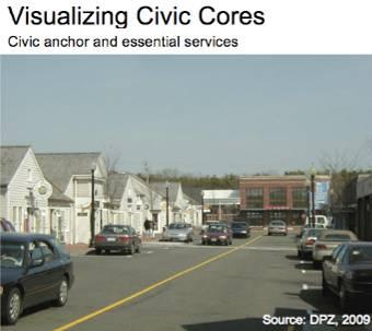
82 66

83 C: CULTURAL CORE APPENDIX Figure C.1: Cultural Core Focus Areas Map 67
84 C.2: Cultural Core Visioning Workshop Feedback Chart PUBLIC RESPONSE NOTES LIKE Mill Redevelopment will renew interest in downtown Walkability River access/proposed riverfront recapture park Image of Mixed Use Development Elders close to the town center 4 units/per acre Density Mixed use Chicopee River Protection Support For Diversity of housing types: o Rental Occupied o Single family homes o Market rate o Not subsidized: housing o High end apartment o Condos Places for young people/families to live Opportunity for people to connect (places to meet, casual encounters, etc.) Maintaining current Architecture Opportunity for increased Transit Rethinking the Walgreens Site as a gateway Like parking garage on Mill Parcel Reaching a critical mass of residents that would support retail and shops Density and character of the old workers housing neighborhood DISLIKE East Street cannot support an increase in density Too many subsidized housing units Center/ Pike Exit (Lack of parking, Traffic) People don t want to live in commercial center at Pike Exit Scenario does not address diversity within the town Scenario doesn t adequately address traffic concerns i.e. the bottleneck on the bridge Worry that subsidized housing will attract the wrong type of person Too many rental units worry about the people that will be attracted Dislike highest proposed Density 68
")
85 D. GREEN COMMUNITY APPENDIX Figure D.1: Natural Resource Protection (part I) Map 69
86 Figure D.2: Natural Resource Protection (part II) Map 70

87 Figure D.3: Natural Resource Protection (part III) Map 71
88 Figure D.4: Natural Resource Protection (part IV) Map 72

89 Figure D.5: Zoning 73

90 Figure D.6: Connectivity (Existing Conditions) Map 74

91 Figure D.7: Connectivity (Bike Routes, Trails and Shared Streets) Map 75

92 Figure D.8: Connectivity (Public Transportation) Map 76

93 Figure D.9: Clean Energy, Industry, and Agriculture Map 77
CHAPTER 3 VISION, GOALS, & PLANNING PRINCIPLES. City of Greensburg Comprehensive Plan. Introduction. Vision Statement. Growth Management Goals.
 CHAPTER 3 VISION, GOALS, & PLANNING PRINCIPLES Introduction The Greensburg Comprehensive Plan is intended as a working community document. A combination of long and short-term goals, this document is intended
EXISTING COMPREHENSIVE PLAN
 EXISTING COMPREHENSIVE PLAN Town Center Land Use Element: V. LAND USE POLICIES Town Center Mercer Island's business district vision as described in "Your Mercer Island Citizen-Designed Downtown" was an
4- PA - LD - LIVELY DOWNTOWN. LD - Background
 4- PA - LD - LIVELY DOWNTOWN LD - Background The downtown has been the service centre for the community since the city s inception and the area continues to supply people with their personal services,
1.0 Purpose of a Secondary Plan for the Masonville Transit Village
 Report to Planning and Environment Committee To: Chair and Members Planning & Environment Committee From: John M. Fleming Managing Director, Planning and City Planner Subject: Masonville Transit Village
Town Center (part of the Comprehensive Plan)
") Town Center (part of the Comprehensive Plan) Mercer Island Town Center Looking North (2014) In 1994, a year-long process culminated in a set of design guidelines and code requirements for the Town Center
Town Center (part of the Comprehensive Plan) Mercer Island Town Center Looking North (2014) In 1994, a year-long process culminated in a set of design guidelines and code requirements for the Town Center
ELK GROVE GENERAL PLAN VISION
 2-1 CHAPTER 2: 2-2 CREATING OUR The Community Vision for Elk Grove, expressed through a Vision Statement and a series of Supporting Principles, is a declaration of the kind of community that Elk Grove
C. Westerly Creek Village & The Montview Corridor
 C. Westerly Creek Village & The VISION Community Vision When the goals of the city are achieved Westerly Creek Village, a distinctive community defined by Montview Boulevard and Westerly Creek, is a strong
PLAN ELEMENTS WORKSHOP. April 5, 2016
 PLAN ELEMENTS WORKSHOP April 5, 2016 needs more housing. But there is no one-size fits-all solution. Every neighborhood has its own character. In some places, density is not only appropriate it is badly
Gold Line Bus Rapid Transit Transit Oriented Development (BRTOD) Helmo Station Area Plan
 Helmo Station Area Plan") Appendix F Gold Line Bus Rapid Transit Transit Oriented Development (BRTOD) Helmo Station Area Plan Introduction and Purpose of the Plan The Gold Line Bus Rapid Transit facility is an eleven-mile dedicated
Appendix F Gold Line Bus Rapid Transit Transit Oriented Development (BRTOD) Helmo Station Area Plan Introduction and Purpose of the Plan The Gold Line Bus Rapid Transit facility is an eleven-mile dedicated
Welcome. Walk Around. Talk to Us. Write Down Your Comments
 Welcome This is an information meeting introducing the applications for proposed redevelopment of the Yorkdale Shopping Centre site at 3401 Dufferin Street and 1 Yorkdale Road over the next 20+ years,
Envision Concord Public Event Part 3. October 21, :30 AM 12:00 PM Concord-Carlisle High School Cafeteria
 Envision Concord Public Event October 21, 2017 9:30 AM 12:00 PM Concord-Carlisle High School Cafeteria Survey Responses + Emerging Priority Areas Summary from Spring Kick-Off Event Envision Concord Survey
John M. Fleming Managing Director, Planning and City Planner. Old East Village Dundas Street Corridor Secondary Plan Draft Terms of Reference
 Report to Planning and Environment Committee To: From: Subject: Chair and Members Planning & Environment Committee John M. Fleming Managing Director, Planning and City Planner Old East Village Dundas Street
City of Farmington. Downtown Plan. Amendment to the 1998 Master Plan Adopted October 11, 2004
 City of Farmington Amendment to the 1998 Master Plan Adopted October 11, 2004 Introduction Planning Background 1 Scope and Components of the Plan Amendment 2 Concept Introduction 3 Plan Concepts 3 Conceptual
ROAD CLOSURE AND LAND USE AMENDMENT SILVER SPRINGS (WARD 1) NORTHEAST OF NOSEHILL DRIVE NW AND SILVER SPRINGS ROAD NW BYLAWS 2C2018 AND 29D2018
 NORTHEAST OF NOSEHILL DRIVE NW AND SILVER SPRINGS ROAD NW BYLAWS 2C2018 AND 29D2018") Page 1 of 19 EXECUTIVE SUMMARY This application proposes redesignating two parcels in the community of Silver Springs from Special Purpose Future Urban Development (S-FUD) District and undesignated road
Page 1 of 19 EXECUTIVE SUMMARY This application proposes redesignating two parcels in the community of Silver Springs from Special Purpose Future Urban Development (S-FUD) District and undesignated road
SALISBURY TOMORROW Our Vision
 SALISBURY TOMORROW Our Vision Salisbury is committed to supporting a high quality of life and sense of community for all residents. These commitments need to be reflected in our community programs, services
CHAPTER 7: VISION AND ACTION STATEMENTS. Noble 2025 Vision Statement
 CHAPTER 7: VISION AND ACTION STATEMENTS This chapter presents the vision, policy and action statements that transform the comprehensive planning study, an analysis of Noble s past, future trends and community
Denton. A. Downtown Task Force
 2 Public Involvement Early and ongoing public involvement was solicited so that the public had ample opportunity to help direct the DTIP s concepts and implementation strategies. The residents of Denton
Ivywild On The Creek PRELIMINARY CREEK DISTRICT MASTER PLAN
 Ivywild On The Creek PRELIMINARY CREEK DISTRICT MASTER PLAN Introduction: Rejuvenating an extraordinary Creekside neighborhood THE CREEKSIDE DISTRICT The Ivywild On The Creek Neighborhood District Master
A BLUEPRINT FOR BROCKTON A CITY-WIDE COMPREHENSIVE PLAN
 A BLUEPRINT FOR BROCKTON A CITY-WIDE COMPREHENSIVE PLAN Public Meeting October 2016 1 Plan Summary and Discussion Public Meeting May 4 2017 City of Brockton Bill Carpenter, Mayor Department of Planning
3.1 community vision. 3.3 required plan elements
 Chapter 3 Community Form 3.1 community vision 3.2 Parks & landscaping concepts 3.3 required plan elements D R A F T 20 Community Form Chapter 3 3.0 Community form 3.1 community vision The Specific Plan
Robbinsdale LRT Station. CDI Development Guidelines. August Overview
 Robbinsdale LRT Station August 2018 Overview The City of Robbinsdale may have the coolest opportunity site along the 13 mile stretch of the Bottineau LRT corridor / Blue Line extension. Located a block
THE POLICY FRAMEWORK FOR WALKABLE COMMUNITIES. Community Technical Assistance Program Building Active Communities Institute March 2016
 THE POLICY FRAMEWORK FOR WALKABLE COMMUNITIES Community Technical Assistance Program Building Active Communities Institute March 2016 ACTIVE COMMUNITIES BACK THEN ACTIVE COMMUNITIES BACK THEN Lifestyle
Sacramento Area Council of Governments (SACOG)
") Sacramento Area Council of Governments (SACOG) The Blueprint Vision The SACOG Board of Directors adopted the Preferred Blueprint Scenario in December 2004, a bold vision for growth that promotes compact,
Sacramento Area Council of Governments (SACOG) The Blueprint Vision The SACOG Board of Directors adopted the Preferred Blueprint Scenario in December 2004, a bold vision for growth that promotes compact,
MEETING PURPOSE AND OVERVIEW
 MEETING PURPOSE AND OVERVIEW On February 23, 2012, the City of Elk Grove hosted the first of two community workshops related to the Southeast Policy Area. The workshop was held from 6:00 8:30 p.m. in the
Lehigh Acres Land Development Regulations Community Planning Project
 Lehigh Acres Land Development Regulations Planning Effort Summary In July, 2010 Commissioner Frank Mann invited the Lehigh Acres community to start discussing how to achieve their recently adopted community
The Five Components of the McLoughlin Area Plan
 The Five Components of the McLoughlin Area Plan This documents contains the complete language of the five components of the McLoughlin Area Plan: The Vision Statement The Values The Guiding Principles
Chapter 4. Linking Land Use with Transportation. Chapter 4
 Chapter 4 Linking Land Use with Transportation Chapter 4 59 Chapter 4 Linking Land Use with Transportation Community Design and Transportation Program Introduction Since the 1950s, the predominant development
MAIN STREET ECONOMIC DEVELOPMENT STRATEGY
 MAIN STREET ECONOMIC DEVELOPMENT STRATEGY A PATHWAY TO A BETTER POUGHKEEPSIE DRAFT Working Paper #2: Planning Strategies Submitted December 1 st, 2015 to the City of Poughkeepsie LAND USE LAW CENTER PACE
VILLAGE OF CLEMMONS PLANNING BOARD DRAFT STAFF REPORT
 VILLAGE OF CLEMMONS PLANNING BOARD DRAFT STAFF REPORT PETITION INFORMATION Docket # C-226 Staff Megan Ledbetter Petitioner(s) JBJH Properties, LLC Owner(s) JBJH Properties, LLC Subject Property 5892-49-1766
BROOKLYN PARK / 85TH AVE LRT STATION CDI DEVELOPMENT GUIDELINES DRAFT
 August 2018 Page intentionally left blank The Brooklyn Park Library adjacent to the 85th Ave LRT Station Area. OVERVIEW The Blue Line LRT Extension / Bottineau corridor offers a unique opportunity to leverage
Hockessin Community Redevelopment Plan
 Hockessin Community Redevelopment Plan 3.1 Introduction The Community Redevelopment Plan for the Village of Hockessin is the result of the people s vision for a distinct village center that serves as the
Improve Neighborhood Design and Reduce Non Point Source Water Pollution
 HOW TO Planning Guide Improve Neighborhood Design and Reduce Non Point Source Water Pollution This document was funded by a grant from the New Hampshire Coastal Program with funding from the National Oceanic
The transportation system in a community is an
 7 TRANSPORTATION The transportation system in a community is an important factor contributing to the quality of life of the residents. Without a sound transportation system to bring both goods and patrons
Future Land Use SAMPLE RECOMMENDATIONS
 SAMPLE RECOMMENDATIONS Future Land Use The Future Land Use Chapter of the Master Plan builds upon prior chapters examining the existing conditions in their respective topic areas to present a comprehensive
Danvers High Street I-1 District Study
 Danvers High Street I-1 District Study Presentation of Final Recommendations Planning Board Presentation June 26 th, 2018 1 Introductions Metropolitan Area Planning Council Sam Cleaves AICP, Principal
Small Area Plan. South Gateway
 Small Area Plan Adopted May 12, 2008 South Gateway Purpose. The South Gateway Small Area Plan defines the City s expectations for the future of the southern entrance to the City at Interstate 85 and Highway
K. SMART ASSOCIATES LIMITED
 Planning Justification Report Zoning By-Law Amendment 185 King Street North Waterloo, Ontario April 7th, 2017 Project Reference Number 16-245 K. SMART ASSOCIATES LIMITED CONSULTING ENGINEERS AND PLANNERS
East Central Area Plan
 East Central Area Plan Steering Committee Meeting January 10 th, 2019 Tears-McFarlane House Community Room East Central Area Plan Steering Committee Meeting January 10 th, 2019 CHUN Tears-McFarlane House
Making Transit Oriented Development Work For Boonton, NJ
 Making Transit Oriented Development Work For Boonton, NJ Bloustein School of Planning and Public Policy Studio Dan Burton Loannie Dao Webster Slater Brandon Williams Ian Watson Maria Laham Nicola Mammes
DALY CITY VISIONING PROCESS COMMUNITY WORKSHOP 3 MAY 8, 2008
 DALY CITY VISIONING PROCESS COMMUNITY WORKSHOP 3 MAY 8, 2008 PROCESS General Plan - a statement of the community s values, vision and aspirations for now and into the future... Timeframe LONG TERM - 2030
4.1.3 LAND USE CATEGORIES
 4.1.3 LAND USE CATEGORIES a. City Center District The City Center District incorporates the existing character and mix of uses in downtown Belmont to encourage redevelopment and new development in keeping
Executive Summary. NY 7 / NY 2 Corridor
 Executive Summary NY 7 / NY 2 Corridor Transportation and Land Use Study December 2005 Prepared for: Town of Colonie Capital District Transportation Committee Prepared by: Introduction: Land use decisions
PINE CURVE REZONING. BACKGROUND Purchased as two parcels in 2001 and 2002
 BACKGROUND Purchased as two parcels in 2001 and 2002 WHAT THE PROJECT IS AND IS NOT A Rezoning establishes the land use standards for Annexed and Zoned Greater Downtown District Historic Center September
Create Policy Options Draft Plan Plan Approval. Public Consultation Events. Phase 2
 Background Grandview-Woodland Community Plan In the spring of 2012, the City of Vancouver embarked on a comprehensive community planning program in the Grandview-Woodland neighbourhood. The process has
Town of Peru Comprehensive Plan Executive Summary
 Town of Peru Comprehensive Plan Executive Communities that plan grow by choice, not by chance. A plan makes growth thoughtful, understandable, and predictable. A plan shows that a community is managing
Policies and Code Intent Sections Related to Town Center
 Policies and Code Intent Sections Related to Town Center The Town Center Vision is scattered throughout the Comprehensive Plan, development code and the 1994 Town Center Plan. What follows are sections
WHAT WE HEARD REPORT - Summary Bonnie Doon Mall Redevelopment Application (LDA )
") WHAT WE HEARD REPORT - Summary Bonnie Doon Mall Redevelopment Application (LDA18-0184) PROJECT ADDRESS: 1 Bonnie Doon Shopping Centre NW, 8420 85 Street NW & 8715 85 Street NW PROJECT DESCRIPTION: Rezoning
WHAT WE HEARD REPORT - Summary Bonnie Doon Mall Redevelopment Application (LDA18-0184) PROJECT ADDRESS: 1 Bonnie Doon Shopping Centre NW, 8420 85 Street NW & 8715 85 Street NW PROJECT DESCRIPTION: Rezoning
2018 Northampton Township Comprehensive Plan
 2018 BUCKS COUNTY, PENNSYLVANIA What is a? A comprehensive plan is a municipality s main policy document that details the collective vision for the future, the historic, environmental, and cultural facilities
Preliminary Plan Framework: Vision and Goals
 Preliminary Plan Framework: Vision and Goals Draft: May 2015 Introduction Since the Town of Milliken s comprehensive plan was last updated in 2010, the community was heavily impacted by the 2013 flood,
Chapter 1: Introduction
 Chapter 1: Introduction The Penn Avenue Community Works Corridor Vision and Implementation Framework presents an integrated communitybased vision and a coordinated, long-term implementation framework for
Silverdale Regional Center
 Silverdale Regional Center Vision for Silverdale Regional Center The Silverdale Regional Center Plan (Plan) will guide the evolution of the Silverdale Regional Center from a collection of strip malls and
Community Design Guidelines. Port Wallace DRAFT
 Community Design Guidelines Port Wallace DRAFT Energy 1 2 3 Nature Movement Connections Built Form DRAFT Layout Energy 1 Nature Community Design Guidelines GREAT COMMUNITIES PROTECT, CELEBRATE, AND CONSERVE
PINE CURVE REZONING. Property does not meet criteria for open space preservation and is not a candidate for a park
 PINE CURVE REZONING BACKGROUND Purchased as two parcels in 2001 and 2002 Annexed and Zoned Greater Downtown District Historic Center September 25, 2002 and October 7, 2002 WHAT THE PROJECT IS AND IS NOT
ROBBINSDALE LRT STATION CDI DEVELOPMENT GUIDELINES
 August 2018 OVERVIEW The City of Robbinsdale has a prime-opportunity site in the middle of the 13 mile stretch of the Bottineau LRT corridor / Blue Line extension. Robbinsdale offers a prominent, vital,
Table of Contents. Elm Avenue Improvement Plan City of Waco, Texas. Introduction 1. Existing Context 1 Figure 1 2.
 Table of Contents Introduction 1 Existing Context 1 Figure 1 2 Plan Guidelines 3 Future Urban Form 4 The West-End 4 Main Street 6 The East-End 7 Figure 2 9 Public Improvement Recommendations 7 General
1 October Dear Citizens of Charlotte and Mecklenburg County,
 1 October 2011 Dear Citizens of Charlotte and Mecklenburg County, As co-chairs of the Center City 2020 Vision Plan Steering Committee, we are proud to present the Center City 2020 Vision Plan, which sets
FUNDING CORRIDOR REVITALIZATION
 FUNDING CORRIDOR REVITALIZATION Integrated corridor planning for the 21 st Century America Planning Association Annual Conference Atlanta, GA April 27, 2014 Mariia Zimmerman, MZ Strategies, LLC mariia@mzstrategies.com
Further input invited as Colchester Growth Strategy nears final phase
 IUE 3 / NOVEMBER 2015 Further input invited as Colchester Growth trategy nears final phase trathcona County is seeking public feedback as it enters the final phase of work on a Growth Management trategy
DRAFT Land Use Chapter
 Stevens Creek Urban Village DRAFT 1 18 17 Land Use Chapter INTRODUCTION This Land Use Chapter describes how the Stevens Creek Urban Village will accommodate the growth that is planned for it in the Envision
Plano Tomorrow Vision and Policies
 Plano Tomorrow Vision and Policies PLANO TOMORROW PILLARS The Built Environment The Social Environment The Natural Environment The Economic Environment Land Use and Urban Design Transportation Housing
Comprehensive Plan. Faribault, Minnesota. Hoisington Koegler Group Inc. Claybaugh Preservation Architecture Inc. Howard R. Green Company Bonz/REA
 Comprehensive Plan Faribault, Minnesota Adopted by the Faribault City Council July 8, 2003 prepared for: prepared by: Hoisington Koegler Group Inc. Claybaugh Preservation Architecture Inc. Howard R. Green
Concord Community Reuse Project Goals and Guiding Principles. Overarching Goals (OG)
") Concord Community Reuse Project Goals and Guiding Principles Overarching Goals (OG) No priority is implied by the order of presentation of the goals and guiding principles. Overarching goals for the Concord
Concord Community Reuse Project Goals and Guiding Principles Overarching Goals (OG) No priority is implied by the order of presentation of the goals and guiding principles. Overarching goals for the Concord
REVIEW AND EVALUATION OF REGIONAL LAND USE
 REVIEW AND EVALUATION OF REGIONAL LAND USE AND TRANSPORTATION SCENARIOS #220831 Environmental Justice Task Force October 7, 2014 VISION 2050 Process Development of Guiding Vision for Land Use and Transportation
Mark-up of the effect of the proposed Bronte Village Growth Area OPA No.18 on the text of section 24, Bronte Village, of the Livable Oakville Plan
 Mark-up of the effect of the proposed Bronte Village Growth Area OPA No.18 on the text of section 24, Bronte Village, of the Livable Oakville Plan Notes: This document is provided for information purposes
Land Use. Hardware Street Vendor Mixed-Use
 Land Use Definition Land Use is the way a piece of real estate is utilized. Existing, proposed, and adopted land uses all play a role in the planning process. Once a land use plan is adopted, the next
North Fair Oaks Community Plan Summary and Information
 North Fair Oaks Community Plan Summary and Information WHAT IS THE NORTH FAIR OAKS COMMUNITY PLAN? The North Fair Oaks Community Plan is part of the San Mateo County General Plan, and establishes policies
Land Use Amendment in Southwood (Ward 11) at and Elbow Drive SW, LOC
 at and Elbow Drive SW, LOC") 2018 November 15 Page 1 of 10 EXECUTIVE SUMMARY This land use amendment application was submitted by Rick Balbi Architect on 2017 August 31 on behalf of Sable Developments Ltd, and with authorization from
2018 November 15 Page 1 of 10 EXECUTIVE SUMMARY This land use amendment application was submitted by Rick Balbi Architect on 2017 August 31 on behalf of Sable Developments Ltd, and with authorization from
In surveys, Dallas residents say what they want to change most
 NEIGHBORHOODS ELEMENT In surveys, Dallas residents say what they want to change most in the city is its appearance they want it to look beautiful, with trees and pedestrian-friendly neighborhoods. The
MEMO 1. INTRODUCTION PURPOSE & PROCESS REQUEST
 MEMO Date: August 22, 2017 To: Board of Commissioners From: Jason Burdette, Planning Director Re: Davidson Commons East Hotel Stakeholder Feedback 1. INTRODUCTION PURPOSE & PROCESS This memorandum summarizes
Official Plan Review
 Official Plan Review Summary Report - The Built Environment August 2014 Part 1: Introduction Planning for a healthy, prosperous and sustainable community is an important goal for our municipality. From
East Central Area Plan
 East Central Area Plan Steering Committee Meeting March 8 th, 2018 CHUN Tears McFarlane House Vision Statement Development Opportunities Analysis Vision Elements 1. Equitable, Affordable and Inclusive
Developer s Program. The Station at East 54
 Developer s Program The Station at East 54 Existing Conditions The Station at East 54 is proposed for a 1.12 acre site at the northeast corner of Hamilton Road and Prestwick Road, tucked between the East
CHAPTER 7: Transportation, Mobility and Circulation
 AGLE AREA COMMUNITY Plan CHAPTER 7 CHAPTER 7: Transportation, Mobility and Circulation Transportation, Mobility and Circulation The purpose of the Transportation, Mobility and Circulation Chapter is to
Sustainably Repositioning Greyfield Sites. Greyfield Sites Anywhere
 Sustainably Repositioning Greyfield Sites Jim Constantine Looney Ricks Kiss Architects Todd Poole 4ward Planning Greyfield Sites Anywhere Pennsylvania Chapter American Planning Association Conference 2009
greenprint midtown SUSTAINABILITY ACTION PLAN 2012
 greenprint midtown SUSTAINABILITY ACTION PLAN 2012 MIDTOWN ALLIANCE SOUTHFACE ENERGY INSTITUTE RENAISSANCE PLANNING GROUP SUSTAINABLE ATLANTA PERKINS+WILL 2 GREENPRINT MIDTOWN 1. Introduction Sustainability
SLIDE TITLE TRANSIT-ORIENTED DEVELOPMENT PLAN RED-PURPLE BYPASS STUDY AREA PUBLIC MEETING #2 RED AND PURPLE MODERNIZATION. RPM TOD Plan Update
 SLIDE TITLE TRANSIT-ORIENTED DEVELOPMENT PLAN RED-PURPLE BYPASS STUDY AREA PUBLIC MEETING #2 RED AND PURPLE MODERNIZATION 1 SLIDE TITLE AGENDA Project Introduction TOD s and Development Trends Real Estate
BROOKHILL NEIGHBORHOOD MODEL ZONING MAP AMENDMENT PREFACE TO APPLICATION
 BROOKHILL NEIGHBORHOOD MODEL ZONING MAP AMENDMENT PREFACE TO APPLICATION June 15, 2015 Revised: August 1, 2016 I. VISION Brookhill is a proposed community based upon the principles of Albemarle County
TRANSPORTATION AND LAND USE
 CHAPTER 10 TRANSPORTATION AND LAND USE Transportation and land use are intimately linked. The expansion of a highway typically spurs housing, employment growth and land development in the communities that
Urban Design Manual PLANNING AROUND RAPID TRANSIT STATIONS (PARTS) Introduction. Station Study Areas
 Introduction. Station Study Areas") 111111 PLANNING AROUND RAPID TRANSIT STATIONS (PARTS) Introduction The ION rapid transit system will link Waterloo, Kitchener and Cambridge through a central transit corridor (CTC). There are a number
111111 PLANNING AROUND RAPID TRANSIT STATIONS (PARTS) Introduction The ION rapid transit system will link Waterloo, Kitchener and Cambridge through a central transit corridor (CTC). There are a number
Information Session July 25, 2018
 Concord Pike (US 202) Master Plan Information Session July 25, 2018 1 Concord Pike (US 202) Master Plan 2018 Project Partners Wilmington Area Planning Council Delaware Department of Transportation New
ADMINISTRATION RECOMMENDATION(S) 2018 January 25. That Calgary Planning Commission recommend APPROVAL of the proposed Land Use Amendment.
 2018 January 25. That Calgary Planning Commission recommend APPROVAL of the proposed Land Use Amendment.") Page 1 of 9 EXECUTIVE SUMMARY This land use amendment proposes to redesignate a parcel from DC Direct Control District to Multi-Residential Contextual Grade-Oriented (M-CG) District to allow for multi-residential
Page 1 of 9 EXECUTIVE SUMMARY This land use amendment proposes to redesignate a parcel from DC Direct Control District to Multi-Residential Contextual Grade-Oriented (M-CG) District to allow for multi-residential
Proposed Comprehensive Plan Strategies DRAFT for discussion June 28, 2017
 Proposed Comprehensive Plan Strategies DRAFT for discussion June 28, 2017 Land Use Rural Areas Refine the Farm and Forest area (FF) Update FF boundaries to account for existing lots less than five acres
Sherri Ferguson. President/CEO Portland Chamber of Commerce. Tennessee Certified Economic Developer Capstone Project
 Sherri Ferguson President/CEO Portland Chamber of Commerce Tennessee Certified Economic Developer Capstone Project Strategic Plan Development for the North Gateway of Portland, Tennessee The New Gateway
Living in Albemarle County s Urban Places
 Living in Albemarle County s Urban Places ALBEMARLE COUNTY, VIRGINIA A Closer Look at Albemarle s Approach to Managing Growth and Creating Quality Urban Environments www.albemarle.org Page 2 Living in
This Review Is Divided Into Two Phases:
 Semiahmoo Town Centre Review The purpose of this review: To review the Semiahmoo Town Centre Concept Plan, originally approved in 1993, to ensure that this centre will continue to serve the needs of South
URBAN DESIGN BRIEF URBAN DESIGN BRIEF 721 FRANKLIN BLVD, CAMBRIDGE August 2018
 URBAN DESIGN BRIEF URBAN DESIGN BRIEF 721 FRANKLIN BLVD, CAMBRIDGE August 2018 DESIGN BRIEF CONTENTS PART A 1.0 INTRODUCTION 2.0 DESCRIPTION & ANALYSIS OF SITE CONTEXT 3.0 DESIGN CONSTRAINTS AND OPPORTUNITIES
MIXED-USE VILLAGE OVERLAY FLOATING DISTRICT
 MIXED-USE VILLAGE OVERLAY FLOATING DISTRICT Zoning regulations developed by committee to the Planning Board for the Town of DeWitt, NY Issue date: 13 July 2017 revised 3/12/2018, revised 4/26/2018, 5/9/2018
 Community Workshop #2 December 4, 2014 Team Tonight s Agenda 6:00 pm Welcome! 6:05 pm The Future of Downtown Tustin Ideas, Strategies and Recommendations 6:35 pm Questions and Comments 6:50 pm Open
City of Le Sueur DOWNTOWN MASTER PLAN
 City of Le Sueur DOWNTOWN MASTER PLAN City Council Update 9/11/2017 Hoisington Koegler Group Inc. Presentation Agenda 01 Schedule Update / Tonight s Objectives 02 What We ve Heard - Engagement Comments
RESEDA - WEST VAN NUYS COMMUNITY PLAN
 RESEDA - WEST VAN NUYS COMMUNITY PLAN Executive Summary As part of the initial outreach effort, the Department of City Planning hosted two workshops for the Reseda-West Van Nuys Community Plan Area during
9 th Street Sub Area Plan
 9 th Street Sub Area Plan In the 1990 s, when the Township prepared the last Master Plan, the 9 th Street corridor was studied as part of a larger 9 th Street Focus Area that included the West Main Street
CITY OF CHARLOTTESVILLE, VIRGINIA CITY COUNCIL AGENDA
 CITY OF CHARLOTTESVILLE, VIRGINIA CITY COUNCIL AGENDA Agenda Date: December 16, 2013 Action Required: Adoption of Resolution Presenter: Staff Contacts: Title: James E. Tolbert, AICP, Director of NDS James
3 Vision and Goals. Vision and Goals. Blueprint for Bloomsburg. Vision. Town of Bloomsburg Comprehensive Plan,
 Vision and Goals 3 Vision and Goals Citizens of the Town of Bloomsburg clearly value their natural and cultural heritage, the walkable, mixed use pattern of downtown, the access to education, and the community
Urban Planning and Land Use
 Urban Planning and Land Use 701 North 7 th Street, Room 423 Phone: (913) 573-5750 Kansas City, Kansas 66101 Fax: (913) 573-5796 Email: planninginfo@wycokck.org www.wycokck.org/planning To: From: City Planning
Sheridan Boulevard S TAT I O N A R E A P L A N S H E R I D A N B O U L E VA R D S TAT I O N A R E A P L A N
 Sheridan Boulevard S TAT I O N A R E A P L A N 1 City of Lakewood Adopted November, 2006 S H E R I D A N B O U L E VA R D S TAT I O N A R E A P L A N The Vision The City of Lakewood s overall vision is
Staff Report to the North Ogden City Planning Commission
 Staff Report to the North Ogden City Planning Commission SYNOPSIS / APPLICATION INFORMATION Application Request: Concept review on a legislative application to rezone land located at approximately 1750
City of Long Beach. creating vibrant and exciting places
 City of Long Beach creating vibrant and exciting places Land Use Element Urban Design Element Overview of the two draft General Plan elements Discuss areas of change Economic goals of the plans Case study
Chapter 1.0 Introduction
 Chapter 1.0 Introduction 1.1 Background The North Metro commuter rail line is part of the RTD FasTracks regional transit system expansion program to build more than 100 miles of rail transit throughout
9/19/2018 TODAY S WEBINAR AGENDA CONTINUING EDUCATION UPCOMING TRAINING FROM APBP
 TODAY S WEBINAR AGENDA 3:00 pm: Introduction 3:05 pm: Presentation 3:45 pm: Questions 4:00 pm: Webinar Ends For technical assistance during the webinar: 1-800-263-6317 Choose these prompts: 1, 1, 1 CONTINUING
EXECUTIVE SUMMARY DRAFT CHAPTER 1 INTRODUCTION EXECUTIVE SUMMARY
 CHAPTER 1 EXECUTIVE SUMMARY INTRODUCTION Through the joint efforts of the City of Tulsa planning staff and the Land Services division of Indian Nations Council of Governments (INCOG), the Berryhill Land