Counsel OPSB Staff Patrick Donlon and Jon Pawley, OPSB Staff
|
|
|
- Candice Underwood
- 5 years ago
- Views:
Transcription

1 Legal Department American Electric Power 1 Riverside Plaza Columbus, OH AEP.com Hector Garcia Senior Counsel Regulatory Services (614) (P) (614) (F) hgarcia1@aep.com Chairman Andre T. Porter Ohio Power Siting Board 180 East Broad Street Columbus, Ohio October 7, 2015 Re: Case No EL-BLN Request for Expedited Treatment: In the Matter of the Letter of Notification for the Delano-Scioto Trail 138 kv Transmission Line Rebuild Project Dear Chairman Porter, Attached please find a copy of the Letter of Notification (LON) for the Delano- Scioto Trail 138 kv Transmission Line Rebuild Project by AEP Ohio Transmission Company, Inc. This filing and notice is in accordance with O.A.C A copy of this filing will also be submitted to the executive director or the executive director s designee. A copy will be provided to the Board Staff via electronic message. The Company will also submit a check in the amount of $2,000 to the Treasurer, State of Ohio, for Fund 5610 for the expedited fees. If you have any questions, please do not hesitate to contact me. Respectfully Submitted, /s/ Hector Garcia Hector Garcia Senior Counsel cc. Counsel OPSB Staff Patrick Donlon and Jon Pawley, OPSB Staff
2 LETTER OF NOTIFICATION FOR THE DELANO-SCIOTO TRAIL 138 KV TRANSMISSION LINE REBUILD PROJECT PUCO Case No EL-BLN Submitted pursuant to OAC AEP Ohio Transmission Company, Inc. (AEP Ohio Transco) OCTOBER 2015
3 LETTER OF NOTIFICATION Delano-Scioto Trail 138 kv Transmission Line Rebuild Project AEP Ohio Transmission Company, Inc. (AEP Ohio Transco) is providing the following information in accordance with the procedures delineated in Ohio Administrative Code Section : Letter of Notification Requirements of the Rules and Regulations of the Ohio Power Siting Board (OPSB) (B) GENERAL INFORMATION 1. The name of the project and applicant s reference number, if any, names and reference numbers(s) of resulting circuits and a brief description of the project, and why the project meets the requirements of a letter of notification. The proposed Delano-Scioto Trail 138 kv Transmission Line Rebuild Project (Project) is identified as part of PJM Reference Number B2256 regarding rebuild of approximately 38 miles of 138 kv transmission line between Ross Station and Harrison Station. The Project consists of rebuilding the existing 138 kv single-circuit transmission line within an existing right-of-way between Delano Station and Scioto Trail Station in Pickaway and Ross Counties, Ohio. Figures 1.1 and 1.2 show the location of the 10.9-mile long project in relation to the surrounding vicinity. The Project meets the requirements for a Letter of Notification because it is within the types of projects defined by Item (4)(a) of Attachment A of the interim process defined in the OPSB s September 4, 2012 Finding and Order in Docket GE-BRO. These items state: (4) Replacing electric power transmission line structure(s) with a different type of structure(s) or adding structure(s) within an existing electric power transmission line and: (a) Two miles or less of new right-of-way required. AEP Ohio Transco 1 Delano-Scioto Trail October kv Rebuild Project
4 2. If the proposed letter of notification project is an electric power transmission line or gas or natural gas transmission line, a statement explaining the need for the proposed facility. As part of the 2017 RTEP process, PJM identified several N-1-1 contingency violations requiring upgrades to remediate. These violations include: Loading above 100% of emergency capability on Delano-Scioto Trail 138 kv branch and Scioto Trail-Scippo 138 kv branch Voltages below 92% at Circleville Station, Delano Station, East Scippo Switch Station, Ross Station, Scioto Trail Station, Scippo Station, Clayburne Switch Station, Biers Run Station, Hopetown Station, and Seaman Station. Voltage drops exceeding 8% at Adams Station, Circleville Station, Delano Station, East Scippo Switch Station, Ross Station, Scioto Trail Station, Scippo Station, Clayburne Switch Station, Biers Run Station, and Seaman Station. To correct these violations, AEP Ohio Transco proposed a new project to upgrade the entire 138 kv through path from Harrison Station in southern Columbus to Ross Station in Chillicothe including the rebuild of all existing 138 kv lines along this circuit path. PJM confirmed this project corrects the cited violations, decided to make this a baseline (mandatory) project, and assigned AEP Ohio Transco to make the required changes. 3. The location of the project in relation to existing or proposed lines and stations shown on maps and overlays provided to the Public Utilities Commission of Ohio in the applicant s most recent long term forecast report. The location of this Project in relation to existing transmission lines and stations is shown on Figures 1.1 and 1.2. The project directly impacts the following existing facilities: Harrison, Circleville, Scippo, East Scippo Switch, Scioto Trail, Delano, Clayburne Switch, and Ross Stations Circleville-Harrison (CSP) 138 kv transmission line, Circleville-Scippo 138 kv transmission line, Scioto Trail-Scippo 138 kv transmission line, Delano-Scioto Trail 138 kv transmission line, Delano-Kenworth-Ross 138 kv transmission line. AEP Ohio Transco 2 Delano-Scioto Trail October kv Rebuild Project
5 4. The alternatives considered and reasons why the proposed location or route is best suited for the proposed facility. The discussion shall include, but not be limited to impacts associated with socioeconomic, natural environment, construction, or engineering aspects of the project. The proposed Project is along an existing transmission line right-of-way. Since the existing line has been in place for over 60 years, the least impact option is to rebuild on existing centerline. At this time, no other alternatives have been considered. 5. The anticipated construction schedule and proposed in-service date of project. Construction of the rebuild will begin on approximately November 1, The in-service date for the Project is approximately May 31, An area map of not less than 1:24,000-scale clearly depicting the facility's centerline with clearly marked streets, roads, and highways, and clearly written instructions for locating and viewing the facility. Figures 1.1 and 1.2 provide the proposed Project centerline on the United States Geologic Service (USGS) 7.5-minute topographic maps of the Circleville, Ohio and Kingston, Ohio quadrangles. To access the Project location from public roads, take Interstate 71 South from Columbus for approximately 5 miles to Exit 101, Interstate 270 East. Follow I-270 E to Exit 52 taking US-23 South toward Circleville. Continue on US-23 South for 32 miles and take the OH-207 exit. Turn left off the ramp until OH-207 dead-ends and turn right onto Hospital Rd. After 0.7 mile, take the first left onto Delano Road and follow for 0.8 mi. Then take a left onto OH-159. The substation is on your left. The approximate address of Delano Station is 5242 OH-159, Chillicothe, OH A list of properties for which the applicant has obtained easements, options, and/or land use agreements necessary to construct and operate the facility and a list of the additional properties for which such agreements have not been obtained. The new structures will be located within existing transmission line right-of-way for approximately 10.9 miles. Slight deviations at four (4) structures at the northern end are proposed to avoid current building encroachments within the existing right-of-way. While easements may be adjusted in these areas, no additional property options, or land use agreements are necessary within the existing right-of-way. These property owners will be notified of the Project prior to commencement of construction activities. AEP Ohio Transco 3 Delano-Scioto Trail October kv Rebuild Project
6 (C) TECHNICAL FEATURES OF THE PROJECT 1. Operating characteristics, estimated number and types of structures required, and right-of-way and/or land requirements. The Delano Scioto Trail single-circuit line is operated at 138 kv. The line will be rebuilt for single-circuit operation. The proposed 138 kv single-circuit transmission line will consist of one (1) 1926 kcm ACSR/TW Type 13 - CUMBERLAND conductor per phase. Two (2) 7#8 Alumoweld overhead groundwires will be used as shield wires above the phase conductors and one (1) All-Dielecric Self-Supporting (ADSS) communication fiber to be installed below the phase conductors. The insulator assemblies will consist of polymer insulators. The replacement structures will be galvanized steel two-pole structures with horizontal cross arm (H-Frames). Sketches of the proposed structure types are included as Figures 2.1 through For electric power transmission lines, the production of electric and magnetic fields during the operation of the proposed electric power transmission line. (a) Calculated Electric and Magnetic Field Levels Three loading conditions were examined: (1) normal maximum loading, (2) emergency line loading, and (3) winter normal conductor rating. Normal maximum loading represents the peak flow expected with all system facilities in service; daily/hourly flows fluctuate below this level. Emergency loading is the maximum current flow during unusual (contingency) conditions, which exist only for short periods of time. Winter normal (WN) conductor rating represents the maximum current flow that a line, including its terminal equipment, can carry during winter conditions. It is not anticipated that this line would operate at its WN rating in the foreseeable future. Loading levels and the calculated electric and magnetic fields are summarized below. The corresponding designs, including phase configurations, are shown in Figure 3. AEP Ohio Transco 4 Delano-Scioto Trail October kv Rebuild Project
7 EMF CALCULATIONS Condition Line Load (MVA) Electric Field (kv/m) Magnetic Field (mg) (1) Normal Maximum Loading / 1.3 / / 68.5 / 22.5 (2) Emergency Line Loading / 1.3 / / / 51.6 (3) Winter Normal Conductor Rating / 2.3 / / / * EMF levels (left right-of-way edge/maximum/right right-of-way edge) calculated one meter above ground assuming balanced currents and nominal voltages. Electric fields reflect normal and emergency operations; lower electric fields are expected during emergency conditions when one mutually-coupled line is out of service. (b) Discussion of the Company s Design Alternatives Regarding EMF Levels Design alternatives were not considered due to electric and magnetic fields (EMF) and their strength levels. Transmission lines, when energized, generate EMF. Laboratory studies have failed to establish a strong correlation between exposure to EMF and effects on human health. However, some people are concerned that EMF have impacts on human health. Due to these concerns, EMF associated with the new circuits was calculated in the Table above. The EMF was computed assuming the highest possible EMF values that could exist along the proposed transmission line. Normal daily EMF levels will operate below these maximum load conditions. Based on studies from the National Institutes of Health, the magnetic field (measured in milligauss) associated with emergency loading at the highest EMF value for this transmission line, is lower than those associated with normal household appliances like microwaves, electric shavers and hair dryers. For additional information regarding EMF, the National Institute of Health has posted information on their website: ooklet.pdf 3. The estimated cost of the project by Federal Energy Regulatory Commission account, unless the applicant is not an electric light company, a gas company or a natural gas company as defined in Chapter 4905., of the Revised Code (in which case, the applicant shall file the capital costs classified in the accounting format ordinarily used by the applicant in its normal course of business). The 2015 capital cost estimates for the proposed project have been tabulated by the Federal Energy Regulatory Commission (FERC) Electric Plant Transmission Accounts: AEP Ohio Transco 5 Delano-Scioto Trail October kv Rebuild Project
8 FERC Account Number ESTIMATES OF APPLICABLE INTANGIBLE AND CAPITAL COSTS Description Cost 350 Land and Land Rights Not Applicable 352 Structures & Improvement Not Applicable 353 Substation Equipment Not Applicable 354 Towers & Fixtures Not Applicable 355 Poles & Fixtures $18,921, Overhead Conductors & Devices $7,636, Underground Conductors & Devices Not Applicable 358 Underground-to-overhead Conversion Equipment Not Applicable 359 Right-of-way Clearing, Roads, Trails or Other Access $237,458 TOTAL $26,795,262 (D) SOCIOECONOMIC DATA 1. A brief description of land use within the vicinity of the proposed project, including: (a) a list of municipalities, townships and counties affected; and (b) estimates of population density adjacent to rights of way within the study corridor (the U.S. census information may be used to meet this requirement.) On behalf of AEP Ohio Transco, AECOM prepared a Socioeconomic, Land Use, and Agricultural District Review Report. This report is included as Appendix A. 2. The location and general description of all agricultural land (including agricultural district land) existing at least sixty days prior to submission of the letter of notification within the proposed electric power transmission line right-of-way, or within the proposed electric power transmission substation fenced-in area, or within the construction site boundary of a proposed compressor station. The majority of agricultural land crossed by the Project is within existing right-of-way. Impacts to agricultural land are expected to be temporary and limited to construction access and the small footprint of each structure. Additional details regarding agricultural land impacted by the construction of the Project are provided in Appendix A. AEP Ohio Transco 6 Delano-Scioto Trail October kv Rebuild Project
9 3. A description of the applicant s investigation (concerning the presence or absence of significant archaeological or cultural resources that may be located within the area likely to be disturbed by the project), a statement of the findings of the investigation, and a copy of any document produced as a result of the investigation. An archaeological investigation by Weller & Associates, Inc. will be competed for this project. A copy of the resulting report will be provided to the Ohio Power Siting Board under separate cover. 4. Documentation that the chief executive officer of each municipal corporation and county, and the head of each public agency charged with planning land use in the area in which any portion of the facility is to be located have been notified of the project and have been provided with a copy of the letter of notification. The applicant shall describe the company s public information program used in the siting of the proposed facility. The information submitted shall include either a copy of the material distributed to the public or a copy of the agenda and summary of the meeting(s) held by the applicant. Copies of this Letter of Notification have been sent to the Ross County Commissioners, Ross County Engineer, the Mayor of Kingston, Ross County Planning Department, Green Township Trustees, the Pickaway County Commissioners, Pickaway County Engineer, Pickaway County Office of Planning, Department of Public Services and Planning, Pickaway Township Trustees, the Chillicothe and Ross County Public Library and the Pickaway County District Library. Copies of the cover letters to these officials and the local library are attached in Appendix B. AEP Ohio Transco will advise local officials of features and the status of the proposed Project. 5. A brief description of any current or pending litigation involving the project known to the applicant at the time of the letter of notification. There is no known current or pending litigation involving this Project. 6. A listing of local, state, and federal governmental agencies known to have requirements which must be met in connection with the construction of the project, and list of documents that have been or are being filed with those agencies in connection with siting and constructing the project. AEP Ohio Transco 7 Delano-Scioto Trail October kv Rebuild Project
10 A Notice of Intent will be filed with the Ohio Environmental Protection Agency for authorization of construction stormwater discharges under General Permit OHC Based on the currently planned placement of two poles within a 100-year flood zone, coordination with the Pickaway County Floodplain Coordinator is anticipated. There are no other known local, state, or federal requirements that must be met prior to commencement of the proposed Project. (E) ENVIRONMENTAL DATA 1. A description of the applicant s investigation concerning the presence or absence of federal or state endangered species (including endangered species, threatened species, rare species, species proposed for listing, species under review for listing, and species of special interest) that may be located within the area likely to be disturbed by the project, a statement of the findings of the investigation, and a copy of any document produced as a result of the investigation. On behalf of AEP Ohio Transco, AECOM prepared a Threatened and Endangered Species Report. AECOM coordinated with the USFWS and ODNR regarding special status species in the vicinity of the Project. No impacts to threatened or endangered species are expected. The full Threatened and Endangered Species Report for the Project is included as Appendix C. 2. A description of the applicant s investigation concerning the presence or absence of areas of ecological concern (including national and state forests and parks, floodplains, wetlands, designated or proposed wilderness areas, national and state wild and scenic rivers, wildlife areas, wildlife refuges, wildlife management areas, and wildlife sanctuaries) that may be located within the areas likely to be disturbed by the project, a statement of the findings of the investigation, and a copy of any document produced as a result of the investigation. On behalf of AEP Ohio Transco, AECOM prepared an Areas of Ecological Concern, Wetland Delineation, and Stream Assessment Report. No impacts to wetlands or streams are anticipated. The full Areas of Ecological Concern, Wetland Delineation, and Stream Assessment Report for the Project is included as Appendix D. 3. Any known additional information that will describe any unusual conditions resulting in significant environmental, social, health or safety impacts. AEP Ohio Transco 8 Delano-Scioto Trail October kv Rebuild Project
11 To the best of AEP Ohio Transco s knowledge, no unusual conditions exist that would result in environmental, social, health, or safety impacts. Construction and operation of the proposed Project will meet all applicable safety standards established by the Occupational Safety and Health Administration, and will be in accordance with the requirements specified in the latest revision of the National Electrical Safety Code as adopted by the Public Utilities Commission of Ohio. The Stormwater Pollution Prevention Plan (SWPPP), which will include the Access Plan, will be provided to the OPSB under separate cover, after submission of this Letter of Notification. AEP Ohio Transco 9 Delano-Scioto Trail October kv Rebuild Project


12 J:\Project\A\AEP\ Sioto Trail-Delano 138kV\Data-Tech\GIS\OverviewMap.mxd Date: 9/30/2015 Delano Station LEGEND: Delano-Scioto Trail 138 kv Line 0 2,000 4,000 Scale in Feet JOB NO FIGURE 1.1 PROJECT OVERVIEW Delano-Scioto Trail 138 kv Transmission Line


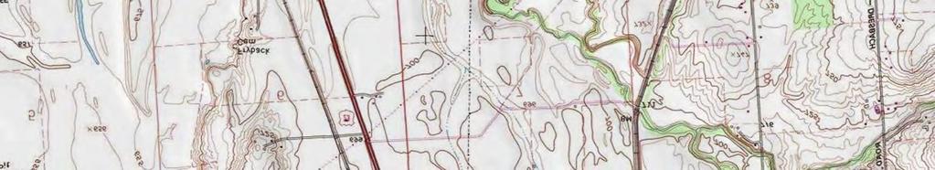
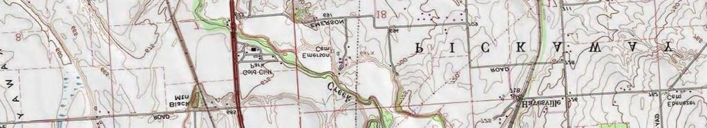


13 J:\Project\A\AEP\ Sioto Trail-Delano 138kV\Data-Tech\GIS\OverviewMap.mxd Date: 9/30/2015 SCIOTO TRAIL (CS) Station LEGEND: Delano-Scioto Trail 138 kv Line 0 2,000 4,000 Scale in Feet JOB NO FIGURE 1.2 PROJECT OVERVIEW Delano-Scioto Trail 138 kv Transmission Line
14
15
16
17
18 APPENDIX A SOCIOECONOMIC, LAND USE, AND AGRICULTURAL DISTRICT REVIEW REPORT

19 DELANO-SCIOTO TRAIL 138 KV TRANSMISSION LINE REBUILD PROJECT, ROSS AND PICKAWAY COUNTIES, OHIO SOCIOECONOMIC, LAND USE, AND AGRICULTURAL DISTRICT REVIEW REPORT Prepared for: American Electric Power Ohio Transmission Company 700 Morrison Road Gahanna, Ohio Prepared by: 525 Vine Street, Suite 1800 Cincinnati, Ohio Project #: September 2015
20 TABLE OF CONTENTS 1.0 PROJECT DESCRIPTION GENERAL LAND USE DESCRIPTION POPULATION DENSITY ESTIMATE AGRICULTURAL DISTRICT LAND CONCLUSION... 3 Number TABLES TABLE 1 STUDY AREA CENSUS POPULATION ESTIMATES... 2 Number FIGURES (follow text) FIGURES 1A-1C LAND USE MAP September 2015 Socioeconomic, Land Use, and Agricultural District Report
21 1.0 PROJECT DESCRIPTION This document presents the socioeconomic, land use, and agricultural district review conducted by AECOM for American Electric Power Ohio Transmission Company s (AEP Ohio Transco) proposed Delano-Scioto Trail 138 kv Transmission Line Rebuild Project (Project). AEP Ohio Transco is proposing to rebuild approximately 10.9 miles of the existing Delano-Scioto Trail 138 kv transmission line in Ross and Pickaway Counties, Ohio. As part of the Ohio Power Siting Board (OPSB) Letter of Notification (LON) requirements, AEP Ohio Transco is required to assess and report the socioeconomic, land use, and agricultural district characteristics potentially affected by the Project, as stated in Ohio Administrative Code (OAC) Rule (D)(1) and (2). These rules state: (D) Socioeconomic data. Describe the social and ecological impacts of the project. This description shall contain the following information: (1) A brief, general description of land use within the vicinity of the proposed project, including: (a) a list of municipalities, townships, and counties affected; and (b) estimates of population density adjacent to rights-of-way within the study corridor (the U.S. census information may be used to meet this requirement). (2) The location and general description of all agricultural land (including agricultural district land) existing at least sixty days prior to submission of the letter of notification within the proposed electric power transmission line rightof-way, or within the proposed electric power transmission substation fenced-in area, or within the construction site boundary of a proposed compressor station. AEP Ohio Transco retained AECOM to conduct a desktop review of socioeconomic, land use, and agricultural district land characteristics. A study corridor was established within 1,000 feet of each side of the line to be rebuilt, resulting in a 2,000-foot wide study corridor. In conjunction with ecological field surveys for the Project, AECOM noted land uses crossed by the Project. This report will be used to assist AEP Ohio Transco s efforts to avoid or minimize impacts to socioeconomic characteristics and land uses potentially present in the study area during construction activities. 2.0 GENERAL LAND USE DESCRIPTION Land use within the study area is shown on Figures 1A through 1C. Current land use characteristics were obtained through review of aerial photography taken in 2013; the United States Geological Survey (USGS) 7.5-minute topographic maps of the Circleville, Ohio (1974) and Kingston, Ohio (1975) quadrangles; parcel GIS files of the Project area; and a field reconnaissance conducted in March The primary land uses within the 2,000-foot wide study corridor include industrial and commercial facilities, agricultural fields, wooded parcels, and residences. Stream, transportation, and utility corridors are also present. One nature preserve (Betsch Fen State Nature Preserve), managed by the Nature Conservancy, was also identified within the 2,000-foot wide study corridor. September Socioeconomic, Land Use, and Agricultural District Report
22 The 2,000-foot wide study corridor crosses a portion of the Village of Logan Elm, Circleville Township, and Pickaway Township in Pickaway County; and Green Township in Ross County. General land use trends in Pickaway County indicate that there is an ongoing conversion of farmland to residential and commercial districts as the City of Circleville, located at the northern end of the Project, expands. While some additional development is expected in the vicinity of the Project, the limited undeveloped parcels suggest only minimal to moderate growth. Based on a review of the Pickaway County, Ross County, the Village of Logan Elm, Circleville Township, Pickaway Township, and Green Township websites, no comprehensive plans indicating future land use for the Project area were identified. According to Devon Shoemaker, a staff planner for Ross County, there are no applicable zoning ordinances within the townships crossed by the Project in Ross County. According to Terry Frazier, Director of Development and Planning in Pickaway County, there are no applicable zoning ordinances within the area crossed by the project in Pickaway County. According to Alan Gabriel, Zoning Inspector for Pickaway Township, there are no applicable zoning ordinances within Pickaway Township. 3.0 POPULATION DENSITY ESTIMATE Population density estimates for land within the 2,000-foot wide study corridor were calculated by direct estimation based on study corridor size, number of residences identified in the corridor, and the average number of persons per household in Ross and Pickaway Counties. Approximately 140 homes were identified along the 10.9-mile Delano-Scioto Trail 138 kv line within the 2,724-acre study corridor, in Ross and Pickaway Counties. Thirty-three of the 140 homes were located in Ross County and 107 homes were located in Pickaway County. According to the 2010 U.S. Census, the average household in Ross County has 2.48 persons, and the average household in Pickaway has 2.61 persons. Based on the number of homes identified along the study corridor in each county, the total estimated population along the route is approximately 361. This equates to a population density of 0.13 person per acre. Table 1 outlines population statistics for the Project study corridor. TABLE 1 STUDY AREA CENSUS POPULATION ESTIMATES Government Unit Percent of 2,000- foot Corridor 2000 Census 2010 Census Pickaway County ,727 55,698 Village of Logan Elm ,062 1,118 Circleville Township ,300 2,389 Pickaway Township ,851 2,041 Ross County ,345 78,064 Green Township ,492 4,918 Source: U.S. Census Bureau, Census 2000 Summary File 1; U.S. Census Bureau, 2010 Census. 4.0 AGRICULTURAL DISTRICT LAND Agricultural fields are visible on aerial photography within the 2,000-foot study corridor, as shown on Figures 1A through 1C, and were observed during the field reconnaissance. AECOM contacted the Ross County and Pickaway County Auditors offices regarding parcels registered in the agricultural district land program. There are reportedly 17 agricultural district land parcels in the 2,000-foot study corridor in Pickaway County, including three that are crossed by the centerline. There are reportedly 11 agricultural September Socioeconomic, Land Use, and Agricultural District Report

23 district land parcels in the study corridor in Ross County, including three that are crossed by the centerline. As a rebuild project, primarily within existing right-of-way, impacts to agricultural district land are expected to be temporary and minimal. 5.0 CONCLUSION The Project is not expected to significantly impact current socioeconomic characteristics, land use, or agricultural district land in the vicinity. The Project is not expected to negatively impact any future land use plans for the area. September Socioeconomic, Land Use, and Agricultural District Report


24 J:\Project\A\AEP\ Sioto Trail-Delano 138kV\Data-Tech\GIS\Figure_1A_1B_1C_LandUseMap.mxd Date: 9/29/ ,000 4,000 Scale in Feet BASE MAP SOURCE:BING MAPS HYBRID LEGEND: Scioto Trail-Delano 138 kv Line Agricultural District Land Parcel Residence Cemetery Government Owned Land Commercial/Industrial Land ayette ou nty Ross Cou nty Pick awa y T wp Pickaway Cou nty Gree n Twp Logan Elm Village Village of Kingston City of Chillicothe Hocking Cou nty Vinton Cou nty JOB NO FIGURE 1A LAND USE MAP Delano-Scioto Trail 138 kv Transmission Line


25 J:\Project\A\AEP\ Sioto Trail-Delano 138kV\Data-Tech\GIS\Figure_1A_1B_1C_LandUseMap.mxd Date: 9/29/ ,000 4,000 Scale in Feet BASE MAP SOURCE:BING MAPS HYBRID LEGEND: Scioto Trail-Delano 138 kv Line Agricultural District Land Parcel Residence Cemetery Government Owned Land Commercial/Industrial Land ayette ou nty Ross Cou nty Pick awa y T wp Pickaway Cou nty Gree n Twp Logan Elm Village Village of Kingston City of Chillicothe Hocking Cou nty Vinton Cou nty JOB NO FIGURE 1B LAND USE MAP Delano-Scioto Trail 138 kv Transmission Line


26 J:\Project\A\AEP\ Sioto Trail-Delano 138kV\Data-Tech\GIS\Figure_1A_1B_1C_LandUseMap.mxd Date: 9/29/ ,000 4,000 Scale in Feet BASE MAP SOURCE:BING MAPS HYBRID LEGEND: Scioto Trail-Delano 138 kv Line Agricultural District Land Parcel Residence Cemetery Government Owned Land Commercial/Industrial Land ayette ou nty Ross Cou nty Pick awa y T wp Pickaway Cou nty Gree n Twp Logan Elm Village Village of Kingston City of Chillicothe Hocking Cou nty Vinton Cou nty JOB NO FIGURE 1C LAND USE MAP Delano-Scioto Trail 138 kv Transmission Line
27 APPENDIX B PUBLIC OFFICIALS LETTERS SERVING COPY OF LETTER OF NOTIFICATION
28 September 30, 2015 AEP Ohio 700 Morrison Road Gahanna, OH Pickaway County District Library Mr. Jim Guenther, Director 1160 North Court Street Circleville, Ohio RE: Letter of Notification Delano-Scioto Trail 138kV Transmission Line Rebuild Project Case Number: EL-BLN Dear Mr. Guenther: In accordance with Rules 4906 of the Ohio Administrative Code (OAC), AEP Ohio Transmission Company (AEP Ohio Transco) is required to submit a Letter of Notification to the State of Ohio Power Siting Board (OPSB) whenever certain changes are made to our transmission facilities. The proposed Delano-Scioto Trail 138kV Transmission Line Rebuild Project, Public Utilities Commission of Ohio Case Number EL-BLN, consists of rebuilding an existing 138-kilovolt (kv) transmission line between Delano substation and Scioto Trail substation. The Delano-Scioto Trail transmission line will be rebuilt within existing right of way. The total length of this line is approximately 11 miles. AEP Ohio Transco will rebuild the line using double circuit H-Frame structures. The Delano-Scioto Trial transmission line traverses Pickaway Township in Pickaway County and Green Township in Ross County. This project will be an approximate $20 million investment by the company. Construction is anticipated to begin in November In compliance with Rule of the OPSB Rules and Regulations, we have prepared and filed the attached Letter of Notification. This Notice contains details on the line location, project description and construction schedule, and is submitted for your information. Please feel free to contact me at and I would be happy to answer any questions concerning this project. Sincerely, Brett E. Schmied Project Outreach Specialist AEP Ohio cc: Curtis Perry, Project Manager
29 September 30, 2015 AEP Ohio 700 Morrison Road Gahanna, OH Chillicothe and Ross County Public Library Mr. C. Nicholas Tepe, Director 140 South Paint Street Chillicothe, Ohio RE: Letter of Notification Delano-Scioto Trail 138kV Transmission Line Rebuild Project Case Number: EL-BLN Dear Mr. Tepe: In accordance with Rules 4906 of the Ohio Administrative Code (OAC), AEP Ohio Transmission Company (AEP Ohio Transco) is required to submit a Letter of Notification to the State of Ohio Power Siting Board (OPSB) whenever certain changes are made to our transmission facilities. The proposed Delano-Scioto Trail 138kV Transmission Line Rebuild Project, Public Utilities Commission of Ohio Case Number EL-BLN, consists of rebuilding an existing 138-kilovolt (kv) transmission line between Delano substation and Scioto Trail substation. The Delano-Scioto Trail transmission line will be rebuilt within existing right of way. The total length of this line is approximately 11 miles. AEP Ohio Transco will rebuild the line using double circuit H-Frame structures. The Delano-Scioto Trial transmission line traverses Pickaway Township in Pickaway County and Green Township in Ross County. This project will be an approximate $20 million investment by the company. Construction is anticipated to begin in November In compliance with Rule of the OPSB Rules and Regulations, we have prepared and filed the attached Letter of Notification. This Notice contains details on the line location, project description and construction schedule, and is submitted for your information. Please feel free to contact me at and I would be happy to answer any questions concerning this project. Sincerely, Brett E. Schmied Project Outreach Specialist AEP Ohio cc: Curtis Perry, Project Manager
30 September 30, 2015 AEP Ohio 700 Morrison Road Gahanna, OH Pickaway County Board of Commissioners Mr. Brian Stewart Mr. Jay Wippel Mr. Harold Henson 139 West Franklin Street Circleville, Ohio RE: Letter of Notification Delano-Scioto Trail 138kV Transmission Line Rebuild Project Case Number: EL-BLN Dear Commissioners: In accordance with Rules 4906 of the Ohio Administrative Code (OAC), AEP Ohio Transmission Company (AEP Ohio Transco) is required to submit a Letter of Notification to the State of Ohio Power Siting Board (OPSB) whenever certain changes are made to our transmission facilities. The proposed Delano-Scioto Trail 138kV Transmission Line Rebuild Project, Public Utilities Commission of Ohio Case Number EL-BLN, consists of rebuilding an existing 138-kilovolt (kv) transmission line between Delano substation and Scioto Trail substation. The Delano-Scioto Trail transmission line will be rebuilt within existing right of way. The total length of this line is approximately 11 miles. AEP Ohio Transco will rebuild the line using double circuit H-Frame structures. The Delano-Scioto Trial transmission line traverses Pickaway Township in Pickaway County and Green Township in Ross County. This project will be an approximate $20 million investment by the company. Construction is anticipated to begin in November In compliance with Rule of the OPSB Rules and Regulations, we have prepared and filed the attached Letter of Notification. This Notice contains details on the line location, project description and construction schedule, and is submitted for your information. Please feel free to contact me at and I would be happy to answer any questions concerning this project. Sincerely, Brett E. Schmied Project Outreach Specialist AEP Ohio cc: Curtis Perry, Project Manager
31 September 30, 2015 AEP Ohio 700 Morrison Road Gahanna, OH Pickaway County Engineer Mr. Sterlin C. Mullins 121 West Franklin Street Circleville, Ohio RE: Letter of Notification Delano-Scioto Trail 138kV Transmission Line Rebuild Project Case Number: EL-BLN Dear Mr. Mullins: In accordance with Rules 4906 of the Ohio Administrative Code (OAC), AEP Ohio Transmission Company (AEP Ohio Transco) is required to submit a Letter of Notification to the State of Ohio Power Siting Board (OPSB) whenever certain changes are made to our transmission facilities. The proposed Delano-Scioto Trail 138kV Transmission Line Rebuild Project, Public Utilities Commission of Ohio Case Number EL-BLN, consists of rebuilding an existing 138-kilovolt (kv) transmission line between Delano substation and Scioto Trail substation. The Delano-Scioto Trail transmission line will be rebuilt within existing right of way. The total length of this line is approximately 11 miles. AEP Ohio Transco will rebuild the line using double circuit H-Frame structures. The Delano-Scioto Trial transmission line traverses Pickaway Township in Pickaway County and Green Township in Ross County. This project will be an approximate $20 million investment by the company. Construction is anticipated to begin in November In compliance with Rule of the OPSB Rules and Regulations, we have prepared and filed the attached Letter of Notification. This Notice contains details on the line location, project description and construction schedule, and is submitted for your information. Please feel free to contact me at and I would be happy to answer any questions concerning this project. Sincerely, Brett E. Schmied Project Outreach Specialist AEP Ohio cc: Curtis Perry, Project Manager
32 September 30, 2015 AEP Ohio 700 Morrison Road Gahanna, OH Pickaway County Office of Planning Mr. Terry Frazier, Director 124 West Franklin Street Circleville, Ohio RE: Letter of Notification Delano-Scioto Trail 138kV Transmission Line Rebuild Project Case Number: EL-BLN Dear Mr. Frazier: In accordance with Rules 4906 of the Ohio Administrative Code (OAC), AEP Ohio Transmission Company (AEP Ohio Transco) is required to submit a Letter of Notification to the State of Ohio Power Siting Board (OPSB) whenever certain changes are made to our transmission facilities. The proposed Delano-Scioto Trail 138kV Transmission Line Rebuild Project, Public Utilities Commission of Ohio Case Number EL-BLN, consists of rebuilding an existing 138-kilovolt (kv) transmission line between Delano substation and Scioto Trail substation. The Delano-Scioto Trail transmission line will be rebuilt within existing right of way. The total length of this line is approximately 11 miles. AEP Ohio Transco will rebuild the line using double circuit H-Frame structures. The Delano-Scioto Trial transmission line traverses Pickaway Township in Pickaway County and Green Township in Ross County. This project will be an approximate $20 million investment by the company. Construction is anticipated to begin in November In compliance with Rule of the OPSB Rules and Regulations, we have prepared and filed the attached Letter of Notification. This Notice contains details on the line location, project description and construction schedule, and is submitted for your information. Please feel free to contact me at and I would be happy to answer any questions concerning this project. Sincerely, Brett E. Schmied Project Outreach Specialist AEP Ohio cc: Curtis Perry, Project Manager
33 September 30, 2015 AEP Ohio 700 Morrison Road Gahanna, OH Department of Public Services and Planning Mr. John Ankrom 104 East Franklin Street Circleville, Ohio RE: Letter of Notification Delano-Scioto Trail 138kV Transmission Line Rebuild Project Case Number: EL-BLN Dear Mr. Ankrom: In accordance with Rules 4906 of the Ohio Administrative Code (OAC), AEP Ohio Transmission Company (AEP Ohio Transco) is required to submit a Letter of Notification to the State of Ohio Power Siting Board (OPSB) whenever certain changes are made to our transmission facilities. The proposed Delano-Scioto Trail 138kV Transmission Line Rebuild Project, Public Utilities Commission of Ohio Case Number EL-BLN, consists of rebuilding an existing 138-kilovolt (kv) transmission line between Delano substation and Scioto Trail substation. The Delano-Scioto Trail transmission line will be rebuilt within existing right of way. The total length of this line is approximately 11 miles. AEP Ohio Transco will rebuild the line using double circuit H-Frame structures. The Delano-Scioto Trial transmission line traverses Pickaway Township in Pickaway County and Green Township in Ross County. This project will be an approximate $20 million investment by the company. Construction is anticipated to begin in November In compliance with Rule of the OPSB Rules and Regulations, we have prepared and filed the attached Letter of Notification. This Notice contains details on the line location, project description and construction schedule, and is submitted for your information. Please feel free to contact me at and I would be happy to answer any questions concerning this project. Sincerely, Brett E. Schmied Project Outreach Specialist AEP Ohio cc: Curtis Perry, Project Manager
34 September 30, 2015 AEP Ohio 700 Morrison Road Gahanna, OH Pickaway Township Trustee Mr. Daryl Rittinger Morris-Salem Road Circleville, Ohio RE: Letter of Notification Delano-Scioto Trail 138kV Transmission Line Rebuild Project Case Number: EL-BLN Dear Mr. Rittinger: In accordance with Rules 4906 of the Ohio Administrative Code (OAC), AEP Ohio Transmission Company (AEP Ohio Transco) is required to submit a Letter of Notification to the State of Ohio Power Siting Board (OPSB) whenever certain changes are made to our transmission facilities. The proposed Delano-Scioto Trail 138kV Transmission Line Rebuild Project, Public Utilities Commission of Ohio Case Number EL-BLN, consists of rebuilding an existing 138-kilovolt (kv) transmission line between Delano substation and Scioto Trail substation. The Delano-Scioto Trail transmission line will be rebuilt within existing right of way. The total length of this line is approximately 11 miles. AEP Ohio Transco will rebuild the line using double circuit H-Frame structures. The Delano-Scioto Trial transmission line traverses Pickaway Township in Pickaway County and Green Township in Ross County. This project will be an approximate $20 million investment by the company. Construction is anticipated to begin in November In compliance with Rule of the OPSB Rules and Regulations, we have prepared and filed the attached Letter of Notification. This Notice contains details on the line location, project description and construction schedule, and is submitted for your information. Please feel free to contact me at and I would be happy to answer any questions concerning this project. Sincerely, Brett E. Schmied Project Outreach Specialist AEP Ohio cc: Curtis Perry, Project Manager
35 September 30, 2015 AEP Ohio 700 Morrison Road Gahanna, OH Pickaway Township Trustee Mr. Mark E. Martin Kingston Pike Circleville, Ohio RE: Letter of Notification Delano-Scioto Trail 138kV Transmission Line Rebuild Project Case Number: EL-BLN Dear Mr. Martin: In accordance with Rules 4906 of the Ohio Administrative Code (OAC), AEP Ohio Transmission Company (AEP Ohio Transco) is required to submit a Letter of Notification to the State of Ohio Power Siting Board (OPSB) whenever certain changes are made to our transmission facilities. The proposed Delano-Scioto Trail 138kV Transmission Line Rebuild Project, Public Utilities Commission of Ohio Case Number EL-BLN, consists of rebuilding an existing 138-kilovolt (kv) transmission line between Delano substation and Scioto Trail substation. The Delano-Scioto Trail transmission line will be rebuilt within existing right of way. The total length of this line is approximately 11 miles. AEP Ohio Transco will rebuild the line using double circuit H-Frame structures. The Delano-Scioto Trial transmission line traverses Pickaway Township in Pickaway County and Green Township in Ross County. This project will be an approximate $20 million investment by the company. Construction is anticipated to begin in November In compliance with Rule of the OPSB Rules and Regulations, we have prepared and filed the attached Letter of Notification. This Notice contains details on the line location, project description and construction schedule, and is submitted for your information. Please feel free to contact me at and I would be happy to answer any questions concerning this project. Sincerely, Brett E. Schmied Project Outreach Specialist AEP Ohio cc: Curtis Perry, Project Manager
36 September 30, 2015 AEP Ohio 700 Morrison Road Gahanna, OH Pickaway Township Trustee Mr. David Rittinger State Route 159 Kingston, Ohio RE: Letter of Notification Delano-Scioto Trail 138kV Transmission Line Rebuild Project Case Number: EL-BLN Dear Mr. Rittinger: In accordance with Rules 4906 of the Ohio Administrative Code (OAC), AEP Ohio Transmission Company (AEP Ohio Transco) is required to submit a Letter of Notification to the State of Ohio Power Siting Board (OPSB) whenever certain changes are made to our transmission facilities. The proposed Delano-Scioto Trail 138kV Transmission Line Rebuild Project, Public Utilities Commission of Ohio Case Number EL-BLN, consists of rebuilding an existing 138-kilovolt (kv) transmission line between Delano substation and Scioto Trail substation. The Delano-Scioto Trail transmission line will be rebuilt within existing right of way. The total length of this line is approximately 11 miles. AEP Ohio Transco will rebuild the line using double circuit H-Frame structures. The Delano-Scioto Trial transmission line traverses Pickaway Township in Pickaway County and Green Township in Ross County. This project will be an approximate $20 million investment by the company. Construction is anticipated to begin in November In compliance with Rule of the OPSB Rules and Regulations, we have prepared and filed the attached Letter of Notification. This Notice contains details on the line location, project description and construction schedule, and is submitted for your information. Please feel free to contact me at and I would be happy to answer any questions concerning this project. Sincerely, Brett E. Schmied Project Outreach Specialist AEP Ohio cc: Curtis Perry, Project Manager
37 September 30, 2015 AEP Ohio 700 Morrison Road Gahanna, OH Pickaway Township Fiscal Officer Mr. Brian J. Barr Caldwell Road Circleville, Ohio RE: Letter of Notification Delano-Scioto Trail 138kV Transmission Line Rebuild Project Case Number: EL-BLN Dear Mr. Barr: In accordance with Rules 4906 of the Ohio Administrative Code (OAC), AEP Ohio Transmission Company (AEP Ohio Transco) is required to submit a Letter of Notification to the State of Ohio Power Siting Board (OPSB) whenever certain changes are made to our transmission facilities. The proposed Delano-Scioto Trail 138kV Transmission Line Rebuild Project, Public Utilities Commission of Ohio Case Number EL-BLN, consists of rebuilding an existing 138-kilovolt (kv) transmission line between Delano substation and Scioto Trail substation. The Delano-Scioto Trail transmission line will be rebuilt within existing right of way. The total length of this line is approximately 11 miles. AEP Ohio Transco will rebuild the line using double circuit H-Frame structures. The Delano-Scioto Trial transmission line traverses Pickaway Township in Pickaway County and Green Township in Ross County. This project will be an approximate $20 million investment by the company. Construction is anticipated to begin in November In compliance with Rule of the OPSB Rules and Regulations, we have prepared and filed the attached Letter of Notification. This Notice contains details on the line location, project description and construction schedule, and is submitted for your information. Please feel free to contact me at and I would be happy to answer any questions concerning this project. Sincerely, Brett E. Schmied Project Outreach Specialist AEP Ohio cc: Curtis Perry, Project Manager
38 September 30, 2015 AEP Ohio 700 Morrison Road Gahanna, OH Ross County Board of Commissioners Mr. James M. Caldwell Mr. Doug Corcoran Mr. Stephen A. Neal 2 North Paint Street, Suite H Chillicothe, Ohio RE: Letter of Notification Delano-Scioto Trail 138kV Transmission Line Rebuild Project Case Number: EL-BLN Dear Commissioners: In accordance with Rules 4906 of the Ohio Administrative Code (OAC), AEP Ohio Transmission Company (AEP Ohio Transco) is required to submit a Letter of Notification to the State of Ohio Power Siting Board (OPSB) whenever certain changes are made to our transmission facilities. The proposed Delano-Scioto Trail 138kV Transmission Line Rebuild Project, Public Utilities Commission of Ohio Case Number EL-BLN, consists of rebuilding an existing 138-kilovolt (kv) transmission line between Delano substation and Scioto Trail substation. The Delano-Scioto Trail transmission line will be rebuilt within existing right of way. The total length of this line is approximately 11 miles. AEP Ohio Transco will rebuild the line using double circuit H-Frame structures. The Delano-Scioto Trial transmission line traverses Pickaway Township in Pickaway County and Green Township in Ross County. This project will be an approximate $20 million investment by the company. Construction is anticipated to begin in November In compliance with Rule of the OPSB Rules and Regulations, we have prepared and filed the attached Letter of Notification. This Notice contains details on the line location, project description and construction schedule, and is submitted for your information. Please feel free to contact me at and I would be happy to answer any questions concerning this project. Sincerely, Brett E. Schmied Project Outreach Specialist AEP Ohio cc: Curtis Perry, Project Manager
39 September 30, 2015 AEP Ohio 700 Morrison Road Gahanna, OH Ross County Engineer Mr. Charles Ortman 755 Fairgrounds Road Chillicothe, Ohio RE: Letter of Notification Delano-Scioto Trail 138kV Transmission Line Rebuild Project Case Number: EL-BLN Dear Mr. Ortman: In accordance with Rules 4906 of the Ohio Administrative Code (OAC), AEP Ohio Transmission Company (AEP Ohio Transco) is required to submit a Letter of Notification to the State of Ohio Power Siting Board (OPSB) whenever certain changes are made to our transmission facilities. The proposed Delano-Scioto Trail 138kV Transmission Line Rebuild Project, Public Utilities Commission of Ohio Case Number EL-BLN, consists of rebuilding an existing 138-kilovolt (kv) transmission line between Delano substation and Scioto Trail substation. The Delano-Scioto Trail transmission line will be rebuilt within existing right of way. The total length of this line is approximately 11 miles. AEP Ohio Transco will rebuild the line using double circuit H-Frame structures. The Delano-Scioto Trial transmission line traverses Pickaway Township in Pickaway County and Green Township in Ross County. This project will be an approximate $20 million investment by the company. Construction is anticipated to begin in November In compliance with Rule of the OPSB Rules and Regulations, we have prepared and filed the attached Letter of Notification. This Notice contains details on the line location, project description and construction schedule, and is submitted for your information. Please feel free to contact me at and I would be happy to answer any questions concerning this project. Sincerely, Brett E. Schmied Project Outreach Specialist AEP Ohio cc: Curtis Perry, Project Manager
40 September 30, 2015 AEP Ohio 700 Morrison Road Gahanna, OH Ross County Planning Department Mr. Keith Putnam, Administrator 15 North Paint Street, Suite 200 Chillicothe, Ohio RE: Letter of Notification Delano-Scioto Trail 138kV Transmission Line Rebuild Project Case Number: EL-BLN Dear Mr. Putnam: In accordance with Rules 4906 of the Ohio Administrative Code (OAC), AEP Ohio Transmission Company (AEP Ohio Transco) is required to submit a Letter of Notification to the State of Ohio Power Siting Board (OPSB) whenever certain changes are made to our transmission facilities. The proposed Delano-Scioto Trail 138kV Transmission Line Rebuild Project, Public Utilities Commission of Ohio Case Number EL-BLN, consists of rebuilding an existing 138-kilovolt (kv) transmission line between Delano substation and Scioto Trail substation. The Delano-Scioto Trail transmission line will be rebuilt within existing right of way. The total length of this line is approximately 11 miles. AEP Ohio Transco will rebuild the line using double circuit H-Frame structures. The Delano-Scioto Trial transmission line traverses Pickaway Township in Pickaway County and Green Township in Ross County. This project will be an approximate $20 million investment by the company. Construction is anticipated to begin in November In compliance with Rule of the OPSB Rules and Regulations, we have prepared and filed the attached Letter of Notification. This Notice contains details on the line location, project description and construction schedule, and is submitted for your information. Please feel free to contact me at and I would be happy to answer any questions concerning this project. Sincerely, Brett E. Schmied Project Outreach Specialist AEP Ohio cc: Curtis Perry, Project Manager
41 September 30, 2015 AEP Ohio 700 Morrison Road Gahanna, OH Mayor Ned Boggs Village of Kingston 8 North Oak Street Kingston, Ohio RE: Letter of Notification Delano-Scioto Trail 138kV Transmission Line Rebuild Project Case Number: EL-BLN Dear Mayor Boggs: In accordance with Rules 4906 of the Ohio Administrative Code (OAC), AEP Ohio Transmission Company (AEP Ohio Transco) is required to submit a Letter of Notification to the State of Ohio Power Siting Board (OPSB) whenever certain changes are made to our transmission facilities. The proposed Delano-Scioto Trail 138kV Transmission Line Rebuild Project, Public Utilities Commission of Ohio Case Number EL-BLN, consists of rebuilding an existing 138-kilovolt (kv) transmission line between Delano substation and Scioto Trail substation. The Delano-Scioto Trail transmission line will be rebuilt within existing right of way. The total length of this line is approximately 11 miles. AEP Ohio Transco will rebuild the line using double circuit H-Frame structures. The Delano-Scioto Trial transmission line traverses Pickaway Township in Pickaway County and Green Township in Ross County. This project will be an approximate $20 million investment by the company. Construction is anticipated to begin in November In compliance with Rule of the OPSB Rules and Regulations, we have prepared and filed the attached Letter of Notification. This Notice contains details on the line location, project description and construction schedule, and is submitted for your information. Please feel free to contact me at and I would be happy to answer any questions concerning this project. Sincerely, Brett E. Schmied Project Outreach Specialist AEP Ohio cc: Curtis Perry, Project Manager
42 September 30, 2015 AEP Ohio 700 Morrison Road Gahanna, OH Green Township Trustee Mr. Dale A. Naas 9200 Dry Run Road Kingston, Ohio RE: Letter of Notification Delano-Scioto Trail 138kV Transmission Line Rebuild Project Case Number: EL-BLN Dear Mr. Naas: In accordance with Rules 4906 of the Ohio Administrative Code (OAC), AEP Ohio Transmission Company (AEP Ohio Transco) is required to submit a Letter of Notification to the State of Ohio Power Siting Board (OPSB) whenever certain changes are made to our transmission facilities. The proposed Delano-Scioto Trail 138kV Transmission Line Rebuild Project, Public Utilities Commission of Ohio Case Number EL-BLN, consists of rebuilding an existing 138-kilovolt (kv) transmission line between Delano substation and Scioto Trail substation. The Delano-Scioto Trail transmission line will be rebuilt within existing right of way. The total length of this line is approximately 11 miles. AEP Ohio Transco will rebuild the line using double circuit H-Frame structures. The Delano-Scioto Trial transmission line traverses Pickaway Township in Pickaway County and Green Township in Ross County. This project will be an approximate $20 million investment by the company. Construction is anticipated to begin in November In compliance with Rule of the OPSB Rules and Regulations, we have prepared and filed the attached Letter of Notification. This Notice contains details on the line location, project description and construction schedule, and is submitted for your information. Please feel free to contact me at and I would be happy to answer any questions concerning this project. Sincerely, Brett E. Schmied Project Outreach Specialist AEP Ohio cc: Curtis Perry, Project Manager
43 September 30, 2015 AEP Ohio 700 Morrison Road Gahanna, OH Green Township Trustee Mr. Robert A. Wakefield 6828 Dry Run Road Kingston, Ohio RE: Letter of Notification Delano-Scioto Trail 138kV Transmission Line Rebuild Project Case Number: EL-BLN Dear Mr. Wakefield: In accordance with Rules 4906 of the Ohio Administrative Code (OAC), AEP Ohio Transmission Company (AEP Ohio Transco) is required to submit a Letter of Notification to the State of Ohio Power Siting Board (OPSB) whenever certain changes are made to our transmission facilities. The proposed Delano-Scioto Trail 138kV Transmission Line Rebuild Project, Public Utilities Commission of Ohio Case Number EL-BLN, consists of rebuilding an existing 138-kilovolt (kv) transmission line between Delano substation and Scioto Trail substation. The Delano-Scioto Trail transmission line will be rebuilt within existing right of way. The total length of this line is approximately 11 miles. AEP Ohio Transco will rebuild the line using double circuit H-Frame structures. The Delano-Scioto Trial transmission line traverses Pickaway Township in Pickaway County and Green Township in Ross County. This project will be an approximate $20 million investment by the company. Construction is anticipated to begin in November In compliance with Rule of the OPSB Rules and Regulations, we have prepared and filed the attached Letter of Notification. This Notice contains details on the line location, project description and construction schedule, and is submitted for your information. Please feel free to contact me at and I would be happy to answer any questions concerning this project. Sincerely, Brett E. Schmied Project Outreach Specialist AEP Ohio cc: Curtis Perry, Project Manager
44 September 30, 2015 AEP Ohio 700 Morrison Road Gahanna, OH Green Township Trustee Ms. Marcella J. Wolfe 156 Clayburne Boulevard Chillicothe, Ohio RE: Letter of Notification Delano-Scioto Trail 138kV Transmission Line Rebuild Project Case Number: EL-BLN Dear Ms. Wolfe: In accordance with Rules 4906 of the Ohio Administrative Code (OAC), AEP Ohio Transmission Company (AEP Ohio Transco) is required to submit a Letter of Notification to the State of Ohio Power Siting Board (OPSB) whenever certain changes are made to our transmission facilities. The proposed Delano-Scioto Trail 138kV Transmission Line Rebuild Project, Public Utilities Commission of Ohio Case Number EL-BLN, consists of rebuilding an existing 138-kilovolt (kv) transmission line between Delano substation and Scioto Trail substation. The Delano-Scioto Trail transmission line will be rebuilt within existing right of way. The total length of this line is approximately 11 miles. AEP Ohio Transco will rebuild the line using double circuit H-Frame structures. The Delano-Scioto Trial transmission line traverses Pickaway Township in Pickaway County and Green Township in Ross County. This project will be an approximate $20 million investment by the company. Construction is anticipated to begin in November In compliance with Rule of the OPSB Rules and Regulations, we have prepared and filed the attached Letter of Notification. This Notice contains details on the line location, project description and construction schedule, and is submitted for your information. Please feel free to contact me at and I would be happy to answer any questions concerning this project. Sincerely, Brett E. Schmied Project Outreach Specialist AEP Ohio cc: Curtis Perry, Project Manager
45 September 30, 2015 AEP Ohio 700 Morrison Road Gahanna, OH Green Township Fiscal Officer Mr. D. Brad McCorkle 3867 Sulphur Spring Road Kingston, Ohio RE: Letter of Notification Delano-Scioto Trail 138kV Transmission Line Rebuild Project Case Number: EL-BLN Dear Mr. McCorkle: In accordance with Rules 4906 of the Ohio Administrative Code (OAC), AEP Ohio Transmission Company (AEP Ohio Transco) is required to submit a Letter of Notification to the State of Ohio Power Siting Board (OPSB) whenever certain changes are made to our transmission facilities. The proposed Delano-Scioto Trail 138kV Transmission Line Rebuild Project, Public Utilities Commission of Ohio Case Number EL-BLN, consists of rebuilding an existing 138-kilovolt (kv) transmission line between Delano substation and Scioto Trail substation. The Delano-Scioto Trail transmission line will be rebuilt within existing right of way. The total length of this line is approximately 11 miles. AEP Ohio Transco will rebuild the line using double circuit H-Frame structures. The Delano-Scioto Trial transmission line traverses Pickaway Township in Pickaway County and Green Township in Ross County. This project will be an approximate $20 million investment by the company. Construction is anticipated to begin in November In compliance with Rule of the OPSB Rules and Regulations, we have prepared and filed the attached Letter of Notification. This Notice contains details on the line location, project description and construction schedule, and is submitted for your information. Please feel free to contact me at and I would be happy to answer any questions concerning this project. Sincerely, Brett E. Schmied Project Outreach Specialist AEP Ohio cc: Curtis Perry, Project Manager
46 APPENDIX C THREATENED AND ENDANGERED SPECIES SURVEY REPORT
47 DELANO-SCIOTO TRAIL 138 KV TRANSMISSION LINE REBUILD PROJECT, ROSS AND PICKAWAY COUNTIES, OHIO RARE, THREATENED, AND ENDANGERED SPECIES SURVEY REPORT Prepared for: American Electric Power Ohio Transmission Company 700 Morrison Road Gahanna, Ohio Prepared by: 525 Vine Street, Suite 1800 Cincinnati, Ohio Project #: September 2015
48 TABLE OF CONTENTS 1.0 PROJECT DESCRIPTION METHODS RESULTS State Species of Concern Federal Species of Concern SUMMARY CONCLUSION... 6 TABLES Number TABLE 1 TABLE 2 STATE LISTED SPECIES THAT COULD INHABIT ROSS AND PICKAWAY COUNTIES, OHIO... 3 FEDERALLY LISTED SPECIES THAT COULD INHABIT ROSS AND PICKAWAY COUNTIES, OHIO... 4 Number ATTACHMENT A AGENCY RESPONSES ATTACHMENT September 2015 Rare, Threatened, and Endangered Species Survey Report
49 1.0 PROJECT DESCRIPTION This document presents the results of the rare, threatened, and endangered species assessment conducted by AECOM for American Electric Power Ohio Transmission Company s (AEP Ohio Transco) proposed Delano-Scioto Trail 138 kv Transmission Line Rebuild Project (Project). AEP Ohio Transco is proposing to rebuild approximately 10.9 miles of the existing Delano-Scioto Trail 138 kv transmission line in Ross and Pickaway Counties, Ohio. As part of the Ohio Power Siting Board (OPSB) Letter of Notification (LON) requirements, AEP Ohio Transco is required to assess and report the federal and state designated species potentially affected by the Project, as stated in Ohio Administrative Code (OAC) Rule (E)(1). This rule states: (E) Environmental data. Describe the environmental impacts of the proposed project. This description shall include the following information: (1) A description of the applicant's investigation concerning the presence or absence of federal and state designated species (including endangered species, threatened species, rare species, species proposed for listing, species under review for listing, and species of special interest) that may be located within the area likely to be disturbed by the project, a statement of the findings of the investigation, and a copy of any document produced as a result of the investigation. AEP retained AECOM to conduct rare, threatened, and endangered species review and field surveys within areas crossed by the proposed Project. This report will be used to assist AEP Ohio Transco s efforts to avoid impacts to threatened and endangered species potentially present in the survey area during construction activities. 2.0 METHODS The first phase of the survey involved a review of online lists of federal and state species of concern. In addition to the review of available literature, AECOM submitted a request to Ohio Department of Natural Resources (ODNR) Ohio Natural Heritage Database for Geographical Information System (GIS) records of species of concern that were reported within close proximity to the Project. These GIS records were overlain on the Project GIS maps to identify designated species and other sensitive areas as reported by ODNR in relation to the Project. A copy of the letter provided with the Ohio Natural Heritage Database GIS records is included in Attachment A. AECOM also submitted a coordination letter to the U.S. Fish and Wildlife Service (USFWS) and ODNR soliciting comments on the Project. Copies of the response letters provided by ODNR and USFWS are included as Appendix A. Agency-identified species and available species-specific information was reviewed to identify the various habitat types that listed species are known to frequent. This information was used during the field survey to assess the potential for these species of concern in, or near the Project study corridor. September Rare, Threatened, and Endangered Species Survey Report
50 3.0 RESULTS AECOM field ecologists conducted a designated species habitat survey in conjunction with the stream and wetland field surveys on March 30 and 31, The survey corridor was observed to be an existing electric transmission right-of-way and associated preliminary access roads. 3.1 State Species of Concern ODNR provided Ohio Natural Heritage Database GIS records and a corresponding letter response dated January 8, Data was requested for the area within a half mile of either side of the Project centerline. Within the half mile buffer, the database identified sighting records for two state-threatened animal species in the area crossed by the southern end of the Project, including barn owl (Tyto alba) and spotted turtle (Clemmys guttata). One state-threatened and five state-protected plant records were also identified approximately 0.2-mile west of the Project within the Kinnikinnick Fen conservation site, and include: few-flowered spike-rush (Eleocharis quinqueflora), marsh arrow-grass (Triglochin palustris), (P), fen indian-plantain (Arnoglossum plantagineum), shining ladies'-tresses (Spiranthes lucida), white beakrush (Rhynchospora alba), and tufted hair grass (Deschampsia cespitosa). Additionally, one managed area (Betsch Fen Nature Preserve) was identified approximately 250-feet west of the Project. The Betsch Fen Nature Preserve was also identified as a prairie fen plant community. ODNR provided additional GIS records that extended outside of the half mile buffer of the Project centerline. A conservation site (Hitler Ponds) was identified approximately 1.5 miles east of the northern end of the Project. Three additional managed areas (Circleville Canal Wildlife Area, Kinnikinnick Wildlife Area and Great Seal State Park) were identified between 0.8 and 1.3 miles of the Project. One record of an aquatic invertebrate special status species (fawnsfoot - Truncilla donaciformis) a record of an aquatic vertebrate special status species (river redhorse - Moxostoma carinatum) and a record of a plant special status species (pale umbrella-sedge - Cyperus acuminatus) were identified within a stretch of the Scioto River approximately 1.2 miles west of the Project. A second record of pale umbrella-sedge was identified approximately 1.4 miles east of the Project centerline in the southern portion of the Project. One record of bald eagle (Haliaeetus leucocephalus) was also identified approximately 1.2 miles west of the Project centerline in the southern portion of the Project. A copy of the ODNR response is included in Attachment A. After receiving the ODNR Ohio Natural Heritage Database response, AECOM sent a second letter to ODNR on January 14, 2015 soliciting specific comments regarding the Project. A response from the ODNR was sent on February 26, Table 1 lists the species identified by ODNR in Ross and Pickaway Counties in February September Rare, Threatened, and Endangered Species Survey Report
51 TABLE 1 STATE LISTED SPECIES THAT COULD INHABIT ROSS AND PICKAWAY COUNTIES, OHIO Common Name Scientific Name State Status Mammals Fish Indiana bat Myotis sodalis Endangered Shortnose gar Lepisosteus platostomus Endangered Scioto madtom Noturus trautmani Endangered Spotted darter Etheostoma maculatum Endangered Northern brook lamprey Ichthyomyzon fossor Endangered Goldeye Hiodon alosoides Endangered Tippecanoe darter Etheostoma tippecanoe Threatened Mussels Paddlefish Polyodon spathula Threatened Lake chubsucker Erimyzon sucetta Threatened Northern madtom Noturus stigmosus Endangered Snuffbox Epioblasma triquetra Endangered Clubshell Pleurobema clava Endangered Northern riffleshell Epioblasma torulosa rangiana Endangered Rayed bean Villosa fabalis Endangered Rabbitsfoot Quadrula cylindrical cylindrical Endangered Washboard Megolonaias nervosa Endangered Ohio pigtoe Pleurobema cordatum Endangered Elephant-ear Elliptio crassidens Endangered Threehorn wartyback Obliquaria reflexa Threatened Fawnsfoot Truncilla donaciformis Threatened Black sandshell Ligumia recta Threatened Amphibians Eastern hellbender Cryptobranchus alleganiensis Endangered Reptiles Timber rattlesnake Crotalus horridus horridus Endangered Spotted turtle Clemmys guttata Threatened September Rare, Threatened, and Endangered Species Survey Report
52 In the February 2015 response for the project, ODNR requested that suitable Indiana bat habitat should be conserved or cut between October 1 and March 31. If clearing is necessary during summer months, a mist net survey must be conducted between June 15 and July 31, prior to cutting. Various fish and mussel species were identified to potentially inhabit perennial streams of Ross and Pickaway Counties. Additionally, the eastern hellbender is an entirely aquatic salamander that inhabits perennial streams with large flat rocks. ODNR stated that if no in-water work is proposed, impacts to these species are not expected. ODNR identified two reptile species within Ross and Pickaway Counties. The timber rattlesnake is a woodland species and uses wooded areas and deep rock crevices as den sites. The spotted turtle prefers fens, bogs, and marshes, but is also known to inhabit wet prairies, meadows, pond edges, wet woods, and the shallow sluggish water of small streams and ditches. Due to the location, type of habitat present along the project route, and the type of work proposed for this project, ODNR indicated that the Project is not likely to impact the timber rattlesnake or spotted turtle. No state species of concern or signs of these species, and no unique habitats were observed during the field survey. Based on the lack of tree clearing within the existing right-of-way, no proposed in-water work, and no permanent wetland impacts, no state species of concern are expected to be impacted by the proposed Project. 3.2 Federal Species of Concern To address the Project s potential to impact federally protected species, AECOM conducted a web based literature review of the USFWS Ohio County Distribution List of Federally Listed Threatened, Endangered, Proposed, and Candidate Species, Revised December 2014, to identify what species potentially occur in Ross and Pickaway Counties, Ohio. Table 2 lists the nine species identified during the USFWS literature review. Additionally, AECOM submitted a coordination letter to USFWS soliciting comments on the Project. A copy of the USFWS response is included in Attachment A. TABLE 2 FEDERALLY LISTED SPECIES THAT COULD INHABIT ROSS AND PICKAWAY COUNTIES, OHIO Common Name Scientific Name Federal General Notes County Status Mammals Indiana bat Myotis sodalis Endangered Pickaway, Seasonal clearing Ross restrictions Northern long-eared bat Fish Myotis septentrionalis Threatened Pickaway, Ross Scioto madtom Notorus trautmani Endangered Pickaway Seasonal clearing restrictions In-stream work not proposed at this time September Rare, Threatened, and Endangered Species Survey Report
53 TABLE 2 FEDERALLY LISTED SPECIES THAT COULD INHABIT ROSS AND PICKAWAY COUNTIES, OHIO Federal General Notes Common Name Scientific Name County Status Mussels Clubshell Pleurobema clava Endangered Northern riffleshell Rabbitsfoot Rayed bean Epioblasma torulosa rangiana Quadrula cylindrica cylindrica Villosa fabalis Endangered Threatened Endangered Pickaway, Ross Pickaway, Ross Pickaway Pickaway, Ross In-stream work not proposed at this time. In-stream work not proposed at this time. In-stream work not proposed at this time. In-stream work not proposed at this time. Plants Snuffbox Epioblasma triquetra Endangered Running buffalo clover Pickaway, Ross Trifolium stoloniferum Endangered Ross Federally Listed Species by Ohio Counties, December, Accessed January 12, 2015: In-stream work not proposed at this time. Field surveys to be conducted Spring Avoidance, if necessary, is anticipated. Indiana Bat: The federal government lists the Indiana bat as endangered in Ohio. Winter Indiana bat hibernacula include caves and mines, while summer habitat typically includes tree species exhibiting exfoliating bark or cavities that can be used for roosting. The 8- to 10-inch diameter size classes of several species of hickory (Carya spp.), oak (Quercus spp.), ash (Fraxinus spp.), birch (Betula spp.), and elm (Ulmus spp.) have been found to be utilized by the Indiana bat. These tree species and many others may be used when dead, if there are adequately sized patches of loosely-adhering bark or open cavities. The structural configuration of forest stands favored for roosting includes a mixture of loose-barked trees with 60 to 80 percent canopy closure and a low density sub-canopy (less than 30 percent between about 6 feet high and the base canopy). The suitability of roosting habitat for foraging or the proximity to suitable foraging habitat is critical to the evaluation of a particular tree stand. An open subcanopy zone, under a moderately dense canopy, is important to allow maneuvering while catching insect prey. Proximity to water is critical, because insect prey density is greater over or near open water. The Project corridor is an existing electric transmission line right-of-way and associated preliminary construction access roads. The potential to impact this species appears very low. September Rare, Threatened, and Endangered Species Survey Report
54 Northern Long-Eared Bat: The federal government lists this species as Threatened in Ohio. As with the Indiana bat, winter northern long-eared bat hibernacula include caves and mines, while summer habitat typically includes tree species exhibiting exfoliating bark or cavities that can be used for roosting. Northern long-eared bat has also been found, albeit rarely, roosting in structures like barns and sheds. Similar to the Indiana bat, characteristics within the Project corridor suggest it is not likely to inhabit the proposed work areas. Running Buffalo Clover: The proposed Project lies within the range of running buffalo clover, a federally-listed endangered species. This plant can be found in partially shaded woodlots, mowed areas (lawns, parks, cemeteries), and along streams and trails. Running buffalo clover requires periodic disturbance and a somewhat open habitat to successfully flourish, but cannot tolerate full-sun, full-shade, or severe disturbance. AECOM conducted the field surveys on March 30 th and 31 st and no running buffalo clover was observed. Further, the project corridor is an existing electric transmission line right-of-way and associated access roads. The right-of-way appears to be cleared of tall-growing woody species that would provide partial shade and pesticide use to control vegetation may have been historically used. Based on location and land use being primarily agricultural fields, the potential for running buffalo clover to be present appears to be low. Clubshell, Northern Riffleshell, Rabbitsfoot, Rayed Bean, and Snuffbox mussels: These five mussel species are listed as endangered in Ross and Pickaway Counties within the species ranges. No in-water work is planned as part of the Project. No impacts to mussel species are anticipated. AECOM submitted a coordination letter to USFWS on January 15, 2015, soliciting comments on the Project. In correspondence dated February 3, 2015, USFWS stated that no adverse effects to the Indiana bat and northern long-eared bat are anticipated due to AEP Ohio Transco s proposed implementation of seasonal tree cutting (only clearing between October 1 and March 31), if necessary. 4.0 SUMMARY AEP retained AECOM to conduct a rare, threatened, and endangered species review for areas located within 1,000 feet of the proposed Project and a field survey within the proposed Project right-of-way. This report will be used to assist AEP s efforts to avoid impacts to rare, threatened, and endangered species potentially present in the study area during construction activities. The field survey was conducted by AECOM field biologists on March 30 and March 31, No species of concern or signs of these species, and no unique habitats were observed. No species of concern are expected to be impacted by the proposed Project. 5.0 CONCLUSION Based upon the nature of the Project, review of available current literature, review of federal and state records of species of concern, and the field survey conducted on March 30 and March 31, 2015, it is not anticipated that federal or state species of concern will be impacted by the Project as currently planned. However, contact with the USFWS, indicates that seasonal tree clearing restrictions, or additional summer surveys, are required to limit potential impacts to the Indiana and northern long-eared bats. At September Rare, Threatened, and Endangered Species Survey Report
55 this time, AECOM understands that no tree clearing or in-water work is necessary for the Project as proposed. September Rare, Threatened, and Endangered Species Survey Report
56 ATTACHMENT A AGENCY RESPONSES
57 Ohio Division of Wildlife Scott Zody, Chief 2045 Morse Rd., Bldg. G Columbus, OH Phone: (614) January 8, 2015 Sarah Bell AECOM 525 Vine St., Suite 1800 Cincinnati, OH Dear Ms. Bell, Per your request, I have ed you a set of shapefiles with our Natural Heritage Program data for the Delano-Scioto Trail 138 kv Transmission Line Rebuild project, including a one mile radius, in Pickaway Township, Pickaway County and Green Township, Ross County, Ohio. This data will not be published or distributed beyond the scope of the project description on the data request form without prior written permission of the Natural Heritage Program. Records included in the data layer may be for rare and endangered plants and animals, geologic features, high quality plant communities and animal assemblages. Fields included are scientific and common names, state and federal statuses, as well as managed area and date of the most recent observation. State and federal statuses are defined as: E = endangered, T = threatened, P = potentially threatened, SC = species of concern, SI = special interest, FE = federal endangered, FT = federal threatened and A = recently added to inventory, status not yet determined. In addition to the species given in the data shapefile, there is a record for one or more sensitive species within your project study area. Please be aware that we do not give out specific locations for sensitive species, therefore a generalized location is shown in the sensitive species shapefile. The managed areas layer includes state, federal and county lands, as well as areas owned by non-profits, museums and other entities. Managed areas are sites under formal protection for their natural resources. Please be aware that this layer may not be complete and we are continually updating it as new information becomes available to us. The conservation sites layer shows areas deemed by the Natural Heritage Program to be high quality sites not currently under formal protection. They may, for example, harbor one or more rare species, be an outstanding example of a plant community, or have geologically significant features, etc. These sites may be in private ownership and our listing of them does not imply permission for access.

58 Our inventory program has not completely surveyed Ohio and relies on information supplied by many individuals and organizations. Therefore, a lack of records for any particular area is not a statement that rare species or unique features are absent from that area. This letter only represents a review of rare species and natural features data within the Ohio Natural Heritage Database. It does not fulfill coordination under the National Environmental Policy Act (NEPA) or the Fish and Wildlife Coordination Act (48 Stat. 401, as amended; 16 U.S. C. 661 et seq.) and does not supersede or replace the regulatory authority of any local, state or federal agency nor relieve the applicant of the obligation to comply with any local, state or federal laws or regulations. Please contact me at if I can be of further assistance. Sincerely, Debbie Woischke Ohio Natural Heritage Program
59 Office of Real Estate Paul R. Baldridge, Chief 2045 Morse Road Bldg. E-2 Columbus, OH Phone: (614) Fax: (614) February 26, 2015 Aaron Geckle AECOM 525 Vine Street, Suite 1800 Cincinnati, Ohio Re: ; AEP's Scioto Trail-Delano 138 kv Rebuild Project Project: The proposed project involves the rebuilding of approximately eleven miles of electric transmission line. Location: The proposed project is located in Union and Wayne Townships, Ross and Pickaway Counties, Ohio. The Ohio Department of Natural Resources (ODNR) has completed a review of the above referenced project. These comments were generated by an inter-disciplinary review within the Department. These comments have been prepared under the authority of the Fish and Wildlife Coordination Act (48 Stat. 401, as amended; 16 U.S.C. 661 et seq.), the National Environmental Policy Act, the Coastal Zone Management Act, Ohio Revised Code and other applicable laws and regulations. These comments are also based on ODNR s experience as the state natural resource management agency and do not supersede or replace the regulatory authority of any local, state or federal agency nor relieve the applicant of the obligation to comply with any local, state or federal laws or regulations. Natural Heritage Database: The Natural Heritage Database ah the following data at or within a one mile radius of the project area. Prairie fen plant community Small fringed gentian (Gentianopsis procera), P Pale umbrella-sedge (Cyperus acuminatus), P Marsh arrow-grass (Triglochin palustris), P Fen indian-plantain (Arnoglossum plantagineum), P Few-flowered spike-rush (Eleocharis quinqueflora), T Shining ladies -tresses (Spiranthes lucida), P White beak-rush (Rhynchospora alba), P Tufted hair grass (Deschampsia cespitosa), P Spotted turtle (Clemmys guttata), T Barn owl (Tyto alba), T River redhorse (Moxostoma carinatum), SC Fawnsfoot (Truncilla donaciformis), T Bald eagle (Haliaeetus leucocephalus), FSC Betsch Fen Nature State Nature Preserve, The Nature Conservancy
60 Kinnikinnick Wildlife Area, ODNR Division of Wildlife Great Seal State Park, ODNR Division of Parks & Recreation Circleville Canal Wildlife Area, ODNR Division of Wildlife Kinnikinnick Fen Conservation Site Hitler Ponds Conservation Site We are unaware of any geologic features, animal assemblages, scenic rivers, national parks, state or national forests or national wildlife refuges within the project area. The review was performed on the project area you specified in your request as well as an additional one mile radius. Records searched date from This information is provided to inform you of features present within your project area and vicinity. Additional comments on some of the features may be found in pertinent sections below. Please note that Ohio has not been completely surveyed and we rely on receiving information from many sources. Therefore, a lack of records for any particular area is not a statement that rare species or unique features are absent from that area. Although all types of plant communities have been surveyed, we only maintain records on the highest quality areas. Statuses are defined as: E = state endangered; T = state threatened; P = state potentially threatened; SC = state species of concern; SI = state special interest; A = species recently added to state inventory, status not yet determined; X = presumed extirpated in Ohio; FE = federal endangered, FT = federal threatened, FSC = federal species of concern, FC = federal candidate species. Fish and Wildlife: The Division of Wildlife (DOW) has the following comments. The DOW recommends that impacts to streams, wetlands and other water resources be avoided and minimized to the fullest extent possible, and that best management practices be utilized to minimize erosion and sedimentation. The project is within the range of the Indiana bat (Myotis sodalis), a state endangered and federally endangered species. The following species of trees have relatively high value as potential Indiana bat roost trees to include: shagbark hickory (Carya ovata), shellbark hickory (Carya laciniosa), bitternut hickory (Carya cordiformis), black ash (Fraxinus nigra), green ash (Fraxinus pennsylvanica), white ash (Fraxinus americana), shingle oak (Quercus imbricaria), northern red oak (Quercus rubra), slippery elm (Ulmus rubra), American elm (Ulmus americana), eastern cottonwood (Populus deltoides), silver maple (Acer saccharinum), sassafras (Sassafras albidum), post oak (Quercus stellata), and white oak (Quercus alba). Indiana bat roost trees consists of trees that include dead and dying trees with exfoliating bark, crevices, or cavities in upland areas or riparian corridors and living trees with exfoliating bark, cavities, or hollow areas formed from broken branches or tops. However, Indiana bats are also dependent on the forest structure surrounding roost trees. If suitable habitat occurs within the project area, the DOW recommends trees be conserved. If suitable habitat occurs within the project area and trees must be cut, the DOW recommends cutting occur between October 1 and March 31. If suitable trees must be cut during the summer months, the DOW recommends a net survey be conducted between June 1 and August 15, prior any to cutting. Net surveys should incorporate either nine net nights per square 0.5 kilometer of project area, or four net nights per kilometer for linear projects. If no tree removal is proposed, this project is not likely to impact this species. The project is within the range of the snuffbox (Epioblasma triquetra), a state endangered and federally endangered mussel, the clubshell (Pleurobema clava), a state endangered and federally endangered mussel, the northern riffleshell (Epioblasma torulosa rangiana), a state endangered and federally endangered mussel, the rayed bean (Villosa fabalis), a state endangered and
61 federally endangered mussel, the rabbitsfoot (Quadrula cylindrica cylindrica), a state endangered and federal candidate mussel, the washboard (Megalonaias nervosa), a state endangered mussel, the Ohio pigtoe (Pleurobema cordatum), a state endangered mussel, the elephant-ear (Elliptio crassidens), a state endangered mussel, the threehorn wartyback (Obliquaria reflexa), a state threatened mussel, the fawnsfoot (Truncilla donaciformis), a state threatened mussel, and the black sandshell (Ligumia recta), a state threatened mussel. Due to the location, and that there is no in-water work proposed in a perennial stream, this project is not likely to impact these species. The project is within the range of the Scioto madtom (Noturus trautmani), a state endangered and federally endangered fish, the spotted darter (Etheostoma maculatum), a state endangered fish and a federal species of concern, the northern brook lamprey (Ichthyomyzon fossor), a state endangered fish, the northern madtom (Noturus stigmosus), a state endangered fish, the goldeye (Hiodon alosoides), a state endangered fish, the shortnose gar (Lepisosteus platostomus), a state endangered fish, the Tippecanoe darter (Etheostoma tippecanoe), a state threatened fish, the paddlefish (Polyodon spathula), a state threatened fish, and the lake chubsucker (Erimyzon sucetta), a state threatened fish. Due to the location, and that there is no in-water work proposed in a perennial stream, this project is not likely to impact these species. The project is within the range of the eastern hellbender (Cryptobranchus alleganiensis alleganiensis), a state endangered species and a federal species of concern. This long-lived, entirely aquatic salamander inhabits perennial streams with large flat rocks. In-water work in hellbender streams can reduce availability of large cover rocks and can destroy hellbender nests and/or kill adults and juveniles. The contribution of additional sediment to hellbender streams can smother large cover rocks and gravel/cobble substrate (used by juveniles), making them unsuitable for refuge and nesting. Projects that contribute to altered flow regimes (e.g., by increasing areas of impervious surfaces or modifying the floodplain) can also adversely affect hellbender habitat. Due to the location, and that there is no in-water work proposed in a perennial stream, this project is not likely to impact this species. The project is within the range of the timber rattlesnake (Crotalus horridus horridus), a state endangered species, and a federal species of concern. The timber rattlesnake is a woodland species. In addition to using wooded areas, the timber rattlesnake also utilizes sunlit gaps in the canopy for basking and deep rock crevices known as den sites for overwintering. Due to the location, the type of habitat present along the project route, and the type of work proposed, this project is not likely to impact this species. The project is within the range of the spotted turtle (Clemmys guttata), a state threatened species. This species prefers fens, bogs and marshes, but also is known to inhabit wet prairies, meadows, pond edges, wet woods, and the shallow sluggish waters of small streams and ditches. Due to the type of habitat present along the project route, and the type of work proposed, this project is not likely to impact this species. Due to the potential of impacts to federally listed species, as well as to state listed species, we recommend that this project be coordinated with the US Fish & Wildlife Service. Soil and Water: The Division of Soil and Water Resources has the following comments. The project crosses four Ohio EPA designated streams, three of which are exceptional warmwater habitat and one that is a warmwater habitat. The process of clearing stream banks in the approximate 100 foot wide corridors can cause stream impacts/bank destabilization, especially in cases as shown below when the transmission lines do not cross the stream perpendicularly. In the

62 case of Kinnikinnick Creek, an exceptional warmwater habitat stream (EWH), the transmission line runs parallel to approximately 479 feet of stream, which denudes approximately 1.1 acres of riparian corridor. A quick look at the historical meandering along this reach indicates that the banks are meandering noticeably in this reach due to lack of trees. The division recommends that this area and the other EWH stream crossings (Scippo Creek and Congo Creek) be investigated to see if the planting of native prairie grasses, to help hold the soils, can be a better solution for the rivers. Bank destabilization can cause excessive sediment in a reach, smothering the macro invertebrates and decreasing water quality as the slug of sediment moves down stream Kinnikinnick Creek Stream Crossing

63 2010 aerial of the Kinnikinnick Creek Crossing Please contact John Kessler at (614) if you have questions about these comments or need additional information. John Kessler ODNR Office of Real Estate 2045 Morse Road, Building E-2 Columbus, Ohio

64 Geckle, Aaron From: Sent: To: Subject: on behalf of Ohio, FW3 Tuesday, February 03, :26 PM Geckle, Aaron Scioto Trail-Delano 138 kv Electric Transmission Line Rebuild in Pickaway and Ross Co. TAILS# 03E TA-0615 Dear Mr. Geckle, We have received your recent correspondence regarding potential impacts to federally listed species in the vicinity of the above referenced project. There are no federal wilderness areas, wildlife refuges or designated critical habitat within the vicinity of the project area. We recommend that proposed activities minimize water quality impacts, including fill in streams and wetlands. Best management practices should be utilized to minimize erosion and sedimentation. LISTED, PROPOSED, AND CANDIDATE SPECIES COMMENTS: Due to the project type, size, location, and the proposed implementation of seasonal tree cutting (only clearing between October 1 and March 31) to avoid impacts to Indiana bats and northern long-eared bats, we do not anticipate adverse effects to any federally endangered, threatened, proposed or candidate species. Should the project design change, or during the term of this action, additional information on listed or proposed species or their critical habitat become available, or if new information reveals effects of the action that were not previously considered, consultation with the Service should be initiated to assess any potential impacts. If there is a federal nexus for the project (e.g., federal funding provided, federal permits required to construct), no tree clearing on any portion of the parcel should occur until consultation under section 7 of the ESA, between the Service and the federal action agency, is completed. We recommend that the federal action agency submit a determination of effects to this office, relative to the Indiana bat, for our review and concurrence. If you have additional questions or require further assistance with your project proposal, please contact me at the following number (614) In addition, you can find more information on natural resources in Ohio, and a county list of federally threatened and endangered species in Ohio, by visiting our homepage at: Sincerely, Megan Seymour Acting Field Supervisor 1
65 APPENDIX D AREAS OF ECOLOGICAL CONCERN, WETLAND DETERMINATION, AND STREAM ASSESSMENT REPORT


66 DELANO-SCIOTO TRAIL 138 KV TRANSMISSION LINE REBUILD PROJECT, ROSS AND PICKAWAY COUNTIES, OHIO AREAS OF ECOLOGICAL CONCERN, WETLAND DETERMINATION, AND STREAM ASSESSMENT REPORT Prepared for: American Electric Power Ohio Transmission Company 700 Morrison Road Gahanna, Ohio Prepared by: 525 Vine Street, Suite 1800 Cincinnati, Ohio Project #: September 2015
67 TABLE OF CONTENTS 1.0 PROJECT DESCRIPTION METHODS Special Status Ecological Areas Wetland Assessment Stream and River Crossings RESULTS Special Status Ecological Areas Wetland Assessment Stream and River Crossings SUMMARY CONCLUSION REFERENCES... 7 Number TABLES TABLE 1 STREAMS IDENTIFIED WITHIN THE SURVEY CORRIDOR... 4 TABLE 2 WETLANDS IDENTIFIED WITHIN THE SURVEY CORRIDOR... 5 Number FIGURES (follow text) FIGURES 1 to 10 ECOLOGICAL SURVEY RESULTS ATTACHMENTS (follow figures) Number ATTACHMENT A ATTACHMENT B WETLAND FORMS PHOTOGRAPHS September 2015 Areas of Ecological Concern Report
68 1.0 PROJECT DESCRIPTION This document presents the results of the wetland delineation and stream assessment conducted by AECOM for American Electric Power Ohio Transmission Company s (AEP Ohio Transco) proposed Delano-Scioto Trail 138 kv Transmission Line Rebuild Project (Project). AEP Ohio Transco is proposing to rebuild approximately 10.9 miles of the existing Delano-Scioto Trail 138 kv transmission line in Ross and Pickaway Counties, Ohio. As part of the Ohio Power Siting Board (OPSB) Letter of Notification (LON) requirements, AEP Ohio Transco is required to describe the investigation concerning the presence or absence of areas of ecological concern as stated in Ohio Administrative Code (OAC) Rule (E)(2). This rule states: (E) Environmental data. Describe the environmental impacts of the proposed project. This description shall include the following information: (2) A description of the applicant's investigation concerning the presence or absence of areas of ecological concern (including national and state forests and parks, floodplains, wetlands, designated or proposed wilderness areas, national and state wild and scenic rivers, wildlife areas, wildlife refuges, wildlife management areas, and wildlife sanctuaries) that may be located within the areas likely to be disturbed by the project, a statement of the findings of the investigation, and a copy of any document produced as a result of the investigation. AEP Ohio Transco retained AECOM to review areas of ecological concern, as defined above, within the proposed Project vicinity and conduct a field survey of waters of the U.S. within the limits of the existing and proposed transmission line right-of-way and associated proposed construction access roads. This report will be used to assist AEP Ohio Transco s efforts to avoid impacts to areas of ecological concern present in the survey area during construction. 2.0 METHODS 2.1 Special Status Ecological Areas AECOM reviewed maps and Geographical Information System (GIS) data in order to identify national and state forests and parks, designated or proposed wilderness areas, national and state wild and scenic rivers, wildlife areas, wildlife refuges, wildlife management areas, and wildlife sanctuaries in the Project vicinity. GIS data sources included the Ohio Department of Natural Resources (ODNR) Ohio Natural Heritage Database and federal land and parks layers available from Environmental Systems Research Institute (ESRI). Property ownership within 1,000 feet of the Project was reviewed to identify parcels that may have special status. AECOM also noted land use during the field reconnaissance conducted on March 30 and 31, Floodplains were evaluated based on the Federal Emergency Management Agency s (FEMA) Flood Map Viewer ( September Areas of Ecological Concern Report
69 2.2 Wetland Assessment National Wetland Inventory (NWI) wetlands are areas of potential wetland that have been identified from U.S. Fish and Wildlife Service (USFWS) aerial photo-interpretation and which have typically not been field verified. Forested and heavy scrub/shrub wetlands are often not shown on NWI maps, as foliage effectively hides the visual signature that indicates the presence of standing water and moist soils from an aerial view. In addition, many NWI-mapped wetlands are not found during field surveys. As a result, NWI maps do not show all the wetlands found in a particular area nor do they necessarily provide accurate wetland boundaries. NWI maps are useful for providing indications of potential wetland areas, which are often supported by soil mapping and hydrologic predictions, based upon topographical analysis using USGS topographic maps. As requested by AEP, AECOM restricted the wetland assessments to: 1) identifying wetlands to their appropriate Cowardin classification (Cowardin, et al., 1979) and identification of boundaries, and 2) conducting wetland evaluations using the Ohio Rapid Assessment Method (ORAM) protocol. The Project area was reviewed for the presence of wetlands using the procedures outlined in the United States Army Corps of Engineers (USACE) Wetlands Delineation Manual (1987 Manual) (Environmental Laboratory, 1987) in conjunction with the procedures outlined in the USACE Regional Supplement to the Corps of Engineers Wetland Delineation Manual: Midwest Region (Regional Supplement) (2010). Since the Project survey only included a wetland determination, AECOM did not conduct detailed examinations of the three wetland parameters that are documented in USACE Regional Supplement data sheets. However, enough information was gathered to make the onsite determination whether a wetland was present or not based on a three-factor approach involving indicators of hydrophytic vegetation, hydric soil, and wetland hydrology and to identify the approximate boundaries. AECOM biologists identified wetlands through a pedestrian site reconnaissance of the survey corridor, including identifying the vegetation communities, soils identification where necessary, conducting a geomorphologic assessment of hydrology, and notation of disturbance. Determined wetland boundaries were noted where one or more of these criteria gave way to upland characteristics. The determined wetland boundaries were recorded with a handheld Trimble GeoXH Global Positioning System (GPS) unit where the proposed Project enters and exits a wetland. The field survey results presented herein apply to the existing and reasonably foreseeable site conditions at the time of our assessment. They cannot apply to site changes of which AECOM is unaware and has not had the opportunity to review. Changes in the condition of a property may occur with time due to natural processes or human impacts at the project site or on adjacent properties. Changes in applicable standards may also occur as a result of legislation or the expansion of knowledge over time. Accordingly, the findings of this report may become invalidated, wholly or in part, by changes beyond the control of AECOM. Wetland Classifications: Wetlands were classified based on the naming convention found in Classification of Wetlands and Deepwater Habitats of the United States (Cowardin et al, 1979). September Areas of Ecological Concern Report
70 Ohio Rapid Assessment Method v. 5.0: The Ohio Environmental Protection Agency s (Ohio EPA) Ohio Rapid Assessment Method (ORAM) for Wetlands Version 5.0 was developed to determine the relative ecological quality and level of disturbance of a particular wetland in order to meet requirements under Section 401 of the Clean Water Act. Wetlands are scored on the basis of hydrology, upland buffer, habitat alteration, special wetland communities, and vegetation communities. Each of these subject areas is further divided into subcategories resulting in a score that describes the wetland using a range from 0 (low quality and high disturbance) to 100 (high quality and low disturbance). Wetlands scored from 0 to 29.9 are grouped into "Category 1," 30 to 59.9 are "Category 2," and 60 to 100 are "Category 3." Transitional zones exist between Categories 1 and 2 from 30 to 34.9 and between Categories 2 and 3 from 60 to However, according to the Ohio EPA, if the wetland score falls into the transitional range, it must be given the higher Category unless scientific data can prove it should be in a lower Category (Mack, 2001). The ORAM score for the wetlands that were delineated are discussed in Section 3.2 of this report. 2.3 Stream and River Crossings Regulatory activities under the Clean Water Act (CWA) provide authority for states to issue water quality standards and designated uses to all Waters of the U.S. upstream to the highest reaches of the tributary streams. In addition, the CWA of 1972 and its 1977 and 1987 amendments require knowledge of the potential fish or biological communities that can be supported in a stream or river, including upstream headwaters. Streams were identified by the presence of a defined bed and bank, and evidence of an ordinary high water mark (OHWM). Similar to the wetland assessments, AECOM stream assessments were limited to GPS recording of channels and basic classification based on flow regime (perennial, intermittent, or ephemeral). 3.0 RESULTS 3.1 Special Status Ecological Areas AECOM conducted a review of published resources and agency consultations to identify national or state forests and parks designated or proposed wilderness areas, national and state wild and scenic rivers, wildlife areas, wildlife refuges, wildlife management areas, wildlife sanctuaries and floodplains crossed by and in the immediate vicinity of the Project. No national forests or parks, designated or proposed wilderness areas, or national wild and scenic rivers were identified within 1,000 feet of the proposed Project. However, one state nature preserve (Betsch Fen State Nature Preserve) managed by the Nature Conservancy was identified approximately 260 feet to the west of the Project centerline in Ross County. According to the FEMA National Flood Hazard Layer (NFHL) (GIS shapefile), three separate areas of the Project are mapped within a 100-year flood zone. These locations are within the floodplains of Scippo Creek, Congo Creek, and Kinnikinnick Creek. Three poles will be replaced within the 100-year flood zone, while the remaining portions of the Project are located within Flood Zone X, an area with minimal flood hazard. No changes in flood elevations are anticipated as a result of the Project. September Areas of Ecological Concern Report
71 3.2 Wetland Assessment Seven wetlands, totaling 1.88 acres, were identified within the survey corridor and are summarized in Table 1. Of the seven wetlands, five were identified as palustrine emergent (PEM) wetlands and two were palustrine emergent/scrub-shrub (PEM/PSS) wetlands. ORAM scores for these wetlands ranged from 18.5 to Category 1 Wetlands Four Category 1 wetlands were identified in the survey corridor. These four wetlands were characterized as PEM within existing right-of-way or along access roads. These wetlands generally exhibited low quality plant communities, moderate to high intensity of surrounding land use (residential, row cropping, shrub, second growth forest), and recovering modification to substrate and hydrology. Category 2 Wetlands Three Category 2 wetlands were identified within the survey corridor. These wetlands included one characterized as PEM and two characterized as PSS/PEM within existing right-ofway. These wetlands generally exhibited low to medium quality plant communities, low to high intensity of surrounding land use (wooded, scrub shrub, second growth forest), and recovering modification to substrate and habitat. Category 3 Wetlands No Category 3 wetlands were identified in the Project survey corridor. The location and approximate extent of the wetlands identified within the Project survey corridor are shown on Figures 1 through 10. The completed ORAM forms are provided in Attachment A. Color photographs taken of representative wetlands during the field survey are provided in Attachment B. TABLE 1 WETLANDS IDENTIFIED WITHIN THE PROJECTSURVEY CORRIDOR Report Name Latitude Longitude Cowardin Wetland Type ORAM Score ORAM Category Acreage within Survey Corridor Acreage Impacted Crossed by Access Road Wetland PEM No Wetland PEM/PSS No Wetland PEM No Wetland PEM No Wetland PSS/PEM No Wetland PEM No Wetland PEM No Total: 7 wetlands September Areas of Ecological Concern Report
72 3.3 Stream and River Crossings AECOM identified six streams, totaling 1,107 linear feet, within the survey corridor which are summarized in Table 2. Four of the streams, totaling 807 linear feet within the survey corridor, were classified as perennial streams and are crossed by the centerline. Two streams, totaling 300 linear feet within the survey corridor, were identified as intermittent streams and are crossed by the centerline. The locations of the streams identified within the survey corridor are shown on Figures 1 through 10. Color photographs were taken of representative streams during the field survey and are provided in Attachment B. Report Name Stream 1 Stream 2 TABLE 2 STREAMS IDENTIFIED WITHIN THE PROJECTSURVEY CORRIDOR Waterbody Longitude Latitude Kinnikinnick Creek Blackwater Creek Stream 3 Congo Creek Stream 4 Stream 5 Tributary to Congo Creek Tributary to Congo Creek Stream 6 Scippo Creek Aquatic Life Use Designation in Exceptional Warmwater Habitat Warmwater Habitat Exceptional Warmwater Habitat Flow Regime Length within Survey Corridor (feet) Length Impacted (feet) Perennial Perennial Perennial Undesignated Intermittent Undesignated Intermittent Exceptional Warmwater Habitat Perennial Total: 6 Streams 1,107 0 AECOM has preliminarily determined that all identified streams within the survey corridor appear to be jurisdictional (i.e., waters of the U.S.), as they all appear to be tributaries that flow into other waters of the U.S. 3.4 Ponds No ponds were identified within the survey corridor. 4.0 SUMMARY One managed area, Betsch Fen Nature Preserve, was identified within 1,000 feet of the proposed Project. No impacts to the area are anticipated as a result of the Project. Three areas within the Project survey corridor have been identified within the 100-year flood zone, Kinnikinnick Creek, Scippo Creek, and Congo Creek. Three poles are anticipated to be replaced within the 100-year flood zone. No changes in flood elevations are anticipated as a result of the Project. September Areas of Ecological Concern Report
73 During the field survey, there were seven wetlands identified, totaling 1.88 acres, within the Project survey corridor. Four of these wetlands are classified as Category 1 wetlands and all were PEM wetlands. The three remaining wetlands are Category 2 wetlands that include one PEM and two PSS/PEM wetlands. No Category 3 wetlands were observed within the Project survey corridor. There are no existing or proposed poles located within any wetlands. Two intermittent and four perennial streams were identified, totaling 1,107 linear feet within the survey corridor. 5.0 CONCLUSION This report will be used to assist AEP Ohio Transco s efforts to avoid special status ecological areas, wetlands, and streams to the extent possible during construction of the Project, thereby minimizing impacts to these features identified within the Project area. Based on the preliminary Project footprint and identified features, no construction activity within streams or wetlands is anticipated. Erosion control methods including silt fencing are expected to be used where appropriate to minimize runoff-related impacts to stream channels. As a result, significant impacts to waters of the U.S. are not anticipated. September Areas of Ecological Concern Report
74 6.0 REFERENCES Cowardin, L.M., V. Carter, F.C. Golet and E.T. LaRoe Classification of Wetlands and Deepwater Habitats of the United States. Office of Biological Services, U.S. Fish and Wildlife Service, Washington, D.C. Environmental Laboratory U.S. Corps of Engineers Wetlands Delineation Manual. Technical Report Y-87-1, U.S. Army Engineer Waterways Experiment Station: Vicksburg, Mississippi. Mack, John J Ohio Rapid Assessment Method for Wetlands v. 5.0, User s Manual and Scoring Forms. Ohio EPA Technical Report WET/ Ohio Environmental Protection Agency, Division of Surface Water, 401/Wetland Ecology Unit, Columbus, Ohio. U.S. Army Corps of Engineers Regional Supplement to the Corps of Engineers Wetland Delineation Manual: Midwest Region (Version 2.0), ed. J. S. Wakeley, R. W. Lichvar, and C. V. Noble. ERDC/EL TR Vicksburg, MS: U.S. Army Engineer Research and Development Center. September Areas of Ecological Concern Report


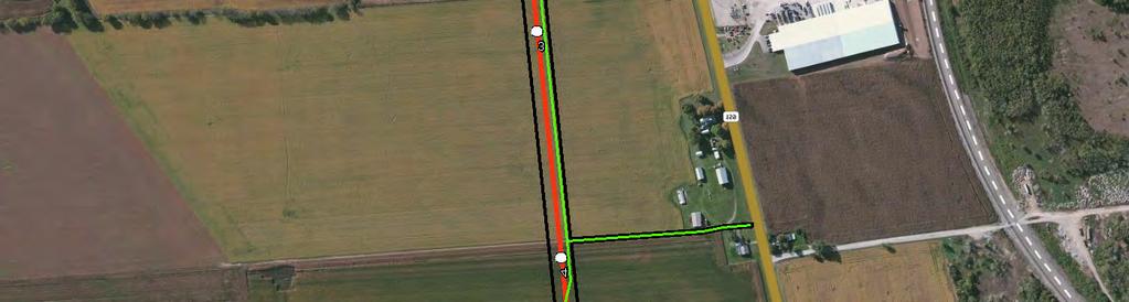

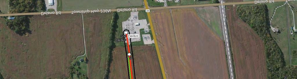
75 J:\Project\A\AEP\ Sioto Trail-Delano 138kV\Data-Tech\GIS\Figures_WDR_Map_ mxd Date: 9/29/ ,000 Scale in Feet LEGEND: Scioto Trail-Delano 138 kv Line Structure Ecological Survey Cooridor Proposed Access Road 100-year Flood Zone Assessed Stream Assessed Wetland Pickaway Co. Ross Co. FIGURE 1 WETLAND DELINEATION AND STREAM ASSESSMENT MAP JOB NO Delano-Scioto Trail 138 kv Transmission Line


76 J:\Project\A\AEP\ Sioto Trail-Delano 138kV\Data-Tech\GIS\Figures_WDR_Map_ mxd Date: 9/29/ ,000 Scale in Feet LEGEND: Scioto Trail-Delano 138 kv Line Structure Ecological Survey Cooridor Proposed Access Road 100-year Flood Zone Assessed Stream Assessed Wetland Pickaway Co. Ross Co. FIGURE 2 WETLAND DELINEATION AND STREAM ASSESSMENT MAP JOB NO Delano-Scioto Trail 138 kv Transmission Line


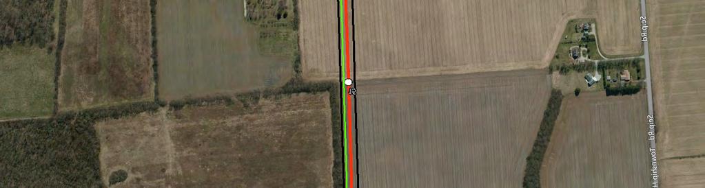

77 J:\Project\A\AEP\ Sioto Trail-Delano 138kV\Data-Tech\GIS\Figures_WDR_Map_ mxd Date: 9/29/ ,000 Scale in Feet LEGEND: Scioto Trail-Delano 138 kv Line Structure Ecological Survey Cooridor Proposed Access Road 100-year Flood Zone Assessed Stream Assessed Wetland Pickaway Co. Ross Co. FIGURE 3 WETLAND DELINEATION AND STREAM ASSESSMENT MAP JOB NO Delano-Scioto Trail 138 kv Transmission Line

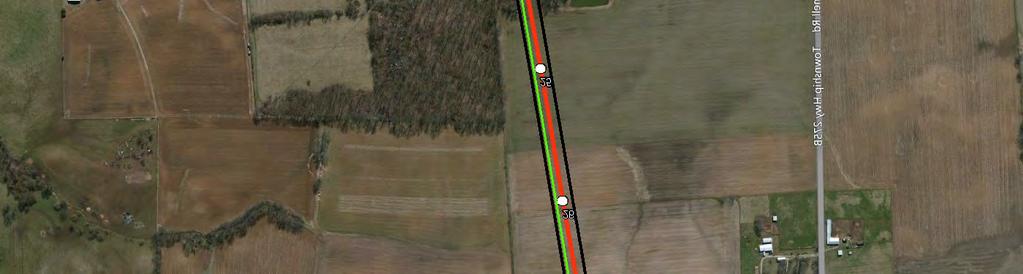

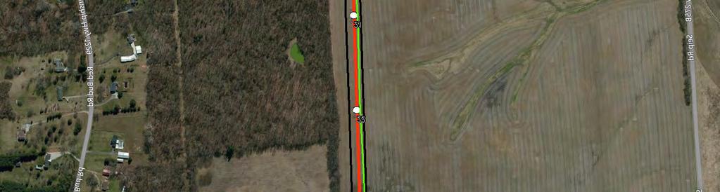

78 J:\Project\A\AEP\ Sioto Trail-Delano 138kV\Data-Tech\GIS\Figures_WDR_Map_ mxd Date: 9/29/ ,000 Scale in Feet LEGEND: Scioto Trail-Delano 138 kv Line Structure Ecological Survey Cooridor Proposed Access Road 100-year Flood Zone Assessed Stream Assessed Wetland Pickaway Co. Ross Co. FIGURE 4 WETLAND DELINEATION AND STREAM ASSESSMENT MAP JOB NO Delano-Scioto Trail 138 kv Transmission Line


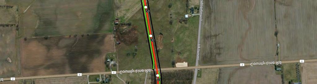

79 J:\Project\A\AEP\ Sioto Trail-Delano 138kV\Data-Tech\GIS\Figures_WDR_Map_ mxd Date: 9/29/ ,000 Scale in Feet LEGEND: Scioto Trail-Delano 138 kv Line Structure Ecological Survey Cooridor Proposed Access Road 100-year Flood Zone Assessed Stream Assessed Wetland Pickaway Co. Ross Co. FIGURE 5 WETLAND DELINEATION AND STREAM ASSESSMENT MAP JOB NO Delano-Scioto Trail 138 kv Transmission Line


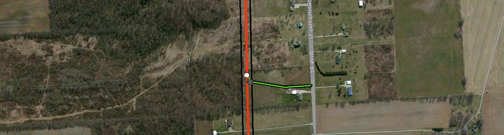
80 J:\Project\A\AEP\ Sioto Trail-Delano 138kV\Data-Tech\GIS\Figures_WDR_Map_ mxd Date: 9/29/ ,000 Scale in Feet LEGEND: Scioto Trail-Delano 138 kv Line Structure Ecological Survey Cooridor Proposed Access Road 100-year Flood Zone Assessed Stream Assessed Wetland Pickaway Co. Ross Co. FIGURE 6 WETLAND DELINEATION AND STREAM ASSESSMENT MAP JOB NO Delano-Scioto Trail 138 kv Transmission Line


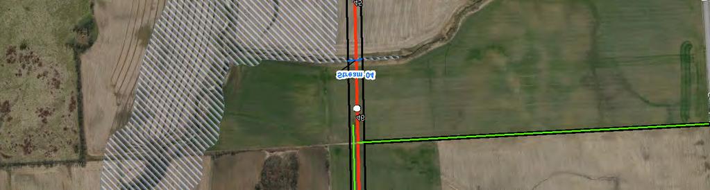


81 J:\Project\A\AEP\ Sioto Trail-Delano 138kV\Data-Tech\GIS\Figures_WDR_Map_ mxd Date: 9/29/ ,000 Scale in Feet LEGEND: Scioto Trail-Delano 138 kv Line Structure Ecological Survey Cooridor Proposed Access Road 100-year Flood Zone Assessed Stream Assessed Wetland Pickaway Co. Ross Co. FIGURE 7 WETLAND DELINEATION AND STREAM ASSESSMENT MAP JOB NO Delano-Scioto Trail 138 kv Transmission Line


82 J:\Project\A\AEP\ Sioto Trail-Delano 138kV\Data-Tech\GIS\Figures_WDR_Map_ mxd Date: 9/29/ ,000 Scale in Feet LEGEND: Scioto Trail-Delano 138 kv Line Structure Ecological Survey Cooridor Proposed Access Road 100-year Flood Zone Assessed Stream Assessed Wetland Pickaway Co. Ross Co. FIGURE 8 WETLAND DELINEATION AND STREAM ASSESSMENT MAP JOB NO Delano-Scioto Trail 138 kv Transmission Line


83 J:\Project\A\AEP\ Sioto Trail-Delano 138kV\Data-Tech\GIS\Figures_WDR_Map_ mxd Date: 9/29/ ,000 Scale in Feet LEGEND: Scioto Trail-Delano 138 kv Line Structure Ecological Survey Cooridor Proposed Access Road 100-year Flood Zone Assessed Stream Assessed Wetland Pickaway Co. Ross Co. FIGURE 9 WETLAND DELINEATION AND STREAM ASSESSMENT MAP JOB NO Delano-Scioto Trail 138 kv Transmission Line

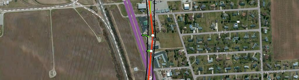


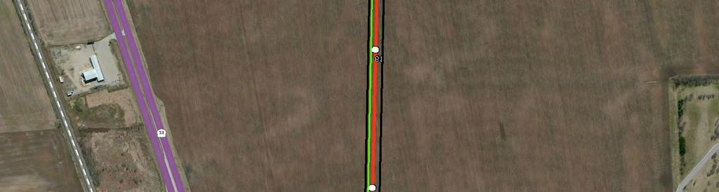
84 J:\Project\A\AEP\ Sioto Trail-Delano 138kV\Data-Tech\GIS\Figures_WDR_Map_ mxd Date: 9/29/ ,000 Scale in Feet LEGEND: Scioto Trail-Delano 138 kv Line Structure Ecological Survey Cooridor Proposed Access Road 100-year Flood Zone Assessed Stream Assessed Wetland Pickaway Co. Ross Co. FIGURE 10 WETLAND DELINEATION AND STREAM ASSESSMENT MAP JOB NO Delano-Scioto Trail 138 kv Transmission Line
85 ATTACHMENT A WETLAND FORMS
86

87
88
89
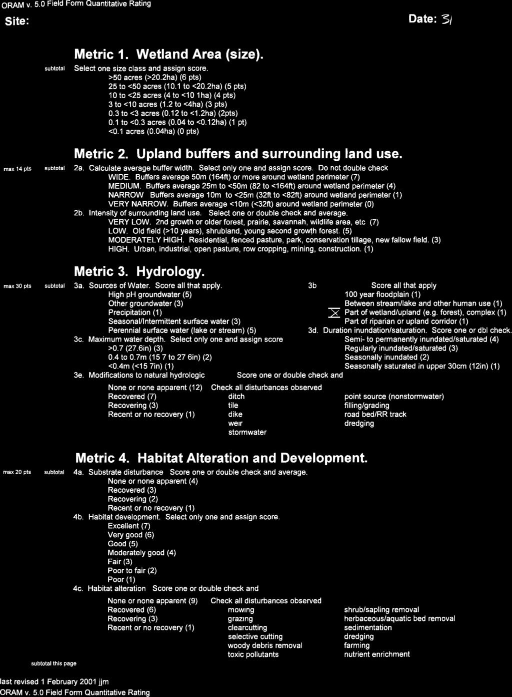

90
91
92

93
94
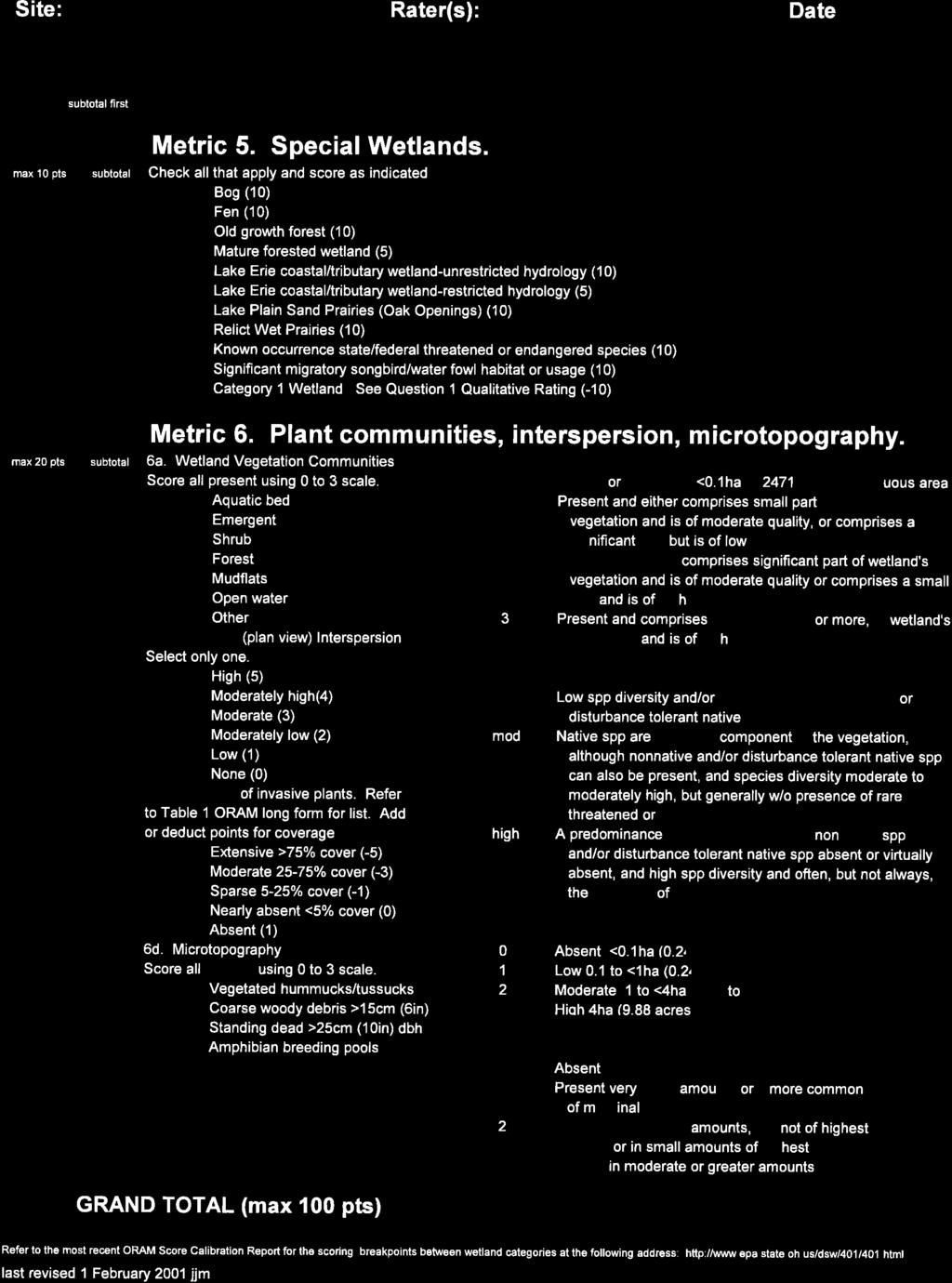
95
96

97

98

99
100 ATTACHMENT B PHOTOGRAPHS


101 Client Name: AEP Ohio Transco Site Location: Scioto Trail-Delano 138kV Transmission Line Rebuild PHOTOGRAPHIC RECORD Streams and Wetlands Project No Photo No. 1 Date: March 31, 2015 Description: Stream 4 Facing downstream Typical Intermittent Stream Photo No. 2 Date: March 30, 2015 Description: Stream 1 Facing upstream Typical Perennial Stream


102 Client Name: AEP Ohio Transco Site Location: Scioto Trail-Delano 138kV Transmission Line Rebuild PHOTOGRAPHIC RECORD Streams and Wetlands Project No Photo No. 3 Date: March 30, 2015 Description: Wetland 1 Typical ORAM Category 1 PEM wetland in right-of-way Photo No. 4 Date: March 31, 2015 Description: Wetland 5 Typical ORAM Category 2 PEM/PSS wetland in right-of-way
Letter of Notification For East Lima Station Expansion Project
 Letter of Notification For East Lima Station Expansion Project PUCO Case No. 18-0906-EL-BLN Submitted to: The Ohio Power Siting Board Pursuant to Ohio Administrative Code Section 4906-6-05 Submitted by:
Application for Certificate of Environmental Compatibility and Public Need
 Application for Certificate of Environmental Compatibility and Public Need Central Hudson Gas & Electric A and C Lines Towns of Pleasant Valley, LaGrange, Wappinger, and East Fishkill Dutchess County,
AMERICAN TRANSMISSION SYSTEMS, INCORPORATED A FIRSTENERGY COMPANY LETTER OF NOTIFICATION BROADVIEW SUBSTATION EXPANSION PROJECT
 AMERICAN TRANSMISSION SYSTEMS, INCORPORATED A FIRSTENERGY COMPANY LETTER OF NOTIFICATION BROADVIEW SUBSTATION EXPANSION PROJECT OPSB CASE NO.: 16-1981-EL-BLN January 12, 2017 American Transmission Systems,
AMERICAN TRANSMISSION SYSTEMS, INCORPORATED A FIRSTENERGY COMPANY CONSTRUCTION NOTICE. CARDINGTON-GALION 138 kv TRANSMISSION LINE RAISING PROJECT
 AMERICAN TRANSMISSION SYSTEMS, INCORPORATED A FIRSTENERGY COMPANY CONSTRUCTION NOTICE CARDINGTON-GALION 138 kv TRANSMISSION LINE RAISING PROJECT OPSB CASE NO.: 18-0864-EL-BNR MAY 29, 2018 American Transmission
TOWNSHIP OF LOGAN SOIL & FILL IMPORTATION AND PLACEMENT APPLICATION SUBMITTAL CHECKLIST
 TOWNSHIP OF LOGAN SOIL & FILL IMPORTATION AND PLACEMENT APPLICATION SUBMITTAL CHECKLIST Applications: 5 copies of application - Applicant will reproduce the copies at his/her costs. The Township Clerk
ARLINGTON COUNTY, VIRGINIA. County Board Agenda Item Meeting of June 16, 2018
 ARLINGTON COUNTY, VIRGINIA County Board Agenda Item Meeting of June 16, 2018 DATE: June 7, 2018 SUBJECT: Z-2604-18-1 Rezoning from R-6 and R-5 Single Family Residential Districts to S-3A Special District
WASHINGTON COUNTY OREGON
 WASHINGTON COUNTY OREGON LONG RANGE PLANNING DIVISION North Bethany Subarea Stream Corridors: Existing Regulations In Oregon, there is a distinct difference between the land use rules that apply in rural
Request for Statement of Interest in Implementation of the Roosevelt Road Redevelopment Plan
 425 Hillside Avenue Request for Statement of Interest in Implementation of the Roosevelt Road Redevelopment Plan I. INTRODUCTION The is seeking the services of a qualified consulting firm to prepare plans
Glenborough at Easton Land Use Master Plan
 Implementation 114 9.0 IMPLEMENTATION 9.1 OVERVIEW This chapter summarizes the administrative procedures necessary to implement the proposed land use plan, infrastructure improvements, development standards,
A Guide to Open Space Design Development in Halifax Regional Municipality
 A uide to Open Space Design Development in Halifax Regional Municipality May 2007 1 Introduction Pursuant to Section 3.5 of the Regional Municipal Planning Strategy (RMPS), subdivision of land may proceed
Procedures IV. V. Rural Road Design Option
 i IV. Procedures A. All applicants required to prepare a Conservation Design Subdivision shall provide the Planning Board with a conceptual conventional subdivision design as well as a proposed layout
CITY OF SCANDIA ORDINANCE NO. 174
 CITY OF SCANDIA ORDINANCE NO. 174 AN ORDINANCE AMENDING ORDINANCE NO. 122, THE SCANDIA DEVELOPMENT CODE, CHAPTER 2, SECTION 4.34, REGARDING SOLAR FARMS AND COMMUNITY SOLAR GARDENS The City Council of the
ROSEMONT 138KV TRANSMISSION LINE SITING STUDY PROJECT
 ROSEMONT 138KV TRANSMISSION LINE SITING STUDY PROJECT Public Open House Meeting #3 - Corona de Tucson April 14, 2010 - Quail Creek 5:30pm 8:30pm Presentation and Question and Answer: 6:30pm 7:00pm Project
Proposed St. Vital Transmission Complex
 Proposed St. Vital Transmission Complex Round 2 Preferred Route for the St. Vital to Letellier Line What is it? Manitoba Hydro is proposing construction of two 230-kilovolt (kv) transmission lines to improve
CHARLES COUNTY GOVERNMENT RFP NO POPES CREEK RAIL TRAIL DESIGN
 CHARLES COUNTY GOVERNMENT Department of Fiscal and Administrative Services Purchasing Division Telephone: 301-645-0656 July 7, 2015 RFP NO. 16-02 POPES CREEK RAIL TRAIL DESIGN ADDENDUM NUMBER ONE TO: All
I. STAFF POLICY RECOMMENDATIONS. The following RMP policy strategies are proposed by staff in support of a Scenic Resource Protection Program:
 Policy Consideration: Scenic Resource Protection Program Status: For Consideration by the Highlands Council at September 14, 2006 Work session Date: September 12, 2006 I. STAFF POLICY RECOMMENDATIONS The
MONTGOMERY COUNTY PLANNING DEPARTMENT
 MONTGOMERY COUNTY PLANNING DEPARTMENT THE MARYLAND-NATIONAL CAPITAL PARK AND PLANNING COMMISSION MCPB Item No.: Date: 5-03-18 Pike and Rose, Phase I: Site Plan Amendment No. 82012002D Rhoda Hersson-Ringskog,
City of Westbrook. 2 York Street Westbrook, Maine (207) Fax:
 Fax:") City of Westbrook DEPARTMENT OF PLANNING & CODE ENFORCEMENT 2 York Street Westbrook, Maine 04092 (207) 854-0638 Fax: 1-866-559-0642 WESTBROOK PLANNING BOARD TUESDAY, JANUARY 2, 2018, 7:00 P.M. WESTBROOK
City of Westbrook DEPARTMENT OF PLANNING & CODE ENFORCEMENT 2 York Street Westbrook, Maine 04092 (207) 854-0638 Fax: 1-866-559-0642 WESTBROOK PLANNING BOARD TUESDAY, JANUARY 2, 2018, 7:00 P.M. WESTBROOK
LOS ANGELES AIRPORT/EL SEGUNDO DUNES Specific Plan
 LOS ANGELES AIRPORT/EL SEGUNDO DUNES Specific Plan Ordinance No. 167,940 Effective June 28, 1992 TABLE OF CONTENTS MAP Section 1. Section 2. Section 3. Section 4. Section 5. Section 6. Specific Plan Area
D1 September 11, 2013 Public Hearing APPLICANT:
 D1 September 11, 2013 Public Hearing APPLICANT: BEACH MUNICIPAL FEDERAL CREDIT UNION PROPERTY OWNER: SISTERS II, LLC STAFF PLANNER: Karen Prochilo REQUEST: Conditional Change of Zoning (AG-2 Agriculture
4.1 LAND USE AND HOUSING
 4.1 This section provides a project-level analysis of potential impacts to land use, Shorelines of the State (shorelines), and housing. The study area for the land use and housing analysis in the Final
STAFF REPORT DEVELOPMENT COMMISSION ZONING MEETING CITY OF COLUMBUS, OHIO JANUARY 10, 2019
 STAFF REPORT DEVELOPMENT COMMISSION ZONING MEETING CITY OF COLUMBUS, OHIO JANUARY 10, 2019 5. APPLICATION: Z18-063 Location: 4053 WEST BROAD STREET (43228), being 6.42± acres located at the southeast corner
Review Zone Application for D&R Canal Commission Decision
 Review Zone Application for D&R Canal Commission Decision MEETING DATE: July 20, 2016 DRCC #: 16-4803 Latest Submission Received: June 13, 2016 Applicant: Robert McCarthy, PE PSE&G 4000 Hadley Road, 2
COUNTY COUNCIL OF PRINCE GEORGE'S COUNTY, MARYLAND SITTING AS THE DISTRICT COUNCIL 2010 Legislative Session. Council Members Dernoga and Olson
 DR- COUNTY COUNCIL OF PRINCE GEORGE'S COUNTY, MARYLAND SITTING AS THE DISTRICT COUNCIL 00 Legislative Session Bill No. CB--00 Chapter No. Proposed and Presented by Introduced by Co-Sponsors The Chairman
Town of Windham. Planning Department 8 School Road Windham, ME voice fax
 Town of Windham Planning Department 8 School Road Windham, ME 04062 voice 207.864-5960 fax 207.892.1916 MEMO DATE: TO: Staff Review Committee FROM: Amanda Lessard, Planner Cc: Ellen Rathbone, St. Germain
AGENDA ITEM: IOWA. west] that were not FISCAL IMPACT. the City of Clive. STAFF REVIEW. Resolution II. Amendment PREPARED BY: REVIEWED BY:
![AGENDA ITEM: IOWA. west] that were not FISCAL IMPACT. the City of Clive. STAFF REVIEW. Resolution II. Amendment PREPARED BY: REVIEWED BY:](/thumbs/93/112428810.jpg "AGENDA ITEM: IOWA. west] that were not FISCAL IMPACT. the City of Clive. STAFF REVIEW. Resolution II. Amendment PREPARED BY: REVIEWED BY:") AGENDA ITEM: CITY OF WAUKEE, IOWA CITY COUNCIL MEETING COMMUNICATION MEETING DATE: March 7, 2016 AGENDA ITEM: Consideration of approval of a resolution approving Engineering Services Amendment No. 1 with
AGENDA ITEM: CITY OF WAUKEE, IOWA CITY COUNCIL MEETING COMMUNICATION MEETING DATE: March 7, 2016 AGENDA ITEM: Consideration of approval of a resolution approving Engineering Services Amendment No. 1 with
Major Subdivision Sketch Plan Checklist
 This checklist provides specific requirements that are apart of the Sketch process. The entire process is described by the Huntersville Subdivision Review Process which details all the submittal and resubmittal
Existing Conditions and Environmental Consequences Floodplains
 3.9 Environmental Consequences 3.8 3.8.1 WHAT ARE FLOODPLAINS? are low-lying areas adjacent to rivers, streams, and other waterbodies that are susceptible to inundation (flooding) during rain events. These
DRAFT SECTION 4(f) EVALUATION INTERSTATE 73 FEIS: I-95 to I-73/I-74 in North Carolina
 EVALUATION INTERSTATE 73 FEIS: I-95 to I-73/I-74 in North Carolina") DRAFT SECTION 4(f) EVALUATION INTERSTATE 73 FEIS: I-95 to I-73/I-74 in North Carolina 1.0 INTRODUCTION Section 4(f) of the Department of Transportation Act of 1966, 49 U.S.C. 303, requires that prior to
DRAFT SECTION 4(f) EVALUATION INTERSTATE 73 FEIS: I-95 to I-73/I-74 in North Carolina 1.0 INTRODUCTION Section 4(f) of the Department of Transportation Act of 1966, 49 U.S.C. 303, requires that prior to
Northeast Ohio Regional Sewer District Stormwater Management Plan Review Policy
 Northeast Ohio Regional Sewer District Stormwater Management Plan Review Policy Introduction As a component of the Northeast Ohio Regional Sewer District s (District) Regional Stormwater Management Program,
GIS to Estimate Archaeological Site Loss and Develop Conservation Strategies
 GIS to Estimate Archaeological Site Loss and Develop Conservation Strategies Terry Jackson Office of Decision Support Systems Planning and Environmental Management Division Georgia Department of Community
PRELIMINARY CONDITIONAL USE SUBMITTAL CHECKLIST REQUIREMENTS
 This checklist must accompany your submittal as the cover page. CONDITIONAL USE Application Submittal Checklist for PRELIMINARY AND FINAL APPROVAL Per Winter Park Land Development Code Sec. 58-90 PRELIMINARY
Chapter 4 - Preparation of Stormwater Site Plans
 Chapter 4 - Preparation of Stormwater Site Plans The Stormwater Site Plan is the comprehensive report containing all of the technical information and analysis necessary for the City to evaluate a proposed
SECTION 1 Introduction...1. SECTION 2 Regional Context Criteria for Planning Districts Description of Planning District...
 Table of Contents SECTION 1 Introduction...1 SECTION 2 Regional Context...2 2.1 - Criteria for Planning Districts...2 2.2 - Description of Planning District...2 SECTION 3 Goals & Objectives...5 SECTION
CONSENT CALENDAR CITY PLANNING COMMISSION AGENDA ITEM NO: A.1, A.2 STAFF: LARRY LARSEN
 Page 8 CONSENT CALENDAR CITY PLANNING COMMISSION AGENDA ITEM NO: A.1, A.2 STAFF: LARRY LARSEN FILE NO: CPC PUZ 14-00013 - QUASI-JUDICIAL FILE NO: CPC PUD 14-00014 QUASI-JUDICIAL PROJECT: APPLICANT: OWNER:
Request for Decision. Recommendation. Presented: Monday, Jul 07, Report Date Friday, Jun 20, Type: Public Hearings
 Presented To: Planning Committee Request for Decision Application for rezoning in order to permit a place of worship on a vacant lot zoned for C1, Local Commercial uses, Cam Street, Sudbury Sitiri Investments
Article 6 Tree Protection
 Article 6 Tree Protection 8.1 Purpose 8.2 Applicability 8.2.1 General Provisions 8.2.2 Exemptions 8.3 Permitting Procedure 8.4 Planting Procedure 8.5 Performance Guarantee Required for Belated Planting
Neo-Traditional Overlay Application
 MAYOR AND CITY COUNCIL OF LAUREL DEPARTMENT OF ECONOMIC AND COMMUNITY DEVELOPMENT 8103 Sandy Spring Road Laurel, Maryland 20707 (301) 725-5300 Internet Address http://www.cityoflaurel.org E-mail: ecd@laurel.md.us
2.7 ac park. TOTAL 5,403 DU 1,297,900 sf 1,105,450 sf 3.87 ac 5,563 DU 1,121,200 sf 1,105,450 sf 3.87 ac
 PLAN AMENDMENT 2013-I-B1: SEVEN CORNERS SPECIAL STUDY Summary of Pre-staffing Comments Planner: Bernard Suchicital bsuchi@fairfaxcounty.gov (703) 324-1254 Background On October 29, 2013, the Board of Supervisors
SUBMITTAL REQUIREMENTS
 WHEN PROCESS TYPE III IS USED References to Process Type III applications are found in several places in the Milton Municipal Code (MMC), indicating that the development, activity, or use, is permitted
USA Addition of South & East Side Residential Parcels. USA Deletion of a Town of Christiana Parcel. Conversion from USA to Limited Service Area
 Village of Rockdale Village of Rockdale 148 Water Street Cambridge, WI 53523 Phone 608.423.1497 Fax 608.423.9694 Urban Service Area (USA) Amendment USA Addition of South & East Side Residential Parcels
7.0 SOCIAL, ECONOMIC, AND ENVIRONMENTAL ISSUES
 7.0 SOCIAL, ECONOMIC, AND ENVIRONMENTAL ISSUES The following list of social, economic, and environmental issues have been identified based on a preliminary inventory of resources in the project area, an
Appendix E Preliminary Location Hydraulic Study
 Appendix E Prepared for: State of Alaska Department of Transportation and Public Facilities Prepared by: HDR Alaska, Inc. 2525 C Street, Suite 305 Anchorage, Alaska 99503 February 2014 This page intentionally
Chapter 1: General Program Information
 Chapter 1: General Program Information 1.1 Introduction The Montgomery County Stormwater Management Resolution (#03-1-5) was adopted by the County Board of Commissioners on January 22, 2003. The purpose
APPENDIX 1: SCOPED ENVIRONMENTAL IMPACT STATEMENT (EIS) FORM
 FORM") APPENDIX 1: SCOPED ENVIRONMENTAL IMPACT STATEMENT (EIS) FORM This form is intended for use by applicants (primarily private landowners) who need to conduct a Scoped EIS in support of minor development
APPENDIX 1: SCOPED ENVIRONMENTAL IMPACT STATEMENT (EIS) FORM This form is intended for use by applicants (primarily private landowners) who need to conduct a Scoped EIS in support of minor development
Project phasing plan (if applicable) 12 copies of site plan
 12 copies of site plan") SITE PLAN REVIEW PERMIT APPLICATION City of Grand Haven, 11 N. Sixth Street, Grand Haven, MI 49417 Phone: (616) 847-3490 Fax: (616) 844-2051 Website: www.grandhaven.org 1. Project Information Address/location
SITE PLAN REVIEW PERMIT APPLICATION City of Grand Haven, 11 N. Sixth Street, Grand Haven, MI 49417 Phone: (616) 847-3490 Fax: (616) 844-2051 Website: www.grandhaven.org 1. Project Information Address/location
Canyon Lake Master Plan Revision Public Information Meeting March 18, 2016
 Canyon Lake Master Plan Revision Public Information Meeting March 18, 2016 Marcus Schimank Canyon Lake Manager Capital Regional Office U.S. Army Corps of Engineers Fort Worth District US Army Corps of
PLANNING APPROVAL & PLANNED UNIT DEVELOPMENT Date: November 2, 2017
 PLANNING APPROVAL & PLANNED UNIT DEVELOPMENT Date: November 2, 2017 DEVELOPMENT NAME LOCATION Mobile Christian School 5900 Cottage Hill Road (North side of Cottage Hill Road, 230 ± West of Freemont Drive
DISCUSSION TOPIC: ST JOHNS RIVER & ITS TRIBUTARIES (BPII) 2030 COMPREHENSIVE PLAN POLICES AND REGULATORY FRAMEWORK
 2030 COMPREHENSIVE PLAN POLICES AND REGULATORY FRAMEWORK") DISCUSSION TOPIC: ST JOHNS RIVER & ITS TRIBUTARIES (BPII) 2030 COMPREHENSIVE PLAN POLICES AND REGULATORY FRAMEWORK St. John s River & Its Tributaries Issue Summary: The St. Johns River is an important
DISCUSSION TOPIC: ST JOHNS RIVER & ITS TRIBUTARIES (BPII) 2030 COMPREHENSIVE PLAN POLICES AND REGULATORY FRAMEWORK St. John s River & Its Tributaries Issue Summary: The St. Johns River is an important
Exhibit 16 Stormwater Management and Erosion & Sedimentation Control
 TYPE S1 TYPE S1 TYPES S2 and S2A Exhibit 16 Stormwater Management and Erosion & Sedimentation Control EXHIBIT 16 STORMWATER MANAGEMENT & EROSION AND SEDIMENTATION CONTROLS Motherhouse Senior Housing Subdivision
9 CITY OF VAUGHAN OFFICIAL PLAN AMENDMENT NO BOCA EAST INVESTMENTS LIMITED
 9 CITY OF VAUGHAN OFFICIAL PLAN AMENDMENT NO. 631 - BOCA EAST INVESTMENTS LIMITED The Planning and Economic Development Committee recommends the adoption of the recommendations contained in the following
CHARTER TOWNSHIP OF VAN BUREN PLANNING COMMISSION November 12, 2014 MINUTES
 CHARTER TOWNSHIP OF VAN BUREN PLANNING COMMISSION November 12, 2014 MINUTES Chairperson Thompson called the meeting to order at 7:32 p.m. ROLL CALL: Present: Johnson, Boynton, Kelley, McKenna, Budd, Franzoi
LICENSES FOR UTILITY CROSSINGS OF PUBLIC LANDS AND WATERS ACCORDING TO MINNESOTA RULES CHAPTER [Rules Effective July 1, 2004]
![LICENSES FOR UTILITY CROSSINGS OF PUBLIC LANDS AND WATERS ACCORDING TO MINNESOTA RULES CHAPTER [Rules Effective July 1, 2004]](/thumbs/78/77546780.jpg "LICENSES FOR UTILITY CROSSINGS OF PUBLIC LANDS AND WATERS ACCORDING TO MINNESOTA RULES CHAPTER [Rules Effective July 1, 2004]") LICENSES FOR UTILITY CROSSINGS OF PUBLIC LANDS AND WATERS ACCORDING TO MINNESOTA RULES CHAPTER 6135 [Rules Effective July 1, 2004] Minnesota Department of Natural Resources Division of Lands and Minerals
LICENSES FOR UTILITY CROSSINGS OF PUBLIC LANDS AND WATERS ACCORDING TO MINNESOTA RULES CHAPTER 6135 [Rules Effective July 1, 2004] Minnesota Department of Natural Resources Division of Lands and Minerals
PURPOSE: The purpose is to provide commercial facilities in the Vancouver and Clark County vicinity.
 US Army Corps of Engineers Seattle District Joint Public Notice Application for a Department of the Army Permit and a Washington Department of Ecology Water Quality Certification and/or Coastal Zone Management
PLNPCM Carl s Jr. Commercial Parking Lot at Redwood Road and 1700 South
 Staff Report PLANNING DIVISION COMMUNITY & NEIGHBORHOODS To: Salt Lake City Planning Commission From: Casey Stewart; 801-535-6260 Date: November 4, 2016 Re: PLNPCM2015-00874 Carl s Jr. Commercial Parking
March 30, Mr. David Singer Environmental Planner CDOT Region S. Holly Street, Room 200 Denver, Colorado 80222
 March 30, 2011 Mr. David Singer Environmental Planner CDOT Region 6 2000 S. Holly Street, Room 200 Denver, Colorado 80222 Subject: Biological Resources Summary for the Proposed Colorado Center Bicycle/Pedestrian
The Illinois Department of Transportation and Lake County Division of Transportation. Route 173, including the Millburn Bypass
 The Illinois Department of Transportation and Lake County Division of Transportation welcome you to this Public Hearing for U.S. Route 45 from Illinois Route 132 to Illinois Route 173, including the Millburn
Town of Peru Comprehensive Plan Executive Summary
 Town of Peru Comprehensive Plan Executive Communities that plan grow by choice, not by chance. A plan makes growth thoughtful, understandable, and predictable. A plan shows that a community is managing
Chapter 10 IMPLEMENTATION RECOMMENDATIONS
 Chapter 10 IMPLEMENTATION RECOMMENDATIONS The recommended land use plan presented in the previous chapter provides a design for the attainment of the urban and rural development and open space preservation
Northern Branch Corridor SDEIS March 2017
 Northern Branch Corridor SDEIS March 2017 15. 15.1. Chapter Overview 15.1.1. Introduction This chapter discusses changes to the Preferred Alternative resulting in the potential for project improvements
Right-of-Way Acquisitions and Relocations Technical Memorandum
 Right-of-Way Acquisitions and Relocations Technical Memorandum Southeast Extension Project Lincoln Station to RidgeGate Parkway Prepared for: Federal Transit Administration Prepared by: Denver Regional
Chapter 13: Implementation Plan
 Implementation A. Introduction The Implementation Plan, in table form on the following pages, provides a summary of all the Action Items recommended in Chapters 2 through 12. The table also indicates which
Whitemarsh Township Greenway Plan
 Whitemarsh Township Greenway Plan Prepared for: Whitemarsh Township August 16, 2007 Table of Contents Table of Contents... i Introduction... 1 Study Area Setting... 2 Regional Setting... 2 Township Character...
Overview of Southwestern Pennsylvania Commission s (SPC) 2040 Long Range Transportation Plan (LRTP)
 2040 Long Range Transportation Plan (LRTP)") Overview of Southwestern Pennsylvania Commission s (SPC) 2040 Long Range Transportation Plan (LRTP) Presented to Pennsylvania Agency Coordination Meeting May 27, 2015 Doug Smith & Ryan Gordon 1 Southwestern
Overview of Southwestern Pennsylvania Commission s (SPC) 2040 Long Range Transportation Plan (LRTP) Presented to Pennsylvania Agency Coordination Meeting May 27, 2015 Doug Smith & Ryan Gordon 1 Southwestern
Note: Staff reports can be accessed at Zone: I-3. Tier:
 The Maryland-National Capital Park and Planning Commission Prince George s County Planning Department Development Review Division 301-952-3530 Note: Staff reports can be accessed at www.mncppc.org/pgco/planning/plan.htm.
North Metro Natural Gas Pipeline Project Routing Study. Exhibit I: Comment and Response Document
 North Metro Natural Gas Pipeline Project Routing Study Exhibit I: Comment and Response Document North Metro Natural Gas Pipeline Project Routing Study This page intentionally left blank. North Metro Natural
Michael D, Harvey, Current Planning Supervisor. This project was originally approved in 2012 by the BOCC and is summarized as follows:
 PLANNING & INSPECTIONS DEPARTMENT Craig N. Benedict, AICP, Director Current Planning (919) 245-2575 (919) 644-3002 (FAX) www.orangecountync.gov 131 W. Margaret Lane Suite 201 P. O. Box 8181 Hillsborough,
Town of Newmarket 395 Mulock Drive P.O. Box 328, Newmarket, Ontario, L3Y 4X7. Website: newmarket.ca Phone:
 Town of Newmarket 395 Mulock Drive P.O. Box 328, Newmarket, Ontario, L3Y 4X7 Email: info@newmarket.ca Website: newmarket.ca Phone: 905-895-5193 Natural Heritage System Boundary Refinement: Vacant Lot West
STATE OF TENNESSEE DEPARTMENT OF TRANSPORTATION ENVIRONMENTAL DIVISION
 STATE OF TENNESSEE DEPARTMENT OF TRANSPORTATION ENVIRONMENTAL DIVISION Suite 900 - James K. Polk Building 505 Deaderick Street Nashville, Tennessee 37243-0334 MEMORANDUM TO: FROM: Files Joe W. Matlock,
1.0 INTRODUCTION 1.1 TH 14 WEST STUDY AREA Project Description Functional Classification Purpose of the Project
 1.0 INTRODUCTION 1.1 TH 14 WEST STUDY AREA 1.1.1 Project Description The Trunk Highway (TH) 14 West Corridor is a two-lane roadway approximately 22 miles in length. Located in Nicollet County, the corridor
DRAFT MAP AMENDMENT FLU 04-4
 DRAFT MAP AMENDMENT FLU 04-4 SW 24 TH AVENUE ROADWAY CORRIDOR The University of Florida participates with the Metropolitan Transportation Planning Organization (MTPO) in its responsibilities for the continuing,
TOWN OF BRUDERHEIM Report to the capital region board
 TOWN OF BRUDERHEIM Report to the capital region board Introduction to the Town of Bruderheim Municipal Development Plan amendment and Relation to the CRB Evaluation Criteria 02 march 2017 1 Introduction
MOBILE CITY PLANNING COMMISSION LETTER OF DECISION. October 22, 2010
 MOBILE CITY PLANNING COMMISSION LETTER OF DECISION Archbishop of Mobile 400 Government St. Mobile, AL 36602 Re: Case #SUB2010-00075 (Subdivision) 3650 Springhill Avenue (Northwest corner of Springhill
CITY OF ST. AUGUSTA STEARNS COUNTY MINNESOTA ORDIANCE NO AN ORDINANCE ESTABLISHING REGULATIONS FOR STORMWATER MANAGEMENT
 CITY OF ST. AUGUSTA STEARNS COUNTY MINNESOTA ORDIANCE NO. 2017-05 AN ORDINANCE ESTABLISHING REGULATIONS FOR STORMWATER MANAGEMENT In the interest of the health, safety, and welfare of its citizens, the
PUBLIC HEARING. Thursday, December 14, 2017 FDOT Urban Office 2198 Edison Avenue Jacksonville, FL 32204
 DISTRICT TWO PUBLIC HEARING I 10 (SR 8) from I 295 to I 95 Project Development & Environment Study Duval County, Florida Financial Project Number 213326 2 22 01 Efficient Transportation Decision Making
17.1 INTRODUCTION CONTEXT CONCLUSIONS
 CHAPTER 17. FLOODPLAIN 17.1 INTRODUCTION 17.1.1 CONTEXT A floodplain is part of an extensive drainage and filtration system and water cycle that serves to contain flood waters from storms. Floodplain areas
SITE PLAN REVIEW ITEMS - REFERENCE CHECKLIST
 City of Seminole 9199 113 th Street N. Seminole, FL 33772 Ph: (727) 392-1966 Fx: (727) 319-6583 SITE PLAN REVIEW ITEMS - REFERENCE CHECKLIST Note: This checklist is designed to aid designers in the review
July 12, Columbus City Council City Hall 90 West Broad Street Columbus, OH RE: I-70/71 Columbus Crossroads Project
 OHIO DEPARTMENT OF TRANSPORTATION DISTRICT 6 400 EAST WILLIAM STREET DELAWARE, OHIO 43015 800.372.7714 Columbus City Council City Hall 90 West Broad Street Columbus, OH 43215-9015 RE: I-70/71 Columbus
APPLICATION FOR REZONING PROPERTY CITY OF HOLLAND, MICHIGAN. Name of Applicant. Address, and Phone # of Applicant
 APPLICATION FOR REZONING PROPERTY CITY OF HOLLAND, MICHIGAN Name of Applicant Address, Email and Phone # of Applicant Name and Address of Owner (if other than applicant) Ownership Interest of Applicant
DISCUSSION ON VACAVILLE S2 INVESTORS PROPERTY IN URBAN RESERVE
 Agenda Item No. 9C April 25, 2017 TO: FROM: SUBJECT: Honorable Mayor and City Council Attention: Jeremy Craig, Interim City Manager Barton Brierley, AICP, Community Development Director (Staff Contact:
PLANNING APPROVAL STAFF REPORT Date: November 17, 2011
 # 11 ZON2011-02680 PLANNING APPROVAL STAFF REPORT Date: November 17, 2011 NAME LOCATION Alabama Power Company East side of Navco Road 130 ± South of Columbus Avenue CITY COUNCIL DISTRICT District 4 PRESENT
Application for Site Plan Review
 Application for Site Plan Review City of Pontiac Office of Land Use and Strategic Planning 47450 Woodward Ave, Pontiac, MI 48342 T: 248.758.2800 F: 248.758.2827 Property/Project Address: Sidwell Number:
November 21, Planning Commission Charter Township of Lyon Grand River Ave. New Hudson, MI 48165
 Planning Commission Charter Township of Lyon 58000 Grand River Ave. New Hudson, MI 48165 Subject: AP-18-68; 11 Mile and Milford Road Park, Site Plan Review #1 Based on site plan dated 11/12/18 Location:
Chesapeake Bay Critical Area Conservation Plan
 The Maryland-National Capital Park and Planning Commission Prince George s County Planning Department Development Review Division 301-952-3530 Note: Staff reports can be accessed at www.mncppc.org/pgco/planning/plan.htm.
City of Philadelphia
 (Bill No. 160462) AN ORDINANCE Amending Subcode A (The Philadelphia Administrative Code), Subcode F (The Philadelphia Fire Code) and Subcode PM (The Philadelphia Property Maintenance Code) of Title 4 of
Minnesota Department of Natural Resource - Natural Resource Guidance Checklist Conserving Natural Resources through Density Bonuses
 Minnesota Department of Natural Resource - Natural Resource Guidance Checklist Conserving Natural Resources through Density Bonuses NRDB Why Use Density Bonuses & This Checklist Local units of government
INTRODUCTION PLANNING HISTORY
 INTRODUCTION The Upper Rock Creek Master Plan Area lies in the east central part of Montgomery County. The Master Plan Area is adjacent to the City of Rockville to the south, the Olney Planning Area to
EPA/ODEQ DEMOLITION BY FIRE REQUIREMENTS
 EPA/ODEQ DEMOLITION BY FIRE REQUIREMENTS The OKLAHOMA AIR POLLUTION CONTROL RULES, Oklahoma Administrative Code (OAC) 252:100-13, Open Burning, specifically, subpart 5, Open burning prohibited, states:
Richton Park Western Development Corridor Green Infrastructure Development Plan August 18, 2017
 Richton Park Western Development Corridor Green Infrastructure Development Plan August 18, 2017 Conservation Design Forum Geosyntec Consultants 403 W. St. Charles Road 1420 Kensington Road, Suite 103 Lombard,
Plat Requirements CHECKLIST FOR SITE PLAN REVIEW
 This checklist is to be used as a guide for complying with the Town of Hollis Site Plan Regulations. It is to be used for each individual site plan review application submitted. Applicants are encouraged
SITE SUMMARY REPORT Arlington Dump NONCD Yadkin County
 SITE SUMMARY REPORT Arlington Dump NONCD 0000644 Yadkin County Hurricane Recovery Act of 2005 State of North Carolina State Contract N06009S Schnabel Project No. 06210002.15 July 31, 2009 Prepared for:
Lewisville Lake Master Plan Revision Public Information Meeting May 2 & 4, 2017
 Lewisville Lake Master Plan Revision Public Information Meeting May 2 & 4, 2017 Presented By Rob Jordan Lake Manager U.S. Army Corps of Engineers Fort Worth District US Army Corps of Engineers Purpose
TEN MILE PLANNING COMMISSION AGENDA January 10, :30 p.m. Buffalo Mountain Meeting Room, County Commons 0037 Peak One Dr., SCR 1005, Frisco, CO
 PLANNING DEPARTMENT 970.668.4200 0037 Peak One Dr. PO Box 5660 www.summitcountyco.gov Frisco, CO 80443 TEN MILE PLANNING COMMISSION AGENDA January 10, 2019-5:30 p.m. Buffalo Mountain Meeting Room, County
TOWN OF NORTH CASTLE WESTCHESTER COUNTY 17 Bedford Road Armonk, New York R E S O L U T I O N
 PLANNING BOARD John P. Delano, Chair TOWN OF NORTH CASTLE WESTCHESTER COUNTY 17 Bedford Road Armonk, New York 10504-1898 R E S O L U T I O N Telephone: (914) 273-3542 Fax: (914) 273-3554 www.northcastleny.com
Public Information Meeting
 Lavon Lake Master Plan Revision Public Information Meeting March 10, 2015 Presented By Michael Kinard Lake Manager U.S. Army Corps of Engineers Fort Worth District US Army Corps of Engineers Purpose of
LEGAL NOTICE. City of Tacoma Determination of Environmental Nonsignificance. Fred Wagner, Wagner Development. Demolition of Manitou school buildings
 LEGAL NOTICE City of Tacoma Determination of Environmental Nonsignificance Lead Agency: Applicant: Proposal: Location: City of Tacoma Fred Wagner, Wagner Development Demolition of Manitou school buildings
Re: Application Type: Proposed Highlands Redevelopment Area Designation
 CHRIS CHRISTIE Governor KIM GUADAGNO Lt. Governor State of New Jersey Highlands Water Protection and Planning Council 100 North Road (Route 513) Chester, New Jersey 07930-2322 (908) 879-6737 (908) 879-4205
DRIVEWAY REGULATIONS
 TOWN OF NEW LONDON PLANNING BOARD DRIVEWAY REGULATIONS INSTRUCTIONS TO APPLICANTS FOR THE CONSTRUCTION OR ALTERATION OF DRIVEWAYS IMPORTANT: READ CAREFULLY BEFORE FILLING OUT ATTACHED APPLICATION Revised
City of Fort Lupton Administrative Site Plan Process
 City of Fort Lupton Administrative Site Plan Process Purpose The Site Plan process is meant to promote orderly and sound development standards as they apply to the City. These site development standards
STAFF REPORT FOR STANDARD COASTAL DEVELOPMENT PERMIT #CDP FEBRUARY 26, 2015 CPA - 1 PO BOX 238 APTOS, CA 94001
 STAFF REPORT FOR STANDARD COASTAL DEVELOPMENT PERMIT #CDP 2014-0030 FEBRUARY 26, 2015 CPA - 1 OWNER/APPLICANT: AGENT: REQUEST: HANS HEIM PO BOX 238 APTOS, CA 94001 JAMES HAY PO BOX 762 MENDOCINO, CA 95460