MONTGOMERY COUNTY PLANNING DEPARTMENT THE MARYLAND-NATIONAL CAPITAL PARK AND PLANNING COMMISSION
|
|
|
- Kory Singleton
- 5 years ago
- Views:
Transcription
1 MONTGOMERY COUNTY PLANNING DEPARTMENT THE MARYLAND-NATIONAL CAPITAL PARK AND PLANNING COMMISSION MCPB Item No. Date: Rock Spring Park, Preliminary Plan Amendment B and Site Plan Amendment, I Michael Brown, Planner Coordinator, Area 2 Division, Michael.Brown@montgomeryplanning.org, Khalid Afzal, Supervisor, Area 2 Division, Khalid.Afzal@montgomeryplanning.org, Glenn Kreger, Chief, Area 2 Division, Glenn.Kreger@montgomeryplanning.org, Completed: 07/03/2014 Description Request to resubdivide a acre portion of the acre property into 168 lots and dedicate 1.45 acres to Montgomery County Department of Transportation to allow the development of up to 168 townhouse units, including 12.5% MPDUs. Located on Fernwood Road between Rockledge and Rock Spring Drives; I-3 Zone in the 1992 North Bethesda/Garrett Park Master Plan area; Applicant: RS Associates LLC Filing Date: December 19, 2013 Summary Staff recommends approval with conditions of amendments to the Preliminary and Site Plans. Applicant requests approval of residential uses in the I-3 Zone pursuant to the Optional Method of Development under Section 59-C Applicant is providing more than the minimum 40 feet right-of-way recommended in the Countywide Transit Corridors Functional Master Plan to allow flexibility in accommodating a station(s) for the North Bethesda Transitway in the vicinity of the intersection of Rock Spring Drive and Fernwood Road. The proposed lots will be served by an internal network of private streets. Per Section 50-29(a)(2), the Planning Board must find the private streets to have attained the status of public streets. The Planning Board must find that events have occurred to render the master plan recommendation for a reconfigured Fernwood Road/Rock Spring Drive intersection no longer appropriate. The Planning Board must find that the reduced building and sidewalk setback is compatible with adjacent development per Section 59-C (2)(F). Applicant requests a parking waiver for a reduction of 32 spaces from the total number required. Applicant requests a tree variance for the removal of 10 trees. Applicant requests approval of 4-foot wide sidewalk between sticks. The Planning Board s Recreation Guidelines recommend a minimum 5 feet.
2 TABLE OF CONTENTS SECTION 1: RECOMMENDATION AND CONDITIONS 3 Preliminary Plan Site Plan SECTION 2: SITE DESCRIPTION 9 Site Vicinity Site Analysis SECTION 3: PROJECT DESCRIPTION 13 Previous Approvals Proposed Project Community Outreach SECTION 4: PRELIMINARY PLAN REVIEW 18 Master Plan Conformance Public Facilities Environment Compliance with the Subdivision Regulations Conclusion SECTION 5: SITE PLAN REVIEW 28 Analysis and Findings- Section 59-D-3.4(c) Conclusion 2
3 SECTION 1: RECOMMENDATION AND CONDITIONS PRELIMINARY PLAN RECOMMENDATION AND CONDITIONS Staff recommends approval of Preliminary Plan Amendment No B, Rock Spring Park, subject to the following conditions: 1. Approval is limited to a maximum of 168 one-family attached lots of which 12.5% must be moderately priced dwelling units (MPDUs), associated Homeowners Association (HOA) parcels and private streets and alleys parcels; 1,554,983 square feet of general office use; and 18,000 square feet of a child day care facility with a maximum of 30 employees. 2. Prior to the release of any building permit, the Applicant must enter into a new Traffic Mitigation Agreement with the Planning Board and MCDOT to participate in the North Bethesda Transportation Management District (TMD). The Applicant will assist in achieving and maintaining a non-auto driver mode share goal of at least 30% for residents per the North Bethesda/Garrett Park Master Plan. 3. Prior to approval of the final Record Plat, the Applicant must submit language to Staff that will be included in the Homeowners Association documents disclosing that the 32 on-site street parking spaces are restricted for visitor/guest parking only. The Applicant must provide this disclosure to all prospective purchasers in the Purchase Agreement. The 32 on-site street parking spaces must be signed for visitor/guest parking. 4. The Applicant must dedicate a 55-foot wide right-of-way along Fernwood Road and Rock Spring Drive comprising a 40-foot wide future transitway plus an additional fifteen feet for accommodation of a transit station(s) and the pedestrian promenade. The 10-feet closest to the townhouse units will consist of sidewalk and tree panel. 5. The private street network must be located within its own parcel(s), separate from the development, and the record plat must reflect a public use and access easement over the private streets, alleys, and adjacent parallel sidewalks. 6. The Planning Board has accepted the recommendation of the MCDOT in its letter dated June 6, 2014 and the amendment dated June 13, 2014 and hereby incorporates them as conditions of the Preliminary Plan approval. The Applicant must comply with each of the recommendations as set forth in the letters, which may be amended by MCDOT provided that the amendments do not conflict with other conditions of the Preliminary Plan approval. a. Prior to recordation of plat(s), the Applicant must satisfy the provisions for access and improvements as required by MCDOT. 7. The Planning Board has accepted the recommendations of the County Department of Permitting Services (MCDPS) stormwater management concept letter dated June 30, 2014, and hereby incorporates them as conditions of the Preliminary Plan approval. Therefore, the Applicant must comply with each of the recommendations as set forth in the letter, which may be amended by MCDPS provided that the amendments do not conflict with other conditions of the Preliminary Plan approval. 8. The Applicant must comply with the Amended Final Forest Conservation Plan (FFCP) as approved with Site Plan No I. 9. The Subject Property is located in the Walter Johnson High School Cluster. The Applicant must make a School Facilities Payment to MCDPS at the high school level at the single-family attached unit rate for all units for which a building permit is issued and a School Facilities Payment is applicable. The timing and amount of the payment will be in accordance with Chapter 52 of the Montgomery County Code and is determined by MCDPS. 3
4 10. In the event that a subsequent Site Plan approval substantially modifies the subdivision shown on the Preliminary Plan with respect to lot configuration or right-of-way location, width, or alignment (except the modifications required by these conditions), the Applicant must obtain approval of a Preliminary Plan amendment prior to certification of the Site Plan. 11. The Certified Preliminary Plan must contain the following note: Unless specifically noted on this plan drawing or in the Planning Board conditions of approval, the building footprints, building heights, on-site parking, site circulation, and sidewalks shown on the Preliminary Plan are illustrative. The final locations of buildings, structures and hardscape will be determined at the time of Site Plan review. Please refer to the zoning data table for development standards such as setbacks, building restriction lines, building height, and lot coverage for this lot. Other limitations for site development may also be included in the conditions of the Planning Board s approval. 12. All necessary easements must be shown on the Record Plat. 13. No clearing or grading of the Subject Property or recording of plats must occur prior to approval of the Certified Site Plan. 14. The Preliminary Plan approval will remain valid for sixty (60) months from the date of mailing of the Planning Board Resolution for this Planning Board action. 15. The Adequate Public Facility Review (APF) will remain valid for eighty-five (85) months from the date of mailing of the Planning Board Resolution for the Site Plan. 4
5 SITE PLAN RECOMMENDATION AND CONDITIONS Staff recommends approval of Site Plan Amendment No I, Rock Spring Park, for a maximum of 168 one-family attached units on acres. All site development elements shown on the latest electronic version as of the date of this Staff Report submitted via eplans to the M-NCPPC are required except as modified by the following conditions. 1. Preliminary Plan Conformance The Applicant must comply with the conditions of approval for Preliminary Plan No as listed in MCPB Opinion dated March 17, 1999, and as amended by Preliminary Plan No A as listed in MCPB Resolution No and Preliminary Plan No B. 2. Site Plan Conformance Except as modified by this approval and only as applicable to this parcel, the development must comply with the conditions of approval for Site Plan No as listed in the Planning Board Opinion dated January 19, 1990, as amended by Site Plan No A listed in the Planning Board Opinion dated February 22, 1999, Site Plan No C listed in the Administrative Memorandum signed February 27, 2004, Site Plan No D listed in the Administrative Memorandum signed October 4, 2005, Site Plan No E listed in the Planning Board Resolution No , Site Plan No F listed in the Planning Board Resolution No , Site Plan No G listed in the Planning Board Resolution No , and Site Plan No H listed in the Administrative Memorandum signed February 2, Building Height The maximum height for the 168 one-family attached units is 60 feet. 4. Transportation a. Prior to the release of any building permit, the Applicant must enter into a Traffic Mitigation Agreement with the Planning Board and MCDOT to participate in the North Bethesda Transportation Management District (TMD). b. The Applicant must construct the private internal street(s) to applicable Montgomery County tertiary residential street structural standards and must construct all sidewalks, both on and off the Subject Property, to applicable ADA standards. c. The Subject Property is covered by a valid site plan enforcement agreement, which is not modified by this site plan amendment except to the extent that there is a direct conflict between the two, in which case this amendment supersedes only the conflicting portion of the site plan enforcement agreement. 5. Environment a. Prior to issuance of sediment and erosion control permits, the Applicant must seek approval from the M-NCPPC General Counsel of the Certificate of Compliance Agreement for reforestation/afforestation and must purchase the required forest bank credits. b. Final Sediment Control Plan must be consistent with the limit of disturbance (LOD) shown on the Amended Final Forest Conservation Plan (FFCP). c. The Applicant must comply with all tree protection and tree save measures shown on the approved Amended FFCP. 5
6 d. Tree save measures not specified on the FFCP may be required by the M-NCPPC forest conservation inspector at the pre-construction meeting. e. Prior to issuance of building permits for units along Fernwood Road and Rock Spring Drive, the following must be provided to the Maryland-National Capital Park and Planning Commission (M-NCPPC) Staff: i. The Applicant must provide a noise analysis that includes the baseline noise and the 20-year projected noise levels for the units along Fernwood Road and Rock Spring Drive. ii. The Applicant must provide certification to M-NCPPC staff from an engineer that specializes in acoustical treatment that the building shell for residential units affected by exterior noise levels above 65 decibel (dba), day-night average sound level (Ldn) will attenuate the projected exterior noise levels to an interior level not to exceed 45 dba, Ldn. iii. The builder must certify that noise-impacted units will be constructed in accordance with recommendations of the engineer that specializes in acoustical treatment. 6. Moderately Priced Dwelling Units (MPDUs) Prior to the release of any building permits, the Applicant must execute an Agreement-to-Build with the Department of Housing and Community Affairs (DHCA) to provide a minimum of 12.5 percent MPDUs. 7. Recreation Facilities The Applicant must provide at least the following recreation facilities as shown on the Certified Site Plan, conforming to the 1992 M-NCPPC Recreation Guidelines: a. Nine Picnic/Sitting areas; b. Pedestrian System; c. Bike System; and d. One Multi-Age Playground. 8. Common Open Space Covenant Record plat of subdivision must reference the Common Open Space Covenant recorded at Liber Folio 578 (Covenant). 9. Maintenance The Applicant and subsequent owner(s) are responsible for maintaining and ensuring the long term maintenance of all publicly accessible amenities including, but not limited to paving, plantings, lighting, benches, and playground equipment. 10. Architecture a. The final exterior architectural character, proportion, materials, and articulation must be substantially similar to the schematic elevations shown on the architectural drawings and plans submitted via eplans unless modified by Staff approval. b. The exterior architectural character, proportion, materials, and articulation of the MPDUs must be substantially similar to the exterior architectural character, proportion, materials, and articulation of the market rate units. 6
7 11. Pedestrian & Bicycle Circulation a. The Applicant must provide a total of four bike parking spaces or equivalent approved by Staff that conforms to American Pedestrian and Bicycle Professionals guidelines. The Applicant shall install the bike racks near the proposed playground and public seating area. The final location must be determined at Certified Site Plan. b. The Certified Site Plan must delineate a location for a bikesharing station in coordination with MCDOT based on the requirements of the bikesharing system. 12. Fire and Rescue The Planning Board has accepted the recommendations of the Montgomery County Fire and Rescue Service Fire Code Enforcement Section in its letter dated June 2, 2014, and hereby incorporates them as conditions of the Site Plan approval. Therefore, the Applicant must comply with each of the recommendations as set forth in the letter, which may be amended by Montgomery County Fire and Rescue Service Fire Code Enforcement Section provided that the amendments do not conflict with other conditions of Site Plan approval. 13. Landscape Surety Prior to issuance of the first building permit for a residential unit, the Applicant must enter into a Site Plan Surety and Maintenance Agreement with the Planning Board in a form approved by the M-NCPPC Office of General Counsel that outlines the responsibilities of the Applicant. The Agreement must include a performance bond(s) or other form of surety in accordance with Section 59-D-3.5(d) of the Montgomery County Zoning Ordinance, with the following provisions: a. A cost estimate of the materials and facilities, which, upon Staff approval, will establish the surety amount. b. The cost estimate must include applicable Site Plan elements, including, but not limited to plant material, on-site lighting, recreational facilities, site furniture, mailbox pad sites, trash enclosures, retaining walls, fences, railings, private roads, paths and associated improvements. c. The bond or surety shall be tied to the development program, and completion of all improvements covered by the surety for each phase of development will be followed by inspection and potential reduction of the surety. 14. Development Program The Applicant must construct the development in accordance with a development program that will be reviewed and approved by Staff prior to the approval of the Certified Site Plan. For the purposes of these conditions, a building includes all abutting one-family attached units within one stick. The development program must include the following items in the phasing schedule: a. A phasing, or sequence for the various stages of construction of the approved development with the associated release of permits as conditioned in the Planning Board resolution. b. Clearing and grading must correspond to the construction phasing to minimize soil erosion and must not occur prior to approval of the Final Forest Conservation Plan, Sediment Control Plan, and Staff inspection and approval of all applicable environmental protection devices. c. Prior to the release of a Use and Occupancy Certificate for each stick, street lamps and sidewalks adjacent to that stick must be installed. Street tree plantings may wait until the next growing season. 7
8 d. Prior to the release of a Use and Occupancy Certificate for each stick, on-site amenities directly abutting that stick must be installed, including, but not limited to, recreation amenities and public use space. e. Phasing for installation of on-site landscaping and lighting. f. Phasing of dedications, stormwater management, sediment and erosion control, afforestation, and other features, as applicable. 15. Certified Site Plan Prior to approval of the Certified Site Plan, the Applicant must make the following revisions and/or provide information subject to Staff review and approval: a. Include the Final Forest Conservation Plan approval, stormwater management concept approval, development program, and Planning Board Resolution approving this Site Plan in the Certified Site Plan set. b. Remove unnecessary sheets as identified by Staff. c. Make corrections and clarifications to details, calculations, recreation facilities, labeling, data tables, and schedules as needed and directed by Staff. d. Ensure consistency of all details and layout between architecture, site, and landscape plans. 8

9 SECTION 2: SITE DESCRIPTION Site Vicinity The subject property (Site) is a combination of four lots and is bound by Fernwood Road to the south, Rock Spring Drive to the southeast and Rockledge Drive around the northern and western boundaries. I- 270 is located to the north and west of the site with access from Rockledge Drive and Fernwood Road. The neighborhood surrounding the Site is predominately corporate offices for high technology companies. Sharing the block to the east of the Site is Rockledge Executive Plaza with approximately 330,000 square feet (SF) of office space in two buildings. To the north is Rockledge Center with approximately 500,000 SF of office space in two buildings. To the northwest are Lockheed Martin Headquarters and the Center for Leadership Excellence with approximately 550,000 square feet of office space in two buildings. To the west is Democracy Center with approximately 700,000 SF of office space in three buildings. To the south is Marriott Headquarters with approximately 800,000 SF of office space in one building. To the southeast are Rock Spring Plaza, Bedford and Westmoreland totaling approximately 680,000 SF of office space in four buildings. Parking is accommodated throughout the area with a combination of structured facilities and surface lots. Westfield Montgomery Mall is located to the southwest across I-270 and Walter Johnson High School is located to the southeast. Just north of the high school is the site of the approved, unbuilt Rock Spring Centre on 32 acres proposed with approximately 210,000 SF of retail space, 550,000 SF of office space, 200,000 SF of hotel use, 90,000 SF of cultural entertainment/recreation use, and 513 residential units. Lockheed Martin DRIVE Rockledge Center Berkshires at Rock Spring I-270 Democracy Center Rock Spring Park Rockledge Executive Plaza DRIVE Rock Spring Centre (Approved, Unbuilt) Bedford Westfield Montgomery Mall Marriott HQ Rock Spring Plaza Westmoreland Walter Johnson High School Vicinity Aerial 9

10 Site Analysis The acre Site currently comprises four lots located in the Rock Spring Park district as identified by the 1992 North Bethesda/Garrett Park Master Plan. The parcel, identified as the IBM parcel, was zoned I-3. The Site currently contains four office buildings, three structured parking facilities and one surface parking lot. A stormwater management pond is located in the center of the site and serves as a landscape amenity for the office park. The Site is currently served by public water and sewer and slopes gradually down from the center to Fernwood Road in the south. It is located in the Cabin John Creek Watershed with no existing flood plains or wetlands. There is an existing Washington Suburban Sanitary Commission (WSSC) easement of 0.37 acres of frontage along Rockledge Drive (see diagram on page 15). The 2013 Countywide Transit Corridors Functional Master Plan recommends a 40-foot wide right-of-way to accommodate the North Bethesda Transitway in the future. The transitway is planned between the Grosvenor Metrorail station at its eastern end and the transit center at Westfield Montgomery Mall at its western end. A station location is recommended on the Site in the vicinity of the intersection of Rock Spring Drive and Fernwood Road. Lot 2 Lot 3 Lot 5 Lot 6 Site Aerial 10

11 BUILDING NO ROCKLEDGE DRIVE PARKING GARAGE NO ROCKLEDGE DRIVE PARKING STRUCTURE NO. 1 ORIGINAL IBM OFFICE BLDG UNBUILT BUILDING NO. 1A PARKING STRUCTURE NO. 3A UNBUILT BUILDING NO. 1B UNBUILT PARKING STRUCTURE NO. 3 Approved Plan 11


12 Large landscaped median with Parking Garage No. 2 on the left, the original IBM Office building on the right and Building No. 2 in the background Stormwater management pond as a landscape amenity with office buildings 6700 and 6710 Rockledge Drive in the background The original IBM Building with Parking Garage No. 2 adjacent Parking Garage No. 3A fronting Rock Spring Drive with the original IBM Building and Parking Garage No. 2 in the background 12
13 SECTION 3: PROJECT DESCRIPTION Previous Approvals The Planning Board approved Site Plan No by Planning Board Opinion dated January 19, 1990 for approval of 1,635,100 square feet (0.85 FAR) of general office and ancillary uses in the I-3 Zone. The Planning Board approved Site Plan Amendment No A by Planning Board Opinion dated February 22, 1999 to modify the site layout, including the retention of the original IBM building and the addition of above ground parking structures. The Applicant submitted Site Plan Amendment No B for an extension of the validity period but it was determined a new Preliminary Plan was necessary. Preliminary Plan No was submitted and consequently approved by the Planning Board via Planning Board Opinion dated March 17, The Planning Director granted administrative approval for Site Plan Amendment No C on February 27, 2004 to provide an emergency generator for the office buildings. The Planning Director granted administrative approval for Site Plan Amendment No D on October 4, 2005 to modify the phasing, modify the building layout for Building 2 and make minor changes to the grading for the stormwater management facility. The Planning Board approved Site Plan Amendment No E by MCPB Resolution No to change the size of the planters in the garage, make minor grading changes to the stormwater management facility, and increase the size of the street trees. The Planning Board approved Site Plan Amendment No F by MCPB Resolution No to revise the footprint, massing and elevation of Buildings 1A and 1B, modify the footprints of Parking Garages No. 3 and 4 and revise the landscape and hardscape elements associated with the changes to the buildings and parking structure. This amendment resulted in reduction from 1,635,100 square feet to 1,634,983 square feet. The Planning Board approved Site Plan Amendment No G concurrently with Preliminary Plan Amendment No A by MCPB Resolution Nos and respectively to convert 18,000 square feet of office to a daycare facility and modify the landscape to include an outdoor play area. The Planning Director granted administrative approval for Site Plan Amendment No H on February 2, 2012 to add a new monument sign and modify an existing monument sign. 13

14 Proposed Project This application proposes development only on Lot 5 of which the Applicant has authorization to improve a acre portion of the acre total acre of land subject to previous approvals listed on page 13. The Applicant proposes a townhouse community on the portion of Lot 5 previously reserved for Buildings 1A and 1B of office use and Parking Structure No. 3, pursuant to the Optional Method of Development of the I-3 Zone. The proposal is for 168 townhouse units, including 21 three-bedroom MPDUs (12.5%) on approximately acres of net lot area. There are twenty-two sticks of townhouses (buildings) each ranging from 5 to 13 attached units; only three buildings are proposed with 10 or more units. The Applicant proposes a future dedication of 1.45 acres along Fernwood Road and Rock Spring Drive to the Montgomery County Department of Transportation (MCDOT) to accommodate the North Bethesda Transitway. Illustrative Site Plan The townhouse units will be arranged with front doors facing streets or open space with rear-loaded garages. The proposed development will be served by internal private streets and a series of alleys with two points of primary vehicular access from Rockledge and Rock Spring Drives. A private loop street will serve as the primary internal road for the development. 14

15 A central open space will be provided along with a pedestrian promenade at the periphery and through the center of the Site. The central open space will include a multi-age playground and a grass area for open play. North Bethesda Transitway The Applicant has provided an expanded transit easement to accommodate the proposed BRT station and travel route. The Countywide Transit Corridors Functional Master Plan calls for a 40-foot easement along Fernwood Road and Rock Spring Drive to be used for the North Bethesda Transitway. The Applicant has agreed to provide an additional 15 feet continuous, parallel dedication for ultimate flexibility in accommodating the transitway along with a station(s) and stormwater management features. The additional 15-foot dedication will overlap a portion of the proposed 20-foot promenade. The total area of the 55-foot wide dedication to MCDOT will be approximately 1.45-acre dedication. The Applicant proposes to transfer the land after the 20-foot promenade is built. As an interim condition, the area reserved for the BRT travel route and station(s) will be grass lawn. The promenade will have connections to the public sidewalk near Fernwood Road s intersections with Rockledge and Rock Spring Drives. Site Constraints The exact configuration of the North Bethesda Transitway will be determined by MCDOT at a later time. However, it is expected that the majority of the 20-foot promenade along Fernwood Road and Rock Spring Drive will remain intact for pedestrian and bike circulation. See illustrations below. 15

 shows bus travel lanes adjacent to the proposed 20-foot promenade.")
16 Potential BRT Pavement Potential BRT Station Reduced Promenade width for Station Proposed 20-Foot Promenade Potential BRT Pavement Potential Site Plan with Future North Bethesda Transitway Proposed Townhouse Unit Fernwood Road BRT Lanes 20-ft Promenade Proposed Townhouse Unit Fernwood Road BRT Lane BRT Station BRT Lane ±6-ft Promenade Cross Sections illustrating potential conditions with an implemented BRT System. The illustration (top) shows bus travel lanes adjacent to the proposed 20-foot promenade. The illustration (bottom) shows bus travel lanes and a potential station with a reduced promenade. 16


17 Architecture The proposed townhouse units will vary between widths of 14, 16, 18, 19 and 22 feet. The majority of the units will be four stories with a maximum height of 60 feet. Units will feature private outdoor terraces on the third or fourth levels with an option for decks and/or Juliette style balconies. The proposed townhouse units are designed to reflect the contemporary style of the adjacent commercial buildings. While the façade materials will include familiar residential components such as brick, fiber cement siding and color-tinted glass, its application and the façade composition will create a unique residential style for the office park setting. Large casement windows, light colors and strong vertical elements lend to the contemporary facade. A block of units will feature variation in material color, bay window and front entry configurations to distinguish the individual units. Illustrative Façade Elevation of townhouse front (above) and rear (below) Community Outreach The Applicant has met all proper signage, noticing, and submittal requirements. The Applicant held numerous meetings with adjacent property owners who are in support of the proposal. The Applicant sent a notice to all adjacent and confronting property owners. The Applicant also held a pre-submittal meeting on September 25, 2013, at the Davis Community Library. Staff has not received correspondence on this matter. 17
18 SECTION 4: PRELIMINARY PLAN REVIEW Master Plan Conformance A preliminary plan must substantially conform to the applicable master plan, sector plan, or urban renewal plan, including maps and text, unless the Planning Board finds that events have occurred to render the relevant master plan, sector plan, or urban renewal plan recommendation no longer appropriate. (Montgomery County Code Chapter 50: Subdivision Regulation, Section 50-35(l)) The Approved and Adopted (1992) North Bethesda/Garrett Park Master Plan (Plan) identifies the Property as IBM parcel (No. 9) of the Rock Spring Park district. The Plan s objectives for the parcels in this district include the following: Provide for reasonable expansion of existing office uses. Add residential and retail uses. Preserve publicly accessible open space. Provide pedestrian and bicycle paths linking the open space with others areas in the office parks, with public facilities, and with adjacent residential neighborhoods. Integrate transitway stations and right-of-way into future development. (p.94) The proposed application: Introduces residential use into a suburban office park; Preserves over forty percent of green area and adds a central, recreational space for residents and office workers; Adds a 20-foot wide promenade for recreational use around the periphery of the Site and through the center. It also provides new sidewalks that allow for movement to and through the Site. The application upgrades the sidewalk along Rock Spring Drive and Fernwood Road by introducing a 5-foot wide green panel with street trees along the curb; and Provides a fifty-five foot wide easement for future dedication along the periphery of the site for the North Bethesda Transitway as called for in the Countywide Transit Corridors Functional Master Plan. The Plan recommends support for the expansion of office development on the IBM parcel that includes a retail component; a public park; an easement for transitway station/right-of-way, and bicycle path; pedestrian paths, and streetscape improvements. (p.94) The Plan, adopted in 1992, reflected the approved Preliminary and Site Plans of office and retail for the 44-acre site. To date, 1.55 million of the approved 1.63 million square feet of commercial development has been constructed. Given the weak market for office space in the foreseeable future, the application seeks to replace the approved, unbuilt office buildings with 168 townhouse units. Although the specific recommendations for this parcel did not envision residential uses, mixed use development is encouraged in the Rock Spring district. Therefore, Staff concludes that the exclusion of residential from the site specific recommendation is no longer appropriate. 18
19 The Plan also provided Development Guidelines for the IBM Parcel on pages They include the following: Ensure that individual buildings are part of a design scheme that organizes the elements into a coherent whole. Provide a strong relationship between the form and materials so that the buildings are compatible with each other and are viewed as parts of one building composition. Orient the buildings to create a significant open space that is not only a visual focal point but a highly accessible to and usable by the public. Provide pedestrian links between all sides of the central public park and other pedestrian destinations along the exterior roadways. Provide an easement for future dedication of all necessary right-of-way for the North Bethesda Transitway and a station along the southern portion of the site. Coordinate the design of the retail structure with that of the transit station to create a focal point of activity and vitality in Rock Spring Park and a link to the central public park. Accommodate to a reasonable extent the reconfiguration of the Fernwood Road/Rock Spring Drive intersection. Provide streetscape elements along the realigned road, including sidewalks, street trees, benches, bus shelters, and other streetscape elements. Explore with adjacent property owners and public agencies the opportunity for creating a small public park or landscaped island on land left over from the road realignment. The application proposes the following: Contemporary architectural styling for the proposed units that reflects the style of the adjacent office buildings. Large casement windows, light colors and strong vertical elements have been combined to create an attractive, unique residential style that is appropriate for the office park context. Central green space along with a wide pedestrian promenade as added amenities for the office park. The proposed central green, approximately ⅔ acre, will include a multi-age playground and area for open play. A pedestrian network that includes a 20-foot wide promenade that connects to existing walkways to provide connections between the residential buildings, public open space, adjacent office uses, bus shelters and the future transit facility. Lead-in pathways from Fernwood Road are proposed for the interim until the transitway is constructed. A fifty-five foot wide area along Rock Spring Drive and Fernwood Road for future dedication to accommodate the North Bethesda Transitway and station(s). An upgraded streetscape along Fernwood Road and Rock Spring Drive with a 5-foot wide lawn panel and 6-foot sidewalks along the perimeter with street trees to create a pleasant pedestrian experience. The Montgomery County Department of Transportation (MCDOT) and Planning Staff agree that the recommended reconfiguration of the Fernwood Road/Rock Spring Drive intersection is no longer appropriate. The recommendation draws from a 1992 North Bethesda Transitway Feasibility Study for a 19
20 monorail system between Westfield Montgomery Mall and Grosvenor Metrorail Station. The monorail system would have necessitated a wider turning radius at the Fernwood Road/Rock Spring Drive intersection than the present configuration. The recommended intersection reconfiguration was intended to follow the alignment of the monorail system. The Approved and Adopted 2013 Countywide Transit Corridors Functional Master Plan recommends implementing a 102-mile bus rapid transit network that includes the North Bethesda Transitway Corridor. Bus travel way does not require the planned, large turning radius. Therefore, Staff concludes that the reconfiguration of the Fernwood Road/Rock Spring Drive intersection is no longer appropriate. Bikeway Network The proposal follows the recommendations of the Countywide Bikeways Functional Master Plan (2005) as identified below: 1. Rockledge Drive: signed shared roadway SR-60; 2. Rock Spring Drive: signed shared roadway SR-59; and 3. Fernwood Road with bike lanes, BL-4. The proposal also identifies a potential location for a bikesharing station along the pedestrian promenade fronting Fernwood Road. Environment The Master Plan s main environmental objective is to protect and enhance the environmental resources of North Bethesda-Garrett Park (p.247). The Plan also makes specific recommendations for tree preservation, air quality, stormwater management and water and sewer including the following: Retain the maximum number of specimen trees on sites where they occur. Provide additional trees along existing streets, in median strips, and in parking lots whenever feasible. Require that every new road recommended by this Plan have a streetscape plan with an emphasis on tree planting. Require commercial and residential developers to plant more trees, particularly native shade trees, consistent with County tree legislation. Support retention of much of the existing open space resources of North Bethesda-Garrett Park, both public and private. Endorse corrective measures to reduce flooding and to improve stream quality by retrofitting developed sites. (p ) The proposed application provides the following for the entire acre parcel: Retention of existing trees including 234 canopy trees, 34 ornamental trees and 110 evergreen trees. Addition of 168 canopy trees, 13 ornamental trees and 15 evergreen trees along existing streets, proposed private streets, central open space and promenade. 20
21 Retention of 42.6 of the existing 44 percent green area that serves as an open space resource for Rock Spring Park. Incorporation of micro-bio facilities in open spaces and along private streets and pervious pavement in the alleys for stormwater management quantity control and quality improvement. Staff finds the proposed application substantially conforms to the Master Plan. Public Facilities Master-Planned Roadway In accordance with the 1992 North Bethesda/Garrett Park Master Plan, Rock Spring Drive and Fernwood Road are designated as four-lane arterials, A-81 and A-85, respectively. Rockledge Drive, while not designated in the Master Plan, has obtained the status of a Business District Street with four-lanes. All roadways currently provide the minimum right-of-way requirement of 80 feet. No additional dedication is required for master-planned roadways. Transportation Demand Management A Traffic Mitigation Agreement (TMAg) for the entire 44-acre site was established in This agreement had a 20-year life and is no longer valid. However, the Site Plan Enforcement Agreement established for the entire site in 1991 to achieve the 10% trip reduction requirement of the I-3 Zone remains valid. The Applicant will be required to execute a new TMAg for the proposed residential land use. Neither the new TMAg nor this Site Plan Amendment modify the existing Site Plan Enforcement Agreement, except to the extent that there is a direct conflict in which case the new TMAg and this Site Plan Amendment supersede only the conflicting portion of the Site Plan Enforcement Agreement. Public Transit Service The following bus routes currently operate along the property frontage as follows: 1. Ride On routes 47 and 96 operates along Fernwood Road, 2. Ride On routes 6, 26, 47, and 96 operate along Rock Spring Drive, and 3. Ride On route 96, Metrobus routes J2 and J3, and MTA route 991 operate along Rockledge Drive. Ride On route 6: From Westfield Montgomery Mall Transit Center past the Grosvenor Metrorail Station to Garrett Park operating every 30 minutes during the weekday peak hours. Ride On route 26: From Westfield Montgomery Mall Transit Center to the Glenmont Metrorail Station operating every 30 minutes during the weekday peak hours. Ride On route 47: From Rockville Metrorail Station to the Bethesda Metrorail Station operating every 30 minutes during the weekday peak hours. Ride On route 96: From Westfield Montgomery Mall Transit Center past the Grosvenor Metrorail Station to Garrett Park operating every 10 minutes during the weekday peak hours Metrobus Routes J2 & J3: From Westfield Montgomery Mall Transit Center to Silver Spring Metrorail Station operating every from 5 to 20 minutes during the weekday peak hours MTA Route 991: From Hagerstown in Washington County through Frederick County along I-270 to Rock Spring Park operating every 20 minutes during the weekday peak hours. 21
22 The North Bethesda Transitway is planned between Westfield Montgomery Mall and Grosvenor Metrorail Station. The transitway will provide bus rapid transit service along Fernwood Road and Rock Spring Drive with a planned transit stop in the vicinity of the Fernwood Road/Rock Spring Drive intersection. Local Area Transportation Review The Site has an existing approval for office uses of which 439,063 square feet is unbuilt. On March 19, 2013, County Council approved Subdivision Regulation Amendment (SRA) that extended the Adequate Public Facilities Ordinance (APFO) validity period for a Preliminary Plan valid on March 31, 2009, for a total of six years from its original expiration date. As a result, the APFO approval for the unbuilt 439,063 square feet of office development previously set to expire July 30, 2011 is now valid through July 30, The proposed Preliminary Plan Amendment satisfies the LATR test with the traffic statement dated January 8, 2014, showing that traffic produced by 168 townhomes is equivalent to 80,000 square feet of office space using the appropriate trip generation rate conversion. Thus, the proposal is well within the approved traffic/transportation capacity for the entire site and the roads will continue to operate at an acceptable level. The table below shows the number of peak-hour trips generated by the previously approved uses and by the proposed townhouse use during the weekday morning and evening peak hours (6:30 to 9:30 a.m. 4:00 to 7:00 p.m. respectively). Of the 1,634,983 total approved square footage commercial space, the Applicant is requesting to use some of the trips attributed to the unbuilt 439,063 (line 4) for the proposed townhouse development (line 5) and retain the remaining credit of 663 morning and 516 evening peak hour trips (line 6) for future use. Square Feet (SF) or Weekday Peak-Hour Land Use Line Dwelling Units (DU) Morning Evening Current Approval 1 General Office (Built) 1,177,920 SF 1,994 1,716 2 Child Day Care Facility (Built) 18,000 SF 22* 21* 3=1+2 Total (Built) 1,195,920 SF 2,016 1,737 4 General Office (Unbuilt) 439,063 SF Proposed 5 Townhouse Units 168 DU =4-5 General Office (Unbuilt-Remaining Credit) 344,788 SF** ** Total Trips Generated by the Proposed Land Uses on Entire Site 7=6+1 General Office (Built and Unbuilt) 1,522,708 SF 2,596 2,232 8=2 Child Day Care Facility 18,000 SF 22* 21* 9=7+8 Total Non-Residential 1,540,708 SF 2,618 2,253 10=5+9 Total 2,702 2,369 *Includes only primary trips to/from the daycare facility (and not pass-by & diverted trips) and the number of trips calculated based on 30 employees. **The equivalent square footage reflects the lower number of peak-hour trips in either the AM or PM peak hour. However, a total 359,063 square feet of approved, unbuilt office use will remain. 22
23 Other Public Facilities and Services The proposed development will be served by public water and sewer systems. The Montgomery County Fire and Rescue Service has reviewed the application and determined that the Property has appropriate access for fire and rescue vehicles. Other public facilities and services including police station, firehouse and health care are currently operating in accordance with the Subdivision Staging Policy and will continue to be sufficient following the construction of the project. Electric, gas, and telecommunications services will also be available and adequate. The project is located in the Walter Johnson Cluster, which requires a School Facilities Payment at the middle and high school levels. The Department of Permitting Services (DPS) will determine the amount of the payment. Environment Based on the analysis below and conditions in this report, Staff finds the proposed plan to be in compliance with M-NCPPC s Environmental Guidelines and recommends that the Planning Board approve the Forest Conservation Plan (FCP) with the conditions cited in this Staff Report. The variance approval is assumed in the Planning Board s approval of the FCP. Forest Conservation Plan The Site is subject to the Montgomery County Forest Conservation Law (Chapter 22A of the County Code). The Planning Board approved the original Forest Conservation Plan (# ) on April 25, 2002, with an afforestation requirement of 5.62 acres. Mitigation under the original plan was to be met largely through on-site landscaping and tree canopy coverage. The changes proposed in the current Preliminary and Site Plan Amendments do not alter the net tract area of the Site; therefore, the afforestation requirement remains unchanged at 5.62 acres. Removal of some of the on-site trees and updating of the existing landscape plants reduces the amount of existing tree cover credit that can be applied to the mitigation requirement. The amended Final Forest Conservation Plan proposes to satisfy the afforestation requirements through 4.29 acres of existing and newly planted landscaping on-site, leaving a remaining obligation of 1.33 acres of forest planting. The Applicant proposes to satisfy this remaining requirement through off-site forest banking. Variance Land disturbance associated with the proposed development will impact the Critical Root Zones (CRZ) of 14 trees with a diameter at breast height (dbh) of 30 inches or greater. Three of these trees were approved for removal in previous Forest Conservation Plans. The initial plan submission of this application proposed removing these three trees plus an additional eleven trees not previously approved for removal. Planning Staff has worked with the Applicant to preserve four trees designated for removal in the first iteration of the Site Plan Amendment. The variance request now seeks approval to remove ten trees and to impact the CRZ of four trees that will now be saved. 23
24 Forest Conservation Variance Section 22A-12(b)(3) of Montgomery County Forest Conservation Law provides criteria that identify certain individual trees as high priority for retention and protection. Any impact to these trees, including removal of the subject tree or disturbance within the tree s critical root zone (CRZ) requires a variance. An applicant for a variance must provide certain written information in support of the required findings in accordance with Section 22A-21 of the County Forest Conservation Law. The law requires no impact to trees that: measure 30 inches or greater, dbh; are part of a historic site or designated with a historic structure; are designated as national, State, or County champion trees; are at least 75 percent of the diameter of the current State champion tree of that species; or trees, shrubs, or plants that are designated as Federal or State rare, threatened, or endangered species. The Applicant submitted a variance request on May 5, 2014 to impact 14 trees that are considered high priority for retention under Section 22A-12(b)(3) of the County Forest Conservation Law (Attachment B). Unwarranted Hardship As discussed in the previous section, the proposal is in accordance with both the intent and recommendations of the North Bethesda/Garrett Park Master Plan. Of the total 44 acres of the Site, the development area is limited to acres on Lot 5. With the dedication of a 55-foot right-of-way for the proposed BRT alignment along Fernwood Road and Rock Spring Drive (1.45 acres), the existing Washington Suburban Sanitary Commission (WSSC) easement along Rockledge Drive (0.37 acre), and the proposed central open space (0.66 acre), the development area is further constrained. As a result, the proposal reflects a compressed development into a relatively compact footprint. Further reductions in development to save additional specimen trees would not allow the Applicant to achieve a viable proposal for the Site. For these reasons, Staff concurs that the Applicant has a sufficient unwarranted hardship to consider a variance request. Section 22A-21 of the County Forest Conservation Law sets forth the findings that must be made by the Planning Board or Planning Director, as appropriate, in order for a variance to be granted. Staff has made the following determinations in the review of the variance request and the proposed FFCP amendment based on the required findings that granting of the requested variance: 1. Will not confer on the applicant a special privilege that would be denied to other applicants. As noted above, the proposed design has attempted to balance all of the competing factors that constrain the site. The Applicant has worked with staff to reduce impacts to specimen trees, resulting in the preservation of four specimen trees that were previously shown for removal. It is Staff s opinion that granting the variance will not confer a special privilege to the applicant. 24
25 2. Is not based on conditions or circumstances which are the result of the actions by the applicant. Staff concurs that the requested variance is based on the constraints of the site and the proposed development density, public facilities and amenities as recommended in the Sector Plan, rather than on conditions or circumstances which are the result of actions by the Applicant. 3. Is not based on a condition relating to land or building use, either permitted or nonconforming, on a neighboring property. Staff concurs that the requested variance is a result of the proposed site design and constraints on the Site and not as a result of land or building use on a neighboring property. 4. Will not violate State water quality standards or cause measurable degradation in water quality. MCDPS has approved a stormwater management concept, dated June 30, (Attachment A). In addition, the variance trees removed will be mitigated with the planting of new canopy trees to replace the lost water quality benefit functions of the trees being removed. Therefore, Staff concurs that the project will not violate State water quality standards or cause measurable degradation in water quality. Mitigation for Trees Subject to the Variance Provisions Removal of the 10 variance trees will result in the loss of 354 caliper inches of mature trees. Planning Department policy requires replacement of variance trees at a rate of 1 replaced for every 4 removed, using replacement trees of no less than 3 caliper, to replace lost environmental functions performed by the trees removed. Based on this formula, the Applicant is required to plant 86.6 caliper inches of variance mitigation trees. The Applicant proposes to plant 18 5-inch caliper trees in mitigation, resulting in a total replacement of 90 caliper inches. County Arborist s Recommendation on the Variance In accordance with Montgomery County Code Section 22A-21(c), the Planning Department is required to refer a copy of the variance request to the County Arborist in the Montgomery County Department of Environmental Protection for a recommendation prior to acting on the request. The request was forwarded to the County Arborist on May 15, On June 5, 2014, the Arborist issued a letter recommending the variance be approved with mitigation (Attachment A). Planning Staff recommends that the variance be granted. 25
26 Stormwater Management DPS issued a letter accepting the Stormwater Management Concept for the Site on January 31, Subsequently, a letter was issued accepting the revised Stormwater Management Concept on June 30, The Stormwater Management Concept proposes to meet required stormwater management goals through ESD to the maximum extent practicable (MEP) with the use of porous pavement, microbioretention techniques in tree panels and in open spaces along the streets. Compliance with the Subdivision Regulations The proposed application has been reviewed for compliance with Montgomery County Code, Chapter 50: Subdivision Regulations. The proposed size, shape, width and orientation of the lots are appropriate for the location taking into account the recommendations in the North Bethesda/Garrett Park Master Plan, and for the type of development and use contemplated. The proposed lots are designed to meet all requirements established in the Subdivision Regulations, including access, frontage, dedication for public uses, adequacy of public facilities and conformance to Master Plan recommendations. This application has been reviewed by other applicable County agencies, all of whom have recommended approval of the plan (Attachment A). Lots Frontage on a Private Street Section 50-29(a)(2) of the Subdivision Regulations states, except as otherwise noted in the zoning ordinance, every lot shall abut on a street or road which has been dedicated to public use or which has acquired the status of a public road. The I-3 Zone does not have minimum frontage requirements. As specifically stated above, except as otherwise noted in the zoning ordinance, the proposed lots are not required to have frontage in the I-3 Zone. Twenty-four (24) townhouse lots are proposed to front common greens with alleys that provide vehicular access to the rear of the lots and eighty-six (86) townhouse lots are proposed to front onto private streets. The private roads are proposed to be constructed to the minimum public road structural standards, to have a minimum 20-foot pavement width with adequate turning radii at intersections where needed for emergency access, an appropriate paving cross-sections elsewhere for private vehicles, and an appropriate circulation and turnaround pattern. Further, the private roads will be placed within an easement that ensures they remain fully accessible to the public. Staff finds the proposed private roads to be fully accessible to the public; accessible to fire and rescue vehicles, as needed and designed to the minimum public road standards, except for right-of-way and pavement widths. For townhouse lots fronting common green, fire and rescue accessibility will be provided by the 20-foot promenade. Following precedent set in other similar cases approved by the Planning Board, Staff finds the application complies with Section 50-29(a)(2). 26
27 Resubdivision Criteria Typically, in order to approve an application for resubdivision of residential lots, the Planning Board must find that each of the proposed lots complies with all seven of the resubdivision criteria, set forth in Section 50-29(b)(2) of the Subdivision Regulations, which states: Resubdivision. Lots on a plat for the Resubdivision of any lot, tract or other parcel of land that is part of an existing subdivision previously recorded in a plat book shall be of the same character as to street frontage, alignment, size, shape, width, area and suitability for residential use as other lots within the existing block, neighborhood or subdivision. This provision of the Subdivision Regulations only applies to residentially zoned properties. While, the lots in this application are proposed for residential use, they are zoned I-3. Following precedent set in other similar cases approved by the Planning Board, Staff finds that Section 50-29(b)(2) does not apply as part of the Preliminary Plan review. Conclusion Staff recommends approval of the Preliminary Plan Amendment based on the conditions and analysis contained in this report. 27
28 SECTION 5: SITE PLAN REVIEW Analysis and Findings- Section 59-D-3.4(c) 1. The site plan conforms to all non-illustrative elements of a development plan or diagrammatic plan, and all binding elements of a schematic development plan, certified by the Hearing Examiner under Section 59-D-1.64, or is consistent with an approved project plan for the optional method of development, if required, unless the Planning Board expressly modifies any element of the project plan. The project is not subject to a development plan, diagrammatic plan, schematic development plan, or project plan. 2. The site plan meets all of the requirements of the zone in which it is located, and where applicable, conforms to an urban renewal plan approved under Chapter 56. Purpose of the Zone The project is proposed pursuant to the Optional Method of Development of the I-3 Zone. The optional method permits a mixed-use development in the I-3 Zone at locations that have convenient access to transit and are recommended in the Master Plan. Under the optional method, commercial uses that maintain an employment emphasis must be mixed with residential uses. Development must be in accordance with this provision of this section. Section 59-C It is the purpose of the I-3 Mixed-Use Option to promote mixed-use, transit and pedestrian-oriented centers, which include housing and a commercial component with an employment emphasis. It is also the purpose to promote development that follows sound environmental principles and maximizes preservation of natural features. Specifically, the optional method is designed to: (a) Provide a compatible mix of uses including employment, housing, and retail configured to define and animate the streets and to create a strong sense of place in the manner of traditional towns and urban neighborhoods; (b) Promote compact, environmentally sensitive development that preserves natural features; (c) Provide high quality residential neighborhoods consisting of a mix of unit types with open spaces and community facilities that are centrally located and easily accessible; (d) Provide an interconnected street system, which consists of short blocks and is designed to promote pedestrian, bicycle and transit use as attractive, practical alternatives to automobile use for daily activities such as shopping and commuting; and 28
29 (e) Encourage the efficient use of the center and its transit facilities by providing pedestrian and bicycle linkages to adjacent areas and convenient access to transit. (Section 59-C ) The Site has convenient access to the Westfield Montgomery Mall Transit Center for Ride On, Metro and MTA bus services and is served by six bus stops around the Site. Lastly, the Site is the location of a planned transit stop for the North Bethesda Transitway. While the North Bethesda/Garrett Park Master Plan did not specifically recommend residential uses for this specific site, one of the objectives for the Rock Spring Park district is to add residential and retail uses. In addition, the project achieves the following: Introduces residential use and a fine grid of urban blocks into a traditional suburban office park providing more activity and animation after business hours; Preserves over forty percent of green area and adds a central open space and a multiage playground for residents and office workers; Adds a 20-foot wide promenade along the three street frontages of the Site and the center of the Site. It also provides new sidewalks that allow for movement to and through the Site. The application upgrades the sidewalks along Rock Spring Drive and Fernwood Road by introducing a 5-foot wide green panel with street trees along the curb; and Provides a fifty-five foot wide easement for future dedication along the periphery of the site for the North Bethesda Transitway as called for in the Countywide Transit Corridors Functional Master Plan. Staff finds the application meets the purpose of the I-3 Zone. 29
30 Development Standards Development under the optional method must meet all the requirements of the I-3 Zone except development density, setbacks, minimum lot sizes, internal setbacks and frontage requirements specified in Section 59-C (b). Development Standard 59-C-5.31 Building height No building shall exceed (feet) 59-C-5.32 Coverage limitations Minimum green area (percent of gross tract area) Maximum off-street parking area (percent of gross tract area) Permitted/ Required 59-C (b)(1) Development Density Maximum non-residential density (FAR) Base Residential density (du/ac) Proposed * 8 3.8** 59-C (b)(2) Minimum Setbacks from property line From abutting nonresidential development (feet) *** 59-C (b)(3) Minimum Lot sizes, internal setbacks and frontage Minimum Lot Size (square feet) 695 Internal Setbacks (feet) Determined at -front time of Site 5 -side Plan 1 -rear 1 Frontage (feet) 0 *See discussion of Special Provisions in Section 59-C-5.438(c) below. **7.5 Percent for Lot 5 only (see page 10 for map). ***See discussion of building setback waiver request. 30
31 Development Density Special Provisions in Section 59-C-5.438(c) allow a maximum 0.85 FAR as quoted below: a record lot, partially developed on June 26, 1989 in accordance with an approved site plan, and which abuts or confronts one or more lots occupied on June 25, 1989 by buildings with FARs greater than a 0.85 FAR, may: 1. For a period of 5 years after June 26, 1989, be permitted a development density up to FAR 0.85 based on gross tract area and the Planning Board may approve the site plan, provided the Planning Board finds that: i. the site plan is in compliance with all other provisions of the I-3 zone in effect at the time of site plan approval, and ii. affected intersections will be adequate to accommodate the density above 0.5 FAR, unless such evaluation is required at building permit. On June 26, 1989, Parcel 1 comprising acres was a record lot partially developed with the original IBM building (constructed in the 1960s). Pursuant to this provision, on November 16, 1989, the Planning Board approved Site Plan No for 1,635,100 square feet of commercial office (0.85 FAR). At the time of approval, the Site Plan was in compliance with all other provisions of the I-3 Zone. For a period of 5 years, the Site was allowed to continue to be built out greater than 0.6 FAR (the normally permitted maximum FAR). After the end of the 5- year window, the Planning Board granted amendments to the approved Site Plan as long as the APFO approval for the Site remained valid; the 0.85 FAR in the original site plan continued to be valid. Notably, Preliminary Plan Amendment No A and Site Plan Amendment No G, approved on July 24, 2008, allowed the conversion of 18,000 square feet of approved, unbuilt commercial footage for day care use. Similarly, the proposed Preliminary Plan and Site Plan Amendments request density conversion of approved, unbuilt general office use to a different use. Setback Waiver The Applicant requests a waiver from the 25 setback from adjacent non-residential development. As proposed, townhouse units fronting Radial Driveway F are setback a minimum of 6.5 feet from the property line. Directly across from these proposed units is the existing Parking Garage No. 2. The Applicant asserts that the comparable scale of the townhouse units relative to the adjacent structures in the park is compatible without the required setback. Section 59-C (b)(2)(F) states that the Planning Board may allow a reduction in setbacks if the reduced setback is compatible with adjacent development. As proposed, the face-to-face dimension between the townhouse units and Parking Garage No. 2 is 72 feet (see Illustration on page 34). Staff finds the distance to be appropriate for the proposed confronting uses and recommends approval of the reduced setback. 31
32 Parking Wavier Parking Requirement 59-E-3.7 Required Proposed Townhouse 2 Spaces/Unit 83 Market-Rate units Market-Rate units * 21 MPDU On-Street Spaces - 32 subtotal Existing (Built) Office 4 Spaces/1000 SF 1,195,920 SF 4,784 5,385 COMBINED TOTAL 5,120 5,689 *assumes that all 64 purchasers opt for 1 space The Applicant is requesting a waiver of 32 spaces for the required on-site parking. Sixty-four (64) of the Market-Rate units will be 16 feet wide, the Applicant will offer the purchasers of these 64 units the option of a two-car garage or one-car garage with additional ground-floor living space. This results in a potential deficit of up to 32 parking spaces from the code requirement. If only 50% of those purchasing the 16-foot wide units opt for the two-car garage, the project will meet the code requirement. The proposed parking waiver meets the goal outlined in the purpose clause of the I-3 Optional Method to promote pedestrian, bicycle and transit use as attractive, practical alternatives to automobile use. While the Site is not located within a central business district or transit station development area, it is served by multiple bus routes and BRT is planned for the future. Transit service in this area is expected to be enhanced. The Applicant has agreed to reserve the 32 on-street spaces for guests only. In addition, the Applicant has arranged for the exclusive use of 72 parking spaces in the existing Parking Garage No. 2 for guest overflow parking. While the terms of this agreement may be altered or annulled anytime in the future, Parking Garage No. 2 is available to the general public for a fee and is available to accommodate guest overflow parking. Section 59-E-4.5 states: the Planning Board may waive any requirement in this Article [E] not necessary to accomplish the objectives in Section 59-E-4.2 and in conjunction with reductions may adopt reasonable requirements above the minimum standards. Staff finds the reduction of parking accomplishes the following objectives of Section 59-E-4.2: protection of the health, safety and welfare of those who use any adjoining land or public road that abuts; safety of 32
33 pedestrians and motorists; optimum safe circulation of traffic and proper location of entrances and exits to public roads; and provision of appropriate lighting. In conclusion, Staff supports the requested parking waiver for the following reasons: with the full waiver for 32 spaces, the proposed parking meets the objectives outlined in Section 59-E- 4.2; and based on the Applicant s experience in development with a garage option, it is unlikely that all 64 units will opt for the one-car garage. 3. The locations of buildings and structures, open spaces, landscaping, recreation facilities, and pedestrian and vehicular circulation systems are adequate, safe, and efficient. Location of Buildings and Structures The location of the buildings and structures are adequate, safe and efficient. All proposed buildings are arranged along a grid street pattern and allow for safe and efficient pedestrian circulation. The provision of rear loaded garages with an alley system minimizes vehicular intrusion into the pedestrian realm. Open Spaces The locations of proposed open spaces are adequate, safe, and efficient. In addition to the existing open spaces to remain, the proposed open space network includes small landscaped areas, a large centralized space with a multi-age playground and a twenty-foot wide promenade which encircles the townhouse units and runs through the Site. The proposed open space areas and the promenade are landscaped to provide shaded spaces while maintaining functionality for passive or active recreation. Landscaping and Lighting The proposed landscaping and lighting for the Site will ensure the area will be safe, adequate, and efficient for year-round use and enjoyment by residents and visitors. The proposed pedestrian lighting fixtures and street lighting fixtures will limit the lighting levels to streets, sidewalks, and the promenade. A mix of shrubs, shade trees, ornamental trees and foundation plantings are proposed throughout the Site. Recreation Facilities The proposed development will provide adequate, safe, and efficient recreation facilities to help residents lead an active and healthy life. The on-site recreation amenities are dispersed throughout the Site. They include 9 bench-seating areas, multi-age play equipment, and a twenty-foot wide promenade for pedestrian and bike circulation. Off-site recreation facilities within ½ mile of the Site include Walter Johnson High School and Stratton Park. Off-site recreation facilities within 1 mile of the Site include Cabin John Regional Park, Tilden Woods Park, Timberlawn Park and Ashburton Elementary School. 33

34 The proposed development meets the required supply of recreation facilities based on the Planning Board s Recreation Guidelines. However, there are proposed pathways between the townhomes with a sidewalk width of 4 feet. The Recreation Guidelines recommends a minimum width of 5 feet. After investigating the issue, the Applicant asserts that increasing the sidewalk width would compromise the side setbacks as requested by DPS. Therefore, the Applicant requests approval of the 4-foot width sidewalk. Staff supports this request. Pedestrian and Vehicular Circulation Systems Internal vehicular circulation will be adequate, safe and efficient. The Site will be served by three public streets, two internal private streets, and a series of private alleys. Vehicular access will be provided from Rockledge and Rock Spring Drives. The street network will include a primary loop road with specialty paving and/or pavers where it intersects with the north/south pedestrian promenade. Internal street intersections and crosswalk locations provide adequate sight distance and implement ADA compliant sidewalk ramps. The private street system provides access for emergency vehicles and other public services. Mountable curbs allow emergency vehicles access onto the pedestrian promenade. 4. Each structure and use is compatible with other uses and other site plans, and with existing and proposed adjacent development. No other development is proposed in the immediate vicinity at this time. The architecture of the proposed townhouse units provides varied unit widths and exterior finish materials that will reflect the contemporary style of the adjacent commercial buildings. The introduction of residential uses to this suburban park provides a compatible mix of uses to create a more active and animated office park after business hours. It will enhance the office park character, while preserving the overall emphasis on employment uses. This infill, residential project will create a strong sense of place by transforming the traditional office park into a more dynamic multi-use center. Property Line 6.5 Building Setback Parking Garage No. 2 Cross section illustrating the conditions of the waiver request 34


35 Building massing exhibit Illustrative rendering of proposed units and promenade 5. The site plan meets all applicable requirements of Chapter 22A regarding forest conservation, Chapter 19 regarding water resource protections, and any other applicable laws. a. Under Chapter 22A of the Montgomery County Code, the NRI/FSD # for this site was approved on August 1, 2001 and the Forest Conservation Plan was approved in April 2002 with an amendment in The Applicant has provided an amended Forest Conservation Plan that is in compliance with M-NCPPC s Environmental Guidelines. Staff recommends that the Planning Board approve the Final Forest Conservation Plan with the conditions cited in this Staff Report. Staff is requesting that the Planning Board approve the variance request. b. The Department of Permitting Services issued a letter accepting the Stormwater Management Concept for the site on June 30,
36 Conclusion Staff recommends approval of the Site Plan Amendment based on the conditions and analysis contained in this report. ATTACHMENTS A. Agency Letters B. Forest Conservation Variance Request C. Final Forest Conservation Amendment 36
37 ATTACHMENT A
38
39
40
41
42
43
44
45
46
47

48 DEPARTMENT OF ENVIRONMENTAL PROTECTION Isiah Leggett County Executive Robert G. Hoyt Director June 3, 2014 Françoise Carrier, Chair Montgomery County Planning Board Maryland National Capital Park & Planning Commission 8787 Georgia Avenue Silver Spring, Maryland RE: Rock Spring Park, eplan I, application for amendment accepted on 10/7/2013 Dear Ms. Carrier: All applications for a variance from the requirements of Chapter 22A of the County Code submitted after October 1, 2009 are subject to Section 22A-12(b)(3). Accordingly, given that the application for the above referenced request was submitted after that date and must comply with Chapter 22A, and the Montgomery County Planning Department ( Planning Department ) has completed all review required under applicable law, I am providing the following recommendation pertaining to this request for a variance. Section 22A-21(d) of the Forest Conservation Law states that a variance must not be granted if granting the request: 1. Will confer on the applicant a special privilege that would be denied to other applicants; 2. Is based on conditions or circumstances which are the result of the actions by the applicant; 3. Arises from a condition relating to land or building use, either permitted or nonconforming, on a neighboring property; or 4. Will violate State water quality standards or cause measurable degradation in water quality. Applying the above conditions to the plan submitted by the applicant, I make the following findings as the result of my review: 1. The granting of a variance in this case would not confer a special privilege on this applicant that would be denied other applicants as long as the same criteria are applied in each case. Therefore, the variance can be granted under this criterion. 2. Based on a discussion on March 19, 2010 between representatives of the County, the Planning Department, and the Maryland Department of Natural Resources Forest Service, the disturbance of trees, or other vegetation, as a result of development activity is not, in and of itself, interpreted as a condition or circumstance that is the result of the actions by the applicant. Therefore, the Division of Environmental Policy & Compliance 255 Rockville Pike, Suite 120 Rockville, Maryland
49 Françoise Carrier June 3, 2014 Page 2 variance can be granted under this criterion, as long as appropriate mitigation is provided for the resources disturbed. 3. The disturbance of trees, or other vegetation, by the applicant does not arise from a condition relating to land or building use, either permitted or nonconforming, on a neighboring property. Therefore, the variance can be granted under this criterion. 4. The disturbance of trees, or other vegetation, by the applicant will not result in a violation of State water quality standards or cause measurable degradation in water quality. Therefore, the variance can be granted under this criterion. Therefore, I recommend a finding by the Planning Board that this applicant qualifies for a variance conditioned upon the applicant mitigating for the loss of resources due to removal or disturbance to trees, and other vegetation, subject to the law based on the limits of disturbance (LOD) recommended during the review by the Planning Department. In the case of removal, the entire area of the critical root zone (CRZ) should be included in mitigation calculations regardless of the location of the CRZ (i.e., even that portion of the CRZ located on an adjacent property). When trees are disturbed, any area within the CRZ where the roots are severed, compacted, etc., such that the roots are not functioning as they were before the disturbance must be mitigated. Exceptions should not be allowed for trees in poor or hazardous condition because the loss of CRZ eliminates the future potential of the area to support a tree or provide stormwater management. Tree protection techniques implemented according to industry standards, such as trimming branches or installing temporary mulch mats to limit soil compaction during construction without permanently reducing the critical root zone, are acceptable mitigation to limit disturbance. Techniques such as root pruning should be used to improve survival rates of impacted trees but they should not be considered mitigation for the permanent loss of critical root zone. I recommend requiring mitigation based on the number of square feet of the critical root zone lost or disturbed. The mitigation can be met using any currently acceptable method under Chapter 22A of the Montgomery County Code. In the event that minor revisions to the impacts to trees subject to variance provisions are approved by the Planning Department, the mitigation requirements outlined above should apply to the removal or disturbance to the CRZ of all trees subject to the law as a result of the revised LOD. If you have any questions, please do not hesitate to contact me directly. Sincerely, Laura Miller County Arborist cc: Steve Findley, Senior Planner
50
51
52
53 ATTACHMENT B May 5, 2014 Ms. Lynn S. Knaggs & Mr. Steve Findley Senior Planner M NCPPC Area 2 Planning Division Montgomery County Planning Department 8787 Georgia Avenue 2 nd Floor Silver Spring, Maryland Re: Forest Conservation Variance Request Rock Spring Park, Bethesda, MD FCP #198093, Site Plan # and F VIKA # VM1817B Dear Ms. Knaggs: On behalf of our client, RS Associates, LLC, C/O EYA, LLC (the Applicant ), the contract purchaser of approximately 9.07 acres of land located within the boundary of Rockledge Drive, Fernwood Road and Rock Spring Drive in Bethesda (the Property ), we request approval of a variance pursuant to Section 22A 21(b) of the Montgomery County Forest Conservation Law. The variance is necessary to allow removal of trees on the Property that are 30 DBH or greater, and trees that are 75% the diameter of the county champion for that species. The Property is the remaining undeveloped portion of Rock Spring Park. As you may know, the Applicant has been working closely with planning staff at MNCPPC and with MCDOT since DRC in January to redesign the site plan to accommodate the County s plans for a bus rapid transit system (transitway) along the Rock Spring and Fernwood Property frontages and to provide for a larger, central park space internal to the site. Combined with existing site constraints and easements, the collaborative redesign effort led to this revised plan and necessitated the concentration of the townhomes into their current configuration. As the Applicant worked to redesign the plan to accommodate the competing interests, the Applicant also incorporated feedback received fromenvironmental staff during the plan review process regarding opportunities to save existing trees on the Property where possible. While this variance request seeks variances to remove the same 10 trees as the October submission, the new plan has been designed to save four trees previously approved for removal (#16, #17, #14, #61). Two of these trees are incorporated into the new central park and two are located on the perimeter of the property. The Applicant plans to work closely with an arborist to minimize disruption to these four trees during the construction process and has made these four trees prominent features of the revised plan. This variance request is prepared by VIKA Maryland and is submitted as an amendment to the approved Forest Conservation Plan (FCP) dated April 25, A Natural Resources Inventory Report and Plan (NRI) for Rock Spring Park was submitted and subsequently approved by The Maryland National Capital Park and Planning Commission (MNCPPC) on August 2, 2001 (NRI# ). In 2008, the Planning board approved a site plan amendment and revised landscape plan which modified the FCP. The approved 2008 site plan amendment included the removal of tree numbers 1, 2, 5, & 6 (noted on the proposed FCP amendment). Approval of this variance would further amend the FCP to allow the removal of ten (10) trees as noted on the FCP (trees #3, 4, 7, 8, 9, 10, 11, 12, 13 & 14), seven (7) of which are located within existing easements and would be subject to removal by WSSC or DOT without a variance.
54 Ms. Lynn S. Knaggs & Mr. Steve Findley M NCPPC Area 2 Planning Division Re: Forest Conservation Variance Request Rock Spring Park, Bethesda, MD FCP #198093, Site Plan # and F VIKA # VM1817B May 5, 2014 Page 2 of 6 The Variance Request As detailed below, existing conditions, site constraints and the nature of the proposed project justify the granting of the variance pursuant to Section 22A 21(b) of the Code. Additionally, the variance is in conformance with Section 22A 21(d) of the Code because the granting of the variance (i) will not confer a special privilege on the Applicants that would be denied to others; (ii) is not based on conditions or circumstances which result fromthe action of the Applicants; (iii) is not based on a condition related to land or building use, either permitted or non conforming, on a neighboring property; and (iv) will not violate State water quality standards or cause measurable degradation in water quality. Pursuant to Section 22A 21(b) of the Forest Conservation Law, the Variance request must provide the following: 1. Describe the special conditions peculiar to the property which would cause the unwarranted hardship; 2. Describe how enforcement of these rules will deprive the landowner of rights commonly enjoyed by others in similar areas; 3. Verify that State water quality standards will not be violated or that a measurable degradation in water quality will not occur as a result of the granting of the variance; and 4. Provide any other information appropriate to support the request The Applicant provides the following to address the above criteria: 1. Justification Narrative for Tree Disturbance The subject property is located within Rock Spring Park, which is part of a corporate office park located between I 270 and the I 270 spur, near their junction with I 495. The office park covers approximately 247 acres and exemplifies a typical campus style with individualized, medium scale office buildings (ranging from2 to 15 stories). Rock Spring Park comprises 44 acres and is zoned I 3. The net area to be redeveloped with townhouses is part of Lot 5, Rock Spring Park, comprised of approximately 9.07 acres of land. This lot has frontage along Fernwood Road on its south side, Rockledge Drive at its west side, and Rock Spring Drive on its east Road sides. Fernwood Road and Rock Spring Drive are classified as arterial roadways (A 85 and A 81) with a minimummaster plan right of way of 80 feet. Adjacent uses to in Rock Spring Park include seven office buildings, two parking garages, and a stormwater management facility. The North Bethesda Garrett Park Master Plan generally recommends residential development for Rock Spring Park. This is allowed under the Optional Method of Development in the I 3 Zone. The staff at M NCPPC has expressed support for locating residential development on the Property to help transformthe office park into a more vibrant mixed use area. The proposed, compact townhome project will comprise 168 units, less than the maximumallowed units of 179 based on eight (8) dwelling units per acre without utilizing the MPDU bonus. Due to its location in an office park, the project has been designed to have an urban feel appropriate in scale to the surrounding buildings. An existing variable width WSSC easement and a proposed 55 foot Transitway and Pedestrian Easement per County master plan and transportation requirements are located along the perimeter of the site on all three sides with street frontage, dramatically shrinking the developable envelope of the Property. Because of these constraints, the townhomes cannot be located out on the existing street frontage. Instead, the homes, the streets, and other elements required to serve the units are set back fromrock Spring Drive, Fernwood Road and Rockledge Drive. The set back off of the perimeter roads led to an important site element, a multi use path which encircles the development. Located partially in the area of the transit easement, it will serve as a pedestrian way, bike path, and also as emergency vehicle access. Because the transitway and WSSC easement force the units facing Rock Spring Drive, Fernwood Road and Rockledge Drive more than 50 fromthe road, the 20 pedestrian promenade is
55 Ms. Lynn S. Knaggs & Mr. Steve Findley M NCPPC Area 2 Planning Division Re: Forest Conservation Variance Request Rock Spring Park, Bethesda, MD FCP #198093, Site Plan # and F VIKA # VM1817B May 5, 2014 Page 3 of 6 needing to provide fire service to the units, further constraining the development envelop. Utilities will be placed around the site perimeter in the WSSC right of way. These site elements result in an impact to more than 30% of the CRZ of ten (10) trees on the Property, necessitating the approval of this variance. Seven of the ten are located within an existing WSSC easement, Transit Easement or both and hence are subject to removal without a variance. The maximumrecommended allowed disturbance into the CRZ is 30%, assuming the tree is healthy and has no additional root defects or other conditions that would predispose the tree to fail. Principally due to use of existing easements for utilities and the proposed shared use path, saving the trees identified in the variance is not practical for this project. The applicant has revised the project layout in response to comments fromthe Development Review Committee, and has made provision to save four trees that were previously designated for removal. These trees were evaluated on April 28, 2014 to determine their health, vigor within the context of site conditions and the proposed plan. The location and condition of these four trees are noted on the FCP. Three of the trees (#16, #17, and #41) were designated for removal in the approved 2008 amendment, and one (#61) was not indicated on the existing conditions. These trees will add character and quality to the development and provide environmental benefits for water and air quality, and stormwater management. The proposed disturbances to trees greater than 30 dbh is needed to allow the proposed residential development for Rock Spring Park. The project is not seeking any special privilege only the minimal amount of relief necessary to allow the project to be built through the established variance process under the Forest Conservation Law. Development of the proposed 168 townhomes as permitted under the I 3 optional method would result in impacts the subject trees. The townhouse design is largely governed by site constraints due to the existing and future easements provided to accommodate the County s North Bethesda Transitway, and the location of site elements within these easements. Environmental elements such as micro bio retention are not only designed to improve rainwater management, but to provide a visual, educational and placemaking amenity. Additionally, open space, playgrounds and gathering areas provide opportunities for physical activity and social interaction. Furthermore, the proposed addition of 168 canopy trees, 13 ornamental trees and 15 evergreen trees will serve to provide environmental benefits such as shade to reduce heat island effect, the sequestering of carbon, runoff absorption and canopy. The variance request is not the result of conditions or circumstances fromaction taken by the Applicants. 2. Impact of Enforcement of Rules The inability to remove/impact the subject trees would prevent this Applicant fromdeveloping this site as allowed in the I 3 Zone under the optional method. The proposed density is a reduction in the allowed density on the site (168 versus 179 allowed) and the proposal is similar in scale and design to other I 3 optional method projects. Tree removal for similar projects is common and a denial of the variance would deprive this owner of a right enjoyed by others. 3. Water Resource Protection The Project will meet all applicable water quality resource protection requirements. The Applicant has submitted a Stormwater Management Concept Plan for the Project to the Montgomery County Department of Permitting Services (DPS), Water Resources Section, which is currently under review. As shown in the Concept, the Project will provide for stormwater to be stored and treated on site using an existing pond that we are draining a portion of the site to for water quantity control and quality improvement. The Project will meet the required water quality treatment and water quantity control needs through use of Environmental Site Design (ESD) to the Maximum Extent Practicable (MEP) and the existing pond. Proposed stormwater management quantity control and quality improvement techniques include micro biofilter facilities in open spaces and along private streets, and parks as

56 Ms. Lynn S. Knaggs & Mr. Steve Findley M NCPPC Area 2 Planning Division Re: Forest Conservation Variance Request Rock Spring Park, Bethesda, MD FCP #198093, Site Plan # and F VIKA # VM1817B May 5, 2014 Page 4 of 6 well as pervious pavement in the alleys. Therefore, the removal of ten (10) specimen trees will not adversely affect water quality in any measurable way. 4. Grant of Request The granting of this request would not confer on the Applicants a special privilege that would be denied to other applicants. This request is typical for an application of this type. The request is not based on a condition related to land or building use on a neighboring property, and, as stated previously, the granting of this request will not violate State water quality standards or cause measureable degradation in water quality. Thank you for your consideration of this variance request. We believe that the supporting information provided with this letter justifies approval of the variance to remove ten (10) trees. If you have any questions or need more information, please do not hesitate to contact us so that we may discuss this matter further. Sincerely, VIKA Maryland, LLC Stephen K. Cook, RLA, LEED AP+ Senior Landscape Architect SKC/kc
57 Attachment A Tree # Scientific Name / Common Name D.B.H. (Inches) Field Cond. Dis position ON SITE SPECIMEN TREES PROPOSED FOR REMOVAL OR IMPACTED CRZ Area (sf) CRZ Impact (sf) CRZ Impact (%) Located in Easement Justification T 3 T 4 Quercus phellos/ Willow Oak Quercus phellos/ Willow Oak 38 Good Remove 1,134 1, % 40 Good Remove 1,256 1, % No No This tree rests within an existing planting island surrounded by sidewalk or pavement. The proposed activity will occur on the existing island and will include the construction of a townhome building within the road and curb reconfiguration. This tree rests within an existing planting island surrounded by sidewalk or pavement. The proposed activity will occur on the existing island and will include the construction of new utilities, road, curb and gutter and sidewalks. T 7 Quercus palustris/ Pin Oak 36 Good Remove 1,017 1, % Yes This tree rests at an existing site entrance that will remain as an access point. The Tree is also located in a WSSC easement. The proposed activity will involve the encroachment of a townhome building, 20 emergency access road and utilities. T 8 Quercus palustris/ Pin Oak 30 Good Remove % Yes This tree rests along Rockledge Drive, and about 50 off the edge of pavement The Tree is also located in a WSSC easement. The proposed activity will involve the encroachment of a townhome building, 20 emergency access road and utilities. T 9 Quercus palustris/ Pin Oak 33 Good Remove % Yes This tree rests along Rockledge Drive, and about 36 off the edge of pavement The Tree is also located in a WSSC easement. The proposed activity will involve the encroachment of a townhome building, 20 emergency access road and utilities. T 10 Quercus palustris/ Pin Oak 36 Good Remove 1,017 1, % Yes This tree rests along Rockledge Drive, and about 60 off the edge of pavement The Tree is also located in a WSSC easement. The proposed activity will involve the encroachment of a townhome building, 20 emergency access road and utilities. T 11 Quercus palustris/ Pin Oak 36 Good Remove 1,017 1, % Yes The location of this tree rests within WSSC and BRT easement 40 feet north of Fernwood Road. It will also be impacted by fill for the townhome building, fire access road and utilities. T 12 Quercus palustris/ Pin Oak 36 Good Remove 1,017 1, % Yes The location of this tree is 73 feet north of Fernwood Road and rest within WSSC and BRT easement and will also be impacted by fill for the townhome building, fire access road and utilities. T 13 Quercus palustris/ Pin Oak 36 Good Remove 1,017 1, % No The location of this tree is 120 feet north of Fernwood Road and partially rests within thr BRT easement and will also be impacted by the townhome building, fire access road and utilities. T 14 Pinus strobus/ White Pine 33 Good Remove % Yes This tree, 80 feet west of rock spring drive is within the BRT easement and will be directly impacted by the 20 fire access lane and townhome building to its west.
58 Attachment A T 16 Quercus phellos/willow Oak 35 Good Save No GOOD VIGOR, VITALITY AND COLOR. THERE IS ROOT GIRDLING AT GRADE. WILL REQUIRE DETAILED MEASURES FOR PRESERVATION T 17 Quercus phellos/willow Oak 37 Fair Save No MODERATE TO SIGNIFICANT UPPER BRANCH STEM DECLINE. SOME UPPER STEMS SHOW BORE HOLES FROM INSECTS AND/OR BIRD FEEDING. TREE SHOWS EVIDENCE OF DECLINE. T 41 Quercus palustris/pin Oak 29 Good Save Yes GOOD VIGOR, VITALITY AND COLOR. CANOPY SHOWS MINOR ASYMMETRY. NO OBSERVABLE BIOTIC OR STRUCTURAL ISSUES. T 61 Quercus rubra/red Oak 32 Good Save Yes GOOD VIGOR, VITALITY AND COLOR. NO OBSERVABLE BIOTIC OR STRUCTURAL ISSUES.
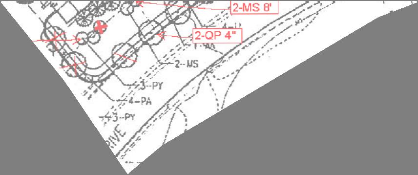

59 ATTACHMENT C


60 Key Asbuilt Latin/Common Name qty Size Shade Trees AR AR AR AR BN BN BN FG LT PA PA PA PA QA QI QP QP QP QP QP QP Acer rubrum/red Maple Acer rubrum/red Maple Acer rubrum/red Maple Acer rubrum/red Maple Betula nigra/riverbirch Betula nigra/riverbirch Betula nigra/riverbirch Fagus sylvatica/copper Beach Liriodendron tulipifera/tulip Poplar Plantanus acerfolia 'Bloodgood'/Bloodgood London Plane Plantanus acerfolia 'Bloodgood'/Bloodgood London Plane Plantanus acerfolia 'Bloodgood'/Bloodgood London Plane Plantanus acerfolia 'Bloodgood'/Bloodgood London Plane Quercus coccinea/scarlet Oak Quercus inbricaria/laurel Oak Quercus phellos/willow Oak Quercus phellos/willow Oak Quercus phellos/willow Oak Quercus phellos/willow Oak Quercus phellos/willow Oak Quercus phellos/willow Oak 3 1/2" cal. Current 20 Yr. Canopy Size Canopy Area Dia. Ft 2" cal. 3" cal. 4" cal. 25" cal. 11" 9" 12" " 4" cal. 5 6" cal. 12" cal " cal. 3.5" cal. 4" cal. 26" cal. 30" cal ' 3" cal. 8" 7' /2 3" cal. 9" cal. 10" cal. 2" cal. 1" cal. 2" cal ' 6 8' 8' ' 8' Sq. Ft. Acres 163, /2" cal. 3 1/2" cal. 3 1/2" cal. 3 1/2" cal. 3 1/2" cal. 234 Flowering Trees AC CC CF LI MS MS MS MS PSP PY PY PY Amelanchier canadensis/shadblow Serviceberry Cercis canadensis/eastern Redbud Cornus florida/flowering Dogwood Lagerstroemia indica/crape Myrtle Magnolis x soulagiana/saucer Magnolia Magnolia x soulagiana/saucer Magnolia Magnolia x soulagiana/saucer Magnolia Magnolia x soulagiana/saucer Magnolia Prunus subhirtella pendula/weeping Higan Cherry Prunus yedoensis/yoshino Cherry Prunus yedoensis/yoshino Cherry Prunus yedoensis/yoshino Cherry 6 8' 6 8' 6 8' 6 8' 34 Evergreen Trees CL IN IO TO Cupressocyparis x leylandii/leyland Cypress Ilex 'Nellie Stevens'/Nellie Stevens Holly Ilex opaca/american Holly Pseudotsuga/Douglas Fir Juniperus virginiana/eastern Red Cedar Thuja occidentalis/american Arborvitae 6 8' 6 8' 6 8' 6 8' 6 8'
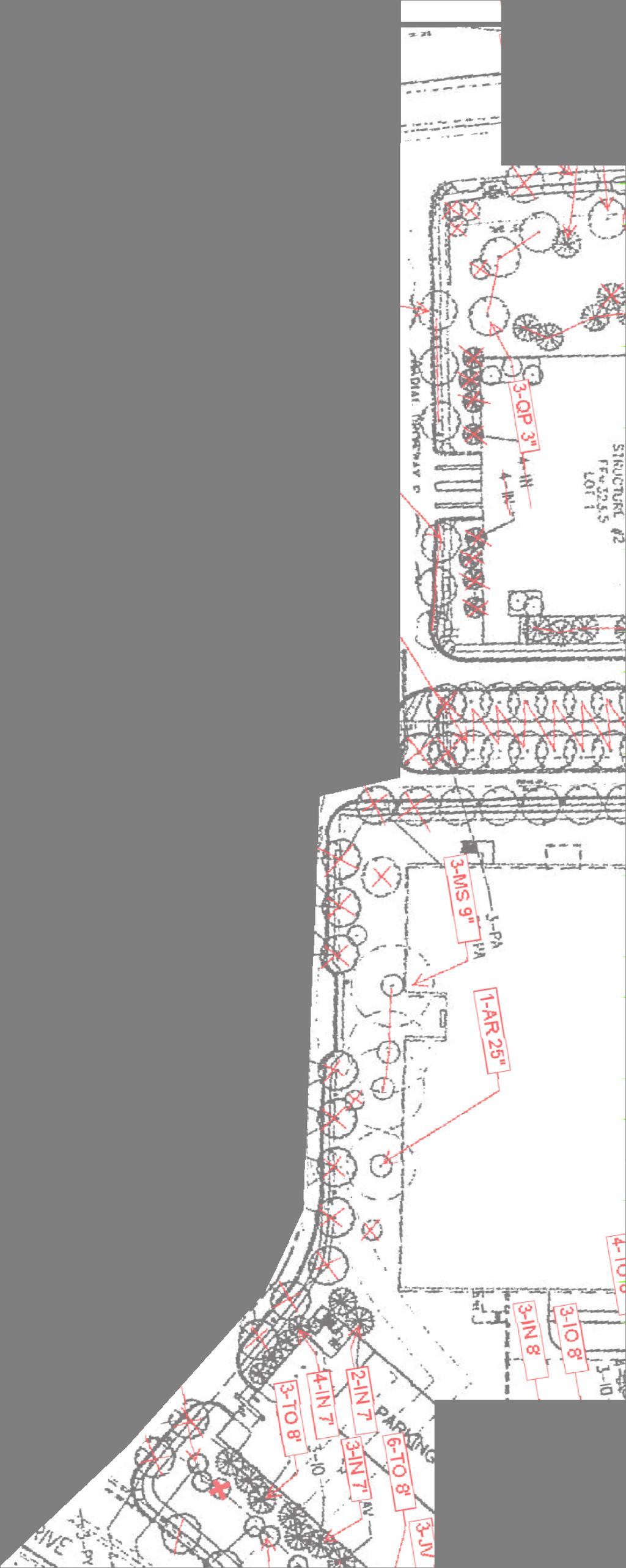

61
MONTGOMERY COUNTY PLANNING DEPARTMENT THE MARYLAND-NATIONAL CAPITAL PARK AND PLANNING COMMISSION
 MONTGOMERY COUNTY PLANNING DEPARTMENT THE MARYLAND-NATIONAL CAPITAL PARK AND PLANNING COMMISSION MCPB Item No. Date: 12-10-15 Leisure World Clubhouse II Addition Fitness Center, Limited Site Plan Amendment
MONTGOMERY COUNTY PLANNING DEPARTMENT THE MARYLAND-NATIONAL CAPITAL PARK AND PLANNING COMMISSION
 MONTGOMERY COUNTY PLANNING DEPARTMENT THE MARYLAND-NATIONAL CAPITAL PARK AND PLANNING COMMISSION The Goddard School in North Bethesda Preliminary Plan Amendment 11996015B and Site Plan Amendment 82006005A
MONTGOMERY COUNTY PLANNING DEPARTMENT THE MARYLAND-NATIONAL CAPITAL PARK AND PLANNING COMMISSION
 MONTGOMERY COUNTY PLANNING DEPARTMENT THE MARYLAND-NATIONAL CAPITAL PARK AND PLANNING COMMISSION MCPB Item No. Date: 3.10.2016 Site Plan 820160040 Nora School Parker Smith, Planning Technician, Area 1,
MONTGOMERY COUNTY PLANNING DEPARTMENT
 MONTGOMERY COUNTY PLANNING DEPARTMENT THE MARYLAND-NATIONAL CAPITAL PARK AND PLANNING COMMISSION MCPB Item No.: Date: 5-03-18 Pike and Rose, Phase I: Site Plan Amendment No. 82012002D Rhoda Hersson-Ringskog,
MONTGOMERY COUNTY PLANNING DEPARTMENT THE MARYLAND-NATIONAL CAPITAL PARK AND PLANNING COMMISSION
 MONTGOMERY COUNTY PLANNING DEPARTMENT THE MARYLAND-NATIONAL CAPITAL PARK AND PLANNING COMMISSION MCPB Item No. Date: 06-12-14 King of the Nations Christian Fellowship Church: Limited Site Plan Amendment
The subject site plan amendment proposes the following revisions to the approved site plan:
 PROPOSED AMENDMENT The subject site plan amendment proposes the following revisions to the approved site plan: 1. The building footprint was modified to accommodate the revised architectural design. 2.
MONTGOMERY COUNTY PLANNING DEPARTMENT THE MARYLAND-NATIONAL CAPITAL PARK AND PLANNING COMMISSION
 MONTGOMERY COUNTY PLANNING DEPARTMENT THE MARYLAND-NATIONAL CAPITAL PARK AND PLANNING COMMISSION MCPB Item No. Date: 1/15/2015 Bethesda North Marriott Hotel and Conference Center: Limited Site Plan Amendment
MONTGOMERY COUNTY PLANNING DEPARTMENT THE MARYLAND-NATIONAL CAPITAL PARK AND PLANNING COMMISSION
 MONTGOMERY COUNTY PLANNING DEPARTMENT THE MARYLAND-NATIONAL CAPITAL PARK AND PLANNING COMMISSION MCPB Item No. Date: 05/12/2016 North Bethesda Conference Center Parking Structure, Mandatory Referral No.
MONTGOMERY COUNTY PLANNING DEPARTMENT THE MARYLAND-NATIONAL CAPITAL PARK AND PLANNING COMMISSION
 MONTGOMERY COUNTY PLANNING DEPARTMENT THE MARYLAND-NATIONAL CAPITAL PARK AND PLANNING COMMISSION Gables White Flint, Preliminary Plan No. 120150010 and Site Plan No. 820150010 MCPB Item No. Date: 4/30/2015
MONTGOMERY COUNTY PLANNING DEPARTMENT Newell Street. Site Plan Item #2. Maryland-National Capital Park and Planning Commission
 8001 Newell Street Site Plan 820140020 Item #2 December 19, 2013 Redlined Conditions 1. The Applicant must comply with the conditions of approval for Project Plan 920130020 in MCPB Resolution No. 13-74.
MONTGOMERY COUNTY PLANNING DEPARTMENT THE MARYLAND-NATIONAL CAPITAL PARK AND PLANNING COMMISSION
 MONTGOMERY COUNTY PLANNING DEPARTMENT THE MARYLAND-NATIONAL CAPITAL PARK AND PLANNING COMMISSION MCPB Item No. Date: 1/26/12 Hanover Shady Grove, Sketch Plan 320120020 Joshua Sloan, Coordinator, Joshua.Sloan@MontgomeryPlanning.org,
MONTGOMERY COUNTY PLANNING DEPARTMENT
 MONTGOMERY COUNTY PLANNING DEPARTMENT THE MARYLAND-NATIONAL CAPITAL PARK AND PLANNING COMMISSION MCPB Item No. Date: 12/20/2018 Nucci Subdivision, Preliminary Plan No. 120160170 MF Marco Fuster, Planner
MONTGOMERY COUNTY PLANNING DEPARTMENT THE MARYLAND-NATIONAL CAPITAL PARK AND PLANNING COMMISSION
 MONTGOMERY COUNTY PLANNING DEPARTMENT THE MARYLAND-NATIONAL CAPITAL PARK AND PLANNING COMMISSION MCPB Item No.: 2 Date: 12-19-13 Site Plan 820140020, 8001 Newell Street Neil Braunstein, AICP, Area 1, neil.braunstein@montgomeryplanning.org,
MONTGOMERY COUNTY PLANNING DEPARTMENT THE MARYLAND-NATIONAL CAPITAL PARK AND PLANNING COMMISSION
 MONTGOMERY COUNTY PLANNING DEPARTMENT THE MARYLAND-NATIONAL CAPITAL PARK AND PLANNING COMMISSION MCPB Item No. Date: 9-4-13 Limited Site Plan Amendment No. 81994026B, Darcars at Montgomery Industrial Park,
MONTGOMERY COUNTY PLANNING DEPARTMENT THE MARYLAND-NATIONAL CAPITAL PARK AND PLANNING COMMISSION
 MONTGOMERY COUNTY PLANNING DEPARTMENT THE MARYLAND-NATIONAL CAPITAL PARK AND PLANNING COMMISSION MCPB Item No. 8 Date: 12-15-16 Montgomery Village Center Sketch Plan No. 320170020 TL Troy Leftwich, Senior
MONTGOMERY COUNTY PLANNING DEPARTMENT THE MARYLAND-NATIONAL CAPITAL PARK AND PLANNING COMMISSION
 MONTGOMERY COUNTY PLANNING DEPARTMENT THE MARYLAND-NATIONAL CAPITAL PARK AND PLANNING COMMISSION MCPB Item No. Date10/25/12 Sketch Plan No. 32012004, White Flint Mall Redevelopment Nkosi Yearwood, Senior
Project Name: MELWOOD HOTEL. Date Accepted: 1/12/04. Waived. Planning Board Action Limit: Plan Acreage: 1.7 Zone: Dwelling Units:
 The Maryland-National Capital Park and Planning Commission Prince George's County Planning Department Development Review Division 301-952-3530 Note: Staff reports can be accessed at www.mncppc.org/pgco/planning/plan.htm.
MONTGOMERY COUNTY PLANNING DEPARTMENT THE MARYLAND-NATIONAL CAPITAL PARK AND PLANNING COMMISSION
 MONTGOMERY COUNTY PLANNING DEPARTMENT THE MARYLAND-NATIONAL CAPITAL PARK AND PLANNING COMMISSION MCPB Item No. Date: 05-22-14 Consent Item - Park Potomac: Site Plan Amendment No. 82004015K MCS. Molline
I. Introduction. Prior Approvals
 Statement of Justification First National Bank 19790 Crystal Rock Drive, Germantown, Maryland Application for Site Plan and Limited Preliminary Plan Amendment I. Introduction DPH Architecture, for First
MONTGOMERY COUNTY PLANNING DEPARTMENT THE MARYLAND-NATIONAL CAPITAL PARK AND PLANNING COMMISSION MCPB Item No.: 13 Date: 07/19/18
 MONTGOMERY COUNTY PLANNING DEPARTMENT THE MARYLAND-NATIONAL CAPITAL PARK AND PLANNING COMMISSION MCPB Item No.: 13 Date: 07/19/18 Black Hill / ViaSat: Project Plan No. 92012004B, Preliminary Plan No. 12012021B,
Clarksburg Square Road Extension
 Clarksburg Square Road Extension Preliminary Plan No. 120140060 Site Plan No. 820140050 Site Plan Amendment No. 82007022C (Clarksburg Town Center) Clarksburg SPA Water Quality Plan Mandatory Referral MR2015008
MONTGOMERY COUNTY PLANNING DEPARTMENT THE MARYLAND-NATIONAL CAPITAL PARK AND PLANNING COMMISSION
 MONTGOMERY COUNTY PLANNING DEPARTMENT THE MARYLAND-NATIONAL CAPITAL PARK AND PLANNING COMMISSION Preliminary Plan 120120220 & Site Plan 820120140, 7001 Arlington Road MCPB Item No. 8 Date: 11-1-12 Erin
MONTGOMERY COUNTY PLANNING DEPARTMENT THE MARYLAND-NATIONAL CAPITAL PARK AND PLANNING COMMISSION
 MONTGOMERY COUNTY PLANNING DEPARTMENT THE MARYLAND-NATIONAL CAPITAL PARK AND PLANNING COMMISSION Montgomery Auto Sales Park: Preliminary Plan No. 11985027A, Site Plan No. 820140130 and Site Plan No. 820140140
MONTGOMERY COUNTY PLANNING DEPARTMENT
 MONTGOMERY COUNTY PLANNING DEPARTMENT THE MARYLAND-NATIONAL CAPITAL PARK AND PLANNING COMMISSION Ashburton Elementary School Addition, Mandatory Referral, MR2018009 MCPB Item No. Date: 02-15-18 Troy Leftwich,
MONTGOMERY COUNTY PLANNING DEPARTMENT
 MONTGOMERY COUNTY PLANNING DEPARTMENT THE MARYLAND-NATIONAL CAPITAL PARK AND PLANNING COMMISSION MCPB Item # Date: 9-6-18 Ourisman Ford at Montgomery Mall, Site Plan No. 82009014B Emily Tettelbaum, Planner
MONTGOMERY COUNTY PLANNING DEPARTMENT THE MARYLAND-NATIONAL CAPITAL PARK AND PLANNING COMMISSION
 MONTGOMERY COUNTY PLANNING DEPARTMENT THE MARYLAND-NATIONAL CAPITAL PARK AND PLANNING COMMISSION Ashton Market: Preliminary Plan No. 120180180 and Site Plan No. 820180160 Jonathan Casey, Senior Planner,
MONTGOMERY COUNTY PLANNING DEPARTMENT THE MARYLAND-NATIONAL CAPITAL PARK AND PLANNING COMMISSION
 MONTGOMERY COUNTY PLANNING DEPARTMENT THE MARYLAND-NATIONAL CAPITAL PARK AND PLANNING COMMISSION 8015 Old Georgetown Road, Preliminary Plan 120160220, Site Plan 820160090 MCPB Item No.: 8 Date: 11-03-16
MONTGOMERY COUNTY PLANNING DEPARTMENT THE MARYLAND-NATIONAL CAPITAL PARK AND PLANNING COMMISSION
 MONTGOMERY COUNTY PLANNING DEPARTMENT THE MARYLAND-NATIONAL CAPITAL PARK AND PLANNING COMMISSION MCPB Item No. 4 7/18/13 4990 Fairmont Avenue, Project Plan 920130070 & Preliminary Plan 120130230 Erin Grayson,
MONTGOMERY COUNTY PLANNING DEPARTMENT
 MONTGOMERY COUNTY PLANNING DEPARTMENT THE MARYLAND-NATIONAL CAPITAL PARK AND PLANNING COMMISSION Ourisman Ford at Montgomery Mall, Sketch Plan No. 320170100 MCPB Item No. Date: 11-30-17 LS Lori Shirley,
MONTGOMERY COUNTY PLANNING DEPARTMENT THE MARYLAND-NATIONAL CAPITAL PARK AND PLANNING COMMISSION
 MONTGOMERY COUNTY PLANNING DEPARTMENT THE MARYLAND-NATIONAL CAPITAL PARK AND PLANNING COMMISSION MCPB Item No. 3 4/3/14 4990 Fairmont Avenue, Site Plan 820140060 Erin Banks, AICP, Senior Planner, Area
MONTGOMERY COUNTY PLANNING DEPARTMENT
 MONTGOMERY COUNTY PLANNING DEPARTMENT THE MARYLAND-NATIONAL CAPITAL PARK AND PLANNING COMMISSION MCPB Item No.: 11 Date: 7-20-17 Burtonsville McDonalds: Site Plan No. 820150020 Jonathan Casey, Senior Planner,
Asbury Chapel Subdivision Sketch Plan
 Asbury Chapel Subdivision Sketch Plan PART 1: PROJECT SUMMARY Applicant: NVR Inc. Project Size: +/- 76.13 acres Parcel Numbers: 02101112,02116101,02116112, 02116113 Current Zoning: Transitional Residential
MONTGOMERY COUNTY PLANNING DEPARTMENT
 MONTGOMERY COUNTY PLANNING DEPARTMENT THE MARYLAND-NATIONAL CAPITAL PARK AND PLANNING COMMISSION MCPB Item No. 4 Date: 12-15-16 CVS Derwood: Site Plan No. 820160150 Calvin Nelson, Jr., Planner Coordinator,
MONTGOMERY COUNTY PLANNING DEPARTMENT THE MARYLAND NATIONAL CAPITAL PARK AND PLANNING COMMISSION
 MONTGOMERY COUNTY PLANNING DEPARTMENT THE MARYLAND NATIONAL CAPITAL PARK AND PLANNING COMMISSION MCPB Item No. 3 Date: 1.5.17 7272 Wisconsin Avenue: Sketch Plan Amendment No. 32016004A, Preliminary Plan
MONTGOMERY COUNTY PLANNING DEPARTMENT
 MONTGOMERY COUNTY PLANNING DEPARTMENT THE MARYLAND-NATIONAL CAPITAL PARK AND PLANNING COMMISSION North Bethesda Town Center Parcel G Site Plan No. 820180010 MCPB Item No.: Date: 01-25-18 Atul Sharma, Planner
12 January 12, 2011 Public Hearing APPLICANT: TAILWIND DEVELOPMENT GROUP,LLC PROPERTY OWNER: CITY OF VIRGINIA BEACH
 12 January 12, 2011 Public Hearing APPLICANT: TAILWIND DEVELOPMENT GROUP,LLC PROPERTY OWNER: CITY OF VIRGINIA BEACH STAFF PLANNER: Faith Christie REQUEST: Conditional Change of Zoning (from PD-H1 Planned
COUNTY COUNCIL OF PRINCE GEORGE'S COUNTY, MARYLAND SITTING AS THE DISTRICT COUNCIL 2010 Legislative Session. Council Members Dernoga and Olson
 DR- COUNTY COUNCIL OF PRINCE GEORGE'S COUNTY, MARYLAND SITTING AS THE DISTRICT COUNCIL 00 Legislative Session Bill No. CB--00 Chapter No. Proposed and Presented by Introduced by Co-Sponsors The Chairman
PLANNED UNIT DEVELOPMENT & SUBDIVISION STAFF REPORT Date: May 18, 2017
 & PUD-0000102-2017 PLANNED UNIT DEVELOPMENT & SUBDIVISION STAFF REPORT Date: May 18, 2017 NAME SUBDIVISION NAME Dauphin Creek Estates Subdivision Dauphin Creek Estates Subdivision LOCATION CITY COUNCIL
MONTGOMERY COUNTY PLANNING DEPARTMENT THE MARYLAND-NATIONAL CAPITAL PARK AND PLANNING COMMISSION
 MONTGOMERY COUNTY PLANNING DEPARTMENT THE MARYLAND-NATIONAL CAPITAL PARK AND PLANNING COMMISSION MCPB Item No. 6 Date: 5-9-13 Site Plan No. 820130090, West Chevy Chase Heights Erin Grayson, Senior Planner,
MONTGOMERY COUNTY PLANNING DEPARTMENT THE MARYLAND NATIONAL CAPITAL PARK AND PLANNING COMMISSION
 MONTGOMERY COUNTY PLANNING DEPARTMENT THE MARYLAND NATIONAL CAPITAL PARK AND PLANNING COMMISSION MCPB Item No. 7 Date: 7.19.18 ZOM Bethesda, Preliminary Plan No. 120180140 and Site Plan No. 820180120 Matthew
MONTGOMERY COUNTY PLANNING DEPARTMENT THE MARYLAND-NATIONAL CAPITAL PARK AND PLANNING COMMISSION
 MONTGOMERY COUNTY PLANNING DEPARTMENT THE MARYLAND-NATIONAL CAPITAL PARK AND PLANNING COMMISSION MCPB Item No. Date: 10.25.18 Artery Plaza: Site Plan Amendment 81984002E SD Stephanie Dickel, Planner Coordinator,
CHESAPEAKE LANDSCAPE ORDINANCE
 CHESAPEAKE LANDSCAPE ORDINANCE CONSERVATION PRESERVATION CZO 19-600 Effective October 16, 2008 BUFFER YARD C PARKING LOT REFORESTATION YEAR 1 REFORESTATION YEAR 4 BUFFER YARD F CBPA REFORESTATION Page
MONTGOMERY COUNTY PLANNING DEPARTMENT
 MONTGOMERY COUNTY PLANNING DEPARTMENT THE MARYLAND-NATIONAL CAPITAL PARK AND PLANNING COMMISSION MCPB Consent Date: 4-26-18 Cabin John Auto Park (N. Bethesda Home Depot), Site Plan Amendment No. 81980017A
MONTGOMERY COUNTY PLANNING DEPARTMENT
 MONTGOMERY COUNTY PLANNING DEPARTMENT THE MARYLAND-NATIONAL CAPITAL PARK AND PLANNING COMMISSION MCPB Item No. Date: 04/05/2018 850 Sligo Avenue Sketch Plan No. 320180090 Neil Sullivan, Planner Coordinator,
MONTGOMERY COUNTY PLANNING DEPARTMENT THE MARYLAND-NATIONAL CAPITAL PARK AND PLANNING COMMISSION
 MONTGOMERY COUNTY PLANNING DEPARTMENT THE MARYLAND-NATIONAL CAPITAL PARK AND PLANNING COMMISSION MCPB Item No. Date: 9/22/16 Ripley II: Sketch Plan Amendment No. 32015003A, Preliminary Plan No. 120160190,
MONTGOMERY COUNTY PLANNING DEPARTMENT THE MARYLAND-NATIONAL CAPITAL PARK AND PLANNING COMMISSION
 MONTGOMERY COUNTY PLANNING DEPARTMENT THE MARYLAND-NATIONAL CAPITAL PARK AND PLANNING COMMISSION MCPB Item No.: Date: 1-9-14 Grosvenor/Wild Acres Preliminary Plan No. 120130110, Site Plan No. 820130130
AWH REPORT OF THE PLANNING AND DEVELOPMENT DEPARTMENT FOR APPLICATION FOR REZONING ORDINANCE TO PLANNED UNIT DEVELOPMENT
 AWH REPORT OF THE PLANNING AND DEVELOPMENT DEPARTMENT FOR APPLICATION FOR REZONING ORDINANCE TO PLANNED UNIT DEVELOPMENT MAY 8, 2014 The Planning and Development Department hereby forwards to the Planning
MONTGOMERY COUNTY PLANNING DEPARTMENT THE MARYLAND NATIONAL CAPITAL PARK AND PLANNING COMMISSION
 MONTGOMERY COUNTY PLANNING DEPARTMENT THE MARYLAND NATIONAL CAPITAL PARK AND PLANNING COMMISSION MCPB Item No. Date: 5.3.18 8000 Wisconsin Avenue Sketch Plan No. 320180120 Matthew Folden, Planner Coordinator,
EXHIBIT B PROJECT NARRATIVE POULSBO MEADOWS
 EXHIBIT B PROJECT NARRATIVE POULSBO MEADOWS Name of Project: Poulsbo Meadows; A Planned Residential Development (PRD)/Plat Applicants Name: PBH Group LLC/Byron Harris PO Box 1010 Silverdale, WA 98038 Description
Note: Staff reports can be accessed at Zone: I-3. Tier:
 The Maryland-National Capital Park and Planning Commission Prince George s County Planning Department Development Review Division 301-952-3530 Note: Staff reports can be accessed at www.mncppc.org/pgco/planning/plan.htm.
Request Alternative Compliance to the prescribed criteria of the Oceanfront Resort District Form-Based Code. Staff Planner Kristine Gay
 Applicant/Owner Ocean Rental Properties, LLC Public Hearing April 13, 2016 City Council Election District Beach Agenda Item 1 Request Alternative Compliance to the prescribed criteria of the Oceanfront
MONTGOMERY COUNTY PLANNING DEPARTMENT
 MONTGOMERY COUNTY PLANNING DEPARTMENT THE MARYLAND-NATIONAL CAPITAL PARK AND PLANNING COMMISSION MCPB Item No. 5 Date: 11.29.2018 The Crescent at Chevy Chase, Preliminary Plan No. 120180150 and Site Plan
Chapter PEDESTRIAN COMMERCIAL (PC) ZONING DISTRICT
 ZONING DISTRICT") Chapter 11-17 PEDESTRIAN COMMERCIAL (PC) ZONING DISTRICT Sections: 11-17-01 GENERAL PURPOSE 11-17-02 PERMITTED BUILDING TYPES 11-17-03 USES PERMITTED WITH DESIGN REVIEW 11-17-04 USES PERMITTED BY CONDITIONAL
Chapter 11-17 PEDESTRIAN COMMERCIAL (PC) ZONING DISTRICT Sections: 11-17-01 GENERAL PURPOSE 11-17-02 PERMITTED BUILDING TYPES 11-17-03 USES PERMITTED WITH DESIGN REVIEW 11-17-04 USES PERMITTED BY CONDITIONAL
MONTGOMERY COUNTY PLANNING DEPARTMENT THE MARYLAND-NATIONAL CAPITAL PARK AND PLANNING COMMISSION
 MONTGOMERY COUNTY PLANNING DEPARTMENT THE MARYLAND-NATIONAL CAPITAL PARK AND PLANNING COMMISSION MCPB Item No. Date: 6/30/2016 Washington Adventist Hospital, Site Plan Amendment No. 82008021E Michael Brown,
Request Change in Nonconformity. Staff Recommendation Approval. Staff Planner Jonathan Sanders
 Applicant & Owner Public Hearing April 11, 2018 City Council Election District Beach Agenda Item 5 Request Change in Nonconformity Staff Recommendation Approval Staff Planner Jonathan Sanders Location
MONTGOMERY COUNTY PLANNING DEPARTMENT THE MARYLAND-NATIONAL CAPITAL PARK AND PLANNING COMMISSION
 MONTGOMERY COUNTY PLANNING DEPARTMENT THE MARYLAND-NATIONAL CAPITAL PARK AND PLANNING COMMISSION MCPB Item No. 3 Date: 02-28-13 8415 Fenton Street, Preliminary Plan 120120130, Site Plan 820130050 John
MONTGOMERY COUNTY PLANNING DEPARTMENT THE MARYLAND-NATIONAL CAPITAL PARK AND PLANNING COMMISSION
 MONTGOMERY COUNTY PLANNING DEPARTMENT THE MARYLAND-NATIONAL CAPITAL PARK AND PLANNING COMMISSION MCPB Item Date: 09/08/16 The Collection (Formerly Chevy Chase Center): Site Plan Amendment No. 82001013C,
COUNTY COUNCIL OF PRINCE GEORGE'S COUNTY, MARYLAND, SITTING AS THE DISTRICT COUNCIL ORDER AFFIRMING PLANNING BOARD DECISION (CORRECTED)
") Case No. Applicant: Lanham LLLP COUNTY COUNCIL OF PRINCE GEORGE'S COUNTY, MARYLAND, SITTING AS THE DISTRICT COUNCIL ORDER AFFIRMING PLANNING BOARD DECISION (CORRECTED) IT IS HEREBY ORDERED, after review
Case No. Applicant: Lanham LLLP COUNTY COUNCIL OF PRINCE GEORGE'S COUNTY, MARYLAND, SITTING AS THE DISTRICT COUNCIL ORDER AFFIRMING PLANNING BOARD DECISION (CORRECTED) IT IS HEREBY ORDERED, after review
MONTGOMERY COUNTY PLANNING DEPARTMENT THE MARYLAND-NATIONAL CAPITAL PARK AND PLANNING COMMISSION
 MONTGOMERY COUNTY PLANNING DEPARTMENT THE MARYLAND-NATIONAL CAPITAL PARK AND PLANNING COMMISSION MCPB Item No.: 9 Date: 07-20-17 Topgolf - Germantown: Preliminary Plan Amendment No. 12007065B and Site
TABLE OF CONTENTS SITE DESCRIPTION 3 Vicinity 3 Site Analysis 4. PROJECT DESCRIPTION 5 Proposal 5
 TABLE OF CONTENTS SITE DESCRIPTION 3 Vicinity 3 Site Analysis 4 PROJECT DESCRIPTION 5 Proposal 5 PROJECT ANALYSIS 6 Master Plan 6 Transportation & Circulation 6 Environment 7 Development Standards 8 Community
MONTGOMERY COUNTY PLANNING DEPARTMENT THE MARYLAND-NATIONAL CAPITAL PARK AND PLANNING COMMISSION
 MONTGOMERY COUNTY PLANNING DEPARTMENT THE MARYLAND-NATIONAL CAPITAL PARK AND PLANNING COMMISSION Staff Report: Sketch Plan #320110010, Mid-Pike Plaza ITEM #: MCPB HEARING DATE: January 20, 2011 REPORT
MONTGOMERY COUNTY PLANNING DEPARTMENT THE MARYLAND-NATIONAL CAPITAL PARK AND PLANNING COMMISSION
 MONTGOMERY COUNTY PLANNING DEPARTMENT THE MARYLAND-NATIONAL CAPITAL PARK AND PLANNING COMMISSION MCPB Item No. Date: 04/24/2014 Sketch Plan No. 320140020, AVA Wheaton Michael Brown, Planner Coordinator,
MONTGOMERY COUNTY PLANNING DEPARTMENT THE MARYLAND NATIONAL CAPITAL PARK AND PLANNING COMMISSION
 MONTGOMERY COUNTY PLANNING DEPARTMENT THE MARYLAND NATIONAL CAPITAL PARK AND PLANNING COMMISSION MCPB Item No. 8 Date: 3.30.2017 Project Name: Lot 31/31A Bethesda, Site Plan Amendment, No. 82007018C Elza
COMMUNITY DESIGN. GOAL: Create livable and attractive communities. Intent
 COMMUNITY DESIGN Intent An attractive, well-designed County will attract quality development, instill civic pride, improve the visual character of the community, and create a strong, positive image for
SMALL LOT DESIGN STANDARDS. An Illustrated Working Draft for Test Implementation
 SMALL LOT DESIGN STANDARDS An Illustrated Working Draft for Test Implementation SMALL LOT DESIGN STANDARDS ILLUSTRATED WORKING FOR TEST IMPLEMENTATION OVERVIEW SMALL LOT CODE AMENDMENT & POLICY UPDATE
Gold Line Bus Rapid Transit Transit Oriented Development (BRTOD) Helmo Station Area Plan
 Helmo Station Area Plan") Appendix F Gold Line Bus Rapid Transit Transit Oriented Development (BRTOD) Helmo Station Area Plan Introduction and Purpose of the Plan The Gold Line Bus Rapid Transit facility is an eleven-mile dedicated
Appendix F Gold Line Bus Rapid Transit Transit Oriented Development (BRTOD) Helmo Station Area Plan Introduction and Purpose of the Plan The Gold Line Bus Rapid Transit facility is an eleven-mile dedicated
MONTGOMERY COUNTY PLANNING DEPARTMENT THE MARYLAND-NATIONAL CAPITAL PARK AND PLANNING COMMISSION
 MONTGOMERY COUNTY PLANNING DEPARTMENT THE MARYLAND-NATIONAL CAPITAL PARK AND PLANNING COMMISSION Staff Report: Preliminary Plan No. 11998092B: Rock Spring Centre Site Plan No. 820090030: Rock Spring Centre
ARTICLE 17 SITE PLAN REVIEW
 ARTICLE 17 SITE PLAN REVIEW 17.01 INTENT AND PURPOSE The intent of this section is to provide for consultation and cooperation between the applicant and the township planning commission so that the applicant
MONTGOMERY COUNTY PLANNING DEPARTMENT THE MARYLAND-NATIONAL CAPITAL PARK AND PLANNING COMMISSION
 MONTGOMERY COUNTY PLANNING DEPARTMENT THE MARYLAND-NATIONAL CAPITAL PARK AND PLANNING COMMISSION MCPB Item No.: Date: 9-24-15 Plaza Del Mercado Limited Site Plan Amendment 82006004A Crystal Myers, Senior
PART 1: PROJECT SUMMARY. Proposed Land Use: 120 single-family lots. The application is Attachment A. The site plan is Attachment B.
 PART 1: PROJECT SUMMARY Applicant: JBH Development, LLC and Hopper Communities, INC Project Size: +/- 80.48 acres Parcel Number: 01513107, 01513108, 01513109, 01513113, 01513120, 01513121, 01513122, 01513124,
Westwood Shopping Center Sketch Plan, Plan # February 23, 2017 Item # 9
 Westwood Shopping Center Sketch Plan, Plan # 320170010 February 23, 2017 Item # 9 Westwood II Site 64,111 s.f. Manor Care site: vacant two story building HOC-Westwood Towers, 15 story tower To be considered
North Oakville East Parks Facilities Distribution Plan. November, 2009
 North Oakville East November, 2009 POLICY CONTEXT 1) Purpose a) The purpose of this document is to be a guide for the location, configuration, design and development of the parks system for the North Oakville
City of Yelm. Tahoma Terra Final Master Plan Development Guidelines. Table of Contents
 City of Yelm Tahoma Terra Final Master Plan Development Guidelines Table of Contents Table of Contents... 1 Purpose... 2 Low Density Residential (R4-6)... 3 Moderate Density Residential (R6-10)... 5 Neighborhood
MONTGOMERY COUNTY PLANNING DEPARTMENT
 MONTGOMERY COUNTY PLANNING DEPARTMENT THE MARYLAND-NATIONAL CAPITAL PARK AND PLANNING COMMISSION 6000 Executive Boulevard, Sketch Plan No. 320180140 MCPB Item No. Date: 06/21/2018 Emily Tettelbaum, Senior
S C O P E O F W O R K A P R I L
 white flint 2 sector plan S C O P E O F W O R K A P R I L 2 0 1 2 MONTGOMERY COUNTY PLANNING DEPARTMENT M-NCPPC MontgomeryPlanning.org 1 white flint 2 sector plan Scope of Work abstract This scope of work
KASPER. City of Georgetown, Texas PUD Planned Unit Development. December 30, 2015 Revised January 27, 2016
 KASPER City of Georgetown, Texas PUD Planned Unit Development December 30, 2015 Revised January 27, 2016 Applicant: Sentinel Land Company, LLC 4910 Campus Drive Newport Beach, CA Prepared by: SEC Planning
COUNTY COUNCIL OF PRINCE GEORGE'S COUNTY, MARYLAND, SITTING AS THE DISTRICT COUNCIL ORDER AFFIRMING PLANNING BOARD DECISION, WITH AMENDED CONDITIONS
 Case No. Applicant: Dawn Limited Partnership COUNTY COUNCIL OF PRINCE GEORGE'S COUNTY, MARYLAND, SITTING AS THE DISTRICT COUNCIL ORDER AFFIRMING PLANNING BOARD DECISION, WITH AMENDED CONDITIONS IT IS HEREBY
Request Alternative Compliance to the prescribed criteria of the Oceanfront Resort District Form- Based Code. Staff Recommendation Approval
 Applicant Property Owner Steven H. Murden Public Hearing June 14, 2017 City Council Election District Beach Agenda Item 8 Request Alternative Compliance to the prescribed criteria of the Oceanfront Resort
CITY PLANNING COMMISSION AGENDA. ITEM NO(s): C.1 C.3 STAFF: STEVE TUCK
: C.1 C.3 STAFF: STEVE TUCK") Page 34 CITY PLANNING COMMISSION AGENDA ITEM NO(s): C.1 C.3 STAFF: STEVE TUCK FILE NOS: CPC ZC 12-00035 QUASI-JUDICIAL CPC NV 12-00036 QUASI-JUDICIAL AR DP 12-00039 QUASI-JUDICIAL PROJECT: APPLICANT: OWNER:
Page 34 CITY PLANNING COMMISSION AGENDA ITEM NO(s): C.1 C.3 STAFF: STEVE TUCK FILE NOS: CPC ZC 12-00035 QUASI-JUDICIAL CPC NV 12-00036 QUASI-JUDICIAL AR DP 12-00039 QUASI-JUDICIAL PROJECT: APPLICANT: OWNER:
14 October 10, 2012 Public Hearing APPLICANT: MPB, INC
 14 October 10, 2012 Public Hearing APPLICANT: MPB, INC PROPERTY OWNER: MUNDEN & ASSOCIATES, LP STAFF PLANNER: Karen Prochilo REQUEST: Conditional Change of Zoning (AG-1 & AG-2 to Conditional O-2) ADDRESS
MONTGOMERY COUNTY PLANNING DEPARTMENT THE MARYLAND-NATIONAL CAPITAL PARK AND PLANNING COMMISSION
 MONTGOMERY COUNTY PLANNING DEPARTMENT THE MARYLAND-NATIONAL CAPITAL PARK AND PLANNING COMMISSION MCPB Item No.: 11 Date: 06-28-18 Black Hill Infrastructure Site Plan Amendment No. 82013025C Benjamin Berbert,
PART 1: PROJECT SUMMARY. The application is Attachment A. The site plan is Attachment B.
 Belleterre Subdivision Sketch Plan Town Board 8.7.17 Belleterre Subdivision Sketch Plan PART 1: PROJECT SUMMARY Applicant: Bowman Development Project Size: +/- 20.85 acres Parcel Number: 01115104 and 01115121
The Development Review Process. Presentation to the GSSC IAC
 The Development Review Process Presentation to the GSSC IAC July 19, 2011 Regulatory Processes in the Planning Department Natural Resource Inventory/Forest Stand Delineation Zoning (Development Plan) Special
Planned Development Review Revisions (Project No. PLNPCM )
") Planned Development Review Revisions (Project No. PLNPCM2014-00139) Standard residential development Planned Development Example: Smaller lot sizes than what is allowed to create open space amenity. What
Planned Development Review Revisions (Project No. PLNPCM2014-00139) Standard residential development Planned Development Example: Smaller lot sizes than what is allowed to create open space amenity. What
1. Request: The subject application requests the construction of a single-family home in the R-R Zone.
 R E S O L U T I O N WHEREAS, the Prince George's County Planning Board is charged with the approval of Detailed Site Plans pursuant to Part 3, Division 9 of the Zoning Ordinance of the Prince George's
Planning Commission Staff Report June 5, 2008
 Owner/Applicant Taylor Village Sacramento Investments Partners, LP c/o Kim Whitney 1792 Tribute Road #270 Sacramento, CA 95815 Staff Recommendation Planning Commission Staff Report Project: File: Request:
MONTGOMERY COUNTY PLANNING DEPARTMENT THE MARYLAND-NATIONAL CAPITAL PARK AND PLANNING COMMISSION
 MONTGOMERY COUNTY PLANNING DEPARTMENT THE MARYLAND-NATIONAL CAPITAL PARK AND PLANNING COMMISSION Clarksburg Square Road Extension: Preliminary Plan No. 120140060, Preliminary/Final Water Quality Plan,
PLANNED UNIT DEVELOPMENT STAFF REPORT Date: June 2, 2016
 # 9 ZON2016-01032 PLANNED UNIT DEVELOPMENT STAFF REPORT Date: June 2, 2016 DEVELOPMENT NAME JJT Properties LLC LOCATION 1147 & 1151 East I-65 Service Road South and 1180 Sledge Drive (Southeast corner
Rock Spring Master Plan Community Meeting #8: Preliminary Recommendations
 Rock Spring Master Plan Community Meeting #8: Preliminary Recommendations July 18, 2016 Ι Walter Johnson High School Andrea Gilles, andrea.gilles@montgomeryplanning.org Ι www.montgomeryplanning.org/community/rockspring/
ATTACHMENT A. SILVERDALE DESIGN STANDARDS Amendments to the Waaga Way Town Center Chapter
 ATTACHMENT A SILVERDALE DESIGN STANDARDS Amendments to the Waaga Way Town Center Chapter Chapter 10. Waaga Way Town Center 10.1 Physical Identity Elements & Opportunities The Waaga Way Town Center includes
STATEMENT OF JUSTIFICATION CLARKSBURG PREMIUM OUTLETS AT CABIN BRANCH NORTH DISTRICT, PHASE
 STATEMENT OF JUSTIFICATION CLARKSBURG PREMIUM OUTLETS AT CABIN BRANCH NORTH DISTRICT, PHASE 1 Southwest Corner of Clarksburg Road and Interstate-270 Clarksburg, Maryland Application for Site Plan #820140160
Request Conditional Rezoning (R-15 Residential to Conditional A-24 Apartment) Staff Recommendation Approval. Staff Planner Jimmy McNamara
 Staff Recommendation Approval. Staff Planner Jimmy McNamara") Applicant Franklin Johnston Group Management & Development, LLC Property Owner Virginia Wesleyan College Public Hearing July 12, 2017 City Council Election District Bayside Agenda Item 3 Request Conditional
Applicant Franklin Johnston Group Management & Development, LLC Property Owner Virginia Wesleyan College Public Hearing July 12, 2017 City Council Election District Bayside Agenda Item 3 Request Conditional
R E S O L U T I O N. Single-Family Residence/ Church. 2,488 sq. ft. 2,488 sq. ft. Area Parking Required: Church
 R E S O L U T I O N WHEREAS, the Prince George s County Planning Board is charged with the approval of Detailed Site Plans pursuant to Part 3, Division 9 of the Zoning Ordinance of the Prince George s
Michael Brown, Senior Planner, Area 2 Planning Division,
 THE MARYLAND-NATIONAL CAPITAL PARK AND PLANNING COMMISSION MCPB Item No. Date: 12-15-11 Glenmont Fire Station, Mandatory Referral, MR 2012007 Michael Brown, Senior Planner, Area 2 Planning Division, michael.brown@montgomeryplanning.org,
MONTGOMERY COUNTY PLANNING DEPARTMENT THE MARYLAND-NATIONAL CAPITAL PARK AND PLANNING COMMISSION
 MONTGOMERY COUNTY PLANNING DEPARTMENT THE MARYLAND-NATIONAL CAPITAL PARK AND PLANNING COMMISSION MCPB Item No.: 5 Date: 06-29-17 Bradford s Landing, Site Plan No. 820170060 Sandra Pereira, RLA, Acting
4 January 11, 2012 Public Hearing APPLICANT:
 . 4 January 11, 2012 Public Hearing APPLICANT: MID-ATLANTIC AUTO PROPERTY OWNER: DZR, LLC STAFF PLANNER: Leslie Bonilla REQUEST: Conditional Use Permit (truck rental, automobile service, and automotive/bulk
MONTGOMERY COUNTY PLANNING DEPARTMENT THE MARYLAND-NATIONAL CAPITAL PARK AND PLANNING COMMISSION
 MONTGOMERY COUNTY PLANNING DEPARTMENT THE MARYLAND-NATIONAL CAPITAL PARK AND PLANNING COMMISSION MCPB Item No.: 8 Date: 9-19-13 Bethesda Commerce, Limited Preliminary & Site Plan, 120130240 & 820130240
The Maryland-National Capital Park and Planning Commission Prince George s County Planning Department Development Review Division
 The Maryland-National Capital Park and Planning Commission Prince George s County Planning Department Development Review Division 301-952-3530 Note: Staff reports can be accessed at www.mncppc.org/pgco/planning/plan.htm.
COUNTY OF PRINCE WILLIAM 5 County Complex Court, Suite 120 Prince William, Virginia (703) Metro Fax: (703)
 Metro Fax: (703)") COUNTY OF PRINCE WILLIAM 5 County Complex Court, Suite 120 Prince William, Virginia 22192-5308 (703) 792-6930 Metro 631-1703 Fax: (703) 792-5285 DEPARTMENT OF DEVELOPMENT SERVICES Wade A. Hugh Director
COUNTY OF PRINCE WILLIAM 5 County Complex Court, Suite 120 Prince William, Virginia 22192-5308 (703) 792-6930 Metro 631-1703 Fax: (703) 792-5285 DEPARTMENT OF DEVELOPMENT SERVICES Wade A. Hugh Director
Project phasing plan (if applicable) 12 copies of site plan
 12 copies of site plan") SITE PLAN REVIEW PERMIT APPLICATION City of Grand Haven, 11 N. Sixth Street, Grand Haven, MI 49417 Phone: (616) 847-3490 Fax: (616) 844-2051 Website: www.grandhaven.org 1. Project Information Address/location
SITE PLAN REVIEW PERMIT APPLICATION City of Grand Haven, 11 N. Sixth Street, Grand Haven, MI 49417 Phone: (616) 847-3490 Fax: (616) 844-2051 Website: www.grandhaven.org 1. Project Information Address/location