URBAN DESIGN PEER REVIEW
|
|
|
- Stephen Golden
- 5 years ago
- Views:
Transcription

1 URBAN DESIGN PEER REVIEW Amendment C193 to the Greater Shepparton Planning Scheme Report prepared for the City of Greater Shepparton 01 June 2017 planisphere
2 Planisphere This publication is copyright. No part may be reproduced by any process except in accordance with the provisions of the Copyright Act ACKNOWLEDGEMENTS The Study Team recognises that the State of Victoria has an ancient and proud Aboriginal history and complex ownership and land stewardship systems stretching back many thousands of years. We would like to acknowledge the Traditional Owners of this land, and offer our respect to the past and present Elders, and through them to all Aboriginal and Torres Strait Islander People. PROJECT CONTROL NAME NO. PM APPROVED PD APPROVED DATE Draft Report 1 PH LR 17 May 2017 Final Report 1 PH LR 01 June 2017 Final Report 2 PH LR 15 June 2017 Deleted: 4 planisphere
3 CONTENTS 1 Introduction Proposal Summary About this Report The Design Response Subject Site & Surrounds Amendment Background C193 Explanatory Report Policy Framework Greater Shepparton Planning Scheme Strategic Planning Policy Urban Design Review & Discussion Response to SPPF & Local Provisions Interim Design Guidelines for Large Format Retail Premises Conclusions & Recommendations Determining Appropriate Changes Summary of Recommendations Conclusion APPENDICES Appendix A: Site Visit planisphere
4 Page intentionally blank. planisphere
5 1 INTRODUCTION Planisphere has been asked to provide an urban design peer review of the combined planning scheme amendment C193 and planning permit application at Numurkah Road and 10 Ford Road, Shepparton. The land is proposed to be rezoned via Amendment C193 to the Greater Shepparton Planning Scheme, and developed for a supermarket, medical centre, community meeting space and specialty retail shops. This report considers policy from the Greater Shepparton Planning Scheme and other strategic planning documents relevant to the subject site. A site visit was conducted on 8 May 2017 (refer to photos at Appendix A). 1.1 PROPOSAL SUMMARY The applicant for the proposal is Debra Butcher Consulting Pty Ltd, on behalf of Lascorp Development Group Pty Ltd. The application is currently being assessed under Section 96(1) of the Planning and Environment Act (1987) as a combined planning scheme amendment (C193) and use and development proposal. The Council is the responsible authority for the amendment and permit approval. The Council referred the Amendment to Department of Environment, Land, Water and Planning (DELWP) for authorisation to exhibit on 20 April On 5 April 2017, Council received advice from DELWP that the Amendment would be authorised subject to the following conditions: Council consider the State Planning Policy regarding urban design and built form at Clause and local strategies at Clause of the Greater Shepparton Planning Scheme Council review the application against the Activity Centre Design Guidelines: Interim Design Guidelines for Large Format Retail Premises and the assessment criteria outlined in the Commercial Activity Centres Strategy. DELWP has requested the above policies be reviewed in addition to the existing Explanatory Report for the Amendment to ensure the design and built form of the development meets best practice and the future needs of residents of Shepparton North and the wider community. Those policies are addressed in Section 3 of this report. 1.2 ABOUT THIS REPORT This report has been prepared to assist Council in its review of the current application against Clause 15.01, Clause and the relevant activity centre design guidelines as outlined above. The report contains the following sections: Overview of the subject site and PSA C193 planisphere
6 Assessment of the proposal against relevant policies from the planning scheme, Activity Centre Design Guidelines: Interim Design Guidelines for Large Format Retail Premises and the assessment criteria outlined in the Commercial Activity Centres Strategy and other strategic work currently being undertaken by Council Peer review summary and recommendations Conclusion. 1.3 THE DESIGN RESPONSE A site visit was conducted on 8 May 2017 (refer to photos at Appendix A). According to the Greater Shepparton Activity Centres Strategy (2015) and analysis undertaken as part of the UDF Addendum (2017), the Shepparton North commercial area plays a role as a regional retail and light manufacturing hub beyond the Shepparton township, as well as a subregional centre. In the planning scheme, the area is identified as needing further convenience retail opportunities and lower order community facilities. In addition, it has been identified as being able to accommodate further bulky goods retail (refer to Clause ). The nature of the highway corridor is defined by large format bulky goods retailing and some light manufacturing uses with a variety of front setbacks and building typologies. BUILDING DESIGN The proposed supermarket, retail premises, medical centre and community centre are designed as a large format premises, wrapped with smaller shops that face the car parking area around the main building footprint. The building has a large footprint, with retail space totalling 5,990sqm, of which 3,960sqm is the supermarket/liquor retail, and 2,030sqm is the specialty retail shops. A further 300sqm is provided for the medical centre on the south-west corner of the building, and a 100sqm for the community centre on the northern building frontage, facing Ford Road. The minimum building height will be approximately 6m, with a maximum of 7.5m across the main built form, and 8m at the building s entrance feature. A palette of muted colours and tonings has been chosen for the building materials, as follows: Timber-look cladding (form-liner ribbed concrete finish cladding in grey) Aluminium battens (light and dark grey) Aluminium cladding to the loading dock and canopy fascia (dark grey) Compressed fibre cement sheeting (dark grey) Precast concrete panels with texture paint finish (dark grey) Brick cladding punctuated by vertical timber-look battens (parapet walls to the supermarket component of the building). The palette of materials and colours is contemporary in its selection, and provides a variation between textures and finishes across the built form. Large areas of glazing will be provided via the retail frontages on the north (Ford Road) and west (Numurkah planisphere
7 Road) elevations. The neutral aspect of colours selected should respond well to the broader landscape setting of the area, defined by broad paddocks and remnant eucalyptus. A single, main entrance is located on the western (Numurkah Road) frontage, with a higher (8m) projecting canopy component extending towards the town centre on the west of the building. The entrance will provide shade and add visual interest to the built form, while clearly demarcating the entrance to the centre. The entrance will be defined by a large, projecting structure with fins and poles that highlight both the town centre and entryway. Feature canopies are also included on the two main building corners (south-west, the medical centre; and north-west, specialty retail) enhancing the visual prominence of these uses in the space. The 3D renders provided as part of the application show wall panels featuring metal extrusions, timber-look battens on wall panels and high use of glazing to shop fronts which will add visual interest and encourage active frontages around the building. Use of vertical and horizontal battens on different wall panels highlights different built form components and visually defines different uses within and around the building. The architectural design response is supported by areas of landscaping around the built form and extending through the car parking area (further details are provided in the landscape section below). SITE LAYOUT The proposed centre will be located towards the south-east corner of the subject site. Two pad sites are proposed for development in future stages; one directly abuts Numurkah Road and Doody Street, on the south-east corner of the site. The second pad site is located directly adjacent to an adjoining property at Numurkah Road, towards the north-west portion of the subject site. This second pad site will directly abut Ford Road. The future use of these sites has not yet been identified. The building will be set back from its boundaries as follows: m from Numurkah Road 72.05m from Ford Road 6.5m from Doody Street 12m from eastern boundary 3m easement along eastern boundary (drainage). A 3m drainage (pipeline) easement will run along the eastern property boundary as part of drainage management in the area. INTERFACES To the north, the proposed development will address Ford Road. In this location, a number of small retail holdings will also address the street frontage, while being set within the car parking area approximately 70m from Ford Road. The Ford Road interface effectively acts as a transition area between the commercial strip along Numurkah Road the Goulburn Valley Highway precinct, and the residential area extending from the eastern site boundary. planisphere
8 To the south, the proposed development addresses Doody Street. In this location there is a narrow setback to the public realm, and the development is set back a maximum of 6m from the southern boundary. The wall height on the south elevation ranges between 6.125m and 7.5m, effectively presenting as two storey built form to the public realm. On the building s east elevation, a loading/unloading area is proposed adjacent to the boundary. This boundary also marks a zone transition from the proposed C1Z to residential. The interface will be mitigated by a 3m wide drainage easement proposed in this location PROPOSED TOWN CENTRE On the west elevation of the proposed development, a town square has been provided. A small pedestrian refuge has also been provided on the north elevation at the entrance to the community centre. The proposed centre is set well within the subject site, at a distance greater than adjoining properties fronting Numurkah Road, with the exception of the pad site on the south-west, to be developed in a future stage. Given the scale of the Numurkah Road and Goulburn Valley Highway, and the configuration of the subject site (wrapping around an adjoining property on the corner of Numurkah Road and Ford Road), it is considered that the proposed site layout pragmatically responds to layout constraints. SIGNAGE The proposed pole signage for the multiple retail premises will be clustered and that only one sign will be located on the Ford Road and Numurkah Road frontages, with a maximum height of 11.5m. ACCESS AND MOVEMENT Pedestrian access to and from the site will occur via two main walkways from Numurkah Road and Ford Road; a pedestrian path from the residential area to the east will also be provided on the south side of Doody Street, with a zebra crossing linking to the subject site. According to the Traffic Engineering Assessment, (Traffix Group, January 2017), adequate pedestrian sight triangles will be available at all proposed crossovers. The main pedestrian pathways through the site have been located in the centre of parking bays, with linear and clearly defined edges. Zebra crossings will be provided at any point where pedestrians are required to cross the car parking area outside the protected path. Cyclist parking has been provided on the west elevation of the building, adjacent to the town centre area. Staff parking is provided on the south of the building in a secure area. Cyclist paths should be clearly defined through the site and signage/line marking be used to communicate mode share areas, if it is proposed for pedestrians and cyclists to share accessways (e.g. the main access routes to the site). Car parking areas have been located to the west and north of the building, with access from Ford Road, Numurkah Road and Doody Street. The areas of car parking will be shaded using sails above car parking spaces, and trees planted throughout the car parking area. planisphere
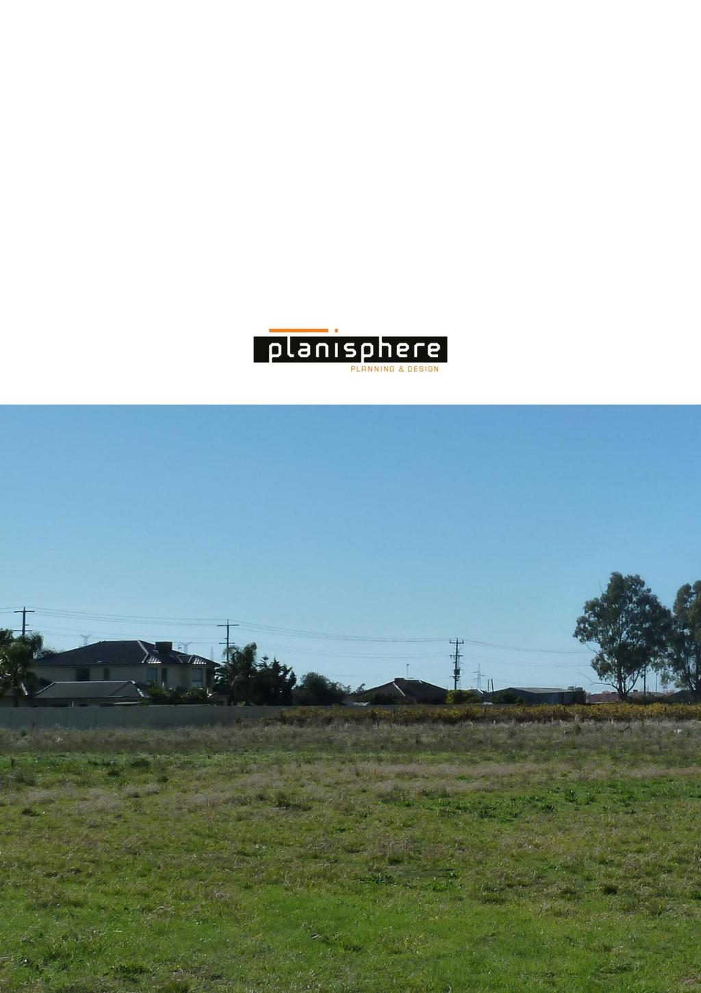
9 Truck movement for deliveries to the supermarket and specialty tenancies will be managed along the eastern boundary of the site, with trucks entering from Ford Road and exiting via Doody Street. A click and collect pick up area will be located on the southern side of the building, towards the east. Services and trolley areas will be located on the east of the building. Landscape The landscape plan shows large canopy trees are to be provided throughout the car parking area. A Landscape Plan Guide has recently been prepared for Council (Spiire, December 2016) and it is recommended that the landscape plan reflect the relevant requirements set out in the plan for Commercial Developments (Section 7). The Plan specifies Council s preference for: Streetscape and property interfaces; Garden beds; and Car parks. The Plan also specifies plants relevant to the local Ecological Vegetation Classes (EVC) for Shepparton, and it is recommended that plants selected are chosen from that list. A town centre with raised garden beds and grassed areas for passive contemplation has been provided at the main entrance to the centre, providing a small green space for visitors to the site. Some seating will be provided in this area. Garden and grassed areas are also proposed adjacent to the medical centre, towards the south-east of the site. 1.4 SUBJECT SITE & SURROUNDS The subject site at Numurkah Road and 10 Ford Road, Shepparton (also known as Lot S2 on plan of subdivision PS527826) has an area of approximately 4.05 hectares and is an irregular L-shape with frontages to Ford Road (180m), Numurkah Road (100m) and Doody Street (100m). The land is currently undeveloped and is generally flat. The subject site is located within the Commercial 2 Zone (C2Z) and the land is not affected by any overlays. The site directly abuts land in the Road Zone, Category 1 (RDZ1) on Numurkah Road/Goulburn Valley Highway, to the west. It is noted that a current planning permit amendment is being considered for the IGA site at Numurkah Road (south of the subject site), and that land to the immediate south of the subject site on Doody Street has been identified for a future child care centre. A 3m drainage easement is proposed to run along the eastern property boundary, adjacent to the GRZ1 land. THE SURROUNDING AREA The subject site is located on the northern extent of Shepparton within the City of Greater Shepparton. Shepparton is the fourth largest regional centre in Victoria and is a key service centre for a broad region of north-central Victoria and southern New South Wales. To the immediate north of Numurkah Road and Ford Road, land is zoned General Residential Zone 1 (GRZ1), and contains a number of single storey residences and large vacant lots. planisphere
 and a small number of single storey, detached dwellings (refer to Appendix A: Site Visit).")
10 Directly to the site s east, land is zoned General Residential Zone, schedule 1 (GRZ1). Land in that area is currently being used for agriculture (small vineyard) and a small number of single storey, detached dwellings (refer to Appendix A: Site Visit). Further east, land to is zoned Neighbourhood Residential Zone 1 (NRZ1) and contains a number of single storey, detached dwellings that form the suburban fringe of Shepparton North. Generally, the residential area is expected to undergo some change as further areas of residential land have been identified in Shepparton s north. To the immediate west and south of the site, land is zoned Commercial 2 Zone (C2Z) and contains numerous bulky goods retailers including Solar City Marine & Caravans, Haeuslers Shepparton and O Connor s Shepparton. The pattern of development along Numurkah Road in Shepparton North is defined by wide frontages, generous front setbacks and large format retail or bulky goods-style warehouse developments with office or showroom components. Further west and south-east of the subject site, some land is zoned Industrial 1 Zone (IN1Z). This area contains a range of manufacturing businesses. Shepparton operates a number of bus routes that service the area. The bus stop closest to the site is located approximately 720m to the south on the corner of Numurkah Road and Hawkins Street. This stop is serviced by Route 4 which operates to and from Shepparton to Connolly Park, terminating at the Shepparton Bus Interchange. FIGURE 1: EXISTING ZONES MAP planisphere
, the area is considered to be a northern gateway entrance to the town.")
11 FIGURE 2: EXISTING OVERLAYS MAP URBAN CONTEXT: SHEPPARTON NORTH GATEWAY COMMERCIAL PRECINCT As highlighted in the Shepparton North and South Business Areas Urban Design Framework Addendum (Planisphere, 2017), the area is considered to be a northern gateway entrance to the town. The existing urban and semi-industrial area has a coarse grained (large format) character defined by big box agricultural supplies and large scale commercial buildings with hard stand car parking areas and warehousetype built form. Recent developments towards the southern part of the precinct present with narrower front setbacks. Due to the variety of lot sizes across the precinct, setbacks may be determined by the lot layout itself as well as informed by adjoining development. This has resulted in a transition of built form types based on lot size or proximity to the southern part of the precinct. There is a variety of existing front setbacks along Numurkah Road, with some buildings set back as far as 70m. Limited landscaping in the private realm has been provided in a manner that contributes to the canopy of the corridor beyond remnant eucalypts. Palm trees have been used in some instances however these do not provide shade or heat relief as adequately as broader canopy trees. planisphere


12 FIGURE 3: EXISTING PATTERN OF DEVELOPMENT ALONG NUMURKAH ROAD FIGURE 4: EXISTING PATTERN OF DEVELOPMENT ALONG NUMURKAH ROAD planisphere
13 2 AMENDMENT BACKGROUND Planning scheme amendment (PSA) C193 has been prepared by Greater Shepparton City Council, which is the planning authority for this amendment. The Amendment has been made at the request of Debra Butcher Consulting Pty Ltd, on behalf of Lascorp Development Group Pty Ltd. In June 2016, Council received an application to rezone land at Numurkah Road and 10 Ford Road, Shepparton (the subject site) from Commercial 2 Zone (C2Z) to Commercial 1 Zone (C1Z) and to use and develop the land for the purpose of a supermarket, medical centre and retail premises. The planning permit relates to development of the two aforementioned properties; the amendment also applies to land at part of Ford Road, Shepparton and part of 25 Hawkins Road, Shepparton, which are proposed to be included partly within a Public Acquisition Overlay (PAO) but not rezoned to C1Z. The proposal has been made pursuant to Section 96(1) of the Planning and Environment Act (1987) and the relevant Clauses of the Greater Shepparton Planning Scheme (the planning scheme). Under the existing zoning provisions (Commercial 2 Zone or C2Z), use of the land for a supermarket with a floor area greater than 1800 square metres is prohibited. Therefore, the land must be rezoned to Commercial 1 Zone (C1Z) to enable an application to be made for the proposed use and development. As outlined in Council s Explanatory Report, the proposed combined amendment and permit will facilitate development of the subject site for a supermarket, associated retail premises and a medical centre, to support the northern parts of Shepparton. In summary, the combined planning scheme amendment (PSA C193) and permit application ( ) is to: Rezoning: Rezone land at Numurkah Road, 10 Ford Road from Commercial 2 Zone (C2Z) to Commercial 1 Zone (C1Z) (the subject site) Apply a Public Acquisition Overlay (PAO) to a portion of Numurkah Road, part of Ford Road and part of 25 Hawkins Road in favour of Council, to provide for drainage infrastructure associated with the Yakka Basin catchment Amend Schedule to Clause Public Acquisition Overlay; PAO23 will be placed over the entire portion of the site servicing area to ensure consistency. The acquiring authority is the Greater Shepparton City Council. Planning permit application ( ): Develop land for a supermarket (trigger for the rezoning requirement), medical centre and retail premises Construct and display business identification signage Reduce the number of car parking spaces required under Clause Deleted: rezoning Deleted:, part of Ford Road, Shepparton and part of 25 Hawkins Road Deleted: <#> Deleted: Use and d Deleted: with a floor area greater than 1800sqm Deleted:, medical centre and retail premises (planning permit application D planisphere
14 2.1 C193 EXPLANATORY REPORT Council has assessed the proposal against its Commercial Activity Centres Strategy (November 2015) and found there is strong support for the proposal in this strategy. According to Council: The Strategy includes the permit granted to the Fairley s IGA site for an additional 4000 square metres retail space in its baseline assessment of available retail floor space, noting there is a current floor space cap of 8,000 square metres retail. [The Strategy] further states that the opportunity for expansion within the vacant Commercial 1 Zoned land has not been realised and while it is identified as a subregional centre in the hierarchy, the Strategy identifies it is currently functioning in a more limited role. The centre is dominated by a single use (supermarket) and a lack of diversity in the retail and commercial activities when compared to the other sub-regional centres of Riverside Plaza and Mooroopna. For the centre to realise its expected sub-regional service role, it must contain a broader range of retail and commercial functions. The Strategy recommends six actions in relation to the Shepparton North Activity Centre, five of which relate to this proposal. Action 1 encourages the expansion of retail and commercial facilities in the existing Commercial 1 Zone area. However, Action 3 states that retail and commercial development may be appropriate outside the existing Commercial 1 Zone specifically to accommodate a second supermarket, and that an appropriate site in the area fronting the Goulburn Valley Highway between Ford Road in the north and Hawkins Street in the south can be endorsed for this extension to the Commercial 1 Zone. The proposed combined amendment/ permit therefore aligns with this action. The proposed amendment/ permit also aligns with Action 2, providing a range of retail and non-retail facilities consistent with sub-regional status, including a second full line supermarket. A provision in C192 ensures this will not include a major non-food retail anchor. Council has assessed the proposal against the relevant urban design considerations contained within the Commercial Activity Centres Strategy and found that: The proposal is consistent with the guidance for developing additional retail floor space as provided in the Strategy and with the draft Urban Design Framework: Shepparton North and South Business Areas Addendum (2017), as prepared by Planisphere. The combined permit/ amendment allows for a thorough consideration of the proposed design and layout of the development, to ensure it integrates architecturally and functionally into the surrounding areas. The proposal provides sufficient articulation and activation along the eastern elevation (frontage), with the inclusion of landscaping to create a town square, fenestration to provide surveillance of the street/ car parking area and provision of seating for cafes. The northern elevation provides access from all retail onto the street, with identification for each frontage. Deleted: As outlined in Council s Explanatory Report, the proposed combined amendment and permit will allow for the commercial development of the site. Under the provisions of the Commercial 2 Zone (C2Z), the use of the land for a supermarket with a floor area greater than 1800 square metres is prohibited. Therefore, the land must be rezoned to Commercial 1 Zone (C1Z) to facilitate the proposed use and development as proposed. planisphere
15 The western elevation is a long wall, however it is considered appropriate given it is primarily for loading and heavy vehicle access. Landscaping, and a drainage easement setting back the building from the boundary will ameliorate the impact of this wall to the west. The southern boundary will be sufficiently articulated given its primary function is access to the click and collect bay and loading for the medical centre. The building will be particular via fenestration to the front of the building provided by the medical centre and a green wall along the central element, as well as landscaping, softening the appearance from the street. Pedestrian access will be provided along the southern boundary of the site, separated via a landscaped nature strip, which is considered an appropriate measure to protect the safety of pedestrians given the road will be used by heavy vehicles. The proposal provides pedestrian access and cycling connections to the proposed residential developments to the north east and east of the site and permit conditions will require provision for public transport infrastructure at the site. The proposal integrates with a range on non-retail commercial and community facilities, including a medical centre and community facility, with easy access to the recently approved childcare centre to the south. In addition to the urban design assessment Council has undertaken, this report will provide further analysis against the: State Planning Policy regarding urban design and built form (Clause and local strategies at Clause of the Greater Shepparton Planning Scheme) Activity Centre Design Guidelines: Interim Design Guidelines for Large Format Retail Premises and the assessment criteria outlined in the Commercial Activity Centres Strategy. planisphere
16 3 POLICY FRAMEWORK As outlined in Section 1 of this report, the proposal will be reviewed against Clause and Clause of the planning scheme, as well as the Activity Centre Design Guidelines: Interim Design Guidelines for Large Format Retail Premises, using the assessment criteria outlined in the Commercial Activity Centres Strategy. This assessment will be used to inform the recommendations and actions in Section 5, including any changes to the site layout and building design required as a result of the review. 3.1 GREATER SHEPPARTON PLANNING SCHEME CLAUSE 15 BUILT ENVIRONMENT & HERITAGE Clause (Built Environment and Heritage: Urban Environment) highlights that urban design should create urban environments that are safe, functional and provide good quality spaces with a sense of place and cultural identity. The policy requires that development achieve architectural and urban design outcomes that contribute positively to local urban character and enhance the public realm while minimising detrimental impact on neighbouring properties. The policy includes strategies (Clause ) to: Promote good urban design to make the environment more liveable and attractive. Require development to respond to its context in terms of urban character, cultural heritage, natural features, surrounding landscape and climate. In addition, the policy outlines urban design principles (Clause ) to guide developments, as follows (relevant to the current proposal): Development must take into account the natural, cultural and strategic context of its location. Planning authorities should emphasise urban design policies and frameworks for key location of precincts. Design of interfaces between buildings and public spaces, including the arrangement of adjoining activities, entrances, windows, and architectural detailing, should enhance the visual and social experience of the user. Site consolidation should not result in street frontages that are out of keeping with the complexity and rhythm of existing streetscapes. New development should achieve high standard in architecture and urban design. Any rooftop plant, lift over runs, service entries, communication devices and other technical attachment should be treated as part of the overall design. planisphere
17 CLAUSE SETTLEMENT Clause (Strategic Settlement Urban Design Plan) seeks to ensure; high quality architectural, urban design and landscape outcomes for built form and open spaces throughout the municipality. Its policy objectives include: To ensure development implements the Urban Design Framework Shepparton North and South Business Areas The Urban Design Framework aims to achieve a distinctive urban design and appearance for the areas which will have a positive impact on most aspects of living and investing in the municipality The appearance of rural, industrial, retail and residential areas and main road approaches to urban centres is important in maintaining a strong level of civic pride. This is also important for a quality pedestrian and shopping environment in the municipality To promote the principles of environmentally sustainable design To control advertising signs as to protect and enhance the appearance of rural and urban areas and ensure signage does not adversely affect the visual amenity of the natural environment or the built form in the municipality. Relevant Strategies include: Ensure the scale, mass and height of new commercial development respects the prevailing neighbourhood character Ensure building frontages avoid long expanses of solid walls and incorporate design elements and a variety of materials that create articulation and visual interest Ensure development respects and responds to valued local ecological qualities and the use of indigenous and low maintenance plant species are used where possible. CLAUSE ECONOMIC DEVELOPMENT Clause (Economic Development: Commercial/Activity Centres) provides objectives and strategies to successfully plan for the growth experienced in the City of Greater Shepparton. Those relevant to the application include: As identified in the Greater Shepparton 2030 Economic Development Plan Report, there will be demand for an additional 40,570sqm of floor space to support the forecast population growth from 2011 to This demand exists in the north and south growth corridors, with Numurkah Road having concentrations of bulky goods retailing. The identification of lower order neighbourhood retail and community centres to serve convenience needs of North Shepparton. Encourage shops to front the road, be built in line with other buildings and have regard to the location of car parking, landscaping and pedestrian areas. planisphere
18 CLAUSE ADVERTISING SIGNAGE The purpose of Clause is as follows: To regulate the display of signs and associated structures. To provide for signs that are compatible with the amenity and visual appearance of an area, including the existing or desired future character. To ensure signs do not contribute to excessive visual clutter or visual disorder. To ensure that signs do not cause loss of amenity or adversely affect the natural or built environment or the safety, appearance or efficiency of a road. In addition to Clause 52.06, recent work regarding the display of advertising signage in the UDF Addendum has been outlined below. The role additional signage will play in the broader visual context is of interest from an urban design and whole-of-precinct perspective in this location. CLAUSE CAR PARKING The purpose of Clause is: To ensure the provision of an appropriate number of car parking spaces having regard to the demand likely to be generated, the activities on the land and the natures of the locality. To support sustainable transport alternatives to the motor car. To promote the efficient use of car parking spaces through the consolidation of car parking facilities. To ensure that car parking does not adversely affect the amenity of the locality. To ensure that the design and location of car parking is of a high standard, creates a safe environment for users and enables easy and efficient use. Clause (Car parking design) provides an overview of design standards that must be met in order to construct a car park. Those relevant to this proposal are accessway design, dimensions, urban design considerations, safety and landscaping. A response to those elements has been included in the following section. CLAUSE LOADING AND UNLOADING OF VEHICLES The purpose of Clause is: To set aside land for loading and unloading commercial vehicles to prevent loss of amenity and adverse effect on traffic flow and road safety. In order for the requirements to be met, no building or works may be constructed for the manufacture, servicing, storage or sale of goods or materials unless adequate land is provided as specified. Driveways must to be a minimum width as specified in the table below. planisphere
 were prepared by the State government to assist in the design of large format retail premises in or on the edge of activity centres that respond to their settings,")
19 3.2 STRATEGIC PLANNING POLICY ACTIVITY CENTRE DESIGN GUIDELINES: INTERIM GUIDELINES FOR LARGE FORMAT RETAIL PREMISES (2007) The Activity Centre Design Guidelines: Interim Design Guidelines for Large Format Retail Premises (2007) were prepared by the State government to assist in the design of large format retail premises in or on the edge of activity centres that respond to their settings, customers and environment. They include design considerations for the creation of new activity centres with a large format retail component, or developing any new trade supplies premises. The guidelines provide design suggestions in relation to four key elements: Urban context Equitable access Public amenity Environmental sustainability. They also contain a number of key considerations pertinent to this review. Those relevant to this proposal are explored in detail in Section 3.2: Urban Design Assessment. CITY OF GREATER SHEPPARTON COMMERCIAL ACTIVITY CENTRES STRATEGY (2015) The Commercial Activity Centres Strategy (Essential Economics and Spiire, 2015) provides a clear understanding of the of the role and function of urban and rural activity centres in Greater Shepparton, identifies future retail/commercial floor space requirements for activity centres and identifies the relationships between economic activity, population levels, demographics, and social sustainability of activity centres. The Strategy defines an activity centre hierarchy for Greater Shepparton, and designates Shepparton North, including land at Numurkah Road and 10 Ford Road, as a future subregional centre that currently fulfils a neighbourhood activity centre function (p. 116). The strategy notes the centre lies within the Gateway North Enterprise Corridor but does not form part of the corridor. The Strategy states that the opportunity for expansion within the vacant Commercial 1 Zoned land has not been realised and while it is identified as a sub-regional centre in the hierarchy, the Strategy identifies it is currently functioning in a more limited role. For the centre to realise its expected sub-regional service role, it must contain a broader range of retail and commercial functions. planisphere
20 The Strategy recommends six actions in relation to the Shepparton North Activity centre, two of which relate to the design of this proposal: Ensure that future development of the Shepparton North centre takes place in a manner supported by appropriate urban design and planning guidance. It also states that retail and commercial development may be appropriate outside the existing Commercial 1 Zone specifically to accommodate a second supermarket. Once the location of an expanded Commercial 1 Zone in Shepparton North is identified, Council should develop an urban design framework or similar assessment that provides appropriate guidance on how the centre can develop in a manner that provides a high-level of amenity to shoppers and is consistent with best-practice activity centre development guidelines. SHEPPARTON NORTH & SOUTH BUSINESS AREAS URBAN DESIGN FRAMEWORK (ADDENDUM, 2017) Addendum Overview for Shepparton North The Shepparton North and South Business Areas Urban Design Framework (2017 Addendum) is currently being prepared. The Addendum has been prepared in response to land use and development changes that have occurred in the northern commercial area at Numurkah Road. In particular, the addendum highlights design considerations for the area, which should be considered as a key gateway to Greater Shepparton when travelling from the northern region. The Numurkah Highway section of the gateway precinct, included in the Addendum study area, contains the subject site. The scale of development and display of advertising signage, as well as interfaces with adjoining uses and setbacks to Numurkah Road or the Goulburn Valley Highway are of relevance to the current proposal. At the time of writing, the Addendum had been adopted by Council (April 2017) and is on public exhibition. The draft Addendum has been prepared to manage visual clutter, quality of built form and car parking in the public realm, which currently detract from the area and the important urban design and functional roles it plays. The subject site is located within the Addendum s Subject area for the Shepparton North Gateway Commercial Precinct. VISION The vision for the Shepparton North Gateway Commercial Precinct is To encourage a vibrant commercial area supporting large scale, regionally significant service and retail activities, within a high quality public realm that reflects the strategic important of the area as a gateway location. STRATEGIES A range of strategies are listed in relation to urban design that will ensure the precinct achieves its vision. Those relevant to the proposal are: Development on the northern edge of the precinct should incorporate innovative designs using form, materials and articulation to reflect the transition from rural to urban environment. planisphere
21 New commercial buildings should not exceed two storeys, be in keeping with the large format scale of surrounding development and avoid blank and dominant facades. Street setbacks should be a minimum of 20 metres from the front lot boundary and must incorporate significant landscaping and sealed car parking. A minimum 1.5m landscape buffer must be established along rear boundaries abutting properties in the GRZ1. Roof forms should be an integral and considered aspect of the building that is climatically appropriate for the local context. Maintain an active street frontage that is attractive and accessible through limiting crossovers and excessive driveway widths. Ensure paved car parking areas are broken up by landscaping and where practical provide significant canopy trees that can assist in shading. Signage should respect the preferred character of the area and does not dominate the site. Animated and visually distracting signage is discouraged. New buildings should adopt the appearance of commercial built form and provide articulated building facades that reduce the visual bulk on the streetscape. Entrances should be clearly defined, oriented towards the streetscape and have human scale elements, including large window proportions to enhance the relationship between built form and the streetscape. Materials for external surfaces should consider and complement the surrounds, neutral colours should be considered and unarticulated concrete surfaces, unarticulated cladding systems and bright extravagant colours should be avoided. LANDSCAPE PLAN GUIDE FOR DEVELOPMENTS IN CAMPASPE SHIRE COUNCIL, CITY OF GREATER SHEPPARTON & MOIRA SHIRE COUNCIL (DRAFT, JANUARY 2017) The Landscape Plan Guide for Developments in Campaspe Shire Council, City of Greater Shepparton and Moira Shire Council was prepared by Spiire and its draft form released in January It contains guidelines for commercial development, including the following key considerations: GENERAL Landscape treatments are to address the visual bulk and scale of the development such as with tree and garden bed planting or green walls. STREETSCAPE/PROPERTY INTERFACES Consider appropriate width areas for garden bed and verge width for tree planting minimum 1.2m wide and wider where large trees are to be used. Soften visual impact of blank walls and blur hard edges/lines with garden bed and tree planting of appropriate scale. planisphere
22 Soften street interfaces and adjoining properties through tree and garden planting and appropriate fence treatments (where fencing is required). Define pedestrian access from streets into commercial developments via connecting pathways, including through car parks. GARDEN BEDS Species selection that promotes native plants for drought tolerance, suitability to site, micro climate, purpose (screening, ornamental, personal safety). CAR PARKS Tree planting throughout car parks to achieve maximum shade and amenity. Tree species for car parks are to be determined according to locality, aspect, microclimate and other considerations such as local character. Planting areas of appropriate width (minimum 1.2m) where car parks interface with streets and buildings. Ensure success of planting areas by not allowing vehicle overhang to burn/ damage planting use permeable paving beneath vehicle overhang area. planisphere
23 4 URBAN DESIGN REVIEW & DISCUSSION This discussion has been prepared using the four key design elements from the Interim Design Guidelines (DELWP, 2007) as a basis for review. Where relevant, other strategic planning policies (summarised in Section 3) are also referenced. 4.1 RESPONSE TO SPPF & LOCAL PROVISIONS CLAUSE BUILT ENVIRONMENT & HERITAGE The strategies at Clause 15 set up a framework for guiding design responses. The current proposal and subject site provide for a commercial and retail development that will interact with a number of different interfaces. Specifically: Main road interface along Numurkah Road/Goulburn Valley Highway and on Ford Road Commercial interface with adjoining properties that will remain Commercial 2 Zone (C2Z) Residential interface along the eastern property boundary Drainage interface along the immediate eastern property boundary. This part of Shepparton North has been identified for more detailed planning controls (the Shepparton North and South Business Areas Urban Design Framework Addendum, 2017, currently being prepared) regarding urban design and interface management with adjoining areas. It is also highlighted as an area that can accommodate further growth, and should provide greater retail services that address the forthcoming increase in population as a result of further residential land development in Shepparton North. Therefore, the role this area plays will diversify in future. The response below considers the following strategies as set out at Clause : Interface with adjoining uses and the public realm Pedestrian experience on the site Architectural design response The location of plant. INTERFACES A key strategy for consideration at Clause is that design of interfaces between buildings and public spaces, including the arrangement of adjoining activities, entrances, windows, and architectural detailing, should enhance the visual and social experience of the user. The proposed development is set well within the subject site, limiting its interface with Numurkah Road to the west. The northern interface is considered to be generally acceptable in the context of the large format highway corridor. The proposed development is set back a maximum distance of 230m from Numurkah Road. In future, development of the pad area on the south-west corner of the subject site will mitigate the deep front setback currently proposed. planisphere
24 The design of the west elevation itself is well-articulated, and will be activated within the site as the main entrance to the centre. There is a high degree of glazing and good opportunities for passive surveillance from the centre to the adjoining car parking area. A number of small retail premises provide visual interest and articulation to this elevation, in keeping with the intent of the interface strategy. The northern setback from Ford Road should be designed to enable a transition in scale between the commercial and residential areas. This could be achieved through careful design of the Ford Road pad site, and also through landscape treatments that soften the appearance of the car parking area from the street. Due to the internal layout of the building, the southern elevation to Doody Street currently presents as a blank façade, with high wall signage and low level planting (including some trees shown with a maximum height of less than 3m) along the street interface. Entrance to a loading/unloading and click and collect area is also located on the southern boundary of the site, towards the east. It is recommended that the wall design fronting Doody Street be better articulated and glazing provided to ensure this area benefits from passive surveillance, as well as providing visual interest and engagement with the public realm. It is understood that a pedestrian link from the residential area to the east may be joined to Doody Street in future. Accordingly, the southern façade may be the first point of contact for many customers travelling on foot or by bike to the centre. The façade treatment in this location must better respond to the human scale and provide a higher quality visual safety response in this location. It is important that the eastern interface also engages with a transition in land uses from busy commercial use to more sensitive residential uses. To ensure this transition is achieved, it is recommended that greater landscaping be provided in this area. ARCHITECTURAL DESIGN RESPONSE The architectural design proposed is generally considered to provide a contemporary, recognisably commercial response for the site. Use of muted colours and tonings will ensure visual primacy is afforded to the landscape features on the site. The retail premises which wrap the main part of the centre will provide for active frontages and separation/articulation between the shop fronts will lessen the visual impact the building s large footprint. The provision of a main, clearly demarcated entryway is supported in that it clearly directs movement within the site to a key, visible point and provides for visual interest through the feature over the entrance. PEDESTRIAN EXPERIENCE ON THE SITE Clear pedestrian paths have been provided from the public realm through the site to its main entrances. Footpaths around the perimeter of the site connecting to the surrounding area have also been provided. It is recommended that greater detail regarding shade to pedestrian areas, as the landscape plan currently does not provide a detailed response to how the town centre open space areas and pedestrian pathways will be weather protected, particularly in summer or the warmer months. planisphere
25 On balance good spaces have been provided for pedestrians, and detailed design should be prepared to demonstrate how the pedestrian experience will be protected and enhanced on site (e.g. location of seating, orientation and infrastructure selection to maximise physical accessibility and weather protection, etc). PLANT LOCATION The location of plant should also be massed such that it is located closer to adjoining commercial uses or towards the west, rather than in close proximity to the residential area to the east. At present no detailed roof plan has been provided demonstrating the location of the plant. CLAUSE ECONOMIC DEVELOPMENT This proposal responds to the strategic need for additional retail space in Shepparton s north, as highlighted in Clause In response to the policy, it is generally considered that the finer grain retail stores proposed as part of the centre have been well positioned and oriented towards both Numurkah Road and Ford Road. Given the generous setbacks from Ford Road and Numurkah Road, it is important that pedestrian and cyclist access to the site is protected, clearly demarcated and provides a useful connection from the main roads to the centre. Given the order of main roads that the site abuts, it is considered that the majority of visitors to the site entering via Ford Road or Numurkah Road will visit the site by car. However, it is anticipated that some pedestrian and bike traffic will be generated in the east from the residential area, and due to the proposed pedestrian/cyclist link to Doody Street. In this location in particular, clear sight lines and pedestrian walkways must be provided. The loading/unloading and click and collect areas should be revised to ensure protected pedestrian paths are provided in this location as the configuration is currently shown to cut off the footpath towards the south-east of the site. Due to the scale of the corridor, the Goulburn Valley Highway/Numurkah Road interface should be managed by significant landscaping, and the future pad site design should provide a transition in scale between the Numurkah Road interface and the centre towards the rear of the subject site. 4.2 INTERIM DESIGN GUIDELINES FOR LARGE FORMAT RETAIL PREMISES ELEMENT 1: URBAN CONTEXT STRATEGIC LOCATION Given the site s location and the strategic policy support, development of a supermarket and associated retail premises, medical and community centres in this location is considered to be generally appropriate. The scale of development is broadly appropriate for the area, and the rhythm of development along Numurkah Road is largely defined by large, warehouse-like developments. planisphere
26 The building s two storey appearance has been scaled towards the pedestrian interfaces within the site, consistent with the prevailing character in the area. BUILT FORM As suggested in Element 1: Urban Context of the Interim Design Guidelines, the proposed large format supermarket has been wrapped with smaller units to enhance the interface between building and street. LANDSCAPE The landscape plan does not illustrate how the east elevation will be treated to minimise impacts from the loading and unloading area and should be amended to ensure that amenity issues associated with servicing the development via loading bays and storage areas is lessened. Landscaping within the drainage easement (3m) may also soften the buffer; however, this cannot be relied upon as the only solution and on-site landscaping measures should also be taken. The landscape solution must support pedestrian and cyclist movement through the site and key pedestrian entrances from Numurkah Road, Ford Road and Doody Street by providing shade and greenery to ensure the site s outdoor spaces are hospitable. ELEMENT 2: EQUITABLE ACCESS The design guidelines seek convenient, safe and comfortable access for sustainable transport modes including walking, cycling and public transport, to reduce the reliance on the car. A mixture of access modes contribute to a lively public environment, and should be encouraged to co-exist. FOOTPATHS Footpaths around the perimeter of the site, with the exception of a portion of Doody Street to the south-east, provide clear links for pedestrians from the public realm to the surrounding area, however further information should be provided regarding the detailed design of pedestrian movement and cyclist paths. While bicycle parking areas are shown, cyclist movement to and around the site has not been shown. PUBLIC TRANSPORT The nearest bus stop to the subject site is beyond 700m (refer to Section 2.2). However, the subject site will directly abut a residential area and is visibly located on a key gateway entrance to Shepparton for those visiting, living and working in the area and adjoining regional towns. It is unlikely that people visiting the site will use public transport to access the site due to its location on a highway and incomplete sections of footpath along the highway, combined with limited shade and amenity from the bus stop to the subject site. However, this stop is located within a 10-minute walk from the site, and the path should be improved for the benefit of the precinct in the long-term. planisphere
27 PEDESTRIANS AND CYCLISTS The permit conditions should include provision for detailed pedestrian and cyclist movement plans that demonstrate that safe, well-marked and sheltered walkways are provided along building edges, and through car parks. This is particularly important given the proposed walking distances within the site from the public realm to the centre. VEHICLE ACCESS AND PARKING Vehicle entry to the site has been managed to funnel traffic to various entrances around the site via Numurkah Road (Goulburn Valley Highway service road), Ford Road and Doody Street. Truck movements will also be managed via Ford Road and Doody Street due to the location of loading/unloading and storage areas (on the south and east elevations). In terms of the street layout, it is generally considered that the entrance/exist points have been well integrated with the surrounding network. There is potential modal conflict between the truck path, pedestrian and cyclist movement at the south-east corner of the site, where pedestrian/cyclist links to the east may occur. However, use of a zebra crossing to the south of Doody Street and connecting to the east is considered to address this potential issue. ELEMENT 3: PUBLIC AMENITY There are a number of proposed retail uses wrapping the supermarket and facing the car parking areas and public realm. Accordingly, the proposed shopfront environment should provide an active and lively frontage to the surrounding area. SHOPFRONT ENVIRONMENT Objective 3.1 of the design guidelines seeks to provide a visually attractive and active public interface and shopfront environment. The building has articulated and transparent edges, with pedestrian refuges around the building for rest and relaxation. Due to the distance of the setback from Numurkah Road (approximately 200m), it is unlikely that the building will have clear engagement with either road corridor. However, development of both pad sites on the two respective frontages will provide opportunities to address those streets more fully or appropriately in future. PEDESTRIAN ENVIRONMENT Objective 3.2 seeks to enhance the pedestrian environment and states that buildings should be set back a maximum of 22m from the street frontage (but ideally be built to the street boundary). It is generally considered that there are limited opportunities for achieving no setback to the public realm or a maximum 22m setback, due to: The size of the lot; Its location in a sub-regional strip commercial precinct and the associated large-format scale of built form; Its proximity to the highway and the limited enjoyment afforded by the highway as a pedestrian environment; The irregular shape of the lot. planisphere
28 Furthermore, the draft Addendum to the UDF prepared in 2017 recommends a minimum building setback of 20m from Numurkah Road, due to the urban context of the precinct and nature of large format development. The corner site at Numurkah Road is in separate ownership and is located in a more prominent position than the subject site; it is most critical that this site address both frontages at Ford Road and the Goulburn Valley Highway to meet the design guidelines. As outlined above, future development of the two pad sites on Numurkah Road and Ford Road will also play a role in reducing the impact of the proposed supermarket and associated retail premises. PEDESTRIAN AMENITY Adequate shade should be provided in the pedestrian refuge and town centre areas that are proposed, as suggested by trees shown in the town centre, to ensure that the pedestrian spaces are well shaded and protected from heat effects, particularly due to the openness of the site, the western elevation and the sun exposure likely to occur here in warmer months. PUBLIC CONVENIENCE AND COMFORT Landscaping and plant selection across the site should be selected based on the Landscape Plan Guide currently being prepared by Spiire on behalf of Council (draft plan, January 2017). A landscape concept plan has been provided, however greater detail must be provided regarding species selection, provision of garden beds in and around the development, the width and depth of soil areas for significant trees and the contribution shade will make as a result of tree coverage, particularly in the large car parking areas. It is recommended that landscaping be provided in accordance with the Commercial Developments section of the draft Landscape Plan Guide (2017). Wherever possible it is recommended that garden beds with a width greater than the minimum (1.2m) be provided to give trees and plants the best chance of establishment in an arid climate. Significant shade trees with canopy spread must also be provided, with space clear to the trunks to enable visibility. PARKING This objective seeks to ensure a high quality car parking environment it is recommended that the car parking area be further broken up by landscaping areas. A key consideration of Objective 3.7 (Parking Environment) is that the visual impact of car parking from the street should be lessened. The objective recommends that such visual prominence be reduced by locating parking areas to the side or rear of developments. As this will not be achieved on the subject site, it is recommended areas be softened by significant landscaping, as detailed above. LOADING AND UNLOADING The provision of loading bays in the multi-use development generally responds to the statutory requirement set out at Clause of the planning scheme. Key considerations are: planisphere
29 The supermarket is 3,960sqm in area requiring, 45.4sqm of loading area. The provided loading bay is greater than the minimum requirement. A swept path analysis of 19m articulated vehicle accessing the supermarket loading bay has been undertaken in the traffic assessment and access was shown to be satisfactory; however, as noted in the traffic peer review, the swept path analysis considered the internal loading dock layout and it is recommended additional assessments are undertaken to confirm a 19m semi-trailer can enter the site from Ford Road and exit via Doody Street. Two additional loading bays are provided for the loading of retail tenancies. Given the size of retail premises, it may be appropriate for the tenancies to share the two common loading areas. In addition, many retail tenancies deliveries are likely to be via small vans which could also make use of on-site parking to undertake deliveries. SIGNAGE This design solution is encouraged, including in the context of Clause 52.05, and generally responds to the recommendations from the Interim Design Guidelines as well as the draft UDF Addendum. Further consideration should be given to the scale and height of the Woolworths and BWS signs shown on the elevations, particularly on the southern elevation to Doody Street, where there is limited setback from the street. The proportions of the sign should be reviewed to ensure visual impact of the signage is reduced. A recommended approach is to reduce the display height of the sign. ELEMENT 4: ENVIRONMENTAL SUSTAINABILITY Limited information has been provided regarding proposed environmental sustainability responses for the proposed development. It is recommended that where possible, water sensitive urban design (WSUD) treatments, storm water reuse, sustainable building materials, thermal performance measures and building orientation be maximised. The objectives set out in the Interim Design Guidelines (4.1 and relevant subsections) regarding minimising the environmental impacts of restricted retail developments should be reviewed and considered. The application should be amended to include a detailed statement that addresses this element and the relevant objectives of the environmental sustainability guidelines. planisphere
30 5 CONCLUSIONS & RECOMMENDATIONS This section summarises the recommendations and conclusions from the urban design assessment at Section DETERMINING APPROPRIATE CHANGES The proposed development is generally considered to be strategically appropriate given the planned residential growth in Shepparton North and a lack of retail and convenient services for residents in the area. This has been identified and is supported by the Commercial Areas Strategy, the subject of Planning Scheme Amendment C192 for inclusion as a local policy in the planning scheme. In the context of current work regarding landscape plans and urban design responses in Shepparton North, recommendations have been provided below to encourage improved interfaces to the east and south, as well as greater emphasis on landscape design within the site. Should the recommended changes be made, it is considered that the proposal would generally respond to the Interim Design Guidelines for Large Format Retail Premises and relevant provisions from the Greater Shepparton Planning Scheme, as assessed in Section SUMMARY OF RECOMMENDATIONS It is recommended that the proposed development be amended to: Amend the Doody Street on the southern elevation to provide greater opportunities for passive surveillance and an active frontage (e.g. using glazing and openings, depending on safety and traffic flow requirements), reducing the dominance of the blank façade on this elevation. Revise the loading/unloading and click and collect area to ensure safe pedestrian and cyclist movement can occur along Doody Street towards the GRZ1 area. Provide a greater landscape buffer on the eastern property boundary to limit amenity impacts to the GRZ1 area identified for future residential growth. Provide a more detailed landscape solution that ensures sufficient soil breadth and depth for the establishment of significant canopy trees throughout the car parking area; refer to the Landscape Plan Guide for Developments in the Shire of Campaspe, City of Greater Shepparton and Moira Shire Council (December 2016) for guidance. Lower the height of the high wall sign on the building s southern elevation to reduce its visual impact in close proximity to Doody Street. Provide further details to show pedestrian and cyclist movement to and within the development will be protected and clearly demarcated to facilitate alternative modes of site access than the car. The application should include a statement addressing the environmental sustainability element of the guidelines. planisphere
31 5.3 CONCLUSION On balance the proposed recommendations seek further design detail beyond that which has been provided, regarding the building s interface with adjoining uses and the site s future integration with the surrounding area. The changes recommended above ensure that greater consideration is given to the Interim Design Guidelines: Large Format Retail Premises, the Landscape Plan Guidelines and the Shepparton North and South Business Areas UDF (2017 Addendum) in accordance with the request from DELWP. This will ensure that the development delivers on its role as a commercial activity centre for Shepparton North and contributes to the ultimate goal for this area to become a sub-regional centre. It is generally considered that the recommended changes above will result in a proposal that satisfactorily responds to the Interim Design Guidelines. Deleted: It is ultimately Deleted: be Deleted: to planisphere
32 Page intentionally blank. planisphere


33 APPENDIX A: SITE VISIT A site visit was undertaken on 8 May 2017 to inspect the subject site and its surrounding context. Key images have been included below to illustrate the interface between the subject site, adjoining properties and street interfaces. Ford Road Northern site boundary looking east along Ford Road Ford Road View south over subject site towards Doody Street Ford Road View south-west from northern site boundary towards Doody St and adjoining property Ford Road View towards adjoining property on the north-west of the subject site Ford Road View towards adjoining property at 231 Numurkah Road Ford Road View towards Ford Road- Wanganui Road-Goulburn Valley Highway intersection to the west of the site planisphere


")
 Subject site View")
")

34 Ford Road View towards Ford Road- Wanganui Road-Goulburn Valley Highway intersection to the west of the site Ford Road Adjoining property at 231 Numurkah Road (north-west of the subject site) Doody Street View towards adjacent site at 219 Numurkah Road (south) Doody Street View towards adjacent site at 219 Numurkah Road (south-west) Subject site View north-west towards 213 Numurkah Road (across subject site towards adjoining property) Subject site View north-west towards 213 Numurkah Road (across subject site towards adjoining property) planisphere


35 Subject site View north over subject site towards Ford Road Subject site View north-east over subject site towards Ford Road and adjoining residential development Subject site View north-east over subject site towards Ford Road and adjoining residential development Subject site View south-east towards nearby development (child care centre is currently proposed in this location) View west along Doody Street Subject site View north over subject site towards adjoining property at 213 Numurkah Road planisphere


36 View south-east from Numurkah Road over subject site towards 219 Numurkah Road View south-east from Numurkah Road over subject site towards 219 Numurkah Road View south-east from Numurkah Road over subject site towards 219 Numurkah Road Existing IGA to the south of the subject site at 193 Numurkah Road Existing IGA to the south of the subject site at 193 Numurkah Road Existing IGA to the south of the subject site at 193 Numurkah Road planisphere
37 Page intentionally blank. planisphere
38 planisphere
SCHEDULE 12 TO THE DESIGN AND DEVELOPMENT OVERLAY GLEN WAVERLEY ACTIVITY CENTRE STRUCTURE PLAN
 DD/MM/YY Proposed C120 SCHEDULE 12 TO THE DESIGN AND DEVELOPMENT OVERLAY Shown on the planning scheme map as DDO12. GLEN WAVERLEY ACTIVITY CENTRE STRUCTURE PLAN 1.0 Design objectives DD/MM/YY Proposed
I615. Westgate Precinct
 I615. Westgate Precinct I615.1. Precinct Description The Westgate Precinct is located approximately 18km west of the Auckland city centre. There are seven Sub-precincts in the Westgate Precinct: Sub-precinct
22.15 OUTDOOR ADVERTISING SIGNAGE POLICY
 22.15 OUTDOOR ADVERTISING SIGNAGE POLICY This policy applies to all land where a planning permit is required to construct or display a sign under the provisions of the Kingston Planning Scheme. 22.15-1
APPENDIX MATAKANA COMMERCIAL URBAN DESIGN GUIDELINES
 APPENDIX MATAKANA COMMERCIAL URBAN DESIGN GUIDELINES 1.0 INTRODUCTION The following urban design guidelines are to be utilised by landowners, planners and other persons involved in development at early
Keystone Business Park Precinct Structure Plan North East Industrial Precinct. Part 2 Design Principles
 Keystone Business Park Precinct Structure Plan North East Industrial Precinct Part 2 Design Principles Context Issues Services Landform Issues Geotech and contamination Ecology Traffic and access Issues
I539. Smales 2 Precinct
 I539. Smales 2 Precinct I539.1. Precinct Description The Smales 2 Precinct applies to a 4.8 hectare block of land located on the southern side of Northcote Road and fronting Lake Pupuke, Takapuna. The
URBAN DESIGN BRIEF REPORT
 URBAN DESIGN BRIEF REPORT PREPARED FOR 2568401 ONTARIO INC NEW GASBAR, CONVENIENCE STORE & CARWASH DEVELOPMENT @ 1509 FANSHAWE PARK ROAD WEST LONDON, ONTARIO GAMA ENGINEERING INC. PROJECT NUMBER 1669 PREPARED
Urban Design Brief to 1557 Gordon Street & 34 Lowes Road West
 Urban Design Brief 1533 to 1557 Gordon Street & 34 Lowes Road West Reid s Heritage Homes Ltd. & 883928 Ontario Ltd. and RHH Property Management Ltd. City of Guelph Zoning By-law Amendment November 2017
INCREMENTAL CHANGE AREA REVIEW March 2015 Page 1
 INCREMENTAL CHANGE AREA REVIEW March 2015 Page 1 Table of Contents Introduction... 3 Background to Review... 3 Comparison of the Schedules to the General Residential Zone... 7 Methodology... 7 Policy Context...
Memorial Business Park Site. Proposed Future Development. Design guidelines. August
 Memorial Business Park Site Proposed Future Development Design guidelines August 2014 www.designenvironment.co.nz 0064 3 358 3040 Contents 1.0 Background 1.1 Introduction 3 1.2 Objectives 4 2.0 Context
The Proposed Auckland Unitary Plan (notified 30 September 2013)
") 3 Business zones Introduction There are 10 business zones in the Unitary Plan: City Centre Metropolitan Centre Town Centre Local Centre Neighbourhood Centre Mixed Use General Business Business Park Light
3 Business zones Introduction There are 10 business zones in the Unitary Plan: City Centre Metropolitan Centre Town Centre Local Centre Neighbourhood Centre Mixed Use General Business Business Park Light
DAREBIN PLANNING SCHEME AMENDMENT C137
 Who is the planning authority? Planning and Environment Act 1987 DAREBIN PLANNING SCHEME AMENDMENT C137 EXPLANATORY REPORT This amendment has been prepared by the Darebin City Council, who is the planning
Northern Territory Compact Urban Growth Policy
 Northern Territory Compact Urban Growth Policy A Reference Policy Document to clause 2.7 (Reference to Policy) of the NT Planning Scheme May 2015 Table of Contents 1 Policy Setting... 3 1.1 Context for
URBAN DESIGN BRIEF URBAN DESIGN BRIEF 721 FRANKLIN BLVD, CAMBRIDGE August 2018
 URBAN DESIGN BRIEF URBAN DESIGN BRIEF 721 FRANKLIN BLVD, CAMBRIDGE August 2018 DESIGN BRIEF CONTENTS PART A 1.0 INTRODUCTION 2.0 DESCRIPTION & ANALYSIS OF SITE CONTEXT 3.0 DESIGN CONSTRAINTS AND OPPORTUNITIES
I404 Beachlands 2 Precinct
 I404. Beachlands 2 I404.1. Precinct Description The Beachlands 2 precinct covers approximately 6 hectares of land at the corner of Beachlands and Whitford Maraetai Roads. Its purpose is to provide for
MVRC ARCHITECTURAL DESIGN STATEMENT
 11251 MOONEE VALLEY RACING CLUB MAY 201 CONTENTS 0 Contents Introduction 1 Site Analysis a. Site Features b. Built form Interfaces c. Existing Streetscape d. Site Opportunities and Constraints 2 Masterplan
Bel-Air Lexus Automobile Service Station
 Bel-Air Lexus Automobile Service Station Design Brief 443-447 McArthur Avenue Ottawa April 30, 2015 14-1299-MCA Site Details Application: Site Plan Control Legal Description and Municipal Addresses: 443
Nelson Residential Street Frontage Guideline
 DRAFT 22-06-2012 Nelson Residential Street Frontage Guideline June 2012 1317273 Contents and purpose Residential s are important Residential s are much more than corridors which move traffic. Streets allow
Town Planning Report. Combined Planning Permit and Planning Scheme Amendment Request under Section 96A of the Planning and Environment Act 1987
 Town Planning Report Combined Planning Permit and Planning Scheme Amendment Request under Section 96A of the Planning and Environment Act 1987 1 Henry Street, Belmont Prepared by Tract Consultants for
TOWN PLANNING ASSESSMENT KAUFLAND STORE NETWORK VICTORIAN ENTRY PROPOSAL PART THREE HIGH STREET, EPPING
 TOWN PLANNING ASSESSMENT KAUFLAND STORE NETWORK VICTORIAN ENTRY PROPOSAL PART THREE 592-694 HIGH STREET, EPPING Table of Contents Part Three 592-694 High Street, Epping... 3 1 Local strategic context...
New-Cast Mixed-use Development Proposal King Street West, Newcastle, Ontario
 URBAN DESIGN BRIEF New-Cast Mixed-use Development Proposal King Street West, Newcastle, Ontario TABLE OF CONTENTS: 1.0 Executive Summary 2.0 Creating Vibrant and Sustainable Urban Places: Excerpts from
TABLE OF CONTENTS. Human Habitats, 155 Dorcas St South Melbourne, Victoria 3205
 TARNEIT JUNCTION Town Planning Report DECEMBER 2013 TABLE OF CONTENTS Table of contents... 1 1 Introduction... 2 2 SIte context and surrounds... 4 2.1 Site Features... 4 2.2 Surrounding land uses... 4
6.0 Land Use Policies for Rural Settlements. 6.1 Rural Settlement Strategy
 6.0 Land Use Policies for Rural Settlements 6.1 Rural Settlement Strategy INTRODUCTION AMENDMENT NO. 131 PURPOSE Designated rural settlements comprise Rural Clusters, Villages and Serviced Villages as
10 Proposed Redevelopment, Tewkesbury Road, Cheltenham SCHEME EVOLUTION STARBUCKS
 SCHEME EVOLUTION STARBUCKS The proposed Starbucks Drive Thru alongside the proposed food store provides an appropriate mix of uses, suitable for this location. The proposed store is bespoke, designed specifically
PUBLIC RIGHT-OF-WAY IN THIS CHAPTER PUBLIC REALM
 PUBLIC RIGHT-OF-WAY This section provides design guidelines for improvements in the public right-of-way. The public right-of-way refers to streets, sidewalks, non-vehicular thoroughfares, parks and greenways
Wide asphalt driveway abutting school property. garage built with incompatible materials, too close to park. incompatible fencing materials
 Wide asphalt driveway abutting school property incompatible fencing materials garage built with incompatible materials, too close to park Lack of plantings as a buffer between private property and open
Appendix C: Interim Mixed-Use Evaluation Criteria
 Appendix C: Interim Mixed-Use Evaluation Criteria C-1 Appendix C: Interim Mixed-Use Evaluation Criteria PURPOSE: The implementation of numerous policies contained within the Master Plan hinges on the creation
Westwind Developments Ltd. PIONEER LANDS AREA STRUCTURE PLAN - PROPOSED AMENDMENT
 FEBRUARY 2013 TABLE OF CONTENTS 1.0 BACKGROUND... 1 1.1 Amendment... 1 2.0 LOCATION & CONTEXT... 2 2.1 Land Ownership... 2 3.0 POLICY CONTEXT... 3 3.1 Municipal Development Plan... 3 3.2 Capital Region
Combined Planning Scheme Amendment Request and Planning Permit Application
 Combined Planning Scheme Amendment Request and Planning Permit Application Rezone land from the Farming Zone to the Commercial 1 Zone and develop a SubRegional Activity Centre Bellarine Gateway Plaza,
Commercial Development Permit Area
 City of Kamloops KAMPLAN Commercial Development Permit Area PURPOSE The purpose of this Development Permit Area (DPA) is to establish objectives and provide guidelines for the form and character of commercial
Subdivision Design Criteria. Penihana North GUIDELINES TO THE RULES
 Created September 2013 Penihana North Subdivision Design Criteria GUIDELINES TO THE RULES This part of the Plan sets out the design criteria for subdivision in Penihana North. The criteria will be considered
GREATER SHEPPARTON PLANNING SCHEME AMENDMENTS C192 & C193 PLANNING PERMIT APPLICATION
 GREATER SHEPPARTON PLANNING SCHEME AMENDMENTS C192 & C193 PLANNING PERMIT APPLICATION 2016-269 221-229 NUMURKAH ROAD AND 10 FORD ROAD SHEPPARTON STATEMENT OF EVIDENCE BY ANDREW CLARKE ON PLANNING ISSUES
Proposed for Vic West Neighbourhood Plan. Design Guidelines for Intensive Residential Development - Townhouse and Attached Dwelling
 Proposed for Vic West Neighbourhood Plan Design Guidelines for Intensive Residential Development - Townhouse and Attached Dwelling Design Guidelines for Intensive Residential Development - Townhouse and
TOWN PLANNING ASSESSMENT KAUFLAND SUPERMARKET NETWORK VICTORIAN ENTRY PROPOSAL. PART FIVE MAROONDAH HIGHWAY, CHIRNSIDE PARK Revision 2
 TOWN PLANNING ASSESSMENT KAUFLAND SUPERMARKET NETWORK VICTORIAN ENTRY PROPOSAL PART FIVE - 266 268 MAROONDAH HIGHWAY, CHIRNSIDE PARK Revision 2 1 2 Table of Contents Part Five 266 268 Maroondah Highway,
Highland Village Green Design Guidelines
 Highland Village Green Design Guidelines Publishing Information Title Highland Village Green Design Guidelins Author The City of Calgary Status DRAFT - Proposed document subject to changes Additional Copies
COMMUNITY DESIGN. GOAL: Create livable and attractive communities. Intent
 COMMUNITY DESIGN Intent An attractive, well-designed County will attract quality development, instill civic pride, improve the visual character of the community, and create a strong, positive image for
URBAN DESIGN BRIEF. 2136&2148 Trafalgar Road. Town of Oakville
 URBAN DESIGN BRIEF 2136&2148 Trafalgar Road Town of Oakville Prepared By: METROPOLITAN CONSULTING INC For 2500674 Ontario Inc November 2016 TABLE OF CONTENTS Page No. 1.0 Introduction/Description of Subject
WELLINGTON HOSPITAL DESIGN GUIDE TABLE OF CONTENTS
 WELLINGTON HOSPITAL DESIGN GUIDE TABLE OF CONTENTS 1.0 Introduction Page 2 The Place of Wellington Hospital 2 The Future of the Hospital 2 2.0 The Intention of the Design Guide 3 3.0 Analysis 4 General
AOTEA SUPERMARKET ZONE. Zone Introduction
 C18 AOTEA SUPERMARKET ZONE Zone Introduction C18.1 Objective This zone identifies a specific area in Aotea for a stand alone supermarket. The zone is site specific and has a range of objectives, policies
Section Three, Appendix 16C Medium Density Housing, Design Assessment Criteria (Residential 8A zone)
") APPENDIX 16C MEDIUM DENSITY HOUSING, DESIGN ASSESSMENT CRITERIA (RESIDENTIAL 8A ZONE) PURPOSE OF APPENDIX 16C (RESIDENTIAL 8A ZONE) In the Residential 8A Zone the following are defined as restricted discretionary
APPENDIX 16C MEDIUM DENSITY HOUSING, DESIGN ASSESSMENT CRITERIA (RESIDENTIAL 8A ZONE) PURPOSE OF APPENDIX 16C (RESIDENTIAL 8A ZONE) In the Residential 8A Zone the following are defined as restricted discretionary
General Manager, Planning and Development; General Manager, Parks, Recreation and Culture. Proposed Mini-Park and Plaza Designations
 Corporate NO: R106 Report COUNCIL DATE: June 16, 2008 REGULAR COUNCIL TO: Mayor & Council DATE: June 12, 2008 FROM: SUBJECT: General Manager, Planning and Development; General Manager, Parks, Recreation
Section Three, Appendix 17C Multiple Unit Housing Design Assessment Criteria
 APPENDIX 17C MULTIPLE UNIT HOUSING DESIGN ASSESSMENT CRITERIA Purpose of Appendix 17C In the Residential 9 Zone the construction and use of multiple household units located within the Multiple Household
GUIDELINES REPLACEMENT HOUSING GUIDELINES LOCATION INTRODUCTION URBAN DESIGN GUIDELINES
 Replacement housing in the former City of North York will be consistent with the following urban design guidelines. They provide a framework for residential re-development in the former City of North York
1 The decision of the Responsible Authority is affirmed. 2 In permit application WH/2014/851, no permit is granted.
 VICTORIAN CIVIL AND ADMINISTRATIVE TRIBUNAL ADMINISTRATIVE DIVISION PLANNING AND ENVIRONMENT LIST VCAT REFERENCE NO. P754/2015 PERMIT APPLICATION NO.WH/2014/851 CATCHWORDS Section 77 of the Planning and
ASSESSMENT OF LANDCAPE PROVISIONS FOR PROPOSED PLAN CHANGE 5. Local Business Zone PALMERSTON NORTH CITY COUNCIL FINAL
 Hawke s Bay Office: PO Box 8823 Havelock North john@hudsonassociates.co.nz Ph 06 877 9808 M 021 324 409 A division of Hudson Group Ltd ASSESSMENT OF LANDCAPE PROVISIONS FOR PROPOSED PLAN CHANGE 5 Local
URBAN DESIGN BRIEF Gordon Street City of Guelph. Prepared on behalf of Ontario Inc. March 25, Project No. 1507
 URBAN DESIGN BRIEF 1131 Gordon Street City of Guelph Prepared on behalf of 1876698 Ontario Inc. March 25, 2016 Project No. 1507 423 Woolwich Street, Suite 201, Guelph, Ontario, N1H 3X3 Phone (519) 836-7526
East Bayshore Road Neighbourhood
 East Bayshore Road Neighbourhood Northridge Property Management Urban Design Brief 3195 East Bayshore Road City of Owen Sound January 2016 East Bayshore Road Neighbourhood Northridge Property Management
Chapter 13 Residential Areas: Appendices APPENDIX 1 Residential Areas
 Chapter 13 Residential Areas: Appendices Page 1 Chapter 13 Residential Areas: Appendices APPENDIX 1 Residential Areas Design Code for Intensive Housing INTRODUCTION DESIGN ELEMENTS A NEIGHBOURHOOD DESIGN
Tāhuhu whakaruruhau ā-taone The sheltering ridge pole
 B2. Tāhuhu whakaruruhau ā-taone - Urban growth and form B2.1. Issues Tāhuhu whakaruruhau ā-taone The sheltering ridge pole Auckland s growing population increases demand for housing, employment, business,
ELMVALE ACRES SHOPPING CENTRE MASTER PLAN
 ELMVALE ACRES SHOPPING CENTRE MASTER PLAN Contents 1.0 INTRODUCTION... 2 2.0 LOCATION... 2 3.0 EXISTING CONTEXT... 2 4.0 VISION & GUIDING PRINCIPLES... 2 5.0 LAND USE AND BUILT FORM... 4 5.1 St. Laurent
Urban Design Brief December 23, 2015 Southside Construction Group Official Plan & Zoning By-Law Amendment
 Urban Design Brief Proposed Official Plan & Zoning By-Law Amendment 3244, 3263 and 3274 Wonderland Road South Southside Group December 23, 2015 TABLE OF CONTENTS Page No. INTRODUCTION... 1 SECTION 1 LAND
4 RESIDENTIAL ZONE. 4.1 Background
 4 RESIDENTIAL ZONE 4.1 Background The residential areas within the City are characterised by mainly lowrise dwellings sited on individual allotments. Past architectural styles, settlement patterns and
4. INDUSTRIAL 53 CASTLE ROCK DESIGN
 4. INDUSTRIAL 53 CASTLE ROCK DESIGN CASTLE ROCK DESIGN 54 4. INDUSTRIAL Overview Well-designed and attractive industrial centers are the product of blending economic realities with both functional and
Buildings may be set back to create small plazas provided that these setbacks do not substantially disrupt the street wall s continuity.
 6-22 Community Design Street Walls and Street-front Setbacks The siting of buildings will play a critical role in establishing the character and sense of place for the District. Siting buildings at the
DRAFT Northeast Quadrant of Kipling Avenue and Highway 7 DRAFT AUGUST 29, Goals Land Use. The goals of this Plan are to:
 AUGUST 29, 2017 12.15 Northeast Quadrant of Kipling Avenue and Highway 7 12.15.1 Goals 12.15.2 Land Use The goals of this Plan are to: 12.15.2.1 General Provisions: a) Ensure the development of a compact
UNIVERSITY TOWN NEIGHBOURHOODS 5.5 HOUSING MELBOURNE CAMPUS MASTER PLAN 2014
 5.5 169 EXISTING CONDITIONS & VISION NEIGHBOURHOOD VISION The provision of on-campus housing into the future will continue to be an important element of the La Trobe University experience. A long-term
Boundaries and Fencing
 Boundaries and Fencing Introduction 7.1 The purpose of this chapter of the design code is to establish design principles and parameters to guide the development and erection of site boundaries within the
Chapter 2: OUTLINE PLANNING APPLICATION PROPOSALS. A New Garden Neighbourhood Matford Barton 17
 Chapter 2: OUTLINE PLANNING APPLICATION PROPOSALS A New Garden Neighbourhood Matford Barton 17 2.1. SUMMARY AND STATUS OF THE PROPOSALS 2.1.1. The parameter plans and associated wording in this chapter
Appendix D: Rockbank Major Town Centre key design principles
 Appendix D: Rockbank Major Town Centre key design principles ATTRACTING INVESTMENT & SUPPORTING THE COMMUNITY Principle 1 Create a focal point for a diverse range of uses within the town centre that are
Ensure that development within the Arrowtown Urban Growth Boundary provides:
 URBAN DEVELOPMENT 4 4.2.5.2 Ensure that development within the Arrowtown Urban Growth Boundary provides: an urban form that is sympathetic to the character of Arrowtown, including its scale, density, layout
97 Lea Bridge Road, Leyton, E10 7QL London Borough of Waltham Forest December 2015
 97 Lea Bridge Road, Leyton, E10 7QL London Borough of Waltham Forest December 2015 Public Realm and Landscape Proposals LEA BRIDGE ROAD, WALTHAMSTOW Public Realm & Landscape Proposals BDP(90)RPT001 December
Greater Geelong Planning Scheme Proposed Planning Scheme Amendment C and 5-19 Princes Highway, Norlane
 Greater Geelong Planning Scheme Proposed Planning Scheme Amendment C253 PLANNING SUBMISSION prepared for Bunnings Group Ltd by SJB Planning Pty Ltd Level 1, Building D 80 Dorcas Street SOUTHBANK VIC 3006
8.0 Design and Form of Development 43/
 42/ 8.0 Design and Form of Development 43/ Rothwells Farm, Golborne/ Development Statement Figure 7. Site Constraints Key 44/ Site Boundary 360 Bus Route/Stops Existing Trees Underground Water Pipe Sensitive
2A District-wide Policies
 2A Introduction This Chapter contains policies which are relevant to subdivision, use and development activities occurring across all zones and areas of the District. The policies in this Chapter implement
REMARKABLES PARK ZONE
 .10 Remarkables Park Zone.10.1 Resources, Activities and Values The Remarkables Park Area comprises approximately 150 hectares of perimeter urban land in the vicinity of Frankton and occupies a strategic
Attachment 1 TOWN OF NEW TECUMSETH. Manual for the Preparation of an Urban Design Report
 Attachment 1 TOWN OF NEW TECUMSETH Manual for the Preparation of an Urban Design Report July 2010 TABLE OF CONTENTS Background, Policy Framework and the Preparation of Urban Design Reports 1. Introduction
Mixed Use Centres Development Permit Guidelines
 1 Mixed Use Centres Development Permit Guidelines Area Commercial or Mixed Use development occurring in City Centre, Urban Centre, Neighbourhood Centre, or Institutional Complex land use designations is
WEST LOOP DESIGN GUIDELINES CHECKLIST
 WEST LOOP DESIGN GUIDELINES CHECKLIST Section 1.0 General Strategies 1.1 DESIGN EXCELLENCE: ENCOURAGE HIGH QUALITY AND INNOVATIVE DESIGN OF NEW BUILDINGS WITHIN THE WEST LOOP WITHOUT BEING PRESCRIPTIVE
Appendix H: Easement cross sections
 Appendix H: Easement cross sections SHARED PATH 1.5m FOOTPATH NATURE STRIP 7.3m CARRIAGEWAY 2.7m NATURE STRIP EXISTING PIPELINE 150mm DIA 5.0m (approx.) LOCAL ACCESS ROAD EXISTING PIPELINE 500mm DIA 2.7m
and services The protection and conservation of environmentally significant and sensitive natural heritage features and functions.
 6. Land Use 6.0 Preamble A healthy and livable city is one in which people can enjoy a vibrant economy and a sustainable healthy environment in safe, caring and diverse neighbourhoods. In order to ensure
6 Site Framework Strategies
 6 Site Framework Strategies 6.1 Introduction Section 6 identifies a number of specific areas which are considered to be key sites within the Plan area and which may have potential for development / redevelopment.
Complete Neighbourhood Guidelines Review Tool
 Complete Neighbourhood Guidelines Review Tool Prepared By: City of Regina Planning Department October 2014 Page 1 of 14 Community Development Review Checklist for Secondary Plans and Concept Plans The
MASTER PLAN NO. 60 (SITE DEVELOPMENT PLAN EASTBANK/REGATTA NORTH PRECINCTS 2 4) 2008
 2008") Page 2 TABLE OF CONTENTS PAGE 1 PRELIMINARY... 5 1.1 CITATION... 5 1.2 TYPE OF MASTER PLAN... 5 1.3 LEGAL REQUIREMENT FOR MASTER PLAN... 5 1.4 LEGAL EFFECT OF THE MASTER PLAN... 5 2 DESCRIPTION OF LAND...
Page 2 TABLE OF CONTENTS PAGE 1 PRELIMINARY... 5 1.1 CITATION... 5 1.2 TYPE OF MASTER PLAN... 5 1.3 LEGAL REQUIREMENT FOR MASTER PLAN... 5 1.4 LEGAL EFFECT OF THE MASTER PLAN... 5 2 DESCRIPTION OF LAND...
Figure 3-1: Public Realm Plan
 3 Public Realm Figure 3-1: Public Realm Plan 3.1 Public Realm Concept The public realm concept for the Little Mountain site integrates a clear and accessible movement network with public spaces for social
FRUITVALE TRANSIT VILLAGE (Phase 2) Residential Project
 Residential Project") FRUITVALE TRANSIT VILLAGE (Phase 2) Residential Project DEVELOPER: SIGNATURE PROPERTIES ARCHITECT: HKIT ARCHITECTS April 23, 2010 TABLE OF CONTENTS 3 Vision 4 Description of Site 5 Guiding Concepts 6
FRUITVALE TRANSIT VILLAGE (Phase 2) Residential Project DEVELOPER: SIGNATURE PROPERTIES ARCHITECT: HKIT ARCHITECTS April 23, 2010 TABLE OF CONTENTS 3 Vision 4 Description of Site 5 Guiding Concepts 6
CONTENTS 8.0 LAND USE 8.1 GENERAL LAND USE 8.2 RESIDENTIAL 8.3 MIXED USE 8.4 COMMERCIAL 8.5 EMPLOYMENT LANDS
 8-2 Land Use 8.0 LAND USE CONTENTS 8.1 GENERAL LAND USE 8.1.1 Uses provided for in all Land Use Designations 8.1.2 Uses prohibited in Hazardous Lands, Hazardous Sites and Special Policy Areas 8.1.3 Uses
Plan Modification to Chapter B2 of the Auckland Unitary Plan(AUP) Operative in part (15 November 2016)
 Operative in part (15 November 2016)") UNITARY PLAN UPDATE REQUEST MEMORANDUM TO FROM Phill Reid Linley Wilkinson DATE 25 September 2018 SUBJECT Plan Modification to Chapter B2 of the Auckland Unitary Plan(AUP) Operative in part (15 November
UNITARY PLAN UPDATE REQUEST MEMORANDUM TO FROM Phill Reid Linley Wilkinson DATE 25 September 2018 SUBJECT Plan Modification to Chapter B2 of the Auckland Unitary Plan(AUP) Operative in part (15 November
Urban Design Manual 2.0 DRIVE-THROUGH FACILITIES. Background. Urban Design Challenges
 222221 2.0 DRIVE-THROUGH FACILITIES Background In recent years, drive-through facilities have grown significantly in popularity with drive-through restaurants, in particular, being established on numerous
WINDSOR GLEN DESIGN GUIDELINES
 WINDSOR GLEN DESIGN GUIDELINES Adopted by Council, 2006 WINDSOR GLEN REDEVELOPMENT DESIGN GUIDELINES August 2006 1.0 Master Plan Organization For this area of the Coquitlam Town Centre, a mix of high,
Introduction How to read this document Land to which this Precinct Structure Plan applies Background information...
 Introduction... 4 How to read this document... 6 Land to which this Precinct Structure Plan applies... 6 Background information... 6 Shepparton North East Development Contributions Plan... 7... 8 OUTCOMES...
Appendix 7 Precinct Analysis Carlton
 Appendix 7 Precinct Analysis Carlton (Andover Street) Rezone from R2 Low Density Residential to R3 Medium Density Residential Retain existing B1 Neighbourhood Centre zone Existing Zoning Map (R2 Low Density
Official Plan Review: Draft Built Form Policies
 PG.30.1 REPORT FOR ACTION Official Plan Review: Draft Built Form Policies Date: May 15, 2018 To: Planning and Growth Management Committee From: Chief Planner and Executive Director, City Planning Division
Policies and Code Intent Sections Related to Town Center
 Policies and Code Intent Sections Related to Town Center The Town Center Vision is scattered throughout the Comprehensive Plan, development code and the 1994 Town Center Plan. What follows are sections
CITY OF FREMANTLE LOCAL PLANNING SCHEME NO. 4 AMENDMENT NO. 68 SCHEME AMENDMENT REPORT
 CITY OF FREMANTLE LOCAL PLANNING SCHEME NO. 4 AMENDMENT NO. 68 SCHEME AMENDMENT REPORT CITY OF FREMANTLE PLANNING AND DEVELOPMENT SERVICES 8 WILLIAM STREET FREMANTLE WA 6160 PLANNING AND DEVELOPMENT ACT
GREENBANK DEVELOPMENT MASTERPLAN
 DEVELOPMENT MASTERPLAN POTENTIAL TRAIN STATION COMMUNITY CENTRE Greenbank will be a connected masterplanned community providing easy access to local and surrounding amenity. Affordable quality homes, green
Draft Ada Street Cardiff Area Plan
 Draft Ada Street Cardiff Area Plan (Draft Amendment to Lake Macquarie Development Control Plan 2014) Exhibition: The draft Area Plan is on public exhibition from 29 February 2016 to 29 March 2016. Submissions:
4.0 Zones and Overlays
 4.0 Zones and Overlays The following section details the existing zones and overlays within the Mooroopna West Growth Corridor. Revision 1 7 July 2009 Page 27 Due to the overall size (260 ha) and geographical
Celebrate the unexpected
 Celebrate the unexpected Design Guidelines September 2014 DESIGN GUIDELINES 3 Contents 1.0 Introduction 5 2.0 The purpose 7 2.1 The structure 8 2.2 The process 9 3.0 Jubilee the precinct 10 3.1 residential
Community Design Guidelines. Port Wallace DRAFT
 Community Design Guidelines Port Wallace DRAFT Energy 1 2 3 Nature Movement Connections Built Form DRAFT Layout Energy 1 Nature Community Design Guidelines GREAT COMMUNITIES PROTECT, CELEBRATE, AND CONSERVE
Urban Design Brief Fanshawe Park Road. Competition Toyota
 Urban Design Brief 1300 Fanshawe Park Road Competition Toyota May 2, 2014 TABLE OF CONTENTS Page No. INTRODUCTION... 1 SECTION 1 LAND USE PLANNING CONTEXT... 1 1.1 The Subject Lands... 1 1.2 The Proposal...
INSTITUTIONAL USE DESIGN COMPATIBILITY TECHNIQUES
 INSTITUTIONAL USE DESIGN COMPATIBILITY TECHNIQUES INTRODUCTION Community institutions are an important part of the character and vitality of neighborhoods in Forsyth County. Institutional uses include
PART AOTEA PRECINCT
 CONTENTS... PAGE AOTEA PRECINCT...4 14.5.1 INTRODUCTION...4 14.5.2 RESOURCE MANAGEMENT ISSUES...4 14.5.3 RESOURCE MANAGEMENT OBJECTIVES AND POLICIES... 4 14.5.4 RESOURCE MANAGEMENT STRATEGY...5 14.5.5
[PLANNING RATIONALE] For Site Plan Control and Lifting of Holding Zone By-Law 101 Champagne Avenue. May 23, 2014
![[PLANNING RATIONALE] For Site Plan Control and Lifting of Holding Zone By-Law 101 Champagne Avenue. May 23, 2014](/thumbs/75/71599615.jpg "[PLANNING RATIONALE] For Site Plan Control and Lifting of Holding Zone By-Law 101 Champagne Avenue. May 23, 2014") [PLANNING RATIONALE] For Site Plan Control and Lifting of Holding Zone By-Law 101 Champagne Avenue May 23, 2014 Contents 1.0 Introduction... 2 2.0 Site Context... 2 2.1 Adjacent Uses... 2 Figure 1: Site
[PLANNING RATIONALE] For Site Plan Control and Lifting of Holding Zone By-Law 101 Champagne Avenue May 23, 2014 Contents 1.0 Introduction... 2 2.0 Site Context... 2 2.1 Adjacent Uses... 2 Figure 1: Site
TALL BUILDING GUIDELINES
 TALL BUILDING GUIDELINES Urban Design Guidance for the Site Planning and Design of Tall Buildings in Milton May, 2018 A Place of Possibility Contents 1.0 INTRODUCTION 1 1.1 What is a Tall Building? 2
THE CITY OF VAUGHAN BY-LAW BY-LAW NUMBER A By-law to adopt Amendment Number 1 to the Official Plan of the Vaughan Planning Area.
 THE CITY OF VAUGHAN BY-LAW BY-LAW NUMBER 015-2014 A By-law to adopt Amendment Number 1 to the Official Plan of the Vaughan Planning Area. NOW THEREFORE the Council of the Corporation of the City of Vaughan
Urban Design Brief. Watson Parkway North & Watson Road North Guelph, Ontario. Prepared by Coletara Development
 Urban Design Brief Watson Parkway North & Watson Road North Guelph, Ontario Prepared by Coletara Development December, 2013 Urban Design Brief, Coletara Development 1 Introduction This Urban Design Brief
appendix and street interface guidelines
 appendix five: building and street interface guidelines appendix 5 building and street interface guidelines BOULEVARDS Boulevards are generally characterized by higher levels of traffic movement at higher
MOMENTUM. Design Brief. Site Plan Control and Minor Variance Applications. 59 Russell Avenue
 MOMENTUM PLANNING AND COMMUNICATIONS Design Brief Site Plan Control and Minor Variance Applications 59 Russell Avenue December 2014 Revised February 2015 Prepared by: Dennis Jacobs MCIP, RPP Index 1. Introduction
GREENVALE CENTRAL PRECINCT STRUCTURE PLAN
 76 Conservation area boundary. Low Fence to exclude vehicles but allow pedestrian access Front boundary of allotment 5.0m MINIMUM SETBACK Path providing public access to dwellings fronting Conservation
SCHEDULE THREE TO THE DEVELOPMENT PLAN OVERLAY EASTERN GOLF COURSE KEY REDEVELOPMENT SITE
 DD/MM/YY SCHEDULE THREE TO THE DEVELOPMENT PLAN OVERLAY Shown on the planning scheme map as DPO3 EASTERN GOLF COURSE KEY REDEVELOPMENT SITE 1.0 A permit may be granted before a development plan has been