Placemaking in Waterfront Communities
|
|
|
- Cecil Wilkins
- 5 years ago
- Views:
Transcription

1 Placemaking in Waterfront Communities Creating Vibrant Coastal Communities Techniques, Tools and Resources to Advance Placemaking in Muskegon, MI July 11, 2013 Elizabeth Durfee NOAA Coastal Management Fellow

2 Outline Placemaking review Waterfront planning Placemaking in waterfront communities -Marquette -Sault Ste. Marie -Port Huron -Fishtown -Charlevoix -Manistique Tools Resources 2

3 Placemaking economic development + higher quality places + improved overall quality of life Quality places Coordinated Regional approach Leveraging assets Creating more options Connectivity Form P vs p placemaking Marriott 3

4 Waterfront Planning Fishtown, Leland, MI Sea Grant 4

5 Placemaking in Waterfront Communities opportunity 5

6 Placemaking in Waterfront Communities need 6

7 Planning in Coastal Communities sustainability planning 7

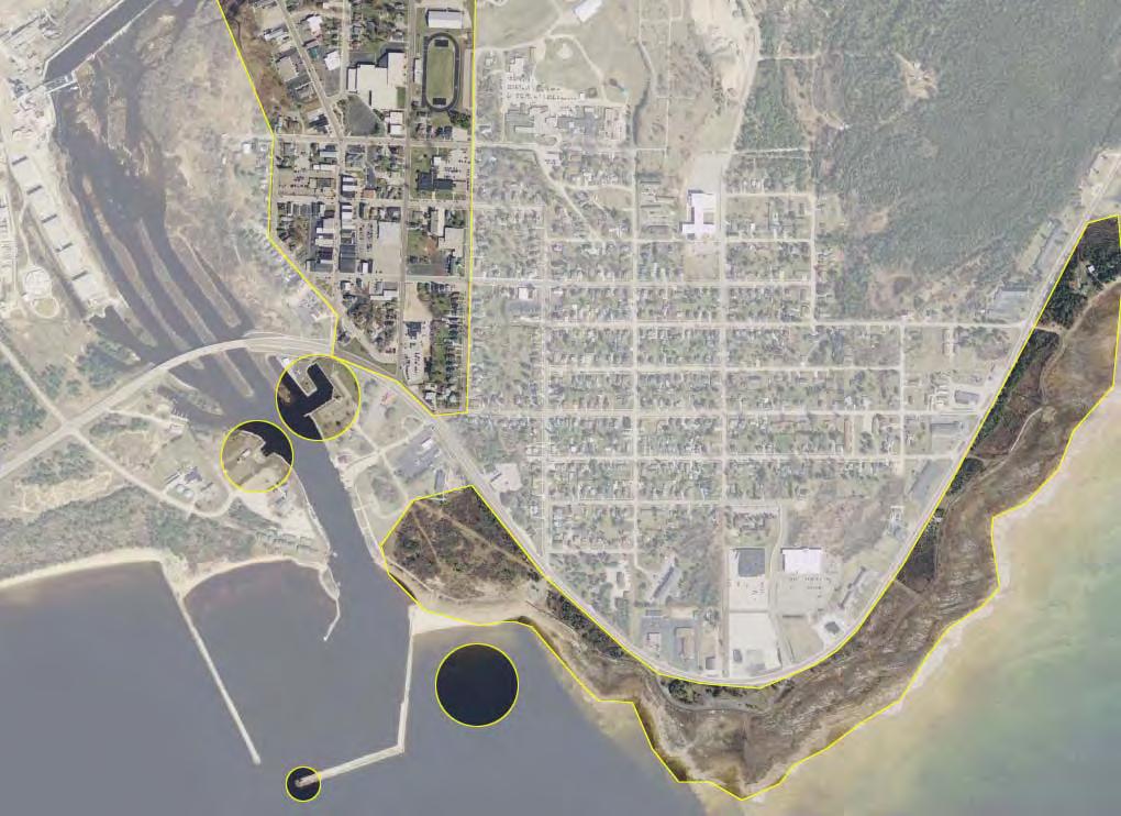
8 Marquette 8 USACE
9 Actions Marquette Dock Company Coal Dock Harbor study Property acquisition Conversion of rail yard and tracks to trail Community engagement and visioning Form-based code Marina studies and improvements Mixed use redevelopment Recreation plan SGRAT workshop Master plan updates circa 1938 Mattson Lower Harbor Park Superior View 2004 Marquette Community Master Plan 9

10 Goals Increase access to waterfront Physical connectivity between downtown and waterfront Promote redevelopment in an environmentally sound manner Reuse of underutilized waterfront New downtown housing options Maintain a working waterfront Preserve and increase greenery 10
11 Actions Marquette Dock Company Coal Dock Harbor study Property acquisition Conversion of rail yard and tracks to trail Community engagement and visioning Form-based code Marina studies and improvements Mixed use redevelopment Recreation plan SGRAT workshop Master plan updates circa 1938 Mattson Lower Harbor Park Superior View 2004 Marquette Community Master Plan 11

12 Waterfront Form-Based Code Form-based code: an alternative to conventional zoning that uses physical form, rather than separation of uses, to regulate and establish standards for the built environment. Workshop Flex North Lakeshore General Five Founders Five General 3 Working Waterfront Zone Parking Setback Line Future ROW Public Use Area 12

13 HEIGHT SITING ELEMENTS USE 13

14 14

15 Traditional Neighborhood -Residential Commercial Traditional Neighborhood-Residential Gateway Corridor-Mixed Use Waterfront-Mixed Use Waterfront-Recreation Conservation Powerplant-Special District 15


16 Actions Marquette Dock Company Coal Dock Harbor study Property acquisition Conversion of rail yard and tracks to trail Community engagement and visioning Form-based code Marina studies and improvements Mixed use redevelopment Recreation plan SGRAT workshop Master plan updates circa 1938 Mattson Lower Harbor Park Superior View 2004 Marquette Community Master Plan 16


17 Waterfront Smart Growth Smart Growth Principles Mix land uses Take advantage of compact design Provide a range of housing choices Create walkable communities Foster distinctive, attractive communities Preserve open space + critical environmental areas Direct development toward existing communities Provide a variety of transportation options Make development decisions predictable + fair Encourage community + stakeholder collaboration AND FOR COASTAL WATERFRONTI COMMUNITIES SMART GROWTH 17

18 Waterfront SGRAT MICHIGAN Michigan s Coastal Communities Assess Waterfront Smart Growth Success Accessible walkways and scenic views are key elements for waterfront smart growth. PHOTO COURTESY OF MICHIGAN SEA GRANT The potential of Michigan s waterfront communities to attract people for work, living, and play is hampered when waterfronts lack public access, walkability, or a mix of scenic and civic uses. Now a self-assessment tool and workshop can help communities support their waterfronts to be sustainable and economically vibrant centers for public life. Michigan s Waterfront Smart Growth Readiness Assessment Tool is a voluntary self-audit that is undertaken by officials and stakeholders in waterfront communities during facilitated workshops. In 2010 and 2011, eight communities piloted the tool, and more communities will participate in the coming months. The online tool asks the community to rate its performance on waterfront smart growth principles such as compact community design, the preservation of open space and natural beauty, community collaboration, and other factors (see Smart Growth Coastal and Waterfront Elements ). It s exciting to see different parts of a community come together with a vision for their waterfront seeing where they are right now and where they might want to be. Mark Breederland, Michigan Sea Grant The Michigan Citizen Planner, Planning and Zoning Center, and Land Policy Institute of Michigan State University (MSU) developed the waterfront smart growth tool, which was inspired by and adapted from MSU s original Smart Growth Readiness Assessment Tool. Michigan Sea Grant and MSU s Greening Michigan Institute facilitate the workshops and complete final reports. Tool development was funded by NOAA s Office of Ocean and Coastal Resource Management through Michigan s Coastal Zone Management Program. the waterfront. The waterfront may be dominated by one or two types of uses that are spread out, instead of a mix of uses placed close together that draw many people. Or it may have transitioned from water-dependent uses, like fisheries, to non-water-dependent uses such as condo construction that block scenic views or access to natural resources. ONE CITY S EXPERIENCE The City of Alpena and its surrounding township are located in northeastern Michigan along Lake Huron s Thunder Bay and Thunder Bay River. Moreover, in 2010 a new zoning ordinance adopted by the City of Alpena included a mixed-use waterfront development district that encourages property ownership and water-related land uses while opening up public access to the waterfront. One thing the assessment made clear is that we needed a better working knowledge of how our local waterfront ASSETS AND CHALLENGES regulation process related to state and federal regulations, It s exciting to see different parts of a community come says Sundin. As a result, we are strengthening this weak Strengthen and direct development toward existing together with a vision for their waterfront seeing understanding With 3,288 miles the of coast, second permits in length only to they need, which agencies have information link so we can better assist our riverfront property communities to and encourage waterfront revitalization. where they are right now and where they might want Alaska, Michigan has many waterfront assets. owners in understanding the permits they need, which Provide a variety of land- and waterbased transportation options. to be, says Mark Breederland, an extension educator be involved, The state s and coastal communities how front four to Great start Lakes and the process. agencies have to be involved, and how to start the process. and workshop facilitator for Michigan Sea Grant. provide homes for 44 percent of Michigan s population. Make development decisions predictable, fair, Moreover, an estimated 804,381 state jobs relate to ONWARD AND UPWARD and cost-effective through consistent pol icies the Great Lakes and translate into $54 billion in annual Greg Sundin and coordinated permitting processes. employee compensation, according to Michigan s Great Lakes Jobs, a 2009 report by Michigan Sea Grant. Waterfront communities have a competitive advantage because people want to work and play there, says Breederland. Many of our towns want to strengthen their waterfront economy by preserving character and public access, but challenges may be in the way. This tool was developed to help them understand both their success and their problems, so they can succeed. With results in on the pilot, the project partners are now considering a few adjustments that could make the tool and webpage more accessible and user friendly. A second wave of self-assessment workshops is also planned. One of the best experiences for Breederland is seeing how communities use self-assessment to build smart growth momentum. At the end of one workshop, people volunteered to stay afterward, and they decided to meet twice a year from then on to track their progress with waterfront smart growth, he says. Smart Growth Coastal and Waterfront Elements When we took the self-assessment, were quite One thing the assessment made clear pleased to see our is successes, that says Greg Sundin, the needed a city s director of planning and development. Alpena s better working knowledge of how our local waterfront regulation waterfront area includes a picturesque downtown with commercial, recreational, and tourism sectors; an mile loop for biking, walking, and inline skating; and easy process related to state and federal access regulations... to Thunder Bay National Marine Sanctuary. As a result, we are strengthening this weak information link so we can better assist our riverfront property owners in The self-assessment is designed so it can be repeated. We have hopes, Breederland says, of going back to these communities a few years from now and watching them congratulate themselves when their smart growth scores go up. Mix land uses, including water-dependent uses. Director of Planning and Development, City of Alpena Take advantage of compact community design that enhances, preserves, and provides access to waterfront resources. Provide a range of housing opportunities and choices to meet the needs of both seasonal and permanent residents. Create walkable communities with physical and visual access to and along the waterfront for public use. Foster distinctive, attractive communities with a strong sensee of place that capitalizes on the waterfront s ts heritage. Preserve open space, farmland, natural beauty, and the critical environmental areas that characterize and support coastal and waterfront communities. Encourage community and stakeholder collaboration in development decisions, ensuring that public interests in and rights of access to the waterfront and coastal waters are upheld. From Smart Growth for Coastal and Waterfront Communities at Each community later receives an objective score and written summary outlining its smart growth successes, benchmarking its progress, and suggesting potential areas of improvement. Michigan s challenges are shared by many other U.S. waterfront communities. For instance, the departure of big industry may have left brownfields and structural eyesores along For more information on the Waterfront Smart Growth Readiness Assessment Tool, contact Wayne R. Beyea, extension specialist and instructor for Michigan State University s School of Planning, Design, and Construction at beyea@msu.edu or (517) You can also learn more by visiting 8 SEPTEMBER/OCTOBER 2012 COASTAL SERVICES COASTAL SERVICES SEPTEMBER/OCTOBER NOAA Coastal Services Center Magazine Feature September October
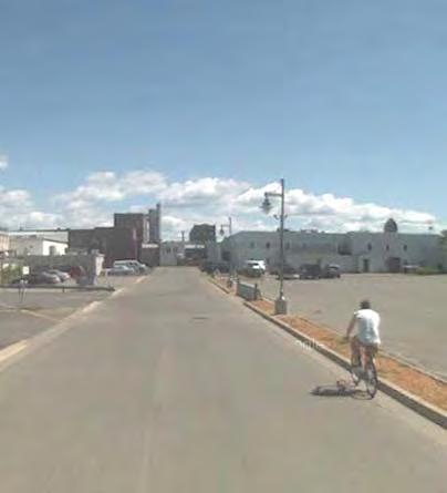
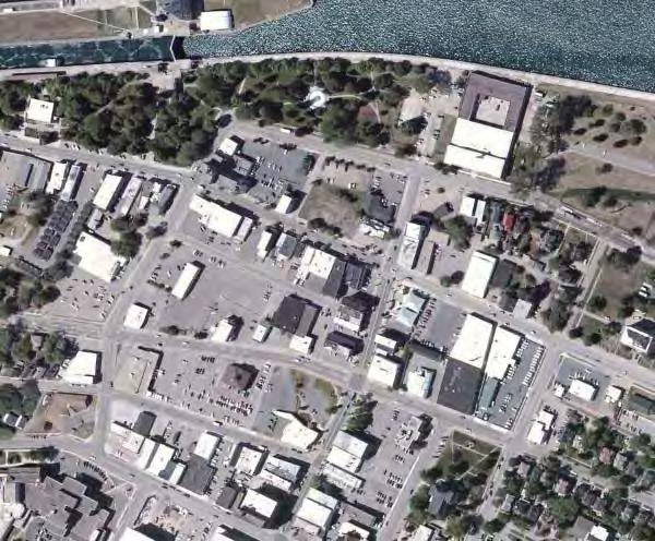
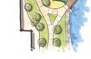
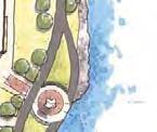
19 Lake Superior Lower Harbor and Downtown 19
20 20
21 21
22 22
23 23

24 24
25 25


26 The Landing Proposed Buildings FoundersLanding.com 26
27 27
28 28
29 29
30 30

31 31

32 Sault Ste. Marie 32 USACE

33 Water Street Final design and reconstruction plan for historic Water Street CZMP grant funded Leveraged history as a long standing community Created coastal walkway that links natural resources, historical and cultural opportunities, and urban neighborhoods Flickr 33


34 PlacePlan Project 2013 Google 34


35 Goals Create transition zone that increases connectivity between downtown and tourist area Provide public gathering space Generate interest and activity Strengthen local and regional economy Honor heritage Leverage existing assets 4 seasons, indoor-outdoor, fl exible space Provide mix of uses 35

36 Context Image courtesy of the city of Sault Ste. Marie 36

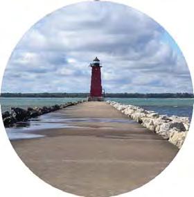
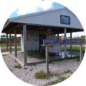
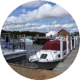
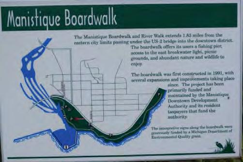
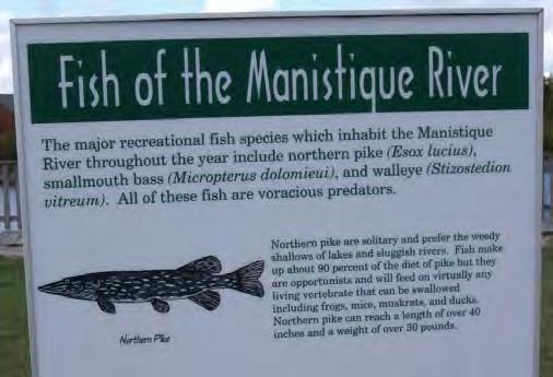
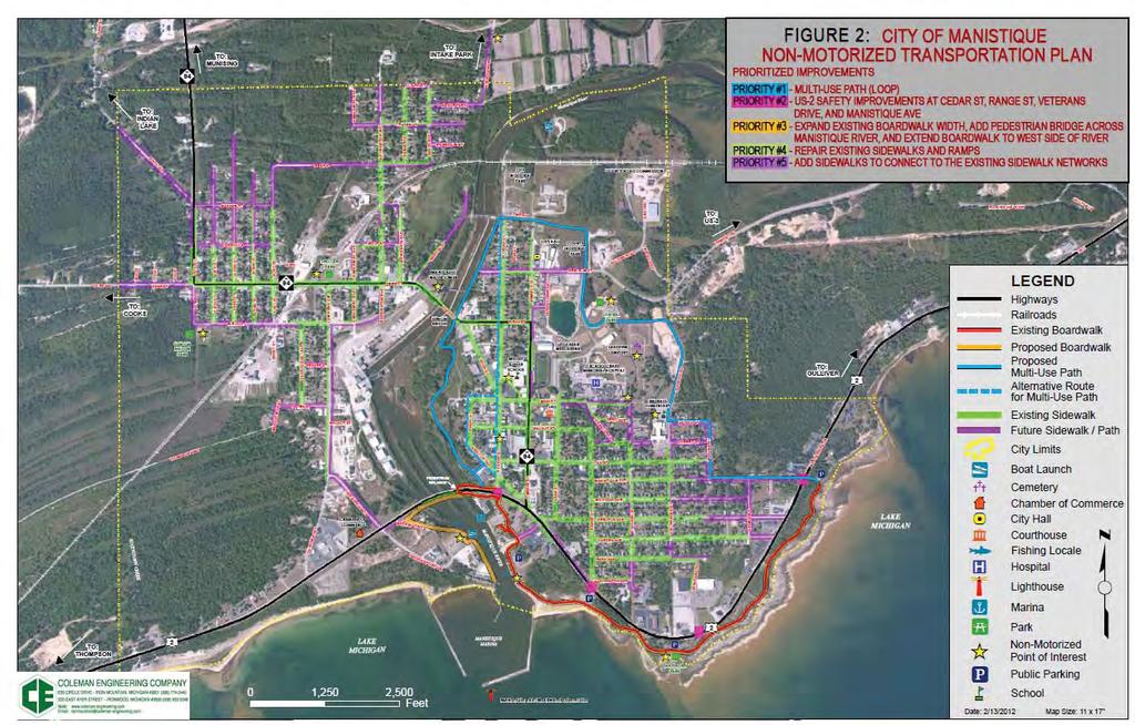
37 Concept Plan Image courtesy of the city of Sault Ste. Marie 37
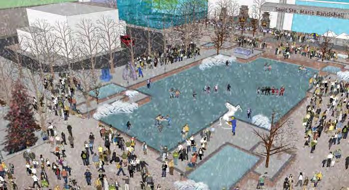
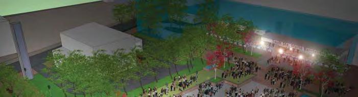

38 Perspectives Images courtesy of the city of Sault Ste. Marie 38


39 3RD STREET 4TH STREET Port Huron URBAN PLAZA/ PERFORMANCE SPACE/ FARMER S MARKET WATER STREET VERTICAL ELEMENT WATER STREET SHARED USE TRAIL SHORELINE PROTECTION WALL STREET COMMUNITY PLAZA FOCAL FEATURE -SCULPTURE -EXHIBIT SHARED USE PATH INTERACTIVE/ DEMONSTRATION AREA FISHING NOTCH AMPHITHEATER/ OUTDOOR TEACHING AREA OVERLOOK/ INTERPRETATION AREA WETLAND HABITAT PEDESTRIAN BRIDGE TYPICAL TRAIL NODE OUTDOOR CLASSROOM/DEMONSTRATION AREA PORT HURON SOUTH RIVERFRONT PLAN PLAN ENLARGEMENTS - NOVEMBER 2010 N


40 Goals Tie waterfront to downtown Increase access to waterfront Increase development opportunities Establish natural areas and wetlands Promote water-related use UniqueAmerica 40


41 Fishtown, Leland Fishtown Preservation Society developed a master plan, historic structure report, and long-term interpretive plan to ensure that Fishtown remains an active fi shery, historic site, and tourist attraction open to all FSP continues to create creative signage and interactive displays to educate visitors and contribute to branding Leland created a historic district 41

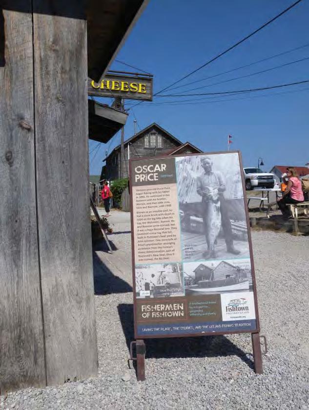
42 Fishtown, Leland 42


43 Charlevoix Renovated waterfront park to provide better connection between the downtown and marina Created space for programmed, recreational, and leisure activities Increased visual and physical access to waterfront 43


44 Manistique 44
45 Manistique 45
46 Tools for Waterfront Planning Tools + resources to protect water dependent uses + public access Planning Harbor Management Plan Waterfront Smart Growth Waterfronts Master Plan Authority Port Authority Harbor Authority Inventory Coastal Access Site Community Assets Build Out Analysis Economic Assessment Needs Assessment Zoning Form Based Code Overlay Zoning Shoreland Zoning Water Dependent Use Zoning Tax Incentives Current Use Taxation Exemption/Abatement Policy + Regulation Visual Access Design Standards Historic Preservation CZMP Public Trust Doctrine Stakeholder Engagement Coalition Conflict Resolution Visioning Exercise Branding Stakeholder Analysis Land Acquisition + Rights Easement Land Bank Transfer / Purchase of Development Rights 2013 National Working Waterfront Network Online Toolkit: 46


47 CZMP Placemaking Tools Waterfront community planning grants Water dependent use site planning and design Grants for developing and enhancing amenities Smart Growth assistance DOWNTOWN WATERFRONT FORM-BASED CODE WORKSHOP Ken Braband With Ferrell Madden Associates 47
48 Resources National Working Waterfront Network Form-Base Codes - Smart Growth Tactics NOAA Coastal and Waterfront Smart Growth Form-Based Codes Institute Smart Growth Readiness Assessment Project for Public Spaces Smart Growth America Michigan Coastal Zone Management Program EPA Smart Growth Michigan Sea Grant NOAA Coastal Services Center Digital Coast Michigan Municipal League placemaking.mml.org/ 48

49 Elizabeth Durfee NOAA Coastal Management Fellow Michigan CZMP Michigan Sea Grant
{Best Practices. Summary of Tools, Strategies and Best Practices from 11 Michigan Case Study Communities
 Case Studies Michigan Coastal Community Working Waterfronts { Summary of Tools, Strategies and from 11 Michigan Case Study Communities Table of Contents Zoning...2 Community and Stakeholder Collaboration
Planning for Waterfront Communities
 Planning for Waterfront Communities Redevelopment Ready Communities Supplemental Training Program OFFICE OF THE GREAT LAKES Waterfront Community Best Practices and Guidelines New supplemental criteria
Citizen Engagement for a Sustainable Built Environment
 Citizen Engagement for a Sustainable Built Environment Examples and Case Studies from Michigan Communities Genesee County Metropolitan Planning Commission 10 th Annual Planning Forum October 23, 2015 Wayne
DISCUSSION TOPIC: ST JOHNS RIVER & ITS TRIBUTARIES (BPII) 2030 COMPREHENSIVE PLAN POLICES AND REGULATORY FRAMEWORK
 2030 COMPREHENSIVE PLAN POLICES AND REGULATORY FRAMEWORK") DISCUSSION TOPIC: ST JOHNS RIVER & ITS TRIBUTARIES (BPII) 2030 COMPREHENSIVE PLAN POLICES AND REGULATORY FRAMEWORK St. John s River & Its Tributaries Issue Summary: The St. Johns River is an important
DISCUSSION TOPIC: ST JOHNS RIVER & ITS TRIBUTARIES (BPII) 2030 COMPREHENSIVE PLAN POLICES AND REGULATORY FRAMEWORK St. John s River & Its Tributaries Issue Summary: The St. Johns River is an important
Chapter 3. Community Vision and Goals
 Chapter 3. Community Vision and Goals 3.1 Public Involvement Charlevoix s master plan was prepared in a way that maximized public participation. Dating back to 2004, the Planning Commission and staff held
TOWN COUNCIL / PLANNING COMMISSION
 Workshop #3 TOWN COUNCIL / PLANNING COMMISSION January 20, 2011 Consultant Team In Attendance Tonight BMS Design Group Nevada City and San Francisco Michael Smiley, AICP, ASLA Partner-in-Charge Nancy L.
Best Practices Appendix: Waterfront Communities
 Redevelopment Ready Communities Best Practices Appendix: Waterfront Communities revised September 2014 Waterfront RRC defined The purpose of these additional criteria is to provide waterfront communities
Photo credit: U.S. EPA
 Smart Growth for Coastal & Waterfront Communities Heceta Head Coastal Conference October 29 th, 2010 Kris Wall, NOAA Photo credit: U.S. EPA Smart Growth Mixed land uses Range of housing choices Compact
Zoning and Development Considerations in the Boothbay Harbor Maritime/Water Dependent District
 Zoning and Development Considerations in the Boothbay Harbor Maritime/Water Dependent District Bob Faunce Lincoln County Planner Lincoln County Regional Planning Commission Board of Selectmen and Planning
City of Lake Mary, Florida. Evolution of a Historic Downtown with Transit Oriented Development Strategies
 City of Lake Mary, Florida Evolution of a Historic Downtown with Transit Oriented Development Strategies What is Transit Oriented Development? Walkable villages located at and around transit stations in
RRC WATERFRONT PLANNING TOOLKIT AND GUIDELINES
 RRC WATERFRONT PLANNING TOOLKIT AND GUIDELINES The purpose of this toolkit is to provide more detail on best planning practices identified in the RRC Best Practice Evaluation Criteria Waterfront-specific
Ivywild On The Creek PRELIMINARY CREEK DISTRICT MASTER PLAN
 Ivywild On The Creek PRELIMINARY CREEK DISTRICT MASTER PLAN Introduction: Rejuvenating an extraordinary Creekside neighborhood THE CREEKSIDE DISTRICT The Ivywild On The Creek Neighborhood District Master
About Momentum Midland
 About Momentum Midland Achieving a community s full potential in terms of economic development and quality of life is critically important to its long term sustainability. Core to achieving this is a vibrant
City of Plattsburgh DRI: Downtown Streetscapes & Riverfront Access. Downtown Streetscape and Riverfront Access Design
 City of Plattsburgh DRI: Downtown Streetscapes & Riverfront Access Welcome Thank you for coming this evening. Agenda PART I - Project Context The Downtown Revitalization Program Our DRI Projects Other
Strategies/Actions Priority List
 Strengthening the Creative Sector: Build stronger relationships with, and between, cultural organizations and businesses and increase opportunities for working together to build capacity within organizations.
Making Transit Oriented Development Work For Boonton, NJ
 Making Transit Oriented Development Work For Boonton, NJ Bloustein School of Planning and Public Policy Studio Dan Burton Loannie Dao Webster Slater Brandon Williams Ian Watson Maria Laham Nicola Mammes
Municipal Plan*Assessment
 Municipal Plan*Assessment This tool was developed to assist in reviewing municipal master plans and in determining if these plans are consistent with smart growth principles, neighboring municipal plans,
DRAFT ROOSEVELT ROAD. District Recommendations. Figure 5.23 The Roosevelt Road Corridor
 CHAPTER 5 Figure 5.23 The Road Corridor Road will develop as a mixed-use corridor, emphasizing regional retail, west of the river and mixed-use development east of the river. KEY RECOMMENDATIONS 1. High
Coastal Smart Growth Approaches for Working Waterfront Preservation, Implementing Locally-Based Strategies and Solutions
 Coastal Smart Growth Approaches for Working Waterfront Preservation, Implementing Locally-Based Strategies and Solutions National Working Waterfronts Symposium March 26, 2013 Presented by: Lydia Bennett
Libby Zemaitis October 18, 2017 Climate Outreach Specialist, NYS DEC Hudson River Estuary Program
 1 Supporting Hudson Riverfront communities as Climate-Adaptive Leaders Libby Zemaitis October 18, 2017 Climate Outreach Specialist, NYS DEC Hudson River Estuary Program The Hudson River Estuary Program
Ship Creek Redevelopment
 Ship Creek Redevelopment Three Concepts May 2013 Cambridge ARCHITECTURE Philadelphia ENGINEERING Raleigh INTERIORS San Francisco PLANNING Washington, DC www.klingstubbins.com contact@klingstubbins.com
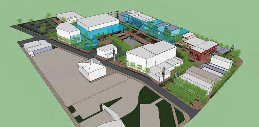
Baraga Avenue PlacePlan Marquette, MI July 24 th, 2014
 Baraga Avenue PlacePlan Marquette, MI July 24 th, 2014 Presentation Outline Project Purpose Acknowledgements Placemaking Overview PlacePlan Process Design Overview PlacePlan Recommendations Physical Design
Introducing the Main Street Strategic Toolbox
 Ulster County Main Streets: A Regional Approach Ulster County Planning Department, 244 Fair Street, Kingston NY 12401 Why do we take a regional approach to Main Streets? There are many different approaches
Regions are Growing...
 Growing Strong Communities: The rural version of smart growth New Partners for Smart Growth Conference 2006 Matthew Dalbey January 27, 2006 U.S. Environmental Protection Agency Development, Community and
IMPLEMENTING SOMERSET COUNTY S INVESTMENT FRAMEWORK
 IMPLEMENTING SOMERSET COUNTY S INVESTMENT FRAMEWORK SMART CONSERVATION THROUGH SMART GROWTH NJ LAND CONSERVATION RALLY March 22, 2014 Laurette Kratina, PP, AICP, Supervising Planner Somerset County Planning
CHAPTER 1 Introduction
 CHAPTER 1 Introduction From sea to summit, Lane County covers almost 4,800 square miles of diverse Oregon landscape. Stretching from the Pacific Ocean through the Coastal Range, the Willamette Valley to
Town of Peru Comprehensive Plan Executive Summary
 Town of Peru Comprehensive Plan Executive Communities that plan grow by choice, not by chance. A plan makes growth thoughtful, understandable, and predictable. A plan shows that a community is managing
Al Hansen, Director of Parks and Recreation City of Petoskey, Michigan
 Al Hansen, Director of Parks and Recreation City of Petoskey, Michigan 231-347-2500 ahansen@petoskey.us What is Placemaking? Definitions Found Online: Creating a sense of place Creating a sense of belonging
A BLUEPRINT FOR BROCKTON A CITY-WIDE COMPREHENSIVE PLAN
 A BLUEPRINT FOR BROCKTON A CITY-WIDE COMPREHENSIVE PLAN Public Meeting October 2016 1 Plan Summary and Discussion Public Meeting May 4 2017 City of Brockton Bill Carpenter, Mayor Department of Planning
Table L-1 Summary Action Strategy. Action Item Timing Status Responsible Agency
 CHAPTER 4: CIRCULATION ELEMENT ISSUE #1: MAJOR THOROUFARES AND TRANSPORTATION ROUTES A balanced transportation system for Fontana is provided that meets the mobility needs of current and future residents
The John Bartram Association Action Plan to advance the 10 year Strategic Plan
 The John Bartram Association 2013-2015 Action Plan to advance the 10 year Strategic Plan We are poised to take significant leaps with the opportunities that surround us. In the next three years we are
THE TOWN OF WASAGA BEACH
 THE TOWN OF WASAGA BEACH Downtown Development Master Plan Committee of the Whole Presentation January 26 th 2017 Uses within this designation should reflect a dependence on tourism as opposed to the permanent
CHAPTER 3 VISION, GOALS, & PLANNING PRINCIPLES. City of Greensburg Comprehensive Plan. Introduction. Vision Statement. Growth Management Goals.
 CHAPTER 3 VISION, GOALS, & PLANNING PRINCIPLES Introduction The Greensburg Comprehensive Plan is intended as a working community document. A combination of long and short-term goals, this document is intended
Project Profile BAR HARBOR
 1 BAR HARBOR The Bar Harbor Master Plan merges community vision with design guidelines to preserve the unique character of Bar Harbor Village. PROJECT SUMMARY Overview: The economic vitality of Bar Harbor
PLAN ELEMENTS WORKSHOP. April 5, 2016
 PLAN ELEMENTS WORKSHOP April 5, 2016 needs more housing. But there is no one-size fits-all solution. Every neighborhood has its own character. In some places, density is not only appropriate it is badly
CHAPTER 8 ISSUES, CONCERNS, CONSTRAINTS AND OPPORTUNITIES
 CHAPTER 8 ISSUES, CONCERNS, CONSTRAINTS AND OPPORTUNITIES Introduction This River Conservation Plan was developed during a time of tremendous activity and effort in planning the transformation of the Delaware
Downtown Whitby Action Plan
 Downtown Whitby Action Plan Final Report October 2016 Table of Contents Introduction 1 Public Consultation 2 Walkability 3 Downtown Whitby Walkability Map 4 Vision 5 Goal & Objectives 6 Objective 1 7 Objective
NACCED/NACo CONFERENCE JULY 10, 2015
 NACCED/NACo CONFERENCE JULY 10, 2015 Regional Growth Framework 2 Regional Growth Framework Regional Priorities Preferred Growth Concept Tools to Support Local Governments 3 Top Priorities for the CONNECT
Grantsburg Community Design Team (CDT)
") Grantsburg Community Design Team (CDT) Summary Report Overview On April 10-13, 2014, a team of (19) volunteer planners, design professionals, and community development educators volunteered their time
Grantsburg Community Design Team (CDT) Summary Report Overview On April 10-13, 2014, a team of (19) volunteer planners, design professionals, and community development educators volunteered their time
PRINCIPLE 6: Preserve open space, farmland, natural beauty, and critical environmental areas
 HOW TO APPLY SMART GROWTH PRINCIPLES TO RURAL COMMUNITIES PRINCIPLE 6: Preserve open space, farmland, natural beauty, and critical environmental areas A product of AND A cooperative publication from the
PLANNING ADVISORY BOARD AGENDA OCTOBER
 ! City of Langley PLANNING ADVISORY BOARD AGENDA OCTOBER 1, 2014 3-5pm LANGLEY CITY HALL - 112 2 nd Street, Langley WA 1) Call to Order and Roll Call 2) Approval of the Minutes September 10, 2014 3) Public
Waterfront Development Master Plan
 PORT of VANCOUVER USA Vancouver, WA Waterfront Development Master Plan DRAFT - FINAL CONCEPTUAL MASTER PLAN PROJECT TEAM NBBJ Heritage Research Associates JLA Kittelson Associates Leland Consulting Group
QUINCE ORCHARD/FIRSTFIELD CORRIDOR CITY OF GAITHERSBURG MTAP 2017
 QUINCE ORCHARD/FIRSTFIELD CORRIDOR CITY OF GAITHERSBURG MTAP 2017 ULI LEADERSHIP INSTITUTE 2017 The Team Allison Davis, WMATA Daniel Park, Rodgers Consulting Debbie Albert, Arlington County Harry Ross,
Regional Placemaking: Connecting Towns as Places
 Regional Placemaking: Connecting Towns as Places Philip Myrick, Project for Public Spaces Corning, NY May 13, 2009 30 years - 1000 communities - 46 states - 12 countries Two City Streets It is difficult
Visioning Statement and Guiding Principles
 Visioning Statement and Guiding Principles Planning for the Future The General Plan The General Plan represents Woodland's shared vision of the future and defines a path to lead the community toward its
MASTER PLANNING: THE CRITICAL ROLE OF ELECTED LEADERS AND THE PLANNING COMMISSION Planning Michigan Conference
 MASTER PLANNING: THE CRITICAL ROLE OF ELECTED LEADERS AND THE PLANNING COMMISSION 2018 Planning Michigan Conference Today s Presenters: Chris McLeod, AICP, Sterling Heights City Planner Gerald (Jerry)
Anatomy of A Vibrant Downtown. Anatomy of a Vibrant Downtown
 Anatomy of A Vibrant Downtown The goal of MAIN ST. REVITALIZATION PLANNING is to provide a framework that will help transform your downtown into a VIBRANT DOWNTOWN a place where people love to LIVE, WORK,
Food Innovation Districts An Economic Gardening Tool. Patty Cantrell Sarah Lucas Lakes to Land November 14, 2012
 Food Innovation Districts An Economic Gardening Tool Patty Cantrell Sarah Lucas Lakes to Land November 14, 2012 Provide services to local governments in 10-county region Planning master plans, recreation
section 3: Vision, Values and Goals
 Vision, Values and Goals 3 2041 Vision: Victoria is an urban sustainability leader inspiring innovation, pride and progress towards greater ecological integrity, livability, economic vitality, and community
Keyport. Vision for Keyport
 Keyport Vision for Keyport Keyport is a rural, historic waterfront village bounded and limited in size by its natural borders of water and the Naval Undersea Warfare Center. The community consists primarily
Tonight s presentation and conversation is being conducted by CityVisions Associates and Gamble Associates, who have been selected by the City and
 1 1 2 Tonight s presentation and conversation is being conducted by CityVisions Associates and Gamble Associates, who have been selected by the City and County to conduct the Downtown Frankfort Master
Status Report: MD 355 Project
 Status Report: MD 355 Project OCTOBER 2006 M-NCPPC MONTGOMERY COUNTY PLANNING DEPARTMENT Summary of Community Comments, and break to the Results of the MD 355 Participation Session Brookside Gardens -
Downtown Dubuque...it s a great time.
 Downtown Dubuque...it s a great time. Your timing could not be better to invest in Downtown. With hundreds of millions in public and private investment occurring on the City s downtown waterfront, millions
LUNDY S LANE COMMUNITY IMPROVEMENT PLAN STUDY
 PUBLIC INFORMATION MEETING #2 October 12, 2016 LUNDY S LANE COMMUNITY IMPROVEMENT PLAN STUDY AGENDA 5:00 to 5:30pm: Open House 5:30 to 6:15pm: Presentation 6:15 to 7:00pm: Individual paced workshop with
3.9 Systems Interrelationships
 191 Sustainability Building Blocks: The Comprehensive Plan Systems Community Form Economy Social Transportation Natural Resources Housing and Neighborhoods Utilities and Infrastructure Institutions.9 Systems
10.0 Open Space and Public Realm
 10.0 Open Space and Public Realm 10.0 Open Space and Public Realm The Public Open Space System is comprised of: outdoor spaces available for public use that are either publicly owned (e.g., parks and
REQUEST FOR PROPOSAL DOWNTOWN MASTER PLAN & PARKING STUDY CITY OF MONROE, MICHIGAN
 REQUEST FOR PROPOSAL DOWNTOWN MASTER PLAN & PARKING STUDY CITY OF MONROE, MICHIGAN RESPONSES ARE DUE: 10:00AM, TUESDAY, SEPTEMBER 5, 2017 CITY OF MONROE OFFICE OF THE CITY CLERK/TREASURER 120 EAST FIRST
The Vision. Photo provided by The Minervini Group. 46 Vision, Objectives & Strategies
 Vision, Objectives & Strategies The is the public framework and guide for future development of the Grand Traverse Commons. The establishes public polices for infrastructure, the preservation of natural
Corridors. Re-vitalize our Corridors and Gateways
 Corridors Re-vitalize our Corridors and Gateways Artist s rendering from the 287 Strategic Plan, 2015 Corridors are the major throughways of Loveland but they also provide important commercial, community
The Five Components of the McLoughlin Area Plan
 The Five Components of the McLoughlin Area Plan This documents contains the complete language of the five components of the McLoughlin Area Plan: The Vision Statement The Values The Guiding Principles
SAN RAFAEL GENERAL PLAN 2040 INTRODUCTION AND OVERVIEW
 SAN RAFAEL GENERAL PLAN 2040 INTRODUCTION AND OVERVIEW Steering Committee Presentation February 14, 2018 Purpose of General Plan Guide land use and development decisions Coordinate transportation, infrastructure,
Route 1 Corridor Study
 Route 1 Corridor Study Westbrook, Connecticut A Vision for the Connecticut Shoreline Public Informational Meeting July 28, 2015 Lower Connecticut River Valley Council of Governments Fitzgerald & Halliday,
V. Vision and Guiding Principles
 V. Vision and Guiding Principles The Master Plan for the Powers Ferry Corridor seeks a foundation in the desires of the community. At times, various elements of the community offered opposing viewpoints,
1 October Dear Citizens of Charlotte and Mecklenburg County,
 1 October 2011 Dear Citizens of Charlotte and Mecklenburg County, As co-chairs of the Center City 2020 Vision Plan Steering Committee, we are proud to present the Center City 2020 Vision Plan, which sets
TOD 101 CREATING LIVABLE COMMUNITIES WITH TRANSIT
 1 CREATING LIVABLE COMMUNITIES WITH TRANSIT What are transit Centered Communities? Benefits of Partnerships to Support and Implement What You Will Learn Portland s Pearl District Your Trainers Today Catherine
2040 LUP is a part of the Comprehensive Plan and carries the same legal authority. Economic Challenges
 1.1. Guiding Anchorage s Growth Where will new residents settle over the next two decades? Where will people work, shop, and play? Will there be enough room to grow? How will Anchorage look? Will growth
EXECUTIVE SUMMARY EXECUTIVE SUMMARY
 1 EXECUTIVE SUMMARY EXECUTIVE SUMMARY Penn s Landing is envisioned as a welcoming riverfront green space adjacent to a refurbished civic marina becoming the centerpiece for adjacent development. With a
Linking Ecological Restoration and Economic Recovery at a Great Lakes Area of Concern: Muskegon Lake, MI. Heather Braun Great Lakes Commission
 Linking Ecological Restoration and Economic Recovery at a Great Lakes Area of Concern: Muskegon Lake, MI Heather Braun Great Lakes Commission Why Here? Restoration in urban centers: Muskegon Lake AOC Why
THE CITY OF MARQUETTE A CASE STUDY. Michigan Coastal Community Working Waterfronts
 A CASE STUDY { THE CITY OF Michigan Coastal Community Working Waterfronts A CASE STUDY THE CITY OF Michigan Coastal Community Working Waterfronts This case study was compiled as part of a set of 11 working
Bourne Downtown Site Planning
 Prepared for: The Town of Bourne, MA In Cooperation with: Bourne Financial Development Corporation Prepared by:, Inc. June 24, 2009 Table of Contents Introduction and Summary... 1 Site Existing Conditions...
ICLEI Webinar Sustainability in the Master Plan and Zoning Code
 ICLEI Webinar Sustainability in the Master Plan and Zoning Code Sustainability in Grand Rapids 2000 2002 New Master Plan 2004 2005 Neighborhood Pattern Workbook 2006 2007 Form-Based Zoning Ordinance 2007
Village of Fair Haven Goals & Objectives
 Village of Fair Haven Goals & Objectives 1 Natural Environmental Quality & Aesthetics Embrace policies and programs that preserve and enhance the Village s natural resources, environment, water quality,
Comprehensive Plan Advisory Panel Meeting #3
 Comprehensive Plan Advisory Panel Meeting #3 November 7, 2016 Agenda 1. September 19 th Meeting Notes 2. Summary of Focus Areas Charrette 3. Heart of the City Focus Area a. HOC2/Station Areas Concept &
ECONOMIC DEVELOPMENT. Guiding Principles
 ECONOMIC DEVELOPMENT Consistent with the Guiding Principle Make Fort Lupton a comable place for everyone, Fort Lupton will strive to create a sustainable standard of living and high quality of life for
Laberge Group. Town of Coeymans. Draft Comprehensive Plan. Overview of Planning Process
 Draft : Presentation of Goals & Strategies Laberge Group Benjamin H. Syden, A.I.C.P., E.D.P Director in Charge Nicole Allen, A.I.C.P. Senior Planner Anjali Malhotra Planner Presentation Outline Introductions
Atlanta BeltLine, Inc. Pathways to Urban Sustainability
 Atlanta BeltLine, Inc. Pathways to Urban Sustainability September 30, 2010 WHAT IS THE ATLANTA BELTLINE? Transit 22-mile loop Parks 1300 + new acres Trails 33 miles Jobs & Economic Development 20 areas,
VACANT TO VIBRANT : GREEN INFRASTRUCTURE & URBAN REVITALIZATION
 VACANT TO VIBRANT : GREEN INFRASTRUCTURE & URBAN REVITALIZATION Calumet Summit 2013: Connecting for Action Lauren Riga, Director City of Gary Department of Green Urbanism Gary Storm Water Management District
Animating the Rideau Canal December 2013
 Executive Summary Animating the Rideau Canal December 2013 Why study the Rideau Canal? The Rideau Canal has been an important part of Ottawa throughout its history, and has shaped and been shaped by the
NEIGHBORHOOD DESIGN ELEMENT
 NEIGHBORHOOD DESIGN ELEMENT INTRODUCTION The following recommendations constitute an urban design oriented "neighborhood analysis" of Plantation. It is an optional Comprehensive Plan Element. The five
Embrace Green Urban Space:
 1 Embrace Green Urban Space: Parks/Green Space as Vital to Urban Livability Jenna Fletcher The Trust for Public Land LUAC November 15, 2012 2 The Trust for Public Land conserves land for people to enjoy
Regional Context Statement
 Regional Context Statement REGIONAL CONTEXT STATEMENT 3. REGIONAL CONTEXT STATEMENT In 1995, the Provincial Government passed into law the Growth Strategies Act. The purpose of this provincial initiative
APPENDIX K WINDSOR OFFICIAL PLAN
 CEAA ENVIRONMENTAL ENVIRONMENTAL IMPACT ASSESSMENT AMBASSADOR BRIDGE ENHANCEMENT PROJECT Replacement Span and Plaza Expansion APPENDIX K WINDSOR OFFICIAL PLAN Avalon Consulting Professionals of Ontario,
RECREATION AND OPEN SPACE ELEMENT GOALS, OBJECTIVES, AND POLICIES
 RECREATION AND OPEN SPACE ELEMENT GOALS, OBJECTIVES, AND POLICIES Goal 7 To provide park facilities, recreation programs, and open space resources that are safe, adequate, and accessible to all City residents,
A. WHAT IS A GENERAL PLAN?
 I. Introduction A. WHAT IS A GENERAL PLAN? A general plan is the planning guideline for the future of a city. It contains goals and policies which regulate urban development, the protection of the natural
City of Heath. Town Center Concept
 In the give-and-take of getting projects designed, financed, and approved, the famous refrain from the film Field of Dreams is heard often: if you build it, they will come. From the perspective of the
Historic Preservation Element
 Casa Gardens by Carolyn Pelkey Historic Preservation Element Incorporated in 1928, the City of San Clemente was among the first master planned communities in the U.S. built from open grazing land. Before
S A C R A M E N T O C O U N T Y JACKSON HIGHWAY & GRANT LINE EAST VISIONING STUDY
 JACKSON HIGHWAY & GRANT LINE EAST S A C R A M E N T O C O U N T Y P L A N N I N G D E P A R T M E N T SUMMARY AND WORKBOOK November 19, 2008 History of the Visioning Study Sacramento County has two growth
DRAFT. Waterfronts and Open Spaces. 10 The Riverfront Open Space System
 CHAPTER 4 Waterfronts and Open Spaces 10 The Riverfront Open Space System 12 Planned, proposed and envisioned riverfront recommendations. Figure 4.3.23 The riverfront will become a major new public amenity
CHAPTER 12 IMPLEMENTATION
 CHAPTER 12 IMPLEMENTATION The 2010 Town of Denton Comprehensive Plan is intended to capture a vision of the future of Denton. As such, it provides a basis for a wide variety of public and private actions
PUBLIC REALM STUDY AREA
 WELCOME PUBLIC REALM STUDY AREA WHAT IS PUBLIC REALM? Welcome to the Ballina Town Public Realm public consultation event. Mayo Council is in the process of producing a Public Realm Strategy for Ballina
TEMPLE MEDICAL & EDUCATION DISTRICT
 City of Temple, Texas TEMPLE MEDICAL & EDUCATION DISTRICT 1 Description. The City of Temple joined in partnership with key public and private entities to jointly promote education and medical activities
In surveys, Dallas residents say what they want to change most
 NEIGHBORHOODS ELEMENT In surveys, Dallas residents say what they want to change most in the city is its appearance they want it to look beautiful, with trees and pedestrian-friendly neighborhoods. The
Community Design. Our Use of Land. Introduction
 Community Design Our Use of Land Introduction This element addresses the physical form of the natural environment and the built form of the City. The major features that give San Rafael its visual character
Downtown Streetscape Manual & Built Form Standards
 City of Guelph Downtown Streetscape Manual & Built Form Standards July 2014 Prepared by Brook McIlroy Inc. in association with Unterman McPhail Associates and McCormick Rankin Inc. City of Guelph Downtown
PRINCE GEORGE S PLAZA TRANSIT DISTRICT DEVELOPMENT PLAN AND TRANSIT DISTRICT OVERLAY ZONE UPDATE
 PRINCE GEORGE S PLAZA TRANSIT DISTRICT DEVELOPMENT PLAN AND TRANSIT DISTRICT OVERLAY ZONE UPDATE UNIVERSITY PARK TOWN LISTENING SESSION JUNE 12, 2014 Prince George s County Planning Department The Maryland-National
Windsor Locks Transit-Oriented Development Planning Grant Request. Project Background
 Windsor Locks Transit-Oriented Development Planning Grant Request Project Background Downtown Windsor Locks runs along Main Street in the vicinity of the intersection of Routes 159 and 140. The current
THE 355/270 CORRIDOR:
 THE 355/270 CORRIDOR: Strategic Ideas for Sustaining a Livable Work Place Project Summary ACCESS LIFE DESIGN HEALTH WORK Montgomery County Planning Department The Maryland-National Capital Park and Planning
Somers Point Master Plan
 Somers Point Master Plan Progress Report and Public Meeting August 20, 2014 Master Plan Reexamination Municipal Land Use Law require that all municipalities reexamine their master plan every ten years.
8implementation. strategies
 PROGRAM STRATEGIES 8implementation strategies T he implementation actions of this chapter are designed to support and carry out the land use, economic development, transportation, urban design, and program
Master Plan for Preservation and Scenic Conservation (1995)
") 3.2 Master Plan for Preservation and Scenic Conservation (1995) The Master Plan for Preservation and Scenic Conservation was developed under the direction of the Guilford Preservation Alliance in the 1980s
3.2 Master Plan for Preservation and Scenic Conservation (1995) The Master Plan for Preservation and Scenic Conservation was developed under the direction of the Guilford Preservation Alliance in the 1980s