West Kingston. Village Plan Final Report Town of South Kingstown, RI October 2015
|
|
|
- Morris Dalton
- 5 years ago
- Views:
Transcription


1 West Kingston Village Plan Final Report Town of South Kingstown, RI October 2015
2
3 Contents THE WEST KINGSTON VILLAGE PLAN EXECUTIVE SUMMARY...1 GOALS OF THE PROJECT... 3 Celebrate West Kingston...4 Create a Community Discussion...6 Articulate a Vision...7 Chart a Course for the Future...8 COMMON THREADS...9 Managing Change and Preserving Community Character...9 Connectivity and Circulation...12 SPECIFIC ISSUES...14 Expansion/Future Development Plans at the University of Rhode Island (URI)...14 Potential Loss of Agricultural Land...16 Zoning Ordinance Conformity...19 Important Historic Sites...20 Future Viability of Industrial Uses in the Area...22 The Groundwater Protection Overlay District...23 SUMMARY MATRIX...25 CONTENTS


4 ACKNOWLEDGEMENTS ACKNOWLEDGEMENTS This project was supported by the Rhode Island Statewide Planning Program with funding provided by the U.S. Department of Transportation, Federal Highway Administration. Matching in-kind resources were provided by the Town of South Kingstown. Consultant services were provided by the Horsley Witten Group, Inc. The Town wishes to thank Statewide Planning, FHWA, the South Kingstown Planning Board and the many residents, business owners, and Town professional staff who participated in this process.


5 The West Kingston Village Plan Executive Summary South Kingstown is a community made up of many villages and special places. The unique identity of each village hearkens back hundreds of years and provides a foundation for the Town s future. To ensure the continued success of these different villages, the residents, business owners and local officials of South Kingstown continue to develop village plans. The West Kingston Village Plan was completed in 2015 and had four basic goals: 1. Celebrate West Kingston West Kingston has a rich history that helps to define its character. Many of the buildings, open spaces, and natural resources provide a connection to the past that should be an integral part of discussing more current affairs. West Kingston is home to a small but impressive collection of historic buildings and a mix of uses, all surrounded by open space and working rural landscapes. These features give the Village its sense of place and provide the foundation for this study. 2. Create a Community Discussion The people of West Kingston were engaged during the planning process through interviews and public forums. Over a dozen interviews were performed and three public forums were held between 2013 and 2015 at key points in the process. Mapping exercises, a visual preference survey, presentations and open discussions were used to elicit feedback from the community. Participants at the public forums used map exercises to identify economic development and circulation improvement opportunities. Executive Summary West Kingston Village Plan 1
6 3. Articulate a Vision A Vision Statement was developed for the Village that projects decades into the future: West Kingston should remain a working village with a core that supports a mix of small-scale business, historic assets, and residences connected to working agricultural lands and public/open spaces through a well-maintained system of roads, sidewalks, and pathways. Key elements important to the future of West Kingston include: A diverse local economy with small businesses, modern industrial uses, active farmland, and open space. A small collection of historic structures, including the Courthouse Center for the Arts and Kingston Station that are active and well-preserved. A village core surrounded by a contiguous ring of preserved forest, open space and diverse water resources. Protecting the water quality of the Chipuxet River Aquifer through conservation and sustainable development practices. Multi-modal transportation with easy access to and from neighboring towns and the region. Continued cooperation between residents, business owners, the University of Rhode Island and government officials (Town and State). 4. Chart a Course for the Future A series of actions are presented at the close of this report that are designed to address broad common thread issues as well as specific issues associated with the village. Generally, these strategies are geared toward reenforcing the scale of development and infrastructure that exists today, while providing some opportunities for growth and innovation where appropriate. Below is a sample from the 21 action items identified for West Kingston. The complete list of strategies is summarized on page 25. Identify appropriate areas for mixed use and amend the Zoning Ordinance accordingly. Evaluate the Groundwater Protection Overlay District Ordinance and revise to improve its functioning by reflecting modern industrial practices, improved performance standards, best practices regarding resource sustainability and aquifer protection, consistency with state regulations, and the use of green infrastructure techniques for stormwater management. Identify an Economic Development/ Business Community Liaison to ensure the Town, the State, and existing industries are routinely updated on needs and opportunities. Develop new performance standards in the industrial areas that will provide a clear path for permit approval. Consider regulatory amendments that provide active farms with more flexibility to pursue revenue generating activities. Continue to advocate for a village perspective in all transportation related projects to help manage congestion and increase alternative modes of transportation. The Town will continue to work toward implementation of these initiatives based on the availability of resources, the direction of the Planning Board, and the emergence of partnerships with The University of Rhode Island (URI) and other key stakeholders. The input and support from residents and business owners in West Kingston will be critical to the success of the plan and the Town hopes the conversations that began with this process will continue. 2 West Kingston Village Plan
7 Goals of the Project The West Kingston Village Plan is part of a much larger vision for South Kingstown as whole. Village planning is a regular practice in South Kingstown and recognizes the role these areas play in the larger fabric of the community. The Town has a history of performing long-range planning studies with the underlying belief that strategies must account for and strengthen the unique character of each village. To that end, the Town performed a number of focused planning efforts to examine opportunities and challenges related to distinct village areas. Studies for Matunuck, Peace Dale, and Wakefield were completed from 2010 to 2015, and the Town s Healthy Places by Design initiative looked closely at opportunities related to several villages throughout the Town. In continuing this tradition of village planning, this plan has the following basic goals: 1. Celebrate West Kingston In order to guide West Kingston into the future, it is important for residents and officials to understand the events that brought West Kingston to its current condition Like many of South Kingstown s villages, West Kingston has a rich history that helps to define its character in the present day. Many of the buildings, open spaces, and natural resources provide connections to the past that should be an integral part of discussing more current affairs. West Kingston s economic, social, and environmental assets are numerous and sometimes complex. Celebrating and raising the general awareness of these assets were important goals for this project. 2. Create a Community Discussion South Kingstown has always worked to engage the community in its village planning efforts. The Planning Board and Planning Department believe that in order to fully appreciate the complexity of issues facing South Kingstown s villages, the voices of residents and business owners must be heard. An important goal of this project was to engage the people of West Kingston in a broad community discussion through a variety of techniques and events. GOALS 3. Articulate a Vision Using the celebration of its assets and the input from community discussions, a Vision Statement was developed for the project that looks decades into the future. The Vision Statement is similar in format to the statements developed for Peace Dale and Wakefield village plans and, as such, can be inserted directly into the Town s Comprehensive Plan. 4. Chart a Course for the Future To achieve the Vision Statement articulated for the Village of West Kingston, the community will need to address a series of issues specific to the area. During the community discussion, issues related to the natural environment, community character, limitations on infrastructure capacity, and several other issues were identified as critical to the future success of the Village. Each of these issues is described in this plan with a series of recommendations for implementation. Each village in South Kingstown is unique and planning efforts should seek to acknowledge and account for these unique environments. - SK Comprehensive Plan West Kingston Village Plan 3

 did not exist, but that year a new Kingston Station was constructed at its current location. With its new station, West Kingston began to grow.")


8 Celebrate West Kingston A Brief History In 1837, the New York, Providence, and Boston Railroad Company built a rail line from Providence to Stonington, Connecticut. This led to the establishment of West Kingston. The village center was originally located to the north, where Waites Corner Road crosses the railroad tracks, and was comprised of the train station, a store, and several homes. Before 1875, Kingstown Road (Route 138) did not exist, but that year a new Kingston Station was constructed at its current location. With its new station, West Kingston began to grow. In 1876, the Narragansett Pier Railroad was built to take passengers to Narragansett Pier, a popular tourist destination for Rhode Islanders. By the end of the century, it was carrying up to 500 passengers a day. The Rhode Island College of Agriculture and Mechanical Arts (now the University of Rhode Island) in nearby Kingston also increased the station s use. Fairgrounds Road received its name from the Kingston Fair which operated at this time on the grounds currently occupied by Schneider Electric. The county courthouse moved into the Village in 1894 and railroad related businesses also established operations around the Kingston Station. The University of Rhode Island (URI) began in 1888 as a land grant university. In this capacity, the University worked closely with the surrounding community to develop agricultural advances in livestock, turf, and other products with a community-based hands on approach. The agricultural heritage of the Village continued to thrive and expand throughout the 20th century. Potato farmers gradually converted their crops to turf in response to its minimal complexities in production and higher returns on crop yields. While agricultural activities all but ceased in the more industrial villages of Peace Dale and Wakefield, active farming continued in West Kingston and the more rural surrounding villages. Residential development remained limited and concentrated around the core of West Kingston. Kingston Station Kingston Station Interior URI Agriculture Experiment Station Following World War II, URI experienced tremendous growth (spurred by the GI Bill): land was acquired, buildings were erected, and new departments, divisions, and programs were added. During this same timeframe, there was almost a 40% increase in the Town s population, which led to widening and improving local roadways as well as construction of new highways. By 1952, rail passenger service to the Narragansett Pier came to an end and soon after the right-of-way east of Route 108 was abandoned and the tracks were removed. By the 1960 s, the population of the Town had doubled. With more people moving from the cities into the surrounding suburbs, commuting between home and work became more commonplace. Small-scale single-family residential neighborhoods were established in and around the village core and the Village continued to grow and thrive. 4 West Kingston Village Plan Former Washington County Courthouse


9 West Kingston Today Kingston Station Agricultural Fields Liberty Cedar Company Farmland Courthouse Center for the Arts For such a small, rural village, West Kingston s landscape and the systems that operate there are surprisingly diverse. The collection of divergent land uses, sensitive natural resources, historic structures, and transportation options work collectively to define West Kingston s community character. West Kingston s future could move in many different directions depending on local and state policy. The availability of developable land, the capacity for infill development, and market pressures resulting from rail, roadway and bikeway traffic make for very favorable real estate conditions. Additionally, the presence of partially centralized water supply and sewage disposal remove certain barriers to development that other rural villages have difficulty overcoming. While this development pressure certainly is important to consider for residents, business owners and town leadership, market pressures alone do not define local policy decisions. Today, rail service continues on the mainline between New York and Boston. Kingston station, in continuous use since it was built, is a rare and well-preserved example of a late 19th century rural railroad station and was entered in the National Register of Historic Places in Industrial uses have expanded to the north of Kingston Station, under a newer business model, with the development of the Kingston Station Commercial Condominiums (smaller scale commercial / industrial spaces). The provision of sewers and recent reconstruction of portions of Liberty Lane and Fairgrounds Road have helped promote the continued industrial and wholesale activities of the Industrial Park while also protecting groundwater and other environmental resources.the development of the West Kingston Park and completion of the William C. O Neill Bike Path provided a range of recreational activities within thevillage, as well as to various destinations outside the Village. Meanwhile, the renewed efforts of the Courthouse Center for the Arts show great promise, and the venue continues to host a variety of cultural amenities for residents and visitors. West Kingston is centered on the historic train station and flanked by once rail-dependent industrial land uses, with predominantly single-family residential development, several churches, and a Post Office within its core. The surrounding environs consist largely of agricultural uses and protected open space areas. Fairgrounds Road is a commercial industrial area with Arnold Lumber along the west side of the train tracks and several larger employers including Schneider Electric and Modine Manufacturing. A small commercial condominium development also exists to the north of the overflow parking area associated with the train station. Modest single-family homes front along Route 138 interspersed with isolated pockets of commercial development. The West Kingston Park (Town Park) is located approximately a quarter mile west of the station on Kingstown Road, and the West Kingston Fire Station is located on Fairgrounds Road north of Route 138. Despite the presence of the train station, high intensity industrial uses and traffic volumes associated with URI on Route 138 and weekend travel to Newport, thevillage of West Kingston still offers the sense of a small-town setting. West Kingston Village Plan 5
. This included a review of important documents and studies, the development of maps, and a review of local regulations.")


10 Create a Community Discussion To set the stage for engaging residents and business owners in West Kingston, municipal staff, members of the Planning Board, and the project consultant developed an Existing Conditions assessment (Appendix A). This included a review of important documents and studies, the development of maps, and a review of local regulations. During the development of the Existing Conditions assessment, the project consultant also conducted a number of key stakeholder interviews, including local officials, residents, small business owners, and representatives from various boards/land trusts within the Village. After the initial assessments and interviews were completed, an outline of the Village s Strengths, Weaknesses, Opportunities and Threats (SWOT) was assembled. This SWOT Analysis identified the preliminary list of key issues for West Kingston and was presented during the first public workshop on March 19, This first workshop was designed to be introductory in nature and was used to share these early findings and, more importantly, listen to local stakeholders discuss their own hopes and concerns for West Kingston. Public feedback within this workshop was integrated into the analysis and helped to expand on key issues and guide the early development of recommendations. Two additional public workshops were held on November 19, 2013 and July 28, 2015 and were used to further refine (and confirm) the defining issues associated with the Village. The workshop process included facilitated work groups, and requested that participants identify both specific threats/potential solutions and opportunities/strategies for issues affecting the Village. Importantly, while these discussions were specifically designed to build the content of this plan, participants felt strongly that the discussions should be the start of an ongoing community conversation. Implementation of many strategies identified in this plan will require time, resources, and community consensus. As such a vital part of this planning process is to build agreement around strategies and policies toward implementing a vision for the Village of West Kingston. Historic Postcards Courtesy of David Gates 6 West Kingston Village Plan


11 Articulate a Vision The community discussions during this project were used to create a vision for West Kingston. This Vision Statement describes what West Kingston might look like 20 years from now. The statement describes the Town s aspirations for the area and should be used as a tool to consider policy decisions moving forward: West Kingston should remain a working village with a core that supports a mix of small-scale business, historic assets, and residences connected to working agricultural lands and public spaces through a well-maintained system of roads, sidewalks and pathways. Key elements important to the future of West Kingston include: A diverse local economy with modern industrial uses, small business and active farmland; A small collection of historic structures, including the Courthouse Center for the Arts and Kingston Station, that are active and wellpreserved; A village core surrounded by a contiguous ring of preserved forest, open space and diverse water resources; Development that uses sustainable practices to protect the Chipuxet River Aquifer; Multi-modal transportation with easy access to and from neighboring towns and the region; and Continued cooperation between residents, business owners, the University of Rhode Island and government officials (Town and State). Public Art Installation at the Courthouse Center for the Arts West Kingston Village Plan 7


12 Chart a Course for the Future In order to achieve the vision that grew from the public process, South Kingstown must carefully consider a wide array of complex issues. In one respect,west Kingston is tied to its history, the courthouse building, the train station, agricultural fields, the historic cemeteries all of these elements are a clear link to the past. In another respect, there are many pressures on West Kingston that could create a very different future. Pressures from URI expansion, potential commuter rail service, and the vulnerability of agricultural lands to development pressure could dramatically alter the character of the Village. The Town s vision for this area focuses on balancing these challenges and opportunities within a modest growth approach through continued coordination, and with the careful and vigilant application of different tools. The key issues identified through this study process can be divided into common threads and specific issues as shown below: Common Threads Managing Change and Preserving Community Character Connectivity and Circulation Specific Issues 8 Expansion/Future Development Plans at URI Potential Loss of Agricultural Land Zoning Ordinance Conformity Important Historic Sites Future Viability of Industrial Uses in the Area The Groundwater Protection Overlay District (GPOD) Historic Kingston Station West Kingston Village Plan
13 Common Threads Common Threads Managing Change and Preserving Community Character The Challenge This issue of redevelopment and community character is presented first as it touches each of the other key opportunities and challenges to varying degrees. Whether considering changes to the Zoning Ordinance, investments in infrastructure, or the fate of individual buildings, South Kingstown will need to be mindful of how these activities affect the character of the Village. This somewhat precautionary approach should not be interpreted as a no growth agenda or a desire to simply leave West Kingston just the way it is. There are many opportunities to improve the local economy, environmental conditions, and overall quality of life, but these efforts should be made in the context of the Vision for West Kingston developed in this study. One issue that is particularly important for the future character of West Kingston is the potential expansion of commuter rail service to the Kingston Train Station and other rail improvements. The Rhode Island Department of Transportation (RIDOT) is in the midst of a two-phase strategic initiative to enhance Rhode Island s presence in the regional Northeast Corridor (NEC) economy. Phase I of this initiative included the design and construction of commuter rail stations at T.F. Green Airport in Warwick and at Wickford Junction in North Kingstown. Now that these are fully operational, RIDOT is now looking to study additional rail expansion along the NEC into Kingston and Westerly (Phase II). An ongoing feasibility study will look at potential Phase II ridership projections and site logistics (parking, access, circulation) at and around the existing Kingston Station. A separate, yet complementary project involves the U.S. Department of Transportation s commitment of $25 million to fund plans by RIDOT and Amtrak to make improvements at Kingston Station. These improvements include the construction of a third track to allow the passing through of highspeed express Acela trains and the building of high level platforms to permit more efficient passenger boardings. Town officials, residents, and business owners all recognize the potential ripple effect that these expansions can have on West Kingston. Increased rail service, particularly commuter rail, will increase the already high appeal of living in the Village. Higher volumes of commuter traffic in and out of the Village by automobile will increase the demand for parking around the station and could also increase opportunities for local commerce and access to employment centers like Schneider Electric. Based on the slow progression of transit ridership at places like T.F. Green Airport and Wickford Junction, it is reasonable to assume that transit expansion into the West Kingston areas may take some time. However, it is important to develop a policy framework well in advance so the Town can have a strong position when investments start to occur. West Kingston Village Plan 9

14 Moving Forward To maintain the scale and type of growth that will support West Kingston s historic village character and achieve the Vision Statement set forth in this report, a series of tools should be considered: Design Guidelines. An important recommendation for West Kingston moving forward is the development of some level of design guidance. This topic was raised during the public workshops, as well as in interviews conducted during the project. Participants were generally comfortable with the concept of regulating design in a manner that would not be overly prescriptive or onerous. Conversations about regulation suggested the importance of providing a basic framework for the location and scale of buildings, general principles of building form, and safeguards against choices hugely inconsistent with the character of the Village. Several other communities in Rhode Island have regulated village design including (but not limited to): Burrillville, Charlestown, Exeter, Jamestown, North Kingstown, and Richmond. These communities use a variety of approaches, with some providing non-binding guidance documents and others providing more rigid standards embedded in the Zoning Ordinance. Regardless of the regulatory approach applied to West Kingston, creating a detailed design manual is recommended to document those features most important to preserve and emulate with the goal of maintaining and strengthening the Village s identity into the future. This excerpt from the Shannock Village Design Guidelines represents an approach that could be helpful to preserving important features in West Kingston. 10 West Kingston Village Plan


15 Mixed Use. The concept of mixed use development is an idea that surfaced several times in the community discussions around West Kingston. The most common recurring idea was the possibility of mixing small numbers of residential units with neighborhood scale commercial development. This classic top of the shop model is often associated with traditional village design and may be an avenue for measured growth in West Kingston. This type of housing model is currently not permitted in the R-20 district, which is the predominant zoning designation along Route 138. The Town may wish to identify a collection of parcels where this type of development might be appropriate and begin a focused public discussion on potential Zoning Ordinance amendments. Cottage Community Development. This style of housing development is relatively new to Rhode Island, with the most popular example in the State being The Cottages on Green in East Greenwich. Generally comprised of between six and twenty homes per development, cottage communities are providing an innovative answer to what appears to be a strong market niche. First-time home buyers, singles, and older homeowners looking to down-size are attracted to these small, community-oriented homes. From a design perspective, these homes are typically oriented toward one another across a common green creating a shared space that draws residents into a ready-made neighborhood situation. Importantly, if this style of more dense residential development is considered, there must also be consideration of providing pedestrian-oriented services and amenities to serve its residents. Greater numbers of residents will create demand for local neighborhood destinations like public spaces, shops and services. The Town will need to consider these demands as part of a bigger picture approach to regulatory reform. Very specific zoning requirements are recommended for cottage style housing as the design details and site development standards are what truly distinguish these communities from other developments. This residential model was also recommended for consideration in the Wakefield and Peace Dale plan developed for South Kingstown, and a sample ordinance was provided as part of that report. Stakeholder Coordination. A fourth recommendation to address the issue of maintaining community character is to convene a group of village stakeholders interested in fostering the image and experience of West Kingston. Groups like Friends of Kingston Station, the Courthouse Center for the Arts, local churches, representation from URI, major employers, and others could form an ad hoc committee with assistance from the Town. West Kingston Village Plan 11


16 Connectivity and Circulation The Challenge West Kingston has evolved to be a multi-modal village. Amtrak train service is provided at Kingston Station. RIPTA Flex Service is provided at URI and into the Village of Kingston. Automobile travel within the Village is from both regional and local sources, and the William C. O Neill Bike Path begins/terminates at Kingston Train Station. However, despite the presence of so many different modes of transportation, these elements are not fully integrated within a larger village-wide system and sidewalks are intermittent. Residents of West Kingston spoke passionately about this particular issue and recognized this lack of connectivity as a lost opportunity. They also cited several areas of congestion that could benefit from better signage, speed control, and enforcement in particular Waites Corner Road and Fairgrounds Road. Recognizing that significant transportation related projects are planned for the area, participants in the community discussion called for coordinating these efforts with the broader Vision Statement for the Village. Recently completed or ongoing projects that could help to create positive outcomes for the Village include: Route 138 Reconstruction Project. Plans to reconstruct Route 138 between Route 108 and Route 2 have been the subject of over 10 years of planning between RIDOT and a town-appointed group of residents and stakeholders called the Route 138 Reconstruction Project Area Committee. The plan calls for roundabouts on Route 138 at the Route 2, Ministerial Road and Keaney Road intersections, and sections of traffic islands through Kingston Village, between Upper College Road and Route 108. The first phase of this work is from Route 108 to the Railroad Bridge, while the second phase is from Railroad Bridge west to Route 2. As of 2015, the plans for the first phase were 90 percent complete and the project was seeking environmental permits through the Rhode Island Department of Environmental Management (RIDEM). The project will include improvements to the existing sidewalk system on Route 138, providing a much needed continuous sidewalk from URI to the West Kingston Park. However, some concerns have been raised including: Potential impairment of emergency vehicle circulation and movement through the Village due to the incorporation of traffic islands and reduced traffic lane width; Pedestrian and bicyclist safety at the roundabouts; Capacity and cost to maintain improvements; and The ability to meet more stringent stormwater standards than originally planned for in the early design phase of the project. Route 138 near the Ryan Center 12 West Kingston Village Plan Route 138 roundabout concept at Keaney Road

. This plan maximizes the number of parking spaces while also providing the necessary size infiltration basin to accommodate stormwater management.")
17 Kingston Station Parking Lot Expansion. Due to the increasing demand for train, bus and bicycle parking at Kingston Station, RIDOT developed design plans to expand the parking lot as part of the Route 138 Reconstruction Project. The plans include the addition of 135 parking spaces to the south and relocation of the existing stormwater detention pond, as well as an additional 45 spaces to the north adjacent to the signal tower (this latter aspect has been completed). This plan maximizes the number of parking spaces while also providing the necessary size infiltration basin to accommodate stormwater management. RIDOT is also looking into the issue of safe pedestrian circulation to the station and alternatives for a reconstructed tower adjacent to the existing Station to include public restrooms for bike path users. The William C. O Neill Bike Path. The William C. O Neill (a.k.a. South County ) Bike Path provides a total of six miles of multi-use path from the Kingston Train Station to the Town of Narragansett and serves as an important multi-modal connection between the rail station and the central Villages of Peace Dale and Wakefield. Unfortunately, access to this biking/walking path is achieved primarily by automobile as the provision of sidewalks within the Village of West Kingston is limited to the area surrounding the train station. Linkages to the surrounding residential neighborhoods, and more importantly, URI are not fully available at this time. A planned URI Bike Path connector/extension (discussed on page 14) will provide significant improvements in terms of connectivity to the William C. O Neill Bike Path. The popularity of the train station and bike path is evident both weekdays and weekends throughout the year with the parking lot fully utilized and additional vehicles often jumping the granite curbing to park on grassed areas. Moving Forward The Town recognizes the need to be vigilant about safety issues within the Village and the need to tie together the impressive inventory of multi-modal transportation options. Because the State transportation authority (RIDOT) has jurisdiction over most rights of way, one of the Town s most important roles is as a persistent partner in the development of plans. Recognizing that RIDOT resources are limited, South Kingstown will need to continually advocate for a more holistic approach to infrastructure improvements that provide for a complementary and safe transportation system across all available transit modes. The Town can be helpful to the overall process by identifying opportunities for wayfinding, speed reduction, and better connectivity that an outside agency might miss simply because it is not as familiar with the local setting. It will also be important for the Town to advocate for improvements that maintain the village scale so integral to West Kingston s identity. Further, the Town should advocate that these projects incorporate green infrastructure features to protect the Groundwater Protection Overlay District and improve the overall visual character of these improvements. Finally, there may be opportunities for South Kingstown to serve as a convener of different stakeholders. On transportation projects (and other multi-agency issues identified in the plan) the Town can look for opportunities to coordinate discussions, disseminate information, and bring different parties together with the goal of identifying solutions that meet the needs of everyone involved. West Kingston Village Plan 13
18 Specific Issues Expansion/Future Development Plans at the University of Rhode Island The Challenge URI is South Kingstown s largest anchor institution and has a significant effect on how the Villages of Kingston and West Kingston, and the Town as a whole, function. This is evidenced by the fact that the Town s Comprehensive Plan has an entire chapter dedicated to the relationship between the University and the Town. In West Kingston, the University, the State, and the Town must continually coordinate infrastructure investment because of the intersecting and overlapping jurisdictions associated with the area roadway network. URI s facilities can generate large traffic volumes and increases in stormwater runoff, which must be properly managed. Projects that will have a significant effect on West Kingston include: URI Roadway Resurfacing/Subsurface Short-term Repair. Flagg Road, Lower College Road and Upper College Road all serve as major arteries for access to and within the University campus. These roads are particularly important in light of growth of the URI student population, new commuter parking lots at the west end of Flagg Road, the addition of new or upgraded academic facilities on the northerly side of the campus and residential development in the Old North Road corridor. All of those uses and activities have the potential to increase traffic congestion in and around the University without properly designed mitigation. Upgrade projects for these three roads are also multimodal opportunities that can benefit all users: pedestrians, bicycles, buses, as well as automobiles. Each weekday, over 70 RIPTA buses (Routes 64/66) enter and exit campus via Upper or Lower College Roads. RIPTA also provides on campus shuttle service using both 40-passenger and 27-passenger buses that traverse sections of all three roads. This project also includes adding designated bicycle lanes to the south side of Flagg Road in lieu of on-street parking and a breakdown lane. URI/William C. O Neill Bike Path Connector/Extension. The proposed URI Connector and Extension is an intermodal project that enhances linkages between RIPTA service lines, the Kingston Station, the William C. O Neill Bike Path, and West Kingston Elementary School. This project is contained in the State s Transportation Improvement Program (TIP) as a priority item under the study and development category (see figure next page). In the long-term, commuter rail service is likely to reach Kingston Station, underscoring the need for safe and efficient pedestrian and bicyclist access between URI and Kingston Station. The construction of the URI Connector and Extension will support URI s sustainability efforts, and is critical to reducing the number of single occupancy vehicle trips to/from the Kingston campus and within the Village. Specific Issues Flagg Road Extension. An important element of the University s Kingston Campus Master Plan, this new roadway section extends from the northwestern bend in Plains Road with University property to the western edge of Flagg Road. The extension provides improved traffic flow to/from perimeter parking lots and campus destinations day to day, and as well for special events via the Plains Road entrance on Route 138. With the completion of this extension, the importance and functionality of the University s Plains Road entrance will increase. The University and Town have an agreement for URI to assume general maintenance and upkeep responsibilities for the Plains Road segment from 138 into the campus. 14 West Kingston Village Plan

19 Flag Road extension, URI URI Roadway Resurfacing/Subsurface Repair (Flagg Rd., Lower College and Upper College Rds.). Designated on-road bicycle lanes RIPTA Flex Service is at URI and in the Village of Kingston Plains Road Route 138 William C. O Neill Bike Path begins and terminates at Kingston Station Ministerial Road Proposed URI/South County Bike Path Connector/Extension, from URI to Bike Path Moving Forward Growth occurring at URI and the surrounding vicinity will place an increased demand on the area s existing infrastructure (state highways, local roads, utilities, etc.) affecting some of these features disproportionately. It will also be critical for the Town to protect surface waters and the underlying Chipuxet Aquifer from impacts that could occur from increases in impervious cover, higher water withdrawals, and/or exposure to hazardous materials. Presently there are a number of active and proposed developments within this vicinity. Going forward it is expected that, on the Town side, growth pressures will persist in the areas in proximity to the campus. As such, land use and capital improvement planning efforts of the University, Town of South Kingstown, and State of Rhode Island must be coordinated to ensure that negative impacts to the safety, welfare, and convenience of the public are addressed and environmental degradation does not result. The Town is also concerned that institutional growth should not occur or be viewed in isolation, particularly with regard to transportation impacts that could increase congestion and localized flooding from impervious surfaces. The planning process for institutional growth and expanded or new facilities must consider and be coordinated with host community perspectives and interests. Continuous communication and an open dialogue with the Town s administration and residential neighborhoods must be a theme running through the University s land use planning efforts. Expansions of enrollment or facilities must occur in a balanced fashion that fully considers quality of life issues of the host community, particularly for the historic Villages of Kingston and West Kingston. An emphasis on green infrastructure for URI s capital projects will be essential to facilitate its sustainable campus objectives, in addition to continued protection for the Groundwater Protection Overlay District, Chipuxet Aquifer and the White Horn Brook. West Kingston Village Plan 15


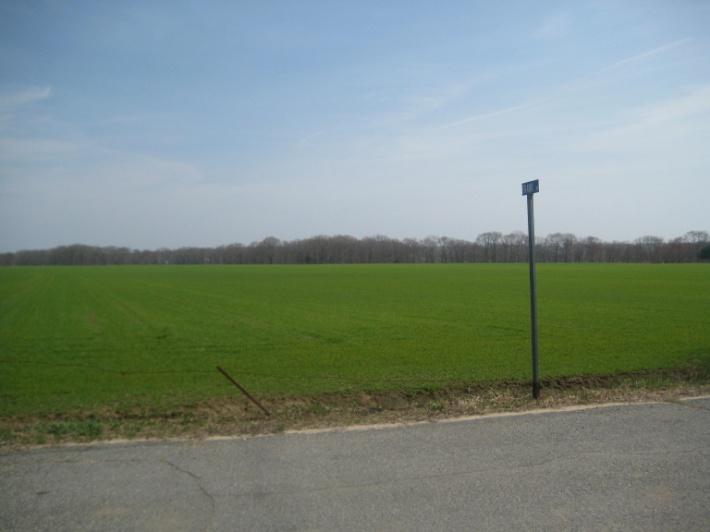
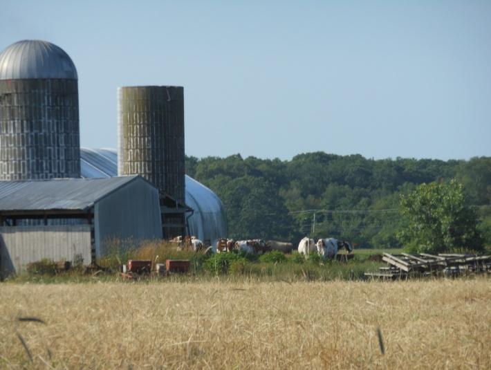
20 The Town has worked with and continues to cooperate with the University of Rhode Island on a variety of specific issues, illustrated by the Town s ongoing participation in the Campus Master Planning Process and periodic Town/ Gown meetings. The Town has suggested a more formal approach be forged to provide a process and structure to address areas where interests intersect, in the form of a Host Community/University cooperative agreement. Such agreements create a framework to address impacts to the quality of life in neighborhoods, local environmental systems, area historic resources, local and state roads, and other conflicts, concerns or opportunities. To this end, the Town should continue participation in the Campus Master Planning Process and at Town/Gown meetings, while also pursuing a Host Community/University cooperative agreement. Potential Loss of Agricultural Land The figure on the left shows different levels of protection. Properties in orange have strong protections, while those in solid green are part of a temporary program commonly referred to as Farm, Forest, and Open Space. These properties receive special tax status as an incentive to maintain the current use (e.g., farming), but owners can eventually decide to sell the land and convert to another use (e.g., residential). On the right, this figure most notably shows the development potential that threatens the rural character of the lands surrounding the Village core area. The Challenge A large part of the community discussion in West Kingston is a celebration of the nearly contiguous ring of agricultural land surrounding the village core. Notable farms include the Nemzow (13 acres), Bouchard (48 acres), Partyka (81 acres), and URI properties (123 acres) all of which meet the State s definition of Land Currently in Agricultural Use. The Cottrell Dairy Farm (73 acres) immediately adjacent to the west of the Village is home to the Milk in Progress operations and is one of several agricultural operations protected under the Rhode Island Agricultural Land Preservation Commission (ALPC). The State also provides the same protection for the 55-acre Tibbits property. 16 West Kingston Village Plan
, with a small portion zoned for industrial use (IND-1).")


21 In addition to celebrating the successful preservation efforts in West Kingston, residents and officials focused on those parcels to the north of the village center that may be at risk for future development. The majority of these lands are zoned for residential use (R-200), with a small portion zoned for industrial use (IND-1). As with the rest of New England, agricultural operations particularly those on residentially zoned land face tremendous market pressure to abandon farm operations and develop the land. Additionally, RIDEM regulations related to land use and preservation are stringent and continue to change, often requiring property owners to work hard just to understand what is required of them. If these areas were to be developed, potential impacts could include increased stormwater runoff and impervious surfaces, potential contamination threats to groundwater resources, degradation of natural areas, and loss of the traditional agricultural character of the Village. Moving Forward While the amount of unprotected farmland is much smaller than the protected area, preserving these final pieces will play a critical role in completing the system of outlying lands surrounding West Kingston s center. Protection of the agricultural heritage of the Village is critical to preserving its overall character and sense of place while also reinforcing the village core. Identifying viable alternatives to residential development to be explored by the Town is recommended to maintain the existing (and encourage future) agricultural land uses. Some of the tools the Town will consider include: Expanding Accessory Agricultural Uses. RIDEM recently completed a study entitled Community Guidance to Maintain Working Farms and Forests. This publication describes how rural culture and landscapes work to create a unique economy characterized by ingenuity and ever evolving homebased or farm-based businesses. Farming in particular is described as an industry that must adapt to challenges and opportunities on a year-toyear basis with a constant focus on finding new ways to generate revenue. Municipalities that support this type of rural economic development will need to adopt a regulatory framework that embraces flexibility, innovation and expansion of farm-based business, while also ensuring the protection of neighboring residents and the environment. Basic steps required to create these regulations include: Identify a comprehensive list of business uses or commercial operations that could help maintain the viability of farms and provide incentives to limit the development of working farm and forest lands. Develop performance standards for these business activities that will allow them to coexist within residential zones with neighboring homes and other uses. West Kingston Village Plan 17

22 Craft regulatory guidance that communities can use to shape local ordinances to allow for new businesses, bring existing commercial operations in residential zones into conformity, and apply reasonable performance standards. Education and Coordination. State regulations and tax policies are complex and variable and can create additional obstacles for property owners hoping to maintain their property in agricultural use. Property owners could benefit from support and education from municipal officials to better understand what is required to sustain their operations. The Town should consider developing a program to educate and support owners of agricultural/ open space operations. A community liaison could provide a level of connectivity and/or support between the Town, business owners and various state agencies, as well as guiding property owners as to what alternatives for protection currently exist (conservation easements, purchase of development rights, etc.). Another coordination issue for the Town related to land preservation is collaboration with the local land trust and other organizations that may be willing partners including: the South Kingstown Land Trust, Southern Rhode Island Conservation District, Audubon Society, The Nature Conservancy, and others. The Town has had good success in this area via the Partnership for Preservation, a consortium of municipal, state, federal and land trust interests which seeks to identify opportunities, resources and programs for open space, forestland and agricultural preservation. Transfer of Development Rights. TDR is a regulatory tool that was first adopted in Rhode Island (in a comprehensive program) in 2008 by North Kingstown. Since then, the Town of Exeter has also adopted a comprehensive TDR program. This tool allows development rights from one area of town (a Sending Area ) to be transferred to another area of town (a Receiving Area ) as a density bonus. The land in the Sending Area, which may have been zoned for residential use, is permanently preserved. The land in the Receiving Area, presumably identified as a growth area, is developed at a density that would otherwise not be permitted. South Kingstown may wish to investigate the potential application of this tool to protect currently unprotected lands surrounding West Kingston. 18 West Kingston Village Plan


, JD Auto Service, and Taylor s Landing Coffee")

23 Zoning Ordinance Conformity The Challenge The term non-conforming use is a legal phrase that describes a land use that was established legally at one point in time, but no longer complies with zoning laws that were since established or amended. Because these uses were legally established years ago, they have certain protections often referred to as grandfathering. A grandfathered use is allowed to continue indefinitely in basically the same way without experiencing any penalty. However, if the use were to change, or if the owner wished to expand or intensify the use, the Town is able to enforce certain restrictions and provide a higher level of permit scrutiny. This situation is very common across New England, and West Kingston has a small number of important properties that fit this description. There are several non-conforming uses scattered along Route 138 within the Village including the Station House Restaurant, Kenyon Oil (Mobil Gas Station), JD Auto Service, and Taylor s Landing Coffee Shop. The Post Office, which serves as an institutional anchor in West Kingston, is an allowed use; however, the zoning could be clearer on this matter and adjustments to the regulatory language would benefit the Town. During public discussions, residents generally felt these uses contributed in a positive way to everyday life in the Village. The scale of the businesses seems appropriate to the village setting, they provide basic everyday services, and generally do not cause any nuisance issues. Discussing these businesses in particular made it possible for participants in the community conversation to envision a modest amount of neighborhood commercial use on these sites and potentially in other areas of the Village. However, it was also noted that the gas station and auto service operations represent uses that are not only prohibited in the underlying zoning district, but also conflict with the purposes of the Groundwater Protection Overlay District. Moving Forward As noted above, non-conforming uses enjoy some level of legal protection as they are grandfathered, and therefore are legally allowed to continue in their current form. However, as part of any zoning reform effort in the Village, the Town should decide once and for all whether these properties should remain non-conforming or be accommodated by changes to local regulations. This decision should be made within the broader context of the Village and consistent with goals for modest increases in commerce in appropriate areas. Community discussions often focused on the area surrounding the Courthouse Center for the Arts. The mix of cultural, commercial and government uses in such close proximity suggests the possibility of a small village core that could serve as a mixed use center and focal point for the Village. Revised zoning, coupled with strong design guidance, could be used to weave together these parcels into more of a West Kingston Village Plan 19


 behind the house. In 1939, Oliver Watson donated the house to the Town for use as a home for elderly town residents.")
24 cohesive design. Some participants in the community discussion also pointed to Waites Corner as an area that seemed well suited to the small-scale commercial uses currently in place. Important Historic Sites The Challenge A more specific issue regarding community character is related to individual sites and buildings within the Village. For a variety of reasons, at the time this study was performed, the future of two significant properties was not certain. Oliver Watson House Courthouse Center for the Arts The historic William Watson House on Waites Corner Road - locally known as the Oliver Watson House, after the builder s son - is a two-story, wood-shingled residence with two small, brick chimneys, a central portico entry with transom and side lights in a five-bay façade, and an addition at the rear. Developed in 1857, the site also contains outbuildings (barn and shed) behind the house. In 1939, Oliver Watson donated the house to the Town for use as a home for elderly town residents. The property was last utilized in the late 1990 s. Today, the structure remains vacant and attempts by the Town to market the property have not been successful. The extensive renovations that would be required to the buildings on this site (exterior and interior), the current zoning for government use (GI zoning district), and the lack of central utilities (public sewer and water) likely contribute to the challenges associated with conveying the property out of municipal ownership and appropriate reuse. The historic courthouse building located on Kingstown Road (Route 138) is one of the most distinguishing features of West Kingston and is home to the Courthouse Center for the Arts (the Center). For years, the Center has served as the unofficial center of the Village. Since its inception, the Center functioned as a community-based arts center, with the last five years operating under a Theater Model. This change to a Theater Model was not financially viable and the Center has struggled to stay active during this time. This situation has jeopardized the Center s existing terms with the buildings current owner (State of Rhode Island), which allows it to operate as an arts center in return for a minimal annual fee. Once ceasing to exist as an arts center for three consecutive months, the building s use reverts back to the State. In 2015 (its 26th year), the Center for the Arts is re-structuring their programming with a focus on their roots as a community-based arts center. 20 West Kingston Village Plan

25 Moving Forward Oliver Watson House. The Town will continue efforts toward the transfer and reuse of the Oliver Watson House for appropriate residential purposes. Any action moving forward will need to balance impacts to the surrounding neighborhood, the desire to honor the history of the property, the Groundwater Protection Overlay District, and fiscal concerns. In part, these fiscal concerns result from the original dedication of the site to the Town by the Watson Trust for use by elderly town residents. Any resources garnered from the sale of the property, therefore, must be on the best terms available and benefit the senior citizens of the community through the South Kingstown Senior Services Program. It is suggested that the Town work to craft a reuse scenario for the Watson House which balances consideration of the terms of the original bequest from the Watson Trust and the articulated concerns of the neighborhood regarding the future of this property. Courthouse Center for the Arts. Re-activating the courthouse building represents one of the biggest short-term opportunities for the Village, and recommendations begin with reinforcing the site as the village center. In 2015, the Center is currently restructuring back to an Arts Model and ramping up programming for its 26th anniversary season. To date, the Center has acquired a liquor license (Class T Theater Licenses) to enhance the visitor s experience during shows, coordinated with the Rhode Island State Council for the Arts (RISCA) to be utilized as a satellite venue, and anticipates running summer camps to include photography, child acting, visual arts and music series/education. The Board of Directors and many residents believe the Center could become a multi-faceted complex providing community meeting space as well as economic development opportunities. There is potential for expansion of the facilities in the main building basement, and also at additional land holdings along Taber Street. The Town should consider supporting flexible development scenarios at and adjacent to the Center. As a nonprofit, the Center cannot rely solely on private donations to sustain it in perpetuity; it needs consistent cash flow opportunities from other sources. West Kingston Village Plan 21


26 Future Viability of Industrial Uses in the Area The Challenge One of the biggest concerns for the Village, and community as a whole, is the ongoing viability of existing industrial uses in West Kingston. Although the total number of industrial uses in South Kingstown is relatively small, these operations still provide high quality employment opportunities and contribute significantly to the local tax base. Consistent with national trends, South Kingstown has experienced some decrease in occupancy of industrial space. Schneider Electric, for example, is the Town s largest private sector employer, yet a portion of the usable space is currently vacant. There is a demand for small-scale industrial business incubator space within West Kingston s industrial area as evidenced by occupancy demand at the contractor condominium developments on Frank Avenue and Liberty Lane. The former Arnold Lumber site at Waites Corner is another industrial site of concern as it is partially vacant and in need of rehabilitation. The owners are considering a plan to rehabilitate the buildings on the site, provide improved infrastructure (parking and drainage management) and site amenities to improve its prospects for reuse. Moving Forward Coordination. The nature of industrial operations across the globe is changing rapidly and dramatically. While many of the traditional industrial uses (e.g., parts manufacturing, assembly, etc.) are still viable, new opportunities around cleantech, bio-medical research, and other innovative industries are more prevalent. Contemporary enterprises that are still classified as industrial are running much more efficient and cleaner operations in large part due to technological advances. In order to capture these opportunities, and to try to meet the needs of existing industries, the Town should develop a means for regular communication between key stakeholders. Several business owners who were interviewed suggested that the Town appoint an Economic Development/Business Liaison to provide a level of connectivity and/or support between the Town, business owners, and prospective developers. The efforts could serve to promote the development/redevelopment of existing sites in West Kingston as well as other sites across the community. These discussions will also provide the Town with a clearer understanding of the amenities and infrastructure that might be helpful to local industries. For example, mixed use zoning in the village core (page 19) could lead to the development of small eateries and services that make working in West Kingston more attractive. The potential for commuter rail service expansion (page 14) and possible expansion of sewer services are examples of infrastructure services that could increase the viability of local industries moving forward. As amenities and support services increase, the Town can use these investments to leverage improvements to private property that increase the aesthetic appeal of industrial operations. While these types of investments require considerable planning and sometimes considerable financing, proactive coordination at this level is essential to future success. Open communication will ensure that the Town, property owners, business owners, and the State regularly share information about business needs, prospective investors, funding programs, potential incentives, and other important information. 22 West Kingston Village Plan

27 Performance Standards. As industries continue to evolve, so do regulations that govern them. In decades past, it was common for local municipalities to use many special use permits as a regulatory tool for industrial use. These permit processes allowed a municipality to review permit applications on a case-by-case basis, potentially providing an extra layer of protection for the Town. While special use permits may still be desirable in many instances, it may be possible for the Town to reconsider their approach for uses that are more predictable. The best way for any municipality to transfer from a special use permit to a by right model for different industrial uses is through the development of clear performance standards. Specification for site design, building design, containment, and disposal are easier to incorporate into local ordinances and provide high levels of protection from nuisance and environmental damage. Although the scale is obviously much larger than anything in South Kingstown, regulations for the Quonset Business Park in North Kingstown are very prescriptive and provide an excellent reference and starting point for state-of-the-art industry performance standards. The Groundwater Protection Overlay District The Challenge The Village of West Kingston sits above groundwater reservoirs and within the groundwater protection areas associated with the Chipuxet Aquifer. The Chipuxet Aquifer, one of ten sole source aquifers associated with the larger Pawcatuck Basin, provides high quality groundwater to the four public water suppliers in Town. The Aquifer is also the source for many of the private residential, agricultural, commercial and industrial wells in Town. Finally, the aquifer recharges the ponds and streams that are an important element to the cultural landscapes of West Kingston. The Groundwater Protection Overlay District (GPOD) is the zoning tool used by South Kingstown to establish additional protections on the Chipuxet Aquifer and the interrelated surface water resources. This overlay covers the entirety of the West Kingston Village Plan study area and focuses on water quality protection. Site design standards dictate the storage of hazardous and toxic materials, storage tanks, interior floor drains, dumpsters, West Kingston Village Plan 23
28 roof runoff, stormwater runoff, and landscaping requirements, among others. For existing uses, site design standards will be implemented if substantial reconstruction occurs, which is defined as improvement, alteration, or replacement of 30 percent or more of floor area or land area of the existing use. Some uses within the IND-1 district are currently prohibited by the overlay district, including among others: general automotive service and repair shops, automotive body shops, welding, metal plating, and the use, storage or generation of hazardous or toxic materials. Automotive uses in the area including service stations and automotive repair are also prohibited. In addition to issues related to water quality, another important issue related to the Chipuxet Aquifer is water quantity. RIDEM has documented that the Chipuxet system is stressed from a water quantity perspective. Increasing withdrawals from the Aquifer, along with increased seasonal drought conditions, lead to lowering of the water table and subsequent reductions to stream flow and wetland coverage. These hydrologic impacts can cause significant damage to ecosystems over time, with loss of wildlife habitat, biodiversity and flood storage capacity. Moving Forward The existing GPOD ordinance has served the Town well to date. However, a more detailed review of the ordinance suggests that there are opportunities to update and improve the ordinance. In large part, sections of the ordinance that may be amended would simply bring certain references up to date or clarify some of the performance standards. For example, since the adoption of this local ordinance, the State of Rhode Island has adopted a much more detailed and comprehensive manual dealing with stormwater management. The Town may wish to review that manual in detail to incorporate more recent standards and information that would improve their ordinance. Using the state standards can also increase recharge requirements for stormwater management, thereby addressing some of the need to increase groundwater recharge to an aquifer that is already stressed from a water quantity perspective. As RIDEM continues work to determine the safe yield of the State s aquifer system, South Kingstown may have opportunities to refine their approach to mitigating impacts to, or even replenishing, the Chipuxet Aquifer. Educating the agricultural community about more sustainable irrigation techniques and state-of-the-art turf management practices could contribute to alleviating some of the stress on the Aquifer. Likewise, conservation or reuse practices related to industrial use could be discussed with operations in the industrial area to ensure each tenant is taking an active role in water conservation. Another important issue related to the GPOD is the fact that the industrial zoned parcels in West Kingston are subject to the ordinance. Many decades ago, the coexistence of an industrial zone and the GPOD may have seemed infeasible based on the high incidence of hazardous materials that would require storage on site and the potential generation of hazardous wastes. Today, as mentioned earlier in this report, industrial operations tend to be cleaner and are typically of a smaller scale than what occurred several decades ago. Moving forward in South Kingstown, it will be important both environmentally and economically to ensure that performance standards are up to date and clearly written. For example, there is language in the ordinance today that requires the judgment of the Building Official on a case-by-case basis as well as written input from RIDEM. It may be possible to replace these discretionary and time consuming processes with clear performance standards that provide high levels of aquifer protection and more efficient permit review. The integration of green infrastructure elements into state and local transportation improvements can also contribute towards the protection of the Chipuxet Aquifer and Groundwater Protection Overlay District. 24 West Kingston Village Plan
29 Summary Matrix The table below summarizes the key issues facing West Kingston today and the recommendations from this study to address those issues. Some of the recommendations identified may not be specific to just one issue area, and may have wider applicability and overlap with other issues identified in this report. Key Issues Managing Change and Preserving Community Character Connectivity and Circulation Expansion/Future Development Plans at URI Potential Loss of Agricultural Land Zoning Ordinance Conformity Important Historic Sites Future Viability of Industrial Uses in the Area The Groundwater Protection Overlay District Recommendations Develop illustrated design guidelines specific to the Village. Identify appropriate areas for mixed use and consider amendments to the Zoning Ordinance accordingly. Consider incorporating cottage community development into the Village. Convene an active village community group to help establish a village identity. Continue to advocate for a village perspective in all transportation related projects to help manage congestion and promote alternative modes of transportation. Advocate for signage and enforcement that helps to calm and direct everyday traffic in the village. Continue participation in the Campus Master Planning Process and at the Town/Gown meetings, while also pursuing a Host Community/University cooperative agreement. Consider regulatory amendments that provide active farms with more flexibility to pursue revenue generating activities. Consider TDR and Density Transfer Credits as tools for generating funds to purchase agricultural easements Identify a community liaison to the agricultural community that provides outreach and education on existing regulations and programs. Consider a new mixed use zoning district in the area of the courthouse, post office and adjacent commercial uses. Consider a limited rezoning of Taylor s Landing Coffee Roasters for small-scale commercial use. Continue to pursue sale and appropriate reuse of the William Watson House. Help to reactivate the Courthouse Center as the center of West Kingston Village by allowing on-site program flexibility. Identify an Economic Development/ Business Community Liaison to ensure the Town, the State, and existing industries are routinely updated on needs and opportunities. Develop new performance standards that will provide a clear path for permit approval and potentially reduce the need for special use permits. Encourage existing industrial uses to improve the aesthetics of their buildings and sites to improve the marketability and functional capacities of these facilities. Consider streetscape and stormwater management improvements and expansion of utility service (water and sewer) to bolster the area s use potential and protect groundwater resources. Evaluate the Groundwater Protection Overlay District Ordinance and revise to improve its functioning by reflecting modern industrial practices, improved performance standards, best practices regarding resource sustainability and aquifer protection, consistency with state regulations, and the use of green infrastructure techniques for stormwater management. Identify opportunities within the agricultural and industrial sectors, as well as with municipal roadway improvements, to increase recharge to the Chipuxet Aquifer. Consider incorporating green infrastructure elements within regulatory updates and future projects within the district. West Kingston Village Plan 25

30 Appendix A Existing Conditions, West Kingston
31 Existing Conditions West Kingston is a working village with a varied land development pattern. Land uses presently include industry, small businesses, farms, and single-family residential neighborhoods. The Village lies completely within the Town s Groundwater Protection Overlay District (GPOD). Within the GPOD environmental limitations apply to industrial uses the Village s dominant land uses limiting such operations to those that do not generate significant quantities of waste water and are not water intensive. The Village is also home to the historic Kingston Train Station and serves as a gateway to the University of Rhode Island (URI) via Route 138 and Plains Road. This section provides an overview of existing conditions in West Kingston, organized into the following categories: - Physical Environment - Social and Recreational Components - Infrastructure - Regulatory Elements Physical Environment West Kingston has many natural resource areas including groundwater resources, agricultural uses, and critical and environmentally sensitive areas. Most of these natural systems overlap with one another and serve multiple functions. West Kingston sits above groundwater reservoirs and wellhead protection areas associated with the Chipuxet Aquifer. The Chipuxet Aquifer, one of ten sole source aquifers associated with the larger Pawcatuck Basin Sole Source Aquifer, provides high quality groundwater to the four public water suppliers in town (United Water, Kingston Water District, URI and the South Kingstown South Shore District) and provides the source for many of the private residential, agricultural, commercial and industrial wells in the community. 2 Appendix A Existing Conditions, West Kingston

32 Source: Town of South Kingstown, RIGIS The Chipuxet Aquifer provides high quality groundwater to four public well fields and is the source for many private residential, agricultural, commercial and industrial wells in town 3 Appendix A Existing Conditions, West Kingston
33 The Town s marine and estuarine resources are complemented by freshwater marshes and open water in a series of ponds, including Worden Pond, and rivers connecting upland resource areas with tidal estuaries. Worden Pond (1,075 acres) is the largest natural lake in the State. Freshwater wetlands include wooded swamps, marshes, bogs, wet meadows, lakes and ponds, and floodplains. Many small ponds and streams are found throughout the Town, remnants of long-past glacial action. The Chipuxet River winds south from Hundred Acre Pond and Thirty Acre Pond, emptying into Worden Pond. These resources provide benefits to both residents and visitors by way of natural, scenic and recreational opportunities. Approximately 20 percent of the State s most significant rare species and natural community sites are found in the Town of South Kingstown. The RIDEM s Natural Heritage Program (RINHP) mapped the critical and environmentally sensitive areas within the Town, the largest concentration being that which surrounds the Village to the west, south and east lands primarily associated with RIDEM s Great Swamp Management Area. Agricultural resources (predominantly turf farm operations) are a significant part of the landscape within the Village of West Kingston, including the Nemzow (13 acres), Bouchard (48 acres), Partyka (81 acres), and URI properties (123 acres). The Cottrell Dairy Farm (73 acres), immediately to the west of the village core area, contributes to the local economy and proudly advertises its Milk in Progress operations. This parcel, along with the Tibbets Farm (55 acres) is protected under the Rhode Island Agricultural Land Preservation Commission. Other lands in West Kingston are enrolled in the State s Farm, Forest and Open Space Program (FFOS). This program provides for reduced tax assessments for agricultural and forest land. The FFOS program does not provide permanent protection of enrolled properties. Land within the program can exit to a non-agricultural or open space use without penalty after participation in FFOS for a 15 year period. In terms of its cultural resources, the Village includes a number of historic cemeteries and is surrounded by several distinctive and noteworthy scenic landscapes (Ministerial Road Scenic Roadway Designation, South County Trail, Worden Pond/Larkin Pond, and West Kingston Turf Farms/Yawgoo Pond). Of note is the historic William Watson House (1857) at 274 Waites Corner Road, which is owned by the Town. Locally known as the Oliver Watson House, the property was donated to the Town around 1920 to serve as a rest home for elderly residents. The building was utilized for such purposes until the late 1990 s. Today, the structure remains vacant with its future undetermined. 4 Appendix A Existing Conditions, West Kingston

34 Source: Town of South Kingstown, RIGIS 5 Appendix A Existing Conditions, West Kingston

35 Source: Town of South Kingstown, RIGIS 6 Appendix A Existing Conditions, West Kingston

36 Source: Town of South Kingstown, RIGIS 7 Appendix A Existing Conditions, West Kingston


37 Social and Recreational Components William C. O Neill bike path parking at Kingston Station West Kingston Park West Kingston Park, a 12-acre town-owned site, includes two softball fields, two (each) basketball/ tennis/volleyball courts, a playground and a picnic area. Many residents identify West Kingston Park as the primary outdoor space for social interaction and recreational opportunities within the Village. Additionally, the William C. O Neill Bike Path beginning at the train station provides access for residents and visitors to bike, jog, and walk along this scenic path. The historic Courthouse Center for the Arts (Center) provides a vital indoor space for social interaction through various programs/events offered in the building. The mission of the Center is to produce and distribute exceptional arts programs year round for Village residents and the greater Rhode Island community, such as gallery exhibits, music events and educational opportunities in the arts. West Kingston Post Office serves as a service hub and gathering place for residents Overflow parking at the train station/bike path on a warm weekend spring day 8 Appendix A Existing Conditions, West Kingston


38 Immediately to the east of the Village, the University of Rhode Island (URI) is the major public institution/employer within the Town of South Kingstown. The Town recognizes the University s importance as an historic, cultural, recreational, and employment resource; as an economic development partner; and as a stimulus for intellectual thinking and source of diversity within the community. The Town and URI have common interests including preserving and enhancing their shared quality of life, sense of place, provision of adequate services and infra-structure, resource protection, and respect for history. The University s Capital Improvement Plan (FY ) notes that more than $844 million in investment is pending to support sixty-eight various on-going and new projects. Courthouse Center for the Arts Taylor s Landing Infrastructure West Kingston is located within the Urban Services Boundary designated by Land Use 2025, indicating the general availability of municipal services that may support higher densities. Land Use 2025 is the major State Guide Plan in Rhode Island s planning and development system. It articulates the State s major objectives and strategies to guide and coordinate the land-use plans and regulations of municipalities and state agencies. The viability of the West Kingston industrial area has been supported by the provision of sewers and recent reconstruction of portions of Liberty Lane and Fairgrounds Road. The sewer system extended to this area was primarily intended to support existing industrial and wholesale operations and protect the groundwater resources in the area. Circulation and traffic volumes through the Village are reflective of the industrial development along Fairgrounds Road, population growth in the community, and increases in traffic generated by the Kingston Train Station and University of Rhode Island. Traffic volumes for both early morning and early evening (commuter peak Swale-based provisions for private stormwater management within the Village 9 Appendix A Existing Conditions, West Kingston
39 travel times) are an ongoing concern along Route 138, Route 2, and Waites Corner Road (as identified by the Route 138 Project Area Committee). The Town s general objective is to provide safe and efficient access within and through the Town for all modes in a balanced fashion while maintaining the Town's rural qualities and scenic aesthetics. Beginning at Kingston Station, the William C. O Neill Bike Path serves as an important multi-modal connection between the Village and the Town. URI s potential expansion and current policy to promote access to the campus from the west through the Village of West Kingston requires properly scaled infrastructure improvements to support the Village as a gateway to URI. The Town has been working overtime with RIDOT, primarily through the Route 138 Project Area Committee, to incorporate design features in the forthcoming Route 138 reconstruction project (Route 108 to Route 2). This will improve pedestrian/bicycle safety and convenience and calm and mitigate traffic congestion in the Villages of Kingston and West Kingston. At the time this report was developed (Summer 2015), the project was at the 90% design stage and environmental permits were being sought preparatory to project bidding and construction. On a Village-wide basis, provisions for roadway storm drainage as well as on-site storm drainage were observed in several locations. In many cases, the use of open channel drainage contributes to the more rural character of the Village. Limited RIPTA Service is provided on Route 66 from Kingston Station northbound to Kennedy Plaza in Providence and southbound to Wakefield Center and Galilee in Narragansett. Additionally, Route 64 provides service from Kingston Station to the Gateway Center in Newport. Parking, or lack thereof, is also a concern in West Kingston. As previously stated, parking at the train station/bike path is fully utilized, with overflow parking occurring north of the station adjacent to the historic Kingston Station Tower and on grassed/maintained areas. As an interim step to address this situation RIDOT recently completed a project entitled Kingston Station North Overflow Parking Lot which added 45 parking spaces to the existing parking configuration. In addition, RIDOT has developed a design to maximize the number of proposed parking spaces (an additional 135 spaces) while providing the necessary size infiltration basin to accommodate the stormwater management design. This project may proceed in parallel fashion with the planned Route 138 Reconstruction Project adding much needed parking for this multimodal facility. The West Kingston/URI Disposal Area Landfills ceased operations in URI and the Towns of South Kingstown and Narragansett have been (and continue as) partners in the site remediation efforts under the Environmental Protection Agency (EPA) and Rhode Island Department of Environmental Management (RIDEM) landfill closure regulations. In 2006, a landfill capping system was completed. Since that time, the Town has been responsible for landfill cap maintenance and pro-rata long-term monitoring associated with the Town landfill. In 2009, chemical oxidation of soil and groundwater in the vicinity of the URI drum disposal area was completed and fully funded by URI. The Town continues to participate in the monitoring of its former landfills to maintain public health and safety. Presently the Town is working with its regional partners, EPA and RIDEM, to secure environmental land use restrictions (ELURs) on properties in proximity to the closed landfills as an added means of environmental security for the vicinity. 10 Appendix A Existing Conditions, West Kingston
, Very Low Density Residential (R200), Open Space (OS), and a large swath of land zoned Government")


40 Regulatory Elements Zoning in the heart of the Village of West Kingston is predominately a mix of Industrial One (IND-1) and Medium-High Density Residential (R20) districts. In the outlaying areas of the Village are lands zoned Low Density Residential (R80), Very Low Density Residential (R200), Open Space (OS), and a large swath of land zoned Government Institutional (GI) consisting of URI s properties east of the Village. The West Kingston Zoning Districts map depicts the distribution of existing zoning in the Village and immediate environs. The IND-1 district is designated along Fairgrounds Road between the roadway and the rail line through the center of the Village. It is also concentrated to the west/southwest of the Village. This district is intended to permit manufacturing, wholesale storage, and distribution activities within existing manufacturing areas in West Kingston. Existing businesses within this district include Schneider Electric, Modine Manufacturing Corporation, RI Wiring Services, and Arnold Lumber. Sod fields associated with multiple turf farm operations along the rail line are also found in the IND-1 district. Businesses located within the Industrial 1 (IND-1) zone (West Kingston Industrial Park), including South County Post and Beam and the Kingston Station Commercial Condominiums Fairgrounds Road transition zone between residential and industrial development 11 Appendix A Existing Conditions, West Kingston
, with maximum building coverage of twenty-five percent.")
41 Source: Town of South Kingstown, RIGIS The residential areas within the core Village area are designated for Medium-High Density (R20) use. Minimum lot size in this district is twenty-thousand square feet (0.46 acres per residential unit), with maximum building coverage of twenty-five percent. Present in this R20 area is the Station House Restaurant (3711 Kingstown Road). This facility which has been in place for many years; however, restaurants are not permitted in the R20 district and therefore 12 Appendix A Existing Conditions, West Kingston


42 the Station House is considered a grandfathered (legal non-conforming) use of property. Its long-term presence is seen as consistent with the area and supportive of a village dynamic. Residential areas off of Liberty Lane include homes built in the 1960s and 1970s. Development fronting on Kingstown Road consists of single family homes of a similar time period to the north (late 1800s and early 1900s), a U.S. Post Office, and the West Kingston Baptist Church, all of which are permitted in the R20 zoning district. This stretch also includes a few scattered commercial uses not supported by current zoning, including two gas stations/convenience stores and a coffee shop (Taylor s Landing) serving breakfast and lunch near Liberty Lane. Medium High Density Residential (R20) throughout the Village, and the Station House Restaurant (non-conforming, grandfathered use) The potential for land use conflicts is evident along Fairgrounds Road where single family homes abut industrial businesses (R20 and IND-1 districts). Existing zoning (Section 507) contains performance standards to address these potential friction points within this transition zone regulating commercial and industrial uses in terms of noise, smoke, particulate matter, and odors, among other hazards, nuisances, and harmful effects to public health and the environment. It also includes provisions for side yard and rear yard setbacks at least equal to twice the side or rear yard requirement of the adjoining residential district. GI parcels are also dispersed throughout the Village. These areas include the historic Courthouse Center for the Arts and Watson House, Kingston Station and the University of Rhode Island to the immediate east of the Village. In the surrounding environs of the Village are lands zoned Low Density Residential (R80), Very Low Density Residential (R200) and Open Space (OS). Most parcels within the R200 district are primarily agricultural uses and associated homes. OS is related to the Great Swamp Management Area, West Kingston Park and lands preserved via development rights purchase, fee simple acquisition or conservation easement. Lands under the FFOS program are not designated under the OS zoning district. Open Space District zoning parcels generally provide a ring of preserved properties around the Village (except for the area northeast of the Village core area). Notable preserved parcels consist of the following: the Cottrell Homestead (74 acres, also under Rhode Island Agricultural Land Preservation Commission), west of the Village associated with RIDEM property (63 acres, also under Rhode Island Agricultural Land Preservation Commission) and RIDEM property (32 13 Appendix A Existing Conditions, West Kingston
43 acres), south of the Village associated with the Great Swamp Management Area (1,616 acres), Girl Scouts of RI Inc. (178 acres), and Tibbets property (55 acres, also under Rhode Island Agricultural Land Preservation Commission), southeast of the Village associated with the Kingston Water District (79 acres), and to the north associated with the Audubon Society (50 acres). As noted in this Appendix, the Groundwater Protection Overlay District provides additional land use controls to protect groundwater and interrelated surface water resources. Some uses within the IND-1 district are prohibited in the overlay district, including, among others, general automotive service and repair shops, automotive body shops, welding, metal plating, and the use, storage or generation of hazardous or toxic materials. Site design standards dictate the storage of hazardous and toxic materials, storage tanks, interior floor drains, dumpsters, roof runoff, stormwater runoff, and landscaping requirements, among others. For existing uses, site design standards will be implemented if substantial reconstruction occurs, which is defined as improvement, alteration, or replacement of 30 percent or more of floor area or land area of the existing use. Based on reviews of the Rhode Island Geographic Information System (RIGIS) and the Town s Geographic Information System Buildout Model, there are several acres of vacant, developable land available within the Village. The majority of these vacant parcels are lands associated with the existing turf farms. Dependent on the underlying zoning district future development of these lands, also within the Groundwater Protection Overlay, would be subject to environmental limitations. 14 Appendix A Existing Conditions, West Kingston

44 Source: Town of South Kingstown, RIGIS 15 Appendix A Existing Conditions, West Kingston
Chapter 2: Vision, Goals and Strategies
 Chapter 2: Vision, Goals and Lake Elmo Today & Tomorrow Comprehensive Plan 2040 2 VISION, GOALS & STRATEGIES - DRAFT 4-6-2018 INTRODUCTION Comprehensive Plan Purpose Perhapse the most important objective
Next Steps, Expectations Going Forward Staying Involved Adjournment
 South Kingstown Villages Study The Village of West Kingston JJulyy 28, 2015 South Kingstown Planning Department 180 High Street Wakefield, RI 02879 Horsleyy Witten Group p 55 Dorrance Street Providence,
CHAPTER 8 ISSUES, CONCERNS, CONSTRAINTS AND OPPORTUNITIES
 CHAPTER 8 ISSUES, CONCERNS, CONSTRAINTS AND OPPORTUNITIES Introduction This River Conservation Plan was developed during a time of tremendous activity and effort in planning the transformation of the Delaware
CHAPTER 7: VISION AND ACTION STATEMENTS. Noble 2025 Vision Statement
 CHAPTER 7: VISION AND ACTION STATEMENTS This chapter presents the vision, policy and action statements that transform the comprehensive planning study, an analysis of Noble s past, future trends and community
38 Queen s University Campus Master Plan Part 1
 38 Queen s University Campus Master Plan Part 1 46 The Campus at the City Scale Chapter 4 The Campus at the City Scale 39 Queen s is an urban University centrally located in Kingston. Decisions made by
The transportation system in a community is an
 7 TRANSPORTATION The transportation system in a community is an important factor contributing to the quality of life of the residents. Without a sound transportation system to bring both goods and patrons
CHAPTER 7: Transportation, Mobility and Circulation
 AGLE AREA COMMUNITY Plan CHAPTER 7 CHAPTER 7: Transportation, Mobility and Circulation Transportation, Mobility and Circulation The purpose of the Transportation, Mobility and Circulation Chapter is to
CHAPTER 3 VISION, GOALS, & PLANNING PRINCIPLES. City of Greensburg Comprehensive Plan. Introduction. Vision Statement. Growth Management Goals.
 CHAPTER 3 VISION, GOALS, & PLANNING PRINCIPLES Introduction The Greensburg Comprehensive Plan is intended as a working community document. A combination of long and short-term goals, this document is intended
V. Vision and Guiding Principles
 V. Vision and Guiding Principles The Master Plan for the Powers Ferry Corridor seeks a foundation in the desires of the community. At times, various elements of the community offered opposing viewpoints,
EXECUTIVE SUMMARY DRAFT CHAPTER 1 INTRODUCTION EXECUTIVE SUMMARY
 CHAPTER 1 EXECUTIVE SUMMARY INTRODUCTION Through the joint efforts of the City of Tulsa planning staff and the Land Services division of Indian Nations Council of Governments (INCOG), the Berryhill Land
Executive Summary. NY 7 / NY 2 Corridor
 Executive Summary NY 7 / NY 2 Corridor Transportation and Land Use Study December 2005 Prepared for: Town of Colonie Capital District Transportation Committee Prepared by: Introduction: Land use decisions
Gold Line Bus Rapid Transit Transit Oriented Development (BRTOD) Helmo Station Area Plan
 Helmo Station Area Plan") Appendix F Gold Line Bus Rapid Transit Transit Oriented Development (BRTOD) Helmo Station Area Plan Introduction and Purpose of the Plan The Gold Line Bus Rapid Transit facility is an eleven-mile dedicated
Appendix F Gold Line Bus Rapid Transit Transit Oriented Development (BRTOD) Helmo Station Area Plan Introduction and Purpose of the Plan The Gold Line Bus Rapid Transit facility is an eleven-mile dedicated
ELK GROVE GENERAL PLAN VISION
 2-1 CHAPTER 2: 2-2 CREATING OUR The Community Vision for Elk Grove, expressed through a Vision Statement and a series of Supporting Principles, is a declaration of the kind of community that Elk Grove
C. Westerly Creek Village & The Montview Corridor
 C. Westerly Creek Village & The VISION Community Vision When the goals of the city are achieved Westerly Creek Village, a distinctive community defined by Montview Boulevard and Westerly Creek, is a strong
Hockessin Community Redevelopment Plan
 Hockessin Community Redevelopment Plan 3.1 Introduction The Community Redevelopment Plan for the Village of Hockessin is the result of the people s vision for a distinct village center that serves as the
DRAFT Amsterdam/Churchill Community Plan (4/17/08) Adopted By the Gallatin County Commission
 Adopted By the Gallatin County Commission") DRAFT Amsterdam/Churchill Community Plan (4/17/08) Adopted By the Gallatin County Commission Table of Contents Acknowledgements Chapter 1: Introduction A Brief History What s Next Authority Organization
DRAFT Amsterdam/Churchill Community Plan (4/17/08) Adopted By the Gallatin County Commission Table of Contents Acknowledgements Chapter 1: Introduction A Brief History What s Next Authority Organization
8implementation. strategies
 PROGRAM STRATEGIES 8implementation strategies T he implementation actions of this chapter are designed to support and carry out the land use, economic development, transportation, urban design, and program
Transportation. Strategies for Action
 Transportation A major priority for the Overlake Neighborhood is to develop a multimodal transportation system. To achieve this system, a balance has to be found among travel, circulation and access needs;
A BLUEPRINT FOR BROCKTON A CITY-WIDE COMPREHENSIVE PLAN
 A BLUEPRINT FOR BROCKTON A CITY-WIDE COMPREHENSIVE PLAN Public Meeting October 2016 1 Plan Summary and Discussion Public Meeting May 4 2017 City of Brockton Bill Carpenter, Mayor Department of Planning
Town Center (part of the Comprehensive Plan)
") Town Center (part of the Comprehensive Plan) Mercer Island Town Center Looking North (2014) In 1994, a year-long process culminated in a set of design guidelines and code requirements for the Town Center
Town Center (part of the Comprehensive Plan) Mercer Island Town Center Looking North (2014) In 1994, a year-long process culminated in a set of design guidelines and code requirements for the Town Center
The University District envisions, in its neighborhood
 Envisioning the University District Link Light Rail in Seattle s neighborhoods CIY OF SEALE CONCEP-LEVEL SAION AREA PLANNING RECOMMENDAION RESOLUION # 30165 EXHIBI L Vision 08.2000 he University District
Living in Albemarle County s Urban Places
 Living in Albemarle County s Urban Places ALBEMARLE COUNTY, VIRGINIA A Closer Look at Albemarle s Approach to Managing Growth and Creating Quality Urban Environments www.albemarle.org Page 2 Living in
North Fair Oaks Community Plan Summary and Information
 North Fair Oaks Community Plan Summary and Information WHAT IS THE NORTH FAIR OAKS COMMUNITY PLAN? The North Fair Oaks Community Plan is part of the San Mateo County General Plan, and establishes policies
Chapter 1.0 Introduction
 Chapter 1.0 Introduction 1.1 Background The North Metro commuter rail line is part of the RTD FasTracks regional transit system expansion program to build more than 100 miles of rail transit throughout
The Five Components of the McLoughlin Area Plan
 The Five Components of the McLoughlin Area Plan This documents contains the complete language of the five components of the McLoughlin Area Plan: The Vision Statement The Values The Guiding Principles
DRAFT Subject to Modifications
 TREASURE COAST REGIONAL PLANNING COUNCIL M E M O R A N D U M To: Council Members AGENDA ITEM 8 From: Date: Subject: Staff May 19, 2017 Council Meeting Florida Department of Transportation Complete Streets
Windsor Locks Transit-Oriented Development Planning Grant Request. Project Background
 Windsor Locks Transit-Oriented Development Planning Grant Request Project Background Downtown Windsor Locks runs along Main Street in the vicinity of the intersection of Routes 159 and 140. The current
Issues Requiring Future Study
 Issues Requiring Future Study Transportation planning is an ongoing process that tends to identify new issues as it finds solutions for others. Some issues are so complex that a solution to one problem
3. VISION AND GOALS. Vision Statement. Goals, Objectives and Policies
 Vision Statement Queen Creek s interconnected network of parks, trails, open spaces and recreation opportunities provide safe and diverse activities and programs that sustain its unique, small town, equestrian
ARLINGTON COUNTY, VIRGINIA
 ARLINGTON COUNTY, VIRGINIA County Board Agenda Item Meeting October 15, 2005 DATE: September 28, 2005 SUBJECT: Request to Advertise the adoption of the 2005 Clarendon Sector Plan C. M. RECOMMENDATION:
Welcome. Walk Around. Talk to Us. Write Down Your Comments
 Welcome This is an information meeting introducing the applications for proposed redevelopment of the Yorkdale Shopping Centre site at 3401 Dufferin Street and 1 Yorkdale Road over the next 20+ years,
Preliminary Plan Framework: Vision and Goals
 Preliminary Plan Framework: Vision and Goals Draft: May 2015 Introduction Since the Town of Milliken s comprehensive plan was last updated in 2010, the community was heavily impacted by the 2013 flood,
SALISBURY TOMORROW Our Vision
 SALISBURY TOMORROW Our Vision Salisbury is committed to supporting a high quality of life and sense of community for all residents. These commitments need to be reflected in our community programs, services
Blueprint Denver A BLUEPRINT FOR AN INCLUSIVE CITY. Executive Summary
 Blueprint Denver A BLUEPRINT FOR AN INCLUSIVE CITY Executive Summary PUBLIC REVIEW DRAFT 2 1/7/2019 DENVERIGHT BLUEPRINTDENVER Blueprint Denver: A Blueprint for an Inclusive City An Equitable City Planning
Town of Peru Comprehensive Plan Executive Summary
 Town of Peru Comprehensive Plan Executive Communities that plan grow by choice, not by chance. A plan makes growth thoughtful, understandable, and predictable. A plan shows that a community is managing
Town of Cobourg Heritage Master Plan. Statutory Public Meeting
 Town of Cobourg Heritage Master Plan Statutory Public Meeting April 25 th 2016 Presentation Overview 1. Introduction 2. Project background and schedule overview 3. Review of strategic direction content
EXISTING COMPREHENSIVE PLAN
 EXISTING COMPREHENSIVE PLAN Town Center Land Use Element: V. LAND USE POLICIES Town Center Mercer Island's business district vision as described in "Your Mercer Island Citizen-Designed Downtown" was an
Denton. A. Downtown Task Force
 2 Public Involvement Early and ongoing public involvement was solicited so that the public had ample opportunity to help direct the DTIP s concepts and implementation strategies. The residents of Denton
REGIONAL ACTIVITY CENTER
 DRAFT REGIONAL ACTIVITY CENTER 70 EAST BENCH MASTER PLAN DRAFT 06 Introduction The East Bench Regional Activity center is comprised of large educational, research, medical, and employment centers. These
CITY CLERK. Parkland Acquisition Strategic Directions Report (All Wards)
") CITY CLERK Clause embodied in Report No. 10 of the, as adopted by the Council of the City of Toronto at its meeting held on November 6, 7 and 8, 2001. 10 Parkland Acquisition Strategic Directions Report
CITY CLERK Clause embodied in Report No. 10 of the, as adopted by the Council of the City of Toronto at its meeting held on November 6, 7 and 8, 2001. 10 Parkland Acquisition Strategic Directions Report
2040 LUP is a part of the Comprehensive Plan and carries the same legal authority. Economic Challenges
 1.1. Guiding Anchorage s Growth Where will new residents settle over the next two decades? Where will people work, shop, and play? Will there be enough room to grow? How will Anchorage look? Will growth
Corridor Vision. 1Pursue Minnehaha-Hiawatha Community Works Project. Mission of Hennepin County Community Works Program
 1Pursue Minnehaha-Hiawatha Community Works Project Minnehaha-Hiawatha Community Works is a project within the Hennepin Community Works (HCW) program. The mission of the HCW program is to enhance how the
Chapter 1: Introduction
 Chapter 1: Introduction The Penn Avenue Community Works Corridor Vision and Implementation Framework presents an integrated communitybased vision and a coordinated, long-term implementation framework for
City of Farmington. Downtown Plan. Amendment to the 1998 Master Plan Adopted October 11, 2004
 City of Farmington Amendment to the 1998 Master Plan Adopted October 11, 2004 Introduction Planning Background 1 Scope and Components of the Plan Amendment 2 Concept Introduction 3 Plan Concepts 3 Conceptual
Port Lavaca Future Land Use
 Port Lavaca Future Land Use Introduction The City of Port Lavaca is beginning to see sustained growth, after many years of relative stable population. New single family homes, apartments, and businesses
CITY OF PUYALLUP. Background. Development Services
 CITY OF PUYALLUP Development Services 333 South Meridian Puyallup WA 98371 To: City Council From: Katie Baker, AICP, Planning Division Re: South Hill Neighborhood Plan Adoption Date: (Meeting date: February
greenprint midtown SUSTAINABILITY ACTION PLAN 2012
 greenprint midtown SUSTAINABILITY ACTION PLAN 2012 MIDTOWN ALLIANCE SOUTHFACE ENERGY INSTITUTE RENAISSANCE PLANNING GROUP SUSTAINABLE ATLANTA PERKINS+WILL 2 GREENPRINT MIDTOWN 1. Introduction Sustainability
Urban Planning and Land Use
 Urban Planning and Land Use 701 North 7 th Street, Room 423 Phone: (913) 573-5750 Kansas City, Kansas 66101 Fax: (913) 573-5796 Email: planninginfo@wycokck.org www.wycokck.org/planning To: From: City Planning
PSRC REVIEW REPORT & CERTIFICATION RECOMMENDATION
 PSRC REVIEW REPORT & CERTIFICATION RECOMMENDATION KITSAP COUNTY COUNTYWIDE PLANNING POLICIES July 2, 2012 BACKGROUND A major emphasis of the Washington State Growth Management Act (GMA) is the need to
WATERFORD Plan of Preservation, Conservation and Development Supplement Part 1 - Policy Element
 WATERFORD 2012 Plan of Preservation, Conservation and Development 2015 Supplement Part 1 - Policy Element Effective June 11, 2015 2015 Plan Update GOAL To respond to the evolving land use needs and continually
Proposed Comprehensive Plan Strategies DRAFT for discussion June 28, 2017
 Proposed Comprehensive Plan Strategies DRAFT for discussion June 28, 2017 Land Use Rural Areas Refine the Farm and Forest area (FF) Update FF boundaries to account for existing lots less than five acres
THEMES, VISION, + PRINCIPLES
 CHAPTER 2: THEMES, VISION, + PRINCIPLES This page intentionally left blank. 20 VISION DRAFT AUGUST 2018 2 2 THEMES, VISION, + GUIDING PRINCIPLES The Key Themes, Vision, and Guiding Principles presented
TOWN CENTER. Origins of a Crossroads Community
 TOWN CENTER Origins of a Crossroads Community Town Commons 1973 - Courtesy of the Burlington Archives, No. 81 Unlike other New England towns with iconic town centers, Burlington evolved as a dispersed
SECTION ONE: INTRODUCTION. introduction
 introduction 1 INTRODUCTION Since it was first established in 1843 as a trading post for the Hudson s Bay Company, Victoria has evolved into a Provincial capital city that is recognized across Canada and
The Vision. Photo provided by The Minervini Group. 46 Vision, Objectives & Strategies
 Vision, Objectives & Strategies The is the public framework and guide for future development of the Grand Traverse Commons. The establishes public polices for infrastructure, the preservation of natural
Illustration of Eastlake Farmer s Cooperative Grain Elevator. Chapter 5: implementation 5-1
 Illustration of Eastlake Farmer s Cooperative Grain Elevator Chapter 5: implementation 5-1 chapter 5: implementation Introduction The Eastlake Subarea Plan includes a wide range of recommendations intended
TRANSPORTATION ELEMENT GOALS, OBJECTIVES, AND POLICIES
 TRANSPORTATION ELEMENT GOALS, OBJECTIVES, AND POLICIES GOAL 2 The City shall provide a safe, convenient, effective, and energy efficient multimodal transportation system which is coordinated with the Future
FOUR MILE RUN VALLEY WORKING GROUP AND CHARGE
 FOUR MILE RUN VALLEY WORKING GROUP AND CHARGE Adopted April 16, 2016 Amended July 19, 2016 Overview of Integrated Effort The overall goal of the Four Mile Run Valley (4MRV) initiative is to develop a comprehensive
A. WHAT IS A GENERAL PLAN?
 I. Introduction A. WHAT IS A GENERAL PLAN? A general plan is the planning guideline for the future of a city. It contains goals and policies which regulate urban development, the protection of the natural
hermitage town center
 hermitage town center A Community Vision prepared by Strada for The City of Hermitage and The Mercer County Regional Planning Commission January 2007 table of contents introduction 3 design principles
FOSTER COMPREHENSIVE PLAN UPDATE CIRCULATION
 5.8.1 INTRODUCTION CIRCULATION The Circulation Element of the Comprehensive Plan studies the routes and modes of travel. The circulation network of the town affects the ease of movement through Foster
Welcome to the Oakridge Centre Open House
 Welcome to the Oakridge Centre Open House Why is the City hosting this event? This open house is to inform you of a rezoning application submitted to the City of Vancouver to amend the existing CD-1 (Comprehensive
CITY COUNCIL AGENDA REPORT
 CITY COUNCIL AGENDA REPORT Subject: COUNCIL MOTION LRT ALIGNMENT REMOVAL FROM THE TRANSPORTATION MASTER PLAN On February 10, 2016 Councillor Hughes provided notice in accordance with Section 23 of Procedure
Arlington, Virginia is a worldclass
 EXECUTIVE S U M M A RY Arlington maintains a rich variety of stable neighborhoods, quality schools and enlightened land use policies, and received the Environmental Protection Agency s highest award for
SECTION II SECTION II STATEMENT OF GOALS, OBJECTIVES, PRINCIPLES, ASSUMPTIONS, POLICIES AND STANDARDS
 STATEMENT OF GOALS, OBJECTIVES, PRINCIPLES, ASSUMPTIONS, POLICIES AND STANDARDS 1 2 STATEMENT OF GOALS, OBJECTIVES, PRINCIPLES, ASSUMPTIONS, POLICIES AND STANDARDS INTRODUCTION The New Jersey Municipal
Policies and Code Intent Sections Related to Town Center
 Policies and Code Intent Sections Related to Town Center The Town Center Vision is scattered throughout the Comprehensive Plan, development code and the 1994 Town Center Plan. What follows are sections
Chapter 4. Linking Land Use with Transportation. Chapter 4
 Chapter 4 Linking Land Use with Transportation Chapter 4 59 Chapter 4 Linking Land Use with Transportation Community Design and Transportation Program Introduction Since the 1950s, the predominant development
Midtown Greenway Land Use and Development Plan Executive Summary
 Midtown Greenway Land Use and Development Plan Executive Summary Introduction The Midtown Greenway Land Use and Development Plan sets policy direction for land use and development in the Midtown Greenway
3 Vision and Goals. Vision and Goals. Blueprint for Bloomsburg. Vision. Town of Bloomsburg Comprehensive Plan,
 Vision and Goals 3 Vision and Goals Citizens of the Town of Bloomsburg clearly value their natural and cultural heritage, the walkable, mixed use pattern of downtown, the access to education, and the community
4.1.3 LAND USE CATEGORIES
 4.1.3 LAND USE CATEGORIES a. City Center District The City Center District incorporates the existing character and mix of uses in downtown Belmont to encourage redevelopment and new development in keeping
Chapter 10 IMPLEMENTATION RECOMMENDATIONS
 Chapter 10 IMPLEMENTATION RECOMMENDATIONS The recommended land use plan presented in the previous chapter provides a design for the attainment of the urban and rural development and open space preservation
Table of Contents. Elm Avenue Improvement Plan City of Waco, Texas. Introduction 1. Existing Context 1 Figure 1 2.
 Table of Contents Introduction 1 Existing Context 1 Figure 1 2 Plan Guidelines 3 Future Urban Form 4 The West-End 4 Main Street 6 The East-End 7 Figure 2 9 Public Improvement Recommendations 7 General
Port Credit Local Advisory Panel October 20 th Meeting
 Port Credit Local Advisory Panel October 20 th Meeting Focus Of This Evening s Meeting: 1. Hurontario Main Street Higher Order Transit Study 2. Port Credit Mobility Hub & GO Station Parking Structure Study
In surveys, Dallas residents say what they want to change most
 NEIGHBORHOODS ELEMENT In surveys, Dallas residents say what they want to change most in the city is its appearance they want it to look beautiful, with trees and pedestrian-friendly neighborhoods. The
S A C R A M E N T O C O U N T Y JACKSON HIGHWAY & GRANT LINE EAST VISIONING STUDY
 JACKSON HIGHWAY & GRANT LINE EAST S A C R A M E N T O C O U N T Y P L A N N I N G D E P A R T M E N T SUMMARY AND WORKBOOK November 19, 2008 History of the Visioning Study Sacramento County has two growth
Making Transit Oriented Development Work For Boonton, NJ
 Making Transit Oriented Development Work For Boonton, NJ Bloustein School of Planning and Public Policy Studio Dan Burton Loannie Dao Webster Slater Brandon Williams Ian Watson Maria Laham Nicola Mammes
Plan Overview. Manhattan Area 2035 Reflections and Progress. Chapter 1: Introduction. Background
 Plan Overview The Manhattan Urban Area Comprehensive Plan (the Comprehensive Plan) is a joint planning initiative of the City of Manhattan, Pottawatomie County, and Riley County. The 2014 Comprehensive
10.0 Open Space and Public Realm
 10.0 Open Space and Public Realm 10.0 Open Space and Public Realm The Public Open Space System is comprised of: outdoor spaces available for public use that are either publicly owned (e.g., parks and
Cumberland Region Tomorrow is a private, non-profit, citizen based regional organization working with Greater Nashville Regional Council
 Cumberland Region Tomorrow is a private, non-profit, citizen based regional organization working with Greater Nashville Regional Council and others in the public and private sectors, dedicated to planning
Northwest Rail Corridor and US 36 BRT Development Oriented Transit Analysis 4.4 STATION AREA FINDINGS
 4.4 STATION AREA FINDINGS Each station is different, and each one requires a separate set of recommendations based on the vision for the site. This section outlines an initial TOD strategy and recommendations
ESTABLISH AN EFFICIENT TOWN CENTER
 ESTABLISH AN EFFICIENT TOWN CENTER 4 Overview Lisbon residents are proud of the history of Newent and at the same time recognize its current importance as a centralized location for a variety of municipal
Animating the Rideau Canal December 2013
 Executive Summary Animating the Rideau Canal December 2013 Why study the Rideau Canal? The Rideau Canal has been an important part of Ottawa throughout its history, and has shaped and been shaped by the
IMPLEMENTING SOMERSET COUNTY S INVESTMENT FRAMEWORK
 IMPLEMENTING SOMERSET COUNTY S INVESTMENT FRAMEWORK SMART CONSERVATION THROUGH SMART GROWTH NJ LAND CONSERVATION RALLY March 22, 2014 Laurette Kratina, PP, AICP, Supervising Planner Somerset County Planning
1.0 Introduction. Purpose and Basis for Updating the TMP. Introduction 1
 1.0 Introduction The Town of Castle Rock is situated between the metropolitan areas of Denver and Colorado Springs, amidst a unique terrain of rolling hills, mesas, ravines, and waterways. Like many Front
Urban Design Manual PLANNING AROUND RAPID TRANSIT STATIONS (PARTS) Introduction. Station Study Areas
 Introduction. Station Study Areas") 111111 PLANNING AROUND RAPID TRANSIT STATIONS (PARTS) Introduction The ION rapid transit system will link Waterloo, Kitchener and Cambridge through a central transit corridor (CTC). There are a number
111111 PLANNING AROUND RAPID TRANSIT STATIONS (PARTS) Introduction The ION rapid transit system will link Waterloo, Kitchener and Cambridge through a central transit corridor (CTC). There are a number
2030 Comprehensive Plan VISION STATEMENT
 RESOURCE DOCUMENT for Steering Committee Meeting #2 July 12, 2017 2030 Comprehensive Plan VISION STATEMENT Steering Committee from 2008 Established the Lauderdale s Vision as: Creating a livable, lovable
Phase 1 : Understanding the Campus Context. Phase 2 : APPROACHES - Alternates & Preferred Plan
 Introduction MASTER PLAN PURPOSE WHY A CAMPUS MASTER PLAN? The purpose of the Master Plan at the University of Illinois at Chicago is to translate UIC s strategic goals and objectives into a compelling
1 October Dear Citizens of Charlotte and Mecklenburg County,
 1 October 2011 Dear Citizens of Charlotte and Mecklenburg County, As co-chairs of the Center City 2020 Vision Plan Steering Committee, we are proud to present the Center City 2020 Vision Plan, which sets
Parks Master Plan Implementation: Phase I Waterfront Use and Design REPORT #: September 7, 2016 File #
 0 'O DI Lan-171-14 1 - THE CORPORATION OF THE TOWN OF COBOURG..,. STAFF REPORT TO: FROM: Mayor and Members of Council Dean A. Hustwick, Director of Recreation and Culture DATE OF MEETING: Committee of
Chapter 3. Community Vision and Goals
 Chapter 3. Community Vision and Goals 3.1 Public Involvement Charlevoix s master plan was prepared in a way that maximized public participation. Dating back to 2004, the Planning Commission and staff held
Shift Rapid Transit Public Participation Meeting May 3, 2017
 Shift Rapid Transit Public Participation Meeting May 3, 2017 Shift Rapid Transit Initiative Largest infrastructure project in the city s history. Rapid Transit initiative will transform London s public
DRAFT FOR PUBLIC REVIEW. Game Plan for a Healthy City
 DRAFT FOR PUBLIC REVIEW 2018 Game Plan for a Healthy City 2 Denveright. Parks & Recreation Game Plan Draft for Public Review Draft for Public Review Executive Summary Game Plan Overview Executive Summary
Subregion 4 Central Avenue-Metro Blue Line Corridor Transit-Oriented Development (TOD) Implementation Project. Community Meeting April 27, 2011
 Implementation Project. Community Meeting April 27, 2011") Subregion 4 Central Avenue-Metro Blue Line Corridor Transit-Oriented Development (TOD) Implementation Project Community Meeting April 27, 2011 Overview Introduction to Subregion 4 TOD Implementation Program
Subregion 4 Central Avenue-Metro Blue Line Corridor Transit-Oriented Development (TOD) Implementation Project Community Meeting April 27, 2011 Overview Introduction to Subregion 4 TOD Implementation Program
CHAPTER 1. Ms. Guajardo s Class - Central Elementary CH 1 1
 INTRODUCTION CHAPTER 1 Ms. Guajardo s Class - Central Elementary CH 1 1 1.1 SETTING South Centre City is a linear corridor south of Downtown Escondido paralleling Centre City Parkway and South Escondido
Mary Norwood. Mayoral Forum on Greenspace Responses
 1. What do you believe is the single most pressing issue impacting Atlanta s urban forest and greenspace, and how would you solve that issue? Preserving and Protecting Atlanta s forest cover Lungs of Atlanta
Small Area Plan. South Gateway
 Small Area Plan Adopted May 12, 2008 South Gateway Purpose. The South Gateway Small Area Plan defines the City s expectations for the future of the southern entrance to the City at Interstate 85 and Highway
CONCLUSION AND IMPLEMENTATION
 Lisbon s Vision CONCLUSION AND IMPLEMENTATION 7 Lisbon residents clearly appreciate the character, amenities, and opportunities that define our community. This Plan of Conservation and Development identifies
CITY OF CHARLOTTESVILLE, VIRGINIA CITY COUNCIL AGENDA
 CITY OF CHARLOTTESVILLE, VIRGINIA CITY COUNCIL AGENDA Agenda Date: December 16, 2013 Action Required: Adoption of Resolution Presenter: Staff Contacts: Title: James E. Tolbert, AICP, Director of NDS James
Section 4 BUILDING THE MASTER PLAN
 The Master Plan 33 Section 4 BUILDING THE MASTER PLAN Figure 4:1. A collaborative effort characterized the two design workshops sponsored by DISC to create hypothetical Master Plans for the Towers Property
Concord Community Reuse Project Goals and Guiding Principles. Overarching Goals (OG)
") Concord Community Reuse Project Goals and Guiding Principles Overarching Goals (OG) No priority is implied by the order of presentation of the goals and guiding principles. Overarching goals for the Concord
Concord Community Reuse Project Goals and Guiding Principles Overarching Goals (OG) No priority is implied by the order of presentation of the goals and guiding principles. Overarching goals for the Concord