APPENDIX H. VISUAL AND AESTHETICS TECHNICAL MEMORANDUM
|
|
|
- Sherilyn Carpenter
- 5 years ago
- Views:
Transcription
1 APPENDIX H. VISUAL AND AESTHETICS TECHNICAL MEMORANDUM Environmental Assessment Northwest Phase II Light Rail Extension September 2018
2 This page is intentionally left blank. Environmental Assessment Northwest Phase II Light Rail Extension September 2018
3 To: Robert Forrest, Valley Metro From: HDR Project Team Date: RE: Northwest Phase II Light Rail Extension Project Visual and Aesthetics Technical Memorandum A community s visual aesthetic quality is an integral component of community pride. Visual aesthetics concern both the character of the visual experience and the effect upon the viewer. Assessing visual quality is subjective; however, federal, State and local policies and regulations provide guidance as to what the general public considers a desirable visual environment. The visual landscape encompasses both natural (topography, water, vegetation) and human-made (buildings, roads) features. Areas that are generally recognized as sensitive include residences, parks, water bodies, historic or culturally important resources and public facilities. 1.0 AFFECTED ENVIRONMENT 1.1 METHODOLOGY The Study Area for the Northwest Phase II Light Rail Extension Project is shown in Figure 1. The visual analysis evaluation area is the road right-of-way (ROW) and areas visible from the ROW. The project team conducted field surveys of the evaluation area in August and September Using the information gathered, the team divided the evaluation area into visual assessment units based on landform, land use, length and the presence of special features in the foreground, middleground and background. Since the entire area is within an urban setting, the units were defined by observable changes in land use and visual character. Photos were taken to document the existing character and views. Potential impacts of the proposed action (Build Alternative) and taking no action (No-Build Alternative) were assessed against the current visual setting. The impact analysis sought to evaluate the effects on the visual quality and cohesiveness that the Build Alternative would have on the area s visual conditions and the sensitivity viewers would have to changes in the visual landscape. 1.2 REGULATORY AND DEVELOPMENT SETTING Various plans, policies, standards and guidelines provide guidance to the aesthetics and visual aspects of development in the area. These include federal guidance, the City of Phoenix 2015 General Plan and the North Mountain Phoenix Village plan. A summary of this guidance is presented below.
 requires federal agencies to integrate environmental values into their decision-making process by considering the environmental impacts of their proposed actions and reasonable alternatives to")
4 Page 2 FIGURE 1: STUDY AREA Federal The National Environmental Policy Act of 1969 (NEPA), as amended (42 United States Code 4321 et seq.) requires federal agencies to integrate environmental values into their decision-making process by considering the environmental impacts of their proposed actions and reasonable alternatives to those actions. The visual assessment follows U.S. Department of Transportation guidance. This guidance was developed for highway projects but is used here because the project is also a linear transportation facility. The main components are: Describe the affected environment s character and quality Determine the viewer groups Evaluate views to and from the project Describe visible changes that would occur Develop mitigation measures for significant impacts, if any
5 Page Local Phoenix 2015 General Plan The voter-adopted Phoenix 2015 General Plan is organized by five Core Values: Connect People and Places, Strengthen Our Local Economy, Celebrate Our Diverse Community and Neighborhood, Build the Sustainable Desert City, and Create an Even More Vibrant Downtown. Under each Core Value are subsection topics with goals, measures of success, land use and design principles, and policies and actions. Following are direct excerpts from the 2015 General Plan that relate to transit and connectivity, organized by subsections. Cores, Centers and Corridors Land Use and Design Principles: Promote development in compact cores, centers and corridors that are connected by roads and transit, and are designed to encourage walking and bicycling. Complete Streets Goal: Create a system of streets which encourage and facilitate active transportation improves safety for all transportation modes Public Transit Goal: Develop the Phoenix transit system into an efficient multi-modal transportation system which will allow for the movement of people safely and efficiently, connecting the many activity and employment centers and neighborhoods throughout the city. Land Use and Design Principles: Develop transit facilities in appropriate cores, centers and corridors to facilitate trip reductions and use of mass transit. Policies and Actions: Continue to facilitate the timely construction of the light rail transit system approved in the Transit 2000 Plan. Connected Neighborhoods Policies and Actions: Utilize public transit routes on all major streets to link neighborhood residents with employment, shopping and services North Mountain Village The boundaries of North Mountain Village are approximately Greenway Road on the north, Northern Avenue on the south, 43rd Avenue on the west and State Route 51 on the east. Each Village has a village core that serves as a gathering place and the focus for the local transportation system. The core for North Mountain Village is Metrocenter, the north terminus of this extension. The goal for the core is to develop with a blend of employment, commercial, cultural and residential uses. 1.3 EXISTING VISUAL SETTING The evaluation area is within Phoenix city limits, within the larger Phoenix metropolitan area, which lies within the Basin and Range Physiographic Province. This province is
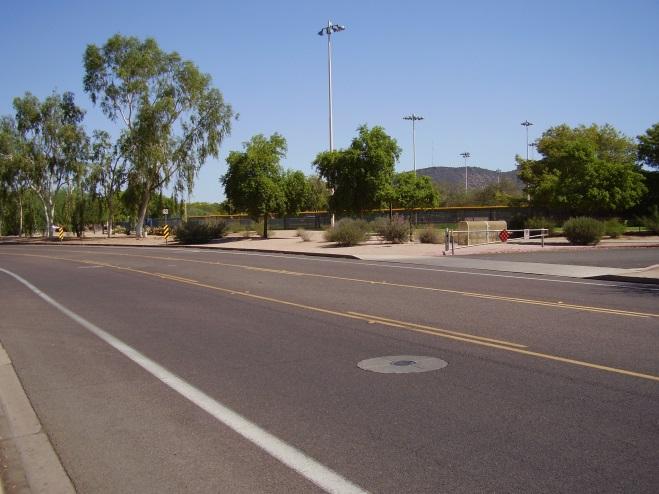
6 Page 4 characterized by rocky mountain ranges that alternate with desert basins as the primary landform organization. The natural biotic zone in which the evaluation area is located is the Sonoran Desertscrub vegetative community, characterized by saguaro, bursage, creosote bush, ocotillo, prickly pear/cholla, palo verde and ironwood. The existing vegetative community has been completely replaced by urban development and ornamental plants with some native species at the Rose Mofford Sports Complex. The plant palette in this urban setting includes species such as California fan palms, olive trees, Aleppo pines, bottle trees, elm trees, petite oleanders, hesperaloes, Texas sage and large expanses of turf. There are a few mesquite and palo verde trees, mostly along the Rose Mofford Sports Complex frontage. The evaluation area is within an urban commercial land use setting. Almost all the developments along the segment are large one- to five-story office buildings. They are predominantly stucco, brick, block and glass buildings in shades of grays and browns. There is a small amount of residential three apartment complexes, a mobile home/rv park and an extended stay suites hotel. At the north end, on the west side of Interstate 17 (I-17), the land use is commercial (retail and restaurants). The Rose Mofford Sports Complex borders 25th Avenue on the eastern side from the Arizona Canal north to Mountain View Road. It provides a large open space for about one-quarter mile. Dunlap Avenue, from the existing light rail station west to 25th Avenue, is five through lanes and a left-turn lane. 25th Avenue, from Dunlap Avenue north to Mountain View Road, has one lane in each direction, a left-turn lane and bicycle lanes. Mountain View Road, from 25th Avenue to I-17, is one lane in each direction. On the west side of I-17, the track and station would be elevated above what is now parking area for three restaurants and freeway frontage road. There are no landscaped medians in the corridor. Streetlights are a combination of standard cobra head fixtures on gray poles, cobra head fixtures attached to wooden power line poles, bronze poles and shoebox fixtures, decorative fixtures and City of Phoenix green poles and fixtures at major signalized intersections. They are on both sides of the alignment. From just west of 22nd Avenue to just east of 25th Avenue, there are power lines along the northern side of Dunlap Avenue, along the western side of 23rd Avenue and along the southern side of the Arizona Canal at 25th Avenue. High-voltage power lines parallel the southern side of the Arizona Canal Diversion Channel (ACDC) and the I-17 northbound frontage road at Mountain View Road, all perpendicular to the alignment. Sidewalks are found on both sides of the street, where the alignment follows an existing street, except for along the Rose Mofford Sports Complex where the sidewalk meanders well off the street into the property. No designated on-street parking exists in the corridor.

7 Page VISUAL ASSESSMENT UNITS After field review, the project team divided the evaluation area into four visual assessment units. The visual assessment units were divided geographically, primarily based on building size and building proximity to street. All other visual factors vegetation, views, utilities, building condition, types of businesses are similar throughout the length of the evaluation area. The four visual assessment units, numbered south to north, are shown in Figure 2. FIGURE 2: VISUAL ASSESSMENT UNITS
8 Page Unit 1 Dunlap Avenue from 19th Avenue to 25th Avenue and 25th Avenue from Dunlap to the Arizona Canal Unit 1 begins at the current end-of-line station on Dunlap Avenue just west of 19th Avenue and continues west along Dunlap Avenue to 25th Avenue and then north on 25th Avenue to the Arizona Canal. The visual characteristics are described in Table 1, followed by photos of typical buildings. TABLE 1: UNIT 1 CHARACTERISTICS a DUNLAP AVE (19TH AVE TO 25TH AVE) AND 25TH AVE (DUNLAP AVE TO ARIZONA CANAL) Visual Description Characteristic Land use Business commercial, educational, mobile home/rv park, apartment complexes, hotel Building height One to five stories Parking Surface parking and parking garages Street westbound Two travel lanes, sidewalk (Dunlap Ave) Street eastbound Three travel lanes, sidewalk (Dunlap Ave) Street northbound One travel lane, sidewalk, bicycle lane (25th Ave) Street southbound One travel lane, sidewalk, bicycle lane (25th Ave) Median Continuous left-turn lane only Building-to-street Buildings set back from the street 15 to 225 feet relationship Building condition Overall good Vegetation Street landscaping by development; no consistent species of street trees Utilities Standard cobra head fixtures on gray poles (both Dunlap Ave and 25th Ave) Cobra head fixtures attached to wooden power line poles, bronze poles and shoebox fixtures and City of Phoenix green poles and fixtures at major signalized intersections along Dunlap Ave Power lines along the northern side of the Dunlap Ave from just west of 22nd Ave to just east of 25th Ave and perpendicular to the corridor along 23rd Ave, southern side of the Arizona Canal and southern side of the ACDC Viewers Motorists, pedestrians, bicyclists, transit users on Dunlap Ave Views Foreground, middleground, and background views of urban development Very distant views (3 miles plus) of mountains directly east and west when on Dunlap Avenue a unless noted otherwise, descriptions apply to both Dunlap Ave and 25th Ave


9 Page 7 UNIT 1 IMAGES Office building at southwestern corner of Dunlap Avenue and 25th Avenue Office building at northeastern corner of Dunlap Avenue and 25th Avenue Office building at southeastern corner of Dunlap Avenue and 23rd Avenue Parking garage at southwestern corner of Dunlap Avenue and 22nd Avenue Office building at northwestern corner of Dunlap Avenue and 23rd Avenue Parking garage on west side of 25th Avenue

10 Page 8 Apartment units on northwestern corner of 25th Avenue and Dunlap Avenue Unit 2 25th Avenue from the Arizona Canal to Mountain View Road Unit 2 begins at the Arizona Canal and continues north on 25th Avenue to Mountain View Road. The visual characteristics are described in Table 2, followed by photos of some of the buildings and the sports complex. TABLE 2: UNIT 2 CHARACTERISTICS 25TH AVE (ARIZONA CANAL TO MOUNTAIN VIEW RD) Visual Characteristic Description Land use Business commercial, U.S. Department of Veterans Affairs health clinic, sports complex Building height One to three stories Parking Surface parking Street northbound One travel lane, sidewalk, bicycle lane Street southbound One travel lane, sidewalk, bicycle lane Median Continuous left-turn lane only Building-to-street Buildings set back from the street 85 to 175 feet relationship Building condition Overall good Vegetation Street landscaping by development; no consistent species of street trees Utilities Standard cobra head fixtures on gray poles High-voltage power lines cross perpendicular to 25th Avenue at the Arizona Canal and ACDC Viewers Motorists, pedestrians, bicyclists Views Foreground, middleground, and background views of urban development and regional park


11 Page 9 UNIT 2 IMAGES Office building on west side of 25th Avenue Regional park on east side of 25th Avenue Office building on west side of 25th Avenue Regional park on east side of 25th Avenue
12 Page Unit 3 Mountain View Road from 25th Avenue to I-17 Unit 3 begins at 25th Avenue and Mountain View Road and continues west on Mountain View Road to I-17. The visual characteristics are described in Table 3, followed by photos of some of the buildings. Visual Characteristic Land use Building height Parking Street westbound Street eastbound Median Building-to-street relationship Building condition Vegetation Utilities Viewers Views TABLE 3: UNIT 3 CHARACTERISTICS MOUNTAIN VIEW RD (25TH AVE TO I-17) Description Business commercial, restaurants, hotel One to three stories Surface parking One travel lane, sidewalk, bicycles share right travel lane or sidewalk One travel lane, sidewalk, bicycles share right travel lane or sidewalk None Buildings set back from the street 30 to 450 feet Overall good Street landscaping by development; no consistent species of street trees Decorative fixture street lights High-voltage power lines parallel I-17 on the eastern side of the freeway Motorists, pedestrians, bicyclists Foreground, middleground, and background views of urban development with very distant views (3 miles plus) of mountains directly east


13 Page 11 UNIT 3 IMAGES Hotel on south side of Mountain View Road Office building on southwestern corner of Mountain View Road and 25th Avenue Restaurant on southeastern corner of Mountain View Road and I-17 frontage road Restaurant on northeastern corner of Mountain View Road and I-17 frontage road
14 Page Unit 4 Frontage Area along West Side of I-17 Unit 4 begins on the east side of I-17 on the Mountain View Road alignment, crosses over I-17 and turns north, terminating with an elevated station north of Cheryl Drive. The visual characteristics are described in Table 4, followed by photos of some of the buildings. TABLE 4: UNIT 4 CHARACTERISTICS FRONTAGE AREA ALONG WEST SIDE OF I-17 Visual Characteristic Description Land use Business commercial, restaurants Building height One story Parking Surface parking Street northbound Not applicable Street southbound Two southbound lanes of I-17 frontage road Median Not applicable Building-to-street Retail buildings with parking are adjacent to the frontage road relationship Building condition Overall good Vegetation Some landscape associated with the businesses along the frontage road Utilities Street lights along the frontage road Parking lot lighting Viewers Motorists Views Foreground, middleground, and background views of urban development


15 Page 13 UNIT 4 IMAGES Parking lot behind Souper Salad restaurant Souper Salad building Parking lot behind commercial buildings Frontage road right-of-way between commercial buildings and freeway
16 Page PROPOSED TPSS AND SIGNAL BUILDING LOCATIONS Three potential sites have been identified for traction power substations (TPSSs), two of which will be selected. There are three sites identified for a signal house, two of which would be located on the elevated structure. A TPSS site is approximately 6,174 to 7,144 square feet. A signal house site is approximately 66 feet by 78 feet with a 16 by 28-foot structure. Table 5 lists the TPSS and signal house sites, provides a site description of each and is followed by photos of each of the sites. At this stage of design, it is not finalized where on the parcel the building would be located. TABLE 5: PROPOSED TPSS AND SIGNAL HOUSE LOCATIONS TPSS or Signal House Location Site Description TPSS: 25th Ave, west side, south of the Arizona Canal TPSS: Mountain View Rd and 25th Ave TPSS: Northern side of Cheryl Dr west of ring road Signal house: Dunlap Ave between 19th and 22nd Ave Signal house: Mountain View Rd, east of I-17 on elevated structure Signal house: West of I-17 on elevated structure Western side of 25th Ave south of the Arizona Canal Diversion Channel and Trail and adjacent to and east of vacant land identified for use as a potential construction staging area. Northwestern quadrant of the intersection of 25th Ave and Mountain View Rd within an existing parking lot. Northern side of Cheryl Dr just west of the shopping center ring road within an existing parking lot. Southern side of Dunlap Ave within the existing DeVry University parking lot between 22nd Ave and driveway access to park-and-ride at the 19th Ave/Dunlap Ave light rail station. On the elevated structure east of the I-17 northbound frontage road. On the elevated structure just west of the I-17 southbound frontage road on the southern side of Cheryl Dr above an existing parking lot.


17 Page 15 IMAGES OF TPSS AND SIGNAL HOUSE LOCATIONS a TPSS: 25th Avenue, west side, south of the Arizona Canal TPSS: Mountain View Road and 25th Avenue TPSS: Cheryl Drive and shopping center ring road Signal House: Dunlap Avenue near 22nd Avenue a Two signal house locations are on the proposed elevated structure, so existing site photos are not available.


18 Page STATION LOCATIONS The Build Alternative has three station locations. Table 6 describes the station location surroundings and is followed by photos of each station site and nearby buildings. Station 25th Ave/Dunlap Ave Mountain View Rd/25th Ave Metrocenter TABLE 6: STATION LOCATIONS Description Office buildings north, south and east of the station Residential across 25th Ave to the west and south across Dunlap Ave to the east Office buildings to the west Sports complex to the east Commercial retail to the west Freeway to the east IMAGES OF STATION LOCATIONS 25th Ave/Dunlap Ave Mountain View Rd/25th Ave Metrocenter
19 Page IMPACT ASSESSMENT 2.1 METHODOLOGY To determine the effects on the visual environment, the project team used a rating system similar to systems used by the U.S. Forest Service, Bureau of Land Management and Federal Highway Administration to depict the levels of impact the project might have on the visual quality in each visual assessment unit. Table 7 lists the ratings used. TABLE 7: VISUAL QUALITY IMPACT RATING Impact Definition Mitigation None None or negligible change None needed Low Minor change, elements introduced are Mitigation may not be required similar to existing features Moderate Noticeable change, elements obstruct or alter views or character Mitigation may be needed to reduce impacts High 2.2 VIEWER TYPES Major change, elements obstruct views or substantially alter character Extraordinary mitigation needed to reduce impacts Viewer types were also considered in the evaluation. Viewer types are those people who regularly travel through the Study Area or who may have sensitivity to visual changes in the environment. Five viewer types were identified: residents, business owners/employees/clientele, motorists, pedestrians/bicyclists and transit users. Viewer sensitivity to visual change can be affected by distance between viewer and visual resource, visibility of the resource within the visual assessment unit, frequency and duration of view and viewer expectation. Viewer type and length of stay in the Study Area were also considered. Sensitivity is usually higher for those viewers who live or work in an area or who are driving or walking through for pleasure versus those who are commuting or driving for work through the area. Residential viewers typically have the highest sensitivity because they have an extended viewing period and may be concerned about changes in views from their homes. Other than residents, who have high sensitivity, the viewer types have low to moderate sensitivity to change (Table 8). Most of the people in these other groups use the corridor for commuting, working or shopping.
20 Page 18 Resident Viewer Business owner/ employee/clientele Motorist Pedestrian/bicyclist TABLE 8: VIEWER TYPES Definition Residents are the most sensitive viewers. They spend the most time near the project elements. People working in or visiting businesses spend typical business hours in the area or make frequent but short buying trips. Motorists generally travel parallel to the project and their exposure is short term. Pedestrians and bicyclists generally travel parallel to the project but at slower rates than motorists; however, their overall exposure is still considered short term. Transit user Bus riders travel to and through the corridor. Low Sensitivity to Change High Low to moderate Low Moderate The Northwest Phase II Light Rail Extension Project evaluation area is dominated by large office buildings and parking garages. Most viewers are likely employees and clients who work in and visit these buildings. Motorists are another large viewing group because drivers use Dunlap and 25th Avenues and Mountain View Road to get to these businesses or use it to travel to destinations beyond the area. A fair number of pedestrians and bicyclists was observed along Dunlap Avenue, and the bus stops were active. There are three high-density residential developments that occur adjacent to the corridor. 2.3 VISUAL QUALITY Visual quality describes the visual relationship between landscape elements. Each unit was evaluated and assigned an existing visual quality rating (Table 9) using the rating categories from Table 7. The evaluation criteria were: Vividness. Vividness is assessed using landform and landcover. Landform vividness is frequently determined by the pattern elements of form or line, such as the strongly defined skyline of a mountain landscape or distinct, memorable urban setting. Landcover consists of water, surface geology, vegetation and human-made development. Areas with high vividness, for example, often contain water, which creates a vivid landscape component as a result of linear visual effects (such as a shoreline or the sharp edge of a waterfall) and color. In a built environment, human-made features with lots of detail and color can be distinctive. TABLE 9: EXISTING VISUAL QUALITY, BY UNIT Unit Vividness Intactness Unity Overall 1 Dunlap Ave from 19th Ave to 25th Ave and Low Moderate Moderate Moderate 25th Ave from Dunlap Ave to Arizona Canal 2 25th Ave from Arizona Canal to Mountain Low Moderate Moderate Moderate View Rd 3 Mountain View Rd from 25th Ave to I-17 Low Moderate Moderate Moderate 4 Along I-17 Southbound Frontage Road Low Low Low Low
21 Page 19 Intactness. Intactness is assessed in terms of the quality of the natural visual appearance of an area, or in the case of urban areas, how well the human-made features fit together. Low intactness occurs when an unsightly human-made element ( eyesore ) encroaches into an undisturbed natural area or is out of place in the developed landscape. High intactness is attributable to the natural visual order of an untouched landscape or a well-kept urban area that has visual integrity. Unity. Unity is generally used as a measure of how human-made and natural elements work together within the same visual unit, or in the case of urban areas, the compositional harmony of the features. Human-made environments with no visual relation to natural landform or landcover patterns are usually considered to lack visual unity. Viewers in Unit 1 have foreground and middleground views of predominantly large office buildings. Background views are blocked by the foreground and middleground features except when looking directly east or west on Dunlap Avenue where distant mountains can be seen. Vividness is low because of the similar scale, color and architecture of the buildings, which are the most visible elements. Intactness is moderate because of the dynamic nature of a constantly changing urban environment. Unity is moderate for this unit because the composition is customary for an arterial street lined with office buildings. Unit 2 foreground and middleground views are of office buildings and a sports complex. Background views are blocked by the foreground and middleground features. Vividness is low because of the similar scale, color and architecture of the buildings, which are the most visible elements. Intactness is moderate because of the dynamic nature of a constantly changing urban environment. Unity is moderate for this unit because of the relationship between the office buildings to the west versus the regional park on the east. Unit 3 has foreground and middleground views of large office buildings and smaller scale restaurant buildings. Background views are blocked by the foreground and middleground features except when looking directly east on Mountain View Road where distant mountains can be seen. Vividness is low because of the similar scale, color and architecture of the buildings, which are the most visible elements. Intactness is moderate because of the dynamic nature of a constantly changing urban environment. Unity is moderate for this unit because the composition is customary for a collector street serving offices, hotels and restaurants. Viewers in Unit 4 have foreground and middleground views of commercial and retail buildings, parking lots and the adjacent interstate. Background views are blocked by the foreground and middleground features. Vividness, intactness and unity are all low for this unit. There are no memorable or dramatic features that create noteworthy views or visual interest and the human-made elements do not fit together well nor have compositional harmony No-Build Alternative The No-Build Alternative assumes that the light rail and supporting facilities would not be constructed; therefore, no physical alteration of built and natural components would occur in the area other than the few roadway and transit capital improvements included
22 Page 20 in the RTP that have already been approved for funding. In the No-Build scenario, the patterns and trends of land development and socioeconomic activity currently occurring in the corridor would continue, including a continued increase in development and redevelopment actions. Changes would occur through typical market forces and the implementation of various governmental plans for development and redevelopment. The area s general character is expected to remain relatively constant, with some infill occurring. Therefore, the corridor s existing character would not be affected with the decision to implement the No-Build Alternative Build Alternative The proposed corridor is an urban, active area with buildings and parking lots, poles and power lines and other similar features of an urban transportation corridor Unit 1 Unit 1 encompasses Dunlap Avenue from 19th to 25th Avenues, and 25th Avenue from Dunlap Avenue to the Arizona Canal. The proposed cross section on Dunlap Avenue has a similar through traffic lane arrangement as the current condition two westbound lanes, three eastbound lanes. However, left turns would be restricted to fewer locations than currently occur. 25th Avenue would continue to have one lane in each direction and would have a dedicated left-turn lane heading south on 25th Avenue and a traffic signal to turn left onto Mission Lane. The Build Alternative would add track, poles and overhead catenary wires along the guideway and a center-running station on Dunlap Avenue, just east of 25th Avenue. There would be no adverse impact because many poles and wires currently exist along the alignment. Along the eastern side of 25th Avenue, the expanded ROW is likely to cause the removal of several mature trees that provide shade and vegetation to the streetscape. There would be no impact because a large number of poles and wires currently exist along the alignment. Overall, no adverse impacts would occur along Dunlap or 25th Avenues south of the Arizona Canal and ACDC Unit 2 Unit 2 encompasses 25th Avenue from the Arizona Canal to Mountain View Road. 25th Avenue north of the Arizona Canal and ACDC would continue to have one lane in each direction; left turns would be restricted to select locations. At the Arizona Canal and ACDC crossing, two new pedestrian-activated signals would be installed. The Build Alternative would add track, poles and overhead catenary wires along the guideway and a side-running station on the eastern side of 25th Avenue. The station platform, shade structures and two new traffic signals in front of the sports complex would change the character of the street, making it more urban than it currently appears. Overall, no adverse impacts would occur along 25th Avenue from the Arizona Canal to Mountain View Road Unit 3 Unit 3 encompasses Mountain View Road from 25th Avenue to I-17. Mountain View Road would continue to have a traffic lane in each direction but the ability to make left turns would be restricted because of the elevated guideway. The Build Alternative would
23 Page 21 add poles and overhead catenary wires along the elevated guideway. Along the northern side of the street, the expanded ROW is likely to cause the removal of several mature trees that provide shade and vegetation to the streetscape. At the western end of Mountain View Road, the view west across the freeway to Metrocenter would be replaced by the view of the trackway rising over the freeway. The character of the street would become more urban than it currently appears. Elevating the trackway over the freeway would partially block background views to the west for viewers at Mountain View Road street level; however, views for transit riders would be enhanced. There are two options for the type of elevated guideway. One is on retained fill; one is an open structure. The main viewers that would discern this difference are those at street level looking either north or south toward the elevated structure. In the first option, viewers would see large retaining walls and would not be able to cross under the structure. In the second option, viewers would be able to see past the elevated guideway and would be able to cross under the structure. Overall, no adverse impacts would occur along Mountain View Road from 25th Avenue to I Unit 4 Unit 4 encompasses the frontage area along the western side of I-17 from the Mountain View Road alignment north to the end of the proposed improvements. Along the western side of I-17, the new alignment and elevated station would be located parallel to an interstate that has numerous poles and signs. The Metrocenter station would be elevated above the I-17 southbound frontage road, somewhat obstructing the visibility of the shopping center from the freeway and frontage road. The Souper Salad building, with its singular roofline, would remain. It would be most visible from the elevated station and from the shopping center ring road but its view from the freeway would be further obscured than it is currently. Walkways and elevators would connect the ground level and the elevated station at the northern and southern ends of the platform. The elevated station would change the character of what is now one-story restaurants and surface parking. However, because it is located between a major interstate and an expansive mall and parking lot, the change in character would be in keeping with an urban corridor. Overall, no adverse impacts would occur along the frontage road along the western side of I-17. From the perspective of drivers on I-17, the addition of an overpass and an elevated station would not change the overall character of an urban transportation corridor. The overpass would be similar to other bridges that cross I-17 in multiple locations TPSS and Signal House Locations The visual impact of the TPSS and signal house locations would be low. They are located in existing or proposed parking areas or near existing buildings, and would include fencing and screening to minimize the visual impact on the surrounding area. A TPSS building in any of the locations identified would fit into the context of the surrounding area and would not change the area s character or feel. The signal house on Dunlap Avenue near 22nd Avenue would be located in an existing parking lot. The signal houses on the elevated structure would be part of the visual change associated with the elevated structure and would not, on their own, change the visual character.
24 Page 22 There would be no impact should a TPSS and signal building option be selected in any of these locations Station Locations The visual impact of the three station locations is low. They are in areas of large office and commercial buildings and parking lots, so there would be no change to the area s character or feel Park-and-rides Park-and-rides would be accommodated at two locations. One would be leasing or buying a sufficient portion of the existing parking lot near the Dillard s department store at Metrocenter to accommodate approximately 260 park-and-ride spaces. This would provide parking across the ring road from the proposed relocated transit center and light rail station. The Build Alternative would also add approximately 179 spaces to the Rose Mofford Sports Complex that would be shared with recreational users. The parking area would have an emergency call box, CCTV cameras and, if necessary, lighting. The park-and-ride spaces at both locations would be surface parking; no structures are proposed. Because both of the park-and-ride locations are currently surface parking areas, no change in the area s character or feel would occur. 3.0 CONCLUSION No mitigation is necessary because the Build Alternative is not expected to contribute to adverse visual effects or cumulative adverse impacts. Although no mitigation is necessary, the Build Alternative s final design would incorporate specific aesthetic guidelines for stations, platforms, TPSSs, overhead catenary poles and wires and track, where possible. Valley Metro would conform to the guidance and specifications contained in Valley Metro s applicable design criteria for stations, landscape, etc. These documents include methods to enhance and maintain the urban continuity and to blend the Build Alternative s features into the existing setting. Methods that could be adopted are listed below: Integrate new facilities with area redevelopment plans. Minimize the height of facilities to the extent possible to reduce their visibility. Use plant materials to provide screening for sensitive visual resources and viewers. Use light fixtures that will not cause light spillover into residential areas. Carefully select TPSS sites, provide screening and use architecture of a style that is compatible with the surrounding environment. Provide new landscape to create continuity throughout the Build Alternative area.
APPENDIX D: Visual and Aesthetic Conditions for NCCU Station Refinement. Durham-Orange Light Rail Transit Project
 APPENDIX D: Visual and Aesthetic Conditions for NCCU Station Refinement Durham-Orange Light Rail Transit Project October 2016 1. Introduction The Combined FEIS/ROD summarizes the effects of the D-O LRT
3.5 VISUAL AND AESTHETIC QUALITIES
 3.5 VISUAL AND AESTHETIC QUALITIES 3.5.1 Introduction to Analysis 3.5.1.1 Summary of Results The Preferred Alternative would represent a minimal change to the visual character of the existing rail corridor.
Section 3.16 Visual Quality
 Chapter 3 Affected Environment, Environmental Consequences, and Mitigation Measures Section 3.16 Visual Quality Introduction This section discusses existing conditions, effects and mitigation measures
22a. Existing Condition. 22b. Simulation of NE 20th Street Alternative (D3)
") Appendix F4.5 Visual Consistency and Key Observation Point Analyses EXHIBIT F4.5-22 Key Observation Point 22 (looking east along NE 20th Street) 22a. Existing Condition 22b. Simulation of NE 20th Street
Appendix F4.5 Visual Consistency and Key Observation Point Analyses EXHIBIT F4.5-22 Key Observation Point 22 (looking east along NE 20th Street) 22a. Existing Condition 22b. Simulation of NE 20th Street
Glenn Highway MP DSR. Landscape Narrative
 Glenn Highway MP 34-42 DSR Landscape Narrative Project Landscape Goals The Glenn Highway MP 34-42 Project extends through a variety of landscape types typical to the Matanuska-Susitna Valley. In general,
The transportation system in a community is an
 7 TRANSPORTATION The transportation system in a community is an important factor contributing to the quality of life of the residents. Without a sound transportation system to bring both goods and patrons
4.5 Visual and Aesthetic Resources
 4.5 Visual and Aesthetic Resources 4.5.1 Summary Table 4.5-1 shows how many homes would have reduced visual quality under each alternative. Measures like the ones suggested in Section 4.5.5, Potential
Gold Line Bus Rapid Transit Transit Oriented Development (BRTOD) Helmo Station Area Plan
 Helmo Station Area Plan") Appendix F Gold Line Bus Rapid Transit Transit Oriented Development (BRTOD) Helmo Station Area Plan Introduction and Purpose of the Plan The Gold Line Bus Rapid Transit facility is an eleven-mile dedicated
Appendix F Gold Line Bus Rapid Transit Transit Oriented Development (BRTOD) Helmo Station Area Plan Introduction and Purpose of the Plan The Gold Line Bus Rapid Transit facility is an eleven-mile dedicated
5.4.6 Cumulative Operational Impacts
 5.4.5.2 Visual Character Impacts The proposed project is located in greater downtown Los Angeles, which is a dynamic environment where new projects are constructed on an ongoing basis. Additional development
Right-of-Way Acquisitions and Relocations Technical Memorandum
 Right-of-Way Acquisitions and Relocations Technical Memorandum Southeast Extension Project Lincoln Station to RidgeGate Parkway Prepared for: Federal Transit Administration Prepared by: Denver Regional
3.5 VISUAL AND AESTHETIC QUALITIES
 3.5 VISUAL AND AESTHETIC QUALITIES 3.5.1 Introduction to Analysis A commuter rail transit project is a major investment in a community s future. How it impacts the visual qualities of the natural and cultural
4.1 AESTHETICS AND VISUAL QUALITY
 SCOPE AND METHODOLOGY 4.1 AESTHETICS AND VISUAL QUALITY This section evaluates the potential impacts to aesthetics and visual quality. Aesthetics refers to visual resources and the quality of what can
Planning Districts INTRODUCTION
 INTRODUCTION To facilitate detailed examination of development prospects for all areas of the community, Delano has been divided into 14 planning districts. The location of these planning districts is
The impacts examined herein take into account two attributes of aesthetic values:
 IV. ENVIRONMENTAL IMPACT ANALYSIS This section addresses the potential impacts to views and aesthetics as a result of the proposed Project at the Project Site and the development scenarios analyzed for
4.0 AFFECTED ENVIRONMENT AND ENVIRONMENTAL CONSEQUENCES
 4.0 AFFECTED ENVIRONMENT AND ENVIRONMENTAL CONSEQUENCES The following sections discuss the impacts associated with environmental resources for the tunneling method Alternatives A and B. The construction
Policies and Code Intent Sections Related to Town Center
 Policies and Code Intent Sections Related to Town Center The Town Center Vision is scattered throughout the Comprehensive Plan, development code and the 1994 Town Center Plan. What follows are sections
Midtown Greenway Land Use and Development Plan Executive Summary
 Midtown Greenway Land Use and Development Plan Executive Summary Introduction The Midtown Greenway Land Use and Development Plan sets policy direction for land use and development in the Midtown Greenway
Seneca Meadows. Block 4 Locate office, technology, and medical development adjacent to I Screen views of garage structures from I-270.
 Seneca Meadows Seneca Meadows has an industrial park in its southern end and a mixed-use employment area planned for the north end. The district benefits from extensive I-270 visibility, stream valley
Establish a network of streetscaped vehicle and pedestrian routes that connect within and outside the Plan area.
 This Plan s urban design goals are to create an urban scale, walkable community with connections to transit, parks, and services and with amenities and facilities for residents and employees. The 1992
RZC Public View Corridors and Gateways
 RZC 21.42 Public View Corridors and Gateways 21.42.010 Purpose 21.42.020 Scope and Authority 21.42.030 Administration 21.42.040 Gateways Design 21.42.050 Unidentified Public Views 21.42.060 Identification
CHAPTER 1. Ms. Guajardo s Class - Central Elementary CH 1 1
 INTRODUCTION CHAPTER 1 Ms. Guajardo s Class - Central Elementary CH 1 1 1.1 SETTING South Centre City is a linear corridor south of Downtown Escondido paralleling Centre City Parkway and South Escondido
SPRINGHILL LAKE TRANSIT VILLAGE
 Greenbelt Metro Area Sector Plan - Subarea Design Policies and Guidelines - Springhill Lake Transit Village 113 SPRINGHILL LAKE TRANSIT VILLAGE Residential Neighborhood and Village Center CONCEPT Springhill
5.8 Visual Resources and Aesthetic Qualities
 I-70 East Supplemental Draft EIS 5.8 Visual Resources and Aesthetic Qualities 5.8 Visual Resources and Aesthetic Qualities This section discusses the visual resources and aesthetic qualities of the study
3.1 Aesthetics, Light, and Glare
 3.1 3.1.1 Introduction This section describes the existing aesthetics, light, and glare setting and potential effects from project implementation on visual resources and the site and its surroundings.
FUTURE LAND USE ELEMENT
 FUTURE LAND USE ELEMENT GOAL I: To create and sustain a great place to live, play, and prosper Objective 1: The City of Ocala shall incorporate the principles and strategies of the Ocala 2035 Vision into
Eastern Terminus TECHNICAL MEMORANDUM CENTRAL BROWARD EAST-WEST TRANSIT ANALYSIS BROWARD COUNTY, FLORIDA
 Eastern Terminus TECHNICAL MEMORANDUM CENTRAL BROWARD EAST-WEST TRANSIT ANALYSIS BROWARD COUNTY, FLORIDA FINANCIAL PROJECT ID NUMBER 411189-2-22-01 FLORIDA DEPARTMENT OF TRANSPORTATION DISTRICT 4 Prepared
3.5. Visual and Aesthetic Qualities
 3.5 Visual and Aesthetic Qualities 3.5 Visual and Aesthetic Qualities 3.5.1 Introduction to Analysis 3.5.1.1 Summary of Results Implementation of the Preferred Alternative would involve the installation
1.0 Circulation Element
 5/9/18 1.0 Circulation Element 1.1 Introduction As growth and development occur in Apache County, enhancements to its circulation system will be necessary. With time, more roads will be paved and air and
Existing Transportation System 5-1
 5-1 The Jackson County transportation system is served by several modes of transportation including streets and highways, multi-modal, non-motorized, rail, and aviation. While the focus of the transportation
5.1 AESTHETICS AND VISUAL RESOURCES Physical Setting
 5.1 AESTHETICS AND VISUAL RESOURCES 5.1.1 Physical Setting Aesthetic values are an important aspect in establishing the identity, sense of place, and quality of life in a community. Natural features in
Clairtrell Area Context Plan
 Clairtrell Area Context Plan March 2005 Urban Development Services City Planning Contents 1. Introduction... 4 2. Development Structure... 6 2.1 Streets... 7 2.1.1 Sheppard Avenue and Bayview Avenue...
ARLINGTON COUNTY, VIRGINIA
 ARLINGTON COUNTY, VIRGINIA County Board Agenda Item Meeting October 15, 2005 DATE: September 28, 2005 SUBJECT: Request to Advertise the adoption of the 2005 Clarendon Sector Plan C. M. RECOMMENDATION:
3.10 LAND USE SETTING PROJECT SITE EXISTING LAND USE DESIGNATIONS AND ZONING. General Plan Land Use Designations.
 This section of the Draft EIR addresses the existing land uses on and adjacent to the project site and discusses the potential impacts of the proposed project on existing land uses. Key issues addressed
Tonight s Agenda. Summary Presentation Open House. Group Discussion Next Steps: online community wide survey
 Community Open House February 22, 2018 Tonight s Agenda Summary Presentation Open House Station 1: Project Overview and Community Input Station 2: Draft Vision and Guiding Principles Station 3: Western,
C. Westerly Creek Village & The Montview Corridor
 C. Westerly Creek Village & The VISION Community Vision When the goals of the city are achieved Westerly Creek Village, a distinctive community defined by Montview Boulevard and Westerly Creek, is a strong
Staff Report and Recommendation
 Community Planning and Development Planning Services 201 W. Colfax Ave., Dept. 205 Denver, CO 80202 p: 720.865.2915 f: 720.865.3052 www.denvergov.org/cpd TO: City Council Neighborhoods and Planning Committee
Northwest Rail Corridor and US 36 BRT Development Oriented Transit Analysis 4.4 STATION AREA FINDINGS
 4.4 STATION AREA FINDINGS Each station is different, and each one requires a separate set of recommendations based on the vision for the site. This section outlines an initial TOD strategy and recommendations
3.0 PROJECT DESCRIPTION
 3.0 PROJECT DESCRIPTION 3.1 BACKGROUND Under California law (Government Code Section 65300 et seq.), every city and county is required to have a general plan. The general plan is to be comprehensive and
CHAPTER 7: VISION AND ACTION STATEMENTS. Noble 2025 Vision Statement
 CHAPTER 7: VISION AND ACTION STATEMENTS This chapter presents the vision, policy and action statements that transform the comprehensive planning study, an analysis of Noble s past, future trends and community
Nob Hill Pipeline Improvements Project EIR
 Section 3.1 Aesthetics This section addresses the visual aspects that may affect the views experienced by the public, including the potential to impact the existing character of each area that comprises
CHAPTER 7: Transportation, Mobility and Circulation
 AGLE AREA COMMUNITY Plan CHAPTER 7 CHAPTER 7: Transportation, Mobility and Circulation Transportation, Mobility and Circulation The purpose of the Transportation, Mobility and Circulation Chapter is to
II. SINGLE FAMILY RESIDENTIAL
 II. SINGLE FAMILY RESIDENTIAL Castle Rock is made up of numerous individually built houses and subdivision tracts that have been developed during the past century. Some of the tracts are diverse in architectural
Chapter 1 - General Design Guidelines CHAPTER 1 GENERAL DESIGN GUIDELINES
 CHAPTER 1 GENERAL DESIGN GUIDELINES 1.0 INTRODUCTION This Publication has been developed to provide current, uniform procedures and guidelines for the application and design of safe, convenient, efficient
Town Center. Block 5 Existing multifamily residential units are expected to remain.
 Area Guidelines Germantown s districts should be developed as distinct communities with unique features that are supported through the guidelines. The guidelines not only help distinguish these districts
East Corridor Final Environmental Impact Statement
 East Corridor Final Environmental Impact Statement Alternatives Considered Operating Plan The requirements for opening day operations versus year 2030 are based on ridership and operations. Opening day
, C-MS I June 3, 2016 $1500 pd chk #216918
 , C-MS-8 LOTS 21 THROUGH 40, INCLUSIVE, BLOCK 299 CLEMENTS ADDITION TO THE CITY OF DENVER SOUTHEAST QUARTER OF SECTION 34, TOWNSHIP 3 SOUTH, RANGE 68 WEST, SIXTH PRINCIPAL MERIDIAN, CITY
ELMVALE ACRES SHOPPING CENTRE MASTER PLAN
 ELMVALE ACRES SHOPPING CENTRE MASTER PLAN Contents 1.0 INTRODUCTION... 2 2.0 LOCATION... 2 3.0 EXISTING CONTEXT... 2 4.0 VISION & GUIDING PRINCIPLES... 2 5.0 LAND USE AND BUILT FORM... 4 5.1 St. Laurent
PROPOSED REDEVELOPMENT OF THE GLEN ABBEY GOLF CLUB. STREETSCAPE DESIGN STUDY (excerpt from the Urban Design Brief) TOWN OF OAKVILLE.
 TOWN OF OAKVILLE.") PROPOSED REDEVELOPMENT OF THE GLEN ABBEY GOLF CLUB STREETSCAPE DESIGN STUDY (excerpt from the Urban Design Brief) TOWN OF OAKVILLE OCTOBER, 2016 for 2.4.2 STREETS Streets are the single largest component
PROPOSED REDEVELOPMENT OF THE GLEN ABBEY GOLF CLUB STREETSCAPE DESIGN STUDY (excerpt from the Urban Design Brief) TOWN OF OAKVILLE OCTOBER, 2016 for 2.4.2 STREETS Streets are the single largest component
Transportation. Strategies for Action
 Transportation A major priority for the Overlake Neighborhood is to develop a multimodal transportation system. To achieve this system, a balance has to be found among travel, circulation and access needs;
MEMORANDUM. DATE: March 15, Chairman and Members Community Redevelopment Agency. Leif J. Ahnell, C.P.A., C.G.F.O. Executive Director
 MEMORANDUM DATE: March 15, 2019 TO: FROM: Chairman and Members Community Redevelopment Agency Leif J. Ahnell, C.P.A., C.G.F.O. Executive Director SUBJECT: Camino Square, IDA No. CRP-16-02, located at 171
Urban Planning and Land Use
 Urban Planning and Land Use 701 North 7 th Street, Room 423 Phone: (913) 573-5750 Kansas City, Kansas 66101 Fax: (913) 573-5796 Email: planninginfo@wycokck.org www.wycokck.org/planning To: From: City Planning
ROAD CLOSURE AND LAND USE AMENDMENT SILVER SPRINGS (WARD 1) NORTHEAST OF NOSEHILL DRIVE NW AND SILVER SPRINGS ROAD NW BYLAWS 2C2018 AND 29D2018
 NORTHEAST OF NOSEHILL DRIVE NW AND SILVER SPRINGS ROAD NW BYLAWS 2C2018 AND 29D2018") Page 1 of 19 EXECUTIVE SUMMARY This application proposes redesignating two parcels in the community of Silver Springs from Special Purpose Future Urban Development (S-FUD) District and undesignated road
Page 1 of 19 EXECUTIVE SUMMARY This application proposes redesignating two parcels in the community of Silver Springs from Special Purpose Future Urban Development (S-FUD) District and undesignated road
Creating Complete Roadway Corridors:
 Creating Complete Roadway Corridors: The AASHTO Guide to Transportation Landscape Architecture and Environmental Design NCHRP Project 15-33 Status Report AASHTO Standing Committee on Design Technical Committee
Public input has been an important part of the plan development process.
 Lakewood s Comprehensive Plan recognizes that transportation helps shape the community, and that the way the community provides for the safe and efficient movement of people affects the character of the
3.1 AESTHETICS AND VISUAL RESOURCES
 3.1 AESTHETICS AND VISUAL RESOURCES This section examines the potential for the proposed Project to create aesthetic and visual impacts as defined by the California Environmental Quality Act (CEQA) as
A. WHAT IS A GENERAL PLAN?
 I. Introduction A. WHAT IS A GENERAL PLAN? A general plan is the planning guideline for the future of a city. It contains goals and policies which regulate urban development, the protection of the natural
Executive Summary. NY 7 / NY 2 Corridor
 Executive Summary NY 7 / NY 2 Corridor Transportation and Land Use Study December 2005 Prepared for: Town of Colonie Capital District Transportation Committee Prepared by: Introduction: Land use decisions
URBAN DESIGN BRIEF 305, 309, & 315 SOUTHDALE ROAD WEST LONDON ONTARIO
 URBAN DESIGN BRIEF 305, 309, & 315 SOUTHDALE ROAD WEST LONDON ONTARIO CARVEST PROPERTIES LTD. December 2013 Section 1 - Land Use Planning Context 1.1 Subject Lands The subject lands are located immediately
4. INDUSTRIAL 53 CASTLE ROCK DESIGN
 4. INDUSTRIAL 53 CASTLE ROCK DESIGN CASTLE ROCK DESIGN 54 4. INDUSTRIAL Overview Well-designed and attractive industrial centers are the product of blending economic realities with both functional and
FDOT D4 Complete Streets
 FDOT D4 Complete Streets Context Sensitive Solutions Directs that complete street solutions will complement the context of the community. Collaborative approach to decision making, project development,
3.1 community vision. 3.3 required plan elements
 Chapter 3 Community Form 3.1 community vision 3.2 Parks & landscaping concepts 3.3 required plan elements D R A F T 20 Community Form Chapter 3 3.0 Community form 3.1 community vision The Specific Plan
Chapter 1.0 Introduction
 Chapter 1.0 Introduction 1.1 Background The North Metro commuter rail line is part of the RTD FasTracks regional transit system expansion program to build more than 100 miles of rail transit throughout
The Anaheim Resort Public Realm Landscape Program. City of Anaheim. Adopted September 1994 (94R-239)
") Public Realm Landscape Program City of Anaheim Adopted September 1994 (94R-239) Amendment No. 1 October 1996 (96R-178) Amendment No. 2 June 1999 (99R-137) Amendment No. 3 February 2001 (2002R-56) Amendment
Public Realm Landscape Program City of Anaheim Adopted September 1994 (94R-239) Amendment No. 1 October 1996 (96R-178) Amendment No. 2 June 1999 (99R-137) Amendment No. 3 February 2001 (2002R-56) Amendment
PUBLIC OPEN HOUSE SEPTEMBER 8 TH, 2010 CITY OF LETHBRIDGE DEVELOPMENT SERVICES
 PUBLIC OPEN HOUSE SEPTEMBER 8 TH, 2010 CITY OF LETHBRIDGE DEVELOPMENT SERVICES INTRODUCTION Why is the City creating the West Lethbridge Employment Centre Area Structure Plan? West Lethbridge Urbanization
PROJECT SITE The Proposed Project includes the Allen and Pike Street malls between Delancey and South Streets (see Figure 2C-1).
.") Chapter 2, Section C: A. INTRODUCTION This chapter considers the potential of the proposed Reconstruction of the Allen and Pike Street Malls project to affect the urban design characteristics and visual
Chapter 2, Section C: A. INTRODUCTION This chapter considers the potential of the proposed Reconstruction of the Allen and Pike Street Malls project to affect the urban design characteristics and visual
CHAPTER FIVE COMMUNITY DESIGN
 CHAPTER FIVE COMMUNITY DESIGN CHAPTER FIVE - COMMUNITY DESIGN Assumptions Frazier Park and Lebec have historically developed according to different patterns of spatial form. While both communities are
YONGE STEELES CORRIDOR SECONDARY PLAN. Young + Wright / IBI Group Architects Dillon Consulting Ltd. GHK International (Canada) Ltd.
 Ltd.") PART A: PREAMBLE 1.0 PURPOSE The purpose of this Secondary Plan is to provide a development framework for intensification of the Yonge/ Steeles corridor including the north side of Steeles Avenue West
PART A: PREAMBLE 1.0 PURPOSE The purpose of this Secondary Plan is to provide a development framework for intensification of the Yonge/ Steeles corridor including the north side of Steeles Avenue West
3.0 URBAN DESIGN. December 6, OVERVIEW
 Urban Design 3.0 URBAN DESIGN December 6, 2007 3.1 OVERVIEW The highly urban character of Easton Place is defined by the overall design of the community. The following sections provide an overview of the
Rezoning Transportation Analysis Petition Number: General Location Identifier:
 From: Kelsie Anderson, PE Kelsie.Anderson@charlottenc.gov 704-432-5492 Staff Reviewer: Kory Hedrick, PE, PMP Khedrick@charlottenc.gov 704-432-6511 CDOT s review of this rezoning petition is intended to
Urban Design 9Identity
 Urban Design 9Identity URBAN DESIGN IDENTITY Urban design is about connecting people to their places through the built environment, nature, and overall urban form. Done well, it creates a memorable space
IV.B. VISUAL RESOURCES
 IV.B. VISUAL RESOURCES ENVIRONMENTAL SETTING Existing Visual Character Project Site The project site is located at 17331-17333 Tramonto Drive in the Pacific Palisades community of the City of Los Angeles
Table of Contents. Elm Avenue Improvement Plan City of Waco, Texas. Introduction 1. Existing Context 1 Figure 1 2.
 Table of Contents Introduction 1 Existing Context 1 Figure 1 2 Plan Guidelines 3 Future Urban Form 4 The West-End 4 Main Street 6 The East-End 7 Figure 2 9 Public Improvement Recommendations 7 General
4 C OMMUNITY D ISTRICTS
 4 C OMMUNITY D ISTRICTS N ew development in the Area will include many different types of land uses, including a destination retail area that attracts people from all over the region; recreation opportunities
3.6 VISUAL/AESTHETICS
 3.6 VISUAL/AESTHETICS The information in this section is based on the I-710 Corridor Project Visual Impact Assessment (VIA) (December 2011) and Urban Design and Aesthetics Toolbox Report (February 2012).
Definitions. Average Daily Traffic Demand (ADT): The actual number or projected number of cars that pass a point in a 24-hour period.
: The actual number or projected number of cars that pass a point in a 24-hour period.") Definitions Access Management: A combination of physical techniques and transportation policies used to control the flow of traffic between roads and the surrounding lands. Alternative City Form Scenarios:
Definitions Access Management: A combination of physical techniques and transportation policies used to control the flow of traffic between roads and the surrounding lands. Alternative City Form Scenarios:
Visual and Aesthetics
 Such a connection could accommodate timed transfers and improve connections between local transit service and Presidio Shuttle service. Level of Service The results of the analysis are provided on a route-by-route
EXISTING COMPREHENSIVE PLAN
 EXISTING COMPREHENSIVE PLAN Town Center Land Use Element: V. LAND USE POLICIES Town Center Mercer Island's business district vision as described in "Your Mercer Island Citizen-Designed Downtown" was an
3. Project Description
 3.1 PROJECT LOCATION The Platinum Triangle (herein after also referred to as the Project Area ) is located at the confluence of the Interstate 5 (I-5 Freeway) and the State Route 57 (SR-57 Freeway), in
4.1.3 LAND USE CATEGORIES
 4.1.3 LAND USE CATEGORIES a. City Center District The City Center District incorporates the existing character and mix of uses in downtown Belmont to encourage redevelopment and new development in keeping
Section Regulatory Framework/Methodology. Land Use and Development
 Section 4.2 Land Use and Development This section summarizes the existing land uses and developments in the project area, and the potential impacts of the proposed alternatives on these resources. Information
4.16 Visual Quality and Aesthetics
 4.16 4.16.1 Introduction This section describes the affected environment and environmental consequences related to visual quality and aesthetics from operations of the NEPA Alternatives. Information regarding
Midtown Corridor Alternatives Analysis. Appendix A - Initially Considered Alternatives Screening
 Midtown Corridor Alternatives Analysis Appendix A - Initially Considered Alternatives Screening Arterial BRT on Lake Street - Overall Rating: RATING Metropolitan Council recommendations stated in the Transportation
Table L-1 Summary Action Strategy. Action Item Timing Status Responsible Agency
 CHAPTER 4: CIRCULATION ELEMENT ISSUE #1: MAJOR THOROUFARES AND TRANSPORTATION ROUTES A balanced transportation system for Fontana is provided that meets the mobility needs of current and future residents
Mobility Districts and Traffic Studies
 Mobility Districts and Traffic Studies During the last Comprehensive Plan update in 2008, the City of Sarasota identified the need to develop a citywide strategy for enhancing the mobility options of all
VICTORIA DOWNTOWN DEVELOPMENT PLANNING
 VICTORIA DOWNTOWN DEVELOPMENT PLANNING A Vision & Guide for the Future Downtown Victoria thrives as a center for the community, offering a great mix of entertainment, culture, business, and recreational
TRANSIT ORIENTED DEVELOPMENT PINELLAS COUNTY MPO LIVABLE COMMUNITIES INITIATIVE PINELLAS COUNTY COMPREHENSIVE PLAN AMENDMENTS
 PINELLAS COUNTY MPO LIVABLE COMMUNITIES INITIATIVE MODEL LAND DEVELOPMENT CODE TRANSIT ORIENTED DEVELOPMENT PINELLAS COUNTY COMPREHENSIVE PLAN AMENDMENTS MPO Livable Communities Initiative Goal: Improve
4.1 AESTHETICS. A. Regulatory Framework
 4.1 This section includes a description of the existing visual setting of the project site and an analysis of the effects the proposed project would have on aesthetics in the project vicinity. Aesthetics
2.0 AREA PLANS. Lakeside Business District. Lakeside Business District Land Use Categories:
 Lakeside Business District Lakeside Business District Land Use Categories: Campus Commercial Campus Commercial means a mixture of uses which includes corporate offices, office parks, hotels, commercial,
CONTENTS 8.0 LAND USE 8.1 GENERAL LAND USE 8.2 RESIDENTIAL 8.3 MIXED USE 8.4 COMMERCIAL 8.5 EMPLOYMENT LANDS
 8-2 Land Use 8.0 LAND USE CONTENTS 8.1 GENERAL LAND USE 8.1.1 Uses provided for in all Land Use Designations 8.1.2 Uses prohibited in Hazardous Lands, Hazardous Sites and Special Policy Areas 8.1.3 Uses
Visual Impact Assessment 830 Pratt Avenue St Helena, CA
 Visual Impact Assessment 830 Pratt Avenue St Helena, CA 1. Introduction The following aesthetic visual impact assessment has been prepared pursuant to the California Environmental Quality Act (CEQA). The
University Parkway Corridor Plan. Public Workshop Sept. 18, 2017
 University Parkway Corridor Plan Public Workshop Sept. 18, 2017 AGENDA 1. Overview of Process 2. Study Area 3. Components of the Plan 4. What We Know 5. What We Have Heard 6. Tonight s Input 7. Next Steps
Welcome. Comprehensive Plan & Transportation Plan Open House November 7, 2012
 Welcome Comprehensive Plan & Transportation Plan Open House November 7, 2012 Agenda Proposed future land use plan Comprehensive Plan strategies Traffic forecasts Future traffic operations Possible future
Environmental Assessment. Appendix E Visual And Aesthetic Conditions Technical Report
 Environmental Assessment Appendix E Visual And Aesthetic Conditions Technical Report Visual & Aesthetic Conditions Kansas City Streetcar Main Street Extension December 20, 2018 02 Contents 1. Introduction...
Environmental Setting, Impacts, and Mitigation Measures
 CHAPTER 3 Environmental Setting, Impacts, and Mitigation Measures Format of the Environmental Analysis The assessment of each environmental resource discussed in this chapter includes the following: Environmental
URBAN DESIGN BRIEF. 2136&2148 Trafalgar Road. Town of Oakville
 URBAN DESIGN BRIEF 2136&2148 Trafalgar Road Town of Oakville Prepared By: METROPOLITAN CONSULTING INC For 2500674 Ontario Inc November 2016 TABLE OF CONTENTS Page No. 1.0 Introduction/Description of Subject
The West Vaughan Employment Area Secondary Plan Policies
 Part 2: The West Vaughan Employment Area Secondary Plan Policies 2.1 General Policies It is the policy of Council: 2.1.1. That the West Vaughan Employment Area (the WVEA), identified on Schedule 1, will
141 GEORGE STREET PLANNING RATIONALE
 141 GEORGE STREET PLANNING RATIONALE MINOR ZONING BY-LAW AMENDMENT NOVEMBER 2, 2016 PLANNING RATIONALE 223 McLeod Street Ottawa, ON K2P 0Z8 613.730.5709 fotenn.com INTRODUCTION FOTENN Consultants is acting
REQUEST FOR QUALIFICATIONS
 REQUEST FOR QUALIFICATIONS VILLAGE OF HAMBURG COMPREHENSIVE ZONING/LAND USE REGULATIONS UPDATE Prepared By: Village of Hamburg 100 Main Street Hamburg, New York 14075 Village of Hamburg RFQ Page 1 of 10
TREASURE COAST REGIONAL PLANNING COUNCIL M E M O R A N D U M. To: Council Members AGENDA ITEM 5H
 TREASURE COAST REGIONAL PLANNING COUNCIL M E M O R A N D U M To: Council Members AGENDA ITEM 5H From: Date: Subject: Staff October 17, 2008 Council Meeting Local Government Comprehensive Plan Review Draft
CITY OF PUYALLUP. Background. Development Services
 CITY OF PUYALLUP Development Services 333 South Meridian Puyallup WA 98371 To: City Council From: Katie Baker, AICP, Planning Division Re: South Hill Neighborhood Plan Adoption Date: (Meeting date: February