NORTH HARBOR INITIATIVE
|
|
|
- Valerie Lamb
- 5 years ago
- Views:
Transcription


1 Indiana Harbor, East Chicago, Indiana NORTH HARBOR INITIATIVE Community Reinvestment Public Shoreline Connection Strong Leadership
2 The City of East Chicago and are leading the revitalization of Indiana Harbor, the city s historic lakeshore community that remains rich in cultural diversity and a strong urban fabric. The Mayor s vision for Indiana Harbor revitalization includes: New residential development Retail corridor improvements Park renovation and expansion A new performing arts center And extending the community back to Lake Michigan, a redeveloped marina, and a regionally accessible shoreline park as envisioned in the Marquette Plan. Realizing this vision requires overcoming significant obstacles, particularly in the northern section of the community. These obstacles include blighted and vacant land, dilapidated and underutilized retail, obsolete infrastructure, poorly planned connections to Cline Avenue, and an overall lack of community-shoreline integration. Successful revitalization requires a bold comprehensive strategy that will redefine Indiana Harbor as a community of choice where families and businesses prosper along Indiana s regional shoreline. In 2006, the City procured The Community Builders, Inc. and Hispanic Housing Development Corporation to lead the Indiana Harbor Master Development Team (IHMDT). The City and IHMDT are advancing several catalytic projects that will invigorate the community, strengthen its real estate market, enhance public amenities and improve the community s image to the surrounding region. At the same time, a master development strategy is being created that will guide the long-term redevelopment of the Indiana Harbor Community. In 2007, the first of these catalytic projects began with new streetscapes and infrastructure along Main and Broadway. Renovation plans for Nunez and Callahan Parks were developed through community workshops. The City began converting the vacant Carnegie Library into a new performing arts center. And, community workshop participants inadvertently created the name for this comprehensive revitalization approach, the North Harbor Initiative. In 2008, the first phase of new housing development will begin. Nunez Park will be expanded into a full campus giving Lincoln Elementary students a direct and safe connection to playgrounds, athletic fields and the Roberto Clemente Community Center. The new intersection of Main & Broadway will be completed. And, the City of East Chicago will partner with the City of Gary and Northwest Indiana Regional Development Authority to create the South Shore Lakefront Plan (SSLP). The SSLP will outline redevelopment of the mile long shoreline located between the East Chicago Marina and Gary s Buffington Harbor. Moreover, it will provide the strategy for connecting the Indiana Harbor Community to a regional shoreline and redeveloped marina.
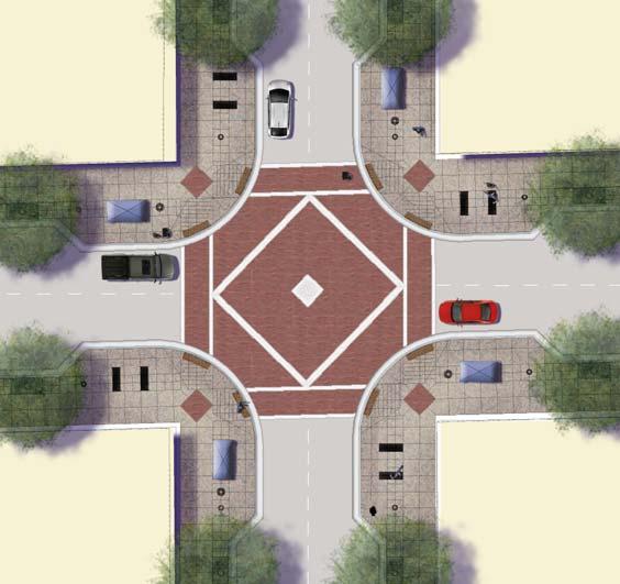
3 REBUILDING THE COMMUNITY MAIN & BROADWAY MAIN & BROADWAY REVITALIZATION PLAN 1. Carnegie Peforming Arts Center Rebabiliation of historic library as a new facility for dance, music and theater. 2. Nunez Park Pennsylvania - Block Redevelopment Zone Gu rie New homes with prime facing Nunez Park, yet part of the existing historic block grid. 4. Phase 1 Main Street Townhomes GRAND HEMLOCK 3: First Single Family Homes th Carnegie District PARRISH Expansion of park to connect elementary school to community center and provide more recreational activities. Workforce housing townhomes centered around a rejuvinating community amenities. 5. Broadway Mixed-Use Development BROADWAY potential phase Phase III CATALPA BUTTERNUT ALDER Commercial Focus Area PULASKI Phase II 7. Main & Broadway Street Reconstruction MAIN Single Family Home Sites DEODAR Phase I A revitalized Broadway will ultimately connect to redeveloped regional shoreline park system. P ELM Mixed-Use 6. Shoreline- Community Gateway P FIR Legend A combination of new retail and housing that connects the parks and anchors small business rejuvinization. Additional Redevelopment Areas Implementing a long-term revitalization plan requires the strategic implementation of significant short-term projects. Over the next 3 to 4 years the City will be rebuilding the Main Street District. More than a collection of historic retail buildings, this district has two community parks, an elementary school, a community center, a post office, a court house, a bank, and a medical clinic. The Main Street District once functioned as as the heart of the community attracting visitors from other communities. Rejuvinating the key intersection of Main & Broadway with new townhomes, retail, and streetscapes complimented by renovated and expanded parks with help reunite Indiana Harbor s neighborhoods and attract new investment and interest. New pedestrian-oriented streetscapes, seperated sewers systems and water lines. 8. Callahan Park Redeveloped park with outdoor stage that will host community concerts, festivals and events.


4 RESIDENTIAL DEVELOPMENT New Townhomes Adjacent to Shopping Districts Replace vacant lots with new homes for working families Bring families back to Main & Broadway shopping district Create positive street life for residents and visitors Schematic Design Drafts: Main Street Townhomes & Nunez Park Single Families


5 NEW LINCOLN SCHOOL & NUÑEZ PARK CAMPUS Fall Spring 2008 CITY OF EAST CHICAGO School City of East Chicago City Engineering Department City Parks Department City Planning Department IMPROVEMENTS New Soccer Field New Basketball Courts New Tennis Court New Water Feature New Picnic Areas New Play Lot New Paths & Entries New Signage & Landscaping New Furniture & Lighting Deodar Broadway HISPANIC HOUSING DEVELOPMENT CORPORATION Master Planner: Park Design:


6 CALLAHAN PARK RENOVATION Fall Spring 2008 CITY OF EAST CHICAGO Broadway City Engineering Department City Parks Department City Planning Department Alder IMPROVEMENTS New Concert Seating New Music Stage New Water Park New Picnic Areas New Basketball Court New Play Lot New Community Garden New Lighting New Furniture & Landscaping HISPANIC HOUSING DEVELOPMENT CORPORATION Master Planner: Park Design:


7 MAIN AND BROADWAY STREETSCAPE IMPROVEMENTS Phase One Fall Summer 2007 CITY OF EAST CHICAGO City Engineering Department City Parks Department City Planning Department IMPROVEMENTS New Utility Infrastructure Total Street Reconstruction Special Intersection Treatment Broadway New Street Furniture New Lighting New Landscaping Main Street Phase One and Phase Two Limits of Work HISPANIC HOUSING DEVELOPMENT CORPORATION Master Planner: Streetscape Design: Engineer:
SOUTHEAST SPORTS COMPLEX MASTER PLAN
 REPORT TO SOUTHGATE NEIGHBORHOOD COUNCIL APRIL 13, 2016 Visioning Process April 30: Stakeholder Meeting with Sports Groups May 5: Stakeholder Meeting with Southgate Land Use Committee May 13: SNC Meeting
DRAFT ROOSEVELT ROAD. District Recommendations. Figure 5.23 The Roosevelt Road Corridor
 CHAPTER 5 Figure 5.23 The Road Corridor Road will develop as a mixed-use corridor, emphasizing regional retail, west of the river and mixed-use development east of the river. KEY RECOMMENDATIONS 1. High
DRAFT. Waterfronts and Open Spaces. 10 The Riverfront Open Space System
 CHAPTER 4 Waterfronts and Open Spaces 10 The Riverfront Open Space System 12 Planned, proposed and envisioned riverfront recommendations. Figure 4.3.23 The riverfront will become a major new public amenity
Chapter 1: Introduction
 Chapter 1: Introduction The Penn Avenue Community Works Corridor Vision and Implementation Framework presents an integrated communitybased vision and a coordinated, long-term implementation framework for
A P P E N D I X B - O P P O R T U N I T Y S I T E S
 A P P E N D I X B - O P P O R T U N I T Y S I T E S OPPORTUNITY SITES As listed in the Land Use Element, the City has identified 15 Opportunity Sites expected to be the focus of change and revitalization
Land Use. Hardware Street Vendor Mixed-Use
 Land Use Definition Land Use is the way a piece of real estate is utilized. Existing, proposed, and adopted land uses all play a role in the planning process. Once a land use plan is adopted, the next
DOWNTOWN RESIDENTIAL DISTRICT DEVELOPMENT OPPORTUNITES
 DOWNTOWN RESIDENTIAL DISTRICT DEVELOPMENT OPPORTUNITES Out of all the areas in Downtown Painesville, this district provides the greatest opportunity for change with the vacation of Lake East Hospital.
About Momentum Midland
 About Momentum Midland Achieving a community s full potential in terms of economic development and quality of life is critically important to its long term sustainability. Core to achieving this is a vibrant
IMAGINE CLEARWATER. Community Workshop 3. November 2016
 IMAGINE CLEARWATER Community Workshop 3 November 2016 Imagine Clearwater has been a 6-month community-focused process to re-envision the downtown waterfront. VISIONING FRAMEWORK MASTER PLAN HOW CAN WE
Table of Contents. Elm Avenue Improvement Plan City of Waco, Texas. Introduction 1. Existing Context 1 Figure 1 2.
 Table of Contents Introduction 1 Existing Context 1 Figure 1 2 Plan Guidelines 3 Future Urban Form 4 The West-End 4 Main Street 6 The East-End 7 Figure 2 9 Public Improvement Recommendations 7 General
NEIGHBORHOOD DESIGN ELEMENT
 NEIGHBORHOOD DESIGN ELEMENT INTRODUCTION The following recommendations constitute an urban design oriented "neighborhood analysis" of Plantation. It is an optional Comprehensive Plan Element. The five
Constraints/Issues/Negatives Overall:
 Constraints/Issues/Negatives Overall: The perception of public safety affects the quality of life and image of the community. The tax system impacts redevelopment and affects the ability of owners to maintain
A Vibrant Downtown. Chapter 5 Cary Public Art Opportunities 31
 A Vibrant Downtown Cary s vision for Downtown is a unique, vibrant, dynamic, pedestrian friendly location; a regional destination and a place to live, work, and recreate, according to the 2001 Town Center
Corridors. Re-vitalize our Corridors and Gateways
 Corridors Re-vitalize our Corridors and Gateways Artist s rendering from the 287 Strategic Plan, 2015 Corridors are the major throughways of Loveland but they also provide important commercial, community
University of Denver Land Use Plan Update I. Executive Summary
 Executive Summary The task of developing a Land Use Plan for the University of Denver has been an exciting collaborative process that engaged a variety of interested people, including members of the University
Great Plans for a Great City
 CHAPTER 1 Great Plans for a Great City 1 Figure 1.1 South Michigan Avenue today Figure 1.2 South Michigan Avenue will be one of many higher intensity, mixed-use corridors that will extend out from the
Mark-up of the effect of the proposed Bronte Village Growth Area OPA No.18 on the text of section 24, Bronte Village, of the Livable Oakville Plan
 Mark-up of the effect of the proposed Bronte Village Growth Area OPA No.18 on the text of section 24, Bronte Village, of the Livable Oakville Plan Notes: This document is provided for information purposes
Creating a Main Street Strategy A Roadmap to a Community s Future
 Creating a Main Street Strategy A Roadmap to a Community s Future Creating a Main Street Strategy A Roadmap to a Community s Future 9:00 am Session 1: Creating a Main Street Strategy A Roadmap to a Community
Workshop #3 June 13, 2016
 Downtown Ocoee Master Plan Workshop #3 June 13, 2016 Our Team Our Team and Tonight s Goal Quick Recap: Why a Downtown Plan? How are we developing the plan? How can you still be involved? What s left to
INTRODUCING THE BALTIMORE CITY GREEN NETWORK VISION PLAN
 INTRODUCING THE BALTIMORE CITY GREEN NETWORK VISION PLAN GOALS OF THE GREEN NETWORK PLAN Protect and enhance the unique ecological resources of our city Support economic growth and sustainable redevelopment
SUMMERSIDE / MT. CARMEL REINVESTMENT CORRIDOR COMMUNITY DEVELOPMENT STRATEGY
 SUMMERSIDE / MT. CARMEL REINVESTMENT CORRIDOR COMMUNITY DEVELOPMENT STRATEGY FEBRUARY 2013 I. Location of the Summerside/Mt. Carmel Reinvestment Corridor The Summerside/Mt. Carmel Reinvestment Corridor
Village of Fair Haven Goals & Objectives
 Village of Fair Haven Goals & Objectives 1 Natural Environmental Quality & Aesthetics Embrace policies and programs that preserve and enhance the Village s natural resources, environment, water quality,
Lynn Housing Authority and Neighborhood Development. Washington Street Gateway District Plan A p r i l
 Lynn Housing Authority and Neighborhood Development Washington Street Gateway District Plan A p r i l 2 0 0 8 rendering of sagamore hill from lynnway pedestrian overpass table of contents project area
Zoning and Development Considerations in the Boothbay Harbor Maritime/Water Dependent District
 Zoning and Development Considerations in the Boothbay Harbor Maritime/Water Dependent District Bob Faunce Lincoln County Planner Lincoln County Regional Planning Commission Board of Selectmen and Planning
CHAPTER 3 VISION, GOALS, & PLANNING PRINCIPLES. City of Greensburg Comprehensive Plan. Introduction. Vision Statement. Growth Management Goals.
 CHAPTER 3 VISION, GOALS, & PLANNING PRINCIPLES Introduction The Greensburg Comprehensive Plan is intended as a working community document. A combination of long and short-term goals, this document is intended
North Fair Oaks Community Plan Summary and Information
 North Fair Oaks Community Plan Summary and Information WHAT IS THE NORTH FAIR OAKS COMMUNITY PLAN? The North Fair Oaks Community Plan is part of the San Mateo County General Plan, and establishes policies
CONTEXT: the Highway, the River + the Railroads run through us.
 CONTEXT: the Highway, the River + the Railroads run through us. I-25 36 In the past they have divided us, now we have an opportunity to unite us. I-76 I-270 I-76 CSU I-25 LEGEND Cut + Cover River North
8implementation. strategies
 PROGRAM STRATEGIES 8implementation strategies T he implementation actions of this chapter are designed to support and carry out the land use, economic development, transportation, urban design, and program
Downtown Cleveland Alliance/Tremont
 Cleveland Innerbelt Urban Design Stakeholder Workshops Downtown Cleveland Alliance/Tremont May 4, 2007 2007 Activities: What We re Going To Be Doing. March 8, 2007 Initiate Urban Design Aesthetic Study
12 th Street Connector Alignment Study VISIONING PUBLIC WORKSHOP - JUNE 25, :00PM TO 8:00PM
 12 th Street Connector Alignment Study VISIONING PUBLIC WORKSHOP - JUNE 25, 2018 6:00PM TO 8:00PM Goals for Today s Workshop Agenda: Project Introduction, Purpose, and Goals Existing Conditions Traffic
Planning for Waterfront Communities
 Planning for Waterfront Communities Redevelopment Ready Communities Supplemental Training Program OFFICE OF THE GREAT LAKES Waterfront Community Best Practices and Guidelines New supplemental criteria
U n i v e r s i t y o f S o u t h C a r o l i n a A i k e n. Land Plan Study
 U n i v e r s i t y o f S o u t h a r o l i n a A i k e n Land Plan Study 06.27.2008 Goals ampus Growth Develop a Land Plan that allows for the orderly expansion of the campus over the next ten years and
GAMMAGE SQUARE - RECOMMENDATIONS
 GAMMAGE SQUARE - RECOMMENDATIONS We envision an expanded cultural district surrounding the historic ASU Gammage. Creating a cultural district will enhance the existing historic landmark by activating the
The Trinity River Corridor, offering Dallas areas of natural
 IMPLEMENTATION PLAN FOR THE TRINITY RIVER CORRIDOR The Trinity River Corridor, offering Dallas areas of natural beauty and untapped potential, runs through the heart of the city. Proposed improvements
NEIGHBORHOOD 3: UNIVERSITY EDGE
 NEIGHBORHOOD 3: UNIVERSITY EDGE Aerial View of North Indiana Avenue EXISTING CHARACTER The University Edge neighborhood represents the primary town/gown interface between the campus and the city of Bloomington,
Preci nct P l ans Figure 56 Campus Aerial Photo, 2008 CAL STATE EAST BAY, HAYWARD CAMPUS MASTER PLAN
 9 Precinct Plans This section contains a detailed discussion of the planning and design concepts for specific areas or precincts of the Cal State East Bay Hayward campus. The Precinct Plans pertain to
WATERFORD Plan of Preservation, Conservation and Development Supplement Part 1 - Policy Element
 WATERFORD 2012 Plan of Preservation, Conservation and Development 2015 Supplement Part 1 - Policy Element Effective June 11, 2015 2015 Plan Update GOAL To respond to the evolving land use needs and continually
This is the East Carolina University Comprehensive Facilities Master Plan Final Draft Plan Review. This workbook reviews the campus draft master plan
 This is the East Carolina University Comprehensive Facilities Master Plan Final Draft Plan Review. This workbook reviews the campus draft master plan first presented on campus on June 29 and June 30, 2011.
OPEN SPACE TYPES. SIZE 8 acres. SIZE 20 acres. SIZE 1 acre
 TYPICAL CHARACTERISTICS OPEN SPACE TYPES OPEN SPACE TYPES The neighborhood contains an extensive variety of open space types. Most of these spaces incorporate multiple uses and activities, so that each
C. Westerly Creek Village & The Montview Corridor
 C. Westerly Creek Village & The VISION Community Vision When the goals of the city are achieved Westerly Creek Village, a distinctive community defined by Montview Boulevard and Westerly Creek, is a strong
Corridor Vision. 1Pursue Minnehaha-Hiawatha Community Works Project. Mission of Hennepin County Community Works Program
 1Pursue Minnehaha-Hiawatha Community Works Project Minnehaha-Hiawatha Community Works is a project within the Hennepin Community Works (HCW) program. The mission of the HCW program is to enhance how the
WELCOME and introduction
 1 WELCOME and introduction Mobility Hub Locations within Burlington STUDY OVERVIEW STUDY OBJECTIVES The City of Burlington is developing four Area Specific Plans, one for each of Burlington s Mobility
CAMPUS MASTER PLAN DRAFT PLAN UPDATE JANUARY
 NEW MEXICO HIGHLANDS UNIVERSITY CAMPUS MASTER PLAN DRAFT PLAN UPDATE JANUARY 27 2010 MASTER PLANNING GOALS TO BALANCE THE STRATEGIC GOALS OF THE UNIVERSITY WITH THE PHYSICAL CAMPUS through the assessment
Riverwalk Dreams compiled by Thomas P. Healy November 16, 2017
 Riverwalk Dreams compiled by Thomas P. Healy November 16, 2017 1986 Ripple Village Plan: A neighborhood plan developed by the City of Indianapolis Department of Metropolitan Development s Division of Planning
EXHIBIT A. Tax Increment Reinvestment Zone No. 1 (Town Center) First Amended Project Plan 1
 First Amended Project Plan 1") EXHIBIT A Tax Increment Reinvestment Zone No. 1 (Town Center) First Amended Project Plan 1 1 As amended by Resolution No. 2008-02-001(TR1R) of the Tax Increment Reinvestment Zone No.1, and approved to
EXHIBIT A Tax Increment Reinvestment Zone No. 1 (Town Center) First Amended Project Plan 1 1 As amended by Resolution No. 2008-02-001(TR1R) of the Tax Increment Reinvestment Zone No.1, and approved to
Planning Districts INTRODUCTION
 INTRODUCTION To facilitate detailed examination of development prospects for all areas of the community, Delano has been divided into 14 planning districts. The location of these planning districts is
ARISE: The Rock Renaissance Area Redevelopment & Implementation Strategy
 2014 Professional Awards 1 ARISE: The Rock Renaissance Area Redevelopment & Implementation Strategy Janesville, WI Completed December 2014 Analysis & Planning Purpose of Project 2 The purpose of the Rock
Urban Analysis. Downtown Zanesville like any city, has been physically modified through time as it
 Urban Analysis As a part of the consulting team s reconnaissance effort, an urban analysis was performed. Before the future of a place can be envisioned, one must understand the physical characteristics
hermitage town center
 hermitage town center A Community Vision prepared by Strada for The City of Hermitage and The Mercer County Regional Planning Commission January 2007 table of contents introduction 3 design principles
A BLUEPRINT FOR BROCKTON A CITY-WIDE COMPREHENSIVE PLAN
 A BLUEPRINT FOR BROCKTON A CITY-WIDE COMPREHENSIVE PLAN Public Meeting October 2016 1 Plan Summary and Discussion Public Meeting May 4 2017 City of Brockton Bill Carpenter, Mayor Department of Planning
12600 S Existing Conditions
 STUDY AREA BOUNDARY Study Area Boundary Study Area Context The District Riverton Meadows Vista Station Mountain View Village Market Center 2 Mile Radius 12600 S Existing Conditions 12600 S is a river of
Visioning Statement and Guiding Principles
 Visioning Statement and Guiding Principles Planning for the Future The General Plan The General Plan represents Woodland's shared vision of the future and defines a path to lead the community toward its
PLAN ELEMENTS WORKSHOP. April 5, 2016
 PLAN ELEMENTS WORKSHOP April 5, 2016 needs more housing. But there is no one-size fits-all solution. Every neighborhood has its own character. In some places, density is not only appropriate it is badly
TA B L E O F C ON T EN T S
 TA B L E O F C ON T EN T S Introduction 1 Site Analysis 2 EXISTING TREE ANALYSIS 3 Community Outreach 5 PUBLIC WORK SHOP #1 GENERAL PUBLIC 6 PUBLIC WORKSHOP #2 4 TH OF JULY CELEBRATION 9 PUBLIC WORKSHOP
Plano Tomorrow Vision and Policies
 Plano Tomorrow Vision and Policies PLANO TOMORROW PILLARS The Built Environment The Social Environment The Natural Environment The Economic Environment Land Use and Urban Design Transportation Housing
WARM SPRINGS PARK MASTER PLAN
 TABLE OF CONTENTS page 1.0 Introduction and Overview 1 2.0 Information Gathering 2 3.0 Conceptual Alternative Development 8 4.0 Master Plan Development 14 5.0 Construction Cost Estimates 19 LIST OF FIGURES
Hockessin Community Redevelopment Plan
 Hockessin Community Redevelopment Plan 3.1 Introduction The Community Redevelopment Plan for the Village of Hockessin is the result of the people s vision for a distinct village center that serves as the
Al Hansen, Director of Parks and Recreation City of Petoskey, Michigan
 Al Hansen, Director of Parks and Recreation City of Petoskey, Michigan 231-347-2500 ahansen@petoskey.us What is Placemaking? Definitions Found Online: Creating a sense of place Creating a sense of belonging
THE CIVIC DISTRICT DEVELOPMENT OPPORTUNITIES
 1 THE CIVIC DISTRICT DEVELOPMENT OPPORTUNITIES The Civic District is the physical and emotional heart of the downtown. It is also a major gateway into the central core, establishing the image and identity
TEMPLE MEDICAL & EDUCATION DISTRICT
 City of Temple, Texas TEMPLE MEDICAL & EDUCATION DISTRICT 1 Description. The City of Temple joined in partnership with key public and private entities to jointly promote education and medical activities
Elm Fork Land Use. Trinity River Corridor Project Committee May 13, 2013
 Elm Fork Land Use Trinity River Corridor Project Committee May 13, 2013 Purpose Discuss Trinity River planned Land Use and Appropriate Compatible Uses, particularly with respect to the Elm Fork Area 2
REGIONAL ACTIVITY CENTER
 DRAFT REGIONAL ACTIVITY CENTER 70 EAST BENCH MASTER PLAN DRAFT 06 Introduction The East Bench Regional Activity center is comprised of large educational, research, medical, and employment centers. These
TECHNICAL ASSISTANCE PANEL. Graniteville TAP: Developing a Community Vision
 TECHNICAL ASSISTANCE PANEL SPONSORED BY: Graniteville TAP: Developing a Community Vision Graniteville Community Development Improvement Corporation Mission To provide leadership in the responsible use
THE 355/270 CORRIDOR:
 THE 355/270 CORRIDOR: Strategic Ideas for Sustaining a Livable Work Place Project Summary ACCESS LIFE DESIGN HEALTH WORK Montgomery County Planning Department The Maryland-National Capital Park and Planning
UNIVERSITY OF KENTUCKY 2012 Campus Plan Update. Ross Tarrant Architects
 UNIVERSITY OF KENTUCKY 2012 Campus Plan Update AGENDA TEAM 1 2 3 4 5 ENGAGEMENT PUBLIC INPUT PROCESS GOALS AND OBJECTIVES PLANNING PROCESS AND SCHEDULE TOPICS AND DISCUSSION Team SASAKI UNIVERSITY OF PENNSYLVANIA
CITY OF WEST PALM BEACH DOWNTOWN ACTION COMMITTEE Meeting Date: December 13, 2017
 I. REQUEST CITY OF WEST PALM BEACH DOWNTOWN ACTION COMMITTEE Meeting Date: December 13, 2017 Code Revision Case No. 17-15 DMP Zoning and Land Development Regulations Amendment A City initiated request
Downtown Subarea Plan
 Downtown Subarea Plan Downtown Subarea Plan Downtown is the historic heart of the. Charles community. Its traditional Main reet, the Fox River, and civic uses give it a unique prominence and character.
INDEPENDENCE BOULEVARD AREA PLAN
 INDEPENDENCE BOULEVARD AREA PLAN Public Meeting October 28, 2008 Tonight s Agenda Introduction 4:00 4:05 Tom Warshauer Presentation 4:05 5:00 Blake Drury Group Exercises 5:00 5:50 All Wrap Up & Next Steps
SARANAC LAKE VISION CONCEPTS
 DRAFT SARANAC LAKE VISION CONCEPTS A GENUINE PLACE TO LIVE, WORK, SHOP AND EXPERIENCE CULTURE IN THE HEART OF THE ADIRONDACKS PHOTO COURTESY OF SARANAC LAKE SARANAC LAKE, NEW YORK DECEMBER 2007 SARANAC
Chapter 4 : THEME 1. Development Framework DRAFT. Direct growth to create a dynamic Central Area made up of vibrant, mixed-use districts
 Chapter 4 : THEME 1 Direct growth to create a dynamic Central Area made up of vibrant, mixed-use districts CHICAGO CENTRAL AREA PLAN 43 Figure 4.1.1 Fig. 4.1.2 High-Density, Mixed-Use Corridors Fig. 4.1.3
Catalyst For Economic Development Washington Park Chicago IL
 Catalyst For Economic Development Washington Park Chicago IL Masters Project Joel Burkhart Advisors Dirk Denison Patrick Papczun Elevator Statement I propose to develop a comprehensive master plan that
VACANT TO VIBRANT : GREEN INFRASTRUCTURE & URBAN REVITALIZATION
 VACANT TO VIBRANT : GREEN INFRASTRUCTURE & URBAN REVITALIZATION Calumet Summit 2013: Connecting for Action Lauren Riga, Director City of Gary Department of Green Urbanism Gary Storm Water Management District
CITY OF COLWICH COMPREHENSIVE PLAN LAND USE LAND USE 1
 LAND USE LAND USE 1 WHAT YOU WILL FIND IN THIS CHAPTER: Discussion of today s conditions and tomorrow s projections Discussion of challenges and opportunities Discussion of the environmental quality goals,
Welcome. Community Consultation Meeting November 28, Review and discuss the Bathurst Quay Neighbourhood Plan Framework
 Welcome Community Consultation Meeting November 28, 2016 Why Are We Here Today? Review and discuss the Bathurst Quay Neighbourhood Plan Framework Review and discuss an Action Plan for Implementation Next
Town Center (part of the Comprehensive Plan)
") Town Center (part of the Comprehensive Plan) Mercer Island Town Center Looking North (2014) In 1994, a year-long process culminated in a set of design guidelines and code requirements for the Town Center
Town Center (part of the Comprehensive Plan) Mercer Island Town Center Looking North (2014) In 1994, a year-long process culminated in a set of design guidelines and code requirements for the Town Center
In the heart of the Southern Sector is a diamond in the rough
 WESTMORELAND DART STATION AREA PLAN Map III-2.24 The Westmoreland DART Station Area In the heart of the Southern Sector is a diamond in the rough the Westmoreland Transit Station. This DART station, near
Anatomy of A Vibrant Downtown. Anatomy of a Vibrant Downtown
 Anatomy of A Vibrant Downtown The goal of MAIN ST. REVITALIZATION PLANNING is to provide a framework that will help transform your downtown into a VIBRANT DOWNTOWN a place where people love to LIVE, WORK,
Lynn Waterfront Master Plan
 Lynn Waterfront Master Plan Public Meeting #2 December 10th, 2018 1 Project Schedule Update September 26, 2018 December 10, 2018 Development of the Master Harbor Plan Amendment and Revised Waterfront Master
WORKSHOP PURPOSE PERRY COMPREHENSIVE PLAN COMMUNITY WORKSHOP APRIL 4 TH, 2013 WHAT IS A COMPREHENSIVE PLAN? AGENDA
 WORKSHOP PURPOSE PERRY COMPREHENSIVE PLAN COMMUNITY WORKSHOP APRIL 4 TH, 2013 Provide background information on the Perry Comprehensive Plan Tap the expertise of the local experts (YOU!) Understand what
Status Update (2006 vs. Now) Citizen s Advisory Committee February Plan for Prosperity
 Citizen s Advisory Committee February Plan for Prosperity") Status Update (2006 vs. Now) Citizen s Advisory Committee February 2018 Plan for Prosperity 2000 2017 2000 2017 Gardnerville Population 6,000 5,760 5746 5,500 5,000 5,067 5,550 5,165 5,394 5,412 5,250
Status Update (2006 vs. Now) Citizen s Advisory Committee February 2018 Plan for Prosperity 2000 2017 2000 2017 Gardnerville Population 6,000 5,760 5746 5,500 5,000 5,067 5,550 5,165 5,394 5,412 5,250
Tonight s presentation and conversation is being conducted by CityVisions Associates and Gamble Associates, who have been selected by the City and
 1 1 2 Tonight s presentation and conversation is being conducted by CityVisions Associates and Gamble Associates, who have been selected by the City and County to conduct the Downtown Frankfort Master
UCSF Parnassus Heights Re-Envisioning Process
 UCSF Parnassus Heights Re-Envisioning Process Community Working Group Meeting #5 February 27, 2019 Agenda Welcome, Introductions, Agenda Overview, and Review of Last Meeting Summary of Community Ideas
Charles P. Johnson and Associates. Annapolis Landscape Architects
 Charles P. Johnson and Associates Annapolis Landscape Architects AGENDA Introduction Project Limits and Scope Site Analysis Opportunities & Constraints Program Goals Image Boards Design Alternatives Pros
2040 LUP is a part of the Comprehensive Plan and carries the same legal authority. Economic Challenges
 1.1. Guiding Anchorage s Growth Where will new residents settle over the next two decades? Where will people work, shop, and play? Will there be enough room to grow? How will Anchorage look? Will growth
Boise State University October 7-8 Workshop # 2 MASTER PLAN UPDATE. Ayers Saint Gross
 Boise State University October 7-8 Workshop # 2 MASTER PLAN UPDATE Ayers Saint Gross WORKSHOP AGENDA 01 PROCESS UPDATE 02 WORKSHOP 1 SUMMARY Issues + Opportunities Plan-Program Elements 03 PLANNING FRAMEWORK
A Vision for Upper Merrimack Presented by MIT Department of Urban Studies and Planning
 A Vision for Upper Merrimack Presented by MIT Department of Urban Studies and Planning A Vision for Upper Merrimack Who we are: A group of graduate students at MIT. Planning consultants for the City of
The University District envisions, in its neighborhood
 Envisioning the University District Link Light Rail in Seattle s neighborhoods CIY OF SEALE CONCEP-LEVEL SAION AREA PLANNING RECOMMENDAION RESOLUION # 30165 EXHIBI L Vision 08.2000 he University District
4- PA - LD - LIVELY DOWNTOWN. LD - Background
 4- PA - LD - LIVELY DOWNTOWN LD - Background The downtown has been the service centre for the community since the city s inception and the area continues to supply people with their personal services,
The Project. In 2013, construction was completed between 100 Street and 102 Street.
 The Project Jasper Avenue New Vision (JANV) is a major catalyst project identified in the Capital City Downtown Plan (2010) between 92 Street and 109 Street, including the streets half a block north and
NEIGHBORHOOD 8: NORTHEAST AREA
 NEIGHBORHOOD 8: NORTHEAST AREA Carillon Tower Aerial View of Northeast Area Northeast Area Map 288 neighborhoods NEIGHBORHOOD 8: NORTHEAST AREA Campus View Apartments Student Recreational Sports Center
The Preferred Scenario Map, attached, shows the proposed land use pattern. Vibrant downtown Vallejo is a destination for locals and visitors alike.
 MEMORANDUM DATE November 18, 2015 TO Andrea Ouse, Community Development Director Mark Hoffheimer, Senior Planner City of Vallejo FROM Andrew Hill SUBJECT Narrative Description of the Preferred Scenario
MALL REVITALIZATION CASE STUDIES
 MALL REVITALIZATION CASE STUDIES DECEMBER 9, 2012 MALL REVITALIZATION OVERVIEW Introduction Sample Case Studies prepared for Lacey Woodland District Steering Committee as it considers strategies to revitalize
Downtown Streetscape Manual & Built Form Standards
 City of Guelph Downtown Streetscape Manual & Built Form Standards July 2014 Prepared by Brook McIlroy Inc. in association with Unterman McPhail Associates and McCormick Rankin Inc. City of Guelph Downtown
RIVERWALK EAST PUBLIC ART DESIGN PROJECT
 RIVERWALK EAST PUBLIC ART DESIGN PROJECT PREFACE In August 2018, Mayor Rahm Emanuel announced plans to improve the east end of the Chicago Riverwalk. These improvements are part of ongoing efforts to build
GREENING THE BOULEVARD Master Plan Concepts for Venice Boulevard between Lincoln and Sawtelle
 GREENING THE BOULEVARD Katherine Spitz Associates Inc. 4212½ Glencoe Avenue Marina Del Rey, CA 90292 310 574 4460 Fax 574 4462 January 2008 Table of Contents Overview Proposed Design Improvements Illustration
Table L-1 Summary Action Strategy. Action Item Timing Status Responsible Agency
 CHAPTER 4: CIRCULATION ELEMENT ISSUE #1: MAJOR THOROUFARES AND TRANSPORTATION ROUTES A balanced transportation system for Fontana is provided that meets the mobility needs of current and future residents
The Private Role in a Public-Private Partnership. Ask Me Anything Conference May 30, 2018
 The Private Role in a Public-Private Partnership Ask Me Anything Conference May 30, 2018 1 Thoughts to Share Today Schmit+Associates Essential Elements of a P3 Community Vision Market Demand Economic Viability
Guiding Principles. People dance, and to share culture. Place consistency and internal connections. Management community for years to come
 3. The Campus Concept This chapter presents an overview of the Campus Concept from the formulations of its guiding principals through general recommendations to facilitate the triple urban design plan
City of Long Beach. creating vibrant and exciting places
 City of Long Beach creating vibrant and exciting places Land Use Element Urban Design Element Overview of the two draft General Plan elements Discuss areas of change Economic goals of the plans Case study
the green business district
 the green business district Hazelwood Studio Ken Doyno, Instructor Dan Rothschild, Instructor Grace Whang, Jessica Kim The Second Avenue intervention is entitled the Green Building District. What this