City of Albuquerque. Integrated Development Ordinance (IDO) Training Development Standards. March 30 & April 4,
|
|
|
- Jared Hardy
- 5 years ago
- Views:
Transcription

 Training")

1 City of Albuquerque Integrated Development Ordinance (IDO) Training Development Standards March 30 & April 4,
2 IDO Trainings FAQs by Topic March 21 & 23 March 30 & April 4 April 6 & April 18 7 Parts 1. General Provisions 2. Zone Districts 3. Overlay Zones 4. Use Regulations Table Allowable Uses Section 4-3 Use-specific Standards 5. Development Standards Dimensional Standards Tables General Regs 6. Administration & Enforcement 7. Definitions & Acronyms IDO Trainings Zones Uses General Regulations Processes
3 Follow-up Trainings March 21 & 23 March 30 & April 4 April 6 & April 18 7 Parts 1. General Provisions 2. Zone Districts 3. Overlay Zones 4. Use Regulations Table Allowable Uses Section 4-3 Use-specific Standards 5. Development Standards Dimensional Standards Tables General Regs 6. Administration & Enforcement 7. Definitions & Acronyms Zones Uses General Regulations Processes


4 Using the IDO: What can happen on a property? See Zones & Uses Training for more detail Use Table Zoning Residential? Mixed-use? Non-residential? Use-specific Standards Next to low-density residential? (SF, duplex, TH) Next to City Open Space? Section Distance Separations Between nuisance uses From Residential Uses Protections for City Open Space


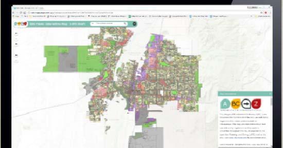
5 Using the IDO: What are the standards for quality development? Overlay Zones Part 3 Interactive Map Tools for Protections & Incentives Center / Corridor Context Zoning Table III & Part 5 Dev. Area Adjacent Dev. Small areas Residential Mixed-use Non-residential PDF download: Bookmarked Hyperlinked Searchable

6 Overlay Zones See Zones & Uses Training for more detail Airport Protection Overlay Character Protection Overlay Historic Protection Overlay View Protection Overlay IDO Part 3 Overlay Zones Collections of development standards that differ from citywide rules to protect unique places Click here for Overlay Layers Interactive Map
7 Using the IDO: What are the standards for quality development? Overlay Zones Part 3 Interactive Map Tools for Protections & Incentives Center / Corridor Context Zoning Table III & Part 5 Dev. Area Adjacent Dev. Small areas Residential Mixed-use Non-residential PDF download: Bookmarked Hyperlinked Searchable

 UC = Urban")


8 Implementing the Comp Plan: Center & Corridor Provisions Balance of Carrots & Sticks Higher building heights by right Lower parking requirements More building design requirements More buffering requirements DT = Downtown (Center) UC = Urban Center AC = Activity Center EC = Employment Center MS = 660 feet from a Main Street PT = 660 feet from a Premium Transit station MT = 660 feet from a Major Transit Interactive Map Click here for Comp Plan Layers UC DT UC

9 Center/Corridor Provisions p. xxvi
10 Using the IDO: What are the standards for quality development? Overlay Zones Part 3 Interactive Map Tools for Protections & Incentives Center / Corridor Context Zoning Table III & Part 5 Dev. Area Adjacent Dev. Small areas Residential Mixed-use Non-residential PDF download: Bookmarked Hyperlinked Searchable
 Areas of Change = where to")

11 Implementing the Comp Plan: Development Areas Balance of Carrots & Sticks Required protections citywide for Areas of Consistency Incentives in Areas of Change Edge buffers for adjacencies Areas of Change & Consistency How to direct growth where we want it (and not where we don t) Areas of Change = where to grow Centers & Corridors Transit centers Metropolitan Redevelopment Areas Biz & Industrial Park Master Plans Areas of Consistency = what to protect Single-family zone or land use Parks & Open Space All other development not in Areas of Change Click here for Comp Plan Layers

12 Area of Consistency Protection: Contextual Development 75% < New Lots > 125% of surrounding lot size Front setback between those on either side, regardless of zone requirement Excerpt pg. 169

13 Area of Consistency Protection: Edge Buffer Landscaping pg. 239

14 Context Protection: Edge Buffer Landscaping by Development Type

15 Context Protection: Neighborhood Edge Building Height Step-down Section 5-9 p. 260 R-ML, R-MH, Mixed-use or Non-residential zone Low-density residential use in R-A, R-1, R- MC or R-T zones
16 Context Protection: Site Design & Sensitive Lands Section 5-2 Key Subsections 5-2(C) Avoidance of Sensitive Lands 5-2(D) Archaeological Sites 5-2(E) Major Arroyo Standards 5-2(F) Irrigation Facility (Acequia) Standards 5-2(H) Major Public Open Space Edges Properties w/in 330 ft. Properties adjacent Any size 5+ acres Adjacent to Petroglyph National Monument Single-loaded street reqmt Sensitive Lands Floodplains and flood hazard areas Steep slopes Unstable soils Wetlands Arroyos Irrigation facilities (acequias) Escarpments Rock outcroppings Large stands of mature trees Archaeological sites


17 Context Protection: Small Area Regulations p. xiv p. xix
18 Using the IDO: What are the standards for quality development? Overlay Zones Part 3 Interactive Map Tools for Protections & Incentives Center / Corridor Context Zoning Table III & Part 5 Dev. Area Adjacent Dev. Small areas Residential Mixed-use Non-residential PDF download: Bookmarked Hyperlinked Searchable
 p.")
19 Dimensional Standards: MX Zone Districts Zones (By intensity) p. 172 Categories

20 Dimensional Standards: NR Zone Districts p

21 p. 168 Dimensional Standards: Residential Zone Districts Site Standards

22 Dimensional Standard Table: Building Height Residential Zones p. 169 Tech Edit: 35 ft. Tech Edit : No 100-ft. rule for R-ML


23 p Dimensional Standards: Residential Zone Districts Setbacks

24 Exceptions & Encroachments: Building Height p Amendment in Exhibit 9 clarifies that parapets count toward building height
25 Building Design Standards: Multi-family Residential Development Building Entrances Emphasize primary pedestrian entrances Building façades Projections/recesses every 80 horizontal feet UC-MS-PT: 20% minimum of facades facing public street = clear windows/doors Roof Design 2-ft. variation every 100 horizontal feet Garages and carports Not between primary façade and street frontage Residential Zone Districts p
26 Building Design Standards: Multi-family, MX, & Non-residential Development Building façades 2 activating features along at least 30% of horizontal length of façade (at least 1 per 40 linear feet) Façades >100 feet = + 1 feature Accessory buildings visible from public street = similar color & material to primary building p Windows 265 Primary pedestrian entrances Shade feature Sun shelves Planters Projection/recesses every 100 feet Change in material every 50 linear feet Projecting element every 30 feet 3-D Cornice or base treatment Roof treatment Murals or sculpture
 Change every 50 linear feet in height, setback, or material (not UC) Shade features along 50%+ of horizontal length of street façades Articulation")
27 Building Design Standards: Multi-family, MX, & Non-residential Development Ground Floor Height MX zones + UC-MS-PT 12 feet minimum UC-AC-MS-PT Building façades 60% minimum ground floor façades facing public street = windows/doors (30% for upper floors) Change every 50 linear feet in height, setback, or material (not UC) Shade features along 50%+ of horizontal length of street façades Articulation on facades adjacent to Residential or MX zone districts p
28 Parking Requirements Triggers New primary building Expansion > 25% or 2,500 s.f., whichever is less Change in use Exemptions Downtown Area (no requirement) McClellan Park Area Old Town HPO-5 Pre-1965 buildings p Nob Hill: establishments < 3,000 s.f. (not restaurants, bars, or nightclubs)

29 Parking Requirements: Table p. 206

30 Parking Requirements: Table p. 208

31 Parking Requirements: Table Maximums Office & General Retail UC-MS-PT only Applies to parking lots, not parking structures Excerpt p. 209
32 Front-yard Parking: Development Standards Section 5-5(F)(1)(a)(3 Location Parking in Residential zone districts or for low-density residential development is prohibited on any portion of the front yard setback other than on a driveway or drive aisle meeting the standards of this IDO and the DPM. Section Improvements 5-5(F)(3) Parking area improvement required per DPM Maximum Size Exhibit 5 Section 5-5(F)(2)(a)1 Lot Size Maximum Front Yard Parking Area 5,000 s.f. 400 s.f. or up to 60%, whichever is greater < 5,000 and 2,200 s.f. 400 s.f. or up to 75%, whichever is greater < 2,200 s.f. 400 s.f. or up to 85%, whichever is greater
33 Front-yard Parking: Admin & Enforcement Exhibit 5 Additions Section 6-6(8)(3) Variance Front yard parking criteria added to Variance DRB Limited on-street parking Section 7-1 Definition Vehicle definition added per Traffic Code (includes trailers, boats, etc.) Nonconformity Section 6-6(8)(3) Front-yard parking not meeting standards of IDO is illegal and subject to enforcement except: Parking areas in existence prior to June 17, 2007 Improved parking areas grandfathered Unimproved parking areas limited in size per IDO Section 5-5(F)(2)(a)1 Parking areas in existence between June 17, 2007 and Effective Date of IDO Parking areas meeting Front-yard Parking Ordinance adopted by Council grandfathered
34 Regulations for Quality: Development Standards Part Table of Contents p. v 5-1 Dimensional Standards 5-2 Site Design & Sensitive Lands 5-3 Access & Connectivity 5-4 Subdivision of Land 5-5 Parking & Loading 5-6 Landscape, Buffering, & Screening 5-7 Walls & Fences 5-8 Outdoor Lighting 5-9 Neighborhood Edges 5-10 Solar Access 5-11 Building Design 5-12 Signs 5-13 Operation & Maintenance Internal Organization Purpose Applicability/Exemptions Tables where possible Text regulations General Center/Corridor Provisions Overlay/Small Area Provisions
35 Implementation IDO Enactment: November 17, 2017 Training Staff, public, & design professionals Amendments errors/omissions IDO Effective Date: Thurs, May 17, months TIMELINE Follow-up Zone Change Process Nonconforming uses Voluntary downzones IDO Annual Update Submittal: July year 1 year from July years Community Planning Area Assessments: June 2020

36 Voluntary Zone Change Requests Eligible for free zone change requests for 1 year: Nonconforming use Voluntary downzoning Vacant former Special Use property Floating zone line PD or NR-BP with nonconforming lot size PD <2 acres or > 20 acres NR-BP < 20 acres Legal uses grandfathered Zoning Conversion Map Opt in now by adding a pin on your property, requesting a zone, and adding contact information.

37 Ongoing, Proactive Planning Framework Community Planning Area (CPA) Assessments Recommendations K M L N O P S R Q V U 4 months/cpa 3/yr for 4 yrs Zoning & Land Use Documents: ABC Comp Plan - 5 year update cycle IDO - 1 year update cycle Policies Regulations T K West Mesa Q North Albuquerque L Northwest Mesa R Mid Heights M Southwest Mesa S Near Heights N Near North Valley T Mesa del Sol O Central ABQ U Foothills P North I-25 V East Gateway


38 Questions? Project Website Interactive Map Planning Department: Russell Brito UD&D Division Manager Mikaela Renz-Whitmore ABC-Z Project Manager Council Services: Petra Morris Planning Manager Shanna Schultz Policy Analyst Zoning Conversion Map
IDO Trainings FAQs by Topic
 City of Albuquerque Integrated Development Ordinance (IDO) Training Development Standards March 30 & April 4, 2018 www.abc-zone.com IDO Trainings FAQs by Topic 7 Parts 1. General Provisions https://abc-zone.com/document/abq-adopted-ido
City of Albuquerque. Integrated Development Ordinance (IDO) Training. Winter
 Training. Winter") City of Albuquerque Integrated Development Ordinance (IDO) Training Winter 2018 www.abc-zone.com Training Opportunities December Current Planning staff Code Enforcement staff January/February Evening CPA
City of Albuquerque Integrated Development Ordinance (IDO) Training Winter 2018 www.abc-zone.com Training Opportunities December Current Planning staff Code Enforcement staff January/February Evening CPA
City of Albuquerque. Integrated Development Ordinance (IDO) Training. Winter
 Training. Winter") City of Albuquerque Integrated Development Ordinance (IDO) Training Winter 2018 www.abc-zone.com Training Opportunities January/February Evening CPA Trainings Friday lunchtime trainings Friday Study Halls
City of Albuquerque Integrated Development Ordinance (IDO) Training Winter 2018 www.abc-zone.com Training Opportunities January/February Evening CPA Trainings Friday lunchtime trainings Friday Study Halls
RESIDENTIAL DISTRICTS
 RESIDENTIAL DISTRICTS The residential district standards have been revised to reflect on-the-ground conditions, while continuing to respect the use patterns established within the neighborhoods. This will
UNIFIED DEVELOPMENT CODE
 Zoning UNIFIED DEVELOPMENT CODE Regulates how land is used Sets dimensional requirements for structures Addresses all aspects of site development: accessory structures, temporary uses, parking, landscape,
Zoning Technical Review Presented by Camiros. November 10, 2015
 Zoning Technical Review Presented by Camiros November 10, 2015 TECHNICAL REVIEW OVERVIEW Purpose of this Report Outline issues with current Ordinance Present preliminary approaches for revisions Set drafting
Planned Development Review Revisions (Project No. PLNPCM )
") Planned Development Review Revisions (Project No. PLNPCM2014-00139) Standard residential development Planned Development Example: Smaller lot sizes than what is allowed to create open space amenity. What
Planned Development Review Revisions (Project No. PLNPCM2014-00139) Standard residential development Planned Development Example: Smaller lot sizes than what is allowed to create open space amenity. What
LIST OF TABLES, FIGURES AND APPENDICES
 LIST OF TABLES, FIGURES AND APPENDICES Chapter Page 2 INTERPRETATION FIGURE 2.1 SAMPLE AWNING...2.8 FIGURE 2.2 SAMPLE LOW-RISE APARTMENT DESIGN...2.9 FIGURE 2.3 SAMPLE DUPLEX DESIGN...2.10 FIGURE 2.4 SAMPLE
CITY OF PUYALLUP. Background. Development Services
 CITY OF PUYALLUP Development Services 333 South Meridian Puyallup WA 98371 To: City Council From: Katie Baker, AICP, Planning Division Re: South Hill Neighborhood Plan Adoption Date: (Meeting date: February
OCEAN BOULEVARD PLANNED DEVELOPMENT DISTRICT (PD-5)
") OCEAN BOULEVARD PLANNED DEVELOPMENT DISTRICT (PD-5) Ordinance History: C-5562, 1982 The intent of the Planned Development Plan is to provide a framework to guide new development in a way that is sensitive
OCEAN BOULEVARD PLANNED DEVELOPMENT DISTRICT (PD-5) Ordinance History: C-5562, 1982 The intent of the Planned Development Plan is to provide a framework to guide new development in a way that is sensitive
MIAMI 21 CODE MAY This document is amended as of May 26, 2011.
 CODE MAY 2011 This document is amended as of May 26, 2011. THIS PAGE LEFT INTENTIONALLY BLANK. TABLE OF CONTENTS PREAMBLE ARTICLE 1. DEFINITIONS OF TERMS AND USES 1.1 Definitions of Building Function:
Standards (R-3) Figure B-11: R-3 Residential Standards Exhibit
 Figure B-11: R-3 Residential Standards Exhibit") Avila Ranch Avila Ranch Specific Plan Development Standards High Medium Density - High Residential Density Residential Lot and Building Lot and Standards Building (R-3) Standards (R-3) EXAMPLES These sketches
Avila Ranch Avila Ranch Specific Plan Development Standards High Medium Density - High Residential Density Residential Lot and Building Lot and Standards Building (R-3) Standards (R-3) EXAMPLES These sketches
13. New Construction. Context & Character
 13. New Construction Context & Character While historic districts convey a sense of time and place which is retained through the preservation of historic buildings and relationships, these areas continue
B L A C K D I A M O N D D E S I G N G U I D E L I N E S for Multi-family Development
 B L A C K D I A M O N D D E S I G N G U I D E L I N E S for Multi-family Development Adopted June 18, 2009 This section of the Design and focuses on site planning and design guidance for new multi-family
Design Guidelines for Residential Subdivisions
 Design Guidelines for Residential Subdivisions Development Services 972-466-3225 cityofcarrollton.com This page intentionally left blank. Table of Contents Purpose... 1 Design Objectives... 1 Design Guidelines
NEW CASTLE COUNTY S ZONING DISTRICTS
 NEW CASTLE COUNTY S ZONING DISTRICTS This is general information about New Castle County s zoning districts. The information included is by no means exhaustive or complete. Before designing plans to develop
SECTION UNIFIED DEVELOPMENT ORDINANCE SECTION Part 1 Ordinance. ARTICLE 1 Zoning Districts
 SECTION 1-100 UNIFIED DEVELOPMENT ORDINANCE SECTION 1-300 Part 1 Ordinance SECTION 1-100. Introduction. ARTICLE 1 Zoning Districts Crystal Lake strives to maintain a balance of various land uses for a
Incentive Zoning Regulations Florida Municipal City of Orlando
 Topic: Resource Type: State: Jurisdiction Type: Municipality: Year (adopted, written, etc.): 2002 Community Type applicable to: Title: Incentive Zoning Regulations Florida Municipal City of Orlando Document
CHAPTER SPECIAL PURPOSE AND OVERLAY ZONING DISTRICTS
 Special Purpose and Overlay Zoning Districts 106.28.010 CHAPTER 106.28 - SPECIAL PURPOSE AND OVERLAY ZONING DISTRICTS SPECIAL PURPOSE AND OVERLAY ZONING DISTRICTS Sections: 106.28.010 - Purpose 106.28.020
Citizen Advisory Group Meeting 5: Land Use April 14, 2011
 Citizen Advisory Group Meeting 5: Land Use April 14, 2011 Meeting Agenda 1. Background Review 2. Transportation Follow-up 3. PED Overlay Approach 4. Land Use Mapping 5. Group Exercise 6. Wrap-up and Next
Request Alternative Compliance to the prescribed criteria of the Oceanfront Resort District Form-Based Code. Staff Planner Kristine Gay
 Applicant/Owner Ocean Rental Properties, LLC Public Hearing April 13, 2016 City Council Election District Beach Agenda Item 1 Request Alternative Compliance to the prescribed criteria of the Oceanfront
COUNTY COUNCIL OF PRINCE GEORGE'S COUNTY, MARYLAND SITTING AS THE DISTRICT COUNCIL 2010 Legislative Session. Council Members Dernoga and Olson
 DR- COUNTY COUNCIL OF PRINCE GEORGE'S COUNTY, MARYLAND SITTING AS THE DISTRICT COUNCIL 00 Legislative Session Bill No. CB--00 Chapter No. Proposed and Presented by Introduced by Co-Sponsors The Chairman
DESIGN PROFESSIONALS DEEP DIVE THURSDAY, MAY 25, 2017
 DESIGN PROFESSIONALS DEEP DIVE THURSDAY, MAY 25, 2017 The Plan Article 5 Project Design Where we are in the process and what has been accomplished General organization of the document Specifics Questions,
B. Blocks, Buildings and Street Networks
 B. Blocks, Buildings and Street Networks Figure IV.4 A rational block pattern with connected streets Introduction The single most important element in the physical and functional integration of mixed use
MIXED-USE VILLAGE OVERLAY FLOATING DISTRICT
 MIXED-USE VILLAGE OVERLAY FLOATING DISTRICT Zoning regulations developed by committee to the Planning Board for the Town of DeWitt, NY Issue date: 13 July 2017 revised 3/12/2018, revised 4/26/2018, 5/9/2018
ORDINANCE WHEREAS, this Ordinance is consistent with the City of Winter Garden Comprehensive Plan; and
 ORDINANCE 17-06 AN ORDINANCE OF THE CITY COMMISSION OF THE CITY OF WINTER GARDEN, FLORIDA, CREATING ARTICLE XIV OF CHAPTER 118 OF THE CITY OF WINTER GARDEN CODE OF ORDINANCES PROVIDING FOR THE EAST PLANT
DRAFT Northeast Quadrant of Kipling Avenue and Highway 7 DRAFT AUGUST 29, Goals Land Use. The goals of this Plan are to:
 AUGUST 29, 2017 12.15 Northeast Quadrant of Kipling Avenue and Highway 7 12.15.1 Goals 12.15.2 Land Use The goals of this Plan are to: 12.15.2.1 General Provisions: a) Ensure the development of a compact
City of San Ramon. Zoning Ordinance. Adopted: October 27, Latest Revisions Effective: March 28, 2018
 City of San Ramon Zoning Ordinance Adopted: October 27, 2015 Latest Revisions Effective: March 28, 2018 City of San Ramon 7000 Bollinger Canyon Road San Ramon, California 94583 [Page intentionally left
Chapter PEDESTRIAN COMMERCIAL (PC) ZONING DISTRICT
 ZONING DISTRICT") Chapter 11-17 PEDESTRIAN COMMERCIAL (PC) ZONING DISTRICT Sections: 11-17-01 GENERAL PURPOSE 11-17-02 PERMITTED BUILDING TYPES 11-17-03 USES PERMITTED WITH DESIGN REVIEW 11-17-04 USES PERMITTED BY CONDITIONAL
Chapter 11-17 PEDESTRIAN COMMERCIAL (PC) ZONING DISTRICT Sections: 11-17-01 GENERAL PURPOSE 11-17-02 PERMITTED BUILDING TYPES 11-17-03 USES PERMITTED WITH DESIGN REVIEW 11-17-04 USES PERMITTED BY CONDITIONAL
LAND USE DESIGNATIONS AND ZONING CLASSIFICATIONS
 LAND USE DESIGNATIONS AND ZONING CLASSIFICATIONS One of the most significant issues addressed within the community plan process is land use. How land is utilized within a community directly affects the
Community Design Plan
 Gardena General Plan 2006 Authority While the is not a required element of a General Plan, it is included because improving the community appearance and image is paramount to the overall quality of life
Town of Washington Master Plan & Regulatory Audit: Interim Results
 Town of Washington Master Plan & Regulatory Audit: Interim Results May 20, 2008 Presented by: 30 Bank Street Lebanon, NH 03766 www.uvlsrpc.org Introduction & Purpose Compare the Master Plan to the regulations
A Context-Based Design Code for Pedestrian & Transit-Oriented Development RAIL~VOLUTION NOVEMBER 2006
 A Context-Based Design Code for Pedestrian & Transit-Oriented Development RAIL~VOLUTION NOVEMBER 2006 Palo Alto Zoning Ordinance Update. Project Overview City of Palo Alto Palo Alto Zoning Ordinance Update.
4 Residential and Urban Living Zones
 4 Residential and Urban Living Zones Refer to Chapters 11 to 20 for additional rules that may apply to these zones. 4.1 OBJECTIVES AND POLICIES Objective Res1 Policy 1 Policy 2 Policy 3 Policy 4 Policy
Site Planning. 1.0 Site Context. 2.0 Pedestrian Circulation Systems. Pag e 2-23
 The following photographs from throughout the country illustrate key urban design principles. Photographs are provided to illustrate the overall urban design concepts described in Chapter 1 of the Downtown
4.500 Preston Road Overlay District
 Section 4.500 Preston Road Overlay District 2004 Zoning Ordinance 4.500 Preston Road Overlay District (ZC 98-29; Ordinance No. 98-9-12) 4.501 Purpose To provide appropriate design standards for the use
ORDINANCE AN ORDINANCE TO ADD A NEW SECTION 4.N. IN THE ZONING CODE FOR THE TOWN OF MIDDLETOWN, RELATING TO MIXED-USE DEVELOPMENT
 Introduced: November 5, 2018 Approved: ORDINANCE 18-11-01 AN ORDINANCE TO ADD A NEW SECTION 4.N. IN THE ZONING CODE FOR THE TOWN OF MIDDLETOWN, RELATING TO MIXED-USE DEVELOPMENT BE IT ENACTED BY THE MAYOR
Chapter 3: Office & Office Mixed-Use Project Types
 Chapter Contents Purpose... 3-2 Applicability and Use Types...3-3 (1) Site Design...3-4 Building Placement and Orientation...3-5 Circulation and Vehicle Parking...3-6 Bicycle/Pedestrian Amenities...3-8
AN ORDINANCE THE COUNCIL OF THE CITY OF PHILADELPHIA HEREBY ORDAINS:
 AN ORDINANCE Amending Title 14 of The Philadelphia Code, entitled Zoning and Planning, by amending Section 14-507, entitled /CDO, Central Delaware Riverfront Overlay District, under certain terms and conditions.
Urban Planning and Land Use
 Urban Planning and Land Use 701 North 7 th Street, Room 423 Phone: (913) 573-5750 Kansas City, Kansas 66101 Fax: (913) 573-5796 Email: planninginfo@wycokck.org www.wycokck.org/planning To: From: City Planning
BOULEVARD AND PARKWAY STANDARDS
 88-323 BOULEVARD AND PARKWAY STANDARDS 88-323-01 PURPOSE Considerable public and private investment exists and is expected to occur adjacent to boulevards and parkways within the city. The following standards
Be it enacted by the Town Board of the Town of Guilderland that the following new A (Transit Oriented Development (TOD) District) is adopted:
 District) is adopted:") Local Law No. 4 of 2018 (Adoption of 280-18A (Transit Oriented Development District) Be it enacted by the Town Board of the Town of Guilderland that the following new 280-18A (Transit Oriented Development
Local Law No. 4 of 2018 (Adoption of 280-18A (Transit Oriented Development District) Be it enacted by the Town Board of the Town of Guilderland that the following new 280-18A (Transit Oriented Development
ARTICLE 8 DESIGN STANDARDS
 ARTICLE 8 DESIGN STANDARDS 8.000 Overview. The purpose of this Article is to establish additional standards for certain uses. These standards are intended to reduce adverse effects on surrounding property
Why is This Project Needed? Project Schedule and Milestones. Participation and Communication Plan. Issue Identification Exercise
 Presentation Why is This Project Needed? Project Schedule and Milestones What Have We Learned So Far? Participation and Communication Plan Issue Identification Exercise Consultant Team Cuningham Group
Zoning Interface: Districts and Forms for Sioux Falls Zoning Ordinance
 Zoning Interface: Districts and Forms for Sioux Falls Zoning Ordinance For more information about each form, click on the associated link. Single-Family Residential Districts RR Rural Residential RS Single-Family
PLANNED UNIT DEVELOPMENT & SUBDIVISION STAFF REPORT Date: May 18, 2017
 & PUD-0000102-2017 PLANNED UNIT DEVELOPMENT & SUBDIVISION STAFF REPORT Date: May 18, 2017 NAME SUBDIVISION NAME Dauphin Creek Estates Subdivision Dauphin Creek Estates Subdivision LOCATION CITY COUNCIL
Volcano Cliffs Sector Development Plan
 Existing Sector / Corridor / Design Overlay Zone Summary Sheet Volcano Cliffs Sector Web: http://documents.cabq.gov/planning/sectors/sdp-volcanocliffs-amended-7-9-15.pdf Joint plan with Bernalillo County
WASHINGTON COUNTY OREGON
 WASHINGTON COUNTY OREGON July 9, 2009 Revisions to Chapter 2 of the Bethany Community Plan The North Bethany Subarea Plan Exhibit pages 7 and 8 The sections for the Core and Flexible Streets were amended
Residential Design Standards Stakeholders Meeting
 Residential Design Standards Stakeholders Meeting CHARLOTTE-MECKLENBURG PLANNING DEPARTMENT JULY 29 TH, 2008 Agenda Introductions Housekeeping Recap of 1 st meeting Presentation-Planning Policies and Regulations
TUSTIN RED HILL DEVELOPMENT TUSTIN CITY COUNCIL WORKSHOP
 TUSTIN RED HILL DEVELOPMENT TUSTIN CITY COUNCIL WORKSHOP 7-6-15 CONTEXT MAP PREVIOUS CHURCH AND ADJACENT RETAIL SITE EXISTING RETAIL CENTER SITE CONDITIONS PREVIOUS SITE CONDITIONS PREVIOUSLY APPROVED
TOP TEN LIST OF COMMUNITY CONCERNS REGARDING PROPOSED AMENDMENTS TO CHAPTER 42
 TOP TEN LIST OF COMMUNITY CONCERNS REGARDING PROPOSED AMENDMENTS TO CHAPTER 42 1. Extend the urban area to Beltway 8 in stages, over say a three-year period, prioritizing development in transit and declining
TRANSIT ORIENTED DEVELOPMENT PINELLAS COUNTY MPO LIVABLE COMMUNITIES INITIATIVE PINELLAS COUNTY COMPREHENSIVE PLAN AMENDMENTS
 PINELLAS COUNTY MPO LIVABLE COMMUNITIES INITIATIVE MODEL LAND DEVELOPMENT CODE TRANSIT ORIENTED DEVELOPMENT PINELLAS COUNTY COMPREHENSIVE PLAN AMENDMENTS MPO Livable Communities Initiative Goal: Improve
Nick Sigmund, Sr. Zoning Officer
 Nick Sigmund, Sr. Zoning Officer Wisconsin Department of Natural Resources Administrative Code NR 115 under the authority of Wisconsin Statute 59.692, establishes and provides that shoreland zoning regulations
EXECUTIVE SUMMARY DRAFT CHAPTER 1 INTRODUCTION EXECUTIVE SUMMARY
 CHAPTER 1 EXECUTIVE SUMMARY INTRODUCTION Through the joint efforts of the City of Tulsa planning staff and the Land Services division of Indian Nations Council of Governments (INCOG), the Berryhill Land
17.11 Establishment of Land Use Districts
 17.11 Establishment of Land Use Districts 17.11.010 Purpose. To promote the health, safety, and general welfare of City residents and those who come to South Salt Lake to work, exchange commerce and recreate.
MIDTOWN MIXED-USE VILLAGE. TECHNICAL DATA SHEET COMPONENT C-1 FOR PUBLIC HEARING - PETITION NUMBER Project No RZ1.1. Issued.
 N MIDTOWN MIXED-USE VILLAGE TECHNICAL DATA SHEET COMPONENT C- FOR PUBLIC HEARING - PETITION NUMBER 04-00 Project No. 496 Issued Revised SCALE: " = 0' N 0 0 0 40 RZ. c GENERAL PROVISIONS: a. SITE LOCATION.
Chapter 10 IMPLEMENTATION RECOMMENDATIONS
 Chapter 10 IMPLEMENTATION RECOMMENDATIONS The recommended land use plan presented in the previous chapter provides a design for the attainment of the urban and rural development and open space preservation
Mark-up of the effect of the proposed Bronte Village Growth Area OPA No.18 on the text of section 24, Bronte Village, of the Livable Oakville Plan
 Mark-up of the effect of the proposed Bronte Village Growth Area OPA No.18 on the text of section 24, Bronte Village, of the Livable Oakville Plan Notes: This document is provided for information purposes
VILLAGE OF CLEMMONS PLANNING BOARD DRAFT STAFF REPORT
 VILLAGE OF CLEMMONS PLANNING BOARD DRAFT STAFF REPORT PETITION INFORMATION Docket # C-226 Staff Megan Ledbetter Petitioner(s) JBJH Properties, LLC Owner(s) JBJH Properties, LLC Subject Property 5892-49-1766
Deb Grube, Sr. Zoning Officer
 Deb Grube, Sr. Zoning Officer Wisconsin Department of Natural Resources Administrative Code NR 115 under the authority of Wisconsin Statute 59.692, establishes and provides that shoreland zoning regulations
ARTICLE IV: DEVELOPMENT STANDARDS 404 MASTER PLANNING
 IV 13 404 MASTER PLANNING Master Planning through the Site Analysis (Master Planning Site Analysis) or Planned Development (Master Planning Planned Development) is provided to encourage development which
Listening Sessions: Guiding Principles and Unified Development Code New Castle County, Delaware
 Listening Sessions: Guiding Principles and Unified Development Code New Castle County, Delaware March 2015 AGENDA Introduction: Who We Are Work Program and Schedule Guiding Principles Discussion Project
ARTICLE RRCO RED ROCK CORRIDOR OVERLAY DISTRICT
 ARTICLE 11.10 RRCO RED ROCK CORRIDOR OVERLAY DISTRICT (adopted 11/22/2011 MC16-116-11) SECTIONS: 11.10.01 Intent 11.10.02 Boundaries of District 11.10.03 Development Standards 11.10.04 Variance 11.10.01
The broad range of permitted and special uses allowed in the district remain, but some descriptions have been clarified.
 Memorandum To: Emily Fultz, AICP City Planner, City of Edwardsville From: Michael Blue, FAICP Principal, Teska Associates Date: January 24, 2019 RE: B-1 Zoning District Update A draft, updated B-1 Central
C-I-10. The effect of establishing a comprehensive site review as follows will: B. Reduce the cluttered aspects of current development by:
 C-I-10 PART C SECTION I ARTICLE 10 GENERAL REGULATIONS PROJECT SITE REVIEW I. Purpose The effect of establishing a comprehensive site review as follows will: A. Protect streetscapes from projects that
STORMWATER MANAGEMENT CODES ANALYSIS RICHLAND COUNTY, SC SITE PLANNING ROUNDTABLE
 STORMWATER MANAGEMENT CODES ANALYSIS RICHLAND COUNTY, SC SITE PLANNING ROUNDTABLE Codes analyses for each subcommittee were completed to assist participants of the Richland County Site Planning Roundtable.
APPENDIX A: CONSISTENCY FINDINGS A-1
 : CONSISTENCY FINDINGS A-1 The following table assesses the extent to which the Central Larkspur Specific Plan is consistent with the policies and programs of the Larkspur General Plan 1990 2010, the General
Temple Terrace Downtown Overlay District. Division 5
 Temple Terrace Downtown Overlay District Division 5 12.299 - Purpose and intent. The purpose of the Downtown Overlay District (DOD) is to establish architectural, landscaping, design, building, and use
3.1 community vision. 3.3 required plan elements
 Chapter 3 Community Form 3.1 community vision 3.2 Parks & landscaping concepts 3.3 required plan elements D R A F T 20 Community Form Chapter 3 3.0 Community form 3.1 community vision The Specific Plan
R E S O L U T I O N. Single-Family Residence/ Church. 2,488 sq. ft. 2,488 sq. ft. Area Parking Required: Church
 R E S O L U T I O N WHEREAS, the Prince George s County Planning Board is charged with the approval of Detailed Site Plans pursuant to Part 3, Division 9 of the Zoning Ordinance of the Prince George s
4.1 LAND USE AND PLANNING EXISTING CONDITIONS REGULATORY BACKGROUND LAND USES IN THE PLAN AREA SURROUNDING LAND USES
 4.1 LAND USE AND PLANNING This section includes a description of the existing land use plans that apply to the Plan area and a description of existing land uses in the vicinity. It also includes an analysis
Commercial Development Permit Area
 City of Kamloops KAMPLAN Commercial Development Permit Area PURPOSE The purpose of this Development Permit Area (DPA) is to establish objectives and provide guidelines for the form and character of commercial
Dufferin Street and Centre Street Area Specific Policies
 12.XX 12.XX.1 12.XX.1.1. 12.XX.2. 12.XX.2.1. 12.XX.2.2 Dufferin Street and Centre Street Area Specific Policies Goals The goal of this Plan is to provide the necessary land use and development policies
E. Natural areas include habitats such as wetlands, tidal marshes, waterways, natural drainage-ways, woodlands and grassland meadows.
 Adopted November 1999 I. Purpose A. The purpose of these guidelines is to assist in the design and layout of open space, as provided on developed lots within the District. The intent of these guidelines
Steering Committee Meeting
 Neighborhood Planning Initiative NPI EAST CENTRAL AREA PLAN Steering Committee Meeting November 9, 2017 6:00PM 8:00PM Tears McFarlane House East Central Area Plan Steering Committee Meeting 11/9/17 AGENDA
Design Guidelines Update Strategy Report
 Olde Town Arvada Design Guidelines Update Strategy Report Arvada Olde Town Design Guidelines Update Strategy Report July 7, 2010 Introduction The City of Arvada is in the process of updating the Design
ARTICLE 13 STREETS General
 ARTICLE 13 STREETS 13.1 General Streets shall be designed to suit their functions. Many streets have purposes other than vehicular traffic. As an alternative to current N.C. Department of Transportation
CHAPTER FIVE COMMUNITY DESIGN
 CHAPTER FIVE COMMUNITY DESIGN CHAPTER FIVE - COMMUNITY DESIGN Assumptions Frazier Park and Lebec have historically developed according to different patterns of spatial form. While both communities are
Future Five. Design/ Development Guidelines. January 2008 Amended June 08 per City Council motion
 Future Five Design/ Development Guidelines January 2008 Amended June 08 per City Council motion 5-Points Design Guidelines Table of Contents I. Introduction 3 II. Area boundaries 4 III. Review Process
Site Design (Table 2) Fact Sheet & Focus Questions:
 Fact Sheet & Focus Questions:") Site Design (Table 2) Fact Sheet & Focus Questions: BACKGROUND WHAT IS SITE DESIGN? Site design refers to the arrangement of buildings and open spaces on adjacent sites to maximize the shared benefits
Site Design (Table 2) Fact Sheet & Focus Questions: BACKGROUND WHAT IS SITE DESIGN? Site design refers to the arrangement of buildings and open spaces on adjacent sites to maximize the shared benefits
2. Would the proposed project comply with the Land Use map? 3. Would the proposed project require a rezoning? 4. What is the proposed zoning district?
 TOWN OF CHAPEL HILL Planning and Sustainability Department 405 Martin Luther King Jr. Blvd. Chapel Hill, NC 27514 www.townofchapelhill.org phone (919) 9682728 Concept Plans are intended to be an opportunity
Appendix D North Road/N. Leroy Street Subarea Plan
 North Road/N. Leroy Street Subarea Plan INTRODUCTION The City of Fenton Master Plan was updated in 1996 and included a subarea plan for the North Leroy Street area of the City. It was recognized at that
NEIGHBORHOOD DESIGN ELEMENT
 NEIGHBORHOOD DESIGN ELEMENT INTRODUCTION The following recommendations constitute an urban design oriented "neighborhood analysis" of Plantation. It is an optional Comprehensive Plan Element. The five
The Maryland-National Capital Park and Planning Commission Prince George's County Planning Department Development Review Division
 The Maryland-National Capital Park and Planning Commission Prince George's County Planning Department Development Review Division 301-952-3530 Note: Staff reports can be accessed at www.mncppc.org/pgco/planning/plan.htm.
Southern Pines. Downtown Neighborhood Development Plan
 Southern Pines Downtown Neighborhood Development Plan Public Review Draft: March 28, 2013 Table of Contents Overview... 1 Purpose of the Downtown Neighborhood Development Plan... 1 How the Plan was Developed...
Mitchell Ranch South MPUD Application for Master Planned Unit Development Approval Project Narrative. Introduction
 Mitchell Ranch South MPUD Application for Master Planned Unit Development Approval Project Narrative Introduction Mitchell Ranch South is a proposed single family (detached) residential development on
PLANNED UNIT DEVELOPMENT Date: April 5, 2018
 PLANNED UNIT DEVELOPMENT Date: April 5, 2018 DEVELOPMENT NAME SUBDIVISION NAME LOCATION Robert Myers Robert Myers 2955 and 2989 Dauphin Street (Southeast corner of Dauphin Street and Sage Avenue) CITY
VILLAGE OF SKOKIE Design Guidelines for Mixed-Use Districts NX Neighborhood Mixed-Use TX Transit Mixed-Use CX Core Mixed-Use
 VILLAGE OF SKOKIE Design Guidelines for Mixed-Use Districts NX Neighborhood Mixed-Use TX Transit Mixed-Use CX Core Mixed-Use TABLE OF CONTENTS CHAPTER 1 SITE DESIGN Purpose 1 CHAPTER 2 SITE DESIGN Streetscape
Infill Residential Design Guidelines
 Infill Residential Design Guidelines Adopted March 23, 2004 Amended September 10, 2013 City of Orange Community Development Department Planning Division Phone: (714) 744-7220 Fax: (714) 744-7222 www.cityoforange.org
ROLL CALL Member Anthony, Member Avdoulos, Member Greco, Member Lynch, Member Maday, Chair Pehrson
 CALL TO ORDER The meeting was called to order at 7:00 PM. PLANNING COMMISSION ACTION SUMMARY CITY OF NOVI Regular Meeting July 11, 2018 7:00 PM Council Chambers Novi Civic Center 45175 W. Ten Mile (248)
Policies and Code Intent Sections Related to Town Center
 Policies and Code Intent Sections Related to Town Center The Town Center Vision is scattered throughout the Comprehensive Plan, development code and the 1994 Town Center Plan. What follows are sections
PINE CURVE REZONING. Property does not meet criteria for open space preservation and is not a candidate for a park
 PINE CURVE REZONING BACKGROUND Purchased as two parcels in 2001 and 2002 Annexed and Zoned Greater Downtown District Historic Center September 25, 2002 and October 7, 2002 WHAT THE PROJECT IS AND IS NOT
Request by Fareway Stores Inc. to Initiate Neighborhood Commercial Zoning Text Amendments
 ITEM: 26_ Staff Report Request by Fareway Stores Inc. to Initiate Neighborhood Commercial Zoning Text Amendments BACKGROUND: August 14, 2018 Fareway has an interest in redeveloping the site of their Downtown
Prince George s County, Maryland
 Executive Summary of Module 2 May 2016 Division 27-5: Development Standards Division 27-8: Interpretation and Definitions Division 24-3: Subdivision Standards (Adequacy of Public Facilities) Division 24-6:
Town of Portola Valley General Plan. Nathhorst Triangle Area Plan
 Town of Portola Valley General Plan Amended December 10, 1997 Table of Contents Introduction... 1 Planning Area... 1 Objectives... 2 Principles... 2 Standards... 4 Description... 4 Community Commercial...
EXHIBIT B PROJECT NARRATIVE POULSBO MEADOWS
 EXHIBIT B PROJECT NARRATIVE POULSBO MEADOWS Name of Project: Poulsbo Meadows; A Planned Residential Development (PRD)/Plat Applicants Name: PBH Group LLC/Byron Harris PO Box 1010 Silverdale, WA 98038 Description
AMENDMENT NO. 42 TO THE OFFICIAL PLAN OF THE TOWN OF GRIMSBY
 AMENDMENT NO. 42 TO THE OFFICIAL PLAN OF THE TOWN OF GRIMSBY INITIATED BY TOWN OF GRIMSBY TABLE OF CONTENTS PART I: THE CERTIFICATION Certification Page Adopting By-law of the Town of Grimsby PART II:
MONTGOMERY COUNTY PLANNING DEPARTMENT
 MONTGOMERY COUNTY PLANNING DEPARTMENT THE MARYLAND-NATIONAL CAPITAL PARK AND PLANNING COMMISSION MCPB Item No.: Date: 5-03-18 Pike and Rose, Phase I: Site Plan Amendment No. 82012002D Rhoda Hersson-Ringskog,
Design Guidelines and Development Standards for Southwood Ranch. Prepared February, 2016 by
 Design Guidelines and Development Standards for Southwood Ranch D e s i g n D i s t r i c t Prepared February, 2016 by Table of Contents Introduction 2 District Overlay Map. 3 Development Standards. 4