SUBDIVISIONS: UNDERSTANDING THE BASICS STEVE LEHMAN AICP
|
|
|
- Marsha Holmes
- 5 years ago
- Views:
Transcription
1 SUBDIVISIONS: UNDERSTANDING THE BASICS STEVE LEHMAN AICP

2

3 DANIEL BURNHAM Make no little plans, they have no magic to stir men s s blood and probably themselves will not be realized. Make big plans; aim high in hope and work, remembering that a noble, logical diagram once recorded will never die. Father of City Planning


4 The Subdivision and Site Plan Handbook David Listokin & Carole Walker
5 SUBDIVISIONS DEFINITION OF SUBDIVISION SUBDIVISION REGULATIONS DESIGN STANDARDS PROCESSING
6 SUBDIVISION DEFINITION Section 10-9a -103 Utah Code "Subdivision" means any land that is divided, re -subdivided or proposed to be divided into two or more lots, parcels, sites, units, plots, or other division of land.
7 SUBDIVISION REGULATIONS ORIGIN DEVELOPMENT CONTROLS ADVANTAGES The Practice of Local Government Planning Second Edition
8 ORIGIN Early platting and subdivision regulations were to govern the recording of plats to ensure that proper land records were made when land was described and sold. With the publication of the Standard City Planning Enabling Act in 1928, by the U.S. Department of Commerce, local governments were able to regulate subdivision development through State adoption of enabling legislation.
9 DEVELOPMENT CONTROLS Practice of Local Government Planning 2 nd Edition With the adoption of enabling legislation, regulations began to evolve into development controls: Design standards for lots and blocks. Incorporation of design and construction standards of subdivision improvements. Many Cities began to require public facilities including dedication requirements. Adequate public facilities test. Impact fees.
10 ADVANTAGES Communities want liveable neighborhoods that are prone to deterioration. not Existing residents do not want adverse effects from development near their neighborhood. Future residents want a variety of housing options which to choose and an attractive environment in which to live. from Developers want flexibility to provide the housing they conceive as being marketable.


11 LIVEABLE NEIGHBORHOODS NOT PRONE TO DETERIORATION Building Materials Public Improvements Street Lighting Storm Drain Facilities Well Maintained ROW Landscaping


12 POTENTIAL ADVERSE EFFECTS FROM ADJACENT DEVELOPMENT Existing vs. New Subdivision Development Existing Public Facilities


13 FUTURE RESIDENTS WANT A VARIETY OF HOUSING OPTIONS. Senior Condominiums Townhomes

14 PROVIDE FLEXIBILITY FOR DEVELOPERS TO MARKET A VARIETY OF HOUSING
15 DESIGN STANDARDS Design standards provide the specific guidelines for the design of the physical improvements in the subdivision. Standards are developed for the purpose of protecting the public health and safety, preserving natural resources, and achieving community aesthetic goals. Planning and Zoning Administration in Utah Third Edition
16 CONSIDERATIONS OVERALL SUBDIVISION DESIGN STREET DESIGN & PATTERNS Good vs. Bad Residential Street Hierarchy STREET IMPROVEMENTS UTILITIES LOT DESIGN SENSITIVE LANDS

17 OVERALL DESIGN To be effective, the overall design should be integrated with other local government plans, policies and ordinances. The design should take into account the surrounding land uses and other natural constraints that may impact the quality of the project.

18 STREET DESIGN Critical to subdivision success. Generally defines lot layout. Provide avenues for utilities. Cities should have a street classification system. Planning and Zoning Administration in Utah Third Edition
19 RESIDENTIAL STREET HIERARCHY Street widths and patterns should be compatible with natural features. Subdivision streets should discourage through traffic. Public improvements should be installed to make streets safe. The Subdivision and Site Plan Handbook David Listokin & Carole Walker


20 STREET IMPROVEMENTS Curb & Gutter Sidewalk Parkstrip Appropriate ROW Street Lights


21 Direct Services: Sewer Water Storm Drain Power, Gas, Phone, etc. Indirect Services: City Parks Police & Fire Libraries Schools UTILITIES The Practice of Local Government Planning Second Edition


22 LOT DESIGN Lot size and design can help establish appealing neighborhoods. Ordinances should be flexible for challenging infill properties. General Plan should be used to guide decisions about lot sizes and density. Residential Performance Zoning Bruce E. Fowler
23 LOT DESIGN Subdivisions Development & Regulation Planning & Zoning Education Series Center for Public Policy & Administration University of Utah

24 SENSITIVE LANDS Subdivision review should ensure that new development is integrated into the natural environment.

25 SENSITIVE LAND STUDIES Subsurface Reports Groundwater Environmental Geologic Reports Natural Hazards Man Made Hazards Wetland Reports
26 SUBDIVISION PROCESS Example Flow Chart Conceptual Review Preliminary Plat Final Plat
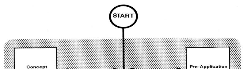


27 The Subdivision and Site Plan Handbook David Listokin & Carole Walker

28 Conceptual Review Fosters an informal review between the applicant and municipality.

29 Preliminary Plat Most important step in the process. Standards and regulations are applied. Engineering and other agency reviews are conducted. Planning Commission review. Planning and Zoning Administration in Utah Third Edition


30 FINAL PLAT The final plat should be drawn to reflect any changes made by the Planning Commission, or reviewing agencies during the preliminary process. Plan and Profiles. Final Approval. Planning and Zoning Administration in Utah Third Edition
General Plans. Tom Dansie, AICP Steve Pastorik, AICP
 General Plans Tom Dansie, AICP Steve Pastorik, AICP General Plans What is a General Plan? What does State code say? How is a General Plan used? How is a General Plan developed? Suggested considerations
Re: Keeping Special Area D North of Jensen Lane In the Town Of Windsor s Urban Growth Boundary
 Attachment 2a April 15, 2016 Town of Windsor Community Development Department Linda Kelly, Town Manager Toni Bertolero, Interim Community Development Director Town Council Members 9291 Old Redwood Highway
CONSERVATION SUBDIVISIONS & SITE DESIGN
 CONSERVATION SUBDIVISIONS & SITE DESIGN A Presentation for the 2008 Tennessee Farmland Legacy Conference By the Tennessee Local Planning Assistance Office Department of Economic and Community Development
SECTION II SECTION II STATEMENT OF GOALS, OBJECTIVES, PRINCIPLES, ASSUMPTIONS, POLICIES AND STANDARDS
 STATEMENT OF GOALS, OBJECTIVES, PRINCIPLES, ASSUMPTIONS, POLICIES AND STANDARDS 1 2 STATEMENT OF GOALS, OBJECTIVES, PRINCIPLES, ASSUMPTIONS, POLICIES AND STANDARDS INTRODUCTION The New Jersey Municipal
Checklists. Project Name: Location: File Number: Date of Submittal: Reviewer: Date: Applicant: Contact Name: Phone Number:
 Applicant: Contact Name: Phone Number: Email: Project Name: Location: File Number: Date of Submittal: Reviewer: Date: Concept Plan Requirements: I. General Project Information 1. Address or parcel number
SUBDIVISION, PLANNED UNIT DEVELOPMENT, PLANNING APPROVAL, REZONING & SIDEWALK WAIVER STAFF REPORT Date: February 7, 2013
 SUBDIVISION, PLANNED UNIT DEVELOPMENT, PLANNING APPROVAL, REZONING & SIDEWALK WAIVER STAFF REPORT Date: February 7, 2013 APPLICANT NAME SUBDIVISION NAME DEVELOPMENT NAME LOCATION S. E. Cemeteries of AL
ORDINANCE NO. City of Bellingham City Attorney 210 Lottie Street Bellingham, Washington INFILL HOUSING ORDINANCE Page 1
 ORDINANCE NO. AN ORDINANCE RELATING TO LAND USE PLANNING AND ZONING, CREATING A NEW BMC CHAPTER 20.28 INFILL HOUSING, AND NEW SUBSECTION BMC 20.12.030.E, GREEN FACTOR LANDSCAPING STANDARDS, AND AMENDING
ARTICLE 6: Special and Planned Development Districts
 ARTICLE 6: Special and Planned Development Districts 6-10 Traditional Neighborhood Development (TND) District 6-10.10 Purpose and Intent The Traditional Neighborhood Development (TND) District provides
Olde Towne Vision Plan
 Olde Towne Vision Plan Introduction In 2016, the City of Bellevue will complete its move of City offices from Olde Towne Bellevue to its new municipal complex on Wall Street. The City intends to sell its
ITEM # _ 41 _ DATE: COUNCIL ACTION FORM MAJOR FINAL PLAT FOR MENARDS SUBDIVISION BACKGROUND:
 ITEM # _ 41 _ DATE: 06-12-18 COUNCIL ACTION FORM SUBJECT: MAJOR FINAL PLAT FOR MENARDS SUBDIVISION BACKGROUND: The City s subdivision regulations are included in Chapter 23 of the Ames Municipal Code.
PLANNED UNIT DEVELOPMENT Date: April 5, 2018
 PLANNED UNIT DEVELOPMENT Date: April 5, 2018 DEVELOPMENT NAME SUBDIVISION NAME LOCATION Robert Myers Robert Myers 2955 and 2989 Dauphin Street (Southeast corner of Dauphin Street and Sage Avenue) CITY
A Guide to Open Space Design Development in Halifax Regional Municipality
 A uide to Open Space Design Development in Halifax Regional Municipality May 2007 1 Introduction Pursuant to Section 3.5 of the Regional Municipal Planning Strategy (RMPS), subdivision of land may proceed
Green Gables. April 24, 2013
 Green Gables Preliminary and Final Plat April 24, 2013 Development Team Green Gables Development Corporation (Owner/Developer) DTJ Design (Planner/Landscape Architect) Enertia Consulting Group (Civil Engineer)
11 March 9, 2011 Public Hearing APPLICANT: BUDDHIST EDUCATION CENTER OF AMERICA DONG HUNG TEMPLE, INC. PROPERTY OWNER: MOY FAMILY, LLC
 11 March 9, 2011 Public Hearing APPLICANT: BUDDHIST EDUCATION CENTER OF AMERICA DONG HUNG TEMPLE, INC. PROPERTY OWNER: MOY FAMILY, LLC REQUEST: Conditional Use Permit for Religious use STAFF PLANNER: Karen
RRW Stonebrook, LLC Tentative Map Findings
 RRW Stonebrook, LLC Tentative Map Findings FINDING T1: The request conforms to the Master Plan and zoning ordinances. RELATIONSHIP TO THE MASTER PLAN 1. The respective development is located within an
PLANNED UNIT DEVELOPMENT & SUBDIVISION STAFF REPORT Date: May 18, 2017
 & PUD-0000102-2017 PLANNED UNIT DEVELOPMENT & SUBDIVISION STAFF REPORT Date: May 18, 2017 NAME SUBDIVISION NAME Dauphin Creek Estates Subdivision Dauphin Creek Estates Subdivision LOCATION CITY COUNCIL
Outflow to Saw Mill Run
 Dormont Stormwater Fee Frequently Asked Questions What is stormwater, and why is it a problem in Dormont? Stormwater is runoff from rain or snow that falls and flows to Little Saw Mill Run or McNeilly
CITY OF ZEELAND PLANNING COMMISSION
 APPLICATION FOR SITE PLAN REVIEW AND SPECIAL LAND USE Date City Official App. Filing Fee Rec'd ($350) NOTE TO APPLICANT: Please submit this application for Site Plan Review along with twenty (20) copies
SPECIFIC PLAN Requirements
 CITY OF LANCASTER PLANNING DEPARTMENT 44933 Fern Avenue, Lancaster, California 93534 (661) 723-6100 SPECIFIC PLAN Requirements Purpose The purpose of a specific plan is to provide for the logical development
Subdivision Staff Report
 Subdivision Staff Report Name: Bridgewalk Subdivision Date: December 8, 2004 File: SUB04-00089 Meeting: December 14, 2004 Approval: Preliminary To: City Council Lead Agency: Boise City From: Richard Beck
Request Alternative Compliance to the prescribed criteria of the Oceanfront Resort District Form-Based Code. Staff Recommendation Approval
 Applicant & Property Owner Public Hearing February 8, 2017 City Council Election District Beach Agenda Item D1 Request Alternative Compliance to the prescribed criteria of the Oceanfront Resort District
Manage Community Growth
 How to Planning Guide Series Prepared by Strafford Regional Planning Commission Cynthia Copeland, AICP, Executive Director Gerald Mylroie, AICP, Senior Land Use Planner We can grow in ways that fit our
Re: Thorncreek Commons Commercial Response to Pre-Application Meeting held September 24, 2014 Comments
 8/20/2015 Jay Ruchti Senior Planner City Development Department City of Thornton 9500 Civic Center Drive Thornton, CO Re: Thorncreek Commons Commercial Response to Pre-Application Meeting held September
CHAPTER 7: VISION AND ACTION STATEMENTS. Noble 2025 Vision Statement
 CHAPTER 7: VISION AND ACTION STATEMENTS This chapter presents the vision, policy and action statements that transform the comprehensive planning study, an analysis of Noble s past, future trends and community
Living in Albemarle County s Urban Places
 Living in Albemarle County s Urban Places ALBEMARLE COUNTY, VIRGINIA A Closer Look at Albemarle s Approach to Managing Growth and Creating Quality Urban Environments www.albemarle.org Page 2 Living in
THE POLICY FRAMEWORK FOR WALKABLE COMMUNITIES. Community Technical Assistance Program Building Active Communities Institute March 2016
 THE POLICY FRAMEWORK FOR WALKABLE COMMUNITIES Community Technical Assistance Program Building Active Communities Institute March 2016 ACTIVE COMMUNITIES BACK THEN ACTIVE COMMUNITIES BACK THEN Lifestyle
Staff Report to the North Ogden City Planning Commission
 Staff Report to the North Ogden City Planning Commission SYNOPSIS / APPLICATION INFORMATION Application Request: Concept review on a legislative application to rezone land located at approximately 1750
Rural Land Use Designations Kittitas County December 6, 2007 Draft
 KITTITAS COUNTY COMMUNITY DEVELOPMENT SERVICES 411 N. Ruby St., Suite 2, Ellensburg, WA 98926 CDS@CO.KITTITAS.WA.US Office (509) 962-7506 Fax (509) 962-7682 Rural Land Use Designations Kittitas County
Ridgefield and the Growth Management Act
 1 2 Ridgefield and the Growth Management Act 3 Why Do We Plan History of Planning in Ridgefield Washington experiences rapid growth in the late 1980 s that began to change the perceived quality of life.
Planning Districts INTRODUCTION
 INTRODUCTION To facilitate detailed examination of development prospects for all areas of the community, Delano has been divided into 14 planning districts. The location of these planning districts is
Laberge Group. Town of Coeymans. Draft Comprehensive Plan. Overview of Planning Process
 Draft : Presentation of Goals & Strategies Laberge Group Benjamin H. Syden, A.I.C.P., E.D.P Director in Charge Nicole Allen, A.I.C.P. Senior Planner Anjali Malhotra Planner Presentation Outline Introductions
Request Change in Nonconformity. Staff Recommendation Approval. Staff Planner Jonathan Sanders
 Applicant & Owner Public Hearing April 11, 2018 City Council Election District Beach Agenda Item 5 Request Change in Nonconformity Staff Recommendation Approval Staff Planner Jonathan Sanders Location
PART 1: PROJECT SUMMARY. Proposed Land Use: 120 single-family lots. The application is Attachment A. The site plan is Attachment B.
 PART 1: PROJECT SUMMARY Applicant: JBH Development, LLC and Hopper Communities, INC Project Size: +/- 80.48 acres Parcel Number: 01513107, 01513108, 01513109, 01513113, 01513120, 01513121, 01513122, 01513124,
THREE-STEP DESIGN PROCESS FOR OPEN SPACE SUBDIVISIONS
 00216106.DOC NMA/RRK 1/30/14 THREE-STEP DESIGN PROCESS FOR OPEN SPACE SUBDIVISIONS Open space subdivisions, sometimes called cluster developments, maintain a significant portion of a development site in
Section 9 NEIGHBORHOOD DESIGN
 Section 9 NEIGHBORHOOD DESIGN City of Lancaster Comprehensive Plan D u n k i n, S e f k o & A s s o c i a t e s, I n c. NEIGHBORHOOD DESIGN INTRODUCTION There are many ways in which a neighborhood can
6 November 13, 2013 Public Hearing APPLICANT: CAH HOLDINGS, LLC
 6 November 13, 2013 Public Hearing APPLICANT:, LLC PROPERTY OWNER: LC REALTY, LLC STAFF PLANNER: Kevin Kemp REQUEST: Conditional Use Permit (Automated Car Wash) ADDRESS / DESCRIPTION: 3565 Holland Road
Request Alternative Compliance to the prescribed criteria of the Oceanfront Resort District Form-Based Code. Staff Planner Kristine Gay
 Applicant/Owner Ocean Rental Properties, LLC Public Hearing April 13, 2016 City Council Election District Beach Agenda Item 1 Request Alternative Compliance to the prescribed criteria of the Oceanfront
VALLEY COUNTY MINIMUM STANDARDS FOR PRIVATE ROAD DESIGN AND CONSTRUCTION
 MINIMUM STANDARDS FOR PRIVATE ROAD DESIGN AND CONSTRUCTION Adopted November 28, 2005 TABLE OF CONTENTS DEFINITION OF TERMS...II I. DESIGN CRITERIA... 1 A. GENERAL DESIGN CRITERIA... 1 B. ROADWAY CLASSIFICATION...
Asbury Chapel Subdivision Sketch Plan
 Asbury Chapel Subdivision Sketch Plan PART 1: PROJECT SUMMARY Applicant: NVR Inc. Project Size: +/- 76.13 acres Parcel Numbers: 02101112,02116101,02116112, 02116113 Current Zoning: Transitional Residential
Drexel, Barrell & Co.
 Drexel, Barrell & Co. June 18, 2018 Engineers/Surveyors Boulder Colorado Springs Greeley 3 South 7 th Street Colorado Springs, Colorado 80905-1501 719 260-0887 719 260-8352 Fax El Paso County Planning
Project phasing plan (if applicable) 12 copies of site plan
 12 copies of site plan") SITE PLAN REVIEW PERMIT APPLICATION City of Grand Haven, 11 N. Sixth Street, Grand Haven, MI 49417 Phone: (616) 847-3490 Fax: (616) 844-2051 Website: www.grandhaven.org 1. Project Information Address/location
SITE PLAN REVIEW PERMIT APPLICATION City of Grand Haven, 11 N. Sixth Street, Grand Haven, MI 49417 Phone: (616) 847-3490 Fax: (616) 844-2051 Website: www.grandhaven.org 1. Project Information Address/location
implementation10 Village of Greendale Comprehensive Plan: Greendale, Wisconsin. Revisiting a Greenbelt Community
 implementation10 Village of Greendale Comprehensive Plan: 2010 - Village of Greendale Comprehensive Plan: 2010 - Implementation The recommendations of this Plan must be implemented by the Village of Greendale,
Rapid City Planning Commission Rezoning Project Report
 Rapid City Planning Commission Rezoning Project Report April 5, 2018 Item # 4 Applicant Request(s) Case # 18RZ008 Rezoning request from General Agricultural District to Low Density Residential District
CHUGIAK-EAGLE RIVER SITE-SPECIFIC LAND USE PLAN
 CHUGIAK-EAGLE RIVER SITE-SPECIFIC LAND USE PLAN JUNE 2010 Final Prepared for The Heritage Land Bank, Municipality of Anchorage by Agnew: :Beck Consulting www.agnewbeck.com 907.222.5424 Chugiak-Eagle River
Camden County Development Regulations. Updated February 2017
 Camden County Development Regulations Updated February 2017 GENERAL MEETING SCHEDULE OF THE CAMDEN COUNTY PLANNING BOARD All meetings will convene at 6:00 PM on the 4th Tuesday of each month and will be
SUBMITTAL REQUIREMENTS: FINAL PLAN REVIEW- PROJECT DEVELOPMENT PLAN (PDP)
") 1) Application form and filing fee. Application Form.pdf Development Review Guide STEP 6 of 8 SUBMITTAL REQUIREMENTS: FINAL PLAN REVIEW- PROJECT DEVELOPMENT PLAN (PDP) 2) Transportation Development Review
1) Application form and filing fee. Application Form.pdf Development Review Guide STEP 6 of 8 SUBMITTAL REQUIREMENTS: FINAL PLAN REVIEW- PROJECT DEVELOPMENT PLAN (PDP) 2) Transportation Development Review
Transfer of Development Rights
 Transfer of Development Rights Chesterfield Township: A Case Study New Jersey Highlands Council March 5, 2009 Chesterfield Township s Old York Village Transfer of Development Rights and Traditional Neighborhood
Essential Skills: Reading and Interpreting Maps and Plans
 Essential Skills: Reading and Interpreting Maps and Plans Prepared for: NYS Tug Hill Commission Local Government Conference March 31, 2016 Prepared by: Peter G. Vars, P.E. BME ASSOCIATES Stages of Plan
The Development Review Process. Presentation to the GSSC IAC
 The Development Review Process Presentation to the GSSC IAC July 19, 2011 Regulatory Processes in the Planning Department Natural Resource Inventory/Forest Stand Delineation Zoning (Development Plan) Special
USA Addition of South & East Side Residential Parcels. USA Deletion of a Town of Christiana Parcel. Conversion from USA to Limited Service Area
 Village of Rockdale Village of Rockdale 148 Water Street Cambridge, WI 53523 Phone 608.423.1497 Fax 608.423.9694 Urban Service Area (USA) Amendment USA Addition of South & East Side Residential Parcels
PLANNED UNIT DEVELOPMENT STAFF REPORT Date: June 2, 2016
 # 9 ZON2016-01032 PLANNED UNIT DEVELOPMENT STAFF REPORT Date: June 2, 2016 DEVELOPMENT NAME JJT Properties LLC LOCATION 1147 & 1151 East I-65 Service Road South and 1180 Sledge Drive (Southeast corner
DAVENPORT VILLAGE SECONDARY PLAN
 27 DAVENPORT VILLAGE SECONDARY PLAN 27. DAVENPORT VILLAGE SECONDARY PLAN 1. VISION FOR THE DAVENPORT VILLAGE SECONDARY PLAN Davenport Village, municipally known as 830, 940, 980 and 1100 Lansdowne Avenue,
PART 1: PROJECT SUMMARY. The application is Attachment A. The site plan is Attachment B.
 Belleterre Subdivision Sketch Plan Town Board 8.7.17 Belleterre Subdivision Sketch Plan PART 1: PROJECT SUMMARY Applicant: Bowman Development Project Size: +/- 20.85 acres Parcel Number: 01115104 and 01115121
understanding Green Infrastructure In Zoning
 understanding Green Infrastructure In Zoning Purpose Measurable standards can be adopted within municipal zoning codes, and subdivision and stormwater regulations, to promote a comprehensive approach to
CROWN POINT SUBDIVISION
 CROWN POINT SUBDIVISION A COMPARISON OF CONVENTIONAL VERSUS CONSERVATION SUBDIVISION DESIGN DEVELOPER: PAUL LUCIANO BUILDERS LAND PLANNING & DESIGN: DAVID LAIRD ASSOCIATES FUNDING PROVIDED BY: PA SEA GRANT
General Location Annex, Rezone & Preliminary Plat Lansdowne Addition, Unit Three
 NEWFOUNDLAND I-5 Agricultural District Subject Site SUNDANCE ANDERSON Single Family Residential CHRISTY PUD Agricultural District Highway Business General Location Annex, Rezone & Preliminary Plat Lansdowne
City of Concord, NH Site Plan Regulations
 City of Concord, NH Site Plan Regulations Adopted: November 30, 2011 Revised: October 17, 2012 April 17, 2013 July 18, 2016 City of Concord Planning Board Planning Division Community Development Department
Proposed Walkability Ordinance for City of Knoxville (6/16/17)
") Proposed Walkability Ordinance for City of Knoxville (6/16/17) New or revised text is highlighted Section 1: Purpose The purpose of this ordinance is to set requirements for walkability and pedestrian
Proposed Walkability Ordinance for City of Knoxville (6/16/17) New or revised text is highlighted Section 1: Purpose The purpose of this ordinance is to set requirements for walkability and pedestrian
TOP TEN LIST OF COMMUNITY CONCERNS REGARDING PROPOSED AMENDMENTS TO CHAPTER 42
 TOP TEN LIST OF COMMUNITY CONCERNS REGARDING PROPOSED AMENDMENTS TO CHAPTER 42 1. Extend the urban area to Beltway 8 in stages, over say a three-year period, prioritizing development in transit and declining
DOWNTOWN DEVELOPMENT. Dimension IV 211 N. BROADWAY, SUITE 204 GREEN BAY, WI WAUGOO, OSHKOSH, WI 54901
 211 N. BROADWAY, SUITE 204 GREEN BAY, WI 54303 19 WAUGOO, OSHKOSH, WI 54901 (920) 431-3444 TOLL FREE: (866) 431-3444 DOWNTOWN DEVELOPMENT DIMENSION IV.COM Architecture. Sustainability. Planning. Economic
PUBLIC SERVICES ELEMENT GOALS / POLICIES / MEASURES
 PUBLIC SERVICES ELEMENT GOALS / POLICIES GOALS / POLICIES / MEASURES Authority The Public Services Element addresses provision of municipal services to City residents. The following paragraphs provide
CITY OF APPLE VALLEY PLANNING COMMISSION MINUTES SEPTEMBER 18, 2013
 PLANNING COMMISSION MINUTES SEPTEMBER 18, 2013 1. CALL TO ORDER The City of Apple Valley Planning Commission meeting was called to order by Chair Melander at 7:00 p.m. Members Present: Tom Melander, Ken
Planning Primer Legislative Background, Policy Documents and Development Review Processes. Presented by: Planning Services Date: April 6, 2017
 Planning Primer Legislative Background, Policy Documents and Development Review Processes Presented by: Planning Services Date: April 6, 2017 Agenda Legislative Background 7:30 to 8:00 pm Questions 8:00
Planned Residential Neighborhoods Land Use Goals
 Planned Residential Neighborhoods Land Use Goals Issue: Guidelines that provide for diverse high quality residential areas that include a variety of housing styles and layouts are needed. Goal 1: Create
PLANNING COMMISSION STAFF REPORT S. Apartments Planned Development PLNSUB Planned Development 247 West 1400 South March 12, 2014
 PLANNING COMMISSION STAFF REPORT 1400 S. Apartments Planned Development PLNSUB2013-00997 Planned Development 247 West 1400 South March 12, 2014 Applicant: Wasatch Advantage Group, represented by Adam Lankford
Drexel, Barrell & Co.
 Drexel, Barrell & Co. December 21, 2018 Engineers/Surveyors Boulder Colorado Springs Greeley 3 South 7 th Street Colorado Springs, Colorado 80905-1501 719 260-0887 719 260-8352 Fax El Paso County Planning
Planning Commission April 4, 2013 BOCC Workshop Page 1
 Planning Commission April 4, 2013 BOCC Workshop Page 1 Planning Commission April 4, 2013 BOCC Workshop Page 2 Planning Commission April 4, 2013 BOCC Workshop Page 3 Planning Commission April 4, 2013 BOCC
Appendix E: Illustrative Green Infrastructure Examples
 Appendix E: Illustrative Green Infrastructure Examples Integrating LID into San Francisco s Urban Landscape Figure E. High-density Residential Figure E. Low-density Residential Figure E. Mixed Use 7 Figure
EXHIBIT B PROJECT NARRATIVE POULSBO MEADOWS
 EXHIBIT B PROJECT NARRATIVE POULSBO MEADOWS Name of Project: Poulsbo Meadows; A Planned Residential Development (PRD)/Plat Applicants Name: PBH Group LLC/Byron Harris PO Box 1010 Silverdale, WA 98038 Description
REQUEST FOR COUNCIL ACTION 6A AGENDA ITEM
 DATE REQUEST FOR COUNCIL ACTION 6A AGENDA ITEM ORIGINATING DEPT. AGENDA ITEM CITY ADMINISTRATOR APPROVAL Community Development PUD Concept & Development Stage Plan Preliminary Plat & Final Plat PREVIOUS
Planning Commission Staff Report June 5, 2008
 Owner/Applicant Taylor Village Sacramento Investments Partners, LP c/o Kim Whitney 1792 Tribute Road #270 Sacramento, CA 95815 Staff Recommendation Planning Commission Staff Report Project: File: Request:
Planning Commission Staff Report
 3330 South 1300 East Millcreek, UT 84106 801-214-2700 millcreek.us File #CU-18-016 Planning Commission Staff Report Meeting Date: October 17, 2018 Applicant: Lotus Monarch Homes, LLC Property Address:
RESIDENTIAL PLANNED UNIT DEVELOPMENT / SUBDIVISION AND REZONING CONCEPT AND DEVELOPMENT STAGE PLAN SUBMITTAL NARRATIVE
 RESIDENTIAL PLANNED UNIT DEVELOPMENT / SUBDIVISION AND REZONING CONCEPT AND DEVELOPMENT STAGE PLAN SUBMITTAL NARRATIVE DEVELOPMENT TEAM DONEGAL SOUTH Maple Grove, Minnesota March 27, 2017 Applicant/Developer/Builder:
Rebecca Dohn October 13, 2017
 Rebecca Dohn October 13, 2017 Why Green Infrastructure? Population Growth 46,000 45,000 44,000 43,000 42,000 41,000 40,000 39,000 38,000 37,000 36,000 Impervious Acres 2 Why Green Infrastructure? 3 Why
PLANNED UNIT DEVELOPMENT & SUBDIVISION STAFF REPORT Date: March 15, 2012
 PLANNED UNIT DEVELOPMENT & SUBDIVISION STAFF REPORT Date: March 15, 2012 DEVELOPMENT NAME SUBDIVISION NAME LOCATION OSR Subdivision OSR Subdivision 5559 Old Shell Road (South side of Old Shell Road, 570
Section 3: Land Use M C H E N R Y K A N E. Figure 3.1: Potential Future Municipal Boundaries. Future Municipal Boundaries. County Land Use Plans
 Section 3: Land Use Figure 3.1: Potential Future Municipal Boundaries Land use and transportation are intertwined; yet, land use and transpor- tation planning are often undertaken as separate disciplines.
CHAPTER 12 IMPLEMENTATION
 CHAPTER 12 IMPLEMENTATION The 2010 Town of Denton Comprehensive Plan is intended to capture a vision of the future of Denton. As such, it provides a basis for a wide variety of public and private actions
APPLICATION FOR REZONING PROPERTY CITY OF HOLLAND, MICHIGAN. Name of Applicant. Address, and Phone # of Applicant
 APPLICATION FOR REZONING PROPERTY CITY OF HOLLAND, MICHIGAN Name of Applicant Address, Email and Phone # of Applicant Name and Address of Owner (if other than applicant) Ownership Interest of Applicant
ARTICLE 17 SITE PLAN REVIEW
 ARTICLE 17 SITE PLAN REVIEW 17.01 INTENT AND PURPOSE The intent of this section is to provide for consultation and cooperation between the applicant and the township planning commission so that the applicant
ARTICLE VI: SITE PLAN REVIEW
 Section 6.01 - Site Plan Review (All Districts) ARTICLE VI: SITE PLAN REVIEW Site plans give the Planning commission an opportunity to review development proposals in a concise and consistent manner. The
PLANNED UNIT DEVELOPMENT Date: May 4, 2017
 PLANNED UNIT DEVELOPMENT Date: May 4, 2017 DEVELOPMENT NAME LOCATION Sarah & Michael Stashak 2165 & 2167 Old Shell Road (South side of Old Shell Road, at the Southern terminus of Frazier Court) CITY COUNCIL
Applicant Name Phone / Fax / Address City State Zip Code . Property Owner Phone / Fax / Address City State Zip Code
 Master Development Plan Application Community Development Department City of Redmond 411 SW 9 th Street Redmond, Oregon 97756 541-923-7721 541-548-0706 FAX Master Development Plan Fee $38,862.52 File Number
Port Marigny TND Planning and Zoning Commission Workshop September 1, 2015 Preliminary Observations - David Bailey, AIA, AICP
 Planning and Zoning Commission Workshop September 1, 2015 Preliminary Observations - David Bailey, AIA, AICP Outline, per 8-27-15 Memorandum: 1. Background 2. General Observations 3. Comprehensive Plan
THREE-YEAR CAPITAL IMPROVEMENT PLAN FY
 THREE-YEAR CAPITAL IMPROVEMENT PLAN FY2016 2018 Annual CIP Development Process Public Works & Engineering Divisions Prepare List of Capital Needs and Recommended Deferred Maintenance Public Works & Engineering
Public may provide comments on the GDP within the next two weeks (December 24)
") 25/70 General Development Plan (GDP) Public Meeting Wednesday, December 10, 2014 6:00 8:00 P.M. District 1 Police Station Community Room 1311 W 46th Ave, Denver, CO 80211 Council Woman Montero: This particular
25/70 General Development Plan (GDP) Public Meeting Wednesday, December 10, 2014 6:00 8:00 P.M. District 1 Police Station Community Room 1311 W 46th Ave, Denver, CO 80211 Council Woman Montero: This particular
Palisades Outline Plan
 NE ¼ 25 36 28 W4 Town of Penhold Approved August 13, 2012 Contents Figures & Tables... 2 Introduction... 1 Overview... 1 Purpose... 1 Development Area... 3 Ownership... 3 Topography... 3 Existing & Surrounding
4-Town Comprehensive Plan DRAFT 7/30/07
 4-Town Comprehensive Plan DRAFT 7/30/07 Acknowledgements ning Committee Town of Harrisburg Norman Roof Randy Nicol Town of Martinsburg Terry Thisse Paul Kelly Town of Montague Jan Bagdanowicz Wendy Perry
APPENDIX A 6 CONCEPTUAL PRELIMINARY PLAN GUIDE AND CHECKLIST FOR MAJOR SUBDIVISIONS CARRBORO DEVELOPMENT GUIDE APPENDIX A
 6 CONCEPTUAL PRELIMINARY PLAN GUIDE AND CHECKLIST FOR MAJOR SUBDIVISIONS Conceptual Preliminary Guide/Checklist for Major Subdivisions Page 1 FORM: REVIEW DATE: CONCEPTUAL PLAN REVIEW 2000 REVIEWED BY:
Plat Requirements CHECKLIST FOR SITE PLAN REVIEW
 This checklist is to be used as a guide for complying with the Town of Hollis Site Plan Regulations. It is to be used for each individual site plan review application submitted. Applicants are encouraged
PARISH OF ASCENSION OFFICE OF PLANNING AND DEVELOPMENT PLANNING DEPARTMENT
 PARISH OF ASCENSION OFFICE OF PLANNING AND DEVELOPMENT PLANNING DEPARTMENT APPENDIX IX RECREATION VEHICLE PARK REGULATIONS Contents: 17-901. General Information, Procedures, and Process... 3 17-902. Recreational
Total acreage of Bloomsburg 3,014. Percentage of land used by intensive land uses 49.7% Percentage of land used by open space land uses 42.
 Land Use by the Numbers Total acreage of Bloomsburg 3,014 Percentage of land used by intensive land uses 49.7% Percentage of land used by open space land uses 42.8% Percentage of other lands (water) 7.5%
The following rules shall be used to determine the precise location of any zone boundary shown on the Official Zoning Map of Auburn:
 ARTICLE III. ESTABLISHMENT OF ZONING DISTRICTS Section 300. Establishment of Zoning Districts. The City of Auburn, Alabama is hereby divided into zoning districts of such number and character as are necessary
PLANNING APPROVAL & PLANNED UNIT DEVELOPMENT Date: November 2, 2017
 PLANNING APPROVAL & PLANNED UNIT DEVELOPMENT Date: November 2, 2017 DEVELOPMENT NAME LOCATION Mobile Christian School 5900 Cottage Hill Road (North side of Cottage Hill Road, 230 ± West of Freemont Drive
THE CITY OF MOBILE, ALABAMA
 THE CITY OF MOBILE, ALABAMA LETTER OF DECISION Ark of Safety, Inc. Mobile, AL 36617 Re: (Northwest corner of Main Street and First Avenue, extending to the Southwest corner of Esau Avenue and Main Street.)
Improve Neighborhood Design and Reduce Non Point Source Water Pollution
 HOW TO Planning Guide Improve Neighborhood Design and Reduce Non Point Source Water Pollution This document was funded by a grant from the New Hampshire Coastal Program with funding from the National Oceanic
Warren County/Bowling Green Focus 2030 Comprehensive Plan VOLUME 1 INDEX
 Appendix 5: Index VOLUME 1 INDEX A Aesthetics ES-6, FLU-15, FLU-17, FLU-24, NCR-7 Agricultural Base FLU-18, FLU-20 Agricultural Centers, Rural FLU-11 Agricultural District NCR-17-NCR-18 Agricultural Economy
CONCEPTUAL DEVELOPMENT PLAN REVIEW - CITY OF MARYLAND HEIGHTS
 APPLICATION NUMBER: CDP15-0004 APPLICATION (PROJECT) NAME: MARYLAND OAKS APPLICANT: PROPERTY OWNER NAME: APPLICANT S REQUEST: McBride Maryland Oaks, LLC 16091 Swingley Ridge Road, Suite 300 Chesterfield,
Camden SMART Initiative Stormwater Management and Resource Training
 Camden SMART Initiative Stormwater Management and Resource Training www.camdensmart.com Camden s Struggle with Stormwater 1 The City of Camden is served by a combined sewer system, which uses the same
Access Management and Site Plan Review. Robert W. Hofrichter Asst Administrator, Transportation and Mobility Planning Division April 2014
 Access Management and Site Plan Review Robert W. Hofrichter Asst Administrator, Transportation and Mobility Planning Division April 2014 Access Management 2 Access Management What is Access Management?
P: Site Plan Approval
 STAFF REPORT 2016-39P: Site Plan Approval Community Development Department Council Chambers, 7:30 PM, January 5, 2017 To: From: Re: Paul Luke, Plan Commission Chairperson Steve Marciani, AICP, Planning