ULI St. Louis Technical Assistance Panel
|
|
|
- Terence Bell
- 5 years ago
- Views:
Transcription
1 ULI St. Louis Technical Assistance Panel
2 ULI St. Louis Technical Assistance Panel Sponsored by: Citizens for Modern Transit in partnership with METRO
3 ULI St. Louis Mission Statement The mission of the ULI St. Louis is to provide leadership in the responsible use of land and in creating and sustaining thriving communities worldwide.
4 Technical Assistance Panel Objective, multidisciplinary advice on land use and real estate issues developed over the course of one and a half days ULI St. Louis members from across the region volunteer their time to participate as panelists
5 TAP Panel Members Panel Work Day: October 30, 2012 Panel Chair Laura Radcliff, Stifel Nicolaus & Company, Inc. Panel Members Natasha Das Colleen McNitt Ruiz, Lathrop & Gage LLP Brian O Connell, Hilliker Corporation Glenn Powers, St. Louis County Planning Brian Pratt, GreenStreet Development Group LLC Technical Writer & ULI St. Louis District Coordinator: Kelly Annis
6 CMT, Metro, Cortex & TOD TAP was commissioned by Citizens for Modern Transit (CMT), in keeping with goal of TOD education and advocacy CMT and Metro charged the panel with three questions relating to the station siting, additional parking options, and incentives for further development
7 Cortex - founding Five educational and research institutions joined forces in 1998 to create Cortex, a not-for-profit organization. With their initiative and ever-expanding community support, Cortex is destined to become the regional and national hub for life science research, development and commercialization. BJC HealthCare Missouri Botanical Garden Saint Louis University University of Missouri St. Louis Washington University


8 Cortex Boundaries SLU Central West End BJC & Wash U Medical Center Forest Park Forest Park Southeast Botanical Heights SLU Med Center


9 Proposed Master Plan Euclid Ave Taylor Ave Newstead Ave Boyle Ave Sarah Ave Forest Park Ave Duncan Ave
10 Cortex District Cortex: 200 acre Innovation Community Transitioning/transforming former industrial area into vibrant, mixed-use knowledge community Phase 1 (1998) $155mm invested, 950 jobs, 124 housing units Heritage Building (Wexford) $73mm, 190,000 sf, 400 jobs New Office Building (BJC) $45mm, 200,000 sf, 1,000 employees Cortex Commons construction begins Aug Public infrastructure improvements totaling $40.7mm New I-64/40 interchange at south/center of district Shriners Hospital acquisition for new hospital building
11 CMT, Metro, Cortex & TOD Cortex s current employees and potential business tenants desire light rail Cortex working with Metro to locate a MetroLink station between Sarah Avenue and Boyle Avenue CMT: with Transportation Oriented Development (TOD) education and advocacy goals, how could a light rail station best support TOD and spark further development? ULI Technical Assistance Panel
12 Panel s Charge If a MetroLink Station is added to the current system between Boyle and Sarah in Midtown St. Louis, what specific location would maximize the potential benefits for the Cortex development as a whole and best serve residents in the surrounding neighborhoods?
13 Panel s Charge There are four sites identified for a potential parking garage in the Cortex district. If a MetroLink Station is added to the current system between Boyle and Sarah in Midtown St. Louis, what are the pros and cons of each potential garage site from a TOD perspective? How can specific site design and tenant mix enhance the opportunities?
14 Panel s Charge What incentives could be utilized to bring in even further development at the site?


15 Sponsors CMT in partnership with Metro CORTEX Members, City & Elected Officials Washington University, BJC, Saint Louis University, Missouri Botanical Garden Aldermen, SLDC Real Estate Community & Neighborhood Developers, Park Central MODOT Great Rivers Greenway Stakeholder Meetings
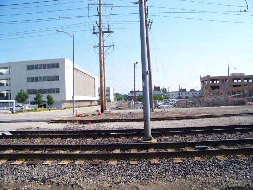
16 Station Location What specific station location would maximize the potential benefits for the Cortex development as a whole and best serve residents in the surrounding neighborhoods?
17 Station Location SLU Central West End BJC & Wash U Medical Center Forest Park Forest Park Southeast Botanical Heights SLU Med Center
 @4240 BJC AOB MetroLink Alignment Sarah Avenue")
18 Station Location Forest Park Avenue CORTEX 1 Duncan Avenue Boyle Avenue Cortex Commons BJC AOB MetroLink Alignment Sarah Avenue I-64/40

19 Station Location Intersection at Boyle Avenue Intersection at Sarah Avenue
20 Station Location Between Boyle and Sarah Avenues Push to as close to Boyle as possible Open to Commons as front door to the district (as opposed to mid-block, opening to possible parking garage) Provides good proximity to possible parking at new BJC building and parking to the district s southern edge and Forest Park Southeast neighborhood Provide pedestrian, bike access from both streets Include station signage at Boyle and Sarah Push for signature design of station canopy featuring district branding

21 Station Location
22 Additional Station Notes Name and brand the station in concert with Cortex/ district branding first impression for those visiting the district Use art, lighting to make station special Use station furniture, billboards to convey information about district Map: You Are Here Advertising for district businesses Share info re: new innovations at work; tv broadcast Note wifi access points, cafes

23 Additional Station Notes
24 Parking & Potential Garage(s) Four potential district parking garages: Pros from TOD perspective? Cons? How can design and tenant mix enhance the opportunities?

25 Parking Garage Options


26 Parking Garage Site 1 and US Metals Duncan Ave Cortex Commons US Metals Site 1, View from Duncan
27 Parking Garage Site 1 and US Metals PROS First floor retail appropriate for Duncan corridor Close proximity to current development Makes the area feel safer Creates a circulator for bikes between Sarah and Boyle and provides signage opportunity off Duncan Accommodates additional uses, mixed use Perhaps the sliver next to Site 1 could become bike station Two possible entrances If entire US Metals site is acquired, orient garage east-west and put a different use along Duncan (keeps cars moving directly from Sarah into the garage, away from pedestrians)
28 Parking Garage Site 1 and US Metals CONS No current site control over US Metals, relocation costs difficult to determine Site is more expensive than others to develop Might need to be the location for the bike station given proximity to proposed Great Rivers Greenway trail Timing might need to be tied to the greenway improvements Draws more traffic into the district be mindful of how increased traffic will impact the experience


29 Duncan Ave Parking Garage Site 2 north of Duncan, between Boyle & Sarah Cortex Commons US Metals Site 2, View from Duncan
30 PROS Close to everything under development Parking Garage Site 2 Provides additional parking for residential area, encourages pedestrian traffic, and provide opportunity for rooftop community development for nearby residents Just as close to the station as Site 4 north of Duncan, between Boyle & Sarah
31 CONS Parking Garage Site 2 In middle of proposed pedestrian corridor Need to enter from Forest Park Avenue, if possible Depth of lot is skinnier would be better oriented northsouth instead of east-west Should not be built in place of residential north of Duncan, between Boyle & Sarah Significant demand for residential, particularly apartments, in the area given proximity to SLU, Wash U Med Center, BJC, etc.


32 Parking Garage Site 3 current surface lot for Cortex 1 Duncan Ave Cortex Commons Site 3, View from Duncan & Boyle
33 PROS Parking Garage Site 3 current surface lot for Cortex 1 Accommodates new development on the adjacent site Accommodates current Cortex needs
34 CONS Parking Garage Site 3 current surface lot for Cortex 1 Does not provide much additional parking beyond current Cortex building and needs of future residential on that site Capacity limited by one deck of parking (should not block view of Cortex building)


35 Parking Garage Site 4 Commons between Tower Grove & Boyle, north of I-64/40 I-64/40 View FROM Site 4
36 PROS Parking Garage Site 4 Proximity to new BJC office building and south entrance to Cortex Commons Large enough for mixed use Good visibility to highway between Tower Grove & Boyle, north of I-64/40 Metro envisions moving transfer station to Site 4
37 CONS Parking Garage Site 4 Potential for cars stacking back onto highway Highest and best use of this site? between Tower Grove & Boyle, north of I-64/40 The master plan notes hotel and retail at Site 4 could be demand for hotel here now Great view into the Commons for cars?
38 Additional Notes on Parking Need for a comprehensive parking study, overseen by members of Cortex (currently well-served by plentiful surface lots) Periodically review study and district s needs Incorporate multi-user options Include staging of parking meter integration Address: Unified ownership Operation and pricing Use innovative design standards (including height restrictions, new building parking quotas, signage, branding for the district, streetlevel retail, materials lighting)
39 Financial Incentives Building excess parking now allows for future perks for new businesses locating in district Public sector could participate in building, ownership of garage and enjoy income stream Special purpose bonds (STL Treasurer s Office) MDFB credits Cortex needs corporate donations (match corporations needs with Cortex)
40 Financial Incentives New Markets Tax Credits Transportation Development District (TDD) or Community Improvement District (CID) via assessment (at this stage as lacking sales tax in district); possibly use as guarantee which would require building owners to cover gap in event of shortfall Use voucher system for transportation for area employees (pricing to encourage transit ridership) Great Rivers Greenway funding


41 Enhance streetscapes, clean/cut ID community attributes in line with Innovation Community and publicize Provide child care options Provide a bike rental station Offer district-wide wifi Install security stations to call for public safety escort/assistance Incentives Amenities

42 Incentives Amenities Install electric car charging stations in garages Provide CarShare stations Use priority parking for green vehicles Treat the garage roofs differently green roofs, patios, beer gardens? Wrap office and residential around the parking garages.
43 Summary Station should be located between Boyle and Sarah, at the western-most point Comprehensive parking study should precede any decisions regarding parking garages, locations No one potential garage site rises to top Incentives to promote development and attract new businesses should include financial incentives as well as amenities for the district
44
Technical Assistance Panel Proposed MetroLink Station in the Cortex District St. Louis, Missouri
 Cortex Scheel District Street MetroLink Station, Belleville, St. Louis, Illinois Missouri Technical Assistance Panel Proposed MetroLink Station in the Cortex District St. Louis, Missouri Panel Recommendations
ULI St. Louis Technical Assistance Panel
 ULI St. Louis Technical Assistance Panel ULI St. Louis Technical Assistance Panel Sponsored by: Citizens for Modern Transit in partnership with METRO ULI St. Louis Mission Statement The mission of the
SPRINGFIELD, MA Technical Assistance Panel (TAP)
") SPRINGFIELD, MA Technical Assistance Panel (TAP) ULI the Urban Land Institute Mission To provide leadership in the responsible use of land and in creating and sustaining thriving communities worldwide.
SPRINGFIELD, MA Technical Assistance Panel (TAP) ULI the Urban Land Institute Mission To provide leadership in the responsible use of land and in creating and sustaining thriving communities worldwide.
Transportation. Strategies for Action
 Transportation A major priority for the Overlake Neighborhood is to develop a multimodal transportation system. To achieve this system, a balance has to be found among travel, circulation and access needs;
ULI Boston Technical Assistance Panel (TAP) Program. Downtown Marlborough
 Program. Downtown Marlborough") ULI Boston Technical Assistance Panel (TAP) Program Downtown Marlborough ULI the Urban Land Institute Mission To provide leadership in the responsible use of land and in creating and sustaining thriving
ULI Boston Technical Assistance Panel (TAP) Program Downtown Marlborough ULI the Urban Land Institute Mission To provide leadership in the responsible use of land and in creating and sustaining thriving
TECHNICAL ASSISTANCE PANEL. Graniteville TAP: Developing a Community Vision
 TECHNICAL ASSISTANCE PANEL SPONSORED BY: Graniteville TAP: Developing a Community Vision Graniteville Community Development Improvement Corporation Mission To provide leadership in the responsible use
Corridor Vision. 1Pursue Minnehaha-Hiawatha Community Works Project. Mission of Hennepin County Community Works Program
 1Pursue Minnehaha-Hiawatha Community Works Project Minnehaha-Hiawatha Community Works is a project within the Hennepin Community Works (HCW) program. The mission of the HCW program is to enhance how the
Urban Planning and Land Use
 Urban Planning and Land Use 701 North 7 th Street, Room 423 Phone: (913) 573-5750 Kansas City, Kansas 66101 Fax: (913) 573-5796 Email: planninginfo@wycokck.org www.wycokck.org/planning To: From: City Planning
Developer s Program. The Station at East 54
 Developer s Program The Station at East 54 Existing Conditions The Station at East 54 is proposed for a 1.12 acre site at the northeast corner of Hamilton Road and Prestwick Road, tucked between the East
Mini Technical Assistance Panel. Rock Spring Park
 Mini Technical Assistance Panel Rock Spring Park May 22, 2013 The Team Jason Bonnet, Forest City Washington Matthew Flis, Town of Vienna William Herbig, National Capital Planning Commission Sophie Lambert,
KCATA Transit Oriented Development Initiatives
 KCATA Transit Oriented Development Initiatives KCATA: Regional Transportation Authority Created by bi-state compact Approved by Congress 7 County service area Quasi-governmental with broad powers Power
LEED-ND 101: Practical Strategies for Achieving Sustainability Goals. Travis Parker Lakewood Planning Director
 LEED-ND 101: Practical Strategies for Achieving Sustainability Goals Travis Parker Lakewood Planning Director Metro Vision Idea Exchange Oct 11, 2012 West Corridor Stations West Corridor Overview West
JANUARY 19, 2011 CENTRAL AVENUE-METRO BLUE LINE TRANSIT-ORIENTED DEVELOPMENT IMPLEMENTATION PROJECT COMMUNITY FORUM
 CENTRAL AVENUE-METRO BLUE LINE TRANSIT-ORIENTED DEVELOPMENT IMPLEMENTATION PROJECT COMMUNITY FORUM JANUARY 19, 2011 THE MARYLAND-NATIONAL CAPITAL PARK AND PLANNING COMMISSION PRINCE GEORGE S COUNTY PLANNING
The Vision. Photo provided by The Minervini Group. 46 Vision, Objectives & Strategies
 Vision, Objectives & Strategies The is the public framework and guide for future development of the Grand Traverse Commons. The establishes public polices for infrastructure, the preservation of natural
NOVEMBER 2016 AARP IN ST. LOUIS & CITIZENS FOR MODERN TRANSIT PLACEMAKING STRATEGIES FOR ST. LOUIS TRANSIT DRAFT
 NOVEMBER 2016 AARP IN ST. LOUIS & CITIZENS FOR MODERN TRANSIT PLACEMAKING STRATEGIES FOR ST. LOUIS TRANSIT DRAFT SECTION 3 RECOMMENDATIONS AARP IN ST. LOUIS + CMT + ARCTURIS + THE INNIS GROUP 37 SECTION
REGIONAL ACTIVITY CENTER
 DRAFT REGIONAL ACTIVITY CENTER 70 EAST BENCH MASTER PLAN DRAFT 06 Introduction The East Bench Regional Activity center is comprised of large educational, research, medical, and employment centers. These
The University District envisions, in its neighborhood
 Envisioning the University District Link Light Rail in Seattle s neighborhoods CIY OF SEALE CONCEP-LEVEL SAION AREA PLANNING RECOMMENDAION RESOLUION # 30165 EXHIBI L Vision 08.2000 he University District
October 25 Downtown Partnership and Action Plan Workshop Record of Group Table Results
 October 25 Downtown Partnership and Action Plan Workshop Record of Group Table Results During the October 25 workshop, participants were asked to rank their top priorities for the Downtown Action Plan.
CORTEX K. OFFICE SPACES FOR THE MODERN WORKSTYLE DEVELOPED BY KOMAN & AVAILABLE Q4 2019
 CORTEX K. OFFICE SPACES FOR THE MODERN WORKSTYLE DEVELOPED BY KOMAN & AVAILABLE Q4 2019 THE KOMAN GROUP IS DEVELOPING A SIGNATURE MIXED-USE DEVELOPMENT WELCOMING YOUR CUSTOMERS TO CORTEX. FUTURE PHASE
Planning Districts INTRODUCTION
 INTRODUCTION To facilitate detailed examination of development prospects for all areas of the community, Delano has been divided into 14 planning districts. The location of these planning districts is
The Village of Shirlington
 The Village of Shirlington Suburban Smart Growth Without Rail Transit July 2018 Agenda History (1940 to present) Attributes and Outcomes Lessons Learned Setting the Stage Arlington County Arlington is
Today Land & People. Northeast Nampa Gateway District. Employment. Land Use Characteristics. Demographics. Current Zoning
 Today Land & People Employment Major employers include Saint Alphonsus, the College of Western Idaho, the Auto Mall, Sorrento Lactalis and Walmart. 3,004 jobs in 2010 (COMPASS-CIM 2040 TAZ data) 4,345
ULI Boston Technical Assistance Panel (TAP) Program. Downtown Hyannis
 Program. Downtown Hyannis") ULI Boston Technical Assistance Panel (TAP) Program Downtown Hyannis ULI the Urban Land Institute Mission To provide leadership in the responsible use of land and in creating and sustaining thriving communities
ULI Boston Technical Assistance Panel (TAP) Program Downtown Hyannis ULI the Urban Land Institute Mission To provide leadership in the responsible use of land and in creating and sustaining thriving communities
40 Years of Smart Growth Arlington County s Experience with Transit Oriented Development in the Rosslyn-Ballston Metro Corridor
 40 Years of Smart Growth Arlington County s Experience with Transit Oriented Development in the Rosslyn-Ballston Metro Corridor A presentation by the Arlington County Department of Community Planning,
A BLUEPRINT FOR BROCKTON A CITY-WIDE COMPREHENSIVE PLAN
 A BLUEPRINT FOR BROCKTON A CITY-WIDE COMPREHENSIVE PLAN Public Meeting October 2016 1 Plan Summary and Discussion Public Meeting May 4 2017 City of Brockton Bill Carpenter, Mayor Department of Planning
New Partners for Smart Growth Conference February 5, 2010
 Dan Stroh, Planning Director City of Bellevue Planning and Community Development Bellevue, WA New Partners for Smart Growth Conference February 5, 2010 Summary of Project Long-range plan update for Bel-Red
Hopkins. Development Guidelines May Overview. Sponsored by: Blake Road Corridor Collaborative City of Hopkins
 Hopkins Blake Road LRT Station Area Development Guidelines May 2015 Sponsored by: Blake Road Corridor Collaborative City of Hopkins Overview Hopkins is a dynamic community of over 17,000 residents located
MONTGOMERY COUNTY METRO STATION AREA DESIGN CHARRETTE
 MONTGOMERY COUNTY METRO STATION AREA DESIGN CHARRETTE Shady Grove Metro Station Area Charrette Closing Presentation October 25-28, 2000 MONTGOMERY COUNTY, MD M-NCPPC Design Collective, Inc. Architects
Kensington Center. Public Meeting # Transit-Oriented Development, Town of Berlin, CT
 Kensington Center Public Meeting #1 10.27.16 Transit-Oriented Development, Town of Berlin, CT CivicMoxie 2016 What is Transit-Oriented Development Definition: Transit-Oriented Development (TOD) = is an
Small Area Plan. South Gateway
 Small Area Plan Adopted May 12, 2008 South Gateway Purpose. The South Gateway Small Area Plan defines the City s expectations for the future of the southern entrance to the City at Interstate 85 and Highway
The transportation system in a community is an
 7 TRANSPORTATION The transportation system in a community is an important factor contributing to the quality of life of the residents. Without a sound transportation system to bring both goods and patrons
TOD 101 CREATING LIVABLE COMMUNITIES WITH TRANSIT
 1 CREATING LIVABLE COMMUNITIES WITH TRANSIT What are transit Centered Communities? Benefits of Partnerships to Support and Implement What You Will Learn Portland s Pearl District Your Trainers Today Catherine
PLAN ELEMENTS WORKSHOP. April 5, 2016
 PLAN ELEMENTS WORKSHOP April 5, 2016 needs more housing. But there is no one-size fits-all solution. Every neighborhood has its own character. In some places, density is not only appropriate it is badly
Potential Green Infrastructure Strategies May 6, 2015 Workshop
 Potential Green Infrastructure Strategies May 6, 2015 Workshop Background The City of Cortland is developing the Tioughnioga Urban Headwaters Green Infrastructure Action Plan with funding from the National
Urban Design Manual PLANNING AROUND RAPID TRANSIT STATIONS (PARTS) Introduction. Station Study Areas
 Introduction. Station Study Areas") 111111 PLANNING AROUND RAPID TRANSIT STATIONS (PARTS) Introduction The ION rapid transit system will link Waterloo, Kitchener and Cambridge through a central transit corridor (CTC). There are a number
111111 PLANNING AROUND RAPID TRANSIT STATIONS (PARTS) Introduction The ION rapid transit system will link Waterloo, Kitchener and Cambridge through a central transit corridor (CTC). There are a number
Create Policy Options Draft Plan Plan Approval. Public Consultation Events. Phase 2
 Background Grandview-Woodland Community Plan In the spring of 2012, the City of Vancouver embarked on a comprehensive community planning program in the Grandview-Woodland neighbourhood. The process has
Land Use. Hardware Street Vendor Mixed-Use
 Land Use Definition Land Use is the way a piece of real estate is utilized. Existing, proposed, and adopted land uses all play a role in the planning process. Once a land use plan is adopted, the next
CHAPTER 7: Transportation, Mobility and Circulation
 AGLE AREA COMMUNITY Plan CHAPTER 7 CHAPTER 7: Transportation, Mobility and Circulation Transportation, Mobility and Circulation The purpose of the Transportation, Mobility and Circulation Chapter is to
The West Vaughan Employment Area Secondary Plan Policies
 Part 2: The West Vaughan Employment Area Secondary Plan Policies 2.1 General Policies It is the policy of Council: 2.1.1. That the West Vaughan Employment Area (the WVEA), identified on Schedule 1, will
Forest Hills Improvement Initiative A Partnership for Building a Better Community. Use & Design Guidelines September 23, 2008
 Forest Hills Improvement Initiative A Partnership for Building a Better Community City of Boston Thomas M. Menino, Mayor Emerging Community Vision p. 2 Site Use & Design Guidelines p. 3 to 21 Arborway
40 Years of Smart Growth Arlington County s Experience with Transit Oriented Development in the Rosslyn-Ballston Metro Corridor
 40 Years of Smart Growth Arlington County s Experience with Transit Oriented Development in the Rosslyn-Ballston Metro Corridor A presentation by the Arlington County Department of Community Planning,
ALMONO. Hazelwood, City of Pittsburgh. A riverfront investment opportunity combining residential, office and light industrial uses A L M O N O S I T E
 Tecumseh St. ALMONO Hazelwood, City of Pittsburgh A riverfront investment opportunity combining residential, office and light industrial uses Downtown Pittsburgh Oakland South Side Flats Birmingham Bridge
Tony Garcia, City-County Planning Commission & Beth Alden, Hillsborough MPO
 Tony Garcia, City-County Planning Commission & Beth Alden, Hillsborough MPO TOD Defined A compact neighborhood with housing, jobs and neighborhood services within easy walking distance of a transit station
RIDGES TO RIVERS OPEN SPACE NETWORI< OF THE MID-COLUMBIA DRAFT ACTION PLAN
 RIDGES TO RIVERS OPEN SPACE NETWORI< OF THE MID-COLUMBIA DRAFT ACTION PLAN Ridges to Rivers Open Space Network of the Mid-Columbia Region Draft Action Plan (8/6/08) The goals of the propose
Michigan City Alternative Analysis Realignment Study. Progress Status Update Report Presentation to City Council February 1, 2012
 Michigan City Alternative Analysis Realignment Study Progress Status Update Report Presentation to City Council Project Web Site Project Web Site is Active www. emichigancity.com Click on NICTD logo at
BROOKLYN PARK / 85TH AVE LRT STATION CDI DEVELOPMENT GUIDELINES DRAFT
 August 2018 Page intentionally left blank The Brooklyn Park Library adjacent to the 85th Ave LRT Station Area. OVERVIEW The Blue Line LRT Extension / Bottineau corridor offers a unique opportunity to leverage
EXHIBIT A. Tax Increment Reinvestment Zone No. 1 (Town Center) First Amended Project Plan 1
 First Amended Project Plan 1") EXHIBIT A Tax Increment Reinvestment Zone No. 1 (Town Center) First Amended Project Plan 1 1 As amended by Resolution No. 2008-02-001(TR1R) of the Tax Increment Reinvestment Zone No.1, and approved to
EXHIBIT A Tax Increment Reinvestment Zone No. 1 (Town Center) First Amended Project Plan 1 1 As amended by Resolution No. 2008-02-001(TR1R) of the Tax Increment Reinvestment Zone No.1, and approved to
ANC 2A Presentation. November 9, 2006
 ANC 2A Presentation November 9, 2006 Introduction & Overview Applicants Boston Properties and KSI Services (project developers) The George Washington University (land owner) 2.66 acre site (former GW hospital
DISCOVER KIRBY GROVE
 5 R I C H M O N D AV E, H O U S TO N DISCOVER KIRBY GROVE Within the Upper Kirby District, the mixed-use Kirby Grove destination features culinary concepts from renowned chefs, luxury mid-rise residences,
EXISTING COMPREHENSIVE PLAN
 EXISTING COMPREHENSIVE PLAN Town Center Land Use Element: V. LAND USE POLICIES Town Center Mercer Island's business district vision as described in "Your Mercer Island Citizen-Designed Downtown" was an
HE VISION. Building a Better Connected Place
 HE VISION Building a Better Connected Place WALK INTO THE FUTURE. Life in Cranberry, 2030 Here s what our residents told us they wanted to see in their community by 2030: The Cranberry of 2030 is a place
Executive Summary. Parks and Recreation Plan. Executive Summary
 Parks and Recreation Plan Executive Summary The Whitemarsh Township Parks and Recreation Plan sets forth a vision for how Whitemarsh Township can provide a premiere parks and recreation system reflective
East Central Area Plan
 East Central Area Plan Steering Committee Meeting March 8 th, 2018 CHUN Tears McFarlane House Vision Statement Development Opportunities Analysis Vision Elements 1. Equitable, Affordable and Inclusive
BRYN MAWR. Tier 2 Characteristics: Location: Lancaster Avenue from Old Lancaster Road on the east to Norwood Avenue on the west
 BRYN MAWR Tier 2 Characteristics: Transit-oriented Mixed use Along Lancaster Avenue Serve township-wide needs Civic space Employment centers Location: Lancaster Avenue from Old Lancaster Road on the east
Chapter 1: Introduction
 Chapter 1: Introduction The Penn Avenue Community Works Corridor Vision and Implementation Framework presents an integrated communitybased vision and a coordinated, long-term implementation framework for
Town Center. Block 5 Existing multifamily residential units are expected to remain.
 Area Guidelines Germantown s districts should be developed as distinct communities with unique features that are supported through the guidelines. The guidelines not only help distinguish these districts
University of the District of Columbia Van Ness Campus Master Plan Community Open House 3. December 8, 2010
 University of the District of Columbia Van Ness Campus Master Plan Open House 3 December 8, 2010 Introductions Sequence of Work: Campus Master Plan BEGIN: INTRODUCE AND START WORK Project Initiation Team
Seneca Meadows. Block 4 Locate office, technology, and medical development adjacent to I Screen views of garage structures from I-270.
 Seneca Meadows Seneca Meadows has an industrial park in its southern end and a mixed-use employment area planned for the north end. The district benefits from extensive I-270 visibility, stream valley
University Avenue District
 University Avenue District UPDATE ON THE OPPORTUNITY 07.8.15 1 University Avenue District The new century nexus of live, work, learn, research, and engage. An intentional partnership of developers, businesses,
2.0 THE PLATINUM TRIANGLE VISION
 2.0 THE PLATINUM TRIANGLE VISION The envisions an exciting future for the area surrounding Angel Stadium of Anaheim, the Honda Center and The Grove of Anaheim. 2.1 Planning Principles In order to further
Access to the University of North Carolina at Chapel Hill, UNC Hospitals, and Chapel Hill Transit.
 M 1/ 4 1/ 2 E IL M E IL Station Family: County: City: UNC Hospitals WHY THIS STATION? University Village Orange Chapel Hill Access to the University of North Carolina at Chapel Hill, UNC Hospitals, and
Beaverton City Council: Work Session. SIDEDistrict. May 6, 2014
 BEAVERTON Beaverton City Council: CREEK Work Session SIDEDistrict May 6, 2014 Tonight s Agenda BEAVERTON CREEK SIDE Brief updates Creekside Vision Scenarios & discussion: Redevelopment & Parking Project
ULI St. Louis Technical Assistance Panel Recommendations. Technical Assistance Panel MetroLink UMSL South Station St.
 UMSL Scheel South Street MetroLink Station, St. Belleville, Louis, Missouri Illinois Technical Assistance Panel MetroLink UMSL South Station St. Louis, Missouri Panel Recommendations to CMT and Metro April
NORTH CLAYMONT AREA MASTER PLAN COMMUNITY WORKSHOP #1 FEBRUARY 3, 2016
 NORTH CLAYMONT AREA MASTER PLAN COMMUNITY WORKSHOP #1 FEBRUARY 3, 2016 1. Introduction To the team and to the Plan Planning Partners The Claymont Community WILMAPCO New Castle County Claymont Renaissance
Integrated Urban Development. April Reflections from the NZPI Study Tour of Portland, Seattle and Vancouver
 Integrated Urban Development April 2009 Reflections from the NZPI Study Tour of Portland, Seattle and Vancouver Integrated Urban Development Urban Growth Management Transportation Transit Orientated Mixed
WELCOME and introduction
 1 WELCOME and introduction Mobility Hub Locations within Burlington STUDY OVERVIEW STUDY OBJECTIVES The City of Burlington is developing four Area Specific Plans, one for each of Burlington s Mobility
BUDGETING FOR OUTCOMES TRINITY RIVER CORRIDOR
 BUDGETING FOR OUTCOMES TRINITY RIVER CORRIDOR Trinity River Corridor Team Members: Kelly High, Streets Department Megan Lam, Office of Financial Services Mike Mikeska, Dallas Water Utilities Diana Ochoa,
NJ s Land Use and Transit Policies
 1 NJ s Land Use and Transit Policies NJ TRANSIT created in 1979 to reverse decline of public transportation State Development & Redevelopment Plan adopted (1986) encourages growth in areas where population,
Midtown Greenway Land Use and Development Plan Executive Summary
 Midtown Greenway Land Use and Development Plan Executive Summary Introduction The Midtown Greenway Land Use and Development Plan sets policy direction for land use and development in the Midtown Greenway
The Lower SaLuda Greenway
 The Lower SaLuda Greenway InITIaTIve a FLourIShInG Greenway. a hub For economic GrowTh. a ConneCTIon BeTween CoMMunITIeS. In April 2017 the Michael J. Mungo Foundation and Lexington County commissioned
1.0 VISION STATEMENT. December 6, PRINCIPLES
 Vision Statement Lincoln Regional Airport 1.0 VISION STATEMENT 1.1 City LOCATION of AND OVERVIEW The Easton Lincoln Place Land Use Master Plan identifies the principles, goals, policies, and standards
Making Transit Oriented Development Work For Boonton, NJ
 Making Transit Oriented Development Work For Boonton, NJ Bloustein School of Planning and Public Policy Studio Dan Burton Loannie Dao Webster Slater Brandon Williams Ian Watson Maria Laham Nicola Mammes
Stakeholders Advisory Working Groups (SAWGs) Smart Growth and TOD Land Use (#11) SAWG Meeting
 Smart Growth and TOD Land Use (#11) SAWG Meeting") Presentation - Part II Tappan Zee Bridge/I-287 Corridor Project July 21, 2010 Slide 1. David Kooris (Regional Plan Association) welcomed members of the Land Use Stakeholders Advisory Working Groups (SAWGs)
Presentation - Part II Tappan Zee Bridge/I-287 Corridor Project July 21, 2010 Slide 1. David Kooris (Regional Plan Association) welcomed members of the Land Use Stakeholders Advisory Working Groups (SAWGs)
Tyvola & Archdale Transit Station Area Plan. June 5, 2008
 Tyvola & Archdale Transit Station Area Plan Second Public Meeting June 5, 2008 Presentation Outline 1. Purpose and Process 2. Station Area Overview 3. Plan Recommendations 4. Comments Received and Proposed
The Five Components of the McLoughlin Area Plan
 The Five Components of the McLoughlin Area Plan This documents contains the complete language of the five components of the McLoughlin Area Plan: The Vision Statement The Values The Guiding Principles
NorthPoint, Inc. Community-Based Development Concept
 NorthPoint, Inc. Community-Based Development Concept 6.0.01 EXECUTIVE SUMMARY The NorthPoint Community Board Development concept is a community development strategy. It leverages NorthPoint s mission,
ROBBINSDALE LRT STATION CDI DEVELOPMENT GUIDELINES
 August 2018 OVERVIEW The City of Robbinsdale has a prime-opportunity site in the middle of the 13 mile stretch of the Bottineau LRT corridor / Blue Line extension. Robbinsdale offers a prominent, vital,
Transportation Working Team Duane Diggs, Co-Chair (VOICE Buffalo) Kelly Dixon, Co-Chair (GBNRTC) Paul Ray, Facilitator (UB Regional Institute)
 Kelly Dixon, Co-Chair (GBNRTC) Paul Ray, Facilitator (UB Regional Institute)") towards a more sustainable Buffalo Niagara Transportation Working Team Duane Diggs, Co-Chair (VOICE Buffalo) Kelly Dixon, Co-Chair (GBNRTC) Paul Ray, Facilitator (UB Regional Institute) Agenda Welcome,
towards a more sustainable Buffalo Niagara Transportation Working Team Duane Diggs, Co-Chair (VOICE Buffalo) Kelly Dixon, Co-Chair (GBNRTC) Paul Ray, Facilitator (UB Regional Institute) Agenda Welcome,
PIKE PINE RENAISSANCE: ACT ONE. October 19, 2017
 PIKE PINE RENAISSANCE: ACT ONE October 19, 2017 WATERFRONT SEATTLE PROGRAM PROJECT INTRODUCTION Pike and Pine streets, between First and Melrose avenues Pedestrian and streetscape improvements Budget:
August 2016 COTTAGE GROVE STATION AREA PLANNING REPORT
 August 2016 COTTAGE GROVE STATION AREA PLANNING REPORT Introduction The Red Rock Corridor is a proposed 30 mile transitway that runs along Highway 61 and Interstate 94 between Hastings and Union Depot
Volume 2: Implementation Plan
 Volume 2: Implementation Plan February 25 th 2002 Implementation Introduction This document outlines the steps that should be taken to implement the Washington Heights Neighborhood Plan. The City Council
W&OD PARK MASTER PLAN. The City s Greenest Street. DRAFT W&OD Trail Master Plan v4.docx Page 1
 W&OD PARK MASTER PLAN Adopted XXX-XX-XXXX The City s Greenest Street DRAFT W&OD Trail Master Plan v4.docx Page 1 Introduction and Purpose The Washington & Old Dominion Railroad Regional Park (W&OD) (which
Chapter 4. Linking Land Use with Transportation. Chapter 4
 Chapter 4 Linking Land Use with Transportation Chapter 4 59 Chapter 4 Linking Land Use with Transportation Community Design and Transportation Program Introduction Since the 1950s, the predominant development
Blue Line LRT Extension
 v e Noble Pkwy Noble Pkwy Xerxes Ave N Shingle Creek Penn Ave N Penn Ave N Fremont Ave N Lyndale Ave N S Washington Ave University Ave NE Blue Line LRT Extension LIGHT RAIL PLATFORM AND STATION DESIGN
C. Westerly Creek Village & The Montview Corridor
 C. Westerly Creek Village & The VISION Community Vision When the goals of the city are achieved Westerly Creek Village, a distinctive community defined by Montview Boulevard and Westerly Creek, is a strong
178 Carruthers Properties Inc.
 178 Carruthers Properties Inc. Planning Rationale for 178 Carruthers Avenue Site Plan Control Application June 2014 Table of Contents 1.0 Introduction 2.0 Overview of Subject Property 3.0 Current Zoning
Millbrae TOD #2 Project Analysis
 Millbrae TOD #2 Project Analysis Project Description A Site Development Permit and Conditional Use Permit are proposed to allow for a mixed-use transitoriented development on approximately 9 Acres located
Union Station, Los Angeles Dec. 4-9, 2011
 Union Station, Los Angeles Dec. 4-9, 2011 About the Urban Land Institute The mission of the Urban Land Institute is to provide leadership in the responsible use of land and in creating and sustaining thriving
Shift Rapid Transit Public Participation Meeting May 3, 2017
 Shift Rapid Transit Public Participation Meeting May 3, 2017 Shift Rapid Transit Initiative Largest infrastructure project in the city s history. Rapid Transit initiative will transform London s public
John M. Fleming Managing Director, Planning and City Planner. Old East Village Dundas Street Corridor Secondary Plan Draft Terms of Reference
 Report to Planning and Environment Committee To: From: Subject: Chair and Members Planning & Environment Committee John M. Fleming Managing Director, Planning and City Planner Old East Village Dundas Street
Northwest commuter rail station US 36 BRT. Westminster Station
 Northwest commuter rail station Westminster Station US 36 BRT Westminster Center US 36 & Church Ranch Broomfield Flatiron/96 th St. US 36 & McCaslin Table Mesa Boulder Junction 13-month effort that will
GO Station Mobility Hubs: Draft Precinct Plans. Committee of the Whole July 12, 2018
 GO Station Mobility Hubs: Draft Precinct Plans Committee of the Whole July 12, 2018 Purpose of this Workshop Present Draft Precinct Plans for the 3 GO Station Mobility Hubs Continue the conversations that
Silverdale Regional Center
 Silverdale Regional Center Vision for Silverdale Regional Center The Silverdale Regional Center Plan (Plan) will guide the evolution of the Silverdale Regional Center from a collection of strip malls and
Gold Line Bus Rapid Transit Transit Oriented Development (BRTOD) Helmo Station Area Plan
 Helmo Station Area Plan") Appendix F Gold Line Bus Rapid Transit Transit Oriented Development (BRTOD) Helmo Station Area Plan Introduction and Purpose of the Plan The Gold Line Bus Rapid Transit facility is an eleven-mile dedicated
Appendix F Gold Line Bus Rapid Transit Transit Oriented Development (BRTOD) Helmo Station Area Plan Introduction and Purpose of the Plan The Gold Line Bus Rapid Transit facility is an eleven-mile dedicated
Reshaping The City: New Visions for Urban Transport. Trent Lethco, Associate Principal Allison Davis, Senior Planner Vicent Risica, Planner Arup
 Reshaping The City: New Visions for Urban Transport Trent Lethco, Associate Principal Allison Davis, Senior Planner Vicent Risica, Planner Arup Agenda Where are we now? Rethinking infrastructure? Cities
Downtown Whitby Action Plan
 Downtown Whitby Action Plan Final Report October 2016 Table of Contents Introduction 1 Public Consultation 2 Walkability 3 Downtown Whitby Walkability Map 4 Vision 5 Goal & Objectives 6 Objective 1 7 Objective
Ivywild On The Creek PRELIMINARY CREEK DISTRICT MASTER PLAN
 Ivywild On The Creek PRELIMINARY CREEK DISTRICT MASTER PLAN Introduction: Rejuvenating an extraordinary Creekside neighborhood THE CREEKSIDE DISTRICT The Ivywild On The Creek Neighborhood District Master
Draft Bergamot Area Plan
 ATTACHMENT 1 Draft Bergamot Area Plan Taskforce on the Environment April 15, 2013 www.bergamotplan.net 1 Overview WHAT IS THE BERGAMOT AREA PLAN? A Community-Based Planning Document Guiding the Future
ULI Boston Technical Assistance Panel (TAP) Framingham Tech Park
 Framingham Tech Park") ULI Boston Technical Assistance Panel (TAP) Framingham Tech Park ULI the Urban Land Institute Mission To provide leadership in the responsible use of land and in creating and sustaining thriving communities
ULI Boston Technical Assistance Panel (TAP) Framingham Tech Park ULI the Urban Land Institute Mission To provide leadership in the responsible use of land and in creating and sustaining thriving communities
Rights-of-Way Preservation Guidelines
 Rights-of-Way Preservation Guidelines Summary of Policy The purpose of the Rights-of-Way Preservation Guidelines is to help staff make decisions about preserving rights-ofway for future transportation