Blood Alley Square/Trounce Alley Redesign
|
|
|
- Gervase Foster
- 6 years ago
- Views:
Transcription
1 1 Redesigning Blood Alley Square the Heart of Gastown Project Background Blood Alley Square is a public space in the heart of Gastown, adjacent to Trounce Alley. The cobblestones, narrow lanes, streetlights and brick buildings bring a unique sense of character unlike anywhere else in the city. The square is cherished by residents, businesses, and visitors, and is well-used by neighbourhood groups for community events. Project Location The Redesign WATER ST TRO UNCE ALLEY TRO UNCE B BLOOD OD ALLEY SQUA UARE E ABBOTT ST W CORDOVA ST CARRALL ST ALEXANDER ST r CPR RIGHT-OF-WAY COLUMBIA ST The redesign will improve this public space for neighbourhood gatherings; conserve its important heritage characteristics; propose new ways to manage commercial dumpsters and waste in the alley; and create a stewardship plan that involves local residents, businesses and communities. The redesign will be guided by the nine social impact objectives in the Downtown Eastside Plan to ensure it is inclusive and welcoming to all community members. We have hired Enns Gauthier Landscape Architects to lead a highlyqualified team of consultants with considerable experience in the DTES to redesign Blood Alley Square/Trounce Alley.


2 2 Why are we here today? In 2010 we met with local residents and business to identify what is important to them and developed concepts for the square. These preliminary designs are a stepping off point for the square redesign. We would like to hear your ideas and what you think! Balancing Diverse Needs We need to balance the diverse needs of the community, businesses, and residents who all share the space. The redesign should consider the need to repair and upgrade the space, while respecting and retaining its much-cherished heritage character. Key design components to consider: Retention of heritage character Retention of tall, mature trees and arrangement of planter boxes More attractive and sustainable lighting Need to accommodate loading and access to parking for residents and businesses Opportunities to allow for diverse activities and events, including patio seating Alternatives to better manage commercial waste containers and recycling Better connection of the square and elevated ground floor of the adjacent development to reactivate ground floor uses Integration of the redesign of the square to the redevelopment of 33 W. Cordova How you can give us your feedback? Please take some time to review the materials and ask City staff or the consultant team if you have any questions. Make sure to provide your feedback by filling out a questionnaire, either here or online at.


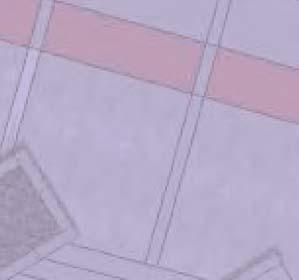
3 3 The Downtown Eastside Plan The Downtown Eastside Plan (2014) is a policy plan that provides a clear but flexible framework to guide positive change, development and public benefits in the Downtown Eastside over the next 30 years. The over-arching goal is to make the Downtown Eastside a more livable, safe and supportive place for all of its diverse residents. Applicable Plan Policies: Retain the predominant retail and commercial character with tourist-oriented goods and services, destination shops, boutiques, restaurants, and offices, and support a vibrant street life by retaining the character of the existing public realm. Rehabilitate Blood Alley Square/Trounce Alley, to improve the public realm, increase safety and introduce programming, with support for community stewardship as a shared space, including opportunities for the low-income community. Retail and commercial shops and restaurants on Carrall Street support street vitality in Gastown, Trounce Alley (looking west) with Blood Alley Square to the left. Support the community in stewardship and programming of the Carrall Street Greenway and Blood Alley Square. Seek to improve walking and cycling connections to commercial areas and to other neighbourhood areas. 7.2 Ensure that all are welcomed in the programming of urban spaces Identify important places and spaces and involve the local community in programming towards supporting the DTES identity. Reinforce and enhance the historic public realm Recognizing the prevailing, and historically distinctive, public realm asset and strengthen through thoughtful improvements, programming and celebration. Wide sidewalks with mature street trees and lighting, and separate bike lane on the Carrall Street Greenway create a comfortable environment that encourages walking and cycling Reinforce and recognize the distinct identity of historic areas through streetscape treatments, design elements, and street furniture Improve signage and enhance the distinct identity of the historic area s laneways as inviting pedestrian spaces. Public realm features, such as the decorative cluster globe street lighting and signage, enhances the distinct character of Gastown and reinforces its identity as a historic area.
 to support community programming, and stewardship for all types of community events.")

4 4 Applicable Plan Policies continued: Improve existing and explore new opportunities for community access and programming in plazas, squares, and gathering spaces Encourage community stewardship and programming of plazas and green spaces Ensure plazas and gathering spaces have infrastructure, (e.g. water, power, lighting, grey water disposal, and storage) to support community programming, and stewardship for all types of community events Identify, preserve and improve places with social and cultural meaning to the community Encourage stewardship of trees, green spaces and green storm water infrastructure, e.g. rain gardens, and bioswales. Plant shade trees where appropriate and species that are hardy to changing climate conditions. An open-air performance of Handel s Messiah by the Vancouver s Bach Choir attracted 400 people from a diverse background to Blood Alley Square, November Pursue opportunities for additional drinking fountains or bottle filling stations when opportunities arise. Social Impact Objectives The Social Impact Objectives guide and manage change and development in the neighbourhood. These objectives seek to: Ensure that developments and businesses fit the DTES neighbourhood context, offer needed, locally-serving uses, and do not significantly exclude or negatively impact the low-income community. Encourage a wide range of housing options in the neighbourhood, with a particular focus on new and improved social and affordable housing for the homeless and other low- and moderate-income singles and families. Ensure diverse development that is respectful of heritage assets, surrounding scale, urban pattern, and social and community context. Improve the overall quality, accessibility and inclusiveness of the public realm in the DTES, recognizing the uniqueness of each sub-area. Retain, preserve and celebrate local heritage, arts and culture for all. Maintain the diversity of existing businesses and commercial uses and support affordable commercial spaces for social enterprises, micro enterprises and small businesses providing lowcost goods and services for residents. Encourage the use of local goods and services in the construction, operation and maintenance of the proposed development or business. Encourage local and inclusive hiring in the construction, operation and maintenance phases of the improvement and the strengthening of social and micro economies. Maintain adequate health and social services within the community, as well as community amenity and gathering spaces to serve the needs of the diverse local population. East Van Roasters, a social enterprise on Carrall Street, provides training and employment to women, while creating bean-to-bar chocolate and coffee roasted and prepared locally.
 A Statement of Significance (SOS) explains what a historic place is and why it is important.")
 The report envisions Blood Alley to be a model project for creating a more sustainable, pedestrian-friendly public realm.")
 Businesses and residents have long advocated for alternative ways to manage commercial")
 (Development Application DE419722) The proposed redevelopment presents new opportunities to make the square even more vibrant and")
5 5 Studies and Projects Informing the Redesign These are the studies already completed that inform the redesign: Blood Alley Square/Trounce Alley Statement of Significance (October 2010, commissioned by City of Vancouver) A Statement of Significance (SOS) explains what a historic place is and why it is important. This report includes recommendations for conservation work needed to maintain the character of Blood Alley Square / Trounce Alley Public Realm Vision Summary Report (February 2015, commissioned by the Gastown BIA) The report envisions Blood Alley to be a model project for creating a more sustainable, pedestrian-friendly public realm. This model could also incorporate innovative approaches to dealing with garbage/recycling. Business Plan for the Dumpster-Free Alley Pilot Project (October 2005, commissioned by the Gastown BIA) Businesses and residents have long advocated for alternative ways to manage commercial waste and recycling in Gastown to active alleyways as pedestrian spaces. This report proposed a plan to eliminate commercial waste containers from the alley. 33 W Cordova Redevelopment (Stanley New Fountain site) (Development Application DE419722) The proposed redevelopment presents new opportunities to make the square even more vibrant and welcoming. For example, it could add new businesses fronting Blood Alley Square to further activate the space. To better manage the use of the square, any activities held by the businesses on City-owned property require permits, e.g. special events permits, patio permits, etc.


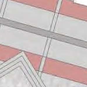
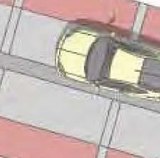
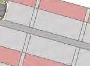
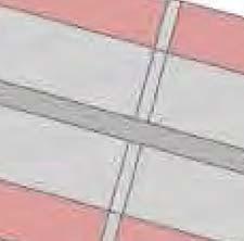
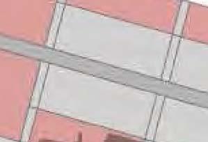
6 6 History of Blood Alley Square and Trounce Alley As Vancouver s first neighbourhood, Gastown is a National Historic Site and has long been recognized for its historic value and rich architectural character. Blood Alley Square and Trounce Alley are an important part of Gastown. Trounce Alley was established in 1870 when the Old Granville Townsite was surveyed, and is one of the oldest original roadways in Vancouver. As the Townsite grew, Trounce Alley became an important access route to the buildings fronting Water and Cordova Streets in the 1920s and 1930s. Blood Alley Square is a significant open space abutting Trounce Alley, and the Stanley/New Fountain Hotels. In 1971, in an effort to create pedestrian spaces in the centre of Gastown, the City of Vancouver purchased the rear 40-foot portion of the Stanley/New Fountain Hotel lots. The existing garages were demolished and construction of the square began in It was named Blood Alley Square the same year. Trounce Alley (looking west) before Blood Alley Square was created Existing Look and Character Blood Alley Square/Trounce Alley construction, Aug/Sep 1973 (T. Sebastian) The brick paving, granite edging, cluster-globe lamps, granite planters, and trees were added in the 1970s as part of the Gastown beautification project. Although these are not original historic materials, they have become a part of Gastown s much-cherished character today. Granite cobble (in herringbone pattern) Red clay brick pavers Nine tall, mature trees planted in 1973 Black metal railings with concrete steps Black metal bollards, granite landscape planters, and black metal rubbish bins Granite block seating, granite cobble pavers, granite block tree/landscape planters Red clay brick paver steps and ramp, granite block tree planters Black metal stair railings, ornamental black wrought iron cluster-globe lamps


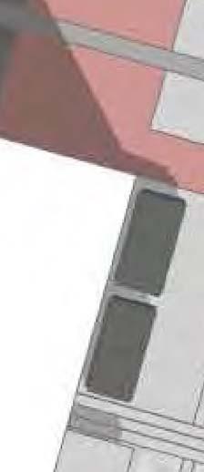
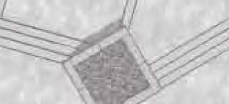
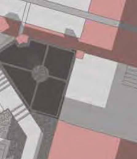
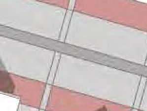
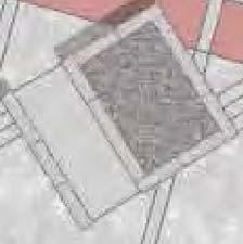
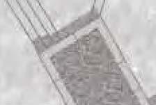
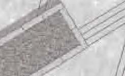
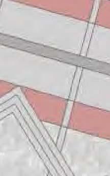
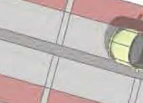
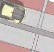
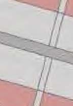
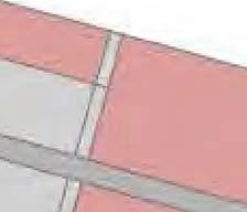
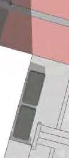
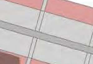
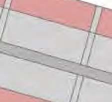
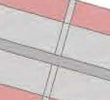
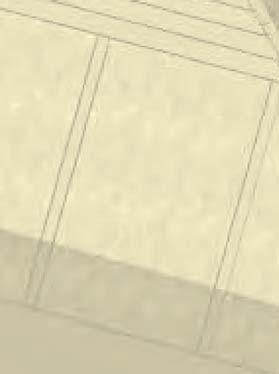
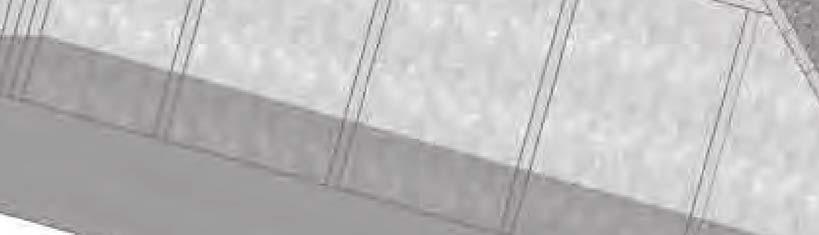
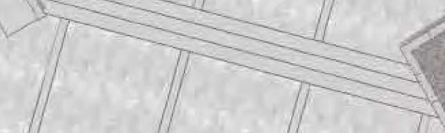
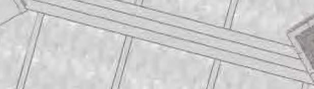
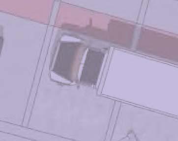
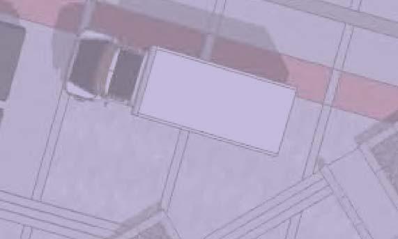
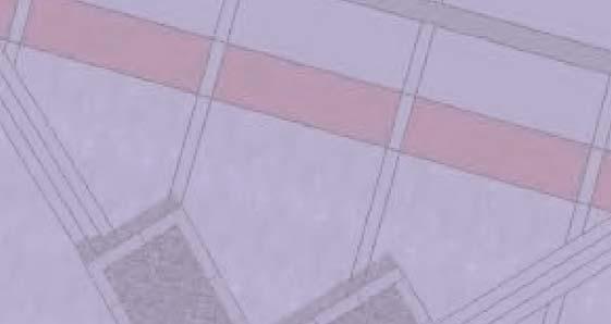
7 7 Existing Conditions Currently Have Do Not Enter Sign at Abbot Street End Granite Paving Running Bond Pattern Parking Garage Entry Granite Channel Red Clay Brick Paving Concrete Paving Granite Paving Running Bond Pattern Red Clay Brick Paving Granite Planter Typical Mews Entry Metal Stair with Concrete Treads Granite Cobble in Herringbone Pattern Granite Band Typical Granite Planter Typical Stanley New Fountain Hotel Red Clay Brick Stair Metal Stair with Concrete Treads EXISTING LANDSCAPE PLAN Some of the original materials used in the square and alley have been altered. Tane surface has become uneven as the alley became busier, and the street lights require repairs. As the area densified, commercial uses increased over time. There are now 16 commercial waste containers in the alley, both the square and alley are used for temporary parking, loading, garbage pick-up and access to utilities. The ground of Cordova Street is almost one floor higher than that of the Blood Alley Square and Trounce Alley. As a result, three staircases are used to connect the ground floor of the Stanley New Fountain Hotel to Blood Alley Square. Commercial waste containers Vehicles parking on red clay steps Commercial loading in Trounce Alley Asphalt repairs over granite and bricks pavers Pooling water, missing granite pavers Uneven, disturbed red clay bricks Dislodged granite block Staircase connecting the ground floor of Stanley New Fountain to Blood Alley Square


8 8 Community Use, Events, and Celebrations Community groups have hosted a number of events in the square. New restaurants that directly front the alley are further establishing Trounce Alley as a popular gathering space. The proposed redevelopment of the Stanley New Fountain site will present new opportunities to make the square even more vibrant and welcoming. Community-organized barbecue Pony rides as part of a community event Chinese Lunar New Year Celebrations Petting zoo as part of a spring festival Weddings photos in Gaolers Mews Over 2000 people attended a children s festival and fashion show The Vancouver s Bach Choir performed Handels Messiah for over 400 people Community gathering and social space Contact the Project Manager and Neighbourhood Planner about the Redesign Tom Warren, Project Manager, Streets and Electrical Design Branch tom.warren@vancouver.ca Helen Ma, Planner, Downtown Eastside Planning Group helen.ma@vancouver.ca For more information: Phone dtes@vancouver.ca Fill out the questionnaire online:


9 9 What s next for the Redesign? Concept A Concept B Waste Management Public Input Concept Refinement Stewardship Strategy Public Input Report To City Council - On Concept Design Initial Design Heritage Assessment Public Input Detailed Design Report to City Council on Final Design & Funding Request Final Design Where are we now? May June July March March Phase 1 Phase 2 Concept Refinement Phase 3 Detail Design Phase 4 Waste Management Report Phase 5 Construction We are here Dependent on funding availability and City Council approval


10 10 OPTION A: DESIGN FEATURES Blood Alley Square: lower portions of the square. Shifts focuss of square to central space that acts as the primary programmable open space. Proposed concrete steps with granite nosing to replace red brick stairs providing a clean, univerally accessable, durable stair treament. Ramped access to lower plaza at east and west ends of square. Ramps constructed of concrete to accommodate universal access. Retains all existing planters with expansion of central planter. Planters proposed to be constructed of concrete and faced with granite or brick and capped with granite reclaimed from square. Retains all existing trees. Concrete bands reference existing granite bands. Concrete acts as grid that frames and stabilizes granite cobble. Granite cobble is reclaimed and installed in herringbone pattern referencing existing conditions. Designs at East and West ends of the square illustrate strategies for opening up the darker corners of the square. All of these strategies are adaptable to both design Options A and B. Brick or Granite Faced Concrete Planter with Granite Cap Typical Granite Speed Bumps VIEW A Concrete Band Typical VIEW B Granite Channel Concrete Driving Surface Red Clay Brick Paving Reclaimed Granite Cobble in Herringbone Pattern Concrete Ramp Granite Speed Bumps Trounce Alley: Reconstruct existing granite channel that disects the alley. Detailed to match granite channels along Carrall Street Greenway. Proposed concrete paving to surround the granite channel. Concrete replaces existing granite paving providing a stable durable material in driving surface. Concrete paved driving surface framed by Gastown red brick paving that references existing conditions. Concrete bands from upper and lower square carried through alley, interupted only by granite channel. Serves to unify square and alley as one distinct space. Concrete bands also act as grid that frames and Reclaimed Granite Cobble in Herringbone Pattern Concrete Band Typical Brick or Granite Faced Concrete Planter with Granite Cap Typical VIEW C Gastown red brick paving at East and West entrances of square inset STANLEY NEW FOUNTAIN HOTEL Granite Nosed Concrete Steps Typical precinct as a shared pedestrian vehicle space. VIEW A: View from Upper Square Looking West VIEW B: View from Upper Square Looking East VIEW C: View from Lower Square Looking East BLOOD ALLEY SQUARE: Rehabilitation Options


11 11 OPTION B: DESIGN FEATURES Blood Alley Square: Granite Speed Bumps Concrete Band Typical the square. Shifts focuss of square primarily to large space at the west end of the square and secondarily to the central space and limits the space in the upper plaza. Proposed concrete steps with granite nosing to replace red brick stairs providing a clean, univerally accessable, durable stair treament. Ramped access to lower square closely associated with larger lower square spaces. Ramps constructed of concrete to accommodate universal access. Retains all existing planters with expansion of central planter. Planters proposed to be constructed of concrete and faced with granite or brick and capped with granite reclaimed from square. Retains all existing trees. Concrete bands reference existing granite bands. Concrete acts as grid that frames and stabilizes granite cobble. Granite cobble is reclaimed and installed in herringbone pattern referencing existing conditions. Designs at East and West ends of the square illustrate strategies for opening up the darker corners of the square. All of these strategies are adaptable to both design Options A and B. Brick or Granite Faced Concrete Planter with Granite Cap Typical VIEW A VIEW B Carrall Greenway Granite Channel Concrete Paving in Driving Surface Red Clay Brick Paving Concrete Ramp Reclaimed Granite Cobble in Herringbone Pattern Granite Speed Bumps Trounce Alley: Reconstruct existing granite channel that disects the alley. Detailed to match granite channels along Carrall Street Greenway. Proposed concrete paving to surround the granite channel. Concrete replaces existing granite paving providing a stable durable material in driving surface. Concrete paved driving surface framed by Gastown red brick paving that references existing conditions. Concrete bands from upper and lower square carried through alley, interupted only by granite channel. Serves to unify square and alley as one distinct space. Concrete bands also act as grid that frames and Gastown red brick paving at East and West entrances of square inset Reclaimed Granite Cobble in Herringbone Pattern Concrete Band Typical Brick or Granite Faced Concrete Planter with Granite Cap Typical STANLEY NEW FOUNTAIN HOTEL VIEW C Granite Nosed Concrete Steps Typical VIEW A: View from Upper Plaza Looking West VIEW B: View from Upper Plaza Looking East VIEW C: View from Lower Plaza Looking East BLOOD ALLEY SQUARE: Rehabilitation Options


12 LEGEND OPTION A OPEN SPACE/CIRCULATION ANALYSIS Vehicular Circulation Pedestrian Circulation Primary Programmable Open Space Additional Progammable Open Space/Parking, Loading Additional Progammable Open Space/Parking, Loading Secondary Programmable Open Space Additional Programmable Open Space Expanded Patio Space Secondary Progammable Open Space Primary Progammable Open Space Secondary Progammable Open Space Exhibition/Staging Area STANLEY NEW FOUNTAIN HOTEL OPTION B OPEN SPACE/CIRCULATION ANALYSIS Expanded patio space for adjacent restaurant Additional progammable open space/parking, loading Additional progammable open space/parking, loading Primary progammable open space BLOOD ALLEY SQUARE: Rehabilitation Options Secondary progammable open space Secondary progammable open space 12
13 LEGEND OPTION A SUSPENDED CABLE MOUNTED LIGHTING 13 Suspended Lighting on Cable Pole Lighting Ground Mounted Planter Lighting Wall Mounted Building Lighting Wall Mounted STANLEY NEW FOUNTAIN HOTEL OPTION A GROUND AND WALL MOUNTED LIGHTING STANLEY NEW FOUNTAIN HOTEL BLOOD ALLEY SQUARE: Rehabilitation Options
14 LEGEND OPTION B SUSPENDED CABLE MOUNTED LIGHTING 14 Suspended Lighting on Cable Pole Lighting Ground Mounted Planter Lighting Wall Mounted Building Lighting Wall Mounted STANLEY NEW FOUNTAIN HOTEL OPTION B GROUND AND WALL MOUNTED LIGHTING STANLEY NEW FOUNTAIN HOTEL BLOOD ALLEY SQUARE: Rehabilitation Options
Blood Alley Square/Trounce Alley Redesign
 June 216 Kick-Off Events Questionnaire and Engagement Summary Background The City of Vancouver is redesigning Blood Alley Square and Trounce Alley, important public spaces in the heart of Gastown, which
Engagement Summary Gastown Streets: Local Business Visioning Workshop
 Engagement Summary Gastown Streets: Local Business Visioning Workshop Gastown s streets are in need of major repair and rehabilitation and we have a once in a lifetime opportunity to holistically plan
Appendix D: Page 1 of 5
 October 12, 2017 Attention: Lisa King, Project Facilitator, City of Vancouver Re: 33 W. Cordova Street DP Application Revised Submission to DE 419722 Lisa, Per your request, please find below our updated
open house 3 CITY OF SALEM Downtown Streetscape Plan
 open house 3 Streetscape concepts CITY OF SALEM Downtown Streetscape Plan analysis concepts we are here refined concepts & document Feb 13th 1 2 3 apr 18th KICKOFF OPEN HOUSE Streetscape Work Group Walking
Lambeth Main Street Streetscape Improvements
 Lambeth Main Street Streetscape Improvements Open House October 5th, 2017 Agenda 1. Introduction 2. Project Background 3. Context 4. Project Objectives 5. Design Principles & Approach 6. Streetscape Design
Main Street Reconstruction From Ninth Line to Stouffer Street. Town of Whitchurch-Stouffville. Public Information Centre
 Main Street Reconstruction From Ninth Line to Stouffer Street Town of Whitchurch-Stouffville Public Information Centre November 23, 2016 4:30 to 6:00 pm & 7:00 to 8:00 pm 6240 Main Street, Stouffville
VEHICULAR AND PEDESTRIAN CIRCULATION
 This perspective sketch communicates the intended character and quality of a proposed streetscape design. Locate benches near a major intersection where people tend to gather. Seating and lighting provide
BUSINESS DISTRICT DESIGN GUIDELINES
 Des Plaines, Illinois Prepared for the City of Des Plaines by: The Lakota Group Laurie Marston, AICP March 2005 Section 5: Streetscape Elements Business District Design Guidelines STREETSCAPE ELEMENTS
Lehigh Acres Land Development Regulations Community Planning Project
 Lehigh Acres Land Development Regulations Planning Effort Summary In July, 2010 Commissioner Frank Mann invited the Lehigh Acres community to start discussing how to achieve their recently adopted community
4- PA - LD - LIVELY DOWNTOWN. LD - Background
 4- PA - LD - LIVELY DOWNTOWN LD - Background The downtown has been the service centre for the community since the city s inception and the area continues to supply people with their personal services,
PROPOSED REDEVELOPMENT OF THE GLEN ABBEY GOLF CLUB. STREETSCAPE DESIGN STUDY (excerpt from the Urban Design Brief) TOWN OF OAKVILLE.
 TOWN OF OAKVILLE.") PROPOSED REDEVELOPMENT OF THE GLEN ABBEY GOLF CLUB STREETSCAPE DESIGN STUDY (excerpt from the Urban Design Brief) TOWN OF OAKVILLE OCTOBER, 2016 for 2.4.2 STREETS Streets are the single largest component
PROPOSED REDEVELOPMENT OF THE GLEN ABBEY GOLF CLUB STREETSCAPE DESIGN STUDY (excerpt from the Urban Design Brief) TOWN OF OAKVILLE OCTOBER, 2016 for 2.4.2 STREETS Streets are the single largest component
Urban Design Manual PLANNING AROUND RAPID TRANSIT STATIONS (PARTS) Introduction. Station Study Areas
 Introduction. Station Study Areas") 111111 PLANNING AROUND RAPID TRANSIT STATIONS (PARTS) Introduction The ION rapid transit system will link Waterloo, Kitchener and Cambridge through a central transit corridor (CTC). There are a number
111111 PLANNING AROUND RAPID TRANSIT STATIONS (PARTS) Introduction The ION rapid transit system will link Waterloo, Kitchener and Cambridge through a central transit corridor (CTC). There are a number
QUESTION 8: What are your Public Realm priorities for implementation? What would you like to see happen first? TELL US WHAT YOU THINK
 Public Realm Plan How will the Public Realm Plan be implemented? The Public Realm Plan document will set out a vision for the next 30 years. Over time, Plan elements and aspects can be implemented as opportunities
The Five Components of the McLoughlin Area Plan
 The Five Components of the McLoughlin Area Plan This documents contains the complete language of the five components of the McLoughlin Area Plan: The Vision Statement The Values The Guiding Principles
Davie Village Public Space Improvements
 Davie Village Public Space Improvements Phase 2: April 2015 Conceptual Design Options Questionnaire Summary Background In April 2015, City of Vancouver staff, with design consultant PFS Studio, hosted
Welcome. Community Consultation Meeting November 28, Review and discuss the Bathurst Quay Neighbourhood Plan Framework
 Welcome Community Consultation Meeting November 28, 2016 Why Are We Here Today? Review and discuss the Bathurst Quay Neighbourhood Plan Framework Review and discuss an Action Plan for Implementation Next
LANEWAYS 2.0. Laneway opportunities in the West End
 LANEWAYS 2.0 Laneway opportunities in the West End Take the self-guided tour then complete the questionnaire online! Head to our website: vancouver.ca/westendplan Take this self-guided tour and explore
Table of Contents. Elm Avenue Improvement Plan City of Waco, Texas. Introduction 1. Existing Context 1 Figure 1 2.
 Table of Contents Introduction 1 Existing Context 1 Figure 1 2 Plan Guidelines 3 Future Urban Form 4 The West-End 4 Main Street 6 The East-End 7 Figure 2 9 Public Improvement Recommendations 7 General
R STREET CORRIDOR NEIGHBORHOOD Site Plan and Design Review Supplemental Guidelines Checklist
 R STREET CORRIDOR NEIGHBORHOOD Site Plan and Design Review Supplemental Guidelines Checklist Applicant s Name: Project Address: Phone: Email: Applicant shall fill out the design guidelines checklist for
Community Design Plan
 Gardena General Plan 2006 Authority While the is not a required element of a General Plan, it is included because improving the community appearance and image is paramount to the overall quality of life
PUBLIC RIGHT-OF-WAY IN THIS CHAPTER PUBLIC REALM
 PUBLIC RIGHT-OF-WAY This section provides design guidelines for improvements in the public right-of-way. The public right-of-way refers to streets, sidewalks, non-vehicular thoroughfares, parks and greenways
Conceptual Design. Main Street Enhancement and Extension Project. Bothell, Washington. June 11, 2009
 Conceptual Design Main Street Enhancement and Extension Project Bothell, Washington June 11, 2009 Berger/ABAM Engineers and Cascade Design Collaborative, Inc For Main Street Bothell to succeed it must
SECTION ONE: INTRODUCTION. introduction
 introduction 1 INTRODUCTION Since it was first established in 1843 as a trading post for the Hudson s Bay Company, Victoria has evolved into a Provincial capital city that is recognized across Canada and
FLORIN ROAD CORRIDOR Site Plan and Design Review Guidelines Checklist
 FLORIN ROAD CORRIDOR Site Plan and Design Review Guidelines Checklist Applicant s Name: Project Address: Phone: Email: Applicant shall fill out the design guidelines checklist for all guidelines applicable
Welcome to the Oakridge Centre Open House
 Welcome to the Oakridge Centre Open House Why is the City hosting this event? This open house is to inform you of a rezoning application submitted to the City of Vancouver to amend the existing CD-1 (Comprehensive
Coliseum Station Area Area Redevelopment Plan. Public Engagement #1 June 12, 2017
 Coliseum Station Area Area Redevelopment Plan Public Engagement #1 June 12, 2017 Welcome Engagement Purpose Introduce the project Share information Gather input Project Updates & Newsletter edmonton.ca/coliseumplan
1 Welcome! UBC Okanagan Master Plan Update - Open House
 1 Welcome! UBC Okanagan Master Plan Update - Open House UBC is updating the Master Plan for the Okanagan Campus. The purpose of today s Open House is to: Present the draft 2015 Master Plan Answer any questions
CAMBIE CORRIDOR PLAN
 1 WELCOME TO THE OPEN HOUSE PUBLIC REALM PLAN - CAMBIE CORRIDOR Thank you for coming to the Cambie Corridor Public Realm Open House! Place a dot where you live Please provide us with your comments and
Unique. Livable. Connected. Sustainable. Anticipate and Manage Change. Variety of Housing Choices. Enhanced Arterial Corridors
 Neighborhood Vision The Old Town Neighborhoods are Unique, Livable, Connected, and Sustainable. As mature, established neighborhoods, many of the ideas and opportunities expressed by stakeholders in support
DOWNTOWN GEORGETOWN PLANNING STUDY
 DOWNTOWN GEORGETOWN PLANNING STUDY Community Workshop #3 Thursday, May 4, 08 The Planning Partnership OVERVIEW OF STUDY, PROCESS & MILESTONES We are here PURPOSE OF THE STUDY To develop a clear vision
King-Spadina Secondary Plan Community Consultation Meeting. Michelle Knieriem, City Planner October 11, 2017
 King-Spadina Secondary Plan Community Consultation Meeting Michelle Knieriem, City Planner October 11, 2017 Agenda 6:30 Welcome 6:35 Presentation 7:15 Question and Answer Session 8:15 Closing Remarks HOW
City of Redlands Architectural Guidelines for Non-Residential Development
 14. Building articulation shall be included in the design of building, in order to create a formal entry statement. Avoid this Do this Page 11 15. Give special attention to creating pedestrian scale and
Small Area Plan. South Gateway
 Small Area Plan Adopted May 12, 2008 South Gateway Purpose. The South Gateway Small Area Plan defines the City s expectations for the future of the southern entrance to the City at Interstate 85 and Highway
SUBCHAPTER 4-B GUIDELINES FOR THE B-3 COMMERCIAL CHARACTER AREA
 1 SUBCHAPTER 4-B GUIDELINES FOR THE B-3 COMMERCIAL CHARACTER AREA Downtown Bozeman should be the location of buildings of greatest height and intensity in the community. The following guidelines apply
Johnson Street Bridge Public Realm Update
 Johnson Street Bridge Public Realm Update August 20, 2015 Background Johnson Street Bridge Replacement Project impacts a diverse range of stakeholders In addition to a new bridge, the project also includes
Figure 3-1: Public Realm Plan
 3 Public Realm Figure 3-1: Public Realm Plan 3.1 Public Realm Concept The public realm concept for the Little Mountain site integrates a clear and accessible movement network with public spaces for social
Community Mixed Use Zone Districts (CMU)
") 18.28.500 Community Mixed Use Zone Districts (CMU) The Community Mixed Use Zone Districts (CMU) are intended to help implement the land use goals and strategies found in the Golden Vision 2030 values,
18.28.500 Community Mixed Use Zone Districts (CMU) The Community Mixed Use Zone Districts (CMU) are intended to help implement the land use goals and strategies found in the Golden Vision 2030 values,
Official Plan Review: Draft Built Form Policies
 PG.30.1 REPORT FOR ACTION Official Plan Review: Draft Built Form Policies Date: May 15, 2018 To: Planning and Growth Management Committee From: Chief Planner and Executive Director, City Planning Division
WINDSOR GLEN DESIGN GUIDELINES
 WINDSOR GLEN DESIGN GUIDELINES Adopted by Council, 2006 WINDSOR GLEN REDEVELOPMENT DESIGN GUIDELINES August 2006 1.0 Master Plan Organization For this area of the Coquitlam Town Centre, a mix of high,
1999 Approval to replace World War I monument and relocate plaques Approval to rehabilitate the Chase Mill building and surrounding site
 Memorandum PLANNING DIVISION DEPARTMENT OF COMMUNITY AND NEIGHBORHOODS To: Historic Landmark Commission From: Katia Pace, Principal Planner Date: October 26, 2016 Re: Liberty Park Improvements The purpose
V. Vision and Guiding Principles
 V. Vision and Guiding Principles The Master Plan for the Powers Ferry Corridor seeks a foundation in the desires of the community. At times, various elements of the community offered opposing viewpoints,
Community Design Guidelines. Port Wallace DRAFT
 Community Design Guidelines Port Wallace DRAFT Energy 1 2 3 Nature Movement Connections Built Form DRAFT Layout Energy 1 Nature Community Design Guidelines GREAT COMMUNITIES PROTECT, CELEBRATE, AND CONSERVE
section five BEAUTIFICATION PLAN
 section five BEAUTIFICATION PLAN BEAUTIFICATION PLAN Section Five Beautification Plan The goal of the Beautification Plan is to improve the Route 8-Sunnyland Corridor in terms of aesthetics and to create
City of Farmington. Downtown Plan. Amendment to the 1998 Master Plan Adopted October 11, 2004
 City of Farmington Amendment to the 1998 Master Plan Adopted October 11, 2004 Introduction Planning Background 1 Scope and Components of the Plan Amendment 2 Concept Introduction 3 Plan Concepts 3 Conceptual
Landscape and Streetscape Design 2.5
 Landscape and Streetscape Design 2.5 2.5.1 Goals 2.5.2 Planting 2.5.3 Sidewalks and Pavement 2.5.4 Furnishings 2.5.5 Walls 2.5.6 Lighting 2.5.7 Stormwater 2.5.8 Street Cross Sections 2.5 LANDSCAPE AND
Pedestrian and Bike Bridge LOGO
 6.2.2 Pedestrian and Bike Bridge The proposed pedestrian and bike crossing re-envisions the existing bridge at Pismo Creek on Cypress Street. The bridge is currently underutilized by vehicular through
Crofton Manor 2803 West 41st Avenue WHAT WE HEARD. Public Consultation: Phase 1
 Crofton Manor 2803 West 41st Avenue WHAT WE HEARD Public Consultation: Phase 1 Background CROFTON MANOR What s Happening The City of Vancouver is undertaking a planning and public engagement process to
Vancouver s public spaces our plazas, squares, streets, laneways, pathways, and waterfront are where public life happens.
 Vancouver s public spaces our plazas, squares, streets, laneways, pathways, and waterfront are where public life happens. These places and spaces are where we interact with the city on a daily basis, as
A Vision Statement. In Progress
 A Vision Statement A Vision Statement A vibrant, multicultural, walkable neighbourhood comprised of distinct areas, each with its own special character. A Vision Statement A vibrant, multicultural, walkable
Building Great Neighbourhoods. Strathcona
 Building Great Neighbourhoods Strathcona March 21, 2018 Becky Redford Project Manager, Planning & Design Building Great Neighbourhoods Integrated Infrastructure Services Welcome and Purpose To provide
Complete Neighbourhood Guidelines Review Tool
 Complete Neighbourhood Guidelines Review Tool Prepared By: City of Regina Planning Department October 2014 Page 1 of 14 Community Development Review Checklist for Secondary Plans and Concept Plans The
New Westminster Downtown Parking Strategy Public Open House #1 September 13, 2012
 New Westminster Downtown Parking Strategy Public Open House #1 September 13, 2012 The City is preparing a strategy for parking in Downtown New Westminster. The study team and a group of key stakeholders
DALY CITY VISIONING PROCESS COMMUNITY WORKSHOP 3 MAY 8, 2008
 DALY CITY VISIONING PROCESS COMMUNITY WORKSHOP 3 MAY 8, 2008 PROCESS General Plan - a statement of the community s values, vision and aspirations for now and into the future... Timeframe LONG TERM - 2030
PUBLIC REALM STUDY AREA
 WELCOME PUBLIC REALM STUDY AREA WHAT IS PUBLIC REALM? Welcome to the Ballina Town Public Realm public consultation event. Mayo Council is in the process of producing a Public Realm Strategy for Ballina
WELCOME. Welcome to this public exhibition about the future of the Aylesham Shopping Centre.
 WELCOME Welcome to this public exhibition about the future of the Aylesham Shopping Centre. This exhibition has been organised by Tiger Developments Ltd and members of the project team are available today
Official Community Plan Bylaw No. 4360, 2004, Amendment Bylaw No. 4897, 2016 (Sewell s Landing)
") District of West Vancouver Official Community Plan Bylaw No. 4360, 2004, Amendment Bylaw No. 4897, 2016 (Sewell s Landing) Effective Date: 1089612v1 District of West Vancouver Official Community Plan Bylaw
District of West Vancouver Official Community Plan Bylaw No. 4360, 2004, Amendment Bylaw No. 4897, 2016 (Sewell s Landing) Effective Date: 1089612v1 District of West Vancouver Official Community Plan Bylaw
GLEN ROAD PEDESTRIAN BRIDGE ENVIRONMENTAL ASSESSMENT STUDY PUBLIC INFORMATION CENTRE #2 OCTOBER 24, 2017
 GLEN ROAD PEDESTRIAN BRIDGE ENVIRONMENTAL ASSESSMENT STUDY PUBLIC INFORMATION CENTRE #2 OCTOBER 24, 2017 Glen Road Pedestrian Bridge Class Environmental Assessment 1 WELCOME! Welcome to the second Public
The following concept plans and illustrations are the result of this 10 month study of the alley connections from CSU to the River District.
 W E L C O M E T O T H E F O R T C O L L I N S D O W N T O W N A L L E Y S A N D I N T E G R AT E D W A L K W AY S M A S T E R P L A N O P E N H O U S E The following concept plans and illustrations are
[PLANNING RATIONALE] For Site Plan Control and Lifting of Holding Zone By-Law 101 Champagne Avenue. May 23, 2014
![[PLANNING RATIONALE] For Site Plan Control and Lifting of Holding Zone By-Law 101 Champagne Avenue. May 23, 2014](/thumbs/75/71599615.jpg "[PLANNING RATIONALE] For Site Plan Control and Lifting of Holding Zone By-Law 101 Champagne Avenue. May 23, 2014") [PLANNING RATIONALE] For Site Plan Control and Lifting of Holding Zone By-Law 101 Champagne Avenue May 23, 2014 Contents 1.0 Introduction... 2 2.0 Site Context... 2 2.1 Adjacent Uses... 2 Figure 1: Site
[PLANNING RATIONALE] For Site Plan Control and Lifting of Holding Zone By-Law 101 Champagne Avenue May 23, 2014 Contents 1.0 Introduction... 2 2.0 Site Context... 2 2.1 Adjacent Uses... 2 Figure 1: Site
MOUNTAIN VIEW ELEMENTARY SCHOOL SITE REDEVELOPMENT OPEN HOUSE. MacPherson Room, 10 am 5 pm
 MOUNTAIN VIEW ELEMENTARY SCHOOL SITE REDEVELOPMENT OPEN HOUSE MacPherson Room, 10 am 5 pm MOUNTAIN VIEW SCHOOL SITE REDEVELOPMENT 1 WELCOME TO THE OPEN HOUSE FOR THE MOUNTAIN VIEW SCHOOL SITE WHY WE ARE
The Lower SaLuda Greenway
 The Lower SaLuda Greenway InITIaTIve a FLourIShInG Greenway. a hub For economic GrowTh. a ConneCTIon BeTween CoMMunITIeS. In April 2017 the Michael J. Mungo Foundation and Lexington County commissioned
In surveys, Dallas residents say what they want to change most
 NEIGHBORHOODS ELEMENT In surveys, Dallas residents say what they want to change most in the city is its appearance they want it to look beautiful, with trees and pedestrian-friendly neighborhoods. The
Little Mountain UDP Presentation
 Summary of UDP Evaluation of Dec 2015 Plan Dec 2015 Site Plan Transitional edges work well Central spine and permeability are strong Tree retention is good Establish Big Idea Sameness of built form contributes
6. DOWNTOWN. The Downtown Element focuses on supporting and expanding the vitality and enhancement of Downtown Chico as the City s central core.
 VISION In 2030, Downtown Chico is the heart of the community and the center of cultural activity. Engaging and active at the street level, it is a multi-story, mixed-use hub, with specialty retail, restaurants,
The open space system should provide connective elements, relate to natural resources, and enhance the suburban character of the landscape..
 The open space system should provide connective elements, relate to natural resources, and enhance the suburban character of the landscape.. Mixed-use and infill development should maintain or enhance
SDOT DPD. SDOT Director s Rule DPD Director s Rule DCLU DR SED DR of 7 CITY OF SEATTLE
 SDOT SDOT Director s Rule 2-07 DPD Applicant: CITY OF SEATTLE Page 1 of 7 Supersedes: DCLU DR 11-93 SED DR 93-4 Seattle Department of Transportation (SDOT) Department of Planning and Development (DPD)
This Review Is Divided Into Two Phases:
 Semiahmoo Town Centre Review The purpose of this review: To review the Semiahmoo Town Centre Concept Plan, originally approved in 1993, to ensure that this centre will continue to serve the needs of South
Town Center (part of the Comprehensive Plan)
") Town Center (part of the Comprehensive Plan) Mercer Island Town Center Looking North (2014) In 1994, a year-long process culminated in a set of design guidelines and code requirements for the Town Center
Town Center (part of the Comprehensive Plan) Mercer Island Town Center Looking North (2014) In 1994, a year-long process culminated in a set of design guidelines and code requirements for the Town Center
Wayfinding. North Gateway: Integrate a vertical gateway marker on the west side of Ward Street at the south corner of Vernon Street.
 3.3.6.2 Wayfinding Existing Conditions Wayfinding signage is important to direct visitors and tourists to different locations in the downtown. A significant part of the wayfinding signage in the downtown
LUNDY S LANE COMMUNITY IMPROVEMENT PLAN STUDY
 PUBLIC INFORMATION MEETING #2 October 12, 2016 LUNDY S LANE COMMUNITY IMPROVEMENT PLAN STUDY AGENDA 5:00 to 5:30pm: Open House 5:30 to 6:15pm: Presentation 6:15 to 7:00pm: Individual paced workshop with
Westwind Developments Ltd. PIONEER LANDS AREA STRUCTURE PLAN - PROPOSED AMENDMENT
 FEBRUARY 2013 TABLE OF CONTENTS 1.0 BACKGROUND... 1 1.1 Amendment... 1 2.0 LOCATION & CONTEXT... 2 2.1 Land Ownership... 2 3.0 POLICY CONTEXT... 3 3.1 Municipal Development Plan... 3 3.2 Capital Region
Figure Example of out door dining in the public right-of-way.
 Section 2 Core Area Goal 2.2.1 To maintain and enhance the character of existing streets in the Downtown Area. Character Figure 2.2.1 Example of out door dining in the public right-of-way. A. Provide street
UNION STUDIO Greater Kennedy Plaza!
 April May 2013 UNION STUDIO Greater Kennedy Plaza! It s time: Providence s civic plaza and transit hub is re-imagined as a vibrant urban gathering place 1 Kennedy Plaza Reborn THE TEAM Client: The City
East Central Area Plan
 East Central Area Plan Steering Committee Meeting March 8 th, 2018 CHUN Tears McFarlane House Vision Statement Development Opportunities Analysis Vision Elements 1. Equitable, Affordable and Inclusive
BUILDING SCALE AND SETBACKS 5 ELEMENTS:... 5 FAÇADES (COMMERCIAL/RESIDENTIAL) 5
 5") VISION STATEMENT 3 UTILIZATION OF THE GUIDELINES 3 IMPLEMENTATION 3 PROCEDURES FOR DESIGN REVIEW 3 LAND USE AND ZONING 4 LAND USE 4 ELEMENTS:... 4 ZONING 4 ELEMENTS:... 4 BUILDING SCALE AND SETBACKS 5
VISION STATEMENT 3 UTILIZATION OF THE GUIDELINES 3 IMPLEMENTATION 3 PROCEDURES FOR DESIGN REVIEW 3 LAND USE AND ZONING 4 LAND USE 4 ELEMENTS:... 4 ZONING 4 ELEMENTS:... 4 BUILDING SCALE AND SETBACKS 5
Mid-Rise Buildings on Toronto s Avenues Responding to the Public Realm Andrea Oppedisano, City of Toronto
 Mid-Rise Buildings on Toronto s Avenues Responding to the Public Realm Andrea, City of Toronto Introduction The Avenues and Mid-Rise Buildings Study explores opportunities to encourage a built form that
Division VI Community Mixed Use (CMU) Architectural Guidelines and Standards
 Architectural Guidelines and Standards") Division VI 18.40.800 Community Mixed Use (CMU) Architectural Guidelines and Standards 18.40.810 Guidelines The goals of the Comprehensive Plan include a focus on pedestrian safety, amenities and aesthetics
Division VI 18.40.800 Community Mixed Use (CMU) Architectural Guidelines and Standards 18.40.810 Guidelines The goals of the Comprehensive Plan include a focus on pedestrian safety, amenities and aesthetics
Sheridan Boulevard S TAT I O N A R E A P L A N S H E R I D A N B O U L E VA R D S TAT I O N A R E A P L A N
 Sheridan Boulevard S TAT I O N A R E A P L A N 1 City of Lakewood Adopted November, 2006 S H E R I D A N B O U L E VA R D S TAT I O N A R E A P L A N The Vision The City of Lakewood s overall vision is
(DC1) Direct Development Control Provision DC1 Area 4
 Direct Development Control Provision DC1 Area 4") . General Purpose (DC) Direct Development Control Provision DC Area 4 The purpose of this Provision is to provide for an area of commercial office employment and residential development in support of the
. General Purpose (DC) Direct Development Control Provision DC Area 4 The purpose of this Provision is to provide for an area of commercial office employment and residential development in support of the
appendix and street interface guidelines
 appendix five: building and street interface guidelines appendix 5 building and street interface guidelines BOULEVARDS Boulevards are generally characterized by higher levels of traffic movement at higher
Ivywild On The Creek PRELIMINARY CREEK DISTRICT MASTER PLAN
 Ivywild On The Creek PRELIMINARY CREEK DISTRICT MASTER PLAN Introduction: Rejuvenating an extraordinary Creekside neighborhood THE CREEKSIDE DISTRICT The Ivywild On The Creek Neighborhood District Master
Shared Principles and Emerging Plan Directions
 Shared Principles and Emerging Plan Directions Introduction Since the Fairfield Neighbourhood planning process launched in June 2016, we have heard from many residents, businesses, groups and other people
Animating the Rideau Canal December 2013
 Executive Summary Animating the Rideau Canal December 2013 Why study the Rideau Canal? The Rideau Canal has been an important part of Ottawa throughout its history, and has shaped and been shaped by the
PLANNING ADVISORY BOARD AGENDA OCTOBER
 ! City of Langley PLANNING ADVISORY BOARD AGENDA OCTOBER 1, 2014 3-5pm LANGLEY CITY HALL - 112 2 nd Street, Langley WA 1) Call to Order and Roll Call 2) Approval of the Minutes September 10, 2014 3) Public
CHAPTER 5: GUIDING PRINCIPLES
 CHAPTER 5: GUIDING PRINCIPLES The following 10 principles were developed based on public consultation, planning policy and the background analysis conducted during Phase 1. The Guiding Principles significantly
General Manager of Planning, Urban Design and Sustainability
 ADMINISTRATIVE REPORT Report Date: March 20, 2017 Contact: Karen Hoese Contact No.: 604.873.7665 RTS No.: 11971 VanRIMS No.: 08-2000-20 Meeting Date: March 29, 2017 TO: FROM: SUBJECT: Standing Committee
Jewel. Platte. of the. Plattsmouth Main Street Landscape Architecture by HDR
 Jewel of the Platte Plattsmouth Main Street Landscape Architecture by HDR Plattsmouth, Nebraska is a historic community of 6,500 residents located along the west bank of the Missouri River, just south
Contact: Alex Taranu ( ) or Karl Walsh ( )
 or Karl Walsh ( )") Date: 09 September 2005 File: Subject: P03.DUDS Downtown Urban Design Vision Study Report Contact: Alex Taranu (905 874 3454) or Karl Walsh (905 874 2331) OVERVIEW Staff has produced an Urban Design Vision
Date: 09 September 2005 File: Subject: P03.DUDS Downtown Urban Design Vision Study Report Contact: Alex Taranu (905 874 3454) or Karl Walsh (905 874 2331) OVERVIEW Staff has produced an Urban Design Vision
W O R K S H O P S U M M A R Y
 W O R K S H O P S U M M A R Y Community Workshop #2: Preliminary Design Strategies October 27, 2007 Upper Market Community Workshop Series and Design Plan Page 1 of 13 INTRODUCTION The Upper Market Community
WHAT WE HEARD REPORT - Summary Bonnie Doon Mall Redevelopment Application (LDA )
") WHAT WE HEARD REPORT - Summary Bonnie Doon Mall Redevelopment Application (LDA18-0184) PROJECT ADDRESS: 1 Bonnie Doon Shopping Centre NW, 8420 85 Street NW & 8715 85 Street NW PROJECT DESCRIPTION: Rezoning
WHAT WE HEARD REPORT - Summary Bonnie Doon Mall Redevelopment Application (LDA18-0184) PROJECT ADDRESS: 1 Bonnie Doon Shopping Centre NW, 8420 85 Street NW & 8715 85 Street NW PROJECT DESCRIPTION: Rezoning
FRUITVALE TRANSIT VILLAGE (Phase 2) Residential Project
 Residential Project") FRUITVALE TRANSIT VILLAGE (Phase 2) Residential Project DEVELOPER: SIGNATURE PROPERTIES ARCHITECT: HKIT ARCHITECTS April 23, 2010 TABLE OF CONTENTS 3 Vision 4 Description of Site 5 Guiding Concepts 6
FRUITVALE TRANSIT VILLAGE (Phase 2) Residential Project DEVELOPER: SIGNATURE PROPERTIES ARCHITECT: HKIT ARCHITECTS April 23, 2010 TABLE OF CONTENTS 3 Vision 4 Description of Site 5 Guiding Concepts 6
CARRALL STREET GREENWAY Public Realm Improvements & Community Development. Linda Chow, P.Eng. Brigid Kudzius, P.Eng. Douglas Scott, CSLA
 CARRALL STREET GREENWAY Public Realm Improvements & Community Development Linda Chow, P.Eng. Brigid Kudzius, P.Eng. Douglas Scott, CSLA Transportation Division, City of Vancouver Paper prepared for presentation
What We Heard Report: Westmount Architectural Heritage Area Rezoning Drop-in Workshop
 What We Heard Report: Westmount Architectural Heritage Area Rezoning Drop-in Workshop August 2018 What We Heard Report: Westmount Architectural Heritage Area Rezoning Drop-in Workshop Executive Summary
Bloor Street East Potential Ravine Portal Overlook and Access Passage to the Rosedale Valley and Don River Valley Ravine, Toronto, Canada
 TRANSFORMATIVE IDEA 2. GREAT STREETS Bloor Street Christie Pits Park Bloor St Spadina Ave Bathurst St Shaw St 1 Recognize the significant public realm improvements along Bloor Street and extend and enhance
BROADWAY EAST. Revitalization Strategy. 2.1 Introduction
 2 BROADWAY EAST Revitalization Strategy 2.1 Introduction The Mount Pleasant Community Plan identified a need to revitalize the Broadway East shopping area. This is the area along Broadway from Prince Edward
V. Gateways GATEWAYS / V-1
 V. GATEWAYS / V-1 Many of Chesapeake s gateways are located on highways and call for bold and attractive designs that motorists can understand, appreciate, and enjoy. can also take the form of natural
The University District envisions, in its neighborhood
 Envisioning the University District Link Light Rail in Seattle s neighborhoods CIY OF SEALE CONCEP-LEVEL SAION AREA PLANNING RECOMMENDAION RESOLUION # 30165 EXHIBI L Vision 08.2000 he University District
Maplewood Avenue Downtown Complete Street Project
 Maplewood Avenue Downtown Complete Street Project Second Public Meeting January 24, 2018 Welcome and Introduction of Project Team City Planning and Public Works Staff City of Portsmouth Juliet Walker Planning
Queensborough Eastern Neighbourhood Node. Community Open House
 Queensborough Eastern Community Open House The Vision The Queensborough Eastern will become the heart of eastern Queensborough. Through a sensitive mix of viable commercial and residential areas, the neighbourhood
Town of Cobourg Heritage Master Plan. Statutory Public Meeting
 Town of Cobourg Heritage Master Plan Statutory Public Meeting April 25 th 2016 Presentation Overview 1. Introduction 2. Project background and schedule overview 3. Review of strategic direction content