West Seventh Street Corridor Plan. SIOUX CITY, IOWA June 2014
|
|
|
- Merryl Kelly
- 6 years ago
- Views:
Transcription


1 West Seventh Street Corridor Plan SIOUX CITY, IOWA June 2014

2 ACKNOWLEDGMENTS PREPARED FOR: The City of Sioux City PREPARED BY: 900 Farnam on the Mall Suite 100 Omaha, Ne Whispering Creek Dr Sioux City, Ia
3 TABLE OF CONTENTS Overview...4 History...6 Design Principles and Working Goals...8 Process...10 Overall Streetscape Plan...12 West 7 th Typical Cross Section...14 West 7 th Streetscape Design Concepts...16 Streetscape Amenities...32 Green Infrastructure...36 Landscape Plantings...38 Story In Art...40 Facade Rehabilitation Concepts...44 Bridge Enhancements...48 Future Event Spaces Cost Opinion


4 Deteriorating Sidewalks Existing Fencing Existing Barbed Wire Fencing Ponding Water Along West 7 th Street 4

5 OVERVIEW Since its original platting in the 1860 s, West 7 th Street has been a primary entry into downtown Sioux City. Over its long history, West 7 th Street has been the home to retail, manufacturing, foundries, and has been known as an auto row and immigrant-friendly area with a history of restaurants, shops, and service establishments owned and operated by minorities. The mix of businesses found today along West 7 th Street is reflective of this broad diversity and lends itself to a mix of uses along the Corridor. Due to aging infrastructure and existing potential for improvement, the City of Sioux City is investing in the West 7 th Street Corridor. The City has begun this investment with the recently completed Wesley Parkway reconstruction, an ambitious building façade program for businesses along West 7 th Street, and the commitment to reconstruct a major stretch of the West 7 th Street Corridor and the underlying 100+ year old utilities. This master plan is intended to provide guidance for the design of a new West 7 th Street Corridor that stretches from Wesley Parkway to Hamilton Boulevard. The plan was crafted through a robust public process, including both an advisory group and stakeholder group. Existing West 7 th Street looking towards the Bluff Street intersection 5


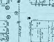
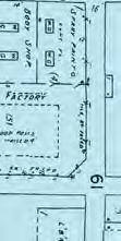


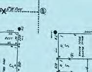
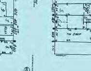
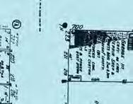
6 Sanborn Map West 7 th Street during the 1908 Perry Creek Flood West 7 th Street in the 1940 s 6


7 HISTORY West 7 th Street was platted in the 1860 s and became the manufacturing center for early Sioux City, which transitioned in the 1920 s into an auto row. As an immigrant-friendly area, West 7 th Street has a long history of restaurants, shops, and service establishments owned and operated by minorities. West 7 th Street building facades (1908) West 7 th Street building facade and advertising painted on brick walls 7


8 Tiger brick formerly manufactured in Sioux City Brick Crenellations Painted Advertisements Existing Building Facades and Architectural Character 8
9 DESIGN PRINCIPLES AND WORKING GOALS The West 7 th Street Corridor Plan addresses the following goals in the design; the pedestrian environment must be improved, the streetscape must express an evocative and relevant narrative, there must be adequate transportation and parking, businesses will be accommodated during the duration of construction, and the design will improve and strengthen the architecture within the Corridor. In order to create a pedestrian friendly environment, the traffic lanes will be reduced from four to three, allowing for wider sidewalks and lane widths that meet today s design standards. The streetscape will include green spaces and gathering areas throughout the Corridor. The design will tell the story of West 7 th Street s unique history. By referencing existing site materials and incorporating unique artwork at the entries to the Corridor and along the street, the area will have an unique identity within Sioux City. The redesigned streets will include convenient areas for parking, allow needed access for loading and unloading, and accommodate all forms of transportation. During construction, it is essential to minimize disruption to businesses operating on West 7 th Street. To do this, the design will employ good phasing strategies and ensure that the proceedings are communicated well and often with businesses. The efforts in improving the West 7 th Street Corridor will ensure the longevity of the streetscape. The elements used will be durable and low maintenance. The planting selections will be realistic, healthy species that are environmentally suitable and durable in the urban environment. A set of directions or policies will be established for how the streetscape elements should be maintained. Working with the existing facades, the architecture will reinforce the building edge through vacant lots, strengthen the building stock along the Corridor, and creatively screen industrial businesses. 9


10 This preliminary street section was explored, but due to public comment, bike lanes were removed. In the new street configuration, bike lanes could be added if need arises in the future. Concept Sketch for Festival Space Concept Sketch looking east from West 7 th and Omaha Street intersection 10


11 PROCESS Preliminary Streetscape Concepts Concept Sketch - Exploration Concept Sketch - Gateway Element Meetings with business owners and the advisory committee The City and design team conducted a robust public participation process. Meetings included a kickoff meeting with stakeholders and business owners along West 7 th Street, door to door visits with business owners, a Visual Listening meeting, a three-day design charrette, and a public presentation of the proposed design concept for West 7 th Street. At the visual listening meeting, streetscape and urban design images were shown to the group. The group was given cards to gauge the likability of the image to determine if elements from the image should be included in the West 7 th Street project. 11

12 DIAMOND VOGEL LESSMAN S LIGHTING CENTER ARCHIE S DINER DIAMOND THAI CUISINE 7 TH STREET AUTO WEST 7 TH STREET HAMILTON BLVD OMAHA ST COOK ST 3E MAIN ST DA KAO BERNIE S LAWN AND GARDEN CENTER 12

13 WEST 7 TH STREET CORRIDOR STREETSCAPE PLAN The long history and wide mix of business over time has resulted in a vibrant and eclectic character to this street. The plan and design draws upon this randomness in its patterns and unifies the Corridor with a common design language. Colorful, durable, and contemporary materials are repeated down the street, creating a unified Corridor that respects its history and encourages reinvestment. HONG KONG MARKET CARQUEST AUTO PARTS KOLLMAN APPLIANCE TRAN COLLISION J & L WEST 7 TH STREET SIOUX ST MARKET ST BLUFF ST WESLEY PKWY PRESTIGE COLLISION CENTERS UNITED RENT ALL JUNIOR LEAGUE SIOUXLAND LOCK & KEY AMERICAN HOME HEALTH CARE N 13
14 PAGE TITLE This reconstruction project will replace the pavements, utilities, and pedestrian infrastructure in the existing right of way along West 7 th Street. In order to meet current design standards, the street has been reduced to a three lane section. On street parallel parking is maintained and protected with pedestrian nodes. The pedestrian zone is modestly widened, and the entire corridor is improved with lighting, art, public gathering spaces, site furniture, and plantings. 14


15 WEST 7 TH STREET TYPICAL CROSS-SECTION 15


16 PAGE TITLE HAMILTON BLVD DIAMOND VOGEL COLOR CONCRETE CROSSWALKS WEST 7 TH STREET BENCHES PAVERS PROPOSED LANDSCAPING GATEWAY LIGHTING ELEMENTS GATEWAY ELEMENTS 16

17 HAMILTON BOULEVARD TO OMAHA STREET - DESIGN CONCEPTS WEST 7 TH STREET REGULAR CONCRETE SIDEWALKS COLOR CONCRETE SIDEWALKS LESSMAN S LIGHTING CENTER OMAHA STREET STREET TREES The overall design of the West 7 th Street Corridor follows the working goals established by the advisory group and business/property owners. Starting with Hamilton Boulevard to Bluff Street, the design establishes a gateway at the intersection of Hamilton Boulevard and West 7 th Street through the addition of gateway elements and the narrowing of the street to create landscape areas that reinforce the sense of arrival into the Corridor. The gateway elements help to create an identity for the area and tell the story of West 7 th Street. The narrowed street allows for shorter distances for users to cross, thus creating a safer pedestrian environment. New concrete and color concrete sidewalks create a wider pedestrian space. The random color concrete pattern reflects the ever-changing street environment along West 7 th Street. Mid block planters serve to calm traffic and act as areas for green infrastructure, as well as provide important root space for necessary tree growth. DA KAO N 17

18 PAGE TITLE OMAHA STREET ARCHIE S DINER SOUP KITCHEN UNITED COMMERCIAL COLOR CROSSWALKS PAVERS WEST 7 TH STREET 25-0 PARKING STALLS REGULAR CONCRETE SIDEWALKS BOB S WATERING HOLE MORNINGSIDE PLUMBING 18


19 OMAHA STREET TO COOK STREET PROPOSED PRIVATE LANDSCAPING 7 TH STREET AUTO PROPOSED PRIVATE 3 FENCE COOK STREET WEST 7 TH STREET GATEWAY LIGHTING ELEMENT COLOR CONCRETE SIDEWALKS BUS STOP OPEN SPACE / COMMUNITY GARDEN BENCHES STREET TREES West 7 th Street, from Omaha to Cook Street, includes many of the same elements as the previous block: new concrete sidewalks, planting areas, street trees, screening of parking areas, new lighting, benches, trash receptacles, and color concrete crosswalks. This block also includes a space for a proposed community garden. The garden would take over the now vacant lot at the southwest corner of Cook Street and West 7 th Street. The garden could be used by the nearby church, soup kitchen, restaurants, and neighborhood residents; serving as a gathering space for community events. N 19

20 PAGE TITLE COOK STREET STEFFAN EQUIPMENT PROPOSED PRIVATE 6 FENCE PROPOSED PRIVATE 6 FENCE PROPOSED PRIVATE LANDSCAPING COLOR CROSSWALKS PAVERS BUS STOP WEST 7 TH STREET REGULAR CONCRETE SIDEWALKS BERNIE S LAWN AND GARDEN CENTER 20

21 COOK STREET TO MAIN STREET PROPOSED PRIVATE LANDSCAPING FESTIVAL SPACE PROPOSED PRIVATE 6 FENCE MAIN STREET COLOR CONCRETE SIDEWALKS WEST 7 TH STREET 3E BENCHES STREET TREES West 7 th Street, from Cook to Main Street, also includes similar elements as the previous blocks. As a private project, new fencing would replace the barbed wire chain link fencing along the Steffen Equipment property. Landscape elements would also be used for screening in this area. A new festival space is proposed in the vacant lot located at the northwest corner of West 7 th and Main Street. The space is designed to be a flexible space that could be used for various events. Grass pave would be used in the space to allow for food truck vendor parking. When not used by food trucks, the area would be green space. N 21

22 PAGE TITLE MAIN STREET PROPOSED PRIVATE LANDSCAPING PROPOSED PRIVATE 3 FENCE DIAMOND THAI CUISINE COLOR CROSSWALKS WEST 7 TH STREET PAVERS REGULAR CONCRETE SIDEWALKS 3E STORAGE LOT 22

23 MAIN STREET TO SIOUX STREET HONG KONG MARKET SIOUX STREET COLOR CONCRETE SIDEWALKS WEST 7 TH STREET BUS STOP BENCHES As in previous blocks, West 7 th Street, from Main to Sioux Street, includes new concrete sidewalks, planting areas, street trees, screening of parking areas, new lighting, benches, trash receptacles, and color concrete crosswalks. Planters and outdoor seating could be placed in the sidewalk area next to Hong Kong Market as another way to activate and beautify the street. PRESTIGE COLLISION CENTERS STREET TREES N 23

24 PAGE TITLE SIOUX STREET CARQUEST AUTO PARTS KOLLMAN APPLIANCE COLOR CROSSWALKS PAVERS BUS STOP WEST 7 TH STREET REGULAR CONCRETE SIDEWALKS VINA HAIR BY YEN UNITED RENT ALL 24

25 SIOUX STREET TO MARKET STREET KOLLMAN APPLIANCE RED BONES CAFE MARKET STREET COLOR CONCRETE SIDEWALKS WEST 7 TH STREET BENCHES As in previous blocks, West 7 th Street, from Sioux to Market Street, includes new concrete sidewalks, planting areas, street trees, screening of parking areas, new lighting, benches, trash receptacles, and color concrete crosswalks. Planters and outdoor seating could be placed in the sidewalk area next to Red Bones Cafe or any other new restaurants that choose to locate along West 7 th Street. PROPOSED PRIVATE LANDSCAPING PROPOSED PRIVATE 3 FENCE STREET TREES N 25

26 PAGE TITLE MARKET STREET AMERIPRISE FINANCIAL TRAN COLLISION COLOR CROSSWALKS PAVERS WEST 7 TH STREET REGULAR CONCRETE SIDEWALKS FOULK BROS. PLUMBING & HEATING JUNIOR LEAGUE PROPOSED PRIVATE LANDSCAPING 26

27 MARKET STREET TO BLUFF STREET FASHION FLOORS BLUFF STREET J&L COLOR CONCRETE SIDEWALKS WEST 7 TH STREET BUS STOP BENCHES As in previous blocks, West 7 th Street, from Market to Bluff Street, includes new concrete sidewalks, planting areas, street trees, screening of parking areas, new lighting, benches, trash receptacles, and color concrete crosswalks. Perpendicular parking along Bluff Street will be implemented, and should need arise, there is a possibility for implementation of perpendicular parking that would coincide with future public improvement projects. DENNIS SUPPLY STREET TREES N 27

28 PAGE TITLE BLUFF STREET J & L BIKE RACKS PROPOSED PRIVATE LANDSCAPING GATEWAY LIGHTING ELEMENT COLOR CROSSWALKS PAVERS BUS STOP WEST 7 TH STREET COLOR CONCRETE SIDEWALKS REGULAR CONCRETE SIDEWALKS JORDAN AIR INDEPENDENT RADIATOR WORKS SIOUXLAND LOCK & KEY AMERICAN HOME HEALTH CARE 28

29 BLUFF STREET TO WESLEY PARKWAY GATEWAY ELEMENT WESLEY PKWY WEST 7 TH STREET PROPOSED PRIVATE FENCING The intersection of Wesley Parkway and West 7 th Street serves as the primary gateway when traveling from downtown to the Corridor. Gateway elements will welcome patrons into the West 7 th Street Corridor. New landscaping will also enhance the entry into the Corridor. STREET TREES N 29

30 PAGE VIEW LOOKIGN TITLE WEST OF WEST 7 TH STREET AT HONG KONG MARKET Plantings, protected parking, and sidewalk amenities will create a stronger business environment. 30

31 WEST 7 TH STREET & WESLEY PARKWAY GATEWAY A strong gateway to the Corridor will project an improved image for the street as it invites people to use these businesses. 31


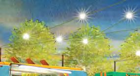
32 PAGE STREETSCAPE TITLE AMENITIES - SIGNAGE AND LIGHTING Preliminary Proposed Street Lighting - LED Street Signs and Wayfinding West 7 th Street Historic Lighting (c ) Gateway Element Lighting Features at Hamilton Blvd. and Wesley Pkwy. 32


33 STREETSCAPE AMENITIES - SITE FURNISHINGS Site furnishings selected for the project reflect the working man s street and modern aesthetic that was promoted by the advisory committee during the design process. Benches should be selected to deter people from sleeping on them. New lighting along the street will be LED lighting and also reflects the past and the future of the street. Bench Bench Trash Receptacle Cable Bike Rack Wrap Planters 33


34 PAGE TITLE New bus shelters are proposed at yet to be determined existing bus stops along West 7 th Street. The bus shelters should reflect the proposed aesthetic, be well lit and be designed to deter overnight use. Existing fencing should be replaced with new fencing that also reflects the proposed aesthetic. The design team incorporated elements from the tiger brick pattern found in existing buildings along the street into a traditional fence assembly such as omega fence. The fencing will serve as a functional barrier as well as a visual cue of the existing building fabric along the street. Bus Shelter with Swings Bus Shelter Inspiration 34


35 STREETSCAPE AMENITIES - FENCING AND BUS SHELTER A custom band will be installed along the upper portion of a common fence to reinforce the patterns Tiger Brick Inspiration Fencing alongside Gateway Element 35


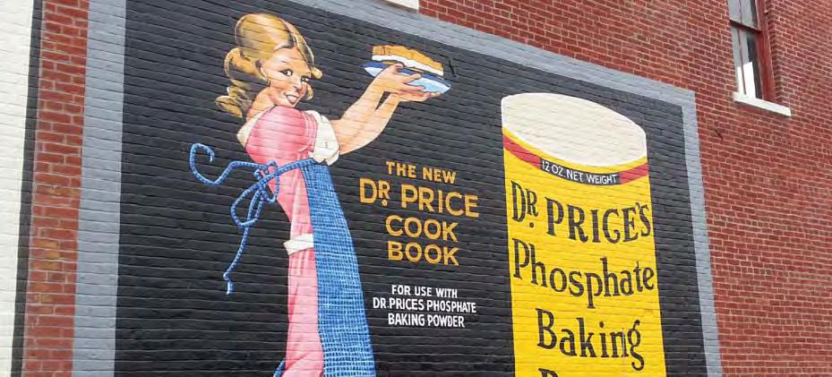
36 STREETSCAPE PAGE TITLE AMENITIES - PAVERS AND COLOR CONCRETE Pavements used in the sidewalk and crosswalk areas will consist of a variety of regular concrete, color concrete and pavers to help provide a sense of scale for the pedestrian using the street. Colors for the various pavements will reflect the hues of the existing building facades and street. Opportunities for green infrastructure will happen in conjunction with traditional street drainage design to mitigate areas of ponding that occur along the street. Stormwater planters help to clean pollutants from the street before entering the groundwater and reduces the quantity of stormwater entering the drainage system. Paving Patterns within pedestrian way Color Concrete Sidewalks Color Concrete Crosswalks Intersection Edge Pavement Pattern 36

37 GREEN INFRASTRUCTURE Rainwater planters similar to these would clean storm water before it is released into nearby Perry Creek. 37


38 PAGE TITLE Bald Cypress Honeylocust Kentucky Coffee Tree 38


39 LANDSCAPE PLANTINGS Trees, shrubs, and perennials are selected for their size and shape, as well as their ability to thrive in a tough urban environment. Native plants are preferred, since they have genetically evolved to survive in this part of Iowa. These plants are just a sampling of those that will be used in the streetscape final design. PLANT LIST OVERSTORY TREES Bald Cypress Honeylocust Kentucky Coffeetree SHRUBS AND PERENNIALS Gro Low Sumac Dwarf Fountaingrass Daylily Catmint Blue Salvia Paprika Yarrow Daylilies Catmint Dwarf Fountain Grass Gro Lo Sumac Blue Salvia, Yarrow 39


40 PAGE TITLE 40


41 STORY IN ART West 7 th Street has a rich history of different cultures, businesses, and architecture. In order to tell the story of West 7 th Street in art, the history of the street was used as inspiration. The gateway elements that occur at Hamilton Boulevard and Wesley Parkway reflect the strong architectural fabric that once occurred along West 7 th Street. The stories heard about illegal card games and the nightlife that happened upstairs during one era of West 7 th Street is reflected in the lighted upper story windows. The windows also reflect the store shop windows that occurred along the Corridor when it was known as auto row. Words and decorative motifs reflect the various cultures and businesses that have inhabited the area. Brick is used to express the unique pattern that once was fabricated in Sioux City and can be seen presently along West 7 th Street. Custom pedestrian lighting continue the elements found in the gateway features and carry this theme down West 7 th Street. 41


42 PAGE TITLE 42


43 STORY IN ART Several historic building advertisements exist along West 7 th Street. These ghosts provided the inspiration to suggest that this idea be renewed within the Corridor. These new building advertisements with their vibrant color and business relevance will add unique character to the area. 43


44 PAGE TITLE Existing building facade Kollman Appliance and Sleep Source facade rehabilitation rendering 44


45 FACADE REHABILITATION CONCEPTS Dennis Supply Building - Existing Facade Historic Photo of the Dennis Supply Building The City of Sioux City has started a facade improvement program in concurrence with the West 7 th Street reconstruction project. Renderings were prepared by the project team to spur ideas of what existing facades along West 7 th Street could look like. The renderings are based on historical photos of the buildings. Important components include the restoration of windows along the street, the replacement of windows in the second story openings, modified awnings that are historically sensitive, and signage improvements all in a pattern that is consistent with the historical buildings. Proposed Dennis Supply Building facade rehabilitation rendering with murals 45


46 PAGE TITLE Proposed Fashion Floors facade rehabilitation rendering 46


47 FACADE REHABILITATION CONCEPTS Saigon Video and Hair by Yen - Existing facade The removal of artificial facades, the restoration of store fronts, and brick repair are important tools to improving the buildings along the street. Proposed Saigon Video and Hair by Yen facade rehabilitation rendering 47

48 FUTURE PAGE TITLE ENHANCEMENTS WEST OF WESLEY PARKWAY AND WEST 7 TH STREET WESLEY PKWY STREET TREES EXISTING BIKE PATH COLOR CONCRETE SIDEWALKS WEST 7 TH STREET COLOR CROSSWALKS REGULAR CONCRETE SIDEWALKS PAVERS BRIDGE ENHANCEMENTS PERRY CREEK N 48

49 FUTURE BRIDGE ENHANCEMENTS This plan recommends that the 7 th Street improvements are continued across Wesley Parkway and through the Perry Creek bridge as a future project. Prior to the Perry Creek project, West 7 th Street was physically connected by buildings and sidewalks to the downtown area. The bridge enhancements proposed help to create the connection once again from downtown to the West 7th Street Corridor. New railings and lighting along the bridge will be used to reinforce this connection and draw users into the area. 49

50 PAGE TITLE WEST 7 TH STREET The southwest corner of Cook Street and West 7 th Street is proposed to be redeveloped as a community garden in the future. In addition to providing an important source of food for the adjacent neighborhood, this garden will provide a place for strong social and community relationships to develop and thrive. COOK STREET RAINWATER HARVESTING COMMUNITY GARDEN PLANTERS PROPOSED LANDSCAPING TOOLSHED N 50

51 FUTURE COMMUNITY GARDEN SPACE AT COOK AND WEST 7TH STREETS 51

52 PAGE TITLE FOOD TRUCK PARKING FESTIVAL SPACE TABLES The small vacant lot at the northwest corner of Main Street and West 7 th Street is envisioned as a public festival space as a future project. This relatively inexpensive urban plaza will offer a destination within the Corridor. This plaza can be used for small performances and entertainment, food truck parking, and as a headquarters for area events. As a day to day use, tables and informal seating is suggested. WEST 7 TH STREET MAIN STREET N 52

53 FUTURE FESTIVAL SPACE AT MAIN AND WEST 7TH STREETS 53
54 PAGE TITLE PHASE ONE : $7,783,000 Phase one includes the following: New utilities including storm sewer, sanitary sewers, water lines and lighting. Total street reconstruction New sidewalks - concrete, color concrete and pavers Landscaping Site furnishings 54
55 WEST 7 TH STREET - COST OPINION PHASE TWO: $873,000 Phase two includes the following: PHASE THREE: $408,000 Phase three includes the following: FUTURE PHASES: Future phases include the following: Art components Fencing and landscaping outside the R.O.W Bridge Enhancements Community Garden Festival Space 55
Table of Contents. Elm Avenue Improvement Plan City of Waco, Texas. Introduction 1. Existing Context 1 Figure 1 2.
 Table of Contents Introduction 1 Existing Context 1 Figure 1 2 Plan Guidelines 3 Future Urban Form 4 The West-End 4 Main Street 6 The East-End 7 Figure 2 9 Public Improvement Recommendations 7 General
VEHICULAR AND PEDESTRIAN CIRCULATION
 This perspective sketch communicates the intended character and quality of a proposed streetscape design. Locate benches near a major intersection where people tend to gather. Seating and lighting provide
Jewel. Platte. of the. Plattsmouth Main Street Landscape Architecture by HDR
 Jewel of the Platte Plattsmouth Main Street Landscape Architecture by HDR Plattsmouth, Nebraska is a historic community of 6,500 residents located along the west bank of the Missouri River, just south
BUSINESS DISTRICT DESIGN GUIDELINES
 Des Plaines, Illinois Prepared for the City of Des Plaines by: The Lakota Group Laurie Marston, AICP March 2005 Section 5: Streetscape Elements Business District Design Guidelines STREETSCAPE ELEMENTS
R STREET CORRIDOR NEIGHBORHOOD Site Plan and Design Review Supplemental Guidelines Checklist
 R STREET CORRIDOR NEIGHBORHOOD Site Plan and Design Review Supplemental Guidelines Checklist Applicant s Name: Project Address: Phone: Email: Applicant shall fill out the design guidelines checklist for
The Project. In 2013, construction was completed between 100 Street and 102 Street.
 The Project Jasper Avenue New Vision (JANV) is a major catalyst project identified in the Capital City Downtown Plan (2010) between 92 Street and 109 Street, including the streets half a block north and
SOUTH UNIVERSITY Street Design Setting a Direction for Schematic Design
 1 SOUTH UNIVERSITY Street Design Setting a Direction for Schematic Design Meeting Agenda 2 1. Project Scope 2. Design Direction 3. Design Details 4. Schedule and Construction Logistics 3 SOUTH UNIVERSITY
The Lincoln Neighborhood Corridor Plan. The LiNC
 October 1, 2014 Planning Commission Study Session The Lincoln Neighborhood Corridor Plan The LiNC Purpose of Tonight s Meeting Introduction to The LiNC Review of Existing Conditions and Community Identified
Community Design Plan
 Gardena General Plan 2006 Authority While the is not a required element of a General Plan, it is included because improving the community appearance and image is paramount to the overall quality of life
GREENING THE BOULEVARD Master Plan Concepts for Venice Boulevard between Lincoln and Sawtelle
 GREENING THE BOULEVARD Katherine Spitz Associates Inc. 4212½ Glencoe Avenue Marina Del Rey, CA 90292 310 574 4460 Fax 574 4462 January 2008 Table of Contents Overview Proposed Design Improvements Illustration
Project Consulting Team:
 THE DOWNTOWN CHERRYVILLE LAND USE + STREETSCAPE MASTER PLAN WAS FUNDED THROUGH THE GENEROUS DONATIONS OF THE FOLLOWING: The Community Foundation of Gaston County ElectriCities of North Carolina The Cherryville
The open space system should provide connective elements, relate to natural resources, and enhance the suburban character of the landscape..
 The open space system should provide connective elements, relate to natural resources, and enhance the suburban character of the landscape.. Mixed-use and infill development should maintain or enhance
Maplewood Avenue Downtown Complete Street Project
 Maplewood Avenue Downtown Complete Street Project Second Public Meeting January 24, 2018 Welcome and Introduction of Project Team City Planning and Public Works Staff City of Portsmouth Juliet Walker Planning
Quality Public Realm & Streetscapes
 1 Quality Public Realm & Streetscapes Lambeth Community Association/Business Association 1.1 Install decoration and/or decorative lighting on London Hydro poles along Main Street from Campbell Street to
Johnson Street Bridge Public Realm Update
 Johnson Street Bridge Public Realm Update August 20, 2015 Background Johnson Street Bridge Replacement Project impacts a diverse range of stakeholders In addition to a new bridge, the project also includes
Chapter 7: Streetscape & Design Elements
 OVERVIEW Chapter 7: Streetscape & Design Elements During the public input phase of The Dixie Fix, the area of streetscape generated much interest. While safety and traffic flow are primary objectives of
COMPLETE GREEN STREET CHECKLIST
 COMPLETE GREEN STREET CHECKLIST This document was developed to dissect the structure of an urban street and explore opportunities to make our streets more complete while also integrating green street strategies.
Main Street Streetscape Plan. Downtown Redevelopment Plan Phase One
 2012 Main Street Streetscape Plan Downtown Redevelopment Plan Phase One Message from Council Council Left to right: Dwight Ganske, Judy Bennett, Darren Badry, Mayor Ken Lemke, Robert Twerdoclib, Pat Hansard,
INSTITUTIONAL USE DESIGN COMPATIBILITY TECHNIQUES
 INSTITUTIONAL USE DESIGN COMPATIBILITY TECHNIQUES INTRODUCTION Community institutions are an important part of the character and vitality of neighborhoods in Forsyth County. Institutional uses include
open house 3 CITY OF SALEM Downtown Streetscape Plan
 open house 3 Streetscape concepts CITY OF SALEM Downtown Streetscape Plan analysis concepts we are here refined concepts & document Feb 13th 1 2 3 apr 18th KICKOFF OPEN HOUSE Streetscape Work Group Walking
PUBLIC RIGHT-OF-WAY IN THIS CHAPTER PUBLIC REALM
 PUBLIC RIGHT-OF-WAY This section provides design guidelines for improvements in the public right-of-way. The public right-of-way refers to streets, sidewalks, non-vehicular thoroughfares, parks and greenways
FLORIN ROAD CORRIDOR Site Plan and Design Review Guidelines Checklist
 FLORIN ROAD CORRIDOR Site Plan and Design Review Guidelines Checklist Applicant s Name: Project Address: Phone: Email: Applicant shall fill out the design guidelines checklist for all guidelines applicable
Downtown North Las Vegas Demonstration Site Project. Project Update
 Downtown North Las Vegas Demonstration Site Project Project Update 7.16.14 Presentation Overview Project Purpose and Process Planning Context Opportunities and Barriers Summary Community Input Preliminary
Conceptual Design. Main Street Enhancement and Extension Project. Bothell, Washington. June 11, 2009
 Conceptual Design Main Street Enhancement and Extension Project Bothell, Washington June 11, 2009 Berger/ABAM Engineers and Cascade Design Collaborative, Inc For Main Street Bothell to succeed it must
THEMES, VISION, + PRINCIPLES
 CHAPTER 2: THEMES, VISION, + PRINCIPLES This page intentionally left blank. 20 VISION DRAFT AUGUST 2018 2 2 THEMES, VISION, + GUIDING PRINCIPLES The Key Themes, Vision, and Guiding Principles presented
Ivywild On The Creek PRELIMINARY CREEK DISTRICT MASTER PLAN
 Ivywild On The Creek PRELIMINARY CREEK DISTRICT MASTER PLAN Introduction: Rejuvenating an extraordinary Creekside neighborhood THE CREEKSIDE DISTRICT The Ivywild On The Creek Neighborhood District Master
Town Center Design Guidelines
 Adopted by City Council on September 18, 2018 Design Theme The Draper Town Center Design Theme is defined as encompassing those architectural design styles that were prevalent in the construction of civic
WELCOME and introduction
 1 WELCOME and introduction Mobility Hub Locations within Burlington STUDY OVERVIEW STUDY OBJECTIVES The City of Burlington is developing four Area Specific Plans, one for each of Burlington s Mobility
ANCHOR TO ANCHOR. Rescale the street to create an iconic boulevard.
 ANCHOR TO ANCHOR Rescale the street to create an iconic boulevard. UR NE ER UV GO NE LA OBJECTIVES 1. Maintain appropriate traffic flow and prioritize commercial curb access 2. Mark gateways at the street
MISSION STREETSCAPE PLAN. Neighborhood Commercial Streets handle continuous activity. Neighborhood Commercial STREET ROW: Main Design Treatments
 Neighborhood Commercial STREET ROW: 64-80 Main Design Treatments CORNER reduce crossing distance for pedestrians, create entrances to a residential area and slow cars down. help widen sidewalk allocating
P A I N E S V I L L E D O W N T O W N P L A N
 DEVELOPMENT YIELDS In addition to the qualitative aspects of the plan, it is important to understand the redevelopment concepts from a quantitative standpoint. How many new homes are being proposed p in
Bow to Bluff Public Realm Plan Design Update
 Bow to Bluff Public Realm Plan Design Update December 017 Great public spaces encourage people to gather, recreate, explore and discover. Introduction The City of Calgary is planning to improve the corridor
Appendix A COMMUNITY IMPROVEMENT PLAN DESIGN GUIDELINES
 Appendix A COMMUNITY IMPROVEMENT PLAN DESIGN GUIDELINES INTRODUCTION The continuous and desirable improvement of Arnprior requires a clear understanding of what is envisioned for the Town. These Design
CHAPTER 8. Mrs. Zimman s Class - Central Elementary
 SUSTAINABILITY CHAPTER 8 Mrs. Zimman s Class - Central Elementary 8.1 OVERVIEW Green infrastructure also known as low impact development (LID) and environmental or sustainable site design is an environmentally
The Vision. Photo provided by The Minervini Group. 46 Vision, Objectives & Strategies
 Vision, Objectives & Strategies The is the public framework and guide for future development of the Grand Traverse Commons. The establishes public polices for infrastructure, the preservation of natural
7Page 91 CLEMMONS COMMUNITY COMPASS 7 COMMUNITY CHARACTER
 7 Community Character The beauty of Clemmons won t necessarily be a reflection of our past, but our future. This quote from Comprehensive Plan Steering Committee member Wayne Dodson captures the essence
VISION AND GUIDING DESIGN PRINCIPLES
 pleasure point commercial corridor VISION AND GUIDING DESIGN PRINCIPLES Public Draft November 26, 2018 County of Santa Cruz with assistance from MIG CONTENTS PART I: INTRODUCTION AND VISION... 3 Community
Figure Example of out door dining in the public right-of-way.
 Section 2 Core Area Goal 2.2.1 To maintain and enhance the character of existing streets in the Downtown Area. Character Figure 2.2.1 Example of out door dining in the public right-of-way. A. Provide street
UNIVERSITY AVENUE CORRIDOR REDESIGN JULY 10, 2017 KICK-OFF MEETING
 UNIVERSITY AVENUE CORRIDOR REDESIGN JULY 10, 2017 KICK-OFF MEETING COLLABORATIVE COMMUNITY-BASED DESIGN IS THE FOUNDATION TO A SUCCESSFUL PROJECT AGENDA FOR TONIGHT 1 INTRODUCTIONS 2 PROJECT LIMITS & OVERVIEW
BUILDING SCALE AND SETBACKS 5 ELEMENTS:... 5 FAÇADES (COMMERCIAL/RESIDENTIAL) 5
 5") VISION STATEMENT 3 UTILIZATION OF THE GUIDELINES 3 IMPLEMENTATION 3 PROCEDURES FOR DESIGN REVIEW 3 LAND USE AND ZONING 4 LAND USE 4 ELEMENTS:... 4 ZONING 4 ELEMENTS:... 4 BUILDING SCALE AND SETBACKS 5
VISION STATEMENT 3 UTILIZATION OF THE GUIDELINES 3 IMPLEMENTATION 3 PROCEDURES FOR DESIGN REVIEW 3 LAND USE AND ZONING 4 LAND USE 4 ELEMENTS:... 4 ZONING 4 ELEMENTS:... 4 BUILDING SCALE AND SETBACKS 5
Main Street Reconstruction From Ninth Line to Stouffer Street. Town of Whitchurch-Stouffville. Public Information Centre
 Main Street Reconstruction From Ninth Line to Stouffer Street Town of Whitchurch-Stouffville Public Information Centre November 23, 2016 4:30 to 6:00 pm & 7:00 to 8:00 pm 6240 Main Street, Stouffville
V. Vision and Guiding Principles
 V. Vision and Guiding Principles The Master Plan for the Powers Ferry Corridor seeks a foundation in the desires of the community. At times, various elements of the community offered opposing viewpoints,
Landscape and Streetscape Design 2.5
 Landscape and Streetscape Design 2.5 2.5.1 Goals 2.5.2 Planting 2.5.3 Sidewalks and Pavement 2.5.4 Furnishings 2.5.5 Walls 2.5.6 Lighting 2.5.7 Stormwater 2.5.8 Street Cross Sections 2.5 LANDSCAPE AND
Olde Towne Vision Plan
 Olde Towne Vision Plan Introduction In 2016, the City of Bellevue will complete its move of City offices from Olde Towne Bellevue to its new municipal complex on Wall Street. The City intends to sell its
Downtown Cleveland Alliance/Tremont
 Cleveland Innerbelt Urban Design Stakeholder Workshops Downtown Cleveland Alliance/Tremont May 4, 2007 2007 Activities: What We re Going To Be Doing. March 8, 2007 Initiate Urban Design Aesthetic Study
Status Update (2006 vs. Now) Citizen s Advisory Committee February Plan for Prosperity
 Citizen s Advisory Committee February Plan for Prosperity") Status Update (2006 vs. Now) Citizen s Advisory Committee February 2018 Plan for Prosperity 2000 2017 2000 2017 Gardnerville Population 6,000 5,760 5746 5,500 5,000 5,067 5,550 5,165 5,394 5,412 5,250
Status Update (2006 vs. Now) Citizen s Advisory Committee February 2018 Plan for Prosperity 2000 2017 2000 2017 Gardnerville Population 6,000 5,760 5746 5,500 5,000 5,067 5,550 5,165 5,394 5,412 5,250
To ensure human scale design, the towers step back from the facade of the building after four stories.
 41 40 SPRING GARDEN WEST A DESIGN BY PUBLIC ENGAGEMENT Chapter 3 Design SETBACK (SPRING GARDEN WEST LOOKING SOUTH) To ensure human scale design, the towers step back from the facade of the building after
Streets Vision
 streets 86 2.9 Vision : The Most Prevalent and Important Public Spaces Fixed routes of human travel have served as corridors for commerce and places for human interaction from the earliest trails and foot
section five BEAUTIFICATION PLAN
 section five BEAUTIFICATION PLAN BEAUTIFICATION PLAN Section Five Beautification Plan The goal of the Beautification Plan is to improve the Route 8-Sunnyland Corridor in terms of aesthetics and to create
BUSINESS DISTRICT DESIGN GUIDELINES
 Des Plaines, Illinois Prepared for the City of Des Plaines by: The Lakota Group Laurie Marston, AICP March 2005 Section 6: Landscaping Business District Design Guidelines LANDSCAPING GUIDELINES The following
QUESTION 8: What are your Public Realm priorities for implementation? What would you like to see happen first? TELL US WHAT YOU THINK
 Public Realm Plan How will the Public Realm Plan be implemented? The Public Realm Plan document will set out a vision for the next 30 years. Over time, Plan elements and aspects can be implemented as opportunities
ROCKTON DOWNTOWN STREETSCAPE MASTER PLAN. Plan Commission Presentation April 10, 2018 Teska Associates Christopher Burke Engineering
 ROCKTON DOWNTOWN STREETSCAPE MASTER PLAN Plan Commission Presentation April 10, 2018 Teska Associates Christopher Burke Engineering AGENDA 1. Project Scope & Schedule 2. Steering Committee & Community
This Review Is Divided Into Two Phases:
 Semiahmoo Town Centre Review The purpose of this review: To review the Semiahmoo Town Centre Concept Plan, originally approved in 1993, to ensure that this centre will continue to serve the needs of South
appendix and street interface guidelines
 appendix five: building and street interface guidelines appendix 5 building and street interface guidelines BOULEVARDS Boulevards are generally characterized by higher levels of traffic movement at higher
Division VI Community Mixed Use (CMU) Architectural Guidelines and Standards
 Architectural Guidelines and Standards") Division VI 18.40.800 Community Mixed Use (CMU) Architectural Guidelines and Standards 18.40.810 Guidelines The goals of the Comprehensive Plan include a focus on pedestrian safety, amenities and aesthetics
Division VI 18.40.800 Community Mixed Use (CMU) Architectural Guidelines and Standards 18.40.810 Guidelines The goals of the Comprehensive Plan include a focus on pedestrian safety, amenities and aesthetics
Commercial Node Plan Devine Street/Jackson Blvd. COLUMBIA, SC
 Commercial Node Plan Devine Street/Jackson Blvd. COLUMBIA, SC 9.17.13 AGENDA 1 Introductions 2 Project Update 3 Concepts 4 Recommendations 5 Next Steps Introductions Project Update Process 5-Phase Process
4.9 Mendocino Avenue Corridor Plan Design Guidelines
 4.9 Mendocino Avenue Corridor Plan Design Guidelines The Mendocino Avenue Corridor Plan addresses the area between College Avenue and Steele Lane. Mendocino Avenue is a busy arterial that runs parallel
EXISTING COMPREHENSIVE PLAN
 EXISTING COMPREHENSIVE PLAN Town Center Land Use Element: V. LAND USE POLICIES Town Center Mercer Island's business district vision as described in "Your Mercer Island Citizen-Designed Downtown" was an
The University District envisions, in its neighborhood
 Envisioning the University District Link Light Rail in Seattle s neighborhoods CIY OF SEALE CONCEP-LEVEL SAION AREA PLANNING RECOMMENDAION RESOLUION # 30165 EXHIBI L Vision 08.2000 he University District
FRUITVALE TRANSIT VILLAGE (Phase 2) Residential Project
 Residential Project") FRUITVALE TRANSIT VILLAGE (Phase 2) Residential Project DEVELOPER: SIGNATURE PROPERTIES ARCHITECT: HKIT ARCHITECTS April 23, 2010 TABLE OF CONTENTS 3 Vision 4 Description of Site 5 Guiding Concepts 6
FRUITVALE TRANSIT VILLAGE (Phase 2) Residential Project DEVELOPER: SIGNATURE PROPERTIES ARCHITECT: HKIT ARCHITECTS April 23, 2010 TABLE OF CONTENTS 3 Vision 4 Description of Site 5 Guiding Concepts 6
public review draft Key objectives for this chapter are:
 5 - parks & open space Providing a rich collection of outdoor places for informal gathering and recreation, as well as planned promotional activities and community events, is a key concept for Midtown.
Chapter 14 Streetscape Improvements
 This chapter presents streetscape design concepts for key streets and gateways in the Downtown Specific Plan area. This chapter is organized as follows: 14 Streetscape Improvements 14.1 Streetscape Treatments
Shared Principles and Emerging Plan Directions
 Shared Principles and Emerging Plan Directions Introduction Since the Fairfield Neighbourhood planning process launched in June 2016, we have heard from many residents, businesses, groups and other people
Community Mixed Use Zone Districts (CMU)
") 18.28.500 Community Mixed Use Zone Districts (CMU) The Community Mixed Use Zone Districts (CMU) are intended to help implement the land use goals and strategies found in the Golden Vision 2030 values,
18.28.500 Community Mixed Use Zone Districts (CMU) The Community Mixed Use Zone Districts (CMU) are intended to help implement the land use goals and strategies found in the Golden Vision 2030 values,
Fifth and Detroit Street Design May 2017 Capital Improvements Committee. DOWNTOWN Street Design
 1 Fifth and Detroit Street Design May 2017 Capital Improvements Committee Agenda 2 Review Street Configuration Prior Meeting Review Outreach Synopsis Functional Street Design Refinements Curb Edge, Turning
East Central Area Plan
 East Central Area Plan Steering Committee Meeting March 8 th, 2018 CHUN Tears McFarlane House Vision Statement Development Opportunities Analysis Vision Elements 1. Equitable, Affordable and Inclusive
Town Center (part of the Comprehensive Plan)
") Town Center (part of the Comprehensive Plan) Mercer Island Town Center Looking North (2014) In 1994, a year-long process culminated in a set of design guidelines and code requirements for the Town Center
Town Center (part of the Comprehensive Plan) Mercer Island Town Center Looking North (2014) In 1994, a year-long process culminated in a set of design guidelines and code requirements for the Town Center
VILLAGE OF SKOKIE Design Guidelines for Mixed-Use Districts NX Neighborhood Mixed-Use TX Transit Mixed-Use CX Core Mixed-Use
 VILLAGE OF SKOKIE Design Guidelines for Mixed-Use Districts NX Neighborhood Mixed-Use TX Transit Mixed-Use CX Core Mixed-Use TABLE OF CONTENTS CHAPTER 1 SITE DESIGN Purpose 1 CHAPTER 2 SITE DESIGN Streetscape
Community Engagement Committee Meeting #1 December 10, :30pm-8:30pm
 Community Engagement Committee Meeting #1 December 10, 2014 6:30pm-8:30pm Welcome and Introductions Dana Murdoch Minneapolis Park and Recreation Board Project Manager Ryan French Walker Art Center Director
WEST LOOP DESIGN GUIDELINES CHECKLIST
 WEST LOOP DESIGN GUIDELINES CHECKLIST Section 1.0 General Strategies 1.1 DESIGN EXCELLENCE: ENCOURAGE HIGH QUALITY AND INNOVATIVE DESIGN OF NEW BUILDINGS WITHIN THE WEST LOOP WITHOUT BEING PRESCRIPTIVE
Cit of Kitchener Ur 6 an Design Manual PARTA. Desi n for _--::
 Cit of Kitchener Ur 6 an Design Manual Date PARTA Year ) Desi n for k Nodes Corridors _--:: Section Page 01 of 12 2 INTRODUCTION Purpose & Application Nodes and Corridors have been identified as key intensification
V. Gateways GATEWAYS / V-1
 V. GATEWAYS / V-1 Many of Chesapeake s gateways are located on highways and call for bold and attractive designs that motorists can understand, appreciate, and enjoy. can also take the form of natural
4- PA - LD - LIVELY DOWNTOWN. LD - Background
 4- PA - LD - LIVELY DOWNTOWN LD - Background The downtown has been the service centre for the community since the city s inception and the area continues to supply people with their personal services,
Policies and Code Intent Sections Related to Town Center
 Policies and Code Intent Sections Related to Town Center The Town Center Vision is scattered throughout the Comprehensive Plan, development code and the 1994 Town Center Plan. What follows are sections
Hockessin Community Redevelopment Plan
 Hockessin Community Redevelopment Plan 3.1 Introduction The Community Redevelopment Plan for the Village of Hockessin is the result of the people s vision for a distinct village center that serves as the
The Village. Chapter 3. Mixed Use Development Plan SPECIFIC PLAN
 The Village SPECIFIC PLAN Chapter 3 3.1 INTRODUCTION 3.1.1 Purpose This Chapter describes the development regulations applicable to the Mixed-Use and Transit Center Planning Areas. These form-based regulations
Lehigh Acres Land Development Regulations Community Planning Project
 Lehigh Acres Land Development Regulations Planning Effort Summary In July, 2010 Commissioner Frank Mann invited the Lehigh Acres community to start discussing how to achieve their recently adopted community
Mississippi Drive Corridor Revitalization. A DestinationTransportation Project...
 Mississippi Drive Corridor Revitalization A DestinationTransportation Project... Mississippi Drive Corridor Revitalization Welcome! Tonight s Agenda: Further define the Scope of the Project Discuss the
38 Queen s University Campus Master Plan Part 1
 38 Queen s University Campus Master Plan Part 1 46 The Campus at the City Scale Chapter 4 The Campus at the City Scale 39 Queen s is an urban University centrally located in Kingston. Decisions made by
City of Plattsburgh DRI: Downtown Streetscapes & Riverfront Access. Downtown Streetscape and Riverfront Access Design
 City of Plattsburgh DRI: Downtown Streetscapes & Riverfront Access Welcome Thank you for coming this evening. Agenda PART I - Project Context The Downtown Revitalization Program Our DRI Projects Other
SOUTH UNIVERSITY Street Design Alternatives in Progress
 1 Alternatives in Progress 2016.01.20 Meeting Agenda 2 1. Progress & Schedule 2. Utilizing the Street Design Manual 3. Site Characteristics and Input Received 4. Street Geometry What can we accomplish
EcoVerde MADISON TO DOWNTOWN TO BEACH. Legend Highway Major Connection Major Street Local Street Proposed Access. Response to Tropicana Field RFP
 EcoVerde TO BEACH 275 16th Street North 16th Street South 13th Street North 13th Street South 11th Street North 11th Street South 1st Avenue North Central Avenue 1st Avenue South TO DOWNTOWN 2nd Avenue
Downtown Papillion. Concepts for the Enhancement and Growth of Papillion s Traditional Town Center
 Downtown Papillion Concepts for the Enhancement and Growth of Papillion s Traditional Town Center Developed for the City of Papillion by RDG Planning & Design T raditional downtown districts occupy a particular
Pedestrian and Bike Bridge LOGO
 6.2.2 Pedestrian and Bike Bridge The proposed pedestrian and bike crossing re-envisions the existing bridge at Pismo Creek on Cypress Street. The bridge is currently underutilized by vehicular through
SUBCHAPTER 4-B GUIDELINES FOR THE B-3 COMMERCIAL CHARACTER AREA
 1 SUBCHAPTER 4-B GUIDELINES FOR THE B-3 COMMERCIAL CHARACTER AREA Downtown Bozeman should be the location of buildings of greatest height and intensity in the community. The following guidelines apply
July 12, Columbus City Council City Hall 90 West Broad Street Columbus, OH RE: I-70/71 Columbus Crossroads Project
 OHIO DEPARTMENT OF TRANSPORTATION DISTRICT 6 400 EAST WILLIAM STREET DELAWARE, OHIO 43015 800.372.7714 Columbus City Council City Hall 90 West Broad Street Columbus, OH 43215-9015 RE: I-70/71 Columbus
Small Area Plan. South Gateway
 Small Area Plan Adopted May 12, 2008 South Gateway Purpose. The South Gateway Small Area Plan defines the City s expectations for the future of the southern entrance to the City at Interstate 85 and Highway
W O R K S H O P S U M M A R Y. Community Workshop #1: Visioning September 11th, 2007
 W O R K S H O P S U M M A R Y Community Workshop #1: Visioning September 11th, 2007 Upper Market Community Workshop Series and Design Plan Page 1 of 9 INTRODUCTION The Upper Market Community Workshop Series
the village at market creek
 the village at market creek executive summary october 2012 i ii introduction The Village at Market Creek is primed to grow into one of San Diego s most lively, multi-cultural arts destinations. Our community
PIKE PINE RENAISSANCE: ACT ONE. October 19, 2017
 PIKE PINE RENAISSANCE: ACT ONE October 19, 2017 WATERFRONT SEATTLE PROGRAM PROJECT INTRODUCTION Pike and Pine streets, between First and Melrose avenues Pedestrian and streetscape improvements Budget:
urban design Introduction
 ACHIEVE SP RI NGF I ELD.3 Introduction Urban Design Areas Design Areas are areas within Springfield that have a unique and recognizable character that is different from other areas in the community. The
3.0 master plan concept
 3.0 master plan concept 3.1 introduction The purpose of the Huron Church Road Master Plan Concept is to provide an overview of the Master Plan design process, identify preliminary streetscape installations
Courthouse Square Planning & Urban Design Study. Courthouse Square Working Group #13 October 15, 2014
 Courthouse Square Planning & Urban Design Study Courthouse Square Working Group #13 October 15, 2014 1 Courthouse Square Process Working Group Community Courthouse Square Advisory Groups & Civic Associations
Figure 3-1: Public Realm Plan
 3 Public Realm Figure 3-1: Public Realm Plan 3.1 Public Realm Concept The public realm concept for the Little Mountain site integrates a clear and accessible movement network with public spaces for social
lot flankage Y street 16m 6m landscape strip for large site 3m landscape strip for small medium site
 Commercial General Commercial Objectives Create developments compatible with adjacent land uses in scale, function and character Define a consistent and attractive street edge with quality landscaping,
Community Design Guidelines. Port Wallace DRAFT
 Community Design Guidelines Port Wallace DRAFT Energy 1 2 3 Nature Movement Connections Built Form DRAFT Layout Energy 1 Nature Community Design Guidelines GREAT COMMUNITIES PROTECT, CELEBRATE, AND CONSERVE
Public input has been an important part of the plan development process.
 Lakewood s Comprehensive Plan recognizes that transportation helps shape the community, and that the way the community provides for the safe and efficient movement of people affects the character of the
Roanoke Rapids Streetscape Master Plan. City Council Presentation
 SCHEDULE: Stakeholder Meeting/Kick off November,2016 Master Planning Phase (November March 2017) Public Meeting #1 December 13, 2016 Review Meeting with Key Stakeholders Refine Concepts Based on Input
SECTION TWO: Overall Design Guidelines
 SECTION TWO: Overall Design Guidelines This section provides overall design principles and guidelines for the Gardnerville Mixed-use Overlay. They provide criteria for mixed-use places consisting of residential,
SDOT DPD. SDOT Director s Rule DPD Director s Rule DCLU DR SED DR of 7 CITY OF SEATTLE
 SDOT SDOT Director s Rule 2-07 DPD Applicant: CITY OF SEATTLE Page 1 of 7 Supersedes: DCLU DR 11-93 SED DR 93-4 Seattle Department of Transportation (SDOT) Department of Planning and Development (DPD)