ARCHAEOLOGICAL AND PALEONTOLOGICAL RESOURCES ASSESSMENT
|
|
|
- Tobias Pitts
- 5 years ago
- Views:
Transcription
1 ARCHAEOLOGICAL AND PALEONTOLOGICAL RESOURCES ASSESSMENT BEACH AND ORANGETHORPE MIXED- USE SPECIFIC PLAN PROJECT, CITY OF BUENA PARK, ORANGE COUNTY, CALIFORNIA Prepared for City of Buena Park Community Development Department 6650 Beach Boulevard Buena Park, California Prepared by BonTerra Consulting 151 Kalmus Drive, Suite E-200 Costa Mesa, California T: (714) F: (714) USGS 7.5 Anaheim Topographic Quadrangle Approximately 12.5 acres Key Words: CEQA, Gabrielino, Archaeological Survey, No Resources July 2008
2 TABLE OF CONTENTS Beach and Orangethorpe Mixed-Use Specific Plan Section Page National Archaeological Database (NADB) Information Sheet... MS-1 Management Summary... MS-2 Section 1.0 Introduction... 1 Section 2.0 Project Description... 1 Section 3.0 Background Environment Prehistory Ethnography History... 5 Section 4.0 Methodology Cultural Resources Archaeological/Historical Records Search Native American Coordination Project Area Pedestrian Survey Paleontological Resources... 8 Section 5.0 Results Archaeological Resources Archaeological/Historical Records Search Results Native American Consultation Results Archaeological Survey Results Paleontological Resources Section 6.0 Study Findings and Conclusions Archaeological and Historical Resources Legislative Framework Summary of Results Recommendations Paleontological Resources Legislative Framework Summary of Results Recommendations Section 7.0 Certification Section 8.0 References Cited R:\PAS\Projects\BuenaPa\J002\Cultural\CultRpt doc i Table of Contents
3 Beach and Orangethorpe Mixed-Use Specific Plan TABLES Table Page 1 Beach and Orangethorpe Mixed-use Development Statistical Summary Previous Studies Conducted Within One Mile of the Project... 8 EXHIBITS Exhibit Follows Page 1 Regional Location Local Vicinity Conceptual Site Plan... 2 APPENDICES Appendix A Professional Qualifications Appendix B South Central Coastal Information Center Records Search Results Appendix C Native American Heritage Commission Correspondence and SB 18 Consultation with Native Americans Appendix D Natural History Museum of Los Angeles County Correspondence R:\PAS\Projects\BuenaPa\J002\Cultural\CultRpt doc ii Table of Contents
4 National Archaeological Database (NADB) Information Sheet Beach and Orangethorpe Mixed-Use Specific Plan Submitted by: ARCHAEOLOGICAL AND PALEONTOLOGICAL RESOURCES ASSESSMENT FOR THE BEACH AND ORANGETHORPE MIXED-USE DEVELOPMENT SPECIFIC PLAN PROJECT, CITY OF BUENA PARK, ORANGE COUNTY, CALIFORNIA BonTerra Consulting 151 Kalmus Dr. Ste. E-200 Costa Mesa, CA (714) By Brian K. Glenn, M.A., R.P.A. January 2008 Revised July 2008 Submitted to: City of Buena Park Legislation: CEQA Community Development Department USGS Quadrangle: Anaheim Beach Blvd. T3S/R11W/Section 35 Buena Park, CA Acreage: ~12.5 acres (714) Phase I Archaeological and Paleontological Resources Assessment Survey, City of Buena Park, Orange County, California BonTerra Consulting Project Number: BuenaPa J002 Key Words: CEQA, Gabrielino, Archaeological Records Search and Survey, Paleontological Records Search, No Resources R:\PAS\Projects\BuenaPa\J002\Cultural\CultRpt doc MS-1 Archaeological and Paleontological Resources Assessment
5 Beach and Orangethorpe Mixed-Use Specific Plan MANAGEMENT SUMMARY At the request of the City of Buena Park, BonTerra Consulting completed an Archaeological Resources Assessment for the proposed Beach and Orangethorpe Mixed-use Development Project (proposed project), which is located on the northeastern corner of Beach Boulevard and Orangethorpe Avenue in the city of Buena Park, Orange County, California. The proposed project area is located in a mixed commercial and residential environment less than one-quarter mile south of Interstate 5. This study was conducted to identify any potentially significant archaeological or paleontological resources that might be adversely affected by the project. This study has been prepared in accordance with California Environmental Quality Act (CEQA) requirements and with guidelines recommended by the State of California Office of Historic Preservation (OHP 1990). A separate evaluation was prepared for historic (built environment) cultural resources. The study included: (1) an archaeological/historical resources records search at the designated repository of the California Historical Resources Information System (CHRIS); (2) a search of the Native American Heritage Commission s (NAHC) Sacred Lands File; and (3) a paleontological resources records search. BonTerra Consulting assisted the city of Buena Park in its Senate Bill (SB) 18 consultation with NAHC-listed Native Americans; An archaeological/historical resources records search for the project area and the surrounding one-mile radius indicated that no archaeological field surveys had been previously conducted over the project area. No archaeological resources have been identified within the one-mile radius. The NAHC search of the Sacred Lands File failed to indicate the presence of Native American cultural resources in the immediate area (NAHC 2007). An archaeological survey of the project area was conducted by BonTerra Consulting Cultural Resources Specialist Paul O. Shattuck on November 12, The survey focused on the central, undeveloped portion of the project area, though exposed ground in front yards of the surrounding structures was also examined. The results of the survey indicated that the ground has previously been disturbed by disking in order to reduce vegetation. No prehistoric- or historic-period archaeological resources were identified during the survey. BonTerra Consulting concludes that the proposed project has a low potential to encounter subsurface archaeological sites and archaeological monitoring is, therefore, neither warranted nor recommended. In the event that archaeological resources are encountered during ground disturbances, work in the area should be diverted until a qualified Archaeologist has had an opportunity to evaluate the significance of the find. In the event that human remains are encountered during ground disturbances, work in the area shall be diverted and the County Coroner must be contacted immediately, in accordance with State law. Work in the area shall halt until the Coroner determines that all appropriate and lawful measures have been implemented. A paleontological records search conducted by the Natural History Museum of Los Angeles County (NHMLAC) indicates that the surficial deposits within the project area consist of younger Quaternary Alluvium, which has been assigned a low paleontologic sensitivity. The younger fan deposits likely overlie older Quaternary Alluvium which is considered to be highly fossiliferous, (i.e., high paleontological sensitivity) in Orange County and the Santa Ana Basin. The older Quaternary Alluvium is likely present only at depths greater than six (6) feet below the existing ground surface within the project area. BonTerra Consulting concurs with the NHMLAC s assessment that a paleontological treatment and mitigation plan is required if ground disturbance is to exceed a depth of six (6) feet to mitigate possible adverse impacts to paleontological resources within the project area. R:\PAS\Projects\BuenaPa\J002\Cultural\CultRpt doc MS-2 Archaeological and Paleontological Resources Assessment
6 Beach and Orangethorpe Mixed-Use Specific Plan SECTION 1.0 INTRODUCTION BonTerra Consulting was retained by the City of Buena Park to conduct a cultural resources assessment for the proposed Beach and Orangethorpe Mixed-use Development Specific Plan Project (proposed project), which is located in the city of Buena Park in Orange County, California (Exhibit 1, Regional Location). This study was conducted in compliance with the requirements of the California Environmental Quality Act (CEQA) to identify the presence of significant archaeological, historic, or paleontological resources that may be adversely affected by the proposed project. At the request of the City, BonTerra Consulting also facilitated coordination between the City and Native American groups listed on the Native American Heritage Commission s (NAHC) Senate Bill (SB) 18 list for the City of Buena Park. BonTerra Consulting has prepared this Cultural Resource Assessment Report (Report) in accordance with the California Office of Historic Preservation guidelines (OHP 1990). This Report includes an overview of the project description; project setting; background information regarding the environmental and historical setting of the project site; sources consulted in regards to the identification of archaeological, historic, Native American, and paleontological resources; and archaeological field methods. Assessment findings, conclusions, and recommendations regarding cultural (archaeological and historic) and paleontological resources are provided. This Report was prepared by BonTerra Consulting Cultural Resources Manager Mr. Brian K. Glenn, M.A. Mr. Glenn is a Registered Professional Archaeologist (RPA) qualified under Secretary of the Interior s Professional Qualifications Standards (USDI 1983; Appendix A). The paleontological records search was prepared by Dr. Samuel McLeod, Curator of Vertebrate Paleontology at the Natural History Museum of Los Angeles County (NHMLAC). SECTION 2.0 PROJECT DESCRIPTION The proposed Beach and Orangethorpe Mixed-use Development Specific Plan Project is located on the northeastern corner of the intersection of Beach Boulevard and Orangethorpe Avenue, generally north of State Route 91 (SR-91) and southwest of Interstate 5 (I-5) in the City of Buena Park, as shown on the U.S. Geological Survey (USGS) 7.5 Anaheim Topographic Quadrangle (USGS 1965) in Section 35 of Township 3 South, Range 11 West, San Bernardino Baseline and Meridian (Exhibit 2, Local Vicinity). The project site is bound by Melrose Street to the north, Brenner Avenue to the east, Orangethorpe Avenue to the south, and State Route 39 (Beach Boulevard) to the west. The project site encompasses approximately 12.5 acres and is primarily vacant. The site also includes single-family residential uses and commercial properties; the central portion of the site is vacant. The project site is flat with no distinguishing topographical features, and on-site vegetation is limited to ornamental trees, grass, and shrubs. The central, vacant portion is periodically disked to reduce vegetation. The project site is entirely surrounded by development as follows: single-family residential uses to the north and east; hotel, restaurant, and commercial/retail uses to the south; and commercial uses to the west. According to the City of Buena Park General Plan (Exhibit 2-8, Land Use Plan: Central Planning Area), the existing land use designations for the project are Tourist Entertainment, Low Density Residential, and Commercial. Current zoning for the project site is Entertainment Corridor Specific Plan (ECSP), Single-Family Residential (RS-6), and Commercial General (CG). To better guide and stimulate the future success of the Entertainment Corridor, the ECSP was R:\PAS\Projects\BuenaPa\J002\Cultural\CultRpt doc 1 Archaeological and Paleontological Resources Assessment
7 Beach and Orangethorpe Mixed-Use Specific Plan created in 1986 and was last amended in The ECSP is also known as the Beach Boulevard Entertainment Corridor. The proposed Beach and Orangethorpe Mixed-use Development Specific Plan Project would be constructed in two phases. The proposed project includes the following: up to 1,000 multi-family residential units, 355,000 square feet (sf) of retail development, a 300-room hotel with banquet/conference facilities and a possible timeshare component, and approximately 4,800 above ground and belowground parking spaces. A breakdown of the proposed land uses is provided in Table 1, and a conceptual site plan is provided in Exhibit 3. TABLE 1 BEACH AND ORANGETHORPE MIXED-USE DEVELOPMENT STATISTICAL SUMMARY Phase 1 Phase 2 Total Multi-family Residential 681 units a 319 units 1,000 units Hotel 300 rooms/ 270,000 sf rooms/ 270,000 sf Retail 355,000 sf 0 355,000 sf Parking 4,000 stalls 800 stalls 4,800 stalls sf square feet a As an option, one of the 4 residential buildings in Phase 1 could be developed with office uses. Between 3 and 4 residential buildings, with a maximum height of 184 feet, are proposed in both Phases (for between 6 and 8 buildings total). As an option, one of the residential buildings in Phase 1 could be developed with office uses. This would represent a reduction of approximately 177 units in Phase 1 and the addition of approximately 195,000 sf of office space. The proposed hotel would be developed in Phase 1; would be approximately 270,000 sf; and would include 300 rooms. It should also be noted that retail uses could be developed as part of Phase 2; however, the maximum amount of retail developed as part of the project would not exceed 355,000 sf. SECTION 3.0 BACKGROUND 3.1 ENVIRONMENT The project area lies in the alluvial wash basin of the Transverse and Peninsular Ranges, which are located to the north and east, respectively. These ranges, which include the San Gabriel and the Santa Ana Mountains, comprise a broad ecological province, known as Cismontane Southern California. This province is dominated by scrub vegetation, also known as Chaparral (Schoenherr 1992: ). Fullerton Creek passes directly north of the project area and merges with Coyote Creek approximately 2.25 miles to the west and eventually flows into the San Gabriel River. The Santa Ana River is located slightly less than eight miles to the east; the alluvial plain slopes gently to the northwest. Topography in the area of proposed construction is characterized by a generally level surface with an average site elevation of approximately 75 feet above mean sea level. None of the native scrub vegetation remains in the vicinity of the project site. Presently, the vegetation within or immediately adjacent to the project area consists entirely of non-native shrubs and trees (primarily palms), and ruderal species that are growing through the cracks of various paved areas. R:\PAS\Projects\BuenaPa\J002\Cultural\CultRpt doc 2 Archaeological and Paleontological Resources Assessment
8 Beach and Orangethorpe Mixed-Use Specific Plan 3.2 PREHISTORY The prehistory of much of Southern California is best described by a general chronology that was originally developed for the coastal region by William Wallace in 1955; it is applicable to many near-coastal and interior areas. Supported by radiocarbon dates from key archaeological sites, Wallace (1955, 1978) established a 4-stage sequence that, after nearly 50 years, remains widely applicable today. He identified four archaeological horizons based on types of artifacts and features that are diagnostic of broad periods in the prehistory of Southern California: Horizon I: Early Man (before 7,000 years ago) Horizon II: Millingstone Assemblages (7,000 3,500 years ago) Horizon III: Intermediate Cultures (3,500 1,500 years ago) Horizon IV: Late Prehistoric Cultures (1,500 historic contact, ca. 200 years ago) Horizon I, Early Man, included a speculated, but at the time unsubstantiated, late Pleistocene occupation. Since Wallace formulated his chronology, sites on the central coast and at Buena Vista Lake, for example, have yielded radiocarbon ages between 9,500 and 8,000 years ago (Greenwood 1972; Fredrickson and Grossman 1977; Glassow 1997). Clovis-style fluted projectile points at least 11,000 years old have been found in the southern San Joaquin Valley, Mojave Desert, and Tehachapi Mountains (Moratto 1984:81, 87); these discoveries substantiate Wallace s belief in a late Pleistocene period of occupation. The Early Man Horizon is usually thought to have been characterized by small, highly mobile bands of hunters who were drawn to Late Ice Age resources (e.g., broad inland lakes and marshes and large game). Now known to correspond to the better-defined Western Pluvial Lakes Tradition (WPLT) of interior deserts or Paleo-Coastal Tradition (PCT) of the Pacific littoral zone (both 11,000 8,000 years ago), sites from this period show a greater diversity of ecological settings and approaches to subsistence (Moratto 1984:104). Sophisticated WPLT/PCT lithic technology featured finely crafted projectile points, crescents, scrapers, and knives. Horizon II, Millingstone Assemblages, represents a long period of time characterized by small but less nomadic groups that probably relied on a seasonal round type of settlement that may have begun during earlier millennia (see Moratto 1984:109). In many areas, the seasonal round likely included both inland and coastal residential bases. Millingstone sites are marked by the appearance of seed-grinding tools (such as manos, metates, and hammerstones) usually in large numbers. These often occur in association with shell middens in coastal locations. Seeds from sage, buckwheat, and various grasses provided staple foods, and less emphasis appears to have been placed on hunting. Coarse-grained, durable, lithic materials (such as quartzite, rhyolite and other volcanic materials) are more common in flaked stone tools from this period than fine-grained, silicious materials such as chert and jasper. During Horizon III, Intermediate Cultures, the first evidence of acorn processing appeared in the presence of mortars and pestles. As a high calorie, storable food, acorns contributed to an increasing sedentary and more complex social organization (Johnson and Earle 1987). The absence of small projectile points indicates that the bow and arrow a hallmark of the Late Prehistoric period had not yet been introduced, but elaborate dart points are a common artifact of this era. Along the coast, the Intermediate Period saw the use of more diverse marine resources, evident in bone and shell fishhooks, harpoon points, and net weights. It was during this time that the introduction of plank canoes is postulated. Shell and steatite beads and ornaments were produced in larger quantities and in a variety of styles. Regional exchange intensified with non-local materials such as steatite, serpentine, fused shale and obsidian, all of which were obtained through trade (McIntyre 1990:5). R:\PAS\Projects\BuenaPa\J002\Cultural\CultRpt doc 3 Archaeological and Paleontological Resources Assessment
9 Beach and Orangethorpe Mixed-Use Specific Plan The Horizon IV, Late Prehistoric Cultures, exhibited larger populations and a wider variety of material culture and social institutions than those of previous horizons. Storable surplus foods (such as acorns and dried meats, especially fish and shellfish) allowed populations to increase and social mechanisms to diversify. New artifact classes such as small triangular projectile points and steatite shaft straighteners (indicating bow and arrow technology), some types of shell beads, and ceramics (in some areas) are diagnostic of the Late Prehistoric era. The production of pictographs (rock paintings) is also thought to be a hallmark of this period. It is during this period that the Uto-Aztecan speaking emigrants from the Great Basin appeared in what is now Riverside, San Bernardino, Los Angeles, Orange, northern San Diego, northern Imperial and southern Kern Counties, as well as the southern Channel Islands. Among these peoples were the ethnohistoric Gabrielino (Tongva) who settled in the Los Angeles, Orange, and western San Bernardino County areas. Late Prehistoric archaeology is generally better understood because the late nineteenth and early twentieth century descendants of these groups provided additional information to early anthropologists. Unfortunately, introduction of foreign diseases, displacement, and absorption into other groups caused by the arrival of the Spanish, Mexican, and American populations decimated native populations to such low numbers that by the mid- to late-1800s, they were a very minor portion of the overall population. For this reason, very little interest in native inhabitants and their prehistory was initially generated. 3.3 ETHNOGRAPHY At the time of Spanish contact, the proposed project site was inhabited by the Gabrielino (Tongva) (see Kroeber 1925; Harrington 1942; Johnston 1962; Blackburn 1963; Heizer 1968; Bean and Smith 1978; McCawley 1996). The name Gabrielino identifies those people who came under the control of Misión San Gabriel Arcángel and included the inhabitants of most of current-day Los Angeles, Orange, and western San Bernardino and Riverside counties. According to the ethnographic evidence, the Gabrielino territory included the coastal plain of Los Angeles and Orange counties extending from Topanga Canyon in the north to Aliso Creek in the south; western San Bernardino County; and east of Mount Rubidoux in western Riverside County. Their territory also included Santa Catalina, San Clemente, and San Nicolas Islands. Unfortunately, the Gabrielino are one of the least documented of the native peoples of California because they were one of the first groups to suffer the effects of foreign diseases brought by the Spanish and the subsequent migration of foreigners who arrived in the region (Bean and Smith 1978). Fortunately, ethnographic studies conducted by J.P. Harrington (1942), Alfred Kroeber (1925), and others in the early twentieth century provide some insight into the culture of the Gabrielino. Linguists hypothesize that the Gabrielino language derived from one of the Cupan languages in the Takic family. The Takic family is part of the Uto-Aztecan linguistic stock (Bean and Smith 1978). Linguistic analysis suggests that at one time, the entire Southern California coastal region was populated entirely by Hokan speakers who were gradually separated and displaced by Takic speaking immigrants from the Great Basin area, among them the Gabrielino or their ancestors (Bean and Smith 1978; Cameron 1999). The timing and extent of the migrations and their impact on indigenous peoples is not well understood and any data related to it represents a valuable contribution to the understanding of local prehistory. Gabrielino territory occupied one of the richest environmental habitats in all of California. The territory included four terrestrial macro-environments: the Interior Mountains/Adjacent Foothills, Prairie, Exposed Coast, and Sheltered Coast (Bean and Smith 1978). These diverse macro-environments and the resources contained within each enabled the Gabrielino to develop one of the most complex cultures of any of the native California groups. The abundance of R:\PAS\Projects\BuenaPa\J002\Cultural\CultRpt doc 4 Archaeological and Paleontological Resources Assessment
10 Beach and Orangethorpe Mixed-Use Specific Plan resources provided many opportunities for the Gabrielino to exploit native plants and animals. This, in turn, allowed the population to settle in small villages throughout the territory. Permanent villages evolved in resource-rich areas near rivers, streams, and along the coast. Secondary, or satellite, villages were also established nearby. At least four villages have been identified in Orange County. The closest of these is the village of Pasbengna. Ethnographic records indicate that the village was located near the center of the city of Santa Ana, approximately 14 miles to the southeast of the project area (Johnston 1962:87). The Gabrielino traditionally constructed two types of dwellings: the subterranean pit house and the thatched lean-to (wickiup). The pit house was constructed by excavating approximately two feet below the surface and constructing the walls and roof with wooden beams and earth around the excavation pit. The lean-to, or wickiup, was constructed of thatched walls and a thatched roof, surrounded by large converging poles. A hearth located inside the structure provided warmth. Hearths used for cooking were located outside. Sweathouses, or temescals, were used as a meeting place for the men (Kroeber 1925; Bean and Smith 1978). The material culture of the Gabrielino reflected an elaborately developed artistic style and an adaptation to the various environments within their territory. This artistic style was often manifested in elaborate shell bead and asphaltum ornamentation on many utilitarian items, (such as bone awl handles and bowl or mortar rims). Spear, bow and arrow, throwing sticks, nets and snares were used for hunting, while manos and metates, as well as mortars and pestles, were used for processing plant and animal material into food items. The Gabrielino were also known for their high quality of basketry, made from rush stems (Juncus sp.), native grass (Muhlenbergia rigens), and squawbush (Rhus trilobata) (Bean and Smith 1978:542). 3.4 HISTORY The major historic periods for the greater Southern California area are defined by key events documented by participants, witnesses, historians, and cartographers. Paramount among these was the transfer of political control over Alta California, including the project area specifically. Spanish Period ( ) Mexican Period ( ) American Period (1848 Present) Spanish explorer Juan Rodriguez Cabrillo made a temporary landfall at the Chumash village of Sisolop (present-day Ventura) on October 12, 1542 (Grant 1978:518). He was the first of several early explorers, representing several nations, to explore the Alta California coast. However, the end of the prehistoric era in Southern California is marked by the arrival of the Gaspar de Portolá Overland Expedition from New Spain (Mexico) and the subsequent founding of the first Spanish settlement at San Diego on July 16, 1769 (Johnston 1962). With the onset of the Spanish Period, the Gabrielino first came into direct contact with Europeans when the Portolá Expedition passed through present day Orange County in late 1769, stopping in the San Gabriel Valley where the expedition camped briefly as they continued west toward Ventura (Kyle 2002:151). The Misión San Gabriel Arcángel and the Misión San Fernando Rey De España, 2 of the 21 Francisca missions established by the Spanish in Alta California, impacted Gabrielino people profoundly; Misión San Gabriel Arcángel and Misión San Fernando Rey De España, both in Los Angeles County, were founded in September 1771 and September 1797, respectively. The Gabrielino were persuaded to settle in the vicinity of the missions, ranchos, and asistencias. The missions were charged with administering to the natives within their areas. Mission life did R:\PAS\Projects\BuenaPa\J002\Cultural\CultRpt doc 5 Archaeological and Paleontological Resources Assessment
11 Beach and Orangethorpe Mixed-Use Specific Plan give the Native Americans skills needed to survive in their rapidly changing world, but the population was decimated by the introduction of European diseases such as measles and small pox for which they had no immunity. After 1810, mission populations declined faster than they could be replenished. In 1783 California belonged to Spain, and Pedro Fages was the Governor of this part of the country. He was given permission from the King of Spain to make land grants in California, and gave one such piece of land to Manuel Nieto, ex-corporal of the Leather Jacket guards of the Portolá Expedition. This piece of land extended from the San Gabriel River to the Santa Ana River and from the ocean to the road from San Gabriel Mission (Buena Park 2007). Mexico s independence from Spain in 1821 brought the Mexican Period to California. The new government of Mexico had a very different outlook on mission activities. Secularization of the missions, which was planned under the Spanish, was greatly accelerated by the Mexican government. Mexico secularized the missions in 1833 and expanded on the Spanish practice of granting large tracts of ranch land to soldiers, civil servants, and pioneers (Cleland 1951, 1962). Plans to provide land, training, and living quarters for the Native American population never developed and the mission lands were soon under the control of relatively few influential Mexican families. In 1834, Manuel Nieto s land was divided into five ranchos. One of the five ranchos was named Rancho Los Coyotes and totaled 48,806 acres. Buena Park is located near the center of this rancho. Rancho Los Coyotes is a center of California and American history, for it was here in January 1847, that Commodore Robert S. Stockton and his band of Americans rested in preparation for the battle of the San Gabriel River. The battle was won and the outcome of the Mexican War ( ) was settled in this area. The exact location of Stockton s encampment is historically marked near the Los Coyotes Country Club in the Bellehurst area of Buena Park. The Mexican-American war officially ended on February 2, 1848, with the signing of the Treaty of Guadalupe Hidalgo (Rolle 1998:91). The treaty established California as a United States possession, beginning the American Period with Mexico s concession of Alta California to the United States. The discovery of gold in 1849 catapulted California to the forefront of American commerce and politics. The transition to the American Period was more apparent in 1850, when the new state of California was apportioned into 27 original counties (Coy 1973:140; Marschner 2000:43). In the period between the 1870s and the turn of the twentieth century, the northern Orange County area was home to farmers who grew a variety of crops, including oranges, lemons, walnuts, strawberries and apricots, to name a few. The increased commercial development in the area helped fuel a land boom that was already underway in Southern California (Hallan-Gibson 1986; Dumke 1944). Americanization further expanded in the area after completion of the transcontinental railroad in 1869 and its connection to Los Angeles in By then, Abel Steams had acquired Rancho Los Coyotes in consideration for loans made to Pio and Adres Pico. In 1885, James A. Whitaker purchased 690 acres of this land from Steams, and in 1887 he founded the City of Buena Park in conjunction with the railway development of what is now known as Orange County (Buena Park Historical Society 2007). Whitaker intended to create a cattle ranch, but Santa Fe Railway officials convinced him to use the land for a new town. Whitaker filed his township papers in 1887 in Los Angeles County Orange County had not been formed to create the town of Buena Park. Buena Park first became known as a dairy center, and both the Santa Fe and Southern Pacific Railroads built depots. The Lily Creamery started operations in Buena Park in With the exception of a few wineries, the creamery was the first industry in the city. It was R:\PAS\Projects\BuenaPa\J002\Cultural\CultRpt doc 6 Archaeological and Paleontological Resources Assessment
12 Beach and Orangethorpe Mixed-Use Specific Plan during the early part of the twentieth century (1920) that Walter Knott with his wife Cordelia moved to Buena Park. The Knott family purchased property in They developed the land with an adobe that housed a tea-room, berry market, and berry nursery. The business was expanded to include a restaurant and eventually a small ghost town theme park to amuse waiting customers, the first of six theme areas (Knott s Berry Farm 2007). The City of Buena Park was incorporated in The post-world War II population boom that began in the late 1940s and early 1950s, the construction of Interstate 5 (I-5), and the opening of Disneyland in nearby Anaheim have had a profound effect on the development of Buena Park. The influx of people into Southern California post-world War II created a huge demand for single-family suburban residential tracts and commercial businesses to service the new residents and tourists. SECTION 4.0 METHODOLOGY 4.1 CULTURAL RESOURCES ARCHAEOLOGICAL/HISTORICAL RECORDS SEARCH An archaeological/historical resources records search for the project area and the surrounding one-mile radius was completed by BonTerra Consulting staff at the South Central Coastal Information Center (SCCIC) at California State University, Fullerton on November 1, 2007 (Appendix B). The SCCIC is the designated repository of the California Historical Resources Information System (CHRIS) for records concerning archaeological and historic resources and associated studies in Orange County. The records search provided data on known archaeological and constructed resources, as well as previous studies within one mile of the project area. Data sources consulted at the SCCIC include archaeological records, Archaeological Determinations of Eligibility, historic maps, and the Historic Property Data File (HPDF) maintained by the California Office of Historic Preservation (OHP). The HPDF contains listings for the National Register of Historic Places (National Register) and/or the California Register of Historical Resources (California Register), California Historical Landmarks (CHL), and California Points of Historical Interest (CPHI). BonTerra Consulting also consulted published references on Orange County historical sites for lists of locally designated historical resources (Orange County 2007) NATIVE AMERICAN COORDINATION The resource identification effort included a request of a Sacred Lands file check by the Native American Heritage Commission (NAHC) in Sacramento regarding the possibility of Native American cultural resources in the project vicinity. In addition, the project is subject to the requirements of SB 18 (Government Code ). The NAHC provided a list of Native American representatives corresponding to the project area that were to be given the opportunity to consult in a government-to-government capacity with the City of Buena Park regarding the proposed project (Appendix C). The City of Buena Park initiated the 90-day period for Native American groups to request SB 18 consultation by mailing letters to the representatives on the NAHC list PROJECT AREA PEDESTRIAN SURVEY An archaeological survey of the project area was conducted by BonTerra Consulting Cultural Resources Specialist Paul O. Shattuck on November 12, The survey focused on the R:\PAS\Projects\BuenaPa\J002\Cultural\CultRpt doc 7 Archaeological and Paleontological Resources Assessment
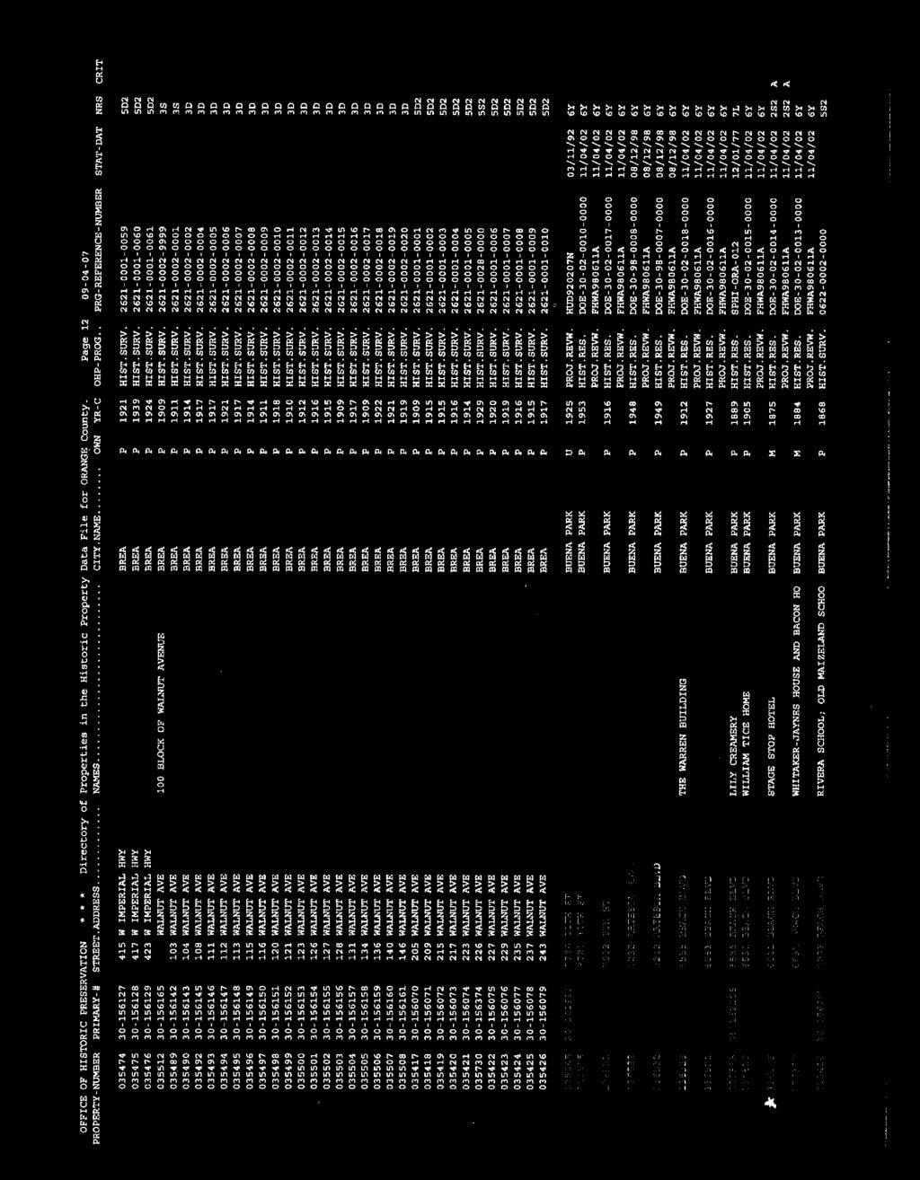
13 Beach and Orangethorpe Mixed-Use Specific Plan central, undeveloped portion of the project area, though exposed ground in front yards of the surrounding structures was also examined. Survey of the undeveloped area consisted of a series of parallel pedestrian transects spaced no greater than 15 meters (approximately 49 feet) apart. Photographs of existing buildings and the surrounding area were taken with an Olympus C-740 digital camera. No GPS data were collected. 4.2 PALEONTOLOGICAL RESOURCES A paleontological resources records search and scientific literature review for the project area was conducted by Dr. Samuel McLeod, Curator of Vertebrate Paleontology at the Natural History Museum of Los Angeles County (NHMLAC) on October 6, 2007 (McLeod 2007; Appendix D). Dr. McLeod is a qualified Paleontologist with extensive experience in Orange County. The records search and literature review provided information on geologic formations, known fossil types and localities, any published studies within the project area and in the general vicinity, and recommendations to mitigate impacts to significant non-renewable paleontological resources. SECTION 5.0 RESULTS 5.1 ARCHAEOLOGICAL RESOURCES ARCHAEOLOGICAL/HISTORICAL RECORDS SEARCH RESULTS The results of the archaeological/historical records search indicate that thirteen archaeological and/or historical studies have been conducted within one mile of the project area (Table 1; see Appendix B for the complete bibliography). None of these studies include any portion of the project area, although surveys OR1569 and OR2743 border the project area along Orangethorpe Avenue. This indicates that the project area has likely never been surveyed for archaeological resources. Brief summaries of each of the studies are provided in the table below. TABLE 2 PREVIOUS STUDIES CONDUCTED WITHIN ONE MILE OF THE PROJECT SCCIC Report No. Author(s) and Year Coverage/Type of Study OR1512 Allen acre, Phase I assessment, no resources OR1596 Clewlow linear miles, Phase I assessment, 1 resource OR1657 Mason 1997 Less than 1 acre, Phase I assessment, no resources OR2094 Ashkar linear miles, Phase I assessment, three resources OR2204 McKenna 2001 Less than 1 acre, Phase I assessment, no resources OR814 Romani linear miles, Phase I assessment, no resources OR2743 Duke 2002 Less than 1 acre, Phase I assessment, no resources OR2758 Duke 2001 Less than 1 acre, Phase I assessment, no resources OR3076 Bonner 2005 Less than 1 acre, Phase I assessment, no resources OR3276 Kane linear miles, Phase I assessment, no resources OR3373 Arrington and Sikes ,431 linear miles, Final Monitoring and Findings Report, number of resources is unspecified, See report (same as LA8255 and VN2504) R:\PAS\Projects\BuenaPa\J002\Cultural\CultRpt doc 8 Archaeological and Paleontological Resources Assessment
14 Beach and Orangethorpe Mixed-Use Specific Plan TABLE 2 PREVIOUS STUDIES CONDUCTED WITHIN ONE MILE OF THE PROJECT (Continued) SCCIC Report No. Author(s) and Year Coverage/Type of Study OR3376 Wlodarski 2007 Less than 1 acre, Phase I assessment, no resources OR3436 Bonner 2007 Less than 1 acre, Phase I assessment, no resources No previously recorded archaeological resources have been identified within one mile of the project area though some of the surveys noted did identify resources outside the search radius. A review of the SCCIC literature indicates no archaeological resources listed in the National Register or the California Register within one mile of the project area. No archaeological resources are listed as California Historical Landmarks or California Points of Historical Interest within the one-mile radius. The historic USGS 15 Anaheim topographic quadrangle (1896) depicts several roads, including Orangethorpe Avenue within the one-mile radius. No buildings are depicted in the immediate vicinity of the project area during this period. The historic USGS 15 Anaheim topographic quadrangle (Department of the Army 1942) depicts buildings along the project perimeter within the project area. These represent extant structures and/or locations currently occupied by structures that are either historic or of a more recent nature. Review of the maps with regard to the central undeveloped portion of the project area indicates the area has never been developed NATIVE AMERICAN CONSULTATION RESULTS Two separate inquiries were made of the Native American Heritage Commission (NAHC). The first requested a review of the Sacred Lands File Database regarding the possibility of Native American cultural resources in the project vicinity that are not documented on other databases. The NAHC review of the Sacred Lands File on October 10, 2007 failed to indicate the presence of Native American cultural resources in the immediate area (Singleton 2007, see Appendix C) The second request was for the NAHC list of Native American groups for which SB 18 (Government Code ) government-to-government consultation between the lead agency and NAHC-listed Native American groups for specific plan and general plan amendments would be required. The NAHC listed five groups (Appendix C). The City of Buena Park prepared and distributed the SB 18 consultation requests to the five NAHC-listed Native American groups. The SB 18 consultation requests informed the recipients of the nature of the project; known Native American resources on and adjacent to the project area; the status of prehistoric cultural resources within the project area; and steps to be undertaken in order to reduce impacts to a level considered less than significant (Attachment C). On behalf of the City, BonTerra Consulting Environmental Planner Justin Partridge followed up with phone calls to these Native American representatives on April 4, 2008 (Appendix C). Mr. Partridge left messages for three representatives and spoke with one representative, who requested that the information be ed to him; this was done the same day (the fifth phone number was out of order). The City did not receive any requests from Native American R:\PAS\Projects\BuenaPa\J002\Cultural\CultRpt doc 9 Archaeological and Paleontological Resources Assessment
15 Beach and Orangethorpe Mixed-Use Specific Plan representatives for consultation. Please see Appendix C for complete information regarding the Native American consultation process ARCHAEOLOGICAL SURVEY RESULTS The central, undeveloped portion of the project area was surveyed by BonTerra Consulting Cultural Resources Specialist Paul O. Shattuck on November 12, In addition, a cursory examination of the developed project perimeter was made. Given what appears to be routine disking as part of an active weed-abatement program, ground visibility was excellent overall in the undeveloped area; the existing vegetation was low and sparse, consisting primarily of non-native ruderal species. The results of the survey indicate that the central portion of the project area is currently undeveloped with no indications of development in the past. No prehistoric or historic cultural resources were observed as a part of the survey. The surrounding developed property contains both commercial and residential structures. Examination of these parcels was limited to inspection from the street. Among these parcels is a circa 1930 residential structure at 7851 Orangethorpe Avenue. Because of its age, there is an increased likelihood of encountering buried deposits, although no evidence of deposits was noted. 5.2 PALEONTOLOGICAL RESOURCES The NHMLAC reported that the project area is situated on terrestrial Quaternary Alluvium. The surficial deposits consist of younger Quaternary Alluvium, which has a low potential to contain significant non-renewable paleontological resources. The younger alluvium likely overlies older Quaternary Alluvium and possibly La Habra Formation deposits, both of which have a high potential to contain significant non-renewable paleontological resources throughout Orange County and the Santa Ana Basin. The NHMLAC has indicated that older Quaternary Alluvium will likely be encountered at depths greater than six feet below ground surface within the project area. The NHMLAC reported that no fossil localities have been recorded within the project area. However, a fossil horse (Equus sp.) was found within similar older Quaternary Alluvium at a depth of 8 10 feet below the ground surface; this fossil locality is approximately 10 miles to the east-southeast in the city of Orange (McLeod 2007). SECTION 6.0 STUDY FINDINGS AND CONCLUSIONS 6.1 ARCHAEOLOGICAL AND HISTORICAL RESOURCES LEGISLATIVE FRAMEWORK State of California Under CEQA, [a] project with an effect that may cause a substantial adverse change in the significance of an historical resource is a project that may have a significant effect on the environment (CEQA Guidelines [b]). Substantial adverse change is defined as physical demolition, destruction, relocation, or alteration of the resource or its immediate surroundings such that the significance of an historical resource would be materially impaired (CEQA Guidelines [b][1]). CEQA has established statutory requirements for the formal review and analysis of projects. Historical Resources (Archaeological and Historic) A historical resource is defined as a resource that is listed in or eligible for listing in the California Register. The criteria applied to evaluate resources for the California Register are listed below. These criteria are worded in a manner to provide for a wide diversity of resources R:\PAS\Projects\BuenaPa\J002\Cultural\CultRpt doc 10 Archaeological and Paleontological Resources Assessment
16 Beach and Orangethorpe Mixed-Use Specific Plan and resource types. The following criteria shall be used in evaluating resources for eligibility for listing in the California Register. The California Register criteria closely mirror the criteria for evaluating a resource for the National Register. Guidance in applying the National Register criteria is further discussed in How To publications, Standards and Guidelines sheets, and Keeper s opinions of the National Register. Such materials are available upon request. California Register of Historical Resources Criteria for Evaluation (Public Resources Code ) states that a resource may be listed as a historical resource in the California Register if it meets any of the following National Register criteria: (1) Is associated with events that have made a significant contribution to the broad patterns of California s history and cultural heritage; and/or (2) Is associated with the lives of persons important in our past; and/or (3) Embodies the distinctive characteristics of a type, period, region, or method of construction, or represents the work of an important creative individual, possesses high artistic values; and/or (4) Has yielded, or may be likely to yield, information important in prehistory or history. The quality of historical significance in American history, architecture, archaeology, engineering, and culture may be present in districts, sites, buildings, structures, and objects that possess integrity of location, design, setting, materials, workmanship, feeling, and association. Public Resources Code further defines properties that may be eligible for the California Register as: (1) Properties formally determined eligible for, or listed in the National Register of Historic Places; (2) State Historical Landmarks consecutively numbered from No. 770 and higher; (3) Points of Historical Interest which have been reviewed by the California Office of Historic Preservation and recommended for listed by the State Historical Resources Commission for inclusion; (4) Historical resources identified as significant in historical resource surveys; and (5) Local landmarks or historic properties designated under any municipal our county ordinance. The fact that a resource is not listed in, or determined to be eligible for listing in the California Register, not included in a local register of historical resources (pursuant to Public Resources Code [k]) or identified in a historical resources survey (meeting the criteria in Public Resources Code [g]) does not preclude a lead agency from determining that the resource may be a historical resource as defined in the Public Resources Code (j) or CEQA also contains a section that addresses unique archaeological resources and provides a definition of such resources in ; this section establishes limitations on the cost of mitigation and prohibits imposition of mitigation measures for impacts on archaeological resources that are not unique. Title 14, (c)(2) of the CEQA Guidelines, however, states R:\PAS\Projects\BuenaPa\J002\Cultural\CultRpt doc 11 Archaeological and Paleontological Resources Assessment
17 Beach and Orangethorpe Mixed-Use Specific Plan that the limitations in this section do not apply when an archaeological resource has already met the definition of a historical resource under Public Resources Code City of Buena Park The City of Buena Park General Plan s Conservation Element Goals and Policies (Buena Park 1994) state: The City s rich history and the preservation of that history is the focus of the following goal and supporting policies that call for continued efforts in saving the past for future generations. Goal 1: The City will continue to preserve sites of significant paleontological importance for future scientific study and to encourage the identification and preservation of historically significant sites in the City. The City sets forth five policies to aid in accomplishing this goal: Policy 1.1 Support the preservation of sites containing significant paleontological resources. Policy 1.2 Encourage the preservation of buildings which have historic significance and/or architectural merit. Policy 1.3 Consider, as appropriate, permitting non-conforming use of buildings of architectural merit or historic significance for the life of the building. Policy 1.4 Encourage preservation and awareness of significant natural resources within the City. Policy 1.5 Encourage citizen awareness of the City s historic and cultural resources. In addition, the City acknowledges that the likelihood of encountering archaeological resources is low, but requires implementing CEQA statutes should these resources be encountered during development, including evaluation of eligibility for the California Register of Historical Resources and mitigation of impacts to eligible sites through preservation and/or data recovery programs (Buena Park 1994:6-6 through 6-8) SUMMARY OF RESULTS Archaeological Resources The SCCIC conducted an archaeological/historical resources records search for the project area and the surrounding one-mile radius. The records search indicated that no archaeological or historic resource assessments had been previously conducted over the project area and no archaeological resources have been identified within the one-mile radius. In addition, the NAHC search of the Sacred Lands File Database failed to identify Native American sacred cultural resources in the immediate project vicinity. Based on the City s notification of Native American representatives as a part of the SB 18 consultation process between the City of Buena Park and NAHC-listed Native American groups, no information was provided by these groups pertaining to previously unidentified cultural resources. Survey of the central, undeveloped portion of the project area was undertaken on November 12, 2007, by BonTerra Consulting Cultural Resources Paul O. Shattuck. The results of the survey indicated that the project area is relatively flat with a central undeveloped core and surrounding commercial and residential structures. No prehistoric- or historic-period archaeological resources were identified during the survey. R:\PAS\Projects\BuenaPa\J002\Cultural\CultRpt doc 12 Archaeological and Paleontological Resources Assessment
18 Beach and Orangethorpe Mixed-Use Specific Plan RECOMMENDATIONS Archaeological Resources BonTerra Consulting concludes that the proposed project has a low potential to encounter subsurface archaeological sites and archaeological monitoring is neither warranted nor recommended. Although no archaeological resources were identified within or immediately adjacent to the project area, the presence of significant subsurface archaeological resources is always a possibility in areas where only surface inspection has taken place. If archaeological evidence (e.g., stone artifacts, dark ashy soils or burned rocks, or old glass, metal, or ceramic artifacts) becomes apparent during ground disturbances, work in that location should be diverted and a qualified Archaeologist should be contacted immediately to evaluate the nature and significance of the find. If human remains are discovered, the Orange County Coroner s office must be notified immediately under State law (California Health and Safety Code ) and all activities in the immediate area of the find must cease until appropriate and lawful measures have been implemented. If the Coroner determines that the remains are Native American, the NAHC must also be contacted (California Public Resources Code ). The NAHC will designate a Most Likely Descendent (MLD) who will make recommendations concerning the reassignment of the remains in consultation with the City of Buena Park and the Project Archaeologist. 6.2 PALEONTOLOGICAL RESOURCES LEGISLATIVE FRAMEWORK Paleontological resources are non-renewable scientific and educational resources. The legislative framework applicable to paleontological resources pursuant to the proposed project includes Public Resources Code prohibits the removal or destruction of vertebrate paleontological sites or any other paleontological feature situated on public lands without prior approval of the public agency in control of those lands. Projects subject to CEQA must determine whether the project would directly or indirectly destroy a unique paleontological resource SUMMARY OF RESULTS The results of the paleontological records search indicate that the upper sediments within the project area consist of younger Quaternary Alluvium, which has been assigned a low paleontologic sensitivity. These younger sediments likely overlie older Quaternary Alluvium which is considered to be highly fossiliferous in Orange County and the Santa Ana Basin. Older Quaternary Alluvium is considered sensitive, but likely present only at depths greater than six feet below the existing ground surface in the project area RECOMMENDATIONS Review of the paleontological records on file at the NHMLAC indicates the presence of significant fossils within older deposits. Current construction plans indicate that ground disturbance will extend to depths greater than six feet and may occur within the older Quaternary Alluvium. Therefore, the preparation and implementation of a Paleontology Treatment Program and Mitigation Plan is warranted and should be prepared. The Paleontology Treatment Program and Mitigation Plan may include monitoring during excavation into sensitive strata; recovery of significant fossils; and evaluation, preparation and permanent curation of significant specimens by a qualified Paleontologist and/or institution. R:\PAS\Projects\BuenaPa\J002\Cultural\CultRpt doc 13 Archaeological and Paleontological Resources Assessment
19 Beach and Orangethorpe Mixed-Use Specific Plan No paleontological mitigation monitoring program is recommended for ground disturbance associated with grading or shallow excavations (i.e., to a maximum depth of six feet below the existing ground surface). However, in the event that paleontogical resources are encountered during ground disturbances within the upper six feet, work in the area(s) should be diverted until a qualified Paleontologist has had an opportunity to evaluate the significance of the find. SECTION 7.0 CERTIFICATION I hereby certify that the statements furnished above and in the attached exhibits present the data and information required for this Cultural Resource Assessment Report, and that the facts, statements, and information presented are true and correct to the best of my knowledge and belief. DATE: January 29, 2008 SIGNED: Brian K. Glenn, M.A., RPA Cultural Resources Manager R:\PAS\Projects\BuenaPa\J002\Cultural\CultRpt doc 14 Archaeological and Paleontological Resources Assessment
20 Beach and Orangethorpe Mixed-Use Specific Plan SECTION 8.0 REFERENCES CITED Bean, Lowell John, and Charles R. Smith 1978 Gabrielino. In: Handbook of North American Indians, Vol. 8, California, edited by Robert F. Heizer, pp Smithsonian Institution, Washington, D.C. Buena Park, City of 2007 City of Buena Park History City of Buena Park General Plan Update: Year 2010 Plan (Updated 1997). Prepared by David Evans Associates. Buena Park Historical Society 2007 Buena Park Historically Named. Blackburn, Thomas 1963 Ethnohistoric Descriptions of Gabrielino Material Culture. University of California Archaeological Survey Annual Report :1 50. Los Angeles. Cameron, Constance 1999 Determining Tribal Boundaries through Potsherds: An Archaeological Perspective. Pacific Coast Archaeological Society Quarterly, Vol. 35, Numbers 2 & 3, Spring/Summer. Cleland, Robert Glass 1951 The Cattle on a Thousand Hills: Southern California, Huntington Library, San Marino, California The Irvine Ranch. Huntington Library, San Marino, California. Coy, Owen C California County Boundaries: A Study of the Division of the State into Counties and the Subsequent Changes in their Boundaries. Revised Edition (originally published in 1923 by the California Historical Survey Commission, Berkeley). Valley Publishers, Fresno. Department of the Army, United States, Corps of Engineers 1942 Anaheim. 15 Minute Series Topographic Map. 1: United States Geological Survey, Reston, Virginia. Dumke, Glenn S The Boom of the Eighties in Southern California. Huntington Library Publications, San Marino, California. Frederickson, David A., and Joel Grossman 1977 A San Dieguito Component at Buena Visa Lake, California. Journal of California Anthropology 4(2): Glassow, Michael A Middle Holocene Cultural Development in the Central Santa Barbara Channel Region. Perspectives in California Archaeology 4: Institute of Archaeology, University of California, Los Angeles. R:\PAS\Projects\BuenaPa\J002\Cultural\CultRpt doc 15 Archaeological and Paleontological Resources Assessment
21 Beach and Orangethorpe Mixed-Use Specific Plan Grant, Campbell 1978 Interior Chumash. In: Handbook of North American Indians, Vol. 8, California, Robert F. Heizer (ed.), pp Smithsonian Institute, Washington, D.C. Greenwood, Roberta S Years of Prehistory at Diablo Canyon, San Luis Obispo County, California. San Luis Obispo County Archaeological Society Occasional Papers 7:1 97. Hallan-Gibson, Pamela 1986 The Golden Promise: An Illustrated History of Orange County. Windsor Publications, Inc., Northridge, California. Harrington, John P Culture Element Distributions, XIX: Central California Coast. University of California Anthropological Records 7 (1):1 46. Berkeley. Heizer, Robert F. (ed.) 1968 The Indians of Los Angeles County: Hugo Reid s Letters of Southwest Museum Papers 21. Los Angeles. Johnson, Allen W. and Timothy Earle 1987 The Evolution of Human Societies: From Foraging Group to Agrarian State. Stanford University Press, Stanford. Johnston, Bernice Eastman 1962 California s Gabrielino Indians. Southwest Museum, Los Angeles. Knott s Berry Farm 2007 Knott s Berry Farm: Historical Background. index.shtml. Kroeber, Alfred L The Gabrielino. Chapter 44 in: Handbook of the Indians of California, pp Bureau of American Ethnology Bulletin 78. Smithsonian Institution, Washington, D.C. Kyle, Douglas E Historic Spots in California. Stanford University Press, Stanford, California. Marschner, Janice 2000 California 1850: A Snapshot in Time. Coleman Ranch Press, Sacramento. McCawley, William 1996 The First Angelinos: The Gabrielino Indians of Los Angeles. Malki Museum Press, Banning and Ballena Press, Novato, California. McIntyre, Michael 1990 Cultural Resources of the Upper Santa Clara River Valley, Los Angeles, and Ventura Counties, California. In: Archaeology and Ethnohistory of Antelope Valley and Vicinity, edited by Bruce Love and William H. dewitt, pp Antelope Valley Archaeological Society Occasional Paper No. 2. Lancaster, California. R:\PAS\Projects\BuenaPa\J002\Cultural\CultRpt doc 16 Archaeological and Paleontological Resources Assessment
22 Beach and Orangethorpe Mixed-Use Specific Plan McLeod, Samuel 2007 Paleontological Resources for the Proposed BuenaPa J002: M+D Properties Project, in the City of Buena Park, Orange County, Project Area. Letter to Brian K. Glenn dated October 6, On file at BonTerra Consulting, 151 Kalmus Drive, Suite E-200, Costa Mesa, California Moratto, Michael 1984 California Archaeology. Academic Press, Orlando, Florida. Office of Historic Preservation (OHP) 1990 Archaeological Resource Management Reports (ARMR): Recommended Contents and Format. Department of Parks and Recreation, Sacramento. Orange, County of 2007 Orange County History. Available at: Archives/arhistry.asp. Accessed on December 13, Rolle, Andrew 1998 California: A History. Fifth Edition. Harlan Davidson, Inc., Wheeling, Illinois. Schoenherr, Allan A A Natural History of California. University of California Press, Berkeley. United States Department of the Interior (USDI) 1983 Archaeology and Historic Preservation; Secretary of the Interior's Standards and Guidelines. Federal Register, National Park Service, Washington, D.C. United States Geological Survey (USGS) 1896 Anaheim. 15 Minute Series Topographic Map. 1: United States Geological Survey, Reston, Virginia Anaheim. Photorevised Minute Series Topographic Map. 1: Originally Published in United States Geological Survey, Reston, Virginia. Wallace, William, J A Suggested Chronology for Southern California Coastal Archaeology. Southwestern Journal of Anthropology 11(3): Post-Pleistocene Archeology, 9000 to 2000 B.C. In California, edited by R. F. Heizer, pp Handbook of North American Indians, Vol. 8, W. C. Sturtevant, general editor. Smithsonian Institution, Washington, D.C. R:\PAS\Projects\BuenaPa\J002\Cultural\CultRpt doc 17 Archaeological and Paleontological Resources Assessment
23 APPENDIX A PROFESSIONAL QUALIFICATIONS
24 BRIAN K. GLENN, M.A., RPA CULTURAL RESOURCES MANAGER M.A., Archaeology, University of California, Los Angeles, 1991 B.A., Anthropology, University of California, Santa Barbara, 1986 B.A., Geography, University of California, Santa Barbara, 1986 Brian Glenn specializes in Cultural Resources Management (CRM) under California Environmental Quality Act (CEQA), National Historic Preservation Act (NHPA), and local regulations. Mr. Glenn is a Registered Professional Archaeologist (RPA) qualified under Secretary of the Interior s standards. During more than 25 years of experience, he has directed or contributed to projects throughout southern California. He is skilled in a wide range of field and administrative tasks fundamental to CRM and has authored numerous technical reports. His professional foci concern the graphic display of data with emphases in exploratory data analyses and geographical information systems (GIS) with emphases on southern California's Early Period (10,000 to 2,000 B.P.), artifact morphology as an indicator of function, and coastal environmental reconstruction through the analysis of fish and shellfish remains. Orange County Selected Experience: FEMA Harbors, Beaches & Parks Storm Repair Projects, Orange County, CA. BonTerra Consulting prepared a cultural resources assessment report in support of the FEMA-sponsored repair projects within Aliso and Wood Canyons Wilderness Park and O Neill Regional Park. Client: County of Orange, 2007 Los Alamitos Retarding Station, Cities of Seal Beach and Long Beach, CA. BonTerra Consulting prepared a cultural resources management plan for the installation of a replacement pump assembly adjacent to the San Gabriel River in the Cities of Seal Beach and Long Beach. Client: County of Orange, 2007 O Neill Regional Park Cultural Resources Monitoring, County of Orange, CA. BonTerra Consulting conducted cultural resources construction monitoring as part of a sewer conversion project. Client: County of Orange, 2007 Scully Adobe, County of Orange, CA. BonTerra Consulting managed National Register evaluation excavations of a middle- to late-19 th Century adobe within the State Route 90 right-of-way. Client: Caltrans, 2006 State Route 57 Widening Project, Orange County, CA. BonTerra Consulting prepared Caltrans cultural resources documents which included a Historic Properties Survey Report, bridge study, and an Archaeological Survey Report which included historic archives review, pedestrian survey, Native American consultation, and paleontological literature review. Client: RBF Consulting, 2005 Piccadilly Place Sound Wall, City of Fullerton, CA. BonTerra Consulting prepared the cultural resources element of the Preliminary Environmental Assessment Report prior to
25 BRIAN K. GLENN Page 2 sound wall installation at the Interstate 5/State Route 91 interchange, for submission to Caltrans. Client: Washington Infrastructure, 2007 Hoag Hospital SB 18 Consultation, City of Newport Beach, CA. BonTerra Consulting prepared and distributed consultation request letters to Native American groups on behalf of the City of Newport Beach in compliance with SB 18 requirements for government-togovernment consultation. Client: City of Newport Beach, 2007 Talbert Lake Restoration Project, Huntington Beach, CA. BonTerra Consulting conducted a cultural resources assessment of the proposed restoration project area of potential effects in compliance with Section 106 and CEQA for submission to the U.S. Army Corps of Engineers. Client: PACE, 2007 Highland Reservoir Project, Yorba Linda, CA. BonTerra Consulting conducted a Phase I cultural resources assessment of an 8.76-acre reservoir property in the City of Yorba Linda which included historic archives review and architectural evaluation, pedestrian survey and paleontological literature review. Client: Carollo Engineers, 2006 State Route 73/Jamboree Avenue Bridge Improvement Project, Newport Beach, CA. BonTerra Consulting prepared Caltrans-approved cultural resources documents which included a Historical Resource Compliance Report, bridge study, and an Archaeological Survey Report which included historic archives review, pedestrian survey, Native American consultation, and paleontological literature review. Client: RBF Consulting, 2005 Professional Experience: BonTerra Consulting, Cultural Resources Manager 2005 to Present Pacific West Archaeology, Owner/Principal Investigator 1996 to 2005 Ogden Environmental & Energy Services, Senior Archaeologist 1991 to 1996 UCLA Institute of Archaeology Information Center, Acting Coordinator 1988 to 1991 UCSB Center for Archaeological Studies, Archaeological Technician 1984 to 1988 Registrations, Certifications, and Affiliations: Register of Professional Archaeologists (RPA, formerly SOPA), 1992 County of San Diego Certification, 1992 County of Riverside Certification, 2002 County of Orange Certification, 2006 Various County and City Consultant Lists Society for American Archaeology (SAA) Society for California Archaeology (SCA)
26 APPENDIX B SOUTH CENTRAL COASTAL INFORMATION CENTER RECORDS SEARCH RESULTS

27
28
29
30
31
32
33

34

35

36
37 APPENDIX C NATIVE AMERICAN HERITAGE COMMISSION CORRESPONDENCE AND SB 18 CONSULTATION WITH NATIVE AMERICANS
38 TRANSMITTAL DATE: October 4, 2007 TO: Ms. Dave Singleton FAX NUMBER: (916) Program Analyst TEL NUMBER: (916) Native American Heritage Comm. CLIENT CODE: BuenaPa 915 Capitol Mall, Rm. 364 PROJECT CODE: J002 Sacramento, CA FROM: Brian Glenn, M.A., RPA Fax / Pages 1 Mail Fed Ex / Overnite Express Delivery / Courier REGARDING: Sacred Lands File Search and Contact List Request Dear Mr. Singleton: At your earliest convenience, please conduct a search of the Sacred Lands File for the BuenaPa J002: M+D Properties Project in the City of Buena Park, Orange County. The project location is shown on the USGS Anaheim 7.5 Minute Quadrangle in Section 35 of Township 3S/Range 11W (S.B.B.M). Please fax or the results to me at (714) , referencing your letter to BuenaPa J002: M+D Properties Project ". If you have any questions or require any additional information, please do not hesitate to contact me at (714) or via at bglenn@bonterraconsulting.com. Sincerely, BONTERRA CONSULTING Brian K. Glenn, M.A., RPA Cultural Resources Manager 151 Kalmus Drive, Suite E-200 Costa Mesa, CA (714) (714) Fax
39
40
41
42 LOCAL GOVERNMENT TRIBAL CONSULTATION LIST REQUEST NATIVE AMERICAN HERITAGE COMMISSION 915 CAPITOL MALL, ROOM 364 SACRAMENTO, CA (916) (916) Fax Project Title: Buena Park: M+D Properties Beach & Orangethorpe Project Local Government/Lead Agency: _City of Buena Park Contact Person: Brian Glenn BonTerra Consulting Phone: (714) Street Address: 151 Kalmus Dr. Suite E-200 Fax: (714) City: Costa Mesa, CA Zip: Project Location: County: Orange City/Community: Buena Park Local Action Type: General Plan General Plan Element _XX_ Specific Plan _XX_ General Plan Amendment Specific Plan Amendment Pre-planning Outreach Activity Project Description: The proposed project is a multi-use development on approximately 14 acres in the City of Buena Park. The proposed development includes a hotel, retail commercial and high-rise residences on the northeast corner of Beach Boulevard and Orangethorpe Avenue. NAHC Use Only Date Received: Date Completed Native American Tribal Consultation lists are only applicable for consulting with California Native American tribes per Government Code Section
43
44
45
46
47
48
49
50
51
52
53
54
55
56 APPENDIX D NATURAL HISTORY MUSEUM OF LOS ANGELES COUNTY CORRESPONDENCE

57
W.H. Bonner Associates
 15619 Ogram Avenu Gardena, CA 90249-444 W.H. Bonner Associates Archaeofaunal Studies Archaeological Surveys Historical & Genealogical Research (310) 675-274 E-mail: whbonner@aol.com April 21, 2014 Wendy
V. ENVIRONMENTAL IMPACT ANALYSIS D. CULTURAL RESOURCES
 V. ENVIRONMENTAL IMPACT ANALYSIS D. CULTURAL RESOURCES Incorporated into this section are the findings and conclusions of two archaeological investigations conducted on the Project Site: a site survey
Phase I Cultural Resources Assessment for the
 Phase I Cultural Resources Assessment for the Heritage Museum Monitoring Well No. 2 Project Prepared for Daniel Bott Principal Planner Orange County Water District 18700 Ward Street Fountain Valley, California
2.1.8 Cultural Resources Regulatory Setting. Affected Environment, Environmental
 REVISED DRAFT ENVIRONMENTAL IMPACT REPORT/ Affected Environment, Environmental 2.1.8 Cultural Resources This section evaluates the potential for historical and archaeological resources within the proposed
4.3 CULTURAL and HISTORIC RESOURCES
 4.3 CULTURAL and HISTORIC RESOURCES This section includes a discussion of onsite development s potential impacts to historic and cultural resources. Information has been summarized from a report prepared
EASTERN GOLETA VALLEY COMMUNITY PLAN
 D. CULTURAL RESOURCES Cultural resources include but are not limited to buildings, structures, and districts, prehistoric and historic archaeological sites, historical landscapes, and traditional cultural
Appendix C Cultural Resources Survey
 Appendix C Cultural Resources Survey A Cultural Resources Survey for the Gallo Winery Expansion Project 18000 River Road, Livingston Merced County, California Eileen Barrow, M.A./R.P.A. July 22, 2011 A
I 5 South Multimodal Corridor Study. Appendix F. I 5 South Multimodal Corridor Study Cultural Resources Constraints Analysis (February 8, 2010)
") I 5 South Multimodal Corridor Study Appendix F I 5 South Multimodal Corridor Study Cultural Resources Constraints Analysis (February 8, 2010) 847 Jamacha Road, El Cajon, California 92019-3206 tel: (619)
I 5 South Multimodal Corridor Study Appendix F I 5 South Multimodal Corridor Study Cultural Resources Constraints Analysis (February 8, 2010) 847 Jamacha Road, El Cajon, California 92019-3206 tel: (619)
Chapter 19: Cultural Resources
 Chapter 19: Cultural Resources Introduction and Setting Traditionally the term "cultural resources" has been used rather narrowly to refer to archaeological remains and to historical structures. Archaeologists,
SANTA ROSA ISLAND RANCHING DISTRICT, CHANNEL ISLANDS NATIONAL PARK, CALIFORNIA
 DEPARTMENT OF LANDSCAPE ARCHITECTURE School of Architecture and Allied Arts University of Oregon Site Planning and Design Studio, Fall 2016 LA 489 / 589: CRN: 13477 / 13496 Professor Robert Z Melnick,
Final Initial Study. Chalice Unitarian Universalist Congregation Conditional Use Permit
 5 Final Initial Study Chalice Unitarian Universalist Congregation Conditional Use Permit Appendix B Chalice Unitarian Universalist Congregation Cultural Resources Memorandum TRC 9685 Research Drive Irvine,
4.4 CULTURAL RESOURCES
 4.4 This chapter discusses existing conditions on the Project site and in the vicinity and analyzes potential impacts to cultural resources that could result from buildout of the Project. Cultural resources
THE CALIFORNIA ENVIRONMENTAL QUALITY ACT (CEQA) AND HISTORICAL AND TRIBAL CULTURAL RESOURCES
 AND HISTORICAL AND TRIBAL CULTURAL RESOURCES") THE CALIFORNIA ENVIRONMENTAL QUALITY ACT (CEQA) AND HISTORICAL AND TRIBAL CULTURAL RESOURCES A review by Dr. John Parker, RPA original 2008, updated 2016 What Projects Require CEQA Review?...1 How does
THE CALIFORNIA ENVIRONMENTAL QUALITY ACT (CEQA) AND HISTORICAL AND TRIBAL CULTURAL RESOURCES A review by Dr. John Parker, RPA original 2008, updated 2016 What Projects Require CEQA Review?...1 How does
Appendix G. Archaeological and Paleontological Resources Records Searches
 Appendix G Archaeological and Paleontological Resources Records Searches South Central Coastal Information Center California State University, Fullerton Department of Anthropology MH-426 800 North State
CHAPTER 10 AESTHETICS
 CHAPTER 10 AESTHETICS CHAPTER 10 AESTHETICS This section identifies and evaluates key visual resources in the project area to determine the degree of visual impact that would be attributable to the project.
4. ENVIRONMENTAL IMPACT ANALYSIS 4. CULTURAL RESOURCES
 4. ENVIRONMENTAL IMPACT ANALYSIS 4. CULTURAL RESOURCES 4.4.1 INTRODUCTION The following section addresses the proposed Project s potential to result in significant impacts upon cultural resources, including
Draft Environmental Assessment Appendix A. SHPO Correspondence, January 19, 2017
 Draft Environmental Assessment Appendix A. SHPO Correspondence, January 19, 2017 Rosecrans/Marquardt Grade Separation Project April 2018 Federal Railroad Administration U.S. Department 1200 New Jersey
Prepared for: Transition Properties, LP Mr. Art Day, Senior Vice President P.O. Box 1010 Blue Jay, CA Prepared by:
 for the Proposed Church and 5 th Warehouses Project No.13534 City of Highland, County of San Bernardino, California Prepared for: Transition Properties, LP Mr. Art Day, Senior Vice President P.O. Box 1010
Nob Hill Pipeline Improvements Project EIR
 Section 3.1 Aesthetics This section addresses the visual aspects that may affect the views experienced by the public, including the potential to impact the existing character of each area that comprises
PRIMARY RECORD Trinomial # NRHP Status Code 3S, 3CS, 5S3 Other Listings Review Code Reviewer Date
 PRIMARY RECORD # NRHP Status Code 3S, 3CS, 5S3 Other Listings Review Code Reviewer Date Page 1 of 6 1252 *Resource Name or # (Assigned by recorder) Old Topanga Canyon Road P1. Other Identifier: *P2. Location:
4.4 CULTURAL RESOURCES
 4.4 This chapter describes the regulatory framework and existing conditions in the Project area related to cultural resources, and the potential impacts of the Project on cultural resources. The section
Architectural Inventory Form
 COLORADO CULTURAL RESOURCE SURVEY Page 1 of 8 Official Eligibility Determination (OAHP use only) Rev. 9/98 OAHP1403 Date Initials Determined Eligible National Register Determined Not Eligible National
REQUEST FOR PROPOSALS. Preparation of National Register of Historic Places. Nominations for the following:
 REQUEST FOR PROPOSALS Preparation of National Register of Historic Places Nominations for the following: The Conner Swales Site, The Baumann Village Site, The Bird Point Heaven Village Site, The Wise Village
CEQA and Historic Preservation: A 360 Degree Review
 CEQA and Historic Preservation: A 360 Degree Review California Preservation Foundation Workshop February 11, 2015 Presented by Chris McMorris Partner / Architectural Historian CEQA and Historic Preservation
STAGE 1 ARCHAEOLOGICAL ASSESSMENT OF RATHBURN ROAD, FROM DUKE OF YORK BOULEVARD TO SHIPP DRIVE, CITY OF MISSISSAUGA. Submitted to:
 STAGE 1 ARCHAEOLOGICAL ASSESSMENT OF RATHBURN ROAD, FROM DUKE OF YORK BOULEVARD TO SHIPP DRIVE, CITY OF MISSISSAUGA Submitted to: McCormick Rankin Corporation 2655 North Sheridan Way, Suite 280 Mississauga,
Authority of the General Plan
 Authority of the General Plan This La Habra Heights General Plan will serve as the blueprint for future planning and development in the City. This General Plan describes the City s vision for the future
4 Environmental Impact Analysis
 Environmental Impact Analysis 4 Environmental Impact Analysis This section discusses the potential environmental effects of the proposed project for the specific environmental issue areas that were identified
The following summary of the cultural setting describes the prehistory and history of the regional vicinity.
 3.5 CULTURAL RESOURCES Cultural resources represent and document the activities, accomplishments, and traditions of past and present cultures and link current and former inhabitants of an area. Archaeological
Table of Contents J.2 Cultural Resources - Archaeological Resources
 Table of Contents J.2 Cultural Resources - Archaeological Resources 1. INTRODUCTION... 1642 2. ENVIRONMENTAL SETTING... 1642 a. Regulatory Setting... 1642 (1) State... 1642 (2) Local... 1644 (3) Native
Architectural Inventory Form
 COLORADO CULTURAL RESOURCE SURVEY Page 1 of 8 Official Eligibility Determination (OAHP use only) Rev. 9/98 OAHP1403 Date Initials Determined Eligible National Register Determined Not Eligible National
TABLE OF CONTENTS HISTORIC PRESERVATION ELEMENT I. INTRODUCTION HP. A. Purpose HP B. Assessment and Conclusions...
 TABLE OF CONTENTS HISTORIC PRESERVATION ELEMENT I. INTRODUCTION... 1 - HP A. Purpose... 1 - HP B. Assessment and Conclusions... 1 - HP II. GOAL, OBJECTIVES AND POLICIES... 3 - HP GOAL 1: PROTECTION AND
IV.B. VISUAL RESOURCES
 IV.B. VISUAL RESOURCES ENVIRONMENTAL SETTING Existing Visual Character Project Site The project site is located at 17331-17333 Tramonto Drive in the Pacific Palisades community of the City of Los Angeles
STAFF REPORT FOR STANDARD COASTAL DEVELOPMENT PERMIT #CDP FEBRUARY 26, 2015 CPA - 1 PO BOX 238 APTOS, CA 94001
 STAFF REPORT FOR STANDARD COASTAL DEVELOPMENT PERMIT #CDP 2014-0030 FEBRUARY 26, 2015 CPA - 1 OWNER/APPLICANT: AGENT: REQUEST: HANS HEIM PO BOX 238 APTOS, CA 94001 JAMES HAY PO BOX 762 MENDOCINO, CA 95460
III. PROJECT DESCRIPTION
 III. PROJECT DESCRIPTION A. PROJECT LOCATION Regional Setting The project site is located in the southeast quadrant of the City of Chico in Butte County, California and is comprised of four parcels totaling
ARCHAEOLOGICAL INVESTIGATIONS FOR THE OLD DAVIS ROAD REALIGNMENT PROJECT ON THE UNIVERSITY OF CALIFORNIA, DAVIS CAMPUS YOLO COUNTY, CALIFORNIA
 Cultural Resources Consultants ARCHAEOLOGICAL INVESTIGATIONS FOR THE OLD DAVIS ROAD REALIGNMENT PROJECT ON THE UNIVERSITY OF CALIFORNIA, DAVIS CAMPUS YOLO COUNTY, CALIFORNIA Prepared for: Matt Dulcich,
WESTSIDE SUBWAY EXTENSION PROJECT
 Archaeological Resources Supplemental Survey Technical Report 3.0 Area of Potential Effects March 2012 Figure 3-6: Archaeological APE for LPA Alignment (Map 5 of 7) March 2012 Page 3-9 Archaeological Resources
Submitted: July 23, 2009
 Stage I and II Archaeological Assessment Jock River Estates Phase 2 PML Project No. 0801-01 Client: 773804 Ontario Inc. Lot 21, Concession 2 Geographic Township of Goulbourn City of Ottawa Submitted: July
4.5 HISTORIC, ARCHAEOLOGICAL, AND PALEONTOLOGICAL RESOURCES
 4.5 HISTORIC, ARCHAEOLOGICAL, AND PALEONTOLOGICAL RESOURCES This section describes the cultural background and setting of the project area and provides the results of cultural resources surveys and analysis
2.1 Decision Making Matrix
 2.1 Decision Making Matrix The following decision-making matrix merges the elements of architectural and historical significance and current condition within the over-arching treatment recommendation of
Appendix H Cultural Analysis/Cultural and Paleontological Resources Studies Letter Report (Calipatria I, Midway I and Midway II)
") Appendix H Cultural Analysis/Cultural and Paleontological Resources Studies Letter Report (Calipatria I, Midway I and Midway II) AECOM 1420 Kettner Boulevard Suite 500 San Diego, CA 92101 www.aecom.com
Appendix H Cultural Analysis/Cultural and Paleontological Resources Studies Letter Report (Calipatria I, Midway I and Midway II) AECOM 1420 Kettner Boulevard Suite 500 San Diego, CA 92101 www.aecom.com
Section 3.5 Cultural Resources
 Section 3.5 Cultural Resources 3.5.1 Introduction Cannabis cultivation and manufacturing may result in environmental impacts to cultural resources, including the damage or degradation of historic resources
TOWN OF AURORA HERITAGE IMPACT ASSESSMENTS AND CONSERVATION PLANS GUIDE
 PLANNING AND DEVELOPMENT SERVICES Development Planning Division Heritage Planning Section Phone: 905-727-3123 ext. 4226 Fax: 905-726-4736 Email: planning@aurora.ca Town of Aurora 100 John West Way, Box
Architectural Inventory Form (page 1 of 5)
") OAHP1403 Rev. 9/98 COLORADO CULTURAL RESOURCE SURVEY (page 1 of 5) Official eligibility determination (OAHP use only) Date Initials Determined Eligible- NR Determined Not Eligible- NR Determined Eligible-
OAHP1403 Rev. 9/98 COLORADO CULTURAL RESOURCE SURVEY (page 1 of 5) Official eligibility determination (OAHP use only) Date Initials Determined Eligible- NR Determined Not Eligible- NR Determined Eligible-
Notice of Preparation and Notice of Public Scoping Meeting. At Dublin Project
 Notice of Preparation and Notice of Public Scoping Meeting Date January 17, 2018 To Project Title Project Application Number Project Location Project Applicant Contact For questions or submitting comments.
A. OVERVIEW OF ENVIRONMENTAL SETTING
 IV. A. OVERVIEW OF The proposed site is comprised of three parcels totaling approximately 4.24 acres, situated southwesterly of the intersection of Weyburn and Tiverton Avenues. Parcel A is 2.72 acres
RECOMMENDATION REPORT
 DEPARTMENT OF CITY PLANNING RECOMMENDATION REPORT City Planning Commission Case No.: CPC-2012-1165-GPA-ZC Date: August 9, 2012 Time: After 8:30 AM Place: City Hall, Room 350 Public Hearing: Required CEQA
CITY OF GENEVA HISTORIC PRESERVATION COMMISSION 22 S. FIRST STREET GENEVA, ILLINOIS 60134
 A GUIDE TO THE LOCAL LANDMARK DESIGNATION PROCESS INTRODUCTION The City of Geneva is a residential community characterized by fine examples of many significant architectural styles dating from the mid-1800s
APPENDIX 1: SCOPED ENVIRONMENTAL IMPACT STATEMENT (EIS) FORM
 FORM") APPENDIX 1: SCOPED ENVIRONMENTAL IMPACT STATEMENT (EIS) FORM This form is intended for use by applicants (primarily private landowners) who need to conduct a Scoped EIS in support of minor development
APPENDIX 1: SCOPED ENVIRONMENTAL IMPACT STATEMENT (EIS) FORM This form is intended for use by applicants (primarily private landowners) who need to conduct a Scoped EIS in support of minor development
2. INTRODUCTION 2.1 AUTHORITY 2.2 PURPOSE AND INTENT 2.3 SITE LOCATION
 2. INTRODUCTION 2.1 AUTHORITY The City of Gardena initiated and prepared the Artesia Corridor Specific Plan pursuant to the provisions of California Government Code, Title 7, Division 1, Chapter 3, Article
Bureau for Historic Preservation s Guidance for Historic Preservation Planning
 Bureau for Historic Preservation s Guidance for Historic Preservation Planning The Municipalities Planning Code was revised in 2000 and included a provision for historic preservation planning. The Bureau
CHAPTER 2 SUMMARY 1. PROJECT SUMMARY DATA
 CHAPTER 2 SUMMARY This is an Initial Study format used to determine, pursuant to CEQA Guidelines Section 15177, whether a project 1) is within the scope of a Master EIR (MEIR), 2) may result in additional
Architectural Inventory Form
 COLORADO CULTURAL RESOURCE SURVEY Page 1 of 8 Official Eligibility Determination (OAHP use only) Rev. 9/98 OAHP1403 Date Initials Determined Eligible National Register Determined Not Eligible National
3.0 PROJECT DESCRIPTION
 3.0 PROJECT DESCRIPTION 3.1 BACKGROUND Under California law (Government Code Section 65300 et seq.), every city and county is required to have a general plan. The general plan is to be comprehensive and
Hendersonville Historic Preservation Commission Main Street Local Historic District Design Guidelines
 Hendersonville Historic Preservation Commission Main Street Local Historic District Design Guidelines Adopted May 16, 2007 Revised September 15, 2010 Drafted by the members of the Proposed Main Street
5. Environmental Analysis
 5.1 This section of the Draft Environmental Impact Report (DEIR) describes the existing landform and aesthetic character of the project area and discusses the potential impacts to the visual character
INTRODUCTION. 1.1 What is a General Plan? 1.2 Requirements for a General Plan. 1.3 Introduction to Monterey County
 1.1 What is a General Plan? INTRODUCTION California state law requires each city and county to adopt a comprehensive, long-term general plan for the physical development of the county or city, and any
3.10 LAND USE SETTING PROJECT SITE EXISTING LAND USE DESIGNATIONS AND ZONING. General Plan Land Use Designations.
 This section of the Draft EIR addresses the existing land uses on and adjacent to the project site and discusses the potential impacts of the proposed project on existing land uses. Key issues addressed
2.7 ac park. TOTAL 5,403 DU 1,297,900 sf 1,105,450 sf 3.87 ac 5,563 DU 1,121,200 sf 1,105,450 sf 3.87 ac
 PLAN AMENDMENT 2013-I-B1: SEVEN CORNERS SPECIAL STUDY Summary of Pre-staffing Comments Planner: Bernard Suchicital bsuchi@fairfaxcounty.gov (703) 324-1254 Background On October 29, 2013, the Board of Supervisors
Chapter 8: Cultural Heritage Assessment
 Chapter 8: Cultural Heritage Assessment Cultural Heritage Assessment 8. Cultural Heritage Assessment... 2 8.1 Introduction... 2 8.2 Baseline Assessment... 2 8.3 Results / Assessment Findings... 3 8.4 Mitigation...
Venice Pumping Plant Dual Force Main Project Draft EIR
 City of Los Angeles 5.9 LAND USE PLANS 5.9.1 Environmental Setting Venice Pumping Plant Dual Force Main Project Draft EIR The Project lies within the bounds of Los Angeles County and the City of Los Angeles.
4. ENVIRONMENTAL IMPACT ANALYSIS 7. LAND USE AND PLANNING
 4. ENVIRONMENTAL IMPACT ANALYSIS 7. LAND USE AND PLANNING 4.7.1 INTRODUCTION The following analysis discusses the consistency of the Proposed Project with the corresponding land use and zoning designations
Paleontological Resources: Paleontology is the study of plant and animal fossils.
 3.5 3.5.1 Introduction This section describes the existing cultural resource setting and potential effects from Project implementation on the Project Site and its surrounding area. Descriptions and analysis
Planning Commission Report
 Planning Commission Report To: From: Subject: Planning Commission Meeting: January 6, 2016 Agenda Item: 8-B Planning Commission David Martin, Planning & Community Development Director Introduction to the
3.0 LAND USE PLAN. 3.1 Regional Location. 3.2 Existing Conditions Existing Uses. Exhibit Regional Location Map
 3.0 LAND USE PLAN 3.1 Regional Location The Anaheim Resort Specific Plan (ARSP) area is located in the City of Anaheim, which is 35 miles southeast of downtown Los Angeles and 7 miles northwest of Santa
VILLAGE OF BOLTON HERITAGE CONSERVATION DISTRICT PLAN
 Page 1 1. INTRODUCTION AND BACKGROUND 1.1 THE PROJECT VILLAGE OF BOLTON HERITAGE CONSERVATION DISTRICT PLAN TERMS OF REFERENCE The Town of Caledon (Town) is a large, predominantly rural municipality with
ARCHAEOLOGICAL INVENTORY SURVEY
 Alta Sierra Development Project, Nevada County, Archaeological Survey ARCHAEOLOGICAL INVENTORY SURVEY Alta Sierra Development Project, One-acre, Nevada County, California. Prepared for Simon CRE 5111 N.
COMBINED PHASE I ARCHAEOLOGICAL SURVEY BUILDING/LANDSCAPE AND ARCHAEOLOGICAL ASSESSMENT PLAN
 COMBINED PHASE I ARCHAEOLOGICAL SURVEY BUILDING/LANDSCAPE AND ARCHAEOLOGICAL ASSESSMENT PLAN ST. ELIZABETHS HOSPITAL - WEST CAMPUS 2700 MARTIN LUTHER KING, JR. AVENUE, SE DISTRICT OF COLUMBIA [SITE NUMBER
Morro Shoulderband Snail Protocol Survey Report for the Parcel at 3093 Beachcomber Drive, Morro Bay, San Luis Obispo County, California
 Morro Shoulderband Snail Protocol Survey Report for the Parcel at 3093 Beachcomber Drive, Morro Bay, San Luis Obispo County, California Prepared for: John K. Construction Inc. Prepared by: SWCA Environmental
Architectural Inventory Form (page 1 of 5)
") OAHP1403 Rev. 9/98 COLORADO CULTURAL RESOURCE SURVEY (page 1 of 5) I. IDENTIFICATION 1. Resource number 5RT-2050 2. Temporary resource number: 145008005 3. County: Routt County 4. City: Steamboat Springs
OAHP1403 Rev. 9/98 COLORADO CULTURAL RESOURCE SURVEY (page 1 of 5) I. IDENTIFICATION 1. Resource number 5RT-2050 2. Temporary resource number: 145008005 3. County: Routt County 4. City: Steamboat Springs
Los Angeles Department of City Planning RECOMMENDATION REPORT
 Los Angeles Department of City Planning RECOMMENDATION REPORT CULTURAL HERITAGE COMMISSION HEARING DATE: January 13, 2011 TIME: 10:00 AM PLACE: City Hall, Room 1010 200 N. Spring Street Los Angeles, CA
April 4, 2013 Rana Ahmadi San Francisco Municipal Transportation Agency 1 South Van Ness Avenue, 7th Floor San Francisco, CA 94103
 April 4, 2013 Rana Ahmadi San Francisco Municipal Transportation Agency 1 South Van Ness Avenue, 7th Floor San Francisco, CA 94103 RE: CEQA Review Ocean Avenue Public Plaza Block/Lot 3180/001, Case No.
PROJECT INFORMATION. The type of development
 A LETTER OF RECOMMENDATION (WITH CONDITIONS) FOR THE EXEMPTION OF A FULL PHASE 1 ARCHAEOLOGICAL HERITAGE IMPACT ASSESSMENT FOR THE PROPOSED, CONSTRUCTION OF A FILLING STATION AND ASSOCIATED INFRASTRUCTURE
5.0 Historic Resource Survey
 5.0 Historic Resource Survey SECTION 5.1 INTRODUCTION The Historic Resources Survey is a document which identifies all Contributing and Non-contributing structures and all contributing landscaping, natural
Mesa Verde: The History Of The Ancient Pueblo Settlement By Jesse Harasta, Charles River Editors READ ONLINE
 Mesa Verde: The History Of The Ancient Pueblo Settlement By Jesse Harasta, Charles River Editors READ ONLINE Taos Pueblo was first settled at some point in the 13th or 14th century, The Ancestral Puebloans
ARLINGTON COUNTY, VIRGINIA
 ARLINGTON COUNTY, VIRGINIA County Board Agenda Item Meeting of September 19, 2015 DATE: September 11, 2015 SUBJECTS: Outdoor Café at Citizen Burger Bar A. SP# 418 Site Plan Amendment to modify an approved
Phase One Archaeological Investigation Results, James Madison Park Master Development Plan Project, City of Madison, Dane County, Wisconsin
 Phase One Archaeological Investigation Results, James Madison Park Master Development Plan Project, City of Madison, Dane County, Wisconsin Prepared for the City of Madison Parks Department 28 January
Architectural Inventory Form
 OAHP1403 Rev. 9/98 COLORADO CULTURAL RESOURCE SURVEY Architectural Inventory Form Official eligibility determination (OAHP use only) Date Initials Determined Eligible- NR Determined Not Eligible- NR Determined
Summary of Other State Archeological Guidelines
 Summary of Other State Archeological Guidelines This is a summary all guidelines for archeology from 17 other states. This information was gathered in order to see what type of guidelines other states
ENVIRONMENTAL SETTING
 II. ENVIRONMENTAL SETTING EXISTING CONDITIONS The 208.87-acre Project site is located in the western portion of the City (refer to Figures II-1 and II-2). The Project site comprises Assessor s Parcel Number
CHAPTER 1. Ms. Guajardo s Class - Central Elementary CH 1 1
 INTRODUCTION CHAPTER 1 Ms. Guajardo s Class - Central Elementary CH 1 1 1.1 SETTING South Centre City is a linear corridor south of Downtown Escondido paralleling Centre City Parkway and South Escondido
DATE: PLANNING COMMISSION MEETING OF APRIL 27, 2016 SUBJECT: REQUEST FOR THE REMOVAL OF FIVE HERITAGE TREES AT 95 MERCEDES LANE (APN )
") DATE: PLANNING COMMISSION MEETING OF APRIL 27, 2016 TO: FROM: THE PLANNING COMMISSION HALEIGH KING, ASSISTANT PLANNER SUBJECT: REQUEST FOR THE REMOVAL OF FIVE HERITAGE TREES AT 95 MERCEDES LANE (APN 070-230-150)
DATE: PLANNING COMMISSION MEETING OF APRIL 27, 2016 TO: FROM: THE PLANNING COMMISSION HALEIGH KING, ASSISTANT PLANNER SUBJECT: REQUEST FOR THE REMOVAL OF FIVE HERITAGE TREES AT 95 MERCEDES LANE (APN 070-230-150)
3. Project Description
 3.1 PROJECT LOCATION The Platinum Triangle (herein after also referred to as the Project Area ) is located at the confluence of the Interstate 5 (I-5 Freeway) and the State Route 57 (SR-57 Freeway), in
The impacts examined herein take into account two attributes of aesthetic values:
 IV. ENVIRONMENTAL IMPACT ANALYSIS This section addresses the potential impacts to views and aesthetics as a result of the proposed Project at the Project Site and the development scenarios analyzed for
PHASE 1 ARCHAEOLOGICAL IMPACT ASSESSMENT PROPOSED DEVELOPMENT ERF 3 ROBERTSON WESTERN CAPE PROVINCE
 PHASE 1 ARCHAEOLOGICAL IMPACT ASSESSMENT PROPOSED DEVELOPMENT ERF 3 ROBERTSON WESTERN CAPE PROVINCE Prepared for BOLAND ENVIRO Att: Mr Nik Wullschleger PO Box 250 Worcester 6849 Fax: (023) 347 0336 By
HISTORIC PRESERVATION RESOURCE GUIDE CHAPTER TEN: HISTORIC PRESERVATION RESOURCE LIST HISTORIC PRESERVATION RESOURCE GUIDE
 HISTORIC PRESERVATION RESOURCE GUIDE HISTORIC TACOMA JULY 2011 Historic Tacoma-July 2011 10-1 TACOMA RESOURCES City of Tacoma, Tacoma Culture http://www.tacomaculture.org/ Tacoma is a city rich with culture,
3.0 Project Description
 3.0 Project Description 3.0 PROJECT DESCRIPTION 3.1 PROJECT LOCATION AND SETTING PROJECT LOCATION The proposed Downtown Lancaster Specific Plan Project (project) is located in the City of Lancaster, California.
AN ARCHAEOLOGICAL SURVEY FOR THE RICHARDS, TEXAS FARM-TO-MARKET ROAD 149 FIBER OPTIC CABLE PROJECT IN MONTGOMERY COUNTY, TEXAS
 AN ARCHAEOLOGICAL SURVEY FOR THE RICHARDS, TEXAS FARM-TO-MARKET ROAD 149 FIBER OPTIC CABLE PROJECT IN MONTGOMERY COUNTY, TEXAS Antiquities Permit 6097 By William E. Moore Brazos Valley Research Associates
5.1 AESTHETICS AND VISUAL RESOURCES Physical Setting
 5.1 AESTHETICS AND VISUAL RESOURCES 5.1.1 Physical Setting Aesthetic values are an important aspect in establishing the identity, sense of place, and quality of life in a community. Natural features in
Archaeological Survey Report
 Archaeological Survey Report for UNION STREET RAILROAD BRIDGE (Trail Connection Project) Key No. 11085 ODOT, Region 2 Local Agency On-Call ATA 23456 WOC 1 City of Salem, Urban Development HDR Project No.
City Center Neighborhood Plan
 [1] City Center Neighborhood Plan As adopted by Ordinance No. 2014-09-049 and amended by Ordinance Nos. Formerly CBD Neighborhood as adopted by Ordinance No. 8868 and amended by Ordinance Nos. 8946, 9693,
4.1 AESTHETICS AND VISUAL QUALITY
 SCOPE AND METHODOLOGY 4.1 AESTHETICS AND VISUAL QUALITY This section evaluates the potential impacts to aesthetics and visual quality. Aesthetics refers to visual resources and the quality of what can
CITY CLERK. Parkland Acquisition Strategic Directions Report (All Wards)
") CITY CLERK Clause embodied in Report No. 10 of the, as adopted by the Council of the City of Toronto at its meeting held on November 6, 7 and 8, 2001. 10 Parkland Acquisition Strategic Directions Report
CITY CLERK Clause embodied in Report No. 10 of the, as adopted by the Council of the City of Toronto at its meeting held on November 6, 7 and 8, 2001. 10 Parkland Acquisition Strategic Directions Report
5.9 LAND USE Existing Conditions Historic Land Use Trends Existing Land Use Distribution
 5.9 LAND USE This section describes the existing land use pattern and land use planning/regulatory framework in the City of Fontana. It also evaluates potential long-term land use impacts such as physically
I539. Smales 2 Precinct
 I539. Smales 2 Precinct I539.1. Precinct Description The Smales 2 Precinct applies to a 4.8 hectare block of land located on the southern side of Northcote Road and fronting Lake Pupuke, Takapuna. The
TAKANINI STRUCTURE PLAN AREAS 6A & 6B: ARCHAEOLOGICAL ASSESSMENT
 TAKANINI STRUCTURE PLAN AREAS 6A & 6B: ARCHAEOLOGICAL ASSESSMENT Report prepared for Hosken & Associates Ltd By Barry Baquie (MA) Rod Clough (PhD) April 2006 Clough & Associates Ltd heritage@clough.co.nz
Historic and Cultural Resources
 Chapter 4: Historic and Cultural Resources 4.1 INTRODUCTION This chapter assesses the potential effects to historic structures and archaeological resources as a result of the construction and operation
APPENDIX C AB 52 DOCUMENTATION
 APPENDIX C AB 52 DOCUMENTATION Local Government Tribal Consultation List Request Native American Heritage Commission 1550 Harbor Blvd, Suite 100 West Sacramento, CA 95691 916-373-3710 916-373-5471 Fax
City of Fontana Notice of Preparation and Notice of Public Scoping Meeting Fontana North Walmart Project
 Notice of Preparation and Notice of Public Scoping Meeting Fontana North Walmart Project Date: Monday, February 22, 2016 To: From: Subject: Public Agencies and Interested Parties Orlando Hernandez, Senior
7.0 SOCIAL, ECONOMIC, AND ENVIRONMENTAL ISSUES
 7.0 SOCIAL, ECONOMIC, AND ENVIRONMENTAL ISSUES The following list of social, economic, and environmental issues have been identified based on a preliminary inventory of resources in the project area, an
Whittier Greenway Trail. Est. 2009
 Whittier Greenway Trail Est. 2009 The Whittier Greenway Trail begins in the northwest corner of Whittier, near the 605 Freeway, and closely parallels Whittier Boulevard. When it reaches Painter Avenue,