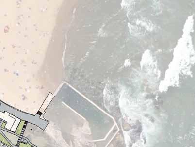
CURL CURL BEACH LANDSCAPE DRAFT MASTERPLAN
|
|
|
- Corey Bradford
- 5 years ago
- Views:
Transcription


1 LANDSCAPE
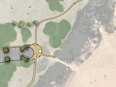
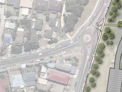
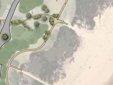
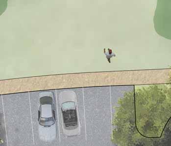
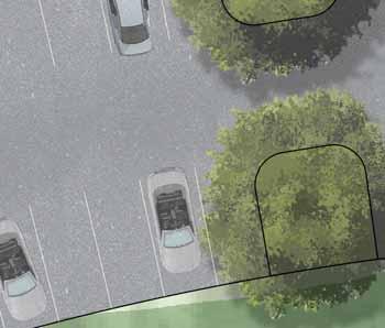
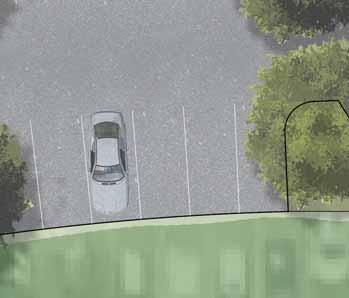
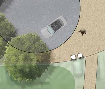
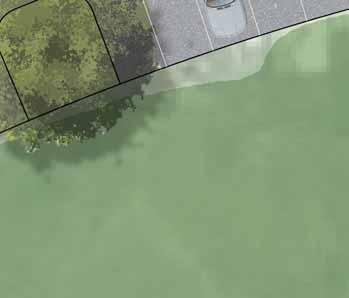
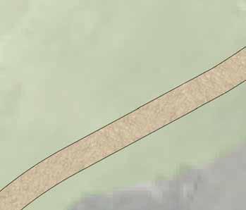
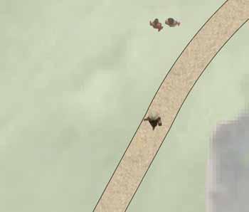
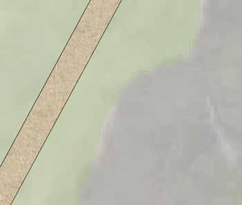
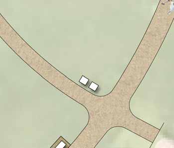
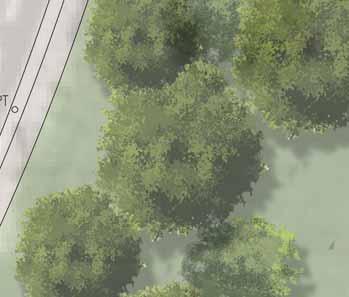
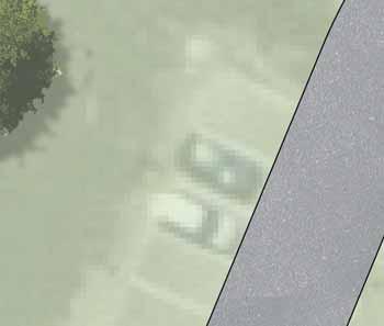
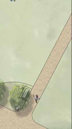
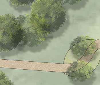
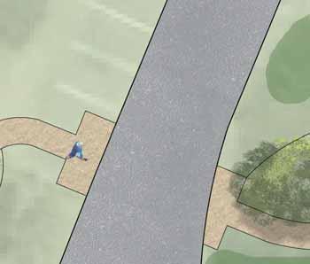
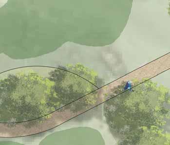
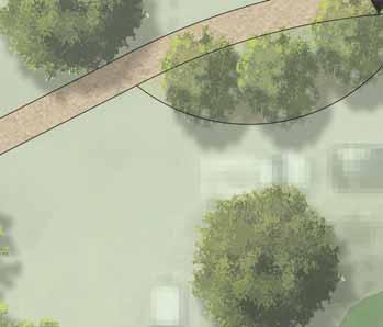
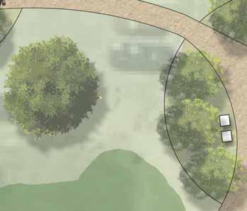
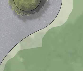
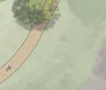
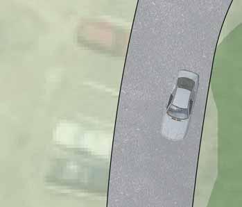
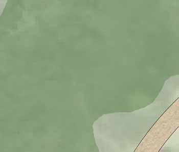
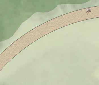
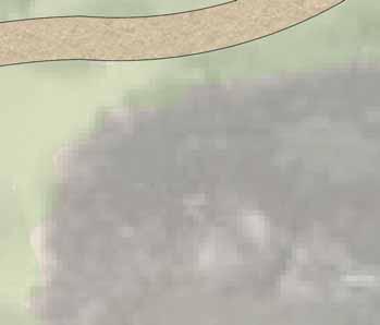
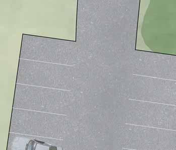
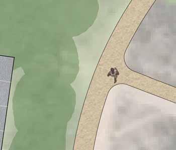
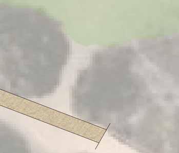
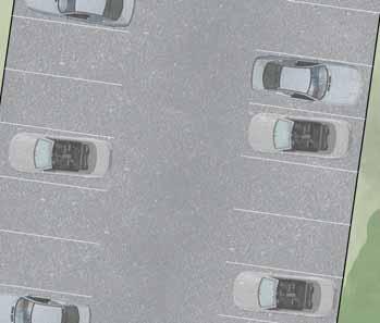
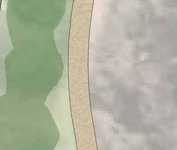
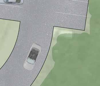
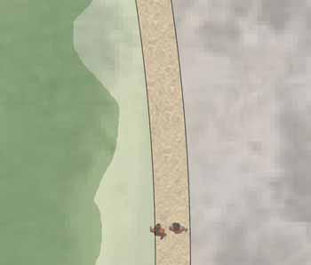
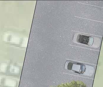
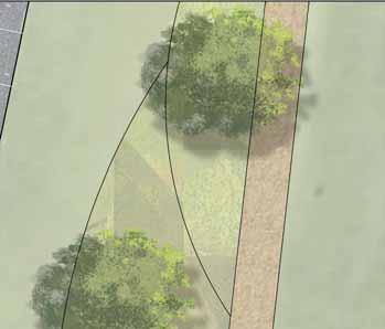
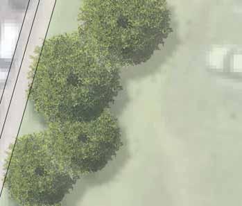
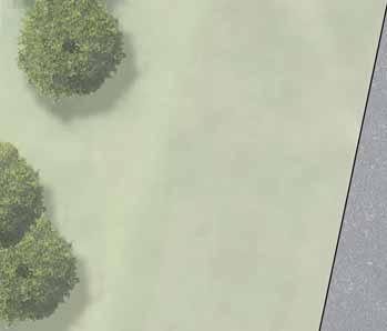
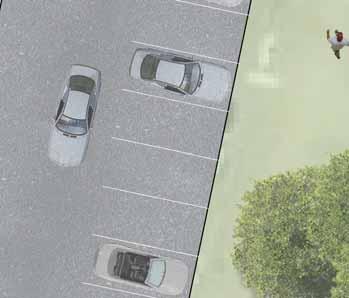
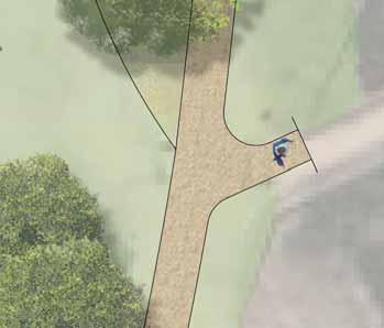
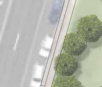
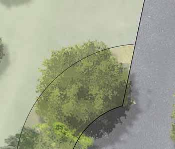
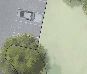
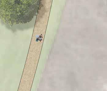
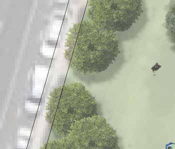
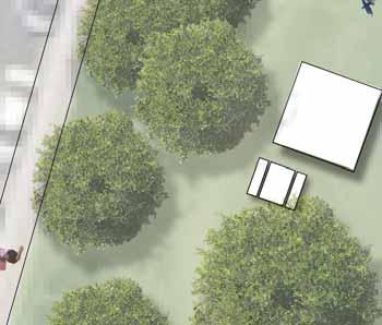
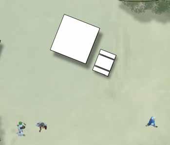
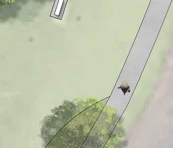
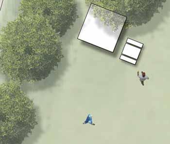
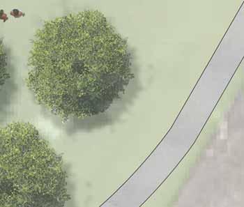
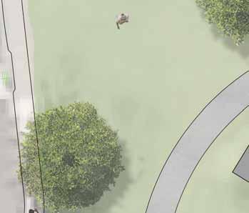
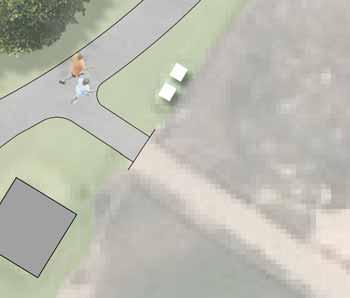
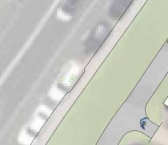
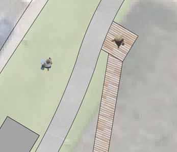
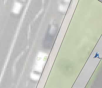
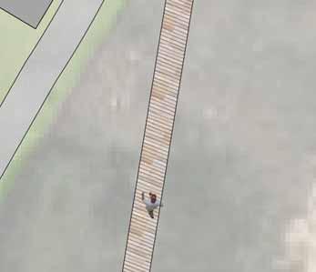
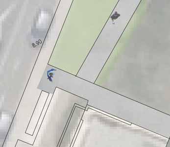
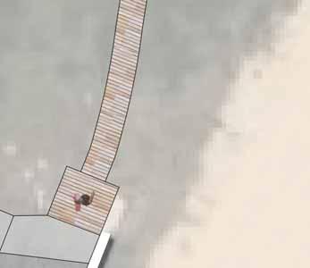
2 LANDSCAPE KEY BENEFITS OPEN SPACE EXISTING = 25600m2 PROPOSED = 29000m2 NATURAL/LANDSCAPED AREA EXISTING = 36200m2 PROPOSED = 38450m2 PARKING SPACES MAIN CAR PARK EXISTING = 172 PROPOSED = 174 SOUTH CURL CURL SLSC EXISTING = 36 PROPOSED = 36 COASTAL WALK CAR PARK EXISTING = 20 PROPOSED = 18 PEDESTRIAN WALKS CONCRETE = 860m DECOMPOSED GRANITE = 1290m BOARDWALK = 40m 64 SPACES AREAS TO BE FENCED OFF TO PROTECT AND WILDLIFE MAINTAIN ACCESS TO LAGOON FOR DOG PLAY MAIN OFF LEASH DOG AREA. POTENTIAL FOR DOG PLAY EQUIPMENT DECOMPOSED GRANITE PATH AROUND OFF LEASH DOG PLAY AREA DECOMPOSED GRANITE MEETING POINT PEDESTRIAN LINK FROM BEACH TO ADAMS STREET OVAL AND ADJACENT PEDESTRIAN WALKS DECOMPOSED GRANITE SECONDARY PATH LINKING PRIMARY PATH TO DOG PLAY AREA OFF LEASH DOG PLAY AREA AND KICK-ABOUT SPACE. IMPROVEMENTS TO TURFED AREAS THROUGHOUT SITE 28 SPACES ENTRY FEATURE AND LINK TO CURL CURL BEACH FROM ADJACENT STREETS. CLEARING OF EXISTING TO CREATE VIEWS 32 SPACES 24 SPACES PRIMARY DECOMPOSED GRANITE PATH LINKING THE NORTH AND SOUTH AREAS OF THE SITE REPLACEMENT OF SELECTED TO INCREASE SURVEILLANCE INTO SITE 26 SPACES INVESTIGATE NEW ENTRY OPTIONS TO IMPROVE TRAFFIC FLOW AND SAFETY START OF OFF LEASH DOG AREA. INFORMATION SIGN AND CHANGE IN SURFACE SURFACE OF EXISTING PARKING IMPROVED CONNECTIONS FROM CAR PARK AND PRIMARY PATH TO BEACH EXTENSION OF GREEN SPACE WITH NEW SHELTERS AND BBQ FACILITIES TO CREATE VIEWING AREA PRIMARY CONCRETE PATH CONNECTION THROUGH SITE. CREATING SEPARATION FROM SAND DUNES BUS STOP TO REMAIN IN EXISTING LOCATION RAISED ACCESSIBLE RAMP ABOVE EXISTING DUNE PROMENADE IN FRONT OF SOUTH CURL CURL SLSC AND CONNECTION TO ROCK POOL CARPARK AND LOADING ZONE 52 SPACES ACCESSIBLE RAMP CONNECTING COASTAL WALK TO CURL CURL BEACH WALK 18 SPACES SURFACE OF EXISTING PARKING


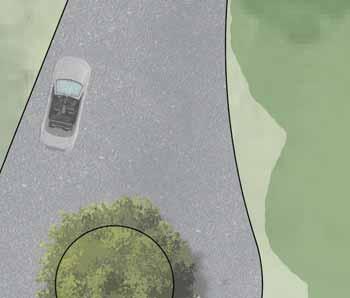
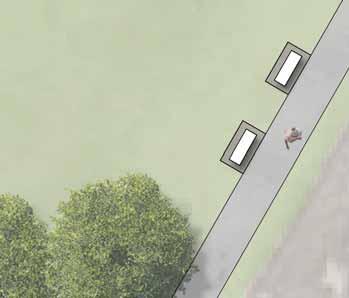
3 LANDSCAPE - DOG PLAY AREAS KEY EXISTING OFF LEASH DOG PLAY PROPOSED OFF LEASH DOG PLAY


4 LANDSCAPE - 03 OFF LEASH DOG PLAY AREA. POTENTIAL FOR DOG PLAY EQUIPMENT DECOMPOSED GRANITE PATH AROUND OFF LEASH DOG PLAY AREA DECOMPOSED GRANITE PEDESTRIAN LINK CONNECTING BEACH TO ADAM STREET OVAL, ADJACENT DOG PLAY AREAS AND PEDESTRIAN TRAILS RELOCATION OF EXISTING SHOWER TURNING CIRCLE AND DROP OFF ZONE DECOMPOSED GRANITE MEETING POINT WITH SEATING AT END OF CAR PARK AND MAIN ENTRANCE TO NORTHERN END OF CURL CURL BEACH SURFACE OF EXISTING CAR PARK. NEW LANDSCAPING INCLUDING TREES AND MEDIAN PLANTING IMPROVED LANDSCAPING WITH IMPROVED TURFED AREAS AND CLEARING OUT OF WEEDS AND DEAD OFF LEASHED DOG PLAY AREA DECOMPOSED GRANITE WALKING PATH LINKING NORTH AND SOUTH AREAS OF SITE


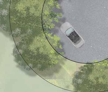
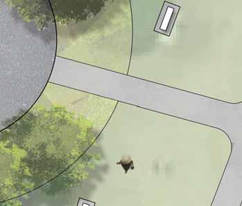
5 LANDSCAPE - 04 SURFACE OF EXISTING CAR PARK KICK-ABOUT SPACE. IMPROVEMENTS TO TURFED AREAS THROUGHOUT SITE LINKING ROAD FOR NORTH AND SOUTH SECTIONS OF CAR PARK CLEARING OF EXISTING DENSE AND REPLACE WITH SUITABLE TREES TO INCREASE SURVELLIANCE INTO SITE AND CREATE STRONG VIEWS FROM STREET DECOMPOSED GRANITE PEDESTRIAN WALK LINKING NORTH AND SOUTH AREAS OF SITE DECOMPOSED GRANITE PATH CONNECTING MAIN BEACH PATHWAY LINK TO CARRINGTON PARADE PATHWAY PRIMARY PATH LINKING THE NORTH AND SOUTH AREAS OF THE SITE ENTRY FEATURE TO CURL CURL BEACH. VIEWS FROM CARRINGTON PARADE, GRIFFIN ROAD AND ADAM STREET TURNING CIRCLE FOR VEHICLES TO MINIMISE CONGESTION WHEN LOOKING FOR PARKING PROTECTION OF ADJACENT DUNE IMPROVED CONNECTIONS TO BEACH WALKWAYS SURFACE OF EXISTING CAR PARK


6 LANDSCAPE - 05 SURFACE OF EXISTING CAR PARK UPGRADED CAR PARK LANDSCAPING, INCLUDING NEW TREES AND MEDIAN PLANTING IMPROVED LANDSCAPING WITH MASS PLANTING OF TREES ALONG PEDESTRIAN WALK IMPROVED CONNECTIONS TO BEACH WALKWAYS REPLACEMENT OF SELECTED TO INCREASE SURVEILLANCE TURNING CIRCLE AND DROP OFF ZONE RETAIN EXISTING MEMORIAL SEATING EXTENSION OF GREEN SPACE WITH NEW SHELTERS AND BBQ FACILITIES PRIMARY CONCRETE PATH CONNECTION THROUGH SITE. CREATING SEPARATION FROM SAND DUNES NEW SEATING ALONG PEDESTRIAN WALKWAY UPGRADE OF EXISTING SITE FURNITURE REMOVAL OF EXISTING FURNITURE TO CREATE LARGER OPEN PLAY SPACE PROTECTION OF ADJACENT DUNE


7 LANDSCAPE - 06 PRIMARY PEDESTRIAN PATH CONNECTING SOUTHERN AND NORTHERN AREAS OF SITE RELOCATION OF EXISTING SITE SHOWERS 1 : 14 RAISED ACCESSIBLE RAMP OVER DUNE MAINTAIN EXISTING RAMP ACCESS UPGRADE EXISTING SITE FURNITURE AND LIFEGUARD VIEWING AREA MAINTAIN EXISTING STAIR ACCESS FROM CARRINGTON PARADE TO BEACH PROMENADE PROMENADE IMPROVED OUTDOOR DINING NEW STAIR CONNECTION FROM CARRINGTON PARADE. SEPARATING PEDESTRIAN AND VEHICULAR ACCESS ADJUSTED ENTRY RAMP TO CAR PARK FROM CARRINGTON PARADE TO ACCOMMODATE NEW PEDESTRIAN CONNECTION SCREENING FOR EXISTING BIN STORAGE AREA SURFACE OF EXISTING PARKING AREA AND LOADING ZONE PROMENADE AND CONNECTION TO ROCK POOL 1 : 13 ACCESSIBLE RAMP CONNECTING TOP CAR PARK WIDENING OF EXISTING STAIRS TO ROCK POOL VIEWING POINT WITH SEATING 1 : 13 ACCESSIBLE RAMP CONNECTING EXISTING COASTAL WALK TO CURL CURL BEACH AND PROPOSED PEDESTRIAN LINK NEW RETAINING WALL TO ALLOW FOR RECONFIGURATION OF CAR PARK NEW VIEWING AREA AND MEETING POINT AT END/BEGINNING OF COASTAL WALK SURFACE OF EXISTING CAR PARK ALLOWING EASY TURN AROUND POINT


8 LANDSCAPE - 07 PRIMARY PEDESTRIAN PATH CONNECTING SOUTHERN AND NORTHERN AREAS OF SITE IMPROVED BEACH ACCESS RELOCATION OF EXISTING SHOWER 1 : 14 RAISED ACCESSIBLE RAMP OVER DUNE AA PROTECTION OF ADJACENT DUNE MAINTAIN EXISTING RAMP ACCESS PROMENADE RETAIN EXISTING STAIR ACCESS EXISTING FOOTPATH RELOCATED SHOWER NEW CONCRETE PATH DUNE WITH PROPOSED RAISED TIMBER BOARDWALK CURL CURL BEACH SECTION AA - 1 : 100


9 LANDSCAPE - 08 AA IMPROVED SURFACE TREATMENT TO EXISTING PROMENADE AND CONNECTION TO ROCK POOL WIDENING OF EXISTING STAIRS TO 1500mm WIDE VIEWING POINT WITH SEATING 1 : 13 ACCESSIBLE RAMP CONNECTING TOP CAR PARK AND COASTAL WALK TO CURL CURL BEACH NEW WHEEL STOPS TO ACT AS BARRIER FOR PEDESTRIAN WALK SURFACE OF EXISTING CAR PARK, MAINTAINING VIEWS TO BEACH BEGINNING/END OF EXISTING COASTAL WALK. NEW SEATING AND SHELTER TO CAPTURE SURROUNDING COASTAL VIEWS CARRINGTON PARADE RECONFIGURED CARPARK NEW CONCRETE PATH HEADLAND EXISTING CONCRETE PROMENADE ROCK POOL SECTION AA - 1 : 100
Wentworth Point July Community Information Session Feedback Summary
 Wentworth Point July Community Information Session Feedback Summary Introduction On Saturday, 28 July 2018, Landcom held a community information session from 11am to 1pm, at the Pulse Club, Wentworth Point,
Visualisations of reimagined Italian Garden & Rose Garden. Italian & Rose Gardens
 Visualisations of reimagined Italian Garden & Rose Garden Italian & Rose Gardens High quality heritage restoration toprotct & enhance these jewels of South Cliff Gardens New stone flag footpaths Restoration
Foreshore Redevelopment Masterplan
 Foreshore Redevelopment Masterplan Design Guidelines July 009 Introduction The Surfers Paradise Beachfront Masterplan Design Guidelines describe the proposed Public Promenade Beachfront interface zone
PART 5 : TEXTURE : PUBLIC DOMAIN CONCEPTS
 ART : TEXTURE : UBLIC DOMAIN CONCETS ENTRANCE TOWN CENTRE MASTERLAN 37 MARINE ARADE 3i 1a 3d 4a 3 6 3e 4b 4 3g 3c 4c 3f 3b 3a 1a 1 2a 2 3h WATERFRONT RECINCT WEST MASTERLAN TUGGERAH LAKE - CHANNEL The
KAMBAH INN SPRING GARDEN CHINESE RESTAURANT
 COURT SPRING GARDEN CHINESE RESTAURANT STAGE STAGE PRE TENDER INDICATIVE PLAN 0-0 COURT EXISTING EUCALYPT TO BE RETAINED SPRING GARDEN CHINESE RESTAURANT STAGE TOILET BLOCK NEW TOILET BLOCK AND SOLID ROOF/SHADE
Walkway position / alignment. Maintains a 1.5 to 2m separation to existing Norfolk Island Pines to provide usable grassed open space.
 This shall be read in conjunction with: oberts oad Termination Plan efer to Frame Group documentation for ngineering Plans, Profiles and Cross Sections and Construction Methodologies. Final set out of
Port Macquarie Town Centre Landscape Architects
 Port Macquarie Town Centre Town Green Master Plan Review Tract Landscape Architects Urban Designers Town Planners A review of the Town Green Master Plan Port Macquarie, New South Wales Prepared by Tract
Proposed Pedestrian and Cycle Routes. Headland to Spit Great Ocean Walk and coastal path network* (Regional scale path)
") four strategies access and movement The access and movement strategy for the Master Plan aims to promote healthy, active and sustainable movements to and through Mooloolaba. Pedestrian and Cycle A lack
four strategies access and movement The access and movement strategy for the Master Plan aims to promote healthy, active and sustainable movements to and through Mooloolaba. Pedestrian and Cycle A lack
ROCKAWAY BOARDWALK Community Board 14 Parks Committee Meeting June 4, 2014
 ROCKAWAY BOARDWALK Community Board 14 Parks Committee Meeting June 4, 2014 Introduction 2 Agenda Design Update Construction Update Local Hiring Update 3 Community Input 7 Meeting Date September 17, 2013
PART 05 VISUAL SETTING
 PART 05 VISUAL SETTING 5.1 How to use the Visual Settings 5.2 Views from the Headland 5.3 Creek Foreshore Park Looking North 5.4 Bridge looking North 5.5 Bridge looking West 5.6 Bridge looking South 5.7
Seven Creeks Neighbourhood. Community Plan
 Seven Creeks Neighbourhood Community Plan INTRODUCTION SEVEN CREEKS The Seven Creeks Estate is home to a steadily expanding community of families, couples and individuals who enjoy the very best of both
project background relationship to the spit Guiding Principles Mooloolaba Spit Futures Plan (2009) Vision one
 Vision one") one project background relationship to the spit The Spit is an important part of Mooloolaba and a key contributor to the natural beauty of the town. The Spit is cherished by local residents and visitors
one project background relationship to the spit The Spit is an important part of Mooloolaba and a key contributor to the natural beauty of the town. The Spit is cherished by local residents and visitors
Ohlone College Measure G Project Scope Revisions
 Scope Revisions Current Title Revised Title Current Scope Revised Scope 6101 Relocated Baseball Field Athletic Fields Create new sustainable baseball field with synthetic turf, bleacher seating and batting
Waterlily Playscape Committee Waterlily Playscape, Waterlily Park, Ocean Shores Draft Concept Plan. G Issue D 14/07/16
 Waterlily Playscape Committee Waterlily Playscape, Waterlily Park, Ocean Shores Draft Concept Plan Issue D 14/07/16 New two level wharf for fishing and interacting with waters edge (exact location to be
VEHICULAR AND PEDESTRIAN CIRCULATION
 This perspective sketch communicates the intended character and quality of a proposed streetscape design. Locate benches near a major intersection where people tend to gather. Seating and lighting provide
A CONCEPTUAL PROPOSAL BY THE UMDLOTI FORUM Representing the Umdloti Ratepayers and Residents Association and the emdloti UIP
 A CONCEPTUAL PROPOSAL BY THE UMDLOTI FORUM Representing the Umdloti Ratepayers and Residents Association and the emdloti UIP PRESENTATION STRUCTURE 1.0 Overview of Umdloti 2.0 Current challenges in Umdloti
Four Big Ideas. Three Key Opportunities. Principles. Draft Place Making Master Plan. 1. The Foreshore 2. Green Links. 3.
 project background Four Big Ideas 1. The Healthy Thriving Place. An International Focus 3. Reclaiming Mooloolaba 4. The Resort Heart of the Coast In November 01 a big ideas workshop was held involving
ACADEMY AREA CONCEPT PLAN
 ACADEMY AREA Strip ling C hape l Roa d CONCEPT PLAN 7 S2 U Stripling 52 ROADWAYS AND PARKING: ADVENTURE PLAYGROUND AND SPRAYGROUND: Current roadways follow existing drives. It is recommended that the Folds
Master Plan Presentation August 12, 2015
 Master Plan Presentation August 12, 2015 A vision for tomorrow... May, 13 2015 prepared for: prepared by: SITE LOCATION SITE NTS SITE ANALYSIS +/- 17.8 Ac. RESIDENTIAL HOMES 1 2 RAIL ROAD (SAFETY CONCERNS)
BAY DRIVE PARK Questions and Answers
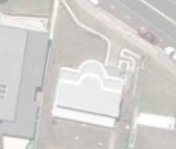
 Q. How tall is the building near the beach and what will it look like? A. The Park Amenity Building is a two-story metal-roofed coquina-faced building with a restroom on the first floor and an observation
Legend Explanation CONCEPT PLAN
 Legend Explanation CONCEPT PLAN A. Community Hall Flexible Space with associated amenities and catering facilities Adjacent smaller community meeting spaces Raised podium with wide sheltered breakout spaces
Woods Chapel Park. Park Amenities: Playground, basketball court, single table shelter, small pond and multi-use trail.
 Woods Chapel Park Park Location: 3925 NW Dogwood Park Land Established: 1979 Park Size: 10 acres Developed Acres: 6 acres Undeveloped Acres: 4 acres Park Type: Neighborhood Park Amenities: Playground,
1999 Approval to replace World War I monument and relocate plaques Approval to rehabilitate the Chase Mill building and surrounding site
 Memorandum PLANNING DIVISION DEPARTMENT OF COMMUNITY AND NEIGHBORHOODS To: Historic Landmark Commission From: Katia Pace, Principal Planner Date: October 26, 2016 Re: Liberty Park Improvements The purpose
OPPORTUNITIES AND CONSTRAINTS - OXBOW PARK ENTRANCE AND PUT-IN
 OPPORTUNITIES AT OXBOW EXISTING WETLANDS Site is undeveloped and we can design a park that works well from the start. SAND BEACH Potential to eliminate invasive species. DEBRIS (CONCRETE, OLD CARS) VEGETATION
Tangimoana Community Plan Presentation
 Tangimoana Community Plan Presentation Vision Statement Tangimoana Retain and improvethe special natural character and environment that makes us an iconickiwiana village Page 6 I Tangimoana Community Plan
BACKGROUND CONTEXT & ANALYSIS MASTER PLAN KEY PRECINCTS IMPLEMENTATION 5.1 IMPLEMENTATION OVERVIEW 5.5 POSSIBLE PROJECTS PRECINCT D
 1 2 3 4 5 BACKGROUND CONTEXT & ANALYSIS MASTER PLAN KEY PRECINCTS IMPLEMENTATION 5.1 IMPLEMENTATION OVERVIEW 5.2 POSSIBLE PROJECTS PRECINCT A 5.3 POSSIBLE PROJECTS PRECINCT B 5.4 POSSIBLE PROJECTS PRECINCT
BACKGROUND INFORMATION DOCUMENT
 BACKGROUND INFORMATION DOCUMENT PROPOSED UPGRADING OF THE N2 NATIONAL ROAD FROM KRAAIBOSCH TO DIE VLEIE BASIC ENVIRONMENTAL IMPACT ASSESSMENT The South African National Roads Agency Society Limited (SANRAL)
Project Location. Jay and Patty Baker Park and Gordon River Greenway Connector Bridge. Naples Beach Golf Club. Gordon River. East. Naples.
 Gordon River Project Location Naples Beach Golf Club East Naples Naples Naples Bay Evergreen Golf and Country Club and Gordon River Greenway Connector Bridge Gordon River Greenway CONNECTOR BRIDGE AND
STANDARD SPECIFICATIONS Book 2 ENGINEERING DRAWINGS INCLUDES ADDENDUMS
 STANDARD SPECIFICATIONS Book 2 ENGINEERING DRAWINGS INCLUDES ADDENDUMS July 23, 2018 Page 1 of 7 STANDARD LEGEND SYMBOLS (September, 1973)... AS-101A STANDARD LEGEND SYMBOLS (September, 1973)... AS-101B
TONIGHT S MEETING DRAFT SUMMARY REPORT CAPE WOOLAMAI COASTAL RESERVES MASTER PLAN PHILLIP ISLAND SOUTH AND NORTH COAST KEY AREA PLAN OCTOBER 2014
 TONIGHT S MEETING Phillip Island Nature Parks and Bass Coast Shire Council have partnered to achieve a comprehensive and integrated master plan for the safe use and management of Cape Woolamai Coastal
City of Rockingham. Local Management Practices, Costs and Strategic Coastal Planning
 City of Rockingham Local Management Practices, Costs and Strategic Coastal Planning Decision Making Process Considerations Climate Change Response Action Plan Ongoing observations/major Storm events Ongoing
ROAD AND CAR PARK DESIGN GUIDELINES
 3.2 ROAD AND CAR PARK DESIGN GUIDELINES PIHA AREA DESIGN GUIDELINES AUCKLAND REGIONAL COUNCIL 37 Existing Road and Car Park Photos: North Piha carpark Anawhata carpark Winstone Track carpark off Piha Road
LOS ANGELES MISSION COLLEGE MASTER PLAN Master Plan DESIGN & DEVELOPMENT PRINCIPLES
 LOS ANGELES MISSION COLLEGE MASTER PLAN DESIGN & DEVELOPMENT PRINCIPLES 34 Quality Learning Along the Arroyo PROGRAM SUMMARY BY PROJECT The following are program summaries for each of the projects planned
KEY MAP DEVELOPMENT PERMIT AREA MAP. Sunnymede North Sub-Area Plan
 Richmond Official Community Plan BROADMOOR AREA SUNNYMEDE NORTH SUB-AREA PLAN Bylaw 7100 Schedule 2.6C SUNNYMEDE NORTH SUB-AREA PLAN SUNNYMEDE NORTH SUB-AREA PLAN SUNNYMEDE NORTH SUB-AREA PLAN KEY MAP
The open space system should provide connective elements, relate to natural resources, and enhance the suburban character of the landscape..
 The open space system should provide connective elements, relate to natural resources, and enhance the suburban character of the landscape.. Mixed-use and infill development should maintain or enhance
5.0 Key Implementation Areas
 SECTION 5 KEY IMPLEMENTATION AREAS page 35 5.0 Key Implementation Areas This section provides a schedule of works required to implement objectives and policies identified in this management plan. The landscape
Long Branch-Wayne Local Park Renovation Project
 Montgomery Parks Long Branch-Wayne Local Park Renovation Project Community Meeting #2 September 20, 2016 Oak View Elementary School 7:00-9:00 PM Welcome / Team Introductions M-NCPPC (Montgomery Parks)
4.1 Build Alternative 1 Construction Phasing
 SECTION 4 Implementation Plan This section discusses potential segmentation of the build alternatives into multiple projects for implementation of improvements to the NSH from Rabbit Creek Road to 36th
Preci nct P l ans Figure 56 Campus Aerial Photo, 2008 CAL STATE EAST BAY, HAYWARD CAMPUS MASTER PLAN
 9 Precinct Plans This section contains a detailed discussion of the planning and design concepts for specific areas or precincts of the Cal State East Bay Hayward campus. The Precinct Plans pertain to
ADELAIDE COMETS CLUBROOMS DESIGN CONCEPT
 PREPARED FOR Adelaide Comets FC Tampawardli Park (Ellis Park) Lot 587 West Terrace Adelaide SA 5000 P +61 8 8333 9796 ATTENTION Jim Tsouvalas P +61 8 8231 1885 E webmaster@adelaidecomets.com.au PREPARED
Point Defiance Park. Master Plan Update. April 23 rd 2015
 Point Defiance Park Master Plan Update April 23 rd 2015 Public Participation 1/29, 2/26, 3/26 & 4/23 Tonight s Agenda: Introduction: March Meeting Recap: Overview Feedback Responses Presentation of Master
MICHAELS AVE RESERVE. Draft Concept Plan of South Section September Contents. 1 Project Background. 2 Masterplan Timeline
 MICHAELS AVE ESEVE Draft Concept Plan of South Section September 05 Contents Project Background Masterplan Timeline Photographic Analysis Option A - Updated Masterplan 5 Option B - Alternative Design 6
Blue Springs Park. Park Land Established: Developed Acres: 12 acres Undeveloped Acres: 2 acres
 Blue Springs Park Park Location: 2204 SW South Ave. Park Land Established: 1975 Park Size: 14 acres Developed Acres: 12 acres Undeveloped Acres: 2 acres Park Type: Neighborhood Park Amenities: Softball
Emerson Park Master Plan Update. Public Meeting III August 27, 2014
 Emerson Park Master Plan Update Public Meeting III August 27, 2014 Meeting Agenda: Project Update Presentation of Master Plan Components Discussion and Feedback The Path Forward: Building on the Concept
Achieving a Vision. Master Plan 2009 Belknap Campus August 10 11, UofL Belknap Campus Master Plan Update
 Achieving a Vision Master Plan 2009 Belknap Campus August 10 11, 2009 Consultant Team The Campus Studio Ann Arbor Michigan Team Leader Campus Planning Site Design JRA Architects Louisville Kentucky Assistant
Preferred Riverwalk Alternative Components August 17, 2017:
 Preferred Riverwalk Alternative Components August 17, 2017: 1. Entrance and Future Pump Station Location: Entrance location to line up with main parking entrance to Captain Parkers and allows future Pump
JACKsON STREET PIER CONCEPTUAL DESIGN PACKAGE SEPTEMBER 21, 2017
 JACKsON STREET PIER CONCEPTUAL DESIGN PACKAGE SEPTEMBER 21, 2017 JACKsON STREET PIER Process outline DESIGN PROCESS OVERVIEW: Sandusky s Jackson Street Pier Conceptual Design process included input from
DICKY BEACH PRECINCT PLAN. 10 November 2016 ENDORSED REV D
 PLAN 10 November ENDORSED CONTENTS This document presents the Dicky Beach Precinct Plan while capturing the project s key design phases and associated deliverables. The document has been organised into
ANCHORAGE PARK REPORT CARD Assessing A Park s Appearance, Function, & Condition
 ANCHORAGE PARK REPORT CARD Assessing A Park s Appearance, Function, & Condition Park Name: Is Your Park an A or an F? Your Name: Contact Information Optional: Date: General Instructions: Phone: Email:
Pedestrian and Bike Bridge LOGO
 6.2.2 Pedestrian and Bike Bridge The proposed pedestrian and bike crossing re-envisions the existing bridge at Pismo Creek on Cypress Street. The bridge is currently underutilized by vehicular through
SALEM FOREST RIVER PARK PRELIMINARY POOL AREA ASSESSMENT & MASTER PLAN STUDY. For the City of Salem
 SALEM PRELIMINARY POOL AREA ASSESSMENT & MASTER PLAN STUDY For the City of Salem 6-13-17 This process undertaken by Weston & Sampson is to outline preliminary ideas only of what possibilities exist for
PASSENGER RAIL NETWORK LIGHTING OF STATION ENVIRONMENT TO COMPLY WITH DISABILITY STANDARDS FOR ACCESSIBLE PUBLIC TRANSPORT
 PASSENGER RAIL NETWORK LIGHTING OF STATION ENVIRONMENT TO COMPLY WITH DISABILITY STANDARDS FOR ACCESSIBLE PUBLIC TRANSPORT Prepared for The Australasian Rail Association by: WEBB Queensland 7 Baroona Road
Overview Report. Proposed Development
 Overview Report Proposed Development the construction of a 1km cycle/pedestrian trail including a new footbridge, new car park and entrance road at Drumshanbo Lock and a new pedestrian/cycle road crossing,
FORD PARK MASTER PLAN SEPTEMBER 2016
 FORD PARK MASTER PLAN SEPTEMBER 2016 The Ford Park Master Plan has been prepared for Banyule City Council by ACLA in association with insideedge. FINAL COPY - Submitted to Council 1 September 2016 Contents
Mount Maunganui North. Neighbourhood Plan
 Mount Maunganui North Neighbourhood Plan March 2002 Acknowledgements The time and energy provided to this neighbourhood planning process by representatives of the Mount Maunganui Progressive Association,
New Berlin City Center Plan Commission Review PDQ Food Stores, Inc
 March 2, 2017 City of New Berlin Planning Commission 3805 S Casper Dr New Berlin, WI 53151 RE: New Berlin City Center Plan Commission Review PDQ Food Stores, Inc Dear Plan Commission Members, On behalf
CARDIFF STREETSCAPE MASTER PLAN. Warners Bay. Belmont. Glendale. Swansea. Toronto. Morisset. ADOPTED - Mar Issue 01, Version 02.
 Warners Bay Belmont Glendale Swansea Toronto Morisset ADOPTED - Mar 2012 - Issue 01, Version 02. - MISC/39/2011 Mount Hutton Charlestown INTRODUCTION 1 of 10 PLANNING CONTROLS 1. Lifestyle 2020. LAKE MACQUARIE
14-18 Gallway St, Windsor. Revision D
 Revision D The Gallway Street Landscape Design Intent: The overall planting design intent: is to be a native, resilient, sub-tropical collection of species. The arrangement to the front entry space will
CONICAL HILL RESERVE Landscape Concept Plan. January 2018
 CONICAL HILL RESERVE Landscape Concept Plan January 018 CONICAL HILL RESERVE LANDSCAPE CONCEPT PLAN Prepared for: Hurunui District Council (HDC) Prepared by: Align Ltd Concept Plan 19.01.18 Designed: Align
GREENVALE CENTRAL PRECINCT STRUCTURE PLAN
 76 Conservation area boundary. Low Fence to exclude vehicles but allow pedestrian access Front boundary of allotment 5.0m MINIMUM SETBACK Path providing public access to dwellings fronting Conservation
BRITTINGHAM PARK DOG PARK IMPROVEMENTS PUBLIC INPUT MEETING #2. Sarah Lerner, Landscape Architect - City of Madison Parks Division
 BRITTINGHAM PARK DOG PARK IMPROVEMENTS PUBLIC INPUT MEETING #2 Sarah Lerner, Landscape Architect City of Madison Parks Division TONIGHT S GOALS Existing Conditions Design Considerations Surfacing Options
11.0 TRANSPORTATION ELEMENT
 11.0 TRANSPORTATION ELEMENT Transit, Circulation and Parking Sub-Element: For all campuses, FIU's goal is to increase multimodal access. In combination with other measures - such as the development of
Fifth and Detroit Street Design May 2017 Capital Improvements Committee. DOWNTOWN Street Design
 1 Fifth and Detroit Street Design May 2017 Capital Improvements Committee Agenda 2 Review Street Configuration Prior Meeting Review Outreach Synopsis Functional Street Design Refinements Curb Edge, Turning
Wilbur Young Park. Park Land Established: Developed Acres: 15 acres Undeveloped Acres: 25 acres
 Wilbur Young Park Park Location: 1100 SE Adams Dairy Parkway Park Land Established: 1987 Park Size: 40 acres Developed Acres: 15 acres Undeveloped Acres: 25 acres Park Type: Community Park Amenities: Shelter
2. reimagine kings way undercroft as a community space
 2. reimagine kings way undercroft as a community space CLARENDON STREET CLARKE STREET QUEENS BRIDGE STREET MORAY STREET CITY ROAD BALSTON STREET BOYD KINGS WAY POWER STREET KAVANAGH WEST GATE FREEWAY Figure
Elsternwick Park Northern Sector. Phase 2 Community Engagement Summary Report
 Elsternwick Park Northern Sector Phase 2 Community Engagement Summary Report June 2016 Table of Contents Introduction... 3 Stage 1 Idea Generation Engagement Overview... 3 Stage 2 Concept Generation -
MUNICIPALITY OF ANCHORAGE
 MUNICIPALITY OF ANCHORAGE ANCHORAGE PARKS & RECREATION PRC 09-52 b DATE: November 2, 2009 TO: FROM: SUBJECT: Park and Recreation Commission Suzanne R. Little, Senior Park Planner Jewel Lake Park Improvements
ENVISION. Planning and Policy Initiatives Maintenance and Operations Initiatives Programming Initiatives
 ENVISION Through the master planning process, a range of ideas, concepts, policies and initiatives were developed and vetted internally with staff, the project Advisory Committee, and master plan team.
CIVITAS CIVITAS CIVITAS CIVITAS CIVITAS CIVITAS CIVITAS CIVITAS CIVITAS CIVITAS CIVITAS CIVITAS CIVITAS CIVITAS CIVITAS CIVITAS
 7. The Vision 80 East River Esplanade Vision Plan Site Specific Visions Through research, analysis, outreach, and discussions with city and state agency representatives, it became apparent that a phased,
30% DRAFT GAINSBORO PARK IMPROVEMENT PROJECT THE CITY OF PLEASANT RIDGE CITY OF PLEASANT RIDGE, OAKLAND COUNTY, MICHIGAN
 LEGAL PROPERTY DESCRIPTION SEE NOTES SHEET FOR LEGAL PROPERTY DESCRIPTIONS THE CITY OF PLEASANT RIDGE GAINSBORO PARK IMPROVEMENT PROJECT CITY OF PLEASANT RIDGE, OAKLAND COUNTY, MICHIGAN 4444 Second Avenue
PRELIMINARY DESIGN + DEVELOPMENT PLAN
 WELCOME! To The Public Open House May 30 th, 2017 HARBOUR WEST PARKS Vision Project Overview The City s vision for Port Credit Harbour West Parks is to develop a vibrant waterfront destination that integrates
BRIGHTON BEACH TO FERDINANDO GARDENS DRAFT MASTERPLAN. Thompson Berrill Landscape Design P/L 26 July 2016
 BRIGHTON BEACH TO FERDINANDO GARDENS DRAFT MASTERPLAN Thompson Berrill Landscape Design P/L 26 July 2016 CONTENTS PAGE INTRODUCTION Introduction Land Management Cultural Heritage Existing Conditions Plan
Monte Cecilia Park DRAFT CONCEPT PLAN FEBRUARY 2015 AUCKLAND COUNCIL
 Monte Cecilia Park DRAFT CONCEPT PLAN FEBRUARY 2015 AUCKLAND COUNCIL 1 Site analysis and concept 1.1 Location Site Extent MT ALBERT RD HILLSBOROUGH RD BUDOCK RD MONTE CECILIA PARK KORMA RD HERD RD Figure
WELCOME TO YOULBURY. WELCOME TO YOULBURY EXISTING SITE
 WELCOME TO YOULBURY In Scouting, we believe that young people develop most when they are learning by doing, when they are given responsibility, work in teams, take acceptable risks and think for themselves.
Chapter 4: Jordan Road Character District
 4: Jordan Road Character District 4.1 Introduction The Jordan Road character district encompasses much of the former Jordan orchard and farmstead, which was a significant part of Sedona s history. The
GRASS CREEK PARK WASHROOM AND AND FACILITY UPDATE: CONCEPT A A FLOOR PLAN AND ELEVATIONS 2/5 PRELIMINARY ARCHITECTURAL FLOOR FLOOR PLAN_CONCEPT A A
 AND FACILITY UPDATE AND FACILITY AND FACILITYUPDATE: UPDATE: CONDITIONS CONDITIONS /5 CONDITIONS CONDITIONS AERIAL AERIAL ENTRANCE DRIVEWAY GRAVEL PATHWAY AREA OF BERM OF OF FROM FROM PLAYGROUND PLAYGROUND
PLANNING RATIONALE FOR THE PROPOSED RIVERSIDE SOUTH ELEMENTARY SCHOOL 715 BRIAN GOOD AVENUE, OTTAWA, ON
 PLANNING RATIONALE FOR THE PROPOSED RIVERSIDE SOUTH ELEMENTARY SCHOOL 715 BRIAN GOOD AVENUE, OTTAWA, ON Conseil des écoles publiques de l'est de l'ontario (CEPEO) French Public School Board TABLE OF CONTENTS
Establish a network of streetscaped vehicle and pedestrian routes that connect within and outside the Plan area.
 This Plan s urban design goals are to create an urban scale, walkable community with connections to transit, parks, and services and with amenities and facilities for residents and employees. The 1992
East Grove Public Realm
 H - - MP - Elephant Park Public Realm RO EY DN NEW KENT ROAD E AC PL The public realm has been designed to create an environment which is easy to move through, accessible to all, safe and playful. The
Courthouse Square Planning & Urban Design Study. Courthouse Square Working Group #13 October 15, 2014
 Courthouse Square Planning & Urban Design Study Courthouse Square Working Group #13 October 15, 2014 1 Courthouse Square Process Working Group Community Courthouse Square Advisory Groups & Civic Associations
Revitalization of Durand Park. Durand Park Proposal June 2008
 Revitalization of Durand Park Durand Park Proposal June 2008 Background! " Property purchased in 1974! " Opened in September 1975, largely thanks to the work of the DNA! " Only park in the Durand: 12 000
HOOVER-UNION TRIANGLE
 HOOVER-UNION TRIANGLE TABLE OF CONTENTS INTRODUCTION Who? What? Why? MEETING #1 RECAP [3/25] Presentation Activities Post-it Boards Photos Generated Schemes MEETING #2 RECAP [4/8] Presentation Schematic
CRA Five Year Capital Improvement Plan. September 2, 2015
 CRA Five Year Capital Improvement Plan September 2, 2015 Downtown CRA Recap Introduction Downtown Capital Improvement Projects: $2.6M available for FY 2016. Includes the recent loan of $2.0M. DOWNTOWN
Point Grey Precinct Plan Final Plan
 Final Plan 3D Perspective View Indicative only NOVEMBER 2015 Contents Contents Figures Acronyms 1. Introduction 4 5. Design Guidelines 32 Figure 1: The Plan 15 AHD Australian Height Datum 1.1 About this
Design & Access Statement
 PI 007 RIBA Chartered Architects Design & Access Statement Ocean Beach Pleasure Park South Shields 1.0 Appraising the Context 1.1 Assessment of the sites immediate and wider context 1.2 Involvement Consultation
Devil s Slide Coastal Trail Improvements Project. County of San Mateo
 County of San Mateo Project History Measure T Nov.1996 Plans and Permits Task Force meetings Hired a team Board support Budget Project Overview Programming and Linkages Park hours Multi use trail Pedestrians
Ward Park. Park Land Established: Developed Acres: 9 acres Undeveloped Acres: 4 acres
 Ward Park Park Location: 1000 SW 22 nd St Park Land Established: 1979-80 Park Size: 13 acres Developed Acres: 9 acres Undeveloped Acres: 4 acres Park Type: Neighborhood Park Amenities: 2 Shelters, tennis
WALLACE EMERSON. Visioning Open Houses Summary Report
 WALLACE EMERSON Visioning Open Houses Summary Report June 2018 INTRODUCTION On Thursday, April 26, 2018 and Tuesday, May 22, 2018; Galleria Developments hosted two separate Aspirations, Ideas and Visioning
West Dennis Center: Bass River to Old Main Street. West Dennis Business District: Old Main Street to Dennis Commons
 West Dennis Center: Bass River to Old Main Street West Dennis Business District: Old Main Street to Dennis Commons Dennisport Center: Dennis Commons to Division Street Main Street Project Goals Project
Report or technical documentations of the target areas in Siauliai
 WP 4 Energy Supply Report or technical documentations of the target areas in Siauliai 2011.10.27 Summary of the draft version of technical documentation for two target areas Lieporiai park 1.1. Works basis
Memorial Business Park Site. Proposed Future Development. Design guidelines. August
 Memorial Business Park Site Proposed Future Development Design guidelines August 2014 www.designenvironment.co.nz 0064 3 358 3040 Contents 1.0 Background 1.1 Introduction 3 1.2 Objectives 4 2.0 Context
Implementation plan. 3.1 Staging
 3 Implementation plan 3.1 Staging The Olympic Park Master Plan has been developed to provide actions that are practical and realistic and considers the financial responsibilities and capacity of Council
Brains and Archibald park concept plan
 Brains and Archibald park concept plan The Brains and Archibald park concept plan has been commissioned by the Whau Local Board for the purpose of providing a vision to guide improvements to Brains Park
Wentworth Point Peninsula Park
 WELCOME Welcome to today s community information session. Landcom has been appointed by Roads and Maritime Services (owners of the land) to construct Point Park. Today s information session is to give
Hidden Pointe Landscape Master Plan. June, archi terra
 Hidden Pointe Landscape Master Plan June, 2006 t h e archi terra g r o u p 1 Table of Contents Background Purpose and Goals of the Master Plan Master Plan Process Existing Conditions Entrance Hidden Pointe
Foreshore Community Reference Committee
 Foreshore Community Reference Committee MINUTES - Meeting Two On-site inspection Elwood to St Kilda West Beach 26 th October 2010 2.30 5.00pm. In Attendance: Councillor Janet Bolitho Nick Aagren - Port
7.5 Impacts on the Section 4(f) Properties
 Properties") constructive use, such as noise, air quality and visual impacts were also assessed. It was determined that this project would not introduce changes of an external nature that would affect the recreational
constructive use, such as noise, air quality and visual impacts were also assessed. It was determined that this project would not introduce changes of an external nature that would affect the recreational
Lower Merion Commercial Districts Issues and Characteristics Handbook November 2013
 Lower Merion Commercial Districts Issues and Characteristics Handbook November 2013 DRAFT TOWNSHIP-WIDE VISION: To maintain and enhance commercial areas to complement the surrounding high-quality residential
The principal elements of the NTC Strategic Vision plan are as follows.
 The proposed project would improve the NTC site plan, circulation, visitor amenities, and landscaping, and would include construction of two new stadiums to replace the existing Louis Armstrong Stadium
GYPSUM PARKWAY CORRIDOR ENHANCEMENT Gypsum, Colorado. Schematic Design January 2015
 GYPSUM PARKWAY CORRIDOR ENHANCEMENT Gypsum, Colorado Schematic Design January 2015 1 2 3 4 5 6 7 8 9 DESIGN WORKSHOP Landscape Architecture Land Planning Urban Design Tourism Planning Asheville Aspen Austin