Muswellbrook Coal Company No.1 Open Cut Extension Soil Study
|
|
|
- Abraham Rice
- 5 years ago
- Views:
Transcription
1 Muswellbrook Coal Company No.1 Open Cut Extension Soil Study November 2001
2 Table of Contents 1. Introduction Methodology Description of Soil Units Observed Yellow Duplex Soils with mottled subsoils (Dy3.41, Dy2.41) Yellow Duplex Soils, whole coloured subsoils (Dy 2.41) Brown subsoils on the ridgelines Mining Area Land Capability/Suitability Land Capability Agricultural Suitability Existing Erosion Topsoil Stripping Plan Conclusions References... 1
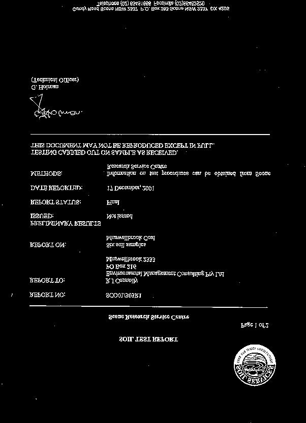
3 1. Introduction Muswellbrook Coal Company (MCC) has mined by open cut methods an area northeast of Muswellbrook since MCC is seeking approval to mine further to the east of the No. 1 Open Cut in Extension A and Extension B. This essentially consists of mining the remnant coal between the No. 1 Open Cut and the No. 2 Open Cut. This Soils and Land Capability study assesses the area of sloping land between the open cut mining areas. The existing overburden dumps of the No. 2 Open Cut forms a physical barrier to the east. The existing access road (Coal Road) to the No. 2 Open is within the pit limits of the proposed mining area and will be relocated further to the south. 2. Methodology Terrain of the No.1 Open Cut Extension Area was assessed using MCC aerial photography (Hatch 2326, Photos 4374/5, 25/5/2001) and subsequent field checking. Landform units have been plotted on a scanned image of one of the photographs (Figure 1). Mapping of terrain is according to terrain unit and slope class as indicated in Table 1. TABLE 1 LANDFORM 1 st Character Terrain Unit 2 nd Character Slope Class 1 Crest a 0-2% 2 Sideslope b 2-5% 3 Footslope c 5-10% 4 Drainage plain d 10-20% 5 Incised drainage line e 20-50% Reference has been made to the Soils of the Singleton 1: Sheet by Kovac and Lawrie, (Soil Landscape Series Sheet SI 56-1). Soil profiles were assessed in the field using various excavations as well as observations of exposed soil profiles in gully walls. Observation methods were generally as described in the Australian Soil and Land Survey Field Handbook (McDonald et al, 1998). Soil Testing has been carried out by the Research Service Centre at Scone operated by the Department of Land and Water Conservation.


4 Start Screen Search Appendices No.2 Opencut Overburden Emplacement 3e 3d 2d 3d 3d 2c No.1 Opencut 1c 1b 3c 2d LEGEND Study Area Crest Sideslope 1b 1b ad al Ro Co 3c 2c 2c Footslope 2c Mining Areas SCALE Metres NOTE: Whilst all care has been taken, locations on aerial photo are approximate and indicative only. File Name: TOPOGRAPHY.CDR 1c MUSWELLBROOK COAL COMPANY LIMITED Landform Units FIGURE 1
5 3. Description of Soil Units Observed The whole of the area is mapped as the Roxburgh Soil Landscape in Soil Landscapes of the Singleton 1: Sheet. The undulating low hills and undulating hills, consisting of the Greta Coal Measures sediments display various degrees of weathering of the sandstones, shales, coal, mudstones and conglomerates. The soils derived from this parent material are typically yellow duplex soils. Figure 2 shows soils in the proposed mining area. 3.1 Yellow Duplex Soils with mottled subsoils (Dy3.41, Dy2.41) These generally occur in the drainage lines with fine sandy loam topsoils. The topsoil is organically enriched and darker, average depth being 5 centimetres. Soils are weakly structured with sandy fabric and ph Generally an A2 horizon is present, cms depth and is likely to be conspicuously bleached. B-horizons B-horizons have typically a medium clay texture with medium structure and ped size to 50 mm with rough ped fabric. Range of ph was with an acid soil reaction trend. Depth to weathered rock was to 400 cm in the deep gully. 3.2 Yellow Duplex Soils, whole coloured subsoils (Dy 2.41) Yellow Duplex Soils with whole coloured subsoils (solods) occur on the sideslopes where gradients are generally less than 10%. A1-horizons are darker coloured, about 5 cms in depth overlying thick, bleached A2-horizons. Typically topsoil is fine sandy loam texture, weakly structured, with ph 5.5. B-horizons The B-horizons have medium clay subsoils, yellow in colour, with medium structure and very firm consistence. Subsoil remains brightly coloured to at least 50 cms with ph Brown subsoils on the ridgelines Brown duplex soils occur along the ridgelines especially north of Coal Road. To the south resistant conglomerate subcrops occur giving rise to patches of skeletal soils. Topsoil consists of a thin A1-horizon 0-5 cms depth, with weak structure and ph 5.5. The A2- horizon is 15 cms in thickness, and conspicuously bleached. The B-horizon is whole coloured to depths below 50 cms, with ph 6.0.


6 Start Screen Search Appendices No.2 Opencut Overburden Emplacement No.1 Opencut LEGEND Study Area 1 Soil Sampling Sites Brown Subsoils on Ridgelines Yellow Duplex (Whole Coloured) SCALE Yellow Duplex (Mottled Subsoils) Rocky Mining Areas Metres NOTE: Whilst all care has been taken, locations on aerial photo are approximate and indicative only. File Name: SOILS.CDR 500 MUSWELLBROOK COAL COMPANY LIMITED Soils FIGURE 2
7 3.4 Mining Area Mining areas are those areas where open cut operations have resulted in excavation of overburden material and placement in emplacement areas. These may have been subsequently revegetated and may have had some topsoil material spread before being revegetated. Some of the area to be disturbed in the current proposal consists of mining areas that have not been rehabilitated but rather form part of currently used infrastructure. This includes haul roads and hardstands around the workshop, stockpiles etc. 4. Land Capability/Suitability 4.1 Land Capability The Department of Land and Water Conservation (DLWC) has developed a system of agricultural capability classification (see Figure 3) based on environmental factors, which may limit the use of land (Emery, 1985). These factors include widespread influences such as climate, land slope and form and local soil limitations such as soil depth, erodibility, water holding capacity, rockiness, salinity, and the degree of existing erosion. One or a number of the factors in combination may restrict land use and limit land capability. Based on assessment of these limiting factors, land is classified into eight classes, with the restriction on use, or the likelihood of erosion damage increasing from Class I to Class VIII. (Refer to Table 2). TABLE 2 RURAL LAND CAPABILITY Land Class Land Suitability Land Definition Class I Regular cultivation No erosion control requirements Class II Regular cultivation Simple requirements such as crop rotation, minor strategic works Class III Regular cultivation Intensive soil conservation measures required such as banks and waterways Class IV Grazing, occasional cultivation Simple practices such as stock control, fertilizer application Class V Grazing, occasional cultivation Intensive soil conservation measures required such as banks, contour ripping Class VI Grazing only Managed to ensure ground cover is maintained Class VII Unsuitable for rural production Green timber maintained to control erosion Class VIII Unsuitable for rural production Should not be cleared, logged or grazed


8 Start Screen Search Appendices No.2 Opencut Overburden Emplacement No.1 Opencut LEGEND Study Area Class IV Class V Class VI Mining Area SCALE Metres NOTE: Whilst all care has been taken, locations on aerial photo are approximate and indicative only. File Name: LAND CLASS.CDR MUSWELLBROOK COAL COMPANY LIMITED Land Capability Class FIGURE 3
9 Land capability has been mapped at a scale 1: 100,000 by the Soil Conservation Service of NSW in the Land Capability Series Sheets, Muswellbrook (9033). At this scale the Study Area is shown as Class V Land, suited to grazing but requiring intensive soil conservation works to maintain stability, with some Class IV land suitable for grazing to the south where slopes are reduced. Some steep lands close to Muswellbrook No.2 Open Cut are shown as Class VI Land, suitable for judicious grazing. However when assessed with the benefit of detailed topographical and soils information, a more refined pattern can be described (Figure 3). The Class V lands are those where the Yellow Duplex soils are formed in situ from the sedimentary sequence of the Greta Coal Measures with generally a good cover of native grasses. Steeper sideslopes and the drainage lines have been grouped as Class VI Land. These areas have poorer cover and active sheet and gully erosion, necessitating only judicious grazing. Class IV Lands are those with moderate slope. There is good ground cover and occasional rocky outcrop making these areas suitable for grazing without constraints other than satisfactory management. The mining areas formed of overburden materials, are variously vegetated ranging from rehabilitated land to hardstand and stockpile areas. These lands have been designated as Mining Area (m), currently removed from agricultural production. 4.2 Agricultural Suitability NSW Agriculture has an alternative system of classification of lands according to five classes of agricultural suitability (see Table 3). Class Class 1 Class 2 Class 3 Class 4 Class 5 TABLE 3 AGRICULTURAL SUITABILITY Description Arable land suitable for intensive cultivation where constraints to sustained high levels of agricultural production are minor or absent. Arable land suitable for regular cultivation for crops but not suited to continuous cultivation. It has a moderate to high suitability for agriculture but edaphic (soil factors) or environmental constraints reduce the overall level of production and may reduce the cropping phase to a rotation with sown pastures. Grazing land or land well suited to pasture improvement. It may be cultivated or cropped in rotation with pasture. The overall production level is moderate because of edaphic or environmental constraints. Erosion hazard, soil structural breakdown or other factors including climate may limit the capacity for cultivation and soil conservation or drainage works may be required. Land suitable for grazing but not cultivation. Agriculture is bases on native pastures or improved pastures bases on minimum tillage techniques. Production may be seasonally high but the overall production level is low as a result of major environmental constraints Land unsuitable for agriculture or at best only to light grazing. Agricultural production is low or zero as a result of severe constraints, including economic factors, which preclude land improvement.
10 Figure 4 shows Agricultural Suitability of lands within the Study Area. The land is largely Class 4 Land suitable for grazing but not cultivation. Constrains include slope, soil structure, rockiness, and the degree of existing erosion. The active mining and infrastructure areas comprise the Class 5 Land unsuitable for agriculture. 5. Existing Erosion An erosion survey was conducted of all the Hunter River Catchments, Hunter River Catchment Soil Erosion (Emery, 1985). 1: Sheet S.C.S /6 shows the study area generally as an area of moderate to severe sheet erosion. Grass cover has improved since the early eighties because of reduced grazing pressure. The deep north south trending drainage lines are classed as areas of very severe gully erosion (1.5-3 m deep). 6.Topsoil Stripping Plan Elliott and Veness (1981) developed a scheme for selecting topdressing materials for use in mine rehabilitation in the Hunter Valley. Critical properties identified were: Soil structure Coherence Mottling Macrostructure Ped strength Texture Sand and gravel content Salt content and ph These characteristics were assessed in the field and by laboratory testing. Table 4 summarises the quantities of topsoil materials and constraints in their use. The topsoil estimates are included as a guide to quantities of topdressing materials available but do not meet the guidelines for topsoil stockpiling. These materials would be most useful if carefully handled and stripped and respread in a single operation. They would be better suited to rehabilitation sites with low erosion potential such as crests or protected footslopes, and not long sideslopes or drainage areas.


11 Start Screen Search Appendices No.2 Opencut Overburden Emplacement No.1 Opencut LEGEND Study Area Class 4 Class 5 SCALE Metres NOTE: Whilst all care has been taken, locations on aerial photo are approximate and indicative only. File Name: AGR SUITABILITY.CDR MUSWELLBROOK COAL COMPANY LIMITED Agricultural Suitability Class FIGURE 4
12 Soil Type Yellow Duplex Soils Mottled Subsoils Yellow Duplex Soils Whole Coloured Subsoils Mining and Infrastructure Areas Brown Subsoils on Ridgelines TABLE 4 TOPSOIL STRIPPING Average Depth Area Volume Constraints (cm) (ha) (m 3 ) Weak structure Sand and gravel Structure, consistence, ph 30.4 Structure Structure, salinity consistence The Yellow Duplex Soils with mottled subsoils fail to meet the criteria in that the soil structure is weak and the sand and gravel content exceeds the recommendations. It does contain valuable native plant seed and micro-organisms. If planned as a single topsoil stripping and re-spreading operation for rehabilitation of low erosion potential areas, successful results could be achieved under favourable conditions. Mixing with the bleached A2 horizon would need to be avoided. The material used to rehabilitate the previously rehabilitated lands can be reclaimed but suffers from previous handling and possible mixing with the underlying overburden material. A rapid weathered interface may have developed assisting with recovery. The Yellow Duplex Soils with whole coloured subsoils have poor structure and have high sand and gravel contents, above recommended levels (SL texture, gravelly). These areas will contribute some useful material but care is required to ensure contamination with bleached A2 material is avoided. The Brown Soils on the Ridgelines are again dominated by conspicuously bleached A2- horizon requiring careful separation. Limitations include the degree of existing erosion, poor structure, excess sand and gravel. The Mining and Infrastructure Areas contain material used to rehabilitate the previously rehabilitated lands can be reclaimed but suffers from previous handling and possible mixing with the underlying overburden material. A rapid weathered interface may have developed assisting with recovery.
13 7. Conclusions Soils in the proposed mining area of the No. 1 Open Cut Extension are largely the in situ soils formed from the weathering of the sedimentary rocks of the Greta Coal Measures. Duplex soils are dominant with brown subsoils on the ridges and yellow soils on the slopes. The Yellow Duplex Soils are mottled at depth in the drainage lines but mostly with whole coloured subsoils on the side slopes. All soils have deep (20-30 cm) A2-horizons that are bleached and generally dispersible. This material is erodible and unstable on the surface, and should not be collected with the stripped topsoil (A1-horizon). The A1-horizon material is organically enriched giving it a darker colour, and contains micro-organisms and seeds of native plants which will enhance rehabilitation following mining. However because of poor structure and high sand and gravel content, these thin soils do not meet the standards as described by Elliot and Veness. It would be best to carefully separate from the A2-horizon material and handle in a single operation, by stripping and immediately re-spreading on reshaped surfaces. The subsoils materials should be suitable for sealing purposes, though some exhibit some dispersion. The bright, nonmottled materials will be the most stable. 8. References Elliott G.L. and Veness R.A. (1981) Selection of Topdressing Material for Rehabilitation of Disturbed Areas in the Hunter Valley. Journ. Soil cons. NSW, 37:1 pp Emery K.A. (1985), Hunter River Catchment Soil Erosion. Soil Conservation Service of New South Wales. Sydney. Emery K.A. (1985). Rural land Capability Mapping, Soil Conservation Service of New South Wales. Sydney. Kovac M. and Lawrie J.W. (1991). Soil Landscapes of the Singleton 1: Sheet. Soil Conservation Service of NSW, Sydney. McDonald R.C., Isbell R.F., Speight J.G., Walker J. and Hopkins M.S. (1998), Australian Soil and Land Survey Field Handbook. CSIRO. Canberra.
14 Appendix 1
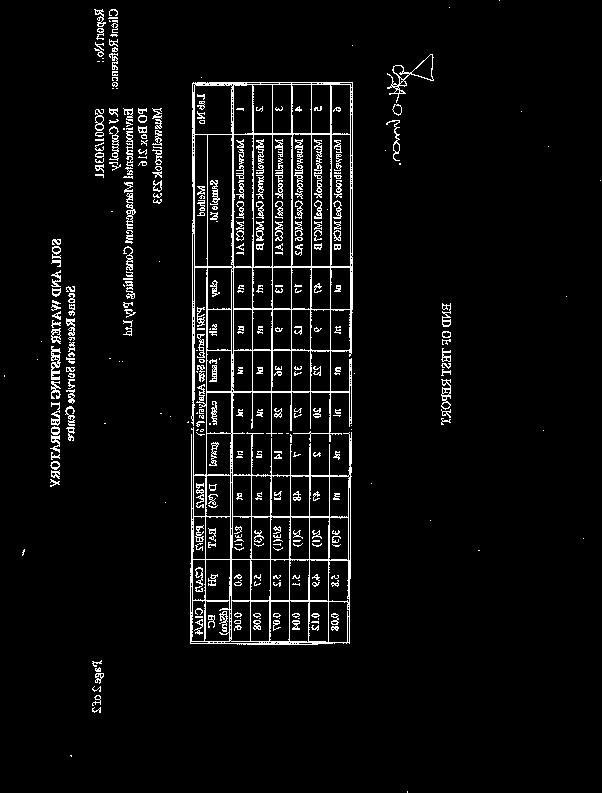
15 Soil Profile Morphology- Site 1 (West of Coal Road) Soil Characteristic A-horizon B-horizon Remarks Depth (cm) A Texture (field) FSL SC ph Structure (McDonald et al, 1998) Structure grade weak Strong Ped size 10 mm <50 mm Ped type platy Polyhedral consistence weak Very firm Colour 7.5 YR 3/3 7.5 YR 4/8 Mottle Stickiness 3 Plasticity degree 3 Plasticity type N Coarse fragments Abundance Moderate (4) Few (2) Size Coarse gravelly Medium gravelly Shape Rounded platy Rounded platy Lithology Sandstone/ironstone Sandstone/shale Laboratory Tests Clay % Silt % Fine sand % Coarse sand % Gravel % Dispersion % Emmerson Aggregate Test ph Electrical Conductivity Note: Units are in standard units for soil characteristic, or in classes following McDonald et al, (1998), Australian Soil and Land Survey Field Handbook. Laboratory testing results are as reported by Scone Research Service Centre (Appendix 2). A1-1
16 Soil Profile Morphology- Site 2 (East of No. 1 Open Cut) Soil Characteristic A-horizon B-horizon Remarks Depth (cm) A Texture (field) FSL MC ph Structure (McDonald et al, 1998) Structure grade Weak Medium Ped size 10 mm <50 mm Ped type Platy Polyhedral consistence Very firm (4) Very firm (4) Colour 7.5 YR 4/3 7.5 YR 5/8 Mottle 7.5 YR 7/2 A2 conspicuous bleach, gravelly Stickiness 0 2 Plasticity degree 3 Plasticity type U Coarse fragments Abundance Common Common Size Medium gravelly Medium gravelly with some stones Shape Angular tabular At, stones RP Lithology Sandstone/ironstone Sandstone Laboratory Tests Clay % Silt % Fine sand % Coarse sand % Gravel % Dispersion % Emmerson Aggregate Test ph Electrical Conductivity Note: Units are in standard units for soil characteristic, or in classes following McDonald et al, (1998), Australian Soil and Land Survey Field Handbook. Laboratory testing results are as reported by Scone Research Service Centre (Appendix 2). A1-2
17 Soil Profile Morphology- Site 3 (Dam in deep gully) Soil Characteristic A-horizon B-horizon Remarks Depth (cm) A Texture (field) FSL MC ph Mottled at depth Structure (McDonald et al, 1998) Structure grade weak Strong Ped size 5-10 mm (3) mm (5) Ped type polyhedral polyhedral consistence Weak (2) Strong (5) Fabric Rough ped Rough ped Colour 7.5 Yr 5/3 7.5 YR 5/6 Mottle 7.5 YR 8/2 A2 Stickiness Plasticity degree Plasticity type Moderately sticky Very plastic U Coarse fragments Abundance Few (2) Common (3) Size Fine gravel (2) Medium gravel (2) Shape Rounded Rounded Lithology Quartz Quartz Laboratory Tests Clay % Silt % Fine sand % Coarse sand % Gravel % Dispersion % Emmerson 8/3(1) 3(3) Aggregate Test ph Electrical Conductivity (ds/m) Note: Units are in standard units for soil characteristic, or in classes following McDonald et al, (1998), Australian Soil and Land Survey Field Handbook. Laboratory testing results are as reported by Scone Research Service Centre (Appendix 2). A1-3
18 Soil Profile Morphology- Site 4 (East of No. 1 Open Cut) Soil Characteristic A-horizon B-horizon Remarks Depth (cm) A Texture (field) FSL MC ph Structure (McDonald et al, 1998) Structure grade Weak Medium Ped size Ped type consistence Colour 7.5 Yr 3/3 7.5 YR 5/6 Mottle (A2) 7.5 YR 6/3 7.5 YR 6/3 Stickiness Plasticity degree Plasticity type Coarse fragments Abundance Few (2) Few (2) Size Cobbly Cobbly Shape Rounded Rounded Lithology Sandstone Sandstone Laboratory Tests Clay % Silt % 9 9 Fine sand % Coarse sand % Gravel % 14 2 Dispersion % Emmerson 8/3(1) 2(1) Aggregate Test ph Electrical Conductivity Note: Units are in standard units for soil characteristic, or in classes following McDonald et al, (1998), Australian Soil and Land Survey Field Handbook. Laboratory testing results are as reported by Scone Research Service Centre (Appendix 2). A1-4
19 Soil Profile Morphology- Site 5 (Ridgeline track) Soil Characteristic A-horizon B-horizon Remarks Depth (cm) A Texture (field) FSL MC ph Structure (McDonald et al, 1998) Structure grade weak moderate Ped size Ped type consistence Colour 10 YR 4/3 10 YR 4/6 Mottle Stickiness Plasticity degree Plasticity type Coarse fragments Abundance Size Shape Lithology Laboratory Tests Clay % Silt % Fine sand % Coarse sand % Gravel % Dispersion % Emmerson 3(3) Aggregate Test ph 5.8 Electrical 0.08 Conductivity Note: Units are in standard units for soil characteristic, or in classes following McDonald et al, (1998), Australian Soil and Land Survey Field Handbook. Laboratory testing results are as reported by Scone Research Service Centre (Appendix 2). A1-5
20 Soil Profile Morphology Site 6 Rocky outcrop Soil Characteristic A-horizon B-horizon Remarks Depth (cm) 3 Texture (field) SL ph Structure (McDonald et al, 1998) Structure grade Ped size Ped type consistence Colour Mottle Stickiness Plasticity degree Plasticity type Coarse fragments Rocky(10-20%) Abundance Abundant Size Cobbly (60-200mm) Shape Angular Tabular Lithology Sandstone/siltstone HEmmerson Aggregate Test affected Laboratory Tests Clay % Silt % Fine sand % Coarse sand % Gravel % Dispersion % Emmerson Aggregate Test ph Electrical Conductivity Note: Units are in standard units for soil characteristic, or in classes following McDonald et al, (1998), Australian Soil and Land Survey Field Handbook. Laboratory testing results are as reported by Scone Research Service Centre (Appendix 2). A1-6
21 Soil Profile Morphology- Site 7 Roadside Soil Characteristic A-horizon B-horizon Remarks Depth (cm) 5 Texture (field) SL MC ph 4.5 Structure (McDonald et al, 1998) Structure grade Moderate Ped size mm Ped type Angular blocky consistence Very firm (4) Colour 10YR 4/6 Mottle Stickiness Plasticity degree Plasticity type Coarse fragments Abundance Abundant Size Large pebbles (20-60 mm) Shape Rounded tabular Lithology Sandstone/ironstone Laboratory Tests Clay % Silt % Fine sand % Coarse sand % Gravel % Dispersion % Emmerson Aggregate Test ph Electrical Conductivity Note: Units are in standard units for soil characteristic, or in classes following McDonald et al, (1998), Australian Soil and Land Survey Field Handbook. Laboratory testing results are as reported by Scone Research Service Centre (Appendix 2). A1-7
22 Soil Profile Morphology -Site 8 Roadside Gully Soil Characteristic A-horizon B-horizon Remarks Depth (cm) 9 A2-horizon 40 cm Texture (field) SL ph Structure (McDonald et al, 1998) Structure grade Ped size Ped type consistence Weak mm Platy Weak Colour Mottle Stickiness Plasticity degree Plasticity type Coarse fragments Abundance Common (10-20%) Size Gravel (-20 mm) Shape Angular platy Lithology Sandstone/coal Laboratory Tests Clay % Silt % Fine sand % Coarse sand % Gravel % Dispersion % Emmerson Aggregate Test ph Electrical Conductivity Note: Units are in standard units for soil characteristic, or in classes following McDonald et al, (1998), Australian Soil and Land Survey Field Handbook. Laboratory testing results are as reported by Scone Research Service Centre (Appendix 2). A1-8
23 Appendix 2
24
25
5 RESULTS FOR THE REJECT EMPLACEMENT AREA
 SPECIALIST CONSULTANT STUDIES 9b - 21 NARRABRI COAL OPERATIONS PTY LTD of the REA, BSA and Water Pipeline Report No. 674/17 5 RESULTS FOR THE REJECT EMPLACEMENT AREA 5.1 Introduction From the information
APPENDIX I Soils, Land Capability & Agricultural Assessment Report
 APPENDIX I Soils, Land Capability & Agricultural Assessment Report APPENDIX I Soils, Land Capability and Agricultural Assessment 21/18113/148861 Orange Resource Recovery and Waste Management Project Environmental
Appendix 22 Soils and Land Capability
 Appendix 22 Soils and Land Capability March 2009 March 2009 Table of Contents Page No. 1. INTRODUCTION... 1 2. SOIL PROFILING AND MAPPING... 2 2.1 Soil Survey Methodology... 2 2.2 Soil Landscapes... 3
2018 Iowa FFA Soil Judging CDE Exam 1. Landscape positions characterizes the location of the soil on the landscape and identifies potential risks.
 2018 Iowa FFA Soil Judging CDE Exam 1. Landscape positions characterizes the location of the soil on the landscape and identifies potential risks. Which landscape position is considered the floodplain
STATEMENT OF PHYSICAL CHARACTERISTICS AND AGRICULTURAL LAND CLASSIFICATION
 STATEMENT OF PHYSICAL CHARACTERISTICS AND AGRICULTURAL LAND CLASSIFICATION BIRKWOOD FARM, ALTOFTS WEST YORKSHIRE Proposed Opencast Extraction of Clay and coal ADAS January 1990 Leeds Regional Office File
Pits 1 & 3 Questions. 7. Subsurface: Texture (5 pts) A. Coarse B. Moderately course C. Medium D. Fine E. Very Fine
 A. Coarse B. Moderately course C. Medium D. Fine E. Very Fine") Minnesota Soils Scorecard Questions for Pits 1-4 Scantron # 105481 Use your soils scorecard to fill out the answers on your scantron Bubble in the front side of the sheet for Pit 1 (# 1-45) and Pit 2 (#51-95)
Minnesota Soils Scorecard Questions for Pits 1-4 Scantron # 105481 Use your soils scorecard to fill out the answers on your scantron Bubble in the front side of the sheet for Pit 1 (# 1-45) and Pit 2 (#51-95)
BENGALLA Mining Company. Soils and Land Capability Impact Assessment
 BENGALLA Mining Company Soils and Land Capability Impact Assessment Soil and Land Capability Impact Assessment Continuation of Bengalla Mine July 2013 HAN05-001 Continuation of Bengalla Mine 1 Prepared
Soil Survey and Land Resource Assessment
 Karuah East Pty Ltd FINAL Soil Survey and Land Resource Assessment Karuah East Quarry Project July 2011 HQP05-002 Table of Contents TABLE OF CONTENTS 1.0 INTRODUCTION... 1 1.1 BACKGROUND... 1 1.2 PROJECT
STATEMENT OF PHYSICAL CHARACTERISTICS AND AGRICULTURAL LAND CLASSIFICATION WITTON PARK, COUNTY DURHAM PROPOSED QUARRY EXTENSION DECEMBER 1992

IOWA FFA STATE SOILS CDE SATURDAY, OCTOBER 13, 2007 AMES, IOWA
 IOWA FFA STATE SOILS CDE SATURDAY, OCTOBER 13, 2007 AMES, IOWA 1. Moderately sloping has what percent slope: a. 9-14% b. 2-5% c. 5-9% d. over 14% 2. Which of the following horizons is the loose underlying
PROPOSED OPEN CAST COAL SITE SEPTEMBER 1992
 AGRICULTURAL LAND CLASSIFICATION AND STATEMENT OF PHYSICAL CHARACTERISTICS SKIERS SPRING, HOYLAND, SOUTH YORKSHIRE PROPOSED OPEN CAST COAL SITE SEPTEMBER 1992 ADAS LEEDS STATUTORY GROUP Job No. 98/92 MAFF
2016 Area 3 Envirothon Muskingum County Soils Test ANSWER KEY
 2016 Area 3 Envirothon Muskingum County Soils Test ANSWER KEY 1. The majority of the bedrock in Muskingum County is. a. sedimentary bedrock b. glacial bedrock c. igneous bedrock d. metamorphic bedrock
AGRICULTURAL LAND CLASSIFICATION AND SOIL PHYSICAL CHARACTERISTICS LAND NEAR SHIRE HILL FARM SAFFRON WALDEN ESSEX
 AGRICULTURAL LAND CLASSIFICATION AND SOIL PHYSICAL CHARACTERISTICS LAND NEAR SHIRE HILL FARM SAFFRON WALDEN ESSEX AGRICULTURAL LAND CLASSIFICATION (ALC) AND SOIL PHYSICAL CHARACTERISTICS LAND NEAR SHIRE
Iowa FFA Soil Career Development Event 2008
 Iowa FFA Soil Career Development Event 2008 1. In Iowa, corn suitability ratings for soil mapping units specifies a. natural weather conditions b. surface and subsurface drainage installed where needed
SOIL SURVEY FOR PROPOSED WET ASH DISPOSAL FACILITY, HENDRINA POWER STATION, MPUMALANGA PROVINCE
 REPORT for Lidwala Environmental and Planning Servives by the INSTITUTE FOR SOIL CLIMATE AND WATER AGRICULTURAL RESEARCH COUNCIL SOIL SURVEY FOR PROPOSED WET ASH DISPOSAL FACILITY, HENDRINA POWER STATION,
2016 Iowa FFA Soils Evaluation CDE Exam
 2016 Iowa FFA Soils Evaluation CDE Exam 1. Which of the following is true regarding soil horizons? a. A horizon is darker in color and has more organic matter b. B horizon is darker in color and has more
2017 Iowa FFA Soil Judging CDE Exam
 2017 Iowa FFA Soil Judging CDE Exam 1. Landscape positions vary in soil composition and makeup. What landscape position would be characterized by having strata and lenses of different textures in the profile:
The entire site supports grass on which sheep had been grazing recently.
 PHYSICAL CHARACTERISTICS REPORT FOR LAND AT HORSEHAY A^ Agricultural Land Classification of approximately 14 hectares of land to the southwest of Horsehay was undertaken in November 1989. The site lies
2014 Iowa FFA Soil Judging CDE Exam
 2014 Iowa FFA Soil Judging CDE Exam 1. Landscape position is one aspect of evaluating the surface features of a certain tract of land. Identifying the correct landscape position will indicate: a. If the
Soil Interpretations Erosion and Sedimentation Control Planning and Design Workshop
 Soil Interpretations Erosion and Sedimentation Control Planning and Design Workshop Presented by Richard Brooks Presentation prepared by Kristin May Resource Soil Scientists USDA-Natural Resources Conservation
Land Capability Classifications
 Land Capability Classifications Unit: Soil Science Problem Area: Basic Principles of Soil Science Student Learning Objectives. Instruction in this lesson should result in students achieving the following
AGRICULTURAL LAND CLASSIFICATION AND SOIL PHYSICAL CHARACTERISTICS BIRCH PIT, NEAR COLCHESTER ESSEX
 AGRICULTURAL LAND CLASSIFICATION AND SOIL PHYSICAL CHARACTERISTICS BIRCH PIT, NEAR COLCHESTER ESSEX AGRICULTURAL LAND CLASSIFICATION AND SOIL PHYSICAL CHARACTERISTICS SEMI-DETAILED SURVEY BIRCH PIT, NEAR
2012 FINAL SOILS AREA 2 Envirothon Questions Answer KEY
 2012 FINAL SOILS AREA 2 Envirothon Questions Answer KEY Questions 1-6 to be answered at the soil pit: 1. Soil scientists categorize soils by drainage classes. What is the drainage class of the soil at
1. Position (2 pts.) 2. Parent Material (2 pts.) 3. Slope Characteristics (2 pts.) 4. Surface Stoniness or Rockiness (2 pts.)
 2. Parent Material (2 pts.) 3. Slope Characteristics (2 pts.) 4. Surface Stoniness or Rockiness (2 pts.)") Maryland Envirothon SOILS Exam Guidance Information (revised 2017) Objective: To test students' knowledge and awareness of basic soil science and its application in wise land-use planning and therefore
Maryland Envirothon SOILS Exam Guidance Information (revised 2017) Objective: To test students' knowledge and awareness of basic soil science and its application in wise land-use planning and therefore
STATE TAX COMMISSION OF MISSOURI ASSESSOR MANUAL
 STATE TAX COMMISSION OF MISSOURI ASSESSOR MANUAL CHAPTER: REVISION DATE: 10/1/2008 Page 1 of 18 7.3 The purpose of this section of the Assessor s Manual is to supplement the State Tax Commission s published
CB1 Moderately undulating landscape with slight gilgai (few inches) formation: broad ridge tops and upper slopes of moderately shallow grey cracking
 formation: broad ridge tops and upper slopes of moderately shallow grey cracking") CB1 Moderately undulating landscape with slight gilgai (few inches) formation: broad ridge tops and upper slopes of moderately shallow grey cracking clays (Ug5.22 and Ug5.23). Associated are: (i) some
CB1 Moderately undulating landscape with slight gilgai (few inches) formation: broad ridge tops and upper slopes of moderately shallow grey cracking clays (Ug5.22 and Ug5.23). Associated are: (i) some
SOIL CHARACTERIZATION USING DIAGNOSTIC PROPERTIES
 SOIL CHARACTERIZATION USING DIAGNOSTIC PROPERTIES The following are the characters of the pedologically important properties used in categorizing soils: SOIL CHARACTERIZATION Soil Profile Description:
Agricultural Land Classification and Statement of Physical Characteristics Higbfield Farm Whitley Bridge North Yorkshire October 1996
 Agricultural Land Classification and Statement of Physical Characteristics Higbfield Farm Whitley Bridge North Yorkshire October 1996 Resource Planning Team ADAS Reference: 82/96 Leeds Statutory Group
Topoclimate Southland Soil Technical Data Sheet No Waiau
 This Technical Data Sheet describes the typical average properties of the specified soil. It is essentially a summary of information obtained from one or more profiles of this soil that were examined and
AGRICULTURAL LAND CLASSIFICATION AND STATEMENT OF PHYSICAL CHARACTERISTICS
 AGRICULTURAL LAND CLASSIFICATION AND STATEMENT OF PHYSICAL CHARACTERISTICS SEGHILL, NORTHUMBERLAND PROPOSED VASTE DISPOSAL SITE ADAS January 1989 Leeds Regional Office REF: 3/89 2FCS 4191 lds.rpg3.seghill
PHYSICAL CHAtlACTERISTICS REPORT FOR THE PROPOSED SAND AND GRAVEL SITE AT MANOR FARM, UFFINGTON
 PHYSICAL CHAtlACTERISTICS REPORT FOR THE PROPOSED SAND AND GRAVEL SITE AT MANOR FARM, UFFINGTON Introduction Following the" request for detailed information on the physical characteristics of soil at Manor
Unit II Soil Management
 Unit II Soil Management Lesson 2: Using Soil Survey Manuals Soil survey manuals provide useful information for grassland management. Soil scientists evaluate the soil for chemical and physical properties,
EXPERIMENT 6 PREPARATION OF LAND CAPABILITY CLASS MAP
 EXPERIMENT 6 PREPARATION OF LAND CAPABILITY CLASS MAP Structure 6.0 Objectives 6.1 Intnxluction 6.2 Experiment 6.21 Deciding Factors for Land Capability 6.2.2 Requirements 6.23 Procedure 6.3 Observations
SOIL EROSION COMBATING IS ESSENTIAL IN ORDER TO CONSERVE OUR VALUABLE SOIL RESOURCES
 SOIL EROSION COMBATING IS ESSENTIAL IN ORDER TO CONSERVE OUR VALUABLE SOIL RESOURCES A. Introduction - Land is also a precious resource. Land is needed for agriculture and occupation. Land is under pressure
AGRICULTURAL LAND CLASSIFICATION AND STATEMENT OF PHYSICAL CHARACTERISTICS
 AGRICULTURAL LAND CLASSIFICATION AND STATEMENT OF PHYSICAL CHARACTERISTICS DALE PIT FARM. HATFIELD VOODHOUSE PROPOSED EXTRACTION OF SAND AHD GRAVEL ADAS April 1989 Leeds Regional office File Ref: 2FCS
EDULABZ. Ans. (b) 7. The soft, porous layer with a good water-retaining capacity forms the
 7. The soft, porous layer with a good water-retaining capacity forms the") 3 SOIL I. Multiple choice questions: Tick ( ) the correct choice. 1. The process of soil formation is called (a) conservation (b) weathering (c) erosion (d) none Ans. (b) 2. Soil profile consists of (a)
3 SOIL I. Multiple choice questions: Tick ( ) the correct choice. 1. The process of soil formation is called (a) conservation (b) weathering (c) erosion (d) none Ans. (b) 2. Soil profile consists of (a)
Topoclimate Southland Soil Technical Data Sheet No. 8. Sobig
 This Technical Data Sheet describes the typical average properties of the specified soil. It is essentially a summary of information obtained from one or more profiles of this soil that were examined and
Examining soils in the field. Examining soils in the field. Environment Agency thinksoils examining soils in the field
 Examining soils in the field thinksoils Examining soils in the field Environment Agency thinksoils examining soils in the field 31 Examining soils in the field 32 Environment Agency thinksoils examining
Land Judging in West Virginia
 Guide 406R-LJ Revised 2017 Land Judging in West Virginia A program of WVU Extension Service 4-H and Agriculture and Natural Resources extension.wvu.edu/youth-family/youth-evaluation/landjudging Land Judging
SUMMARY. alcholnie.doc\ih\jk
 SUMMARY A detailed Statement of Physical Characteristics and Agricultural Land Classification survey of ha of land at Stainton ("Holme Hall Quarry Extension") was carried out in September 1994. At the
CAVIL HEAD OCCS ACKLINGTON NOVEMBER 1997
 CAVIL HEAD OCCS ACKLINGTON Agricultural Land Classification (ALC) and Statement of Physical Characteristics Report NOVEMBER 1997 Resource Planning Team RPT Job Number: 67/97 Northern Region MAFF Reference:
Loam: About 40% sand, 40% silt, 20% clay. Mixture of pore sizes to balance water retention and aeration. Considered the best soil for growing crops.
 Soil Characteristics Soil is formed from a combination of two Primary sources: Weathering of Parent Rock ( ) = material introduced by plants, animals, and decomposers Minor sources: Nutrients incorporated
ALBERTA TRANSPORTATION POST-DISTURBANCE ASSESSMENT GUIDE FOR BORROW EXCAVATIONS. Dec 2013 Edition
 ALBERTA TRANSPORTATION POST-DISTURBANCE ASSESSMENT GUIDE FOR BORROW EXCAVATIONS Dec 2013 Edition - ii - ACKNOWLEDGEMENTS This guide supersedes the document entitled Alberta Transportation Post-Disturbance
In 1983, the town evacuated and purchased by government for $36 million
 1 2 3 4 5 6 7 8 9 Introduction to Environmental Geology, 5e Chapter 17 Soil and Environment Weathering: summary in haiku form Rocks brought to surface decompose to sediment and that's weathering. Case
Lesson 3: Understanding Soil Color
 Lesson 3: Understanding Soil Color 1 Bright colored Color Dull colored Humus Mottle colored Native vegetation Structure Tall prairie grass Texture Deciduous hardwood forest 2 I. Soils have many features
Topoclimate Southland Soil Technical Data Sheet No. 11. Pukemutu
 This Technical Data Sheet describes the typical average properties of the specified soil. It is essentially a summary of information obtained from one or more profiles of this soil that were examined and
APPENDIX. Soil and Land Capability Impact Assessment
 APPENDIX P P P FINAL Maules Creek Coal Project Soil and Land Capability Assessment November 2010 HAN17-001 P GSS Environmental TABLE OF CONTENTS 1.0 INTRODUCTION... 1 1.1 BACKGROUND... 1 1.2 PROJECT DESCRIPTION...
NOT PROTECTIVELY MARKED SUB-APPENDIX A2: SOIL ANALYTICAL SUITES
 SUB-APPENDIX A2: SOIL ANALYTICAL SUITES A2.1.1 There will be three soil analytical suites summarised in Table 3 in the text. Details of the analyses to be carried out in each suite and the methodologies
The Nature of Soil Soil Conservation Sustainable Ag.
 Chapter 6 & 7 The Nature of Soil Soil Conservation Sustainable Ag. Climate Soil Forming Factors Parent material Organisms Topography Time Value of Soil Soil is under appreciated Condition of soil affects
Developing a land capability system for the Western Plains of New South Wales
 Developing a land capability system for the Western Plains of New South Wales Paul Smith 1, John Lawrie 2, Alan Welch 3 and Daniel Wiecek 4 1 Department of Infrastructure, Planning and Natural Resources,
SOIL SURVEY OF PORTIONS 81 AND 82 OFTHE FARM VAALBANK 512JQ, NEAR MAGALIESBURG, SOUTH-WEST OF PRETORIA
 REPORT For Newtown Landscape Architects SOIL SURVEY OF PORTIONS 81 AND 82 OFTHE FARM VAALBANK 512JQ, NEAR MAGALIESBURG, SOUTH-WEST OF PRETORIA By N.M. Mushia, D.G. Paterson and S.D. Mkula Report Number
14 Visual Amenity 14-1
 Visual Amenity 14 CONTENTS 14 Visual Amenity 14.1 14.1 Introduction Introduction 14.2 14.2 Project Setting Project Setting 14.3 14.3 Project Overview Project Overview 14.4 14.4 Viewing Locations Viewing
Soil resources in upper Basho Valley.
 Soil resources in upper Basho Valley. Åge A. Nyborg, 2007 Norwegian Forest and Landscape Institute. Soil management challenges in Upper Basho Valley Low nutrient content, low organic matter content, deficient
MAIN ROADS Western Australia COALFIELDS HIGHWAY PROJECTS ROADSIDE REVEGETATION MANAGEMENT
 MAIN ROADS Western Australia COALFIELDS HIGHWAY PROJECTS ROADSIDE REVEGETATION MANAGEMENT Presentation - South West Region - Alan Grist, Project Manager, Environment (November 2015) Protecting and enhancing
The issue of Protection of class I and class II soils in the One Plan
 The issue of Protection of class I and class II soils in the One Plan Alan Palmer Soil and Earth Sciences Massey University Palmerston North 1 What is the problem? Horizons appears to have backed away
2011 Wisconsin Envirothon Soils and Land Use Exam
 2011 Wisconsin Envirothon Soils and Land Use Exam USE THE OCONTO COUNTY SOIL SURVEY TO ANSWER QUESTIONS 1-4 The Pensaukee River Wetland Complex is a mixture of state (Pensaukee Wildlife Area) and privately
AGRICULTURAL LAND CLASSIFICATION AND STATEMENT OF SOIL PHYSICAL CHARACTERISTICS EXTENSION TO CLOUD HILL QUARRY, BREEDON ON THE HILL, LEICESTERSHIRE
 AGRICULTURAL LAND CLASSIFICATION AND STATEMENT OF SOIL PHYSICAL CHARACTERISTICS EXTENSION TO CLOUD HILL QUARRY, BREEDON ON THE HILL, LEICESTERSHIRE 1.0 BACKGROUND 1.1 A site of approximately 14.5 ha in
Topoclimate Southland Soil Technical Data Sheet No. 23. Waikiwi
 This Technical Data Sheet describes the typical average properties of the specified soil. It is essentially a summary of information obtained from one or more profiles of this soil that were examined and
Agricultural Science II Soil Science Soil Structure 50 minutes
 Student Outcome Course Unit Lesson Estimated Time Agricultural Science II Soil Science Soil Structure 50 minutes Explain the importance of soil structure. Learning Objectives 1. Explain the term soil structure
AGRICULTURAL LAND CLASSIFICATION
 AGRICULTURAL LAND CLASSIFICATION GOOLE/HOOK LOCAL PLAN SITES SURVEYED FOR BOOTHFERRY BOROUGH COUNCIL'S INDUSTRIAL LAND SUITABILITY STUDY ADAS February 1991 Leeds Regional Office 2FCS 5205 CONTENTS 1. Introduction
Land Capability Class
 Guide for Applying Conservation Treatments for Land Evaluation (5/23/2011) LAND TREATMENT After examining and determining the physical features of the soil profile, one can determine the land capability
Land Judging and Homesite Evaluation Guidebook
 Land Judging and Homesite Evaluation Guidebook Kansas State University Agricultural Experiment Station and Cooperative Extension Service INTRODUCTION The study of land and its wise use should be important
Topoclimate Southland Soil Technical Data Sheet No. 76. Mossburn
 This Technical Data Sheet describes the typical average properties of the specified soil. It is essentially a summary of information obtained from one or more profiles of this soil that were examined and
Mature basalt volcanic soils
 MANAGING NORTHLAND SOILS Mature basalt volcanic soils 8.1.2 Soil types in this group Kerikeri friable clay (KE) Kerikeri friable clay with large boulders (KEb) Matarau friable clay (MC, MCH*) Matarau friable
FINAL AND TEMPORARY REHABILITATION PRINCIPLES. BLOOMFIELD GROUP REPORT 2013 Rix s Creek
 Rix s Creek Lane Singleton NSW 2330 AUSTRALIA PO Box 4 East Maitland NSW 2323 T: 61 2 6578 8888 F: 61 2 6571 1066 ABN 25 003 824 244 FINAL AND TEMPORARY REHABILITATION PRINCIPLES BLOOMFIELD GROUP REPORT
City of Stoughton Erosion Control Permit Application (effective 2/6/2018)
") City of Stoughton Erosion Control Permit Application (effective 2/6/2018) Incomplete applications will not be accepted Project Name: Address of subject property: Landowner Name(s): Applicant Name: Landowner
City of Stoughton Erosion Control Permit Application (effective 2/6/2018) Incomplete applications will not be accepted Project Name: Address of subject property: Landowner Name(s): Applicant Name: Landowner
Soil Maps for Production Agriculture. Jarrod O. Miller, Extension Agronomist
 Soil Maps for Production Agriculture Jarrod O. Miller, Extension Agronomist Origination of Soil Mapping Originally mapped by Division of Soils Federal Bureau of Soils Soil Conservation Service (SCS) started
Urban Conservation Practice Physical Effects ESTABLISHMENT, GROWTH, AND HARVEST NUTRIENT MANAGEMENT
 NOT WELL 800 - Urban Stormwater Wetlands A constructed system of shallow pools that create growing conditions for wetland plants to lessen the impacts of stormwater quality and quantity in urban areas.
Vegetation Management
 Vegetation Management GENERAL CONSTRUCTION PRACTICE Best practice vegetation management involves giving appropriate consideration to the following issues. Not all the issues will be relevant on every site.
AGRICULTURAL LAND CLASSIFICATION REPORT LAND AT BRANT FARM, STOURPORT-ON-SEVERN
 AGRICULTURAL LAND CLASSIFICATION REPORT LAND AT BRANT FARM, STOURPORT-ON-SEVERN INTRODUCTION 1. This report presents the findings of a detailed Agricultural Land Classification (ALC) survey on 12ha of
Kenya Agricultural Research Institute Kenya Soil Survey P.O. Box Tel: /
 Kenya Agricultural Research Institute Kenya Soil Survey P.O. Box 14733-00800 Tel: 4443376/4440903 E-mail - kss@iconnect.co.ke NAIROBI THE SOIL CONDITIONS OF SIX EXPERIMENTAL SITES IN MACHANG A, EMBU, KIREGE,
MAFF Ministry of Ifinil Agriculture Rsheries and Food
 MAFF Ministry of Ifinil Agriculture Rsheries and Food STATEMENT OF PHYSICAL CHARACTERISTICS AND AGRICULTURAL LAND CLASSIFICATION SHILBOTTLE COLLIERY RECLAMATION SCHEME NORTHUMBERLAND DECEMBER 1994 ADAS
 Cci
Cci Using Land Capability Classifications
 Lesson C7 2 Using Land Capability Classifications Unit C. Plant and Soil Science Problem Area 7. Soil Erosion and Land Management Lesson 2. Using Land Capability Classifications New Mexico Content Standard:
ACRE NOOK EAST QUARRY, CHELFORD, CHESHIRE. Statement of Site Physical Characteristics January 1998
 ACRE NOOK EAST QUARRY, CHELFORD, CHESHIRE Statement of Site Physical Characteristics January 1998 J M LePage Resource Planning Team RPT Reference: 084/97 & 25/RPT/0863 Northern Region FRCA Reference: EL
The Progress of Rehabilitation. Neil Dale
 The Progress of Rehabilitation Neil Dale History Prior to Sept 1990 some mining leases had restore or rehabilitate conditions, others didn t. Sept 1990 May 1995 shall undertake rehabilitation to satisfaction
HUMBLEBURN OCCS, CRAGHEAD, COUNTY DURHAM SURVEY OF RESTORED LAND OCTOBER RPT Job Number: 73/97 MAFF Reference: EL LURET Job Number: ME3RTP
 HUMBLEBURN OCCS, CRAGHEAD, COUNTY DURHAM SURVEY OF RESTORED LAND OCTOBER 1997 Resource Planning Team Northern Region FRCA, Leeds RPT Job Number: 73/97 MAFF Reference: EL 10387 LURET Job Number: ME3RTP
Introduction to Environmental Science. Soil Characteristics. Chapter 11 Soil
 Chapter 11 Soil Soil Characteristics It s more than dirt Most soils are 100s of years old Weathering breaks down parent rock Soil Separates (particle types) Sand (largest) Silt Clay (smallest) Plants contribute
STATEMENT OF PHYSICAL CHARACTERISTICS OLDWICK FARM, WEST LAVANT, WEST SUSSEX
 STATEMENT OF PHYSICAL CHARACTERISTICS OLDWICK FARM, WEST LAVANT, WEST SUSSEX STATEMENT OF PHYSICAL CHARACTERISTICS OLDWICK FARM, WEST LAVANT, WEST SUSSEX 1. BACKGROUND 1.1 This 37.1 ha site was surveyed
Low Gradient Velocity Control Short Term Steep Gradient [1] Channel Lining Medium-Long Term Outlet Control Soil Treatment Permanent
![Low Gradient Velocity Control Short Term Steep Gradient [1] Channel Lining Medium-Long Term Outlet Control Soil Treatment Permanent](/thumbs/77/74849271.jpg "Low Gradient Velocity Control Short Term Steep Gradient [1] Channel Lining Medium-Long Term Outlet Control Soil Treatment Permanent") Grass Linings DRAINAGE CONTROL TECHNIQUE Low Gradient Velocity Control Short Term Steep Gradient [1] Channel Lining Medium-Long Term Outlet Control Soil Treatment Permanent [1] May be used on short, steep
Grass Linings DRAINAGE CONTROL TECHNIQUE Low Gradient Velocity Control Short Term Steep Gradient [1] Channel Lining Medium-Long Term Outlet Control Soil Treatment Permanent [1] May be used on short, steep
APPENDIX D. Slope Stability Analysis Results for Soil and Overburden Storage Mounds
 Geotechnical Assessment Report APPENDIX D Slope Stability Analysis Results for Soil and Overburden Storage Mounds DABGeot/09059GA/Final Geotechnical Assessment Report STABILITY OF SOIL AND OVERBURDEN STORAGE
Learning Objectives Part 1. Chapter 4 Soil Physical Properties. Soil Physical Properties. Color. Physical properties part 1
 Learning Objectives Part 1 Chapter 4 Soil Physical Properties Know what color tells you about a soil Describe the concept of soil texture and its importance Use the textural triangle to determine a soil
Soil Texture = %Sand, Silt & Clay in a soil.
 Soils Soil Texture = %Sand, Silt & Clay in a soil. Soil texture is the single most important physical property of the soil. Knowing the soil texture alone will provide information about: 1) water flow
ALBERTA TRANSPORTATION GUIDE TO RECLAIMING BORROW EXCAVATIONS. December 2013 Edition
 ALBERTA TRANSPORTATION GUIDE TO RECLAIMING BORROW EXCAVATIONS December 2013 Edition ACKNOWLEDGEMENTS This guide supersedes the document entitled Alberta Transportation Guide to Reclaiming Borrow Excavations
27/01/2017. This event is being run by SAC Consulting. What is Soil?
 This event is being run by SAC Consulting What is Soil? 1 Soil Texture It describes the physical composition of the soil % of sand, silt and clay Refers to the mineral fragments of the soil only water
AGRICULTURAL USE & QUALITY OF LAND NEAR MINDALE HOUSE PRESTATYN. Report 762/1
 AGRICULTURAL USE & QUALITY OF LAND NEAR MINDALE HOUSE PRESTATYN Report 762/1 11 th April, 2012 AGRICULTURAL USE & QUALITY OF LAND NEAR MINDALE HOUSE PRESTATYN F W Heaven, BSc, MISoilSci Report 762/1 Ltd
Preliminary Soil Survey at N Fifikh Site
 Feasibility Study on Water Resources Development in Rural Area in the Kingdom of Morocco Final Report Volume VII Data Book Data Book SO Soil Survey SO2 Preliminary Soil Survey at N Fifikh Site Preliminary
SOILS AND AGRICULTURAL USE & QUALITY OF LAND OFF HOLT ROAD, ROSSETT. Report 1067/1
 SOILS AND AGRICULTURAL USE & QUALITY OF LAND OFF HOLT ROAD, ROSSETT Report 1067/1 2 nd March, 2015 SOILS AND AGRICULTURAL USE AND QUALITY OF LAND OFF HOLT ROAD, ROSSETT M W Palmer, MSc, PhD, MISoilSci
3.44b. Soil Classification AK & BR
 3.44b Soil Classification AK & BR Why look at soil? Because soil and its constituents are the base material for growing trees. History Why a Forestry Commission soil classification? There is a need for
Historic soils of NSW
 Historic soils of NSW This project was initiated by the NSW branch of the Australian Society of Soil Science (ASSSI) for the Sydney 2004 Supersoil conference but not completed until after the conference.
LANDPKS TEACHING MANUAL
 LANDPKS TEACHING MANUAL IMPLICATIONS FOR LAND DEGRADATION and RESTORATION FOR THE LandPKS LandInfo MODULE Contents: A description of LandPKS application indicators Indicators and how they impact land degradation
2.1.4 Roof Downspout Rain Gardens
 2008 SWMM, 2010 Revision City of Tacoma 2.1.4 Roof Downspout Rain Gardens Purpose and Definition Bioretention areas are shallow stormwater retention facilities designed to mimic forested systems by controlling
APPENDIX K. Visual Impact Assessment
 APPENDIX K Visual Impact Assessment Integra Open Cut Project VISUAL IMPACT ASSESSMENT Prepared for URS Australia Pty Ltd 3 rd December 2008 GREEN BEAN DESIGN l a n d s c a p e a r c h I t e c t s GREEN
Horner-McLaughlin Woods: Soil Types
 Horner-McLaughlin Woods: Soil Types Not present at HMW Adrian Muck Conover Loam 0-4% Slopes Houghton Muck Miami Loam 2-6% Slopes Miami Loam 6-12% Slopes Miami Loam 12-18% Slopes t 0 0.125 0.25 Miles Mary
HINCKLEY AND BOSWORTH LOCAL PLAN Land south of Earl Shilton - Site G Agricultural Land Classification February 1997
 HINCKLEY AND BOSWORTH LOCAL PLAN Land south of Earl Shilton - Site G Agricultural Land Classification February 1997 Resource Planning Team ADAS Reference: 95/96n Eastern Statutory Centre MAFF Reference:
This definition is from the Soil Science Glossary (Soil Science Society of America).
.") What is Soil? This definition is from the Soil Science Glossary (Soil Science Society of America). soil - (i) The unconsolidated mineral or organic material on the immediate surface of the earth that serves
What is Soil? This definition is from the Soil Science Glossary (Soil Science Society of America). soil - (i) The unconsolidated mineral or organic material on the immediate surface of the earth that serves
BC Soil Information Finder Tool. Questions
 BC Soil Information Finder Tool Questions 1 What is the Soil Information Finder Tool?... 2 2 How accurate is the information for a point on the map?... 3 3 What does Soil Erosion Potential mean?... 4 4
4/23/2018. Soil John Wiley & Sons, Inc. All rights reserved. Lecture 14
 Lecture 14 Soil Lecture 14 1. The Soil System 2. Soil Properties and Major Soil Types 3. Environmental Problems Related to Soil 4. Soil Conservation and Regeneration 1 The Soil System Soil Uppermost layer
Report on the soil evaluation at Harakeke 2015 Ltd Properties, Tasman District, Nelson
 Report on the soil evaluation at Harakeke 2015 Ltd Properties, Tasman District, Nelson Dr Iain Campbell Land & Soil Consultancy Services Nelson October 2014 SUMMARY Five separate soil groupings were identified
AGRICULTURAL LAND CLASSIFICATION AND STATEMENT OF SOIL PHYSICAL CHARACTERISTICS TYTTENHANGER QUARRY EXTENSION, LONDON COLNEY, HERTFORDSHIRE
 AGRICULTURAL LAND CLASSIFICATION AND STATEMENT OF SOIL PHYSICAL CHARACTERISTICS TYTTENHANGER QUARRY EXTENSION, LONDON COLNEY, HERTFORDSHIRE 1.0 BACKGROUND 1.1 The site covers an area of 42.2 ha, and is