Green System Planning Day 4 SALA Vancouver Summer Program
|
|
|
- Kimberly Phelps
- 5 years ago
- Views:
Transcription

1 Green System Planning Day 4 SALA Vancouver Summer Program
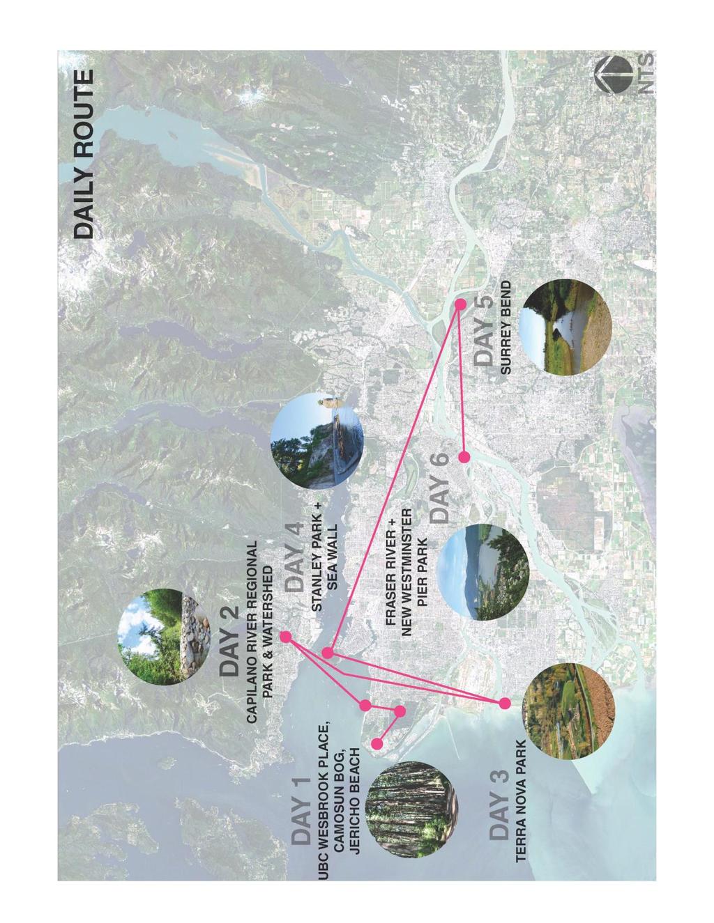
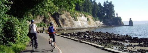
2 OUTLINE 1. Lecture 1 Green Networks Cynthia Girling 2. Break 3. Lecture 2 Principles of Park Planning Jeff Fitzpatrick 4. Photo of the Day assignment 5. Field Trip Stanley Park Cycling/Walking Tour Day 4 OVERVIEW
3

4 Principles of Park Planning SALA Vancouver Summer Program
5 Day 4 Lecture Lecture Principles of Park Planning The Public Realm Anatomy of a park Park planning and design Spirit of place genius loci
6 THE PUBLIC REALM
7 The Public Realm WHAT IS IT?

8 The Public Realm WHAT IS IT? Parks Greenways Urban parks Public plazas Public buildings Laneways Streets Green roofs Public transit Beaches publicly owned streets, pathways, right of ways, parks, publicly accessible open spaces and any public and civic building and facilities


9 The Public Realm WHAT IS IT? Parks Greenways Urban parks Public plazas Public buildings Laneways Streets Green roofs Public transit Beaches publicly owned streets, pathways, right of ways, parks, publicly accessible open spaces and any public and civic building and facilities

10 The Public Realm WHAT IS IT?
11 ANATOMY OF A PARK


12 Anatomy of a Park PARK TYPOLOGIES Large parks Neighbourhood parks Nature parks Conservation areas Plazas Pocket parks Sports/recreation parks Stanley Park, Vancouver Mid Main Park, Vancouver

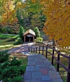
13 Anatomy of a Park THE BASIC COMPONENTS Access + Entrance Circulation (connections, places to move through) Nodes (places to stay) Natural Areas / Planting /Performative Features/points of interest English Bay, Vancouver the built and natural elements that make up a park


14 Anatomy of a Park ACCESS Stanley Park Entrance Gateway 1890 Stanley Park Entrance 2016 How do I get to the park, and how do I know when I have arrived?


15 How do I get to the park, and how do I know when I have arrived? Anatomy of a Park ACCESS

16 Anatomy of a Park CIRULCATION A hierarchy Designed for type, frequency and intended use Defines how people move through and experience the park Defines places within the circulation network Internal park users and those moving through the site
17 Anatomy of a Park CIRULCATION

18 Anatomy of a Park CIRULCATION

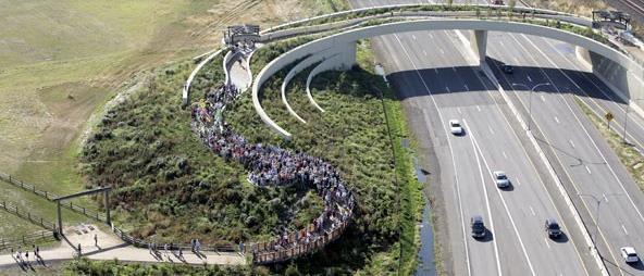
19 Anatomy of a Park CIRULATION

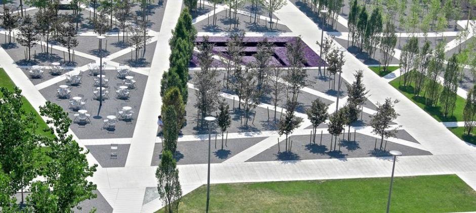
20 Anatomy of a Park NODES Gathering space Open space Formal gardens Beaches Picnic areas Activity zones Markets Playgrounds Community gardens Program areas.place to stay, spend time. Destinations.


21 .place to stay, spend time. Destinations. Anatomy of a Park NODES


22 Anatomy of a Park PERFOMATIVE AREAS / PLANTING / NATURAL AREAS Conservation areas No access zones Boundary + edge definition Farm areas Ecosystem services (pollination areas, stormwater management, etc) Contribute sound, air quality, visual interest and buffers, and natural setting to park experience Stanley Park, Vancouver Mid Main Park, Vancouver


23 Anatomy of a Park FEATURES: POINTS OF INTERST Art Interpretation A view A surprise Heritage feature A relic A big tree A memorial Stanley Park Statue Stanley Park Carving Stanley Park Totem Poles


24 Anatomy of a Park THE BASIC COMPONENTS FEATURES: POINTS OF INTERST Stanley Park Totem Poles

25 Anatomy of a Park THE BASIC COMPONENTS STANLEY PARK Stanley Park Totem Poles
26 PARK PLANNING + DESIGN

27 HOW DO WE GET FROM.. Park Planning + Design PROCESS AN EMPTY SITE

28 TO A PARK PLAN + DESIGN Park Planning + Design PROCESS

29 TO A NEW PARK?.. Park Planning + Design PROCESS

30 Park Planning + Design PROCESS


31 Park Planning + Design RESEARCH AND INFORMATION GATHERING Regional Plans Policy Existing recreational demand studies Growth projections and trend analysis Regional Growth Strategy Who is this park for? what services does it need to provide?...


32 Park Planning + Design SITE INVENTORY AND ANALYSIS - ECOLOGICAL DESIGN Ecological Design GIS Ecosystem Services Ian McHarg, 1971 design that minimizes environmentally destructive impacts by integrating itself with living processes Sim Van der Ryn and Stuart Cowan
33 Park Planning + Design SITE INVENTORY AND ANALYSIS EXISTING CONDITIONS Environmental Geology Soils Hydrology Existing vegetation Wetlands Wildlife and habitat Climate orientation, wind, precipitation, humidity Topography
34 Park Planning + Design SITE INVENTORY AND ANALYSIS EXISTING CONDITIONS Socio Economic + Cultural Adjacent communities Cultures First Nations Traditional land use Existing land use
35 Park Planning + Design SITE INVENTORY AND ANALYSIS EXISTING CONDITIONS Infrastructure Zoning Existing buildings Utilities + servicing Planned infrastructure Road, trail and other connections
36 Park Planning + Design SITE INVENTORY AND ANALYSIS EXISTING CONDITIONS Experiential Views Points of interest Special features Sound + smell

37 Park Planning + Design PUBLIC ENGAGMENT Who are the users What are their interests What do they want in the park? Are there others not being heard? Who is this park for? Masloves scale of engagment


38 Park Planning + Design PUBLIC ENGAGMENT Community meeting Special interest group meetings Community workshops Public open houses Response?

39 Park Planning + Design PUBLIC ENGAGMENT Source

40 Park Planning + Design FIRST NATION ENGAGEMENT Stanley Park Totem Poles Musqueam First Nation Representatives

41 Park Planning + Design SPIRIT OF PLACE GENIUS LOCI Natural elements Sounds Smells History Built form Views The people in the space The textures, colors seasons What make a place special or distinct - its past, current and future essence


42 Park Planning + Design SPIRIT OF PLACE AUTHENTICITY Placemaking facilitates creative patterns of use, paying particular attention to the physical, cultural, and social identities that define a place and support its ongoing evolution -Project for Public Space


43 Park Planning + Design SPIRIT OF PLACE THE SENSES


44 Park Planning + Design SPIRIT OF PLACE THE SENSES
45 Park Planning + Design SPIRIT OF PLACE THE SENSES

46 Park Planning + Design SITE INVENTORY AND ANALYSIS OPPORTUNITIES AND CONSTRAINTS
47 Park Planning + Design SITE INVENTORY AND ANALYSIS OPPORTUNITIES AND CONSTRAINTS

48 Park Planning + Design SITE INVENTORY AND ANALYSIS OPPORTUNITIES AND CONSTRAINTS
49 Park Planning + Design CONCEPT DESIGN
50 Park Planning + Design CONCEPT DESIGN Access + Entrance Circulation (connections, places to move through) Nodes (places to stay) Natural Areas / Planting /Performative Features/points of interest Stanley Park Totem Poles
51 Park Planning + Design CONCEPT DESIGN Access + Entrance Circulation (connections, places to move through) Nodes (places to stay) Natural Areas / Planting /Performative Features/points of interest What experience are you trying to create? What ecosystem services are required? What social / economic / cultural / community challenges are you trying to address? What is the context for this space? Who is this space for? What should be preserved, what should be changes? What is the big idea? What is the spirit of place? Stanley Park Totem Poles


52 Concept Plan Access + Entrance Circulation Nodes Natural Areas / Planting Features/points of interest Park Planning + Design CONCEPT PLAN whats the big idea?... Matsqui Trail Regional Park Concept Plan


53 Design development Detailed design Construction Park Planning + Design DESIGN

54 Park Planning + Design IMPLEMENTATION

55 Are people using this park Do people take ownership of this park? Do those who engaged in the process support the end product? Is it performing its intended ecological services? Park Planning + Design SUCCESS?


56 Examples HIGH LINE WHAT: Reclaimed Rail Line - Elevated Park DESIGNER: Field Operations LOCATION: New York
57 Examples HIGH LINE WHAT: Reclaimed Rail Line - Elevated Park DESIGNER: Field Operations LOCATION: New York
58 QUESTIONS?
Principles of Park Planning SALA Vancouver Summer Program
 Principles of Park Planning SALA Vancouver Summer Program Day 4 Lecture Lecture Principles of Park Planning The Public Realm Anatomy of a park Park planning and design Spirit of place genius loci THE PUBLIC
Queensborough Eastern Neighbourhood Node. Community Open House
 Queensborough Eastern Community Open House The Vision The Queensborough Eastern will become the heart of eastern Queensborough. Through a sensitive mix of viable commercial and residential areas, the neighbourhood
Community Design Guidelines. Port Wallace DRAFT
 Community Design Guidelines Port Wallace DRAFT Energy 1 2 3 Nature Movement Connections Built Form DRAFT Layout Energy 1 Nature Community Design Guidelines GREAT COMMUNITIES PROTECT, CELEBRATE, AND CONSERVE
10.0 Open Space and Public Realm
 10.0 Open Space and Public Realm 10.0 Open Space and Public Realm The Public Open Space System is comprised of: outdoor spaces available for public use that are either publicly owned (e.g., parks and
Shared Principles and Emerging Plan Directions
 Shared Principles and Emerging Plan Directions Introduction Since the Fairfield Neighbourhood planning process launched in June 2016, we have heard from many residents, businesses, groups and other people
GATEWAY AREA STRUCTURE PLAN
 CHESTERMERE GATEWAY AREA STRUCTURE PLAN COMMUNITY OPEN HOUSE SEPTEMBER 22 nd, 2015 PLAN AREA ± 512 hectares (± 1,265 acres) GATEWAY LOCATION UNDEVELOPED LANDS PRESENT AGRICULTURAL USE REGIONAL LAND USE
Complete Neighbourhood Guidelines Review Tool
 Complete Neighbourhood Guidelines Review Tool Prepared By: City of Regina Planning Department October 2014 Page 1 of 14 Community Development Review Checklist for Secondary Plans and Concept Plans The
FUNDAMENTAL BUILDING BLOCKS
 FUNDAMENTAL BUILDING BLOCKS THE WEB OF GIBSONS - EXISTING Lacks Community Structure and Support Circulation, surface water flow and buildings are disjointed from the community Social neighbourhoods are
WILLAMETTE FALLS LEGACY PROJECT
 OPPORTUNITIES & CONSTRAINTS There are here three falls on a line of rocks extending across the river, which forms the bed of the upper channel. The water is precipitated through deep abrazed gorges, and
CHAPTER 5: GUIDING PRINCIPLES
 CHAPTER 5: GUIDING PRINCIPLES The following 10 principles were developed based on public consultation, planning policy and the background analysis conducted during Phase 1. The Guiding Principles significantly
Section 4 - Public Realm & Landscape proposals Landscape Masterplan. Section 4 52
 - Public Realm & Landscape proposals Landscape Masterplan 52 Proposed Masterplan - Green Infrastructure Strategy District Park 4.33 Ha to provide Passive and active recreation with a large play area which
MAYFIELD WEST SECONDARY PLAN PHASE 2
 MAYFIELD WEST SECONDARY PLAN PHASE 2 Public Open House #3 February 25, 2010 Draft Preferred Land Use Scenario TOWN OF CALEDON PLANNING & DEVELOPMENT DEPARTMENT Open House Agenda TOWN OF CALEDON 1. Welcome
WELCOME and introduction
 1 WELCOME and introduction Mobility Hub Locations within Burlington STUDY OVERVIEW STUDY OBJECTIVES The City of Burlington is developing four Area Specific Plans, one for each of Burlington s Mobility
CAL POLY MASTER PLAN UPDATE, March 2015
 Some Key Themes in the General Guiding Principles Academic Mission The plan must foremost advance the University s academic mission and student success. Foresight and Adaptability The plan should take
Report to: Development Services Committee Report Date: April 24, 2017
 SUBJECT: Cornell Rouge National Urban Park Gateway - Report on Design Charrette and Next Steps PREPARED BY: Lilli Duoba, MES, MCIP, RPP, Manager, Natural Heritage (ext. 7925) REVIEWED BY: Marg Wouters,
University of Saskatchewan CAMPUS MASTER PLAN. Senate Meeting Preliminary Presentation. April 21, 2018 DIALOG ECS DA WATT
 University of Saskatchewan CAMPUS MASTER PLAN Senate Meeting Preliminary Presentation April 21, 2018 DIALOG ECS DA WATT project process presentation agenda Stakeholder Engagement Project Control phase1
Throughout. square. (Crystal City Vision Plan 2050)
") 1: Terms related to the PSMP document 1 public space (see also public realm, civic space) An open space designated on the regulating plan, accessible to all, including Plazas, Mini Parks, and Neighborhoods
1: Terms related to the PSMP document 1 public space (see also public realm, civic space) An open space designated on the regulating plan, accessible to all, including Plazas, Mini Parks, and Neighborhoods
WILBURTON COMMERCIAL AREA
 WILBURTON COMMERCIAL AREA BELLEVUE DOWNTOWN ASSOCIATION L A N D U S E A N D L I VA B I L I T Y C O M M I T T E E B R A D L E Y C A LV E R T, A I C P C O M M U N I T Y D E V E L O P M E N T P R O G R A
BURTON STATION STRATEGIC GROWTH AREA PLAN UPDATE PUBLIC MEETING 3/26/18
 BURTON STATION STRATEGIC GROWTH AREA PLAN UPDATE PUBLIC MEETING 3/26/18 1 WHERE WE ARE? 2 PRIMARY OBJECTIVES OF THE PLAN UPDATE 1. Update the land use designation for Burton Station Village to reflect
Southwest Fleetwood Enclave
 Southwest Fleetwood Enclave Development Concept Plan Southwest Fleetwood Enclave 1 st Land Owners Meeting April 30 th, 2012 Presentation Overview Why the Plan? ; Overview & Purpose of Study; Constraints
Marshview Park. Concept Briefing and Feedback Session. Aquarium/Owls Creek Plan Steering Committee March 20, 2012
 Marshview Park Concept Briefing and Feedback Session Aquarium/Owls Creek Plan Steering Committee March 20, 2012 1 Outline of Today s Discussion Introductions Context for Marshview Park Site analysis -
External Engagement Summary Report
 External Engagement Summary Report July 2018 Rain City Strategy: Engagement Report Rain City Strategy Engagement In March 2018, the City of Vancouver invited residents, businesses, and industry professionals
North Oakville East Parks Facilities Distribution Plan. November, 2009
 North Oakville East November, 2009 POLICY CONTEXT 1) Purpose a) The purpose of this document is to be a guide for the location, configuration, design and development of the parks system for the North Oakville
South th E ast Communit ity Centre (SECC)
") South East Community Centre (SECC) 1 New Park Design & Community Centre Update Thursday, February 8, 2018 Public Open House Thank you for attending this Open House! The town and the Consulting Team will
South East Community Centre (SECC) 1 New Park Design & Community Centre Update Thursday, February 8, 2018 Public Open House Thank you for attending this Open House! The town and the Consulting Team will
Edgeley Pond + Park Public Meeting
 Edgeley Pond + Park Public Meeting February 21, 2017 Purpose of the meeting This Public Meeting is an opportunity for you to review the project background, process and provide input. City of Vaughan staff
Colorado Station 2.0
 Colorado Station 2.0 Spring 2016 MURP Workshop UC Denver Ellen Ittelson Gregory Meek Megan Yonke Katelyn Puga Nathan Silverstein Claire Dalby Matthias Helfen Mark Richardson Jake Schmitz Gaby Hart Lauren
Saratoga Quarry Park Master Plan
 Project Team City of Saratoga John Cherbone, Director of Public Works Iveta Harvancik, Senior Engineer PlaceWorks Isabelle Minn, Principal-in-Charge Isby Fleischmann, Project Manager Kyle Simpson, CEQA
COW BAY DEVELOPMENT LANDS
 PRINCE RUPERT PORT AUTHORITY COW BAY DEVELOPMENT LANDS MARCH 28TH, 2012 % of Completion 0 25 50 75 100 4 guiding principles & OBJECTIVES COMMUNITY FEEDBACK BUSINESS & COW BAY MERCHANT FEEDBACK COMMUNITY
RESILIENT COMMUNITIES PROJECT CITY OF MINNETONKA
 RESILIENT COMMUNITIES PROJECT CITY OF MINNETONKA BUILDING COMMUNITY-UNIVERSITY PARTNERSHIPS FOR SUSTAINABILITY Presentation to The League of Women Voters March 16, 2013 Julie Wischnack, Community Development
The West Vaughan Employment Area Secondary Plan Policies
 Part 2: The West Vaughan Employment Area Secondary Plan Policies 2.1 General Policies It is the policy of Council: 2.1.1. That the West Vaughan Employment Area (the WVEA), identified on Schedule 1, will
PUBLIC RIGHT-OF-WAY IN THIS CHAPTER PUBLIC REALM
 PUBLIC RIGHT-OF-WAY This section provides design guidelines for improvements in the public right-of-way. The public right-of-way refers to streets, sidewalks, non-vehicular thoroughfares, parks and greenways
T O W N O F H I G H R I V E R
 T O W N O F H I G H R I V E R o p e n s p a c e p l a n The Town of High River, 30 minutes South of Calgary, still retains much of its distinctive small town character and provides residents with a high
PROPOSED REDEVELOPMENT OF THE GLEN ABBEY GOLF CLUB. STREETSCAPE DESIGN STUDY (excerpt from the Urban Design Brief) TOWN OF OAKVILLE.
 TOWN OF OAKVILLE.") PROPOSED REDEVELOPMENT OF THE GLEN ABBEY GOLF CLUB STREETSCAPE DESIGN STUDY (excerpt from the Urban Design Brief) TOWN OF OAKVILLE OCTOBER, 2016 for 2.4.2 STREETS Streets are the single largest component
PROPOSED REDEVELOPMENT OF THE GLEN ABBEY GOLF CLUB STREETSCAPE DESIGN STUDY (excerpt from the Urban Design Brief) TOWN OF OAKVILLE OCTOBER, 2016 for 2.4.2 STREETS Streets are the single largest component
Public Open House. Yonge Street and Bernard Avenue (Bernard KDA) Planning Study Update Town of Richmond Hill. March 30, 2017
 Planning Study Update Town of Richmond Hill. March 30, 2017") Public Open House Yonge Street and Bernard Avenue (Bernard KDA) Planning Study Update Town of Richmond Hill March 30, 2017 Open House Review of Project Purpose and Process Policy Refresher Highlights of
Public Open House Yonge Street and Bernard Avenue (Bernard KDA) Planning Study Update Town of Richmond Hill March 30, 2017 Open House Review of Project Purpose and Process Policy Refresher Highlights of
GREENBANK DEVELOPMENT MASTERPLAN
 DEVELOPMENT MASTERPLAN POTENTIAL TRAIN STATION COMMUNITY CENTRE Greenbank will be a connected masterplanned community providing easy access to local and surrounding amenity. Affordable quality homes, green
OPEN SPACE TYPES. SIZE 8 acres. SIZE 20 acres. SIZE 1 acre
 TYPICAL CHARACTERISTICS OPEN SPACE TYPES OPEN SPACE TYPES The neighborhood contains an extensive variety of open space types. Most of these spaces incorporate multiple uses and activities, so that each
Parks Renaissance. Strategy. Director, Operations. General Committee. Presentation to. May 16, Barb Rabicki
 1 Parks Renaissance Strategy Presentation to General Committee May 16, 2016 Barb Rabicki Director, Operations Incorporates recommendation to complete Parks Renaissance Strategy Feedback / requests from
Gather information from online resources covering the following topics:
 Assignment #1: Regional Analysis Project Site Location: Greater Boston Area What comprises a region? The many elements within a region comprise the region as a whole. Natural as well as manmade environmental
A BLUEPRINT FOR BROCKTON A CITY-WIDE COMPREHENSIVE PLAN
 A BLUEPRINT FOR BROCKTON A CITY-WIDE COMPREHENSIVE PLAN Public Meeting October 2016 1 Plan Summary and Discussion Public Meeting May 4 2017 City of Brockton Bill Carpenter, Mayor Department of Planning
Strategic Plan August 2017
 Strategic Plan August 017 BREATHE EDMONTON S GREEN NETWORK STRATEGY FOUNDATIONS 1 1.1 The Need for a Green Network Strategy... 1. Purpose of the Strategy...3 1.3 Structure of the Document...3 1.4 Planning
Planning Board Briefing
 Planning Board Briefing Why Now? The Sector Plan Implementation Chapter States: Before Stage 1 begins, the following must occur: Approval of the Sectional Map Amendment. Approval of the Greater Lyttonsville
Welcome! HORSESHOE BAY PARK. Welcome!
 Welcome! HORSESHOE BAY PARK Welcome! Where are we in the process? Today we would like your input on how Horseshoe Bay Park can be upgraded to serve the community s needs better. CONSULT STAKEHOLDERS TAKE
SAN RAFAEL GENERAL PLAN 2040 INTRODUCTION AND OVERVIEW
 SAN RAFAEL GENERAL PLAN 2040 INTRODUCTION AND OVERVIEW Steering Committee Presentation February 14, 2018 Purpose of General Plan Guide land use and development decisions Coordinate transportation, infrastructure,
INTRODUCING THE BALTIMORE CITY GREEN NETWORK VISION PLAN
 INTRODUCING THE BALTIMORE CITY GREEN NETWORK VISION PLAN GOALS OF THE GREEN NETWORK PLAN Protect and enhance the unique ecological resources of our city Support economic growth and sustainable redevelopment
Call for Artists for: Design and Construction of Environmental Art Activation Story Mill Community Park, Bozeman, MT
 Call for Artists for: Design and Construction of Environmental Art Activation Story Mill Community Park, Bozeman, MT Seeking artists to design, fabricate and install art elements in the nature sanctuary
Engagement Summary Gastown Streets: Local Business Visioning Workshop
 Engagement Summary Gastown Streets: Local Business Visioning Workshop Gastown s streets are in need of major repair and rehabilitation and we have a once in a lifetime opportunity to holistically plan
North Shore Trail. Council Meeting June 10, 2002
 North Shore Trail Council Meeting June 10, 2002 Process Guiding Principles Inventory and Analysis Preliminary Concepts (4) Final Concept Phasing Strategy Estimated Costs OVERVIEW Purpose: Prepare an overall
PORT OF VANCOUVER WATERFRONT DEVELOPMENT. Concept Development Plan City Center Redevelopment Authority April 20, 2017
 PORT OF VANCOUVER WATERFRONT DEVELOPMENT Concept Development Plan City Center Redevelopment Authority April 20, 2017 Port History PORT ESTABLISHED 1912 TERMINAL 1 ACQUIRED 1925 GWM SIGNS LEASE 1935 HARBOR
Regional Context Statement
 Regional Context Statement REGIONAL CONTEXT STATEMENT 3. REGIONAL CONTEXT STATEMENT In 1995, the Provincial Government passed into law the Growth Strategies Act. The purpose of this provincial initiative
Parks, Open Space and Trails
 Introduction Parks have often been referred as the lungs of our cities, cleansing the air of pollutants and particulate matter. Parks are also gathering places for families and community. They offer spaces
COURTICE MAIN STREET COMMUNITY IMPROVEMENT PLAN
 COURTICE MAIN STREET COMMUNITY IMPROVEMENT PLAN Public Meeting #1 April 28, 2016 Birdseye view of the study area PIC #1 AGENDA Agenda and Format 6:30 6:50 Registration 6:50 7:45 Introductions, Presentation
PUBLIC ENGAGEMENT & SIX THEMES OF THE PLAN
 Connecting the heart of Eagle to the soul of the river - Kathy Chandler-Henry, Commissioner Eagle County CHAPTER 1 PUBLIC ENGAGEMENT & SIX THEMES OF THE PLAN town of eagle - river corridor plan 1 PUBLIC
Goal 1: To Encourage the Orderly, Harmonious and Judicious Use of University Resources in the Development of University Land.
 2.0 Future Land Use Goal 1: To Encourage the Orderly, Harmonious and Judicious Use of University Resources in the Development of University Land. Objective 1.1: Make available future building sites that
City of Langford Green Development Checklist
 City of Langford Green Development Checklist The following Green Development Checklist creates a sustainability standard for all comprehensive development within the City of Langford. The commitments made
April 11, 2016 Park Board Chair and Commissioners General Manager Vancouver Board of Parks and Recreation New Brighton Salt Marsh - Preferred Concept
 TO: FROM: SUBJECT: April 11, 2016 Park Board Chair and Commissioners General Manager Vancouver Board of Parks and Recreation New Brighton Salt Marsh - Preferred Concept RECOMMENDATION A. THAT the Vancouver
CREATE A VIBRANT MIXED-USE COMMUNITY
 CREATE A VIBRANT MIXED-USE COMMUNITY Land Use Public Realm Plan Built Form Heritage Tell us what you think! Place a sticky note here or leave us a comment form LAND USE The land use framework of this Secondary
Red Deer County Open Space Master Plan
 PhD FCSLA MCIP Professor and Research Leader, The EVDS Urban Lab University of Calgary Presentation to International Federation of Landscape Architects Congress Suzhou, China 2010 Four-phase, multi-year
Garden District Heritage Conservation District Study
 Garden District Heritage Conservation District Study Community Consultation Meeting September 24 th, 2013 What is a Heritage Conservation District? A defined area of heritage significance and character
Historic Yonge Street HCD Study Public Meeting #2
 Historic Yonge Street HCD Study Public Meeting #2 March 26, 2014 Archaeological Services Inc. Philip Goldsmith Architect Agenda: 7:00 p.m. Open House 7:30 p.m. Welcome and Presentation 8:00 p.m. Questions
Tāhuhu whakaruruhau ā-taone The sheltering ridge pole
 B2. Tāhuhu whakaruruhau ā-taone - Urban growth and form B2.1. Issues Tāhuhu whakaruruhau ā-taone The sheltering ridge pole Auckland s growing population increases demand for housing, employment, business,
MCCOYS CREEK RESTORATION 30% DESIGN
 MCCOYS CREEK RESTORATION 30% DESIGN THE MCCOYS CREEK RESTORATION PLAN The restoration plan aims to reduce flooding, restore ecosystem health, expand recreational opportunities along the creek, and connect
THE NEIGHBORHOOD TODAY
 THE NEIGHBORHOOD TODAY CORE AREA VISION How are we Good Urbanism A Site s DNA thinking about Elements of great Unique elements urban communities embedded in a place the site and design? ELEMENTS LIKE:
URBAN DESIGN BRIEF URBAN DESIGN BRIEF 721 FRANKLIN BLVD, CAMBRIDGE August 2018
 URBAN DESIGN BRIEF URBAN DESIGN BRIEF 721 FRANKLIN BLVD, CAMBRIDGE August 2018 DESIGN BRIEF CONTENTS PART A 1.0 INTRODUCTION 2.0 DESCRIPTION & ANALYSIS OF SITE CONTEXT 3.0 DESIGN CONSTRAINTS AND OPPORTUNITIES
Appendix E: Illustrative Green Infrastructure Examples
 Appendix E: Illustrative Green Infrastructure Examples Integrating LID into San Francisco s Urban Landscape Figure E. High-density Residential Figure E. Low-density Residential Figure E. Mixed Use 7 Figure
DOWNTOWN PARKS & PUBLIC REALM PLAN
 DOWNTOWN PARKS & PUBLIC REALM PLAN CHALLENGES The Parks and Public Realm Strategy addresses challenges associated with a growing Downtown, including: GOALS 3.3 New buildings will fit within their existing
SQUAMISH 2010 AND BEYOND COMMUNITY VISION
 Our plan has been imagined and created to be both pragmatic and visionary. At the core of the strategy is a consideration of the highway s role and its impact on the community. First and foremost in creating
A Joined-up Regional Landscape: A Roadmap to connect the parts
 Breaking the Barriers: Engineering Solutions to Ecological Problems A Joined-up Regional Landscape: A Roadmap to connect the parts Associate Professor Darryl Low Choy Urban Research Program Outline Nature
COMMUNITY HEART HEATHER STREET LANDS
 COMMUNITY HEART PLAZA AT HARVARD, CAMBRIDGE VISUALIZATION OF THE COMMUNITY HEART FROM 33RD AVENUE The concept includes an active mix of uses around open space to support all-day vibrancy. Anchored by the
CAMPUS PLACEMAKING: CAC WORK SESSION. August 23, 2018
 CAMPUS PLACEMAKING: CAC WORK SESSION August 23, 2018 AGENDA Public Realm Framework Overview & Discussion (~20 minutes) Health & Wellness Report Overview & Discussion (~15 minutes) Riverfront Update & Discussion
QUESTION 8: What are your Public Realm priorities for implementation? What would you like to see happen first? TELL US WHAT YOU THINK
 Public Realm Plan How will the Public Realm Plan be implemented? The Public Realm Plan document will set out a vision for the next 30 years. Over time, Plan elements and aspects can be implemented as opportunities
11.5 Kipling Avenue Corridor Secondary Plan
 11.5 Kipling Avenue Corridor Secondary Plan ADOPTED BY VAUGHAN CITY COUNCIL NOT YET APPROVED BY THE ONTARIO MUNICIPAL BOARD 11.5.1 Development Principles and Objectives The following principles support
Midtown Greenway Land Use and Development Plan Executive Summary
 Midtown Greenway Land Use and Development Plan Executive Summary Introduction The Midtown Greenway Land Use and Development Plan sets policy direction for land use and development in the Midtown Greenway
CAMPUS MASTER PLAN UPDATE
 13 April 2016 CAMPUS MASTER PLAN UPDATE Focus Group Landscape AGENDA What We Heard Review of Campus Observations & Analysis Campus Framework & Open Space Network Table-Top Exercise Landscape Guideline
include playgrounds, sports fields, community gardens and picnic areas.
 DEVELOPMENT PLAN OPEN SPACE SYSTEM OPEN SPACE SYSTEM The neighborhood provides for a range of open space types. The Village Square is an important open space in the neighborhood. It serves as a gathering
MAYFIELD WEST SECONDARY PLAN PHASE 2
 MAYFIELD WEST SECONDARY PLAN PHASE 2 Council Information Workshop February 16, 2010 Draft Preferred Land Use Plan TOWN OF CALEDON PLANNING & DEVELOPMENT DEPARTMENT Workshop Agenda TOWN OF CALEDON 1. Welcome
PUBLIC ART CALL LIONS GATE COMMUNITY CENTRE. For Expressions of Interest Submission Deadline: March 18, 2018 Project Value: $85,000(inclusive)
") LIONS GATE COMMUNITY CENTRE PUBLIC ART CALL For Expressions of Interest Submission Deadline: March 18, 2018 Project Value: $85,000(inclusive) LGCC EOI 1 LIONS GATE COMMUNITY CENTRE (LGCC) PUBLIC ART CALL
LIONS GATE COMMUNITY CENTRE PUBLIC ART CALL For Expressions of Interest Submission Deadline: March 18, 2018 Project Value: $85,000(inclusive) LGCC EOI 1 LIONS GATE COMMUNITY CENTRE (LGCC) PUBLIC ART CALL
RECREATION, OPEN SPACE AND GREENWAYS ELEMENT GOALS, OBJECTIVES, AND POLICIES
 RECREATION, OPEN SPACE AND GREENWAYS ELEMENT GOALS, OBJECTIVES, AND POLICIES GOAL R-1: DEVELOP A RECREATION, OPEN SPACE AND GREENWAYS SYSTEM AS AN INTEGRAL COMPONENT OF AN OVERALL, COUNTY-WIDE ECONOMIC
A larger version of this map is located on the last page of this PDF.
 MAP Committee Input McLoughlin Area Draft Vision Map A larger version of this map is located on the last page of this PDF. 1. The map above is intended to portray a vision for the McLoughlin area. It highlights
UDF PLANS AND GUIDELINES
 UDF PLANS AND GUIDELINES 5 Land Use Land Use Development Plan Plan no. 3 Land Use Development Mixed Use Retail / Leisure Residential Civic and Institutional Proposed Zoning Table Development Edges Plan
Neighborhood Districts
 NEIGHBORHOOD DISTRICTS SEVEN MAIN DISTRICTS Neighborhood Districts While the Development Plan provides a broad-scale overview of the neighborhood, this section focuses on uses and relationships at the
The Neighbourhood Unit
 DESIGN... Site Framework PROCESS IMPLEMENTATION 22 TOOL DESCRIPTION The neighbourhood unit is a holistic planning and design strategy that addresses the configuration of the major physical components of
DRAFT Anan Wildlife Observatory Recreation Site Master Plan. Prepared by: Wrangell Ranger District Tongass National Forest Alaska
 DRAFT Anan Wildlife Observatory Recreation Site Master Plan Prepared by: Wrangell Ranger District Tongass National Forest Alaska December, 2015 Signature Sheet Approved: James King Director of Recreation,
4 Sustainability and Growth Management
 4 Sustainability and Growth Management Introduction Traditionally, has assumed growth and development with limited consideration for the long-term negative social, environmental or economic impacts on
Britannia Farm Master Plan Refresh September 21 st 2016 Public Consultation #2 Summary Report
 Britannia Farm Master Plan Refresh September 21 st 2016 Public Consultation #2 Summary Report September 21 st Public Open House #2 Overview The Peel District School Board is undertaking a Refresh of the
Deputation to Building & Planning Committee November 19, 2012
 Deputation to Building & Planning Committee November 19, 2012 Proposed Rezoning Special Sites 8 and 11 OZ 12/003 W7 Presented by Sharon Giraud, President GWHA executive@gordonwoods.ca Gordon Woods Our
38 Queen s University Campus Master Plan Part 1
 38 Queen s University Campus Master Plan Part 1 46 The Campus at the City Scale Chapter 4 The Campus at the City Scale 39 Queen s is an urban University centrally located in Kingston. Decisions made by
Overview of the Plan. The Building Blocks of Centers, Neighborhoods and Network INTERNAL DRAFT
 Overview of the Plan 4 East Davidson Ramah Church Rd June Washam Rd Bradford District Park Bradford Shearer Rd Campus District NC 73 Davidson-Concord North Rocky River This Master Plan projects an approximate
March 14, Will Allen Director of Strategic Conservation Planning
 New Frontiers in Land Conservation: Green Infrastructure for Urban Vacant and Underutilized Lands 23 rd Annual RMLUI Conference March 14, 2014 Will Allen Director of Strategic Conservation Planning Special
NORTH LAKE SPECIFIC PLAN AREA
 NORTH LAKE SPECIFIC PLAN AREA June 21, 2018 WELCOME Workshop Agenda Introduction Provide information about the program and introduce the team Background Information Share information about the North Lake
Community Conservation Workshop. Lake Placid
 Community Conservation Workshop Lake Placid 2 Community Conservation Program Welcome! We have designed a Community Conservation Program that listens to the needs of community members. We are conducting
Comprehensive Plan Advisory Panel Meeting #3
 Comprehensive Plan Advisory Panel Meeting #3 November 7, 2016 Agenda 1. September 19 th Meeting Notes 2. Summary of Focus Areas Charrette 3. Heart of the City Focus Area a. HOC2/Station Areas Concept &
City of Kitchener Urban Design Manual Dra 2019 PART A URBAN STRUCTURE & BUILT FORM. Green Areas
 City of Kitchener Urban Design Manual Dra 2019 PART A URBAN STRUCTURE & BUILT FORM Green Areas Introduction City of Kitchener Urban Design Manual Section Page 01 INTRODUCTION 2 KITCHENER S GREEN AREAS
Otay Regional Trail Alignment Study. Public Workshop March 14 th, 2017 from 5:30-8 p.m.
 Public Workshop March 14 th, 2017 from 5:30-8 p.m. Purpose of the Study A multi-agency planning effort to create a coordinated and sustainable trail system that enhances recreation and provides trail connections
Objectives and Strategies for the Integration of Recreation, Parks and Open Space in Regional Plans
 BULLETIN 2 Objectives and Strategies for the Integration of Recreation, Parks and Open Space in Regional Plans TABLE OF CONTENTS Introduction 3 Land-use Framework Outcomes 1 4-8 Land-use Framework Outcomes
Urban Design Manual PLANNING AROUND RAPID TRANSIT STATIONS (PARTS) Introduction. Station Study Areas
 Introduction. Station Study Areas") 111111 PLANNING AROUND RAPID TRANSIT STATIONS (PARTS) Introduction The ION rapid transit system will link Waterloo, Kitchener and Cambridge through a central transit corridor (CTC). There are a number
111111 PLANNING AROUND RAPID TRANSIT STATIONS (PARTS) Introduction The ION rapid transit system will link Waterloo, Kitchener and Cambridge through a central transit corridor (CTC). There are a number
Ivywild On The Creek PRELIMINARY CREEK DISTRICT MASTER PLAN
 Ivywild On The Creek PRELIMINARY CREEK DISTRICT MASTER PLAN Introduction: Rejuvenating an extraordinary Creekside neighborhood THE CREEKSIDE DISTRICT The Ivywild On The Creek Neighborhood District Master
Tauranga City Centre Spatial Framework
 Tauranga City Centre Spatial Framework Stakeholder Engagement Workshop 15 October 2015 Project Design Team Beca & LandLAB Our team Henry Crothers (LandLab) Landscape Architect/Urban Designer Urban and
Community Information Meeting
 Queensborough Eastern Community Information Meeting July 24, 2014 Cameron Chalmers, MCIP, RPP Platform Properties Meeting Format Purpose Format The purpose of the meeting is to invite the community to
McCowan Precinct Plan Study Background & Deliverables
 1 DRAFT & WITHOUT PREJUDICE McCowan Precinct Plan Study Background & Deliverables In September, 2011, City Planning (Scarborough District) began a study of an area within the Scarborough Centre, identified
TRANSFORMATIVE PLACES:
 TRANSFORMATIVE PLACES: SOFT POWER, PLACE-MAKING AND THE PUBLIC LIBRARY Ontario Library Association Annual Institute on the Library as Place 2016 Transformative Spaces Halifax Central Library, Halifax NS