Santa Barbara County Planning Commission May 11 th, Cuyama Valley Conservancy vs. Troesh Diamond Rock Mine
|
|
|
- Beverley Neal
- 5 years ago
- Views:
Transcription
1 Santa Barbara County Planning Commission May 11 th, 2011 Cuyama Valley Conservancy vs. Troesh Diamond Rock Mine
2 INTRODUCTION I Who Are We? The Cuyama Valley Conservance openly opposed the mine. In six days we collected signatures representing 450 Cuyama Valley Residents in opposition to the Diamond Rock Mine. We are the people- we live here! SCV BOS Reference: 2
3 POLITICS & RESOURCES Diamond Rock * Financial Troesh Extended Family Robertson s Ready Mix (CEO, Dennis Troesh) Largest ready mix producer with 700 trucks in Southern California Just sold 37.7% of family company for $900,000,000, (100% company = $2,430,000,000.00) SCV BOS
4 DESCRIPTION OF DEVELOPMENT Cumulative Impact SCV BOS Reference: 4
5


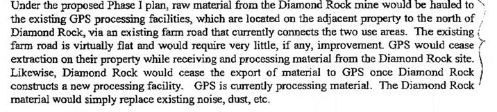
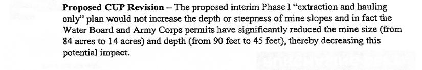
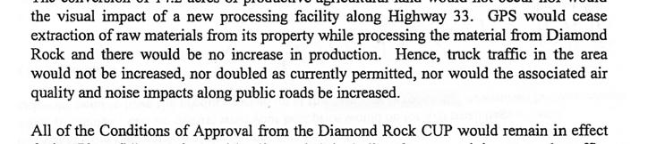
6 UPDATE Cuyama Valley Conservancy Case#: 11RVP Proposed project: The proposed revision would not substantially change the project as previously approved; rather, it would introduce an interim Phase I extraction and hauling only plan. SCV BOS : 6
7 UPDATE Cuyama Valley Conservancy Extraction Rate Per Year County Approved 500, ,000 tons Army Corp Approved 200,000 tons Maximum Pit Depth 90 feet 45 feet Project Footprint 25 acres 14 acres Permit Duration 30 years 5 years (renewable) Monitoring Plan? Independent surveyor April & October annually SCV BOS
8 UPDATE Cuyama Valley Conservancy Requests 1. Material excavation, trucking processing, and reclamation shall be limited to 6:00am to 6:00pm, Monday - Friday. 2. Maximum truck trips per day shall be limited to 100 haul trips per work day (260 work 40,000/pounds per truck = average 38 haul trips per day). 3. If an emergency is declared by the Planning Director, a pre-determined extraction rate, truck trips and the duration of the emergency needs to be quantified in the E.I.R. 4. No truck will be allowed south on Lockwood Valley Rd. 5. A quarterly report on the distribution of aggregate fines for public review shall be made available for public review If trucking and sales receipts do not support fines distribution a specific fee shall be imposed. SCV BOS
9 UPDATE Cuyama Valley Conservancy Requests (continued) 6. The County Conditional Use Permit in conjunction with the Army Crop shall be required to have a monitoring plan for: a. Material extraction rates b. Water usage c. Air quality 7. The County shall adopt a policy for dealing with standing water infill to 6 feet above the water table as required by California Fish & Game and the Army Corp. 8. The County s Conditional Use Permit shall be modified to reflect all conditions of the Army Corp and other agency approval. SCV BOS
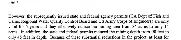
10 ECONOMICS We Don t Need The Gravel Projected gravel needs through August 2036 for Santa Barbara and San Luis Obispo Counties SCV BOS


11 ECONOMICS We Don t Need The Gravel Where the Diamond Rock sand and gravel could economically go 67,000+ new homes and infrastructure planned on Hwy 5 between Tejon Ranch and Santa Clarita. SCV BOS Reference: 11
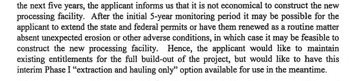
12 ECONOMICS Benefits to residents of Santa Barbara County and State of California SCV BOS Reference: 12

 Proponents Retained: John Larson- Project Manager for")

13 POLITICS & RESOURCES Diamond Rock * Legal / Technical Proponents Retained: Kerry Shapiro of Jeffer, Mangles, Butler & Marmaro LLP- Heads Government Land Use, Zoning Enforcement and Energy Department. Also lead attorney for Cemex vs. City of Santa Clarita (150 lawyers) Proponents Retained: John Larson- Project Manager for URS, $5.4 Billion Dollar company, with 50,000 employees. Proponents Retained: John Hecht- CEO of West Coast Engineering, also advisor to: Ozena Mine in Ventura County Frazier Park Mine in Kern County SCV BOS Reference: 13


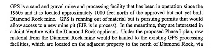
14 DESCRIPTION OF DEVELOPMENT Cumulative Impact Locations of Proposed Diamond Rock Mine Pit, GPS Mine Pit & Richard s Holdings Mine Site Why were the cumulative impacts of these three contiguous mines not considered? SCV BOS Reference: EIR draft App A URS Figure
15
16
17 Cuyama Valley Conservancy Who Are We? Save the Cuyama Valley Organizing Committee members The Cuyama Valley Conservancy is a 501(c)(3) non-profit organization. The organization s original name was Save the Cuyama Valley and it has been working for the benefit of the Valley and dits residents since SCV BOS Reference: 17
18 INTRODUCTION I Outline of Presentation Introduction To the Cuyama Valley Conservancy And Its Concerns Introduction To Cuyama Valley History Landscape Flora Fauna What s At Stake Economy & Infrastructure Safety & Air Pollution Cumulative Mine Affects Participants & Economics Critical Analysis Of E.I.R. (Water & Hydrology) What We Get Summary > What If? SCV BOS
19


20
APPENDIX J PERFORMANCE STANDARDS FOR GRAVEL MINE, PIT MINE, OR QUARRY
 APPENDIX J PERFORMANCE STANDARDS FOR GRAVEL MINE, PIT MINE, OR QUARRY A. Purpose: 1. Regulatory Requirement and Use Mitigation: The purpose of this appendix is to provide a regulatory context (standards)
Roy L. Wickland 15 Belvedere Avenue - Belvedere, CA 94920
 Roy L. Wickland 15 Belvedere Avenue - Belvedere, CA 94920 June 19, Ms. Irene Borba Director of Planning and Building City of Belvedere ~1anning Department 450 San Rafael Avenue Belvedere, CA 94920 JUN.
Local Area Key Issues Paper No. 11: Extractive industry - Yandina Creek and Browns Creek Road
 Draft Sunshine Coast Planning Scheme Review of Submissions Local Area Key Issues Paper No. 11: Extractive industry - Yandina Creek and Browns Creek Road Key Issue: No. of submissions: Sites identified
JULIAN HOME SITE PROPERTY REPORT
 ADDRESS: HWY 79, Julian, CA 92036 JULIAN HOME SITE PROPERTY REPORT DESCRIPTION: A rare 3.37+/- acre home site in the Kentwood area of Julian. This site is contiguous with Highway 79, but accessed via Lakeview
Notice of Completion Form A See NOTE BELOW Mail to: State Clearinghouse, 1400 Tenth Street, Sac., CA / SCH #
 Notice of Completion Form A See NOTE BELOW Mail to: State Clearinghouse, 1400 Tenth Street, Sac., CA 95814 916/445-0613 SCH # 2002021130 Project Title: Pebble Beach Company s Del Monte Forest Preservation
CHAPTER 2 SUMMARY 1. PROJECT SUMMARY DATA
 CHAPTER 2 SUMMARY This is an Initial Study format used to determine, pursuant to CEQA Guidelines Section 15177, whether a project 1) is within the scope of a Master EIR (MEIR), 2) may result in additional
5.8 PUBLIC SERVICES FIRE PROTECTION AND EMERGENCY SERVICES
 5.8 PUBLIC SERVICES FIRE PROTECTION AND EMERGENCY SERVICES 5.8.1 INTRODUCTION This section assesses the proposed projects potential impacts on fire protection services. Information for the following analysis
INTRODUCTION. 1.1 What is a General Plan? 1.2 Requirements for a General Plan. 1.3 Introduction to Monterey County
 1.1 What is a General Plan? INTRODUCTION California state law requires each city and county to adopt a comprehensive, long-term general plan for the physical development of the county or city, and any
City of Surrey PLANNING & DEVELOPMENT REPORT File:
 City of Surrey PLANNING & DEVELOPMENT REPORT PROPOSAL: Planning Report Date: September 14, 2009 OCP Amendment Temporary Industrial Use Permit in order to allow the outdoor storage of construction waste
PC RESOLUTION NO GRADING PLAN MODIFICATION (GPM)
") PC RESOLUTION NO. 16-07-26- GRADING PLAN MODIFICATION (GPM) 16-006 A RESOLUTION OF THE PLANNING COMMISSION OF THE CITY OF SAN JUAN CAPISTRANO, CALIFORNIA APPROVING GRADING PLAN MODIFICATION (GPM) 16-006,
PC RESOLUTION NO. 16-07-26- GRADING PLAN MODIFICATION (GPM) 16-006 A RESOLUTION OF THE PLANNING COMMISSION OF THE CITY OF SAN JUAN CAPISTRANO, CALIFORNIA APPROVING GRADING PLAN MODIFICATION (GPM) 16-006,
Minister of the Environment Representative
 Page 39 MINUTES OF THE MUNICIPAL PLANNING COMMISSION of the Town of Banff in the Province of Alberta Town Hall Council Chamber Wednesday, at 9:00 a.m. COMMISSION MEMBERS PRESENT Raymond Horyn Public Representative
RD:VMT:JMD 10/14/2015 RESOLUTION NO.
 RD:VMT:JMD 10/14/2015 RESOLUTION NO. A RESOLUTION OF THE COUNCIL OF THE CITY OF SAN JOSE ADOPTING THE EDENVALE AVENUE PLANNED DEVELOPMENT REZONING PROJECT MITIGATED NEGATIVE DECLARATION, FOR WHICH AN INITIAL
 Situating the Rosemont Mine Proposal Geographically & Historically: Toward a Political Ecology of a Copper Mine Owen King Owen.King@uwe.ac.uk @OMKingy @Hydrosocial This presentation Geographical Context
3.0 Cumulative Scenario and Methodology. 3.0 Cumulative Scenario and Methodology
 3.0 Cumulative Scenario and Methodology Under the CEQA Guidelines, a cumulative impact consists of an impact which is created as a result of the combination of the project evaluated in the environmental
Report to City Council
 Attachment 4 BUDGET OFFICER CITY ATTORNEY APPROVALS CITY MANAGER Report to City Council TO: FROM: Mayor and City Council John C. Terell, Community and Economic Development Director AGENDA DATE: June 24,
Santa Barbara LAFCO. Review of Santa Barbara LAFCO Agricultural and Open Space Policies. October 11, 2018 BUSINESS ITEM NO. 1
 Santa Barbara LAFCO Review of Santa Barbara LAFCO Agricultural and Open Space Policies October 11, 2018 Background At the April 5, 2018 meeting, the Commission reviewed an Open Letter from the Environmental
980± acre former ranch Located on east and west sides of Veterans Parkway Connects South Meadows and Donner Springs/Hidden Valley.
 980± acre former ranch Located on east and west sides of Veterans Parkway Connects South Meadows and Donner Springs/Hidden Valley Project Location Master Plan Amendment for a mix of Single Family Mixed
FOR SALE. Arvin Edison Vineyard & Open Land Gross Acres Kern County, CA
 Arvin Edison Vineyard & Open Land FOR SALE Property Highlights Arvin Edison Water Storage District Class I and II Soils Neighboring properties planted to almonds, vineyards, and citrus The information
Rempstone Extension - East Leake 2014
 Overall Restoration of East Leake Quarry Sand Martin Face Southern Agricultural Corridor Wetland Ponds/Conservation Corridor following Sheepwash Brook Reinstated Bridleway/Footpaths Southern Agricultural
Glenborough at Easton Land Use Master Plan
 Implementation 114 9.0 IMPLEMENTATION 9.1 OVERVIEW This chapter summarizes the administrative procedures necessary to implement the proposed land use plan, infrastructure improvements, development standards,
CHAPTER NATURAL RESOURCE EXCAVATION
 12 CHAPTER 29.2528. NATURAL RESOURCE EXCAVATION Sections: 29.28.010. Purpose. 29.28.020. Application of Natural Resource Excavation Chapter. 29.28.030. Definitions. 29.28.040. Applications and Approval
W.H. Bonner Associates
 15619 Ogram Avenu Gardena, CA 90249-444 W.H. Bonner Associates Archaeofaunal Studies Archaeological Surveys Historical & Genealogical Research (310) 675-274 E-mail: whbonner@aol.com April 21, 2014 Wendy
CENTRAL ESTUARY PLAN AVISION FOR OAKLAND S WATERFRONT
 Central Estuary Plan A VISION FOR OAKLAND S WATERFRONT Specific Plan and Environmental Assessment Presentation to the Parks and Recreation Advisory Commission December 9, 2009 This Afternoon s Presentation
COUNTY OF RIVERSIDE PLANNING DEPARTMENT STAFF REPORT
 Agenda Item No.: 5.4 Area Map: Jurupa Zoning District: Prado-Mira Loma Supervisorial District: Second Project Planner: Christian Hinojosa Planning Commission: February 3, 2010 Conditional Use Permit No.
FIREFIGHTING RESOURCES OF CALIFORNIA ORGANIZED FOR POTENTIAL EMERGENCIES
 FIREFIGHTING RESOURCES OF CALIFORNIA ORGANIZED FOR POTENTIAL EMERGENCIES PAST, CURRENT AND FUTURE DIRECTIONS A PROGRESS REPORT OCTOBER 1988 PAST, CURRENT, AND FUTURE Coordinate multi-agency resources during
Department of Community Development. Planning and Environmental Review Division Revised Notice of Preparation
 Department of Community Development Michael J. Penrose, Acting Director Divisions Building Permits & Inspection Code Enforcement County Engineering Economic Development & Marketing Planning & Environmental
LID Permit Requirements. Lisa Austin. Geosyntec Consultants
 LID Permit Requirements Lisa Austin Geosyntec Consultants Presentation Outline Types of LID Permit Requirements Specified site design Specified LID BMPs LID performance metrics Specified Site Design (San
CITY OF ST. AUGUSTA STEARNS COUNTY MINNESOTA ORDIANCE NO AN ORDINANCE ESTABLISHING REGULATIONS FOR STORMWATER MANAGEMENT
 CITY OF ST. AUGUSTA STEARNS COUNTY MINNESOTA ORDIANCE NO. 2017-05 AN ORDINANCE ESTABLISHING REGULATIONS FOR STORMWATER MANAGEMENT In the interest of the health, safety, and welfare of its citizens, the
Commercial Launch Site Addendum to Wetland Mitigation Plan. Revision 2. April 25, SpaceX Proprietary
 Commercial Launch Site Addendum to Wetland Mitigation Plan Revision 2 April 25, 2017 SpaceX Proprietary Contents 1.0 Project Information... 1 1.1 Background... 1 2.0 Compensatory Mitigation... 2 2.1 Goals
NOTICE OF PREPARATION
 NOTICE OF PREPARATION DATE: January 6, 2016 TO: LEAD AGENCY: Responsible Agencies, Organizations, and Interested Parties Contact: Tyler Barrington, Principal Planner Planning Department Community Development
LOS ANGELES AIRPORT/EL SEGUNDO DUNES Specific Plan
 LOS ANGELES AIRPORT/EL SEGUNDO DUNES Specific Plan Ordinance No. 167,940 Effective June 28, 1992 TABLE OF CONTENTS MAP Section 1. Section 2. Section 3. Section 4. Section 5. Section 6. Specific Plan Area
2010 SWANA Landfill Gas Utilization Excellence Award Submittal
 2010 SWANA Landfill Gas Utilization Excellence Award Submittal Ventura Regional Sanitation District Biosolids Drying and CONTENTS 1) Design and Construction 2 2) Environmental Controls 3 3) Regulatory
MATHEMATICAL SCIENCES BUILDING
 Final Focused Tiered Environmental Impact Report State Clearinghouse No. 2002072048 Prepared By: OFFICE OF RESOURCE MANAGEMENT AND PLANNING University of California One Shields Avenue 376 Mrak Hall Davis,
ARTICLE VI: SITE PLAN REVIEW
 Section 6.01 - Site Plan Review (All Districts) ARTICLE VI: SITE PLAN REVIEW Site plans give the Planning commission an opportunity to review development proposals in a concise and consistent manner. The
March 30, Keyes Van Nuys Honda Dealership Keyes Motor, Inc.
 March 30, 08 ENVIRONMENTAL CASE NO.: ENV-07-77-EIR PROJECT NAME: PROJECT APPLICANT: Keyes Van Nuys Honda Dealership Keyes Motor, Inc. PROJECT ADDRESS: 600, 6007, 605, 6053, and 6059 N. Van Nuys Boulevard;
4. ENVIRONMENTAL IMPACT ANALYSIS 7. LAND USE AND PLANNING
 4. ENVIRONMENTAL IMPACT ANALYSIS 7. LAND USE AND PLANNING 4.7.1 INTRODUCTION The following analysis discusses the consistency of the Proposed Project with the corresponding land use and zoning designations
Cool Season Vegetables and Strawberry Response to Phosphates Research and Observations over the last Ten Years
 Cool Season Vegetables and Strawberry Response to Phosphates Research and Observations over the last Ten Years David Holden Introduction My Experience Over 700 trials in the past ten years in nutrient
STORMWATER GREEN INFRASTRUCTURE AND PLANNING/ZONING BOARDS
 STORMWATER GREEN INFRASTRUCTURE AND PLANNING/ZONING BOARDS Source: Center for Watershed Protection, 2007 Southern Tier Central Regional Planning & Development Board Chemung County Stormwater Team OUTLINE
Table of Contents TABLE OF CONTENTS SECTION TITLE PAGE
 TABLE OF CONTENTS SECTION TITLE PAGE 1 INTRODUCTION AND OVERVIEW 1-1 1.1 Purpose and Need 1-1 1.2 Goals and Objectives 1-3 1.3 Overview of the Planning Process 1-5 1.4 Federal and State Requirements and
City of Fort Lupton Administrative Site Plan Process
 City of Fort Lupton Administrative Site Plan Process Purpose The Site Plan process is meant to promote orderly and sound development standards as they apply to the City. These site development standards
Wallkill River. Floodplain Bench Project Phase 1. OCSWCD Kevin Sumner. October 2016 Orange County. Wendell Buckman
 Wallkill River Floodplain Bench Project Phase 1 October 2016 Orange County OCSWCD Kevin Sumner Wendell Buckman Introduction Location Define the Problem History Location MIDDLETOWN NEWBURGH PROJECT Location
Medical Marihuana Facility License Application
 Primary Charter Township of Monitor 2483 E. Midland Road Bay City, MI 48706-9469 : (989) 684-7203 Fax: (989) 684-9234 Township Use Only Application ID New Application Renewal Revision Date Received Amount
MEMORANDUM. TERESA McCLISH, COMMUNITY DEVELOPMENT DIRECTOR
 MEMORANDUM TO: FROM: BY: CITY COUNCIL TERESA McCLISH, COMMUNITY DEVELOPMENT DIRECTOR KELLY HEFFERNON, ASSOCIATE PLANNER SUBJECT: CONSIDERATION OF ADOPTION OF AN ORDINANCE AMENDING CHAPTER 16.84 OF THE
Project phasing plan (if applicable) 12 copies of site plan
 12 copies of site plan") SITE PLAN REVIEW PERMIT APPLICATION City of Grand Haven, 11 N. Sixth Street, Grand Haven, MI 49417 Phone: (616) 847-3490 Fax: (616) 844-2051 Website: www.grandhaven.org 1. Project Information Address/location
SITE PLAN REVIEW PERMIT APPLICATION City of Grand Haven, 11 N. Sixth Street, Grand Haven, MI 49417 Phone: (616) 847-3490 Fax: (616) 844-2051 Website: www.grandhaven.org 1. Project Information Address/location
BOARD OF ZONING ADJUSTMENT STAFF REPORT Date: September 12, 2011
 BOARD OF ZONING ADJUSTMENT STAFF REPORT Date: September 12, 2011 CASE NUMBER 5699/5325 APPLICANT NAME LOCATION VARIANCE REQUEST The Wooden Boat Ministry 360 Rapier Avenue (Northwest corner of Rapier Avenue
ARTICLE IX SPECIAL PERMIT USES
 ARTICLE IX SPECIAL PERMIT USES All special permit uses cited in Article IX and Attachment A of this Ordinance or any other Section of this Ordinance shall be subject to Site Plan Review. The procedures
CITY OF ALAMEDA PLANNING BOARD Draft RESOLUTION
 CITY OF ALAMEDA PLANNING BOARD Draft RESOLUTION A RESOLUTION OF THE PLANNING BOARD OF THE CITY OF ALAMEDA APPROVING DESIGN REVIEW AND DEVELOPMENT PLAN AMENDMENT APPLICATION PLN13-0157 TO CONSTRUCT ELEVEN
City of Larkspur. Notice of Mitigated Negative Declaration for the 285
 Notice of Mitigated Negative Declaration for the 285 Magnolia Avenue Mixed-Use Project Date: December 2, 2013 Responsible Agency: Project Title: 285 Magnolia Avenue Mixed-Use Project Project Address: 285
Anglo American Platinum; Mogalakwena Mine: Construction of Bridge and Gravel Road. Consultation with community members 26 July 2016
 Anglo American Platinum; Mogalakwena Mine: Construction of Bridge and Gravel Road Consultation with community members 26 July 2016 AGENDA Welcome and introduction. Meeting protocol. Purpose of the meeting.
Stafford County Strategic Plans
 Stafford County Strategic s Strategic Department Description Date Adopted Board of Supervisors Priorities Fiscal Responsibility Education Public Safety Infrastructure Economic Development Service Excellence
Referral Early Consultation
 DEPARTMENT OF PLANNING AND COMMUNITY DEVELOPMENT 1010 10 TH Street, Suite 3400, Modesto, CA 95354 Planning Phone: (209) 525-6330 Fax: (209) 525-5911 Building Phone: (209) 525-6557 Fax: (209) 525-7759 Date:
DEPARTMENT OF COMMUNITY DEVELOPMENT Planning and Environmental Review Division DRAFT NOTICE OF PREPARATION
 Department of Community Development Lori A. Moss, Director Divisions Building Permits & Inspection Code Enforcement County Engineering Economic Development & Marketing Planning & Environmental Review [CLICK
III. ENVIRONMENTAL SETTING
 III. ENVIRONMENTAL SETTING A. OVERVIEW OF ENVIRONMENTAL SETTING Regional Setting The project site is located in Los Angeles County in the northeastern San Fernando Valley, approximately 18 miles north
National Conservation Council AGENDA
 2017-05-03 NCC GM Agenda v1 National Conservation Council Special General Meeting (National Trust Meeting Room Dart Park, Wednesday 3 rd May 3:30pm- 5pm) AGENDA 1. Call to Order a. Attendees, Apologies,
State Parks and Wildlife Conservation Trust Fund Act
 State Parks and Wildlife Conservation Trust Fund Act The People of the State of California find and declare all of the following: (1) California s natural resources and wildlife must be preserved and protected
Port of San Diego Sea Level Rise Ad Hoc Committee Meeting 1 of 3.. September 18, 2018
 Port of San Diego Sea Level Rise Ad Hoc Committee Meeting 1 of 3. September 18, 2018 Agenda Welcome Introductions Rules of the Ad-Hoc Presentation Background Vulnerability Assessment Results Non-Agenda
III. PROJECT DESCRIPTION
 III. PROJECT DESCRIPTION LOCATION AND BOUNDARIES The City of Manhattan Beach is located in the South Bay region of Los Angeles County, California, approximately 2 miles south of the Los Angeles International
Debra Larson and Director Malcolm Dougherty
 District 5 District Director Timothy Gubbins Looking south at US 101/San Juan Road interchange in Monterey County Provide a safe, sustainable, integrated and efficient transportation system to enhance
Council of the European Union Brussels, 22 March 2018 (OR. en)
") Council of the European Union Brussels, 22 March 2018 (OR. en) Interinstitutional File: 2018/0068 (NLE) 7436/18 PROPOSAL From: date of receipt: 21 March 2018 To: No. Cion doc.: Subject: AELE 12 EEE 8 N
Council of the European Union Brussels, 22 March 2018 (OR. en) Interinstitutional File: 2018/0068 (NLE) 7436/18 PROPOSAL From: date of receipt: 21 March 2018 To: No. Cion doc.: Subject: AELE 12 EEE 8 N
4 January 11, 2012 Public Hearing APPLICANT:
 . 4 January 11, 2012 Public Hearing APPLICANT: MID-ATLANTIC AUTO PROPERTY OWNER: DZR, LLC STAFF PLANNER: Leslie Bonilla REQUEST: Conditional Use Permit (truck rental, automobile service, and automotive/bulk
5.13 RECREATION / OPEN SPACE
 5.13 RECREATION / OPEN SPACE The project includes the development of two 5+ acre public parks, four pocket parks and various trails. This complies with the Board of Supervisors established minimum standard
MUNICIPAL DISTRICT OF ROCKY VIEW NO.
 BEARSPAW AREA STRUCTURE PLAN Bylaw C-4129-93, Adopted January 18, 1994 MUNICIPAL DISTRICT OF ROCKY VIEW NO. 44 Department of Planning and Development BEARSPAW AREA STRUCTURE PLAN BY-LAW C-4129-93 January,
NOTICE OF PREPARATION
 NOTICE OF PREPARATION To: All Interested Parties Subject: Notice of Preparation of an Environmental Impact Report From: City of Petaluma Address: 11 English Street, Petaluma, CA 94952-2610 Contact: Heather
HISTORIC PRESERVATION: Community Identity Economic Development Sustainability
 HISTORIC PRESERVATION: Community Identity Economic Development Sustainability Winter & Company A Preservation Program: Is a reasoned, objective activity that operates with: Thoughtfully developed tools
Rural Land Use Designations Kittitas County December 6, 2007 Draft
 KITTITAS COUNTY COMMUNITY DEVELOPMENT SERVICES 411 N. Ruby St., Suite 2, Ellensburg, WA 98926 CDS@CO.KITTITAS.WA.US Office (509) 962-7506 Fax (509) 962-7682 Rural Land Use Designations Kittitas County
THE LAND CONSERVANCY OF SAN LUIS OBISPO COUNTY
 THE LAND CONSERVANCY OF SAN LUIS OBISPO COUNTY WWW.LCSLO.ORG WHO WE ARE Through voluntary and collaborative measures, we work to permanently protect and enhance lands having important scenic, agricultural,
PG&E WINTERS GAS OPERATIONS AND TECHNICAL TRAINING CENTER
 PG&E WINTERS GAS OPERATIONS AND TECHNICAL TRAINING CENTER CEQA scoping Meeting March 19 th, 2014 Winters City Council Chambers - 6:30 pm AGENDA FOR THE MEETING 6:30 Welcome (John Donlevy) 6:40 Overview
4 September 14, 2011 Public Hearing APPLICANT:
 4 September 14, 2011 Public Hearing APPLICANT: MID-ATLANTIC AUTO PROPERTY OWNER: KHJ, LLC STAFF PLANNER: Leslie Bonilla REQUEST: Conditional Use Permit (motor vehicle rental, automotive service, and automotive/bulk
PREMIER BUILDING SITE
 VALLEY CENTER PREMIER BUILDING SITE PROPERTY REPORT ADDRESS: 15625 Rim of the Valley, Valley Center, CA 92082 DESCRIPTION: 10.56 ACRE premier building site located in the heart of San Diego County s avocado
Jordan Harrison, Planner III, San Francisco Recreation and Park Department
 Date December 8, 2015 To: Through: From: Subject: Recreation and Park Commission Philip A. Ginsburg, General Manager Dawn Kamalanathan, Director, Capital & Planning Division Jordan Harrison, Planner III,
GVPAC Endorsement of Draft Plan
 GVPAC Endorsement of Draft Plan Tuesday, July 5, 2011 at 6:00PM Call to Order Pledge of Allegiance and Roll Call Public Comment Period Administrative Announcements and Staff Updates Action Minutes from
ORDINANCE NO BOARD OF SUPERVISORS, COUNTY OF SAN MATEO STATE OF CALIFORNIA
 ORDINANCE NO. 4785 BOARD OF SUPERVISORS, COUNTY OF SAN MATEO STATE OF CALIFORNIA * * * * * * ORDINANCE ADDING CHAPTER 5.77 OF TITLE 5 OF THE SAN MATEO COUNTY ORDINANCE CODE, RESPONSIBLE RECYCLING OF ELECTRONIC
RESOLUTION NO. WHEREAS, the Planning Commission of the City certified said General Plan Update FPEIR, which certification was not appealed; and
 RESOLUTION NO. A RESOLUTION OF THE COUNCIL OF THE CITY OF SAN JOSE APPROVING THE MONTGOMERY 7 PROPOSED RESIDENTIAL AND RETAIL PROJECT 565 LORRAINE AVENUE ADDENDUM TO THE DIRIDON STATION AREA PLAN FINAL
Northside Interjurisdictional Specific Plan and EIR
 Northside Interjurisdictional Specific Plan and EIR Presented by: DAVE MURRAY, Senior Planner City Of Riverside BRIAN MOONEY, FAICP Rick Community Planning And Sustainable Development KURT CULBERTSON,
Notice of Preparation of an Environmental Impact Report and Scoping Meeting for the Canyon Lane Roadway Improvements Development Project
 of an Environmental Impact Report and Scoping Meeting for the As the Lead Agency, the County of San Mateo (County) will prepare an Environmental Impact Report (EIR) for the (project), and would like your
SECTION 2.0 INTRODUCTION
 SECTION 2.0 INTRODUCTION 2.1 PURPOSE AND SCOPE OF THE EIR Environmental Impact Reports (EIR) are informational documents which wil inform public agency decision-makers and the public generally of the significant
TABLE OF CONTENTS. Tables Table UC Davis Park and Open Space Resources
 TABLE OF CONTENTS 4.13 Recreation... 4.13-1 4.13.1 Environmental Setting... 4.13-1 4.13.2 Impacts and Mitigation Measures... 4.13-4 4.13.3 References... 4.13-8 Tables Table 4.13-1 UC Davis Park and Open
EXHIBIT A. Tax Increment Reinvestment Zone No. 1 (Town Center) First Amended Project Plan 1
 First Amended Project Plan 1") EXHIBIT A Tax Increment Reinvestment Zone No. 1 (Town Center) First Amended Project Plan 1 1 As amended by Resolution No. 2008-02-001(TR1R) of the Tax Increment Reinvestment Zone No.1, and approved to
EXHIBIT A Tax Increment Reinvestment Zone No. 1 (Town Center) First Amended Project Plan 1 1 As amended by Resolution No. 2008-02-001(TR1R) of the Tax Increment Reinvestment Zone No.1, and approved to
San Joaquin Valley Unified Air Pollution Control District. Best Performance Standard (BPS) x.x.xx
 x.x.xx") San Joaquin Valley Unified Air Pollution Control District Best Performance Standard (BPS) x.x.xx Class Category Dryers and Dehydrators Pistachio Dryer Best Performance Standard Natural Gas-Fired Column
San Joaquin Valley Unified Air Pollution Control District Best Performance Standard (BPS) x.x.xx Class Category Dryers and Dehydrators Pistachio Dryer Best Performance Standard Natural Gas-Fired Column
The purpose of this report is to respond to the following Community Services Committee Direction of May 4, 2010:
 Report To: Community Sewices Committee Item: Date of Report: CS-10-124 June 4,2010 Stan Bertoia File: Date of Meeting: Commissioner F-6120 June 15,2010 Subject: Proposed Community Garden Ward(@: All PUBLIC
POLICY SRT/D4 STORMWATER MANAGEMENT
 POLICY SRT/D4 STORMWATER MANAGEMENT BACKGROUND Increasing population, decreasing rainfall and increasing community expectations regarding environmental issues have led to increasing recognition of the
MEETING AGENDA. 3. * Update on Proposed Watershed Program Approach for SCV Water
 Date: March 8, 2018 To: From: Water Resources and Watershed Committee Maria Gutzeit, Chair Tom Campbell William Cooper Robert DiPrimio Jerry Gladbach Jacque McMillan Steve Cole Assistant General Manager
San Joaquin Valley Unified Air Pollution Control District. Best Performance Standard (BPS) x.x.xx
 x.x.xx") San Joaquin Valley Unified Air Pollution Control District Best Performance Standard (BPS) x.x.xx Class Category Dryers and Dehydrators Pistachio Dryer Best Performance Standard Natural Gas-Fired Column
San Joaquin Valley Unified Air Pollution Control District Best Performance Standard (BPS) x.x.xx Class Category Dryers and Dehydrators Pistachio Dryer Best Performance Standard Natural Gas-Fired Column
NOTICE OF AVAILABILITY (NOA) OF A DRAFT ENVIRONMENTAL IMPACT REPORT AND NOTICE OF PUBLIC HEARING 2190 Shattuck Avenue Mixed-Use Project
 OF A DRAFT ENVIRONMENTAL IMPACT REPORT AND NOTICE OF PUBLIC HEARING 2190 Shattuck Avenue Mixed-Use Project") Planning and Development Department Land Use Planning Division NOTICE OF AVAILABILITY (NOA) OF A DRAFT ENVIRONMENTAL IMPACT REPORT AND NOTICE OF PUBLIC HEARING 2190 Shattuck Avenue Mixed-Use Project Notice
Planning and Development Department Land Use Planning Division NOTICE OF AVAILABILITY (NOA) OF A DRAFT ENVIRONMENTAL IMPACT REPORT AND NOTICE OF PUBLIC HEARING 2190 Shattuck Avenue Mixed-Use Project Notice
4.11 RECREATION Setting
 4.11 RECREATION 4.11.1 Setting a. Existing Park and Recreation Facilities. The currently features over 30 parks (including seven community parks, 10 neighborhood parks, and eight mini parks), one ten hole
PLANNING COMMISSION RESOLUTION NO GREEN LINE MIXED USE SPECIFIC PLAN
 PLANNING COMMISSION RESOLUTION NO. 2017-16 GREEN LINE MIXED USE SPECIFIC PLAN A RESOLUTION OF THE PLANNING COMMISSION OF THE CITY OF HAWTHORNE RECOMMENDING THAT THE CITY COUNCIL OF THE CITY OF HAWTHORNE,
Referral Early Consultation
 DEPARTMENT OF PLANNING AND COMMUNITY DEVELOPMENT 1010 10 th Street, Suite 3400, Modesto, CA 95354 Phone: 209.525.6330 Fax: 209.525.5911 Date: February 14, 2017 Referral Early Consultation To: Distribution
Philip A. Ginsburg, General Manager Dawn Kamalanathan, Director, Capital & Planning Division
 Date: May 3, 2017 To: Through: From: Recreation and Park Commission Capital Committee Philip A. Ginsburg, General Manager Dawn Kamalanathan, Director, Capital & Planning Division Brian Stokle, Planner,
Errata 1 Landmark Apartments Project Final Environmental Impact Report
 Errata 1 Project Final Environmental Impact Report This document addresses proposed refinements to the Project evaluated in the (EIR or Final EIR) prepared in September 2016. Specifically, in response
CITY OF SEASIDE STAFF REPORT
 Item 12 CITY OF SEASIDE STAFF REPORT TO: FROM: BY: Honorable Mayor and City Council Ray Corpuz, City Manager Diana Ingersoll, Deputy City Manager, Resource Management Services Rick Medina, Senior Planner
COMMUNITY DEVELOPMENT SERVICES PLANNING AND BUILDING DEPARTMENT PLACERVILLE OFFICE:
 COMMUNITY DEVELOPMENT SERVICES PLANNING AND BUILDING DEPARTMENT http://www.edcgov.us/devservices/ PLACERVILLE OFFICE: LAKE TAHOE OFFICE: 2850 Fair Lane Court, Placerville, CA 95667 924 B Emerald Bay Rd.
BUSINESS PLAN CEN/TC 125 MASONRY EXECUTIVE SUMMARY
 Page: 1 BUSINESS PLAN CEN/TC 125 MASONRY EXECUTIVE SUMMARY The scope of CEN/TC 125 is "Standardization in the field of masonry units of clay, calcium silicate, dense aggregate concrete, lightweight aggregate
Tasks and content (under the former Planning Act)
") DENMARK: fact sheet for planning levels REGIONAL, B Danish Town Planning Institute, draft of 19.03.2007 Planning level Type of plan Illustration of the planning level Overview of the plan Facts Facts Legal
DENMARK: fact sheet for planning levels REGIONAL, B Danish Town Planning Institute, draft of 19.03.2007 Planning level Type of plan Illustration of the planning level Overview of the plan Facts Facts Legal
PLANNING FOR THE SUPPLY OF BUILDING AND ROOFING STONE The Planning Officers Society 2008
 PLANNING FOR THE SUPPLY OF BUILDING AND ROOFING STONE The Planning Officers Society 2008 Extraction of minerals, including building and roofing stone, from the land requires planning permission under the
STATE OF NORTH CAROLINA DECLARATION OF
 Prepared by and Return to: Orange County Parcel Identification Number(s): STATE OF NORTH CAROLINA COUNTY OF ORANGE DECLARATION OF RESTRICTIVE COVENANTS THIS DECLARATION OF RESTRICTIVE COVENANTS ( Declaration
CITY OF SAN MATEO ORDINANCE NO
 CITY OF SAN MATEO ORDINANCE NO. 2012-4 AMENDING SECTION 27.38.090, OPEN SPACE REQUIREMENTS, OF CHAPTER 27.38, CBD DISTRICTS-CENTRAL BUSINESS DISTRICT, SECTION 27.64.023, PARKING PROHIBITED ON LAWNS, FLOWERS,
BROOKE PETERSON, AICP Associate Principal
 BROOKE PETERSON, AICP Brooke s career includes a wide range of long-range policy planning, development project planning, urban design, and environmental planning experience for both the public and private
SAN FRANCISCO MUNICIPAL TRANSPORTATION AGENCY
 THIS PRINT COVERS CALENDAR ITEM NO. : 10.3 DIVISION: Sustainable Streets BRIEF DESCRIPTION: SAN FRANCISCO MUNICIPAL TRANSPORTATION AGENCY Approving the removal of Municipal Railway bus zones at various
Railroad Safety Trail. Recompiled August Project Description. Prepared For: City of San Luis Obispo
 Adopted June 2001 Recompiled August 2008 Project Description Prepared For: City of San Luis Obispo Prepared By: RRM Design Group 3701 S. Higuera Street San Luis Obispo, California (805) 543-1794 In Association
City of Fort Lupton Site Plan Process
 Form WKBK001 City of Fort Lupton Site Plan Process Purpose The Site Plan process is meant to promote orderly and sound development standards as they apply to the City. These site development standards