The Greenway Guidebook
|
|
|
- Ferdinand Wright
- 5 years ago
- Views:
Transcription


1 The Greenway Guidebook The Adopted September 28, 2010 Search greenway collaborative at dakotacounty.us
2 Prepared for: A collaboration between and the cities within of Apple Valley, Burnsville, Eagan, Farmington, Hastings, Inver Grove Heights, Lakeville, Mendota Heights, Rosemount, South St. Paul and West St. Paul. Prepared by: Hoisington Koegler Group Inc. 123 North Third Street, Suite 100 Minneapolis, MN (612) Contact: Friends of the Mississippi River 360 North Robert Street Saint Paul, MN (651) John Mertens, Office of Planning and Analysis, Minnesota (952) john.mertens@co.dakota.mn.us Adopted by the Board of Commissioners 9/28/2010. Four workgroups guided the Guidebook: Governance and Funding Kurt Chatfield, Planning Supervisor, Barry Bernstein, Parks Director, Hastings Terry Schultz, Parks and Nat Res Director, Burnsville Dan Schultz, Parks Director, Rosemount Steve Michaud, Parks Director, Lakeville Brian Sorenson, Program Engineer, Steve Sullivan, Parks Director, Brent Gustafson, Budget Director, Peter Hellegers, City Planner, South St. Paul Allan Hunting, City Planner, Inver Grove Heights Greenway Design Ben Boike, City Planner, West St. Paul Tim Plath, Engineer, Eagan Randy Distad, Parks Director, Farmington Dan Patterson, Planner, Eric Zweber, City Planner, Rosemount Craig Johnson, Parks and Open Space Land Protection and Stewardship Kevin Smith, Parks Supervisor, Hastings Al Singer, Land Conservation Manager, Tom Schuster, Parks Supervisor, Rosemount Tom Lewanski, Conservation Director, Friends of Mississippi River Brendon Slotterback, Planner, Pam Dudziak, Planner, Eagan John Forrest, Natural Resources, Chris Esser, Parks Director, South St. Paul Operations and Maintenance John Mertens, Planner, Matt Saam, City Engineer, West St. Paul Eric Carlson, Parks Director, Inver Grove Heights Ross Beckwith, Construction Engineer, Andy Brotzler, City Engineer, Rosemount Juli Johnson, Parks Director, Eagan Kathy Bodmer, City Planner, Apple Valley John Hennen, Parks Supervisor, Lakeville Steve Skinner, Recreation Supervisor, Apple Valley Terry Vikla, Park Maintenance Supervisor, Paul Johnson, Natural Resource Manager, Eagan

3 Table of Contents \ 1. Introduction 5 2. Governance and Funding Land Protection and Stewardship Greenway Design Operations and Maintenance 49
4


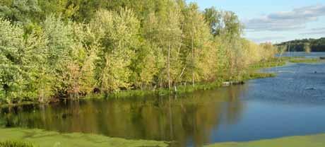
5 Chapter I: Introduction Introduction Image from the Metropolitan Design Center Image Bank Regents of the University of Minnesota. All rights reserved. Used with permission.
6 Introduction Why Greenways? Residents want trails, clean water and open space. A survey of residents conducted for the County s comprehensive plan early in 2008 revealed strong support for greenway elements and the greenway concept (see figures below and the County s comprehensive plan). 6 Cities in have recognized demand for trails and have built impressive systems anchored on their parks. The city and regional parks system has provided residents with an array of recreation opportunities. recognized demand for open space protection and land stewardship and has oriented its Park and Open Space department toward these ends. Water Resources has repeatedly heard residents call for water quality improvement and has made great strides. The DNR, watershed districts, private nonprofits and others also have tackled water quality, open space, habitat and other objectives. In short, all these agencies are working indepently toward the shared goals, but they aren t always coordinated or systematic. The greenway collaborative will help to coordinate these activities and allow us to do more together than we could separately. Each partner brings its own strengths, expertise, experiences and tools to create a whole greater than the sum of its parts. The County should work with cities to connect city and county parks and popular destinations with greenways that include trails. Average: Percent of respondents Not at all supportive How supportive are you of taking a leadership role in protecting open space, historic places, and water quality? Average: 8.67 Extremely supportive Percent of respondents Not at all supportive Extremely supportive Source: Decision Resources phone survey of 400 Dakota County residents January February Margin of error +/- 5 percentage points at 95 percent confidence.

7 What do we mean by collaborative? Cities, and other partners can collaborate to more efficiently and effectively deliver better greenways. But what does this collaboration look like in practice? These guidelines envision two layers of a greenway collaborative. The larger group will meet less frequently maybe once a year to guide the effort generally and share experiences in creating the greenway system. This group is envisioned as something similar to the CONDAC transportation group. The collaborative also puts the weight of the region behind funding applications and greenway delivery, giving local projects legitimacy and demonstrated need. The greenway-specific collaboratives are segments of the larger group and contain only the germane parties. This smaller group focuses on master planning, alignment, natural resource priorities, sharing of responsibilities and operating each greenway. (larger group) Greenway-specific collaboratives Introduction Activities: Identifies collaboration opportunities Guides efforts Advises on guideline improvements Communicates values Reinforces regional importance Stands behind funding applications Participants: Cities, Townships,, DNR and other partners Activities: Master-plan individual greenways Assemble land Tailor greenway to each context Define responsibilities Deliver individual greenways Operate greenways Maintain greenways Participants: Cities along a particular greenway corridor,, schools, landowners, local partners 7


8 Introduction Greenways 2030 Vision The 2008 Park System Plan solidifies a vision of an interconnected system of regional greenways through developed areas of the County. The greenway vision suggests 200 miles of regional greenway, 2/3 of which are on land currently in public or semipublic ownership. 8 The vision proposes more than a trail system it suggests enhanced open space corridors that perform multiple functions and provide multiple community benefits in areas of water quality, habitat, recreation and nonmotorized transportation. Accommodating all four will be the goal for each greenway segment and is a focus of this document.


9 Corridors link larger hubs allowing plants and animals to thrive in a functioning ecosystem. Introduction Destination trails with a natural signature tie together a seamless system of local parks, regional parks, local trails, greenways and schools. Buffer strips, native vegetation and land management practices improve water quality and ecosystem health. Trails with grade separation and fourseason maintenance link activity centers across the county and link a feeder system of local trails. 9
10 Introduction Guidebook Purpose With this document, the takes the approach used in roadbuilding and applies it to creating a countywide network of greenways. Most of us take for granted the roadway system we use every day. It interconnects, gets us where we want to go, has a hierarchy and is maintained. The roadway system has coordinated and cross-agency structures of funding, operations and maintenance. There is no reason to believe a greenway system will require anything less. This guidebook outlines a framework to establish regional greenways. The guidebook is organized around key activities in developing successful greenways funding and governance, land protection and stewardship, design and operations and maintenance. Cross-jurisdictional advisory groups were organized around these topics to develop this guidebook. Measuring Success Success of a mature regional greenway system will be measured around factors like recreational usage, habitat creation, reduction in vehicle miles traveled, nonlocal funding secured, miles of trail completed and others. This foundational document is focused on these success factors: Positioning greenway segments to be ready for implementation Positioning greenway segments to successfully compete for regional, state and federal funding Formulating projects that are infused with the core values of water quality, habitat, recreation and nonmotorized transportation To do this in a simple way, two checklists have been created against which each greenway segment or project should be evaluated. The checklists will no doubt be refined as the gains experience in developing greenway projects but this will provide a good start. 10


11 The first tier of evaluation is a project readiness checklist. This will help determine whether and when a greenway segment or project is ready for funding requests and planning/design resources as a regional greenway. ü Project Readiness Checklist Does the local community have a park/trail dedication ordinance that recognizes greenways as dedication opportunities? Introduction Does the local community have PUD and subdivision ordinances that identify greenways as desirable features of new development? Does the local community s comprehensive plan identify a greenway for this general corridor? Have property ownership, natural resources, topography and other landscape features been generally evaluated to gain a preliminary sense of greenway feasibility and location? Have and the local community identified this greenway segment as a priority? Does the greenway have a Metropolitan Council-approved master plan? Has it undergone feasibility study or design and engineering? Have additional funding sources been secured or identified? Have residents been engaged and do they support it? The iterative framework will be used by all parties in formulating, delivering and operating greenways. Borrowed views on the Minnesota River Greenway 11
12 Introduction ü Land Protection and Stewardship What land protection tools can be used to secure the corridor? Are there opportunities to restore natural areas, increase biologic diversity and improve ecological function? Through what means can long-term stewardship of natural areas in the corridor be assured? ü Greenway Design Does the proposed greenway meet the minimum guideline widths? Is as much of the greenway not adjacent to roads as possible (shooting for 80 percent or better)? Will the greenway improve water quality? through natural systems with recreational water amenities? Will natural areas be protected as part of an interconnected system that will provide or enhance wildlife corridors? Will the proposed greenway provide an attractive recreational experience that makes it a destination in its own right? Will the proposed greenway provide attractive nonmotorized transportation that connects to destinations and activity centers? ü Operations and Maintenance Have long-term costs been established or projected? 12
13 Who is best for construction and operations regardless of funding source? How will maintenance and operations preserve and perpetuate the four functions of the greenway (transportation, habitat, water, recreation)? Will the project ensure construction and operations are infused with multiple benefits of water quality, habitat, transportation and recreation? Introduction Will the project leverage operational strengths of cities and the County? Key Terms Greenway: A linear corridor planned, designed and managed to provide multiple benefits to water quality, habitat, recreation and transportation. Open space: Land not occupied by buildings or dominated by pavement; typically a naturally vegetated tract of land. Governance: The act of exercising authority or control. Land protection: For procuring land needed to establish the greenway system and protecting greenway lands over the long-term from damage and misuse. Stewardship: Closely associated with greenway operations with the difference being that operations is focused on the recreation utility of the greenway while stewardship targets the restoration and care of native landscapes and habitat within greenway corridors. Corridor: A linear tract of land providing passage for people and wildlife. 13
14


15 Chapter 2: Governance & Funding Governance & Funding
16 Governance & Funding 2. Governance & Funding Governance and funding are the keystones of the. This chapter suggests a framework of methods by which cities, the County and other partners collaborate to build and operate greenways and an approach to funding those activities. It is recognized that the construction and operational roles played by project partner will likely vary between greenway segments. Objectives Institutionalize City/County collaboration and communication regarding -project prioritization -capital improvement planning -outside funding pursuits -land protection -planning/design -project delivery -operations/stewardship Establish a governance structure that -uses each greenway segment s planning process to define the roles of project partners -is opportunistic and nimble -builds from the strengths of each project partner 16
17 Key Topics Communication: The greenway system requires institutionalized communication channels between cities and the County. Finding: Participants in the greenway collaborative should meet periodically to share information and expertise. Ownership: There will be numerous ownership scenarios for greenways including private, municipal and County. County ownership of regional greenways is not required, but will need a perpetual easement, memorandum of understanding or joint powers agreement on regional trails within greenways. Finding: Easements or other arrangements will be critical in securing funding and support for greenways. Jurisdictional responsibilities: Early discussion among project partners concludes that responsibilities for operations, maintenance, construction and other activities will vary by greenway segment. Regional trails are the jurisdictional responsibility of, but the larger greenway corridor could be governed in many ways to suit the situation. The governance structure outlined in this chapter suggests using each master planning process to define specific responsibilities. The intent of the governance structure is to allow flexibility to maximize greenway benefits and efficiencies. Finding: Joint powers agreements based on individual master plans likely will be needed for each greenway. Governance & Funding Outside funding: In many cases, as the regional agency, will be in the best position to pursue outside funding, but determination of funding pursuits should be linked with other strategic decisions. Finding: Greenway projects should be positioned to access funding from sources aligned with transportation, recreation, water quality and natural resource protection. Opportunistic funding: Limited windows of opportunity to secure crucial greenway land will present themselves. Finding: Having a flexible funding source is critical to leverage funding from other agencies. 17
18 Governance & Funding Coordinated capital improvement and comprehensive planning: Municipal and county jurisdictions prepare multi-year capital improvement plans as well as comprehensive guide plans. Since greenways will, in many cases, be financial and land use partnerships between a city and the County, plan coordination will be critical. This speaks to the importance of communication, agreeing on greenway corridors, determining priority projects and determining capital funding responsibilities. Specifics of a greenway capital improvement program (CIP) have not yet been determined. Finding: A greenway CIP could be developed based on input from cities and the County. Key Questions Who makes up greenway collaboratives? Most of the collaboration will occur between and cities, but school districts, watersheds, townships and federal and state agencies will also collaborate in some corridors. Collaborative partner engagement will vary based on each project, with cities generally being involved only in greenways in their jurisdiction or directly linking to them. How are priority projects determined? The Comprehensive Plan established general priorities for the 200-mile greenway system. At a more refined scale, projects will be prioritized by the County in a transparent process that considers readiness, funding and consistency with the greenway guidelines. How can comprehensive plans be aligned? Adopted comprehensive plans should include discussion and a map of the Greenway Vision. If the extent or location of regional greenways changes, comprehensive plans should be amended. Who will lead the funding pursuit, planning and implementation of greenways? This is one of the early decisions to be made for priority projects once they are selected. Depending on specific corridor circumstances, a city or the County may lead aspects of the effort. 18
19 Governance Municipalities ID Project Readiness CIP and Comprehensive Plan Master Planning to Metropolitan Council Standards Municipal CIP and Comprehensive Plan Outside Funding Pursuit Land Protection Project Delivery Governance & Funding Master Planning Guidelines in close collaboration with cities and other partners Project Working Group Community Outreach Master Plan... Strategic Guidance Cost Share Design/ Engineering Land Protection Project Delivery Operations/ Stewardship Regional Greenway Designation 19
20 Master Planning Governance & Funding is responsible for funding and preparing master plans for regional greenways. Master plans will be developed in collaboration with the partners, other agencies and residents. Cities may consider their master plan efforts as in-kind contributions for greenways. All master plans for regional greenways are subject to County approval and must meet regional guidelines. Typical Cost-Share and Roles Roles should be determined based on the strengths of each agency and the circumstances of individual greenway segments. In-kind contributions of land, easements, design, engineering, construction and maintenance and operations are encouraged. Joint powers agreements will be developed to establish predominant roles and responsibilities between the city and the county regarding cost share and funding. Future projects will be positioned to secure state and federal funds for recreation, water and habitat. It is anticipated these sources will account for the majority of acquisition and construction costs. Typical Ownership While the greenway network will rely heavily on borrowed views and adjacencies with private and semipublic land, portions of the greenway system will have to be in public ownership to ensure public access, access to funding and natural resource protection because private land that contributes to greenway character has no legal status. Ownership mix in each corridor will vary; below are options for the publicly held portions of greenways. Component 30 regional trail easement Minimum corridor ( ) Connected natural areas Trailheads Ownership County easement, fee title, MOU or joint powers agreement City or County easement, fee title City or others own fee title, County may hold easement if funded through Farmland and Natural Areas Program City or County fee title 20
21 Typical Cost-Share and Roles Actual roles and responsibilities will vary by project and will be established by joint powers agreements Component 30 regional trail easement Acquisition County w/ city help using parks, ROW, ponding or park dedication (County will reimburse or negotiate terms) Design/engineering Construction/restoration Operations/Maintenance County unless city is ready to advance project County; cities can advance for later reimbursement by prior agreement if up to standards County. May be contracted. Minimum corridor ( ) City can contribute existing park, park dedication, PUD, ponding, etc. Land not secured by city or others could be secured by County through grants Shared. City or County contribution can be in-house design and engineering County may fund natural areas in easements, city may fund active use areas within city parks Land owner or by agreement Connected natural areas County helps city or owner seek funding NA County may assist if funded through FNAP Land owner Trailheads Shared when in city parks and master-planned Shared if facility serves joint use Shared if facility serves joint use Shared if facility serves joint use Typical Federal Transportation grant approach Actual grant responsibilities will be developed case by case at the time of application through negotiation between the county and cities. In situations where the cities are better positioned to deliver a project: TE applications should be submitted by the city (with assistance from as needed) could provide the required local funding match (20 percent of grant funds) Cities could assume costs for design, engineering and construction management (may be in-house) Governance & Funding 21
22 Typical acquisition strategy for minimum corridor in order of priority Governance & Funding 1) Use existing public land that is already secured to create corridors. No ownership change is required. Examples include existing parks, ponding areas, schools, wildlife areas and other public land. 2) Preserve corridors in coordination with land development. Use park dedication, ponding areas, PUDs, and subdivision requirements to assemble corridors. 3) Take advantage of existing land use regulations that protect open space. Public ownership may not be needed in these areas beyond the 30-foot trail easement. Examples include floodplain regulations, shoreland zoning, wetland protection areas, bluff protection areas, etc. 4) Strategically purchase property or easements as necessary. Leverage regional, state, and federal grants and existing land conservation programs as sources of revenue and provide local match as needed. The County may access emergency acquisition funds from Metropolitan Council for some parcels. Use local funding from county and city sources without match only when all other avenues have been explored. Example acquisition techniques and assemblage Greenway edge (~300 feet width) Conservation easement 22 Ponding easement City park dedication City park dedication School property School property County regional trail acquisition or easement Lighter brown protected by floodplain restrictions Purchase through grant Existing city park Existing ROW Undevelopable private land on steep slope and floodplain

23 Grant Programs A funding strategy is needed to create and preserve s existing and future greenways. This may include the initial capital costs and on-going maintenance costs. To move forward the County will need to be cognizant of budgeting priorities and allocation of resources. In addition to County and City funds, other sources such as partnerships and grants should be explored; examples are listed below. NPS Rivers, Trails and Conservation Assistance Program The National Parks Service s Rivers, Trails and Conservation Assistance Program provides technical assistance to conserve rivers, preserve open space and develop trails and greenways. The program implements the conservation and recreation mission of the National Park Service. Governance & Funding Minnesota Department of Transportation Reauthorization of SAFETEA-LU likely will fund transportation improvements across the U.S. for the following six years. The most used funding programs have been Surface Transportation Program Urban Guarantee funds, Congestion Mitigation Air Quality funds, Transportation Enhancement funds and Bridge Improvement/Replacement funds. These funds are overseen by MnDOT and the Metropolitan Council. Minnesota Department of Natural Resources The Minnesota DNR is one of the most comprehensive resources when it comes to state funding for natural resources, parks and trails. Current programs provide assistance to protect and preserve open space and natural habitats. Each program varies in funding and timing. The DNR should be consulted to clarify funding availability and qualifications. Minnesota Pollution Control Agency The MPCA provides grants that address environmental issues. Programs relevant to greenway initiatives include those that address water quality. The MPCA should be consulted to clarify funding availability and qualifications. 23
24 The Environment and Natural Resources Trust Fund (LCCMR) The Environment and Natural Resources Trust Fund is funded through state lottery proceeds. This program has helped acquire land to preserve greenways, natural areas, water bodies and open space. Governance & Funding Clean Water, Land and Legacy Amendment On Nov. 4, 2008, Minnesota voters approved the Clean Water, Land and Legacy Amendment to the Minnesota Constitution, which increased the general sales and use tax rate by three-eighths of one percentage point to percent and dedicated the additional proceeds as follows: 1/3 to a new Outdoor Heritage Fund to restore, protect and enhance wetland, prairie, forest and habitat for game, fish and wildlife. 1/3 to a new Clean Water Fund to be spent to protect, enhance and restore water quality in lakes, rivers, streams and groundwater with at least 5 percent of the fund spent to protect drinking water percent to a new Parks and Trails Fund to support parks and trails of regional or statewide significance percent to a new Arts and Cultural Heritage Fund for arts, arts education and arts access and to preserve history and heritage. Watershed Management Organizations Local watershed management organizations provide funding to improve water quality and manage runoff. Foundations and Nonprofits Foundations and nonprofits throughout the country and state are willing to fulfill their mission by supporting local projects. The Minnesota Council on Foundations is a great starting point for identifying local foundations. Before pursuing a foundation, it is important to recognize that each operates differently and toward its own mission. It is also important to contact a foundation early to clarify whether a project would be considered. 24
25 Grant Matrix Grant Minnesota Department of Transportation (MnDOT) Recreation R Transportation T Water Quality W Habitat H Reauthorization of SAFETEA LU Safe Routes to School Program Department of Natural Resources (DNR) Metro Greenways Protection & Restoration Natural and Scenic Area Governance & Funding To increase, protect and enhance natural and scenic areas. Federal Recreational Trail Program To encourage the maintenance and development of motorized, non motorized, and diversified trails by providing funding assistance. Restoration Grants Restoration activities that establish or support native plant and animal communities Protection Grants Protection of high quality sites with native plant. Local Trail Connections Program To provide grants to local units of government to promote relatively short trail connections between where people live and desirable locations, not to develop significant new trails. Outdoor Recreation Grants Provides matching grants to local units of government for up to 50% of the cost of acquisition, development and/or redevelopment costs of local parks and recreation areas. 25
26 Governance & Funding Grant Minnesota's Landowner Incentive Program LIP provides technical and financial assistance to eligible, private landowners within LIP project areas, who are interested in enhancing habitat on their land for target species. Target species are:plants and animals identified under state or federal endangered species laws as endangered, threatened or of special concern (listed species) and non listed animal species with declining or vulnerable populations (Species In Greatest Conservation Need). Lessard Sams Conservation Partners Legacy Grants Restoration and Enhancement projects will consist of activities that restore or enhance habitat for fish, game, or wildlife on lands permanently protected by conservation easement or public ownership. Protection projects maintain the ability of habitat and related natural systems to sustain fish, game or wildlife through acquisition of fee title or conservation easements. Land acquired in fee must be open to public hunting and fishing during open seasons. Land protection also includes preserving ecological systems and preventing future degradation of those systems. Roadsides for Wildlife Recreation Transportation Water Quality Habitat To encourage local road authorities and landowners to use Integrated Roadside Resource Management Techniques so that ecological values (water, soil, wildlife, native plants) are considered. For example, this program provides information on state mowing laws so that there is reduction in the disturbance of nesting wildlife. 26
27 Grant Shoreland Habitat Restoration Grant Program To expand the diversity and abundance of native aquatic and shoreland plants; improve and protect the quality of shoreline habitat; enhance and protect water quality; raise awareness of the value of native shoreline and aquatic vegetation. Shoreland Habitat Block Grants are to provide cost share funding to counties, cities, watershed districts, other local units of government, conservation groups and lake associations to conduct shoreline restoration projects with native plants, to improve fish and wildlife habitat. Wetland Tax Exemption Program Recreation Transportation Water Quality Habitat Governance & Funding To provide a financial incentive to maintain wetlands in their natural state and to promote an awareness of wetland values. Native Prairie Bank Program To protect native prairie through the purchase of conservation easements, that allows the land to remain in private ownership. Native Prairie Tax Exemption Program To conserve native prairie by providing property tax exemptions on eligible native prairie lands. Reinvest in Minnesota (RIM) critical habitat match program To encourage private citizens and organizations to help fund the acquisition and development of critical fish and wildlife habitat by having their donations of land or cash matched from a special state fund. Parks and Trails Legacy Grant Program To support trails of regional or statewide significance. 27
28 Governance & Funding Grant To support trails of regional or statewide significance. Minnesota Pollution Control Agency (PCA) Financial Assistance for Nonpoint Source Water Pollution Projects: Clean Water Partnership, Clean Water Legacy and Section 319 Programs The MPCA provides financial and technical assistance to local government and other water resource managers to address nonpoint source water pollution through the State Clean Water Partnership (CWP) and Federal Clean Water Act Section 319 (Section 319) programs. Clean Water Legacy Act Surface Water Assessment Grants Recreation Transportation Water Quality Habitat Surface Water Assessment Grant funds can be used to monitor the physical, chemical, biological, and/or bacteriological water quality parameters of lakes or streams. Clean Water Legacy Act (CWLA) Funding Round Guidance for Stormwater Applications for Federal Clean Water Act Section 319 TMDL Implementation Funds Provides funding to protect, restore and preserve the quality of Minnesota's surface waters. Metropolitan Council Metro Environment Partnership Grant Program The purpose of MetroEnvironment Partnership Grant Program is to improve the water quality of Metro Area lakes and rivers by reducing nonpoint source (NPS) pollution through education and implementation grants. Miscellaneous Grants State of Minnesota Lottery Environment & Natural Resources Trust Fund 28

29 Chapter 3: Land Protection & Stewardship Land Protection & Stewardship

30 3. Land Protection & Stewardship This chapter outlines the objectives, techniques and key topics associated with protecting and caring for greenways. We use the term land protection to mean both securing land needed to establish the greenway system and protecting the integrity of greenway lands from damage and misuse. The term stewardship is closely associated with greenway operations discussed elsewhere in this guidebook. The difference is that greenway operations are focused on the recreational utility of the greenway while stewardship targets care for native landscapes and habitat within greenway corridors. Land Protection & Stewardship Objectives Establish an interconnected open space network with high habitat value. Protect and improve ecological function. Remain flexible to land protection options. Choose lands that offer multiple benefits. Measure and monitor success. Develop partnerships and engage residents. A Metro Greenways sign identifies an area protected by conservation easement. 30

31 Native plants in residential areas protect water bodies from the damages of fertilizers and other chemicals that typically run off treated turf grass lawns into storm sewers. Key Topics Relationship between land protection and stewardship: There is a strong relationship between the formal protection of land designated as greenway and stewardship of habitat and the natural systems on that land. Legally protecting land does not ensure its environmental health or ecological function but stewardship does. Correspondingly, good stewardship provides no safeguards against land being sold or altered but land protection does. A successful greenway system will address both land protection and stewardship. Land Protection & Stewardship Integration with the development process: A primary way to protect greenway corridors is to institutionalize the greenway plan into the local development process. Use of comprehensive planning, zoning, park dedication, official mapping and other strategic tools to designate and trigger greenway protection are all part of the land development process. With plans for greenways incorporated into local controls and processes, their protection will become a matter of course. Ecological function as one of multiple benefits: Most communities have become accustomed to planning and building trail corridors. The expands the notion of corridor to include ecological benefits as well as recreational ones. Habitat, wildlife movement, stormwater infiltration and carbon sequestration as well as alternative modes of transportation and recreation are core objectives of greenway corridors. A natural corridor without a trail or a trail corridor 31
32 without habitat are fine in their own right but they are not what the is striving for the integration of both. Using greenways to increase biological diversity: Plants provide a foundation for the ecological function of a greenway and reflect a unique landscape character. Establishing native plant communities such as prairie, savanna, woodland and wetland in appropriate locations across a greenway system supports a broader variety of wildlife, is more visually interesting and is shown to be more ecologically stable less prone to disturbance, erosion, disease and invasion. Land Protection & Stewardship The importance of flexibility: When it comes to land protection, one size will not fit all. There will likely be a customized approach to land protection needed for each property owner. It will be important to remain flexible to the needs of various stakeholders in land protection negotiations. The need for on-going monitoring: Land protection and stewardship are long-term endeavors. Situations arise with issues like encroachment or habitat damage that can be resolved easily if caught early through regular monitoring but could lead to costly repairs if not addressed. Monitoring of key vegetation, animal groups such as birds and frogs or water quality is also the prime way to measures the success of stewardship efforts. The strength of partnerships: The strength of any land protection and stewardship project is greatly enhanced by the involvement of other agencies and organizations. Each group brings different perspectives that combine to create superior results. Partnerships benefit the community by getting more people involved, creating stronger connections and making education an inherent aspect of greenways. Furthermore, partnerships allow cities, the County and property owners to leverage their resources by tapping into expertise and resources they may not otherwise have. 32 The success of any stewardship project is dependent on residents the people who live nearby, who know it, who bring others there and raise awareness. Without resident engagement, many stewardship projects languish. Engaging residents in multiple project phases, from planning, to installation, to monitoring brings value to the community and individuals. Building these relationships from the beginning phases can help build project support and can make all subsequent phases go more smoothly.

33 Buffers are a key strategy to improve water quality with greenways Land Protection Tools Park Dedication Land Protection & Stewardship Park dedication could be used by municipalities to secure greenway land in conjunction with city parks at the time of surrounding development. This tool is typically used by cities to fulfill neighborhood recreation needs and in many situations a greenway could meet local recreation needs while connecting residents to regional facilities. The County would either reimburse the city for the value of the park dedication used for the greenway, or otherwise come to agreement on how to reach an equitable use of park dedication. The County may evaluate the feasibility of county-wide park dedication to augment funding for regional greenways. Comprehensive Planning and Zoning Municipal land use guidance and zoning could define and help protect greenway corridors by officially designating them in comprehensive plans 33
34 and zoning codes. Establishing special zoning designation such as overlays and coupling greenway corridors with otherwise protected lands such as floodways and bluffs are a couple of common strategies. Official Mapping Greenways could be officially mapped by government entities as public record of the government s intent to acquire the land for public use. Acquisition Land Protection & Stewardship There are a number of approaches to acquiring land and each has its own set of activities, steps, advantages and limitations. The major approaches are described below. There are a number of potential conservation partners, both public and private, that can assist in land acquisition. Direct Purchase With this tool, the fee title to the property is acquired. There are often grant programs available (e.g. DNR Metro Greenways Program) and project partners (e.g. Farmland and Natural Area Program) that can provide matching funds and/or expertise for acquisition projects. Land Donation A landowner may choose to gift all or part of their land for greenway use. The landowner may be able to enjoy tax benefits for donating land to qualified public or conservation partner. Bargain Sale In some cases it may be in the landowner s best interest to sell their property for something less than fair market value. By doing so, a landowner may receive tax benefits. 34 Life Estate This tool allows the landowner to live on the land after selling the fee title. Life estates can be structured in many different ways (e.g. the landowner can live on the land until he/she dies or any mutually agreed upon number of years). A life estate can affect the appraised value of the land.
35 Conservation Easement A conservation easement is a non-ownership interest in property that imposes limitations to protect natural, scenic, or open-space values; assure its availability for agriculture, forest, recreation, or open-space; protect natural resources, or air/water quality; or preserve the historic, architectural, archaeological, or cultural aspects of property. Each conservation easement is tailor made to the specific landowner and the goals of the project. has critical experience with conservation easements. The natural systems on which greenways will be assembled integrate greenways into the broader landscape. Prior to Western settlement, was relatively wild and unplowed; natural forces maintained equilibrium. Native plant and animal communities evolved into an Stewardship ecological balance like a protective shell that sustained and buffered the area s streams. It is well outside of anyone s abilities and outside anyone s intentions to fully restore the greenways to pristine presettlement conditions, but major headway within the system is feasible. Land Protection & Stewardship The natural resource objective for the greenway system is to strike a new and healthy ecological balance different from the presettlement condition but still a healthy context within which nature can thrive. This vision suggests improved land management with strategic habitat restoration to create a protective web of natural landscapes that once again sustain and buffer the county s streams, provide wildlife habitat and connections. Greenway corridors: The first stewardship priority is restoring continuous native habitat in greenway corridors themselves. This continuous ribbon of varying widths will function as a wildlife corridor and buffer streams from damaging effects like runoff, pollution and invasive species. Adjoining Sensitive Lands: The next order of stewardship priority is habitat restoration and protection of the most sensitive lands, including uplands, which link greenways to the broader landscape. These landscapes perform vital functions of preserving habitat and species diversity and stormwater 35
36 infiltration and cleansing. Prioritization of adjoining landscapes will be based on intrinsic sensitivities like erodibility, aquifer recharge, the presence of wetlands and the presence of native plant communities, in addition to landowner interest. Designated wildlife and aquatic management areas also provide important refuge for wildlife and native plants. A Healthy Natural Framework: Stewardship of first- and second-order landscapes will reestablish a stronger habitat network that can thrive in the future. This overall habitat and open space network will have greater resilience and will provide a strong framework for future growth. Land Protection & Stewardship Stewardship Techniques Stewardship Objectives Establish high habitat value Protect and improve ecological function Measure and monitor success Develop partnerships and engage residents Rationale Balance wildlife Greater ecosystem stability (disease, erosion, invasion) Visually appealing Reduces non-native invasive species Cycles nutrients Invigorates native plants Perpetuates native plant and wildlife communities Clear indicators of project results Identification of problems or emerging issues. Strengthens the project Creates more community visibility Creates long-term investment of residents Provides education opportunities Stewardship Techniques Use historic plant communities as guide for restorations Control non-native, invasive species Minimize pesticide use Install native plants or seed Model native plant community composition Select native, local genotype species Prescribed burning of suitable habitats in suitable locations Substitute mowing or weeding where fire is not feasible or applicable Photographs Survey plants and animals (birds, frogs) prior to stewardship, during and after completion. Continue indefinitely. Develop responses to new concerns. Involve local and regional agencies and organizations. Open-house planning sessions Volunteer work events Educational tours 36


37 Chapter 4: Greenway Design Greenway Design
38 4. Greenway Design Design is critical to a high-quality greenway system. An overarching goal of the collaborative is to move beyond trails and develop greenways with trails in them. Objectives Create an interconnected system of greenways with a natural design signature that improves water quality, enhances wildlife habitat, provides first-class linear recreation and increases mobility. Connect, enhance and interpret natural habitat. Create wildlife corridors to expand wildlife range. Filter and store stormwater that enters greenways. Create a safe, amenity-rich trail network that meets the needs of multiple users in all seasons. Greenway Design Create an inviting, connected, memorable and nature-based recreation system. Key Topics Design consistency: Design consistency will be important in combining a regional greenway system with the distinct greenway segments implemented by different agencies and developers. This guidebook establishes the foundation for design consistency; early projects will serve as models with features to be reused and refined in later projects. Borrowed views: Borrowed views suggests taking advantage of greenway-adjacent open space to expand the character and ecological function beyond what the greenway alone can accomplish. What this boils down to is colocating greenways with other long-term open spaces. 38
39 Balancing multiple objectives: Implementing a greenway system will require trade-offs. This chapter outlines greenway performance goals and techniques that are ideals in greenway design but will not all be achievable with every project. The collaborative must be mindful of the need for flexibility without losing the underlying intent of the greenway system. Year-round facility: Greenways will provide year-round recreation and transportation functions. Greenways can be used for jogging, hiking, snowshoeing, nordic skiing and bird watching. With the expected continuing increase in bike commuting, greenways will also serve a yearround transportation function which will require that some greenways be maintained for bicyclists year-round. Which segments are maintained for which activities will be determined as the system develops and demand for each type of transportation and recreation is more readily gauged. Minimizing conflicts: The primary greenway trail conflict points are with crossing vehicular traffic and with adjoining neighbors. The potential for conflicts in both categories should be minimized through the use of landscape buffers, grade-separated crossings and considerate design. Universal accessibility: Greenway trails and walkways should provide universal access. Universal design considerations are especially critical at street crossings, in sidewalk and trail cross-section design, and in naturebased recreation and interpretation. Providing local access: Neighborhood access to the greenway system should be abundant but thoughtful to minimize conflict points; direct access from private property should not be allowed. Greenway Design Wayfinding: Wayfinding will unify the greenway system from a usability and character standpoint. Signage should be consistent across the system and should both guide people to greenways and to guide greenway users to local services and cultural destinations. Sustainability and environmentalism: Greenways will be assembled in environmentally sustainable ways with a minimized negative impact on natural systems in and beyond. Strategies include using recycled materials, pervious pavement and energy-efficient lighting. 39
40 Greenway Typology Three greenway categories or typologies have been defined for Dakota County regional greenways. They are categorized by the setting within which they exist. Each strives to perform the functions of water quality enhancement, habitat creation, non-motorized transportation and recreation. Because each greenway type has unique characteristics, they also have inherent strengths and weaknesses in each function. Greenway Design There are references made in this section to greenway width of 300 feet. This is a dimension many habitat experts have arrived at as a minimum corridor width for establishing a healthy native plant and wildlife ecosystem when those corridors interconnect larger habitat nodes. While this is a high standard, it is valuable to understand and strive for healthy ecological function in the greenway system. Greenway collaborative members recognize that there will be instances in which portions of the greenway will be limited to significantly less than the minimum width. Greenway segments will be designed individually to best suit the four elements in each corridor; what works in one corridor may not in another. That said, rule of thumb minimums are provided below for each context. Greenway width is the average width per 1 mile segment (determination of segments is flexible and for width calculation need not match segment designation used for other purposes). Where multiple contexts exist within a segment, a prorated minimum width should be used. Contexts and character will be determined by partner consensus in the master planning process. Greenway area along 1-mile segment width = - 1 mile impervious surface area Urban greenways are those that would typically be retrofitted into existing neighborhoods or those that are built along with development in dense, urban districts. They will typically require significant compromise on a systemwide ideal width of 300 feet. They will likely have inherent strengths in the transportation and recreation functions and greater design challenges in water quality and habitat. Minimum width: 100 feet. 40

41 Suburban greenways typically are built in conjunction with developing neighborhoods and have more flexibility in location and width than urban greenways. They can take greater advantage of adjacency to natural features, ponds, streams and parks and their connection to community destinations or natural areas can be designed into the surrounding development pattern. Greenways in suburban settings have an opportunity to creatively balance the functions of water quality, habitat, transportation and recreation. Minimum width: 200 feet. Rural greenways have the greatest opportunity to meet the 300 foot critical dimension and function as healthy habitat and water quality corridors. In this greenway type, the transportation and recreation functions would be equal to other greenway types but the greater width also allows the ecological functions. Agricultural land likely will be prominent in this greenway type. Minimum width: 300 feet. Greenway Design Each greenway type has been diagrammed on the following pages. The diagrams are intended to illustrate inter-relationships between greenway elements and adjacent lands. 41

42 Greenway Typology-Urban Setting shared use rain garden canopy buffer lighting sidewalk multiuse trail sidewalk links commercial buffer Greenway Design PLAN residential buffer canopy buffer appropriate buffer for adjacent uses 42 URBAN GREENWAY sidewalk multiuse trail MIN. WIDTH - 100ft SECTION

43 Greenway Typology- Suburban Setting trail links lighting signage bike parking rest area interpretive overlook paved trail shared land use opportunities natural trail naturalized stormwater pond greenway nature area PLAN signage SECTION paved trail canopy buffer infiltration natural trail interpretive rest area MINIMUM GREENWAY WIDTH - 200FT greenway nature area Greenway Design SUBURBAN GREENWAY 43


44 Greenway Typology-Rural Setting interpretive overlook Agriculture rest area Agricultural Buffer: infiltration spray drift beneficial insects linear natural feature Greenway Design PLAN Agricultural Buffer: infiltration spray drift beneficial insects paved trail linear natural feature signage SECTION paved trail MINIMUM GREENWAY RURAL GREENWAY 44


45 linear natural feature greenway nature area greenway nature area Greenway Design WIDTH 300FT 45
46 Performance Goals Topic Corridor Location Natural Design Signature Corridor Width Urban Follow water flow and away from streets 80% of time, use to interlink activity centers Native gardenesque landscaping and turf, consistent boulevard trees, follows water where possible, contemporary lighting and furnishings Minimum 100 feet Suburban Away from streets 80% of time, follow water flow where possible, locate with natural features (wetlands, bluffs), use to interlink activity centers Native habitat, follows water where possible, contemporary lighting and furnishings Minimum 200 feet Rural Away from roads 80% of time, follow water flow where possible, locate with natural features (wetlands, bluffs), use to interlink activity centers Native plant communities, follows water where possible, contemporary furnishings Minimum 300 feet Borrowed Views Public facilities, parks, schools, religious institutions, HOA common areas Stormwater ponds, parks, schools, religious institutions, HOA common areas DNR lands, farmland, easements Bike Trail Separate from peds, min. 3 feet from streets, paved, 10-foot min. Multi-use, min. 50 feet from roads, paved, 10-foot min. width Multi-use, min. 100 feet from roads, paved, 10-foot min. width Greenway Design Pedestrian Walkway Other Trail Uses Separate from bikes, min. 5 width, min. 6 from roads and bikes Unpaved, x-c skiing where practical Multi-use Unpaved, x-c skiing, hiking Multi-use Unpaved, x-c skiing, hiking and/or horse in select locations Road Crossings Arterial and above grade separated, collector vehicles stop Driveways and local streets alternative crosswalk pavement Arterial and above grade separated, collector vehicles stop Driveways and local streets alternative crosswalk pavement Arterial and above grade separated, collector vehicles stop Driveways and local streets alternative crosswalk pavement 46
47 Performance Goals-continued Trailhead Topic Urban Suburban Rural Primary ones in activity centers; car/bike parking, restrooms, access to water and food; minor trailhead kiosks at neighborhood entries, spaced every 2 miles or less Primary ones in activity centers; car/bike parking, restrooms, access to water and food; minor trailhead kiosks at neighborhood entries, spaced 2 to 3 miles or less Locate in public open space; car/bike parking, restrooms, access to water and food, picnic facilities, spaced roughly every 5 miles Stormwater Store and infiltrate greenway stormwater for 100-year storm, consider rainwater reuse for surrounding irrigation Accept some stormwater from adjacent landscape, store and infiltrate greenway + stormwater for 100-year storm Accept some stormwater from adjacent landscape, store and infiltrate greenway + stormwater for 100-year storm Landscaping/ Habitat Opportunistic habitat generally focused on plants and animals requiring smaller ranges Connected native plant communities, some turf; larger animals may be present Expansive native plant communities, full range of animal groups should be present Interpretation Wayfinding Each greenway segment should have interpretive theme expressed in artful way, integrate interpretation with corridor design, interpretive stops/ overlooks at key corridor locations Systemwide design, frequent directional signs, street signs, map kiosks, trailheads Each greenway segment should have interpretive theme expressed in artful way, integrate interpretation with corridor design, interpretive stops/ overlooks at key locations Systemwide design, periodic directional signs, street signs, map kiosks, trailheads Each greenway segment should have interpretive theme expressed in artful way, integrate interpretation with corridor design, interpretive stops/ overlooks at key locations Systemwide design, occasional directional signs, street signs, map kiosks, trailheads Greenway Design Lighting Continuous, lowenergy, pedestrian scale; enhanced at trailheads/crossings Continuous except where deleterious, low-energy, ped-scale Likely only at trailheads Amenities Trash, benches, water at key locations Picnic tables, shelter, water at minimum 5- mile intervals Picnic tables, shelter, water at minimum 10- mile intervals 47

48 Menu of Potential Design Techniques This table indicates where design techniques could be considered to meet the range of habitat, water quality, transportation and recreation objectives. Greenway Design Techniques Adjacencies Public Art Bike/Ped Separation Bird Blinds Vegetated Buffers Connectivity Cultural Events Daylighting Density of Recreation Flood Protection Follow Water Full Season Interest Gardens Grade Separated Crossings Habitat Restoration Rainwater Harvesting Infiltration Inter-Link Destinations Interpretation Land Forms Long Trip Managed Landscape Multi-Use Native Landscape Non-Native Landscape Pervious Pavement Platform Crossing Productive Landscape Rain Garden Re-naturalized Ponds Safe Crossing Lane Security Sensory Landscape Separate Commuter Lane Signage Stream Restoration Trailhead Tree Canopy View Preserved Vines/Green Screen Wetland Restoration Ballfields URBAN Habitat Water Quality Transportation Recreation SUBURBAN Habitat Water Quality Transportation Recreation RURAL Habitat Water Quality Transportation ü ü ü ü ü ü ü ü ü ü ü ü ü ü ü ü ü ü ü ü ü ü ü ü ü ü ü ü ü ü ü ü ü ü ü ü ü ü ü ü ü ü ü ü ü ü ü ü ü ü ü ü ü ü ü ü ü ü ü ü ü ü ü ü ü ü ü ü ü ü ü ü ü ü üü ü ü ü ü ü ü ü ü ü ü ü ü ü üü ü ü ü ü ü ü ü Recreation 48


49 Chapter 5: Operations & Maintenance Operations & Maintenance
This page intentionally blank.
 This page intentionally blank. Parks, Recreation, and Open Space Chapter Relationship to Vision Vision Parks, Recreation and Open Space Chapter Concepts County Government. County government that is accountable
Mendota-Lebanon Hills Greenway Master Plan Executive Summary. August draft for more information visit
 Mendota-Lebanon Hills Greenway Master Plan Executive Summary August 2013 draft for more information visit www.hkgi.com/projects/dakota INTRODUCTION The Mendota-Lebanon Hills Greenway Master Plan portrays
METROPOLITAN COUNCIL 390 North Robert Street, St. Paul, MN Phone (651) ; TDD (651)
 ; TDD (651)") DATE: December 20, 2011 METROPOLITAN COUNCIL 390 North Robert Street, St. Paul, MN 55101 Phone (651) 602-1000; TDD (651) 291-0904 TO: Metropolitan Parks and Open Space Commission FROM: Tori Dupre, Senior
DATE: December 20, 2011 METROPOLITAN COUNCIL 390 North Robert Street, St. Paul, MN 55101 Phone (651) 602-1000; TDD (651) 291-0904 TO: Metropolitan Parks and Open Space Commission FROM: Tori Dupre, Senior
Rosemount Greenway Master Plan Executive Summary. draft. Spring for more information visit
 Rosemount Greenway Master Plan Executive Summary Spring 2012 draft for more information visit www.hkgi.com/projects/dakota INTRODUCTION The Rosemount Greenway Master Plan portrays a vision to establish
METROPOLITAN COUNCIL 390 North Robert Street, St. Paul, MN Phone (651) ; TDD (651)
 ; TDD (651)") DATE: October 24, 2012 METROPOLITAN COUNCIL 390 North Robert Street, St. Paul, MN 55101 Phone (651) 602-1000; TDD (651) 291-0904 TO: Metropolitan Parks and Open Space Commission FROM: Tori Dupre, Senior
DATE: October 24, 2012 METROPOLITAN COUNCIL 390 North Robert Street, St. Paul, MN 55101 Phone (651) 602-1000; TDD (651) 291-0904 TO: Metropolitan Parks and Open Space Commission FROM: Tori Dupre, Senior
Metropolitan Parks and Open Space Commission
 Business Item No. 2013-xxx Metropolitan Parks and Open Space Commission Meeting date: October 1, 2013 For the Community Development Committee meeting of October 7, 2013 Subject: Mendota-Lebanon Hills Greenway
The Trust for Public Land. in Minnesota
 The Trust for Public Land in Minnesota Protecting Minnesota s Natural Legacy In Minnesota, The Trust for Public Land (TPL) is protecting strategic land and water resources for people to enjoy as parks,
Whitemarsh Township Greenway Plan
 Whitemarsh Township Greenway Plan Prepared for: Whitemarsh Township August 16, 2007 Table of Contents Table of Contents... i Introduction... 1 Study Area Setting... 2 Regional Setting... 2 Township Character...
National Association of Conservation Districts. Kris Hoellen Vice President, Sustainable Programs The Conservation Fund September 19, 2013
 National Association of Conservation Districts Kris Hoellen Vice President, Sustainable Programs The Conservation Fund September 19, 2013 Our Mission The Conservation Fund forges partnerships to conserve
Concept Master Plan. for. Draft of. Wildlife Management Area. Prepared for. June, 2008
 Draft of Concept Master Plan for Vermillion Highlands: A Research, Recreation and Wildlife Management Area Prepared for Vermillion Highlands Steering Committee - Minnesota Department of Natural Resources
Planning for and Managing Open Space and Natural Areas
 Planning for and Managing Open Space and Natural Areas Increasingly, development proposals in Delaware include large amounts of open space and natural areas. While open space is important as a community
SUSTAINABILITY PLAN OTTAWA COUNTY PARKS AND RECREATION COMMISSION FALL 2017
 SUSTAINABILITY PLAN OTTAWA COUNTY PARKS AND RECREATION COMMISSION FALL 2017 Table of Contents Introduction Natural Resources Quality of Life Community Continuing the Mission Sustainability Measuring Sustainability
Mendota Heights 2040 Comprehensive Plan Draft Vers
 4 Parks and Trails The City of Mendota Heights boasts a variety of recreational and open space opportunities. Few cities can claim access to regional trails, riverside and lakeside parks, scenic bluffs
7.0 SOCIAL, ECONOMIC, AND ENVIRONMENTAL ISSUES
 7.0 SOCIAL, ECONOMIC, AND ENVIRONMENTAL ISSUES The following list of social, economic, and environmental issues have been identified based on a preliminary inventory of resources in the project area, an
10.0 Open Space and Public Realm
 10.0 Open Space and Public Realm 10.0 Open Space and Public Realm The Public Open Space System is comprised of: outdoor spaces available for public use that are either publicly owned (e.g., parks and
Town of Peru Comprehensive Plan Executive Summary
 Town of Peru Comprehensive Plan Executive Communities that plan grow by choice, not by chance. A plan makes growth thoughtful, understandable, and predictable. A plan shows that a community is managing
2040 LUP is a part of the Comprehensive Plan and carries the same legal authority. Economic Challenges
 1.1. Guiding Anchorage s Growth Where will new residents settle over the next two decades? Where will people work, shop, and play? Will there be enough room to grow? How will Anchorage look? Will growth
Parks, Trails, and Open space Element
 Parks, Trails, and Open space Element Parks, Trails, and Open Space element Parks, Recreation, and Open Space are important components of the quality of life desired by the residents of Elk Grove. This
3. VISION AND GOALS. Vision Statement. Goals, Objectives and Policies
 Vision Statement Queen Creek s interconnected network of parks, trails, open spaces and recreation opportunities provide safe and diverse activities and programs that sustain its unique, small town, equestrian
The following principles guide the development of goals and strategies to protect and promote these amenities:
 OPEN SPACE/PARKS/TRAILS/RECREATION GOALS/STRATEGIES Cherry Hills Village is a living environment that offers low density development, open areas, public scenic vistas, public trails and public parks. This
Minnesota Department of Natural Resource - Natural Resource Guidance Checklist Conserving Natural Resources through Density Bonuses
 Minnesota Department of Natural Resource - Natural Resource Guidance Checklist Conserving Natural Resources through Density Bonuses NRDB Why Use Density Bonuses & This Checklist Local units of government
SECTION FOUR: MISSION STATEMENT, GOALS & OBJECTIVES
 SECTION FOUR: MISSION STATEMENT, GOALS & OBJECTIVES Chapter Summary Chapter Ten: Mission Statement, Goals & Objectives To fulfill its mission, the Parks and Recreation Commission has identified four basic
COMMUNITY DESIGN. GOAL: Create livable and attractive communities. Intent
 COMMUNITY DESIGN Intent An attractive, well-designed County will attract quality development, instill civic pride, improve the visual character of the community, and create a strong, positive image for
LAND USE ELEMENT. Purpose. General Goals & Policies
 LAND USE ELEMENT Purpose This Land Use Element contains the goals and policies necessary to support the City s responsibility for managing land resources and guiding development through implementing regulations,
STEWARDSHIP OF LONG ISLAND SOUND S ECOLOGICAL AND RECREATIONAL RESOURCES
 STEWARDSHIP OF LONG ISLAND SOUND S ECOLOGICAL AND RECREATIONAL RESOURCES Robin Kriesberg, Save the Sound, Inc. Thomas Halavik, US Fish and Wildlife Service Coastal Program An Initiative to Identify, Protect
Yadkin River Greenway Feasibility Study Fact Sheet Village of Clemmons, Town of Lewisville, Town of Bermuda Run
 Fact Sheet Village of Clemmons, Town of Lewisville, Town of Bermuda Run Project Background The Yadkin River Greenway Feasibility Study is a joint project with the Village of Clemmons, the Town of Bermuda
4 Sustainability and Growth Management
 4 Sustainability and Growth Management Introduction Traditionally, has assumed growth and development with limited consideration for the long-term negative social, environmental or economic impacts on
RECREATION AND OPEN SPACE ELEMENT GOALS, OBJECTIVES, AND POLICIES
 RECREATION AND OPEN SPACE ELEMENT GOALS, OBJECTIVES, AND POLICIES Goal 7 To provide park facilities, recreation programs, and open space resources that are safe, adequate, and accessible to all City residents,
Central Lake Ontario Conservation Conservation Lands Master Plan
 Conservation Lands Master Plan Top 13 Frequently Asked Questions 1. What are conservation lands? Where are these conservation lands located in the Central Lake Ontario Conservation watershed? Conservation
RECREATION, OPEN SPACE AND GREENWAYS ELEMENT GOALS, OBJECTIVES, AND POLICIES
 RECREATION, OPEN SPACE AND GREENWAYS ELEMENT GOALS, OBJECTIVES, AND POLICIES GOAL R-1: DEVELOP A RECREATION, OPEN SPACE AND GREENWAYS SYSTEM AS AN INTEGRAL COMPONENT OF AN OVERALL, COUNTY-WIDE ECONOMIC
THREE-STEP DESIGN PROCESS FOR OPEN SPACE SUBDIVISIONS
 00216106.DOC NMA/RRK 1/30/14 THREE-STEP DESIGN PROCESS FOR OPEN SPACE SUBDIVISIONS Open space subdivisions, sometimes called cluster developments, maintain a significant portion of a development site in
13 Maintenance and Operations Plan 223
 222 13 Operations Maintenance and Plan 223 Chapter 13 MAINTENANCE AND OPERATIONS PLAN 13.1 Stewardship The Minneapolis Park and Recreation Board (MPRB) is the steward of a nationally-acclaimed park system.
Urban Planning and Land Use
 Urban Planning and Land Use 701 North 7 th Street, Room 423 Phone: (913) 573-5750 Kansas City, Kansas 66101 Fax: (913) 573-5796 Email: planninginfo@wycokck.org www.wycokck.org/planning To: From: City Planning
Arlington, Virginia is a worldclass
 EXECUTIVE S U M M A RY Arlington maintains a rich variety of stable neighborhoods, quality schools and enlightened land use policies, and received the Environmental Protection Agency s highest award for
Chapter 2: Vision, Goals and Strategies
 Chapter 2: Vision, Goals and Lake Elmo Today & Tomorrow Comprehensive Plan 2040 2 VISION, GOALS & STRATEGIES - DRAFT 4-6-2018 INTRODUCTION Comprehensive Plan Purpose Perhapse the most important objective
{Best Practices. Summary of Tools, Strategies and Best Practices from 11 Michigan Case Study Communities
 Case Studies Michigan Coastal Community Working Waterfronts { Summary of Tools, Strategies and from 11 Michigan Case Study Communities Table of Contents Zoning...2 Community and Stakeholder Collaboration
Parks, Trails, and Open Space Element
 P arks, Recreation, and Open Space are important components of the quality of life desired by the residents of Elk Grove. This Element of the General Plan addresses the City s goals, policies, and actions
2030 Comprehensive Plan VISION STATEMENT
 RESOURCE DOCUMENT for Steering Committee Meeting #2 July 12, 2017 2030 Comprehensive Plan VISION STATEMENT Steering Committee from 2008 Established the Lauderdale s Vision as: Creating a livable, lovable
OPEN SPACE CHAPTER 7: OVERVIEW. Preserve open space to protect natural resources, enhance character and provide passive recreation opportunities
 CHAPTER 7: OPEN SPACE OVERVIEW Ridgefield has made tremendous progress permanently preserving areas of town as open space. Open space preservation can serve many important purposes, including: protect
Master Plan Objectives and Policies
 Master Plan Objectives and Policies Introduction This chapter identifies the Park issues and recommended policies established by this Master Plan. The issues were identified through meetings with staff,
SUBJECT: Waterfront Hotel Planning Study Update TO: Planning and Development Committee FROM: Department of City Building. Recommendation: Purpose:
 Page 1 of Report PB-23-18 SUBJECT: Waterfront Hotel Planning Study Update TO: Planning and Development Committee FROM: Department of City Building Report Number: PB-23-18 Wards Affected: 2 File Numbers:
Member Service Plan Sierra Nevada AmeriCorps Partnership
 Member Service Plan Sierra Nevada AmeriCorps Partnership Service plans lay the framework for what each Member will be doing during their service. Service plans detail the major projects and expected results
CHAPTER 4 FUTURE LAND USE AND URBAN SERVICES DISTRICTS
 CHAPTER 4 FUTURE LAND USE AND URBAN SERVICES DISTRICTS Introduction This chapter discusses how Benzie County should grow and change in the future. A community can grow and change in many different ways.
Executive Summary. Parks and Recreation Plan. Executive Summary
 Parks and Recreation Plan Executive Summary The Whitemarsh Township Parks and Recreation Plan sets forth a vision for how Whitemarsh Township can provide a premiere parks and recreation system reflective
Preliminary Plan Framework: Vision and Goals
 Preliminary Plan Framework: Vision and Goals Draft: May 2015 Introduction Since the Town of Milliken s comprehensive plan was last updated in 2010, the community was heavily impacted by the 2013 flood,
G. RECREATION AND OPEN SPACE ELEMENT. The following summarizes the Recreation and Open Space Element:
 G. RECREATION AND OPEN SPACE ELEMENT The purpose of the Element is to provide the framework and direction for a comprehensive system of public and private sites for recreation, including, but not limited
I. STAFF POLICY RECOMMENDATIONS. The following RMP policy strategies are proposed by staff in support of a Scenic Resource Protection Program:
 Policy Consideration: Scenic Resource Protection Program Status: For Consideration by the Highlands Council at September 14, 2006 Work session Date: September 12, 2006 I. STAFF POLICY RECOMMENDATIONS The
Chapter 10 IMPLEMENTATION RECOMMENDATIONS
 Chapter 10 IMPLEMENTATION RECOMMENDATIONS The recommended land use plan presented in the previous chapter provides a design for the attainment of the urban and rural development and open space preservation
COMMUNITY ENVIRONMENTAL MANAGEMENT
 COMMUNITY ENVIRONMENTAL MANAGEMENT CEM HANDBOOK FOR COMMUNITY CONSERVATION PLANNING ----- Draft ----- Prepared by the CENTER FOR COMMUNITY ENVIRONMENTAL MANAGEMENT in association with the NEW YORK STATE
Parks, Open Space and Trails
 Introduction Parks have often been referred as the lungs of our cities, cleansing the air of pollutants and particulate matter. Parks are also gathering places for families and community. They offer spaces
CHAPTER 12 IMPLEMENTATION
 CHAPTER 12 IMPLEMENTATION The 2010 Town of Denton Comprehensive Plan is intended to capture a vision of the future of Denton. As such, it provides a basis for a wide variety of public and private actions
Corridor Vision. 1Pursue Minnehaha-Hiawatha Community Works Project. Mission of Hennepin County Community Works Program
 1Pursue Minnehaha-Hiawatha Community Works Project Minnehaha-Hiawatha Community Works is a project within the Hennepin Community Works (HCW) program. The mission of the HCW program is to enhance how the
SECTION II SECTION II STATEMENT OF GOALS, OBJECTIVES, PRINCIPLES, ASSUMPTIONS, POLICIES AND STANDARDS
 STATEMENT OF GOALS, OBJECTIVES, PRINCIPLES, ASSUMPTIONS, POLICIES AND STANDARDS 1 2 STATEMENT OF GOALS, OBJECTIVES, PRINCIPLES, ASSUMPTIONS, POLICIES AND STANDARDS INTRODUCTION The New Jersey Municipal
CALGARY: City of Animals Edited by Jim Ellis
 CALGARY: City of Animals Edited by Jim Ellis ISBN 978-1-55238-968-3 THIS BOOK IS AN OPEN ACCESS E-BOOK. It is an electronic version of a book that can be purchased in physical form through any bookseller
Working Group Meeting
 April 4,, 2017 Parks Operations Bldg Working Group Meeting Arts Districts Overview Stormwater/RPA/Stream Considerations First Principles Agenda 7:00pm 7:05pm 7:10pm 7:40pm 8:30pm 9:40pm 9:45pm Welcome
Support the implementation of Cape Coral's Comprehensive Plan. Protect and utilize the unique natural resources in the City.
 7.0 OVERVIEW - RECOMMENDATIONS Chapter 7 The preparation of the Cape Coral Parks and Recreation Master Plan spanned a period of approximately 12 months. Plan preparation included the input of a wide range
DISCUSSION TOPIC: ST JOHNS RIVER & ITS TRIBUTARIES (BPII) 2030 COMPREHENSIVE PLAN POLICES AND REGULATORY FRAMEWORK
 2030 COMPREHENSIVE PLAN POLICES AND REGULATORY FRAMEWORK") DISCUSSION TOPIC: ST JOHNS RIVER & ITS TRIBUTARIES (BPII) 2030 COMPREHENSIVE PLAN POLICES AND REGULATORY FRAMEWORK St. John s River & Its Tributaries Issue Summary: The St. Johns River is an important
DISCUSSION TOPIC: ST JOHNS RIVER & ITS TRIBUTARIES (BPII) 2030 COMPREHENSIVE PLAN POLICES AND REGULATORY FRAMEWORK St. John s River & Its Tributaries Issue Summary: The St. Johns River is an important
CHAPTER 1 Introduction
 CHAPTER 1 Introduction From sea to summit, Lane County covers almost 4,800 square miles of diverse Oregon landscape. Stretching from the Pacific Ocean through the Coastal Range, the Willamette Valley to
Growth Management: Common Value 2 of Community Character
 Growth Management: Common Value 2 of Community Character 24 Why is Growth Management a Common Value? Effective Growth Management is essential to protecting our surrounding ecosystem and reinforcing our
Environment and Natural Resources Trust Fund 2009 Phase 2 Request for Proposals (RFP)
") Environment and Natural Resources Trust Fund 2009 Phase 2 Request for Proposals (RFP) LCCMR ID: 049B1 Project Title: Preventing Nonpoint Pollution in Cannon, Rum, Mississippi Rivers Total Project Budget:
Environment and Natural Resources Trust Fund 2009 Phase 2 Request for Proposals (RFP) LCCMR ID: 049B1 Project Title: Preventing Nonpoint Pollution in Cannon, Rum, Mississippi Rivers Total Project Budget:
ST. MARY S SOIL CONSERVATION DISTRICT (SMSCD) AND DPW&T CONCEPT EROSION AND SEDIMENT CONTROL AND STORMWATER MANAGEMENT GUIDELINES AND CHECKLIST
 AND DPW&T CONCEPT EROSION AND SEDIMENT CONTROL AND STORMWATER MANAGEMENT GUIDELINES AND CHECKLIST") St. Mary s Soil Conservation District 26737 Radio Station Way, Suite B Leonardtown, MD 20650 Phone: 301-475-8402 ext. 3 Fax: 301-475-8391 www.stmarysscd.com St. Mary s County Government Department of Public
St. Mary s Soil Conservation District 26737 Radio Station Way, Suite B Leonardtown, MD 20650 Phone: 301-475-8402 ext. 3 Fax: 301-475-8391 www.stmarysscd.com St. Mary s County Government Department of Public
Gold Line Bus Rapid Transit Transit Oriented Development (BRTOD) Helmo Station Area Plan
 Helmo Station Area Plan") Appendix F Gold Line Bus Rapid Transit Transit Oriented Development (BRTOD) Helmo Station Area Plan Introduction and Purpose of the Plan The Gold Line Bus Rapid Transit facility is an eleven-mile dedicated
Appendix F Gold Line Bus Rapid Transit Transit Oriented Development (BRTOD) Helmo Station Area Plan Introduction and Purpose of the Plan The Gold Line Bus Rapid Transit facility is an eleven-mile dedicated
The transportation system in a community is an
 7 TRANSPORTATION The transportation system in a community is an important factor contributing to the quality of life of the residents. Without a sound transportation system to bring both goods and patrons
Portage County Parks, Trails and Greenways Plan
 Portage County Parks, Trails and Greenways Plan Agenda for Local Planning Meeting Introductory Presentation Why we need a Plan Plan project goals and process Benefits Overview of local planning region
Landowner's Guide to the Lower St. Croix Riverway. Protect. Restore. Celebrate. stcroixriverassociation.org
 Landowner's Guide to the Lower St. Croix Riverway Protect. Restore. Celebrate. stcroixriverassociation.org Cover and page spread photographs by Craig Blacklock. For more information on how to be a river
Chapter 3. Community Vision and Goals
 Chapter 3. Community Vision and Goals 3.1 Public Involvement Charlevoix s master plan was prepared in a way that maximized public participation. Dating back to 2004, the Planning Commission and staff held
Green Infrastructure Policies and Ordinances
 Green Infrastructure Policies and Ordinances October 23, 2013 By Karen Firehock, Green Infrastructure Center 2013 Georgia Urban Forest Council s 23 rd Annual Conference The mission of the nonprofit Green
Chapter 5: Natural Resources and Environment
 NATURAL RESOURCES AND ENVIRONMENT 5-1 5 Chapter 5: Natural Resources and Environment BACKGROUND AND INTENT Urban expansion represents the greatest risk for the future degradation of existing natural areas,
1 Introduction. Chapter. In this chapter:
 Chapter 1 Introduction In this chapter: 1.1 A Snapshot of the Region 1.2 Towards a Sustainable Region 1.3 The Provincial Context 1.4 Purpose and Organization The Regional Municipality of York Official
APPENDIX A 6 CONCEPTUAL PRELIMINARY PLAN GUIDE AND CHECKLIST FOR MAJOR SUBDIVISIONS CARRBORO DEVELOPMENT GUIDE APPENDIX A
 6 CONCEPTUAL PRELIMINARY PLAN GUIDE AND CHECKLIST FOR MAJOR SUBDIVISIONS Conceptual Preliminary Guide/Checklist for Major Subdivisions Page 1 FORM: REVIEW DATE: CONCEPTUAL PLAN REVIEW 2000 REVIEWED BY:
Executive Summary Purpose of the Plan Defining Open Space and Greenways
 Executive Summary Bucks County possesses a vast array of open space resources including natural areas, parks, farmland and historic and cultural resources that contribute to a high quality of life valued
Call for Artists for: Design and Construction of Environmental Art Activation Story Mill Community Park, Bozeman, MT
 Call for Artists for: Design and Construction of Environmental Art Activation Story Mill Community Park, Bozeman, MT Seeking artists to design, fabricate and install art elements in the nature sanctuary
CONSERVATION ELEMENT GOALS, OBJECTIVES, AND POLICIES
 CONSERVATION ELEMENT GOALS, OBJECTIVES, AND POLICIES Goal 4 To conserve, manage, appropriately use and protect the natural resources of the City ensuring continued resource availability and environmental
The Five Components of the McLoughlin Area Plan
 The Five Components of the McLoughlin Area Plan This documents contains the complete language of the five components of the McLoughlin Area Plan: The Vision Statement The Values The Guiding Principles
Silverdale Regional Center
 Silverdale Regional Center Vision for Silverdale Regional Center The Silverdale Regional Center Plan (Plan) will guide the evolution of the Silverdale Regional Center from a collection of strip malls and
IMPLEMENTING SOMERSET COUNTY S INVESTMENT FRAMEWORK
 IMPLEMENTING SOMERSET COUNTY S INVESTMENT FRAMEWORK SMART CONSERVATION THROUGH SMART GROWTH NJ LAND CONSERVATION RALLY March 22, 2014 Laurette Kratina, PP, AICP, Supervising Planner Somerset County Planning
SALISBURY TOMORROW Our Vision
 SALISBURY TOMORROW Our Vision Salisbury is committed to supporting a high quality of life and sense of community for all residents. These commitments need to be reflected in our community programs, services
DRAFT FOR PUBLIC REVIEW. Game Plan for a Healthy City
 DRAFT FOR PUBLIC REVIEW 2018 Game Plan for a Healthy City 2 Denveright. Parks & Recreation Game Plan Draft for Public Review Draft for Public Review Executive Summary Game Plan Overview Executive Summary
1. Parks & Recreation Neighborhood Parks Community Parks Special Use Sites 2. Open Space 3. Trails
 Appendix A: Park Classifications The intent of parks and recreation classifications is to aid in making acquisition and design decisions for park sites, facilities and the organization of recreation space
Highlands Region Stormwater Management Program Guidance
 DRAFT Highlands Region Stormwater Management Program Guidance Release Date: January 2016 Abstract This guidance document provides an overview of the Highlands Stormwater Management Program. It is intended
Lake Marion-South Creek Greenway
 LAKE MARION-SOUTH CREEK GREENWAY MASTER PLAN 2013 Lake Marion-South Creek Greenway MASTER PLAN Executive Summary MAY 2013 DRAFT FOR MORE INFORMATION VISIT WWW.HKGI.COM/PROJECTS/DAKOTA INTRODUCTION The
CHAPTER 8 ISSUES, CONCERNS, CONSTRAINTS AND OPPORTUNITIES
 CHAPTER 8 ISSUES, CONCERNS, CONSTRAINTS AND OPPORTUNITIES Introduction This River Conservation Plan was developed during a time of tremendous activity and effort in planning the transformation of the Delaware
Chapter 4. Linking Land Use with Transportation. Chapter 4
 Chapter 4 Linking Land Use with Transportation Chapter 4 59 Chapter 4 Linking Land Use with Transportation Community Design and Transportation Program Introduction Since the 1950s, the predominant development
1.0 INTRODUCTION 1.1 TH 14 WEST STUDY AREA Project Description Functional Classification Purpose of the Project
 1.0 INTRODUCTION 1.1 TH 14 WEST STUDY AREA 1.1.1 Project Description The Trunk Highway (TH) 14 West Corridor is a two-lane roadway approximately 22 miles in length. Located in Nicollet County, the corridor
INTEGRATING NATURAL RESOURCES INTO A DEVELOPMENT, PUBLIC AND PRIVATE ROLES
 INTEGRATING NATURAL RESOURCES INTO A DEVELOPMENT, PUBLIC AND PRIVATE ROLES Why? Integrating natural resources into a development can increase its market value, enhance the quality of life for those who
Community Conservation Workshop. Lake Placid
 Community Conservation Workshop Lake Placid 2 Community Conservation Program Welcome! We have designed a Community Conservation Program that listens to the needs of community members. We are conducting
Riparian Buffer on the Bushkill Creek. Policies
 Riparian Buffer on the Bushkill Creek Riparian buffers provide numerous benefits to landowners and the community by protecting groundwater recharge areas, providing flood control, providing stormwater
38 Queen s University Campus Master Plan Part 1
 38 Queen s University Campus Master Plan Part 1 46 The Campus at the City Scale Chapter 4 The Campus at the City Scale 39 Queen s is an urban University centrally located in Kingston. Decisions made by
A citizen s guide to the. Comprehensive Plan. City of Lakeville, Minnesota 1
 A citizen s guide to the Comprehensive Plan 2008 City of Lakeville, Minnesota 1 Introduction The City of Lakeville completed an update of its Comprehensive Plan in 2008. A comprehensive plan is a tool
Countywide Green Infrastructure
 Montgomery County s Countywide Green Infrastructure F U N C T I O N A L M A S T E R P L A N The Maryland National Capital Park and Planning Commission INFRASTRUCTURE An underlying base or foundation especially
Parks Master Plan Implementation: Phase I Waterfront Use and Design REPORT #: September 7, 2016 File #
 0 'O DI Lan-171-14 1 - THE CORPORATION OF THE TOWN OF COBOURG..,. STAFF REPORT TO: FROM: Mayor and Members of Council Dean A. Hustwick, Director of Recreation and Culture DATE OF MEETING: Committee of
DRAFT MAP AMENDMENT FLU 04-4
 DRAFT MAP AMENDMENT FLU 04-4 SW 24 TH AVENUE ROADWAY CORRIDOR The University of Florida participates with the Metropolitan Transportation Planning Organization (MTPO) in its responsibilities for the continuing,
A BLUEPRINT FOR BROCKTON A CITY-WIDE COMPREHENSIVE PLAN
 A BLUEPRINT FOR BROCKTON A CITY-WIDE COMPREHENSIVE PLAN Public Meeting October 2016 1 Plan Summary and Discussion Public Meeting May 4 2017 City of Brockton Bill Carpenter, Mayor Department of Planning
CITY CLERK. Parkland Acquisition Strategic Directions Report (All Wards)
") CITY CLERK Clause embodied in Report No. 10 of the, as adopted by the Council of the City of Toronto at its meeting held on November 6, 7 and 8, 2001. 10 Parkland Acquisition Strategic Directions Report
CITY CLERK Clause embodied in Report No. 10 of the, as adopted by the Council of the City of Toronto at its meeting held on November 6, 7 and 8, 2001. 10 Parkland Acquisition Strategic Directions Report
I-494 Rehabilitation Project SP (I-394 to Fish Lake Interchange) June 2014 Section 4(f) De Minimis Determination
 June 2014 Section 4(f) De Minimis Determination") I-494 Rehabilitation Project SP 2785-330 (I-394 to Fish Lake Interchange) June 2014 Section 4(f) De Minimis Determination State Project Number 2785-330 Federal Project No. NHPP-I494 (002) Trunk Highway:
I-494 Rehabilitation Project SP 2785-330 (I-394 to Fish Lake Interchange) June 2014 Section 4(f) De Minimis Determination State Project Number 2785-330 Federal Project No. NHPP-I494 (002) Trunk Highway:
TOWN OF SPRINGFIELD, NEW HAMPSHIRE
 TOWN OF SPRINGFIELD, NEW HAMPSHIRE NATURAL RESOURCES INVENTORY EXECUTIVE SUMMARY March 2008 Prepared by: Watershed to Wildlife, Inc. Natural Resource Consultants 42 Mill Street, Suite 3 Littleton, NH 03561
Policy & Procedure Effective Date: Parks Department Page of
 City of Arvada Policy & Procedure Effective Date: Parks Department Page of TITLE: City of Arvada Prairie Dog Habitat Plan APPROVAL: PURPOSE: To establish a plan for the preservation of black-tailed prairie
An Ambitious Plan: Transforming the blighted South Platte River and surrounding environment into Denver s greatest natural resource.
 CONNECTING THE PEOPLE TO THEIR RIVER SOUTH PLATTE RIVER VISION IMPLEMENTATION PROGRAM: GRANT-FRONTIER PARK TO OVERLAND POND PARK REACH The South Platte River Vision Implementation Program (River Vision)
IV. Development in the Rural Overlay District
 Intracoastal Waterway Route 17 Route 168 Great Dismal Swamp VIRGINIA NORTH CAROLINA IV. Development in the Rural Overlay District IV-1 Route 17 in Chesapeake s Rural Overlay District affords distant views
THE CORPORATION OF THE TOWNSHIP OF KING REPORT TO COMMITTEE OF THE WHOLE. The Parks, Recreation & Culture Department respectfully submit the following
 KING THE CORPORATION OF THE TOWNSHIP OF KING REPORT TO COMMITTEE OF THE WHOLE Monday November 2, 2015 Parks, Recreation & Culture Department PRC-2015-44 RE: Public Art Policy 1. RECOMMENDATIONS: The Parks,