Lake Marion-South Creek Greenway
|
|
|
- Charleen Dorsey
- 6 years ago
- Views:
Transcription


1 LAKE MARION-SOUTH CREEK GREENWAY MASTER PLAN 2013 Lake Marion-South Creek Greenway MASTER PLAN Executive Summary MAY 2013 DRAFT FOR MORE INFORMATION VISIT


 1st MM Grade separated crossing at Flagstaff Ave 1st NN Gateway at Flagstaff Ave 1st OO")
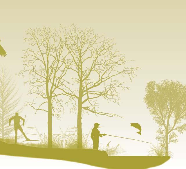
2 INTRODUCTION The Lake Marion-South Creek Greenway Master Plan portrays a vision to establish a greenway from the Minnesota River in Burnsville to downtown Farmington. The Lake Marion-South Creek Greenway Master Plan emerged from the Dakota County Parks, Lakes, Trails and Greenways Vision 2030 and the Dakota County Greenway Collaborative Guidebook. Dakota County envisions its greenways to provide multiple layers of benefits in water quality, habitat enhancement, recreation, and non-motorized transportation. The Lake Marion-South Creek Greenway travels 20 miles through Burnsville, Scott County, Lakeville, and Farmington. Today, the landscape surrounding the greenway is varied. The greenway travels through a mix of residential neighborhoods, commercial development, local parks, Murphy-Hanrehan Regional Park Reserve (one of the finest natural resource amenities in the area), skirts the western edge of Lake Marion, through historic Master Plan Purpose Lake Marion/ South Creek Greenway The master plan Provides strategic guidance for future greenway development Integrates recreation, transportation, natural resource management, and improved water quality Provides recommendations for natural and cultural resource stewardship Identifies a greenway trail alignment, interpretive themes, and design direction Recommends implementation strategies for land protection, development phasing, capital and operations budgets, and funding. Lake Marion-South Creek Greenway North Priority Projects O P Q B C D E G I N T F H R A J K M S U L V X PROJECT Segment 4: HH II JJ KK LL MM NN OO PP QQ RR SS TT UU VV WW XX YY W AA Y Z BB CC DD EE GG HH II JJ PRIORITY Existing First Priority Project Second Priority Project Long-Term Project/ Minnesota River Greenway By Others POTENTIAL TRIGGERS/PART- NERS HH Greenway (McGuire M.S. to Hamburg Ave) 1st II Grade separated crossing at Hamburg Ave 1st JJ Greenway (Hamburg Ave to Cedar Ave) 1st KK Grade separated crossing at Cedar Ave 1st LL Greenway (Cedar Ave to Flagstaff Ave) 1st MM Grade separated crossing at Flagstaff Ave 1st NN Gateway at Flagstaff Ave 1st OO Greenway (From Flagstaff Ave along South Creek) 1st PP Grade separated crossing at Pilot Knob Rd extension 1st In conjunction w/ road construction QQ Greenway (Along South Creek to Spruce St) 1st RR Gateway at Spruce St 1st SS Greenway (Along Spruce St to Spruce St/South Creek Bridge) 1st TT Grade separated crossing at Spruce St/South Creek Bridge 1st UU Greenway (Along South Creek) 1st VV Grade separated crossing at Denmark Ave/South Creek Bridge 1st WW Greenway (Denmark Ave along South Creek) 1st XX Greenway (to Rambling River Trailhead) 2nd YY Rambling River Trailhead 2nd KK UU VV LL OO QQ SS WW RR MM TT YY XX NN PP 1 Lake Marion-South Creek Greenway DRAFT MASTER PLAN Executive Summary 2013 Lake Marion-South Creek Greenway DRAFT MASTER PLAN Executive Summary


 Minnesota Department of Transportation Minnesota Department")
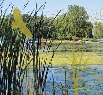
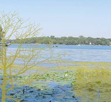
3 Funding Funding will also be a collaboration between the County, cities, and other agencies as appropriate. Cost share roles will be determined based on the strengths of each agency and circumstances of each project. In-kind contributions of land, easement, design, engineering, construction, maintenance, and operations are encouraged and will be outlined in individual joint powers agreements between agencies. It is anticipated that most future capital projects will be positioned to secure regional, state, and federal funds for recreation, water, and habitat and that these sources will account for the majority of capital construction costs. In many cases, but not all, Dakota County, as the regional agency, will be in the best position to pursue outside funding. Examples of outside funding sources include: NPS Rivers, Trails, and Conservation Assistance Program Federal Transportation Grants (MAP 21) Minnesota Department of Transportation Minnesota Department of Natural Resources Minnesota Pollution Control Agency Metropolitan Council The Environment and Natural Resources Trust Fund Clean Water, Land, and Legacy Amendment Watershed Management Organizations Foundations and Nonprofits Statewide Health Improvement Program (SHIP) Lake Marion-South Creek Greenway North Priority Projects PROJECT PRIORITY POTENTIAL TRIGGERS/PART- NERS Segment 1: A Trailhead at MN River Regional Greenway Long Term Part of Minnesota River Greenway B Greenway (Along Minnesota River to Hwy 13) Long Term Part of Minnesota River Greenway C Grade separated crossing at TH 13 1st D Gateway at Rudy Kraemer Nature Preserve 1st E Greenway (Through Rudy Kraemer Nature Preserve) 1st F Greenway (Rudy Kraemer Nature Preserve to Williams Dr) 1st G Greenway (Williams Dr to Judicial Rd to Howell Park) 1st H Improvements to greenway (Howell Park to Sunset Pond Park) 2nd I Gateway at Sunset Pond Park 2nd J Greenway (From Sunset Pond Park C.P. R&R corridor/csah 42 crossing) 1st K Improvements to grade separated crossing at CSAH 42 1st L Gateway at Rose Park 2nd M Greenway (Rose Park to Kelleher Park) 2nd N Gateway at Kelleher Park 2nd Segment 2: O Greenway through Scott Co. By Others To be masterplanned by Scott Co/TRPD P North Trailhead at Murphy Hanrehan Park By Others TRPD Q Greenway through Scott Co. By Others To be masterplanned by Scott Co/TRPD R Gatewayat Murphy Hanrehan Park By Others TRPD S Greenway (Murphy Hanrehan Park to 185th St W) 2nd T Grade separated crossing at 185th St W) 1st U Greenway (185th St W through Ritter Farm Park) 1st U.1 Trailhead at Ritter Farm Park 2nd Segment 3: V Overpass at Interstate 35 Existing W Gateway at Casperson Park 2nd X Greenway (Interstate 35 to 205th St W) 2nd Y Gateway at south end of Lake Marion 2nd Z Grade separated crossing at 205th St W 2nd AA Improvements to greenway (Along 205th St W to Antlers Park) 2nd Improve existing paved trail BB Trailhead at Antlers Park 2nd CC Greenway (Antlers Park to Dodd Blvd) 2nd DD Greenway (Dodd Blvd to (C.P. R&R line) 2nd Improve existing paved trail EE Gateway at Downtown Lakeville 1st FF GG Not Used GG Greenway (208th St W to McGuire M.S. adjacent to RR) 1st Funding for annual operating and maintenance costs for the 30 regional trail corridor and trailheads will primarily be the responsibility of Dakota County. Annual operating costs are funded though the Dakota County General Fund Budget and from regional park allocations from the Metropolitan Council. In situations where there are efficiencies in local jurisdictions performing maintenance and operations, Dakota County will enter into a joint powers agreement outlining responsibilities and cost sharing. downtown Lakeville, and along the shores of South Creek before arriving in downtown Farmington. The greenway also provides a link between the Minnesota River and North Creek Greenways. EXISTING CONDITIONS The Lake Marion-South Creek Greenway links several natural areas of significance: The Minnesota River, Murphy Hanrehan Regional Park, Lake Marion, South Creek, and the Vermillion River. Between these natural resources is a mix of suburban development residential and commercial areas and local parks. The greenway also connects historic downtowns in Lakeville and Farmington. Two areas will experience significant future growth: the Northwest Quadrant in Burnsville near the Minnesota River and the area along South Creek in Farmington. Cultural Resources Every place has a unique history with resources with which people have an emotional connection. Within the greenway corridor, there are parks, the Dan Patch line, and many recreational resources, both historic and current, that have provided people with access to nature for generations. Places and stories of interest include: Native American burial mounds near the Minnesota River; the legendary Dan Patch racehorse; Orchard Gardens, a flag stop railroad depot on the National Register of Historic Places; early resort history- the Weichselbaum Resort on Lake Marion and other resorts on Orchard and Crystal Lakes; the 40 acre amusement park at Antlers Park; and several structures of historic age within older portions of Lakeville, Burnsville, and Farmington. Natural Resources The natural resources in the area surrounding the Lake Marion-South Creek Greenway consist of large complexes of high quality woodlands, prairies, and wetlands, mostly within regional and community parks. Murphy-Hanrehan Regional Park Reserve is one of the highest quality natural areas in the metro with a diverse mix of prairie, shrubland, woodland, and wetlands. Kraemer Nature Preserve, Ritter Farm Park, and Rambling River Park are also fine natural areas. The greenway area is also rich in water resources. Of note are the Minnesota River and river valley, Lake Marion, South Creek, and the Vermillion River. South Creek and the Vermillion River are DNR designated trout streams and provide opportunities for fishing recreation. Restoration work, including remeandering in some areas, is currently underway along South Creek. Lake Marion Swimming at Lake Marion Murphy Hanrehan Regional Park Reserve Photo: Minnesota Historical Society Photo: Three Rivers Park Distrtict 9 Lake Marion-South Creek Greenway DRAFT MASTER PLAN Executive Summary 2013 Lake Marion-South Creek Greenway DRAFT MASTER PLAN Executive Summary


4 Land Protection And Stewardship Dakota County s greenway concept expands the traditional concept of a corridor to include recreation, transportation, ecological, and water quality components in a corridor. Because securing the entire width of the corridor it is not feasible, a dual approach to securing greenway lands is recommended. Land Protection - protecting land is essential to make the greenway usable to the public. For the Lake Marion-South Creek Greenway, this means securing lands needed for the trail corridor and trailheads. For land owned by other public agencies, Dakota County will need to permanently protect the trail corridor and trailheads for greenway trail use with easements or joint powers agreements. For land that is currently privately owned, the County will need to protect the trail corridor for public use. Land protection strategies include: park dedication, direct purchase with resale of land not required for the trail, permanent easements, land donation, bargain sale, life estate, and negotiations with cities and developers. Sunset Pond Land Stewardship - refers to the care of native landscapes and habitat within the wider greenway. Generally, Dakota County will not be the lead agency in stewardship activities outside of the 30 trail corridor, but will work as steward partners with local jurisdictions, agencies, and private landowners with funding and expertise. Phasing and Priorities Rudy Kraemer Nature Preserve Greenway segments have been prioritized as either first priority projects or second priority projects. It is anticipated that first priority projects will be built in advance of second priority projects but the Master Plan remains flexible so that any project can be implemented as partnership or funding opportunities arise. First priority projects are those that are needed to create a continuous, functional greenway experience. It is intended that recreation, water quality, and natural resource elements be integrated into the greenway at the time of initial construction. Second priority projects will enhance the greenway experience. These are things such as: grade separated crossings; trailhead development; and enhancements to existing trails such as landscaping, habitat restoration interpretation, wayfinding, benches, trash receptacles, etc. South Creek Lake Marion-South Creek Greenway DRAFT MASTER PLAN Executive Summary


5 The Stewardship Plan The linear nature of the Lake Marion- South Creek Greenway will require natural resource management strategies that are geographically targeted, cooperative, and realistic. The plan recommends restoration and protection efforts be focused on the trailhead locations, where there is the greatest opportunity for greenway users to see the results of activities. Stewardship activities in the larger greenway corridor will need to be in cooperation with public and private landowners. All stewardship actions should be evaluated through the lens of sustainability is the stewardship effort sustainable over the long-term, from both an ecological and economic perspective. IMPLEMENTATION & MANAGEMENT Lake Marion-South Creek Greenway Habitat Investment Areas VERMILLION HIGHLANDS GREENWAY CONCEPT PLAN Implementation will depend on multijurisdictional collaboration. Without continued coordination between the communities and agencies that the greenway travels through it is unlikely the greenway, as it is envisioned, will be built. While the 30 regional trail corridor will be the jurisdictional and operational responsibility of Dakota County, the larger greenway corridor will be governed in many ways depending on the situation and land ownership. As greenway segments are built, formal joint powers agreements between Dakota County and collaborating agencies will need to be established to outline specific agency responsibilities. These agreements will outline who has control over the trail right-of-way, as well as who will operate and maintain the trail and how they will do it. Similarly, responsibilities for land acquisition, construction, stewardship, operations, and maintenance will depend on the particularities of each segment. 7 Lake Marion-South Creek Greenway DRAFT MASTER PLAN Executive Summary 2013

, and trail connections.")


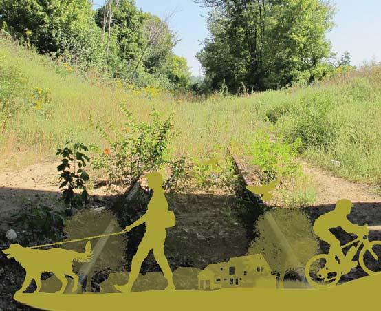
6 THE PLAN The Development Plan Development of the Lake Marion-South Creek Greenway hinges on a continuous, paved trail for nature-based recreation and non-motorized transportation. The trail is a connective feature linking recreation destinations (places people go for outdoor recreation), activity centers (gathering places along the trail), and trail connections. Design features that are signatures of Dakota County Regional Trails include: Enhancements to at-grade crossings will improve safety AUSTIN BENCH RIDE BIKE LOOP CALLISTO BOLLARD Outdoor furnishings, such as benches, bike racks, and lighting, will be placed conveniently along the greenway for resting and safety. Follows natural resources and has a natural design signature Frequent access points at full service trailheads with restrooms, picnicking, water and vehicle parking (every 3-5 miles) and smaller, more frequent, neighborhood gateways between trailheads Paved trails that are plowed in winter Grade separated crossings at major roads Cultural and natural resource interpretation Wayfinding High quality furnishings at trailheads, gateways and rest areas Universal accessibility Utilizes sustainable building practices and materials Lighting where evening use is anticipated Judicial Road Conceptual Section Wayfinding is discussed as an important part in the Development Plan for the greenway. Above are concepts for a Gateway Landmark wayfinding element. Trailheads will be located at major access points along the greenway. Source: HKGi Grade separated crossings will be used to cross major roadways or railroads. The Interpretive Plan The interpretive plan identifies an interpretive theme and sub-themes that provide a framework for cultural and environmental interpretive education. The plan recommends that the theme and subthemes be integrated into the greenway design and interpretation concentrated at trailheads and neighborhood gateways. Interpretive Theme A Place for People: Lake Marion-South Creek Greenway continues to provide abundant recreational opportunities to an evolving community. Subthemes Active Living- Counting the Benefits: Historic and Current Recreation Opportunities in the Corridor A Changing Community Identity: A Distinct Urban Fabric A Population Shift: We Celebrate the Changes and Respect the History that Shaped our Community Downtown Lakeville 5 Lake Marion-South Creek Greenway DRAFT MASTER PLAN Executive Summary 2013 Lake Marion-South Creek Greenway DRAFT MASTER PLAN Executive Summary
Mendota-Lebanon Hills Greenway Master Plan Executive Summary. August draft for more information visit
 Mendota-Lebanon Hills Greenway Master Plan Executive Summary August 2013 draft for more information visit www.hkgi.com/projects/dakota INTRODUCTION The Mendota-Lebanon Hills Greenway Master Plan portrays
Rosemount Greenway Master Plan Executive Summary. draft. Spring for more information visit
 Rosemount Greenway Master Plan Executive Summary Spring 2012 draft for more information visit www.hkgi.com/projects/dakota INTRODUCTION The Rosemount Greenway Master Plan portrays a vision to establish
Metropolitan Parks and Open Space Commission
 Business Item No. 2013-xxx Metropolitan Parks and Open Space Commission Meeting date: October 1, 2013 For the Community Development Committee meeting of October 7, 2013 Subject: Mendota-Lebanon Hills Greenway
METROPOLITAN COUNCIL 390 North Robert Street, St. Paul, MN Phone (651) ; TDD (651)
 ; TDD (651)") DATE: December 20, 2011 METROPOLITAN COUNCIL 390 North Robert Street, St. Paul, MN 55101 Phone (651) 602-1000; TDD (651) 291-0904 TO: Metropolitan Parks and Open Space Commission FROM: Tori Dupre, Senior
DATE: December 20, 2011 METROPOLITAN COUNCIL 390 North Robert Street, St. Paul, MN 55101 Phone (651) 602-1000; TDD (651) 291-0904 TO: Metropolitan Parks and Open Space Commission FROM: Tori Dupre, Senior
METROPOLITAN COUNCIL 390 North Robert Street, St. Paul, MN Phone (651) ; TDD (651)
 ; TDD (651)") DATE: October 24, 2012 METROPOLITAN COUNCIL 390 North Robert Street, St. Paul, MN 55101 Phone (651) 602-1000; TDD (651) 291-0904 TO: Metropolitan Parks and Open Space Commission FROM: Tori Dupre, Senior
DATE: October 24, 2012 METROPOLITAN COUNCIL 390 North Robert Street, St. Paul, MN 55101 Phone (651) 602-1000; TDD (651) 291-0904 TO: Metropolitan Parks and Open Space Commission FROM: Tori Dupre, Senior
Corridor Vision. 1Pursue Minnehaha-Hiawatha Community Works Project. Mission of Hennepin County Community Works Program
 1Pursue Minnehaha-Hiawatha Community Works Project Minnehaha-Hiawatha Community Works is a project within the Hennepin Community Works (HCW) program. The mission of the HCW program is to enhance how the
Mendota Heights 2040 Comprehensive Plan Draft Vers
 4 Parks and Trails The City of Mendota Heights boasts a variety of recreational and open space opportunities. Few cities can claim access to regional trails, riverside and lakeside parks, scenic bluffs
Lake Marion/ South Creek Greenway
 Lake Marion/ South Creek Greenway Master Plan Preliminary DRAFT Chapters 1 & 2-27 Feb 2013 Lake Marion/ South Creek Greenway Preliminary DRAFT Master Plan Acknowledgements Dakota County Board of Commissioners
Business Item No
 Community Development Committee For the Community Development Committee meeting of December 19, 2016 For the Metropolitan Council meeting of January 11, 2017 Business Item No. 2016-255 Subject: River to
Mississippi Skyway Preliminary Engineering Report
 EXECUTIVE SUMMARY Mississippi Skyway Preliminary Engineering Report CITY OF RAMSEY, MINNESOTA DECEMBER 2014 City of RAMSEY EXECUTIVE SUMMARY Project Need and Intent The Mississippi Skyway pedestrian bridge
Rich Valley Greenway Master Plan. Central Greenway Connectivity Study
 Rich Valley Greenway Master Plan Central Greenway Connectivity Study Dakota County Planning Commission February, 2017 Rich Valley Greenway Master Plan Dakota County Greenway Vision Establish a County-wide
This page intentionally blank.
 This page intentionally blank. Parks, Recreation, and Open Space Chapter Relationship to Vision Vision Parks, Recreation and Open Space Chapter Concepts County Government. County government that is accountable
3. VISION AND GOALS. Vision Statement. Goals, Objectives and Policies
 Vision Statement Queen Creek s interconnected network of parks, trails, open spaces and recreation opportunities provide safe and diverse activities and programs that sustain its unique, small town, equestrian
The Trust for Public Land. in Minnesota
 The Trust for Public Land in Minnesota Protecting Minnesota s Natural Legacy In Minnesota, The Trust for Public Land (TPL) is protecting strategic land and water resources for people to enjoy as parks,
A citizen s guide to the. Comprehensive Plan. City of Lakeville, Minnesota 1
 A citizen s guide to the Comprehensive Plan 2008 City of Lakeville, Minnesota 1 Introduction The City of Lakeville completed an update of its Comprehensive Plan in 2008. A comprehensive plan is a tool
Arlington, Virginia is a worldclass
 EXECUTIVE S U M M A RY Arlington maintains a rich variety of stable neighborhoods, quality schools and enlightened land use policies, and received the Environmental Protection Agency s highest award for
Chapter 6. Overall Vision RECOMMENDATIONS. More Trail and Trail. Connections. Equal Access to Park. Facilities and Programs. Water Access.
 Overall Vision More Trail and Trail Connections Equal Access to Park Facilities and Programs Water Access Environment Variety Chapter 6 RECOMMENDATIONS Chapter 6 The following recommendations for park,
& SUSTAINABILITY PLAN
 Chapter 6: IMPLEMENTATION, MANAGEMENT, & SUSTAINABILITY PLAN Overview The Chester Woods Master Plan presents a long-term vision for the park. While phasing of improvements is suggested, Olmsted County
Associate Superintendent. Plymouth, Minnesota
 Associate Superintendent Plymouth, Minnesota Welcome to Three Rivers Three Rivers District is a natural resources-based park system located in the suburban Minneapolis/St. Paul metro area of Minnesota
Office of Greenways & Trails Providing Statewide Leadership and Coordination. Southeast Greenways and Trails Summit October 1-3, 2017
 Office of Greenways & Trails Providing Statewide Leadership and Coordination Southeast Greenways and Trails Summit October 1-3, 2017 1 Office of Greenways and Trails The Office of Greenways and Trails
Photo by Carlton Ward Jr. Executive Summary
 Photo by Carlton Ward Jr. Executive Summary The Cooperative Conservation Blueprint (Blueprint) is a multi-partner strategic conservation process developed by the Florida Fish and Wildlife Commission (FWC)
edmonton.ca/ribbonofgreen #ribbonofgreen
 WHAT IS THE RIBBON OF GREEN? The Ribbon of Green is Edmonton s entire river valley and ravine system. The Ribbon of Green (2018) Project will provide strategic guidance for the southwest and northeast
RECREATION AND OPEN SPACE ELEMENT GOALS, OBJECTIVES, AND POLICIES
 RECREATION AND OPEN SPACE ELEMENT GOALS, OBJECTIVES, AND POLICIES Goal 7 To provide park facilities, recreation programs, and open space resources that are safe, adequate, and accessible to all City residents,
San Diego River Coalition 2012 Work Plan
 San Diego River Coalition 2012 Work Plan Adopted November 18, 2011 The mission of the San Diego River Coalition is preserve and enhance the San Diego River, its watershed, and its natural, cultural and
Yadkin River Greenway Feasibility Study Fact Sheet Village of Clemmons, Town of Lewisville, Town of Bermuda Run
 Fact Sheet Village of Clemmons, Town of Lewisville, Town of Bermuda Run Project Background The Yadkin River Greenway Feasibility Study is a joint project with the Village of Clemmons, the Town of Bermuda
1. Parks & Recreation Neighborhood Parks Community Parks Special Use Sites 2. Open Space 3. Trails
 Appendix A: Park Classifications The intent of parks and recreation classifications is to aid in making acquisition and design decisions for park sites, facilities and the organization of recreation space
& SUSTAINABILITY PLAN
 Chapter 6: IMPLEMENTATION, MANAGEMENT, & SUSTAINABILITY PLAN Overview The Oxbow Park and Zollman Zoo Master Plan presents a long-term vision for the park. While phasing of improvements is suggested, Olmsted
RECREATION, OPEN SPACE AND GREENWAYS ELEMENT GOALS, OBJECTIVES, AND POLICIES
 RECREATION, OPEN SPACE AND GREENWAYS ELEMENT GOALS, OBJECTIVES, AND POLICIES GOAL R-1: DEVELOP A RECREATION, OPEN SPACE AND GREENWAYS SYSTEM AS AN INTEGRAL COMPONENT OF AN OVERALL, COUNTY-WIDE ECONOMIC
Eau Claire County Mission Statement:
 (1) Indicates 1 st Reading (2) Indicates 2 nd Reading 1. Call to Order AGENDA Eau Claire County Board of Supervisors Tuesday, May 19, 2015 / 7 pm Location: County Boardroom, 1 st Floor Courthouse, Room
Working together to leverage limited Funds
 Working together to leverage limited Funds ARAPAHOE COUNTY OPEN SPACES 10 County Budget Conference September 20, 2013 The Power of Partnerships 2013 SORP Conference 5/23/2014 Why Talk About Open Space?
Animating the Rideau Canal December 2013
 Executive Summary Animating the Rideau Canal December 2013 Why study the Rideau Canal? The Rideau Canal has been an important part of Ottawa throughout its history, and has shaped and been shaped by the
Pedestrian and Bike Bridge LOGO
 6.2.2 Pedestrian and Bike Bridge The proposed pedestrian and bike crossing re-envisions the existing bridge at Pismo Creek on Cypress Street. The bridge is currently underutilized by vehicular through
June 14, 2017 for the June 20, 2017 Parks and Trails Commission Meeting
 105 South Fifth Avenue Suite 513 Minneapolis, MN 55401 Tel: 612-252-9070 Fax: 612-252-9077 www.landform.net TO: FROM: DATE: Corcoran Parks and Trails Commission Kendra Lindahl, Landform June 14, 2017 for
Whitemarsh Township Greenway Plan
 Whitemarsh Township Greenway Plan Prepared for: Whitemarsh Township August 16, 2007 Table of Contents Table of Contents... i Introduction... 1 Study Area Setting... 2 Regional Setting... 2 Township Character...
Potential Green Infrastructure Strategies May 6, 2015 Workshop
 Potential Green Infrastructure Strategies May 6, 2015 Workshop Background The City of Cortland is developing the Tioughnioga Urban Headwaters Green Infrastructure Action Plan with funding from the National
{Best Practices. Summary of Tools, Strategies and Best Practices from 11 Michigan Case Study Communities
 Case Studies Michigan Coastal Community Working Waterfronts { Summary of Tools, Strategies and from 11 Michigan Case Study Communities Table of Contents Zoning...2 Community and Stakeholder Collaboration
Wildflowers grow in the new community park on Oakwood Road
 Wildflowers grow in the new community park on Oakwood Road PLANNING AREA - NEW PARKS An important element in the plan for the City of Delafield is to look ahead for future park needs. The City has the
CRESCENT PARK GREENWAY VISION
 CRESCENT PARK GREENWAY VISION City of Hillsboro Trails Master Plan CRESCENT PARK GREENWAY Members of the Hillsboro community came together to determine the following vision and goals for the Crescent Park
Nine Mile Creek Regional Trail Update. Edina City Council Workshop March 4, 2014
 Nine Mile Creek Regional Trail Update Edina City Council Workshop March 4, 2014 Presentation Outline: Where we ve been - Recap of route assessment process and approved route Where we are now - Summary
The Greenway Guidebook
 The Greenway Guidebook The Adopted September 28, 2010 Search greenway collaborative at dakotacounty.us Prepared for: A collaboration between and the cities within of Apple Valley, Burnsville, Eagan, Farmington,
Enhance the High Line Canal Projects
 Enhance the High Line Canal Projects Joint Project Proposal for Arapahoe County Open Spaces Funding Partner Sponsors: South Suburban Park and Recreation District City of Centennial City of Littleton October
Pittsfield Action Plan (West Branch of the Housatonic River)
") An initiative of the Massachusetts Executive Office of Energy and Environmental Affairs in partnership with the City of Pittsfield Pittsfield Action Plan (West Branch of the Housatonic River) The spring
An initiative of the Massachusetts Executive Office of Energy and Environmental Affairs in partnership with the City of Pittsfield Pittsfield Action Plan (West Branch of the Housatonic River) The spring
Looking Ahead. Welcome! The High Line Canal Conservancy. Adventure ON THE HIGH LINE CANAL. Chapter 4. Highlights of this Process:
 Adventure ON THE HIGH LINE CANAL Charting our Course for the Next Century Chapter 4 Looking Ahead Welcome! The High Line Canal Conservancy is leading a broad and inclusive community conversation about
I-494 Rehabilitation Project SP (I-394 to Fish Lake Interchange) June 2014 Section 4(f) De Minimis Determination
 June 2014 Section 4(f) De Minimis Determination") I-494 Rehabilitation Project SP 2785-330 (I-394 to Fish Lake Interchange) June 2014 Section 4(f) De Minimis Determination State Project Number 2785-330 Federal Project No. NHPP-I494 (002) Trunk Highway:
I-494 Rehabilitation Project SP 2785-330 (I-394 to Fish Lake Interchange) June 2014 Section 4(f) De Minimis Determination State Project Number 2785-330 Federal Project No. NHPP-I494 (002) Trunk Highway:
GOCO Grants Awarded to Projects in Arapahoe County through June 2015
 Grant Type Open Space Fiscal Year Applicant Project Title Grant Amount 2015 City of Aurora Acres Protected Triple Creek Greenway Corridor Phase 3 $2,050,000.00 0 Planning 2015 Arapahoe County High Line
Presenting a Vision for Thread Lake
 Presenting a Vision for Thread Lake FEBRUARY 20, 2014 SPECIAL THANKS TO: International Academy of Flint Flint River Watershed Coalition South Saginaw Business and Resident Association South Side Neighborhood
Louisville Township Community Parks, Trails and Open Spaces Planning Map and Parks Plan and Development Report
 Louisville Township Community Parks, Trails and Open Spaces Planning Map and Parks Plan and Development Report Prepared for Louisville Township by Erin Lovell, Community Growth Options (U-CGO), University
Please read the entire document
 projects impacting the waterfront revitalization area. The waterfront revitalization area of the town will have to subareas to the west and east of the village. Page 6 of 6 Wayfinding master plan create
Sustaining Historic Public Landscapes Preservation & Sustainability for Our Shared Heritage To Enhance Quality of Life & Experience of Place
 Body & Soul: Parks & the Health of Great Cities National Association for Olmsted Parks & City Parks Alliance Pittsburgh Parks Conservancy 22 September 2008 Sustaining Historic Public Landscapes Preservation
INTRODUCING THE BALTIMORE CITY GREEN NETWORK VISION PLAN
 INTRODUCING THE BALTIMORE CITY GREEN NETWORK VISION PLAN GOALS OF THE GREEN NETWORK PLAN Protect and enhance the unique ecological resources of our city Support economic growth and sustainable redevelopment
13 Maintenance and Operations Plan 223
 222 13 Operations Maintenance and Plan 223 Chapter 13 MAINTENANCE AND OPERATIONS PLAN 13.1 Stewardship The Minneapolis Park and Recreation Board (MPRB) is the steward of a nationally-acclaimed park system.
G. RECREATION AND OPEN SPACE ELEMENT. The following summarizes the Recreation and Open Space Element:
 G. RECREATION AND OPEN SPACE ELEMENT The purpose of the Element is to provide the framework and direction for a comprehensive system of public and private sites for recreation, including, but not limited
The following principles guide the development of goals and strategies to protect and promote these amenities:
 OPEN SPACE/PARKS/TRAILS/RECREATION GOALS/STRATEGIES Cherry Hills Village is a living environment that offers low density development, open areas, public scenic vistas, public trails and public parks. This
PARTF Scoring System for Grants
 PARTF Scoring System for Grants The members of the N.C. Parks and Recreation Authority use the PARTF scoring system as one of several tools to select grant recipients. Please provide all of the information
Trail Feasibility and Planning Project for Northern Dutchess County, New York
 for Northern Dutchess County, New York Funded in Part by Grants from the Hudson River Valley Greenway, Land Trust Alliance Conservation Partnership Program and the Thomas Thompson Trust 1 STEERING COMMITTEE
Parks, Open Space and Trails
 Introduction Parks have often been referred as the lungs of our cities, cleansing the air of pollutants and particulate matter. Parks are also gathering places for families and community. They offer spaces
A larger version of this map is located on the last page of this PDF.
 MAP Committee Input McLoughlin Area Draft Vision Map A larger version of this map is located on the last page of this PDF. 1. The map above is intended to portray a vision for the McLoughlin area. It highlights
Preface. Erie. Scranton. Allentown. Pittsburgh. Harrisburg. Philadelphia
 The Southern Alleghenies Region The Southern Alleghenies Region spans the Laurel Highlands and Allegheny Front in the west across the Appalachians to the east. It is comprised of Blair, Bedford, Cambria,
Provide and maintain sufficient public parks, recreation facilities, and open space to meet the recreational needs of County residents and visitors.
 (ROS) Goal Provide and maintain sufficient public parks, recreation facilities, and open space to meet the recreational needs of County residents and visitors. OBJECTIVE ROS.01 The County shall acquire,
New Partners for Smart Growth Conference February 5, 2010
 Dan Stroh, Planning Director City of Bellevue Planning and Community Development Bellevue, WA New Partners for Smart Growth Conference February 5, 2010 Summary of Project Long-range plan update for Bel-Red
COASTAL CONSERVANCY. Staff Recommendation June 5, 2008 SAN DIEGO RIVER TRIBUTARY CANYONS PROJECT. File No Project Manager: Megan Johnson
 COASTAL CONSERVANCY Staff Recommendation June 5, 2008 SAN DIEGO RIVER TRIBUTARY CANYONS PROJECT File No. 08-059 Project Manager: Megan Johnson RECOMMENDED ACTION: Authorization to disburse an amount not
ADOPTED CAPITAL IMPROVEMENT PROGRAM BUDGET ARROYO PROJECTS
 ADOPTED CAPITAL IMPROVEMENT PROGRAM BUDGET ARROYO PROJECTS HAHAMONGNA FY 212-216 Capital Improvement Program Priority Description Total Estimated Costs Appropriated Through FY 211 Adopted FY 212 FY 213
A Vision for Walnut Creek
 A Vision for Walnut Creek Photo: City of Clive Walnut Creek Booklet 8 of 8 Greater Des Moines Water Trails and Greenways 1 Table of Contents Booklet 1: Water Trails Strategies and Policies Booklet 2: Beaver
Portage County Parks, Trails and Greenways Plan
 Portage County Parks, Trails and Greenways Plan Agenda for Local Planning Meeting Introductory Presentation Why we need a Plan Plan project goals and process Benefits Overview of local planning region
Northwest Rail Corridor and US 36 BRT Development Oriented Transit Analysis 4.4 STATION AREA FINDINGS
 4.4 STATION AREA FINDINGS Each station is different, and each one requires a separate set of recommendations based on the vision for the site. This section outlines an initial TOD strategy and recommendations
Open House RIVER DES PERES GREENWAY: LANSDOWNE SHREWSBURY METROLINK TO FRANCIS R. SLAY PARK
 Open House 10.12.16 RIVER DES PERES GREENWAY: LANSDOWNE SHREWSBURY METROLINK TO FRANCIS R. SLAY PARK MEETING AGENDA Great Rivers Greenway and Project Partners River des Peres Greenway Overview Project
Overview of Southwestern Pennsylvania Commission s (SPC) 2040 Long Range Transportation Plan (LRTP)
 2040 Long Range Transportation Plan (LRTP)") Overview of Southwestern Pennsylvania Commission s (SPC) 2040 Long Range Transportation Plan (LRTP) Presented to Pennsylvania Agency Coordination Meeting May 27, 2015 Doug Smith & Ryan Gordon 1 Southwestern
Overview of Southwestern Pennsylvania Commission s (SPC) 2040 Long Range Transportation Plan (LRTP) Presented to Pennsylvania Agency Coordination Meeting May 27, 2015 Doug Smith & Ryan Gordon 1 Southwestern
An Ambitious Plan: Transforming the blighted South Platte River and surrounding environment into Denver s greatest natural resource.
 CONNECTING THE PEOPLE TO THEIR RIVER SOUTH PLATTE RIVER VISION IMPLEMENTATION PROGRAM: GRANT-FRONTIER PARK TO OVERLAND POND PARK REACH The South Platte River Vision Implementation Program (River Vision)
DISCUSSION TOPIC: ST JOHNS RIVER & ITS TRIBUTARIES (BPII) 2030 COMPREHENSIVE PLAN POLICES AND REGULATORY FRAMEWORK
 2030 COMPREHENSIVE PLAN POLICES AND REGULATORY FRAMEWORK") DISCUSSION TOPIC: ST JOHNS RIVER & ITS TRIBUTARIES (BPII) 2030 COMPREHENSIVE PLAN POLICES AND REGULATORY FRAMEWORK St. John s River & Its Tributaries Issue Summary: The St. Johns River is an important
DISCUSSION TOPIC: ST JOHNS RIVER & ITS TRIBUTARIES (BPII) 2030 COMPREHENSIVE PLAN POLICES AND REGULATORY FRAMEWORK St. John s River & Its Tributaries Issue Summary: The St. Johns River is an important
Carrboro Greenways Commission January 9 th, 2007
 Carrboro Greenways Commission January 9 th, 2007 Statewide The flooding of Crabtree Valley in the early 1970 s (right before Crabtree Valley Mall was set to open) caused city, state, and federal officials
1.0 INTRODUCTION 1.1 TH 14 WEST STUDY AREA Project Description Functional Classification Purpose of the Project
 1.0 INTRODUCTION 1.1 TH 14 WEST STUDY AREA 1.1.1 Project Description The Trunk Highway (TH) 14 West Corridor is a two-lane roadway approximately 22 miles in length. Located in Nicollet County, the corridor
2011 ASLA Design Awards. Westside Creeks Restoration Plan Merit Award AECOM, Fort Collins. Planning & Urban Design
 2011 ASLA Design Awards Westside Creeks Restoration Plan Merit Award AECOM, Fort Collins Planning & Urban Design Project Fact Sheet Category of Entry: Rotating Specialty Award: 2011 2011 ASLA Colorado
Call for Artists for: Design and Construction of Environmental Art Activation Story Mill Community Park, Bozeman, MT
 Call for Artists for: Design and Construction of Environmental Art Activation Story Mill Community Park, Bozeman, MT Seeking artists to design, fabricate and install art elements in the nature sanctuary
OPEN SPACE CHAPTER 7: OVERVIEW. Preserve open space to protect natural resources, enhance character and provide passive recreation opportunities
 CHAPTER 7: OPEN SPACE OVERVIEW Ridgefield has made tremendous progress permanently preserving areas of town as open space. Open space preservation can serve many important purposes, including: protect
Concept Master Plan. for. Draft of. Wildlife Management Area. Prepared for. June, 2008
 Draft of Concept Master Plan for Vermillion Highlands: A Research, Recreation and Wildlife Management Area Prepared for Vermillion Highlands Steering Committee - Minnesota Department of Natural Resources
Summary of Action Strategies
 Strategic Action Plan 6 Summary of Action Strategies Action Strategy Categories: 1. Organization and Management 2. Implementation 3. Marketing and Promotion This chapter summarizes all of the action strategies
FY Capital Improvement Program Arroyo Projects
 FY 219-223 Capital Improvement Program FY 218 FY 219 FY 22 FY 221 FY 222 FY 223 1 2 3 4 5 6 7 8 9 1 Hahamongna - Implement Master Plan - Oak Grove Area Improvements (7756) Hahamongna - Implement Master
Table of Contents. Elm Avenue Improvement Plan City of Waco, Texas. Introduction 1. Existing Context 1 Figure 1 2.
 Table of Contents Introduction 1 Existing Context 1 Figure 1 2 Plan Guidelines 3 Future Urban Form 4 The West-End 4 Main Street 6 The East-End 7 Figure 2 9 Public Improvement Recommendations 7 General
Transportation. Strategies for Action
 Transportation A major priority for the Overlake Neighborhood is to develop a multimodal transportation system. To achieve this system, a balance has to be found among travel, circulation and access needs;
Goals and Action Items
 Goals and Action Items Developing goals and action items is an important part of the recreation planning process. The overall goals of a recreation department are to provide recreation opportunities for
Parks, Trails, and Open space Element
 Parks, Trails, and Open space Element Parks, Trails, and Open Space element Parks, Recreation, and Open Space are important components of the quality of life desired by the residents of Elk Grove. This
City of Tacoma Planning and Development Services
 Agenda Item D-1 City of Tacoma Planning and Development Services To: Planning Commission From: Elliott Barnett, Planning Services Division Subject: Application #2014-08 Open Space Element Update Meeting
Toronto Parks Renaissance Strategy
 Toronto Parks Renaissance Strategy Overview, Emerging Themes and Directions Presentation to EDPC, May 4, 2006 Parks Renaissance Strategy Presentation Agenda Project Overview Emerging Themes and Directions
ARROYO PROJECTS ADOPTED CAPITAL IMPROVEMENT PROGRAM BUDGET
 A RROYO P ROJECTS ADOPTED CAPITAL IMPROVEMENT PROGRAM BUDGET FISCAL YEARS 214-218 HAHAMONGNA Priority Description 1 Hahamongna Watershed Park - Implement Master Plan 211,6 211,6 (77565) 2 Hahamongna -
Chapter 5: Recreation
 Chapter 5: Recreation Introduction and Setting Recreational opportunities within Nevada County are varied, ranging from public parks with intensively used active recreational facilities, to vast tracts
Figure 1. Proposed Strategic Habitat Conservation Areas for Florida
 Figure 1. Proposed Strategic Habitat Conservation Areas for Florida Critical Lands and Waters Identification Project (CLIP) Cooperative Effort Century Commission for Sustainable Florida Florida Natural
Gold Line Bus Rapid Transit Transit Oriented Development (BRTOD) Helmo Station Area Plan
 Helmo Station Area Plan") Appendix F Gold Line Bus Rapid Transit Transit Oriented Development (BRTOD) Helmo Station Area Plan Introduction and Purpose of the Plan The Gold Line Bus Rapid Transit facility is an eleven-mile dedicated
Appendix F Gold Line Bus Rapid Transit Transit Oriented Development (BRTOD) Helmo Station Area Plan Introduction and Purpose of the Plan The Gold Line Bus Rapid Transit facility is an eleven-mile dedicated
DOWNTOWN PARKS & PUBLIC REALM PLAN
 DOWNTOWN PARKS & PUBLIC REALM PLAN CHALLENGES The Parks and Public Realm Strategy addresses challenges associated with a growing Downtown, including: GOALS 3.3 New buildings will fit within their existing
Preliminary Plan Framework: Vision and Goals
 Preliminary Plan Framework: Vision and Goals Draft: May 2015 Introduction Since the Town of Milliken s comprehensive plan was last updated in 2010, the community was heavily impacted by the 2013 flood,
Draft Stillwater 2030 Comprehensive Plan- Goals and Policies
 Draft Stillwater 2030 Comprehensive Plan- Goals and Policies Instructions- Review each goal and policy and discuss with group any changes, deletions for additions to the list using your groups pen. Keep
ROBBINSDALE LRT STATION CDI DEVELOPMENT GUIDELINES
 August 2018 OVERVIEW The City of Robbinsdale has a prime-opportunity site in the middle of the 13 mile stretch of the Bottineau LRT corridor / Blue Line extension. Robbinsdale offers a prominent, vital,
RIDGES TO RIVERS OPEN SPACE NETWORI< OF THE MID-COLUMBIA DRAFT ACTION PLAN
 RIDGES TO RIVERS OPEN SPACE NETWORI< OF THE MID-COLUMBIA DRAFT ACTION PLAN Ridges to Rivers Open Space Network of the Mid-Columbia Region Draft Action Plan (8/6/08) The goals of the propose
2.0 AREA PLANS. Lakeside Business District. Lakeside Business District Land Use Categories:
 Lakeside Business District Lakeside Business District Land Use Categories: Campus Commercial Campus Commercial means a mixture of uses which includes corporate offices, office parks, hotels, commercial,
WELCOME TO THE CHOUTEAU GREENWAY DESIGN, DEVELOPMENT AND CONSTRUCTION WORKING GROUP!
 WELCOME TO THE CHOUTEAU GREENWAY DESIGN, DEVELOPMENT AND CONSTRUCTION WORKING GROUP! Chouteau Greenway Steering Committee and Working Groups Overview Overview January 9, 2019 Chouteau Greenway will transform
Implementation Guide Comprehensive Plan City of Allen
 Implementation Guide 2030 Comprehensive Plan City of Allen DRAFT 2015 Implementation Guide Allen 2030 Comprehensive Plan INTRODUCTION The Comprehensive Plan serves as a guide for the growth and development
Open Space, Natural Areas, Parks, and Recreation
 Open Space, Natural Areas, Parks, and Recreation WHAT ARE THE CITY S CURRENT VALUES? This section addresses open spaces, natural areas, parks and recreation, and stormwater multi-use projects under separate
HILLSBOROUGH COUNTY Greenways and Trails Plan Update. Executive Summary. Date
 HILLSBOROUGH COUNTY Greenways and Trails Plan Update Executive Summary Date PURPOSE AND PROJECT OVERVIEW The Hillsborough County Greenways Master Plan (1995) and the City of Tampa s Greenways and Trails
Albert Lea. Redevelopment Plan. 701 Xenia Avenue South, Suite 300 Minneapolis, MN Tel: (763) Fax: (763) wsbeng.
 Fax: (763) wsbeng.") Albert Lea Redevelopment Plan 701 Xenia Avenue South, Suite 300 Minneapolis, MN 55416 Tel: (763) 541-4800 Fax: (763) 541-1700 wsbeng.com Albert Lea Redevelopment Plan Table of Contents Composite Districts...
Albert Lea Redevelopment Plan 701 Xenia Avenue South, Suite 300 Minneapolis, MN 55416 Tel: (763) 541-4800 Fax: (763) 541-1700 wsbeng.com Albert Lea Redevelopment Plan Table of Contents Composite Districts...
SECTION FOUR: MISSION STATEMENT, GOALS & OBJECTIVES
 SECTION FOUR: MISSION STATEMENT, GOALS & OBJECTIVES Chapter Summary Chapter Ten: Mission Statement, Goals & Objectives To fulfill its mission, the Parks and Recreation Commission has identified four basic
Pinellas County Greenways
 Pinellas County Greenways USING GREENWAYS TO LINK OPEN SPACES The Florida Greenways Commission has defined a greenway as...a corridor of protected open space that is managed for conservation and/or recreation.