700 X 300 M HONG KONG HONG KONG SURFACE
|
|
|
- Abner Clarke
- 5 years ago
- Views:
Transcription

1 700 X 300 M HONG KONG HONG KONG SURFACE
2
3 700 x 300 m HONG KONG Analysis and tracing of hong kong surface ETH Studio Basel Institut der Gegenwart June 2004 Roger Diener, Marcel Meili Emanuel Christ, Simon Hartmann, John Palmesino, Nelson Tam Michael Bölling, Lilian Demuth

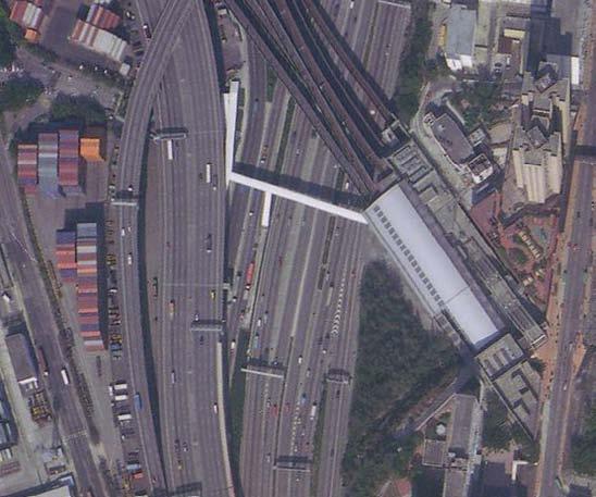
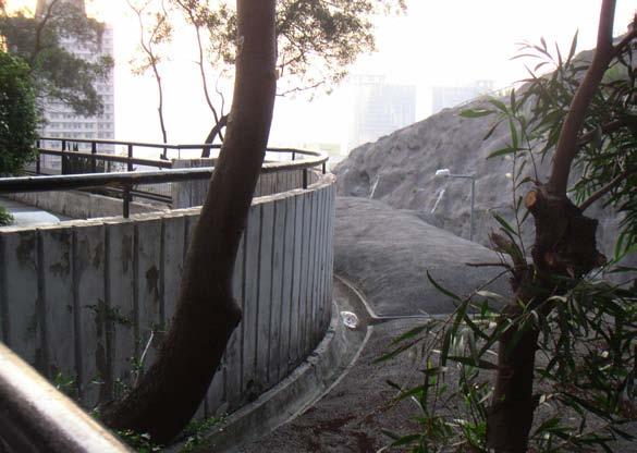
4 Kwai Chung Kwai Chung is situated in the north west of Kowloon between the harbour and steep mountains. The chosen site contains typical elements of Hong Kong s urban landscape, such as reclaimed land, large infrastructure networks and stabilized hills on few square meters. tsuen wan Kooloon central The location of the site

5 Map of Kwai Chung source_survey & Mapping Office, Lands Department, Hong Kong


6 a young terrain 30 % of the site is reclaimed land. Reclamation started in this area in the 1960 s


7 source_ , Mapping Hong Kong, A Historical Atlas, Hal Empson 2002, Survey & Mapping Office, Lands Department, Hong Kong
8 the site

9 source_survey & Mapping Office, Lands Department, Hong Kong

10 sl Topography x The topography rises from the sealevel up to 160 meters within a distance of 400 meters. road-network container port underne

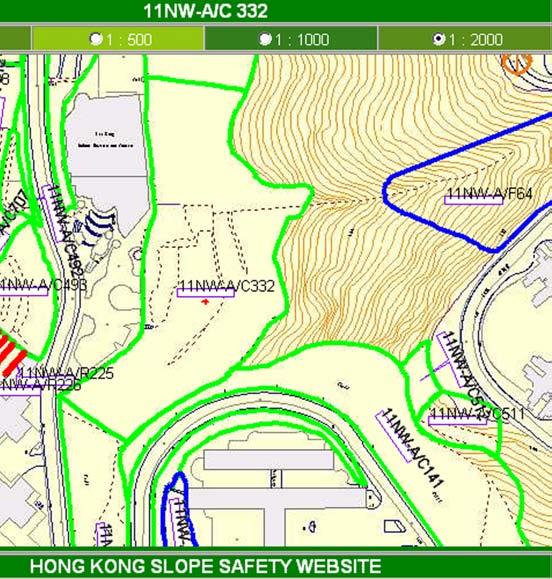
11 Highland Park Estate ope 11NW-A/C 332 Cho Yiu Chuen Estate and Lim cho Street Yuet Lai Court Lai King station ath the Tsing Kwai Highway

12 Scanning a site - eight sectors underneath the Tsing Kwai Highway road-network Lai King station container port

13 slope 11NW-A/C 332 Highland Park Estate Cho Yiu Chuen Estate and LIm cho road Yuet Lai Court Sitemap source_survey & Mapping Office, Lands Department, Hong Kong
14

15 container port Land on demand


16 Filling The terrain of the container port terminal was reclaimed 40 years ago. container hills walkway to the MTR-station container loading container port road


17 container port office fenced walkway to the container port office container loading
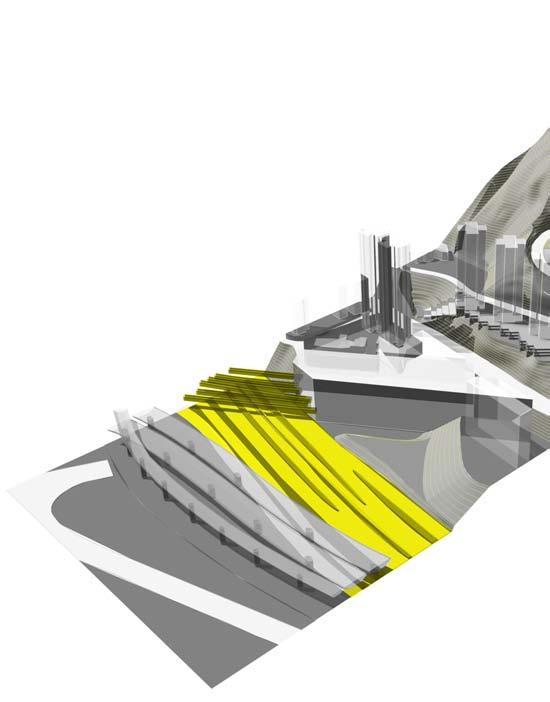
18

19 underneath the Tsing Kwai Highway use to the max


20 more than a byproduct Tsing Kwai Highway Container Port Road South Exit from Tsing Kwai Highway Tsing Kwai Highway truck carpark


21 truck carpark entrance gate truck repair lot


22 personal occupancy truck repair lot office


23 office garden
24

25 Kwai chung Road condensed infrastructure

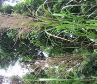
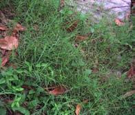
26 highway and rail system

27 highways rail mtr

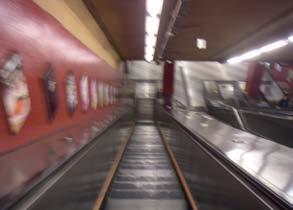
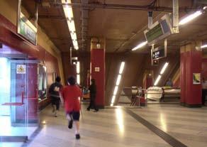
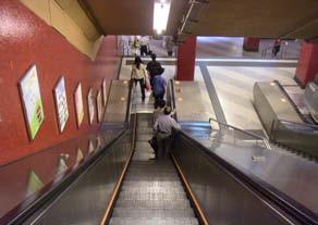
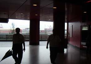
28 overlaid Tsing Kwai Highway to the Airport Tsing Kwai Highway Exit Container Port Road South
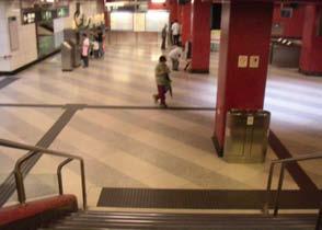
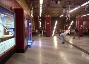
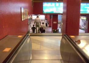
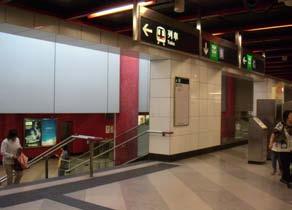
 Kwai Chung Road to Tsuen")
29 Mass Transit Railway (Tsuen Wan Line) Mass Transit Railway (Airport Express) Kwai Chung Road to Tsuen Wan

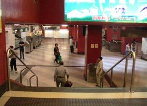
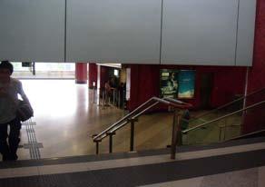
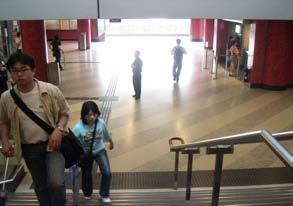
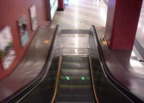
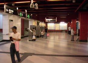
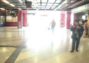
30 adjoint Entrance to Tsing Kwai Highway Kwai Chung Road to Kowloon

31 Tsing Kwai Highway Container Port Road South Kwai Chung Road to Tsuen Wan


32 in between Massive concrete structure and artificial greening are the main elements of the in-between-space. The Kwai Chung Road is separeted by a fence. Mass Transit Railway Kwai Chung Road to Tsuen Wan Mass Transit Railway Mass Transit Railway Structure Kwai Chung Road to Tsuen Wan


33 walkway to Mtr-Station Kwai Chung Road to Tsuen Wan Container Port Road South Container Port Road South nature grows in every condition
34

35 Lai King Station invisible giant

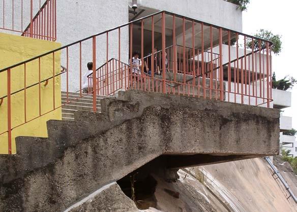
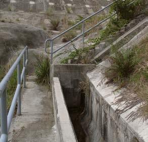
36 mtr dissappearance Prominent buildings are hardly perceived in a conglomeration of large scale objects. They become part of the urban texture. etrance

37 port office exit to port station yin lai shopping center lai king hill road


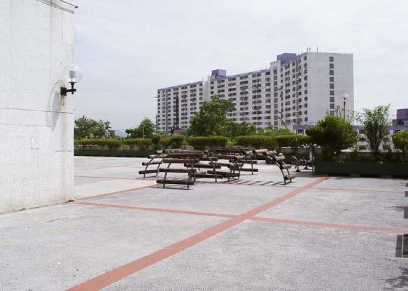
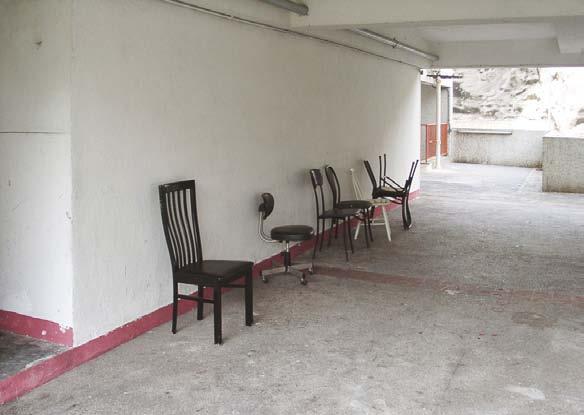
38 only a transit In the perception of the user the building is reduced to an uniform transit space.
39
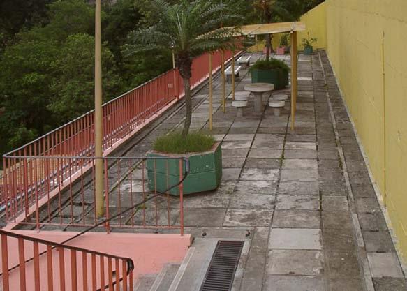
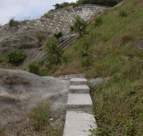
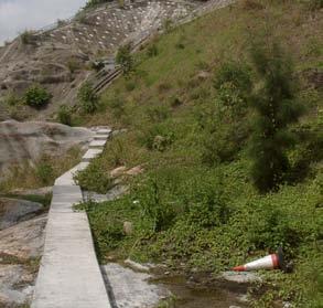
40

41 Yuet lai court fight for space Yuet Lai Court was completed by the Hong Kong Housing Authority in It consists of four non standard blocks with totally 704 flats and was planned as public housing estate. The flats size is between 39-48m 2 and are sold for $.


42 overhang The podium is built on stilts regardless of the slope topography. The two artefacts behave in a contradictory way. shotcreted rock slope fresh water pipe plants break through shotcreted surface tthe structure of the podium is mostly not following the terrain


43 park deck lai king hill road podium shotcreted cut slope
44 cut in On the hillside the podium is carved into the slope. retaining wall podium park deck weephole

45 entrance gate stair to podium fill slope


46 on the podium The podium is designed in a uniform insignificant manner. People bring their own chairs to recreate in the shadow. public space on the podium
47


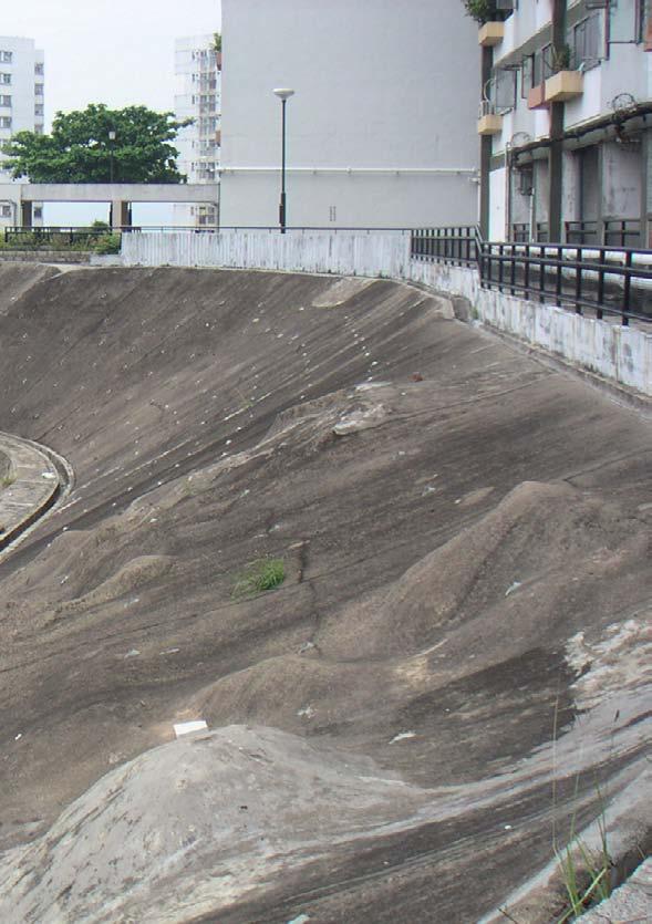
48 Terraced slope The slope is formed to terraces for public use. The stairway connects the estate to the Lai King Hill Road.
49


50 private gardens on prohibited ground Elderly inhabitants use the slope as garden in the lack of balconies. no entry chairs seat with a view


51 gardening stuff estate management orders to remove
52


53 Slope 11NW-A/C 322 the green wall

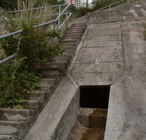
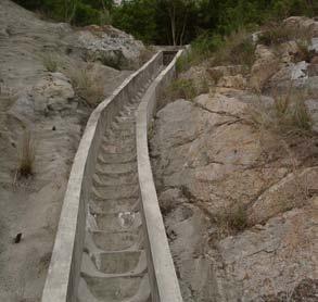
54 under control

55

56 difficult conditions Hong Kong s topography is formed by special climatic and geomorphical conditions. Intensive rainfalls, hilly terrains and a sandy type of soil effects a huge number of landslides every year. The fast increase of the population during the 20th century and the lack of space to expand, Forced the urban developers to deal with this threat. The measures to protect the building and infrastructure sites from the danger of landslides, creates an artificial landscape of manmade slopes and afforrested terrain. Geografic relief of Hong Kong Dense urban areas, 2000 areas with intense rainfall incidence ( ) >70mm p.h. landslide incidence in hong kong area, source_geo report no.62_the government of hong kong special administrativ region_1997 source_mapping hk_guiterrez+portefaix_2000 source_geo report no.54, 59, 70, 97, 105_the government of hong kong special administrativ region
57 Slope areas, registered secured slopes source_geotechnical engineering office

58 danger of landslides If you imagine 200 years ago, this is just small fishing village at the coast of china. When the British came in 1840, Hong Kong harbour was a wonderful port to use as base. If your`re starting town and country planning today with a green field site, this is, my view, one of the last places in the world you would try to build a city of five million people, because there is not much flat land. I think Hong Kong is unique. It s the only city in the world, with such an extensive steep development on these types of slopes. Rio de Janeiro, Caracas or some european cities also got some areas of the urban development on steep slopes, but not to the same extend as Hong Kong. So the impact of landslides and soil erosion is more direct in terms of consequence in this urban area than in another city in the world. That s why we afford a very strong governmental control on these slopes.


59 The population was only half a million at the end of Second World War. Now it s nearly seven million. So landslide incidence starts to become a big problem. Through the 50, 60 and 70`ties, we started to have landslide disasters. This is one of the famous ones in 1972, when part of the hillside at mid-levels area felt down and knocked down housing, about 67 people were killed that day. On the same day, under intense rainfall another 71 people were killed when a big loose fill slope collapsed. In one day we had 138 people killed in For the last 30 years nearly, Hong Kong government has a very strong control over really three main things. First of all is checking new building site formation projects, to make sure, that people, who form new slopes by cutting and filling, build the slopes to modern standards. The second main thing in the governmental plan is to start a long term program of stabilizing the old cut and fill slopes and retaining walls to bring them up to modern standard. We`re currently spending at least US$ a year upgrading all these thousands and thousands of old slopes. And the third thing was this try, starting to encourage all slope owners, the people who form the slopes to maintain the slopes, cause slopes are like your own body or a car, they need to be looked after. Mr. R. P. Martin Chief of the Geotechnical Engineering Office


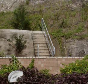
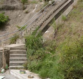
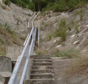
60 controlled Landscape slopes in the Hong Kong region are registred in an online database. The website is provided by the Geotechnical Egineering Office, which is responsible for the maintenance and planning of the slopes.
61


62 slope construction The stabilisation of the terrain is usally made with soil nails. Therefor a 15 meter deep hole is drilled into the slope. The drill bits are screwed together in order to reach the requiered deepness. The distance between the drill holes averages one to two meters. drill


63 The soil nails are inserted into the hole and it is filled up with concrete. Often the treated terrain will be covered by a concrete surface for better drain and to prevent soil liquification. This process is called shotcreting. drill bits soil nails drill hole

64 section of slope 11nw-a/C 332 Highland park estate

65 Kai min Lau Buildings yuet Lai court

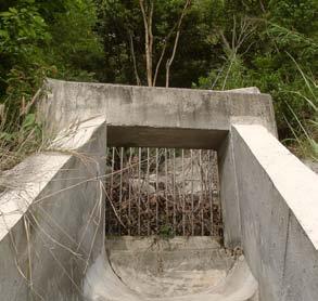
66 concrete surface with soilnails slope stabilized with soilnails


67 plants on weepholes concrete cap of soilnail

68 maintenance stairs and drain channel rockslope covered with wire gauze against rockfall


69 maintenance stair for drain channel channel is stepped to decelerate drain water


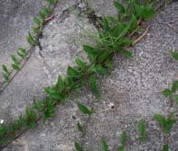
70 clear border separates public space from slope water drain wire gauze


71 public space access prohibited to maintenance stair


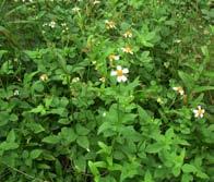
72 walkways on slopes are for maintenance use only
73


74 artificial forest The forest is nerved with artificial drain elements. catchpit of the main water channel stepped drain channel


75 natural drain covered with concrete sprayed concrete on forest ground

76 The stabilizing and drain elements reveal the artificiality drain channel plant mat stabilize forest ground Plants growing out of weepholes


77 start of drain channel plant mat on forest ground drain of the soil

78 diffuse Border plants break through concrete surface


79 no unauthorised entry wire gauze weephole for drain


80 slope forest plants


81
82

83 lim cho street customized topography

84 carved The street is carved into the terrain with a constant inclination.

85


86 lim cho street section 1 section 2 section 3


87 section 4 section 5 section 6

88 textures Different states of artefact and nature create divers textures kai min lau catchpit retaining wall lim cho street

89 shotcreted after 1999 rock slope


90 weephole drain water sediments colours surface soil nails rock slope


91 soil nails weephole shotcrete surface rock slope wire gauze against rockfall
92 Kai Min Lau Buildings The construction of Cho Yiu Chuen Estate was started in 1977 by the Hong Kong Housing Society and completed with Kai Min Lau Buildings in The form of the buildings belong to the Slab type. Lim Cho Street seperates Kai Min Lau from Cho Yiu Chuen Estate and its surroundings like an island. The only direct connection is the pedestrian bridge with elevator. Playground Parking Pedestrian bridge Lim Cho Street Podium level

93 Third floor


94 adjusted The slope is formed to a flattened plateau for the building platform used as public space. the artificial modulated terrain and the border to the public Space of the estate

95


96 overlap The building structure overlaps the platform, adapted to the slope inclination. chill out in the shadow playground


97 podium level for maintenance use only flattened slope

98 detached The pedestrian bridge between the two platforms is detached from the terrain and divides the slope inclination into horizontal and vertical. the footbridge and elevator
99
100

101 Highland Park Estate private hill

102 Highland Park Estate Highland Park Estate was completed in 1999 and is one out of 13 built estates that belongs to the Sandwich Class Housing Scheme. In the early 90 s, the Society was invited by the Government to develop properties for sale at concessionary prices to eligible middle-income families. service street playground main access to podium garden sport entrance entrance podium garden gate club Podium level tower II tower III tower VI tower IV tower V tower I Flat level

103 source_hongkong Housing Society


104 secluded Public space is turned into a private artificial garden elevated onto the podium and secluded from it s surroundings. The podium is referencless to the topography. forest slope 11NW-a/c 332 lai fung street


105 playground at exposed position private garden


106 restricted view The view from the top of the hill is entitlet to those with permisson to enter. entrance gate to lai fung street podium garden service facilities Lai fung street


107 fence to forest slope 11NW-A/c 332 main entrance to estate

108 eight Hong Kong Principles private hill the green wall

109 land on DEMAND use to the max Condensed infrastructure fight for space customized topography invisible giant
110
111 internet websites: Lands Department: Highways Department: Planning Department: MTR Hong Kong: Hong Kong Slope Safety: Slope Information System: Hong Kong Housing Society: Cho Yiu Chuen Estate: Highland Park Estate: Hong Kong Housing Authority: all pictures and drawings without source indication are produced by Michael Boelling and Lilian Demuth, Studio Basel
APPENDIX C: HILLSIDE DEVELOPMENT REGULATIONS (prev. Ordinance #2008-1)
") APPENDIX C: HILLSIDE DEVELOPMENT REGULATIONS (prev. Ordinance #2008-1) 1. PURPOSE: The purpose of this section is to define the conditions under which hillside development may occur that will not result
APPENDIX C: HILLSIDE DEVELOPMENT REGULATIONS (prev. Ordinance #2008-1) 1. PURPOSE: The purpose of this section is to define the conditions under which hillside development may occur that will not result
Task Force on Harbourfront Developments in Kowloon, Tsuen Wan and Kwai Tsing
 Task Force on Harbourfront Developments in Kowloon, Tsuen Wan and Kwai Tsing For discussion on 2 June 2016 TFK/03/2016 AMENDMENTS TO THE APPROVED TSUEN WAN OUTLINE ZONING PLAN NO. S/TW/31 PURPOSE This
Field trip report. Field trip transport planning, , 2 ECTS, 2017S
 Field trip report Field trip transport planning, 231.043, 2 ECTS, 2017S Transit-Oriented Development (TOD) initiated by private railway companies in Japan The example of Utsukushigaoka on the Tama Den-en
Highbridge Park Enhance the picturesque park: Provide more opportunities for healthy activity: Improve forest and ecology health:
 Enhance the picturesque park: Expose gigantic rocks and meadows Provide more opportunities for healthy activity: Improve the recreation center, athletic fields, playgrounds & restrooms Improve forest and
Unit II Soil Management
 Unit II Soil Management Lesson 2: Using Soil Survey Manuals Soil survey manuals provide useful information for grassland management. Soil scientists evaluate the soil for chemical and physical properties,
The University of Hong Kong s Centennial Campus: Growth and Sustainability in a City Environment
 The University of Hong Kong s Centennial Campus: Growth and Sustainability in a City Environment Dr. Sarah Liao Senior Advisor to the Vice Chancellor The University of Hong Kong ISCN Symposium Shanghai
Final Master Plan and Development Control Regulations
 1. INTRODUCTION CHECK LIST a. Introduction b. Table of contents c. Definitions. d. scope of works. 2. FINAL OVERALL MASTER PLAN a. SITE ANALYSIS and OVERVIEW: i. Existing and Proposed Site Plan Levels.
Land Use/Transport Integration. Land Use as an end Transport as a means
 Copenhagen s Finger Plan Land Use/Transport Integration Land Use as an end Transport as a means Smart Growth Land Use Transport Contrasting Models of Transit & Development Adaptive Cities: built forms
BAY AREA PARKS & RECREATION
 BAY AREA PARKS & RECREATION ALCATRAZ ISLAND CLIFF STABILIZATION Alcatraz Island San Francisco Bay California National Park Service Wiss Janney Elstner Associates Geologic Hazards Geotechnical Site/Civil
Pointe-Claire Community Destination
 Pointe-Claire Community Destination Lester John Vidal Sarah Gregoire-Caucci Gabriel Van Beverhoudt APRIL 2011 Table of Content 1. Executive Summary Problems & Solutions Current State Approach 2. Program
Building and Site Design Standards
 Commercial Design Standards All Business and Industrial Uses as Described in Section 2234 Requiring Special Permit Review Except Large-Scale Ground Mounted Solar Photovoltaic Installations and Wireless
Strategic Planning in the Making: Legacy and Vision for Hong Kong. Mr. K. K. LING, JP, FHKIP, RPP Director of Planning
 The Hong Kong Institute of Surveyors Planning & Development Conference 2016 Planning and Development, Past Present & Future (22 October 2016) Strategic Planning in the Making: Legacy and Vision for Hong
Re: Development Permit Panel Meetings Held on January 27,2016, October 12, 2016 and June 14, 2017
 City of, Richmond Report to Council To: From: Richmond City Council Joe Erceg, MCIP Chair, Development Permit Panel Date: September 21, 2017 File: Re: Development Permit Panel Meetings Held on January
Official Community Plan Bylaw No. 4360, 2004, Amendment Bylaw No. 4897, 2016 (Sewell s Landing)
") District of West Vancouver Official Community Plan Bylaw No. 4360, 2004, Amendment Bylaw No. 4897, 2016 (Sewell s Landing) Effective Date: 1089612v1 District of West Vancouver Official Community Plan Bylaw
District of West Vancouver Official Community Plan Bylaw No. 4360, 2004, Amendment Bylaw No. 4897, 2016 (Sewell s Landing) Effective Date: 1089612v1 District of West Vancouver Official Community Plan Bylaw
Key Themes and Responses May 2016
 King and Victoria Transit Hub and Waterloo Street Pedestrian Access Key Themes and Responses May 2016 The following summarizes what Regional staff heard about the King Victoria Transit Hub and Waterloo
HIGHLAND VILLAGE GREEN URBAN DESIGN PRINCIPLES/GUIDELINES
 URBAN DESIGN GUIDING PRINCIPLES/GUIDELINES CONTEXT/CHARACTER The City of Calgary s Municipal Development Plan (MDP), Transit-Oriented Development (TOD) Policy Guidelines and Main Street/Corridor policy
Outstanding outdoor spaces for public parks
 Outstanding outdoor spaces for public parks l Play area design and build RE FRESH UNIQUE TO PLAYFORCE refresh your existing playground see page 4 l Play area refurbishment l Landscaping l Fencing and Signage
Traditional Chinese and Western Historical Buildings Teacher s Guide
 S1 IH (Teacher s Guide) Traditional Chinese and Western Historical Buildings 1 Traditional Chinese and Western Historical Buildings Teacher s Guide Periods Content Remark Location and fung shui Types of
An affiliate company of AR Challenges, Ltd. ISRAEL
 1. Airport & Aviation security and operations efficiency. 2. First Responders Equipment, Systems & Training. 3. Port and Marina security management. (ISPS) 4. Public transportation security and management.
ANCHORING THE URBANISING OF KRISTIANSHOLM. // Sandviken, Bergen, Norway
 ANCHORING THE URBANISING OF KRISTIANSHOLM // Sandviken, Bergen, Norway THE FACTS Bergen city was established in 1070 by King Olav Kyrre. The cities name of that time was Bjørgvin, which means «the green
Financing Transportation Successes from other Jurisdictions
 Financing Transportation Successes from other Jurisdictions Presenter: Michael A. Goldberg Organization: Sauder School of Business, UBC January 28, 2015 Hilton Metrotown, Burnaby Transportation and Land
Index 1-SETTLEMENT 2-RURAL SETTLEMENTS: (VILLAGES) 3-URBAN AREAS: (TOWNS) 3.1-TOWN FUNCTIONS 3.2-TOWN'S HIERARCHY 3.3-STRUCTURE OF TOWNS
 3-URBAN AREAS: (TOWNS) 3.1-TOWN FUNCTIONS 3.2-TOWN'S HIERARCHY 3.3-STRUCTURE OF TOWNS") TOWNS Index 1-SETTLEMENT 2-RURAL SETTLEMENTS: (VILLAGES) 3-URBAN AREAS: (TOWNS) 3.1-TOWN FUNCTIONS 3.2-TOWN'S HIERARCHY 3.3-STRUCTURE OF TOWNS 3.4-PARTS OF THE TOWN 4-URBAN PROBLEMS 5. EXERCISES 1-SETTLEMENT
TOWNS Index 1-SETTLEMENT 2-RURAL SETTLEMENTS: (VILLAGES) 3-URBAN AREAS: (TOWNS) 3.1-TOWN FUNCTIONS 3.2-TOWN'S HIERARCHY 3.3-STRUCTURE OF TOWNS 3.4-PARTS OF THE TOWN 4-URBAN PROBLEMS 5. EXERCISES 1-SETTLEMENT
Making the case for Sustainable Transport Project Potential
 Making the case for Sustainable Transport Project Potential The Structural Investment Fund (SIF) Strategy for Greater Lincolnshire identifies the barriers to growth identified by having poor transport
Executive Review Panel Report on Arson Incident
 PR039/17 26 April 2017 Executive Review Panel Report on Arson Incident Further to the completion of the investigation carried out by the Executive Review Panel on the arson incident which occurred on 10
3 Summary of Major Views and Responses
 3 Summary of Major Views and Responses 3.1 Major Views 3.1.1 The comments and suggestions received from various channels and parties during the two-month Stage 1 PE on the Study, which have been discussed
Haresfield House Haresfield Gloucestershire GL10 3EQ
 Haresfield House Haresfield Gloucestershire GL10 3EQ Haresfield House This lovely four bedroom country house, which is built of Cotswold stone and in part dates back to the early 19th Century, is set in
Berkeley House Boughton Hill, Dunkirk, Faversham, Kent ME13 9LE
 Berkeley House Boughton Hill, Dunkirk, Faversham, Kent ME13 9LE Berkeley House Boughton Hill, Dunkirk Faversham, Kent ME13 9LE 1,100,000 Guide Price Boughton 0.5 mile M2 1.8 miles Faversham Station 4.4
Infill Residential Design Guidelines
 Infill Residential Design Guidelines Adopted March 23, 2004 Amended September 10, 2013 City of Orange Community Development Department Planning Division Phone: (714) 744-7220 Fax: (714) 744-7222 www.cityoforange.org
INDIAN SCHOOL MUSCAT MIDDLE SECTION DEPARTMENT OF SOCIAL SCIENCE LAND,SOIL,WATER,NATURAL VEGETATION AND WILDLIFE RESOURCES
 INDIAN SCHOOL MUSCAT MIDDLE SECTION DEPARTMENT OF SOCIAL SCIENCE LAND,SOIL,WATER,NATURAL VEGETATION AND WILDLIFE RESOURCES NAME: CLASS VIII SEC: ROLL NO: DATE: /06/2017 I. FILL IN THE BLANKS : 1. The uneven
Park Board Chair and Commissioners General Manager Vancouver Board of Parks and Recreation Love Locks Concept Plan
 Date: June 30, 2015 TO: FROM: SUBJECT: Park Board Chair and Commissioners General Manager Vancouver Board of Parks and Recreation Love Locks Concept Plan RECOMMENDATION A. THAT the Vancouver Park Board
Coastal Community Convinced about Vacuum Sewers
 Coastal Community Convinced about Vacuum Sewers By Steve Gibbs The relationship between cost and value is usually very predictable. The quality of a product or service typically increases with the price.
WINDSOR GLEN DESIGN GUIDELINES
 WINDSOR GLEN DESIGN GUIDELINES Adopted by Council, 2006 WINDSOR GLEN REDEVELOPMENT DESIGN GUIDELINES August 2006 1.0 Master Plan Organization For this area of the Coquitlam Town Centre, a mix of high,
Design of Movable Bridges - selected examples
 Design of Movable Bridges - selected examples Adriaan Kok Designer, Project Manager ipv Delft Delft, The Netherlands adriaankok@ipvdelft.nl Niels Degenkamp Designer, Project Manager ipv Delft Delft, The
Ecological Reflection on the Current Development of Mainland
 Ecological Reflection on the Current Development of Mainland China s Urban Waterfront: a Case of Wuhan In the 21st century, urban waterfront construction is a hot issue of mainland China s urban development.
WHEELOCK AND COMPANY LIMITED. Annual Report 2000 / 2001 BUSINESS REVIEW. Gateway, Hong Kong
 BUSINESS REVIEW Gateway, Hong Kong 16 KEY TO SUCCESS Being an actively-managed conglomerate with a welldiversified portfolio of businesses in the areas of property development, property investment, quality
FROM NOTHING TO A MAJOR URBAN CENTRE IN 40 YEARS: AN INCREMENTAL APPROACH TO INFRASTRUCTURE DEVELOPMENT THE CASE OF THE LOUVAIN NEW UNIVERSITY TOWN
 UNIVERSITY COLLEGE LONDON - BARTLETT SHOOL OF PLANNING - 16 January 2013 FROM NOTHING TO A MAJOR URBAN CENTRE IN 40 YEARS: AN INCREMENTAL APPROACH TO INFRASTRUCTURE DEVELOPMENT THE CASE OF THE LOUVAIN
Sub-committee on Harbour Plan Review of Harbour-front Enhancement Committee. Ninth Meeting
 Sub-committee on Harbour Plan Review of Harbour-front Enhancement Committee Ninth Meeting Date: 5 October 2005 Time: 3:30pm Venue: Conference Room 15/F, North Point Government Offices, 333 Java Road, North
SOIL CONSERVATION METHODS OF SOIL CONSERVATION
 1 SOIL CONSERVATION Soil erosion in rubber plantations can be greater, which are situated on undulating to steep terrain with high intensity of rainfall, especially during the early years after planting.
TOD Planning in China: Problems and Solutions. Yin Jia, Founder, EFC Engeering Consulting Co. Ltd.
 TOD Planning in China: Problems and Solutions Yin Jia, Founder, EFC Engeering Consulting Co. Ltd. Contents 1. Concept and Origin of TOD 2. Comparison of TOD Development between China and U.S. 3. Practice
ACUPUNCTURAL ARCHITECTURE IN BURAIL
 ACUPUNCTURAL ARCHITECTURE IN BURAIL ADDITIONAL BOOKLET 2013 / 2014 Naisa Al Kailany, Mania Bien, Floor Brinks, Hans Kalkhoven REFLECTION GENERAL INFORMATION BURAIL Area of the Plot Permanent cluster 400
Highland Village Green Design Guidelines
 Highland Village Green Design Guidelines Publishing Information Title Highland Village Green Design Guidelins Author The City of Calgary Status DRAFT - Proposed document subject to changes Additional Copies
Popp s Ferry Causeway Park Back Bay Environmental Educational Center CASHIO COCHRAN LLC
 Popp s Ferry Causeway Park Back Bay Environmental Educational Center CASHIO COCHRAN LLC A LIMITED LIABILITY COMPANY Popp s Ferry Causeway Park Master Plan Prepared for: City of Biloxi Department of Parks
Welcome! Joyce Avenue & Snell s Park Estate Regeneration. Please make sure that you fill out our feedback form after you have seen the exhibition!
 Welcome! As part of its Housing Development and Estate Renewal Improvement Programme, the Council is currently consulting with you on the long term future of your estates at Joyce Avenue and Snell s Park.
Balinroich Farm. Fearn Tain Easter Ross IV20 1RR. Allan House. Allan House & Garden Cottage 3
 Balinroich Farm 2 Allan House Balinroich Farm Fearn Tain Easter Ross IV20 1RR Balinroich Farm is situated 33 miles northeast of Inverness in Easter Ross in what is known as the Tarbat Peninsula. The farm
Ringsend & Irishtown Local Environmental Improvement Plan
 Ringsend & Irishtown Local Environmental Improvement Plan Study Area East Link Bridge St. Patrick s Boat Club Ringsend Technical Institute Stella Maris Boat Club St. Patrick s Church Ringsend Library Ringsend
Slope Failures and Subsurface Water Flow in Reclaimed Farm Lands
 Slope Failures and Subsurface Water Flow in Reclaimed Farm Lands By TSUYOSHI MIYAZAKI* Land Utilization Division, Shikoku National Agricultural Experiment Station (Zentsuji, Kagawa, 765 Japan) Introduction
COMPLIANCE CHECKLIST HILLSIDE RESIDENTIAL DESIGN GUIDELINES MANUAL
 COMPLIANCE CHECKLIST HILLSIDE RESIDENTIAL DESIGN GUIDELINES MANUAL The following checklist summarizes development guidelines and standards. See the appropriate section for a complete explanation of the
28. Coolaney-Rockfield Mini-Plan
 28. Coolaney-Rockfield Mini-Plan 28. Coolaney-Rockfield Mini-Plan Community facilities Community facilities in Coolaney-Rockfield consist of a primary school, crèche, community centre, sports field and
RA1.01. Project Description:
 Project Description: Designed around a philosophy of "healthy building for healthy bodies," the University s recreation center inspires personal health and wellness. As the University s campus continues
Video: Universal Design
 Design and Applied Technology Teaching Kit for Senior Secondary Curriculum Design and Innovation Video: Universal Design [Student notes] Organizer Sponsor Research Team Contents Preamble Learning plan
WELCOME TO THE NEW WILTON PARK
 WELCOME TO THE NEW WILTON PARK VISION HISTORY OF WILTON PARK TOWARDS A PLANNING APPLICATION Our objective is to create a truly outstanding environment at Wilton Park. At the heart of our proposals is a
Chapter 8. Visualizations
 Examples of Effective Techniques for Improving the Quality of Environmental Documents Chapter 8. Visualizations Visualizations help the reader to see what the project would look like in the real world.
Report or technical documentations of the target areas in Siauliai
 WP 4 Energy Supply Report or technical documentations of the target areas in Siauliai 2011.10.27 Summary of the draft version of technical documentation for two target areas Lieporiai park 1.1. Works basis
I. STAFF POLICY RECOMMENDATIONS. The following RMP policy strategies are proposed by staff in support of a Scenic Resource Protection Program:
 Policy Consideration: Scenic Resource Protection Program Status: For Consideration by the Highlands Council at September 14, 2006 Work session Date: September 12, 2006 I. STAFF POLICY RECOMMENDATIONS The
Assessment of Landscape, Visual and Natural Character Effects
 Assessment of Landscape, Visual and Natural Character Effects Consent Footprint Amendments Mangamaunu Half Moon Bay Okiwi Bay South Report prepared for: New Zealand Transport Agency and KiwiRail Holdings
Moving from Vision to Action
 Moving from Vision to Action Photo: John Carvalho What does it mean for a city to move? To see its people belong and connect? To prosper? To become green? Those are the pillars that are helping Mississauga
Site Design (Table 2) Fact Sheet & Focus Questions:
 Fact Sheet & Focus Questions:") Site Design (Table 2) Fact Sheet & Focus Questions: BACKGROUND WHAT IS SITE DESIGN? Site design refers to the arrangement of buildings and open spaces on adjacent sites to maximize the shared benefits
Site Design (Table 2) Fact Sheet & Focus Questions: BACKGROUND WHAT IS SITE DESIGN? Site design refers to the arrangement of buildings and open spaces on adjacent sites to maximize the shared benefits
KANPUR 5 LAND USE Final Report: Kanpur City Development Plan Under JNNURM
 5 LAND USE The process of planned development for Kanpur city was started way back in 1943 when Kanpur Development Board has prepared the first development plan. With the change in socio-economic situation
Gather information from online resources covering the following topics:
 Assignment #1: Regional Analysis Project Site Location: Greater Boston Area What comprises a region? The many elements within a region comprise the region as a whole. Natural as well as manmade environmental
Long Span Bridge in Norway
 Long Span Bridge in Norway Børre Stensvold. Bridge Director, Norwegian Public Roads Administration, Directorate of Public Roads Arianna Minoretti. Senior Engineer, Norwegian Public Roads Administration,
CITY OF MERCER ISLAND DESIGN COMMISSION STAFF REPORT
 CITY OF MERCER ISLAND DESIGN COMMISSION STAFF REPORT Agenda Item: 2 March 9, 2011 Project: Description: Applicant: DSR11-004 The applicant is requesting approval to replace the existing exterior wood framed
Need for better accessibility on Karl Johans gate (street) Project Levende Oslo (Oslo Alive)
 Project Levende Oslo (Oslo Alive)") Need for better accessibility on Karl Johans gate (street) Project Levende Oslo (Oslo Alive) Map of the city centre of Oslo, Karl Johans gate marked. International Conference on Universal Design (UD 2014)
Need for better accessibility on Karl Johans gate (street) Project Levende Oslo (Oslo Alive) Map of the city centre of Oslo, Karl Johans gate marked. International Conference on Universal Design (UD 2014)
Bridge Mechanics By Lydia Lukidis
 Bridges are built over obstacles like roads, rivers, or railroad tracks. They allow people or vehicles to cross from one side to another. Without them, we would have a hard time moving aroun Bridges existed
WELCOME! TO THE DOWNTOWN MASTER PLAN OPEN HOUSE
 PUBLIC OPEN HOUSE MARCH 21, 2017 WELCOME! TO THE DOWNTOWN MASTER PLAN OPEN HOUSE We ve already started talking with people about Downtown s opportunities PEDS Meeting Hosts Downtown Transportation Plan
The Long Thatch. 17 South Street, Pennington, Lymington, SO41 8EB
 The Long Thatch 17 South Street, Pennington, Lymington, SO41 8EB A quite stunning modernised detached cottage, with origins dating back to the early 1700 s set within private grounds of just under half
Planning for Liveability in Hong Kong
 Asian-Pacific City Summit 2013 Planning for Liveability in Hong Kong Phyllis C M LI Deputy Director of Planning/Territorial Planning Department Government of the Hong Kong Special Administrative Region
Advanced Site Inventory Activity
 9-12 ACTIVITY Advanced Site Inventory Activity 9-12 ACTIVITY Summary: Students investigate various elements of their Schoolyard Habitats site, including climate, land use, and human impact. Grade Level:
Revitalization Guidelines for Corridors, Villages and Town Centres
 Revitalization Guidelines for Corridors, Villages and Town Centres July 2017 Updated May, 2018 Publishing Information Title: Prepared by: Revitalization Guidelines for Corridors, Villages and Town Centres
-'" 1. The snow eater happens in the. B White Mountains C Appalachian Mountains D Sierra Nevada Mountains
 _ A snow eater is a special wind. It blows only at certain places and times. One of these places is in the Rocky Mountains. The special time is most often late winter or early spring. The mountains are
4 Residential and Urban Living Zones
 4 Residential and Urban Living Zones Refer to Chapters 11 to 20 for additional rules that may apply to these zones. 4.1 OBJECTIVES AND POLICIES Objective Res1 Policy 1 Policy 2 Policy 3 Policy 4 Policy
at Mesa Verde Displayed with permission The American Surveyor March Copyright 2008 Cheves Media
 at Mesa Verde Using Lasers to Help Save History >> By Elizabeth Lee hen the CyArk team was asked to fly to Mesa Verde National Park for an on-location shoot for PBS s WIRED Science, they brought the scanner
MINNESOTA ARCHITECTURE - HISTORY INVENTORY FORM
 Identification Historic Name Bridge L8849 Current Name Bridge L8849 Field # Address Municipal Road 99 over the Chippewa River City/Twp Montevideo County Chippewa Legal Desc. Twp 117N Range 40W Sec 07 QQ
FEEDING THE FUTURE. Horizontal & Vertical Urban Farm. >>> ZERO + House of the FEWs SITE SURVEY ANALYSIS PROPOSAL TECHNOLOGY
 FEEDING THE FUTURE ZERO + House of the FEWs Horizontal & Vertical Urban Farm ORTOMERCATO SITE SURVEY ANALYSIS PROPOSAL TECHNOLOGY STUDENTS: Ma Fanchao Zhang Xingyi ZERO + House of the FEWs ANALYSIS Accessibility
The Role of CHIA in the Evaluation of Heritage Significance: The Hong Kong Experience. Ellen Cameron
 The Role of CHIA in the Evaluation of Heritage Significance: The Hong Kong Experience Ellen Cameron Abstract / Summary Hong Kong is often thought of as a modern city of densely populated urban spaces.
Task Force on Kai Tak Harbourfront Development. Station Square at Kai Tak
 For discussion on 24 February 2017 Station Square at Kai Tak PURPOSE This paper seeks Members views on the design of the Station Square at Kai Tak. BACKGROUND 2. Upon the relocation of the Hong Kong International
Forest Road, Burley, Hampshire, BH24 4DE
 Forest Road, Burley, Hampshire, BH24 4DE A quite beautifully modernised and presented four bedroom, two reception room family home occupying a secluded plot The Property A covered entrance porch and solid
Extension of the CITIC Tower Footbridge to the Legislative Council Complex at Tamar
 Task Force on Harbourfront Developments on Hong Kong Island For discussion on 31 July 2012 TFHK/10/2012 Extension of the CITIC Tower Footbridge to the Legislative Council Complex at Tamar PURPOSE This
AESTHETIC APPEARANCE. Design Guidelines for Grade-Separated Pedestrian, Cyclist and Equestrian Structures
 III. AESTHETIC APPEARANCE The aesthetic qualities of a grade-separated structure are as important as the specific design criteria. For example, a structure may be constructed to the exact criteria set
Witteveen+Bos. Strategy // Planning // Design for resilient urban places. Rachael Cox April 2017
 Healthy Witteveen+Bos: & Resilient Cities: Designing Urban Healthy Planning & and Resilient Engineering Cities 1 Witteveen+Bos Strategy // Planning // Design for resilient urban places Rachael Cox April
(SUB)URBAN LIVINGROOM!
URBAN LIVINGROOM!") COMPETITION PROPOSAL TEAM CODE: (SUB)URBAN LINGROOM! PUBLIC 1/3 PUBLIC TEAM CODE: YARDS FOR EERYONE! PRATE 2/3 PRATE TEAM CODE: LET S MEET AT THE TOWER! 3/3 COMPETITION PROPOSAL (SUB)URBAN LINGROOM! Suvela
COMPETITION PROPOSAL TEAM CODE: (SUB)URBAN LINGROOM! PUBLIC 1/3 PUBLIC TEAM CODE: YARDS FOR EERYONE! PRATE 2/3 PRATE TEAM CODE: LET S MEET AT THE TOWER! 3/3 COMPETITION PROPOSAL (SUB)URBAN LINGROOM! Suvela
Case Study of Integrated Housing and Railway Development (Kohoku New Town and Yokohama City Metro Development)
") Case Study of Integrated Housing and Railway Development (Kohoku New Town and Yokohama City Metro Development) Project Division, Urban Development Bureau and Development Cooperation Division, International
Case Study of Integrated Housing and Railway Development (Kohoku New Town and Yokohama City Metro Development) Project Division, Urban Development Bureau and Development Cooperation Division, International
Commercial Development Permit Area
 City of Kamloops KAMPLAN Commercial Development Permit Area PURPOSE The purpose of this Development Permit Area (DPA) is to establish objectives and provide guidelines for the form and character of commercial
Conservation Area Designation, amendments and Review
 Conservation Area Designation, amendments and Review Location: Any area largely confined to Park Road and St. James Avenue which includes the following properties: St. James Church, St. James Road; No.
BIG COOK S POND COTTAGE DEVELOPMENT PLAN ENVIRONMENTAL ASSESSMENT REGISTRATION
 GOVERNMENT OF NEWFOUNDLAND AND LABRADOR Department of Environment and Conservation Lands Branch, Land Management Division BIG COOK S POND COTTAGE DEVELOPMENT PLAN ENVIRONMENTAL ASSESSMENT REGISTRATION
Catholic School Master Plan & Playground: Tulsa, Oklahoma
 Catholic School Master Plan & Playground: Tulsa, Oklahoma Purpose: Located in Tulsa Oklahoma, the school is a traditional Catholic school that focuses its efforts on outstanding instruction of reading,
Thabiso Seno 1, Nobuyuki Ogura 2. Department of Civil Engineering and Architecture 1 University of the Ryukyus 2
 ANALYSIS AND IMPACTS OF HILLSIDES DEVELOPMENTS NOT REGULATED BY BUILDING PROFESSIONALS IN THE LOW INCOME AREAS OF BOTSWANA - IN THE CASE OF PELENG, LOBATSE - Thabiso Seno 1, Nobuyuki Ogura 2 Department
SMALL LOT DESIGN STANDARDS. An Illustrated Working Draft for Test Implementation
 SMALL LOT DESIGN STANDARDS An Illustrated Working Draft for Test Implementation SMALL LOT DESIGN STANDARDS ILLUSTRATED WORKING FOR TEST IMPLEMENTATION OVERVIEW SMALL LOT CODE AMENDMENT & POLICY UPDATE
GUIDELINES FOR ENVIRONMENTAL SCREENING OF ROAD PROJECTS
 GUIDELINES FOR ENVIRONMENTAL SCREENING OF ROAD PROJECTS April, 1997 Juan Quintero The World Bank Latin America and Caribbean Region Type of Projects Much of the confusion as to the project environmental
In 1983, the town evacuated and purchased by government for $36 million
 1 2 3 4 5 6 7 8 9 Introduction to Environmental Geology, 5e Chapter 17 Soil and Environment Weathering: summary in haiku form Rocks brought to surface decompose to sediment and that's weathering. Case
Elements at Kowloon Station
 Awards02Commercial.indd 8 7/28/08 12:38:20 PM commercial Winner Elements at Kowloon Station Hong Kong, CHina DeveloPMent team Elements at Kowloon Station is an 82,750-square-meter (890,714-sf) retail complex
Task Force on Water-land Interface
 Task Force on Water-land Interface For discussion on 2 June 2016 TFWL/02/2016 An Overview of Railing Design along Victoria Harbourfront PURPOSE This paper gives Members an overview of the design of existing
Wentworth Point July Community Information Session Feedback Summary
 Wentworth Point July Community Information Session Feedback Summary Introduction On Saturday, 28 July 2018, Landcom held a community information session from 11am to 1pm, at the Pulse Club, Wentworth Point,
A $335M Project to Save NYC From Climate Catastrophe Margaret Rhodes Design, June 9, 2014, Wired
 A $335M Project to Save NYC From Climate Catastrophe Margaret Rhodes Design, June 9, 2014, Wired Caption: The Department of Housing and Urban Development has awarded $335 million to Bjarke Ingels Copenhagen
A BRIDGE TO THE CAVE THE NEW MARINIČ BRIDGE IN THE ŠKOCJAN CAVES PARK IN SLOVENIA
 4 th International Conference A BRIDGE TO THE CAVE THE NEW MARINIČ BRIDGE IN THE ŠKOCJAN CAVES PARK IN SLOVENIA Rok MLAKAR Structural Engineer Ponting d.o.o. (Ltd.) Maribor, Slovenia rok.mlakar@ponting.si
II. SINGLE FAMILY RESIDENTIAL
 II. SINGLE FAMILY RESIDENTIAL Castle Rock is made up of numerous individually built houses and subdivision tracts that have been developed during the past century. Some of the tracts are diverse in architectural
A CONCEPTUAL PROPOSAL BY THE UMDLOTI FORUM Representing the Umdloti Ratepayers and Residents Association and the emdloti UIP
 A CONCEPTUAL PROPOSAL BY THE UMDLOTI FORUM Representing the Umdloti Ratepayers and Residents Association and the emdloti UIP PRESENTATION STRUCTURE 1.0 Overview of Umdloti 2.0 Current challenges in Umdloti
17. Coolaney-Rockfield Mini-Plan
 County Development Plan 2017-2023 Consolidated Draft + Adopted Amendments - August 2017 17. Coolaney-Rockfield Mini-Plan Village profile Coolaney is located approximately 23 km to the south-west of Sligo
ROAD AND CAR PARK DESIGN GUIDELINES
 3.2 ROAD AND CAR PARK DESIGN GUIDELINES PIHA AREA DESIGN GUIDELINES AUCKLAND REGIONAL COUNCIL 37 Existing Road and Car Park Photos: North Piha carpark Anawhata carpark Winstone Track carpark off Piha Road
shown on the following page.
 ARCHITECTURE PLANNING URBAN DESIGN May 5, 2016 Ms. Tricia Schimpp Department of Community Development City of San Mateo 330 West 20th Avenue San Mateo, CA 94403-1388 RE: Hillsdale Terrace Dear Tricia:
The new Elevator Foyer will block access for construction equipment, so if we are ever to make major changes to this area, now is the time.
 This is the current West Garden. The numbers refer to altitude, in feet. The Assembly Room floor (and the new Elevator Foyer floor) are at about 103. The garden rises 14 feet to the north and west, reaching