Strategic Planning in the Making: Legacy and Vision for Hong Kong. Mr. K. K. LING, JP, FHKIP, RPP Director of Planning
|
|
|
- Chastity Patterson
- 5 years ago
- Views:
Transcription
 Strategic Planning in the Making: Legacy and Vision for Hong Kong Mr. K. K. LING, JP, FHKIP, RPP Director of Planning Planning Department")
1 The Hong Kong Institute of Surveyors Planning & Development Conference 2016 Planning and Development, Past Present & Future (22 October 2016) Strategic Planning in the Making: Legacy and Vision for Hong Kong Mr. K. K. LING, JP, FHKIP, RPP Director of Planning Planning Department

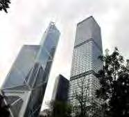
2 Our Cityscape 2
 Water Bodies 1,110km 2 Total Land Area : ~ 24% urban or builtup land ~ 76% countryside (including 42% as Country Parks, Special Areas, Geoparks, Ramsar Site, SSSIs, etc)")
3 Land Utilisation in Hong Kong 24.2% (268 km 2 ) Urban or built-up area 66.3% (737 km 2 ) Woodland/Shrubland/ Grassland/Wetland 0.7% (7 km 2 ) Barren land 2.7% (30 km 2 ) Water Bodies 1,110km 2 Total Land Area : ~ 24% urban or builtup land ~ 76% countryside (including 42% as Country Parks, Special Areas, Geoparks, Ramsar Site, SSSIs, etc) 6.1% (68 km 2 ) Agriculture 3
 : Built-up 7.3m 3.")
 53% of non-reclaimed land")
")
4 Our Developed Land Total land area: 1,110km 2 24% (268km 2 ) : Built-up 7.3m 3.8m Reclamation in Hong Kong 6,954ha reclaimed land 6% of total land area ( ) 53% of non-reclaimed land has a gradient Over 70% of office floor spaces About 50% of the commercial floor spaces (mainly retail) 27% of our population >20 o 4


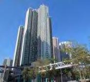
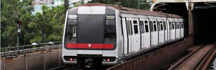
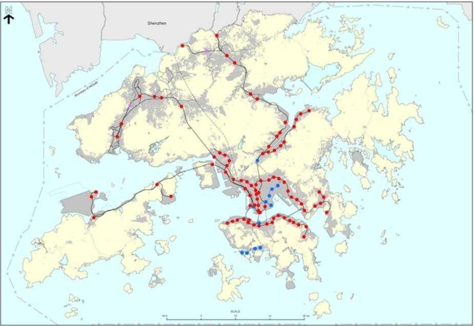
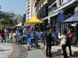
5 5 Our City Form Compact, High Density, Transit-oriented City Form Within 500m-walkable catchment of railway stations 45% living quarters 77% Commercial/ Office space


6 Our City Form Compact, High Density, Transit-oriented City Form Areas within 400m of District Parks/Open Space Areas within 3km of Country Park 110m 2 green space per capita 90%of the population within 400m of district parks/open space 85%of the population within 3km of Country Parks 6
 New Town Development 1973 2011 3.7M(52.")

7 7 Our Population Distribution Population Distribution of Hong Kong ( ) No. of Residents in New Territories M(12.5%) New Town Development M(52.8%) 3.3M are living in New Towns Population Density 6,690 27,327 persons/km 2 persons/km 2 Only counted built-up area Kwun Tong DC Tin Shui Wai 55,204 persons/km 2 New Town 66,995 persons/km 2


8 Strategic Planning Legacy 8


9 Strategic Planning Legacy Abercrombie Plan (1948) Major focus on new developments around Victoria Harbour Visionary projects such as cross-harbour tunnel, underground railway alignment, reclamation and new town development (Sha Tin) were proposed Sir Patrick Abercrombie (Photo source: (to accommodate additional 600,000 population) 9


: 5.")
10 Strategic Planning Legacy Colony Outline Plan (1970) Broad land use pattern for the whole territory to guide programme for land and infrastructure development New Town development (namely Tsuen Wan, Sha Tin and Castle Peak) and improvement of the environment in the existing urban areas First set of planning standards and guidelines in Hong Kong Hong Kong Planning Standards and Guidelines Proposed Broad Land Use Pattern in the Colony Outline Plan (Projected population (1986): 5.8 million) 10
 A basic framework for")


11 Strategic Planning Legacy Hong Kong Outline Plan (1979) A basic framework for future physical planning and development in Hong Kong A coordinated land use and transport planning strategy to the new town development, setting out broad planning principles, provision of country parks, beaches and conservation areas Existing and Planned Development Areas in the Hong Kong Outline Plan Planning Strategy : Urban Development Possibilities outside Planned Development Areas (Projected population (1996): 6.87 million) 11


: 7.")
12 Strategic Planning Legacy Territorial Development Strategy (1984) An integrated land use and transport planning framework for the territory A hierarchical and multi-modal transportation framework A land use framework for conservation of areas of major ecological, agricultural, recreational and landscape significance Tseung Kwan O Source: LandsD Tin Shui Wai Proposed Growth Areas in the Territorial Development Strategy (Projected population (1996): 7.1 million) Source: LandsD 12


13 Strategic Planning Legacy Port and Airport Development Strategy (1989) Hong Kong International Airport Source: LandsD Data source: Port & Airport Develop ment Strategy Final Report, 1989 Tung Chung West Kowloon Source: LandsD Source: LandsD 13
")
: 8.")
14 Strategic Planning Legacy Territorial Development Strategy Review (1996) Integrated landuse-transport-environmental planning (Projected population (2016): 8.1 million) 14


15 Strategic Planning Legacy Hong Kong 2030: Planning Vision and Strategy (2007) Sustainable development as the overarching planning principle Planning concepts Emphasis on smart growth and wise management of resources Do more with less No-go areas Rail-based development pattern Balancing development and conservation Broad development directions Promoting a quality living environment Enhancing economic competitiveness Strengthening links with the world, particularly the PRD Region Recommended Development Pattern (Projected population (2030): 8.4 million) 15

16 Strategic Planning Legacy 16

17 Global Megatrends Individuals and Society Changing demographics with ageing population Physical Environment Scarcity of natural resources Global Economy Interconnected global economy Better education Accelerating urbanisation Shift of economic power to the East Innovation and technology as key driver More technology & information and communications technology enabled Climate change Rise of global middle class Source: adapted from KPMG s Future State 2030: The global megatrends shaping governments 17


18 Challenges for Hong Kong A growing and ageing population and a shrinking labour force Climate change Moderate performance for liveability A large quantity of old building stock Demand for new transport and other infrastructure KEY SALIENT PLANNING ISSUES FOR HONG KONG Imbalance in home-job spatial distribution Keen competition in the global and regional economy Challenges in land development Moderate performance for innovation 18

19 LOOKING AHEAD In planning for our future city, we need to embrace changes and uncertainties. Possible Milestones 19


20 Strategic Initiative 1: Addressing Home-Job Imbalance Issue Planned Population: New Job Opportunities: GOVERNMENT TO RESERVE LAND FOR VARIOUS JOB GENERATING USES 20


21 Kwu Tung North and Fanling North NDAs Kwu Tung North Population : 5,400 Cenus 2011 Kwu Tung North NDA Population : 105,500 Job: 31,179 Fanling North NDA Population: 71,400 Fanling North Job: 6,515 Population: 950 Cenus 2011 Total Population: 467,200 (+176,900) Job Opportunities: 95,844 (+37,694) Fanling & Sheung Shui Population : : 261, , ,300 Job: Job: Cenus 58,150 XX


22 Kwu Tung North and Fanling North NDAs Spatial Distribution of Job-generating Land Uses Business & Technology Park Research & Development Residential Development with Retails and Services G/IC Facilities 22
 (FLN: 5,672) G/IC Facilities 5,209 (KTN: 4,366) (FLN: 843) Total New Job Opportunities")
23 Kwu Tung North and Fanling North NDAs New Job Opportunities Business & Technology Park 13,058 (KTN) Research & Development 4,065 (KTN) Residential Development with Retails and Services 15,362 (KTN: 9,690) (FLN: 5,672) G/IC Facilities 5,209 (KTN: 4,366) (FLN: 843) Total New Job Opportunities ~37,700 23


24 Hung Shui Kiu NDA Reserve development spaces to accommodate economic uses including offices, retail, hotels and various industrial uses (including modern logistics, innovation & technology, and testing & certification) Create about 150,000 jobs of different nature and profile which also benefit Tin Shui Wai new town 24


25 Hung Shui Kiu NDA Diversified jobs to establish an employment node in NWNT Create about 150,000 jobs of different nature and profiles Retail, Dining, Entertainment and other Commercial 40,000 Office 32,000 Enterprise and Technology Park 18,000 Industrial Use 5,000 Other Services 2,000 Total New Job Opportunities 150,000 Commercial 74,000 2,000 Hotel Special Industry 60,000 23,000 Logistics Facilities 14,000 Port Back-up, Storage and Workshop Uses Community Services 16,000 14,000 G/IC Facilities (including Education) 25


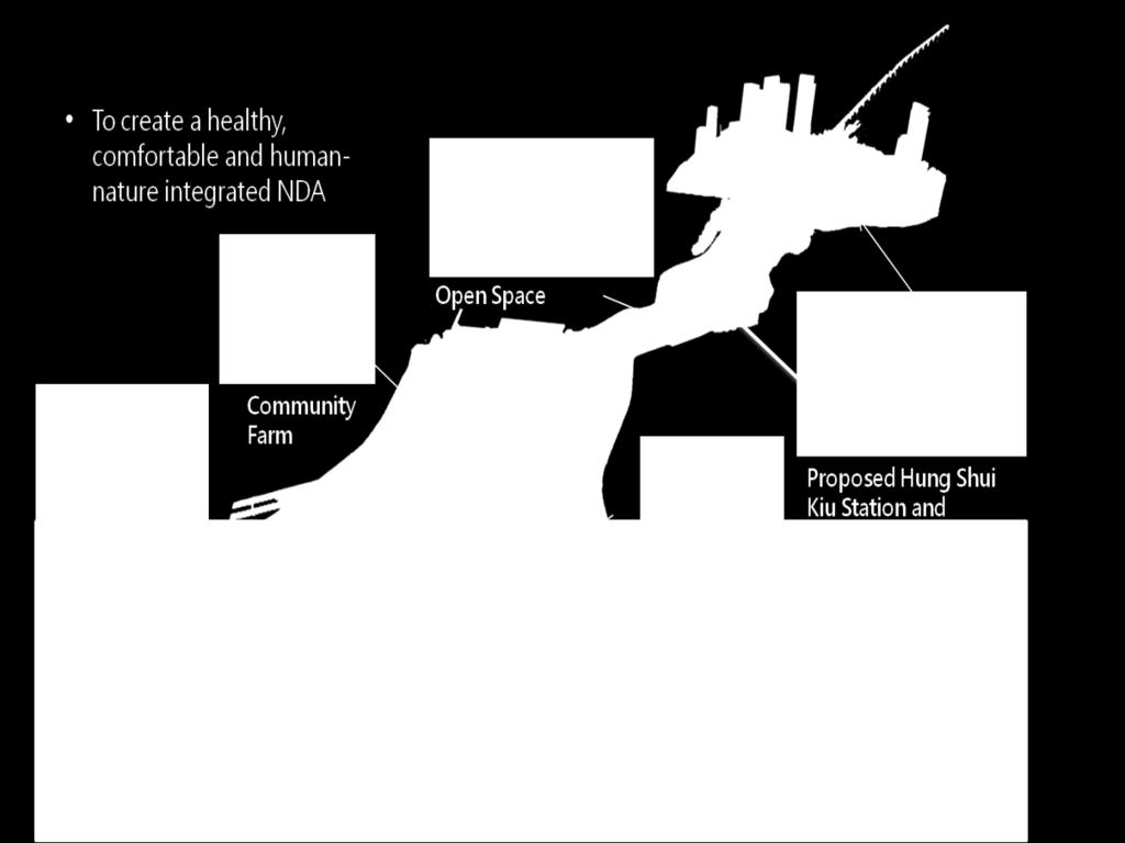
26 Yuen Long South Development Create about 10,800 job opportunities from commercial, storage and workshop and GIC uses Comprehensive transport network and public transport services would be planned in YLS to facilitate future residents traveling to Hung Shui Kiu NDA, which provides about 150,000 jobs of different nature and profile 26


27 Hung Shui Kiu NDA and Yuen Long South Development Total Population: 1,221,544 (+300,000) Job Opportunities: 364,050 (+160,800) 27

 164,000sqm.")
28 Tung Chung Commercial Development New Job Opportunities: 40,000 Retail Office Hotel 163,000sqm. (Local) 164,000sqm. (Regional) 500,000sqm. 50,000sqm. 28


 29")
29 Tung Chung New Town Extension Tung Chung New Town Extension Population: 144,000 Job: 40,000 Total Population: 277,600 (+144,000) Existing Tung Chung New Town Population: 78,000 Job: 12,100 Job Opportunities: 52,100 (+40,000) 29
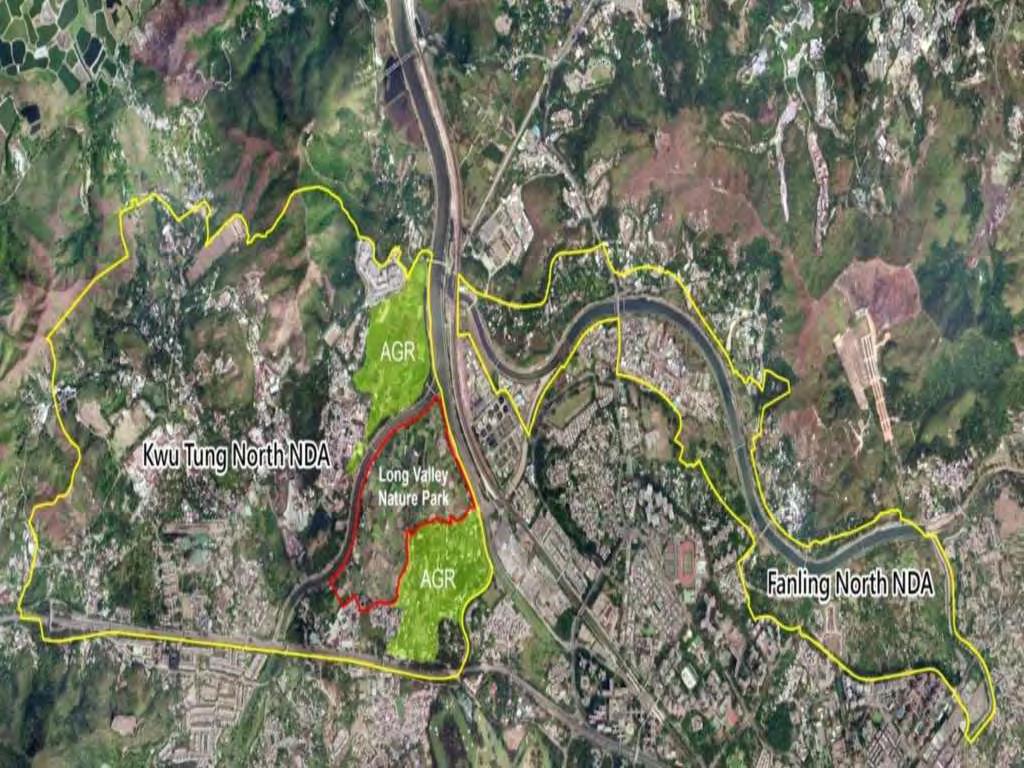
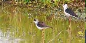

30 Strategic Initiative 2: Urban-Rural-Countryside-Nature Integration Kwu Tung North NDA: Long Valley Nature Park 37 ha of area with the highest ecological value 30


31 Kwu Tung North NDA: Agricultural Land Land to the north and south of the Nature Park would be zoned Agriculture (58ha) 31


32 Kwu Tung North NDA: Riverside Community Designate a meander as CA zone Allow a wider buffer area of AGR around CA zone 32


33 Hung Shui Kiu NDA: Integration with Existing Developments Embracing existing villages into new town planning scheme with carefully designed traditional land use and urban form. Recommended Outline Development Plan 建議發展大綱圖 N 33

, landscaped pedestrian walkway and cycle")
34 Hung Shui Kiu NDA: River Regeneration Connection to Tin Shui Wai & river regeneration recreates ambience of village life along water courses 5m 2m 10m 2m 5.5m 1.25m 6.5m 1.25m 5.5m 4m River Walk Pedestrian Footpath Tram Stop Tramway Tram Stop Cycle Track Private Housing Terraced Retail Podium Car Parks A promenade will be developed along the regenerated river channel to connect HSK and TSW Retail and dining facilities, environmentally friendly transport (tram), landscaped pedestrian walkway and cycle track will be provided to promote vibrancy of the promenade. 25m 20m 10m Car Parks isting River Wall & Railing Riverside Promenade EFTS Reserve Shopping Street 34

35 Strategic Initiative 3: Liveable and Sustainable 35


36 Kwu Tung North and Fanling North NDAs 36

37 Kwu Tung North and Fanling North NDAs Transit-Oriented Development (TOD) Kwu Tung Railway Station Fanling North PTI 500m distance 500m radius from railway station/pti 37


38 Kwu Tung North and Fanling North NDAs Landscaped pedestrian shopping street to enhance vibrancy 38


39 Kwu Tung North and Fanling North NDAs Government, Institution or Community facilities within easy reach of residents 39

40 Kwu Tung North and Fanling North NDAs Integrated open space and pedestrian/cycle track networks 40


41 Hung Shui Kiu NDA To integrate pedestrian walkway system with open space and amenity strips Shopping streets lined with retail frontages to enhance street vibrancy 41

42 Hung Shui Kiu NDA 42
43 Strategic Initiative 4: Place-making and Thriving Communities Championing place-making in NDAs Kwu Tung North NDA Town Plaza Hung Shui Kiu NDA Regional Civic Node Tung Chung New Town Extension 43


44 Kwu Tung North NDA Town centre well-designed with pedestrianised boulevards, terraced setting and shop frontage to create a sense of place and enhance vibrancy. North-south and east-west green spines function both as breezeway and visual corridors, providing public spaces and allowing creation of pedestrian precincts in the city centres 44


45 Hung Shui Kiu NDA About 56ha of land designated for different G/IC uses About 62ha for open spaces, including the Regional Town Park, District Open Space and Local Open Space Regional Civic Node Located adjacent to proposed HSK Station, co-locating a Regional Plaza, government offices, a new magistracy and a community hall for residents of the NDA and the NWNT. 45

46 Tung Chung New Town Extension GIC facilities provision according to HKPSG and population distribution Various social welfare facilities are planned in the Tung Chung Extension Area and well integrated for easy access 46


47 Tung Chung New Town Extension Designation of River Park in Tung Chung West on both sides of Tung Chung Stream for recreation purpose No more reclamation in Tung Chung West 47


48 Concluding Remarks Rethinking the future new towns/ NDAs of Hong Kong A new mindset in not viewing NDAs as dormitory towns but places with their unique characters Thriving and sustainable communities 48
49 Planning Department THANK YOU
Planning for Liveability in Hong Kong
 Asian-Pacific City Summit 2013 Planning for Liveability in Hong Kong Phyllis C M LI Deputy Director of Planning/Territorial Planning Department Government of the Hong Kong Special Administrative Region
New Towns in Hong Kong: Planning for the Next Generation
 ctbuh.org/papers Title: Author: Subject: Keywords: New Towns in Hong Kong: Planning for the Next Generation Pun Chung Chan Urban Design Density Development Planning Publication Date: 2001 Original Publication:
Overview of Land Use Framework for Victoria Harbourfront. Planning Department February 2011
 Overview of Land Use Framework for Victoria Harbourfront Planning Department February 2011 Background TPB set out Vision Statement for the Victoria Harbour in 1999 To make Victoria Harbour attractive,
The Master Plan Framework
 The Master Plan Framework The East Harbour Master Plan advances the development of 60 acres of former industrial lands east of the Don River. The Master Plan outlines a vision for a vibrant, transit-oriented
heuston gateway: sections heuston gateway: regeneration strategy and development framework plan
 B B1 A B1 B C A heuston gateway: sections B B1 C 117 4.3.3 Zoning The station is the central hub of the area and this function must be preserved and developed. However large areas of the Heuston Station
An advanced tool for assessing and guiding sustainable urban development
 Improving Transportation Demand Management through Sustainable Urban Planning and Design: Recommendations from International Green Model City Initiative (IGMC) Lu Haifeng Secretary-General Global Forum
New Partners for Smart Growth Conference February 5, 2010
 Dan Stroh, Planning Director City of Bellevue Planning and Community Development Bellevue, WA New Partners for Smart Growth Conference February 5, 2010 Summary of Project Long-range plan update for Bel-Red
THE 355/270 CORRIDOR:
 THE 355/270 CORRIDOR: Strategic Ideas for Sustaining a Livable Work Place Project Summary ACCESS LIFE DESIGN HEALTH WORK Montgomery County Planning Department The Maryland-National Capital Park and Planning
UDF PLANS AND GUIDELINES
 UDF PLANS AND GUIDELINES 5 Land Use Land Use Development Plan Plan no. 3 Land Use Development Mixed Use Retail / Leisure Residential Civic and Institutional Proposed Zoning Table Development Edges Plan
Integrated Multi Modal Public Transit Hub
 Leaders Programme in Urban Transport Planning and Management Integrated Multi Modal Public Transit Hub at Central Business District- Ahmedabad Neela Munshi (Senior Town Planner) Deepa Dave (AM Urban Planner)
K. SMART ASSOCIATES LIMITED
 Planning Justification Report Zoning By-Law Amendment 185 King Street North Waterloo, Ontario April 7th, 2017 Project Reference Number 16-245 K. SMART ASSOCIATES LIMITED CONSULTING ENGINEERS AND PLANNERS
01 the vision NEW LYNN IS WAITING FOR THE GREAT LEAP FORWARD
 [A] FRAMEWORK 01 the vision 02 the framework 03 urban design principles 04 c o n t e x t 05 issues a n d o p p o r t u n i t i e s 06 creating a t.o.d. 07 key recommendations 08 seven strategic areas of
The Five Components of the McLoughlin Area Plan
 The Five Components of the McLoughlin Area Plan This documents contains the complete language of the five components of the McLoughlin Area Plan: The Vision Statement The Values The Guiding Principles
Land Use/Transport Integration. Land Use as an end Transport as a means
 Copenhagen s Finger Plan Land Use/Transport Integration Land Use as an end Transport as a means Smart Growth Land Use Transport Contrasting Models of Transit & Development Adaptive Cities: built forms
Sub-committee on Harbour Plan Review of Harbour-front Enhancement Committee. Ninth Meeting
 Sub-committee on Harbour Plan Review of Harbour-front Enhancement Committee Ninth Meeting Date: 5 October 2005 Time: 3:30pm Venue: Conference Room 15/F, North Point Government Offices, 333 Java Road, North
8.0 Design and Form of Development 43/
 42/ 8.0 Design and Form of Development 43/ Rothwells Farm, Golborne/ Development Statement Figure 7. Site Constraints Key 44/ Site Boundary 360 Bus Route/Stops Existing Trees Underground Water Pipe Sensitive
GO Station Mobility Hubs: Draft Precinct Plans. Committee of the Whole July 12, 2018
 GO Station Mobility Hubs: Draft Precinct Plans Committee of the Whole July 12, 2018 Purpose of this Workshop Present Draft Precinct Plans for the 3 GO Station Mobility Hubs Continue the conversations that
Solving urban land use conflict!
 Solving urban land use conflict! Figure 9.1 shows part of the land use map of Tai Kok Tsui, and the photograph was taken in this area. Figure 9.2 shows the information about proposed redevelopment projects
Sustainable City of the Future LUSAIL
 Sustainable City of the Future March 2013 1 2013 - Lusail Real Estates Development Company 2 CITY Lusail City Vision To build a strong social and cultural foundation into a technologically advanced modern
D-O LRT Zoning Discussion. Chapel Hill Boards & Commissions October 16, 2017
 D-O LRT Zoning Discussion Chapel Hill Boards & Commissions October 16, 2017 Update on Overall D-O LRT Station Area Initiative Objectives Design and educate on principles of Good Transit-Oriented Development
Plano Tomorrow Vision and Policies
 Plano Tomorrow Vision and Policies PLANO TOMORROW PILLARS The Built Environment The Social Environment The Natural Environment The Economic Environment Land Use and Urban Design Transportation Housing
Chapter 6. Conclusions and Recommendations
 Chapter 6 Conclusions and Recommendations The research hypothesized that not all American New Urbanism principles need adaptation to fit in the Egyptian physical and social context. Generally, principles
Plan Framework Report. Attachment A
 Plan Framework Report Attachment A Uptown-Douglas Corridor Plan - Plan Framework Report Contents Introduction... 1 Planning Process... 3 Project Objectives... 4 Vision... 5 Community Values... 6 Structural
BETTER PUBLIC TRANSPORT PROJECT WATERBEACH TO SCIENCE PARK AND EAST CAMBRIDGE CORRIDORS
 Report To: Greater Cambridge Partnership Joint Assembly 20 th September 2018 Lead Officer: Peter Blake GCP Director of Transport BETTER PUBLIC TRANSPORT PROJECT WATERBEACH TO SCIENCE PARK AND EAST CAMBRIDGE
DRAFT WESTERN CITY DISTRICT PLAN PLANNING PRIORITIES AND ACTIONS
 Greater Sydney Commission DRAFT WESTERN CITY DISTRICT PLAN PLANNING PRIORITIES AND ACTIONS Issued: 26 OCTOBER 2017 Version: 1 Subject: Greater Sydney Region and District Plans This information note is
Kai Tak Development Proposal of Increasing Development Intensity and Findings of Technical Study. PlanD CEDD GPA IRD ArchSD
 Kai Tak Development Proposal of Increasing Development Intensity and Findings of Technical Study PlanD CEDD GPA IRD ArchSD Overview of Kai Tak Former North Apron Kai Tak Land Use Plan Kowloon Bay To Kwa
SUSTAINABLE TRANSPORT & INTEGRATED LAND USE PLANNING
 SUSTAINABLE TRANSPORT & INTEGRATED LAND USE PLANNING UNESCAP Capacity Building Workshop, Colombo Integrated Land use and Urban Transport Planning : Principles and Practices 31st October 2017 ACTIVE TRANSPORTATION
Task Force on Harbourfront Developments in Kowloon, Tsuen Wan and Kwai Tsing
 Task Force on Harbourfront Developments in Kowloon, Tsuen Wan and Kwai Tsing For discussion on 2 June 2016 TFK/03/2016 AMENDMENTS TO THE APPROVED TSUEN WAN OUTLINE ZONING PLAN NO. S/TW/31 PURPOSE This
Status Report: MD 355 Project
 Status Report: MD 355 Project OCTOBER 2006 M-NCPPC MONTGOMERY COUNTY PLANNING DEPARTMENT Summary of Community Comments, and break to the Results of the MD 355 Participation Session Brookside Gardens -
Keystone Business Park Precinct Structure Plan North East Industrial Precinct. Part 2 Design Principles
 Keystone Business Park Precinct Structure Plan North East Industrial Precinct Part 2 Design Principles Context Issues Services Landform Issues Geotech and contamination Ecology Traffic and access Issues
New Official Plan Quest November 2013
 City of Markham New Official Plan Quest November 2013 Building Markham s Future Together - 6 Key Strategic Priorities 1. Growth - Managing our Growth 2. Transportation/Transit - Improving transportation
Visioning Statement and Guiding Principles
 Visioning Statement and Guiding Principles Planning for the Future The General Plan The General Plan represents Woodland's shared vision of the future and defines a path to lead the community toward its
Western City District What we heard
 What we heard Vision to 2056 and Priorities Governance and implementation Infrastructure and funding The protection of the natural landscape including biodiversity and the Metropolitan Rural Area for food
WELCOME and introduction
 1 WELCOME and introduction Mobility Hub Locations within Burlington STUDY OVERVIEW STUDY OBJECTIVES The City of Burlington is developing four Area Specific Plans, one for each of Burlington s Mobility
Eastern City District Plan
 OUR GREATER SYDNEY 2056 Revised Draft Eastern City District Plan OVERVIEW Bayside Burwood Canada Bay City of Sydney Inner West Randwick Strathfield Waverley Woollahra Snapshot of the Eastern City District
Tāhuhu whakaruruhau ā-taone The sheltering ridge pole
 B2. Tāhuhu whakaruruhau ā-taone - Urban growth and form B2.1. Issues Tāhuhu whakaruruhau ā-taone The sheltering ridge pole Auckland s growing population increases demand for housing, employment, business,
1 Introduction. Chapter. In this chapter:
 Chapter 1 Introduction In this chapter: 1.1 A Snapshot of the Region 1.2 Towards a Sustainable Region 1.3 The Provincial Context 1.4 Purpose and Organization The Regional Municipality of York Official
Key Concepts of the General Plan
 Key Concepts of the General Plan General Plan Purpose Vision for City s future Standards for City Services Land Use Plan General Plan Purpose San Jose is creating its Blueprint for the Future to become
Complete Neighbourhood Guidelines Review Tool
 Complete Neighbourhood Guidelines Review Tool Prepared By: City of Regina Planning Department October 2014 Page 1 of 14 Community Development Review Checklist for Secondary Plans and Concept Plans The
OUR GREATER SYDNEY A metropolis of three cities. OVERVIEW. connecting people. DRAFT Greater Sydney Region Plan
 OUR GREATER SYDNEY 2056. A metropolis of three cities. OVERVIEW. connecting people. DRAFT Greater Sydney Region Plan October 2017 This document is an overview of the draft Greater Sydney Region Plan. To
MOUNT PLEASANT SECONDARY PLAN & VILLAGE BLOCK PLAN. Wednesday, March 5, 2008 Informal Public Open House
 MOUNT PLEASANT SECONDARY PLAN & VILLAGE BLOCK PLAN Wednesday, March 5, 2008 Informal Public Open House 1. Welcome & Introductions 2. Highlights of Provincial Growth Plan 3. Overview and Status Update -
Figure 1- Site Plan Concept
 Figure 1- Site Plan Concept Parking will be provided underground on three levels at rate of 1.0 space/ unit; this rate includes all visitors parking. MMM Group has prepared a parking assessment (April,
17.11 Establishment of Land Use Districts
 17.11 Establishment of Land Use Districts 17.11.010 Purpose. To promote the health, safety, and general welfare of City residents and those who come to South Salt Lake to work, exchange commerce and recreate.
Moody Centre Station TOD Area Today
 Moody Centre Station TOD Area Today WHAT IS a transit-oriented Murray Street development area? A Transit-Oriented Development (TOD) Area is a dense, walkable residential and commercial area built to support
4.00 STAKEHOLDERS. urbanprojects
 4.00 STAKEHOLDERS 94 heuston gateway: regeneration strategy and development framework plan 95 The Heuston Gateway presents one of the greatest concentrations of brown field development sites located adjacent
3 Summary of Major Views and Responses
 3 Summary of Major Views and Responses 3.1 Major Views 3.1.1 The comments and suggestions received from various channels and parties during the two-month Stage 1 PE on the Study, which have been discussed
Appendix 1 Structure plan guidelines
 Appendix 1 Structure plan guidelines This appendix forms part of the regional policy statement [rps]. 1.1. Introduction Structure plans are an important method for establishing the pattern of land use
THE GREEN VISION WORKSHOP Friday, November 6, 2009
 THE GREEN VISION WORKSHOP Friday, November 6, 2009 SUSTAINABLE LONG RANGE PLANNING IN SANTA MONICA Eileen Fogarty Director, Planning and Community Development GREEN BUILDINGS Santa Monica has the most
URBAN MOBILITY PLAN PERSPECTIVES FOR APPROVED BY THE COMMUNITY COUNCIL MEETING ON 20 JUNE 2011
 URBAN MOBILITY PLAN 2010-2015 PERSPECTIVES FOR 2030 APPROVED BY THE COMMUNITY COUNCIL MEETING ON 20 JUNE 2011 The Sustainable Urban Mobility Plan (PDU in French) is an institutional document defining the
Articulating planning, urban design and mobility policy
 Articulating planning, urban design and mobility policy 1 29 Km Presentation of the Greater Nantes - competences Inter-municipal cooperation body and urban transport organising authority created in 2001
Port Credit Local Advisory Panel October 20 th Meeting
 Port Credit Local Advisory Panel October 20 th Meeting Focus Of This Evening s Meeting: 1. Hurontario Main Street Higher Order Transit Study 2. Port Credit Mobility Hub & GO Station Parking Structure Study
Executive Summary. NY 7 / NY 2 Corridor
 Executive Summary NY 7 / NY 2 Corridor Transportation and Land Use Study December 2005 Prepared for: Town of Colonie Capital District Transportation Committee Prepared by: Introduction: Land use decisions
Harbour-front Enhancement Committee. Urban Design Study for the New Central Harbourfront Revised Planning and Urban Design Concepts
 Harbour-front Enhancement Committee Paper No. 5/2010 For discussion on 18 February 2010 Urban Design Study for the New Central Harbourfront Revised Planning and Urban Design Concepts Purpose 1. This Paper
Subdivision Design Criteria. Penihana North GUIDELINES TO THE RULES
 Created September 2013 Penihana North Subdivision Design Criteria GUIDELINES TO THE RULES This part of the Plan sets out the design criteria for subdivision in Penihana North. The criteria will be considered
City of St. Thomas New Official Plan
 City of St. Thomas New Official Plan Sustainable & Healthy Community Workshop Ann Joyner and Paddy Kennedy Dillon Consulting Limited Work Shop Outline Introduction Presentation Exercise 1 (individual)
DRAFT GREATER SYDNEY REGION PLAN OBJECTIVES, STRATEGIES AND ACTIONS
 Greater Sydney Commission DRAFT GREATER SYDNEY REGION PLAN OBJECTIVES, STRATEGIES AND ACTIONS Issued: 26 OCTOBER 2017 Version: 1 Subject: Greater Sydney Region and District Plans This information note
1.0 Purpose of a Secondary Plan for the Masonville Transit Village
 Report to Planning and Environment Committee To: Chair and Members Planning & Environment Committee From: John M. Fleming Managing Director, Planning and City Planner Subject: Masonville Transit Village
U T D N o r t h C a m p u s T O D and D o w n t o w n D e n t o n T O D
 U n i v e r s i t y o f T e x a s a t D a l l a s C i t y o f R i c h a r d s o n U T D N o r t h C a m p u s T O D and D o w n t o w n D e n t o n T O D Rick Leisner, AICP Assistant Director of Development
Alignment of Options 2 & 3. Lam Tin. Tseung Kwan O Town Centre South. Ocean Shores. Cemetery. Cross Bay Link. Alignment Option 1
 Alignment of Options 2 & 3 Tseung Kwan O Town Centre South Alignment Option 1 Cross Bay Link Note: The above alignments are for illustration only. The final alignment is subject to further study and detailed
Harbour-front Enhancement Committee Sub-committee on Harbour Plan Review
 Paper No.13/2009 For discussion on 22 July 2009 Harbour-front Enhancement Committee Sub-committee on Harbour Plan Review Draft Planning Brief for Comprehensive Development Area (1) Site at the Guangzhou
By & Fax. Creating a Better Pedestrian Environment to Improve Streetscape and Promote Walking
 The Secretary for Transport and Housing, Transport and Housing Bureau, 22/F, East Wing, Central Government Offices, 2 Tim Mei Avenue, Tamar, Hong Kong. (Attn. Mr. Chan Fan, Frank JP) Dear Mr. Chan, By
Integrated Urban Development. April Reflections from the NZPI Study Tour of Portland, Seattle and Vancouver
 Integrated Urban Development April 2009 Reflections from the NZPI Study Tour of Portland, Seattle and Vancouver Integrated Urban Development Urban Growth Management Transportation Transit Orientated Mixed
Draft Western District Plan
 Powered by TCPDF (www.tcpdf.org) Draft Western District Plan Submission_id: 31440 Date of Lodgment: 15 Dec 2017 Origin of Submission: Online Organisation name: Goodman Property Services Australia Pty Ltd
an inspirational new destination residential commercial retail leisure education CW brochure FINAL version NEW.indd 3-4
 an inspirational new destination residential commercial retail leisure education CW brochure FINAL version NEW.indd 3-4 01/09/2015 10:06 residential commercial retail leisure education Welcome to Chatham
EDMONTON: Changing the Way We Grow and the Way We Move
 EDMONTON: Changing the Way We Grow and the Way We Move Rhonda, Toohey, P.Eng. Transportation Department City of Edmonton Paper prepared for presentation at the Sustainable Urban Transportation Session
PUBLIC OPEN HOUSE HURONTARIO-MAIN CORRIDOR SECONDARY PLAN
 PUBLIC OPEN HOUSE HURONTARIO-MAIN CORRIDOR SECONDARY PLAN Tuesday, February 28, 2012 6pm 9pm 1 st Floor Atrium, City Hall 2 Wellington Street West, Brampton 1 POLICY FRAMEWORK The 2006 Provincial Growth
ORANGE COUNTY IMPLEMENTING THE FOUR C s
 ORANGE COUNTY IMPLEMENTING THE FOUR C s East Central Florida Corridor Task Force O R A N G E COUN TY P LA N N I N G DIVISION C O M M U N I T Y, E N V I R O N M E N T A L A N D D E V E L O P M E N T S E
INDEPENDENCE BOULEVARD AREA PLAN
 INDEPENDENCE BOULEVARD AREA PLAN Public Meeting October 28, 2008 Tonight s Agenda Introduction 4:00 4:05 Tom Warshauer Presentation 4:05 5:00 Blake Drury Group Exercises 5:00 5:50 All Wrap Up & Next Steps
Preliminary Recommendations Tk Takoma/Langley Crossroads Sector Plan
 Preliminary Recommendations Tk Takoma/Langley Crossroads Sector Plan Vision is to achieve a Transit Oriented, pedestrian friendly Community that Celebrates and builds upon the cultural Diversity of the
Greater Langley: NEW BUILDINGS
 District Scale Overview The Liveable Region Strategic Plan (LRSP) identifies four main growth strategies: Protect the green zone; build complete communities; achieve a compact metropolitan area and increase
INDEPENDENCE BOULEVARD AREA PLAN. Economic Development Committee Overview May 25, 2010
 INDEPENDENCE BOULEVARD AREA PLAN Economic Development Committee Overview May 25, 2010 Presentation Outline Plan Purpose and Development Process Draft Plan Policies and Implementation Strategies Request
Sahuarita District & Phase 1 Master Plan. Town Council December 11, 2017
 Sahuarita District & Phase 1 Master Plan Town Council December 11, 2017 Visioning Study Visioning Process Advisory Group Meetings Community Questionnaire Town Center Case Studies Community Analysis The
Tonight s Agenda. 6:00 6:30 Welcome and Tour Panels with Team 6:30 7:30 Presentation 7:30 8:45 Break Out Session 8:45 9:30 Feedback & Next Steps
 Tonight s Agenda 6:00 6:30 Welcome and Tour Panels with Team 6:30 7:30 Presentation 7:30 8:45 Break Out Session 8:45 9:30 Feedback & Next Steps Welcome Public Open House #2 Tonight s Presentation Project
Mr Tony HO Chief Geotechnical Engineer Geotechnical Engineering Office Civil Engineering and Development Department Hong Kong, China
 Mr Edward LO Chief Town Planner Planning Department Hong Kong, China Mr Tony HO Chief Geotechnical Engineer Geotechnical Engineering Office Civil Engineering and Development Department Hong Kong, China
Draft Eastern District Plan
 Draft Eastern District Plan Submission_id: 31238 Date of Lodgment: 13 Dec 2017 Origin of Submission: Online Organisation name: Turrulla Gardens Pty Ltd C/- Mecone Organisation type: Industry First name:
Horwood Map of London, Westminster & Southwark First edition
 Barratt London is developing plans in tandem with Southwark Council and TfL to transform the southern end of Blackfriars Road. The residential-led, mixed-use scheme will deliver new private and affordable
PART 5: DEVELOPMENT FRAMEWORK Figure 57: Proposed Height
 Figure 57: Proposed Height 103 Figure 58: Proposed Land Use 104 Figure 59: 3D Image of the Initial Height and Land Use in the Study Area 105 4.3.2 Landmarks and Nodes The growth of Sandton from an out
URBAN DESIGN STUDY FOR THE WAN CHAI NORTH AND NORTH POINT HARBOURFRONT AREAS FEASIBILITY STUDY
 Agreement No. CE 54/2014 (TP) Meeting with Task Force on Harbourfront Developments on HK Island 10 Feb 2015 2 CONTENTS STUDY TEAM STUDY METHODOLOGY & APPROACH STUDY PROGRAMME KEY ISSUES Study Team Organization
City of Fort Lauderdale UPTOWN URBAN VILLAGE. Public Workshop December 7, 2016
 Public Workshop December 7, 2016 Workshop Agenda Introductions Project Presentation o o o History Project Scope/Timeline Character of Study Area o o o o Land Use Public Realm/Pedestrian Mobility Multimodal
City of Tacoma Planning and Development Services
 Agenda Item E-1 City of Tacoma Planning and Development Services To: Planning Commission From: Elliott Barnett, Planning Services Division Subject: Tacoma Mall Regional Center Subarea Plan and EIS Meeting
City of Long Beach. creating vibrant and exciting places
 City of Long Beach creating vibrant and exciting places Land Use Element Urban Design Element Overview of the two draft General Plan elements Discuss areas of change Economic goals of the plans Case study
Draft Memorandum #1: Goals and Vision for Revitalization
 Keizer Revitalization Plan Draft Memorandum #1: Goals and Vision for Revitalization Submitted to: City of Keizer April 12, 2018 (revised) Prepared By: Angelo Planning Group and Otak, Inc. Project No. 17482.A
Public Open House #1
 Public Open House #1 TONIGHT S AGENDA Welcome Project Overview The Big Picture The Station Area The Analysis Thoughts about Future Change Breakout Group Discussions Summation / Next Steps Project Overview
Response to the London Bridge Area Vision and Site Allocations within the New Southwark Plan
 1 Melior Place London SE1 3SZ 020 7407 4701 teamlondonbridge.co.uk info@teamlondonbridge.co.uk 28 April 2017 Response to the London Bridge Area Vision and Site Allocations within the New Southwark Plan
North District What we heard
 What we heard Vision to 2056 and Priorities Governance and implementation Infrastructure and funding The vision for a metropolis of three cities, and the 30 minute city. Feedback emphasised: That for the
1.4 TRANSIT VISION 2040 FROM VISION TO ACTION THEME 1: PUTTING TRANSIT AT THE CENTRE OF COMMUNITIES. Fully integrate transit with community design
 TRANSIT VISION 2040 FROM VISION TO ACTION TRANSIT VISION 2040 defines a future in which public transit maximizes its contribution to quality of life with benefits that support a vibrant and equitable society,
SUB AREA 3 CENTRAL STRATFORD AND SOUTHERN QUEEN ELIZABETH OLYMPIC PARK
 191 ADOPTED LOCAL PLAN: THE SUB AREAS SUB AREA 3 CENTRAL STRATFORD AND SOUTHERN QUEEN ELIZABETH OLYMPIC PARK SECTION 12 Vision VISION Central Stratford and Southern Queen Elizabeth Olympic Park will become
3. Urban Design in the Central Area
 3. Urban Design in the Central Area The Central Area Planning and Design Group assumes the responsibility to promote high quality urban and architectural design in the Central Area, plan and ensure the
ELMVALE ACRES SHOPPING CENTRE MASTER PLAN
 ELMVALE ACRES SHOPPING CENTRE MASTER PLAN Contents 1.0 INTRODUCTION... 2 2.0 LOCATION... 2 3.0 EXISTING CONTEXT... 2 4.0 VISION & GUIDING PRINCIPLES... 2 5.0 LAND USE AND BUILT FORM... 4 5.1 St. Laurent
Tauranga City Centre Spatial Framework
 Tauranga City Centre Spatial Framework Stakeholder Engagement Workshop 15 October 2015 Project Design Team Beca & LandLAB Our team Henry Crothers (LandLab) Landscape Architect/Urban Designer Urban and
Official Plan Review
 Official Plan Review Summary Report - The Built Environment August 2014 Part 1: Introduction Planning for a healthy, prosperous and sustainable community is an important goal for our municipality. From
Northern Territory Compact Urban Growth Policy
 Northern Territory Compact Urban Growth Policy A Reference Policy Document to clause 2.7 (Reference to Policy) of the NT Planning Scheme May 2015 Table of Contents 1 Policy Setting... 3 1.1 Context for
Outline of Presentation
 LUSAKA CITY COUNCIL 2 nd Annual IGC Cities Conference Making Cities work for growth London School of Economics (LSE) United Kingdom. 28 th 29 th January 2016 Presenter: Alex Mwansa Town Clerk Lusaka City
WINCHESTER TOWN 3.1 LOCATION, CHARACTERISTICS & SETTING
 WINCHESTER TOWN 3.1 LOCATION, CHARACTERISTICS & SETTING 3.1.1 The area referred to by the City Council, as Winchester Town, consists of the Winchester Wards plus the adjoining built up areas of Badger
CONTENTS 2.0 A FRAMEWORK FOR SUSTAINABLE GROWTH 2.1 MANAGING SUSTAINABLE GROWTH THE VISION TO GOALS AND OBJECTIVES 2.3 MARKHAM STRUCTURE
 2 A Framework for Sustainable Growth 2.0 A FRAMEWORK FOR SUSTAINABLE GROWTH CONTENTS 2.1 MANAGING SUSTAINABLE GROWTH THE VISION TO 2031 2.2 GOALS AND OBJECTIVES 2.2.1 Protecting the Natural Environment
Embrace Green Urban Space:
 1 Embrace Green Urban Space: Parks/Green Space as Vital to Urban Livability Jenna Fletcher The Trust for Public Land LUAC November 15, 2012 2 The Trust for Public Land conserves land for people to enjoy
The Neighbourhood Unit
 DESIGN... Site Framework PROCESS IMPLEMENTATION 22 TOOL DESCRIPTION The neighbourhood unit is a holistic planning and design strategy that addresses the configuration of the major physical components of
Urban Design Manual PLANNING AROUND RAPID TRANSIT STATIONS (PARTS) Introduction. Station Study Areas
 Introduction. Station Study Areas") 111111 PLANNING AROUND RAPID TRANSIT STATIONS (PARTS) Introduction The ION rapid transit system will link Waterloo, Kitchener and Cambridge through a central transit corridor (CTC). There are a number
111111 PLANNING AROUND RAPID TRANSIT STATIONS (PARTS) Introduction The ION rapid transit system will link Waterloo, Kitchener and Cambridge through a central transit corridor (CTC). There are a number
The Proposed Auckland Unitary Plan (notified 30 September 2013)
") 3 Business zones Introduction There are 10 business zones in the Unitary Plan: City Centre Metropolitan Centre Town Centre Local Centre Neighbourhood Centre Mixed Use General Business Business Park Light
3 Business zones Introduction There are 10 business zones in the Unitary Plan: City Centre Metropolitan Centre Town Centre Local Centre Neighbourhood Centre Mixed Use General Business Business Park Light
City of Kingston. North King s Town Secondary Plan Open House + Workshop #1 February 28, 2018
 City of Kingston North King s Town Secondary Plan Open House + Workshop #1 February 28, 2018 1 event agenda 30 min Panel Review + Discussion 30 min Presentation + Q&A 75 min Workshop Session 15 min Report