Pinal Regional Transportation Plan
|
|
|
- Meghan Gaines
- 5 years ago
- Views:
Transcription


1 Pinal Regional Transportation Plan Central Arizona Governments 1075 S. Idaho Road, Suite 300 Apache Junction, AZ June 2017


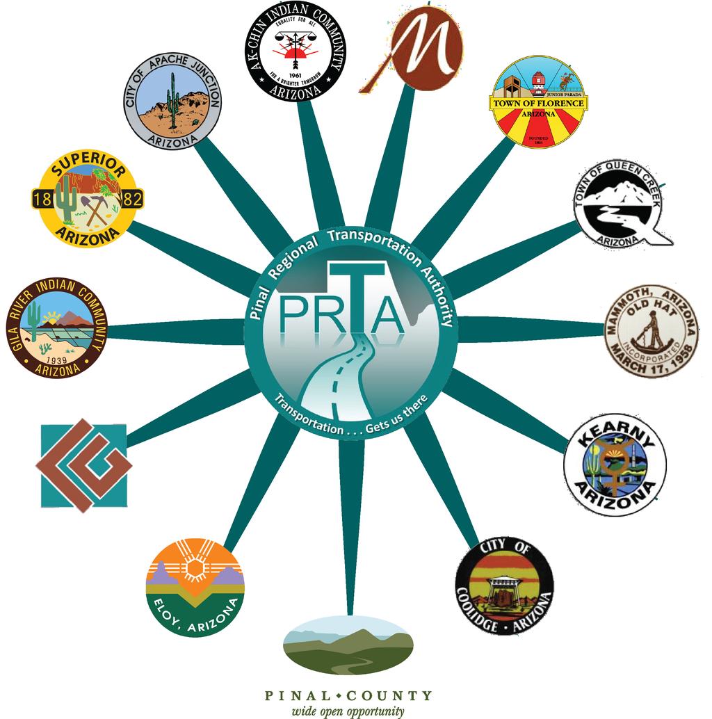
2 INTRODUCTION The Regional Transportation Plan for Pinal County, overseen by the Pinal Regional Transportation Authority (RTA), sets forth a comprehensive, multimodal plan which includes a list of key roadway and public transportation projects to be developed over a period between 2018 and The Pinal RTA s Regional Transportation Plan has been developed as a viable solution to meet the transportation needs of a rapidly growing region and seeks to meet the ongoing mobility needs of Pinal County residents. The Plan has been prepared to carry forward necessary multimodal projects to the voters of Pinal County, who will be asked to consider this Plan s approval, along with the passage of a transportation excise tax at the November 2017 Special Election. A successful vote of the Plan and transportation excise tax is expected to generate approximately $641,755,458 million in transportation funding over the next 20 years to establish a transportation network within Pinal County that will enhance countywide mobility and effectively transport a growing number of people and goods at a regional level. The RTA Board may authorize the issuance of bonds payable from the transportation excise tax as permitted by Arizona Revised Statute PINAL REGIONAL TRANSPORTATION AUTHORITY On August 5, 2015, the Pinal County Board of Supervisors formed the Pinal RTA. In accordance with Arizona Revised Statute , the Pinal RTA is a public, political, tax levying public improvement and taxing subdivision of the state. The Regional Council of Governments from Pinal County, Central Arizona Governments, will provide leadership and oversee the activities of the Pinal RTA. The membership consists of each member government within Pinal County. The Pinal RTA was established to provide funding, and to focus on creating a balanced regional transportation system for the residents of Pinal County. The Plan will provide a mechanism for the County, its cities, towns, and Tribal Communities to collaborate in developing a seamless countywide 20-year Regional Transportation Plan, which is subject to voter approval. PINAL RTA GOVERNANCE STRUCTURE The governing authority of the Pinal RTA is vested in a Board of Directors, comprised of each member of the Regional Council within Pinal County of the Central Arizona Governments. Each member shall have one vote each when determining transportation policy as representatives of the Pinal RTA. According to Arizona Revised Statute , the RTA Board may decide to appoint advisory committees as it deems necessary. Upon the passage of the ballot measures for the approval of the Pinal RTA Regional Transportation Plan, and the approval of the transportation excise tax, the RTA Board will appoint a RTA Advisory Committee and a regional Citizen s Oversight Committee. The RTA Board will appoint a Citizen's Oversight Committee to inform and collaborate the plans for construction of parkways, principal arterial streets and transit projects funded by Pinal County. THE NEED FOR A REGIONAL TRANSPORTATION PLAN Since 1990, Pinal County has experienced a tremendous amount of 1,000,000 growth. Between 1990 and 2014, the population of Pinal County has 900,000 increased from 116,867 to approximately 396,237 people, which 800,000 represents an increase of 239 percent. Since the economic downturn of 700, , the municipalities of Apache Junction, Casa Grande, Coolidge, 600,000 Eloy, Florence, Maricopa, and the unincorporated community of San 500,000 Tan Valley have experienced significant increases in economic 400,000 development activities and new housing construction which have 300,000 collectively brought more people into Pinal County. Such a rapid level of 200,000 growth has created transportation concerns such as congestion and safety and the need for quality transportation routes to efficiently move people and goods. These greater than pre-2008 levels of growth are anticipated to continue into the future and the residents of Pinal County are faced with continuing transportation challenges. 1 Pinal County Population Projections Low Forecast Medium Forecast High Forecast Growth Rate: 2.0% 2.5% 3.4% There are inadequate connections from 1-10 to local routes and businesses, and there is a need for additional roadway connectivity to Metropolitan Phoenix. Pinal County s existing north-south and east-west roadways need to be improved, and in many cases, lack sufficient capacity. Also, there has been a significant increase in fatal and serious traffic crashes due to the overall rise in vehicular travel. At present, Federal and State funding is very limited and unable to accommodate needed roadway construction throughout the County, and the County s municipalities are also lacking sufficient funding for roadway improvements. 100,000 PROPOSED PINAL COUNTY TRANSPORTATION ECISE TA According to Arizona Revised Statute , the Pinal RTA Board will adopt a 20-year Regional Transportation Plan, and request by resolution certified by the Pinal RTA governing board to the Pinal County Board of Supervisors, that the issue of levying a transportation excise tax be submitted to Pinal County voters at a countywide General Election. Effectively carrying out each of the projects as identified within this Regional Transportation Plan is solely dependent upon the proposed transportation excise tax being passed by the voters of Pinal County in November of ANTICIPATED REVENUES OVER 20 YEARS A detailed Revenue Forecast for a proposed transportation excise tax was produced for the Pinal RTA. The purpose of the study was to prepare a forecast for a proposed 20-year transportation excise tax that would be levied in Pinal County for the improvement of regional transportation facilities and public transportation. The report addressed population growth, inflation and Per Capita Personal Income and prepared three forecast scenarios of low, medium and high. A medium scenario was recommended by the study for the collection of a transportation excise tax. Based upon the Medium Revenue Forecast, it was determined that between the Fiscal Years of 2018 and 2037, a Pinal County transportation excise tax would be expected to result in a total collection of approximately $641,755,458. The Pinal RTA has used this figure in an effort to prioritize and estimate the transportation needs as highlighted in this Plan. PINAL RTA REGIONAL TRANSPORTATION PLAN ELEMENTS Based upon a 2015 analysis conducted by the Pinal RTA, it was estimated that there was an approximate $1.2 billion transportation need throughout the County. Also, based upon the Pinal RTA revenue analysis indicating a total future collection of $641,755,458 over a 20-year period, it was determined that only 52 percent of all needs could realistically be met. Working from this premise, the Pinal RTA sought to identify the most critical needs, and determined that the majority of improvements would be in the form of roadways, with a smaller component being addressed through public transportation. ELEMENTS TO BE FUNDED BY THE TRANSPORTATION ECISE TA Roadway Element This element will focus on delivering regional roadway improvements, such as the development of regional parkways and arterial connectors to accommodate future growth and development. Other projects will include the development of several roadways of economic significance and the construction of a Traffic Interchange along Interstate 10 in central Pinal County and in the City of Casa Grande. Also, this element calls for the preservation of future right of way for high capacity corridors, to include the North-South Parkway Corridor and the West Pinal Freeway Corridor. When considering the proposed funding for project development, an estimated 92.5 percent will be dedicated to the Roadway Element. This element will be funded by the proposed Pinal County transportation excise tax, to be voted upon by the electorate of Pinal County in November of An estimated 4.5 percent of revenues will be allocated for local projects and administrative costs. Public Transportation Element The Pinal RTA will focus on funding provided for the development of strategically located Park and Ride lots and Dial-a-Ride services throughout the County for people with disabilities, senior citizens and members of the general public. will also be provided for transit operations within the County. Priority will be given to providing matching funds for existing transit systems. When considering the proposed funding for project development, an estimated 3.0 percent will be dedicated to the Public Transportation Element. This element will be funded by the proposed Pinal County transportation excise tax, to be voted upon by the electorate of Pinal County in November of Non-Tax Funded Elements The following elements will seek alternative sources other than the proposed Pinal RTA transportation excise tax for planning and potential future project development purposes. Work on these elements is contingent upon identifying and securing transportation funding not related to the Pinal RTA half-cent sales tax. Safety Element The Safety Element will work toward the overall development of appropriate safety goals and objectives for the future, and establishing a regional vision. A number of issues will be considered that are intended to lower the overall number of crashes associated with impaired driving, speeding, red-light running, illegal passing, aggressive driving and other factors. The safety element will identify key infrastructure and project needs throughout the region that are intended to enhance safety, address driver training and public awareness, and promote safer, multimodal access to the county s transportation network for all modes of travel. 7
 Stanfield Rd Montgomery Road Lanes: 2 Miles: 10 Amount: $25.")

 Selma Hwy I-10 Traffic Interchange Amount: $15M Combs Rd Hunt Hwy ELOY APACHE JUNCTION Ocotillo Rd rx 84 rx287 rx 87 rx187 Thornton Road Miles: 3.5 Amount: $11.")


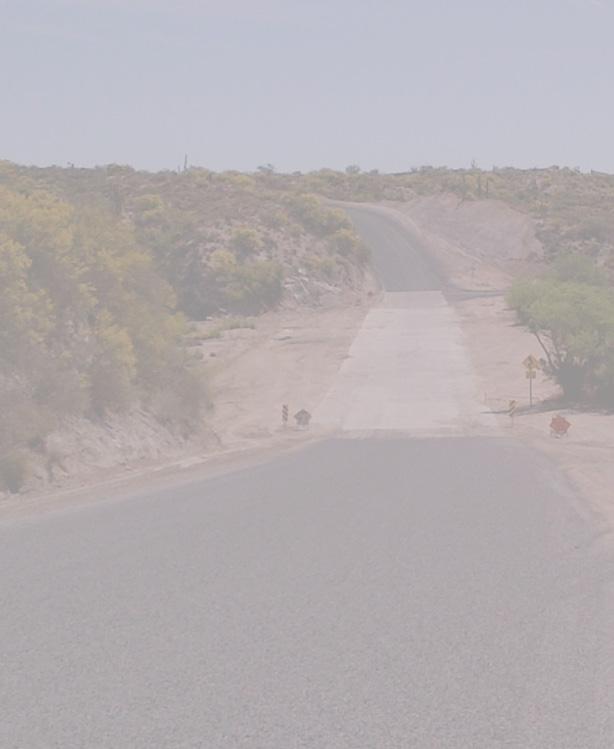
3 11 Mile Corner Rd Ironwood Dr Warren Rd SR-347 Miles: 9 Amount: $28.8M rx238 rx347 SR-347 West Pinal Freeway/ROW Miles: 31 Amount: $4.65M MARICOPA Maricopa-Casa Grande Highway West Pinal Freeway (ROW Preservation) Stanfield Rd Montgomery Road Lanes: 2 Miles: 10 Amount: $25.6M Pinal Regional Transportation Plan Approved by the Pinal Regional Transportation Authority: June 5, 2017 Caption Legend Road Improvements East - West Corridor Miles: 21 Amount: $67.2M 8 Peters Road Lanes: 2 Miles: 1 Amount: $3.2M New Construction rx587 Montgomery Rd CASA GRANDE Peters Rd 10 Val Vista Rd rx387 Thornton Rd Trekell Rd Battaglia Rd QUEEN CREEK McCartney Rd 60 SR SAN TAN VALLEY COOLIDGE Kortsen/Kleck Rd SR 24 Parkway (Casa Grande Connector) Selma Hwy I-10 Traffic Interchange Amount: $15M Combs Rd Hunt Hwy ELOY APACHE JUNCTION Ocotillo Rd rx 84 rx287 rx 87 rx187 Thornton Road Miles: 3.5 Amount: $11.2M ROW Preservation rx 87 rx387 rx 84 Selma Highway Miles: 16 Amount: $51.2M rx 88 FLORENCE Skyline Dr Felix Rd rx287 Miles: 4 Amount: $38.4M Baumgartner Rd North-South ROW Miles: 15 Amount: $2.25M North-South Corridor Miles: 36 Amount: $326.4M Kortsen Road/Kleck Road Miles: 14 Amount: $44.8M SUPERIOR Alignments currently under study by the Arizona Department of Transportation Arizona rx 79 Farms Rd Alignments currently under study by the Arizona Department of Transportation 10 rx 79 Cordones Road Lanes: 2 Miles: 1.5 Amount: $2.5M KEARNY Legend Cordones Rd Park and Ride Traffic Interchange (ROW) Eloy Council Resolution Coolidge Council Resolution West Pinal Freeway (ROW) Roads MAMMOTH rx 77 µ d MARANA For additional information please visit or SADDLEBROOKE Miles Disclaimer: This map does not represent a legal survey. It is intended for general purposes only. Map Date: June 7, 2017


4 Projections produced by the State of Arizona indicate that Pinal County will continue to see significant increases in population over the next several decades. Population projections over the next 20 years indicate that Pinal County will continue to grow to a level between 750,000 and 913,000 people. LOCAL ROADWAY FUNDING The intent of this Plan is to forward to voters a equitably balanced transportation plan that is responsive to future growth and meets the regional needs of the County. However, some areas such as Eloy, Kearny, Mammoth and Superior located in the Copper Basin of eastern Pinal County will not benefit directly from the proposed project development. Therefore, they will each receive an amount of at least $300,000 per year of available taxes to be utilized on local roadway development. This is in accordance with Arizona Revised Statute ACCESS MANAGEMENT ELEMENT An Access Management Element will establish a desired level of access control on roadways throughout the County in an effort to help retain the capacity of roadways, while maintaining public safety and ensuring access to public lands. Goals and objectives, and recommendations will be established to effectively manage and plan for the implementation of transportation and land use strategies intended to improve roadway safety and functionality at the Countywide level. The element will define a variety of methods for access control, utilize best practices, and establish guidelines for effective access management. STAKEHOLDER AND PUBLIC OUTREACH EFFORTS Throughout the process of developing this Regional Transportation Plan, the Pinal RTA reached out to each of the member communities, elected officials and residents of Pinal County. Previous plans that identified project needs, project scenarios and priorities were shared with member governments, and stakeholders. The public information and outreach process included an array of public meetings, presentations before City and Town Councils, and presentations to community boards and committees. Extensive outreach was also provided through meetings and discussions with City and Town managers, and County staff members. The Pinal RTA also conducted a series of community open houses at strategic locations throughout the County in an effort to solicit public input and comments. A website was developed at to provide ongoing updates and to distribute information for public review. The Pinal RTA website provided important public meeting dates, distributed the most current project lists and maps, and provided presentations and reports for review. The Pinal RTA also generated public press releases, participated in media interviews, regularly engaged with members of the public, and informed the Pinal County Board of Supervisors on the overall process. 2


5 THE PINAL REGIONAL TRANSPORTATION PLAN PROJECTS FOR CONSIDERATION State Route 347 Expansion of a principal arterial roadway with two additional lanes along State Route 347 between the Pinal-Maricopa County line to the North, and the municipal boundary of the City of Maricopa to the south. This represents a linear distance of approximately nine miles. The new construction of a north traveling lane and a south traveling lane along State Route 347 represents a total of 18 additional lane miles of construction. The project scope involves design and construction. The estimated cost of this roadway project is approximately $28.8 million. If the allocated funds are unable to be used for this project, they are to be designated for the East-West Corridor and Parking Lot Projects. State Route 24 Parkway A four mile long four lane east-west parkway facility with a median between State Route 24 at Ironwood Road to the West, and the future alignment of the North-South Corridor to the East. The project scope involves the purchase of land to establish a 300-foot wide right of way corridor, to include design and construction. The estimated cost of this roadway is approximately $38.4 million. West Pinal Freeway/ROW Preservation Right of way will be preserved for the West Pinal Freeway corridor, from the Pinal-Maricopa County line to the west, and Interstate 8 to the south. The project would require a total of 31 miles. The estimated cost approximately $4.65 million. THE PROPOSED PINAL REGIONAL TRANSPORTATION PLAN DEVELOPMENT SCHEDULE The identified projects within this plan have also been included in the table below, which sets forth a prioritized development schedule of when projects are positioned for construction or implementation. The development schedule is divided into four stages, which represent distinctive five-year increments over the 20-year life of the tax. All Plan projects are divided into Phases I (FY 2018-FY 2022), II (FY 2023-FY 2027), III (FY 2028-FY 2032) and IV (FY 2033-FY 2037). Each of the four Phases identifies a list of projects to be developed during that particular fiveyear period of time, including "overlapping" projects that are to be programmed over, multiple phases as necessary. PROJECTS DEVELOPMENT SCHEDULE Corridor / SR 24 Parkway (ROW) West Pinal Freeway (ROW) SR 347 Kortsen/Kleck Rd Alignment I-10 TI Selma Highway Thornton Road East - West Corridor Montgomery Rd Cordones Rd Peters Rd Local Roadway Public Transportation Start Ironwood Dr US 60 Kortsen Rd/Kleck Rd County Line City of Maricopa Henness Rd 10 TI Thornton Rd SR 84 SR 347 Val Vista Rd Catalina Hills Dr Burris Rd End Kortsen Rd/Kleck Rd I-10 TON Boundary County Line 10 TI I-8 I-10 I-8 Coyote Trl Thornton Rd PHASE I PHASE II PHASE III PHASE IV NOTES: * - Ongoing throughout the 20 year plan; - Scheduled project construction or project implementation; The project priorities identified in this table are dependent upon available transportation excise tax. 5 6 PREVIOUS TRANSPORTATION PLANNING EFFORTS Over the past 11 years, multiple planning efforts within Pinal County have addressed critical transportation needs at the local, regional and county levels. Sixteen transportation studies documenting 2,000 pages of recommendations and findings were reviewed and provided the framework of the Regional Transportation Plan for the Pinal RTA. A table of each of these studies and their completion dates are included below. City of Maricopa Area Transportation Plan Southern Pinal County Regional Corridor Study East West Corridor Design Concept Study Central Arizona Governments Regional Transportation Plan I-11 and Intermountain West Corridor Study North South Corridor Study City of Coolidge Comprehensive Transportation Feasibility Study Apache Junction Transit Feasibility Study Apache Junction Comprehensive Transportation Study Pinal County Transit Feasibility Study City of Eloy Small Area Transportation Plan I-8 and I-10 / Hidden Valley Framework Study Pinal County Regionally Significant Routes for Safety and Mobility Coolidge-Florence Regional Transportation Study City of Casa Grande Small Area Transportation Study Pinal County Small Area Transportation Study November 2015 July 2015 September 2015 March 2015 November 2014 Ongoing June 2012 June 2012 May 2012 April 2011 March 2010 August 2009 December 2008 February 2008 July 2007 August 2006 MOVING FORWARD - THE PINAL REGIONAL TRANSPORTATION PLAN The Pinal Regional Transportation Plan will place a direct emphasis on roadway development. If the vote passes, it is expected that the Regional Transportation Plan will produce the following projects and enhancements for the residents and communities of Pinal County: A 36 mile North-South Parkway Corridor between the US 60 in Apache Junction, and the Kortsen-Kleck roadway align-ment in the City of Coolidge. A 4 mile East-West Parkway near San Tan Valley that connects State Route 24 at the Ironwood Drive to the future alignment of the North-South Parkway Corridor. The development of 164 new Parkway lane miles throughout Pinal County. The construction of a Traffic Interchange at Interstate 10 and Kortsen Road. Approximately 50 miles of regional roadway improvements for connectivity and economic development. The addition of 100 new travel lane miles throughout the Pinal Region for arterial and local roadways. The preservation of right of way for a 31 mile West Pinal Freeway corridor between the Pinal-Maricopa County line and Interstate 8, for the construction of a future high capacity corridor. The preservation of the remaining 15 mile segment of needed right of way for the construction of the North-South Parkway Corridor between the City of Coolidge and Interstate 10. Needed access and capacity to the Region s emerging job centers. The preservation of annual project funding for less populated municipalities in the Region, to be used for local road projects. The construction of Park and Ride facilities located throughout Pinal County. The provision of annual funding for Dial-a-Ride services to assist people with disabilities, seniors, and members of the general public; and the provision of annual operational funding for existing transit systems.

6 THE PINAL REGIONAL TRANSPORTATION PLAN PROJECTS FOR CONSIDERATION North-South Corridor New construction of a 36 mile, north-south, limited access two lane principal facility between U.S. Highway 60 in the City of Apache Junction to the north to Kortsen/Kleck Road south of Coolidge. The estimated cost of the design and construction of the principal arterial is approximately $326.4 million. Pinal County will contribute $30.0 million in additional funding towards the project. North-South Right of Way Right of way will be preserved for the remainder of the North-South Parkway by purchasing 15 miles from Kortsen/Kleck Road to the north to I-10 on the south near Eloy. The purchase of land will establish a 300-foot wide right of way corridor. The estimated cost of the preserved right of way is approximately $2.25 million. Selma Highway Improvements needed for existing two-lane roadway from Thornton Road to the west, located in the City of Casa Grande, to the future North-South Corridor alignment to the East, located near the City of Coolidge. The project scope involves design and construction, and the purchase of right of way for various segments of the corridor. Project includes approximately four miles of new construction over graded non-paved roadway segments, and a crossing over a drainage canal and railroad tracks at State Route 84. The estimated cost of this roadway project is approximately $51.2 million. Kortsen/Kleck Road Alignment Also referred to as the Casa Grande Connector, this project involves the widening of this facility from two lanes to four lanes from Henness Road to the West, located in the City of Casa Grande, to the future alignment of the North- South Corridor Parkway to the East, located in the City of Coolidge. The widening of the Casa Grande Connector will involve a 14 mile corridor, and represents a total of 28 additional lane miles of roadway construction. The estimated cost of this roadway project is approximately $44.8 million. I-10 Traffic Interchange The Kortsen/Kleck Road Alignment project scope involves a traffic interchange at I-10. The estimated cost of the of the traffic interchange is approximately $15 million. Cordones Road The new road, located in the southern Pinal County community of Saddlebrooke, is a 1.5 miles long, north-south, two lane minor arterial roadway facility. The project scope involves the purchase of necessary right of way, design and construction. The estimated cost of this roadway project is approximately $2.5 million. Thornton Road Widening of Thornton Road from two lanes to four lanes from State Route 84 to the north, to Interstate 8 to the south. Thornton Road will involve a 3.5 mile linear corridor, representing a total of seven additional lane miles of roadway construction. The project scope involves the purchase of necessary right of way, design and construction. The estimated cost of this roadway project is approximately $11.2 million. Peters Road Important "regional" economic development project in a future high job growth area. A widening roadway project consisting of two more additional lanes from Burris Road to the west, to Thornton Road to the east, located in the City of Casa Grande. The widening of Peters Road will involve a one mile linear corridor, and represents a total of two miles of additional lanes of roadway construction. The project scope involves the purchase of necessary right of way, design and construction. The estimated cost of this roadway project is approximately $3.2 million. East - West Corridor The project will begin at State Route 347 in the city of Maricopa and extend east through northern Casa Grande to I-10. The 21 mile corridor will be constructed by new and existing roadways. The estimated cost of project is approximately $67.2 million. If the allocated funds are unable to be used for this project, they are to be designated for State Route 347 and Parking Lot Projects. Montgomery Road Improvements to the Montgomery Road Corridor from the East-West Corridor to the North, located in the City of Casa Grande, to interstate 8 to the South. The project corridor is ten miles in length, and will call for the construction of approximately four miles of new roadway. The intent is to develop a connective, north-south, two-lane roadway facility that is fully improved. The project scope involves the purchase of necessary right of way, design and construction. The estimated cost of project is approximately $25.6 million. Parking Lot Projects North-South Corridor - SR87 to Kleck Rd, $67.2 million; North-South Corridor - Kleck Rd to I-10, $144 million; Burris Rd - SR84 to Alamo Rd, $4.8 million; Eleven Mile Corner - SR87 to I-1o, $57.6 million; Selma Hwy - Montgomery Rd to Thornton Rd, $8 million; Trekell Rd - I-8 to three miles south, $9.6 million; Skyline Rd - Gantzel Rd to North-South, $38.4 million; Florence-Kelvin Hwy - End of pavement to 2 miles west of SR177, $5.25 million; Val Vista TI at I-10, $15 million; Selma Hwy TI at I-10, $15 million. 4
2. AGENCY COORDINATION AND PUBLIC INVOLVMENT
 2. AGENCY COORDINATION AND PUBLIC INVOLVMENT This chapter discusses the process carried out for conducting agency coordination and public involvement activities. TECHNICAL ADVISORY COMMITTEE A Technical
The Village of Sugar Grove, in partnership with Kane County, the Illinois Department of Transportation, and the Illinois Tollway welcomes you to the
 The Village of Sugar Grove, in partnership with Kane County, the Illinois Department of Transportation, and the Illinois Tollway welcomes you to the first Public Meeting for the proposed interchange improvement
Date: April 10, 2017 City Council Work Session April 24, 2017: Status Report on the Comprehensive Plan Update and Transportation Master Plan
 AGENDA REPORT To: From: By: Honorable Mayor and City Council Members Warren Hutmacher, City Manager Sharon Ebert, Director Community Development Date: April 10, 2017 Agenda: City Council Work Session April
5.0 IMPLEMENTATION STRATEGIES
 5.0 IMPLEMENTATION STRATEGIES 5.1 Recommended Alternative This chapter discusses the anticipated steps needed to move each project from recommendation to construction. Since full funding for these alternatives
PREPARED FOR: PLATTEVIEW ROAD CORRIDOR STUDY EXECUTIVE SUMMARY
 PREPARED FOR: PLATTEVIEW ROAD CORRIDOR STUDY EXECUTIVE SUMMARY SEPTEMBER 2016 Introduction The Platteview Road Corridor Study was led by the Metropolitan Area Planning Agency (MAPA) with assistance from
1.0 PROJECT PURPOSE AND NEED
 1.0 PROJECT PURPOSE AND NEED The FasTracks Plan includes the extension of the Central Corridor from its current terminus at 30th/Downing to a connection to the East Corridor commuter rail service planned
Hunt Highway CELESTE PEMBERTON, CFM, CPM PINAL COUNTY CARLOS SANCHEZ SORIA, PE T.Y. LIN INTERNATIONAL
 Hunt Highway CELESTE PEMBERTON, CFM, CPM PINAL COUNTY CARLOS SANCHEZ SORIA, PE T.Y. LIN INTERNATIONAL Agenda Design Concept Report Phase 1 Phase 2 Phase 3 Phase 4 Phase 5 Questions Design Concept Report
1.0 Circulation Element
 5/9/18 1.0 Circulation Element 1.1 Introduction As growth and development occur in Apache County, enhancements to its circulation system will be necessary. With time, more roads will be paved and air and
CITY OF CHARLOTTESVILLE, VIRGINIA CITY COUNCIL AGENDA
 CITY OF CHARLOTTESVILLE, VIRGINIA CITY COUNCIL AGENDA Agenda Date: December 16, 2013 Action Required: Adoption of Resolution Presenter: Staff Contacts: Title: James E. Tolbert, AICP, Director of NDS James
RESOLUTION NO. R Refining the route, profile and stations for the Downtown Redmond Link Extension
 RESOLUTION NO. R2018-32 Refining the route, profile and stations for the Downtown Redmond Link Extension MEETING: DATE: TYPE OF ACTION: STAFF CONTACT: Capital Committee Board PROPOSED ACTION 09/13/2018
1.0 Introduction. Purpose and Basis for Updating the TMP. Introduction 1
 1.0 Introduction The Town of Castle Rock is situated between the metropolitan areas of Denver and Colorado Springs, amidst a unique terrain of rolling hills, mesas, ravines, and waterways. Like many Front
1.0 INTRODUCTION 1.1 TH 14 WEST STUDY AREA Project Description Functional Classification Purpose of the Project
 1.0 INTRODUCTION 1.1 TH 14 WEST STUDY AREA 1.1.1 Project Description The Trunk Highway (TH) 14 West Corridor is a two-lane roadway approximately 22 miles in length. Located in Nicollet County, the corridor
master plan of highways
 scope of work master plan of highways abstract This Scope of Work outlines the tasks and goals of updating the Master Plan of Highways, as well as the outreach that will be used in the planning process.
Summary Report No. 3 - Public Involvement, Round Three
 Pinal County Corridors Definition Study Summary Report No. 3 - Public Involvement, Round Three ADOT Project No. T04-49-P0001 ADOT Purchase Order No. PGKG 2642 Prepared by: Kaneen Advertising & Public Relations
DOMINION BOULEVARD CORRIDOR STUDY AND ECONOMIC DEVELOPMENT STRATEGIC PLAN A MODEL FOR CHESAPEAKE S FUTURE
 DOMINION BOULEVARD CORRIDOR STUDY AND ECONOMIC DEVELOPMENT STRATEGIC PLAN A MODEL FOR CHESAPEAKE S FUTURE Overview I. Draft Plan Process II. Draft Plan Overview a. Market Analysis b. Master Land Use Plan
List of Priority Projects
 List of Priority Projects Fiscal Years 2019-20 to 2023-24 June 25, 2018 Amended December 17, 2018 Metropolitan Transportation Planning Organization for the Gainesville Urbanized Area List of Priority
master plan of highways bus rapid transit amendment
 Scope of Work master plan of highways bus rapid transit amendment September 2011 Montgomery County Planning Department M-NCPPC MontgomeryPlanning.org 1 Scope of Work master plan of highways bus rapid transit
RESOLUTION NO
 RESOLUTION NO. 2016-16 A RESOLUTION PROVIDING FOR THE SUBMISSION TO THE QUALIFIED ELECTORS OF THE CITY OF BELLINGHAM AT AN ELECTION TO BE HELD ON NOVEMBER 8, 2016 OF A PROPOSITION AUTHORIZING THE CITY
SH 199 Corridor Master Plan. Community Meeting No. 2 May 31, 2017
 Community Meeting No. 2 May 31, 2017 Transportation Projects On or Near SH 199 SH 199 from 0.3 miles south of FM 1886 to south end of Lake Worth bridge Construct freeway mainlanes and frontage roads 10-Year
NORTH-SOUTH CORRIDOR STUDY EXECUTIVE SUMMARY. Executive Summary
 Executive Summary Background As congestion continues to affect mobility in the region, the Ozarks Transportation Organization (OTO) is particularly concerned with traffic movement. The North-South Corridor
Definitions. Average Daily Traffic Demand (ADT): The actual number or projected number of cars that pass a point in a 24-hour period.
: The actual number or projected number of cars that pass a point in a 24-hour period.") Definitions Access Management: A combination of physical techniques and transportation policies used to control the flow of traffic between roads and the surrounding lands. Alternative City Form Scenarios:
Definitions Access Management: A combination of physical techniques and transportation policies used to control the flow of traffic between roads and the surrounding lands. Alternative City Form Scenarios:
3. VISION AND GOALS. Vision Statement. Goals, Objectives and Policies
 Vision Statement Queen Creek s interconnected network of parks, trails, open spaces and recreation opportunities provide safe and diverse activities and programs that sustain its unique, small town, equestrian
Executive Summary. NY 7 / NY 2 Corridor
 Executive Summary NY 7 / NY 2 Corridor Transportation and Land Use Study December 2005 Prepared for: Town of Colonie Capital District Transportation Committee Prepared by: Introduction: Land use decisions
Right-of-Way Acquisitions and Relocations Technical Memorandum
 Right-of-Way Acquisitions and Relocations Technical Memorandum Southeast Extension Project Lincoln Station to RidgeGate Parkway Prepared for: Federal Transit Administration Prepared by: Denver Regional
CHAPTER 7: Transportation, Mobility and Circulation
 AGLE AREA COMMUNITY Plan CHAPTER 7 CHAPTER 7: Transportation, Mobility and Circulation Transportation, Mobility and Circulation The purpose of the Transportation, Mobility and Circulation Chapter is to
Presentation Item C Annotated Model Outline for a Framework for a Green Infrastructure Plan
 Date: August 17, 2016 To: From: Subject: Management Committee Dan Cloak, Consultant Presentation Item C Annotated Model Outline for a Framework for a Green Infrastructure Plan Recommendation: Receive the
Issues Requiring Future Study
 Issues Requiring Future Study Transportation planning is an ongoing process that tends to identify new issues as it finds solutions for others. Some issues are so complex that a solution to one problem
TENNESSEE STATE ROUTE 109 CORRIDOR MANAGEMENT AGREEMENT MEMORANDUM OF UNDERSTANDING CORRIDOR MANAGEMENT ALONG STATE ROUTE 109
 TENNESSEE STATE ROUTE 109 CORRIDOR MANAGEMENT AGREEMENT MEMORANDUM OF UNDERSTANDING CORRIDOR MANAGEMENT ALONG STATE ROUTE 109 I. Purpose The purpose of this Agreement is to provide a framework for the
Mississippi Skyway Preliminary Engineering Report
 EXECUTIVE SUMMARY Mississippi Skyway Preliminary Engineering Report CITY OF RAMSEY, MINNESOTA DECEMBER 2014 City of RAMSEY EXECUTIVE SUMMARY Project Need and Intent The Mississippi Skyway pedestrian bridge
CONTENTS BACKGROUND AND CONTEXT... 3 Plan Area... 3 History... 3 Previous Planning Initiatives... 4 PLANNING FRAMEWORK... 5 Countywide Transit
 CONTENTS BACKGROUND AND CONTEXT... 3 Plan Area... 3 History... 3 Previous Planning Initiatives... 4 PLANNING FRAMEWORK... 5 Countywide Transit Corridors Functional Master Plan... 5 Veirs Mill Road Bus
DRAFT SECTION 4(f) EVALUATION INTERSTATE 73 FEIS: I-95 to I-73/I-74 in North Carolina
 EVALUATION INTERSTATE 73 FEIS: I-95 to I-73/I-74 in North Carolina") DRAFT SECTION 4(f) EVALUATION INTERSTATE 73 FEIS: I-95 to I-73/I-74 in North Carolina 1.0 INTRODUCTION Section 4(f) of the Department of Transportation Act of 1966, 49 U.S.C. 303, requires that prior to
DRAFT SECTION 4(f) EVALUATION INTERSTATE 73 FEIS: I-95 to I-73/I-74 in North Carolina 1.0 INTRODUCTION Section 4(f) of the Department of Transportation Act of 1966, 49 U.S.C. 303, requires that prior to
Congestion Management Safety Plan. Michael Corbett State Program Administrator September 2017
 Congestion Management Safety Plan Michael Corbett State Program Administrator September 2017 Agenda Topic 1 What is the Congestion Management Safety Plan (CMSP)? 2 Relevance to Congestion Investments 3
Route 1 Corridor Study
 Route 1 Corridor Study Westbrook, Connecticut A Vision for the Connecticut Shoreline Public Informational Meeting July 28, 2015 Lower Connecticut River Valley Council of Governments Fitzgerald & Halliday,
A. WHAT IS A GENERAL PLAN?
 I. Introduction A. WHAT IS A GENERAL PLAN? A general plan is the planning guideline for the future of a city. It contains goals and policies which regulate urban development, the protection of the natural
Creating Complete Roadway Corridors:
 Creating Complete Roadway Corridors: The AASHTO Guide to Transportation Landscape Architecture and Environmental Design NCHRP Project 15-33 Status Report AASHTO Standing Committee on Design Technical Committee
Figure 5. Previously Identified Viable Corridors
 OVERVIEW The Central Florida Expressway Authority (CFX) is evaluating the potential to expand SR 408 from its current eastern terminus along SR 50 to SR 520 in northeastern Orange County, Fl. This new
2.0 PURPOSE AND NEED. 2.1 Purpose. 2.2 Need Traffic Congestion in and around Downtown Derry
 2.0 PURPOSE AND NEED Taking into consideration agency and public input, the purpose and need for the Project was identified early in Project planning. As noted in Appendix A, for purposes of meeting the
Transportation Research Center
 Increasing Design Flexibility in the AASHTO Green Book Your Department Name Presentation to AASHTO Subcommittee on Design Doug Harwood, MRIGlobal July 2017 Transportation Research Center Resolution of
Introduction and Overview
 Introduction and Overview Articulate local values and priorities Guide land use and development decisions Coordinate transportation, infrastructure, and City services with expected growth and available
12/9/2013. HOLLYWOOD/PINES CORRIDOR PROJECT AMPO 2013 Annual Conference October 24, Our Perspective. Broward.
 HOLLYWOOD/PINES CORRIDOR PROJECT AMPO 2013 Annual Conference October 24, 2013 Our Perspective Broward Fort Lauderdale 1 Broward Metropolitan Planning Organization Fort Lauderdale Fort Lauderdale Skyline
A Connected Region for Our Future. Tampa Bay Regional Planning Council
 A Connected Region for Our Future Tampa Bay Regional Planning Council TBARTA Vision A world class transportation network for the Tampa Bay region that will connect people and places, move goods and services,
I. INTRODUCTION. Project Background and Study Area
 I. INTRODUCTION Project Background and Study Area Freedom Parkway is a key east-west corridor connecting I-25 on the west to the Town of Kersey on the east, running approximately one to two miles south
4-Town Comprehensive Plan DRAFT 7/30/07
 4-Town Comprehensive Plan DRAFT 7/30/07 Acknowledgements ning Committee Town of Harrisburg Norman Roof Randy Nicol Town of Martinsburg Terry Thisse Paul Kelly Town of Montague Jan Bagdanowicz Wendy Perry
State Highway 121 Southwest Parkway. Fort Worth s Transportation Success Story in Design and Cooperation
 State Highway 121 Southwest Parkway Fort Worth s Transportation Success Story in Design and Cooperation Greater Fort Worth Association of Realtors October 24, 2007 Presented by: Dan Lamers, P.E. North
BOARD OF SUPERVISORS BUSINESS MEETING ACTION ITEM. Endorsement of Design for Route 7/George Washington Boulevard Overpass. Algonkian and Broad Run
 BOARD OF SUPERVISORS BUSINESS MEETING ACTION ITEM Date of Meeting: March 7, 2017 # 14 SUBJECT: ELECTION DISTRICTS: CRITICAL ACTION DATE: STAFF CONTACTS: Endorsement of Design for Route 7/George Washington
WHEREAS, the current Comprehensive Plan was adopted in 2005; and
 RESOLUTION 2018-06 RESOLUTION TO AMEND THE CITY S COMPREHENSIVE PLAN TO (1) AMEND CHAPTER 4 TO ADD A SPECIAL REVITALIZATION DISTRICT FOR EDUCATION AND ECONOMIC DEVELOPMENT ; (2) DESIGNATE ON THE FUTURE
PSRC REVIEW REPORT & CERTIFICATION RECOMMENDATION
 PSRC REVIEW REPORT & CERTIFICATION RECOMMENDATION KITSAP COUNTY COUNTYWIDE PLANNING POLICIES July 2, 2012 BACKGROUND A major emphasis of the Washington State Growth Management Act (GMA) is the need to
North Carolina Department of Transportation Project Development and Environmental Analysis Branch
 North Carolina Department of Transportation Project Development and Environmental Analysis Branch Citizens Informational Workshop I-85, from I-485 to NC 73 Mecklenburg and Cabarrus Counties October 30,
Present. and. Future
 Present and Future July 1985 303 from MC 85 to I-17 included in the Regional Freeway System May 1989 State Transportation Board adopts Loop 303 1990 Revenues from Proposition 300 insufficient; 303 removed
CONSULTING SERVICES FOR THE WHITEBELT VISIONING EXERCISE ADDENDUM TO THE GTA WEST LAND USE STUDY WORK PROGRAM
 CONSULTING SERVICES FOR THE WHITEBELT VISIONING EXERCISE ADDENDUM TO THE GTA WEST LAND USE STUDY 1. Introduction WORK PROGRAM The Town of Caledon is a large, local municipality located in the Greater Toronto
Longmeadow Parkway Fox River Bridge Corridor. August 6, 2015
 Longmeadow Parkway Fox River Bridge Corridor August 6, 2015 Longmeadow Parkway Bridge Corridor 5.6 miles from Huntley Road to IL 62 Unique municipal/county/state/federal partnership Links Randall Road
WURZBACH PARKWAY WURZBACH PARKWAY
 WURZBACH PARKWAY WURZBACH PARKWAY From Lockhill-Selma Rd to NW Military Hwy Open NW Military HouseHwy/Lockhill-Selma Open House Barshop Jewish Community Center December Barshop Jewish 14, 2017 Community
CHAPTER 1 Introduction
 CHAPTER 1 Introduction From sea to summit, Lane County covers almost 4,800 square miles of diverse Oregon landscape. Stretching from the Pacific Ocean through the Coastal Range, the Willamette Valley to
Report to: Development Services Committee Report Date: April 24, 2017
 SUBJECT: Cornell Rouge National Urban Park Gateway - Report on Design Charrette and Next Steps PREPARED BY: Lilli Duoba, MES, MCIP, RPP, Manager, Natural Heritage (ext. 7925) REVIEWED BY: Marg Wouters,
A project of the Arizona State Land Department,/ facilitated by East Valley Partnership & Pinal Partnership
 A project of the Arizona State Land Department,/ facilitated by East Valley Partnership & Pinal Partnership September 4, 2008 Ms. Peggy Fiandaca Pinal County Comprehensive Plan 13771 Fountain Hills Blvd.,
Transportation Committee
 Transportation Committee Business Item No. 2013-286SW Meeting date: October 14, 2013 For the Metropolitan Council meeting of October 16, 2013 Subject: Southwest Light Rail Transit (Green Line Extension):
STAFF REPORT SAUSALITO CITY COUNCIL
 STAFF REPORT SAUSALITO CITY COUNCIL MEETING DATE: January 8, 2019 AGENDA TITLE: LEAD DEPARTMENT: Southern Marin Fire District Lessons Learned Update Report Southern Marin Fire District, Fire Chief Chris
COLVER ROAD INDUSTRIAL CONCEPT PLAN
 COLVER ROAD INDUSTRIAL CONCEPT PLAN A CONCEPTUAL LAND USE AND TRANSPORTATION PLAN FOR TA-4 AN URBAN RESERVE AREA OF THE CITY TALENT City of Talent Adopted by City Council Resolution No., June, 2015 PART
Remi Mendoza City Planning Academy March 13, 2017
 Remi Mendoza City Planning Academy March 13, 2017 1 What is the General Plan? The 2030 General Plan 5-Year Update (2035 General Plan) Questions and Answers 2 Guidebook for development and growth Required
City of Hermosa Beach Administrative Policy #
 City of Hermosa Beach Administrative Policy # SUBJECT: Living Streets Policy Date: Approved by: City Council Authority: Public Works Department & Community Development Department Mayor, PURPOSE The City
LAND USE AMENDMENT CORNERSTONE (WARD 3) 60 STREET NE AND COUNTRY HILLS BOULEVARD NE MAP 26NE BYLAW 22D2017
 60 STREET NE AND COUNTRY HILLS BOULEVARD NE MAP 26NE BYLAW 22D2017") Page 1 of 14 EXECUTIVE SUMMARY This Land Use Amendment application covers an area of 43.76 hectares ± (108.14 acres ±) located in northeast Calgary, bound by Country Hills Boulevard NE to the south and
Page 1 of 14 EXECUTIVE SUMMARY This Land Use Amendment application covers an area of 43.76 hectares ± (108.14 acres ±) located in northeast Calgary, bound by Country Hills Boulevard NE to the south and
PROJECT STATEMENT LOCATION/DESIGN PUBLIC HEARING. 19 th AVENUE NORTH EXTENSION PROJECT FROM SPRINGDALE DRIVE TO NORTH 2 ND STREET/U.S.
 PROJECT STATEMENT LOCATION/DESIGN PUBLIC HEARING 19 th AVENUE NORTH EXTENSION PROJECT FROM SPRINGDALE DRIVE TO NORTH 2 ND STREET/U.S. 67 HEARING LOCATION: ERICKSEN COMMUNITY CENTER 1401 11 TH AVENUE NORTH
Southern Gateway Project and Public Green
 Southern Gateway Project and Public Green Transportation and Trinity River Project Committee May 23, 2016 Purpose of Presentation Provide the history and an overview of the Southern Gateway Project (SGP)
COUNCIL COMMUNICATION
 Meeting Date: June 13, 2017 COUNCIL COMMUNICATION Agenda Item: Agenda Location: Consent Calendar Work Plan # 194,195, 196 Legal Review: 1 st Reading 2 nd Reading Subject: A resolution approving Thornton
SAN FRANCISCO MUNICIPAL TRANSPORTATION AGENCY
 THIS PRINT COVERS CALENDAR ITEM NO. : 10.3 DIVISION: Sustainable Streets BRIEF DESCRIPTION: SAN FRANCISCO MUNICIPAL TRANSPORTATION AGENCY Approving the removal of Municipal Railway bus zones at various
SECTION 4(f) DE MINIMIS DOCUMENTATION
 DE MINIMIS DOCUMENTATION") SECTION 4(f) DE MINIMIS DOCUMENTATION Illinois Route 60/83 IL 176 to the intersection of IL 60 (Townline Road) Lake County P-91-084-07 Mundelein Park and Recreation District Project Limit SECTION 4(f)
SECTION 4(f) DE MINIMIS DOCUMENTATION Illinois Route 60/83 IL 176 to the intersection of IL 60 (Townline Road) Lake County P-91-084-07 Mundelein Park and Recreation District Project Limit SECTION 4(f)
The transportation system in a community is an
 7 TRANSPORTATION The transportation system in a community is an important factor contributing to the quality of life of the residents. Without a sound transportation system to bring both goods and patrons
SPECIAL COMMITTEE OF THE WHOLE DECEMBER 9, 2002 BLOCK 57/58 WEST BLOCK PLAN BLOCK PLAN FILE BL.57/58W.99 HUNTINGTON BUSINESS PARK LAND OWNERS
 SPECIAL COMMITTEE OF THE WHOLE DECEMBER 9, 2002 BLOCK 57/58 WEST BLOCK PLAN BLOCK PLAN FILE BL.57/58W.99 HUNTINGTON BUSINESS PARK LAND OWNERS Recommendation The Commissioner of Planning recommends: THAT
Secrest Short Cut and Monroe Expressway Small Area Plan AUGUST 29, 2018
 Secrest Short Cut and Monroe Expressway Small Area Plan AUGUST 29, 2018 Background and Process Monroe Expressway will be open by the end of 2018 Union County and Indian Trail identified a need to revisit
Plan Review for High-Capacity Transit in the Project Corridor: S. 200th Street to Federal Way City Center
 Federal Way Transit Extension Plan Review for High-Capacity Transit in the Project Corridor: S. 200th Street to Federal Way City Center Prepared for: Sound Transit Prepared by: CH2M HILL Contents Executive
9 CITY OF VAUGHAN OFFICIAL PLAN AMENDMENT NO BOCA EAST INVESTMENTS LIMITED
 9 CITY OF VAUGHAN OFFICIAL PLAN AMENDMENT NO. 631 - BOCA EAST INVESTMENTS LIMITED The Planning and Economic Development Committee recommends the adoption of the recommendations contained in the following
MAYFIELD WEST SECONDARY PLAN PHASE 2
 MAYFIELD WEST SECONDARY PLAN PHASE 2 Public Open House #3 February 25, 2010 Draft Preferred Land Use Scenario TOWN OF CALEDON PLANNING & DEVELOPMENT DEPARTMENT Open House Agenda TOWN OF CALEDON 1. Welcome
ARLINGTON COUNTY, VIRGINIA. County Board Agenda Item Meeting of January 28, 2017 SUPPLEMENTAL REPORT
 ARLINGTON COUNTY, VIRGINIA County Board Agenda Item Meeting of January 28, 2017 SUPPLEMENTAL REPORT DATE: January 26, 2017 SUBJECT: The Virginia Department of Transportation s Transform I-66 Inside the
SR 836 Southwest Extension
 SR 836 Southwest Extension Miami-Dade County, Florida August 8, 2018 MDX WORK PROGRAM NO.: 83618 Project Need Population growth and traffic in southwest Miami-Dade has significantly increased without the
TRANSPORTATION ELEMENT GOALS, OBJECTIVES, AND POLICIES
 TRANSPORTATION ELEMENT GOALS, OBJECTIVES, AND POLICIES GOAL 2 The City shall provide a safe, convenient, effective, and energy efficient multimodal transportation system which is coordinated with the Future
Submitted by: Phillip L. Harrington, Director, Department of Public Works. Framework for Green Infrastructure Plan Development
 Page 1 of 8 Office of the City Manager CONSENT CALENDAR June 13, 2017 To: From: Honorable Mayor and Members of the City Council Dee Williams-Ridley, City Manager Submitted by: Phillip L. Harrington, Director,
Revised Long Range Transportation Plan
 Revised Long Range Transportation Plan Auburn, Alabama Prepared for: City of Auburn, Alabama Prepared by: Skipper Consulting, Inc. June 2006 Revised Long Range Transportation Plan City of Auburn, Alabama
FDOT D4 Complete Streets
 FDOT D4 Complete Streets Context Sensitive Solutions Directs that complete street solutions will complement the context of the community. Collaborative approach to decision making, project development,
IH35 Corridor Plan Amendment to the Comprehensive Plan
 IH35 Corridor Plan Amendment to the Comprehensive Plan Background The corridor plan for the IH35 corridor is an amendment to the Burleson comprehensive plan. Generally, the purpose of a corridor plan is
ADOPTION OF THE REVISED OPEN SPACE AND CONSERVATION ELEMENT OF THE GENERAL PLAN
 TO: FROM: SUBJECT: Honorable Mayor and City Council Planning Department ADOPTION OF THE REVISED OPEN SPACE AND CONSERVATION ELEMENT OF THE GENERAL PLAN RECOMMENDATION: It is recommended that the City Council:
The Illinois Department of Transportation and Lake County Division of Transportation. Route 173, including the Millburn Bypass
 The Illinois Department of Transportation and Lake County Division of Transportation welcome you to this Public Hearing for U.S. Route 45 from Illinois Route 132 to Illinois Route 173, including the Millburn
6:00 8:00 PM I-95 FROM EXIT 57 TO EXIT 60 PROJECT
 PUBLIC INFORMATIONAL MEETING TUESDAY, APRIL 27, 2010 AT NEWBURYPORT CITY HALL, AUDITORIUM 60 PLEASANT STREET NEWBURYPORT, MASSACHUSETTS 6:00 8:00 PM FOR THE PROPOSED WHITTIER BRIDGE / I-95 IMPROVEMENTS
Cumberland Region Tomorrow is a private, non-profit, citizen based regional organization working with Greater Nashville Regional Council
 Cumberland Region Tomorrow is a private, non-profit, citizen based regional organization working with Greater Nashville Regional Council and others in the public and private sectors, dedicated to planning
TORONTO COMPLETE STREETS GUIDELINES
 TORONTO COMPLETE STREETS GUIDELINES Presentation by Fiona Chapman, Manager, Pedestrian Projects Public Realm Section, Transportation Services, City of Toronto June 2017 PURPOSE OF THE PROJECT To develop
Public Hearing. Charlotte County-Punta Gorda MPO - Meeting Rooms A and B March 14, open house at 4 p.m., formal presentation at 5 p.m.
 Public Hearing Charlotte County-Punta Gorda MPO - Meeting Rooms A and B March 14, 2019 open house at 4 p.m., formal presentation at 5 p.m. Welcome to the Public Hearing for the Harborview Road (CR 776)
CITY COUNCIL AGENDA REPORT
 CITY COUNCIL AGENDA REPORT Subject: COUNCIL MOTION LRT ALIGNMENT REMOVAL FROM THE TRANSPORTATION MASTER PLAN On February 10, 2016 Councillor Hughes provided notice in accordance with Section 23 of Procedure
Palm Beach County (University Drive Removal) and Broward County (Transportation Element) Remedial Amendments
 and Broward County (Transportation Element) Remedial Amendments") SR 7/US 441 Transit-Supportive Land Use Planning and Urban Design Assistance (SR 7 Study) Focus TCRPC: Develop detailed analysis of land uses, development regulations, and community visioning all relative
SR 7/US 441 Transit-Supportive Land Use Planning and Urban Design Assistance (SR 7 Study) Focus TCRPC: Develop detailed analysis of land uses, development regulations, and community visioning all relative
Implementation Guide Comprehensive Plan City of Allen
 Implementation Guide 2030 Comprehensive Plan City of Allen DRAFT 2015 Implementation Guide Allen 2030 Comprehensive Plan INTRODUCTION The Comprehensive Plan serves as a guide for the growth and development
ITEM #8. Regional Smart Growth Program. Regional Smart Growth Program. Presentation Overview. Coast Highway Vision and Stategic Plan.
 Regional Smart Growth Program Economic Development Commission What is Smart Growth? Adopted as part of the Regional Comprehensive Plan (RCP) RCP provides vision for region based on Smart Growth and sustainability
Urban Planning and Land Use
 Urban Planning and Land Use 701 North 7 th Street, Room 423 Phone: (913) 573-5750 Kansas City, Kansas 66101 Fax: (913) 573-5796 Email: planninginfo@wycokck.org www.wycokck.org/planning To: From: City Planning
Services Department B September 10, 2007
 Report To: Development Services Committee Item: Date of Report: DS-07-246 September 5, 2007 From: Commissioner, Development File: Date of Meeting: Services Department B7200-0001 September 10, 2007 Subject:
TIRZ 17/Redevelopment Authority Capital Improvements Plan Projects
 Gessner Widening: T-1701 What: Widen the road from a six-lane divided boulevard to an eight-lane divided boulevard street section, increase turn lanes, update traffic signal system, improve drainage by
ARGENTA TRAIL (CSAH 28/63) REALIGNMENT SOUTH PROJECT (CP 63-25)
 REALIGNMENT SOUTH PROJECT (CP 63-25)") ARGENTA TRAIL (CSAH 28/63) REALIGNMENT SOUTH PROJECT (CP 63-25) Preliminary Design Report February 2015 Prepared For: City of Inver Grove Heights Dakota County Prepared By: Kimley-Horn and Associates,
ARGENTA TRAIL (CSAH 28/63) REALIGNMENT SOUTH PROJECT (CP 63-25) Preliminary Design Report February 2015 Prepared For: City of Inver Grove Heights Dakota County Prepared By: Kimley-Horn and Associates,
S C O P E O F W O R K A P R I L
 white flint 2 sector plan S C O P E O F W O R K A P R I L 2 0 1 2 MONTGOMERY COUNTY PLANNING DEPARTMENT M-NCPPC MontgomeryPlanning.org 1 white flint 2 sector plan Scope of Work abstract This scope of work
Planning & Zoning Board Meeting. DRAFT Comprehensive Transportation Plan Update, February 23, 2018 version
 Planning & Zoning Board Meeting DRAFT Comprehensive Transportation Plan Update, February 23, 2018 version May 10, 2018 Overview Overview of Agency Comments Overview of proposed modifications to the Draft
South Davis County COMMUNITY SPOTLIGHT
 South Davis County COMMUNITY SPOTLIGHT Davis/SLC Community Connector Bus Rapid Transit line connecting SLC & Davis County RTP Phase 1 Project Generate 3,100 average weekday riders Relieve congestion on
Point A Point B Point C Point D. City of Hapeville Public Meeting July 25, 2017
 City of Hapeville Public Meeting July 25, 2017 Fulton County Transit Master Plan Overview Following last year s ¾-cent TSPLOST effort, the Mayors of the 14 Cities outside of Atlanta and the Fulton County
BETTER PUBLIC TRANSPORT PROJECT WATERBEACH TO SCIENCE PARK AND EAST CAMBRIDGE CORRIDORS
 Report To: Greater Cambridge Partnership Joint Assembly 20 th September 2018 Lead Officer: Peter Blake GCP Director of Transport BETTER PUBLIC TRANSPORT PROJECT WATERBEACH TO SCIENCE PARK AND EAST CAMBRIDGE
Scope of Services. River Oaks Boulevard (SH 183) Corridor Master Plan
 Corridor Master Plan") Scope of Services River Oaks Boulevard (SH 183) Corridor Master Plan PROJECT AREA The project area consists of the River Oaks Boulevard (SH 183) corridor bounded by SH 199 at the northern end and the Trinity
Scope of Services River Oaks Boulevard (SH 183) Corridor Master Plan PROJECT AREA The project area consists of the River Oaks Boulevard (SH 183) corridor bounded by SH 199 at the northern end and the Trinity
12 AMENDMENT NO. 149, TOWN OF MARKHAM HIGHWAY 404 NORTH SECONDARY PLAN
 12 AMENDMENT NO. 149, TOWN OF MARKHAM HIGHWAY 404 NORTH SECONDARY PLAN The Planning and Economic Development Committee recommends the adoption of the recommendation contained in the following report August