Master Plan Report. 28 September 2015
|
|
|
- Diane Heath
- 6 years ago
- Views:
Transcription


1 Master Plan Report 28 September 2015


2 Contents Greenway was brought to you by T 2 - A multidisciplinary team that has joined forces to provide this master plan for the future Moorebank Georges River Precinct. "Our vision is to provide a new and enhanced way of living and growing to the Liverpool LGA, creating the next major NSW regional city." Penny Campbell Structural Engineer Parsons Brinckerhoff Xavierra Hoong Yap Senior Quantity Surveyor Slattery Alexander Micallef Project Manager Sydney Water Robbie Williams Senior Civil Engineer AECOM Australia Paul Casey Associate Engineer SMEC Elizabeth Kimbell Town Planner Calibre Consulting Shane Tyrrell Senior Engineer GHD Connecting people and places. Introduction... 1 Objectives & Principles... 2 Objectives... 2 Principles... 2 Background &Context... 3 Site Location... 3 Opportunities & Constraints... 4 Strategic Planning Context... 5 Greenway Master Plan... 7 Design Elements... 8 Connecting People and Places... 8 Water Sensitivity Blue Corridors... 9 Water Sensitivity Green Corridors Transport Street Typology Housing, Population and Sustainability Recreation Cultural Employment Delivering Greenway Planning Process Staging Economics Stakeholder Engagement Summary References Acknowledgements... 28
3 Introduction Greenway establishes a new precinct along the Georges River of west Moorebank to cater for projected population growth. The development is a vibrant, attractive residential and commercial regional hub, supporting the growth of Liverpool City Centre. Liverpool City Council area is currently experiencing rapid economic, demographic and physical changes as Liverpool becomes one of the fastest growing regions in Sydney. The population is expected to almost double to more than 320,000 over the next 20 years. The Metropolitan Plan targets employment capacity of 31,000 jobs for Liverpool Regional City by It is essential that Liverpool Council together with the NSW Government nurture opportunities to create an increasingly attractive city, both for residents and business, whilst retaining a capacity for employment and investment growth. This will progressively enhance Liverpool s image as a vibrant regional city, improve job creation and retention as well as promote equity of access to jobs and facilities in Sydney s south west. This will support a substantial future population and key infrastructure developments including Western Sydney Airport and Southwest Rail Link. Greenway is located to the south east of Liverpool CBD, is founded on the following four pillars that are crucial in supporting the future growth of Liverpool City as a regional city: Community Liveability Activity Viability Our Greenway Master Plan, in conjunction with Liverpool Council s regeneration of its City Centre, creates a new precinct along the Georges River of west Moorebank to cater for projected population growth and to establish the development as a vibrant, attractive residential and commercial regional hub, supporting the growth of Liverpool City Centre. Greenway proposes a mixture of land uses along the river foreshore, offering spaces for events, recreation, commerce, employment, and culture. The riverbank will feature public art, water sculptures and water sensitive urban design initiatives. New medium rise apartment buildings with northerly aspects will contribute to the mix of housing types and tenures in the area. They will be set behind lower buildings defining the edge of the new precinct and the visual corridor of the river. This Master Plan capitalises on several opportunities, which will assist in creating a vibrant, successful development with strong elements of place making. One such opportunity is the Georges River. Greenway seeks to reconnect the city with its greatest natural asset. Despite Liverpool's riverfront location, the CBD is currently oriented away from the river due to the rail line creating a physical barrier. At present Georges River is not successfully incorporated into the city experience and does not contribute to the identity and context of the city location. It is critical that the vision of a rejuvenated Liverpool City incorporates this natural asset and makes the most of its river location. This Master Plan establishes the city on both sides of the river, while providing connectivity between existing and future developments through a river precinct setting. Page 1


4 Objectives & Principles Georges River River Front Entertainment District Greenway Boulevard- View from multi-storey Green Parking Objectives Understanding the physical and economic characteristics of the site to develop a vibrant, mixed use precinct with attractive public spaces with pedestrian and transport connections, whilst leveraging off existing infrastructure surrounding the site Capitalise on major developments, such as Western Sydney Airport and Moorebank Intermodal Terminal to create a business and employment precinct Design a strong urban form with sustainable values and state of the art architectural form and destinations generating a strong sense of place to attract local and international tourists Create a culturally diverse community enhancing the strong heritage values of the precinct and Liverpool Identify key stakeholders and develop a community consultation engagement plan Develop a staging and funding plan Increase residential properties to accommodate the future population growth projected for Liverpool including the provision of affordable housing Principles Greenway s principles are based on the four pillars: Community - Providing multicultural spaces for people from different backgrounds to congregate and connect, enhancing social cohesion and providing a platform for mutual understanding of diverse community backgrounds. Liveability - Creating healthy built environments through implementing sustainable infrastructure including recycled water services, green roofs for approved amenity and additional green spaces and local rain gardens to reduce pollutants discharged to the river for the benefit of residents and visitors. Activity - Connecting people to places by introducing active transportation networks integrating walking and cycling routes to public transport. Walkways create lines of sight for residents within Greenway encouraging walkability. Viability - A feasible development which supports growth in residents and employment and promotes wellbeing and sustainable living for City of Liverpool Page 2


5 Background &Context Site Location Greenway is located in Sydney s South West in Liverpool Local Government Area (LGA), approximately 35km from Sydney s CBD and 25km from Badgerys Creek. The site is connected to the South Western Region and Western Sydney through major road connections including the M5 Motorway, Hume Highway, Newbridge Road and Heathcote Road. The site is surrounded by a variety of land uses with the western and northern boundaries bordered by the Georges River providing prime waterfront land, to the east is low density residential and to the south is M5 Motorway. Further south is the proposed Moorebank Intermodal Terminal. Areas of interest around the site that are separated by the Georges River include: the north and the east which are existing Liverpool City Centre Liverpool Hospital is immediately north of the site Liverpool Station is to the north west. Page 3
.")
6 Potential linkages Opportunities & Constraints A site feasibility analysis assisted in defining the opportunities and weaknesses which are capitalised on or addressed in this master plan. The table below identifies key findings with some annotated on the aerial image (left). Liverpool CBD Opportunities Constraints Waterfront land Geotechnical and flooding constraints may limit the construction of tall buildings along the foreshore Liverpool Station Georges River Georges River barrier to connectivity Large ownerships Part of the site located within 1% AEP flood line Paper Mill Newbridge Road Close to the city centre & Liverpool train station Potential for pedestrian linkages across Georges River Adjoining existing low density residential Newbridge Road separates the site Old degraded industrial buildings Limited access points Underdeveloped site The Paper Mill Development including 2 residential flat buildings can be as an opportunity or constraint. As an opportunity, this development will revitalise the areas and create an attractive waterfront development, increasing the residential population in the area The Liverpool CBD Planning Amendment to introduce a B4 Mixed Use zone and amendment development standards. This can be seen as an opportunity as it will facilitate the revitalisation of the Liverpool CBD. Page 4
7 Strategic Planning Context Greenway will support and contribute to the State Government s development targets and integrate with key government policy and directions to grow Liverpool economically, environmentally, socially and culturally. NSW 2021 State Plan The State Government s NSW Year plan has targets for 100,000 new jobs as part of the strategy to improve the NSW economy. Targets also include improving transport services and shifting away from the use of private vehicles towards public transport, walking and cycling. The plan provides target mode shares for public transport for major centres in NSW, including a target of 28% across the Sydney Metropolitan Region. Increasing the use of walking and cycling for trips is advocated, with specific targets of more than doubling the mode share of bicycle trips and increasing the mode share of walking trips to 25% by This will be assisted through another aim of the plan to create planning policy that encourages job growth in centres close to where people live. Greenway will support each of these targets by providing a location for employment growth. In combination with the Long Term Transport Master Plan and Rebuilding NSW Western Sydney Plan, it would place more people within easy access of highfrequency public transport services. Appropriate planning within the precinct can ensure that walking and cycling to the station as well as within the precinct are encouraged. A Plan for Growing Sydney A Plan for Growing Sydney was released by the NSW Government in December 2014 to guide land use planning decisions over the next 20 years. It identifies the location of future urban development, the strategic transport corridors and major centres to become the focus of residential and employment growth in the future. Western Sydney is expected to experience high growth with the need for new dwellings and additional jobs to meet demand. The Plan acknowledges that the South West Sydney region is the fastest growing subregion in Sydney. Liverpool, Campbelltown-Macarthur, Leppington and the Western Sydney Employment Area will also contribute to the growth and diversification of the subregion s economy. The South West Growth Centre will continue to play a key role in providing housing and jobs for future residents. Liverpool is identified as a Strategic Centre in the Plan and Greenway is one of the key areas for the growth of Liverpool. To support this growth, the Plan acknowledges the need to identify and deliver enabling infrastructure to unlock development potential supporting population and employment growth. Liverpool is also identified as an Enterprise Corridor attracting new economic activity due to its location between Bankstown Airport, Milperra to the East and Badgerys Creek airport precinct to the West. Badgerys Creek and related activity will be a major stimulus to the Western Sydney Economy. Greenway logically provides opportunities to capture this growth. The NSW Government will work with Liverpool Council to: Retain a commercial core in Liverpool for longterm employment growth. Provide capacity for additional mixed-use development in Liverpool including offices, retail, services and housing. Investigate potential future uses of land located east of Georges River and north of Newbridge Road. Match population growth with delivery of social infrastructure and support health-related land uses, childcare centres, schools, sports and recreation, cultural and conference facilities Improve walking and cycling connections to Liverpool train station from east of the train line, and between Liverpool and the Georges River. Investigate a potential light rail corridor from Parramatta to Liverpool via the T-way Page 5

8 A Plan for Growing Sydney also identifies a concept for an interconnected system of natural landscapes, local open spaces and strategic parks within major commercial, employment and residential precincts, known as the Sydney Green Grid. The Green Grid will promote more walking and cycling for healthy lifestyles and Liverpool was identified as a pilot for the program. With regard to the potential redevelopment of the Greenway Precinct, the Green Grid can be supported with the planning of a network of landscaped shared pathways within the Precinct, and river trails along Georges River On a local level, Council has recognised that the East Bank precinct is capable of providing a vibrant mixed use precinct to complement the existing City Centre including high density housing and/or residential accommodation, the expansion of the commercial core, inclusion of public open space and potentially educational uses. Council would like a master plan of this area to pursue multiple connections from this precinct to the City Centre and to incorporate transport and pedestrian links, bridges, walkways and riverside promenades. Council has recognised that the East Bank precinct provides an opportunity for further expansion of the City Centre but is limited due to environmental constraints and poor connections between the City Centre and the East Bank precinct. Statutory Planning Context The Liverpool Local Environmental Plan (LLEP) 2008 is the overarching statutory document guiding the development of the site. The LLEP provides the following provisions for the site: The site has multiple land use zones including RE1 Public Recreation, IN1 General Industrial, IN2 Light Industrial, SP2 Infrastructure (Classified Road Newbridge Road) The site contains flood prone land The site has a minimum lot size of 2,000m² The Floor Space Ratio (FSR) is 0.75:1 on the northern part of Newbridge Road The maximum height of buildings vary from 21m fronting the M5, 15m to the north of that, 18m north of Newbridge Road. The Pirelli Power Cables and Systems Building (formerly MM Cables Factory, and Cable Makers Australia Factor Pty Ltd) is a listed heritage item in the LLEP (item no.76) This site has provisions that dictate that development must exhibit design excellence. Page 6


9 Greenway Master Plan Page 7


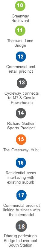
10 Design Elements Connecting People and Places A network of multi-functional green corridors throughout Greenway will bring green space into the heart of the development and provide walkways and sight lines linking residents to Georges River. This will connect Greenway: Residents to each other and the surrounding environment With neighbouring areas including the existing residential areas to the east and the Liverpool CBD to the west To key transport links including the Liverpool train station and the M7 motorway Greenway Boulevard is a green spine running the entire length of the development. It provides a long uninterrupted line of sight from north to south. Greenway Boulevard will be multifunctional, including: Wide pedestrian friendly walkways that encourages walking and interaction with adjacent shops and buildings Cycleways that integrate with Greenway s active transport network Green healthy streetscape to improve amenity and provide an attractive places for people to live and work Greenway Boulevard will pass over the Tharawal Land Bridge, a green and trafficable link across Newbridge Road that removes the barrier between north and south precincts. The Tharawal Land Bridge is more than a transport link, it will: Promote active modes of transport by providing safe passage across Newbridge Road Be a place of leisure promoting activities such as walking, jogging and picnics Support the local ecosystem by providing additional high value green space for birds and wildlife Greenway Boulevard and Tharawal land bridge provide green, active connections between the north and south Page 8


11 Water Sensitivity Blue Corridors The Georges River is an important natural feature for the people of Liverpool. It not only provides visual amenity, but is used by residents for active recreation such as kayaking and water skiing. Greenway will move Liverpool towards being a river city by improving access with the Georges River foreshore. Blue corridors of water sensitive features will enhance the Georges River by detaining stormwater in the public realm landscape and removing pollutants. These features will include: Small local rain gardens and grassy swales integrated with green streetscapes throughout Greenway, controlling pollutants at the source and preventing them from being discharge into the river. Permeable pavements will reduce stormwater runoff and local flooding by allowing stormwater to soak through pavements and into the soil, making water available to plant roots. Larger bio-retention systems and wetlands located along the Georges River bank will capture the remaining stormwater runoff, reducing peak flows and further preventing pollutants from entering the Georges River. Controlling stormwater runoff at the source and keeping water in the landscape will improve water quality in the Georges River as well as also improve amenity for Greenway residents. Water sensitive features reduce discharge of pollutants to Georges River Page 9

12 Water sensitive buildings and streetscapes will improve amenity, reduce flooding, improve water quality and ensure drought resistance Water Sensitivity Green Corridors A passive stormwater drainage system will utilise Greenway s multi-functional network of green corridors to create a water sensitive stormwater system. It will: Manage and convey stormwater flows at the surface, providing short runs to Georges River, minimising or avoiding the need for large underground stormwater infrastructure Cleans stormwater as it travels along the tree covered, passive stormwater distribution system Reduce minor flooding and stormwater peaks by managing stormwater at the source and slowing its travel through the precinct Green roofs, elevated podiums and walls will be implemented locally, at the individual building scale. These green features will: Utilise mezzanine levels to increase green space for residents and workers to meet and enjoy Improve thermal comfort within buildings Become part of the water sensitive drainage infrastructure by detaining, reducing and treating roof water, before it flows to the Georges River In 2014, the Cooperative Research Centre for Water Sensitive Cities released their report entitled The impacts of WSUD solutions on human thermal comfort. They concluded water sensitive urban design can improve thermal comfort, reducing urban heat by up to 10 degrees celsius. Improvement in the local microclimate by: Shading the streetscape and reducing urban heat Reduce heat radiated from buildings with green walls, and Retaining water in the landscape to provide evaporative cooling Drought resistance will: Utilise recycled water from the nearby Liverpool Water Recycling Plant operated by Sydney Water. This promotes sustainability and will ensure that Greenway remains 'green' even in the toughest climate Greenway s network of green corridors will enhance liveability by maintaining community health and wellbeing, creating a sense of place and attract people to the precinct. Page 10
13 Transport Greenway connects people to people by creating links to the Liverpool City Centre and surrounding regional hubs such as Parramatta and Western Sydney. Connectivity is supported with active integrated transport networks such as walkable streets, cycleways, bus and train services. The provision of adequate transport networks is critical to Greenway and Liverpool s economic future and to attracting new residents. Transportation needs for Greenway and the wider Liverpool region are met by several modes of transport (rail, buses, aviation and active transport). Liverpool is already strategically well located to access key freight and commuter transport corridors. Its position is currently close to: Junctions of the M7, M5 and Hume Highway, T-Way rapid bus transit line from Liverpool to Parramatta Rail / Bus interchange adjacent to Liverpool station. Future transportation requirements of the Greenway development will be served by planned major infrastructure projects for the area, specifically: Badgerys Creek Airport Proposed second international airport for Sydney. Western Sydney Infrastructure Plan - Funding for a 10 year, $3.6 billion road investment program for Western Sydney. The Western Sydney Infrastructure Plan will deliver major road infrastructure upgrades to support an integrated transport solution for the region. Moorebank Intermodal Terminal (MIT) - The proposed development of Moorebank Intermodal Terminal and the co located freight village will potentially create employment opportunities in transport and logistics on the edge of the city and promote supporting commercial activity across the city. Key future connections to Greenway are: M12 Motorway providing access from Liverpool CBD to the airport (via Elizabeth Drive) Bringelly Road Upgrade providing alternate southern approach to the airport from the M5 This infrastructure will benefit the region by improving road networks and constructing major new roads to serve the region. This will provide better connectivity between Greenway and the major urban growth areas, such as the South West Growth Centre and Hoxton Park as well as improving the catchment area for retailers, residents and workers for Greenway. The Master Plan for Greenway has been developed in consideration of transportation requirements. The proposed development is served by a variety of transport modes and encourages active transportation in the hierarchy of preferred modes. Additional bridges are to be constructed over Georges River to improve connectivity between opposite river banks. Currently the river represents an obstacle to the integration of future and existing Liverpool developments, as opposed to the natural asset that the river can offer the region. The following bridges will provide connections between Greenway and the wider Liverpool City Centre: The Mill Bridge (combined vehicle and pedestrian) Pirelli pedestrian footbridge (connection to existing Liverpool Station) Dharug pedestrian footbridge (connection to future Liverpool South Station) Bulba-Bideen shared path (connection to peninsula) Bigge Bridge (combined vehicle and pedestrian, connection to Liverpool hospital) Significant road infrastructure upgrades will be required at the following key junctions: Moorebank Avenue and M5 Moorebank Avenue and Newbridge Road The proposed Tharawal Land Bridge will span the existing Newbridge Road. This heavily trafficked route will pass beneath the development, alleviating traffic issues for Greenway and ensuring the development is not segregated as a result of the roadway. Page 11


14 Newbridge Road Bridge View from Lighthorse Park Rail It is noted that almost half of Sydney s population lives within 2km of a train station and that approximately half of all jobs are within 1km of a train station. This development has been progressed to ensure that Liverpool station maximises opportunity for job and population growth. Rail connections for Greenway are: Liverpool Station existing transportation hub in Liverpool CBD Proposed new Liverpool South Station located approximately midway between the existing Liverpool and Casula stations. Due to the size of the regeneration project and the resulting distance from Liverpool station, the installation of a new station here would assist in promoting growth for the commercial precinct and provide a public transport option for Intermodal related commuter activities. Sydney Metro Project benefits to commuter with reduced travel times (10 minute reduction to Sydney CBD) and higher frequency of service Bus Public transportation links will be improved to better serve Greenway. A shuttle bus service which connects Greenway from south to north via Greenway Boulevard will be established to mitigate private vehicle use. Existing bus services will be augmented to cater for increased use providing improved access between Greenway, Liverpool CBD and the wider region. Upgrade works to the existing Moorebank Avenue will be required to provide the necessary kiss and ride zone, taxi ranks and bus zones. Establish dedicated bus routes connecting the Liverpool-Parramatta T-Way to Badgerys Creek Airport to serve the commuting workforce and airport users as alternative means of public transportation to airport. Private Vehicles The use of private vehicles throughout Greenway will be restricted because of the dedicated pedestrianised and cycle zones. Private vehicle access will be provided through the development predominantly via Moorebank Avenue and Greenway Boulevard. This is essential for private resident parking and for routine delivery access. Multistorey parking lots at the south end of Greenway will accommodate the parking needs of the populace accessing via the M5. It is estimated that these facilities will provide in excess of 4,300 spaces. The commercial and residential buildings will include standard basement parking facilities to accommodate private vehicle use. Page 12

15 Active Transport The Greenway Master Plan has been developed to encourage and favour active transport (walking and cycling). Active transport corridors are provided between all key development features. The easy access to the walkways and cycleways will encourage healthy living, reduce emissions and preserve the natural beauty afforded by Georges River. Road types chosen throughout the development accommodate active transport options such as wide pedestrian footways, cycle paths, vehicle exclusion zones. The key active transport corridors are: Georges River and "Gandangara Walkabout" active transport promoted on the river setting Greenway Boulevard active transport promoted along retail and commercial boulevard Greenway also creates an easy connection to the continuous active transport route with the Westlink M7 Shared Pathway via Hoxton Park Road Page 13


16 Greenway Boulevard Street Typology Greenway Boulevard This multi-way boulevard will separate through traffic from local traffic and facilities. The benefits of this street type through the spine of the Greenway includes: Safer and easier travel by separating through traffic from local traffic Local access lanes to be used as a shared space for local uses e.g. deliveries Multiple medians create the opportunity to add design features and character. The envisaged boulevard will clearly demarcate local community space from through traffic. A generous, spatial streetscape is envisaged with wide pedestrianised areas for active transport. Medians will establish a boundary between through traffic and the neighbourhood-oriented space. Medians will also include landscaping and street trees, in addition to active use pedestrian and cycleways. The vibrancy of the boulevard will be ensured by the incorporation of retail outlets, cafés and other stores on the ground floor of units to give energy to the area and the whole development. Some limited on-street parking may be located on either the median or the sidewalk side of the local access lane (parallel parking preferred). This can provide an additional source of revenue for Council. Through Roads Through Roads The primary function of these roads is to allow traffic (vehicle, cyclist or pedestrian) to negotiate through Greenway and additionally serve as egress routes for the development. Moorebank Avenue is Greenway s most critical road, as it offers the primary access to Greenway. The success of the development will depend on the creation of a suitable four lane thoroughfare to cater for the traffic generated by the development. This will be supported by the proposed associated junction upgrades required at the M5 motorway and Heathcote Road/Newbridge Road. To additionally improve access to appropriate bus lanes, stops, taxi ranks will be incorporated into the road upgrade projects. These roads will have a similar feel to the local roads envisaged for the development but with a greater emphasis on accommodating larger traffic volumes. Page 14


17 Local Roads Local Roads The vibrancy of local roads is due to the continuous activity throughout the day. Residential and commercial streets in Greenway is where residents do their daily errands, meet with friends, and shop and play on the weekends. Short-term parking for customers and space for loading facilities are essential components for the commercial districts. However, parking and loading facilities often compete for the same space as business such as cafes, for example want the same desirable features such as corner bulb-outs or pedestrian plazas. Managing parking and loading facilities efficiently and effectively can serve both the needs of local businesses while enabling improvements to the public realm. Shared Public Ways or Pedestrianised Alleys These streets will provide local access throughout the development. They will: Shared Public Ways Prioritise use for pedestrians and public space over vehicular through travel Accommodate small numbers of vehicles at low speeds as necessary for local access to building entries and driveways, on-street parking, loading, service and emergency access and deliveries The character of a shared public way may vary, from quiet, residential-only lanes to mixed-use residential and pedestrian-oriented commercial streets. A narrower pedestrian/cyclist only variant may also be considered. Pedestrian only rights-of-way may consist of a public staircase, a narrow pedestrian path, or a downtown alley connecting two streets. Page 15


18 Housing, Population and Sustainability A vital component to any town master plan is the consideration of housing for the new population. The right mix of building density, location, access and sustainable liveability needs to be struck in coordination with the targeted demographics. This will ensure rapid uptake of the new housing which will populate Greenway. Liverpool is in the early stages of a predicted 25-year growth cycle which is forecast the LGA s population from about 200,000 today to 320,000 by It is rated alongside Parramatta and Penrith as major regional cities in Sydney highlighted for exceptional growth. It was identified in 2012 s NSW State Budget as one of eight key growth areas, with 100,000 new dwellings earmarked for development. With this in mind, Greenway has been designed to house a sizable population to match the expected Liverpool LGA growth projections. Single people, married couples and young families are all attracted to Liverpool s location, employment prospects, educational facilities and multicultural lifestyle. The availability of comparatively affordable housing and land is also another big drawcard. Residential building density, population and supply Greenway s concept intends to bring space and wellness to its populace and has been designed to prevent over population of the precinct. Greenway has lush, open passages between buildings on ground level with good utilisation of vertical space enabling a considerable population growth. To achieve this goal, medium rise apartment buildings have been utilized. Greenway residential building heights range from 4 to 20 storeys above ground. Through 3D modelling of standardised apartment building types on the anticipated Greenway site, it has been determined Greenway will produce approximately 6500 new dwellings which will contain a mix of 1, 2 & 3 bedroom apartments. This will allow housing for approximately 20,000, helping reduce the requirement for residential properties. Market research indicates that demand is high for apartments in the Liverpool region with a good "Demand to Supply Ratio" (DSR) of 70. The northern end of Greenway will attract the premium home owners with higher incomes, whilst the southern side will provide a range of 'affordable housing' tenancy options with development partially funded by the NSW State Government Affordable Housing scheme. Page 16

 Private vehicle.")

19 Location and Access Residential areas are located along the eastern side of Greenway. This provides residents with nearby access to specific areas of interest. All housing in Greenway is: Adjacent to retail zones in the north and south Close to commercial employment zones Within 300m of the Georges River and Gandangara Walkabout Within 200m of dedicated wide open, green community spaces. Getting around Greenway will be easy for residents as there are many options available. Safe travel is provided by: Walking tracks Cycling tracks Public transport (electric shuttle bus service) Private vehicle. To prevent excessive vehicle use in Greenway by residents and visitors, three key strategies have been developed for the Greenway concept. Decentralised Parking Frequent public transport Abundant walking and cycling tracks Sustainable housing As one of the core pillars of Greenway, liveability is a vital component of housing the new population. Greenway housing have entirely high density apartments. Mitigation of a crowded feeling is achieved with wide open external spaces for shared community use. By design, Greenway will provide the following to the local population in order to promote a sense of liveability: Integrated green spaces such as "green roofs" which can be used for communal vegetable gardening, paying homage to the original intent of Liverpool as an agricultural centre established by Governor Lachlan Macquarie in 1810 Generously sized outdoor balcony spaces Separation from adjacent apartment buildings at ground level to provide a perception of space and clear lines of sight Greenway residential buildings will have as low an impact on the environment as practicable. All residential apartment buildings will have integrated Solar Cells for facades, awning and shading where feasible. Industrial scale energy storage options have entered the market such as the "Tesla Powerpack" renewable energy use has become more practical and cheaper. Combined with sustainable building design features such as double glazed glass and evaporative cooling technologies, Greenway Retirement Village As the "Baby Boomer" generation matures into retirement, there is an emerging need for homes designed specifically for older residents. With this increase in demand known, Greenway will incorporate a premium standard retirement village which will provide both independent and assisted living options. Greenway Retirement Village will be located at the very north section of the precinct. This will enable fast medical emergency access via Biggie Bridge to Liverpool Hospital should it be required. This piece of mind and convenience surrounded by natural river views and open walking spaces will be in high demand by the local aging population. This will also create an enhanced sense of community and can ensure that families maintain close proximity to their loved ones. Page 17


20 Recreation Greenway will create exciting new spaces and facilities for recreational and cultural activities. The Greenway Hub is central to the Greenway social scene and will include: Indoor civic facilities with free meetings rooms, library, prayer, study spaces and teaching rooms for classes and short courses Multipurpose outdoor spaces to support markets and religious/cultural celebrations A grassy amphitheatre will look down at the River Stage and will provide an arena for cultural celebrations and music or theatrical performances Community services will utilise the Hub s indoor facilities The Richard Sadleir Sports Precinct, which will include: Boathouse clubs and rowing sports at the south western end of Greenway Sports Stadium for Rugby, AFL and Soccer Games A home for local sporting teams The River Front Entertainment District will: Provide a place for restaurants and cafes to be enjoyed by local residents Night life such as clubs overlooking the water with alluring water features. Markets and 'retail therapy' for those who love to shop Greenway s Active Transport Network including Gandangara Walkabout and Botanic Gardens will provide enticing active opportunities, such as jogging and cycling. Greenway s recreational facilities will also integrate with existing Liverpool facilities, such as the Powerhouse Arts Centre and Liverpool City Library. Greenway s potential to provide both exciting and relaxing recreational activities will not only satisfy it local population, but will also entice visitors from the greater south west Sydney Region. Page 18
21 Cultural A grassy amphitheatre will look down at the River Stage providing space for cultural celebrations and performances as well as a stage for local dance schools, music groups to perform as well as large scale concerts. Liverpool Council has numerous Community projects to cater for the diverse community groups within the city which is guided by the Growing Liverpool 2023 Community Strategic Plan. This Plan identifies the need for facilities for community groups in order to transform the city into a vibrant hub for jobs, entertainment and services. The plan identifies a need for the following: A city nerve centre to connect hospital, shops and transport The creation of an eat street, a lively café strip for all tastes, ages and budgets The revitalisation of the existing mall Green linkages between the City Centre, Georges River and transform Bigge Park into an integrated public space for time out, recreation and community celebrations New defined entry points into the City Centre The above initiatives have been incorporated into this Master Plan. The Greenway Hub will be the eastern portion of the Liverpool community precinct, connected to the existing City Centre and other community facilities through five new active transport links across the Georges River. These links will encompass the natural beauty and provide vital connections to the hospital and Bigge Park, train station, The Paper Mill and the Casula Powerhouse Arts Centre as well as the wider cycling paths such as the WestlinkM7 Shared Path, Mirambeena and Chipping Norton Loop. The Greenway Hub will be located centrally, 10 minutes walk from station via the Pirelli Bridge. The Hub s indoor and outdoor spaces will offer programs and support that are attuned to the multicultural mix of interests, religion, migrants, refugees and Culturally and Linguistically Diverse (CALD) backgrounds. It is envisaged that the Hub will provide the following initiatives to support the community and promote social cohesion: Indoor civic facilities Places for all ages to participate, learn, join interest groups or meet friends whilst supporting the local TAFE student s at the Hub s training café. Adult skills classes such as English as a second language, computer basics, and work ready will be combined with hobby and special interest classes. Community support services for self-help, mental health, carer and parent support groups as well as access to professional services like Centrelink advisors, financial support, advisory and legal services through to therapy and counselling. Facilitating networking groups such as migrants and refugees or other small business owners which will share experiences and create new opportunities within the community. Free health and fitness classes, for all ages, will encourage new friends and create small interest groups. Children s services will range from playgroup, music lessons and groups, dance classes, school holiday program. Multipurpose outdoor spaces will support community monthly markets and religious/cultural celebrations. A grassy amphitheatre will look down at the River Stage providing space for cultural celebrations and performances as well as a stage for local dance schools, music groups to perform as well as large scale concerts. Page 19
22 Employment Greenway will deliver opportunities for more than 15,000 jobs, primarily in health care, retail & hotels and community and education. The Liverpool Business Centres & Corridors Strategy 2013 (LBC&CS) reports the Liverpool LGA has grown in the order of 1.75% per annum, significantly higher than the Greater Sydney average of 1.24%. It is forecasted that the population of the Liverpool will continue to grow over the next 20 years from 180,143 people in 2011 to approximately 284,596 people in This projected growth is likely to result in increased demand for retail and commercial floor space in the Liverpool LGA. Greenway is located between Liverpool CBD and Moorebank, which are both categorised as a regional city and a town centre in the LBC&CS. The proximity of the site enables future expansion of the CBD and as the site develops the links will become more established. In the earlier stages Greenway will be the link between the Liverpool CBD and Moorebank. Greenway is a perfect opportunity to increase employment within the Liverpool LGA by providing an attractive place to live and work by creating an active residential and business community with improved transport links. The viability of the employment potential has been reviewed against the Bureau of Transport Statistics (BTS) employment forecasts. The BTS estimates employment, refer to Table 1 will increase for the Liverpool LGA from approximately under 68,000 to above 126,000 over the next 30 years. The largest industry within the Liverpool LGA is Manufacturing with approximately 10,000 employees, closely followed by Health Care and Social Assistance with approximately 9,800. The BTS has projected that over the next 30 years Manufacturing will remain fairly constant whilst Health Care and Social Assistance will more than double to 20,500 employees. Other industries projected to increase heavily in Liverpool LGA are Professional, Scientific & Technical Services and Education & Training from 2,076 to 5,767 and 5,786 to 12,529 respectively. Refer to Table 2 for further industry breakdown detail. The majority of the Health Care and Social Assistance and Professional, Scientific & Technical Services and Education & Training is projected to be within the City of Liverpool. Based on the above statistics Greenway has provided new commercial health care, retail, hotels, community and educational buildings. The floor space of the new buildings are aligned with the projected employment numbers. The premium location of Greenway and its supporting transport links, world class amenities and fantastic design will attract multiple businesses, retail companies and education bodies to realise the projected employment numbers. Projected Greenway Employment Generation Greenway will provide an opportunity to generate more than 15,000 jobs across several industries, which is greater than that projected by the BTS figures. The expectation is that the majority will be from three industries as mentioned above, however the expanse and diversity of Greenway will enable all industries to take advantage of the new facilities and its attractive commercial environment available. Through collaboration with Liverpool City Council, a marketing campaign will be devised to attract more businesses to the area, potentially through favourable economic parameters in early settlement periods to create an initial financial boost. Table 1 BTS employment forecasts for Liverpool LGA Year Total Employees 67,678 76,958 88,495 97, , , ,798 Page 20
23 Table 2 - BTS Employment Forecasts for Liverpool LGA by industry and year Year Agriculture, Forestry & Fishing Mining Manufacturing Electricity, Gas, Water & Waste Services Construction Wholesale Trade Retail Trade Accommodation& Food Services Transport, Postal & Warehousing Information Media & Telecommunications , ,175 3,900 7,231 3,078 4, , ,499 3,946 9,182 3,752 5, , ,887 4,680 11,204 4,392 7,060 1, ,436 1,068 5,466 5,159 12,540 4,889 8,154 1, ,569 1,202 5,778 5,623 14,190 5,529 9,190 1, ,699 1,262 6,187 6,248 15,815 6,022 10,683 1, , ,832 1,323 6,512 6,504 17,401 6,541 11,718 1,831 Year Financial & Insurance Services Rental, Hiring & Real Estate Services Professional, Scientific & Technical Services Administrative & Support Services Public Admin & Safety Education & Training Health Care & Social Assistance Arts & Recreation Services Other Services Unclassified ,076 2,671 5,773 5,786 9, ,207 2, ,176 1,223 2,802 2,989 5,774 7,130 11, ,637 1, ,339 1,390 3,559 3,403 6,204 8,209 13, ,879 1, ,487 1,497 4,016 3,897 6,610 9,258 14, ,051 1, ,869 1,739 4,635 4,555 7,047 10,399 16,725 1,029 3,256 1, ,949 1,813 5,268 5,081 7,449 11,494 18,569 1,197 3,584 2, ,999 1,873 5,767 5,666 7,727 12,529 20,497 1,233 3,731 2,040 Page 21
24 Delivering Greenway Planning Process Greenway involves a large area in close proximity to Liverpool Central Business District and is seeking a transformation from industrial land uses to dense commercial/retail and residential land uses. In order to formalise and implement the master plan, elements relating to land use zoning and other development standards such as building height are required to be incorporated into statutory planning documents. The Site has to be rezoned through a planning amendment to the Liverpool Local Environmental Plan (LEP) 2008 which is proposed to Council in the form of a Planning Proposal. It is important to involve the key stakeholders and community prior to submitting the Planning Proposal to Council. Greenway involves a large area in close proximity to Liverpool Central Business District and is seeking a transformation from industrial land uses to dense commercial/retail and residential land uses. The proposed community engagement is discussed later in this report. Although community engagement is undertaken as part of the rezoning process, creating opportunities for key stakeholders and the community prior to submission will assist in addressing any community groups that wish to be heard and ensuring the assessment process is smooth and undertaken in a timely manner. Following community engagement, the Planning Proposal is prepared based on the following amendments: Rezoning of land zoned currently IN1 General Industrial and IN2 Light Industrial to B4 Mixed Use. It is noted that B4 mixed Use does not include retail uses as permissible form of development. A Schedule 1 Additional Permitted Uses Retail Premises to be included Building Height o Northern part of the site maximum 105m o Southern part of the site maximum 70m Floor Space Ratio o Northern part of the site maximum 2:1 o Southern part of the site maximum 1.5:1 The preparation of the Planning Proposal would follow the Department of Planning & Environment guidelines which require a rezoning to consider several criteria such as the relationship of Greenway to regional and sub-regional strategies such as A Plan for Growing Sydney, consistency with State Environment Planning Policies (SEPP), application of ministerial 117 directions, environmental, social and economic impact, adequate public infrastructure and the views of State and Commonwealth public authorities. The Master Plan Planning Proposal will require a package of consultant studies/drawings. Which can be can be delayed until the Department of Planning and Environment assess the application. In addition, a site-specific Development Control Plan (DCP) should be prepared and exhibited at the same time as the Planning Proposal. The Greenway DCP would provide site analysis, outline the key planning principles, set the aims and objectives for Greenway, outline the function and uses, envisaged dwelling yield and provide guidelines for public domain, accessibility, setbacks, public transport, landscaping and parking. Following the submission of the Planning Proposal to Council, the next steps in the process include: 1. Council assessment 2. Attend a Council meeting for an endorsement to send to the Department of Planning and Environment 3. Department of Planning and Environment provide their Gateway Determination with conditions such as which consultant studies are required to be prepared and submitted to Council 4. Formal exhibition for 28 days 5. Sent to the public authorities for 30 days. The public authorities that may need to be consulted are the Office of Environment and Heritage, Transport for NSW, Roads & Maritime Services, Sydney Water, Energy Australia, Telstra, Bankstown Airport Limited, Civil Aviation Safety Authority, Airservices Australia and the Department of Infrastructure and Regional Development. This was the list of authorities were consulted in relation to the Liverpool CBD LEP 6. Resubmit any changes to Council where any submissions received would be reviewed and addressed. A report recommendation would be to send the Planning Proposal to the Department of Planning & Environment for the LEP amendment to be made 7. Department of Planning & Environment would formally amend the LEP by the Minister making the LEP amendment. Page 22

, Parramatta Light Rail, Bringelly Road upgrade, M12 motorway 5.")

25 Stage 1 Stage 2 Stage 3 Staging Greenway is to be constructed and opened in stages over 15 years. Staging the project would result in the following advantages: 1. Cost efficient delivery of the highest priority infrastructure sections of the project in line with the DCP and council requirements 2. Staged delivery will match the demand for public transport along the corridor grows 3. Reduce the impacts of the construction periods on the local community and road users 4. Programed to complement other planned transport projects, including the Western Sydney Rail Upgrade Program, Sydney Rapid Transit (SRT), Parramatta Light Rail, Bringelly Road upgrade, M12 motorway 5. Programed to complement other planned infrastructure projects, such as Badgerys Creek Airport Timeframes for the delivery of Greenway are: 6. Stage 1 between Stage 2 between Stage 3 between Infrastructure Stage between Stage 1 of the project will include: Construction of the northern precinct including 60% of residential dwellings, medical & educational buildings and the riverfront retail and entertainment area Staggered delivery of highest priority transport links Pirelli Bridge, Bigge Bridge, Bulba-Bideen shared path connecting to surrounding neighbours and amenities Construction of the first stage of Greenway Boulevard including Tharawal Land Bridge to the link the northern and southern precincts Upgrade existing road networks (i.e. Newbridge Road and Heathcote Road) to accommodate higher peak demands. Stage 2 of the project will include: Construction of the southern precinct which includes remaining 40% residential dwellings, commercial buildings, Green Hub and riverfront retail and entertainment precinct Construction of Mill Bridge linking to the west Continue construction of Greenway Boulevard Commence construction of the Gandangara Walkabout network, starting in the north and progressing south Widen existing Moorebank Avenue and M5 highway to accommodate more vehicles while providing a calm, spacious pedestrian and living environment for adjacent residences Stage 3 will include: Construction of stadium Construction of a new rail station on the existing Liverpool Station to Glenfield line and future rail network to Leppington. The Infrastructure Stage would include: Progressive traffic mitigation by modification and upgrade of surrounding road networks and junctions such as Hume Highway, Hoxton Park Road, Governor Macquarie Drive, and Church Road. Upgrade existing bus road networks between Liverpool and Parramatta to encourage use of public transport and support population growth. Establish dedicated bus routes connecting Liverpool-Parramatta T-Way to Badgerys Creek Airport to serve a commuting workforce and airport users. Current regional bus operator Transdev NSW to provide additional service terminating at Liverpool Station bus interchange. Page 23
26 Economics The concentration of urban renewal opportunities in Greenway places additional pressure on surrounding transport infrastructure, but also offers an opportunity to use the scale of development to achieve substantial improvement. The key considerations for infrastructure required to support future population and employment growth within Greenway include: Delivering long term transport connections to provide improved access to Greenway Matching the population with the delivery of social infrastructure and open space Ensuring adequate utility capacity is available to service the development Coordinating infrastructure investments from government and the private sector Greenway will engage and work with infrastructure agencies and stakeholders to coordinate the infrastructure required to support integrated land use planning throughout the development, as well as identify available finance and contribution schemes. Public Transport Links In June 2014, the Government announced Rebuilding NSW a new plan to turbocharge NSW. With a population of over two million people, Western Sydney is now bigger than many of Australia s capital cities. Rebuilding NSW invests $10 billion in Western Sydney and presents a oncein-a-generation opportunity to build the infrastructure that Western Sydney needs. This will ensure Western Sydney not only keeps up with forecast population growth, but thrives, delivering the jobs and economic foundations to become an even better place to work and live. Rebuilding NSW provides the opportunity to extend the benefits of public transport to more communities across Western Sydney. The reliability and frequency of services on the existing passenger rail network will also be improved progressively under Sydney s Rail Future Stage 2. The Government will reserve $1 billion to deliver this plan for the Western Sydney Rail Upgrade Program which specifically targets the capacity constraints on the T1 Western Line. Greenway will source funding from the Rebuilding NSW initiative for construction of the new rail station (Liverpool South Station) Stadia and Cultural Facilities Families in Western Sydney should not always have to travel into the Sydney CBD to participate in cultural and sporting activity. Western Sydney needs an increase its investment in arts and cultural infrastructure. The NSW Government will also engage with Western Sydney councils to identify coinvestment proposals for cultural infrastructure. Western Sydney will also benefit from the $600 million stadia fund. The Government will look at long term options for the construction of an outer Western Sydney stadium to support expected population growth and encourage tourism to the area. In order to benefit from the $600 million funding, Greenway will work closely with Liverpool and other local councils to design and construct the proposed stadium as well as the centrally located cultural centre which meet the government and funding requirements. Other Stakeholder Contribution Greenway recognises the competing demands on Government budgets. As Greenway land is privately owned, the cost of developing each site will be funded by the respective owners and developers. Profits from the developments will be returned to the developer. Funding can be sourced from the developer via the following schemes: Section 94 Contributions based on the Liverpool City Council Section 94 Plan Voluntary Planning Agreement [VPA] to deliver key infrastructure items and social and open space projects Betterment Tax for up-zonings which aims to tax the economic rent from land rezoning that would otherwise accrue to the landowner. This encourages Governments to allow land to be used for its most productive use as this will increase the value of the land (and hence increase the revenue raised from land tax) Pursue support from Sydney Inter Modal Terminal Alliance (SIMTA) as the Moorebank Intermodal Terminal will have a direct impact on the proposed Liverpool district redevelopment and compromise intended development and regeneration works of Liverpool City by channelling heavy goods traffic along Moorebank Avenue and Church Road. Collaboration with SIMTA to ensure infrastructure upgrades in the vicinity of the Intermodal Terminal, particularly M5 Motorway, Hume Highway, Moorebank Avenue, Newbridge Road, Church Road, and other local roads are beneficial to Liverpool Council. The following table summarises the opportunities, infrastructure and funding mechanisms that Greenway plans to utilise. Page 24
27 Greenway Proposal Opportunity Key Infrastructure recommendations Costs and funding Liverpool South Station Western Sydney Rail Upgrade Program Consider non-capital options to relieve pressure on the system during peak periods Up to $1 billion from the Rebuilding NSW initiative Greenway Active Transport Bridges Construction of bridges serving local communities, and facilitates higher productivity vehicle access Construction of Pirelli Bridge, Bigge Bridge, Mill Bridge, Tharawal Bridge and Dharug Bridge which connecting Liverpool South Station Australian Government s Bridges Renewal Programme (BRP) contribute a maximum of 50% of the total project cost Greenway Hub Western Sydney cultural hubs Partner with local councils to develop opportunities for co-investment in new and repurposed cultural infrastructure in Western Sydney, with particular regard to the river cities of Liverpool, Penrith and Campbelltown Greenway Stadium Sporting infrastructure Commence planning for an outer Western Sydney stadium, to be built in the longer term $600 million from the Rebuilding NSW initiative $600 million from the Rebuilding NSW initiative Upgrade surrounding road networks Upgrade infrastructure in the vicinity of Moorebank Intermodal Terminal Construction of new slip lanes at intersection of: Moorebank Avenue and M5 Motorway, Moorebank Avenue and Heathcote Road, Alliance with SIMTA Newbridge Road and Moorebank Avenue, Newbridge Road and Governor Macquarie Drive Widening Newbridge Road to facilitate pedestrian movements, improve public lighting over bridge to achieve higher visibility at night and increase safety Modification of Hume Highway intersections including M5 Motorway, Hoxton Park Road, Governor Macquarie Drive, Memorial Avenue etc. Additional services on the existing bus network Improve connectivity to global centres Invest in Bus Rapid Transit and Bus Priority programs $300 million from the Rebuilding NSW initiative Aged Care precinct Provide home and community care and aging centre Construction of Greenway retirement village which incorporates both independent and assisted living Family & Community Services Ageing, Disability & Home Care (ADHC) Light rail corridor from Parramatta to Liverpool via the T-way Sydney Rapid Transit & Parramatta Light Rail Consider additional stations to support urban renewal $7 billion from the Rebuilding NSW initiative Page 25
28 Stakeholder Engagement An important part of developing a master plan is identifying the key stakeholders and interest groups and providing opportunities for the community to express their opinions about the master plan and to have a voice as to what they want to see on our site. Community engagement is an integral part of developing a master plan to ensure Greenway will be embraced and supported by the existing communities. It is proposed community engagement be undertaken prior to a formal submission to Council in order to help gain the community support which will assist in a smoother implementation of the plan. Community consultation which can be classified into three types including information, consultation and active participation. Effective community engagement requires an integration of several techniques in order for society to be reached. We have identified the following key stakeholders that should be consulted: Local business groups Local residents Existing owners Public utility authorities The hospital Representatives from the main religious groups in the area Local and State Government representatives SITMA and Moorebank Intermodal Terminal consultation between Council and the SITMA to ensure that a collaborative approach to restricting Intermodal related traffic congestion on local roads. Greenway s Community Engagement Strategy will be focused on creating awareness of the Master Plan, through different types of media and in different languages. Website will be set up for people to explore the concept as well as community meetings/drop in sessions to direct their attention to ways in which they can comment and contribute to Greenway s concept. A range of techniques that form the Greenway Community Engagement Strategy includes: Advertising: in particular formats and languages for a range of media such as newspapers, magazines, radio, television and online media. This will create awareness about Greenway and to encourage the public to investigate further. Online information can be translated into a range of languages and target specific audiences such as younger people. Fact sheets are a simple, timely and inexpensive way to summarise and convey the key points. Fact sheets will be distributed with information about how to get involved. Media stories will raise interest and inform the community. Greenway also plans to contact a local reporter to write in a local paper about the precinct. Displays of highly visual materials in a range of locations stimulates engagement activity. Newspaper inserts provide information to a large number of people in a community. Newspaper inserts about Greenway will be placed in a range of community papers and journals. Community meetings will increase awareness of community issues and concerns about Greenway. Page 26


29 Summary Greenway is the promise of a vibrant new precinct which will elevate Liverpool's status to the next major NSW regional city. This Master Plan has provided an overview of what will make Greenway a unique and successful development based on the four core pillars of: 6,500 New Dwellings 20+ Community Facilities 18,000 New Parking Spaces 20,000 Population Increase Community Liveability Activity Viability T2 is proud to bring you this Greenway Master Plan and is now eager to proceed on to the next step in the development process. 15,000 New Jobs 29% city Green Space Close to Liverpool Hospital UWS - Medical Education Campus The key stakeholders which have been mentioned in this plan will be engaged to firm up funding commitments. Further community stakeholder interaction will be undertaken to ensure confident uptake and viability of the concept. 45min to Sydney & Badgerys Airports 10mins to Stations 7.5 km Active Transport Routes Sports Stadium Seating 20,000. Page 27
Draft Western District Plan
 Powered by TCPDF (www.tcpdf.org) Draft Western District Plan Submission_id: 31440 Date of Lodgment: 15 Dec 2017 Origin of Submission: Online Organisation name: Goodman Property Services Australia Pty Ltd
Western City District What we heard
 What we heard Vision to 2056 and Priorities Governance and implementation Infrastructure and funding The protection of the natural landscape including biodiversity and the Metropolitan Rural Area for food
DRAFT WESTERN CITY DISTRICT PLAN PLANNING PRIORITIES AND ACTIONS
 Greater Sydney Commission DRAFT WESTERN CITY DISTRICT PLAN PLANNING PRIORITIES AND ACTIONS Issued: 26 OCTOBER 2017 Version: 1 Subject: Greater Sydney Region and District Plans This information note is
As will be detailed, our site plays a strategic role in providing these opportunities.
 29 March 2017 Greater Sydney Commission PO Box 257 Parramatta NSW 2124 Email: info@gsc.nsw.gov.au Dear Sir/Madam, RE: DISTRICT PLAN-SOUTH WEST AREA. Woodward Park and Liverpool CBD. I have been requested
Draft Eastern District Plan
 Draft Eastern District Plan Submission_id: 31238 Date of Lodgment: 13 Dec 2017 Origin of Submission: Online Organisation name: Turrulla Gardens Pty Ltd C/- Mecone Organisation type: Industry First name:
OUR GREATER SYDNEY A metropolis of three cities. OVERVIEW. connecting people. DRAFT Greater Sydney Region Plan
 OUR GREATER SYDNEY 2056. A metropolis of three cities. OVERVIEW. connecting people. DRAFT Greater Sydney Region Plan October 2017 This document is an overview of the draft Greater Sydney Region Plan. To
North District What we heard
 What we heard Vision to 2056 and Priorities Governance and implementation Infrastructure and funding The vision for a metropolis of three cities, and the 30 minute city. Feedback emphasised: That for the
Keystone Business Park Precinct Structure Plan North East Industrial Precinct. Part 2 Design Principles
 Keystone Business Park Precinct Structure Plan North East Industrial Precinct Part 2 Design Principles Context Issues Services Landform Issues Geotech and contamination Ecology Traffic and access Issues
DRAFT GREATER SYDNEY REGION PLAN OBJECTIVES, STRATEGIES AND ACTIONS
 Greater Sydney Commission DRAFT GREATER SYDNEY REGION PLAN OBJECTIVES, STRATEGIES AND ACTIONS Issued: 26 OCTOBER 2017 Version: 1 Subject: Greater Sydney Region and District Plans This information note
Draft Western District Plan
 Powered by TCPDF (www.tcpdf.org) Draft Western District Plan Submission_id: 31371 Date of Lodgment: 14 Dec 2017 Origin of Submission: Online Organisation name: Mecone Pty Ltd Organisation type: Industry
South District Plan OVERVIEW
 OUR GREATER SYDNEY 2056 Revised Draft South District Plan OVERVIEW Canterbury-Bankstown Georges River Sutherland Snapshot of the South District today and into the future The Greater Sydney Commission acknowledges
Eastern City District Plan
 OUR GREATER SYDNEY 2056 Revised Draft Eastern City District Plan OVERVIEW Bayside Burwood Canada Bay City of Sydney Inner West Randwick Strathfield Waverley Woollahra Snapshot of the Eastern City District
REVISED DRAFT NORTH DISTRICT PLAN PLANNING PRIORITIES AND ACTIONS
 Greater Sydney Commission REVISED DRAFT NORTH DISTRICT PLAN PLANNING PRIORITIES AND ACTIONS Issued: 26 OCTOBER 2017 Version: 1 Subject: Greater Sydney Region and District Plans This information note is
I615. Westgate Precinct
 I615. Westgate Precinct I615.1. Precinct Description The Westgate Precinct is located approximately 18km west of the Auckland city centre. There are seven Sub-precincts in the Westgate Precinct: Sub-precinct
Making the case for Sustainable Transport Project Potential
 Making the case for Sustainable Transport Project Potential The Structural Investment Fund (SIF) Strategy for Greater Lincolnshire identifies the barriers to growth identified by having poor transport
Welcome to the Oakridge Centre Open House
 Welcome to the Oakridge Centre Open House Why is the City hosting this event? This open house is to inform you of a rezoning application submitted to the City of Vancouver to amend the existing CD-1 (Comprehensive
South District What we heard
 What we heard Vision to 2056 and Priorities Governance and implementation Infrastructure and funding Feedback supported: The vision for a metropolis of three cities, but emphasised the importance of infrastructure
Northern Territory Compact Urban Growth Policy
 Northern Territory Compact Urban Growth Policy A Reference Policy Document to clause 2.7 (Reference to Policy) of the NT Planning Scheme May 2015 Table of Contents 1 Policy Setting... 3 1.1 Context for
[PLANNING RATIONALE] For Site Plan Control and Lifting of Holding Zone By-Law 101 Champagne Avenue. May 23, 2014
![[PLANNING RATIONALE] For Site Plan Control and Lifting of Holding Zone By-Law 101 Champagne Avenue. May 23, 2014](/thumbs/75/71599615.jpg "[PLANNING RATIONALE] For Site Plan Control and Lifting of Holding Zone By-Law 101 Champagne Avenue. May 23, 2014") [PLANNING RATIONALE] For Site Plan Control and Lifting of Holding Zone By-Law 101 Champagne Avenue May 23, 2014 Contents 1.0 Introduction... 2 2.0 Site Context... 2 2.1 Adjacent Uses... 2 Figure 1: Site
[PLANNING RATIONALE] For Site Plan Control and Lifting of Holding Zone By-Law 101 Champagne Avenue May 23, 2014 Contents 1.0 Introduction... 2 2.0 Site Context... 2 2.1 Adjacent Uses... 2 Figure 1: Site
Page 1 of 19 URBAN DESIGN FRAMEWORK FOR BOLTON STREET WATERFORD
 Page 1 of 19 URBAN DESIGN FRAMEWORK FOR BOLTON STREET WATERFORD 1.0 Introduction: The relocation of the City Council stores and depot from Bolton Street creates an exciting opportunity for development
Central City District What we heard
 What we heard Vision to 2056 and Priorities Governance and implementation Infrastructure and funding The vision for a metropolis of three cities, and the 30 minute city. Feedback requested: Clearer communication
Transportation. Strategies for Action
 Transportation A major priority for the Overlake Neighborhood is to develop a multimodal transportation system. To achieve this system, a balance has to be found among travel, circulation and access needs;
Rochford District Council Allocations Development Plan Document: Discussion and Consultation Document Sustainability Appraisal
 Option SWH1 Balanced Communities Option SWH1 1 To ensure the delivery of high quality sustainable communities where people want to live and work Will it ensure the phasing of infrastructure, including
Comprehensive Plan ADOPTED APRIL 2014
 Comprehensive Plan ADOPTED APRIL 2014 8 8. Outstanding Recreational & Cultural Opportunities We are proud of our community s parks and recreation system. Our community will ensure that the legacy of our
Draft South West District Plan - Campbelltown City Council Submission Attachment 1
 Draft South West District Plan - Campbelltown City Council Submission Attachment 1 Campbelltown City Council Report and Resolution - Draft South West District Plan - Draft Submission Ordinary Meeting 28/03/17
The Proposed Auckland Unitary Plan (notified 30 September 2013)
") 3 Business zones Introduction There are 10 business zones in the Unitary Plan: City Centre Metropolitan Centre Town Centre Local Centre Neighbourhood Centre Mixed Use General Business Business Park Light
3 Business zones Introduction There are 10 business zones in the Unitary Plan: City Centre Metropolitan Centre Town Centre Local Centre Neighbourhood Centre Mixed Use General Business Business Park Light
Tāhuhu whakaruruhau ā-taone The sheltering ridge pole
 B2. Tāhuhu whakaruruhau ā-taone - Urban growth and form B2.1. Issues Tāhuhu whakaruruhau ā-taone The sheltering ridge pole Auckland s growing population increases demand for housing, employment, business,
V. Vision and Guiding Principles
 V. Vision and Guiding Principles The Master Plan for the Powers Ferry Corridor seeks a foundation in the desires of the community. At times, various elements of the community offered opposing viewpoints,
DAREBIN PLANNING SCHEME AMENDMENT C137
 Who is the planning authority? Planning and Environment Act 1987 DAREBIN PLANNING SCHEME AMENDMENT C137 EXPLANATORY REPORT This amendment has been prepared by the Darebin City Council, who is the planning
Plan Modification to Chapter B2 of the Auckland Unitary Plan(AUP) Operative in part (15 November 2016)
 Operative in part (15 November 2016)") UNITARY PLAN UPDATE REQUEST MEMORANDUM TO FROM Phill Reid Linley Wilkinson DATE 25 September 2018 SUBJECT Plan Modification to Chapter B2 of the Auckland Unitary Plan(AUP) Operative in part (15 November
UNITARY PLAN UPDATE REQUEST MEMORANDUM TO FROM Phill Reid Linley Wilkinson DATE 25 September 2018 SUBJECT Plan Modification to Chapter B2 of the Auckland Unitary Plan(AUP) Operative in part (15 November
Colchester Northern Gateway Master Plan Vision Review Draft. July 2016
 Colchester Northern Gateway Master Plan Vision Review Draft July 2016 Contents Introduction 4 Context 8 Purpose of the Report 8 Strategic Position 9 Overview of the Process 11 2012 Master Plan Vision 12
The West Vaughan Employment Area Secondary Plan Policies
 Part 2: The West Vaughan Employment Area Secondary Plan Policies 2.1 General Policies It is the policy of Council: 2.1.1. That the West Vaughan Employment Area (the WVEA), identified on Schedule 1, will
10.0 Open Space and Public Realm
 10.0 Open Space and Public Realm 10.0 Open Space and Public Realm The Public Open Space System is comprised of: outdoor spaces available for public use that are either publicly owned (e.g., parks and
Draft Western District Plan
 Powered by TCPDF (www.tcpdf.org) Draft Western District Plan Submission_id: 31466 Date of Lodgment: 15 Dec 2017 Origin of Submission: Online Organisation name: Coronation Property Co Pty Ltd Organisation
Central City District Plan
 OUR GREATER SYDNEY 2056 Revised Draft Central City District Plan OVERVIEW Blacktown Cumberland Parramatta The Hills Snapshot of the Central City District today and into the future People Population, age
Inclusive and Engaging City
 Inclusive and Engaging City An Inclusive City welcomes and enables all people to participate fully in City life. Population, housing, services, social inclusion and liveability are important elements of
TIDAPA Structure Plan
 TIDAPA Structure Plan Prepared by Tract Consultants 28 MARCH 2017 0217-0074 Table of Contents 01 STRATEGIC CONTEXT Executive Summary Regional Context Page 3 Page 4 02 LOCAL CONTEXT Aerial Photograph Local
C. Westerly Creek Village & The Montview Corridor
 C. Westerly Creek Village & The VISION Community Vision When the goals of the city are achieved Westerly Creek Village, a distinctive community defined by Montview Boulevard and Westerly Creek, is a strong
Land Use Amendment in Southwood (Ward 11) at and Elbow Drive SW, LOC
 at and Elbow Drive SW, LOC") 2018 November 15 Page 1 of 10 EXECUTIVE SUMMARY This land use amendment application was submitted by Rick Balbi Architect on 2017 August 31 on behalf of Sable Developments Ltd, and with authorization from
2018 November 15 Page 1 of 10 EXECUTIVE SUMMARY This land use amendment application was submitted by Rick Balbi Architect on 2017 August 31 on behalf of Sable Developments Ltd, and with authorization from
Realities and Assets in an In-Town Shopping Center
 SUSTAIN SOUTHERN MAINE MILL CREEK PILOT LESSONS LEARNED April 15, 2013 Realities and Assets in an In-Town Shopping Center 1. An older shopping district that was laid out in a low-density, strip center
PART AOTEA PRECINCT
 CONTENTS... PAGE AOTEA PRECINCT...4 14.5.1 INTRODUCTION...4 14.5.2 RESOURCE MANAGEMENT ISSUES...4 14.5.3 RESOURCE MANAGEMENT OBJECTIVES AND POLICIES... 4 14.5.4 RESOURCE MANAGEMENT STRATEGY...5 14.5.5
WATERLOO STATE SIGNIFICANT PRECINCT SUMMARY OF STUDIES
 WATERLOO STATE SIGNIFICANT PRECINCT SUMMARY OF STUDIES Technical studies will be undertaken to inform the master planning process for the Waterloo precinct to develop a Precinct Proposal to redevelop the
ELMVALE ACRES SHOPPING CENTRE MASTER PLAN
 ELMVALE ACRES SHOPPING CENTRE MASTER PLAN Contents 1.0 INTRODUCTION... 2 2.0 LOCATION... 2 3.0 EXISTING CONTEXT... 2 4.0 VISION & GUIDING PRINCIPLES... 2 5.0 LAND USE AND BUILT FORM... 4 5.1 St. Laurent
GREENBANK DEVELOPMENT MASTERPLAN
 DEVELOPMENT MASTERPLAN POTENTIAL TRAIN STATION COMMUNITY CENTRE Greenbank will be a connected masterplanned community providing easy access to local and surrounding amenity. Affordable quality homes, green
Welcome to our exhibition
 Welcome to our exhibition The Homes & Communities Agency (HCA) welcomes you to this public exhibition explaining our proposals for the redevelopment of the former Lea Castle Hospital site. About the Homes
4.1.3 LAND USE CATEGORIES
 4.1.3 LAND USE CATEGORIES a. City Center District The City Center District incorporates the existing character and mix of uses in downtown Belmont to encourage redevelopment and new development in keeping
Queensborough Eastern Neighbourhood Node. Community Open House
 Queensborough Eastern Community Open House The Vision The Queensborough Eastern will become the heart of eastern Queensborough. Through a sensitive mix of viable commercial and residential areas, the neighbourhood
38 Queen s University Campus Master Plan Part 1
 38 Queen s University Campus Master Plan Part 1 46 The Campus at the City Scale Chapter 4 The Campus at the City Scale 39 Queen s is an urban University centrally located in Kingston. Decisions made by
SUB AREA 3 CENTRAL STRATFORD AND SOUTHERN QUEEN ELIZABETH OLYMPIC PARK
 191 ADOPTED LOCAL PLAN: THE SUB AREAS SUB AREA 3 CENTRAL STRATFORD AND SOUTHERN QUEEN ELIZABETH OLYMPIC PARK SECTION 12 Vision VISION Central Stratford and Southern Queen Elizabeth Olympic Park will become
This Review Is Divided Into Two Phases:
 Semiahmoo Town Centre Review The purpose of this review: To review the Semiahmoo Town Centre Concept Plan, originally approved in 1993, to ensure that this centre will continue to serve the needs of South
Lambeth Main Street Streetscape Improvements
 Lambeth Main Street Streetscape Improvements Open House October 5th, 2017 Agenda 1. Introduction 2. Project Background 3. Context 4. Project Objectives 5. Design Principles & Approach 6. Streetscape Design
elbridge Core Strategy
 C elbridge Core Strategy Celbridge is designated as a Moderate Growth Town in the RPGs. The County Development Plan reinforces this designation in its settlement strategy. Moderate Growth Towns within
Macro Town Planning Submission
 7 March 2017 Ref: WTJ16-153_Macro Town Planning Submission_Macquarie Park Investigation Area Macro Town Planning Submission Macquarie Park Investigation Area Multiple Goodman Land Holdings Prepared by
LIVEABLE. A diverse and welcoming capital city with an enviable lifestyle and strong community. Liveable City of Adelaide Strategic Plan
 LIVEABLE A diverse and welcoming capital city with an enviable lifestyle and strong community 38 Liveable City of Adelaide 2016-2020 Strategic Plan City of Adelaide 2016-2020 Strategic Plan 39 LIVEABLE
EAST VILLAGE STRATEGIC SITE NOVEMBER 2017
 EAST VILLAGE STRATEGIC SITE NOVEMBER 2017 East Village will be a sustainable, mixeduse precinct with a focus on innovative employment and education opportunities. Enhanced by green spaces and places for
Planning Proposal Charlestown Swim and Leisure Centre LEP Amendment
 Planning Proposal Charlestown Swim and Leisure Centre LEP Amendment Amendment No. 4 to Lake Macquarie Local Environmental Plan 2014 (PP_2014_LAKEM_005_00) Local Government Area: Name of Draft LEP: Lake
Chapter 2: OUTLINE PLANNING APPLICATION PROPOSALS. A New Garden Neighbourhood Matford Barton 17
 Chapter 2: OUTLINE PLANNING APPLICATION PROPOSALS A New Garden Neighbourhood Matford Barton 17 2.1. SUMMARY AND STATUS OF THE PROPOSALS 2.1.1. The parameter plans and associated wording in this chapter
Today Land & People. Northeast Nampa Gateway District. Employment. Land Use Characteristics. Demographics. Current Zoning
 Today Land & People Employment Major employers include Saint Alphonsus, the College of Western Idaho, the Auto Mall, Sorrento Lactalis and Walmart. 3,004 jobs in 2010 (COMPASS-CIM 2040 TAZ data) 4,345
Plano Tomorrow Vision and Policies
 Plano Tomorrow Vision and Policies PLANO TOMORROW PILLARS The Built Environment The Social Environment The Natural Environment The Economic Environment Land Use and Urban Design Transportation Housing
Concord Community Reuse Project Goals and Guiding Principles. Overarching Goals (OG)
") Concord Community Reuse Project Goals and Guiding Principles Overarching Goals (OG) No priority is implied by the order of presentation of the goals and guiding principles. Overarching goals for the Concord
Concord Community Reuse Project Goals and Guiding Principles Overarching Goals (OG) No priority is implied by the order of presentation of the goals and guiding principles. Overarching goals for the Concord
Planning Proposal Toronto Road, Booragul. Amendment to Lake Macquarie Local Environmental Plan (LMLEP) 2014
 2014") Planning Proposal Toronto Road, Booragul Amendment to Lake Macquarie Local Environmental Plan (LMLEP) 2014 Local Government Area: Name of Draft LEP: Subject Land: Land Owner: Applicant: Folder Number:
Planning Proposal Toronto Road, Booragul Amendment to Lake Macquarie Local Environmental Plan (LMLEP) 2014 Local Government Area: Name of Draft LEP: Subject Land: Land Owner: Applicant: Folder Number:
Horwood Map of London, Westminster & Southwark First edition
 Barratt London is developing plans in tandem with Southwark Council and TfL to transform the southern end of Blackfriars Road. The residential-led, mixed-use scheme will deliver new private and affordable
REMARKABLES PARK ZONE
 .10 Remarkables Park Zone.10.1 Resources, Activities and Values The Remarkables Park Area comprises approximately 150 hectares of perimeter urban land in the vicinity of Frankton and occupies a strategic
Planning Districts INTRODUCTION
 INTRODUCTION To facilitate detailed examination of development prospects for all areas of the community, Delano has been divided into 14 planning districts. The location of these planning districts is
Silverdale Regional Center
 Silverdale Regional Center Vision for Silverdale Regional Center The Silverdale Regional Center Plan (Plan) will guide the evolution of the Silverdale Regional Center from a collection of strip malls and
Pioneering the Sustainable Future of Pakistan. A New Destination of Islamabad
 Pioneering the Sustainable Future of Pakistan A New Destination of Islamabad A New Destination of Islamabad C A P I TAL S M A R T CIT Y ISL A M A B A D, PAKISTA N CAPITAL SMART CITY ISLAMABAD C A P I TAL
Ivywild On The Creek PRELIMINARY CREEK DISTRICT MASTER PLAN
 Ivywild On The Creek PRELIMINARY CREEK DISTRICT MASTER PLAN Introduction: Rejuvenating an extraordinary Creekside neighborhood THE CREEKSIDE DISTRICT The Ivywild On The Creek Neighborhood District Master
Response to the London Bridge Area Vision and Site Allocations within the New Southwark Plan
 1 Melior Place London SE1 3SZ 020 7407 4701 teamlondonbridge.co.uk info@teamlondonbridge.co.uk 28 April 2017 Response to the London Bridge Area Vision and Site Allocations within the New Southwark Plan
Economy Vision Statements: Social Wellbeing Vision Statements: Natural Environment Vision Statements:
 Economy Vision Statements: 1. Our business environment makes us a region of choice for new employers as we encourage entrepreneurship and have a vibrant, diversified and resilient regional economy. 2.
13 THORNHILL YONGE STREET STUDY IMPLEMENTATION CITY OF VAUGHAN OPA 669 AND TOWN OF MARKHAM OPA 154
 13 THORNHILL YONGE STREET STUDY IMPLEMENTATION CITY OF VAUGHAN OPA 669 AND TOWN OF MARKHAM OPA 154 The Planning and Economic Development Committee recommends the adoption of the recommendations contained
Complete Neighbourhood Guidelines Review Tool
 Complete Neighbourhood Guidelines Review Tool Prepared By: City of Regina Planning Department October 2014 Page 1 of 14 Community Development Review Checklist for Secondary Plans and Concept Plans The
Planning Proposal Concurrent DA/LEP Amendment for Belmont North Pharmacy Amendment No. 24 to Lake Macquarie Local Environmental Plan (LMLEP) 2014
 2014") Planning Proposal Concurrent DA/LEP Amendment for Belmont North Pharmacy Amendment No. 24 to Lake Macquarie Local Environmental Plan (LMLEP) 2014 Local Government Area: Name of Draft LEP: Subject Land:
Planning Proposal Concurrent DA/LEP Amendment for Belmont North Pharmacy Amendment No. 24 to Lake Macquarie Local Environmental Plan (LMLEP) 2014 Local Government Area: Name of Draft LEP: Subject Land:
Public Open House. Overview of the Downtown Plan Official Plan Amendment April 23, 2018
 Public Open House Overview of the Downtown Plan Official Plan Amendment April 23, 2018 1 A 25-Year Plan for Downtown To ensure growth contributes positively to Toronto s Downtown as a great place to live,
Smart Growth Development Checklist
 2004 Smart Growth Development Checklist Smart Growth Development Checklist Corporation of the City of New Westminster Guide and manage growth in a manner which is consistent with the principles of sustainable
Lake Macquarie City. A copy of the published amendment including the instrument and maps, is provided in Attachment 7 of this report.
 Planning Proposal Amendment No. 77 to Lake Macquarie Local Environmental Plan 2004 and proposed Amendment to Draft Lake Macquarie Local Environmental Plan 2013 Minor Zone Boundary Adjustment - Pasminco
A BLUEPRINT FOR BROCKTON A CITY-WIDE COMPREHENSIVE PLAN
 A BLUEPRINT FOR BROCKTON A CITY-WIDE COMPREHENSIVE PLAN Public Meeting October 2016 1 Plan Summary and Discussion Public Meeting May 4 2017 City of Brockton Bill Carpenter, Mayor Department of Planning
SECTION ONE: INTRODUCTION. introduction
 introduction 1 INTRODUCTION Since it was first established in 1843 as a trading post for the Hudson s Bay Company, Victoria has evolved into a Provincial capital city that is recognized across Canada and
URBAN DESIGN BRIEF URBAN DESIGN BRIEF 721 FRANKLIN BLVD, CAMBRIDGE August 2018
 URBAN DESIGN BRIEF URBAN DESIGN BRIEF 721 FRANKLIN BLVD, CAMBRIDGE August 2018 DESIGN BRIEF CONTENTS PART A 1.0 INTRODUCTION 2.0 DESCRIPTION & ANALYSIS OF SITE CONTEXT 3.0 DESIGN CONSTRAINTS AND OPPORTUNITIES
8.0 Design and Form of Development 43/
 42/ 8.0 Design and Form of Development 43/ Rothwells Farm, Golborne/ Development Statement Figure 7. Site Constraints Key 44/ Site Boundary 360 Bus Route/Stops Existing Trees Underground Water Pipe Sensitive
our greater future settlement and housing 11 Greater Shepparton 2030 focusing on the future
 our greater future 5 settlement and housing Shepparton, Mooroopna and Tatura will be bigger and more compact Urban areas will bustle with an expanded population base and will take up land identified for
Town Center (part of the Comprehensive Plan)
") Town Center (part of the Comprehensive Plan) Mercer Island Town Center Looking North (2014) In 1994, a year-long process culminated in a set of design guidelines and code requirements for the Town Center
Town Center (part of the Comprehensive Plan) Mercer Island Town Center Looking North (2014) In 1994, a year-long process culminated in a set of design guidelines and code requirements for the Town Center
Session 4 New Urban Regions and Major Urban Extensions. Tackling Western Sydney s Urban Growth
 Session 4 New Urban Regions and Major Urban Extensions Tackling Western Sydney s Urban Growth Stephanie Barker Rohan Dickson & Associates and consultant to NSW Growth Centres Commission Friday 8 February
Further input invited as Colchester Growth Strategy nears final phase
 IUE 3 / NOVEMBER 2015 Further input invited as Colchester Growth trategy nears final phase trathcona County is seeking public feedback as it enters the final phase of work on a Growth Management trategy
Midtown Greenway Land Use and Development Plan Executive Summary
 Midtown Greenway Land Use and Development Plan Executive Summary Introduction The Midtown Greenway Land Use and Development Plan sets policy direction for land use and development in the Midtown Greenway
UNIVERSITY TOWN NEIGHBOURHOODS 5.5 HOUSING MELBOURNE CAMPUS MASTER PLAN 2014
 5.5 169 EXISTING CONDITIONS & VISION NEIGHBOURHOOD VISION The provision of on-campus housing into the future will continue to be an important element of the La Trobe University experience. A long-term
Stratford Neighbourhood Plan Questionnaire
 Stratford Neighbourhood Plan Questionnaire Please tick the appropriate box or answer in the space provided. If you require further copies of the questionnaire, as more than one person in the household
Wollondilly Resilience Network (WReN) Inc. Comments on the Draft South West District Plan
 Inc. Comments on the Draft South West District Plan") Wollondilly Resilience Network (WReN) Inc. Comments on the Draft South West District Plan March 2017 About WReN Wollondilly Resilience Network (WReN) Inc. is a not for profit community association based
Wollondilly Resilience Network (WReN) Inc. Comments on the Draft South West District Plan March 2017 About WReN Wollondilly Resilience Network (WReN) Inc. is a not for profit community association based
Bourne Downtown Site Planning
 Prepared for: The Town of Bourne, MA In Cooperation with: Bourne Financial Development Corporation Prepared by:, Inc. June 24, 2009 Table of Contents Introduction and Summary... 1 Site Existing Conditions...
City of Farmington. Downtown Plan. Amendment to the 1998 Master Plan Adopted October 11, 2004
 City of Farmington Amendment to the 1998 Master Plan Adopted October 11, 2004 Introduction Planning Background 1 Scope and Components of the Plan Amendment 2 Concept Introduction 3 Plan Concepts 3 Conceptual
EXISTING COMPREHENSIVE PLAN
 EXISTING COMPREHENSIVE PLAN Town Center Land Use Element: V. LAND USE POLICIES Town Center Mercer Island's business district vision as described in "Your Mercer Island Citizen-Designed Downtown" was an
Neighborhood Districts
 NEIGHBORHOOD DISTRICTS SEVEN MAIN DISTRICTS Neighborhood Districts While the Development Plan provides a broad-scale overview of the neighborhood, this section focuses on uses and relationships at the
Town Center. Block 5 Existing multifamily residential units are expected to remain.
 Area Guidelines Germantown s districts should be developed as distinct communities with unique features that are supported through the guidelines. The guidelines not only help distinguish these districts
Case studies. B1.1 Lloyds Crossing, Portland (USA)
") B. Case Studies 57 B1 Case studies B1.1 Lloyds Crossing, Portland (USA) Lloyds Crossing in Portland is a brownfields redevelopment site in the central city area, with the aim of: Developing a conceptual
B. Case Studies 57 B1 Case studies B1.1 Lloyds Crossing, Portland (USA) Lloyds Crossing in Portland is a brownfields redevelopment site in the central city area, with the aim of: Developing a conceptual
Hobart A Strategic Framework
 Hobart 2025 A Strategic Framework Adopted by the Hobart City Council 15 October 2007 Table of Contents Introduction...2 Vision and Future Directions...3 FD1 Offers opportunities for all ages and a city
SCHEDULE 12 TO THE DESIGN AND DEVELOPMENT OVERLAY GLEN WAVERLEY ACTIVITY CENTRE STRUCTURE PLAN
 DD/MM/YY Proposed C120 SCHEDULE 12 TO THE DESIGN AND DEVELOPMENT OVERLAY Shown on the planning scheme map as DDO12. GLEN WAVERLEY ACTIVITY CENTRE STRUCTURE PLAN 1.0 Design objectives DD/MM/YY Proposed
3.1 community vision. 3.3 required plan elements
 Chapter 3 Community Form 3.1 community vision 3.2 Parks & landscaping concepts 3.3 required plan elements D R A F T 20 Community Form Chapter 3 3.0 Community form 3.1 community vision The Specific Plan
MOUNT AVENUE MASTERPLAN WORKING DRAFT NOVEMBER 2006
 MOUNT AVENUE MASTERPLAN WORKING DRAFT NOVEMBER 2006 1 1. OVERALL MASTERPLAN IDENTITY: Dun Dealgan motte and bailey The Dun Dealgan motte and bailey, a national monument, is located to the north east of
FRUITVALE TRANSIT VILLAGE (Phase 2) Residential Project
 Residential Project") FRUITVALE TRANSIT VILLAGE (Phase 2) Residential Project DEVELOPER: SIGNATURE PROPERTIES ARCHITECT: HKIT ARCHITECTS April 23, 2010 TABLE OF CONTENTS 3 Vision 4 Description of Site 5 Guiding Concepts 6
FRUITVALE TRANSIT VILLAGE (Phase 2) Residential Project DEVELOPER: SIGNATURE PROPERTIES ARCHITECT: HKIT ARCHITECTS April 23, 2010 TABLE OF CONTENTS 3 Vision 4 Description of Site 5 Guiding Concepts 6
FORMER CANADIAN FORCES BASE (CFB) ROCKCLIFFE SECONDARY PLAN. Official Plan Amendment XX to the Official Plan for the City of Ottawa
 ROCKCLIFFE SECONDARY PLAN. Official Plan Amendment XX to the Official Plan for the City of Ottawa") FORMER CANADIAN FORCES BASE (CFB) ROCKCLIFFE SECONDARY PLAN Official Plan Amendment XX to the Official Plan for the City of Ottawa 1 INDEX THE STATEMENT OF COMPONENTS PART A THE PREAMBLE PAGE Purpose...
FORMER CANADIAN FORCES BASE (CFB) ROCKCLIFFE SECONDARY PLAN Official Plan Amendment XX to the Official Plan for the City of Ottawa 1 INDEX THE STATEMENT OF COMPONENTS PART A THE PREAMBLE PAGE Purpose...
01 the vision NEW LYNN IS WAITING FOR THE GREAT LEAP FORWARD
 [A] FRAMEWORK 01 the vision 02 the framework 03 urban design principles 04 c o n t e x t 05 issues a n d o p p o r t u n i t i e s 06 creating a t.o.d. 07 key recommendations 08 seven strategic areas of