Rideau River to Ledbury Park
|
|
|
- Grant Rich
- 6 years ago
- Views:
Transcription


1 RUe Bank Plan de conception communautaire Bank StReet community Design Plan Rideau River to Ledbury Park March 2012 Prepared by: In association with: Greenberg Consultants Inc. D

2 Bank Street Community DeSign Plan: rideau river to ledbury Park The Project Team appreciates the participation of residents, the public, and involvement of all its advisory committee members in the making of this community design plan. The Community Design Plan is the guiding policy document for the Bank Street community between the Rideau River and Ledbury Park that will be used to direct the future development of the area. City of ottawa, 2012
3 TABLE OF CONTENTS 1.0 The Bank Street CDP Process INTRODUCTION STUDY AREA CONSULTATION PROCESS Advisory Committees HOW TO USE THIS CDP Bank Street Today PLANNING AND ENVIRONMENTAL CONTEXT Official Plan Transportation, Cycling, and Pedestrian Plans Ottawa Greenspace Master Plan Comprehensive Zoning By-law Environmental Features BUILT FORM AND LAND USE Public Land Ownership Built Form Land Use Greenspace Gross Floor Area TRANSPORTATION AND INFRASTRUCTURE Existing Traffic Levels Right-of-Way Allowance Existing Transit Network Existing Cycling Network Existing Pedestrian Network Public Utilities SOCIOECONOMIC CONTEXT EXISTING CONDITIONS ANALYSIS Strengths and Opportunities Issues and Constraints i
4 BANK STREET COMMUNITY DESIGN PLAN: RIDEAU RIVER TO LEDBURY PARK 3.0 Vision, Design Principles & Overall Planning Strategy CDP VISION & DESIGN PRINCIPLES OVERALL PLANNING STRATEGY ii 4.0 Mobility and Circulation TRANSPORTATION MODAL SHARES New Road Infrastructure Intersection Modifications Public Right-of-Way Design PUBLIC TRANSIT Transit Priority Signals Queue Jump Lanes PEDESTRIANS AND CYCLISTS Multi-Use Pathways Cycling Improvements Improvements for Pedestrians Land Use and Built Form GENERAL LAND USE AND DESIGN GUIDELINES LAND USE AND DESIGN GUIDELINES FOR NODES Node 1: Bank Street from Riverside Drive North to Transitway Bridge, including Billings Bridge Plaza Node 2: Bank Street and Heron Road Node 3: Bank Street near Walkley Road and Alta Vista Drive LAND USE AND DESIGN GUIDELINES FOR KALADAR MIXED-USE AREA Public Realm Improvements STREETSCAPE Street Trees Parkettes Gateways and Entrance Features Public Art Street Lighting Commercial Signage GREENSPACE Greenway Linear Park... 64
5 TABLE OF CONTENTS New Public Greenspace Near Ledbury Park Area Billings Bridge Shopping Centre and Transitway Alta Vista Pedestrian Access to Future Walkley LRT Station Hydro Corridor: Community Garden Measuring Sustainability SUSTAINABLE DEVELOPMENT Implementation and Phasing OFFICIAL PLAN AMENDMENT ZONING BY-LAW AMENDMENT Clarifying wording in AM1 Subzone Billings Bridge Mixed-Use Centre Nodes Kaladar Area Future Walkley LRT Station Area Parking Provisions CAPITAL PROJECTS IMPROVEMENTS THROUGH PRIVATE REDEVELOPMENT PROPERTY ACQUISITIONS AND EASEMENT PERMISSIONS DESIGN REVIEW PANEL PARTNERSHIPS ECONOMIC DEVELOPMENT INCENTIVES PHASING STRATEGY iii
6 BANK STREET COMMUNITY DESIGN PLAN: RIDEAU RIVER TO LEDBURY PARK iv LIST OF FIGURES Figure 1.1 Figure 1.2 Figure 2.1 Figure 2.2 Figure 2.3 Figure 2.4 Figure 2.5 Figure 4.1 Figure 4.2 Figure 4.3 Figure 4.4 Figure 4.5 Figure 4.6 Figure 4.7 Figure 4.8 Figure 4.9 CDP Study Area and Location Map... 2 Public Consultation Process... 3 Official Plan Designations of Study Area... 8 Greenspace and Natural Features of the CDP and Surrounding Area Public Land Ownership and Building Footprint Map Suburban Commercial Roadway Cross-section, City of Ottawa Regional Road Corridor Design Guidelines Character Areas of the CDP Study Area Future Targets for Modal Shares during PM Peak Hour Compressed with Median Cross-section Bus Queue Jumps Across a Cycle Lane Existing and Proposed Pedestrian, Cycling, and Multi-use Pathway Connections Proposed Multi-Use Pathways Proposed multi-use pathways in the Ledbury Park area Multi-Use Pathway Cross-Section Proposed Connections around Billings Bridge Mall Site Section of the slope and pathway adjacent to the Billings Bridge Transitway Figure 4.10 Locations of Proposed Pedestrian Connections Figure 5.1 Figure 5.2 Figure 5.3 Figure 5.4 Figure 5.5 Figure 6.1 Figure 6.2 Figure 6.3 Figure 6.4 Figure 6.5 Figure 6.6 Figure 8.1 Node, Mixed-Use, and Connecting Areas Map Demonstration plan showing potential redevelopment of Node Demonstration plan showing potential redevelopment of Node Demonstration plan showing potential redevelopment of Node Demonstration plan showing potential redevelopment of the Kaladar area Existing Hydro Pole Street-side Alignment with Recommended Street Tree Setbacks Parkette Design Concept Priority Public Art Locations Decorative Lighting Assemblies for Short Height Poles Decorative Lighting Assemblies for Tall Height Poles Greenspace Improvement Locations Proposed Zoning By-law Amendments for Maximum Building Height and Floor Space Index... 74
7 TABLE OF CONTENTS LIST OF TABLES Table 2.1 Table 2.2 Table 2.3 Table 2.4 Table 4.1 Table 7.1 Table 8.1 Existing Modal Shares of Study Area and Existing and Future City-wide Modal Shares during Peak Period... 9 Existing GFA in Study Area by Land Use (based on City draft 2010 Land Uses) Existing Intersection Operations along Bank Street Public Right-of-Way Widths Along Bank Street (estimated) Automobile Level of Service (LOS) CDP Recommendations Promoting Sustainable Development Phasing Plan for CDP Initiatives and Projects v
8 BANK STREET COMMUNITY DESIGN PLAN: RIDEAU RIVER TO LEDBURY PARK ACRONYM LIST vi AODA - Accessibility for Ontarians with Disabilities Act BAC - Business Advisory Committee BIA - Business Improvement Area CIP - Community Improvement Plan CNR - Canadian National Rail CPTED - Crime Prevention Through Environmental Design DPA - Design Priority Area FSI - Floor Space Index GFA - Gross Floor Area LICO - Low Income Cut-Off LOS - Level of Service NCC - National Capital Commission ONS - Ottawa Neighbourhood Study OP - Official Plan OPA - Official Plan Amendment PAC - Public Advisory Committee RLS - Residential Land Strategy for Ottawa ROW - Right-of-way TAC - Technical Advisory Committee TMP - Transportation Master Plan TMIP - Transportation Management Implementation Plan TOD - Transit-Oriented Development
9 1 THE BANK STREET CDP PROCESS The Bank Street corridor from Billings Bridge to the rail corridor south of Walkley Road provides significant opportunities for redevelopment and revitalization. The area has an active commercial community providing employment and services to residents in the surrounding areas. The area is very close to beautiful natural settings including the Rideau River corridor which has national significance, and the Airport Parkway greenspace system. Already, there are two major transit stations within walking distance to the area, and further transit improvements are planned, including improved transit service on Heron Road, and a LRT station at Walkley Road. The Billings Bridge Mall site today is a hub of both retail and employment uses, with a very high level of transit service. In the last few years, two things have started to happen. Redevelopment of Bank Street is progressing south from Centretown, from the Glebe to Old Ottawa South. Secondly, the City of Ottawa is already seeing interest from landowners who wish to improve and redevelop their properties. The area is reaching the age when many of the original buildings need major upgrades or have reached the end of their normal lifespan. The City plans to meet its overall growth management requirements through four strategic directions: managing growth, providing infrastructure, maintaining environmental integrity, and creating liveable communities. Among those directions, the City plans to direct growth to areas where it can be accommodated in compact and mixed-use development, and served with quality transit, walking and cycling facilities. The Arterial Mainstreet corridor along Bank Street between Billings Bridge and the rail line south of Walkley Road, including the Billings Bridge Mixed- Use Centre, is an ideal area to direct compact, mixed-use development. The area is well connected to the transit network, and easily connected to the City-wide cycling network. And numerous larger parcels of land at the major intersections are capable of accommodating more intensive mixeduse development. The challenge for this Community Design Plan is to promote a high quality of development, give certainty to the future built form, and create a more cycling and pedestrian friendly area while maintaining the multi-functional capacity of the corridor. This includes the need to move vehicles in a north-south direction until future transportation facilities are developed nearby that would alleviate some of this through traffic. The Community Design Plan successfully addresses this challenge. 1.1 INTRODUCTION The Bank Street Community Design Plan: Rideau River to Ledbury Park began in November 2010 and consisted of a year-long community consultation process. Under the direction and guidance of the community, residents, businesses, and users of the area, the group envisioned how they would like to see this area develop and grow over the next 20 years. The Community Design Plan serves as the guiding policy document for the Bank Street community between the Rideau River and 1
 sets out a strategic land use direction for the future.")
10 BANK STREET COMMUNITY DESIGN PLAN: RIDEAU RIVER TO LEDBURY PARK 2 Ledbury Park, and outlines the framework for how future development will be achieved. The City of Ottawa Official Plan (2003) sets out a strategic land use direction for the future. It identifies where land uses will change over time and how population and economic growth will be accommodated in specific growth areas. Community design plans are undertaken for areas that will see significant change and to implement policies of the Official Plan at the community level using a comprehensive and coherent approach. The Bank Street Community Design Plan (CDP) is a community design plan for a portion of Bank Street designated as Arterial Mainstreet and Mixed-Use Centre in the Official Plan. The CDP is a policy document that guides a wide range of implementation tools such as the Comprehensive Zoning By-law and the City s capital projects. The CDP was developed through a collaborative process that involved community members, study area businesses, advisory committees, City departments, and other related stakeholders. This is described further in Section STUDY AREA Bank Street between Riverside Drive to the Canadian National (CN) rail line, located south of Walkley Road near Ledbury Park, was identified as a candidate area for a community design plan. The study area boundary and Areas of Influence are identified in Figure 1.1. The Areas of Influence are large parcels of land that are not within the study area but may impact the area if they are redeveloped in the future. Figure 1.1 CDP Study Area and Location Map The goal of this CDP is to develop a coordinated growth strategy for this section of Bank Street to guide its character and future development over the next 20 years. Guidelines, recommendations, and initiatives are provided in the plan based on a thorough public consultation process, needs assessments and technical analysis work. Although the CDP timeframe is a 20-year planning period, it is likely this area will continue to evolve as local market conditions mature and that some of the recommended projects and initiatives will occur beyond the planning horizon.

11 CHAPTER 1 THE BANK STREET CDP PROCESS The study area traverses three City wards: Capital Ward to on the west side of Bank Street, north of Walkley Road; Alta Vista Ward on the east side of Bank Street, north of Walkley Road; and River Ward along both sides of Bank Street south of Walkley Road. 1.3 CONSULTATION PROCESS Continuous collaboration and public consultation throughout the project ensured that the CDP reflects short- and long-term interests and values of the stakeholders. During the CDP process the Project Team assessed the needs of the community, identified the strengths, opportunities, constraints and issues in the study area. Phase 3 gathered and assessed the feedback from Phase 2 used to draft the CDP report. The Plan was prepared for final revision and then brought forward for approval by Planning Committee and City Council. These activities were instrumental in achieving the different objectives of the three public consultation phases, implemented throughout the development of the CDP. Figure 1.2 Public Consultation Process The public consultation process included three phases, outlined in Figure 1.2. In each phase there were meetings with each of the three advisory committees, additional meetings with various committee members, and a public open house. The project website was used extensively to communicate information on the public open houses and CDP materials. 3 Phase 1 consisted of forming the advisory committees, launching the project website ( and building the project list. It also involved identifying and presenting an overview of the existing conditions of the study area and confirming the key issues with stakeholders. Phase 2 defined the vision statement and design framework for the CDP and developed planning and design options. The Project Team then gathered stakeholder feedback on the vision, principles, and design options. All three Councillors offices were involved in the CDP planning process, from the inception of the project to the approval of the plan ADVISORY COMMITTEES Three committees advised the CDP process: the Public Advisory Committee, Business Advisory Committee, and Technical Advisory Committee. These committees worked with the Project Team to address issues relevant to their area of expertise and also acted as liaisons to their respective groups. They also provided advice that allowed the
 was comprised of a group of dedicated individuals who represented the needs and interests of their respective communities.")
.")

12 BANK STREET COMMUNITY DESIGN PLAN: RIDEAU RIVER TO LEDBURY PARK Project Team to refine its proposals and communicate them more effectively to the general public. Public Advisory Committee The Public Advisory Committee (PAC) was comprised of a group of dedicated individuals who represented the needs and interests of their respective communities. The community associations and City of Ottawa advisory committees represented on the PAC were: Accessibility Advisory Committee; The first public open house held on February 16, 2011 (MMM Group, 2011). 4 Alta Vista Community Association; Canterbury Community Association; Forest and Greenspace Advisory Committee; Heron Park Community Association; Old Ottawa South Community Association; Pedestrian and Transit Advisory Committee; Roads and Cycling Advisory Committee; Ridgemont Community Association; Riverside Park Community Association; and South Keys Landing Tenants Association. The second public open house held on June 9, 2011 (MMM Group, 2011). Business Advisory Committee The study area does not have a Business Improvement Area (BIA) association; therefore, other methods were used to engage business representatives within the study area. Outreach to the business community was necessary to ensure there was representation of all stakeholders views. A questionnaire was mailed to all businesses within and near the study area at the beginning of the project and included an invitation to join the Business Advisory Committee (BAC). The BAC was formed and represented businesses and commercial property owners from the study area. The third public open house held on October 4, 2011 (MMM Group, 2011).
13 CHAPTER 1 THE BANK STREET CDP PROCESS Technical Advisory Committee The Technical Advisory Committee (TAC) was a group of representatives from a comprehensive range of City departments who have a role or responsibility in the study area. The TAC also included the Rideau Valley Conservation Authority, the National Capital Commission, and Hydro Ottawa as they were also study area stakeholders. The TAC provided technical advice on issues such as traffic, transit, servicing, forestry, planning and other social/community policies. In addition to the group meetings, members also had individual meetings or provided input on specific issues when needed. 1.4 HOW TO USE THIS CDP The Bank Street CDP is a Council approved plan and the guiding reference document for shaping the development of the study area over the next 20 years and beyond. It will be used by various City departments and supported by the Ward Councillors when studies, public capital projects, and private development applications are planned, approved, and implemented in this area. This ensures that the CDP vision and design principles are met, and that new initiatives and projects within the study area correspond to the recommendations of the CDP. The document will also be used by residents, businesses, and community associations to ensure that the CDP area is developing in the manner that was agreed-upon during the public consultation process. As a Council approved plan, there will be greater opportunity to implement special projects in the area, including a public arts program, acquisition of land for municipal parking, pathway connections and parks, developing an identity for the area with branding and streetscaping, and development incentives through zoning and Community Improvement Plan (CIP) grants. The Bank Street Secondary Plan (from Rideau River to Ledbury Park) supports the CDP. The Secondary Plan is a guide to the long term design and development of the CDP planning area and provides concise direction on land use, built form, design, parking, and circulation. As a result of the CDP, the Comprehensive Zoning By-law is being amended to reflect the recommendations of the CDP and the Official Plan. The zoning amendments will ensure consistency between the CDP, Secondary Plan, Official Plan and Comprehensive Zoning By-law. During the development of the CDP, the City of Ottawa Urban Design Guidelines for Development along Arterial Mainstreets, High-Rise Housing, and Transit-Oriented Development were consulted. The CDP is consistent with these policies. As development applications are reviewed, the CDP should be read together with these other policy documents. Where there is a discrepancy between any of the Guidelines and the CDP, the CDP design policy will take precedence given its understanding with the local subject matter. Much thought and consideration were taken to develop the CDP recommendations. A multidisciplinary approach was used to ensure that all potential impacts were contemplated and that the recommendations are sustainable and provide the best overall outcome for all study area users and visitors. 5
14 BANK STREET COMMUNITY DESIGN PLAN: RIDEAU RIVER TO LEDBURY PARK The Bank Street CDP is an action-oriented plan, written to be easily understood through clear objectives and recommendations. Chapter 2 explains where the Bank Street corridor stands today. Chapter 3 describes how the corridor is envisioned to develop over the next 20 years and speaks to the Plan s overall strategy to meet the Official Plan goals and community needs. The CDP strategy is then translated into recommendations in Chapters 4, 5, and 6, grouped by the themes of mobility and circulation, land use and built form, and public realm improvements. Chapter 7 discusses measuring sustainability in the CDP. The last chapter of the CDP outlines how the implementation and phasing should occur. 6


15 2 BANK STREET TODAY The CDP study area is the portion of Bank Street that is bounded by two bridges: Billings Bridge and Bank Street South Bridge. Billings Bridge is at the northern end of the CDP area and crosses the Rideau River. Bank Street South Bridge is at the south end of the CDP area and crosses the CN rail line and Sawmill Creek. The length of the study area is 3.2 km and the total land area is 101 hectares. This chapter describes the existing conditions of the Bank Street CDP study area as well as the potential opportunities and constraints. Chapter 2 also summarizes the key city policies that are important to formulate this Plan. 2.1 PLANNING AND ENVIRONMENTAL CONTEXT OFFICIAL PLAN The City of Ottawa Official Plan (OP) (2003) designates this portion of Bank Street as Arterial Mainstreet and the Billings Bridge Plaza area as Mixed-Use Centre. For both areas the OP establishes minimum density targets. The Residential Land Strategy for Ottawa (2009), states that the 2006 density of the entire Bank Street Arterial Mainstreet corridor (which is approximately 6.0 km long and extends from Riverside Drive to Queensdale Avenue) is 79 people and jobs per hectare (ha). Later in 2009, the Official Plan Amendment (OPA) 76 approved a minimum density target for the same area of 120 people and jobs per hectare post This is a minimum increase in density of 52% over more than 25 years. According to the Residential Land Strategy, the minimum density target was established for Bank Street because it is a designated transit corridor. 7 For the Billings Bridge Mixed Use Centre, the Residential Land Strategy states that the 2006 density is 130 people and jobs per hectare. In OPA 76, the approved minimum target density for this area is 160 people and jobs per hectare for This is a minimum increase in density of 23% over 25 years. The minimum density target was established for this area in light of the Billings Bridge transit station, which abuts the Shopping Centre.

16 BANK STREET COMMUNITY DESIGN PLAN: RIDEAU RIVER TO LEDBURY PARK Urban Design Policies Figure 2.1 Official Plan Designations of Study Area Lands that are designated Arterial Mainstreet and Mixed Use Centre are Design Priority Areas. According to the City s Official Plan, Design Priority Areas (DPAs) are areas to direct growth, to protect and enhance the character and sustainability of affected communities, and to provide a focus for coordinating urban design efforts and enhancements. Capital and private sector development projects within DPAs are subject to review by the Urban Design Review Panel during the consultation stage of development applications. As Bank Street is an Arterial Mainstreet, the Urban Design Guidelines for Developments along Arterial Mainstreets (2006) are also heavily referenced and applied TRANSPORTATION, CYCLING, AND & PEDESTRIAN PLANS The Transportation Master Plan (2008) strongly supports the use of sustainable transportation and sets goals to increase the city-wide peak hour transit, cycling, and pedestrian modal shares. The Bank Street corridor is a good candidate for sustainable transportation due to its proximity to rapid transit and its direct connections to the downtown. Within the study area, the TMP does not propose to widen Bank Street or any of the major arterial roads that intersect Bank Street. However, the TMP does propose to widen the Airport Parkway, from the airport to Brookfield Road, which may reduce some through traffic on Bank Street. When examining the most recent, available modal shares data from the 2005 National Capital Region Origin-Destination Survey, the Bank Street study area is lower than the City s average for some modes of transportation, but higher than the City s average in other modes. For example, Table 2.1 shows that the study area has less people walking and cycling than the City average but has more people using public transit during the AM peak time than the City average. Regarding automobile usage, there are more people using cars in the study area during the PM peak period than during the AM peak period for both the study area and the City average.
17 CHAPTER 2 BANK STREET TODAY Table 2.1 also shows the TMP s future targets for city-wide modal shares. Table 2.1 Existing Modal Shares of Study Area and Existing and Future City-wide Modal Shares during Peak Period MODE OF TRANSPORTATION AM Peak (existing) STUDY AREA PM Peak (existing) CITY-WIDE AM Peak (existing) AM Peak (future per TMP) Pedestrian 7% 6% 9% 9% Cycling 1% 2% 2% 3% Transit 29% 20% 21% 26% Automobile 63% 72% 68% 62% Total 100% 100% 100% 100% The TMP proposes to improve the city-wide cycling modal share from 1.7% to 2.9% by To help achieve this, the Ottawa Cycling Plan (2008) proposes new bicycle lanes along Bank Street throughout the entire study area. The Ottawa Pedestrian Plan (2009) proposes to improve the city-wide peak hour walking modal share from 9.3% to 10% by Refer to Schedule 7a: Alta Vista of the Pedestrian Plan for the key considerations for network improvements, which encompasses the CDP area. Achieving pedestrian improvements in the Alta Vista area is deemed a high priority in the Pedestrian Plan OTTAWA GREENSPACE MASTER PLAN In order to ensure an adequate supply of greenspace throughout the City s urban area, the Greenspace Master Plan (2006) seeks to use CDPs as a means to identify greenspace opportunities in new and redeveloping neighbourhoods and propose strategies and links to the Urban Greenspace Network. The Master Plan has a parks space target of 2 hectares per 1,000 population or 8 to 10% of developable area COMPREHENSIVE ZONING BY-LAW The study area is predominantly zoned Arterial Mainstreet (AM) in the City of Ottawa Comprehensive Zoning By-law. The AM zone allows for a broad range of uses including retail, commercial services, offices, residential, and institutional uses within mixed-use buildings or side by side in separate buildings. More specifically, much of the AM zoning is Arterial Mainstreet Subzone 1 (AM1), which allows for a maximum of 50% of the permitted floor space index (i.e., the maximum possible floor area that can be built on the site) to be used for non-residential uses in order to encourage mixed-use development. The Mixed-Use Centre (MC) zone, where Billings Bridge Plaza is located, accommodates a wide range of transit supportive uses. Billings Bridge Plaza is zoned as MC[1341]F(1.0)H(25), which is an exception zone permitting a maximum floor space index (FSI) of 1.0 and a maximum height of 25 metres. Also within the study area are parcels of General Mixed-Use (GM), Development Reserve (DR), General Industrial (IG), Parks and Open Space (O1), Hydro Corridor Subzone (O1P), Environmental Protection (EP), Residential 4th Density (R4B) and Residential 5th Density (R5C). These zones permit a wide range of uses, from parks and open space, to light industrial uses and mid- to high-rise apartment housing. 9
18 BANK STREET COMMUNITY DESIGN PLAN: RIDEAU RIVER TO LEDBURY PARK ENVIRONMENTAL FEATURES The Rideau River is located to the north of the study area and Sawmill Creek is located to the west of the study area, running along the Transitway. The Creek crosses the study area near the Transitway overpass and also near the CN rail line, located to the south of Walkley Road. Figure 2.2 shows the greenspace and natural features of the area. The majority of the study area is outside the 100- year floodplain of the Rideau River, with the exception of a small area along the Rideau River and Sawmill Creek. Steep slopes (measured as slopes exceeding 8%) are found in two areas. One is along Bank Street near the Transitway overpass and Sawmill Creek and the other is found at the southern extremity of the study area near the bridge over the CN rail line. Although slopes in other areas are not necessarily considered a natural hazard, there is a notable topographical change between lands east of Bank Street, which are periodically higher in many parts of the study area, versus lands to the west. There are also notable grade changes west of Bank Street, particularly between Heron and Walkley, along the edge of the former rail line that used to go through the area. Historically these grade differences have affected the formation of land parcels. The study area is located within a portion of the physiographic region known as the Ottawa Valley Clay Plains. Known sensitive marine clay soils exist to the south end of the study area and are subject to Council-adopted policy that may influence new tree plantings near buildings to low-water demand plantings. 2.2 BUILT FORM AND LAND USE PUBLIC LAND OWNERSHIP There are minimal public lands within the study area when compared to the amount of public lands in the surrounding area. The National Capital Commission (NCC) lands exist within and adjacent to the study area. The northern limit of the study area is bounded by the Rideau River, which is part of the NCC s recreational network of multi-use pathways. Southeast of the study area, treed NCC lands form the western limits of Ledbury Park. There are other federal lands primarily to the west of the site, notably at the RA Centre. Municipal lands are throughout the surrounding area, and include the community centres and recreational facilities that serve the local communities. Figure 2.3 shows the public land ownership within and around the study area.
19 CHAPTER 2 BANK STREET TODAY Figure 2.2 Greenspace and Natural Features of the CDP and Surrounding Area 11

20 BANK STREET COMMUNITY DESIGN PLAN: RIDEAU RIVER TO LEDBURY PARK BUILT FORM 12 The CDP portion of Bank Street was generally developed post-1945 and its current building form is reminiscent of building development from the 1970s. The buildings range in age with some being in their original condition and recent developments being large box commercial buildings at the south end of the study area. The built form of the study area can be generally characterized by larger lots with larger buildings along the west side of Bank Street, with a fine grained building pattern and smaller lots on the east side. Generally, the parking is provided on-site and found to the front and/or side of buildings. Refer to Figure 2.3 for the building footprints in the study area. Infill and intensification has already happened in an area west of Bank Street between Ohio Street and Rockingham Avenue. Properties abutting Bank Street within the study area are primarily used for commercial purposes, with some residential and limited industrial uses. There are five heritage properties within or near the study area, with one being Billings Estate Museum, a designated heritage property. The other four properties are identified as having heritage value but not formally designated heritage properties. Two of these properties are on Bank Street between Heron Road and Alta Vista Drive and the remaining two properties are on Walkley Road. Building at 1663 Bank Street identified with heritage value but is not formally designated (Google Maps, 2011) The tallest buildings found in the study area are on the east side of Bank Street near the Transitway. There is one seven-storey, mixed-use office and commercial building, and three high-rise apartment buildings that are approximately 17 and 21 storeys high. Across the street is Billings Bridge Plaza, a two-storey regional shopping centre with an adjoining 12-storey office building LAND USE The land uses along Bank Street in the study area are predominantly commercial, functioning at both a community and regional level. There is also office uses located throughout the corridor. Industrial uses are found predominantly in the Kaladar area. Residential land uses are primarily found in the northern portion of the study area, in the form of apartment buildings. Single-detached, townhouses, and row houses are found in pockets throughout the study area. Residential communities (e.g., Billings Bridge, Alta Visa, Ridgemont, and Ledbury Park) surround the study area with a mix of low and medium density housing types.


21 CHAPTER 2 BANK STREET TODAY Figure 2.3 Public Land Ownership and Building Footprint Map 13

22 BANK STREET COMMUNITY DESIGN PLAN: RIDEAU RIVER TO LEDBURY PARK Aerial (Source: National Air Photo Library) There is little evidence of mixed uses within individual buildings or development blocks in the study area. The commercial and office uses are generally grouped together. Residential uses are concentrated in apartments or row houses located to the north and south of the study area and in the surrounding communities. These residential communities are not located along the Bank Street corridor. There is minimal vacant land throughout the study area GREENSPACE Limited natural vegetative open space and park features exist within the study area. The study area has the potential to provide primary, supporting, and contributing open space and leisure lands per the Greenspace Master Plan. The Master Plan indicates 2008 Aerial (Source: City of Ottawa) that the study area surroundings have a balanced distribution of parks and other greenspace. Generally, trees appear to be under environmental stress, though some mature trees exist within the study area. A tree canopy cover of approximately 28% exists across the entire city, with an ultimate target of 30%. The canopy cover within the study area is considerably less, estimated to be 10% to 15%. The Alta Vista community has a high percentage of Ash trees, compared to the ratio of Ash trees in the rest of the city. Issues related to the invasive Emerald Ash Borer are an ongoing initiative in the area.
23 CHAPTER 2 BANK STREET TODAY GROSS FLOOR AREA To calculate and estimate the existing gross floor area (GFA) in the study area, the Project Team used the building footprints, City s land use data and number of storeys. The land uses in the study area were grouped into general categories to estimate GFA by land use type. Table 2.2 provides an overview of the existing GFA by land use. Table 2.2 Existing GFA in Study Area by Land Use (based on City draft 2010 Land Uses) Existing GFA by Land Use GFA Estimated (m2) Percentage of total GFA Residential 145, % Commercial 126, % Office 55, % Industrial 50, % Institutional % Other Non- Residential 19, % Total GFA 398, % Residential land use has the highest percentage of GFA (36.5%), with a large percentage being from the high-rise apartment buildings found in selected locations within the study area. Commercial GFA was almost one-third of the total GFA. The Comprehensive Zoning By-law is reasonably new and has not yet had the chance to fully affect built form in the study area. In most cases the maximum permitted floor space index (FSI) is 2.0; therefore, the maximum GFA that could be developed per site would be up to two times the property area. Since most of the properties have zoning that permits buildings that are up to approximately eight storeys (25m), it is reasonable to assume that the existing zoning for Arterial Mainstreet would accommodate intensification targets as discussed in Section and further in Chapter TRANSPORTATION AND INFRASTRUCTURE EXISTING TRAFFIC LEVELS The CDP portion of Bank Street is an arterial roadway providing an important connection to the downtown. The corridor represents one of three major north-south crossings in the urban area. Similarly, at the southern boundary of the study area, Bank Street represents one of few crossings of the Canadian National Rail (CNR) line. The limited number of crossings of the Rideau River and CNR limit the alternative transportation options in the area and make Bank Street as an important transportation link. The existing cross-section of Bank Street is primarily a four-lane arterial with some wider sections to accommodate high traffic volumes and turning movements. As a major commercial corridor, Bank Street has many closely spaced entrances to business parking lots. To assist vehicles making left turns into and out of the businesses along Bank Street, the CDP proposes additional turn lanes in some locations. Existing traffic operations in the study area were modeled and described by the volume-to-capacity ratios (V/C) and corresponding level of service (LOS). The City standard LOS for roads outside the downtown area is LOS D. The City typically requires mitigation measures (e.g., additional lane capacity and/or adjustments to signal timing plans) when the volume-to-capacity ratio exceeds 0.90 (or 15
24 BANK STREET COMMUNITY DESIGN PLAN: RIDEAU RIVER TO LEDBURY PARK LOS E ). LOS E reflects congested conditions when individual signal cycles frequently fail to service the vehicles that have arrived at the intersection. Meaning, not all queued vehicles get through the intersection on the green light phase. The overall intersection operations and individual movements are summarized in Table 2.3. cross-section for a four-lane suburban commercial roadway with two bicycle lanes as described in the City of Ottawa Regional Road Corridor Design Guidelines (2000) and shown in Figure 2.4. Figure 2.4 Suburban Commercial Roadway Cross-section, City of Ottawa Regional Road Corridor Design Guidelines Table 2.3 Existing Intersection Operations along Bank Street Intersection AM PEAK PM PEAK V/C LOS V/C LOS 16 Riverside Drive North 0.9 D 0.94 E Riverside Drive South 0.78 C 0.87 D Transitway 0.40 A 0.51 A Belanger Avenue 0.55 A 0.56 A Randall Avenue 0.35 A 0.44 A Heron Road 0.83 D 0.90 D Erie Avenue 0.45 A 0.54 A Alta Vista Drive 0.66 B 0.75 C Walkley Road 0.83 D 0.96 E Kitchener Avenue 0.44 A 0.85 D The intersections of Walkley Road, Heron Road, Riverside Drive South and Riverside Drive North are all approaching capacity during the peak hours. These intersections represent the major arterials through the study area and the capacity constraints suggest minimal growth in automobile traffic in the area can be accommodated under the existing road configurations and City standards RIGHT-OF-WAY ALLOWANCE The OP reserves a right-of-way of 37.5 metres for Bank Street within the study area. This reflects a The Bank Street road network is currently operating near capacity and the TMP does not propose to widen Bank Street. Table 2.4 provides approximations of the existing public right-of-way (ROW) widths along Bank Street, which vary throughout the corridor from 20 to 36 metres. Table 2.4 Public Right-of-Way Widths Along Bank Street (estimated) From To ROW Riverside N Riverside S m Riverside S Transitway m Transitway Kilborn m Kilborn Randall 30 m Randall Heron m Heron Alta Vista m Alta Vista Walkley m Walkley Kitchener m Kitchener South End 25 m In comparing the existing property lines to the proposed 37.5 m ROW, it is evident that the
25 CHAPTER 2 BANK STREET TODAY majority of the corridor does not currently have an adequate ROW, particularly in areas where there are small lot properties EXISTING TRANSIT NETWORK The transit network in the study area includes both local transit routes as well as access to the rapid transit stations immediately west of the Bank Street; Billings Bridge and Walkley stations abut the study area. Both the Transitway and O-Train Rapid Transit corridors run parallel to Bank Street near the study area and provide frequent and fast transit service towards downtown. Greenboro Station, just outside the study area at the south-western edge, has a park and ride lot which accommodates 678 vehicles and typically fills up on weekdays by 8:00 am. To increase transit ridership and meet the goals of the TMP, easy and improved access to the existing rapid transit corridors must be implemented EXISTING CYCLING NETWORK The corridor is bounded by bicycle lanes on the north end of the study area near the Billings Bridge Shopping Centre and immediately south of the study area near the South Keys Shopping Centre. These cycling lanes are currently disconnected to each other and hinder any coherent bicycle linkage through the study area. The Ottawa Cycling Plan proposes cycling lanes to be implemented along Bank Street through the entire study area. This would provide the missing cycling link and be a direct connection to and from the downtown and south end EXISTING PEDESTRIAN NETWORK While the sidewalk space adequately services the pedestrian volumes along Bank Street, the pedestrian environment in this area is poor. The large intersections at Heron Road and Walkley Road provide increased delay for pedestrian movements through the area. Furthermore, the sidewalks on Bank Street are either immediately adjacent to the vehicle travel lanes or occasionally separated by a narrow asphalt splash pad. The lack of landscaping and buffer area between the vehicles and pedestrians creates an unappealing pedestrian space. In numerous locations, the sidewalk abuts paved parking pads. During the Project Team s site inspections, numerous examples were observed of cars partially parked over the sidewalk area. The sidewalk is also interrupted frequently by vehicle entrances so the visual distinction between the sidewalk and site access/parking is often poor. In some areas there is a lack of sidewalk/roadside space to safely and comfortably accommodate pedestrians, cyclists and vehicles. For example, the sidewalk at the corners of Billings Bridge and Riverside Drive are often overcrowded with pedestrians and cyclists waiting to cross the street PUBLIC UTILITIES The Preliminary Design Report for Bank Street Reconstruction (2008) reviewed the existing and future capacity infrastructure needs of the study area from Riverside Drive North to Walkley Road. It identified basement flooding at several locations along Bank Street including at Alta Vista Drive, Randall Avenue, and between the east and westbound lanes of Riverside Drive. Drainage and flooding complaints were also reported and the storm sewers have insufficient capacity to convey the 10-year storm. Infrastructure improvements can resolve most of these issues and these improvements can be done 17
26 BANK STREET COMMUNITY DESIGN PLAN: RIDEAU RIVER TO LEDBURY PARK 18 in conjunction with the Bank Street Reconstruction Project. 2.4 SOCIOECONOMIC CONTEXT The study area is surrounded by established residential communities, whose residents use or could use the businesses and services within the corridor. The study area consists of portions of the following neighbourhoods: Billings Bridge (northwest), Alta Vista (northeast), Heron Park (southwest) and Ridgemont and Ledbury Park (southeast). In 2006, the Ottawa Neighbourhood Study (ONS) undertook socioeconomic profiles of the Billings Bridge/Alta Vista area and Ledbury/Heron Gate/Ridgemont/Elmwood area which captures the study area and the immediate surrounding communities. The ONS summarized the Billings Bridge/Alta Vista neighbourhood as an area with a number of strengths, such as a good linguistic mix, lower than average crime rates, and a population that is relatively engaged in the political process. It notes that household income is close to the city average, but there are a relatively high number of families and seniors with incomes below the low income cut-off (LICO), which suggests pockets of poverty in a fairly affluent neighbourhood. There is good access and availability of grocery and specialty stores and the short distances mean that walking is possible. The study notes a higher percentage of single parents and a high percentage of seniors who live alone. The ONS summarized the Ledbury/Heron Gate/ Ridgemont/Elmwood area as an extremely diverse neighbourhood. The incidence of poverty has increased which is reflected by the low individual and household incomes. Household income was less than half the city average. Families predominate in the area; however, the incidence of lone parent families is twice the city average. Unemployment as well as underemployment is a concern, particularly for youth. Generally, housing is row houses or high rise apartment rentals that are unaffordable for many households. It is important to note that the specialty food and grocery stores are generally more than a kilometre away from this neighbourhood centre. From the community profiles, there is indication that there are populations (such as seniors and lowincome groups), which would greatly benefit from having better access to retail and services on Bank Street as well as improved connectivity to transit and pedestrian and cycling linkages. 2.5 EXISTING CONDITIONS ANALYSIS Bank Street acts as a spine connecting many areas and communities together. To assist in the analysis of the existing conditions, a character area map was developed to illustrate areas with similar land use features. A brief description of each character area is provided next and Figure 2.5 shows the character areas of the CDP. The character area map was used as a guide to understand the existing context and in developing the plan s overall recommendations for the whole CDP area.
27 CHAPTER 2 BANK STREET TODAY Area 1: Billings Bridge Gateway Not designated as an Employment Area A distinct area created by the bounding (as defined by the Provincial Policy conditions of the Transitway, its overpass Statement) in the City s Official Plan. above Bank Street, the rail line, and Area 5: Lower Bank Street Retail Sawmill Creek. Has more contemporary auto-oriented Strongly associated with and related to the retail and warehouse uses, distinct from Rideau River. the street related uses further north. A transition point between Old Ottawa South and the Bank Street corridor to the south. Large parcels of land are relatively underdeveloped for the overall land area. Area 2: Sawmill Creek to Randall Avenue Few mixed uses, an extension of the predominantly residential areas from both the east and west that meet at Bank Street. Has already had some considerable infill and intensification in the lands closer to Bank Street. Primarily non-residential uses: offices and professional services (as opposed to retail). Area 3: Alta Vista Mainstreet A concentration of retail and professional service uses. Little mixed-use development. Sites are principally accessed from Bank Street. Buildings are closer to the road on the east side. Area 4: Kaladar Industrial Area A legacy industrial area and includes lots on the west side of the former rail line (does not front onto Bank Street). Many of the buildings are used for small scale manufacturing and warehousing. Land use compatibility issues with adjacent residential areas. Retail and restaurant activity is generally larger format, national names. Although sidewalks are complete and in good condition, the large distances between sites make it less desirable as a walking area. Area 6: Ridgemont Fringe at Bank Street Where Ridgemont neighbourhood fronts onto Bank Street. Lots are generally small single-family residential size. Little or no evidence of mixed use, although some homeowners may operate professional services out of their dwellings. 19

28 BANK STREET COMMUNITY DESIGN PLAN: RIDEAU RIVER TO LEDBURY PARK Figure 2.5 Character Areas of the CDP Study Area 20
29 CHAPTER 2 BANK STREET TODAY Area 7: Ledbury Park Medium density housing development that includes both Ottawa Community Housing and a townhouse condominium development. Physically separated from the Ridgemont neighbourhood by the hydro corridor and further isolated by the rail corridor to the south. Extension of the ramps from the Bank Street South Bridge crossing the rail corridor isolates it from Bank Street itself. Hosts a variety of district-level recreational uses and the City plans to add additional recreation to this area. No mixed-use development STRENGTHS AND OPPORTUNITIES The following is a list of strengths and opportunities found in the Bank Street CDP study area. They are characteristics and features that are recognized and highlighted in the CDP design process. 1. Accessible location as a destination and connection route to other areas of the City. 2. High traffic volumes to attract current and new customers. 3. Proximity to the rapid transit network and Billings Bridge and Walkley Transit Stations.; 4. Diversity and variety of businesses and services. 5. Ability to do daily errands (e.g., groceries and banking) and general services (e.g., medical and car repair) in the same area. 6. Availability of commercial, retail, and office employment opportunities. 7. Established residential neighbourhoods that are adjacent to the study area. 8. Proximity to Rideau River, NCC pathways and Billings Bridge to access Old Ottawa South. 9. Sawmill Creek as a natural feature along the western boundary of study area. 10. Policy support for proposed cycling lanes throughout study area. 11. Future infrastructure improvements (i.e., replacement and upgrade of water, sanitary, and storm sewers) are expected to meet increased capacity needs with intensification ISSUES AND CONSTRAINTS Issues and constraints of the study area have been identified and were further examined during the CDP design process for mitigation and lessening their impact to the study area. 1. High traffic area makes it difficult to cross Bank Street as a pedestrian as well as an unappealing cycling environment. 2. Concerns of the shared (5 th lane) left turning lane. 3. City s standard for acceptable LOS for traffic operations is LOS D for areas outside of the downtown. During peak hours, there are intersections along Bank Street that are recorded at LOS E during the pm peak period. 4. Concern that future growth and intensification will attract more traffic to an area with existing traffic management issues. 5. Bank Street is one of the few north-south corridors, growth and intensification along the corridor may create a need for additional capacity on alternate north-south arterial roads in the area. 6. Public right-of-way varies in width throughout the study area. 7. Difficult to distinguish sidewalks from business asphalt driveways and parking lots. 8. Minimal to no pedestrian or cycling related-street furniture and no public gathering places. 9. Lack of greenspace and landscaping throughout majority of study area corridor. 21
30 BANK STREET COMMUNITY DESIGN PLAN: RIDEAU RIVER TO LEDBURY PARK 10. Abrupt streetscape change and feel entering the study area when crossing the bridge from Old Ottawa South. 11. Conflict of pedestrian and cycling systems at Bank and Riverside Drive North intersection; 12. Lack of character area identity (not a recognizable destination). 13. Topographical changes near the Transitway and Bank Street as well as along Sawmill Creek. Steep slopes also found near the bridge over the rail lines to the south of the study area. 14. Basement flooding identified as a concern in several locations along Bank Street, including Alta Vista Drive, Randall Avenue, and near Riverside Drive. 15. Out-of-date and incompatible land uses between the study area and the Kaladar Industrial area. 22
31 3 VISION, DESIGN PRINCIPLES & OVERALL PLANNING STRATEGY The overall planning strategy for the Bank Street CDP is to ensure that future development is undertaken in a coordinated and planned approach, supported by clear guidelines and an implementation strategy. The CDP is framed by a vision and design principles that were written in consultation with the advisory committees, residential and business communities, and users of the area. observation, buildings are currently on average 1 to 2 storeys and below a 1.0 FSI. A 52% increase would be 2 to 3 storeys and under the current zoning, buildings can be up to 8 storeys with at least a 2.0 FSI. It is then reasonable to assume that the existing zoning for Arterial Mainstreet would accommodate the City s intensification targets in future developments. The CDP will guide how and where this intensification should be planned. The Residential Land Strategy for Ottawa (RLS) (2009) establishes the 2031 minimum density targets for the Arterial Mainstreet designation of Bank Street and the Mixed Use Centre designation for Billings Bridge. The RLS also outlines the population densities for these areas from As described in Sections and 2.2.5, the increase in density is measured as a percentage and applied to the estimated gross floor area (GFA) of existing developments in the CDP area. For Bank Street the density target is an increase of 52% and for Billings Bridge Mixed Use Centre the density target is an increase of 23% from 2006 levels. The Comprehensive Zoning By-law is reasonably new (enacted in 2008) and has not yet had the chance to fully affect built form within the study area. In most cases if there is no underground parking, the maximum permitted floor space index (FSI) is 2.0. Meaning, the maximum GFA that could be developed per site would be up to two times the property area. There is a relationship between density and GFA (through built form) such that it can be generally estimated if the density is to increase by 52%, as is proposed for Bank Street, the needed GFA could be assumed to increase by the same amount. From 3.1 CDP VISION & DESIGN PRINCIPLES The Bank Street corridor encompassed by the Bank Street Community Design Plan (CDP) is identified in the City of Ottawa s Official Plan as a desirable destination within the City where people shall live, work and shop. The CDP area, from Riverside Drive to the rail lines south of Walkley Road, was built during the post- World War II era and shall undergo significant change over the next 20 years. The area has the capacity to accommodate a substantial population of residents and workers in an environment that will be well served by all modes of travel. The role of the CDP is to guide the transformation of this portion of the Bank Street corridor while capitalizing on its current strengths as a shopping and services destination. The function of Bank Street as an arterial street will be preserved, providing access to downtown and other areas of the City. The CDP envisions the Bank Street corridor as: 23


32 BANK STREET COMMUNITY DESIGN PLAN: RIDEAU RIVER TO LEDBURY PARK 24 i. A vibrant mixed use area with a diverse concentration of housing types, employment, shops and services; ii. An area with hubs of activity that are accessible by foot, bicycle, public transit, and automobile; iii. An area with public gathering places and an improved and landscaped streetscape, which enhance the corridor s environment and sustainability; As the Bank Street corridor gradually transitions to a more urbanized environment with an appealing sense of place, there will be phased traffic flow and safety improvements that occur incrementally over time with redevelopment. These improvements will help create a community that is comfortable for residents and visitors, which has better connections to its greenspaces and natural settings. The vision for the Bank Street corridor is supported by a number of key underlying principles. 3. All new development and infrastructure will be planned to be flexible so it can better accommodate future shifts in transportation choices. Opportunities for a more robust public transit network and mobility system should be built into the corridor. 4. The street will be reinforced with an attractive streetscape that is comprised of pedestrian and greenspace elements such as street furniture, trees, and lighting standards. 5. A long-term area-wide parking strategy should be developed that responds to changes in automobile usage over time. REDEVELOPMENT: THE STREET: 1. As an Arterial Mainstreet, Bank Street will function as a connection between other parts of the City and as a destination in itself. 2. Bank Street will be a place that is safe and accessible for bicycles and pedestrians. It will be attractive, green and promote public gathering and community activities with yearround amenities. 6. Redevelopment will help make the area more liveable and will use sustainable design principles so that, in the future, the area will be more environmentally sensitive than it is today. It must remain economically viable for businesses and residents and be more socially vibrant. New development and infrastructure improvements will take these factors into consideration when being planned and designed. 7. Development and infrastructure will respect the existing neighbourhoods that surround the CDP area and help create a mainstreet

.")
33 CHAPTER 3 VISION, PRINCIPLES AND PLANNING STRATEGY that becomes the focus of the community rather than a barrier. 8. Neighbouring properties will be encouraged to redevelop within a similar time period, starting at key areas in the CDP. Private sector phasing strategies will be developed and supported by public actions and incentives to promote positive change through catalytic projects. IDENTITY: 3.2 OVERALL PLANNING STRATEGY I. Meeting Official Plan s Designations and Density Targets The planning strategy for the CDP is built upon policies and guidelines established by the Official Plan (OP). The OP designates the Bank Street portion of the CDP study area as Arterial Mainstreet and designates Billings Bridge Shopping Centre as a Mixed Use Centre. There are two Transitway stations and a future LRT station within walking distance of the study area. The CDP is consistent with the policies and guidelines set out in the Urban Design Guidelines for Development along Arterial Mainstreets (2006) and the Transit Oriented Development Guidelines (2007) Distinct and coordinated public realm and streetscape improvements will help create a sense of place and identity for the CDP area such that, over time, people refer to this section of Bank Street by name. 10. The diverse range of shops, services, and employment in the CDP will be preserved and encouraged over time, and contribute to the Bank Street CDP identity. Example of intensification that complements the surrounding area (MMM Group, 2010) The OP establishes the minimum density target for Bank Street Arterial Mainstreet post This target is 120 people and jobs per gross hectare, which is an increase of 52% from the recorded 2006 density. For Billings Bridge Mixed Use Centre the minimum density target for 2031 is 160 people and jobs per gross hectare, a projected increase of 23% from the 2006 density. The land use concepts and zoning by-law amendments outlined in this CDP takes these density targets into account.
34 BANK STREET COMMUNITY DESIGN PLAN: RIDEAU RIVER TO LEDBURY PARK 26 The whole corridor will likely intensify to some degree over time; however, the CDP concentrates more intense development (e.g., increased heights) at transit-oriented nodes to achieve the OP s intensification targets. The maximum FSI, outlined by zoning provisions, determines the maximum gross floor area that can be built within a site. The FSI consequently determines the level of overall intensification of a site. In the case of the CDP area, most of the corridor already has a maximum FSI of 3.5 when underground parking is provided, otherwise the maximum FSI is 2.0. In nodes, the maximum building height has been increased but the FSI or gross floor area that can be built on a site has not been increased. By increasing the building height permitted in nodes, options for built form are increased, which works as an incentive for developers to maximize the development potential of their sites and thus, helps the City meet its density targets. II. Promoting Sustainability The CDP s planning strategy supports the Official Plan s goal of promoting sustainability as the City s population increases and land resources become limited over time. Promoting intensification, mix of uses (residential and non-residential), and alternative modes of transportation will encourage people to live close to where they work, move around the city without having to use a car, and do their errands and shopping in one destination while being close to parks and pathways that are accessible from the CDP corridor. Encouraging mixed use intensification, particularly near the transit stations, promotes efficient use of land and less dependence on the automobile (and thus, lowering levels of greenhouse gas emissions). Improving the walkability and bike-ability of the corridor with better landscaping and tree coverage not only has quality of life benefits but also improves the environment of the study area. III. Improving Transportation Modal Shares and Connections The CDP takes a multi-disciplinary approach to balancing the range of transportation needs and objectives for the study area. From the community consultation, a recurring theme to ensure that local and through traffic capacity was not significantly impeded was identified. The Transportation Master Plan does not propose to widen Bank Street. Therefore a key element of the CDP s overall transportation strategy is to create opportunities to increase modal shares for pedestrians, cyclists, and public transit (thereby decreasing the modal shares for the current, dominant mode of transportation, the single occupancy vehicle). Commuting and recreational bike lanes and wider and consistent sidewalks are recommended throughout the study area. These improvements are part of the CDP pedestrian and cycling network plan. IV. Vibrant Streetscape and Compressed Cross-section The streetscape will be rebuilt through the Bank Street Reconstruction Project and enhanced with tree plantings, landscaping, parkettes, lighting, and pedestrian amenities. The proposed cross-section for most of the corridor is a modification of the City s Arterial Road Corridor cross-section. The City currently owns only a narrow right-of-way along the corridor. The modified cross-section proposed by this CDP will reduce the number of property takings that would have been required to achieve the standard City cross-section.


35 CHAPTER 3 VISION, PRINCIPLES AND PLANNING STRATEGY Furthermore, the smaller lots on the east side of the street will not be negatively impacted by removing development viability on one or both sides of the street because large property takings are not required. The modified cross-section also provides greater opportunity for tree plantings in the setback, a more comfortable walking environment and a pedestrian refuge on the median while ensuring capacity is available for traffic flow and on-street cycling lanes. Animate the streetscape with buildings close to the sidewalk, lighting fixtures, and landscaping (MMM Group, 2010) onerous parking requirements, reduce the amount of land used for parking lots as well as promote walking to several businesses and services in one car trip. These changes would be required during site plan control applications as the area redevelops. VI. Improvements to Greenspace Lack of greenspace and landscaping is evident along the corridor and was noted frequently during the consultation process. There will be a concerted effort to ensure that the amount and quality of greenspace is improved in the study area. A greenway is proposed along the former rail line that parallels Bank Street to the west. Landscaping and tree planting is encouraged wherever feasible along the streetscape within the public and private rightsof-way. The existing City-owned pathway and park system should be improved and new pathways should be developed near the Ledbury Park area. 27 V. Develop a Parking Strategy A parking management strategy is important to encourage redevelopment of small lots in the study area. Currently, it is difficult for many small properties to meet the parking standards if they were to redevelop. The parking strategy foresees a new municipal parking lot and aims to standardize the minimum parking requirements in the study area to a lesser rate because two different City standards currently apply within the study area. Cash-in-lieu of parking will be encouraged during redevelopment of small lots near the new municipal parking lot. The City should encourage shared accesses and shared parking, among multiple tenants located within the same property and also between properties. This will help relieve properties of Existing pathway between Brookfield Road and Bank Street (MMM Group, 2010) VII. Seeking Quality Development that Complements the Community The study area is a Design Priority Area. As such, land use, built form, zoning provisions, and urban design guidelines are provided in the CDP. To reinforce the importance of good design, the CDP is also consistent with the existing Urban Design Guidelines for Developments along Arterial
36 BANK STREET COMMUNITY DESIGN PLAN: RIDEAU RIVER TO LEDBURY PARK Mainstreet, which should also be referred to in evaluating development applications. Consideration was given to ensure that new development and intensification does not conflict with the surrounding area but complements its existing services and uses. A sensitive transition between high rise buildings and low rise residential neighbourhoods is important and will be achieved using building storey step backs, podiums, and/or intervening structures that are low- to mid-rise in height. The City s Urban Design Review Panel will examine the design merits of high-rise development applications and assess their ability to mitigate any impact on nearby lowrise residential areas. 28 VIII. Community Facility to Serve Growing Population As the study area matures and intensifies over time there will be growth in the population in the corridor and surrounding areas. A community facility is proposed in the heart of the CDP area to ensure there are adequate community facilities for the growing population.

37 4 MOBILITY AND CIRCULATION The CDP corridor is a good candidate for sustainable transportation because of its proximity to rapid transit, pathway networks and direct connection to downtown. In order to reduce the reliance on automobile usage and promote alternative modes of transportation, the modal share increase of non-automobile uses needs to be strongly encouraged in the Bank Street CDP. 4.1 TRANSPORTATION MODAL SHARES A transportation impact assessment study was carried out to estimate the impact of intensification (meeting the OP minimum density targets) in the study area. Future traffic conditions were estimated based on background traffic and new trips to/from new developments. The results demonstrated that future peak period traffic will exceed the existing roadway capacity. Intersection capacity is represented by Level of Service (LOS) from A to F. LOS A indicates that traffic is moving well with limited delay while LOS F indicates the intersection volume exceeds the available capacity and high delay is expected. Under existing conditions, some of the intersections in the study area are operating at LOS E, such that vehicle progression is considered poor and not all queued vehicles get through the intersection on the first green light phase. In the urban core area LOS E is considered acceptable to meet the City of Ottawa Transportation Impact Assessment Guidelines. Based on the projected intensification over the next 20 years, there are several intersections in the study area that are expected to operate at LOS F during the PM peak hour. Approximately 50% of peak period trips within the corridor are through traffic, signifying that the trip s origin and destination are both outside of the study area. The traffic analysis has considered the future roadway projects identified in the TMP, specifically the widening of the Airport Parkway and Alta Vista Transportation Corridor as well as a planned rapid transit route along Heron Road and a new O-Train station at Walkley Road. These infrastructure projects are expected to alleviate the through traffic demand on Bank Street as development increases in the south end of the City, which will free-up roadway capacity for new vehicles associated with future intensification/redevelopment of the area. In order to limit roadway congestion, at least 20% of future automobile drivers during the PM peak hour, and 10% during the AM peak hour will need to choose more sustainable modes of transportation to achieve LOS E or better within the entire CDP corridor. Table 4.1 compares the existing and future LOS, without and with a change in the modal share. Table 4.1 Automobile Level of Service (LOS) 29

38 BANK STREET COMMUNITY DESIGN PLAN: RIDEAU RIVER TO LEDBURY PARK 30 This translates to a reduction from 50% and 59% to 45% and 47%, respectively, of trips made by auto drivers for the existing AM and PM peak hours. Figure 4.1 illustrates one scenario for modal share changes that would achieve a 20% reduction in future auto drivers during the PM peak hour. The modal share increases for walking, cycling, transit, and auto passengers were based on the existing proportion for each mode of transportation and a review of the TMP targets. Figure 4.1 Future Targets for Modal Shares during PM Peak Hour Identifying measures to achieve a modal shift (and changes in travel behaviour) requires a comprehensive review of the travel patterns in a wider catchment area than the study area, which is addressed in the TMP. In addition, a Transportation Management Implementation Plan (TMIP) offers an appropriate framework to study how to increase sustainable modes of transportation specific to the Bank Street Corridor. Development within the study area and the surrounding communities along with proposed infrastructure changes will influence future traffic patterns. As intensification occurs, the City will continue to monitor the traffic flow along Bank Street and may choose to pursue a TMIP to alleviate congestion in the area. In the remainder of the chapter, the CDP identifies opportunities to improve traffic operations and encourage a modal shift to sustainable modes of transportation: public transit, walking, and cycling NEW ROAD INFRASTRUCTURE The Airport Parkway has a northbound off-ramp and a southbound-on ramp at Walkley Road, which provides access to and from the southern portion of the CDP area. During stakeholder consultations, the study team was asked to consider the benefits of adding a northbound on-ramp constructed at Walkley Road to access the Airport Parkway. It would provide an alternative to Bank Street for north-south through traffic to take the Airport Parkway. Given that downstream conditions north on the Airport are already congested, this is unlikely to have any network level benefit during peak hours. During off-peak hours, however, this may provide some limited relief for Bank Street and provide a moderate improvement to accessibility to downtown. This concept should be reviewed at the next update of the City s Transportation Master Plan INTERSECTION MODIFICATIONS Intersection modifications are recommended to handle existing and future traffic capacity at major intersections. They are: 1. Walkley Road at Bank Street intersection reconfigured to include a second northbound left turn lane. 2. Heron Road and Bank Street intersection reconfigured to include a second eastbound left turn lane. 3. Alta Vista Drive and Bank Street intersection be modified into a 4-way intersection when redevelopment of the southwest portion of the Bank Street and Alta Vista Drive intersection occurs (refer to Section 5.2.3). This modification would allow for improved local access to this proposed intensification area. Through traffic on Alta Vista Drive would be discouraged by restricting the through movement into and out of the developments at this intersection.
 and yield to pedestrian signs are recommended along Bank Street at Riverside Drive, Kilborn Avenue, Heron Road, and Walkley Road when the City s")
39 CHAPTER 4 MOBILITY AND CIRCULATION 4. Ladder crosswalks (also known as zebra crossings) and yield to pedestrian signs are recommended along Bank Street at Riverside Drive, Kilborn Avenue, Heron Road, and Walkley Road when the City s Traffic Department deems that the intersections warrant these measures. 3. Maintain flow of through traffic; 4. Provide on-street cycling lanes; 5. Improve quality of sidewalks; 6. Create a pedestrian-oriented streetscape and design for pedestrian and cycling comfort; 7. Landscaping in strategic locations to ensure viability and sustainability of the plantings given microclimate, soil conditions and salt impacts; Example of zebra crossings at Gladstone Avenue and Booth Street, Ottawa (Bing Maps, 2011) PUBLIC RIGHT-OF-WAY DESIGN As identified in Section 2.3.2, the existing ROW varies throughout the corridor from 20 metres to 36 metres. The OP reserves a ROW of 37.5 metres for Bank Street within the CDP area; however, there are sections along the corridor where small lot properties front Bank Street making it difficult to acquire the full ROW allowance without having significant financial and land acquisition implications for the City. Through the analysis and consultation process related to the cross-section design for the Bank Street corridor, key principles and components were determined to guide how the cross-section should ultimately be designed. The proposed cross-section will: 1. Achieve a consistent set of elements in the ROW throughout the corridor; 2. Achieve an overall consistent ROW width, whenever possible. If widths vary between blocks, the design should ensure transitions are well conceived to maintain traffic flow and minimize interruptions to users of the street; 8. Recognize the need for dedicated locations for hydro poles, lighting, and street furniture, and attempt to provide some consistency in placement wherever feasible; 9. Minimize property takings at constrained locations by looking at reduced widths of individual elements provided that the minimum widths recommended in this CDP are achieved; and 10. Meet Ontario Traffic Manual (OTM), City of Ottawa, and Hydro Ottawa standards for component widths and setbacks. From the options developed and presented to stakeholders during the CDP process, the compressed with median cross-section is the recommended cross-section throughout the corridor. It is a compressed version of the Official Plan cross-section for arterial roads. The CDP provides a minimum and maximum width for each element of the ROW. In areas where the existing ROW is constrained, the design should strive to use a lower width in the range provided to minimize property takings. Given that site conditions are highly variable, the final decisions will need to be made in the engineering phase of the Bank Street reconstruction project (discussed further in Section 8.3). 31
40 BANK STREET COMMUNITY DESIGN PLAN: RIDEAU RIVER TO LEDBURY PARK 32 Figure 4.2 illustrates by cross-section component the range of widths recommended. In some cases, there is only one recommended fixed width. The importance of this cross-section design concept is to show the key features that are to be integrated into the detailed design plan, such as: i. Lanes for traffic ii. Medians that also provide room to accommodate turns iii. Enhanced sidewalks iv. New cycling lanes If there are opportunities and options in the detailed design plan to expand one or more of the crosssection components, the priority for additional space should be: 1. Cycling lanes to provide future ability to redevelop alternative cycling facilities (such as segregated cycling lanes or wider lane markings) and also to provide additional space between sidewalk and vehicle lanes to provide greater separation between pedestrian and vehicles; 2. Sidewalks to increase pedestrian capacity and comfort; and 3. Public landscaping area to increase space for tree planting and root storage to improve the survival rate of plantings. The 4-lane road will be maintained throughout the corridor, with breaks in the median to provide leftturn access into local businesses. Over time, the goal is to reduce the number of accesses through consolidation and sharing between users, leading to less frequent one-way left turns and the eventual removal of the two-way left turn lanes. This will improve overall traffic flow as the area intensifies as well as minimize the number of conflict points among drivers, cyclists, and pedestrians. Components of the compressed with median crosssection are: 1. Vehicle lanes are proposed to be at a compressed standard (between 3.25 to 3.75 metres); 2. Cycling lanes proposed on both sides of Bank Street at 1.5 to 2 metres wide; 3. Sidewalks are to be at least 1.8 metres and up to 2.4 metres wide where the City has enough property. The boulevard (area between sidewalk and curb) and the cycling lane will develop a buffer between pedestrians and vehicles; 4. A narrow boulevard (can be landscaped with pavers or with soft landscaping) will accommodate street lighting, utilities, and utility poles. To minimize clutter in the streetscape, lighting fixtures should be added to hydro poles. 5. Trees will be planted within the landscaped setback (1.5 to 3 metres) on the opposite side of the street where hydro poles are found. The maximum width for the landscaped area is set at a width to establish a row of mature trees on one side of the street, and improve the likelihood of tree survival. There are opportunities for expanded landscaping on abutting private property. 6. The median, ranging from 1.5 to 5 metres, is to be used for landscaping, pedestrian refuge, and community identification (i.e., banners, signs) and/or lighting. The location of the median is also where left turn lanes and mountable medians would be accommodated.


41 CHAPTER 4 MOBILITY AND CIRCULATION Figure 4.2 Compressed with Median Cross-section 33 To improve traffic flow and address community concerns with the two-way-left-turn-lanes, which exist through most of the corridor, the existing twoway-left-turn-lanes will be generally removed and replaced by a median with occasional midblock left turn access. During the detailed design of the Bank Street Reconstruction project, the City will need to discuss shared access opportunities with property owners as well as during redevelopment of sites. While left turns are ultimately recommended to be removed except at high volume turn locations, the City will need to consult with landowners during the engineering process. The City may need to accommodate continued left turns in some instances through a mountable median. Although less preferable, the City may need to consider retaining some shortened segments non-continuous two-way left turn lanes until the land uses on either side of the road convert to less auto-dominant uses.
42 BANK STREET COMMUNITY DESIGN PLAN: RIDEAU RIVER TO LEDBURY PARK PUBLIC TRANSIT Changing the overall modal shares is highly dependent on increasing the mode share of public transit. The corridor has access to rapid transit and local bus routes as well as park and ride lots. These transit features provide the CDP area with a comparative advantage to promote public transit usage and reduce reliance on the automobile. The majority of the increase in transit ridership in the study area is likely to be achieved through improved access to the Transitway at existing stations (Billings Bridge and Walkley) and Heron Road when it becomes a supplementary intensive bus route. In addition, a future LRT station is proposed at Walkley as part of the O-Train line. The exact location of the future Walkley LRT station has not yet been confirmed but is shown conceptually on the south side of Walkley Road on Figure 4.4 based on the possibility of integration with the proposed development of the adjacent site. The station design and location will be discussed during the next review of the OP and TMP and as part of the North-South Corridor LRT Project. The future Walkley LRT station will be designed to be accessible to the existing Walkley bus station to ensure that the stations are well connected. The City plans to expand the park and ride lot at Leitrim in the future. The Greenboro Park and Ride is regularly full and should also be expanded. Increased transit ridership from users of the park and rides will help alleviate the through traffic along the corridor. As intensification and redevelopment occurs within the CDP area, it is recommended that OC Transpo look into increasing the frequency of local buses along Bank Street. Bus routes and frequency are currently based on existing passenger demand TRANSIT PRIORITY SIGNALS Transit priority signals can detect buses as they approach an intersection. When a bus is detected, the signal can extend the green by a few seconds to ensure the bus clears the intersection or if the bus arrives on a red, the signal can shorten the red phase to reduce transit delay. Transit priority signals are recommended and would be most effective at intersections with long red phases for the transit movements. Recommended locations are at Walkley Road, Heron Road, and Alta Vista Drive intersections QUEUE JUMP LANES The queue jump allows transit vehicles to pull ahead of regular traffic that is stopped at an intersection. This queue jump can be provided by an advanced stop bar or by a transit-only signal. To provide an advanced stop bar, stop lines are located further back from the intersection, which allows transit vehicles the opportunity to pull in front of the traffic. To provide a transit-only signal, transit vehicles would require a short transit-only through lane in the right-most lane. Transit vehicles would be given a short green phase in which to move through the intersection in advance of the general purpose traffic. The Bank Street corridor has existing right turn lanes which could be used by buses as queue jump lanes, avoiding the widening of the intersection to provide an additional queue jump lane. Queue jump lanes are most appropriate at the Bank Street intersections which are expected to operate near or over capacity considering the full build out of the proposed intensification areas. As the intersections approach capacity, all vehicles may not clear the intersection on the green signal. These queue jump lanes will allow the buses to move to the front of the queue and minimize their delay at the intersection. It is proposed that Walkley
43 CHAPTER 4 MOBILITY AND CIRCULATION Road (east and north approach) and Heron Road (east and north approach) be considered for queue jump lanes. Figure 4.3 Bus Queue Jumps Across a Cycle Lane 4.3 PEDESTRIANS AND CYCLISTS 35 The City s Pedestrian Plan and Cycling Plan were consulted when developing the recommendations to improve pedestrian and cycling conditions in the study area as well as to promote increased modal shares of both. Cycling lanes along the entire corridor is proposed in the Cycling Plan and further supported by the CDP. Figure 4.4 shows the existing and proposed pedestrian, cycling, and multi-use pathway connections in and around the study area. The remainder of the chapter describes the recommended pedestrian, cycling, and multi-use pathway improvements. In addition, Chapter 6 describes public improvements which include improvements to pedestrian and cycling amenity areas.

44 BANK STREET COMMUNITY DESIGN PLAN: RIDEAU RIVER TO LEDBURY PARK Figure 4.4 Existing and Proposed Pedestrian, Cycling, and Multi-use Pathway Connections 36
 in order to create a safe and enjoyable environment for the public.")
45 CHAPTER 4 MOBILITY AND CIRCULATION MULTI-USE PATHWAYS Figure 4.5 Proposed Multi-Use Pathways Pathways are intended for pedestrian and cycling use. The design of the pathway should adhere to the principles of Crime Prevention through Environmental Design (CPTED) in order to create a safe and enjoyable environment for the public. This includes making provisions for appropriate lighting and high visibility of the pathway. Furthermore, the pathway should be universally accessible and meet Accessibility for Ontarians with Disabilities Act (AODA) standards. Figure 4.5 illustrates proposed locations for multi-use paths. 1. Greenway Linear Park A former CN Rail line runs parallel to Bank Street. The land is currently a mix of private and public property. Most of the land is unused and vegetated; however, some of the sections are being used as informal pathways. This area can be developed as an urban greenway and linear park as a new offstreet multi-use pathway from Bruce Timmerman Park to Brookfield Road. 37 Conceptual rendering of Greenway Linear Park (photo overlay of existing informal trail along portion of proposed Greenway Linear Park) The existing pathway connection from Brookfield Road to Bank Street should be improved with provisions for seating, additional lighting and widening of the path to accommodate cyclists and pedestrians.


46 BANK STREET COMMUNITY DESIGN PLAN: RIDEAU RIVER TO LEDBURY PARK Pathways in the Ledbury Park Area Figure 4.6 illustrates new multi-use pathways should be developed in the Ledbury Park area near the Home Depot. This would connect pedestrians and cyclists to the proposed Sawmill Creek Corridor Pathway to the west and the proposed hydro corridor pathway to the east. Appropriate connection across the existing rail line to this proposed pathway should be considered in conjunction with its development. This may be an underpass or an overpass depending on local site engineering conditions. Figure 4.6 Proposed multi-use pathways in the Ledbury Park area Walkley Road can become part of a much longer pedestrian/cyclist spine extending along the Greenway Linear Park. Figure 4.7 Multi-Use Pathway Cross-Section 5. Billings Estate Museum To improve the access from Bank Street to the Billings Estate Museum the existing pathway should be enhanced with new signage from Bank Street and improved surface conditions (e.g., stabilized gravel path with universally accessible grades, width, and materials). Figure 4.5 identifies the location of the existing pathway. 3. Hydro Corridor There is a proposed pathway (shown in the Cycling and Pedestrian Plans) along the hydro corridor further to the east of Bank Street. However, the proposed pathway corridor does not extend to Bank Street. This pathway should continue along the corridor and connect to Bank Street. 4. Future Walkley LRT Transit Station A multi-use pathway should connect from Bank Street and Walkley Road to the future Walkley LRT transit station. A design concept for the multi-use pathway is shown in Figure 4.7. The connection to 6. Billings Bridge Plaza/Transitway A system of multi-use pathways should be developed to improve connections from Old Ottawa South and NCC Rideau River pathways to Billings Bridge Plaza, RA Recreation Centre, Billings Bridge Transit Station and communities south of Sawmill Creek. Figure 4.8 illustrates the proposed locations and connections for these pathways. The pathways should be developed in partnership with Billings Bridge Plaza. A direct pedestrian connection between Billings Bridge Transitway Station and the community to the south was examined; however, it was not recommended due to the high costs and the potential environmental disturbance. Between the two areas, there is an approximate 10 metre drop down to Sawmill Creek. Due to the very steep embankments and environmental constraints, a long pedestrian bridge would be required to span the

47 CHAPTER 4 MOBILITY AND CIRCULATION distance. A less direct route informally exists to the west which can be formalized. The slopes are moderate, and a shorter bridge could cross the creek and connect to other amenities, including the mall. Figure 4.8 Proposed Connections around Billings Bridge Mall Site In addition to the proposed cycling lanes along Bank Street and the Greenway Linear Park, it is recommended that signed routes be established to improve overall cycling connections in the study area. Figure 4.4 shows locations for proposed signed cycling routes, which are along: Rockingham Avenue, Brookfield Road, Glenhaven Private and Bank Street Bridge over the CN rail line. Additional improvements for cycling are: 1. If elephant feet pavement markings are recommended in the Ontario Traffic Manual Book 18 (cycling design guidelines currently being developed), it is proposed they are used at Walkley Road, Heron Road, and Riverside Drive North where the proposed multi-use pathway crosses Bank Street. 2. Provide bicycle racks throughout corridor at public park locations or private developments as a condition of site plan approval CYCLING IMPROVEMENTS There are several locations that cycling facilities should be added to complement the future cycling lanes in the CDP area. Two main locations are on the bridges at either end of the study area. 1. It is important that the City add cycling lanes to Billings Bridge over the Rideau River notwithstanding the heritage attributes of the bridge. Sensitive architectural/engineering design can be achieved to respect the age and style of the bridge. 2. Share the road signage should be installed and/or use of sharrows (shared use lane markings) on the bridge over the CN rail line south of Walkley Road. The bridge cannot be retrofitted to accommodate bike lanes due to width and structural constraints. It is recommended that bike lanes be added when the bridge is slated for reconstruction IMPROVEMENTS FOR PEDESTRIANS The pedestrian environment will be improved in the recommended roadway cross-section, which consists of medians to provide for pedestrian refuge when crossing Bank Street and improved sidewalk conditions that are consistent in width throughout the corridor. Additional improvements for pedestrians are: 1. Zebra stripes and yield to pedestrian signs at Walkley Road, Heron Road, Kilborn Avenue, and Riverside Drive (immediately or when City deems warranted); 2. Improved landscaping on public ROW and during redevelopment of private properties to make walking environment more appealing; 3. Improved pedestrian linkages to areas west of Bank Street (using the proposed Greenway Linear Park); and 4. Improved linkages to existing and future transit stations (Billings Bridge and Walkley Transit Stations and future Walkley LRT station).

48 BANK STREET COMMUNITY DESIGN PLAN: RIDEAU RIVER TO LEDBURY PARK 40 Access to Transitway at Billings Bridge The existing pedestrian environment next to the Billings Bridge Transitway is poor. There is no separation between pedestrians and the Transitway. Furthermore, the sidewalk is at the top of a steep slope and is exposed to cold winter winds and the hot summer sun. The slope can be extended so that there is more space for plantings and sidewalk improvements. Specifically, as illustrated by Figure 4.9, the pathway should be moved away from the roadway to provide room for the planting of deciduous trees, which will shade the path in the summer and provide a buffer from the Transitway. Coniferous trees and shrubs should be planted on the slope to provide a barrier from north westerly winter winds and improve the aesthetics of the area. Figure 4.9 Section of the slope and pathway adjacent to the Billings Bridge Transitway Ledbury Park Area There are no existing formal pedestrian connections up the bridge embankment from Ledbury Community to the Bank Street Bridge to connect to the Greenboro Transit Station. The next photo illustrates an informal pathway that pedestrians have made up the steep slope to the roadway and bridge. Figure 4.10 highlights the proposed locations for formal pedestrian connections to Bank Street. An accessible path can be built up the slope to provide a proper connection between Ledbury community and Bank Street. Existing informal path up the steep slope to the bridge from Ledbury community


49 CHAPTER 4 MOBILITY AND CIRCULATION Figure 4.10 Locations of Proposed Pedestrian Connections 41 Fieldwork drawings: preliminary design ideas for pedestrian access up/down Bank Street bridge embankment Chapter 6 highlights additional public improvements which will enhance the pedestrian environment in the study area.

50 42 BANK STREET COMMUNITY DESIGN PLAN: RIDEAU RIVER TO LEDBURY PARK

51 5 LAND USE AND BUILT FORM The existing zoning on Bank Street already allows for considerable general intensification, since the permitted Floor Space Index (FSI) would already allow several times more development on most sites than exists today. However, to accomplish the Official Plan s objectives for intensification in arterial mainstreets as well as transit-oriented development, the planning strategy of this CDP introduces a hierarchy of intensification by specifically targeting the sites within walking distance of existing and future higher order transit service for taller mixeduse development. These concentrated areas of mixed-use intensification are referred to as nodes. Node 2: Development parcels on the northwest and southwest of Bank Street and Heron Road; and Node 3: Development parcels on the northwest, northeast, and southwest of Bank Street and Walkley Road and on either side of Alta Vista Drive at Bank Street. Figure 5.1 Node, Mixed-Use, and Connecting Areas Map Although additional flexibility is being provided for height in these nodes, the intent is that these areas accomplish additional planning and urban design objectives. The flexibility provided by the increased height permissions will make it easier for landowners to deploy the mixed-use transit-oriented densities that are intended for these sites. These sites can then be catalyst for change in the remainder of the corridor. 43 To manage the impacts of change, taller buildings will be subject to stricter urban design zoning provisions and design guidelines. These areas are also intended to provide a mix of land uses, and contribute to improvements in the public realm around the sites to create more attractive pedestrian conditions along street frontages. The three nodes in the CDP area are: Node 1: Development parcels on the west and east sides of Bank Street between Riverside Drive North and the Transitway Bridge, including the Billings Bridge Plaza property;
52 BANK STREET COMMUNITY DESIGN PLAN: RIDEAU RIVER TO LEDBURY PARK Intensification will also occur in a mixed-use area. Similar to a node, a mixed-use area will have a mix of residential and non-residential uses, but is limited by the range and scale of uses. In these areas, compatibility of new land uses must be carefully considered and sensitive to nearby residential neighbourhoods. One mixed-use area has been identified in the CDP. The Kaladar area is a legacy industrial area that is near residential neighbourhoods and commercial activity. It is intended that it redevelop as a mixeduse area comprising of low to mid-rise buildings. New developments that are adjacent to the existing residential area need to be designed so that they transition smoothly and complement the surrounding neighbourhood. complete community spine accessible on foot from surrounding neighbourhoods. In Section 5.1, the general land use and design guidelines are applicable to the entire CDP area (nodes, mixed-use, and connecting areas). In Section 5.2 are further guidelines for nodes and in Section 5.3 are the area-specific guidelines for the Kaladar mixed-use area. The CDP land use guidelines are supported by the Bank Street Secondary Plan, which is an amendment to the Official Plan, and by the amendments to the Comprehensive Zoning By-law. These are key implementation tools under the Planning Act to add predictability and certainty to the expected land use and built form. 44 The connecting areas are outside of the nodes and mixed-use area and will have intensification as is currently permitted by the City s Comprehensive Zoning By-law. The design guidelines will promote a more cohesive mainstreet character as the sites gradually redevelop, ultimately bridging the node areas into an integrated mainstreet corridor with a distinct community identity and character. Figure 5.1 illustrates the locations of the three categories of intensification at nodes, Kaladar mixed use area, and connecting areas. The goal of the Bank Street CDP is to transform the study area from a retail strip into a central spine for a new higher-density mixed-use community focused around three pedestrian and transit-oriented nodes. Retail uses will continue to be present along Bank Street; however, the CDP recommends incentives such as greater flexibility in zoning that will make it more likely to attract complementary development of residential and office use. In time, the number of people living and working in the area will increase adding social and economic vibrancy. This will transform the corridor into a more active and 5.1 GENERAL LAND USE AND DESIGN GUIDELINES The following provides general land use and design guidelines for the entire CDP planning area unless otherwise specified. Land Use 1. A wide range of land uses, including residential, office, institutional, employment, community and open space are permitted. 2. Mixed-use development with street-related retail uses on the ground floor is encouraged along the Bank Street frontage. 3. Residential or office uses should be considered the primary use for all buildings and located on the upper floors of mixed-use buildings. 4. If mixed-use development cannot be achieved within an individual building, a mix of uses in a cluster of single-use buildings is a reasonable alternative approach.
 of 2.0 is permitted for properties zoned as Arterial Mainstreet Zone.")
 5. Outdoor commercial patios are discouraged on side streets. 6.")

53 CHAPTER 5 LAND USE AND BUILT FORM Mixed-use building with street level retail uses (MMM Group, 2011) may be lower depending on the distance away from residential areas. Consult zoning regulations for specific direction. 3. A maximum floor space index (FSI) of 2.0 is permitted for properties zoned as Arterial Mainstreet Zone. If 80% of the required parking is provided below grade, the maximum FSI is 3.5. This is currently permitted under the Arterial Mainstreet Zone. 4. A well-defined streetwall of 2 to 4 storeys is to be encouraged along Bank Street. Mixed-Use building in CDP area (MMM Group, 2010) 5. Outdoor commercial patios are discouraged on side streets. 6. Public and private open spaces are permitted along Bank Street where a strong design rationale integrated with the development and/or public right-of-way is provided. These places may serve as gateways, entrance features, gathering places, focal points, connections, etc. 7. A range of housing types and tenures are encouraged for residential uses. Built Form 1. Unless otherwise specified, the maximum building height for nodes is 50 metres, approximately a 16-storey building. The maximum permitted height may be lower depending on the distance from residential areas. Consult zoning regulations for specific direction. 2. The maximum building height for the properties within the connecting areas (between the nodes) is 25 metres, approximately an eightstorey building. The maximum permitted height 3-storey street wall is well defined (MMM Group, 2009) 5. The maximum building setback for nonresidential or mixed-use buildings within nodes along the Bank Street frontage is 3 metres. If the building is on the same side of the street as the overhead hydro wires and hydro poles, the maximum building setback is 5 metres. Existing buildings that expand to a maximum 25% of their existing gross floor area are exempt from meeting the maximum frontage setback requirement. This requirement will not apply to gas stations. 6. The building setback for residential buildings within nodes along the Bank Street frontage is to be between 3 to 6 metres if the building has ground floor residential living space and subject to requirements for setback from overhead wires. 7. The ground floor of a mixed-use building should have a high floor-to-ceiling 45


54 BANK STREET COMMUNITY DESIGN PLAN: RIDEAU RIVER TO LEDBURY PARK 46 measurement to allow for a range of uses (e.g., 4.5 metre distance from floor to ceiling). 8. Height transitions should be maintained between high-rise buildings, mid-rise buildings and existing low-rise buildings. Transitions in heights can be achieved by locating tall buildings away from low buildings, having a generous separation space between buildings, and having upper storeys of building steppedback away from low buildings. will be achieved over time. Existing buildings that expand to a maximum 25% of their existing gross floor area, gas bars and lots with a Bank Street frontage of 35 metres or less are exempt from this requirement. 2. Buildings with longer street frontages should be designed with architectural features to break up and enliven the façade. At a minimum, the building should not have any length greater than 20 metres without some form of articulation, courtyard or other architectural feature that achieves a break in the visual appearance of the length. 3. A minimum step back of 2.5 metre is required at the second, third or fourth storey of mid- to high-rise buildings to ensure a pedestrian oriented environment is upheld. Step backs at the upper storeys help achieve a human scale and allow more light on the sidewalks. 8-storey mixed-use building with retail on the ground floor and residential on the upper floors (MMM Group, 2010) Buildings have wide street frontage and 2-storey street wall is maintained by storey step backs (MMM Group, 2010) Ground floor animation with step back at the third storey (MMM Group, 2009) Design 1. Within nodes, at least 70% of the lot width along Bank Street must be occupied by one or more building walls. Lot width should be measured at the front yard building setback. A phasing plan, submitted to the satisfaction of the City s Planning and Growth Management Department, may demonstrate how this policy 4. Building setbacks and design should respect the overhead hydro wires and other utility wires that exist in the Bank Street corridor. Overhead hydro wires and other utility wires may influence the placement and selection of street trees and separation distance of buildings from wires. 5. Buildings along Bank Street should have front doors that are easily accessible for pedestrians. Additional rear or side doors may be provided.
55 CHAPTER 5 LAND USE AND BUILT FORM 6. When development occurs on lands abutting the entrance to a rapid transit station, such development shall include, wherever possible, indoor, sheltered pedestrian connections to transit locations. 7. High-rise towers should be designed as point towers with floor plates not to exceed 750 square metres with a generous separation distance between towers. A minimum building separation of 30 metres is recommended. 8. The location and orientation of upper storeys of high-rise buildings should be sensitive to adjacent residential areas. The intrusion of high-rise buildings onto private amenity spaces of existing residential neighbours should be mitigated through the use of step backs, podiums, or intervening structures that are low to mid rise in height. 9. Development proposals within nodes and the zoning designation of Arterial Mainstreet are to be reviewed by the City s Urban Design Review Panel (UDRP). Pre-application consultation is required. Exemptions of when the UDRP does not require application review are established by the City and should be followed. 10. Screening is required between parking lots/parking ramps and residential properties to reduce the visual impact of vehicles. Trees, shrubs and/or low opaque walls are required to screen cars from view. 11. Large format retail uses should be designed in an urban multi-storey street-related form. Parking and Access 1. Parking is discouraged between the building and Bank Street. Parking should be located behind buildings that front Bank Street either on surface lots or in at grade or underground structures. Rear parking lots access by rear lane or side driveway 2. Shared parking arrangements between tenants, buildings, and lots are encouraged, particularly for uses that operate at different times. 3. Parking lots should be accessed via rear lanes or local streets. A driveway from Bank Street may be permitted if a rear lane or local road is not available for access. 4. Parking may be permitted in side yards if the subject property is too shallow to allow for rear yard parking or if not all required parking can be accommodated in the rear yard. Only one drive aisle is permitted for side yard parking lots. Illustration of side yard parking options for small and shallow lots 47

 2-storey building close to the street edge with side yard parking (Google Maps, 2011) 48 Parking and pedestrian access on a")
56 BANK STREET COMMUNITY DESIGN PLAN: RIDEAU RIVER TO LEDBURY PARK 5. Municipal, public-private or private parking lots are encouraged within nodes. The need and location for these developments should be demonstrated via a parking study. 6. Cash-in-lieu of retail parking should be collected from small lot development applications in nodes (and near nodes) to support the creation of public parking facilities in the CDP area. A poor pedestrian environment with parking conflicts (MMM Group, 2010) 2-storey building close to the street edge with side yard parking (Google Maps, 2011) 48 Parking and pedestrian access on a typical urban retail street 7. Parking structures along public rights-of-way should include at-grade active uses. 8. In order to improve the efficiency of traffic moving along Bank Street and improve pedestrian and cycling continuity, the number of individual driveways onto the street needs to be minimized. Shared driveways are encouraged and will allow access to multiple developments with less impact to the street and sidewalk. Traffic 1. The City will use a transportation impact assessment submitted by development proponents to assess the impacts of individual proposal on the traffic systems. The assessment will also determine the adequacy of parking arrangements and any necessary localized road improvements to support the intensity of development. Public Realm Improvements 1. A public greenspace is envisioned near the Ledbury Park area. This greenspace would act as a small pedestrian and cycling node with multi-use pathways connecting to Sawmill Creek. 2. A community garden in the hydro corridor is envisioned for the Ledbury Park area. The garden would serve the near-by residents and connect Bank Street to the future east-west pathway, which is outlined in the City s Pedestrian Plan.

57 CHAPTER 5 LAND USE AND BUILT FORM 5.2 LAND USE AND DESIGN GUIDELINES FOR NODES The following guidelines provide additional policy direction for each of the three nodes. A demonstration plan is provided for each node showing key built form features in a development block area. The demonstration plan is to be referred to at the time of a development application to illustrate how to apply the CDP guidelines for nodes. Different designs may be appropriate if they accomplish the same design intent and meet the CDP guidelines NODE 1: BANK STREET FROM RIVERSIDE DRIVE NORTH TO TRANSITWAY BRIDGE, INCLUDING BILLINGS BRIDGE PLAZA The properties on the west and east sides of Bank Street, between Riverside Drives, enjoy a prominent location in the CDP area, close to the Rideau River. Their limited vehicular access from Bank Street hinders their opportunity to meaningfully redevelop. The redevelopment potential of most of these properties would increase significantly if access were improved from some alternative to Bank Street. Aerial view (orthographic) of Bank Street between Riverside Drive and Transitway (City of Ottawa, 2008) The north end of Node 1 is an appropriate location for mid- to high-rise mixed-use buildings that use special design elements and architecture to communicate their prominent gateway location into the CDP planning area. Any mid- to high-rise development would have to be proven through appropriate traffic impact assessments, submitted to the satisfaction of the City. At the south end of Node 1, the redevelopment of the Billings Bridge Plaza property with higherdensity mixed-use development will be a major step in achieving the City s intensification goals. The site will become a mixed use transit-oriented neighbourhood, with retail streets and residential and office towers, centered on a central amenity space. The site will be redeveloped in phases over time, with the rear portion of the site likely changing first. The first or second phases of redevelopment should create an internal network of streets with the later phase of redevelopment creating a central amenity space, a new access point from Data Centre Road and mixed use and residential intensification. The CDP study examined alternative configurations of the two portions of Riverside Drive at the Bank Street intersection, including the possibility of combining the north and south roadway elements into one roadway. The concept has advantages for improving public space immediately adjacent to the Rideau River and improving access to lots on either side of Bank Street. However, under current conditions it would have a detrimental impact on traffic operations at a crucial convergence of two major roads. It would significantly reduce traffic flow through the intersection. It would also necessitate additional dedicated left and right turn lanes and through lanes that would require widening of all intersection approaches. This would make it a less attractive pedestrian and cycling environment. Consequently, without a major change in the way traffic operates at a network level, the disadvantages outweighed the advantages. 49
58 BANK STREET COMMUNITY DESIGN PLAN: RIDEAU RIVER TO LEDBURY PARK 50 Land Use 1. A master concept plan for the entire Billings Bridge Shopping Centre site should be submitted with an early phase of redevelopment. The concept plan should demonstrate how the redevelopment will unfold, to the satisfaction of the City s Planning Department. 2. A central amenity space should be developed within the Billings Bridge Plaza site. 3. Mixed-use development with street-related retail uses on the ground floor is encouraged along new internal streets and around the central amenity space on the Billings Bridge Plaza site. Built Form 1. The maximum building height is 70 metres for development located at the rear of the Billings Bridge Plaza site, close to the transit station. The preferred development is a 16 storey office building connected to the existing transit station. 2. The maximum building height is 50 metres (approximately a 16-storey mixed use building) for development along the Bank Street frontage of the Billings Bridge Plaza site. 3. The maximum building height is 25 metres (approximately an 8-storey mixed use building) for development located along the Riverside Drive frontage of the Billings Bridge Plaza site. Design 1. Mid- to high-rise buildings located at the north end of the node should have a signature architectural design given their visible and important location along the Rideau River. 2. Proposed development occurring close to the Rideau River is to be circulated to the National Capital Commission for comment. Parking 1. Parking for retail uses on the Billings Bridge Plaza site may be provided on surface lots during the initial phases of redevelopment, but should be replaced by underground or structured parking in the later stages of redevelopment (e.g., when residential towers at the front and/or side of the site are developed). Circulation 1. Primary vehicular access to the properties located between Riverside Drive North and South should not be from Bank Street. Shared driveways, secured through easements or land dedicated to the City upon redevelopment should be provided. i. Development parcels on the east side of Bank Street should use the existing accesses from Riverside Drive. ii. Development parcels on the west side of Bank Street should use a new local one-way street, replacing the westerly ramp. 2. Direct pedestrian connections located north, east and west of the Billings Bridge transit station must be developed and maintained. 3. A north-south pedestrian and cycling link between the Riverside trails and the Billings Bridge transit station should be developed. This link should connect to the east-west linkages mentioned above. Refer to Section 4.3 of the CDP for illustrations of this connection. 4. A network of new local streets (public or private) should be developed over time on the Billings Bridge Plaza site. This internal roadway network should connect to existing intersections on Bank Street, Riverside Drive and Data Centre Road.
 Direct connections to transit Access to Data Centre Road Height near transit station and rear")

59 CHAPTER 5 LAND USE AND BUILT FORM Figure 5.2 Demonstration plan showing potential redevelopment of Node 1 Mainstreet frontage along Bank St. and increased height Convert ramp into local road Increased maximum building height to 50m (16 storeys) Direct connections to transit Access to Data Centre Road Height near transit station and rear of site (70m) NODE 2: BANK STREET AND HERON ROAD Node 2 includes the northwest and southwest corners of Bank Street and Heron Road, referred to below as development blocks. Node 2 should evolve into a pedestrian-oriented main street, with a continuous streetscape and strong street edge along Bank Street. Mixed-use buildings with retail frontages are envisioned for the area. The east side of Bank Street has a smaller parcel fabric than the west side and will accommodate less-dense development. Pedestrian walkways between buildings are encouraged to provide greater permeability to Bank Street from neighbouring residential areas. A linear greenway park, running north-south, will further increase connectivity by linking Bruce Timmerman Park with Brookfield Road (refer to Section 4.3 of the CDP for more information). Aerial view (orthographic) near Bank Street and Heron Road (City of Ottawa, 2008)

60 BANK STREET COMMUNITY DESIGN PLAN: RIDEAU RIVER TO LEDBURY PARK 52 Design 1. Developments near the Alta Vista Drive / Bank Street intersection should be coordinated and provide improved streetscape features to establish an entrance identity for the Alta Vista Community. 2. Development along existing or new local roads should have front doors onto the street. Circulation 1. Primary vehicular access for the northwest development block should be from Cecil Street. A second vehicular access to Heron Road may be permitted, provided traffic studies can prove its functionality. 2. Primary vehicular access for the southwest development block will be from Wildwood Avenue (either through user agreements, converted to public road or rebuilt private road to public standards), which should connect to Bank Street and Heron Road. 3. Ensure that Wildwood Avenue provides access to properties in the interior of the block to allow intensification with a new access to Bank Street near Erie Avenue. Parking 1. The City should locate a municipal parking lot within this node. The need and exact location of this lot is to be demonstrated through a parking study to be undertaken by the City. Refer to Section of the CDP for more information. 2. Retail uses on small lots may use cash-in-lieu of parking rather than supplying on-site customer parking. Cash-in-lieu of parking should be used to enhance public parking opportunities in the area. Figure 5.3 Demonstration plan showing potential redevelopment of Node 2 Increased maximum building height to 50m (16 storeys) NORTHWEST DEVELOPMENT BLOCK Create mixed-use mainstreet SOUTHWEST DEVELOPMENT BLOCK Develop Greenway Linear Park along former railway corridor

 of Bank Street near Walkley Road and Alta Vista Drive (City of Ottawa, 2008) Built Form 1.")
61 CHAPTER 5 LAND USE AND BUILT FORM NODE 3: BANK STREET NEAR WALKLEY ROAD AND ALTA VISTA DRIVE Node 3 includes the northwest, northeast, and southwest corners of Bank Street and Walkley Road, referred to below as development blocks. Node 3 should evolve into a medium- to highdensity transit-oriented development area with higher-density buildings being located on the north side and the southwest side of the Walkley Road / Bank Street intersection. Aerial view (orthographic) of Bank Street near Walkley Road and Alta Vista Drive (City of Ottawa, 2008) Built Form 1. High-rise buildings are permitted on the north and southwest side of the Bank Street / Walkley Road intersection. 2. Townhouses or low-rise apartments are appropriate for the west side of Bank Street, behind mixed-use building developments. Circulation 1. A direct east-west pedestrian connection should be established from Bank Street to the future LRT station at Walkley Road. 2. Primary vehicular access for the northwest development block should be from a new local street (public or private) that connects the Alta Vista Drive / Bank Street intersection to Walkley Road. The existing Walkley Road connection to Glenhaven Private, which provides access to the residential subdivision, may need to be reconfigured to accommodate the new local street. Through traffic is to be discouraged from using this new local access. 53 Figure 5.4 Demonstration plan showing potential redevelopment of Node 3 Create 4-way intersection at Alta Vista Dr. to provide local access for new development NORTHEAST DEVELOPMENT BLOCK Build on existing commercial character to create street-related retail NORTHWEST DEVELOPMENT BLOCK SOUTHWEST DEVELOPMENT BLOCK Increased maximum building height to 50m (16 storeys) Encourage TOD at future LRT Direct connections to transit


62 BANK STREET COMMUNITY DESIGN PLAN: RIDEAU RIVER TO LEDBURY PARK Any new access to Walkley Road from the northwest or southwest development blocks should be coordinated with the existing intersection at Glenhaven Private. 4. Vehicular access to the northeast development block should be from a new local street (public or private) that connects Alta Vista Drive to Walkley Road. This connection is for local access and it should be designed so it is not an attractive cut-through for traffic. 5. Vehicular access to the southwest development block should be from a new internal local street (public or private) that connects to Bank Street and/or Walkley Road. 5.3 LAND USE AND DESIGN GUIDELINES FOR KALADAR MIXED USE AREA adjacent residential neighbourhoods and Bank Street. Land Use 1. The City will ensure land use compatibility and sensitivity between residential and nonresidential uses by excluding new uses that create undue noise, vibrations, odours, dust, air emissions and/or heavy vehicle traffic, and by limiting outdoor storage. Uses which are self-contained and have a low probability of external air or noise emissions will be permitted. Refer to Section of the CDP for the list of prohibited industrial uses and the permitted land uses in the proposed new zoning. 2. Row housing, walk-up apartments and/or lowrise apartments are suitable forms of residential development. Aerial view (orthographic) of Kaladar area (City of Ottawa, 2008) The Kaladar Avenue area is shaped by its historic industrial uses that were connected to the operation of a former railway line. With the removal of the railway, the Kaladar area is no longer suitable for exclusively industrial uses and is well suited to accommodate moderate intensification as it is close to transit and an arterial mainstreet. The area provides an opportunity to establish a mix of uses while being sensitive to adjacent residential communities and providing connectivity between the Row housing development in Ottawa (MMM Group, 2011) 3. Low impact employment and retail land uses are appropriate. The former CN Rail corridor abutting the Kaladar Area will be developed into a linear park to promote active transportation and passive recreation. Built Form 1. The maximum permitted building height is 22 metres (approximately a seven-storey building). Depending on proximity to existing residential areas it will be lower. Refer to the GM-X Subzone for more details.

63 CHAPTER 5 LAND USE AND BUILT FORM 2. Taller buildings in the Kaladar Area should be located closer to the eastern property boundary, next to the former CN railway line. 3. Adaptive reuse of the buildings in the Kaladar Area is encouraged. 4. It is not intended for large format retail uses to be permitted and the uses of restaurant, retail, and retail food store are limited to 300 square metres of gross floor area. The cumulative total gross floor area of these non-residential uses is up to 2,999 square metres. Circulation 1. Primary vehicular access to the Kaladar redevelopment area will be from Kaladar Avenue and Brookfield Road. 2. A new east-west local street or publicly- accessible connection should be established between the Greenway Linear Park to Kaladar Avenue. This will break up the Kaladar area into smaller blocks that contain buildings that have pedestrian oriented street frontages. 3. Pedestrian and cycling access should be provided from Kaladar Avenue to the railway line, to facilitate access to the future Greenway Linear Park and, ultimately, to Bank Street. 55 Figure 5.5 Demonstration plan showing potential redevelopment of the Kaladar area Taller building heights encouraged near former CN railway line Transition between medium rise and low rise developments can be mitigated with use of storey step backs Develop Greenway Linear Park along former railway corridor Redevelopment of industrial area into broader mix of uses, including residential development

64 56 BANK STREET COMMUNITY DESIGN PLAN: RIDEAU RIVER TO LEDBURY PARK
65 6 PUBLIC REALM IMPROVEMENTS Public spaces such as parks and sidewalks make up a large part of people s urban experiences. There are several opportunities within the CDP area and public rights-of-way for enhancements to the overall greenspace and streetscape. 6.1 STREETSCAPE Improving the identity, aesthetics, and general pedestrian comfort of the streetscape is a significant part of adding to the appeal of Bank Street. The enhancement and introduction of parkettes, public art, street trees and lighting will aid in enriching the overall streetscape STREET TREES Trees in an urban landscape create spatial patterns which enhance the experience of moving through a particular space. Trees help connect the shape and scale of buildings with the streetscape and contribute to the overall identity and feel of a space. They ameliorate the microclimate, provide pedestrian comfort, and contribute to the environmental health of the area. Trees should be used to improve the overall aesthetics and unique identity of the study area. Trees should be planted every 7 to 10 metres in the setback of the public ROW (provided that there is sufficient space) to establish an avenue of mature trees which gives character, identity and distinction to Bank Street as an important pedestrian and automobile route. When site conditions make it impossible to achieve this in the public ROW, the City will encourage private landowners to plant trees in the front yard setback areas to complement the public realm plantings. Trees are not intended to be located in the boulevard (area between the sidewalk and the road) due to restricted space available and low probability of survival. The successful establishment of healthy and mature urban trees is dependent on adequate soil volume, drainage, and quality (most commonly affected by road salt). Achieving an adequate soil volume for trees in an urban environment can be challenging considering the high demand on available space. There are several planting pit options which can be implemented to improve the soil conditions of trees and the chances of long term growth success that should be applied when considering tree plantings in the public ROW setback and private development sites. Appropriate selection of a planting pit option will require an understanding of the benefits and drawbacks of each type of planting pit as well as the existing conditions and constraints of each potential planting site when developing a landscape plan. i. Root paths: long and narrow topsoil paths between planting pits provide additional soil volume. ii. Soil trenches: Linear trenches that extend out from the planting pit and under adjacent paving. iii. Structural soils: soils which are engineered to be compacted while still providing space for water and organic material. iv. Structured cells/vaults: a modular system of plastic cells which provides space for soil while supporting adjacent paving. Street tree locations should be coordinated with underground utilities and infrastructure to minimize root pruning during utility maintenance, mitigate potential damage and to ensure optimum tree growth. 57


66 BANK STREET COMMUNITY DESIGN PLAN: RIDEAU RIVER TO LEDBURY PARK 58 Street Trees and Overhead Power Lines As overhead power lines run parallel with Bank Street, both the type of tree and planting site must be considered to avoid interfering with overhead utilities. Figure 6.1 illustrates the minimum setbacks for low, medium, and tall trees. Based on Hydro Ottawa regulations, trees planted adjacent to the sidewalk should be planted away from overhead utilities at least the distance of the height of the tree at maturity. In areas where space is limited, it is recommended that trees with a shorter mature canopy be planted to avoid contact between branches and overhead wires. The CDP does not recommend burying the overhead wires because of the high financial costs. The City s Underground Wiring Policy (2011) concluded that the undergrounding of overhead wires on the City s right-of-way be undertaken only when the full cost of burial is paid for by the requesting party, or as otherwise approved by Council on a case-by-case basis. If the City were to consider burying overhead wires, priority areas would be corridors such as Traditional Mainstreets. As illustrated in Figure 6.1, utility lines extend from the hydro corridor south of Walkley up the east side of Bank Street to Evans Boulevard, where they switch over to the west side of Bank Street and continue to Riverside Drive. Figure 6.1 Existing Hydro Pole Street-side Alignment with Recommended Street Tree Setbacks pedestrians and cyclists. There is a general lack of seating, rest and refuge areas, greenspace, and appropriate microclimatic spaces for those moving along the street edge. The introduction of public parkettes, private patios and courtyards will greatly increase the comfort of pedestrians while improving the overall streetscape appeal and aesthetic. Furthermore, given the current character of the streetscape, parkettes are an excellent way to integrate additional trees and help create a more consistent setback by filling in some of the setback gaps. A parkette is generally a small piece of unused/underutilized land or building frontage that has been converted into greenspace, recreational area, playground, or simple seating area. Figure 6.2 illustrates a possible parkette design. The introduction of parkettes along the corridor is ideal in that they require a small footprint but considerably enhance the local pedestrian environment. Figure 6.2 Parkette Design Concept PARKETTES (Right-side figure adapted from Hydro Ottawa, 2009/10) Parkettes should be located at regular intervals (every metres or 1-2 every block) and near publicly active areas including retail locations, street corners and transit stops. Where public space is limited, private businesses should make provisions for seating and greenscaping as part of the building street frontage. During the stakeholder consultation, the study area was described as a hostile environment for Parkettes will adhere to the principles laid out in the Access for Ontarians with Disabilities Act (AODA)


67 CHAPTER 6 PUBLIC REALM IMPROVEMENTS and Crime Prevention through Environmental Design (CPTED) and be designed as comfortable and safe spaces for the public. Design considerations should include appropriate seating, bike racks, trash receptacles and/or plantings of native trees and shrubs, which provide both summer and winter interest. The desired microclimate of the space should be considered when designing the parkette. The orientation and type of seating, placement and type of plant, hardscaping, and overall context of the site are all factors in ensuring that the parkette will be comfortable throughout all the seasons. Existing parkette on Bank Street in Old Ottawa South (MMM Group, 2011) GATEWAYS AND ENTRANCE FEATURES Gateways and entrance features can be thought of as a natural or built structure that reflects the local culture, history, natural landscape or built form. Typically located in the ROW of arterial roads, they are designed to be distinctive, attractive and long lasting features which define community boundaries, symbolize an arrival to a specific community or area and enhance the surrounding landscape while assisting in wayfinding. Gateway Lookout at Rideau River/Billings Bridge Area The intersection of Billings Bridge with Riverside Drive is a major transition from Old Ottawa South to Bank Street south of the Rideau River. Furthermore, the corners where the bridge meets Riverside Drive is a very active but hostile area for pedestrians, cyclists and automobiles due to the constrained space. As such, there is the opportunity to introduce a gateway which announces this transition while significantly improving the public realm. The lack of space at the corners of Billings Bridge and Riverside Drive forms a choke point for pedestrians and cyclists travelling along Bank Street and those moving along the NCC multi-use pathway. A platform should be constructed over the embankment to create an overlook. It should be designed to integrate into the Billings Bridge when it is reconstructed. The platforms would significantly increase the space at the corners and thus lower conflicts between pedestrians, cyclists and the roadway. Additionally, the platforms would capitalize on the opportunity to appreciate the views of the Rideau River. The design and approvals phase of the project will determine how pedestrians and cyclists maneuver on and around the lookout to avoid conflicts. The platforms should be an integrated design serving as a marque landmark and gateway to Bank Street south of the Rideau River while creating a refuge and meeting area for the public with opportunities for public art, information plaques and wayfinding. Location of Proposed Lookout platforms (Google Maps, 2011) 59


68 BANK STREET COMMUNITY DESIGN PLAN: RIDEAU RIVER TO LEDBURY PARK PUBLIC ART Public art should be installed in several locations within the study area. Public art will improve the streetscape and help foster a sense of identity. Figure 6.3 illustrates the strategic locations for public art, which are: Existing view from Billings Bridge (MMM Group, 2011) i. Integrated with the proposed Rideau River platform/lookout; ii. Under the Transitway bridge; iii. At Alta Vista Drive / Bank Street intersection; and iv. Integrated with the design of the proposed public greenspace near Ledbury Park. 60 Lookout platform concept rendering Public art in the CDP area should be undertaken and supported by the City of Ottawa Public Art Program, which can commission artwork, work with community groups, and/or hold local design competitions. The final locations for public art installation should be determined by the artist in collaboration with the City. Figure 6.3 Priority Public Art Locations Lookout platform concept section

 Pedestrian and roadway lighting along Perth Street in Richmond, ON (MMM Group, 2011) Tall")
69 CHAPTER 6 PUBLIC REALM IMPROVEMENTS STREET LIGHTING Street and pedestrian level lighting should be on shared poles where possible and practical. Tall height lighting equipment should be located at the curbside to create a sense of separation from vehicular traffic. Figure 6.4 Decorative Lighting Assemblies for Short Height Poles (City of Ottawa Right-of-Way Lighting Policy, 2009) Figure 6.5 Decorative Lighting Assemblies for Tall Height Poles (City of Ottawa Right-of-Way Lighting Policy, 2009) Pedestrian and roadway lighting along Perth Street in Richmond, ON (MMM Group, 2011) Tall height lighting equipment is comprised of a 9.8 metre or 10.7 metre high pole with a decorative luminaire, side mounted onto the pole with a bracket arm. The City of Ottawa Right-of-Way Lighting Policy (2009) specifies that the tall height lighting equipment is to be used on its own for rights-of-way along Arterial Mainstreets and also in conjunction with short-height poles in all other Special Areas COMMERCIAL SIGNAGE Signage must accommodate the needs of business owners while respecting the character and aesthetics of the Bank Street area. Signage should be designed to promote a pedestrian oriented streetscape while still being visible to automobiles. Signage should not result in undue clutter or distractions for drivers. 61 Short-height lighting equipment is typically used for pedestrian scale lighting. The equipment is made up of a 4.3 metre high decorative pole or a 4.6 metre standard pole and a top decorative luminaire. It is suggested that the tall height lighting equipment be used in conjunction with short height poles (when shared poles for lighting are not an option) to make a more unique and comfortable pedestrian environment as well as contributing to a sense of identity for Bank Street and improving the continuity of the streetscape. Retailers which have signs facing perpendicular to the street assists pedestrians in locating retail locations (City of Ottawa Transit- Oriented Development Guidelines, 2007) The City of Ottawa s Urban Design Guidelines for Large Format Retail, Gas Stations, and Development along Arterial Mainstreets highlight

70 BANK STREET COMMUNITY DESIGN PLAN: RIDEAU RIVER TO LEDBURY PARK several guidelines for signage related policies. Commercial owners and tenants should refer to these documents together with the CDP when considering signage location, design, and scale. 6.2 GREENSPACE The study area along Bank Street lacks open space, uniform landscape treatment, and components typical of comfortable outdoor pedestrian environments. Through results of the public consultation process, vegetated open space linkages are strong desires of the neighbourhood. 62 Context sensitive signage with focused lighting on Richmond Street in Westboro (MMM Group, 2011) Signage must be designed to have focused illumination which avoids light pollution including glare and light spillover towards adjacent land uses. Signage should respect the character and scale of the area. With this is mind, buildings should be designed to accommodate signs that complement both the buildings scale and architectural features. Bank Street has potential for improving the access, connectivity, quality, and sustainability of existing greenspace while capitalizing on opportunities to create new active and passive greenspace with improved ecological functions. Figure 6.6 outlines the locations for recommended greenspace improvements. It is important that signage be used to identify and distinguish between uses where there are multiple buildings on a site. However, individual signs should not be allowed to dominate a site or public spaces. Signage should not contravene the City s Permanent Signs on Private Property By-law. Temporary and portable signs on Bank Street should be restricted and adhere to the City s Temporary Signs on Private Property By-law.

71 CHAPTER 6 PUBLIC REALM IMPROVEMENTS Figure 6.6 Greenspace Improvement Locations 63


 64 The universally accessible greenway is a significant open space within the study area and the broader community.")


72 BANK STREET COMMUNITY DESIGN PLAN: RIDEAU RIVER TO LEDBURY PARK GREENWAY LINEAR PARK The development of a Greenway Linear Park along the former CN Rail corridor, from the vicinity of Randall Avenue to Brookfield Road, will provide the public with a central public corridor of vegetated open space. By enabling multi-use modes of active transportation and passive recreation, the corridor will serve the neighbourhood as a critical recreational and transportation spine. The network of open space will create a direct linkage to local destinations and transportation infrastructure such as bus stations, light rail, future park and pathway developments, and transit-oriented development nodes. (MMM Group, 2011) 64 The universally accessible greenway is a significant open space within the study area and the broader community. It is critical that through planning and site design that pedestrian activity is encouraged. It will be comfortable and aesthetically pleasing and include a 3.5 metre wide multi-use pathway with regularly spaced seating, bicycle infrastructure, and decorative lighting. Its landscape design shall consider sustainable stormwater management practices by promoting on-site stormwater retention and detention and include a variety of green infrastructure improvements such as rain gardens, bio-infiltration swales and stormwater planters. Site design will consider the use of responsible material selection and enhance biodiversity of local flora and fauna. (MMM Group, 2011) (MMM Group, 2011) The geometry, layout and proximity (predominantly parallel to Bank Street) of the Greenway will enhance its significance and potential for adjacent future development in the area. Where the Greenway meets major streets, commercial uses can wrap around the edge to partially face the Greenway to help animate the spaces. The following photos illustrate existing conditions along portions of the old rail line corridor. (MMM Group, 2011)
73 CHAPTER 6 PUBLIC REALM IMPROVEMENTS AREA metre length AREA metre length AREA metre length AREA metre length Greenway Linear Park by Section AREA 1: Enhancement to Bruce Timmerman Park To improve public open space and accommodate the future Greenway Linear Park, Bruce Timmerman Park should be enhanced by establishing a playground and improving/adding seating, lighting, and vegetation. This area has the potential to become a new destination space and gateway to an off-road pedestrian network connecting Bank Street at Randall Avenue to the proposed LRT station at Walkley Road. AREA 2: Connecting Pathway The City should entertain an easement agreement or acquire property from the commercial properties and private residential lots. The proposed multi-use path would result in no net parking loss to the Blue Heron Mall rear parking lot. Furthermore, creating public space behind the retail lot would provide better pedestrian connections for potential customers. There are complex grading and stormwater management issues that need to be resolved in detailed design. 65 AREA 3: Development Of City-owned Parcel The city-owned site north of Heron Road provides the opportunity for the development of a destination space halfway along the urban greenway. This property has the potential for mixed-use development and new recreational park space integrated with the Greenway Linear Park. AREA 4: Property Acquisition to Create Public Open Space and Recreational Pathway Linkage A new linear park could be the centre of a redevelopment and intensification strategy south of Heron Road. The land would be acquired through parkland dedication as sites are redeveloped. To connect the park to Walkley Road, the City should ensure that there is a public access agreement on


74 BANK STREET COMMUNITY DESIGN PLAN: RIDEAU RIVER TO LEDBURY PARK Glenhaven Private and indicated as a signed cycling route NEW PUBLIC GREENSPACE NEAR LEDBURY PARK AREA sunshine to penetrate during winter. The ultimate goal is to create spaces with a comfortable temperature throughout the seasons. A small natural haven overlooking the running flow of Sawmill Creek is located south of Home Depot and west of the Bank Street Bridge over the CNR line. This site should be developed as a future public greenspace. 66 The site is currently being used as an informal access to the Airport Parkway trails and as a break spot for staff of nearby stores. The City of Ottawa Pedestrian Master Plan highlighted this area as a proposed multi-use pathway access point to the Airport Parkway trail network. As such, the site has the potential to become an active public space and steps should be taken to enhance the area. The greenspace development will require provisions for environmental restoration, recreation, refuge, and act as a pedestrian and cyclist node with connections to future planned multi-use pathways along Sawmill Creek. Opportunities for environmental restoration and improved ecological functions include: creek cleanup, planting of trees and vegetation which shade the watercourse, introducing aquatic plants which help filter the water, establishing native plants with a special focus on introducing fruit bearing and pollinator species, and removing invasive tree and plant species. As a public destination, this space needs to be designed as a comfortable pedestrian environment. This includes adhering to CPTED principles (primarily lighting and sight lines), providing seating, and designing with microclimate in mind. (MMM Group, 2011) (MMM Group, 2011) (Bing Maps, 2011) Deciduous trees and structures like trellises can provide shade during summer months but allow the

 As part of a general intersection improvement, provisions through private")


75 CHAPTER 6 PUBLIC REALM IMPROVEMENTS BILLINGS BRIDGE SHOPPING CENTRE AND TRANSITWAY Greenspace enhancement and expansion should be made as part of an overall pedestrian access improvement to the Billings Bridge Shopping Centre and Transit Station ALTA VISTA (MMM Group, 2011) As part of a general intersection improvement, provisions through private redevelopment and part of capital improvements should be made to enhance and expand landscape features at the corners of Bank Street and Alta Vista Drive PEDESTRIAN ACCESS TO FUTURE WALKLEY LRT STATION Public greenspace should be incorporated with pathway access between Bank Street and the future LRT station south of Walkley. Furthermore, provisions should be made to incorporate a parkette at the junction of the pathway and Bank Street HYDRO CORRIDOR: COMMUNITY GARDEN A community garden and space for recreation should be established in the hydro corridor that crosses Bank Street south of Walkley Road. The community garden would serve the adjacent neighborhoods while creating a community destination for Bank Street. The community garden would also function as a gateway to a pedestrian and cyclist corridor which is proposed along the hydro corridor further to the east as part of the City s Pedestrian and Cycling Plans. (Bing Maps, 2011) (MMM Group, 2011)

76 68 BANK STREET COMMUNITY DESIGN PLAN: RIDEAU RIVER TO LEDBURY PARK
77 7 MEASURING SUSTAINABILITY The Bank Street CDP supports the Official Plan s goal of promoting sustainability as the study area and surrounding area s population increases and as land resources become limited. Intensification, promotion of mix of uses, and the availability of alternative modes of transportation will encourage residents and visitors to live close to where they work, do their errands and shopping in one destination while being close to parks and pathways that are accessible from the CDP corridor. The CDP promotes development that is adaptable to modes of active transportation and automobile use as well as promoting a healthy lifestyle. 7.1 SUSTAINABLE DEVELOPMENT Sustainable development is defined as development that meets the needs of the present generation without compromising the ability of future generations to meet their own needs (Brundtland Commission, 1983). Without anticipating change and planning for the future, unwelcomed urban sprawl and low-density automobile-dependant development will more likely occur. From a sustainability perspective, sprawl inefficiently uses land resources, makes longer distances between origins and destinations (making active modes of transportation less possible), and increases the level of greenhouse gas emissions. to how to create a vibrant pedestrian oriented street while also continuing to play a role in the City s traffic network. The CDP strives to meet this challenge by making recommendations which allow for an appropriate level of intensification, promote transit use through appropriate development, improve the walkability and bike-ability of the study area, and provide other opportunities to improve the quality of life for the community residents and users. The following table outlines the major recommendations of the CDP and provides an explanation of how they help the City meet its overall sustainability goal. The CDP identifies whether the recommendation: Requires a policy change (i.e., Official Plan amendment, zoning by-law amendment, easement agreement, etc.); A City infrastructure initiative or project; and/or Achieved through private development. 69 The CDP takes advantage of the strong opportunities for transit-oriented development near the Billings Bridge and Walkley transit stations, and at the Heron Road intersection where there will ultimately be an intensive bus route. However, the study corridor is a designated north-south arterial road and does carry traffic from the south of the City to the downtown. The challenge facing this area is
78 BANK STREET COMMUNITY DESIGN PLAN: RIDEAU RIVER TO LEDBURY PARK Table 7.1 CDP Recommendations Promoting Sustainable Development CDP Action How is it Sustainable? Policy Public Infrastructure Private Development Provide a compact street cross- Creates an efficient use of available section which strikes a balance space between maintaining adequate Promotes alternatives to private vehicular flows and creating a automobile use through active safe and attractive streetscape transportation (walking and cycling) for pedestrians and cyclists. 2. Accomplish the Official Plan More compact and higher density intensification targets through housing forms promote efficient use of increasing permitted building height and density in selected land and infrastructure locations. encourages people to have less auto dependent lifestyles 3. Discourage direct driveway Promotes active transportation access to Bank Street in order to Local streets create more connections maximize the efficient flow of points for pedestrians traffic and minimize potential conflict points with pedestrians and cyclists. Where feasible new local streets or laneways will allow vehicular access. 4. Provide cycling lanes along the Promotes active transportation both entire corridor through the CDP locally and regionally area, including across both bridges at either end of the study area. 5. Improve Billings Bridge to allow Promotes place making improved cycling and pedestrian Promotes active transportation access. 6. Improve pedestrian and cycling Promotes active transportation links to Billings Bridge Transit Encourages transit use Station. Supports transit-oriented development 7. Support and encourage more Encourages transit use intense redevelopment of the Supports transit-oriented development Billings Bridge Plaza site. Helps City meets intensification targets 8. Convert the former CN rail line to Promotes place making a greenway and linear park with a Promotes active transportation multi-use path. Greenway becomes a destination for recreational walkers, joggers and cyclists 9. Connect the Greenway to Promotes active transportation Glenhaven Private Drive. 10. Improve pathway between Promotes active transportation Brookfield Road and Bank Street. Supports pedestrian-oriented retail uses along Bank Street Transit-oriented development
79 CHAPTER 7 MEASURING SUSTAINABILITY CDP Action How is it Sustainable? Policy Public Infrastructure Private Development 11. Protect for pathway between Bank Street and the future Walkley LRT station. 12. Provide a pedestrian linkage and a community garden along the hydro corridor east of Bank Street, north of Ledbury Park. Encourages future transit use Supports transit-oriented development Promotes active transportation Promotes place making and a sense of community Promotes physical activity 13. Encourage the redevelopment of Promotes a live-work opportunities the Kaladar industrial area as a Helps meets City s intensification mixed-use development. targets Supports pedestrian-oriented retail uses 14. Provide pathway connections Promotes active transportation between Kaladar neighborhood and Bank Street. 15. Encourage mixed-use Promotes place making redevelopment near the Encourages transit use intersection of Heron Road and Helps meets City s intensification Bank Street. targets Supports pedestrian-oriented retail uses along Bank Street 16. Improve underpass and Encourages transit use by improving a overpass conditions near Bank more direct connection to Greenboro Street bridge embankment Transit Station (near Ledbury Park) to improve Supports pedestrian-oriented retail connection and access to Bank uses along Bank Street Street and surrounding areas. Provides a linkage to nearby pathways 17. Create new park at Sawmill Promotes active transportation Creek with pathway connections to future pathway along Sawmill Creek, west of Home Depot. 18. Make the intersection of Alta Reduces the need for driveways Vista and Bank Street a 4-way directly onto Bank Street intersection. Provide a new Promotes active transportation by public or private road parallel to providing more connections and west of Bank Street connecting this intersection to Walkley Road. 19. Provide a new public or private road parallel to and east of Bank Street, connecting Alta Vista to Walkley Road. 20. Encourage mixed-use redevelopment near the intersection of Walkley Road and Bank Street. Reduces the need for driveways directly onto Bank Street Promotes active transportation by providing more connections Promotes place making Supports transit-oriented development Helps meets City s intensification targets 71
80 BANK STREET COMMUNITY DESIGN PLAN: RIDEAU RIVER TO LEDBURY PARK CDP Action How is it Sustainable? Policy Public Infrastructure Private Development Provide a municipal parking lot/garage in Heron/Bank Street node area. 22. Encourage the development of shared publicly-accessible parking structures as part of large-scale private developments. 23. Implement improvements to pedestrian crossings. 24. Prohibit front yard parking and discourage side yard parking. 25. Promote or require a consistent streetwall (setback and height) along Bank Street. 26. Improve pathway from Riverside Drive to Billings Estate Museum. 27. Enhance Bruce Timmerman Park. 28. Create Rideau River lookout platforms and gateway at the corners of Billings Bridge and Riverside Drive. 29. Implement transit priority signals and queue jump lanes for transit vehicles in selected areas. Supports pedestrian-oriented retail uses along Bank Street Supports pedestrian-oriented retail uses along Bank Street Supports mixed-use redevelopment by eliminating the need for on-site parking Supports pedestrian-oriented retail uses along Bank Street Supports mixed-use redevelopment by eliminating the need for on-site parking Promotes active transportation Supports pedestrian-oriented retail uses along Bank Street Supports pedestrian-oriented retail uses along Bank Street Supports pedestrian-oriented retail uses along Bank Street Promotes active transportation Promotes place making Promotes active transportation Promotes place making Promotes physical activity Promotes place making Gateway becomes a destination for recreational walkers, joggers and cyclists Encourages transit use Supports transit-oriented development
81 8 IMPLEMENTATION AND PHASING The Bank Street CDP is an action-oriented plan that should be easy to understand and that provides clear direction on how the plan will be implemented. It will take both public action and private redevelopment activity for significant elements of the CDP recommendations to be realized within its 20-year timeframe. The implementation approach involves infrastructure improvements, investment in capital projects, zoning by-law amendments, and development incentives from the public sector. This chapter outlines these requirements and prioritizes them in a phasing strategy. summarizes the zoning amendments that accompany this CDP. The zoning by-law amendment report (separate from this CDP) will detail the technical provisions and conditions CLARIFYING WORDING IN AM1 SUBZONE In the Comprehensive Zoning By-law, the provision for AM1 Subzone regarding floor space index is unclear in its meaning for non-residential uses (Section 186 (1)(a)). It is proposed to clarify its meaning and revise the wording from: 8.1 OFFICIAL PLAN AMENDMENT The Bank Street CDP, once approved, is an adopted plan by Council. It does not require an amendment to be part of the Official Plan. However, the City will adopt a secondary plan to give more weight to the vision and design principles, as well as the land use and design policies. 8.2 ZONING BY-LAW AMENDMENT The CDP recommends an amendment to the Comprehensive Zoning By-law to accommodate specific provisions for built form, land use, and parking. The proposed zoning changes will be brought forward for approval at the same time as this CDP and the Secondary Plan. The following list Only 50% of the permitted floor space index may be used for the non-residential uses And amended to: No greater than 50% of the maximum permitted floor space index may be used for the nonresidential uses. The intent of this provision is to encourage mixeduse development; for example, to encourage ground floor non-residential uses and residential uses on the second floor if the total permitted FSI is used. This is a technical amendment for clarity and it has no effect on the intent or application of the current zoning provision. 73

82 BANK STREET COMMUNITY DESIGN PLAN: RIDEAU RIVER TO LEDBURY PARK Figure 8.1 Proposed Zoning By-law Amendments for Maximum Building Height and Floor Space Index 74
83 CHAPTER 8 IMPLEMENTATION AND PHASING BILLINGS BRIDGE MIXED USE CENTRE In the Official Plan (OP), the Billings Bridge Plaza is located within a designated Mixed Use Centre, which encourages a compact, high density mix of uses. The Billings Bridge Mixed Use Centre is zoned MC[1341]F(1.0)H(25), which limits the development envelope for an area that is identified in the OP for intensification. Billings Bridge Plaza is adjacent to a rapid transit station. The OP encourages higher densities along the Transitway. The current zoning permits up to 8- storey buildings but limits total gross floor area to one times the property area (since maximum FSI is 1.0). This existing development envelope has less development potential and density than the AM zoning (maximum FSI is 2.0, increasing to 3.5 if 80% of parking is below grade) per hectare. Therefore, the zoning for Billings Bridge should be reflective of the OP intent for Mixed Use Centres, particularly along the Transitway. i. The zoning should be amended to MC[1341]F(2.0)H(50) h, permitting a greater FSI of 2.0 and sculpting the permitted height on site. The zoning increases the maximum building height to 50 metres along Bank Street, 25 metres along Riverside Drive, and 70 metres at the rear portion of the site near the transit station. Holding zone provisions are also placed on the site to ensure development unfolds in a coherent, practical manner (refer to Figure 8.1); ii. A new holding provision (-h) will be placed on the site to locate three sub-zones where varying levels of requirements will be in place to lift the holding provision. iii. As shown on the zoning diagram for the property occupied by Billings Bridge Plaza, the proponent will be required to develop a master concept plan for the site that comprises of Areas A, B, and C as part of the conditions to lift the holding zone. The master concept plan is required at the site plan control phase, once the FSI for the site surpasses 1.0; iv. To lift the holding zone in Areas B and C the proponent will be required to submit servicing and traffic studies to the satisfaction of the City that supports the level of development. v. Additionally, to lift the holding zone in Area C, the proponent will be required to provide a new access to the interior of the site from Data Centre Drive. vi. Billings Bridge site is part of Node 1 in the CDP. Additional zoning rules apply to development fronting Bank Street to implement minimum built form design requirements, as explained in Section NODES With the zoning that is already in place, the whole CDP corridor will gradually intensify over time. Nodes are areas where more intensification is likely to occur due to the proximity of existing and/or future transit stations and designated transit corridors. In addition, the development potential of parcels within nodes is higher due to their size. Larger parcels of land have a greater potential for redevelopment because there is a larger building envelope and can accommodate more building height. Three nodes are identified in the corridor: Bank Street between Riverside Drive North and the Transitway Bridge (Node 1), Heron Road and Bank Street (Node 2), and Alta Vista Drive / Walkley Road and Bank Street (Node 3) as shown on Figure 8.1 and discussed in Chapter 5. The following regulations apply to development within nodes: i. The permitted maximum building height will be increased to 50 metres (equivalent to 75
84 BANK STREET COMMUNITY DESIGN PLAN: RIDEAU RIVER TO LEDBURY PARK 76 approximately a 16-storey residential building or a 13-storey office building). If the site is adjacent to a low-rise residential area, the maximum building height is only permitted when it is more than 30 metres from a property line abutting a residential zone (R1 to R4); ii. For non-residential and mixed-use buildings, a maximum building setback of 3.0 metres from the front property line will be required (5.0 metres if the site is adjacent to overhead hydro wires and poles), although gas stations will be exempted; iii. A minimum continuous built frontage of 70% along Bank Street will be required, except for small lots (refer to Section 5.1) or gas stations; and iv. Existing buildings that are expanded to a maximum 25% of the existing gross floor area are exempted from meeting the maximum front yard setback and continuous built frontage zoning provisions KALADAR AREA The Kaladar area (bounded by Heron Road, Kaladar Avenue, Brookfield Road, and former CPR tracks) is a legacy industrial area from when this portion of Bank Street was a highway and the rail line was active. Much of the surrounding area has changed, with nearby residential neighbourhoods maturing and the number of commercial uses increasing over time along Bank Street. In the Official Plan, this area is designated as General Urban and the zoning is IG1[270]. The current zoning is a General Industrial subzone category with exception provisions specific to the Kaladar Area. The area is not an Employment Area in the Official Plan. The CDP proposes to amend the zoning to reflect the contemporary conditions of today and to meet the Official Plan s intention of permitting the development of a wide range of housing and employment choices. i. The zoning should be amended to change from the general industrial subzone (IG1) to a General Mixed-use Subzone (GM-X) that would permit a wider range of uses while still retaining a limited list of light industrial uses. The list of permitted uses is based on their compatibility and sensitivity to the existing residential land uses that are nearby. Uses that create excessive nuisances such as noise, odour, air emissions, heavy vehicle traffic or aesthetic issues with outside storage will not be permitted; ii. The industrial uses of the IG zone that will be prohibited (which are currently permitted under IG1) are: crematorium; drive through facility; heavy equipment and vehicle sales, outdoor amusement park, rental, and servicing; leaf and yard waste composting facility; storage yard; truck transport terminal; and waste processing and transfer facility (nonputrescible); iii. The following non-residential uses in the General Mixed Use Zone will be permitted in the GM-X: Amusement park, limited to an indoor entertainment facility animal care establishment animal hospital artist studio bank bank machine broadcasting studio catering establishment community centre community garden community health and resource centre convenience store day care diplomatic mission emergency service home-based business
85 CHAPTER 8 IMPLEMENTATION AND PHASING home-based day care instructional facility library light industrial uses medical facility office park parking garage parking lot personal service business place of assembly place of worship production studio recreation and athletic facility research and development centre service and repair shop technology industry training centre warehouse iv. The following non-residential uses in the General Mixed Use Zone will be permitted in the GM-X, only if the property fronts onto Heron Road: Car wash Gas bar Automobile service station v. The following non-residential uses in the General Mixed Use Zone will be permitted in the GM-X, only if the total gross floor area of these uses does not exceed 2,999 square metres and each individual use is no greater than 300 square metres of gross floor area: Restaurant Retail food store Retail store vi. The following residential uses in the General Mixed Use Zone will be permitted in the GM-X: Apartment dwelling, low rise Bed and breakfast Converted dwelling Detached dwelling Diplomatic mission Duplex dwelling Group home Link-detached dwelling Multiple attached dwelling Planned unit development Retirement home Rooming house Secondary dwelling unit Semi-detached dwelling unit Stacked dwelling Three unit dwelling vii. The zoning provisions for front, side and rear yard setbacks will be similar to the existing General Industrial Zone (for the industrial uses) and the General Mixed Use (for residential and commercial uses). viii. The maximum building height will be the same as what is currently permitted in the existing zone (22 metres). ix. The new GM-X zone is not intended to permit large format retail uses, and the exception provisions of IG1[270] will be kept. The exception limits each non-residential use to up to 300 square metres of gross floor area and a cumulative total gross floor area of non-residential uses up to a maximum 2,999 square metres FUTURE WALKLEY LRT STATION AREA The existing zoning of the land adjacent to the east side of the future Walkley LRT transit station is General Mixed-Use. To promote transit oriented development and higher density uses near the rapid transit system, and to be of similar zoning to the node areas, the development potential of this site can be improved by: i. Amending the zoning of the site from GM[1404]F(1.3)H(35) to GM[1404]F(2.0)H(50)-h, which increases the permitted maximum building height to 50 metres and increases the maximum 77

86 BANK STREET COMMUNITY DESIGN PLAN: RIDEAU RIVER TO LEDBURY PARK permitted Floor Space Index to 2.0, which is in line as the proposed zoning amendment for the node areas. ii. To remove the holding symbol, the proponent will be required to submit a servicing and traffic study to the satisfaction of the City that supports the proposed level of intensification. iii. The development of sites on the southwest side of Walkley and Bank must provide publicly accessible walkways to the future LRT station PARKING PROVISIONS may encourage coordinated development schemes between neighbouring sites. Parking Management As part of the parking management strategy, a municipal parking lot is proposed along Wildwood Avenue. This lot would provide parking for nearby businesses, particularly those near Heron Road and Bank Street, and between Heron Road and Alta Vista Drive. The City should allow the use of cashin-lieu of parking for redevelopment of the small lots in these areas that may have difficulty meeting parking requirements. 78 The minimum parking space rates are categorized by land use and area in the Comprehensive Zoning By-law. However, the study area is currently divided into two parking rate areas, with the boundary being Heron Road. Therefore, two different parking standards were being applied to the study area. The study area north of Heron Road is under the parking provisions for Inner Urban Area and the study area south of Heron Road is under the provisions of Suburban Area. Since some sites in the study area, particularly smaller lots, may have difficulty meeting the minimum parking space rates under the Suburban Area parking standards, the Inner Urban Area parking standards should be applied. The Inner Urban Area rates for parking spaces are lower than the Suburban Area minimum parking space rates. Potential municipal parking lot location along Wildwood Avenue (Google Maps, 2011) Currently, parking is provided on-site on private property, or on-street on side streets. In addition to the City initiating a study for the proposed municipal parking lot, the City may study the demand for onstreet parking, including on Bank Street at some future date. i. The parking requirements in the study area should be changed so that the Inner Urban Area parking provisions apply to all properties along Bank Street between Heron Road and Walkley Road. ii. Parking requirements for one lot may be located on another lot within the same block, or on the immediate opposite side of street. This should provide more options to developers when designing their site and
87 CHAPTER 8 IMPLEMENTATION AND PHASING 8.3 CAPITAL PROJECTS There are several City infrastructure projects that may soon be initiated or implemented following the adoption of this CDP. It is critical that these projects integrate the recommendations of the CDP. They are: 1. Bank St. Reconstruction Project The detailed design should be updated to reflect the CDP s guidelines and recommendations for the functional components of the proposed right-of-way cross-section and public realm improvements along the streetscape; 2. Billings Bridge Reconstruction: Environmental Assessment and Preliminary Design The bridge will undergo rehabilitation in the short term to address existing structural deficiencies. While the interim work is underway, an environmental assessment (EA) should be initiated for the expansion of the bridge deck to accommodate two cycling lanes. In conjunction with the bridge reconstruction work, the EA and preliminary design should include the proposed Gateway Outlook Project at Riverside Drive North and Bank Street, outlined in Section This Gateway will provide an entrance feature and platform for pedestrians and cyclists to better manoeuvre the Bank / Riverside intersection. 3. Municipal Parking Lot Acquire land for a municipal parking lot. Refer to Section Conversion of Westerly Ramp between Riverside Drive North and South into Road The conversion of the geometry of the existing one-way ramp into a regularized one-way road (with future option as a twoway road) on the west side of Bank Street will improve access for larger property developments in between the two Riverside Drives, and access to the Billings Bridge site. 5. Signature Public Art During the design phase of the reconstruction of Bank Street and Billings Bridge, it is crucial that the City initiates a public art process. The CDP recommends four strategic public art locations: gateway lookout at Billings Bridge, under Transitway Bridge, Alta Vista and Bank Street intersection, and at new park near Ledbury Park. 6. Billings Estate Museum The City should improve the existing pathway from Riverside Drive to the Museum and improve the wayfinding signage to direct visitors from Riverside Drive and Bank Street to the improved pathway. 7. Bruce Timmerman Park This will be the northern entrance of the Greenway Linear Park. The CDP recommends that this park be reconstructed to include more recreational uses such as seating areas, play structures, drinking fountains. 8. Ledbury Park Area Connection Improvements Improved connections are needed from Ledbury Park area to cross Bank Street and access the Greenboro Transit Station. These improvements should include formalizing the pathway with landscaping and slope mitigation. This pathway is located near the beginning of the bridge that crosses the CNR rail tracks. 9. New Parkette near Home Depot and the Ledbury Park community The City should develop a new parkette and connection to the Sawmill Creek pathway system (underpass or overpass over rail line and Transitway). 10. Community Garden Lands within the Hydro corridor near Ledbury Park should be used for a community garden. The City should initiate negotiations with the utility to permit this garden. 11. Multi-use Pathway at Brookfield Road to Bank Street Improve the pathway so that it meets Crime Prevention through 79
88 BANK STREET COMMUNITY DESIGN PLAN: RIDEAU RIVER TO LEDBURY PARK 80 Environmental Design (CPTED) guidelines, including adding lighting and widening the pathway. 12. Bike lanes on the Bank Street Bridge over CN Rail Line Cycling lanes should be added to the bridge to connect the new bicycle lanes along Bank Street to the existing bicycle lanes located on the south side of the bridge. The connecting cycling lanes should be added when the bridge deck is reconstructed. As an interim solution, the City should review the feasibility of developing a cycling connection under the bridge if the reconstruction of the bridge structure is not slated within the CDP s planning horizon. 13. Linkage to Data Centre Drive and Billings Bridge Station The City should initiate a design process with the NCC to develop alternative concepts for a pathway that connects the community on the south side of the Transitway to Data Centre Drive and Billings Bridge transit station. This would require crossings of Sawmill Creek, the VIA Rail corridor, and the Transitway. The City will assess the feasibility of at-grade, underpass, or overpass options to cross the Transitway. 8.4 IMPROVEMENTS THROUGH PRIVATE REDEVELOPMENT The study area will change over time as landowners bring forward development applications that go through the site plan approval process. During the site plan approval process, the City should ensure that strategic locations for public space and multiuse pathway connections are reflected in site plans and retained through parkland dedications. The public space and pathway connections to be acquired or protected are: 1. Central public amenity space at Billings Bridge Plaza; 2. Improvements to the east-west accesses to the Billings Bridge transit station; 3. New vehicular access from Data Centre Drive to Billings Bridge Plaza and improved cycling facilities along to Data Centre Drive connecting to existing and proposed pathways; 4. Pathway from the future Walkley LRT station to Bank Street; and 5. Sections of the Greenway Linear Park that are under private ownership. 8.5 PROPERTY ACQUISITIONS AND EASEMENT PERMISSIONS The redevelopment of certain lands in the study area is important towards achieving the complete vision and principles of the CDP. However, site plan control and plan of subdivision applications alone may not permit the City to acquire all the land needed to develop these key linkages and infrastructure projects. Therefore, another option the City can use to acquire this land would be to enter into user agreements such as easement permissions on private roads. The City should: 1. Acquire lands on or around Wildwood Avenue for a municipal parking lot; 2. In the short-term, the City will encourage the landowners on both sides of Wildwood Road to enter into user agreements on the private road upon the receipt of any planning applications from the owner(s) of Wildwood Road. If there is any major redevelopment of the Canadian Tire site involving a change of use (i.e., to mixed
89 CHAPTER 8 IMPLEMENTATION AND PHASING use or residential), and/or if there is a significant increase in the intensity of the use of the site (i.e., developed to 1.0 FSI or greater), the City should examine the need to convert Wildwood into a public road or a private road developed to public standards. If reconstructed, Wildwood Avenue should also have an access to Bank Street opposite of Erie Avenue (or in that vicinity depending on the detailed design); 3. Negotiate an easement agreement (if required) for Glenhaven Private so that cyclists and pedestrians can access the south end of the Greenway from Walkley Road; 4. Acquire minimal property takings required for the Bank Street Reconstruction project, as confirmed through detailed design; and 5. Acquire the remaining portions of the proposed Greenway Linear Park that cannot be retained through site plan approval. These portions would be acquired through acquisition or easement agreements. 8.6 DESIGN REVIEW PANEL Development applications that are within the Arterial Mainstreet Zone and Mixed-use Zone, and meet certain threshold requirements, are subject to review by the Design Review Panel. The Panel should pay particular attention to proposals located in the designated nodes and mixed-use areas when reviewing applications from the study area. The CDP along with the Urban Design Guidelines for Developments along Arterial Mainstreets and Transit-Oriented Development Guidelines provide guidelines to achieve quality development that achieves the vision of the CDP and complements the community. The Design Review Panel should have particular regard for appropriate height transitions between taller elements and adjacent low rise residential areas. 8.7 PARTNERSHIPS The CDP will be achieved through Council support, community involvement, and partnerships. The following partnerships should be pursued by the City. Business Improvement Area (BIA) There should be a creation of one or more business improvement areas (BIA) within the corridor. A BIA would help form partnerships between the business community and the City, and may help implement certain aspects of the CDP. As the corridor is 3.2 kilometres long it may be more appropriate to have several BIAs that service the CDP study area. Bank Street between Heron Road and Walkley Road is a good candidate for one BIA, as there is an existing mix of small and large businesses, the beginning of a mainstreet feel, and the entrance to the Alta Vista community. National Capital Commission (NCC) The City and the NCC should work together in developing the Gateway Outlook Project at the Rideau River. This project will serve as a gateway into the CDP area as well as a lookout point to the River. The project will also serve as the connection to cross Bank Street and access the NCC multi-use pathway. The NCC is currently undertaking the Capital Urban Lands Master Plan and the City should submit a recommendation that the Gateway Outlook Project be made part of the Master Plan. In addition, the City should work with the NCC during the design process for the pathway crossing 81
90 BANK STREET COMMUNITY DESIGN PLAN: RIDEAU RIVER TO LEDBURY PARK at Sawmill Creek to connect the community on the south side of the Transitway to the Billings Bridge transit station and Data Centre Drive. This crossing would be part of the overall connection required, which includes an underpass crossing at the VIA rail corridor and a crossing of the Transitway. As the study area includes some legacy industrial area near former rail lines or past and existing automotive related uses, there may be contaminated sites. Affected property owners should be encouraged to apply to the City of Ottawa Brownfields Redevelopment Program ECONOMIC DEVELOPMENT INCENTIVES The CDP study area will experience public investment through various capital projects and the reconstruction of Bank Street. However, to encourage private investment into the CDP area, certain property owners would benefit from having targeted incentives to remove any barriers to redevelopment. This can be achieved using a Community Improvement Plan (CIP). Only portions of the study area currently demonstrate the need for measures under a CIP. The study area is generally occupied by viable businesses and, although there may be room for aesthetic improvement, there is little evidence of extensive dereliction. The permissions that exist or will exist in the amended zoning should give incentive for sites to redevelop. The area between the two Riverside Drives is a primary concern since there are already vacant and underutilized lands in this area. If there is limited private redevelopment activity occurring between the two Riverside Drives within five years, the City should consider adopting incentives under a CIP. These would include: 1. Incentives for façade renewal along Bank Street; and 2. Tax equivalent grants for redevelopment of sites and development charge exemption or rebate grants for properties between Riverside Drive North and South. If there is limited redevelopment activity of former industrial or automotive sites within five years, the City should reassess the market conditions and consider broadening the application of the CIP provisions to nodes. 8.9 PHASING STRATEGY To ensure a coherent approach to implementation, the initiatives and projects outlined in this CDP have been assigned a realistic timeframe for development. The phasing strategy of the CDP is broken down into three timeframes: the short term is considered the next five years ( ) and the initiatives and projects listed in this timeframe are a high priority; the medium term is considered 5 to 10 years ( ); and, the long term is considered in more than 10 years, until the end of the planning period and even after ( ). In the long term, market conditions may have matured and other CDP projects will have been completed. The City is responsible for initiating many of the initiatives and projects outlined in the CDP recommendations. The phasing strategy prioritizes the order of the initiatives and projects to be implemented, as they will be catalysts for redevelopment and new development in the study area. Table 8.1 lists the CDP short, medium, and long term initiatives and projects.
91 CHAPTER 8 IMPLEMENTATION AND PHASING Table 8.1 Phasing Plan for CDP Initiatives and Projects Time Frame CDP Initiatives and Projects Short Term ( ) City initiated Official Plan Amendment and Zoning By-law Amendment Undertake a Transportation Management Implementation Plan (TMIP) if deemed required based on anticipated traffic conditions Create a BIA to involve businesses and property owners in the redevelopment of the CDP study area (may be more than one) Bank Street Reconstruction as per CDP s proposed cross-section and streetscape concepts that include bike lanes, pedestrian amenities and landscaping Billings Bridge Reconstruction and Gateway Outlook Project (EA is scheduled for 2012 to 2014). Access improvements to the Billings Bridge transit station, including east-west connections. Initiate study on the provision of municipal parking in the CDP area. Recommended location for municipal parking lot is along Wildwood Avenue Work with private landowners to pursue a continuous mutual access to Wildwood Avenue with connections to both Heron Road and Bank Street Acquire parkland through parkland dedications and cash-in-lieu of parkland taken during site plan control applications for the Greenway Linear Park (on-going throughout CDP planning period). The City may also purchase remaining portions needed to complete the Linear Park, if necessary Start-up of City s Public Arts Program in CDP area Community garden within hydro corridor near Ledbury Park Feasibility study of cycling connection under Bank Street Bridge (south of Walkley Road) to cross Sawmill Creek and CNR tracks. Medium Term ( ) Acquisition of lands for the Greenway Linear Park that cannot be acquired through site plan control applications, with particular focus on portions between Bruce Timmerman Park and Heron Road Ledbury Park area connection and greenspace improvements, including new park near Home Depot site and public art installation Conversion of 1-way ramps into normalized roads on either side of Bank Street between Riverside Drive North and South 83
92 BANK STREET COMMUNITY DESIGN PLAN: RIDEAU RIVER TO LEDBURY PARK 84 Time Frame Long Term ( ) CDP Initiatives and Projects Tax equivalent grants and development charge exemptions (or rebate grants) and incentives for façade renewal along Bank Street for properties between Riverside Drive North and South Within the Nodes, if necessary, tax equivalent grants and development charge exemptions (or rebate grants) and incentives for façade renewal for properties Improve pathway from Riverside Drive to Billings Estate Museum and install wayfinding signage Improve multi-use pathway from Brookfield Street to Bank Street Reconstruct Bruce Timmerman Park Negotiate an easement agreement on Glenhaven Private for access to the Greenway Linear Park Depending on the future redevelopment (from change of use or significant increase in density) of the southwest development block near Heron Road and Bank Street (refer to Figure 5.3), the City may acquire Wildwood Avenue and convert into a public road. Acquisition of remaining properties to complete Greenway Linear Park, with particular focus on portions between Heron Road and Walkley Road Add cycling lanes to Bank Street Bridge that crosses the CNR line south of Walkley Road If short and medium term projects are not completed within their respective timeframes, priority to be placed during last 10 years of planning horizon through an implementation plan.
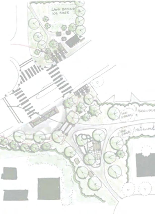
93


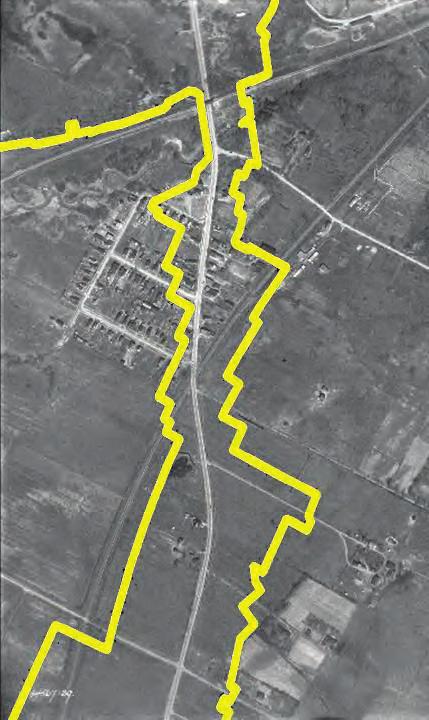


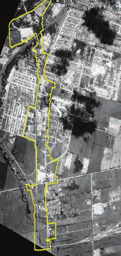


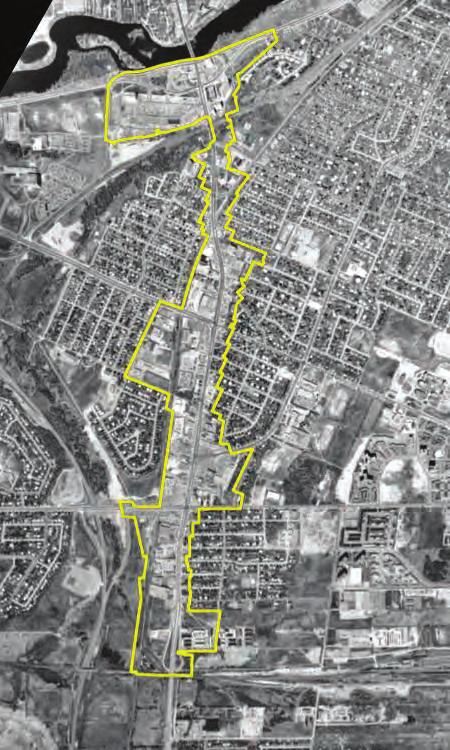

94 today
Bank Street Secondary Plan
 1.1 Introduction The is a guide to the long term design and development of the portion of Bank Street between Riverside Drive and Ledbury Park, and provides direction on land use, built form, design, parking,
ELMVALE ACRES SHOPPING CENTRE MASTER PLAN
 ELMVALE ACRES SHOPPING CENTRE MASTER PLAN Contents 1.0 INTRODUCTION... 2 2.0 LOCATION... 2 3.0 EXISTING CONTEXT... 2 4.0 VISION & GUIDING PRINCIPLES... 2 5.0 LAND USE AND BUILT FORM... 4 5.1 St. Laurent
Urban Design Manual PLANNING AROUND RAPID TRANSIT STATIONS (PARTS) Introduction. Station Study Areas
 Introduction. Station Study Areas") 111111 PLANNING AROUND RAPID TRANSIT STATIONS (PARTS) Introduction The ION rapid transit system will link Waterloo, Kitchener and Cambridge through a central transit corridor (CTC). There are a number
111111 PLANNING AROUND RAPID TRANSIT STATIONS (PARTS) Introduction The ION rapid transit system will link Waterloo, Kitchener and Cambridge through a central transit corridor (CTC). There are a number
[PLANNING RATIONALE] For Site Plan Control and Lifting of Holding Zone By-Law 101 Champagne Avenue. May 23, 2014
![[PLANNING RATIONALE] For Site Plan Control and Lifting of Holding Zone By-Law 101 Champagne Avenue. May 23, 2014](/thumbs/75/71599615.jpg "[PLANNING RATIONALE] For Site Plan Control and Lifting of Holding Zone By-Law 101 Champagne Avenue. May 23, 2014") [PLANNING RATIONALE] For Site Plan Control and Lifting of Holding Zone By-Law 101 Champagne Avenue May 23, 2014 Contents 1.0 Introduction... 2 2.0 Site Context... 2 2.1 Adjacent Uses... 2 Figure 1: Site
[PLANNING RATIONALE] For Site Plan Control and Lifting of Holding Zone By-Law 101 Champagne Avenue May 23, 2014 Contents 1.0 Introduction... 2 2.0 Site Context... 2 2.1 Adjacent Uses... 2 Figure 1: Site
FORMER CANADIAN FORCES BASE (CFB) ROCKCLIFFE SECONDARY PLAN. Official Plan Amendment XX to the Official Plan for the City of Ottawa
 ROCKCLIFFE SECONDARY PLAN. Official Plan Amendment XX to the Official Plan for the City of Ottawa") FORMER CANADIAN FORCES BASE (CFB) ROCKCLIFFE SECONDARY PLAN Official Plan Amendment XX to the Official Plan for the City of Ottawa 1 INDEX THE STATEMENT OF COMPONENTS PART A THE PREAMBLE PAGE Purpose...
FORMER CANADIAN FORCES BASE (CFB) ROCKCLIFFE SECONDARY PLAN Official Plan Amendment XX to the Official Plan for the City of Ottawa 1 INDEX THE STATEMENT OF COMPONENTS PART A THE PREAMBLE PAGE Purpose...
Mark-up of the effect of the proposed Bronte Village Growth Area OPA No.18 on the text of section 24, Bronte Village, of the Livable Oakville Plan
 Mark-up of the effect of the proposed Bronte Village Growth Area OPA No.18 on the text of section 24, Bronte Village, of the Livable Oakville Plan Notes: This document is provided for information purposes
YONGE STEELES CORRIDOR SECONDARY PLAN. Young + Wright / IBI Group Architects Dillon Consulting Ltd. GHK International (Canada) Ltd.
 Ltd.") PART A: PREAMBLE 1.0 PURPOSE The purpose of this Secondary Plan is to provide a development framework for intensification of the Yonge/ Steeles corridor including the north side of Steeles Avenue West
PART A: PREAMBLE 1.0 PURPOSE The purpose of this Secondary Plan is to provide a development framework for intensification of the Yonge/ Steeles corridor including the north side of Steeles Avenue West
1.0 Purpose of a Secondary Plan for the Masonville Transit Village
 Report to Planning and Environment Committee To: Chair and Members Planning & Environment Committee From: John M. Fleming Managing Director, Planning and City Planner Subject: Masonville Transit Village
13 THORNHILL YONGE STREET STUDY IMPLEMENTATION CITY OF VAUGHAN OPA 669 AND TOWN OF MARKHAM OPA 154
 13 THORNHILL YONGE STREET STUDY IMPLEMENTATION CITY OF VAUGHAN OPA 669 AND TOWN OF MARKHAM OPA 154 The Planning and Economic Development Committee recommends the adoption of the recommendations contained
CONTENTS 8.0 LAND USE 8.1 GENERAL LAND USE 8.2 RESIDENTIAL 8.3 MIXED USE 8.4 COMMERCIAL 8.5 EMPLOYMENT LANDS
 8-2 Land Use 8.0 LAND USE CONTENTS 8.1 GENERAL LAND USE 8.1.1 Uses provided for in all Land Use Designations 8.1.2 Uses prohibited in Hazardous Lands, Hazardous Sites and Special Policy Areas 8.1.3 Uses
Former Rockcliffe Airbase Community Design Plan Guiding Design Vision and Principles December 4, 2013
 APPENDIX 5 - Guiding Design Vision and Principles Former Rockcliffe Airbase Community Design Plan Guiding Design Vision and Principles December 4, 2013 Vision Statement The redevelopment of the former
Clairtrell Area Context Plan
 Clairtrell Area Context Plan March 2005 Urban Development Services City Planning Contents 1. Introduction... 4 2. Development Structure... 6 2.1 Streets... 7 2.1.1 Sheppard Avenue and Bayview Avenue...
Land Use Amendment in Southwood (Ward 11) at and Elbow Drive SW, LOC
 at and Elbow Drive SW, LOC") 2018 November 15 Page 1 of 10 EXECUTIVE SUMMARY This land use amendment application was submitted by Rick Balbi Architect on 2017 August 31 on behalf of Sable Developments Ltd, and with authorization from
2018 November 15 Page 1 of 10 EXECUTIVE SUMMARY This land use amendment application was submitted by Rick Balbi Architect on 2017 August 31 on behalf of Sable Developments Ltd, and with authorization from
Uptown Rideau Street Secondary Plan [Amendment #166, January 12, 2016]
![Uptown Rideau Street Secondary Plan [Amendment #166, January 12, 2016]](/thumbs/76/73760497.jpg "Uptown Rideau Street Secondary Plan [Amendment #166, January 12, 2016]") [Amendment #166, January 12, 2016] The policies of this Secondary Plan are in effect, save and except for the property at 560 Rideau Street, for which there remains a site specific appeal to this Secondary
[Amendment #166, January 12, 2016] The policies of this Secondary Plan are in effect, save and except for the property at 560 Rideau Street, for which there remains a site specific appeal to this Secondary
PORT WHITBY COMMUNITY
 PORT WHITBY COMMUNITY SECONDARY PLAN UPDATE COMMUNITY IMPROVEMENT PLAN URBAN DESIGN GUIDELINES September 2015 DRAFT PROPOSED AMENDMENT NUMBER # to the Whitby Official Plan PURPOSE: The intent of this Amendment
Welcome. Walk Around. Talk to Us. Write Down Your Comments
 Welcome This is an information meeting introducing the applications for proposed redevelopment of the Yorkdale Shopping Centre site at 3401 Dufferin Street and 1 Yorkdale Road over the next 20+ years,
URBAN DESIGN BRIEF. 2136&2148 Trafalgar Road. Town of Oakville
 URBAN DESIGN BRIEF 2136&2148 Trafalgar Road Town of Oakville Prepared By: METROPOLITAN CONSULTING INC For 2500674 Ontario Inc November 2016 TABLE OF CONTENTS Page No. 1.0 Introduction/Description of Subject
Edward R. Sajecki Commissioner of Planning and Building
 Corporate Report Clerk s Files Originator s Files CD.03.POR DATE: TO: FROM: SUBJECT: Chair and Members of Planning and Development Committee Meeting Date: February 27, 2012 Edward R. Sajecki Commissioner
Alta Vista Transportation Corridor Environmental Study Report November 2005
 Alta Vista Transportation Corridor Environmental Study Report November 2005 6.0 ALTERNATIVE DESIGNS The Preferred Solution to providing additional transportation system capacity through the AVTC study
SOUTH KEYS TO BLOSSOM PARK Bank Street Community Design Plan
 SOUTH KEYS TO BLOSSOM PARK Bank Street Community Design Plan September 28, 2015 1 Visit us: Ottawa.ca/planning This page has been intentionally left blank 2 Table of Contents 1.0 Introduction... 8 1.1
Trafalgar Road Corridor Planning Study Open House
 Trafalgar Road Corridor Planning Study Open House June 24, 2013 6:30-8:30 p.m. Oakville & Trafalgar Rooms Overview The Livable Oakville Plan identifies the lands along Trafalgar Road, between the QEW and
KANATA CENTRUM 255 KANATA AVENUE OFFICIAL PLAN AMENDMENT ZONING BY-LAW AMENDMENT
 KANATA CENTRUM 255 KANATA AVENUE OFFICIAL PLAN AMENDMENT ZONING BY-LAW AMENDMENT JUNE 2015 PREPARED BY: FOTENN Consultants Inc. 223 Mcleod Street Ottawa, ON K2P OZ8 (613) 730-5709 PREPARED FOR: Kanata
SUBJECT: GO Station Mobility Hubs Preferred Concepts: Aldershot GO, Burlington GO and Appleby GO. Planning and Development Committee - Public Meeting
 Page 1 of Report PB-76-17 SUBJECT: GO Station Mobility Hubs Preferred Concepts: Aldershot GO, Burlington GO and Appleby GO TO: FROM: Planning and Development Committee - Public Meeting Planning and Building
LAKEVIEW LOCAL ADVISORY PANEL. THE COPORATION OF THE CITY OF MISSISSAUGA THURSDAY, NOVEMBER 18, 2010
 LAKEVIEW LOCAL ADVISORY PANEL THE COPORATION OF THE CITY OF MISSISSAUGA www.mississauga.ca/lakeviewportcreditreview THURSDAY, NOVEMBER 18, 2010 MISSISSAUGA SENIORS CENTRE LUCY TURNBALL ROOM (1389 Cawthra
178 Carruthers Properties Inc.
 178 Carruthers Properties Inc. Planning Rationale for 178 Carruthers Avenue Site Plan Control Application June 2014 Table of Contents 1.0 Introduction 2.0 Overview of Subject Property 3.0 Current Zoning
Bel-Air Lexus Automobile Service Station
 Bel-Air Lexus Automobile Service Station Design Brief 443-447 McArthur Avenue Ottawa April 30, 2015 14-1299-MCA Site Details Application: Site Plan Control Legal Description and Municipal Addresses: 443
Animating the Rideau Canal December 2013
 Executive Summary Animating the Rideau Canal December 2013 Why study the Rideau Canal? The Rideau Canal has been an important part of Ottawa throughout its history, and has shaped and been shaped by the
7.0 Confederation Heights
 7.0 7.1 Location This chapter applies to the area generally bounded by the Rideau River, Riverside Drive, Brookfield Road, the CNR rail line, Data Centre Road, more specifically as shown on Schedule N
The transportation system in a community is an
 7 TRANSPORTATION The transportation system in a community is an important factor contributing to the quality of life of the residents. Without a sound transportation system to bring both goods and patrons
Gold Line Bus Rapid Transit Transit Oriented Development (BRTOD) Helmo Station Area Plan
 Helmo Station Area Plan") Appendix F Gold Line Bus Rapid Transit Transit Oriented Development (BRTOD) Helmo Station Area Plan Introduction and Purpose of the Plan The Gold Line Bus Rapid Transit facility is an eleven-mile dedicated
Appendix F Gold Line Bus Rapid Transit Transit Oriented Development (BRTOD) Helmo Station Area Plan Introduction and Purpose of the Plan The Gold Line Bus Rapid Transit facility is an eleven-mile dedicated
1.4 TRANSIT VISION 2040 FROM VISION TO ACTION THEME 1: PUTTING TRANSIT AT THE CENTRE OF COMMUNITIES. Fully integrate transit with community design
 TRANSIT VISION 2040 FROM VISION TO ACTION TRANSIT VISION 2040 defines a future in which public transit maximizes its contribution to quality of life with benefits that support a vibrant and equitable society,
38 Queen s University Campus Master Plan Part 1
 38 Queen s University Campus Master Plan Part 1 46 The Campus at the City Scale Chapter 4 The Campus at the City Scale 39 Queen s is an urban University centrally located in Kingston. Decisions made by
URBAN DESIGN BRIEF URBAN DESIGN BRIEF 721 FRANKLIN BLVD, CAMBRIDGE August 2018
 URBAN DESIGN BRIEF URBAN DESIGN BRIEF 721 FRANKLIN BLVD, CAMBRIDGE August 2018 DESIGN BRIEF CONTENTS PART A 1.0 INTRODUCTION 2.0 DESCRIPTION & ANALYSIS OF SITE CONTEXT 3.0 DESIGN CONSTRAINTS AND OPPORTUNITIES
PLANNING RATIONALE FOR 1127, 1128 MILL STREET AND 1125 CLAPP LANE CITY OF OTTAWA
 PLANNING RATIONALE FOR 1127, 1128 MILL STREET AND 1125 CLAPP LANE CITY OF OTTAWA Prepared by: Realty Initiatives and Development On behalf of the Manotick Mill Community Lands Development Corporation March
5.1 Site Plan Guidelines
 5. Community Core Guidelines Development of the Community Core will take place by plan of subdivision and site plan approval. It will occur in a phased manner that will reflect the timing of residential
SCARBOROUGH SUBWAY EXTENSION. Scarborough Subway Extension. Final Terms of Reference
 Scarborough Subway Extension Final Terms of Reference 1 1.0 Introduction and Background 1.1 Introduction Toronto City Council recently confirmed support for an extension of the Bloor-Danforth Subway from
QUEEN-RIVER SECONDARY PLAN
 34 QUEEN-RIVER SECONDARY PLAN 34. QUEEN RIVER SECONDARY PLAN 1. INTRODUCTION The Queen-River area is approximately 6.4 hectares and is located at the eastern edge of the Downtown as shown on Map 34-1.
GO Station Mobility Hubs: Draft Precinct Plans. Committee of the Whole July 12, 2018
 GO Station Mobility Hubs: Draft Precinct Plans Committee of the Whole July 12, 2018 Purpose of this Workshop Present Draft Precinct Plans for the 3 GO Station Mobility Hubs Continue the conversations that
770 BRONSON AVENUE. Zoning By-law Amendment and Site Plan Control
 770 BRONSON AVENUE Zoning By-law Amendment and Site Plan Control Revised Planning Rationale + Design Brief August 2016 REVISED PLANNING RATIONALE 223 McLeod Street Ottawa, ON K2P 0Z8 613.730.5709 fotenn.com
John M. Fleming Managing Director, Planning and City Planner. Old East Village Dundas Street Corridor Secondary Plan Draft Terms of Reference
 Report to Planning and Environment Committee To: From: Subject: Chair and Members Planning & Environment Committee John M. Fleming Managing Director, Planning and City Planner Old East Village Dundas Street
WELCOME and introduction
 1 WELCOME and introduction Mobility Hub Locations within Burlington STUDY OVERVIEW STUDY OBJECTIVES The City of Burlington is developing four Area Specific Plans, one for each of Burlington s Mobility
DRAFT Northeast Quadrant of Kipling Avenue and Highway 7 DRAFT AUGUST 29, Goals Land Use. The goals of this Plan are to:
 AUGUST 29, 2017 12.15 Northeast Quadrant of Kipling Avenue and Highway 7 12.15.1 Goals 12.15.2 Land Use The goals of this Plan are to: 12.15.2.1 General Provisions: a) Ensure the development of a compact
PART 1. Background to the Study. Avenue Study. The Danforth
 The Danforth 1.1/ Study Purpose & Key Municipal Goals 1.2/ The Local Advisory Committee 1.3/ The Project Team 1.4/ Study Process/Summary of Method 1.5/ Summary of Consultation 1.1 Study Purpose and Key
DOWNTOWN GEORGETOWN PLANNING STUDY
 DOWNTOWN GEORGETOWN PLANNING STUDY Community Workshop #3 Thursday, May 4, 08 The Planning Partnership OVERVIEW OF STUDY, PROCESS & MILESTONES We are here PURPOSE OF THE STUDY To develop a clear vision
MAYFIELD WEST SECONDARY PLAN PHASE 2
 MAYFIELD WEST SECONDARY PLAN PHASE 2 Public Open House #3 February 25, 2010 Draft Preferred Land Use Scenario TOWN OF CALEDON PLANNING & DEVELOPMENT DEPARTMENT Open House Agenda TOWN OF CALEDON 1. Welcome
5 TOWN OF MARKHAM OFFICIAL PLAN AMENDMENT NO. 144 MILLIKEN MAIN STREET SECONDARY PLAN
 5 TOWN OF MARKHAM OFFICIAL PLAN AMENDMENT NO. 144 MILLIKEN MAIN STREET SECONDARY PLAN The Planning and Economic Development Committee recommends the following: 1. The communication from Brendan O Callaghan,
Don Mills Crossing Study and Celestica Lands Development Application Community Meeting, Open House, and Breakout Discussions
 Consultation Summary Don Mills Crossing Study and Celestica Lands Development Application Community Meeting, Open House, and Breakout Discussions This report is not intended to provide a verbatim transcript
776 and 784 St. Laurent Boulevard City of Ottawa
 Engineering Land / Site Development Municipal Infrastructure Environmental / Water Resources Traffic / Transportation Structural Recreational 776 and 784 St. Laurent Boulevard City of Ottawa Planning Rationale
Queensborough Eastern Neighbourhood Node. Community Open House
 Queensborough Eastern Community Open House The Vision The Queensborough Eastern will become the heart of eastern Queensborough. Through a sensitive mix of viable commercial and residential areas, the neighbourhood
Regency Developments. Urban Design Brief. Holyrood DC2 Rezoning
 Regency Developments Urban Design Brief Holyrood DC2 Rezoning Stantec Consulting Ltd. 7-31-2017 1. Overview Regency Developments intends to rezone the lands located at 8510 and 8511 93 Avenue, within the
900 ALBERT PLANNING RATIONALE MARCH 21, 2016 TRINITY
 900 ALBERT PLANNING RATIONALE MARCH 21, 2016 TRINITY PREPARED FOR: TRINITY Trinity Development Group Inc. Sun Life Financial Centre, East Tower 3250 Bloor Street West, Suite 1000 Toronto, ON M8X 2X9 www.trinity-group.com
Stanley Greene District Downsview (80 Carl Hall Road) Zoning By-law Amendment and Draft Plan of Subdivision Applications Request for Direction Report
 Zoning By-law Amendment and Draft Plan of Subdivision Applications Request for Direction Report") STAFF REPORT ACTION REQUIRED Stanley Greene District Downsview (80 Carl Hall Road) Zoning By-law Amendment and Draft Plan of Subdivision Applications Request for Direction Report Date: December 16, 2011
STAFF REPORT ACTION REQUIRED Stanley Greene District Downsview (80 Carl Hall Road) Zoning By-law Amendment and Draft Plan of Subdivision Applications Request for Direction Report Date: December 16, 2011
Emery Village Road 2A Municipal Class Environmental Assessment Study
 PW12.11 STAFF REPORT ACTION REQUIRED Emery Village Road 2A Municipal Class Environmental Assessment Study Date: March 30, 2016 To: From: Wards: Reference Number: Public Works and Infrastructure Committee
C. Westerly Creek Village & The Montview Corridor
 C. Westerly Creek Village & The VISION Community Vision When the goals of the city are achieved Westerly Creek Village, a distinctive community defined by Montview Boulevard and Westerly Creek, is a strong
PUBLIC OPEN HOUSE HURONTARIO-MAIN CORRIDOR SECONDARY PLAN
 PUBLIC OPEN HOUSE HURONTARIO-MAIN CORRIDOR SECONDARY PLAN Tuesday, February 28, 2012 6pm 9pm 1 st Floor Atrium, City Hall 2 Wellington Street West, Brampton 1 POLICY FRAMEWORK The 2006 Provincial Growth
599 Kennedy Road - Official Plan Amendment and Zoning Amendment Application - Preliminary Report
 STAFF REPORT ACTION REQUIRED 599 Kennedy Road - Official Plan Amendment and Zoning Amendment Application - Preliminary Report Date: March 7, 2017 To: From: Wards: Reference Number: Scarborough Community
THAT the attached Terms of Reference for the Thornhill Centre Street Study be approved.
 COMMITTEE OF THE WHOLE AUGUST 18, 2003 THORNHILL CENTRE STREET STUDY PLANNING FILE: 15.92 Recommendation The Commissioner of Planning recommends: THAT the attached Terms of Reference for the Thornhill
EXISTING COMPREHENSIVE PLAN
 EXISTING COMPREHENSIVE PLAN Town Center Land Use Element: V. LAND USE POLICIES Town Center Mercer Island's business district vision as described in "Your Mercer Island Citizen-Designed Downtown" was an
Definitions. Average Daily Traffic Demand (ADT): The actual number or projected number of cars that pass a point in a 24-hour period.
: The actual number or projected number of cars that pass a point in a 24-hour period.") Definitions Access Management: A combination of physical techniques and transportation policies used to control the flow of traffic between roads and the surrounding lands. Alternative City Form Scenarios:
Definitions Access Management: A combination of physical techniques and transportation policies used to control the flow of traffic between roads and the surrounding lands. Alternative City Form Scenarios:
Draft Urban Hamilton Official Plan. Amendment No. XX
 1 of 75 The following text, together with: Draft Appendix A Appendix B Volume 1, Schedule E-1 Urban Land Use Designations Appendix C Volume 1, Appendix A Parks Classification Map Appendix D Volume 1, Appendix
Commercial Development Proposal Tenth Line Road. Planning Rationale Report. Minto Developments Inc.
 Commercial Development Proposal 2168 Tenth Line Road Report September 2015 Prepared for Minto Developments Inc. Paquette Planning Associates Ltd. 56 Hutchison Avenue Ottawa, Ontario K1Y 4A3 PH: 613-722-7217
St. Clair Avenue West Area Transportation Master Plan
 1 (Between Keele Street and Old Weston Road) Public Information Centre 1 December 2, 2015 2 Welcome Welcome to the first Public Information Centre for the St. Clair Avenue West Area. The panels will present
*** DRAFT 2 FOR PUBLIC REVIEW ***
 6.7 The area is generally bounded by the Red Hill Valley Parkway to the west, Lake Avenue to the east, the Queen Elizabeth Way (QEW) to the north, and by the properties just south of Queenston Road to
Town Center (part of the Comprehensive Plan)
") Town Center (part of the Comprehensive Plan) Mercer Island Town Center Looking North (2014) In 1994, a year-long process culminated in a set of design guidelines and code requirements for the Town Center
Town Center (part of the Comprehensive Plan) Mercer Island Town Center Looking North (2014) In 1994, a year-long process culminated in a set of design guidelines and code requirements for the Town Center
Complete Neighbourhood Guidelines Review Tool
 Complete Neighbourhood Guidelines Review Tool Prepared By: City of Regina Planning Department October 2014 Page 1 of 14 Community Development Review Checklist for Secondary Plans and Concept Plans The
The West Vaughan Employment Area Secondary Plan Policies
 Part 2: The West Vaughan Employment Area Secondary Plan Policies 2.1 General Policies It is the policy of Council: 2.1.1. That the West Vaughan Employment Area (the WVEA), identified on Schedule 1, will
DAVENPORT VILLAGE SECONDARY PLAN
 27 DAVENPORT VILLAGE SECONDARY PLAN 27. DAVENPORT VILLAGE SECONDARY PLAN 1. VISION FOR THE DAVENPORT VILLAGE SECONDARY PLAN Davenport Village, municipally known as 830, 940, 980 and 1100 Lansdowne Avenue,
Lehigh Acres Land Development Regulations Community Planning Project
 Lehigh Acres Land Development Regulations Planning Effort Summary In July, 2010 Commissioner Frank Mann invited the Lehigh Acres community to start discussing how to achieve their recently adopted community
Figure 1- Site Plan Concept
 Figure 1- Site Plan Concept Parking will be provided underground on three levels at rate of 1.0 space/ unit; this rate includes all visitors parking. MMM Group has prepared a parking assessment (April,
Official Plan Review: Draft Built Form Policies
 PG.30.1 REPORT FOR ACTION Official Plan Review: Draft Built Form Policies Date: May 15, 2018 To: Planning and Growth Management Committee From: Chief Planner and Executive Director, City Planning Division
Urban Design Brief December 23, 2015 Southside Construction Group Official Plan & Zoning By-Law Amendment
 Urban Design Brief Proposed Official Plan & Zoning By-Law Amendment 3244, 3263 and 3274 Wonderland Road South Southside Group December 23, 2015 TABLE OF CONTENTS Page No. INTRODUCTION... 1 SECTION 1 LAND
PLANNING RATIONALE FOR ZONING BY-LAW AMENDMENT MINTO COMMUNITIES INC. ARCADIA RESIDENTIAL STAGES 3 & 4 ARCADIA COMMERCIAL STAGE 2 CITY OF OTTAWA
 PLANNING RATIONALE FOR ZONING BY-LAW AMENDMENT MINTO COMMUNITIES INC. ARCADIA RESIDENTIAL STAGES 3 & 4 ARCADIA COMMERCIAL STAGE 2 CITY OF OTTAWA Prepared for: MINTO COMMUNITIES INC. 180 Kent Street, Suite
TOWN OF INNISFIL SPECIAL COUNCIL AGENDA OUR JOBS INNISFIL HEIGHTS WORKSHOP WEDNESDAY JANUARY 20, :30 P.M.
 January 13, 2016 TOWN OF INNISFIL SPECIAL COUNCIL AGENDA INNISFIL HEIGHTS WORKSHOP WEDNESDAY JANUARY 20, 2016 5:30 P.M. PLEASE REMEMBER TO TURN OFF CELL PHONES 1. OPENING OF MEETING BY THE MAYOR Opening
Midtown Greenway Land Use and Development Plan Executive Summary
 Midtown Greenway Land Use and Development Plan Executive Summary Introduction The Midtown Greenway Land Use and Development Plan sets policy direction for land use and development in the Midtown Greenway
appendix and street interface guidelines
 appendix five: building and street interface guidelines appendix 5 building and street interface guidelines BOULEVARDS Boulevards are generally characterized by higher levels of traffic movement at higher
Further input invited as Colchester Growth Strategy nears final phase
 IUE 3 / NOVEMBER 2015 Further input invited as Colchester Growth trategy nears final phase trathcona County is seeking public feedback as it enters the final phase of work on a Growth Management trategy
URBAN DESIGN BRIEF 181 Burloak Drive, Oakville
 URBAN DESIGN BRIEF 181 Burloak Drive, Oakville February 2017 Our File: 1730B 230-7050 WESTON ROAD / WOODBRIDGE / ONTARIO / L4L 8G7 / T: 905 761 5588/ F: 905 761 5589/WWW.MHBCPLAN.COM TABLE OF CONTENTS
Implementation Guide Comprehensive Plan City of Allen
 Implementation Guide 2030 Comprehensive Plan City of Allen DRAFT 2015 Implementation Guide Allen 2030 Comprehensive Plan INTRODUCTION The Comprehensive Plan serves as a guide for the growth and development
and services The protection and conservation of environmentally significant and sensitive natural heritage features and functions.
 6. Land Use 6.0 Preamble A healthy and livable city is one in which people can enjoy a vibrant economy and a sustainable healthy environment in safe, caring and diverse neighbourhoods. In order to ensure
Chapter 1: Introduction
 Chapter 1: Introduction The Penn Avenue Community Works Corridor Vision and Implementation Framework presents an integrated communitybased vision and a coordinated, long-term implementation framework for
Eglinton Avenue East & 50 Thermos Road - Official Plan Amendment Application Preliminary Report
 STAFF REPORT ACTION REQUIRED 1966 2050 Eglinton Avenue East & 50 Thermos Road - Official Plan Amendment Application Preliminary Report Date: March 15, 2016 To: From: Wards: Reference Number: Scarborough
Public input has been an important part of the plan development process.
 Lakewood s Comprehensive Plan recognizes that transportation helps shape the community, and that the way the community provides for the safe and efficient movement of people affects the character of the
Create Policy Options Draft Plan Plan Approval. Public Consultation Events. Phase 2
 Background Grandview-Woodland Community Plan In the spring of 2012, the City of Vancouver embarked on a comprehensive community planning program in the Grandview-Woodland neighbourhood. The process has
THE GARDEN CITY PLAN. City of St. Catharines Official Plan. City of St. Catharines
 THE GARDEN CITY PLAN City of St. Catharines Official Plan City of St. Catharines August 2010 APPROVAL INFORMATION This Official Plan of the City of St. Catharines Planning Area, known as the Garden City
Plan Overview. Manhattan Area 2035 Reflections and Progress. Chapter 1: Introduction. Background
 Plan Overview The Manhattan Urban Area Comprehensive Plan (the Comprehensive Plan) is a joint planning initiative of the City of Manhattan, Pottawatomie County, and Riley County. The 2014 Comprehensive
POLICY AMENDMENT AND LAND USE AMENDMENT KILLARNEY/GLENGARRY (WARD 8) NW CORNER OF RICHMOND ROAD AND 33 STREET SW BYLAWS 1P2015 AND 7D2015
 NW CORNER OF RICHMOND ROAD AND 33 STREET SW BYLAWS 1P2015 AND 7D2015") Page 1 of 13 EXECUTIVE SUMMARY This application seeks to redesignate an RC-2 (Residential Contextual One/Two Dwelling) parcel to MC-Gd72 (Multi-Residential Contextual Grade-Oriented) to allow for multi-residential
Page 1 of 13 EXECUTIVE SUMMARY This application seeks to redesignate an RC-2 (Residential Contextual One/Two Dwelling) parcel to MC-Gd72 (Multi-Residential Contextual Grade-Oriented) to allow for multi-residential
burlington mobility hubs study Downtown Burlington Mobility Hub
 burlington mobility hubs study Downtown Burlington Mobility Hub Draft Precinct Plan Workbook PIC #3, September 7, 2017 downtown mobility hub objectives City staff and their consultants are proposing an
Planning Rationale Fernbank Road, Ottawa. Major Zoning By-law Amendment and Site Plan Control Application Ontario Inc.
 Planning Rationale Major Zoning By-law Amendment and Site Plan Control Application 5264 Fernbank Road, Ottawa 1872089 Ontario Inc. March 2014 Planning Rationale Major Zoning By-law Amendment and Site Plan
5.0 Community Design Plan
 5.0 Community Design Plan The Community Design Plan for the Mer Bleue area is a composite of three plans: Land Use Plan Transportation Plan Municipal Servicing Plan Read together, these Plans and associated
Scope of Services. River Oaks Boulevard (SH 183) Corridor Master Plan
 Corridor Master Plan") Scope of Services River Oaks Boulevard (SH 183) Corridor Master Plan PROJECT AREA The project area consists of the River Oaks Boulevard (SH 183) corridor bounded by SH 199 at the northern end and the Trinity
Scope of Services River Oaks Boulevard (SH 183) Corridor Master Plan PROJECT AREA The project area consists of the River Oaks Boulevard (SH 183) corridor bounded by SH 199 at the northern end and the Trinity
V. Vision and Guiding Principles
 V. Vision and Guiding Principles The Master Plan for the Powers Ferry Corridor seeks a foundation in the desires of the community. At times, various elements of the community offered opposing viewpoints,
GOLDEN MILE SECONDARY PLAN. Community Consultation Meeting #3 June 26, 2018
 GOLDEN MILE SECONDARY PLAN Community Consultation Meeting #3 June 26, 2018 Meeting Overview 1. Introduction 2. Principles + Vision 3. Street + Block Alternatives 4. Parks + Open Space Alternatives 5. Land
THE CITY OF VAUGHAN BY-LAW BY-LAW NUMBER A By-law to adopt Amendment Number 1 to the Official Plan of the Vaughan Planning Area.
 THE CITY OF VAUGHAN BY-LAW BY-LAW NUMBER 015-2014 A By-law to adopt Amendment Number 1 to the Official Plan of the Vaughan Planning Area. NOW THEREFORE the Council of the Corporation of the City of Vaughan
1.3 TRANSIT VISION 2040 FROM VISION TO ACTION THEME 1: PUTTING TRANSIT AT THE CENTRE OF COMMUNITIES. Fully integrate transit with community planning
 TRANSIT VISION 2040 FROM VISION TO ACTION TRANSIT VISION 2040 defines a future in which public transit maximizes its contribution to quality of life with benefits that support a vibrant and equitable society,
6. REGIONAL AND COMMUNITY FACILITIES DESIGNATIONS 6.1. OBJECTIVES FOR REGIONAL AND COMMUNITY FACILITIES LAND USE DESIGNATIONS
 6. REGIONAL AND COMMUNITY FACILITIES DESIGNATIONS INTRODUCTION The Regional and land use designations provide the primary locations for uses which satisfy the health, education and other service needs
Lambeth Main Street Streetscape Improvements
 Lambeth Main Street Streetscape Improvements Open House October 5th, 2017 Agenda 1. Introduction 2. Project Background 3. Context 4. Project Objectives 5. Design Principles & Approach 6. Streetscape Design
30 and 44 Zorra Street - Zoning By-law Amendment Application - Preliminary Report
 STAFF REPORT ACTION REQUIRED 30 and 44 Zorra Street - Zoning By-law Amendment Application - Preliminary Report Date: March 14, 2016 To: From: Wards: Reference Number: Etobicoke York Community Council Director,
Hockessin Community Redevelopment Plan
 Hockessin Community Redevelopment Plan 3.1 Introduction The Community Redevelopment Plan for the Village of Hockessin is the result of the people s vision for a distinct village center that serves as the
PLANNING JUSTIFICATION REPORT
 PLANNING JUSTIFICATION REPORT 55 DELHI STREET CITY OF GUELPH PREPARED FOR: VESTERRA PROPERTY MANAGEMENT PREPARED BY: LABRECHE PATTERSON & ASSOCIATES INC. SCOTT PATTERSON, BA, CPT, MCIP, RPP PRINCIPAL,
ROAD CLOSURE AND LAND USE AMENDMENT SILVER SPRINGS (WARD 1) NORTHEAST OF NOSEHILL DRIVE NW AND SILVER SPRINGS ROAD NW BYLAWS 2C2018 AND 29D2018
 NORTHEAST OF NOSEHILL DRIVE NW AND SILVER SPRINGS ROAD NW BYLAWS 2C2018 AND 29D2018") Page 1 of 19 EXECUTIVE SUMMARY This application proposes redesignating two parcels in the community of Silver Springs from Special Purpose Future Urban Development (S-FUD) District and undesignated road
Page 1 of 19 EXECUTIVE SUMMARY This application proposes redesignating two parcels in the community of Silver Springs from Special Purpose Future Urban Development (S-FUD) District and undesignated road