F U T U R E L A N D U S E E L E M E N T
|
|
|
- Betty Underwood
- 6 years ago
- Views:
Transcription
1 F U T U R E L A N D U S E E L E M E N T T A B L E O F C O N T E N T S Page BACKGROUND... FL - 1 LAND USE AND POPULATION DATA... FL - 1 ANALYSIS... FL - 7 NEEDS AND RECOMMENDATIONS... FL - 15 GOALS, OBJECTIVES, AND POLICIES... FL - 16 THE FUTURE LAND USE MAP... FL - 37 LIST OF MAPS MAP # 1 - PLANNING AREA... FL - 2 MAP # 2 - EXISTING LAND USE... FL - 5 MAP # 3 - POTENTIAL RESIDENTIAL DEVELOPMENT... FL - 11 MAP # 4 - GENERALIZED ADJACENT LAND USES... FL - 44 MAP # 5 - SOIL SURVEY... FL - 45 MAP # 5A - SOIL CLASSIFICATION LEGEND... FL - 46 MAP # 6 - WELLFIELD PROTECTION AREAS... FL - 47 MAP # 7 - SPECIAL FLOOD HAZARD AREAS... FL - 48 MAP # 8 - HISTORIC DISTRICTS AND SITES... FL - 49 MAP # 9 - TRANSPORTATION CONCURRENCY EXCEPTION AREA (T.C.E.A.)... FL - 50 MAP # 10 - LOCATION OF NATIVE ECOSYSTEMS... FL - 51 MAP # 11 - ANNEXATION AREAS... FL - 52 LIST OF TABLES TABLE L-1 - EXISTING LAND USE INVENTORY... FL - 6 TABLE L EAR POPULATION PROJECTIONS VS CENSUS AND BEBR ESTIMATES... FL - 6 TABLE L-3 - POPULATION PROJECTIONS... FL - 7 TABLE L-4 - POTENTIAL RESIDENTIAL UNITS... FL - 12 TABLE L-5 - FUTURE LAND USE ALLOCATIONS... FL - 38 TABLE L-6 - LAND USE DESIGNATION / ZONING MATRIX... FL - 43
2 F U T U R E L A N D U S E E L E M E N T OF THE COMPREHENSIVE PLAN CITY OF DELRAY BEACH BACKGROUND The text of the Element is a summary of the complete inventory, analysis, and recommendations which are contained in the following source documents: 1989 Delray Beach Future Land Use Element (Strategic Planning Group) 1996 Evaluation and Appraisal Report (City of Delray Beach, 1996) 2006 Evaluation and Appraisal Report (City of Delray Beach, 2006) Year Water Supply Facilities Work Plan (Kimley-Horn and Associates, 2015) The source documents, along with other documents which are cited in the Element, are available for public review at the Planning & Zoning Department Offices located at 100 N.W. 1st Avenue, Delray Beach, Florida. LAND USE AND POPULATION DATA The Charter for the City of Delray Beach established the "Greater Delray Beach Area". That area exceeded the municipal boundaries and provided that the City could annex properties within it (i.e. a "reserve annexation area"). Since the Charter was adopted, the City has enacted numerous annexations. Through 1987, these annexations had mostly been voluntary and were usually associated with proposed development seeking municipally provided services (water, sewer, fire, police, street maintenance). That annexation process led to the creation of numerous County islands or "enclaves". Following enactment of special legislation entitled the "Delray Beach Enclave Annexation Act", the City in 1988 unilaterally annexed approximately 1,300 parcels located within 68 enclaves which comprised 834 acres and a population of approximately 3,100 individuals. Upon adoption of the 1989 Comprehensive Plan, the City s reserve annexation area was replaced by the boundaries of its Official Planning Area. The Official Planning Area is the area for which most calculations and projections in this Plan are predicated upon. It is also considered the City s ultimate boundaries. The Planning Area is specifically delineated on Map #1, as well as most maps contained in this Element. FL - 1
3 FL - 2
4 At the time of adoption of the 1996 Evaluation and Appraisal Report, The City of Delray Beach consisted of approximately 15.1 square miles, with a total planning area of approximately 18.7 square miles. Since 1996, the City has processed 25 annexations including approximately 207 acres of land, thereby increasing the incorporated area to 16.4 square miles. The Planning Area contains approximately 17 square miles (gross) with 0.8 square miles under County jurisdiction ( September 2014). The areas under County jurisdiction include the following (please see Map #11 for geographical description of these areas): A. The Foxe Chase Subdivision, a acre platted residential subdivision, containing 43 individual single family-detached lots. Two homes receives City water and sewer, five homes receive City water only, and the remaining existing homes are serviced by well water and septic tanks. B. Delray Community Hospital Area, 9.3 acres of institutional and commercial land uses (Delray Medical Center Condos). All uses receive City water and sewer. C. Barwick Road Area (just north of Atlantic Ave), acres of predominately residential uses. A small number of homes receive City water and sewer, but the vast majority do not. The area includes several unplatted single family lots, and the following platted subdivisions: Kingsland, Kingsland Pines, and Franwood Pines. D. The Atlantic Avenue and Military Trail Area, acres of mixed land uses. Services are provided to existing commercial uses, and some residential. This area does not include High Point West of Delray, or the portion of Country Club Acres west of Military Trail. E. The North Military Trail / Barwick Road Area, acres of mixed land uses. Services are provided to some residential parcels. F. High Point West Area, 200 acres of mixed land uses. Water services are provided to High Point West of Delray through the form of a master meter. All service mains within High Point are privately owned and maintained. The remaining commercial and scattered residential uses do not receive City water and sewer. G. Country Club Acres (west of Military Trail). A 159 acre single family subdivision. None of the homes in this subdivision currently receive City water or sewer service. Through this comprehensive planning formulation, review, and adoption process, it is intended that Palm Beach County formally recognize the City of Delray Beach Comprehensive Plan as the Plan for the designated planning area and that it shall guide future land development decision making. A program for annexation of the above areas are set forth in the Goals, Objectives, and Policies of this Element. Most future development, by virtue of existing boundaries, will be subject to annexation prior to development through the City's use of annexation agreements as a prerequisite for obtaining water service. The following information is provided in summary form, consistent with the structure of 9J5-006(1). FL - 3
5 Map #2 depicts generalized existing land uses. Table L-1 provides a listing of approximate acreage of existing uses. There are no conflicting land uses or conflicting designations on the Future Land Use Map between the City of Delray Beach and its municipal neighbors. Enclaves and land under County jurisdiction is discussed previously. There are no designated Areas of Critical State Concern, pursuant to Section , Florida Statutes. There are no dredge spoil disposal sites in the City. FL - 4

6 FL - 5
7 TABLE L-1 EXISTING LAND USE INVENTORY LAND USE ACRES PERCENT RESIDENTIAL 6, % COMMERCIAL 1, % INDUSTRIAL 411 4% VACANT & AGRICULTURE % RECREATION, OPEN SPACE, AND CONSERVATION 1,321 13% EDUCATION AND PUBLIC FACILITIES % TOTALS 10, % * The above table provides a breakdown of existing land uses for the City and remaining Planning Area. These figures exclude the right-of-way for I-95, arterial roadways, and the surface area for Lake Ida and the Intracoastal Waterway. Source: City of Delray Beach, 2008 POPULATION PROJECTIONS Based on the population projections included in the 1996 EAR, the 1996 population of the City of Delray Beach was comprised of 54,508 permanent residents and the 2005 projected population was 59,103 permanent residents. As shown Table L-2 below, the population projections made in the 1996 EAR were substantially lower than the corresponding 2000 Census figure and subsequent BEBR estimates. Given the large adjustment in 2000, it s obvious that the population had been growing at a much higher rate than estimated since the prior Census in 1990, thereby skewing the projections downward. Table L EAR Population Projections vs Census and BEBR Estimates Year 1996 EAR Census/BEBR Difference % Difference , ,550 60,020 3, % ,060 60,645 3, % ,571 61,527 3, % ,081 62,578 4, % ,592 63,439 4, % ,103 63,888 4, % ,613 64,095 4, % ,124 64,360 4, % FL - 6
8 Table L-3 City of Delray Beach Population Projections Year Population , , , , , , , ,870 Source: Palm Beach County Population Allocation Model using BEBR Population Projections and the 2014 Water Supply Plan (Population projections based on Palm Beach County TAZ data from 2012 and 2013 for service area and corresponding linear) regressions As indicated in Table L-3, the 2007 estimated population of the City of Delray Beach was 64,360 as part of the previous water supply plan with an estimated 2010 population of 65,781. These estimates were based on high growth rates experienced through the early to mid-2000 s. However, the 2010 US Census reflected an actual City population of 59,695 persons within the City. It is understood these numbers are reflective of the economic downturn and reduced growth experienced in the City and state as a whole. Based on this updated (baseline) population number and using the new average growth rate of approximately 1.5% per year, the projections from the previous water supply plan have been updated accordingly. The City s population is expected to increase by approximately 12% to 66,989 by the year 2015 with continued growth through the planning period of Beyond 2015, the City is anticipated to grow by an additional (approximate) 7% to 71,576 by the year 2025, and by an additional (approximate) 3% to 73,870 by year Population projections for the Planning Area (based on the 2014 Water Supply Plan) which exceed the City, are estimated to be 72, 248, 74,792, and 78, 236 for years 2020, 2025 and 2030; respectively. ANALYSIS The following information is provided in summary form, consistent with the structure of 9J5-006(2). More detailed information and full explanations are found the 1996 and 2006 Evaluation and Appraisal Reports. As the distribution of land uses indicates (Table L-1), the City is primarily residential in nature, with moderate amounts of commercial, industrial and recreation/open space. Approximately 1.1% of the planning area is currently vacant. Residential and vacant land is found throughout the Planning Area, both east and west of I-95. Commercial uses are mainly clustered in commercial corridors, located along major roadways, FL - 7
9 such as Atlantic Avenue, Federal Highway and Linton Boulevard. The small amount of industrial land is primarily located adjacent to I-95, on either side. AVAILABILITY OF FACILITIES AND SERVICES The City s water and sanitary sewer treatment facilities have sufficient capacity to provide the adopted level-of-service for the City s current and 2030 population, under the Comprehensive Plan s development scenario. Water and sewer service lines are extended to most properties. Wells for domestic potable water and septic tanks are fairly prevalent in the unincorporated sections of the Planning Area. The water and sewer sub-elements set forth programs for providing remedial actions to provide central services to existing, unserved residential areas. Central water and central sewer will be used by all projects which have currently approved development orders. Water supply, water treatment, and wastewater treatment facilities are all capable of accommodating existing development and land for which specific development orders have been issued. There are no ultimate solid waste disposal facilities within the corporate limits or Planning Area. The Palm Beach County Solid Waste Authority (SWA) has established a LOS of 7.13 pounds per person per day (PPD). Based on existing landfill space, current population, and the land use plans of the County and its municipalities, the SWA has sufficient landfill capacity to meet that LOS for the projected life of the existing landfill (2021). Additionally, the Board of the Solid Waste Authority has authorized the initial design and permitting efforts to develop a new landfill on 1,600 acres owned by the authority. The capacity of this new landfill facility will extend the life of the solid waste system beyond the year The City s solid waste generation is approximately 6.02 PPD. Thus the City meets the SWA s LOS standards. With the development of the Morikami Wellfield, west of the Planning Area, and expansion of the City s reclaimed distribution system the City has sufficient raw water capacity to meet the needs of the 2030 population. The City has adopted the Stormwater Master Plan that identifies current LOS throughout the City and areas needing remedial action. Cost estimates for those improvements are also included. Required improvements have been prioritized and programmed. Coordination was achieved with the Transportation Element by the use of different land use scenarios being used in the traffic model. No significant differences were noted with respect to impacts of local land use decisions. The most significant impacts to the street system occurred in response to inter-area traffic on County and State arterial roadways. Roadway level of service deficiencies (based on County and regional standards for all but State facilities in which case FDOT standards are used) currently (2008) exist on the following streets: Lake Ida Road, Swinton Avenue to Federal Highway; FL - 8
10 I-95 south of Linton Boulevard Federal Highway (US-1), Linton Boulevard to Lindell Boulevard; Atlantic Avenue, I-95 to Swinton Avenue; In addition to the above mentioned LOS deficiencies, some areas in the City currently lack improved roadways. Several areas that the City has annexed contain unimproved streets. The affected areas are the Woods of Southridge, and Wallace Drive areas. Roadway improvements in the other areas are to be completed either following the adoption of associated redevelopment plans or through the City s capital improvement program. To aid in the revitalization of the downtown, the City has established a Transportation Concurrency Exception Area (TCEA). Designation of the TCEA is essential to achieve the City s goal of having a compact and vibrant downtown. Downtown Delray Beach, including West Atlantic Avenue and the commercial areas east of the Intracoastal Waterway, is the logical location for a concentration of growth, both commercial and residential. All major infrastructure systems are in place, including a grid network of streets providing convenient access to and from major arterials and the interstate highway system. However, the existing building setbacks, as well as the pedestrian oriented streetscape, provide little opportunity for road widening to increase traffic capacity. Nor would such widening be consistent with the character and ambiance of the area. Adherence to a rigid level of service standard for traffic in the central business district would create a major obstacle to the City s revitalization efforts, and could jeopardize the substantial public and private investment that has been made in the area to date. The TCEA allows the City to continue to grow, within established limits, and without having to significantly alter the existing character of the downtown area. VACANT LAND ANALYSIS / ACCOMMODATING PROJECTED POPULATION In 1989, the term built-out was referencing current population as a percentage of the ultimate projected population (54,410 / 62,400 = 87%). However, this methodology only takes residential development into consideration. In order to represent the actual amount of development left to take place in the Planning Area, the current definition of built-out represents acreage. More precisely, the total acreage of developed land represented as a percentage of the total acreage of the developable Planning Area (10,054/10,162 = 98.9%). Thus other types of land uses, such as industrial and commercial, are taken into consideration. A substantial amount of development has occurred in the Delray Beach Planning Area since adoption of the 1996 Comprehensive Plan. With over 98.9% of the total land area now developed, the city is nearly completely built out in terms of land area. In addition to the development of vacant parcels throughout the City, there was a substantial amount of redevelopment during this period in the downtown area. The success of the City s efforts to revitalize the downtown and policies to create a sustainable downtown resulted in a significant number of residential units being constructed in mixed-use and FL - 9
11 free standing residential developments in the downtown area. With the exception of Atlantic High School, which was relocated west of I-95 on residential property, development has generally occurred where it was anticipated. Of the remaining vacant land in the Planning Area, approximately 90 acres of land is available for residential development or mixed-use development (as shown on Map #3). There is also a substantial amount of land available for infill residential development on individual lots in residential subdivisions. In addition, there are approximately 18 acres suitable for commerce/industrial development (all in aggregated tracts of one acre or more). Here again, there are also several vacant tracts of less than one acre in size. None of the above mentioned available vacant land was identified as having any soils, topographic, or historic constraints, which would preclude development. All population and development estimates used in this report are predicated upon the remaining land available for development and redevelopment. Thus, the land needed for projected development is the amount of available land which remains. FL - 10
12 FL - 11
13 TABLE L - 4 POTENTIAL RESIDENTIAL UNITS May 2008 MAXIMUM LAND USE CURRENT POTENTIAL MAP ID# DESIGNATION ZONING ACRES UNITS A MEDIUM DENSITY RM B MEDIUM DENSITY COUNTY C MEDIUM DENSITY COUNTY M MEDIUM DENSITY RM SUBTOTALS D TRANSITIONAL A F TRANSITIONAL A & POC L TRANSITIONAL SAD SUBTOTALS H CONGRESS AVENUE MIXED-USE MROC J CONGRESS AVENUE MIXED-USE MROC K CONGRESS AVENUE MIXED-USE MROC SUBTOTALS N COMMERCIAL CORE CBD SUBTOTALS E GENERAL COMMERCIAL GG O GENERAL COMMERCIAL GC SUBTOTALS I PREVIOUS APPROVAL MIC P PREVIOUS APPROVAL GC SUBTOTALS GRAND TOTALS: FL - 12
14 REDEVELOPMENT ANALYSIS Blighted and Declining Areas Delray Beach has been designated as an entitlement community, which automatically qualifies the City for state and federal funding through programs such as the Community Development Block Grant (CDBG) and State Housing Initiative Partnership (SHIP). These funds are used primarily for infrastructure and housing improvements in designated target areas (generally those neighborhoods classified as Rehabilitation in the Housing Element). In addition, a substantial portion of the City has been declared as blighted for the purposes of establishing a Community Redevelopment Area. This area is under the jurisdiction of the Community Redevelopment Agency (CRA), a 7- member board appointed by the City Commission. Redevelopment activities in the CRA area are established in a separate Community Redevelopment Plan and are funded through the use of Tax Increment Financing (TIFs). The CDBG area lies totally within the CRA boundaries, which allows for joint participation and funding of various affordable housing programs. Redevelopment is identified as the approach to eliminate blighted conditions in six separate areas of the City, which were originally designated as Redevelopment Areas in the 1989 Comprehensive Plan. The general location of those areas is as follows: West Atlantic Avenue corridor, from Swinton Avenue to I-95 Along Wallace Drive Lindell and Federal Highway area Silver Terrace subdivision S.W. 4th Avenue north of Linton Boulevard Osceola Park area (south of the CBD, west of S.E. 5th Avenue) Redevelopment plans have been adopted for all of the areas, and corresponding changes to the Future Land Use Map and zoning designations have been made. In addition to those areas listed above, the North Federal Highway Corridor has been separately designated as a blighted area, and a Redevelopment Plan was developed to address that mixed use corridor. The preparation of Strategic Task Team Neighborhood Action Plans is appropriate to help stabilize some of the City s older neighborhoods that are in decline. These areas are identified as Revitalization on the Neighborhood Categorization Map in the Housing Element. During the 2007 Goal Setting Session, the City Commission identified two additional areas which need a redevelopment plan, overlay district or other development tool to promote and guide their future redevelopment. The Linton Avenue corridor from I-95 east to Federal Highway contains a mismatch of uses with no clear direction for how this area could best be utilized to maximize its potential and the South Federal Highway FL - 13
15 area, south of Linton Boulevard contains a significant number of marginal uses that may become obsolete and be phased out. Redevelopment of both of these areas will help to expand and diversify the City s overall economy. Non-conforming Uses The need exists for the elimination or reduction of uses inconsistent with the community s character and proposed future land uses. The City currently pursues the termination of inappropriate uses through the traditional method of applying restrictions on the continuance and expansion of nonconforming uses (i.e., not allowing the use to be re-established once it has been abandoned for six months; restricting the type and value of improvements, etc.) The section of the Land Development Regulations concerning nonconforming uses has been periodically amended, but it has not been comprehensively evaluated for several years. There has on occasion been some confusion concerning the difference between nonconforming structures, and conforming structures which contain nonconforming uses. This section of the LDRs should be reevaluated in order to clarify the language and the City s position regarding nonconforming uses and structures FLOOD PRONE AREAS Flood prone areas are identified on maps prepared by the Federal Emergency Management Agency. These maps are used by the Building Department Permit Division in determining compliance with the City's Flood Damage Protection Ordinance. Severe flooding of developed areas, other than by ocean activity, is influenced by the water levels in Lake Ida and the C-15 Canal. Water levels in each of these is controlled by the South Florida Water Management District; thus, in times of severe rainstorms some mitigation can be provided. In addition, existing and proposed development is regulated by the Flood Damage Protection Ordinance. OTHER The City of Delray Beach is located in the center of south Palm Beach County, and is a strategic location for regional public and semi-public facilities. It is currently the site of the south county courthouse, a solid waste transfer station, mental health and drug rehabilitation centers, County bus maintenance facility, wastewater treatment facility, and Palm Beach County administrative offices. Some of the facilities generate certain positive benefits, such as job growth and an increased consumer base for local businesses. However, there are also negative impacts associated with the uses, including a loss of property tax revenue. In addition, certain facilities generate odors from waste products, increase truck traffic throughout the City, and create similar detrimental impacts. The position of the City is that it has assumed much of the area s burden for the provision of these services, and that it is not obligated to accommodate additional facilities. FL - 14
16 NEEDS AND RECOMMENDATIONS RE-EVALUATION OF THE PLANNING AREA BOUNDARIES The adopted Comprehensive Plan had specific policies with regard to annexing eligible properties by FY 94/95. While the City has been successful in annexing some properties through the ELMS III legislation and voluntary annexations, there has been difficulty annexing other properties that were not attainable through ELMS III. The problem areas are those near Military Trail which require approval of a referendum by over 50% of the property owners. The City will need to determine if its planning area boundaries should be defined to continue to pursue these eligible areas, reduced to exclude the current eligible areas, or expanded to include additional area. ECONOMIC DEVELOPMENT STUDY The Future Land Use Element has a policy which discourages Future Land Use Map Amendments which diminish the Commerce land use designation. Given the current downsizing trends of larger corporations; the reluctance of large users to build to suit versus occupying existing vacant built space; and current job creation primarily by small firms; the City needs to assess the adequacy of the existing Commerce land to sustain the City in the future, and if it is the most needed land use. Many of the City s larger employers are companies located in office developments which have a Transitional land use designation. Also, the City needs to assess the other major economic components of the City such as tourism and the need for a major hotel. In order to better assess the economic needs, the City will have an economic development study conducted to the determine the land uses that will be necessary to accommodate the employment needs and sustain the economic growth of the City. FL - 15
17 GOALS, OBJECTIVES, AND POLICIES GOAL AREA "A" DEVELOPMENT AND REDEVELOPMENT OF REMAINING LAND Objective A-1 Appropriateness of intensity Policy A-1.1 Establishment of Intensity of Use for Land Use Categories on the Future Land Use Map Policy A-1.2 Avoiding Strip Commercial Development Policy A-1.3 Retention of "Commerce" Land Use Designations Policy A-1.4 Economic Development Study [Revised by Amendment 10-1] Policy A-1.5 Balanced Demographic Mix of Year Round Residents Policy A-1.6 Commercial Land Use Amendments Policy A-1.7 Findings for Future Land Use Map Amendments Policy A-1.8 Demonstrated need for Regional Facilities Policy A-1.9 Class A Offices within Congress Avenue Corridor Policy A-1.10 Design Guidelines for Congress Avenue Corridor and Four Corners Overlay [Revised by Amendment 10-1] Policy A-1.11 Marketing Plan for Congress Ave. Corridor [Revised by Amendment 10-1] Objective A-2 Elimination of Inconsistent Uses Policy A-2.1 Continuation of Code Enforcement Efforts Policy A-2.2 Requirement re "Findings Of Consistency" Policy A-2.3 Consistency in Development of Remaining Land Policy A-2.4 Location of Auto Dealers and Auto Related Uses Policy A-2.5 Evaluation of Non-Conforming Uses Regulations [Revised by Amendment 10-1] Policy A-2.6 Structures Destroyed by Disaster Policy A-2.7 Reconstruction of Structures Destroyed by Disaster Objective A-3 Retention of Open Space & Natural Areas Policy A-3.1 Requirement re "Findings Of Consistency" Policy A-3.2 Relationship to "Conservation Areas" Policy A-3.3 Reference to Conservation Element and Open Space & Recreation Element Policies Objective A-4 Historic Preservation Policy A-4.1 Requirement of Findings of Consistency Policy A-4.2 Inventory of Historical Buildings, Sites, or Districts Objective A-5 Development Regulations - Upgrading Policy A-5.1 Enforcement of Sign Code Policy A-5.2 Sign Code Policy A-5.3 Flood Damage Protection Ordinance Policy A-5.4 CPTED [Added by Amendment 11-1] Objective A-6 Discouraging Urban Sprawl Objective A-7 Workforce Housing Policy A-7.1 Workforce Housing Density Bonus Program FL - 16
18 Policy A-7.2 Workforce Housing Overlay Districts Policy A-7.3 Coastal High Hazard Area Policy A-7.4 Time Period for Affordability Policy A-7.5 Monitor Affordable Housing Initiatives Objective A-8 Regional Activity Centers [Added by Amendment 09-1] Policy A-8.1 Community Design Elements [Added by Amendment 09-1] Policy A-8.2 Internal Circulation [Added by Amendment 09-1] Policy A-8.3 Bicycle and Pedestrian Connections [Added by Amendment 09-1] Policy A-8.4 Congress Village [Added by Amendment 09-1] Policy A-8.5 Transportation requirements [Added by Amendment 09-1] Policy A-8.6 Regional Activity Center Overlay Designation [Added by Amendment 09-1] GOAL AREA "B" PROVISION OF SERVICES AND DEVELOPMENT Objective B-1 Accommodating Needed Facilities Objective B-2 Concurrency Policy B-2.1 Requirement for Provision of Facilities Policy B-2.2 Certification Required Policy B-2.3 Requirement re "Findings Of Consistency" Policy B-2.4 Referral of Drainage Plans for Review Policy B-2.5 Referral of Site Plans & Plats to FDOT for Review Policy B-2.6 Referral of Site Plans & Plats to County for Review Policy B-2.7 Water Supply Concurrency Objective B-3 Services with the Planning Boundaries Policy B-3.1 Standard for Provision of Services Policy B-3.2 Provision of Facilities on Demand Policy B-3.3 Coordination with County re: Land Use Policy B-3.4 Coordination with County re Land Use Policy B-3.5 Annexation Program Policy B-3.6 Support Legislation for Unilateral Annexation GOAL AREA "C" REDEVELOPMENT AND RENEWAL Objective C-1 Blighted Areas Policy C-1.1 Reference to Housing Element Programs Policy C-1.2 Community Redevelopment Agency Policy C-1.3 Industrial Areas along Arterial Streets Policy C-1.4 North Federal Highway Corridor [Revised by Amendment 10-1] Policy C-1.5 West Atlantic Redevelopment Area Policy C-1.6 Silver Terrace Area Policy C-1.7 Southwest Area Neighborhood Policy C-1.8 Redevelopment of Wallace Drive Industrial Area Policy C-1.9 Lindell and Federal Highway Policy C-1.10 S.W. 4 th Avenue Policy C-1.11 Osceola Park Area Policy C-1.12 South Federal Highway[Revised by Amendment 10-1] Policy C-1.13 Linton Boulevard[Revised by Amendment 10-1] FL - 17
19 Objective C-2 Economic Development Policy C-2.1 Role of Culture and the Arts Policy C-2.2 Alleys in Old School Square District Policy C-2.3 Beach Commercialization/Promotion Objective C-3 The Central Business District Policy C-3.1 CBD Zone District Policy C-3.2 CBD Development Plan Policy C-3.3 Parking Structures Policy C-3.4 Pineapple Grove Main Street Policy C-3.5 TCEA Monitoring Policy C-3.6 TCEA Exempt from Traffic Concurrency Policy C-3.7 Developments of Regional Impact (DRI) with the TCEA Policy C-3.8 Parking Lots in Pineapple Grove Objective C-4 Coastal Area/Hurricane Coordination GOAL AREA "D" SCHOOLS Objective D-1 Achieving a School Population which Mirrors the Diversity of the Community Policy D-1.1 Coordination with School Board Policy D-1.2 Deferral of Certain Projects Policy D-1.3 Advisory Boundary Committee Objective D-2 Enhanced Role in Neighborhoods Policy D-2.1 Access Improvements Policy D-2.2 Expansion of Village Academy Policy D-2.3 Creation of Middle School on Current Atlantic High School Site Objective D-3 City - School District Cooperation Policy D-3.1 Infrastructure Policy D-3.2 Coordination Assignment Policy D-3.3 New Schools Policy D-3.4 Public School Siting Policy D-3.5 Findings of Consistency Policy D-3.6 School Site Selection Criteria Policy D-3.7 Co-location of Schools with Parks, etc. Policy D-3.8 Classroom Size Objective D-4 Continued Improvement of Schools Policy D-4.1 Funding Policy D-4.2 Continued Improvement of Schools, and Public Awareness Objective D-5 Achievement Matters for All Programs Policy D-5.1 Improve Student Achievement Policy D-5.2 Pre-Kindergarten Programs Policy D-5.3 Support of Village Academy Policy D-5.4 Beacon Program Expansions Policy D-5.5 Education Board FL - 18
20 GOAL AREA "A" LAND WITHIN THE PLANNING AREA SHALL BE DEVELOPED OR REDEVELOPED, TO SUSTAIN AND ENHANCE THE EXISTING QUALITY OF LIFE, COMPLIMENT AND BE COMPATIBLE WITH EXISTING LAND USE AND RESULT IN A MIXED, BUT PREDOMINATELY RESIDENTIAL COMMUNITY WITH A BALANCED ECONOMIC BASE AND ENCOURAGE ACCESSIBLE AFFORDABLE EVERYDAY SERVICES. Objective A-1 Property shall be developed or redeveloped, in a manner so that the future use, intensity and density are appropriate in terms of soil, topographic, and other applicable physical considerations; encourage affordable goods and services; are complementary to and compatible with adjacent land uses; and fulfill remaining land use needs. Policy A-1.1 The descriptions of land use designations contained in this Element are hereby adopted and establish the intensity of use for each future land use category and compatible zoning district designations. Policy A-1.2 Zoning changes which would result in strip commercial development shall be avoided. Where strip commercial developments or zoning currently exist along an arterial street, consideration should be given to increasing the depth of the commercial zoning in order to provide for better project design. Strip commercial development, in this context, is characterized by several of the following design features: buildings are arranged in a linear (or strip) format on a narrow depth lot; parking is generally street frontage or on-street; uses are one store deep; no design integration among individual uses; typically no pedestrian access between adjacent developments; very little or no uniformity of signage on an individual development. Policy A-1.3 The Commerce land use designation, which involves a mix of light industrial, commercial uses, and research and development, is the most needed land use during the City's final stage of build-out. Thus, changes to the Future Land Use Map, which diminish this land use, are discouraged. Policy A-1.4 The City shall undertake a comprehensive study of economic development issues and needs in FY The study will, at a minimum, assess the major economic components of the City to determine the uses necessary to accommodate employment needs and sustain economic growth. Recommendations made in the study regarding land use needs shall be adopted as policies in the Future Land Use Element. [Revised by Amendment 10-1] Policy A-1.5 As the City has an ample supply of housing designed to accommodate its seasonal and retirement population, new residential developments shall be designed for a balanced demographic mix of permanent year-round residents. This shall be accomplished through the implementation of policies from Objective B-2 of the Housing Element. FL - 19
21 Policy A-1.6 To encourage revitalization of the City's Central Business District and enhance the residential character of the western portion of the City, Future Land Use Map amendments to commercial designations in the area west of Interstate I-95 shall be discouraged. Policy A-1.7 Amendments to the Future Land Use Map (FLUM) must be based upon the findings listed below, and must be supported by data and analysis that demonstrate compliance with these findings: Demonstrated Need -- That there is a need for the requested land use. The need must be based upon circumstances such as shifts in demographic trends, changes in the availability of land, changes in the existing character and FLUM designations of the surrounding area, fulfillment of a comprehensive plan objective or policy, annexation into the municipal boundaries, or similar circumstances. The need must be supported by data and analysis verifying the changing demographics or other circumstances. This requirement shall not apply to requests for the FLUM designations of Conservation or Recreation and Open Space; nor shall it apply to FLUM changes associated with annexations when the City s advisory FLUM designation is being applied, or when the requested designation is of a similar intensity to the advisory designation. However, the findings described in the remainder of this policy must be addressed with all FLUM amendments. Consistency -- The requested designation is consistent with goals, objectives, and policies of the most recently adopted Comprehensive Plan. Concurrency -- Development at the highest intensity possible under the requested designation can meet the adopted concurrency standards. Compatibility -- The requested designation will be compatible with existing and future land uses of the surrounding area. Compliance -- Development under the requested designation will comply with the provisions and requirements of the Land Development Regulations. Policy A-1.8 Future proposals to establish regional public facilities shall be supported by data which demonstrates that the loss of property tax revenue and other negative impacts will be offset by mitigating measures which may include, but are not limited to: payment of fees, creation of significant numbers of local jobs, and measures to control odors, noise, traffic, and other potential impacts on the surrounding communities. If the approving body determines that the negative impact of a particular facility cannot be substantially offset by mitigating measures, the application shall be denied. Policy A-1.9 The primary function of the Congress Avenue Mixed Use Future Land Use designation is to attract Class A office development while allowing limited residential development (including workforce housing) and support commercial uses. The designation allows commercial and office development at a total maximum FAR of 1.0. The commercial uses are limited to 20% of the total floor area of a master development plan. Office uses may comprise one hundred percent (100%) of the total floor area of a master development plan. Residential development, at a maximum density of up to 50 units per acre within 2,500 linear feet of the Tri Rail Station, and 40 units per acre for FL - 20
22 the balance of the corridor, will be allowed. Residential use may comprise up to 100% of the total floor area of a master development plan within 1,000 feet of the Tri-Rail Station; 80% of the total floor area between 1,001 and 2,500 feet of the Tri-Rail Station; and 75% of the total floor area for the balance of the corridor. The maximum FAR for residential uses is 2.0. Development must have an emphasis on non-vehicular (e.g. pedestrian and bicycle) access to mass transit, including but not limited to, Tri-rail and Palm Tran. Policy A-1.10 In FY 2010/11, the Planning & Zoning department shall evaluate the need for establishing design guidelines for the Congress Avenue Corridor and the Four Corners Overlay District. [Revised by Amendment 10-1] Policy A-1.11 In FY 2010/11, the City shall work with the Chamber of Commerce to develop a marketing plan to attract new business and promote redevelopment of the Congress Avenue Corridor. [Revised by Amendment 10-1] Objective A-2 To reduce, and eventually eliminate, uses which are inconsistent with predominant adjacent land uses, and to insure compatibility of future development, the following policies shall be applied. Policy A-2.1 The City shall continue its Code Enforcement Program at funding and staffing levels to no less than that of FY07/08. Policy A-2.2 Prior to approving any development application which comes before it, the applicable approving board must make a "finding of overall consistency" of the requested land use action with the objectives and policies of the Future Land Use Element. Policy A-2.3 Development of remaining vacant properties shall occur in a manner which is consistent with and complementary to adjacent development regardless of zoning designations. This policy shall be implemented through the review process associated with platting and site plans. Policy A-2.4 Automobile uses are a significant land use within the City and as such they have presented unique concerns. In order to properly control these uses and guide them to locations which best suit the community s future development, the following shall apply: 1) Auto related uses other than gasoline stations, wash establishments, and auto parts sales, shall not be permitted in the area encompassed by the CBD zone district. 2) Automobile dealerships shall not locate and/or expand in the following areas: Within the CBD zone district; West side of Southbound Federal Highway between George Bush Boulevard and S.E. 10th Street; FL - 21
23 East side of Federal Highway, between George Bush Boulevard and the north property line of the Delray Swap Shop/Flea Market Property; On properties fronting George Bush Boulevard, east of Federal Highway. 3) Rezoning to AC (Automotive Commercial) to accommodate auto dealerships shall not be permitted west of I-95. 4) Automobile dealerships shall be directed to the following areas: North of George Bush Boulevard, between Federal and Dixie Highways; East side of Federal Highway north of the north property line of the Delray Swap Shop/Flea Market; South of Linton Boulevard, between Federal and Dixie Highways; On the north side of Linton Boulevard, between I-95 and S.W. 10th Avenue, and along Wallace Drive. 5) Auto related uses which involve the servicing and repair of vehicles, other than as part of a full service dealership, shall be directed to industrial/commerce areas. Policy A-2.5 The section of the Land Development Regulations that deals with nonconforming uses and structures shall be comprehensively evaluated in order to ensure that the restrictions on the continuation, expansion, and improvement of nonconforming structures and uses are clear and enforceable. This evaluation and the subsequent LDR changes shall be completed in FY 2011/12. [Revised by Amendment 10-1] Policy A-2.6 Whenever a commercial, residential, hotel, motel, or resort dwelling unit structure is destroyed to an extent of greater than 50% of its value by disaster, the structure may be rebuilt to pre-disaster use, densities and heights if permit applications are submitted within one year following the disaster. Current fire and building codes shall be met; current parking, building setbacks, and landscape requirements shall be complied with as closely as possible. For purposes of this policy, disaster means any non-self imposed catastrophic damage including, but not limited to, fire, flood and storm. Policy A-2.7 Whenever a structure is damaged to an extent of greater than 50% of its value, it shall not be reconstructed unless such reconstruction complies with the requirements of the zoning district which applied to the property, except as provided in Policy A-2.6. Objective A-3 The development or utilization of remaining vacant land shall provide for the creation and retention of open space and the retention of natural resources. This objective shall be met through the following policies: Policy A-3.1 Prior to recommending approval of any land use application which involves vacant land, the appropriate approving board must make a finding that the requested land use action is consistent with this objective and its supporting policies. FL - 22
24 Policy A-3.2 Proposed development should not adversely affect any land identified as an environmentally sensitive area pursuant to Objective B-1 of the Conservation Element. Policy A-3.3 Proposed development shall accommodate required open space as provided for under Objective B-1 of the Open Space and Recreation Element. Objective A-4 The redevelopment of land and buildings shall provide for the preservation of historic resources. The objective shall be met through continued adherence to the City s Historic Preservation Ordinance and, where applicable, to architectural design guidelines through the following policies: Policy A-4.1 Prior to approval or recommending approval of any land use or development application for property located within a historic district or designated as a historic site, the Historic Preservation Board must make a finding that the requested action is consistent with the provisions of Section of the Land Development Regulations relating to historic sites and districts and the Delray Beach Design Guidelines. Policy A-4.2 In order to protect the City s historic resources, the Land Development Regulations shall include provisions for designation of historically significant buildings, structures, archaeological sites, or districts. The City shall conduct periodic neighborhood surveys to identify and evaluate potential historic resources at least once every five years. Objective A-5 The City shall maintain its Land Development Regulations, which shall be regularly reviewed and updated, to provide timely, equitable and streamlined processes including, but not limited to, building permit processes for residential developments and to accommodate mixed-use developments, and other innovative development practices. Policy A-5.1 The City shall continue to enforce its existing sign code. Policy A-5.2 The City shall continue to enforce its Flood Damage Protection Ordinance. Policy A-5.3 The City shall continue to enforce its existing off-street parking regulations. Policy A-5.4 Building and site designs for all development and redevelopment projects shall incorporate Crime Prevention Through Environmental Design (CPTED) standards to the greatest extent possible. This policy shall be implemented through the review process associated with site plans. The Land Development Regulations shall be amended in FY 2011/12 to reflect this requirement. [Added by Amendment 11-1] Objective A-6 Urban sprawl shall be discouraged by the provision of services necessary for development of unserved parcels in the City's Planning Area. FL - 23
25 Objective A-7 To encourage the provision of workforce housing and transit-oriented workforce residential development in the City, the following policies shall be implemented. Policy A-7.1 The maximum density may be increased within the Medium Density, General Commercial and Transitional Future Land Use designations through the Workforce Housing Density Bonus Program. The concept is that for every workforce housing unit that a developer builds, a calculated number of market rate units greater than would be allowed otherwise may be built. Policy A-7.2 Workforce Housing Overlay Districts shall be identified on the Future Land Use Map. The maximum density within these districts shall be as follows: The MROC (Mixed Residential Office Commercial) zoning district shall have a maximum density of 40 units per acre except within the Tri-rail Station Overlay where the maximum density is 50 units per acre. The Southwest Neighborhood and Carver Estates Overlay Districts shall have a maximum density of 24 units per acre. The I-95/CSX RR Corridor Overlay District shall have a maximum of 24 units per acre. The SW 10 th Street Overlay District shall have a maximum density of 12 units per acre. The Four Corners Overlay District shall have a maximum density of 30 units per acre. The Infill Overlay District shall have a maximum density of 22 units per acre for lands zoned General Commercial. All other zoning districts within the Infill Overlay District shall have a maximum density of 18 units per acre. [Revised by Amendment 14-1] Policy A-7.3 Residential Density may not be increased on any property located within the Coastal High Hazard Area through density bonuses in the Workforce Housing Program. Policy A-7.4 All Workforce Housing Units, constructed under the Family/Workforce Housing Program, shall remain affordable for a period of no less than forty (40) years commencing from the date of initial occupancy of the unit. Policy A-7.5 The City shall monitor the progress of its affordable housing initiatives and may modify the program or enact other provisions to improve the program when necessary. Objective A-8 Encourage compact development reflecting characteristics which include a mixture of community-serving uses, such as residential, commercial, office, employment, civic and institutional, recreation and open space, characterized by efficient infrastructure, promotion of pedestrian circulation and convenient access to mass transit facilities through the establishment of Regional Activity Center overlays within the Congress Avenue corridor in the CMU (Congress Avenue Mixed Use) land use designation. [Added by Amendment 09-1] FL - 24
26 Policy A-8.1 All Regional Activity Center Overlays shall include the following community design elements: [Added by Amendment 09-1] 1. An interconnected network of streets and paths designed to encourage walking and bicycle use, with traffic calming where desirable; 2. A complimentary mix and range of land uses, including residential, office, commercial and recreational. Education, civic and cultural land uses may also be included if desired. 3. Appropriate densities and intensities of land uses within walking distance of transit stops; 4. Daily activities within walking distance of residences and public uses 5. Streets and squares that are safe, comfortable, and attractive for the pedestrian; 6. Access to buildings streets and parking designed to be conducive with all transportation modes; 7. Off-street parking areas located and designed in a manner that supports and does not conflict with pedestrian activity, such as to the side or rear of buildings, and shall be limited in size and scale. Large fields of parking shall not be placed between the building façade and the connecting roadway. Policy A-8.2: Regional Activity Center overlays shall be planned in a manner that maximizes internal circulation and minimizes conflicts on the major arterial roadways. [Added by Amendment 09-1] Policy A-8.3: Regional Activity Center overlays shall provide fully-connected routes to all destinations with direct bicycle and pedestrian connections within and between residential areas and supporting community facilities and services, such as shopping areas, employment centers, transit stops, neighborhood parks and schools. The paths should be spatially defined by buildings, trees and lighting. [Added by Amendment 09-1] Policy A-8.4: The Congress Village Regional Activity Center overlay, is hereby established on the acre Office Depot headquarters site, located on the west side of Congress Avenue, south of Old Germantown Road. The development of the site as a Regional Activity Center will result in a maximum developable intensity of 600,000 square feet of office use, 400,000 square feet of commercial uses, 350 hotel units and 2,000 residential units. [Added by Amendment 09-1] Policy A-8.5: Regional Activity Center overlays shall contribute to providing a safe, convenient, comfortable and aesthetically pleasing transportation environment that promotes walking, cycling and transit use. Improvements or enhancements to the multimodal network, which may be required as a condition of development approval, include the following: [Added by Amendment 09-1] 1. Full accommodations for pedestrian access and movement, including shaded sidewalks; 2. Full accommodations for bicycles, such as lockers, showers and racks; 3. Direct connections between the Regional Activity Center overlay area and the regional bicycle/pedestrian network; 4. Installation of bike lanes, sidewalks, and shared use paths/trails; 5. Well designed accommodations for transfer of passengers at designated transit facilities; FL - 25
27 6. Preferential parking for rideshare participants; 7. Well designed access for motor vehicle passenger drop-offs and pick-ups at designated transit facilities and commercial and office development sites; 8. Full accommodations for the mobility impaired, including parking spaces, sidewalks, and ramps for handicapped access; and 9. Installation of transit use shelters. Policy A-8.6: All Regional Activity Center overlays within the CMU (Congress Avenue Mixed Use) land use designation shall be established by Policies under this Objective through a Comprehensive Plan text amendment. [Added by Amendment 09-1] GOAL AREA "B" THE REMAINING GROWTH OF THE COMMUNITY SHALL OCCUR IN A MANNER WHERE NEW DEVELOPMENT AND REDEVELOPMENT WILL BE SERVICEABLE AND IT WILL NOT IMPEDE THE COMMUNITY'S ABILITY TO ACCOMMODATE FUTURE GROWTH OR DETRACT FROM ITS CURRENT QUALITY OF LIFE. Objective B-1 New development shall not occur upon land which is needed for public facilities or greenspace which are necessary to support development within the community. Objective B-2 Facilities and services which are provided by, or through, the City of Delray Beach shall be provided to new development concurrent with issuance of a Certificate of Occupancy pursuant to the following policies. Policy B-2.1 Services and facilities shall be provided pursuant to the levels of service as established elsewhere in this Plan, concurrent with occupancy. For water facilities, concurrency shall mean that direct connection to a functioning municipal system is made. For sewer facilities, concurrency shall mean that direct connection to a functioning municipal system is made; or, where such facilities are not reasonably accessible (as defined in the Land Development Regulations), connection to a septic system that meets the requirements of the County Health Department. For public schools, concurrency shall be defined as the improvement is in place or construction appropriations are specified within the first three years of the most recently approved School District of Palm Beach County Five Year Capital Improvement Schedule, as reflected in Table SD-CIP of the Capital Facilities Element. For streets, drainage, and other facilities concurrency shall be determined by the following: the improvement is in place prior to issuance of the occupancy permit; the improvement is bonded, as a part of the subdivision improvements agreement or similar instrument, and there is a schedule of completion in the bonding agreement; the improvement is a part of a governmental capital improvement budget; it has been designed; and a contract for installation has been solicited. FL - 26
28 Policy B-2.2 As a part of the City's Concurrency Management System, prior to issuance of any certificate of occupancy, the Chief Building Official or a designee shall certify that concurrency is achieved. Policy B-2.3 Prior to recommending approval of any land use application which comes before it, the Local Planning Agency, or appropriate approving body, must make a finding of consistency with this objective and its supporting policies. If such a finding cannot be made, either conditions shall be made which provide for concurrency or the land use request shall be denied. Policy B-2.4 All drainage plans shall be reviewed pursuant to the policies of the Lake Worth Drainage District and/or the South Florida Water Management District, as applicable. This shall be accomplished by referral of development applications to these agencies. No building permit shall be issued unless and until an approval of drainage plans has been granted by the appropriate review agency. Policy B-2.5 All site plans and plats which have direct access to State roads shall be referred to Florida Department of Transportation (FDOT). Permits from FDOT shall be obtained prior to approval of final plat or building permit, whichever is applicable. Policy B-2.6 All site plans and plats which have direct access to County roads shall be referred to Palm Beach County. Permits from Palm Beach County shall be obtained prior to approval of final plat or building permit, whichever is applicable. Policy B-2.7 Prior to approving a building permit or its functional equivalent, the City will consult with the City Environmental Services Department and its Public Utilities Division to determine whether water supplies to serve the new development will be available no later than the anticipated date of issuance of a certificate of occupancy, or its functional equivalent, by the City. [AMENDMENT 2008-WSP1] Objective B-3 The City of Delray Beach may provide facilities and limited services for that area within its planning boundaries which is not yet annexed. The City shall annex such properties as they become eligible. Policy B-3.1 Services shall be provided to unincorporated areas upon annexation and they shall be at a level which exists for land uses elsewhere in the City under the same or similar conditions. In circumstances where it not feasible or appropriate to accomplish annexation, individual services (e.g. fire protection, code enforcement), may be provided to unincorporated parcels within the Planning Area, through an interlocal agreement. This paragraph shall not apply to water and sewer services, in areas which received these services from Palm Beach County, prior to annexation. Policy B-3.2 Water and sewer facilities may be provided to unincorporated areas by the City, upon demand, in a manner consistent with policies of the City. The provision of water facilities shall be accompanied by an agreement to voluntarily annex upon eligibility unless the property is already eligible in which case, annexation shall precede the provision of services. FL - 27
29 Policy B-3.3 Within the Delray Beach Planning Area, the City's FLUM designation shall be in effect immediately upon annexation of a specific parcel. Following any annexation, the Future Land Use Map, and appropriate portions of the Comprehensive Plan, shall be amended to reflect the change in the City's boundaries. Policy B-3.4 For purposes of implementing Policy B-3.3, the Future Land Use Map designations as initially contained on the City's Future Land Use Map upon adoption in November, 1989, (and as formally amended subsequently) are hereby deemed to be the Future Land Use Map designations for the territory subject to provisions of the interlocal agreement. Policy B-3.5 The City shall undertake the following program for the annexation of remaining eligible properties: Preparation of an "urban services annexation report" as required by Florida Statutes, for each of the remaining designated annexation areas: A. Foxe Chase subdivision B. Delray Community Hospital Area C. Barwick Road (just north of Atlantic Avenue) D. Atlantic Avenue & Military Trail, (less the portion of Country Club Acres west of Military Trail and High Point of Delray West) E. The North Military Trail / Barwick Road Area Area. F. High Point Delray Area (north of Atlantic Avenue) (See Map #11 for a geographical description of the above referenced areas). Working in concert with the Palm Beach County Planning Department, address the annexation of improved property which lacks adequate sewer, water, street, and/or drainage facilities pursuant to the Palm Beach County Annexation Incentive Program; Recommend whether annexation should be pursued, and if so, the means by which annexation should occur. Accommodate individual voluntary annexations as the opportunities arise. Policy B-3.6 The City of Delray Beach hereby supports legislation at the State level which allows for unilateral annexation by municipalities in designated urban areas. GOAL AREA "C" BLIGHTED AREAS OF THE CITY SHALL BE REDEVELOPED AND RENEWED AND SHALL BE THE MAJOR CONTRIBUTING AREAS TO THE RENAISSANCE OF DELRAY BEACH. FL - 28
30 Objective C-1 Blighted areas, as designated by the City Commission, shall receive special attention and assistance in renewal. This objective shall be implemented through the following policies and activities. Policy C-1.1 Residential areas shall be categorized in terms of their level of need and programs shall be identified to provide assistance. This policy shall be implemented through objectives and policies in the Housing Element, including a commitment to maintain and/or increase Community Development staff and funding levels to implement the programs. Policy C-1.2 The City shall work with the Community Redevelopment Agency (CRA) for the improvement of neighborhoods within the CRA boundaries. The City shall take the lead in the preparation of Strategic Task Team Neighborhood Action Plans (as described in the Housing Element). The unique powers of the CRA may be used in the implementation of appropriate provisions of such plans. Policy C-1.3 The City shall concentrate efforts in the heavy industrial and undeveloped areas along arterial roadways in order to provide a better image of the community. Such efforts should include: enhanced and continuous code enforcement, regulations which require heavy industrial uses to provide perimeter landscaping of their sites, owners of vacant property shall provide a landscaped appearance of their properties. Policy C-1.4 The following pertains to the North Federal Highway Corridor: The North Federal Highway Corridor is defined as the area bounded by the FEC railroad right-of-way to the west, the easterly boundary of the CRA to the east, NE 4 th Street to the south, and the north City limits to the north. Properties in the corridor that front on Federal Highway primarily contain small-scale, strip commercial development. Many parcels in the area contain vacant or dilapidated structures, substandard parking, and substandard landscaping. The area also contains residential areas identified as Stabilization and Revitalization on the Residential Neighborhood Categorization Map contained in the Housing Element. Many of the remaining parcels in the area are currently vacant. Due to those conditions, the North Federal Highway Corridor is hereby identified as a blighted area. The North Federal Highway Redevelopment Plan was approved by City Commission on March 16, The Plan identified the need for limited rezonings and LDR amendments, along with improvements necessary to accomplish certain redevelopment goals. Future development in the area must be in accordance with the provisions of the Redevelopment Plan. FL - 29
31 In FY 2010/11, the Planning & Zoning department shall evaluate the need for establishing design guidelines for the corridor. [Revised by Amendment 10-1] Policy C-1.5 The following pertains to the redevelopment of the West Atlantic Avenue Area: This area extends in a corridor along Atlantic Avenue eastward from I-95 to Swinton Avenue. The present land uses in this area include single family homes, duplexes, mini-parks, commercial uses along Atlantic Avenue and N.W. 5th Avenue, and scattered vacant parcels. The West Atlantic Avenue Redevelopment Plan was adopted by the City Commission on July 11, The plan establishes Future Land Use Map designations, zonings, special development standards, and design guidelines for the Redevelopment Area. Future development in the area must be in accordance with the provisions of the redevelopment plan. Policy C-1.6 The following pertains to the redevelopment of the Silver Terrace Area: This area involves the old Silver Terrace Subdivision which contains some mixed use but is primarily single family. It also involves the adjacent land use of the Floranda Mobile Home Park which is a well maintained land use but which may, in the future, be inappropriate for its location along Federal Highway adjacent to a regional shopping center. The Silver Terrace Redevelopment Plan was adopted by the City Commission on March 5, The plan establishes Future Land Use Map designations, zonings, and special development standards for the redevelopment area. Future development in the area must be in accordance with the provisions of the Redevelopment Plan. Policy C-1.7 The following pertains to redevelopment of the Southwest Neighborhood Area: This area is generally defined as the area bounded by West Atlantic Avenue on the north, SW 10 th Street on the south, Interstate 95 on the west, and Swinton Avenue on the east. Many of parcels in the area contain vacant or dilapidated structures, substandard parking and substandard landscaping. The area also contains residential areas identified as Rehabilitation on the Residential Neighborhood Categorization Map contained in the Housing Element. The Southwest Area Neighborhood Redevelopment Plan was adopted by the City Commission at its meeting of June 3, The Plan establishes a blueprint for the revitalization and stabilization of the area. The Southwest Area Neighborhood Redevelopment Plan is divided into five sub-areas based upon current and proposed land uses. The sub-areas serve to define potential boundaries for the phased implementation of the various plan components. Future development in the area must be in accordance with the provisions of the Redevelopment Plan. Policy C-1.8 The following pertains to redevelopment of the Wallace Drive Industrial Area: FL - 30
32 This area is bordered by SW 10th Street on the north; Milfred Street on the south; SW 9th Avenue on the east; and Tangelo Terrace on the west. The area had developed under County jurisdiction into a mix of incompatible land uses with limited public infrastructure and little or no code enforcement. The Wallace Drive Industrial Area Redevelopment Plan was adopted by City Commission on January 6, The Plan establishes proposed land use designations for the Redevelopment Area. Future development must be in accordance with the provisions of the Redevelopment Plan. The Redevelopment Plan encourages the development of light industrial, limited commercial and office uses in an urban setting. Aggregation of parcels is encouraged throughout the area to accommodate unified development. Policy C-1.9 The following pertains to the vicinity of Lindell and Federal Highway: This area extends from the C-15 Canal northward between Federal and Dixie Highways. The area does not include the existing (Honda) automobile dealership but does include the mobile home park north of it. Half of the land is vacant, almost half is underutilized as a substandard trailer park, and a few lots have residences upon them. The Lindell/Federal Highway Redevelopment Plan was adopted by the City Commission on April 4, The plan establishes proposed land use designations for the Redevelopment Area. Future development must be in accordance with the provisions of the redevelopment plan. Aggregation of parcels is encouraged throughout the area to accommodate a unified development. Policy C-1.10 The following pertains to the area on both sides of S.W. 4th Avenue, north of Linton Boulevard. This area involves warehouses, heavy industrial use, sporadic residential uses, and vacant land. The vacant land was platted as a part of the Woods of Southridge Subdivision. The Southridge/SW 4 th Avenue Redevelopment Plan was adopted by City Commission on June 15, Future development must be in accordance with the provisions of the Redevelopment Plan. Policy C-1.11 The following pertains to the area bounded by S.E. 2nd Street, Federal Highway, S.E. 5th Street, and Swinton Avenue (Osceola Park area): This area has industrial uses with inadequate parking to the west, commercial uses to the east, and a mixed residential area which has turned mainly into renter-occupied units. It is also encompassed by wellfield protection zones. The Osceola Park Redevelopment Plan was adopted by the City Commission on December 6, The primary focus of this redevelopment plan is to arrest deterioration, provide adequate parking and services for the existing industrial and commercial areas, and accommodate housing which is compatible with the other uses. The Plan establishes proposed Future Land Use Map designations for the area. Future development must be in accordance with the provisions of the Redevelopment Plan. Policy C-1.12 The following pertains to the South Federal Highway area, south of Linton Boulevard. FL - 31
33 In FY 2010/11, the City s Planning & Zoning Department shall review existing land uses in this area and shall create a redevelopment plan, overlay district or other development tool to promote and guide future redevelopment of the area. [Revised by Amendment 10-1] Policy C-1.13 The following pertains to the Linton Boulevard area, from I-95 east to Federal Highway. In FY 2010/11, the City s Planning & Zoning Department shall review existing land uses in this area and shall create a redevelopment plan, overlay district or other development tool to promote and guide future redevelopment of the area. [Revised by Amendment 10-1] Objective C-2 Economic development, with due regard for private property rights, historic preservation and character, is an essential component of the redevelopment and renewal efforts which are directed to the future of the City of Delray Beach. Specific efforts for the coordination and provision of economic development activities shall be centered in the City Administration's Development Services Management Group. Those efforts shall be governed by the following policies. Policy C-2.1 The City of Delray Beach hereby acknowledges the role of Culture and the Arts in Economic Development and pledges in pursuit of a theme of this Comprehensive Plan -- A Renaissance Community -- the promotion of the arts and accommodation of cultural activities for economic development ends. Policy C-2.2 Alleys located within the Old School Square Historic District on either side of Swinton Avenue shall remain and be made available for access to abutting properties. Accordingly, these alleys shall not be abandoned to private interests. Policy C-2.3 The City's Coastal Area is one of its most valuable resources in terms of economic attraction, recreation, and natural beauty. While action is appropriate to capitalize upon the economic benefits of this resource, commercialization and promotion shall not occur to such an extent that they diminish this beach resource. Objective C-3 The Central Business District (CBD) and surrounding neighborhoods, including A-1-A, Seacrest and Swinton Avenue represents the essence of what is Delray Beach i.e. a "village by the sea". The continued revitalization of the CBD is essential to achieving the overall theme of the City's Comprehensive Plan by managing growth and preserving the charm. The following policies and activities shall be pursued in the achievement of this objective. Policy C-3.1 The Central Business District (CBD) Zoning District regulations shall facilitate and encourage rehabilitation and revitalization and shall, at a minimum, address the following: deletion of inappropriate uses FL - 32
34 incentives for locating retail on the ground floor with office and residential use on upper floors accommodating parking needs through innovative actions incentives for dinner theaters, playhouses, and other family oriented activities allowing and facilitating outdoor cafes incentives for mixed use development and rehabilitations elimination of side yard setback requirements allow structural overhang encroachments into required yard areas Policy C-3.2 The Downtown Delray Beach Master Plan was adopted by the City Commission on March 19, Covering the downtown business districts surrounding the Atlantic Avenue corridor between I-95 and A-1-A, it represents the citizens vision for the growth and unification of Delray Beach, while still retaining the village by-the-sea character of the CBD. The Plan addresses a wide range of issues including infill development, neighborhood parks, shared parking, public art, the roadway and alleyway systems, marketing/economic development, and the need to modify the Land Development Regulations to include design guidelines to retain the character of Delray Beach. Future development and redevelopment in this area shall be consistent with the Master Plan. Policy C-3.3 The City shall be the lead agency in pursuing the construction and operation of tiered parking structures with mixed uses in the CBD. Policy C-3.4 The City supports the efforts to revitalize the Pineapple Grove Main Street area, and the use of the Main Street approach: organization, promotion, design, and economic restructuring. Opportunities to promote the area as a Arts District shall be emphasized. Policy C-3.5 The City shall monitor development in the TCEA annually to assess the land use mix. Should monitoring show that the rate of development or land use mix vary significantly from projections, the City shall reanalyze the traffic impacts of the TCEA on the roadway network. The monitoring effort shall include a review of the implementing policies of the TCEA and adjustments to their schedules as necessary based on the actual rate of development. Policy C-3.6 The City shall continue to exempt land uses within the TCEA from traffic concurrency requirements. Policy C-3.7 Developments of Regional Impact (DRI), even when located within the TCEA, shall be subject to the requirements of Chapter 380, F.S. Policy C-3.8 The City will participate, along with the CRA, in funding the development of public/private parking lots in the Pineapple Grove Main Street area. FL - 33
35 Objective C-4 The relationship between coastal area population and measures for evacuation in the event of a hurricane shall be enhanced through the requirement that redevelopment of existing properties in the coastal zone shall be consistent with the Future Land Use Map as opposed to reconstruction to current intensities, except as provided in Coastal Management Policy C-3.5. GOAL AREA "D" THE PUBLIC SCHOOL SYSTEM WHICH SERVES DELRAY BEACH SHALL BE AN ASSET TO THE COMMUNITY THROUGH ANTICIPATING AND ACCOMMODATING THE NEEDS AND DESIRES OF EXISTING AND FUTURE RESIDENTS OF THIS CITY. Objective D-1 The City shall strive to maintain a school population that mirrors the diversity of our community. Policy D-1.1 The City shall advocate for housing strategies that enable residents of different socio-economic background to live work and attend schools in our community Policy D-1.2 The City will continue monitoring the Advisory Boundary Committee (ABC) and participate and advocate as necessary in their discussions relating to boundary changes that may affect socio-economic balance within our schools. Policy D-1.3 The City will strive to support specialized academies and choice programs to improve the diversity that has been compromised by recent boundary changes with the creation of neighborhood schools. Objective D-2 The role of schools in their neighborhoods shall be enhanced so that the school facilities aid in achieving the goals and objectives of this Comprehensive Plan, particularly those identified in the Housing Element, which are directed toward the stabilization and revitalization of neighborhoods. Policy D-2.1 The City shall make improvements to sidewalks and pathways under its jurisdiction which, without such improvements, would require that the School Board transport students. New developments shall be required to comply with this policy by providing such pathways concurrent with the development. Policy D-2.2 The City will work with the School Board to maximize the use of the Delray Full Service Center. Policy D-2.3 The City will work with the School Board to insure that a new middle school of the arts is constructed on the old Atlantic High School site (Seacrest Boulevard) enhancing the neighborhood in which it is located. FL - 34
36 Objective D-3 The City shall cooperate with the School Board to achieve placement of new schools inside of the County s urban services area, to upgrade and enhance existing facilities within the City, as provided for in The School District of Palm Beach County s 5-Year Plan and Capital Budget. Policy D-3.1 The City shall work with the School Board to provide appropriate infrastructure and physical plant improvements. Policy D-3.2 The policies of this objective shall be coordinated through ongoing communications between the Office of the City Manager and the School District Superintendent. There shall be a mutual obligation to insure that all policies within this goal area are urgently pursued. Policy D-3.3 The City shall work with the School Board towards constructing and placing into operation, a new middle school of the arts at the old Atlantic High School site (Seacrest Boulevard). Policy D-3.4 Public educational facilities of The School District of Palm Beach County shall be consistent with all land use categories except Conservation. Policy D-3.5 The location and construction of new public education facilities and the expansion of existing facilities shall be permitted based upon a finding that the proposal is consistent with applicable goals, objectives, and policies of the Comprehensive Plan, and is compatible with adjacent land uses and development patterns. Policy D-3.6 The City shall encourage the School Board to select elementary and middle school locations that are within a reasonable walking distance from neighborhoods that have substantial numbers of children who will attend the school. The sites should be easily and safely accessible to pedestrians, bicycles, school busses, mass transit, and cars. Whenever possible, access to the site should be from a collector road (City collector or local road for elementary schools), as opposed to an arterial road. Policy D-3.7 The City shall seek to co-locate public facilities, such as parks, libraries, and community centers, with public educational facilities of The School District of Palm Beach County to the greatest extent possible. Policy D-3.8 The City supports the Classroom Size Reduction (CSR) policy of the School district of Palm Beach County to enhance the learning environment of Delray Beach schools. Objective D-4 The City shall work toward the continued improvement of its schools and to promote a positive image of the local public education facilities. Policy D-4.1 The City will continue to lobby the School Board for an equitable amount of funding and resources for schools located within the City. FL - 35
37 Policy D-4.2 Through its Education Board, the City will work to publicize the improvements that have been made to local schools, and to ensure that the schools, students and teachers are recognized for their achievements. This will be achieved through the production of informational brochures and the conducting of special programs and activities to promote education and the local schools. Objective D-5. The City Supports the School Board s policies and programs that are intended to raise student achievement. Policy D-5.1 The City will continue its efforts to help improve student achievement, by working in concert with the School Board to provide programs and resources that are appropriate to the unique demographic profile of each school located within the City and help secure funding as necessary. Policy D-5.2 The City shall encourage and help to promote the School District prekindergarten programs. Policy D-5.3 The City will continue to lend its support to Village Academy school by providing technical assistance and partnering and funding of the Beacon Center program. Policy D-5.4 The City will determine the need and advocate for Beacon program expansions. Policy D-5.5 The Education Board will continue to support our schools by focusing on Literacy, parental Involvement, and Community Partnerships that will enhance academic success. FL - 36
38 THE FUTURE LAND USE MAP Maps #5, #7, and #10 depict the location of natural resources (wetlands, floodplains, and minerals and soils) which may affect the development potential of a specific site. A Future Land Use Map prepared in a manner as prescribed by 9J5-006(4) is an attachment to the Plan. Historically Significant Properties: Existing Historic Districts and individual structures which are of historic significance are not shown on the Future Land Use Map. However, they are shown on Map #8 in the Future Land Use Element. Historically significant properties can only be redeveloped in a manner consistent with the City of Delray Beach's Historic Preservation Ordinance. Districts which have been formally designated (per the Historic Preservation Ordinance) as historically significant shall be shown as such on the Official Zoning Map. Waterwells and Cones of Influence: In addition to being shown on the Future Land Use Map, Map #6 shows the approximate location of each of the municipal water wells which are located within the Delray Beach Planning Area. The location includes Wellfield Protection Zone #1 (approximately 100' radius from the well), within which no development is to occur. The Future Land Use Map also shows the boundary of Wellfield Protection Zones within which provisions of the Palm Beach County Wellfield Protection Ordinance apply. Further description of the wellfield protection program is provided within the Conservation and Public Facilities Elements. Interpretation of Land Use Boundaries: The Future Land Use Map is produced through the City s Digital Base Map System (DBMS). While the DBMS is updated constantly, there are still areas of the City which may be slightly out of scale, and/or where property lines or road rights-of-way maybe out-dated. Thus, the boundaries of land uses, as shown on the Future Land Use Map, are considered to be approximate. The Local Planning Agency shall make a finding as to the specific boundaries at the time that they make a finding of consistency with the Comprehensive Plan. Such findings are mandatory when the Local Planning Agency acts upon a land use request. Whenever there is a doubt as to the boundaries of land uses or there is a question as to how to interpret the application of the above land use designations as they apply to specific territory, the Local Planning Agency shall provide such an interpretation. However, such an interpretation shall not exceed the requirements for amendment to the Comprehensive Plan as set forth in the Land Use Management Act of 1985, as amended. Table L-5 provides a listing of future land use categories used on the map and the acreage allocated to them. FL - 37
39 TABLE L - 5 FUTURE LAND USE ALLOCATIONS TOTAL PLANNING AREA ,574 ACRES ADJUSTED LAND USE AREA ,162 ACRES LAND USE CATEGORY PER PLAN AREA PERCENT OF ALUA Low Density, Stable Residential Medium Density, Stable Residential 3,817 2, % 24.9% Transitional Designations % Commercial Core General Commercial Industrial Commerce % 6.9% 1.1% 2.6% Recreation & Open Space & Conservation 1, % Community Facilities % Congress Avenue Mixed Use % Other Mixed Use % 1 The Adjusted Land Use Area has been calculated to more accurately reflect comparison among percentages of land uses. It does not include the right-of-way for I-95, and arterial road ways. It does include the area for all other streets. In addition, the A.L.U.A. does not include the surface area of the Intracoastal Waterway or Lake Ida. It does include other water bodies. Source: City of Delray Beach, 2008 The designated land use categories are described in the following material. Table L-6 identifies which zoning districts are consistent with the Future Land Use Map categories (designations). RESIDENTIAL LAND USES: There are two categories of residential land use. Low Density: This designation is applied to land which is developed, or is to be developed, at a density of five units per acre or less. Such land is usually developed for single family purposes although mixed residential uses may occur under a planned residential zoning district. Home ownership is characteristic of this designation. Where this designation exists, uses other than low density residential shall not be considered. Medium Density: This designation is applied to land which is developed, or is to be developed, at a density between five and twelve units per acre. Residential density is limited to a maximum of 12 dwelling units per acre, except within the portion of the Southwest Neighborhood Area Overlay District lying between the commercial area along West Atlantic Avenue and SW 2nd Street (SW 3rd Street along SW 12th Avenue), from Swinton Avenue to Interstate 95, where the density may exceed 12 units per acre, FL - 38
40 up to a maximum of 24 units per acre subject to Conditional Use approval and the recommendations and strategies outlined in the Southwest Area Neighborhood Redevelopment Plan. Areas with this designation, located within a workforce housing overlay district, may also exceed 12 units per acre, up to a maximum of 24 units per acre within the Carver Estates Overlay District and 18 units per acre within other overlay districts by obtaining density bonuses through the provision of workforce housing units. Such land is usually developed in planned communities or exists in older areas where there are duplexes and condominiums. Home ownership is characteristic of this designation. Where this designation exists, uses other than those which are residential in character shall not be considered. TRANSITIONAL LAND USES: This designation is applied to land which is developed, or is to be developed, for either residential or nonresidential uses, except when applied to property within the Wallace Drive Overlay District, in which case this designation will be limited to only nonresidential uses. In some instances this designation provides for a transition between less intensive residential use and commercial uses. In other instances, this designation allows the establishment of uses which are compatible with adjacent residential use. When Neighborhood Commercial Zoning is placed within or adjacent to a residential area, such zoning shall be limited to two acres, or less, which is sufficient to accommodate the needs of an immediate residential neighborhood. While in others, it provides for uses which are not as intensive as general commercial in areas where residential use is not desirable and/or appropriate. Residential development at a density between five and twelve units per acre, mobile home parks and apartment development in addition to condominiums, Continuing Care Facilities, A.C.L.F., and various types of group homes are appropriate under this designation. Areas with this designation, located within a workforce housing overlay district, may exceed 12 units per acre up to a maximum of 24 units per acre within the Carver Estates Overlay District and 18 units per acre within the infill workforce housing area, by obtaining density bonuses through the provision of workforce housing units. Nonresidential development at an intensity equivalent to that associated with medium density residential land uses is also appropriate at a maximum FAR of 1.0, except when applied to property within the Wallace Drive Overlay District, where it is limited to a maximum FAR of 0.25.[Revised by Small-Scale Amendment - Ordinance 14-12] COMMERCIAL LAND USES: There are two categories of commercial land use. Commercial Core: This designation is applied to the Community's Downtown area. It includes a substantial portion of the Transportation Concurrency Exception Area described in the Future Land Use Element and graphically shown in Map 9. The Commercial Core designation accommodates a variety of uses including commercial and office development; residential land use upper story apartments; older homes renovated to accommodate office use; and uses such as "bed and breakfast" establishment; and industrial/commerce type uses. A maximum Floor Area Ratio of 3.0 is permitted for nonresidential uses and residential uses may comprise up to 50% of the total floor area, within the West Atlantic Avenue Neighborhood Area. The base residential density within the West Atlantic Avenue Neighborhood and Beach areas is 12 units per acre. The base residential density within the downtown core area is 30 units per acre, but portions of this area may exceed 30 units per acre, up to a maximum of 100 units per acre, subject to Conditional Use approval. Also, within the West Atlantic FL - 39
41 Avenue Neighborhood Area, the density may exceed the base of 12 units per acre, up to a maximum of 30 units per acre subject to Conditional Use approval. General Commercial: This designation is applied to land which is, or should be, developed for general commercial purposes e.g. retail, office, services. Light industrial type uses such as fabrication and assembly are permissible under this designation when located in the special overlay district between Federal Highway and Dixie Highway, north of N.E. 14th Street to the north City limit. A maximum Floor Area Ratio of 3.0 is permitted for nonresidential uses, except as indicated within the following overlay districts: Four Corners Overlay District - For mixed-use development within this overlay district, the nonresidential component is limited to an FAR of 2.0 Silver Terrace Courtyards Overlay District - Nonresidential development is limited to an FAR of 0.75 Lintco Development Overlay District - Nonresidential development is limited to an FAR of Waterford Overlay District - Nonresidential development is limited to an FAR of Infill Workforce Housing Overlay District - Nonresidential development is limited to an FAR of 0.75 for lands zoned General Commercial (GC). Residential uses may comprise up to 15% of the total floor area of the General Commercial Land Use designation. Residential uses are permitted either in conjunction with a commercial use, or as a stand alone use subject to Conditional Use approval. Residential density is limited to a maximum of 12 dwelling units per acre, except in Redevelopment Area #6 (Lindell/Federal Highway) where residential densities may be allowed up to a maximum of 16 units per acre subject to Conditional Use approval and the criteria outlined in the Redevelopment Plan for that area and within the Silver Terrace Courtyards Overlay District where residential densities may be allowed up to a maximum of 22 units per acre subject to Conditional Use approval. Areas with the General Commercial designation, located within a workforce housing overlay district, may also exceed 12 units per acre up to a maximum of 30 units per acre within the Four Corners Overlay District and 18 units per acre within the infill workforce housing area, by obtaining density bonuses through the provision of workforce housing units. [Revised by Amendment 10-1]; [Revised by Amendment 09-1] INDUSTRIAL LAND USE: There are two categories of industrial land use. Industrial: This designation accommodates manufacturing, fabrication, assembly, and warehousing. It is applied to property which currently has such uses and which is located in an area which should continue to be used for industrial purposes. It is also applied to those areas of the community which are best suited, because of their location, to accommodate industrial uses. Residential and general commercial uses are not appropriate on land designated as Industrial. The maximum intensity for development within this category is 0.60 FAR. Commerce: This designation is applied to property which is developed, or is to be developed, in such a manner as to accommodate a mix of industrial, service, and FL - 40
42 commercial uses. This may be done either through development of existing parcels or through a planned concept. Residential development may also be permitted provided that such development is within a designated workforce housing overlay district that allows such use and any residential development meets the criteria of the City of Delray Beach Workforce Housing Ordinance. Areas with this designation, located within a workforce housing overlay district, may be developed up to a maximum of 24 units per acre, provided at least 25% of the units are workforce housing units. The maximum intensity for nonresidential uses within this category is 0.60 FAR. AGRICULTURAL LAND USE: There are no designations for agricultural land use on the Future Land Use Map. The City of Delray Beach Planning Area is an urbanized area with 98.9% of its land area developed. The long-term continuance of existing agricultural operations is not compatible with the urbanization which has occurred. The maximum intensity for development within this category is 0.15 FAR. RECREATION & OPEN SPACE LAND USE: This designation applies to public recreational areas (such as municipal parks), to open space areas, and to conservation areas. Open space areas include canals, waterways, beaches, shores, estuarine systems, golf courses, private open (common) areas within planned developments, and undevelopable parcels. Public recreational areas which also have indoor facilities (e.g. community centers) are more apt to be shown as "Community Facilities". The conservation properties are those lands shown on the Conservation Map. Land shown under this designation shall not be used for any purpose other than recreation, open space, or conservation. The maximum intensity for development within this category is 0.5 FAR. CONSERVATION LAND USE: This designation applies to those specific properties identified in the Conservation Element as land to be preserved. No other land use is appropriate. These properties shall be either placed into public ownership or developed only as allowed by policies of the Conservation Element. They are shown on the Future Land Use Map under the Open Space Conservation designation. Properties having an Open Space-Conservation designation will be developed with an intensity consistent with the policies contained within Objective B-1 of the Conservation Element. The maximum intensity for development within this category is 0.01 FAR. COMMUNITY FACILITY LAND USES: This designation is applied to current and future school sites; to current and future sites for public buildings; and to current and future sites for public facilities e.g. the wastewater treatment plant. It is also applied to single function (purpose) buildings which have been constructed for community related purposes (e.g. churches) and which are not commercial in nature. However, not all community facilities are required to be shown under this designation. Small sites are not shown nor are the locations of governmental services (e.g. H.R.S.) which lease common office space, nor are churches that do not include substantial accessory uses such as educational facilities. The maximum intensity for development within this category is 1.0 FAR. MIXED USE CATEGORIES: There are two types of mixed use land designations on the Future Land Use Map. FL - 41
43 Congress Avenue Mixed Use: This designation is applied to properties in the Congress Avenue Corridor bounded by West Atlantic Avenue on the north, the C-15 Canal to the south, I-95 transportation corridor on the east and generally Congress Avenue on the west together with the Congress Park, Congress Park South, and the Office Depot complex located just west of Congress Avenue. The Mixed Use designation accommodates a variety of uses including limited commercial, office development and residential uses. The primary function of the district is to attract Class A office development while allowing limited residential development (including workforce housing) and support commercial uses. The Congress Avenue Corridor is specifically designated as highly suitable for increased intensities. Within the corridor, mixed uses that meet the guidelines and standards prescribed in the Land Development Regulations for Regional Activity Centers and that are in conformance with Chapter of the Florida Statutes, shall be entitled to increases in DRI threshold intensities as provided in Section (2)(e) of the Florida Statutes. [Revised by Amendment 09-1] Upon establishment of the Congress Avenue Mixed Use (CMU) district, the City shall create a zoning district that permits mixed use development. Residential development at a maximum density of up to 50 units per acre within 2,500 linear feet of the Tri Rail Station, and 40 units per acre for the balance of the corridor will be allowed. Residential use may comprise up to 100% of the total floor area of a master development plan within 1,000 feet of the Tri-Rail Station; 80% of the total floor area between 1,001 and 2,500 feet of the Tri-Rail Station; and 75% of the total floor area for the balance of the corridor. The maximum FAR for residential uses is 2.0. The mixed use category will also allow commercial and office development at a maximum FAR of 1.0. The commercial uses are limited to 20% of the total floor area of a master development plan. Other Mixed Use: This designation is applied along the Swinton Avenue corridor generally 4 blocks north and two blocks south of Atlantic Avenue. With the exception of the Old School Square facility itself, the boundaries are contiguous with the Old School Square Historic Arts zoning district. This category provides for mixed uses of residential, office and commercial activities with an emphasis on the arts, that will encourage the restoration or preservation of historic structures and, yet, maintain and enhance the historic and pedestrian scale of the area. Allowed residential uses include single family detached and duplex structures on a minimum 8,000 sq. ft. lot. Based on this minimum lot size, the maximum density within this category is 10 units per acre. Residential uses shall comprise no less than 10% of the uses in the OSSHAD District as expressed by the exclusive use of individual parcels, other than condominium ownerships. The maximum intensity for nonresidential development (commercial and office) within this category is 1.0 FAR and may comprise up to 100% of the total floor area of a building. The gross floor area of residential units within a structure containing permitted nonresidential use(s) shall not exceed 50% of the gross floor area of the structure within which they are located. FL - 42
44 Table L-6 Land Use Designation/Zoning Matrix RESIDENTIAL ZONING DISTRICTS ZONING DISTRICTS LAND USE DESIGNATION A (2) RR R-1-AAA R-1-AAAB R-1-AA R-1-AAB R-1-A R-1-AB MH RL RM PRD LOW DENSITY RESIDENTIAL X X X X X X X X X X MEDIUM DENSITY RESIDENTIAL X X (5) X X X X X X X X X TRANSITIONAL X X X X X X X X X X X COMMERCIAL CORE X GENERAL COMMERCIAL X INDUSTRIAL X COMMERCE X RECREATION & OPEN SPACE X X(6) X(6) X(6) X(6) X(6) X(6) X(6) X(6) X(6) X(6) X(6) CONSERVATION COMMUNITY FACILITY X MIXED USE CONGRESS AVENUE MIXED USE (1) NON-RESIDENTIAL ZONING DISTRICTS ZONING DISTRICTS LAND USE DESIGNATIONS GC AC NC PC CBD POC POD PCC MIC I LI RO HAD SAD CF CD OS OSR MROC LOW DENSITY RESIDENTIAL X X X X MEDIUM DENSITY RESIDENTIAL X X X X TRANSITIONAL X X X X X X X X COMMERCIAL CORE X X X X X X GENERAL COMMERCIAL X X X X X X X X X X INDUSTRIAL X X X X X X X COMMERCE X X X X X X X RECREATION & OPEN SPACE X X X X CONSERVATION X X X COMMUNITY FACILITY X X X (4) X (4) MIXED USE X (3) X X CONGRESS AVENUE MIXED USE (1) X X X (1) CONGRESS AVENUE MIXED USE See Congress Avenue Mixed Use description beginning on page FL - 40, for more specific details. (2) Agricultural zoning may function as a "holding" zone in all of the noted Future Land Use Map designations except for the Rural Residential designation where it is a permanent zoning. (3) The HAD zoning district is a special use district which is only applicable to the Old School Square Historic District. (4) Open Space (OS), and Open Space & Recreation (OSR) zoning are utilized on the Community Facilities (CF) land use designation where more restriction is required to constrain uses. (5) The Rural Residential (RR) zoning is utilized in the Medium Density Residential (MDR) designation as a "holding" zone (6) Residential zoning districts are permitted within the Recreation and Open Space (OS) land use designation for open space and recreation uses (e.g. golf courses and water bodies) FL - 43
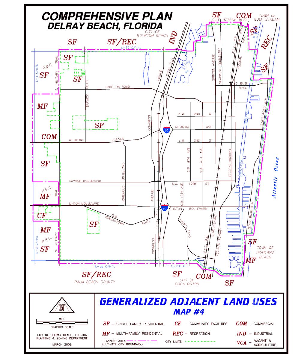
45 FL - 44

46 FL - 45
47 SOIL LEGEND MAP # 5A The first letter, always a capital, is the initial letter of the soil name. The second letter is a lower case letter for a narrowly defined unit, and a capital letter for a broadly defined unit. 1/ The third position, if used, is a capital letter and connotes slope class. Most symbols without a slope letter are those for nearly level soils, but some are for land types or broadly defined units that have a considerable range in slope. SYMBOL NAME SYMBOL NAME AdB Adamsville sand, organic subsoil variant Pa Pahokee muck An Anclote fine sand PbB Palm Beach-Urban land complex ASF Arents, very steep 1/ PcB Paola sand, 0 to 8 percent slopes AU Arents-Urban land complex 1/ Pd Pineda sand AX Arents-Urban land complex, organic substratum Pe Pinellas fine sand Ba Basinger fine sand Pf Pits Bc Basinger-Urban land complex Pg Placid fine sand BM Basinger and Myakka sands, depressional 1/ PhB Pomello fine sand Bn Beaches Po Pompano fine sand Bo Boca fine sand QAB Quartzipsamments, shaped 1/ Cc Canaveral-Urban land complex Ra Riviera sand Ch Chobee fine sandy loam Rd Riviera sand, depressional CuB Cocoa-Urban land complex Ru Riviera-Urban land complex Da Dania muck Sa Sanibel muck Fa Floridana fine sand ScB St. Lucie sand, 0 to 8 percent slopes Ha Hallandale sand SuB St. Lucie-Urban land complex Ho Holopaw fine sand Ta Tequesta muck Im Immokalee fine sand Tc Terra Ceia muck Ju Jupiter fine sand TM Tidal swamp, mineral 1/ La Lauderhill muck TO Tidal swamp, organic 1/ Mk Myakka sand Tr Torry muck Mu Myakka-Urban land complex UD Udorthents 1/ Oc Okeechobee muck Ur Urban land On Okeelanta muck Wa Wabasso fine sand Os Oldsmar sand Wn Winder fine sand 1/ The composition of these units is apt to be more variable than the other units in the survey area. Mapping has been controlled well enough, however, to be interpreted for the anticipated use of the soils. FL - 46

48 FL - 47

49 FL - 48
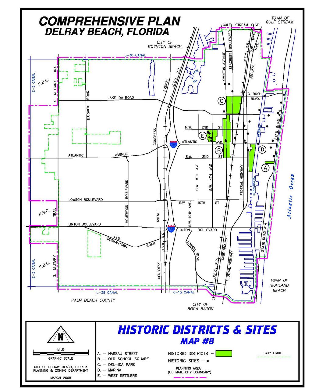
50 FL - 49

51 FL - 50

52 FL - 51

53 FL - 52
TREASURE COAST REGIONAL PLANNING COUNCIL M E M O R A N D U M. To: Council Members AGENDA ITEM 5H
 TREASURE COAST REGIONAL PLANNING COUNCIL M E M O R A N D U M To: Council Members AGENDA ITEM 5H From: Date: Subject: Staff October 17, 2008 Council Meeting Local Government Comprehensive Plan Review Draft
City of Palm Coast 2035 Comprehensive Plan - Goals, Objectives, and Policies EXECUTIVE SUMMARY
 EXECUTIVE SUMMARY INTRODUCTION The original Comprehensive Plan, with two adopted planning timeframes, was adopted in 2004, following the City s incorporation in 1999. The first timeframe is five (5) years
CHARLES PUTMAN CHARLES PUTMAN AND ASSOCIATES, INC
 MEMORANDUM CHARLES PUTMAN & ASSOCIATES, INC. LAND DEVELOPMENT CONSULTANTS PLANNING ZONING PERMITTING 4722 NW Boca Raton Boulevard, Suite C-106 Boca Raton, Florida 33431 Phone: 561/994-6411 FAX: 561/994-0447
The transportation system in a community is an
 7 TRANSPORTATION The transportation system in a community is an important factor contributing to the quality of life of the residents. Without a sound transportation system to bring both goods and patrons
TRANSPORTATION ELEMENT GOALS, OBJECTIVES, AND POLICIES
 TRANSPORTATION ELEMENT GOALS, OBJECTIVES, AND POLICIES GOAL 2 The City shall provide a safe, convenient, effective, and energy efficient multimodal transportation system which is coordinated with the Future
CHAPTER 12 IMPLEMENTATION
 CHAPTER 12 IMPLEMENTATION The 2010 Town of Denton Comprehensive Plan is intended to capture a vision of the future of Denton. As such, it provides a basis for a wide variety of public and private actions
Joint Meeting City Council and the Plan Commission. September 1st, 2015
 Joint Meeting City Council and the Plan Commission September 1st, 2015 1 The City Plan Commission shall recommend a City Plan for the physical development of the City Article IX Section 2 of the City of
Chapter 10 IMPLEMENTATION RECOMMENDATIONS
 Chapter 10 IMPLEMENTATION RECOMMENDATIONS The recommended land use plan presented in the previous chapter provides a design for the attainment of the urban and rural development and open space preservation
EXHIBIT A. Tax Increment Reinvestment Zone No. 1 (Town Center) First Amended Project Plan 1
 First Amended Project Plan 1") EXHIBIT A Tax Increment Reinvestment Zone No. 1 (Town Center) First Amended Project Plan 1 1 As amended by Resolution No. 2008-02-001(TR1R) of the Tax Increment Reinvestment Zone No.1, and approved to
EXHIBIT A Tax Increment Reinvestment Zone No. 1 (Town Center) First Amended Project Plan 1 1 As amended by Resolution No. 2008-02-001(TR1R) of the Tax Increment Reinvestment Zone No.1, and approved to
Intergovermental Coordination
 Intergovermental Coordination CITY OF WINTER PARK CHAPTER 8: INTERGOVERNMENTAL COORDINATION ELEMENT INTERGOVERNMENTAL COORDINATION ELEMENT GOAL 8-1: PROVIDE FOR IMPROVED INTERGOVERNMENTAL COORDINATION
CHAPTER 7: Transportation, Mobility and Circulation
 AGLE AREA COMMUNITY Plan CHAPTER 7 CHAPTER 7: Transportation, Mobility and Circulation Transportation, Mobility and Circulation The purpose of the Transportation, Mobility and Circulation Chapter is to
CITY OF PUYALLUP. Background. Development Services
 CITY OF PUYALLUP Development Services 333 South Meridian Puyallup WA 98371 To: City Council From: Katie Baker, AICP, Planning Division Re: South Hill Neighborhood Plan Adoption Date: (Meeting date: February
HOUSING ELEMENT GOALS, OBJECTIVES, AND POLICIES
 HOUSING ELEMENT GOALS, OBJECTIVES, AND POLICIES Goal 6 Maintain and enhance the supply of decent, safe, energy efficient and affordable housing and maximize viable options and opportunities for present
MEMORANDUM AGENDA ITEM #6c
 South Florida Regional Planning Council MEMORANDUM AGENDA ITEM #6c DATE: FEBRUARY 1, 2010 TO: FROM: SUBJECT: COUNCIL MEMBERS STAFF CITY OF PARKLAND PROPOSED COMPREHENSIVE PLAN AMENDMENT (ALTERNATIVE REVIEW)
IMPLEMENTATION STRATEGIES. In This Chapter. Goals & Strategies 182 Project List 183 Future Land Use 186 CHAPTER 11 IMPLEMENTATION STRATEGIES
 In This Chapter Goals & Strategies 182 Project List 183 Future Land Use 186 11 IMPLEMENTATION STRATEGIES NORTH AUGUSTA, SC 2017 COMPREHENSIVE PLAN 179 Individual commitment to a group effort that is what
COLVER ROAD INDUSTRIAL CONCEPT PLAN
 COLVER ROAD INDUSTRIAL CONCEPT PLAN A CONCEPTUAL LAND USE AND TRANSPORTATION PLAN FOR TA-4 AN URBAN RESERVE AREA OF THE CITY TALENT City of Talent Adopted by City Council Resolution No., June, 2015 PART
AWH REPORT OF THE PLANNING AND DEVELOPMENT DEPARTMENT FOR APPLICATION FOR REZONING ORDINANCE TO PLANNED UNIT DEVELOPMENT
 AWH REPORT OF THE PLANNING AND DEVELOPMENT DEPARTMENT FOR APPLICATION FOR REZONING ORDINANCE TO PLANNED UNIT DEVELOPMENT MAY 8, 2014 The Planning and Development Department hereby forwards to the Planning
ARTICLE 6: Special and Planned Development Districts
 ARTICLE 6: Special and Planned Development Districts 6-10 Traditional Neighborhood Development (TND) District 6-10.10 Purpose and Intent The Traditional Neighborhood Development (TND) District provides
City of Hermosa Beach Administrative Policy #
 City of Hermosa Beach Administrative Policy # SUBJECT: Living Streets Policy Date: Approved by: City Council Authority: Public Works Department & Community Development Department Mayor, PURPOSE The City
Dwelling Units Max 12 dwelling units per acre/min 8 dwelling units per acre. Development Mix 80% non residential/20% residential
 13. OSTEEN LOCAL PLAN Background: The Osteen Local Plan area is located in southwest Volusia County along the SR 415 corridor between Lemon Bluff Road and Acorn Lake Road and includes 3,990 acres. The
TREASURE COAST REGIONAL PLANNING COUNCIL M E M O R A N D U M. To: Council Members AGENDA ITEM 5I
 TREASURE COAST REGIONAL PLANNING COUNCIL M E M O R A N D U M To: Council Members AGENDA ITEM 5I From: Date: Subject: Staff December 12, 2008 Council Meeting Local Government Comprehensive Plan Review Town
TRANSPORTATION ELEMENT
 TRANSPORTATION ELEMENT GOAL I: To create and maintain a safe, efficient and aesthetic transportation system that encourages multi-modal transportation and promotes the mobility strategies of the Ocala
1934 Commerce Lane Suite 1 Jupiter, Florida Ph Fax Lic # LC-C ATTACHMENT G.
 Landscape Architects I Land Planners I Environmental Consultants 1934 Commerce Lane Suite 1 Jupiter, Florida 33458 Ph 561.747.6336 Fax 561.747.1377 www.cotleurhearing.com Lic # LC-C000239 ATTACHMENT G
Staff Report and Recommendation
 Community Planning and Development Planning Services 201 W. Colfax Ave., Dept. 205 Denver, CO 80202 p: 720.865.2915 f: 720.865.3052 www.denvergov.org/cpd TO: City Council Neighborhoods and Planning Committee
SECTION II SECTION II STATEMENT OF GOALS, OBJECTIVES, PRINCIPLES, ASSUMPTIONS, POLICIES AND STANDARDS
 STATEMENT OF GOALS, OBJECTIVES, PRINCIPLES, ASSUMPTIONS, POLICIES AND STANDARDS 1 2 STATEMENT OF GOALS, OBJECTIVES, PRINCIPLES, ASSUMPTIONS, POLICIES AND STANDARDS INTRODUCTION The New Jersey Municipal
NEW CASTLE COUNTY S ZONING DISTRICTS
 NEW CASTLE COUNTY S ZONING DISTRICTS This is general information about New Castle County s zoning districts. The information included is by no means exhaustive or complete. Before designing plans to develop
[THIS PAGE INTENTIONALLY LEFT BLANK]
![[THIS PAGE INTENTIONALLY LEFT BLANK]](/thumbs/77/76526040.jpg "[THIS PAGE INTENTIONALLY LEFT BLANK]") 1-1 LAND USE [THIS PAGE INTENTIONALLY LEFT BLANK] TABLE OF CONTENTS INTRODUCTION... 7 1-1. GOAL: TO DEVELOP AND MAINTAIN A WELL-BALANCED COMMUNITY WITH A VARIETY OF LAND USES THAT ARE COMPATIBLE WITH EACH
1-1 LAND USE [THIS PAGE INTENTIONALLY LEFT BLANK] TABLE OF CONTENTS INTRODUCTION... 7 1-1. GOAL: TO DEVELOP AND MAINTAIN A WELL-BALANCED COMMUNITY WITH A VARIETY OF LAND USES THAT ARE COMPATIBLE WITH EACH
FUTURE LAND USE ELEMENT
 FUTURE LAND USE ELEMENT GOAL I: To create and sustain a great place to live, play, and prosper Objective 1: The City of Ocala shall incorporate the principles and strategies of the Ocala 2035 Vision into
Mitchell Ranch South MPUD Application for Master Planned Unit Development Approval Project Narrative. Introduction
 Mitchell Ranch South MPUD Application for Master Planned Unit Development Approval Project Narrative Introduction Mitchell Ranch South is a proposed single family (detached) residential development on
LAND USE GOALS, OBJECTIVES AND POLICIES. Goal 1: [L] (EFF. 7/16/90)
![LAND USE GOALS, OBJECTIVES AND POLICIES. Goal 1: [L] (EFF. 7/16/90)](/thumbs/88/115018937.jpg "LAND USE GOALS, OBJECTIVES AND POLICIES. Goal 1: [L] (EFF. 7/16/90)") LAND USE GOALS, OBJECTIVES AND POLICIES Goal 1: [L] (EFF. 7/16/90) The Comprehensive Plan shall protect and enhance the quality of life in this community by providing economically sound educational, employment,
LAND USE GOALS, OBJECTIVES AND POLICIES Goal 1: [L] (EFF. 7/16/90) The Comprehensive Plan shall protect and enhance the quality of life in this community by providing economically sound educational, employment,
LAND USE AMENDMENT DOWNTOWN COMMERCIAL CORE (WARD 7) MACLEOD TRAIL SE AND 5 AVENUE SE BYLAW 254D2017
 MACLEOD TRAIL SE AND 5 AVENUE SE BYLAW 254D2017") Page 1 of 10 EXECUTIVE SUMMARY This Land Use Amendment application seeks to redesignate a full downtown block (currently the YWCA site) from a Direct Control based on the CM-2 District (Land Use Bylaw
Page 1 of 10 EXECUTIVE SUMMARY This Land Use Amendment application seeks to redesignate a full downtown block (currently the YWCA site) from a Direct Control based on the CM-2 District (Land Use Bylaw
ARLINGTON COUNTY, VIRGINIA
 ARLINGTON COUNTY, VIRGINIA County Board Agenda Item Meeting October 15, 2005 DATE: September 28, 2005 SUBJECT: Request to Advertise the adoption of the 2005 Clarendon Sector Plan C. M. RECOMMENDATION:
Welcome. Comprehensive Plan & Transportation Plan Open House November 7, 2012
 Welcome Comprehensive Plan & Transportation Plan Open House November 7, 2012 Agenda Proposed future land use plan Comprehensive Plan strategies Traffic forecasts Future traffic operations Possible future
INTERGOVERNMENTAL COORDINATION ELEMENT
 Goals, Objectives and Policies COORDINATION ELEMENT GOAL 8.1.: ESTABLISH EFFECTIVE COORDINATION MEASURES AMONG ALL PERTINENT PUBLIC AND QUASI-PUBLIC ENTITIES SO TO BEST MAINTAIN PALM BEACH GARDENS' QUALITY
Incentive Zoning Regulations Florida Municipal City of Orlando
 Topic: Resource Type: State: Jurisdiction Type: Municipality: Year (adopted, written, etc.): 2002 Community Type applicable to: Title: Incentive Zoning Regulations Florida Municipal City of Orlando Document
Glenborough at Easton Land Use Master Plan
 Implementation 114 9.0 IMPLEMENTATION 9.1 OVERVIEW This chapter summarizes the administrative procedures necessary to implement the proposed land use plan, infrastructure improvements, development standards,
Future Land Use and Transportation
 Planning & Zoning Board Workshop Comprehensive Plan for Village of Estero Future Land Use and Transportation April 6, 2017 January Kick-off Meeting Public Input What do you like about Estero? Location
12 Intergovernmental Coordination
 Intergovernmental Coordination Supporting Data The purpose of the Intergovernmental Coordination Element is to identify and resolve incompatible goals, objectives, policies and development proposed in
4.1.3 LAND USE CATEGORIES
 4.1.3 LAND USE CATEGORIES a. City Center District The City Center District incorporates the existing character and mix of uses in downtown Belmont to encourage redevelopment and new development in keeping
CITY OF TARPON SPRINGS DCA#11-1AR
 Agenda Item #3.H.2 05/09/11 TAMPA BAY REGIONAL PLANNING COUNCIL LOCAL GOVERNMENT COMPREHENSIVE PLAN ADOPTED AMENDMENT REPORT CITY OF TARPON SPRINGS DCA#11-1AR 1 ADOPTED WITH THE FOLLOWING CHANGES: Ordinance
CHAPTER 7: VISION AND ACTION STATEMENTS. Noble 2025 Vision Statement
 CHAPTER 7: VISION AND ACTION STATEMENTS This chapter presents the vision, policy and action statements that transform the comprehensive planning study, an analysis of Noble s past, future trends and community
Planned Development Review Revisions (Project No. PLNPCM )
") Planned Development Review Revisions (Project No. PLNPCM2014-00139) Standard residential development Planned Development Example: Smaller lot sizes than what is allowed to create open space amenity. What
Planned Development Review Revisions (Project No. PLNPCM2014-00139) Standard residential development Planned Development Example: Smaller lot sizes than what is allowed to create open space amenity. What
Chapter Master Planned Communities (MPC) District
 District") Sections 14.53.010 Purpose and Intent 14.53.020 Applicability 14.53.030 Procedure 14.53.040 MPC Standards 14.53.050 Required Findings 14.53.010 Purpose and Intent Chapter 14.53 Master Planned Communities
Sections 14.53.010 Purpose and Intent 14.53.020 Applicability 14.53.030 Procedure 14.53.040 MPC Standards 14.53.050 Required Findings 14.53.010 Purpose and Intent Chapter 14.53 Master Planned Communities
TEMPLE MEDICAL & EDUCATION DISTRICT
 City of Temple, Texas TEMPLE MEDICAL & EDUCATION DISTRICT 1 Description. The City of Temple joined in partnership with key public and private entities to jointly promote education and medical activities
Implementation Guide Comprehensive Plan City of Allen
 Implementation Guide 2030 Comprehensive Plan City of Allen DRAFT 2015 Implementation Guide Allen 2030 Comprehensive Plan INTRODUCTION The Comprehensive Plan serves as a guide for the growth and development
6 Growth Management Challenges and Opportunities
 6 Growth Management Challenges and Opportunities The Town has established a goal of attaining a 50% participation rate with respect to employment opportunities versus residential population. The Town s
RECREATION AND OPEN SPACE ELEMENT GOALS, OBJECTIVES, AND POLICIES
 RECREATION AND OPEN SPACE ELEMENT GOALS, OBJECTIVES, AND POLICIES Goal 7 To provide park facilities, recreation programs, and open space resources that are safe, adequate, and accessible to all City residents,
Planning Districts INTRODUCTION
 INTRODUCTION To facilitate detailed examination of development prospects for all areas of the community, Delano has been divided into 14 planning districts. The location of these planning districts is
ORDINANCE WHEREAS, this Ordinance is consistent with the City of Winter Garden Comprehensive Plan; and
 ORDINANCE 17-06 AN ORDINANCE OF THE CITY COMMISSION OF THE CITY OF WINTER GARDEN, FLORIDA, CREATING ARTICLE XIV OF CHAPTER 118 OF THE CITY OF WINTER GARDEN CODE OF ORDINANCES PROVIDING FOR THE EAST PLANT
SECTION 1 Introduction...1. SECTION 2 Regional Context Criteria for Planning Districts Description of Planning District...
 Table of Contents SECTION 1 Introduction...1 SECTION 2 Regional Context...2 2.1 - Criteria for Planning Districts...2 2.2 - Description of Planning District...2 SECTION 3 Goals & Objectives...5 SECTION
E O L A F I V E. Location Map SUMMARY G M P Z O N I T E M S # 1 A. & B.
 N. Eola Drive Staff Report to the Municipal Planning Board August 18, 2015 G M P 2 0 1 5-0 0 0 1 9 Z O N 2 0 1 5-00016 I T E M S # 1 A. & B. A N X 2 0 1 2-0 0 0 0 5 G M P 2 0 1 2-0 0 0 0 6 Z O N 2 0 1
Provide and maintain sufficient public parks, recreation facilities, and open space to meet the recreational needs of County residents and visitors.
 (ROS) Goal Provide and maintain sufficient public parks, recreation facilities, and open space to meet the recreational needs of County residents and visitors. OBJECTIVE ROS.01 The County shall acquire,
EXISTING COMPREHENSIVE PLAN
 EXISTING COMPREHENSIVE PLAN Town Center Land Use Element: V. LAND USE POLICIES Town Center Mercer Island's business district vision as described in "Your Mercer Island Citizen-Designed Downtown" was an
SUBJECT: LOCAL GOVERNMENT COMPREHENSIVE PLAN PROPOSED AND ADOPTED AMENDMENT CONSENT AGENDA
 MEMORANDUM AGENDA ITEM #IV.C DATE: APRIL 15, 2019 TO: FROM: COUNCIL MEMBERS STAFF SUBJECT: LOCAL GOVERNMENT COMPREHENSIVE PLAN PROPOSED AND ADOPTED AMENDMENT CONSENT AGENDA Pursuant to the 1974 Interlocal
SPRINGHILL LAKE TRANSIT VILLAGE
 Greenbelt Metro Area Sector Plan - Subarea Design Policies and Guidelines - Springhill Lake Transit Village 113 SPRINGHILL LAKE TRANSIT VILLAGE Residential Neighborhood and Village Center CONCEPT Springhill
Woodburn Comprehensive Plan Growth Management Goals and Policies
 Goal Woodburn Comprehensive Plan Growth Management Goals and Policies G-1. The City's goal is to manage growth in a balanced, orderly and efficient manner, consistent with the City s coordinated population
TABLE OF CONTENTS INTRODUCTION PLAN CONCEPT... 3
 TABLE OF CONTENTS BY-LAW NO. Z-1 INTRODUCTION... 1 1.0 PLAN CONCEPT... 3 1.1 Mission... 3 1.2 A Future Vision for Fredericton... 3 1.3 Growth Strategy Goals... 5 National Context... 5 Provincial Context...
S A C R A M E N T O C O U N T Y JACKSON HIGHWAY & GRANT LINE EAST VISIONING STUDY
 JACKSON HIGHWAY & GRANT LINE EAST S A C R A M E N T O C O U N T Y P L A N N I N G D E P A R T M E N T SUMMARY AND WORKBOOK November 19, 2008 History of the Visioning Study Sacramento County has two growth
6 PORT SYDNEY SETTLEMENT AREA
 Section 6 Port Sydney Page 61 6 PORT SYDNEY SETTLEMENT AREA 6.1 Basis and Principles Village of Port Sydney Waterfront Community Existing Services 6.1.1 Port Sydney is an historic settlement that has developed
1. FUTURE LAND USE ELEMENT Goals, Objectives, and Policies
 1. Goals, Objectives, and Policies The has limited vacant land remaining for new development. Redevelopment is anticipated to represent nearly all development activity within the City. More City residents
CHAPTER 3 VISION, GOALS, & PLANNING PRINCIPLES. City of Greensburg Comprehensive Plan. Introduction. Vision Statement. Growth Management Goals.
 CHAPTER 3 VISION, GOALS, & PLANNING PRINCIPLES Introduction The Greensburg Comprehensive Plan is intended as a working community document. A combination of long and short-term goals, this document is intended
Support the implementation of Cape Coral's Comprehensive Plan. Protect and utilize the unique natural resources in the City.
 7.0 OVERVIEW - RECOMMENDATIONS Chapter 7 The preparation of the Cape Coral Parks and Recreation Master Plan spanned a period of approximately 12 months. Plan preparation included the input of a wide range
3.10 LAND USE SETTING PROJECT SITE EXISTING LAND USE DESIGNATIONS AND ZONING. General Plan Land Use Designations.
 This section of the Draft EIR addresses the existing land uses on and adjacent to the project site and discusses the potential impacts of the proposed project on existing land uses. Key issues addressed
Transit / Housing Oriented Redevelopment
 Broward County Urban Planning and Redevelopment Department Kick-Off Meeting October 24, 2007 Transit / Housing Oriented Redevelopment 1 Future Land Use 2 Broward County Charter Voters approved in 1974.
Baumgarten MPUD. Exhibit 3 Evaluation Criteria
 Pursuant to LDC subsections 10.02.13 B, 10.02.08 F and Chapter 3 G. of the Administrative Code, staff s analysis and recommendation to the Planning Commission, and the Planning Commission s recommendation
September 25th, 2018 $2000 fee pd CC
 2.7267 acres 2018I-00075 September 25th, 2018 $2000 fee pd CC Rezoning Review Criteria Analysis - Map Amendment Application Number: 2018I-00075 805 W. 38 th Avenue October 19, 2018 (amd.) September 17,
Land Use Amendment in Southwood (Ward 11) at and Elbow Drive SW, LOC
 at and Elbow Drive SW, LOC") 2018 November 15 Page 1 of 10 EXECUTIVE SUMMARY This land use amendment application was submitted by Rick Balbi Architect on 2017 August 31 on behalf of Sable Developments Ltd, and with authorization from
2018 November 15 Page 1 of 10 EXECUTIVE SUMMARY This land use amendment application was submitted by Rick Balbi Architect on 2017 August 31 on behalf of Sable Developments Ltd, and with authorization from
Beachside Redevelopment Committee
 Beachside Redevelopment Committee DRAFT FINAL RECOMMENDATIONS MARCH 22, 2018 This is a new slide 2 This is a new slide Table of Contents I. Introduction and Overview II. III. Community Improvements and
Executive Summary. The goals of the Plan are to:
 Executive Summary The Wiscasset Bath Road Master Plan (Plan) seeks to maximize development opportunities along Bath Road through the strategic coordination of traffic infrastructure improvements, land
4. UTILITIES ELEMENT.
 4. UTILITIES ELEMENT. The purpose of this element is to provide for necessary public facilities and services correlated to future land use projections and population demand. Utilities Sub-Elements (A)
LU Encourage schools, institutions, and other community facilities that serve rural residents to locate in neighboring cities and towns.
 Application No. 891627: Comprehensive Plan Text Amendment - Rural School Policies - Amend policies consistent with State Legislation allowing schools in the rural area and extension of sewer service to
The West Vaughan Employment Area Secondary Plan Policies
 Part 2: The West Vaughan Employment Area Secondary Plan Policies 2.1 General Policies It is the policy of Council: 2.1.1. That the West Vaughan Employment Area (the WVEA), identified on Schedule 1, will
Definitions. Average Daily Traffic Demand (ADT): The actual number or projected number of cars that pass a point in a 24-hour period.
: The actual number or projected number of cars that pass a point in a 24-hour period.") Definitions Access Management: A combination of physical techniques and transportation policies used to control the flow of traffic between roads and the surrounding lands. Alternative City Form Scenarios:
Definitions Access Management: A combination of physical techniques and transportation policies used to control the flow of traffic between roads and the surrounding lands. Alternative City Form Scenarios:
MAIN STREET ECONOMIC DEVELOPMENT STRATEGY
 MAIN STREET ECONOMIC DEVELOPMENT STRATEGY A PATHWAY TO A BETTER POUGHKEEPSIE DRAFT Working Paper #2: Planning Strategies Submitted December 1 st, 2015 to the City of Poughkeepsie LAND USE LAW CENTER PACE
SECTION UNIFIED DEVELOPMENT ORDINANCE SECTION Part 1 Ordinance. ARTICLE 1 Zoning Districts
 SECTION 1-100 UNIFIED DEVELOPMENT ORDINANCE SECTION 1-300 Part 1 Ordinance SECTION 1-100. Introduction. ARTICLE 1 Zoning Districts Crystal Lake strives to maintain a balance of various land uses for a
The following rules shall be used to determine the precise location of any zone boundary shown on the Official Zoning Map of Auburn:
 ARTICLE III. ESTABLISHMENT OF ZONING DISTRICTS Section 300. Establishment of Zoning Districts. The City of Auburn, Alabama is hereby divided into zoning districts of such number and character as are necessary
COMMUNITY DESIGN. GOAL: Create livable and attractive communities. Intent
 COMMUNITY DESIGN Intent An attractive, well-designed County will attract quality development, instill civic pride, improve the visual character of the community, and create a strong, positive image for
MEMORANDUM AGENDA ITEM #IV.C
 MEMORANDUM AGENDA ITEM #IV.C DATE: NOVEMBER 27, 2017 TO: FROM: COUNCIL MEMBERS STAFF SUBJECT: LOCAL GOVERNMENT COMPREHENSIVE PLAN PROPOSED AND ADOPTED AMENDMENT CONSENT AGENDA Pursuant to Section 163.3184,
ROAD CLOSURE AND LAND USE AMENDMENT SILVER SPRINGS (WARD 1) NORTHEAST OF NOSEHILL DRIVE NW AND SILVER SPRINGS ROAD NW BYLAWS 2C2018 AND 29D2018
 NORTHEAST OF NOSEHILL DRIVE NW AND SILVER SPRINGS ROAD NW BYLAWS 2C2018 AND 29D2018") Page 1 of 19 EXECUTIVE SUMMARY This application proposes redesignating two parcels in the community of Silver Springs from Special Purpose Future Urban Development (S-FUD) District and undesignated road
Page 1 of 19 EXECUTIVE SUMMARY This application proposes redesignating two parcels in the community of Silver Springs from Special Purpose Future Urban Development (S-FUD) District and undesignated road
Improve Neighborhood Design and Reduce Non Point Source Water Pollution
 HOW TO Planning Guide Improve Neighborhood Design and Reduce Non Point Source Water Pollution This document was funded by a grant from the New Hampshire Coastal Program with funding from the National Oceanic
Town Center (part of the Comprehensive Plan)
") Town Center (part of the Comprehensive Plan) Mercer Island Town Center Looking North (2014) In 1994, a year-long process culminated in a set of design guidelines and code requirements for the Town Center
Town Center (part of the Comprehensive Plan) Mercer Island Town Center Looking North (2014) In 1994, a year-long process culminated in a set of design guidelines and code requirements for the Town Center
Future Land Use Element Goals, Objectives & Policies
 Future Land Use Element Goals, Objectives & Policies Future Land Use Element Goals, Objectives, and Policies 163.3177(6)(a) 9J-5.006(3) Overall Goal City of Bunnell Future Land Use Element Ensure that
LAND USE ELEMENT. Purpose. General Goals & Policies
 LAND USE ELEMENT Purpose This Land Use Element contains the goals and policies necessary to support the City s responsibility for managing land resources and guiding development through implementing regulations,
TOP TEN LIST OF COMMUNITY CONCERNS REGARDING PROPOSED AMENDMENTS TO CHAPTER 42
 TOP TEN LIST OF COMMUNITY CONCERNS REGARDING PROPOSED AMENDMENTS TO CHAPTER 42 1. Extend the urban area to Beltway 8 in stages, over say a three-year period, prioritizing development in transit and declining
TRANSIT ORIENTED DEVELOPMENT PINELLAS COUNTY MPO LIVABLE COMMUNITIES INITIATIVE PINELLAS COUNTY COMPREHENSIVE PLAN AMENDMENTS
 PINELLAS COUNTY MPO LIVABLE COMMUNITIES INITIATIVE MODEL LAND DEVELOPMENT CODE TRANSIT ORIENTED DEVELOPMENT PINELLAS COUNTY COMPREHENSIVE PLAN AMENDMENTS MPO Livable Communities Initiative Goal: Improve
CITY OF COLWICH COMPREHENSIVE PLAN LAND USE LAND USE 1
 LAND USE LAND USE 1 WHAT YOU WILL FIND IN THIS CHAPTER: Discussion of today s conditions and tomorrow s projections Discussion of challenges and opportunities Discussion of the environmental quality goals,
SECTION E. Realizing the Plan
 SECTION E Realizing the Plan 60 DESIGN REGINA - OFFICIAL COMMUNITY PLAN SECTION E Realizing the Plan Design Regina has been an ambitious plan-making exercise, with a high level of community, stakeholder,
Olde Towne Vision Plan
 Olde Towne Vision Plan Introduction In 2016, the City of Bellevue will complete its move of City offices from Olde Towne Bellevue to its new municipal complex on Wall Street. The City intends to sell its
implementation10 Village of Greendale Comprehensive Plan: Greendale, Wisconsin. Revisiting a Greenbelt Community
 implementation10 Village of Greendale Comprehensive Plan: 2010 - Village of Greendale Comprehensive Plan: 2010 - Implementation The recommendations of this Plan must be implemented by the Village of Greendale,
13 THORNHILL YONGE STREET STUDY IMPLEMENTATION CITY OF VAUGHAN OPA 669 AND TOWN OF MARKHAM OPA 154
 13 THORNHILL YONGE STREET STUDY IMPLEMENTATION CITY OF VAUGHAN OPA 669 AND TOWN OF MARKHAM OPA 154 The Planning and Economic Development Committee recommends the adoption of the recommendations contained
City of Chickasaw Land Use Comprehensive Plan 2030 Chapter5-Draft(2)Public review_
Public review_") Land Use Land Use refers to the activity or development characteristics of a given parcel of land. The Land Use Plan presented in the following pages, represents the City of Chickasaw s official position
Land Use Land Use refers to the activity or development characteristics of a given parcel of land. The Land Use Plan presented in the following pages, represents the City of Chickasaw s official position
Warren County/Bowling Green Focus 2030 Comprehensive Plan VOLUME 1 INDEX
 Appendix 5: Index VOLUME 1 INDEX A Aesthetics ES-6, FLU-15, FLU-17, FLU-24, NCR-7 Agricultural Base FLU-18, FLU-20 Agricultural Centers, Rural FLU-11 Agricultural District NCR-17-NCR-18 Agricultural Economy
The Need to Develop a Transit Ready Community
 Evaluation & Appraisal Report (EAR) Major Issue # 6 The Need to Develop a Transit Ready Community July 3, 2007 EAR Major Issue # 6 Transit Ready Existing Comp Plan policies apply only to Indiantown Road:
open public hearing and allow public comment request to continue LPA public hearing to January 16, 2014 at 10:30 am
 TODAY S AGENDA Work Session LPA Transmittal Public Hearing open public hearing and allow public comment request to continue LPA public hearing to January 16, 2014 at 10:30 am staff will issue a recommendation
INTERGOVERNMENTAL COORDINATION ELEMENT Inventory Analysis
 INTERGOVERNMENTAL COORDINATION ELEMENT Inventory Analysis 2.176 INTRODUCTION This Element outlines and analyzes those issues that require intergovernmental cooperation to achieve plan implementation. The
City Center Specific Plan Amendments And Background Report City of Richmond. PLANNING COMMISION FINAL DRAFT January, 2001
 City Center Specific Plan Amendments And Background Report City of Richmond PLANNING COMMISION FINAL DRAFT January, 2001 TABLE OF CONTENTS Page LIST OF TABLES... LIST OF FIGURES... INDEX... OVERVIEW...
2.4 FUTURE LAND USE ELEMENT Goals, Objectives and Policies
 GOAL 1: To create developmental patterns that direct future growth to appropriate areas on campus, in a manner that promotes the educational mission of the University, the protection of environmentally
Potential Annexation Areas And Annexation
 Exhibit A to Ordinance No. - Proposed Amendments to the Pierce County Countywide Planning Policies Addressing Potential Annexation Areas And Annexation 1 0 1 0 1 COUNTYWIDE PLANNING POLICY ON URBAN GROWTH
and services The protection and conservation of environmentally significant and sensitive natural heritage features and functions.
 6. Land Use 6.0 Preamble A healthy and livable city is one in which people can enjoy a vibrant economy and a sustainable healthy environment in safe, caring and diverse neighbourhoods. In order to ensure
CITY PLANNING COMMISSION AGENDA. ITEM NO(s): C.1 C.3 STAFF: STEVE TUCK
: C.1 C.3 STAFF: STEVE TUCK") Page 34 CITY PLANNING COMMISSION AGENDA ITEM NO(s): C.1 C.3 STAFF: STEVE TUCK FILE NOS: CPC ZC 12-00035 QUASI-JUDICIAL CPC NV 12-00036 QUASI-JUDICIAL AR DP 12-00039 QUASI-JUDICIAL PROJECT: APPLICANT: OWNER:
Page 34 CITY PLANNING COMMISSION AGENDA ITEM NO(s): C.1 C.3 STAFF: STEVE TUCK FILE NOS: CPC ZC 12-00035 QUASI-JUDICIAL CPC NV 12-00036 QUASI-JUDICIAL AR DP 12-00039 QUASI-JUDICIAL PROJECT: APPLICANT: OWNER: