2014 Bentley Systems, Incorporated. Bentley Map V8i SELECT series 4
|
|
|
- Johnathan Weaver
- 5 years ago
- Views:
Transcription
1 2014 Bentley Systems, Incorporated Bentley Map V8i SELECT series 4

2 Agenda Why Bentley Map V8i SELECT series 4 Map SELECT series 4 Workshop Tools Workflows Map SELECT series 4 Workshop Tools User Interfaces Why use Bentley Map? Why Bentley Map What users say Interoperability Mapping Tools ESRI File GDB Mapping Bentley Systems, Incorporated

3 Why Use Bentley Map V8i? Powerful, Extensible 3D GIS and Mapping Software for the World's Infrastructure. Visualization and editing of 2D/3D geospatial information Bentley Systems, Incorporated Editing, analysis and management of 2D/3D geospatial information *Standalone or with MicroStation Enterprise editing, analysis and processing of 2D/3D geospatial information


4 Why Bentley Map Interoperate Integrating today s data Integrate types, many geospatial/non-geospatial types of data data Create & Update High performance 3D data creation & update in flexible architecture Extract Value Spatial analysis Produce deliverables Bentley Systems, Incorporated


5 What users say Bentley s software allowed us to provide Cancún City with the best Federated Geospatial Information System in all of Mexico, as well as to conduct an excellent interdepartmental collaboration and project management. Jorge Hernández CEO Innovacion Sistemas y Proyectos, Cancún, Mexico Changes to operating systems and Oracle databases as well as the need for a centralized, seamless spatial database have motivated the pursuit of a next-generation GIS system that would last for the next 10 to 15 years[...] Using Bentley Map V8i SS4 we have been able to adapt our existing application to the new requirements without having to completely re-write it. We selected Bentley Map because of its direct connection to Oracle Spatial, and that meant minimal changes were needed to our database schema. Rao Tanuku Director Systems Engineering IT, Verizon "Using Bentley's geospatial technologies to help make decisions when choosing locations for investment projects within city limits, we are able to achieve substantial cost savings while taking the quality of our work to an entirely new level." Viktor Panarin Director, Municipality of Dzerzhinsk, Russia "Bentley Map leverages the advantages of CAD and GIS, providing a supreme platform for map feature editing. With the robustness of the DGN file technology and full integration with MicroStation, our users can expedite their work very effectively. Sr Dr. Tan LiatChoon Deputy Director, Department of Survey and Mapping Malaysia Bentley Systems, Incorporated
6 Map SELECTseries 4 Workshop Tools Workflows Why ERSI GDB Files and Mapping Tools? Interoperability Why ESRI GDB Files and Mapping Tools? Advantages of ESRI GDB Files and Mapping Tools Benefits of ESRI GDB File Interop and Mapping Tools Workflow to Import an ESRI File GDB Workflow to Connect/Extract/Post to ESRI File GDB Mapping Tools Workflow to Create Map Model in any model Workflow View Scale/Scale based visualization Workflow Cartographic representation Bentley Systems, Incorporated
7 Why ESRI GDB File Interoperability and Mapping Tools? Benoit to fill in Bentley Systems, Incorporated


8 Advantages of ESRI GDB File Interop and Mapping Tools Precise ESRI GDB File Accessible Bentley Systems, Incorporated


9 Benefits of ESRI GDB File Interop and Mapping Tools Increase Productivity Bentley Map XFM Data Improve Quality Bentley Systems, Incorporated


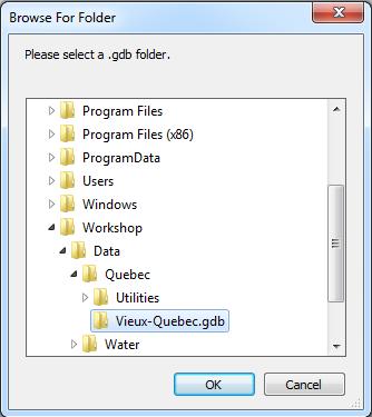
10 Workflow to Import an ESRI File GDB Bentley Systems, Incorporated


11 Workflow to Connect/Extract/Post to ESRI File GDB Bentley Systems, Incorporated
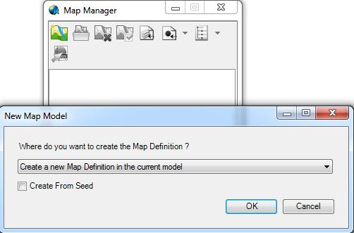
12 Workflow to Create Map Model in any model Bentley Systems, Incorporated

13 Workflow View Scale/Scale based visualization Bentley Systems, Incorporated

14 Workflow Cartographic representation Bentley Systems, Incorporated
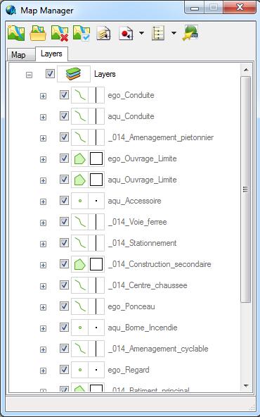
15 Map SELECT series 4 Workshop Tools User Interfaces ESRI File GDB Mapping Import from ESRI GDB File Connect/Extract/Post to an ESRI GDB Data Source Connect/Extract/Post to ESRI File GDB Create Map Model in any model View Scale/Scale based visualization Cartographic representation Bentley Systems, Incorporated

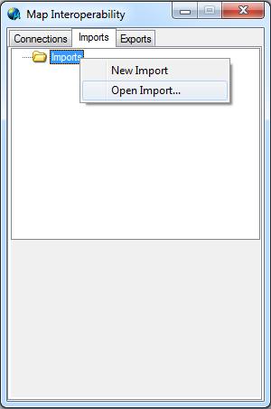
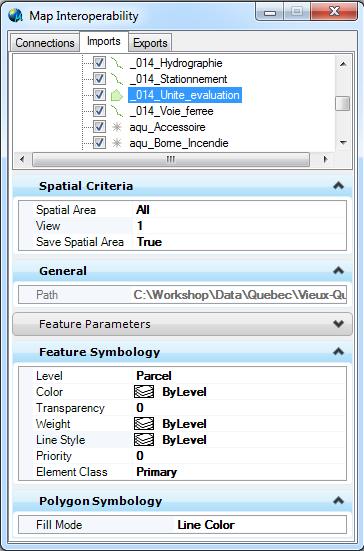
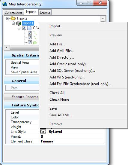
16 Import an ESRI File GDB Bentley Systems, Incorporated

17 Connect/Extract/Post to ESRI File GDB Bentley Systems, Incorporated


18 Create Map Model in any model Bentley Systems, Incorporated


19 View Scale/Scale based visualization Bentley Systems, Incorporated


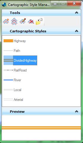


20 Cartographic representation Bentley Systems, Incorporated
21 Practice Exercise Purpose of this Exercise Explore new Map Interoperability to import from ESRI GDB File and explore new mapping functions Practice Exercises Complete the following practice exercise(s). Use Map Interoperability to import ESRI GDB file Use Map Manager for view control and to visualize the map data Use Print Preparation Tools to create deliverables in PDF Practice exercises are located in the Practice Workbook.pdf document installed with the dataset files Bentley Systems, Incorporated
22 Practice Exercise Purpose of this Exercise Explore new Map Interoperability to extract and post an ESRI GDB Datasource Practice Exercises Complete the following practice exercise(s). Use Map Interoperability to connect to a ESRI GDB Datasource and extract data Use Command Manager to place proposed features Use Map Interoperability to post data a to ESRI GDB Datasource Practice exercises are located in the Practice Workbook.pdf document installed with the dataset files Bentley Systems, Incorporated
Esri Roads and Highways: Integrating and Developing LRS Business Systems
 Esri Roads and Highways: Integrating and Developing LRS Business Systems Tom Hill Esri UC 2014 Technical Workshop Overview: Esri Roads and Highways Esri UC 2014 Technical Workshop Esri Roads and Highways:
GeoPlanner SM for ArcGIS : An Introduction
 GeoPlanner SM for ArcGIS : An Introduction Greg Pleiss Robert Stauder Esri UC 2014 Technical Workshop Agenda Application Overview Specific Capabilities - Configuration - Avaliable Data - Spatial Analysis
Practices and Challenges in Adopting Esri Roads and Highways in the U.S.
 Practices and Challenges in Adopting Esri Roads and Highways in the U.S. Xiao Qin, Zhaoxiang He, Zengwang Xu University of Wisconsin-Milwaukee Bo Guo Gistic Research Inc. Kelly Schieldt Wisconsin Department
Green Infrastructure Resources for Coastal Flood Risk Management
 Natural Floodplain Functions Alliance (NFFA) WEBINAR SERIES PRESENTS: Green Infrastructure Resources for Coastal Flood Risk Management Maria Honeycutt, PhD, CFM Lauren Long Tashya Allen NFFA Webinars Hosted
Enterprise GIS Architecture Deployment Options
 2013 Esri International User Conference July 8 12, 2013 San Diego, California Technical Workshop Enterprise GIS Architecture Deployment Options Andrew Sakowicz Esri UC2013. Technical Workshop op. Introduction
Evolving Broadcast Operations With ESB
 Evolving Broadcast Operations With ESB Chris Contakes, Vice President IT, PBS Sylvain Nazef, Sr. Enterprise Architect, PBS Bryan Boggio, Sr. Director, Media Systems, PBS Joy Wang, Director Software Development,
2008 APWA Public Works Congress
 Reduce Street Cuts Use a Web Based Application for Utility Collaboration Presenters: City Of Newton, Massachusetts Dave Turocy Deputy Commissioner, Public Works City of Baltimore Margaret Martin Div. Chief,
ArcGIS Data Reviewer. Planning and Deploying Data Quality Services. Edwin Waite & Shankar Chandrasekaran. Esri UC 2014 Technical Workshop
 ArcGIS Data Reviewer Planning and Deploying Data Quality Services Edwin Waite & Shankar Chandrasekaran Esri UC 2014 Technical Workshop A few examples of why data validation matters Esri UC 2014 Technical
AGI NI 2016 Building A Modern Day GIS For ESB Networks
 AGI NI 2016 Building A Modern Day GIS For ESB Networks Agenda IMGS ESB Networks GIS Requirements Project Team and Implementation Integration G/Technology Solution Lessons Learned Thank You We deliver innovative
ArcGIS Online at Philadelphia Water Department
 ArcGIS Online at Philadelphia Water Department ESRI Public Sector Conference December 2017 Jessica Gould, GISP Megan Clarkin, AICP, LEED Green Associate Tim Smith We provide the City with integrated water,
System Requirements and Supported Platforms for Oracle Real-Time Decisions Applications. Version May 2008
 System Requirements and Supported Platforms for Oracle Real-Time Decisions Applications Version 2.2.1 May 2008 Copyright 2008, Oracle. All rights reserved. Part Number: E12184-01 The Programs (which include
The Esri Public Works Platform. More Than Mapping
 The Esri Public Works Platform More Than Mapping Intelligent Public Works Sustaining a safe, vibrant community requires a smart public works system. Esri created a platform that connects public works departments
MapObjects. Embeddable Mapping and GIS Components for Application Developers
 MapObjects Embeddable Mapping and GIS Components for Application Developers MapObjects Embeddable Mapping and GIS Components for Application Developers With MapObjects software, developers can create applications
Esri Roads and Highways & ArcGIS Platform
 Esri Roads and Highways & ArcGIS Platform Increasing efficiency and effectiveness through improved data quality, capture, accessibility, reporting and analytics to transportation agencies Esri Roads and
EMTA regularly contributes to the European Commission consultation exercises, and takes opportunities to voice its concerns to European Institutions
 EMTA was created in 1998 at the initiative of the STIF, as a forum for the exchange of information research and experience between the public transport authorities responsible for planning, integrating
Creating 3D Interior Maps for Campus Planning
 Creating 3D Interior Maps for Campus Planning ESRI User Conference 2016 Parvaneh Kossari Harvard Planning & Project Management Antje Kunze SMARTERBETTERCITIES Harvard Planning & Project Management Harvard
GEO-SPATIAL TECHNOLOGY BOUSTEAD GEO-SPATIAL TECHNOLOGY
 lutions Water & Wastewater Engineering Energy-Related Engineering Geo-Spatial Technology Industrial Real Estate Solutions Discovering where advantage begins GEO-SPATIAL TECHNOLOGY BOUSTEAD GEO-SPATIAL
ISO 6394 INTERNATIONAL STANDARD
 INTERNATIONAL STANDARD ISO 6394 Third edition 2008-03-15 Earth-moving machinery Determination of emission sound pressure level at operator's position Stationary test conditions Engins de terrassement Détermination
Tyco Security Products Acquires Innometriks Deal strengthens TSP s Solutions in the Government Market
 MEDIA CONTACT Manisha Kumari +91 80 4052 7000 Info-tspindia@tycoint.com Tyco Security Products Acquires Innometriks Deal strengthens TSP s Solutions in the Government Market WESTFORD, Mass. May 16, 2016
Fairfax County Community Services Board Emergency Response System: Notifier
 Lathan S. Dennis, MSc., GIS Analyst Fairfax County, Human Services 12011 Government Center Parkway, Suite 946, Fairfax, VA 22035 Voice (703) 324-5648 Fax (703) 324-7572 Email ldenni@fairfaxcounty.gov Jim
Eastern Band of Cherokee Indians Integrated Geographical Information System (IGIS)
") Eastern Band of Cherokee Indians Integrated Geographical Information System (IGIS) 1 Background The Eastern Band of Cherokee Indians (EBCI) is the only federally recognized Tribe in North Carolina. Historically
Eastern Band of Cherokee Indians Integrated Geographical Information System (IGIS) 1 Background The Eastern Band of Cherokee Indians (EBCI) is the only federally recognized Tribe in North Carolina. Historically
Hardware and Software Requirements. Integration Enhancements. Functional Enhancements
 Oracle Retail Point-of-Service Release Notes Release 13.4 E25272-01 December 2011 This document highlights the major changes for Release 13.4 of Oracle Retail Point-of-Service. Overview Oracle Retail Point-of-Service
Bridging GIS and BIM in planning and designing Green Infrastructure
 GEODESIGN - Bridging GIS and BIM in planning and designing Green Infrastructure Dr. Olaf Schroth, Professor in Geodesign and Landscape Informatics Weihenstephan-Triesdorf University of Applied Sciences,
~!VAUGHAN NOV Z November 21, Mr. Denis Kelly, Regional Clerk The Regional Municipality of York Yonge Street Newmarket, ON L3Y 6Z1
 ~!VAUGHAN NOV Z 5 2016 November 21, 2016 Mr. Denis Kelly, Regional Clerk The Regional Municipality of York 17250 Yonge Street Newmarket, ON L3Y 6Z1 Dear Mr. Kelly: RE: NEW KIRBY GO STATION IN BLOCK 27
User Advocacy Group. Rohit Gupta
 User Advocacy Group Rohit Gupta Agenda Introduction to User Advocacy Group (UAG) UAG Process User Communities Initiatives User Advocacy Group Mission To enhance the productivity of the user community by
Campus Map Applications
 Campus Map Applications - use cases from Göttingen - M.SC. CLAUDIA MALZER GEORG-AUGUST-UNIVERSITÄT GÖTTINGEN INSTITUTE OF GEOGRAPHY DEPT. CARTOGRAPHY, GIS & REMOTE SENSING GOLDSCHMIDTSTR. 5 37077 GÖTTINGEN
Sustain.Ability. Alarm Management: Be Pro-active, not Re-active Honeywell Users Group Europe, Middle East and Africa. Tyron Vardy, Honeywell
 Sustain.Ability. 2012 Honeywell Users Group EMEA 2014 Honeywell Users Group Europe, Middle East and Africa Alarm Management: Be Pro-active, not Re-active Tyron Vardy, Honeywell Agenda Introduction Defining
SAM and ESB Update. Spring 2016 NYS Coordinator s Conference. May 18, 2016
 SAM and ESB Update Spring 2016 NYS 9-1-1 Coordinator s Conference May 18, 2016 May 18, 2016 2 Streets and Address Maintenance (SAM) Program May 18, 2016 3 SAM Address Points 6.2 million total points delivered
Take Control. > Your partner to protect people, property and the environment.
 Take Control > Your partner to protect people, property and the environment. Deliver instant, reliable and complete communications Federal Signal enhances public safety and security around the world. From
Implementing the OGC Sensor Web Enablement Standards for Marine Applications
 Implementing the OGC Sensor Web Enablement Standards for Marine Applications ROBEX Sensor Workshop, Vienna, 27 th April 2017 Simon Jirka, 52 North GmbH, jirka@52north.org Motivation Existing earth observation
ISO INTERNATIONAL STANDARD. Liquid hydrogen Land vehicle fuel tanks. Hydrogène liquide Réservoirs de carburant pour véhicules terrestres
 INTERNATIONAL STANDARD ISO 13985 First edition 2006-11-01 Liquid hydrogen Land vehicle fuel tanks Hydrogène liquide Réservoirs de carburant pour véhicules terrestres Reference number ISO 13985:2006(E)
Presentation August 20, 2013
 Presentation August 20, 2013 St. Vital Transmission Complex Stakeholder Workshop WELCOME! Manitoba Hydro 9:00am to 1:50pm Purpose of Workshop Share current project information Including outcomes of the
Next Generation Alarm Management With DynAMo Alarm and Operations Management
 2012 Honeywell Users Group EMEA Sustain.Ability. Next Generation Alarm Management With DynAMo Alarm and Operations Management Tyron Vardy Introductions Tyron Vardy Product Director for Advanced Solutions
Live, Work, Locate and Site Selector
 Configuring Live, Work, Locate and Site Selector in Your Community John Hauck ArcGIS for State Government Solutions for Esri s government customers Series of useful maps and apps focused on government
ISO/TC 211 GEOGRAPHIC INFORMATION AND GEOMATICS A FRAMEWORK AND REFERENCE MODEL
 ISO/TC 211 GEOGRAPHIC INFORMATION AND GEOMATICS A FRAMEWORK AND REFERENCE MODEL Kian FADAIE Canada Centre for Remote Sensing Natural Resources Canada Fadaie@nrcan.gc.ca Paper number 1734 KEY WORDS: ISO/TC211,
Diana Arsovic Nielsen Director Health Innovation Centre of Southern Denmark
 Diana Arsovic Nielsen Director Health Innovation Centre of Southern Denmark Models of Innovation; Disruptive, Open and Challenge lead innovation in health care of the future Agenda Insights into the way
Have a look at our report and let us know which results surprised you and which confirmed your suspicions.
 How comprehensively do you understand the way architectural offices use technology? Do design firms share the same headaches? Limited processor capabilities, graphics-intensive tasks, software crashes,
Facility Commander Wnx
 Facility Commander Wnx Integrated security management platform for Windows Seamless. Effective. Efficient. Integrate security applications on one versatile platform It s easy and efficient to seamlessly
CITY OF VAUGHAN EXTRACT FROM COUNCIL MEETING MINUTES OF NOVEMBER 15, 2016
 Item 11, Report No. 38, of the Committee of the Whole, which was adopted without amendment by the Council of the City of Vaughan on November 15, 2016. Regional Councillor Di Biase declared an interest
Introducing the Digital Illumination Interface Alliance
 Introducing the Digital Illumination Interface Alliance The global industry alliance for DALI lighting control March 2019 1 DiiA: The global industry alliance for DALI DiiA the Digital Illumination Interface
2017/11/16 P a g e 1
 2017/11/16 P a g e 1 Contents What s New... 2 Fixes... 3 Driver Updates... 3 New Sensors... 3 New Features... 3 How To... 4 Security... 4 Auditing... 6 Smart UI/MAPS Title 21 CFR Part 11 Auditing... 6
About Esri NeA. Esri NeA Training Profile 2012
 About Esri NeA Stemming from Esri s commitment to meet the needs and demands of the GIS community in the Middle East and North Africa, Esri established Esri Northeast Africa (Esri NeA). Esri NeA is a free
Design and analysis of the piping systems
 Design and analysis of the piping systems Over all schematic diagram of the total system along with equipment and connecting piping is shown in Fig.. Different piping systems are described as follows:.
ISO 3858 INTERNATIONAL STANDARD. Rubber compounding ingredients Carbon black Determination of light transmittance of toluene extract
 INTERNATIONAL STANDARD ISO 3858 Third edition 2008-09-15 Rubber compounding ingredients Carbon black Determination of light transmittance of toluene extract Ingrédients de mélange du caoutchouc Noir de
A community driven catalyst for an equitable, healthy, (economically viable and environmentally) sustainable corridor
 sustainable corridor") Economy Environment Equity Building Sustainability Supporting neighborhoods Preserving municipal resources A community driven catalyst for an equitable, healthy, (economically viable and environmentally)
Economy Environment Equity Building Sustainability Supporting neighborhoods Preserving municipal resources A community driven catalyst for an equitable, healthy, (economically viable and environmentally)
WASHINGTON SURVEYING AND RATING BUREAU
 WASHINGTON SURVEYING AND RATING BUREAU AGENDA Who we are What we do Why we do it How PC gradings are developed Grading topics How PC gradings are published WHO WE ARE Rating Bureau Starting our 102 th
Integrated security management platform for Windows. Seamless. Effective. Efficient.
 Integrated security management platform for Windows Seamless. Effective. Efficient. We have 70% security personnel turnover in a year. How can we effectively train them on multiple applications when each
Fire Alarm and Mass Notification Project
 Fire Alarm and Mass Notification Project Denver International Airport Denver, Colorado, USA Photo provided courtesy of Denver International Airport VIEW OF EXISTING JEPPESEN TERMINAL, LOOKING SOUTH Photo
UL Health Sciences Industry Case Study: Skanray Technologies
 UL Health Sciences Industry Case Study: Skanray Technologies Skanray Technologies, Mysore India High Technology medical start-up company in India gains access to global regulatory markets by partnering
Being Prepared and Providing Situational Awareness, through the use of Web GIS
 Being Prepared and Providing Situational Awareness, through the use of Web GIS Captain Michael Brady, Commanding Officer GIS Unit, Fire Department City of New York Who We Are 11,198 Firefighters and Fire
"VOICE OF SECURITY: Trends In Intercom, Public Address, and Mass Notification Emergency Communications
 "VOICE OF SECURITY: Trends In Intercom, Public Address, and Mass Notification Emergency Communications ASIS Houston Chapter Luncheon May 21, 2014 Paul Rux Director of Sales Mexico / South Central Region
Philadelphia Water Department, Green Infrastructure Implementation Graduate Internship Opportunities Summer 2017
 PHILADELPHIA WATER 1101 Market Street Philadelphia, Pennsylvania 19107-2994 Debra McCarty, Commissioner Philadelphia Water Department, Green Infrastructure Implementation Graduate Internship Opportunities
Approval to Enter Into an Agreement with Everbridge, Inc. to Provide a Mass Notification System in Stanislaus County
 THE BOARD OF SUPERVISORS OF THE COUNTY OF STANISLAUS ACTION AGENDA SUMMARY DEPT: CEO-Office of Emergency Services BOARD AGENDA# B-9 ~~~~~~~~~ Urgent D Routine [!] E)>.S AGENDA DATE December 15, 2015 CEO
Graduate Degree program B.Sc. Interior Design
 DETAILED SYLLABUS FOR DISTANCE EDUCATION Graduate Degree program B.Sc. Interior Design (B.SC.ID) (Three Years Course) Course Title: B.Sc. Interior Design Duration : Six Semester Total Degree Marks : 2400
Interconnecting egovernment and INSPIRE
 Interconnecting egovernment and INSPIRE E.Pauknerova, J.Polacek and P.Soucek COSMC/ČÚZK Czech Office for Surveying, Mapping and Cadastre A.Jakobsson EuroGeographics 24-06-2012 INSPIRE Conference, Istanbul
Oracle Communications Performance Intelligence Center
 Oracle Communications Performance Intelligence Center System Alarms Guide Release 10.2.1 E77506-01 June 2017 1 Oracle Communications Performance Intelligence Center System Alarms Guide, Release 10.2.1
Martin Huber 26September 2017 F&G SOLUTIONS FOR THE PROCESS INDUSTRY
 Martin Huber 26September 2017 F&G SOLUTIONS FOR THE PROCESS INDUSTRY Agenda 1 Challenges in the Process Industry International codes and standards F&G in an industrial Facility Honeywell s industrial F&G
A Guide to the Standardized Framework Project for Puget Sound Stormwater System Mapping
 A Guide to the Standardized Framework Project for Puget Sound Stormwater System Mapping Produced by with a grant from the Washington State Department of Ecology Stormwater Services Project Team: Mark Preszler,
Siemens Enterprise Security. Integrated Security Process. Airports. & Resource Management for Today s Airports. Steve Batt, Market Manager Airports
 Siemens Enterprise Security Integrated Security Process Airports & Resource Management for Today s Airports Steve Batt, Market Manager Airports The Spectrum of Airport Security Technology Intrusion Detection
Compact Product Suite Compact HMI 6.0 Overview ABB
 Compact Product Suite Compact HMI 6.0 Overview ABB 2 OVERVIEW COMPACT HMI VERSION 6.0 Compact HMI A feature-rich human-machine interface Another feature is the high performance prefabricated, reusable
Western Pennsylvania Conservancy Clairton & Harrison Community Greening Assessment Projects Request for Proposals July 2018
 Western Pennsylvania Conservancy Clairton & Harrison Community Greening Assessment Projects Request for Proposals July 2018 Proposal Information The Western Pennsylvania Conservancy (WPC) is seeking proposals
Location-aware Mobile Devices & Landscape Reading
 DLA 2011 May 27th 2011 JOYE R. VERBEKEN J. HEYDE S. LIBBRECHT H. Location-aware Mobile Devices & Landscape Reading University College Ghent Dep. Bioscience and Landscape Architecture Brusselsesteenweg
Approval to Use $76,105 of Fire Warden Public Facilities Fees (PFF) Funding for the Purchase of a Regional Fire Records Management System
 Funding for the Purchase of a Regional Fire Records Management System") THE BOARD OF SUPERVISORS OF THE COUNTY OF STANISLAUS ACTION AGENDA SUMMARY DEPT: CEOOffice of Emergency SrvcsIFire Warden BOARD AGENDA # Urgent AGENDADATE *B9 November 30,2010 CEO Concurs with Recom 415VoteRequired
THE BOARD OF SUPERVISORS OF THE COUNTY OF STANISLAUS ACTION AGENDA SUMMARY DEPT: CEOOffice of Emergency SrvcsIFire Warden BOARD AGENDA # Urgent AGENDADATE *B9 November 30,2010 CEO Concurs with Recom 415VoteRequired
Tutorial 16: Urban Planning
 Table of Contents Tutorial 16: Urban planning......................................... 3 2 Tutorial 16: Urban planning Download items Tutorial data Tutorial pdf This tutorial describes how CityEngine can
Situational Awareness for Life & Fire Safety. October 10, 2013
 Situational Awareness for Life & Fire Safety October 10, 2013 New Fire Standards Control and Communication Units For Fire Alarm Control Units Mass notification products shall be constructed to comply with
Employing Open Simulator as an Immersive and Collaborative GeoDesign Tool
 230 Employing Open Simulator as an Immersive and Collaborative GeoDesign Tool Muhammed Ali ÖRNEK 1 and Ebru ÖZER 2 1 İTÜ, İstanbul/Turkey maornek@itu.edu.tr 2 FIU, Miami/United States eozer@fiu.edu Abstract
Department of Growth and Climate of the Nordic Council of Ministers Working Meeting in the Leontief Centre 16 August, 2013
 Department of Growth and Climate of the Nordic Council of Ministers Working Meeting in the Leontief Centre 16 August, 2013 WELCOME Irina Karelina, ICSER Leontief center, Director-General NORDIC-RUSSIAN
Welcome to Esri's Software Export Control Classification Number (ECCN) Matrix August 2017
 Matrix August 2017") Welcome to Esri's Software Export Control Classification Number (ECCN) Matrix August 2017 This portion of the Esri web site is to provide information regarding the export control classification of Esri
Welcome to Esri's Software Export Control Classification Number (ECCN) Matrix August 2017 This portion of the Esri web site is to provide information regarding the export control classification of Esri
Public Forum. Kelley s Corner: The Corner that Connects Us. The Cecil Group. March 7, Acton 2020 Town of Acton.
 Public Forum Acton 2020 Town of Acton March 7, 2013 AGENDA Purpose of Forum Kelley s Corner Project Examples of the Planning Processes Next Steps Dialogue: Questions and Answers PURPOSE Acton 2020 April
Global Platform for Sustainable Cities (GPSC) Working Group on Indicators for Sustainable Cities & Geospatial Tools
 Working Group on Indicators for Sustainable Cities & Geospatial Tools") Global Platform for Sustainable Cities (GPSC) Working Group on Indicators for Sustainable Cities & Geospatial Tools March 7 to 8, 2016 Singapore Working Group on Indicators for Sustainable Cities and Geospatial
Global Platform for Sustainable Cities (GPSC) Working Group on Indicators for Sustainable Cities & Geospatial Tools March 7 to 8, 2016 Singapore Working Group on Indicators for Sustainable Cities and Geospatial
INTERNATIONAL STANDARD
 INTERNATIONAL STANDARD ISO 16247 First edition 2004-10-15 Road vehicles Detection of exhaust system leaks Helium test method and detection device specification Véhicules routiers Détection des fuites du
The Language of Geography. Health and Human Services
 The Language of Geography Health and Human Services Cover Points of Distribution: this Esri map shows population density in relation to vaccine distribution centers, helping health officials perform a
RECOMMENDED COURSE SEQUENCE
 RECOMMENDED COURSE SEQUENCE 3-Year Program First Professional Degree First Year LA 501 Studio I 3 LA 504 Studio III 3 LA 503 Studio II 3 LA 506 Studio IV 3 LA 592A & 696L Plants in the Landscape & Lab
ISO INTERNATIONAL STANDARD
 INTERNATIONAL STANDARD ISO 5658-2 Second edition 2006-09-15 Reaction to fire tests Spread of flame Part 2: Lateral spread on building and transport products in vertical configuration Essais de réaction
ISO Plastics Film and sheeting Determination of water vapour transmission rate Infrared detection sensor method
 INTERNATIONAL STANDARD ISO 15106-2 First edition 2003-01-15 Plastics Film and sheeting Determination of water vapour transmission rate Part 2: Infrared detection sensor method Plastiques Film et feuille
A New Approach to ESB Migration Building a foundation for Digital Business
 A New Approach to ESB Migration Building a foundation for Digital Business Summary Traditional business models are being threatened by the digital economy. Having the ability to do business digitally is
Oracle Retail Management System Release Notes Release Spanish. January 2008
 Oracle Retail Management System Release Notes Release 10.1.20 Spanish January 2008 Oracle Retail Management System Release Notes, Release 10.1.20 Spanish Copyright 2008, Oracle. All rights reserved. Primary
Oracle Retail Merchandising System Release Notes Release 12.0 May 2006
 Oracle Retail Merchandising System Release Notes Release 12.0 May 2006 Copyright 2006, Oracle. All rights reserved. The Programs (which include both the software and documentation) contain proprietary
ISO INTERNATIONAL STANDARD. Reaction to fire tests for floorings Part 1: Determination of the burning behaviour using a radiant heat source
 INTERNATIONAL STANDARD ISO 9239-1 Third edition 2010-06-15 Reaction to fire tests for floorings Part 1: Determination of the burning behaviour using a radiant heat source Essais de réaction au feu des
GIS Training of Undergraduates: Campus Stormwater Mapping. Joanne Logan, University of Tennessee. Gordie Bennett, University of Tennessee
 GIS Training of Undergraduates: Campus Stormwater Mapping Joanne Logan, University of Tennessee Gordie Bennett, University of Tennessee Seth Benge, University of Tennessee Tim Prather, University of Tennessee
HealthEast Care System
 healthcare HealthEast Care System CASE STUDY HealthEast Leverages OnGuard Open Platform to Manage Enterprise-Wide Security Operations As the largest health care provider in the Twin Cities East Metro area,
ISO INTERNATIONAL STANDARD. Determination of the resistance to jet fires of passive fire protection materials Part 1: General requirements
 INTERNATIONAL STANDARD ISO 22899-1 First edition 2007-12-01 Determination of the resistance to jet fires of passive fire protection materials Part 1: General requirements Détermination de la résistance
Smart Growth for Dallas
 Smart Growth for Dallas Data-driven decisions for the future of Dallas parks, open spaces, and green infrastructure Dallas Park and Recreation Board March 10, 2016 Agenda I. Welcome and Introductions II.
Why and How to Migrate from Oracle Reports to JasperReports [WEBINAR]
![Why and How to Migrate from Oracle Reports to JasperReports [WEBINAR]](/thumbs/86/94951197.jpg "Why and How to Migrate from Oracle Reports to JasperReports [WEBINAR]") Why and How to Migrate from Oracle Reports to JasperReports [WEBINAR] Presenters Guillaume Autier Director of Solution Consulting, TIBCO Magdalena Serban R & D, PITSS GmbH Jason Marra VP of Sales and Operations,
Why and How to Migrate from Oracle Reports to JasperReports [WEBINAR] Presenters Guillaume Autier Director of Solution Consulting, TIBCO Magdalena Serban R & D, PITSS GmbH Jason Marra VP of Sales and Operations,
2014 South Atlantic LCC
 2014 South Atlantic LCC Annual Report 1 Allie Stewart, U.S. FWS The South Atlantic LCC s 2014 Annual Report this year of progress and accomplishments is dedicated to South Atlantic LCC Coordinator, Ken
Esri Partner Network. Program Guide April For Partners Worldwide Developing GIS Solutions and Services on the Esri Software Platform
 Esri Partner Network Program Guide For Partners Worldwide Developing GIS Solutions and Services on the Esri Software Platform Esri Partner Network Program Guide Table of Contents 4 The Power of the Esri
2015 Honeywell Users Group Europe, Middle East and Africa. Incident Response at your Fingertips Adrian Fielding, Honeywell
 2015 Honeywell Users Group Europe, Middle East and Africa Incident Response at your Fingertips Adrian Fielding, Honeywell Integrated Protective Solutions Honeywell s Integrated Protective Solutions deliver
Graduate-Level Course List
 CRPLAN 5001 - Introduction to GIS (4) Introduction to the basic principles of geographic information systems and their use in spatial analysis and information management. Prereq: Sr or Grad standing. Not
Session VI Smart safety systems
 Session VI Smart safety systems September 09th, 2016 Kolkata Denzil D Enterprise security Building Technologies Siemens Ltd Siemens AG 2011. All rights reserved. Safety every where Hospital Office Residential
Leveraging the Data Ecosystem for Smart, Resilient and Sustainable Cities
 Leveraging the Data Ecosystem for Smart, Resilient and Sustainable Cities -Urbanization in Uganda By Mr. Bernard Justus MUHWEZI Chairman, Geo-Information Management Working Group, Uganda Bureau of Statistics,
Comprehensive solutions for greater safety and security Answers for infrastructure.
 Fire Safety & Security Comprehensive solutions for greater safety and security Answers for infrastructure. Combining fire and security expertise to deliver a higher level of safety and security Meeting
KELTRON LS 7000 ALARM MANAGEMENT SYSTEM Keltron Alarm Monitoring, Dispatch, and Reporting Software
 KELTRON LS 7000 ALARM MANAGEMENT SYSTEM Keltron Alarm Monitoring, Dispatch, and Reporting Software OVERVIEW The Keltron LS 7000 Alarm Management System software and computers make up the dispatch portion
BC Soil Information Finder Tool
 BC Soil Information Finder Tool This project is a collaborative effort between the British Columbia (BC) Ministry of Agriculture (AGRI) and the BC Ministry of Environment (MoE) with funding from Growing
Indoor Location, Tracking, and Routing
 2013 Esri International User Conference July 8 12, 2013 San Diego, California Technical Workshop Indoor Location, Tracking, and Routing Wolfgang Hall, Esri Tobias Donaubauer, Infsoft Robert Garrity, Esri
Regional ITS Architecture Report
 Regional ITS Architecture Report Prepared for: The Missouri Department of Transportation 2211 St. Mary s Boulevard Jefferson City, MO 65109 August 2004 Prepared by: TransCore 920 W. 47 th Street Kansas
ISO 7010 INTERNATIONAL STANDARD. Graphical symbols Safety colours and safety signs Safety signs used in workplaces and public areas AMENDMENT 1
 INTERNATIONAL STANDARD ISO 7010 First edition 2003-10-01 AMENDMENT 1 2006-03-01 Graphical symbols Safety colours and safety signs Safety signs used in workplaces and public areas AMENDMENT 1 Symboles graphiques
The Public Architect as City Builder
 The Public Architect as City Builder WE 203: The Public Architect as City Builder Wednesday, April 26, 2017, 8:30am 5:30pm Learning Units 7.50 LUs/HSW/RIBA This presentation is protected by U.S. and international
Operation & Maintenance Task Force
 Operation & Maintenance Task Force Best Practices in solar O&M in Mexico Workshop Máté Heisz September 6th, 2018, Mexico City Supported by: The significance of O&M 2 The European solar PV market size Source:
Case Study siemens.ca/ingenuityforlife
 WE Charity Case Study siemens.ca/ingenuityforlife WE Charity Case Study Siemens ingenuity helps WE make doing good doable No charity in the world is quite like WE. With a goal to build a community of 100
ISO/TR TECHNICAL REPORT. Reaction-to-fire tests Full-scale room tests for surface products Part 2: Technical background and guidance
 TECHNICAL REPORT ISO/TR 9705-2 First edition 2001-05-01 Reaction-to-fire tests Full-scale room tests for surface products Part 2: Technical background and guidance Essais de réaction au feu Essais dans