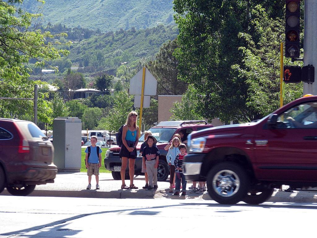
Key Pad Polling Results. Goals and Strategies Open House February 3, 2011
|
|
|
- Roland Barton
- 5 years ago
- Views:
Transcription

1 Key Pad Polling Results Goals and Strategies Open House February 3, 2011
2 1. What is your age 1. Under years years years 5. Over 65 years 49% 11% 1% 11% 27% Under years years years Over 65 years
3 3. How did you learn out about this event? 1. Flyer 2. Newspaper 49% 3. Radio 4. Word of mouth 28% 5. County website 15% 6. 2% 0% 5% Flyer Newspaper Radio Word of mouth County website
4 Where do you live? 31% 1. Spanish Valley Grand County 1% 2. Spanish Valley San Juan County 58% 3. In the City of Moab 6% 4. Castle Valley 0% 5. Colorado River 0% 6. Cisco/Westwater 2% 7. La Sals 0% 8. Thompson Springs 1% 9. I 70 0% 10. US 191 North
5 Top 2 favorite kinds of music 26% 1. Country western 58% 2. Rock 19% 3. Bluegrass 3% 4. Religious/faith 24% 5. Folk 9% 6. Punk 10% 7. Jazz 12% 8. Pop/top 40 12% 9. Hip hop 18% 10. Classical


6 Open Space Types 1. Geological Hazards 2. Steep Slopes 3. Ridgelines 4. Riparian Areas 5. Historic Sites 6. Agricultural Lands
7 Top 2 Open Space Priorities 1. Geologic Hazards 2. Steep slopes 3. Ridgelines 4. Riparian Areas 1. Geological Hazards 2. Steep Slopes 3. Ridgelines 5. Historic Sites 6. Agricultural Land 17% 13% 57% 37% 25% 40% 4. Riparian Areas 5. Historic Sites Geologic Hazards Steep slopes Ridgelines Riparian Areas Historic Sites Agricultural Land 6. Agricultural Lands


8 Open Space Set aside 1. Open Space dedication 2. Continuous Open Space throughout County with fee
9 Which voluntary open space program is better? 47% 1. Open space set aside for density bonus 53% 2. Fee in lieu of open space for buying public open space 1. Open Space within a development 2. Open Space throughout County with fee

10

11 Rural Center
12 Do you think rural centers are a good 3% 1. Yes, anywhere idea for this plan? 60% 10% 28% 2. Yes, in the appropriate locations 3. I could live with it 4. I would not like to see them happen

13 Complete Streets Safe Routes to School
14


15 Complete Streets Which is more pedestrian friendly?
16 Should some county roads offer 84% 1. Yes pedestrian/bicycle access? 16% 2. No


17 Complete Streets Bike Lanes Bike Lane vs Trail Detached, parallel multi modal trail Bike Lane along road Curb, gutter, sidewalk No pedestrian/bike


18 Pedestrian and bike options 1. Detached Multimodal Trail 3. Bike lane along road 2. Curb, gutter, sidewalk 4. No pedestrian/bike

19 Preference for the north south collector roads (Spanish Valley Drive, Mill Creek Drive) 1. Detached Multimodal Trail 3. Bike lane along road 45% 1. Detached Multimodal 11% 2. Curb, gutter, sidewalk 36% 3. Bike lane along the road 9% 4. No pedestrian/bike Curb, gutter, sidewalk Curb, gutter, sidewalk 4. No pedestrian/bike
20 Preference for the East West Roads: Spanish 1. Trail Road, Mill Creek Drive, San Jose Road, Sage Detached Multimodal Avenue, Trail Resource Road, Beeman 3. Road Bike lane along 30% 1. Detached Multimodal road 9% 2. Curb, gutter, sidewalk 54% 3. Bike lane along the road 7% 4. No pedestrian/bike Curb, gutter, sidewalk Curb, gutter, sidewalk 4. No pedestrian/bike
21 1. Detached Multimodal Trail 3. Bike lane along road Curb, gutter, sidewalk Curb, gutter, sidewalk Preference for US 191 South 76% 1. Detached Multimodal 1% 2. Curb, gutter, sidewalk 11% 3. Bike lane along the road 11% 4. No pedestrian/bike 4. No pedestrian/bike
22 1. Detached Multimodal Trail 3. Bike lane along road Curb, gutter, sidewalk Curb, gutter, sidewalk Preference for US 191 North 87% 1. Detached Multimodal 0% 2. Curb, gutter, sidewalk 4% 3. Bike lane along the road 9% 4. No pedestrian/bike 4. No pedestrian/bike
23 1. Detached Preference for Hwy 128 Multimodal Trail 3. Bike lane along road 53% 1. Detached Multimodal 1% 2. Curb, gutter, sidewalk 30% 3. Bike lane along the road 16% 4. No pedestrian/bike Curb, gutter, sidewalk Curb, gutter, sidewalk 4. No pedestrian/bike
24 1. Detached Preference for Hwy 279 Multimodal Trail 3. Bike lane along road 31% 1. Detached Multimodal 0% 2. Curb, gutter, sidewalk 57% 3. Bike lane along the road 12% 4. No pedestrian/bike Curb, gutter, sidewalk Curb, gutter, sidewalk 4. No pedestrian/bike

25 1 US 191 Corridor No frontage road or buffer

26 2 US 191 Corridor Parallel frontage road with detached trail
27 3 US 191 Corridor Alternate frontage road alignment with detached trail

28 Preferences for US 191 South 1. No frontage road or buffer 2. Parallel frontage road with detached trail 3. Alternate frontage alignment with detached trail No frontage road or b... 31% Parallel frontage road... 28% 41% Alternate frontage al...


29 Design for Pedestrian Access
30 In what locations (if any) do you think commercial land uses should design for 1. US 191 South commercial areas 2. US 191 North commercial areas 3. All commercial areas 4. No pedestrian access design needed pedestrian access? US 191 South comme... 0% US 191 North comme... 9% 61% All commercial areas No pedestrian acces... 29%


31 Transportation Inside of a Development 1. No curb and gutter, detached trail system 2. Curb and gutter and walk
32 Which is most appropriate for residential development 34% 1. No curb and gutter and detached trails 11% 32% 23% 2. Curb, gutter, sidewalk 3. Depends on the location 4. Depends on the density
33 Connectivity

34 Connectivity
35 Rate the importance of connectivity in the unincorporated county 35% 1. Very important 43% 22% 2. Somewhat important 3. Not important


36 Visual Impact Mitigation 1. Buffering 2. Site Planning / Ridgeline Protection 3. Architectural Design (color and materials) 4. No Visual Impact Mitigation
37 Visual Impact Mitigation for US 191 North 6% 52% 27% 15% 1. Buffering 2. Site Planning/Ridgeline Protection 3. Architectural: color and materials 4. No visual impact mitigation 1. Buffering 2. Site Planning/Ridgeline 3. Architectural Design (color and materials) 4. No Visual Impact Mitigation
38 Visual Impact Mitigation for US 191 South (along the highway) 11% 42% 32% 15% 1. Buffering 2. Site Planning/Ridgeline Protection 3. Architectural: color and materials 4. No visual impact mitigation 1. Buffering 2. Site Planning/Ridgeline 3. Architectural Design (color and materials) 4. No Visual Impact Mitigation
39 14% 40% 31% 15% Visual Impact Mitigation for the Spanish Valley (mostly residential areas) 1. Buffering 2. Site Planning/Ridgeline Protection 3. Architectural: color and materials 4. No visual impact mitigation 1. Buffering 2. Site Planning/Ridgeline 3. Architectural Design (color and materials) 4. No Visual Impact Mitigation
40 Visual Impact Mitigation for the Colorado River Corridor 9% 55% 28% 8% 1. Buffering 2. Site Planning/Ridgeline Protection 3. Architectural: color and materials 4. No visual impact mitigation 1. Buffering 2. Site Planning/Ridgeline 3. Architectural Design (color and materials) 4. No Visual Impact Mitigation
41 Visual Impact Mitigation for Thompson Springs 6% 33% 20% 40% 1. Buffering 2. Site Planning/Ridgeline Protection 3. Architectural: color and materials 4. No visual impact mitigation 1. Buffering 2. Site Planning/Ridgeline 3. Architectural Design (color and materials) 4. No Visual Impact Mitigation
42 Visual Impact Mitigation for Cisco Westwater I70 3% 29% 16% 52% 1. Buffering 2. Site Planning/Ridgeline Protection 3. Architectural: color and materials 4. No visual impact mitigation 1. Buffering 2. Site Planning/Ridgeline 3. Architectural Design (color and materials) 4. No Visual Impact Mitigation


43 Commercial/Non Residential Lighting Plan view of a light 1. Full cut off 2. No light trespass across a property line 3. Light level limits
44 Preference for commercial/non residential lighting 33% 1. Full cut off requirements 27% 22% 18% 2. Light trespass restriction 3. Foot candle limits 4. No lighting standards/limits 1. Full cut off 2. No light trespass 3. Foot Candle limits

45 Stormwater Management Residential


46 Stormwater Management Commercial

47 Stormwater Management Concept 1. Conventional Piped approach 2. Stormwater Quality Treatment
48 Preferences for storm water management 1. Conventional piped approach 2. Storm water quality treatment 85% 15% Conventional piped... Storm water quality...

49 Solar Access 1. Design Review prior to Building Permit Solar fences Building design Height
50 Solar Access New development layouts 2. Layout is key to solar access in new development. Street orientation Lot and street dimensions Open space configuration Relationship to topography

51 Preference for solar access: 1. Design review prior to building permit 2. New development layout 3. No solar access protection 54% 24% 22% Design review prior t... New development la... No solar access prot

52 Solar Access Remove barriers for individual use
53 Remove barriers for individual solar 59% 1. I support this energy systems 22% 19% 2. I can live with it 3. I don t support this

54 Solar Farms
55 Would you like to see commercialscale solar power in the county? 9% 1. Yes, anywhere 70% 9% 13% 2. Yes, in the appropriate location 3. I could live with it 4. I would not like to see it here

56 Wind Power Wind Map of Utah


57 Wind Power
58 Would you like to see commercialscale wind power in the county? 10% 1. Yes, anywhere 70% 8% 12% 2. Yes, in the appropriate location 3. I could live with it 4. I would not like to see it here

59 Environmentally Friendly Design Energy savings Water efficiency CO2 emissions reduction Improve indoor air quality Water quality treatment Sensitivity to Building impacts
60 Do you think an incentive based energy conservation building code is 78% 1. Yes worth pursuing? 22% 2. No
WASHINGTON COUNTY OREGON
 WASHINGTON COUNTY OREGON July 9, 2009 Revisions to Chapter 2 of the Bethany Community Plan The North Bethany Subarea Plan Exhibit pages 7 and 8 The sections for the Core and Flexible Streets were amended
Tennessee Stormwater Management Program. Stormwater Management Site Assessment and Inventory Checklist. Quick Check o Vicinity Map within Watershed
 Tennessee Stormwater Management Program Project Name: Location: File Number: Reviewer: Date of Submittal: Review Date: Project Meeting Chronology: Type of Meeting: Date: Stormwater Management Site Assessment
SH 199 Corridor Master Plan. Community Meeting No. 2 May 31, 2017
 Community Meeting No. 2 May 31, 2017 Transportation Projects On or Near SH 199 SH 199 from 0.3 miles south of FM 1886 to south end of Lake Worth bridge Construct freeway mainlanes and frontage roads 10-Year
Silverdale Regional Center
 Silverdale Regional Center Vision for Silverdale Regional Center The Silverdale Regional Center Plan (Plan) will guide the evolution of the Silverdale Regional Center from a collection of strip malls and
Transportation Land Use Integration & Regional Planning. Don Kostelec, AICP Senior Planner, Louis Berger Group February 1, 2010
 Transportation Land Use Integration & Regional Planning Don Kostelec, AICP Senior Planner, Louis Berger Group February 1, 2010 Transportation Land Use Integration DOT-HUD-EPA Sustainable Communities Initiative
COLVER ROAD INDUSTRIAL CONCEPT PLAN
 COLVER ROAD INDUSTRIAL CONCEPT PLAN A CONCEPTUAL LAND USE AND TRANSPORTATION PLAN FOR TA-4 AN URBAN RESERVE AREA OF THE CITY TALENT City of Talent Adopted by City Council Resolution No., June, 2015 PART
Clair-Maltby Community visioning
 Clair-Maltby Community visioning workshop #1 Summary April 27th, 2017 Table of Contents INTRODUCTIon 1 PURPOSE 1 CONSULTATION STRUCTURE 2 PARTICIPANT FEEDBACK 3 VISIONING EXERCISE 8 ONLINE SURVEY RESULTS
Community Open House March 26 th, 2018
 Community Open House March 26 th, 2018 Open House Agenda 1. Overview of Planning Process What we heard 2. Future Land Use Policy 3. Priority Growth Areas 4. Plan Elements Making it happen What is a Comprehensive
3. VISION AND GOALS. Vision Statement. Goals, Objectives and Policies
 Vision Statement Queen Creek s interconnected network of parks, trails, open spaces and recreation opportunities provide safe and diverse activities and programs that sustain its unique, small town, equestrian
CHAPTER 7: Transportation, Mobility and Circulation
 AGLE AREA COMMUNITY Plan CHAPTER 7 CHAPTER 7: Transportation, Mobility and Circulation Transportation, Mobility and Circulation The purpose of the Transportation, Mobility and Circulation Chapter is to
The West Vaughan Employment Area Secondary Plan Policies
 Part 2: The West Vaughan Employment Area Secondary Plan Policies 2.1 General Policies It is the policy of Council: 2.1.1. That the West Vaughan Employment Area (the WVEA), identified on Schedule 1, will
Denver Moves: Transit Task Force
 Insert transit picture Denver Moves: Transit Task Force Meeting #8 October 5, 2017 1. Welcome & Introductions Opening remarks and housekeeping Task Force and audience introductions Upcoming events and
April 21, 2007 CCRP Workshop Summary
 April 21, 2007 CCRP Workshop Summary Group 1 1. Reuse around BART with a lot of housing and jobs 2. Greenway around creek 3. Transit and auto connection all through the site from Kirker Pass to Port Chicago
EXHIBIT B PROJECT NARRATIVE POULSBO MEADOWS
 EXHIBIT B PROJECT NARRATIVE POULSBO MEADOWS Name of Project: Poulsbo Meadows; A Planned Residential Development (PRD)/Plat Applicants Name: PBH Group LLC/Byron Harris PO Box 1010 Silverdale, WA 98038 Description
Horizon 2035 Land Use and Transportation Element
 CITY OF SUNNYVALE Horizon 2035 Land Use and Transportation Element City Council Study Session March 7, 2017 Overview General Plan Context Mixed Use Villages Transportation Mode & Parking General Plan Policy
CHAPTER 5: Special Character Areas
 AGLE AREA COMMUNITY Plan CHAPTER 5 CHAPTER 5: Special Character Areas ! 62! 2010 EAGLE AREA COMMUNITY PLAN 2010 EAGLE AREA COMMUNITY PLAN 63 Special Character Areas Seven areas have been identified as
Designing Walkable Urban Thoroughfares: A Context Sensitive Approach
 Designing Walkable Urban Thoroughfares: A Context Sensitive Approach Communities Want: Flexibility Compatibility with adjacent land uses Balanced land use/transportation functions Safe and attractive streets
City of Lafayette Study Session Staff Report Design Review Commission
 ++ City of Lafayette Study Session Staff Report Design Review Commission Meeting Date: January 08, 2018 Staff: Subject: Chris Juram, Planning Technician SS12-17 Miramar Homebuilders, R-20 Zoning: Request
Glenborough at Easton Land Use Master Plan
 Vision Statement Sunrise Blvd. Hazel Ave. Prairie City Rd. Gencorp Property Lincoln Regional Airport 1.0 VISION STATEMENT The identifies City of the principles, goals, policies, and standards Lincoln that
Chapter 1. Comprehensive Plan Summary. Purpose
 Chapter 1 Comprehensive Plan Summary Purpose The Carbondale Comprehensive Plan is an officially adopted policy document that establishes the town s goals for the future and provides direction for decisions
for Master Planned Development Framework Design Standards & Guidelines
 B L A C K D I A M O N D DE S I G N G U I D E L I N E S for Master Planned Development Framework Design Standards & Adopted June 18, 2009 Introduction and Purpose The Master Planned Development (MPD) Framework
Complete Neighbourhood Guidelines Review Tool
 Complete Neighbourhood Guidelines Review Tool Prepared By: City of Regina Planning Department October 2014 Page 1 of 14 Community Development Review Checklist for Secondary Plans and Concept Plans The
Access Management: An Overview
 Figures 1-5 Below Evolution of development along a highway. In the early stages, land along the road is used for farming with little traffic generated. As time passes, the highway corridor becomes a de
Applicant Name Phone / Fax / Address City State Zip Code . Property Owner Phone / Fax / Address City State Zip Code
 Master Development Plan Application Community Development Department City of Redmond 411 SW 9 th Street Redmond, Oregon 97756 541-923-7721 541-548-0706 FAX Master Development Plan Fee $38,862.52 File Number
OP Council Resolution June 16, Planning and Development Services
 OP-08-01 Council Resolution June 16, 2008 Planning and Development Services Kingsgate Landing Outline Plan Table of Contents 1.0 Introduction 1 1.1 Purpose of Plan 1 1.2 Plan Area Location 1 1.3 Ownership
SQUAMISH 2010 AND BEYOND COMMUNITY VISION
 Our plan has been imagined and created to be both pragmatic and visionary. At the core of the strategy is a consideration of the highway s role and its impact on the community. First and foremost in creating
Yahoo! Inc. CO-7. Santa Clara Valley Urban Runoff. Site Location: 701 First Avenue Sunnyvale, CA
 Yahoo! Inc. CO-7 Site Location: 701 First Avenue Sunnyvale, CA Rocky swales Multi-story buildings reduce building footprint Access to the Bay Trail open space area including parking available for visitors
AWH REPORT OF THE PLANNING AND DEVELOPMENT DEPARTMENT FOR APPLICATION FOR REZONING ORDINANCE TO PLANNED UNIT DEVELOPMENT
 AWH REPORT OF THE PLANNING AND DEVELOPMENT DEPARTMENT FOR APPLICATION FOR REZONING ORDINANCE TO PLANNED UNIT DEVELOPMENT MAY 8, 2014 The Planning and Development Department hereby forwards to the Planning
Watertown City Council
 City of Watertown Watertown City Council April 14 th, 2015 Agenda Item: City Comment on Sun Share CUP Application Request for Action: Motion to Approve City Comments regarding CUP Application Department:
Whitemarsh Comprehensive Plan Update: Housing & Land Use. Public Workshop #3: September 20, 2018
 Whitemarsh Comprehensive Plan Update: Housing & Land Use Public Workshop #3: September 20, 2018 Agenda Welcome Process Recap What We ve Heard The Plan Framework Review of Recommended Actions Land Use Housing
Glenn Highway MP DSR. Landscape Narrative
 Glenn Highway MP 34-42 DSR Landscape Narrative Project Landscape Goals The Glenn Highway MP 34-42 Project extends through a variety of landscape types typical to the Matanuska-Susitna Valley. In general,
9 th Street Sub Area Plan
 9 th Street Sub Area Plan In the 1990 s, when the Township prepared the last Master Plan, the 9 th Street corridor was studied as part of a larger 9 th Street Focus Area that included the West Main Street
BROOKHILL NEIGHBORHOOD MODEL ZONING MAP AMENDMENT PREFACE TO APPLICATION
 BROOKHILL NEIGHBORHOOD MODEL ZONING MAP AMENDMENT PREFACE TO APPLICATION June 15, 2015 Revised: August 1, 2016 I. VISION Brookhill is a proposed community based upon the principles of Albemarle County
Section4 Design Vision & Implementation Plan
 Section4 Design Vision & Implementation Plan W Woodschurch Rd 4.1 Design Focus Areas The Framework Plan is simply the starting point for directing the design and implementation of a wide range of transportation
II. SINGLE FAMILY RESIDENTIAL
 II. SINGLE FAMILY RESIDENTIAL Castle Rock is made up of numerous individually built houses and subdivision tracts that have been developed during the past century. Some of the tracts are diverse in architectural
MASTER PLAN. 201 Planning Concepts. Chapter 2
 Chapter 2 MASTER PLAN 201 Planning Concepts 202 Master Land Use Plan 203 Affordable Housing Program 204 Parks, Open Space, and Recreation Trails 205 Grading Concept 206 Circulation Plan 207 Landscape Concept
CAMPUS PLANNING COMMITTEE STAFF REPORT SAMARITAN SPORTS MEDICINE INSTITUTE AT OSU 10/21/2013
 Office of Capital Planning and Development; 130 Oak Creek Building; Corvallis, Oregon 97331-2001 CPC STAFF REPORT: SAMARITAN SPORTS MEDICINE INSTITUTE AT OSU CAMPUS PLANNING COMMITTEE STAFF REPORT SAMARITAN
Establish a network of streetscaped vehicle and pedestrian routes that connect within and outside the Plan area.
 This Plan s urban design goals are to create an urban scale, walkable community with connections to transit, parks, and services and with amenities and facilities for residents and employees. The 1992
3.5 Historic Old Town Character Area
 3.5 Historic Old Town Character Area Downtown Suwanee is characterized by two areas: Historic Old Town and Town Center. Due to their proximity and similar purposes, the two areas can function together
Site Design (Table 2) Fact Sheet & Focus Questions:
 Fact Sheet & Focus Questions:") Site Design (Table 2) Fact Sheet & Focus Questions: BACKGROUND WHAT IS SITE DESIGN? Site design refers to the arrangement of buildings and open spaces on adjacent sites to maximize the shared benefits
Site Design (Table 2) Fact Sheet & Focus Questions: BACKGROUND WHAT IS SITE DESIGN? Site design refers to the arrangement of buildings and open spaces on adjacent sites to maximize the shared benefits
4.1 AESTHETICS AND VISUAL QUALITY
 SCOPE AND METHODOLOGY 4.1 AESTHETICS AND VISUAL QUALITY This section evaluates the potential impacts to aesthetics and visual quality. Aesthetics refers to visual resources and the quality of what can
DRAFT DESIGN GUIDELINES
 IHZ Booklet #7 May 6, 2010 DRAFT DESIGN GUIDELINES CANTERBURY 7 Overview During the recent planning process for the Plan of Conservation and Development community character was identified as an important
CHAPTER 4 SITE DESIGN AND NATURAL RESOURCE STEWARDSHIP
 CHAPTER 4 SITE DESIGN AND NATURAL RESOURCE STEWARDSHIP ARTICLE 4-1 SITE LAYOUT Division 4-1-1 Purpose and Application of Article Sec. 4-1-1-1 Purpose of Article A. The purpose of this Article is to establish
RESOLUTION NO R
 e e RESOLUTION NO R04 0054 BE IT RESOLVED by the Mayor and City Council ofthe City ofpapillion that The Papillion Comprehensive Plan is hereby amended to incorporate the Option A Future Land Use Map Transportation
Comprehensive Plan Advisory Panel Meeting #3
 Comprehensive Plan Advisory Panel Meeting #3 November 7, 2016 Agenda 1. September 19 th Meeting Notes 2. Summary of Focus Areas Charrette 3. Heart of the City Focus Area a. HOC2/Station Areas Concept &
SPRINGHILL LAKE TRANSIT VILLAGE
 Greenbelt Metro Area Sector Plan - Subarea Design Policies and Guidelines - Springhill Lake Transit Village 113 SPRINGHILL LAKE TRANSIT VILLAGE Residential Neighborhood and Village Center CONCEPT Springhill
Article X Landscape Regulations
 Article X Landscape Regulations Zone Landscaping Uses other than Single Family or Duplex May 21, 2015 1 Current Code vs. Proposed Current Code-Landscaping Street Trees Street Buffer (Design Standard -
Town of Peru Comprehensive Plan Executive Summary
 Town of Peru Comprehensive Plan Executive Communities that plan grow by choice, not by chance. A plan makes growth thoughtful, understandable, and predictable. A plan shows that a community is managing
CHAPTER 22 Rural Open Space Community Developments
 CHAPTER 22 Rural Open Space Community Developments Section 22.1 Description and Purpose The intent of this Chapter is to offer property owners an alternative to traditional zoning requirements for rural
Asbury Chapel Subdivision Sketch Plan
 Asbury Chapel Subdivision Sketch Plan PART 1: PROJECT SUMMARY Applicant: NVR Inc. Project Size: +/- 76.13 acres Parcel Numbers: 02101112,02116101,02116112, 02116113 Current Zoning: Transitional Residential
BUILDING SCALE AND SETBACKS 5 ELEMENTS:... 5 FAÇADES (COMMERCIAL/RESIDENTIAL) 5
 5") VISION STATEMENT 3 UTILIZATION OF THE GUIDELINES 3 IMPLEMENTATION 3 PROCEDURES FOR DESIGN REVIEW 3 LAND USE AND ZONING 4 LAND USE 4 ELEMENTS:... 4 ZONING 4 ELEMENTS:... 4 BUILDING SCALE AND SETBACKS 5
VISION STATEMENT 3 UTILIZATION OF THE GUIDELINES 3 IMPLEMENTATION 3 PROCEDURES FOR DESIGN REVIEW 3 LAND USE AND ZONING 4 LAND USE 4 ELEMENTS:... 4 ZONING 4 ELEMENTS:... 4 BUILDING SCALE AND SETBACKS 5
Subregion 4 Central Avenue-Metro Blue Line Corridor Transit-Oriented Development (TOD) Implementation Project. Community Meeting April 27, 2011
 Implementation Project. Community Meeting April 27, 2011") Subregion 4 Central Avenue-Metro Blue Line Corridor Transit-Oriented Development (TOD) Implementation Project Community Meeting April 27, 2011 Overview Introduction to Subregion 4 TOD Implementation Program
Subregion 4 Central Avenue-Metro Blue Line Corridor Transit-Oriented Development (TOD) Implementation Project Community Meeting April 27, 2011 Overview Introduction to Subregion 4 TOD Implementation Program
Town Center. Block 5 Existing multifamily residential units are expected to remain.
 Area Guidelines Germantown s districts should be developed as distinct communities with unique features that are supported through the guidelines. The guidelines not only help distinguish these districts
Better Cycling. The City will update the cycling master plan (London ON Bikes) based on the approved BRT network.
 based on the approved BRT network.") Better Cycling Dedicated bike facilities will be constructed along BRT corridors where space is available. Nearby bike routes will also be upgraded to ensure a complete network is available for cyclists.
Better Cycling Dedicated bike facilities will be constructed along BRT corridors where space is available. Nearby bike routes will also be upgraded to ensure a complete network is available for cyclists.
Ten Mile Creek Planning Area
 PLANNING AREA POLICIES TEN MILE CREEK Ten Mile Creek Planning Area Location and Context The Ten Mile Creek Planning Area ( Ten Mile Creek area ) is located south of the current Boise AOCI, generally south
ATTACHMENT A. SILVERDALE DESIGN STANDARDS Amendments to the Waaga Way Town Center Chapter
 ATTACHMENT A SILVERDALE DESIGN STANDARDS Amendments to the Waaga Way Town Center Chapter Chapter 10. Waaga Way Town Center 10.1 Physical Identity Elements & Opportunities The Waaga Way Town Center includes
SANTA CRUZ COUNTY REGULATORY IMPEDIMENT GAP ANALYSIS TOOL
 SANTA CRUZ COUNTY REGULATORY IMPEDIMENT GAP ANALYSIS TOOL BENCHMARK/OBJECTIVE Street Width Is the minimum pavement width allowed for streets in low density residential developments that have less than
2 ALTERNATIVES AND OPTIONS
 2 ALTERNATIVES AND OPTIONS This chapter documents the process used to develop improvement concepts for Oregon Avenue and describes the resulting project alternatives and options, which were developed in
City of Redmond. Urban Holding Area Master Planning Requirements and Approval Process
 City of Redmond Urban Holding Area Master Planning Requirements and Approval Process June 21, 2006 City of Redmond: Urban Holding Area Master Planning Requirements and Approval Process Table of Contents
Chapter 3 Site Planning and Low Impact Development
 CHAPTER 3 Site Planning and Low Impact Development Chapter 3 Site Planning and Low Impact Development 3.0 Introduction The City of Charleston requires that major residential, large commercial (>1 acre),
Lower Merion Commercial Districts Issues and Characteristics Handbook November 2013
 Lower Merion Commercial Districts Issues and Characteristics Handbook November 2013 DRAFT TOWNSHIP-WIDE VISION: To maintain and enhance commercial areas to complement the surrounding high-quality residential
KY 55 Bypass & KY 61 Small Area Plan
 CHAPTER TEN EXECUTIVE SUMMARY The construction of a new road has the power to improve or damage the quality of life for a community. With proper planning and development, a street or road can compliment
Samish Neighborhood Plan
 [1] As adopted by Ordinance No. 8868 and amended by Ordinance Nos. 8946, 9107, 9142, 9242, 9243, 9297, 10584, 2004-12-087, 2007-12-104, 2014-09-047, 2015-06-024, 2015-06-025 and 2015-06-026. [2] Neighborhood
Section 9 NEIGHBORHOOD DESIGN
 Section 9 NEIGHBORHOOD DESIGN City of Lancaster Comprehensive Plan D u n k i n, S e f k o & A s s o c i a t e s, I n c. NEIGHBORHOOD DESIGN INTRODUCTION There are many ways in which a neighborhood can
Standards (R-3) Figure B-11: R-3 Residential Standards Exhibit
 Figure B-11: R-3 Residential Standards Exhibit") Avila Ranch Avila Ranch Specific Plan Development Standards High Medium Density - High Residential Density Residential Lot and Building Lot and Standards Building (R-3) Standards (R-3) EXAMPLES These sketches
Avila Ranch Avila Ranch Specific Plan Development Standards High Medium Density - High Residential Density Residential Lot and Building Lot and Standards Building (R-3) Standards (R-3) EXAMPLES These sketches
6.3 Elyria-Swansea. Basin Snapshot
 6.3 Elyria-Swansea The Elyria-Swansea Map Unit is comprised of the I-70 & Colorado Blvd basin (0060-01) and the I-70 & York basin (0060-02) from the Denver Storm Drainage Master Plan (SDMP) and has a total
COACHELLA VALLEY ASSOCIATION OF GOVERNMENTS NOTICE OF PREPARATION OF A PROGRAM ENVIRONMENTAL IMPACT REPORT AND PUBLIC SCOPING MEETING
 COACHELLA VALLEY ASSOCIATION OF GOVERNMENTS NOTICE OF PREPARATION OF A PROGRAM ENVIRONMENTAL IMPACT REPORT AND PUBLIC SCOPING MEETING Date of Notice: November 12, 2013 To: From: Michael Shoberg Transportation
IMPLEMENTATION STRATEGIES. In This Chapter. Goals & Strategies 182 Project List 183 Future Land Use 186 CHAPTER 11 IMPLEMENTATION STRATEGIES
 In This Chapter Goals & Strategies 182 Project List 183 Future Land Use 186 11 IMPLEMENTATION STRATEGIES NORTH AUGUSTA, SC 2017 COMPREHENSIVE PLAN 179 Individual commitment to a group effort that is what
City of Nogales General Plan
 Open Space, Parks, Recreation and Trails City of Nogales General Plan Residents of Nogales place a high priority in the development of a comprehensive system of open space, parks, recreation and trails
RESPONSES TO PUBLIC CONCERNS AND QUESTIONS
 RESPONSES TO PUBLIC CONCERNS AND QUESTIONS Stations and Summary Questions for Public Meeting #2 June 23, 2015 General Questions / Concerns: 1. Is there any way this development can raise revenue for the
MURRAY CENTRAL STATION MASTER PLAN Central Station Area of Influence and Site Analysis
 CENTRAL STATION MASTER PLAN Central Station Area of Influence and Site Analysis OVERVIEW Planned Fire Station TAYLORSVILLE A thorough Site Analysis was conducted to ensure planning and design concepts
8 Future Land Use Plan
 The Plan provides a land use framework for future development in the county through 2020. Future Land Use Plan The Future Land Use Plan provides a land use framework for future development in the county
WAYNE GLEN (also known as the Richter Property) A model Low Impact Development (LID) community.
 A model Low Impact Development (LID) community.") WAYNE GLEN (also known as the Richter Property) A model Low Impact Development (LID) community. Sketch Plan Submission Tredyffrin Planning Commission i Meeting January 17, 2013 114 Forrest Avenue, Suite
WAYNE GLEN (also known as the Richter Property) A model Low Impact Development (LID) community. Sketch Plan Submission Tredyffrin Planning Commission i Meeting January 17, 2013 114 Forrest Avenue, Suite
TOWN COUNCIL / PLANNING COMMISSION
 Workshop #3 TOWN COUNCIL / PLANNING COMMISSION January 20, 2011 Consultant Team In Attendance Tonight BMS Design Group Nevada City and San Francisco Michael Smiley, AICP, ASLA Partner-in-Charge Nancy L.
Experiences and Adoption of Low Impact Development in City of Fort Worth
 Experiences and Adoption of Low Impact Development in City of Fort Worth Ranjan S. Muttiah Stormwater Management City of Fort Worth ranjan.muttiah@fortworthtexas.gov Factoid The most common man made material
CITY PLANNING COMMISSION AGENDA. ITEM NO(s): C.1 C.3 STAFF: STEVE TUCK
: C.1 C.3 STAFF: STEVE TUCK") Page 34 CITY PLANNING COMMISSION AGENDA ITEM NO(s): C.1 C.3 STAFF: STEVE TUCK FILE NOS: CPC ZC 12-00035 QUASI-JUDICIAL CPC NV 12-00036 QUASI-JUDICIAL AR DP 12-00039 QUASI-JUDICIAL PROJECT: APPLICANT: OWNER:
Page 34 CITY PLANNING COMMISSION AGENDA ITEM NO(s): C.1 C.3 STAFF: STEVE TUCK FILE NOS: CPC ZC 12-00035 QUASI-JUDICIAL CPC NV 12-00036 QUASI-JUDICIAL AR DP 12-00039 QUASI-JUDICIAL PROJECT: APPLICANT: OWNER:
ARTICLE 13 STREETS General
 ARTICLE 13 STREETS 13.1 General Streets shall be designed to suit their functions. Many streets have purposes other than vehicular traffic. As an alternative to current N.C. Department of Transportation
Getting Started On Your Green Infrastructure (GI) Plan
 Plan") Getting Started On Your Green Infrastructure (GI) Plan Peter Schultze-Allen EOA Inc. Annual SCVURPPP C3 Workshop June 16, 2015 Presentation Outline MRP 2.0 C.3.j (GI) requirements GI Framework elements
Getting Started On Your Green Infrastructure (GI) Plan Peter Schultze-Allen EOA Inc. Annual SCVURPPP C3 Workshop June 16, 2015 Presentation Outline MRP 2.0 C.3.j (GI) requirements GI Framework elements
PLANNING COMMISSION WORKSESSION AGENDA. City Hall Second Floor Conference Room 9027 Center Street. July 1, :30 PM
 MEMBERS Harry J. Clark, Chairperson Bruce Wood, Vice-Chairperson Russell Harrison Ken Johnson Robert W. Schilpp Martha Wilson PLANNING COMMISSION WORKSESSION AGENDA City Hall Second Floor Conference Room
ARTICLE 13 STREETS General
 ARTICLE 13 STREETS 13.1 General Streets shall be designed to suit their functions. Many streets have purposes other than vehicular traffic. As an alternative to current N.C. Department of Transportation
Tacoma Mall Neighborhood Subarea Plan & EIS. Planning Commission January 18, 2017
 Tacoma Mall Neighborhood Subarea Plan & EIS Planning Commission January 18, 2017 Objectives Develop one or more options for connectivity requirement What is the intent? Key considerations Range of options
Potential Green Infrastructure Strategies May 6, 2015 Workshop
 Potential Green Infrastructure Strategies May 6, 2015 Workshop Background The City of Cortland is developing the Tioughnioga Urban Headwaters Green Infrastructure Action Plan with funding from the National
URBAN DESIGN BRIEF URBAN DESIGN BRIEF 721 FRANKLIN BLVD, CAMBRIDGE August 2018
 URBAN DESIGN BRIEF URBAN DESIGN BRIEF 721 FRANKLIN BLVD, CAMBRIDGE August 2018 DESIGN BRIEF CONTENTS PART A 1.0 INTRODUCTION 2.0 DESCRIPTION & ANALYSIS OF SITE CONTEXT 3.0 DESIGN CONSTRAINTS AND OPPORTUNITIES
Hockessin Community Redevelopment Plan
 Hockessin Community Redevelopment Plan 3.1 Introduction The Community Redevelopment Plan for the Village of Hockessin is the result of the people s vision for a distinct village center that serves as the
SECTION TWO: Urban Design Concepts
 SECTION TWO: Urban Design Concepts The Gardnerville Plan for Prosperity shapes economic opportunities presented by regional growth. The Urban Design Concepts provide policies and concepts for land use,
Trinity Uptown - Peripheral Zones University Drive/ Jacksboro Highway Zone March 31, 2008
 Trinity Uptown - Peripheral Zones University Drive/ Jacksboro Highway Zone March 31, 2008 TRINITY UPTOWN CHARACTERISTICS Desirable density Residential and mixed uses Active waterfront Public spaces Pedestrian
City of Lafayette Study Session Staff Report Design Review Commission
 City of Lafayette Study Session Staff Report Design Review Commission Meeting Date: April 24, 2017 Staff: Payal Bhagat, Senior Planner Subject: HDP18-15 & HDP31-15 Ramesh Patel & Melcor Development (Owners),
CLACKAMAS COUNTY BOARD OF COMMISSIONERS 2051 Kaen Road, Oregon City BCC Hearing Room - 4th Floor. LAND USE HEARING October 3, :30 AM
 CLACKAMAS COUNTY PLANNING AND ZONING DIVISION DEPARTMENT OF TRANSPORTATION AND DEVELOPMENT DEVELOPMENT SERVICES BUILDING 150 BEAVERCREEK ROAD OREGON CITY, OR 97045 503-742-4500 ZONINGINFO@CLACKAMAS.US
Small Area Plan. South Gateway
 Small Area Plan Adopted May 12, 2008 South Gateway Purpose. The South Gateway Small Area Plan defines the City s expectations for the future of the southern entrance to the City at Interstate 85 and Highway
North Oakville East Parks Facilities Distribution Plan. November, 2009
 North Oakville East November, 2009 POLICY CONTEXT 1) Purpose a) The purpose of this document is to be a guide for the location, configuration, design and development of the parks system for the North Oakville
Planned Development Review Revisions (Project No. PLNPCM )
") Planned Development Review Revisions (Project No. PLNPCM2014-00139) Standard residential development Planned Development Example: Smaller lot sizes than what is allowed to create open space amenity. What
Planned Development Review Revisions (Project No. PLNPCM2014-00139) Standard residential development Planned Development Example: Smaller lot sizes than what is allowed to create open space amenity. What
understanding Green Infrastructure In Zoning
 understanding Green Infrastructure In Zoning Purpose Measurable standards can be adopted within municipal zoning codes, and subdivision and stormwater regulations, to promote a comprehensive approach to
CROWN POINT SUBDIVISION
 CROWN POINT SUBDIVISION A COMPARISON OF CONVENTIONAL VERSUS CONSERVATION SUBDIVISION DESIGN DEVELOPER: PAUL LUCIANO BUILDERS LAND PLANNING & DESIGN: DAVID LAIRD ASSOCIATES FUNDING PROVIDED BY: PA SEA GRANT
Urban Design Brief Proposed Residential Development 5219 Upper Middle Road City of Burlington
 Urban Design Brief Proposed Residential Development 5219 Upper Middle Road City of Burlington Prepared by Weston Consulting Prepared for BLOOMFIELD DEVELOPMENT INC. Date: March 2017 Table of Contents 1.
Provide and maintain sufficient public parks, recreation facilities, and open space to meet the recreational needs of County residents and visitors.
 (ROS) Goal Provide and maintain sufficient public parks, recreation facilities, and open space to meet the recreational needs of County residents and visitors. OBJECTIVE ROS.01 The County shall acquire,
2.5 Roads. Loading and service areas adjacent to Highway 401 should be screened through architectural walls and/or landscape buffer planting.
 N HIGHWAY OFF RAMP 2.5 Roads A legible road network with a clear hierarchy will help create a connected community, both within and surrounding the Milton Heights. The following section outlines the proposed
CITY OF BOYNTON BEACH SE 1 ST STREET COMPLETE STREETS IMPROVEMENTS
 CITY OF BOYNTON BEACH SE 1 ST STREET COMPLETE STREETS IMPROVEMENTS N Project Location -Town Square -Villages at Ocean SE 1st St, between E Woolbright Rd and SE 2nd Ave Project Location -Boynton One -Publix
ALTERNATIVE STATION AREA -
 ALTERNATIVE STATION AREA - THE 10 TH STREET GARDEN STATION Two alternative land use scenarios and designs are illustrated here: Scheme A - Transit-Oriented Development High to Mid-Density Residential /Office
Chapter 2: Preliminary Analysis
 State Highway 5 Corridor Context Sensitive Master Plan ADOPTED June 17, 2014 (Resolution 2014-06-071) Chapter 2: Preliminary Analysis Before looking to the future of the State Highway 5 (SH 5) Corridor,
7.0 SOCIAL, ECONOMIC, AND ENVIRONMENTAL ISSUES
 7.0 SOCIAL, ECONOMIC, AND ENVIRONMENTAL ISSUES The following list of social, economic, and environmental issues have been identified based on a preliminary inventory of resources in the project area, an