STATE UNIVERSITY CONSTRUCTION FUND Lead Agency, State Environmental Quality Review Act
|
|
|
- Loreen Walters
- 5 years ago
- Views:
Transcription
 process has recently been initiated for a proposed action: Phase 1 of the proposed")
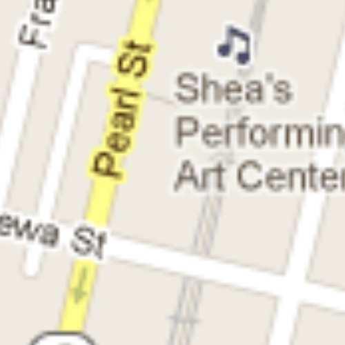
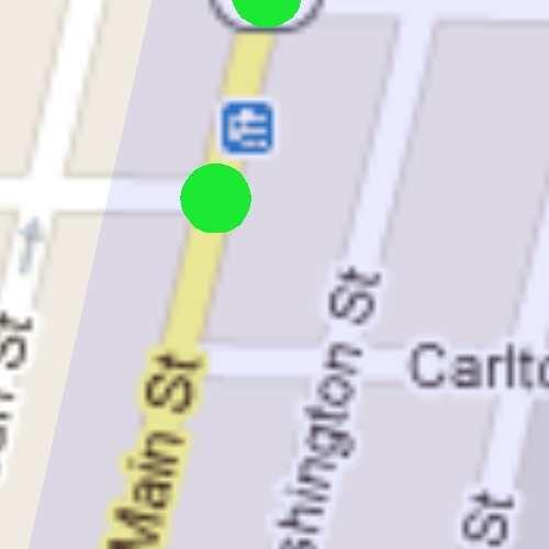
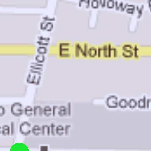
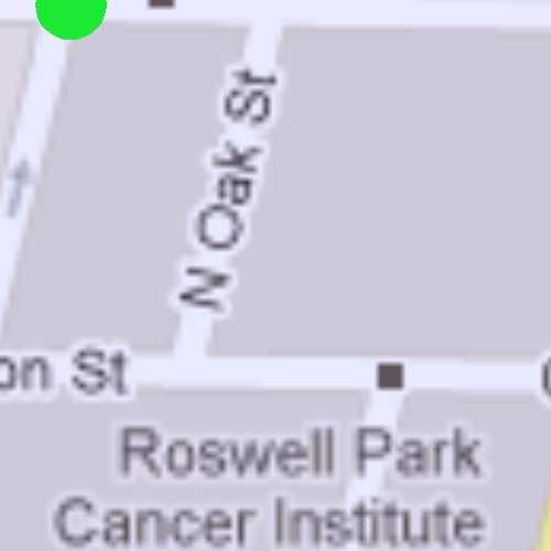
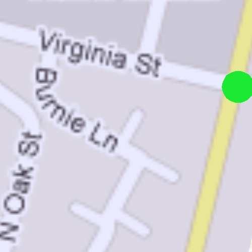
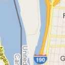
1 UNIVERSITY AT BUFFALO SCHOOL OF MEDICINE AND BIOMEDICAL SCIENCES SEQRA FINAL SCOPING DOCUMENT FOR THE Draft Environmental Impact Statement STATE UNIVERSITY CONSTRUCTION FUND Lead Agency, State Environmental Quality Review Act DECEMBER 20, 2012 INTRODUCTION The State Environmental Quality Review Act (SEQRA) process has recently been initiated for a proposed action: Phase 1 of the proposed School of Medicine and Biomedical Sciences (SMBS), located on the new Downtown Campus of the University at Buffalo, State University of New York (SUNY). The University at Buffalo (UB), as part of their larger UB 2020 initiative, is proposing to construct new facilities for the SMBS at the expanding Buffalo Niagara Medical Campus (BNMC) as part of its new downtown campus. The medical school now resides on UB's South Campus. In order to facilitate this move, UB is proposing to construct two new buildings (Phase 1 and 2 of the SMBS, see below) to house the SMBS on the BNMC, where the Buffalo General Medical Center, Gates Vascular Institute, Roswell Park Cancer Institute, Hauptman-Woodward Medical Research Institute, and other medical facilities are all currently located. The BNMC is located in downtown Buffalo, in the area generally circumscribed by Goodrich, Michigan, Virginia, and Ellicott Streets. Phase 1 of the SMBS is proposed to be a 520,000 gross square-foot (GSF) building at the southeast corner of Main and High Streets. UB is currently in the process of negotiating to purchase and/or use the parcels involved from the current owners (HSBC Bank, Evergreen Real Estate, NFTA, and Roosevelt Housing Associates). Construction of Phase 1 will occur between September 2013 and August This building will integrate the existing Niagara Frontier Transportation Authority (NFTA) Metro Rail station at Main and Allen Streets to serve as a gateway to the BNMC and offer connections to the community and other University assets. A new pedestrian access station to the rail station access will be integrated into the proposed building. The proposed Phase 1 building will also include medical, laboratory, and educational facilities, and may include commercial retail and/or food service (accessible to the public) on the street level of the proposed building. The existing First Niagara Bank branch located at the Southeast corner of Main and High Streets and the existing NFTA Rail Allen St/Medical Campus Station along with associated surface parking will be demolished to accommodate this project. Phase 2 of the SMBS is proposed to be an additional 305,000 GSF building (connected to Phase 1) at the southeast corner of High and Ellicott Streets to be designed between 2019 and 2021 and completed in Phase 1 is not structurally or programmatically dependent on the construction of Phase 2. Only Phase 1 is being
2 proposed at this time. Phase 2 is not considered to be part of the proposed project at this time (a separate SEQRA evaluation will be conducted for Phase 2 prior to construction of Phase 2). A SEQRA review was previously conducted for the UB Comprehensive Physical Plan, which included the UB Downtown Campus (including the BNMC and proposed SMBS site) and included preparation of a Draft Generic Environmental Impact Statement (DGEIS) and Final Generic Environmental Impact Statement (FGEIS). The SEQRA evaluation for the SMBS will draw upon the information presented in the previous DGEIS and FGEIS for the UB Comprehensive Physical Plan. Locating the SMBS within the Downtown Campus will also draw from and contribute to the synergy of other efforts proposed in this area (not part of this project), such as the extension of Allen Street into the heart of the BNMC, and the anticipated relocation of the Women and Children's Hospital to the BNMC on the Northeast corner of Main and High Streets. PURPOSE OF THE FINAL SCOPING DOCUMENT IN SEQRA The basic purpose of SEQRA is to incorporate the consideration of environmental factors into the existing planning, review and decision-making processes of State, regional, and local government agencies at the earliest possible time. To accomplish this goal, SEQRA requires a determination of whether a proposed action may have a significant impact on the environment, and if it is determined that the action may have a significant adverse impact, prepare or request an Environmental Impact Statement (EIS). It was the intention of the Legislature that the protection and enhancement of the environment, human and community resources should be given appropriate weight with social and economic considerations, and that those factors be considered together in reaching decisions on proposed actions. It is not the intention of SEQRA that environmental factors be the sole consideration in decision-making. Public scoping represents an initial step in the review of potential environmental impacts under SEQRA for the proposed SMBS. The primary goals of scoping are to focus an EIS on potentially significant impacts and to eliminate consideration of those impacts that are irrelevant or non-significant. A draft scoping document was released for public and agency review and comment on October 9, The purpose of the draft scoping document is to provide an opportunity for involved agencies, interested agencies, and the public to review and comment on the identification of significant environmental conditions and resources, which may be affected by the proposed action, and the extent and quality of information necessary to address those issues during the SEQRA process. In addition, a public scoping meeting was held on October 22, 2012 at St. John Baptist Church, 184 Goodell Street in Buffalo and two scoping meetings were held relating specifically to the Traffic Assessment for the project (see below). This final scoping document incorporates all comments or input received during the comment period and at any of the various scoping meetings. No written comments on the draft scoping document were received. The sign-in sheet at the public scoping meeting on October 22, 2012 indicated attendance by one person (other than representatives of the Lead Agency and their consultants). No individuals or organizations provided oral comments. A transcript of the public hearing is available in.pdf format on the following website maintained by the Lead Agency: Two scoping meetings were held specifically regarding the scope of the Traffic Assessment Report for the project. The first was a conference call held on November 9, 2012 with representatives from: New York State Department of Transportation State University Construction Fund University at Buffalo Buffalo Niagara Medical Campus 2
3 Greater Buffalo Niagara Regional Transportation Council Niagara Frontier Transportation Authority Fisher Associates The second was held at the NYSDOT Offices on December 4, 2012 with representatives from: New York State Department of Transportation City of Buffalo State University Construction Fund University at Buffalo Fisher Associates These two meetings provided an opportunity for these agencies to comment on the original Traffic Assessment Scope Outline dated September 10, 2012, which was appended to the draft scoping document. Based on input from these two meetings, a revised Traffic Assessment Scope Outline (dated December 11, 2012) was prepared. The revised Traffic Assessment Scope Outline details the scope of work for the project s Traffic Assessment Report, which will be incorporated into and attached as an appendix to the DEIS. This revised Traffic Assessment Scope Outline is appended to this final scoping document. Pursuant to New York State Environmental Conservation Law Article 8, SEQRA; and Part 617 of Chapter 6 of the New York Code of Rules and Regulations (NYCRR), and the adoption of a positive declaration by the Lead Agency, the State University Construction Fund (SUCF) intends to prepare a DEIS for Phase 1 of the proposed University at Buffalo SMBS. In accordance with SEQRA, the DEIS will address specific adverse environmental impacts which can reasonably be anticipated. This scoping document identifies the significant environmental conditions and resources that may be affected by the Project, and defines the extent and quality of information necessary to address those issues. The DEIS will include all elements required by 6 NYCRR 617.9, including: i. DEIS Cover Sheet. All draft and final EISs must be preceded by a cover sheet stating whether it is a draft or final EIS; the name or descriptive title of the action; the location (county and town, village or city) and street address, if applicable, of the action; the name and address of the Lead Agency and the name and telephone number of a person at the agency who can provide further information; the names of individuals or organizations that prepared the statement; the date of its acceptance by the lead agency; and in the case of a draft EIS, the date by which comments must be submitted. ii. DEIS Table of Contents. The table of contents will include listings of DEIS sections, tables, figures, maps, appendices, attachments and any items that may be submitted under separate cover (and identified as such). In addition, the DEIS shall include the following sections: 1.0 EXECUTIVE SUMMARY The executive summary will include a brief description of the proposed action and a listing of potential environmental impacts and proposed mitigation measures. A summary will also be provided of the approvals and permits required, and the alternatives to the proposed action that are evaluated within the DEIS. 2.0 DESCRIPTION OF THE PROPOSED ACTION 3
4 As described in more detail in the following sections, this chapter of the DEIS will include a comprehensive description of the site and will provide a detailed discussion of the proposed development. 2.1 Site Description This section of the DEIS will characterize the size, geographic boundaries, and physiographic characteristics of the Project site. The relationship of the proposed Project to residential areas, schools, parklands, historic properties, wetland areas, streams courses, or any other recognized or protected natural or man-made features will be described. The dominant land use within and adjacent to the Project site will also be discussed. More detailed descriptions of these resources and any potential impacts to them will be analyzed in detail in dedicated sections of Chapter Detailed Description of the Proposed Action The purpose, size, and layout of the proposed Project will be described in this section of the DEIS. Maps, graphics, and/or plans will be provided showing the proposed location of the components of the SMBS facility including the building, site access, parking areas, and lawns/landscaping. Changes to existing facilities (such as demolition of existing buildings, widening of existing or addition of new service roads, and modifications to drainage patterns) will also be described. 2.3 Project Purpose, Need and Benefits A statement describing the purpose and need for the Project will be provided, along with background and history of the Project. This section will also include a brief overview of the environmental, social and/or economic benefits that are anticipated to result from the Project. This will include an estimate of employment opportunities (both temporary construction jobs and permanent staff jobs) that are anticipated to result from the Project. 2.4 Project Construction The section of the DEIS will describe construction of the proposed Project, including construction schedule/duration, construction staging and parking, anticipated construction employment, construction sequencing, and routing of construction traffic along local roads. The construction schedule will be compliant with the State Pollutant Discharge Elimination System (SPDES) General Permit. 2.5 Reviews, Approvals and Other Compliance Determinations Governmental agencies having approval over the Project will be listed in this section, with explanation of the nature of their jurisdiction and the specific approvals required from each listed entity. 3.0 EXISTING CONDITIONS, POTENTIAL IMPACTS, AND MITIGATION MEASURES With respect to each issue (or set of issues) described below in the various resource sections, the corresponding section of the DEIS will identify in sequence: the existing environmental conditions; the potential impacts of the proposed Project; and anticipated measures to avoid, minimize, and/or mitigate those impacts, as appropriate. The impacts and mitigation measures presented in these sections will include those related to the proposed SMBS facility s operation as well as its construction. 4
5 Where one of these sections identifies multiple related issues (e.g., Section 3.1; Geology, Soils, and Topography), the section will first describe the existing conditions regarding all of these multiple related issues before then describing the related potential impacts. The discussion of impacts related to the multiple issues included within the section will then be followed by a review and discussion of related mitigation measures. The text of these sections will be supplemented with maps, graphics, agency correspondence, agency data/analyses, Geographic Information System (GIS) data, and completed support studies as necessary to convey the required information. 3.1 Geology, Soils, and Topography This section will evaluate and describe topography, surface and subsurface soils, and bedrock conditions within the Project site. Potential impacts to soils could result from demolition of existing facilities, excavation and grading for construction of the new building, site restoration, and landscaping. Topographical concerns include changes in slope during or after Project implementation that could alter drainage patterns and potentially increase runoff. This section will also describe mitigation measures that will be used to avoid, minimize, or mitigate impacts to geology, soils, and topography, including an approved erosion and sediment control plan. Descriptions of existing conditions will be based upon published data (e.g., the Soil Survey of Erie County, electronic data from the Natural Resources Conservation Service, topographic mapping from the U.S. Geological Service, and maps and files from the New York State Museum). In addition, site specific support studies will be prepared as follows: Geotechnical Analysis: A geotechnical investigation will be conducted for the proposed Project. The study will include subsurface exploration using test borings, geotechnical evaluation of subsurface conditions, and laboratory analyses of samples recovered from the borings. The borings will be conducted at various locations throughout the Project site. A report summarizing the results will be included as an Appendix to the DEIS. 3.2 Water Resources This section of the DEIS will describe water resources at the Project site, including surface waters, groundwater, floodplains and floodways, and stormwater. Existing conditions, potential impacts and mitigation measures will be presented for each topic area. Concerns include potential water usage in excess of 20,000 gallons per day. Surface Waters The section will describe surface waters (i.e., wetlands, streams, rivers, lakes, and ponds) within and adjacent to the Project site (if any), including their respective state and federal classifications. If relevant and applicable, the DEIS will identify the need for any Article 24 Freshwater Wetlands permits and/or Article 15 Stream Disturbance Permits, or approvals required under Sections 401 and 404 of the Clean Water Act. Any Project-related impacts to surface water resources will be described, along with proposed measures to avoid, minimize and/or mitigate such impacts. Groundwater This section will describe existing groundwater resources (based primarily on the results of the Geotechnical Analysis) and evaluate potential impacts to groundwater resources that may be caused by Project implementation, and will identify and characterize proposed means of avoiding or mitigating such impacts. Floodplains and Floodways 5
6 This section will identify any FEMA-regulated floodplain or floodway areas (as well as any local data), and provide an assessment of potential Project-related impacts to floodplains or floodways (if any). The section will also identify and describe mitigation activities in relation to such impacts. Stormwater The DEIS will describe any construction related impacts to drainage, stormwater runoff, and consequent effects upon water quality in the vicinity of the construction site. This section will be informed by the site specific Preliminary Storm Water Pollution Prevention Plan (SWPPP), to be developed and approved prior to construction, which will include the following: Preliminary SWPPP: This document will describe measures for controlling runoff and pollutants from the Project site during and after construction activities. Typical components of SWPPPs include measures that reduce or eliminate erosion and sedimentation, control volume and peak rate of stormwater runoff, and maintain stormwater controls during and after completion of construction. A Preliminary SWPPP will be included as an Appendix to the DEIS. 3.3 Climate, Air Quality, and Odor This section will describe the existing air quality status in the vicinity of the Project site based on publicly available data, and discuss the potential impacts that could occur during Project construction or operation. Mitigation measures designed to minimize these impacts will be described in this section of the DEIS. Concerns are primarily related to emissions from construction vehicles and dust generated during earth-moving activities. 3.4 Biological, Terrestrial, and Aquatic Ecology The section will describe the dominant plant species, ecological communities, wildlife species, and available habitat within the Project site. In addition, any known occurrences of state- or federally-listed plant or animal species (or available habitat for such species) will be identified. The extent to which the proposed Project would affect these resources will then be evaluated. Proposed measures to avoid, minimize, or mitigate for any impacts to ecological resources will also be included. Agency correspondence related to state- or federally-listed plant or animal species will be included in an Appendix to the DEIS. 3.5 Documented Environmental Conditions This section will describe recognized environmental conditions at the Project site, with respect to the range of contaminants within the scope of Comprehensive Environmental Response, Compensation and Liability Act (42 U.S.C. 9601) and petroleum products. Potential impacts associated with the Project within or in the vicinity of such recognized environmental conditions will be identified, and mitigation measures recommended as appropriate. The analysis in this section of the DEIS will be based on a site specific study, which will include the following: Phase I Environmental Site Assessment: A Phase I Environmental Site Assessment will be conducted for the Project site in accordance with the American Society for Testing and Materials Standard E The assessment will include a field inspection, interviews with persons knowledgeable about the Project site, agency correspondence, searches of state/federal databases of reported spills, and review of historical maps, photographs, and real estate documentation. The Phase I Environmental Site Assessment report will be included as an Appendix to the DEIS. 6
7 3.6 Aesthetic/Visual Resources This section will describe the existing visual character in the vicinity of the Project site, evaluate visual impacts associated with construction and operation of the proposed SMBS facility, and recommend measures to avoid, minimize, or mitigate any adverse impacts to aesthetic resources. Descriptions of existing conditions will be based upon a site specific support study, which will include the following: Visual Assessment: A visual assessment will be conducted that will include identification of visually sensitive sites and/or critical views within 0.5 mile of the proposed SMBS facility. Photographs will be taken to document existing conditions. In addition, computer-generated visual simulations will be prepared to depict the appearance of the completed Project and assist in the evaluation of visual impacts. The Visual Assessment report will be included as an Appendix to the DEIS. 3.7 Historic, Cultural, and Archaeological Resources The section will identify sites, structures, and districts with significant historic and archaeological value within a 0.5-mile radius of the Project site, evaluate potential adverse impacts on historic and archaeological resources, and recommend measures to avoid, minimize, or mitigate any adverse impacts to cultural resources. The analysis contained in the DEIS will be based on site specific support studies, which will include the following: Site Specific Archeological Sensitivity Assessment: A Phase 1A Cultural Resources Survey was previously prepared for the UB Comprehensive Physical Plan (including the Project site), which was included in the DGEIS and revised for inclusion in the FGEIS for the UB Comprehensive Physical. The previously prepare Phase 1A and DGEIS/FGEIS provide an archeological sensitivity assessment for the Downtown Campus area, which includes a map that differentiates areas with high, medium and low potential to include undisturbed archeological sites. Based on this previous assessment, the Project site includes areas of both medium and low potential for archeological sites to be present. A site-specific archaeological sensitivity assessment will be prepared based on the protocol outlined in the DGEIS to determine whether specific development sites require further (Phase 1B) Archaeological Resources Investigation. A Site Specific Archeological Sensitivity Assessment report for the Project site will be included as an Appendix to the DEIS. Historic Resources Assessment: Building upon the information presented in the Phase 1A Cultural Resources Survey for the UB Comprehensive Physical Plan (as described above), a site-specific Historic Resources Assessment will be prepared. The assessment will include evaluation of the Project s potential impact on adjacent and nearby historic properties (within 0.5-mile), as well as more general considerations of the Project s potential effect on the architectural and visual character of the adjacent neighborhood(s). This will include properties listed and/or previously determined eligible for listing on the National Register of Historic Places (NRHP), as well as properties that have been designated Landmarks and/or Preservation Districts by the City of Buffalo Historic Preservation Board. A Historic Resources Assessment report will be included as an Appendix to the DEIS. 3.8 Open Space and Recreation The section will document the current use of the Project site in terms of open space and recreation, and describe the anticipated effects upon such use in the area. 7
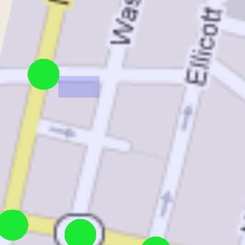
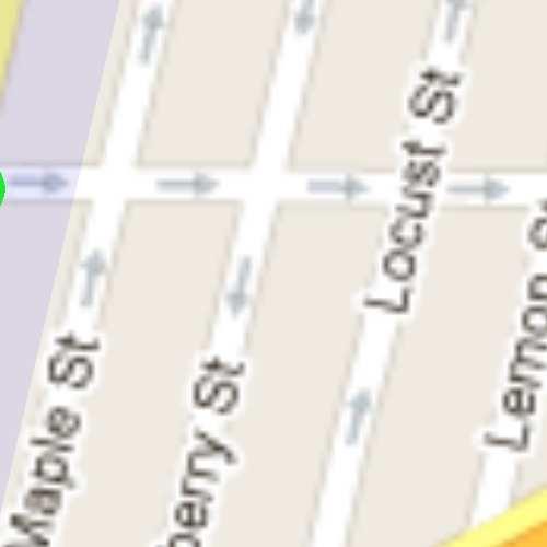
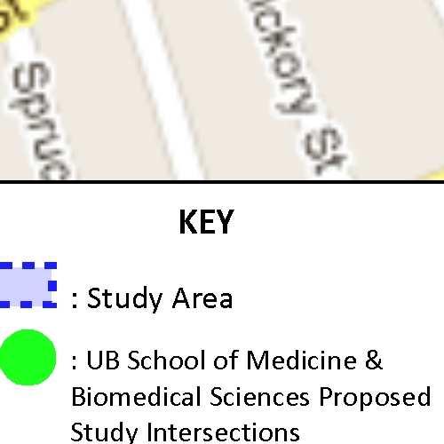
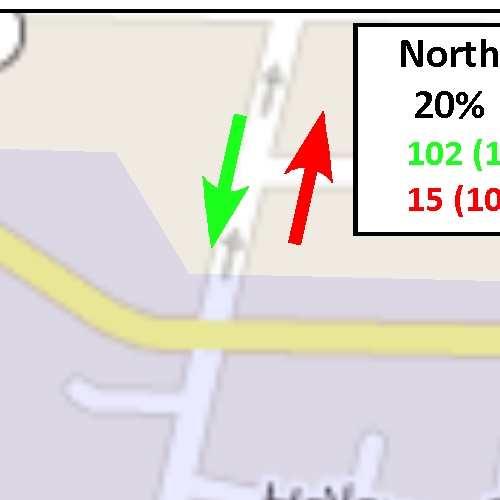
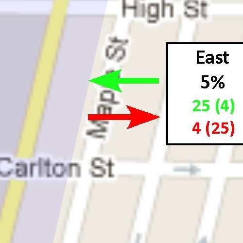
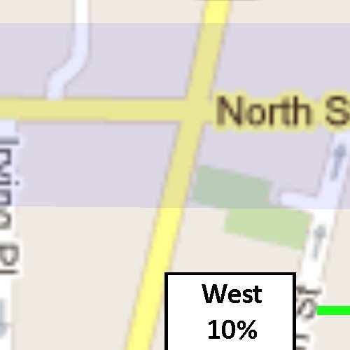
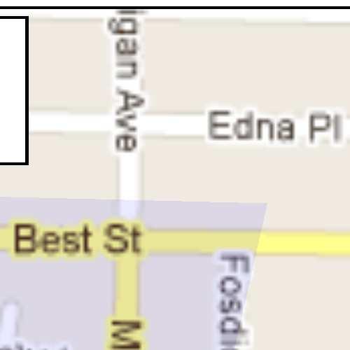
8 3.9 Traffic and Transportation This section of the DEIS will document existing pedestrian and vehicular use of the Project site and vicinity, describe the anticipated effects of the proposed Project on transportation-related use and infrastructure, and recommend measures to avoid, minimize, or mitigate any adverse impacts. The discussion will be largely based on a site specific traffic assessment, which will include the following: Traffic Assessment: A traffic study will be conducted for the vicinity of the Project site. Components of the study will include analysis of baseline conditions and projected growth of traffic volume for both the proposed Project and for a null condition (i.e., projected growth in traffic volume without the proposed SMBS). The study area for the analysis will include intersections inside the area circumscribed by Best Street, Main Street, Tupper Street, and Michigan Avenue. Additionally, the study will include a review of the parking needs for the proposed Project. A report summarizing the results and findings of the Traffic Assessment will be included as an Appendix to the DEIS. A more detailed proposed outline/scope for the Traffic Assessment is included as Attachment 1 to this Final Scoping Document Noise This section will generally describe existing conditions at the Project site (based on publicly available data) relative to noise, evaluate associated Project impacts, and discuss measures to avoid, minimize, or mitigate any such impacts Public Health and Safety This section will generally describe existing conditions at the Project site relative to public health and safety, evaluate associated Project impacts, and discuss mitigation measures to minimize any such impacts. Specific concerns include pedestrian safety during construction, which is anticipated to last approximately 3 years Land Use and Community Character This section will describe the existing character of the Project site and adjacent community and review relevant planning documents that have been previously prepared and adopted for the project vicinity. It is anticipated that these will include the Buffalo Niagara Medical Campus Master Plan (2010), The UB Comprehensive Physical Plan, Queen City in the 21 st Century (Buffalo s Comprehensive Plan), Queen City Hub: A Regional Action Plan for Downtown Buffalo, and the Fruit Belt Neighborhood Strategy and Allentown Neighborhood Strategy Plans. In addition, this section will evaluate potential impacts regarding the proposed Project s compatibility with surrounding land uses and (relevant) previously approved plans, and discuss measures to avoid, minimize, or mitigate any Project-related impacts Community Facilities and Services The DEIS will describe existing community services, including local police, fire and, emergency service departments. Information will be based on publicly available data, personal communications with service providers, and/or review and confirmation of pertinent literature. The DEIS will identify how the proposed Project may impact these services, and mitigation measures will be identified, as needed. 4.0 UNAVOIDABLE ADVERSE IMPACTS 8
9 This section of the DEIS will identify impacts that are likely to occur despite mitigation measures, and will compare these unavoidable impacts to Project-related benefits. This section will also identify general avoidance and mitigation measures (e.g., adherence to applicable regulatory requirements), and specific mitigation measures (e.g., development of a SWPPP). 5.0 ALTERNATIVES ANALYSIS The DEIS will include a description and evaluation of the range of reasonable alternatives to the proposed action. Alternatives to be considered will include the no action alternative as well as alternatives that would rely upon alternate Project location, alternate Project layout, or alternate Project scale/extent to either reduce or eliminate potential impacts. 6.0 IRREVERSIBLE AND IRRETRIEVABLE COMMITMENT OF RESOURCES This section of the DEIS will identify those natural and man-made resources consumed, converted, or otherwise made unavailable for future use as a consequence of the proposed Project. 7.0 CUMULATIVE IMPACTS The DEIS will evaluate the potential cumulative impact of the proposed Project, along with other campus construction projects developed or proposed in the area. 8.0 GROWTH INDUCING ASPECTS This section of the DEIS will describe potential growth-inducing aspects the proposed SMBS facility may have with respect to additional development in the vicinity of the Project site. 9.0 EFFECTS ON THE USE AND CONSERVATION OF ENERGY RESOURCES This section of the DEIS will describe the effect of the proposed Project on the use and conservation of energy REFERENCES This section of the DEIS will list any sources of information cited directly within the narrative text. APPENDICES TO ACCOMPANY DEIS At a minimum, and as described in more detail in the previous sections, the following materials will be included to supplement the information presented within the narrative: Relevant maps and figures Project plans, specifications, and/or construction information Geotechnical Analysis Preliminary Stormwater Pollution Prevention Plan (SWPPP) Relevant agency correspondence Phase I Environmental Site Assessment Visual Assessment Archaeological Sensitivity Assessment Historic Resources Assessment 9
10 Traffic Assessment encl. Attachment 1. University at Buffalo School of Medicine and Biomedical Sciences, Phase 1 Traffic Assessment Scope Outline (prepared by Fisher Associates, December 11, 2012). 10
11 University at Buffalo School of Medicine & Biomedical Sciences Phase I Traffic Assessment Scope Outline December 11, 2012 Page 1 Two scoping meetings have been conducted to assist with developing the Traffic Assessment Scope of work for Phase I of the University at Buffalo School of Medicine & Biomedical Sciences project. The first scoping meeting was a conference call held on November 9, 2012 with representatives from the: New York State Department of Transportation State University Construction Fund University at Buffalo Buffalo Niagara Medical Campus Greater Buffalo Niagara Regional Transportation Council Niagara Frontier Transportation Authority Fisher Associates A second scoping meeting was held on December 4, 2012 at NYSDOT offices with representatives from: New York State Department of Transportation City of Buffalo State University Construction Fund University at Buffalo Fisher Associates These meetings provided an opportunity for comment and input on the original Traffic Assessment Scope Outline dated September 10, Based on provided input a revised Traffic Assessment Scope Outline follows. This Traffic Assessment Scope Outline will form the basis of the detailed scope of work for the traffic assessment to be included in the Draft Environmental Impact Statement (DEIS) for Phase I of the University at Buffalo School of Medicine & Biomedical Sciences. Traffic Assessment Scope Outline The traffic assessment will be conducted to commonly accepted standards and practices for insertion into the project s DEIS by others. The assessment s focus is vehicular impacts and potential mitigation, if any.
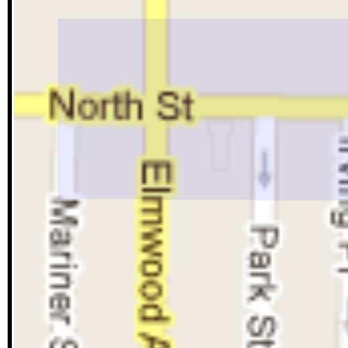
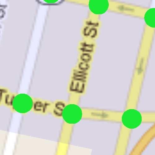
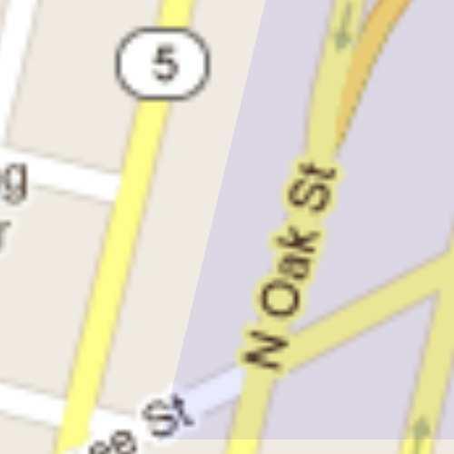
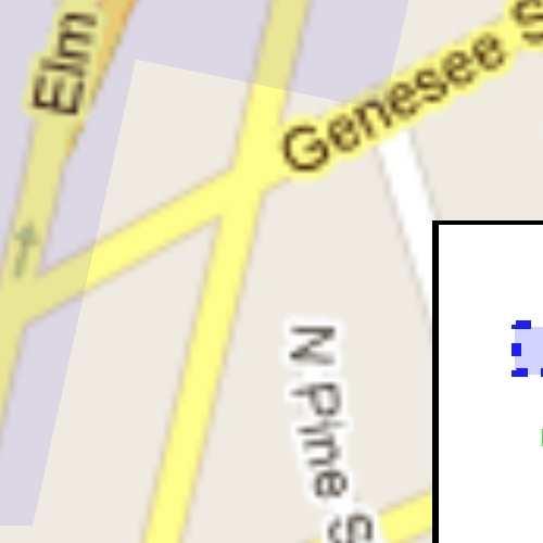
12 University at Buffalo School of Medicine & Biomedical Sciences Phase I Traffic Assessment Scope Outline December 11, 2012 Page 2 I. The overall study area is generally defined by: Tupper Street to the South Best Street to the North Main Street to the West Michigan Avenue to the East Specific study intersections are identified on Figure 1. These study intersections were identified through field investigations, preliminary trip generation and distribution considerations as well as based on provided input from the scoping meetings. II. III. IV. From discussions with the State University Construction Fund and University at Buffalo, Phase I of the University at Buffalo School of Medicine & Biomedical Sciences building will be operational by 2016; therefore, this is will be the Future Build year for the traffic assessment. Only impacts on the 2016 Null Condition from Phase I of the University at Buffalo School of Medicine & Biomedical Sciences will be evaluated in this traffic assessment. It was confirmed that existing morning and evening intersection traffic volume data is available for all of the study intersections depicted in Figure 1, except North Street & Franklin Street, through the Greater Buffalo Niagara Regional Transportation Council. Intersection count data at North Street & Elmwood Avenue, North Street & Delaware Avenue and Oak Street & Genesee Street is 2010 or older. It is assumed that intersection turning movement counts will be collected at these four intersections: North Street & Elmwood Avenue North Street & Delaware Avenue North Street & Franklin Street Oak Street & Genesee Street V. This study will utilize existing roadway conditions (intersection geometry, signals, etc.) as a basis when conducting capacity analysis for Existing, Null and Future No-Build Conditions.
13 University at Buffalo School of Medicine & Biomedical Sciences Phase I Traffic Assessment Scope Outline December 11, 2012 Page 3 VI Null Condition traffic volumes will be derived by applying a 1.0% growth rate to the Existing Conditions volumes and then adding the trips from the following approved developments: Children s Hospital of Buffalo Medical Office Building VII. Trip generation for University at Buffalo School of Medicine & Biomedical Sciences Phase I project will be based on peak hour parking data contained in the UB School of Medicine & Biomedical Sciences Parking Study dated October Trips for this project are summarized in Table 1. Table 1 Trip Generation Trip Type Weekday AM Weekday PM Enter Exit Total Enter Exit Total Student Faculty/Staff/Visitors Total Trip Generation The trip generation for this project is divided into two categories assuming each will have a unique travel pattern to and from the overall project area. Additionally, the Institute of Transportation Engineers Trip Generation Manual indicates an 85/15 spilt of entering and exit traffic is possible for research type facilities during commuter peak periods. Therefore, this enter/exit split was applied to the trip generation estimates to arrive at the overall entering and exiting trip distributions in Table 1. VIII. Overall, trip distributions to and from the study area will be based on population distribution data provided by University at Buffalo for both Students and Faculty/Staff/Visitors. Figure 2 and Figure 3 present the overall entering/exiting trip distributions for the Students and Faculty, respectively. Specific distributions at each of the study intersections will be based on parking locations identified in UB School of Medicine & Biomedical Sciences Parking Study dated October 2012 as well as proximity of the project location to expressway access.

14 University at Buffalo School of Medicine & Biomedical Sciences Phase I Traffic Assessment Scope Outline December 11, 2012 Page 4 IX. Distributed new trips will be applied to the 2016 Null Conditions traffic volumes to derive 2016 Future Conditions traffic volumes. X. Given the urban environment this project is located within and the confined network of study intersections, intersection capacity analyses will be conducted using SYNCHRO traffic software for Base 2013, 2016 Null and 2016 Future Conditions for one weekday morning and one weekday afternoon/evening study period. XI. Analysis and findings will be summarized into a traffic assessment report for inclusion in the DEIS document(s).


15

16

17
PepsiCo R & D Facility Expansion Town of Mount Pleasant, Westchester County, NY Draft Environmental Impact Statement Scoping Outline
 PepsiCo R & D Facility Expansion Town of Mount Pleasant, Westchester County, NY Draft Environmental Impact Statement Scoping Outline 10-17-2016 This document identifies the issues to be addressed in the
DRAFT SCOPE FOR THE DRAFT ENVIRONMENTAL IMPACT STATEMENT FOR HUDSON HIGHLANDS RESERVE TOWN OF PHILIPSTOWN, NEW YORK June 5, 2018
 DRAFT SCOPE FOR THE DRAFT ENVIRONMENTAL IMPACT STATEMENT FOR HUDSON HIGHLANDS RESERVE TOWN OF PHILIPSTOWN, NEW YORK June 5, 2018 Project Name: Project Location SEQRA Classification of Project: Lead Agency:
MacDonnell Heights Town Center
 Draft Environmental Impact Statement MacDonnell Heights Town Center Town of Poughkeepsie, Dutchess County, New York LEAD AGENCY Town of Poughkeepsie Planning Board One Overocker Road Poughkeepsie, NY 12603
WATERS EDGE AT DOBBS FERRY DRAFT ENVIRONMENTAL IMPACT STATEMENT VOLUME I
 WATERS EDGE AT DOBBS FERRY DRAFT ENVIRONMENTAL IMPACT STATEMENT VOLUME I Atilda, Fairlawn and Constance Avenues Village of Dobbs Ferry Town of Greenburgh Westchester County, New York Tax Lot Numbers Section
East River Waterfront Esplanade and Piers New York, New York Draft Environmental Impact Statement
 East River Waterfront Esplanade and Piers New York, New York Draft Environmental Impact Statement October 12, 2006 CEQR No.: TO COME ULURP Nos.: TO COME Lead Agency: Lower Manhattan Development Corporation
Chapter 4 - Preparation of Stormwater Site Plans
 Chapter 4 - Preparation of Stormwater Site Plans The Stormwater Site Plan is the comprehensive report containing all of the technical information and analysis necessary for the City to evaluate a proposed
ROCKEFELLER UNIVERSITY
 ROCKEFELLER UNIVERSITY NEW RIVER BUILDING AND FITNESS CENTER Draft Environmental Impact Statement CEQR No. : 14DCP019M Lead Agency: New York City Department of City Planning Prepared By: AKRF, Inc. November
SCOPING DOCUMENT FOR BAKER RESIDENTIAL CLUSTER SUBDIVISION DRAFT ENVIRONMENTAL IMPACT STATEMENT (DEIS)
") SCOPING DOCUMENT FOR BAKER RESIDENTIAL CLUSTER SUBDIVISION DRAFT ENVIRONMENTAL IMPACT STATEMENT (DEIS) TOWN OF MOUNT PLEASANT PLANNING BOARD WESTCHESTER COUNTY, NEW YORK Lead Agency and Contact Person:
SCOPING DOCUMENT FOR BAKER RESIDENTIAL CLUSTER SUBDIVISION DRAFT ENVIRONMENTAL IMPACT STATEMENT (DEIS) TOWN OF MOUNT PLEASANT PLANNING BOARD WESTCHESTER COUNTY, NEW YORK Lead Agency and Contact Person:
Institutional Master Plan The Arnold Arboretum of Harvard University
 Institutional Master Plan The Arnold Arboretum of Harvard University Submitted to: Boston Redevelopment Authority One City Hall Square Boston, MA 02201 Submitted by: The Arnold Arboretum of Harvard University
EXECUTIVE SUMMARY. This Second Revised Draft Generic Environmental Impact Statement ( revised DGEIS
 EXECUTIVE SUMMARY This Second Revised Draft Generic Environmental Impact Statement ( revised DGEIS or DGEIS ) has been prepared pursuant to the State Environmental Quality Review Act and its implementing
Draft Rhode Island Stormwater Design and Installation Standards Manual
 Draft Rhode Island Stormwater Design and Installation Standards Manual Summary The May 2009 Public Review Draft version of the RI Stormwater Design and Installation Standards Manual consists of approximately
Transportation Improvements
 Transportation Improvements 0 0 Volume II of the Final EIS for the DHS Headquarters consolidation at St. Elizabeths includes analysis to transportation improvements for the DHS Headquarters Consolidation
DETERMINATION OF SIGNIFICANCE FOR THE LONGWOOD PUBLIC LIBRARY EXPANSION & RENOVATION; STATE ENVIRONMENTAL QUALITY REVIEW ACT (SEQRA) RESOLUTION
 RESOLUTION") Longwood Public Library Resolution Library Board of Trustees August 13, 2012 DETERMINATION OF SIGNIFICANCE FOR THE LONGWOOD PUBLIC LIBRARY EXPANSION & RENOVATION; STATE ENVIRONMENTAL QUALITY REVIEW ACT
Longwood Public Library Resolution Library Board of Trustees August 13, 2012 DETERMINATION OF SIGNIFICANCE FOR THE LONGWOOD PUBLIC LIBRARY EXPANSION & RENOVATION; STATE ENVIRONMENTAL QUALITY REVIEW ACT
Mitchell Ranch South MPUD Application for Master Planned Unit Development Approval Project Narrative. Introduction
 Mitchell Ranch South MPUD Application for Master Planned Unit Development Approval Project Narrative Introduction Mitchell Ranch South is a proposed single family (detached) residential development on
B. DESCRIPTION OF THE PROPOSED ACTION
 Executive Summary A. INTRODUCTION Metro-North Commuter Railroad Company ( Metro-North or the Project Sponsor ) is proposing the construction of a new, expanded parking garage at 50 Haarlem Avenue (formerly
ARTICLE VI: SITE PLAN REVIEW
 Section 6.01 - Site Plan Review (All Districts) ARTICLE VI: SITE PLAN REVIEW Site plans give the Planning commission an opportunity to review development proposals in a concise and consistent manner. The
7.0 SOCIAL, ECONOMIC, AND ENVIRONMENTAL ISSUES
 7.0 SOCIAL, ECONOMIC, AND ENVIRONMENTAL ISSUES The following list of social, economic, and environmental issues have been identified based on a preliminary inventory of resources in the project area, an
Lower Don River West Remedial Flood Protection Project TABLE OF CONTENTS. Page. Executive Summary
 TABLE OF CONTENTS Page Executive Summary 1.0 INTRODUCTION...1-1 1.1 Purpose of the Undertaking...1-1 1.2 Study Area Description...1-1 1.3 Description of the Undertaking...1-1 1.4 Rationale for the Undertaking...1-2
When planning stormwater management facilities, the following principles shall be applied where possible.
 2.0 Principles When planning stormwater management facilities, the following principles shall be applied where possible. 2.0.1 Drainage is a regional phenomenon that does not respect the boundaries between
HAZARD MITIGATION GOALS AND OBJECTIVES
 SEWRPC Community Assistance Planning Report No. 282, 2nd Edition CITY OF MILWAUKEE ALL HAZARDS MITIGATION PLAN UPDATE Chapter IV HAZARD MITIGATION GOALS AND OBJECTIVES [NOTE: Throughout this plan update
Northern Branch Corridor SDEIS March Table of Contents
 Table of Contents Executive Summary... ES-1 ES.1 Introduction... ES-1 ES.2 Project Background... ES-1 ES.3 Purpose and Need... ES-5 ES.4 Alternatives... ES-6 ES.5 Operating Plan... ES-11 ES.6 Cost Analysis...
Goal 1 To establish and follow land use patterns for the long-range development of the campus.
 ELEMENT 4 FUTURE LAND USE Goal 1 To establish and follow land use patterns for the long-range development of the campus. Objective 1A Correct existing incompatible campus land uses. Policy 1A-1 Reduce
PUBLIC HEARING. DRAFT Environmental Impact Statement. Matthews Memorial Baptist Church Washington, DC October 18, National Capital Region
 National Capital Region DRAFT Environmental Impact Statement PUBLIC HEARING Matthews Memorial Baptist Church Washington, DC October 18, 2007 Introduction Welcome and team introduction Hearing procedures
City of Westbrook. 2 York Street Westbrook, Maine (207) Fax:
 Fax:") City of Westbrook DEPARTMENT OF PLANNING & CODE ENFORCEMENT 2 York Street Westbrook, Maine 04092 (207) 854-0638 Fax: 1-866-559-0642 WESTBROOK PLANNING BOARD TUESDAY, JANUARY 2, 2018, 7:00 P.M. WESTBROOK
City of Westbrook DEPARTMENT OF PLANNING & CODE ENFORCEMENT 2 York Street Westbrook, Maine 04092 (207) 854-0638 Fax: 1-866-559-0642 WESTBROOK PLANNING BOARD TUESDAY, JANUARY 2, 2018, 7:00 P.M. WESTBROOK
APPENDIX A SIMPLIFIED APPROACH TO STORMWATER MANAGEMENT FOR SMALL PROJECTS. In West Sadsbury Township, Chester County, Pennsylvania
 APPENDIX A SIMPLIFIED APPROACH TO STORMWATER MANAGEMENT FOR SMALL PROJECTS In West Sadsbury Township, Chester County, Pennsylvania TABLE OF CONTENTS I. Introduction 3 II. Importance of Stormwater Management
Environmental Assessment
 Hudson-Bergen Light Rail (HBLR) Route 440 Extension Environmental Assessment Project Sponsor: Prepared by: AKRF, Inc. BEM Systems, Inc. Gannett Fleming Inc. InGroup, Inc. Richard Grubb & Associates, Inc.
ARTICLE 6: Special and Planned Development Districts
 ARTICLE 6: Special and Planned Development Districts 6-10 Traditional Neighborhood Development (TND) District 6-10.10 Purpose and Intent The Traditional Neighborhood Development (TND) District provides
Shoreline Master Program Town of La Conner, Washington
 Shoreline Master Program Town of La Conner, Washington Department of Ecology approval effective Adopted September 24, 2013 by Town of La Conner Ordinance No.1106 Amended May 13, 2014 by Town of La Conner
PCE PRELIMINARY DRAINAGE ANALYSIS REPORT FOR WESTWOOD MIXED USE NEIGHBORHOOD PROJECT 772 NORTH FOREST ROAD TOWN OF AMHERST, ERIE COUNTY, NEW YORK
 PCE PRELIMINARY DRAINAGE ANALYSIS REPORT FOR WESTWOOD MIXED USE NEIGHBORHOOD PROJECT 772 NORTH FOREST ROAD TOWN OF AMHERST, ERIE COUNTY, NEW YORK MAY 19, 2014 Prepared By: Timothy M. Lavocat, P.E., CFM
ENVIRONMENTAL IMPACT REPORT COMPREHENSIVE GENERAL PLAN AND ZONING ORDINANCE SCH NUMBER:
 ENVIRONMENTAL IMPACT REPORT FOR THE CITY OF BANNING COMPREHENSIVE GENERAL PLAN AND ZONING ORDINANCE SCH NUMBER: 2005011039 Prepared for: City of Banning 99 East Ramsey Street Banning, CA 92220 Prepared
WASHINGTON COUNTY OREGON
 WASHINGTON COUNTY OREGON LONG RANGE PLANNING DIVISION North Bethany Subarea Stream Corridors: Existing Regulations In Oregon, there is a distinct difference between the land use rules that apply in rural
Located in the Town of North Castle 1700 Old Orchard Street, North Castle, Westchester County, NY Tax ID:
 State Environmental Quality Review POSITIVE DECLARATION Notice of Intent to Prepare a Draft EIS Determination of Significance Notice of Scoping Session This notice is issued pursuant to Part 617 of the
RESOLUTION NO. R Refining the route, profile and stations for the Downtown Redmond Link Extension
 RESOLUTION NO. R2018-32 Refining the route, profile and stations for the Downtown Redmond Link Extension MEETING: DATE: TYPE OF ACTION: STAFF CONTACT: Capital Committee Board PROPOSED ACTION 09/13/2018
City of Larkspur. Notice of Mitigated Negative Declaration for the 285
 Notice of Mitigated Negative Declaration for the 285 Magnolia Avenue Mixed-Use Project Date: December 2, 2013 Responsible Agency: Project Title: 285 Magnolia Avenue Mixed-Use Project Project Address: 285
DRAFT MAP AMENDMENT FLU 04-4
 DRAFT MAP AMENDMENT FLU 04-4 SW 24 TH AVENUE ROADWAY CORRIDOR The University of Florida participates with the Metropolitan Transportation Planning Organization (MTPO) in its responsibilities for the continuing,
ENBRIDGE GAS DISTRIBUTION INC. Proposed Relocation for Ninth Line, Markham and Whitchurch-Stouffville. Environmental Screening Report
 Page 1 of 18 ENBRIDGE GAS DISTRIBUTION INC. Proposed Relocation for Ninth Line, Markham and Whitchurch-Stouffville Environmental Screening Report July 2011 Page 2 of 18 Table of Contents 1.0 INTRODUCTION
ST. MARY S SOIL CONSERVATION DISTRICT (SMSCD) AND DPW&T CONCEPT EROSION AND SEDIMENT CONTROL AND STORMWATER MANAGEMENT GUIDELINES AND CHECKLIST
 AND DPW&T CONCEPT EROSION AND SEDIMENT CONTROL AND STORMWATER MANAGEMENT GUIDELINES AND CHECKLIST") St. Mary s Soil Conservation District 26737 Radio Station Way, Suite B Leonardtown, MD 20650 Phone: 301-475-8402 ext. 3 Fax: 301-475-8391 www.stmarysscd.com St. Mary s County Government Department of Public
St. Mary s Soil Conservation District 26737 Radio Station Way, Suite B Leonardtown, MD 20650 Phone: 301-475-8402 ext. 3 Fax: 301-475-8391 www.stmarysscd.com St. Mary s County Government Department of Public
Description of Preferred Alternative
 Chapter 2 Description of Preferred Alternative 2.1 Introduction This chapter of the programmatic Sammamish Town Center Sub-area Plan Final EIS provides a more detailed description of the Preferred Alternative
COUNTY COUNCIL OF PRINCE GEORGE'S COUNTY, MARYLAND SITTING AS THE DISTRICT COUNCIL 2010 Legislative Session. Council Members Dernoga and Olson
 DR- COUNTY COUNCIL OF PRINCE GEORGE'S COUNTY, MARYLAND SITTING AS THE DISTRICT COUNCIL 00 Legislative Session Bill No. CB--00 Chapter No. Proposed and Presented by Introduced by Co-Sponsors The Chairman
Parks, Trails, and Open space Element
 Parks, Trails, and Open space Element Parks, Trails, and Open Space element Parks, Recreation, and Open Space are important components of the quality of life desired by the residents of Elk Grove. This
Northern Branch Corridor DEIS December 2011
 16 Floodplains 161 Chapter Overview 1611 Introduction The flowing chapter identifies floodplains found within the Northern Branch Corridor in accordance with Executive Order 11988, Floodplain Management
Kevin M. Rampe, President -- Lower Manhattan Development Corporation
 For Internal Use Only: Date Received: WRP no. DOS no. NEW YORK CITY WATERFRONT REVITALIZATION PROGRAM Consistency Assessment Form Proposed actions that are subject to CEQR, ULURP or other local, state
McDonald s Restaurant - Purcellville Town of Purcellville Special Use Permit Statement of Justification July 24, 2014
 Introduction / Written Statement McDonald s Restaurant - Purcellville McDonald s Corporation is proposing to redevelop the existing McDonald s eating establishment with a drive-through located at 121 N
The principal elements of the NTC Strategic Vision plan are as follows.
 The proposed project would improve the NTC site plan, circulation, visitor amenities, and landscaping, and would include construction of two new stadiums to replace the existing Louis Armstrong Stadium
SOIL EROSION AND SEDIMENT CONTROL
 SOIL EROSION AND SEDIMENT CONTROL SECTION 1: AUTHORITY, TITLE AND PURPOSE 11. STATUTORY AUTHORIZATION This ordinance is adopted pursuant to the provisions of the Federal Water Pollution Control Act 86
STATE ENVIRONMENTAL QUALITY REVIEW ACT (SEQRA) FINDINGS STATEMENT
 FINDINGS STATEMENT") STATE ENVIRONMENTAL QUALITY REVIEW ACT (SEQRA) FINDINGS STATEMENT Name of Action: Albany-Hudson Electric Trail Final Environmental Impact Statement Description of Action: The proposed project is a 36-mile-long
STATE ENVIRONMENTAL QUALITY REVIEW ACT (SEQRA) FINDINGS STATEMENT Name of Action: Albany-Hudson Electric Trail Final Environmental Impact Statement Description of Action: The proposed project is a 36-mile-long
Chapter 10 IMPLEMENTATION RECOMMENDATIONS
 Chapter 10 IMPLEMENTATION RECOMMENDATIONS The recommended land use plan presented in the previous chapter provides a design for the attainment of the urban and rural development and open space preservation
~P'~'~; SAN FRANCISCO
 ~o counr~, ~P'~'~; SAN FRANCISCO ~'.~ PLANNING DEPARTMENT a 2 757 O~~~S 0 Case No.: Project Address: Zoning: Certificate of Determination COMMUNITY PLAN EVALUATION UMU (Urban Mixed Use) District 58-X Height
Executive Summary. Project Description. Project Legislation
 Project Description Executive Summary The Minnesota Sports Facilities Authority (MSFA) has prepared a Final Environmental Impact Statement (Final EIS) under the Minnesota Environmental Policy Act for the
Checklists. Project Name: Location: File Number: Date of Submittal: Reviewer: Date: Applicant: Contact Name: Phone Number:
 Applicant: Contact Name: Phone Number: Email: Project Name: Location: File Number: Date of Submittal: Reviewer: Date: Concept Plan Requirements: I. General Project Information 1. Address or parcel number
PURPOSE: The purpose is to provide commercial facilities in the Vancouver and Clark County vicinity.
 US Army Corps of Engineers Seattle District Joint Public Notice Application for a Department of the Army Permit and a Washington Department of Ecology Water Quality Certification and/or Coastal Zone Management
Existing Conditions and Environmental Consequences Floodplains
 3.9 Environmental Consequences 3.8 3.8.1 WHAT ARE FLOODPLAINS? are low-lying areas adjacent to rivers, streams, and other waterbodies that are susceptible to inundation (flooding) during rain events. These
COMMUNITY DEVELOPMENT SERVICES PLANNING AND BUILDING DEPARTMENT PLACERVILLE OFFICE:
 COMMUNITY DEVELOPMENT SERVICES PLANNING AND BUILDING DEPARTMENT http://www.edcgov.us/devservices/ PLACERVILLE OFFICE: LAKE TAHOE OFFICE: 2850 Fair Lane Court, Placerville, CA 95667 924 B Emerald Bay Rd.
Parks, Trails, and Open Space Element
 P arks, Recreation, and Open Space are important components of the quality of life desired by the residents of Elk Grove. This Element of the General Plan addresses the City s goals, policies, and actions
2.4 FUTURE LAND USE ELEMENT Goals, Objectives and Policies
 GOAL 1: To create developmental patterns that direct future growth to appropriate areas on campus, in a manner that promotes the educational mission of the University, the protection of environmentally
PLANNED UNIT DEVELOPMENT STAFF REPORT Date: June 2, 2016
 # 9 ZON2016-01032 PLANNED UNIT DEVELOPMENT STAFF REPORT Date: June 2, 2016 DEVELOPMENT NAME JJT Properties LLC LOCATION 1147 & 1151 East I-65 Service Road South and 1180 Sledge Drive (Southeast corner
Thompson Education Center
 DRAFT SCOPING DOCUMENT FOR China City of America (CCOA) Thompson Education Center DRAFT ENVIRONMENTAL IMPACT STATEMENT (DEIS) - PHASE 1 AND DRAFT GENERIC ENVIRONMENTAL IMPACT STATEMENT (DGEIS) - PHASES
New York City Transit
 2 Broadway Veronique Hakim New York, NY 10004-2207 President 646 252-5800 Tel 646252-5815 Fax New York City Transit May 17,2016 Ms. Diane Barlow Murray Hill neighborhood Assoc. P.O.Box 1897 New York, NY
SUMMARY. Support the Southeast Arkansas Regional Intermodal Facility.
 SUMMARY THE I-69 LOCATION STUDY The proposed I-69 Location Study from El Dorado to McGehee, Arkansas, represents one section (Section of Independent Utility No. 13) of the nationally designated I-69 Corridor
TOWNSHIP OF LOGAN SOIL & FILL IMPORTATION AND PLACEMENT APPLICATION SUBMITTAL CHECKLIST
 TOWNSHIP OF LOGAN SOIL & FILL IMPORTATION AND PLACEMENT APPLICATION SUBMITTAL CHECKLIST Applications: 5 copies of application - Applicant will reproduce the copies at his/her costs. The Township Clerk
DRAFT ENVIRONMENTAL IMPACT REPORT NORTH HOLLYWOOD-VALLEY VILLAGE COMMUNITY PLAN AREA
 Environmental Review City Hall 200 N. Spring Street, Room 750 Los Angeles, CA 90012 DRAFT ENVIRONMENTAL IMPACT REPORT NORTH HOLLYWOOD-VALLEY VILLAGE COMMUNITY PLAN AREA The Plaza at The Glen Mixed Use
Draft TISCORNIA ESTATE SPECIFIC PLAN/EIR
 Draft TISCORNIA ESTATE SPECIFIC PLAN/EIR Submitted CONTENTS 1. PLAN SUMMARY II. INTRODUCTION IX. SPECIFIC PLAN RELATIONSHIPS X. XI. List of Figures 1. Regional Location 2. Point Richmond Area 3. Planning
STATELINE RETAIL CENTER FINAL ENVIRONMENTAL IMPACT STATEMENT
 STATELINE RETAIL CENTER FINAL ENVIRONMENTAL IMPACT STATEMENT US Route 6 / US Route 202 Town of Southeast, Putnam County, New York Project Sponsor: PLI, LLC 1699 Route 6, Suite 1 Carmel, NY 10512 Contact:
Appendix I. Checklists
 Appendix I Checklists Town of Greenwich Drainage Manual Department of Public Works - Engineering Division Town Hall - 101 Field Point Road, Greenwich, CT 06836-2540 Phone 203-622-7767 - Fax 203-622-7747
STORMWATER SITE PLAN INSTRUCTIONS AND SUBMITTAL TEMPLATE Medium and Large Projects
 DEPARTMENT OF COMMUNITY DEVELOPMENT 621 Sheridan Street, Port Townsend, WA 98368 Tel: 360.379.4450 Fax: 360.379.4451 Web: www.co.jefferson.wa.us/communitydevelopment E-mail: dcd@co.jefferson.wa.us STORMWATER
APPENDIX 1: SCOPED ENVIRONMENTAL IMPACT STATEMENT (EIS) FORM
 FORM") APPENDIX 1: SCOPED ENVIRONMENTAL IMPACT STATEMENT (EIS) FORM This form is intended for use by applicants (primarily private landowners) who need to conduct a Scoped EIS in support of minor development
APPENDIX 1: SCOPED ENVIRONMENTAL IMPACT STATEMENT (EIS) FORM This form is intended for use by applicants (primarily private landowners) who need to conduct a Scoped EIS in support of minor development
PRELIMINARY CONDITIONAL USE SUBMITTAL CHECKLIST REQUIREMENTS
 This checklist must accompany your submittal as the cover page. CONDITIONAL USE Application Submittal Checklist for PRELIMINARY AND FINAL APPROVAL Per Winter Park Land Development Code Sec. 58-90 PRELIMINARY
Advance Engineering & Surveying PLLC
 Advance Engineering & Surveying, PLLC Consulting in: Civil & Environmental Engineering Land Surveying Land Development 11 Herbert Drive Phone: (518) 698-3772 Latham, N.Y. 12110 Email:ncostape@gmail.com
Scoping Document / DEIS Cross Reference
 Scoping Document / DEIS Cross Reference FINAL SCOPING DOCUMENT DRAFT ENVIRONMENTAL IMPACT STATEMENT Proposed Project: Wal-Mart Expansion Store No. 2043-04, Warsaw, NY Project Location: 2348 NYS Route 19
WELCOME! 8 8:30 6: TH STREET IMPROVEMENTS. Open House. Presentation & Q&A
 WELCOME! 168 TH STREET IMPROVEMENTS 6:30 Open House 7 8 Presentation & Q&A 8 8:30 Open House WELCOME Todd Pfitzer City of Omaha Engineer Bob Stubbe City of Omaha Public Works Director Jon Meyer Project
REQUEST FOR QUALIFICATIONS
 REQUEST FOR QUALIFICATIONS VILLAGE OF HAMBURG COMPREHENSIVE ZONING/LAND USE REGULATIONS UPDATE Prepared By: Village of Hamburg 100 Main Street Hamburg, New York 14075 Village of Hamburg RFQ Page 1 of 10
Holmberg & Howe, Land Surveyors and Civil Engineers Zoning District: R-35
 Development Impact Statement Name of Project: Red Tail Drive Acreage: 13.5 Acres± Type of Project: Residential Subdivision Owner: 96 East Street Development, LLC Location: rear of 112 East Street Parcel
PUBLIC HEARING. Thursday, December 14, 2017 FDOT Urban Office 2198 Edison Avenue Jacksonville, FL 32204
 DISTRICT TWO PUBLIC HEARING I 10 (SR 8) from I 295 to I 95 Project Development & Environment Study Duval County, Florida Financial Project Number 213326 2 22 01 Efficient Transportation Decision Making
REPORT TO PLANNING COMMISSION
 CITY OF Meeting Date: October 25, 2011 Agenda Item: Community Development Department Planning Division P. O. Box 151560, San Rafael, CA 94915-1560 PHONE: (415) 485-3085/FAX: (415) 485-3184 Case Numbers:
6.1. INTRODUCTION 6.2. EXISTING CONDITIONS
 Chapter 6: Stormwater Management 6.1. INTRODUCTION This Chapter describes the current drainage patterns on the Project Site, the stormwater management system that is proposed as part of the Proposed Project,
MEMO 1. INTRODUCTION PURPOSE & PROCESS REQUEST
 MEMO Date: August 22, 2017 To: Board of Commissioners From: Jason Burdette, Planning Director Re: Davidson Commons East Hotel Stakeholder Feedback 1. INTRODUCTION PURPOSE & PROCESS This memorandum summarizes
Right-of-Way Acquisitions and Relocations Technical Memorandum
 Right-of-Way Acquisitions and Relocations Technical Memorandum Southeast Extension Project Lincoln Station to RidgeGate Parkway Prepared for: Federal Transit Administration Prepared by: Denver Regional
PROJECT BACKGROUND. Preliminary Design Scope and Tasks
 PROJECT BACKGROUND Preliminary Design Scope and Tasks The purpose of this Study is the development of preliminary designs for intersection improvements for Trunk Highway (TH) 36 at the intersections of
Final Generic Environmental Impact Statement for Adoption of the Town of New Hartford Comprehensive Plan Update
 for Adoption of the Town of New Hartford Comprehensive Plan Update Name of Action: Adoption of the Town of New Hartford Comprehensive Plan Update by the Town of New Hartford Town Board Location: Lead Agency:
Erosion & Sediment Control Plan Application Form & Checklist
 Erosion & Sediment Control Plan Application Form & Checklist GENERAL INFORMATION Application Date: Project Address: Tax Map / Parcel Number(s): PROPERTY OWNER / DEVELOPER Firm Name: Contact Person: Title:
PSRC REVIEW REPORT & CERTIFICATION RECOMMENDATION
 PSRC REVIEW REPORT & CERTIFICATION RECOMMENDATION KITSAP COUNTY COUNTYWIDE PLANNING POLICIES July 2, 2012 BACKGROUND A major emphasis of the Washington State Growth Management Act (GMA) is the need to
2.7 ac park. TOTAL 5,403 DU 1,297,900 sf 1,105,450 sf 3.87 ac 5,563 DU 1,121,200 sf 1,105,450 sf 3.87 ac
 PLAN AMENDMENT 2013-I-B1: SEVEN CORNERS SPECIAL STUDY Summary of Pre-staffing Comments Planner: Bernard Suchicital bsuchi@fairfaxcounty.gov (703) 324-1254 Background On October 29, 2013, the Board of Supervisors
Draft Environmental Assessment
 Draft Environmental Assessment CASCADE PARK Orem City, Utah A conversion of land protected under Section 6(f)(3) of the Land and Water Conservation Fund Act, Public Law 108-98 September 2017 For information,
Northern Branch Corridor SDEIS March 2017
 Northern Branch Corridor SDEIS March 2017 15. 15.1. Chapter Overview 15.1.1. Introduction This chapter discusses changes to the Preferred Alternative resulting in the potential for project improvements
I. DESCRIPTION OF PROPOSED ACTION... 1 A. General Description... 1 B. Historical Resume and Project Status... 2 C. Cost Estimates...
 PROJECT COMMITMENTS SUMMARY... S-1 1. Type of Action... S-1 2. Description of Action... S-1 3. Summary of Purpose and Need... S-1 4. Alternatives Considered... S-2 5. NCDOT Alternatives Carried Forward...
Project phasing plan (if applicable) 12 copies of site plan
 12 copies of site plan") SITE PLAN REVIEW PERMIT APPLICATION City of Grand Haven, 11 N. Sixth Street, Grand Haven, MI 49417 Phone: (616) 847-3490 Fax: (616) 844-2051 Website: www.grandhaven.org 1. Project Information Address/location
SITE PLAN REVIEW PERMIT APPLICATION City of Grand Haven, 11 N. Sixth Street, Grand Haven, MI 49417 Phone: (616) 847-3490 Fax: (616) 844-2051 Website: www.grandhaven.org 1. Project Information Address/location
STORMWATER MANAGEMENT CODES ANALYSIS RICHLAND COUNTY, SC SITE PLANNING ROUNDTABLE
 STORMWATER MANAGEMENT CODES ANALYSIS RICHLAND COUNTY, SC SITE PLANNING ROUNDTABLE Codes analyses for each subcommittee were completed to assist participants of the Richland County Site Planning Roundtable.
2035 General Plan Update and Belmont Village Specific Plan. Joint Study Session with the City Council and Planning Commission April 12, 2016
 2035 General Plan Update and Belmont Village Specific Plan Joint Study with the City Council and Planning Commission April 12, 2016 Agenda 1. Welcome and Introductions 2. General Plan Update Status of
Review of Opportunity Area C Draft Comprehensive Plan and Draft BOS Follow-On Motions. Special Working Group Meeting March 4, 2015
 Review of Opportunity Area C Draft Comprehensive Plan and Draft BOS Follow-On Motions Special Working Group Meeting March 4, 2015 The slides that follow identify where the draft Comprehensive Plan has
Northern Branch Corridor SDEIS March 2017
 14. Water Quality 14.1. Chapter Overview 14.1.1. Introduction This section discusses changes to the potential for activities associated with the development and operation of the Preferred Alternative to
Appendix E Section 4(f) Evaluation
 Evaluation") Appendix E Section 4(f) Evaluation Appendix E Draft Section 4(f) Evaluation E.1 Introduction This appendix addresses a federal regulation known as Section 4(f), which protects parks, recreation areas,
Appendix E Section 4(f) Evaluation Appendix E Draft Section 4(f) Evaluation E.1 Introduction This appendix addresses a federal regulation known as Section 4(f), which protects parks, recreation areas,
Barvills Solar Farm Environmental Statement Non-Technical Summary
 Barvills Solar Farm Environmental Statement Non-Technical Summary 13 March 2015 Produced for Prepared by St John s House Queen Street, Manchester M2 5JB Contents Contents... 2 1 Introduction... 3 1.1 Development
Open House Public Involvement Meeting Howland High School Cafeteria, 200 Shaffer Drive NE, Warren, Ohio. Informational Handout
 Open House Public Involvement Meeting Howland High School Cafeteria, 200 Shaffer Drive NE, Warren, Ohio SR 46 (Niles Cortland Road) and SR 82 Proposed Improvements Howland Township, Trumbull County, Ohio
Chesapeake Bay Critical Area Conservation Plan
 The Maryland-National Capital Park and Planning Commission Prince George s County Planning Department Development Review Division 301-952-3530 Note: Staff reports can be accessed at www.mncppc.org/pgco/planning/plan.htm.
Application for Certificate of Environmental Compatibility and Public Need
 Application for Certificate of Environmental Compatibility and Public Need Central Hudson Gas & Electric A and C Lines Towns of Pleasant Valley, LaGrange, Wappinger, and East Fishkill Dutchess County,
CHUGIAK-EAGLE RIVER SITE-SPECIFIC LAND USE PLAN
 CHUGIAK-EAGLE RIVER SITE-SPECIFIC LAND USE PLAN JUNE 2010 Final Prepared for The Heritage Land Bank, Municipality of Anchorage by Agnew: :Beck Consulting www.agnewbeck.com 907.222.5424 Chugiak-Eagle River
Major Subdivision Sketch Plan Checklist
 This checklist provides specific requirements that are apart of the Sketch process. The entire process is described by the Huntersville Subdivision Review Process which details all the submittal and resubmittal
Ten Mile Creek Planning Area
 PLANNING AREA POLICIES TEN MILE CREEK Ten Mile Creek Planning Area Location and Context The Ten Mile Creek Planning Area ( Ten Mile Creek area ) is located south of the current Boise AOCI, generally south
Town of Liberty, NY COMPREHENSIVE PLAN & ZONING UPDATES
 Town of Liberty, NY S Public Informational Meeting October 4, 2016 High School Auditorium Welcome Thank you for coming tonight. Agenda Part I Overview of Proposed Changes What is Being Prepared Anticipated
MEMORANDUM. DATE: March 15, Chairman and Members Community Redevelopment Agency. Leif J. Ahnell, C.P.A., C.G.F.O. Executive Director
 MEMORANDUM DATE: March 15, 2019 TO: FROM: Chairman and Members Community Redevelopment Agency Leif J. Ahnell, C.P.A., C.G.F.O. Executive Director SUBJECT: Camino Square, IDA No. CRP-16-02, located at 171