Landscape Structure and Geophysical Parameters that Control the Hydrology of Venal Pools
|
|
|
- Felicity French
- 5 years ago
- Views:
Transcription


1 Landscape Structure and Geophysical Parameters that Control the Hydrology of Venal Pools Presentation by Niall McCarten, Institute for Ecohydrology Research and Dept. of Land, Air, and Water Resources, University of California, Davis
2 Overview of Presentation Landscapes and Spatial Scales of Vernal Pool Ecosystems Geophysical Parameters Topography and Soils Hydrological Relationships Vernal Pool Restoration Process

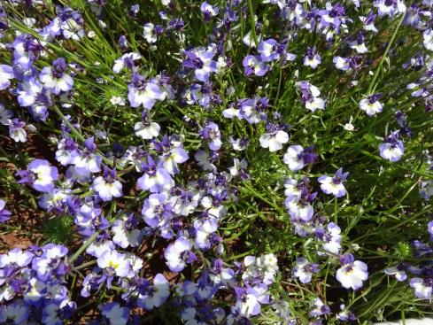
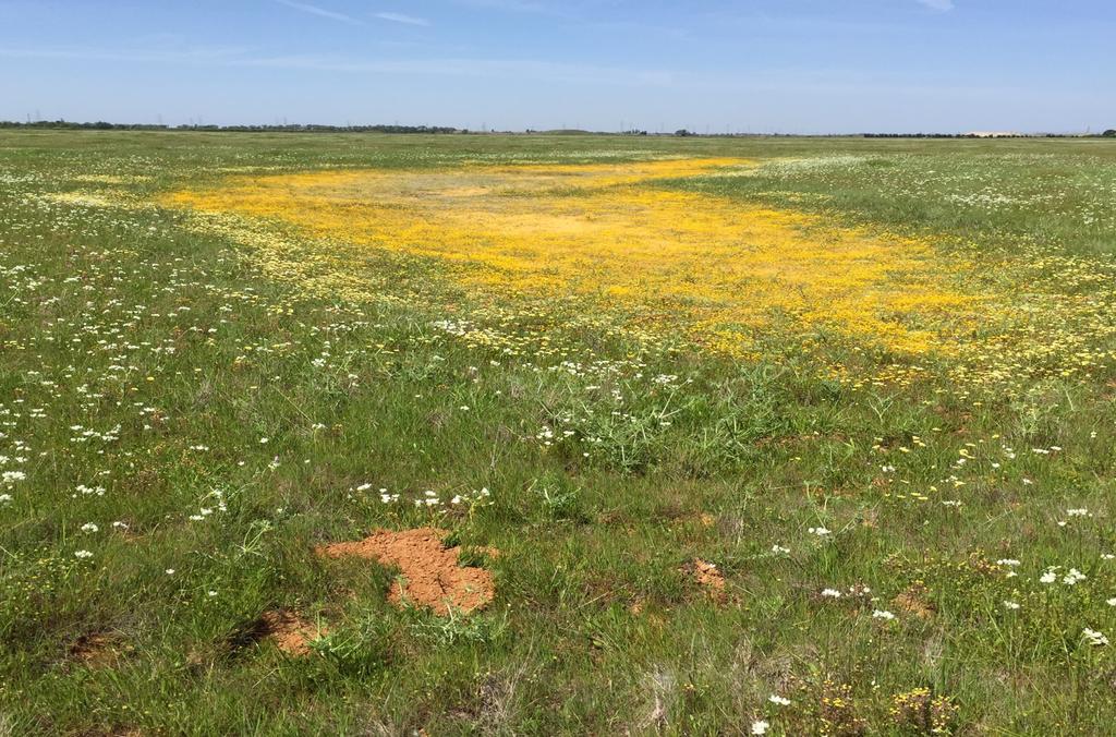
3 Vernal Pools

4 Vernal Pools


5 Vernal Pool Landscapes Agate Desert, Oregon - Hardpan Ecosystems develop in a variety of landscapes with different geology Table Mtn, California - Basalt Flow Sacramento, California - hardpan

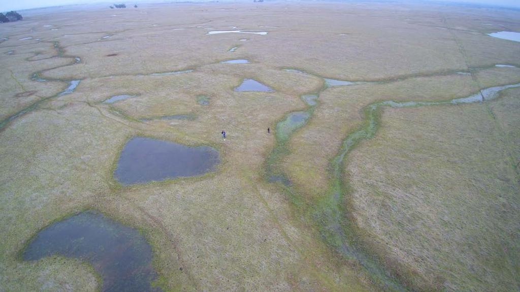
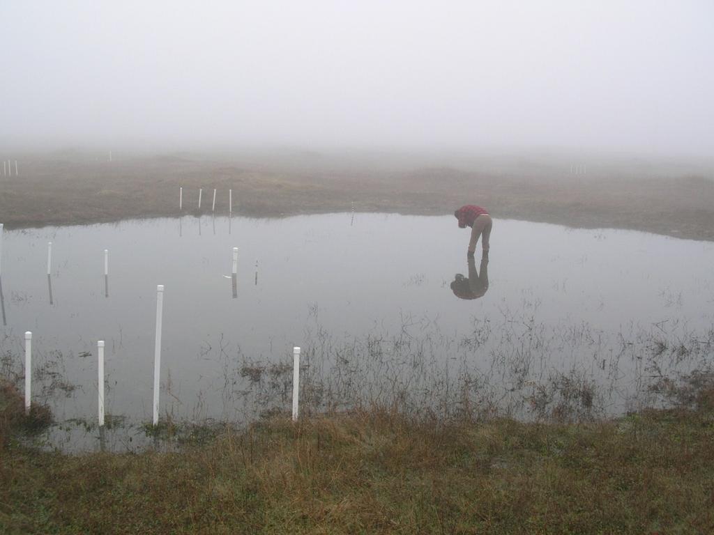
6 Surface Water and Connectivity

7 Vernal Pool Landscapes

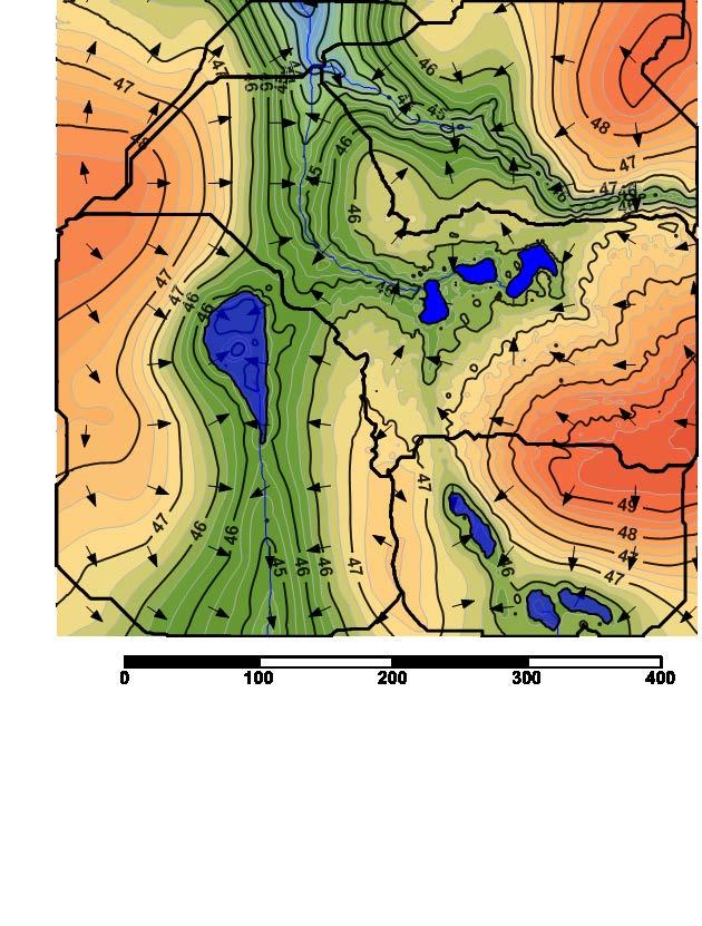
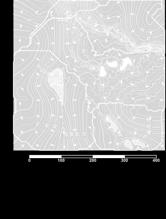
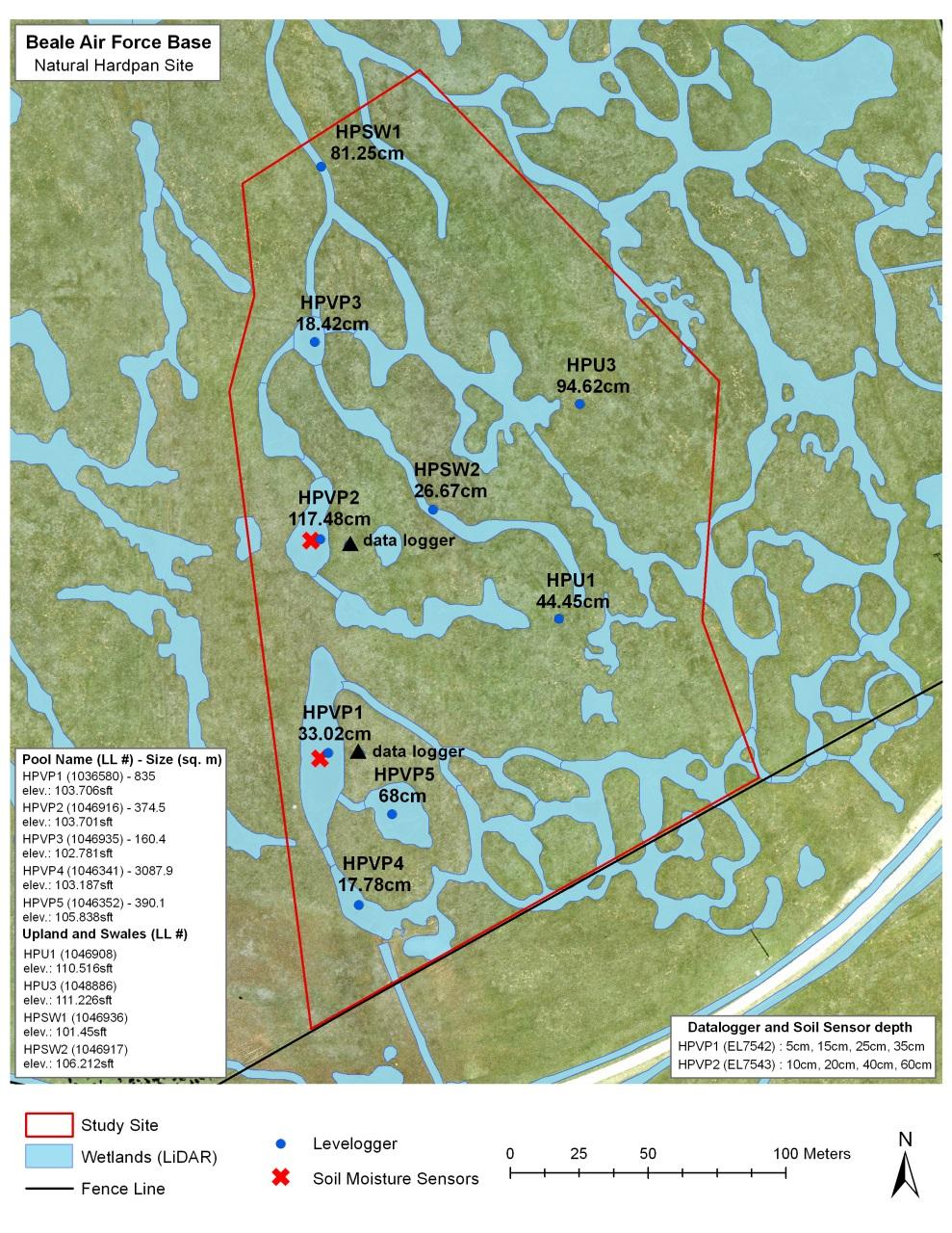
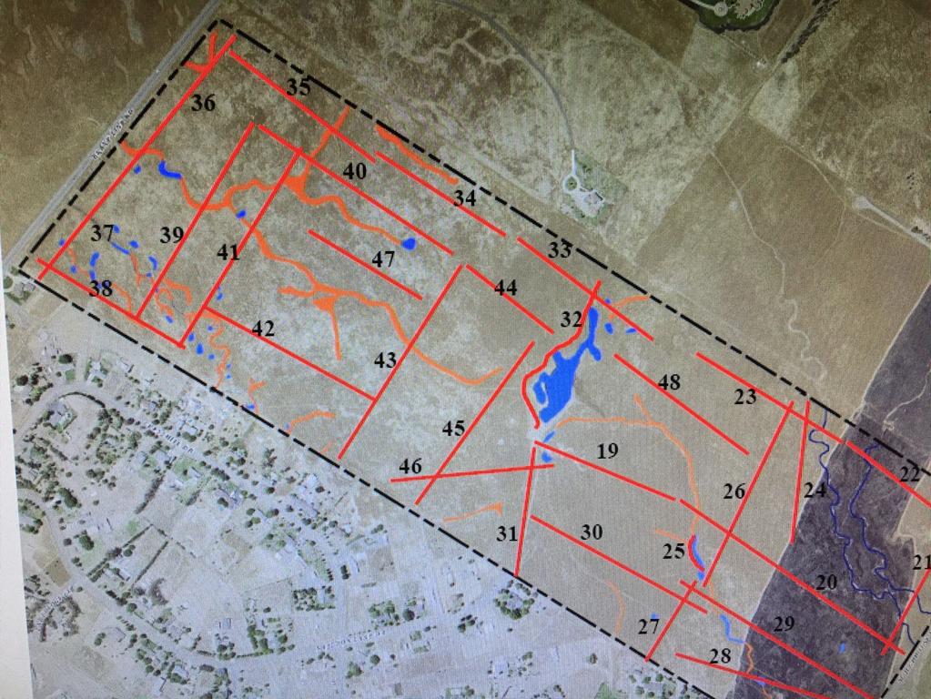
8 Mather Field Catchments

9 Catchment & Cascading Vernal Pools
 (Qo + Et) Qi S")
10 Water Balance Storage = (Qi + P) (Qo + Et) Qi S Qo

11 Catchments Within Catchments 3.8% 7.9% % 18.5% 10.3%
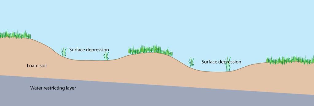
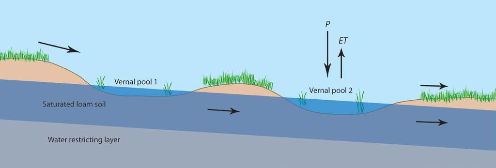
12 Cross-section of a vernal pool catchment
 + Uplands Enough Water to Saturate the Soil (40% to 50% of soil is")
13 Soil Surface and Subsurface Water Relationships Water Input: Rainfall (40% to 60%) + Uplands Enough Water to Saturate the Soil (40% to 50% of soil is air)
14 Variation in Vernal Pool Hydrology Due to Soil Profile


15 Soils Soil series known to have water-restricting zones in the soil profile: Duripan San Joaquin Series Redding Series Hedge
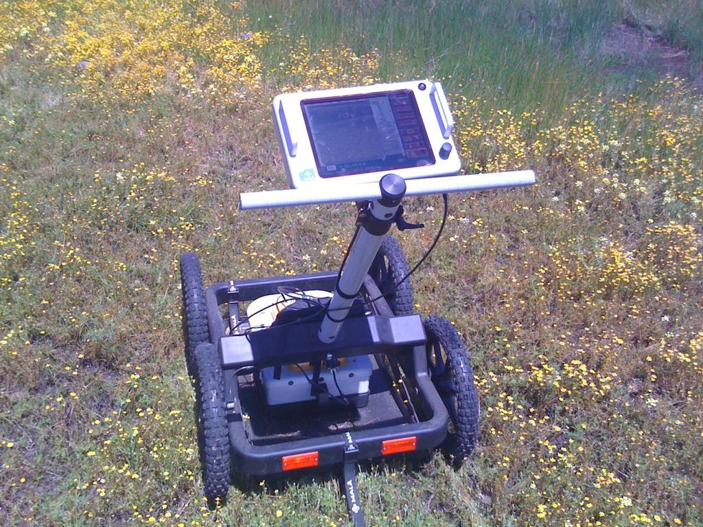
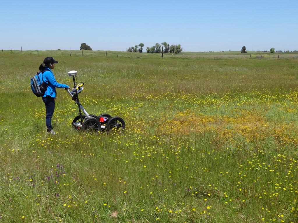
16 Measuring Soil Water-Restricting Layers GroundPenetrating Radar


17 Figure GPR Transect Across Vernal Pool Landscape at MCB Camp Pendleton GPR Maritime Chaparral The GPR soil profile shows the presence and depth to the water-restricting layer along a surface transect at MCB Camp Pendleton. Vernal Pool Clay WaterRestricting layer Corresponding to B22t Soil Horizon Vernal Pool Swale Hardpan WaterRestricting layer Corresponding to Cm Soil Horizon Clay WaterRestricting layer Corresponding to B22t Soil Horizon

18 Ground Penetrating Radar and Soil

19 Ground-Penetrating Radar Profile of Vernal Pool Landscape Soil Surface Vernal Pool Hardpan Vernal Pool Upland


20 A Horizon = Loam B Horizon = Clay C = Sandstone Huerhuero Loam
21 Vernal Pool Site Assessment and Restoration Engineering Design Process Site Suitability Conduct Site Suitability and Hydrological Functioning Analysis Vernal Pool Model Use site hydrology model to make draft engineering design of restored vernal pools Field Verification & Finalize Model Pool site specific GPR surveys and additional topography (GPS). Finalize model. Construction
22 Step 1 Site Suitability & Constraints Identify the Site has Suitable Topography Identify the Site has Suitable Soil with Water-Restricting Layer and Depth Identify Location of Existing Wetlands Conduct Hydrological Analysis of the Site Catchment/watershed area and slope Direction of water flow Measure seasonal hydrology or compare with similar sites and wetlands
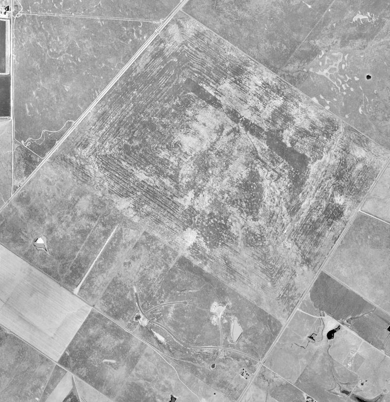
23 Historical Current acre site


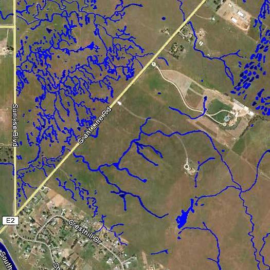
24 Existing Topography and Wetlands
")
 Bqm -")
25 San Joaquin Soil Series A Loam Bt - Loam 2Bt- Clay (claypan) Bqm - Hardpan Redding A Gravelly Loam 2Bt Clay (claypan) Bqm - Hardpan
26 Ground-Penetrating Radar Transects

27 Ground Penetrating Radar Transects San Joaquin series Redding series Seasonal swale Claypan
28 Step 2 Conceptual Design and Engineering of Created Pools Identify and Map Potential Locations for Wetland Restoration or Creation, Conduct Hydrological Analysis of Site with Created Vernal Pools Model the affect of created pools on existing wetland hydrology, Model the hydrology of the created pools.

29 Model of Surface Change to Create New Vernal Pool Basin New Pool Basin


30 Complete Vernal Pool Grading Model

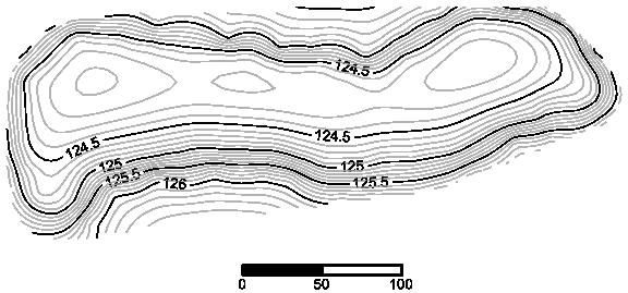
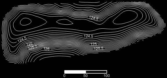
31 Vernal Pool Topography


32 Pool Location & Soil Water Restricting DAT 36B - Pools 6 & 7 Layers DAT 39B Pools 12, 13, 14, 17


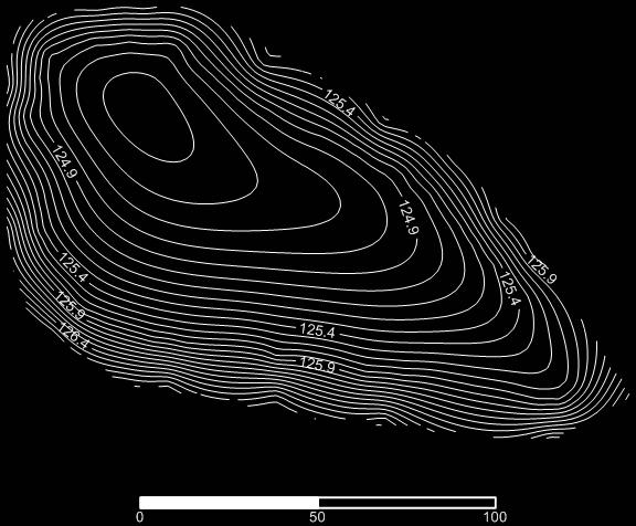
33 Digital Elevation Model of Every Vernal Pool
34 Disturbed Soil Sites Disturbance of the natural topography and soils result in challenges in GPR measurements, and with continuity of the soil texture, and depth to water-restricting layers. Examples of Disturbance: Mixing of soil horizon, excavation, and compaction. Rice fields, farming equipment, tanks, and helicopters.


35 Vernal Pool Hydrology Modeling Effect of different amount and seasonal timing of rainfall on the vernal pool hydrology


36 3-D Vernal Pool Landscape Model Figure 4-5 Vector water flow model of post construction topography of the Rooney Property


37 Lidar Topography Restoration of vernal pools on Huerhuero loam
38 Step 3 Field Verification and 4 Construction The locations of potential vernal pools is surveyed in more detail using GPR and additional GPS for a more accurate topographic model The vernal pool 3-D computer model is converted into a GPS coordinate model. The primary bulldozer has GPS antenna on each side of the blade. Grading of vernal pools within 0.1 feet.

39 Construction of Vernal Pools

40 Restored Vernal Pols
41 Notes The size, shape, and location of pools depends on the physical setting, Predicting the hydrology during dry to wet rainfall years with varying seasonal distribution is key to predicting the outcome, Hydrological monitoring critical. If they don t have water the first year there is a problem.


42 Potential Outcomes Wetter Eleocharis Downingia Lasthenia Navarretia Drier Festuca perennis non-native
43 QUESTIONS?
Trees and Levees: How and Where Do Tree Roots Grow?
 Trees and Levees: How and Where Do Tree Roots Grow? Photo: Ed Wallace Alison M. Berry Plant Sciences Department University of California, Davis The Vegetation Challenge Symposium August 28, 2007 Tree Roots
4.6. Low Impact and Retentive Grading
 4.6. Low Impact and Retentive Grading Low Impact Grading techniques focus on utilizing existing topography during Site layout to minimize cost. Proposing structures, roads, and other impervious surfaces
Chapter 3 Site Planning and Low Impact Development
 CHAPTER 3 Site Planning and Low Impact Development Chapter 3 Site Planning and Low Impact Development 3.0 Introduction The City of Charleston requires that major residential, large commercial (>1 acre),
Area 3 Envirothon Soils Questions Key
 Area 3 Envirothon Soils Questions Key 1. Soil aeration is the exchange of air in soil with air from the atmosphere. When a soil is well aerated, the air within the soil is very similar to the atmosphere
Section 1. Judging the soil pit (questions 1-4)
") CONNECTICUT ENVIROTHON 2009 SOILS QUESTIONS Please select the best response to the following questions. There are 25 questions; each question is worth 4 points. Section 1. Judging the soil pit (questions
CONNECTICUT ENVIROTHON 2009 SOILS QUESTIONS Please select the best response to the following questions. There are 25 questions; each question is worth 4 points. Section 1. Judging the soil pit (questions
URBAN SOILS & SEATTLE EXAMPLES
 Class Results - Mystery Soil #1 14 12 10 8 6 4 2 0 Sandy Clay Loam Sandy Loam Silty Loam Class Results - Mystery Soil #2 6 5 4 3 2 1 0 Silty Clay Clay Loam Sandy Sandy Silty Sandy Silty Loamy Loam Clay
If you are not able to turn in your notebook see me or Dan ASAP
 Notebook Collection Collecting hard copies now OR Electronic versions using Catalyst drop box Due by 5:30 pm today Use website for link If you are not able to turn in your notebook see me or Dan ASAP URBAN
Soil Properties That Distinguish Ecological Sites
 Soil Properties That Distinguish Ecological Sites Mike Duniway USGS-Southwest Biological Science Center Canyonlands Research Station Moab, UT mduniway@usgs.gov Spokane, WA January 31, 2012 Ecological Sites
New Tools for Land Management: A Quick Introduction to Ecological Site Descriptions
 New Tools for Land : A Quick Introduction to Ecological Site Descriptions Land management agencies have the job of managing natural resources for multiple uses in a sustainable manner. A sound understanding
Hydrologic Assessment of using Low Impact Development to Mitigate the Impacts of Climate Change. Chris Jensen, AScT Master of Science Thesis
 Hydrologic Assessment of using Low Impact Development to Mitigate the Impacts of Climate Change Chris Jensen, AScT Master of Science Thesis Bowker Creek Initiative April 12, 2012 Outline 1. Future Impacts
Vernal pools hold waters of life
 Vernal pools hold waters of life MARCH 16, 2010, 12:02 AM The endangered fairy shrimp swims on its back and feeds by filtering nutrients from the brackish waters. John Gibbins Short-leaved dudleya is among
NYC Envirothon 2017 Soil Science Review. Richard K Shaw USDA-NRCS
 NYC Envirothon 2017 Soil Science Review Richard K Shaw USDA-NRCS Introduction Who Are We? U.S. Department of Agriculture (1862) Natural Resources Conservation Service (1935) What Do We Do? Provide leadership
Specifying Soils for Plant Growth
 Specifying Soils for Plant Growth Which by coincidence reduces runoff Timothy A. Craul, CPSSc President, Craul Land Scientists The soil must be plant friendly. The soil is a natural system. All soils are
Subject: Sea Level Rise Constraints and Opportunities for India Basin
 Memorandum To: Monica Melkesian, Build Inc Cc: From: Leslie Lazarotti lazarotti@wra-cacom Ext 1300 Subject: Sea Level Rise Constraints and Opportunities for Date: July 8, 2015 The impetus for this study
CONNECTICUT ENVIROTHON 2012 SOILS QUESTIONS
 CONNECTICUT ENVIROTHON 2012 SOILS QUESTIONS Please select the best response to the following questions. There are 25 4 point questions. Many have more than one part. Good luck! Section 1: Judging the soil
2012 FINAL SOILS AREA 2 Envirothon Questions Answer KEY
 2012 FINAL SOILS AREA 2 Envirothon Questions Answer KEY Questions 1-6 to be answered at the soil pit: 1. Soil scientists categorize soils by drainage classes. What is the drainage class of the soil at
Team number Page 1 of Canon Envirothon Soils Station Test. Soils and Climate Change
 Team number Page 1 of 9 2006 Canon Envirothon Soils Station Test Soils and Climate Change There are many kinds of soil on the surface of the earth. The kind of soil that is present at a given location
County of Prince Edward. Stormwater Management Plan. Agreement in lieu of a Stormwater Management Plan
 County of Prince Edward Stormwater Management Program Date: E-Permitting Number: This stormwater management plan (Agreement) is hereby submitted by the Owner to specify the methods that will be implemented
SOIL MOISTURE MONITORING FOR EFFICIENT IRRIGATION OF ALFALFA
 SOIL MOISTURE MONITORING FOR EFFICIENT IRRIGATION OF ALFALFA California Alfalfa & Grains Symposium Dec. 10-12, 2014 Long Beach, CA Daniele Zaccaria & Steve Orloff University of California - Cooperative
Antioch Habitat Conservation Plan/Natural Community Conservation Plan
 Antioch Habitat Conservation Plan/Natural Community Conservation Plan Science Advisor Workshop February 8, 2018 Kathryn Gaffney Project Manager Matt Ricketts Lead Biologist 1 PRESENTATION OUTLINE Background
** Ecological Sites tied to soil data accessible through Web Soil Survey
 Ecological Site: A distinctive kind of land with specific physical characteristics that differs from other kinds of land in its ability to produce a distinctive kind and amount of vegetation, and in its
Chapter 4 - Preparation of Stormwater Site Plans
 Chapter 4 - Preparation of Stormwater Site Plans The Stormwater Site Plan is the comprehensive report containing all of the technical information and analysis necessary for the City to evaluate a proposed
Vineyard Variability Due To Differences in Soil. Ann Tan UC Davis
 Vineyard Variability Due To Differences in Soil Ann Tan UC Davis Background We know that soils are important, but how much do they affect grape productivity and fruit quality? Some studies suggest a role
ASCE - Philadelphia. Soils & Stormwater Management. Matthew C. Hostrander, CPSS, SEO Soil Scientist. Gilmore & Associates, Inc.
 ASCE - Philadelphia Soils & Stormwater Management Matthew C. Hostrander, CPSS, SEO Soil Scientist Gilmore & Associates, Inc. Course Overview COURSE OUTLINE Soil Science Fundamentals Discuss United States
Minnesota Department of Natural Resource - Natural Resource Guidance Checklist Conserving Natural Resources through Density Bonuses
 Minnesota Department of Natural Resource - Natural Resource Guidance Checklist Conserving Natural Resources through Density Bonuses NRDB Why Use Density Bonuses & This Checklist Local units of government
New Tools for Conservation: Ecological Site Descriptions and Their Role in Conservation Planning
 New Tools for Conservation: Ecological Site Descriptions and Their Role in Conservation Planning Creating effective conservation policies and programs requires knowledge of land resources, the ecosystem
Soil Formation. 6.E.2.3 Explain how the formation of soil is related to the parent rock type and the environment in which it develops.
 Soil Formation 6.E.2.3 Explain how the formation of soil is related to the parent rock type and the environment in which it develops. What is soil? A loose mixture of weathered rock, organic material,
Understanding Soil Variability to Utilize Variable Rate Fertilizer Technology
 Understanding Soil Variability to Utilize Variable Rate Fertilizer Technology Agronomy Update -2012 Red Deer, AB Jan 17 & 18, 2012 Ross H. McKenzie Research Scientist Agronomy Research & Innovation Div.
Rainwater Harvesting: Soil Storage and Infiltration Systems
 Rainwater Harvesting: Soil Storage and Infiltration Systems Justin K. Mechell Texas Cooperative Extension Department of Biological and Agricultural Engineering Texas A&M University How Rainwater Harvesting
Land Drainage Research Project
 Land Drainage Research Project (LanDraP) Final Report May 2014 Henry Webber BA Hons MPhil FACTS Contents Acknowledgements... 2 1. Introduction... 3 1.1 The Project Aims... 3 1.2 Ground Penetrating Radar...
Land Formation & Water Management
 Land Formation & Water Management Field Development Configuring the field shape, surface and slope Installation of water control structures To Optimize water management Crop production, uniformity Conserve
Basic Information: Vernal Pool Systems
 Basic Information: Assessment Area Name: Project Name: Assessment Area ID #: Project ID #: Assessment Team Members for This AA Date: AA Location: Latitude: Longitude: Datum: Wetland Category: Natural Constructed
In 1983, the town evacuated and purchased by government for $36 million
 1 2 3 4 5 6 7 8 9 Introduction to Environmental Geology, 5e Chapter 17 Soil and Environment Weathering: summary in haiku form Rocks brought to surface decompose to sediment and that's weathering. Case
Using Soil Attributes for HGM Wetland Classification
 Using Soil Attributes for HGM Wetland Classification Richard Weber Wetland Hydraulic Engineer Wetland Team (Ret.) CNTSC, Fort Worth, TX Slide 1 Data Sources: Web Soil Survey County Scale Smaller than Reference
PHYSICAL CHAtlACTERISTICS REPORT FOR THE PROPOSED SAND AND GRAVEL SITE AT MANOR FARM, UFFINGTON
 PHYSICAL CHAtlACTERISTICS REPORT FOR THE PROPOSED SAND AND GRAVEL SITE AT MANOR FARM, UFFINGTON Introduction Following the" request for detailed information on the physical characteristics of soil at Manor
HISTORICAL ECOLOGY OF THE DELTA Emerging Concepts about a Spatially Complex and Temporally Dynamic System
 ITEM REMOVED DUE TO COPYRIGHT STATUS HISTORICAL ECOLOGY OF THE DELTA Emerging Concepts about a Spatially Complex and Temporally Dynamic System Robin Grossinger and Alison Whipple San Francisco Estuary
IMPORTANCE OF HARESFOOT CLOVER (TRIFOLIUM ARVENSE) AS A NITROGEN FIXER IN SEMI-ARID GRASSLANDS OF NEW ZEALAND. C.C.Boswell, W.L.Lowther and P.R.
 AS A NITROGEN FIXER IN SEMI-ARID GRASSLANDS OF NEW ZEALAND. C.C.Boswell, W.L.Lowther and P.R.") ID # 26 01 IMPORTANCE OF HARESFOOT CLOVER (TRIFOLIUM ARVENSE) AS A NITROGEN FIXER IN SEMI-ARID GRASSLANDS OF NEW ZEALAND C.C.Boswell, W.L.Lowther and P.R.Espie AgResearch, Invermay Agricultural Centre,
ID # 26 01 IMPORTANCE OF HARESFOOT CLOVER (TRIFOLIUM ARVENSE) AS A NITROGEN FIXER IN SEMI-ARID GRASSLANDS OF NEW ZEALAND C.C.Boswell, W.L.Lowther and P.R.Espie AgResearch, Invermay Agricultural Centre,
Differences in ecological sites, and sometimes
 Society for Range Management Soil Processes and Properties That Distinguish Ecological Sites and States By Michael C. Duniway, Brandon T. Bestelmeyer, and Arlene Tugel Differences in ecological sites,
SOIL SURVEY FOR PROPOSED WET ASH DISPOSAL FACILITY, HENDRINA POWER STATION, MPUMALANGA PROVINCE
 REPORT for Lidwala Environmental and Planning Servives by the INSTITUTE FOR SOIL CLIMATE AND WATER AGRICULTURAL RESEARCH COUNCIL SOIL SURVEY FOR PROPOSED WET ASH DISPOSAL FACILITY, HENDRINA POWER STATION,
The Nature of Soil Soil Conservation Sustainable Ag.
 Chapter 6 & 7 The Nature of Soil Soil Conservation Sustainable Ag. Climate Soil Forming Factors Parent material Organisms Topography Time Value of Soil Soil is under appreciated Condition of soil affects
Soil Interpretations Erosion and Sedimentation Control Planning and Design Workshop
 Soil Interpretations Erosion and Sedimentation Control Planning and Design Workshop Presented by Richard Brooks Presentation prepared by Kristin May Resource Soil Scientists USDA-Natural Resources Conservation
Biodiversity Conservation
 Biodiversity Conservation and Site Plan Review Biodiversity conservation principles Threats to biodiversity Location of development Reviewing site plans Lunch Reviewing site plans (continued) LEED and
2001 Southeastern Pennsylvania Stormwater Management Symposium Villanova University. Jean K. Akers
 2001 Southeastern Pennsylvania Stormwater Management Symposium Villanova University Abstract Planting For Water Quality Incorporating plantings into stormwater BMP design to improve water quality. Jean
Soils and Land Use Test
 SOIL PROPERTIES Total Score /50 1) List two of the five main functions of soil. (2 points) Habitat for organisms, Engineering medium, Filters and stores water, Anchor for plants, Cycles nutrients 2) Small
The Effects of Woody Vegetation on Levees
 The Effects of Woody Vegetation on Levees Maureen K. Corcoran Assistant Technical Director, Water Resources Infrastructure Vicksburg, MS 26 February 2010 US Army Corps of Engineers Problem Statement What
Land Formation. Field Development
 Land Formation California Rice Production Workshop, v15 Field Development Field development refers to configuring the field shape, surface slope and installation of water control structures to optimize
Problem soils & its management. Satira Udomsri, LDD
 Problem soils & its management Satira Udomsri, LDD Kingdom of Thailand Location: Southeast Asian mainland 5 o -20 o N 97 o -105 o E Area total: land: water: Capital: 513,120 sq km 510,890 sq km 2,230 sq
Rainwater Harvesting: Where does the Rainfall Go?
 Rainwater Harvesting: Where does the Rainfall Go? Justin Mechell Extension Assistant Department of Biological and Agricultural Engineering Texas A&M University Objectives Understand a watershed and how
The entire site supports grass on which sheep had been grazing recently.
 PHYSICAL CHARACTERISTICS REPORT FOR LAND AT HORSEHAY A^ Agricultural Land Classification of approximately 14 hectares of land to the southwest of Horsehay was undertaken in November 1989. The site lies
Pits 1 & 3 Questions. 7. Subsurface: Texture (5 pts) A. Coarse B. Moderately course C. Medium D. Fine E. Very Fine
 A. Coarse B. Moderately course C. Medium D. Fine E. Very Fine") Minnesota Soils Scorecard Questions for Pits 1-4 Scantron # 105481 Use your soils scorecard to fill out the answers on your scantron Bubble in the front side of the sheet for Pit 1 (# 1-45) and Pit 2 (#51-95)
Minnesota Soils Scorecard Questions for Pits 1-4 Scantron # 105481 Use your soils scorecard to fill out the answers on your scantron Bubble in the front side of the sheet for Pit 1 (# 1-45) and Pit 2 (#51-95)
FISH RESTORATION PROGRAM AGREEMENT Implementing Habitat Restoration Requirements Of The Biological Opinions
 FISH RESTORATION PROGRAM AGREEMENT Implementing Habitat Restoration Requirements Of The Biological Opinions Dennis McEwan Department of Water Resources waterways tidal wetlands Whipple et al. 2012: Sacramento-San
Vernal pools are found in California and just a few other places in the world. Seasonal wet depressions or
 T hey have been called "pot holes in the rngeand." During the summer they are dry depressions In the ground. In the winter months they fill with rain water. Vernal pools hold water long enough to allow
Soil Health Practices in the Landscape
 Soil Health Practices in the Landscape Salvatore Mangiafico Rutgers Cooperative Extension Environmental and Resource Management Agent In this session... Benefits of healthy soils in the landscape Plant
Why do soils differ across the landscape?
 Today s Objectives: Elements of soil formation Describe important soil physical & chemical properties Describe the ability to use and interpret soil survey information (printed and digital) List some site
DO YOU KNOW YOUR SOILS? (Rev. 10/11)
") DO YOU KNOW YOUR SOILS? (Rev. 10/11) Circle all the correct answers. 1. What is the layer normally present on the surface of the soil in cropped fields? a. O c. Ap e. B g. R b. A d. E f. C 2. Available
DO YOU KNOW YOUR SOILS? (Rev. 10/11) Circle all the correct answers. 1. What is the layer normally present on the surface of the soil in cropped fields? a. O c. Ap e. B g. R b. A d. E f. C 2. Available
2011 Wisconsin Envirothon Soils and Land Use Exam
 2011 Wisconsin Envirothon Soils and Land Use Exam USE THE OCONTO COUNTY SOIL SURVEY TO ANSWER QUESTIONS 1-4 The Pensaukee River Wetland Complex is a mixture of state (Pensaukee Wildlife Area) and privately
Tree Root Architecture: Patterns and Geotechnical Roles in Levees
 Tree Root Architecture: Patterns and Geotechnical Roles in Levees Shih Ming Chung and Alison M. Berry University of California, Davis Collaborators Gerald Bawden, U.S.G.S.; Keir Keightley, UC Davis; Sandra
Salinity Management in Alfalfa Fields
 Salinity Management in Alfalfa Fields Michelle Leinfelder-Miles Delta Farm Advisor, San Joaquin County KAC Alfalfa and Forage Field Day September 12, 2014 Presentation outline Background salts, soils,
2016 Area 3 Envirothon Muskingum County Soils Test ANSWER KEY
 2016 Area 3 Envirothon Muskingum County Soils Test ANSWER KEY 1. The majority of the bedrock in Muskingum County is. a. sedimentary bedrock b. glacial bedrock c. igneous bedrock d. metamorphic bedrock
VA DCR STORMWATER DESIGN SPECIFICATION NO. 11 WET SWALE. VERSION 2.0 January 1, 2013 SECTION 1: DESCRIPTION
 VIRGINIA DCR STORMWATER DESIGN SPECIFICATION No. 11 VERSION 2.0 January 1, 2013 SECTION 1: DESCRIPTION Wet swales can provide runoff filtering and treatment within a conveyance system and are a cross between
Basic Soil Science. Fundamentals of Nutrient Management. Melissa L. Wilson
 Basic Soil Science Fundamentals of Nutrient Management Melissa L. Wilson Department of Environmental Science & Technology Ag Nutrient Management Program University of Maryland, College Park Photo credit:
City of Norfolk Coastal Flood Mitigation Program. March 13, 2013
 City of Norfolk Coastal Flood Mitigation Program March 13, 2013 Topics Brief overview of Norfolk s Coastal Flood Program Data-driven analysis and decision making City-wide vulnerability, project concepts,
DEALING WITH STORM WATER MANAGEMENT
 December 2012 DEALING WITH STORM WATER MANAGEMENT This fact sheet provides information on the guiding principles of storm water management practices, explains the difference between structural and non-structural
New Development Stormwater Guidelines
 New Development Stormwater Guidelines CITY OF MOUNTLAKE TERRACE Table of Contents Introduction... 2 Ecology s Minimum Requirements for stormwater management... 2 Description of the 9 Minimum Requirements...
2014 Envirothon Georgia Soil Study Guide
 2014 Envirothon Georgia Soil Study Guide In addition to materials in this document, 2014 Georgia Envirothon contestants are responsible for materials found in the following documents: From The Surface
Soil & Site Evaluator - Need to Know
 Soil & Site Evaluator - Need to Know I. The professional will understand the factors of soil development and demonstrate their importance to site evaluations. A. Topography 1. Landscape description 2.
Otay Regional Trail Alignment Study. Public Workshop March 14 th, 2017 from 5:30-8 p.m.
 Public Workshop March 14 th, 2017 from 5:30-8 p.m. Purpose of the Study A multi-agency planning effort to create a coordinated and sustainable trail system that enhances recreation and provides trail connections
Soil & Site Evaluator - Need to Know
 Soil & Site Evaluator - Need to Know I. The professional will understand the factors of soil development and demonstrate their importance to site evaluations. A. Topography 1. Landscape & landform description
HUDSON VALLEY REGIONAL COUNCIL 3 Washington Center, Newburgh NY
 PROJECT AREA: HYDE PARK HUDSON VALLEY REGIONAL COUNCIL 3 Washington Center, Newburgh NY 12550 http://www.hudsonvalleyregionalcouncil Insert aerial site photo with streets labeled GREEN INFRASTRUCTURE CONCEPT
URS Australia ADDENDUM. Caval Ridge Project Soil Survey and Land Resource Assessment Report
 URS Australia ADDENDUM Caval Ridge Project Soil Survey and Land Resource Assessment Report September 2009 ADDENDUM Addendum to the Caval Ridge Project Soil Survey and Land Resource Assessment Report 2009,
Tara Skryne Landscape Conservation Area Project: Progress Report: Phase 1
 Tara Skryne Landscape Conservation Area Project: Progress Report: Phase 1 A partnership project between Meath County Council, the Heritage Council and the Department of Environment, Heritage and Local
Explaining a Soil Profile
 Lesson C1 3 Explaining a Soil Profile Unit C. Basic Principles of Agricultural/Horticultural Science Problem Area 1. Using Basic Soil Science Principles Lesson 3. Explaining a Soil Profile New Mexico Content
Objectives: Students will learn about the types and textures of soil within a soil profile.
 Objectives: Students will learn about the types and textures of soil within a soil profile. Materials: Soil profile pictures with description (mounted with Velcro) Soil profile poster board Soil Word Scramble
Carver County: Stormwater Reuse Investigation. Mark Greve Marcella Hartman Savannah Hintsala Alex Nelson Lilly Rouillard
 Carver County: Stormwater Reuse Investigation Mark Greve Marcella Hartman Savannah Hintsala Alex Nelson Lilly Rouillard Investigation Purpose 1. Collect stormwater reuse data and current research 2. Compare
O horizon: the O-horizon is made up of organic material. The horizon is found at the soil surface.
 A Good Dirty n Soil Lab: References: Wagner & Sanford. Environmental Science. Wiley & Sons, 2005. Molnar. Laboratory Investigations for AP* Env. Science. Peoples Ed, 2005. Soil Porosity & Permeability
Making Sense of Soil Series
 Making Sense of Soil Series Larry A. Morris Forest Soils Professor UGA WSF&NR The type, organization, and degree of development of soil horizons (layers) we observe in a soil profile such as pictured below
Soil moisure, vol. % Precipitation, in. BSEN 4210 Irrigation HW 2 Daily Rainfall and Soil Moisture Ann Nunnelley 4 Sept. 2015
 BSEN 4210 Irrigation HW 2 Daily Rainfall and Ann Nunnelley 4 Sept. 2015 The following graphs and tables represent the precipitation and soil properties from the Princeton#1 SCAN site (site# 2005) located
Appendix I. Checklists
 Appendix I Checklists Town of Greenwich Drainage Manual Department of Public Works - Engineering Division Town Hall - 101 Field Point Road, Greenwich, CT 06836-2540 Phone 203-622-7767 - Fax 203-622-7747
Wetland Restoration In Altered Landscapes
 Wetland Restoration In Altered Landscapes Mike McClure, Wetland Service Biologist, MO Dept. of Conservation Wetland Restoration In Altered Landscapes Do s, Don ts and Things To Think About Assessing the
Selecting Appropriate Stormwater Control Measures for Your Development Project
 Phase II Post-Construction Stormwater Requirements Workshop - February 10, 2014 Selecting Appropriate Stormwater Control Measures for Your Development Project Jill Bicknell, P.E., EOA, Inc. Outline of
POST-FIRE RESTORATION Dos and Don ts
 POST-FIRE RESTORATION Dos and Don ts USDA Natural Resources Conservation Service The NRCS/RCD office is located at: 744 LA GUARDIA ST BLDG A SALINAS, CA 93905-3354 (831) 424-1036 (NRCS) (831) 424-1036
CfE Higher Geography BIOSPHERE
 CfE Higher Geography BIOSPHERE WHAT ARE THE OUTCOMES? 1. Use a range of mapping skills and techniques in physical environment contexts by: 1.1 Interpreting complex geographical information from at least
USE OF PRECISION AGRICULTURE TECHNOLOGY TO EVALUATE SOIL COMPACTION
 USE OF PRECISION AGRICULTURE TECHNOLOGY TO EVALUATE SOIL COMPACTION R. Goodson R. Letlow, D. Rester, and J. Stevens AUTHORS:Louisiana CooperativeExtension Service, LSU AgCenter P.O. Box 25100, Baton Rouge,
RAIN GARDEN ILLINOIS URBAN MANUAL PRACTICE STANDARD. (feet) CODE 897 DEFINITION
 CODE 897 DEFINITION") ILLINOIS URBAN MANUAL PRACTICE STANDARD RAIN GARDEN (feet) CODE 897 Source: Kendall County Soil and Water Conservation District DEFINITION Rain gardens are small, shallow, flat bottomed depressions constructed
ILLINOIS URBAN MANUAL PRACTICE STANDARD RAIN GARDEN (feet) CODE 897 Source: Kendall County Soil and Water Conservation District DEFINITION Rain gardens are small, shallow, flat bottomed depressions constructed
City of Elmhurst. Comprehensive Flood Plan. City of Elmhurst. City Council Meeting September 15, 2014
 City of Elmhurst City of Elmhurst Comprehensive Flood Plan City Council Meeting September 15, 2014 City of Elmhurst Presentation Overview Study Background Study Methodology Analysis of Three Additional
2.1.4 Roof Downspout Rain Gardens
 2008 SWMM, 2010 Revision City of Tacoma 2.1.4 Roof Downspout Rain Gardens Purpose and Definition Bioretention areas are shallow stormwater retention facilities designed to mimic forested systems by controlling
Butte Mtn. Late Successional Reserve Habitat Restoration Project Soil Report
 KLAMATH NATIONAL FOREST Butte Mtn. Late Successional Reserve Habitat Restoration Project Soil Report GOOSENEST RANGER DISTRICT JOE BLANCHARD 4/23/2013 Prepared by Joe Blanchard Forest Soil Scientist Klamath
Modeling Rain Garden LID Impacts on Sewer Overflows
 7 Modeling Rain Garden LID Impacts on Sewer Overflows Uzair (Sam) M. Shamsi In September 2010, the U.S. Environmental Protection Agency (USEPA) released a new version (5.0.021) of Storm Water Management
 108 40' 29'' W Soil Map Mesa County Area, Colorado 108 36' 55'' W 39 10' 11'' N 39 6' 31'' N 4331700 4332500 4333300 4334100 4334900 4335700 4336500 4337300 4338100 701100 701900 702700 703500 704300 705100
4. Contractor (and subcontractors if applicable) certification statement(s)
 certification statement(s)") CHEMUNG COUNTY STORMWATER COALITION STORMWATER POLLUTION PREVENTION PLAN (SWPPP) SUBMITTAL CHECKLIST GENERAL INFORMATION: 1. Owner/Operator name, legal address, phone number 2. Copy of signed Notice of
CHEMUNG COUNTY STORMWATER COALITION STORMWATER POLLUTION PREVENTION PLAN (SWPPP) SUBMITTAL CHECKLIST GENERAL INFORMATION: 1. Owner/Operator name, legal address, phone number 2. Copy of signed Notice of
Table 4.7.1: Swales Potential Application and Storm Water Regulation
 4.7. Swales A swale is a vegetated open channel, planted with a combination of grasses and other herbaceous plants, shrubs, or trees. A traditional swale reduces peak flow at the discharge point by increasing
Highway Alignment and Route Location Survey
 CHAPTER 2 Highway Route Surveys and Location Introduction To determine the geometric features of road design, the following surveys must be conducted after the necessity of the road is decided. Type of
STAFFORDSHIRE AND STOKE-ON- TRENT STRUCTURE PLAN Site 7: Priory Farm. Agricultural Land Classification ALC Map and Report November 1998
 STAFFORDSHIRE AND STOKE-ON- TRENT STRUCTURE PLAN Site 7: Priory Farm Agricultural Land Classification ALC Map and Report November 1998 A J Spalding Resource Planning Team RPT Reference: 008/98 & 25/RPT/Ol
SOILS BACKYARD CONSERVATION
 SOILS 2015.03.25 BACKYARD CONSERVATION WORKING LANDSCAPES PLLC Working Landscapes PLLC offers landscape architectural and irrigation design services, with an emphasis on sustainable technologies and techniques.
Custom Soil Resource Report for Lane County Area, Oregon
 United States Department of Agriculture Natural Resources Conservation Service A product of the National Cooperative Soil Survey, a joint effort of the United States Department of Agriculture and other
Outline. Overview of Soil Methods. Ecosystem Services in the Soil. Why care about soils? What are biological soil crusts?
 Overview of Soil Methods Outline Why do we care about soils? Biological soil crust Soil sampling methods Ecological Monitoring and Analysis (REM 357) Park Valley, UT Why care about soils? Basis for all
Soil Series: Elevation and Agricultural Soil Test Survey of the Godfrey Dryland Experimental Farm, Clarkston, Utah
 October 2017 AG/Soils/2017-01pr Soil Series: Elevation and Agricultural Soil Test Survey of the Godfrey Dryland Experimental Farm, Clarkston, Utah Ryan Hodges, Robert Clawson and Grant E. Cardon (Graduate
City of Troutdale South Troutdale Road Storm Drainage Plan
 City of Troutdale South Troutdale Road Storm Plan January 29 City of Troutdale SOUTH TROUTDALE ROAD STORM DRAINAGE PLAN January 29 Prepared for: City of Troutdale 342 SW 4th Street Troutdale, OR 976 Prepared
Urban Rain Gardens: Capturing our local water. Martha Berthelsen The Watershed Project
 Urban Rain Gardens: Capturing our local water Martha Berthelsen The Watershed Project www.thewatershedproject.org The Watershed Project s mission is to inspire Bay Area communities to understand, appreciate,
HAVE YOU NOTICED at construction sites how a
 Explaining a Soil Profile HAVE YOU NOTICED at construction sites how a cross section of soil has a layered look? Soil near the top of the cross section is often dark, and soil below appears lighter. What