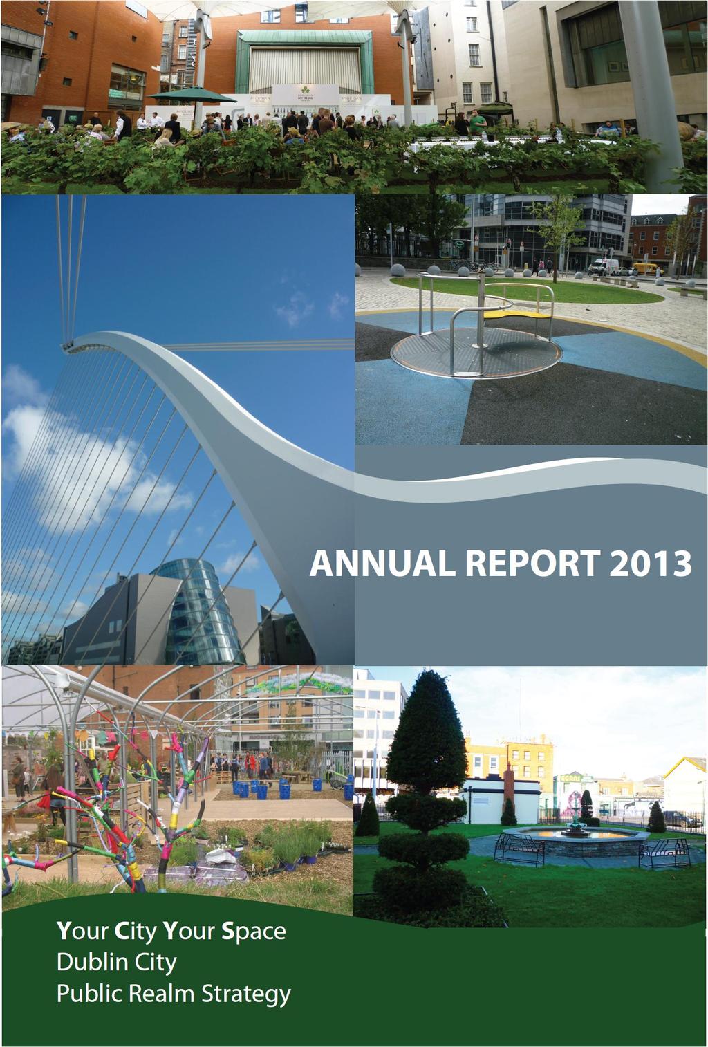
Public Realm Strategy; Your City Your Space Annual Report 2013
|
|
|
- Emerald Brown
- 5 years ago
- Views:
Transcription

1 To the Lord Mayor and Report No. 362/2013 Members of Dublin City Council Report of the Acting Assistant City Manager Public Realm Strategy; Your City Your Space Annual Report 2013 The Your City, Your Space; Dublin City Public Realm Strategy was adopted by the City Council in September 2012 following extensive research and consultation with a wide range of stakeholders and a public consultation process. Section 4.1 of the strategy provides for a report on progress to be submitted annually to the City Council and this report fulfils the requirement. The strategy has 15 long term actions and a two year work plan based on the twelve identified projects listed below: Public Realm Project Public Realm Project 1 Grafton St Quarter Public Realm 7 Aungier Street Plan 2 Trinity to IMMA East West Route Dubline 8 Public Realm Information Management System 3 Liffey Corridor Project 9 Dereliction Project 4 Mountjoy Square Park and 10 Design Manual for working with Environs Historic Public Realm 5 North Inner City Quadrant 11 Merrion Square Tea Rooms 6 Grangegorman Connections to the City 12 Street Charter Pilot Initiative - Thomas Street All of these projects are underway with an assigned project manager and they report at least quarterly to the established Cross-Departmental, Multi-Disciplinary Coordination Group who provide guidance and expertise on issues arising. Each of the 12 projects in the two year work plan has a number of actions assigned which are being progressed as per the project reports attached. The Liffey Corridor Project Report (Project 3) has been completed and published. The research, observations and recommendations will inform the development of a Local Area Plan for this strategic area of the city. The Public Realm Co-ordination Group propose to substitute in its place, the Parnell Square Cultural Quarter Project in the work plan for 2014, as this project has a significant public realm element to it and involves the regeneration of unused buildings, historic public realm and art /
2 animation of an area currently underutilised, with the associated movement and public transport requirements of such a significant area of the Civic Spine of the city. The Strategy further identifies 15 Actions which follow from the guiding principles outlined in the Strategy document. These actions are long term or ongoing and they apply across a range of activities and services, some requiring individual projects or trials in order to bring forward solutions and new policy. Action 1 Establish a cross-departmental, multidisciplinary group to coordinate Dublin City Council s public realm projects and to liaise with external agencies delivering public realm works. Report A cross departmental, multidisciplinary, co-ordination group is in place who meets monthly to review progress on each of the ongoing projects, providing input and guidance. This meeting is also a forum for raising issues relevant to the public realm, initiating actions either from the group itself or from a Department within the City Council. Sub-groups and smaller projects may be assigned from these outcomes. There is also an opportunity to present project outcomes/solutions which may be scalable in the city. Action 2 Collaborate with project delivery teams to ensure that comprehensive design briefs are prepared and multi-disciplinary design reviews are carried out for all Dublin City Council s public realm projects. Report - Design briefs and templates are in place where required, for all listed projects and the Public Realm Co-ordination Group input into these on a quarterly basis or as required provide expertise and guidance. Action 3 Work with project teams to integrate Universal Design Principles into designs for new public realm works. Report - Universal Design Principles are now an accepted standard for Dublin City Council Project teams and are being incorporated into project briefs and tender documents as a matter of course. Action 4 Create a Design Manual of design guidance and co-ordinated specifications (including no noise characteristics) for materials, furniture and other public realm fixtures. This will be used for co-ordination across departments and to inform developers, utilities and others involved in public realm works. Report - A Roads Construction Specification Manual is being progressed to include an agreed pallet of materials which should be available in draft shortly. Work has commenced on a Manual on Street Furniture which will include a higher standard of treatment for the Civic Spine and Primary Streets in the city, as well as a guiding standard for installation of such items as bollards, bike stands, bins, lighting, etc.
3 Action 5 Review protocols with utilities providers and any other parties permitted to carry out works in the public realm to ensure that works are co-ordinated, carried out in an environmentally acceptable manner, that damage to existing finishes is minimised, and that works are reinstated to an acceptable standard. Report - A review of business systems and policy has been undertaken under Project 8 and the outcomes will inform changes to systems per attached report. Action 6 Develop Service Level Standards for public spaces, to protect and improve qualitative and quantitative standards for air quality, noise control and pedestrian volume and safety. Take proactive action on behalf of the Council to ensure that these standards are achieved. To engage with third parties to achieve these standards and to use legal means to do so if necessary. Special consideration to be given to those noise hot spots and quiet areas identified in the Dublin Noise Action Plan. Report -The Parks & Landscape Services, as part of their ongoing Parks & Landscape Strategy development are reviewing the application of Service Level Standards for open spaces generally including air quality and noise control. These characteristics affect the use and enjoyment of parks & open spaces in particular where sources of pollution and noise are in proximity to users. Application of parks service level standards reviewed under the strategy may be tested for other public spaces to determine if city-wide or location specific standards are needed. Action 7 Develop a Strategy for Parks and Open Spaces to set standards for design, use, maintenance and service provision. It will utilise pilots and innovative management approaches to improve the range and quality of recreational amenities in the city. Report- Parks and Landscape Services have undertaken an audit of parks and open spaces in relation to access and quality. Access in this instance relates to proximity to user and how well serviced areas of the city are by parks or open recreational spaces. Parks were further audited in relation to quality and a graded system applied. A user survey is currently running on the City Council website asking for public comment regarding their likes, dislikes, additional services available in parks, uses they would like to see and how far they travel to a park, etc. The outcomes of all these actions will feed into a Parks and Landscape Strategy which will have regard to noise and air quality. Action 8 Improve controls and coordination of information about underground services for works departments and utilities providers. Report This is being dealt with under Project 8 referred to in action 5 above. Action 9 Advise or facilitate the training of staff and contractors in work and best practice in the public realm. This will include producing a manual for working with, and protecting historic street surfaces. Report This is being dealt with under Project 10 as per attached report.
4 Action 10 Provide an accessible and useful point of contact for the public on the design and management of the public realm. Actively build awareness and ownership of public realm quality issues. Report -The Public Realm Project Manager was appointed in 2011 with a designated address publicrealm@dublicity.ie as a point of contact. The Public Realm Project Manager inputs into policy development and project groups on behalf of the Public Realm Co-ordination Group as appropriate and oversees smaller interventions and projects designed to improve the public realm and test new approaches. Requests and proposals by private individuals and companies to trial in the public realm are evaluated and directed appropriately. Action 11 Consult with interest groups on a project basis through the use of new technologies and approaches to develop policies that make public spaces more inclusive and accessible for all ages and capabilities, with a particular emphasis on children, youth and the elderly. Report A web-based consultation tool has recently launched on the Dublin City Council website with the tag line Have your say. This allows the public to have an input on items that interest them and acknowledges submissions received. It also allows them to share items instantly through facebook and twitter with friends of similar interest. This approach should broaden the scope and number of submissions on any public consultation. The Public Realm Project Manager worked with the Grafton Street Quarter Project Team on the communications tool and plan for their Project so that a line of contact and information exchange was established with all businesses and individuals currently living or trading in the area. It facilitates the issue of regular bulletins to stakeholders liaison group keeping them informed on developments relevant to them but also established a point of contact and social media presence website and contact so the general public could follow progress. The Project Manager held workshops with members of Comhairle na nóg with regard to how they would like to have their say and what issue they felt were relevant to them. Social media is the main source of engagement, however the group identified the networking of student groups at second level as an avenue not explored, and that items sent to Principals of Schools should also be notified to the Student Union where appropriate. The Citywide Age Alliance are looking at issues on an Area basis with a view to establishing a strategy and implementation plan specific to the local areas and the Project Manager continues to liaise with this project in order to identify new avenues for engagement. Action 12 Engage with building owners to improve the impact of their buildings on public realm quality. When developing projects, engage with owners of privately owned public open spaces (POPOS) to promote quality, accessibility and integration with the city s public realm and to discourage inappropriate uses, such as private parking or vacant lots while encouraging recreational activities and informal play.
5 Report- The Public Realm Project Manager has engaged with City Council Departments, Area Offices, community and stakeholder groups on a number of initiatives and pilots to gain knowledge and experience. They divide broadly into the following categories; Greening initiatives, trial of moss wall and green wall Alternative use of vacant sites, proposals for community gardens or green interventions on privately owned development sites, (Thomas St. Pocket Park and Green Wall, Mary s Abbey Garden Space and proposal for Church St. Site, Smithfield Alternative or temporary use of spaces-granby Pop up Park, Play Space and Parklet trials, Events Street Art and Public Art some trials have been held and outcomes evaluated on the traffic light utility boxes and a proposal for an on street virtual library Tourism Projects Augmented Reality Project with DIT, Proposal re walking route in Dublin 7, Institute without Boundaries Proposals for Camden St. /Aungier St. Corridor Communications - Consultation tool, project briefs and reporting Planning Participated in the Vacant Spaces project, input into Part 8 proposal for public realm gain and where there is cross over with projects listed above.. Action 13 Survey the quality of Dublin s public realm on an ongoing basis to inform a programme of improvement works. Report -A number of survey projects have been initiated in the last year. These include street surveys of materials, street furniture and utility covers, land use, vacant land and development sites, pedestrian and traffic audits and information gathered through utility openings, and bespoke projects, etc. The City Council continues to build an information bank to inform its program of works and give a detailed record of current status. We have also agreed on information sharing with other bodies engaged in surveying the public realm and continue to work with Third Level Institutions in this regard. Action 14 Work with third level institutions and other bodies to develop or collate research on different aspects of the public realm for example historic surfaces, shared surfaces and street furniture including a central repository for such studies. Report -There are a number of projects and partnerships running with Third Level Institutions, UCD Trinity, DIT and DCU and the Institute without Boundaries Toronto. In relation to the Historic Public Realm the 2010 survey is still current and a further survey of the historic ironwork around the Georgian Squares has been completed through the intern program within the City Architects Department. This included surveying the railings, gates, boot-scrapers, and coal hole covers and culminated in an exhibition running to the end of November in the Civic Trust before moving to The Royal Society of Antiquaries of Ireland in Merrion Square. The Public Realm Project Manager is in discussions with our Libraries Department with a view to identifying needs and criteria for an electronic repository for these studies and information gathered by individual projects having more corporate use. There are issues in relation to data protection, copyright, intellectual property and technology to be addressed.
6 Action 15 Implement a two-year work plan to include pilot projects in order to build knowledge and act as exemplars and catalysts for the improvement of quality. This will include utilising temporary solutions (such as public art, cultural programmes, temporary public spaces) and addressing diverse issues such as historic surfaces and shared surfaces to enrich the public realm. Report - The two year work plan is delivered through the 12 identified projects and pilots and exemplars run under them as well as individual projects run by the Public Realm Project Manager. For example the Grafton Street Quarter Project will launch an art competition as part of its next phase, temporary public realm interventions have been installed at Fade Street and Clarendon Street, installation of Granby Pop up Park. A report on these projects will be provided annually to the City Council and the next review is due in September The Public Realm Co-ordination Group The Public Realm Co-ordination Group was set up in They oversaw the development of the final strategy document and currently review project reports and co-ordinate the actions outlined in the strategy as well as highlighting issues in the public realm. The group also work with internal departments, other public agencies and private developers to improve the quality of the city s public realm. The strategy has an assigned Project Manager who provides administration and coordination of project reports and information distribution as well as leading on smaller trials and projects which benefit the public realm. These initiatives can be broad ranging, addressing matters of legislation or policy changes, some individual bespoke solutions and other scalable interventions which can roll out city wide to improve the experience of the city for residents, workers or visitors. The Group consists of representatives of the main City Council Departments who met eleven times in the year and they also work in sub groups as matters arise. They give guidance to project teams and advocates for public realm issues and improvements. The group is chaired by Mr. Charlie Lowe, Area Manager Central and North West Area and is made up of representatives of the following; City Centre Area Management North and South, Environment & Engineering Department, Roads and Traffic Department, Information Systems, City Architects, Planning Department, Heritage, Archaeology & Conservation, Parks and Landscaping Services, Roads & Traffic Department. This overall report is submitted for consideration and noting by the City Council. Jim Keogan Acting Assistant City Manager
7
8
9 1. Grafton Street Quarter Public Realm Plan Project Project Manager Department and Partners for delivery Department for implementation/ Maintenance Actions Assigned from Public Realm Strategy Grafton Street Quarter Public Realm Plan Frank Lambe, Senior Executive Officer South East Area South East Area Office, DCC Interdisciplinary Project Team drawn from across Dublin City Council including South East Area, City Architects Division, Roads and Traffic Divisions, Planning Department, Parks Division, Public Arts Office. 2, 3, 4, 5, 6, 9, 10, 11 Project Description This is the regeneration project proposed for the Grafton Street Quarter. The status of the area requires a high standard of design and integration with the historic fabric of the city. The design work when complete will guide the section of the Design Manual relevant to the Civic Spine and character areas of the city (part of Action 3). Progress to date Improvement works commenced on Grafton Street in June 2013 and will continue in a series of phases with an expected completion date of October There will be a cessation of all works from mid November 2013 to mid January 2014 to facilitate the Christmas and New Year periods. An Inter-departmental, multi-disciplinary project team is in place, working with a professional design team and overseen by a Steering Group chaired by the Director of Traffic / City Engineer. Comprehensive design briefs are being carried out for each sub-project. Universal Design Principles are being integrated into the design of the improvement works, seeking to incorporate the needs of people of all ages and abilities. For example, a key feature of the new paving on Grafton Street is the incorporation of a guidance strip for the visually impaired, the first of its kind in the public realm. There has been ongoing dialogue with a range of disability groups through the auspices of the Access Office. It is intended to extend the instances of no kerbs whenever possible throughout the Grafton Street Quarter improvement works. The Grafton Street Quarter project will contribute to the content of a design manual for materials, street furniture and other public realm fixtures. However, at this stage, the development of a palette of materials and a range of specifications for the Grafton Street Quarter is still ongoing and in certain instances will be unique. The project will continue to have regard to city standards and guidance and will assist with the delivery of the design manual in the medium term. The Grafton Street Quarter Project has engaged in pre-works consultation with utility providers and there has been co-ordination with regard to their requirements and the requirements of the Grafton Street improvement works. This will continue to be the approach over the course of the Grafton Street Quarter Project.
10 As the Grafton Street Quarter improvement works are progressed, we will seek to build on existing relationships with business representatives and other stakeholders to identify a common purpose in the management and maintenance of public spaces and also to address issues associated with private spaces and building shop-fronts. etc. To date the Grafton Street Quarter design and improvement works have not had to significantly address historic street surfaces. (Grafton Street and much of the side streets immediately off it were completely repaved in the 1980 s and have no historic street surfaces). However, when the project moves into areas of historic paving, the design team will liaise with our Roads and Conservation offices to deliver best practice and good quality integration of surfaces. The Grafton Street Quarter project has a communications plan in place and maintains various points of contact and information exchange, via a stakeholder s liaison group, a web address, facebook and twitter accounts, and telephone. Budget costs and funding Estimated Grafton Street project cost is 4 million approx. with funding from Development Levies and support from the National Transport Authority. Capital funding is in place to continue the improvement works over the coming years. Next steps The Draft Grafton Street Quarter Public Realm Plan was launched on October 25 th and is open for consultation for a three weeks. Develop design information for next group of streets to be improved with a Part 8 planning application.
11 2. Trinity to IMMA - East West Route now branded Project Project Manager Department and Partners for delivery Department for implementation/ Maintenance Actions Assigned from Public Realm Strategy Dubline Trinity to IMMA Tourism Route Bruce Phillips, Senior Executive Officer South Central Area South Central Area Office DCC Bord Failte and Office of Public Works Co-ordination role for cross departmental approach encompassing, community engagement, public realm improvements, roads and traffic, waste management and planning projects. Area Office 2,3,4,6,8,9,10,11,12. Project Description This project draws together a number of schemes at various stages, so as to maximise value to the city and improve this key route. Projects already underway include Castle Street public realm works, Thomas Street QBC, Fáilte Ireland public realm funding. There are potential partnerships with the Digital Hub and NCAD. Progress to date This is a medium term project and to date has delivered the following with regard to the actions listed; Action 2 Design brief prepared for Visitor Information Hub at Barbardo Square. Design brief prepared for Public Realm Improvements at High Street, Dublin 8. Design brief prepared for Public Lighting columns/scheme at Thomas Street. Design brief prepared for Public Infrastructure Branding Feasibility Study along Dubline route. Action 3 Universal Design Principals incorporated into planning and design process for Barnardo Square through consultation with the City Councils Access Officer, NDA, Project Architects and current guidelines/best practice. Action 4 A register and manual completed of public realm furniture from College Green to Kilmainham. Action 6 Developed a daily public realm inspection regime along Dubline and some adjoining streets such as Francis Street and Meath Street. - Increased service level standards, particularly street cleaning regimes. - Introduced Adopt the Street scheme with Thomas Street Traders Association. - Scheduled the 90 day Action Plan, May July 2013.
12 - Thomas Street QBC included public lighting, enhanced pedestrian facility at junction, removal of clutter, co-ordination of street lighting, refurbishment of public realm. Action 8 Developed a daily public realm inspection regime along Dubline and built daily relationship with key City Council Departments to ensure matters attended to quickly. Action 9 Co-ordination of public realm materials and furniture and previously carried out environmental improvements schemes along the route. Action10 Building awareness and ownership of public realm through regular meetings with Thomas Street Business Association, Dubline Partners Group and through demonstrating quality materials and workmanship on City Council projects. Action 11 Barnardo Visitor Information Hub proofed for universal accessibility. The Project Team is examining extending WiFi along the route making navigation and information more accessible to all, as well as an improved wayfinding scheme for the route. Action 12 Developing a scheme, which will be funding by Fáilte Ireland where private property owners can avail of a 70% funding for improvements in certain circumstances. Engaging with key statutory bodies such as Digital Hub, National College of Art and Design, Diageo and Thomas Street Business Association about route improvements and enhancing the presentation and organisation of street trading along the route. Budget costs and sources of funding Fáilte Ireland - 3.5million plus Improvement works carried out by Dublin City Council Quality Bus Corridor for Thomas Street Budget 3m Next Steps Wayfinding Extension of and marking of the wayfinding system for Dubline. Devise a scheme of information panels for Dubline. Public Realm Commence Part 8 process for environmental improvements to High Street. Installation of heritage street lighting in Thomas Street as part of National Transportation Authority improvements. Review the inventory of street furniture and look at mechanisms to unify and declutter. Visitor information Hub/ Barnardos Square Commence detailed design and planning drawings and tender documents if Part 8 process approved by City Council. Wifi Design and plan extensions of existing WiFi Services along the route. Community Engagement prepare a plan in collaboration with a local group to establish Street Ambassador Programme. Business engagement continue to facilitate meetings with residents, businesses, state agencies and other interested parties to progress the core objectives.
13 3. Liffey Corridor Project Project Project Manager Department and Partners for delivery Department for implementation/ Maintenance Actions Assigned from Public Realm Strategy Liffey Corridor Project Dick Gleeson City Planner and Mentor Fergus Brown and David Jordan, Urban Nexus Planning Department Urban Nexus Project Planning Department 3, 4, 6, 10, 11, 12, Project Description A research project to apply innovative urban design and landscape design to the Liffey Quays. It is intended that the outputs of this project will inform a proposed Local Area Plan. Current Position During the Project Fergus D 21 st Century Liffey: A Boulevard of Rooms + Corridors was on display through the summer at the headquarters of Dublin Civic Trust and can be viewed at Next Steps Development
14 4. Mountjoy Square and Environs Regeneration Project Project Manager Department and Partners for delivery Department for implementation/ Maintenance Actions Assigned from Public Realm Strategy Mountjoy Square Park & Environs Leslie Moore, City Parks Superintendent Culture, Recreation and Amenity Department Parks & Landscape Services Mountjoy Square Society Parks & Landscape Services 2, 3, 5, 7, 9, 10, 11 Project Description Development of a plan to guide the long-term regeneration of Mountjoy Square Park that is sensitive to its Georgian background. This project examines the Square s park and streetscape and its potential for future regeneration. In particular, the potential for historic landscape restoration and the needs of the current park require close examination. A five stage project is defined consisting of: Studies & Public Engagement, Funding & Programme Review, Design Consultation & Procurement, Implementation, Maintenance & Management. The original Georgian enclave was developed and occupied by the social elite of the period, however the fabric of the Square has changed over time as changes to the socio-political structure of the city and country occurred. The landscape character of the original set-piece Georgian park has eroded over time as the function and demands of city public parks replaced the exclusivity of the original keyholder park. Today the Park retains its original uniform square shape, a perfect square of 140m by 140m.The Park is bounded by original railings on plinth with entrances located centrally on each side. Internally approximately half of the area is in passive use with paths, seating and tree planting, while half is in active recreational use and buildings. There is a hard surfaced area used for football, a basketball court, table tennis and an extensive playground. The structures are a community building, a crèche and maintenance depot. Consideration is being given to its historical / conservation value and how the needs of a present day public park integrate with this. While there is considerable information on the Georgian planning and architecture,as well as historical information on the residents of the square, less is known on the park itself and hence the need for this study relating to the rich history of the square, its park, architecture and notable inhabitants (e.g. Lafcadio Hearn & Sean O Casey) will form part of the study. The potential for restoration is expected to contribute to cultural tourism and regeneration of this Georgian part of Dublin, which is now designated as an Architectural Conservation Area (ACA). Progress to date The project is currently in Stage 1, which has included a study visit to restored Russell Square in London with Camden Council and the call for tenders for a
15 Historic Landscape and Conservation Study. The consultancy study will consist of the following services: (a)review of the historical context of Mountjoy Square in Georgian Dublin, Ireland and England with emphasis on the landscape provision of the square. (b)research and present an accurate timeline for the planning, design development, opening and subsequent use of the square s park to the modern era, as well as an in-depth description of each stage inclusive of illustrations. The historical management, staffing and operations shall be described. (c)research and present a history of the park s designer John Sutherland, including his biography, and design work attributed to him. (d)research and present findings on the components of square s park and streetscape including: Planting. To research the species used or likely to be used in the park as well as their arrangement, planting and horticultural maintenance. To review in the wider context of the era of plant finding expeditions and plant hunters and the use of new introductions to botanical gardens, parks and gardens. Hard landscape & structures. To research and present findings of the components of original hard landscape elements including railings, paths (including street paving characteristics around the square), seating. Original structures, now removed (such as lighting on railings) and current structures are included in this research. Drawings and images shall be presented to illustrate design and construction of these elements and those typical of this era. (e)review and present findings on the conservation value of current park features, in particular trees, railings and buildings. A detailed condition survey and preparation of specifications for remedial conservation works for each feature (structures, planting,)and its immediate physical environment. The detailed condition survey will describe the level of intactness of the structures. It will also include a structural report on the condition of structures; fabric identification; detailed assessment of defects arising from, inter alia, weathering and erosion, loss of detail, effects of vandalism, excessive vegetative growth. This survey shall be referenced in the report and in supporting survey drawings. The detailed condition survey will allow for a full understanding of the physical condition of each structure and will encompass the following areas of investigation: Investigation of intended design composition, Assessment of intactness based on physical evidence and archival documentation, Structural integritym Physical defects including loss of original material and structural elements, Inappropriate later interventions, Vandalism, including graffiti, Loss of fabric from excessive vegetative growth, weathering and erosion. Preparation of statement of condition and necessary remedial action required to meet conservation best practice of the features identified above, without the
16 requirement for detailed specification. A hierarchy should be established to prioritise features that require more immediate conservation intervention. (f)review and present findings on the comparison of the contemporary park layout vis-a-vis the original layout. Including potential for suitable additions to the park, e.g. a café. Review existing conservation designations and potential for future designations. (g)re-location options for existing park facilities to accommodate restoration shall be reviewed with outline costs presented. This will include a review of the local land bank that may accommodate relocated facilities and development of best-fit criteria, so that if relocated, the new facilities will be of the same quality and preferably better. (h)interpretation concepts for this park and the Georgian parks shall be presented. Interpretation will include possible physical interventions and use of digital resources. (i) To review the impact of traffic on roads surrounding the park. In particular to review the impact of bus parking (public & private) and propose solutions, and to review possible impact of vehicular traffic on gaining access to the park and propose possible solutions. (j)prepare a Project Report inclusive of findings of requirements above and a conservation & restoration plan for the park and streetscape with approximate cost estimates to include options and preferred option for conservation/restoration and indicative material specifications & phasing for implementation. The approach outlined above contributes positively to actions assigned under the Public Realm Strategy. Budget and Funding Sources The Historic Landscape and Conservation Study has an estimated budget of 20k- 30k funded by Dublin City Council and potential funding from Mountjoy Square Society. The study will examine restoration options and include costings for future budgeting. Future progress to implementation phase requires an identified source of funding. Next steps Delivery of a Historic Landscape and Conservation Study to guide next steps.
17 5. North East Inner City Quadrant Project Project Project Manager Department and Partners for delivery Department for implementation/ Maintenance Actions Assigned from Public Realm Strategy North East Inner City Quadrant Brendan Hayden, Senior Executive Officer Central Area Office Central Area Office DCC Central Area Office 2, 4, 5, 7, 11, 12, 13, 14 Project Description This project pilots design and management approaches to improve quality of everyday life and to identify design opportunities that may reduce crime and antisocial behaviour in an inner urban residential area. The area of Parnell Street between O Connell Street and Gardiner Street particularly should be the focus of sustained examination and assessment in conjunction with local businesses with a view to producing a set of proposals to enhance and improve the public realm at this location. Progress to Date While it has not been immediately possible to progress all of the objectives of the original project, enhancements and improvements to the public realm are being implemented through the North Inner City Litter Action Group. This group has been established to carry out an examination of the litter issues in the North Inner City, to identify the particular causes/sources of same, and to devise and implement actions to bring about a gradual and consistent improvement in the situation. Approach in context of Actions assigned More use of CCTV and other oversight methods in areas renowned as litter black spots is required as is more use of technical support from the Waste Management Section. More community involvement and encouragement and support for the setting up of environmental groups is necessary together with the organisation of more community cleanup weeks/weekends. An emphasis on educational programmes in relation to littering and dumping of rubbish and the effects on people s health and the environment are needed- Apart from engaging directly with the Community on this issue, there is also a case to be made that a more comprehensive and targeted approach in educating school children should take place. It might be simplistic, however school children do bring the message home to their parents, and this is what is needed. Encouragement of private owners and dwellers to maintain their premises particularly those with basement accommodation where littering can be a problem is required. More encouragement for and targeting of recycling is needed. Encouragement of greater links and communication between the Waste Disposal Companies and the Local Authority is required. More targeting of businesses to encourage them to keep footpaths around
18 their premises clean and tidy is necessary. More media campaigns highlighting the problems, the penalties and the supports for communities interested in keeping their areas and streets clean and tidy are required - There is a need to look at Dublin City Council s Media Strategy and information, the do s and the don ts and a more concerted effort made to get the message out, that illegal dumping is wrong, is damaging communities and businesses and the City s reputation and is bad for tourism, and most importantly people s health. Perhaps the assistance of well known sporting figures could be considered in any media campaign. Encouragement of Waste Disposal Companies to enter into more dialogue with its customers in order to find out what the issues are and to deal with them, where appropriate is essential. Waste operators need to be encouraged to provide a bin (as distinct from a bag) collection service. Identification of the owners of neglected multi let properties needs to be prioritised. A programme of street washing outside of and apart from the main thoroughfares is required. Stiffer penalties for illegal dumping (increased fines) are required Location & sitting of litter bins needs to have criteria driven as distinct from a request driven approach. Easier access to the courts and an acknowledgement that the issue of littering and illegal dumping are very serious and must be dealt with in a stronger manner is needed. The current Litter Management Plan needs to be examined in the context of issues emerging from the IBAL Report, with particular reference to the frequency of cleaning of certain streets. It is considered that the advancement of works on the Cultural Quarter Project, Parnell Street and the Luas Cross City will create the potential for public realm enhancement works particularly at Parnell Street, Parnell Square and Marlborough Street and in the wider area of the North East Inner City Quadrant. Next steps Actions will continue to be progressed and reported to the Central Area Committee. For noting The Environmental Health Section has been carrying out house inspections of private rented dwellings in the area in an effort to improve housing standards. The Alfie Byrne and Avondale House complexes have undergone recent precinct improvements which includes the complete revamp of outdoor areas. Building development is ongoing at Liberty House, which abuts the area. The IDA site at the corner of Summerhill and Gardiner Street has been sold to a private developer. Terms are agreed for disposal of a site at Summerhill for a primary care centre. Enhancement works were recently completed on restaurant frontage at Parnell Street. Footpath reconstruction underway at Talbot Street.
19 6. Grangegorman Connections with the City Project Project Manager Department and Partners for delivery Department for implementation/ Maintenance Actions Assigned from Public Realm Strategy Grangegorman Connections with the City Paraic Fallon Senior Planner, Planning Department Edel Kelly Senior Executive Planner Roads &Traffic Department Grangegorman Development Agency, National Transport Authority, Coras Iompair Éireann, Rail Procurement Agency Dublin Bus, Bus Éireann and Dublin City Council Two Projects running Local connections to Grangegorman DIT Campus Broadstone Gate Plaza Project, Traffic Dept 2,3,4,5,9,14 Project Description: A Project to define the strategic connections necessary to integrate the Grangegorman redevelopment into the surrounding districts and the city centre. It includes key public realm connections at Broadstone, Smithfield and Prussia Street as well as within the site. Broadstone Gate The brief of this project group is to bring forward a Part 8 proposal to include improvements to the public realm including a new entrance plaza and associated access roads at Broadstone Gate, a separated vehicular, pedestrian and cyclist access to the Grangegorman Strategic Development Zone (SDZ), provide access to the Broadstone Bus Éireann garage and Dublin Bus (Phibsboro Garage), both protected structures. the removal of a section of boundary wall (a protected structure) between Broadstone and St. Brendan's Hospital. the demolition of the Maxol garage on Constitution Hill and the demolition of two derelict houses (and associated structures). ancillary site and service works, including a new pedestrian plaza and landscaping to enhance the setting of the Broadstone Terminal Building (a protected structure). Progress to date The Broadstone Gate Working Group was set up to prepare an agreed design solution for Broadstone Gate. There are a number of challenges including multiple landowners and users on the site to be accommodated. The design is the product of collaboration between Grangegorman Development Agency, National Transport Authority, Córas Iompair Éireann, Rail Procurement Agency, Dublin Bus, Bus Éireann and Dublin City Council, comprising the Broadstone Working Group. In addition consultations within Dublin City Council were held with the Planning Department, Roads Maintenance, Public Lighting, Drainage Department, Parks Department, Architects Department, the Conservation Department and the Dublin City Council Heritage Officer. The proposals also include the construction of a new bridge as part of the works to provide a replacement connection between the Dublin Bus and Bus Éireann depots. In addition the proposals included a raised lid over the Luas track to allow for the parking of buses. The design and layout of the section of the Luas Broombridge rail line through Broadstone has been an important factor in determining the design for Broadstone Gate. This Project will deliver a new important urban space for Dublin as well as safe, legible, pedestrian and cycle links from the north west inner city to the city centre. The works will be carried out on a site of approx 0.88 hectares, separated by the permitted Luas
20 line BXD alignment (under An Bord Pleanála Ref. 29N.NA0004), now known as Luas Cross City which is outside the site. Next steps The Part 8 was lodged and has been through public consultation stage. A report and recommendation on the Part 8 will be brought to the November meeting of the City Council for consideration by the Members Grangegorman Connections with the City An internal Dublin City Council Group was set up comprising Planning Department, Roads Maintenance, Public Lighting, Water and Drainage Department, Parks Department, Architects Department, the Conservation Department, Dublin City Council Heritage Officer, Area Office and Public Realm Group to review submissions under the Grangegorman Strategic Development Zone (SDZ). The requirements of the SDZ dictate a speedy and final adjudication on applications. The group focused on the statutory requirements of the SDZ and also to how the development will impact on the city structures and service and implementation of best practice and standards, both internal to the development site at Grangegorman and its environs. The main objective is to deliver on the SDZ while being cognitive of the heritage value of the site, opening it up to local communities and creating legibility between the site, its local environment and the city as a whole with sensitivity to the impact of a large volume of staff and students moving to and from the campus on the local community. In the medium term the group are working to ensure the impact of construction and associated movements are well managed and cause the minimum disruption to the local community. Progress to date The Award winning Phoenix Care Centre has been completed and opened. The Minister for Education and Skills Mr Ruairi Quinn TD recently launched the PPP for DIT Central and East Quads and a number of elements are progressing on site: Reuse of 6 Protected Structures (already permitted and under development). Demolitions and site enabling works (permitted and commenced). Permission has been granted for some 15.9 hectares of public realm and site infrastructure (SIPR) on the Grangegorman lands (total 28.7 hectares), including part of the public thoroughfare of Grangegorman Upper and Lower, in accordance with the provisions of the 2012 Planning Scheme. A contractor has been appointed and works are due to commence at the end of October The Environmental Science Research and Incubation Building (ESHI) has been granted planning permission. Next steps The initial stages of the Site Infrastructure Public Realm (SIPR) project will provide for key site infrastructure including a new watermain and surface water sewer, provisions for construction traffic, temporary parking requirements and the preparation and planting of playing pitches and recreational areas in the first instance. Overall the SIPR Project which includes the connections to North Circular Road (provided), Fingal Place and Broadstone Gate and will be implemented in tandem with the roll out of development of the other phases of the planning scheme. The quality of the design and finishes accord with the provisions of the Grangegorman Planning Scheme
21 and will deliver the above connections and facilitate connections via Grangegorman Lower to Smithfield and the Red Line Luas, and via St. Brendan s Way and Broadstone Gate to the Luas Cross City and the city centre, in accordance with the aims of the Public Realm Strategy. The design, landscaping and finishes of the campus public realm are specified in the permission granted, with details subject to compliance submissions and the written agreement of the relevant Council Divisions. The scale and complexity of the overall SIPR project and its permitted duration of 10 years will necessitate the provision of some areas temporary surfaces and temporary parking arrangements to enable the future construction of new building phases as the project continues over time. The secondary pedestrian and cycle entrance at Fingal Place is subject to the preparation of a public realm improvement and traffic management scheme to be prepared by the Roads and Traffic Planning Division in consultation with the GDA and residents of Fingal Place. The GDA are in consultation with the owner of lands on Prussia Street with a view to progressing the provision of the required main pedestrian and cycle access to Grangegorman as part of a potential redevelopment of those lands. Negotiations are ongoing between the GDA and the owners of the Park Shopping Centre in relation to providing access to the campus via those lands. The European Investment Bank (EIB) has confirmed the funding arrangements for the Central and Eastern Quads. The reference designs for the quads have been completed and it is expected that the procurement process will have commenced by year end, with a preferred bidder expected to be announced by the Summer of 2014.

22 7 Aungier Street Historic Street Regeneration Pilot Project Project Manager Department and Partners for delivery Department for implementation/ Maintenance Actions Assigned from Public Realm Strategy Aungier Street Historic Street Regeneration Pilot Nicola Matthews, Conservation Architect City Architect s Department City Architects and the South East Area Office Co-ordination of cross departmental approach to work towards the regeneration of Aungier Street encompassing housing and the community section, public realm group, roads and traffic, architects, planning, parks, archaeology and conservation South East Area Office 2, 3, 4, 6, 9,11,12 Project Description The Aungier Street project is a pilot multi-disciplinary project set up to develop a conservation-led approach to the regeneration of Aungier Street, a historic street laid out in the 17 th Century, in order to improve its quality for the benefit of residents, businesses and visitors Progress to date Research on the history of the street and its wider context has been completed, in collaboration with the Dublin Civic Trust, and with funding from the City Council and the Heritage Council. The research report Aungier Street: Revitalising and Historic Neighbourhood sets out its significance and the next steps required to activate change and improvement on the street. The series of actions identified in the report are currently being examined and will be prioritised. The report was presented to the South East Area Committee and officially launched by the Lord Mayor at the Whitefriar Street/ Carmelites Gathering Weekend on 23 rd August. The report is now online at: erstreet In addition, one of the projects identified through the Dublin Project in association with the Institute Without Boundaries and Dublin Institute of Technology. The Valentine District sets out to capitalise on the tourism potential of the area. This project is currently being scoped out, to assess how best to proceed and ensure the collaboration with key local stakeholders. A Project Team will be established within the City Council to set out the priorities
23 and actions required to drive this project forward. A wider Steering Group, involving key local stakeholders, will be established in early 2014 to ensure that actions which require input and co-operation from the local community, business and other interests can be delivered. Approach in context of Actions assigned Co-ordination in the delivery of actions will be ensured by way of the internal Project Team structure while securing the involvement of external stakeholders will be achieved through the wider Steering Group. A key focus of the Aungier Street study is the engagement and involvement of external stakeholders. Observations The linking together of the Aungier Street study and the Institute without Boundaries Project (IwB Dublin Project) is important in maintaining a co-ordinated focus on the regeneration of Aungier Street. Budget and Funding Sources A budget to kick-start smaller environmental enhancements has been set aside by the South East Area Office for Public realm enhancements necessitated by the traffic management works at Redmond s Hill and Bishop Street will be funded by the National Transportation Authority. Next steps The Project Team within DCC to be established and operational by November Actions within the Aungier Street study to be prioritised and action plan prepared by January Valentine District project to be scoped out by December 2013 Traffic management works to include public realm improvements at Redmond s Hill and Bishop s Street requiring a Part 8 approval to be lodged early Construction of dublinbikes stations at York Street to commence shortly.
Grangegorman A New Campus for a New University
 Grangegorman A New Campus for a New University Dr Louis Gunnigan Campus Planning Team Dublin Institute of Technology Grangegorman A Project that is Changing a City Background Grangegorman 200 year+ history
Grangegorman Update. College of Engineering & Built Environment 29 November 2013
 Grangegorman Update College of Engineering & Built Environment 29 November 2013 Campas nua ITBÁC i lár na cathrach i ngráinseach Ghormáin DIT new city centre campus at Grangegorman Agenda Major Changes
1.0 Purpose of a Secondary Plan for the Masonville Transit Village
 Report to Planning and Environment Committee To: Chair and Members Planning & Environment Committee From: John M. Fleming Managing Director, Planning and City Planner Subject: Masonville Transit Village
Published in March 2005 by the. Ministry for the Environment. PO Box , Wellington, New Zealand ISBN: X.
 Action Pack Published in March 2005 by the Ministry for the Environment Manatū Mō Te Taiao PO Box 10-362, Wellington, New Zealand ISBN: 0-478-18994-X ME number: 580 This document is available on the Ministry
2.0 Strategic Context 4
 2.0 Strategic Context 4 2.1 The Area Action Plan is a non-statutory plan, which forms a corporate policy document, expressing particular issues and areas of concern while also providing a vision for the
Developing a New Urban Quarter at Grangegorman, Dublin: The Role of Planning in its Successful Delivery
 Developing a New Urban Quarter at Grangegorman, Dublin. Developing a New Urban Quarter at Grangegorman, Dublin: The Role of Planning in its Successful Delivery Terry Prendergast BSc, MPhil, MSc, MIPI Principal
DUBLIN DOCKLANDS MASTER PLAN AND RELATIONSHIP WITH OTHER PLANS
 .1 National Policy and Programmes.1.1 Sustainable Development A Strategy for Ireland, 1997.1.2 National Climate Change Strategy, 2007-2012.1. National Development Plan 2007-201.1.4 National Spatial Strategy,
John M. Fleming Managing Director, Planning and City Planner. Old East Village Dundas Street Corridor Secondary Plan Draft Terms of Reference
 Report to Planning and Environment Committee To: From: Subject: Chair and Members Planning & Environment Committee John M. Fleming Managing Director, Planning and City Planner Old East Village Dundas Street
CITY OF CHARLOTTESVILLE, VIRGINIA CITY COUNCIL AGENDA
 CITY OF CHARLOTTESVILLE, VIRGINIA CITY COUNCIL AGENDA Agenda Date: December 16, 2013 Action Required: Adoption of Resolution Presenter: Staff Contacts: Title: James E. Tolbert, AICP, Director of NDS James
DAREBIN PLANNING SCHEME AMENDMENT C137
 Who is the planning authority? Planning and Environment Act 1987 DAREBIN PLANNING SCHEME AMENDMENT C137 EXPLANATORY REPORT This amendment has been prepared by the Darebin City Council, who is the planning
Downtown Whitby Action Plan
 Downtown Whitby Action Plan Final Report October 2016 Table of Contents Introduction 1 Public Consultation 2 Walkability 3 Downtown Whitby Walkability Map 4 Vision 5 Goal & Objectives 6 Objective 1 7 Objective
NORTH CIRCULAR ROAD - REGENERATION IN ACTION
 NORTH CIRCULAR ROAD - REGENERATION IN ACTION Notting Hill Housing is a social enterprise which has been at the forefront of vibrant urban regeneration since 1963. Notting Hill has over 25,000 homes across
6.0 Development of Amenities,
 6.0 Development of Amenities, conservation of architectural heritage and other features This chapter outlines the Area's significant potential to provide for amenities of city wide and local importance
Poolbeg West SDZ Draft Planning Scheme
 Poolbeg West SDZ Draft Planning Scheme Introduction/vision Housing Community Economy/Employment Movement/transport Infrastructure green infrastructure /open space Land-use and phasing Public Realm Urban
SCARBOROUGH SUBWAY EXTENSION. Scarborough Subway Extension. Final Terms of Reference
 Scarborough Subway Extension Final Terms of Reference 1 1.0 Introduction and Background 1.1 Introduction Toronto City Council recently confirmed support for an extension of the Bloor-Danforth Subway from
Town of Cobourg Heritage Master Plan. Statutory Public Meeting
 Town of Cobourg Heritage Master Plan Statutory Public Meeting April 25 th 2016 Presentation Overview 1. Introduction 2. Project background and schedule overview 3. Review of strategic direction content
doyle + o troithigh landscape - architecture
 doyle + o troithigh landscape - architecture REPORT: PROJECT: LANDSCAPE DESIGN REPORT. STUDENT HOUSING DEVELOPMENT AT WESTWOOD HOTEL SITE. DATE: MAY 2018. www.doyle-otroithigh.com Landscape design report,
Don Mills Crossing Study and Celestica Lands Development Application Community Meeting, Open House, and Breakout Discussions
 Consultation Summary Don Mills Crossing Study and Celestica Lands Development Application Community Meeting, Open House, and Breakout Discussions This report is not intended to provide a verbatim transcript
FOUR MILE RUN VALLEY WORKING GROUP AND CHARGE
 FOUR MILE RUN VALLEY WORKING GROUP AND CHARGE Adopted April 16, 2016 Amended July 19, 2016 Overview of Integrated Effort The overall goal of the Four Mile Run Valley (4MRV) initiative is to develop a comprehensive
THAT the attached Terms of Reference for the Thornhill Centre Street Study be approved.
 COMMITTEE OF THE WHOLE AUGUST 18, 2003 THORNHILL CENTRE STREET STUDY PLANNING FILE: 15.92 Recommendation The Commissioner of Planning recommends: THAT the attached Terms of Reference for the Thornhill
EVALUATION OF MASTER PLAN ALTERNATIVES
 7 The Environmental Report is required to identify, describe and evaluate reasonable alternatives, taking into account the objectives and geographical scope of the Master Plan 2008. Three plan alternatives
CITY CLERK. Parkland Acquisition Strategic Directions Report (All Wards)
") CITY CLERK Clause embodied in Report No. 10 of the, as adopted by the Council of the City of Toronto at its meeting held on November 6, 7 and 8, 2001. 10 Parkland Acquisition Strategic Directions Report
CITY CLERK Clause embodied in Report No. 10 of the, as adopted by the Council of the City of Toronto at its meeting held on November 6, 7 and 8, 2001. 10 Parkland Acquisition Strategic Directions Report
Streets for People, Place-Making and Prosperity. #TOcompletestreets
 COMPLETE STREETS FOR TORONTO Streets for People, Place-Making and Prosperity COMPLETE STREETS: A NEW APPROACH A Complete Streets design approach considers the needs of all users people who walk, bicycle,
SUBJECT: Waterfront Hotel Planning Study Update TO: Planning and Development Committee FROM: Department of City Building. Recommendation: Purpose:
 Page 1 of Report PB-23-18 SUBJECT: Waterfront Hotel Planning Study Update TO: Planning and Development Committee FROM: Department of City Building Report Number: PB-23-18 Wards Affected: 2 File Numbers:
Newcourt Masterplan. November Exeter Local Development Framework
 Newcourt Masterplan November 2010 Exeter Local Development Framework Background The Exeter Core Strategy Proposed Submission sets out the vision, objectives and strategy for the development of Exeter up
Ebbsfleet Development Corporation
 Title of Paper Planning and Housing Delivery Report September 2018 Presented by Sub-Committee Mark Pullin, Chief Planning Officer Planning Committee Purpose of Paper and Executive Summary This paper provides
WHITELEY TOWN COUNCIL NORTH WHITELEY DEVELOPMENT SEPTEMBER 2014
 WHITELEY TOWN COUNCIL NORTH WHITELEY DEVELOPMENT SEPTEMBER 2014 Dear Resident This Special Edition of the Whiteley Voice which has been prepared in conjunction with the North Whiteley Consortium is to
Summary of Heritage Input
 Summary of Heritage Input Commonwealth is providing services to the City of Ottawa, as heritage expert in the Lansdowne Revitalization project recognizing not only that Lansdowne accommodates designated
Horwood Map of London, Westminster & Southwark First edition
 Barratt London is developing plans in tandem with Southwark Council and TfL to transform the southern end of Blackfriars Road. The residential-led, mixed-use scheme will deliver new private and affordable
38 Queen s University Campus Master Plan Part 1
 38 Queen s University Campus Master Plan Part 1 46 The Campus at the City Scale Chapter 4 The Campus at the City Scale 39 Queen s is an urban University centrally located in Kingston. Decisions made by
WEST BLACKHALL STREET PUBLIC REALM + TOWN CENTRE CONNECTIONS Public Exhibition 28 th June 2018
 WEST BLACKHALL STREET PUBLIC REALM + TOWN CENTRE CONNECTIONS Public Exhibition 28 th June 2018 Welcome Introduction Design Your Involvement Thank you for coming Engagement We would like to gather to this
ALTERNATIVE PROPOSAL FOR TRI LOCATED NATIONAL PAEDIATRIC HOSPITAL BY 2016 ON A 20.5 ACRE (8.3 HECTARE) SITE
 SITE") ALTERNATIVE PROPOSAL FOR TRI LOCATED NATIONAL PAEDIATRIC HOSPITAL BY 2016 ON A 20.5 ACRE (8.3 HECTARE) SITE EXECUTIVE SUMMARY This is a viable and achievable proposal to realise an iconic tri located National
ALTERNATIVE PROPOSAL FOR TRI LOCATED NATIONAL PAEDIATRIC HOSPITAL BY 2016 ON A 20.5 ACRE (8.3 HECTARE) SITE EXECUTIVE SUMMARY This is a viable and achievable proposal to realise an iconic tri located National
heuston gateway: sections heuston gateway: regeneration strategy and development framework plan
 B B1 A B1 B C A heuston gateway: sections B B1 C 117 4.3.3 Zoning The station is the central hub of the area and this function must be preserved and developed. However large areas of the Heuston Station
NOTTINGHAM CITY HOMES
 APPENDIX 1 NOTTINGHAM CITY HOMES FIRE SAFETY POLICY 2013/14 Draft for Board Uncontrolled when printed Page 1 of 14 DOCUMENT CONTROL Identification and Approval Status Document Title: Nottingham City Homes
Town of Oakville Streetscape Strategy
 Town of Oakville Streetscape Strategy Endorsed by PDC on February 10, 2014 (PD-011-14) Town of Oakville Streetscape Strategy [endorsed by PDC February 10, 2014] 0 Town of Oakville Streetscape Strategy
To the Lord Mayor and Report No. 312/
 To the Lord Mayor and Report No. 312/2017 Members of Dublin City Council Report of the Chief Executive Dublin City Council -----------------------------------------------------------------------------------------------------------
Description Details submitted pursuant to discharge of condition 5 (Design Code) attached to planning permission 13/01729/OUT.
 attached to planning permission 13/01729/OUT.") ITEM 9 Application Number: 18/00266/DISCON Description Details submitted pursuant to discharge of condition 5 (Design Code) attached to planning permission 13/01729/OUT. AT The Point, 602 Midsummer Boulevard,
ITEM 9 Application Number: 18/00266/DISCON Description Details submitted pursuant to discharge of condition 5 (Design Code) attached to planning permission 13/01729/OUT. AT The Point, 602 Midsummer Boulevard,
Enclosures Appendix 1: Draft Golders Green Station Planning Brief. Summary
 Policy and Resources Committee 23 February 2017 Title Report of Wards Status Urgent Key Golders Green Station Draft Planning Brief Cath Shaw Commissioning Director - Growth & Development Interim Deputy
WELCOME TO THE NEW WILTON PARK
 WELCOME TO THE NEW WILTON PARK VISION HISTORY OF WILTON PARK TOWARDS A PLANNING APPLICATION Our objective is to create a truly outstanding environment at Wilton Park. At the heart of our proposals is a
COMMUNITY SUSTAINABILITY AND ENVIRONMENTAL MASTER PLAN IMPLEMENTATION UPDATE
 Attachment 1 COMMUNITY SUSTAINABILITY AND ENVIRONMENTAL MASTER PLAN IMPLEMENTATION UPDATE Priorities and Key Initiatives Committee May 2013 Page E-1 How we grow Goal 2: To ensure sustainable development
SUBMISSION TO DRAFT FINGAL COUNTY DEVELOPMENT PLAN RE: LANDS AT CASTLEKNOCK VILLAGE CENTRE
 April 2016 SUBMISSION TO DRAFT FINGAL COUNTY DEVELOPMENT PLAN 2017-2023 RE: LANDS AT CASTLEKNOCK VILLAGE CENTRE On behalf of: Lidl Ireland GmbH Submitted to: Planning & Strategic Infrastructure Department
Welcome to the Oakridge Centre Open House
 Welcome to the Oakridge Centre Open House Why is the City hosting this event? This open house is to inform you of a rezoning application submitted to the City of Vancouver to amend the existing CD-1 (Comprehensive
Housing Land Initiative. Feasibility Study. Update
 Report to the Housing & Community Strategic Policy Committee Housing Land Initiative Feasibility Study Update September 2016 Oscar Traynor Road Site Site Description Dublin City Council owns a 17.014 ha
Memorials, Plaques & Interpretive Signs Policy
 Memorials, Plaques & Interpretive Signs Policy APPROVAL COUNCIL DATE / CEO VERSION NO: Version 0.4 TRIM REF: 16/31097 REVIEW 30 June 2020 RESPONSIBLE EXECUTIVE General Manager City Assets & Environment
Dublin Mountains Project Q & A
 01 What is the background to the project? What is the Project? Why is the needed now? Why Hellfire/Masseys? What has happened so far? What is the project status now? Why is the planning application for
Land Use Amendment in Southwood (Ward 11) at and Elbow Drive SW, LOC
 at and Elbow Drive SW, LOC") 2018 November 15 Page 1 of 10 EXECUTIVE SUMMARY This land use amendment application was submitted by Rick Balbi Architect on 2017 August 31 on behalf of Sable Developments Ltd, and with authorization from
2018 November 15 Page 1 of 10 EXECUTIVE SUMMARY This land use amendment application was submitted by Rick Balbi Architect on 2017 August 31 on behalf of Sable Developments Ltd, and with authorization from
3 Urban Design and the State Highway Network
 NZ Transport Agency Page 1 of 14 Urban Design Professional Services Guide 1 Introduction This is a professional services guide on urban design, which provides direction to the NZ Transport Agency (NZTA)
Navan 1. Nevinstown 2. Farganstown 3. Liscarton
 Review of Economic Development Sites and Residential Lands regarding the Proposed Variation No. 3 (Phase 3b) for Meath County Council Navan Review of Economic Development Sites regarding the Proposed Variation
North Fair Oaks Community Plan Summary and Information
 North Fair Oaks Community Plan Summary and Information WHAT IS THE NORTH FAIR OAKS COMMUNITY PLAN? The North Fair Oaks Community Plan is part of the San Mateo County General Plan, and establishes policies
CHAPTER 8 ISSUES, CONCERNS, CONSTRAINTS AND OPPORTUNITIES
 CHAPTER 8 ISSUES, CONCERNS, CONSTRAINTS AND OPPORTUNITIES Introduction This River Conservation Plan was developed during a time of tremendous activity and effort in planning the transformation of the Delaware
FOUR MILE RUN VALLEY WORKING GROUP AND CHARGE Adopted April 16, 2016 Amended July 19, 2016
 FOUR MILE RUN VALLEY WORKING GROUP AND CHARGE Adopted April 16, 2016 Amended July 19, 2016 Working Group Charge The Working Group is charged by the County Board to collaborate with staff to provide commission,
The second application granted full planning permission for the development of a new sports centre facility.
 Meadowbank Masterplanning Consultation Autumn 2018 Frequently Asked Questions & Answers Background On 29 June 2018, the City of Edinburgh Council Planning Committee approved two planning applications.
implementation r expression in landscape
 6 ubc okanagan implementation campus plan r expression in landscape 68 6 implementation campus plan sections The Campus Plan supports the academic mission, values and commitments of the University by providing
Cotswolds AONB Landscape Strategy and Guidelines. June 2016
 Cotswolds AONB Landscape Strategy and Guidelines June 2016 Cotswolds AONB Landscape Strategy and Guidelines Introduction The evolution of the landscape of the Cotswolds AONB is a result of the interaction
2bPlanning Scheme. Appendix. Conservation - Removal of Structures. Grangegorman
 Appendix 2bPlanning Scheme Grangegorman Conservation - Removal of Structures Innovative Urban Quarter Contemporary Healthcare Facilities Modern Education Hub Accessible Public Spaces Appendix 2b: Purpose
04Design. Methodology. Future of Jacksons Hill Identifying Potential Uses Building Typology and Adaptability Community Engagement
 Jacksons Hill Adaptive Re-Use Study 25 04Design Methodology Objectives Future of Jacksons Hill Identifying Potential Uses Building Typology and Adaptability Community Engagement Jacksons Hill Adaptive
Welcome to the community information evening about Taylor Wimpey Central London s proposed development of Mount Pleasant.
 Welcome Welcome to the community information evening about Taylor Wimpey Central London s proposed development of Mount Pleasant. This event provides you with information on the background to the site
Section 4 - Public Realm & Landscape proposals Landscape Masterplan. Section 4 52
 - Public Realm & Landscape proposals Landscape Masterplan 52 Proposed Masterplan - Green Infrastructure Strategy District Park 4.33 Ha to provide Passive and active recreation with a large play area which
Chapter 2: OUTLINE PLANNING APPLICATION PROPOSALS. A New Garden Neighbourhood Matford Barton 17
 Chapter 2: OUTLINE PLANNING APPLICATION PROPOSALS A New Garden Neighbourhood Matford Barton 17 2.1. SUMMARY AND STATUS OF THE PROPOSALS 2.1.1. The parameter plans and associated wording in this chapter
Heritage Action Zone. Explanatory Notes and Guidance
 Heritage Action Zone Explanatory Notes and Guidance Contents What is a Heritage Action Zone?...2 What support can Historic England offer to a Heritage Action Zone?...2 What could a Heritage Action Zone
UDF PLANS AND GUIDELINES
 UDF PLANS AND GUIDELINES 5 Land Use Land Use Development Plan Plan no. 3 Land Use Development Mixed Use Retail / Leisure Residential Civic and Institutional Proposed Zoning Table Development Edges Plan
1071 King Street West Zoning Amendment Application - Preliminary Report
 STAFF REPORT ACTION REQUIRED 1071 King Street West Zoning Amendment Application - Preliminary Report Date: August 9, 2012 To: From: Wards: Reference Number: Toronto and East York Community Council Director,
Code of Practice on Closed Circuit Television (CCTV)
") Code of Practice on Closed Circuit Television (CCTV) Rev Date Purpose of Issue/Description of Change Equality Impact Assessment Completed 1. December, 2011 Initial Issue 2. 5 th June, 2017 Review and approval
Code of Practice on Closed Circuit Television (CCTV) Rev Date Purpose of Issue/Description of Change Equality Impact Assessment Completed 1. December, 2011 Initial Issue 2. 5 th June, 2017 Review and approval
Town Center (part of the Comprehensive Plan)
") Town Center (part of the Comprehensive Plan) Mercer Island Town Center Looking North (2014) In 1994, a year-long process culminated in a set of design guidelines and code requirements for the Town Center
Town Center (part of the Comprehensive Plan) Mercer Island Town Center Looking North (2014) In 1994, a year-long process culminated in a set of design guidelines and code requirements for the Town Center
INTRODUCTION NORTH HEYBRIDGE GARDEN SUBURB
 INTRODUCTION This event is being hosted by the promoters of the proposed North Heybridge Garden Suburb who are working with Maldon District Council and other key stakeholders on the preparation of a comprehensive
Local Growth Planning in North Central Green Line Communities
 2018 April 30 Page 1 of 6 EXECUTIVE SUMMARY This report outlines a high-level scope for local growth planning for north central Green Line communities. The catalyst for this review is the significant investments
A Better City Request for Qualifications
 A Better City Request for Qualifications Urban design proposal for the pedestrianization of Birch Street in Roslindale December 13, 2018 Responses preferred by January 8, 2019 at 11:59pm Eastern Time Request
Warren Farm, Ampthill
 1 Welcome The developers of the Warren Farm site, Bloor Homes and Connolly Homes, are holding this exhibition on the emerging Design Codes for the development prior to their formal submission to Central
... on the draft Arden Vision & Framework
 April 2017 Integrated world-class urban renewal Feedback... on the draft Arden Vision & Framework On 1 September 2016 the Victorian Planning Authority (VPA) released the draft Arden Vision & Framework
Limerick Chamber Submission with respect to the Design Brief for the development of the Opera Site in Limerick city
 Limerick Chamber Submission with respect to the Design Brief for the development of the Opera Site in Limerick city April 2018 April 2018 1 Limerick Chamber s Submission re Opera Site 1. Introduction At
PUBLIC RIGHT-OF-WAY IN THIS CHAPTER PUBLIC REALM
 PUBLIC RIGHT-OF-WAY This section provides design guidelines for improvements in the public right-of-way. The public right-of-way refers to streets, sidewalks, non-vehicular thoroughfares, parks and greenways
Public Open House. Overview of the Downtown Plan Official Plan Amendment April 23, 2018
 Public Open House Overview of the Downtown Plan Official Plan Amendment April 23, 2018 1 A 25-Year Plan for Downtown To ensure growth contributes positively to Toronto s Downtown as a great place to live,
Policy and Resources Committee 10 th October Green Infrastructure Supplementary Planning Document (SPD) Summary. Title
 Summary. Title") Policy and Resources Committee 10 th October 2017 Title Report of Wards Status Urgent Key Enclosures Officer Contact Details Green Infrastructure Supplementary Planning Document (SPD) Deputy Chief Executive
Policy and Resources Committee 10 th October 2017 Title Report of Wards Status Urgent Key Enclosures Officer Contact Details Green Infrastructure Supplementary Planning Document (SPD) Deputy Chief Executive
Neighbourhood Planning Local Green Spaces
 Neighbourhood Planning Local Green Spaces Introduction... 2 1. Why green space is important... 4 2. Neighbourhood plans and green space... 6 3. Evidence... 8 Statutory designations... 9 Green space audit...
Toronto Complete Streets Guidelines
 c. DTAH 58 60 3.1 70 3.2 Performance Measurement 71 3.3 Exceptions Chapter 3 describes the five general steps in the street design process. Not all projects follow these steps, as the number of steps and
North Oakville East Parks Facilities Distribution Plan. November, 2009
 North Oakville East November, 2009 POLICY CONTEXT 1) Purpose a) The purpose of this document is to be a guide for the location, configuration, design and development of the parks system for the North Oakville
13 THORNHILL YONGE STREET STUDY IMPLEMENTATION CITY OF VAUGHAN OPA 669 AND TOWN OF MARKHAM OPA 154
 13 THORNHILL YONGE STREET STUDY IMPLEMENTATION CITY OF VAUGHAN OPA 669 AND TOWN OF MARKHAM OPA 154 The Planning and Economic Development Committee recommends the adoption of the recommendations contained
Welcome. Community Consultation Meeting November 28, Review and discuss the Bathurst Quay Neighbourhood Plan Framework
 Welcome Community Consultation Meeting November 28, 2016 Why Are We Here Today? Review and discuss the Bathurst Quay Neighbourhood Plan Framework Review and discuss an Action Plan for Implementation Next
CITY OF VAUGHAN EXTRACT FROM COUNCIL MEETING MINUTES OF NOVEMBER 15, 2016
 Item 11, Report No. 38, of the Committee of the Whole, which was adopted without amendment by the Council of the City of Vaughan on November 15, 2016. Regional Councillor Di Biase declared an interest
Regeneration Initiatives in Monaghan
 Regeneration Initiatives in Monaghan Monaghan: Border Town Context Town pop. 7,678, MD pop. 20,891, County pop. 61,386 (Census 2016) Challenge of building critical mass of population Indigenous agri-food
Strategic Environmental Assessment Screening Report. Dublin Port Masterplan Review 2017
 Strategic Environmental Assessment Screening Report Dublin Port Masterplan Review 2017 Table of Contents 1 Introduction... 1 2 Purpose of the Masterplan... 2 3 Task 1.1 Pre-Screening Check... 5 4 Task
Long Branch Neighbourhood Character Guidelines Final Report
 STAFF REPORT ACTION REQUIRED Long Branch Neighbourhood Character Guidelines Final Report Date: October 26, 2017 To: From: Wards: Reference Number: Etobicoke York Community Council Director, Community Planning,
CITY OF HELSINKI ACCESSIBILITY GUIDELINES
 CITY OF HELSINKI ACCESSIBILITY GUIDELINES 2011 HELSINKI FOR ALL 2(13) Contents 1. Introduction... 3 1.1 Drafting of the accessibility guidelines... 3 1.2 Aim and content of the accessibility guidelines...
HERITAGE STRATEGY. For the City of Lake Macquarie
 HERITAGE STRATEGY For the City of Lake Macquarie INTRODUCTION The purpose of this document is to identify the strategies the City of Lake Macquarie will employ to guide heritage management. The nine (9)
The Edgeworthstown Tidy Towns Plan 2014 to The Edgeworthstown Tidy Towns Plan to Year 3:
 The Edgeworthstown Tidy Towns Plan 2014 to 2018 Year 3: 2017-2018 Edgeworthstown Tidy Towns Association May 2017 May 2016 0 WELCOME TO EDGEWORTHSTOWN Our Town Our Plan Edgeworthstown is a small Co. Longford
The 20 Bedford Way Masterplan
 The 20 Bedford Way Masterplan 20 Bedford Way is a Grade II* listed building designed by Architect Sir Denys Lasdun and Partners in the 1960 s. The building is considered an exemplar of Lasdun s work, characterised
Health and Safety Policy. Version Author Revisions Made Date 1 Colin Campbell First Draft March 2014
 Fire Safety Policy Originator name: Section / Dept: Implementation date: Clive Parkinson Health & Safety March 2014 Date of next review: March 2017 Related policies: Health and Safety Policy Policy history:
New name for WDGC. A cross-sector framing of the cultural, heritage and natural environment offer locally
 Study Name: 'Public Realm Study' Action Plan Period 2016 to 2021 s Indicative Funding (total) Funding Lead, Source or Options 1. Marketing / Promotion of WDGC Area In line with Blue Sail's recommendations
Urban Design Manual PLANNING AROUND RAPID TRANSIT STATIONS (PARTS) Introduction. Station Study Areas
 Introduction. Station Study Areas") 111111 PLANNING AROUND RAPID TRANSIT STATIONS (PARTS) Introduction The ION rapid transit system will link Waterloo, Kitchener and Cambridge through a central transit corridor (CTC). There are a number
111111 PLANNING AROUND RAPID TRANSIT STATIONS (PARTS) Introduction The ION rapid transit system will link Waterloo, Kitchener and Cambridge through a central transit corridor (CTC). There are a number
BEDFORD BOROUGH COUNCIL PLAN IMPLEMENTATION MONITORING REPORT
 BEDFORD BOROUGH COUNCIL PLAN IMPLEMENTATION MONITORING REPORT 2017-18 Summary 1 Progress on local development documents 1 Local development documents adopted in the monitoring period 1st April 2017 31st
3. Endorse the LRT vision in transforming Surrey into Connected-Complete-Livable communities, and more specifically, the official vision statement:
 CORPORATE REPORT NO: R038 COUNCIL DATE: February 20, 2017 REGULAR COUNCIL TO: Mayor & Council DATE: February 16, 2017 FROM: General Manager, Engineering FILE: 8740-01 SUBJECT: Surrey Light Rail Transit
BRIDGE OF DON MASTERPLAN & PLANNING SUMMARY
 BRIDGE OF DON MASTERPLAN & PLANNING SUMMARY SITE LOCATION The site of the existing AECC lies in an area of predominately residential and business use in Bridge of Don and extends approximately 50 acres.
PLANNING STATEMENT. Market House Market Place Kingston upon Thames KT1 1JS
 PLANNING STATEMENT To support planning and listed building consent applications for change of use from Class A1 shop and Class A3 cafe to Class A3 restaurant at: Market House Market Place Kingston upon
WELCOME. Welcome to our second public exhibition on proposals for the redevelopment of the Paddington Central Management Office.
 WELCOME Management Office Paddington Central Welcome to our second public exhibition on proposals for the redevelopment of the Paddington Central Management Office. Following feedback from meetings with
Prescription of qualifications. ARB Criteria at Part 2
 Prescription of qualifications ARB Criteria at Part 2 Approved: January 2010 Effective From: 2011/2012 Introduction Under the Architects Act 1997, the Architects Registration Board (ARB) has the responsibility
UNIVERSITY TOWN NEIGHBOURHOODS 5.5 HOUSING MELBOURNE CAMPUS MASTER PLAN 2014
 5.5 169 EXISTING CONDITIONS & VISION NEIGHBOURHOOD VISION The provision of on-campus housing into the future will continue to be an important element of the La Trobe University experience. A long-term
SOUTH CAMBRIDGESHIRE DISTRICT COUNCIL. Executive Director (Operational Services) Corporate Manager (Planning and New Communities)
 Corporate Manager (Planning and New Communities)") SOUTH CAMBRIDGESHIRE DISTRICT COUNCIL REPORT TO: Planning Committee 12 January 2011 AUTHOR/S: Executive Director (Operational Services) Corporate Manager (Planning and New Communities) Notes: S/1848/10
SOUTH CAMBRIDGESHIRE DISTRICT COUNCIL REPORT TO: Planning Committee 12 January 2011 AUTHOR/S: Executive Director (Operational Services) Corporate Manager (Planning and New Communities) Notes: S/1848/10
Parish of Repton NEIGHBOURHOOD DEVELOPMENT PLAN
 Parish of Repton NEIGHBOURHOOD DEVELOPMENT PLAN BASIC CONDITIONS STATEMENT December 2018 CEF 4 Legal Requirements This statement has been produced by the NDP Working Group on behalf of Repton Parish Council
A VISION FOR ST DAVIDS. Agreed by the community at the SDRBA meeting on Monday 22 nd March 2004 at Exeter Community Centre
 A VISION FOR ST DAVIDS Agreed by the community at the SDRBA meeting on Monday 22 nd March 2004 at Exeter Community Centre This Vision Statement has been prepared after consultation with the residents,
Proposed Student Accommodation Development
 Statement of Response to the Notice of Pre- Application Consultation Opinion Former "Matts of Cabra" public house and lands to the rear, Fassaugh Avenue, Cabra, Dublin 7 Proposed Student Accommodation