The Auburn Plan Designing the Future of Auburn February 28, 2005
|
|
|
- Marian Price
- 5 years ago
- Views:
Transcription

1 The Auburn Plan Designing the Future of Auburn February 28, 2005
2 Block-by-Block Bicycle Tour Aerial survey Focus Group Meetings September 7 and 8 Design Workshops October 11, 14, and 21 Revitalization Committee Meetings November, December, and January Public Open House February 16

3 The Auburn Plan Contents Public Participation: Goals and Priorities Auburn s Community Character Special Places Connections District Studies Downtown Auburn Courthouse Avenue South Auburn Design Vocabulary Community Linkages
 School District (27) Transportation (26) Courthouse Avenue (24) Wayfinding and Marketing (23) Population (22) Housing (12) Fine Arts (8) Round table discussions with over 54")
4 Public Participation Focus Group Comments Strategic Issues and Opportunities Downtown & South Auburn (55 comments) Parks & Recreation (49) Public Involvement (45) Development (40) Economic Development (41) School District (27) Transportation (26) Courthouse Avenue (24) Wayfinding and Marketing (23) Population (22) Housing (12) Fine Arts (8) Round table discussions with over 54 residents Surrounding Area (6) Roughly 16 hours of discussion September 7-8

5 Public Participation Focus Group Comments Downtown and South Auburn Businesses need to market collaboratively Boarded windows look bad Buildings need renovations Create an Old Market or Haymarket character Parks and Recreation Develop a trail system Continue to enhance existing excellent recreation features, including Rotary Lake, Recreation Complex, and Legion Memorial Park. Public Involvement Perception that the City and County governments should work more closely. Volunteer groups should increase cooperation..

6 Design Workshops Public Participation

7 Auburn s Community Character Public Participation Community Character District Studies Design Vocabulary Community Linkages

8 Community Character Development Character Highways 75 Highway 136 Missouri Pacific Railroad Little Nemaha River Calvert & Sheridan Highway Mixed Use Business Clusters Public Residential Developing Areas The Big Picture

9 Community Character Pathways & Nodes Highways 75 (J Street) Highway 136 (Central Ave) Courthouse Avenue 19 th Street Major nodes - J & 6 th Streets - J & 19 th Streets - J & Central Avenue - J & 14 th Streets - J & 23 rd Streets - Central Ave & P Street The Big Picture

10 Community Character Activity Centers Downtown Auburn South Auburn (Courthouse) Crestview Recreation Complex Legion Memorial Park Fairgrounds/Rotary Lake High School Hospital The Big Picture


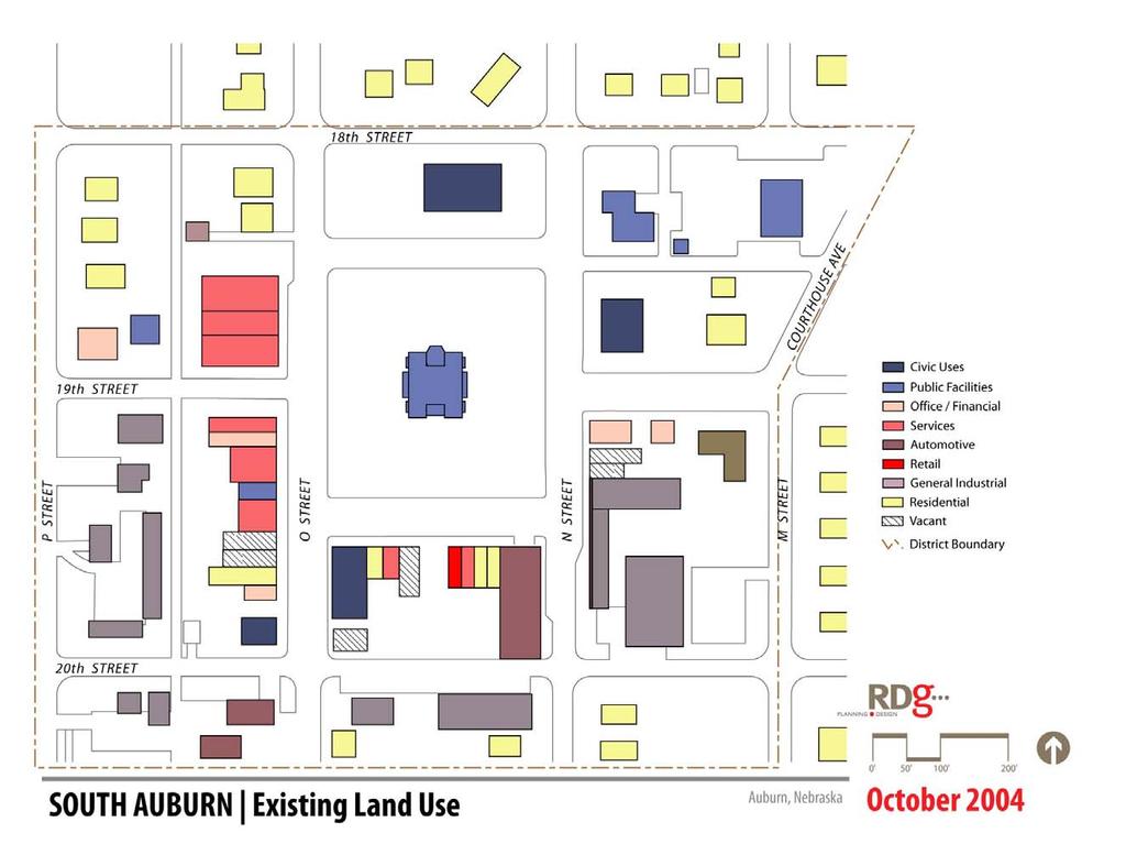
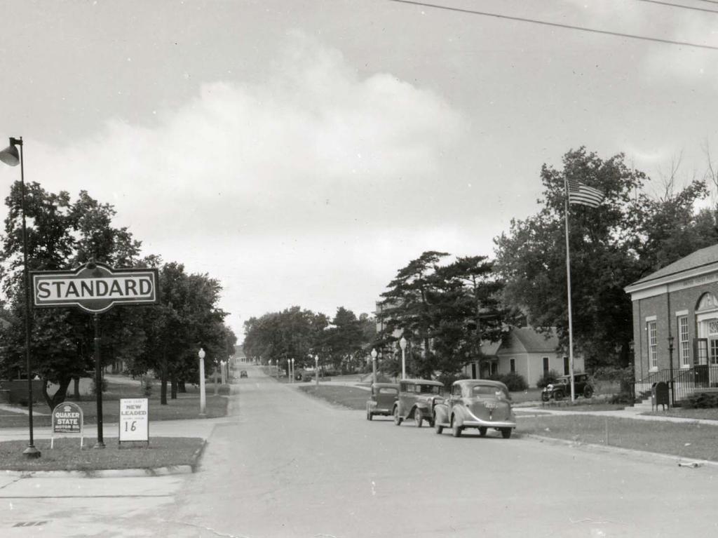
11 Community Systems Historic Significance Source: Nemaha County: Nebraska Historic Buildings Survey, Nebraska State Historical Society, August 2004 Nemaha County Blue - National Registered or Eligible Orange - Contributing Downtown is eligible as a historic district. South Auburn is NOT eligible as a historic district based on a NSHS study prepared in 2004 (pg 31). We respectfully disagree. The Big Picture

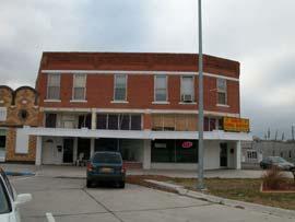
12 Downtown Auburn Public Participation Community Character District Studies Design Vocabulary Community Linkages


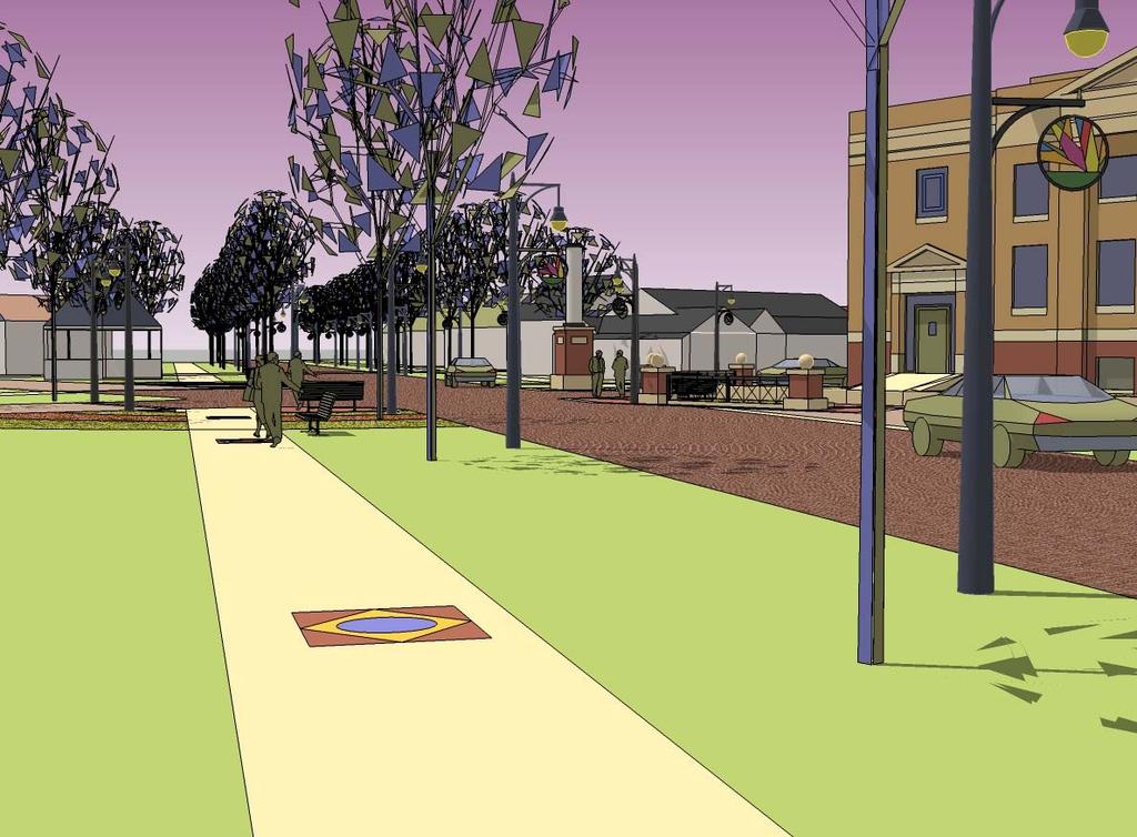
13 Downtown Auburn Land Use Looking South

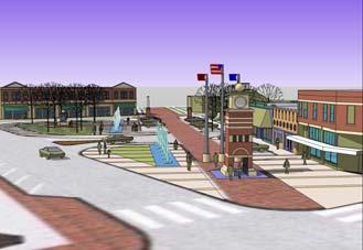
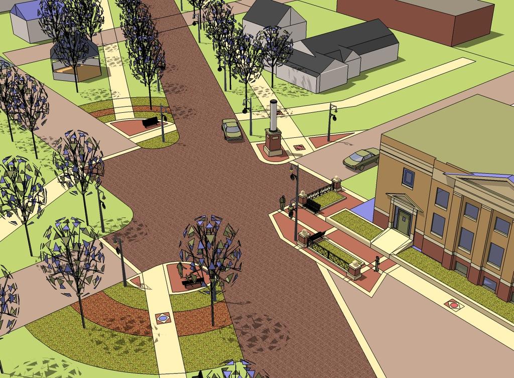
14 Downtown Auburn Development Concept


15 Downtown Auburn Development Concept Opportunity for new mixed use multi-story building. Replace windows Upper-story canopies New Awnings Improved Signage Redesigned parking lots Preserve special or historic signs. New construction opportunity.


16 Downtown Auburn Development Concept New Residential Construction overlooking Legion Memorial Park. Units could be townhouses, condominium or rental apartments, or senior living. Possible underground parking. Redesigned Parking Lot Mid-Block Crossing and Pedestrian alleyway Improve building facades w/ awnings, improved signage, and window treatments. Install appropriate windows in upper-story windows. Install wayfinding signage to parking areas


17 Brick accents along sidewalk. Enhanced crosswalks. Enhanced corner nodes. Placement of sidewalk accents should be sensitive to truck traffic. Install markers along sidewalk, describing local history, people and events of Auburn

18 Downtown Auburn Parking

19 Courthouse Avenue Public Participation Community Character District Studies Design Vocabulary Community Linkages

20 Highway 75 COURTHOUSE AVENUE

21 Street lighting Auto Dealership Building Stock

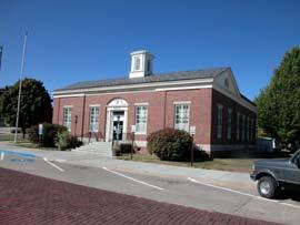
22 Beginning of Brick Pavers Historic Post Office

23 Some tree coverage Undefined parking Overhead Wires Nice clean edge between brick and curb Road in good condition nearly 100 years old

24 3 streets intersecting each other, creating awkward crossings Concrete open space in front of Church of Christ

25 Possible better utilization of triangle Brick street acts as a natural traffic calmer

26 Landmark terminus comes into view Space bleeds to the east because of poor street definition. Improves with tree line as we approach South Auburn.

27 Style of lighting is not consistent with the character of the street.

28 Trees create a canopy over the avenue

29 More concrete open space in front of building (old grocery). Office Building Void corner. 3 streets intersecting each other, creating awkward pedestrian and vehicle crossings.

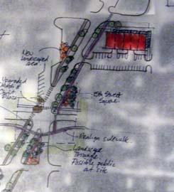
30 Terminus comes into focus.

31 Building leads traveler around the corner House commands the intersection Vacant Lot


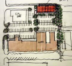
32 Courthouse Avenue Existing Conditions Access Eliminated Courthouse Avenue intersection reconfigured with the reconstruction of Highway 75. H&H Trailers Online Trading Services Carsmart Parking Edward Jones Time Warner Cable China Buffet
33 Courthouse Avenue Existing Proposed Site Redevelopment Major redevelopment Tall 1 story or 2 mixed use building with parking tucked behind.
34 Courthouse Avenue
35 Courthouse Avenue
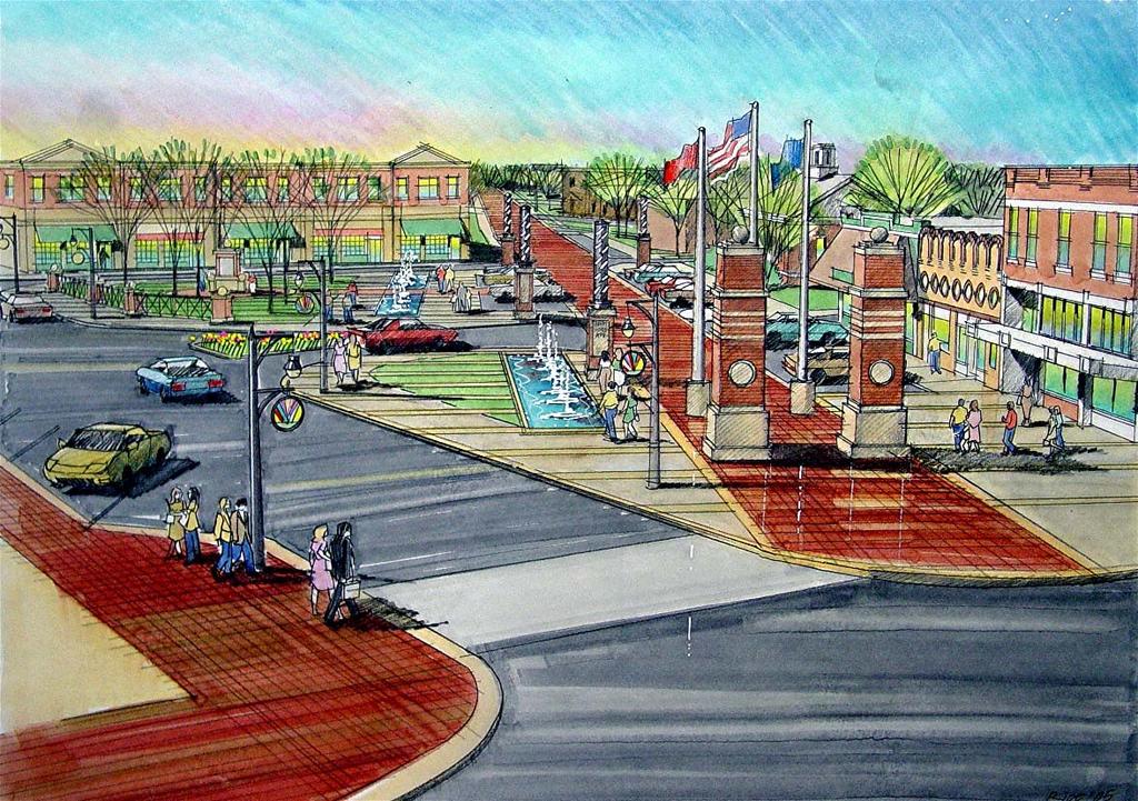
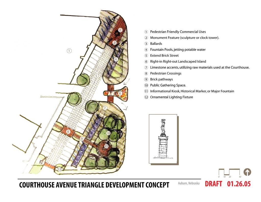
36

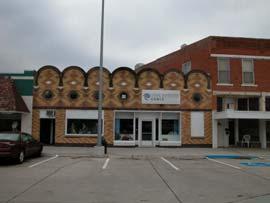
37 Courthouse Avenue Development Concept


38 Courthouse Avenue Church of Christ Plaza Area Plant Trees along Corridor New Civic Use Visitor Center or Chamber Offices 15 th Street Square Potential Redevelopment Site Redesigned Entrance Feature


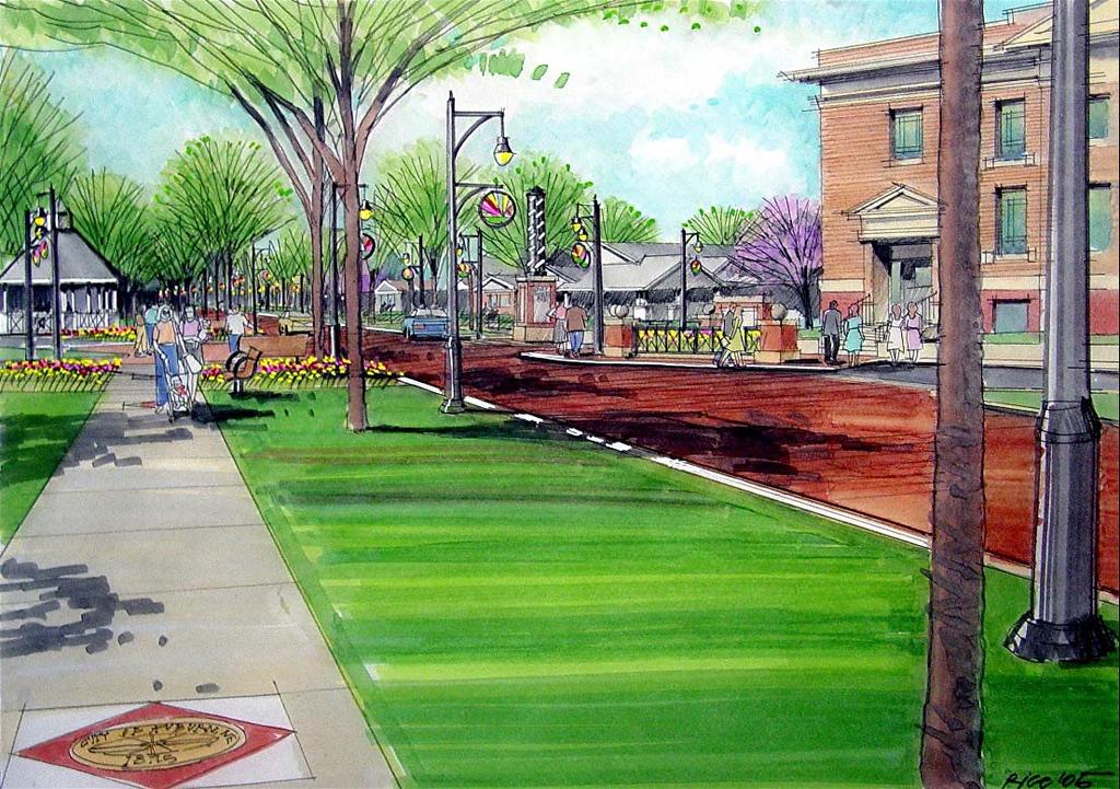
39 Courthouse Avenue Midway Square Plant Trees along Corridor New pedestrian commercial use with outdoor seating. Define Crossings Plant trees along roadway


40 Courthouse Avenue New Gateway Plaza Realign private drive. Public Library Midway Building Install pavers, directing traffic to Courthouse Avenue New single-family residential
41
42 Courthouse Avenue
43 Courthouse Avenue


44 Recommendations for Courthouse Avenue Brick street preservation. Thematic street lighting. Intersection features with street signing. Interpretive graphics. Wayside street furniture. New, accessible sidewalks.

45 South Auburn Public Participation Community Character District Studies Design Vocabulary Community Linkages Red Goose Antiques Serendipity Holly s Hobby Cafe Woodshop Plus Looking North on O Street
46 Existing Conditions

47 South Auburn Development Concept

48 South Auburn Elevation Concepts

49 South Auburn Elevation Concepts

50 South Auburn Elevation Concept


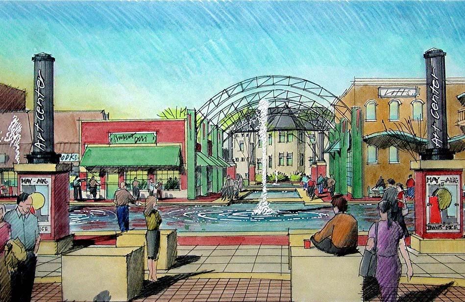
51 South Auburn Concept View looking from Arts Center to Courthouse Major capital improvement project incorporating Fountains and water pathways Public space, Enhanced building facades, and New Arts Center.
52


53 South Auburn Elevation Concepts Looking north along O Street Sidewalk Section Accent Lighting Window signage Awnings Designated Outdoor Seating Area. Awnings & Accent Lighting Das Rheinland in Omaha s Old Market

54 Design Vocabulary Public Participation Community Character District Studies Design Vocabulary Design Vocabulary Community Linkages

55 Existing Lighting Features

56 Existing Pedestrian Features


57 New street name signs and light landmarks Recommended Features Light fixture Street Name Limestone Base


58 Street & Pedestrian Lighting Recommended Features Courthouse Avenue Legion Memorial Park Pedestrian Lighting Down-casting light, reducing ambient light into nearby neighborhood.


.")
59 Recommended Features Art Markers created by Children Sidewalk Medallions Incorporate points of information that educate pedestrians about local history, people, and events (Calvert and Sheridan). Awnings Sidewalk Crossings & Nodes
60
61

62 Community Linkages Public Participation Community Character District Studies Design Vocabulary Community Linkages

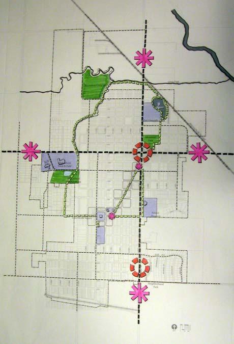
63 Community Linkages Trails and Recreation Connect Major Destinations - Parks - South Auburn - Downtown - Schools and Civic Areas - Neighborhoods Create Loops Build in phases Link to Steamboat Trace Trail Plan also helps Auburn to become eligible for Federal Funds

64 Community Linkages Opportunities Map Pathways Nodes Major Entrances Activity Centers Future Development Areas Trails & Recreation

65 Community Linkages Wayfinding System Wayfinding Locations* Gateways *subject to compliance with MUTCD
66 Tools for Implementation

67 Tools for Implementation Amendment One, which passed in November 2004, allows voters to say if they want the Legislature to adopt laws that would delay or temporarily freeze property tax assessment increases resulting from improvements to an eligible historic property.
68 Tools for Implementation Tax Increment Financing, tied to specific projects and providing financing for public improvements, rehabilitation, and projectrelated expenses. Community Development Block Grants, providing financing for economic development and rehabilitation projects. HOME funds may also be used for projects that provide affordable hhousing. Transportation Enhancements (TE) Funds, providing 80% Federal funding for trails or enhancements to major transportation corridors. Tax Credits, providing Federal tax credits to projects that include historically appropriate reuse of historic properties and/or provide housing for low and moderate-income households.

69 Tools for Implementation Private Philantropy, including legacy giving, to honor people who have built and continue to build Auburn. Foundations, leveraging contributions and investments from major donors with an interest in Auburn and small town Nebraska. Bond Issues or City Financing, recognizing the value of a community investing in its future to increase its overall value. Conceive of the city as a business, investing in its assets like any strong business should.
70
Table of Contents. Elm Avenue Improvement Plan City of Waco, Texas. Introduction 1. Existing Context 1 Figure 1 2.
 Table of Contents Introduction 1 Existing Context 1 Figure 1 2 Plan Guidelines 3 Future Urban Form 4 The West-End 4 Main Street 6 The East-End 7 Figure 2 9 Public Improvement Recommendations 7 General
EXISTING COMPREHENSIVE PLAN
 EXISTING COMPREHENSIVE PLAN Town Center Land Use Element: V. LAND USE POLICIES Town Center Mercer Island's business district vision as described in "Your Mercer Island Citizen-Designed Downtown" was an
Illustration of Eastlake Farmer s Cooperative Grain Elevator. Chapter 5: implementation 5-1
 Illustration of Eastlake Farmer s Cooperative Grain Elevator Chapter 5: implementation 5-1 chapter 5: implementation Introduction The Eastlake Subarea Plan includes a wide range of recommendations intended
Downtown Papillion. Concepts for the Enhancement and Growth of Papillion s Traditional Town Center
 Downtown Papillion Concepts for the Enhancement and Growth of Papillion s Traditional Town Center Developed for the City of Papillion by RDG Planning & Design T raditional downtown districts occupy a particular
TOWN COUNCIL / PLANNING COMMISSION
 Workshop #3 TOWN COUNCIL / PLANNING COMMISSION January 20, 2011 Consultant Team In Attendance Tonight BMS Design Group Nevada City and San Francisco Michael Smiley, AICP, ASLA Partner-in-Charge Nancy L.
Town Center (part of the Comprehensive Plan)
") Town Center (part of the Comprehensive Plan) Mercer Island Town Center Looking North (2014) In 1994, a year-long process culminated in a set of design guidelines and code requirements for the Town Center
Town Center (part of the Comprehensive Plan) Mercer Island Town Center Looking North (2014) In 1994, a year-long process culminated in a set of design guidelines and code requirements for the Town Center
Project Consulting Team:
 THE DOWNTOWN CHERRYVILLE LAND USE + STREETSCAPE MASTER PLAN WAS FUNDED THROUGH THE GENEROUS DONATIONS OF THE FOLLOWING: The Community Foundation of Gaston County ElectriCities of North Carolina The Cherryville
ROBBINSDALE LRT STATION CDI DEVELOPMENT GUIDELINES
 August 2018 OVERVIEW The City of Robbinsdale has a prime-opportunity site in the middle of the 13 mile stretch of the Bottineau LRT corridor / Blue Line extension. Robbinsdale offers a prominent, vital,
Dyersville Downtown Plan. Open House October 24, 2017
 Dyersville Downtown Plan Open House October 24, 2017 What is a Comprehensive Plan? - Vision - Guidance for decisions - Basis for regulations What is a Downtown Plan? - Understand priorities - Identify
Downtown Dubuque...it s a great time.
 Downtown Dubuque...it s a great time. Your timing could not be better to invest in Downtown. With hundreds of millions in public and private investment occurring on the City s downtown waterfront, millions
PLAN ELEMENTS WORKSHOP. April 5, 2016
 PLAN ELEMENTS WORKSHOP April 5, 2016 needs more housing. But there is no one-size fits-all solution. Every neighborhood has its own character. In some places, density is not only appropriate it is badly
South Davis County COMMUNITY SPOTLIGHT
 South Davis County COMMUNITY SPOTLIGHT Davis/SLC Community Connector Bus Rapid Transit line connecting SLC & Davis County RTP Phase 1 Project Generate 3,100 average weekday riders Relieve congestion on
7Page 91 CLEMMONS COMMUNITY COMPASS 7 COMMUNITY CHARACTER
 7 Community Character The beauty of Clemmons won t necessarily be a reflection of our past, but our future. This quote from Comprehensive Plan Steering Committee member Wayne Dodson captures the essence
Study Area. Capitol Way. Greening America s Capitals 11/13/2014. A Greening America s Capitals Project
 Olympia, WA: Greening Capitol Way Supporting Communities move towards sustainability is a priority for the federal government. A Greening America s Capitals Project Office of Sustainable Communities U.S.
Chapter 1: Introduction
 Chapter 1: Introduction The Penn Avenue Community Works Corridor Vision and Implementation Framework presents an integrated communitybased vision and a coordinated, long-term implementation framework for
Carlsbad Village Redevelopment Concept Summary of Features
 Carlsbad Village Redevelopment Concept Summary of Features Calthorpe Associates November 5, 2003 The Redevelopment Concept illustrates a vision for the future of Carlsbad Village. The overall vision of
City of Farmington. Downtown Plan. Amendment to the 1998 Master Plan Adopted October 11, 2004
 City of Farmington Amendment to the 1998 Master Plan Adopted October 11, 2004 Introduction Planning Background 1 Scope and Components of the Plan Amendment 2 Concept Introduction 3 Plan Concepts 3 Conceptual
Status Update (2006 vs. Now) Citizen s Advisory Committee February Plan for Prosperity
 Citizen s Advisory Committee February Plan for Prosperity") Status Update (2006 vs. Now) Citizen s Advisory Committee February 2018 Plan for Prosperity 2000 2017 2000 2017 Gardnerville Population 6,000 5,760 5746 5,500 5,000 5,067 5,550 5,165 5,394 5,412 5,250
Status Update (2006 vs. Now) Citizen s Advisory Committee February 2018 Plan for Prosperity 2000 2017 2000 2017 Gardnerville Population 6,000 5,760 5746 5,500 5,000 5,067 5,550 5,165 5,394 5,412 5,250
Public input has been an important part of the plan development process.
 Lakewood s Comprehensive Plan recognizes that transportation helps shape the community, and that the way the community provides for the safe and efficient movement of people affects the character of the
Small Area Plan. South Gateway
 Small Area Plan Adopted May 12, 2008 South Gateway Purpose. The South Gateway Small Area Plan defines the City s expectations for the future of the southern entrance to the City at Interstate 85 and Highway
Robbinsdale LRT Station. CDI Development Guidelines. August Overview
 Robbinsdale LRT Station August 2018 Overview The City of Robbinsdale may have the coolest opportunity site along the 13 mile stretch of the Bottineau LRT corridor / Blue Line extension. Located a block
Project Goal. RRRC Living Towns Planning Workshp. Town of Halifax Revitalization Project. Dynamic Planning & Management Duo: July 12, 2006
 Project Goal Town of Halifax Revitalization Project RRRC Living Towns Planning Workshp July 12, 2006 Town of Halifax Halifax County *** Revitalization Project Goal*** To create Economic Opportunity and
EXHIBIT A. Tax Increment Reinvestment Zone No. 1 (Town Center) First Amended Project Plan 1
 First Amended Project Plan 1") EXHIBIT A Tax Increment Reinvestment Zone No. 1 (Town Center) First Amended Project Plan 1 1 As amended by Resolution No. 2008-02-001(TR1R) of the Tax Increment Reinvestment Zone No.1, and approved to
EXHIBIT A Tax Increment Reinvestment Zone No. 1 (Town Center) First Amended Project Plan 1 1 As amended by Resolution No. 2008-02-001(TR1R) of the Tax Increment Reinvestment Zone No.1, and approved to
Courthouse Square Planning & Urban Design Study Working Group Meeting #11 September 2, 2014
 Courthouse Square Planning & Urban Design Study Working Group Meeting #11 September 2, 2014 1 Study Area Courthouse Square DRAFT Design Concepts A B C 3 Public Feedback July 23 Workshop & Online Survey
Civic Center District
 Civic Center District The Civic Center district is the civic and social heart of Warrenville, containing such public buildings as the City Hall, Warrenville Public Library, Police Station, Park District
Grantsburg Community Design Team (CDT)
") Grantsburg Community Design Team (CDT) Summary Report Overview On April 10-13, 2014, a team of (19) volunteer planners, design professionals, and community development educators volunteered their time
Grantsburg Community Design Team (CDT) Summary Report Overview On April 10-13, 2014, a team of (19) volunteer planners, design professionals, and community development educators volunteered their time
About Momentum Midland
 About Momentum Midland Achieving a community s full potential in terms of economic development and quality of life is critically important to its long term sustainability. Core to achieving this is a vibrant
Roosevelt Corridor. R e i n v e s t m e n t P l a n. Public Meeting Gilbert Elementary School May 12, :00 pm
 Roosevelt Corridor R e i n v e s t m e n t P l a n Public Meeting Gilbert Elementary School May 12, 2009 6:00 pm Agenda 6:00 6:10 6:25 6:40 6:55 7:00 Opening Comments Councilwoman Jennifer V. Ramos District
Committee Meeting: Downtown Today & Concept Refinement September 11, 2017
 Committee Meeting: Downtown Today & Concept Refinement September 11, 2017 AGENDA 1. Brief Input Update 2. Comprehensive Plan Principles 3. Downtown Today 4. Concept Updates 5. Future Schedule What is a
Figure Example of out door dining in the public right-of-way.
 Section 2 Core Area Goal 2.2.1 To maintain and enhance the character of existing streets in the Downtown Area. Character Figure 2.2.1 Example of out door dining in the public right-of-way. A. Provide street
Lower Merion Commercial Districts Issues and Characteristics Handbook November 2013
 Lower Merion Commercial Districts Issues and Characteristics Handbook November 2013 DRAFT TOWNSHIP-WIDE VISION: To maintain and enhance commercial areas to complement the surrounding high-quality residential
124 Subarea Visions. Vision Plan. A. Nelessen Associates, INC I Visioning I Planning I Urban Design
 Subareas 124 Subarea Visions The next seven sections describe specific recommendations tailored to each subarea. Each subarea is discussed separately except for certain aspects of 95th Street and Antioch
Policies and Code Intent Sections Related to Town Center
 Policies and Code Intent Sections Related to Town Center The Town Center Vision is scattered throughout the Comprehensive Plan, development code and the 1994 Town Center Plan. What follows are sections
Public Meeting Final Recommendations August 8, 2013
 Public Meeting Final Recommendations August 8, 2013 Meeting Agenda 1. Existing Conditions 2. Plan Building Blocks & Process 3. The Plan Policies 4. What we heard 5. Next Steps Existing Conditions Existing
Rio/29 Small Area Plan. Design Plan & Implementation Framework Open House - January 25, 2018
 Rio/29 Small Area Plan Design Plan & Implementation Framework Open House - January 25, 2018 MEETING PURPOSE PRESENTATION 1. Orient to the updated design plans 2. Introduce implementing options 3. Explain
PIKE PINE RENAISSANCE: ACT ONE. October 19, 2017
 PIKE PINE RENAISSANCE: ACT ONE October 19, 2017 WATERFRONT SEATTLE PROGRAM PROJECT INTRODUCTION Pike and Pine streets, between First and Melrose avenues Pedestrian and streetscape improvements Budget:
RESEDA - WEST VAN NUYS COMMUNITY PLAN
 RESEDA - WEST VAN NUYS COMMUNITY PLAN Executive Summary As part of the initial outreach effort, the Department of City Planning hosted two workshops for the Reseda-West Van Nuys Community Plan Area during
Johnson Street Bridge Public Realm Update
 Johnson Street Bridge Public Realm Update August 20, 2015 Background Johnson Street Bridge Replacement Project impacts a diverse range of stakeholders In addition to a new bridge, the project also includes
Preservation Planning
 Protect and Maintain the Historic Character of your Community Beverly, West Virginia Randolph County HLC PROTECT Purpose of all work done in survey and registration is not to only register properties.
Dignowity Hill Neighborhood Plan & Eastside Reinvestment Plan
 Dignowity Hill Neighborhood Plan & Eastside Reinvestment Plan Rebecca Paskos, Senior Planner Neighborhood & Urban Design Division Planning & Community Development Department City of San Antonio (210) 207-7816
TEAM INPUT SUMMARY. Postcard Image?
 DOWNTOWN MAULDIN TEAM PUBLIC INPUT TEAM INPUT SUMMARY Postcard Image? A nice neighborhood The main city center with government buildings Mauldin entry sign, high school, Cultural Center, Sunset Park, Hall
Jewel. Platte. of the. Plattsmouth Main Street Landscape Architecture by HDR
 Jewel of the Platte Plattsmouth Main Street Landscape Architecture by HDR Plattsmouth, Nebraska is a historic community of 6,500 residents located along the west bank of the Missouri River, just south
CHAPTER 7: Transportation, Mobility and Circulation
 AGLE AREA COMMUNITY Plan CHAPTER 7 CHAPTER 7: Transportation, Mobility and Circulation Transportation, Mobility and Circulation The purpose of the Transportation, Mobility and Circulation Chapter is to
7-PARKS, OPEN SPACE & PUBLIC ART
 7-s, Open Space & Public Art 7-PARKS, OPEN SPACE & PUBLIC ART This chapter provides recommendations for the expansion of new parks, plazas and open space that serve the many user groups targeted for downtown.
City Center Specific Plan Amendments And Background Report City of Richmond. PLANNING COMMISION FINAL DRAFT January, 2001
 City Center Specific Plan Amendments And Background Report City of Richmond PLANNING COMMISION FINAL DRAFT January, 2001 TABLE OF CONTENTS Page LIST OF TABLES... LIST OF FIGURES... INDEX... OVERVIEW...
Olde Towne Vision Plan
 Olde Towne Vision Plan Introduction In 2016, the City of Bellevue will complete its move of City offices from Olde Towne Bellevue to its new municipal complex on Wall Street. The City intends to sell its
ESTABLISH AN EFFICIENT TOWN CENTER
 ESTABLISH AN EFFICIENT TOWN CENTER 4 Overview Lisbon residents are proud of the history of Newent and at the same time recognize its current importance as a centralized location for a variety of municipal
City of Plattsburgh DRI: Downtown Streetscapes & Riverfront Access. Downtown Streetscape and Riverfront Access Design
 City of Plattsburgh DRI: Downtown Streetscapes & Riverfront Access Welcome Thank you for coming this evening. Agenda PART I - Project Context The Downtown Revitalization Program Our DRI Projects Other
Roanoke Rapids Streetscape Master Plan. City Council Presentation
 SCHEDULE: Stakeholder Meeting/Kick off November,2016 Master Planning Phase (November March 2017) Public Meeting #1 December 13, 2016 Review Meeting with Key Stakeholders Refine Concepts Based on Input
Downtown Subarea Plan
 Downtown Subarea Plan Downtown Subarea Plan Downtown is the historic heart of the. Charles community. Its traditional Main reet, the Fox River, and civic uses give it a unique prominence and character.
Lehigh Acres Land Development Regulations Community Planning Project
 Lehigh Acres Land Development Regulations Planning Effort Summary In July, 2010 Commissioner Frank Mann invited the Lehigh Acres community to start discussing how to achieve their recently adopted community
4.1.A NORTHWEST QUADRANT MASTER PLAN
 4.1.A NORTHWEST QUADRANT MASTER PLAN (Ordinance 0-16-27, dated October 17, 2016) Goal: Transform the Northwest Quadrant into the cultural centerpiece of Deerfield. Objectives: 1. Maintain the cluster of
Preliminary Subdivision Plan
 Preliminary Subdivision Plan 704-525-8000 Suite 1200 Executive Summary the east huntersville area development plan provides a series of development initiatives and public improvements for land east of
TEMPLE MEDICAL & EDUCATION DISTRICT
 City of Temple, Texas TEMPLE MEDICAL & EDUCATION DISTRICT 1 Description. The City of Temple joined in partnership with key public and private entities to jointly promote education and medical activities
City of Long Beach. creating vibrant and exciting places
 City of Long Beach creating vibrant and exciting places Land Use Element Urban Design Element Overview of the two draft General Plan elements Discuss areas of change Economic goals of the plans Case study
Town of Peru Comprehensive Plan Executive Summary
 Town of Peru Comprehensive Plan Executive Communities that plan grow by choice, not by chance. A plan makes growth thoughtful, understandable, and predictable. A plan shows that a community is managing
Urban Analysis. Downtown Zanesville like any city, has been physically modified through time as it
 Urban Analysis As a part of the consulting team s reconnaissance effort, an urban analysis was performed. Before the future of a place can be envisioned, one must understand the physical characteristics
WELCOME and introduction
 1 WELCOME and introduction Mobility Hub Locations within Burlington STUDY OVERVIEW STUDY OBJECTIVES The City of Burlington is developing four Area Specific Plans, one for each of Burlington s Mobility
WEST LOOP DESIGN GUIDELINES CHECKLIST
 WEST LOOP DESIGN GUIDELINES CHECKLIST Section 1.0 General Strategies 1.1 DESIGN EXCELLENCE: ENCOURAGE HIGH QUALITY AND INNOVATIVE DESIGN OF NEW BUILDINGS WITHIN THE WEST LOOP WITHOUT BEING PRESCRIPTIVE
TO: Denver Planning Board FROM: Analiese Hock, Senior City Planner DATE: March 13, 2018 RE:
 Community Planning and Development Planning Services 201 W. Colfax Ave., Dept. 205 Denver, CO 80202 p: 720.865.2915 f: 720.865.3052 www.denvergov.org/cpd TO: Denver Planning Board FROM: Analiese Hock,
Historic Preservation Element
 Casa Gardens by Carolyn Pelkey Historic Preservation Element Incorporated in 1928, the City of San Clemente was among the first master planned communities in the U.S. built from open grazing land. Before
Fifth and Detroit Street Design May 2017 Capital Improvements Committee. DOWNTOWN Street Design
 1 Fifth and Detroit Street Design May 2017 Capital Improvements Committee Agenda 2 Review Street Configuration Prior Meeting Review Outreach Synopsis Functional Street Design Refinements Curb Edge, Turning
Denver Moves: Transit Task Force
 Insert transit picture Denver Moves: Transit Task Force Meeting #8 October 5, 2017 1. Welcome & Introductions Opening remarks and housekeeping Task Force and audience introductions Upcoming events and
Planning Board Briefing
 Planning Board Briefing Why Now? The Sector Plan Implementation Chapter States: Before Stage 1 begins, the following must occur: Approval of the Sectional Map Amendment. Approval of the Greater Lyttonsville
Metro. Activity Center Design Guidelines. Recommendations For Developing Focused, Mixed-Use Commercial/Residential Centers
 Metro Activity Center Design Guidelines Recommendations For Developing Focused, Mixed-Use Commercial/Residential Centers Metro Activity Centers What is a MAC? Legacy, the adopted guide for the future growth
Draft Memorandum #1: Goals and Vision for Revitalization
 Keizer Revitalization Plan Draft Memorandum #1: Goals and Vision for Revitalization Submitted to: City of Keizer April 12, 2018 (revised) Prepared By: Angelo Planning Group and Otak, Inc. Project No. 17482.A
The Ingersoll Avenue Improvement Plan outlines an ambitious development and physical improvement program for
 THE INGERSOLL AVENUE IMPROVEMENT PLAN CHAPTER 5 IMPLEMENTATION The Ingersoll Avenue Improvement Plan outlines an ambitious development and physical improvement program for the corridor s future. This chapter
City of Le Sueur DOWNTOWN MASTER PLAN Town Hall, September 19, 2018
 City of Le Sueur DOWNTOWN MASTER PLAN Town Hall, September 19, 2018 Presentation Overview 1. Master Plan Findings 2. Implementation Strategies 3. Completed to Date 4. Comments or Questions 01 MASTER PLAN
The Lower SaLuda Greenway
 The Lower SaLuda Greenway InITIaTIve a FLourIShInG Greenway. a hub For economic GrowTh. a ConneCTIon BeTween CoMMunITIeS. In April 2017 the Michael J. Mungo Foundation and Lexington County commissioned
The Vision. Photo provided by The Minervini Group. 46 Vision, Objectives & Strategies
 Vision, Objectives & Strategies The is the public framework and guide for future development of the Grand Traverse Commons. The establishes public polices for infrastructure, the preservation of natural
Potential Green Infrastructure Strategies May 6, 2015 Workshop
 Potential Green Infrastructure Strategies May 6, 2015 Workshop Background The City of Cortland is developing the Tioughnioga Urban Headwaters Green Infrastructure Action Plan with funding from the National
2030 Comprehensive Plan VISION STATEMENT
 RESOURCE DOCUMENT for Steering Committee Meeting #2 July 12, 2017 2030 Comprehensive Plan VISION STATEMENT Steering Committee from 2008 Established the Lauderdale s Vision as: Creating a livable, lovable
Urban Planning and Land Use
 Urban Planning and Land Use 701 North 7 th Street, Room 423 Phone: (913) 573-5750 Kansas City, Kansas 66101 Fax: (913) 573-5796 Email: planninginfo@wycokck.org www.wycokck.org/planning To: From: City Planning
Table L-1 Summary Action Strategy. Action Item Timing Status Responsible Agency
 CHAPTER 4: CIRCULATION ELEMENT ISSUE #1: MAJOR THOROUFARES AND TRANSPORTATION ROUTES A balanced transportation system for Fontana is provided that meets the mobility needs of current and future residents
STREETSCAPE IMPROVEMENTS - RECOMMENDATIONS
 STREETSCAPE IMPROVEMENTS - RECOMMENDATIONS Figure 4.3.1- A map of all of the recommended streetscape improvements. The key component of downtown s public realm, apart from its public spaces, is its street
Community Open House March 26 th, 2018
 Community Open House March 26 th, 2018 Open House Agenda 1. Overview of Planning Process What we heard 2. Future Land Use Policy 3. Priority Growth Areas 4. Plan Elements Making it happen What is a Comprehensive
Tonight s Agenda. 7:45 p.m. Next Steps 8:00 p.m. Close
 Community Workshop #3 January 28, 2016 Team Tonight s Agenda 6:00 p.m. Welcome and Introductions! 6:15 p.m. Draft Specific Plan Overview Project Process Update Vision and Objectives Overview Key Findings
At first Work Session on October 22, At second Work Session on November 19, At third Work Session on December 3, 2015
 At first Work Session on October 22, 2015 Staff Reviewed Infrastructure: Transportation Capacity School Capacity Willett Branch Proposed Staging Language At second Work Session on November 19, 2015 Land
PLACEMAKING & MOBILITY WORKSHOP. January 27, 2016
 PLACEMAKING & MOBILITY WORKSHOP January 27, 2016 Boston needs more housing. But there is no one-size fitsall solution. Every neighborhood has its own character. In some places, density is not only appropriate
Illustrative Development Plan
 Illustrative Development Plan December 7, 005 045 Sansome St., Studio 3 San Francisco, CA 94 Area A - Increase visibility to waterfront and aquatic center from the Embarcadero - Provide streets rather
A. WHAT IS A GENERAL PLAN?
 I. Introduction A. WHAT IS A GENERAL PLAN? A general plan is the planning guideline for the future of a city. It contains goals and policies which regulate urban development, the protection of the natural
VILLAGE & TOWN OF BERGEN: COMPREHENSIVE PLAN
 VILLAGE & TOWN OF BERGEN: COMPREHENSIVE PLAN CPC Public Hearing April 21, 2016 History 1996 Comprehensive Plan Comprehensive Plan Update Committee Consultant (LaBella Associates): December 2014 Residents
BRADENTON RIVERWALK EXPANSION MASTER PLAN
 BRADENTON RIVERWALK EXPANSION MASTER PLAN INTRODUCTION & AGENDA Process Update Community Engagement Summary Center for Active Design (CfAD) Recommendations Context and Existing Conditions Master Plan Alternatives
July 12, Columbus City Council City Hall 90 West Broad Street Columbus, OH RE: I-70/71 Columbus Crossroads Project
 OHIO DEPARTMENT OF TRANSPORTATION DISTRICT 6 400 EAST WILLIAM STREET DELAWARE, OHIO 43015 800.372.7714 Columbus City Council City Hall 90 West Broad Street Columbus, OH 43215-9015 RE: I-70/71 Columbus
Hockessin Community Redevelopment Plan
 Hockessin Community Redevelopment Plan 3.1 Introduction The Community Redevelopment Plan for the Village of Hockessin is the result of the people s vision for a distinct village center that serves as the
MONTGOMERY COUNTY METRO STATION AREA DESIGN CHARRETTE
 MONTGOMERY COUNTY METRO STATION AREA DESIGN CHARRETTE Shady Grove Metro Station Area Charrette Closing Presentation October 25-28, 2000 MONTGOMERY COUNTY, MD M-NCPPC Design Collective, Inc. Architects
LUNDY S LANE COMMUNITY IMPROVEMENT PLAN STUDY
 PUBLIC INFORMATION MEETING #2 October 12, 2016 LUNDY S LANE COMMUNITY IMPROVEMENT PLAN STUDY AGENDA 5:00 to 5:30pm: Open House 5:30 to 6:15pm: Presentation 6:15 to 7:00pm: Individual paced workshop with
Town Center. Block 5 Existing multifamily residential units are expected to remain.
 Area Guidelines Germantown s districts should be developed as distinct communities with unique features that are supported through the guidelines. The guidelines not only help distinguish these districts
Strategies/Actions Priority List
 Strengthening the Creative Sector: Build stronger relationships with, and between, cultural organizations and businesses and increase opportunities for working together to build capacity within organizations.
FUNDING CORRIDOR REVITALIZATION
 FUNDING CORRIDOR REVITALIZATION Integrated corridor planning for the 21 st Century America Planning Association Annual Conference Atlanta, GA April 27, 2014 Mariia Zimmerman, MZ Strategies, LLC mariia@mzstrategies.com
The Urban Core: Downtown Lincoln
 The 'P' Street corridor linking The Urban Core: Downtown Lincoln the Haymarket District to the Antelope Valley Parkway is a place of many possibilities. What are the conditions & attributes that will successfully
Bourne Downtown Site Planning
 Prepared for: The Town of Bourne, MA In Cooperation with: Bourne Financial Development Corporation Prepared by:, Inc. June 24, 2009 Table of Contents Introduction and Summary... 1 Site Existing Conditions...
MOUNTAIN VIEW ELEMENTARY SCHOOL SITE REDEVELOPMENT OPEN HOUSE. MacPherson Room, 10 am 5 pm
 MOUNTAIN VIEW ELEMENTARY SCHOOL SITE REDEVELOPMENT OPEN HOUSE MacPherson Room, 10 am 5 pm MOUNTAIN VIEW SCHOOL SITE REDEVELOPMENT 1 WELCOME TO THE OPEN HOUSE FOR THE MOUNTAIN VIEW SCHOOL SITE WHY WE ARE
Cobb County Design Guidelines Mableton Parkway & Veterans Memorial Highway Community Design Workshop January 12, 2017
 Community Design Workshop January 12, 2017 Agenda Opening Remarks / Introductions Scope of Work Existing Conditions Key Issues / Opportunities VPS Summary Draft Vision & Goal Statement Implementation Concepts
Making Transit Oriented Development Work For Boonton, NJ
 Making Transit Oriented Development Work For Boonton, NJ Bloustein School of Planning and Public Policy Studio Dan Burton Loannie Dao Webster Slater Brandon Williams Ian Watson Maria Laham Nicola Mammes
City of Ennis. Downtown Master Plan Catalyst Projects
 City of Ennis Downtown Master Plan Catalyst Projects Revised Framework Plan REVISED Project Types and Descriptions Project Types A. Visitor Attracting Projects: Projects in this category are intended to
Silver Line CPAM UPDATE. Transportation and Land Use Committee October 14, 2016
 Silver Line CPAM UPDATE Transportation and Land Use Committee October 14, 2016 Purpose Recap Project History and Map Changes Provide Overview of CPAM Components Discuss Transportation Impacts Discuss Fiscal
Sub Area 2: Downtown Overland Park
 Downtown 132 2.12 encompasses over 600 acres and extends between 71st Street and 87 th Street including Downtown Overland Park. The area is home to several individual historic sites and structures, including
A BLUEPRINT FOR BROCKTON A CITY-WIDE COMPREHENSIVE PLAN
 A BLUEPRINT FOR BROCKTON A CITY-WIDE COMPREHENSIVE PLAN Public Meeting October 2016 1 Plan Summary and Discussion Public Meeting May 4 2017 City of Brockton Bill Carpenter, Mayor Department of Planning
Burlington Enhancement Plan
 Burlington Enhancement Plan Community Presenta/on Burlington Residents Association East Tennessee Community Design Center The ETCDC is a non-profit that provides low cost, conceptual architectural and