REVIEW SET ONLY - NOT FOR BIDDING
|
|
|
- Violet Thompson
- 5 years ago
- Views:
Transcription
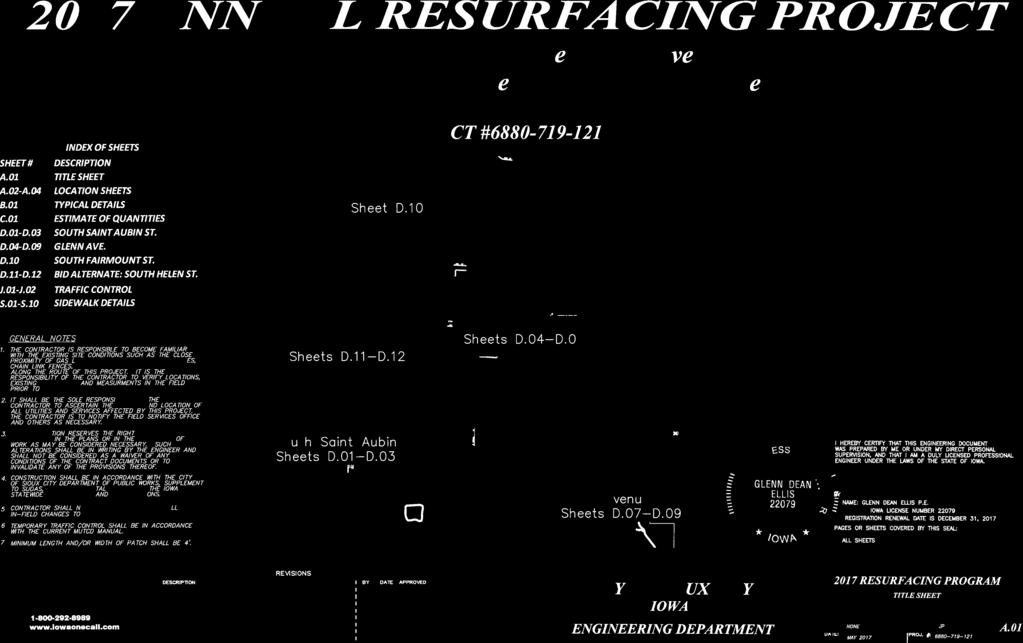
1
2 LOCATION SHEET A.02
3 LOCATION SHEET A.03
4 LOCATION SHEET A.04
5 Grade Break Special Shaping Parking Perpendicular Curb Ramp Slope: 6.25% (target) 8.3% (max) 3 Special Shaping Existing Sidewalk Parallel Curb Ramp (if required) Turning Space 2 Match existing sidewalk cross slope. Cross Slope Transition Segment (where necessary) Curb ramp requirements: 1. Maximum curb ramp slope of 8.3%, or 2. Minimum length of 15'-0" at any constant slope Grade Break 1 Passing area if sidewalk is less than 5'-0" wide. Face of Curb Back of Curb FIGURE Space passing area at 200'-0" (max.) intervals. (Required for new construction) Key Curb Ramp Turning Space Detectable Warning Grass Match pedestrian street crossing slope, or flatter. Minimum 4 feet by 4 feet. Target cross slope of 1.5% with a maximum cross slope of 2.0%. Target cross slope of 1.5% with a maximum cross slope of 2.0%. TYPICAL DETAILS B.01
6 ESTIMATE OF QUANTITIES C.01
7 Driveway Ho#2841 S St Aubin Seger Ave Sergeant Rd S St Aubin St Seger Ave S St Aubin St South Saint Aubin Street (South of Seger Avenue to Meyers Avenue) D.01
8 S St Aubin St Meyers Ave Bushnell Ave S St Aubin St S St A S St Aubin St South Saint Aubin Street (Meyers Avenue to North of Bushnell Avenue) D.02
9 in St S St Aubin St Glenn Ave South Saint Aubin Street (North of Bushnell Avenue to Glenn Avenue) D.03
10 S St Aubin St S Patterson St Glenn Avenue S Royce St S Cleveland St Glenn Avenue S Cleveland St Glenn Avenue (S. St. Aubin Street to S. Cleveland Street) D.04
11 S Cleveland St Glenn Ave S Nicollet St S Hennepin St S Clinton St Glenn Ave S Henry St Glenn Avenue (S. Cleveland St to west of S. Henry Street) D.05
12 S Henry St Lakeport St Glenn Avenue ( S Henry Street) D.06
13 S Palmetto St Glenn Avenue Glenn Avenue S Lemon St Glenn Avenue S Lemon St S Cypress St S Cedar St Glenn Avenue (S. Palmetto Street to S. Cypress Street) D.07
14 S Maple St S Cypress St S Cypress St S Maple St Glenn Avenue Glenn Ave S Olive St Glenn Avenue (S. Cypress Street to east of S. Olive Street) D.08
15 S Magnolia St Glenn Ave S Lyons St Glenn Ave S Oleander St Morningside Ave Glenn Avenue (East of South Olive to Morningside Avenue) D.09
16 South Fairmont Street (Lewis Boulevard to 4th Street) D.10
17 Bid Alternate South Helen Street (Transit Avenue to Laurel Avenue) D.11
18 Bid Alternate South Helen Street (Laurel Avenue to Peters Avenue) D.12
19 GENERAL NOTES - TRAFFIC CONTROL 1. ONLY THE DETOUR FOR THE SOUTH LOOP OF SOUTH FAIRMOUNT STREET ARE SHOWN IN THE TRAFFIC CONTROL PLAN. THE CONTRACTOR IS RESPONSIBLE FOR PROVIDING DETAILED TRAFFIC CONTROL PLANS FOR ANY OTHER STAGES THAT MAY BE REQUIRED. CHANGES TO THE PHASING PLAN MUST BE APPROVED BY THE ENGINEER. 2. TRAFFIC CONTROL ON THIS PROJECT SHALL BE IN ACCORDANCE WITH SPECIFIC LAYOUTS SHOWN ON THESE PLANS. TRAFFIC CONTROL DEVICES, PROCEDURES, AND LAYOUTS SHALL BE PER THE DOT STANDARD ROAD PLANS. 3. ALL TRAFFIC CONTROL DEVICES MUST BE MUTCD COMPLIANT. 4. ALL TRAFFIC CONTROL DEVICES SHALL BE FURNISHED, ERECTED, MAINTAINED, AND REMOVED BY THE CONTRACTOR. 5. ANY TEMPORARY TRAFFIC CONTROL DEVICES REQUIRED BY THE CONTRACTOR SHALL BE INCIDENTAL TO THE TRAFFIC CONTROL BID ITEM. 6. THE CONTRACTOR SHALL COVER ALL CONFLICTING SIGNS. 7. THE CONTRACTOR SHALL COORDINATE TRAFFIC CONTROL WITH OTHER PROJECTS IN THE AREA. 8. CONTRACTOR SHALL SETUP ALL TRAFFIC CONTROL DEVICES IN ACCORDANCE WITH THESE PLANS AND APPLICABLE STANDARD ROAD PLANS PRIOR TO COMMENCEMENT OF WORK ACTIVITIES. ROAD WORK AHEAD LEFT LANE CLOSED AHEAD Traffic Control Details Standard Signs J.01


20 1 6th Street 7 3rd Street HWY th Street 4th Street 3rd Street 2nd Street South Fairmount Street rd Street 2nd Street Traffic Control South Fairmount Street Detour J.02
21 BUSHNELL AVENUE AND GLENN AVENUE SIDEWALK DETAILS S.01
22 S NICOLLET ST AND S HENNEPIN ST SIDEWALK DETAILS S.02
23 S CLINTON ST AND S HENRY ST SIDEWALK DETAILS S.03
24 S PALMETTO STREET AND GLENN AVENUE SIDEWALK DETAILS S.04
25 S LEMON ST SIDEWALK DETAILS S.05
26 S CYPRESS ST AND S MAPLE ST SIDEWALK DETAILS S.06

27 S OLIVE ST AND S MAGNOLIA ST SIDEWALK DETAILS S.07
28 S OLEANDER ST AND S LYON ST SIDEWALK DETAILS S.08
29 LAUREL AVE AND DAVIS AVE SIDEWALK DETAILS S.09
30 S HELEN ST AND GARRETTSON AVE SIDEWALK DETAILS S.10
September 28, 2017 Wentworth Avenue (CR 8) Sidewalk Improvements Open House
 Sidewalk Improvements Open House") TIME Anytime from 5:00 PM to 7:00 PM LOCATION City Hall Council Chambers Learn about the project Speak with project representatives Provide input YOU RE INVITED! September 28, 2017 Wentworth Avenue (CR
TIME Anytime from 5:00 PM to 7:00 PM LOCATION City Hall Council Chambers Learn about the project Speak with project representatives Provide input YOU RE INVITED! September 28, 2017 Wentworth Avenue (CR
Project will Replace: Utilities Curb Pavement Lighting. City of Madison
 Project will Replace: Utilities Curb Pavement Lighting Replace sanitary sewer main & laterals Winnebago: Existing 8 main, 1905 Linden: Existing 6 main, 1915, upsize to 8 main Atwood: Existing 12 main,
Spring 2018 Construction Update
 Spring 2018 Construction Update Ward 3 Southwest Engineering Department Locust Street Bridge over the Des Moines River The Locust Street Bridge over the Des Moines River project is being let through the
Project Status. Construction is underway for Phase 3. Overall Project Area and Schedule. Schedule of Current Construction Phases.
 I-95 Avenue Interchange Project Status Construction is underway for Phase 3. Overall Project Area and Schedule Phase 0: Completed 2010 Section GR0: Completed in Fallin 2010 Phase 2: Completed Section GR2:
CAPITAL GATEWAY CONCEPT PLAN
 CAPITAL GATEWAY CONCEPT PLAN Purpose & Goals of the Concept Plan The Purpose: Develop an urban design strategy Identify recommended infrastructure design elements The Goal: Maximize short- and long-term
Highway 15 Project - Hutchinson
 Highway 15 Project - Hutchinson Agenda What are we going to talk about today? Goals and benefits of the project Details about the proposed work Project schedule and costs Any questions you may have about
2040 Long Range Transportation Plan
 2040 Long Range Transportation Plan Adopted: April 15, 2013 APPENDIX D HIGHWAY NEEDS PLAN PROJECTS FREDERICKSBURG Existing and Committed Projects Fall Hill Avenue/Mary Washington Blvd. (Fredericksburg)
North Loop Paving. December 18th, Street Reconstruction Project. Forrest Hardy, Transportation Planner Minneapolis Public Works
 CITY OF MINNEAPOLIS Street Reconstruction Project December 18th, 2017 Forrest Hardy, Transportation Planner Minneapolis Public Works Forrest.Hardy@MinneapolisMN.Gov (612) 673-5951 Adam Hayow, Project Engineer
Canal Road City Limits (East of Van Dyke Ave) to Saal Road
 to Saal Road") Canal Road City Limits (East of Van Dyke Ave) to Saal Road Construction Update 9/14/2018 The ashalt paving on the southside of Canal Road is expected to start Saturday, September 15 (weather permitting)
Canal Road City Limits (East of Van Dyke Ave) to Saal Road Construction Update 9/14/2018 The ashalt paving on the southside of Canal Road is expected to start Saturday, September 15 (weather permitting)
DRAFT. 10% Common Open Space
 % OF CHARLOTTE IS CATEGORIZED AS A. LAND USES : Placeholder map displaying location of Place Type GOALS: Accommodate XX% of future growth. Provide a concentration of primarily commercial and civic activity
MEMORANDUM. I2 District Downtown Parking Overlay District 24,000 square feet /.55 acres. Industrial Employment District North Loop Small Area Plan
 Department of Community Planning & Economic Development 50 South 4th Street, Room 300 Minneapolis, MN 5545-385 MEMORANDUM To: City Planning Commission, Committee of the Whole Prepared By: Peter Crandall,
ROANOKE STREET IMPROVEMENTS CHRISTIANSBURG, VIRGINIA VDOT PROJECT # U R24 UPC #:
 ROANOKE STREET IMPROVEMENTS CHRISTIANSBURG, VIRGINIA VDOT PROJECT # U000-154-R24 UPC #: 108868 VICINITY MAP This project is to be constructed in accordance with the Virginia Department of Transportation
PennDOT Public Meeting. S.R. 3044, Section A01 Castle Shannon Boulevard Roadway Improvement Project
 PennDOT Public Meeting S.R. 3044, Section A01 Castle Shannon Boulevard Roadway Improvement Project Mt Lebanon Township, Allegheny County Mt Lebanon Township Municipal Building November 6, 2014 1 Project
TOWNSHIP OF HOWELL TOWNSHIP OF HOWELL ENGINEERING PROJECTS STATUS REPORT OCTOBER 19, Resurfacing of Aldrich Road West Contract # 11-06
 TOWNSHIP OF HOWELL DEPARTMENT OF COMMUNITY DEVELOPMENT & LAND USE DIVISION OF ENGINEERING 251 Preventorium Road Phone: (732) 938-4500 x2300 Post Office Box 580 Fax: (732) 919-1080 Howell, NJ 07731-0580
DESIGN CRITERIA PACKAGE
 RFQ: 17-C-00003 DESIGN-BUILD SERVICES FOR THE DESIGN CRITERIA PACKAGE PREPARED BY: JAMES E. JACKSON, JR. AIA CITY ARCHITECT CONTRACT ADMINISTRATION DEPARTMENT and INTERFLOW ENGINEERING, L.L.C DESIGN CRITERIA
Capital Projects impacting Odenton Town Center
 Capital Projects impacting Odenton Town Center 1 2 E549700 W801600/ W801602 Anne Arundel County Department of Public Works Manor View Elementary School Transmission Main - MD 32 @ Meade Phase 2 $34,399,000
4.500 Preston Road Overlay District
 Section 4.500 Preston Road Overlay District 2004 Zoning Ordinance 4.500 Preston Road Overlay District (ZC 98-29; Ordinance No. 98-9-12) 4.501 Purpose To provide appropriate design standards for the use
Welcome. Northern Segment of Hwy 100 I-90 to South of Madison Street Meeting Goals:
 Welcome Northern Segment of Hwy 100 I-90 to South of Madison Street Meeting Goals: - Review Environmental Assessment - Share Preferred Alternative -Receive Public Comments 2003 EA Preferred Alternative
RESIDENTIAL PLANNED UNIT DEVELOPMENT / SUBDIVISION AND REZONING CONCEPT AND DEVELOPMENT STAGE PLAN SUBMITTAL NARRATIVE
 RESIDENTIAL PLANNED UNIT DEVELOPMENT / SUBDIVISION AND REZONING CONCEPT AND DEVELOPMENT STAGE PLAN SUBMITTAL NARRATIVE DEVELOPMENT TEAM DONEGAL SOUTH Maple Grove, Minnesota March 27, 2017 Applicant/Developer/Builder:
SR 483 Clyde Morris Boulevard FDOT District 5
 This project occurs on a 3.0 mile section of SR 483 (Clyde Morris Blvd.) south of Beville Road (SR 400) to north of International Speedway Boulevard (SR 600). Ghyabi is providing project management and
University Park Subdivision Street Assessment Report
 University Park Subdivision Street Assessment Report Prepared for: University Park Subdivision TABLE OF CONTENTS Introduction... 3 Existing Conditions Analysis... 4 Street Improvements... 5 Existing:...
City of Cedar Rapids Public Works Tentative Bid Schedule Issued December 4, 2017 *Subject to Change*
 12/6/2017 3012115-03 Northwood Dr NE, Glass to s/o Brookland $980,000.00 J. 4/16/2018 12/13/2017 3012121-02 O Ave NW, 16th to Ellis $4,065,000.00 Tippe; Lee J. 3/19/2018 Collins Rd NE from E of Northland
Prince William Street Project (Grant Avenue to Wellington Road)
") Prince William Street Project (Grant Avenue to Wellington Road) 1 Goals Improve pedestrian and bike traffic safety Improve street drainage with curb & gutter Upsize water mains Enhance overall street appearance
Prince William Street Project (Grant Avenue to Wellington Road) 1 Goals Improve pedestrian and bike traffic safety Improve street drainage with curb & gutter Upsize water mains Enhance overall street appearance
City of Kearney Capital Improvement Update October 1, TH STREET AND 17TH AVENUE IMPROVEMENTS
 56TH STREET AND 17TH AVENUE IMPROVEMENTS FUNDING: Bonded ESTIMATED COST: $3,885,000 COMPLETION DATE: Fall 2018 SCOPE OF PROJECT: Widening of 56th Street from 6th Avenue to 19th Avenue, and widening 17th
PROPOSED IMPROVEMENTS
 IV. PROPOSED IMPROVEMENTS The proposed improvements for each alternative carried forward are discussed below. A. FUNCTIONAL CLASSIFICATION AND ROADWAY CROSS-SECTIONS The classifications of the roadways
open house 3 CITY OF SALEM Downtown Streetscape Plan
 open house 3 Streetscape concepts CITY OF SALEM Downtown Streetscape Plan analysis concepts we are here refined concepts & document Feb 13th 1 2 3 apr 18th KICKOFF OPEN HOUSE Streetscape Work Group Walking
Errol Heights Park and Community Garden Frequently Asked Questions March 22, 2018
 Errol Heights Park and Community Garden Frequently Asked Questions March 22, 2018 Question 1: What improvements are planned for Errol Heights Park? How will the community be engaged in the process to shape
Expo Line Transit Project. Project Status Update Meeting West End Corridor Segment C
 Exposition Light Rail Transit Project Project Status Update Meeting West End Corridor Segment C Culver City Senior Center November 18, 2010 Phase 1 Project Description Phase 1 from Downtown Los Angeles
I-95 Girard Avenue Interchange Near Neighbors Meeting. Project Status
 I-95 Girard Avenue Interchange Project Status Construction is underway for Phase 1 and 2. Phase 3 construction will begin early 2014. Overall Project Area and Schedule GR0: Completed GR0: Completed in
Old Town Neighborhoods Plan. Choices Event Wednesday, December 9, 2015
 Old Town Neighborhoods Plan Choices Event Wednesday, December 9, 2015 Agenda 6:00 6:10 p.m. Welcome + Sign In 6:10 6:30 p.m. Presentation 6:30 8:00 p.m. Workshop + Open House Seeking your input on: Neighborhood
This Review Is Divided Into Two Phases:
 Semiahmoo Town Centre Review The purpose of this review: To review the Semiahmoo Town Centre Concept Plan, originally approved in 1993, to ensure that this centre will continue to serve the needs of South
Sidewalks Street Lights
 Boston Complete Streets Guidelines 013 Boston Transportation Department Sidewalks Introduction 17 Sidewalk Design Principles 18 Sidewalk Zones 0 Sidewalk Zones Widths Preferred and Minimum Widths for Sidewalk
MISSION STREETSCAPE PLAN. Neighborhood Commercial Streets handle continuous activity. Neighborhood Commercial STREET ROW: Main Design Treatments
 Neighborhood Commercial STREET ROW: 64-80 Main Design Treatments CORNER reduce crossing distance for pedestrians, create entrances to a residential area and slow cars down. help widen sidewalk allocating
PARKLET PROPOSAL PACKAGE & PROCESS
 500.3 I PARKLETS The term parklet refers to a small temporary constructed seating or community gathering area over an on-street parking space or an extension of the sidewalk into the operating State highway
MARINA BAY NEIGHBORHOOD PRESENTATION. City of Richmond Officer Bradley A. Moody Memorial Underpass. April 11, 2012
 MARINA BAY NEIGHBORHOOD PRESENTATION City of Richmond Officer Bradley A. Moody Memorial Underpass April 11, 2012 TEAM INTRODUCTIONS Project Oversight and Approval City of Richmond Formally Richmond Community
Reconstruction Project. Wayzata Task Force Meeting September 3, 2009
 CSAH 101 Reconstruction Project Wayzata Task Force Meeting September 3, 2009 Agenda 700 7:00 Re-Introductions ti 7:05 2008 Activity Recap / 2009 Activities-to-date 7:10 Discussion of Layout Revisions (per
Metro 2010 Pedestrian Symposium Walking into the Future City
 Metro 2010 Pedestrian Symposium Walking into the Future City John Kaliski, AIA, May 12, 2010 How can our transportation and land use policies create complete streets for all users? How do we optimize the
SFMTA PHELAN LOOP AND PUBLIC PLAZA PHELAN OCEAN AVENUE
 SFMTA Municipal Transportation Agency Image: a bus in front of the Palace of the Legion of honor SFMTA PHELAN LOOP AND PUBLIC PLAZA PHELAN AVENUE @ OCEAN AVENUE Community Meeting May 23, 2012 San Francisco,
Taché Promenade Tuesday, October 17, 2017
 Welcome to the Public Information Session for the City of Winnipeg s Taché Promenade Tuesday, October 17, 2017 We want to hear from you. Please participate today by: Viewing the recommended design and
startup. Construction of contractor entrance off University City Blvd connecting to Lot 8 has started.
 Campus Construction Situation Report #6 March 15, 2012 Hechenbleikner Lake Dam No change from previous notice Dewatering maintenance continues. Major construction activity will begin mid April and with
4/8/2015 Item #10D Page 1
 MEETING DATE: April 8, 2015 PREPARED BY: Christy Villa, Associate Civil Engineer DEPT. DIRECTOR: Glenn Pruim DEPARTMENT: Public Works CITY MANAGER: Larry Watt SUBJECT: NORTH COAST HIGHWAY 101 STREETSCAPE
Mississippi Drive Corridor Revitalization. A DestinationTransportation Project...
 Mississippi Drive Corridor Revitalization A DestinationTransportation Project... Mississippi Drive Corridor Revitalization Welcome! Tonight s Agenda: Further define the Scope of the Project Discuss the
4.1 Build Alternative 1 Construction Phasing
 SECTION 4 Implementation Plan This section discusses potential segmentation of the build alternatives into multiple projects for implementation of improvements to the NSH from Rabbit Creek Road to 36th
ARTICLE 13 STREETS General
 ARTICLE 13 STREETS 13.1 General Streets shall be designed to suit their functions. Many streets have purposes other than vehicular traffic. As an alternative to current N.C. Department of Transportation
Capital Projects in and near Odenton Town Center
 Capital Projects in and near Odenton Town Center Map ID Anne Arundel County Department of Public Works This project provides for the design, right of way acquisition, and construction of approximately
ARTICLE 13 STREETS General
 ARTICLE 13 STREETS 13.1 General Streets shall be designed to suit their functions. Many streets have purposes other than vehicular traffic. As an alternative to current N.C. Department of Transportation
This page left intentionally blank.
 July 2012 This page left intentionally blank. Table of Contents Appendix A : Project Development Checklist Appendix B: At-Grade Rail Crossings Appendix C: Maintenance and Operations Examples Appendix D:
P A R K L E T 2016 PILOT PROJECT
 GRAND FORKS, NORTH DAKOTA P A R K L E T 2016 PILOT PROJECT City of Grand Forks Planning & Community Development Department LIVE, LEARN, WORK, PLAY, AND STAY The purpose of the Grand Forks Parklet Application
Cleveland Park Streetscape and Drainage Improvement Project 1
 Cleveland Park Streetscape and Drainage Improvement Project 1 Urban Context Washington, D.C. Connecticut Avenue Cleveland Park Streetscape and Drainage Improvement Project 2 Neighborhood Context Contributing
Potential Green Infrastructure Strategies May 6, 2015 Workshop
 Potential Green Infrastructure Strategies May 6, 2015 Workshop Background The City of Cortland is developing the Tioughnioga Urban Headwaters Green Infrastructure Action Plan with funding from the National
REQUIRED CHECKLIST FOR Better Streets Plan Section 138.1(c)(2)
(2)") REQUIRED CHECKLIST FOR Better Streets Plan Section 138.1(c)(2) Planning Department 1650 Mission Street Suite 400 San Francisco, CA 94103-9425 Pursuant to Planning Code Section 138.1 and Administrative
REQUIRED CHECKLIST FOR Better Streets Plan Section 138.1(c)(2) Planning Department 1650 Mission Street Suite 400 San Francisco, CA 94103-9425 Pursuant to Planning Code Section 138.1 and Administrative
MAIN STREET RECONSTRUCTION PROJECT PRE-CONSTRUCTION PUBLIC INFORMATION SESSION AGENDA
 MAIN STREET RECONSTRUCTION PROJECT PRE-CONSTRUCTION PUBLIC INFORMATION SESSION 7:00 P.M. TO 8:30 P.M. NOVEMBER 21 st, 2017 PENETANGUISHENE MEMORIAL COMMUNITY CENTRE BRIAN ORSER HALL (61 Maria Street) 1.
CITY OF DAVIS DESIGN REVIEW INFORMATION CHECKLIST
 CITY OF DAVIS DESIGN REVIEW INFORMATION CHECKLIST The purpose of a design review is comprehensive site plan and architectural review so as to determine compliance with article 40.31 of the Davis Municipal
Town of Yucca Valley Capital Improvement Projects Report July 24, 2014
 Town of Yucca Valley Capital Improvement Projects Report July 24, 2014 SR 62 Traffic and Pedestrian Improvements from Apache Trail to Palm Avenue (PLHD) The project includes construction of curbs, gutters,
SH 199 Corridor Master Plan. Community Meeting No. 2 May 31, 2017
 Community Meeting No. 2 May 31, 2017 Transportation Projects On or Near SH 199 SH 199 from 0.3 miles south of FM 1886 to south end of Lake Worth bridge Construct freeway mainlanes and frontage roads 10-Year
2017 General Obligation Bond
 2017 General Obligation Bond Presentation of Public and Council Projects to the Transportation & Mobility Stakeholder Committee April 13, 2017 Agenda Deferred Maintenance Project Development Process Projects
Construction Projects Report
 Construction Projects Report Week of September 17 23, 2018 For general inquiries and questions, please contact the Project Management Office at (940) 349 7227 Street/Intersection From To CURRENT PROJECTS
TOWN OF PALM BEACH FOR IMMEDIATE RELEASE. Patricia Strayer, P.E., Town Engineer Phone: ,
 TOWN OF PALM BEACH DATE: October 19, 2017 FOR IMMEDIATE RELEASE MEDIA CONTACT: Patricia Strayer, P.E., Town Engineer Phone: 561-838-5440, Email: pstrayer@townofpalmbeach.com Construction and Traffic Highlights
VALLEY COUNTY MINIMUM STANDARDS FOR PRIVATE ROAD DESIGN AND CONSTRUCTION
 MINIMUM STANDARDS FOR PRIVATE ROAD DESIGN AND CONSTRUCTION Adopted November 28, 2005 TABLE OF CONTENTS DEFINITION OF TERMS...II I. DESIGN CRITERIA... 1 A. GENERAL DESIGN CRITERIA... 1 B. ROADWAY CLASSIFICATION...
Monroe Street Reconstruction. Final Corridor Design Presentation & Open House August 16, 2017
 Monroe Street Reconstruction Final Corridor Design Presentation & Open House August 16, 2017 Thank you to Wingra School! Tonight s Agenda 1. Project Overview 2. Design Proposal & Preparing for Reconstruction
February 17, Sara Ullman Planner I. Sincerley,
 February 17, 2016 Sara Ullman Planner I City of Aurora Planning Department Re: Mrachek Middle School Replacement (#1116704)/Response Initial Submission Review Dear Ms. Ullman, Thank you for your assistance
July 23, 2014 Wilson School. Working Group Meeting #3 Preliminary Site Analysis School Siting Considerations Guiding Principles
 July 23, 2014 Wilson School Working Group Meeting #3 Preliminary Site Analysis School Siting Considerations Guiding Principles Agenda Follow-Up from Meeting #2: WG & community feedback Presentations /
SUBCHAPTER 4-B GUIDELINES FOR THE B-3 COMMERCIAL CHARACTER AREA
 1 SUBCHAPTER 4-B GUIDELINES FOR THE B-3 COMMERCIAL CHARACTER AREA Downtown Bozeman should be the location of buildings of greatest height and intensity in the community. The following guidelines apply
2-B-18-UR. Revised: 3/27/2018
 Revised: 3/27/2018 Revised: 3/27/2018 GI FOR KIDS A MEDICAL OFFICE BLDG. 0000 BOARDWALK BLVD. KNOXVILLE, TENNESSEE CONSTRUCTION PRELIMINARY - NOT FOR Landscape Plan Target Publix Town Center Boulevard
Appendix A. Project Location and Preferred Alternative Figures
 Appendix A Project Location and Preferred Alternative Figures Figure 1: Project Location Map Figure 2A: Preferred Alternative Layout Sheet 1 Figure 2B: Preferred Alternative Layout Sheet 2 Figure 2C: Preferred
IOWA HIGHWAY 57 / WEST 1 ST STREET STUDY PUBLIC INFORMATIONAL MEETING APRIL 22, 2014
 IOWA HIGHWAY 57 / WEST 1 ST STREET STUDY PUBLIC INFORMATIONAL MEETING APRIL 22, 2014 INTRODUCTION The City of Cedar Falls and the Iowa Department of Transportation are conducting a Public Informational
Butchers Hill. Greening Feasibility FINAL REPORT MAY 2009 N PORT ST N WOLFE ST S MADEIRA ST. Submitted To: Submitted By:
 S WOLFE ST N CASTLE ST N WASHINGTON ST S WASHINGTON ST S CHAPEL ST S DURHAM ST S DUNCAN ST N MADEIRA ST N MONTFORD AVE Butchers Hill Greening Feasibility N DUNCAN ST MULLIKIN ST N PORT ST N WOLFE ST E
City of Ketchum P.O. Box East Ave. N. Ketchum, ID 83340
 City of Ketchum P.O. Box 2315 480 East Ave. N. Ketchum, ID 83340 June 10, 2015 Mayor Jonas and City Councilors City of Ketchum Ketchum, Idaho Mayor Jonas and City Councilors: Sidewalk Discussion Introduction/History
EXHIBIT A 2019 FINANCING: PROJECT AUTHORIZATIONS
 EXHIBIT A 2019 FINANCING: PROJECT AUTHORIZATIONS Projects with Prior City Commission Authorization (No Changes) Downtown Canopy PW17B4CIP Prior Authorizing Ordinance: Ordinance No. 9428 Estimated Total
Maplewood Avenue Downtown Complete Street Project
 Maplewood Avenue Downtown Complete Street Project Second Public Meeting January 24, 2018 Welcome and Introduction of Project Team City Planning and Public Works Staff City of Portsmouth Juliet Walker Planning
NorthPoint, Inc. Community-Based Development Concept
 NorthPoint, Inc. Community-Based Development Concept 6.0.01 EXECUTIVE SUMMARY The NorthPoint Community Board Development concept is a community development strategy. It leverages NorthPoint s mission,
III - design standards
 III - design standards The Circulation Classification and Character section of the Design Standards chapter prescribes the types of circulation routes, the location of the circulation routes, the connections
7.5 Impacts on the Section 4(f) Properties
 Properties") constructive use, such as noise, air quality and visual impacts were also assessed. It was determined that this project would not introduce changes of an external nature that would affect the recreational
constructive use, such as noise, air quality and visual impacts were also assessed. It was determined that this project would not introduce changes of an external nature that would affect the recreational
St. Clair Avenue West Area Transportation Master Plan
 1 (Between Keele Street and Old Weston Road) Public Information Centre 1 December 2, 2015 2 Welcome Welcome to the first Public Information Centre for the St. Clair Avenue West Area. The panels will present
Report or technical documentations of the target areas in Siauliai
 WP 4 Energy Supply Report or technical documentations of the target areas in Siauliai 2011.10.27 Summary of the draft version of technical documentation for two target areas Lieporiai park 1.1. Works basis
Proposed FY 2004 TRANSPORTATION CAPITAL PROGRAM New Jersey Department of Transportation Projects
 Carteret Industrial Road 98547 This project will address the upgrade of Carteret Industrial Road. The federal Transportation Equity Act for the 21st Century (TEA-21) provided funding for this project under
Lambeth Main Street Streetscape Improvements
 Lambeth Main Street Streetscape Improvements Open House October 5th, 2017 Agenda 1. Introduction 2. Project Background 3. Context 4. Project Objectives 5. Design Principles & Approach 6. Streetscape Design
INFRASTRUCTURE EXISTING INFRASTRUCTURE A. Circulation B. Signals C. Drainage D. Utilities
 7.01. EXISTING INFRASTRUCTURE A. Circulation B. Signals C. Drainage D. Utilities 7.02. PROPOSED INFRASTRUCTURE A. Overall Concept B. Circulation C. Signals D. Drainage 7.03. INFRASTRUCTURE MAP A. Key Infrastructure
APPENDIX G: TOWN ORDINANCE REVIEW
 APPENDIX G: TOWN ORDINANCE REVIEW TYLin (225740) Woodard & Curran SWMP January 2013 Stormwater LID strategies, ranked for Zoning Bylaw and Site Plan Review Standards Dimensional Requirements Permit the
PROPOSED REDEVELOPMENT OF THE GLEN ABBEY GOLF CLUB. STREETSCAPE DESIGN STUDY (excerpt from the Urban Design Brief) TOWN OF OAKVILLE.
 TOWN OF OAKVILLE.") PROPOSED REDEVELOPMENT OF THE GLEN ABBEY GOLF CLUB STREETSCAPE DESIGN STUDY (excerpt from the Urban Design Brief) TOWN OF OAKVILLE OCTOBER, 2016 for 2.4.2 STREETS Streets are the single largest component
PROPOSED REDEVELOPMENT OF THE GLEN ABBEY GOLF CLUB STREETSCAPE DESIGN STUDY (excerpt from the Urban Design Brief) TOWN OF OAKVILLE OCTOBER, 2016 for 2.4.2 STREETS Streets are the single largest component
Municipality of Anchorage, Alaska Parks & Recreation Department
 Municipality of Anchorage, Alaska Parks & Recreation Department 632 W. 6 th Avenue, Suite 630 P.O. Box 196650 Anchorage, AK 99519 Tel 907-343-4355 URL www.muni.org/departments/parks MEMORANDUM Date: October
Chapter 5: Natural Resources and Environment
 NATURAL RESOURCES AND ENVIRONMENT 5-1 5 Chapter 5: Natural Resources and Environment BACKGROUND AND INTENT Urban expansion represents the greatest risk for the future degradation of existing natural areas,
California Environmental Quality Act (CEQA) Environmental Review Process
 Environmental Review Process") California Environmental Quality Act (CEQA) Environmental Review Process Los Angeles Union Station Forecourt and Esplanade Improvements constitute a Project Los Angeles County Metropolitan Transportation
California Environmental Quality Act (CEQA) Environmental Review Process Los Angeles Union Station Forecourt and Esplanade Improvements constitute a Project Los Angeles County Metropolitan Transportation
Bylaw No. B-03/2011 Adopted by Airdrie City Council February 21, 2012
 COOPER S CROSSING STAGE 4 Neighbourhood Structure Plan City of Airdrie WESTMARK HOLDINGS LTD. Bylaw No. B-03/2011 Adopted by Airdrie City Council February 21, 2012 CONSULTANTS: LAND USE PLANNING: Southwell
COMPLETE GREEN STREET CHECKLIST
 COMPLETE GREEN STREET CHECKLIST This document was developed to dissect the structure of an urban street and explore opportunities to make our streets more complete while also integrating green street strategies.
CITY OF INVER GROVE HEIGHTS A G E N D A CITY COUNCIL WORK SESSION June 3, :00 PM INVER GROVE HEIGHTS CITY HALL COUNCIL CHAMBERS
 CITY OF INVER GROVE HEIGHTS A G E N D A CITY COUNCIL WORK SESSION June 3, 2013 6:00 PM INVER GROVE HEIGHTS CITY HALL COUNCIL CHAMBERS 1. CALL TO ORDER Mayor Tourville 2. RENTAL REGULATIONS 3. FRONT YARD
Kittson Parkway / Watershed Park Parking Lot
 Kittson Parkway / Watershed Park Parking Lot Date Constructed: Summer 2005 Site Location / Description: Kittson Parkway, North Delta, British Columbia. Permeable parking lot adjacent to Watershed Park;
Corridor Vision. 1Pursue Minnehaha-Hiawatha Community Works Project. Mission of Hennepin County Community Works Program
 1Pursue Minnehaha-Hiawatha Community Works Project Minnehaha-Hiawatha Community Works is a project within the Hennepin Community Works (HCW) program. The mission of the HCW program is to enhance how the
STREETSCAPE MANUAL ONLINE TRAINING SESSION 1: Background
 TRAINING SESSION 1: The Urban Design Streetscape Manual is a reference tool developed to help implement City policy and guide the design, construction and maintenance of streetscape improvements in Toronto.
ROME WATERFRONT VILLAGE PROJECT NARRATIVE January 25, 2018
 January 25, 2018 The Rome Waterfront Village project is intended to foster the revitalization of the area between South James Street and Erie Boulevard north of the Erie Canal as well as improve public
The Lincoln Neighborhood Corridor Plan. The LiNC
 October 1, 2014 Planning Commission Study Session The Lincoln Neighborhood Corridor Plan The LiNC Purpose of Tonight s Meeting Introduction to The LiNC Review of Existing Conditions and Community Identified
Grand Rounds History
 Grand Rounds History 1883 Plan for Minneapolis Park System prepared by Landscape Architect Horace W. S. Cleveland. The system of connecting parks and parkways was first called the Grand Rounds by William
Completing the Vision:
 Completing the Vision: North A1A-Lane Reconfiguration TDLC-Transportation Design for Liveable Communities Surf Rd. Redirection of Traffic Phase III Streetscape October 30, 2012 1 Project Overview District
Downtown Redevelopment Project Update
 Downtown Redevelopment Project Update The redevelopment project will begin the week of September 4, 2017. It is anticipated that construction will be approximately 565 days, depending on weather. 7-6-18
See Yellow Highlighted for Major Closures
 Projects Report Week of May 07-13, 2018 Street/Intersection From To CURRENT PROJECTS of Ave. A Maple Eagle 3/19/18 6/30/18 Barbara St. Audra Beverly 5/7/18 5/21/18 Bonnie Brae St. Roselawn West of UPPRR
F. Driveways. Driveways which provide access to off-street parking or loading from public streets shall comply with the following:
 Section 20.945.040 General Design Standards for Surface Parking Areas. A. Review Authority. Parking lot design and drainage shall be subject to review and approval of the City Transportation Manager. B.
Community Response Buchanan Elementary. December 13, 2016
 Community Response Buchanan Elementary December 13, 2016 SITE EVALUATION FOLLOWING INITIAL COMMUNITY INPUT BUCHANAN ELEMENTARY SCHOOL Design Concepts for the new Buchanan Elementary School have been shared
Zoning Ordinance Section 1.100
 4.800 (ZC 98-45; Ordinance No. 98-9-13) 4.801 Purpose To provide appropriate design standards for the development of properties within the State Highway 121 corridor. These standards recognize the significance
CITY OF MINNEAPOLIS. Street Paving History. 8th Avenue North Washington Avenue to 3rdStreet N..creosoted wood block
 8th Avenue North 1913 - Washington Avenue to 3rdStreet N..creosoted wood block 9th Avenue North 1919 - Washington Avenue to 4th Street N..4 brick LEGEND 10th Avenue North 2nd Avenue North 8th Avenue North
Interstate 229 Major Investment Study Exit 9 Benson Rd Sub-Study
 60 th Street N. 60 th Street N. Benson Road Benson Road Interstate 229 Major Investment Study Exit 9 Benson Rd Sub-Study Informational Meeting June 2 nd, 2015 5:00 pm to 6:30 pm 2014 HDR, all rights reserved.