Nearby Features (Water body, T&E Habitat, Wetlands, Noxious Weed):
|
|
|
- Isabella Jennings
- 5 years ago
- Views:
Transcription

1 Variance Request Form Company: Avangrid Renewables Variance: VAR-016 Address: 1125 NW Couch Street, Suite 700 Request No.: Rev 0 City, State, Zip : Portland, OR, Date Submit: 07/07/17 Date Agency Received: Agency Reference No.: Request Prepared by: Kamber McAllister (ICF) Spread/Location (Milepost): N/A Net Acreage Affected: No Additional Alignment Sheet/Sta. No.: Tract No.: N/A Landowner: BLM In or Within 50ft of a Wetland: Yes No Current Land Use/Vegetative Cover: NA Within 50ft of a Water Body: Yes No Nearby Features (Water body, T&E Habitat, Wetlands, Noxious Weed): NA Area, Residence, Cultural Resource Site (distance, etc.): Variance Level: Level 1 Level 2 Level 3 (To Be Assigned by Designated Representative) Variance From: Permit Plan/Procedure Specification Drawing Mitigation Measure Other Detailed Description of Variance: Attachments Yes No Photos? Yes No Variance 16 (VAR-016) is requesting a change in the means for installing underground (UG) collector line under McCain Valley Road (MVR) from boring to trenching in order to utilize the most efficient method and avoid the need for additional areas all while maintaining egress. Boring-and-jacking is specified in Mitigation Measure TRA-1 and in the Project s Traffic Control Plan when installing project components under an existing road. Boring is better suited for installation of the underground collector line under the paved portions of MVR under County jurisdiction, than along the portions of MVR under the BLM s jurisdiction where MVR has already been altered per the projects plans. The proposed trenching method utilizes a PLC trencher, which digs the trench and lays the wire in one pass. A backhoe will dig a starter trench on one side of the road. The trencher will then trench ahead to the centerline of the road at an angle, which allows egress in front of the trencher. Once the trencher has trenched to this point and the wire is installed, the backfill equipment (skid steer, dozer and vibratory trench compactor) will backfill the open trench and egress will be allowed behind the machine. Once the installed section is completely backfilled and egress is provided over the backfilled trench, the trencher will then trench ahead to complete the road crossing. This process should take no longer than 30 minutes for each side of this crossing. Traffic will be slowed in the area where the work is being performed and flaggers will be used to direct traffic. See Attachment B for a diagram of this process. The scenario included in Attachment B is the narrowest of the MVR crossings and a similar set-up will be used for all other crossings. In some locations traffic may be stopped for a short period of time (10 minutes) as the trencher moves across the road and compaction is occurring. In the event of an emergency equipment will be moved and vehicles associated with the emergency situation will be allowed to cross. This change in methodology would take place at the locations previously identified for crossings in the approved plans and the additional locations identified on Attachment A, Figure 1.. Where underground collection line needs to be installed beneath MVR to avoid sensitive resources, trenching using the PLC will install the UG collector line parallel with the road, staying on the road's edge. The trencher's dimensions are 8 feet, 2 inches in width by 45 feet in length and will be installed along one of the road, therefore allowing egress on the opposite side of MVR. This type of trenching takes approximately one hour per 100 linear feet, and would occur at three locations including two sections between J & G and one between A and B (Attachment A, Figure2). Flaggers will be present to direct traffic during work conducted within portions of MVR. All crossings will be conducted so work at a site can be performed in the same day, therefore eliminating any open trenches being left open overnight. Soil and compaction testing will be performed following compaction to ensure a 95% density based on the soil type. Variance Justification: The change in construction method from boring to trenching, as described above, will allow installation to occur within the existing project footprint and maintain egress along MVR. Typically jacking and boring requires approximately two, 50 square foot work areas for staging and spoils, and a sending and a receiving pit on either side of the road at each road crossing (each approximately 20 feet x 30 feet, and approximately 10 feet deep). These areas are not included in the approved engineering. Rather than impacting these additional areas, VAR- 016 proposes a change in construction methodology. The boring-and-jacking method was called out in the mitigation measure to minimize delays on McCain Valley Road associated with trenching. The proposed trenching methods, as described above, will be conducted to keep a portion of the road open for egress and flaggers will be onsite during work within MVR to ensure safety and limit potential delays. In addition, construction personnel will coordinate to limit construction traffic through the portions of MVR where work is occurring within the road. The proposed trenching will occur within the approved disturbance limits will not have any additional impacts to listed species habitat. E-1
2 For Avangrid Renewables Use Only Additional Surveys Required Cultural Survey Yes No Surveyed Corridor Description VAR-016 does not include additional areas beyond the approved disturbance limits and is within the existing survey boundary. No additional surveys were conducted for this variance. Additional Surveys Completed T & E Survey Yes No Yes No Report Document Survey: Sign-Off (as appropriate) Name (print) Approval Signature Conditions (see attached) Avangrid Permit Manager Kristen Goland Yes No Lead Environmental Inspector Talia Haley Yes No Designated Biologist James Hickman N/A Yes No Cultural Resource Specialist Brian Williams N/A Yes No For BLM Project Manager or Compliance Contact Use Only Variance Approved: Variance Denied: Date: Signature: For Compliance Manager and Monitor Use Only Variance Approved: Variance Denied: Date: Signature: Yes No Stipulations: Spread: OPPC Variance Request No.: VARIANCE CONDITIONS Name: Title: Organization: Conditions: E-2
3 Name: Title: Organization: Conditions: Name: Title: Organization: Conditions: E-3
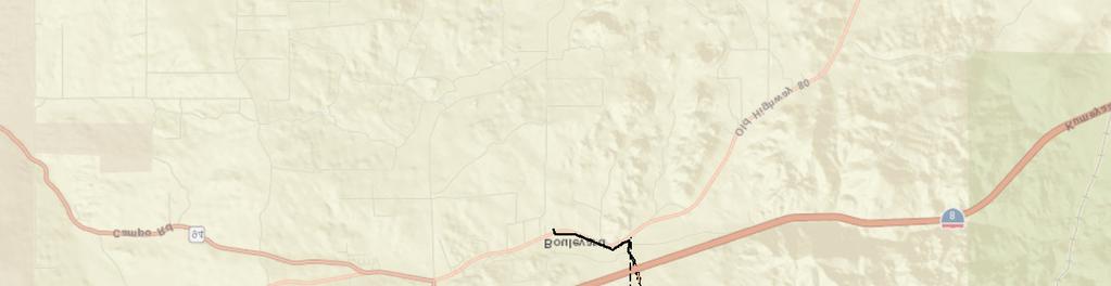
4 Attachment A Figures
5 7699 Anagram Drive, Eden Prairie, MN Phone (952) Toll Free (888)
6 7699 Anagram Drive, Eden Prairie, MN Phone (952) Toll Free (888)


7 7699 Anagram Drive, Eden Prairie, MN Phone (952) Toll Free (888)

, Esri Korea, Esri (Thailand),")


8 Figure 2 Sheet 1 Figure 2 Sheet 2 Service Layer Credits: Sources: Esri, HERE, DeLorme, USGS, Intermap, INCREMENT P, NRCan, Esri Japan, METI, Esri China (Hong Kong), Esri Korea, Esri (Thailand), K:\San Diego\projects\Iberdrola\00567_15_TuleWind\analyses\ _MVR_Trenching\Tule_Trenching_Bio_Detail.mxd 6/29/ Legend Approved Engineering Access Road Approved Project Engineering Footprint Overhead Collection Staging Areas Overhead Transmission Revised Engineering UGC Trenching In Road Source: ICF; Avangrid (2017); Imagery (2008). 0 4,500 9,000 Feet ± Figure 2 Index UGC Trenching in McCain Valley Road Tule Wind Project


 Coast Horned Lizard Silvery Legless Lizard Jacumba")
9 Ro ad f A A-2 1 f f A-1 f b BLM f CC b b tclow BLM JD 33a f JD 34 MBS f JD 33b d d JD 33b-culvert JD 33c JD 32a-culvert Service Layer Credits: Sources: Esri, HERE, DeLorme, USGS, Intermap, INCREMENT P, NRCan, Esri Japan, METI, Esri China (Hong Kong), Esri Korea, Esri (Thailand), oad yr alle in V BLM Legend Parcels Approved Engineering! J HJ J K:\San Diego\projects\Iberdrola\00567_15_TuleWind\analyses\ _MVR_Trenching\Tule_Trenching_Bio_Detail.mxd 6/29/ JD 32a JD 32b Ca Mc BLM Habitat Big Sagebrush Scrub Access Road Chamise Chaparral Approved Project Engineering Footprint Dense Coast Live Oak Woodland Overhead Collection Disturbed Habitat Turbines Montane Buckwheat Scrub Staging Areas Open Coast Live Oak Woodland Revised Engineering UGC Trenching In Road Biological Resources Project Survey Area JD 190-culvwrt JD 190 Scrub Oak Chaparral f Semi Desert Chaparral Upper Sonoran Subshrub Scrub JD 134 Jurisdictional Waters Sensitive Species (2017) Coast Horned Lizard Silvery Legless Lizard Jacumba milkvetch Source: ICF; Avangrid (2017); Imagery (2008). 0 f 350 ± 700 Feet Figure 2 Sheet 1 UGC Trenching in McCain Valley Road Tule Wind Project

, 68 67 K:\San Diego\projects\Iberdrola\00567_15_TuleWind\analyses\20170629_MVR_Trenching\Tule_Trenching_Bio_Detail.")
; Imagery (2008).")


10 JD 247a JD 247b County JD 144 JD 143 CLOW JD 142 BLM JD 91c JD 98 JD 97 JD 254 JD 99 JD 96 JD 95a JD 145 CC JD 91d CLOW JD JD 145a JD 94c BLM JD 91e JD 94d JD 250 JD 83i 64 d JD 91a JD 91a-culvert JD 92b JD 252 JD 251 D ad A Ro JD 146 JD 93a d McCain JD 93b Valley R oad JD 95b-culvert JD 94b JD 95c JD 83o JD 91f BLM d JD 83J Credits: Sources: Esri, HERE, 66 DeLorme, USGS, Intermap, INCREMENT P, NRCan, Esri Japan, METI, Esri China (Hong JD 256 Kong), Esri Korea, Esri (Thailand), K:\San Diego\projects\Iberdrola\00567_15_TuleWind\analyses\ _MVR_Trenching\Tule_Trenching_Bio_Detail.mxd 6/29/ d JD 257 Parcels Access Road Dense Coast Live Oak Woodland Collection Structure Disturbed Habitat Jurisdictional Waters Jacumba milkvetch Upper Sonoran Subshrub Scrub tclow CC JD 129a Source: ICF; Avangrid (2017); Imagery (2008). JD 129b JD 103 JD 103a JD 131 JD 83s County JD 83l Un-Vegetated Channel JD 258 Red Diamond Rattlesnake 2 Southern North Slope Chaparral CC Sensitive Species (2017) JD 104b Southern Riparian Woodland d Scrub Oak Chaparral Semi Desert Chaparral MBS JD 269 Redshank Chaparral f Open Coast Live Oak Woodland UGC Trenching In Road Wash Area JD 130b d JD 104c JD 106d JD 129 tclow JD 129c 0 JD 105b 3 ± Parking d JD 102a-cul JD 102c JD 95e JD 130 Montane Buckwheat Scrub JD 130a Non Native Grass Project Survey Area CC Granitic Southern Mixed Chaparral Transmission Structure geraea Sticky JD 83r Field d Pasture / Agriculture Overhead Transmission ESA Batch Plant Approved Project Engineering Footprint Biological Resources Y X MBSChaparral Chamise Revised Engineering SNSC JD 102b SNSC Staging Areas CC SNSC Construction Office Big Sagebrush Scrub Overhead Collection Habitat O&M Building JD 83k MBS Approved Engineering 1 Legend JD 101c d d JD 101a-culvert JD 101a JD 101b JD 83q JD 100a Substation Sub Bay 69 SNSC JD 83p JD 149 d Service Layer JD 255 JD d d d JD 95b JD 94a-culvert JD 148 JD 147 JD 92a JD 92a-culvert JD 94a JD 91b JD 253 JD 95d 63 JD 83h Road AB JD 83g Feet Figure 2 Sheet 2 UGC Trenching in McCain Valley Road Tule Wind Project
11 Attachment B Trenching Process Diagrams
12 7699 Anagram Drive, Eden Prairie, MN Phone (952) Toll Free (888)
13 7699 Anagram Drive, Eden Prairie, MN Phone (952) Toll Free (888)
14 7699 Anagram Drive, Eden Prairie, MN Phone (952) Toll Free (888)
15 7699 Anagram Drive, Eden Prairie, MN Phone (952) Toll Free (888)


16


17
Information for File # MHK
 Information for File #2014-03555-MHK Applicant: Corps Contact: Wimmer Communities Marie Kopka Address: 250 N. Sunnyslope Road, Suite 296 Brookfield, Wisconsin 53005 E-Mail: Marie.H.Kopka@usace.army.mil
JOINT PUBLIC NOTICE. 26 June United States Army Corps of Engineers State of Louisiana
 JOINT PUBLIC NOTICE 26 June 2017 United States Army Corps of Engineers State of Louisiana New Orleans District Department of Environmental Quality Regulatory Branch Office of Environmental Services 7400
Towne Park Estates Subdivision Phase II
 Towne Park Estates Subdivision Phase II ENVIRONMENTAL NARRATIVE October 21, 2014 Submitted to: Submitted by: Horner Environmental Professionals, Inc. 4252 Hay Road Lutz, Florida 33559 HEP TOWNE PARK ESTATES
CITY OF VACAVILLE PLANNING COMMISSION Item No. 8.A STAFF REPORT July 18, 2016 STAFF CONTACT: Amy Feagans, Contract Planner (707)
") CITY OF VACAVILLE PLANNING COMMISSION Item No. 8.A STAFF REPORT July 18, 2016 STAFF CONTACT: Amy Feagans, Contract Planner (707) 449-5140 TITLE: THE FARM AT ALAMO CREEK ENVIRONMENTAL IMPACT REPORT (EIR)
CITY OF VACAVILLE PLANNING COMMISSION Item No. 8.A STAFF REPORT July 18, 2016 STAFF CONTACT: Amy Feagans, Contract Planner (707) 449-5140 TITLE: THE FARM AT ALAMO CREEK ENVIRONMENTAL IMPACT REPORT (EIR)
water resource specialists
 Vaughn Collins, PE, CFM, Northwest Hydraulic Consultants Brad Livingston, Oregon Department of Transportation Melissa Reich, North Coast Land Conservancy Location Necanicum River 75 sq mi watershed Active
.404 acres (approximately 17,600 square feet) Existing Zoning
 Existing Zoning") COMMUNITY DEVELOPMENT DEPARTMENT Planning and Zoning Division 1725 Reynolds Street, Suite 200, Brunswick, GA 31520 Phone: 912-554-7428/Fax: 1-888-252-3726 BOARD OF COMMISSIONERS STAFF REPORT October 25,
COMMUNITY DEVELOPMENT DEPARTMENT Planning and Zoning Division 1725 Reynolds Street, Suite 200, Brunswick, GA 31520 Phone: 912-554-7428/Fax: 1-888-252-3726 BOARD OF COMMISSIONERS STAFF REPORT October 25,
Legend. Miles. Fence Removal Location Map for Powdermill 2 and 3. Powdermill Rehab 3 Powdermill Rehab 2 PGC_Roads SGL_Boundary
 ¹ Fence Removal N40.3580 W79.0374 Fence Removal Location Map for Powdermill 2 and 3 SGL 042 Compartment: 2 Cover Stand: 46, 68 Westmoreland County St. Clair Township Hipchain Perimeter 8990 Ft. 42 acres
Option 7A Alignment Map. 100-year Floodplain with or without Project
 1-year Floodplain with or without Project New 1-year Floodplain with Project 1-year Floodplain Removed with Project i.e., Benefitted Area) Option 7A Alignment increment P 37ft Corp., GEBCO, USGS,Town FAO,
WELCOME! Four Corners and Upper Rio Grande Vulnerability Assessment Webinar Series
 WELCOME! Four Corners and Upper Rio Grande Vulnerability Assessment Webinar Series Phone audio: Dial: 866-620-8138; Passcode: 5952203# Mute your phone and turn off computer speakers (prevents echo issue).
III. PROJECT DESCRIPTION
 III. PROJECT DESCRIPTION A. PROJECT LOCATION Regional Setting The project site is located in the southeast quadrant of the City of Chico in Butte County, California and is comprised of four parcels totaling
Wallace Country Acreage
 Wallace Country Acreage A stunning brick home surrounded by beautiful landscaping and picturesque views of the Nebraska plains Email: Jordan@lashleyland.com Property Highlights List Price $500,000 Location
Figure 1. Project Vicinity and Context
 SPK-2003-00670 PN: Figure 1. Vicinity Map Figure 1. Project Vicinity and Context COUNTRY ACRES LN SYMPHONY AVE LOCUST RD LN Y LEW R H O A M RT O N LN PV 19 Phase 1 Development LN PV 19 Phase 1 Backbone
1 foot of Sea Level Rise
 1 foot of Sea Level Rise Schools Fire Stations Law Enforcement Assisted Living Hospitals 1ft SLR 0 0.35 0.7 1.4 Miles Year 20 Poplation: the 2013 stdy A Geological Perspective U.S. Mid-Atlantic Coast a
Site Plan Review Residential Accessory Building
 COMMUNITY DEVELOPMENT DEPARTMENT Planning Division P.O. Box 490 333 Broadalbin Street SW Albany, OR 97321 Phone (541) 917-7550 Fax (541) 917-7598 www.cityofalbany.net Site Plan Review Residential Accessory
Gloucester County PLAN SUBMITTER'S CHECKLIST
 Page 1 of 9 Gloucester County PLAN SUBMITTER'S CHECKLIST FOR EROSION AND SEDIMENT CONTROL PLANS Please fill in all blanks and please reference the plan sheets/pages where the information may be found,
Methods, approaches, and procedures to minimize active agricultural land impacts during pipeline construction, surface restoration, and pipeline
 Agricultural Impact Minimization Plan Methods, approaches, and procedures to minimize active agricultural land impacts during pipeline construction, surface restoration, and pipeline operation. PennEast
Coast & Creek Cleanup Cordelia American Canyon Creek
 Rodriguez High School Oakbrook Dr. & Silverado Dr. G:\EnvironmentalComplaince\..\SiteMap_LowerUnionCreek.mxd Cordelia American Canyon Creek Scandia Dan Wilson Creek Subway End of Lookout Hill Rd. off Central
Piles, Trenching, Inverters, Cables, Material Deliveries
 Agricultural Inspection Report General Information Project Name Albany Date of Inspection 20161012 Start/End Time 7:50 am Inspector s Name(s) Inspector s Title(s) Describe present phase of construction
In November and December, SACOG staff conducted the following Blueprint Implementation land use activities:
 SACOG Board of Directors Item #18-1-16 Receive & File January 11, 2018 Blueprint Implementation Activities The purpose of this item is to regularly inform the Board of SACOG land use related activities
January 8, Sean Fairfield Odell Wind Farm, LLC C/o Algonquin Power Co. 354 Davis Road Oakville, Ontario L6J 2X1 Canada
 engineering planning environmental construction 71 Xenia Avenue South Suite 3 Minneapolis, MN 55416 Tel: 763-541-48 Fax: 763-541-17 January 8, 215 Sean Fairfield Odell Wind Farm, LLC C/o Algonquin Power
Information for File MVP MMJ; CSAH 10 Reconstruction (Waconia and Watertown Townships)
") Information for File MVP-2014-03830-MMJ; Reconstruction (Waconia and Watertown Townships) Applicant: Carver County Corps Contact: Melissa Jenny Address: 180 Fifth Street East, Suite 700, St. Paul, MN 55101
Information for File MVP-2014-03830-MMJ; Reconstruction (Waconia and Watertown Townships) Applicant: Carver County Corps Contact: Melissa Jenny Address: 180 Fifth Street East, Suite 700, St. Paul, MN 55101
Request for an Exception to the Napa County Road and Street Standards
 F Request for an Exception to the Napa County Road and Street Standards Shed Creek Winery Use Permit P16-327 and Use Permit Exception to the Conservation Regulations P17-178 Planning Commission Hearing
STREAM BUFFERS
 88-415 STREAM BUFFERS 88-415-01 PURPOSE In the Kansas City region and throughout the nation, vegetated stream buffers have been clearly shown to protect stream stability and related infrastructure, improve
Drainage Analysis-Newgate/Phelps & Hatchett Hill Road Areas Rev. 0 Erosion & Sediment Control Measures
 Drainage Analysis-Newgate/Phelps & Hatchett Hill Road Areas Rev. 0 Erosion & Sediment Control Measures 4.0 EROSION & SEDIMENT CONTROL MEASURES After performing the analysis summarized above, Burns & McDonnell
CHINO HILLS CHINO HILLS. September 6, 2012 OPEN SPACE MANAGEMENT PLAN
 September 6, 2012 Welcome! Today s Agenda Introduction Purpose and Scope of the Open Space Management Plan Where Have We Been? Presentation of Preliminary Findings Exercise: Issue identification and Priority
I Figure 1. Site Location Map
 ^_ 23 115 Miles Figure 1. Site Location Map Mayo P Project Location Date: 7/23/218 1 2 Miles Sources: Esri, HERE, DeLorme, USGS, ntermap, increment P Corp., NRCAN, Esri Japan, MET, Esri China (Hong Kong),
Huntington Stormwater Utility
 Huntington Stormwater Utility Stormwater Management & Sediment and Erosion Control Requirements for Construction Sites Authorized by Huntington City Code Articles: 971, 970, 930, 935, 955, Revised April
Northern Branch Corridor SDEIS March 2017
 Northern Branch Corridor SDEIS March 2017 15. 15.1. Chapter Overview 15.1.1. Introduction This chapter discusses changes to the Preferred Alternative resulting in the potential for project improvements
PLAN SUBMITTER'S CHECKLIST
 Page 1 of 8 PLAN SUBMITTER'S CHECKLIST FOR EROSION AND SEDIMENT CONTROL PLANS Please fill in all blanks and reference the plan sheets/pages where the information may be found, where appropriate, or write
Methods, approaches, and procedures to minimize active agricultural land impacts during pipeline construction, surface restoration, and pipeline
 Agricultural Impact Minimization Plan Methods, approaches, and procedures to minimize active agricultural land impacts during pipeline construction, surface restoration, and pipeline operation. PennEast
LATEST EDITIONS OF THE FOLLOWING: 1. INTERNATIONAL BUILDING CODE (2012 EDITION) 2. INTERNATIONAL CODE COUNCIL 3. ANSI/TIA/EIA-222-G
 2. INTERNATIONAL CODE COUNCIL 3. ANSI/TIA/EIA-222-G") SITE PROJECT DESCRIPTION: TOWER TYPE: SITE ADDRESS: (E9 ADDRESS TBD) ZONING JURISDICTION: PARCEL NUMBER: AREA OF : ZONING: LEGAL DESCRIPTION: FACILITY 65' MONOPINE CITY OF FORT COLLINS 9722-6-004 600 ±
SITE PROJECT DESCRIPTION: TOWER TYPE: SITE ADDRESS: (E9 ADDRESS TBD) ZONING JURISDICTION: PARCEL NUMBER: AREA OF : ZONING: LEGAL DESCRIPTION: FACILITY 65' MONOPINE CITY OF FORT COLLINS 9722-6-004 600 ±
NOTICE OF PREPARATION
 NOTICE OF PREPARATION DATE: January 6, 2016 TO: LEAD AGENCY: Responsible Agencies, Organizations, and Interested Parties Contact: Tyler Barrington, Principal Planner Planning Department Community Development
Environmental Protection Ordinances (Performance Zoning) Bedminster Township, Bucks County
 Bedminster Township, Bucks County") Environmental Protection Ordinances (Performance Zoning) Bedminster Township, Bucks County ARTICLE VI. PERFORMANCE STANDARDS Section 600 Compliance All uses, activities, subdivisions and/or land developments
Environmental Protection Ordinances (Performance Zoning) Bedminster Township, Bucks County ARTICLE VI. PERFORMANCE STANDARDS Section 600 Compliance All uses, activities, subdivisions and/or land developments
SANTA CRUZ COUNTY REGULATORY IMPEDIMENT GAP ANALYSIS TOOL
 SANTA CRUZ COUNTY REGULATORY IMPEDIMENT GAP ANALYSIS TOOL BENCHMARK/OBJECTIVE Street Width Is the minimum pavement width allowed for streets in low density residential developments that have less than
ZANDER ASSOCIATES Environmental Consultants
 ZANDER ASSOCIATES Environmental Consultants June 23, 2011 Massy Mehdipour 1425 Dana Ave. Palo Alto, CA 94301 Supplemental Biological Resource Assessment 1170 Signal Hill Road Pebble Beach, Monterey County,
WILLIAM STREET STORM SEWER OUTFALL. PUBLIC INFORMATION CENTRE March 23, 2017
 WILLIAM STREET STORM SEWER OUTFALL Municipal Class Environmental Assessment PUBLIC INFORMATION CENTRE March 23, 2017 ACCESSIBILITY Under the Accessibility Standards 2015 for Customer Service Regulation
March 30, Mr. David Singer Environmental Planner CDOT Region S. Holly Street, Room 200 Denver, Colorado 80222
 March 30, 2011 Mr. David Singer Environmental Planner CDOT Region 6 2000 S. Holly Street, Room 200 Denver, Colorado 80222 Subject: Biological Resources Summary for the Proposed Colorado Center Bicycle/Pedestrian
A. Regional Detention Requirements
 I. GENERAL DESIGN GUIDELINES A. Full-spectrum detention is provided for all new development, redevelopment or expansion of a site to provide for water quality and flood control detention. B. Detention
Working Group Meeting
 April 4,, 2017 Parks Operations Bldg Working Group Meeting Arts Districts Overview Stormwater/RPA/Stream Considerations First Principles Agenda 7:00pm 7:05pm 7:10pm 7:40pm 8:30pm 9:40pm 9:45pm Welcome
Carolina North Individual Permit Application September 2010 Draft
 Carolina North Individual Permit Application September 2010 Draft Appendix C Jurisdictional Streams, Wetlands, and Buffer Impacts Figures (C- 1 through C-17) C-1 Sheet Index: Impacts within and Outside
Stormwater Standards. Clackamas County Service District No. 1. Planting Guide for Buffers
 Stormwater Standards Clackamas County Service District No. 1 APPENDIX B Planting Guide for Buffers Table of Contents Appendix B - Planting Guide for Buffers... Page B.1 General... 1 B.1.1 Introduction...
ARROYO PROJECTS ADOPTED CAPITAL IMPROVEMENT PROGRAM BUDGET
 A RROYO P ROJECTS ADOPTED CAPITAL IMPROVEMENT PROGRAM BUDGET FISCAL YEARS 214-218 HAHAMONGNA Priority Description 1 Hahamongna Watershed Park - Implement Master Plan 211,6 211,6 (77565) 2 Hahamongna -
Notice of Preparation and Notice of Public Scoping Meeting. At Dublin Project
 Notice of Preparation and Notice of Public Scoping Meeting Date January 17, 2018 To Project Title Project Application Number Project Location Project Applicant Contact For questions or submitting comments.
Non-Metallic Mining Reclamation Checklist
 Eau Claire County DEPARTMENT OF PLANNING AND DEVELOPMENT Eau Claire County Courthouse, Rm. 1510 721 Oxford Avenue Eau Claire, Wisconsin 54703-5481 (715) 839-4741 f Housing & Community Development 839-6240
NOTICE OF PREPARATION OF A DRAFT ENVIRONMENTAL IMPACT REPORT
 NOTICE OF PREPARATION OF A DRAFT ENVIRONMENTAL IMPACT REPORT TO: SUBJECT: Interested Parties Notice of Preparation of a Draft Environmental Impact Report for the Marywood Residential Development project.
Response to Comments (July 28, 2010 Oregon City Determination of Application Completeness Memo)
") Environmental Science & Assessment, LLC MEMORANDUM DATE: August 13, 2010 TO: Oregon City Planning CC: Jill Long Lane Powell FROM: RE: Jack Dalton Response to Comments (July 28, 2010 Oregon City Determination
Environmental Science & Assessment, LLC MEMORANDUM DATE: August 13, 2010 TO: Oregon City Planning CC: Jill Long Lane Powell FROM: RE: Jack Dalton Response to Comments (July 28, 2010 Oregon City Determination
Antioch Habitat Conservation Plan/Natural Community Conservation Plan
 Antioch Habitat Conservation Plan/Natural Community Conservation Plan Science Advisor Workshop February 8, 2018 Kathryn Gaffney Project Manager Matt Ricketts Lead Biologist 1 PRESENTATION OUTLINE Background
ADOPTED CAPITAL IMPROVEMENT PROGRAM BUDGET ARROYO PROJECTS
 ADOPTED CAPITAL IMPROVEMENT PROGRAM BUDGET ARROYO PROJECTS HAHAMONGNA FY 212-216 Capital Improvement Program Priority Description Total Estimated Costs Appropriated Through FY 211 Adopted FY 212 FY 213
Ten Mile Creek Planning Area
 PLANNING AREA POLICIES TEN MILE CREEK Ten Mile Creek Planning Area Location and Context The Ten Mile Creek Planning Area ( Ten Mile Creek area ) is located south of the current Boise AOCI, generally south
PLANNED UNIT DEVELOPMENT & SUBDIVISION STAFF REPORT Date: May 18, 2017
 & PUD-0000102-2017 PLANNED UNIT DEVELOPMENT & SUBDIVISION STAFF REPORT Date: May 18, 2017 NAME SUBDIVISION NAME Dauphin Creek Estates Subdivision Dauphin Creek Estates Subdivision LOCATION CITY COUNCIL
Suggestions. Energy Advisory Board Meeting 09/02/2010
 Reclamation Strategies and Suggestions Energy Advisory Board Meeting 09/02/2010 First thing first: Planning stage Scope of project»group wells/pads in same general area under one project»utilize existing
Agenda Item # 1. Meeting Date September 21, Prepared By. Approved By
 Agenda Item # 1 Work Session Meeting Date September 21, 2015 Prepared By Approved By Erkin Ozberk, Senior Planner Suzanne R. Ludlow City Manager Discussion Item Background Discussion of Site Plan Application
DRIVEWAY LOCATION APPROVAL RULES AND REGULATIONS
 TOWN OF SUDBURY DRIVEWAY LOCATION APPROVAL RULES AND REGULATIONS 1. Driveway Location Approval Application Procedure 2. Form of Application 3. Form of Driveway Location Plan 4. Consideration by Town Engineer
Northeast Perkins County Pivots
 Northeast Perkins County Pivots 315.9± acres of center pivot irrigated farmland Southeast of Paxton, NE Email: Jordan@lashleyland.com Property Highlights List Price $1,550,000 Location Southeast of Paxton,
Proposed St. Vital Transmission Complex
 Proposed St. Vital Transmission Complex Round 2 Preferred Route for the St. Vital to Letellier Line What is it? Manitoba Hydro is proposing construction of two 230-kilovolt (kv) transmission lines to improve
Introduction. Who we are. Purpose of this public consultation
 Introduction Who we are Purpose of this public consultation SHE Transmission are proposing to submit a planning application for our proposed Development of a High Voltage Direct Current Switching Station
Caithness HVDC Switching Station Pre Application Consultation Event. August 2016
 Caithness HVDC Switching Station Pre Application Consultation Event August 2016 Introduction Who we are Purpose of this public consultation Other SSE Businesses SHE Transmission are proposing to submit
D.M. Wills Associates Limited PARTNERS IN ENGINEERING OSIM Bridge and Culvert Inspection Program. Township of North Frontenac
 2016 OSIM Bridge and Culvert Inspection Program Township of North Frontenac D.M. Wills Project No. 16-9206 D.M. Wills Associates Limited PARTNERS IN ENGINEERING Peterborough February 2017 Prepared for:
California State University, Monterey Bay Campus Parking Relocation Project Attachment to Notice of Exemption
 California State University, Monterey Bay Campus Parking Relocation Project Attachment to Notice of Exemption California State University, Monterey Bay (CSUMB) proposes to improve an existing oncampus
DRAFT DESIGN CRITERIA STORMWATER TREATMENT STANDARDS CITY OF OVERLAND PARK
 DRAFT DESIGN CRITERIA STORMWATER TREATMENT STANDARDS CITY OF OVERLAND PARK A. Authority As set forth in the Overland Park Municipal Code (OPMC), Chapter 16.210, the Director of Planning and Development
Information for File # JTF
 Information for File # 2013-04665-JTF Applicant Corps Contact Enbridge Energy, Limited Partnership Josh Fitzpatrick Address 1554 Highway 2, Suite 2, Two Harbors, MN 55616 E-Mail joshua.t.fitzpatrick@usace.army.mil
SITE PLAN (REVISED 8/13/18) l. Development Data Table
 l. Development Data Table") SITE PLAN (REVISED 8/13/18) l. Development Data Table a. Site Acreage: 9.25 b. Tax Parcels included in rezoning: #108-081-07 and #108-081-23 c. Existing Zoning (including overlays and vesting): R-3 (see
SITE PLAN (REVISED 8/13/18) l. Development Data Table a. Site Acreage: 9.25 b. Tax Parcels included in rezoning: #108-081-07 and #108-081-23 c. Existing Zoning (including overlays and vesting): R-3 (see
TREE REMOVAL PERMIT PACKET
 PERMIT INTAKE HOURS Permit Applications will be accepted between 8:30 am and 4:30 pm. Community Development Engineering Division 38 Hill Street, Suite G-30 Roswell, GA 30075 770-641-3780 www.roswellgov.com
VALLEY COUNTY MINIMUM STANDARDS FOR PRIVATE ROAD DESIGN AND CONSTRUCTION
 MINIMUM STANDARDS FOR PRIVATE ROAD DESIGN AND CONSTRUCTION Adopted November 28, 2005 TABLE OF CONTENTS DEFINITION OF TERMS...II I. DESIGN CRITERIA... 1 A. GENERAL DESIGN CRITERIA... 1 B. ROADWAY CLASSIFICATION...
Minnesota Department of Natural Resource - Natural Resource Guidance Checklist Conserving Natural Resources through Density Bonuses
 Minnesota Department of Natural Resource - Natural Resource Guidance Checklist Conserving Natural Resources through Density Bonuses NRDB Why Use Density Bonuses & This Checklist Local units of government
Information for File # MVP MMJ; Elim Care
 Information for File # MVP-217-2628-MMJ; Elim Care Applicant: Elim Care of Maple Plain Corps Contact: Melissa Jenny Address: 18 Fifth Street East, Suite 7, St. Paul, MN 5511-168 E-Mail: Melissa.m.jenny@usace.army.mil
Low Density Projects. Design Objective
 E-1. Low Density Projects Design Objective Low density projects are not required to be equipped with Stormwater Control Measures (SCMs) in exchange for limiting their built-upon area, maximizing dispersed
King and Queen County Department of Building & Zoning P.O. Box 177, King and Queen Courthouse, VA Phone: Fax:
 King and Queen County Department of Building & Zoning P.O. Box 177, King and Queen Courthouse, VA 23085 Phone: 804-785-5975 Fax: 804-769-5000 Water Quality Impact Assessment (WQIA) Application Note: Encroachment
Morro Shoulderband Snail Protocol Survey Report for the Parcel at 3093 Beachcomber Drive, Morro Bay, San Luis Obispo County, California
 Morro Shoulderband Snail Protocol Survey Report for the Parcel at 3093 Beachcomber Drive, Morro Bay, San Luis Obispo County, California Prepared for: John K. Construction Inc. Prepared by: SWCA Environmental
Section 1 TABLE OF CONTENTS
 Section 1 TABLE OF CONTENTS... [M]ineral fertilizer is essential to feed around half of the world s population, and will be fundamental to ensure global food security through the 21 st century. 2013 U.N.
Erosion & Sediment Control Plan Application Form & Checklist
 Erosion & Sediment Control Plan Application Form & Checklist GENERAL INFORMATION Application Date: Project Address: Tax Map / Parcel Number(s): PROPERTY OWNER / DEVELOPER Firm Name: Contact Person: Title:
OP Council Resolution June 16, Planning and Development Services
 OP-08-01 Council Resolution June 16, 2008 Planning and Development Services Kingsgate Landing Outline Plan Table of Contents 1.0 Introduction 1 1.1 Purpose of Plan 1 1.2 Plan Area Location 1 1.3 Ownership
Major Subdivision Sketch Plan Checklist
 This checklist provides specific requirements that are apart of the Sketch process. The entire process is described by the Huntersville Subdivision Review Process which details all the submittal and resubmittal
Natural Resource Protection
 VISION Our Parker community will enhance the quality of life by avoiding development in environmentally hazardous areas and by safeguarding the natural environment. Natural Resource Protection Introduction
5. LOW IMPACT DEVELOPMENT DESIGN STANDARDS
 5. LOW IMPACT DEVELOPMENT DESIGN STANDARDS Low Impact Development (LID) requires a shift in stormwater management away from conveying runoff to a small number of downstream points through hydraulically
Essential Skills: Reading and Interpreting Maps and Plans
 Essential Skills: Reading and Interpreting Maps and Plans Prepared for: NYS Tug Hill Commission Local Government Conference March 31, 2016 Prepared by: Peter G. Vars, P.E. BME ASSOCIATES Stages of Plan
The subject site plan amendment proposes the following revisions to the approved site plan:
 PROPOSED AMENDMENT The subject site plan amendment proposes the following revisions to the approved site plan: 1. The building footprint was modified to accommodate the revised architectural design. 2.
Site Inspection Protocol and Procedures: Mazama Pocket Gopher
 Site Inspection Protocol and Procedures: Mazama Pocket Gopher The following information describes the Thurston County screening protocol for 2018 to assess the likelihood of take of three subspecies of
Community LID Workgroup Issue Paper #6
 Community LID Workgroup Issue Paper #6 Topic: Hard and Impervious Surface Coverage Limits Objective: Minimize the amount of hard and impervious surfaces in developments to allow more stormwater to infiltrate
Irvington to Kino 138 kv Transmission Line Project April 2018
 EXHIBIT H: EXISTING PLANS To the extent applicant is able to determine, state the existing plans of the state, local government and private entities for other developments at or in the vicinity of the
Project No. Tract No. APN ETo Zone No. MAWA = ccf ETWU = ccf
 Project Name Project Location COACHELLA VALLEY WATER DISTRICT LANDSCAPE AND IRRIGATION PRE-SUBMITTAL CHECKLIST ORDINANCE NO. 1302.2 (This submittal checklist does not include all the requirements of the
City of Grande Prairie Development Services Department
 City of Grande Prairie Development Services Department ROYAL OAKS NORTH OUTLINE PLAN OP-07-03 NW 35-71-6 W6M May 7, 2007 Royal Oaks North Outline Plan TABLE OF CONTENTS 1.0 INTRODUCTION........ 3 1.1 Purpose
Zoning Ordinance Article 3
 Article 3 Natural Resources Protection Section 301 Natural Resources Protection 301.1. Purpose - The following natural resources protection standards are established to protect the public health, safety
PROPOSED DRAINAGE PATTERNS
 1121 1118.50 Basin Floor 1120 1119 0 N 100 200 PROPOSED DRAINAGE PATTERNS Deroiser Drive Riverwood Drive County 260 0 100 200 Project Name: Riverwood Drive LITTLE FALLS TOWNHOMES Project Location: LITTLE
4.500 Preston Road Overlay District
 Section 4.500 Preston Road Overlay District 2004 Zoning Ordinance 4.500 Preston Road Overlay District (ZC 98-29; Ordinance No. 98-9-12) 4.501 Purpose To provide appropriate design standards for the use
2. Would the proposed project comply with the Land Use map? 3. Would the proposed project require a rezoning? 4. What is the proposed zoning district?
 TOWN OF CHAPEL HILL Planning and Sustainability Department 405 Martin Luther King Jr. Blvd. Chapel Hill, NC 27514 www.townofchapelhill.org phone (919) 968 2728 Concept Plans are intended to be an opportunity
Welcome to the Public Consultation Exhibition
 Welcome to the Public Consultation Exhibition Today is your opportunity to: Speak to the team Learn more about the project Leave feedback on the plans The Secretary of State for Transport has recognised
What is the EDPA? The EDPA has three objectives: 1. Protect biodiversity. 2. Mitigate damage during development. 3. Restore degraded ecosystems
 What is the EDPA? Environmental Development Permit Areas are the best tool available to municipalities to protect ecosystems and habitat on private land. The EDPA has three objectives: 1. Protect biodiversity
Community Development Planning Division
 Josephine County, Orego n Community Development Planning Division 700 NW Dimmick, Suite C / Grants Pass, OR 97526 (541) 474-5421 / Fax (541) 474-5422 E-mail: planning@co.josephine.or.us Dear Property Owner:
PRELIMINARY DRAINAGE REPORT LATHAM 200 MMSCFD GAS PROCESSING PLANT
 PRELIMINARY DRAINAGE REPORT LATHAM 200 MMSCFD GAS PROCESSING PLANT LOTS B, RECORDED EXEMPTION 1211-2-1, RECX13-0096 LOCATED IN THE NORTH 1/2 OF SECTION 2, TOWNSHIP 3 NORTH, RANGE 66 WEST, 6 TH PRINCIPAL
City of Lafayette Study Session Staff Report Design Review Commission
 City of Lafayette Study Session Staff Report Design Review Commission Meeting Date: April 24, 2017 Staff: Payal Bhagat, Senior Planner Subject: HDP18-15 & HDP31-15 Ramesh Patel & Melcor Development (Owners),
CONSERVATION SUBDIVISIONS & SITE DESIGN
 CONSERVATION SUBDIVISIONS & SITE DESIGN A Presentation for the 2008 Tennessee Farmland Legacy Conference By the Tennessee Local Planning Assistance Office Department of Economic and Community Development
City of Coquitlam Parkland Management Framework
 City of Coquitlam land Management Framework Coquitlam s land Management Framework The City of Coquitlam currently manages approximately 955 hectares (2,359 acres) of parkland that s about double the size
The Maryland-National Capital Park and Planning Commission Prince George's County Planning Department Development Review Division
 The Maryland-National Capital Park and Planning Commission Prince George's County Planning Department Development Review Division 301-952-3530 Note: Staff reports can be accessed at www.mncppc.org/pgco/planning/plan.htm.
A P P E N D I X D. Project Stormwater Plan Worksheets
 A P P E N D I X D Worksheets for Section 1: Basic Project Information This worksheet must be filled out for all projects required to implement the 2015 Post- Construction Stormwater Standards Manual. A
PLANNING APPROVAL STAFF REPORT Date: November 17, 2011
 # 11 ZON2011-02680 PLANNING APPROVAL STAFF REPORT Date: November 17, 2011 NAME LOCATION Alabama Power Company East side of Navco Road 130 ± South of Columbus Avenue CITY COUNCIL DISTRICT District 4 PRESENT
Exhibit A. 8:9 Scuffletown Rural Conservation District
 Exhibit A 8:9 Scuffletown Rural Conservation District 8:9.1 Intent and Purpose The Scuffletown Rural Conservation (SRC) District is intended to provide for residential development that supports the development
ACADEMY OF MONTESSORI EXPANSION CONSTRUCTION PLANS
 CONSTRUCTION PLANS COUNTY RESUBMITTAL 2 October 26, 2018 15421 Thonotosassa, FL 33592 DRAWING INDEX (TOTAL NUMBER OF SHEETS = 11) LEGAL DESCRIPTION (PER OR Book 20115, PG 644) Tract B: The south 210 feet
Note: Staff reports can be accessed at Zone: I-3. Tier:
 The Maryland-National Capital Park and Planning Commission Prince George s County Planning Department Development Review Division 301-952-3530 Note: Staff reports can be accessed at www.mncppc.org/pgco/planning/plan.htm.
STORMWATER GREEN INFRASTRUCTURE AND PLANNING/ZONING BOARDS
 STORMWATER GREEN INFRASTRUCTURE AND PLANNING/ZONING BOARDS Source: Center for Watershed Protection, 2007 Southern Tier Central Regional Planning & Development Board Chemung County Stormwater Team OUTLINE