S E C T I O N 8 THE GOALS AND OBJECTIVES: KEY ELEMENTS 8.1 ENHANCEMENT OF THE ROSE GARDEN
|
|
|
- Angela Dulcie Roberts
- 5 years ago
- Views:
Transcription


1 S E C T I O N 8 THE GOALS AND KEY ELEMENTS 8.1 ENHANCEMENT OF THE ROSE GARDEN GOAL: To Enhance the Penticton Rose Garden and Integrate it with the Heritage Park 8-37


2 OBJECTIVES A. Design to include hard surface pathways through the garden, connecting the Grand Plaza (entryway) to the First Nations Centre and the parking lot to the core of the park. B. Design to include structural trellis and gazebo to allow visitors refuge from sun and heat. Climbing roses can complement the trellis along the walkways. C. The design will allow for repositioning the rose garden to the west, making more space available for the entry plaza. D. Seating will be included and compatible with furniture in other parts of the heritage park. Furniture can be included in a donor program to help off-set costs. E. Public art/signage will announce entry to the garden. F. Although the new space is still expected to be a contemplative/ornamental garden, it should not preclude use of the space or features (e.g. gazebo) to be programmed occasionally with music, readings, or artist displays. G. A barrier-free pedestrian path that can also serve as a service access to the PIB property will form part of the Rose Garden enhancement. (Also see C) 8-38


3 8.2 UPGRADES TO THE ROCK OUTLOOK/JETTY GOAL: To upgrade the rock outlook (jetty) to make it more inviting to visitors and for it to become an integral feature of the heritage marine park. Note: It is not the intent to turn this feature into a pier ; however a small (day moorage) boat dock is proposed to be constructed alongside the jetty, wherein pier-type construction materials such as piles, decking and fascia would be used. 8-39


4 A. The surface of the jetty will be made more accessible with the addition of a concrete deck. Consideration should be given to wheel chair accessibility, efficient maintenance and ability to withstand service vehicle access to the point and light delivery to the moored boats. B. Improvements will include lights, safety rails and utilities such as electrical, water supply and sanitary sewer connection. The intent is to consider sufficient municipal service to permit a small restaurant or other attraction at the end of the jetty, should such ever be warranted in the future. C. A special feature forming a destination or rest area such as a viewing deck or gazebo at the end of the jetty should be considered to truly make the jetty inviting. Such a feature could include things such as: viewing deck (elevated), mounted telescope, seating, interpretive plaques, permanent art, underwater sculptures, etc. Accent lighting would assist to draw visitors out to the end of the jetty. D. A gateway located at the entry to the rock outlook/jetty may take the form of an arch, pilasters, public art, wrought iron gate or simply a sign announcing arrival at the SS Sicamous Heritage Park Jetty. The jetty should be a public area open at all times but rules of use may be posted near the entry. 8-40

5 8.3 DAY MOORAGE GOAL: To provide a small boat docking area along the east side of the jetty for day moorage/short duration use. A. Design will include a wood pile-supported dock with wood or composite decking and fascia large enough to accommodate approximately seven large water craft. Design may include opportunities for expansion should demand warrant and subject to public support. Electrical and water services should be made available but fuel or sani station is not envisioned as the nearby Penticton Yacht and Marina offers a gas dock with marine fuel and septic service pump outs along with some food and beverage, temporary and guest moorage and boat rentals. (See 8.2 B Re: Services along the jetty) B. The length and width of the dock/slips will be subject to detailed design; however Shoreline Pile Driving has estimated a structure of approximately 10 x 200 feet for a preliminary cost estimate. C. A log boom will be used to control movement of boats/separation of power boats from personal watercraft or swimming area. Signage is also recommended to avoid conflict between all recreational activities in the vicinity of the jetty and the SS Sicamous Park. (See Section 12 Implementation) 8-41

6 8.4 FIRST NATIONS CULTURAL CENTRE GOAL: To encourage the PIB to develop a small facility that would celebrate First Nations/historical culture of the Okanagan Valley settlement and marine use. and indoor storage of boats, paddles and related artifacts. C. The First Nations Centre could include one or a combination of two or more strategically planned and designed smaller buildings, viewing decks and outdoor activity areas. Careful integration with the adjacent Rose Garden and remainder of the Heritage Park would allow for compatibility of the park program and ease of movement for the visitor to the site. D. Programming and events for the First Nations Centre is expected to be the responsibility of PIB, however, combined planning with the SS Sicamous Restoration Society and the City of Penticton would benefit marketing, tourism and overall operations of the park. A. The City of Penticton and SS Sicamous Restoration Society will work with the PIB to plan and design a facility that includes both indoor and outdoor space that can be used and programmed to profile First Nations/Okanagan native culture and that can be integrated with remainder of the Heritage Marine Park theme. B. Boats/boat building of First Nations historic watercraft (dugout canoes, war canoes, and transport boats) could be profiled in static displays, live restoration displays and during special events and celebrations. The site should be planned to allow both outdoor CONCEPT ONLY 8-42

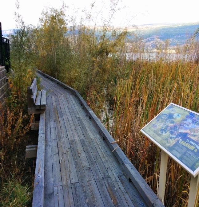
7 8.5 WETLANDS RESTORATION AND EROSION CONTROL GOAL: To protect integrity of the shoreline on the western edge of the park near the outflow of Okanagan Lake. A. Approximately 100 meters of the shoreline along the channel inlet is to be considered for erosion control/waterfront rehabilitation. The shoreline abuts property that is the responsibility of PIB, the City and the Province. Cooperative action is necessary to move forward with further planning and design of this area and the means to use rip-rap to rehabilitate the shoreline slope. Levelton Consultants has provided a preliminary investigation and concluded that a rip-rap surfaced slope would be feasible in the proposed shoreline and boardwalk area. They have also concluded that a raised walkway and viewing deck within the riprap slope area and/or grade-supported walkway along the park area above the slope would be feasible. B. Wetlands restoration is an integral component of the shoreline rehabilitation area. Works to include shoreline materials (plants, etc.) will be undertaken under the direction of a QEP/RPBio and subject to permitting by the Province of BC (Natural Resources Department). C. Long-term protection of the wetlands can be enhanced by allowing residents and visitors to better appreciate the natural environment in this area, be they fish, plants, beavers or birds that would typically seek habitat on the water s edge. This objective calls for a boardwalk, viewing deck and interpretive signage to complement the restoration of the wetlands. 8-43


8 8-44

 can be provided for shortterm storage of canoes and kayaks.")
9 8.6 PADDLE BOAT AREA GOAL: To protect a beach area on the port side of the ship for lake access by human powered boats. A. The area is to be defined by floating log boom, buoys, and a boardwalk along with signage to manage users/ recreational activity in this area. B. A launch area along the beach will permit resting of canoes, kayaks and small sail boats that can be carried from the public parking lot or dropoff zones on the road. The area will need to be managed to avoid overcrowding during put in and take out of the water craft, especially during instruction of large classes and sporting/ racing events. Boats to be rented should not be stored on the foreshore/beach area. Figure 13 C. A boatshed in the vicinity of launch area (see Figure 13) can be provided for shortterm storage of canoes and kayaks. The SS Sicamous Restoration Society should view this as an opportunity for revenue generation if a secure building can be constructed. 8-45

10 8.7 BUILDINGS AND SITE IMPROVEMENTS GOAL: To accommodate strategically located buildings and site improvements that will complement the marine park program, aesthetics and support the needs of visitors. A. Figure 14 defines the framework for the major uses, including pathways, the boats and most buildings. Buildings are referred to as sheds, washrooms, the boatshed and Dredge Shed, and decks. If additional buildings are required in the future, it is expected that they would be contained in the works area north of the salon and south of the tug boats. Caution should be exercised in planning the location of any additional structures so that they do not interfere with the planned walkways to the decks or out to the jetty. The washroom will be attached to the Dredge Shed and design should respect the heritage character of the old building. B. The landscape concept respects recommendations contained within the arborist report and the land use plan that depicts where planting is to be focused or changes made relative to trees, shrubs and lawn. Hardscape areas such as the plaza and the public parking lot will also contain areas of focused landscaping; the plaza may also contain some potted trees in areas where the site could be reconfigured for events such as a boat show. C. Site improvements call for lighting along walkways (bollard and lamp standards), in the plaza and on the jetty. A cohesive kit of parts will include benches and other seating opportunities, garbage receptacles and bike racks. (A donor program can be used to off-set costs, as noted for the Rose Garden.) Figure


11 8.8 GATEWAY PLAZA GOAL: To provide a sense of entry and profile to Heritage Park with a gateway plaza to be located at the east side of the park. A. Design a plaza that will give the SS Sicamous Heritage Park the curb appeal to make it inviting, accommodate displays and complement the heritage tourism theme. B. Consider a special feature such as a water fountain or public art with a significant scale that will embellish the area and serve as an attraction unto itself. C. Use the plaza as a potential play area, meeting place/ resting area, programmed space for small events, permanent and temporary art/ sculpture installments related to the marine/ nautical theme, temporary vending, etc. D. Make the space accessible to the public at night and year round. (Use CPTED design principles; lights; economic use of space including food trucks.) 8-47


12 Representative images only. 8-48


13 8.9 ROAD AND ROUND-ABOUT CHANGES GOAL: To re-route a short length of Riverside Drive and relocate the roundabout to accommodate the entry plaza and address vehicle and pedestrian mobility in the area. A. Phase in the roadway and round-about changes in concert with the upgrades to the park site and public parking lot. B. Design of the round-about at Churchill Avenue to address safe traffic and pedestrian movements including access points, crosswalks, entry feature and landscaping (within the round-about). C. Work with adjacent property owners regarding landscaped boulevard treatment and sidewalk on east side of Riverside Drive between Churchill Avenue and Lakeshore Drive. D. Address access locations to be provided off of Riverside Drive into the public parking lot, drop-off zones, and into adjacent residential/commercial area. E. Address main pedestrian access off Riverside Drive and into the plaza gateway with detailed design that respects sense of entry, aesthetics and prominent profile for the Park. This should include attention to signage, urban design features, lights, gate/entryway and pedestrian mobility. 8-49


14 8.10 SPECIAL FEATURES GOAL: To implement a family of special features that will complement the marine heritage park program and help to enhance the wow factor of this destination. A. In collaboration with the SS Sicamous Restoration Society and special committees of Council, create a public art program specifically for the site, allowing art to be designed and installed in a phased manner. This should not preclude temporary installments. B. Design a special feature (noted in 8.8) that forms the focal point of the plaza; features in the round-about, at the end of the jetty, in the Rose Garden and even within the First Nations center may draw off this inspiration. C. Create an interpretive program that communicates the history of marine/boat building, nautical, steamships, Okanagan Lake, First Nations water routes and lake/land use, natural heritage, and changes to the Okanagan Valley from various perspectives: Orchards/Vineyards/Wineries; personalities; transportation; recreation; economy; forest fires; water use and the various settlements along the lake. Interpretive plaques should not dominate and compromise the collection of historic ships and artifacts. Representative images only. 8-50
 A.")
 The lot will be re-striped for more efficient use of the space and for connections to the roundabout.")

15 8.11 PARKING LOT EXPANSION AND DROP-OFF ZONES GOAL: To expand the public parking lot in keeping with the relocation of Riverside Drive and the round-about. (Drop-off zones will be integral to the road improvements, addressing convenient short-term parking for cars and buses.) A. The public parking lot is to be expanded southward and eastward to accommodate approximately 120 spaces. (Additional 35 to 40 parking spaces) The lot will be re-striped for more efficient use of the space and for connections to the roundabout. Landscaped islands will be introduced for aesthetics and storm water catchment. between pedestrians and people carrying boats across the roads and pathways. D. Human powered boats should be dropped and picked up by vehicle within the public parking lot. Small trailers can be used to transport boats such as canoes and kayaks, and only along designated pathways. Caution should be exercised to avoid conflict between pedestrians and people moving boats to and from the launch area. Spaces for boat drop-off within the public parking lot should be designated. B. Bus parking can be accommodated in the public parking lot or during peak tourist seasons buses may need to park in nearby lots or along roadways beyond the park area. The Drop-Off Zones can be used for loading and unloading passengers. The City of Penticton will monitor parking demand for large/long vehicles including buses, vehicles with trailers and RVs. The lot is expected to remain a free public parking space until such time that supply/demand issue is noted by the City. An allocation of spaces to Loco Landing may be negotiated on an annual basis. C. Drop-Off Zones are to be accommodated on both sides of Riverside Drive near the entryway to the Park. The zones should be time-marked for short duration use, especially during peak tourist season. Drop off of boats should be discouraged/ avoided in this location so that there is no conflict 8-51
16 8.12 WALKWAYS/PEDESTRIAN FACILITIES/ACCESS GOAL: To construct a system of walkways/ pedestrian facilities, and vehicle access into and through the park. D. Way finding can be implemented for the on-site destinations. Information can also be provided about tourist sites and services throughout Penticton on sign boards, digital read out displays or in a pamphlet box. The way finding signs should be designed in keeping with a comprehensive theme. A. A primary objective of the phased works will be making the connection of the Okanagan Lake Waterfront Walkway with an extension through the park (and ultimately the Plaza) over to the dam/river channel pathway and the Trans Canada Trail. B. Access to key destinations in the park will be made by a series of pathways that will radiate or extend out from the entry plaza. This includes access into the Rose Garden and through to the First Nations Centre; out to the end of the jetty; to the main entry of the SS Sicamous and onto the boardwalk; through to the public parking lot; into the boat building/works area, and over to the river channel. The pedestrian system will also allow for ease of access to Loco Landing, and across Riverside Drive. C. Vehicle access and deliveries can be made through the plaza to reach the jetty, the port side of the ship and the First Nations Center. The surfaces, widths and structural integrity of these paths will be sufficient to accommodate small delivery vehicles, vans and trucks. DROP OFF OF BOATS SHOULD BE DISCOURAGED IN THIS LOCATION, SO THERE IS NO CONFLICT BETWEEN PEDESTRIANS AND PEOPLE CARRYING BOATS ACROSS THE ROADS AND PATHWAYS. 8-52
17 S E C T I O N 9 PHASING PLAN It is expected that improvements and major changes to the park area can be undertaken in a strategically phased manner. Sufficient resources and Council support must be made available for each phase to proceed. The strategic phasing implies a sequence of works that the City Engineering Department will coordinate along with the detailed design for each element. For example, the phasing will need to respect matters such as maintaining construction vehicle access, pedestrian safety, vehicle flow, and achieving cost efficiencies. Figure
18 9.1 PHASE 1 Okanagan Lake Walkway Connection and Jetty Upgrade Since underground services and construction materials for the jetty will need to come off the road right-of-way and through the center of the park, a logical initial phase will be the upgrades to the Jetty, followed by the main walkway connection. Interim rerouting of traffic on the southbound lane of Riverside Drive may be required (or no work within the existing travelled road surface in Phase 1.) 9.2 PHASE 2 Riverside Drive and Round-About Relocation The removal and relocation of part of Riverside Drive and the existing round-about will be necessary to begin any major works on the entry plaza (Phase 3). The new alignment of the (double lane) road will include crosswalks, sidewalks and drop-off zones. Interim changes to the access into the public parking lot will also be required. (Depending on detailed design and construction standards for the asphalt, it may be prudent to proceed with the expanded parking lot following the road and round-about changes.) 9-54
 could be introduced for some small remnant areas.")
19 9.3 PHASE 3 CORE OF SHIPYARD This phase may be separated into three subphases: 3A. Boardwalk areas on starboard side of Sicamous 3B. Plaza and Rose Garden 3C. Wetlands Restoration Pathway connections would be strategically staged to gain priority access, as required. Depending on the duration of timeline lag between phases, some interim uses (e.g. lawn) could be introduced for some small remnant areas. Phase 3C could proceed earlier to avoid any disruption of the park center with construction trucks and material storage that may be required for the rip-rap project. 9.4 PHASE 4 FIRST NATIONS CENTRE Once services and access to the PIB property is gained, construction can proceed on the proposed center/grounds. (NOTE: Erosion control for the shoreline along the PIB property should be completed in advance of any major construction on that site.) 9-55
20 9.5 PHASE 5 PUBLIC PARKING LOT This phase of work can be completed along with the road/round-about relocation or anytime afterwards. Adjacent landscaping and the installation of a parking pass machine or meters could be an integral component. (NOTE: Negotiations with LOCO Landing Amusement Park owners regarding parking allocation and cost recovery will also help determine sequence of these works.) PHASING WILL NEED TO RESPECT MATTERS SUCH AS MAINTAINING CONSTRUCTION VEHICLE ACCESS, PEDESTRIAN SAFETY, VEHICLE FLOW AND ACHIEVING COST EFFICIENCIES. 9-56
Mississauga Waterfront. Parks Strategy - Draft
 Potential configuration for river s edge seating. Boating on Credit River: A regatta Boating on Credit River: Active enjoyment 5.2 Port Credit Memorial Park West Priority Park 5.2.1 Site Opportunities
Reconnecting to a Forgotten River St. Cloud MN. Aaron Hanson Design Design Thesis LA 572, Thesis, Spring 2012
 Reconnecting to a Forgotten River St. Cloud MN Aaron Hanson Design Design Thesis LA 572, Thesis, Spring 2012 site context 2.5 Miles Sartell St. Cloud to Fargo 170 Miles (2 hrs 45 mins) Hwy 10 infrastructure
The open space system should provide connective elements, relate to natural resources, and enhance the suburban character of the landscape..
 The open space system should provide connective elements, relate to natural resources, and enhance the suburban character of the landscape.. Mixed-use and infill development should maintain or enhance
Popp s Ferry Causeway Park Back Bay Environmental Educational Center CASHIO COCHRAN LLC
 Popp s Ferry Causeway Park Back Bay Environmental Educational Center CASHIO COCHRAN LLC A LIMITED LIABILITY COMPANY Popp s Ferry Causeway Park Master Plan Prepared for: City of Biloxi Department of Parks
VEHICULAR AND PEDESTRIAN CIRCULATION
 This perspective sketch communicates the intended character and quality of a proposed streetscape design. Locate benches near a major intersection where people tend to gather. Seating and lighting provide
Ashbridges Bay Erosion and Sediment Control Project
 Ashbridges Bay Erosion and Sediment Control Project Project Brief Overview Toronto and Region Conservation Authority, in partnership with the City of Toronto, intends to carry out remedial erosion control
Project purpose. advise. The purpose of the Beaumaris Lake Open Space Rehabilitation project is to: + Develop a Functional Program Concept
 Project purpose owns Road Beaumaris Road The purpose of the Beaumaris Lake Open Space Rehabilitation project is to: + Develop a Functional Program Concept + Guide Rehabilitation of Landscape and Community
Welcome! HORSESHOE BAY PARK. Welcome!
 Welcome! HORSESHOE BAY PARK Welcome! Where are we in the process? Today we would like your input on how Horseshoe Bay Park can be upgraded to serve the community s needs better. CONSULT STAKEHOLDERS TAKE
Emerson Park Master Plan Update. Public Meeting III August 27, 2014
 Emerson Park Master Plan Update Public Meeting III August 27, 2014 Meeting Agenda: Project Update Presentation of Master Plan Components Discussion and Feedback The Path Forward: Building on the Concept
Village of Fair Haven Goals & Objectives
 Village of Fair Haven Goals & Objectives 1 Natural Environmental Quality & Aesthetics Embrace policies and programs that preserve and enhance the Village s natural resources, environment, water quality,
BEMIDJI CITY COUNCIL Work Session Agenda Monday July 9, 2012
 BEMIDJI CITY COUNCIL Work Session Agenda Monday July 9, 2012 City Hall Conference Room 5:30 p.m. 1. CALL TO ORDER / ROLL CALL 2. REVIEW PARK PLANS FOR PAUL BUNYAN PARK, LIBRARY PARK AND SOUTH SHORE BAUER
PRELIMINARY DESIGN + DEVELOPMENT PLAN
 WELCOME! To The Public Open House May 30 th, 2017 HARBOUR WEST PARKS Vision Project Overview The City s vision for Port Credit Harbour West Parks is to develop a vibrant waterfront destination that integrates
THE GARDEN CITY PLAN. City of St. Catharines Official Plan. City of St. Catharines
 THE GARDEN CITY PLAN City of St. Catharines Official Plan City of St. Catharines August 2010 APPROVAL INFORMATION This Official Plan of the City of St. Catharines Planning Area, known as the Garden City
38 Queen s University Campus Master Plan Part 1
 38 Queen s University Campus Master Plan Part 1 46 The Campus at the City Scale Chapter 4 The Campus at the City Scale 39 Queen s is an urban University centrally located in Kingston. Decisions made by
MARINA MARKET & WATERFRONT DEVELOPMENT STUDY PORT ARANSAS, TEXAS
 MARINA MARKET & WATERFRONT DEVELOPMENT STUDY PORT ARANSAS, TEXAS FEBRUARY 2015 PRESENTATION OUTLINE 1 2 3 4 5 6 7 REGIONAL POSITIONING SITE IMPRESSIONS PLANNING & DESIGN PRINCIPLES EXISTING IMPROVEMENTS
Victoria Bridge Municipal Class EA Civic Works Committee
 Municipal Class EA John Pucchio, P. Eng., Project Manager June 19 2018 Introduction Existing Conditions Municipal Class EA Proposed Bridge Proposed Road Reconstruction Proposed Improvements Construction
Highland Falls Waterfront Redevelopment Feasibility Study Village Board Meeting March 20, 2017
 Village Board Meeting March 20, 2017 Agenda I. Public Meeting #1 Visioning Summary II. Public Meeting #2 Comment Summary III. IV. IV. Case Study: Milton Train Station Schematic Design Concepts Schedule/Next
1. Parks & Recreation Neighborhood Parks Community Parks Special Use Sites 2. Open Space 3. Trails
 Appendix A: Park Classifications The intent of parks and recreation classifications is to aid in making acquisition and design decisions for park sites, facilities and the organization of recreation space
4. Parks, Open Space and Waterways
 4. s, Open Space and Waterways Other Relevant Policies & Bylaws Official Community Plan s and Open Spaces Master Plan ways Plan Management and Improvement Plans Goals: 1. Protect and enhance Vic West s
PHASE 3-4 PARKS SOUTH PARK AND CHANNEL PARK
 PHASE 3-4 PARKS SOUTH PARK AND CHANNEL PARK Sheet List L1.0 L2.0 L3.0 L4.0 L5.0 L6.0 L7.0 L8.0 L9.0 L10.0 L11.0 L12.0 L13.0 L14.0 L15.0 L16.0 L17.0 L18.0 L19.0 L20.0 L21.0 L22.0 Cover Open Space Context
7-PARKS, OPEN SPACE & PUBLIC ART
 7-s, Open Space & Public Art 7-PARKS, OPEN SPACE & PUBLIC ART This chapter provides recommendations for the expansion of new parks, plazas and open space that serve the many user groups targeted for downtown.
The Vision. Photo provided by The Minervini Group. 46 Vision, Objectives & Strategies
 Vision, Objectives & Strategies The is the public framework and guide for future development of the Grand Traverse Commons. The establishes public polices for infrastructure, the preservation of natural
3.1 Existing Land Use
 3.0 Land Use This strategy has been developed taking into account the position of the Town of Sidney as the economic center of the Saanich Peninsula. It acknowledges existing land use patterns in the downtown
10.0 Open Space and Public Realm
 10.0 Open Space and Public Realm 10.0 Open Space and Public Realm The Public Open Space System is comprised of: outdoor spaces available for public use that are either publicly owned (e.g., parks and
HURON WATERFRONT DEVELOPMENT AND AMPHITHEATER
 AWARD WINNING PROJECT Location Huron, Ohio Architectural, Engineering, Site, Landscaping, Planning, Survey, Grant Administration, Construction Administration Cost $285,000 Amphitheater $300,000 Marina
ASHTABULA COUNTY COASTAL MANAGEMENT PLAN
 Location Ashtabula County, Ohio Planning Grantwriting ODNR, Office of Coastal Management, $25,000 Local Match $25,000 Size 21 miles of coastal area Professional Services 2012 Project Team Randy Mielnik,
Parks Master Plan Implementation: Phase I Waterfront Use and Design REPORT #: September 7, 2016 File #
 0 'O DI Lan-171-14 1 - THE CORPORATION OF THE TOWN OF COBOURG..,. STAFF REPORT TO: FROM: Mayor and Members of Council Dean A. Hustwick, Director of Recreation and Culture DATE OF MEETING: Committee of
Cold Lake Marina Master Plan
 Cold Lake Marina Master Plan Intro to Team Moffatt & Nichol is recognized throughout the world for our role in the revitalization and redevelopment of urban waterfronts, including the evolution of modern
Monroe Street Reconstruction. Public Preconstruction Meeting February 21, 2018
 Monroe Street Reconstruction Public Preconstruction Meeting February 21, 2018 Thank you to Edgewood College! Tonight s Agenda 1. Project Overview 2. Initial project schedule and phasing 3. Expectations
URBAN DESIGN BRIEF URBAN DESIGN BRIEF 721 FRANKLIN BLVD, CAMBRIDGE August 2018
 URBAN DESIGN BRIEF URBAN DESIGN BRIEF 721 FRANKLIN BLVD, CAMBRIDGE August 2018 DESIGN BRIEF CONTENTS PART A 1.0 INTRODUCTION 2.0 DESCRIPTION & ANALYSIS OF SITE CONTEXT 3.0 DESIGN CONSTRAINTS AND OPPORTUNITIES
Official Community Plan Bylaw No. 4360, 2004, Amendment Bylaw No. 4897, 2016 (Sewell s Landing)
") District of West Vancouver Official Community Plan Bylaw No. 4360, 2004, Amendment Bylaw No. 4897, 2016 (Sewell s Landing) Effective Date: 1089612v1 District of West Vancouver Official Community Plan Bylaw
District of West Vancouver Official Community Plan Bylaw No. 4360, 2004, Amendment Bylaw No. 4897, 2016 (Sewell s Landing) Effective Date: 1089612v1 District of West Vancouver Official Community Plan Bylaw
Taché Promenade Tuesday, October 17, 2017
 Welcome to the Public Information Session for the City of Winnipeg s Taché Promenade Tuesday, October 17, 2017 We want to hear from you. Please participate today by: Viewing the recommended design and
Preferred Riverwalk Alternative Components August 17, 2017:
 Preferred Riverwalk Alternative Components August 17, 2017: 1. Entrance and Future Pump Station Location: Entrance location to line up with main parking entrance to Captain Parkers and allows future Pump
Urban Design Manual 2.0 DRIVE-THROUGH FACILITIES. Background. Urban Design Challenges
 222221 2.0 DRIVE-THROUGH FACILITIES Background In recent years, drive-through facilities have grown significantly in popularity with drive-through restaurants, in particular, being established on numerous
Main Street Reconstruction From Ninth Line to Stouffer Street. Town of Whitchurch-Stouffville. Public Information Centre
 Main Street Reconstruction From Ninth Line to Stouffer Street Town of Whitchurch-Stouffville Public Information Centre November 23, 2016 4:30 to 6:00 pm & 7:00 to 8:00 pm 6240 Main Street, Stouffville
BUSINESS DISTRICT DESIGN GUIDELINES
 Des Plaines, Illinois Prepared for the City of Des Plaines by: The Lakota Group Laurie Marston, AICP March 2005 Section 5: Streetscape Elements Business District Design Guidelines STREETSCAPE ELEMENTS
{Best Practices. Summary of Tools, Strategies and Best Practices from 11 Michigan Case Study Communities
 Case Studies Michigan Coastal Community Working Waterfronts { Summary of Tools, Strategies and from 11 Michigan Case Study Communities Table of Contents Zoning...2 Community and Stakeholder Collaboration
SFMTA PHELAN LOOP AND PUBLIC PLAZA PHELAN OCEAN AVENUE
 SFMTA Municipal Transportation Agency Image: a bus in front of the Palace of the Legion of honor SFMTA PHELAN LOOP AND PUBLIC PLAZA PHELAN AVENUE @ OCEAN AVENUE Community Meeting May 23, 2012 San Francisco,
Dowdy Park. Concept Plans TOWN OF NAGS HEAD NORTH CAROLINA. Developed by: Albemarle & Associates, Ltd VHB/ Vanasse Hangen Brustlin, Inc.
 TOWN OF NAGS HEAD NORTH CAROLINA Concept Plans Developed by: Albemarle & Associates, Ltd VHB/ Vanasse Hangen Brustlin, Inc. Site Looking Southeast Dowdy Park Existing Conditions Nags Head Woods Sound Future
Public Workshop 2 December 11, 2014 OLIN
 Public Workshop 2 December 11, 2014 OLIN TRIPLE IMAGE PANORAMA A NEW VISION FOR THE RIVERFRONT PROMENADE Burlington s Riverfront has historically been a defining character of the City s identity. This
Design Considerations
 Essential to the development of a successful Master Plan for the Park Complex is input from the community that the park will serve. The community outreach component of the planning process included numerous
Route 1 Corridor Study
 Route 1 Corridor Study Westbrook, Connecticut A Vision for the Connecticut Shoreline Public Informational Meeting July 28, 2015 Lower Connecticut River Valley Council of Governments Fitzgerald & Halliday,
OPPORTUNITIES AND CONSTRAINTS - OXBOW PARK ENTRANCE AND PUT-IN
 OPPORTUNITIES AT OXBOW EXISTING WETLANDS Site is undeveloped and we can design a park that works well from the start. SAND BEACH Potential to eliminate invasive species. DEBRIS (CONCRETE, OLD CARS) VEGETATION
STREETSCAPE IMPROVEMENTS - RECOMMENDATIONS
 STREETSCAPE IMPROVEMENTS - RECOMMENDATIONS Figure 4.3.1- A map of all of the recommended streetscape improvements. The key component of downtown s public realm, apart from its public spaces, is its street
Public Meeting #3 May 9, 2009 MVVA Team
 Public Meeting #3 May 9, 2009 MVVA Team Welcome to the third Public Meeting for the Lower Don Lands Municipal Class Environmental Assessment (EA) Infrastructure Master Plan and Keating Channel Precinct
Purpose of Open House #3
 Public Meeting #3 May 9, 2009 MVVA Team Purpose of Open House #3 The main purpose of this Open House is to present and seek input on the: Evaluation of transportation and infrastructure design alternatives
HAYDEN ISLAND. Portland s Only Island Community. FINAL CONCEPT PLAN April 2008
 HAYDEN ISLAND Portland s Only Island Community FINAL CONCEPT PLAN April 2008 Introduction Hayden Island is the only island neighborhood in Portland and it provides a unique setting to its residents and
Community Design Guidelines. Port Wallace DRAFT
 Community Design Guidelines Port Wallace DRAFT Energy 1 2 3 Nature Movement Connections Built Form DRAFT Layout Energy 1 Nature Community Design Guidelines GREAT COMMUNITIES PROTECT, CELEBRATE, AND CONSERVE
Welcome. Community Consultation Meeting November 28, Review and discuss the Bathurst Quay Neighbourhood Plan Framework
 Welcome Community Consultation Meeting November 28, 2016 Why Are We Here Today? Review and discuss the Bathurst Quay Neighbourhood Plan Framework Review and discuss an Action Plan for Implementation Next
North Shore Trail. Council Meeting June 10, 2002
 North Shore Trail Council Meeting June 10, 2002 Process Guiding Principles Inventory and Analysis Preliminary Concepts (4) Final Concept Phasing Strategy Estimated Costs OVERVIEW Purpose: Prepare an overall
Chapter 14 Streetscape Improvements
 This chapter presents streetscape design concepts for key streets and gateways in the Downtown Specific Plan area. This chapter is organized as follows: 14 Streetscape Improvements 14.1 Streetscape Treatments
The Project. In 2013, construction was completed between 100 Street and 102 Street.
 The Project Jasper Avenue New Vision (JANV) is a major catalyst project identified in the Capital City Downtown Plan (2010) between 92 Street and 109 Street, including the streets half a block north and
MIAMI 21 PUBLIC HEARING-FIRST READING 2009
 General Principles Public access waterfront walkways shall: 1. Feel public. No one should feel as if he or she is intruding on private property. The public should feel welcome and at ease to move along
Lynn Waterfront Master Plan
 Lynn Waterfront Master Plan Public Meeting #2 December 10th, 2018 1 Project Schedule Update September 26, 2018 December 10, 2018 Development of the Master Harbor Plan Amendment and Revised Waterfront Master
Please read the entire document
 projects impacting the waterfront revitalization area. The waterfront revitalization area of the town will have to subareas to the west and east of the village. Page 6 of 6 Wayfinding master plan create
BRADENTON RIVERWALK EXPANSION MASTER PLAN
 BRADENTON RIVERWALK EXPANSION MASTER PLAN INTRODUCTION & AGENDA Process Update Community Engagement Summary Center for Active Design (CfAD) Recommendations Context and Existing Conditions Master Plan Alternatives
2.1 Location and Size
 2.0 Context 7 2.1 Location and Size The Saanich Penninsula The study area is centrally located within the Town boundaries on the east side of Highway 17, which runs through Sidney in a north-south direction.
ROME WATERFRONT VILLAGE PROJECT NARRATIVE January 25, 2018
 January 25, 2018 The Rome Waterfront Village project is intended to foster the revitalization of the area between South James Street and Erie Boulevard north of the Erie Canal as well as improve public
V. Gateways GATEWAYS / V-1
 V. GATEWAYS / V-1 Many of Chesapeake s gateways are located on highways and call for bold and attractive designs that motorists can understand, appreciate, and enjoy. can also take the form of natural
Project Location. Jay and Patty Baker Park and Gordon River Greenway Connector Bridge. Naples Beach Golf Club. Gordon River. East. Naples.
 Gordon River Project Location Naples Beach Golf Club East Naples Naples Naples Bay Evergreen Golf and Country Club and Gordon River Greenway Connector Bridge Gordon River Greenway CONNECTOR BRIDGE AND
STORMWATER MANAGEMENT FACILITIES/STORMWATER PONDS - What Are They?
 STORMWATER MANAGEMENT FACILITIES/STORMWATER PONDS - What Are They? As land is developed, the natural water cycle is disrupted. Rain infiltrates less, resulting in larger amounts of runoff This increased
Highest & Best Use Study Marina Park Lands
 Executive Summary of Report MARCH 2006 TABLE OF CONTENTS 1. Introduction...1 2. Study Process...2 3. Highest And Best Use Program...3 4. Concept Plan...8 5. Public Area Animation...9 6. Marina Park Implementation
A L F O N S O A R C H I T E C T S
 A L F O N S O A R C H I T E C T S A L M A T H E P I E R O F S T. P E T E R S B U R G A L F ALFONSO O N S O A R ARCHITECTS C H I T E C T S ALMA 1. Please demonstrate how the project fits within the Pinellas
Preliminary Sketch Plan for Fort Hunter Park
 Preliminary Sketch Plan for Fort Hunter Park Public Presentation November 19, 2009 Dauphin County Parks and Recreation 100 Fort Hunter Road Harrisburg, PA 17110 (717) 599-5188 www.dauphinc.org THOMAS COMITTA
3.0 master plan concept
 3.0 master plan concept 3.1 introduction The purpose of the Huron Church Road Master Plan Concept is to provide an overview of the Master Plan design process, identify preliminary streetscape installations
Summary of Changes in the DRAFT Rivers Project Natural Resource Master Plan from the 2001 approved plan to 2014 plan
 Summary of Changes in the DRAFT Rivers Project Natural Resource Master Plan from the 2001 approved plan to 2014 plan The entire Master Plan format and layout has been changed to comply with regulation
M i s s i o n B a y W a t e r f r o n t
 114 M i s s i o n B a y W a t e r f r o n t Character of the Area: The Mission Bay Waterfront extends from Pier 48 at China Basin Channel to 18th Street in the Central Basin. This area of the waterfront
City of Farmington. Downtown Plan. Amendment to the 1998 Master Plan Adopted October 11, 2004
 City of Farmington Amendment to the 1998 Master Plan Adopted October 11, 2004 Introduction Planning Background 1 Scope and Components of the Plan Amendment 2 Concept Introduction 3 Plan Concepts 3 Conceptual
Key Moves in the Plan
 Key Moves in the Plan 2 Add housing that fits the neighbourhood s character Make it easier to leave the car behind Oak Bay Avenue Village plan to be completed in future planning process Future active transportation
TH E U N IVE RSIT Y O F FLO R I DA LANDSCAPE MASTER PLAN REPORT
 TH E U N IVE RSIT Y O F FLO R I DA LANDSCAPE MASTER PLAN REPORT O C T O B E R 2 018 THE UNIVERSITY OF FLORIDA LANDSCAPE MASTER PLAN REPORT OCTOBER 2018 prepared by: CRJA-IBI Group GAI Community Solutions
City of Dryden SUSTAINABLE WATERFRONT DEVELOPMENT PLAN. Prepared by: Hilderman Thomas Frank Cram Landscape Architecture and Planning
 City of Dryden SUSTAINABLE WATERFRONT DEVELOPMENT PLAN Prepared by: Hilderman Thomas Frank Cram Landscape Architecture and Planning INTRODUCTION The Sustainable Waterfront Development Plan provides viable
5.15 AESTHETIC RESOURCES
 5.15 AESTHETIC RESOURCES 5.15.1 Introduction This section assesses the potential visual impacts of the proposed South Ferry Terminal Project in the visual context and character of the southern tip of Lower
Chapter 9: Economic Development
 Chapter 9 Economic Development Goal To embrace a stable, prosperous business environment focused on industry diversity, yielding family income sufficient to support education, recreation, social and cultural
PUBLIC RIGHT-OF-WAY IN THIS CHAPTER PUBLIC REALM
 PUBLIC RIGHT-OF-WAY This section provides design guidelines for improvements in the public right-of-way. The public right-of-way refers to streets, sidewalks, non-vehicular thoroughfares, parks and greenways
Maplewood Avenue Downtown Complete Street Project
 Maplewood Avenue Downtown Complete Street Project Second Public Meeting January 24, 2018 Welcome and Introduction of Project Team City Planning and Public Works Staff City of Portsmouth Juliet Walker Planning
Wayfinding. North Gateway: Integrate a vertical gateway marker on the west side of Ward Street at the south corner of Vernon Street.
 3.3.6.2 Wayfinding Existing Conditions Wayfinding signage is important to direct visitors and tourists to different locations in the downtown. A significant part of the wayfinding signage in the downtown
R STREET CORRIDOR NEIGHBORHOOD Site Plan and Design Review Supplemental Guidelines Checklist
 R STREET CORRIDOR NEIGHBORHOOD Site Plan and Design Review Supplemental Guidelines Checklist Applicant s Name: Project Address: Phone: Email: Applicant shall fill out the design guidelines checklist for
11TH STREET BRIDGE PARK COMPETITION
 11TH STREET BRIDGE PARK COMPETITION DESIGN PRINCIPLES, VALUES AND FACILITIES DESCRIPTION The design principles and list of facilities for a future 11th Street Bridge Park have been gathered through over
Community Design Plan
 Gardena General Plan 2006 Authority While the is not a required element of a General Plan, it is included because improving the community appearance and image is paramount to the overall quality of life
Design Guidelines for PRINCESS ANNE COMMONS
 Design Guidelines for PRINCESS ANNE COMMONS January 25, 2002 To create a unique and identifiable place with attractive, exciting, efficient and safe components to enhance the consistency of the built environment
AMBLESIDE WATERFRONT
 Overview: An Integrated Vision for the Waterfront The waterfront concept plan shown above is the result of 40 years of acquiring, planning and improving a publicly-owned waterfront. Consistent community
5.0 P A R K R E C O M M E N D A T I O N S
 5.0 P A R K R E C O M M E N D A T I O N S 5.1 Confederation Park The analysis of Confederation Park recognizes that it, along with City Hall, is the symbolic heart of Kingston. While the existing layout
WHAT WE LEARNED FROM YOU
 PUBLIC CONSULTATION SUMMARY WHAT WE LEARNED FROM YOU Prepared By: in conjunction with: Poulos and Chung Ltd. Terraprobe Baird and Associates Philips Engineering Ltd. City of Mississauga Waterfront Parks
TURN TO THE RIVER CITY PLAZA LANDSCAPE DESIGN CONCEPT May 25, 2016
 Turn to the River is a multi-year project of Art Spaces - Wabash Valley Outdoor Sculpture Collection, Inc. to connect downtown Terre Haute with the Wabash River through public art and design. The four-square
Design Guidelines and Standards for Sight Triangles. Sight Triangle MANUAL
 Design Guidelines and Standards for Sight Triangles Sight Triangle MANUAL Table of Contents 1.0 Introduction..............................................7 1.1 Key Terms..............................
Project Consulting Team:
 THE DOWNTOWN CHERRYVILLE LAND USE + STREETSCAPE MASTER PLAN WAS FUNDED THROUGH THE GENEROUS DONATIONS OF THE FOLLOWING: The Community Foundation of Gaston County ElectriCities of North Carolina The Cherryville
AIRPORT BUSINESS PARK
 PIER MAC PETROLEUM INSTALLATION LTD. AIRPORT BUSINESS PARK DEVELOPMENT APPLICATIONS March 2003 4.1 Airport Business Park Development Permit Area 4.1.1 Justification/Design Concept The design concept envisioned
TABLE OF CONTENTS 1.0 INTRODUCTION GENERAL OBJECTIVES LAND USE DESIGNATIONS, OBJECTIVES AND POLICIES 4
 Schedule I- Redstone Golf Course Resort Area Sector Plan 1 TABLE OF CONTENTS 1.0 INTRODUCTION 3 2.0 GENERAL OBJECTIVES 3 3.0 LAND USE DESIGNATIONS, OBJECTIVES AND POLICIES 4 4.0 TRANSPORTATION AND ROAD
Fifth and Detroit Street Design May 2017 Capital Improvements Committee. DOWNTOWN Street Design
 1 Fifth and Detroit Street Design May 2017 Capital Improvements Committee Agenda 2 Review Street Configuration Prior Meeting Review Outreach Synopsis Functional Street Design Refinements Curb Edge, Turning
Lansing s Moores River Drive Regional Network Trail project extended the Lansing River Trail system to Waverly Road, and also included bike lane
 Lansing s Moores River Drive Regional Network Trail project extended the Lansing River Trail system to Waverly Road, and also included bike lane striping on W. Mount Hope Avenue. The boulevard on Moores
A. Selma Park, Davis Bay and Wilson Creek
 A. Selma Park, Davis Bay and Wilson Creek This waterfront neighbourhood consists of three separate community areas, linked by Highway 101, but with different character, land use patterns and future potential.
City of Chickasaw Land Use Comprehensive Plan 2030 Chapter5-Draft(2)Public review_
Public review_") Land Use Land Use refers to the activity or development characteristics of a given parcel of land. The Land Use Plan presented in the following pages, represents the City of Chickasaw s official position
Land Use Land Use refers to the activity or development characteristics of a given parcel of land. The Land Use Plan presented in the following pages, represents the City of Chickasaw s official position
Port of Camas-Washougal Waterfront Trail Master Plan
 Port of Camas-Washougal Waterfront Trail Master Plan The Port s facilities are the products of its mission: To make strategic investments that enhance the community s quality of life by bringing jobs,
PORT OF VANCOUVER WATERFRONT DEVELOPMENT. Concept Development Plan City Center Redevelopment Authority April 20, 2017
 PORT OF VANCOUVER WATERFRONT DEVELOPMENT Concept Development Plan City Center Redevelopment Authority April 20, 2017 Port History PORT ESTABLISHED 1912 TERMINAL 1 ACQUIRED 1925 GWM SIGNS LEASE 1935 HARBOR
Task Force Meeting #8
 March 11, 2014 AGENDA 7:00 Welcome/Housekeeping Laura Stetson 7:05 Public Comment 7:20 Presentations BIAC 101/84 Interchange InnVision Shelter Network Redwood City Update 7:35 Revised Guiding Principles
SPRINGHILL LAKE TRANSIT VILLAGE
 Greenbelt Metro Area Sector Plan - Subarea Design Policies and Guidelines - Springhill Lake Transit Village 113 SPRINGHILL LAKE TRANSIT VILLAGE Residential Neighborhood and Village Center CONCEPT Springhill
Hamilton Road Corridor Streetscape Master Plan. Open House October 4 th, 2017
 Hamilton Road Corridor Streetscape Master Plan Open House October 4 th, 2017 Agenda 1. Introductions Agenda Overview 2. Project Background 3. Existing Conditions 4. Strengths, Weaknesses, Opportunities
Wentworth Point July Community Information Session Feedback Summary
 Wentworth Point July Community Information Session Feedback Summary Introduction On Saturday, 28 July 2018, Landcom held a community information session from 11am to 1pm, at the Pulse Club, Wentworth Point,
Section 4: Goals, Objectives, and Strategies
 99 Section 4: Goals, Objectives, and Strategies Goal 1 Resource Protection, Maintenance, Preservation, and Enhancement Protect, preserve, maintain, and enhance the natural, recreational, archaeological,
Carlsbad Village Redevelopment Concept Summary of Features
 Carlsbad Village Redevelopment Concept Summary of Features Calthorpe Associates November 5, 2003 The Redevelopment Concept illustrates a vision for the future of Carlsbad Village. The overall vision of