The Village at Loomis. Long-Envisioned A Wonderful Place to Call Home
|
|
|
- Carmel Dickerson
- 6 years ago
- Views:
Transcription

1 at Loomis Long-Envisioned A Wonderful Place to Call Home
, the Town Center Master Plan (1992), and the Town General")


2 The Vision Implementing the Town s Plans and Goals Years ago, the Town established the vision for The Village at Loomis in plans and EIRs approved by the Town, including: the King Road Specific Plan (1989), the Town Center Master Plan (1992), and the Town General Plan (2001). Great care has been taken to ensure the project meets the requirements laid out in the Loomis General Plan, Loomis Town Center Implementation Plan, Loomis Trails Master Plan and Loomis Bicycle Transportation Plan. [ will] provide a gradual transition of intensity between commercial and the neighboring residential areas, to minimize the potential for land use conflicts with residential uses, and problems for residents site should be developed with a mixture of land uses consisting of three tiers: general commercial and/or office uses ; low profile office structures ; and medium to medium-high density residential. Loomis General Plan project would help increase market demand and economic feasibility for new retail and office development downtown. Loomis Town Center Implementation Plan The goals of the Trails Master Plan include: Provide pedestrian, bike and equestrian access through natural areas. Provide supplemental pedestrian and bike access to the Town s sidewalk system and bike master plan. Improve walkability links to schools. Provide connections to County of Placer s proposed network of multi-use trails. Loomis Trails Master Plan The goals of the Bicycle Transportation Plan include: Provide bicycle route extending Sun Knoll Drive to Doc Barnes Drive. Provide bicycle route extending Day Avenue to Doc Barnes Drive. Provide bicycle connection from end of Library Drive to connect Sun Knoll neighborhood and Doc Barnes Drive. Provide bicycle routes along Doc Barnes Drive to connect Horseshoe Bar Road and King Road. Loomis Bicycle Transportation Plan


3 The Timeline 2003 Community workshop at Memorial Hall organized by Town and facilitated by SACOG Walking tour of site and downtown organized by Town 2004 Community workshop of H. Clarke Powers Elementary organized by Town 2007 Village application filed Joint meeting of Town Council and Planning Commission at Memorial Hall; Vote 5-0 and 5-0 proceed with at Loomis application 2008 EIR scoping meeting organized by Town Recession 2010 Town Center Implementation Plan identifies as economic catalyst to downtown 2014 at Loomis moves ahead EIR scoping meeting organized by Town 2015 Planning Commission workshop organized by Town Town Council and Planning Commission joint workshop at the Depot Town Council and Planning Commission field trip organized by Town 2016 Open House hosted at Memorial Hall
4 The Numbers 19 % Open Space, 45.8 Parks & Trails Acres Residential Acres Parks & Open Space Open Space & Trails Public Parks 2 Active & 2 Passive Stormwater Detention Single- Family Homes 125 Multi- Family Homes* *In accordance with the Town of Loomis General Plan Housing Element requirement 5.9 Acres Business ,550 4,050 Miles New Trails Feet Open Space Trails Feet Multi- Use Trails Retail Office Acres Total Project Area

5 Designed by the community for the community Long envisioned by the Town and shaped by community input, at Loomis will maintain the character of the Town while enhancing the downtown area and making it a focal point for shopping and services. Once completed, at Loomis will blend into the Town s landscape and appear like it has been here for years. It will be an area where people can live, work, shop and enjoy recreational opportunities for years to come. Organized into seven distinct districts, the project includes: the Village Commercial District, the Village Office District, the Village Mixed-Use District, the Village High-Density District, the Village Residential District, the Village Green Court District, and the Village Single-Family District. To improve local circulation, the project will construct the long-planned Doc Barnes Drive connecting King and Horseshoe Bar roads. Additionally, at Loomis will provide a linked system of trails, open space and sidewalks that will protect the riparian corridors, promote a pedestrian-friendly atmosphere and establish a safe, comfortable and convenient bikeway system. Future building within the project will strictly adhere to at Loomis Design Standards including architecture, landscape and roadways developed to maintain and enhance the character of downtown Loomis. By employing authentic architectural palettes, creative site planning techniques and designating an abundance of open space and parks, at Loomis will be a community with a strong, historicallybased identity and distinctive character within the Town of Loomis. at Loomis will truly be a wonderful place to call home.


6 The Venue A hidden treasure Located on 66 predominantly vacant acres behind Raley s Shopping Center, at Loomis is bounded by Horseshoe Bar Road and Laird Street to the west; the Silver Ranch, Sun Knoll, and Day Avenue neighborhoods on the north; I-80 on the east and Raley s Shopping Center on the south. Parks, Trails, Open Space and Wetlands Organized into seven distinct districts, the project includes three singlefamily residential districts, a highdensity residential district (in support of the Town s Housing Element requirements), a mixed-use district, an office district, and a commercial district. Residential District Mixed-Use District Office District Commercial District


7 Single Family District Traditional Single Family District Green Court High Density District

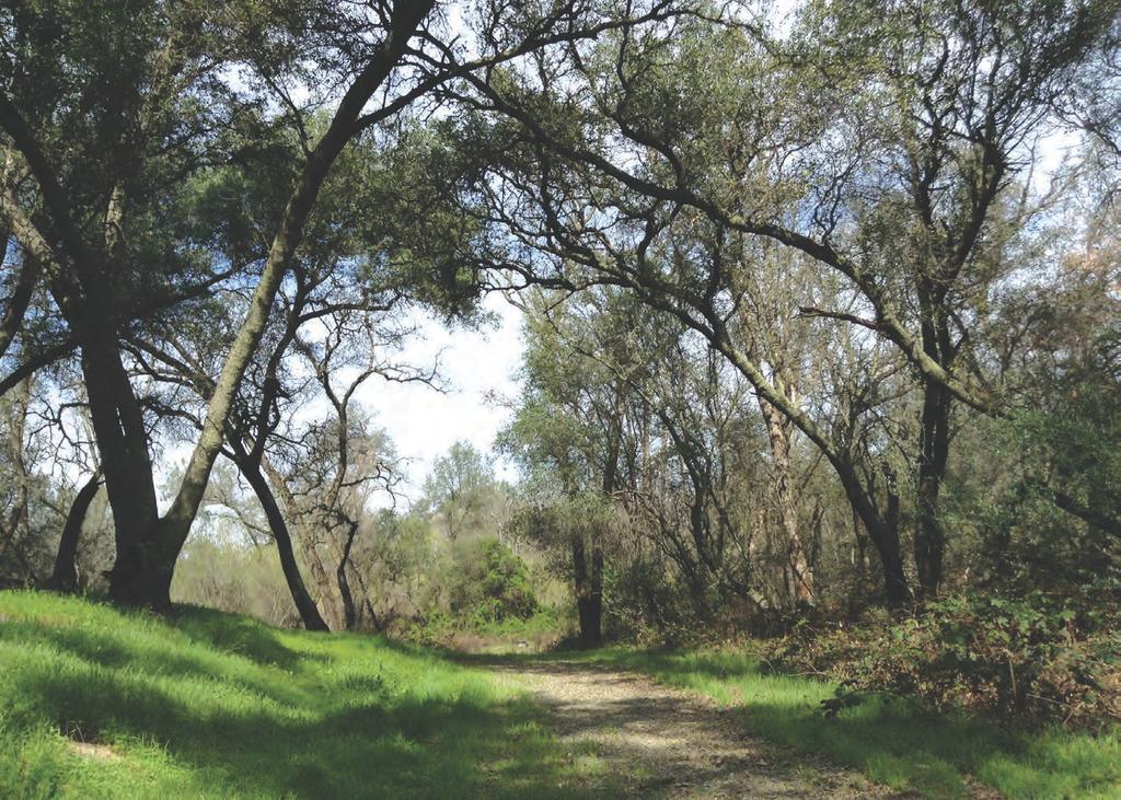
8 A vibrant, mixed-use project in a park-like setting Designed for a multitude of uses and implementing part of the Loomis Trails Master Plan, at Loomis is organized around open space, parks and a pedestrian and bike network connecting all portions of the neighborhood and commercial space with the existing downtown area. The architectural styles of both housing and businesses allow for a variety of choices that complement the existing character of the Town, seamlessly blending the new community with the current one. Protecting natural resources through open space, parks and wetlands Dotted with native oak trees and traversing a drainage corridor, at Loomis centers around 10 acres of open space. The project includes two supplementary open space parcels totaling almost an additional acre of land. These areas protect riparian corridors extending through the site to meet the expectations set forth in the Conservation of Resources section of the Loomis General Plan and provide environmentally safe zones for stormwater detention. Additionally, nearly two acres of public parks will enhance the community, benefiting current and future residents, businesses and visitors alike. Three areas are designated for passive parks recreation areas with minimal development to preserve their beauty and protect sensitive spaces. One such park will be created around a prominent rock outcropping, allowing the scenic nature of the area to remain untouched. These native places will include promenades with seating areas that link the parks to other open space, adjacent neighborhoods and the commercial district to encourage wandering through at Loomis. The remainder of the parklands will be developed into two pocket parks in the residential districts. These active parks will include play equipment for kids, picnic areas, benches and decorative landscape. Nearby homes and other buildings will be oriented facing the street to take full advantage of the open space views and encourage activity in the park-like setting.


9 Promoting a balanced transportation system with a network of trails, paths and sidewalks The Loomis Bicycle Transportation Plan identifies two key goals for bikeway route development in the area that encompasses at Loomis: 1. Achieve a balanced transportation system that is consistent with the Town of Loomis General Plan Circulation Element and provides Town of Loomis residents a variety of transportation choices, including automobile, transit, bicycle, and pedestrian options. 2. Establish a safe, comfortable, convenient and highly-connected bikeway system that meets the transportation and recreation needs of avid, regular, youth and beginning bike riders, while balancing the needs of other transportation types including automobiles, train, transit and pedestrians. Conceived with these goals and smart growth principles in mind, at Loomis creates a network of trails, paths, and sidewalks that will make it safe and easy to traverse by bike or on foot, encouraging residents to leave their cars at home and bike or walk to shopping, work, and school through a well-planned system. Bike paths, walking trails and seating areas will be created along the sides of the open space. Additional bike routes will connect Horseshoe Bar Road to King Road and the Day Avenue and Sun Knoll neighborhoods to the Raley s shopping center. Traversing both natural and developed areas, this network coupled with the planned roadway improvements will help meet the Town s transportation goals.

10 The Districts Commercial Districts The Town Council specifically identified at Loomis as a key catalyst for downtown in the Loomis Town Center Implementation Plan. To achieve this goal, the new commercial districts will become people-active places and building design will support a Main Street feel with all its charm. Contemporary and traditional approaches to building form and expression will provide the variety, interest and vitality appropriate for these commercially activity areas. All commercial projects will be compatible with the project s Design Standards and reflect the character and richness of the project s homes, parks and landscape. Although certain elements of signage and corporate identity are unavoidable, building design will incorporate a diversity of scale, materials and colors to minimize the effects of a typical commercial area. Plus, as stated in the Town of Loomis General Plan, the Village Commercial Districts provide a gradual transition of intensity between commercial and residential areas to minimize conflicts for residents. at Loomis includes three business districts: commercial, office and mixed-use. The village-scale retail area with shops, restaurants and outdoor seating will be a destination for residents of at Loomis as well as those in surrounding neighborhoods, and truly help make the downtown area come alive. Commercial District Commercial District is located near Raley s at the northeast corner of Doc Barnes Drive and Horseshoe Bar Road. Thoughtful site planning will result in a varied commercial street scene along the adjoining primary roadways that will be interesting for both pedestrians and motorists. Parking will be designed as much as possible to put an emphasis on pedestrian access. Office District To create a street scene that appeals to pedestrians and motorists, this District will focus on architectural design and detail. Office District will be located near the corner of Library and South Gates drives and be placed primarily along the roadways. Mixed-Use District Situated along Horseshoe Bar Road at Library Drive, its central location makes this District an ideal walkable destination for nearby residents. Mixed- Use District will be part residential and part business with shared driveways to minimize access points. This District includes a range of small, community-focused retail shops, restaurants and professional services in a Main Street-style setting.


11 Residential Districts The inspiration for at Loomis comes from the historical railroad and farming communities within the Loomis region. Drawing upon this rich history, at Loomis creates a distinctly California-style community with a unique and compelling design. Residential Districts a collection of twelve architectural styles in three thematic series give the project a diverse, small town atmosphere that will seamlessly blend with the Town of Loomis. From alley-loaded row houses to traditional homes opening into courtyards and multifamily housing, at Loomis will radiate the special charm of a family-oriented community. The Arts & Crafts Series Rooted in nature and with a focus on integrating with the land, the four styles in this series are modern interpretations of beloved classics inspired by the work of Frank Lloyd Wright and Greene & Greene. Reminiscent of homes in the Sacramento region during the early part of the Twentieth Century, this series is designed to emphasize the harmony between indoor and outdoor spaces. The Americana Series People from different countries starting a new life in America carried familiar architecture styles and details with them. The Americana Series is a collection of styles rich in detail and honoring history while embracing the future, encapsulating the cultural kaleidoscope that defines this country. These four styles tell the story of the richly infused past punctuated with a touch of the modern day. The Agrarian Series Recalling the agricultural history of the Loomis Basin region and reminiscent of comfortable farm buildings, these four styles bring an element of rustic charm to the neighborhood. Eclectic materials and cascading forms add texture and interest to this series, which ranges from very traditional to reinterpreted, adding to the built-over-time nature of the community. High Density District Located near Raley s and the end of Library Drive and adjacent to the open space corridor and Doc Barnes Drive, High Density District will be developed in accordance with the Loomis General Plan Housing Element Requirement of 25 units per acre. Architectural styles will be chosen from one of the three residential series palettes and will be held to the same strict design standards as the other Districts. High Density District can accommodate multifamily residential or agerestricted residential, with or without services.

12 Landscaping, street designs and roadway enhancements Trees create the structure of a neighborhood and are an ecologically important element in landscape. They cool the neighborhood in the summer, cleanse the air, and provide a sense of place. Thus, many native oak trees will be left untouched and a variety of new trees will be planted within the frontage landscape corridors at an average of four trees per 100 lineal feet of street frontage. Since water has become one of California s most precious resources in recent years, every effort must be made to utilize water in landscaping wisely. To this end, open space, park, commercial, residential and street frontage landscape will adhere to California s Model Water Efficient Landscape Ordinance to conserve as much water as possible. Furthermore, Low Impact Development practices will be encouraged to minimize the effects on the environment. The comprehensive Design Standards includes guidelines to ensure landscape elements in future developments provide for aesthetically pleasing and environmentally-friendly enhancements. at Loomis The street designs are another important part of the overall community concept. Thoughtful street design creates a sense of place and contributes to social activity and neighbor interaction. Street designs emphasize safety, emergency response and traffic flow, while encouraging people to walk comfortably and safely throughout the community. They calm traffic by reducing speeds, which creates a higher quality neighborhood. To improve traffic flow in and around at Loomis and help alleviate downtown traffic, the project includes the construction of Doc Barnes Drive, the long-planned connection between Horseshoe Bar and King roads. The project also extends Library Drive into at Loomis, and includes trails, bike lanes, sidewalks and provisions for storm water collection and treatment. An emergency-only access will be provided at King Road and the proposed Monument Rock Drive, and a separate emergency access will connect Day Avenue with the proposed Blue Anchor Drive. Although not available for general vehicular use, these emergency access points will be open to pedestrians and bicyclists. Visit TheVillageAtLoomis.com for more information. We welcome your questions and comments. Please contact Todd Lowell at or info@lowelldevelopment.com. P.O. Box 1200, Loomis, CA TheVillageAtLoomis.com
3.1 community vision. 3.3 required plan elements
 Chapter 3 Community Form 3.1 community vision 3.2 Parks & landscaping concepts 3.3 required plan elements D R A F T 20 Community Form Chapter 3 3.0 Community form 3.1 community vision The Specific Plan
CHAPTER 3 VISION, GOALS, & PLANNING PRINCIPLES. City of Greensburg Comprehensive Plan. Introduction. Vision Statement. Growth Management Goals.
 CHAPTER 3 VISION, GOALS, & PLANNING PRINCIPLES Introduction The Greensburg Comprehensive Plan is intended as a working community document. A combination of long and short-term goals, this document is intended
Sheridan Boulevard S TAT I O N A R E A P L A N S H E R I D A N B O U L E VA R D S TAT I O N A R E A P L A N
 Sheridan Boulevard S TAT I O N A R E A P L A N 1 City of Lakewood Adopted November, 2006 S H E R I D A N B O U L E VA R D S TAT I O N A R E A P L A N The Vision The City of Lakewood s overall vision is
Policies and Code Intent Sections Related to Town Center
 Policies and Code Intent Sections Related to Town Center The Town Center Vision is scattered throughout the Comprehensive Plan, development code and the 1994 Town Center Plan. What follows are sections
1.0 VISION STATEMENT. December 6, PRINCIPLES
 Vision Statement Lincoln Regional Airport 1.0 VISION STATEMENT 1.1 City LOCATION of AND OVERVIEW The Easton Lincoln Place Land Use Master Plan identifies the principles, goals, policies, and standards
The Vision. Photo provided by The Minervini Group. 46 Vision, Objectives & Strategies
 Vision, Objectives & Strategies The is the public framework and guide for future development of the Grand Traverse Commons. The establishes public polices for infrastructure, the preservation of natural
BROOKHILL NEIGHBORHOOD MODEL ZONING MAP AMENDMENT PREFACE TO APPLICATION
 BROOKHILL NEIGHBORHOOD MODEL ZONING MAP AMENDMENT PREFACE TO APPLICATION June 15, 2015 Revised: August 1, 2016 I. VISION Brookhill is a proposed community based upon the principles of Albemarle County
EXISTING COMPREHENSIVE PLAN
 EXISTING COMPREHENSIVE PLAN Town Center Land Use Element: V. LAND USE POLICIES Town Center Mercer Island's business district vision as described in "Your Mercer Island Citizen-Designed Downtown" was an
Neighborhood Districts
 NEIGHBORHOOD DISTRICTS SEVEN MAIN DISTRICTS Neighborhood Districts While the Development Plan provides a broad-scale overview of the neighborhood, this section focuses on uses and relationships at the
Wadsworth Boulevard S TAT I O N A R E A P L A N
 Wadsworth Boulevard S TAT I O N A R E A P L A N City of Lakewood Adopted November, 2006 The Vision The City of Lakewood s overall vision is to transform the area around the light rail station into a mixed-use
Subarea 4 Indian Creek. Vision The combination of park networks and transportation amenities make Subarea 4 the greenest hub in the Corridor.
 indian creek 180 extends south from 101st Street to I-435. The I-435 and Metcalf intersection is one of the primary intersections in the Kansas City Metro Area. The area includes several residential neighborhoods
Table of Contents. Elm Avenue Improvement Plan City of Waco, Texas. Introduction 1. Existing Context 1 Figure 1 2.
 Table of Contents Introduction 1 Existing Context 1 Figure 1 2 Plan Guidelines 3 Future Urban Form 4 The West-End 4 Main Street 6 The East-End 7 Figure 2 9 Public Improvement Recommendations 7 General
Land Use. Hardware Street Vendor Mixed-Use
 Land Use Definition Land Use is the way a piece of real estate is utilized. Existing, proposed, and adopted land uses all play a role in the planning process. Once a land use plan is adopted, the next
4 C OMMUNITY D ISTRICTS
 4 C OMMUNITY D ISTRICTS N ew development in the Area will include many different types of land uses, including a destination retail area that attracts people from all over the region; recreation opportunities
AWH REPORT OF THE PLANNING AND DEVELOPMENT DEPARTMENT FOR APPLICATION FOR REZONING ORDINANCE TO PLANNED UNIT DEVELOPMENT
 AWH REPORT OF THE PLANNING AND DEVELOPMENT DEPARTMENT FOR APPLICATION FOR REZONING ORDINANCE TO PLANNED UNIT DEVELOPMENT MAY 8, 2014 The Planning and Development Department hereby forwards to the Planning
PUBLIC RIGHT-OF-WAY IN THIS CHAPTER PUBLIC REALM
 PUBLIC RIGHT-OF-WAY This section provides design guidelines for improvements in the public right-of-way. The public right-of-way refers to streets, sidewalks, non-vehicular thoroughfares, parks and greenways
II. SINGLE FAMILY RESIDENTIAL
 II. SINGLE FAMILY RESIDENTIAL Castle Rock is made up of numerous individually built houses and subdivision tracts that have been developed during the past century. Some of the tracts are diverse in architectural
VISION, GOALS & CONCEPT DIAGRAM 2.0
 CHAPTER 2.0 2.1 Vision Creation Process 2.2 City Center Vision Statement, Goals and Objectives 2.3 Individual Zone Visions 2.4 Steps in City Building 2.5 Urban Form Concept Diagram for City Center VISION,
SECTION TWO: Urban Design Concepts
 SECTION TWO: Urban Design Concepts The Gardnerville Plan for Prosperity shapes economic opportunities presented by regional growth. The Urban Design Concepts provide policies and concepts for land use,
A Vibrant Downtown. Chapter 5 Cary Public Art Opportunities 31
 A Vibrant Downtown Cary s vision for Downtown is a unique, vibrant, dynamic, pedestrian friendly location; a regional destination and a place to live, work, and recreate, according to the 2001 Town Center
ELK GROVE GENERAL PLAN VISION
 2-1 CHAPTER 2: 2-2 CREATING OUR The Community Vision for Elk Grove, expressed through a Vision Statement and a series of Supporting Principles, is a declaration of the kind of community that Elk Grove
Lehigh Acres Land Development Regulations Community Planning Project
 Lehigh Acres Land Development Regulations Planning Effort Summary In July, 2010 Commissioner Frank Mann invited the Lehigh Acres community to start discussing how to achieve their recently adopted community
Gold Line Bus Rapid Transit Transit Oriented Development (BRTOD) Helmo Station Area Plan
 Helmo Station Area Plan") Appendix F Gold Line Bus Rapid Transit Transit Oriented Development (BRTOD) Helmo Station Area Plan Introduction and Purpose of the Plan The Gold Line Bus Rapid Transit facility is an eleven-mile dedicated
Appendix F Gold Line Bus Rapid Transit Transit Oriented Development (BRTOD) Helmo Station Area Plan Introduction and Purpose of the Plan The Gold Line Bus Rapid Transit facility is an eleven-mile dedicated
City of Farmington. Downtown Plan. Amendment to the 1998 Master Plan Adopted October 11, 2004
 City of Farmington Amendment to the 1998 Master Plan Adopted October 11, 2004 Introduction Planning Background 1 Scope and Components of the Plan Amendment 2 Concept Introduction 3 Plan Concepts 3 Conceptual
V. Vision and Guiding Principles
 V. Vision and Guiding Principles The Master Plan for the Powers Ferry Corridor seeks a foundation in the desires of the community. At times, various elements of the community offered opposing viewpoints,
TRANSIT ORIENTED DEVELOPMENT PINELLAS COUNTY MPO LIVABLE COMMUNITIES INITIATIVE PINELLAS COUNTY COMPREHENSIVE PLAN AMENDMENTS
 PINELLAS COUNTY MPO LIVABLE COMMUNITIES INITIATIVE MODEL LAND DEVELOPMENT CODE TRANSIT ORIENTED DEVELOPMENT PINELLAS COUNTY COMPREHENSIVE PLAN AMENDMENTS MPO Livable Communities Initiative Goal: Improve
Additional information about land use types is given in Chapter 5. Design guidelines for Centers and Neighborhoods are given in Chapter 7.
 4. Place Types Introduction In Albemarle County s Development Areas, the Neighborhood is the fundamental unit of community planning. The County s Neighborhood Model, an adopted part of the Comprehensive
FLORIN ROAD CORRIDOR Site Plan and Design Review Guidelines Checklist
 FLORIN ROAD CORRIDOR Site Plan and Design Review Guidelines Checklist Applicant s Name: Project Address: Phone: Email: Applicant shall fill out the design guidelines checklist for all guidelines applicable
DOWNTOWN RESIDENTIAL DISTRICT DEVELOPMENT OPPORTUNITES
 DOWNTOWN RESIDENTIAL DISTRICT DEVELOPMENT OPPORTUNITES Out of all the areas in Downtown Painesville, this district provides the greatest opportunity for change with the vacation of Lake East Hospital.
4.1.3 LAND USE CATEGORIES
 4.1.3 LAND USE CATEGORIES a. City Center District The City Center District incorporates the existing character and mix of uses in downtown Belmont to encourage redevelopment and new development in keeping
The following principles guide the development of goals and strategies to protect and promote these amenities:
 OPEN SPACE/PARKS/TRAILS/RECREATION GOALS/STRATEGIES Cherry Hills Village is a living environment that offers low density development, open areas, public scenic vistas, public trails and public parks. This
B L A C K D I A M O N D D E S I G N G U I D E L I N E S for Multi-family Development
 B L A C K D I A M O N D D E S I G N G U I D E L I N E S for Multi-family Development Adopted June 18, 2009 This section of the Design and focuses on site planning and design guidance for new multi-family
Parks, Trails, and Open space Element
 Parks, Trails, and Open space Element Parks, Trails, and Open Space element Parks, Recreation, and Open Space are important components of the quality of life desired by the residents of Elk Grove. This
DALY CITY VISIONING PROCESS COMMUNITY WORKSHOP 3 MAY 8, 2008
 DALY CITY VISIONING PROCESS COMMUNITY WORKSHOP 3 MAY 8, 2008 PROCESS General Plan - a statement of the community s values, vision and aspirations for now and into the future... Timeframe LONG TERM - 2030
Chapter SAR, SENSITIVE AREA RESORT ZONE
 Moab Municipal Code Chapter 17.32 SAR, SENSITIVE AREA RESORT ZONE Page 1 of 8 Sections: 17.32.010 Objectives and characteristics. 17.32.020 Use regulations. Chapter 17.32 SAR, SENSITIVE AREA RESORT ZONE
Draft Memorandum #1: Goals and Vision for Revitalization
 Keizer Revitalization Plan Draft Memorandum #1: Goals and Vision for Revitalization Submitted to: City of Keizer April 12, 2018 (revised) Prepared By: Angelo Planning Group and Otak, Inc. Project No. 17482.A
Bourne Downtown Site Planning
 Prepared for: The Town of Bourne, MA In Cooperation with: Bourne Financial Development Corporation Prepared by:, Inc. June 24, 2009 Table of Contents Introduction and Summary... 1 Site Existing Conditions...
INSTITUTIONAL USE DESIGN COMPATIBILITY TECHNIQUES
 INSTITUTIONAL USE DESIGN COMPATIBILITY TECHNIQUES INTRODUCTION Community institutions are an important part of the character and vitality of neighborhoods in Forsyth County. Institutional uses include
Tonight s Agenda. Summary Presentation Open House. Group Discussion Next Steps: online community wide survey
 Community Open House February 22, 2018 Tonight s Agenda Summary Presentation Open House Station 1: Project Overview and Community Input Station 2: Draft Vision and Guiding Principles Station 3: Western,
VISION AND GUIDING DESIGN PRINCIPLES
 pleasure point commercial corridor VISION AND GUIDING DESIGN PRINCIPLES Public Draft November 26, 2018 County of Santa Cruz with assistance from MIG CONTENTS PART I: INTRODUCTION AND VISION... 3 Community
W O R K S H O P S U M M A R Y. Community Workshop #1: Visioning September 11th, 2007
 W O R K S H O P S U M M A R Y Community Workshop #1: Visioning September 11th, 2007 Upper Market Community Workshop Series and Design Plan Page 1 of 9 INTRODUCTION The Upper Market Community Workshop Series
VICTORIA DOWNTOWN DEVELOPMENT PLANNING
 VICTORIA DOWNTOWN DEVELOPMENT PLANNING A Vision & Guide for the Future Downtown Victoria thrives as a center for the community, offering a great mix of entertainment, culture, business, and recreational
Small Area Plan. South Gateway
 Small Area Plan Adopted May 12, 2008 South Gateway Purpose. The South Gateway Small Area Plan defines the City s expectations for the future of the southern entrance to the City at Interstate 85 and Highway
FRUITVALE TRANSIT VILLAGE (Phase 2) Residential Project
 Residential Project") FRUITVALE TRANSIT VILLAGE (Phase 2) Residential Project DEVELOPER: SIGNATURE PROPERTIES ARCHITECT: HKIT ARCHITECTS April 23, 2010 TABLE OF CONTENTS 3 Vision 4 Description of Site 5 Guiding Concepts 6
FRUITVALE TRANSIT VILLAGE (Phase 2) Residential Project DEVELOPER: SIGNATURE PROPERTIES ARCHITECT: HKIT ARCHITECTS April 23, 2010 TABLE OF CONTENTS 3 Vision 4 Description of Site 5 Guiding Concepts 6
The transportation system in a community is an
 7 TRANSPORTATION The transportation system in a community is an important factor contributing to the quality of life of the residents. Without a sound transportation system to bring both goods and patrons
Ivywild On The Creek PRELIMINARY CREEK DISTRICT MASTER PLAN
 Ivywild On The Creek PRELIMINARY CREEK DISTRICT MASTER PLAN Introduction: Rejuvenating an extraordinary Creekside neighborhood THE CREEKSIDE DISTRICT The Ivywild On The Creek Neighborhood District Master
AMITY STATION Revised Concept Plan Review West Rosemary Street Chapel Hill, NC September 27, 2016
 AMITY STATION Revised Concept Plan Review West Rosemary Street Chapel Hill, NC September 27, 2016 DEVELOPER'S PROGRAM Introduction This is a request for review of a Revised Concept Plan by Chapel Hill
Horizon 2035 Land Use and Transportation Element
 CITY OF SUNNYVALE Horizon 2035 Land Use and Transportation Element City Council Study Session March 7, 2017 Overview General Plan Context Mixed Use Villages Transportation Mode & Parking General Plan Policy
SDOT DCLU. Director s Rule Seattle Design Guidelines for Link Light Rail, Beacon Hill Station. City of Seattle
 SDOT DCLU Director s Rule 11-2003 Applicant: Page Supersedes: City of Seattle Department of Transportation (SDOT) Department of Design, Construction and Land Use (DCLU) 1 of 10 Publication: 7/3/03, 8/29/02*
East Central Area Plan
 East Central Area Plan Steering Committee Meeting March 8 th, 2018 CHUN Tears McFarlane House Vision Statement Development Opportunities Analysis Vision Elements 1. Equitable, Affordable and Inclusive
Glenborough at Easton Land Use Master Plan
 Vision Statement Sunrise Blvd. Hazel Ave. Prairie City Rd. Gencorp Property Lincoln Regional Airport 1.0 VISION STATEMENT The identifies City of the principles, goals, policies, and standards Lincoln that
MEETING PURPOSE AND OVERVIEW
 MEETING PURPOSE AND OVERVIEW On February 23, 2012, the City of Elk Grove hosted the first of two community workshops related to the Southeast Policy Area. The workshop was held from 6:00 8:30 p.m. in the
Be it enacted by the Town Board of the Town of Guilderland that the following new A (Transit Oriented Development (TOD) District) is adopted:
 District) is adopted:") Local Law No. 4 of 2018 (Adoption of 280-18A (Transit Oriented Development District) Be it enacted by the Town Board of the Town of Guilderland that the following new 280-18A (Transit Oriented Development
Local Law No. 4 of 2018 (Adoption of 280-18A (Transit Oriented Development District) Be it enacted by the Town Board of the Town of Guilderland that the following new 280-18A (Transit Oriented Development
FUTURE LAND USE ELEMENT
 FUTURE LAND USE ELEMENT GOAL I: To create and sustain a great place to live, play, and prosper Objective 1: The City of Ocala shall incorporate the principles and strategies of the Ocala 2035 Vision into
2. Form and Character. 2.1 Introduction. 2.2 The Downtown Addition Plan. 2.1 Introduction
 2.1 Introduction 2.1 Introduction This section of the Specific Plan describes and illustrates the desired form, character and uses of the Downtown Addition and explains the underlying design principles.
Civic Center District
 Civic Center District The Civic Center district is the civic and social heart of Warrenville, containing such public buildings as the City Hall, Warrenville Public Library, Police Station, Park District
PLAN ELEMENTS WORKSHOP. April 5, 2016
 PLAN ELEMENTS WORKSHOP April 5, 2016 needs more housing. But there is no one-size fits-all solution. Every neighborhood has its own character. In some places, density is not only appropriate it is badly
Community Design Guidelines. Port Wallace DRAFT
 Community Design Guidelines Port Wallace DRAFT Energy 1 2 3 Nature Movement Connections Built Form DRAFT Layout Energy 1 Nature Community Design Guidelines GREAT COMMUNITIES PROTECT, CELEBRATE, AND CONSERVE
M E M O R A N D U M SITE DATA
 Department of Community Planning & Economic Development 250 South 4 th Street, Room 300 Minneapolis, MN 55415-1385 M E M O R A N D U M TO: City Planning Commission, Committee of the Whole FROM: Lisa Steiner,
Subregion 4 Central Avenue-Metro Blue Line Corridor Transit-Oriented Development (TOD) Implementation Project. Community Meeting April 27, 2011
 Implementation Project. Community Meeting April 27, 2011") Subregion 4 Central Avenue-Metro Blue Line Corridor Transit-Oriented Development (TOD) Implementation Project Community Meeting April 27, 2011 Overview Introduction to Subregion 4 TOD Implementation Program
Subregion 4 Central Avenue-Metro Blue Line Corridor Transit-Oriented Development (TOD) Implementation Project Community Meeting April 27, 2011 Overview Introduction to Subregion 4 TOD Implementation Program
URBAN DESIGN BRIEF. 2136&2148 Trafalgar Road. Town of Oakville
 URBAN DESIGN BRIEF 2136&2148 Trafalgar Road Town of Oakville Prepared By: METROPOLITAN CONSULTING INC For 2500674 Ontario Inc November 2016 TABLE OF CONTENTS Page No. 1.0 Introduction/Description of Subject
PUBLIC PARKS AND FACILITIES, SERVING NEIGHBORHOOD RECREATIONAL AND COMMUNITY EVENTS BUILDINGS BUILT TO THE LINE AND ORIENTED TOWARD THE STREET
 BUILDINGS BUILT TO THE LINE AND ORIENTED TOWARD THE STREET PUBLIC PARKS AND FACILITIES, SERVING NEIGHBORHOOD RECREATIONAL AND COMMUNITY EVENTS CONNECTED & COMPLETE STREETS AND STREET GRID VIEW SHEDS GROUND
Sub Area 2: Downtown Overland Park
 Downtown 132 2.12 encompasses over 600 acres and extends between 71st Street and 87 th Street including Downtown Overland Park. The area is home to several individual historic sites and structures, including
Section 9 NEIGHBORHOOD DESIGN
 Section 9 NEIGHBORHOOD DESIGN City of Lancaster Comprehensive Plan D u n k i n, S e f k o & A s s o c i a t e s, I n c. NEIGHBORHOOD DESIGN INTRODUCTION There are many ways in which a neighborhood can
Corridor Identity. Section 9. Introduction. Corridor Guiding Principles
 Corridor Identity An attractive and healthy community is a critical element of a quality place, and the design of quality places is a balance between environmental, economic, and social considerations.
Prosperity Hucks Area Plan. Transportation and Planning Committee May 11, 2015
 Prosperity Hucks Area Plan Transportation and Planning Committee May 11, 2015 Presentation Outline 1. Background and Location 2. Community Dialog Process 3. Activity Center Recommendations 4. Wedge Recommendations
Parks, Trails, and Open Space Element
 P arks, Recreation, and Open Space are important components of the quality of life desired by the residents of Elk Grove. This Element of the General Plan addresses the City s goals, policies, and actions
Standards (R-3) Figure B-11: R-3 Residential Standards Exhibit
 Figure B-11: R-3 Residential Standards Exhibit") Avila Ranch Avila Ranch Specific Plan Development Standards High Medium Density - High Residential Density Residential Lot and Building Lot and Standards Building (R-3) Standards (R-3) EXAMPLES These sketches
Avila Ranch Avila Ranch Specific Plan Development Standards High Medium Density - High Residential Density Residential Lot and Building Lot and Standards Building (R-3) Standards (R-3) EXAMPLES These sketches
Public Meeting Final Recommendations August 8, 2013
 Public Meeting Final Recommendations August 8, 2013 Meeting Agenda 1. Existing Conditions 2. Plan Building Blocks & Process 3. The Plan Policies 4. What we heard 5. Next Steps Existing Conditions Existing
Urban Design 9Identity
 Urban Design 9Identity URBAN DESIGN IDENTITY Urban design is about connecting people to their places through the built environment, nature, and overall urban form. Done well, it creates a memorable space
PC RESOLUTION NO ARCHITECTURAL CONTROL (AC)
") PC RESOLUTION NO. 16-07-26- ARCHITECTURAL CONTROL (AC) 15-035 A RESOLUTION OF THE PLANNING COMMISSION OF THE CITY OF SAN JUAN CAPISTRANO, CALIFORNIA APPROVING ARCHITECTURAL CONTROL (AC) 15-035, INN AT
PC RESOLUTION NO. 16-07-26- ARCHITECTURAL CONTROL (AC) 15-035 A RESOLUTION OF THE PLANNING COMMISSION OF THE CITY OF SAN JUAN CAPISTRANO, CALIFORNIA APPROVING ARCHITECTURAL CONTROL (AC) 15-035, INN AT
New Berlin City Center Concept Review PDQ Food Stores, Inc
 September 23, 2016 City of New Berlin Planning Commission 3805 S Casper Dr New Berlin, WI 53151 RE: New Berlin City Center Concept Review PDQ Food Stores, Inc Dear Plan Commission Members, On behalf of
Vision Statement for the Town of Flower Mound Master Plan The Town of Flower Mound Master Plan furthers the established community based vision to:
 Vision Statement for the The furthers the established community based vision to: Preserve the country atmosphere and natural environment that makes Flower Mound a unique and desirable community; Mitigate
Mendota Heights 2040 Comprehensive Plan Draft Vers
 4 Parks and Trails The City of Mendota Heights boasts a variety of recreational and open space opportunities. Few cities can claim access to regional trails, riverside and lakeside parks, scenic bluffs
Westbound: A One-day Exploration of Growth
 Westbound: A One-day Exploration of Growth Frog Pond Area 2018 UGB Expansion Proposal June 13, 2018 Growing Out: UGB Asks Four cities submitted proposals to expand greater Portland s urban footprint by
Appendix B - Design Standards and Guidelines November 18, 2015 B-35
 Avila Ranch Figure B-28: R-1 Residential Landscape Palette Figure B-29: R-2 Residential Landscape Palette B-35 Figure B-30: Residential Landscape Palette B-36 Avila Ranch E.2 Buildings Buildings placed
REDLANDS TRANSIT VILLAGES SPECIFIC PLAN
 REDLANDS TRANSIT VILLAGES SPECIFIC PLAN CITY COUNCIL STUDY SESSION JANUARY 4, 2019 Redlands Blvd. Eureka St. Orange St. State St. Citrus Ave. Vine St. GENERAL PLAN TRANSIT VILLAGES WE ARE HERE SPECIFIC
4. INDUSTRIAL 53 CASTLE ROCK DESIGN
 4. INDUSTRIAL 53 CASTLE ROCK DESIGN CASTLE ROCK DESIGN 54 4. INDUSTRIAL Overview Well-designed and attractive industrial centers are the product of blending economic realities with both functional and
3.1 Existing Land Use
 3.0 Land Use This strategy has been developed taking into account the position of the Town of Sidney as the economic center of the Saanich Peninsula. It acknowledges existing land use patterns in the downtown
GUIDING PRINCIPLES IN THIS CHAPTER
 GUIDING PRINCIPLES The guiding principles and design concepts in this chapter work together with the Chapel Hill 2020 Comprehensive Plan to support new public places that can be enjoyed by all while also
WEST LOOP DESIGN GUIDELINES CHECKLIST
 WEST LOOP DESIGN GUIDELINES CHECKLIST Section 1.0 General Strategies 1.1 DESIGN EXCELLENCE: ENCOURAGE HIGH QUALITY AND INNOVATIVE DESIGN OF NEW BUILDINGS WITHIN THE WEST LOOP WITHOUT BEING PRESCRIPTIVE
Green Gables. April 24, 2013
 Green Gables Preliminary and Final Plat April 24, 2013 Development Team Green Gables Development Corporation (Owner/Developer) DTJ Design (Planner/Landscape Architect) Enertia Consulting Group (Civil Engineer)
CHAPTER 1. Ms. Guajardo s Class - Central Elementary CH 1 1
 INTRODUCTION CHAPTER 1 Ms. Guajardo s Class - Central Elementary CH 1 1 1.1 SETTING South Centre City is a linear corridor south of Downtown Escondido paralleling Centre City Parkway and South Escondido
Windsor Locks Transit-Oriented Development Planning Grant Request. Project Background
 Windsor Locks Transit-Oriented Development Planning Grant Request Project Background Downtown Windsor Locks runs along Main Street in the vicinity of the intersection of Routes 159 and 140. The current
Courthouse Square Planning & Urban Design Study. Courthouse Square Working Group #13 October 15, 2014
 Courthouse Square Planning & Urban Design Study Courthouse Square Working Group #13 October 15, 2014 1 Courthouse Square Process Working Group Community Courthouse Square Advisory Groups & Civic Associations
SECTION IV: DEVELOPMENT CONCEPT
 80 SECTION IV: DEVELOPMENT CONCEPT Section IV: DEVELOPMENT CONEPT This section provides an overall understanding and rationale for what is envisioned in The Preserve, the intended quality and character
2.0 AREA PLANS. Lakeside Business District. Lakeside Business District Land Use Categories:
 Lakeside Business District Lakeside Business District Land Use Categories: Campus Commercial Campus Commercial means a mixture of uses which includes corporate offices, office parks, hotels, commercial,
Town Center (part of the Comprehensive Plan)
") Town Center (part of the Comprehensive Plan) Mercer Island Town Center Looking North (2014) In 1994, a year-long process culminated in a set of design guidelines and code requirements for the Town Center
Town Center (part of the Comprehensive Plan) Mercer Island Town Center Looking North (2014) In 1994, a year-long process culminated in a set of design guidelines and code requirements for the Town Center
Highland Village Green Design Guidelines
 Highland Village Green Design Guidelines Publishing Information Title Highland Village Green Design Guidelins Author The City of Calgary Status DRAFT - Proposed document subject to changes Additional Copies
McCowan Precinct Plan Study Background & Deliverables
 1 DRAFT & WITHOUT PREJUDICE McCowan Precinct Plan Study Background & Deliverables In September, 2011, City Planning (Scarborough District) began a study of an area within the Scarborough Centre, identified
Planning Board Briefing
 Planning Board Briefing Why Now? The Sector Plan Implementation Chapter States: Before Stage 1 begins, the following must occur: Approval of the Sectional Map Amendment. Approval of the Greater Lyttonsville
ELMVALE ACRES SHOPPING CENTRE MASTER PLAN
 ELMVALE ACRES SHOPPING CENTRE MASTER PLAN Contents 1.0 INTRODUCTION... 2 2.0 LOCATION... 2 3.0 EXISTING CONTEXT... 2 4.0 VISION & GUIDING PRINCIPLES... 2 5.0 LAND USE AND BUILT FORM... 4 5.1 St. Laurent
Hockessin Community Redevelopment Plan
 Hockessin Community Redevelopment Plan 3.1 Introduction The Community Redevelopment Plan for the Village of Hockessin is the result of the people s vision for a distinct village center that serves as the
City of Nogales General Plan
 Open Space, Parks, Recreation and Trails City of Nogales General Plan Residents of Nogales place a high priority in the development of a comprehensive system of open space, parks, recreation and trails
DRAFT ROOSEVELT ROAD. District Recommendations. Figure 5.23 The Roosevelt Road Corridor
 CHAPTER 5 Figure 5.23 The Road Corridor Road will develop as a mixed-use corridor, emphasizing regional retail, west of the river and mixed-use development east of the river. KEY RECOMMENDATIONS 1. High
Downtown District V I S I O N. April 1, 2011 Draft I
 Downtown District V I S I O N April 1, 2011 Draft I Downtown District VISION DRAFT I A project of the Community Design Resource Center at the University of Houston in partnership with the City of Angleton,
DRAFT. 10% Common Open Space
 % OF CHARLOTTE IS CATEGORIZED AS A. LAND USES : Placeholder map displaying location of Place Type GOALS: Accommodate XX% of future growth. Provide a concentration of primarily commercial and civic activity
NEIGHBORHOOD 7: FEE LANE AREA. Aerial View of Briscoe and McNutt Dormitories
 NEIGHBORHOOD 7: FEE LANE AREA Aerial View of Briscoe and McNutt Dormitories Fee Lane Area Map Briscoe Dormitory 278 neighborhoods NEIGHBORHOOD 7: FEE LANE AREA EXISTING CHARACTER The Fee Lane Area neighborhood
ROBBINSDALE LRT STATION CDI DEVELOPMENT GUIDELINES
 August 2018 OVERVIEW The City of Robbinsdale has a prime-opportunity site in the middle of the 13 mile stretch of the Bottineau LRT corridor / Blue Line extension. Robbinsdale offers a prominent, vital,
Chapter 1 - General Design Guidelines CHAPTER 1 GENERAL DESIGN GUIDELINES
 CHAPTER 1 GENERAL DESIGN GUIDELINES 1.0 INTRODUCTION This Publication has been developed to provide current, uniform procedures and guidelines for the application and design of safe, convenient, efficient