FORT MONROE WATERFRONT PARK. February 09, 2016
|
|
|
- Magdalene Webb
- 6 years ago
- Views:
Transcription


1 FORT MONROE WATERFRONT PARK February 09, 2016

2 THEMES: Series of Experiences Connectivity Cohesiveness Multi-functional Spaces Resiliency


3 THEME: SERIES OF EXPERIENCES History Water / Beaches Open Space Nature CONNECTIVITY Sidewalks Multi-use Trails Roads Water
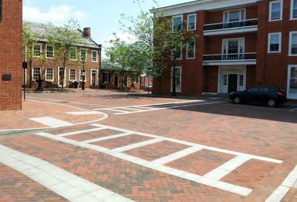
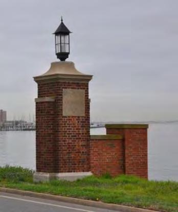
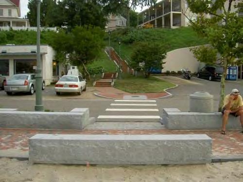
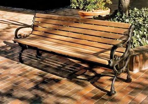
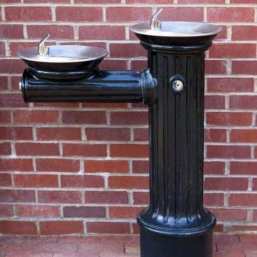
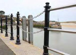
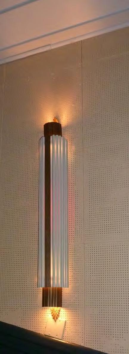
4 THEME: COHESIVENESS Details Materials Repetition

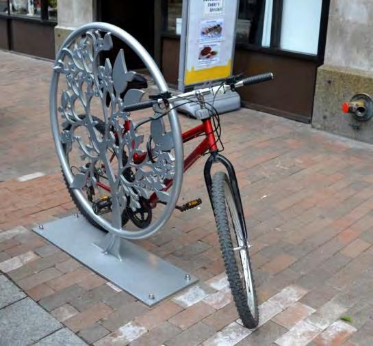
5 THEME: MULTI-FUNCTIONAL SPACES Passive Use Active Use


6 THEME: RESILIENCY Sea-level Rise LID Techniques Brock Environmental Center, Virginia Beach Portland, OR Virginia Beach, VA Buckingham Co ES, Dillwyn, VA
7 OVERALL WATERFRONT PARK PLAN & 10 STUDY AREAS: 1 ENTRANCE 2 MARINA 3 CONTINENTAL PARK 4 ENGINEER WHARF (FISHING PIER) 5 BATTERY & OUTLOOK BEACH 6 GLACIS 7 WHERRY QUARTER 8 KAYAK LAUNCH 9 COMMUNITY CENTER YEAR COMMEMORATION AREA

8 STUDY AREA 1: ENTRANCE


9 PROGRAM: ENHANCE SENSE OF ARRIVAL CONSIDER WALL CONFIGURATION (SERIES OF BARRIERS AS FEATURES) ENHANCE WAYFINDING CONSIDER VEHICULAR PULL-OFF REMOVE / RELOCATE KIOSK REMOVE GUARD BUILDING CONSIDER DECORATIVE PAVING (INGALLS RD HISTORICALLY ASPHALT PAVER BLOCKS) TROLLEY ROUTE ENHANCE & CREATE PEDESTRIAN & VEHICULAR CONNECTIONS PROVIDE NPS SIGN LOCATION CONSIDER AREA FOR PUBLIC ART STUDY AREA 1: ENTRANCE PROGRAM

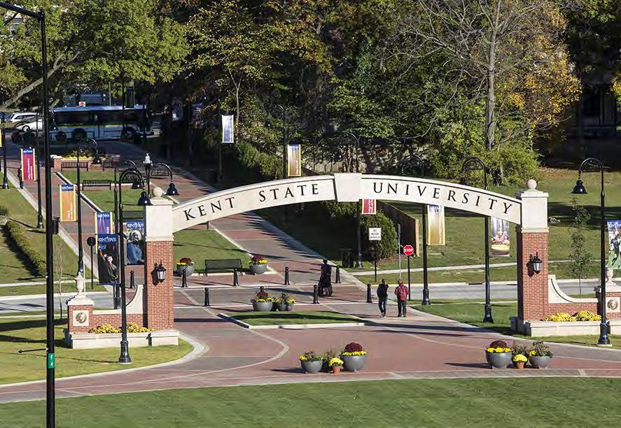
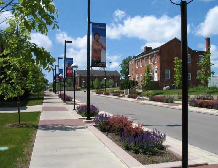
10 Savannah, GA Youngstown, OH Kent, OH Hampton, VA STUDY AREA 1: ENTRANCE INSPIRATION
11 STUDY AREA 1: ENTRANCE EXISTING
12 1. Live Oaks for Framing View 2. Connecting Walkway 3. Keep Ex. Walls & Piers 4. Keep Portion of Ex. Wall 5. New Walkway & Bench 6. Shoreline Restoration 7. Linear Park 8. New Shelter 9. Ex. Osprey Nest 10. Remove Parking Lot & Basketball Court 11. Bleacher Set-up Area 12. Ex. Pump Station 13. Remove Portion of Wall 14. New Entry Sign 15. Keep Wall and Piers 16. New Pavers 17. Monument / Art 18. Remove Guardhouse, Kiosk & Pavement 19. Walkway Connection 20. New Kiosk & Pull-off 21. New Road Connection 22. Remove 2 Lanes & Add Green Space STUDY AREA 1: ENTRANCE OPTION 1

13 STUDY AREA 1: ENTRANCE OPTION 1

14 1. Live Oaks for Framing View 2. Annual Planting 3. Keep Ex. Walls & Piers 4. Keep Portion of Ex. Wall 5. New Walkway & Bench 6. Shoreline Restoration 7. Linear Park 8. New Shelter 9. Ex. Osprey Nest 10. Remove Parking Lot & Basketball Court 11. Bleacher Set-up Area 12. Ex. Pump Station 13. Remove Portion of Wall 14. New Roundabout 15. Tree-lined Walkway 16. New Pavers 17. Monument / Art 18. Remove Guardhouse, Kiosk & Pavement 19. Walkway Connection 20. Keep Ex. Sign 21. New Road Pull-off & Kiosk 22. Remove 2 Lanes & Add Green Space STUDY AREA 1: ENTRANCE OPTION 1a

15 STUDY AREA 1: ENTRANCE OPTION 1a
16 1. Live Oaks for Framing View 2. Historic Rail Line Walk 3. Keep Ex. Walls & Piers 4. Keep Ex. Wall 5. New Walkway & Bench 6. Shoreline Restoration 7. Linear Park 8. New Shelter 9. Ex. Osprey Nest 10. Remove Parking Lot & Basketball Court 11. Bleacher Set-up Area 12. Ex. Pump Station 13. Flowering Trees 14. New Entry Sign 15. Keep Ex. Wall and Piers 16. New Pavers & Public Art 17. Remove Guardhouse and Kiosk & Add Green Space 18. Walkway Connection 19. New Kiosk & Parking 20. New Road Connection 21. Remove 1 Lane & Add Bike Lane & Green Space STUDY AREA 1: ENTRANCE OPTION 2

17 STUDY AREA 1: ENTRANCE OPTION 2
18 STUDY AREA 2: MARINA / MCNAIR DRIVE


19 PROGRAM: CONSIDER EXPANDING MARINA MCNAIR DRIVE WIDTH REDUCTION EXPAND PEDESTRIAN WALK ENHANCE WATERFRONT CONNECTIONS RE-WORK PIER GATES CREATE FEATURES TO REFLECT HISTORIC RIDING GROUNDS CONSIDER PARKING FOR RESIDENTIAL VS. MARINA CONSIDER PARKING FOR MARINA VS. THEATER CONSIDER ADAPTIVE RE-USE OF BUILDINGS EDUCATION CENTER RESTAURANT W/ OUTDOOR SEATING RESTROOMS PROVIDE CONNECTIONS AROUND BUILDINGS PROVIDE ADDITIONAL SITE AMENITIES STUDY AREA 2: MARINA / MCNAIR DRIVE PROGRAM


20 Boston, MA Hong Kong, China San Francisco, CA Virginia Beach, VA Beaufort, SC STUDY AREA 2: MARINA / MCNAIR DRIVE INSPIRATION

21 STUDY AREA 2: MARINA / MCNAIR DRIVE EXISTING

22 1. Walkway around Seawall 2. Remove Paving & Create Green Space 3. Deck & Outdoor Seating 4. Reconfigure Parking 5. Mixed-Use Development & Parking Garage 6. Zero Mile Marker Plaza 7. Walkway Connection 8. Decking for Outdoor Seating 9. Boardwalk / Walkway 10. Reconfigure Parking 11. Roadway Connection STUDY AREA 2: MARINA / MCNAIR DRIVE PROPOSED

23 STUDY AREA 2: MARINA / MCNAIR DRIVE PROPOSED
24 STUDY AREA 3: CONTINENTAL PARK
 CONSIDER WALKWAY ALIGNMENT (CURRENT ALIGNMENT NOT HISTORIC ) AREA NEEDED FOR PULL-OFF ENHANCE VEHICULAR ACCESS FOR")

25 PROGRAM: MAINTAIN PARK FOR PRIVATE EVENTS CONSIDER TIMING OF USE (NOTHING LATE-NIGHT ) CONSIDER RESTROOMS FOR SMALL EVENTS LOCATION NEEDED FOR PORTABLE RESTROOMS FOR LARGE EVENTS CONSIDER BANDSTAND ORIENTATION (MAINTAIN HISTORIC ORIENTATION ) CONSIDER WALKWAY ALIGNMENT (CURRENT ALIGNMENT NOT HISTORIC ) AREA NEEDED FOR PULL-OFF ENHANCE VEHICULAR ACCESS FOR LOADING / UNLOADING POTENTIAL TO PROVIDE STREET TREES (TREES WERE LOCATED HISTORICALLY ALONG FENWICK RD ) CONSIDER SHADOW CAST FROM CHAMBERLIN CONSIDER TYPES OF FESTIVALS / EVENTS PROVIDE OTHER STAGE AREAS PROVIDE STORAGE CONSIDER USE DURING NON-EVENTS CONSIDER INVISIBLE SOLUTIONS ENHANCE CROWD CONTROL AND SAFETY CHANGING ROOMS STUDY AREA 3: CONTINENTAL PARK PROGRAM

26 STUDY AREA 3: CONTINENTAL PARK INSPIRATION

27 STUDY AREA 3: CONTINENTAL PARK EXISTING
28 1. Pavers and Gathering Space 2. Add Green Space & Walkways 3. Grass Paver Parking 4. New Wharf 5. Stage Set-up Area 6. Paved Area for ADA 7. Paved Area for Stage Set-up 8. Drop-off & Walkway 9. Interpretive Signage & Plant Beds 10. New Walkways to Garden 11. Reinforced Walkway 12. Bus Stop 13. Bench 14. Restroom Building 15. Reconfigured Parking STUDY AREA 3: CONTINENTAL PARK PROPOSED

29 STUDY AREA 3: CONTINENTAL PARK PROPOSED

30 STUDY AREA 4: ENGINEER WHARF (FISHING PIER)


31 PROGRAM: ENHANCE PARKING FOR FISHING MAINTAIN ADA ACCESSIBILITY TO PIER MAINTAIN EMERGENCY ACCESS ENHANCE PEDESTRIAN SAFETY / CROSSING CONSIDER VEHICULAR SAFETY CONSIDER TRAFFIC CALMING CREATE SPACE FOR GATHERINGS AT 1619 MARKER CONSIDER PUBLIC ART CONSIDER PHOTOGRAPHY OPPORTUNITIES ENHANCE AND CREATE CONNECTIONS STUDY AREA 4: ENGINEER WHARF PROGRAM


32 Leonardtown, MD Richmond, VA Permeable Paving, Chesapeake, VA Mt. Vernon Beaufort, SC STUDY AREA 4: ENGINEER WHARF INSPIRATION

33 STUDY AREA 4: ENGINEER WHARF EXISTING

34 1. Reconfigured Parking Plaza 3. One-way Parking 4. Drop-off 5. Paver Crosswalk 6. Plaza 7. Monuments or Piers 8. One-way Parking 9. New Walkways 10. Interpretive Signage & Photo Set-up Area 11. Alternative Circulation 12. Moat Walk 13. Restroom Building STUDY AREA 4: ENGINEER WHARF PROPOSED

35 STUDY AREA 4: ENGINEER WHARF PROPOSED
36 STUDY AREA 5: BATTERY & OUTLOOK BEACH


37 PROGRAM: OPPORTUNITY FOR PRIVATE EVENT SPACE BEHIND BATTERY BEACH / LAWN / PIER RENTAL SPACE CREATE OVERFLOW PARKING AREAS POTENTIAL FOR PEDESTRIAN BRIDGE TO INNER FORT PROVIDE ALTERNATE PATH FOR PRIVATE EVENT CLOSURE MAINTAIN & ENHANCE EXISTING PARKING LOTS FOR BUS & VEHICULAR PARKING MAINTAIN VEHICULAR ACCESS TO GULICK DRIVE / BOARDWALK REMOVE GUARDRAIL & CREATE MORE ACCESS POINTS TO BEACH PROVIDE SITE AMENITIES & FURNISHINGS CONSIDER ADAPTIVE RE-USE OF BUILDING 300 STUDY AREA 5: BATTERY & OUTLOOK BEACH PROGRAM


38 Lee Square Park, Bowling Green, KY Farmville, VA Playground, Toronto Myrtle Beach, SC STUDY AREA 5: BATTERY & OUTLOOK BEACH INSPIRATION
39 STUDY AREA 5: BATTERY & OUTLOOK BEACH EXISTING

40 1. Shelter Location & Walkway 2. ADA Ramp 3. Earthworks Management 4. Alternative Pathway 5. Vehicular & ADA Access 6. Reconfigured Parking Approx. 180 spaces 7. ADA Access 8. Walkway on Axis with Gate 9. Gateway & Amphitheater Steps 10. Building 300 Renovation 11. Deck & Outdoor Seating 12. New Playground 13. Shelters or Picnic Tables 14. New Decorative Guardrail 15. Beach Access (ADA) 16. Decorative Outdoor Furnishings 17. Pedestrian Bridge Connection to Fort STUDY AREA 5: BATTERY & OUTLOOK BEACH OPTION 1

41 STUDY AREA 5: BATTERY & OUTLOOK BEACH OPTION 1
42 1. Shelter Location & Walkway 2. ADA Ramp or Steps 3. Earthworks Management 4. Alternative Pathway 5. Vehicular & ADA Access 6. Reconfigured Parking Approx. 85 spaces 7. ADA Access 8. Walkway on Axis with Gate 9. Gateway 10. Building 300 Renovation 11. Deck & Outdoor Seating 12. Amphitheater-style Steps 13. Picnic Area 14. Large Shelter 15. Decorative Guardrail 16. Beach Access 17. Decorative Outdoor Furnishings 18. Pedestrian Bridge Connection STUDY AREA 5: BATTERY & OUTLOOK BEACH OPTION 2

43 STUDY AREA 5: BATTERY & OUTLOOK BEACH OPTION 2
44 1. Shelter Location & Walkway 2. ADA Ramp 3. Earthworks Management 4. Alternative Pathway 5. Vehicular & ADA Access 6. Reconfigured Parking Approx. 120 spaces 7. ADA Access 8. Walkway on Axis with Gate 9. Gateway Feature 10. Building 300 Renovation 11. Deck & Outdoor Seating 12. New Playground 13. Shelters or Picnic Tables 14. Large Shelter 15. Decorative Guardrail 16. Beach Access 17. Decorative Outdoor Furnishings 18. Pedestrian Bridge Connection STUDY AREA 5: BATTERY & OUTLOOK BEACH OPTION 3

45 STUDY AREA 5: BATTERY & OUTLOOK BEACH OPTION 3
46 Existing Building Proposed Rendering STUDY AREA 5: BUILDING 300 / BOARDWALK CAFÉ

47 Proposed Plan STUDY AREA 5: BUILDING 300 / BOARDWALK CAFÉ
48 STUDY AREA 6: GLACIS


49 PROGRAM: CONSIDER ADAPTIVE RE-USE OF BLDG 88 AND RANGE BUILDING MAINTAIN VIEWS TO FIREWORKS PROVIDE MORE PERMANENT PARKING CONSIDER A STAGE AREA FOR EVENTS PROVIDE SHADE MAINTAIN MOAT ACCESS STUDY AREA 6: GLACIS PROGRAM


50 Stage Example, Yorktown, VA Circa 1919 Crissy Field, San Francisco, CA Chattanooga, TN Norfolk, VA STUDY AREA 6: GLACIS INSPIRATION

51 STUDY AREA 6: GLACIS EXISTING

52 1. Walkway Connection 2. Interpretive Signage 3. Moat Access 4. Wetland Restoration or Infill 5. Secondary Stage 6. Walkway to Follow Outer Works 7. Earthworks Management 8. Keep Ex. Road 9. New Walkways & Plaza 10. Bench 11. New Roadway Connection 12. Building 88 Renovation 13. Reconfigured Parking 14. Navy Range Building Renovation 15. ADA Access 16. Deck or Patio 17. Beach Access 18. New Roadway Connection 19. New Roadway Connection STUDY AREA 6: GLACIS PROPOSED

53 STUDY AREA 6: GLACIS PROPOSED

54 Proposed Plan STUDY AREA 6: BUILDING 88 / COMMEMORATION PARK VENUE
 Proposed Plan")

55 Proposed Plan (1 st Floor) Proposed Plan (2 nd Floor) STUDY AREA 6: NAVY RANGE BUILDING
56 STUDY AREA 7: WHERRY QUARTER

 CONSIDER MULTI-PURPOSE SOLUTIONS PROVIDE MORE")

57 PROGRAM: MAINTAIN AS RENTABLE OPEN SPACE CONSIDER ADA ACCESS ISSUES WITH REMAINING CURB CONSIDER LAYOUT FOR EVENTS (UTILITIES, PARKING, ETC.) CONSIDER MULTI-PURPOSE SOLUTIONS PROVIDE MORE ACCESS TO BOARDWALK CONNECTIONS TO NPS PROPERTY CONNECTION TO PARADISE OCEAN CLUB STUDY AREA 7: WHERRY QUARTER PROGRAM

58 STUDY AREA 7: WHERRY QUARTER EXISTING

59 1. Shelter 2. Soccer / Multi-purpose Fields 3. Ex. Steps 4. Shelter / Concession 5. ADA Access or Amphitheater Seating 6. Remove Parking & O/H Utilities 7. New Parking Lot 8. New Roadway Connection 9. New Roadway Connection 10. Jr. Soccer / Multi-purpose Fields 11. Create Grassed Slope for Seating STUDY AREA 7: WHERRY QUARTER PROPOSED

60 STUDY AREA 7: WHERRY QUARTER PROPOSED

61 STUDY AREA 8: KAYAK LAUNCH
 CONSIDER EVENTS (SAILING,")

62 PROGRAM: PROVIDE SITE AMENITIES (GAZEBO, BOARDWALK, SITE FURNITURE) PROVIDE RESTROOM BUILDINGS PROVIDE PEDESTRIAN CONNECTIONS CONSIDER PARKING (TRAILER / BOAT/VEHICULAR) CONSIDER EVENTS (SAILING, RACING, COMPETITIONS) POTENTIAL ONE-WAY VEHICULAR CIRCULATION CONSIDER NEW VEHICULAR CONNECTIONS PROVIDE TRAFFIC CALMING PROVIDE CONNECTION TO BEACH POTENTIAL LIVING SHORELINE STUDY AREA 8: KAYAK LAUNCH PROGRAM


63 Ljubljana, Slovenia Pavilion Example Hampton, VA Shoreline Restoration Path Example STUDY AREA 8: KAYAK LAUNCH INSPIRATION
64 STUDY AREA 8: KAYAK LAUNCH EXISTING
 11. Ex. Utility Bldg 12. Restroom / Bike & Kayak Rental 13. Shelter 14. Multi-purpose Field 15. New Roads and Parallel Parking 16.")
65 1. Shoreline Restoration 2. Beach Area 3. ADA Access to Beach 4. Wood Deck for Seating / Viewing 5. Re-pave Kayak Launch Access 6. Steps 7. Connect with 7-mile Trail 8. Pavers 9. Monument Piers 10. Car & Trailer Parking (one-way) 11. Ex. Utility Bldg 12. Restroom / Bike & Kayak Rental 13. Shelter 14. Multi-purpose Field 15. New Roads and Parallel Parking 16. Event Set-up Area STUDY AREA 8: KAYAK LAUNCH PROPOSED

66 STUDY AREA 8: KAYAK LAUNCH PROPOSED

67 STUDY AREA 9: COMMUNITY CENTER


68 PROGRAM: 200 PIER PROPOSED (CITY OF HAMPTON) POTENTIAL LIVING SHORELINE CONSIDER REMOVING BERM CONNECTION TO NPS LAND STUDY AREA 9: COMMUNITY CENTER PROGRAM
69 STUDY AREA 9: COMMUNITY CENTER EXISTING

70 1. 7-mile Trail Connection foot Pier (location pending) 3. Shoreline Restoration 4. Walkways / Plaza 5. Connection to Air Strip 6. Walkway to Parking 7. Tent Set-up Area STUDY AREA 9: COMMUNITY CENTER PROPOSED

71 STUDY AREA 9: COMMUNITY CENTER PROPOSED

72 STUDY AREA 10: 400-YEAR COMMEMORATION AREA
73 Building 138 Post Library 2. Building 42 Post Theatre 3. Cannon Park STUDY AREA 10: COMMEMORATION AREA EXISTING

74 INFORMATION: BUILT 1909 RENOVATED 1946 TWO STORIES 14,468 SF STUDY AREA 10: BUILDING 138 POST LIBRARY
")
75 STUDY AREA 10: REAR (EAST) ELEVATION


76 STUDY AREA 10: BUILDING SECTIONS


77 1. GLASS / STEEL / BRICK ADDITION 2. ELEVATOR / STAIR 3. ADA RESTROOM 4. BRIDGE 5. RESTROOM 6. VISITOR CENTER DESK 7. FILM / VIEWING ROOM (FMA + NPS) 8. ADA RAMP 9. EXISTING TRANSFORMERS STUDY AREA 10: FIRST FLOOR PROPOSED PLAN

78 1. GLASS / STEEL / BRICK ADDITION 2. ELEVATOR / STAIR (ACCESS TO ROOF GARDEN) 3. ADA RESTROOM 4. BRIDGE 5. RESTROOM 6. RESTORED READING ROOM 7. RESTORED ATRIUM 8. ROOF GARDEN SECONDARY ACCESS STUDY AREA 10: SECOND FLOOR PROPOSED PLAN

79 1. GLASS/STEEL/BRICK ADDITION 2. RESTORED BASEMENT WINDOWS 3. CONFERENCE ROOM 4. STAFF PANTRY 5. WORK ROOM 6. RESTROOM 7. SERVER ROOM 8. OFFICES STUDY AREA 10: BASEMENT (STAFF LEVEL) PROPOSED PLAN


80 SAMPLE CIRCULATION TOWER MAP IDEA FOR ROOF GARDEN/ PLAZA BIRMINGHAM, AL BIRMINGHAM, AL HOUSTON PERMITTING CENTER, HOUSTON, TX YALE UNIVERSITY ART GALLERY, NEW HAVEN, CT STUDY AREA 10: LIBRARY ARCHITECTURAL ELEMENTS FT. MONROE

81 INFORMATION: BUILT 1938 RENOVATED 1973, 1983, 1991 TWO STORIES 10,450 SF STUDY AREA 10: BUILDING 42 POST THEATRE
")
82 STUDY AREA 10: SIDE (EAST) ELEVATION


83 1. THREE SEASON ENCLOSED PORCH 2. EXPANDED LOBBY SPACE 3. NEW ADA TOILET ROOM STUDY AREA 10: LOBBY PROPOSED PLAN

84 1. DRESSING ROOM & TOILETS 2. LOADING DOCK & CONNECTION TO STAGE STUDY AREA 10: AUDITORIUM PROPOSED PLAN

85 STUDY AREA 10: THEATRE ARCHITECTURAL ELEMENTS

86 Building 138 Post Library 2. Building 42 Post Theatre 3. Cannon Park STUDY AREA 10: COMMEMORATION AREA EXISTING

87 STUDY AREA 10: COMMEMORATION AREA PRECEDENTS


88 US Navy Memorial, DC Lynchburg, VA Richmond, VA Charlottesville, VA STUDY AREA 10: COMMEMORATION AREA INSPIRATION

89 1. Plaza / Monument / Art 2. NPS Sign 3. Walkway Enhancement 4. Plaza & Drop-off 5. ADA Parking & Ramp 6. Reconfigured Parking 7. Addition, Loading & Service 8. New Curb Cut 9. Reconfigured Parking 10. New Roadway Connection 11. New Parking Lot 12. Mixed-use / Parking Garage 13. New Connections 14. Old Hotel Site 15. New Roadway Connection 16. Keep YMCA Drop-off 17. Reconfigured Parking 18. Observation Deck 19. Restored Housing 20. New Roadway Connection 21. Podium & Plaza 22. Building Addition 23. Reconfigured Parking 24. Commemoration Loop STUDY AREA 10: COMMEMORATION AREA PROPOSED

90 STUDY AREA 10: COMMEMORATION AREA PROPOSED

91 STUDY AREA 10: COMMEMORATION AREA PROPOSED

92 CONSIDERATIONS MOVING FORWARD Signage Package (in the works) Parking Plan (KHA) Design Guidelines (Buildings & Landscape) Transportation / Bicycle Plan Earthworks Management Plan Integrate Interpretive Plan with Waterfront Park NEXT STEPS Review and Integrate Stakeholder & Public Comments Final Plans
 qdesignarchitecture@gmail.com Carrie Quinn (Q-Design) qdesignarchitecture@gmail.com Jamie Weist (KHA) jamie.weist@kimley-horn.")
93 THANK YOU! Billy Almond (WPL) Nicole Weisstanner (WPL) Emily Rothrock (WPL) Ron Quinn (Q-Design) Carrie Quinn (Q-Design) Jamie Weist (KHA) Rob McGinnis (OCULUS)
VEHICULAR AND PEDESTRIAN CIRCULATION
 This perspective sketch communicates the intended character and quality of a proposed streetscape design. Locate benches near a major intersection where people tend to gather. Seating and lighting provide
SALEM FOREST RIVER PARK PRELIMINARY POOL AREA ASSESSMENT & MASTER PLAN STUDY. For the City of Salem
 SALEM PRELIMINARY POOL AREA ASSESSMENT & MASTER PLAN STUDY For the City of Salem 6-13-17 This process undertaken by Weston & Sampson is to outline preliminary ideas only of what possibilities exist for
BRADENTON RIVERWALK EXPANSION MASTER PLAN
 BRADENTON RIVERWALK EXPANSION MASTER PLAN INTRODUCTION & AGENDA Process Update Community Engagement Summary Center for Active Design (CfAD) Recommendations Context and Existing Conditions Master Plan Alternatives
Y Sports Complex PROGRAMMING Capitol Improvement Plan. Anticipated/Suggested Improvements. Sedgwick County Park: Sports Complex:
 PROJECT OVERVIEW Location: East of Ridge Road, between 21 st Street and 13 th Street, not including SCZ In conjunction with The Sedgwick County Park Facilities Observation Report Compilation of improvements
Design Considerations
 Essential to the development of a successful Master Plan for the Park Complex is input from the community that the park will serve. The community outreach component of the planning process included numerous
The open space system should provide connective elements, relate to natural resources, and enhance the suburban character of the landscape..
 The open space system should provide connective elements, relate to natural resources, and enhance the suburban character of the landscape.. Mixed-use and infill development should maintain or enhance
JACKsON STREET PIER CONCEPTUAL DESIGN PACKAGE SEPTEMBER 21, 2017
 JACKsON STREET PIER CONCEPTUAL DESIGN PACKAGE SEPTEMBER 21, 2017 JACKsON STREET PIER Process outline DESIGN PROCESS OVERVIEW: Sandusky s Jackson Street Pier Conceptual Design process included input from
Emerson Park Master Plan Update. Public Meeting III August 27, 2014
 Emerson Park Master Plan Update Public Meeting III August 27, 2014 Meeting Agenda: Project Update Presentation of Master Plan Components Discussion and Feedback The Path Forward: Building on the Concept
ROCKTON DOWNTOWN STREETSCAPE MASTER PLAN. Plan Commission Presentation April 10, 2018 Teska Associates Christopher Burke Engineering
 ROCKTON DOWNTOWN STREETSCAPE MASTER PLAN Plan Commission Presentation April 10, 2018 Teska Associates Christopher Burke Engineering AGENDA 1. Project Scope & Schedule 2. Steering Committee & Community
PHASE 3-4 PARKS SOUTH PARK AND CHANNEL PARK
 PHASE 3-4 PARKS SOUTH PARK AND CHANNEL PARK Sheet List L1.0 L2.0 L3.0 L4.0 L5.0 L6.0 L7.0 L8.0 L9.0 L10.0 L11.0 L12.0 L13.0 L14.0 L15.0 L16.0 L17.0 L18.0 L19.0 L20.0 L21.0 L22.0 Cover Open Space Context
New Park / Entry Court & Plaza Concept Design
 New Park / Entry Court & Plaza Concept Design The SECC Public realm is proposed to have a focus on health, wellness, and community and that site users will include patrons of the neighbourhood. The block
BEMIDJI CITY COUNCIL Work Session Agenda Monday July 9, 2012
 BEMIDJI CITY COUNCIL Work Session Agenda Monday July 9, 2012 City Hall Conference Room 5:30 p.m. 1. CALL TO ORDER / ROLL CALL 2. REVIEW PARK PLANS FOR PAUL BUNYAN PARK, LIBRARY PARK AND SOUTH SHORE BAUER
1. Parks & Recreation Neighborhood Parks Community Parks Special Use Sites 2. Open Space 3. Trails
 Appendix A: Park Classifications The intent of parks and recreation classifications is to aid in making acquisition and design decisions for park sites, facilities and the organization of recreation space
Preliminary Sketch Plan for Fort Hunter Park
 Preliminary Sketch Plan for Fort Hunter Park Public Presentation November 19, 2009 Dauphin County Parks and Recreation 100 Fort Hunter Road Harrisburg, PA 17110 (717) 599-5188 www.dauphinc.org THOMAS COMITTA
Charles P. Johnson and Associates. Annapolis Landscape Architects
 Charles P. Johnson and Associates Annapolis Landscape Architects AGENDA Introduction Project Limits and Scope Site Analysis Opportunities & Constraints Program Goals Image Boards Design Alternatives Pros
Appendix 1. Private Projects with Respective On Site PUS and Public Parks in the Silver Spring CBD
 Appendix 1 Private Projects with Respective On Site PUS and Public Parks in the Silver Spring CBD Green Space Guidelines for the Silver Spring Central Business District montgomery county planning board,
Chapter 14 Streetscape Improvements
 This chapter presents streetscape design concepts for key streets and gateways in the Downtown Specific Plan area. This chapter is organized as follows: 14 Streetscape Improvements 14.1 Streetscape Treatments
City of Plattsburgh DRI: Downtown Streetscapes & Riverfront Access. Downtown Streetscape and Riverfront Access Design
 City of Plattsburgh DRI: Downtown Streetscapes & Riverfront Access Welcome Thank you for coming this evening. Agenda PART I - Project Context The Downtown Revitalization Program Our DRI Projects Other
Preferred Riverwalk Alternative Components August 17, 2017:
 Preferred Riverwalk Alternative Components August 17, 2017: 1. Entrance and Future Pump Station Location: Entrance location to line up with main parking entrance to Captain Parkers and allows future Pump
R STREET CORRIDOR NEIGHBORHOOD Site Plan and Design Review Supplemental Guidelines Checklist
 R STREET CORRIDOR NEIGHBORHOOD Site Plan and Design Review Supplemental Guidelines Checklist Applicant s Name: Project Address: Phone: Email: Applicant shall fill out the design guidelines checklist for
Providence Waterfront Park
 I-195 Redevelopment Parcels Providence Waterfront Park June 30, 2014 I-195 30% Design Review 1 November 19, 2012 endorses open space design. 2 Design Chronology October 2013 10% Design Submitted for both
MASTER PLAN for the EARL NEWHOUSE WATERFRONT
 MASTER PLAN for the EARL NEWHOUSE WATERFRONT on RESERVOIR POND - CANTON, MA Community Meeting #2 - Thursday, January 11 th PROJECT INTRODUCTION Project Goals: To prepare a MASTER PLAN which develops the
Master Plan Presentation August 12, 2015
 Master Plan Presentation August 12, 2015 A vision for tomorrow... May, 13 2015 prepared for: prepared by: SITE LOCATION SITE NTS SITE ANALYSIS +/- 17.8 Ac. RESIDENTIAL HOMES 1 2 RAIL ROAD (SAFETY CONCERNS)
4 Semi-Private & Private Open Spaces
 4 Semi-Private & Private Open Spaces 4.1 Semi-private Open Space 4.1.1 Common Courtyards The common courtyards for each complex will be designed and programmed for the typical owners living there. They
Highland Falls Waterfront Redevelopment Feasibility Study Village Board Meeting March 20, 2017
 Village Board Meeting March 20, 2017 Agenda I. Public Meeting #1 Visioning Summary II. Public Meeting #2 Comment Summary III. IV. IV. Case Study: Milton Train Station Schematic Design Concepts Schedule/Next
Carlsbad Village Redevelopment Concept Summary of Features
 Carlsbad Village Redevelopment Concept Summary of Features Calthorpe Associates November 5, 2003 The Redevelopment Concept illustrates a vision for the future of Carlsbad Village. The overall vision of
SFMTA PHELAN LOOP AND PUBLIC PLAZA PHELAN OCEAN AVENUE
 SFMTA Municipal Transportation Agency Image: a bus in front of the Palace of the Legion of honor SFMTA PHELAN LOOP AND PUBLIC PLAZA PHELAN AVENUE @ OCEAN AVENUE Community Meeting May 23, 2012 San Francisco,
January 11, New benches installed. Paving of parking lot adjacent to piers and the canoe put-in. Near complete with clean up remaining.
 Project Updates January 11, 2018 CENTERVILLE CHESAPEAKE ARBORETUM BELLS MILL CITY CREEKWOOD SOUTH DEEP CREEK LOCK WORK TO BE PERFORMED/UPDATES Improvements to the parking lot include installation of a
Reconnecting to a Forgotten River St. Cloud MN. Aaron Hanson Design Design Thesis LA 572, Thesis, Spring 2012
 Reconnecting to a Forgotten River St. Cloud MN Aaron Hanson Design Design Thesis LA 572, Thesis, Spring 2012 site context 2.5 Miles Sartell St. Cloud to Fargo 170 Miles (2 hrs 45 mins) Hwy 10 infrastructure
Preci nct P l ans Figure 56 Campus Aerial Photo, 2008 CAL STATE EAST BAY, HAYWARD CAMPUS MASTER PLAN
 9 Precinct Plans This section contains a detailed discussion of the planning and design concepts for specific areas or precincts of the Cal State East Bay Hayward campus. The Precinct Plans pertain to
ACADEMY AREA CONCEPT PLAN
 ACADEMY AREA Strip ling C hape l Roa d CONCEPT PLAN 7 S2 U Stripling 52 ROADWAYS AND PARKING: ADVENTURE PLAYGROUND AND SPRAYGROUND: Current roadways follow existing drives. It is recommended that the Folds
Popp s Ferry Causeway Park Back Bay Environmental Educational Center CASHIO COCHRAN LLC
 Popp s Ferry Causeway Park Back Bay Environmental Educational Center CASHIO COCHRAN LLC A LIMITED LIABILITY COMPANY Popp s Ferry Causeway Park Master Plan Prepared for: City of Biloxi Department of Parks
GYPSUM PARKWAY CORRIDOR ENHANCEMENT Gypsum, Colorado. Schematic Design January 2015
 GYPSUM PARKWAY CORRIDOR ENHANCEMENT Gypsum, Colorado Schematic Design January 2015 1 2 3 4 5 6 7 8 9 DESIGN WORKSHOP Landscape Architecture Land Planning Urban Design Tourism Planning Asheville Aspen Austin
Port of Camas-Washougal Waterfront Trail Master Plan
 Port of Camas-Washougal Waterfront Trail Master Plan The Port s facilities are the products of its mission: To make strategic investments that enhance the community s quality of life by bringing jobs,
BURTON STATION STRATEGIC GROWTH AREA PLAN UPDATE PUBLIC MEETING 3/26/18
 BURTON STATION STRATEGIC GROWTH AREA PLAN UPDATE PUBLIC MEETING 3/26/18 1 WHERE WE ARE? 2 PRIMARY OBJECTIVES OF THE PLAN UPDATE 1. Update the land use designation for Burton Station Village to reflect
WINDSOR GLEN DESIGN GUIDELINES
 WINDSOR GLEN DESIGN GUIDELINES Adopted by Council, 2006 WINDSOR GLEN REDEVELOPMENT DESIGN GUIDELINES August 2006 1.0 Master Plan Organization For this area of the Coquitlam Town Centre, a mix of high,
Dowdy Park. Concept Plans TOWN OF NAGS HEAD NORTH CAROLINA. Developed by: Albemarle & Associates, Ltd VHB/ Vanasse Hangen Brustlin, Inc.
 TOWN OF NAGS HEAD NORTH CAROLINA Concept Plans Developed by: Albemarle & Associates, Ltd VHB/ Vanasse Hangen Brustlin, Inc. Site Looking Southeast Dowdy Park Existing Conditions Nags Head Woods Sound Future
chapter DESIGN GUIDELINES NEW RIVER MASTER PLAN REPORT
 chapter DESIGN GUIDELINES NEW RIVER MASTER PLAN REPORT .76 DESIGN GUIDELINES An Overview design guidelines NEW RIVER MASTER PLAN Design Guidelines can transform the image of a city. Specific, design-based
FROM DUPONT CIRCLE NORTH TO CALIFORNIA STREET, NW. Welcome!
 FROM DUPONT CIRCLE NORTH TO CALIFORNIA STREET, NW Welcome! Meeting Agenda 6:00 PM Open House 6:30 PM Presentation 7:00 PM Open House / Q&A at the Boards Project Design Team Connecticut Avenue, NW Project
Public Workshop 2 December 11, 2014 OLIN
 Public Workshop 2 December 11, 2014 OLIN TRIPLE IMAGE PANORAMA A NEW VISION FOR THE RIVERFRONT PROMENADE Burlington s Riverfront has historically been a defining character of the City s identity. This
PRELIMINARY DESIGN + DEVELOPMENT PLAN
 WELCOME! To The Public Open House May 30 th, 2017 HARBOUR WEST PARKS Vision Project Overview The City s vision for Port Credit Harbour West Parks is to develop a vibrant waterfront destination that integrates
Activities for All Ages. Small Community Feel. Entertainment. Mix of Uses
 DRAFT PROPOSALS Safety Walkability Open Space/Views to Ocean/Beach Access Activities for All Ages Small Community Feel Entertainment Mix of Uses Gathering Place Celebrate Our Assets: Enhance the four major
preliminary master plan Cover Slide executive summary public presentation
 preliminary master plan public presentation executive summary Cover Slide {agenda} + Master Plan Process + Context and Overviews + Preliminary Concepts - Entry/Gateways - Core District - Streetscape +
VIRGINIA KEY CONSENSUS MASTER PLAN
 VIRGINIA KEY CONSENSUS MASTER PLAN JULY 2010 Existing Conditions JULY 2010 STAKEHOLDER INTERVIEW PROCESS, January 18-22, 2007 PUBLIC MEETING #1: SITE INVENTORY AND ANALYSIS, March 29, 2007 PUBLIC MEETING
OPPORTUNITIES AND CONSTRAINTS - OXBOW PARK ENTRANCE AND PUT-IN
 OPPORTUNITIES AT OXBOW EXISTING WETLANDS Site is undeveloped and we can design a park that works well from the start. SAND BEACH Potential to eliminate invasive species. DEBRIS (CONCRETE, OLD CARS) VEGETATION
Georgeson Botanical Garden Master Plan
 Georgeson Botanical Garden Master Plan Alaska Chapter 2018-03-12 This Master Plan was developed by volunteers representing the Alaska Chapter of the American Society of Landscape Architects. Eliza Bober
ROME WATERFRONT VILLAGE PROJECT NARRATIVE January 25, 2018
 January 25, 2018 The Rome Waterfront Village project is intended to foster the revitalization of the area between South James Street and Erie Boulevard north of the Erie Canal as well as improve public
lakeway mixed use tract open space plan
 LEGEND:. UNDISTURBED NATURAL AREA. ENTRY STATEMENT BUILT INTO HILLSIDE. R.O.W. PLANTING (STREET TREES/LIGHTS). HEB ENTRY DRIVE 5. BIO-FILTRATION IN MEDIAN 6. MAIN ENTRY @ MAIN STREET. EXISTING TREES TO
Chapter 6. Overall Vision RECOMMENDATIONS. More Trail and Trail. Connections. Equal Access to Park. Facilities and Programs. Water Access.
 Overall Vision More Trail and Trail Connections Equal Access to Park Facilities and Programs Water Access Environment Variety Chapter 6 RECOMMENDATIONS Chapter 6 The following recommendations for park,
5.0 P A R K R E C O M M E N D A T I O N S
 5.0 P A R K R E C O M M E N D A T I O N S 5.1 Confederation Park The analysis of Confederation Park recognizes that it, along with City Hall, is the symbolic heart of Kingston. While the existing layout
ANCHORAGE PARK REPORT CARD Assessing A Park s Appearance, Function, & Condition
 ANCHORAGE PARK REPORT CARD Assessing A Park s Appearance, Function, & Condition Park Name: Is Your Park an A or an F? Your Name: Contact Information Optional: Date: General Instructions: Phone: Email:
The Village. Chapter 3. Mixed Use Development Plan SPECIFIC PLAN
 The Village SPECIFIC PLAN Chapter 3 3.1 INTRODUCTION 3.1.1 Purpose This Chapter describes the development regulations applicable to the Mixed-Use and Transit Center Planning Areas. These form-based regulations
Sub-committee on Harbour Plan Review of Harbour-front Enhancement Committee. Ninth Meeting
 Sub-committee on Harbour Plan Review of Harbour-front Enhancement Committee Ninth Meeting Date: 5 October 2005 Time: 3:30pm Venue: Conference Room 15/F, North Point Government Offices, 333 Java Road, North
Forest Grove Park Master Plan
 Workshop 03 Steering Committee Meeting 2:00 5:00 PM Public Open House 5:00 7:00 PM February 21, 2012 Agenda February 21, 2012 Schedule and planning process update. Preliminary Program review. Concept plan
Welcome! HORSESHOE BAY PARK. Welcome!
 Welcome! HORSESHOE BAY PARK Welcome! Where are we in the process? Today we would like your input on how Horseshoe Bay Park can be upgraded to serve the community s needs better. CONSULT STAKEHOLDERS TAKE
A L F O N S O A R C H I T E C T S
 A L F O N S O A R C H I T E C T S A L M A T H E P I E R O F S T. P E T E R S B U R G A L F ALFONSO O N S O A R ARCHITECTS C H I T E C T S ALMA 1. Please demonstrate how the project fits within the Pinellas
Ohlone College Measure G Project Scope Revisions
 Scope Revisions Current Title Revised Title Current Scope Revised Scope 6101 Relocated Baseball Field Athletic Fields Create new sustainable baseball field with synthetic turf, bleacher seating and batting
Woods Chapel Park. Park Amenities: Playground, basketball court, single table shelter, small pond and multi-use trail.
 Woods Chapel Park Park Location: 3925 NW Dogwood Park Land Established: 1979 Park Size: 10 acres Developed Acres: 6 acres Undeveloped Acres: 4 acres Park Type: Neighborhood Park Amenities: Playground,
Clairtrell Area Context Plan
 Clairtrell Area Context Plan March 2005 Urban Development Services City Planning Contents 1. Introduction... 4 2. Development Structure... 6 2.1 Streets... 7 2.1.1 Sheppard Avenue and Bayview Avenue...
ALTERNATIVE STATION AREA -
 ALTERNATIVE STATION AREA - THE 10 TH STREET GARDEN STATION Two alternative land use scenarios and designs are illustrated here: Scheme A - Transit-Oriented Development High to Mid-Density Residential /Office
Millbrae TOD #2 Project Analysis
 Millbrae TOD #2 Project Analysis Project Description A Site Development Permit and Conditional Use Permit are proposed to allow for a mixed-use transitoriented development on approximately 9 Acres located
Lakefront Downtown Action Plan Phase I June 2008
 Lakefront Downtown Action Plan Phase I June 2008 Downtown Development Authority City of Lake Charles Lakefront Overview DDA Chairman Rick Richard DPZ Lakefront Plan May 5 th 2007 $18.5M City Bond Issue
Point Defiance Park. Master Plan Update. April 23 rd 2015
 Point Defiance Park Master Plan Update April 23 rd 2015 Public Participation 1/29, 2/26, 3/26 & 4/23 Tonight s Agenda: Introduction: March Meeting Recap: Overview Feedback Responses Presentation of Master
GREENING THE BOULEVARD Master Plan Concepts for Venice Boulevard between Lincoln and Sawtelle
 GREENING THE BOULEVARD Katherine Spitz Associates Inc. 4212½ Glencoe Avenue Marina Del Rey, CA 90292 310 574 4460 Fax 574 4462 January 2008 Table of Contents Overview Proposed Design Improvements Illustration
CONTEXT + PROGRAM. CONTEXT - Site Photos RIALTO THEATRE STATION DEPOT HOTEL CONGRESS GREYHOUND SITE 4TH AVENUE BROADWAY BOULEVARD
 PROJECT SITE - View facing South - GREYHOUND SITE RIALTO THEATRE HOTEL CONGRESS STATION DEPOT BROADWAY BOULEVARD 4TH AVENUE CONGRESS STREET TOOLE STREET CONTEXT - Site Photos CONTEXT + PROGRAM 6th Avenue
Rotary Park / Railroad Lake
 Rotary Park / Railroad Lake Park Location: 600 NW Vesper St. Park Land Established: 1975 Park Size: 12 acres Developed Acres: 12 acres Undeveloped Acres: 0 acres Park Type: Community Park Amenities: 2
Design Guidelines for the Route 30 Corridor Master Plan: Subdivision and Land Development Elements
 Design Guidelines for the Route 30 Corridor Master Plan: Subdivision and Land Development Elements East Whiteland Township- Chester County, PA Prepared by: Draft: May 7, 2018 Design Guidelines for the
SOUTH UNIVERSITY Street Design Alternatives in Progress
 1 Alternatives in Progress 2016.01.20 Meeting Agenda 2 1. Progress & Schedule 2. Utilizing the Street Design Manual 3. Site Characteristics and Input Received 4. Street Geometry What can we accomplish
3.1 Existing Land Use
 3.0 Land Use This strategy has been developed taking into account the position of the Town of Sidney as the economic center of the Saanich Peninsula. It acknowledges existing land use patterns in the downtown
Las Colonias Park Master Plan
 2013 Las Colonias Park Master Plan City of Grand Junction June 2013 Introduction Las Colonias Park, a 101 acre parcel on the edge of the Colorado River south of downtown, was deeded to the City of Grand
M i s s i o n B a y W a t e r f r o n t
 114 M i s s i o n B a y W a t e r f r o n t Character of the Area: The Mission Bay Waterfront extends from Pier 48 at China Basin Channel to 18th Street in the Central Basin. This area of the waterfront
Long Branch-Wayne Local Park Renovation Project
 Montgomery Parks Long Branch-Wayne Local Park Renovation Project Community Meeting #2 September 20, 2016 Oak View Elementary School 7:00-9:00 PM Welcome / Team Introductions M-NCPPC (Montgomery Parks)
Illustrative Development Plan
 Illustrative Development Plan December 7, 005 045 Sansome St., Studio 3 San Francisco, CA 94 Area A - Increase visibility to waterfront and aquatic center from the Embarcadero - Provide streets rather
PROJECT SITE The Proposed Project includes the Allen and Pike Street malls between Delancey and South Streets (see Figure 2C-1).
.") Chapter 2, Section C: A. INTRODUCTION This chapter considers the potential of the proposed Reconstruction of the Allen and Pike Street Malls project to affect the urban design characteristics and visual
Chapter 2, Section C: A. INTRODUCTION This chapter considers the potential of the proposed Reconstruction of the Allen and Pike Street Malls project to affect the urban design characteristics and visual
Maplewood Avenue Downtown Complete Street Project
 Maplewood Avenue Downtown Complete Street Project Second Public Meeting January 24, 2018 Welcome and Introduction of Project Team City Planning and Public Works Staff City of Portsmouth Juliet Walker Planning
Notice of Preparation (NOP) of an Environmental Impact Report and Public Scoping Meeting for the Alameda Shipways Residential Project
 of an Environmental Impact Report and Public Scoping Meeting for the Alameda Shipways Residential Project") Notice of Preparation (NOP) of an Environmental Impact Report and Public Scoping Meeting for the Notice is hereby given that the City of Alameda, Lead Agency, will prepare an Environmental Impact Report
Notice of Preparation (NOP) of an Environmental Impact Report and Public Scoping Meeting for the Notice is hereby given that the City of Alameda, Lead Agency, will prepare an Environmental Impact Report
Benedict Fountain Park Meeting Notes Wednesday, February 15, 2012
 Benedict Fountain Park Meeting Notes Wednesday, February 15, 2012 ALTERNATIVE #1 Like the big open lawn space in alternative 1. Like cohesiveness of sidewalk walk and play areas shown on alternative 1
Figure 3-1: Public Realm Plan
 3 Public Realm Figure 3-1: Public Realm Plan 3.1 Public Realm Concept The public realm concept for the Little Mountain site integrates a clear and accessible movement network with public spaces for social
Master Plan Implementation Committee Meeting
 MILTON VILLAGE ZONING AND WATERFRONT STUDY Master Plan Implementation Committee Meeting February 12, 2018 7:00-9:00 pm IMAGE: GOOGLE COMPILED MEETING FEEDBACK/SURVEY RESULTS Waterfront Principles - Prioritized
GROUND LEVEL ENLARGEMENT / STREETSCAPE AT PIER AVENUE STRAND & PIER HOTEL HERMOSA BEACH HARDSCAPE MATERIAL KEY MAP PIER AVENUE
 COMPOSITE LANDSCAPE LOT B ( MAX SPACES) WILSHIRE BLVD, SUITE 0 BEVERLY HILLS, CA 0 TH STREET WILSHIRE BLVD, SUITE 0 BEVERLY HILLS, CA 0 BRYANT STREET, SUITE 00 SAN FRANCISCO, CA 0 S. FIGUEROA ST. TH FLOOR
TOWN COUNCIL / PLANNING COMMISSION
 Workshop #3 TOWN COUNCIL / PLANNING COMMISSION January 20, 2011 Consultant Team In Attendance Tonight BMS Design Group Nevada City and San Francisco Michael Smiley, AICP, ASLA Partner-in-Charge Nancy L.
Though functionally a part of the Ocean Avenue Neighborhood Commercial
 Phelan Loop area, existing conditions Phelan Loop area, with proposed infill development and open space Though functionally a part of the Ocean Avenue Neighborhood Commercial District, the, along the north
The Process. Phase 1: Detailed Assessment, Design Framework Phase 2: Conceptual Design. Phase 3: Master Plan Document
 Background The Ship Point master planning process was initiated in March of 2017 to advance policy direction from Harbour Vitality Principles (2014) Ship Point design and initial implementation a key action
Capital Projects Update March 2017
 Capital Projects Update March 2017 Partnership Initiatives Eastside Community Center Metro Parks is working with Tacoma Public Schools, the City of Tacoma, Tacoma Housing Authority, Boys & Girls Clubs
Throughout. square. (Crystal City Vision Plan 2050)
") 1: Terms related to the PSMP document 1 public space (see also public realm, civic space) An open space designated on the regulating plan, accessible to all, including Plazas, Mini Parks, and Neighborhoods
1: Terms related to the PSMP document 1 public space (see also public realm, civic space) An open space designated on the regulating plan, accessible to all, including Plazas, Mini Parks, and Neighborhoods
TURN TO THE RIVER CITY PLAZA LANDSCAPE DESIGN CONCEPT May 25, 2016
 Turn to the River is a multi-year project of Art Spaces - Wabash Valley Outdoor Sculpture Collection, Inc. to connect downtown Terre Haute with the Wabash River through public art and design. The four-square
Parks & Recreation. Michael Versen & Associates Landscape Architecture Land Planning
 Michael Versen & Associates Landscape Architecture Land Planning 299 N. Weisgarber Road Suite 201 Knoxville, TN. 37919 website: www.versenassociates.com telephone: 865-588 588-1331 fax: 865-251 251-4086
Official Community Plan Bylaw No. 4360, 2004, Amendment Bylaw No. 4897, 2016 (Sewell s Landing)
") District of West Vancouver Official Community Plan Bylaw No. 4360, 2004, Amendment Bylaw No. 4897, 2016 (Sewell s Landing) Effective Date: 1089612v1 District of West Vancouver Official Community Plan Bylaw
District of West Vancouver Official Community Plan Bylaw No. 4360, 2004, Amendment Bylaw No. 4897, 2016 (Sewell s Landing) Effective Date: 1089612v1 District of West Vancouver Official Community Plan Bylaw
WEST BLACKHALL STREET PUBLIC REALM + TOWN CENTRE CONNECTIONS Public Exhibition 28 th June 2018
 WEST BLACKHALL STREET PUBLIC REALM + TOWN CENTRE CONNECTIONS Public Exhibition 28 th June 2018 Welcome Introduction Design Your Involvement Thank you for coming Engagement We would like to gather to this
Welcome to. kzla. Codman Square Park
 Welcome to Codman Square Park Historical Influences Historical Influences Second Church, 1806 Bollards + Granite Piers Monument from 1910 Postcard from 1910 Existing Conditions Existing Conditions Fencing
Wilbur Young Park. Park Land Established: Developed Acres: 15 acres Undeveloped Acres: 25 acres
 Wilbur Young Park Park Location: 1100 SE Adams Dairy Parkway Park Land Established: 1987 Park Size: 40 acres Developed Acres: 15 acres Undeveloped Acres: 25 acres Park Type: Community Park Amenities: Shelter
5.15 AESTHETIC RESOURCES
 5.15 AESTHETIC RESOURCES 5.15.1 Introduction This section assesses the potential visual impacts of the proposed South Ferry Terminal Project in the visual context and character of the southern tip of Lower
Wentworth Point July Community Information Session Feedback Summary
 Wentworth Point July Community Information Session Feedback Summary Introduction On Saturday, 28 July 2018, Landcom held a community information session from 11am to 1pm, at the Pulse Club, Wentworth Point,
Master Plan. of a new entry ramp as depicted on the Proposed First Floor Plan.
 Master Plan The completed Master Plan is an aggregation of the input gathered in the focus group, steering committee, staff and public open house meetings. The Design Team completed the Draft Master Plan
for Master Planned Development Framework Design Standards & Guidelines
 B L A C K D I A M O N D DE S I G N G U I D E L I N E S for Master Planned Development Framework Design Standards & Adopted June 18, 2009 Introduction and Purpose The Master Planned Development (MPD) Framework
4.9 Mendocino Avenue Corridor Plan Design Guidelines
 4.9 Mendocino Avenue Corridor Plan Design Guidelines The Mendocino Avenue Corridor Plan addresses the area between College Avenue and Steele Lane. Mendocino Avenue is a busy arterial that runs parallel
IMAGINE CLEARWATER. Community Workshop 3. November 2016
 IMAGINE CLEARWATER Community Workshop 3 November 2016 Imagine Clearwater has been a 6-month community-focused process to re-envision the downtown waterfront. VISIONING FRAMEWORK MASTER PLAN HOW CAN WE
MCCOYS CREEK RESTORATION 30% DESIGN
 MCCOYS CREEK RESTORATION 30% DESIGN THE MCCOYS CREEK RESTORATION PLAN The restoration plan aims to reduce flooding, restore ecosystem health, expand recreational opportunities along the creek, and connect
EXISTING VEHICULAR & PEDESTRIAN CIRCULATION
 46 EXISTING CONDITIONS EXISTING VEHICULAR & PEDESTRIAN CIRCULATION Vehicular and pedestrian circulation patterns are illustrated on this graphic. Campus entry points and major vehicular circulation routes
Current City Warehouse Facility. City Market Re-Use Concept. Indoor Market/ Maker s Incubator 1.06 acres +/- Open Air Market 1.
 Current City Warehouse Facility City Market Re-Use Concept Indoor Market/ Maker s Incubator 1.06 acres +/- Open Air Market Open 1.63 acres Air Market +/- 1.63 acres +/- 4.59 acres +/- Artists Workshops/