EXISTING ZONING CODE
|
|
|
- Helena Johnson
- 6 years ago
- Views:
Transcription
1
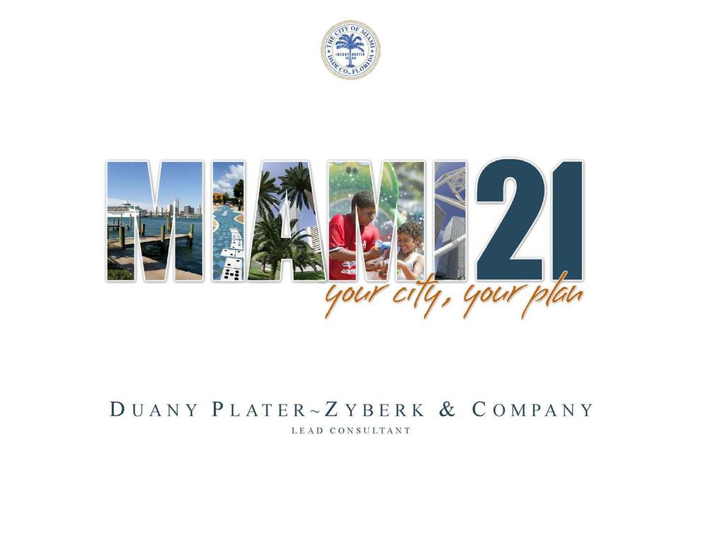
2 MIAMI
3 MIAMI 21 VISION Sense of community Improved quality of life Economic vitality Open space preservation Pedestrian friendly Transit oriented Green building Historic preservation Form based code
4 EXISTING ZONING CODE USE AND DENSITY PERMIT PROCESS FORM Existing Zoning: Focuses on Land Use Separation & Permitting Process Management Emphasizes USE and DENSITY as development controls Relies greatly on PERMIT PROCESS Neglects the role of FORM
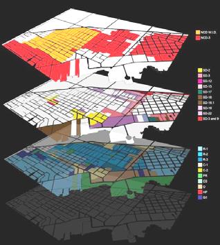
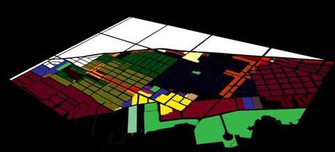
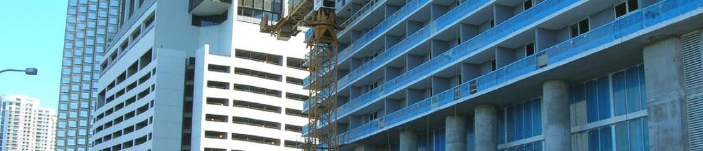
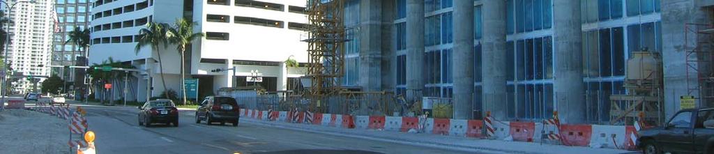
5 COMPLEXITY OF EXISTING ZONING


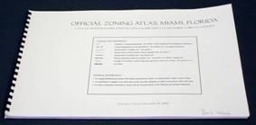

6 MULTIPLE REGULATORY DOCUMENTS

7 UNPREDICTABILITY OF EXISTING ZONING GLA and Bonuses Net lot area Net lot area Net lot area Net lot area Net lot area Only net lot area + half of R.O.W + half of R.O.W + half of R.O.W + half of R.O.W + half of R.O.W + 90 on the water + 90 on the water + 90 on the water + 90 on the water + GLA from adjacent property + GLA from adjacent property + GLA from adj. property + PUD Bonus + PUD Bonus + Affordable Housing Bonus

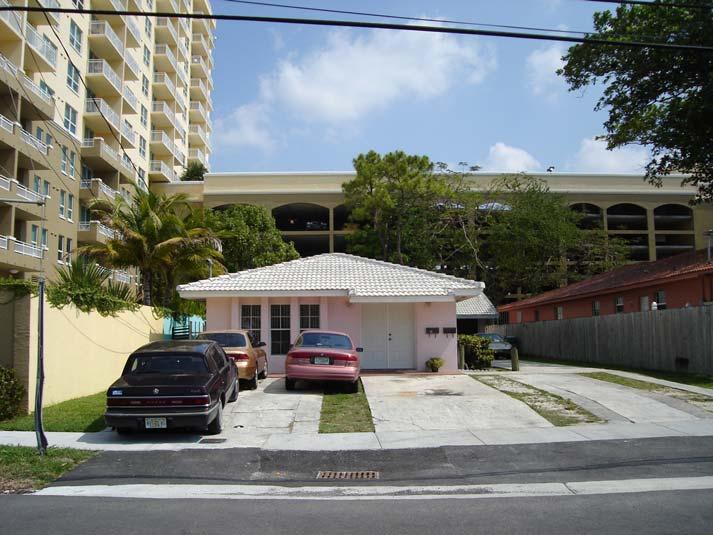
8 UNDESIRABLE JUXTAPOSITIONS NEED FOR TRANSITION

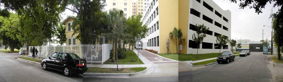
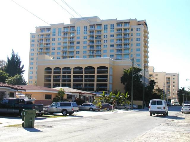
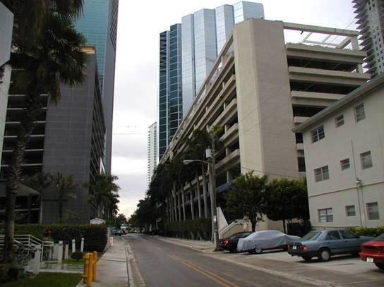
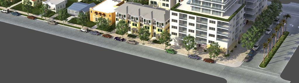
9 EXPOSED PARKING
10 EXISTING CODE - ZONING ORDINANCE 11,000 Neglects quality of public realm / not pedestrian friendly Exposed parking at pedestrian frontages (blank walls) Lacking transitions in density and height Required green space is inaccessible Gross Lot Area based calculations unpredictable Existing Floor Area Ratio (FAR) bonuses do not provide any public benefit Numerous Special Districts are reactive need for proactive comprehensive vision and approach Overly complex and vague regulations
11 EXISTING ZONING CODE USE AND DENSITY PERMIT PROCESS FORM Existing Zoning: Focuses on Land Use Separation & Permitting Process Management Emphasizes USE and DENSITY as development controls Relies greatly on PERMIT PROCESS Neglects the role of FORM
12 FORM BASED CODE
13 FORM BASED CODE FORM USE AND DENSITY PERMIT PROCESS Emphasizes the role of FORM Reduces the role of USE and DENSITY Effectively addresses PERMIT PROCESS
14 MIAMI 21 TEAM CONSULTANTS LEAD PLANNER DUANY PLATER-ZYBERK & COMPANY Elizabeth Plater-Zyberk, Project Principal Francisco Garcia & Marina Khoury, Project Managers Judith Bell, Andres Duany, Mike Lydon, Maria E. Mercer, Christina Miller, Jorge Planas, Gustavo Sanchez & Shannon Tracy. TRANSPORTATION GANNETT FLEMING, INC. Carlos Cejas, Vice President Odalys Delgado, Project Manager ECONOMIC DEVELOPMENT ECONOMICS RESEARCH ASSOCIATES Tom Moriarity, Vice President McDuffie Nichols, Senior Associate LEGAL LEWIS STROUD & DEUTSCH, P.L. Nancy Stroud, Attorney at Law RENDERINGS ARX Solutions, Inc. Thomas Spain James Wassell PUBLIC RELATIONS VILLAGE MARKETING BUREAU Silvia Cejas, President THE MONTE CHRISTO GROUP James Jeune and Pradel Denis ED O DELL & ASSOCIATES Ed O Dell THE HALL GROUP Neil Hall BOTA ENTERPRISES Tamara Philippeaux OTHER STUDIES PARKS & OPEN SPACE MASTER PLAN GOODY CLANCY David Dixon, Principal in Charge Larissa Brown, Chief Planner DOWNTOWN MASTER PLAN UPDATE ZYSCOVICH, INC. Bernard Zyscovich, Principal Trent Baughn, Project Manager CITY DEPARTMENTS Office of Mayor Manuel A. Diaz Office of City Manager Pedro G. Hernandez Offices of City Commissioners Planning Department Office of Zoning Department of Economic Development Department of Capital Improvements and Transportation Office of the City Attorney Neighborhood Enhancement Team (NET) CitiStat Office of Communications Department of Public Works Department of Parks and Recreation Department of Code Enforcement


15 DISTRICTS
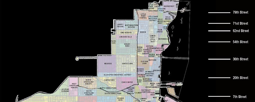
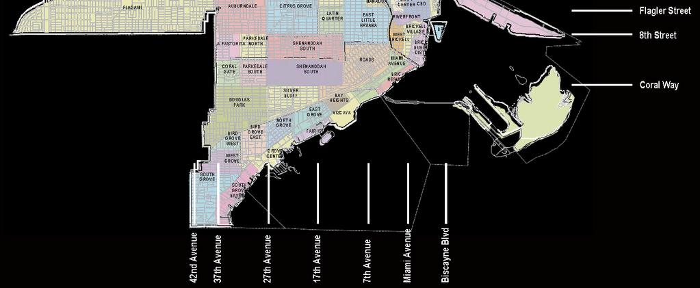
16 NEIGHBORHOODS
17 QUADRANTS

18 EAST QUADRANT NEIGHBORHOODS


19 COMMUNITY INPUT DIRECT MAIL SIGNAGE & INFORMATION TELEVISION, RADIO & PRINT PUBLIC MEETINGS WEB SITE S & QUESTIONS

20 THE TRANSECT GUIDING PRINCIPLES NATURAL GRAPHIC MIAMI
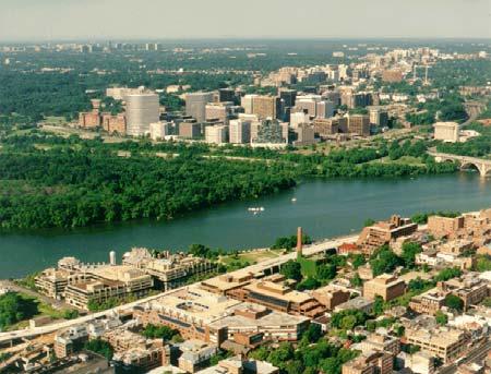
21 AERIALS OF TRANSECT BASED CITIES MIAMI SAN FRANCISCO WASHINGTON

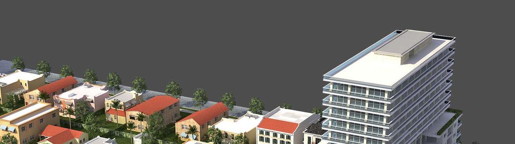
22 FORM-BASED CODE DETACHED, RESIDENTIAL HIGH-RISE, MIXED-USE
23 MIAMI 21 VISION Sense of community Improved quality of life Economic vitality Open space preservation Pedestrian friendly Transit oriented Green building Historic preservation Form based code

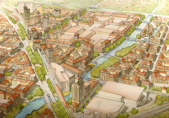
24 NEIGHBORHOOD STRUCTURE Existing Condition Proposed Condition


25 COMMERCIAL CORRIDORS ENHANCING RESIDENTIAL NEIGHBORHOODS Existing Condition Proposed Condition
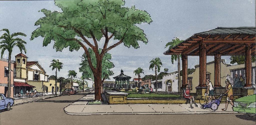
26 NEIGHBORHOOD ACCESS TO OPEN SPACE Existing Condition Proposed Condition

27 NEIGHBORHOOD ACCESS TO OPEN SPACE


28 NEIGHBORHOOD ACCESS TO OPEN SPACE Existing Condition Future FEC transit stop


29 HISTORIC PRESERVATION Existing Condition Proposed Condition

30 ANALYSIS OF EXISTING ZONING

31 360+ USES TRANSLATED TO CATEGORIES

32 CONVERSION TO TRANSECT ZONES
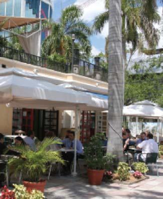
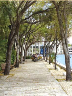
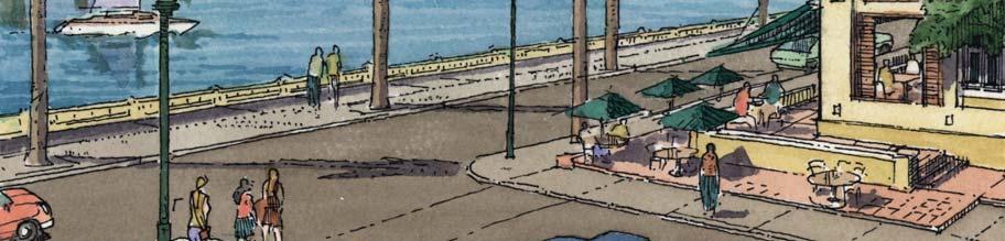
33 SAMPLE CONVERSION ZO to Miami 21


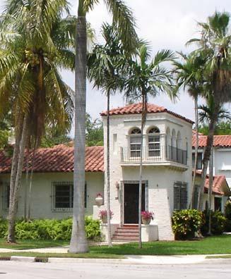
34 T3 T3 - DETACHED SINGLE FAMILY DWELLING 9-18 units/ ac T3 R SINGLE FAMILY DWELLING T3 L SINGLE FAMILY DWELLING W/ ANCILLARY UNIT T3 O - DUPLEX

35 T4 T4 PARTY WALL RESIDENTIAL, LIVE-WORK 36 units/ ac T4 R RESIDENTIAL TOWNHOUSE, APARTMENT HOUSE T4 L, O RESIDENTIAL TOWNHOUSE, LIVE-WORK

36 T5 T5 - RESIDENTIAL, COMMERCIAL, MIXED-USE 65 units/ ac T5 R RESIDENTIAL APARTMENT BUILDING T5 L, O RESIDENTIAL, COMMERCIAL, MIXED-USE BUILDINGS


37 T6 T6-8- RESIDENTIAL, COMMERCIAL, MIXED-USE 150 units/ ac T6 R RESIDENTIAL T6 L RESIDENTIAL, SOME MIXED-USE T6 O RESIDENTIAL, MIXED-USE OR COMMERCIAL
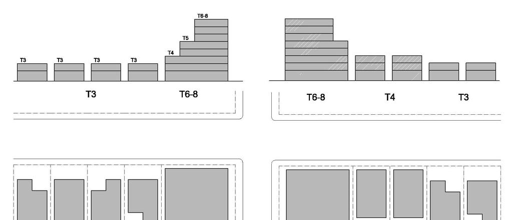
38 TRANSITIONS ACROSS THE TRANSECT
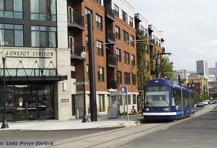
39 TRANSITIONS ACROSS THE TRANSECT
40 QUALITY OF PUBLIC REALM Public Space: detailing of streets for increased walkability and bicycling Wider sidewalks Narrower lanes Trees for shade Private Property: design of buildings to embellish public realm 10 foot setback and easement for wider sidewalks Habitable space overlooking streets (frequent doors and windows, liners, concealed parking, commercial and retail space) Cross-block passages to improve connectedness Transitions for height and density Predictable height and floor plate

41 IMPROVEMENT OF PUBLIC SPACE

42 FACE OF PRIVATE BUILDING

43 FACE OF PRIVATE BUILDING
44 SPECIAL AREA PLANS Site area must be 9 acres minimum Requires a detailed master plan with specific guidelines Allows flexibility within transect regulations Provides public benefits (open space and affordable / workforce housing) Requires a public hearing, City Commission approval
45 PUBLIC BENEFITS For T6 (high-rise buildings) not abutting single family neighborhoods: Existing bonus program expanded for housing, parks, civic facilities (fire station), preservation, green building and brownfields Allows on site, off site provision, or fee payment For T5: one story on site abutting D1 (work place) for affordable workforce housing only

46 TRANSIT ORIENTED DEVELOPMENT


47 TRANSIT ORIENTED DEVELOPMENT Del Mar Station, Pasadena, CA Portland, OR Rosslyn, DC Kendall, FL


48 CORRIDOR IMPROVEMENTS Existing Condition: narrow sidewalks, excessive pavement & few treest Proposed Improvements: wide sidewalks & medians for safety, trees s for shade & beauty

49 NEED FOR GREEN SPACE AND BETTER DRAINAGE

50 STREET IMPROVEMENTS: PERVIOUS PAVEMENT Existing Condition: wide streets, irregular pavement, no trees Proposed Improvement: street trees for shade and beauty, turf block paving for drainage
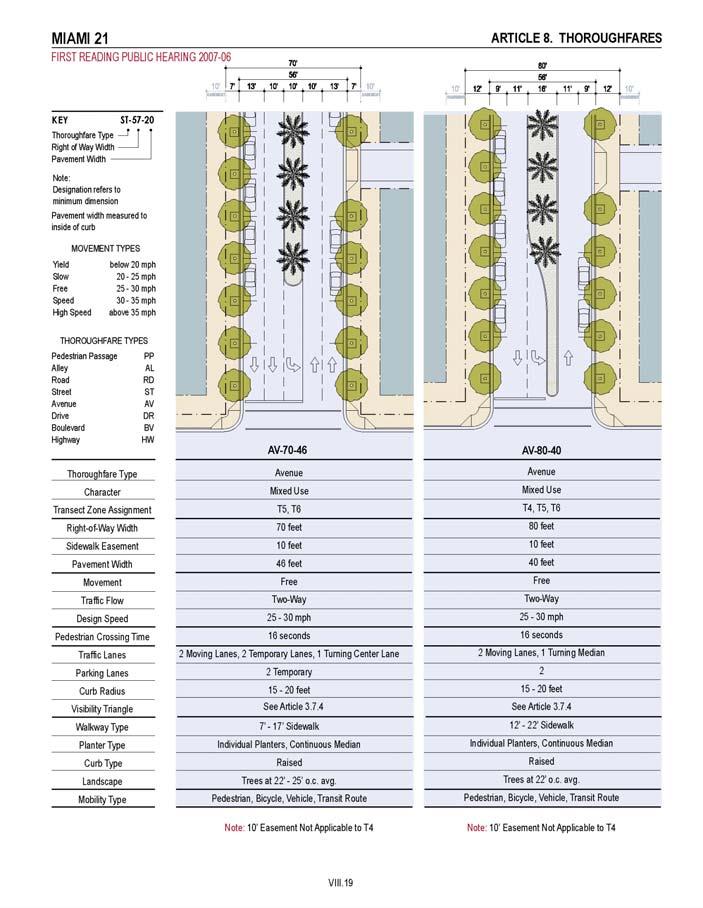
51 THOROUGHFARES
52 PROPOSED PERMITTING PROCESS Applicant Zoning Department CRC - Coordinated Review Committee PZAB Planning Zoning and Appeals Board By Right Waiver Warrant Exception Variance Zoning Change Preapplication Preapplication Preapplication Preapplication Preapplication File with Planning * File with Planning * File with Hearing Board * File with Hearing Board * File with Hearing Board * CRC CRC Zoning Administrator Planning Director Planning Director Planning Director Planning Director PZAB PZAB PZAB City Commission Appeal PZAB Appeal PZAB Appeal City Comm. Appeal Court Appeal Court Building Permit Building Permit Building Permit Building Permit Building Permit Building Permit * All applications shall include required notice
53 CHANGE OVER TIME Incremental growth Intent to ensure transition and protect neighborhoods Limit zoning changes to two public hearings per year Up-zoning only allowed to next successional transect Extended context analysis Non-conformities
54 NON CONFORMITIES Conforming Legal Nonconforming Never conforming Grandfathered Interior Work Exterior Work Addition Permit after the fact Depends Rebuild Hurricane Act of God
55 NON CONFORMITIES There are 2 considerations around which non-conformities revolve: A. Have the structure, use or lot obtained the required permits and certificates? B. Do the structure, use or lot comply with the regulations set forth by the present code? or put differently; Could the structure or use be permitted again today if they were proposed anew? NONCONFORMITIES TABLE Conforming Nonconforming Never conforming Grandfathered A. Yes Yes No B. A Yes No No B Legal Legal Illegal
56 MIAMI 21 SUMMARY Predictability of height and intensity through the form-based code Clear and user-friendly regulations Significant improvements to the public realm (wider sidewalks, building design) Requirements to avoid blank walls/garages through the use of liners (habitable space) Requirements for active use on the ground level (eyes on the street) Public Benefits incentives to create additional housing/parks and open space opportunities Incentives for creation of civic spaces (i.e. fire stations) within private development Green Building requirements and incentives New zoning category that allows granny-flats Historic preservation incentives through transfer of development rights Streamlined permitting process
57 IMPROVED QUALITY OF LIFE

58 ECONOMIC VITALITY
59 OPEN SPACE PRESERVATION

60 PEDESTRIAN FRIENDLY STREETS
61 HISTORIC PRESERVATION
62 SUMMARY CONSERVATION Preserve neighborhoods by creating appropriate transitions of height and density that do not exist today Increase preservation of historical sites and districts by providing incentives for transfer of development rights Create sustainable development through green building requirements and incentives and conserve energy through tree canopy and improved connectedness for walkability Increase access to natural environment through baywalks, riverwalks, and new parks It will create safe, vibrant, pedestrian friendly neighborhoods and thus improving the quality of life of all residents
63 SUMMARY DEVELOPMENT Develop corridors to function as transit-oriented, walkable centers for adjacent neighborhoods Create a predictable environment for growth and appropriate development Create sustainable development through green building requirements and incentives (LEED Certification) Create a pedestrian-friendly environment and improve the public realm by providing wider sidewalks, frequent doors and windows, liners, concealed parking, required commercial and retail space at ground level, which do not exist today Maintain future growth capacity of downtown and develop it as a transit-oriented, walkable area to focus on the region s economic, civic, and cultural activities


64 Existing Condition Illustration
65 ENVIRONMENTAL HEALTH Parks and Public Space Master Plan Green building Air and light for streets View corridors for buildings Wider sidewalks with trees for shade Public benefits: parks, housing, green building, brownfields Generous ceiling heights
66 MIAMI
67
EXISTING COMPREHENSIVE PLAN
 EXISTING COMPREHENSIVE PLAN Town Center Land Use Element: V. LAND USE POLICIES Town Center Mercer Island's business district vision as described in "Your Mercer Island Citizen-Designed Downtown" was an
MIAMI 21 CODE MAY This document is amended as of May 26, 2011.
 CODE MAY 2011 This document is amended as of May 26, 2011. THIS PAGE LEFT INTENTIONALLY BLANK. TABLE OF CONTENTS PREAMBLE ARTICLE 1. DEFINITIONS OF TERMS AND USES 1.1 Definitions of Building Function:
Zoning Technical Review Presented by Camiros. November 10, 2015
 Zoning Technical Review Presented by Camiros November 10, 2015 TECHNICAL REVIEW OVERVIEW Purpose of this Report Outline issues with current Ordinance Present preliminary approaches for revisions Set drafting
Appendix A. SmartCode
 Appendix A Adopted June 16, 2003 Ordinance No. 2152 N.C.S. Appendix A of the uses material from SmartCode. Notwithstanding any other agreements with Duany Plater-Zyberk & Company (DPZ) or the Municipal
Policies and Code Intent Sections Related to Town Center
 Policies and Code Intent Sections Related to Town Center The Town Center Vision is scattered throughout the Comprehensive Plan, development code and the 1994 Town Center Plan. What follows are sections
Listening Sessions: Guiding Principles and Unified Development Code New Castle County, Delaware
 Listening Sessions: Guiding Principles and Unified Development Code New Castle County, Delaware March 2015 AGENDA Introduction: Who We Are Work Program and Schedule Guiding Principles Discussion Project
NORTH LAKE SPECIFIC PLAN AREA
 NORTH LAKE SPECIFIC PLAN AREA June 21, 2018 WELCOME Workshop Agenda Introduction Provide information about the program and introduce the team Background Information Share information about the North Lake
Courthouse Square Implementation Comment/Response Matrix
 Courthouse Square Implementation /Response Matrix 1 Are open space symbols binding? GLUP No, open space symbols are not binding, as the GLUP is a policy instrument illustrating the County s future vision
Bourne Downtown Site Planning
 Prepared for: The Town of Bourne, MA In Cooperation with: Bourne Financial Development Corporation Prepared by:, Inc. June 24, 2009 Table of Contents Introduction and Summary... 1 Site Existing Conditions...
Noblesville Unified Development Ordinance Audit
 Noblesville Unified Development Ordinance Audit December 4 th, 2012 Shane Burkhardt, AICP RW Armstrong Project Summary Started project in the beginning of June 2012 Conducted focus groups July 2012 Conducted
Lehigh Acres Land Development Regulations Community Planning Project
 Lehigh Acres Land Development Regulations Planning Effort Summary In July, 2010 Commissioner Frank Mann invited the Lehigh Acres community to start discussing how to achieve their recently adopted community
TOWNSCAPE. Form Based Codes
 Key Standards Processes and Procedures 1. Are you considering using an FBC in your community? 2. Are you trying to determine if it will be effective? 3. Are you trying to determine how you can best sell
The scale of intervention:
 The scale of intervention: Degree of specificity Is the TND district linked to a specific site? Is it linked to that site s master plan? If more broadly applicable, how will it relate to a variety of sites
MIAMI 21 SEPTEMBER 2015 APPENDIX J: NEIGHBORHOOD REVITALIZATION DISTRICTS TABLE OF CONTENTS J.1. NEIGHBORHOOD REVITALIZATION DISTRICT NRD-1
 TABLE OF CONTENTS J.1. NEIGHBORHOOD REVITALIZATION DISTRICT NRD-1 1.1 Boundaries J.3 1.2 Intent J.3 1.3 Effect of District Designation J.3 1.4 Additional Notice and Review J.3 1.5 Wynwood Thoroughfares
Staff Report to the North Ogden City Planning Commission
 Staff Report to the North Ogden City Planning Commission SYNOPSIS / APPLICATION INFORMATION Application Request: Concept review on a legislative application to rezone land located at approximately 1750
Aesthetics and Design
 University of Connecticut Department of Geography Urban and Regional Planning Lecture 8. Adjunct Lecturer: Donald J. Poland, MS, AICP E-mail: don@donaldpoland.com Web: www.donaldpoland.com Aesthetics and
FUTURE LAND USE ELEMENT
 FUTURE LAND USE ELEMENT GOAL I: To create and sustain a great place to live, play, and prosper Objective 1: The City of Ocala shall incorporate the principles and strategies of the Ocala 2035 Vision into
ORDINANCE NO. City of Bellingham City Attorney 210 Lottie Street Bellingham, Washington INFILL HOUSING ORDINANCE Page 1
 ORDINANCE NO. AN ORDINANCE RELATING TO LAND USE PLANNING AND ZONING, CREATING A NEW BMC CHAPTER 20.28 INFILL HOUSING, AND NEW SUBSECTION BMC 20.12.030.E, GREEN FACTOR LANDSCAPING STANDARDS, AND AMENDING
Glenborough at Easton Land Use Master Plan
 Implementation 114 9.0 IMPLEMENTATION 9.1 OVERVIEW This chapter summarizes the administrative procedures necessary to implement the proposed land use plan, infrastructure improvements, development standards,
Highland Village Green Design Guidelines
 Highland Village Green Design Guidelines Publishing Information Title Highland Village Green Design Guidelins Author The City of Calgary Status DRAFT - Proposed document subject to changes Additional Copies
EXHIBIT A. Tax Increment Reinvestment Zone No. 1 (Town Center) First Amended Project Plan 1
 First Amended Project Plan 1") EXHIBIT A Tax Increment Reinvestment Zone No. 1 (Town Center) First Amended Project Plan 1 1 As amended by Resolution No. 2008-02-001(TR1R) of the Tax Increment Reinvestment Zone No.1, and approved to
EXHIBIT A Tax Increment Reinvestment Zone No. 1 (Town Center) First Amended Project Plan 1 1 As amended by Resolution No. 2008-02-001(TR1R) of the Tax Increment Reinvestment Zone No.1, and approved to
The transportation and land use connection
 The transportation and land use connection A sustainable trend? 180% 160% 140% 120% 100% 80% 60% 40% 20% 0% Annual vehicle miles traveled US Population Road mileage We re driving more. Infrastructure can
KENDALL SQUARE INITIATIVE. Planned Unit Development Special Permit Application - SoMa September 8, 2015
 KENDALL SQUARE INITIATIVE Planned Unit Development Special Permit Application - SoMa September 8, 2015 GENERAL DEVELOPMENT GOALS Kendall Square PUD 2 PRE-ZONING PUBLIC ENGAGEMENT 2008-2009 2010-2012 2013
New Town Mixed Use District
 New Town Mixed Use District Montgomery County Planning Commission 2009 Annual Conference PA Chapter of the American Planning Association October 6, 2009 What is NTMU? More urban style of development Complementary
4.1.3 LAND USE CATEGORIES
 4.1.3 LAND USE CATEGORIES a. City Center District The City Center District incorporates the existing character and mix of uses in downtown Belmont to encourage redevelopment and new development in keeping
TRANSIT ORIENTED DEVELOPMENT PINELLAS COUNTY MPO LIVABLE COMMUNITIES INITIATIVE PINELLAS COUNTY COMPREHENSIVE PLAN AMENDMENTS
 PINELLAS COUNTY MPO LIVABLE COMMUNITIES INITIATIVE MODEL LAND DEVELOPMENT CODE TRANSIT ORIENTED DEVELOPMENT PINELLAS COUNTY COMPREHENSIVE PLAN AMENDMENTS MPO Livable Communities Initiative Goal: Improve
Danvers High Street I-1 District Study
 Danvers High Street I-1 District Study Presentation of Final Recommendations Planning Board Presentation June 26 th, 2018 1 Introductions Metropolitan Area Planning Council Sam Cleaves AICP, Principal
RESIDENTIAL DISTRICTS
 RESIDENTIAL DISTRICTS The residential district standards have been revised to reflect on-the-ground conditions, while continuing to respect the use patterns established within the neighborhoods. This will
ARLINGTON COUNTY, VIRGINIA
 ARLINGTON COUNTY, VIRGINIA County Board Agenda Item Meeting October 15, 2005 DATE: September 28, 2005 SUBJECT: Request to Advertise the adoption of the 2005 Clarendon Sector Plan C. M. RECOMMENDATION:
Chapter PEDESTRIAN COMMERCIAL (PC) ZONING DISTRICT
 ZONING DISTRICT") Chapter 11-17 PEDESTRIAN COMMERCIAL (PC) ZONING DISTRICT Sections: 11-17-01 GENERAL PURPOSE 11-17-02 PERMITTED BUILDING TYPES 11-17-03 USES PERMITTED WITH DESIGN REVIEW 11-17-04 USES PERMITTED BY CONDITIONAL
Chapter 11-17 PEDESTRIAN COMMERCIAL (PC) ZONING DISTRICT Sections: 11-17-01 GENERAL PURPOSE 11-17-02 PERMITTED BUILDING TYPES 11-17-03 USES PERMITTED WITH DESIGN REVIEW 11-17-04 USES PERMITTED BY CONDITIONAL
ARTICLE 6: Special and Planned Development Districts
 ARTICLE 6: Special and Planned Development Districts 6-10 Traditional Neighborhood Development (TND) District 6-10.10 Purpose and Intent The Traditional Neighborhood Development (TND) District provides
GREEN BUILDING AND GREEN DEVELOPMENT
 GREEN BUILDING AND GREEN DEVELOPMENT Glastonbury Conservation Commission/Inland Wetlands Agency and Town Plan & Zoning Commission April 29, 2008 Robert J. Sitkowski, Esq., AIA, AICP Robinson & Cole LLP
Bayshore Boulevard Home Improvement District Design Guidelines
 Bayshore Boulevard Home Improvement District Design Guidelines guidelines for New construction projects and major alterations IN the bayshore boulevard home improvement special use DISTRICT SAN FRANCISCO
Mark-up of the effect of the proposed Bronte Village Growth Area OPA No.18 on the text of section 24, Bronte Village, of the Livable Oakville Plan
 Mark-up of the effect of the proposed Bronte Village Growth Area OPA No.18 on the text of section 24, Bronte Village, of the Livable Oakville Plan Notes: This document is provided for information purposes
2.0 AREA PLANS. Lakeside Business District. Lakeside Business District Land Use Categories:
 Lakeside Business District Lakeside Business District Land Use Categories: Campus Commercial Campus Commercial means a mixture of uses which includes corporate offices, office parks, hotels, commercial,
LAND USE ELEMENT. Purpose. General Goals & Policies
 LAND USE ELEMENT Purpose This Land Use Element contains the goals and policies necessary to support the City s responsibility for managing land resources and guiding development through implementing regulations,
Proposed Walkability Ordinance for City of Knoxville (6/16/17)
") Proposed Walkability Ordinance for City of Knoxville (6/16/17) New or revised text is highlighted Section 1: Purpose The purpose of this ordinance is to set requirements for walkability and pedestrian
Proposed Walkability Ordinance for City of Knoxville (6/16/17) New or revised text is highlighted Section 1: Purpose The purpose of this ordinance is to set requirements for walkability and pedestrian
PUBLIC FRONTAGE REGULATIONS MAP
 2.4. PUBLIC FRONTAGE REGULATIONS The Public Frontage is the area between the face of the curb and the back of the sidewalk. It includes the sidewalk, street trees, street lighting, and any landscaped planting
A Context-Based Design Code for Pedestrian & Transit-Oriented Development RAIL~VOLUTION NOVEMBER 2006
 A Context-Based Design Code for Pedestrian & Transit-Oriented Development RAIL~VOLUTION NOVEMBER 2006 Palo Alto Zoning Ordinance Update. Project Overview City of Palo Alto Palo Alto Zoning Ordinance Update.
UNIFIED DEVELOPMENT CODE
 Zoning UNIFIED DEVELOPMENT CODE Regulates how land is used Sets dimensional requirements for structures Addresses all aspects of site development: accessory structures, temporary uses, parking, landscape,
Ninth Square, New Haven Definition of Form-Based Zoning
 MIXED-USE AND FORM-BASED ZONING Connecticut Land Use Academy Hot Topics in Land Use Conference November 1, 2008 Timothy Bates* *Robert Sitkowski,, Esq., assisted with preparation materials Definition of
Planning Board Briefing
 Planning Board Briefing Why Now? The Sector Plan Implementation Chapter States: Before Stage 1 begins, the following must occur: Approval of the Sectional Map Amendment. Approval of the Greater Lyttonsville
Planning Commission Staff Report June 5, 2008
 Owner/Applicant Taylor Village Sacramento Investments Partners, LP c/o Kim Whitney 1792 Tribute Road #270 Sacramento, CA 95815 Staff Recommendation Planning Commission Staff Report Project: File: Request:
chapter DESIGN GUIDELINES NEW RIVER MASTER PLAN REPORT
 chapter DESIGN GUIDELINES NEW RIVER MASTER PLAN REPORT .76 DESIGN GUIDELINES An Overview design guidelines NEW RIVER MASTER PLAN Design Guidelines can transform the image of a city. Specific, design-based
FLORIN ROAD CORRIDOR Site Plan and Design Review Guidelines Checklist
 FLORIN ROAD CORRIDOR Site Plan and Design Review Guidelines Checklist Applicant s Name: Project Address: Phone: Email: Applicant shall fill out the design guidelines checklist for all guidelines applicable
Staff Report and Recommendation Based on the criteria for review in the Denver Zoning Code, Staff recommends approval for Application #2017I
 TO: Denver City Council Land Use, Transportation and Infrastructure Committee FROM: Theresa Lucero, Senior City Planner DATE: RE: Official Zoning Map Amendment Application #2017I-00149 Staff Report and
Incentive Zoning Regulations Florida Municipal City of Orlando
 Topic: Resource Type: State: Jurisdiction Type: Municipality: Year (adopted, written, etc.): 2002 Community Type applicable to: Title: Incentive Zoning Regulations Florida Municipal City of Orlando Document
ORDINANCE WHEREAS, this Ordinance is consistent with the City of Winter Garden Comprehensive Plan; and
 ORDINANCE 17-06 AN ORDINANCE OF THE CITY COMMISSION OF THE CITY OF WINTER GARDEN, FLORIDA, CREATING ARTICLE XIV OF CHAPTER 118 OF THE CITY OF WINTER GARDEN CODE OF ORDINANCES PROVIDING FOR THE EAST PLANT
B L A C K D I A M O N D D E S I G N G U I D E L I N E S for Multi-family Development
 B L A C K D I A M O N D D E S I G N G U I D E L I N E S for Multi-family Development Adopted June 18, 2009 This section of the Design and focuses on site planning and design guidance for new multi-family
Table of Contents. 1. Future Land Use FLU Housing H-1 Goal 1 H-1 Goal 2 H-4
 Table of Contents 1. Future Land Use FLU-1 Goal 1 FLU-1 2. Housing H-1 Goal 1 H-1 Goal 2 H-4 3. Infrastructure I-1 Goal 1: Potable Water I-1 Goal 2: Sanitary Sewer I-5 Goal 3: Stormwater Management (Drainage)
Design Guidelines Update Strategy Report
 Olde Town Arvada Design Guidelines Update Strategy Report Arvada Olde Town Design Guidelines Update Strategy Report July 7, 2010 Introduction The City of Arvada is in the process of updating the Design
ORANGE LINE TRANSIT NEIGHBORHOOD PLANS VAN NUYS NEIGHBORHOOD COUNCIL, PLUM COMMITTEE DEPARTMENT OF CITY PLANNING, CITY OF LOS ANGELES
 Photo: Mission Meridian(Moule & Polyzoides) ORANGE LINE TRANSIT NEIGHBORHOOD PLANS VAN NUYS NEIGHBORHOOD COUNCIL, PLUM COMMITTEE DEPARTMENT OF CITY PLANNING, CITY OF LOS ANGELES JULY 18, 2018 Project partially
City of Fairfax, Virginia City Council Work Session
 City of Fairfax, Virginia City Council Work Session Agenda Item # WS 2 City Council Meeting 7/5/2016 TO: FROM: SUBJECT: Honorable Mayor and Members of City Council Robert Sisson, City Manager Request of
Bressa Developments Limited. Planning Justification Report. Revised Draft Plan of Subdivision and Zoning By-Law Amendment
 Bressa Developments Limited Revised Draft Plan of Subdivision and Zoning By-Law Amendment Planning Justification Report Part of Lots 7 & 8 Concession 1, North of Dundas Street Town of Oakville September,
PORT WHITBY COMMUNITY
 PORT WHITBY COMMUNITY SECONDARY PLAN UPDATE COMMUNITY IMPROVEMENT PLAN URBAN DESIGN GUIDELINES September 2015 DRAFT PROPOSED AMENDMENT NUMBER # to the Whitby Official Plan PURPOSE: The intent of this Amendment
SOUTH NATOMAS COMMUNITY PLAN
 SOUTH NATOMAS Community Plan Part Three : COMMUNITY PLAN AREAS AND SPECIAL STUDY AREAS SACRAMENTO 2030 GENERAL PLAN Contents Community Location... 3-SN-3 Community Vision... 3-SN-4 Community Profile...
Public Frontage Regulations Map
 2.4. PUBLIC FRONTAGE REGULATIONS The Public Frontage is the area between the face of the curb and the back of the sidewalk. It includes the sidewalk, street trees, street lighting, and any landscaped planting
The Ritz-Carlton, Paradise Valley
 The Ritz-Carlton, Paradise Valley 7000 E. Lincoln Drive Keys to Success Community Conversation II June 4, 2015 RITZ-CARLTON PARADISE VALLEY Town Council Study Session June 4, 2015 General Plan 2012 Land
VILLAGE OF SKOKIE Design Guidelines for Mixed-Use Districts NX Neighborhood Mixed-Use TX Transit Mixed-Use CX Core Mixed-Use
 VILLAGE OF SKOKIE Design Guidelines for Mixed-Use Districts NX Neighborhood Mixed-Use TX Transit Mixed-Use CX Core Mixed-Use TABLE OF CONTENTS CHAPTER 1 SITE DESIGN Purpose 1 CHAPTER 2 SITE DESIGN Streetscape
TO: FROM: SUBJECT: Background
 TO: FROM: SUBJECT: Long Range Planning Committee and Zoning Committee of the Planning Commission Kellie Brown and Margaret Rhodes, Planning Division, CPHD DATE: June 8, 2017 Courthouse Square Implementation
Vision Statement for the Town of Flower Mound Master Plan The Town of Flower Mound Master Plan furthers the established community based vision to:
 Vision Statement for the The furthers the established community based vision to: Preserve the country atmosphere and natural environment that makes Flower Mound a unique and desirable community; Mitigate
RESEDA - WEST VAN NUYS COMMUNITY PLAN
 RESEDA - WEST VAN NUYS COMMUNITY PLAN Executive Summary As part of the initial outreach effort, the Department of City Planning hosted two workshops for the Reseda-West Van Nuys Community Plan Area during
LOW DENSITY RESIDENTIAL
 LOW DENSITY RESIDENTIAL Corner lots with coach houses to increase diversity, provide unity to the streetscape and increase eyes on the street. Garages and ancillary units accessed via rear lanes. Parking
DEPARTMENT OF CITY PLANNING
 DEPARTMENT OF CITY PLANNING R ECOMMENDATI ON R EPORT City Planning Commission Date: October 27, 2016 Time: After 8:30 A.M.* Place: Van Nuys City Hall Council Chamber, 2nd Floor 14410 Sylvan Street Van
CPD Rules and Regulations. Arapahoe Square Zoning and Design Standards/Guidelines
 CPD Rules and Regulations Arapahoe Square Zoning and Design Standards/Guidelines Denver Planning Board May 4 th, 2016 Sponsor & Community Partners Sponsored by Albus Brooks, Council District 9 Developed
Age Friendly Design ( 2:15 Breakout Session )
") Age Friendly Design ( 2:15 Breakout Session ) Second Roundtable on Seniors Transportation Hosted by the Alberta Motor Association and the Edmonton Seniors Coordinating Council Thursday November 29, 2007
Age Friendly Design ( 2:15 Breakout Session ) Second Roundtable on Seniors Transportation Hosted by the Alberta Motor Association and the Edmonton Seniors Coordinating Council Thursday November 29, 2007
TRANSFORM BALTIMORE NEW ZONING CODE
 Laurie Feinberg, Asst. Director 4/26/2017 1 History and Summary of Process Principles of the code New Designations Use Tables Bulk Regulations Design and Landscape Guidelines Liquor Outlet Reduction Urban
Future Land Use and Transportation
 Planning & Zoning Board Workshop Comprehensive Plan for Village of Estero Future Land Use and Transportation April 6, 2017 January Kick-off Meeting Public Input What do you like about Estero? Location
TRANSFORM BALTIMORE NEW ZONING CODE. Laurie Feinberg, Asst. Director
 Laurie Feinberg, Asst. Director 4/5/2017 1 History and Summary of Process Principles of the code New Designations Use Tables Bulk Regulations Design and Landscape Guidelines Liquor Outlet Reduction Urban
Official Plan Review: Draft Built Form Policies
 PG.30.1 REPORT FOR ACTION Official Plan Review: Draft Built Form Policies Date: May 15, 2018 To: Planning and Growth Management Committee From: Chief Planner and Executive Director, City Planning Division
Status Update (2006 vs. Now) Citizen s Advisory Committee February Plan for Prosperity
 Citizen s Advisory Committee February Plan for Prosperity") Status Update (2006 vs. Now) Citizen s Advisory Committee February 2018 Plan for Prosperity 2000 2017 2000 2017 Gardnerville Population 6,000 5,760 5746 5,500 5,000 5,067 5,550 5,165 5,394 5,412 5,250
Status Update (2006 vs. Now) Citizen s Advisory Committee February 2018 Plan for Prosperity 2000 2017 2000 2017 Gardnerville Population 6,000 5,760 5746 5,500 5,000 5,067 5,550 5,165 5,394 5,412 5,250
Mr. Craig Young, Managing Principal Tidewater Capital 25 Taylor Street San Francisco, CA October 27, 2014
 95 Brady Street San Francisco, CA 94103 415 541 9001 info@sfhac.org www.sfhac.org Mr. Craig Young, Managing Principal Tidewater Capital 25 Taylor Street San Francisco, CA 94102 Ref: 1028 Market Street
Request Alternative Compliance to the prescribed criteria of the Oceanfront Resort District Form-Based Code. Staff Planner Kristine Gay
 Applicant/Owner Ocean Rental Properties, LLC Public Hearing April 13, 2016 City Council Election District Beach Agenda Item 1 Request Alternative Compliance to the prescribed criteria of the Oceanfront
Horizon 2035 Land Use and Transportation Element
 CITY OF SUNNYVALE Horizon 2035 Land Use and Transportation Element City Council Study Session March 7, 2017 Overview General Plan Context Mixed Use Villages Transportation Mode & Parking General Plan Policy
Town Center (part of the Comprehensive Plan)
") Town Center (part of the Comprehensive Plan) Mercer Island Town Center Looking North (2014) In 1994, a year-long process culminated in a set of design guidelines and code requirements for the Town Center
Town Center (part of the Comprehensive Plan) Mercer Island Town Center Looking North (2014) In 1994, a year-long process culminated in a set of design guidelines and code requirements for the Town Center
A BLUEPRINT FOR BROCKTON A CITY-WIDE COMPREHENSIVE PLAN
 A BLUEPRINT FOR BROCKTON A CITY-WIDE COMPREHENSIVE PLAN Public Meeting October 2016 1 Plan Summary and Discussion Public Meeting May 4 2017 City of Brockton Bill Carpenter, Mayor Department of Planning
PLAN ELEMENTS WORKSHOP. April 5, 2016
 PLAN ELEMENTS WORKSHOP April 5, 2016 needs more housing. But there is no one-size fits-all solution. Every neighborhood has its own character. In some places, density is not only appropriate it is badly
Steering Committee Meeting
 Neighborhood Planning Initiative NPI EAST CENTRAL AREA PLAN Steering Committee Meeting November 9, 2017 6:00PM 8:00PM Tears McFarlane House East Central Area Plan Steering Committee Meeting 11/9/17 AGENDA
Planning Charlotte s Future. Planning Committee May 17, 2016
 Planning Charlotte s Future Planning Committee May 17, 2016 Place Types: Next Steps March - June Public Input: Education & input on community character and place-type framework Public open house (Transportation
A. Background Summary of Existing Challenges and Potential Possibilities. 1. Summary of Existing Assets and Potential Opportunities
 A. Background 1 A Main Street Master Plan Study was performed and completed in October of 2007. The study was initiated to review current land uses and development patterns along Main Street, from Parrish
M E M O R A N D U M July 27, 2018
 Item #7 M E M O R A N D U M July 27, 2018 To: 2035 Corridor Planning Committee From: Kenneth Baker, Sr. Director of Planning and Development Services Subject: Item #7 Overview Michael Drive Purpose: Review
AWH REPORT OF THE PLANNING AND DEVELOPMENT DEPARTMENT FOR APPLICATION FOR REZONING ORDINANCE TO PLANNED UNIT DEVELOPMENT
 AWH REPORT OF THE PLANNING AND DEVELOPMENT DEPARTMENT FOR APPLICATION FOR REZONING ORDINANCE TO PLANNED UNIT DEVELOPMENT MAY 8, 2014 The Planning and Development Department hereby forwards to the Planning
City of Woodinville Planning Commission Study Session. Development Regulations 101: An Overview of Specific Regulatory Items To Help You in 2012
 City of Woodinville Planning Commission Study Session Development Regulations 101: An Overview of Specific Regulatory Items To Help You in 2012 Development Regulations 101 Overview of the Different Zones
D-O LRT Zoning Discussion. Chapel Hill Boards & Commissions October 16, 2017
 D-O LRT Zoning Discussion Chapel Hill Boards & Commissions October 16, 2017 Update on Overall D-O LRT Station Area Initiative Objectives Design and educate on principles of Good Transit-Oriented Development
EAST QUADRANT INTRODUCTION TRANSECT THEORY DRAFT IN PROGRESS
 EAST QUADRANT THE TRANSECT AND THE FORM-BASED CODING RURAL I I I I I I I I I I TRANSECT I I I I I I I I I I URBAN NATURAL TRANSECT ZONES URBAN TRANSECT ZONES T1 NATURAL T3 SUB-URBAN T2 RURAL DISTRICTS
(DC1) Direct Development Control Provision DC1 Area 4
 Direct Development Control Provision DC1 Area 4") . General Purpose (DC) Direct Development Control Provision DC Area 4 The purpose of this Provision is to provide for an area of commercial office employment and residential development in support of the
. General Purpose (DC) Direct Development Control Provision DC Area 4 The purpose of this Provision is to provide for an area of commercial office employment and residential development in support of the
MAPPING EXERCISE Legend
 BIG IDEAS EXERCISE MAPPING EXERCISE Legend Small Town Feel Economic Development Waterfront Development Pedestrian Connectivity Entertainment and Community Events Community Character/Identity Unique Commercial
Status Report: MD 355 Project
 Status Report: MD 355 Project OCTOBER 2006 M-NCPPC MONTGOMERY COUNTY PLANNING DEPARTMENT Summary of Community Comments, and break to the Results of the MD 355 Participation Session Brookside Gardens -
CITY OF CHARLOTTESVILLE, VIRGINIA CITY COUNCIL AGENDA
 CITY OF CHARLOTTESVILLE, VIRGINIA CITY COUNCIL AGENDA Agenda Date: December 16, 2013 Action Required: Adoption of Resolution Presenter: Staff Contacts: Title: James E. Tolbert, AICP, Director of NDS James
POLICY AMENDMENT AND LAND USE AMENDMENT KILLARNEY/GLENGARRY (WARD 8) NW CORNER OF RICHMOND ROAD AND 33 STREET SW BYLAWS 1P2015 AND 7D2015
 NW CORNER OF RICHMOND ROAD AND 33 STREET SW BYLAWS 1P2015 AND 7D2015") Page 1 of 13 EXECUTIVE SUMMARY This application seeks to redesignate an RC-2 (Residential Contextual One/Two Dwelling) parcel to MC-Gd72 (Multi-Residential Contextual Grade-Oriented) to allow for multi-residential
Page 1 of 13 EXECUTIVE SUMMARY This application seeks to redesignate an RC-2 (Residential Contextual One/Two Dwelling) parcel to MC-Gd72 (Multi-Residential Contextual Grade-Oriented) to allow for multi-residential
1.0 Purpose of a Secondary Plan for the Masonville Transit Village
 Report to Planning and Environment Committee To: Chair and Members Planning & Environment Committee From: John M. Fleming Managing Director, Planning and City Planner Subject: Masonville Transit Village
A. WHAT IS A GENERAL PLAN?
 I. Introduction A. WHAT IS A GENERAL PLAN? A general plan is the planning guideline for the future of a city. It contains goals and policies which regulate urban development, the protection of the natural
MONTGOMERY COUNTY PLANNING DEPARTMENT THE MARYLAND-NATIONAL CAPITAL PARK AND PLANNING COMMISSION
 MONTGOMERY COUNTY PLANNING DEPARTMENT THE MARYLAND-NATIONAL CAPITAL PARK AND PLANNING COMMISSION MCPB Item No. Date: 05-22-14 Consent Item - Park Potomac: Site Plan Amendment No. 82004015K MCS. Molline
Mayor Leon Skip Beeler and Members of the City Commission. Anthony Caravella, AICP, Director of Development Services
 CITY COMMISSION BRIEFING & Planning Board Report For Meeting Scheduled for June 7, 2012 Inner Room Cabaret Site Plan/Architectural Review Downtown Overlay District/Primary Downtown Area Site Plan Consent
Clairtrell Area Context Plan
 Clairtrell Area Context Plan March 2005 Urban Development Services City Planning Contents 1. Introduction... 4 2. Development Structure... 6 2.1 Streets... 7 2.1.1 Sheppard Avenue and Bayview Avenue...
Bloor St. W. Rezoning - Preliminary Report
 STAFF REPORT ACTION REQUIRED 1638-1644 Bloor St. W. Rezoning - Preliminary Report Date: April 1, 2008 To: From: Wards: Reference Number: Toronto and East York Community Council Acting Director, Community
Partnerships in Transportation Transit-oriented Development The Return on Investment
 Partnerships in Transportation Transit-oriented Development The Return on Investment David M. Taylor, CNU Senior Vice President National Director, Sustainable Transportation Solutions Transit and Development
City of Pasadena General Plan
 City of Pasadena General Plan DRAFT LAND USE ELEMENT January 22, 2015 City of Pasadena General Plan Draft Land Use Element Table of Contents Section 1: Land Use Element Goals and Policies Guiding Principles...
URBAN DESIGN BRIEF 181 Burloak Drive, Oakville
 URBAN DESIGN BRIEF 181 Burloak Drive, Oakville February 2017 Our File: 1730B 230-7050 WESTON ROAD / WOODBRIDGE / ONTARIO / L4L 8G7 / T: 905 761 5588/ F: 905 761 5589/WWW.MHBCPLAN.COM TABLE OF CONTENTS