|
|
|
- Shavonne Banks
- 6 years ago
- Views:
Transcription
1
2
3
4
5
6
7
8
9
10
11
12
13
14
15
16
17
18 DHA ENVIRONMENT LAND TO THE REAR OF WARDSDOWN HOUSE, FLIMWELL LANDSCAPE AND VISUAL ASSESSMENT JE/11291
19 Peer Group plc Contents 1 INTRODUCTION AND METHODOLOGY General Methodology Structure of this Report THE BASELINE SITUATION Landscape Context... 6 Site Location and Boundaries... 6 Existing Land Use and Vegetation Within the Site... 6 The Surrounding Area...7 Topography...18 Existing Light Sources Landscape Character County Landscape Character Borough Landscape Character...21 AONB Landscape Character...21 Local Landscape Character Visibility Landscape Designations, Quality, Value and Sensitivity...30 Landscape Quality, Value and Sensitivity Planning Context...32 National Planning Policy...32 Local Planning Policy Core Strategy Core Strategy Evidence Base THE PROPOSED DEVELOPMENT General Landscape Proposals Potential Refinements LANDSCAPE AND VISUAL EFFECTS Landscape and Visual Change...38 Landscape Change...38 Visibility Landscape and Visual Effects Landscape Effects Visual Effects Night Time Effects Potential Effects of Refined Proposals Effects During the Construction Period Planning Policy and Guidance Core Strategy Evidence Base SUMMARY AND CONCLUSIONS...44 Ref: JE/11291 Page 2
20 Peer Group plc APPENDIX A... METHODOLOGY APPENDIX B...OUTLINE DEVELOPMENT PROPOSALS Ref: JE/11291 Page 3
21 Peer Group plc 1 Introduction and Methodology 1.1 General This report has been prepared in connection with the proposed development for housing of a site to the north of Wardsdown House, Union Street, Flimwell. The site lies within the administrative area of Rother District Council (RDC), and is also within the High Weald Area of Outstanding Natural Beauty (AONB) - its location is shown on Figure There are no detailed proposals for the site at the moment, but it is believed to be suitable for around 20 to 25 new dwellings, and an illustrative layout has been prepared (see Appendix B). This Landscape and Visual Impact Assessment has been prepared to provide information on the character and quality of the landscape of and around the site, and the likely landscape and visual effects which would result from the proposed development, in order to assist with the promotion of the site for housing development, and to assist RDC with their consideration of an eventual planning application The site is on the north side of the village, which extends in a linear fashion along the line of the B2087 High Street/Union Street to the west, from its junction with the A21. There is existing housing along Union Street to the south of the site, more recently constructed housing to the west along the residential close of Old Wardsdown, the dense woodland of Wardsdown Wood to the north and rear gardens of houses along Union Street to the south east In common with many High Weald settlements, the village is strung out along a local ridge line, following the line of the B2087 along the higher ground. Despite its elevated location, views towards the village and the site are limited by trees and woodland both immediately around the village and also in the wider landscape. Detailed analysis of landscape character and visibility are set out in Section 2 below The assessment of landscape and visual effects has been undertaken by a qualified and experienced landscape architect, with extensive experience of landscape design and assessment, particularly in Kent and East Sussex. 1.2 Methodology In landscape and visual assessments, a distinction is normally drawn between landscape effects (i.e. effects on the character or quality of the landscape, irrespective of whether there are any views of the landscape, or viewers to see them) and visual effects (i.e. effects on people s views of the landscape, principally from residential properties, but also from public rights of way and other areas with public access). Thus, a development may have extensive landscape effects but few visual effects (if, for example, there are no properties or public viewpoints), or few landscape effects but significant visual effects (if, for example, the landscape is already degraded or the development is not out of character with it, but can clearly be seen from many residential properties) The methodology followed is as set out in the Guidelines for Landscape and Visual Impact Assessment, produced jointly by the Institute of Environmental Management Ref: JE/11291 Page 4
22
23 Peer Group plc and Assessment and the Landscape Institute ( the GLVIA, 1995, revised 2002 and again in 2013). The document Landscape Character Assessment, Guidance for England and Scotland, 2002 (The Countryside Agency and Scottish Natural Heritage) also stresses the need for a holistic assessment of landscape character, including physical, biological and social factors. The detailed methodology used is set out in Appendix A Site visits were undertaken in February 2016, and photographs were taken from within the site and from publicly accessible points in the surrounding area. The site was not visited in the summer, when deciduous vegetation is in full leaf and views tend to be less open, but an allowance has been made in the assessment for this, based on observation of the vegetation on and around the site, and on experience of how views and visibility can vary with the seasons. The assessment undertaken has therefore been based on a worst case situation of maximum visibility, while making an allowance where appropriate for how views may be more limited in the summer. 1.3 Structure of this Report Section 2 of this report describes the baseline situation in terms of the existing site and the character and quality of the surrounding landscape. Section 3 describes the proposed development in terms of both the nature of the proposed built development and also the landscape proposals which form part of the overall development package. Section 4 sets out the landscape and visual effects likely to result from the development, and a summary and conclusions are provided in Section 5. Ref: JE/11291 Page 5
24 Peer Group plc 2 The Baseline Situation 2.1 Landscape Context Site Location and Boundaries The site is broadly rectangular in shape, with an extension to the south to provide the access from Union Street. The site boundaries are as described below, and are shown on the architect s drawing in Appendix B: The northern site boundary is marked by a partially overgrown timber post and rail fence. Immediately to its north (and in places extending into the edge of the site) is an area of developing scrub along the edge of Wardsdown Wood, including willows, birch and bramble (see Photographs 1 to 3). The woodland itself comprises pine, birch and oak, with some rhododendron in the understorey, and is generally dense. The eastern site boundary is marked by a line of tall trees including birch and oak, which extends into a small patch of woodland just to the east of the site (see Photographs 4 and 5). The southern boundary is marked by a timber post and rail fence with some birch trees towards its western end. To the south of this fence line there is a narrow paddock separating the site from the rear garden boundaries of houses along Union Street - as the land slopes generally down to the north from the road these houses are in an elevated position above the site (see Photograph 6). The western site boundary runs alongside an unsurfaced access track which serves properties just to the west of the site and also the isolated property of Wardsdown Bungalow, to the north west. The track continues down the hill to the edge of the woodland, where there is a timber field gate, and its route is followed by a public footpath, part of the long distance Sussex Border Path. Between the site and the track there is a variable fence line with a tall hedgerow of privet, hawthorn and ivy, with some tall conifers to the south and a group of trees including scrubby willows and sycamore just inside the site (see Photographs 7 to 10). From the south western corner of the main body of the site, the boundary extends to the south to Union Street, with the line of the track and footpath to its west. The existing semi-detached property of Wardsdown House is in this southerly part of the site (see Photographs 15 to 18). Existing Land Use and Vegetation Within the Site The site comprises a series of paddocks divided by post and rail fencing, with some gaps, and is not in current agricultural use. Some parts have begun to revert to scrub, and there are brambles along some of the fence lines, and an area of bramble and willow with some Japanese knotweed extending to the south into the site in its western part (see Photograph 11). Ref: JE/11291 Page 6


25
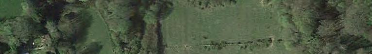
26 Peer Group plc As noted above the existing Wardsdown House in is the southern corner of the site, and to its north, in the western part of the site, there is a brick built double garage, two small timber stable blocks and a large timber garden shed, all with associated areas of hardstanding. There are some tall conifers just to the north of the garage and a large walnut tree just to the north east of the existing house (see Photograph 12). The Surrounding Area The area around the site is as follows: To the north of the site is Wardsdown Wood, with Ketley Wood to the north west, running down into the local valley of the River Bewl, beyond which the land rises again to the line of the A21, where there is a roadside picnic area with toilets at its junction with the B2079. To the north east, on the far side of the A21, is the large expanse of Bedgebury Forest. The County boundary runs along the line of the River Bewl to the north of the site, and the nearest point within Kent is around 200m to the north east of the site. The 2010 Ancient Woodland Inventory for Rother District shows these woodlands as being Ancient Woodland (specifically, as Plantations on Ancient Woodland Sites, i.e. the trees may have been planted, but the area has been under continuous woodland cover). The boundary to the Ancient Woodland is around 20m to the north of the limit of the area proposed for development - it is the blue line shown to the north of the red line boundary on the architect s drawing in Appendix B. An appropriate buffer between the Ancient Woodland and the proposed development would therefore be maintained. To the east of the site is the small patch of woodland noted above and beyond that some small paddocks to the north of the gardens extending downhill to the north from houses along Union Street (which becomes High Street further to the east). To the south of the site are houses along Union Street, with numbers 1 to 5 Fruitfields being single storey at their frontages to the south, but 2 storey at the rear where they overlook the site. There are also 2 further detached properties, The Mount and Delsland, between Fruitfields and Wardsdown House, with a garage and a small stable block to the north of these properties, adjacent to the site. Further to the south there are detached properties extending in a linear fashion along the south side of the road To the west of the site is the public footpath and access track noted above, with on the far side of that a number of properties along the line of the track, including Arabesque and Copperfield Cottage which sit in an elevated position at an angle to the track and have some views over the site (see Photograph 10). To the west of these properties the older houses along the line of Union Street extend close to the road, with a more recent housing development at Old Wardsdown forming an additional area of development behind and to the north of the original linear form of the village, extending down the slope from the ridge line. These houses can be seen from the road through gaps between the older roadside properties (see Photographs 19 to 21). Ref: JE/11291 Page 7
27 Peer Group plc 1. View north into the north western corner of the site showing vegetation along the northern site boundary, marked by the post and rail fence. The taller trees within Wardsdown Wood can be seen in the background. Two images combined. 2. View north east across the northern part of the site, showing the scrubby vegetation along the northern site boundary. Two images combined. Ref: JE/11291 Page 8
28 Peer Group plc 3. View north east across the north eastern part of the site showing the enclosing woodland. Two images combined. 4. View east from within the site showing the woodland vegetation along the eastern site boundary. Two images combined. Ref: JE/11291 Page 9
29 Peer Group plc 5. View south east from within the site, showing woodland along the eastern site boundary and houses on higher ground along Union Street just visible on the right of the view. Two images combined. 6. View south from within the site showing houses in Fruitfields with views across the site. The southern site boundary is the post and rail fence in the foreground - the long narrow paddock between that fence line and the rear garden boundaries is not within the site. Two images combined. Ref: JE/11291 Page 10
30 Peer Group plc 7. View south along the southern part of the track which runs along the western site boundary. The site is behind the fence on the left of the view. Two images combined. 8. View north along the track which runs along the western site boundary - the site is behind the fence and hedge on the right of the view. Ref: JE/11291 Page 11
31 Peer Group plc 9. View north east across the track, showing the existing gate to the rear of Wardsdown House, with the roof of the brick built garage visible beyond it, within the site. Two images combined. 10. View north west from the track, showing properties adjacent to the site - those in the centre of the view are Copperfield Cottage and Arabesque. Two images combined. Ref: JE/11291 Page 12
32 Peer Group plc 11. View east from the western part of the site, showing the area of Japanese knotweed within the site just beyond the post and rail fence. Two images combined. 12. View south east from the same point as Photograph 11, showing the tall conifers and brick garage within the site. The existing Wardsdown House is the white building on the right of the view. Two images combined. Ref: JE/11291 Page 13
33 Peer Group plc 13. View south west from the public footpath showing the area of open space to the north of the Old Wardsdown housing development (visible in the background through the trees). 14. View north from the public footpath to the north west of the site, showing the gate into Wardsdown Wood. Ref: JE/11291 Page 14
34 Peer Group plc 15. View north east across Union Street showing the existing Wardsdown House just to the left of centre in the view - the access track and public footpath run to the near side of the house. 16. View north east across Union Street from slightly closer to the existing Wardsdown House - the right hand part of the building is an extension and is a separate dwelling. Two images combined. Ref: JE/11291 Page 15
35 Peer Group plc 17. View north across Union Street from the footpath on the opposite side of the road, showing Wardsdown House on the left and the neighbouring property of Delsland on the right. 18. View north west across Union Street showing the existing Wardsdown House. Two images combined. Ref: JE/11291 Page 16
36 Peer Group plc 19. View north from Union Street showing modern development in Old Wardsdown visible between the older properties alongside the road. 20. View north from Union Street showing modern development in Old Wardsdown visible between the older properties alongside the road. Ref: JE/11291 Page 17
37 Peer Group plc 21. View north from Union Street showing modern development in Old Wardsdown visible between the older properties alongside the road. Topography The site slopes down from its southern corner on Union Street to the north, into the main body of the site, with levels of just over 132m AOD (above Ordnance Datum, or mean sea level) alongside the road, falling to around 128.5m AOD around the brick built garage in the south western corner of the site. From here levels fall across the site to the north east, reaching 111.0m in the far north eastern corner. Levels in the north western corner of the site are higher, at around 125m AOD. Levels within the central part of the site are around 118m, meaning that the properties to the south of the site along Union Street (which are at a similar level to Wardsdown House, around 130 to 132m AOD) are significantly elevated above the main part of the site, and have views across it Further afield the land continues to fall into the valley of the River Bewl to the north, where levels are around 90m AOD, and lower still to the north west, where the surface of Bewl Water is below 80m AOD. Beyond the river the land rises to the north east, with levels around 114m AOD along the A21, and then continues to rise to the local high point of Windy Ridge, where levels are just over 140m AOD at the radio mast. The land also falls to the south of Union Street, where a series of small wooded valleys run to the south, and levels fall below 50m AOD. Ref: JE/11291 Page 18
38 Peer Group plc Existing Light Sources There are occasional street lights along the B2087 as it passes to the south of the site, but other than those and lights within and around the existing houses there are no significant light sources in the area immediately around the site, and the A21 to the north east is unlit. Landscape Character In terms of wider landscape character, the site lies in the eastern part of the High Weald' National Character Area (NCA) - NCAs are identified by Natural England, and are described on their website as areas that share similar landscape characteristics, and which follow natural lines in the landscape rather than administrative boundaries, making them a good decision-making framework for the natural environment The NCA profile for the High Weald describes the area in the following terms: It is an area of ancient countryside and one of the best surviving medieval landscapes in northern Europe. The High Weald Area of Outstanding Natural Beauty (AONB) covers 78 per cent of the NCA. The High Weald consists of a mixture of fields, small woodlands and farmsteads connected by historic routeways, tracks and paths. Wild flower meadows are now rare but prominent medieval patterns of small pasture fields enclosed by thick hedgerows and shaws (narrow woodlands) remain fundamental to the character of the landscape Key characteristics of the NCA are stated to include: A dispersed settlement pattern of hamlets and scattered farmsteads and medieval ridgetop villages founded on trade and non-agricultural rural industries, with a dominance of timberframed buildings with steep roofs often hipped or half-hipped, and an extremely high survival rate of farm buildings dating from the 17th century or earlier. Extensive broadleaved woodland cover with a very high proportion of ancient woodland with high forest, small woods and shaws, plus steep valleys with gill woodland. Small and medium-sized irregularly shaped fields enclosed by a network of hedgerows and wooded shaws, predominantly of medieval origin and managed historically as a mosaic of small agricultural holdings typically used for livestock grazing Further description includes the following: 'The distinctive pattern of dispersed historic settlement survives although the character of farmsteads has changed with the widespread conversion of traditional farm buildings to dwellings and the associated disappearance of agriculture and industry from farmsteads. The changing character of the farmsteads and surrounding landscape through gentrification ultimately also leads to a changing character of wildlife in terms of the assemblage of species present. Typically, towns such as Tunbridge Wells and villages such as Goudhurst are sited on the ridges, with a dispersed pattern of historic farmsteads and hamlets covering the wooded valleys and field systems. Vernacular buildings have a strong local character influenced by a variation in locally available building materials, resulting in an abundance of weatherboard, brick, tile, and stone or rendered buildings.' Ref: JE/11291 Page 19
39 Peer Group plc The NCA Profile includes a number of Statements of Environmental Opportunity (SEOs) which seek to guide future change. SEO3 is to Maintain and enhance the distinctive dispersed settlement pattern, parkland and historic pattern and features of the routeways of the High Weald, encouraging the use of locally characteristic materials and Wealden practices to ensure that any development recognises and retains the distinctiveness, biodiversity, geodiversity and heritage assets present, reaffirm sense of place and enhance the ecological function of routeways to improve the connectivity of habitats and provide wildlife corridors The NCA Profile also includes a series of Landscape Opportunities, which include the following: Maintain and enhance the distinctive pattern of dispersed settlement of historic farmsteads, hamlets and villages, to promote sustainable development in rural locations and meet local needs for affordable and where possible land based workers, and enhance the design and quality of new development in the landscape meeting local distinctiveness and design guidance. Manage existing and future developments to ensure that sense of place is maintained by making reference to local vernacular building styles and materials, and settlement patterns and distributions. Ensure that proposed growth is sustainable and protects and enhances the character of the area with new building sympathetic to local styles. Where development is permitted, ensure good green infrastructure is included to bring about multiple benefits for people and the environment. County Landscape Character Within this wider definition of character, East Sussex County Council (ESCC) have published a landscape character assessment ( The East Sussex County Landscape Assessment, 2010) for the county. This assessment divides the county into a series of separate landscape character areas, with the site being within the eastern part of Area 7, the Bewl Water Area. The description of this area notes the Ridge-top villages and churches on periphery of area, one of which is Flimwell. The condition of the character area is described as poor, and its sensitivity as moderate Just to the south of the site, along the line of Union Street, is the boundary with another character area, the Upper Rother Valley. This is a larger area, and the description again notes the presence of settlements and main roads mainly along ridges on edges of the area As noted above, the County boundary is around 200m from the site at its closest point. Kent County Council (KCC) have published a landscape character assessment ( Landscape Assessment of Kent, 2004) for the county. This assessment divides the county into 114 separate landscape character areas, with the area to the north of the site being within the 'Bewl and Bedgebury: Kentish High Weald' character area. The description of this character area includes the following: 'This tapestry of land uses is set within a framework of dense shaws, thick hedges and stretches of broad-leaved woodland, some of which are still coppiced.' Ref: JE/11291 Page 20
40 Peer Group plc 'This is a well-settled area, where it is rare to be out of sight of farmstead or cottage. Oasthouses dot the landscape, some tiled and some asphalted.' 'The ridged landscape is a dominant part of the area, but visibility is moderate due to the enclosure of the extensive woodlands. There is a strong continuity to the landscape which contributes to the strong sense of place, and it is considered to be highly sensitive.' Borough Landscape Character At a more local level, RDC do not have a District level landscape character assessment, possibly because most of the District is within the AONB and therefore covered by the High Weald AONB landscape assessment and management plan (see below) However RDC have carried out targeted landscape assessments of the main settlements within the District as part of the Core Strategy evidence base, and Flimwell is included in the Market Towns and Villages Landscape Assessment (2009). This document notes in section that: As a ridge top settlement of characteristic ribbon development Flimwell has some limited opportunities for new development. Any proposals deemed acceptable would need to avoid the more open slopes. There are some enclosed areas which are surrounded by extensive areas of woodland where new development could be accommodated without encroaching on the wider countryside The summary table in this document notes under the heading of Management Opportunities that: Development should avoid open slopes. West of the A21 there would be greater scope for infill development on the north side than on the more open slopes to the south. Avoid open slopes adjacent to the A The table also notes that there is moderate potential for mitigation, and a moderate capacity to accept housing development. The summary Landscape Character Assessment Sheet for Flimwell notes that visual and character sensitivity are both moderate In neighbouring Kent, Tunbridge Wells Borough Council (TWBC) have produced the Tunbridge Wells Borough Landscape Character Assessment, which was updated and adopted as a Supplementary Planning Document (SPD) in This assessment divides the borough into 19 Character Areas, with the area to the north of the site being within Local Character Area 10, the Kilndown Wooded Farmland. This is summarised as: An attractive rolling upland landscape, incised by valleys, with small settlements and individual country houses hidden within a framework of extensive blocks of semi-natural deciduous, ghyll and shaw woodlands that surround large fields of arable and pasture farmland. AONB Landscape Character The AONB landscape assessment ( The High Weald: Exploring the Landscape of the Area of Outstanding Natural Beauty, published by the (then) Countryside Commission in 1994) divides the AONB into a number of distinct character areas, with the site being Ref: JE/11291 Page 21
41 Peer Group plc on the southern edge of the Kentish High Weald character area. The assessment notes the loss of landscape structure, in particular of hedgerows, within the landscape over recent years, and also notes that: This is a well-settled area, where it is rare to be out of sight of farmstead or cottage The AONB Management Plan is considered in Section 2.4 below. Local Landscape Character Within the above wider description of landscape character, the site and immediately surrounding area show a number of the characteristics identified, including the linear settlement strung out along the ridge line, the generally enclosing woodlands and the incised valleys. However, in the area just to the west of the site the linear character of the village has been altered by the recent housing developments of Old Wardsdown and (to a lesser extent), Bewl Bridge Close, further to the west. Old Wardsdown has introduced a line of new houses parallel and to the north of the older roadside dwellings, and also further houses extending to the north and further down the slope of the ridge. Visibility Visibility of the site in its current form is limited by the trees and woodland to the north and east, the rising land and the houses along Union Street to the south, and further houses and trees to the west The main areas from which the site can presently be seen are: From the north there are filtered and short distance views from the edge of the adjoining woodland, but no views from within Wardsdown Wood or the lower parts of the Bewl valley (see Photograph 22). From further to the north there are some limited views to the higher, southern parts of the site only from the area around the lay-by and picnic area on the south side of the A21, through gaps in the roadside vegetation - the houses along Union Street are visible on the skyline in these views (see Photographs 23 and 24). There are no views from the local high point around the radio mast on Windy Ridge, to the north of the A21, as the top of the hill is enclosed by trees and woodland. From the north east there are occasional glimpses towards the site for people travelling to the south east on the A21, through or between the roadside trees (see Photograph 25). From the east there are no significant views from beyond the site boundary, even in winter, as the woodland and trees in this direction are dense and extend up to the edge of the site. There are some heavily filtered views from within the site to one or two properties along the western side of the A21 at a distance of around 500m (see Photograph 26), but any views back to the site from these properties would be partial only in the winter, and completely screened in the summer. From the south there are clear views across the site from the northern elevations of the properties along the north side of Union Street, but no significant views from Ref: JE/11291 Page 22
42 Peer Group plc any further to the south, as the houses closest to the site have relatively narrow gaps between them. There are 7 properties with views (from west to east, Delsland, The Mount and numbers 1 to 5 Fruitfields), plus the existing semidetached property of Wardsdown House (see Photograph 27). These houses look across the site at short distance from an elevated position, but their views also extend across the woodland to the north of the site to encompass a wide area. From the west there are short range views to the site from the adjacent houses along the western side of the track which runs along the site s western boundary. There are two houses here with relatively open views from first floor windows, two more (Arabesque and Copperfield Cottage) with views filtered by trees alongside the track, and around three properties within the Old Wardsdown development with partial and filtered views from one or two upper floor windows only (see Photographs 28 and 29). There are also short distance but largely filtered views to the site from the adjoining public footpath (see Photographs 30 to 32) There are no significant views from any further afield - the falling topography prevents any views from further to the south, and trees and woodland within the local landscape (as well as the houses to the west noted above) prevent any views from further to the west or east (see Photograph 33). View south east towards the site from the public footpath - the site cannot be seen. Ref: JE/11291 Page 23
43 Peer Group plc 23. View south towards the site from the foot of a flight of steps leading to an inspection cover, south of the lay-by for the picnic area - the houses on the skyline in the centre of the view are along the south side of the site. 23A Zoom lens view from the same point - the lower row of houses is immediately to the south of the site, those above them are on the south side of Union Street. The surface of the site cannot be seen. Ref: JE/11291 Page 24
44 Peer Group plc 24. View south towards the site from the lay-by for the picnic area - the houses on the skyline in the centre of the view are along the south side of the site. 24A. Zoom lens view from the same point - the lower row of houses is immediately to the south of the site, those above them are on the south side of Union Street. A small part of the surface of the site can just be seen between the trees - this is along its extreme southern edge, and the new houses would be further to the north, and lower down the slope. Ref: JE/11291 Page 25
45 Peer Group plc 25. View south west towards the site from the A21 - houses along Union Street can be seen on the skyline. 26. View east from within the site, showing (where indicated by the red arrow) properties on the west side of the A21 just visible through the intervening trees. Ref: JE/11291 Page 26
46 Peer Group plc 27. View south from within the site, showing houses along Union Street with views across the site. Two images combined. 28. View south west from within the site showing the timber stables within the site and houses just to the west (on the far side of the footpath) with some views back to the site. Two images combined. Ref: JE/11291 Page 27
47 Peer Group plc 29. View west from within the site showing properties to the west with filtered views back to the site ( Copperfield Cottage and Arabesque on the left, with properties in Old Wardsdown beyond). Two images combined. 30. View south along the public footpath to the west of the site, showing glimpses of the site surface through the boundary hedge on the left of the view. Ref: JE/11291 Page 28
48 Peer Group plc 31. View east into the northern part of the site from the public footpath, through a gap in the boundary hedgrow. Two images combined. 32. Another view to the site from the public footpath - views are generally filtered by boundary vegetation, even in the winter. Ref: JE/11291 Page 29
49 Peer Group plc 33. View in the direction of the site from Rosemary Lane to the west - the site is completely screened by rising ground and intervening vegetation. 2.4 Landscape Designations, Quality, Value and Sensitivity The site lies within the High Weald Area of Outstanding Natural Beauty (AONB). The AONB is a national level designation and covers a large area (1,450 square kilometres, spread over four counties), and the site is in the north eastern part of the designated area The High Weald AONB Management Plan, 2014 to 2019, describes the character of the AONB in the following terms (on page 5): 'At first glance the High Weald appears to be a densely wooded landscape but closer examination reveals a detailed agricultural tapestry of fields, small woodlands and farmsteads. Wildflower meadows are now rare but the medieval pattern of small fields with sinuous edges surrounded by thick hedges and shaws (often surviving remnants of ancient woodland) remain. Extensive views punctuated by church spires can be glimpsed along the ridge-top roads. Around almost every corner a harmonious group of traditional farm buildings comes into view with their distinctive steep, clay tile and hipped roofs. Everything in the High Weald landscape is human scale. Its rich detail is best explored through the myriad of interconnecting paths and tracks. From early in its history this dense network of routeways linked the Weald with settlements on its fringes where farming was easier, and they remain a visible legacy of the value these communities placed on the resources of the forest.' The Introduction to the Management Plan, on page 14, notes that, in respect of the Countryside and Rights of Way (CRoW) Act 2000: Ref: JE/11291 Page 30
50 Peer Group plc 'Section 82 reaffirms the primary purpose of AONBs: to conserve and enhance natural beauty. Section 84 confirms the powers of local authorities to take 'all such action as appears to them expedient for the accomplishment of the purpose of conserving and enhancing the natural beauty of AONBs'. Section 85 places a duty on all public bodies and statutory undertakers to 'have regard' to the 'purpose of conserving and enhancing the natural beauty of the area of outstanding natural beauty'.' It also notes in paragraph 1.1 that: The primary purpose of AONB designation is to conserve and enhance natural beauty. In pursuing the primary purpose of designation, account should be taken of the needs of agriculture, forestry and other rural industries and of the economic and social needs of local communities The vision set out within the plan under the heading of 'Settlement' is as follows: 'A landscape in which the distinctive and historic pattern of settlement of the High Weald is protected in a way that positively contributes to the natural environment and improves the connections between settlements and the countryside. Appropriately worded land use planning policies within relevant development plans ensure that settlements retain their distinctiveness and individual historic buildings, and conservation areas and buried archaeological remains are conserved and enhanced as appropriate. This vision can be realised through new resources, and the application of planning policies and guidance that seek to control development on the basis of an understanding of rural sustainability; promote the traditional pattern of High Weald villages; maximise environmental design and construction quality including, where appropriate, by the use of traditional and local construction materials; minimise resource consumption and promote alternative forms of energy; support appropriate businesses (especially those based on and supporting productive use of land, and community objectives); and the enhancement of the historic environment.' Objective S3 is stated as being 'To enhance the architectural quality of the High Weald', and one of the targets for 2019 in order to achieve this is: 'Widespread use of local materials particularly timber (reflecting the tradition of timber frame building) in construction, with coordinated support for good design and specification; improving the supply chain and fusing traditional skills with new technologies'. Landscape Quality, Value and Sensitivity The area around the site is nationally designated for its landscape quality and value, and is in general of very high quality and value. It would also in general be highly sensitive to new built development, though all of the landscape character assessments reviewed above note the presence of buildings within the landscape as being characteristic of the High Weald, and the development in this case would be well related to the existing settlement edge. Ref: JE/11291 Page 31
51 Peer Group plc However, within that overall high quality, value and sensitivity, and using the definitions set out in Appendix A, the site and immediately surrounding area have been assessed as of overall low to medium landscape quality. This is because, though the site lies within the overall very high quality landscape of the AONB, it is enclosed and largely inward looking, and elements of it (the houses to the south, the various stable buildings and sheds, the tall conifers, encroaching scrub and Japanese knotweed, together with the small fenced paddocks) are uncharacteristic of the AONB, give the site a slightly run down appearance and make little positive contribution to local landscape quality As noted in Appendix A, the concept of landscape value is also important, and is included in assessments in order to avoid consideration only of how scenically attractive an area may be, and thus to avoid undervaluing areas of strong character but little scenic beauty. Factors such as cultural association, recreational use and intangible qualities such as wildness are important in terms of determining landscape value, but are not really applicable to the site (the public footpath does run just outside the western boundary of the site, but is largely separate and screened from it, so its presence does not lead to any additional value), so in this case the landscape value of the site can be taken to be represented by its landscape quality, and to be low to medium Landscape sensitivity is judged according to the type of development proposed. The sensitivity of the site to development of the type proposed would be limited by the nature and scale of the development (relatively low rise residential development is not atypical or discordant in an edge of settlement context, and would represent an incremental change only), the existing screening vegetation around the site, and the presence adjacent to the site of existing residential areas immediately to the south and west. There are no significant or valuable landscape features within the site - the trees within it are mainly either small and scrubby or locally inappropriate tall conifers (though there is a tall walnut tree close to Wardsdown House, which would be retained). Perimeter vegetation would in general be retained and enhanced. The site has therefore been assessed as having low to medium sensitivity to development of the type proposed This assessment differs slightly from that carried out by RDC in their Market Towns and Villages Landscape Assessment, which considered the site to be of moderate sensitivity, but that assessment was of the general area around the village, and the site itself is very well screened and well related to the existing settlement edge. 2.5 Planning Context National Planning Policy The Government s national planning policy and guidance on various aspects of planning are set out in the National Planning Policy Framework (NPPF, March 2012). The NPPF states that the purpose of planning is to help achieve sustainable development, and that in order to do so, the planning system must perform mutually dependent economic, social and environmental roles The 12 principles set out in the NPPF include: Ref: JE/11291 Page 32
52 Peer Group plc... recognising the intrinsic character and beauty of the countryside and supporting thriving rural communities within it. contribute to conserving and enhancing the natural environment Paragraph 109 of the NPPF states that: The planning system should contribute to and enhance the natural and local environment by: Protecting and enhancing valued landscapes, geological conservation interests and soils; Recognising the wider benefits of ecosystem services; Minimising impacts on biodiversity and providing net gains in biodiversity where possible, contributing to the Government's commitment to halt the overall decline in biodiversity, including by establishing coherent ecological networks that are more resilient to current and future pressures The NPPF states in paragraph 115 that: Great weight should be given to conserving landscape and scenic beauty in National Parks, the Broads and Areas of Outstanding Natural Beauty, which have the highest status of protection in relation to landscape and scenic beauty. Local Planning Policy The Rother District Local Plan ('the Local Plan') was adopted in 2006, and many of its policies have been saved and remain part of the statutory development plan. Relevant saved policies include: Policy DS1, which states that development should avoid prejudicing the environment in general and the High Weald AONB in particular, and should also respect the importance of the countryside. Policy GD1, which states that development should be compatible with the conservation of the natural beauty of the AONB. Core Strategy The Rother Local Plan Core Strategy was adopted in September 2014, and includes the following relevant policies: Policy OSS1 states that the overall strategy includes the need to give particular attention to the intrinsic value of the countryside. Policy OSS3 states that development proposals will be considered in the context of (inter alia) the character and qualities of the landscape. Ref: JE/11291 Page 33
53 Peer Group plc Policy OSS4 states that development should respect and not detract from the character and appearance of the locality. Policy RA2 states that the overarching strategy for the countryside includes: Generally conserving the intrinsic value, locally distinctive rural character, landscape features, built heritage, and the natural and ecological resources of the countryside. Policy RA3 states that proposals for development in the countryside should ensure that all development is of an appropriate scale, will not adversely impact on the on the landscape character or natural resources of the countryside and, wherever practicable, support sensitive land management. Policy EN1, Landscape Stewardship, states (in part) that: Management of the high quality historic, built and natural landscape character is to be achieved by ensuring the protection, and wherever possible enhancement, of the district s nationally designated and locally distinctive landscapes and landscape features; including (i) The distinctive identified landscape character, ecological features and settlement pattern of the High Weald Area of Outstanding Natural Beauty; (v) Open landscape between clearly defined settlements, including the visual character of settlements, settlement edges and their rural fringes; (vi) Ancient woodlands; (viii) Other key landscape features across the district, including native hedgerows, copses, field patterns, ancient routeways, ditches and barrows, and ponds and water courses. Core Strategy Evidence Base RDC produced a Rural Settlements Study in 2008 as part of the evidence base for the emerging Core Strategy, and this noted for Flimwell that: In total it seems reasonable to suggest that Flimwell may [be] suitable for allocations of 35 to 50 new dwellings (including at least 25 from the unimplemented Local Plan allocation) in the period up to RDC s 2013 Strategic Housing Land Availability Assessment (SHLAA) Review considered a number of potential development sites around Flimwell, and rated the Wardsdown House site as the most favoured of those not already allocated under the 2006 Local Plan (other than a very small site for 2 or 3 further dwellings added to one of the previous sites). All other potential sites in the village were categorised as rejected The proposed site was considered as Site FL5, Land r/o Fruitfields, and the SHLAA concluded that the site was suitable and developable subject to more detailed investigations, for an estimated 17 residential units. The report also noted that the site Appears to be reasonably well screened from wider landscape by adjacent woodland, although there are glimpses of site from mid distance to north and north-east. Ref: JE/11291 Page 34
54 Peer Group plc 3 The Proposed Development 3.1 General There are at this stage no detailed or fully worked up proposals for the development, and the proposals shown on the drawing in Appendix B are illustrative only, indicating the type and scale of development that it is believed could be reasonably accommodated on the site. In summary this drawing shows: A range of detached, semi-detached and terraced houses, with a total of 23 new dwellings (a net increase of 21, with the demolition of Wardsdown House). Access off Union Street, with the existing Wardsdown House demolished to allow for the new access, which would run to the east of the existing track and public footpath, both of which would continue to run on their existing lines. There would then be a T junction leading to the east to serve the remainder of the site, with the new houses along each side of this section of road. Although the new houses would be visible from the existing houses to the south and (to a lesser degree) south west, they would all be at a lower level than the existing properties, and views from the first floor windows of these existing properties would still be possible, over the roofs of the new houses to the woodland beyond. The new houses would also be a minimum of 40m from the existing properties to the south (with the exception of the new house shown to the north west of Delsland, which would be at an angle from its main line of view and partially screened by the retained walnut tree). 3.2 Landscape Proposals There are no detailed landscape proposals at the present time, and it is anticipated that these would be worked up and submitted as the proposals progress, with a detailed landscape scheme likely to be required as a condition on any planning approval Based on the site inspection carried out to date, and subject to incorporation within the overall development proposals, it is expected that the landscape proposals would be able to include the following elements: Retention of existing perimeter vegetation and also some of the trees within the site, where locally appropriate and in good condition, including the hedgerow between the site and the public footpath to the west, which could be reinforced with new planting. The other site boundaries could also be strengthened with additional planting of locally appropriate native trees and shrubs, as well as some further planting within the rear gardens of the new houses to provide further screening and separation, particularly to the south. Complete eradication by approved means (such as repeated herbicide spraying) of the areas of Japanese knotweed within the site. Ref: JE/11291 Page 35
55 Peer Group plc Detailed ecological survey and development of proposals for the management of the existing strip of scrubby woodland to the north of the site, between it and the Ancient Woodland of Wardsdown Wood. This land is in the same ownership as the site, and would benefit from management over time for nature conservation benefit - this would be likely to include some additional woodland planting. Appropriate planting alongside the southern section of the new access, close to Union Street. Species used for new planting would be native and locally appropriate around the site perimeter, to integrate with the surrounding landscape and in particular the Ancient Woodland to the north, but would also include some more ornamental species closer to the new dwellings to provide year round colour and seasonal interest Potential Refinements As the proposals for the site develop, it is likely that the following refinements to the illustrative proposals shown on the drawing in Appendix B can be made: The drawing has shown retention of all trees within and around the site - in practice this would be rationalised as the design progresses, with the aid of a full arboricultural survey to establish the condition and root protection areas of all of the trees, in order to be able to refine the development proposals to ensure that valuable trees (such as the mature walnut tree just to the north east of Wardsdown House) are retained, and unsafe or poor specimens are removed. A visual inspection has indicated that many of the trees within the site are poor quality scrubby willows, relatively young birches or inappropriate evergreen species. The possibility is being explored of securing access to the site along the line of the existing track, bringing this into the proposed development. That would have the advantage of allowing the existing Wardsdown House to be retained, preserving the current street scene along Union Street in much its existing form. There would be some potential disadvantages in that users of the footpath would need to share the route with vehicles accessing the site up to the point where the access turns to the east into the main body of the site, but the track is already used by some vehicles to access the properties along its western side. The character of the southern part of the route would change, as it would need to be surfaced, but that would be for a relatively short length only. The possibility would be investigated of flipping the short terraces of properties in the north western corner of the site, such that the vehicle access is to the east and the gardens are to the west, backing onto the footpath, to minimise any visual effects or disturbance to footpath users. The new house shown as Plot 3 on the drawing is in a slightly more elevated location than the other new houses to its east, and would therefore interrupt views from the existing houses along Union Street to a greater extent. The detailed design could explore the potential benefits of either rearranging the new houses to minimise Ref: JE/11291 Page 36
LONGDEN VILLAGE DEVELOPMENT STATEMENT
 LONGDEN VILLAGE DEVELOPMENT STATEMENT 2017-2027 1 Longden Development Statement 2017-2027 15/01/18 1. Background 1.1 Longden Village Longden village is a very rural and traditional community first mentioned
Rolling Wooded Pasture Lulworth Wooded Pasture Rempstone Wooded Pasture
 Landscape type: Character areas: Rolling Wooded Pasture Lulworth Wooded Pasture Rempstone Wooded Pasture The rolling wooded pasture landscape type is found around the margins of the Dorset Heaths. Although
National Character Area 70 Melbourne Parklands
 Summary The are a landscape of rolling farmland, parkland and woodland on the northern flanks of the ridge between Burton upon Trent and Swadlincote. The land slopes down to the River Trent, which borders
Warwickshire County Council. Upper and Lower Brailes. Landscape Study
 Warwickshire County Council Upper and Lower Brailes Landscape Study Produced by WCC Landscape Architects March 2016 Landscape Assessment of Potential Development Sites within the parish of Brailes 1.0
Landscape Guidelines. Landscape type: Valley Pasture Character areas: Frome Valley Pasture Stour Valley Pasture. Landscape change
 Landscape type: Valley Pasture Character areas: Frome Valley Pasture Stour Valley Pasture The valley pasture landscape type is found along the lower reaches of the Stour and Frome, formed from alluvial
DEVELOPMENT MANAGEMENT REPORT
 ITEM A08-1 DEVELOPMENT MANAGEMENT REPORT TO: BY: DATE: DEVELOPMENT: SITE: WARD: APPLICATION: APPLICANT: Development Management Committee Development Manager Proposed live/work unit in connection with existing
Statutory and Non-Statutory Designated Sites and Ecology
 Statutory and Non-Statutory Designated Sites and Ecology The National Planning Policy Framework considers the conservation and enhancement of the natural environment in chapter 11 paragraphs 109-119, where
INTRODUCTION. Land south of Bishopswood Lane, Tadley
 0 INTRODUCTION THE SITE Introduction Gladman Developments Ltd. has successfully invested in communities throughout the UK over the past 0 years, developing high quality and sustainable residential, commercial
ENVIRONMENTAL AND LANDSCAPE MAPPING
 APPENDIX IV : Environmental and Landscape Mapping ENVIRONMENTAL AND LANDSCAPE MAPPING Calveley Neighbourhood Plan November 2016 ENVIRONMENTAL AND LANDSCAPE MAPPING Calveley Neighbourhood Plan Calveley
LANDSCAPE AND VISUAL ASSESSMENT
 Hertfordshire County Council LAND AT BALDOCK SITE 3 LANDSCAPE AND VISUAL ASSESSMENT JULY 2008 Jon Etchells Consulting Barn A, Dixies High Street Ashwell Herts SG7 5NT 01462 744662 HERTFORDSHIRE COUNTY
LANDSCAPE AND VISUAL ASSESSMENT
 Hertfordshire County Council LAND AT BALDOCK SITE 2 LANDSCAPE AND VISUAL ASSESSMENT JULY 2008 Jon Etchells Consulting Barn A, Dixies High Street Ashwell Herts SG7 5NT 01462 744662 HERTFORDSHIRE COUNTY
Environmental and Landscape Mapping
 Environmental and Landscape Mapping In support of the Calveley Neighbourhood Plan November 2016 Project Name and Number: Calveley Neighbourhood Plan 16-025 Document Name and Revision: Environmental and
The analysis of key visual characteristics and attributes that contribute to variations in the
 15.0 CHIGWELL/CHIGWELL ROW 15.1 Overview 15.1.1 Chigwell and Chigwell Row settlements are situated in the south of Epping Forest District, to the south of Abridge and southwest of Stapleford Abbotts. Both
East Harptree Landscape & Character Assessment
 East Harptree Landscape & Character Assessment Produced by East Harptree Parish Council in consultation with local residents September 2014 Contents The Parish of East Harptree: Objective Introduction
APPENDIX 4. 5 ST AGNES LOCAL LANDSCAPE CHARACTER ASSESSMENT TABLE ST AGNES BEACON
 APPENDIX 4. 5 ST AGNES LOCAL LANDSCAPE CHARACTER ASSESSMENT TABLE ST AGNES BEACON CHARACTER AREA: ST AGNES BEACON DATE OF ASSESSMENT May 2016 Character Attribute Landscape reference guide ST AGNES BEACON
SETTLEMENT ASSESSMENT PROFORMA
 SETTLEMENT ASSESSMENT PROFORMA Surveyors(s):Clare Sheridan Character Area: Park Estate = Midland Rd, Severn Rd, Festival Rd, Park Rd, Willow Rd, Rylands Rd. Date: Feb Weather: cloudy Look through all the
Welcome to our Public Consultation
 About our development This exhibition gives you the chance to view and comment on our emerging plans for a proposed residential development located on land to the West of Alwyn Road, Rugby. Welcome to
3 Abbey View Mill Hill London NW7 4PB
 Location 3 Abbey View Mill Hill London NW7 4PB Reference: 15/03203/HSE Received: 26th May 2015 Accepted: 16th June 2015 Ward: Mill Hill Expiry 11th August 2015 Applicant: Proposal: Mr Richard Benson Alterations
A payment of 1080 is due in this instance, for a meeting and follow up written response, and will be made by card over the phone.
 JPPC ref: AG/6002 18 th September 2014 Planning Services Vale of White Horse District Council Benson Lane Crowmarsh Gifford Wallingford OX10 8ED Dear Sir/Madam REQUEST FOR PRE-APPLICATION ADVICE RE: RESIDENTIAL
DESIGN & ACCESS STATEMENT
 . DESIGN & ACCESS STATEMENT Site Adjacent to The Manor House, Upper Street,, Kingsdown, Deal, Kent. DESIGNS ARCHITECTURE + PLANNING CONTENTS Design and Access Statement Introduction Site and Location Planning
APP/G1630/W/15/
 Appeal Decision Site visit made on 20 October 2015 by William Fieldhouse BA (Hons) MA MRTPI an Inspector appointed by the Secretary of State for Communities and Local Government Decision date: 20 November
Toddington Central Bedfordshire Stage 3 Green Belt Study December 2017
 Toddington Central Bedfordshire Stage 3 Green Belt Study December 2017 Site: ALP086 - Middle Lakes, Toddington Site size (ha): 2.83 Site: ALP086 - Middle Lakes, Toddington Site size (ha): 2.83 Site description
8.0 Design and Form of Development 43/
 42/ 8.0 Design and Form of Development 43/ Rothwells Farm, Golborne/ Development Statement Figure 7. Site Constraints Key 44/ Site Boundary 360 Bus Route/Stops Existing Trees Underground Water Pipe Sensitive
Cotswolds AONB Landscape Strategy and Guidelines. June 2016
 Cotswolds AONB Landscape Strategy and Guidelines June 2016 Cotswolds AONB Landscape Strategy and Guidelines Introduction The evolution of the landscape of the Cotswolds AONB is a result of the interaction
Statement of Community Involvement LAND OFF SOUTHDOWN ROAD HORNDEAN, HAMPSHIRE
 LAND OFF SOUTHDOWN ROAD HORNDEAN, HAMPSHIRE CONTENTS Page 1. Introduction 3 2. Pre-application Discussions 4 3. The Consultation Process 5 4. Consultation Feedback 7 5. Responses to Consultation Feedback
Settlement Boundaries Methodology North Northumberland Coast Neighbourhood Plan (August 2016)
") Introduction This background paper sets out a methodology for the definition of settlement boundaries in the North Northumberland Coast Neighbourhood Plan. The neighbourhood plan is planning positively
Introduction This background paper sets out a methodology for the definition of settlement boundaries in the North Northumberland Coast Neighbourhood Plan. The neighbourhood plan is planning positively
University Park, Worcester Non Technical Summary December 2011
 University Park, Worcester Non Technical Summary December 2011 Introduction UW Wrenbridge LLP, a Joint Venture Company of the University of Worcester and Wrenbridge Land Ltd (the Applicants ) intend to
Introduction. Welcome to this consultation regarding the draft redevelopment proposals for the former CeramTec factory on Sidmouth Road, Colyton.
 Introduction Welcome to this consultation regarding the draft redevelopment proposals for the former CeramTec factory on Sidmouth Road, Colyton. We are currently considering options for the mixed-use redevelopment
Reference: 16/1447/FUL Received: 7th March 2016 Accepted: 7th March 2016 Ward: East Finchley Expiry 2nd May 2016
 Location 374B Long Lane London N2 8JX Reference: 16/1447/FUL Received: 7th March 2016 Accepted: 7th March 2016 Ward: East Finchley Expiry 2nd May 2016 Applicant: Ms Katrin Hirsig Proposal: Single storey
DESIGN & ACCESS STATEMENT
 DESIGN & ACCESS STATEMENT January 2016 Contents Introduction section 1 Section 1 - Introduction Section 2 - Assessment Section 3 - Involvement Section 4 - Evaluation Section 5 - Design Section 6 - Layout
ABOUT CALA HOMES CALA HOMES
 WELCOME Welcome to this public consultation event for our proposed development on land to the east of Salisbury Road, in Hungerford. Thank you for taking the time to come along today. Homes and Wates Developments
INCREMENTAL CHANGE AREA REVIEW March 2015 Page 1
 INCREMENTAL CHANGE AREA REVIEW March 2015 Page 1 Table of Contents Introduction... 3 Background to Review... 3 Comparison of the Schedules to the General Residential Zone... 7 Methodology... 7 Policy Context...
Neighbourhood Plan Representation
 Date: 10 th November 2017 Neighbourhood Plan Representation Land to the east of Callow Hill Road, Alvechurch Introduction This representation has been prepared by RPS Planning and Development on behalf
SITE ASSESSMENT FORM
 Appendix 2 SITE ASSESSMENT FORM 1. Site information Settlement: Colwall Main Village Site name: SITE 1 Part of vacated Colwall school site and adjacent area Site address: Walwyn Road Site area (hectares):
Planning and Regulatory Committee 20 May Applicant Local Councillor Purpose of Report
 Planning and Regulatory Committee 20 May 2014 7. APPLICATION FOR PLANNING PERMISSION FOR THE CARRYING-OUT OF DEVELOPMENT PURSUANT TO PLANNING PERMISSION REFERENCE NUMBER 603451 DATED 28 FEBRUARY 2007 WITHOUT
WELCOME GYPSY LANE. Wider Site Location plan. Proposals for the development of LAND OFF FOXLYDIATE LANE WEBHEATH. Proposals for the development of
 WELCOME The developers are preparing an outline planning application for a residential led development and need the community s views in order to develop the proposals further WHAT IS PROPOSED? A high
Schedule of Planning Applications Committee Date: 23 May Reference: 06/17/0726/F Parish: Hemsby Officer: Mr J Beck Expiry Date:
 Schedule of Planning Applications Committee Date: 23 May 2018 Reference: 06/17/0726/F Parish: Hemsby Officer: Mr J Beck Expiry Date: 22-05-2018 Applicant: Proposal: Site: Mr Gillett Change of use to the
Persimmon Homes Thames Valley Date received: 2 nd April week date(major): 2 nd July 2014 Ward: Nascot
: 2 nd July 2014 Ward: Nascot") PART A Report of: DEVELOPMENT MANAGEMENT SECTION HEAD Date of Committee: 26 th June 2014 Site address: Rounton, 28, Nascot Wood Road Reference Number: 14/00497/REM Description of Development: Reserved
PART A Report of: DEVELOPMENT MANAGEMENT SECTION HEAD Date of Committee: 26 th June 2014 Site address: Rounton, 28, Nascot Wood Road Reference Number: 14/00497/REM Description of Development: Reserved
Oxford Green Belt Study. Summary of Final Report Prepared by LUC October 2015
 Oxford Green Belt Study Summary of Final Report Prepared by LUC October 2015 Project Title: Oxford Green Belt Study Client: Oxfordshire County Council Version Date Version Details Prepared by Checked by
Emmer Green, Reading. Site Location Plan
 0 Welcome Introduction Gladman Developments Ltd have successfully invested in communities throughout the UK over the past 0 years, developing high quality and sustainable residential, commercial and industrial
PDP DESIGN & ACCESS STATEMENT
 PDP The Planning & Design Partnership Planning.. Architecture.. Interiors.. Landscape The Chicory Barn Studio, The Old Brickyards, Moor Lane, Stamford Bridge York, The East Riding Of Yorkshire, YO41 1HU.
WELCOME. Land North of STEVENAGE. We would like to thank you for attending our public exhibition today.
 WELCOME We would like to thank you for attending our public exhibition today. The purpose of this event is to share our proposals and hear your thoughts on our ideas. Members of the project team are on
BROADHEMBURY DESIGN STATEMENT
 BROADHEMBURY DESIGN STATEMENT As drawn up by Broadhembury Parish Council during the development of a Parish Plan and adopted at its meeting on 17 th May 2010 BROADHEMBURY DESIGN STATEMENT Contents Introduction
EAST OF ENGLAND OFFICE
 Mr Philip Isbell Direct Dial: 01223 582751 Mid Suffolk District Council 131 high Street Our ref: P00524468 Needham Market Ipswich Suffolk IP6 8DL 18 January 2017 Dear Mr Isbell T&CP (Development Management
1 The development hereby permitted shall be carried out in accordance with the following approved plans:
 Location 59 Greenway Close London N20 8ES Reference: 16/00011/HSE Received: 30th December 2015 Accepted: 7th January 2016 Ward: Totteridge Expiry 3rd March 2016 Applicant: Mr Ankit Shah Proposal: Part
About 10% of the Borough's population lives in the seven rural parishes. Population figures from the 1991 census are given below:-
 8. THE DISTRICT VILLAGES 8.1 Population About 10% of the Borough's population lives in the seven rural parishes. Population figures from the 1991 census are given below:- Village No. of Persons Cottingham
Reference: 16/1234/HSE Received: 25th February 2016 Accepted: 2nd March 2016 Ward: High Barnet Expiry 27th April 2016
 Location 7 Sunset View Barnet EN5 4LB Reference: 16/1234/HSE Received: 25th February 2016 Accepted: 2nd March 2016 Ward: High Barnet Expiry 27th April 2016 Applicant: Proposal: Mr & Mrs Peter & Anny Woodhams
49 Broughton Avenue London N3 3EN
 Location 49 Broughton Avenue London N3 3EN Reference: 17/3448/RCU Received: 30th May 2017 Accepted: 1st June 2017 Ward: Finchley Church End Expiry 27th July 2017 Applicant: Mr P Atwal Proposal: Erection
3. Neighbourhood Plans and Strategic Environmental Assessment
 1. Introduction This report sets out a draft Screening Determination for the Preston Parish Council s Neighbourhood Plan and has been prepared by rth Hertfordshire District Council. The purpose of the
tributary farmland tributary farmland
 NORFOLK O R F O L K COAST C O A SAONB T A O NIntegrated B I n t elandscape g r a t e d L Guidance a n d s c a p e G u i d a n c e 1 Integrated landscape character MAP 23a - Landscape Character Type - Tributary
To secure a Green Belt around Cambridge whose boundaries are clearly defined and which will endure for the plan period and beyond.
 4. GREEN BELT OBJECTIVES GB/a GB/b GB/c GB/d To secure a Green Belt around Cambridge whose boundaries are clearly defined and which will endure for the plan period and beyond. To maintain the purposes
5 Gratton Terrace London NW2 6QE. Reference: 17/5094/HSE Received: 4th August 2017 Accepted: 7th August 2017 Ward: Childs Hill Expiry 2nd October 2017
 Location 5 Gratton Terrace London NW2 6QE Reference: 17/5094/HSE Received: 4th August 2017 Accepted: 7th August 2017 Ward: Childs Hill Expiry 2nd October 2017 Applicant: WSD (Gratton) Ltd Proposal: The
Ipswich Issues and Options for the Ipswich Local Plan Review, August 2017, Public Consultation
 Ipswich Issues and Options for the Ipswich Local Plan Review, August 2017, Public Consultation Having reviewed the issues and options documents, the Society has made the following response: Part 1 Strategic
CHAPTER 18 - Strategy Area: Dundry and River Valleys
 This south-eastern part of the Community Forest is a complex area with a wide variety of different landscapes close together, including the Chew Valley, the southern part of the Avon Valley and the eastern
Tennis Court Rear Of 3-5 Corringway London NW11 7ED
 Location Tennis Court Rear Of 3-5 Corringway London NW11 7ED Reference: 18/4122/FUL Received: 3rd July 2018 Accepted: 3rd July 2018 Ward: Garden Suburb Expiry 28th August 2018 Applicant: Ms Sarah Robinson
LETTER OF OBJECTION LAND TO THE SOUTH WEST OF FORGE GARAGE, HIGH STREET, PENSHURST, KENT, TN11 8BU
 Senior Planning Officer Andrew Byrne Sevenoaks District Council Community & Planning Services PO Box 183 Argyle Road Sevenoaks Kent TN13 1GN 04 November 2011 Your Ref: 11/02258/FUL For the attention of
Guidance for Wind Turbine Development in the Dorset AONB
 Photo 1: Rew Manor Farm, West Dorset, chalk downland landscape (Planning application ref: 1/D/09/001280 1 ) Scale & siting: 12m to hub / 16m to blade tip. A well sited small scale turbine, grouped with
PLANNING COMMITTEE. 14 October 2014
 AGENDA ITEM NO 8 PLANNING COMMITTEE 14 October 2014 APPLICATION NUMBER : CA//14/01744/FUL PROPOSAL : Extension and conversion of roof space of an existing detached bungalow together with enhanced parking
Land East of Cromwell Lane
 Land East of Cromwell Lane VISION DOCUMENT AUGUST 2016 The proposals for Land East of Cromwell Lane will be defined by existing landscape features, ensuring that the development offers a quality place
DESIGN & ACCESS STATEMENT
 DESIGN & ACCESS STATEMENT Land to the South East of the A495, Bronington Erection of 31 Dwellings (27 dwellings and 4 bungalows including 4 Affordable Dwellings), Realignment and Improvements to A495 (including
Introduction. Grounds of Objection
 Planning application ref. number 18/04496/APP Planning application to Aylesbury Vale District Council for the erection of 17 dwellings and associated works to the South of Hogshaw Road Granborough. Granborough
ROCHFORD LOCAL DEVELOPMENT FRAMEWORK: Sustainability Appraisal/ Strategic Environmental Assessment. Rochford Core Strategy Preferred Options Document
 ROCHFORD LOCAL DEVELOPMENT FRAMEWORK: Sustainability Appraisal/ Strategic Environmental Assessment Non Technical Summary Rochford Core Strategy Preferred Options Document October 2008 SUSTAINABILITY APPRAISAL
Land off Arbour Close and Cotswold Edge Mickleton, Gloucestershire. Design and Access Statement Mickleton, Gloucestershire
 Land off Arbour Close and Cotswold Edge Contents INTRODUCTION Vision SITE DESCRIPTION The site Technical Assessment ASSESSMENT & EVALUATION Constraints and opportunities SITE CONTEXT Pattern of Development
Warren Farm, Ampthill
 1 Welcome The developers of the Warren Farm site, Bloor Homes and Connolly Homes, are holding this exhibition on the emerging Design Codes for the development prior to their formal submission to Central
Parish of Repton NEIGHBOURHOOD DEVELOPMENT PLAN
 Parish of Repton NEIGHBOURHOOD DEVELOPMENT PLAN BASIC CONDITIONS STATEMENT December 2018 CEF 4 Legal Requirements This statement has been produced by the NDP Working Group on behalf of Repton Parish Council
an Inspector appointed by the Secretary of State for Communities and Local Government
 Appeal Decision Site visit made on 23 January 2017 by Gareth Wildgoose BSc (Hons) MSc MRTPI an Inspector appointed by the Secretary of State for Communities and Local Government Decision date: 6 February
BARRATT HOMES September 2017 LAND OFF ENGINE ROAD NAILSEA LANDSCAPE AND VISUAL IMPACT ASSESSMENT
 0 CONTENTS PAGE 1.0 INTRODUCTION 2 2.0 DESCRIPTION OF DEVELOPMENT & LANDSCAPE STRATEGY 4 3.0 BASELINE SURVEY AND ASSESSMENT 5 4.0 ASSESSMENT OF LANDSCAPE EFFECTS 11 5.0 ASSESSMENT OF VISUAL EFFECTS 17
coastal plain coastal plain
 NORFOLK O R F O L K COAST C O A SAONB T A O NIntegrated B I n t elandscape g r a t e d L Guidance a n d s c a p e G u i d a n c e 1 Integrated landscape character MAP 23a - Coastal Plain Key Plan This
LANDSCAPE CHARACTER ASSESSMENT
 THE COUNTY DURHAM LANDSCAPE CHARACTER ASSESSMENT FOREWORD The landscape of County Durham is one of great contrast and diversity. From the North Pennines in the west to the Durham Coast in the east it contains
Neighbourhood Planning Site Assessment Pro-forma and Guide Version 2
 Neighbourhood Planning Site Assessment Pro-forma and Guide Version 2 September 2014 Site HNP 006 Land East of Stanbridge Road and North of Lower Road 1. Background information Site location and use Site
Guidance for Wind Turbine Development in the Dorset Area of Outstanding Natural Beauty
 DRAFT January 2012 Guidance for Wind Turbine Development in the Dorset Area of Outstanding Natural Beauty Photo 1: Rew Manor Farm, West Dorset, chalk downland landscape (Planning application ref: 1/D/09/001280
B - Coalfield River Corridor Landscape Character Type
 B - Coalfield River Corridor Landscape Character Type Landscape Character Type - Coalfield River Corridor The Coalfield River Corridors Landscape Character Type is located in the two converging valleys
LANDSCAPE AND VISUAL IMPACT ASSESSMENT
 TANGIER HOUSE TANGIER PARK WOOTTON ST. LAWRENCE RG23 8PH Regeneration & Restoration of Outbuildings LANDSCAPE AND VISUAL IMPACT ASSESSMENT Prepared by: ACLA Ltd For: Mr & Mrs T O'Donohoe Ref: ACLA/BEO
2014/0590 Reg Date 26/06/2014 Chobham
 2014/0590 Reg Date 26/06/2014 Chobham LOCATION: PROPOSAL: TYPE: APPLICANT: OFFICER: ASCOT PARK POLO CLUB, WESTCROFT PARK FARM, WINDLESHAM ROAD, CHOBHAM, WOKING, GU24 8SN Erection of a two storey detached
MATURE SUBURBS RESIDENTIAL DEVELOPMENT GUIDELINES
 MATURE SUBURBS RESIDENTIAL DEVELOPMENT GUIDELINES DRAFT FEBRUARY 2005 BIRMINGHAM CITY COUNCIL 1 Introduction Mature Suburbs Residential Development Guidelines - Interim Supplementary Planning Advice -
Plumpton Neighbourhood Development Plan Revised Pre Submission Document - Regulation 14 Consultation
 REPRESENTATIONS... Plumpton Parish Council Plumpton Neighbourhood Development Plan Revised Pre Submission Document - Regulation 14 Consultation Representations submitted on behalf of: Cala Homes (South
Ashtead Neighbourhood Forum Site Assessment AS07 Old Chalk Pit, Pleasure Pit Road. Site ref: AS07 Site address: Old Chalk Pit, Pleasure Pit Road
 Site ref: AS07 Site address: Old Chalk Pit, Pleasure Pit Road Proposed Land Use: Total Site Area (Ha): Housing 0.7ha Description: The site was formally an old chalk pit that has been partially filled and
Test Valley Borough Council Southern Area Planning Committee 8 January 2019
 ITEM 11 APPLICATION NO. 18/02218/FULLS APPLICATION TYPE FULL APPLICATION - SOUTH REGISTERED 23.08.2018 APPLICANT Rugby Football Union SITE The Trojans Club, Stoneham Lane, Eastleigh, SO50 9HT, CHILWORTH
01 Welcome. Why are we here?
 01 Welcome Why are we here? In July 2014 GreenSquare unveiled its plans for 1500 homes to the local community providing much needed houses during the first half of the Stroud District Local Plan period.
Tables of Criteria and Matrices for Landscape Assessment (LSCA & LVIA)
") Carly Tinkler CMLI Environmental, Landscape and Colour Consultancy 46 Jamaica Road, Malvern, Worcestershire WR14 1TU Tel +44 (0)7711 538854 carlytinkler@hotmail.co.uk Tables of Criteria and Matrices for
Carly Tinkler CMLI Environmental, Landscape and Colour Consultancy 46 Jamaica Road, Malvern, Worcestershire WR14 1TU Tel +44 (0)7711 538854 carlytinkler@hotmail.co.uk Tables of Criteria and Matrices for
Welcome to our public exhibition
 About our development Welcome to our public exhibition This exhibition gives you the chance to view and comment on our proposals for a new residential development of 165 high-quality homes, along with
Genex Kidston Connection Project: Draf t Environmental Assessment Report Powerlink Queensland
 : Draf t Environmental Assessment Report Powerlink Queensland Chapter 14 \\autsv1fp001\projects\605x\60577456\6. Draft Docs\6.1 Reports\4. Compiled draft 17 September\Covers\Chapters\Ch 14.docx Rev ision
2. Spatial Portrait, Vision and Objectives
 VISION & OBJECTIVES 2. Spatial Portrait, Vision and Objectives Introduction 2.1 This section sets out the spatial portrait of Uttlesford, the vision we have for the future of the area and the objectives
LEEDS SITE ALLOCATIONS PLAN MATTER 3 GREEN BELT KCS DEVELOPMENT AUGUST 2017
 LEEDS SITE ALLOCATIONS PLAN MATTER 3 GREEN BELT KCS DEVELOPMENT AUGUST 2017 Smith Limited Suite 9C Joseph s Well Hanover Walk Leeds LS3 1AB T: 0113 2431919 F: 0113 2422198 E: planning@peacockandsmith.co.uk
Background Information
 Background Information view at site entrance THE LONDON BOROUGH OF SUTTON As the strategic local authority the Council is working with a range of partners to take forward various development sites in Hackbridge.
Land Adj. 63 Sunny Bank Road, Sutton Coldfield, Birmingham, B73 5RJ
 Committee Date: 11/07/2013 Application Number: 2013/03520/PA Accepted: 20/05/2013 Application Type: Full Planning Target Date: 15/07/2013 Ward: Sutton Vesey Land Adj. 63 Sunny Bank Road, Sutton Coldfield,
an Inspector appointed by the Secretary of State for Communities and Local Government
 Appeal Decision Site visit made on 6 November 2017 by Rachel Walmsley BSc MSc MA MRTPI an Inspector appointed by the Secretary of State for Communities and Local Government Decision date: 19 th January
LANDSCAPE AND VISUAL IMPACT ASSESSMENT
 HARE STREET ROAD BUNTINGFORD LANDSCAPE AND VISUAL IMPACT ASSESSMENT Prepared by ACD Chartered Landscape Architects for Written By: SJD Checked By: JS Date: Document File Ref: TWNT18550lvia Revision: A-
INTRODUCTION. Land off Beresford Road, Holt. Introduction. Site Description. Housing Need. Why is the site suitable for development?
 01 INTRODUCTION Introduction Thank you for taking the time to view this public exhibition and find out more about Gladman Development s latest proposals to develop a new sustainable community of up to
Copyright Nigel Deeley and licensed for reuse under this Creative Commons Licence
 1 Copyright Nigel Deeley and licensed for reuse under this Creative Commons Licence Prepared by the Neighbourhood Plan Steering Group on behalf of Garway Parish Council with assistance from 2 Table of
WELCOME. Olney Road, Lavendon INTRODUCTION. The Site. The Application. The Need for Housing. A Sustainable Location LAVENDON TURVEY OLNEY ROAD
 0 WELCOME INTRODUCTION Gladman Developments Ltd have successfully invested in communities throughout the UK over the past 0 years, developing high quality and sustainable residential, commercial and industrial
Welcome. Land adjacent Sandy Lane WALTHAM CHASE THE PROPOSED SITE
 Land adjacent Sandy Lane WALTHAM CHASE Existing Linden Homes developments Welcome Welcome to Linden Homes Southern s ( Linden ) public exhibition about its proposals for a range of high-quality homes for
vision & process willowburn, tarves community engagement 04/18
 vision & process Historic Conservation area Scotia intend to create a high quality residential development based upon best practice urban design principles. This will include a contemporary reinterpretation
Public Consultation. Land at Monks Farm, North Grove. Welcome
 Welcome Welcome to our public exhibition for development on Land at Monks Farm, orth Grove. Gallagher Estates and Gleeson Strategic Land are preparing an outline planning application for new homes, open
Case Studies; Meitheal Clusters Applied to Villages and Rural Settlements
 Case Studies; Meitheal Clusters Applied to Villages and Rural Settlements 23.3.9 (ii) Case Studies, Meitheal Clusters applied to villages and rural settlments Fig 22.3.12 Cluster site plan; church opposite
Droitwich Spa 6. Reasoned Justification
 87 Droitwich Spa 6 Reasoned Justification 6.1 Droitwich Spa is identified in the settlement hierarchy (Policy SWDP1) as a main town being the largest settlement in Wychavon District with an estimated population
3(iv)(b) TCP/11/16(29)
(b) TCP/11/16(29)") 3(iv)(b) TCP/11/16(29) TCP/11/16(29) Planning Application 09/02229/AML Erection of a dwellinghouse, garage with upper floor accommodation and stables (Approval of Matters Specified by Conditions) at land
3(iv)(b) TCP/11/16(29) TCP/11/16(29) Planning Application 09/02229/AML Erection of a dwellinghouse, garage with upper floor accommodation and stables (Approval of Matters Specified by Conditions) at land
SOUTH CAMBRIDGESHIRE DISTRICT COUNCIL. Executive Director (Operational Services) Corporate Manager (Planning and New Communities)
 Corporate Manager (Planning and New Communities)") SOUTH CAMBRIDGESHIRE DISTRICT COUNCIL REPORT TO: Planning Committee 12 January 2011 AUTHOR/S: Executive Director (Operational Services) Corporate Manager (Planning and New Communities) Notes: S/1848/10
SOUTH CAMBRIDGESHIRE DISTRICT COUNCIL REPORT TO: Planning Committee 12 January 2011 AUTHOR/S: Executive Director (Operational Services) Corporate Manager (Planning and New Communities) Notes: S/1848/10
Change Paper / Date CAIRNGORMS NATIONAL PARK AUTHORITY
 Change Paper / Date CAIRNGORMS NATIONAL PARK AUTHORITY Title: Prepared by: REPORT ON CALLED-IN PLANNING APPLICATION FIONA MURPHY (PLANNING OFFICER DEVELOPMENT MANAGEMENT) DEVELOPMENT PROPOSED: REFERENCE:
18 Birkbeck Road London NW7 4AA. Reference: 15/02994/HSE Received: 14th May 2015 Accepted: 26th May 2015 Ward: Mill Hill Expiry 21st July 2015
 Location 18 Birkbeck Road London NW7 4AA Reference: 15/02994/HSE Received: 14th May 2015 Accepted: 26th May 2015 Ward: Mill Hill Expiry 21st July 2015 Applicant: Proposal: Mrs Tania Kallis Single storey