Wolverton Public Realm Design Manual DRAFT
|
|
|
- Anissa Robinson
- 5 years ago
- Views:
Transcription


1 Urban Design & Landscape Architecture Wolverton Public Realm Design Manual DRAFT
2 Wolverton Public Realm This document has been prepared by Milton Keynes Council s Urban Design, Landscape Architecture, Highways, Traffic and Transport, Conservation & Archaeology teams and in collaboration with Wolverton Steering Group and Wolverton & Greenleys Town Council. For further information on Urban Design and Landscape Architecture issues in relation to this document please contact: Grant Gibson, Design and Special Projects Manager Urban Design and Landscape Architecture Planning, Economy and Development Milton Keynes Council PO Box 113, Civic Offices 1 Saxon Gate East Milton Keynes, MK9 3EJ T +44 (0) E Grant.Gibson@Milton-keynes.gov.uk For all Highways, Traffic and Transport enquiries in relation to this document please contact the Environmental Services Helpline T or E envservices@milton-keynes.gov.uk For all Conservation & Archaeology and wider Planning enquiries in relation to this document please contact the Planning helpline T E planning.enquiries@milton-keynes.gov.uk 2
3 Design Manual Contents SECTION 1 Introduction SECTION 33 Typical Layouts 1.0 Introduction pg Area of Study pg Rationale pg Junctions 3.2 Streets 3.3 Places 1.3 Scope pg Objectives pg Vision pg 06 SECTION 4 Streetscape Elements SECTION 2 Urban Design Principles for the Public Realm 4.1 Ground Surfaces 4.2 Street Furniture 2.0 Understanding the public realm pg What is Good Public Realm? pg Lighting 4.4 Landscaping 2.2 Best Practice Policy and Guidance pg Enhancing the Character and local identity of Wolverton pg Addressing the parking pg Public Realm Movement Network pg 14 SECTION Bibliography Appendices 3
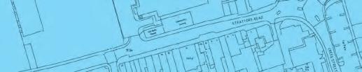
4 Wolverton Public Realm 1 Introduction This manual acts as technical guidance. It has been produced in order to provide a guide for the design, selection, installation and maintenance of the public realm, street furniture and materials within Wolverton. 1.0 Introduction In March 2011, an analysis of Wolverton s public realm was undertaken. The findings showed that the town suffered from a lack of definition due to an uncoordinated approach to the design, selection, installation and maintenance of public areas, street furniture and materials throughout the town. This had a knock-on effect of the town s identity becoming diluted, having unattractive public spaces and generally being difficult to understand and navigate. The town s remaining Victorian public realm was also found to be in a poor state of repair. A co-ordinated approach was need across the town in order to reinforce its identity and retain the conservation area heritage. As a result of these findings, this manual was produced to provide guidance on the design of the public realm and ensure it is co-ordinated, attractive, easily understood and easy to move around. The guidelines provide clear and robust design recommendations for: the way we arrive or move around the town by foot, cycle, public transport or car; the relationships between movement patterns and the design of streets and spaces in the centre; and creating a co-ordinated approach to the design and maintenance of the highway and environment. The design of the public realm and the inter-relationship with transport and movement systems is one of the most significant elements in shaping the future character and image of Wolverton. Careful and informed design of the public realm and the way we move around is fundamental to the quality of future development, and will contribute greatly to the attractiveness and vitality of the town. 1.1 Area of Study The area covered by this study is essentially outlined by the conservation area boundary. However, the principles detailed here should be consulted when works are planned throughout the town. 1.2 Rationale Design guidance and principles for the public realm are essential for Wolverton to thrive as a place that is attractive to visit, live, work and invest in. The guide should encourage those responsible for the appearance and function of public space to adopt a co-ordinated approach to the public realm which respects the local context, delivers quality and reinforces the identity of the town. Design consistency will make it possible to avoid a piecemeal appearance to Wolverton s public spaces, which can damage the character of the town. 1.3 Scope It is not envisaged that all prescribed suggestions within this manual will be implemented immediately; this document is to be referred to for planned future developments, public realm improvements and maintenance works. It is positively encouraged that when work is carried out in the public realm it should be in accordance with the specification detailed in this document in order to form a more coherent and attractive streetscape. 4


5 Design Manual Residential Street, Wolverton Church Street, Wolverton Wolverton 5
6 Wolverton Public Realm 1.4 Objectives The following objectives for the Wolverton Public Realm Design Manual have been identified: to provide a common coherent strategy and approach to the public realm and movement within Wolverton; to provide the basis for all decisions relating to the public realm; to put in place design principles to ensure that the public realm is designed to the highest quality and is appropriate for the future role and identity of Wolverton; to ensure that Wolverton is seen as a whole, and its public realm and movement patterns are coordinated; and to improve the pedestrian environment ensuring that the way people move around the public realm is an attractive, safe and memorable experience whether they travel on foot, by cycle, public transport or by other modes. 1.5 Vision As Wolverton evolves, the form and function of the public realm will change over time. The manual is intended to establish a good foundation on which to build and guide the design of this evolving public realm. This will be achieved by establishing a recognised family of materials and components across the town. The public realm is a key component enabling the town to fulfil its role as an attractive place to live, visit, do business and invest for the communities of Wolverton as well as the surrounding estates and villages it serves. Its streets, squares and other public spaces must be of high quality, in their design, management and maintenance, to set the context for the town as a neighbourhood centre. The public realm should reflect the best of modern practice, embracing new technologies whilst maintaining the best of the local character, distinctive patterns of development, sense of history, culture and traditions. An attractive and safe public realm will contribute to the quality of life and economic prosperity of the town, creating a place where businesses choose to invest and people want to live. Wolverton must be accessible to all, easy to understand, navigate and be inspiring and enjoyable to be in. The public realm will be robust and able to adapt to changing needs. It will build upon and enhance the principles outlined in the conservation area review, that have successfully guided the physical, economic and social development of Wolverton over its history. The identity and character of the public realm in Wolverton will complement future development and provide a setting for new, exciting development opportunities. Across the town, a co-ordinated family of street furniture and materials will enhance the identity for the Wolverton streetscape and have a close relationship with the movement principles set out in the manual. This family of components will enhance local distinctiveness and will inform design decisions. This family and the overall approach to design will also influence the design of publicly accessible, but privately owned, space within future development projects and the special areas of high quality civic and central places within the town centre. 6
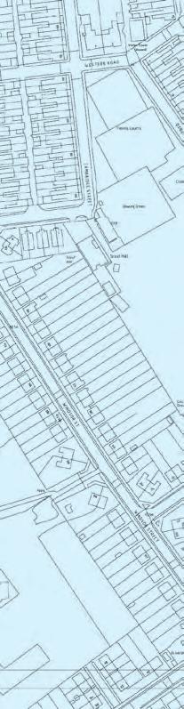

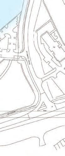
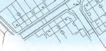


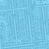


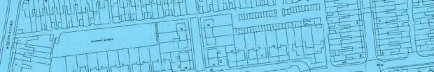
7 Overall area affected Coarse Grain Later Development ( ) Fine Grain Victorian Core ( ) Area of Study Design Manual 7
8 Wolverton Public Realm 2 Urban Design Principles for the Public Realm 2.0 Understanding the public realm Within the context of the Wolverton Public Realm Design Manual the public realm is defined as all the spaces between buildings that can be freely accessed by the public. From an urban design perspective, it encompasses all outdoor areas including streets, backways, parks, squares, pedestrian areas, cycle routes and other areas that enable seamless movement through a network of spaces. It therefore includes areas, both publicly and privately owned and managed, that are accessible by the public. 2.1 What is Good Public Realm? The Wolverton Regeneration Strategy (MKC, 2004) identifies the primary objectives for the public realm as; To create an attractive, safe and clean pedestrian friendly environment, that is interconnected, easy to move through and use for residents, workers and visitors alike. By Design (CABE, 2001) identifies a good public realm as: a place with attractive and successful outdoor areas. For Wolverton, various individual components contribute to this, including: the arrangement of its paving, planting, lighting, orientation, shelter, signage, street furniture, and the way it is overlooked, as well as the routes which pass through it, and the uses in and next to it (By Design, CABE, 2001, p24). The public realm within Wolverton should pay due regards to the conservation area context. Consequently, there is a close relationship between the design of the public realm and the movement networks which access the town of Wolverton. In addition: how attractive public space is, and how well people treat it, will partly depend on the arrangements made for its management and how easy it is to maintain. Long-term management strategies are, therefore, important elements in the continued provision of a successful public realm for the town. The Wolverton Public Realm Design Manual relates to the design and development of all public realm in the town centre. The intention, however, is not to be overly prescriptive in providing structuring principles for design, but to allow room for imaginative design treatment in the future, in locations where this is considered appropriate. 2.2 Best Practice Policy and Guidance There is a range of policy and guidance that sets out principles for the successful and sustainable design of public realm in our towns. Such guidance has reinforced the importance of town centres as the focus for social and economic life. The importance of providing a high quality pedestrian environment to complement the diverse retail, commercial and leisure attractions in town centres is embedded within best practice. Best practice and Wolverton-specific principles should guide all future design development proposals and projects within the public realm. A number of relevant principles can be drawn from best practice documents to form the basis of all new proposals within the Wolverton public realm (these are set out in Table 1). Drawing these principles together and applying the new family of materials and furniture should offer the quality and co-ordinated approach to the public realm that is sought by this manual and is underpinned by the Wolverton Regeneration Strategy. 8
9 Design Manual Best practice principles for public realm in Wolverton Design of the highest quality not compromised for isolated development or operational imperatives. A unifying design approach that pays particular attention to the conservation area context where there is consistency and co-ordination of, with room for richness and imagination in special areas. Improving the pedestrian environment with safe, accessible routes and interest at street level. Easy movement and access for all with priority given to walking, cycling and public transport. Creating diversity, variety and richness where there is a choice of routes, spaces and places to visit or move through giving people reasons to come to Wolverton and return. Appropriate and varied scale which adds interest and defines character, from backways to shopping streets. Wolverton will benefit from a network of public spaces and routes that vary in scale and activity, from the smallest courtyard to larger civic and ceremonial spaces. Clear orientation and connections encouraging people to investigate and aiding navigation through landmark buildings and structures, particularly at intersections; together with signage, colour, lighting and public art. Creating memorable places and spaces with a streetscape punctuated with memorable places and spaces each offering a distinct aspect and atmosphere. Meeting the needs of all groups in society meeting the requirements of a wide range of people, including the young and old, visitors and residents and special user groups. Removing street clutter ensuring that pieces of street furniture form part of a consistent family, and are of high quality, placed and designed to meet aesthetic and functional standards. Animation and visual interest with active frontages, art, lighting and events focussed on key pedestrian routes and destinations. Integrating public art - inviting the vision, creativity and skills of artists makes spaces distinctive by responding to the site, and the people who use and engage with it. Designing a safe environment where all streets and open spaces (whether publicly or privately owned) should be overlooked and bordered by frontages and active uses to provide natural surveillance of the public realm. Opportunities for casual surveillance should be created through the sensitive positioning of building entrances and design of access routes, car parking, cycle routes, etc. Creating a welcoming microclimate where spaces need to be sensitively located and carefully designed to capture the sun, provide shelter from the wind and encourage active use. Ongoing management and maintenance highest standards of management and maintenance will be met for all aspects of Wolverton public realm. A sustainable approach where materials and maintenance regimes are selected to minimise adverse impacts on the environment without damaging or removing the identified original historic features and materials. A collaborative approach all stakeholders working together, will help meet the aspirations for a high quality public realm with Milton Keynes Council and Wolverton and Greenleys Town Council working in partnership to co-ordinate the design and decision making process. Table 1 9

10 Wolverton Public Realm Existing Scenario 1 Street lighting column-mounted contributing to street clutter. 2 Road signage and information on separate posts. 3 Litter bin obstructing footway. 5 Gradual loss of original features that once defined the identity of Wolverton s public realm, such as kerb, drainage channel and surface material details. 6 No visual clues to one way street other than easy to miss no entry signs. 4 Bollards and unnecessary furniture contribute to street clutter. 10

11 Design Manual Suggested Improvements 1 Street lighting wall-mounted wherever possible. Where lamp columns are used, new Wolverton standard columns would be an improvement. 2 Road signs, road names and information wallmounted wherever possible. Where this is not possible, signs should be grouped, utilising existing posts such as lamp columns. 3 Unnecessary bollards removed and litter bin column-mounted. 4 Road narrowed to provide visual clues to one way street, providing clear parking bays and creating space for street trees. 5 Pedestrian crossing points defined with a clear change in surface materials. 6 Tightened corner radius on kerbs to maintain pedestrians desire line and reduce vehicle turning speeds. 7 Retain or reinstate modern equivalent of original features which strengthens Wolverton s identity through the public realm 11
12 Wolverton Public Realm 2.3 Enhancing the Character and local identity of Wolverton The character of an area is best enhanced by respecting its locally distinctive patterns of development, sense of history, culture and traditions. All urban design objectives should seek to improve and contribute to the overall context and identity of Wolverton. Wolverton was the first purpose built green-field railway town in the country after Robert Stephenson brought the London & Birmingham Railway to Wolverton in Wolverton s historic Victorian and Edwardian character and layout should be enhanced when considering any development works. The Future Wolverton vision established the principles of aiming to meet the needs of the community and preserve the heritage and identity of the area whilst supporting local diversity. The distinctive natural and historic setting, views and local topography and ecology should work as an inspiration for future development. Local materials, scale and texture, craftsmanship and scale of development are covered with the conservation area review document and should reflect the local and regional traditions as highlighted. Wolverton must aspire to become a place with the highest quality architecture, landscape architecture and public realm design that will enhance and complement its historic character and context. The future design of the public realm will recognise and enhance the important features and structuring principles of today s Wolverton. These structuring elements are part of the defining character of the town. The structure of the public realm is intended to maintain, enhance and celebrate these characteristics, but reorder how they are applied, to include the following: Grid structure Wolverton s main grid structure of terraced streets and backways dominates the movement network, the public realm and is a key characteristic of the town. This will be maintained and enhanced as a primary element. A pedestrian and cycle grid will be introduced to the existing street and plot structure. The finer grain will seek to address some of the modern day drawbacks of the original Victorian grid structure, seeking to: provide an improved pedestrian environment by utilising and activating backways; creating a comfortable, walkable environment; and establish an interconnected network of streets and pedestrian routes directly related to their relative importance within the townscape. 12
13 Design Manual Family of street furniture and surface materials 2.4 Addressing the parking The original Wolverton Streetscape would have delivered a high quality public realm with a consistent approach to detailing, street furniture, landscape, colour and materials. However, developments and highway works over the years have moved away from this original concept in an unco-ordinated and piecemeal manner. In developing a new coherent approach, there is the opportunity to review existing elements to ensure they are consistent with the principles of the Wolverton Regeneration Strategy while retaining the important original features of the conservation area. An increasing and daily problem for the majority of residents and the single most complained about issue that faces Wolverton is its parking provision. The need to balance the requirements of vehicles with the need for a safe pedestrian and cycling environment will be recognised through the use of appropriate parking control measures such as primrose yellow lines in the conservation area. Any physical measures affecting parking should reflect the principles of this guide. The manual re-establishes a co-ordinated strategy for street materials and signage, street furniture, typical detailing, lighting, pedestrian signage and planting. The new family of public realm components and strategy for implementation must properly address present management and maintenance issues, financial considerations, accessibility, mobility standards and embrace new technologies, standards and efficiencies. Street furniture, materials and finishes will be selected using this criteria to deliver a high quality public realm capable of meeting the challenges of a historic town such as Wolverton. 13
14 Wolverton Public Realm 2.5 Public Realm Movement Network Pedestrians For Wolverton to improve and prosper it is essential that all types of user can freely move around and access all areas of the town. This section describes how design can influence how people move around Wolverton s public realm. It considers two main issues: the interaction of access and movement with the public realm in public spaces, backways, streets and at road junctions; and provision of an equitable and sustainable transport system for Wolverton where the specific needs of different individuals or groups including pedestrians, cyclists, public transport users and motorists can be addressed. The aspirations set out in the Milton Keynes Local Transport Plan 3 (2012) aim to provide excellent connections and interchange facilities with all other city and regional wide public transport services. These improvements will contribute to increased use of public transport in the future; and at a national and local level there is a desire to encourage more sustainable forms of travel. A number of further initiatives, including a Cycling Strategy and Wayfinding Strategy will support walking and cycling trips. In access and movement terms there are four primary users of Wolverton Town Centre: A less constrained and more intuitive pedestrian movement will be encouraged to increase activity on streets in a safe manner and this will be supported by: improved wayfinding and orientation that promotes key walking routes and pedestrian access into and through Wolverton; the promotion of safe crossing points at appropriate junctions; and improvements to backways. Cyclists Cycling will be encouraged and promoted in the following ways: improved wayfinding and orientation that promotes key cycling routes; streets designed to restrain vehicle speeds and create cycle friendly environments; and provision of improved cycle parking facilities at appropriate locations throughout Wolverton. While cycling will be promoted on all roads within Wolverton, north-south and east-west routes that connect schools and leisure facilities will be identified for cyclists wishing to traverse Wolverton. Pedestrians; Cyclists; Public transport users; and Motorists. 14

15 Design Manual Public Transport Motorists Public transport, which includes trains, buses, and taxis, will be promoted and encouraged with the specific intention of significantly increasing the number of people using public transport on a regular basis. A framework for improvement of Wolverton s bus stops and routes has been identified. Waiting facilities along routes will be improved. For the economic prosperity of Wolverton to be enhanced it is vital to provide good facilities for motorists. While the needs of other users are being addressed, motorists should also find that their experience of Wolverton will change. This will be achieved through improved parking facilities at town centre locations. Taxi facilities are proposed for Wolverton Train Station. Cycleway Network Existing Redways Suggested new Cycleway Roads Back Alley School Railway Station 15
16 JUNCTIONS junctions JUN1 Fine Grain Victorian Core ( ) JUN1A JUN1B JUN1C JUN1D Carriageway Crossroads Junction Carriageway / Backway Junction Carriageway / Cycleway Junction Carriageway T-Junction JUN2 Coarse Grain Later Development Area ( ) JUN2A JUN2B JUN2C JUN2D Carriageway Crossroads Junction Carriageway / Backway Junction Carriageway / Cycleway Junction Carriageway T-Junction For illustration of these areas, refer to introductory document (page 7). JUN3 All Areas - One-Way Junction Exit Detail Issue no.1 January 12

17 The Main Features 1 2 Improved pedestrian route definition. Adjusted corner radii. Minimum street furniture clear of pedestrian movement Wall-mounting of signage/lighting where appropriate. Retention and reinstatement of historical features. Active building fronts with pedestrian scale lighting. Carriageway Crossroads Junction (Fine Grain Victorian) 4 1 Details shown serve to echo the traditional Victorian character and street layout of Wolverton. The adjustment of corner radii will slow traffic, whilst allowing more space for pedestrian crossing and improved route definition. Clear footways and scaled lighting will improve accessibility and ease of movement for all JUN1A Issue no.2 June 11 JUN1A
 ramps are: 1.5m - Maximum - 3m slope 1 in 20. l l Kerb New radii ramps - Minimum width 3m. l 1.")
18 Carriageway Crossroads Junction (Fine Grain Victorian) Setting out Principles l l Footway Lighting - Positions as existing on widths bridge (from parapet. back of footway to front l of New kerb) ramps are: 1.5m - Maximum - 3m slope 1 in 20. l l Kerb New radii ramps - Minimum width 3m. l 1.5m Steps to - Half promote landing slow at motor-vehicle mid point speeds. (where ten or more risers). l l Uncontrolled Steps - Central pedestrian balustrade crossings (where set steps out are in line excess of footway. of 3m wide) l l Tactile Steps paving - Width to suit building line. l to Footways- comply with widths Guidance (from back on the of use of tactile footway paving to front surfaces of kerb) DETR are: l Road l Boulevards signs 9.5m attached l Gates 9.5m to building where possible. l back Building to back line when setbacks post at mounted. corners are to l Lighting be verified by developers. l 0.25m The planting offset to design rear of for footpath the to follow embankments property boundary and environment line. of the underpasses positioned asymmetrically should be in accordance on rear of footways with the at adopted proximity technical to property guidance: access Street paths. Trees in CMK: Guidance on wall-mounted the development wherever Process. possible. Bold bands l Road of colour markings planting, combined with double contrasting yellow evergreen lines to extend and silver 10m foliage back from plants junction. in a formal style, will seek to provide striking and differing visual solutions to each location. Planting to have topsoil depth of 450mm. Public Realm Elements G1 G1 G2 G6 G4 G5 G7 G11 G12 G13 G17 F60 F64 L1 Silver grey pre-cast concrete paving flags 400 Silver x 400 grey stagger pre-cast bond concrete paving Buff flags Breedon 400 x 400 gravel stagger bond Precast concrete tonal contrast corduroy paving Surface 400 water x 400 drainage stack gully. bond Channel two laid rows in stretcher at top and course bottom in staffordshire of all steps blue (not required and brindle for brick ramps) Light Staffordshire silver-grey blue granite tonal contrast kerbs to top tactile and bottom brick paving of ramps laid to ends on bottom and Paving to faces inset on inspection top covers to match Drainage adjacent surfacing channels with bright steel grating Black Staffordshire matrix hot-rolled blue bullnosed asphalt kerbs Granite Paving setts inset 100 drainage x 100 channels stack bond Durable Black matrix paint hot-rolled carriageway asphalt markings Pre-cast concrete steps Conservation primrose yellow durable paint carriageway markings Stainless steel hand rail required for all steps Painted Traffic signs black central reservation barrier Junction parapet railing Street name plates (wall-mounted Stainless steel with lacquered traffic sign where possible) frontlit Steel street directory Steel General street highway name plate lighting (preferably Stainless wall-mounted steel with where lacquer possible) finish traffic signal pole with vehicle aspect 8m tall painted and lacquered galvanised steel column with aluminium lantern 3m tall painted and lacquered galvanised steel column with aluminium lantern Tube/ strip high level light in underpasses G1 G1 G4 G4 F60 G11 G11 G5 G5 L1 L1 G17 G13 F64 L1 G5 G5 G11 G11 F60 G4 G4 G1 G1 London Plane Platanus acerifolia at 4.8m spacing Ornamental Cherry Prunus Pink Perfection or similar as agreed. JUN1A Issue no.2 June 11 JUN1A

19 The Main Features Direct pedestrian routes. Adjustment of existing corner radii and kerb alignment at crossings. Change of surface treatment on crossings Backway crossings on half-raised tables for ease of access. Minimum Street furniture clear of pedestrian movement. Lighting to back of footway aiding illumination of pedestrian routes. Carriageway/Backway Junction (Fine Grain Victorian) 2 1 Details shown serve to echo the traditional Victorian backways of Wolverton, complete with original features such as setted drainage channels. Backways form direct pedestrian routes that will be uncluttered and well-lit for safety. The careful use of raised tables at backway junctions retains accessibility and ease of movement for all JUN1B Issue no.2 June 11 JUN1B

20 Carriageway/Backway Junction (Fine Grain Victorian) Setting out Principles l Lighting l Lighting - Positions as existing on 0.25m bridge offset parapet. to rear of footpath to follow l New building ramps line. - Maximum slope 1 in 20. l positioned l New ramps asymmetrically - Minimum width on rear 3m. of footways. l Steps - Half landing at mid point wall-mounted (where ten or wherever more risers). possible. Backway l Steps Lighting - Central balustrade (where 0.25m steps offset are in to excess edges of of 3m backway. wide) wall-mounted l Steps - Width wherever to suit building possible. line. l Footway l Footways- widths (from back of widths footway (from to back front of of footway kerb) are: to front of kerb) l Boulevards are: 1.5m 9.5m - 3m. l Kerb radii l Gates 9.5m m l Building to promote line setbacks slow motor-vehicle at corners are to speeds. be verified by developers. l Uncontrolled l The planting pedestrian design for crossings the set embankments out in line of footway. and environment of the concrete underpasses sett crossing should half-raised be in accordance with semi-dropped with the adopted kerb at technical backway. guidance: ramps Street from Trees carriageway in CMK: Guidance to new level. on l Tactile the paving development Process. Bold bands to of comply colour with planting, Guidance combined on the with use of tactile contrasting paving surfaces evergreen DETR and silver foliage l Road plants signs in a formal style, will seek to attached provide to striking building and where differing possible. visual back solutions to back to when each post location. mounted. Planting to have topsoil depth of 450mm. Public Realm Elements G1 Silver grey pre-cast concrete paving flags G1 400 Silver x 400 grey stagger pre-cast bond concrete paving flags G2 Buff 400 x Breedon 400 stagger gravel bond G6 G2 Precast Conservation concrete Granite tonal setts contrast corduroy paving 100 x staggerbond x 400 stack bond two rows at top and bottom of all steps (not G3 Precast concrete blocks 200 x 100 required for ramps) herringbone bond laid at 45 degrees to G11 Light silver-grey granite kerbs to top and carriageway with contrasting mid grey bottom of ramps laid to ends on bottom colour at crossing points and to faces on top G12 G4 Drainage Surface water channels drainage with gully. bright Channel steel laid grating stretcher course in Staffordshire blue G13 Black and brindle matrix brick. hot-rolled asphalt G15 G5 Granite Staffordshire setts 100 blue x tonal 100 stack contrast bondtactile G17 Durable brick paving paint carriageway markings G24 Pre-cast concrete steps G7 Paving inset inspection covers to match adjacent surfacing F51 Stainless steel hand rail G11 required Staffordshire for all blue steps bullnosed kerbs F52 G13 Painted Black matrix black hot-rolled central reservation asphalt barrier F53 Junction parapet railing G17 Conservation primrose yellow durable F60 Stainless paint carriageway steel with markings lacquered traffic sign frontlit G21 F63 Steel Raised street tables directory at backway crossings F64 Steel street name plate F70 Stainless steel with lacquer finish traffic L1 General highway lighting signal pole with vehicle aspect L2 Footway lighting L1 L3 L4 8m tall painted and lacquered galvanised steel column with aluminium lantern 3m tall painted and lacquered galvanised steel column with aluminium lantern Tube/ strip high level light in underpasses G1 G1 G4 G4 L1 G11 G11 L1 G7 G2 G21 G3 G5 G17 G13 G5 G21 G3 G17 G13 G2 G13 G5 G5 G11 L1 G4 G11 G4 G1 G1 L1 LA1 LA7 London Plane Platanus acerifolia at 4.8m spacing Ornamental Cherry Prunus Pink Perfection or similar as agreed. JUN1B Issue no.2 June 11 JUN1B

21 The Main Features Improved cycle/pedestrian route definition. Adjustment of existing corner radii and kerb alignment at crossings. Change of surface treatment on crossings Cycleway crossings on half-raised tables. Minimum street furniture clear of pedestrian movement. Lighting to back of footway illuminating pedestrian routes. Carriageway/Cycleway Junction (Fine Grain Victorian) 5 1 Details shown serve to echo the traditional Victorian backways of Wolverton, whilst making provision for suggested main cycle routes.the careful use of half-raised tables, change of surface material and tonal contrast at all crossing points, combined with a tighter corner radius will improve accessibility and ease of movement for all users of the cycleway This backway junction on Green Lane, near Moon Street has been selected to become a cycleway junction for the following reasons: It is a direct route to Bushfield school, already attracting a high footfall, including many cyclists. It is currently unsafe, so it is anticipated that the recommmendations will make the junction safer and more accessible for all users. JUN1C Issue no.1 Jan 12 JUN1C

22 Carriageway/Cycleway Junction (Fine Grain Victorian) Setting out Principles l Lighting l Lighting - Positions as existing on 0.25m bridge offset parapet. to rear of footpath to follow l New building ramps - line. Maximum slope 1 in 20. l positioned l New ramps asymmetrically - Minimum width on 3m. rear l Steps of footways. - Half landing at mid point wall-mounted (where ten or wherever more risers). possible. l Cycleway l Steps - Lighting Central balustrade (where 0.25m steps offset are in to excess edges of of 3m cycleway. wide) wall-mounted l Steps - Width wherever to suit building possible. line. l Footway l Footways- widths (from back of widths footway (from to front back of kerb) footway are: to front of kerb) l Boulevards are: 1.5m 9.5m - 3m l Kerb l Gates radii 9.5m 1.5m l Building to promote line setbacks slow motor-vehicle at corners are to speeds. be verified by developers. l Uncontrolled l The planting pedestrian design for crossings the set embankments out in line of and footway. environment of the concrete underpasses sett crossing should be half-raised in accordance with semi-dropped with the adopted kerb technical at cycleway. guidance: ramps Street from Trees carriageway in CMK: Guidance to new level. on l Tactile the development paving Process. Bold bands to of comply colour with planting, Guidance combined on the with use of tactile contrasting paving surfaces evergreen DETR and silver foliage l Road plants signsin a formal style, will seek to attached provide to striking building and where differing possible. visual back solutions to back to when each location. post mounted. Planting to l Road have markings topsoil depth of 450mm. double yellow lines extend past mouth of cycleway by 0.5m. cycleway markings to be positioned before raised crossing. Public Realm Elements G1 Silver grey pre-cast concrete paving flags G1 400 Silver x 400 grey stagger pre-cast bond concrete paving flags G2 Buff 400 Breedon x 400 stagger gravel bond G6 Precast concrete tonal contrast corduroy G2 Conservation Granite setts paving 400 x 400 stack bond two 100 x 100 staggerbond rows at top and bottom of all steps (not G3 required Precast concrete for ramps) blocks 200 x 100 Light herringbone silver-grey laid granite at 45 degrees kerbs to to G11 top and bottom carriageway of ramps with contrasting laid to ends mid on grey bottom and colour to faces at crossing on top points G12 G4 Drainage Surface water channels drainage with gully. bright Channel steel laid grating stretcher course in Staffordshire blue G13 Black and brindle matrix brick. hot-rolled asphalt G15 Granite setts 100 x 100 stack bond G5 Staffordshire blue tonal contrast tactile G17 Durable paving paint carriageway markings G24 Pre-cast concrete steps G7 Paving inset inspection covers to match adjacent surfacing F51 Stainless steel hand rail G11 required Staffordshire for all blue steps bullnosed kerbs F52 Painted black central reservation barrier G12 Paving inset drainage channels F53 Junction parapet railing G13 Black matrix hot-rolled asphalt F60 Stainless steel with lacquered traffic sign G17 frontlit Conservation primrose yellow durable F63 Steel paint street carriageway directory markings F64 Steel street name plate G21 Raised tables at cycleway crossings F70 Stainless steel with lacquer finish traffic signal pole with vehicle aspect F21 Column-mounted litter bin L1 8m tall painted and lacquered galvanised steel column with aluminium lantern L1 General highway lighting L3 3m tall painted and lacquered galvanised L2 steel Footway column lighting with aluminium lantern L4 Tube/ strip high level light in underpasses G11 G1 G1 G4 G4 G5 G5 G2 G13 G11 L1 G17 G21 G3 G17 L2 L1 G13 G21 G3 G13 G2 F21 G5 G5 G4 G4 G11 G11 G1 G1 LA1 LA7 London Plane Platanus acerifolia at 4.8m spacing Ornamental Cherry Prunus Pink Perfection or similar as agreed. JUN1C Issue no.1 Jan 12 JUN1C

23 The Main Features 1 2 Improved pedestrian route definition. Adjusted corner radii. Minimum street furniture clear of pedestrian movement Wall-mounting of signage/lighting where appropriate. Retention and reinstatement of historical features. Active building fronts with pedestrian scale lighting. Carriageway T-Junction (Fine Grain Victorian) Details shown serve to echo the traditional Victorian character and street layout of Wolverton. The adjustment of corner radii will slow traffic, whilst allowing more space for pedestrian crossing and improved route definition. Clear footways and scaled lighting will improve accessibility and ease of movement for all JUN1D Issue no.2 June 11 JUN1D
.")
24 Carriageway T-Junction (Fine Grain Victorian) Setting out Principles l Footway Lighting - Positions as existing on widths bridge (from parapet. back of footway to front l of kerb) New ramps are: 1.5m - Maximum - 3m slope 1 in 20. l Kerb New radii ramps - Minimum width 3m. l 1.5m Steps to - promote Half landing slow at motor-vehicle mid point speeds. (where ten or more risers). l Uncontrolled Steps - Central pedestrian balustrade crossings (where set steps out are in line excess of footway. of 3m wide) l Tactile Steps paving - Width to suit building line. l to Footways- comply with widths Guidance (from back on the of use of tactile footway paving to surfaces front of kerb) DETR are: l Road l Boulevards signs 9.5m attached l Gates 9.5m to building where possible. l back Building to back line when setbacks post at mounted. corners are to l Lighting be verified by developers. l 0.25m The planting offset to design rear of for footpath the to follow embankments property boundary and environment line. of the positioned underpasses asymmetrically should be in accordance on rear of footways with the at proximity adopted technical to property guidance: access paths. Street Trees in CMK: Guidance on wall-mounted the development wherever Process. possible. Bold bands l Road of markings colour planting, combined with double contrasting yellow evergreen lines extend and 10m silver back foliage from plants junction. in a formal style, will seek to provide striking and differing visual solutions to each location. Planting to have topsoil depth of 450mm. Public Realm Elements G1 G1 G2 G6 G6 G4 G11 G5 G7 G12 G11 G13 G12 G15 G17 G13 G24 G17 F51 F52 F60 F53 F64 F60 F63 F64 L1 F70 L1 L3 L4 Silver grey pre-cast concrete paving flags Silver 400 x 400 grey stagger pre-cast bond concrete paving flags Buff 400 Breedon x 400 gravel stagger bond Precast concrete tonal contrast corduroy Surface water drainage gully. Channel laid paving 400 x 400 stack bond two in stretcher course in Staffordshire blue rows at top and bottom of all steps (not and brindle brick required for ramps) Staffordshire Light silver-grey blue granite tonal contrast kerbs to tactile top and paving bottom of ramps laid to ends on bottom Paving and to faces inset inspection top covers to match adjacent Drainage surfacing channels with bright steel grating Staffordshire blue bullnosed kerbs Black matrix hot-rolled asphalt Paving Granite inset setts drainage 100 x 100 channels stack bond Black Durable matrix paint hot-rolled carriageway asphalt markings Pre-cast concrete steps Conservation primrose yellow durable paint carriageway markings Stainless steel hand rail required for all steps Traffic Painted signs black central reservation barrier Junction parapet railing Street name plates (wall-mounted Stainless steel with lacquered traffic sign where possible) frontlit Steel street directory General Steel street highway name lighting plate (preferably wall-mounted Stainless steel with where lacquer possible) finish traffic signal pole with vehicle aspect 8m tall painted and lacquered galvanised steel column with aluminium lantern 3m tall painted and lacquered galvanised steel column with aluminium lantern Tube/ strip high level light in underpasses G1 L1 G5 G11 G4 G5 G13 G5 G5 F60 F64 G5 G17 G5 F60 F64 G1 G11 G11 G1 G4 G4 LA1 LA7 London Plane Platanus acerifolia at 4.8m spacing Ornamental Cherry Prunus Pink Perfection or similar as agreed. JUN1D Issue no.2 June 11 JUN1D

25 The Main Features Direct pedestrian routes. Adjusted corner radii. Raised table with a change of surface at crossing identifies a pedestrian presence and eases access Active building fronts with pedestrian scale lighting. Minimum Street furniture clear of pedestrian movement. Retention and reinstatement of historical features. Carriageway Crossroads Junction (Coarse Grain Later Areas) 5 6 Details shown serve to echo the traditional Victorian character and street layout of Wolverton. The adjustment of corner radii and introduction of raised tables will slow traffic, facilitating safe pedestrian crossing and improving route definition. Clear footways and scaled lighting will improve accessibility and ease of movement for all JUN2A Issue no.2 June 11 JUN2A

26 Carriageway Crossroads Junction (Coarse Grain Later Areas) Setting out Principles Public Realm Elements l Footway widths (from back of footway to front of kerb) are: 1.5m - 3m l Kerb radii 1.5m to promote slow motor-vehicle speeds. l Uncontrolled pedestrian crossings set out in line of footway. l Tactile paving to comply with Guidance on the use of tactile paving surfaces DETR l Road signs attached to building where possible. back to back when post mounted. l Lighting 0.25m offset to rear of footpath to follow property boundary line. positioned asymmetrically on rear of footways at proximity to property access paths. wall-mounted wherever possible. l Road markings double yellow lines to extend 10m back from junction. G1 G4 G5 G7 G10 G13 G17 G21 F60 F64 L1 Silver grey pre-cast concrete paving flags 400 x 400 stagger bond Surface water drainage gully. Channel laid in stretcher course in Staffordshire blue and brindle brick Staffordshire blue tonal contrast tactile paving Paving inset inspection covers to match adjacent surfacing Granite conservation kerbs Black matrix hot-rolled asphalt Conservation primrose yellow durable paint carriageway markings Raised table Traffic signs Street name plates (wall-mounted where possible) General highway lighting (preferably wall-mounted where possible) L1 L1 F64 F64 G5 G5 G1 G1 G10 G5 G5 G10 G13 G21 G10 G5 G17 G5 G10 G1 G1 G5 G5 F60 F60 L1 L1 JUN2A Issue no.2 June 11 JUN2A

27 The Main Features Direct pedestrian routes. Adjustment of existing corner radii and kerb alignment at crossings. Change of surface treatment on crossings Backway crossings on half-raised tables for ease of access. Minimum Street furniture clear of pedestrian movement. Lighting to back of footway aiding illumination of pedestrian routes. Carriageway/Backway Junction (Coarse Grain Later Areas) 1 Details shown serve to echo the traditional Victorian backways of Wolverton, complete with original features such as setted drainage channels. Backways form direct pedestrian routes that will be uncluttered and well-lit for safety. The careful use of raised tables at backway junctions retains accessibility and ease of movement for all JUN2B Issue no.2 June 11 JUN2B

28 Carriageway/Backway Junction (Coarse Grain Later Areas) Setting out Principles l Lighting l Lighting - Positions as existing on 0.25m offset to rear of footpath to bridge parapet. follow building line. l New ramps - Maximum slope 1 in 20. l positioned asymmetrically on rear of l New ramps - Minimum width 3m. footways. l Steps - Half landing at mid point wall-mounted wherever possible. (where ten or more risers). l Backway Lighting l Steps - Central balustrade (where 0.25m offset to edges of backway. steps are in excess of 3m wide) wall-mounted wherever possible. l Steps - Width to suit building line. l Footway l Footways- widths (from back of widths (from back of footway to front footway to front of kerb) are: of kerb) are: 1.5m - 3m. l Boulevards 9.5m l Kerb radii l Gates 9.5m m to promote slow motor-vehicle l Building line setbacks at corners are to speeds. be verified by developers. l Uncontrolled pedestrian crossings l The planting design for the set out in line of footway. embankments and environment of the concrete sett crossing half-raised with underpasses should be in accordance semi-dropped kerb at backway. with the adopted technical guidance: ramps from carriageway to new level. Street Trees in CMK: Guidance on l Tactile paving the development Process. Bold bands to comply with Guidance on the use of of colour planting, combined with tactile paving surfaces DETR contrasting evergreen and silver foliage l Road signs plants in a formal style, will seek to attached to building where possible. provide striking and differing visual back to back when post mounted. solutions to each location. Planting to l Road markings have topsoil depth of 450mm. double yellow lines extend 0.5m past mouth of backway. Public Realm Elements G1 Silver grey pre-cast concrete paving flags G1 400 Silver x 400 grey stagger pre-cast bond concrete paving flags G2 Buff 400 x Breedon 400 stagger gravel bond G6 G2 Precast Conservation concrete Granite tonal setts contrast corduroy paving 100 x staggerbond x 400 stack bond two rows at top and bottom of all steps (not G3 Precast concrete blocks 200 x 100 required for ramps) herringbone bond laid at 45 degrees to G11 Light silver-grey granite kerbs to top and carriageway with contrasting mid grey bottom of ramps laid to ends on bottom colour at crossing points and to faces on top G12 G4 Drainage Surface water channels drainage with gully. bright Channel steel laid grating stretcher course in Staffordshire blue G13 Black and brindle matrix brick. hot-rolled asphalt G15 G5 Granite Staffordshire setts 100 blue x tonal 100 stack contrast bondtactile G17 Durable brick paving paint carriageway markings G24 Pre-cast concrete steps G7 Paving inset inspection covers to match adjacent surfacing F51 Stainless steel hand rail G11 required Staffordshire for all blue steps bullnosed kerbs F52 G13 Painted Black matrix black hot-rolled central reservation asphalt barrier F53 Junction parapet railing G17 Conservation primrose yellow durable F60 Stainless paint carriageway steel with markings lacquered traffic sign frontlit G21 F63 Steel Raised street tables directory at backway crossings F64 Steel street name plate F70 Stainless steel with lacquer finish traffic L1 General highway lighting signal pole with vehicle aspect L1 L3 L4 8m tall painted and lacquered galvanised steel column with aluminium lantern 3m tall painted and lacquered galvanised steel column with aluminium lantern Tube/ strip high level light in underpasses G1 G1 G4 G4 G11 G11 L1 G7 G5 G5 G2 G21 G3 G17 G13 G21 G3 G2 G13 G5 G5 G11 L1 G11 G4 G4 G1 G1 LA1 LA7 London Plane Platanus acerifolia at 4.8m spacing Ornamental Cherry Prunus Pink Perfection or similar as agreed. JUN2B Issue no.2 June 11 JUN2B

29 The Main Features Improved cycle/pedestrian route definition. Adjustment of existing corner radii and kerb alignment at crossing. Raised table with a change of surface at crossing identifies a pedestrian presence and eases access Existing parking spaces retained before the Wyvern school. Minimum street furniture clear of pedestrian movement. Lighting to back of footway aiding illumination of pedestrian routes. Carriageway/Cycleway Junction (Coarse Grain Later Area) 5 Details shown serve to echo the traditional Victorian backways of Wolverton, whilst making provision for main cycle routes. The use of raised tables, change of surface material and tonal contrast allows for a junction that is usable for all with reduced vehicle speeds, parking provision and safe crossing points for pedestrians and cyclists This backway junction on Aylesbury Street, adjacent to the Wyvern school has been selected to become a cycleway junction for the following reasons: It is a direct route to school, already attracting a high footfall, including many cyclists. By arranging the junction with traffic calming measures and shared surfaces, the junction will become safer and more accessible for all users. JUN2C Issue no.1 Jan 12 JUN2C

30 Carriageway/Cycleway Junction (Coarse Grain Later Area) Setting out Principles l Lighting Lighting - Positions as existing on 0.25m bridge offset parapet. to rear of footpath to l follow New building ramps - line. Maximum slope 1 in 20. l positioned New ramps asymmetrically - Minimum width on 3m. l rear Steps of footways. - Half landing at mid point wall-mounted (where ten or wherever more risers). possible. l Cycleway Steps - Central Lightingbalustrade (where 0.25m steps offset are in to excess edges of of 3m cycleway. wide) l wall-mounted Steps - Width wherever to suit building possible. line. l Footway Footways- widths (from back of widths footway (from to front back of kerb) footway are: to front of kerb) l Boulevards are: 1.5m 9.5m - 3m l Kerb l Gates radii 9.5m l m Building to promote line setbacks slow motor-vehicle at corners are to speeds. be verified by developers. l Uncontrolled The planting pedestrian design for crossings the set embankments out in line of and footway. environment of the concrete underpasses sett crossing should be half-raised in accordance with semi-dropped with the adopted kerb technical at cycleway. guidance: ramps Street from Trees carriageway in CMK: Guidance to new level. on l Tactile the development paving Process. Bold bands to of comply colour with planting, Guidance combined on the with use of tactile contrasting paving surfaces evergreen DETR and silver foliage l Road plants signs in a formal style, will seek to attached provide to striking building and where differing possible. visual back solutions to back to when each location. post mounted. Planting to l Road have markings topsoil depth of 450mm. double yellow lines extend past mouth of cycleway by 0.5m. cycleway markings to be positioned before raised crossing. Public Realm Elements G1 Silver grey pre-cast concrete paving flags G1 400 Silver x 400 grey stagger pre-cast bond concrete paving flags G2 Buff 400 Breedon x 400 stagger gravel bond G6 Precast concrete tonal contrast corduroy G2 Conservation Granite setts paving 400 x 400 stack bond two 100 x 100 staggerbond rows at top and bottom of all steps (not G3 required Precast concrete for ramps) blocks 200 x 100 Light herringbone silver-grey bond granite laid at kerbs 45 degrees to top to G11 and bottom carriageway of ramps with contrasting laid to ends mid on grey bottom and colour to faces at crossing on top points G12 G4 Drainage Surface water channels drainage with gully. bright Channel steel laid grating stretcher course in Staffordshire blue and G13 Black brindle matrix brick hot-rolled asphalt G15 Granite setts 100 x 100 stack bond G5 Staffordshire blue tonal contrast tactile G17 Durable paving paint carriageway markings G24 Pre-cast concrete steps G7 Paving inset inspection covers to match adjacent surfacing F51 Stainless steel hand rail G11 required Staffordshire for all blue steps bullnosed kerbs F52 Painted black central reservation barrier G13 Black matrix hot-rolled asphalt F53 Junction parapet railing G17 Conservation primrose yellow durable F60 Stainless steel with lacquered traffic sign paint carriageway markings frontlit F63 G21 Steel Raised street table directory at cycleway crossing F64 Steel street name plate G23 Parking bays F70 Stainless steel with lacquer finish traffic G25 Tree surround signal pole with vehicle aspect L1 F10 F50 L3 F60 L4 8m Fixed tall bollards painted and lacquered galvanised steel column with aluminium lantern Pedestrian guard rail 3m tall painted and lacquered galvanised steel Traffic column signs with aluminium lantern Tube/ strip high level light in underpasses L1 G11 G4 G23 G1 G11 G5 G17 G1 G3 G21 G13 G5 G2 G13 G3 G21 G2 G13 L1 G5 G5 G1 G11 G1 G11 L1 G4 G23 L1 LA1 L2 LA7 General highway lighting London Plane Platanus acerifolia at 4.8m Footway spacing lighting Ornamental Cherry Prunus Pink Perfection or similar as agreed. JUN2C Issue no.1 Jan 12 JUN2C

31 The Main Features 1 2 Improved pedestrian route definition. Adjusted corner radii. Minimum street furniture clear of pedestrian movement Wall-mounting of signage/lighting where appropriate. Retention and reinstatement of historical features. Active building fronts with pedestrian scale lighting. Carriageway T-Junction (Coarse Grain Later Areas) 4 Details shown serve to echo the traditional Victorian character and street layout of Wolverton. The adjustment of corner radii will slow traffic, whilst allowing more space for pedestrian crossing and improved route definition. Clear footways and scaled lighting will improve accessibility and ease of movement for all JUN2D Issue no.2 June 11 JUN2D
 New ramps are: 1.5m - Maximum - 3m slope 1 in 20. l Kerb New radii ramps - Minimum width 3m. l 1.")
32 Carriageway T-Junction (Coarse Grain Later Areas) Setting out Principles l Footway Lighting - Positions as existing on widths bridge (from parapet. back of footway to front l of kerb) New ramps are: 1.5m - Maximum - 3m slope 1 in 20. l Kerb New radii ramps - Minimum width 3m. l 1.5m Steps to - promote Half landing slow at motor-vehicle mid point speeds. (where ten or more risers). l Uncontrolled Steps - Central pedestrian balustrade crossings (where set steps out are in line excess of footway. of 3m wide) l Tactile Steps paving - Width to suit building line. l to Footways- comply with widths Guidance (from back on the of use of tactile footway paving to surfaces front of kerb) DETR are: l Road l Boulevards signs 9.5m attached l Gates 9.5m to building where possible. l back Building to back line when setbacks post at mounted. corners are to l Lighting be verified by developers. l 0.25m The planting offset to design rear of for footpath the to follow embankments property boundary and environment line. of the positioned underpasses asymmetrically should be in accordance on rear of footways with the at proximity adopted technical to property guidance: access paths. Street Trees in CMK: Guidance on wall-mounted the development wherever Process. possible. Bold bands l Road of markings colour planting, combined with double contrasting yellow evergreen lines extend and 10m silver back foliage from plants junction. in a formal style, will seek to provide striking and differing visual solutions to each location. Planting to have topsoil depth of 450mm. Public Realm Elements G1 G1 G2 G6 G6 G4 G11 G5 G7 G12 G10 G13 G13 G15 G17 G17 G24 F51 F60 F52 F64 F53 F60 L1 F63 F64 F70 L1 L3 L4 Silver grey pre-cast concrete paving flags Silver 400 x 400 grey stagger pre-cast bond concrete paving flags Buff 400 Breedon x 400 gravel stagger bond Precast concrete tonal contrast corduroy Surface water drainage gully. Channel laid paving 400 x 400 stack bond two in stretcher course in Staffordshire blue rows at top and bottom of all steps (not and brindle brick required for ramps) Staffordshire Light silver-grey blue granite tonal contrast kerbs to tactile top and paving bottom of ramps laid to ends on bottom Paving and to faces inset inspection top covers to match adjacent Drainage surfacing channels with bright steel grating Granite conservation kerbs Black matrix hot-rolled asphalt Black Granite matrix setts hot-rolled 100 x 100 stack asphalt bond Conservation Durable paint primrose carriageway yellow markings durable paint Pre-cast carriageway concrete steps markings Stainless steel hand rail Traffic required signs for all steps Street Painted name black plates central reservation barrier Junction parapet railing Stainless steel with lacquered traffic sign General frontlit highway lighting Steel street directory Steel street name plate Stainless steel with lacquer finish traffic signal pole with vehicle aspect 8m tall painted and lacquered galvanised steel column with aluminium lantern 3m tall painted and lacquered galvanised steel column with aluminium lantern Tube/ strip high level light in underpasses G4 G5 G1 L1 G10 G10 G5 G13 G5 G1 G5 L1 G5 G17 G5 G10 G4 G1 L1 L1 G4 LA1 LA7 London Plane Platanus acerifolia at 4.8m spacing Ornamental Cherry Prunus Pink Perfection or similar as agreed. JUN2D Issue no.2 June 11 JUN2D

33 The Main Features 1 2 Greenery introduced to soften the landscape. Adjusted corner radii to slow traffic. Kerb built out to accommodate tree pit and create a single lane for traffic movement Improved pedestrian route definition. Car parking bays created due to new kerb alignment. Retention and reinstatement of historical features. One-Way Junction Exit Detail (All Areas) This layout aims to include soft landscaping and greenery into the Wolverton street scene by utilising the exit junctions of any one-way roads. By building the kerb out, a tree pit can be accommodated, along with a single lane for vehicular movement. This layout creates additional car parking bays and affords more space for pedestrians, improving access for all JUN3 Issue no.2 June 11 JUN3
.")
34 One-Way Junction Exit Detail (All Areas) Setting out Principles l l Footway Lighting - Positions as existing on widths bridge (from parapet. back of footway to front l of New kerb) ramps are: 1.5m - Maximum - 3m slope 1 in 20. l l Kerb New radii ramps - Minimum width 3m. l 1.5m Steps to - Half promote landing slow at motor-vehicle mid point speeds. (where ten or more risers). l l Uncontrolled Steps - Central pedestrian balustrade crossings (where set steps out are in line excess of footway. of 3m wide) l l Tactile Steps paving - Width to suit building line. l to Footways- comply with widths Guidance (from back on the of use of tactile footway paving to front surfaces of kerb) DETR are: l Road l Boulevards signs 9.5m attached l Gates 9.5m to building where possible l back Building to back line when setbacks post at mounted. corners are to l Lighting be verified m by developers. offset to rear of footpath l to The follow planting property design boundary for the line. embankments positioned asymmetrically and environment rear of of the footways underpasses at proximity should be to in property accordance access with paths. the adopted technical guidance: wall-mounted Street Trees in wherever CMK: Guidance possible. on l Tree the pit development Process. Bold bands positioned of colour planting, behind tactile combined paving with from mouth contrasting of junction evergreen to allow and clear silver foliage pedestrian plants in movement. a formal style, will seek to tree provide surround striking positioned and differing to front visual of footway solutions with to clear each pedestrian location. Planting width of to 1.5m have minimum topsoil depth of 450mm. l Parking bays width 2.5m where possible. Where this is impossible, cars can occupy part of the carriageway as long as minimum carriageway width requirements are met. Public Realm Elements G1 Silver grey pre-cast concrete paving flags G1 400 Silver x 400 grey stagger pre-cast bond concrete paving G2 Buff flags Breedon 400 x 400 gravel stagger bond G6 Precast concrete tonal contrast corduroy G4 Surface water drainage gully. Channel laid paving stretcher 400 x course 400 stack in staffordshire bond two blue rows and brindle at top and brickbottom of all steps (not required for ramps) G5 Staffordshire blue tonal contrast tactile Light silver-grey granite kerbs to top and brick paving bottom of ramps laid to ends on bottom G7 and Paving to faces inset inspection top covers to match Drainage adjacent surfacing channels with bright steel grating G10 Conservation granite kerbs Black matrix hot-rolled asphalt G11 Staffordshire blue bullnosed kerbs Granite setts 100 x 100 stack bond (Kerb Durable type selected paint according carriageway to area markings of use) Pre-cast concrete steps G13 Black matrix hot-rolled asphalt G17 Conservation primrose yellow durable Stainless steel hand rail paint carriageway markings required for all steps G25 Painted Tree surround black central reservation barrier Junction parapet railing Stainless steel with lacquered traffic sign F60 Traffic signs frontlit F64 Steel Street street name directory plates (wall-mounted Steel where street possible) name plate Stainless steel with lacquer finish traffic signal pole with vehicle aspect L1 General highway lighting (preferably wall-mounted where possible) 8m tall painted and lacquered galvanised steel column with aluminium lantern LA_ 3m Tree tall type painted varies and (see lacquered product sheets) galvanised steel column with aluminium lantern Tube/ strip high level light in underpasses London Plane Platanus acerifolia at 4.8m spacing Ornamental Cherry Prunus Pink Perfection or similar as agreed. G1 G4 G5 F60 G5 L1 G17 G13 G25 G4 LA_ G5 L1 F60 G5 G4 G1 G1 JUN3 Issue no.2 June 11 JUN3
35 STREETS streets ST3 Street ST3A Typical High Street ST3B Typical Fine Grain Victorian Street ( ) ST3C Typical Coarse Grain Later Street ( ) ST3D Typical Backway/Cycleway ST4 All Areas - Pedestrian/Car Parking shared surface Issue no.1 January 12

36 The Main Features 1 2 Lighting and signage wall-mounted where possible to reduce street clutter. Private/Public space buffer strip. 4 5 Existing bullnosed kerbs retained or reinstated. Coursed drainage channels retained or reinstated. Fine Grain Victorian Street 3 Footpath drainage channels. Details shown serve to echo the traditional Victorian character and street format of Wolverton. The ground surfaces, street furniture and lighting are selected to reference the historical features of the town, whilst providing a streetscape that is functional and suitable for modern living. Streets should be uncluttered and easily accessible for all users ST3B Issue no.2 June 11 ST3B
.")
37 Fine Grain Victorian Street Setting out Principles l Lighting - Positions as existing on l Footway widths bridge (from parapet. back of footway to front l of kerb) New ramps are: 1.5m - Maximum - 3m slope 1 in 20. l New ramps - Minimum width 3m. l Kerb radii l 1.5m Steps to - promote Half landing slow at motor-vehicle mid point speeds. (where ten or more risers). l Steps - Central balustrade (where l Uncontrolled pedestrian crossings set steps out are in line in excess of footway. of 3m wide) l Steps - Width to suit building line. l Tactile paving l to Footwayscomply with widths Guidance (from back on the of use of tactile footway paving to surfaces front of kerb) DETR are: l Boulevards 9.5m l Road signs l attached Gates 9.5m to building where possible. l back Building to back line when setbacks post at mounted. corners are to be verified by developers. l Lighting l 0.25m The planting offset to design rear of for footpath the to follow embankments property boundary and environment line. of the positioned underpasses asymmetrically should be in accordance on rear of footways with the at adopted proximity technical to property guidance: access. Street Trees in CMK: Guidance on wall-mounted the development wherever Process. possible. Bold bands of colour planting, combined with l Paving inset drainage channels positioned contrasting symmetrically evergreen and along silver the foliage footpath plants after in a formal every 2 style, plots. will seek to provide striking and differing visual solutions to each location. Planting to have topsoil depth of 450mm. Public Realm Elements G1 G2 G6 G1 G6 G4 G11 G5 G7 G12 G13 G11 G15 G12 G17 G13 G24 G17 F51 F52 F60 F53 F64 F60 F63 L1 F64 F70 L1 L3 L4 Silver grey pre-cast concrete paving flags 400 x 400 stagger bond Buff Silver Breedon grey pre-cast gravel concrete paving flags 400 x 400 stagger bond Precast concrete tonal contrast corduroy paving Surface 400 water x 400 drainage stack gully. bond Channel two laid rows in stretcher at top and course bottom in Staffordshire of all steps blue (not required and brindle for brick. ramps) Light Staffordshire silver-grey blue granite tonal kerbs contrast to top tactile and bottom paving. of ramps laid to ends on bottom and to faces on top Paving inset inspection covers to match Drainage channels with bright steel adjacent surfacing grating Black Staffordshire matrix hot-rolled blue bullnosed asphalt kerbs Granite Paving setts inset 100 drainage x 100 channels stack bond Durable paint carriageway markings Black matrix hot-rolled asphalt Pre-cast concrete steps Conservation primrose yellow durable Stainless paint carriageway steel hand markings rail required for all steps Painted black central reservation barrier Traffic signs Junction parapet railing Stainless Street name steel plates with lacquered traffic sign frontlit Steel street directory General highway lighting Steel street name plate Stainless steel with lacquer finish traffic signal pole with vehicle aspect 8m tall painted and lacquered galvanised steel column with aluminium lantern 3m tall painted and lacquered galvanised steel column with aluminium lantern Tube/ strip high level light in underpasses G17 L1 G1 G1 G4 G4 L1 G13 G11 G11 G12 G12 L1 LA1 LA7 London Plane Platanus acerifolia at 4.8m spacing Ornamental Cherry Prunus Pink Perfection or similar as agreed. ST3B Issue no.2 June 11 ST3B

38 The Main Features 1 2 Lighting and signage wall-mounted where possible to reduce street clutter. Private garden space buffer. 4 Coursed drainage channels retained or reinstated. Coarse Grain Later Street 3 Existing kerbs retained or replaced with granite. Details shown serve to echo the traditional Victorian character and street format of Wolverton. The ground surfaces, street furniture and lighting are selected to reference the historical features of the town, whilst providing a streetscape that is functional and suitable for modern living. Streets should be uncluttered and easily accessible for all users ST3C Issue no.2 June 11 ST3C
 New ramps are: 1.5m - Minimum - 3m width 3m. l l Kerb Steps radii - Half landing at mid point 1.5m (where to promote ten or more slow risers). motor-vehicle l speeds.")
39 Coarse Grain Later Street Setting out Principles l Lighting - Positions as existing on l Footway bridge parapet. l widths New ramps (from- back Maximum of footway slope to 1 in front 20. l of kerb) New ramps are: 1.5m - Minimum - 3m width 3m. l l Kerb Steps radii - Half landing at mid point 1.5m (where to promote ten or more slow risers). motor-vehicle l speeds. Steps - Central balustrade (where l Uncontrolled steps are in pedestrian excess of 3m crossings wide) l set Steps out - in Width line of to footway. suit building line. l l Tactile Footways- pavingwidths (from back of to footway comply to with front Guidance of kerb) on are: the use of tactile l Boulevards paving surfaces 9.5m DETR l Road l Gates signs9.5m l attached Building to line building setbacks where at corners possible. are to back be verified to back by when developers. post mounted. l l Lighting The planting design for the 0.25m embankments offset to rear and environment of footpath to of the follow underpasses property should boundary be in line. accordance positioned with the adopted asymmetrically technical on guidance: rear of footways Street Trees at proximity in CMK: to Guidance property on access the development paths. Process. Bold bands wall-mounted of colour planting, wherever combined possible. with l Road contrasting markingsevergreen and silver foliage double plants yellow in a formal lines style, to extend will seek 10m to back from provide junction. striking and differing visual solutions to each location. Planting to have topsoil depth of 450mm. Public Realm Elements G1 G2 G6 G1 G6 G4 G11 G5 G12 G7 G13 G10 G15 G17 G13 G24 G17 F51 F60 F52 F53 F64 F60 L1 F63 F64 F70 L1 L3 L4 Silver grey pre-cast concrete paving flags 400 x 400 stagger bond Buff Silver Breedon grey pre-cast gravel concrete paving Precast flags 400 concrete x 400 stagger tonal contrast bond corduroy paving 400 x 400 stack bond two Surface water drainage gully. Channel laid rows at top and bottom of all steps (not in stretcher course in Staffordshire blue required for ramps) and brindle brick Light silver-grey granite kerbs to top and bottom Staffordshire of ramps blue laid tonal to contrast ends on tactile bottom and paving. to faces on top Drainage Paving inset channels inspection with covers bright to steel match grating adjacent surfacing Black Granite matrix conservation hot-rolled kerbs asphalt Granite setts 100 x 100 stack bond Durable Black matrix paint hot-rolled carriageway asphalt markings Pre-cast Conservation concrete primrose steps yellow durable paint carriageway markings Stainless steel hand rail required for all steps Painted Traffic signs black central reservation barrier Junction Street name parapet plates railing Stainless steel with lacquered traffic sign frontlit Steel General street highway directory lighting Steel street name plate Stainless steel with lacquer finish traffic signal pole with vehicle aspect 8m tall painted and lacquered galvanised steel column with aluminium lantern 3m tall painted and lacquered galvanised steel column with aluminium lantern Tube/ strip high level light in underpasses L1 L1 G17 G10 G4 G1 G1 G13 G10 G4 L1 L1 LA1 LA7 London Plane Platanus acerifolia at 4.8m spacing Ornamental Cherry Prunus Pink Perfection or similar as agreed. ST3C Issue no.2 June 11 ST3C

40 The Main Features 1 2 Pedestrian scale lighting set to rear of footway for clear movement of pedestrians and cyclists. Historical setted drainage channels retained or reinstated. 4 4 Cycle lane introduced. No bollards at entrance to backway to provide vehicular access to private properties. Typical Backway/Cycleway Details shown serve to echo the traditional Victorian character and backway formats of Wolverton. Whilst retaining historical features of the backway, a cycle lane has been introduced to improve route definition for cyclists and pedestrians. Backways should be uncluttered and easily accessible for all users, with a lighting strategy that makes them safe places to be ST3D Issue no.2 June 11 ST3D

41 Typical Backway/Cycleway Setting out Principles l Backway Lighting Lighting - Positions as existing on 0.25m bridge offset parapet. to edges of backway. l positioned New ramps asymmetrically - Maximum slope at edges 1 in of 20. l backway New ramps at proximity - Minimum to garden width access. 3m. l wall-mounted Steps - Half landing wherever at mid possible. point l Kerb (where radii ten or more risers). l m Steps to - promote Central balustrade slow motor-vehicle (where speeds. steps are in excess of 3m wide) l Uncontrolled Steps - Width pedestrian to suit building crossings line. l set Footways- out in line widths of footway. (from back of concrete footway sett to front crossing of kerb) half-raised are: with semi-dropped l Boulevards 9.5m kerb at backway. ramps l Gates from 9.5mcarriageway to new level. l Tactile Building paving line setbacks at corners are to to be comply verified with by developers. Guidance on the use of l tactile The paving planting surfaces design DETR for the l Road embankments signs and environment of the attached underpasses to building should where be in accordance possible. back with to the back adopted when technical post mounted. guidance: l Road Street markings Trees in CMK: Guidance on double the development yellow lines Process. extend Bold 0.5m bands past mouth of colour of backway. planting, combined with contrasting evergreen and silver foliage plants in a formal style, will seek to provide striking and differing visual solutions to each location. Planting to have topsoil depth of 450mm. Public Realm Elements G1 Silver grey pre-cast concrete paving flags 400 x 400 stagger bond G2 Conservation granite setts 100 x 100 G2 Buff stagger Breedon bond gravel G6 Precast concrete tonal contrast corduroy G7 paving Paving 400 inset x inspection 400 stack bond covers to two match rows adjacent at top surfacing and bottom of all steps (not G13 required Black matrix for ramps) hot-rolled asphalt G11 Light silver-grey granite kerbs to top and bottom of ramps laid to ends on bottom L2 and Footway to faces lighting on top G12 Drainage channels with bright steel grating G13 Black matrix hot-rolled asphalt G15 Granite setts 100 x 100 stack bond G17 Durable paint carriageway markings G24 Pre-cast concrete steps F51 F52 F53 F60 F63 F64 F70 L1 L3 L4 Stainless steel hand rail required for all steps Painted black central reservation barrier Junction parapet railing Stainless steel with lacquered traffic sign frontlit Steel street directory Steel street name plate Stainless steel with lacquer finish traffic signal pole with vehicle aspect 8m tall painted and lacquered galvanised steel column with aluminium lantern 3m tall painted and lacquered galvanised steel column with aluminium lantern Tube/ strip high level light in underpasses L2 G13 G2 L2 LA1 LA7 London Plane Platanus acerifolia at 4.8m spacing Ornamental Cherry Prunus Pink Perfection or similar as agreed. ST3D Issue no.2 June 11 ST3D

42 The Main Features 1 2 Kerb lowered to facilitate vehicular access. Level surface for shared use with pedestrians. Visual contrast in material to indicate parking bays when in use Sense of road narrowing created. Existing kerb alignment unchanged. Retention and reinstatement of historical features alongside new features. Pedestrian/Car Parking shared surface (All Areas) This layout aims to provide parking in the Wolverton street scene without robbing the pedestrian of usable space. By raising the level of the parking bays to meet the footways around them, a surface is created that can be used by pedestrians in the absence of vehicles, and also narrows the road, slowing vehicle speeds and increasing driver awareness towards pedestrian presence ST4 Issue no.2 June 11 ST4
 ramps are: 1.5m - Maximum - 3m. slope 1 in 20. l l Road New signs ramps - Minimum width 3m.")
43 Pedestrian/ Car Parking shared surface (All Areas) Setting out Principles l l Footway Lighting - Positions as existing on widths bridge (from parapet. back of footway to front l of New kerb) ramps are: 1.5m - Maximum - 3m. slope 1 in 20. l l Road New signs ramps - Minimum width 3m. l attached Steps - Half to building landing where at mid possible point back (where to back ten or when more post risers). mounted. l l Lighting Steps -- Central 0.25m offset balustrade to rear (where of footpath to follow steps are property in excess boundary of 3m wide) line. l Steps positioned - Width asymmetrically to suit building on line. rear of l footways Footways- at proximity widths (from to property back of access footway paths. to front of kerb) are: wall-mounted l Boulevards 9.5m wherever possible. l Parking l Gates bays 9.5m l width Building 2.5m line where setbacks possible at corners as long are as to the be minimum verified by pedestrian developers. clear zone is l allowed. The planting design for the embankments and environment of the underpasses should be in accordance with the adopted technical guidance: Street Trees in CMK: Guidance on the development Process. Bold bands of colour planting, combined with contrasting evergreen and silver foliage plants in a formal style, will seek to provide striking and differing visual solutions to each location. Planting to have topsoil depth of 450mm. Public Realm Elements G1 Silver grey pre-cast concrete paving flags G1 400 Silver x 400 grey stagger pre-cast bond concrete paving G2 Buff flags Breedon 400 x 400 gravel stagger bond G6 Precast concrete tonal contrast corduroy G4 Surface water drainage gully. Channel laid paving stretcher 400 x course 400 stack in staffordshire bond two blue rows and brindle at top and brickbottom of all steps (not required for ramps) G10 Conservation granite kerbs Light silver-grey granite kerbs to top and G11 bottom Staffordshire of ramps blue laid bullnosed to ends kerbs on bottom (Kerb and type to selected faces on according top to area of use) Drainage channels with bright steel G13 Black matrix hot-rolled asphalt grating G17 Black Conservation matrix hot-rolled primrose asphalt yellow durable Granite paint carriageway setts 100 x 100 markings stack bond G23 Durable Parking paint Bays carriageway markings Pre-cast concrete steps L1 Stainless General steel highway hand lighting rail (preferably required wall-mounted for where steps possible) Painted black central reservation barrier Junction parapet railing Stainless steel with lacquered traffic sign frontlit Steel street directory Steel street name plate Stainless steel with lacquer finish traffic signal pole with vehicle aspect 8m tall painted and lacquered galvanised steel column with aluminium lantern 3m tall painted and lacquered galvanised steel column with aluminium lantern Tube/ strip high level light in underpasses G11 G4 G10 G11 L1 G17 G1 G13 G1 G23 G4 L1 London Plane Platanus acerifolia at 4.8m spacing Ornamental Cherry Prunus Pink Perfection or similar as agreed. ST4 Issue no.2 June 11 ST4
44 places PL1 PL2 The Square Church Street Car park PLACES Issue no.1 January 12

45 The Main Features 1 2 Parking provision to encourage use of shops. Active retail frontages. 4 5 Important features such as war memorial retained. Pedestrian scale lighting strategy with clear routes. The Square 3 Introduction of greenery to soften the streetscape. 6 Minimum street furniture clear of pedestrian movement. 4 The concept proposals for the sqaure aim to echo and retain the traditional Victorian features of Wolverton, whilst creating a place fit for modern life. By increasing parking provision within the square, it should be enlivened with more visitors, creating a retail hub in this currently poorly accessible area. The introduction of greenery freshens the space and softens the hard landscaping PL1 Issue no.2 June 11 PL1
. l Steps - Central balustrade (where steps are in excess of 3m wide) l Steps - Width to suit building line.")
46 The Square Setting out Principles l Lighting - Positions as existing on bridge parapet. l New ramps - Maximum slope 1 in 20. l New ramps - Minimum width 3m. l Steps - Half landing at mid point (where ten or more risers). l Steps - Central balustrade (where steps are in excess of 3m wide) l Steps - Width to suit building line. l Footways- widths (from back of footway to front of kerb) are: l Boulevards 9.5m l Gates 9.5m l Building line setbacks at corners are to be verified by developers. l The planting design for the embankments and environment of the underpasses should be in accordance with the adopted technical guidance: Street Trees in CMK: Guidance on the development Process. Bold bands of colour planting, combined with contrasting evergreen and silver foliage plants in a formal style, will seek to provide striking and differing visual solutions to each location. Planting to have topsoil depth of 450mm. Public Realm Elements G1 G2 G6 G6 G11 G12 G13 G15 G17 G24 F51 F52 F53 F60 F63 F64 F70 L1 L3 L4 Silver grey pre-cast concrete paving flags 400 x 400 stagger bond Buff Breedon gravel Precast concrete tonal contrast corduroy paving 400 x 400 stack bond two rows at top and bottom of all steps (not required for ramps) Light silver-grey granite kerbs to top and bottom of ramps laid to ends on bottom and to faces on top Drainage channels with bright steel grating Black matrix hot-rolled asphalt Granite setts 100 x 100 stack bond Durable paint carriageway markings Pre-cast concrete steps Stainless steel hand rail required for all steps Painted black central reservation barrier Junction parapet railing Stainless steel with lacquered traffic sign frontlit Steel street directory Steel street name plate Stainless steel with lacquer finish traffic signal pole with vehicle aspect 8m tall painted and lacquered galvanised steel column with aluminium lantern 3m tall painted and lacquered galvanised steel column with aluminium lantern Tube/ strip high level light in underpasses LA1 LA7 London Plane Platanus acerifolia at 4.8m spacing Ornamental Cherry Prunus Pink Perfection or similar as agreed. PL1 Issue no.2 June 11 PL1

47 The Main Features Church Street PL2 Issue no.2 June 11 PL2
. l Steps - Central balustrade (where steps are in excess of 3m wide) l Steps - Width to suit building line.")
48 Church Street Setting out Principles l Lighting - Positions as existing on bridge parapet. l New ramps - Maximum slope 1 in 20. l New ramps - Minimum width 3m. l Steps - Half landing at mid point (where ten or more risers). l Steps - Central balustrade (where steps are in excess of 3m wide) l Steps - Width to suit building line. l Footways- widths (from back of footway to front of kerb) are: l Boulevards 9.5m l Gates 9.5m l Building line setbacks at corners are to be verified by developers. l The planting design for the embankments and environment of the underpasses should be in accordance with the adopted technical guidance: Street Trees in CMK: Guidance on the development Process. Bold bands of colour planting, combined with contrasting evergreen and silver foliage plants in a formal style, will seek to provide striking and differing visual solutions to each location. Planting to have topsoil depth of 450mm. Public Realm Elements G1 G2 G6 G6 G11 G12 G13 G15 G17 G24 F51 F52 F53 F60 F63 F64 F70 L1 L3 L4 Silver grey pre-cast concrete paving flags 400 x 400 stagger bond Buff Breedon gravel Precast concrete tonal contrast corduroy paving 400 x 400 stack bond two rows at top and bottom of all steps (not required for ramps) Light silver-grey granite kerbs to top and bottom of ramps laid to ends on bottom and to faces on top Drainage channels with bright steel grating Black matrix hot-rolled asphalt Granite setts 100 x 100 stack bond Durable paint carriageway markings Pre-cast concrete steps Stainless steel hand rail required for all steps Painted black central reservation barrier Junction parapet railing Stainless steel with lacquered traffic sign frontlit Steel street directory Steel street name plate Stainless steel with lacquer finish traffic signal pole with vehicle aspect 8m tall painted and lacquered galvanised steel column with aluminium lantern 3m tall painted and lacquered galvanised steel column with aluminium lantern Tube/ strip high level light in underpasses LA1 LA7 London Plane Platanus acerifolia at 4.8m spacing Ornamental Cherry Prunus Pink Perfection or similar as agreed. PL2 Issue no.2 June 11 PL2
49 ground surfaces Product sheets G1 G2 G3 G4 G5 G6 G7 G10 G11 G12 G12A G13 G17 G18 G21 G23 G24 G25 Pre-cast concrete paving flags Conservation granite cobbled setts Concrete setts Kerbside drainage channels Blister paving Hazard warning paving Inspection covers Granite conservation kerbs Blue bullnosed kerbs Drainage channels Gulley frames and covers Hot-rolled asphalt Road markings Access kerbs Raised tables Parking bays Steps & Ramps Tree surround GROUND SURFACES Issue no.1 January 12

50 G1 PRE-CAST CONCRETE PAVING FLAGS Role, Use and Position Footway paving used on Public Highways and within the curtilage of Private Developments. Within developments and general amenity areas open for public access at grade. Course to be laid perpendicular to flow of pedestrians. Material/finish Conservation/Saxon paving. Pre-Cast Concrete. Textured Finish. Clear antislip finish/coating on sloping paving Example product Colours Silver Grey. Installation Installation to be in accordance with Milton Keynes Council s Specification for Highway & Construction works. Stagger bond. Consistent joint alignments. No unsightly mortar infills. Dimensions 400 x 400mm x 60 mm minimum. Where additional strength is required due to occasional vehicular loads, flags should be specified with the appropriate increased depth. Additional Comments Footway surfacing has a significant impact on the streetscape. Design teams should ensure that the visual simplicity of the footway is maintained, this includes using tonal contrast tactile blister and hazard warning paving. Marshalls plc, Birkby Grange, Birkby Hall Road, Birkby, Huddersfield HD2 2YA Tel: Charcon Hulland Ward Ashbourne Derbyshire DE6 3ET Tel:

51 G2 CONSERVATION GRANITE COBBLED SETTS Role, Use and Position Backway drainage channels. Material/finish Granite aggregate setts. Colours Silver Grey. Installation Bond Pattern laid on a rigid bed with mortar pointed joints Installation to be in accordance with Milton Keynes Council s Specification for Highway & Construction works. Example product Dimensions 100mm x 100mm diameter x 100mm deep. Additional Comments Existing historical setts should be retained wherever possible, especially within the area defined as town centre in this guide. Where it is deemed that not enough existing conservation setts remain on a given strip of backway to retain the desired visual impact and functional values to the public realm, it is proposed that they are replaced with a modern equivalent. However, any granite setts must be reused elswhere within Wolverton with the town centre taking priority.

52 G3 CONCRETE SETTS Role, Use and Position Blocks are used as a pedestrian/vehicle surface at backway crossing points. Material/finish High quality exposed aggregate finish, V-Groove Key Block by Marshalls would be an appropriate example. Pre-cast concrete chamfered edge. Colours Grey Natural / Staffordshire blue Example product Installation For edge restraints and installation refer to with Milton Keynes Council s Specification for Highway & Construction works. Herringbone bond, set at 45 degrees to the carriageway. Dimensions 200 x 100 x 80mm. Marshalls plc, Birkby Grange, Birkby Hall Road, Birkby, Huddersfield HD2 2YA Tel:

53 G4 KERBSIDE DRAINAGE CHANNELS Role, Use and Position Kerbside drainage channels along streets. Material/finish Block paving laid in Stretcher Course. Colours Staffordshire blue and brindle finish. Example product Installation Laid in Stretcher Course in such a manner as to create a gully channel. Installation to be in accordance with Milton Keynes Council s Specification for Highway & Construction works. Dimensions 215 mm x 65mm 100 mm diameter nominal Ketley Brick Company Ltd Dreadnought Works, Pensnett, Brierley Hill, West Midlands, DY5 4TH, UK. Tel: Fax: info@ketley-brick.co.uk

54 G5 BLISTER PAVING Role, Use and Position (To comply with Guidance on the use of tactile paving surfaces DETR 1998) Referred to as tactile paving. Blister paving is used to provide a warning to people with visual impairment of crossing facilities. Material/finish Staffordshire blue. Colours Example staffordshire blue brick product Tonal contrast finish adjacent to silver grey footway paving. Staffordshire blue brick adjacent to silver grey paving flags Installation Installation to be in accordance with Milton Keynes Council s Specification for Highway & Construction works. Specification and application to conform to the current guidelines. Units must align with direction of crossing. Three rows shall be provided at crossing points laid to 1:10 falls. Dimensions 400 x 400 x 65mm. A blister height below 4.5mm reduces effectiveness and becomes undetectable for the visually impaired. Additional Comments A balance has to be struck between the needs of people having visual impairments and other users and the character of Wolverton. There must however be sufficient tonal contrast between the footway paving and the blister paving to aid the visually impaired. Ketley Brick Company Ltd Dreadnought Works, Pensnett, Brierley Hill, West Midlands, DY5 4TH, UK. Tel: Fax: info@ketley-brick.co.uk

55 G6 HAZARD WARNING PAVING Role, Use and Position (To comply with Guidance on the use of tactile paving surfaces DETR 1998) Hazard warning paving can also be referred to as corduroy paving as horizontal raised strips warn pedestrians of potential hazards. Provide a warning to people with visual impairment of cycleways, or changes of level including top and bottom of steps. Hazard warning paving may also be used to provide warning for other obstacles such as building overhangs or reduced overhead clearance heights. Must be positioned at right angles to direction of walking Material/finish Pre-cast concrete. Example product Colours Tonal contrast finish adjacent to silver grey footway paving. Installation Installation to be in accordance with Milton Keynes Council s Specification for Highway & Construction works. Specification and application to conform to the current guidelines. Units must align with direction of crossing. Dimensions 400 x 400 x 65mm. Marshalls plc, Birkby Grange, Birkby Hall Road, Birkby, Huddersfield HD2 2YA Tel: Charcon Hulland ward Ashbourne, Derbyshire DE6 3ET Tel:

56 G7 INSPECTION COVERS Role, Use and Position Service covers act as access points to either utility apparatus or drainage systems for maintenance. They are found in footways, carriageways and underpasses within Public Highways and Private Developments. Recess allows adjacent paving to be laid incover giving seamless paving within public realm. Material/finish Galvanised Steel. Colours Example product Finished appearance to match adjacent surfacing. The use of a stainless steel marker inset into the surface will denote utility. Installation Installation to be in accordance with Milton Keynes Council s Specification for Highway & Construction works. Paving trays to be installed over the existing chamber to allow the new surface to be cut in to match. Trays to be laid parallel to direction of surrounding paving. Paving to be laid in same direction as adjacent paving. Additional Comments Tactile paving should be kept away or to a minimum near service covers, when possible. Peter Savage Sales office: Liberty House, Liberty Business Park, Attleborough, Nuneaton, Warks, CV11 6RZ Tel: Steelway Brickhouse Tel: Fax: Website:

57 G10 GRANITE CONSERVATION KERBS Role, Use and Position Throughout Wolverton outside designated conservation area. Material/finish Natural granite to BS435 dressing B fair picked. Colours Silver grey. Installation Example product Installation to be in accordance with Milton Keynes Council s Specification for Highway & Construction works. Channels to be laid flush with minimum mm deep Class ST4 concrete bedding and haunching, to resist lateral movement. Kerb alignment to be consistent and follow smooth lines to provide strong definition between footway and carriageway. Upstand 100mm to kerbs. Radius kerbs to be used, not straight cut. Dimensions 255 x 205mm. Marshalls plc, Birkby Grange, Birkby Hall Road, Birkby, Huddersfield HD2 2YA Tel: Charcon Hulland ward Ashbourne Derbyshire DE6 3ET Tel:

58 G11 BLUE BULLNOSED KERBS Role, Use and Position Throughout Wolverton Conservation (area 1). Material/finish Staffordshire Blue single bullnosed engineering brick. Colours Staffordshire Blue. Installation Example original product Installation to be in accordance with Milton Keynes Council s Specification for Highway & Construction works. Kerb alignment to be consistent and follow smooth lines to provide strong definition between footway and carriageway. Upstand 100mm to kerbs. Dimensions 215 x 102 x 65 Bullnose radius 51mm Ketley Brick Company Ltd Dreadnought Works, Pensnett, Brierley Hill, West Midlands, DY5 4TH, UK. Tel: Fax: info@ketley-brick.co.uk


59 G12 DRAINAGE CHANNELS Role, Use and Position Drainage channels, from property downpipes to roadside drainage channel. Material/finish Cast iron. Blue engineering Block channel. Colours Staffordshire blue. Example original product Alternative replacement product Installation Installation to be in accordance with Milton Keynes Council s Specification for Highway & Construction works. Dimensions 50 x 50mm. Additional Comments The original cast iron drainage channels that can be found across Wolverton are an important historic component of the street scene especially the conservation area. Alternative replacement product Marshalls plc, Birkby Grange, Birkby Hall Road, Birkby, Huddersfield HD2 2YA Tel: Ketley Brick Company Ltd Dreadnought Works, Pensnett, Brierley Hill, West Midlands, DY5 4TH, UK. Tel: Fax: info@ketley-brick.co.uk

60 G12A GULLEY FRAMES & COVERS Role, Use and Position To aid drainage of carriageway. Positioned adjacent to the kerbline but within the channel. Exact position to be determined by design Material/finish Cast iron with natural finish Colours Natural metallic Installation Example product: Type A Installation in accordance with Milton Keynes Council s Specification for Highway & Construction Works. Dimensions Type A x 450 x 100mm Manhole Covers Ltd, Little London Business Park, Wendover, Bucks. Tel: Peter Savage Ltd, Head Office, Nuneaton, Warks. Tel:

61 G13 HOT-ROLLED ASPHALT Role, Use and Position Carriageway surface finish used on all streets and bellmouth interfaces within the designation of the Public Highway. This type of surfacing is also suitable for access roads into private developments and loading areas. Material/finish Hot-Rolled Asphalt Surfacing with pre-coated Chipping rolled in. The finished surface shall have a minimum texture depth of 1.2cm. Colours Example product Black matrix with flecks (colour to be determined). Installation Installation to be in accordance with Milton Keynes Council s Specification for Highway & Construction works. Specification shall be the current Department for Transport Specification for Highway Works. All materials shall be manufactured and supplied in accordance with requirements of: BS594: Part and Part 2: Maintenance Preferred method where repairs are to be carried out is to use infra-red heating process techniques. This technique involves re-heating the existing surface and recycling the material in situ. This will ensure a seamless repair and eliminates any joint failures. Dimensions 35-40mm Hot-rolled Asphalt. 10mm Pre-coated Chipping. Additional Comments Hot Rolled Asphalt Surfacing Contractor / material as agreed by Milton Keynes Council Highways Engineer. Hansonlite pre-coated Chipping Hanson Aggregates, Shepshed Tel : Milton Keynes Council promotes recycling and where possible Contractors should endeavour to re-use cold planed bituminous arisings.

62 G17 ROAD MARKINGS Role, Use and Position Markings are applied to the carriageway to control, warn and guide the road user. Road markings do not confer a duty of care to individuals beyond the general public duty of the Highway Authority under Section 39 of the 1988 Road Traffic Act. Material/finish Pre-formed thermoplastic strip or reflectorised finishes to paint should be used. Colours Example product Colours shall be as specified under the current Traffic Signs Regulations and General Direction [the Regulations] or relevant Guidance. Yellow lines within the conservation area should be in conservation primrose yellow. Installation Installation to be in accordance with Milton Keynes Council s Specification for Highway & Construction works. The standard width for all yellow lines shall be 50mm, except where prohibited by the Regulations. This is appropriate for design speeds of up to 30mph. Thicker lines can be used with permission where there are adhesion problems. The standard width for all other lines shall be the minimum specified in the Regulations. The usual size for all wording shall be the minimum specified in the Regulations. Markings shall be laid in sympathy with any underlying paving materials. Where markings are to be removed, ghost images shall be avoided. Mechanical techniques such as sand-blasting are recommended to avoid damaging the road surface. Where markings are to be re-marked, the new paint shall be accurately applied over the old material.
63 G17 ROAD MARKINGS Additional Comments Increasingly, coloured surfacing and road markings are being introduced. The use of colour is only advisory and their impact on the townscape should carefully be taken into consideration before any application. The townscape of Wolverton does not benefit visually from the addition of coloured surfacing/markings.

64 G18 ACCESS KERBS Role, Use and Position Located at bus stops to facilitate level boarding for the public, particularly people with pushchairs and wheelchairs. Marker bump assists the bus to align parallel and close to the kerb. Material/finish Granite. Colours Silver grey. Example product Installation Installation to be in accordance with Milton Keynes Council s Specification for Highway & Construction works. Kerbs shall be laid with 150mm deep class ST4 concrete bedding and haunching. Kerb face 220mm for 3m boarding length with transition kerbs laid either side. Charcon Hulland Ward Ashbourne Derbyshire DE6 3ET Tel:

65 G21 RAISED TABLES Role, Use and Position The two main objectives of raised tables are to make crossing points universally accessible to ease pedestrian movements and to slow vehicle speeds. Side road entry treatments have another function - to denote a change in character between a main street and a minor street. Material/finish Ramps: blocks laid to herring bone bond to match those used elsewhere. Could be Stretcher bond if bonded down with Ronoset. Table tops: hot rolled asphalt to match that used elsewhere Kerbs: granite or staffordshire blue to match those used elsewhere. Example product - Stretcher bond Installation Installation to be in accordance with Milton Keynes Council s Specification for Highway & Construction works. The minimum gradient of approach ramps shall be 1:20. The minimum height of ramps shall be 75mm. The length of the raised area shall be sufficient to avoid grounding of vehicles, with a minimum length of 3m. Delineating kerbs shall be laid flush on the leading edges of the ramp, and flush with the top of the ramps. Any setts, blocks or kerbs shall usually be bedded in 200mm of concrete (Class ST4), with one layer of steel mesh reinforcement, as necessary. Drainage shall be moved or provided, as required in order to drain around a raised table.

66 G23 PARKING BAYS Role, Use and Position Parking bays in Wolverton are generally parallel to the kerb. Parking bays shall be suitable to be used for deliveries of a small scale, disabled drivers and other drivers. Material/finish Blue engineering paver laid to herringbone in Parking bays marked with road markings or colour top marker blocks. Installation Generally, all herringbone paving block to be laid in rows perpendicular to the flow of traffic. Parallel parking bays to be laid in herringbone perpendicular to kerb. Any blocks or kerbs shall usually be bedded in 200mm of concrete (Class ST40) with one layer of steel mesh reinforcement as necessary. Drainage shall be moved or provided as necessary with a minimum of 30cm block width drainage channel running along the curbline, and layed in stretcher course. Example parallel parking bay Additional Comments Ketley Brick Company Ltd Dreadnought Works, Pensnett, Brierley Hill, West Midlands, DY5 4TH, UK. Tel: Fax: info@ketley-brick.co.uk
. Material/finish Pre-cast concrete risers and treads with anti-slip inserts.")
67 G24 STEPS AND RAMPS STEPS Role, Use and Position Steps are used where there are changes in level over a relatively short distance. Changes in level over 150mm should have a step with all the requisite landings, handrails and hazard warning paving (G6). Material/finish Pre-cast concrete risers and treads with anti-slip inserts. Reinforced in-situ concrete bases. Installation Installation to be in accordance with Milton Keynes Council s Specification for Highway & Construction works. To MKC guidelines and Building Regulations 2000 Part M. Rise between mm. Tread between mm. Minimum width 1200mm. RAMPS Role, Use and Position Example product Going of a flight Maximum gradients Maximum rise 10m 1:20 500mm 5m 1:15 333mm 2m 1:12 166mm Limits for Ramp Gradients Ramps are beneficial to wheelchair users, people pushing prams, pushchairs and bicycles. As a general guide, ramps should be provided adjacent to stepped access where practicable. Material/finish Pre-cast concrete slabs as G1. Installation To MKC guidelines and Building Regulations 2000 Part M. Gradients to be as shallow as possible. See table opposite. Wheelchair users need adequate space to stop on landings, to open and pass through doors without having to reverse into circulation routes or to face the risk of rolling back down slopes. Landings should be at least 1.5m long. Marshalls plc, Birkby Grange, Birkby Hall Road, Birkby, Huddersfield HD2 2YA Tel: Charcon, Hulland Ward, Ashbourne, Derbyshire DE6 3ET Tel:

68 G25 TREE SURROUND Role, Use and Position Promoting maximum usable footpath whilst reducing the potential for trip hazards. Promoting rainwater access to the tree roots. A robust element to reduce future maintenance liabilities. Tree planting positions to co-ordinate and integrate with the paving modules and patterns at 4.8m centres to accord with paving modules. Material/finish Fabricated galvanised steel support with paving block infills. Colours Example product To match adjacent paving. Installation Installation to be in accordance with Milton Keynes Council s Specification for Highway & Construction works. Maintenance To manufacturers recommendations. Dimensions 1200 x 1200mm. Bespoke dimensions for special circumstances. Marshalls plc, Birkby Grange, Birkby Hall Road, Birkby, Huddersfield HD2 2YA Tel:
69 street furniture Product sheets Bollards 10 F10 Fixed bollards F11 Lockable bollards F12 Redway bollards Litter bins 20 F20 Freestanding litter bins F21 Column-mounted litter bins F22 Recycling bins Seating 30 F30 Benches Cycle stands 40 F40 Cycle stands uncovered F41 Cycle stands covered Signals 70 F70 Pole-mounted vehicle signal aspects F71 Pole-mounted pedestrian signal aspects Traffic furniture 80 F81 Bus shelters Cabinets 90 F92 Grit stores F93 Planter boxes STREET FURNITURE Railings 50 F50 Pedestrian Guard rails Signage 60 F60 Traffic signs F61 Point-of-arrival sign F62 Information boards F63 Directional fingerposts F64 Street name plates Issue no.1 January 12

70 F10 FIXED BOLLARDS Role and use Used to restrict vehicle movement on pedestrian areas such as footways and parks. Bollards should only be used where there is no alternative means of keeping vehicles from the footway. Bollards can also be used to create articulation and definition to the streetscape. Positioning Located outside of clear pedestrian zone. Spacing to allow for the passage of wheelchairs, push chairs and pedestrians but restrict the passage of vehicles - a maximum spacing of 1.8m centres. Allow 450mm clear space from the front edge of the kerb. Material/finish Engineering grade polyurethane cast around a steel core. Black two-part polyurethane coating and black paint finish. Installation & Maintenance Example product Installation to be in accordance with Milton Keynes Council s Specification for Highway & Construction works. Maintained in accordance with manufacturer s instructions. Dimensions 900mm high. 300mm root depth. 110mm diameter. Standards Bollards which have a security function must be fixed and specified in accordance with BSI Publicly Available Specification (PAS) 68 and 69. Marshalls plc, Birkby Grange Birkby Hall Road Birkby, Huddersfield HD2 2YA Tel:
71 F10 FIXED BOLLARDS Additional Comments Consider opportunities for fixing signs and waymarks to bollards to avoid use of additional posts. The use of visibility bands may be required in areas of heavy pedestrian usage. If vehicles are required to mount the edge of the footway on rare occasions, design teams should consider local strengthening of the footway rather than introducing bollards.

72 F11 LOCKABLE BOLLARDS Role and use Retractable lockable bollards are considered where intermittent vehicular access is required for emergency vehicles, servicing, delivery etc. Positioning Bollards should be used sparingly therefore not to be used to prevent footway parking or damage occurring to footways. Located outside of clear pedestrian zone. Spacing to allow for the passage of wheelchairs, push chairs and pedestrians but restrict the passage of vehicles - a maximum spacing of 1.8m centres. Allow 450mm clear space from the front edge of the kerb. Material/finish Example product Cast iron bollards manufactured from ductile iron to to BS EN Painted in black gloss RAL 9017 Yellow Reflective band for increased visibility and safety required Installation & Maintenance Installation to be in accordance with Milton Keynes Council s Specification for Highway & Construction works. Include ASSA security padlock with standard key. Finish to match bollard. Maintained in accordance with manufacturer s instructions. Dimensions 1000mm high. 100mm diameter. Marshalls plc, Birkby Grange Birkby Hall Road Birkby, Huddersfield HD2 2YA Tel: Broxap Ltd Rowhurst Industrial Estate Chesterton Newcastle- under- Lyme Staffordshire, ST5 6BD Tel: Fax: sales@broxap.com


73 F12 REDWAY BOLLARDS Role and use To mark Redway Routes within Wolverton. Positioning To be positioned at junctions and other hazard points, where Redways cross carriageways or access roads. Spacing between bollards should not exceed 1.8m centres, but should allow the passage of cycles, wheelchairs, pushchairs and pedestrians. To be set back from the kerb a dimension that places them at the back of the inter-visibility envelope of cyclist and vehicle. This dimension shall not be greater than 3.0m. Where the visibility distance is 2.5m then they should be set 2.5m behind the kerb. In certain circumstances arising from the particular geometry of the crossing and its relationship to adjacent footpaths, the bollards may be brought forward and set at 1.9m behind the kerb. Example product Material/finish Galvanized mild steel bollard. Bollards to be galvanized tube with aluminium alloy cap prepared and finished in Stove Bonded Powder coated gloss finish Syntha Pulvin To be comprised of recycled material Colours Yellow Installation & Maintenance Installation to be in accordance with Milton Keynes Council s Specification for Highway & Construction works. Maintained in accordance with manufacturer s instructions. Dimensions 950mm high above ground. 114mm diameter. Marshalls plc, Birkby Grange, Birkby Hall Road, Birkby, Huddersfield HD2 2YA Tel: Broxap Ltd Rowhurst Industrial Estate Chesterton Newcastle- under- Lyme Staffordshire ST5 6BD Tel: Fax: sales@broxap.com Example product

74 F20 FREESTANDING LITTER BINS Role and Use The provision of litter bins is purely functional but can have a considerable impact on the appearance of the street or location. It is therefore not considered appropriate that one single style can be used in all environments, but there should be a restricted range. Freestanding bins may be used where the use of column mounted bins, is not practical. Positioning Litter bins should be provided in various hot spots particularly in parks, near seats and fast food outlets. Must be located at the front of the footway outside the pedestrian clear zone and should be aligned with other street furniture items such as bollards, guardrail and lamp columns. Positioning at the edge of the footway will aid emptying into collection vehicles. Material/finish Cast in Ductile Iron and painted in black. Galvanized steel polyester powder coated. RAL 9017 plastic. Anti-graffiti coating. All bins to be fire- proof, provided with a 20mm ballast base and galvanized steel liner as standard. Example product Installation & Maintenance Installation to be in accordance with Milton Keynes Council s Specification for Highway & Construction works. Maintained in accordance with manufacturer s instructions. Dimensions Height mm. Width mm. Capacity 90 litres. Broxap Ltd Rowhurst Industrial Estate Chesterton Newcastle- under- Lyme Staffordshire ST5 6BD Tel: Fax: sales@broxap.com
75 F20 FREESTANDING LITTER BINS Additional comments Three options (cast iron, polyester powder coated galvanized steel and plastic) are available and should be selected with due consideration to the location, management and maintenance issues and predicted footfall.

76 F21 COLUMN-MOUNTED LITTER BINS Role and Use The use of column-mounted bins aids in the reduction of street furniture clutter by integrating the bin with other street furniture elements. Positioning Integrated with lamp columns, or other existing street columns. Material/finish Galvanized steel polyester powder coated RAL7030. Anti-graffiti coating. All bins to be fire-proof and fitted with a galvanized steel liner as standard. Example product Installation & Maintenance Installation to be in accordance with Milton Keynes Council s Specification for Highway & Construction works. Fitted in accordance with manufacturer s instructions. Maintained in accordance with manufacturer s instructions. Dimensions Height 580/880mm. Width 310mm. Depth 310mm. Capacity 40/60 litres. Additional Comments Column mounted bins may require tactile pavers to reduce the incidence of collision by people with visual impairment who use a cane for navigation. Consideration should be given to the selection of litter bins in particular areas of Wolverton. Three options (stainless steel, polyester powder coated, galvanized steel and plastic) are available and should be selected with due consideration to the location, management and maintenance issues and predicted footfall. Broxap Ltd Rowhurst Industrial Estate Chesterton Newcastle- under- Lyme Staffordshire, ST5 6BD Tel: Fax: sales@broxap.com

77 F22 RECYCLING BIN Role and Use Increasing desire within the community and requirements within local and central government to recycle waste makes the adoption of recycling bins in Milton Keynes appropriate. Bins should have a descriptive sign stating which materials are allowed to be deposited within them. Positioning Bins need to be positioned so as to not interfere with pedestrian movement. Recycling bins need to be positioned sensitively where they are visible but minimizing adverse visual impact. Recycling facilities should be located at the rear of the footway. All bins should be located outside the pedestrian clear zone. In building recesses. Off major pedestrian thoroughfares. In specially constructed enclosures. In multi-storey and other parking areas. Example product Material/finish Galvanized steel polyester powder coated in black. Anti-graffiti coating. All bins to be fire-proof, provided with a 20mm ballast base and galvanized steel liner as standard. Installation & Maintenance Installation to be in accordance with Milton Keynes Council s Specification for Highway & Construction works. Fitted in accordance with manufacturer s instructions. Maintained in accordance with manufacturer s instructions. Dimensions Height 1015mm. Width 770mm. Depth 420mm. Capacity 160 litres. Broxap Ltd Rowhurst industrial Estate Chesterton Newcastle- under- Lyme Staffordshire ST5 6BD Tel: Fax: sales@broxap.com
78 F22 RECYCLING BIN Also available as a single, treble or quadruple unit, according to use. Additional Comments Consideration should be given to the selection of litter bins in particular areas of Wolverton. Options available should be selected with due consideration to the location, management and maintenance issues and predicted footfall.


79 F30 BENCHES Role and Use Seats with back rests are to be located where longer periods of rest are required, eg. bus stops, parks or similar areas where people are encouraged to linger longer in the public realm. Positioning In key dwell and waiting areas. On key pedestrian routes. Typically seats will be positioned within the street furniture zone along the street. Seating should be located where it does not cause an obstruction. Seats will be located at known points of demand primarily within activity areas such as squares to prevent cluttering of the footway and away from the effects of traffic. Problems of antisocial behaviour and rough sleeping should be considered when determining location. Avoid very isolated seating, or seating where there is a poor view of those approaching. Consider the views is there an interesting/attractive outlook? Provision should be made at regular spacing (ideally 50m) along recognized key pedestrian routes. At least 1.8m width should be left unobstructed around seating to allow for the movement of wheelchairs, prams, etc. Example product Example product Material/finish Broxap BX2060-BP Lakeside - Black cast iron framed seat with wooden slats in well surveilled areas. Broxap BX2060-AV-BP Lakeside - Anti-vandal black cast iron framed seat with steel slats to prevent vandalism in less populated areas. Installation & Maintenance Installation to be in accordance with Milton Keynes Council s Specification for Highway & Construction works. Concealed ground fixings should be used. Maintained in accordance with manufacturer s instructions. Dimensions Broxap Ltd Rowhurst industrial Estate Chesterton Newcastle- under- Lyme Staffordshire ST5 6BD Tel: Fax: sales@broxap.com Length: 1800mm.

80 F40 CYCLE STANDS - UNCOVERED Role and Use Used for the parking of cycles in the public realm. The provision of cycle stands in appropriate locations will discourage people chaining bicycles to railings and posts and other undesirable places. Cycle parking should be provided where there is a need and it can be practically fitted within the street. Covered cycle stands are used where there is space and demand for cycles to be protected from the environment. The type of stand proposed is largely standardised although distinctive designs on special public realm areas may be appropriate. Uncovered cycle stands should be used as a short term parking facility. Positioning Cycle stands need to be carefully located and designed to minimise their visual impact, and the potential to create an obstruction in the footway. Cycle stands should be positioned adjacent to key destinations of known demand eg library, shops, transport interchanges, etc and will relate to other street furniture components. Sufficient space must be allowed to ensure that bicycles will not project into the pedestrian clear zone. Stands must be set back from main pedestrian thoroughfares. Locate in highly visible positions and grouped rather than in isolation. When cycle stands are grouped together, a minimum spacing of 1000mm should be provided between stands to allow access and 1200mm is preferred. Avoid obstructing pedestrian movement. Every cycle parking facility should be highly visible and well lit and clear of pedestrian/vehicle sight lines. Cycle stands should be positioned close to building entrances, or in locations that are convenient, safe and well visually surveyed. Material/finish Galvanised polyester powder coated or natural stainless steel finish (Grade 316 preferred). Avoid paint finish due to maintenance implications. Broxap Ltd Rowhurst Industrial Estate Chesterton Newcastle- under- Lyme Staffordshire, ST5 6BD Tel: Fax: sales@broxap.com Example product
81 F40 CYCLE STANDS - UNCOVERED Installation & Maintenance Installation to be in accordance with Milton Keynes Council s Specification for Highway & Construction works. Maintained in accordance with manufacturer s instructions. Dimensions Height 800mm. Length 750mm. Tube diameter 50mm. Additional Comments

82 F41 CYCLE STANDS - COVERED Role and Use Used for the parking of cycles in the public realm. Covered cycle stands are used where there is space and demand for cycles to be protected from the environment. The provision of cycle stands in appropriate locations will discourage people chaining bicycles to railings and posts and other undesirable places. The type of stand proposed is largely standardised although distinctive designs on special public realm areas may be appropriate. Positioning Clear of the pedestrian movement zone. Cycle stands need to be carefully located and designed to minimise their visual impact, and the potential to create an obstruction in the footway. Cycle stands should be positioned adjacent to key destinations of known demand eg library, shops, transport interchanges, etc and will relate to other street furniture components. Sufficient space must be allowed to ensure that bicycles will not project into the pedestrian clear zone. Stands must be set back from main pedestrian thoroughfares. Avoid obstructing pedestrian movement. Every cycle parking facility should be highly visible and well lit and clear of pedestrian/vehicle sight lines. Example product Material/finish Galvanized steel polyester powder coated in black / dark grey. Installation & Maintenance Installation to be in accordance with Milton Keynes Council s Specification for Highway & Construction works. Maintained in accordance with manufacturer s instructions. Dimensions Falco UK Ltd Unit 8 Leekbrook Way Leekbrook Staffordshire ST13 7AP T: (01538) F: (01538) E: sales@falco.co.uk I: Width: 4000 mm Depth: 2718 mm Height: 2396 mm Head height: 2262 mm

83 F50 PEDESTRIAN GUARD RAIL Role and Use Pedestrian guardrail provides a means of discouraging pedestrians from entering the busy carriageway and channelling them to a safer section of road where they can cross. Notwithstanding their prime safety functions, the effect of guardrails on the street scene can often be less than positive. Design teams should question the need for guardrail. Guardrail should not be used unless it can be shown to be needed to maintain pedestrian safety. The general principle is to reduce the need for guard railing and similar features as far as possible. Positioning Wherever possible remove or reduce guard rails to a minimum. Set back 450mm from the roadside kerb face. Positioning of guard rails should consider the visibility of vulnerable pedestrians such as children. Guard rails should not be used as a deterrent to prevent footway parking or damage occurring to footways. Must be located in front of the footway outside the pedestrian clear zone. Example product Material/finish Posts are mild steel galvanised with Ferrocast polyurethane and polyester powder coating in black. Panels are mild steel hot dip galvanised and powder coated in black. Installation & Maintenance Installation to be in accordance with Milton Keynes Council s Specification for Highway & Construction works. Uprights set in concrete bases. Maintained in accordance with manufacturer s instructions. Where guardrail is damaged it should be replaced with matching panels. Dimensions Height at least 1100mm (preferably 1200mm). Length 2000m. Marshalls plc, Birkby Grange, Birkby Hall Road, Birkby, Huddersfield HD2 2YA Tel: Example product
84 F50 PEDESTRIAN GUARD RAIL Ordering Procedure Step 1 - Panel style:... Step 2 - Panel size:... Step 3 - Post dimension:... Step 4 - Post height:... Step 5 - Post cap option: Regent Additional Comments Guardrail should be designed to permit clear sight of people or objects behind the railing when observed from an acute angle.


85 F60 TRAFFIC SIGNS Role and Use For traffic regulation and direction. Positioning Signs mounted as presented by the Secretary of State as indicated in the Traffic Signs Regulations and General Direction Preferred positioning non-intrusive in order of preference as follows: 1. Building Mounted 2. On lighting columns, bollards or other posts. 3. Stand-alone on single posts (cantilevered if necessary). 4. Stand-alone on two posts. Example product Traffic signs should be co-located wherever possible so as to avoid a forest of signage which can over clutter the public realm. Material/finish Colour and type prescribed by the Secretary of State as indicated in the Traffic Signs Regulations and General Directions Internally lit signs preferred, but externally lit signs also accepted. Internally lit signs: MDPE body with black outer and matt white inner finishes; acrylic sign face with encapsulated legend. Supporting columns: stainless steel (Grade 304 or 316); bead blasted lacquered finish. Posts should be finished/painted in Black. Installation & Maintenance Installation to be in accordance with Milton Keynes Council s Specification for Highway & Construction works. Clearance to signs: 2.4 metres above ground level; increased to 2.7 metres where cyclists are present. Mounted back to back where possible rather than single aspect (signs mounted this way to be the same size). Maintained in accordance with manufacturer s instructions. Simmonsigns Limited Stafford Park 5 Telford, Shropshire, TF3 3AS United Kingdom Tel: Example product
86 F60 TRAFFIC SIGNS Dimensions Size prescribed by the Secretary of State as indicated in the Traffic Signs Regulations and General Directions Minimum sign dimensions preferred. The letter x height (and hence sign size) based on the lowest road speed estimates consistent with the Regulations and Council policy in Wolverton. Additional Comments Further comply with the specification for illuminated signs within the general street lighting specification prepared by Milton Keynes Council (Section 5).
87 F61 POINT-OF-ARRIVAL SIGN Role and Use Approximate Number Based on preliminary route network plans and locations it is envisaged that there will be 3 No. locations. Purpose Introduction to Wolverton. To orientate visitor at strategic arrival point. Confirm location. Give overview of area visitor is entering and detail of destinations. Invoke emotive response of welcome. Indicate direction on onward movement. Information Content Example product Location (including area name). Pedestrian Map of Wolverton. You are here locator. Walking distance indicator. Basic information on other movement (transport) systems. City overview map. Redway map (to rear). Generic Location Main arrival points excluding the elevated primary arrival locations. i.e. Bus station, main surface car parks, Multi Storey Car Parks (MSCP s). Panels to be orientated parallel to Boulevards so that maps read heads up. Specification Arrival point structures to be consistent in form, structure and size across the Central area. Monolithic structure to carry a map panel either side. Base/plinth to be constructed either from dark granite slabs or cast iron To be confirmed.
88 sections with wet applied paint finish. Main map to be either toughened glass with rear applied graphic or to be fabricated from mild steel with a Vitreous Enamel finish and applied graphics. Glass panels are potentially cheaper but more susceptible to damage and vandalism, vitreous enamel is more expensive but more durable. Providing the map and other information is kept consistent on each panel the sufficient economies of scale will make vitreous enamel viable. Graphics on a glass panel can potentially be backlit if desired. Final choice of material will be determined by any desire for backlighting, capital budget and the maintenance regime that can be applied. Area identification panel and side cladding to be fabricated from mild steel with a Vitreous Enamel finish and applied graphics.


89 F62 INFORMATION BOARDS Purpose To convey notices and other information. To orientate. Confirm location. Give directional information/overview of town destinations. Indicate relative distance. Information Content Notices Maps Key locations Generic Location Example product In key areas of interest with a high footfall Specification Signage to be consistent in form, structure and size across Wolverton, particularly in the conservation centre. Sign consists of an openable and lockable perspex front, covering a notice board. Post system designed to match directional fingerposts and bollard systems throughout Wolverton. Manufactured from polyurethane cast around a steel core. Black polyurethane and paint finish. Hendon post style with Dome finial should be adopted. Example product Dimensions Height above ground 2400mm. Width 1500/1800mm. Marshalls plc, Birkby Grange, Birkby Hall Road, Birkby, Huddersfield HD2 2YA Tel:
90 Ordering Procedure Step 1: Post Selector - Hendon Post, Black (Pictured). Step 2: Finial Selector - Dome Finial, Black (Pictured). Step 3: Notice Board Type - As required (Infrequent use mm wide or Frequent use mm wide available. Both are available with headers and footers, as pictured). All notice boards should be black, with 40mm white Gill Sans text.

91 F63 DIRECTIONAL FINGERPOST Purpose To orientate. Confirm location. Give directional information / overview of town destinations. Indicate relative distance. Reinforce route. Information Content Primary destinations. Walking distance indicator. Recognised indicative symbols. Generic Location Example product Along primary routes at main intersections with other primary routes and on other critical decision points on primary routes. Specification Signage to be consistent in form, structure and size across Wolverton, particularly in the conservation centre. Sign posts and panels made from polyurethane cast around a steel core. Hendon post style with Dome finial should be adopted. Text centre justified on fingers in Gill Sans font in standard white. Dimensions Total post length 4105mm. Height above ground 3575mm. Post diameter 114mm. Finger length 870mm (width variable). Marshalls plc, Birkby Grange, Birkby Hall Road, Birkby, Huddersfield HD2 2YA Tel: Example product
92 F63 DIRECTIONAL FINGERPOST Ordering Procedure Step 1: Post Selector - Hendon Post, Black (Pictured). Step 2: Finial Selector - Dome Finial, Black (Pictured). Step 3: Finger Selector - Black, As required (Single to Quintuple available, including Half Collar which allows two fingers to be placed at the same height on the post). Step 4: Font Selector - Gill Sans Upper and Lower Case, 40mm, White, Raised, Centre Justified, Raised Black Border. Additional Comments Individual panels can be removed and replaced for maintenance or updating of the system. By including only major destinations, changes would be less frequent and much cheaper than those needed for mapping components.

93 F64 STREET NAME PLATES Purpose Confirm location. Primarily to improve orientation for pedestrians and cyclists but will also assist vehicular traffic. To acknowledge the traditional Victorian character of Wolverton through wall-mounting where possible. Information Content Example original product Street name. Generic Location Street corners, particularly at the corners of blocks. Wall-mounted is preferable, although free-standing is acceptable where wall-mounting is not possible. Specification Polyurethane Ferrocast signage. Where wall-mounted signs exist, these shall be retained. Elsewhere, freestanding signage will be removed and replaced with wall-mounted versions where possible (subject to a wayleave having been obtained). Wall mounted signs to have single sign panel face. Typface must be centred and set in Upper Case Gill Sans font, 87mm X height with a 20% letter space tracking. Please contact Milton Keynes Engineering and Highways department for further fabrication and Installation Details. Ordering Procedure Street Plate 43 or 429 according to size. Font: Gill Sans Font colour: Black Background colour: White Border colour: Black Fixing: Face fixed Marshalls plc, Birkby Grange, Birkby Hall Road, Birkby, Huddersfield HD2 2YA Tel:

94 F70 POLE-MOUNTED VEHICLE SIGNAL ASPECTS Role and Use To display vehicle priorities instructed by the traffic controller. To enable central control and fault diagnosis. Clear signal in all weather conditions. Low power consumption. Positioning Signal heads mounted in order of preference as follows: 1. On lighting columns. 2. Pole-mounted back to back with other signal aspects. 3. Pole-mounted stand-alone. Where green arrow units are necessary four-in-a-line mounting (rather than side-mounted) preferred. Dual primary and secondary traffic signals omitted where this can be demonstrated to be safe. Example product Material/finish Signal heads: metal and plastic painted black. Signal head backing boards: none. Signals: LED Central Light Source (CLS). Pole: stainless steel (Grade 304 or 316); bead blasted lacquered finish. Installation & Maintenance Installation to be in accordance with Milton Keynes Council s Specification for Highway & Construction works. Regime as specified in the maintenance contract. Five year warranty required for new installations. Maintained in accordance with manufacturer s instructions. Dimensions Signal heads: as specified by manufacturer. Poles: 114mm diameter. Peek Traffic Hazelwood House Lime Tree Way Chineham Business Park Basingstoke Hants RG24 8WZ Tel: Fax:
95 F70 POLE-MOUNTED VEHICLE SIGNAL ASPECTS Additional Comments Fault diagnosis required. Where mounted on lighting columns, the compatibility of the electrical supply phases to the signal head with those to the street lighting needs to be checked.
 of pedestrians on the crossing. To enable central control and fault diagnosis. To be comprehended by all road users, including visually and mobility impaired.")
96 F71 POLE-MOUNTED PEDESTRIAN SIGNAL ASPECTS Role and Use To display pedestrian priorities instructed by the traffic controller. To register a demand for pedestrians to cross. To detect the presence (or otherwise) of pedestrians on the crossing. To enable central control and fault diagnosis. To be comprehended by all road users, including visually and mobility impaired. Positioning Mounted in order of preference as follows: 1. On lighting columns or other poles (e.g. traffic signals). 2. Stand-alone. Example product Near-side pedestrian aspects are preferred. These may need to be mounted as pairs (repeater units) where pedestrian flows are significant. Material/finish Black as standard. Rotating cones: used to indicate pedestrian stages, where applicable. Tactile knobs provided on off-side push buttons. Installation & Maintenance Installation to be in accordance with Milton Keynes Council s Specification for Highway & Construction works. Regime as specified in the maintenance contract. Minimum one year warranty required for new installations. Maintained in accordance with manufacturer s instructions. Dimensions As specified by the manufacturer. Pedestrian Aspects: Siemens Traffic Controls Sopers Lane Poole, Dorset BH17 7ER Tel: Poles: Stainton Metal Company Limited Dukesway Teeside Industrial Estate Thornaby, Stockton-on-Tees TS17 9LT


97 F81 BUS SHELTERS Role and Use To protect waiting passengers from inclement weather. To provide a fixing surface for displaying route information, timetables, maps and wait-time LED displays. Positioning Shelters should be clear of the pedestrian zone. Open fronted shelters may be necessary to retain adequate space for wheelchair manoeuvring. Advertising panels shall be parallel to the road so as not to block field of vision along the street. Seating, information boards and litter bins should be provided where space allows - for instance, integral to the shelter. The offset of the front wall of the shelter from the kerb face should be 2m with 1.6m absolute minimum. Example product Material/finish Ensure materials / finish are in keeping with with other street furniture such as lamp columns and litter bins Installation & Maintenance Installation to be in accordance with Milton Keynes Council s Specification for Highway & Construction works. Maintained in accordance with manufacturer s instructions. Example product Dimensions Depends on structures selected. Speak to the Council for further guidance Additional Comments RTPI must be incorporated into design of bus shelter The bus shelter and surrounding footway should be well illuminated and maintained. Street furniture should be cleared upstream of the bus shelter as far as possible, so that passengers have a clear view of approaching buses. Enclosed shelters are preferred due to the extra protection from weather. Trueform Unit 4, Pasadena Trading Estate Pasadena Close Hayes Middlesex England Tel: Fax: sales@trueform.co.uk

98 F92 GRIT STORES Role and Use Grit bins are installed at locations that reflect the routes of high pedestrian flows and areas of higher risk that are inaccessible by conventional gritting methods. Positioning Should be located at places that could become hazardous during icy conditions and where their use will be convenient, without obstructing or causing damage to property or landscaping by salt leakage. Located outside of clear pedestrian zone. Material/finish Example product Grey granite effect finish plastic containers. Should be weatherproof, fireproof and durable. Installation & Maintenance In accordance with manufacturer s specification. Installation to be in accordance with Milton Keynes Council s Specification for Highway & Construction works.. Dimensions Dimensions vary, typically mm width x mm depth x mm height. Manufacturers often supply Slimline versions which may be appropriate for locations with high pedestrian flows to maximise available space. Additional Comments Grit stores should be replenished throughout the winter and consideration given to their removal and storage once the danger of ice has receded. LINPAC Group, 3180 Park Square, Birmingham Business Park, Birmingham, B37 7YN Glasdon UK Limited, Preston New Road, Blackpool, Lancashire, FY4 4UL Tel: Fax: , sales@glasdon-uk.co.uk
99 F93 PLANTER BOXES Role and Use To be used where there is inadequate topsoil depth in public places due to services or hard formation below ground. Can also be used as architectural elements or where some flexibility in location is required. Positioning Planters should be located so as to not obstruct pedestrian movement. Minimum distances between planters to allow access is 1.8m, however they could be positioned adjacent to each other to form a line if access is not required. Material/finish To be agreed Installation & Maintenance Installation to be in accordance with Milton Keynes Council s Specification for Highway & Construction works. Maintained in accordance with manufacturer s instructions. Dimensions To be agreed Christian Foundation, Wolverton
100 lighting Product sheets L1 L2 General highway lighting Footway lighting LIGHTING Issue no.1 January 12


101 L1 GENERAL HIGHWAY LIGHTING Role and use Used on main streets. All columns capable of carrying traffic signs up to 0.6 sq.m in area, bins, cameras and pedestrian push-buttons. Some columns to be capable of carrying mounted traffic signal aspects and pedestrian signal aspects. To prevent glare, no part of lamp to protrude below optic. Able to be monitored remotely using the SELC2000 electronic variable ballast system node and filter, with switch on and switch off facilities (70 lux and 35 lux). Uses attached mini cell supplied with ballast. Positioning Minimum distance from trees 3m. Feeder pillars positioned outside the pedestrian clear zone. Example product Material/finish Columns: painted and lacquered galvanised steel in Black. Lanterns: aluminium, painted in Black. No glued parts. Lamps: white light. Festival and advertising banners on lamp columns could be attached with the use of flexible spring loaded arms. Banners over 1700mm x 600m cannot be accommodated. Installation & Maintenance Supplied with node, filter, ILON, relevant software ADSL line and feeder pillars if on a development site (or space for these to be fitted in the future if installed by the Council). Planted root base detail. Columns washed down every five years; no painting required. Damaged columns taken down and recycled. Dimensions Example product: Double-headed Lanterns: Metcraft (Lighting) Limited 13a Gateway Crescent Oldham Broadway Business Park Chadderton, Oldham OL9 9XB Tel: info@metcraftlighting.com Columns: Fabrikat Ltd Hamilton Road, Sutton-in-Ashfield Nottinghamshire, NG17 5LN England Tel: sales@fabrikat.co.uk
102 L1 GENERAL HIGHWAY LIGHTING 8m tall. Columns: conically tapered sweep from 186mm diameter to 76mm spigot, or as agreed with the engineer. Standards Design to BS5489:2003 in conjunction with BS EN13201:2003. Design luminance to ME3A and conflict areas at junctions to CE2. Lantern protection to BSEN60529:1992 Category IP66 preferred. Unless otherwise agreed with the authorising officer. Ordering Details Ely A lantern Polycarbonate tear drop bowl Arc column bracket Finished in Black Additional Comments: Further comply with the specification for street lighting prepared by Milton Keynes Council (Section 5).
 to avoid the need for a separate")

103 L2 FOOTWAY LIGHTING Role and use Used to light pedestrian areas. Columns capable of carrying small signage. To prevent glare, no part of lamp to protrude below optic. Able to be monitored remotely using the SELC2000 electronic variable ballast system node and filter, with switch on and switch off facilities (70 lux and 35 lux) to avoid the need for a separate photocell. Positioning Minimum distance from trees 2m. Feeder pillars positioned outside the pedestrian clear zone. Material/finish Example product Ely lantern. Columns: painted and lacquered galvanised steel in Black. Lanterns: aluminium, painted in Black. No glued parts. Lamps: White light. Where appropriate double-headed Ely lanterns can be used. Installation & Maintenance Supplied with node, filter, ILON, relevant software ADSL line and feeder pillars if on a development site (or space for these to be fitted in the future if installed by the Council). Columns washed down every five years; no painting. Damaged columns taken down and recycled. Dimensions 5.5m column height, this makes the light source 6m high for calculation purposes. Column: conically tapered from 145mm diameter to 76mm spigot, or as agreed with the engineer. Example product Embellishment Kits & Lanterns: DW Windsor, Pindar Road Hoddesdon, Hertfordshire EN11 0DX Tel: Columns: Stainton Metal Company Limited Dukesway Teeside Ind Estate, Thornaby, Stockton-on-Tees, TS17 9LT Tel:
104 L2 FOOTWAY LIGHTING Standards Design to BS5489:2003 in conjunction with BS EN13201:2003. Design luminance to CE2; footways and Park Extension redways to S4. Lantern protection to BSEN60529:1992 Category IP66 preferred. Ordering Details Ely B Lantern Polycarbonate tear drop bowl Swan Neck bracket Finished in Black Additional Comments: Further comply with the specification for street lighting prepared by Milton Keynes Council (Section 5).
105 landscape Product sheets LA1 LA2 LA3 LA4 LA5 LA6 Cherry Spire Prunus hillieri Spire Obelisk Acer platanoides Sheerwater Seedling Sorbus aucuparia Streetwise Sorbus aucuparia Malus trilobata Malus tschonoskii Issue no.1 January 12 LANDSCAPING

106 LA1 CHERRY SPIRE - Prunus hillieri Spire Role and use Refer to latest version of MKC Guidance and Requirements for Street Trees. Positioning Generally planted in the footway. Minimum footway width varies. Located outside of clear pedestrian zone. Minimum clear pedestrian zone 1.2m. Minimum distance from building... Minimum spacing distance between specimens... Allow... clear space from the front edge of the kerb. Installation & Maintenance Minimum tree pit 1200 x 1200 x 900mm (length x width x depth). All tree pits to include underground guying, positive drainage and watering pipe (See drawing... for guidance). Trees within 1200mm of underground services or kerbs should include root barriers. Enhanced maintenance for three years post installation. Dimensions Example product Minimum girth 14-16mm. Standards Planting BS4428:1989 & BS5837:2005. Maintenance BS7370:1993. Additional Comments: Mature height 6m. Mature width 3m. Hardy. Hillier Nurseries Limited Ampfield House Ampfield Romsey Hampshire SO51 9PA Tel: Fax:

107 LA2 OBELISK - Acer platanoides Role and use Refer to latest version of MKC Guidance and Requirements for Street Trees. Positioning Generally planted in the footway. Minimum footway width varies. Located outside of clear pedestrian zone. Minimum clear pedestrian zone 1.2m. Minimum distance from building... Minimum spacing distance between specimens... Allow... clear space from the front edge of the kerb. Installation & Maintenance Minimum tree pit 1200 x 1200 x 900mm (length x width x depth). All tree pits to include underground guying, positive drainage and watering pipe (See drawing... for guidance). Trees within 1200mm of underground services or kerbs should include root barriers. Enhanced maintenance for three years post installation. Dimensions Example product Minimum girth 14-16mm. Standards Planting BS4428:1989 & BS5837:2005. Maintenance BS7370:1993. Additional Comments: Mature height 10m. Mature width 1.5m. Hardy. Hillier Nurseries Limited Ampfield House Ampfield Romsey Hampshire SO51 9PA Tel: Fax:
108 LA3 SHEERWATER SEEDLING - Sorbus aucuparia Role and use Refer to latest version of MKC Guidance and Requirements for Street Trees. Positioning Generally planted in the footway. Minimum footway width varies. Located outside of clear pedestrian zone. Minimum clear pedestrian zone 1.2m. Minimum distance from building... Minimum spacing distance between specimens... Allow... clear space from the front edge of the kerb. Installation & Maintenance Example product Minimum tree pit 1200 x 1200 x 900mm (length x width x depth). All tree pits to include underground guying, positive drainage and watering pipe (See drawing... for guidance). Trees within 1200mm of underground services or kerbs should include root barriers. Enhanced maintenance for three years post installation. Dimensions Minimum girth 14-16mm. Standards Planting BS4428:1989 & BS5837:2005. Maintenance BS7370:1993. Additional Comments: Mature height 7m. Mature width 3m. Hardy. Hillier Nurseries Limited Ampfield House Ampfield Romsey Hampshire SO51 9PA Tel: Fax:

109 LA4 STREETWISE - Sorbus aucuparia Role and use Refer to latest version of MKC Guidance and Requirements for Street Trees. Positioning Generally planted in the footway. Minimum footway width varies. Located outside of clear pedestrian zone. Minimum clear pedestrian zone 1.2m. Minimum distance from building... Minimum spacing distance between specimens... Allow... clear space from the front edge of the kerb. Installation & Maintenance Minimum tree pit 1200 x 1200 x 900mm (length x width x depth). All tree pits to include underground guying, positive drainage and watering pipe (See drawing... for guidance). Trees within 1200mm of underground services or kerbs should include root barriers. Enhanced maintenance for three years post installation. Dimensions Example product Minimum girth 14-16mm. Standards Planting BS4428:1989 & BS5837:2005. Maintenance BS7370:1993. Additional Comments: Mature height 7m. Mature width 3m. Hardy. Hillier Nurseries Limited Ampfield House Ampfield Romsey Hampshire SO51 9PA Tel: Fax:

110 LA5 Malus trilobata Role and use Refer to latest version of MKC Guidance and Requirements for Street Trees. Positioning Generally planted in the footway. Minimum footway width varies. Located outside of clear pedestrian zone. Minimum clear pedestrian zone 1.2m. Minimum distance from building... Minimum spacing distance between specimens... Allow... clear space from the front edge of the kerb. Installation & Maintenance Minimum tree pit 1200 x 1200 x 900mm (length x width x depth). All tree pits to include underground guying, positive drainage and watering pipe (See drawing... for guidance). Trees within 1200mm of underground services or kerbs should include root barriers. Enhanced maintenance for three years post installation. Dimensions Minimum girth 14-16mm. Example product Standards Planting BS4428:1989 & BS5837:2005. Maintenance BS7370:1993. Additional Comments: Mature height 6m. Mature width 2.5m. Hardy. Hillier Nurseries Limited Ampfield House Ampfield Romsey Hampshire SO51 9PA Tel: Fax:

111 LA6 Malus tschonoskii Role and use Refer to latest version of MKC Guidance and Requirements for Street Trees. Positioning Generally planted in the footway. Minimum footway width varies. Located outside of clear pedestrian zone. Minimum clear pedestrian zone 1.2m. Minimum distance from building... Minimum spacing distance between specimens... Allow... clear space from the front edge of the kerb. Installation & Maintenance Minimum tree pit 1200 x 1200 x 900mm (length x width x depth). All tree pits to include underground guying, positive drainage and watering pipe (See drawing... for guidance). Trees within 1200mm of underground services or kerbs should include root barriers. Enhanced maintenance for three years post installation. Dimensions Minimum girth 14-16mm. Example product Standards Planting BS4428:1989 & BS5837:2005. Maintenance BS7370:1993. Additional Comments: Mature height 6m. Mature width 3m. Hardy. Hillier Nurseries Limited Ampfield House Ampfield Romsey Hampshire SO51 9PA Tel: Fax:
112 Wolverton Public Realm Background Documents: Wolverton: Refreshing the vision (March 2011) This document was a prequel to the Wolverton Public Realm Design Guide and was essentially an analysis of the current states of Wolvertons Public Realm. Wolverton Conservation Area Review (April 2009) Wolverton Area Traffic Review (April 2009) Wolverton Area Action Plan (October 2006) Wolverton Regeneration Strategy (September 2004) Streets for all South East, English Heritage (March 2005) Commission for Architecture and the Built Environment (2000) By Design Urban Design in the Planning system: towards better practice. Department for Transport (2007) Manual For Streets 16
 1908 252329 E urban.design@milton-keynes.gov.uk www.milton-keynes.gov.uk/urbandesign Available in audio, large print, braille and other languages 01908 000000")
113 Urban Design & Landscape Architecture Environment Directorate Milton Keynes Council PO Box 113, Civic Offices 1 Saxon Gate East Milton Keynes, MK9 3HN T +44 (0) F +44 (0) E urban.design@milton-keynes.gov.uk Available in audio, large print, braille and other languages
97 Lea Bridge Road, Leyton, E10 7QL London Borough of Waltham Forest December 2015
 97 Lea Bridge Road, Leyton, E10 7QL London Borough of Waltham Forest December 2015 Public Realm and Landscape Proposals LEA BRIDGE ROAD, WALTHAMSTOW Public Realm & Landscape Proposals BDP(90)RPT001 December
GREATER CAMBRIDGE CITY DEAL. Urban Design Guidance for Transport Infrastructure Projects
 GREATER CAMBRIDGE CITY DEAL Urban Design Guidance for Transport Infrastructure Projects KEY OBJECTIVES OF CITY DEAL The City Deal aims to help Greater Cambridge maintain and grow its status as a prosperous
Description Details submitted pursuant to discharge of condition 5 (Design Code) attached to planning permission 13/01729/OUT.
 attached to planning permission 13/01729/OUT.") ITEM 9 Application Number: 18/00266/DISCON Description Details submitted pursuant to discharge of condition 5 (Design Code) attached to planning permission 13/01729/OUT. AT The Point, 602 Midsummer Boulevard,
ITEM 9 Application Number: 18/00266/DISCON Description Details submitted pursuant to discharge of condition 5 (Design Code) attached to planning permission 13/01729/OUT. AT The Point, 602 Midsummer Boulevard,
West Blackhall Street Public Realm Public Exhibition
 West Blackhall Street Public Realm Public Exhibition Welcome Introduction Thank you for coming to this public engagement, your input is sought to help to deliver high quality public realm improvements
4.0 URBAN DESIGN FRAMEWORK. The vision for the future development of the plan area is to:
 4.0 The vision for the future development of the plan area is to: Create a new neighbourhood that focuses on the highly valued natural and aesthetic features of the lands and provides good quality homes,
Chapter 5 Urban Design and Public Realm
 5.1 Introduction Public realm is all areas of the urban fabric to which the public have access. It is where physical interaction takes place between people. It therefore, includes buildings and their design,
10 Proposed Redevelopment, Tewkesbury Road, Cheltenham SCHEME EVOLUTION STARBUCKS
 SCHEME EVOLUTION STARBUCKS The proposed Starbucks Drive Thru alongside the proposed food store provides an appropriate mix of uses, suitable for this location. The proposed store is bespoke, designed specifically
BROWNFIELD REGENERATION LONDON
 P A V I N G CASE STUDY October 2015 Edition 2 Uniclass 572/1677 Public realm regeneration Iconic conservation area Shared surfaces Designing in detail BROWNFIELD REGENERATION www.paving.org.uk Introduction
22.15 OUTDOOR ADVERTISING SIGNAGE POLICY
 22.15 OUTDOOR ADVERTISING SIGNAGE POLICY This policy applies to all land where a planning permit is required to construct or display a sign under the provisions of the Kingston Planning Scheme. 22.15-1
Drainage. Alignment K:\D (D102241) SHERFORD\CONSOLIDATED PLANNING DOCUMENTS\MAIN STREET\SHERFORD MAIN STREET NARRATIVE REVISION
 SHERFORD\CONSOLIDATED PLANNING DOCUMENTS\MAIN STREET\SHERFORD MAIN STREET NARRATIVE REVISION") The Main Street therefore provides a key link for a HQPT bus system between the Park and Ride, through Sherford onto the A379 and Plymouth City Centre. There is no definitive description of an HQPT system,
The Main Street therefore provides a key link for a HQPT bus system between the Park and Ride, through Sherford onto the A379 and Plymouth City Centre. There is no definitive description of an HQPT system,
BLETCHLEY PARK AREA - DEVELOPMENT FRAMEWORK
 ANNEX A To Item 9 REVISED TEXT: additions shown bold and underlined, deletions in (brackets and in italics). BLETCHLEY PARK AREA - DEVELOPMENT FRAMEWORK This framework sets out the key objectives and requirements
Surface Materials Strategy Reference Images
 2.0 RETAIL & HOTEL PLOTS, BRENT CROSS MAIN SQUARE THRESHOLD SPACES & ENERGY CENTRE Surface Materials Strategy Reference Images Riparian themes and patterns reflected in the paving Palette of warm granite
PUBLIC REALM STRATEGY
 CONSULTATION DRAFT PUBLIC REALM STRATEGY Trenchard Street & Frogmore Street City Design Group Place Directorate Public Realm Strategy Trenchard Street & Frogmore Street Contents 1. Introduction 2. Understanding
Village Enhancement Scheme Barton under Needwood
 Barton Village Enhancement Scheme Village Enhancement Scheme Barton under Needwood Executive summary May 2014 Village enhancement scheme: executive summary 1 Barton Village Enhancement Scheme Executive
PUTTING THE HEART INTO BATTERSEA. A vision
 PUTTING THE HEART INTO BATTERSEA A vision INTRODUCTION This document is a vision for creating a Battersea that its community can be proud of and it is about putting Battersea on the map. It is being proposed
8.0 Design and Form of Development 43/
 42/ 8.0 Design and Form of Development 43/ Rothwells Farm, Golborne/ Development Statement Figure 7. Site Constraints Key 44/ Site Boundary 360 Bus Route/Stops Existing Trees Underground Water Pipe Sensitive
Housing Development at Balloonagh Tralee Co Kerry
 Design Statement Housing Development at Balloonagh Tralee Co Kerry Area of site 10,400m2 24 houses-12no 3 bed, 12no 2 bed and 4 single bed apartments total residential area of 2411m2 Open space provided
East Grove Public Realm
 H - - MP - Elephant Park Public Realm RO EY DN NEW KENT ROAD E AC PL The public realm has been designed to create an environment which is easy to move through, accessible to all, safe and playful. The
Urban Design Guidelines
 Urban Design Guidelines These Urban Design Guidelines comprise the Key Design Objectives below, the Roads Design Guidelines overleaf and Neighbourhood Framework Plans. Together with Section 3: Urban Design
Boundaries and Fencing
 Boundaries and Fencing Introduction 7.1 The purpose of this chapter of the design code is to establish design principles and parameters to guide the development and erection of site boundaries within the
New-Cast Mixed-use Development Proposal King Street West, Newcastle, Ontario
 URBAN DESIGN BRIEF New-Cast Mixed-use Development Proposal King Street West, Newcastle, Ontario TABLE OF CONTENTS: 1.0 Executive Summary 2.0 Creating Vibrant and Sustainable Urban Places: Excerpts from
Response to the London Bridge Area Vision and Site Allocations within the New Southwark Plan
 1 Melior Place London SE1 3SZ 020 7407 4701 teamlondonbridge.co.uk info@teamlondonbridge.co.uk 28 April 2017 Response to the London Bridge Area Vision and Site Allocations within the New Southwark Plan
East Bayshore Road Neighbourhood
 East Bayshore Road Neighbourhood Northridge Property Management Urban Design Brief 3195 East Bayshore Road City of Owen Sound January 2016 East Bayshore Road Neighbourhood Northridge Property Management
Design Guidance. Introduction, Approach and Design Principles. Mauritius. November Ministry of Housing and Lands. .. a
 sig evelo r D Mauritius s. Utilities.. Individu a s. er itects.to ls chpers.po e Public. T. h rban D Sc U e me Promot e h ners. A Design Guidance o.h Planne rs n w iticians r l useholde National Development
Public Consultation. Land at Monks Farm, North Grove. Welcome
 Welcome Welcome to our public exhibition for development on Land at Monks Farm, orth Grove. Gallagher Estates and Gleeson Strategic Land are preparing an outline planning application for new homes, open
WINDSOR GLEN DESIGN GUIDELINES
 WINDSOR GLEN DESIGN GUIDELINES Adopted by Council, 2006 WINDSOR GLEN REDEVELOPMENT DESIGN GUIDELINES August 2006 1.0 Master Plan Organization For this area of the Coquitlam Town Centre, a mix of high,
Cotswolds AONB Landscape Strategy and Guidelines. June 2016
 Cotswolds AONB Landscape Strategy and Guidelines June 2016 Cotswolds AONB Landscape Strategy and Guidelines Introduction The evolution of the landscape of the Cotswolds AONB is a result of the interaction
TRAFALGAR PLACE LONDON
 January 2017 Uniclass L534:L217 Award-winning and Stirling Prize shortlisted Urban regeneration high density housing scheme Exemplary public realm with precast concrete paving Careful detailing carried
38 Queen s University Campus Master Plan Part 1
 38 Queen s University Campus Master Plan Part 1 46 The Campus at the City Scale Chapter 4 The Campus at the City Scale 39 Queen s is an urban University centrally located in Kingston. Decisions made by
Streets for All East of England
 Streets for All East of England Summary In 2017 Historic England published an updated national edition of Streets for All, a practical guide for anyone involved in planning and implementing highways and
WEST BLACKHALL STREET PUBLIC REALM + TOWN CENTRE CONNECTIONS Public Exhibition 28 th June 2018
 WEST BLACKHALL STREET PUBLIC REALM + TOWN CENTRE CONNECTIONS Public Exhibition 28 th June 2018 Welcome Introduction Design Your Involvement Thank you for coming Engagement We would like to gather to this
Urban Design 9Identity
 Urban Design 9Identity URBAN DESIGN IDENTITY Urban design is about connecting people to their places through the built environment, nature, and overall urban form. Done well, it creates a memorable space
PUBLIC REALM STUDY AREA
 WELCOME PUBLIC REALM STUDY AREA WHAT IS PUBLIC REALM? Welcome to the Ballina Town Public Realm public consultation event. Mayo Council is in the process of producing a Public Realm Strategy for Ballina
Former Temple Cowley Pools, Oxford TEMPLE COWLEY LIBRARY * ELEVATION SHOWN IS INDICATIVE AND SUBJECT TO FINAL DESIGN AND AGREEMENT.
 OPEN SPACE TEMPLE COWLEY LIBRARY library beyond Proposed apartments Proposed apartments Proposed houses Temple Road * ELEVATION SHOWN IS INDICATIVE AND SUBJECT TO FINAL DESIGN AND AGREEMENT. * Welcome
PUBLIC RIGHT-OF-WAY IN THIS CHAPTER PUBLIC REALM
 PUBLIC RIGHT-OF-WAY This section provides design guidelines for improvements in the public right-of-way. The public right-of-way refers to streets, sidewalks, non-vehicular thoroughfares, parks and greenways
Place Brief. National Collections Facility (NCF site)
") Place Brief. National Collections Facility (NCF site) Contents 1.0 Purpose 2.0 Location and Proposal 3.0 Vision and Aim 4.0 Placemaking Principles 5.0 Conclusion Plan 1 Location Plan Plan 2 Placemaking
Place Brief. National Collections Facility (NCF site) Contents 1.0 Purpose 2.0 Location and Proposal 3.0 Vision and Aim 4.0 Placemaking Principles 5.0 Conclusion Plan 1 Location Plan Plan 2 Placemaking
Urban Design Manual PLANNING AROUND RAPID TRANSIT STATIONS (PARTS) Introduction. Station Study Areas
 Introduction. Station Study Areas") 111111 PLANNING AROUND RAPID TRANSIT STATIONS (PARTS) Introduction The ION rapid transit system will link Waterloo, Kitchener and Cambridge through a central transit corridor (CTC). There are a number
111111 PLANNING AROUND RAPID TRANSIT STATIONS (PARTS) Introduction The ION rapid transit system will link Waterloo, Kitchener and Cambridge through a central transit corridor (CTC). There are a number
To the Lord Mayor and Report No. 312/
 To the Lord Mayor and Report No. 312/2017 Members of Dublin City Council Report of the Chief Executive Dublin City Council -----------------------------------------------------------------------------------------------------------
VEHICULAR AND PEDESTRIAN CIRCULATION
 This perspective sketch communicates the intended character and quality of a proposed streetscape design. Locate benches near a major intersection where people tend to gather. Seating and lighting provide
V. Gateways GATEWAYS / V-1
 V. GATEWAYS / V-1 Many of Chesapeake s gateways are located on highways and call for bold and attractive designs that motorists can understand, appreciate, and enjoy. can also take the form of natural
WEST LOOP DESIGN GUIDELINES CHECKLIST
 WEST LOOP DESIGN GUIDELINES CHECKLIST Section 1.0 General Strategies 1.1 DESIGN EXCELLENCE: ENCOURAGE HIGH QUALITY AND INNOVATIVE DESIGN OF NEW BUILDINGS WITHIN THE WEST LOOP WITHOUT BEING PRESCRIPTIVE
13. New Construction. Context & Character
 13. New Construction Context & Character While historic districts convey a sense of time and place which is retained through the preservation of historic buildings and relationships, these areas continue
Policies and Code Intent Sections Related to Town Center
 Policies and Code Intent Sections Related to Town Center The Town Center Vision is scattered throughout the Comprehensive Plan, development code and the 1994 Town Center Plan. What follows are sections
Former North Works, Lickey Road, Longbridge, Birmingham
 Committee Date: 14/11/2013 Application Number: 2013/06431/PA Accepted: 27/08/2013 Application Type: Full Planning Target Date: 26/11/2013 Ward: Longbridge Former North Works, Lickey Road, Longbridge, Birmingham
Poole Park Furniture Strategy February Design Stage C. Prepared by the Borough of Poole. First issue. Doc.no. PPL-SW-03
 Poole Park Furniture Strategy February 2017 Prepared by the Borough of Poole Design Stage C Doc.no. PPL-SW-03 First issue Prepared by the Borough of Poole, Environmental Services Team Address: Environmental
Alma Road Rain Gardens, London
 Alma Road Rain Gardens, London SuDS used Rain gardens Permeable paving Tree planting Benefits 1. Location Reduction in flooding from intense rainfall. Reduced surface water pollution to receiving water
SITE ANALYSIS CALVARY HOSPITAL NORTH ADELAIDE LARGE INSTITUTIONS AND COLLEGES DPA CALVARY HOSPITAL
 SITE ANALYSIS Located at: 81-100 Strangways Terrace 55-79 Barnard Street 2-34 Hill Street 312-320 Ward Street HISTORY The Calvary Hospital was established in 1900 and is one of Adelaide's oldest hospitals.
Clairtrell Area Context Plan
 Clairtrell Area Context Plan March 2005 Urban Development Services City Planning Contents 1. Introduction... 4 2. Development Structure... 6 2.1 Streets... 7 2.1.1 Sheppard Avenue and Bayview Avenue...
B L A C K D I A M O N D D E S I G N G U I D E L I N E S for Multi-family Development
 B L A C K D I A M O N D D E S I G N G U I D E L I N E S for Multi-family Development Adopted June 18, 2009 This section of the Design and focuses on site planning and design guidance for new multi-family
GUIDING PRINCIPLES IN THIS CHAPTER
 GUIDING PRINCIPLES The guiding principles and design concepts in this chapter work together with the Chapel Hill 2020 Comprehensive Plan to support new public places that can be enjoyed by all while also
DRAFT. October Wheaton. Design Guidelines
 October 2011 DRAFT Wheaton Design Guidelines 2 Draft - Design Guidelines - Wheaton Sector Plan Contents 04 Section 1: Introduction 06 Section 2: Context 08 Section 3: Design Guidelines 09 Goal 1: Create
STATEMENT OF OBJECTION TO THE PROPOSED DEVELOPMENT OF LAND AT CHURCH CLIFF DRIVE FILEY
 STATEMENT OF OBJECTION TO THE PROPOSED DEVELOPMENT OF LAND AT CHURCH CLIFF DRIVE FILEY You will be aware that Scarborough borough council have adopted a new local plan that includes land at Church Cliff
0 9 Areas of Change 59
 09 Areas of Change 59 09 Areas of Change This section explores seven areas of change within Solihull Town Centre which provide practical interventions in order to deliver the emerging concepts outlined
medium desnity housing
 This section updated September 2013 This part of the Plan sets out the assessment criteria for medium density housing. The criteria are designed to give designers and builders flexibility and to provide
SQUAMISH 2010 AND BEYOND COMMUNITY VISION
 Our plan has been imagined and created to be both pragmatic and visionary. At the core of the strategy is a consideration of the highway s role and its impact on the community. First and foremost in creating
I615. Westgate Precinct
 I615. Westgate Precinct I615.1. Precinct Description The Westgate Precinct is located approximately 18km west of the Auckland city centre. There are seven Sub-precincts in the Westgate Precinct: Sub-precinct
4.0 Design Guidelines For The Village Centre. South fields Community Architectural Design Guidelines Town of Caledon
 4.0 Design Guidelines For The Village Centre 4.0 Design Guidelines for the Village Centre The Village Centre is the focal point of the entire South Fields Community and is designed as a traditional commercial
Subdivision Design Criteria. Penihana North GUIDELINES TO THE RULES
 Created September 2013 Penihana North Subdivision Design Criteria GUIDELINES TO THE RULES This part of the Plan sets out the design criteria for subdivision in Penihana North. The criteria will be considered
Introduction to MP3. MP3 H4 Park Central (North)
") MP H4 Park Central (North) Introduction to MP A visualisation of the Illustrative Masterplan with MP shaded in blue MP is the third phase of the Elephant Park regeneration and is bounded by on the north,
MP H4 Park Central (North) Introduction to MP A visualisation of the Illustrative Masterplan with MP shaded in blue MP is the third phase of the Elephant Park regeneration and is bounded by on the north,
4. MASTERPLAN FRAMEWORK
 6a 6b 4. MASTERPLAN FRAMEWORK 6. Car Parks 6c Car Parks 6a and 6b will provide permanent parking. Area 6a will serve the foodstore with tarmac surfacing within a defined area to the west of the adjacent
Derry Green Corporate Business Park
 Town of Milton Derry Green Corporate Business Park Urban Design Guidelines BMI/Pace - June 2010 Draft 3 Prepared by: Brook McIlroy Planning + Urban Design / Pace Architects Suite 300-51 Camden Street Toronto,
The University District envisions, in its neighborhood
 Envisioning the University District Link Light Rail in Seattle s neighborhoods CIY OF SEALE CONCEP-LEVEL SAION AREA PLANNING RECOMMENDAION RESOLUION # 30165 EXHIBI L Vision 08.2000 he University District
Peckham Peckham Area Vision Map
 Area Vision Map PNAAP13 PNAAP8 Sumner Road Surrey Canal Walk Bird in Bush Park Key: NSP Site Allocations PNAAP Allocations Greenspace Low Line Cycle Network Primary Shopping Areas Square Surrey Canal Walk
PROPOSED REDEVELOPMENT OF THE GLEN ABBEY GOLF CLUB. STREETSCAPE DESIGN STUDY (excerpt from the Urban Design Brief) TOWN OF OAKVILLE.
 TOWN OF OAKVILLE.") PROPOSED REDEVELOPMENT OF THE GLEN ABBEY GOLF CLUB STREETSCAPE DESIGN STUDY (excerpt from the Urban Design Brief) TOWN OF OAKVILLE OCTOBER, 2016 for 2.4.2 STREETS Streets are the single largest component
PROPOSED REDEVELOPMENT OF THE GLEN ABBEY GOLF CLUB STREETSCAPE DESIGN STUDY (excerpt from the Urban Design Brief) TOWN OF OAKVILLE OCTOBER, 2016 for 2.4.2 STREETS Streets are the single largest component
Has there been interest in the site from other parties since St. Modwen owned it? No
 Wolverton Works Q&A from November Public Meeting January 2016 1. General Proposals Can you explain the phases and why they have been timed in the way they have? The discount foodstore will be delivered
Hockessin Community Redevelopment Plan
 Hockessin Community Redevelopment Plan 3.1 Introduction The Community Redevelopment Plan for the Village of Hockessin is the result of the people s vision for a distinct village center that serves as the
SNEINTON CITY CENTRE LACE MARKET. 800 m : 10 min walk
 PUBLIC REALM CITY CENTRE SNEINTON LACE MARKET 00 m : min walk 0 PUBLIC REALM 1: LANDSCAPE CONTEXT Explaining the landscape and historical context Left / Location Plan The redevelopment area which is the
elbridge Core Strategy
 C elbridge Core Strategy Celbridge is designated as a Moderate Growth Town in the RPGs. The County Development Plan reinforces this designation in its settlement strategy. Moderate Growth Towns within
Urban Design Manual 2.0 DRIVE-THROUGH FACILITIES. Background. Urban Design Challenges
 222221 2.0 DRIVE-THROUGH FACILITIES Background In recent years, drive-through facilities have grown significantly in popularity with drive-through restaurants, in particular, being established on numerous
Memorial Business Park Site. Proposed Future Development. Design guidelines. August
 Memorial Business Park Site Proposed Future Development Design guidelines August 2014 www.designenvironment.co.nz 0064 3 358 3040 Contents 1.0 Background 1.1 Introduction 3 1.2 Objectives 4 2.0 Context
Future Five. Design/ Development Guidelines. January 2008 Amended June 08 per City Council motion
 Future Five Design/ Development Guidelines January 2008 Amended June 08 per City Council motion 5-Points Design Guidelines Table of Contents I. Introduction 3 II. Area boundaries 4 III. Review Process
Complete Neighbourhood Guidelines Review Tool
 Complete Neighbourhood Guidelines Review Tool Prepared By: City of Regina Planning Department October 2014 Page 1 of 14 Community Development Review Checklist for Secondary Plans and Concept Plans The
Secondary School to Haye Road
 Secondary School to Haye Road The street continues as a 6.5m wide two-way carriageway with a bend to the right some 200m south of the secondary school. The junction at this bend allows the introduction
Ivywild On The Creek PRELIMINARY CREEK DISTRICT MASTER PLAN
 Ivywild On The Creek PRELIMINARY CREEK DISTRICT MASTER PLAN Introduction: Rejuvenating an extraordinary Creekside neighborhood THE CREEKSIDE DISTRICT The Ivywild On The Creek Neighborhood District Master
ANCHOR TO ANCHOR. Rescale the street to create an iconic boulevard.
 ANCHOR TO ANCHOR Rescale the street to create an iconic boulevard. UR NE ER UV GO NE LA OBJECTIVES 1. Maintain appropriate traffic flow and prioritize commercial curb access 2. Mark gateways at the street
Town Center (part of the Comprehensive Plan)
") Town Center (part of the Comprehensive Plan) Mercer Island Town Center Looking North (2014) In 1994, a year-long process culminated in a set of design guidelines and code requirements for the Town Center
Town Center (part of the Comprehensive Plan) Mercer Island Town Center Looking North (2014) In 1994, a year-long process culminated in a set of design guidelines and code requirements for the Town Center
Background Information
 Background Information view at site entrance THE LONDON BOROUGH OF SUTTON As the strategic local authority the Council is working with a range of partners to take forward various development sites in Hackbridge.
Lambeth Main Street Streetscape Improvements
 Lambeth Main Street Streetscape Improvements Open House October 5th, 2017 Agenda 1. Introduction 2. Project Background 3. Context 4. Project Objectives 5. Design Principles & Approach 6. Streetscape Design
REDEFINING QUEENSWAY CONCEPT DESIGN DESIGN RATIONALE
 DESIGN RATIONALE INTRODUCTION The council and its partners are passionate about Queensway and we are excited about the opportuni es to redefine it as part of these streetscape proposals. We would like
Rotherhithe Rotherhithe Area Vision Map
 Area Vision Map CWAAP1 Improved pedestrian and cycle links to the wider area Improved link from town centre to River Thames and docks CWAAP2 Brunel Museum NSP79 CWAAP3 Proposed Thames Crossing Station
paving accessible PRECAST CONCRETE SOLUTIONS FOR BUILDING REGULATIONS, BS 8300, DDA AND INCLUSIVE MOBILITY Uniclass L534:N535
 September 2006 Uniclass L534:N535 paving accessible PRECAST CONCRETE SOLUTIONS FOR BUILDING REGULATIONS, BS 8300, DDA AND INCLUSIVE MOBILITY www.paving.org.uk Accessible Paving Major changes in legal requirements
DAREBIN PLANNING SCHEME AMENDMENT C137
 Who is the planning authority? Planning and Environment Act 1987 DAREBIN PLANNING SCHEME AMENDMENT C137 EXPLANATORY REPORT This amendment has been prepared by the Darebin City Council, who is the planning
Commercial Development Permit Area
 City of Kamloops KAMPLAN Commercial Development Permit Area PURPOSE The purpose of this Development Permit Area (DPA) is to establish objectives and provide guidelines for the form and character of commercial
Keystone Business Park Precinct Structure Plan North East Industrial Precinct. Part 2 Design Principles
 Keystone Business Park Precinct Structure Plan North East Industrial Precinct Part 2 Design Principles Context Issues Services Landform Issues Geotech and contamination Ecology Traffic and access Issues
1 st now. Design Elements. iii STREET TREES PATTERNED CROSSWALKS SPECIAL SIDEWALK PAVING. First Street ELEMENTS TRANSIT SHELTER / LANTERN
 Design Elements A framework for Design Elements has been developed in response to Project Restore s vision and goals for the First Street Corridor. Guided by the principles good urban design and smart
4 RESIDENTIAL ZONE. 4.1 Background
 4 RESIDENTIAL ZONE 4.1 Background The residential areas within the City are characterised by mainly lowrise dwellings sited on individual allotments. Past architectural styles, settlement patterns and
SECTION ONE North East Industrial Zone Design Guide Palmerston North City Council June 2004
 SECTION ONE North East Industrial Zone Design Guide Palmerston North City Council June 2004 young heart easy living 1 Preface Industrial areas are a very important component of the economic well-being
2.0 Strategic Context 4
 2.0 Strategic Context 4 2.1 The Area Action Plan is a non-statutory plan, which forms a corporate policy document, expressing particular issues and areas of concern while also providing a vision for the
Warren Farm, Ampthill
 1 Welcome The developers of the Warren Farm site, Bloor Homes and Connolly Homes, are holding this exhibition on the emerging Design Codes for the development prior to their formal submission to Central
The Village. Chapter 3. Mixed Use Development Plan SPECIFIC PLAN
 The Village SPECIFIC PLAN Chapter 3 3.1 INTRODUCTION 3.1.1 Purpose This Chapter describes the development regulations applicable to the Mixed-Use and Transit Center Planning Areas. These form-based regulations
Chapter 13 Residential Areas: Appendices APPENDIX 1 Residential Areas
 Chapter 13 Residential Areas: Appendices Page 1 Chapter 13 Residential Areas: Appendices APPENDIX 1 Residential Areas Design Code for Intensive Housing INTRODUCTION DESIGN ELEMENTS A NEIGHBOURHOOD DESIGN
Nelson Residential Street Frontage Guideline
 DRAFT 22-06-2012 Nelson Residential Street Frontage Guideline June 2012 1317273 Contents and purpose Residential s are important Residential s are much more than corridors which move traffic. Streets allow
1.0 Purpose of a Secondary Plan for the Masonville Transit Village
 Report to Planning and Environment Committee To: Chair and Members Planning & Environment Committee From: John M. Fleming Managing Director, Planning and City Planner Subject: Masonville Transit Village
DESIGN PARAMETERS DESIGN OBJECTIVES. Design Focus and the Elements of the Corridor. Driver Confidence. Visual Organization.
 Design Focus and the Elements of the Corridor LBJ Corridor DESIGN PARAMETERS For any project to be successful, the project goals must be clear. Therefore, with the assistance of TxDOT, the Urban Design
Section 4 - Public Realm & Landscape proposals Landscape Masterplan. Section 4 52
 - Public Realm & Landscape proposals Landscape Masterplan 52 Proposed Masterplan - Green Infrastructure Strategy District Park 4.33 Ha to provide Passive and active recreation with a large play area which
RESIDENTIAL ROAD DESIGN GUIDE Rev 0 06/85. Residential Road. Design Guide
 Residential Road Design Guide CONTENTS Section 1 1.1 Principles of Design Section 2 2.1 Road Hierarchy Section 3 3.1 3A Local Distributor Road 3.5 3B Transitional Road Section 4 4.1 4A Collector Road 4.5
3 Urban Design and the State Highway Network
 NZ Transport Agency Page 1 of 14 Urban Design Professional Services Guide 1 Introduction This is a professional services guide on urban design, which provides direction to the NZ Transport Agency (NZTA)
Welcome to our public exhibition
 About our scheme Welcome to our public exhibition Taylor Wimpey East Anglia intends to submit a detailed planning application for a new residential development of 39 high-quality homes at the B&M Concrete
The Vision. Photo provided by The Minervini Group. 46 Vision, Objectives & Strategies
 Vision, Objectives & Strategies The is the public framework and guide for future development of the Grand Traverse Commons. The establishes public polices for infrastructure, the preservation of natural
FLORIN ROAD CORRIDOR Site Plan and Design Review Guidelines Checklist
 FLORIN ROAD CORRIDOR Site Plan and Design Review Guidelines Checklist Applicant s Name: Project Address: Phone: Email: Applicant shall fill out the design guidelines checklist for all guidelines applicable