Secondary School to Haye Road
|
|
|
- Doris Snow
- 5 years ago
- Views:
Transcription


1 Secondary School to Haye Road The street continues as a 6.5m wide two-way carriageway with a bend to the right some 200m south of the secondary school. The junction at this bend allows the introduction of a key building on the south west corner which is, visually, very prominent from the north. A signalised pedestrian crossing facility is provided at this point to assist Sports Centre users access the playing fields north of Main Street. The Sports Centre building directly to the south of the street also provides the opportunity for another landmark building when viewed from the west. The street continues along the southern edge of Hazeldene Quarry where it will be flanked by a steep bund screening the quarry to the north and a row of trees bordering the northern edge of KGV playing fields. The carriageway along this length is widened to 9.5m to provide a dedicated bus and cycle lane for west bound traffic approaching the Haye Road junction. This bus lane provides priority of the HQPT buses the entire length of the road from Vinery Lane to Haye Road. The closure of Vinery Lane, shown on Sheet 9, needs to be carefully managed, including resolving continued access to the south for existing residents. This is expected to be a matter for further review. The default has to be closure in order to avoid the otherwise inevitable rat-running. Non Motorised Users The Main Street is designed to be a high quality and safe environment for pedestrians. The minimum footway width is 3m with many greater than 4m wide. The High Street will be designed to allow adjacent open areas in front of the shops and commercial premises to merge with the highway edge, creating space for cafes and retail goods display areas to the rear of the formal footway. Pedestrian crossing facilities are provided throughout the length of the street. Inside urban the area there are seven sets of traffic signals each having an all red pedestrian call off phase. The all red phase allows pedestrians to diagonally cross junctions often a desire line. A further signalised pedestrian crossing facility is located outside the Sports Centre to provide a safe connection to the sports fields to the north of the Main Street. Informal crossing facilities, in the form of a central refuge, are provided at the north eastern end of the Main Street where traffic flows are highest and in the High Street where crossing distances are large. Elsewhere, uncontrolled crossing points are situated on both sides of each junction in order to provide as much flexibility in crossing locations as possible. The AAP requirement to provide links to the National Cycle Route NCN 2 at Deep Lane and the NCN 27 on the A379 alignment is delivered by a number of means. An urban edge route is provided around the northern and southern boundaries of the urban area. These link to Deep Lane by means of a combined footway/cycleway on the Main Street north of the Park and Ride. They also link to the A379 corridor via Vinery Lane and Sherford Road. It was originally intended that the southern urban edge route be designated as the NCN route. However, it was felt by the local cycling officers that a more direct connection into the Town Centre facilities was more appropriate and it is proposed that the NCN 2 will be directed along the Main Street. In recognition that the Main Street will be used by cyclists the parking bays have been widened to 3m to provide additional clearance between parked vehicles and the cycle running lane. High Quality Public Transport Link (HQPT) Initial suggestions were made by the highway authorities to provide the route of the HQPT around the edge of Sherford. This was perceived to offer the fastest possible service from the Park and Ride into Plymouth. However it became very clear that to enable Sherford itself to benefit from the HQPT service it had to run through the heart of the development, maximising the walkable catchment area of each bus stop. Further options examined the provision of a segregated route parallel to and one block behind the Main Street, but it was not clear as to the status of this street in terms of urban design. It was also felt that with the service located on a secondary street, its profile would be lower and would not as successfully encourage modal shift. Furthermore it was felt that it may be a less comfortable and safe environment for waiting passengers as the street would be have lower levels of activity and be less overlooked than the Main Street. It was decided therefore that that the HQPT must run on the Main Street. A fully segregated lane on the Main Street was considered. However when including the traffic lanes and parallel parking, considered vital to encourage early activity on the Main Street, a further lane was considered impractical. It was nevertheless, agreed that a significant element of bus priority must be provided and the proposal now includes bus priority equipment on the approach to all the traffic signals, providing minimal delay for the HQPT. In addition there is further insurance that if a segregated lane throughout its length is required in the future, the parking lanes could be replaced with a bus lane. The Main Street corridor is therefore wide enough and sufficiently flexible to allow dedicated bus lanes to be retrofitted, if required in the future. The Main Street therefore provides a key link for a High Quality Public Transport bus system between the Park and Ride, through Sherford onto the A379 and Plymouth City Centre. There is no definitive description of an HQPT system, however in this instance it is generally taken to mean a reliable high frequency public transport service that provides cost effective and quicker alternative to cars with modern clean buses. Furthermore, it is a service that has the capacity to carry large numbers of people. The Main Street must allow the buses to perform to these criteria. No decision regarding the type of vehicle to be used for HQPT has been taken. Nevertheless it is envisaged that in K:\D (D102241) SHERFORD\HIGHWAYS\MAIN STREET\SHERFORD MAIN STREET NARRATIVEFINAL DOC


2 order to achieve the necessary patronage levels, high capacity Bendi Buses may be used. The vertical and horizontal alignment of the Main Street has been designed to allow Bendi Buses to operate at speeds of up to 30mph, through the urban area. However it is anticipated that actual speeds will be close to those identified for each of the described Character Areas. Where the surface water from the highway is mixed with substantial volume of private development runoff, the sewer will be adopted by South West Water; where the predominant flow is from the highway, the Highway Authority will adopt as a highway drain. The relevant authority will also adopt the soakaway features. In order to ensure that buses travel through Sherford substantially quicker than the car, priority will be given to buses approaching signalised junctions. Presently eight sets of traffic signals are proposed on the Main Street (if those situated on the existing highway at Deep Lane, Haye Road and Stanborough Cross are not included) each one provided with vehicle actuated switching to give bus priority at all of these junctions. On leaving the Park and Ride, the HQPT will be given priority onto the Main Street at the Northern Avenue junction and will run on the Main Street to the Bridge where, when necessary, it will switch onto its own running lane in the centre of the street. It will then run in the main carriageway until it reaches the Secondary School where it is allowed a straight line across the open area in front of the school entrance bypassing the signalised junction with Southern Avenue. The Haye Road Junction has been designed to provide a segregated approach for the west bound HQPT to receive priority over vehicles waiting to join Haye Road. This can be adapted to allow HQPT buses to turn right from Haye Road onto a future dedicated route through the existing Moorcroft Quarry site. In order to ensure that the interim situation of buses travelling on Haye Road and joining the A379 at Stanbourgh Cross is not compromised by other traffic, a 400m long dedicated bus lane from as far back as Vinery Lane ensures that there is a significant advantage for the bus over the car. This enables the buses to reach the stop line at Haye Road without any delay and the provision of a bus gate allows buses reaching the signalised junction at Stanborough Cross always to pass through on the first phase of the lights. This will give the bus a tremendous advantage over the car but most importantly the advantage will be very visible, and will be witnessed most by those in queuing cars watching the bus pass by. It will act therefore to advertise modal shift. The relative performance of the bus will promote patronage and the episodic congestion for other forms of motorised traffic will actively discourage the use both of the car and of this route which will in turn ensure that the current rat-running is curtailed. The manipulation of the light sequences regardless of traffic levels will be a useful tool through early phases. Three stops within Sherford, in addition to the Park and Ride, are to be provided. These are located at the eastern neighbourhood centre near the square-about junction, at the town centre junction with Brixton Road and outside the secondary school. These stops are designed for high capacity buses with low floors and double entrance doors. Drainage The surface water drainage system serving the Main Street will also drain the adjacent urban areas. Gullies located adjacent to the kerb or in channels on the edge of the carriageway will connect to a surface water sewer below the carriageway. These sewers will drain to a number of main soakaway features located below ground in green open space areas adjacent to the highway at the Bridge and at the western playing fields. These features will be sized to store run-off from the designed rainfall events, however to prevent flooding in extreme events an overflow connection to adjacent watercourses will be provided. Scott Wilson s Engineering layout drawings no s D to 714 shows the principle route of the surface water drains/sewers and the location of the proposed attenuation/storage features. Alignment The Main Street route is entirely located on greenfield agricultural land. With few constraints to its alignment, it was the proposed urban form of Sherford and a desire to seek the less steep areas of topography which, confirmed the detailed route. The topography is generally rolling grassland which drops 70m from the highest point at Deep Lane to the connection point at Haye Road. The steeper gradients are generally at the eastern end however no gradients are greater than 5% (1 in 20). Scott Wilson drawings D108875/717 to 722 shows a long section drawn through the centreline of the Main Street and demonstrates that the proposed finished road level generally follows the existing ground. This therefore limits the amount of earthworks involved in the construction of the street. The Cross-Section drawings D108875/723 to 733 also demonstrate that, in general, the development on each side of the street can be constructed at the back of footpath level again without substantial amounts of earthworks. Access to the existing properties and road connections on site will be incorporated into the overall Sherford road network. In the interim situation the Main Street construction will provide temporary connections to the existing local road network and make available access to the existing properties on site. Lighting Lighting of the Main Street will be to Devon County Council highway lighting standards with white light used throughout. Building mounted lanterns will be used wherever possible. Where lighting columns are unavoidable, primarily adjacent to open space areas or where road widths may compromise ambient lighting on the carriageway, they will be designed as a part of the overall street furniture range. Lighting levels will vary along the length of the street and will be dependant upon the volume of traffic on that length and the K:\D (D102241) SHERFORD\HIGHWAYS\MAIN STREET\SHERFORD MAIN STREET NARRATIVEFINAL DOC

 Design Compendium.")
3 particular use of the area. For example, the High Street section will have higher lighting levels, taking into account greater pedestrian activity in that area. The road adjacent to the bat corridor will be treated as a special case with lower lighting levels and reduced mounting heights, minimizing light spill into the surrounding area. Temporary lighting may need to be provided before adjacent buildings are constructed and this will be dependant upon a number of issues, including the levels of traffic and general activity. Urban Design and Surface Finishes The urban design of the street and the public realm has been designed by Lavigne Lonsdale, taking advice from The Streets for All (South West) Design Compendium. This document, published by the Department for Transport and English Heritage, provides guidance on street material and furniture in great detail and demonstrates local regional characteristics for the south west, including Devon. The material selection relating to buildings and streets, places particular emphasis upon the use of local materials, where, historically, local geology has been the important source of construction material. Despite the wide range of materials available to today s designers, Sherford and the Main Street in particular, seeks to use a simple palate of colours and materials in order to maintain a consistent character throughout. The surface finishes include five types of materials. Black Asphalt Macadam for the carriageway running lanes; Buff coloured spray tar and chip (rolled) for the adjacent footways; Reconstituted paving in flags and blocks for footways in key character areas; Reconstituted block paviour 100x 200mm-300mm. feature paving in carriageways in key character areas; and Reconstituted Countryside cobbles (100x100mm in the parking bays). The tree survey in Section 7 shows which trees will need to be removed to accommodate the road corridor although the tree protection plans need to be finalised as a Condition. Charcon 'Countryside' Cobbles 100x 100mm It is also acknowledged that whilst the locations for the street furniture (bollards, seats, bins, lights etc) has been indicated on the surface finishes plans, the actual product range has yet to be finalised. The street furniture is an important element of the public realm and so further design consultation is required so that a coordinated product range for Sherford is produced. Similarly, the public art component needs careful consideration and whilst indicative locations have been identified, further liaison is required. The aim is, of course, to co-ordinate all of the component elements of engineering, architecture, landscape architecture and urban design in order to set the scene and ultimately to create a unique and inspiring piece of townscape. Charcon 'Andover' Block Paving All kerbs will be 300mm (nominal) width and have an adjacent edge channel (300mm wide stone or 3x 100x200mm setts) and be formed from reconstituted granite. Trees form a key element of the streetscape with semi mature trees forming avenues along the main corridors. Species will be chosen from varieties that are suitable for intensive urban areas. Sheet 3 shows the method of planting for various conditions within the Main Street corridor. K:\D (D102241) SHERFORD\HIGHWAYS\MAIN STREET\SHERFORD MAIN STREET NARRATIVEFINAL DOC


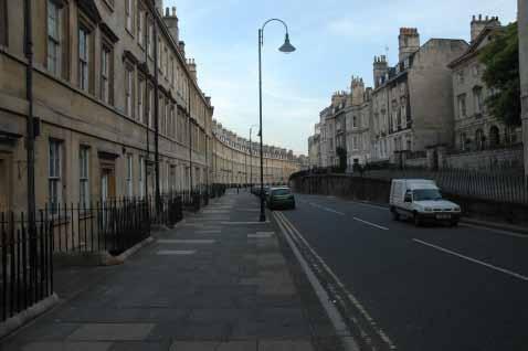
4 MAIN STREET DETAILED APPLICATION Introduction This detailed proposal is included within the Sherford planning application in order to achieve the following objectives: To demonstrate how the Red Tree proposal engages positively with key planning policy objectives aimed at providing a highway and public transport link between A38 and A378; To demonstrate how Sherford can bring forward early and positive delivery of: o improvements to Deep Lane junction in tandem with the establishment of the Park and Ride Interchange. This will help reduce traffic flows on A38 and is key to the performance of new bus services delivered from the outset; and Approach The Main Street design has been achieved through a collaborative effort between the Red Tree project team, The Prince s Foundation, South Hams District Council, the highway authorities of Devon County Council and Plymouth City Council and The Highways Agency. At the same time the outcomes reflect the wider involvement of non transport-only disciplines as exemplified through all design exercises. The alignment of the route has evolved through the master planning process. Initially, at the Enquiry by Design, the route from Deep Lane to the A379 was identified and drawn up by The Prince s Foundation with the assistance of Paul Murrain and Andrew Cameron (then with Alan Baxter Associates and now WSP). At this stage it was agreed that the Main Street would have a High Street element in the centre, where retail use is the principle activity. Red Tree also wished to make this space the formal centre of the development. A wide street was preferred with a strong sense of place and enclosure common to many market towns and particularly similar to the High Streets found in Malborough, Wiltshire and Honiton, East Devon. o a new route within Sherford, which will function as the main highway and public transport link and create opportunities for new development. By submitting this detailed proposal alongside the outline proposal, clear sight is given of the first stage of infrastructure construction. In so doing Red Tree provides the opportunity for the planning process to make its determinations simultaneously. Similarly, Red Tree proposes to open discussions regarding, and to initiate design of, the first phase of housing development following this application. This overlapping, concurrent approach is designed to shorten the timetable to commencement of works on site. The investment in this work ahead of any planning certainly reflects Red Tree s commitment to securing infrastructure that supports new development and the wider community. The most immediate benefit of this approach is the delivery at outset of the enhanced public transport arrangements required by the Structure Plan and the emerging LDF strategies of both Plymouth City and South Hams District Councils. Red Tree supports the Councils clearly stated, combined ambition to promote more sustainable lifestyles and in particular to walk away from the usual over-reliance on the motorcar. The overall form of development, the location and early delivery of community, education and retail facilities are all aimed at achieving this. Equally important is the early commitment to this Main Street Link. Honiton High Street The performance of the High Quality bus route along the street has also been a key factor in the design. The result expresses the dynamic balance required between the various, sometimes apparently competing, desired outcomes. The bus must have a noticeable advantage over the motorcar, but must live broadly in the same space as the car which also contributes to the economic vitality of the commercial aspects of the town centre. Equally both must exist side by side with pedestrian and cycle activity in these public spaces. The detailed design is based upon guidance provided in the new Manual for Streets published in draft by the Department for Transport and the Department for Communities and Local Government. Andrew Cameron is a key contributor to the advice contained in this publication. Scott Wilson and officers from Devon County and Plymouth City Council, with Andrew Cameron representing The Prince s Foundation, formed a High Street Design Group. The physical layout of the street, key junctions and character areas were prepared by Scott Wilson with public space and landscape design input provided by urban designers and landscape architects, Lavigne Lonsdale. The Design Group included safety auditors and urban designers from Devon County Council and South Hams District Council. The final design has been subjected to an independent Stage 1 Road Safety Audit. The report is included with this application. K:\D (D102241) SHERFORD\HIGHWAYS\MAIN STREET\SHERFORD MAIN STREET NARRATIVEFINAL DOC

5 CHARACTER SETTING DRAWING Lavigne Lonsdale Current Road Corridor Sheet 1. Detailed Character Areas Sheet 2. Detailed Area A Eastern Gateway Sheet 3. Detailed Area A Eastern Gateway Sheet 4. Detailed Area B Sherford Bridge Sheet 5. Detailed Area B Sherford Bridge Sheet 6. Detailed Area C The High Street Sheet 7. Detailed Area C The High Street Sheet 8. Detailed Area D Secondary School Sheet 9. Detailed Area D Bat Corridor Sheet 10.
6 c u r r e n t r o a d c o r r i d o r main street design & character setting sheet 1


7 detailed character areas main street design & character setting sheet 2

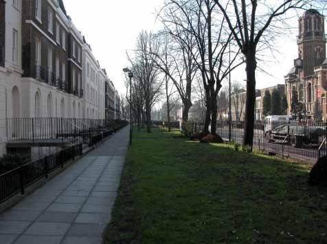
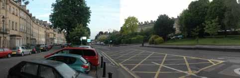
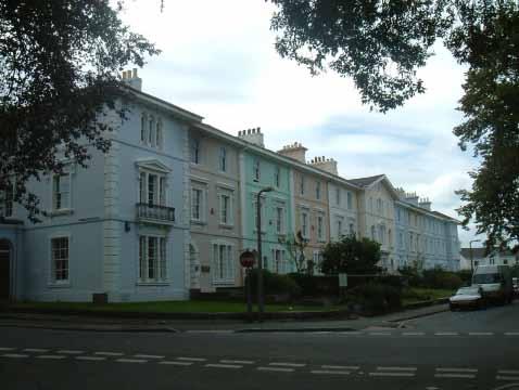

8 kennington frontages newton abbot bath see detail bath detailed area a: eastern gateway bath main street design & character setting sheet 3


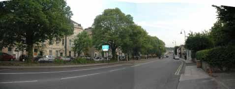
9 a a typical section A - A detailed area a: eastern gateway 2. hennef main street main street design & character setting sheet 4


10 see detail (axo) b b typical section B - B detailed area b: sherford bridge main street design & character setting sheet 5
Drainage. Alignment K:\D (D102241) SHERFORD\CONSOLIDATED PLANNING DOCUMENTS\MAIN STREET\SHERFORD MAIN STREET NARRATIVE REVISION
 SHERFORD\CONSOLIDATED PLANNING DOCUMENTS\MAIN STREET\SHERFORD MAIN STREET NARRATIVE REVISION") The Main Street therefore provides a key link for a HQPT bus system between the Park and Ride, through Sherford onto the A379 and Plymouth City Centre. There is no definitive description of an HQPT system,
The Main Street therefore provides a key link for a HQPT bus system between the Park and Ride, through Sherford onto the A379 and Plymouth City Centre. There is no definitive description of an HQPT system,
Main Street: Deep Lane Junction to Stanborough Cross. Sherford. main street. November 2006
 Sherford Main Street: Deep Lane Junction to Stanborough Cross main street Sherford November 2006 FOREWORD Red Tree (2004) LLP has submitted a planning application for Sherford to both South Hams District
Key Principles. 290 Phasing Principles and Programme
 4 Phasing principles and programme 4c The aims of the phasing strategy are to satisfy planning policy requirements and create a sustainable, strong and healthy new community where, from the outset, people
Sherford. Town Code. town code. Sherford
 Sherford Town Code Sherford town code November 2006 SHERFORD Town Code SEEING IS BELIEVING FOREWORD Red Tree (2004) LLP has submitted a planning application for Sherford to both South Hams District Council
Introduction. Welcome to this consultation regarding the draft redevelopment proposals for the former CeramTec factory on Sidmouth Road, Colyton.
 Introduction Welcome to this consultation regarding the draft redevelopment proposals for the former CeramTec factory on Sidmouth Road, Colyton. We are currently considering options for the mixed-use redevelopment
Public Consultation. Land at Monks Farm, North Grove. Welcome
 Welcome Welcome to our public exhibition for development on Land at Monks Farm, orth Grove. Gallagher Estates and Gleeson Strategic Land are preparing an outline planning application for new homes, open
GREATER CAMBRIDGE CITY DEAL. Urban Design Guidance for Transport Infrastructure Projects
 GREATER CAMBRIDGE CITY DEAL Urban Design Guidance for Transport Infrastructure Projects KEY OBJECTIVES OF CITY DEAL The City Deal aims to help Greater Cambridge maintain and grow its status as a prosperous
Alma Road Rain Gardens, London
 Alma Road Rain Gardens, London SuDS used Rain gardens Permeable paving Tree planting Benefits 1. Location Reduction in flooding from intense rainfall. Reduced surface water pollution to receiving water
East Grove Public Realm
 H - - MP - Elephant Park Public Realm RO EY DN NEW KENT ROAD E AC PL The public realm has been designed to create an environment which is easy to move through, accessible to all, safe and playful. The
Streets for All East of England
 Streets for All East of England Summary In 2017 Historic England published an updated national edition of Streets for All, a practical guide for anyone involved in planning and implementing highways and
The journey so far. The new masterplan for Dargavel Village
 The journey so far Our vision for Dargavel Village began over ten years ago when the original masterplan for transforming the former Royal Ordnance Factory site into a thriving community was established.
Welcome. Site/11/04. Site/11/03. Proposed Site. 11,400 new homes needed in east Cambs
 Welcome Welcome to our consultation on our proposals for new homes on land north east of Soham Road, Fordham. Members of the project team are available to answer any questions you have and listen to feedback.
Former North Works, Lickey Road, Longbridge, Birmingham
 Committee Date: 14/11/2013 Application Number: 2013/06431/PA Accepted: 27/08/2013 Application Type: Full Planning Target Date: 26/11/2013 Ward: Longbridge Former North Works, Lickey Road, Longbridge, Birmingham
Statement of Community Involvement LAND OFF SOUTHDOWN ROAD HORNDEAN, HAMPSHIRE
 LAND OFF SOUTHDOWN ROAD HORNDEAN, HAMPSHIRE CONTENTS Page 1. Introduction 3 2. Pre-application Discussions 4 3. The Consultation Process 5 4. Consultation Feedback 7 5. Responses to Consultation Feedback
Chapter 2: OUTLINE PLANNING APPLICATION PROPOSALS. A New Garden Neighbourhood Matford Barton 17
 Chapter 2: OUTLINE PLANNING APPLICATION PROPOSALS A New Garden Neighbourhood Matford Barton 17 2.1. SUMMARY AND STATUS OF THE PROPOSALS 2.1.1. The parameter plans and associated wording in this chapter
WHITELEY TOWN COUNCIL NORTH WHITELEY DEVELOPMENT SEPTEMBER 2014
 WHITELEY TOWN COUNCIL NORTH WHITELEY DEVELOPMENT SEPTEMBER 2014 Dear Resident This Special Edition of the Whiteley Voice which has been prepared in conjunction with the North Whiteley Consortium is to
Town Center (part of the Comprehensive Plan)
") Town Center (part of the Comprehensive Plan) Mercer Island Town Center Looking North (2014) In 1994, a year-long process culminated in a set of design guidelines and code requirements for the Town Center
Town Center (part of the Comprehensive Plan) Mercer Island Town Center Looking North (2014) In 1994, a year-long process culminated in a set of design guidelines and code requirements for the Town Center
GREENVALE CENTRAL PRECINCT STRUCTURE PLAN
 76 Conservation area boundary. Low Fence to exclude vehicles but allow pedestrian access Front boundary of allotment 5.0m MINIMUM SETBACK Path providing public access to dwellings fronting Conservation
Appendix H: Easement cross sections
 Appendix H: Easement cross sections SHARED PATH 1.5m FOOTPATH NATURE STRIP 7.3m CARRIAGEWAY 2.7m NATURE STRIP EXISTING PIPELINE 150mm DIA 5.0m (approx.) LOCAL ACCESS ROAD EXISTING PIPELINE 500mm DIA 2.7m
INTRODUCTION NORTH HEYBRIDGE GARDEN SUBURB
 INTRODUCTION This event is being hosted by the promoters of the proposed North Heybridge Garden Suburb who are working with Maldon District Council and other key stakeholders on the preparation of a comprehensive
HS2 Interchange Station Design
 Working on behalf of HS2 Interchange Station Design October 2018 www.hs2.org.uk 1 Interchange Station, Solihull Introduction In February 2018, HS2 Ltd appointed Arup to take forward the design of Interchange
UTT/16/1466/DFO GREAT DUNMOW MAJOR
 UTT/16/1466/DFO GREAT DUNMOW MAJOR PROPOSAL: LOCATION: APPLICANT: AGENT: Reserved matters approval for the accesses to the site and principal roads within the site including spine road following outline
Welcome to our exhibition
 Welcome to our exhibition The Homes & Communities Agency (HCA) welcomes you to this public exhibition explaining our proposals for the redevelopment of the former Lea Castle Hospital site. About the Homes
I615. Westgate Precinct
 I615. Westgate Precinct I615.1. Precinct Description The Westgate Precinct is located approximately 18km west of the Auckland city centre. There are seven Sub-precincts in the Westgate Precinct: Sub-precinct
10 Proposed Redevelopment, Tewkesbury Road, Cheltenham SCHEME EVOLUTION STARBUCKS
 SCHEME EVOLUTION STARBUCKS The proposed Starbucks Drive Thru alongside the proposed food store provides an appropriate mix of uses, suitable for this location. The proposed store is bespoke, designed specifically
Welcome to our public exhibition
 About our development Welcome to our public exhibition This exhibition gives you the chance to view and comment on our proposals for a new residential development of 165 high-quality homes, along with
Welcome - Halse Yard, Honiton
 Welcome - Welcome to this consultation regarding potential new Starter Homes on the Halse Farm Machinery site at West End, Honiton. The purpose of this exhibition is to provide the community with an early
Proposed Amendment to the
 Proposed Amendment to the Carrigaline Electoral Area Local Area Plan Amendment No 1: Carrigaline (T-02, O-02 & U-02) August 2012 Proposed Amendment to the Carriagline Electoral Area Local Area Plan 2011
Longbridge Town Centre Phase 2 Planning Application
 Longbridge Town Centre Phase 2 Planning Application Non-Technical Summary of the Environmental Statement December 2013 Introduction A full application for Planning Permission has been submitted to Birmingham
97 Lea Bridge Road, Leyton, E10 7QL London Borough of Waltham Forest December 2015
 97 Lea Bridge Road, Leyton, E10 7QL London Borough of Waltham Forest December 2015 Public Realm and Landscape Proposals LEA BRIDGE ROAD, WALTHAMSTOW Public Realm & Landscape Proposals BDP(90)RPT001 December
BROWNFIELD REGENERATION LONDON
 P A V I N G CASE STUDY October 2015 Edition 2 Uniclass 572/1677 Public realm regeneration Iconic conservation area Shared surfaces Designing in detail BROWNFIELD REGENERATION www.paving.org.uk Introduction
Traffic management in historic areas
 Traffic Advisory Leaflet 1/96 January 1996 Traffic management in historic areas Introduction This leaflet highlights how traffic engineering and highway improvements can be designed sensitively in historic
WELCOME. Welcome and thank you for visiting today.
 WELCOME Welcome and thank you for visiting today. Bellway Homes Ltd (Yorkshire) are preparing a reserved matters planning application for a residential development of 293 homes at land North of Yew Tree
BETTER PUBLIC TRANSPORT PROJECT WATERBEACH TO SCIENCE PARK AND EAST CAMBRIDGE CORRIDORS
 Report To: Greater Cambridge Partnership Joint Assembly 20 th September 2018 Lead Officer: Peter Blake GCP Director of Transport BETTER PUBLIC TRANSPORT PROJECT WATERBEACH TO SCIENCE PARK AND EAST CAMBRIDGE
Warren Farm, Ampthill
 1 Welcome The developers of the Warren Farm site, Bloor Homes and Connolly Homes, are holding this exhibition on the emerging Design Codes for the development prior to their formal submission to Central
Urban Design Guidelines
 Urban Design Guidelines These Urban Design Guidelines comprise the Key Design Objectives below, the Roads Design Guidelines overleaf and Neighbourhood Framework Plans. Together with Section 3: Urban Design
STATEMENT OF OBJECTION TO THE PROPOSED DEVELOPMENT OF LAND AT CHURCH CLIFF DRIVE FILEY
 STATEMENT OF OBJECTION TO THE PROPOSED DEVELOPMENT OF LAND AT CHURCH CLIFF DRIVE FILEY You will be aware that Scarborough borough council have adopted a new local plan that includes land at Church Cliff
Introduction to MP3. MP3 H4 Park Central (North)
") MP H4 Park Central (North) Introduction to MP A visualisation of the Illustrative Masterplan with MP shaded in blue MP is the third phase of the Elephant Park regeneration and is bounded by on the north,
MP H4 Park Central (North) Introduction to MP A visualisation of the Illustrative Masterplan with MP shaded in blue MP is the third phase of the Elephant Park regeneration and is bounded by on the north,
Huddersfield Urban Design Framework. 3. Framework
 3. Framework The illustrative plan has been used as the basis for developing an urban design framework and strategy in Part 3 of this report. This is based on a series of regulatory plans that code the
West Blackhall Street Public Realm Public Exhibition
 West Blackhall Street Public Realm Public Exhibition Welcome Introduction Thank you for coming to this public engagement, your input is sought to help to deliver high quality public realm improvements
medium desnity housing
 This section updated September 2013 This part of the Plan sets out the assessment criteria for medium density housing. The criteria are designed to give designers and builders flexibility and to provide
4 Urban Design Issues & Goals
 4 Urban Design Issues & Goals Urban design is a primary consideration for preparing a development strategy for State Highway 1. It is crucial for the future vibrancy and vigour of the Kapiti Coast communities
appendix and street interface guidelines
 appendix five: building and street interface guidelines appendix 5 building and street interface guidelines BOULEVARDS Boulevards are generally characterized by higher levels of traffic movement at higher
1. Creating a liveable, vibrant, safe and inclusive city centre for the benefit of people of all ages to live, work, learn and enjoy.
 City Centre Framework - Summary Bristol City Council has produced a draft City Centre Framework document. The Framework is a planning and transport document that outlines what the city centre could be
RESIDENTIAL ROAD DESIGN GUIDE Rev 0 06/85. Residential Road. Design Guide
 Residential Road Design Guide CONTENTS Section 1 1.1 Principles of Design Section 2 2.1 Road Hierarchy Section 3 3.1 3A Local Distributor Road 3.5 3B Transitional Road Section 4 4.1 4A Collector Road 4.5
Welcome to our public exhibition
 About Our Scheme Welcome to our public exhibition This exhibition gives you the chance to view and comment upon our emerging proposals for a new residential development of 68 new homes on the site of the
Page 1 of 19 URBAN DESIGN FRAMEWORK FOR BOLTON STREET WATERFORD
 Page 1 of 19 URBAN DESIGN FRAMEWORK FOR BOLTON STREET WATERFORD 1.0 Introduction: The relocation of the City Council stores and depot from Bolton Street creates an exciting opportunity for development
Nelson Residential Street Frontage Guideline
 DRAFT 22-06-2012 Nelson Residential Street Frontage Guideline June 2012 1317273 Contents and purpose Residential s are important Residential s are much more than corridors which move traffic. Streets allow
Artists impression of the Park Promenade and plot H4 with café and restaurant uses that is still subject to change
 The Park Promenade Artists impression of how a café might look Artists impression of the Park Promenade and plot H4 with café and restaurant uses that is still subject to change Precedent images for balconies
Newcourt Masterplan. November Exeter Local Development Framework
 Newcourt Masterplan November 2010 Exeter Local Development Framework Background The Exeter Core Strategy Proposed Submission sets out the vision, objectives and strategy for the development of Exeter up
Colchester Northern Gateway Master Plan Vision Review Draft. July 2016
 Colchester Northern Gateway Master Plan Vision Review Draft July 2016 Contents Introduction 4 Context 8 Purpose of the Report 8 Strategic Position 9 Overview of the Process 11 2012 Master Plan Vision 12
BLETCHLEY PARK AREA - DEVELOPMENT FRAMEWORK
 ANNEX A To Item 9 REVISED TEXT: additions shown bold and underlined, deletions in (brackets and in italics). BLETCHLEY PARK AREA - DEVELOPMENT FRAMEWORK This framework sets out the key objectives and requirements
Phase 1C. Phase 2B. Phase 1A. Phase 1B. Phasing. Lighting. Phase 2A. Staff House Project. Library Project. p p
 11 Phasing 12 Lighting Lighting will play a key role in the success of the Green Heart redevelopment. The various public spaces will be used a great deal after dark, and in particular during the busy winter
Section 4 - Public Realm & Landscape proposals Landscape Masterplan. Section 4 52
 - Public Realm & Landscape proposals Landscape Masterplan 52 Proposed Masterplan - Green Infrastructure Strategy District Park 4.33 Ha to provide Passive and active recreation with a large play area which
SOUTH CAMBRIDGESHIRE DISTRICT COUNCIL. Planning and New Communities Director
 SOUTH CAMBRIDGESHIRE DISTRICT COUNCIL REPORT TO: Planning Committee 9 January 2013 AUTHOR/S: Planning and New Communities Director S/2270/12/FL FEN DRAYTON 850m long flood defence embankment ranging in
SOUTH EAST LINCOLNSHIRE LOCAL PLAN: HOUSING PAPER DONINGTON (JUNE 2016)
") SOUTH EAST LINCOLNSHIRE LOCAL PLAN: HOUSING PAPER DONINGTON (JUNE 2016) 1 DONINGTON S PLACE IN THE SPATIAL STRATEGY 1.1 Policy 2 of the South East Lincolnshire Local Plan 2011-2036 Draft for Public Consultation
SOUTH EAST LINCOLNSHIRE LOCAL PLAN: HOUSING PAPER DONINGTON (JUNE 2016) 1 DONINGTON S PLACE IN THE SPATIAL STRATEGY 1.1 Policy 2 of the South East Lincolnshire Local Plan 2011-2036 Draft for Public Consultation
Ward: West Wittering. Proposal Change of use from public highway pavement to residential garden use.
 Parish: West Wittering Ward: West Wittering WW/17/03295/FUL Proposal Change of use from public highway pavement to residential garden use. Site Izora 1 Watersedge Gardens West Wittering PO20 8RA Map Ref
Village Enhancement Scheme Barton under Needwood
 Barton Village Enhancement Scheme Village Enhancement Scheme Barton under Needwood Executive summary May 2014 Village enhancement scheme: executive summary 1 Barton Village Enhancement Scheme Executive
8.0 Design and Form of Development 43/
 42/ 8.0 Design and Form of Development 43/ Rothwells Farm, Golborne/ Development Statement Figure 7. Site Constraints Key 44/ Site Boundary 360 Bus Route/Stops Existing Trees Underground Water Pipe Sensitive
3.1 The hybrid planning application proposes the following description of development:
 CHAPTER 3: PROPOSED DEVELOPMENT 3.1 The hybrid planning application proposes the following description of development: Hybrid (part-outline/part-full) planning application for a single composite development
(blank page) WestConnex New M Roads and Maritime Services Environmental impact statement
 WestConnex New M Roads and Maritime Services Environmental impact statement") (blank page) WestConnex New M5 5-42 (blank page) WestConnex New M5 5-44 5.5 Tunnels 5.5.1 Main alignment tunnels The main alignment tunnels would be about nine kilometres long, with the western tunnel
(blank page) WestConnex New M5 5-42 (blank page) WestConnex New M5 5-44 5.5 Tunnels 5.5.1 Main alignment tunnels The main alignment tunnels would be about nine kilometres long, with the western tunnel
Calderdale the Next Chapter
 Calderdale the Next Chapter Investing in transport, public spaces and businesses Our vision is all about creating a place where people want to live, visit, study and work. A place where businesses want
WELCOME GYPSY LANE. Wider Site Location plan. Proposals for the development of LAND OFF FOXLYDIATE LANE WEBHEATH. Proposals for the development of
 WELCOME The developers are preparing an outline planning application for a residential led development and need the community s views in order to develop the proposals further WHAT IS PROPOSED? A high
1. Local Plan Context
 1. Local Plan Context WHY ARE YOU HERE? ABOUT US PLANNING APPLICATION CONSULTATION Stewart Milne Homes are in the process of preparing a detailed planning application for a development of approximately
PHASE III: Reserved Matters Submission
 Statement of Compliance with the outline approval for the proposed residential development of land at: BURGES LANE, WIVELISCOMBE PHASE III: Reserved Matters Submission Foreword Contents: This Statement
ILLUSTRATIVE MASTERPLAN
 ILLUSTRATIVE MASTERPLAN The Development Dairy Crest (Imperial College) The Proposed Development aims to create a new high quality residential neighbourhood, alongside a new public park for White City.
Housing development on the edge of Forres
 Project Reference Dallas Dhu Details Housing development on the edge of Forres Location Forres, Moray Use Type Housing / Masterplan Client/Developer Sir Alastair Gordon-Cumming, Altyre Estate Lead Designers
Story Homes. Land at Thirsk Road, Kirklevington. An Introduction to Story Homes. Our Foundations. Commitment to Consultation.
 Story Homes An Introduction to Story Homes Founded by Fred Story in 1987, Story Homes has a long and successful reputation of building high quality and high specification homes. The family owned business
Cotswolds AONB Landscape Strategy and Guidelines. June 2016
 Cotswolds AONB Landscape Strategy and Guidelines June 2016 Cotswolds AONB Landscape Strategy and Guidelines Introduction The evolution of the landscape of the Cotswolds AONB is a result of the interaction
Derry City and Strabane District Council Planning Committee Report. Amended layout from approval A/2004/0462/F with reduction from 166 units
 Derry City and Strabane District Council Planning Committee Report COMMITTEE DATE: 1 st February 2017 APPLICATION No: APPLICATION TYPE: PROPOSAL: LOCATION: APPLICANT: AGENT: Full Planning application Amended
Stratford Neighbourhood Plan Questionnaire
 Stratford Neighbourhood Plan Questionnaire Please tick the appropriate box or answer in the space provided. If you require further copies of the questionnaire, as more than one person in the household
FANSHAWE PARK ROAD/RICHMOND STREET INTERSECTION IMPROVEMENTS. PUBLIC INFORMATION CENTRE 2 June 16, 2016
 FANSHAWE PARK ROAD/RICHMOND STREET INTERSECTION IMPROVEMENTS Municipal Class Environmental Assessment PUBLIC INFORMATION CENTRE 2 June 16, 2016 ACCESSIBILITY Under the Accessibility Standards 2015 for
Chapter 27 Route Window SE7 Church Manorway Bridge. Transport for London
 Chapter 27 Route Window SE7 Church Manorway Bridge Transport for London CHURCH MANORWAY BRIDGE 27 Route Window SE7 Church Manorway bridge Introduction 27.1 The North Kent Line will be converted to four
Chapter 13 Residential Areas: Appendices APPENDIX 1 Residential Areas
 Chapter 13 Residential Areas: Appendices Page 1 Chapter 13 Residential Areas: Appendices APPENDIX 1 Residential Areas Design Code for Intensive Housing INTRODUCTION DESIGN ELEMENTS A NEIGHBOURHOOD DESIGN
To the Lord Mayor and Report No. 312/
 To the Lord Mayor and Report No. 312/2017 Members of Dublin City Council Report of the Chief Executive Dublin City Council -----------------------------------------------------------------------------------------------------------
St. Clair Avenue West Area Transportation Master Plan
 1 (Between Keele Street and Old Weston Road) Public Information Centre 1 December 2, 2015 2 Welcome Welcome to the first Public Information Centre for the St. Clair Avenue West Area. The panels will present
Land at Fiddington Hill Nursery, Market Lavington
 Land at Fiddington Hill Nursery, Market Lavington Briefing Report for Market Lavington Parish Council Persimmon Homes (Wessex) April 2016 Background This brief report has been prepared following the Market
Draft Eastern District Plan
 Draft Eastern District Plan Submission_id: 31238 Date of Lodgment: 13 Dec 2017 Origin of Submission: Online Organisation name: Turrulla Gardens Pty Ltd C/- Mecone Organisation type: Industry First name:
WELCOME. Land North of STEVENAGE. We would like to thank you for attending our public exhibition today.
 WELCOME We would like to thank you for attending our public exhibition today. The purpose of this event is to share our proposals and hear your thoughts on our ideas. Members of the project team are on
Welcome. Walk Around. Talk to Us. Write Down Your Comments
 Welcome This is an information meeting introducing the applications for proposed redevelopment of the Yorkdale Shopping Centre site at 3401 Dufferin Street and 1 Yorkdale Road over the next 20+ years,
ARLESEY CONSULTATION QUESTIONNAIRE
 ARLESEY CONSULTATION QUESTIONNAIRE Arlesey Welcome to the first public exhibition in relation to the outline masterplan proposals for development at land at Chase Farm and land west and north-east of High
PUBLIC RIGHT-OF-WAY IN THIS CHAPTER PUBLIC REALM
 PUBLIC RIGHT-OF-WAY This section provides design guidelines for improvements in the public right-of-way. The public right-of-way refers to streets, sidewalks, non-vehicular thoroughfares, parks and greenways
Making the case for Sustainable Transport Project Potential
 Making the case for Sustainable Transport Project Potential The Structural Investment Fund (SIF) Strategy for Greater Lincolnshire identifies the barriers to growth identified by having poor transport
PUBLIC REALM STRATEGY
 CONSULTATION DRAFT PUBLIC REALM STRATEGY Trenchard Street & Frogmore Street City Design Group Place Directorate Public Realm Strategy Trenchard Street & Frogmore Street Contents 1. Introduction 2. Understanding
Welcome to our Public Consultation
 About our development This exhibition gives you the chance to view and comment on our emerging plans for a proposed residential development located on land to the West of Alwyn Road, Rugby. Welcome to
The Site. Welcome to the public exhibition for Boothferry Road, Hessle.
 LINDEN HOMES Welcome to the public exhibition for Boothferry Road, Hessle. We would like to hear your views about our proposals before we submit a planning application later this year. If there is anything
1. Welcome. Background
 1. Welcome The purpose of this exhibition is to provide you with an update on progress on the Kilnwood Vale Scheme. In order to improve the scheme and deliver key facilities earlier in the development,
4. MASTERPLAN FRAMEWORK
 6a 6b 4. MASTERPLAN FRAMEWORK 6. Car Parks 6c Car Parks 6a and 6b will provide permanent parking. Area 6a will serve the foodstore with tarmac surfacing within a defined area to the west of the adjacent
WEST BLACKHALL STREET PUBLIC REALM + TOWN CENTRE CONNECTIONS Public Exhibition 28 th June 2018
 WEST BLACKHALL STREET PUBLIC REALM + TOWN CENTRE CONNECTIONS Public Exhibition 28 th June 2018 Welcome Introduction Design Your Involvement Thank you for coming Engagement We would like to gather to this
DESIGN & ACCESS STATEMENT. REVISION A Residential Development, Neon Social Club, Nairn Street, Jarrow.
 DESIGN & ACCESS STATEMENT. REVISION A Residential Development, Neon Social Club, Nairn Street, Jarrow. The following Design & Access Statement is in support of a Full Planning Application for a residential
Carton Avenue Action Area Plan Maynooth
 Carton Avenue Action Area Plan Maynooth Kildare County Council JULY 2006 (AAP) Table of Contents Section 1. Introduction...3 Statement of Strategy...3 Location of the Lands...3 Context in the Town Development
WELCOME TO THE NEW WILTON PARK
 WELCOME TO THE NEW WILTON PARK VISION HISTORY OF WILTON PARK TOWARDS A PLANNING APPLICATION Our objective is to create a truly outstanding environment at Wilton Park. At the heart of our proposals is a
6 Site Framework Strategies
 6 Site Framework Strategies 6.1 Introduction Section 6 identifies a number of specific areas which are considered to be key sites within the Plan area and which may have potential for development / redevelopment.
6.0 Access & Maintenance
 Design and Access Statement April 2017 125 6.1 Inclusive Design - Site This proposal has been designed with consideration of the principles of inclusive design, as to be as inclusive as possible including
therry, elizabeth, franklin and queen: BLOCK plan
 therry, elizabeth, franklin and queen: BLOCK plan INTRODUCTION Therry, Elizabeth, Franklin and Queen Street block Purpose & background The City of Melbourne has prepared this document for developers and
University Park, Worcester Non Technical Summary December 2011
 University Park, Worcester Non Technical Summary December 2011 Introduction UW Wrenbridge LLP, a Joint Venture Company of the University of Worcester and Wrenbridge Land Ltd (the Applicants ) intend to
Urban Design Manual PLANNING AROUND RAPID TRANSIT STATIONS (PARTS) Introduction. Station Study Areas
 Introduction. Station Study Areas") 111111 PLANNING AROUND RAPID TRANSIT STATIONS (PARTS) Introduction The ION rapid transit system will link Waterloo, Kitchener and Cambridge through a central transit corridor (CTC). There are a number
111111 PLANNING AROUND RAPID TRANSIT STATIONS (PARTS) Introduction The ION rapid transit system will link Waterloo, Kitchener and Cambridge through a central transit corridor (CTC). There are a number
I539. Smales 2 Precinct
 I539. Smales 2 Precinct I539.1. Precinct Description The Smales 2 Precinct applies to a 4.8 hectare block of land located on the southern side of Northcote Road and fronting Lake Pupuke, Takapuna. The
Boundaries and Fencing
 Boundaries and Fencing Introduction 7.1 The purpose of this chapter of the design code is to establish design principles and parameters to guide the development and erection of site boundaries within the
SUB AREA 3 CENTRAL STRATFORD AND SOUTHERN QUEEN ELIZABETH OLYMPIC PARK
 191 ADOPTED LOCAL PLAN: THE SUB AREAS SUB AREA 3 CENTRAL STRATFORD AND SOUTHERN QUEEN ELIZABETH OLYMPIC PARK SECTION 12 Vision VISION Central Stratford and Southern Queen Elizabeth Olympic Park will become