Brickell West Study T6-36 is the Appropriate Miami 21 Transect Zone for this area
|
|
|
- Annabel Barbra Patterson
- 5 years ago
- Views:
Transcription


1 Brickell West Study T6-36 is the Appropriate Miami 21 Transect Zone for this area architecture urban planning


2


3 SUBMITTED INTO THE PUBLIC RECORD FOR /TEMP-> - Ohk-d~o;,, The Context MIAMI'S URBAN CORE The Brickell West area is an integral part of the greater Brickell neighborhood. The area is bounded by downtown Miami, across the Miami River to the north, and 1-95 to the west, which serves as a buffer between this area and the Little Havana neighborhood on the other side of Brickell West is ideal for development potential due to its location within the City's urban core and because of the area's existing transportation and infrastructure. There is no single-family housing in the area. 3 architecture urban planning interior design


4 SUBMITTED INTO THE PUBLIC RECORD FOR The Question MIAMI 21 ZONING CODE In studying MIAMI 21 and its T-6 24 transect zone, we have studied individual sites and reviewed the impact of this new code to the West Brickell Neighborhood. 1. The QUESTION becomes, why is the same intensity not being applied in the majority of the Brickell West neighborhood as the Brickell Village area to the east and the portion of Brickell West north of NW Fh St.? 2. The City Planners should provide a CONISTENT T6-36 Transect Zone throughout the entire Brickell West area, while leaving the density as it exists. 4 architecture urban planning


5 The Why? MIAMI 21 ZONING CODE SUBMITTED INTO THE PUBLIC RECORD FOR ITEM - W- a ON. 6-a-07 This study answers this question by offering a contrast in the proposed T-6 24 to the T-6 36 as of right designation, which is being proposed for the Brickell Village area, east of the Metro Rail tracks. I 1. T6-36 will allow for a more efficient use of land. 2. Adequate infrastructure is present to support this intensity. 3. The T6-36 transect zone is consistent with the surrounding intensities to the east and north. 4. T6-36 makes perfect ECONOMIC and TRANSPORTATION PLANNNING sense. 5. It is good for the environment and complements the proposed "green building" and "Smart Growth concepts of the Miami 21 code by condensing high growth near existing mass public transportation. 6. Suggested T6-36a zone with an FLR of 12 provides a transition between Brickell to the East and 1-95 serves as a buffer zone to the west. 5 architecture Inttriot design

6


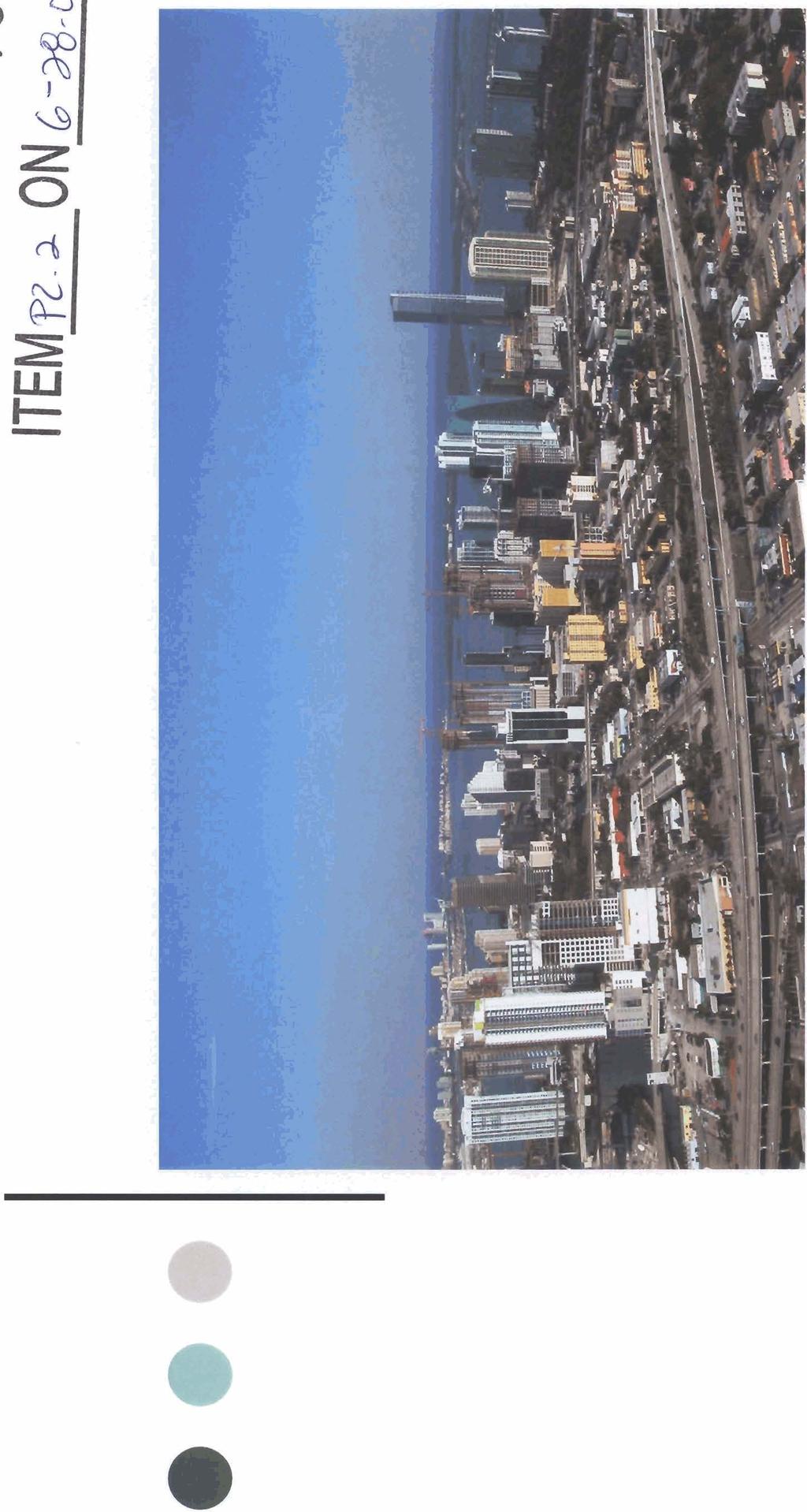
7 SUBMITTED INTO THE Aerial View - Brickell West urban ptannfng


8


9 Aerial View - Brickell West SUBMITTED INTO THE PUBLIC RECORD FOR


10

11


12 SUBMITTED INTO THE PUBLIC RECORD FOR Brickell West Area Transportation Area Analysis RICHARD GARCIA & ASSOCIATES, INC. TRANSPORTATION ENGINEERS


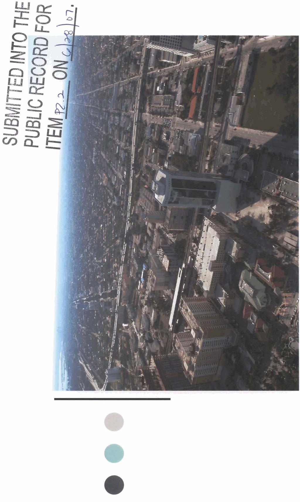
13 SUBMITTED INTO THE PUBLIC RECORD FOR ITEM - v.r ON , - Brickell West Aerial Photo Showing Proposed Miami 21 Transect Zones


14 LEGEND: 1. Fifth St. Metromover Station 2. Eighth St. Metromover Station 3. Tenth St. Metromover Station 4. Brickell Metrorail Station 5. Brickell Metromover Station 6. Financial District Metromover Station Brickell West Aerial Photo Showing Existing Transportation Infrastructure SUBMITTED INTO THE PUBLIC RECORD FOR


15 LEGEND: 1. Fifth St. Metromover Station 2. Eighth St. Metromover Station 3. Tenth St. Metromover Station 4. Brickell Metrorail Station 5. Brickell Metromover Station 6. Financial District Metromover Station Brickell West Aerial Photo Showing Existing Transportation Infrastructure with Walking Radii SUBMITTED INTO THE PUBLIC RECORD FOR ITEM - w-3 ON6]*\0-,,


![Regional Level] SUBMITTED INTO THE](/docs-images/87/96959709/images/16-6.jpg "PUBLIC RECORD FOR ITEM p-2 ON 64$-0~.")
16 TCEA-Traffic Concurrency Exception Area o City Falls within the UIA (Urban lnfill Area ) o Exempt from the Florida Statutes on Concurrency o Importance: a Promote lnfill Development & Re-Development a Reduce Urban Sprawl Improve Mobility via: Transit Pedestrian Bicycling [On a Regional Level] SUBMITTED INTO THE PUBLIC RECORD FOR ITEM p-2 ON 64$-0~. - RICHARD GARCIA & ASSOCIATES, INC.
17
18


19


20
21 Conclusion SUBMITTED INTO THE PUBLIC - RECORD FOR ITEM PZ-r ONL-~-~T, o Purpose: UIA (Urban lnfill Area) DRI (Development of Regional Impacts) P- T (Person- Trip) EAR (Evaluation and Appraisal Report) TE (Transportation Element) o REDUCEAUTODEPENDENCY Increase ridership and Transit Usage o REDUCE SUBURBAN SPRAWL o Each Project will need to Meet Traffic Requirements INDEPENDENTLY o DRI-Increment Ill will further evaluate Traffic o Trans P ortation Corridors Can Support T6-36 transect zone or Brickell West o Reaching a Critical Mass stimulates use of mass transit RICHARD GARCIA 8~ ASSOCIATES, INC. raa


22 SUBMITTED INTO THE PUBLIC - RECORD FOR ITEM P~J-. ON6-;8o7 Brickell West ECONOMIC BENEFITS Study An economic analysis reveals that allowing T6-36 rather than T6-24 for Brickell West is consistent with the national trend for urban centers. This zoning designation allows for high-quality projects in this significantly under-utilized area of the City. Allowing T6-36 for Brickell West produces multiple economic benefits, such as: 1. Economic development opportunities, which leads to significantly enhanced quality of life. 2. Provision of a significant investment opportunity in this area. 3. Creation of an economic engine to help induce sustainable growth. 4. Increased development fees and tax base for the City. 5. An increase in number of permanent jobs in Brickell West. ~ cenitieci ~ ~ublii ~ccounrants & wiess, consultants ~


23

 CONSTRUCTION) YEAR) CURRENT: SD-7 243")

24 SUBMITTED INTO THE PUBLIC RECORD FOR ITEM 2 2 ON ~ 6 -a-o-.~, Brickell West Study ECONOMIC IMPACT OF T6-24 VS. T6-36 The following chart shows the difference in construction employment, wages and tax revenues resulting if a specific Major Use Special Permit project under construction in Brickell West (approved under SD-7 Zoning) had been limited to the T6-24 Zoning designation. ZONING DISTRICT1 EMPLOYMENT (DURING WAGE IMPACT (DURING TAXES (PER TRANSECT ZONE CONSTRUCTION) CONSTRUCTION) YEAR) CURRENT: SD $49,235,040 $2,771,415 PROPOSED: T6-24 (FLR: I-: 134 $27,079,272 $1,524, DIFFERENCE I $22,155,768 $1,247,1-- PERCENTAGE OF REDUCTION WITH T6-24 VERSUS T6-36: 45" PRESENT VALUE OF TAX DIFFERENCE OVER 20 YEARS I $1 5,542,083?3HARm, B m 8.miPm. PA. CenlIled Public Accountants & Business Consultants


25 SUBMITTED INTO THE PUBLIC RECORD FOR ECONOMIC IMPACT OF T6-24 VS. T6-36 Proposed Miami 21 Development Fees Bonus Map


26 5s at 2 - BE* Z ~ Z %.G&.E 0 E gz 0 0 F gg -ddz g:g a 5 LL


27 SUBMITTED INTO THE PUBLIC RECORD FOR ITEM V-a ON Brickell West Study PLANNING PRlNClPLES Allowing consistent INTENSITY in the Brickell West area is a SMART GROWTH principle, and is consistent with the City of Miami's Comprehensive Plan as well, as the Purpose and Intent of Miami 21. "New development should be structured to reinforce a pattern of Neighborhoods and Urban Centers, focusing growth at transit nodes rather than along Corridors." - from the draft of the Miami 21 Code c. bo- 27 architecture urban. planning interior design


28


29 SUBMITTED INTO THE PUBLIC RECORD FOR Brickell West Study SMART GROWTH Smart Growth emerged as a reaction against suburban sprawl, and it includes the following principles: 1. Strengthen and direct development towards existing communities 2. Create walkable neighborhoods 3. Preserve open space, farmland, natural beauty and critical environmental areas 4. Provide a variety of transportation choices 5. Provide a mixture of uses and a variety of housing options 6. Encourage community and stakeholder partcipation 29 architecture urban planning interior design


30 SUBMITTED INTO THE PUBLIC RECORD FOR ITEM R-2 ON&-a-o7. Brickell West Study PLANNING PRINCIPLES Designating T6-36 intensity in the Brickell West area is consistent with good PLANNING PRACTICES and with the concept of reducing sprawl, increasing walkability and public transportation use. Miami's mayor and political leadership have taken a leadership role in encouraging green building; as part of this big picture view, allowing T6-36 intensity for Brickell West will stimulate an ideal central urban community with new green world-class mixed-use projects, pedestrian friendly streets and the best access to the existing mass public transportation system. 30 architecture urban p'l.annlrtg interior design


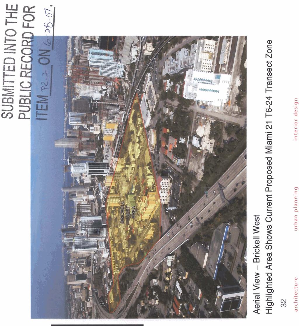
31 SUBMITTED INTO THE PI IRI lp ~crnop FOR Aerial View - Brickell West Current Proposed Miami 21 T6-24 Transect Zone 31 arehihectura wrban planning interior design
32


33 Brickell West Aerial Photo Showing Existing Transportation Infrastructure with Walking Radii LEGEND: 1. Fifth St. Metromover Station 2. Eighth St. Metromover Station 3. Tenth St. Metromover Station 4. Brickell Metrorail Station 5. Brickell Metromover Station 6. Financial District Metromover Station SUBMIJTED INTO THE PUBLIC - RECORD FOR ITEM.pz-2 O N L - ~ - ~ 8


34 3 0 = r a cn 5 z g 5 = - a, a x.- L og 2 z
 zone for Brickell West provides appropriate")
35 I SUBMITTED INTO THE PUBLIC RECORD FOR ITEM a-a ON 6 ~-07. Diagram showing how the suggested T6-36 (FLR:12) zone for Brickell West provides appropriate TRANSITION between Brickell and the area west of 1-95.


36 ill D- F'JK


37 ell West CONCLUSION - WHY NOT? REASONS FOR T6-36 FOR WEST BRICKELL: I 1. WRY WELL-DEFINED ARM WlTH AMPLE BUFFER ZONES 2 CENlJVil IJFE#AN CORE AREA WITH MISTING HIGH DENSITY LAND USE ESIQNATIM B CONSISTENT WITH f3 ART GROWTH AND SUSTAINABILITY Y3 PLkWNtW PRINCIPLE 4. GREAT ACCESS TO EXISTINO TRANSPORTATlON AND ln[iwmumi$re I s. ENHANCED ECONMUIC BENEFITS TO CITY AND COMMUNITY I 6. HAMONIOUS WlTH EXISTING ZOINING PATERM 7. SUGQESTED T6-96A WlTH FLR OF I2 PROVIDES TRANSlTlON BETWEEN BRICKELL - AND AREA WEST OF architecture urban plannlnq interiar design
40 Years of Smart Growth Arlington County s Experience with Transit Oriented Development in the Rosslyn-Ballston Metro Corridor
 40 Years of Smart Growth Arlington County s Experience with Transit Oriented Development in the Rosslyn-Ballston Metro Corridor A presentation by the Arlington County Department of Community Planning,
Joint Meeting City Council and the Plan Commission. September 1st, 2015
 Joint Meeting City Council and the Plan Commission September 1st, 2015 1 The City Plan Commission shall recommend a City Plan for the physical development of the City Article IX Section 2 of the City of
40 Years of Smart Growth Arlington County s Experience with Transit Oriented Development in the Rosslyn-Ballston Metro Corridor
 40 Years of Smart Growth Arlington County s Experience with Transit Oriented Development in the Rosslyn-Ballston Metro Corridor A presentation by the Arlington County Department of Community Planning,
JANUARY 19, 2011 CENTRAL AVENUE-METRO BLUE LINE TRANSIT-ORIENTED DEVELOPMENT IMPLEMENTATION PROJECT COMMUNITY FORUM
 CENTRAL AVENUE-METRO BLUE LINE TRANSIT-ORIENTED DEVELOPMENT IMPLEMENTATION PROJECT COMMUNITY FORUM JANUARY 19, 2011 THE MARYLAND-NATIONAL CAPITAL PARK AND PLANNING COMMISSION PRINCE GEORGE S COUNTY PLANNING
Redevelopment of Downtown
 June 25, 2013 Redevelopment of Downtown Old US 41 Corridor Redevelopment Masterplan Downtown Color Palette Southern Shores and Beaches Sherwin Williams Downtown Vision Rendering Old Florida Design EcoDistricts
Three Decades of Smart Growth: Arlington s Urban Village
 Three Decades of Smart Growth: Arlington s Urban Village An Overview Christopher Zimmerman Arlington County Board January 26, 2006 Arlington, Virginia 3 1 Arlington Today Population ~200,000 Jobs >200,000
Concord Community Reuse Project Goals and Guiding Principles. Overarching Goals (OG)
") Concord Community Reuse Project Goals and Guiding Principles Overarching Goals (OG) No priority is implied by the order of presentation of the goals and guiding principles. Overarching goals for the Concord
Concord Community Reuse Project Goals and Guiding Principles Overarching Goals (OG) No priority is implied by the order of presentation of the goals and guiding principles. Overarching goals for the Concord
Municipal Plan*Assessment
 Municipal Plan*Assessment This tool was developed to assist in reviewing municipal master plans and in determining if these plans are consistent with smart growth principles, neighboring municipal plans,
CHAPTER 7: Transportation, Mobility and Circulation
 AGLE AREA COMMUNITY Plan CHAPTER 7 CHAPTER 7: Transportation, Mobility and Circulation Transportation, Mobility and Circulation The purpose of the Transportation, Mobility and Circulation Chapter is to
17.11 Establishment of Land Use Districts
 17.11 Establishment of Land Use Districts 17.11.010 Purpose. To promote the health, safety, and general welfare of City residents and those who come to South Salt Lake to work, exchange commerce and recreate.
REVIEW AND EVALUATION OF REGIONAL LAND USE
 REVIEW AND EVALUATION OF REGIONAL LAND USE AND TRANSPORTATION SCENARIOS #220831 Environmental Justice Task Force October 7, 2014 VISION 2050 Process Development of Guiding Vision for Land Use and Transportation
Integrated Urban Development. April Reflections from the NZPI Study Tour of Portland, Seattle and Vancouver
 Integrated Urban Development April 2009 Reflections from the NZPI Study Tour of Portland, Seattle and Vancouver Integrated Urban Development Urban Growth Management Transportation Transit Orientated Mixed
Key Concepts of the General Plan
 Key Concepts of the General Plan General Plan Purpose Vision for City s future Standards for City Services Land Use Plan General Plan Purpose San Jose is creating its Blueprint for the Future to become
Economic Development & Housing Council Committee Comprehensive Plan Update September 20, 2005
 1 Economic Development & Housing Council Committee Comprehensive Plan Update September 20, 2005 Purpose To update the Committee on the ForwardDallas! Plan, including: Status Anticipated Products Public
CHARLES PUTMAN CHARLES PUTMAN AND ASSOCIATES, INC
 MEMORANDUM CHARLES PUTMAN & ASSOCIATES, INC. LAND DEVELOPMENT CONSULTANTS PLANNING ZONING PERMITTING 4722 NW Boca Raton Boulevard, Suite C-106 Boca Raton, Florida 33431 Phone: 561/994-6411 FAX: 561/994-0447
Rio/29 Future Land Use Alternatives. Rio/29 Small Area Plan Phase 1 December 12, 2016
 Rio/29 Future Land Use Alternatives Rio/29 Small Area Plan Phase 1 December 12, 2016 PRESENTATION OVERVIEW 1 BACKGROUND 2 COMMUNITY INPUT 3 DESIGN PRINCIPLES 4 5 ALTERNATIVES OPEN HOUSE 2 1 PROJECT BACKGROUND
D-O LRT Zoning Discussion. Chapel Hill Boards & Commissions October 16, 2017
 D-O LRT Zoning Discussion Chapel Hill Boards & Commissions October 16, 2017 Update on Overall D-O LRT Station Area Initiative Objectives Design and educate on principles of Good Transit-Oriented Development
The Need to Develop a Transit Ready Community
 Evaluation & Appraisal Report (EAR) Major Issue # 6 The Need to Develop a Transit Ready Community July 3, 2007 EAR Major Issue # 6 Transit Ready Existing Comp Plan policies apply only to Indiantown Road:
Transit / Housing Oriented Redevelopment
 Broward County Urban Planning and Redevelopment Department Kick-Off Meeting October 24, 2007 Transit / Housing Oriented Redevelopment 1 Future Land Use 2 Broward County Charter Voters approved in 1974.
Portland was a beautiful city, but in the 1960s and 1970s, its population grew very fast.
 4 Portland, Oregon, 1973 After reading Section 4, identify three challenges facing Portland in 1973. Record them in the boxes below. Draw a line from each box to the part of the city most affected by that
Plano Tomorrow Vision and Policies
 Plano Tomorrow Vision and Policies PLANO TOMORROW PILLARS The Built Environment The Social Environment The Natural Environment The Economic Environment Land Use and Urban Design Transportation Housing
Welcome to the Oakridge Centre Open House
 Welcome to the Oakridge Centre Open House Why is the City hosting this event? This open house is to inform you of a rezoning application submitted to the City of Vancouver to amend the existing CD-1 (Comprehensive
12/9/2013. HOLLYWOOD/PINES CORRIDOR PROJECT AMPO 2013 Annual Conference October 24, Our Perspective. Broward.
 HOLLYWOOD/PINES CORRIDOR PROJECT AMPO 2013 Annual Conference October 24, 2013 Our Perspective Broward Fort Lauderdale 1 Broward Metropolitan Planning Organization Fort Lauderdale Fort Lauderdale Skyline
EXHIBIT A. Tax Increment Reinvestment Zone No. 1 (Town Center) First Amended Project Plan 1
 First Amended Project Plan 1") EXHIBIT A Tax Increment Reinvestment Zone No. 1 (Town Center) First Amended Project Plan 1 1 As amended by Resolution No. 2008-02-001(TR1R) of the Tax Increment Reinvestment Zone No.1, and approved to
EXHIBIT A Tax Increment Reinvestment Zone No. 1 (Town Center) First Amended Project Plan 1 1 As amended by Resolution No. 2008-02-001(TR1R) of the Tax Increment Reinvestment Zone No.1, and approved to
Chapter 1.0 Introduction
 Chapter 1.0 Introduction 1.1 Background The North Metro commuter rail line is part of the RTD FasTracks regional transit system expansion program to build more than 100 miles of rail transit throughout
Subregion 4 Central Avenue-Metro Blue Line Corridor Transit-Oriented Development (TOD) Implementation Project. Community Meeting April 27, 2011
 Implementation Project. Community Meeting April 27, 2011") Subregion 4 Central Avenue-Metro Blue Line Corridor Transit-Oriented Development (TOD) Implementation Project Community Meeting April 27, 2011 Overview Introduction to Subregion 4 TOD Implementation Program
Subregion 4 Central Avenue-Metro Blue Line Corridor Transit-Oriented Development (TOD) Implementation Project Community Meeting April 27, 2011 Overview Introduction to Subregion 4 TOD Implementation Program
Economy Vision Statements: Social Wellbeing Vision Statements: Natural Environment Vision Statements:
 Economy Vision Statements: 1. Our business environment makes us a region of choice for new employers as we encourage entrepreneurship and have a vibrant, diversified and resilient regional economy. 2.
TOD 101 CREATING LIVABLE COMMUNITIES WITH TRANSIT
 1 CREATING LIVABLE COMMUNITIES WITH TRANSIT What are transit Centered Communities? Benefits of Partnerships to Support and Implement What You Will Learn Portland s Pearl District Your Trainers Today Catherine
Chapter 4. Linking Land Use with Transportation. Chapter 4
 Chapter 4 Linking Land Use with Transportation Chapter 4 59 Chapter 4 Linking Land Use with Transportation Community Design and Transportation Program Introduction Since the 1950s, the predominant development
178 Carruthers Properties Inc.
 178 Carruthers Properties Inc. Planning Rationale for 178 Carruthers Avenue Site Plan Control Application June 2014 Table of Contents 1.0 Introduction 2.0 Overview of Subject Property 3.0 Current Zoning
Urban Planning and Land Use
 Urban Planning and Land Use 701 North 7 th Street, Room 423 Phone: (913) 573-5750 Kansas City, Kansas 66101 Fax: (913) 573-5796 Email: planninginfo@wycokck.org www.wycokck.org/planning To: From: City Planning
City of Charlottesville
 City of Charlottesville MEMORANDUM To: Charlottesville Planning Commission From: Ebony Walden, Neighborhood Planner and Missy Creasy, Planning Manager Date: November 15, 2012 Re: Comprehensive Plan Fall
Are we creating and exploiting synergies on our transit investments?
 10 Years of TOD in the Denver Front Range Region: Are we creating and exploiting synergies on our transit investments? Tim Van Meter Van Meter Williams Pollack Architecture & Urban Design San Francisco
DRAFT. Urban Development Areas Fairfax County. UDA Needs Profile: Tysons Corner 13% Location Characteristics. Socio-Economic Characteristics
 14 Urban Development Areas Fairfax County UDA Needs Profile: Tysons Corner Tysons Corner is located in Fairfax County, surrounded by the town of McLean to the east and Vienna on the west along I-495, the
, C-MS I June 3, 2016 $1500 pd chk #216918
 , C-MS-8 LOTS 21 THROUGH 40, INCLUSIVE, BLOCK 299 CLEMENTS ADDITION TO THE CITY OF DENVER SOUTHEAST QUARTER OF SECTION 34, TOWNSHIP 3 SOUTH, RANGE 68 WEST, SIXTH PRINCIPAL MERIDIAN, CITY
WELCOME and introduction
 1 WELCOME and introduction Mobility Hub Locations within Burlington STUDY OVERVIEW STUDY OBJECTIVES The City of Burlington is developing four Area Specific Plans, one for each of Burlington s Mobility
City of Villages Parking Strategies. William Anderson, FAICP City Planning & Community Investment San Diego Parking Symposium July 14, 2006
 City of Villages Parking Strategies William Anderson, FAICP City Planning & Community Investment San Diego Parking Symposium July 14, 2006 City of Villages Strategy A hierarchy of walkable, mixed use districts
Embrace Green Urban Space:
 1 Embrace Green Urban Space: Parks/Green Space as Vital to Urban Livability Jenna Fletcher The Trust for Public Land LUAC November 15, 2012 2 The Trust for Public Land conserves land for people to enjoy
City of Hermosa Beach Administrative Policy #
 City of Hermosa Beach Administrative Policy # SUBJECT: Living Streets Policy Date: Approved by: City Council Authority: Public Works Department & Community Development Department Mayor, PURPOSE The City
New Partners for Smart Growth Conference February 5, 2010
 Dan Stroh, Planning Director City of Bellevue Planning and Community Development Bellevue, WA New Partners for Smart Growth Conference February 5, 2010 Summary of Project Long-range plan update for Bel-Red
Land Use & Transportation Primer
 Land Use & Transportation Primer Presented By Smitha Vijayan Center for Urban Transportation Studies University of Wisconsin-Milwaukee Role of Local Government Land use decision-making power mostly given
SUBJECT: LOCAL GOVERNMENT COMPREHENSIVE PLAN PROPOSED AND ADOPTED AMENDMENT CONSENT AGENDA
 MEMORANDUM AGENDA ITEM #IV.C DATE: APRIL 15, 2019 TO: FROM: COUNCIL MEMBERS STAFF SUBJECT: LOCAL GOVERNMENT COMPREHENSIVE PLAN PROPOSED AND ADOPTED AMENDMENT CONSENT AGENDA Pursuant to the 1974 Interlocal
Making TOD Work in the Heart of Suburban Sprawl
 Making TOD Work in the Heart of Suburban Sprawl Rocky Mountain Land Use Institute March 6, 2009 Speakers Ben Herman, FAICP, Principal Clarion Associates Darcie White, AICP, Principal Clarion Associates
History: a Grand Urban Boulevard
 History: a Grand Urban Boulevard 1890 1910: At its peak, Euclid Avenue, "Millionaire's Row," was considered the second most beautiful urban street in the country next to Fifth Avenue in Manhattan. 1910-2030:
Broken Arrow Comprehensive Plan Update Public Workshop Meeting #3 January 23,
 Broken Arrow Comprehensive Plan Update Public Workshop Meeting #3 January 23, September 25,2018 2018 26 April 2016 AGENDA 1. Status Presentation - Charrette Recap - Proposed Vision Framework - Preliminary
Midtown Greenway PROJECT REPORT CARD
 Midtown Greenway PROJECT REPORT CARD Project Overview and History The Midtown Greenway is a 5.5-mile multi-use trail that connects the Mississippi River to the Minneapolis Chain of Lakes. The corridor,
EXISTING COMPREHENSIVE PLAN
 EXISTING COMPREHENSIVE PLAN Town Center Land Use Element: V. LAND USE POLICIES Town Center Mercer Island's business district vision as described in "Your Mercer Island Citizen-Designed Downtown" was an
ATTACHMENT. To the west, north, and east of the block, primarily singlefamily detached residential patterns, with some townhouses, predominate.
 COMMENT / REVISION MATRIX (as of ) for Washington and Kirkwood Special GLUP Study "Plus" and Concept Plan 1 2 Resolve inconsistency between American Legion site area noted in Map 1 1.36 AC 1.29 AC and
Urban Development Areas Frederick County
 18 Urban Development Areas Frederick County UDA Needs Profile: All UDAs Frederick County, Virginia's northernmost county has two UDA s, surrounded by the City of Winchester and located adjacent to the
Urban Development Areas Albemarle County
 1 Urban Development Areas Albemarle County UDA Needs Profile: All UDAs Albemarle County has two UDAs: the Pantops UDA located east of the Rivanna River and the City of Charlottesville, and Places 29 South,
TOD 203 CORRIDOR PLANNING and TOD
 2 CORRIDOR PLANNING and Scales of What You Will Learn The Transit Corridor Types of Corridors Objectives and Strategies for Transit and at the Corridor Level Main Street Corridor Planning and Your Trainers
Cambie Corridor Planning Program Phase Two Draft Plan. Standing Committee on City Services and Budgets May 5, 2011
 Cambie Corridor Planning Program Phase Two Draft Plan Standing Committee on City Services and Budgets May 5, 2011 Cambie Corridor Program Terms of Reference approved July 2009 Land Use Transportation Energy
From Growth Controls, to Comprehensive Planning, to Smart Growth: Planning s Emerging Fourth Wave
 From Growth Controls, to Comprehensive Planning, to Smart Growth: Planning s Emerging Fourth Wave Dr. Tim Chapin Department of Urban & Regional Planning Florida State University Presentation at the APA
Mobility Districts and Traffic Studies
 Mobility Districts and Traffic Studies During the last Comprehensive Plan update in 2008, the City of Sarasota identified the need to develop a citywide strategy for enhancing the mobility options of all
EAST QUADRANT INTRODUCTION TRANSECT THEORY DRAFT IN PROGRESS
 EAST QUADRANT THE TRANSECT AND THE FORM-BASED CODING RURAL I I I I I I I I I I TRANSECT I I I I I I I I I I URBAN NATURAL TRANSECT ZONES URBAN TRANSECT ZONES T1 NATURAL T3 SUB-URBAN T2 RURAL DISTRICTS
Cobb County Design Guidelines Mableton Parkway & Veterans Memorial Highway Community Design Workshop January 12, 2017
 Community Design Workshop January 12, 2017 Agenda Opening Remarks / Introductions Scope of Work Existing Conditions Key Issues / Opportunities VPS Summary Draft Vision & Goal Statement Implementation Concepts
Rezoning Issues Setting a Foundation for Zoning Decisions
 Rezoning Issues Setting a Foundation for Zoning Decisions City Council Workshop May 2, 2016 Agenda Goal Need actionable items and sequence of steps Foundation for Zoning Decisions Council Workshop Discussion
Workshop #1 Outcomes. The Planning Partnership
 Workshop #1 Outcomes The Planning Partnership 1 Background Review Planning Provincial Policy Statement Greenbelt Plan Places to Grow: Growth Plan York Region Official Plan York Region Draft Official Plan
PINE CURVE REZONING. Property does not meet criteria for open space preservation and is not a candidate for a park
 PINE CURVE REZONING BACKGROUND Purchased as two parcels in 2001 and 2002 Annexed and Zoned Greater Downtown District Historic Center September 25, 2002 and October 7, 2002 WHAT THE PROJECT IS AND IS NOT
Rail~Volution October 2008
 Rail~Volution October 2008 1 Where is Tysons Corner? 2 Tysons Corner, Virginia The original edge city Equivalent of 12 th largest US downtown Sprawl on steroids 46m sq ft development 120,000 jobs Additional
IMPLEMENTING SOMERSET COUNTY S INVESTMENT FRAMEWORK
 IMPLEMENTING SOMERSET COUNTY S INVESTMENT FRAMEWORK SMART CONSERVATION THROUGH SMART GROWTH NJ LAND CONSERVATION RALLY March 22, 2014 Laurette Kratina, PP, AICP, Supervising Planner Somerset County Planning
[PLANNING RATIONALE] For Site Plan Control and Lifting of Holding Zone By-Law 101 Champagne Avenue. May 23, 2014
![[PLANNING RATIONALE] For Site Plan Control and Lifting of Holding Zone By-Law 101 Champagne Avenue. May 23, 2014](/thumbs/75/71599615.jpg "[PLANNING RATIONALE] For Site Plan Control and Lifting of Holding Zone By-Law 101 Champagne Avenue. May 23, 2014") [PLANNING RATIONALE] For Site Plan Control and Lifting of Holding Zone By-Law 101 Champagne Avenue May 23, 2014 Contents 1.0 Introduction... 2 2.0 Site Context... 2 2.1 Adjacent Uses... 2 Figure 1: Site
[PLANNING RATIONALE] For Site Plan Control and Lifting of Holding Zone By-Law 101 Champagne Avenue May 23, 2014 Contents 1.0 Introduction... 2 2.0 Site Context... 2 2.1 Adjacent Uses... 2 Figure 1: Site
THE POLICY FRAMEWORK FOR WALKABLE COMMUNITIES. Community Technical Assistance Program Building Active Communities Institute March 2016
 THE POLICY FRAMEWORK FOR WALKABLE COMMUNITIES Community Technical Assistance Program Building Active Communities Institute March 2016 ACTIVE COMMUNITIES BACK THEN ACTIVE COMMUNITIES BACK THEN Lifestyle
THAT the attached Terms of Reference for the Thornhill Centre Street Study be approved.
 COMMITTEE OF THE WHOLE AUGUST 18, 2003 THORNHILL CENTRE STREET STUDY PLANNING FILE: 15.92 Recommendation The Commissioner of Planning recommends: THAT the attached Terms of Reference for the Thornhill
SUSTAINABLE TRANSPORT & INTEGRATED LAND USE PLANNING
 SUSTAINABLE TRANSPORT & INTEGRATED LAND USE PLANNING UNESCAP Capacity Building Workshop, Colombo Integrated Land use and Urban Transport Planning : Principles and Practices 31st October 2017 ACTIVE TRANSPORTATION
ITEM #8. Regional Smart Growth Program. Regional Smart Growth Program. Presentation Overview. Coast Highway Vision and Stategic Plan.
 Regional Smart Growth Program Economic Development Commission What is Smart Growth? Adopted as part of the Regional Comprehensive Plan (RCP) RCP provides vision for region based on Smart Growth and sustainability
[THIS PAGE INTENTIONALLY LEFT BLANK]
![[THIS PAGE INTENTIONALLY LEFT BLANK]](/thumbs/77/76526040.jpg "[THIS PAGE INTENTIONALLY LEFT BLANK]") 1-1 LAND USE [THIS PAGE INTENTIONALLY LEFT BLANK] TABLE OF CONTENTS INTRODUCTION... 7 1-1. GOAL: TO DEVELOP AND MAINTAIN A WELL-BALANCED COMMUNITY WITH A VARIETY OF LAND USES THAT ARE COMPATIBLE WITH EACH
1-1 LAND USE [THIS PAGE INTENTIONALLY LEFT BLANK] TABLE OF CONTENTS INTRODUCTION... 7 1-1. GOAL: TO DEVELOP AND MAINTAIN A WELL-BALANCED COMMUNITY WITH A VARIETY OF LAND USES THAT ARE COMPATIBLE WITH EACH
MOUNT PLEASANT SECONDARY PLAN & VILLAGE BLOCK PLAN. Wednesday, March 5, 2008 Informal Public Open House
 MOUNT PLEASANT SECONDARY PLAN & VILLAGE BLOCK PLAN Wednesday, March 5, 2008 Informal Public Open House 1. Welcome & Introductions 2. Highlights of Provincial Growth Plan 3. Overview and Status Update -
Anatomy of A Vibrant Downtown. Anatomy of a Vibrant Downtown
 Anatomy of A Vibrant Downtown The goal of MAIN ST. REVITALIZATION PLANNING is to provide a framework that will help transform your downtown into a VIBRANT DOWNTOWN a place where people love to LIVE, WORK,
ARTICLE 6: Special and Planned Development Districts
 ARTICLE 6: Special and Planned Development Districts 6-10 Traditional Neighborhood Development (TND) District 6-10.10 Purpose and Intent The Traditional Neighborhood Development (TND) District provides
of ZONING OVERHAUL
 City City of Somerville of ZONING OVERHAUL www.somervillezoning.com November 27, 2018 TONIGHT S AGENDA 1. Recreational Marijuana 2. Answering Alderman questions 1. Mapped Densities Across Somerville Mapped
Town Center (part of the Comprehensive Plan)
") Town Center (part of the Comprehensive Plan) Mercer Island Town Center Looking North (2014) In 1994, a year-long process culminated in a set of design guidelines and code requirements for the Town Center
Town Center (part of the Comprehensive Plan) Mercer Island Town Center Looking North (2014) In 1994, a year-long process culminated in a set of design guidelines and code requirements for the Town Center
495/MetroWest Development Compact Plan Citizen Planner Training Collaborative Conference. March 17, 2012
 495/MetroWest Development Compact Plan Citizen Planner Training Collaborative Conference March 17, 2012 Project Process Local and Regional Priority Areas Growth Scenarios Transportation Investment Categories
Friday, March 4, 2011 New Brunswick, NJ
 Friday, March 4, 2011 New Brunswick, NJ Title Sponsors Smart Growth and Redevelopment Learn and Lead 1. Population is changing and redevelopment creates opportunities to meet the new demand Demographic
Transportation Working Team Duane Diggs, Co-Chair (VOICE Buffalo) Kelly Dixon, Co-Chair (GBNRTC) Paul Ray, Facilitator (UB Regional Institute)
 Kelly Dixon, Co-Chair (GBNRTC) Paul Ray, Facilitator (UB Regional Institute)") towards a more sustainable Buffalo Niagara Transportation Working Team Duane Diggs, Co-Chair (VOICE Buffalo) Kelly Dixon, Co-Chair (GBNRTC) Paul Ray, Facilitator (UB Regional Institute) Agenda Welcome,
towards a more sustainable Buffalo Niagara Transportation Working Team Duane Diggs, Co-Chair (VOICE Buffalo) Kelly Dixon, Co-Chair (GBNRTC) Paul Ray, Facilitator (UB Regional Institute) Agenda Welcome,
CONTENTS 2.0 A FRAMEWORK FOR SUSTAINABLE GROWTH 2.1 MANAGING SUSTAINABLE GROWTH THE VISION TO GOALS AND OBJECTIVES 2.3 MARKHAM STRUCTURE
 2 A Framework for Sustainable Growth 2.0 A FRAMEWORK FOR SUSTAINABLE GROWTH CONTENTS 2.1 MANAGING SUSTAINABLE GROWTH THE VISION TO 2031 2.2 GOALS AND OBJECTIVES 2.2.1 Protecting the Natural Environment
Complete Communities and Active Transportation in Growth Planning
 Complete Communities and Active Transportation in Growth Planning Complete Streets Forum April 23, 2010 Jamie Austin, Manager, Growth Policy Ontario Growth Secretariat Ministry of Energy and Infrastructure
Citizen Comment Staff Response Staff Recommended Revision Planning Committee
 Citizen Comment Staff Response Staff Recommended Revision Planning Committee Area No. 1: Owner desires retail land uses. Area No. 1a: Owner of two small parcels adjacent to Area No. 1 desires retail land
Making Transit Oriented Development Work For Boonton, NJ
 Making Transit Oriented Development Work For Boonton, NJ Bloustein School of Planning and Public Policy Studio Dan Burton Loannie Dao Webster Slater Brandon Williams Ian Watson Maria Laham Nicola Mammes
North Fair Oaks Community Plan Summary and Information
 North Fair Oaks Community Plan Summary and Information WHAT IS THE NORTH FAIR OAKS COMMUNITY PLAN? The North Fair Oaks Community Plan is part of the San Mateo County General Plan, and establishes policies
Zoning Technical Review Presented by Camiros. November 10, 2015
 Zoning Technical Review Presented by Camiros November 10, 2015 TECHNICAL REVIEW OVERVIEW Purpose of this Report Outline issues with current Ordinance Present preliminary approaches for revisions Set drafting
TRANSIT ORIENTED DEVELOPMENT PINELLAS COUNTY MPO LIVABLE COMMUNITIES INITIATIVE PINELLAS COUNTY COMPREHENSIVE PLAN AMENDMENTS
 PINELLAS COUNTY MPO LIVABLE COMMUNITIES INITIATIVE MODEL LAND DEVELOPMENT CODE TRANSIT ORIENTED DEVELOPMENT PINELLAS COUNTY COMPREHENSIVE PLAN AMENDMENTS MPO Livable Communities Initiative Goal: Improve
PUBLIC OPEN HOUSE HURONTARIO-MAIN CORRIDOR SECONDARY PLAN
 PUBLIC OPEN HOUSE HURONTARIO-MAIN CORRIDOR SECONDARY PLAN Tuesday, February 28, 2012 6pm 9pm 1 st Floor Atrium, City Hall 2 Wellington Street West, Brampton 1 POLICY FRAMEWORK The 2006 Provincial Growth
Floyds Fork Area Study Project Overview, Suitability Analysis, & Form Districts July 29, title
 Floyds Fork Area Study Project Overview, Suitability Analysis, & Form Districts July 29, 2008 Agenda Floyds Fork Area Study Project overview and purpose Process and schedule Ongoing initiatives Floyds
Tysons Circulator Study: Process and Preliminary Results Summary. March 2012
 Tysons Circulator Study: Process and Preliminary Results Summary March 2012 Background: 1. The Comprehensive Plan for the Tysons Corner Urban Center calls for a System of Circulators in Tysons Corner to:
PSRC REVIEW REPORT & CERTIFICATION RECOMMENDATION
 PSRC REVIEW REPORT & CERTIFICATION RECOMMENDATION KITSAP COUNTY COUNTYWIDE PLANNING POLICIES July 2, 2012 BACKGROUND A major emphasis of the Washington State Growth Management Act (GMA) is the need to
TRANSIT-ORIENTED DEVELOPMENT POLICY DRAFT. City Planning and Development Department Kansas City, Missouri
 TRANSIT-ORIENTED DEVELOPMENT POLICY DRAFT City Planning and Development Department Kansas City, Missouri What is Transit Oriented Development (TOD)? Development that focuses land uses around a transit
Diverse Coalition of Partners. LEGOs to Legacy. Coastal Cities Summit
 Diverse Coalition of Partners LEGOs to Legacy Coastal Cities Summit Diverse Coalition of Partners Partner Organizations Reality Check Tampa Bay May 2007 300+ regional participants 32 tables public, private,
Connecting Key Activity Centers with High Quality Bus Service
 Connecting Key Activity Centers with High Quality Bus Service Lessons Learned from the DC Circulator Transit Development Plan April 15, 2011 1 DC Circulator Transit Development Plan Ten-year plan for development
TOD IMPLEMENTATION BEST PRACTICE TOOLBOX Leveraging Transit for City Shaping
 arrington.gb@gmail.com gbplacemaking.com THE TOD I LIVE IN ~ PORTLAND, OR TOD IMPLEMENTATION BEST PRACTICE TOOLBOX Leveraging Transit for City Shaping BEST PRACTICE TOPICS Timing & transit Parking & retail
TRANSPORTATION AND LAND USE
 CHAPTER 10 TRANSPORTATION AND LAND USE Transportation and land use are intimately linked. The expansion of a highway typically spurs housing, employment growth and land development in the communities that
Gratigny Parkway East Extension Project Development & Environment (PD&E) Study
 Study") Gratigny Parkway East Extension Project Development & Environment (PD&E) Study Session 4: Presentation of Charrette Results December 8, 2010 MDX Work Program #: 92407 ETDM#: 11500 Project Location & Description
Gratigny Parkway East Extension Project Development & Environment (PD&E) Study Session 4: Presentation of Charrette Results December 8, 2010 MDX Work Program #: 92407 ETDM#: 11500 Project Location & Description
Welcome to Our Open House
 Welcome to Our Councillor Gerbasi & the Planning, Property, & Development Department welcome you to tonight s open house The open house outlines the proposed Osborne Village Neighbourhood Plan a secondary
Lehigh Acres Land Development Regulations Community Planning Project
 Lehigh Acres Land Development Regulations Planning Effort Summary In July, 2010 Commissioner Frank Mann invited the Lehigh Acres community to start discussing how to achieve their recently adopted community
Shift Rapid Transit Public Participation Meeting May 3, 2017
 Shift Rapid Transit Public Participation Meeting May 3, 2017 Shift Rapid Transit Initiative Largest infrastructure project in the city s history. Rapid Transit initiative will transform London s public
CITY S GOALS DRIVE MODE CHOICE IN WINSTON-SALEM, NC
 CITY S GOALS DRIVE MODE CHOICE IN WINSTON-SALEM, NC Taiwo Jaiyeoba HDR, Transit Principal, Atlanta, GA Claire Brinkley HDR, Transit Planner, Charlotte, NC AGENDA 1. Project Background 2. Project Process
Hillsborough County MPO Transit Study. Citizens Team Workshop Wednesday, February 28 th, 2006 Hillsborough Community College - Brandon
 Hillsborough County MPO Transit Study Citizens Team Workshop Wednesday, February 28 th, 2006 Hillsborough Community College - Brandon What is the MPO Transit Study? An effort to look at the full range
NEW CASTLE COUNTY S ZONING DISTRICTS
 NEW CASTLE COUNTY S ZONING DISTRICTS This is general information about New Castle County s zoning districts. The information included is by no means exhaustive or complete. Before designing plans to develop
Complete Streets in Lancaster County
 Complete Streets in Lancaster County PRESENTED BY: Robert Bini, AICP Director for Transportation Planning November 14, 2017 Lancaster County is a growing county of over 534,000 and the bottom line is...
III. Design Principles
 III. Design Principles The design of Bay Meadows Phase II has been guided by a series of Urban Design Principles. These principles, informed by consultant site analysis, City staff recommendations, and