Geography, Society, and Cosmology in the Puebloan Northwest: Monumental Features on Cedar Mesa, Utah
|
|
|
- Caren Hampton
- 5 years ago
- Views:
Transcription
1 Geography, Society, and Cosmology in the Puebloan Northwest: Monumental Features on Cedar Mesa, Utah
2 This presentation will first describe the built features of the Et Al network We next turn to three other networks in the Northern San Juan region to describe the articulation of built features with natural features and noncontemporaneous cultural features We return to the Et Al network to consider the possible articulations of built features with natural and noncontemporaneous features
3 Chacoan refers to an architectural footprint that often includes great house, great kiva, road(s), and berms Terminology
4 Terminology (cont.) In the Northern San Juan region: Chaco era is A.D to 1150 Post-Chaco era is A.D to about 1250
5 A nod to epistemology For things Chacoan in the Northern San Juan region, we are informed particularly by Cameron and Lekson, and by our own work For monumental landscapes and roads, we give a bow to Bradley (1998, 2000), Van Dyke (2003, 2007), Kantner (1997, 2006), Nials and colleagues (Kincaid 1983; Nials and others 1987), Fowler and Stein (1992), Roney (1992), and Vivian (1997a,b)
 We emphasize experience when investigating monumental landscapes We advocate Snead s (2009) point for a")
6 Phenomenology. There, we ve said it. (Please gasp here.) We emphasize experience when investigating monumental landscapes We advocate Snead s (2009) point for a contextual experience or an ethnogeography of the past

7
8
9

10

11
12
13 Examples of other monumental landscapes in the Northern San Juan region Bluff Valley monumental landscape Decker Ruin monumental landscape Cottonwood/Comb Network
14 Bluff Valley Monumental Landscape Associated Cultural Features Associated Natural Features Two protohistoric shrines on rubble mound. Bluff PI Site (on equinox alignment). Site is located on hill overlooking valley at mouth of Cottonwood Canyon. Bluff Great House Dance Plaza Site (on winter solstice alignment). Culturally modified route from cliff top to valley bottom (summer solstice morning alignment). Twin Rocks (equinox alignment). Bluff PI Site Dance Plaza Site Tank Mesa Road Masonry platform, grinding slick shrine, spiral petroglyphs (summer solstice evening alignment). Tank Mesa Road (with Dance Plaza Site). Tank Mesa Road (with Bluff PI Site). Grinding slick shrine. Paired, very deep bedrock "mortars." Alignment formed by Bluff PI and Dance Plaza sites. Road alignment is oriented to Jackson Crossing site complex. Pecked staircase departing/entering Cottonwood Canyon to mesa top. Bedrock groove at isolated spring. Twin alcoves/arches south of great house (indicated by Hopi informants). Site is located at base of Twin Rocks. Site is bisected by arroyo. Site is immediately perched over San Juan River. Two sets of large paired boulders with alignments to 1) Twin Rocks and 2) dance plaza feature. Isolated spring. General orientation to Bears Ears.

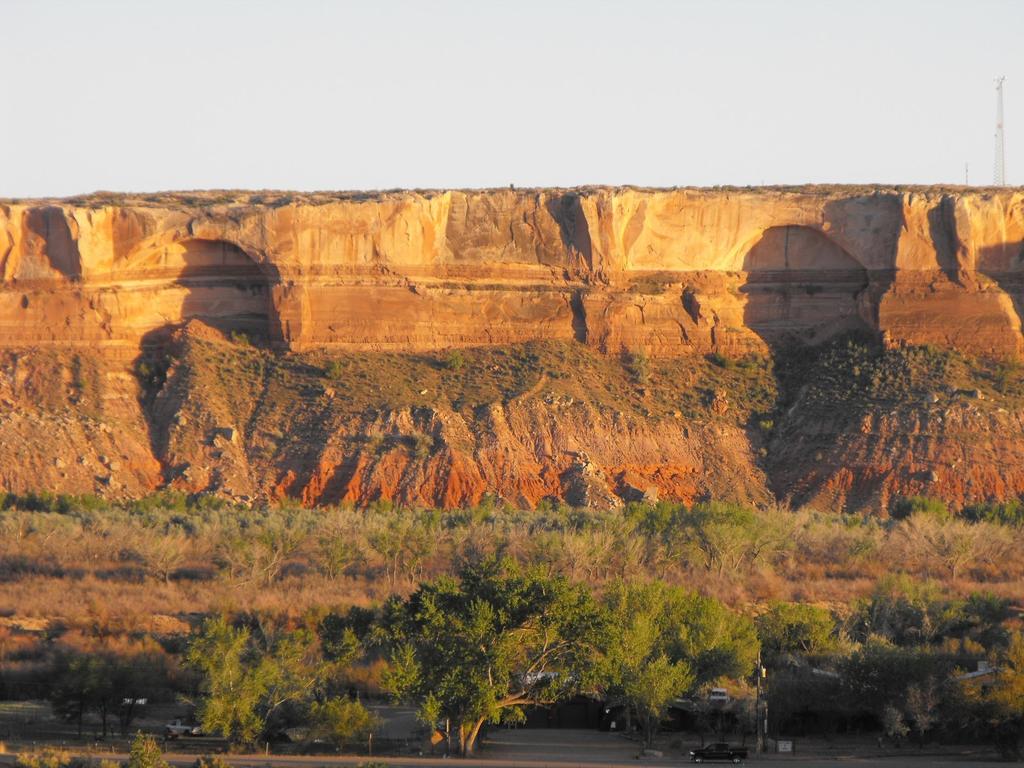
15 Bluff great house Twin Rocks PI site Dance Plaza Twin alcoves
16

17

18
19

20
21 Tank Mesa Road Table 2. Cottonwood/Comb Network Monumental Landscape Associated Cultural Features Associated Natural Features Alignment formed by Bluff PI and Dance Plaza sites. Road alignment is oriented to Jackson Crossing site complex. Pecked staircase departing/entering Cottonwood Canyon to mesa top. Bedrock groove at isolated spring. Isolated spring. General orientation to Bears Ears. Jackson Crossing site complex 42Sa Sa Sa23733 Jackson's Lower Shrine (42Sa23738): 11-m diameter masonry structure. Jackson's Upper Shrine (42Sa23772): includes possible signal fire feature and large masonry enclosure. Rock art panel with possible road-related imagery (42Sa24313). Possible constructed ramp. Paired herraduras. Road-related rock art panel nearby (42Sa20909). Road alignment. Great house is "de novo." Cultural features are all located at the very crest of Comb Ridge. Immediately situated at the very base of Comb Ridge. From the herraduras (above), the road's bearing strikingly orients to the next crossing of Comb Ridge. Great house is itself located on hill near confluence of washes. Mule Canyon Great House Possible PII great kiva is included in "belt-loop" road configuration that wraps around great house (but see Hurst ). Two sandstone spires overlook site from crest of Comb Ridge. Includes two apparent sets of paired towers. Towers flank and overlook a small drainage with a seep.
22

23

24

25

26

27

28

29
30
31
32 The Et Al monumental landscape vs. other Northern San Juan monumental landscapes The Et Al great house differs in that the structure is not on the highest perch Otherwise, topographic highs and lows do seem to have been used Cardinal direction (particularly along the north/south axis) is referenced The Et Al great house might have been a center place relative to a set of shrines Historic inscription (sensu Snead 2009) of the landscape is subtle but apparent
33 Other considerations Monumental landscapes, and probably the actions associated with their creation, use, and memorialization are very public in apparent contrast to the activities in great kivas and great houses Chronology, chronology, chronology (yes, we can!) Who were the people that used the Et Al monumental landscape?
34 Thank you American Indian community of the northern Southwest Drs. Bill Lipe and R.G. Matson BLM archaeologists Don Simonis and Laird Naylor Dr. Catherine Cameron Mr. Bill Davis and Abajo Archaeology

35 The mystery does not get clearer by repeating the question, nor is it bought with going to amazing places. Until you ve kept your eyes and your wanting still for fifty years, you don t begin to cross over from confusion. (Rumi, translated by Coleman Barks)
Two Chaco-Style Great Houses on Cedar Mesa -- with Kayenta Pottery R.G. Matson and William Lipe UBC & WSU SAA The Cedar Mesa Project Turns 40
 Two Chaco-Style Great Houses on Cedar Mesa -- with Kayenta Pottery R.G. Matson and William Lipe UBC & WSU SAA The Cedar Mesa Project Turns 40 Draft 5a, March 23, 2011 The Et Al and Owen Great House sites
HISTORY OF ARCHITECTURE 1. THE BEGINNINGS AND VERNACULAR ARCHITECTURE. Vernacular Architecture in America
 HISTORY OF ARCHITECTURE 1. THE BEGINNINGS AND VERNACULAR ARCHITECTURE Vernacular Architecture in America Rabb Péter PhD 2012-2017 Political Correct name: First Nations (Canada) or Native Americans (USA)
The 13 th Century Depopulation of Cedar Mesa: The View from Ceramic Design Elements. Diane C. Curewitz Washington State University
 The 13 th Century Depopulation of Cedar Mesa: The View from Ceramic Design Elements Diane C. Curewitz Washington State University R.G. Matson University of British Columbia Utah Colorado The Four Corners
Mesa Verde: The History Of The Ancient Pueblo Settlement By Jesse Harasta, Charles River Editors READ ONLINE
 Mesa Verde: The History Of The Ancient Pueblo Settlement By Jesse Harasta, Charles River Editors READ ONLINE Taos Pueblo was first settled at some point in the 13th or 14th century, The Ancestral Puebloans
Lauren T. Clark Jane C. Waldbaum Scholarship Recipient Report 15 July 2018
 Lauren T. Clark Jane C. Waldbaum Scholarship Recipient Report 15 July 2018 I completed a five week field school at the Crow Canyon Archaeological Center right outside of Cortez, Colorado in the southwestern
Legacy documentation: using historical resources in a cultural astronomy project
 Oxford IX International Symposium on Archaeoastronomy Proceedings IAU Symposium No. 278, 2011 c International Astronomical Union 2011 Clive L. N. Ruggles, ed. doi:10.1017/s1743921311012695 Legacy documentation:
Creating Symmetry: The Cultural Landscape in the Sand Canyon Locality, Southwestern Colorado
 KIVA Journal of Southwestern Anthropology and History ISSN: 0023-1940 (Print) 2051-6177 (Online) Journal homepage: http://www.tandfonline.com/loi/ykiv20 Creating Symmetry: The Cultural Landscape in the
THE AMERICAS: NORTH AMERICAN CLIFF DWELLINGS AND STRUCTURES
 THE AMERICAS: NORTH AMERICAN CLIFF DWELLINGS AND STRUCTURES Angela Ngo Arch 115-02 Survey of Architecture I Fall, 2007 Arch 155-37/38: Adel Al-Zahrani Structure and Materials The Anasazi used materials
Mesa Verde cliff dwellings
 Mesa Verde cliff dwellings Cliff Palace, Ancestral Puebloan, 450 1300 C.E., sandstone, Mesa Verde National Park, Colorado (photo: Steven Zucker, CC: BY-NC-SA 2.0) Wanted: stunning view Imagine living in
Ideology on the Chacoan Landscape
 Ruth M. Van Dyke C h a p t e r 1 Ideology on the Chacoan Landscape Landscape is the spatial milieu within which bodies and the social and material worlds intersect. Landscapes involve the archaeologically
Recent Efforts to Research, Preserve, and Protect the Greater Chaco Landscape
 Recent Efforts to Research, Preserve, and Protect the Greater Chaco Landscape Table of Contents 3 Executive Summary 5 Recent Solstice Project Activities to Protect the Greater Chaco Landscape 7 Chaco s
Chaco Landscapes: Data, Theory and Management
 University of Nebraska - Lincoln DigitalCommons@University of Nebraska - Lincoln Anthropology Faculty Publications Anthropology, Department of 2-24-2016 Chaco Landscapes: Data, Theory and Management Ruth
Concho Valley Archeological Society Newsletter
 Concho Valley Archeological Society Newsletter February 2017 CVAS February Meeting Presentation David Woods, president of the San Angelo Railway Museum will be our speaker on February 23rd at the Fort
THE SOCIAL LANDSCAPE OF DEPOPULATION: THE NORTHERN SAN JUAN, A.D Donna M. Glowacki
 THE SOCIAL LANDSCAPE OF DEPOPULATION: THE NORTHERN SAN JUAN, A.D. 1150-1300 by Donna M. Glowacki A Dissertation Presented in Partial Fulfillment of the Requirements for the Degree Doctor of Philosophy
2017 NEH Summer Institute Reading List
 2017 NEH Summer Institute Reading List Core Readings (listed alphabetically by author or editor) (See page 4 for readings organized by week) Agoyo, Herman 2002 Preface: The Holy Way. In Archaeologies of
The Native Americans Unit. Investigative Question: How did location and physical geography influence the daily life of each American Indian tribe?
 The Native Americans Unit Investigative Question: How did location and physical geography influence the daily life of each American Indian tribe? I will also be able to: Differentiate between primary and
at Mesa Verde Displayed with permission The American Surveyor March Copyright 2008 Cheves Media
 at Mesa Verde Using Lasers to Help Save History >> By Elizabeth Lee hen the CyArk team was asked to fly to Mesa Verde National Park for an on-location shoot for PBS s WIRED Science, they brought the scanner
 OPTION 1 CITY CENTER New Library at Soldiers Square Soldiers Square Ramp Site The proposed project is an eight-story vertical mixed-use development that integrates the Library as the main feature in this
Mesa Verde Voices Episode 3: Moving On
 Mesa Verde Voices Episode 3: Moving On Host, Cally Carswell: Mesa Verde Voices is made possible by a grant from Mesa Verde Country, Colorado, where one day just isn t enough. Find out more at MesaVerdeCountry.com.
Appendix 1: Site Inventory Form
 Appendix 1: Site Inventory Form Wapsi Valley Archaeology, Inc. Anamosa, IA 56 X Cemetery Washington 83 24 2 NE X 1 5 approx. 200 approx. 201 unknown unknown Historic Resources Evaluation: 07A: Cemetery
A Re-examination of the Early Pueblo I Components at Monument Village, 42SA971
 Brigham Young University BYU ScholarsArchive All Theses and Dissertations 2011-12-13 A Re-examination of the Early Pueblo I Components at Monument Village, 42SA971 Rachel K. Pollock Brigham Young University
3.1 Survey Monument Preservation Guidelines for New and Reconstruction Projects. B. After construction and prior to recording Notice of Completion:
 3.0 SURVEY 3.1 Survey Monument Preservation Guidelines for New and Reconstruction Projects A. Prior to construction: 1. Public survey records are to be researched for the location of all possible survey
John Wetherill lantern slides, 1892
 , 1892 Emily Moazami 2017 National Museum of the American Indian 4220 Silver Hill Rd Suitland 20746-2863 nmaiarchives@si.edu http://nmai.si.edu/explore/collections/archive/ Table of Contents Collection
B. PROPOSED REFINEMENTS POTENTIALLY AFFECTING URBAN DESIGN AND VISUAL RESOURCES
 Chapter 4: Urban Design and Visual Resources A. CONCLUSIONS OF THE FGEIS The FGEIS concluded that the Approved Plan will not result in any significant adverse impact on urban design or visual resources.
Volcano Cliffs Sector Development Plan
 Existing Sector / Corridor / Design Overlay Zone Summary Sheet Volcano Cliffs Sector Web: http://documents.cabq.gov/planning/sectors/sdp-volcanocliffs-amended-7-9-15.pdf Joint plan with Bernalillo County
APPENDIX A. Day-by-Day Program of Study and Reading List MESA VERDE NATIONAL PARK AND THE CONSTRUCTION OF PUEBLO HISTORY
 APPENDIX A Day-by-Day Program of Study and Reading List MESA VERDE NATIONAL PARK AND THE CONSTRUCTION OF PUEBLO HISTORY Two 1-week workshops, June 26 July 2 and July 17 23, 2016 1 MESA VERDE NATIONAL PARK
17.1 INTRODUCTION CONTEXT CONCLUSIONS
 CHAPTER 17. FLOODPLAIN 17.1 INTRODUCTION 17.1.1 CONTEXT A floodplain is part of an extensive drainage and filtration system and water cycle that serves to contain flood waters from storms. Floodplain areas
GUIDELINES FOR THE ROUTEING OF NEW HIGH VOLTAGE OVERHEAD TRANSMISSION LINES
 The Holford Rules Guidelines on overhead line routeing were first formulated in 1959 by Sir William later Lord, Holford, who was a part-time member of the CEGB. National Grid has reviewed these guidelines,
Daniels Park Master Plan
 Daniels Park Master Plan Prepared for: Douglas County & The City and County of Denver October, 2007 EXHIBIT A Contents Daniels Park Overview 2 Project History & Goals 2-3 Regional Context Map 4 Park Zone
12 Foot Davis and Adjacent Sites
 Peace River, Alberta Proposed Concept Design Presentation and Discussion January 26, 2010 Peace River Provincial Recreation Area 12 Foot Davis Grave Site Dr. Greene Cairn North Environments Landscape Architects
CHAPTER 10 AESTHETICS
 CHAPTER 10 AESTHETICS CHAPTER 10 AESTHETICS This section identifies and evaluates key visual resources in the project area to determine the degree of visual impact that would be attributable to the project.
ALTERNATIVE STATION AREA -
 ALTERNATIVE STATION AREA - THE 10 TH STREET GARDEN STATION Two alternative land use scenarios and designs are illustrated here: Scheme A - Transit-Oriented Development High to Mid-Density Residential /Office
Key Pad Polling Results. Goals and Strategies Open House February 3, 2011
 Key Pad Polling Results Goals and Strategies Open House February 3, 2011 1. What is your age 1. Under 18 2. 19 29 years 3. 30 44 years 4. 45 65 years 5. Over 65 years 49% 11% 1% 11% 27% Under 18 19-29
Basketball Court. Intermediate Play Area. Banner Poles. Planter. Boulder/ Geology Area. Teatherball 4 Square U.S. Map. Swings.
 Site Plan Surface Games Intermediate Play Mural Primary Play ECE Play Intermediate Play Bioswale Student Access & Circulation Banner Poles Student Planter Asphalt Boulder/ Geology Element Sculptures Vegetation
DOWNLOAD OR READ : TOUR MESA VERDE NATIONAL PARK COLORADO A SELF GUIDED PICTORIAL DRIVING TOUR VISUAL TRAVEL TOURS BOOK 326 PDF EBOOK EPUB MOBI
 DOWNLOAD OR READ : TOUR MESA VERDE NATIONAL PARK COLORADO A SELF GUIDED PICTORIAL DRIVING TOUR VISUAL TRAVEL TOURS BOOK 326 PDF EBOOK EPUB MOBI Page 1 Page 2 travel tours book 326 tour mesa verde national
Appendix 17A Scenic Quality Rating Forms
 1 2 Appendix 17A Scenic Quality Rating Forms UNITED STATES DEPARTMENT OF THE INTERIOR BUREAU OF LAND MANAGEMENT SCENIC QUALITY RATING SUMMARY Date: March 7, 2018 Landscape Character Unit: N/A Key Observation
LANDSCAPE UNIT 10 Te Kawau, Turipeka & Otautu Point
 Location Map LANDSCAPE VALUES Landscape Unit No. 10 Description: Te Kawau, Turipeka, & Otautu Point KEY LANDSCAPE FACTORS / VARIABLES LANDSCAPE UNIT 10 Te Kawau, Turipeka & Otautu Point LEGEND Outstanding
Reading the Driftless Landscape
 Reading the Driftless Landscape Author, Cindy Ramseyer Editors and Contributors: Katie Abbott, Chuck Bauer, Darcy Kind, Heidi Nelson, Carroll Schaal A Publication of the Blue Mounds Area Project with generous
STABILIZATION AND RECONSTRUCTION
 STABILIZATION AND RECONSTRUCTION PURPOSE The purpose of this course is to provide the basic academic and field skill to permit the avocational archaeologist the ability to participate in stabilization
INDIAN PEAKS CALENDAR OF EVENTS
 Newsletter of the Indian Peaks Chapter of the Colorado Archaeological Society February 2015 INDIAN PEAKS CALENDAR OF EVENTS Presentation (lecture) meetings are held in the University of Colorado Museum
Rustic Redefined. 115 Morgan Drive Sedona Bedrooms, 2.5 baths 3040 Sq Feet Lot size: 1 Acre. Shown by Appointment Only
 Rustic Redefined Bathed in the towering vistas of the famous Red Rocks of Sedona, this rustic luxe home captures the real drama of the wild west both inside and out. Shown by Appointment Only 115 Morgan
Chapter 5: Recreation
 Chapter 5: Recreation Introduction and Setting Recreational opportunities within Nevada County are varied, ranging from public parks with intensively used active recreational facilities, to vast tracts
Curriculum Vitae Donna M. Glowacki
 Curriculum Vitae Donna M. Glowacki OFFICE ADDRESS 635 Flanner Hall Department of Anthropology University of Notre Dame Notre Dame, IN 46556-5611 Phone: 574-631-7619 FAX: 574-631-5760 Email: dglowack@nd.edu
DACORUM GOLDEN PARSONAGE Great Gaddesden Brief Description Principal Building: Approach: Stable block other utilitarian buildings: Walled Garden:
 HERTFORDSHIRE GARDENS TRUST LOCAL LIST: DACORUM Present Name of Site GOLDEN PARSONAGE Historic Name (if known) Parish/Town Great Gaddesden National Grid Reference of Principal Building: TL051 125 Present
4.500 Preston Road Overlay District
 Section 4.500 Preston Road Overlay District 2004 Zoning Ordinance 4.500 Preston Road Overlay District (ZC 98-29; Ordinance No. 98-9-12) 4.501 Purpose To provide appropriate design standards for the use
Digital Terrestrial Television Infrastructure Rollout. Environmental Impact Assessment - Corridor -
 Digital Terrestrial Television Infrastructure Rollout Environmental Impact Assessment - Corridor - 1 1 ENVIRONMENTAL IMPACT ASSESSMENT (EIA): CORRIDOR 1.1 INTRODUCTION Corridor is a small farming community
to the Jericho Reservoir Project Open House
 Welcome to the Jericho Reservoir Project Open House is responsible for supplying clean, safe drinking water to over 2.4 million residents in the region. Operating our vast drinking water system with a
Visual Impact Assessment 830 Pratt Avenue St Helena, CA
 Visual Impact Assessment 830 Pratt Avenue St Helena, CA 1. Introduction The following aesthetic visual impact assessment has been prepared pursuant to the California Environmental Quality Act (CEQA). The
for a context-sensitive design that connects to its surroundings.
 5 Built Form Figure 5-: Parcels and Buildings 33RD AVE. 5. Block and Building Design Concept Block, parcel, and building design in Little Mountain is based largely on the public realm concept, and the
2.5 Roads. Loading and service areas adjacent to Highway 401 should be screened through architectural walls and/or landscape buffer planting.
 N HIGHWAY OFF RAMP 2.5 Roads A legible road network with a clear hierarchy will help create a connected community, both within and surrounding the Milton Heights. The following section outlines the proposed
Visual and Aesthetic Resources
 Visual and Aesthetic Resources 7.1 INTRODUCTION This chapter evaluates the effects of the Modified Design on visual and aesthetic resources, in comparison to the effects of 2004 FEIS Design. The 2004 FEIS
Donna M. Glowacki January 8, 2018
 Donna M. Glowacki January 8, 2018 246 Corbett Family Hall, Department of Anthropology, University of Notre Dame, Notre Dame, IN 46556 Office: 574-631-7619, Email: dglowack@nd.edu EDUCATION Ph.D. 2006 Department
Networking Magan: Investigating the Political Economy of the Omani Interior in the Third Millennium BC
 Eli Dollarhide 1 Grant Title: Networking Magan: Investigating the Political Economy of the Omani Interior in the Third Millennium BC Eli N. Dollarhide, PhD Candidate Department of Anthropology New York
3.21 HERITAGE AND CULTURAL RESOURCES
 3.21 HERITAGE AND CULTURAL RESOURCES Introduction The planning area is situated in the heart of an area with a long and rich prehistoric and historic record. Native American occupation of the area dates
Cedar Niles Future Park Site Wetland #1
 Date: October 20, 2014 Site: Landowner: Johnson County Parks Designer: Thomas R. Biebighauser Individuals Present: Thomas R. Biebighauser, Dr. Eliodora Chamberlain (US EPA), Jason Daniels (US EPA), Jeannette
Land adjacent to Dingle Dock, Front Street, East Garston
 Land adjacent to Dingle Dock, Front Street, East Garston An Archaeological Watching Brief for Dr J Davies by Jo Pine Thames Valley Archaeological Services Site Code DEG99/82 January 2000 Summary Site name:
UNIVERSITY OF OREGON OREGON BACH FESTIVAL CPC Presentation February 11, 2016
 UNIVERSITY OF OREGON OREGON BACH FESTIVAL CPC Presentation February 11, 2016 LARGE SCALE CAMPUS TRANSPORTATION SITE ARRANGEMENT BUILDING DESIGN Campus Trees Good Neighbor Main Gateways Open-Space Framework
I 5 South Multimodal Corridor Study. Appendix F. I 5 South Multimodal Corridor Study Cultural Resources Constraints Analysis (February 8, 2010)
") I 5 South Multimodal Corridor Study Appendix F I 5 South Multimodal Corridor Study Cultural Resources Constraints Analysis (February 8, 2010) 847 Jamacha Road, El Cajon, California 92019-3206 tel: (619)
I 5 South Multimodal Corridor Study Appendix F I 5 South Multimodal Corridor Study Cultural Resources Constraints Analysis (February 8, 2010) 847 Jamacha Road, El Cajon, California 92019-3206 tel: (619)
AN ARCHAEOLOGICAL SURVEY FOR THE RICHARDS, TEXAS FARM-TO-MARKET ROAD 149 FIBER OPTIC CABLE PROJECT IN MONTGOMERY COUNTY, TEXAS
 AN ARCHAEOLOGICAL SURVEY FOR THE RICHARDS, TEXAS FARM-TO-MARKET ROAD 149 FIBER OPTIC CABLE PROJECT IN MONTGOMERY COUNTY, TEXAS Antiquities Permit 6097 By William E. Moore Brazos Valley Research Associates
TALL BUILDING GUIDELINES
 TALL BUILDING GUIDELINES Urban Design Guidance for the Site Planning and Design of Tall Buildings in Milton May, 2018 A Place of Possibility Contents 1.0 INTRODUCTION 1 1.1 What is a Tall Building? 2
From the Merion Civic Association Tenth Year Book of 1923
 From the Merion Civic Association Tenth Year Book of 1923 THE MERION WAR TRIBUTE HOUSE WALTER T. KARCHER AND LIVINGSTON SMITH, ARCHITECTS. The accompanying sketch was made when Mr. Johnson's gift was accepted
Appraisal of proposed alterations to the boundary of Helmsley Conservation Area
 Appraisal of proposed alterations to the boundary of Helmsley Conservation Area Elmslac Road: Elmslac Road was constructed in the early 1950s in two or three stages by the Helmsley Rural District Council.
EVALUATION REPORT No. 300
 EVALUATION REPORT No. 300 Southwest of 2A Cloughey Road, Portaferry, Co. Down Licence No.: AE/135/85E Sapphire Mussen Report Date: 14 th May 2015 Site Specific Information Site Name: [Southwest of 2a]
IDO Trainings FAQs by Topic
 City of Albuquerque Integrated Development Ordinance (IDO) Training Development Standards March 30 & April 4, 2018 www.abc-zone.com IDO Trainings FAQs by Topic 7 Parts 1. General Provisions https://abc-zone.com/document/abq-adopted-ido
Appendix C Cultural Resources Survey
 Appendix C Cultural Resources Survey A Cultural Resources Survey for the Gallo Winery Expansion Project 18000 River Road, Livingston Merced County, California Eileen Barrow, M.A./R.P.A. July 22, 2011 A
The Inspiration for the King of Prussia Volunteer Fire Company - Station 47 Memorial Park and 9/11 Monument
 The Inspiration for the King of Prussia Volunteer Fire Company - Station 47 Memorial Park and 9/11 Monument A speech delivered on the occasion of the Tenth Anniversary of the 9/11/2001 attacks at the Dedication
Agenda Item 1.a.i. April 4, 2014
 Agenda Item 1.a.i. April 4, 2014 TO: FROM: SUBJECT: CAC Project Review Committee and JPA staff St. John Garabed Church Project Comments on Draft EIR PRC RECOMMENDATION: Request that JPA send Draft EIR
THE HOVENWEEP NATIONAL MONUMENT
 THE HOVENWEEP NATIONAL MONUMENT By J. WALTER FEWKEB Chief, Bm eau O f American Ethnology ["\Vith 10 plates] INTRODUC'l'ION There is one and only one locality in the Union where four States come together
HISTORIC RESOURCES INVENTORY - BUILDING AND STRUCTURES
 HISTORIC RESOURCES INVENTORY - BUILDING AND STRUCTURES Connecticut Commission on Culture & Tourism, One Constitution Plaza, 2nd Floor, Hartford, CT 06103 * Note: Please attach any additional or expanded
Attachment D Eastside Transit Corridor Phase 2 Technical Study Route Options Screening Analysis and Community Outreach Executive Summary April 2017
 Attachment D Eastside Transit Corridor Phase 2 Technical Study Route Options Screening Analysis and Community Outreach Executive Summary April 2017 Technical Study Scope Nov 2014: Board-directed Technical
Village of Pemberton DOWNTOWN ENHANCEMENT INITIATIVE FRONTIER STREET PILOT PROJECT WE NEED YOUR HELP TO REVIEW THE PLAN
 Village of Pemberton DOWNTOWN ENHANCEMENT INITIATIVE FRONTIER STREET PILOT PROJECT WELCOME TO THE NEW FRONTIER STREET! WE NEED YOUR HELP TO REVIEW THE PLAN The Village of Pemberton would like your feedback
Minto In Kensington Open House. Thursday March 23, pm Hillhurst Sunnyside Community Association Ave NW
 Minto In Kensington Open House Thursday March 23, 2017 6-8 pm Hillhurst Sunnyside Community Association 1320 5 Ave NW Project Background & Timeline Background Project Highlights Minto Communities continues
SUBJECT: Pershing Park/World War I Memorial Design
 Founded 1923 Chair Nancy J. MacWood Vice-Chair Stephen Hansen Secretary Jim Nathanson Treasurer Carol F. Aten Trustees George Clark Dorothy Douglas Monte Edwards Alma Gates Erik Hein Larry Hargrove Kathy
Industrial Development Permit Area
 Industrial Development Permit Area PURPOSE The purpose of this Development Permit Area (DPA) is to establish objectives and provide guidelines for the form and character of industrial development in the
Preservation of Scenery National Historic Trails. Rob Sweeten BLM Kevin Rauhe EPG
 Preservation of Scenery National Historic Trails Rob Sweeten BLM Kevin Rauhe EPG EPG Background Landscape architects with expertise in visual resources Resource staff includes: archaeologists, biologists,
City of Albuquerque. Integrated Development Ordinance (IDO) Training Development Standards. March 30 & April 4,
 Training Development Standards. March 30 & April 4,") City of Albuquerque Integrated Development Ordinance (IDO) Training Development Standards March 30 & April 4, 2018 www.abc-zone.com IDO Trainings FAQs by Topic March 21 & 23 March 30 & April 4 April 6
City of Albuquerque Integrated Development Ordinance (IDO) Training Development Standards March 30 & April 4, 2018 www.abc-zone.com IDO Trainings FAQs by Topic March 21 & 23 March 30 & April 4 April 6
Look. Using Pictures in Research. >> By Kenneth T. Mills, LS
 Look Closer Using Pictures in Research >> By Kenneth T. Mills, LS number of months ago I began a personal search for the two meridian monuments set in Marshall, North Carolina in 1898 by the U. S. Coast
SECTION 5: REACH RECOMMENDATIONS/MAPS
 SECTION 5: REACH RECOMMENDATIONS/MAPS This section describes areas of concern and provides specific recommendations for each project reach. Locations of stormwater drains were from GIS coverage supplied
Navajo Nation s Plant Life: What Makes it So Unique? Andrea Hazelton Botanist Navajo Natural Heritage Program
 Navajo Nation s Plant Life: What Makes it So Unique? Andrea Hazelton Botanist Navajo Natural Heritage Program Diné Bikéyah is a Special Place Unique Plants in the Navajo Nation ENDANGERED Cutler s Milk-vetch
RHBL 7325 ENVIRONMENTAL ANALYSIS. By: Whitney Musick
 RHBL 7325 ENVIRONMENTAL ANALYSIS By: Whitney Musick UALR s Ottenheimer Library Photo Credit: http://www.flickr.com/photos/30091470@n08/4565851613/ Background Description Ottenheimer Library is centrally
WEST OAK CLIFF RED LINE EXTENSION
 INITIAL ALTERNATIVES CORRIDOR EVALUATION WEST OAK CLIFF RED LINE EXTENSION Hampton C O R R I D O R I N F O R M AT I O N 408 303 Keist Keist Blvd Duncanville Rd 2 Red Bird Ln Executive Airport Boulder "
ADELAIDE COMETS CLUBROOMS DESIGN CONCEPT
 PREPARED FOR Adelaide Comets FC Tampawardli Park (Ellis Park) Lot 587 West Terrace Adelaide SA 5000 P +61 8 8333 9796 ATTENTION Jim Tsouvalas P +61 8 8231 1885 E webmaster@adelaidecomets.com.au PREPARED
Lake Mead Recreational Area Research
 Archaeology Lake Mead Recreational Area Research 3-31-2007 Archaeological Inventory, Site Assessment, and Data Management, Lake Mead National Recreation Area (LMNRA) and Parashant National Monument (PARA):
RESOLUTION NO R
 e e RESOLUTION NO R04 0054 BE IT RESOLVED by the Mayor and City Council ofthe City ofpapillion that The Papillion Comprehensive Plan is hereby amended to incorporate the Option A Future Land Use Map Transportation
HISTORY OF RUINS STABILIZATION AT CLIFF PALACE AND SPRUCE TREE HOUSE MESA VERDE NATIONAL PARK, COLORADO
 HISTORY OF RUINS STABILIZATION AT CLIFF PALACE AND SPRUCE TREE HOUSE MESA VERDE NATIONAL PARK, COLORADO by Jonathon C. Horn Co-Project Director with Appendices by Susan M. Chandler Co-Project Director
DUN DORNAIGIL HISTORIC ENVIRONMENT SCOTLAND STATEMENT OF SIGNIFICANCE. Property in Care (PIC) ID: PIC289 Designations:
 ID: PIC289 Designations:") Property in Care (PIC) ID: PIC289 Designations: Scheduled Monument (SM90113) Taken into State care: 1974 (Guardianship) Last reviewed: 2004 HISTORIC ENVIRONMENT SCOTLAND STATEMENT OF SIGNIFICANCE DUN DORNAIGIL
Property in Care (PIC) ID: PIC289 Designations: Scheduled Monument (SM90113) Taken into State care: 1974 (Guardianship) Last reviewed: 2004 HISTORIC ENVIRONMENT SCOTLAND STATEMENT OF SIGNIFICANCE DUN DORNAIGIL
Town of Bethany Beach "Central Park" Survey - August 2016
 Q1 1. The Park should have a shade structure adjacent to CentralBoulevard - the design intent is to provide some shade on the northern part of the garden as well as provide a visual screen from the residences
Highway Alignment and Route Location Survey
 CHAPTER 2 Highway Route Surveys and Location Introduction To determine the geometric features of road design, the following surveys must be conducted after the necessity of the road is decided. Type of
Downtown Papillion. Concepts for the Enhancement and Growth of Papillion s Traditional Town Center
 Downtown Papillion Concepts for the Enhancement and Growth of Papillion s Traditional Town Center Developed for the City of Papillion by RDG Planning & Design T raditional downtown districts occupy a particular
MONITORING REPORT: No. 289
 MONITORING REPORT: No. 289 21 Ballynarrig Road Ballydarrog Co. Derry AE/14/213E Dermot Redmond Site Specific Information Site Name: 21 Ballynarrig Road, Limavady Townland: Ballydarrog SMR No. : LDY 016:004
KIVA, Vol. 61, No. 3, 1996
 KIVA, Vol. 61, No. 3, 1996 PITCHERS TO MUGS: CHACOAN REVIVAL AT SAND CANYON PUEBLO BRUCE A. BRADLEY Crow Canyon Archaeological Center Cortez, CO 81321 ABSTRACT Historically, cultural revitalization movements
A:shiwi Cultural Complex A Vision for the Zuni Tribe
 J O N E S J O N E S Architects and Landscape Architects, Ltd. A:shiwi Cultural Complex A Vision for the Zuni Tribe Zuni, New Mexico September 2002 table of contents Introduction 2 Mission & Goals 3 Site
2011 ASLA Design Awards
 2011 ASLA Design Awards Interstate 70 Mountain Corridor Aesthetic Guidance Honor Award Design Workshop, Aspen / THK Associates, Inc. / CH2MHill Planning and Urban Design Project Title: Interstate70 Mountain
City of Lafayette Study Session Staff Report Design Review Commission
 ++ City of Lafayette Study Session Staff Report Design Review Commission Meeting Date: January 08, 2018 Staff: Subject: Chris Juram, Planning Technician SS12-17 Miramar Homebuilders, R-20 Zoning: Request
Describing Places- Adjective Word Order
 Describing Places- Adjective Word Order Work in groups of two or three. Take turns describing an imaginary natural place (each), one sentence at a time. Use as many adjectives as you can in each sentence,
HISTORIC AND DESIGN REVIEW COMMISSION
 HISTORIC AND DESIGN REVIEW COMMISSION January 15, 2014 Agenda Item No: 8 HDRC CASE NO: 2014-013 COMMON NAME: Travis Park ADDRESS: 301 E. Travis ZONING: D CITY COUNCIL DIST.: 1 PUBLIC PROPERTY: Yes APPLICANT:
New Library Building Proposal
 Helen M. Plum Memorial Public Library District New Library Building Proposal September 11, 2017 Images are conceptual and preliminary to refinement, review, and approval by various parties, and thus subject
National Monuments Review Department of the Interior 1849 C St. NW Washington, DC May 25, Submitted via: Regulations.
 National Monuments Review Department of the Interior 1849 C St. NW Washington, DC 20240 May 25, 2017 Submitted via: Regulations.gov portal Comments of the Grand Canyon Trust Regarding the Review of Bears
CAMPUS MASTER PLAN Appendix C Neighborhood Traffic and Parking Task Force
 CAMPUS MASTER PLAN 2004-2015 Appendix C Neighborhood Traffic and Parking Task Force Neighborhood Traffic and Parking Task Force Background The City, OSU, and the neighborhood associations in the vicinity
St. Elizabeths Hospital/West Campus Landscape Character-Defining Features
 The following list of landscape character-defining features is taken directly from Chapter VII of the 2007 St. Elizabeths West Campus Cultural Landscape Report by Heritage Landscapes and Robinson & Associates,