Bridge location. Figure Detail of underpass State Highway 20 under State Highway 1 (Southern Motorway)
|
|
|
- Joanna Manning
- 5 years ago
- Views:
Transcription


1 8.14 SH 20 under SH1 Link Form of underpass represented as a gash through the underlying geology Underpass and walls either side to be lined with pre-cast concrete panels that are heavily rusticated at the base and finely textured at the top to reinforce underlying volcanic geology Bridge location Figure Detail of underpass State Highway 20 under State Highway 1 (Southern Motorway) J A S M A X 46


2 09 Softscape Elements 9.0 Plant Materials Planting and appropriate selection of plant material is a critical design component of the project. Plants will be used to develop the character of the alignment; the spatial volumes, colour, texture and integration with other plantings along SH1 and SH20. Planting will also provide links with past vegetation patterns such as historic lowland forests and reference remnant stands of kahikatea on the nearby Hauraki Plains. Large scale plantings will add a temporal component to the landscape and a legacy for future generations with transitions from emergent character plants and canopy trees. The geological history of the site forms a defining role for plantings around the lava field. Plantings also provide a functional role such as soil binding, screening, filtering views and the improvement of ecological values. The Puhinui Stream is a visually and ecologically significant component of the site as are the storm water ponds and associated wetlands. Appropriate plant selection and positioning will take best advantage of views, visual clues to their locations and the ongoing development of the Manukau urban ecology. J A S M A X 47


 to emphasise areas with volcanic geology and gaps with lower")


 in clumps as a wetland signature species or swamp astelia (Astelia grandis).")

3 9.1 Planting Vision The overall vision for the motorway plantings is to: Integrate the scale and form of SH20 and the SH1 interchange into the urban grain and amenity of Manukau City residential, civic and industrial character areas; Promote a sense of place identity that is driven by the site s natural and cultural history, current cultural identity, natural features, land uses and urban form; Improve urban ecology to support target flora and fauna and improve environmental quality; Assist the establishment of the Puhinui Stream Walkway and ecological corridor; Control views where necessary for mitigation and enhancement; Marry in with existing plantings on SH1 and SH20 to ensure continuity; Reduce whole of life management and maintenance costs; and Ensure the provision of clear sight lines for road users, cyclists and pedestrians. The vision will be achieved by: Plantings of charismatic and recognisable tree species such as kahikatea (Dacrycarpus dacrydioides), kauri (Agathis australis) and totara (Podocarpus totara) in structural layouts at the SH1/ SH20 interchange to integrate the urban form of the motorway and provide dramatic entry sequences; Pacifica geometry earthworks and plantings to form and strengthen the cultural and civic component of Manukau City and provide a point of difference to identify this place from others; Plantings of pohutukawa (Metrosideros excelsa) to emphasise areas with volcanic geology and gaps with lower plantings at critical areas to emphasise views to key volcanic landmarks such as McLaughlins Hill; Riparian and wetland plantings along the banks of the Puhinui Stream and at the edges of storm water ponds. Selection of plant species and locations will ensure clear sight lines for safety and enhance ecological values of the area; A temporal programme of emerging character plants and flowering canopy tree species to integrate a sense of ongoing change and support bird habitat such as nikau palm (Rhopalostylis sapida), kowhai (Sophora microphylla) and pohutukawa; Integration with Manukau City Council Street Tree Planting strategy and TNZ Guidelines for Highway Plantings; Make good any loss of significant or valued vegetation such as the pin oaks in Hayman Park; Ensure plantings tie both sides of the motorway alignment together to signal that both sides are still intact ; Marry in with existing SH20 and SH1 plantings to ensure a smooth transition; and Planting of species that were once found in the Manukau region but are now rare, endangered or uncommon. These include swamp maire (Syzygium maire) in clumps as a wetland signature species or swamp astelia (Astelia grandis). In appropriate areas, taraire (Beischmiedia tarairi) will be used as an enrichment species once the initial planting has established to provide protection. Areas where exotic tree species will be used are limited to areas with social or historical associations with exotic plant species such as Hayman Park and Manukau City Centre and to align with MCC S Street Tree Planting Policy. J A S M A X 48

4 Figure Planting concept. Puhinui Stream Flax Totara Riparian Areas Parks/Green Space Native Highway Mix Kauri Pacifica Fractals Urban Area Kahikatea Pohutukawa Street Tree Planting (works limited to designation) J A S M A X 49
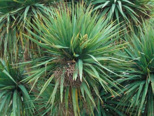
5 9.2 Pacifica Fractals: The Pacifica Fractals are geometrically arranged plantings in the cut between great South Road and Wiri Station Road Extension in the urban civic character area. The fractals are simple, angled plantings that will comply with the required maximum slope angle of the soils and are based on a repeating geometric form derived from Pacifica motifs. Drainage may be incorporated into the angled landforms. The sloping banks will be planted with mountain flax (Phormium cookianum) and cabbage trees (Cordyline australis) underplanted with mountain flax to provide comprehensive ground cover. The plantings will provide a strong simple pattern to be read at 100km/hr, strong texture combinations and attractive flowering and scent. Figure Pacifica Fractals. Cabbage Tree. Mountain Flax. Figure Perspective of Pacifica Fractals. J A S M A X 50


 and cabbage trees (Cordyline")

6 9.2 Pacifica Fractals: The Pacifica Fractals are geometrically arranged plantings in the cut between great South Road and Wiri Station Road Extension in the urban civic character area. The fractals are simple, angled plantings that will comply with the required maximum slope angle of the soils and are based on a repeating geometric form derived from Pacifica motifs. Drainage may be incorporated into the angled landforms. The sloping banks will be planted with mountain flax (Phormium cookianum) and cabbage trees (Cordyline australis) underplanted with mountain flax to provide comprehensive ground cover. The plantings will provide a strong simple pattern to be read at 100km/hr, strong texture combinations and attractive flowering and scent. Figure Pacifica Fractals. Cabbage Tree. Mountain Flax. Figure Perspective of Pacifica Fractals. J A S M A X 50


, kauri (Agathis australis) and")


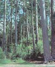
7 9.3 SH1/SH20 Interchange: The interchange will be fitted into a wide area of land with significant topographical variation. The Redoubt Flyover, off-ramps and on-ramps, SH1, SH20 and the SH20 under SH1 underpass present a complex array of overlapping horizontal and vertical alignments. Plantings in the centre provide reference to charismatic plant communities and natural features in the Auckland region including isolated stands of tall kahikatea (Dacrycarpus dacrydioides), kauri (Agathis australis) and totara (Podocarpus totara). Dense planted stands of these trees, amongst native highway plantings for protection, will provide an emergent arrangement of lines that stitch the two motorway systems together. Figure 9.4-3D model of Pacifica Fractals planting. Figure Blow apart model of Pacifica Fractals planting. Figure Interchange Kauri. Kahikatea. Totara. J A S M A X 51


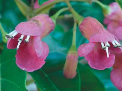
8 9.4 Flaxes: Large scale plantings of flaxes including the tall, hardy and informal Phormium tenax and the low and rigid Phormium cookianum, connect with existing SH20 plantings west of the site, and draw them through in an unbroken sequence to SH1. Both species are used where most appropriate to respond to site conditions, level of desired formality, and lines of sight/screening. Flaxes are frangible, low maintenance and weed suppressing. They are also self regenerating, cost effective and are attractive to nectar eating native birds such as Tui. (Phormium cookianum) (Phormium tenax) 9.5 Native Highway Plantings: The native highway plantings will marry in with existing plantings on SH1 and SH20. They provide textured and attractive multi-layered screening that establishes rapidly and adds continuity into the motorway alignments. Additional value has been added to these with additional plantings of emergent slow growing charismatic plants such as nikau palm (Rhopalostylis sapida) and colour and bird habitat such as kowhai (Sophora microphylla). J A S M A X 52


9 9.6 Waterways and Wetlands: Puhinui Stream and the storm water wetlands are potential native habitat areas and add to the amenity value of the project. A qualified Ecologist will confirm best practices to ensure habitats are targeted and enhanced. Plantings for the Puhinui Stream that are within the designation will marry with the MCC Puhinui Stream Walkway plantings. These will locate low plantings within the flood prone areas of the stream channel, with taller plantings at the tops of the banks, where visibility into the walkway is not a safety requirement. Plantings around storm water wetlands will be naturalistic swathes of native rushes and reeds, with taller tree and shrub plantings set back to screen safety fences and provide naturalistic backdrops where visibility into the ponds is not a safety requirement. Figure Stormwater pond 9.7 Mulching A bark mulch weed suppression system will be adopted over the typical weedmat system due to the following reasons: Bark Mulch Allows rhizomatous and stoloniferous plants to spread unimpeded, thus achieving ground cover more rapidly than other more restrictive methods Weedmat or other similar systems Impedes the spread of rhizomatous and stoloniferous plants At the edges of storm water ponds and stream banks, a mechanically secured bio-degradable mulching system is proposed due to the potential for the areas to be inundated with water and washing away loose mulch materials. In these areas, bark mulch will be impractical. By pinning the mat to the ground the plants and the mulch will be secured in place. Fades to a natural colour and texture Remains highly visible for a long period of time and is unattractive Allows air exchange in the soil Restricts the exchange of air in the soil Restricts water loss from the soil Ineffective at restricting water loss from the soil Insulates the soil Less effective insulation qualities Simple to apply and re-apply when necessary Complex and time consuming to apply and repair Eventually breaks down to form soil Does not break down, and those that do, tend to fray and become untidy Is a natural material, from a renewable and sustainable source Is an unsustainable product that is made from plastic and requires eventual disposal J A S M A X 53

10 9.8 Landscape Mitigation Measures Mitigation measures include: The potential for the greening of the retaining wall in front of Church of Latter Day Saints and the Redoubt Flyover retaining walls with self adhering climbing plants to reduce noise deflection and glare; Filtering views from the SH20 alignment to unsightly industrial sites; Dense planting between residential areas east of SH1 and SH1 for screening; Replacement or relocation of pin oaks in Hayman Park; and Replacement street tree plantings in line with Manukau City street tree planting strategy. 9.9 Puhinui Stream Diversion Works The stream diversion works propose a meander between the base of the SH20 embankment and the neighbouring industrial sites west of Nesdale Avenue. A curvilinear walkway on the south side of the stream will provide views of the native planted stream banks. Low planting on the south side of the stream will ensure good passive surveillance from nearby workplaces to the Puhinui Stream Walkway; and Native riparian rushes and reeds with taller shrubs and flaxes behind with taller canopy trees on the north banks will provide habitat for native flora and fauna and an attractive backdrop and screen for the motorway. The stream diversion works provide opportunities to: Elevate ecological values of the stream and the planted banks and introduce rare and endangered plant species; and Increase amenity and aesthetic values for walkers on the Te Araroa Trail and adjacent industrial sites. Figure Puhihui Stream diversion and stormwater pond. J A S M A X 54
11 PLANT SCHEDULE SPECIES MIX ID COMMON NAME BOTANICAL NAME GRADE CENTRES QUANTITY NOTES General Highway Native Plant Mix Ngaio Myoporum laetum Pb3 Average 1m centres Cabbage tree Cordyline australis Pb3 Flax Phormium tenax Pb3 Karaka Corynocarpus laevigatus Pb3 Karamu Coprosma robusta Pb3 Lancewood Pseudopanax crassifolius Pb3 Kohuhu Pittosporum tennuifolium Pb3 Tarata Pittosporum eugenoides Pb3 Taraire Beilschmiedia tarairi Pb8 Puriri Vitex lucens Pb8 Pohutukawa Metrosideros excelsa Pb8 * Nikau Palm Rhopalostylis sapida Pb8 Ngaio, Pittosporum and Coprosma for base colour, texture and rounded form. Flaxes, lancewoods and cabbage trees for striking textural contrast. Flaxes to ground the plantings and provide a textured edge in random locations. Pohutukawa, Taraire and Karaka for rounded overhead canopy, flower, colour and legacy. * Nikau Palm in selected areas for emergent contrasting texture and legacy. * Kowhai in drifts to connect SH1 with SH20 and enhance the ecological corridor and provide textural contrast. Enrichment Planting * Kowhai Sophora microphylla Pb3 Kahikatea in Native Plant Mix Kahikatea Dacrycarpus dacrydioides Pb8 3m centres 3,000m2 Close spaced Kahikatea for striking vertical form and height, Native plant mix Pb3 1m centres reference to historic vegetation patterns and remnant populations (as above) on Hauraki Plains and for legacy element. Emergent Kahikatea to form volume of space to enhance Gateway experience for motorists on the Redoubt Flyover. 2 stage planting amongst mixed native highway plantings to assist establishment. Kauri in Native Plant Mix Kauri Agathis australis Pb8 3m centres 28,000m2 Close spaced Kauri for charismatic sense of place, striking vertical Native plant mix Pb3 1m centres form and legacy. Kauri to form volume of space to enhance (as above) Gateway experience for north bound motorists. 2 stage planting amongst mixed native highway plantings to assist establishment. Totara in Native Plant Mix Totara Podocarpus totara Pb8 3m centres 10,000m2 Close spaced Totara for local legibility and legacy. Totara to Native plant mix Pb3 1m centres form textured grove to enhance Gateway experience for (as above) south bound motorists. 2 stage planting amongst mixed native highway plantings to assist establishment. Pohutukawa in Flax Pohutukawa Metrosideros excelsa Pb8 6m centres 25,000m2 Multi-branching Pohutukawa planted on lava flow at staggered Flax Phormium tenax Pb3 1m centres spacings. Tall canopy tree for filtered views through trunks and striking summer flower colour. Plant amongst flaxes. Grassed Areas Grass mix Browntop, fescue, clover mix with turf rye grass as nurse At specified rate/m2 63,000m2 Slow growing grass mix in selected areas. J A S M A X 55
12 PLANT SCHEDULE Pacifica Fractals Plant type 1 Cabbage trees Cordyline australis Pb3 0.75m 17,000m2 On top side of bank and sloping earthworks centres Plant type 2 Mountain flax Phormium cookianum Pb3 0.75m See below On sloping bank centres Flax Type 1 Flax Type 2 Mountain Flax Flax (Harakeke) Phormium cookianum Phormium tenax Pb3 Pb3 0.75m centres 1m centres 157,000m2 72,000m2 Planted in drifts to interface with rest of SH20 and link into SH1 and as textured mass ground cover in other areas. Different species selected for height, hydrology and formality of area in which they are planted. Riparian Mix Stormwater Wetlands Puhinui Stream Banks Jointed rush, oi-oi Apodasmia similis Cordyline australis PB3 Pb3 Average 500mm centres Cabbage tree, ti kouka Flax, Harakeke Phormium tenax Pb3 Kahikatea Dacrycarpus dacrydioides Pb8 Karamu Coprosma robusta Pb3 Kowhai Sophora microphylla Pb8 Lancewood, horoeka Pseudopanax crassifolius Pb3 Pukio Carex secta Pb3 Rush Juncus pallidus Pb3 Rush Baumea juncea Pb3 Sedge Cyperus ustulatus Pb3 Shining karamu Coprosma repens Pb3 Enrichment * Swamp Maire Syzygium maire Pb28 Planting * Wheki Ponga Dicksonia fibrosa Pb8 * Swamp Astelia Astelia grandis Pb8 Hayman Park Puriri Pin Oak Vitex lucens Quercus palustris Pb120 Pb No s of tree s Liquidambar Liquidambar styraciflua Pb120 Street Trees Puriri Vitex lucens Pb m centres 63 No s of tree s 37,000m2 Rushes, sedges and grasses on lower stream banks and at edges of wetlands. Drifts of flaxes at tops of banks and to top of maximum flood channels. Small trees and shrubs such as manuka, Coprosma spp., and kowhai in free draining soils at top of bank and away from flood prone areas for low canopy, screening and backdrop. Cabbage trees and lancewoods for striking contrast. Kahikatea for emerging vertical form, height and legacy. * Species selected which occur naturally in the Manukau ecological region but rare or uncommon. * Wheki Ponga to be planted in sheltered areas. * Swamp Maire to be planted in wet areas around ponds and stream. *Swamp Astelia to be planted in groups in wet areas. Species selected from the Manukau City Council s Draft Tree Policy. Specimen tree planting proposed to signal the presence of isolated section of Hayman Park. Species selection and placement to be carried out in consultation with Manukau City. For Lambie Drive and Wiri Station Road. To integrate with MCC Draft Tree Policy. Kauri Agathis australis Pb m centres For Great South Road. To integrate with MCC Draft Tree Policy. Liquidambar Liquidambar styraciflua Pb m centres For Plunket Ave. To integrate with MCC Draft Tree Policy. Oak Quercus sp. Pb120 15m centres For Nesdale and Puhinui Avenues. To integrate with MCC Draft Tree Policy. Green Walls Climbing fig Ficus pumila Pb3 1.2m centres 520 No s For planting at the base of noise walls to produce green, vegetated wall surface. J A S M A X 56
13 SHEET 4-5 SHEET 3-5 SHEET 2-5 SHEET 1-5 SHEET 5-5 A J A S M A X

14 J A S M A X A

15 J A S M A X B

16 J A S M A X A
17 J A S M A X A
18 J A S M A X A


19 GENERAL HIGHWAY MIX PACIFICA FRACTALS Karaka (Corynocarpus laevigatus) Cabbage Tree (Cordyline australis) Mountain Flax (Phormium cookianum) Lancewood (Pseudopanax crassifolius) Pittosporum (Pittosporum eugenioides) J A S M A X 63


20 ICONIC ENRICHMENT PLANTS Kahikatea (Dacrycarpus dacrydioides) Kauri (Agathis australis) Totara (Podocarpus totara) Pohutukawa (Metrosideros excelsa) J A S M A X 64


21 Ponga (Dicksonia fibrosa) Kowhai (Sophora microphylla) Nikau Palm (Rhopalostylis sapida) Puriri (Vitex lucens) J A S M A X 65


22 WETLAND AND WATERWAY PLANTS Carex secta Carex sp Carex virgata Juncus pallidus Juncus pallidus J A S M A X 66


")
")


")
 Kauri")
 Pin Oak")
 Puriri")
23 PARK TREES STREET TREES Puriri (Vitex lucens) Plane Tree (Platanus orientalis) English Oak (Quercus robur) Pohutukawa (Metrosideros excelsa) American Sweetgum (Liquidambar styracifula) Plane Tree (Platanus orientalis) American Sweetgum (Liquidambar styraciflua) Kauri (Agathis australis) Pin Oak (Quercus palustris) Puriri (Vitex lucens) Climbing Fig (Ficus pumila) J A S M A X 67

24 10.1 Landscape and Urban Design Masterplan 10.1 Landscape Plan Description The following is a description with accompanying plans of the Landscape Plan for the Motorway Link. It is generally consistent with the approach of The Landscape Management Plan prepared by Boffa Miskell for Transit New Zealand, is cognisant of the Manukau City Centre Tree Planting Strategy and TNZ Guidelines for Highway Planting and the conditions of the Consent Notice. The concept expands upon the themes established in the above noted work, and as described in the preceding report, is more place specific, deriving themes and forms from the physical and cultural landscape of Manukau City. The strong planting and grading patterns expressed in the Urban/Civic character areas uses fractal geometry to convey, in a contemporary manner, a geometric interpretation of Maori and Pacifica cultural motifs. Fractal geometry is described as any of various extremely irregular curves or shapes for which any chosen part is similar in shape to a given larger or smaller part when magnified or reduced to the same size. This allows the patterning to be read at a global or aerial whole of project level and at the most detailed level in patterning of elements such as barriers and abutments. From east to west the Landscape Plan is described and illustrated on the following pages: 10.1 SH1/REDOUBT ROAD TO GREAT SOUTH ROAD THE INTERCHANGE The intent of the design is to ensure a continuous experience through the established SH1 upon which is grafted the landscape theme of SH20 as it transitions from the Manukau City theme to this interchange area. The landscape concept for the interchange employs the following to highlight the sense of arrival and departure: References to Manukau City cultural identity on structures, earthworks, retaining walls and plantings; References to underlying geology on retaining walls and spill-through abutments; Reference to historic vegetation patterns; Structural plantings to control views and provide confined volumes of space in selected arrival/departure areas; Retain the established planting theme along SH1 north and south of the interchange to merge with existing plantings; Theme noise walls with references to historic naming of Manukau; and Maintain and frame views to the TelstraClear Pacific Arena. Structures The existing Redoubt Road bridge is maintained; Church of Latter Day Saints retaining wall planted with self adhering climbing plants to form green vegetated wall. Same treatment proposed for retaining walls on Redoubt Flyover; The Redoubt Flyover SH1 to SH20 westbound over SH1 fitted with folded steel mesh cladding on barriers to tie in with Pacifica theme and incorporate a repeating decorative element; and SH20 under SH1 southbound underpass lined with rusticated panels. Planting An overstorey of tall kahikatea, kauri and totara are dominant features of the interchange to provide structural form and arrival and departure experience; Screen planting between highway and residential areas to the east with interplanting of kowhai for colour and habitat for Tui; and Swathes of flax plantings to connect SH20 and SH1 and retain sight lines. Figure Interchange Area. J A S M A X 68
25 Figure Perspective sketch from SH1 looking north to Redoubt Flyover
APPROPRIATE NATIVE PLANT SPECIES FOR MARGIN ZONE
 APPROPRIATE NATIVE PLANT SPECIES FOR MARGIN ZONE Plant Species articulata juncea rubiginosa teretifolia Bolboschoen us fluviatillis Carex lessoniana Common Name Broad leaf Reed Height Growth Water depth
NATIVE PLANTING PROGRAMME. Planting for soil conservation, biodiversity and water quality
 NATIVE PLANTING PROGRAMME Planting for soil conservation, biodiversity and water quality Tips for planting 1 2 Prepare the planting hole The hole should always be larger than the plant container or root
Section Three, Appendix 17H Pararekau Island Planting Guidelines
 Appendix 17H - Pararekau Island Planting Guidelines Purpose These planting guidelines pertain to the Pararekau Island Countryside Living Zone, which applies to Pararekau Island and an access roading area
Maungatautari ecological district
 Planting guide 9 What should I plant? In this guide we describe four separate zones, representing the different vegetation types that would have historically clothed the land. Use the map and zone descriptions
Conservation at Totara Park and Auckland Botanic Gardens Friends of Totara Park
 Conservation at Totara Park and Auckland Botanic Gardens Friends of Totara Park Totara Park is south of Auckland city centre, and covers an area of around 530 acres, which was cleared for farming sheep
Introduction...3. Figure 1: Planting for back wetland or spring...9. Figure 2: Planting for stream edge...9
 Appendix 13 - Planting guides Contents Page Introduction...3 Table 1: Planting guide...4 Figure 1: Planting for back wetland or spring...9 Figure 2: Planting for stream edge...9 Figure 3: Planting for
Restoration and Enhancement Planting
 Ecological restoration advice for biodiversity enhancement opportunities at Remuera Golf Club, 120 Abbotts Way, Remuera To: From: Spencer Cooper Course Superintendent, Remuera Golf Club Jacinda Woolly
WAIROA WATERFRONT ENHANCEMENT
 WAIROA WATERFRONT ENHANCEMENT 1 Wairoa SH 2 Hawke Bay Mahia Banks SH 5 Napier SH 5 2 Hawke s Bay Hastings SH 2 Context Engaging Wairoa On still days the people of Wairoa remember stories of the diamonds
RULES FOR URBAN TREE GROUPS AND REMOVAL OF INDIGENOUS VEGETATION REMOVAL
 27A RULES FOR URBAN TREE GROUPS AND REMOVAL OF INDIGENOUS VEGETATION REMOVAL Activities Table Policies 4.4.10, 12.4.7, 12.4.10, 12.4.11, 12.4.12, 12.4.13, 12.4.14, 12.4.15, and 12.4.16 27A.1 Activities
Planting Guide for Hamilton Basin
 Planting Guide for Hamilton Basin Horsham Downs Peat Lakes This planting guide is designed to assist anyone undertaking ecological restoration of the peat lakes in the Hamilton Basin. It is the first in
Prince of Wales/Omāroro Reservoir
 Prince of Wales/Omāroro Reservoir pplication for easement: ddendum 1-Landscape and Visual ssessment ppendix E: dditional Landscape Plans, X-sections and Visualisations LEGEND Proposed Field Maintenance
CONICAL HILL RESERVE Landscape Concept Plan. January 2018
 CONICAL HILL RESERVE Landscape Concept Plan January 018 CONICAL HILL RESERVE LANDSCAPE CONCEPT PLAN Prepared for: Hurunui District Council (HDC) Prepared by: Align Ltd Concept Plan 19.01.18 Designed: Align
Section 6A 6A Purpose of the Natural Features and Landscapes Provisions
 Section 6A 6A Purpose of the Natural Features and Landscapes Provisions This Chapter addresses the protection and management of natural features and landscapes within the City. The City has a number of
Section Three, Part 3 Heritage Protection and Management
 PART 3 HERITAGE PROTECTION AND MANAGEMENT BUILDINGS, OBJECTS, SITES, AREAS AND FLORA AND FAUNA OF HISTORIC, ARCHITECTURAL, SCIENTIFIC OR OTHER INTEREST OR OF VISUAL APPEAL 3.1 INTRODUCTION This section
Section Three, Appendix 16B Subdivision Design Assessment Criteria (Residential 8A & 8B zones)
") APPENDIX 16B SUBDIVISION DESIGN ASSESSMENT CRITERIA (RESIDENTIAL 8A & 8B ZONES) PURPOSE OF APPENDIX 16B (RESIDENTIAL 8A & 8B ZONES) In the Residential 8A and 8B Zones, applications for Restricted Discretionary
APPENDIX 16B SUBDIVISION DESIGN ASSESSMENT CRITERIA (RESIDENTIAL 8A & 8B ZONES) PURPOSE OF APPENDIX 16B (RESIDENTIAL 8A & 8B ZONES) In the Residential 8A and 8B Zones, applications for Restricted Discretionary
32.1 General Industrial, Aviation Commercial and Rural Industrial B zones:
 APPENDIX 32 RULES FOR LANDSCAPING 32.1 General Industrial, Aviation Commercial and Rural Industrial B zones: Yard All yards adjoining a reserve, rural or residential zone or a road adjacent to a reserve,
PART 9: PLANTED STORMWATER DEVICES
 Authorised by : Parks & Gardens Manager Page 1 of 12 PART 9: PLANTED STORMWATER DEVICES 9.1 INTRODUCTION This section applies to engineered stormwater devices that have a planted component (PSD) or works
2 PLANNING YOUR PLANTING OR RESTORATION PROGRAMME
 18 2 PLANNING YOUR PLANTING OR RESTORATION PROGRAMME UNDERSTANDING THE SITE Consider details such as: Location and microclimate - whether coastal (subject to sun, wind, sea salt and shore erosion/deposition)
Riparian zones A guide to the protection of Canterbury s rivers, streams and wetlands
 Riparian zones A guide to the protection of Canterbury s rivers, streams and wetlands Everything is connected What is a riparian zone? Riparian zones are strips of land bordering rivers, streams, lakes
Northland Regional Landscape Assessment Worksheet
 Northland Regional Landscape Assessment Worksheet DESCRIPTION AND CHARACTERISATION Component Land Types (refer to list overleaf) Volcanic cones Geology (including geopreservation sites) Soil Types Unit
Riparian Zone Management
 1 Table of Contents 3 Whats there? Vegetation 4 Whats there? Geology 4 What's the problem? Resource management problems 5 1.0 Planning a Planting 7 1.1 Planting Process and Timetable 7 1.1.1 Select your
18g.1 24 July g1. APPROVED DEVELOPMENT PLAN RESORT D, OWHATIURA
 18g.1 24 July 2010 APPENDIX G g1. APPROVED DEVELOPMENT PLAN RESORT D, OWHATIURA g1.1 INTRODUCTION This Development Plan applies to two areas of land located west of Vaughan Road. The land includes the
Landscape Concept Design Beca Ltd
 Appendix K Landscape Concept Design Beca Ltd Beca May 08 67 NZ-6-0. page 0 ST MARYS BAY AND MASEFIELD WATER QUALITY IMPROVEMENT PROJECT LANDSCAPE CONCEPT DESIGN MARCH 08 REVISION B REVISION HISTORY REVISION
BIG TREES
 STOCK AVAILABILITY LIST October 2017 09 274 4934 0800 BIG TREES www.icontrees.co.nz Prices are subject to change and exclusive of gst and freight We welcome visits by appointment to 99 Clevedon-Takanini
3. Highway Landscaping Assessment
 Guidelines for Highway Landscaping 3-1 3. Highway Landscaping Assessment 3.1 Introduction This section outlines the steps necessary to assess the highway landscaping component of a state highway construction
The Anaheim Resort Public Realm Landscape Program. City of Anaheim. Adopted September 1994 (94R-239)
") Public Realm Landscape Program City of Anaheim Adopted September 1994 (94R-239) Amendment No. 1 October 1996 (96R-178) Amendment No. 2 June 1999 (99R-137) Amendment No. 3 February 2001 (2002R-56) Amendment
Public Realm Landscape Program City of Anaheim Adopted September 1994 (94R-239) Amendment No. 1 October 1996 (96R-178) Amendment No. 2 June 1999 (99R-137) Amendment No. 3 February 2001 (2002R-56) Amendment
A planter s handbook for. Northland natives. including special plants for wetlands, coast and bird food. Putting Northland first
 A planter s handbook for Northland natives including special plants for wetlands, coast and bird food Putting Northland first Tiakina nga manu, ka ora te ngahere. Ka ora te ngahere, ka ora nga manu. Look
STILL CREEK CD-1 GUIDELINES (BY-LAW NO. 6654) Adopted by City Council April 24, 1990
 Adopted by City Council April 24, 1990") $2 City of Vancouver Land Use and Development Policies and Guidelines Community Services, 453 W. 12th Ave Vancouver, BC V5Y 1V4 F 604.873.7344 fax 873.7060 planning@city.vancouver.bc.ca STILL CREEK CD-1
$2 City of Vancouver Land Use and Development Policies and Guidelines Community Services, 453 W. 12th Ave Vancouver, BC V5Y 1V4 F 604.873.7344 fax 873.7060 planning@city.vancouver.bc.ca STILL CREEK CD-1
Hospital Prince of Wales Reservoir, Landscape Report
 Central Wellington Bulk Water Supply - Prince of Wales Park Site Selection Summary Appendix A Hospital Prince of Wales Reservoir, Landscape Report - 2013 CH2M Beca // 24 April 2017 6513361 // NZ1-13857273-13
Century Park to Ellerslie Road Preliminary Engineering
 Century Park to Ellerslie Road Preliminary Engineering South LRT Extension Stakeholder Information Panel Brochure March 2010 www.edmonton.ca/lrtprojects LRT Station (left) and Transit Centre Architectural
I611. Swanson North Precinct
 I611. Swanson North Precinct I611.1. Precinct Description Swanson North is located in the north eastern foothills of the Waitakere Ranges. It is outside the Waitakere Ranges Heritage Area Act and the Waitakere
4. Corridor Design. 4.1 Overarching Principles
 4. Corridor Design 4.1 Overarching Principles The philosophy for the urban and landscape design as outlined in the Project Overview is to provide an integrated, safe, functional and sustainable highway
Appendix 16 Guideline for native revegetation plantings
 Appendix 16 Guideline for native revegetation plantings 16.1. Introduction These guidelines explain what specific information is needed for native revegetation plantings, why the information is necessary
Section C Bridges and retaining walls
 Section C Bridges and retaining walls Above: This existing bridge on SH2 at Tauranga has a simple tapered column form that is a good precedent for the TEL. The open abutment optimises views along the highway
NOTICE OF REQUIREMENT: GILLS ROAD TO OTEHA VALLEY ROAD LINK
 NOTICE OF REQUIREMENT: GILLS ROAD TO OTEHA VALLEY ROAD LINK CONDITIONS AND ADVICE NOTES (AUCKLAND TRANSPORT DECISION VERSION) GENERAL CONDITION 1 Subject to the conditions set out below, the works shall
UNIVERSITY TOWN NEIGHBOURHOODS 5.2 ECO-CORRIDOR MELBOURNE CAMPUS MASTER PLAN 2014
 5.2 ECO-CORRIDOR 37 ECO-CORRIDOR EXISTING CONDITIONS & VISION NEIGHBOURHOOD VISION Investment in the Eco-corridor Neighbourhood will signify the University s commitment to supporting local ecology and
Dune plants WHY ARE DUNE PLANTS IMPORTANT? WHICH PLANTS WHERE? DUNE MANAGEMENT EXAMPLE OF A DUNE PLANT SEQUENCE. Putting Northland first
 DUNE MANAGEMENT Dune plants Why are dune plants important? Which plants where? Foredune plants Mid-dune plants Back-dune plants Planting guidelines Fences and accessways Safety first WHY ARE DUNE PLANTS
Restoration planting organised by Naturally Native for the Tauranga District Council, especially the Matua Saltmarsh stormwater ponds
 Restoration planting organised by Naturally Native for the Tauranga District Council, especially the Matua Saltmarsh stormwater ponds Mark Dean Naturally Native New Zealand Plants 30 Gamman Mill Road,
WETLAND PLANTING GUIDE
 FACTSHEET WETLAND PLANTING GUIDE DIFFERENT PLACES, DIFFERENT PLANTS No two wetlands are exactly alike. The look of a wetland and its mix of plants and animals will vary with local conditions (e.g. climate,
LANDSCAPE GUIDELINES. Countryside & Coastal Countryside Environments. Landscape, Natural Character & Amenity Values Guide
 Landscape, Natural Character & Amenity Values Guide Copyright WDC 2009 Version A2 18May09 Environmental Services Group Publication Countryside & Coastal Countryside Environments START HERE Quality Land
6.1 Campus character areas
 6. Planting guide 6.1 Campus character areas Guiding principles for planting respond to the UC campus landscape character zones identified in Section 2: The University Story and inform the planting strategy
I602. Birdwood Precinct
 I602. Birdwood Precinct I602.1. Precinct description The Birdwood Precinct applies to an area west of Don Buck Road and south of Red Hills Road in west Auckland. It incorporates subdivision and development
SECTION ONE North East Industrial Zone Design Guide Palmerston North City Council June 2004
 SECTION ONE North East Industrial Zone Design Guide Palmerston North City Council June 2004 young heart easy living 1 Preface Industrial areas are a very important component of the economic well-being
SUSTAINABLE LANDSCAPE DESIGN
 Biolandscape Ltd. 5A Willerton Ave I New Lynn I Auckland I New Zealand PO Box 19681 Avondale Auckland 1746 New Zealand 09 620-9027 I 0274 378867 I gilbert@biolandscape.co.nz INFO FACT SHEET No1 SUSTAINABLE
B4. Te tiaki taonga tuku iho - Natural heritage
 B4. Te tiaki taonga tuku iho - Natural heritage Tuia I runga, tuia i raro, tuia ki te waonui a Tiriwa Bind the life forces of heaven and earth to the great realm of Tiriwa B4.1. Issues Auckland s distinctive
Section 12C Subdivision in the Rural Residential Zone
 Section 12C 12C Subdivision in the Rural Residential Zone The Rural Residential Zone provides part of the range of residential opportunities within the City. Land zoned rural residential is considered
ROAD AND CAR PARK DESIGN GUIDELINES
 3.2 ROAD AND CAR PARK DESIGN GUIDELINES PIHA AREA DESIGN GUIDELINES AUCKLAND REGIONAL COUNCIL 37 Existing Road and Car Park Photos: North Piha carpark Anawhata carpark Winstone Track carpark off Piha Road
TIER ONE - CMI URBAN DESIGN OBJECTIVES
 TIER ONE - CMI URBAN DESIGN OBJECTIVES V I S I O N TO CREATE A MOTORWAY CORRIDOR THAT: makes a positive contribution to city-wide connectivity and the urban fabric of Auckland is visually stimulating and
B - Coalfield River Corridor Landscape Character Type
 B - Coalfield River Corridor Landscape Character Type Landscape Character Type - Coalfield River Corridor The Coalfield River Corridors Landscape Character Type is located in the two converging valleys
Stakeholder Reference Stakeholder's Comment NX2 Response
 The ULDSP is not the mechanism used to authorise the Project compliance with all Project conditions. this scope, such as the functionality of structures, is not addressed in this document or through this
A LARGE MULTI-FUNCTIONAL BIORETENTION DEVICE
 A LARGE MULTI-FUNCTIONAL BIORETENTION DEVICE Stephen Priestley 1 ABSTRACT In 2015, Ports of Auckland Ltd further developed their Wiri Inland Port site. This comprised an 8ha development of hard standing
APPENDIX 2 SCHEDULE OF TREES. CITY OF AUCKLAND - DISTRICT PLAN CENTRAL AREA SECTION - OPERATIVE 2004 Page 1
 SCHEDULE OF TREES CENTRAL AREA SECTION - OPERATIVE 2004 Page 1 Page 2 CENTRAL AREA SECTION - OPERATIVE 2004 SCHEDULE OF TREES Alfred Street, (Whole Avenue, both sides) London plane (23) Platanus x acerifolia
VEHICULAR AND PEDESTRIAN CIRCULATION
 This perspective sketch communicates the intended character and quality of a proposed streetscape design. Locate benches near a major intersection where people tend to gather. Seating and lighting provide
Granite Belt Arboretum Australia
 The design principles and guidelines of Granite Belt Arboretum Australia are outlined in this document. They encompass environmental, social and economic sensitivities with the prime focus of creating
Design Assessment. Landscape, Visual and Urban. Reviewed By Telephone: Prepared By Opus International Consultants Limited
 New Zealand Transport Agency Christchurch Northern Arterial and QEII Drive Four Laning Scheme Assessment Report Landscape, Visual and Urban Design Assessment Prepared By Opus International Consultants
Mind the stream. A guide to looking after streams in the Wellington region
 Mind the stream A guide to looking after streams in the Wellington region 1 Contents Streams and stream margins 2 How pollutants affect streams 5 What can a planted stream margin do? 6 What a difference
SH20 WESTERN RING ROUTE OPEN SPACE REPORT
 D R A F T May 2010 SH20 WESTERN RING ROUTE OPEN SPACE REPORT May 2010, Page 1 This report has been prepared for the benefit of the New Zealand Transport Agency (NZTA). No liability is accepted by this
4.2 Ecological Principles
 4.2 Ecological Principles Introduction The overall character of the campus is one of open woodland in which locally and regionally indigenous tree species predominate. The colours, textures and quality
39 WALLACEVILLE STRUCTURE PLAN
 39 WALLACEVILLE STRUCTURE PLAN PRECINCT DESCRIPTIONS, INTENTIONS AND OUTCOMES Wallaceville Living Precinct Area A At approximately 13.4ha, this precinct is the largest precinct and the precinct provides
Stormwater Standards. Clackamas County Service District No. 1. Planting Guide for Buffers
 Stormwater Standards Clackamas County Service District No. 1 APPENDIX B Planting Guide for Buffers Table of Contents Appendix B - Planting Guide for Buffers... Page B.1 General... 1 B.1.1 Introduction...
To provide background into Council's involvement with Ngai Tamarawaho with regard to the development of the Kopurererua Valley ('K Valley') Reserve.
 Reserve.") 13 Taurant^aOty Kopurererua Valley Reserve Development DC No: 307 Purpose To provide background into Council's involvement with Ngai Tamarawaho with regard to the development of the Kopurererua Valley
13 Taurant^aOty Kopurererua Valley Reserve Development DC No: 307 Purpose To provide background into Council's involvement with Ngai Tamarawaho with regard to the development of the Kopurererua Valley
4. INDUSTRIAL 53 CASTLE ROCK DESIGN
 4. INDUSTRIAL 53 CASTLE ROCK DESIGN CASTLE ROCK DESIGN 54 4. INDUSTRIAL Overview Well-designed and attractive industrial centers are the product of blending economic realities with both functional and
6 BRIDGES. 6.1 Design philosophy. Proposed bridges
 SECTION 6 BRIDGES 6 BRIDGES Throughout the Project, bridges are a key visual element and marker for road users, pedestrians and cyclists. The design of bridges, as with other visible structures, has been
Water Sensitive Urban Design Site Development Guidelines and Practice Notes. Appendix
 Water Sensitive Urban Design Site Development Guidelines and Practice Notes Appendix 108 Appendix A Water sensitive developments involve simple design and management practices that take natural site features
St Arnaud Guidelines for subdivisions, buildings & plantings
 St Arnaud Guidelines for subdivisions, buildings & plantings Contents 1. Introduction... 1 2. Aim... 1 3. St Arnaud Landscape Priority Area (Map)... 1 4. Visual Character of St Arnaud... 2 5. Guidelines...
COMMUNITY DESIGN. GOAL: Create livable and attractive communities. Intent
 COMMUNITY DESIGN Intent An attractive, well-designed County will attract quality development, instill civic pride, improve the visual character of the community, and create a strong, positive image for
Appendix 5: Low Growth Vegetation Guideline. Table of Contents
 Guidelines for Highway Landscaping A5-1 Table of Contents 5.1 Scope, objectives and requirements A5-1 5.2 Site selection and maintenance A5-3 5.3 Low growth mown vegetation A5-5 5.4 Low growth native vegetation
H7 Open Space zones. (a) provide for the needs of the wider community as well as the needs of the community in which they are located;
 provide for the needs of the wider community as well as the needs of the community in which they are located;") H7. Open Space zones H7.1. Background The majority of land zoned as open space is vested in the Council or is owned by the Crown. However some areas zoned open space are privately owned. While the open
H7. Open Space zones H7.1. Background The majority of land zoned as open space is vested in the Council or is owned by the Crown. However some areas zoned open space are privately owned. While the open
BIG TREES
 RETAIL SUPPLY LIST FEBRUARY 2015 09 274 4934 0800 BIG TREES www.icontrees.co.nz Prices are subject to change and exclusive of gst and freight We welcome visits by appointment to 99 Clevedon-Takanini Rd,
COMPLIANCE CHECKLIST HILLSIDE RESIDENTIAL DESIGN GUIDELINES MANUAL
 COMPLIANCE CHECKLIST HILLSIDE RESIDENTIAL DESIGN GUIDELINES MANUAL The following checklist summarizes development guidelines and standards. See the appropriate section for a complete explanation of the
Waiwhakareke Restoration Plantings: Establishment of Monitoring Plots
 Waiwhakareke Restoration Plantings: Establishment of Monitoring Plots 25-6 E. Grove, B. Paris and B.D. Clarkson Centre for Biodiversity and Ecology Research The University of Waikato Private Bag 315 Hamilton
Urban and Landscape Design Frameworks Highways and Network Operations Guideline
 Urban and Landscape Design Frameworks Highways and Network Operations Guideline The following outlines the process to be followed through the planning, design and construction phases of a state highway
SH1 - Causeway, Auckland, 2014 (Source: NZ Transport Agency)
") SH1 - Causeway, Auckland, 2014 (Source: NZ Transport Agency) Coastal effects assessment guide Environmental and social responsibility policy State highway environmental plan Transport Agency statement
SH1 - Causeway, Auckland, 2014 (Source: NZ Transport Agency) Coastal effects assessment guide Environmental and social responsibility policy State highway environmental plan Transport Agency statement
5.0 Storm Water Landscape Guidance Introduction
 5.0 Storm Water Landscape Guidance Introduction Landscaping is a critical element to improve both the function and appearance of storm water management practices. Integrated storm water landscapes can
DECEMBER. trade list
 DECEMBER trade list DECEMBER highlights Featured Species PRODUCT 1 Arthropodium Matapouri Bay The Rengarenga Lily(common name) grows in a range of soil conditions but is frost tender. It forms a clump
3.0 master plan concept
 3.0 master plan concept 3.1 introduction The purpose of the Huron Church Road Master Plan Concept is to provide an overview of the Master Plan design process, identify preliminary streetscape installations
Northland Regional Landscape Assessment Worksheet
 Northland Regional Landscape Assessment Worksheet DESCRIPTION AND CHARACTERISATION Component Land Types Northern and eastern dissected hills; moderate to high relief land type Unit name NORTH EAST BUSH
Seneca Meadows. Block 4 Locate office, technology, and medical development adjacent to I Screen views of garage structures from I-270.
 Seneca Meadows Seneca Meadows has an industrial park in its southern end and a mixed-use employment area planned for the north end. The district benefits from extensive I-270 visibility, stream valley
I539. Smales 2 Precinct
 I539. Smales 2 Precinct I539.1. Precinct Description The Smales 2 Precinct applies to a 4.8 hectare block of land located on the southern side of Northcote Road and fronting Lake Pupuke, Takapuna. The
Glenn Highway MP DSR. Landscape Narrative
 Glenn Highway MP 34-42 DSR Landscape Narrative Project Landscape Goals The Glenn Highway MP 34-42 Project extends through a variety of landscape types typical to the Matanuska-Susitna Valley. In general,
Market Place Bythell Place Queen Street Park Riverside Park. Public Spaces. Blenheim CBD Streetscape Final Report 36
 37 39 41 43 Market Place Bythell Place Queen Street Park Riverside Park Final Report 36 Market Place Market Place is a key space for Blenheim s street life, it is a meeting place, retail edge and pedestrian
(blank page) WestConnex New M Roads and Maritime Services Environmental impact statement
 WestConnex New M Roads and Maritime Services Environmental impact statement") (blank page) WestConnex New M5 5-42 (blank page) WestConnex New M5 5-44 5.5 Tunnels 5.5.1 Main alignment tunnels The main alignment tunnels would be about nine kilometres long, with the western tunnel
(blank page) WestConnex New M5 5-42 (blank page) WestConnex New M5 5-44 5.5 Tunnels 5.5.1 Main alignment tunnels The main alignment tunnels would be about nine kilometres long, with the western tunnel
Arboretum Design Guidelines University of Illinois Arboretum. Prepared by Sasaki Associates, Inc
 Arboretum Design Guidelines University of Illinois Arboretum Prepared by Sasaki Associates, Inc June 2001 The design guidelines for the University of Illinois Arboretum are intended to encourage a unified
I511. Hatfields Precinct
 I511. Hatfields Precinct I511.1. Precinct Description The Hatfields Precinct is a contiguous 183.8 hectare block of rural land held in 8 freehold titles, located immediately to the north of Hatfields Beach.
Motuora Vegetation Management Plan
 Motuora Vegetation Management Plan 2010 2014 1. Introduction 1.1 Purpose The purpose of this plan is to provide guidance to Motuora Island managers for the management of vegetation on Motuora when the
Design Specifications & Requirements Manual
 11 PARKS & OPEN SPACES 11.1 DEFINITIONS... 1 11.1.1 Neighbourhood Parks... 1 11.1.2 District Parks... 1 11.1.3. Sport Parks... 1 11.1.4 Urban Parks... 1 11.1.5 Civic Spaces... 1 11.1.6 Open Space System...
I412. Flat Bush Precinct
 I412. Flat Bush Precinct I412.1. Precinct description The Flat Bush precinct covers approximately 1730ha of land adjacent to the Rural Urban Boundary. The Flat Bush Precinct incorporates the provisions
Policies and Code Intent Sections Related to Town Center
 Policies and Code Intent Sections Related to Town Center The Town Center Vision is scattered throughout the Comprehensive Plan, development code and the 1994 Town Center Plan. What follows are sections
HOROWHENUA DEVELOPMENT PLAN June create a safe crossing for children moving to and from the school and other areas. 7.8 Ohau
 7.8 Ohau create a safe crossing for children moving to and from the school and other areas. Ohau has a traditional village form with a collective of school, church and reserve at the main road intersection.
Front Yard Landscaping
 Version 1 Apr 2018 R1 Residential Design Element Front Yard Landscaping Overview Front yard landscaping plays an important role in creating the attractive, green streetscapes that typify many of Auckland
I541. Te Arai North Precinct
 I541. Te Arai North Precinct I541.1. Precinct Description The Te Arai North Precinct contains approximately 616ha of coastal land north of Te Arai Point, generally known as Mangawhai North Forest. The
Colin D Meurk, Simon Swaffield, Robert Watts, Shaun Awatere, Robyn Simcock, Jude Wilson. Landcare Research, Lincoln University, GreenVisionNZ
 Colin D Meurk, Simon Swaffield, Robert Watts, Shaun Awatere, Robyn Simcock, Jude Wilson Landcare Research, Lincoln University, GreenVisionNZ NZREAAA Roadshow 14 th -20 th August, 2013 Our thanks to NZTA
Memorial Business Park Site. Proposed Future Development. Design guidelines. August
 Memorial Business Park Site Proposed Future Development Design guidelines August 2014 www.designenvironment.co.nz 0064 3 358 3040 Contents 1.0 Background 1.1 Introduction 3 1.2 Objectives 4 2.0 Context
Wetland Design Manual. A1: Vision, core outcomes and aspirational outcomes
 Wetland Design Manual A1: Vision, core outcomes and aspirational outcomes Table of contents Introduction 5 Vision 6 Core outcomes 7 Effective pollutant removal and flow management... 7 Community safety...
URBAN DESIGN BRIEF. 2136&2148 Trafalgar Road. Town of Oakville
 URBAN DESIGN BRIEF 2136&2148 Trafalgar Road Town of Oakville Prepared By: METROPOLITAN CONSULTING INC For 2500674 Ontario Inc November 2016 TABLE OF CONTENTS Page No. 1.0 Introduction/Description of Subject
WINDSOR GLEN DESIGN GUIDELINES
 WINDSOR GLEN DESIGN GUIDELINES Adopted by Council, 2006 WINDSOR GLEN REDEVELOPMENT DESIGN GUIDELINES August 2006 1.0 Master Plan Organization For this area of the Coquitlam Town Centre, a mix of high,
I615. Westgate Precinct
 I615. Westgate Precinct I615.1. Precinct Description The Westgate Precinct is located approximately 18km west of the Auckland city centre. There are seven Sub-precincts in the Westgate Precinct: Sub-precinct
2.5 Roads. Loading and service areas adjacent to Highway 401 should be screened through architectural walls and/or landscape buffer planting.
 N HIGHWAY OFF RAMP 2.5 Roads A legible road network with a clear hierarchy will help create a connected community, both within and surrounding the Milton Heights. The following section outlines the proposed
I403 Beachlands 1 Precinct
 I403. Beachlands 1 I403.1. Precinct Description Beachlands is a rural and coastal village located on the eastern side of Auckland, adjoining the Tamaki Strait coastline. The original Beachlands village
Hidden Pointe Landscape Master Plan. June, archi terra
 Hidden Pointe Landscape Master Plan June, 2006 t h e archi terra g r o u p 1 Table of Contents Background Purpose and Goals of the Master Plan Master Plan Process Existing Conditions Entrance Hidden Pointe