Development of a Canadian Wildland Fire Monitoring Sensor (CWFMS)
|
|
|
- Cassandra Sherman
- 5 years ago
- Views:
Transcription
 Canadian Space Agency (2) Canadian Forest Service (3) Institut national d optique CASI ASTRO 2018, May 16 th, Québec, Canada 1 CASI ASTRO 2018,")
1 Unclassified Development of a Canadian Wildland Fire Monitoring Sensor (CWFMS) Helena (Marleen) van Mierlo 1 Linh Ngo Phong 1 Steeve Montminy 1 Joshua M. Johnston 2 Denis Dufour 3 (1) Canadian Space Agency (2) Canadian Forest Service (3) Institut national d optique CASI ASTRO 2018, May 16 th, Québec, Canada 1 CASI ASTRO 2018, May 16th, Québec, Canada


2 Problems Caused by Wildfire More than 1 billion $ yearly cost to manage; Significant health and safety hazards to Canadians; Smoke generation, degraded air quality; Carbon release into the atmosphere; Tens of billions of $ of damage and indirect cost: Destruction of communities, industrial sites, national and provincial parks; Evacuations and health costs; Loss or revenues: Timber, Energy, Farming, Tourism. The amount of wildfire is growing on a yearly basis. 2 CASI ASTRO 2018, May 16th, Québec, Canada
3 Area Affected by Smoke from Fort McMurray 3 CASI ASTRO 2018, May 16th, Québec, Canada
4 Carbon Emissions from Wildfire Canadian Direct Carbon Emissions Fire Fossil Fuel Megatonnes Carbon Year Sources: Fossil fuels: Fire: Amiro, B.D. et al Can. J. For. Res. 31: CASI ASTRO 2018, May 16th, Québec, Canada
5 Facts about wildland fires in Canada Average # of forest fires per year: 8,300 Total area burned annually: 2.3 million hectares 3% of the fires account for 97% of total area burned 5 CASI ASTRO 2018, May 16th, Québec, Canada

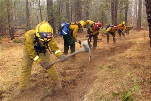
6 Limited Fire Management Resources 6 CASI ASTRO 2018, May 16th, Québec, Canada
 Rate of Spread (ROS) 7 7 CASI ASTRO 2018, May 16th, Québec,")
7 Fire Characterization Data Hotspot Locations Fire Radiative Power (FRP) Rate of Spread (ROS) 7 7 CASI ASTRO 2018, May 16th, Québec, Canada

8 Measurements Needed by the Users Fire characterization data: Every 2 3 hours; Of every point in Canada; For fires as small as 15 m by 15 m; Available within 30 min. after data acquisition. Only possible from space With a constellation of satellites 8 CASI ASTRO 2018, May 16th, Québec, Canada


9 Hotspot Data Currently Available From Satellite Remote Sensing MODIS VIIRS AVHRR Sentinel GOES 9 CASI ASTRO 2018, May 16th, Québec, Canada
10 Limitations of Available Satellite Infrared Data Saturation issues; Insufficient temporal or spatial resolution; Data latency; Time of measurement in the day; Coverage of Canadian forests. 10 CASI ASTRO 2018, May 16th, Québec, Canada
 infrared detector Sensitivity that is good-enough for fire application 11 CASI ASTRO 2018, May 16th, Québec,")
11 Technology Needed Current systems rely on cooled Infra-red detectors: High sensitivity Overkill for fire monitoring High accommodation needs (mass, volume and power) Not suitable for constellations Canadian microbolometer technology Low-resource (uncooled) infrared detector Sensitivity that is good-enough for fire application 11 CASI ASTRO 2018, May 16th, Québec, Canada
12 CSA Investment History 1995 Start of Canada investing in the development of microbolometer technology for thermal imaging 2007 Start of CSA investing in the development of microbolometer technology for the fire application Technology demonstration of early design in space 1 Was designed for Long-Wave InfraRed (LWIR) so exhibited less adequate performance at Mid-Wave InfraRed (MWIR); Without in-flight calibration capability 2016 Completion of feasibility study (CWFMS 2 ) of a Canadian microsatellite with the latest microbolometer technology Optimum designs for Long-Wave and Mid-Wave InfraRed (LWIR/MWIR) measurements 1. The New InfraRed Sensor Technology (NIRST) was demonstrated with partial results on the NASA Aquarius mission on-board the Argentine SAC-D spacecraft from CWFMS Canadian Wildland Fire Monitoring System 12 CASI ASTRO 2018, May 16th, Québec, Canada
13 CWFMS Three-Step Implementation Approach 13 CASI ASTRO 2018, May 16th, Québec, Canada
14 CWFMS Three-Step Implementation Approach Scheduled for summer CASI ASTRO 2018, May 16th, Québec, Canada
15 CWFMS Three-Step Different Implementation options Approach Scheduled for summer 2019 under consideration 15 CASI ASTRO 2018, May 16th, Québec, Canada
16 CWFMS Three-Step Different Implementation options Approach Scheduled for summer 2019 under consideration 9 sat constellation can provide scan of whole of Canada every 2-3 hours (commercial service?) 16 CASI ASTRO 2018, May 16th, Québec, Canada
17 STEP 2: Demonstration in Space - Options Considered Canadian Single Proto- Operational Microsatellite Mission Canadian Tech Demo Nanosatellite Mission Hosting Canadian instrument (microbolometer package) on Belgian Satellite Microsat Nanosat Payload only 17 CASI ASTRO 2018, May 16th, Québec, Canada
18 Conclusion There is a need for frequent fire monitoring data; A low-cost satellite system solution exists, based on microbolometer technology: Sensitivity good-enough for this application; Combining relatively high spatial/temporal resolution. An airborne campaign is in preparation for summer 2019; Discussions are on-going with Belgium/ESA for a space demonstration opportunity. 18 CASI ASTRO 2018, May 16th, Québec, Canada


19 Organizations involved to date 19 CASI ASTRO 2018, May 16th, Québec, Canada
20 Contact Information For more information, please contact: Helena (Marleen) van Mierlo Canadian Space Agency (CSA) Tel : (450) / helena.vanmierlo@canada.ca 20 CASI ASTRO 2018, May 16th, Québec, Canada
21 Back-up Slides 21 CASI ASTRO 2018, May 16th, Québec, Canada
22 Relevant Wavelengths measured in the infrared and visible spectrum Spectral Band (μm) Purpose Visible Near Infrared (VNIR) Short-Wave Infrared (SWIR) Cloud mapping Burned area mapping To improve burned area mapping To obtain ENERGY Mid-Wave Infrared (MWIR) Long-Wave Infrared (LWIR) High Temperature Event (HTE) detection Fire Radiative Power (FRP) measurement Surface temperature characterization False detection (sun-glint) identification Cloud rejection Bi-spectral methods for sub-pixel fire characterization CASI ASTRO 2018, May 16th, Québec, Canada
 41 Volume (mm 3 ) 200 x 536 x 534 Orbit Average Power (W) 16 Peak Power (W) 75 Spectral band (μm) Purpose GSD (m) Sensitivity Dynamic Range MWIR 3.5-4.")
 identification, cloud rejection and bispectral methods for sub-pixel fire characterization. 400 NETD < 0.")
23 Current State of the Art Payload with 3 MWIR + 3 LWIR cameras will provide daily global map; Each camera s detector is a linear array of 1017x3 pixels; Payload Accommodation Needs Mass (kg) 41 Volume (mm 3 ) 200 x 536 x 534 Orbit Average Power (W) 16 Peak Power (W) 75 Spectral band (μm) Purpose GSD (m) Sensitivity Dynamic Range MWIR For High Temperature Event (HTE) Detection and Fire Radiative Power (FRP) measurement NETD < K K LWIR Surface temperature characterization, false detection (sun-glint) identification, cloud rejection and bispectral methods for sub-pixel fire characterization. 400 NETD < K K 23 CASI ASTRO 2018, May 16th, Québec, Canada
Interim evaluation of the New IR Sensor Technology (NIRST) as a wildfire monitoring tool
 as a wildfire monitoring tool") Interim evaluation of the New IR Sensor Technology (NIRST) as a wildfire monitoring tool Joshua Johnston Forest Fire Analyst Canadian Forest Service Great Lakes Forestry Centre Sault Ste. Marie, Ontario
Interim evaluation of the New IR Sensor Technology (NIRST) as a wildfire monitoring tool Joshua Johnston Forest Fire Analyst Canadian Forest Service Great Lakes Forestry Centre Sault Ste. Marie, Ontario
Wildfire Mapping Using FireBIRD Data
 Wildfire Mapping Using FireBIRD Data Global Wildfire Information System (GWIS) GOFC GOLD Fire IT 20-23 rd November 2017, Cumberland Lodge Christian Fischer on behalf of the FireBIRD-Team German Aerospace
DETECTION AND MONITORING OF ACTIVE FIRES USING REMOTE SENSING TECHNIQUES
 DETECTION AND MONITORING OF ACTIVE FIRES USING REMOTE SENSING TECHNIQUES Source: Unknown n.d., http://www.hotrodsandclassics.net/featuredpictures/featurepictures2.htm. by Claire Riddell DETECTION AND MONITORING
Verification and Validation of OOV-TET1 Multispectral Camera Observations within the FireBIRD Project
 DLR.de Chart 1 Verification and Validation of OOV-TET1 Multispectral Camera Observations within the FireBIRD Project O. Frauenberger **, A. Börner *, E. Borg **, W Halle *, E. Lorenz *, S. Mitchell *,
the EU-Japan Support Mission in the Space Sector
 Astro- und Feinwerktechnik Adlershof GmbH the EU-Japan Support Mission in the Space Sector 07 th of September 2017 Sapporo, Japan Dr.-Ing. Sebastian Scheiding s.scheiding@astrofein.com www.astrofein.com
Recent Developments and Prospects for Innovative Remote Sensing of High-Temperature Events and Vegetation Fire Impacts
 Recent Developments and Prospects for Innovative Remote Sensing of High-Temperature Events and Vegetation Fire Impacts by D. Oertel, E. Lorenz, B. Zhukov German Aerospace Center, (DLR-OS) Berlin Adlershof
A temporal active fire detection algorithm applied to geostationary satellite observations
 8 th 10 th June LSA-SAF Workshop 2015 A temporal active fire detection algorithm applied to geostationary satellite observations Gareth Roberts (University of Southampton) Outline Active fire detection
GOFC/GOLD Fire IT Strategic Planning. Day 1 - Break Out Group Discussion
 GOFC/GOLD Fire IT Strategic Planning Day 1 - Break Out Group Discussion Aims of the Fire IT refining and articulating the international requirements for fire related observations making the best possible
DEVELOPMENT OF THE INFRARED INSTRUMENT FOR GAS DETECTION
 DEVELOPMENT OF THE INFRARED INSTRUMENT FOR GAS DETECTION Ching-Wei Chen 1, Chia-Ray Chen 1 1 National Space Organization, National Applied Research Laboratories ABSTRACT MWIR (Mid-Wave Infrared) spectroscopy
Optech Thermal IR Sensing Solutions Expanding the Industry
 Optech Thermal IR Sensing Solutions Expanding the Industry Optech Overview Strategic Growth through acquisitions of camera manufacturers 20 Years of Patented & Proven Camera System Experience Broader Imaging
[Some] Updates on Research into Fire Radiative Power & Energy
![[Some] Updates on Research into Fire Radiative Power & Energy](/thumbs/89/100768239.jpg "[Some] Updates on Research into Fire Radiative Power & Energy") Environmental Monitoring & Modelling Research Group [Some] Updates on Research into Fire Radiative Power & Energy Presented by Martin Wooster (Kings College London, UK) Slide contributions from many others
Environmental Monitoring & Modelling Research Group [Some] Updates on Research into Fire Radiative Power & Energy Presented by Martin Wooster (Kings College London, UK) Slide contributions from many others
Band Selection & Algorithm Development for Remote Sensing of Wildland Fires
 Band Selection & Algorithm Development for Remote Sensing of Wildland Fires Andy Fordham Chester F. Carlson Center for Imaging Science Rochester Institute of Technology Rochester, New York 14623-5604 ajf8207@cis
Results on verification and validation of OOV-TET1 multispectral camera observations within the FireBIRD project
 Results on verification and validation of OOV-TET1 multispectral camera observations within the FireBIRD project O. Frauenberger **, E. Borg **, A. Börner *, W Halle *, E. Lorenz *, S. Mitchell *, C. Paproth
Fire Detection and Monitoring
 Fire Detection and Monitoring Akli Benali Forest Research Center, University of Lisbon aklibenali@gmail.com Conference & Summer School on Forest Fire Management Istituto Superiore Antincendi, Rome, September
Technological developments in infrared imaging: a fast growing market Dr. François Simoens, CEA-Leti, Marketing & Strategy Manager
 Technological developments in infrared imaging: a fast growing market Dr. François Simoens, CEA-Leti, Marketing & Strategy Manager Outline As a reminder, main infrared applications and technologies IR
Global Biomass Burning Emissions from a Constellation of Geostationary Satellites for Global Model Forecast Applications
 1 Global Biomass Burning Emissions from a Constellation of Geostationary Satellites for Global Model Forecast Applications Shobha Kondragunta NOAA/NESDIS Center for Satellite Applications and Research
How SWIR Imaging contributes to the optimization of automatic quality control in the food industry
 How SWIR Imaging contributes to the optimization of automatic quality control in the food industry 2013 Overview Xenics in Short New Architecture Products Line Overview Visionlink Infrared Seminar 2013
SEVIRI/MSG sensor early fire detection performances assessment
 SEVIRI/MSG sensor early fire detection performances assessment G. Laneve, E. Cadau CRPSM Università di Roma La Sapienza e-mail: laneve@psm.uniroma1.it 2 nd GOFC/GOLD Workshop on GEO Fire Monitoring, Darmstadt,
Use of new spatially refined satellite remote sensing fire detection data in support of advanced wildfire mapping and modeling
 Use of new spatially refined satellite remote sensing fire detection data in support of advanced wildfire mapping and modeling Dr. Wilfrid Schroeder 1 Dr. Janice Coen 2 Dr. Patricia Oliva 1 Dr. Louis Giglio
GOES-R AWG Land Team: Fire Detection and Characterization
 GOES-R AWG Land Team: Fire Detection and Characterization June 8, 2010 Presented By: Christopher C. Schmidt 1 1 UW-Madison/SSEC/CIMSS 1 FIRE Product Team AWG Land Team Chair: Yunyue (Bob) Yu FIRE Product
2018 New Infrared Technologies, S.L.
 www.niteurope.com info@niteurope.com Plataforma tecnológica Española de Fotónica (Fotónica 21) Plataforma Tecnológica Española del Acero (Platea) Workshop Soluciones Fotónicas para la siderurgia AIMEN
S-NPP/VIIRS and Landsat-8/OLI Global Active Fire Data Sets
 S-NPP/VIIRS and Landsat-8/OLI Global Active Fire Data Sets Wilfrid Schroeder Louis Giglio, Pierre Guillevic, William Walsh (Dept of Geographical Sciences/UMD) Janice Coen (NCAR/Boulder) Ivan Csiszar (NOAA/NESDIS/STAR)
ALBERTA FOREST PROTECTION THERMAL INFRARED PROGRAM
 ALBERTA FOREST PROTECTION THERMAL INFRARED PROGRAM Eleventh Biennial USDA Forest Service Remote Sensing Applications Conference Salt Lake City, Utah April 25 Ken Dutchak, P. Biol. Reconnaissance and Remote
VIIRS FIRE PRODUCTS UPDATE
 VIIRS FIRE PRODUCTS UPDATE Ivan Csiszar 1, Wilfrid Schroeder 2, Louis Giglio 2, Brad Wind 2, Evan Ellicott 2, Christopher O. Justice 2 1 NOAA/NESDIS Center for Satellite Applications and Research, Camp
The operational MSG SEVIRI fire radiative power products generated at the Land-SAF
 Environmental Monitoring & Modelling Research Group The operational MSG SEVIRI fire radiative power products generated at the Land-SAF Martin Wooster, Gareth Roberts, Weidong Xu, Patrick Freeborn, Jianping
The new generation Teledyne NIR detectors for the SNAP/JDEM mission spectrograph.
 The new generation Teledyne NIR detectors for the SNAP/JDEM mission spectrograph. 1 Outline The SNAP/JDEM mission The SNAP/JDEM spectrograph and the IR spectrograph detector requirements R&D program for
National Infrared Operations (NIROPS) Program Overview. Tom Mellin National Infrared Program Manager
 Program Overview. Tom Mellin National Infrared Program Manager") National Infrared Operations (NIROPS) Program Overview Tom Mellin National Infrared Program Manager Topics NIROPS organization Phoenix imaging system Aircraft Data delivery to infrared interpreters IRIN
National Infrared Operations (NIROPS) Program Overview Tom Mellin National Infrared Program Manager Topics NIROPS organization Phoenix imaging system Aircraft Data delivery to infrared interpreters IRIN
Detection and analysis of high-temperature events in the BIRD mission
 Acta Astronautica 56 (2005) 65 71 www.elsevier.com/locate/actaastro Detection and analysis of high-temperature events in the BIRD mission Boris Zhukov, Klaus Briess, Eckehard Lorenz, Dieter Oertel, Wolfgang
Rapid Prototyping of NASA Next Generation Sensors for the SERVIR System of Fire Detection in Mesoamerica
 Rapid Prototyping of NASA Next Generation Sensors for the SERVIR System of Fire Detection in Mesoamerica Joel S. Kuszmaul, Henrique Momm, Greg Easson University of Mississippi, University, MS 38677 Timothy
THE NORTHSTAR SYSTEM: A NEW ERA IN EARTH OBSERVATION
 THE NORTHSTAR SYSTEM: A NEW ERA IN EARTH OBSERVATION Daniel O Connell 1, Derek R. Peddle 2, 6, Stewart Bain 3, Douglas W. Bancroft 4, Kjell Stakkestad 5,7 NorthStar, Montréal, Québec, Canada. http://www.northstar-data.com
Global fire hotspots detected by NASA satellite to help United Nations
 Global fire hotspots detected by NASA satellite to help United Nations Published on 24 Sep 2010 is Image NASA's not found Moderate or type unknown Resolution Imaging Spectroradiometer (MODIS), an instrument
ONDULUS IR SIMULATION MATERIALIZE. CUSTOMIZE. SIMULATE
 SIMULATION ONDULUS IR MATERIALIZE. CUSTOMIZE. SIMULATE Ondulus IR gives simulations and training scenarios a critical component: physics-based infrared sensors. By adding real-time, high-quality materials-based
There are various resources and toolkits available to perform this task.
 Hands-On Exercise: Wildfires in Chile, January 2017 Task description Imagine you are analyst that has been assigned to the fire Las Maquinas burning in the vicinity of Constitución, in the Maule region
Validating the TET-1 satellite sensing system in detecting and characterizing active fire hotspots
 Validating the TET-1 satellite sensing system in detecting and characterizing active fire hotspots A thesis submitted in fulfilment of the requirements for the degree of Master of Science Simon Stuart
University of Puerto Rico at Mayagüez Direct Broadcast Polar Orbiter Workshop
 University of Puerto Rico at Mayagüez Direct Broadcast Polar Orbiter Workshop 27 April 2016 Lab 2 Part 4: Investigating VIIRS and MODIS Fire Detection Capabilities 1.1. Use Hydra to open the VIIRS directory
Long-term Inventory of Fire Burned Areas and Emissions of North America s Boreal and Temperate Forests
 Long-term Inventory of Fire Burned Areas and Emissions of North America s Boreal and Temperate Forests P.Gong, Z. Li, I. Csiszar, W. Hao, R. Fraser J.Z. Jin, R. Pu Objectives 1. Map burn scars in boreal
MULTI-FUNCTION InGaAs DETECTOR FOR SWIR IMAGING
 OPTRO-214-293312 MULTI-FUNCTION InGaAs DETECTOR FOR SWIR IMAGING Lior Shkedy (1), Alina Koifman (1), Avihoo Giladi (1), Avi Tuito (2), Elad Ilan (1), Ilana Grimberg (1), Itay Hirsh (1), Leonid Bykov (1),
T2SL technology for Mid-IR detectors
 T2SL technology for Mid-IR detectors Linda Höglund Minerva Workshop June, 30 th 1 Outline Introduction Tasks in MINERVA Starting point: MW detectors 320 256 on 30 µm pitch Technologies developed in MINERVA
UNCOOLED MICROBOLOMETER DETECTOR : RECENT DEVELOPMENTS AT ULIS
 Thermogram 2005 1 UNCOOLED MICROBOLOMETER DETECTOR : RECENT DEVELOPMENTS AT ULIS J.L. Tissot, B. Fièque, C. Trouilleau, A. Crastes, O. Legras ULIS BP 27 38113 Veurey-Voroize, France jl.tissot@ulis-ir.com
P1.9 CHARACTERIZING AND UNDERSTANDING THE DIFFERENCES BETWEEN GOES WF_ABBA AND MODIS FIRE PRODUCTS AND IMPLICATIONS FOR DATA ASSIMILATION
 P1.9 CHARACTERIZING AND UNDERSTANDING THE DIFFERENCES BETWEEN GOES WF_ABBA AND MODIS FIRE PRODUCTS AND IMPLICATIONS FOR DATA ASSIMILATION Jay P. Hoffman 1 *, Elaine M. Prins 1, Christopher C. Schmidt 1,
Elaine M. Prins* NOAA/NESDIS, Office of Research and Applications, Advanced Satellite Products Branch (ASPB) Madison, WI
 Madison, WI") P4.6 Global Geostationary Fire Monitoring System Elaine M. Prins* NOAA/NESDIS, Office of Research and Applications, Advanced Satellite Products Branch (ASPB) Madison, WI Donna McNamara NOAA/NESDIS, Office
P4.6 Global Geostationary Fire Monitoring System Elaine M. Prins* NOAA/NESDIS, Office of Research and Applications, Advanced Satellite Products Branch (ASPB) Madison, WI Donna McNamara NOAA/NESDIS, Office
Physical concepts. Remote sensing of fires and vegetation. Applications of SEVIRI channels.
 Physical concepts Remote sensing of fires and vegetation Applications of SEVIRI channels jose.prieto@eumetsat.int Contents Applications of SEVIRI channels Characteristics of the 3.9µm channel Differences
Satellite Derived Fire Products for Biomass Burning Studies
 Satellite Derived Fire Products for Biomass Burning Studies Chris Justice University of Maryland and colleagues Fires in Indochina April 6 2010 ( NASA MODIS Aqua) THE GLOBAL FIRE PRODUCT (1992 93) bioval.jrc.ec.europa.eu/
CO 2, CH 4 and CO Observa0ons from CrIS on S-NPP and JPSS-1
 CO 2, CH 4 and CO Observa0ons from CrIS on S-NPP and JPSS-1 Xiaozhen (Shawn) Xiong 1,2, Lihang Zhou 2 Antonia Gambacorta 1,3, Nick Nalli 1,2, Changyi Tan 1,2 Flavio Iturbide-Sanchez 1,2, Kexing Zhang 1,2
Methane to Markets Oil and Natural Gas Technology Transfer Workshop
 Methane to Markets Oil and Natural Gas Technology Transfer Workshop Detection and Measurement of Fugitive Emissions Using Airborne Differential Absorption Lidar (DIAL) Daniel Brake ANGEL Service ITT Space
EMITTER TECHNICAL DATA
 1 - INFRARED HALOGEN HEATER EMITTERS- INFRARED RADIATION 1.1 - ELETROMAGNETIC SPECTRUM Light can be defined as an electromagnetic wave within the range of 100nm to 100 000nm (1mm). The spectrum s limits
Source Test and Characterization Program
 Source Test and Characterization Program Presented at the 24th Meeting on Characterization and Radiometric Calibration for Remote Sensing (CALCON Technical Meeting) 2015 The Aerospace Corporation Ray Russell,
The FireBird mission - a scientific mission for Earth observation and hot spot detection
 The FireBird mission - a scientific mission for Earth observation and hot spot detection Terzibaschian, Thomas Reile, H., Lorenz, E. DLR, Germany 9th IAA SYMPOSIUM ON SMALL SATELLITES FOR EARTH OBSERVATION,
Analysing Threshold Value in Fire Detection Algorithm Using MODIS Data
 RESEARCH PAPER Analysing Threshold Value in Fire Detection Algorithm Using MODIS Data 1 Bowo E. Cahyono, 2 Peter Fearns, and 3 Brendon McAtee 1 Department of Physics, Jember University, Indonesia; 2 Department
A Data Set for Fire and Smoke Model Development and Evaluation-- RxCADRE
 Data Set for Fire and Smoke Model Development and Evaluation-- RxCDRE Roger Ottmar Pacific Wildland Fire Sciences Laboratory Pacific Northwest Research Station Seattle, W RxCDRE History 2007--Core Fire
Review of MTG FDHSI Mission Requirements Regarding Fire Applications
 Review of MTG FDHSI Mission Requirements Regarding Fire Applications Dr M.J. Wooster and Dr G. Roberts Environmental Monitoring and Modelling Group, Department of Geography King s College London Document
PARALLEL USE OF SEVIRI LSA SAF FRP AND MPEF FIR PRODUCTS FOR FIRE DETECTION AND MONITORING
 PARALLEL USE OF SEVIRI LSA SAF FRP AND MPEF FIR PRODUCTS FOR FIRE DETECTION AND MONITORING C. G. Georgiev, J. S. Stoyanova National Institute of Meteorology and Hydrology, Bulgarian Academy of Sciences
Application Note. Which characterization method is best for your application? The Future of Thermal Imaging is Here!!!
 Microsanj LLC 3287 Kifer Road Santa Clara, CA 95051 Application Note Comparing Thermoreflectance (TTI), Infrared (IR), Near Infrared Emission (EMMI), and Optical Beam Induced Resistance Change (OBIRCH)
Passive Standoff FTIR Detectors as Transducers. Background From radiation to information
 Slide 1 of 27 Passive Standoff Fourier-Transform Infrared Detectors as Transducers Richard J. Green, PhD, Advanced Technology Branch, West Desert Test Center, Dugway Proving Ground, UT 84022 Slide 2 of
PYROsmart. The intelligent infrared early fire detection and extinguishing system
 The intelligent infrared early fire detection and extinguishing system The revolution in the sector of preventive fire monitoring they happen! Fires can break out unexpectedly when storing waste in incinerators
CCTV, HOW DOES IT WORK?
 August 25, 2005 CCTV FLAME DETECTION Video flame detection is an attractive concept. We ve all heard the adage, seeing is believing. In short, we trust our eyes to deliver accurate information. New designs
Fundamentals of Far-infrared
 Fundamentals of Far-infrared CHEAH Kok Wai ( 谢国伟 ) Department of Physics Centre for Advanced Luminescence Materials Hong Kong Baptist University Kowloon Tong Contents The Atmosphere Definition of Far-infrared
Leakage detection in hydraulic and pneumatic systems through infrared thermography and CO2 as tracer gas
 Leakage detection in hydraulic and pneumatic systems through infrared thermography and CO2 as tracer gas Borja Rodríguez 1, Rosario Fernández 1, Mario Lahera 2, Fernando Lasagni 1 1 Materials & Processes
FIRE DETECTION AND MONITORING USING AVHRRA AND MSG SYSTEMS. Version Tuesday, 1.0, 1530 November Slide: 1
 FIRE DETECTION AND MONITORING USING AVHRRA AND MSG SYSTEMS Version Tuesday, 1.0, 1530 November 2005 2004 Slide: 1 Botswana early warning system Version Tuesday, 1.0, 1530 November 2005 2004 Slide: 2 Objectives
Stand-off Detection of Trace Explosives by Infrared Photothermal Imaging. Trace Contamination
 Stand-off Detection of Trace Explosives by Infrared Photothermal Imaging Chris Kendziora, Robert Furstenberg, Michael Papantonakis, Jennifer Stepnowski, Viet Nguyen and R. Andrew McGill US Materials and
From Marine Pollution to Inland. Wildfire Mapping
 From Marine Pollution to Inland Louis Armstrong Wildfire Mapping The Mobilization of the National Aerial Surveillance Program (NASP) in support of the Fort McMurray Wildfires TC Chief, Intelligence, Surveillance
NEAR REAL TIME DETECTION OF BURNED SCAR AREA USING LANDSAT-8 IMAGERIES
 NEAR REAL TIME DETECTION OF BURNED SCAR AREA USING LANDSAT-8 IMAGERIES Danang Surya Candra Kustiyo - Indonesian National Institute of Aeronautics and Space (LAPAN) - Outline INTRODUCTION: Background, Problems,
Defense Technical Information Center Compilation Part Notice
 UNCLASSIFIED Defense Technical Information Center Compilation Part Notice ADP010827 TITLE: Characteristics of Infrared Detectors for Spece Applications DISTRIBUTION: Approved for public release, distribution
1.1. SYSTEM MODELING
 1 INTRODUCTION Electro-optical imaging system analysis is a mathematical construct that provides an optimum design through appropriate trade studies. A comprehensive model includes the target, background,
GOES-R ABI Emissive IR Bands Radiometric Performance Monitoring and Trending
 GOES-R ABI Emissive IR Bands Radiometric Performance Monitoring and Trending Haifeng Qian a, Robert Iacovazzi a, Xiangqian Wu b, Boryana Efremova a, Fangfang Yu a, Xi Shao a a ERT, Inc. Laurel, MD 20707
Uncooled Infrared Imaging Market : Commercial & Military applications
 Uncooled Infrared Imaging Market : Commercial & Military applications Sample report BAE FLIR Fluke FLIR Samsung Techwin Opgal 2011 Table of Contents (1/3) Table of Contents Glossary Companies mentioned
Cooled and uncooled infrared detectors for missile seekers
 Cooled and uncooled infrared detectors for missile seekers Rami Fraenkel, Jacob Haski, Udi Mizrahi, Lior Shkedy and Itay Shtrichman SemiConductor Devices P.O. Box 2250, Haifa 31021, Israel Ephraim Pinski
Wildland fire phenomenology experiments:
 Wildland fire phenomenology experiments: 2001-2002 RIT: Bob Kremens Stef VanGorden Andy Fordham Bryce Nordgren Dave Pogolarza Adam Cisz RMSC: Dan Latham Colin Hardy Brett Butler We plan to measure unknown
Uncooled Infrared Imaging: Higher Performance, Lower Costs
 PRELIMINARY Access to the world s leading infrared imaging technology www.sofradir-ec.com Sofradir EC, Inc. Background Manufacturers of infrared cameras find a wide choice of uncooled infrared cores available
The Role of Satellite Observations in Assessing Impacts of Wildfire Occurrence on Respiratory Health of Population
 The Role of Satellite Observations in Assessing Impacts of Wildfire Occurrence on Respiratory Health of Population Tatiana Loboda University of Maryland Outline Wildfire and human health Interdisciplinary
Ivan Csiszar, Martin Wooster
 Global Geostationary Network Ivan Csiszar, Martin Wooster Recommendations from 2 nd workshop Research and Product Development Continue data fusion efforts and characterization Encourage products based
Strategic Research Agenda for. High-Altitude Aircraft and Airship. Remote Sensing Applications
 Strategic Research Agenda for USE HAAS High-Altitude Aircraft and Airship Remote Sensing Applications Christian Barbier (CSL, B), Bavo Delauré (VITO, B), Arie Lavie (CTI, Is) 1 OUTLINE 1. The USE HAAS
Presentation Title October 18, Physical Sciences Inc. 20 New England Business Center Andover, MA Outline
 Physical Sciences Inc. Standoff detection of trace level explosive residue using passive LWIR hyperspectral imaging B.R. Cosofret, T.E. Janov, M. Costolo, S. Chang, W.J. Marinelli, R. Moro, D. Brown, and
Dräger UCF 7000 Thermal Imaging Camera
 Dräger UCF 7000 Thermal Imaging Camera Today, any call could potentially bring you into a hazardous area. The Dräger UCF 7000 thermal imaging camera is intrinsically safe and offers new levels of security
Daytime Fire Detection Using Airborne Hyperspectral Data Philip E. Dennison 1 and Dar A. Roberts 2. University of Utah, Salt Lake City, UT 84112, USA
 Daytime Fire Detection Using Airborne Hyperspectral Data Philip E. Dennison 1 and Dar A. Roberts 2 1 Department of Geography and Center for Natural and Technological Hazards, University of Utah, Salt Lake
Smart Fire Prevention
 Smart Fire Prevention Using VIP Vision Thermal Cameras to Detect Fire Release 1.0 Contents 1 Introduction to Thermal Imaging... 2 2 Detecting Fires with VIP Vision Thermal Cameras... 3 2.1 Mode Selection...
DEMONSTRATION OF A SEMI-OPERATIONAL FIRE RECOGNITION SERVICE USING BIRD MICRO- SATELLITE - DEMOBIRD
 DEMONSTRATION OF A SEMI-OPERATIONAL FIRE RECOGNITION SERVICE USING BIRD MICRO- SATELLITE - DEMOBIRD Jesús Gonzalo, Gonzalo Martín de Mercado Ingeniería y Servicios Aeroespaciales, S.A. (INSA), Spain Paseo
NFPA 70B and CSA Z463 Standards for Electrical Maintenance Where Does Airborne Ultrasound Fit In?
 NFPA 70B and CSA Z463 Standards for Electrical Maintenance Where Does Airborne Ultrasound Fit In? Adrian Messer, Manager of US Operations UE Systems, Inc. Ph: 864-224-4517 Cell: 914-282-3504 Web: www.uesystems.com
 www.inpe.br/queimadas This (short) presentation will stress: - Interaction with users; - GOES-16 detections A system with dozens of diferent products www.inpe.br/queimadas Our new portal CIMAN combines
Overview of the WF_ABBA Global Geostationary Fire Monitoring Program: Current Implementation and Future Plans
 Overview of the WF_ABBA Global Geostationary Fire Monitoring Program: Current Implementation and Future Plans Elaine M. Prins Consultant Christopher C. Schmidt Jay Hoffman Jason Brunner UW-Madison SSEC
Wildfire detection in western Canada: trends and innovations
 FINAL REPORT March 2014 Wildfire detection in western Canada: trends and innovations Ray Ault Wildfire Operations Research INTRODUCTION The Government of the rthwest Territories (GNWT) asked FPInnovations
Room Temperature MWIR FPAs: Return of the Lead Salts?
 Approved for public release; distribution is unlimited. Room Temperature MWIR FPAs: Return of the Lead Salts? Steven Jost, John Kuppenheimer and Greg Dudoff Sanders, A Lockheed Martin Company, Nashua,
Coal Pile Fire Monitoring System
 Coal Pile Fire Monitoring System Land Instruments International Over 60 years experience Specialists in Infrared Temperature Measurement Combustion Efficiency & Environmental Emissions Monitoring Joined
A 2 K Active Magnetic Regenerative Refrigeration System for Remote Cooling
 A 2 K Active Magnetic Regenerative Refrigeration System for Remote Cooling W. Chen, J. A. McCormick, M. V. Zagarola Creare Inc. Hanover, NH 03755 ABSTRACT This paper reports on the development of an Active
Imaging detection of CO 2 using a bispectral type-ii superlattice infrared camera
 11 th International Conference on Quantitative InfraRed Thermography Imaging detection of using a bispectral type-ii superlattice infrared camera by F. Rutz*, R. Rehm*, A. Wörl*, J. Schmitz*, M. Wauro*,
Space-borne high resolution fire remote sensing in Benin, West Africa
 INT. J. REMOTE SENSING, 10 JUNE, 2004, VOL. 25, NO. 11, 2209 2216 Space-borne high resolution fire remote sensing in Benin, West Africa D. OERTEL, B. ZHUKOV DLR-Institute of Space Sensor Technology and
Bringing Smarts to Methane Emissions Detection
 Bringing Smarts to Methane Emissions Detection An Update on the DOE Smart Methane Emissions Project Maria Araujo Manager R&D Southwest Research Institute Background Fugitive emissions from compressors
A Novel Approach for a Hostile Arms Fire Sensor
 UNCLASSIFIED: Dist A. Approved for public release Joseph Rudy Montoya, PhD and Jorge Melchor US Army Research Laboratory-SLAD White Sands Missile Range, NM Venu Siddapureddy and Darryl Bryk US Army RDECOM-TARDEC
FIRE-RS Project A Nanosatellite & UAVs hybrid system for wildfire characterization.
 FIRE-RS Project A Nanosatellite & UAVs hybrid system for wildfire characterization. Fernando Aguado, Franco Pérez, Diego Nodar López, Alberto González, Miguel Castro Rome 04/12/2017 II Congreso de Ingneniería
Date: Wednesday, January 31, 2018 Time: 8:30 am 5:00 pm Location: Moscone West (Room 2018, Level 2)
") Optics Lasers Detectors FREE WORKshops Date: Wednesday, January 31, 2018 Time: 8:30 am 5:00 pm Location: Moscone West (Room 2018, Level 2) The team from LASER COMPONENTS is holding a free one-day workshop
Optics Lasers Detectors FREE WORKshops Date: Wednesday, January 31, 2018 Time: 8:30 am 5:00 pm Location: Moscone West (Room 2018, Level 2) The team from LASER COMPONENTS is holding a free one-day workshop
Measurement of Light. Photosensors
 Measurement of Light Photosensors Detection of light is a basic need for everything from devices to plants and animals. In the case of animals, light detection systems are very highly specialized, and
SOLAR CELL PRODUCTION REQUIRES EFFECTIVE METROLOGY
 SOLAR CELL PRODUCTION REQUIRES EFFECTIVE METROLOGY 6/12/2010 Recent IR Thermography Developments Can Help Agenda: Infrared Cameras for Solar Cell Inspection Survey of current solar cell test methods New
Broadening IR applications through using spectral filters
 Broadening IR applications through using spectral filters Inframetrics-Europe, Meche/sesteenweg 277, B-1800 Vilvoorde, Belgium Tel. (32) 2 257 90 30, Fax. (32) 2 257 90 39, e-mail: guy.pas@inframetrics.be
Fire-Implementation Team (Fire-IT) Update and Future Steps
 Update and Future Steps") Global Observation of Forest and Land Cover Dynamics Fire-Implementation Team (Fire-IT) Update and Future Steps Fire-IT Co-Chair: Chris Justice (U. Maryland) Fire-IT Executive Officer: Krishna Vadrevu
Global Observation of Forest and Land Cover Dynamics Fire-Implementation Team (Fire-IT) Update and Future Steps Fire-IT Co-Chair: Chris Justice (U. Maryland) Fire-IT Executive Officer: Krishna Vadrevu
Low-Frequency Raman Spectroscopy Enabling Affordable Access to the Terahertz Regime
 Low-Frequency Raman Spectroscopy Enabling Affordable Access to the Terahertz Regime James Carriere and Frank Havermeyer Ondax, Inc: Booth #48 SCIX/FACSS: 10/3/2012 Paper 532 Motivation Low-frequency Raman
IR IN MODERN TECHNOLOGY 1. Infrared Radiation in Modern Technology. Brian D. Dold. Brigham Young University - Idaho
 IR IN MODERN TECHNOLOGY 1 Infrared Radiation in Modern Technology Brian D. Dold Brigham Young University - Idaho IR IN MODERN TECHNOLOGY 2 Abstract Infrared radiation (IR) is invisible to the human eye
Sentinel Asia Wildfire Monitoring
 Sentinel Asia Wildfire Monitoring Masami FUKUDA Institute of Low Temp. Sci. Hokkaido Univ. 3rd Sentinel Asia JPT Meeting 13 March 2007, Singapore Objective of Sentinel Asia Wildfire Monitoring Contribution
New Generation of UV, IR and γ - ray sensors with Carbon Nano-Tubes (CNT)
") New Generation of UV, IR and γ - ray sensors with Carbon Nano-Tubes (CNT) A. Filatzikioti a, N. Glezos b, c, G. Pilatos b, G. Romanos b, A. Spiliotis b, D.J. Stathopoulou a a National Technical University
New Generation of UV, IR and γ - ray sensors with Carbon Nano-Tubes (CNT) A. Filatzikioti a, N. Glezos b, c, G. Pilatos b, G. Romanos b, A. Spiliotis b, D.J. Stathopoulou a a National Technical University
Supplement of LSA SAF Meteosat FRP products Part 1: Algorithms, product contents, and analysis
 Supplement of Atmos. Chem. Phys., 15, 13217 13239, 2015 http://www.atmos-chem-phys.net/15/13217/2015/ doi:10.5194/acp-15-13217-2015-supplement Author(s) 2015. CC Attribution 3.0 License. Supplement of
Standardization of Remote Sensing Technology. Yuan-Yuan Jia. Academy of Opto-Electronics (AOE), CAS
, CAS") WGCV-36 Shanghai, China May 13-17, 2013 Standardization of Remote Sensing Technology Yuan-Yuan Jia 1 Academy of Opto-Electronics (AOE), CAS 2 Secretariat of National Technical Committee 327 on RS of Standardization
WGCV-36 Shanghai, China May 13-17, 2013 Standardization of Remote Sensing Technology Yuan-Yuan Jia 1 Academy of Opto-Electronics (AOE), CAS 2 Secretariat of National Technical Committee 327 on RS of Standardization