ALBERTA FOREST PROTECTION THERMAL INFRARED PROGRAM
|
|
|
- Kristina Mosley
- 5 years ago
- Views:
Transcription
1 ALBERTA FOREST PROTECTION THERMAL INFRARED PROGRAM Eleventh Biennial USDA Forest Service Remote Sensing Applications Conference Salt Lake City, Utah April 25 Ken Dutchak, P. Biol. Reconnaissance and Remote Sensing Unit Wildfire Aviation and Geomatics Section Operations Branch Alberta Forest Protection April 24-28, 2006 RS
2 OVERVIEW Who We Are Information Flow Why Thermal Infra-Red Information Definitions Imaging Operations Applications Modis Satellite Work System Testing Future Developments April 24-28, 2006 RS
3 WHO WE ARE: Alberta Forest Protection, a part of Alberta Sustainable Resource Development. Our responsibility is to protect Alberta's forests and forest communities by preventing and suppressing wildfires. ICS 412 Permanent Staff April 24-28, 2006 RS


4 630,000 km 2 420,000 km 2 forest land > 3,000,000 residents 365 Cities, towns and communities Considerable resource investment Oil and Gas Forestry Recreation April 24-28, 2006 RS
5 THERMAL INFORMATION REQUEST PROCESS IR Coordinator April 24-28, 2006 RS
6 WHY USE THERMAL? April 24-28, 2006 RS

7 VISIBLE WAVELENGTH April 24-28, 2006 RS

8 THERMAL IR WAVELENGTH April 24-28, 2006 RS
9 NORMAL COLOR IMAGE INFRARED IMAGE April 24-28, 2006 RS


10 NORMAL COLOR IMAGE INFRARED IMAGE April 24-28, 2006 RS
11 INFORMATION DEFINITIONS Hotspot: Area of remnant heat > 300 degrees C. and 25 cm in size. Burning Area: Extensive areas of active burning or Collection of Hotspots whose individual mapping/recording would over complicate mapping Fire Perimeter: Maximum extent of fire destroyed vegetation as identified through the collation of successive burning areas or identification of charred area, post burn. April 24-28, 2006 RS

12 EXAMPLES: Hot Spots Active Burning Area Fire Perimeter April 24-28, 2006 RS
13 IMAGING OPERATIONS Hand-helds Rotary Wing Operations Fixed Wing Operations AWIS Bird Dog Satellite Operations April 24-28, 2006 RS


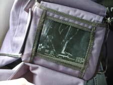
14 HANDHELD UNITS AGEMA Thermal Vision 510 S April 24-28, 2006 RS

15 Visible Thermal Ground based investigations, or air craft with limited aerial coverage needs. April 24-28, 2006 RS


16 ROTARY WING Rotary Wing 6-8 Companies of 20 can provide TIR services Courtesy of Remote Helicopters Ltd. April 24-28, 2006 RS
17 DESIRED PRODUCT - Black Perimeter Trace -GPS Locations of Hotspots -Tabular and digital data April 24-28, 2006 RS

18 Crumb Trail as Evidence of Assessment Coverage April 24-28, 2006 RS


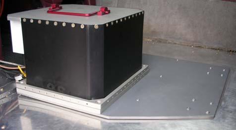
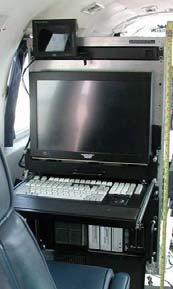
19 FIXED WING Airborne Wildfire Information System (AWIS) April 24-28, 2006 RS
20 PROPOSED AWIS IMAGING OPTIONS Optional Detection Small areas of high detection needs m resolution BH lines or fires with high risk of brake-out or UC Mop up etc. Detection - Monitoring - Large areas of coverage 1 2 m resolution BH lines or fires Large areas in a short amount of time m resolution UC or BH fires Extreme Monitoring Very large areas in a very short period 7 30 m resolution April 24-28, 2006 RS
21 PRODUCT FLOW 2 hrs. 6 AM. April 24-28, 2006 RS
22 April 24-28, 2006 RS

23 > C > 25 cm. + 5m RMSE 8 bid data Nad 83 UTM 11, 12 or 10TM with offset AWIS April 24-28, THERMAL 2006 SCAN MOSAIC RS


24 WEEKLY ACTIVITY REPORT THERMAL MISSION REPORT April 24-28, 2006 RS


25 FIXED WING - FOREST PROTECTION BIRD DOG OPERATIONS 9 Aircraft April 24-28, 2006 RS


26 Analogue and digital recording FLIR MARK II FLIR SATPHIRE FLIR SATPHIRE 2 April 24-28, 2006 RS
27 SATELLITE OPERATIONS MODIS M RESOLUTION 4 IMAGES PER DAY AVAILABLE AS PROVINCIAL COVERAGE GEOTIFF THERMAL ALGRITHMS ALREADY DEVELOPED April 24-28, 2006 RS


28 SATELLITE OPERATIONS MODIS M RESOLUTION 4 IMAGES PER DAY AVAILABLE AS PROVINCIAL COVERAGE GEOTIFF THERMAL ALGRITHMS ALREADY DEVELOPED April 24-28, 2006 RS
29 DAILY PROVINCIAL HOTSPOT MOSAIC Brad Quayle Remote Sensing Applications Center 2222 W South Salt Lake City, UT April 24-28, 2006 RS


30 DAILY PROVINCIAL HOTSPOT MOSAIC Brad Quayle Remote Sensing Applications Center 2222 W South Salt Lake City, UT April 24-28, 2006 RS

31 MODIS FIRE HOTSPOT MAP WITH PSEUDO FIRE PERIMETER April 24-28, 2006 RS
32 APPLICATIONS Quick Look Product Type 1 Map Type 2 Map Fire Web PDA April 24-28, 2006 RS

33 QUICKLOOK PRODUCT WWF-174 July 3, 2003 April 24-28, 2006 RS

34 TYPE 1 MAP PRODUCT April 24-28, 2006 RS


35 TYPE 2 MAP PRODUCT April 24-28, 2006 RS

36 Incident Action Plan Map Orthophoto base ESPECIALLY USEFUL FOR LARGE SCALE OPERATIONS April 24-28, 2006 RS

37 WEB DELIVERY OF HOTSPOTS AND PERIMETERS April 24-28, 2006 RS


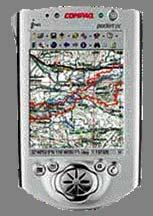
38 PDA MOBILE MAPPING April 24-28, 2006 RS


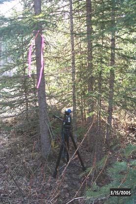
39 Survey Hinton Alberta Thermal Test Grid Site SRD and FERIC Project April 24-28, 2006 RS

40 GOAL: TO OBJECTIVELY TEST THERMAL IMAGING CAPABILITES 90 POINTS + 20cm April 24-28, 2006 Variety of Cover-types RS 2006 Variety of Crown Closure Types 40


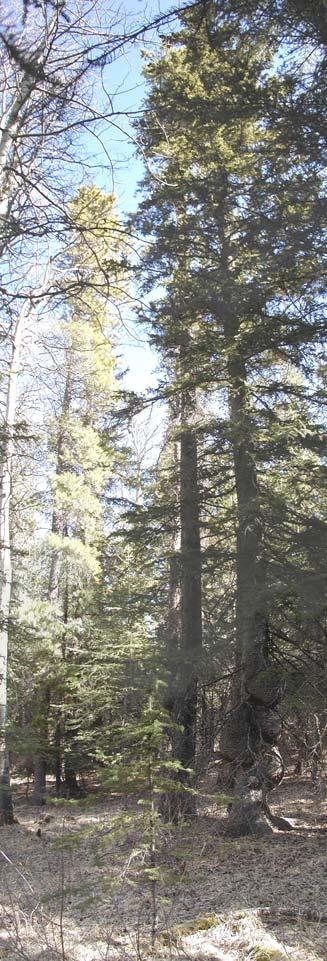
41 FOREST COVER VARIATION April 24-28, 2006 RS


42 ASSESSMENT OF OVERSTORY COVER Open Canopy Dense Canopy Intermediate Canopy April 24-28, 2006 RS


43 TEST TARGETS Targets were constantly maintained throughout test period Targets consisted of: 25 briquettes on a sand base Stove top on propane heat source Frying Pan on propane heat source April 24-28, 2006 RS
44 Evaluation of Test Flights Testee s do not know the configuration of the targets. They do not know the temperature of the targets. False targets are included. Information collected is to be delivered by hand or by ftp to awaiting ground crew for evaluation. Measurement criteria and methods were developed and accepted prior to testing. Measurement, + or for detecting the heat source. Measurement of the spatial precision of those heat sources found. Findings are summarized into a publishable report. The analysis included: Comparison of set targets to targets identified Comparison of the Vendor target points to ground surveyed points Quality of projection in 10TM and UTM Response time from acquisition to delivery in minutes Temperature record for each target during evaluation Review of Gap Light Transmission indices (GLT) and forest cover photo Acquisition time and number of flight passes required April 24-28, 2006 RS

45 FOREST PROTECTION BIRD DOG TRIALS April 24-28, 2006 RS
46 GRID TEST FINDINGS Test Site represents a real world scenario. Process has been refined and is repeatable. Tests are run through a third body, with no biases. Believe that the test represents a true measure of the Testee s capabilites as they would relate to our TIR information needs. Hope to use site for all thermal testing, including contract rotary wing services, Out of province thermal testing and new sensors. April 24-28, 2006 RS
47 FUTURE DEVELOPMENTS Mission Record Decision Support Tool TIR Primer New Hand Held Units On-board Rotary Wing Mapping Wireless delivery of information to Fire-line More Effective Scanning Processes Unmanned Thermal Mapping of Fires Collaboration with Canadian and US agencies Fixed Thermal Scanning April 24-28, 2006 RS
48 MISSION RECORD April 24-28, 2006 RS
49 DECISION SUPPORT TOOL April 24-28, 2006 RS

50 EXPANDED THERMAL INFRARED PRIMER April 24-28, 2006 RS
51 New Hand-Held Units: An evaluation is currently being completed to assess the correct Hand-held thermal units for our operations, including the province of British Columbia. On-board Rotary Wing Mapping An exercise completed last year showed that at least 1 hour of air time can be reduced in rotary wing thermal operations, if the aircraft Is equipped with map production capabilities. Wireless Communications Testing will continue to prove out the capability of delivering the thermal information to pda s and such at the fireline, reducing burning time and increasing effectiveness of the information. April 24-28, 2006 RS
52 More Effective Scanning Processes As part of this year s fixed wing contract, we will be looking to monitor The efficiency of the various scanning sensors and resolution options To allow for better prescription of services. Fixed Thermal Scanning Currently testing a fixed base application of a thermal scanning application that can sense changes in imagery scanned along the horizon and can triangulate position of smoke. Collaboration with Canadian and US Agencies Currently working with the western Canadian provinces to provide a more coordinated initiative. In addition, would like to continue to work with the RSAC people and other US thermal operations to further the science and application of Thermal IR. April 24-28, 2006 RS


53 Unmanned Thermal Mapping of Fires Terms of Reference drafted April 24-28, 2006 RS

54 Ken Dutchak, P. Biol. Reconnaissance and Remote Sensing Unit Wildfire Aviation and Geomatics Section Operations Branch Alberta Forest Protection 9 th Floor, St. Edmonton, Alberta T5K 2M Ken.dutchak@ gov.ab.ca April 24-28, 2006 RS
National Infrared Operations (NIROPS) Program Overview. Tom Mellin National Infrared Program Manager
 Program Overview. Tom Mellin National Infrared Program Manager") National Infrared Operations (NIROPS) Program Overview Tom Mellin National Infrared Program Manager Topics NIROPS organization Phoenix imaging system Aircraft Data delivery to infrared interpreters IRIN
National Infrared Operations (NIROPS) Program Overview Tom Mellin National Infrared Program Manager Topics NIROPS organization Phoenix imaging system Aircraft Data delivery to infrared interpreters IRIN
Observations of the Coulson Martin Mars and FireWatch 76 Operations on the 2011 Wildfires in Mexico. Jim Thomasson Contract Report CR-TBD
 Wildfire Operations Research 1176 Switzer Drive Hinton, AB T7V 1V3 Observations of the Coulson Martin Mars and FireWatch 76 Operations on the 2011 Wildfires in Mexico Jim Thomasson 2011 Contract Report
PROGRAM. Innovations for the future; learning from the past. November 2-4, 2010 Hinton Training Centre, Hinton, Alberta, Canada
 PROGRAM 3 rd International Wildland Fire Detection Workshop Innovations for the future; learning from the past November 2-4, 2010 Hinton Training Centre, Hinton, Alberta, Canada WELCOME to the 2010 Wildland
Wildfire detection in western Canada: trends and innovations
 FINAL REPORT March 2014 Wildfire detection in western Canada: trends and innovations Ray Ault Wildfire Operations Research INTRODUCTION The Government of the rthwest Territories (GNWT) asked FPInnovations
From Marine Pollution to Inland. Wildfire Mapping
 From Marine Pollution to Inland Louis Armstrong Wildfire Mapping The Mobilization of the National Aerial Surveillance Program (NASP) in support of the Fort McMurray Wildfires TC Chief, Intelligence, Surveillance
Development of a Canadian Wildland Fire Monitoring Sensor (CWFMS)
") Unclassified Development of a Canadian Wildland Fire Monitoring Sensor (CWFMS) Helena (Marleen) van Mierlo 1 Linh Ngo Phong 1 Steeve Montminy 1 Joshua M. Johnston 2 Denis Dufour 3 (1) Canadian Space Agency
Unclassified Development of a Canadian Wildland Fire Monitoring Sensor (CWFMS) Helena (Marleen) van Mierlo 1 Linh Ngo Phong 1 Steeve Montminy 1 Joshua M. Johnston 2 Denis Dufour 3 (1) Canadian Space Agency
Fire Detection and Monitoring
 Fire Detection and Monitoring Akli Benali Forest Research Center, University of Lisbon aklibenali@gmail.com Conference & Summer School on Forest Fire Management Istituto Superiore Antincendi, Rome, September
Enhancing our Nation s Wildfire Management Capabilities Through Application of NASA Science and Technology
 Enhancing our Nation s Wildfire Management Capabilities Through Application of NASA Science and Technology Vince Ambrosia Earth Science Division. Biospherics Branch NASA-Ames Research Center 2nd Annual
Interim evaluation of the New IR Sensor Technology (NIRST) as a wildfire monitoring tool
 as a wildfire monitoring tool") Interim evaluation of the New IR Sensor Technology (NIRST) as a wildfire monitoring tool Joshua Johnston Forest Fire Analyst Canadian Forest Service Great Lakes Forestry Centre Sault Ste. Marie, Ontario
Interim evaluation of the New IR Sensor Technology (NIRST) as a wildfire monitoring tool Joshua Johnston Forest Fire Analyst Canadian Forest Service Great Lakes Forestry Centre Sault Ste. Marie, Ontario
state of the art methane leak detection CHARM and GasCam 2011 October 13 th Dr. Axel Scherello
 state of the art methane leak detection CHARM and GasCam 2011 October 13 th Dr. Axel Scherello Overview CHARM for buried pipelines (active principle) GasCam for above ground installations (passive method)
Presentation Outline
 Presentation Outline! Background WRAP Project TFRSAC Technology Development Sensor / R/T Data Communications CDE as DSS Long-Duration Airborne Mission Capability (UAS) Western States Fire Mission Support
BCGEU JOB DESCRIPTION MINISTRY OF FORESTS
 POSITION TITLE: Forest Protection Assistant BRANCH / REGION / DISTRICT: Protection Program, Fire Zones NOC CODE: 2223 SUPERVISOR S POSITION TITLE: Forest Protection Officer CURRENT CLASSIFICATION / GRID:
Wildfire Mapping Using FireBIRD Data
 Wildfire Mapping Using FireBIRD Data Global Wildfire Information System (GWIS) GOFC GOLD Fire IT 20-23 rd November 2017, Cumberland Lodge Christian Fischer on behalf of the FireBIRD-Team German Aerospace
Global fire hotspots detected by NASA satellite to help United Nations
 Global fire hotspots detected by NASA satellite to help United Nations Published on 24 Sep 2010 is Image NASA's not found Moderate or type unknown Resolution Imaging Spectroradiometer (MODIS), an instrument
Colorado Division of Fire Prevention and Control. Colorado Counties Inc. June 5, 2018
 Colorado Division of Fire Prevention and Control Colorado Counties Inc. June 5, 2018 Brief History and Background Vaughn Jones Mike Morgan The Division Background Wildfire in Colorado is a Public Safety
Fire Detection and Prediction Systems of
 JPTM2013, Bangkok, Thailand, 27-2929, Nov. 2013 Fire Detection and Prediction Systems of Peat-Forest t Fires in JST-JICA JSTJICA Project Toshihisa Honma, Kazuya Kaku 1, Aswin Usup 2 and 3 Agus Hidayat
Fire Information for Resource Management System (FIRMS)
") Fire Information for Resource Management System (FIRMS) Diane Davies 1, Chris Justice 1, Jacques Descloitres 2, John Latham 3 John Musinsky 4 1 Department of Geography, University of Maryland 2 SSAI /
Fire Information for Resource Management System (FIRMS) Diane Davies 1, Chris Justice 1, Jacques Descloitres 2, John Latham 3 John Musinsky 4 1 Department of Geography, University of Maryland 2 SSAI /
DFPC s Toolbox. Colorado Fire Prediction System (CO-FPS)
") DFPC s Toolbox Colorado Fire Prediction System (CO-FPS) Wildfire in Colorado 68% of Colorado s forested lands are under federal jurisdiction The Wildland-Urban Interface in Colorado is currently 1.1 million
DFPC s Toolbox Colorado Fire Prediction System (CO-FPS) Wildfire in Colorado 68% of Colorado s forested lands are under federal jurisdiction The Wildland-Urban Interface in Colorado is currently 1.1 million
Use of new spatially refined satellite remote sensing fire detection data in support of advanced wildfire mapping and modeling
 Use of new spatially refined satellite remote sensing fire detection data in support of advanced wildfire mapping and modeling Dr. Wilfrid Schroeder 1 Dr. Janice Coen 2 Dr. Patricia Oliva 1 Dr. Louis Giglio
Evolution of Reclamation Practices in NE Alberta
 Evolution of Reclamation Practices in NE Alberta Alfred Burk Reclamation and Remediation Coordinator CAPFT Edmonton April 14, 2011 Agenda Introduction to Cenovus Energy Reclamation in the Green Zone Forestry
DETECTION AND MONITORING OF ACTIVE FIRES USING REMOTE SENSING TECHNIQUES
 DETECTION AND MONITORING OF ACTIVE FIRES USING REMOTE SENSING TECHNIQUES Source: Unknown n.d., http://www.hotrodsandclassics.net/featuredpictures/featurepictures2.htm. by Claire Riddell DETECTION AND MONITORING
DISTRIBUTION OPERATIONS AND MAINTENANCE
 EB-00-0 Tab Schedule Page of 0 DISTRIBUTION OPERATIONS AND MAINTENANCE PREDICTIVE MAINTENANCE Predictive maintenance expenditures fund work that is required to test and audit distribution system assets.
ForestWatch. Oregon. Click to edit Master subtitle style. KEY Features 09/05/10
 ForestWatch Oregon KEY Features Range-aware, allowing Geo-referencing from a single camera. 12 Mile + detection capability and night-detection. Smart software learns the environment, drastically reducing
Thermography Report. For: (Client) at: (location)
 at: (location)") Thermography Report A SAMPLE INFRARED REPORT INFRARED BUILDING EVALUATION For: (Client) at: (location) Thermography date: 01-01-2013 Thermographer: Dave Sawyer, ITC Level III TIR Outdoor temperature: (Temp)
Thermography Report A SAMPLE INFRARED REPORT INFRARED BUILDING EVALUATION For: (Client) at: (location) Thermography date: 01-01-2013 Thermographer: Dave Sawyer, ITC Level III TIR Outdoor temperature: (Temp)
Colonel Paul Hargrove
 Colonel Paul Hargrove 1 PAST- MAFFS - Why was the Program Established? 1) MAFFS Program was established by Congress in 1970 after the Laguna Fire burned in San Diego County - Caused by downed power lines
Fire Service Considerations A Primer for Building and System Designers. Society of Fire Protection Engineers Fire Service Committee
 Fire Service Considerations A Primer for Building and System Designers Society of Fire Protection Engineers Fire Service Committee Version 1 October 15, 2012 Target Audience Any of these designers without
Guidance on Video Smoke Detection Technology (VSD)
") Guidance Note Guidance on Video Smoke Detection Technology (VSD) Guidance on Video Smoke Detection Technology (VSD) SCOPE... 3 INTRODUCTION... 4 WHAT IS VSD?... 5 STANDARDS... 7 GENERAL GUIDANCE ON THE
Guidance Note Guidance on Video Smoke Detection Technology (VSD) Guidance on Video Smoke Detection Technology (VSD) SCOPE... 3 INTRODUCTION... 4 WHAT IS VSD?... 5 STANDARDS... 7 GENERAL GUIDANCE ON THE
Advanced Fire Information System
 Advanced Fire Information System Karen Steenkamp Philip Frost CSIR Meraka Institute www.sac.co.za Meraka Institute - RSRU RSRU Mission: To conduct basic and applied remote sensing research for the advancement
Energy Technology and Innovations Canada (ETIC) March 2012
 March 2012") Energy Technology and Innovations Canada (ETIC) March 2012 THE PEOPLE: SMART ENERGY SERVICE COMPANIES ETIC is a project of the Canadian Gas Association. CGA transmission and distribution members are noted
Energy Technology and Innovations Canada (ETIC) March 2012 THE PEOPLE: SMART ENERGY SERVICE COMPANIES ETIC is a project of the Canadian Gas Association. CGA transmission and distribution members are noted
As agreed to by the members of the Routt County Multi-Agency Coordinating (MAC) Advisory and Policy Groups on March 15, 2018.
 Advisory and Policy Groups on March 15, 2018.") As agreed to by the members of the Routt County Multi-Agency Coordinating (MAC) Advisory and Policy Groups on March 15, 2018. Remember the 10 STANDARD FIRE ORDERS and the 18 situations that shout WATCH
As agreed to by the members of the Routt County Multi-Agency Coordinating (MAC) Advisory and Policy Groups on March 15, 2018. Remember the 10 STANDARD FIRE ORDERS and the 18 situations that shout WATCH
Land Use Regional Planning in Alberta Collaborating with Stakeholders
 Land Use Regional Planning in Alberta Collaborating with Stakeholders Trevor Lema, Land & Integrated Management Planner September 2018 Overview Why Regional Planning? An Integrated Perspective Integrated
BEACH AND INLET PROJECTS UPDATE
 BEACH AND INLET PROJECTS UPDATE USACE DELTA PROJECT USACE Delta Project Project Extents Elevation Elevation (ft NAVD88) (ft NAVD88) USACE Delta Project Project Cross-Section 20 18 20 16 18 14 16 12 14
Recent Developments and Prospects for Innovative Remote Sensing of High-Temperature Events and Vegetation Fire Impacts
 Recent Developments and Prospects for Innovative Remote Sensing of High-Temperature Events and Vegetation Fire Impacts by D. Oertel, E. Lorenz, B. Zhukov German Aerospace Center, (DLR-OS) Berlin Adlershof
Design and Evaluation of a Wildfire Sprinkler
 Design and Evaluation of a Wildfire Sprinkler September 2017 Roy Campbell Technical report no. 53 Wildfire Operational Research Group http://wildfire.fpinnovations.ca/ fpinnovations.ca FPInnovations is
OSI radiation mapping techniques used during the Integrated Field Exercise IFE14. Outline 10/29/2015
 OSI radiation mapping techniques used during the Integrated Field Exercise IFE14 Blanchard Xavier & Gheddou Hakim On-Site Inspection and International Data Centre Divisions Preparatory Commission for the
Working together to leverage limited Funds
 Working together to leverage limited Funds ARAPAHOE COUNTY OPEN SPACES 10 County Budget Conference September 20, 2013 The Power of Partnerships 2013 SORP Conference 5/23/2014 Why Talk About Open Space?
S-NPP/VIIRS and Landsat-8/OLI Global Active Fire Data Sets
 S-NPP/VIIRS and Landsat-8/OLI Global Active Fire Data Sets Wilfrid Schroeder Louis Giglio, Pierre Guillevic, William Walsh (Dept of Geographical Sciences/UMD) Janice Coen (NCAR/Boulder) Ivan Csiszar (NOAA/NESDIS/STAR)
Aetos Overview. Mistras Internal and External Customers 03/27/2017 R1.4 D E L I V E R I N G A S S E T P R OT EC T I O N S O LU T I O N S GLO BALLY
 Aetos Overview Mistras Internal and External Customers 03/27/2017 R1.4 D E L I V E R I N G A S S E T P R OT EC T I O N S O LU T I O N S GLO BALLY OUR MISSION Cost effectively reduce or eliminate the need
Verification and Validation of OOV-TET1 Multispectral Camera Observations within the FireBIRD Project
 DLR.de Chart 1 Verification and Validation of OOV-TET1 Multispectral Camera Observations within the FireBIRD Project O. Frauenberger **, A. Börner *, E. Borg **, W Halle *, E. Lorenz *, S. Mitchell *,
COMPUTING AERIAL SUPRESSION EFFECTIVENESS BY IR MONITORING
 COMPUTING AERIAL SUPRESSION EFFECTIVENESS BY IR MONITORING Eulalia Planas Y. Pérez, J. Gould, E. Pastor, M. Plucinski Centre d Estudis del Risc Tecnològic UNIVERSITAT POLITÈCNICA DE CATALUNYA ER TEC OUTLINE
RESNET Infrared Inspection Standard and Certification
 RESNET Infrared Inspection Standard and Certification Rogge Miller Guaranteed Watt Savers John Snell Snell Infrared RESNET 2009 Slide #1 Infrared Standard & certification Why create a new standard? I don
Artificial Trees and Fire Performance
 2017 NFPA Conference & Expo Artificial Trees and Fire Performance Presented by: Dwayne Sloan Manager, Principal Engineers Building Materials & Suppression UL LLC Learning Objectives Frame the Fire Problem
PIPELINE REMOTE SENSING FOR SAFETY AND ENVIRONMENT THE PROJECTS CHARM AND PRESENSE
 1 3 rd European Forum Gas 2005 20-21 September 2005, Warsaw, Poland Block 4 New and Future Technologies PIPELINE REMOTE SENSING FOR SAFETY AND ENVIRONMENT THE PROJECTS CHARM AND PRESENSE Werner Zirnig,
GOFC/GOLD Fire IT Strategic Planning. Day 1 - Break Out Group Discussion
 GOFC/GOLD Fire IT Strategic Planning Day 1 - Break Out Group Discussion Aims of the Fire IT refining and articulating the international requirements for fire related observations making the best possible
Optech Thermal IR Sensing Solutions Expanding the Industry
 Optech Thermal IR Sensing Solutions Expanding the Industry Optech Overview Strategic Growth through acquisitions of camera manufacturers 20 Years of Patented & Proven Camera System Experience Broader Imaging
Truckee Meadows Fire Protection District Guide to Wildfire Terminology
 Truckee Meadows Fire Protection District Guide to Wildfire Terminology Hunter Falls Fire, 2014 (Photo: Tim Dunn/RGJ) 1 Size-up If you are calling 911 to report a fire, these factors are helpful to both
CANADIAN DAM ASSOCIATION ASSOCIATION CANADIENNE DES BARRAGES
 Elko, BC Stanrock TMA,ON Ghost Dam, AB 1 CANADIAN DAM ASSOCIATION ASSOCIATION CANADIENNE DES BARRAGES Lake Milo, NS Barrage St-Alban, QC Eastend, SK 2 Canadian Dam Association The CDA is a group of dam
Airborne Imagery Potential Role in Monitoring Climate Change
 PC.DEL/773/09 13 October 2009 ENGLISH only Airborne Imagery Potential Role in Monitoring Climate Change US Department of State 5 October 2009 Briefing Topics Introduction Climate Change Threats to National
Smart Fire Prevention
 Smart Fire Prevention Using VIP Vision Thermal Cameras to Detect Fire Release 1.0 Contents 1 Introduction to Thermal Imaging... 2 2 Detecting Fires with VIP Vision Thermal Cameras... 3 2.1 Mode Selection...
Methane to Markets Oil and Natural Gas Technology Transfer Workshop
 Methane to Markets Oil and Natural Gas Technology Transfer Workshop Detection and Measurement of Fugitive Emissions Using Airborne Differential Absorption Lidar (DIAL) Daniel Brake ANGEL Service ITT Space
Update and Overview on the NFPA Requirements and Testing for Electronic Safety Equipment
 Update and Overview on the NFPA Requirements and Testing for Electronic Safety Equipment Bruce H. Varner. Chair NFPA Technical Committee on Electronic Safety Equipment Fire Chief (Retired) Santa Rosa,
Sensor Grand Challenges: An NVESD Perspective
 Approved for public release; distribution is unlimited Sensor Grand Challenges: An NVESD Perspective James D. Howe U. S. Army NVESD 23 February 1999 Form SF298 Citation Data Report Date ("DD MON YYYY")
1.1. SYSTEM MODELING
 1 INTRODUCTION Electro-optical imaging system analysis is a mathematical construct that provides an optimum design through appropriate trade studies. A comprehensive model includes the target, background,
A Forest Fire Warning Method Based on Fire Dangerous Rating Dan Wang 1, a, Lei Xu 1, b*, Yuanyuan Zhou 1, c, Zhifu Gao 1, d
 International Conference on Applied Science and Engineering Innovation (ASEI 2015) A Forest Fire Warning Method Based on Fire Dangerous Rating Dan Wang 1, a, Lei Xu 1, b*, Yuanyuan Zhou 1, c, Zhifu Gao
Overview of Federal Wildfire Remote Sensing Support 2018
 Overview of Federal Wildfire Remote Sensing Support 2018 Everett Hinkley GIO (acting) GWIS & GOFC Fire IT Meeting October 2018 Fire Season to Date* Currently Planning Level 5 Total Fires: 48,946 (10 yr
Collision Avoidance & Proximity Detection Systems
 Collision Avoidance & Proximity Detection Systems Cameras Lights Proximity Detection By: Dave Winfield Who We Are CAMERAS PROVIX Inc. is a Canadian company specialising in the implementation of safety
Early fire and hotspot detection in tunnels. 07/09/2016 Fire and Safety in Tunnels 2016
 Early fire and hotspot detection in tunnels 07/09/2016 Fire and Safety in Tunnels 2016 FLIR Intelligent Transportation Systems FLIR ITS UK FLIR ITS France FLIR ITS Spain FLIR ITS BELGIUM FLIR ITS Germany
A New Plan For The Calgary Region June calgary.ca call 3-1-1
 A New Plan For The Calgary Region June 2009 calgary.ca call 3-1-1 Introduction Since January 2006, The City of Calgary has been actively participating with the member municipalities of the Calgary Regional
Great Lakes Conservation Blueprint for Terrestrial Biodiversity on the Canadian Shield
 Great Lakes Conservation Blueprint for Terrestrial Biodiversity on the Canadian Shield Bonnie L. Henson 1, Kara E. Brodribb 2 and John L. Riley 3 1 Ontario Ministry of Natural Resources 2,3 The Nature
CROWD-SOURCED REMOTE ASSESSMENTS OF REGIONAL-SCALE POST-DISASTER DAMAGE
 Eleventh U.S. National Conference on Earthquake Engineering Integrating Science, Engineering & Policy June 25-29, 2018 Los Angeles, California CROWD-SOURCED REMOTE ASSESSMENTS OF REGIONAL-SCALE POST-DISASTER
WIRELESS CCTV. Oil, Gas and Renewables Site Security.
 WIRELESS CCTV Oil, Gas and Renewables Site Security Wireless CCTV Wireless CCTV (WCCTV) is a market leading, customer focused provider of portable, redeployable surveillance solutions. WCCTV manufactures
Car Dealership Optex America protects automo0ve inventory from the6 using wireless sensors with remote video monitoring
 Car Dealership Optex America protects automo0ve inventory from the6 using wireless sensors with remote video monitoring Major car dealership in Florida Product Used Redwall Wireless SIP InstallaAon of
BNSF Rail Safety Overview
 BNSF Rail Safety Overview Chris Howell DIRECTOR OF TRIBAL RELATIONS JANURARY 25, 2018 Rail Transports Crude Safely Since 1980, railroads reduced rates for employee injuries, train accidents and grade crossing
CDF GREEN SHEET. California Department of Forestry and Fire Protection SOUTHERN REGION CA-RSS000077
 CDF GREEN SHEET California Department of Forestry and Fire Protection SOUTHERN REGION CA-RSS000077 San Bernardino Unit Pleasant Valley 2 CA-BDU003587 April 30, 2002 Burn Over CDF Engine 3561 Lookouts Communications
Innovative Industrial Solutions, Inc Skyline Drive Russellville, AR 72802
 The SigniFire IP Camera System is capable of detecting and alarming on a variety of events. Once an alarm occurs it can be signaled through contact closure or by digital streamed transmissions over IP.
A Better Way to Support Wildland Fire Suppression
 A Better Way to Support Wildland Fire Suppression John Varner USDA Forest Service jvarner@fs.fed.us FIRE INCIDENT MAPPING TOOLS PURPOSE To have a workable ArcGIS mapping extension that utilizes a personal
Sentinel Asia Wildfire Monitoring
 Sentinel Asia Wildfire Monitoring Masami FUKUDA Institute of Low Temp. Sci. Hokkaido Univ. 3rd Sentinel Asia JPT Meeting 13 March 2007, Singapore Objective of Sentinel Asia Wildfire Monitoring Contribution
DEVELOPMENT OF THE INFRARED INSTRUMENT FOR GAS DETECTION
 DEVELOPMENT OF THE INFRARED INSTRUMENT FOR GAS DETECTION Ching-Wei Chen 1, Chia-Ray Chen 1 1 National Space Organization, National Applied Research Laboratories ABSTRACT MWIR (Mid-Wave Infrared) spectroscopy
PROTECTION OF SETTLEMENTS AGAINST WILDFIRES
 International Journal of Civil Engineering and Technology (IJCIET) Volume 9, Issue 9, September 2018, pp. 2017 2022, Article ID: IJCIET_09_09_197 Available online at http://www.iaeme.com/ijciet/issues.asp?jtype=ijciet&vtype=9&itype=9
2015 NEW PRODUCTS. NOW EXPORTING THE UTAC-STS! THERMAL CLIP-ON WEAPON SIGHT WITH AN IR LASER POINTER.
 2015 2015 NEW PRODUCTS NOW EXPORTING THE UTAC-STS! THERMAL CLIP-ON WEAPON SIGHT WITH AN IR LASER POINTER. NEW DOD GUIDELINES ALLOW EXPORT OF THE NVAG-9 AVIATION GOGGLE WITH AUTOGATING TECHNOLOGY. NEW!
A Canadian Initiative to advance Conservation, Connections, Collaboration and Leadership for Parks and Protected Areas
 Canadian Committee for the IUCN: January 19, 2017 A Canadian Initiative to advance Conservation, Connections, Collaboration and Leadership for Parks and Protected Areas BACKGROUND Canadian Parks Council
GIS Training of Undergraduates: Campus Stormwater Mapping. Joanne Logan, University of Tennessee. Gordie Bennett, University of Tennessee
 GIS Training of Undergraduates: Campus Stormwater Mapping Joanne Logan, University of Tennessee Gordie Bennett, University of Tennessee Seth Benge, University of Tennessee Tim Prather, University of Tennessee
Presentation to Planning Committee, DMM
 District Municipality of Muskoka Muskoka Official Plan Review Background Study: Natural Heritage Review of Urban Centres and Species At Risk Dale Leadbeater 1 September 2011 Presentation to Planning Committee,
Project Report. Infrared Field Users Guide and Vendor Listings. Liaison and Special Projects. Fire and Aviation Management.
 Fire and Aviation Management Project Report Liaison and Special Projects United States Department of Agriculture Forest Service Engineering Remote Sensing Applications Center October 2003 RSAC-1309-RPT1
NEAR REAL TIME DETECTION OF BURNED SCAR AREA USING LANDSAT-8 IMAGERIES
 NEAR REAL TIME DETECTION OF BURNED SCAR AREA USING LANDSAT-8 IMAGERIES Danang Surya Candra Kustiyo - Indonesian National Institute of Aeronautics and Space (LAPAN) - Outline INTRODUCTION: Background, Problems,
SALMO FIRE PROTECTION AREA COMMUNITY WILDFIRE PROTECTION PLAN PART 2
 SALMO FIRE PROTECTION AREA COMMUNITY WILDFIRE PROTECTION PLAN Considerations for Wildland Urban Interface Management in the Salmo Fire Protection Area, British Columbia PART 2 Submitted by: B.A. Blackwell
I. INTRODUCTION. identify long-term capital improvements and rehabilitation measures for the existing drainage system;
 I. INTRODUCTION The Town of Windsor, Colorado is presently experiencing rapid growth and development within the boundaries of several of its major drainage basins. As growth continues within these basins,
Firefighting Robotic System. Reggie Grant Director, Advanced Programs - Dallas
 Firefighting Robotic System Reggie Grant Director, Advanced Programs - Dallas Mission Statement The Fire Fighting Robotic System s s Program mission is to: Provide the wild-land land Firefighters with
Branch Fire Rescue Services
 Branch Fire Rescue Services Introduction Through the protection of life, property and the environment, Fire Rescue Services strives to improve the livability of all Edmontonians. The provision of internationally-recognized
Linden Homes Proposals for land off Ringwood Road, Verwood
 Welcome Welcome to Linden Homes first public exhibition displaying proposals for new homes on land off Ringwood Road in Verwood. Award-winning house builder Linden Homes, part of the Galliford Try Group,
WIRELESS CCTV. Utility Site Security & Surveillance.
 WIRELESS CCTV Utility Site Security & Surveillance Wireless CCTV WCCTV is the UK s leading provider of site security systems for utilities and critical national infrastructure sites, including power stations,
SWANA Northern Lights Chapter. EXTINGUISHING THE IQALUIT LANDFILL FIRE Winnipeg May 20, 2015
 SWANA Northern Lights Chapter EXTINGUISHING THE IQALUIT LANDFILL FIRE Winnipeg May 20, 2015 Prepared by: Dr. Tony Sperling, P.Eng. Landfill Fire Control Inc. Slide 1 of 26 Extinguishing the Iqaluit Landfill
BYLAW 5542 *******************************************************************************
 BYLAW 5542 ********************** A BYLAW OF THE CITY OF LETHBRIDGE TO AUTHORIZE THE ESTABLISHMENT AND OPERATION OF A FIRE AND EMERGENCY SERVICES DEPARTMENT *******************************************************************************
VIIRS FIRE PRODUCTS UPDATE
 VIIRS FIRE PRODUCTS UPDATE Ivan Csiszar 1, Wilfrid Schroeder 2, Louis Giglio 2, Brad Wind 2, Evan Ellicott 2, Christopher O. Justice 2 1 NOAA/NESDIS Center for Satellite Applications and Research, Camp
Coal Pile Fire Monitoring System
 Coal Pile Fire Monitoring System Land Instruments International Over 60 years experience Specialists in Infrared Temperature Measurement Combustion Efficiency & Environmental Emissions Monitoring Joined
Research into multi-sensor detector capabilities and false alarm reduction
 Research into multi-sensor detector capabilities and false alarm reduction Raman Chagger Principal Consultant, Fire Safety Group, BRE BRE Fire Conference, 18 th September 2018 Part of the BRE Trust Introduction
Victor Shapilsky and Adison Ang
 Victor Shapilsky and Adison Ang Incident Detection Systems in Motorway Tunnels Overview Incidents Delayed incident detection Performance criteria for incident detection systems Available incident detection
Countywide Green Infrastructure
 Montgomery County s Countywide Green Infrastructure F U N C T I O N A L M A S T E R P L A N The Maryland National Capital Park and Planning Commission INFRASTRUCTURE An underlying base or foundation especially
GOES-R ABI Emissive IR Bands Radiometric Performance Monitoring and Trending
 GOES-R ABI Emissive IR Bands Radiometric Performance Monitoring and Trending Haifeng Qian a, Robert Iacovazzi a, Xiangqian Wu b, Boryana Efremova a, Fangfang Yu a, Xi Shao a a ERT, Inc. Laurel, MD 20707
Colchester Growth Management Strategy. Open House Meeting October 1, 2015
 Colchester Growth Management Strategy Open House Meeting October 1, 2015 6:00 View panels and meet the consultant team 6:30 Presentation and Q&A 7:30 Informal discussion and fill out comment sheets The
RAPID FIRE DETECTION IN MEXICO AND CENTRAL AMERICA USING REMOTE SENSING METHODS
 RAPID FIRE DETECTION IN MEXICO AND CENTRAL AMERICA Bart Wickel Gerardo Lopez Ma. Isabel Cruz Erik de Badts Raúl Jimenez Rosenberg Comisión nacional para el conocimiento y uso de la biodiversidad Organization
Celtic Exploration Ltd. Well Servicing Incident: Blowout and Fire August 9, 2005
 Celtic Exploration Ltd. Well Servicing Incident: Blowout and Fire August 9, 2005 EUB Post-Incident Report February 6, 2006 ALBERTA ENERGY AND UTILITIES BOARD EUB Post-Incident Report: Celtic Exploration
CO 2, CH 4 and CO Observa0ons from CrIS on S-NPP and JPSS-1
 CO 2, CH 4 and CO Observa0ons from CrIS on S-NPP and JPSS-1 Xiaozhen (Shawn) Xiong 1,2, Lihang Zhou 2 Antonia Gambacorta 1,3, Nick Nalli 1,2, Changyi Tan 1,2 Flavio Iturbide-Sanchez 1,2, Kexing Zhang 1,2
LVSS FLIR LIGHTWEIGHT VEHICLE SURVEILLANCE SYSTEM
 LVSS FLIR TM LIGHTWEIGHT VEHICLE SURVEILLANCE SYSTEM SINGLE OPERATOR. FAST DEPLOYMENT. ANYWHERE. Protecting vast and remote borders, shorelines, and forward-operating bases requires speed, mobility and
Services Department B September 10, 2007
 Report To: Development Services Committee Item: Date of Report: DS-07-246 September 5, 2007 From: Commissioner, Development File: Date of Meeting: Services Department B7200-0001 September 10, 2007 Subject:
THE NEXT GENERATION IN VISIBILITY SENSORS OUTPERFORM BOTH TRADITIONAL TRANSMISSOMETERS AND FORWARD SCATTER SENSORS
 THE NEXT GENERATION IN VISIBILITY SENSORS OUTPERFORM BOTH TRADITIONAL TRANSMISSOMETERS AND FORWARD SCATTER SENSORS Steve Glander: Senior Sales Engineer All Weather, Inc. 1165 National Dr. Sacramento, CA
Third Quarter 2016 Results Summary
 Third Quarter 2016 Results Summary Disclaimer This presentation contains forward-looking statements within the meaning of the Private Securities Litigation Reform Act of 1995. Statements regarding expectations
CITY OF VAUGHAN EXTRACT FROM COUNCIL MEETING MINUTES OF NOVEMBER 15, 2016
 Item 11, Report No. 38, of the Committee of the Whole, which was adopted without amendment by the Council of the City of Vaughan on November 15, 2016. Regional Councillor Di Biase declared an interest
HELPCOS THE HELICOPTER BASED PIPELINE CONTROL SYSTEM OF VNG - VERBUNDNETZ GAS AG
 23rd World Gas Conference, Amsterdam 2006 HELPCOS THE HELICOPTER BASED PIPELINE CONTROL SYSTEM OF VNG - VERBUNDNETZ GAS AG Main author Olaf Meyer, VNG - Verbundnetz Gas AG, Leipzig, Germany Co-authors
Strategic Research Agenda for. High-Altitude Aircraft and Airship. Remote Sensing Applications
 Strategic Research Agenda for USE HAAS High-Altitude Aircraft and Airship Remote Sensing Applications Christian Barbier (CSL, B), Bavo Delauré (VITO, B), Arie Lavie (CTI, Is) 1 OUTLINE 1. The USE HAAS