Eastside Transit Corridor Phase 2 Draft Environmental Impact Statement/ Environmental Impact Report APPENDIX Q
|
|
|
- Marshall Benedict McBride
- 5 years ago
- Views:
Transcription
1 Draft Environmental Impact Statement/ Environmental Impact Report APPENDIX Q VISUAL AND AESTHETIC IMPACTS TECHNICAL MEMORANDUM State Clearinghouse Number:
2


3 Visual and Aesthetic Impacts Technical Memorandum January 10, 2012 Prepared for Los Angeles County Metropolitan Transportation Authority One Gateway Plaza Los Angeles, CA State Clearinghouse Number:
4 This technical memorandum was prepared by: CDM Smith 523 West Sixth Street Suite 400 Los Angeles, CA Page i
5 TABLE OF CONTENTS 1.0 Summary Introduction No Build Alternative Transportation System Management (TSM) Alternative State Route 60 (SR 60) Light Rail Transit (LRT) Alternative Operating Hours and Frequency Proposed Stations Maintenance Yard Washington Boulevard LRT Alternative Proposed Stations Maintenance Yard Methodology for Impact Evaluation Regulatory Framework Federal State Local City of Rosemead City of South El Monte City of Commerce City of Pico Rivera City of Santa Fe Springs City of Whittier City of Monterey Park City of Montebello County of Los Angeles Los Angeles County Metropolitan Transportation Authority (Metro) Thresholds of Significance NEPA Impact Criteria CEQA Impact Criteria Impact Intensity Page ii
6 3.2.4 Sensitive Receptors Area of Potential Impact Methodology Affected Environment Regional Setting Scenic Vistas Light and Glare, Shade and Shadows Local Setting SR 60 LRT Alternative Alignment Washington Boulevard LRT Alternative Alignment Impacts No Build Alternative Construction Impacts Operational Impacts Cumulative Impacts Transportation System Management (TSM) Alternative Construction Impacts Operational Impacts Cumulative Impacts State Route 60 (SR 60) Light Rail Transit (LRT) Alternative Construction Impacts Operational Impacts Cumulative Impacts Cumulative Construction Impacts Cumulative Operational Impacts Washington Boulevard LRT Alternative Construction Impacts Operational Impacts Cumulative Impacts Cumulative Construction Impacts Cumulative Operational Impacts Potential Mitigation Measures Page iii
7 6.1 Construction Mitigation Measures Operational Mitigation Measures Conclusions No Build Alternative NEPA Finding CEQA Determination Transportation System Management (TSM) Alternative NEPA Finding CEQA Determination State Route 60 (SR 60) Light Rail Transit (LRT) Alternative NEPA Finding CEQA Determination Washington Boulevard LRT Alternative NEPA Finding CEQA Determination Maintenance Yard Options NEPA Finding CEQA Determination References Cited Page iv
8 TABLES Table 3-1. Rating of Class of Impacts Table 4-1(a). Visual Resources Along the SR 60 LRT Alternative Alignment Table 4-1(b). Visual Resources Along the Washington Boulevard LRT Alternative Alignment Table 4-2. Historic Resources with Visual Significance Along the Washington Boulevard LRT Alternative Alignment Table 4-3. Summary of Visual Quality of the SR 60 LRT Alternative Table 4-4. Summary of Visual Quality of the Washington Boulevard LRT Alternative Table 5-1. SR 60 LRT Alternative Construction Impacts Summary Table 5-2. SR 60 LRT Alternative Operational Impacts Summary Table 5-3. Washington Boulevard LRT Alternative Construction Impacts on Visually-Sensitive Resources Table 5-4. Washington Boulevard LRT Alternative Construction Impacts Summary Table 5-5. Washington Boulevard LRT Alternative Summary of Shade/Shadow Impacts During Summer Solstice Table 5-6. Washington Boulevard LRT Alternative Summary of Shade/Shadow Impacts During Winter Solstice Table 5-7. Washington Boulevard LRT Alternative Operational Impacts on Visually-Sensitive Resources Table 5-8. Washington Boulevard LRT Alternative Operational Impacts Summary Table 7-1. Summary of Potential Visual and Aesthetic Impacts After Mitigation FIGURES Figure 2-1. No Build Alternative... 4 Figure 2-2. TSM Alternative... 5 Figure 2-3. SR 60 LRT Alternative... 6 Figure 2-4. Washington Boulevard LRT Alternative... 9 Figure 3-1. Local Plans within Project Area Figure 3-2. Area of Potential Impact Figure 4-1. Visual and Historic Resources Associated with Project Alternatives Page v
9 Figure 4-2. SR 60 Segment Areas and Location of Viewpoints Figure 4-3. Photos of Segment 1 (Atlantic Boulevard and Garfield Avenue) Figure 4-4. Photos of Segment 2 (Garfield Avenue to OII Landfill Site) Figure 4-5. Photos of Segment 3 (OII Landfill Site to Montebello Town Square) Figure 4-6. Photos of Segment 4 (Montebello Town Square to San Gabriel Boulevard) Figure 4-7. Photos of Segment 5 (San Gabriel Boulevard to Santa Anita Avenue) Figure 4-8. Photos of Segment 6 (Santa Anita Avenue to San Gabriel River) Figure 4-9. Washington Boulevard Segment Areas and Location of Viewpoints Figure Photos of Segment 2 (Garfield Avenue to Whittier Boulevard) Figure Photos of Segment 2 (Whittier Boulevard to Union Pacific Railroad) Figure Photos of Segment 3 (Union Pacific Railroad to Greenwood Avenue) Figure Photos of Segment 4 (Greenwood Avenue to Rio Hondo) Figure Photos of Segment 5 (Vicinity of Rosemead Boulevard) Figure Photos of Segment 5 (Vicinity of San Gabriel River) Figure Photos of Segment 6 (I-605 Freeway to Lambert Road) Figure 5-1. Typical At-Grade Guideway Cross Section in Street ROW with Embedded Track Figure 5-2. Typical Aerial Structure Cross Section Figure 5-3. Metro Gold Line Eastside Extension and Metro Expo Line Construction Figure 5-4. Visual Simulation (Segment 4) The Shops at Montebello Figure 5-5. Visual Simulation (Segment 5) Legg Lake in Whittier Narrows Recreation Area.. 72 Figure 5-6. Visual Simulation (Segment 2) Garfield Avenue and Via San Clemente Figure 5-7. Visual Simulation (Segment 2) Garfield Avenue and Via Acosta Figure 5-8. Visual Simulation (Segment 2) Garfield Avenue and Madison Avenue Figure 5-9. Visual Simulation (Segment 2) Garfield Avenue and Whittier Boulevard Figure Visual Simulation (Segment 2) Garfield Avenue and Olympic Boulevard Figure Visual Simulation (Segment 4) Washington Boulevard and Greenwood Avenue Figure Visual Simulation (Segment 4) Washington Boulevard at Rio Hondo Coastal Basin Spreading Grounds Figures Figure Visual Simulation (Segment 5) Washington Boulevard and Rosemead Boulevard Page vi
10 Figures Our Lady of Miraculous Medal Church, Montebello Golf Course, and Bicknell Park Shade/Shadows at 9:00 AM 5:00 PM (Summer Solstice) Figures Our Lady of Miraculous Medal Church, Montebello Golf Course, and Bicknell Park Shade/Shadows at 9:00 AM 3:00 PM (Winter Solstice) Figures Rod s Grill Coffee Shop and Adjacent Residences Shade/Shadows at 9:00 AM 5:00 PM (Summer Solstice) Figures Rod s Grill Coffee Shop and Adjacent Residences Shade/Shadows at 9:00 AM 3:00 PM (Winter Solstice) Figures Ashiya Park Shade/Shadows at 9:00 AM 5:00 PM (Summer Solstice) Figures Ashiya Park Shade/Shadows at 9:00 AM 3:00 PM (Winter Solstice) Figures Cantwell Sacred Heart of Mary High School Shade/Shadows at 9:00 AM 5:00 PM (Summer Solstice) Figures Cantwell Sacred Heart of Mary High School Shade/Shadows at 9:00 AM 3:00 PM (Winter Solstice) Figures Montebello Park Historic District Shade/Shadows at 9:00 AM 5:00 PM (Summer Solstice) Figures Montebello Park Historic District Shade/Shadows at 9:00 AM 3:00 PM (Winter Solstice) Page vii
11 ACRONYMS AND ABBREVIATIONS LIST ADA API BLM Caltrans CEQ CEQA CFR CRHR FHWA FTA HOV HSR LAX LOSSAN LRT LRTP LRV Metro MSE NEPA Americans with Disabilities Act Area of Potential Impact US Department of Interior, Bureau of Land Management State of California, Department of Transportation Council on Environmental Quality California Environmental Quality Act Code of Federal Regulations California Register of Historical Resources Federal Highway Administration Federal Transit Administration High Occupancy Vehicle High-Speed Rail Los Angeles International Airport Los Angeles to San Diego Rail Corridor Light Rail Transit Long Range Transportation Plan Light Rail Vehicle Los Angeles County Metropolitan Transportation Authority Mechanically Stabilized Earth National Environmental Policy Act NHPA National Historic Preservation Act of 1966 NRHP OCS National Register of Historic Places Overhead Catenary System Page viii
12 OII ROW RTP SAFETEA-LU SCAG SCE SR 19 Operating Industries Inc. Right-of-Way Regional Transportation Plan Safe, Accountable, Flexible, Efficient Transportation Equity Act: A Legacy for Users Southern California Association of Governments Southern California Edison Rosemead Boulevard SR 60 State Route 60 TOD TPSS TSM UPRR USACE USC USDOT USFS Transit Oriented Development Traction power substations Transportation System Management Union Pacific Railroad United States Army Corps of Engineers United States Code United States Department of Transportation United States Department of Agriculture, Forest Service Page ix
13 1.0 SUMMARY The findings of this visual and aesthetic impact assessment are based upon the Federal Highway Administration (FHWA) Visual Impact Assessment Guidelines and the thresholds of significance criteria included in Appendix G of the California Environmental Quality Act (CEQA) Guidelines. These thresholds are used to identify significant visual and aesthetic impacts associated with substantial degradation of existing visual character or quality of a site and its surroundings. Significance is also determined by the degree of contrast between proposed features and existing features that represent the valued aesthetic image of an area. This technical memorandum evaluates proposed alternatives of the Eastside Transit Corridor Phase 2 Project. These alternatives include the No Build Alternative, Transportation System Management (TSM) Alternative, State Route 60 (SR 60) Light Rail Transit (LRT) Alternative, and Washington Boulevard LRT Alternative. Existing visual resources were identified and documented with photographs of typical views. A relative rating of overall visual quality was then determined for each area. Based on viewer exposure and sensitivity, future views were illustrated with photo simulations at key view locations. Viewers of the project site were categorized into groups to assess how the visual environment is seen and what values are placed on the views. The No Build Alternative would not result in significant impacts on visual and aesthetic conditions. The TSM Alternative would result in minor visual modifications to the existing environment due to construction of enhanced bus stops associated with Rapid Bus Transit lines added throughout the project area, and thus, potential impacts would not be significant. Under the two build alternatives, the visual character and quality of the corridors would be altered from project construction and operation through the removal of landscaping and mature trees and introduction of new built features such as rail tracks, concrete columns and aerial structures, overhead catenary system (OCS), access points, lighting, park and ride facilities, station platforms, and maintenance yards. The construction phase would be a source of disturbance to the visual setting. However, visual impacts associated with construction of either build alternative would be short-time in duration and would not be considered significant. During the operations phase, permanent physical elements would influence a notable visual change in the scale and character of the community along Garfield Avenue between Via Campo and Whittier Boulevard, resulting in significant impacts. The atgrade alignment portion of this corridor would have prominent, visible street-level features, but would not negatively affect the unity and intactness ratings; thus, visual impacts would be less than significant. The option to grade-separate the at-grade alignment along Washington Boulevard over Rosemead Boulevard, the San Gabriel River, and I-605 would be visually contrasting within certain viewsheds. However, no visually-significant historic resources or residential uses are located in the proximity to these grade separations; thus, potential impacts would be less than significant. Potential visual impacts during operations for the SR 60 LRT Alternative would be less than significant. The SR 60 North Side Design Variation includes negligible blocked views of the San Gabriel Mountains to the north for motorists on the freeway; nonetheless, it would also not result in significant impacts. Page 1
14 Scenic views would not be degraded by project implementation. There are no scenic highways or protected views near the proposed alignments. In terms of shade and shadows, shading would be cast by the Washington Boulevard LRT Alternative along Garfield Avenue on shade-sensitive uses for extended periods of time; shade and shadow impacts would be significant along this segment. Shade and shadow impacts for the SR 60 LRT Alternative would not be significant. Table 7-1 included in Section 7.0 of this technical memorandum summarizes visual and aesthetic impacts associated with each of the four alternatives. Potential mitigation measures include new pedestrian-friendly street improvements, such as relocation and/or planting of new mature landscaping and trees, in the vicinity of the alignments and stations, which would enhance the aesthetics of the area. The addition of an enhanced pedestrian environment with prominent, visible street-level features would offset the potentially low to moderate visual impacts. The build alternatives would create improved and safer settings from which pedestrians could view visual and aesthetic resources and create a streetscape that complements those visual and aesthetic resources. However, even with implementation of mitigation measures for potential impacts identified for the Washington Boulevard LRT Alternative along Garfield Avenue, visual and aesthetic impacts/ would remain significant and unavoidable. Page 2
15 2.0 INTRODUCTION The project area, an integral part of the Greater Los Angeles metropolitan area, is almost entirely developed, largely in suburban form. The area affords broad views of the Whittier Narrows Recreation Area, Rio Hondo and San Gabriel River, Montebello Hills, Puente Hills, Rose Hills, and San Gabriel Mountains. Construction activities and potential changes to the streetscape could affect views of these hillsides and distant mountains, water bodies, and natural features. The project involves changes to the natural and built environment and thereby may result in impacts to the visual environment. This technical memorandum evaluates the potential for visual and aesthetic impacts resulting from construction and operation of the proposed Eastside Transit Corridor Phase 2 alternatives. The physical features of the proposed alternatives were considered in assessing the changes to the visual setting. The significance of an impact would be based on several factors, such as the existing visual character of the area, the expectations and number of individuals viewing the area, and the location of the impact (foreground, middle ground, or background). Adverse effects of the proposed project could potentially result from construction-related ground disturbance or landscaping removal. 2.1 No Build Alternative The No Build Alternative is used for comparison purposes to assess the relative benefits and impacts of constructing a new transit project in the project area versus implementing only currently planned and funded projects. The No Build Alternative is also a required alternative for comparison as part of the National Environmental Policy Act (NEPA)/CEQA environmental analysis. The No Build Alternative includes all of the projects that are identified for construction and implementation in the Constrained Plan of Metro s 2009 Long Range Transportation Plan (LRTP) (through the year 2035). This plan includes the Metro Gold Line Eastside Extension currently in operation, but does not include any project resulting from this Phase 2 study effort. It also includes the construction of the Metro Crenshaw Line and the Los Angeles International Airport (LAX) People Mover, as well as the extension of the Metro Purple Line to Westwood, and the extensions of the Metro Green Line to LAX and to the South Bay. The plan also includes construction of the Regional Connector that will connect existing lines through downtown Los Angeles. After construction of the Regional Connector, east-west trains will operate between Santa Monica and East Los Angeles without the need for riders to transfer, and north-south trains will operate between Montclair and Long Beach, also without the need for riders to transfer. Bus services will be reorganized and expanded to provide connections with these new rail lines. Figure 2-1 displays the No Build Alternative. The No Build Alternative also includes all of the projects that are identified for construction and implementation in the financially constrained project list of the 2008 Regional Transportation Plan (RTP): Making the Connections, developed by the Southern California Association of Governments (SCAG) to present the transportation vision for the region through year The RTP outlines future highway projects, including providing one high occupancy vehicle (HOV) lane in each direction on I-5 from SR 19 (Rosemead Boulevard) to I-710. There are no other major roadway improvements in the project area included in the financially constrained RTP. Page 3
 Alternative The TSM Alternative is intended to address the same mobility needs as the two LRT build alternatives, but does not include the construction of a")
16 Source: Metro; CDM, 2011 Figure 2-1. No Build Alternative 2.2 Transportation System Management (TSM) Alternative The TSM Alternative is intended to address the same mobility needs as the two LRT build alternatives, but does not include the construction of a fixed guideway facility. The TSM Alternative includes all of the transit and roadway provisions of the No Build Alternative, plus proposed enhancements to existing bus service. Under the TSM Alternative, the basic approach is to enhance the east-west bus service in the same corridor as the build alternatives to develop the TSM network. In order to leverage the investment in an east-west transit spine, the TSM Alternative also includes enhancements to north-south bus services that would feed and integrate with the improved east-west spine. The TSM Alternative is presented in Figure 2-2. The key elements of the TSM Alternative are the creation of an east-west transit spine along with new north-south feeder service. The transit spine would include new Pomona Freeway Flyer express service from the Eastside Extension Phase 1 terminus at Atlantic Station to Crossroads Parkway near SR 60, supported by enhanced bus service provided by Montebello Bus Lines. The enhanced service would include new Rapid bus service on Route 40 on Beverly Boulevard and additional service on Route 10 on Whittier Boulevard and Route 50 on Washington Boulevard. The north-south feeder service would include new Rapid bus service on Montebello Bus Lines Route 30 on Garfield Avenue, new Limited Stop service on Montebello Bus Lines Route 20 on Montebello Boulevard, and additional service on Metro Route 265 on Paramount Boulevard, Metro Route 266 on Page 4
17 Rosemead Boulevard, and Foothill Transit Route 274 on Workman Mill Road. It would also include Route 577 Limited Stop service in addition to existing Metro Route 370 service on Peck Road and Workman Mill Road. Source: Metro; CDM, 2011 Figure 2-2. TSM Alternative 2.3 State Route 60 (SR 60) Light Rail Transit (LRT) Alternative The SR 60 LRT Alternative would extend the Metro Gold Line Eastside Extension, a dedicated, dual track LRT system with overhead catenary wiring, approximately 6.9 miles east to Peck Road. More than 94 percent of this alternative would operate in an aerial configuration, primarily within the southern portion of the SR 60 Freeway right-of-way (ROW). Figure 2-3 illustrates the SR 60 LRT Alternative. The proposed alignment runs at-grade east from the Metro Gold Line Eastside Extension Atlantic Station in the median of Pomona Boulevard, where the alignment transitions to an independent aerial structure within the south side of the SR 60 Freeway ROW to Garfield Avenue. The SR 60 LRT Alternative continues east beyond Garfield Avenue in the freeway ROW, terminating in the vicinity of the SR 60/Peck Road interchange in the city of South El Monte, with tail tracks for storage extending farther east. The proposed LRT alignment is located on the south side of the freeway between the edge of the eastbound traffic lanes and the SR 60 Freeway ROW line. Traction power substations (TPSS), track crossovers, emergency generators, and other ancillary facilities that provide power and help to operate the LRT would also be constructed along the route. The SR 60 LRT Alternative also includes all Page 5

18 No Build Alternative transit and roadway improvements and TSM Alternative bus services, with the exception of the Pomona Freeway Flyer. An SR 60 North Side Design Variation is being analyzed to address concerns raised by the U.S. Environmental Protection Agency about potential impacts to the former Operating Industries, Inc. (OII) landfill site south of SR 60 in the city of Monterey Park. With this variation, instead of running along the edge of the landfill site on the south side of SR 60, the LRT alignment would transition from the south side to the north side of SR 60 just west of Greenwood Avenue and return to the south side of SR 60 approximately one-quarter mile west of Paramount Boulevard (see Figure 2-3). This design variation would include approximately 3,500 feet of at-grade and aerial alignment on the north side of SR 60, and two new bridges to carry the LRT guideway over SR 60. Source: Metro; CDM, 2011 Figure 2-3. SR 60 LRT Alternative Operating Hours and Frequency The operating hours and schedules for the SR 60 LRT Alternative would be comparable to the weekday, Saturday and Sunday, and holiday schedules for the existing Metro Gold Line. Trains would operate every day from 4:00 AM to 1:30 AM. On weekdays, trains would operate every five minutes during peak hours, every 10 minutes mid-day and until 8:00 PM, and every 15 minutes in the early morning and after 8:00 PM. On weekends, trains would operate every 10 minutes from 9:00 AM to 6:30 PM, every 15 minutes from 6:30 7:30 PM and from 7:00-9:00 AM, and every 20 minutes in the early morning and after 7:30 PM. Page 6
19 2.3.2 Proposed Stations The SR 60 LRT Alternative has four aerial, center platform stations designed with bus and parking facilities to intercept vehicular and bus travel operating within the east-west freeway corridor and circulating in a north-south direction crossing the freeway. All of the station areas would require property acquisition to accommodate stations and related facilities, including park and ride structures, and all have the potential for Transit Oriented Development (TOD). The proposed station locations and estimated parking spaces provided at each station would be as follows: Garfield Avenue East of Garfield Avenue along Via Campo in the city of Montebello, approximately 344 parking spaces. Shops at Montebello On the west side of the Shops at Montebello, approximately 417 parking spaces. Santa Anita Avenue East of Santa Anita Avenue in the city of South El Monte, approximately 692 parking spaces. Peck Road East of Peck Road in the city of South El Monte, approximately 1,983 parking spaces Maintenance Yard Under the SR 60 LRT Alternative, one potential site (referred to as the Mission Junction Yard Option to distinguish it from the additional options identified for the Washington Boulevard LRT Alternative) has been preliminarily identified for the location of a new maintenance yard. The site is approximately 11 acres in size and is adjacent to the existing Mission Junction rail facility, generally bounded by I-5 to the east, I-10 to the south, the Los Angeles River to the west, and the Union Pacific rail line to the north. This industrial area is zoned for railroads and maintenance yard facilities. The proposed maintenance yard, located on the north side of Mission Road, would be operated in conjunction with the existing Division 10 bus maintenance yard located on the south side of Mission Road, adjacent to the proposed maintenance yard site. The proposed maintenance yard would accommodate daily maintenance, inspection and repairs, and storage of the light rail vehicles (LRVs). In addition to the proposed maintenance yard and the existing Division 10 bus maintenance yard, Metro may also consider modifying existing facilities to accommodate the additional capacity required to maintain the project s vehicles or using a proposed maintenance yard in Monrovia that is currently being studied as part of the extension of the Metro Gold Line to Montclair. 2.4 Washington Boulevard LRT Alternative The Washington Boulevard LRT Alternative would extend the Metro Gold Line Eastside Extension, a dedicated, dual track LRT system with overhead catenary wiring, approximately 9.5 miles east to the city of Whittier at Lambert Road. This alternative is proposed to operate in an aerial configuration with columns located in the roadway median or sidewalks, as well as in an at-grade configuration where the street widths are sufficient to accommodate the alignment and potential stations. Figure 2-4 displays the Washington Boulevard LRT Alternative. The proposed alignment runs at-grade east from the Metro Gold Line Eastside Extension Atlantic Station in the median of Pomona Boulevard, where it then transitions to aerial operations running in the south side of the SR 60 Freeway ROW until Garfield Page 7
20 Avenue. This segment is the same as that described for the SR 60 LRT Alternative. At Garfield Avenue, the Washington Boulevard LRT Alternative turns south in an aerial configuration to operate above Garfield Avenue. The aerial structure continues south on Garfield Avenue and then turns southeast along Washington Boulevard. The aerial structure is supported at various locations either by columns straddling both sides of the street or by single columns. At Montebello Boulevard along Washington Boulevard, the alignment transitions to a street running configuration within the center of Washington Boulevard to a terminus station located south of Washington Boulevard just west of Lambert Road, with tail tracks for storage extending south and adjacent to Lambert Road. The street running segment is a dedicated trackway located in the center of Washington Boulevard with only signalized intersections allowing for cross traffic. Partial signal priority would be provided to the LRT at signalized intersections. In addition, TPSS, track crossovers, emergency generators, and other ancillary facilities would be located along the alignment. The Washington Boulevard LRT Alternative also includes all No Build Alternative transit and roadway improvements and TSM Alternative bus services, with the following exceptions: The Pomona Freeway Flyer would operate from the Garfield Avenue station (instead of the Atlantic Station) to Crossroads Parkway near SR 60. Metro Rapid Route 720 would be extended to the Garfield Avenue station, to provide connectivity. Montebello Bus Lines Route 50 Rapid service would operate between downtown Los Angeles and the Greenwood Avenue station only, as it would duplicate LRT service on Washington Boulevard east of Greenwood Avenue. Two design variations are being considered for the Washington Boulevard LRT Alternative. The first design variation, the Rosemead Boulevard aerial crossing, would include a grade separation at Rosemead Boulevard. In this variation, the LRT would operate in an aerial configuration in the vicinity of Rosemead Boulevard. The second design variation, the San Gabriel River/I-605 aerial crossing, would include an aerial crossing of the San Gabriel River and I-605 and a grade separation at Pioneer Boulevard. In this variation, the LRT would operate on an aerial structure just south of Washington Boulevard across the San Gabriel River and then return to the median of Washington Boulevard, still in an aerial configuration, over I-605 and Pioneer Boulevard. Page 8
21 Source: Metro; CDM, 2011 Figure 2-4. Washington Boulevard LRT Alternative The operating hours and service frequency for the Washington Boulevard LRT Alternative would be the same as described for the SR 60 LRT Alternative Proposed Stations The Washington Boulevard LRT Alternative has six stations located to serve the communities through which this alternative runs. Property acquisition at all stations is necessary to accommodate stations, access, and related facilities, including park and ride structures. All of the proposed stations, with the exception of the Whittier Boulevard station, include a park and ride facility. The proposed station locations and estimated parking spaces provided at each would be as follows: Garfield Avenue Aerial, center platform station located on the southeast corner of Garfield Avenue and Via Campo in the city of Montebello, approximately 523 parking spaces. Whittier Boulevard Aerial, side platform station located in the median of Garfield Avenue just north of Whittier Boulevard in unincorporated East Los Angeles, no parking facility. Greenwood Avenue Aerial, side platform station located in the median of Washington Boulevard east of Greenwood Avenue in the city of Montebello, approximately 151 parking spaces. Page 9
22 Rosemead Boulevard With the Rosemead Boulevard at-grade crossing, this would be an atgrade, center platform station located in the center of Washington Boulevard west of Rosemead Boulevard in the city of Pico Rivera, approximately 353 parking spaces. If the Rosemead Boulevard aerial crossing design variation is selected, this station would be an aerial, center platform station. Norwalk Boulevard At-grade, center platform station located in the median of Washington Boulevard east of Norwalk Boulevard in the city of Santa Fe Springs, approximately 667 parking spaces. Lambert Road At-grade, center platform station located south of Washington Boulevard west of Lambert Road in the city of Whittier, approximately 1,008 parking spaces Maintenance Yard Under the Washington Boulevard LRT Alternative, three potential sites have been preliminarily identified for the location of a new maintenance yard: Mission Junction Yard Option - The first site is adjacent to the existing Mission Junction rail facility, as described above under the SR 60 LRT Alternative. Commerce Yard Option - The second potential site, approximately 12 acres in size, is proposed to be within the city of Commerce, located west of Garfield Avenue in Southern California Edison s (SCE) transmission line corridor. The parcel is designated for electrical power facility use and is situated within the San Antonio Rancho known as the Walter L. Vail s 2,000 Acre Tract. Since the LRT tracks would be in an aerial configuration above Garfield Avenue, the lead tracks to the maintenance yard would transition from aerial to at-grade within the southern portion of the Union Pacific Railroad (UPRR) ROW, approximately 1,600 feet away from the mainline on Garfield Avenue. The main entrance to the facility would be off Corvette Street at the southern portion of the site, just west of Saybrook Avenue. Santa Fe Springs Yard Option - The third potential site, approximately nine acres in size, is located within the city of Santa Fe Springs immediately south of Washington Boulevard and east of Allport Avenue. It is currently occupied by automobile repair and light industrial uses. The lead tracks to the yard would cross the eastbound lanes of Washington Boulevard at-grade. Page 10
23 3.0 METHODOLOGY FOR IMPACT EVALUATION The criteria used to evaluate the proposed alternatives are described below. These criteria and the definition of visual impacts and thresholds of significance are discussed. As the refinement of the build alternatives progresses, the methodology will be adjusted as appropriate. Multiple federal agencies have developed analytical frameworks for visual resource management including the U.S. Department of Agriculture, Forest Service (USFS 1974, 1995); U.S. Department of Interior, Bureau of Land Management (BLM 1978); and U.S. Department of Transportation (USDOT), FHWA (FHWA 1981). The methodology and assumptions presented herein build upon the guidance developed by these federal agencies and the extensive work of Lawrence Headley of Lawrence Headley & Associates for the Port of Los Angeles and other Los Angeles projects (e.g., 2008, 2006, and 2005). 3.1 Regulatory Framework There are several legislative regulations that govern the assessment and consideration of visual quality and aesthetic character. These regulations consider the protection and enhancement of existing resources and aesthetic character, as well as the incorporation of design consideration in the development and construction of projects. The following regulatory policies apply to the evaluation of visual effects for the proposed project Federal NEPA is an umbrella law requiring an evaluation and disclosure of potential impacts that might result from construction and operation of a project. As such, NEPA often does not have topic specific requirements or guidance. In the case of potential visual and aesthetic impacts, there are no specific thresholds or evaluation criteria. Often compliance with other federal, state, and local regulations is used as a means of demonstrating that a proposed project would not have adverse impacts under NEPA. The following two federal laws established regulations governing the formulation, evaluation, and review of programs and projects that have an adverse impact on area and community development. Section 106 of the National Historic Preservation Act (NHPA) of 1966 regulates activities that could impact historic properties by diminishing the visual integrity of the property s significant historic features (Title 36, Code of Federal Regulations [CFR] Part 800.5(a)(2)). Section 401 of the Intergovernmental Cooperation Act of 1968 puts regulatory responsibility on the federal government to use all practicable means to assure for all Americans safe, healthful, productive, and aesthetically and culturally pleasing surroundings (Title 42, United States Code [USC], Section 4231 (b)). The FHWA and the Federal Transit Administration (FTA) jointly established Environmental Impact and Related Procedures (Title 23, CFR Part 771) for the evaluation of urban mass transit projects and the Page 11
24 compliance of these projects with 23 USC 109(h) and 303 1, as well as other federal statutes. As such, FHWA s Environmental Impact Statement Visual Impact Discussion requires that a system be used to evaluate the visual character and quality of an area (FHWA 1990). This process is adopted from FHWA s Visual Impact Assessment for Highway Projects and includes subdividing the corridor into landscape units and defining viewsheds, viewer groups, and the visual character and quality of the units (FHWA 1981). The results of the existing visual character and quality analysis provide the framework for comparing the visual impacts of the proposed project. FTA s Design and Art in Transit Projects encourages the use of design and artistic consideration in transit projects (FTA 1995). The FTA recognizes that specific types of transit projects require an assessment of visual effects. The circular provides guidance on opportunities to incorporate quality design and art into transit projects. Good design and art can improve the appearance and safety of a facility, give vibrancy to its public spaces, and help to create livable communities State The California Department of Transportation (Caltrans) established the State Scenic Highway Program to preserve and protect scenic highways from change that would diminish the aesthetic value of lands adjacent to highways. The program includes the regulation of land use and density, design of site and structures, signage, landscaping and grading, and undergrounding of utility lines within the roadway s view corridor (Caltrans 2007, 2008). There are currently no designated state or county scenic highways within the project area Local Local planning policies are included in city and county general plans to preserve and enhance the visual quality and aesthetic resources within the plans jurisdictions. These planning guidelines focus primarily on the maintenance of visual diversity, definition of urban form and character, protection and management of scenic, historic, and cultural resources, enhancement of existing visual character and quality, and control over development. SR 60 LRT Alternative Alignment The following local planning policies pertain to the jurisdictions along the SR 60 LRT Alternative alignment City of Rosemead As part of the city of Rosemead General Plan, the following policies aim to enhance the visual quality of the urban environment, promote a positive physical image, and create identity for all types of development. The city of Rosemead supports improved green space creating a landscape aesthetic that is inviting to the pedestrian and considers it a necessity rather than an amenity USC 109(h) focuses on design criteria relating to social, economic, and environmental effects; 23 USC 303 regulates development, establishment, and implementation of a system managing highway safety, traffic congestion, public transportation facilities and equipment, and intermodal transportation facilities and systems. Page 12
25 Resource Management Goal increase amount and quality of green space throughout Rosemead to improve community aesthetics, encourage pedestrian activity, and provide passive shade and cooling benefits Policy increase landscaping and tree plantings along all major arterials, including San Gabriel Boulevard Policy require new developments to incorporate creative and effective landscaping into the overall site plan of proposed projects Policy pursue establishment of landscaped street medians and parkways where adequate ROW is available Policy enhance the on-and off-ramp areas at SR 60 Policy encourage public art projects through the development of impact fees, in-lieu fees, and policies (in which the city can assess fees on new or proposed development to help cover the costs of public art, parks, libraries, schools, infrastructure, and public services) City of South El Monte The General Plan of the city of South El Monte denotes the following relevant visual policies and goals below: Economic Development Policy facilitate the development of freeway-oriented commercial uses along Santa Anita Avenue between Pomona Freeway and Central Avenue with appropriate signage and high visibility from the freeway. This location is considered a gateway area into South El Monte Housing Policy maintain and enhance the quality of existing residential neighborhoods by providing focused rehabilitation efforts Washington Boulevard LRT Alternative Alignment The following local planning policies pertain to the jurisdictions along the Washington Boulevard LRT Alternative alignment City of Commerce The city of Commerce General Plan sets forth the following policies which aim to encourage aesthetic improvements in its industrial area: Page 13
26 Community Development Policy ensure that commercial and industrial development provides sufficient landscape buffers and other design features to separate new nonresidential uses located in areas adjacent to existing residential neighborhoods Resource Management Policy implement a definitive street tree program that, at the minimum, calls for landscaping along major rights-of-way and within industrial and commercial developments Transportation Policy encourage the maintenance and improvement of pedestrian-safe oriented facilities to ensure safe pedestrian movement City of Pico Rivera The Pico Rivera Image Enhancement Program provides design guidelines to reinforce the identity of both the city and neighborhood areas, including city signage improvements located at the intersection of Washington Boulevard and Paramount Boulevard. In addition to the enhancement objectives, the city of Pico Rivera General Plan sets policies to institute such a visual identity. Land Use Objective develop and maintain a positive community image and identity Policy create a unified city image as seen by residents and visitors to the city City of Santa Fe Springs The city of Santa Fe Springs General Plan provides direction related to the visual environment within the vicinity of the Washington Boulevard LRT Alternative. Land Use Goal improve the appearance and attractiveness of the residential areas of the community Land Use Goal utilize code enforcement and rehabilitation programs, and encourage voluntary efforts to stem neighborhood deterioration Policy appropriate ordinances, codes and other regulations should be enforced to maintain and improve the quality of land use Open Space Goal continue to add to the collection of permanent outdoor sculptures by actively enforcing the Heritage Artwork in Public Places Program Policy ensure that future artwork additions to the program are appropriate, of superior quality, placed in unrestrictive settings, and highly selective City of Whittier The Whittier General Plan consists of visual policies and goals for the protection and preservation of scenic resources in their planning area. Page 14
27 Resource Conservation Goal preserve or conserve natural and cultural resources that have scientific, educational, economic, aesthetic, social, and cultural value. Encourage property owners to preserve areas with native vegetation, wildlife habitat, and visual beauty Recreation Goal provide a sufficient range of recreation opportunities that make the city a more attractive resident location Scenic Roadways and Corridors Goal maintain amenities along major roadways which provide beauty, identity, and form to the community and to neighborhoods within the community Upgrade entryways and areas along major thoroughfares through the city Protect scenic corridors that have aesthetic, recreational, cultural, or historic values SR 60 LRT Alternative and Washington Boulevard LRT Alternative Alignments The following local planning policies pertain to the jurisdictions along both the SR 60 LRT Alternative and Washington Boulevard LRT Alternative alignments City of Monterey Park The Monterey Park General Plan presents the following policies related to visual quality: Circulation Policy continue implementation of the Sidewalk Deficiency Master Plan to provide for sidewalk improvements and enhancements, particularly in areas where sidewalks link residential neighborhoods to activity centers Land Use Policy identify public improvements such as landscape roadway medians, street trees, light fixtures, and directional and district signage that will help define city form and enhance the visual quality of streets in residential neighborhoods The Monterey Park Municipal Code also requires all outdoor lighting to be located and shielded so as to prevent the direct spillage of light or glare onto adjacent lots and streets (Ord , 2003; City of Monterey Park Municipal Code Section ) City of Montebello The Montebello General Plan includes the following policies, which can be used to enhance the physical environment of the city s diverse area: Land Use Policy frontage areas along the Pomona Freeway (SR 60) with good accessibility should be preserved for future commercial and industrial development Circulation Policy provide adequate circulation system in the hills which serves major regional traffic generators, yet preserve the unique environmental and aesthetic qualities of the hill area Page 15
28 Redevelopment Policy undertake neighborhood revitalization programs which will reduce or eliminate the conditions of blight found to exist within any area of the city Open Space Policy identify unique natural features, scenic areas, and historical sites and ensure the preservation and conservation of sufficient open space to introduce relief from otherwise uninterrupted urban development County of Los Angeles The following general policy statements related to visual resources are part of the existing adopted General Plan of the county of Los Angeles (County of Los Angeles 2008): Urban Form protect and enhance the visual uniqueness of natural edges, encourage superior design of major entryways, create a consistent visual relationship with surrounding development Scenic Resources protect the visual quality of highly scenic areas and views from scenic highways, roads, trails and key vantage points Historic Resources protect the visual integrity of historical sites or structures, including consideration of building heights, materials, textures, colors, setbacks and landscaping East Los Angeles Community Plan The East Los Angeles Community Plan establishes a framework of goals, policies and programs that is designed to provide guidance to those making decisions affecting allocations of resources and the pattern, density, and character of development in East Los Angeles (MBA 1998). Goals related to visual quality include the following: To retain the single-family lifestyle of the community To encourage high standards of development and improve the aesthetic quality of the community To show consistency with its intent on scale, signs, character standards Figure 3.1 shows the location of the general plan and specific plan areas that affect the two build alignments, which is further discussed in the Land Use and Development Opportunities Technical Memorandum. Page 16
29 Figure 3-1. Local Plans within Project Area Page 17
30 Los Angeles County Metropolitan Transportation Authority (Metro) Metro Design Criteria Metro adopted design guidelines that provide a uniform basis for the design of light rail projects, and with suitable modification, for other future technology rail projects (Metro 1994). These policies and procedures pertain to design criteria for all construction over, under, or adjacent to a Metro facility or structure and would be implemented, as appropriate. Metro Public Art Policy Metro adopted an art program which mandates that the inclusion of art in the design of public spaces creates a more inviting environment, enlivens a functional world, and contributes to a positive experience for the system s future riders. This policy consists of guidelines pertaining to community involvement, artist collaboration, and certain components of light rail, including station design, trees and other landscaping, signage, street and pedestrian lighting, and public art. 3.2 Thresholds of Significance NEPA and CEQA require evaluation of visual resources in the consideration of effects to the quality of the environment. The evaluation considers site-specific context and visual sensitivity. Despite environmental assessment guidance it is acknowledged that visual and aesthetic findings can be highly subjective, dependent both upon the background of the assessor and the opinions of viewers. Different viewers may consider the same change in the visual environment as either beneficial or adverse. This analysis fully discloses potential impacts for public and agency consideration with as much objectivity as is practical given the subjective nature of aesthetic perceptions NEPA Impact Criteria Though NEPA offers no specific criteria for determining the significance of visual impacts, the statutes and regulations of NEPA and FHWA provide general guidance on how to determine effects to visual resources. NEPA states that visual effects related to the unique character of the affected resource, the potential for controversy, and the potential to violate laws and regulations must be considered during environmental impact analysis (Council on Environmental Quality (CEQ) Regulations for Implementing NEPA, 40 CFR (b)(3), (4),(10) (2006)). The impact criteria under NEPA are further detailed below: Identify the visual quality of the affected resource. The existing landscape is considered an area of high visual quality where its setting (landforms, water, vegetation, and man-made development) has striking characteristics that convey visual excellence. Describe the level of controversy posed by the proposed change in views to and/or from the resources. Sensitive public views may include, for example, areas of recognized scenic beauty, parks, and residential areas, and areas with historic or culturally important resources. Community acceptance is strongly influenced by the effects of these visuallysensitive resources. Describe the proposed project s consistency with the regulatory setting. Page 18
31 3.2.2 CEQA Impact Criteria The analysis of impact significance is largely based on the threshold criteria contained within Appendix G of the 2009 CEQA Guidelines (Environmental Checklist). CEQA Guidelines define a significant impact as a substantial, or potentially substantial, adverse change in any of the physical conditions within the area affected by the project, including objects of aesthetic significance". In general, a project is to have a significant aesthetic impact if it would result in substantial changes to visual resources considered to have aesthetic value. According to Appendix G of the CEQA Guidelines, a project would have a significant impact on aesthetics and visual resources if the project would result in any of the following: Substantial adverse effects on a scenic vista; Substantial damage to scenic resources, including, but not limited to, trees, rock outcroppings, and historic buildings within [a view from] a state scenic highway; Substantial degradation of existing visual character or quality of a site and its surroundings; and, Creation of a new source of substantial light or glare that would adversely affect day or nighttime views in the area. In the absence of any quantitative or qualitative shade and shadow thresholds for jurisdictions within the area of potential impact (API), the L.A. CEQA Thresholds Guide includes the following criterion for identifying and evaluating whether or not potentially significant shade and shadow impacts would occur to light-sensitive land uses adjacent to the project alignments. This criterion is applied to determine whether or not the project would have significant shade and shadow impacts. Would project-related structures result in the shading of shadow-sensitive uses for more than three hours between the hours of 9:00 AM and 3:00 PM Pacific Standard Time (between late October and early April), or for more than four hours between the hours of 9:00 AM and 5:00 PM Pacific Daylight Time (between early April and late October)? (City of Los Angeles 2006) Impact Intensity One of the most readily recognized impacts of a transportation project is its visual presence. The proposed project involves changes to the built environment and thereby has the potential to cause significant impacts on the visual environment. Both NEPA and CEQA use the concept of intensity to assist in determining the significance of a visual impact. The intensity is the degree to which visual conditions change adversely relative to existing conditions. Changes in the visual landscape can be classified as low, moderate, or high, which provides a method for evaluating the duration, extent, and the level of impact significance Sensitive Receptors A sensitive receptor is defined as an individual that is especially sensitive to changes in aesthetic qualities, which for example could include changes in lighting, shadows, or surrounding visual Page 19
32 character. Uses that accommodate sensitive receptors in the API include any scenic vista, scenic highway, and residential, educational, recreational, and park uses. Generally, viewers in parks and residential areas are assumed to be the most sensitive to visual and aesthetic impacts, and viewers in industrial areas would be the least sensitive. For example, while the trees and vegetation restrict visibility beyond what is identified in the API, the Whittier Narrows Recreation Area has high scenic value and contains sensitive receptors. 3.3 Area of Potential Impact The geographic area that is being considered as the API is defined for all visually-sensitive resources including historic properties as: All proposed ROW, land acquisition, construction areas, and parcels adjacent to permanent site improvements and facilities, including: at-grade and aerial alignments; stations and power substations; park and ride facilities; and maintenance yards and buildings. For elevated alignments, the API includes any additional parcels where the elevated structure may alter the character, use, or setting of a potential historic property. The potential effects described above vary when assessing visual resources. Depending upon the setting, scale, and nature of an area, a visual effect can be beneficial or adverse. Visual changes include modifications to the appearance of the transitway and to or from adjacent parcels and viewsheds. Viewsheds for at-grade and elevated alignments would not differ since views are generally defined by similar topography, structures, and other physical barriers. The radius distance of the API is approximately 700 feet. Figure 3-2 illustrates the API for this visual and aesthetic analysis. 3.4 Methodology The visual and aesthetic impact analysis utilized a multi-step process to evaluate the potential aesthetic impacts associated with the proposed alternatives. The progressive steps of this analysis are described in the following paragraphs. First, an existing conditions survey identified major scenic views and substantive visual elements along segments of the corridor, including open space resources and street trees. These elements were identified through field observations, topographic mapping, and aerial photography. Preparing the existing conditions survey relied in part on material from other technical areas or technical memoranda, such as Land Use and Development Opportunities, Community and Neighborhood Impacts, Parklands and Other Community Facilities, Section 4(f) Evaluation, and Cultural Resources. Second, in order to assess the changes in the visual environment, the existing visual quality was categorized using three components based on the FHWA Visual Impact Assessment for Highway Projects Guidelines : vividness, intactness, and unity. The combined result of all three criteria indicated the degree of quality of the landscape. Page 20
33 Vividness refers to the drama, memorability, or distinctiveness of contrasting landscape elements. The degree of vividness is influenced by four elements landform, vegetation, water features, and human-made elements. Intactness is the integrity of the natural and man-built landscape, and the extent to which the landscape is free from visual encroachment. Unity is the degree to which landscape elements join together to form a coherent, harmonious visual pattern. Third, ten key viewpoints along the corridors and from the public ROW were identified and used to describe the viewer sensitivity and the value that viewer groups place on them. These views are representative of what primary viewer groups (commuters, pedestrians, patrons, and residents) can now see and what they would see if the proposed project were to be built. Sensitive views are unique to the area or of special significance to the community. Important community features identified by the cities and the public in scoping meetings were considered in determining key viewpoints. Close attention was paid to views that are potentially significant based on the key evaluation criteria, which include: substantial damage to scenic resources, including, but not limited to, trees, rock outcroppings, and historic buildings within [a view from] a state scenic highway (Appendix G of the CEQA Guidelines); and potential for substantial degradation of existing visual character or quality of a site and its surroundings. Impacts on key viewpoints from shadows and light and glare were also considered, where applicable. Fourth, according to the Safe, Accountable, Flexible, Efficient Transportation Equity Act: A Legacy for Users (SAFETEA-LU), Sections , the use of visualization techniques is encouraged to improve community understanding of the proposed alternatives. Therefore, computer-generated simulations were included from key viewpoints where visual changes would be noticeable after project implementation. The following describes the process used to produce the visual simulations: AutoCAD drawing files of the railway plan and profiles were converted to dxf files and brought into Newtek s Lightware 3D. Based on these converted files, a 3D version of the proposed design was produced. Using information determined on-site by the photographer, a 3D scene was developed to match as closely as possible the field conditions of the photograph with the 3D model. The 3D models were then edited in Adobe Photoshop and adjusted to match the lighting conditions present in each original photo to help the 3D elements blend with the original photograph. Page 21

34 Figure 3-2. Area of Potential Impact Page 22
35 Fifth, potential visual impacts of the build alternatives were analyzed. The potential effects of the proposed build alternatives were apparent in the conceptual simulations, including installation of the light rail facilities. The potential for these build alternatives to result in the removal of existing features, such as roadway medians, landscaping, street trees, and other existing elements was noted. In addition, the potential for new project features to eliminate, obstruct, or otherwise degrade existing scenic views was also noted. However, as per Metro s Public Art Policy, 1,000 feet of urban design features around each station may address these visual impacts. This includes new trees, tree grates, colorized concrete, decorative street lamps, pedestrian lights, and other appropriate elements that ensure the development of a visually pleasing system. This visual and aesthetic impact assessment follows the FHWA guidelines and considers the issue of contrast/context and the degree to which the existing visual character of the area would be altered with project implementation. However, analysis of potential impacts to the visual character is subjective and varies depending upon an individual s perception of a setting as aesthetically pleasing or negative. The aesthetic values that are important in one area can be relatively less important in another area, indicating the complex nature of visual aesthetic perception. Preferred architectural style, expectations for landscaping, and tolerance for visual clutter are common discriminators of aesthetic values. For example, construction of an equipment shelter could be expected to have little if any visual impact in an industrial area, but might have an adverse visual effect if located in an area of otherwise undisturbed vegetation and terrain. Since it is impossible to analyze all possible views in the vicinity of the proposed alignments, the impacts to visual resources were analyzed based on viewer sensitivity and the ten selected key viewpoints that most clearly displayed the potential visual effects of the project. Based on the assessment framework described above, the overall visual impacts were qualitatively categorized or ranked as low, moderate, or high, as described in Table 3-1. Table 3-1. Rating of Class of Impacts Visual Impact Change in Visual Resources Change in Key Views Level of Viewer Response Low Slight change; new project features would be built in a manner generally compatible with the existing environment No change Little or no response to change because it is barely noticeable Moderate Moderate change Moderate or negligible change Moderate or sensible response High Extensive change; new visual elements would be incompatible with the existing environment Prevalent change; new views would be incompatible with the existing environment High due to visual dominance Page 23
36 Finally, potential mitigation recommendations were identified as appropriate (further discussed in Section 6.0). A low impact may or may not require mitigation; a moderate or high impact would require extensive mitigation measures (e.g., architectural design practices, public art, and landscape treatment). After visual impacts were assessed, based on federal and state visual assessment criteria, project alternatives were compared and relevant mitigation measures were identified as appropriate for each type of visual impact. Potential impacts to the visual environment during project construction were evaluated in terms of duration and extent of disturbance. Potential mitigation measures were identified to limit the potentially significant visual impacts as part of the construction plan where feasible. Page 24
37 4.0 AFFECTED ENVIRONMENT The existing visual and aesthetic API was surveyed in March, April, and June Multiple photographs were taken and reviewed. Research was completed to locate previously identified visual and aesthetic resources, consistent with the methodology outlined in Section 3.0. These resources include, but are not limited to, structures of historic significance or visual prominence; open space and recreational areas; distant views of the horizon from public locations; and landscaped medians. The objective was to capture relationships between existing landscape and the corridor alignment environment. This section discusses the existing visual character of the project area. The potential for visual intrusion, view blockage, shade and shadow impacts, and visual incompatibility from the project alternatives is assessed in Section 5.0. Figures 2-3 and 2-4, respectively, illustrate the cities within the project area and the two build alternatives: SR 60 LRT Alternative with the SR 60 North Side Design Variation; and, Washington Boulevard LRT Alternative with the aerial crossing options. 4.1 Regional Setting The visual landscape in the project area is characterized by a primarily built-out urban environment featuring a variety of commercial, industrial, and residential development, including waterway infrastructure and recreational open space areas. While being a highly urbanized area, the project area has within and around it numerous visual resources, such as distant views of the downtown Los Angeles skyline, Puente Hills and Montebello Hills, the Whittier Narrows Recreation Area, and the mountains that make up the Transverse Ranges, including the San Gabriel and San Bernardino Mountains. The Rio Hondo and San Gabriel River are major water features confined in concrete channels paralleled by bike trails. The project area can be characterized as relatively flat lowland plain with minor changes in elevation. The Puente Hills are the only feature in the project area that have a moderate to highly rugged topography. The development pattern within the project area is generally low-intensity residential and commercial land uses, and the area is of a suburban character Scenic Vistas The General Plans of Los Angeles County and cities within the project area were reviewed to determine whether the project would affect scenic vistas. Based on this review, it was determined that no stateor county-designated scenic highways or eligible state scenic highways are located in the project area. The closest designated scenic highway is SR 2 located approximately 13 miles northwest of the project alignments. Therefore, no designated scenic highways would have views of the project. However, several unofficial public viewing areas exist in the project area, such as roadways, parklands, and other publicly accessible locations Light and Glare, Shade and Shadows The build alternative alignments are within the eastern border of the Los Angeles basin and southern border of the San Gabriel Valley, which are heavily urbanized environments. Extensive nighttime lighting is provided throughout the region via street lights and motor vehicles on roadways in the project area. Secondary sources of light are light fixtures on nearby residential, commercial, and Page 25
38 industrial uses. Within this heavily urbanized environment, extremely narrow shadows are cast by the OII landfill site, transmission towers, occasional street trees, and low-rise buildings lining the build alternative alignments. Therefore, the API experiences little-to-no shade during parts of the day as the sun moves from east to west in the sky. 4.2 Local Setting The existing visual landscape of the API varies depending on the proposed build alternative. To provide a framework for analyzing the existing landscape, each of the build alternatives has been divided into segment areas based on the interaction of land use, land cover, and topography. The recognized visual and visually-sensitive historic resources located within the immediate proximity of the project alternative alignments are listed in Tables 4-1 and 4-2. Visual resources are defined as the various elements of landscape that contribute to the visual character of a place; these elements can be either natural or human-made and include objects, vistas, and viewsheds. Historic resources with visual significance are structures eligible for official historic listing for their distinct architecture style and value. Figure 4-1 identifies the location of these visual and historic properties in relationship to the project alternatives. There are no historic resources with visual significance located along the SR 60 LRT Alternative. Table 4-1(a). Visual Resources Along the SR 60 LRT Alternative Alignment # Name Distance from Alignment to Resource 1 Rio Hondo 0 feet 2 Montebello Hills 1,400 feet 3 Whittier Narrows Recreation Area 0 feet 4 Legg Lake 1,100 feet 5 San Gabriel River 1,000 feet 7 Puente Hills 1 mile Page 26
39 Table 4-1(b). Visual Resources Along the Washington Boulevard LRT Alternative Alignment # Name Distance from Alignment to Resource 1 Rio Hondo Coastal Basin Spreading Grounds 0 feet 2 Montebello Hills 1.5 miles 5 San Gabriel River 0 feet 6 "Montebello Welcomes You" Sign 180 feet 7 Puente Hills 1.8 miles 8 Montebello Golf Course and Bicknell Park 50 feet 9 Ashiya Park 50 feet 10 Palm Trees in median of Washington Boulevard, City of Santa Fe Springs 0 feet 11 Cantwell Sacred Heart of Mary High School 50 feet 12 Montebello Park Historic District 0 feet Table 4-2. Historic Resources with Visual Significance Along the Washington Boulevard LRT Alternative Alignment # Name NRHP & CRHR Status Area of Significance Year Built Distance from Alignment to Resource 13 Rod s Grill Coffee Shop Appears eligible Architecture and social history feet 14 Pacific Metals Company/Rolled Steel Products Appears eligible Architecture and industry feet 15 Cliff May designed Ranch House Appears eligible Architecture feet Key: NRHP = National Register of Historic Places CRHR = California Register of Historical Resources Page 27
40 Figure 4-1. Visual and Historic Resources Associated with Project Alternatives Page 28
41 4.2.1 SR 60 LRT Alternative Alignment SR 60 stretches from the Los Angeles Central Business District to the Inland Empire, passing through or near many of the major activity centers in eastern Los Angeles County. It is designated as a Super Truck Route, part of the Federal Subsystem of Highways, and provides oversized trucks with freeway access into the Port of Los Angeles and Port of Long Beach. The majority of SR 60 in the API is slightly above the grade of the surrounding development. The visual context for the proposed SR 60 LRT Alternative alignment consists of six distinct communities or generalized geographic segments. The following discussion describes the existing visual and aesthetic conditions and views in the immediate vicinity, both along the corridor and adjacent to the proposed stations. Figure 4-2 depicts each of these individual segments, and Figures 4-3 through 4-8 provide photographs that discuss the visual character within each segment area. The arrows in Figure 4-2 indicate the location and directional view for photographs and the numbers associated with each arrow correspond to the numbered photographs in Figures 4-3 through 4-8. Photographs were taken from stationary locations and dynamic viewpoints such as from vehicles, while walking, and while riding a bicycle. As described in Section 3.4, Methodology, the qualitative assessment of the existing visual quality was based on the FHWA Visual Impact Assessment for Highway Projects (1981). A gradient system (low, moderate, high) was used to evaluate the visual qualities of each segment area according to the vividness, intactness, and unity within the API. For example, high vividness represents dramatic background views toward the San Gabriel Mountains; high intactness embodies a consistent image of well-maintained suburban homes and street edge treatment along portions of Washington Boulevard; and high unity attests to the careful design and organization of buildings, structures, railroads, and streets. In addition, the visual experience of the pedestrian, transit patron, and motorist, the type of views (i.e., scenic, panoramic, etc.), and the scale and contrast of individual elements were used for the three assessment criteria. Page 29


42 , Figure 4-2. SR 60 Segment Areas and Location of Viewpoints 7/3/2014 Page 30
43 Segment 1 Atlantic Boulevard to Garfield Avenue Segment 1 begins at the Atlantic Boulevard and Pomona Boulevard terminus of the Metro Gold Line Eastside Extension and continues along the alignment to Garfield Avenue. The areas surrounding the freeway are characterized by low- and medium-density residential, low-density commercial, and a golf course south of SR 60. The terrain is generally flat and composed of mostly man-made features. While Pomona Boulevard provides four lanes of traffic, Via Campo provides two one-way lanes of traffic, with minimal landscaping along the sidewalk. The primary viewers along this segment consist of motorists, pedestrians, residents, and golf course patrons. Along SR 60, where the train would transition into the landscaped berm on the south side of SR 60, within the Caltrans ROW, no noise barriers exist; however, mature trees partially screen the freeway edge interfacing with the frontage road, Via Campo, and adjacent residences, allowing some visibility for viewers on both sides of the freeway. In essence, pedestrians and residents fronting Via Campo have vast views of the freeway façade. The elevated freeway makes views of the San Gabriel Mountains unlikely for pedestrians and residents looking from Via Campo, south of SR 60. However, views of the San Gabriel Mountains are available to the pedestrians and residents along Pomona Boulevard, north of SR 60. The OII former landfill site (in the background) and line of utility infrastructure dominate the viewshed for all viewers on Via Campo, looking east along SR 60. The golfers and visitors of the Montebello Golf Course have limited views of Via Campo and SR 60, since a mature row of tall trees along the perimeter of the golf course is meant to purposely screen these views. Even though the trees along the Caltrans ROW attempt to aesthetically screen the freeway, the visual quality of this segment is generally moderately low due to the lack of visual resources and presence of roadside litter. Segment 1 Vividness Intactness Unity Visual Quality Low Moderate Low Moderately Low 7/3/2014 Page 31


44 1 2 Pedestrian view from Pomona Boulevard looking west at Atlantic Station, existing terminus of Eastside Phase 1 Parked motorist view from Pomona Boulevard looking east towards SR 60 overpass of Pomona Boulevard 3 4 Motorist view from Via Campo looking east towards OII landfill site Pedestrian view from Via Campo sidewalk perpendicular to SR 60, looking east 5 6 Pedestrian view from Garfield Avenue looking southeast at strip commercial property Pedestrian view from Via Campo sidewalk looking towards Garfield Avenue intersection Figure 4-3. Photos of Segment 1 (Atlantic Boulevard to Garfield Avenue) 7/3/2014 Page 32
45 Segment 2 Garfield Avenue to OII Landfill Site Segment 2 begins immediately east of Garfield Avenue and continues to the property line of the OII landfill site. The visual character of the proposed station area at Garfield Avenue and Via Campo is characterized by strip commercial development. No important visual resources are located within the station area. Via Campo provides four vehicular travel lanes with inconsistent landscape features on the sidewalk. The primary viewer groups along this segment include school teachers and students of Our Lady of Miraculous Medal Church, visitors of the commercial areas, motorists, and pedestrians. Views from Our Lady of Miraculous Medal Church consist of the Montebello Golf Course to the west, SR 60 traffic to the north, and the OII landfill site to the east. The high topography of the OII landfill site creates a dominant visual element for all viewers looking east. The OII landfill site has become an open space environment in the middle of a built-out suburban community after grass and other vegetation native to the region have grown to cover the liner beneath the active remediation system. However, the transmission lines and towers that stand in front of the OII landfill site reduce the natural landscape of the OII landfill site. These power transmission towers range in height between 90 feet and 120 feet (SCE 2009). There are no prominent views for pedestrians along Via Campo or for visitors of the Montebello Plaza Shopping Center. Aside from the clear views of SR 60 to the north and the OII landfill site to the east, most views these two groups have consist of electrical power facilities, diners, a car dealership, and one-story commercial/retail buildings of disparate design. The non-native trees and shrubs along the southern SR 60 ROW do not effectively screen out the freeway. From the motorist's perspective on SR 60, distant views of the downtown Los Angeles skyline are available to the west and the San Gabriel Mountains to the north, since the freeway is entirely elevated above the surrounding development. Close-range views for motorists on SR 60 and Via Campo include fleeting views of billboard signs, electrical power poles and overhead wires, gasoline stations, and strip commercial uses. There are no notable visual resources throughout this segment; therefore, the overall visual quality of this segment is moderately low. Segment 2 Vividness Intactness Unity Visual Quality Moderate Low Low Moderately Low 7/3/2014 Page 33


46 7 8 Motorist view from SR 60 exit ramp to Garfield Avenue, looking west Pedestrian view from surface parking lot fronting Via Campo, looking south at Our Lady of Miraculous Medal Church 9 Pedestrian view from Garfield Avenue/Via Campo intersection looking east at the OII site Motorist view from SR 60 adjacent to OII North parcel, looking west towards Los Angeles 11 Motorist/pedestrian view from Wilcox and Via Campo looking east at the base of the OII site 10 Figure 4-4. Photos of Segment 2 (Garfield Avenue to OII Landfill Site) 7/3/2014 Page 34


47 Segment 3 OII Landfill Site to Montebello Town Square Segment 3 begins at the property line of the OII landfill site and continues along SR 60 to Paramount Boulevard, the major arterial to access Montebello Town Square. East of Vail Avenue, the visual character of the area is dominated by the OII landfill site, a large grassy landform covered with clean soil and native vegetation. Single-family homes are located within 1,000 feet of the western edge of the former 190-acre landfill. Even though the OII landfill site overlooks the residential community, residents do not have clear views of SR 60. A gas pipeline along the edge of the OII landfill site is visible to motorists driving east on SR 60. Long range views of the downtown Los Angeles skyline are available to motorists driving west on SR 60 after Greenwood Avenue. Presently, transmission towers and power lines obscure the background views of downtown Los Angeles and the San Gabriel Mountains. Nursery, electrical power facilities, chemical processing, open storage, and vacant land uses are generally located north of the area of the SR 60 North Side Design Variation along the SR 60 ROW. In addition, visitors of the Montebello Town Square have partial views of the Greater San Gabriel Valley to the northeast. Despite these unique views, the visual quality of this segment and the area of the SR 60 North Side Design Variation are moderate. Segment 3 Vividness Intactness Unity Visual Quality High Low Low Moderate Motorist view from SR 60 looking west towards downtown Los Angeles Pedestrian view from Paramount Boulevard/Town Center Drive intersection looking north Gasoline station view from Paramount Boulevard/Town Center Drive intersection looking west Gasoline station view from Paramount Boulevard/Montebello Boulevard looking north towards San Gabriel Mountains Figure 4-5. Photos of Segment 3 (OII Landfill Site to Montebello Town Square) 7/3/2014 Page 35
48 Segment 4 Montebello Town Square to San Gabriel Boulevard Segment 4 begins east of Paramount Boulevard and continues along the alignment to San Gabriel Boulevard. This area primarily consists of commercial and institutional land uses. The intersection of the SR 60 off-ramp and Paramount Boulevard is lined with large palm trees on all approaches. Parallel to SR 60, Town Center Drive features numerous trees in order to beautify the environment adjacent to the Shops at Montebello and Kaiser Permanente Health Care facility (Kaiser Permanente). The Shops at Montebello is an enclosed mall, which is located between SR 60 and Montebello Hills and east of Kaiser Permanente. The large trees and landscaping within this segment provides visual relief for the visitors and staff of the mall and health care facility from SR 60 traffic. The bus stop location along Town Center Drive provides bus patrons with open views of the San Gabriel Mountains to the north. Pedestrians along this segment have obscured views of the single-family residential community and Don Bosco Technical Institute located north of SR 60. SR 60 is situated lower than the surrounding development; thus, no clear views of the Shops at Montebello or Kaiser Permanente are available for SR 60 motorists. There are no designated scenic vistas in this setting. The city of Montebello s Open Space Element of the General Plan states that the Montebello Hills provide a vantage point from which to view vistas of Montebello and surrounding communities. Montebello Hills is a landmark and an immediate point of identification, large enough to be seen from almost every location within Montebello. In addition, the General Plan states much of the land in Montebello is scenic in nature. Scenic land is defined in the city of Montebello s Open Space Element as land that possesses outstanding scenic qualities worthy of preservation and open space uses that may include, but are not limited to, public recreation, enjoyment of scenic beauty, conservation or use of natural resources, and cemeteries. A large portion of acreage in Montebello Hills is classified as natural resource land. Currently, Montebello Hills is utilized for the purpose of oil and gas production, but recognized as an undeveloped habitat and hillside terrain area. Overall, the visual quality of this segment is moderate. Segment 4 Vividness Intactness Unity Visual Quality Moderate Moderate Low Moderate 7/3/2014 Page 36


49 Pedestrian view from southwest corner of the Paramount Boulevard/Town Center Drive intersection, looking northeast at the San Gabriel Mountain background 16 Motorist view from Town 17 Center Drive, looking east at the trees buffering SR 60 Pedestrian/bus patron view from bus stop location along Town Center Drive, looking west at trees buffering SR View from the 19 southern SR 60 ROW buffer looking northeast towards SR 60 traffic Motorist view from Town Center Driver looking north towards SR 60 entrance and exit at San Gabriel Boulevard Motorist view from Town Center Drive looking west at the Shops of Montebello sign Figure 4-6. Photos of Segment 4 (Montebello Town Square to San Gabriel Boulevard) 7/3/2014 Page 37
50 Segment 5 San Gabriel Boulevard to Santa Anita Avenue Segment 5 begins at San Gabriel Boulevard and continues along the alignment to Santa Anita Avenue. East of San Gabriel Boulevard, SR 60 traverses through the Whittier Narrows Recreation Area, a large natural open space area bordered by the Rio Hondo and the San Gabriel River. The Whittier Narrows Recreation Area is a significant landscape feature for the entire region due to the overall lack of regional recreational and open space in Los Angeles County. Motorists on SR 60 have brief views of the Whittier Narrows Recreation Area, which is generally blocked by shrubs and trees along the edge of the freeway. Gaps in the existing vegetation provide glimpses of Legg Lake. However, as with most of SR 60, the San Gabriel Mountains and Puente Hills are the primary visual resources available to freeway motorists. Bicyclists and joggers on the Rio Hondo bike trail have close-up views of the Rio Hondo Creek. The Rio Hondo concrete channel ends at the Whittier Narrows Recreation Area, but continues in a meandering course through natural overgrowth. The bluff west of the Rio Hondo provides a scenic route for equestrian riders overlooking the water course, Whittier Narrows Recreation Area, San Gabriel Mountains, Puente Hills, and SR 60. Part of the Whittier Narrows Recreation Area, the Bosque del Rio Hondo (located northwest of the San Gabriel Boulevard and Rosemead Boulevard intersection) offers recreational space for walkers, joggers, bicyclists, and equestrians; however, it is not visible to and from the SR 60 ROW. Within the Whittier Narrows Recreation Area, there are stretches of open space greenery, picnic grounds, and walking paths. Park visitors in the vicinity of Legg Lake have obscured views of SR 60 to the north. In addition to the freeway, there are three transmission lines that bisect the Whittier Narrows Recreation Area which moderately detract from the visual character of the recreational area. Although the Whittier Narrows Recreation Area, in general, is an area of high aesthetic quality (open space, playgrounds, lake, trails), only fleeting views of the San Gabriel Mountains (to the north) are available to park visitors due to the dense stands of mature pine trees throughout the Whittier Narrows Recreation Area. Due to the scenic qualities of Legg Lake and Whittier Narrows Recreation Area, the visual quality of this segment overall is moderately high. Segment 5 Vividness Intactness Unity Visual Quality Moderately High High Low Moderately High 7/3/2014 Page 38


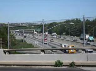
51 Bicyclist view from Rio Hondo bike trail looking west towards SR Bicyclist's view from Rio Hondo bike trail looking west towards SR 60 traffic Park visitor view from Legg Lake in the Whittier Narrows Recreation Area looking east at Puente Hills Park visitor view from Legg Lake in the Whittier Narrows Recreation Area looking north towards SR 60 Park visitor view from Legg Lake in the Whittier Narrows Recreation Area looking west 26 Pedestrian view from Santa Anita 27 Avenue overpass of SR 60 looking west at freeway traffic Figure 4-7. Photos of Segment 5 (San Gabriel Boulevard to Santa Anita Avenue) 7/3/2014 Page 39
52 Segment 6 Santa Anita Avenue to San Gabriel River Segment 6 begins east of Santa Anita Avenue and continues along the alignment to the San Gabriel River, which marks the area near the proposed terminus station. This segment is primarily bordered by single-family residential, South El Monte High School, and strip commercial development with little landscaping as a buffer along the edge of the freeway ROW. The residential community and group picnic areas east of Lexington-Gallatin Road have foreground views of SR 60 and a vacant site to the north. The vacant parcel is located within the United States Army Corps of Engineers (USACE) flood control basin just south of SR 60 and east of Santa Anita Avenue and is vegetated primarily with non-native grasses, with some native shrubs (elderberry and flannel bush) located along the north and west perimeter barbwire fenceline. Much of the vacant site also appears to be bare soil that has been tilled. Teachers and students from South El Monte High School have short views of SR 60 due to the angle of classroom buildings. The pedestrian bridge, which is accessed by residents and school children, offers an overhead foreground view of the freeway and background view of the San Gabriel Mountains to the north and Puente Hills to the east. Peck Road and Durfee Avenue are heavily traveled arterials for trucks. This intersection borders gasoline stations, motels, storage facilities, and commercial development. Motorists, pedestrians, and visitors to these areas have clear views of the SR 60 overcrossing of Peck Road. The San Gabriel River is a concrete channel, lined with bicycle and equestrian trails that can be accessed from Peck Road. Bicyclists, joggers, and equestrian riders have lengthy views of the San Gabriel River, high quality views of the San Gabriel Mountains to the north and the Puente Hills to the east. Los Angeles County recognizes the San Gabriel Mountains and Puente Hills vistas as significant public resources for county residents and businesses and supports the protection and preservation of these resources. However, the power transmission lines and towers, which run parallel to the San Gabriel River at approximately 90 feet to 120 feet in height (SCE 2009), are out of character and scale with the adjacent river bank. As such, the overall visual quality of this segment is considered moderately low. Segment 6 Vividness Intactness Unity Visual Quality Moderate Low Low Moderately Low 7/3/2014 Page 40


53 Pedestrian view from Santa Anita Avenue overpass of SR 60 looking east at vacant site Pedestrian view from pedestrian bridge over SR 60 looking west at Santa Anita Avenue overpass Motorist view from Peck Road/Durfee Avenue intersection looking southeast at gasoline station Pedestrian view from pedestrian bridge over SR 60 looking east at freeway traffic 32 Bicyclist view from San Gabriel River trail 33 looking north at equestrian trail and SR 60 Pedestrian view from Peck Road looking north at San Gabriel River and SR 60 Figure 4-8. Photos of Segment 6 (Santa Anita Avenue to San Gabriel River) 7/3/2014 Page 41
54 Conclusion Although SR 60 is not a designated or proposed scenic corridor, it offers motorists periodic views of the San Gabriel Mountains to the north, downtown Los Angeles skyline to the west, and Puente Hills to the east. In particular, the San Gabriel Mountains form a scenic backdrop for all viewer groups along sections of the SR 60 LRT Alternative alignment, including the SR 60 North Side Design Variation. Visitors of the Shops at Montebello and Montebello Hills have open views of the San Gabriel Mountains and Valley to the north. However, the residents and pedestrians views of the environment are mostly obscured by SR 60 traffic, billboards, freeway signs, transmission towers, and power lines. Additionally, all of the development adjacent to the SR 60 ROW is visually insignificant in architectural and landscape terms. Therefore, the vividness rating is within average range. The Whittier Narrows Recreation Area, the Rio Hondo, and the San Gabriel River are aesthetic resources that play a major role in defining the landscape and character of SR 60. Landscaping, trees, and fencing screen out views of SR 60 traffic for park visitors of the Whittier Narrows Recreation Area. The tree density associated with the Whittier Narrows Recreation Area and the screening vegetation along SR 60 creates a relatively high visual unity and intactness. Nonetheless, ground level views of SR 60 are inevitably part of the visual environment and most of the elements within this alignment are typical of a freeway environment, which results in an overall visual quality classification of moderate when combining all three visual quality criteria. Table 4-3 summarizes the existing visual quality of these segments, using a low, moderate, or high ranking based on the FHWA s three visual assessment components (vividness, intactness, and unity) described in Section 3.4, Methodology. Table 4-3. Summary of Visual Quality of the SR 60 LRT Alternative Segment Area Visual Resources Vividness Intactness Unity Visual Quality 1 Gold Line Eastside Extension terminus station; Montebello Golf Course Low Moderate Low Moderately Low 2 View of Montebello Plaza and commercial uses along Garfield Avenue, Our Lady of Miraculous Medal Church, and OII former landfill site Moderate Low Low Moderately Low 3 1 View of downtown Los Angeles skyline (west of Greenwood Avenue), the San Gabriel Mountains, OII former landfill site, sporadic vegetation, utility towers and lines, and freeway facilities High Low Low Moderate 7/3/2014 Page 42
55 Table 4-3. Summary of Visual Quality of the SR 60 LRT Alternative (continued) Segment Area Visual Resources Vividness Intactness Unity Visual Quality 4 Features Shops at Montebello, Kaiser Permanente Health Care, Montebello Hills, tall mature trees, and hazy views of Don Bosco Technical Institute and the San Gabriel Mountains Moderate Moderate Low Moderate 5 Whittier Narrows Recreation Area, Rio Hondo, bike trails, Legg Lake, Bosque del Rio Hondo, freeway facilities Moderately High High Low Moderately High 6 South El Monte High School, vacant parcel, views of the San Gabriel Mountains and Puente Hills, and San Gabriel River Moderate Low Low Moderately Low Note: 1 The visual quality of this segment includes the area of the SR 60 LRT Alternative North Side Design Variation Washington Boulevard LRT Alternative Alignment The Washington Boulevard LRT Alternative alignment consists of Garfield Avenue, which is bordered by neighborhoods and schools, and Washington Boulevard, which is bordered by a combination of industrial, commercial, and residential areas. The visual character of the proposed Washington Boulevard LRT Alternative alignment has been assessed according to six geographic segments. The following describes the existing visual quality and views in the immediate vicinity, both along the corridor and adjacent to the proposed stations. Figure 4-9 depicts each of these individual segments. Figures 4-10 through 4-16 provide photographs used to characterize the visual character within each segment area. The arrows, in Figure 4-9, indicate the location and directional view and the numbers associated with each arrow correspond to the numbered photographs in Figures 4-10 through Photographs were taken from stationary locations as well as from dynamic viewpoints such as from vehicles, while walking, and while riding a bicycle. Segment 1 Atlantic Boulevard to Garfield Avenue This segment is the same as Segment 1 as discussed in Section for the SR 60 LRT Alternative. Therefore, please see discussion of the Atlantic Boulevard to Garfield Avenue segment in Section The visual quality is moderately low due to the lack of visual resources but presence of mature trees to aesthetically screen the freeway from the Montebello Golf Course and neighboring residences. 7/3/2014 Page 43


56 Figure 4-9. Washington Boulevard Segment Areas and Location of Viewpoints 7/3/2014 Page 44
57 Segment 2 Garfield Avenue to Union Pacific Railroad Segment 2 begins directly south of Via Campo along Garfield Avenue and continues south along the alignment to the UPRR crossing. Low-rise apartments, single-family residential development and a school comprise the visual character of this segment. Garfield Avenue consists of four travel lanes, two lanes traveling in each direction, separated by a turning lane. The street consists predominantly of residential uses with some landscaping, with little variation in visual character. The SR 60 overpass and the mature trees along the edge of the Montebello Golf Course and Bicknell Park are the dominant visual features north of Via Paseo along Garfield Avenue, as it is clearly visible from a pedestrian s perspective. A religious institution, Our Lady of the Miraculous Medal Church, is located on the east side of Garfield Avenue, adjacent to the commercial center. South of Via Paseo, Garfield Avenue is bordered by a hill and low-rise apartments. Views of SR 60 to the north are available from these locations. At Via Acosta, Rod s Grill Coffee Shop is an important, rare, and unusually intact example of coffee shop architecture from the early 1950s period and it pre-figures the Googie coffee shop style that emerged during the late 1950s. Eligible for listing in the National Register of Historic Places (NRHP) at the local level of significance, the building exhibits a high level of integrity. The intersection of Beverly Boulevard and Garfield Avenue features a small retail center and older commercial strip development. Southeast of this intersection, Ashiya Park provides recreational uses to the local community. The graffiti on playground equipment and electrical transmission towers running the length of the park detract from the views of the open space. South of Ashiya Park along Garfield Avenue, multi-family residential and institutional uses exist, including the Mexican American Opportunity Center and Cantwell Sacred Heart of Mary High School. The campus is enclosed by a chain link fence, and the outdoor areas are visible from the street and sidewalk. The campus building is situated on the west side of Garfield Avenue. The sidewalks on both sides of the street are landscaped with grass and street trees that provide shade. The students, staff, and visitors to the high school are the primary viewers in this area. Commercial uses, including a fast food restaurant, car wash, and small business center, define the visual character of the Whittier Boulevard and Garfield Avenue intersection. Views to the west of the intersection include landscaped building frontages and the notable Montebello Welcomes You marquee located in the street median. The sign is a key visual landmark in Montebello. 7/3/2014 Page 45


58 Pedestrian view from Garfield Avenue sidewalk, looking south at commercial strip businesses 1 2 Pedestrian view from sidewalk looking north at Garfield Avenue and Via Acosta intersection Pedestrian view from Beverly Boulevard looking west at Garfield Avenue 3 4 Park visitor view from top of Ashiya Park looking south at Garfield Avenue 5 Pedestrian view from Garfield Avenue/Madison 6 Avenue intersection looking south at Cantwell Sacred Heart of Mary High School Pedestrian view along Garfield Avenue sidewalk looking north towards Ashiya Park and electrical transmission towers Figure Photos of Segment 2 (Garfield Avenue to Whittier Boulevard) 7/3/2014 Page 46


59 South of the intersection, the Montebello Park Historic District represents one of the largest and most defined master planned residential communities in the Los Angeles region from the mid-1920s. The district boundaries are: Whittier Boulevard on the north, Ferguson Drive on the south, Gerhardt Avenue on the west, and Vail Avenue on the east. The fronts of many of the residential homes are landscaped with hedges, trees of varying sizes, and lawns. Foreground views of the UPRR overpass can be seen looking south by motorists, pedestrians, and residents from Garfield Avenue. Light industrial development is visible to the south as well. This segment has a residential visual character and the overall visual quality is moderate because the setting is one that is well maintained, but lacking significant visual resources. Segment 2 Vividness Intactness Unity Visual Quality Moderate Moderate Moderate Moderate Motorist view from Whittier Boulevard just west of Garfield Avenue looking towards Montebello Welcomes You sign 7 8 Pedestrian view from Garfield Avenue and Whittier Boulevard intersection, looking east towards Puente Hills Motorist view from Garfield Avenue looking north at the San Gabriel Mountains in the background 9 Motorist view from Garfield Avenue 10 looking south at the UPRR over-crossing of Garfield Avenue Figure Photos of Segment 2 (Whittier Boulevard to Union Pacific Railroad) 7/3/2014 Page 47
60 Segment 3 Union Pacific Railroad to Greenwood Avenue Segment 3 begins south of the UPRR crossing along Garfield Avenue and follows the alignment as it turns east on Washington Boulevard to Greenwood Avenue. Large industrial warehouses characterize the visual environment of this segment. South of the UPRR, Garfield Avenue begins to traverse through an area of the city of Commerce that is largely industrial in character as it is comprised of concrete construction, light manufacturing, and commercial buildings of recent vintage. These industrial facilities, situated on large lots in front of an abandoned railroad ROW, visually dominate the setting. These parts of Garfield Avenue and Washington Boulevard are generally not pedestrianfriendly, with narrow to no sidewalks on the east side of Garfield Avenue and with little landscaping and street trees. The Pacific Metals Company building, located at the northwest corner of Washington Boulevard and Garfield Avenue, is eligible for listing in the NRHP at the local level of significance for its distinctive architectural design character. The Pacific Metals Company is a one-story, approximately 30-foot tall, reinforced concrete building, defined by the series of matching vertically-aligned concrete sun screens set perpendicular to the wall plane. It is deemed an excellent example of local International Style industrial architecture from the 1950s period. This is the only historical/visual resource in this locale, as the other nearby buildings are typical industrial development from the recent past. Washington Boulevard provides a total of six travel lanes, three in each direction, separated by a median that is minimally landscaped in most locations. Washington Boulevard is also a major truck thoroughfare. On weekends and evenings, many of the arterials in the city of Commerce, including Garfield Avenue and Washington Boulevard, are empty. Motorists and pedestrians traveling west on Washington Boulevard have background views of the downtown Los Angeles skyline. However, there are no designated/proposed scenic vistas or scenic resources in this segment. East of Garfield Avenue, a line of large utility poles and overhead wires runs along the south side of Washington Boulevard throughout this segment and includes nondescript industrial development on both sides of the street. However, the presence of street trees along some building frontages provides visual relief. Overhead wires and power poles span the entire segment and several billboards are visible along the Washington Boulevard ROW. At Washington Boulevard near Greenwood Avenue, the industrial character evolves into retail and commercial development. Due to predominately industrial land uses and lack of landscaping along Washington Boulevard, the visual character of this segment is stark, and lacks any aesthetic value. Thus, the visual quality is low. Segment 3 Vividness Intactness Unity Visual Quality Low Low Low Low 7/3/2014 Page 48

 Segment 4 Greenwood Avenue to Rio Hondo Segment 4 begins immediately east of Greenwood Avenue and continues along the alignment to the")


61 11 Pedestrian view from 12 Washington Boulevard sidewalk looking west towards Garfield Avenue and downtown Los Angeles Pedestrian view from Garfield Avenue sidewalk looking east at Washington Boulevard traffic Motorist view from Washington Boulevard and Vail Avenue intersection looking east towards Puente Hills 13 Motorist view from Washington Boulevard 14 looking west towards downtown Los Angeles Figure Photos of Segment 3 (Union Pacific Railroad to Greenwood Avenue) Segment 4 Greenwood Avenue to Rio Hondo Segment 4 begins immediately east of Greenwood Avenue and continues along the alignment to the eastern boundary of the Rio Hondo Coastal Basin Spreading Grounds. This segment is characterized by a strip of commercial-industrial development and a floodway structure. East of Greenwood Avenue, the South Montebello Irrigation District administration building is an excellent and intact example of a modestly-scaled infrastructure building from The property appears eligible for the NRHP for its association with local water distribution, and as of now, a rare tangible link to the Montebello area s agricultural past. Just east of the Irrigation District building, is a one-story Spanish Colonial Revival style single-family residence built in 1937 that appears to be eligible for the NRHP at the local level of significance for its association with the residential development of Montebello in the pre-world War II era. However, these buildings are not eligible for listing as historic resources for architectural integrity; as such, these are not considered visually-sensitive resources. 7/3/2014 Page 49
62 From Greenwood Avenue to Bluff Road, the visual character of this segment transitions from truck terminal and heavy assembly and manufacturing uses to a more mixed-use area of strip commercial and light industry. Due to its lack of visual coherence, this neighborhood is not of high architectural/visual value. It contains limited-to-no landscaping and no documented historic buildings. In addition, exceptional views of the downtown Los Angeles skyline are available along Washington Boulevard west of Bluff Road. Despite the recognizable vista of the downtown Los Angeles skyline, Washington Boulevard (west of Bluff Road) is not designed as a local scenic highway in the city of Montebello. East of Bluff Road, Washington Boulevard crosses the concrete-lined channel of the Rio Hondo and the Rio Hondo Coastal Basin Spreading Grounds. Bluff Road affords views of the river, spreading grounds, and San Gabriel Mountains and Puente Hills to the north and east, respectively. As part of the Paseo del Rio and the San Gabriel and Los Angeles Rivers Watershed and Open Space Plans, a bike path is provided along the Rio Hondo and Rio Hondo Coastal Basin Spreading Grounds to promote a regional river parkway that connects neighboring jurisdictions. The bike paths are popular and considered a prominent recreational resource along the stretch of the Rio Hondo. Pedestrians and bicyclists from the river and bike path also enjoy scenic views of the San Gabriel Mountains to the north and Puente Hills to the east. Large mature trees are located in the median and both sides of Washington Boulevard between Bluff Road and the end of the Rio Hondo Coastal Basin Spreading Grounds. The trees are a visually defining feature for their shape and size. Although there is no sidewalk on either side of the six-lane Washington Boulevard, the trees also obscure the view of the mountain range to the north and east from a pedestrian's and motorist's perspective. Additionally, the electrical transmission towers and power lines that parallel the Rio Hondo and Rio Hondo Coastal Basin Spreading Grounds add a structural element to the visual character of the surroundings. Overall, Segment 4 of Washington Boulevard lacks notable landscaping except for the section along the Rio Hondo Coastal Basin Spreading Grounds, which individually affords a moderate visual quality rating. Therefore, the overall visual quality of Segment 4 is considered moderately low. Segment 4 Vividness Intactness Unity Visual Quality High Low Low Moderately Low 7/3/2014 Page 50


63 15 16 Pedestrian view from Washington Boulevard sidewalk looking northeast at two historic sites just east of Greenwood Avenue Motorist view from Montebello Boulevard and Washington Boulevard intersection, looking east at downtown Los Angeles kl 17 Pedestrian view from Bluff Road looking east 18 at Rio Hondo and Puente Hills Motorist view from residential street perpendicular to Washington Boulevard, looking north at the San Gabriel Mountains Pedestrian view from Washington Boulevard crossing of Rio Hondo looking east Bicyclist view from Rio Hondo bike trail adjacent to Rio Hondo Coastal Basin Spreading Grounds looking east Figure Photos of Segment 4 (Greenwood Avenue to Rio Hondo) 7/3/2014 Page 51
64 Segment 5 Rio Hondo to I-605 Segment 5 begins east of the Rio Hondo Coastal Basin Spreading Grounds and continues along Washington Boulevard to the I-605 Freeway. East of the Rio Hondo, land uses are predominantly commercial and single-family residential with overhead power lines visible along Washington Boulevard. Washington Boulevard provides a total of six travel lanes, three in each direction, separated either by a continued left turn lane or a landscaped median. The notable visual feature in this segment area is the Pico Rivera Towne Center, a 60-acre open air shopping center located south of Washington Boulevard between Rosemead Boulevard and Paramount Boulevard. The Pico Rivera Towne Center attracts a large number of local residents and shoppers with big brand retailers including Borders Bookstore, Lowe s, and Wal-Mart. The commercial retail strip to the north is not architecturally or visually significant compared to the shopping center. The landscaping and substantial new development is of a visually pleasing quality. However, the lack of unity and cohesion between the neighboring retail strips allows the overall visual quality of this initial segment to be moderate. For instance, the wide and curvy sidewalk, flowering shrubs, and trees are attractive visual features of the shopping center on the south side of Washington Boulevard compared to the north side of the street, which is characterized by mostly retail buildings of simple design with no such sidewalk landscaping of mature trees, and as such have few distinguishing visual features. East of Rosemead Boulevard is the Dal Rae, a steak house and cocktail lounge from the post-world War II era. Just across the street from the restaurant are newly developed apartments located on the south side Washington Boulevard. One block east of the restaurant is the Pico Rivera History and Heritage Society Museum. While this building is historic due to building alterations and the relocation of the building to this site, it does not maintain the architectural integrity required to be a visuallysensitive resource. 7/3/2014 Page 52

 Continuing east of the museum, the visual landscape begins to transition to single-family residential uses.")


65 Motorist view from Paramount Boulevard and Washington Boulevard intersection, looking east at landscaping fronting the Pico Rivera Towne Center 21 Motorist view from 22 Washington Boulevard sidewalk looking west at Dal Rae Restaurant and Pico River Towne Center Pedestrian view from Washington Boulevard sidewalk looking north at Dal Rae Restaurant, just east of Rosemead Boulevard 23 Pedestrian view from Washington Boulevard 24 sidewalk looking south at Pico Rivera History and Heritage Society Museum Figure Photos of Segment 5 (Vicinity of Rosemead Boulevard) Continuing east of the museum, the visual landscape begins to transition to single-family residential uses. The preservation of existing residential neighborhoods is of concern to the residents of Pico Rivera. The residential development consists of medium-sized single-family homes on both sides of Washington Boulevard. The Cliff May designed ranch house, originally constructed in 1953, is eligible for the NRHP and is located within this residential area at the corner of Lindsey Avenue and Washington Boulevard. May s Ranch style is arguably the most popular and pervasive of all residential styles constructed during the post-world War II period of mass suburbanization. As an excellent example of the Ranch style and May s own personal and particular designing vision, this historic property is a visually-sensitive resource in the residential neighborhood of Pico Rivera. According to the Pico Rivera General Plan, most of the existing housing stock is over 30 years old and the up-keep of the visual quality of the area may present challenges. However, the city has planted small-sized trees along the sidewalks and landscaped median of Washington Boulevard interfacing with residences east and west of Passons Boulevard in order to protect the neighborhood s visual quality and provide a buffer between the residential area and Washington Boulevard. This segment of the alignment provides periodic corridor views of the Puente Hills in the far distance to the east. 7/3/2014 Page 53


66 East of the residential neighborhoods, Washington Boulevard then slopes up to begin to cross the San Gabriel River. Bike trails line the edge of the San Gabriel River, which are adjoined by mature specimen trees in the flood basin. The San Gabriel River also contains concrete rock. From the Washington Boulevard bridge crossing, views of the San Gabriel Mountains and Puente Hills are available to the northeast. Foreground views of the I-605 Freeway, parallel to the river, are also available. The visual quality of this area is moderate due to the affording views and the amount of landscaping decorating the length of the residential segment of Washington Boulevard. Overall, the visual quality of the entire Segment 5 is moderate. Segment 5 Vividness Intactness Unity Visual Quality Low Moderate Moderately High Moderate 25 Bicyclist view from Washington Boulevard 26 looking north at San Gabriel River and Puente Hills Pedestrian view from Washington Boulevard and San Gabriel River looking west towards Passons Boulevard Bicyclist view from San Gabriel River bike trail looking south at Washington Boulevard crossing the San Gabriel River Motorist view from Washington Boulevard, just east of the San Gabriel River, looking east at I-605 Freeway overpass Figure Photos of Segment 5 (Vicinity of San Gabriel River) 7/3/2014 Page 54
67 Segment 6 I-605 Freeway to Lambert Road Segment 6 begins east of the I-605 Freeway and continues along Washington Boulevard to Lambert Road. Immediately east of I-605, Pioneer High School is located on the southeast corner of Pioneer Boulevard and Washington Boulevard. The school parking lot is directly visible from the street, while the actual campus is farther southeast from the area visually dominated by the heavily traveled I-605 undercrossing. From Pioneer Boulevard to Norwalk Boulevard, the visual landscape is defined by mostly low-density, single-family residences with small-sized trees lining both sides of the street. The Santa Fe Springs Market Place, a community-scaled shopping center located on the northeast corner of Norwalk and Washington Boulevards, marks a change in neighborhood character from residential to distinctly commercial. Continuing east, the Washington Boulevard corridor traverses a neighborhood in which community-scaled strip commercial developments predominate. The city of Santa Fe Springs formulated design guidelines for Washington Boulevard between Norwalk Boulevard and Broadway in order to attain quality commercial/retail development and to project a slow growth orientation. This segment is visually characterized by commercial and industrial uses that consist of convenience shops, auto repair shops, fast food restaurants, used car sale dealerships, and a car wash. Sidewalks are narrow with few street trees due to the corridor s visual character being mainly defined by auto-oriented uses. In general, there is no defining visual feature that characterizes this segment, as the commercial buildings along Washington Boulevard are not distinctive in their architecture and have little visual uniformity or unique variation from block to block. Land uses alternate between small-scale buildings and parking lots. Along the northern Santa Fe Springs city limits between Allport and Appledale Avenues, the median is landscaped with tall, swaying palm trees that create a strong vertical element for the length of Washington Boulevard. The trees are a visually defining feature of the community, but are not adequately maintained. Within the vicinity of the Lambert Road and Washington Boulevard intersection, there is a mix of commercial and institutional buildings, mainly associated with the Presbyterian Intercommunity Hospital. Background views of the Puente Hills are seen at some locations along Washington Boulevard by pedestrians and motorists, which are partially obstructed by street trees, billboards and signs, overhead utility wires, and taller buildings associated with the hospital. Puente Hills is an important ecological and scenic resource for the city of Whittier and represents the only remaining large undeveloped area within the city. In addition, the Rose Hills Memorial Park is a landform backdrop as seen from residential areas; however, the suburban cityscape prevents clear views from the Lambert Road and Washington Boulevard intersection. As such, the overall visual quality of Segment 6 is moderately low. Segment 6 Vividness Intactness Unity Visual Quality Moderate Low Low Moderately Low 7/3/2014 Page 55


68 29 Motorist view from Washington Boulevard turn lane, 30 located between Broadway and Norwalk Boulevard, looking east toward Puente Hills Motorist view from Washington Boulevard looking east at sidewalk Motorist view from Broadway and Washington Boulevard intersection looking east toward Puente Hills 31 Pedestrian view from Lambert Road and 32 Washington Boulevard intersection looking east at Five Points and Puente Hills Figure Photos of Segment 6 (I-605 Freeway to Lambert Road) 7/3/2014 Page 56
69 Conclusion There are no designated/proposed scenic byways, scenic vistas, or protected public view corridors in the vicinity of the Washington Boulevard LRT Alternative alignment. However, long-distant views of the downtown Los Angeles skyline to the west, the San Gabriel Mountains to the north, and the Puente Hills and Rose Hills to the northeast are available along this alignment, which results in a moderate rating for vividness. Almost all of the development was constructed in the recent past, with the exception of the three visually-sensitive historic properties listed in Table 4-2. Notable visual elements include the Rio Hondo, the San Gabriel River, and the three historic properties determined eligible for listing in the NRHP. The visual and aesthetic context of the alignment is primarily situated in a heavily urbanized setting, shaped by commercial and light industrial development, but also includes a presence of suburban-feel communities. Existing plantings in the median and curbside add to the visual continuity and unity of Washington Boulevard. However, due to the lack of visual intactness, the overall visual quality rating for this alignment is moderate. Table 4-4 summarizes the existing visual quality of each of the segments along the Washington Boulevard LRT Alternative alignment, using a low, moderate, or high ranking based on FHWA s three visual assessment components (vividness, intactness, and unity) described in Section 3.4, Methodology. Table 4-4. Summary of Visual Quality of the Washington Boulevard LRT Alternative Segment Area Visual Resources Vividness Intactness Unity Visual Quality 1 Gold Line Eastside Extension terminus station; Montebello Country Club Golf Course Low Moderate Low Moderately Low 2 3 Montebello Golf Course, Bicknell Park, Our Lady of the Miraculous Medal Church, Rod s Grill Coffee Shop, "Montebello Welcomes You" Sign, Ashiya Park, Cantwell Sacred Heart of Mary High School Pacific Materials industrial warehouse, large utility poles and wires, billboard signs, truck intense corridor, and the UPRR Moderate Moderate Moderate Moderate Low Low Low Low 4 Rio Hondo bike path, trees along median, and views of the downtown Los Angeles skyline, Rio Hondo Coastal Basin Spreading Grounds, and Puente Hills High Low Low Moderately Low 5 Pico Rivera Towne Center, landscaping along residential frontages, Cliff May designed Ranch House, San Gabriel River and bike trail Low Moderate Moderately High Moderate 6 Santa Fe Springs Market Place, Pioneer High School, tall palm trees along median, Presbyterian Intercommunity Hospital, views of Puente Hills Moderate Low Low Moderately Low 7/3/2014 Page 57
70 5.0 IMPACTS Visual and aesthetic impacts associated with the No Build, TSM, and build alternatives are described in the following sections. A summary of the overall visual and aesthetic impacts associated with each alternative is provided at the end of each impact analysis discussion. The impact summary tables show how aspects of construction and operation for each alternative have the potential to affect the identified visual resources. 5.1 No Build Alternative The No Build Alternative would not involve construction of a new LRT project in the project area. It would also not include any major service improvements or new transportation infrastructure beyond what is listed in Metro s 2009 LRTP. The transit network within the project area would be largely the same as it is now (Figure 2-1) Construction Impacts The No Build Alternative would not include any construction activities or roadway improvements to traffic flow patterns within either of the proposed project corridors; therefore, it would not result in construction impacts on community character related to scenic vistas, scenic resources, nighttime lighting, and/or shading and shadowing. Additionally, because the streetscape would remain essentially unchanged, the existing visual character of the project area would not be directly or indirectly degraded or enhanced. As a result, the No Build Alternative would have no impact to visual resources Operational Impacts No direct or indirect operational impacts to scenic vistas, scenic resources, nighttime lighting, and/or shading and shadowing would occur with the No Build Alternative because there would be no new transit operations. Additionally, no new streetscape improvements would be made. Therefore, the No Build Alternative would not result in an operational impact on visual resources or alter the existing community character Cumulative Impacts No visual impacts would result from the No Build Alternative; therefore implementation of this alternative would not contribute to cumulative visual impacts. 5.2 Transportation System Management (TSM) Alternative The TSM Alternative would include all of the provisions of the No Build Alternative, plus the planned enhancements to the existing bus service. The TSM Alternative would improve connecting service to the Metro Gold Line Eastside Extension Phase 1 terminus station at Atlantic Boulevard and Pomona Boulevard, by increasing peak and off-peak period service frequencies to downtown Los Angeles. Refer to Figure 2-2 for the location of the TSM Alternative bus routes Construction Impacts Similar to the No Build Alternative, the TSM Alternative would not include any major construction. It may include some minor construction activities associated with new Rapid Bus shelters and 7/3/2014 Page 58
71 intersection improvements to provide service enhancements. Streetscape improvements would be consistent with existing enhanced bus stops and shelters already located throughout the project area and Greater Los Angeles. Improvements within each segment would take into consideration each respective jurisdiction s local plans, where applicable. However, none of the project elements associated with the improvements to bus service would affect visual resources. Thus, no significant impact on visual resources would occur Operational Impacts The TSM Alternative enhances the No Build Alternative and improves upon the existing bus services. Views to scenic resources along the TSM Alternative alignment would not be obstructed due to the small scale and size of these bus stops and shelters and their location within an existing urbanized environment. Adding bus stops and shelters would not alter the visual character within the project area. Since the streetscape environment would remain virtually unchanged except for upgraded bus stops and additional bus services, the existing visual character of the project area would not be directly or indirectly degraded. New sources of light or glare would not affect day or nighttime views. Contextsensitive design of bus shelters would be applied to avoid any potential visual effects. Therefore, no direct or indirect operational impacts related to scenic vistas, scenic resources, nighttime lighting, and/or shade and shadow would occur Cumulative Impacts No cumulative impacts would result from the TSM Alternative because there would be minor or no direct or indirect impacts. 5.3 State Route 60 (SR 60) Light Rail Transit (LRT) Alternative Construction Impacts This section addresses the visual impacts of construction of the SR 60 LRT Alternative, including the SR 60 North Side Design Variation. Except as noted below, the construction impacts for the design variation would be similar to the construction impacts of the SR 60 LRT Alternative. Direct Construction Impacts The SR 60 LRT Alternative embarks east at-grade on embedded track from the current Eastside Phase 1 terminus at Atlantic and Pomona Boulevards (see Figure 5-1 for a typical at-grade guideway cross section in street ROW with embedded track). The alternative would subsequently transition to a twotrack, fixed aerial guideway system located in the south side of the freeway ROW (see Figure 5-2 for typical aerial structure cross section). Construction-related activities would result in temporary disruptions to the visual character of the API. The construction and installation of guideway structures is expected to occur for approximately 12 to 18 months, an estimated time per mile, at any one location along the SR 60 LRT Alternative alignment. The total construction period is four to six years. Construction activities include site grading, roadway configurations, placement of tracks, OCS (includes poles and overhead contact wires), and the installation of temporary barricades and signaling systems. Work force and construction vehicles would also be present on a short-term basis. During the construction phase, such visual disruptions would include blocked views of scenic resources (mountain ranges, Whittier Narrows Recreation Area, and San Gabriel River) by large construction vehicles and equipment. 7/3/2014 Page 59
72 Note: Not to scale. Figure 5-1. Typical At-Grade Guideway Cross Section in Street ROW with Embedded Track 7/3/2014 Page 60
73 Note: Not to scale. Segment 1 Figure 5-2. Typical Aerial Structure Cross Section Construction activities would include the removal of a majority of trees along the SR 60 ROW, fronting Via Campo, which partially screen the SR 60 from residences view. Removal of the trees screening the freeway would be inconsistent with local policies related to the preservation of tree plantings. Proposed mitigation would replant trees along the berm upon completion of construction. While the project would relocate or replace the trees, the loss of trees is an adverse effect during construction. However, construction activities would be short-term in nature and the extent of the visual nuisance from construction equipment and vehicles would be limited to Via Campo and the embankment adjacent to SR 60. Thus, construction-related activities within Segment 1 would result in a less than significant visual impact. Photos of past work activities for similar LRT construction are shown in Figure /3/2014 Page 61


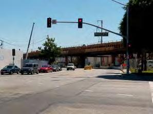
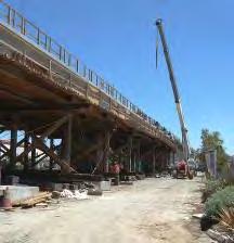
74 Figure 5-3. Metro Gold Line Eastside Extension and Metro Expo Line Construction 7/3/2014 Page 62
75 Segment 2 Due to the elevated freeway structure, it is expected that trackwork construction along the SR 60 ROW s southern edge would be visible from immediately adjacent locations. The removal of the mature trees spread patchily throughout the southern ROW would temporarily alter views for pedestrians along Via Campo and visitors of the Montebello Plaza. Additionally, a construction staging site would be located at the southeast corner of the Via Campo and Garfield Avenue intersection, an area that is primarily commercial. The construction staging area would be utilized for the movement and storage of construction equipment and materials, and eventually be constructed as a park and ride facility. The commercial property facing Garfield Avenue would not be acquired, but would temporarily bear the visual nuisance of the construction staging site and construction activities. Our Lady of Miraculous Medal Church, the Montebello Golf Course, and Bicknell Park are the nearest neighbors to this construction staging location. The trees along the perimeter boundary of the Montebello Golf Course and Bicknell Park would screen the construction activities from view. In addition to the existing view of SR 60 to the north, Our Lady of Miraculous Medal Church would have direct views of the construction staging site due to its proximity. Proposed mitigation would position portable planters and attractive fencing along the perimeter of the construction staging site to lower the extent of disturbance. Construction activities throughout Segment 2 would visually alter the existing environment, but would be temporary in terms of duration; thus, construction-related visual impacts would be less than significant. Segment 3 Construction activities associated with installing the aerial guideway and columns would occur along the freeway ROW adjacent to the OII landfill site. As discussed in Section 4.0, no visually-protected resources are located within this segment, and views of the construction activities along SR 60 would be visible to SR 60 motorists. Freeway motorists would be driving past the construction activities along the southern SR 60 ROW at relatively fast speeds. This category of viewers would have low sensitivity to changes in the visual quality. Background views of downtown Los Angeles to the west and the San Gabriel Mountains to the north would remain unimpaired during construction. The visual character of Segment 3 would be temporarily altered during construction, but would not significantly degrade visual quality since existing elements (i.e., the highway itself, vehicle traffic, and overhead utilities) already reduce the visual intactness and unity of the area. As such, construction-related visual impacts would be less than significant. SR 60 North Side Design Variation The SR 60 North Side Design Variation involves the installation of two aerial structures over SR 60 traffic and a mechanically stabilized earth (MSE) wall on the north side of the freeway in order to accommodate the at-grade guideway along the SR 60 ROW. Construction-related activities would continue to cause temporary visual disruptions related mainly to the excavating and clearing of brush and foliage along the northern Caltrans ROW, grading of a small hill, jobsite equipment, scaffolding associated with overpass construction, placement of supporting columns, and the laying of track and OCS. The construction of the aerial structures would introduce temporary construction activities and machinery into the freeway viewshed including cranes and a temporary falsework to support the aerial structure spanning across the freeway. It would be designed to the same specification as the current 7/3/2014 Page 63
76 overpass structures of Greenwood Avenue and Paramount Boulevard. Construction would not block views of freeway signs mounted on an overpass assembly. However, construction activities would obstruct distant views (only from the motorist's perspective) of the San Gabriel Mountains to the north. However, SR 60 is not a state-designated scenic highway and there are no sensitive viewer groups within the limits of this segment. Construction impacts would occur for approximately 12 to 18 months (the estimated time per mile) along the SR 60 ROW and would cease upon project completion; therefore, construction-related visual impacts would be less than significant. Segment 4 Within Segment 4, to accommodate the aerial guideway and columns, the large trees, located within the greenery between the SR 60 and Town Center Drive, would be removed. This would be a noticeable change throughout this segment and visible to motorists along the SR 60 and Town Center Drive, and pedestrians and visitors of the Shops at Montebello and Kaiser Permanente. Upon completion of the construction phase, the large screening trees would be replanted to shield views of the SR 60 from the Shops at Montebello and Kaiser Permanente. Portions of the existing surface parking lot at the Shops at Montebello would be required for station elements (i.e., park and ride, off-street bus stops, etc.). Station construction would not intrude upon the landscaped areas within Montebello Hills. Although construction activities would be glimpsed from numerous locations on the surface parking area and for variable lengths of time, the commercial occupants and patrons of the Shops at Montebello are thought to have a low-to-medium level of viewer sensitivity due to the focus on daily business and shopping activities. Pedestrian and bus patron views of the San Gabriel Mountains to the north would temporarily be obscured by construction activities. However, the construction phase would be shortterm and considered negligible. Therefore, construction-related impacts to the visual environment of Segment 4 would be less than significant. Segment 5 Construction activities within Segment 5 would remain entirely within the existing Caltrans ROW and would not encroach into the Whittier Narrows Recreational Area. However, views of construction activities would be available to both SR 60 motorists and park visitors of the Whittier Narrows Recreation Area. SR 60 motorists have a low level of visual sensitivity because their attention is directed mainly on driving and views of construction activities would be brief. The trees and vegetation within the Whittier Narrows Recreation Area would partially shield park visitor s views of construction equipment and activities along the SR 60 ROW; however, views would not be shielded in their entirety. Views of Legg Lake and recreational trails would not be altered and thus, the overall visual character for park visitors within the Whittier Narrows Recreation Area would remain intact throughout the construction phase. In addition, long-distant views of the San Gabriel Mountains to the north and Puente Hills to the east from Legg Lake would not be affected as a whole. Therefore, construction-related visual impacts through Segment 5 would be short-term in nature and would be considered less than significant. Segment 6 The currently vacant site, located within the USACE flood control basin at Santa Anita Avenue just south of SR 60 at Santa Anita Avenue, would be cleared and graded for the development of the Santa Anita Avenue station and associated TPSS, park and ride facility, and pedestrian access elements. While the federal government owns a portion of the vacant site, the USACE manages the land. The 7/3/2014 Page 64
77 remainder of the vacant site is maintained through a flowage easement, which would not permit the storage of construction equipment; thus, this proposed station site would not be used as a construction staging location. The residential community and group picnic visitors to the south of the vacant site would have northern views of the construction activities along the SR 60 ROW in the distance. However, viewer sensitivity is considered low because the vacant site encompasses an abandoned-feel due to the overgrowth of non-native grasses, some native shrubs, and tilled soil. It is anticipated that the residential community adjacent to the vacant site would not be sensitive to the visual change associated with the construction activities on the vacant site, which currently detracts from the overall visual quality of the area. Construction activities near the vicinity of Peck Road would require property acquisition and clearance for construction staging and the development of the proposed Peck Road station, park and ride facilities, and TPSS. Freeway motorists tend to focus on long to mid-range views straight ahead when traveling at posted speeds. The pedestrians on Peck Road and Durfee Avenue would have a greater awareness of the construction activities than the highway motorist. Motorists are not considered sensitive receptors unless driving on a scenic roadway that provides views of scenic landscapes. The employees and patrons of surrounding commercial area are not considered sensitive receptors as well because their attention is focused on work tasks (i.e., pumping gasoline, inflating car tires, utilizing the self-storage facility, and other activities). A sensitive receptor is generally an individual that is especially sensitive to changes in aesthetic qualities, which for example could include changes in nighttime lighting, increases in shading and shadows, or changes in the surrounding visual character (Refer to Section Sensitive Receptors). The construction phase is short-term in nature and would not impact visually-sensitive resources. Construction activities would not negatively affect the visual experience of the San Gabriel River trail users, since the main focus is the river path rather than the SR 60 ROW. In addition, the construction equipment activities would not impact the aesthetic appeal of the trail and river. Visual impacts as a result of construction elements would be less than significant due to the location of the station platforms, park and ride facility, and TPSS. Maintenance Yard For the SR 60 LRT Alternative, one potential site, approximately 11 acres in size, would be constructed as a new maintenance yard. The location of the potential site is proposed to be adjacent to the existing Mission Junction rail facility, bounded by I-5 to the east, I-10 to the south, the Los Angeles River to the west, and the Union Pacific rail line to the north. The industrial area is currently zoned for railroads and maintenance yard facilities. Thus, construction of the maintenance yard would not impede on the visual quality of the existing industrial character and would not obstruct views of downtown Los Angeles to the east and the San Gabriel Mountains to the north. Therefore, a less than significant impact would occur. Light and Glare Construction activities would primarily occur during daylight hours and, therefore, would not require lighting. Some activities may require night work (i.e., closing down freeway lanes or intersections), but exact closures and limited nighttime construction activities would be determined during Preliminary Engineering. However, when limited construction activities do occur during nighttime hours, lighting would be directed toward the construction areas and no spillover lighting is anticipated. Construction 7/3/2014 Page 65
78 would result in additional lighting at staging and station construction areas. This would require sufficient lighting for construction crews, which would be hooded and shielded to minimize spillover effects and glare. Construction would not significantly increase the ambient light levels in the vicinity because construction duration would be short and temporary and would not constitute a substantial source of light or glare. Lighting at potential staging areas (all proposed station locations except the Santa Anita Avenue station) would add glare to the existing commercial areas from unshielded light sources and potentially increase ambient nighttime light levels; although staging areas at both locations would be screened from view where appropriate. In addition, light and glare associated with staging areas are not anticipated to have an adverse effect because the locations would generally be located near existing roadway ROW and commercial centers, which are not light and glare sensitive land uses. As such, nighttime lighting impacts would be less than significant during construction of the SR 60 LRT Alternative. Shade and Shadow Equipment required for construction of columns and aerial stations would include drilling rigs, small bulldozers, large cranes, truck trailers to deliver pre-cast concrete girders, and related equipment. The erection of falsework or precast girders would be lifted over active roads by large cranes and secured to the columns. Thus, the potential for construction activities to result in shading and shadows along the SR 60 corridor would be minimal. Shade and shadow impacts from construction would be less than significant. Indirect Construction Impacts Construction of the SR 60 LRT Alternative would result in limited localized visual impacts on the areas adjacent to the freeway in the cities of Montebello, Monterey Park, Rosemead, South El Monte, and portions of East Los Angeles County and Whittier Narrows Recreation Area. Nighttime lighting would be introduced into the immediate API at construction staging locations and in select alignment locations where construction activities would occur at night. The project is located in an urban environment with substantial existing nighttime lighting. All lighting associated with project construction activities would be localized. In addition, heights of structures and construction-related facilities and equipment would be limited and localized to the areas immediately surrounding the freeway ROW, an existing visible transportation land use. Therefore, construction activities for the proposed project would be localized and not result in any indirect visual impacts to scenic resources, visual character, nighttime illumination, and shade and shadows as a result of construction; impacts would be less than significant. Summary Table 5-1 provides a summary of potential visual and aesthetic impacts along the SR 60 corridor during construction. 7/3/2014 Page 66
79 Table 5-1. SR 60 LRT Alternative Construction Impacts Summary Segment Scenic Vistas Visual Character Light and Glare Shade and Shadows 1 Minimal blockage of distant views of OII landfill site to the east; less than significant impacts/no adverse effects Removal of trees and vegetation along the southern SR 60 ROW; temporary visual contrast adjacent to residential community from construction activities and equipment; less than significant impacts/no adverse effects Construction activities would include nighttime security lighting; lighting would be hooded and shielded to prevent spillover and remain on staging site; less than significant impacts/no adverse effects Minimal shade and shadow effects along SR 60 ROW; less than significant impacts/no adverse effects 2 Minimal blockage of foreground views of OII landfill site to the east and background views of the San Gabriel Mountains to the north; less than significant impacts/no adverse effects Acquisition of existing surface parking area for station construction, parking, and staging site at Garfield Avenue; fencing associated with staging site would modify the character of area temporarily; less than significant impacts/no adverse effects Construction staging site would include nighttime security lighting; lighting would be hooded and shielded to prevent spillover and remain on staging site; less than significant impacts/no adverse effects Minimal shade and shadow effects along SR 60 ROW; less than significant impacts/no adverse effects 3 1 No blocked vistas of downtown Los Angeles skyline to the west and the San Gabriel Mountains to the north; less than significant impacts/no adverse effects No scenic resources within this segment; less than significant impacts/no adverse effects Construction activities would include nighttime security lighting; less than significant impacts/no adverse effects Minimal shade and shadow effects along SR 60 ROW; less than significant impacts/no adverse effects 4 Minimal blockage of distant views of the San Gabriel Mountains to the north; construction would not block background views of Montebello Hills to the south; less than significant impacts/no adverse effects Removal of large screening trees would change character of this segment; temporary disturbances to Shops at Montebello from construction of Shops at Montebello station; less than significant impacts/no adverse effects Construction activities at the station site would include nighttime security lighting; lighting would be hooded and shielded to prevent spillover and remain on staging site; less than significant impacts/no adverse effects Minimal shade and shadow effects along SR 60 ROW; less than significant impacts/no adverse effects 5 Minimal blockage of distant views of the San Gabriel Mountains to the north, Puente Hills to the east, and middle ground views of the Whittier Narrows Recreation Area to the south; less than significant impacts/no adverse effects Recreationalists would have limited visual effects of construction activities from Whittier Narrows Recreation Area and Legg Lake; less than significant impacts/no adverse effects Construction activities would include nighttime security lighting; lighting would be hooded and shielded to prevent spillover and remain on staging site; less than significant impacts/no adverse effects Minimal shade and shadow effects along SR 60 ROW; less than significant impacts/no adverse effects 7/3/2014 Page 67
80 Table 5-1. SR 60 LRT Alternative Construction Impacts Summary (continued) Segment Scenic Vistas Visual Character Light and Glare Shade and Shadows 6 Minimal blockage of vistas of the San Gabriel Mountains to the north and Puente Hills to the east; less than significant impacts/no adverse effects Limited visual effects from construction activities on vacant land and existing commercial property for development of Santa Anita Avenue and Peck Road stations; no scenic resources within this segment; limited visual disturbance on the San Gabriel River; less than significant impacts/no adverse effects Construction staging site would include nighttime security lighting; lighting would be hooded and shielded to prevent spillover and remain on staging site; less than significant impacts/no adverse effects Minimal shade and shadow effects along SR 60 ROW; less than significant impacts/no adverse effects Note: 1 Overall, the visual impacts from construction of the SR 60 North Side Design Variation would be similar to the construction of the SR 60 LRT Alternative in this segment with the exception of slightly blocked background views of the San Gabriel Mountains to the north Operational Impacts Operation of the SR 60 LRT Alternative would include both at-grade and aerial guideway segments. Visual change is expected with the introduction of the new guideway adjacent to SR 60. The following analysis provides a segment by segment discussion of potential operational impacts associated with introduction and operation of the LRT project. Regardless of whether the SR 60 North Side Design Variation is implemented or not, its visual impacts during operations would be similar to the operations of the SR 60 LRT Alternative, except as discussed below. A summary table of operational impacts for the SR 60 LRT Alternative (Table 5-2) is provided at the end of the impacts discussion Direct Operational Impacts Segment 1 At-grade operations would occur within the center of Pomona Boulevard from the existing Atlantic Station. The visual change along Pomona Boulevard due to the introduction of overhead wires and trackwork would be consistent with the LRT infrastructure on 3 rd Street. As the alignment approaches SR 60, the at-grade guideway would transition to aerial and would be supported by a retaining wall and columns on the southern edge of SR 60. The API is within urban areas and may be prone to graffiti. Therefore, the retaining walls and supporting columns have the potential to act as a canvas for graffiti taggers. However, specific measures such as installation of textured surfaces and implementation of a graffiti control program would minimize potential for graffiti. The aerial guideway would create a new visual element for pedestrians, residents, and golfers along Via Campo. However, the aerial structure would be consistent with the existing freeway infrastructure in terms of height, mass, and purpose; therefore, it would not defectively alter the viewing context from these viewer groups. Thus, the operation within this segment would result in a less than significant visual impact. 7/3/2014 Page 68
81 Segment 2 The aerial alignment would continue east within the southern portion of the SR 60 ROW, parallel to Via Campo. In order to accommodate the Garfield Avenue station, acquisition and removal of existing commercial businesses is proposed on the southeast corner of the intersection of Garfield Avenue and Via Campo. The station and associated parking structure and station access elements (e.g., on-street and off-street bus stops, kiss and ride areas, Americans with Disabilities Act (ADA) ramps, and pedestrian access ways) would be new visual elements to pedestrians, visitors of Montebello Plaza, and students and teachers of Our Lady of Miraculous Medal Church. However, the OCS and columns associated with the aerial guideway would not affect visual quality since existing conditions consist of utility lines and transmission towers, billboard signs, minimal landscaping, and freeway traffic. The alignment would be compatible with the segment s transportation-oriented character. The OII landfill site would continue to visually dominate the area; thus, the visual quality of Segment 2 would not substantially change and a less than significant impact would occur. Segment 3 The primary viewers of this alignment would be SR 60 motorists, and implementation of the aerial guideway would be consistent with the transportation-oriented character of Segment 3. The aerial alignment would not block views or lower the visual quality categories of views of the San Gabriel Mountains to the north and the downtown Los Angeles skyline to the west. The columns supporting the aerial guideway along the southern SR 60 ROW would appear diminutive in size compared to the OII landfill site. While the LRT guideway system would be a new visual element, it would not contrast with the transportation-related character of this segment. Thus, visual impacts would be less than significant. SR 60 North Side Design Variation The SR 60 North Side Design Variation includes 3,500 feet of at-grade and aerial alignment on the north side of SR 60. Two new aerial structures carrying the LRT guideway would have a column in the median of SR 60, comparable in size to the columns of existing structures. The resulting elevation of these structures would be unobtrusive as it would be comparable to that of adjacent structures and its surfaces may be treated to simulate an aesthetic design. The at-grade guideway on the MSE along the north side of SR 60 ROW may obstruct the distant views of the San Gabriel Mountains to the north because of its slightly elevated position with respect to the freeway; however, existing views are limited due to climatic conditions (i.e., smog), development, and transmission power lines and towers. The OII landfill site and SR 60 traffic would continue to be the visual focus along SR 60. Nursery, electrical power facilities, chemical processing, open storage, and vacant land uses are generally located north of SR 60, resulting in no sensitive viewer groups. The views from freeway motorists were generally assessed as low sensitivity. Therefore, there would be no adverse effect on a scenic vista or sensitive viewers. Similar to the SR 60 LRT Alternative, the SR 60 North Side Design Variation would add to the hardscape, but visual change would be minor due to the fact that the alignment would be compatible with the transportation character of the surroundings. Therefore, there would be no adverse effect. 7/3/2014 Page 69
82 Segment 4 Similar to Segments 2 and 3, the alignment would continue along the southern portion of the SR 60 ROW, and viewers on the south side of SR 60 would continue to experience the greatest visual change. These viewers include motorists, pedestrians, shopping mall visitors, health care facility employees and visitors, and bus transit riders. The mature trees along the freeway s southern ROW would be removed in order to accommodate the large columns of the aerial guideway, OCS, and the proposed Shops at Montebello station. Should these trees be considered historic, they would be stored where feasible and replanted close to their original locations within the SR 60 ROW. Instead of trees softening the freeway environment, viewer groups (pedestrian and visitors of the mall and health care facility) would take the visual brunt of the aerial guideway. However, the aerial guideway and station would not negatively affect visual character of the primarily commercial area. The natural features of Montebello Hills are also located too far from the alignment to be visually affected. Figure 5-4 shows a conceptual visual simulation of the proposed alignment from the existing bus stop on Town Center Drive, looking northeast towards the San Gabriel Mountains. The project-related structures in the visual simulation are conceptual pending Final Design. As shown in the conceptual simulation, the aerial alignment would be located above the existing vegetation and at an elevation much higher than SR 60 through this segment. As such, the aerial guideway and columns would slightly obscure bus rider and pedestrian views of the San Gabriel Mountains to the north. The proposed Shops at Montebello station and associated multi-level parking structure would not result in substantial adverse changes to the visual character of the area since the LRT elements are compatible with the commercial land uses of the surrounding development. Thus, this segment would result in less than significant visual impacts. Segment 5 The aerial alignment would continue to operate within the southern SR 60 ROW. The park visitors, bicyclists, joggers, and equestrian riders of the Whittier Narrows Recreation Area represent the viewer group with the highest level of concern for aesthetic issues. Views of the aerial guideway from the perspective of these viewers would mostly be obscured by the existing trees and vegetation located along the perimeter of the Whittier Narrows Recreation Area. Recreationists frequently visit Legg Lake and bikeways along the San Gabriel River and Rio Hondo and experience it at a relatively slow pace; thus, views of both the SR 60 Freeway and the LRT project would be available from close- and midrange locations. For instance, as shown in the conceptual visual simulation (Figure 5-5), sporadic views of the aerial guideway are anticipated from Legg Lake, looking north towards SR 60. The change to the visual environment due the introduction of the LRT project is not anticipated to be adverse because the greenery, tree density, and Legg Lake in the Whittier Narrows Recreation Area would remain intact and the park s scenic quality would continue to visually dominate the area. Therefore, introduction of the SR 60 LRT Alternative would result in less than significant visual impacts to the Whittier Narrows Recreation Area. 7/3/2014 Page 70
 The Shops at Montebello")
83 Existing Not to Scale Conceptual Figure 5-4. Visual Simulation (Segment 4) The Shops at Montebello 7/3/2014 Page 71
 - Legg Lake in Whittier Narrows")
84 Existing Not to Scale Conceptual Figure 5-5. Visual Simulation (Segment 5) - Legg Lake in Whittier Narrows Recreation Area 7/3/2014 Page 72
85 Segment 6 The aerial alignment would remain in the southern portion of the SR 60 ROW. The proposed Santa Anita Avenue station would be located adjacent to single-family residences, group picnic areas, and South El Monte High School. The proposed Santa Anita Avenue station located within the USACE flood control basin just south of SR 60 and east of Legg Lake consists of vacant land vegetated primarily with non-native grasses, with some native shrubs (elderberry and flannel bush) located along the north and west perimeter fenceline. Much of the proposed station area appears to be bare soil that has been tilled. The visual changes perceived by the nearest sensitive viewers are anticipated to be minimal because the Santa Anita Avenue station would ultimately replace an unattractive, vacant site. Similar to the Santa Anita Avenue station, the proposed Peck Road station would be elevated at approximately 30 feet in height and include station architectural treatment and safety fencing. In the vicinity of the Peck Road station, pedestrians along Peck Road and Durfee Avenue would have clear views of the aerial guideway and station on a daily basis. The scale of the freeway would allow the station to fit within the visual character of the surrounding area. Employees and patrons from the gasoline stations and motel are considered to have less sensitivity to these views as most of their time is spent focused on work tasks (e.g., pumping gas, inflating car tires, utilizing the self-storage facility, and other activities). In addition, the nearby commercial office and storage facilities are not aesthetically appealing and not considered sensitive receptors due to their generally functional design conditions and surroundings. Motorists are not considered sensitive viewers as well because Durfee Avenue, Peck Road, and SR 60 are not scenic roadways. Views of the San Gabriel Mountains to the north, Puente Hills to the east, and the San Gabriel River along the bike trail would be minimally disrupted for bicyclists, joggers, and equestrian riders because existing billboards, freeway signs, transmission towers, utility poles, and freeway traffic already affect these public views. Thus, the visual effects of the aerial guideway and stations would not substantially degrade key views along the southern SR 60 ROW. Overall, the operational effects of the SR 60 LRT Alternative would not contribute to the long-term degradation of the visual quality of the API. The elevated profile of the SR 60 LRT Alternative would represent negligible adverse visual effects and result in minor changes to the visual environment. In addition, no architecturally significant historic resources exist along this corridor. Therefore, impacts to the visual character of the SR 60 corridor would be less than significant. Maintenance Yard For the SR 60 LRT Alternative, one potential site, approximately 11 acres in size, has been preliminarily identified for the location of a new maintenance yard. The location of the potential site is proposed to be adjacent to the existing Mission Junction rail facility, bounded by I-5 to the east, I-10 to the south, the Los Angeles River to the west, and the Union Pacific rail line to the north. The industrial area is currently zoned for railroads and maintenance yard facilities. Thus, operation of this maintenance yard would fit within the context of the existing industrial character and the surrounding land uses. Furthermore, it would not obstruct views of the downtown Los Angeles skyline to the east and the San Gabriel Mountains to the north. Therefore, impacts would be less than significant. 7/3/2014 Page 73
86 Existing maintenance yards of the Metro Rail system are predominantly located in industrial settings and locations for potential sites associated with this project are not unusual. Light and Glare Operation of the SR 60 LRT Alternative would introduce new nighttime lighting associated with the four stations and LRVs. However, light and glare is not anticipated to result in significant impacts to adjacent land uses because the alignment would generally be located in the southern portion of the SR 60 ROW, which currently produces freeway-related light and glare. Nighttime lighting for the stations would represent a negligible addition to light and glare as station locations would be situated adjacent to existing commercial and residential uses with similar light intensity/conditions. Nighttime security lighting associated with parking structures would be shielded to remain on-site and the proximity of proposed parking structures relative to light-sensitive uses is distant enough that any spillover light would not affect light-sensitive uses. Light-sensitive uses include residences, visually-sensitive historic properties, and select natural areas. Light from headlights on LRVs would not shine directly onto homes since trains would be traveling along the southern SR 60 ROW. Therefore, residential uses would not be affected by nighttime lighting from trains on the elevated guideway. In addition, the light intensity from trains would be comparable to existing vehicular traffic along the alignment. New metal surfaces associated with stations and LRVs would potentially reflect sunlight and produce brief and intermittent glare during daytime hours. However, materials used in the station design would be selected to minimize glare impacts. Metal surfaces can also be treated to reduce glare. As such, the additional lighting resulting from project implementation would not constitute a substantial new light source along the project alignment. Therefore, impacts related to light and glare would be less than significant. Shade and Shadow Operation of the SR 60 LRT Alternative would involve LRVs running at-grade and above-grade, mostly the latter, throughout the alignment. Supporting columns would be required in order to support the aerial guideway, overhead catenary structures, and station platforms. Elevated stations would be approximately 30 feet in height. The shade and shadow pattern created by the elevated guideway segment would change throughout the day and seasonally. CEQ defines an adverse shadow impact when a shadow falls on a public open space, residential uses, or an historic resource with features that depend on sunlight to make it significant. No historic resources are located within the proximity of SR 60. Although the aerial guideway traverses through the Whittier Narrows Recreation Area along the SR 60 corridor, the length of shadows would not reach or cast on the shade-sensitive uses of the recreational area; shading would be cast onto parking lots in the northern most portions of the Whittier Narrows Recreation Area. The potential for shading effects along SR 60 would be minimal due to the lack of shade-sensitive land uses. Portions of residential neighborhoods adjacent to SR 60, which are currently unshaded by the freeway structures, would remain unshaded despite its proximity to the proposed alignment because shadows from aerial structures are not projected directly to the south. Therefore, residences along Via Campo and directly south of SR 60 would not be shaded. Thus, project-related shade and shadow impacts would be less than significant. Indirect Operational Impacts Implementation and operation of the SR 60 LRT Alternative would be localized, including all projectrelated lighting and visible only from the immediate vicinity of the project alignment. New nighttime 7/3/2014 Page 74
87 lighting would be introduced into the immediate API and at station locations as a result of project implementation. Additionally, station platforms and catenary structures would be limited in height. Impacts to visual character and environment, nighttime lighting, and shade and shadow would result from implementation or operation of the SR 60 LRT Alternative. Summary Table 5-2 provides a summary of potential visual and aesthetic impacts along the SR 60 corridor during operation. Table 5-2. SR 60 LRT Alternative Operational Impacts Summary Segment Scenic Vistas Visual Character Light and Glare Shade and Shadows 1 Minimal blockage of distant views of OII landfill site to the east and Montebello Golf Course to the south from the SR 60 ROW; less than significant impacts/no adverse effects No scenic resources within this segment; less than significant impacts/no adverse effects Minimal new sources of light and glare; less than significant impacts/no adverse effects Minimal shade and shadow effects along the SR 60 ROW; less than significant impacts/no adverse effects 2 Minimal blockage of middle ground views of OII landfill site to the east and background views of the San Gabriel Mountains to the north; less than significant impacts/no adverse effects New visual elements associated with an aerial station would alter the character of this segment but not degrade visual quality; less than significant impacts/no adverse effects Lighting levels would increase at Garfield Avenue station, but would not create spillover lighting on residences; less than significant impacts/no adverse effects Minimal shade and shadow effects along the SR 60 ROW; less than significant impacts/no adverse effects 3 1 No blockage of distant views of the downtown Los Angeles skyline to the west and the San Gabriel Mountains to the north; less than significant impacts/no adverse effects Aerial guideway elements would be consistent with predominantly freeway-related character of area; less than significant impacts/no adverse effects Minimal new sources of light and glare; less than significant impacts/no adverse effects Minimal shade and shadow effects along the SR 60 ROW; less than significant impacts/no adverse effects 7/3/2014 Page 75
88 Table 5-2. SR 60 LRT Alternative Operational Impacts Summary (continued) Segment Scenic Vistas Visual Character Light and Glare Shade and Shadows 4 Aerial guideway would partially obstruct views of the San Gabriel Mountains to the north from the Shops at Montebello; less than significant impacts/no adverse effects Columns and the aerial guideway in place of the large, screening trees would change the visual character of this segment, but new landscaping including trees and shrubs would re-establish the vegetative character along SR 60; Shops at Montebello station would introduce new visual elements to the commercial area; less than significant impacts/no adverse effects Lighting levels would increase at this station, but would not create spillover lighting on residential land uses; less than significant impacts/no adverse effects Minimal shade and shadow effects along the SR 60 ROW; less than significant impacts/no adverse effects 5 Minimal blockage of background vistas of mountains to the north and east; motorist views of the Whittier Narrows Recreation Area would be obscured by the aerial guideway in addition to existing tree density; less than significant impacts/no adverse effects Aerial LRT would reduce motorist views of the Whittier Narrows Recreation Area and Legg Lake from SR 60; visual continuity of the recreational space would not be disrupted; less than significant impacts/no adverse effects Glare and nighttime light would not significantly intrude onto the Whittier Narrows Recreation Area; less than significant impacts/no adverse effects Minimal shade and shadow effects along the SR 60 ROW; less than significant impacts/no adverse effects 6 Aerial LRT would not substantially alter existing background views of the mountains or San Gabriel River from the existing SR 60 ROW; less than significant impacts/no adverse effects LRT improvements would be consistent with industrial and commercial character of this segment; LRT would not substantially alter or degrade existing visual character; less than significant impacts/no adverse effects Santa Anita Avenue and Peck Road stations would introduce new light sources, oriented to avoid spillover lighting onto adjacent residences; less than significant impacts/no adverse effects Minimal shade and shadow effects along the SR 60 ROW; less than significant impacts/no adverse effects Note: 1 Overall, the visual impacts during operations of the SR 60 North Side Design Variation would be similar to the operation of the SR 60 LRT Alternative in this segment with the exception of negligible blocked views of the San Gabriel Mountains to the north Cumulative Impacts Cumulative Construction Impacts Other planned and/or proposed development projects throughout the project area have gone through or are going through the planning process. Several additional transportation projects are being planned and/or implemented in the SR 60, including Caltrans construction of HOV lanes in both directions of SR 60 between SR 57 and I-605; Metro s proposed congestion relief improvements to the I-605 and SR 60 interchange; and, the California High-Speed Rail (HSR) Study s alternative (Los Angeles to San Diego segment) along SR 60. These projects are listed in the Cumulative Impacts 7/3/2014 Page 76
89 Technical Memorandum. The Monterey Park Market Place commercial center is proposed to be built on the 45-acre north parcel of the OII former landfill site adjacent to the SR 60. These future development projects would be subject to independent environmental review and mitigation in accordance with state and federal laws. However, given the transportation and commercial nature of these projects proposed within an existing transportation corridor, adverse effects on visual quality and character from these proposed and reasonably foreseeable projects would not be expected. Additionally, none of these projects are expected to be undergoing construction simultaneously with the SR 60 LRT Alternative. Therefore, in combination with other planned and approved projects in the area, construction of the SR 60 LRT Alternative and SR 60 North Side Design Variation would not contribute to a cumulatively significant impact on visual quality and character. This alternative would not result in direct or indirect nighttime illumination impacts during construction, nor would the alternative result in significant shade and shadow impacts. Therefore, the alternative would not result in, or contribute to, cumulatively considerable nighttime illumination or shade and shadow impacts Cumulative Operational Impacts Visual impacts associated with the operation of the SR 60 LRT Alternative would be cumulatively considerable if combined with potentially similar impacts of existing, planned, and reasonably foreseeable development in the API. Given the infrastructure-related nature of the transportation projects listed above, visual impacts would not be cumulatively considerable. The Monterey Park Market Place would be developed north of SR 60 on an area formerly used as a landfill, but would be consistent with the surrounding urban character. The signage for this commercial development project would not substantially alter the existing urban character and is anticipated to be taller than the MSE wall associated with SR 60 North Side Design Variation. The MSE wall would include aesthetic treatments such as landscaping or concrete designs, which would not detract from visibility or enhance the appearance of the freeway adjacent to the proposed Monterey Park Market Place development. No cumulative impacts to aesthetic resources and scenic vistas would occur. There are several LRT systems that are located along freeway corridors near activity centers. For example, the San Diego Trolley s Green Line is a 5.8 mile line that travels primarily within fenced ROW along the south side of the I-8 freeway. The line includes elevated and at-grade sections, and a tunnel under San Diego State University campus. In Los Angeles, the Metro Green Line is also an east-west route running along the freeway, primarily in the median of I-105. The Metro Gold Line is another LRT line that runs in the median of I-210. Therefore, in combination with other planned and/or reasonably foreseeable future projects, operation of the SR 60 LRT Alternative and SR 60 North Side Design Variation would not contribute to a cumulatively significant impact on visual quality and character. Both light and glare impacts associated with project operations are site-specific. Cumulative development within the surrounding areas could result in an increase in daytime glare and ambient nighttime lighting. For instance, the proposed lighting on the buildings and signs of the Monterey Park Market Place would create new sources of light to the area that would contribute to cumulative light levels. However, the city of Monterey Park s Municipal Code requires all outdoor lighting in commercial zones to be shielded to prevent light spillage. Therefore, the alternative and cumulative projects would not substantially contribute to significant cumulative light and glare impacts. In 7/3/2014 Page 77
90 addition, the shade and shadow impacts from operations within the surrounding area would not be significant; consequently, the project would not contribute to or result in cumulative significant shade and shadow impacts. 5.4 Washington Boulevard LRT Alternative Construction Impacts The Washington Boulevard LRT Alternative includes a two-track, fixed guideway system located along the median of 3 rd Street/Pomona Boulevard, Garfield Avenue, and Washington Boulevard on both aerial and at-grade configurations. Trackwork construction would involve installation of columns and in the at-grade portions, demolition of the median of the roadway in order to install rail tracks, ancillary facilities, and station platforms. Construction activities, equipment, worker vehicles, trailers, and staging locations would be visible to nearby land uses for a period of 12 to 18 months at any one location. The total construction duration is estimated for four to six years. Due to the generally flat topography throughout this alignment, it is expected that the trackwork construction and equipment would be visible from immediately adjacent locations. Segment 1 Construction activities would be in the center of 3 rd Street/Pomona Boulevard, to the east of the existing Pomona Station, and would be seen mainly by motorists, pedestrians, and commercial property owners and visitors. This street does not have a landscaped median, rather a median lane for turns only. Construction activities would include the removal of a majority of trees along Via Campo fronting the southern edge of the SR 60 ROW, which partially screens the SR 60 corridor from residences views. Removal of the trees screening the freeway would be inconsistent with local policies related to the preservation of tree plantings and constitutes a significant impact. However, as part of proposed mitigation, relocation or planting of new trees would occur along the berm upon completion of construction. Proposed mitigation would ensure that no significant impacts would occur. In addition, construction activities would be short-term in nature and the extent of the visual nuisance from construction equipment and vehicles would be limited to Via Campo and the embankment adjacent to SR 60. Thus, construction-related activities within Segment 1 would result in a less than significant visual impact. Segment 2 Similar to the SR 60 LRT Alternative, for this project alternative, construction staging would take place at the southeast corner of the Via Campo and Garfield Avenue intersection, an area that is primarily commercial. The construction staging site would be utilized for storage of construction equipment and materials. The construction site would be sheltered from direct public view by temporary construction walls; viewers of these temporary construction walls could include patrons of the neighboring Our Lady of the Miraculous Medal Church, golfers at the adjacent Montebello Golf Course, recreational patrons at Bicknell Park, patrons of the commercial businesses located adjacent to the proposed construction staging area and future station site, and motorists traveling north and south on Garfield Avenue. Portions of the existing strip mall would be acquired and demolished in order to operate the construction staging site and subsequently construct the proposed Garfield Avenue station and associated parking structure. There is the potential for park and ride facilities to be developed as TODs in the future, but not as part of this project. This environmental document does not evaluate any specific TOD opportunity for the proposed station locations. Construction activities 7/3/2014 Page 78
91 would temporarily alter views of Our Lady of the Miraculous Medal Church and would be visible to the sensitive viewers at Bicknell Park and the Montebello Golf Course. Just south of Bicknell Park and the Montebello Golf Course is Rod s Grill Coffee Shop at Via Acosta. As discussed in the separate Cultural Resources Technical Memorandum, this building is eligible for listing in the NRHP for its architectural significance. As proposed, one of the columns associated with bents straddling Garfield Avenue would be located near the back of the coffee shop along the sidewalk. The construction of this column at this location, as well as additional construction activities that would occur adjacent to Rod s Grill Coffee Shop would not detract from views of the architecturally significant building. Therefore, construction-related impacts would not significantly impact the coffee shop building. Throughout the remainder of Segment 2, construction activities (north of Whittier Boulevard) would primarily involve installing bents and an aerial guideway that straddles Garfield Avenue. Adjacent to the Montebello Golf Course and Bicknell Park, the existing mature trees lining both sides of Garfield Avenue would be removed in order to accommodate the construction and placement of columns and supporting bents. Golfers and users of the park would have oblique views of construction activities along Garfield Avenue with the removal of trees. However, proposed mitigation would ensure no significant impacts would occur. Additionally, due to the proximity of residential areas along Garfield Avenue, introduction of construction activities would cause an adverse, but temporary, visual change to the neighborhood. The multi-family residential building located immediately adjacent to the alignment along Garfield Avenue would have vast and evolving views of the various phases of construction. South of Beverly Boulevard, columns would be constructed in the center of Garfield Avenue to support the aerial guideway. The aerial guideway construction activities adjacent to Ashiya Park and Cantwell Sacred Heart of Mary High School would be a temporary visual nuisance. At Whittier Boulevard, property acquisition would be required to construct the Whittier Boulevard station above the existing street. The bulk of construction would temporarily obstruct views, detract from the Montebello Welcomes You marquee at the city limit line, and alter the visual character along the corridor for the short-term. South of Whittier Boulevard, the residential neighborhood of the Montebello Park Historical District consists mainly of early homes dated from the mid-1920s. Implementation of the aerial guideway along Garfield Avenue would intersect views from Northside Drive, Olympic Boulevard, and Southside Drive within the historical district, a location that is visually-sensitive. Residential viewers typically have a high level of sensitivity to any changes to foreground views due to their desire to preserve an attractive neighborhood environment near their homes. The residential areas located immediately adjacent to the alignment would have views of construction activities associated with building the aerial structures. While this would temporarily affect the neighborhood, the identifying features that define the historic district would not be damaged or removed by the aerial structure along Garfield Avenue. Due to the relatively spacious landscape design of this community, there would be less than significant visual impacts related to construction of the aerial guideway system within views of the historical district. Throughout Segment 2, construction activities would temporarily affect views of sensitive uses, including Montebello Golf Course, Bicknell Park, Our Lady of Miraculous Medal Church, private 7/3/2014 Page 79
92 residences, Cantwell Sacred Heart of Mary High School, the Montebello Welcomes You marquee, and Ashiya Park. Therefore, visual impacts would be less than significant due to the short-term nature of construction activities. Segment 3 Segment 3 begins south of the UPRR tracks along Garfield Avenue. Within this segment, the alignment would continue to use an elevated structure to cross over the UPRR and subsequently turn east on Washington Boulevard. This area is primarily industrial in character. Construction activities, while a visual nuisance, would not be obtrusive or affect visually-sensitive uses within the industrial areas of the cities of Montebello and Commerce. The Pacific Metals Company building is located on the northwest corner of the Garfield Avenue and Washington Boulevard intersection. As discussed in the Cultural Resources Technical Memorandum, the Pacific Metals Company building is considered eligible for listing in the NRHP due to its embodiment of International style aesthetic. Due to the building s proximity to the project alignment, views of the Pacific Metals Company building would be sensitive. Construction of an aerial guideway would not strongly contrast with the setting of the Pacific Metals Company building, since the industrial uses would continue to dominate the visual character along this corridor. The building would retain its design integrity throughout construction; therefore, the Washington Boulevard LRT Alternative would not impact this resource. Visual impacts during construction within Segment 3 would be less than significant. Segment 4 Segment 4 spans along Washington Boulevard from Greenwood Avenue to the Rio Hondo and Rio Hondo Coastal Basin Spreading Grounds. Construction activities in the vicinity of Greenwood Avenue and Washington Boulevard would temporarily alter the existing visual character in this area. However, within the vicinity of the proposed station site, no visually-sensitive resources have views of this area. Within this segment, the aerial guideway would transition to eventually run at-grade in the center of Washington Boulevard. Therefore, while construction activities in the western portion of this segment would primarily involve the installation of columns within the center of Washington Boulevard, construction activities east of Greenwood Avenue would primarily occur at-grade and involve demolition of the roadway median and at-grade construction activities throughout the eastern portion of this segment. The mature trees located within the median of Washington Boulevard, bisecting the Rio Hondo Coastal Basin Spreading Grounds, would be permanently removed to accommodate the at-grade LRT tracks. However, these trees would be relocated or replaced (after the completion of construction activities) on both sides of the roadway in order to recreate a visual effect similar to what currently exists. Additionally, the existing vistas of the San Gabriel Mountains and Puente Hills to the north and east, respectively, would not be obstructed during construction from a motorist's, bicyclist's, or pedestrian s perspective. Therefore, visual impacts related to construction activities within Segment 4 would be less than significant. 7/3/2014 Page 80
93 Segment 5 Segment 5 includes the span of Washington Boulevard through the city of Pico Rivera between the Rio Hondo and Rio Hondo Coastal Basin Spreading Grounds and the San Gabriel River. The construction of the at-grade guideway along Washington Boulevard would visually disrupt the existing visual character of the city of Pico Rivera, including views of the Pico Rivera Towne Center and residential community. Adjacent to the Towne Center, construction activities would primarily occur within the median of Washington Boulevard. Property acquisition would be required for the construction of the park and ride facility serving the proposed Rosemead Boulevard station. Two options are being considered within Segment 5 in the vicinity of Washington Boulevard and Rosemead Boulevard: an atgrade and aerial crossing option over Rosemead Boulevard. Rosemead Boulevard Aerial Crossing The Rosemead Boulevard aerial crossing would be grade-separated in order to address local circulation and safety issues. Two retaining walls would be constructed along the middle lane of Washington Boulevard. Development of a station bridge would also be required to access the center platform station. The construction equipment necessary to elevate the LRT tracks on retaining walls would visually intensify construction activity at this major intersection. East of Rosemead Boulevard, residences, including a historically-recognized Cliff May designed ranch house, would directly face construction activities along the median of Washington Boulevard. In the vicinity of the residential area, the aerial structure would be transitioning down to at-grade; as such, construction activities would be occurring well above street level. Although most views of Washington Boulevard are at least partially obscured by existing sidewalk plantings, residents would have shortterm views of construction activities from their homes and neighborhoods. No visually-sensitive resources exist within this portion of Segment 5; thus, construction-related impacts would be less than significant due to the temporary change in visual character in the vicinity of the Washington Boulevard/Rosemead Boulevard intersection. Rosemead Boulevard At-grade Crossing Construction of the at-grade option in the vicinity of Washington Boulevard and Rosemead Boulevard would result in construction activities occurring at ground level through the commercial corridor of Washington Boulevard just west of Rosemead Boulevard and then continuing eastward through the residential community. However, visibility of Washington Boulevard from the residential neighborhoods (including the Cliff May designed ranch house) located north and south of the boulevard, is partially shielded by landscaped medians adjacent to frontage roads between Washington Boulevard and the residences. With construction activities occurring at-grade through this portion of the corridor, views of the construction activity would be minimal and visual impacts would be less than significant. In the vicinity of the San Gabriel Coastal Basin Spreading Grounds and San Gabriel River, the construction for the at-grade option would occur on the existing river bridge and under the freeway underpass (described further in Segment 6). The bridge would require retrofit to handle the additional load and widening to accommodate both the traffic lanes and LRT tracks. 7/3/2014 Page 81
94 Grade Separation Options Crossing the San Gabriel River In the vicinity of the San Gabriel Coastal Basin Spreading Grounds and San Gabriel River, construction of the aerial option would include construction of a new bridge to the south of the existing bridge over the river. The new structure would require placement of columns and footings to accommodate the bridge. Bicyclists and trail users along the San Gabriel River would have short duration views of construction activities. North of the existing bridge, the trail offers viewscapes of the San Gabriel Mountains to the north and the transmission lines and Puente Hills to the northeast. The river trail would not be altered and would not affect the visual experience of the trail user. The construction activities would negligibly reduce visual quality throughout the eastern portion of Segment 5 and temporarily alter the viewing context of the residential character along Washington Boulevard east of Rosemead Boulevard and the San Gabriel River crossing. As such, construction-related visual impacts throughout Segment 5 would be less than significant. Segment 6 Segment 6 begins from the eastern portion of the San Gabriel River and includes crossing I-605 and then continuing to the end-of-line station at Lambert Road. To cross I-605, there are two options being considered: an at-grade option crossing underneath the existing I-605 overpass of Washington Boulevard and an aerial option crossing over the interstate. Aerial Option Crossing I-605 To cross over I-605, the aerial transition from the San Gabriel River crossing, as described in Segment 5, would continue east and construction of an aerial structure in excess of 50 feet in height crossing over the highway would be required. The alignment would transition down to at-grade east of the freeway near Pioneer Boulevard. The construction of the aerial structures would introduce some large construction activities and machinery into the freeway viewshed including cranes and temporary falsework to support the aerial structure span across the freeway. Students and teachers at Pioneer High School would not have clear views of the construction because its façade is visually focused along Pioneer Boulevard and Slauson Avenue. The residential community between Pioneer and Norwalk Boulevards would have direct views of construction activities along Washington Boulevard. However, construction of the aerial option would be temporary in nature and therefore result in less than significant visual impacts within Segment 6. San Gabriel River/I-605 At-grade Crossing The San Gabriel River/I-605 at-grade crossing would involve construction activities occurring at street level in the median of the Washington Boulevard throughout the length of the segment. The presence of construction equipment and laying of trackwork may visually disrupt the residential community between Pioneer and Norwalk Boulevards and the overall commercial activity of the corridor for a limited time during the construction phase. The tall palm trees along the median of Washington Boulevard between Allport and Appledale Avenues would be removed in order to accommodate the at-grade LRT system as it continues east along Washington Boulevard. However, these palm trees would be relocated along the sides of the roadway in order to recreate a similar visual effect as it currently exists. 7/3/2014 Page 82
95 Development of the Norwalk Boulevard and Lambert Road stations and associated park and ride facilities would require property acquisition of commercial and industrial land uses. While no visuallysensitive resources are located within Segment 6 of the Washington Boulevard LRT Alternative, construction-related activities would temporarily affect the visual character of the streetscape; these temporary effects constitute a less than significant visual impact. Maintenance Yards For the Washington Boulevard LRT Alternative, three potential sites have been preliminarily identified for the location of a new maintenance yard. The location of the first potential site is proposed to be within the existing Mission Junction rail facility, bounded by I-5 to the east, I-10 to the south, the Los Angeles River to the west, and the Union Pacific rail line to the north. This is the same maintenance yard option proposed for the SR 60 LRT Alternative. The industrial area is zoned and currently used for railroads and maintenance yard facilities. Thus, construction of the first potential maintenance yard would not impede on the visual quality of the existing industrial character and would not obstruct views of the downtown Los Angeles skyline to the east and the San Gabriel Mountains to the north. The second potential maintenance yard, approximately 12 acres in size, would be located within Segment 3, west of Garfield Avenue on SCE s transmission line ROW. The parcel is designated for electrical power facility use. Construction activities would occur adjacent to non-sensitive land uses (manufacturing, assembly, and industrial services). The lead tracks to the maintenance yard would be located within the southern portion of the UPRR ROW, approximately 1,600 feet away from the mainline on Garfield Avenue. Thus, construction of the second potential maintenance yard would be shielded from viewers along Garfield Avenue due to existing industrial development. No substantial change in visual quality would occur during construction activities of this maintenance site. The third potential maintenance yard, approximately nine acres in size, would be located within Segment 6, immediately south of Washington Boulevard and east of Allport Avenue. The land uses within and adjacent to the site include primarily commercial and industrial development. Development of the maintenance yard would result in the replacement of one industrial site for another light-industrial use (the maintenance of LRVs). Therefore, no substantial change in visual quality would occur on this site. The Metro Design Criteria, as specified in Section , would require that the potential maintenance yards be constructed and designed in a manner that would appropriately consider the existing urban context in which the maintenance yard is located. Additionally, implementation of these facilities would not result in a substantial change in visual quality. Therefore, the change in visual quality would not result in a degradation of the area in association with construction of the maintenance yards, and, as such, visual impacts would be less than significant. Light and Glare Construction activities would primarily occur during daylight hours and, therefore, would not require lighting. However, when limited construction activities are performed during nighttime hours (i.e., closing down intersections) lighting would be directed toward the construction areas such that no spillover lighting is anticipated. Construction would result in additional nighttime security lighting at construction staging areas, which would be hooded and shielded to minimize spillover effects and glare. Construction activities and the lighting associated with construction would not significantly 7/3/2014 Page 83
96 increase the ambient light and would not constitute a substantial source of light or glare. As such, nighttime lighting impacts would be less than significant during construction of the Washington Boulevard LRT Alternative. Shade and Shadow Within Segments 1 through 3, equipment required for construction of columns and aerial stations would include drilling rigs, pile drivers, small bulldozers, large cranes, truck trailers to deliver pre-cast concrete girders and other related equipment. The erection of falsework or precast girders would be lifted over active roads by large cranes and secured to the columns. Thus, the potential for construction activities to result in shading and shadows along the Washington Boulevard LRT Alternative would be minimal; impacts from construction would be less than significant. Indirect Construction Impacts Construction of the Washington Boulevard LRT Alternative would result in limited localized visual impacts on the areas adjacent to the project alignment through the cities of Montebello, Commerce, Pico Rivera, Santa Fe Springs, and Whittier. Nighttime lighting would be introduced into the immediate API at construction staging locations and in select alignment locations where construction activities would occur at night. The project is located in an urban environment with substantial existing nighttime lighting. All lighting associated with project construction activities would be localized. In addition, heights of structures and construction-related facilities and equipment would be limited and localized to the areas immediately surrounding the proposed alignment. Therefore, construction activities for the proposed project would be localized and not result in any indirect visual impacts to scenic resources, visual character, nighttime illumination, and shade and shadows as a result of construction; impacts would be less than significant. Summary Table 5-3 summarizes the visual quality impacts during construction to each of the recognized visual and historic resources for the Washington Boulevard LRT Alternative, previously listed in Tables 4-1(b) and 4-2. Table 5-4 provides a summary of potential visual and aesthetic impacts along the Washington Boulevard LRT Alternative alignment during construction. Table 5-3. Washington Boulevard LRT Alternative Construction Impacts on Visually-Sensitive Resources Segment Visually-Sensitive Resources Visual Character Light and Glare Shade and Shadow 2 Montebello Golf Course and Bicknell Park LTS LTS LTS 2 Montebello Hills LTS LTS NO 2 Rod s Grill Coffee Shop LTS LTS LTS 2 Ashiya Park LTS LTS LTS 7/3/2014 Page 84
97 Table 5-3. Washington Boulevard LRT Alternative Construction Impacts on Visually-Sensitive Resources (continued) Visually-Sensitive Resources Visual Character Light and Glare Shade and Shadow 2 Cantwell Sacred Heart of Mary High School LTS LTS LTS 2 "Montebello Welcomes You" Sign LTS LTS LTS 2 Montebello Park Historic District LTS LTS LTS 3 Pacific Metals Company Building LTS LTS LTS 4 Rio Hondo and Rio Hondo Coastal Basin Spreading Grounds LTS LTS NO 5 Cliff May designed Ranch House LTS LTS NO 5 San Gabriel River LTS LTS NO 6 Palm trees in median of Washington Boulevard, City of Santa Fe Springs LTS N/A N/A 6 Puente Hills LTS LTS NO Key: NO = no impact/no effect LTS = less than significant impact/no adverse effect SI = significant impact/adverse effect N/A = not applicable Table 5-4. Washington Boulevard LRT Alternative Construction Impacts Summary Segment Segment Scenic Vistas Visual Character Light and Glare Shade and Shadows 1 Minimal blockage of distant views of OII landfill site to the east; less than significant impacts/no adverse effects Removal of trees and vegetation along the southern SR 60 ROW; temporary visual contrast adjacent to residential community from construction activities and equipment; less than significant impacts/no adverse effects Limited constructionrelated lighting; less than significant impacts/no adverse effects Minimal shade and shadow effects; less than significant impacts/no adverse effects 2 Minimal blockage of background views of the San Gabriel Mountains to the north and Puente Hills to the east; less than significant impacts/no adverse effects Construction activities would temporarily alter the visual character of the corridor s neighborhood and negligibly affect the visual integrity and vividness of visually-sensitive resources; less than significant impacts/no adverse effects Construction staging site would include nighttime security lighting; lighting would be hooded and shielded to prevent spillover; less than significant impacts/no adverse effects Shade and shadow effects limited during construction; less than significant impacts/no adverse effects 7/3/2014 Page 85
98 Table 5-4. Washington Boulevard LRT Alternative Construction Impacts Summary (continued) Segment Scenic Vistas Visual Character Light and Glare Shade and Shadows 2 Minimal blockage of background views of the San Gabriel Mountains to the north and Puente Hills to the east; less than significant impacts/no adverse effects Construction activities would temporarily alter the visual character of the corridor s neighborhood and negligibly affect the visual integrity and vividness of visually-sensitive resources; less than significant impacts/no adverse effects Construction staging site would include nighttime security lighting; lighting would be hooded and shielded to prevent spillover; less than significant impacts/no adverse effects Shade and shadow effects limited during construction; less than significant impacts/no adverse effects 3 Minimal blockage of background views of the downtown Los Angeles skyline to the west; less than significant impacts/no adverse effects Surrounding land uses are light industrial and commercial in nature and construction activities would not visually disrupt the core of this mainly truck corridor; less than significant impacts/no adverse effects Limited constructionrelated lighting; less than significant impacts/no adverse effects Shade and shadow effects limited during construction; less than significant impacts/no adverse effects 4 Minimal blockage of distant views of the downtown Los Angeles skyline to the west, the San Gabriel Mountains to the north and Puente Hills to east; less than significant impacts/no adverse effects Removal of mature trees along median adjacent to Rio Hondo and Rio Hondo Coastal Basin Spreading Grounds would not substantially change visual character after relocation of these trees; less than significant impacts/no adverse effects Limited constructionrelated lighting; less than significant impacts/no adverse effects Construction activities at-grade; less than significant impacts/no adverse effects 5 Minimal blockage of background views from construction activities atgrade and aerial options; less than significant impacts/no adverse effects At-grade Option Noticeable change in visual character however not to a level of significance; less than significant impacts/no adverse effects; Aerial Option Noticeable change to the existing visual character however not to a level of significance; less than significant impacts/no adverse effects Limited constructionrelated lighting; less than significant impacts/no adverse effects Construction activities at-grade; less than significant impacts/no adverse effects 6 Minimal blockage of background views from construction activities atgrade and aerial options; less than significant impacts/no adverse effects At-grade & Aerial Options Removal of existing palm trees along median would not be a substantial change to visual environment after proposed relocation of mature trees along both sides of the roadway; less than significant impact/no adverse effects Limited constructionrelated lighting; less than significant impacts/no adverse effects Construction activities at-grade; less than significant impacts/no adverse effects 7/3/2014 Page 86
99 5.4.2 Operational Impacts Direct Operational Impacts Operation of the Washington Boulevard LRT Alternative would include both at-grade and aerial segments. At-grade operations would occur on Pomona Boulevard from the existing Atlantic Station. As the alignment approaches SR 60, it would transition to an aerial structure in an easterly direction within the embankment on the south edge of the SR 60 Freeway. The alignment would then curve south over the median of Garfield Avenue, and then turn east along the median of Washington Boulevard. The aerial alignment would transition to at-grade after Montebello Boulevard and continue at-grade until the terminus station at Lambert Road. The physical features of the Washington Boulevard LRT Alternative that would alter the visual setting include at-grade and elevated guideways, tracks, OCS and TPSS, stations, parking lots, and maintenance yards. Segment 1 This segment is the same as Segment 1 for the SR 60 LRT Alternative; thus the potential impacts are similar. At-grade operations would occur within the center of Pomona Boulevard from the existing Atlantic Station. Removal of adjacent land uses would not be required. However, visual change due to the introduction of overhead wires and trackwork would result from project implementation. As the alignment approaches SR 60, the guideway would be supported by retaining walls to transition to an aerial structure in an easterly direction on the southern edge of SR 60. The API is within urban areas of Los Angeles County and is determined to be prone to graffiti. The retaining walls and supporting columns have the potential to act as a canvas for graffiti artists. However, specific measures such as the installation of textured surfaces and implementation of a graffiti control program would minimize potential for graffiti. Furthermore, the elevated structures would create a new visual element along Pomona Boulevard and then along Via Campo, which would noticeably alter the viewing context adjacent to the Montebello Golf Course. However, the aerial structure would be consistent with the existing freeway infrastructure currently seen along Via Campo. Thus, the operation within this segment would result in a less than significant visual impact. Segment 2 Segment 2 begins at the Via Campo and Garfield Avenue intersection and continues south along Garfield Avenue to the UPRR tracks. From the embankment on the southern edge of SR 60, the alignment would turn south and continue elevated over the center of the roadway along Garfield Avenue. Removal of business property south of SR 60 would be required in order to accommodate the Garfield Avenue station and associated station facilities. The Garfield Avenue station would be located where these current businesses are located, on the east side of Garfield Avenue just south of Via Campo. The removal of these land uses would result in a notable visual change as experienced from nearby sensitive land uses, including Montebello Golf Course, Bicknell Park, and Our Lady of Miraculous Medal Church. In place of the existing uses, the station and associated station components, including a parking structure and station access elements, would be visually dominant elements in this new commercial setting. Figure 5-6 provides a conceptual visual simulation of the proposed alignment from the sidewalk on the west side of Garfield Avenue looking northeast towards SR 60. The project-related structures in the visual simulation are conceptual pending Final Design. 7/3/2014 Page 87
100 Straddle bents would be constructed to support the longitudinal beams or girders, which in turn support the aerial guideway over the median of Garfield Avenue. A straddle bent is a rigid frame commonly made of reinforced concrete or steel. The bent columns would straddle Garfield Avenue in order to avoid causing obstructions with utilities located in the center of Garfield Avenue. To facilitate the erection of these bents, the mature trees located along the west sidewalk of Garfield Avenue, adjacent to the property line of Montebello Golf Course would be removed. With the removal of these sidewalk trees, direct views of the elevated alignment would continue to be obscured by the trees located within the Bicknell Park and the Montebello Golf Course. This would not significantly alter the views experienced from these two sensitive viewer groups. Just south of Bicknell Park and the Montebello Golf Course is Rod s Grill Coffee Shop. As discussed in the Cultural Resources Technical Memorandum, this building is eligible for listing in the NRHP for its architectural significance. As proposed, one of the columns associated with bents straddling Garfield Avenue would be located near the backside of the coffee shop. Although implementation of the aerial guideway along Garfield Avenue would not result in the removal of this historic resource, its visual setting would change, but direct views of its façade would not be blocked as a result of placement of columns and supporting bents. Figure 5-7 shows a conceptual visual simulation of the proposed alignment from the bus stop on Via Acosta and Garfield Avenue, looking southwest toward the Coffee Shop. As demonstrated within this conceptual simulation, visual impacts to this historic building would be less than significant. Continuing south along Segment 2, the visual dominance of the aerial guideway straddling Garfield Avenue would result in a substantial change to the visual character of the multi-family residential community. The new aerial structure over Garfield Avenue would offer passing motorists and pedestrians highly noticeable views of the elevated structure. The height of the aerial guideway and supporting columns could create a sense of visual encroachment for residential occupants. 7/3/2014 Page 88


101 Existing Not to Scale Conceptual Figure 5-6. Visual Simulation (Segment 2) Garfield Avenue and Via San Clemente 7/3/2014 Page 89


102 Existing Not to Scale Conceptual Figure 5-7. Visual Simulation (Segment 2) Garfield Avenue and Via Acosta 7/3/2014 Page 90
103 The students and teachers of the Cantwell Sacred Heart of Mary High School would have direct views of the aerial guideway from classroom windows and playing fields. Regular visual exposure to the project makes students, teachers and staff, and the adjacent multi-residential community highly sensitive to changes in the visual environment. Figure 5-8 shows a conceptual visual simulation of the proposed alignment from the bus stop on Madison Avenue and Garfield Avenue, looking south towards the Cantwell Sacred Heart of Mary High School. To support the aerial guideway, columns associated with bents straddling Garfield Avenue would be required. In order to install these columns, mature landscaping and street trees in this neighborhood would be removed and would contribute to the visual alteration of this community. Impacts would be significant. South of Cantwell Sacred Heart of Mary High School would be an aerial station at Whittier Boulevard; the station would be elevated at approximately 30 feet in height over Garfield Avenue. Existing development in the vicinity of the station includes a Jack-in-the-Box Restaurant, liquor store, and car wash. Although new visual elements associated with the station and park and ride structure may contrast with the existing scale of the surrounding area, it may also enhance the commercial character of the area. Partial views of the Montebello Welcomes You sign would be available from the station location, looking west along Whittier Boulevard; however, the station itself would not obstruct views of the "Montebello Welcomes You" sign. Clear views of the sign from Whittier Boulevard would remain. Therefore, visual impacts at this location would be less than significant. Figure 5-9 shows a conceptual visual simulation of the proposed alignment from the sidewalk on the south side of Whittier Boulevard, looking north towards the "Montebello Welcomes You" sign near the Garfield Avenue and Whittier Boulevard intersection. South of Whittier Boulevard, the residential neighborhood of the Montebello Park Historical District consists mainly of early homes dating from the mid-1920s. Residential viewers have a high level of sensitivity on effects to foreground views due to their desire to preserve an attractive neighborhood environment near their homes. The supporting columns and aerial guideway along Garfield Avenue would become part of the viewshed from Northside Drive, Olympic Boulevard, and Southside Drive. The homes located immediately adjacent to the alignment would have vast views of the columns and aerial guideway. The neighborhood design and street layout that define the historical district would not be damaged or removed by the aerial structures; therefore, less than significant visual impacts would occur during the operation of aerial guideway system within the Montebello Park Historical District. Figure 5-10 shows the visual simulation of the proposed alignment from the median turn lane along Olympic Boulevard, looking east towards Garfield Avenue. Overall, throughout Segment 2, the visual quality rating would change within this segment. The aerial guideway straddling Garfield Avenue on supporting bents would become visually dominate with respect to pedestrians, motor vehicles, commercial development, community resources, and the multi-family residential complex units. Thus, the visual impacts for Segment 2 would be considered significant. 7/3/2014 Page 91


104 Existing Not to Scale Conceptual Figure 5-8. Visual Simulation (Segment 2) Garfield Avenue and Madison Avenue 7/3/2014 Page 92


105 Existing Not to Scale Conceptual Figure 5-9. Visual Simulation (Segment 2) Garfield Avenue and Whittier Boulevard 7/3/2014 Page 93
 Garfield Avenue and Olympic")
106 Existing Not to Scale Conceptual Figure Visual Simulation (Segment 2) Garfield Avenue and Olympic Boulevard 7/3/2014 Page 94
107 Segment 3 Segment 3 begins south of the UPRR tracks to Greenwood Avenue. Within this segment, the alignment would continue to use an elevated structure to cross over the UPRR and subsequently turn east on Washington Boulevard. This area is primarily industrial in character. The aerial guideway structure south of the UPRR would increase the predominately industrial and commercial visual character. Development of a maintenance and operations facility adjacent to the UPRR would generally fit within the context of the existing industrial character and would not obstruct views or be visible from Garfield Avenue or residential areas. Therefore, the presence of the project in this location would not be obtrusive or affect visually-sensitive uses within the industrial areas of the cities of Montebello and Commerce. The Pacific Metals Company building is located on the northwest corner of the Garfield Avenue and Washington Boulevard intersection. As discussed in the Cultural Resources Technical Memorandum, the Pacific Metals Company building is considered eligible for listing in the NRHP due to its embodiment of International style aesthetic. Due to the building s proximity to the project alignment, views of the Pacific Metals Company building are sensitive. However, the presence of an aerial guideway would not strongly contrast with the setting of the Pacific Metals Company building, since the industrial uses would continue to dominate the visual character along this corridor. The building would retain its design integrity; therefore, the Washington Boulevard LRT Alternative would not impact this resource. Along Washington Boulevard, the aerial guideway would interrupt the open long-distance views of the downtown Los Angeles skyline from the motorist's and pedestrian s perspective when traveling westbound. The aerial guideway and supporting columns would be relatively the same height as the existing utility infrastructure located on the eastbound side of Washington Boulevard, and aerial structures are typically more tolerable in industrial areas because the scale of the project would not contrast with the mass of the surrounding industrial development. Thus, this alternative would not result in a dramatic decrease of visual quality along this segment, and impacts would be less than significant. Segment 4 Segment 4 spans from the Greenwood Avenue station area to the Rio Hondo and Rio Hondo Coastal Basin Spreading Grounds. The area within the vicinity of the proposed Greenwood Avenue station is low in visual quality due to the predominate mix of light-industrial and commercial uses in the area. The aerial guideway would alter, but not substantially degrade, the visual character of the area or its surroundings. The Greenwood Avenue station would be highly visible and expected to minimally affect community character due to its existing industrial and commercial setting. Instead, the presence of the station at this location would add an attractive feature to the neighborhood with improved pedestrian sidewalks, landscaping, and public art. Figure 5-11 shows a conceptual visual simulation of the proposed alignment from the southwest intersection of Greenwood Avenue and Washington Boulevard, looking east. East of Montebello Boulevard, the aerial alignment would transition to at-grade to the terminus station. Removal of median trees at the Rio Hondo Coastal Basin Spreading Grounds for the at-grade alignment would open up views of Washington Boulevard through the spreading basin. Removal of landscaped medians would be inconsistent with local policies related to preservation of trees and 7/3/2014 Page 95
108 landscaping. Figure 5-12 shows a conceptual visual simulation of the proposed alignment from the Rio Hondo Coastal Basin Spreading Grounds along the south sidewalk of Washington Boulevard, looking northeast. However, proposed mitigation would replant these trees near their original locations. Additionally, the presence of an at-grade LRT project along the median of the roadway stretching across the Rio Hondo Coastal Basin Spreading Grounds would not substantially degrade the existing visual quality experienced by motorists, bicyclists and pedestrians since Washington Boulevard is a major travel-arterial. Scenic views of the San Gabriel Mountains to the north and Puente Hills to the northeast would remain intact. Therefore, visual impacts within Segment 4 would be less than significant. 7/3/2014 Page 96


109 Existing Not to Scale Conceptual Figure Visual Simulation (Segment 4) Washington Boulevard and Greenwood Avenue 7/3/2014 Page 97
")

110 Existing Not to Scale Conceptual Figure Visual Simulation (Segment 4) Washington Boulevard at Rio Hondo Coastal Basin Spreading Grounds 7/3/2014 Page 98
111 Segment 5 Segment 5 includes the span of Washington Boulevard through the city of Pico Rivera between the Rio Hondo and Rio Hondo Coastal Basin Spreading Grounds and the San Gabriel River. Within Segment 5 there is both an at-grade option and an aerial option for crossing the intersection of Washington Boulevard and Rosemead Boulevard. Rosemead Boulevard Aerial Crossing For the aerial crossing option, retaining walls would structurally support the LRT tracks over Rosemead Boulevard. The aerial crossing would rise just west of the proposed station and return to ground level just east of Blossom Court, near the Dal Rae Restaurant. Commercial property is not normally considered a sensitive receptor due to their generally functional design conditions and surroundings. The length of the grade separation would substantially change the profile of Washington Boulevard and potentially block views of the unique signpost of the Dal Rae Restaurant (refer to the Cultural Resources Technical Memorandum for further discussion), which is a familiar landmark that orients motorists and pedestrians. Integrating bridge materials and any retaining wall treatment would be proposed for mitigation. Given that there are no visually-sensitive resources and Washington Boulevard is a highly traveled transportation corridor within this portion of Segment 5, operation-related visual impacts would be less than significant for both at-grade and aerial crossing options. Rosemead Boulevard At-grade Crossing The presence of the at-grade guideway along Washington Boulevard would visually change the existing visual character of the city of Pico Rivera, including the visual character and context of the Pico Rivera Towne Center. The Rosemead Boulevard station would be visible from commercial uses along the corridor and from motorists, bicyclists, and pedestrians. Figure 5-13 shows a conceptual visual simulation of the proposed alignment from the sidewalk along Washington Boulevard, east of Rosemead Boulevard, looking north towards the Dal Rae Restaurant. As shown in this conceptual simulation, the presence of the LRT project in the median of Washington Boulevard alters the existing visual character of the area, but does not significantly degrade its visual quality and character. At-grade LRT trackway would change foreground views along Washington Boulevard from a centermedian to light rail tracks and overhead catenary wires. East of Rosemead Boulevard, the Dal Rae Restaurant would have a direct view of the at-grade guideway along the center lane of Washington Boulevard. The restaurant s small scale would contrast with the rail infrastructure s form, color, and texture. Although these new visual elements would be clearly noticeable from the street, it would not result in dramatic effects on the visual environment. The at-grade trackwork would not strongly contrast with the Pico Rivera Historical Museum or result in a dramatic departure, in terms of aesthetics, of the former depot s overall function due to its association with rail and trains. The new visual elements would complement the depot s traditional use during the time of the Pacific Electric Red Car. Although neither of these buildings is considered a visually-sensitive historic resource, they would retain more than sufficient integrity to convey their historical significance (see the Cultural Resources Technical Memorandum for further discussion). The presence of the LRT project within the median of Washington Boulevard would alter the viewing context of the residential character along Washington Boulevard east of Rosemead Boulevard and west of the San Gabriel River crossing. In addition, Washington Boulevard is visible from the historically- 7/3/2014 Page 99
112 recognized Cliff May designed ranch house and the homes fronting Washington Boulevard. Thus, the trackway and associated infrastructure would be noticeable from the perspective of the neighboring residences and the Cliff May designed ranch house. However, the at-grade guideway would be visually consistent with the major arterial and existing transportation nature of the corridor; therefore, visual impacts for the Rosemead Boulevard at-grade crossing would be less than significant. At-grade Option over San Gabriel River The low profile of the at-grade alignment along Washington Boulevard and over the San Gabriel River, would not disrupt the scenic vistas of Puente Hills, Rose Hills, and San Gabriel Mountains. The overhead wires and catenary poles would not diminish long range views of these natural landscapes, which are readily available from many points along Washington Boulevard and the San Gabriel River trail. As such, visual impacts for the at-grade option over the San Gabriel River would be less than significant. Aerial Option over San Gabriel River The San Gabriel River/I-605 aerial crossing (further discussed in Segment 6) would essentially flyover the river bridge, achieved by elevating and supporting the LRT tracks with columns. Transitioning from at-grade to an aerial structure would occur adjacent to the San Gabriel Coastal Basin Spreading Grounds and residences just west of the river. These residences are currently below the grade of Washington Boulevard since the street slopes up slightly to cross the river. The retaining walls and columns associated with the aerial structure would change the character adjacent to these homes, but would not block views of the San Gabriel Mountains. As such, visual impacts for the aerial option over the San Gabriel River would be less than significant. The change in visual quality within the commercial and residential areas of Segment 5 would not result in visual degradation or pose a dramatic visual nuisance to the area. Therefore, visual impacts within this segment would be less than significant. 7/3/2014 Page 100
 Washington Boulevard and Rosemead")
113 Existing Not to Scale Conceptual Figure Visual Simulation (Segment 5) Washington Boulevard and Rosemead Boulevard 7/3/2014 Page 101
114 Segment 6 Segment 6 begins from the eastern side of the San Gabriel River and includes crossing the I-605 Freeway and continuing to the end-of-line station at Lambert Road. At-grade and aerial configuration options are under consideration to cross the I-605 Freeway. Both options would add a new visual element to the already built-out environment. At-grade Option Under I-605 Under the at-grade option, the alignment would traverse below the freeway overpass. The at-grade trackwork and OCS would be consistent with the highway facility itself, vehicle traffic, highway and business signage, and overhead utilities. In addition, the at-grade alignment would not block views of the San Gabriel Mountains to the north and Puente Hills to the northeast from a motorist's, resident's, or pedestrian s perspective. As such, visual impacts for the at-grade option under the I-605 would be less than significant. Aerial Option Over I-605 The aerial guideway option over the I-605 would become a major visual feature within the vicinity of the freeway. The aerial guideway would transition back to at-grade configuration east of Pioneer Boulevard. There would be a substantial change in the structural environment from the street and sidewalk level because the aerial guideway would essentially flyover the I-605, supported by columns and retaining walls. The columns and retaining walls would be a primary visual component for the residential community between Pioneer and Norwalk Boulevards, but would be less dominant than the freeway structures and steady flow of traffic. Retaining wall treatments would contribute to the visual quality improvements of the corridor. In general, motorist sensitivity is low due to primary focus on the road and travel speed. The I-605 lowers the unity and intactness of the existing viewscapes along Washington Boulevard. In addition, many visually distracting features currently exist along this heavily-traveled corridor, including a proliferation of billboards, traffic signals, and utility lines, which often obscures views of the San Gabriel Mountains to the north and Puente Hills to the northeast. Therefore, the aerial option would not substantially reduce the visual quality categories of views of the mountainside, nor degrade the existing visual quality of the area. As such, visual impacts for the aerial option over I-605 would be less than significant. East of Pioneer Boulevard, Washington Boulevard would remain a major arterial that is not particularly vivid or memorable. The setting lacks visual cohesiveness and is of low visual intactness and unity due to disparate and busy street treatments. The rail-related structure would increase the hardscape character with this segment. The at-grade Norwalk Boulevard station would further serve to reinforce the commercial uses along Washington Boulevard. The adjacent neighborhood businesses would be enhanced by pedestrian and aesthetic improvements associated with project implementation. To accommodate the new at-grade LRT tracks as the alignment continues east on Washington Boulevard, the tall palm trees located in the median between Allport and Appledale Avenues would be removed. The loss of the palm trees would be significant before mitigation. However, as part of proposed mitigation, relocation or placement of new trees along the sides of the roadway would recreate a similar visual effect and would mitigate the impacts of tree removal to a level that is less than significant. 7/3/2014 Page 102
115 The Lambert Road station would be located in an area adjoining medical, commercial and industrial land uses. Property acquisition for station elements would be noticeable features, but would have little effect on the overall visual character as these businesses are not unique scenic resources. The station would be compatible with the small scale development at Washington Boulevard and Lambert Road. Therefore, the overall change in visual quality would not result in long-term loss or degradation of this segment area; as such, a less than significant visual impact would occur. Maintenance Yards For the Washington Boulevard LRT Alternative, three potential sites have been preliminarily identified for the location of a new maintenance yard. The first potential site, approximately 11 acres in size, would be adjacent to the existing Mission Junction rail facility, bounded by I-5 to the east, I-10 to the south, the Los Angeles River to the west, and the Union Pacific rail line to the north. This is the same site option previously discussed for the SR 60 LRT Alternative. The industrial area is zoned and currently utilized for railroads and maintenance yard facilities. Thus, operation of this maintenance yard would generally fit within the context of the existing industrial character and would not obstruct views of the downtown Los Angeles skyline to the east and the San Gabriel Mountains to the north. The second potential maintenance yard, approximately 12 acres in size, would be located within Segment 3, west of Garfield Avenue on SCE s transmission line ROW. The maintenance yard would not be visible to residential uses other than from adjacent industrial uses and the UPRR ROW. Thus, operation of this maintenance yard would not result in the degradation of visual quality within this area as it would be consistent with the industrial nature of the surrounding area. The third maintenance yard, approximately nine acres in size, would be located within Segment 6 along Washington Boulevard, east of Sorenson Avenue in a predominately industrial area. Development of the maintenance yard would generally fit within the context of the existing industrial character because existing light industrial uses would be replaced with new light industrial uses of a similar scale. In addition, the perimeter features of the proposed maintenance yard would include wall treatments in order to improve views of the facility from Washington Boulevard, as required by Metro Design Criteria. Existing maintenance yards of the Metro Rail system are predominantly located in industrial settings and locations for potential sites associated with this project are not unusual. Operation of any of these three proposed maintenance yard options would not result in visual degradation because either the site would continue to be used for rail maintenance yard facilities (option 1) or the existing lightindustrial uses would be replaced with new light-industrial uses of a similar scale (options 2 and 3). Therefore, a less than significant impact would occur. Light and Glare Operation of the Washington Boulevard LRT Alternative would introduce new nighttime lighting. However, light and glare is not anticipated to have a significant impact because the alignment would generally be within the median of existing major arterials, which currently produces traffic-related light and glare. Nighttime lighting would be similar to the existing lighting from local roads, commercial centers, and parking lots in the area. If lighting is provided throughout the elevated segment, it does have the potential to add ambient lighting adjacent to existing development. Light and glare effects would primarily be associated with stations and trains. Security lighting for the stations would 7/3/2014 Page 103
116 represent a negligible addition to light and glare as station locations would be situated adjacent to existing commercial and residential uses with similar light intensity/conditions. Additionally, the project area is entirely urbanized and developed. Light from headlights on LRVs would not shine directly onto homes along the corridor since trains would be traveling in the middle of the street parallel to residential communities. The second-story residential units along Garfield Avenue would potentially be affected by nighttime lighting from trains on the elevated guideway. Spillover light would be minimal, but may be noticed by these residents. In addition, the light intensity from trains would be comparable to existing vehicular traffic along the alignment. However, the additional lighting would not constitute a substantial new light source on the project corridor. Therefore, impacts related to light and glare would be less than significant. Shade and Shadow Shade and shadow effects are dependent upon several factors, including the local topography, the season, the height and bulk of the aerial guideway structural elements, the shade-sensitivity of adjacent land uses, and duration of shadow projection. The following nearby facilities along the Washington Boulevard LRT Alternative are shade-sensitive uses: the residential land uses along Garfield Avenue, Our Lady of Miraculous Medal Church, Montebello Golf Course, Bicknell Park, Rod s Grill Coffee Shop, Ashiya Park, Cantwell Sacred Heart of Mary High School, and Montebello Park Historic District. Consequently, shade and shadows cast by the aerial guideway onto adjacent shadesensitive land uses were analyzed during the summer solstice (June 22) for each hour from 9:00 AM to 5:00 PM, and during winter solstice (December 21) for each hour from 9:00 AM to 3:00 PM. Figures 5-14 through 5-93 show shadows that would be cast by the Washington Boulevard LRT Alternative during the summer and winter solstices onto each of these shade-sensitive uses. The Montebello Golf Course and Bicknell Park (Figures 5-14 through 5-29) The Montebello Golf Course and the adjacent Bicknell Park within Segment 2 are sensitive to the effects of shading because sunlight is important to each uses function and commerce. Fencing and trees line the northern and eastern boundary of the Montebello Golf Course and Bicknell Park property along Via Campo and Garfield Avenue. These trees currently cast shade on the pedestrian sidewalk. Shadows cast by the aerial guideway would somewhat overlap with those cast by the existing trees along the perimeter of the municipal golf course. As shown in the following diagrams, the change in shade and shadow patterns would be none to very little to the golf course and park during both summer and winter solstices. The three lakes, tees, bunkers, and cart paths would not be affected by shade and shadows cast by the aerial guideway along Garfield Avenue. Thus, project impacts associated with shading at Montebello Golf Course and Bicknell Park would be less than significant during summer and winter solstices. Our Lady of Miraculous Medal Church and Adjacent Multi-family Residences (Figures 5-14 through 5-29) On the eastern side of Garfield Avenue, immediately across the street from the Montebello Golf Course and Bicknell Park, are multi-family residences and Our Lady of Miraculous Medal Church, which also houses a preschool. Both of these uses are shade-sensitive uses. The front façade of Our Lady of Miraculous Medal Church and multi-family residences would be shaded by project structures for two hours from 4:00 PM to 5:00 PM during summer solstice and the afternoon hours of 12:00 PM to 3:00 PM during winter solstice. Half of the preschool playground area would be shaded from 9:00 7/3/2014 Page 104
117 AM to 12:00 PM during winter solstice. Shadows would gradually spread to cover the entire preschool playground area from 1:00 PM to 3:00 PM. Thus, project-generated shading for Our Lady of Miraculous Medal Church, the preschool, and residences would result in significant impacts during winter solstice only. Rod s Grill Coffee Shop and Adjacent Multi-family Residences (Figures 5-30 through 5-45) Rod s Grill Coffee Shop is considered shade-sensitive. The aerial guideway structures would not result in additional shading on the historic Rod s Grill Coffee Shop during summer solstice. However, the project structures would cast new shade and shadow patterns on the adjacent multi-family residences facing Garfield Avenue, north of Beverly Boulevard, from approximately 3:00 PM through 5:00 PM (a total of three hours) during summer solstice, thereby resulting in a significant shading impact. During winter solstice, both the coffee shop and adjacent residential uses would experience greater length of shadows, mainly in the morning hours of 9:00 AM to 12:00 PM. Thus, project-generated shading for the Rod s Grill Coffee Shop would be significant only during winter solstice and shading for the adjacent residences would be significant during summer and winter solstice. Ashiya Park (Figures 5-46 through 5-61) Ashiya Park represents a shade-sensitive land use because of the recreational and open space activities it supports. The park is currently shaded slightly by the transmission tower and power lines that run along the middle of the park. A small portion of the southern edge of the park would be shaded for one hour at 5:00 PM during summer solstice and 3:00 PM during winter solstice. While a portion of the park would be shaded by the aerial guideway and columns, the area shaded would be only a fraction of the entire open space of Ashiya Park. The majority of Ashiya Park would remain unshaded and unaffected by project structures. Therefore, the project would not impact recreational activities in terms of the amount of shadows cast by the aerial guideway during summer and winter solstices. Cantwell Sacred Heart of Mary High School and Adjacent Residences (Figures 5-62 through 5-77) With regard to Cantwell Sacred Heart of Mary High School, while existing trees on both sides of Garfield Avenue currently shade portions of the school campus and adjacent multi-family residences, the project would not result in additional shadows cast on the campus during summer and winter solstices, as shown in Figures 5-62 through This segment of Garfield Avenue curves and contributes to the shadow length and direction in which they are cast. The aerial guideway would cast shadows on residences adjacent to Cantwell Sacred Heart of Mary High School for two hours during the 4:00 PM and 5:00 PM hours, the latter part of the day, during summer solstice. However, during winter solstice, shadows would be cast on the front yards of residences located north of Madison Avenue beginning at 10:00 AM and gradually lengthen until 3:00 PM. The front yards of residences located south of Madison Avenue would begin to be shaded after 12:00 PM and steadily increased until 3:00 PM. The general residential area facing Cantwell Sacred Heart of Mary High School would experience shade as a result of the project for more than three hours during winter solstice. Consequences of shadows on residences may be positive, including cooling effects during warm weather, or negative, such as the loss of warming influences during cool weather. However, shading for three or more hours may be considered to interfere with physical comfort on that residential property. Thus, based on above results, shade and shadow impacts on the residences adjacent to the 7/3/2014 Page 105
118 high school during winter solstice would be significant. The high school itself would not be affected by shade and shadows generated by the aerial guideway. Montebello Park Historic District (Figures 5-78 through 5-93) In the Montebello Park Historic District, the residences on the west side along Garfield Avenue would experience shadows at 9:00 AM, whereas shade would be cast on the homes on the east side from 3:00 PM to 5:00 PM during summer solstice. Lengths of shadows would be similar during the winter solstice. Small portions of the residences on the west side would be shaded for less than two hours in the morning from 9:00 AM to 10:00 AM and the east side of Garfield Avenue would be shaded from 2:00 PM to 3:00 PM. Thus, project-generated shading for the Montebello Park Historic District would be less than significant during summer and winter solstices. At-Grade Segment The at-grade segment along Washington Boulevard would not cast shadows on any shade-sensitive uses and the properties nearby would not be affected by visual effects of the proposed LRT in terms of shade and shadows. Therefore, no adverse shade or shadow effects would result from operation of the at-grade segment of the Washington Boulevard LRT Alternative. Aerial Crossing Options For the aerial crossing options along Washington Boulevard over Rosemead Boulevard and the San Gabriel River/I-605, the shade and shadow pattern would change throughout the day and seasonally. The length of shadows would not reach or cast on shade-sensitive uses near these locations. The potential for shading effects along these aerial crossing segments would be minimal due to the lack of shade-sensitive land uses. Thus, project-related shade and shadow impacts would be less than significant. 7/3/2014 Page 106
119 Figure Our Lady of Miraculous Medal Church, Montebello Golf Course, and Bicknell Park Shade/Shadows at 9:00 AM (Summer Solstice) Page 107
120 Figure Our Lady of Miraculous Medal Church, Montebello Golf Course, and Bicknell Park Shade/Shadows at 10:00 AM (Summer Solstice) Page 108
121 Figure Our Lady of Miraculous Medal Church, Montebello Golf Course, and Bicknell Park Shade/Shadows at 11:00 AM (Summer Solstice) Page 109
122 Figure Our Lady of Miraculous Medal Church, Montebello Golf Course, and Bicknell Park Shade/Shadows at 12:00 PM (Summer Solstice) Page 110

123 Figure Our Lady of Miraculous Medal Church, Montebello Golf Course, and Bicknell Park Shade/Shadows at 1:00 PM (Summer Solstice) Page 111
124 Figure Our Lady of Miraculous Medal Church, Montebello Golf Course, and Bicknell Park Shade/Shadows at 2:00 PM (Summer Solstice) Page 112
125 Figure Our Lady of Miraculous Medal Church, Montebello Golf Course, and Bicknell Park Shade/Shadows at 3:00 PM (Summer Solstice) Page 113
126 Figure Our Lady of Miraculous Medal Church, Montebello Golf Course, and Bicknell Park Shade/Shadows at 4:00 PM (Summer Solstice) Page 114
127 Figure Our Lady of Miraculous Medal Church, Montebello Golf Course, and Bicknell Park Shade/Shadows at 5:00 PM (Summer Solstice) Page 115
128 Figure Our Lady of Miraculous Medal Church, Montebello Golf Course, and Bicknell Park Shade/Shadows at 9:00 AM (Winter Solstice) Page 116
129 Figure Our Lady of Miraculous Medal Church, Montebello Golf Course, and Bicknell Park Shade/Shadows at 10:00 AM (Winter Solstice) Page 117
130 Figure Our Lady of Miraculous Medal Church, Montebello Golf Course, and Bicknell Park Shade/Shadows at 11:00 AM (Winter Solstice) Page 118
131 Figure Our Lady of Miraculous Medal Church, Montebello Golf Course, and Bicknell Park Shade/Shadows at 12:00 PM (Winter Solstice) Page 119
132 Figure Our Lady of Miraculous Medal Church, Montebello Golf Course, and Bicknell Park Shade/Shadows at 1:00 PM (Winter Solstice) Page 120
133 Figure Our Lady of Miraculous Medal Church, Montebello Golf Course, and Bicknell Park Shade/Shadows at 2:00 PM (Winter Solstice) Page 121
134 Figure Our Lady of Miraculous Medal Church, Montebello Golf Course, and Bicknell Park Shade/Shadows at 3:00 PM (Winter Solstice) Page 122
135 Figure Rod s Grill Coffee Shop and Adjacent Residences Shade/Shadows at 9:00 AM (Summer Solstice) Page 123
136 Figure Rod s Grill Coffee Shop and Adjacent Residences Shade/Shadows at 10:00 AM (Summer Solstice) Page 124
137 Figure Rod s Grill Coffee Shop and Adjacent Residences Shade/Shadows at 11:00 AM (Summer Solstice) Page 125
138 Figure Rod s Grill Coffee Shop and Adjacent Residences Shade/Shadows at 12:00 PM (Summer Solstice) Page 126

139 Figure Rod s Grill Coffee Shop and Adjacent Residences Shade/Shadows at 1:00 PM (Summer Solstice) Page 127
140 Figure Rod s Grill Coffee Shop and Adjacent Residences Shade/Shadows at 2:00 PM (Summer Solstice) Page 128
141 Figure Rod s Grill Coffee Shop and Adjacent Residences Shade/Shadows at 3:00 PM (Summer Solstice) Page 129
142 Figure Rod s Grill Coffee Shop and Adjacent Residences Shade/Shadows at 4:00 PM (Summer Solstice) Page 130
143 Figure Rod s Grill Coffee Shop and Adjacent Residences Shade/Shadows at 5:00 PM (Summer Solstice) Page 131
144 Figure Rod s Grill Coffee Shop and Adjacent Residences Shade/Shadows at 9:00 AM (Winter Solstice) Page 132
145 Figure Rod s Grill Coffee Shop and Adjacent Residences Shade/Shadows at 10:00 AM (Winter Solstice) Page 133
146 Figure Rod s Grill Coffee Shop and Adjacent Residences Shade/Shadows at 11:00 AM (Winter Solstice) Page 134
147 Figure Rod s Grill Coffee Shop and Adjacent Residences Shade/Shadows at 12:00 PM (Winter Solstice) Page 135
148 Figure Rod s Grill Coffee Shop and Adjacent Residences Shade/Shadows at 1:00 PM (Winter Solstice) Page 136
149 Figure Rod s Grill Coffee Shop and Adjacent Residences Shade/Shadows at 2:00 PM (Winter Solstice) Page 137
150 Figure Rod s Grill Coffee Shop and Adjacent Residences Shade/Shadows at 3:00 PM (Winter Solstice) Page 138
151 Ashiya Park Figure Ashiya Park Shade/Shadows at 9:00 AM (Summer Solstice) Page 139
152 Ashiya Park Figure Ashiya Park Shade/Shadows at 10:00 AM (Summer Solstice) Page 140
153 Ashiya Park Figure Ashiya Park Shade/Shadows at 11:00 AM (Summer Solstice) Page 141
154 Ashiya Park Figure Ashiya Park Shade/Shadows at 12:00 PM (Summer Solstice) Page 142
155 Ashiya Park Figure Ashiya Park Shade/Shadows at 1:00 PM (Summer Solstice) Page 143
156 Ashiya Park Figure Ashiya Park Shade/Shadows at 2:00 PM (Summer Solstice) Page 144
157 Ashiya Park Figure Ashiya Park Shade/Shadows at 3:00 PM (Summer Solstice) Page 145
158 Ashiya Park Figure Ashiya Park Shade/Shadows at 4:00 PM (Summer Solstice) Page 146
159 Ashiya Park Figure Ashiya Park Shade/Shadows at 5:00 PM (Summer Solstice) Page 147

160 Ashiya Park Figure Ashiya Park Shade/Shadows at 9:00 AM (Winter Solstice) Page 148
161 Ashiya Park Figure Ashiya Park Shade/Shadows at 10:00 AM (Winter Solstice) Page 149

162 Ashiya Park Figure Ashiya Park Shade/Shadows at 11:00 AM (Winter Solstice) Page 150
163 Ashiya Park Figure Ashiya Park Shade/Shadows at 12:00 PM (Winter Solstice) Page 151
164 Ashiya Park Figure Ashiya Park Shade/Shadows at 1:00 PM (Winter Solstice) Page 152
165 Ashiya Park Figure Ashiya Park Shade/Shadows at 2:00 PM (Winter Solstice) Page 153
166 Ashiya Park Figure Ashiya Park Shade/Shadows at 3:00 PM (Winter Solstice) Page 154
167 Figure Cantwell Sacred Heart of Mary High School Shade/Shadows at 9:00 AM (Summer Solstice) Page 155
168 Figure Cantwell Sacred Heart of Mary High School Shade/Shadows at 10:00 AM (Summer Solstice) Page 156
169 Figure Cantwell Sacred Heart of Mary High School Shade/Shadows at 11:00 AM (Summer Solstice) Page 157
170 Figure Cantwell Sacred Heart of Mary High School Shade/Shadows at 12:00 PM (Summer Solstice) Page 158
171 Figure Cantwell Sacred Heart of Mary High School Shade/Shadows at 1:00 PM (Summer Solstice) Page 159
172 Figure Cantwell Sacred Heart of Mary High School Shade/Shadows at 2:00 PM (Summer Solstice) Page 160
173 Figure Cantwell Sacred Heart of Mary High School Shade/Shadows at 3:00 PM (Summer Solstice) Page 161
174 Figure Cantwell Sacred Heart of Mary High School Shade/Shadows at 4:00 PM (Summer Solstice) Page 162
175 Figure Cantwell Sacred Heart of Mary High School Shade/Shadows at 5:00 PM (Summer Solstice) Page 163
176 Figure Cantwell Sacred Heart of Mary High School Shade/Shadows at 9:00 AM (Winter Solstice) Page 164
177 Figure Cantwell Sacred Heart of Mary High School Shade/Shadows at 10:00 AM (Winter Solstice) Page 165
178 Figure Cantwell Sacred Heart of Mary High School Shade/Shadows at 11:00 AM (Winter Solstice) Page 166

179 Figure Cantwell Sacred Heart of Mary High School Shade/Shadows at 12:00 PM (Winter Solstice) Page 167
180 Figure Cantwell Sacred Heart of Mary High School Shade/Shadows at 1:00 PM (Winter Solstice) Page 168
181 Figure Cantwell Sacred Heart of Mary High School Shade/Shadows at 2:00 PM (Winter Solstice) Page 169
182 Figure Cantwell Sacred Heart of Mary High School Shade/Shadows at 3:00 PM (Winter Solstice) Page 170

183 Figure Montebello Park Historic District Shade/Shadows at 9:00 AM (Summer Solstice) Page 171
Eastside Transit Corridor Phase 2 Draft Environmental Impact Statement/ Environmental Impact Report APPENDIX N
 Draft Environmental Impact Statement/ Environmental Impact Report APPENDIX N LAND USE AND DEVELOPMENT OPPORTUNITIES TECHNICAL MEMORANDUM State Clearinghouse Number: 2010011062 APPENDIX N Addendum to the
Eastside Transit Corridor Phase 2 Draft Environmental Impact Statement/ Environmental Impact Report APPENDIX F. SECTION 4(f) EVALUATION
 EVALUATION") Draft Environmental Impact Statement/ Environmental Impact Report APPENDIX F SECTION 4(f) EVALUATION State Clearinghouse Number: 2010011062 August 2014 Prepared for Los Angeles County Metropolitan Transportation
Draft Environmental Impact Statement/ Environmental Impact Report APPENDIX F SECTION 4(f) EVALUATION State Clearinghouse Number: 2010011062 August 2014 Prepared for Los Angeles County Metropolitan Transportation
LOS ANGELES COUNTY METROPOLITAN TRANSPORTATION AUTHORITY (LACMTA)
") CE OF PREPARAT LOS ANGELES COUNTY METROPOLITAN TRANSPORTATION AUTHORITY (LACMTA) NOTICE OF PREPARATION OF AN ENVIRONMENTAL IMPACT STATEMENT (E1S)lENVIRONMENTAL IMPACT REPORT (EIR) TO: AGENCIES, ORGANIZATIONS
CE OF PREPARAT LOS ANGELES COUNTY METROPOLITAN TRANSPORTATION AUTHORITY (LACMTA) NOTICE OF PREPARATION OF AN ENVIRONMENTAL IMPACT STATEMENT (E1S)lENVIRONMENTAL IMPACT REPORT (EIR) TO: AGENCIES, ORGANIZATIONS
Section Regulatory Framework/Methodology. Land Use and Development
 Section 4.2 Land Use and Development This section summarizes the existing land uses and developments in the project area, and the potential impacts of the proposed alternatives on these resources. Information
Eastside Transit Corridor Phase 2 Technical Study Update Community Outreach Meeting February 2017
 Eastside Transit Corridor Phase 2 Technical Study Update Community Outreach Meeting February 2017 Purpose of Tonight s Meeting Recap of Board motion (2014) and technical study process Provide update on
Attachment D Eastside Transit Corridor Phase 2 Technical Study Route Options Screening Analysis and Community Outreach Executive Summary April 2017
 Attachment D Eastside Transit Corridor Phase 2 Technical Study Route Options Screening Analysis and Community Outreach Executive Summary April 2017 Technical Study Scope Nov 2014: Board-directed Technical
4.0 AFFECTED ENVIRONMENT AND ENVIRONMENTAL CONSEQUENCES
 4.0 AFFECTED ENVIRONMENT AND ENVIRONMENTAL CONSEQUENCES The following sections discuss the impacts associated with environmental resources for the tunneling method Alternatives A and B. The construction
Right-of-Way Acquisitions and Relocations Technical Memorandum
 Right-of-Way Acquisitions and Relocations Technical Memorandum Southeast Extension Project Lincoln Station to RidgeGate Parkway Prepared for: Federal Transit Administration Prepared by: Denver Regional
APPENDIX D: Visual and Aesthetic Conditions for NCCU Station Refinement. Durham-Orange Light Rail Transit Project
 APPENDIX D: Visual and Aesthetic Conditions for NCCU Station Refinement Durham-Orange Light Rail Transit Project October 2016 1. Introduction The Combined FEIS/ROD summarizes the effects of the D-O LRT
5.4.6 Cumulative Operational Impacts
 5.4.5.2 Visual Character Impacts The proposed project is located in greater downtown Los Angeles, which is a dynamic environment where new projects are constructed on an ongoing basis. Additional development
Gold Line Bus Rapid Transit Transit Oriented Development (BRTOD) Helmo Station Area Plan
 Helmo Station Area Plan") Appendix F Gold Line Bus Rapid Transit Transit Oriented Development (BRTOD) Helmo Station Area Plan Introduction and Purpose of the Plan The Gold Line Bus Rapid Transit facility is an eleven-mile dedicated
Appendix F Gold Line Bus Rapid Transit Transit Oriented Development (BRTOD) Helmo Station Area Plan Introduction and Purpose of the Plan The Gold Line Bus Rapid Transit facility is an eleven-mile dedicated
4. ENVIRONMENTAL IMPACT ANALYSIS 7. LAND USE AND PLANNING
 4. ENVIRONMENTAL IMPACT ANALYSIS 7. LAND USE AND PLANNING 4.7.1 INTRODUCTION The following analysis discusses the consistency of the Proposed Project with the corresponding land use and zoning designations
Visual and Aesthetics
 Such a connection could accommodate timed transfers and improve connections between local transit service and Presidio Shuttle service. Level of Service The results of the analysis are provided on a route-by-route
4.1 AESTHETICS AND VISUAL QUALITY
 SCOPE AND METHODOLOGY 4.1 AESTHETICS AND VISUAL QUALITY This section evaluates the potential impacts to aesthetics and visual quality. Aesthetics refers to visual resources and the quality of what can
Section 3.16 Visual Quality
 Chapter 3 Affected Environment, Environmental Consequences, and Mitigation Measures Section 3.16 Visual Quality Introduction This section discusses existing conditions, effects and mitigation measures
A. WHAT IS A GENERAL PLAN?
 I. Introduction A. WHAT IS A GENERAL PLAN? A general plan is the planning guideline for the future of a city. It contains goals and policies which regulate urban development, the protection of the natural
CHAPTER 7: Transportation, Mobility and Circulation
 AGLE AREA COMMUNITY Plan CHAPTER 7 CHAPTER 7: Transportation, Mobility and Circulation Transportation, Mobility and Circulation The purpose of the Transportation, Mobility and Circulation Chapter is to
WESTSIDE SUBWAY EXTENSION PROJECT. Addendum to the Visual and Aesthetic Impacts Technical Report
 PROJECT to the Visual and Aesthetic Impacts Technical Report August 2011 Visual and Aesthetic Impacts Technical Report SUMMARY On October 28, 2010, the Metro Board selected the Westwood/VA Hospital Extension
Nob Hill Pipeline Improvements Project EIR
 Section 3.1 Aesthetics This section addresses the visual aspects that may affect the views experienced by the public, including the potential to impact the existing character of each area that comprises
East Corridor Final Environmental Impact Statement
 East Corridor Final Environmental Impact Statement Alternatives Considered Operating Plan The requirements for opening day operations versus year 2030 are based on ridership and operations. Opening day
2.2.2 Mixed Urban/Community Core Districts
 corridor is visible only from streets that cross them. In others, the rights-of-way are paralleled by frontage roads from which the rail corridors are fully visible to road users. The views within the
2. INTRODUCTION 2.1 AUTHORITY 2.2 PURPOSE AND INTENT 2.3 SITE LOCATION
 2. INTRODUCTION 2.1 AUTHORITY The City of Gardena initiated and prepared the Artesia Corridor Specific Plan pursuant to the provisions of California Government Code, Title 7, Division 1, Chapter 3, Article
Transportation. Strategies for Action
 Transportation A major priority for the Overlake Neighborhood is to develop a multimodal transportation system. To achieve this system, a balance has to be found among travel, circulation and access needs;
3.5 VISUAL AND AESTHETIC QUALITIES
 3.5 VISUAL AND AESTHETIC QUALITIES 3.5.1 Introduction to Analysis 3.5.1.1 Summary of Results The Preferred Alternative would represent a minimal change to the visual character of the existing rail corridor.
TRANSPORTATION ELEMENT GOALS, OBJECTIVES, AND POLICIES
 TRANSPORTATION ELEMENT GOALS, OBJECTIVES, AND POLICIES GOAL 2 The City shall provide a safe, convenient, effective, and energy efficient multimodal transportation system which is coordinated with the Future
3. VISION AND GOALS. Vision Statement. Goals, Objectives and Policies
 Vision Statement Queen Creek s interconnected network of parks, trails, open spaces and recreation opportunities provide safe and diverse activities and programs that sustain its unique, small town, equestrian
The transportation system in a community is an
 7 TRANSPORTATION The transportation system in a community is an important factor contributing to the quality of life of the residents. Without a sound transportation system to bring both goods and patrons
Planned Development Review Revisions (Project No. PLNPCM )
") Planned Development Review Revisions (Project No. PLNPCM2014-00139) Standard residential development Planned Development Example: Smaller lot sizes than what is allowed to create open space amenity. What
Planned Development Review Revisions (Project No. PLNPCM2014-00139) Standard residential development Planned Development Example: Smaller lot sizes than what is allowed to create open space amenity. What
5.8 Visual Resources and Aesthetic Qualities
 I-70 East Supplemental Draft EIS 5.8 Visual Resources and Aesthetic Qualities 5.8 Visual Resources and Aesthetic Qualities This section discusses the visual resources and aesthetic qualities of the study
Chapter IV: Development Pattern
 Chapter IV: Development Pattern Introduction The 2002 Prince George s County Approved General Plan designates three growth policy tiers Developed, Developing, and Rural as well as three center designations
Whittier Greenway Trail. Est. 2009
 Whittier Greenway Trail Est. 2009 The Whittier Greenway Trail begins in the northwest corner of Whittier, near the 605 Freeway, and closely parallels Whittier Boulevard. When it reaches Painter Avenue,
3.10 LAND USE SETTING PROJECT SITE EXISTING LAND USE DESIGNATIONS AND ZONING. General Plan Land Use Designations.
 This section of the Draft EIR addresses the existing land uses on and adjacent to the project site and discusses the potential impacts of the proposed project on existing land uses. Key issues addressed
IV.B. VISUAL RESOURCES
 IV.B. VISUAL RESOURCES ENVIRONMENTAL SETTING Existing Visual Character Project Site The project site is located at 17331-17333 Tramonto Drive in the Pacific Palisades community of the City of Los Angeles
COMMUNITY DESIGN. GOAL: Create livable and attractive communities. Intent
 COMMUNITY DESIGN Intent An attractive, well-designed County will attract quality development, instill civic pride, improve the visual character of the community, and create a strong, positive image for
Table of Contents. Elm Avenue Improvement Plan City of Waco, Texas. Introduction 1. Existing Context 1 Figure 1 2.
 Table of Contents Introduction 1 Existing Context 1 Figure 1 2 Plan Guidelines 3 Future Urban Form 4 The West-End 4 Main Street 6 The East-End 7 Figure 2 9 Public Improvement Recommendations 7 General
The impacts examined herein take into account two attributes of aesthetic values:
 IV. ENVIRONMENTAL IMPACT ANALYSIS This section addresses the potential impacts to views and aesthetics as a result of the proposed Project at the Project Site and the development scenarios analyzed for
Derry Green Corporate Business Park
 Town of Milton Derry Green Corporate Business Park Urban Design Guidelines BMI/Pace - June 2010 Draft 3 Prepared by: Brook McIlroy Planning + Urban Design / Pace Architects Suite 300-51 Camden Street Toronto,
Figure East End of 2 nd Street Tunnel
 Figure 4-13. East End of 2 nd Street Tunnel Figure 4-14. West End of 3 rd Street Tunnel Draft Environmental Impact Statement/Environmental Impact Report Page 23 Figure 4-15. 3 rd Street Corridor and East
Table L-1 Summary Action Strategy. Action Item Timing Status Responsible Agency
 CHAPTER 4: CIRCULATION ELEMENT ISSUE #1: MAJOR THOROUFARES AND TRANSPORTATION ROUTES A balanced transportation system for Fontana is provided that meets the mobility needs of current and future residents
Corridor Vision. 1Pursue Minnehaha-Hiawatha Community Works Project. Mission of Hennepin County Community Works Program
 1Pursue Minnehaha-Hiawatha Community Works Project Minnehaha-Hiawatha Community Works is a project within the Hennepin Community Works (HCW) program. The mission of the HCW program is to enhance how the
Venice Pumping Plant Dual Force Main Project Draft EIR
 City of Los Angeles 5.9 LAND USE PLANS 5.9.1 Environmental Setting Venice Pumping Plant Dual Force Main Project Draft EIR The Project lies within the bounds of Los Angeles County and the City of Los Angeles.
G. RECREATION AND OPEN SPACE ELEMENT. The following summarizes the Recreation and Open Space Element:
 G. RECREATION AND OPEN SPACE ELEMENT The purpose of the Element is to provide the framework and direction for a comprehensive system of public and private sites for recreation, including, but not limited
NOTICE OF PREPARATION
 NOTICE OF PREPARATION To: All Interested Parties Subject: Notice of Preparation of an Environmental Impact Report From: City of Petaluma Address: 11 English Street, Petaluma, CA 94952-2610 Contact: Heather
Mississippi Skyway Preliminary Engineering Report
 EXECUTIVE SUMMARY Mississippi Skyway Preliminary Engineering Report CITY OF RAMSEY, MINNESOTA DECEMBER 2014 City of RAMSEY EXECUTIVE SUMMARY Project Need and Intent The Mississippi Skyway pedestrian bridge
URBAN DESIGN BRIEF URBAN DESIGN BRIEF 721 FRANKLIN BLVD, CAMBRIDGE August 2018
 URBAN DESIGN BRIEF URBAN DESIGN BRIEF 721 FRANKLIN BLVD, CAMBRIDGE August 2018 DESIGN BRIEF CONTENTS PART A 1.0 INTRODUCTION 2.0 DESCRIPTION & ANALYSIS OF SITE CONTEXT 3.0 DESIGN CONSTRAINTS AND OPPORTUNITIES
COLVER ROAD INDUSTRIAL CONCEPT PLAN
 COLVER ROAD INDUSTRIAL CONCEPT PLAN A CONCEPTUAL LAND USE AND TRANSPORTATION PLAN FOR TA-4 AN URBAN RESERVE AREA OF THE CITY TALENT City of Talent Adopted by City Council Resolution No., June, 2015 PART
3.1 AESTHETICS Background and Methodology
 3.1 AESTHETICS 3.1.1 Background and Methodology 3.1.1.1 Regulatory Context The California Environmental Quality Act (CEQA) requires that project sponsors evaluate the project s potential to cause aesthetic
Section 4.11 Traffic and Transportation 4.11 TRAFFIC AND TRANSPORTATION
 4.11 TRAFFIC AND TRANSPORTATION The following sections summarize the evaluation of the potential traffic/transportation impacts of the San Gabriel River Corridor Master Plan. First, the analysis methodology
Chapter Master Planned Communities (MPC) District
 District") Sections 14.53.010 Purpose and Intent 14.53.020 Applicability 14.53.030 Procedure 14.53.040 MPC Standards 14.53.050 Required Findings 14.53.010 Purpose and Intent Chapter 14.53 Master Planned Communities
Sections 14.53.010 Purpose and Intent 14.53.020 Applicability 14.53.030 Procedure 14.53.040 MPC Standards 14.53.050 Required Findings 14.53.010 Purpose and Intent Chapter 14.53 Master Planned Communities
City of Nogales General Plan
 Open Space, Parks, Recreation and Trails City of Nogales General Plan Residents of Nogales place a high priority in the development of a comprehensive system of open space, parks, recreation and trails
2.1.8 Cultural Resources Regulatory Setting. Affected Environment, Environmental
 REVISED DRAFT ENVIRONMENTAL IMPACT REPORT/ Affected Environment, Environmental 2.1.8 Cultural Resources This section evaluates the potential for historical and archaeological resources within the proposed
The Illinois Department of Transportation and Lake County Division of Transportation. Route 173, including the Millburn Bypass
 The Illinois Department of Transportation and Lake County Division of Transportation welcome you to this Public Hearing for U.S. Route 45 from Illinois Route 132 to Illinois Route 173, including the Millburn
Community Design Plan
 Gardena General Plan 2006 Authority While the is not a required element of a General Plan, it is included because improving the community appearance and image is paramount to the overall quality of life
Appendix D Community Impact Assessment
 Appendix D Community Impact Assessment This page is intentionally blank. Mid-City/Exposition Light Rail Transit Project Community Impact Assessment Memorandum for the Improvements at Farmdale Avenue and
Glenn Highway MP DSR. Landscape Narrative
 Glenn Highway MP 34-42 DSR Landscape Narrative Project Landscape Goals The Glenn Highway MP 34-42 Project extends through a variety of landscape types typical to the Matanuska-Susitna Valley. In general,
RESOLUTION NO. R Refining the route, profile and stations for the Downtown Redmond Link Extension
 RESOLUTION NO. R2018-32 Refining the route, profile and stations for the Downtown Redmond Link Extension MEETING: DATE: TYPE OF ACTION: STAFF CONTACT: Capital Committee Board PROPOSED ACTION 09/13/2018
South Davis County COMMUNITY SPOTLIGHT
 South Davis County COMMUNITY SPOTLIGHT Davis/SLC Community Connector Bus Rapid Transit line connecting SLC & Davis County RTP Phase 1 Project Generate 3,100 average weekday riders Relieve congestion on
CHAPTER 15 AESTHETICS. Setting. Introduction. Impacts and Mitigation Measures of the 2015 Plan Alternatives
 CHAPTER 15 AESTHETICS Introduction Setting Impacts and Mitigation Measures of the 2015 Plan Alternatives CHAPTER 15 AESTHETICS INTRODUCTION Public acceptance of a project may be strongly influenced by
Call to Artists Public Art for Los Angeles Metro Stations
 Conceptual Design for Call to Artists Public Art for Los Angeles Metro Stations Artesia Transit Center Union Station/Patsaouras Transit Plaza Los Angeles County Metropolitan Transportation Authority February
Ashland BRT Environmental Assessment: logos of CTA, CDOT, Chicago Department of Housing and Economic Development
 Ashland BRT Environmental Assessment: logos of CTA, CDOT, Chicago Department of Housing and Economic Development Overview The Chicago Transit Authority (CTA), in partnership with the Chicago Department
SUMMERSIDE / MT. CARMEL REINVESTMENT CORRIDOR COMMUNITY DEVELOPMENT STRATEGY
 SUMMERSIDE / MT. CARMEL REINVESTMENT CORRIDOR COMMUNITY DEVELOPMENT STRATEGY FEBRUARY 2013 I. Location of the Summerside/Mt. Carmel Reinvestment Corridor The Summerside/Mt. Carmel Reinvestment Corridor
RZC Public View Corridors and Gateways
 RZC 21.42 Public View Corridors and Gateways 21.42.010 Purpose 21.42.020 Scope and Authority 21.42.030 Administration 21.42.040 Gateways Design 21.42.050 Unidentified Public Views 21.42.060 Identification
3.5. Visual and Aesthetic Qualities
 3.5 Visual and Aesthetic Qualities 3.5 Visual and Aesthetic Qualities 3.5.1 Introduction to Analysis 3.5.1.1 Summary of Results Implementation of the Preferred Alternative would involve the installation
I. STAFF POLICY RECOMMENDATIONS. The following RMP policy strategies are proposed by staff in support of a Scenic Resource Protection Program:
 Policy Consideration: Scenic Resource Protection Program Status: For Consideration by the Highlands Council at September 14, 2006 Work session Date: September 12, 2006 I. STAFF POLICY RECOMMENDATIONS The
EXISTING COMPREHENSIVE PLAN
 EXISTING COMPREHENSIVE PLAN Town Center Land Use Element: V. LAND USE POLICIES Town Center Mercer Island's business district vision as described in "Your Mercer Island Citizen-Designed Downtown" was an
POTOMAC YARD METRORAIL STATION
 POTOMAC YARD METRORAIL STATION DRAFT ENVIRONMENTAL IMPACT STATEMENT EXECUTIVE SUMMARY R Introduction Environmental Impact Statement for a New Metrorail Station at Potomac Yard The Federal Transit Administration
112th Avenue Light Rail Options Concept Design Report JUNE 2010 PREPARED FOR PREPARED BY TBG PGH
 112th Avenue Light Rail Options Concept Design Report JUNE 2010 PREPARED FOR PREPARED BY TBG060310124909PGH C ontents Introduction 1 Project Overview 1 Public Involvement and Technical Coordination 4 Description
City of Farmington. Downtown Plan. Amendment to the 1998 Master Plan Adopted October 11, 2004
 City of Farmington Amendment to the 1998 Master Plan Adopted October 11, 2004 Introduction Planning Background 1 Scope and Components of the Plan Amendment 2 Concept Introduction 3 Plan Concepts 3 Conceptual
ARLINGTON COUNTY, VIRGINIA
 ARLINGTON COUNTY, VIRGINIA County Board Agenda Item Meeting October 15, 2005 DATE: September 28, 2005 SUBJECT: Request to Advertise the adoption of the 2005 Clarendon Sector Plan C. M. RECOMMENDATION:
IV. ENVIRONMENTAL IMPACT ANALYSIS B. AESTHETICS 1. VIEWS
 IV. ENVIRONMENTAL IMPACT ANALYSIS B. AESTHETICS 1. VIEWS ENVIRONMENTAL SETTING Existing Visual Character Project Site The project site is located at 10250 Wilshire Boulevard in the Westwood community of
Mark-up of the effect of the proposed Bronte Village Growth Area OPA No.18 on the text of section 24, Bronte Village, of the Livable Oakville Plan
 Mark-up of the effect of the proposed Bronte Village Growth Area OPA No.18 on the text of section 24, Bronte Village, of the Livable Oakville Plan Notes: This document is provided for information purposes
CHAPTER 1. Ms. Guajardo s Class - Central Elementary CH 1 1
 INTRODUCTION CHAPTER 1 Ms. Guajardo s Class - Central Elementary CH 1 1 1.1 SETTING South Centre City is a linear corridor south of Downtown Escondido paralleling Centre City Parkway and South Escondido
Policies and Code Intent Sections Related to Town Center
 Policies and Code Intent Sections Related to Town Center The Town Center Vision is scattered throughout the Comprehensive Plan, development code and the 1994 Town Center Plan. What follows are sections
Regency Developments. Urban Design Brief. Holyrood DC2 Rezoning
 Regency Developments Urban Design Brief Holyrood DC2 Rezoning Stantec Consulting Ltd. 7-31-2017 1. Overview Regency Developments intends to rezone the lands located at 8510 and 8511 93 Avenue, within the
SECTION II SECTION II STATEMENT OF GOALS, OBJECTIVES, PRINCIPLES, ASSUMPTIONS, POLICIES AND STANDARDS
 STATEMENT OF GOALS, OBJECTIVES, PRINCIPLES, ASSUMPTIONS, POLICIES AND STANDARDS 1 2 STATEMENT OF GOALS, OBJECTIVES, PRINCIPLES, ASSUMPTIONS, POLICIES AND STANDARDS INTRODUCTION The New Jersey Municipal
TOWN COUNCIL / PLANNING COMMISSION
 Workshop #3 TOWN COUNCIL / PLANNING COMMISSION January 20, 2011 Consultant Team In Attendance Tonight BMS Design Group Nevada City and San Francisco Michael Smiley, AICP, ASLA Partner-in-Charge Nancy L.
Authority of the General Plan
 Authority of the General Plan This La Habra Heights General Plan will serve as the blueprint for future planning and development in the City. This General Plan describes the City s vision for the future
DRAFT. October Wheaton. Design Guidelines
 October 2011 DRAFT Wheaton Design Guidelines 2 Draft - Design Guidelines - Wheaton Sector Plan Contents 04 Section 1: Introduction 06 Section 2: Context 08 Section 3: Design Guidelines 09 Goal 1: Create
Environmental Setting, Impacts, and Mitigation Measures
 CHAPTER 3 Environmental Setting, Impacts, and Mitigation Measures Format of the Environmental Analysis The assessment of each environmental resource discussed in this chapter includes the following: Environmental
Chapter 5: Recreation
 Chapter 5: Recreation Introduction and Setting Recreational opportunities within Nevada County are varied, ranging from public parks with intensively used active recreational facilities, to vast tracts
EXECUTIVE SUMMARY DRAFT CHAPTER 1 INTRODUCTION EXECUTIVE SUMMARY
 CHAPTER 1 EXECUTIVE SUMMARY INTRODUCTION Through the joint efforts of the City of Tulsa planning staff and the Land Services division of Indian Nations Council of Governments (INCOG), the Berryhill Land
EXECUTIVE SUMMARY. Introduction
 EXECUTIVE SUMMARY Introduction State Route 68 is a designated scenic route that connects the world-renowned Monterey Peninsula to US Highway 101 and the Salinas Valley. SR 68 is a key route for bicycle,
FDOT D4 Complete Streets
 FDOT D4 Complete Streets Context Sensitive Solutions Directs that complete street solutions will complement the context of the community. Collaborative approach to decision making, project development,
Eastern Terminus TECHNICAL MEMORANDUM CENTRAL BROWARD EAST-WEST TRANSIT ANALYSIS BROWARD COUNTY, FLORIDA
 Eastern Terminus TECHNICAL MEMORANDUM CENTRAL BROWARD EAST-WEST TRANSIT ANALYSIS BROWARD COUNTY, FLORIDA FINANCIAL PROJECT ID NUMBER 411189-2-22-01 FLORIDA DEPARTMENT OF TRANSPORTATION DISTRICT 4 Prepared
Northwest Rail Corridor and US 36 BRT Development Oriented Transit Analysis 4.4 STATION AREA FINDINGS
 4.4 STATION AREA FINDINGS Each station is different, and each one requires a separate set of recommendations based on the vision for the site. This section outlines an initial TOD strategy and recommendations
4.5 Visual and Aesthetic Resources
 4.5 Visual and Aesthetic Resources 4.5.1 Summary Table 4.5-1 shows how many homes would have reduced visual quality under each alternative. Measures like the ones suggested in Section 4.5.5, Potential
178 Carruthers Properties Inc.
 178 Carruthers Properties Inc. Planning Rationale for 178 Carruthers Avenue Site Plan Control Application June 2014 Table of Contents 1.0 Introduction 2.0 Overview of Subject Property 3.0 Current Zoning
FRUITVALE TRANSIT VILLAGE (Phase 2) Residential Project
 Residential Project") FRUITVALE TRANSIT VILLAGE (Phase 2) Residential Project DEVELOPER: SIGNATURE PROPERTIES ARCHITECT: HKIT ARCHITECTS April 23, 2010 TABLE OF CONTENTS 3 Vision 4 Description of Site 5 Guiding Concepts 6
FRUITVALE TRANSIT VILLAGE (Phase 2) Residential Project DEVELOPER: SIGNATURE PROPERTIES ARCHITECT: HKIT ARCHITECTS April 23, 2010 TABLE OF CONTENTS 3 Vision 4 Description of Site 5 Guiding Concepts 6
Route 1 Corridor Study
 Route 1 Corridor Study Westbrook, Connecticut A Vision for the Connecticut Shoreline Public Informational Meeting July 28, 2015 Lower Connecticut River Valley Council of Governments Fitzgerald & Halliday,
LAND USE OVERVIEW WHAT YOU WILL FIND IN THIS CHAPTER
 LAND USE WHAT YOU WILL FIND IN THIS CHAPTER Information about the City s expected population and employment growth. Description and capacity of existing and future land use designations. Policies that
NORTH-SOUTH CORRIDOR STUDY EXECUTIVE SUMMARY. Executive Summary
 Executive Summary Background As congestion continues to affect mobility in the region, the Ozarks Transportation Organization (OTO) is particularly concerned with traffic movement. The North-South Corridor
APPENDIX H. VISUAL AND AESTHETICS TECHNICAL MEMORANDUM
 APPENDIX H. VISUAL AND AESTHETICS TECHNICAL MEMORANDUM Environmental Assessment Northwest Phase II Light Rail Extension September 2018 This page is intentionally left blank. Environmental Assessment Northwest
Clairtrell Area Context Plan
 Clairtrell Area Context Plan March 2005 Urban Development Services City Planning Contents 1. Introduction... 4 2. Development Structure... 6 2.1 Streets... 7 2.1.1 Sheppard Avenue and Bayview Avenue...
LAND USE ELEMENT. Purpose. General Goals & Policies
 LAND USE ELEMENT Purpose This Land Use Element contains the goals and policies necessary to support the City s responsibility for managing land resources and guiding development through implementing regulations,
Hockessin Community Redevelopment Plan
 Hockessin Community Redevelopment Plan 3.1 Introduction The Community Redevelopment Plan for the Village of Hockessin is the result of the people s vision for a distinct village center that serves as the
CITY OF CHARLOTTESVILLE, VIRGINIA CITY COUNCIL AGENDA
 CITY OF CHARLOTTESVILLE, VIRGINIA CITY COUNCIL AGENDA Agenda Date: December 16, 2013 Action Required: Adoption of Resolution Presenter: Staff Contacts: Title: James E. Tolbert, AICP, Director of NDS James
Regional Transportation District
 NORTHEAST AREA TRANSIT EVALUATION FINAL REPORT Prepared for: Regional Transportation District Prepared by: David Evans and Associates, Inc. URS, Corporation November 2007 LIST OF FIGURES Figure 1: Northeast
4.9 Mendocino Avenue Corridor Plan Design Guidelines
 4.9 Mendocino Avenue Corridor Plan Design Guidelines The Mendocino Avenue Corridor Plan addresses the area between College Avenue and Steele Lane. Mendocino Avenue is a busy arterial that runs parallel
Appendix E Section 4(f) Evaluation
 Evaluation") Appendix E Section 4(f) Evaluation Appendix E Draft Section 4(f) Evaluation E.1 Introduction This appendix addresses a federal regulation known as Section 4(f), which protects parks, recreation areas,
Appendix E Section 4(f) Evaluation Appendix E Draft Section 4(f) Evaluation E.1 Introduction This appendix addresses a federal regulation known as Section 4(f), which protects parks, recreation areas,
Executive Summary. NY 7 / NY 2 Corridor
 Executive Summary NY 7 / NY 2 Corridor Transportation and Land Use Study December 2005 Prepared for: Town of Colonie Capital District Transportation Committee Prepared by: Introduction: Land use decisions