Eastside Transit Corridor Phase 2 Draft Environmental Impact Statement/ Environmental Impact Report APPENDIX N
|
|
|
- Barry Wilkerson
- 5 years ago
- Views:
Transcription
1 Draft Environmental Impact Statement/ Environmental Impact Report APPENDIX N LAND USE AND DEVELOPMENT OPPORTUNITIES TECHNICAL MEMORANDUM State Clearinghouse Number:
2
3 APPENDIX N Addendum to the Land Use and Development Opportunities Technical Memorandum Land Use and Development Opportunities Technical Memorandum
4
5 Addendum to the Land Use and Development Opportunities Technical Memorandum July 1,, 2014 Prepared for Los Angeles County Metropolitan Transportation Authority One Gateway Plaza Los Angeles, CA State Clearinghouse Number:
6 E a s t s i d e T r a n s i t C o r r i d o r P h a s e 2 Addendum to the Land Use and Development Opportunities Technical Memorandum This technical memorandum was prepared by: CDM Smith 523 West Sixth Street Suite 400 Los Angeles, California /1/2014 Page i Revision 0
7 E a s t s i d e T r a n s i t C o r r i d o r P h a s e 2 Addendum to the Land Use and Development Opportunities Technical Memorandum TABLE OF CONTENTS This addendum contains updates of all sections of the Land Use and Development Opportunities Technical Memorandum except as indicated by No Updates below. 1.0.A Summary A Introduction (No Updates) A Methodology A Regulatory Framework A Local A Southern California Association of Governments (SCAG) 2008 Regional Transportation Plan (RTP) A Whittier Narrows Dam Basin Master Plan A Affected Environment A Impacts A No Build Alternative (No Updates) A Transportation System Management (TSM) Alternative (No Updates) A State Route 60 (SR 60) Light Rail Transit (LRT) Alternative A Operational Impacts A Policy Consistency A SCAG A Whittier Narrows Dam Basin Master Plan A Land Use Benefits A Project Impacts Summary A Washington Boulevard LRT Alternative (No Updates) A Potential Mitigation Measures /1/2014 Page ii Revision 0
8 E a s t s i d e T r a n s i t C o r r i d o r P h a s e 2 Addendum to the Land Use and Development Opportunities Technical Memorandum 6.1.A Construction Mitigation Measures A Mitigation Measures Applicable to Both Build Alternatives A Operational Mitigation Measures A Mitigation Measures Specific to the SR 60 LRT Alternative A Conclusions A No Build Alternative (No Updates) A Transportation System Management (TSM) Alternative (No Updates) A State Route 60 (SR 60) Light Rail Transit (LRT) Alternative A NEPA Finding A CEQA Determination A Washington Boulevard LRT Alternative (No Updates) A References Cited Tables Table 5-1A. SR 60 LRT Alternative Relevant Land Use Plans and Policies... 8 Figures Figure 4-1A. Land Use Designations... 5 Figure 4-2A. Zoning Designations /1/2014 Page iii Revision 0
9 E a s t s i d e T r a n s i t C o r r i d o r P h a s e 2 Addendum to the Land Use and Development Opportunities Technical Memorandum ACRONYMS AND ABBREVIATIONS LIST There are no updates to this section. 7/1/2014 Page iv Revision 0
10 E a s t s i d e T r a n s i t C o r r i d o r P h a s e 2 Addendum to the Land Use and Development Opportunities Technical Memorandum 1.0.A.A SUMMARY Addenda have been prepared to technical memoranda on environmental topics that have had substantive updates during preparation of the Draft Environmental Impact Statement/Environmental Impact Report (EIS/EIR). The addenda are meant to supplement the original technical memoranda and, where relevant, the information provided in the addenda supersedes obsolete information in the original memoranda. Substantive updates occurred as a result of, but not limited to, the following reasons: substantive input provided by cooperating agencies; Regional Transportation Plan (RTP)/Sustainable Communities Strategy (SCS), which was adopted after the original technical memoranda were prepared; updates to the project construction schedule and methods which were refined based on project evolution and input from cooperating agencies; 2011 Whittier Narrows Dam Basin Master Plan, which was adopted after the original technical memoranda were prepared; and 2010 Census update, which was unavailable at the time the original technical memoranda were prepared. The addenda follow the same outline as the original technical memoranda. An A is included after each section number in this addendum to differentiate sections in the addenda from sections in the original technical memorandum. Only discussions where updates have been made are included in this addendum. The has been updated based on the Regional Transportation Plan (RTP)/Sustainable Communities Strategy (SCS) and the 2011 Whittier Narrows Dam Basin Master Plan, both of which were adopted after the original technical memorandum was prepared. The impact analysis for the SR 60 LRT Alternative has been updated based on these two documents; however, NEPA findings and CEQA determinations from the original technical memorandum have not changed. No updates have been made to the impact analysis for the Washington Boulevard LRT Alternative. In addition, some mitigation measures have been added to further reduce impacts below the level of significance and additional detail has been added to mitigation measures from the original technical memorandum. Development of the SR 60 LRT Alternative would reduce flood storage space within the flowage easement, which would conflict with the 2011 Whittier Narrows Dam Basin Master Plan and result in an adverse land use effect under NEPA and a significant impact under CEQA. However, with implementation of mitigation, this land use effect associated with the SR 60 LRT Alternative would not be adverse under NEPA and would be less than significant under CEQA. These NEPA findings and CEQA determinations have not changed since the original technical memorandum was prepared. Only sections and discussions where updates have been made are included in this addendum. 7/1/2014 Page 1 Revision 0
11 E a s t s i d e T r a n s i t C o r r i d o r P h a s e 2 Addendum to the Land Use and Development Opportunities Technical Memorandum 2.0.A.A INTRODUCTION (NO UPDATES) There are no updates to this section. 7/1/2014 Page 2 Revision 0
12 E a s t s i d e T r a n s i t C o r r i d o r P h a s e 2 Addendum to the Land Use and Development Opportunities Technical Memorandum 3.0.A.A METHODOLOGY Information contained in this section supersedes information provided in the original technical memorandum where applicable. 3.1.A.A Regulatory Framework A.A Local A.A Southern California Association of Governments (SCAG) 2008 Regional Transportation Plan (RTP) The Southern California Association of Governments (SCAG) updated regional transportation plan, Regional Transportation Plan/Sustainable Communities Strategy (RTP/SCS), was adopted in April, The policies and goals of the RTP focus on the need to coordinate land use and transportation decisions to manage travel demand. Goals include: Align the plan investments and policies with improving regional economic development and competitiveness. Maximize mobility and accessibility for all people and goods in the region. Ensure travel safety and reliability for all people and goods in the region. Preserve and ensure a sustainable regional transportation system. Maximize the productivity of our transportation system. Protect the environment and health of our residents by improving air quality and encouraging active transportation (non-motorized transportation, such as bicycling and walking). Encourage land use and growth patterns that facilitate transit and non-motorized transportation A.A Whittier Narrows Dam Basin Master Plan The Whittier Narrows Dam Basin Master Plan (Master Plan) was updated in March The Master Plan area is shown in revised Figures 4-1 and 4-2. The proposed site for the Santa Anita Avenue station is located within the Master Plan area. The Master Plan designates the Santa Anita Avenue station site as Inactive and/or Future Recreation and Easement Lands. 7/1/2014 Page 3 Revision 0
13 E a s t s i d e T r a n s i t C o r r i d o r P h a s e 2 Addendum to the Land Use and Development Opportunities Technical Memorandum 4.0.A.A AFFECTED ENVIRONMENT The boundaries of the Master Plan area have been updated and the proper labeling of the area, Whittier Narrows Dam Flood Control Basin, has been used. The Master Plan area is shown in revised Figures 4-1A and 4-2A. These figures supersede Figures 4-1 and 4-2 in the original technical memorandum. 7/1/2014 Page 4 Revision 0

14 E a s t s i d e T r a n s i t C o r r i d o r P h a s e 2 Addendum to the Land Use and Development Opportunities Technical Memorandum Source: Land Use, Los Angeles County [computer file]. Los Angeles, CA: SCAG, 2005 Figure 4-1A. 4. Land Use Designations 7/1/2014 Page 5 Revision 0

15 E a s t s i d e T r a n s i t C o r r i d o r P h a s e 2 Addendum to the Land Use and Development Opportunities Technical Memorandum Source: California Spatial Information Library 2007; prepared by CDM/AECOM Joint Venture, 2010 Figure 4-2A. 4. Zoning Designations 7/1/2014 Page 6 Revision 0
16 E a s t s i d e T r a n s i t C o r r i d o r P h a s e 2 Addendum to the Land Use and Development Opportunities Technical Memorandum 5.0.A.A IMPACTS Information contained in this section supersedes information provided in the original technical memorandum where applicable. 5.1.A.A No Build Alternative (No Updates) There are no updates to this section. 5.2.A.A Transportation System Management (TSM) Alternative (No Updates) There are no updates to this section. 5.3.A.A State Route 60 (SR 60) Light Rail Transit (LRT) Alternative A.A Operational Impacts A.A Policy Consistency A.A SCAG The Eastside Transit Corridor Phase 2 Project was included in the SCAG RTP/SCS, adopted in April, The policies and goals of the RTP focus on the need to coordinate land use and transportation decisions to manage travel demand. The SR 60 LRT Alternative would be consistent with the RTP goals of maximizing mobility, ensuring safe and reliable travel, preserving and ensuring a sustainable regional transportation system, maximizing the productivity of the region s transportation system, protecting the environment and health of the region s residents, and encouraging land use and growth patterns that facilitate transit and non-motorized transportation. The purpose of the Eastside Transit Corridor Phase 2 Project is to provide a transit connection to the Metro Gold Line Eastside Extension, linking communities farther east of Los Angeles to the regional transit network and improving mobility within the project area by enhancing transit options, and planning for projected growth in a sustainable manner A Whittier Narrows Dam Basin Master Plan A portion of the SR 60 LRT Alternative alignment, including the proposed Santa Anita Avenue station, would occur within the Whittier Narrows Dam Basin Master Plan s designated Inactive and/or Future Recreation and Easement Lands areas. Inactive and/or Future Recreation areas are recreation areas planned for the future or that have been temporarily closed. Easement Lands are all lands for which the USACE hold an easement interest, but not fee title. As indicated in the 2011 Whittier Narrows Dam Basin Master Plan, before approving any new development on Inactive and/or Future Recreation designated areas, the suitability of such development on these lands must be carefully analyzed and weighed against alternative uses of the land. Based on the analysis included within Attachments 1 and 2 to the Addendum to the Water Resources Technical Memorandum, there is no practicable alternative to locating the Santa Anita Avenue station within the designated Inactive and/or Future Recreation area. In addition to the benefits provided by enhanced transit connectivity to nearby communities and activity centers, as discussed in the original technical memorandum and attachments to the Addendum to the Water Resources Technical Memorandum, various environmental and constructability elements constrain 7/1/2014 Page 7 Revision 0
17 E a s t s i d e T r a n s i t C o r r i d o r P h a s e 2 Addendum to the Land Use and Development Opportunities Technical Memorandum the station location, including the proximity to sensitive parcels (schools and residences) that would require acquisition and displacement if the proposed station was relocated. The Master Plan indicates there are no resource objectives or recommendations for Easement Land designation. However, development of the SR 60 LRT Alternative would result in the loss of 83 cubic yards of volume of flood storage capacity within the flood control basin, including the designated flowage easement area, which would conflict with the Whittier Narrows Dam Basin Master Plan and result in a significant land use impact. Refer to the Addendum to the Water Resources Technical Memorandum for more information regarding the loss of flood storage capacity A.A Land Use Benefits Table 5-1A. 5 SR 60 LRT Alternative Relevant Land Use Plans and Policies Planning Jurisdiction Garfield Avenue Station Adopted Plans Relevant Goals and Policies Montebello Monterey Park Montebello General Plan Monterey Park General Plan Facilitate traffic movement Provide ample commercial facilities to meet the needs of residents Provide opportunities for a variety of living needs Make public transportation convenient, safe, and responsive to changing transit demands Create opportunities for new commercial business growth in areas of the city well served by the circulation network Shops at Montebello Station Montebello Montebello General Plan See policies above. Rosemead Rosemead General Plan Promote the linking of local public transit routes with that of adjacent jurisdictions and other transit agencies Expand opportunities for concentrated commercial and industrial uses that contribute jobs and tax revenues to the community Encourage mixed-use development as a means of upgrading established uses and developing vacant parcels along arterials and providing new commercial, residential, and employment opportunities Encourage pedestrian-friendly commercial and residential planned developments wherever possible Santa Anita Avenue Station South El Monte South El Monte General Plan Facilitate and encourage the development of local- and regional-serving commercial uses, specifically north and south of SR 60 along Santa Anita Avenue Encourage the development of regional-serving commercial uses south of the SR 60 Freeway at Santa Anita Avenue Facilitate the development of freeway-oriented commercial 7/1/2014 Page 8 Revision 0
18 E a s t s i d e T r a n s i t C o r r i d o r P h a s e 2 Addendum to the Land Use and Development Opportunities Technical Memorandum Table 5-1A. 5 SR 60 LRT Alternative Relevant Land Use Plans and Policies Planning Jurisdiction Whittier Narrows Dam Basin Peck Road Station South El Monte Adopted Plans Whittier Narrows Dam Basin Master Plan South El Monte General Plan Relevant Goals and Policies uses on commercial properties along Santa Anita Avenue between the SR 60 Freeway and Central Avenue Create opportunities for multi-family housing development Station site is designated as Inactive and/or Future Recreation and Easement Lands areas See policies above A.A Project Impacts Summary With regard to policy consistency, a portion of the SR 60 LRT Alternative alignment, and the proposed Santa Anita Avenue station, would occur within the Whittier Narrows Dam Basin Master Plan s designated flowage easement area. Development of the SR 60 LRT Alternative would result in the loss of 83 cubic yards of volume of flood storage capacity within the flood control basin, including the designated flowage easement area, which would conflict with the 2011 Whittier Narrows Dam Basin Master Plan and result in a significant land use impact. With implementation of mitigation measures discussed below in Section 6.0, Potential Mitigation Measures, land use impacts associated with the SR 60 LRT Alternative would be reduced to less than significant. The alternative would be consistent with all other applicable land use plans and policies. 5.4.A.A Washington Boulevard LRT Alternative (No Updates) There are no updates to this section. 7/1/2014 Page 9 Revision 0
19 E a s t s i d e T r a n s i t C o r r i d o r P h a s e 2 Addendum to the Land Use and Development Opportunities Technical Memorandum 6.0.A.A POTENTIAL MITIGATION MEASURES The following are mitigation measures that have been added or revised since the preparation of the original. 6.1.A.A Construction Mitigation Measures A.A Mitigation Measures Applicable to Both Build Alternatives Use construction methods that avoid pile-driving at locations containing noise- and vibration-sensitive receptors, such as residences, schools, and hospitals. Metro s contractor would consider using castin-drilled-hole (CIDH) or other suitable piling method (such as steel torque-down piles) rather than impact pile drivers to reduce excessive noise and vibration. This should be considered near sensitive receptors. Metro will minimize the construction duration using construction methods that would shorten the construction schedule. 6.2.A.A Operational Mitigation Measures Development of the SR 60 LRT Alternative has the potential to reduce flood storage space within the flowage easement, which would conflict with the Whittier Narrows Dam Basin Master Plan and result in a significant land use impact. With implementation of the following mitigation measure, land use impacts associated with the SR 60 LRT Alternative would be reduced to less than significant A.A Mitigation Measures Specific to the SR 60 LRT Alternative Construction of the SR 60 LRT Alternative in the SR 60 ROW through Whittier Narrows Dam Flood Control Basin and placement of LRT columns in the flood control basin as well as construction of the proposed Santa Anita Avenue station would be modifications of the flood damage reduction structure. Approval of modifications to flood control structures would require additional coordination with USACE. Metro would submit a Section 408 permit application to USACE and would include a technical analysis of the potential impacts to the flood control basin. This would include completion of the eight-step decision-making process under Executive Order for construction within the 100-year floodplain, as well as completion of an evaluation required under Regulation for construction within flood control basins. In addition, an evaluation would be completed as required in compliance with USACE Policy Guidance Letter No. 32 for construction on flowage easement land (at the proposed Santa Anita Avenue station). Based on these evaluations, the SR 60 LRT Alternative construction designs would incorporate all required measures related to being located within a flood control basin which could include, but are not limited to, the following: Buildings that contain utilities, records, and/or equipment shall either be flood-proofed; or Development of contingency plans for evacuation of moveable items before floods. (Addendum to the Water Resources Technical Memorandum) To compensate for potential loss of flood storage capacity or alteration of flood flow direction and velocity due to placement of LRT columns in USACE and LACDPW flood control facilities, Metro would 7/1/2014 Page 10 Revision 0
20 E a s t s i d e T r a n s i t C o r r i d o r P h a s e 2 Addendum to the Land Use and Development Opportunities Technical Memorandum provide 83 cubic acres of compensatory mitigation to replace lost storage capacity. Compensatory mitigation for flood storage impacts would, at a minimum, replace any lost flood capacity. In addition, the Santa Anita Avenue station would be designed so that there would be no parking or storage located on the ground level and so that floodwaters could freely flow under and through the structure. In general, mitigation can occur at or below the elevation of impact. The area chosen for compensatory mitigation must be free draining (e.g., pooled water must be able to flow out of the storage area as floodwaters recede) and would comply with USACE drainage requirements. (Addendum to the Water Resources Technical Memorandum) 7/1/2014 Page 11 Revision 0
21 E a s t s i d e T r a n s i t C o r r i d o r P h a s e 2 Addendum to the Land Use and Development Opportunities Technical Memorandum A.A CONCLUSIONS Information contained in this section supersedes information provided in the original technical memorandum where applicable. 7.1.A.A No Build Alternative (No Updates) There are no updates to this section. 7.2.A.A Transportation System Management (TSM) Alternative (No Updates) There are no updates to this section. 7.3.A.A State Route 60 (SR 60) Light Rail Transit (LRT) Alternative A.A NEPA Finding NEPA findings, with regards to land use and development, have not changed since the original technical memorandum was prepared. A portion of the SR 60 LRT Alternative alignment would occur within the Whittier Narrows Dam Basin Master Plan s designated flowage easement area. Development of the SR 60 LRT Alternative has the potential to reduce flood storage space within the flowage easement, which would conflict with the 2011 Whittier Narrows Dam Basin Master Plan and result in an adverse land use effect. However, with implementation of mitigation, this land use effect associated with the SR 60 LRT Alternative would not be adverse A.A CEQA Determination CEQA determinations, with regards to land use and development, have not changed since the original technical memorandum was prepared. Development of the SR 60 LRT Alternative would conflict with the 2011 Whittier Narrows Dam Basin Master Plan and result in a significant land use impact. However, with implementation of mitigation, this land use impact associated with the SR 60 LRT Alternative would be reduced to less than significant. The alternative would be consistent with all other applicable land use plans and policies. 7.5.A.A Washington Boulevard LRT Alternative (No Updates) There are no updates to this section. 7/1/2014 Page 12 Revision 0
22 E a s t s i d e T r a n s i t C o r r i d o r P h a s e 2 Addendum to the Land Use and Development Opportunities Technical Memorandum 8.0.A.A REFERENCES CITED Southern California Association of Governments Regional Transportation Plan/Sustainable Communities Strategy. April. United States Army Corps of Engineers Whittier Narrows Dam Basin Master Plan. 7/1/2014 Page 13 Revision 0

23 Land Use and Development Opportunities Technical Memorandum January 5, 2012 Prepared for Los Angeles County Metropolitan Transportation Authority One Gateway Plaza Los Angeles, CA State Clearinghouse Number:
24 This technical memorandum was prepared by: CDM Smith 523 West Sixth Street Suite 400 Los Angeles, CA Page i
25 TABLE OF CONTENTS 1.0 Summary Introduction No Build Alternative Transportation System Management (TSM) Alternative State Route 60 (SR 60) Light Rail Transit (LRT) Alternative Operating Hours and Frequency Proposed Stations Maintenance Yard Washington Boulevard LRT Alternative Proposed Stations Maintenance Yard Methodology for Impact Evaluation Regulatory Framework Federal State Local Southern California Association of Governments (SCAG) 2008 Regional Transportation Plan (RTP) Commerce 2020 General Plan County of Los Angeles General Plan East Los Angeles Community Plan Los Angeles General Plan Montebello General Plan Montebello Hills Specific Plan Monterey Park General Plan Pico Rivera General Plan Rancho de Bartolo Specific Plan Amendment Rosemead General Plan Santa Fe Springs General Plan South El Monte General Plan Whittier General Plan Page ii
26 Whittier Boulevard Specific Plan Whittier Commercial Corridor Redevelopment Plan Whittier Narrows Dam Basin Master Plan Thresholds of Significance Area of Potential Impact Methodology Land Use Incompatibility and Conflicts Policy Consistency Land Use Benefits Affected Environment Existing Conditions Impacts No Build Transportation System Management (TSM) Alternative Construction Impacts Operational Impacts State Route 60 (SR 60) Light Rail Transit (LRT) Alternative Construction Impacts Operational Impacts Potential Land Use Conflicts Policy Consistency SCAG County of Los Angeles East Los Angeles Community Plan Los Angeles General Plan Montebello General Plan Montebello Hills Specific Plan Monterey Park General Plan Rosemead General Plan South El Monte General Plan Whittier Narrows Dam Basin Master Plan Land Use Benefits Page iii
27 Project Impacts Summary Cumulative Impacts Washington Boulevard LRT Alternative Construction Impacts Operational Impacts Potential Land Use Conflicts Policy Consistency SCAG Commerce County of Los Angeles East Los Angeles Community Plan Los Angeles General Plan Montebello General Plan Pico Rivera General Plan Rancho de Bartolo Specific Plan Amendment Santa Fe Springs General Plan Whittier General Plan Whittier Boulevard Specific Plan Whittier Commercial Corridor Redevelopment Plan Land Use Benefits Project Impacts Summary Cumulative Impacts Potential Mitigation Measures Construction Mitigation Measures Mitigation Measures Applicable to Both Build Alternatives Mitigation Measures Specific to the SR 60 LRT Alternative SR 60 North Side Design Variation Mitigation Measures Specific to the Washington Boulevard LRT Alternative San Gabriel River/I-605 Crossing Option Operational Mitigation Measures Mitigation Measures Specific to the SR 60 LRT Alternative Mitigation Measures Specific to the Washington Boulevard LRT Alternative Page iv
28 7.0 Conclusions No Build Alternative NEPA Finding CEQA Determination Transportation System Management (TSM) Alternative NEPA Finding CEQA Determination State Route 60 (SR 60) Light Rail Transit (LRT) Alternative NEPA Finding CEQA Determination Washington Boulevard LRT Alternative NEPA Finding CEQA Determination Maintenance Yard Options NEPA Finding CEQA Determination References Cited Appendix A Project Area Land Use and Zoning Maps Page v
29 TABLES Table 5-1. SR 60 LRT Alternative Relevant Land Use Plans and Policies Table 5-2. Washington Boulevard LRT Alternative Relevant Land Use Plans and Policies FIGURES Figure 2-1. No Build Alternative... 5 Figure 2-2. TSM Alternative... 6 Figure 2-3. SR 60 LRT Alternative... 8 Figure 2-4. Washington Boulevard LRT Alternative Figure 3-1. Project Area General Plans and Specific Plans Figure 4-1. Land Use Designations Figure 4-2. Zoning Designations Figure 5-1. SR 60 LRT Alternative Land Use Figure 5-2. SR 60 LRT Alternative Zoning Figure 5-3. SR 60 LRT Alternative Stations - Land Use Figure 5-4. SR 60 LRT Alternative Stations - Zoning Figure 5-5. Washington Boulevard LRT Alternative Land Use Figure 5-6. Washington Boulevard LRT Alternative Zoning Figure 5-7. Washington Boulevard LRT Alternative Stations - Land Use Figure 5-8. Washington Boulevard LRT Alternative Stations - Zoning Page vi
30 ACRONYMS BACT BNSF Caltrans CEQA CIDH DOT EIR EIS EPA FT FTA HOV HUD LAX LRT LRTP LRV Metro MPO MSE NEPA OII Best Available Control Technology Burlington Northern Santa Fe California Department of Transportation California Environmental Quality Act Cast-In-Drilled-Hole United States Department of Transportation Environmental Impact Report Environmental Impact Statement United States Environmental Protection Agency Foothill Transit Federal Transit Administration High Occupancy Vehicle United States Department of Housing and Urban Development Los Angeles International Airport Light Rail Transit Metro s Long Range Transportation Plan Light Rail Vehicle Los Angeles County Metropolitan Transportation Authority Metropolitan Planning Organization Mechanically Stabilized Earth National Environmental Policy Act Operating Industries Inc. Page vii
31 ROW RTP SCAG SCE SR TOD TPSS TSM UPRR USACE VMT Right-of-Way Regional Transportation Plan Southern California Association of Governments Southern California Edison State Route Transit Oriented Development Traction Power Substations Transportation System Management Union Pacific Railroad United States Army Corps of Engineers Vehicle Miles Traveled Page viii
32 1.0 SUMMARY This technical memorandum analyzes the potential impacts of the Eastside Transit Corridor Phase 2 Project on land uses in the eastern portion of Los Angeles County. For the purposes of this analysis, the project area includes the cities of Commerce, Los Angeles, Montebello, Monterey Park, Pico Rivera, Rosemead, Santa Fe Springs, South El Monte, Whittier, and portions of unincorporated Los Angeles County, which include East Los Angeles and west Whittier-Los Nietos. The alternatives analyzed include a No Build Alternative, a Transportation System Management (TSM) Alternative, the State Route 60 (SR 60) Light Rail Transit (LRT) Alternative, and the Washington Boulevard LRT Alternative. The No Build Alternative would not involve any new construction in the project area and is presented to show the potential impacts of not building the proposed light rail project. The TSM Alternative involves enhancements to existing bus service in the project area. This alternative would involve minimal construction and would consist primarily of service-based improvements. The SR 60 LRT Alternative would extend the existing Los Angeles County Metropolitan Transportation Authority s (Metro) Gold Line Eastside Extension from its Atlantic Station terminus in East Los Angeles to Peck Road in South El Monte via Pomona Boulevard and the SR 60 right-of-way (ROW). The Washington Boulevard LRT Alternative would extend the existing Metro Gold Line Eastside Extension from Atlantic Station to Whittier via Pomona Boulevard, SR 60, Garfield Avenue, Washington Boulevard, and Lambert Road. This technical memorandum evaluates the potential impacts of the four proposed alternatives as well as three alternative locations for maintenance yards in accordance with the National Environmental Policy Act (NEPA) and the California Environmental Quality Act (CEQA). Criteria include compatibility with existing land uses and consistency with applicable land use plans, policies, and regulations. In addition, potential land use benefits of the proposed alternatives, such as opportunities for transit oriented development (TOD) and redevelopment, have been identified. The No Build Alternative would not result in any adverse impacts to land use. However, this alternative would not provide new opportunities for land use connections, TOD, higher-density development patterns, and compliance with the federal guidance for transportation investments that have important economic development, environmental, and social benefits. The TSM Alternative would not result in any adverse impacts to land use. However, this alternative would not provide new opportunities for land use connections, TOD, higher-density development patterns, and compliance with the federal guidance for transportation investments to the same extent as the LRT alternatives. Construction of the SR 60 LRT Alternative, including the SR 60 North Side Design Variation, could disrupt surrounding land uses. However, construction of the alternative would be temporary and intermittent in nature, and project construction would be phased so that activities at any one location would not last for the entire duration of the construction period. With implementation of the construction mitigation measures identified in the Transportation Impacts, Air Quality Impacts and Health Risk Assessment, and Noise and Vibration Technical Memoranda, no adverse construction impacts to land uses in the project area would occur. Page 1
33 The SR 60 LRT Alternative would result in the taking of several existing commercial parcels, in some cases the permanent conversion of the land use and partial taking of residential land uses. The SR 60 North Side Design Variation would result in the partial taking of one vacant parcel for a traction power substation (TPSS) facility. All properties would be acquired in accordance with the Uniform Relocation Assistance and Real Property Acquisition Policies Act, and owners would be compensated fairly and offered relocation assistance as described in the Real Estate Acquisition - Displacement and Relocation Technical Memorandum. As a result, these takings would not be considered a significant land use impact given that the new land use would not conflict with existing adjacent land uses. Development of the SR 60 LRT Alternative, including the SR 60 North Side Design Variation, would be consistent with applicable land use plans, policies, and regulations of agencies with jurisdiction over the project area. However, the SR 60 LRT Alternative would conflict with the Whittier Narrows Dam Basin Master Plan. With implementation of mitigation measures identified in the Water Resources Technical Memorandum, which are restated in this technical memorandum, the SR 60 LRT Alternative would be consistent with the Whittier Narrows Dam Basin Master Plan and would not result in any adverse land use impacts. Opportunities for future development on underutilized parcels, vacant sites, and surface parking lots are present in the vicinity of station locations along the SR 60 LRT Alternative alignment. However, less opportunity exists for future development along this alignment compared to the Washington Boulevard LRT Alternative alignment, given the number of stations proposed under the SR 60 LRT Alternative compared to the Washington Boulevard LRT Alternative and the development restriction at the Santa Anita Avenue station site, which is under the jurisdiction of the United States Army Corps of Engineers (USACE). Construction of the Washington Boulevard LRT Alternative could disrupt surrounding land uses. However, construction of the alternative would be temporary and intermittent in nature, and project construction would be phased so that activities at any one location would not last for the entire duration of the construction period. With implementation of the construction mitigation measures identified in the Transportation Impacts, Air Quality Impacts and Health Risk Assessment, and Noise and Vibration Technical Memoranda, no adverse construction impacts to land uses in the project area would occur. The Washington Boulevard LRT Alternative would result in the taking of several existing commercial parcels and, in some cases, the permanent conversion of the land use. As described above, all properties would be acquired in accordance with the Uniform Relocation Assistance and Real Property Acquisition Policies Act, and owners would be compensated fairly and offered relocation assistance. As a result, land use impacts are not considered significant given that the new land use would not conflict with existing adjacent land uses. A multi-family residential land use would also be acquired for the proposed Whittier Boulevard station and a single-family residential land use would be acquired for the TPSS located on the south side of Washington Boulevard just prior to the alignment crossing the San Gabriel River. Relocation assistance would be provided in accordance with the Uniform Relocation Assistance and Real Property Acquisition Policies Act and land use impacts would be less than significant. Development of the Washington Boulevard LRT Alternative would be consistent with Page 2
34 applicable land use plans, policies, and regulations of agencies with jurisdiction over the project area and would not result in any adverse land use impacts. Opportunities for future development on underutilized parcels, vacant sites, and surface parking lots are present in the vicinity of station locations along the Washington Boulevard LRT Alternative alignment. Greater opportunity exists for future development along this alignment compared to the SR 60 LRT Alternative alignment, given the number of stations proposed under the Washington Boulevard LRT Alternative compared to the SR 60 LRT Alternative and the development restriction at the Santa Anita Avenue station site under the SR 60 LRT Alternative. Page 3
35 2.0 INTRODUCTION This technical memorandum discusses the Eastside Transit Corridor Phase 2 project area setting in relation to land use. It describes existing conditions for these resources, current applicable regulatory setting, and potential impacts from construction and operation of the proposed alternatives. The Eastside Transit Corridor Phase 2 project area encompasses over 50 square miles of communities to the east and southeast of downtown Los Angeles. It includes portions of the cities of Commerce, Los Angeles, Montebello, Monterey Park, Pico Rivera, Rosemead, Santa Fe Springs, South El Monte, Whittier, and portions of unincorporated Los Angeles County, which include East Los Angeles and west Whittier-Los Nietos. An optional maintenance yard is also located in the city of Los Angeles. The area is currently served by a network of transit bus routes and the Metro Gold Line Eastside Extension LRT service, which has its eastern terminus at the intersection of Pomona and Atlantic Boulevards in unincorporated East Los Angeles. The Eastside Transit Corridor Phase 2 Project would provide extended LRT service from the current Metro Gold Line Eastside Extension terminus at Atlantic Station eastward to either South El Monte or Whittier. Trains currently serving Atlantic Station would continue east along the extension, which would become part of the Metro Gold Line. Currently, public transit users in this area must use buses, which can become unreliable when traffic is congested. The Eastside Transit Corridor Phase 2 Project would create an alternative to buses and peak-hour driving by establishing new transit service along exclusive and semi-exclusive ROW that avoids most of the delays and congestion that buses and cars cannot. The project would provide residents and businesses in the Eastside communities with an enhanced transit link to the rest of the Los Angeles region. Depending on the alternative selected, four to six new rail stations would be constructed in the project area. Although the project is expected to generate many beneficial impacts, it also has the potential to adversely affect land uses that make up the Eastside. This technical memorandum evaluates the potential for impacts from construction and operation of the proposed Eastside Transit Corridor Phase 2 Project on land uses in the project area and the project s consistency with applicable land use plans, policies, and regulations. 2.1 No Build Alternative The No Build Alternative is used for comparison purposes to assess the relative benefits and impacts of constructing a new transit project in the project area versus implementing only currently planned and funded projects. The No Build Alternative is also a required alternative for comparison as part of the NEPA/CEQA environmental analysis. The No Build Alternative includes all of the projects that are identified for construction and implementation in the Constrained Plan of Metro s 2009 Long Range Transportation Plan (LRTP) (through the year 2035). This plan includes the Metro Gold Line Eastside Extension currently in operation, but does not include any project resulting from this Phase 2 study effort. It also includes the construction of the Metro Crenshaw Line and the Los Angeles International Airport (LAX) People Mover, as well as the extension of the Metro Purple Line to Westwood, and the extensions of the Metro Green Line to LAX and to the South Bay. The plan also includes construction of the Regional Connector that will connect existing lines through downtown Los Angeles. After construction of the Page 4
36 Regional Connector, east-west trains will operate between Santa Monica and East Los Angeles without the need for riders to transfer, and north-south trains will operate between Montclair and Long Beach, also without the need for riders to transfer. Bus services will be reorganized and expanded to provide connections with these new rail lines. Figure 2-1 displays the No Build Alternative. Source: Metro; CDM, 2011 Figure 2-1. No Build Alternative The No Build Alternative also includes all of the projects that are identified for construction and implementation in the financially constrained project list of the 2008 Regional Transportation Plan (RTP): Making the Connections, developed by the Southern California Association of Governments (SCAG) to present the transportation vision for the region through year The RTP outlines future highway projects, including providing one high occupancy vehicle (HOV) lane in each direction on I-5 from SR 19 (Rosemead Boulevard) to I-710. There are no other major roadway improvements in the project area included in the financially constrained RTP. 2.2 Transportation System Management (TSM) Alternative The TSM Alternative is intended to address the same mobility needs as the two LRT build alternatives, but does not include the construction of a fixed guideway facility. The TSM Alternative includes all of the transit and roadway provisions of the No Build Alternative, plus proposed enhancements to existing bus service. Under the TSM Alternative, the basic approach is to enhance the east-west bus service in the same corridor as the build alternatives to develop the TSM network. In Page 5
37 order to leverage the investment in an east-west transit spine, the TSM Alternative also includes enhancements to north-south bus services that would feed and integrate with the improved east-west spine. The TSM Alternative is presented in Figure 2-2. The key elements of the TSM Alternative are the creation of an east-west transit spine along with new north-south feeder service. The transit spine would include new Pomona Freeway Flyer express service from the Eastside Extension Phase 1 terminus at Atlantic Station to Crossroads Parkway near SR 60, supported by enhanced bus service provided by Montebello Bus Lines. The enhanced service would include new Rapid bus service on Route 40 on Beverly Boulevard and additional service on Route 10 on Whittier Boulevard and Route 50 on Washington Boulevard. The north-south feeder service would include new Rapid bus service on Montebello Bus Lines Route 30 on Garfield Avenue, new Limited Stop service on Montebello Bus Lines Route 20 on Montebello Boulevard, and additional service on Metro Route 265 on Paramount Boulevard, Metro Route 266 on Rosemead Boulevard, and Foothill Transit Route 274 on Workman Mill Road. It would also include new Route 370 Limited Stop service in addition to existing Metro Route 270 service on Peck Road and Workman Mill Road. Source: Metro; CDM, 2011 Figure 2-2. TSM Alternative Page 6
38 2.3 State Route 60 (SR 60) Light Rail Transit (LRT) Alternative The SR 60 LRT Alternative would extend the Metro Gold Line Eastside Extension, a dedicated, dual track LRT system with overhead catenary wiring, approximately 6.9 miles east to Peck Road. More than 94 percent of this alternative would operate in an aerial configuration, primarily within the southern portion of the SR 60 Freeway ROW. Figure 2-3 illustrates the SR 60 LRT Alternative. The proposed alignment runs at-grade east from the Metro Gold Line Eastside Extension Atlantic Station in the median of Pomona Boulevard, where the alignment transitions to an independent aerial structure within the south side of the SR 60 Freeway ROW to Garfield Avenue. The SR 60 LRT Alternative continues east beyond Garfield Avenue in the freeway ROW, terminating in the vicinity of the SR 60/Peck Road interchange in the city of South El Monte, with tail tracks for storage extending farther east. The proposed LRT alignment is located on the south side of the freeway between the edge of the eastbound traffic lanes and the SR 60 Freeway ROW line. TPSS, track crossovers, emergency generators, and other ancillary facilities that provide power and help to operate the LRT would also be constructed along the route. The SR 60 LRT Alternative also includes all No Build Alternative transit and roadway improvements and TSM Alternative bus services, with the exception of the Pomona Freeway Flyer. An SR 60 North Side Design Variation is being analyzed to address concerns raised by the U.S. Environmental Protection Agency (EPA) about potential impacts to the former Operating Industries, Inc. (OII) landfill site south of SR 60 in the city of Monterey Park. With this variation, instead of running along the edge of the landfill site on the south side of SR 60, the LRT alignment would transition from the south side to the north side of SR 60 just west of Greenwood Avenue and return to the south side of SR 60 approximately one-quarter mile west of Paramount Boulevard (see Figure 2-3). This design variation would include approximately 3,500 feet of at-grade and aerial alignment on the north side of SR 60, and two new bridges to carry the LRT guideway over SR Operating Hours and Frequency The operating hours and schedules for the SR 60 LRT Alternative would be comparable to the weekday, Saturday and Sunday, and holiday schedules for the existing Metro Gold Line. Trains would operate every day from 4:00 AM to 1:30 AM. On weekdays, trains would operate every five minutes during peak hours, every 10 minutes mid-day and until 8:00 PM, and every 15 minutes in the early morning and after 8:00 PM. On weekends, trains would operate every 10 minutes from 9:00 AM to 6:30 PM, every 15 minutes from 6:30 7:30 PM and from 7:00-9:00 AM, and every 20 minutes in the early morning and after 7:30 PM. Page 7
 2.3.")
39 Source: Metro; CDM, 2011 Figure 2-3. SR 60 LRT Alternative Please see Figure 2-2 for TSM enhancements that are also included as part of the SR 60 LRT Alternative (with the exception of the Pomona Freeway Flyer) Proposed Stations The SR 60 LRT Alternative has four aerial, center platform stations designed with bus and parking facilities to intercept vehicular and bus travel operating within the east-west freeway corridor and circulating in a north-south direction crossing the freeway. All of the station areas would require property acquisition to accommodate stations and related facilities, including park and ride structures, and all have the potential for TOD. The proposed station locations and estimated parking spaces provided at each station would be as follows: Garfield Avenue East of Garfield Avenue along Via Campo in the city of Montebello, approximately 344 parking spaces. Shops at Montebello On the west side of the Shops at Montebello, approximately 417 parking spaces. Page 8
40 Santa Anita Avenue East of Santa Anita Avenue in the city of South El Monte, approximately 692 parking spaces. Peck Road East of Peck Road in the city of South El Monte, approximately 1,983 parking spaces Maintenance Yard Under the SR 60 LRT Alternative, one potential site (referred to as the Mission Junction Yard Option to distinguish it from the additional options identified for the Washington Boulevard LRT Alternative) has been preliminarily identified for the location of a new maintenance yard. The site is approximately 11 acres in size and is adjacent to the existing Mission Junction rail facility, generally bounded by I-5 to the east, I-10 to the south, the Los Angeles River to the west, and the Union Pacific rail line to the north. This industrial area is zoned for railroads and maintenance yard facilities. The proposed maintenance yard, located on the north side of Mission Road, would be operated in conjunction with the existing Division 10 bus maintenance yard located on the south side of Mission Road, adjacent to the proposed maintenance yard site. The proposed maintenance yard would accommodate daily maintenance, inspection and repairs, and storage of the light rail vehicles (LRVs). In addition to the proposed maintenance yard and the existing Division 10 bus maintenance yard, Metro may also consider modifying existing facilities to accommodate the additional capacity required to maintain the project s vehicles or using a proposed maintenance yard in Monrovia that is currently being studied as part of the extension of the Metro Gold Line to Montclair. 2.4 Washington Boulevard LRT Alternative The Washington Boulevard LRT Alternative would extend the Metro Gold Line Eastside Extension, a dedicated, dual track LRT system with overhead catenary wiring, approximately 9.5 miles east to the city of Whittier at Lambert Road. This alternative is proposed to operate in an aerial configuration with columns located in the roadway median or sidewalks, as well as in an at-grade configuration where the street widths are sufficient to accommodate the alignment and potential stations. Figure 2-4 displays the Washington Boulevard LRT Alternative. The proposed alignment runs at-grade east from the Metro Gold Line Eastside Extension Atlantic Station in the median of Pomona Boulevard, where it then transitions to aerial operations running in the south side of the SR 60 Freeway ROW until Garfield Avenue. This segment is the same as that described for the SR 60 LRT Alternative. At Garfield Avenue, the Washington Boulevard LRT Alternative turns south in an aerial configuration to operate above Garfield Avenue. The aerial structure continues south on Garfield Avenue and then turns southeast along Washington Boulevard. The aerial structure is supported at various locations either by columns straddling both sides of the street or by single columns. At Montebello Boulevard along Washington Boulevard, the alignment transitions to a street running configuration within the center of Washington Boulevard to a terminus station located south of Washington Boulevard just west of Lambert Road, with tail tracks for storage extending south and adjacent to Lambert Road. The street running segment is a dedicated trackway located in the center of Washington Boulevard with only signalized intersections allowing for cross traffic. Partial signal priority would be provided to the LRT at signalized intersections. In addition, TPSS, track crossovers, emergency generators, and other ancillary facilities would be located along the alignment. Page 9
.")
41 Source: Metro; CDM, 2011 Figure 2-4. Washington Boulevard LRT Alternative Please see Figure 2-2 for TSM enhancements that are also included as part of the Washington Boulevard LRT Alternative (see text for exceptions). The Washington Boulevard LRT Alternative also includes all No Build Alternative transit and roadway improvements and TSM Alternative bus services, with the following exceptions: The Pomona Freeway Flyer would operate from the Garfield Avenue station (instead of the Atlantic Station) to Crossroads Parkway near SR 60. Metro Rapid Route 720 would be extended to the Garfield Avenue station, to provide connectivity. Montebello Bus Lines Route 50 Rapid service would operate between downtown Los Angeles and the Greenwood Avenue station only, as it would duplicate LRT service on Washington Boulevard east of Greenwood Avenue. Two design variations are being considered for the Washington Boulevard LRT Alternative. The first design variation, the Rosemead Boulevard aerial crossing, would include a grade separation at Rosemead Boulevard. In this variation, the LRT would operate in an aerial configuration in the vicinity Page 10
42 of Rosemead Boulevard. The second design variation, the San Gabriel River/I-605 aerial crossing, would include an aerial crossing of the San Gabriel River and I-605 and a grade separation at Pioneer Boulevard. In this variation, the LRT would operate on an aerial structure just south of Washington Boulevard across the San Gabriel River and then return to the median of Washington Boulevard, still in an aerial configuration, over I-605 and Pioneer Boulevard. The operating hours and service frequency for the Washington Boulevard LRT Alternative would be the same as described for the SR 60 LRT Alternative Proposed Stations The Washington Boulevard LRT Alternative has six stations located to serve the communities through which this alternative runs. Property acquisition at all stations is necessary to accommodate stations, access, and related facilities, including park and ride structures. All of the proposed stations, with the exception of the Whittier Boulevard station, include a park and ride facility. The proposed station locations and estimated parking spaces provided at each would be as follows: Garfield Avenue Aerial, center platform station located on the southeast corner of Garfield Avenue and Via Campo in the city of Montebello, approximately 523 parking spaces. Whittier Boulevard Aerial, side platform station located in the median of Garfield Avenue just north of Whittier Boulevard in unincorporated East Los Angeles, no parking facility. Greenwood Avenue Aerial, side platform station located in the median of Washington Boulevard east of Greenwood Avenue in the city of Montebello, approximately 151 parking spaces. Rosemead Boulevard With the Rosemead Boulevard at-grade crossing, this would be an atgrade, center platform station located in the center of Washington Boulevard west of Rosemead Boulevard in the city of Pico Rivera, approximately 353 parking spaces. If the Rosemead Boulevard aerial crossing design variation is selected, this station would be an aerial, center platform station. Norwalk Boulevard At-grade, center platform station located in the median of Washington Boulevard east of Norwalk Boulevard in the city of Santa Fe Springs, approximately 667 parking spaces. Lambert Road At-grade, center platform station located south of Washington Boulevard west of Lambert Road in the city of Whittier, approximately 1,008 parking spaces Maintenance Yard Under the Washington Boulevard LRT Alternative, three potential sites have been preliminarily identified for the location of a new maintenance yard: Page 11
43 Mission Junction Yard Option - The first site is adjacent to the existing Mission Junction rail facility, as described above under the SR 60 LRT Alternative. Commerce Yard Option - The second potential site, approximately 12 acres in size, is proposed to be within the city of Commerce, located west of Garfield Avenue in Southern California Edison s (SCE) transmission line corridor. The parcel is designated for electrical power facility use and is situated within the San Antonio Rancho known as the Walter L. Vail s 2,000 Acre Tract. Since the LRT tracks would be in an aerial configuration above Garfield Avenue, the lead tracks to the maintenance yard would transition from aerial to at-grade within the southern portion of the Union Pacific Railroad (UPRR) ROW, approximately 1,600 feet away from the mainline on Garfield Avenue. The main entrance to the facility would be off Corvette Street at the southern portion of the site, just west of Saybrook Avenue. Santa Fe Springs Yard Option - The third potential site, approximately nine acres in size, is located within the city of Santa Fe Springs immediately south of Washington Boulevard and east of Allport Avenue. It is currently occupied by automobile repair and light industrial uses. The lead tracks to the yard would cross the eastbound lanes of Washington Boulevard at-grade. Page 12
44 3.0 METHODOLOGY FOR IMPACT EVALUATION This section describes the methodology and assumptions for analysis of potential impacts to land use within the area of potential impact associated with construction and operation of the proposed alternatives. The potential for the proposed alternatives to physically divide an established community or conflict with any applicable habitat conservation plan or natural community conservation plan is analyzed in the Community and Neighborhood Impacts Technical Memorandum and the Ecosystems/Biological Resources Technical Memorandum, respectively. 3.1 Regulatory Framework Federal The San Gabriel River and the Rio Hondo are located within the project area. Any structural features and/or fill constructed near levees or other flood control facilities could require permits and/or approval from various agencies, such as the USACE, and may be subject to specific flood-related regulations. Regulations governing development within flood control facilities are discussed in the Water Resources Technical Memorandum State Design of LRT facilities within the California Department of Transportation (Caltrans) ROW must meet Caltrans standards. This technical memorandum includes a discussion of policies set by Caltrans, including policies that support local projects by making it possible to access Caltrans air space and ROW at less than market prices (i.e., use of land adjacent to SR 60), and mobility action plans that support access to transit by the elderly, handicapped persons, and low-income populations Local A summary of the land use plans, community plans, and specific plans associated with each jurisdiction the build alternatives would travel through, as well as brief assessments of their compatibility with the proposed alternatives, is included in this section. SCAG's 2008 RTP Amendment No. 3 was reviewed as part of this technical memorandum. As illustrated in Figure 3-1, the following general plan, specific plans where applicable, and zoning ordinance of the following jurisdictions have been reviewed: the County of Los Angeles, and cities of Commerce, Los Angeles, Montebello, Monterey Park, Pico Rivera, Rosemead, Santa Fe Springs, South El Monte, and Whittier. In addition, the following plans have also been reviewed: East Los Angeles Community Plan, Montebello Hills Specific Plan, Rancho de Bartolo Specific Plan Amendment, Whittier Boulevard Specific Plan, Whittier Commercial Corridor Redevelopment Plan, and the Whittier Narrows Dam Basin Master Plan. The following is a summary of applicable land use plans, community plans, and redevelopment plans and projects affecting the project area. The boundaries of the applicable planning areas along with each LRT alignment are shown in Figure 3-1. Page 13


45 Figure 3-1. Project Area General Plans and Specific Plans Page 14
46 Southern California Association of Governments (SCAG) 2008 Regional Transportation Plan (RTP) SCAG, which is the Metropolitan Planning Organization (MPO) for the area, undertakes regional planning efforts for the six-county SCAG region consisting of Los Angeles, Orange, Riverside, San Bernardino, Ventura, and Imperial counties. SCAG's planning efforts focus on developing strategies to minimize traffic congestion, protect environmental quality, and provide adequate housing throughout the region. In May 2008, the SCAG Regional Council adopted the RTP: Making the Connections to establish the goals, objectives, and policies for the transportation system, as well as to establish the implementation plan for transportation investments over the next 27 years. The most recent amendment, Amendment No. 4 of the SCAG 2008 RTP: Making the Connections was adopted in November, The RTP includes regional performance indicators with objectives against which specific transportation investments can be measured. The RTP outlines several projects in and around the project area aimed at maximizing the effectiveness, safety, and reliability of Southern California s transportation system Commerce 2020 General Plan In 2008, the city of Commerce General Plan established policies supporting the operation and enhancement of regional and inter-city transit system and the reduction of vehicle miles traveled (VMT). Development and land use changes will be modified to balance the city s bus service. For example, development of employment and commercial centers will be situated along major corridors, supported by better transit service. General Plan policies also specify coordination with local transportation agencies to establish routes, stops, and stations for a more safe and efficient inter-city system. Policies related to air quality require developers of high-density mixed-use developments to consult with the local transit agency and incorporate all appropriate and feasible transit amenities into project plans and encourage the use of alternative transportation, including light rail. A portion of the Washington Boulevard LRT Alternative would be located in the city of Commerce, specifically where the alignment would transition from Garfield Avenue to Washington Boulevard County of Los Angeles General Plan The Los Angeles County General Plan, adopted in 1980, is the general plan for the county and is intended to guide the County s long-range growth and development through year The General Plan consists of two major components, county-wide chapters and elements that set the county-wide policy framework; and the area-wide and community plans that focus on local issues of unincorporated communities. Portions of the western and southeastern project area are within unincorporated Los Angeles County. The western terminus of both build alternative alignments, the existing Atlantic Station, is located in the East Los Angeles Community planning area of Los Angeles County, which is discussed below. A portion of the Washington Boulevard LRT Alternative in the vicinity of the Norwalk Boulevard station site would also be located in the Los Angeles County General Plan area. Page 15
47 Objectives of the Los Angeles County General Plan, Land Use Element include: Coordinate land use with existing and proposed transportation networks; Promote compatible land use arrangements that reduce the reliance on the private automobile in order to minimize related social, economic, and environmental costs; and Foster compatible land use arrangements that contribute to reduced energy consumption and improved air quality. The Transportation Element of the Los Angeles County General Plan also supports public transit system and includes such objectives as: Achievement of a transportation system that is responsive to economic, environmental, energy conservation, and social needs at the local community, area, and county-wide levels; and Achievement of an efficient, well-balanced, integrated, multimodal transportation system that will satisfy short- and long-term travel needs for the movement of people and goods. The General Plan is currently being updated with the Los Angeles County Draft 2035 General Plan available for review. Draft documents provide insight into regional goals for Los Angeles County. The Land Use Element promotes compatible land use arrangements that reduce private automobile dependency in order to minimize related social, economic, and environmental costs. In order to address sustainable development, the county encourages TOD along major transit corridors. Transportation policies proposed under the draft General Plan include, but are not limited to, expansion of the availability of transportation options throughout the county and reduction in VMT and vehicle trips through the use of alternative-modes of transportation and various mobility practices East Los Angeles Community Plan The western terminus of both build alternative alignments, the existing Atlantic Station, is located at the eastern edge of the East Los Angeles Community planning area, a community plan area of the Los Angeles County General Plan which only applies to unincorporated areas of Los Angeles County. Adopted in 1988, the community plan establishes a framework of goals, policies, and programs that is designed to provide guidance to those making decisions affecting the allocation of resources and the pattern, density, and character of development in East Los Angeles. Applicable goals and policies of the community plan include improving local transit and circulation, increasing economic growth, and job creation with priority to jobs accessible by public transportation Los Angeles General Plan The Los Angeles General Plan Framework, adopted in December 1996, is the city-wide portion of the city s General Plan, which is intended to guide the city s long-range growth and development. The General Plan Framework anticipates fast-paced population growth and outlines methods for directing growth toward selected high-density areas where infrastructure is readily available, rather than allow all areas of the city to grow in an uncontrolled fashion. The city of Los Angeles General Plan calls for enhancements to Los Angeles County s rail system, including extensions and feeder bus service. Page 16
48 Montebello General Plan The Montebello General Plan was adopted in 1973 and was intended to guide development for 20 years. Although the city is built beyond the life of the General Plan, Montebello is currently in the process of updating its plan. However, some goals from the current General Plan are still relevant today, such as: Facilitating traffic movement and alleviating congestion in and around the city; Provide major traffic routes on streets which border rather than intersect residential neighborhoods; Develop a circulation system which provides for continuous movement to and from adjacent communities; Improve municipal bus lines that accommodate and service new development; and Strip of commercial developments on Whittier, Beverly, and Washington Boulevards should be clustered into functional areas Montebello Hills Specific Plan The draft Montebello Hills Specific Plan is a comprehensive plan for development of a residential community on approximately 488 acres located in the city of Montebello, with approximately 174 gross acres designated for residential land use. The Specific Plan area is located less than one mile south of SR 60 and generally bounded by Montebello Boulevard to the north and west, San Gabriel Boulevard to the east, and Lincoln Avenue to the south. Policies proposed in the Specific Plan include connecting residential areas to existing public transit facilities and existing commercial and business land use areas Monterey Park General Plan Transportation goals and policies associated with the Monterey Park General Plan promote the following: Making public transportation convenient, safe, and responsive to changing transit demands; Linking local bus service to other transit centers in adjacent communities, including Metrolink stations and the Eastside Transit Corridor Phase 2 Project; Requiring new non-residential development projects to accommodate transit at appropriate locations throughout the city; Continuing to work with transit service providers to identify short- and long-term mobility needs in Monterey Park; and Exploring partnership opportunities between the public and private sectors for providing transit and para-transit services. Page 17
49 Operating Industries Incorporated (OII)/Edison Focus Area The Monterey Park Land Use Element designates seven focus areas to achieve land use changes and associated economic development goals. One focus area, the OII/Edison Focus Area, is located in the project area. The OII Superfund site straddles the SR 60 Freeway just southeast of Potrero Grande Drive, in the city of Monterey Park. While the portion of the landfill south of the freeway remains unavailable for development through the year 2040 or beyond due to contamination, the portion of the landfill north of the freeway has been closed and environmentally cleared for reuse. The city of Monterey Park designates the northern portion of the site as commercial. Currently the city is proposing a commercial project, Monterey Park Market Place, on the northern portion of the OII Superfund site. The goal of the focus area is to create a major regional-serving commercial center south of Potrero Grande Drive, north of the Pomona Freeway. Policies of the focus areas include, but are not limited to: Encourage development of retail businesses within the OII/Edison Focus Area which serve a regional market and maximize tax revenue potential; Work closely with SCE to create a reuse plan for Edison properties that optimizes potential for retail commercial and complementary development; and Work with Caltrans to enhance the appearance of Pomona Freeway frontage bordering the OII/Edison Focus Area Pico Rivera General Plan The city of Pico Rivera is currently updating its General Plan, which was adopted in The existing General Plan supports the expansion of transit routes by developing convenient facilities that support transit service. In order to meet the needs of residents who depend on the buses for transportation, and to help in the implementation of regional air quality goals, the General Plan emphasizes the importance of maintaining and encouraging the expansion, where necessary, of transit services. Other applicable goals and policies outlined in the General Plan include the following: Encourage and support accessible, safe, and efficient public transit opportunities as a viable alternative to automobiles; Work with Metro and Montebello transit agencies to encourage the maintenance and expansion of transit routes and facilities within the city; Support the use of alternative transportation through the development of facilities which support and accommodate these services; Integrate alternative transportation into new developments to reduce the need for parking; Reduce air quality emissions; and Provide a diverse and efficient transportation system that minimizes air pollutant emissions. Page 18
50 Rancho de Bartolo Specific Plan Amendment The purpose of the Rancho de Bartolo Specific Plan and Specific Plan Amendment, which was adopted by the city of Pico Rivera in 2003, was to guide the future development of the 200 gross-acre site previously occupied by Northrop-Grumman and the 35-acre site located to the south of the Northrop- Grumman plant site, which is occupied by the Burlington Northern Santa Fe (BNSF) rail yard. The Specific Plan area is located in the city of Pico Rivera and bounded by Washington Boulevard to the north, Paramount Boulevard to the west, the BNSF railroad to the south, and Rosemead Boulevard to the east. Since adoption of the Specific Plan, the planning area has been redeveloped with commercial and retail uses on the northern portion of the site and industrial uses on the remainder of the site. Objectives of the Specific Plan that are applicable to the project include: Provide new employment opportunities for the city and the region; Promote new development that will benefit the city; and Reduce adverse environmental effects associated with future development within the planning area Rosemead General Plan The Rosemead General Plan, adopted in 2008 and updated in 2010, guides development within the city to year The General Plan stresses improved transportation facilities that effectively serve future developments proposed in the Land Use Element. Relevant goals and policies of the General Plan include: Development of infrastructure and service to support alternative modes of travel; Promote the linking of local public transit routes with that of adjacent jurisdictions and other transit agencies; Expand opportunities for concentrated commercial and industrial uses that contribute jobs and tax revenues to the community; and Encourage pedestrian-friendly commercial and residential planned developments wherever possible. Applicable implementation actions identified in the General Plan include development of a long-range transportation plan for transit service within Rosemead, which evaluates potential locations for a centralized transit center and park and ride facility that would tie into regional local and commuter transit lines; and collaboration with local transit agencies to establish mass transit mechanisms for the reduction of work and non-work related vehicle trips Santa Fe Springs General Plan Elements of the Santa Fe Springs General Plan were adopted between 1991 and Applicable goals and policies from the Land Use and Circulation Elements include: Page 19
51 Providing an environment to stimulate local employment, community spirit, property values, community stability, tax base, and the viability of local business; Support the development of regional facilities which ensure the safe and efficient movement of people and goods from within the city to areas outside its boundaries, and which accommodate regional travel demands of adjacent areas outside the city; Maintain participation in a public transit system that provides mobility to all city residents and employees; Coordinate with Metro to increase transit service and expand services through transit facility improvements; Encourage major new development that is designed in a manner which facilitates provisions or expansion of transit service; Encourage the provision of safe, attractive, and clearly identifiable transit stops throughout the community; and Encourage accessible and efficient public transit for persons with impaired mobility South El Monte General Plan Key goals of the 2000 South El Monte General Plan are to facilitate and encourage the development of local- and regional-serving commercial uses, specifically north and south of SR 60 along Santa Anita Avenue, encourage the increased use of public transportation, maintenance of easy, convenient access to and from South El Monte via SR 60 and Rosemead Boulevard, create opportunities for multi-family housing development, and improve air quality. To ensure these goals are met, South El Monte supports Metro s efforts to increase the use of mass transit and other alternatives to the private automobile. Additionally, South El Monte is exploring locations to establish bus stops throughout the city that would adequately serve employment centers and provide transit connections. Parcels located north and south of SR 60 along Santa Anita Avenue are also identified in the General Plan as economic development focus areas that encourage the development of commercial and retail businesses to meet the needs of the local and regional area. The General Plan identifies the 30-acre site generally bounded by SR 60 to the north, Santa Anita Avenue to the west and south, and Lexington Gallatin Road to the east as an economic development focus area for regional commercial development opportunities. The General Plan acknowledges that this area is a flood easement under USACE jurisdiction, but indicates that development solutions exist to allow the property to be used for commercial purposes. In addition, the area generally bounded by SR 60 to the north, Santa Anita Avenue to the west, the San Gabriel River to the east, and Durfee Avenue to the south, is identified as an improvement district in the General Plan with adequate area for a large regional retail shopping center or entertainment center. The focus of this area is to attract users that can return revenues to the city and meet local and regional shopping needs. Page 20
52 Whittier General Plan The Whittier General Plan, which was adopted in 1993, has identified traffic as an increasing concern in the city. Traffic from neighboring communities has added to congestion along city streets. In addition, cut through traffic has increased traffic along residential streets. The adequacy of existing roadways and increased traffic has continued to be a city concern. Relevant goals and policies outlined in the Whittier General Plan include: Encourage the development of mixed-use districts; Provide a comprehensive public transportation system and alternative modes of transit; Encourage and support the development of a rail transit system through the city; Promote the use of alternative forms of transportation to reduce congestion, traffic, noise, and air quality; and Emphasize creative traffic solutions. Air quality goals of the General Plan include reducing emissions associated with automobile use through enhancement and promotion of transit service and availability, and the development of a transit center. Other air quality goals include reduction in emissions associated with VMT through encouragement of mixed-use developments and residential growth in and around commercial activity centers and transportation node corridors Whittier Boulevard Specific Plan In 2005, the Whittier City Council approved the Whittier Boulevard Specific Plan as the zoning designation along the commercial portions of Whittier Boulevard from Broadway Avenue to Valley Home Road. The zoning is set forth in five land-use districts: the Gateway Segment, Workplace District, Shopping Clusters, Commercial Expansion/Auto Sales Segment, and Neighborhood Spine. The Washington Boulevard LRT Alternative alignment would travel adjacent to and just south of the Workplace District. The Specific Plan aims to coordinate development within the Workplace District in order to enhance the district, increase the city s employment base, enhance the city s economy, and attract quality development to build a strong job center. Principles identified in the Specific Plan to guide development within this district include, attract new types of office land uses, establish the area as an appealing location for workplace uses, encourage the development of housing within and adjacent to the district, and promote connections to the district from within the city and throughout the county by increasing transit service. In addition, the Whittier Boulevard Specific Plan contains a strategy for increasing transit options along Whittier Boulevard through improved bus service frequency and by pursuing a multi-modal transit station near the Five Points intersection Whittier Commercial Corridor Redevelopment Plan The Whittier Redevelopment Agency adopted the original Whittier Commercial Corridor Redevelopment Plan in 2002, which was subsequently amended in The original Whittier Commercial Corridor Redevelopment Plan included the area adjacent to Whittier Boulevard extending Page 21
53 from Redman Avenue to the west and Valley Home Avenue to the east. The amendment to the plan added the Fred C. Nelles California Youth Authority site located near the intersection of Whittier Boulevard and Sorensen Avenue, the area adjacent to Lambert Road from Washington Boulevard to the north and Mills Avenue to the southeast, and the area to the east and west of the intersection of Lambert Road and Leffingwell Road. Objectives of the redevelopment plan include preventing the spread of blight and deterioration, developing properties that are underutilized, enhancing commercial opportunities in the project area, strengthening the economic and employment base, improving public facilities, increasing the housing supply, and achieving an economically viable reuse coupled with appropriate means of historic preservation for the Fred C. Nelles California Youth Authority site Whittier Narrows Dam Basin Master Plan The Whittier Narrows Dam Basin Master Plan was prepared by the USACE in 1974 and was updated in The Master Plan serves as a guide for the use and development of all resources within the Master Plan area. The plan area is located within the Whittier Narrows Recreation Area, which is a large regional park covering nearly 1,500 acres adjacent to the cities of Montebello, Rosemead, South El Monte, and Pico Rivera. The Master Plan provides guidelines for public uses in the area while focusing on flood protection and water conservation as its primary functions and preserving wildlife habitat, vegetation, and cultural resources. The Master Plan identifies existing and future uses in the plan area, including mitigation areas for proposed facilities. 3.2 Thresholds of Significance The standards of significance presented below were developed to gauge potential effects of each alternative relative to the requirements of NEPA and CEQA. The standards were formulated using impact assessment guidance prepared by the Federal Transit Administration (FTA), the Federal Highway Administration, similar analysis presented in other transit project Environmental Impact Statements (EIS)/Environmental Impact Reports (EIR), and the significance thresholds within Appendix G of the California State CEQA Guidelines. Based on these guidance documents, a significant impact/adverse effect on land use would occur if an alternative would: Conflict or be incompatible with adjacent and surrounding land uses caused by degradation or disturbances that diminish the quality of a particular land use; or Conflict with any applicable land use plan, policy, or regulation of an agency with jurisdiction over the project (including, but not limited to, the general plan, specific plan, local coastal program, or zoning ordinance) adopted for the purpose of avoiding or mitigating an environmental effect. 3.3 Area of Potential Impact From a land use perspective, the area of potential impact for determining potential land use conflicts and policy consistency for this project includes current land use designations for parcels directly adjacent to the build alternatives for the full length of the alignments, including potential maintenance yard sites, and the parcels adjacent to any new at-grade or aerial transit stations proposed. It also includes the areas that would be crossed by the TSM Alternative. The area of potential impact that is Page 22
54 used in determining land use benefits associated with each proposed alternative includes parcels within a 0.5-mile radius of station locations. Each proposed alternative was analyzed for potential direct and indirect effects on existing and expected land use type, density, and character resulting from construction and operation. 3.4 Methodology Potential land use impacts associated with each alternative were analyzed within the components outlined below and structured around the standards of significance presented above: Analysis of the potential for short- and long-term conflicts with, or disruption of access to, land uses adjacent to the alternative alignments; Identification of potential conflicts with applicable local land use plans, policies, or regulations; and Identification of potential land use benefits of the proposed alternatives, such as opportunities for TOD and land uses Land Use Incompatibility and Conflicts The analysis of potential short- and long-term conflicts with, and potential disruption of access to, land uses adjacent to the alternative alignments began with an inventory of the existing land uses adjacent to each alternative alignment. The catalogue of land uses relied on general plan land use designations, zoning ordinance designations, and observations made during site reconnaissance. Land use maps are included in this technical memorandum that illustrate the land use designations for parcels adjacent to the alternative alignments. Existing land uses were compared to expected land uses after implementation of the TSM Alternative or construction of each build alternative to identify potential instances of incompatibility and the potential for disruption of existing land uses. Potential for incompatibility could include, but is not limited to, the introduction of LRT adjacent to sensitive land uses, the introduction of new land uses that are inconsistent with existing land uses, noise, security, lighting, traffic (i.e., access, parking, and alternative transportation), and pedestrian safety. The potential for incompatibility with regard to noise, security, lighting, traffic, and pedestrian safety are briefly summarized in this technical memorandum, but are discussed in greater detail in the technical memoranda that address those specific environmental topics. The analysis describes qualitative, and where possible, quantitative impacts associated with each alternative Policy Consistency The analysis focuses on each proposed alternative s consistency with the goals and policies presented in local land use plans, policies, and regulations. This analysis determines if different alternatives have different levels of policy consistency. SCAG's 2008 RTP was reviewed as part of this technical memorandum. The land use plans and regulations associated with each city that is traversed by the alternatives were also reviewed. The general plan and zoning ordinance of the following cities that were reviewed include: the County of Los Angeles, and cities of Commerce, Montebello, Monterey Park, Pico Rivera, Rosemead, Santa Fe Springs, South El Monte, and Whittier. In addition, the Page 23
55 following plans were also reviewed: East Los Angeles Community Plan, Montebello Hills Specific Plan, Rancho Bartolo Specific Plan Amendment, Whittier Boulevard Specific Plan, Whittier Commercial Corridor Redevelopment Plan, and the Whittier Narrows Dam Basin Master Plan. An optional maintenance yard site is located in the city of Los Angeles. Therefore, the city of Los Angeles General Plan was also reviewed Land Use Benefits The analysis assesses the potential land use benefits associated with each proposed alternative, such as opportunities for TOD. Goals and policies presented in local land use plans and ordinances that encourage TOD are discussed along with how each proposed alternative supports these objectives. The potential for the proposed alternatives to generate public investment in transportation infrastructure, which would support economic vitality and environmentally sustainable communities, was also assessed. Page 24
56 4.0 AFFECTED ENVIRONMENT 4.1 Existing Conditions The proposed Eastside Transit Corridor Phase 2 Project would provide a transit connection to the existing Metro Gold Line Eastside Extension, linking communities farther east of Los Angeles to the regional transit network. The project area consists of portions of nine jurisdictions, including the cities of Commerce, Los Angeles, Montebello, Monterey Park, Pico Rivera, Rosemead, Santa Fe Springs, South El Monte, Whittier, and portions of unincorporated Los Angeles County which include east Los Angeles and west Whittier-Los Nietos. The generalized land use designations, illustrated in Figure 4-1, for the project area, are based on data provided by the California Spatial Information Library so that land use could be presented consistently among jurisdictions to the extent possible. The generalized zoning for the project area is illustrated in Figure 4-2. The land use designations and zoning for each jurisdiction generally coincide with the designations provided by the California Spatial Information Library. In addition to the plans and policies discussed above, these maps were used to evaluate the project s potential to conflict with any applicable land use plan, policy, or regulation of an agency with jurisdiction over the project. Refer to Appendix A for specific land use and zoning maps associated with each city in the project area. The project area consists of a variety of land uses. In the project area, the majority of multi-family residential land uses are generally located in the west. Single-family residential land uses are generally located in the northern and southeast portions of the project area. Industrial uses are generally located in the southern portion of the project area. Whittier Narrows, which is located in the northeast portion of the project area, is the largest area of parkland and open space in the project area. Additionally, commercial uses tend to be concentrated along major roadway and freeway corridors in the project area. Several activity centers with a high-volume of traffic and large population and commercial densities are located within the project area. A number of institutions occur within or adjacent to the project area, including East Los Angeles College, Rio Hondo Community College, and Whittier College. State recreation centers and local sports/activity centers are also located within the project area. The most notable are the Whittier Narrows Recreation Center and the Montebello Golf Course. There are several facilities that provide health and medical services to project area residents and throughout the region including Beverly Hospital, Presbyterian Intercommunity Hospital, and Greater El Monte Community Hospital. See the separate Parklands and Other Community Facilities Technical Memorandum for additional information about educational and medical institutions and recreation facilities. Business and industrial parks are concentrated in the cities of Commerce, El Monte, and Industry. These areas provide a range of employment opportunities including industrial, major retail, and office. Several commercial centers also exist within and adjacent to the project area ranging from neighborhood/main street retail to large regional malls and shopping centers. Main street retail districts, such as Whittier Boulevard and Uptown Whittier, have a high-volume of pedestrian activity. Page 25
57 The cities of Commerce, Montebello, and Pico Rivera each have large regional centers, such as the Pico Rivera Towne Center, which attract residents from within and outside of the project area. Page 26
![Source: Land Use, Los Angeles County [computer file].](/docs-images/86/94096337/images/58-1.jpg "Los Angeles, CA: SCAG, 2005 Figure 4-1.")
58 Source: Land Use, Los Angeles County [computer file]. Los Angeles, CA: SCAG, 2005 Figure 4-1. Land Use Designations Page 27

59 Source: California Spatial Information Library 2007; prepared by CDM/AECOM Joint Venture, 2010 Figure 4-2. Zoning Designations Page 28
60 5.0 IMPACTS 5.1 No Build The No Build Alternative is focused on preserving existing transit services and projects currently in use or planned for completion by The No Build Alternative does not include any major service improvements or new transportation infrastructure beyond what is presented in Metro's 2009 LRTP. The potential land use impacts associated with projects as outlined in the 2009 LRTP would be reviewed as a part of environmental analyses specific to those projects. The No Build Alternative would not provide the land use benefits typical of high-capacity transit projects, including encouragement of higher-density and TOD. Since the LRTP predicts that traffic will continually worsen in the absence of additional capacity, the No Build Alternative would contribute to deteriorating access and mobility within east Los Angeles County. Overall, the No Build Alternative is expected to result in less than significant direct and indirect impacts to land uses in the project area and would not contribute to cumulative land use impacts. This alternative would conflict with the FTA guidance (January 13, 2010) that directs consideration of the benefits of transit investments that encourage and support land uses that are environmentally sustainable, and foster livable communities including economic vitality. 5.2 Transportation System Management (TSM) Alternative The TSM Alternative is intended to address the same mobility needs as the build alternatives, but does not include the construction of a fixed guideway facility. The TSM Alternative includes all of the provisions of the No Build Alternative, plus the planned enhancements to existing bus service. Enhanced bus stops would be installed in some locations to provide seating and shelter for waiting passengers. Only minor construction associated with the installation of bus stops and the traffic signal priority system would be needed Construction Impacts Construction of enhanced bus stops on sidewalks adjacent to the bus lanes associated with the TSM Alternative would not conflict with existing land uses or land use plans. As a result, construction impacts associated with the TSM Alternative would be less than significant Operational Impacts The TSM Alternative enhances the No Build Alternative by expanding the Metro Rapid and express bus services operating in eastern Los Angeles County. This alternative emphasizes more frequent service to reduce delay and enhance mobility. Development of enhanced bus stops on sidewalks adjacent to the bus lanes associated with the TSM Alternative would not disrupt access to existing land uses along the alignment. Overall the TSM Alternative would be consistent with local land use plans and policies of improving transit and increasing regional connectivity, but not to the same extent as the build alternatives. However, this alternative would not comply with the FTA guidance supporting transit investments that encourage and support land uses that are environmentally sustainable, foster livable communities, Page 29
61 and increase economic vitality to the same degree as the LRT alternatives (FTA 2010). The TSM Alternative may provide new opportunities for land use connections, TOD or higher-density development patterns, but not to the same extent as the LRT alternatives. This alternative s contribution to cumulative land use impacts would not be considerable. However, this alternative would not contribute to land use benefits to the same degree as the build alternatives, including encouragement and support of land uses that are environmentally sustainable, foster livable communities, and increase economic vitality. 5.3 State Route 60 (SR 60) Light Rail Transit (LRT) Alternative The SR 60 LRT Alternative would extend the existing Metro Gold Line Eastside Extension from the Atlantic Station approximately 6.9 miles east to Peck Road, in South El Monte, with more than 94 percent of this alternative operating in an aerial configuration and primarily within the southern SR 60 Freeway ROW. This alternative would develop four aerial stations at Garfield Avenue, the Shops at Montebello, Santa Anita Avenue, and Peck Road. All stations would be designed with bus and parking facilities. Most of the bus service improvements proposed as part of the TSM Alternative would be implemented as part of the SR 60 LRT Alternative. The alignment and station locations are shown in Figure 5-1. Where noted, the analysis of construction- and operation-related impacts in this section would be the same regardless of whether the optional SR 60 North Side Design Variation is implemented. Construction activities associated with the SR 60 North Side Design Variation would be similar to the construction activities associated with the SR 60 LRT Alternative. As with the majority of the SR 60 LRT Alternative, operation of the SR 60 North Side Design Variation would occur within the SR 60 ROW, except for a portion of the LRT alignment and a TPSS facility which would be located just north of the SR 60 ROW. Land use impacts associated with this portion of the LRT alignment and the TPSS facility are discussed below Construction Impacts Surrounding land uses could be disrupted while construction activities are performed. Most of the construction would occur in the SR 60 ROW and would not conflict with the freeway land use. Intermittent roadway, sidewalk, and intersection closures would be needed along Pomona Boulevard and along streets where the new LRT aerial structure would pass overhead. Construction staging areas for the SR 60 LRT Alternative would all be adjacent to the SR 60 Freeway. Construction of the SR 60 LRT Alternative could generate temporary pedestrian and vehicle detours that would inhibit, but not prevent, access to existing land uses along the alignment. The SR 60 North Side Design Variation would require freeway closures to construct the bridge over the freeway, which would conflict with freeway operations. These impacts would be temporary and could be addressed through mitigation measures. The Transportation Impacts Technical Memorandum analyzes the potential effect on circulation and pedestrian access in the project area. With implementation of mitigation measures, the SR 60 LRT Alternative, including the SR 60 North Side Design Variation, would have a less than significant impact on land use. Construction noise and vehicle traffic would be largely confined to freeway-adjacent areas, and would be similar to existing high-volume vehicle traffic along the freeway. Metro is committed to providing noise control measures in order to be consistent with the goals of all local noise ordinances. In addition, construction of the SR 60 LRT Alternative would not result in significant regional air quality Page 30
62 impacts. Impacts would be temporary and intermittent in nature, and project construction would be phased so that activities at any one location would not last for the entire duration of the construction period. Nonetheless, the SR 60 LRT Alternative, including the SR 60 North Side Design Variation, could significantly impact existing land uses during project construction. However, with implementation of the construction mitigation measures identified in the Transportation Impacts, Air Quality Impacts and Health Risk Assessment, and the Noise and Vibration Technical Memoranda, which are restated in Section 6.0, construction impacts to land uses in the project area would be reduced to less than significant Operational Impacts Potential Land Use Conflicts The SR 60 LRT Alternative would extend the existing Metro Gold Line Eastside Extension from the Atlantic Station approximately 6.9 miles east to Peck Road. The alignment would travel primarily within the southern SR 60 Freeway ROW and would be consistent with the freeway land use. Land uses along the SR 60 LRT Alternative alignment include a mix of commercial, industrial, residential, and open space. Figures 5-1 and 5-2 show the distribution of land uses and zoning designations within 0.5 mile of the alignment. This is a freeway corridor with limited residential land uses directly adjacent to the alignment, as shown in Figures 5-1 and 5-2. The proposed alignment extends at-grade east from the existing Metro Gold Line Eastside Extension Atlantic Station in the median of Pomona Boulevard, where the alignment transitions to an independent aerial structure within the south side of the SR 60 Freeway ROW to Garfield Avenue. East of the Atlantic Boulevard and Pomona Boulevard intersection, land uses adjacent to Pomona Boulevard and the freeway consist of commercial, single- and multi-family residential, educational, and recreational uses, notably the Montebello Golf Course. The proposed Garfield Avenue station would be a center platform station located within the freeway ROW east of Garfield Avenue along Via Campo Street (Montebello). Station facilities, such as kiss and ride space and a park and ride structure, would be located near the southeast corner of Garfield Avenue and Via Campo Street. Parcels on this block are designated and zoned commercial, as shown in Figures 5-3 and 5-4. Existing land uses located on this block include restaurant, retail, and commercial uses with associated parking. Page 31

63 Figure 5-1. SR 60 LRT Alternative Land Use Page 32

64 Figure 5-2. SR 60 LRT Alternative Zoning Page 33

65 Figure 5-3. SR 60 LRT Alternative Stations Land Use Page 34

66 Figure 5-4. SR 60 LRT Alternative Stations - Zoning Page 35
67 Only the East West Bank, which faces Via Campo Street, and parking for the bank and other adjacent commercial uses would need to be removed for construction of the station facilities. In accordance with the Uniform Relocation Assistance and Real Property Acquisition Policies Act, affected land and business owners would be compensated fairly and offered relocation assistance as described in the Real Estate Acquisition - Displacement and Relocation Technical Memorandum. In addition, the loss of parking at this site could be partially offset by the increased public transit access provided by the proposed alternative and potentially replaced through either a reconfigured site, a shared use parking arrangement with new Metro facilities, or future TOD opportunities. In addition, per the Montebello Municipal Code, parking reductions are available for businesses based on documenting modes of employee transportation. Construction of this station would be considered a change in land use type, but would not conflict with adjacent land uses given the urbanized nature of the area. The SR 60 LRT Alternative would continue east beyond Garfield Avenue in the freeway ROW. The proposed LRT alignment would be located on the south side of the freeway between the edge of the eastbound traffic lanes and the SR 60 Freeway property line and would not conflict with the freeway land use. East of Garfield Avenue, single- and multi-family residential land uses, and low- and medium-density commercial uses are located adjacent to the freeway, in the cities of Monterey Park and Montebello. Partial takes of eight residential properties would be required for the alignment as it travels within the SR 60 ROW, just east of Vail Avenue. The partial takes consist of hillside area, and affected land owners would be compensated for this taking with a fair market value for their land as required by law. Immediately beyond the residential uses, in the city of Monterey Park, the alignment would run adjacent to the OII Superfund site. The OII Superfund site is located to the north and south of the SR 60 Freeway. As part of the SR 60 North Side Design Variation, partial acquisition of one parcel on the northern property of the OII Superfund site would be required for a portion of the LRT alignment and a TPSS facility. This large parcel is currently vacant except for a leachate treatment plant and a thermal destruction facility that were installed as part of the remediation of the landfill site. The portion of this parcel that would be acquired is unoccupied and would not affect the existing facilities on-site. Therefore, partial use of this parcel for a portion of the LRT alignment and a TPSS facility would not conflict with this portion of the OII Superfund site, which has been remediated. The affected land owner would be compensated for this taking with a fair market value for their land as required by law. The rest of the SR 60 North Side Design Variation would occur within the SR 60 ROW. East of the OII Superfund site, large warehouse-style retail establishments, medical uses, and the Shops at Montebello are located south of the freeway. Single- and multi-family residential and educational land uses are located to the north of the freeway. An aerial, center platform station would be located on private property adjacent to the Shops at Montebello. Facilities would include an offstreet bus plaza, kiss and ride space, and a park and ride structure, which would be located at the northwest portion of the mall property adjacent to the Town Center Drive/Montebello Town Center intersection. Construction of the station itself would not displace any land uses. However, construction of the station facilities would require removal of parking spaces associated with the Shops at Montebello. Once the station facilities are complete, over 400 spaces would be provided. The loss of parking at this site could be partially offset by the increased public transit access provided by the proposed project and potentially replaced through either a reconfigured site, a shared use parking arrangement with new Metro facilities, or future TOD opportunities. Page 36
68 Construction of this station and associated facilities would not result in a substantial change in land use type as this location is currently served by numerous Metro and Montebello Bus Lines routes which presently connect at an existing stop along Town Center Drive. The proposed Shops at Montebello station would increase alternative transportation options at this location. The SR 60 LRT Alternative would continue east in the freeway ROW past the Whittier Narrows Recreation Area. The Whittier Narrows Recreation Area is located on the north and south side of SR 60, east of San Gabriel Boulevard. The 1,400-acre park is owned by the USACE and serves as a flood control basin. An aerial, center platform station would be located on land on the south side of the freeway to the east of Whittier Narrows Recreation Area and Santa Anita Avenue (South El Monte). Station facilities would include on-street bus interface, kiss and ride space, and a park and ride structure. The parcel where the station and associated facilities would be located is currently used as a USACE flowage easement. Construction of this station and associated facilities would not displace any existing land uses. Land uses adjacent to the station, include Whittier Narrows Recreation Area to the west, single-family residential, industrial, educational, open space, and low-density retail and commercial uses to the north, single-family residential and educational uses to the east, and recreational and open space to the south. Although construction of this station would introduce new development on a site which was previously undeveloped, the station would be compatible with surrounding land uses as it would provide South El Monte residents with access to other communities and provide additional access to one of Los Angeles County s largest recreational areas. Therefore, construction of this station would not result in a land use impact. An aerial, center platform terminus station is also proposed within the freeway ROW, east of Peck Road (South El Monte). Station facilities would include an off-street bus plaza, kiss and ride space, and two park and ride structures. This station is situated to interface with bus routes which operate north into South El Monte along Durfee Avenue as well as south into Whittier via Workman Mill Road. About 0.5 mile to the south, Peck Road connects to an interchange on I-605; therefore, a station at this location could also intercept traffic from communities south via I-605. The station facilities would be located on parcels to the northeast and southeast of the Peck Road/Durfee Avenue intersection, which are currently occupied by two gas stations, a hotel, and a vacant building. Construction of the station facilities would result in the removal of these existing land uses. As required by law, affected land and business owners would be compensated for this taking with a fair market value for their land and establishments and offered relocation assistance. These commercial land uses serve adjacent residential and commercial developments in the neighborhood, in addition to commuters, but other existing commercial businesses and several TOD opportunities in the station area are expected to offset this loss. Construction of this station would be considered a change in land use type, but would not conflict with adjacent land uses given the urbanized nature of the area. As part of this alternative, a maintenance yard would be constructed to store, maintain, and inspect LRVs. A site in the city of Los Angeles is proposed as a potential maintenance yard, the Mission Junction maintenance yard, for the SR 60 LRT Alternative. It would be located at the intersection of Mission Road and Cesar Chavez Avenue, just east of the Los Angeles River channel, bordered on two sides by the I-10 Freeway, adjacent to the existing Mission Junction rail facility. The land immediately Page 37
69 to the north is located in the city of Los Angeles and is currently used as a rail yard and truck loading facility. Development of a maintenance yard at this site would result in the removal of five industrial uses. As required by law, affected land and business owners would be compensated for this taking with a fair market value for their land and establishments and offered relocation assistance. A maintenance yard at this site would be compatible with the surrounding industrial, rail, and freeway land uses. Overall, the majority of land uses adjacent to the alignment are large-scale commercial development and recreational uses, with recreational uses totaling approximately 900 acres within 0.5 mile of the alignment. Major recreational and commercial centers that occur along the alignment include the Montebello Golf Course, the Whittier Narrows Recreation Area, and the Shops at Montebello. As discussed above, potential land use conflicts associated with operation of the SR 60 LRT Alternative would be less than significant. This alternative would not introduce new land uses that are inconsistent with existing land uses Policy Consistency The SR 60 LRT Alternative would travel through portions of unincorporated Los Angeles County, Montebello, Monterey Park, Rosemead, and South El Monte. Therefore, consistency with only the land use plans, community plans, and redevelopment plans associated with these cities is discussed. The plan areas are also illustrated in Figure 3-1 above. SCAG s 2008 RTP is a plan that covers a six-county region, including the project area, and is discussed for both build alternatives SCAG The Eastside Transit Corridor Phase 2 Project was included in the SCAG 2008 RTP - Making the Connections, adopted in May, The policies and goals of the RTP focus on the need to coordinate land use and transportation decisions to manage travel demand. The SR 60 LRT Alternative would be consistent with the RTP goals of sustaining mobility, fostering economic development, enhancing the environment, reducing energy consumption, promoting transportation-friendly development patterns, and encouraging fair and equitable access to all people in the region. The purpose of the Eastside Transit Corridor Phase 2 Project is to provide a transit connection to the Metro Gold Line Eastside Extension, linking communities farther east of Los Angeles to the regional transit network and improving mobility within the project area by enhancing transit options, and planning for projected growth in a sustainable manner County of Los Angeles Objectives of the Los Angeles County General Plan include coordinating land use with existing and proposed transportation networks, and the development of a transportation system that is responsive to economic, environmental, and transportation needs at a local and regional level. This alternative would provide residents, businesses, and transit dependent populations with a transportation alternative connecting them to the rest of Los Angeles County via the Metro transit system. The SR 60 LRT Alternative would improve transit connectivity, which would increase transit ridership. Increased transit ridership would also generate environmental benefits through reduced vehicle trips, less roadway congestion, reduction of emissions for several air pollutants, and offset of greenhouse gas emissions associated with automobile travel. Therefore, this alternative would be consistent with the County of Los Angeles General Plan. Please refer to the Air Quality Impacts and Health Risk Page 38
70 Assessment, and Climate Change Technical Memoranda for more information regarding the reduction of vehicle trips and greenhouse gas emissions East Los Angeles Community Plan Applicable goals and policies of the East Los Angeles Community Plan include improving local transit and circulation, increasing economic growth, and job creation with priority to jobs accessible to public transportation. The SR 60 LRT Alternative would be consistent with the community plan by increasing access to major employment centers, activity centers, and destinations within the project area and region. Improved accessibility and mobility could also lead to an increase in employment opportunities for the regional population Los Angeles General Plan The Metro Gold Line provides transit service to the city of Los Angeles. The SR 60 LRT Alternative would extend the existing Metro Gold Line Eastside Extension from the Atlantic Station approximately 6.9 miles east to Peck Road in South El Monte. This alternative would be consistent with the city of Los Angeles General Plan goal of enhancing Los Angeles County s rail system. A site in the city of Los Angeles is proposed as a potential maintenance yard, the Mission Junction maintenance yard, for the SR 60 LRT Alternative. It would be located just east of the Los Angeles River channel, bordered on two sides by the I-10 Freeway, adjacent to the existing Mission Junction rail facility. This potential maintenance yard site is located in an industrial area and would not conflict with the city of Los Angeles General Plan Montebello General Plan A portion of the SR 60 LRT Alternative would be located in the city of Montebello, with two stations, the Garfield Avenue and the Shops at Montebello stations, located in the city. Although Montebello has been built beyond the life of the General Plan, goals that are still relevant today include facilitating traffic movement and alleviating congestion. Construction of the SR 60 LRT alternative would provide alternative travel options in the project area, which would alleviate congestion on the highway and roadway network and facilitate traffic movement. Therefore, this alternative would be consistent with the Montebello General Plan Montebello Hills Specific Plan Policies proposed in the Specific Plan include connecting residential areas to existing public transit facilities and existing commercial and business land use areas. The SR 60 LRT Alternative would be located to the north of the Specific Plan area, with a station proposed at the Shops at Montebello, within walking distance of the Specific Plan area. Development of the SR 60 LRT Alternative would be consistent with the Specific Plan by providing public transportation to the residents of the Specific Plan area, connecting them to other commercial and business land uses in the area and in other surrounding communities Monterey Park General Plan The SR 60 LRT Alternative alignment would travel within the Caltrans SR 60 ROW, along the southern boundary of Monterey Park. The SR 60 LRT Alternative would continue east within the Caltrans SR 60 ROW. This alternative includes an aerial station, located within the freeway ROW east of Garfield Page 39
71 Avenue along Via Campo Street, and a park and ride structure, at the southeast corner of Garfield Avenue and Via Campo Street, located just south of Monterey Park. By improving transit service in east Los Angeles County, the SR 60 LRT Alternative would support the city s alternative transportation goals of making public transportation convenient, safe, and responsive to changing transit demands. Operating Industries Incorporated (OII)/Edison Focus Area With the SR 60 North Side Design Variation, the SR 60 LRT Alternative alignment would transition from the south side to the north side of SR 60 just west of Greenwood Avenue and return to the south side of SR 60 approximately one-quarter mile west of Paramount Boulevard. The design variation would occur entirely within the SR 60 ROW adjacent to the eastern boundary of the focus area, except for a portion of the LRT alignment and a TPSS facility, which may be located at the eastern boundary of the focus area. The focus area is the site of the proposed Monterey Park Market Place commercial project. The area needed for the portion of the LRT alignment and the TPSS facility would be nominal and would not prevent future development within the focus area. The SR 60 North Side Design Variation would not inhibit development within the focus area. Therefore, the SR 60 LRT Alternative including the North Side Design Variation would not conflict with land use policies encouraging development and reuse within the focus area. One land use policy for the focus area calls for the city of Monterey Park to coordinate with Caltrans to enhance the appearance of the SR 60 Freeway frontage bordering the OII/Edison Focus Area. Portions of the SR 60 North Side Design Variation would be built at-grade and on a mechanically stabilized earth (MSE) wall along the eastern boundary of the focus area. The at-grade portions of the SR 60 North Side Design Variation would not detract or enhance the appearance of the SR 60 Freeway frontage bordering the focus area. The portions of the SR 60 North Side Design Variation built on the MSE wall would occur at either ends of the focus area and would be a maximum height of 25 feet. Construction of the MSE wall would include aesthetic treatments such as landscaping or concrete designs and, therefore, would not conflict with the focus area policy to improve the appearance of the SR 60 Freeway frontage bordering the focus area. Overall, the SR 60 LRT Alternative, with or without the North Side Design Variation, would not conflict with land use plans or policies regarding the OII/Edison Focus Area Rosemead General Plan The station proposed at the Shops at Montebello would be located near the Montebello/Rosemead city boundary. Given the proximity of the Shops at Montebello station to the city of Rosemead, development of the SR 60 LRT Alternative would encourage the linking of Rosemead public transit routes with that of adjacent jurisdictions and other transit agencies; the Shops at Montebello station would increase access to the city of Rosemead, which could stimulate the development of commercial uses within southern Rosemead; and the Shops at Montebello station would promote pedestrianfriendly commercial and residential planned developments. Therefore, the SR 60 LRT Alternative would be consistent with the Rosemead General Plan. In addition, development of the SR 60 LRT Alternative would contribute to the implementation action identified in the Rosemead General Plan to establish mass transit mechanisms for the reduction of work and non-work related vehicle trips. Therefore, the SR 60 LRT Alternative would be consistent with the Rosemead General Plan. Page 40
72 South El Monte General Plan Key goals of the South El Monte General Plan are to encourage the increased use of public transportation, improve air quality, facilitate and encourage the development of commercial uses serving local and regional areas, specifically north and south of SR 60 along Santa Anita Avenue, and create opportunities for multi-family housing development. In addition, a 30-acre site generally bounded by SR 60 to the north, Santa Anita Avenue to the west and south, and Lexington Gallatin Road to the east, is identified in the General Plan as an improvement district with adequate area for a large regional retail shopping center or entertainment center. However, this area is within a flood control basin, which is partially owned by USACE and partially privately-owned but covered by a USACE flowage easement that contains restrictions on use. The USACE does not allow human habitation (e.g., residential uses) in this area, which could limit future development on this site. As part of the SR 60 LRT Alternative, two stations would be located in South El Monte. One station, the Santa Anita Avenue station, would be located on vacant land on the south side of SR 60 to the east of Santa Anita Avenue. The second station, Peck Road station, would be located within the freeway ROW to the east of Peck Road. Stations at these locations would increase transit ridership in South El Monte and the surrounding area, which would generate environmental benefits through reduced vehicle trips, less roadway congestion, reduction of emissions for several air pollutants, and offset of greenhouse gas emissions associated with automobile travel. Please refer to the Air Quality Impacts and Health Risk Assessment, and Climate Change Technical Memoranda for more information regarding the reduction of vehicle trips and the offset of greenhouse gas emissions. Both station sites are located in an improvement district identified in the General Plan as an area adequate for a large regional retail shopping center or entertainment center. Several TOD opportunities exist in the areas surrounding the stations. In addition, construction of the SR 60 LRT Alternative and the Santa Anita Avenue station would increase access to and from South El Monte, which would stimulate development along Santa Anita Avenue north and south of SR 60. Given the above, this alternative would be consistent with the South El Monte General Plan Whittier Narrows Dam Basin Master Plan The Whittier Narrows Dam Basin Master Plan includes a Land Classification Plan that identifies the land allocations for the Master Plan. According to the Master Plan, the site planned for the Santa Anita Avenue station is classified as a flowage easement. Flowage easements are areas where the USACE has the right to inundate for flood protection purposes and where development cannot reduce the storage capacity of the flood control basin. These flowage easements include lands owned by the city of Whittier, Suburban Water Systems (Southwest Water Company), Logistics Terminal, and a private developer within the city of South El Monte. It also includes the area west of Lincoln Avenue and south of San Gabriel Boulevard in the city of Montebello. Construction of the alignment in the SR 60 ROW through the Whittier Narrows Recreation Area, placement of LRT columns, and construction of the proposed Santa Anita Avenue station would occur within the Master Plan s designated flowage easement area. Development within the flood control basin is not allowed to reduce flood storage space. Development of the SR 60 LRT Alternative has the potential to reduce flood storage space within the flowage easement, which would conflict with the Whittier Narrows Dam Basin Master Plan and result Page 41
73 in a significant land use impact. Mitigation described in the Water Resources Technical Memorandum, allows for compensatory storage in the flood control basin as mitigation for the potential loss of flood storage capacity at Whittier Narrows Recreation Area. With implementation of this mitigation measure, the SR 60 LRT Alternative would be consistent with the Whittier Narrows Dam Basin Master Plan and impacts would be reduced to less than significant. The alternative would be consistent with all other applicable land use plans and policies Land Use Benefits Not only does transit help improve accessibility and mobility for communities, connecting them to major centers, but quite often it creates opportunities for economic development. Figure 5-3, above, shows the distribution of land uses within 0.5 mile of each proposed station along the alignment. There are opportunities along the corridor where a fixed guideway transit investment can serve as a "catalyst" for economic revitalization and growth. There are many definitions for the types of investments that can contribute to economic growth. Most are referred to as joint development, TOD, or public/private partnerships. These concepts suggest that investments in development and redevelopment projects can provide economic benefits and enhanced quality of life to communities, while increasing opportunities for transit ridership. Many of these projects require a mutually beneficial agreement with the transit agency and the developer. Metro has a Joint Development Program, which outlines the following goals/policies. 1 Encourage comprehensive planning and development around station sites and along transit corridors. Reduce auto use and congestion through encouragement of transit-linked development. The types of development that Metro seeks for the Joint Development Program are projects that promote and enhance transit ridership, enhance and protect the transportation corridor and its environs, enhance the land use and economic development goals of surrounding communities and conform to local and regional development plans, and generate value to Metro based on a fair market return on public investment. Metro has completed many successful joint development projects and is currently constructing new projects at station locations throughout Los Angeles County. Additionally, on June 16, 2009, EPA joined with the United States Department of Housing and Urban Development (HUD) and the United States Department of Transportation (DOT) to help improve access to affordable housing, create more transportation options, and lower transportation costs while protecting the environment in communities nationwide. Through a set of guiding livability principles and a partnership agreement that will guide the agencies' efforts, this partnership will coordinate federal housing, transportation, and other infrastructure investments to protect the environment, promote equitable development, and help address the challenges of climate change. The livability principles consist of the following: 1 Metro Joint Development Program, information available on Page 42
74 Provide more transportation choices. Develop safe, reliable, and economical transportation choices to decrease household transportation costs, reduce our nation s dependence on foreign oil, improve air quality, reduce greenhouse gas emissions, and promote public health. Promote equitable, affordable housing. Expand location- and energy-efficient housing choices for people of all ages, incomes, races, and ethnicities to increase mobility and lower the combined cost of housing and transportation. Enhance economic competitiveness. Improve economic competitiveness through reliable and timely access to employment centers, educational opportunities, services and other basic needs by workers, as well as expanded business access to markets. Support existing communities. Target federal funding toward existing communities through strategies like transit oriented, mixed-use development, and land recycling to increase community revitalization and the efficiency of public works investments and safeguard rural landscapes. Coordinate and leverage federal policies and investment. Align federal policies and funding to remove barriers to collaboration, leverage funding, and increase the accountability and effectiveness of all levels of government to plan for future growth, including making smart energy choices such as locally generated renewable energy. Value communities and neighborhoods. Enhance the unique characteristics of all communities by investing in healthy, safe, and walkable neighborhoods rural, urban, or suburban. Within the project area there exist many opportunities for joint development at station locations and other public/private transit oriented opportunities along the proposed alignments. The benefits of these projects depend on a number of factors, including station area planning, appropriate zoning, coordination with the transit agency and local jurisdictions, conformity with local and regional land use policies, effectiveness of fees and financial programs associated with the development, and market forces. Figures 5-3 and 5-4, above, illustrate the distribution of land uses and zoning designations within 0.5 mile of the alignment. Table 5-1 lists the applicable plans and policies, as they relate to land use, that have jurisdiction over each station area and redevelopment plans in the area. The identification of potentially developable land, such as vacant parcels and surface parking lots, gives an indication of where the opportunity for future transit oriented projects could occur. Additional development opportunity would come from the redevelopment of existing older or lower-density uses. Opportunity sites, which are discussed below, include 0.5 mile analysis around station locations and alignments. The discussion below is only an indication of where the opportunity for future development could occur; any possible redevelopment or TOD project would be a separate, future project which would undergo independent environmental review. Page 43
75 Table 5-1. SR 60 LRT Alternative Relevant Land Use Plans and Policies Planning Jurisdiction Garfield Avenue Station Adopted Plans Relevant Goals and Policies Montebello Monterey Park Montebello General Plan Monterey Park General Plan Facilitate traffic movement Provide ample commercial facilities to meet the needs of residents Provide opportunities for a variety of living needs Make public transportation convenient, safe, and responsive to changing transit demands Create opportunities for new commercial business growth in areas of the city well served by the circulation network Shops at Montebello Station Montebello Montebello General Plan See policies above. Rosemead Rosemead General Plan Promote the linking of local public transit routes with that of adjacent jurisdictions and other transit agencies Expand opportunities for concentrated commercial and industrial uses that contribute jobs and tax revenues to the community Encourage mixed-use development as a means of upgrading established uses and developing vacant parcels along arterials and providing new commercial, residential, and employment opportunities Encourage pedestrian-friendly commercial and residential planned developments wherever possible Santa Anita Avenue Station South El Monte Whittier Narrows Dam Basin Peck Road Station South El Monte Source: CDM 2011 South El Monte General Plan Whittier Narrows Dam Basin Master Plan South El Monte General Plan Facilitate and encourage the development of local- and regional-serving commercial uses, specifically north and south of SR 60 along Santa Anita Avenue Encourage the development of regional-serving commercial uses south of the SR 60 Freeway at Santa Anita Avenue Facilitate the development of freeway-oriented commercial uses on commercial properties along Santa Anita Avenue between the SR 60 Freeway and Central Avenue Create opportunities for multi-family housing development Station site is designated as a flowage easement area See policies above. Page 44
76 Garfield Avenue station: This station would be located in the city of Montebello. Facilities at this station would include on-street bus interface, kiss and ride space, and a park and ride structure at the southeast corner of Via Campo Street and Garfield Avenue, along with TOD opportunity. Roadway access in the vicinity of this station site includes SR 60 freeway ramps to the east and west, Garfield Avenue to the west, and Wilcox Avenue to the east. From this location, Garfield Avenue provides access to areas north of SR 60 in Monterey Park and to areas south in East Los Angeles and Montebello. Pedestrian access would be provided via crosswalks at street level as well as by a bridge across Via Campo Street to make a convenient connection between the station, parking, and commercial uses, which provides an opportunity for TOD and possible shared parking. Montebello Bus Lines provide transit service in the city of Montebello. Routes serving the station include the M30 (on Garfield Avenue) and M70 (on Via Campo Street and Wilcox Avenue). The site could also be developed as an end-of-line stop for buses operating to and from communities to the east via freeway flyer services along SR 60, which would also encourage TOD in the area. Pedestrian connections are provided in the area and Class II bicycle facilities are located along Via San Clemente that progress through the Montebello Municipal Golf Course and continue east into Montebello. Overall, the accessibility to and from this location would promote future development. However, potential development of land uses in the vicinity of this station would be limited to redevelopment of existing uses since no vacant land exists. In addition, the city of Montebello s existing land use controls associated with land use and zoning designations would limit the intensity of redevelopment. The existing commercial uses to the north of the SR 60 Freeway, along Pomona Boulevard and Garfield Avenue, also present the potential for transit oriented, mixed-use development along the corridor. The city of Monterey Park s Garvey/Garfield Shopping District is also located along Garfield, farther north of the SR 60. There is potential to improve transit connectivity from the Garfield Avenue station to this shopping destination. As indicated in the city of Monterey Park General Plan, the city encourages the gradual redevelopment of residential properties fronting Pomona Boulevard between Bella Vista Park and Fulton Avenue, which are designated Mixed-Use II, with commercial businesses. Construction of the Garfield Avenue station would encourage this redevelopment. Shops at Montebello station: The station would sit between two interchanges which connect with Montebello Boulevard, Paramount Boulevard, and San Gabriel Boulevard for roadway access. Pedestrian access would include a bridge connection to a vertical circulation element across Town Center Drive, which could be integrated into a parking structure or TOD. In addition, existing Class II bicycle facilities are located on Montebello Boulevard for a short distance extending in the east-west direction south of the shopping center. Existing Class I bicycle facilities are located on San Gabriel Boulevard and follow the Rio Hondo in a north-south direction. This station would be located on private property adjacent to the Shops at Montebello with supporting station facilities located at the northwest portion of the mall property, adjacent to the Town Center Drive/Montebello Town Center intersection. The Shops at Montebello is approximately 664,000 square feet and consists of 160 shops and restaurants surrounded by surface parking lots. There is potential to expand commercial/business development at the western end of the shopping center on the surface parking lot. In addition, there is potential for shared parking expansion to accommodate transit riders and shopping center patrons at the northern and western ends of the shopping center. Page 45
77 A medical office building currently exists to the west of the Shops at Montebello across Montebello Town Center roadway which, if expanded, could serve as an employment destination. Future expansion of office/light industrial land uses could create a small employment hub around future transit investments. As indicated above, the Montebello Hills Specific Plan would convert hillside land uses south of the shopping center into residential communities with pedestrian trails, parks, and open space. The Montebello Hills Specific Plan development, along with increased access to the area associated with the proposed station, would promote further development in the area. Santa Anita Avenue station: This station would be located on the south side of the freeway to the east of Santa Anita Avenue (South El Monte) on land currently used as a USACE flowage easement. Santa Anita Avenue connects via Durfee Avenue to Pico Rivera to the south, and provides direct access to the heart of South El Monte located to the north and to Whittier Narrows Recreation Area located immediately west of the station site. An existing pedestrian bridge located at Lexham Avenue/Fawcett Avenue east of the site provides alternative pedestrian access to portions of South El Monte located north of the freeway. The site is also served by the Foothill Transit (FT) 269 bus route, which provides access to the bus hub at the El Monte Busway terminus. Development of this station would increase access to the north-south Metro and FT lines, which would increase interface with fixed guideway transit investments. Class I bicycle facilities are also provided in the Whittier Narrows Regional Park and Class II bicycle facilities are located along Santa Anita Avenue extending north into South El Monte s Class II bicycle route network. The city of South El Monte has identified the 30-acre site, generally bounded by SR 60 to the north, Santa Anita Avenue to the west and south, and Lexington Gallatin Road to the east, which includes the station site, as an economic development focus area for regional commercial development opportunities. However, this area is within a flood control basin, which is partially owned by USACE and partially privately-owned but covered by a USACE flowage easement that contains restrictions on use. The USACE does not allow human habitation (e.g., residential uses) in this area, which could prevent future development on this site. Redevelopment and intensification of land uses have been occurring in the area. A Joint Powers Authority, consisting of the Central Basin Municipal Water District, the Los Angeles County Department of Parks and Recreation, the San Gabriel and Lower Los Angeles Rivers and Mountains Conservancy, and the Upper San Gabriel Valley Municipal Water District, is planning the first phase of the San Gabriel River Discovery Center on the Whittier Narrows Natural Area. The Joint Powers Authority would replace the existing nature center with a new facility with a gross area of approximately 14,700 square feet, expanded parking, and an outdoor classroom. The city is continually developing housing; recent additions include 13 new single-family homes along Lerma Avenue. Mixed-use development is also being proposed for retail/commercial uses on an existing nine-acre parcel of land located along Santa Anita Avenue, which is currently a nursery. Industrial uses north of SR 60 would also provide opportunity for redevelopment in the area. Additionally, a small degree of development could occur on vacant parcels located to the north of SR 60 along Santa Anita Avenue, just north of Fawcett Avenue. These developments, along with increased access to the area associated with the proposed station and LRT alignment, would promote further development in the area. Page 46
78 Peck Road station: The station would be located within the freeway ROW to the east of Peck Road (South El Monte). Station facilities include an off-street bus plaza, kiss and ride space, and two park and ride structures, along with several TOD opportunities in the station area. This station is situated to interface with bus routes which operate north into South El Monte along Durfee Avenue as well as south into Whittier via Workman Mill Road. About 0.5 mile to the south, Peck Road connects to an interchange on I-605; therefore, a station at this location could also intercept traffic from communities south via I-605. The site is served by the Metro 270 bus which provides access north to Monrovia and south to Whittier, Santa Fe Springs, and Norwalk. Peck Road also provides a direct route for a shuttle bus connection to Rio Hondo College which is located just beyond the I-605 Freeway. Pedestrian connections are provided in the station area and Class II bicycle facilities are located along Peck Road in the north-south direction and connect with South El Monte s Class II bicycle network. Accessibility to this station location and its interface with several bus routes would promote ridership and further development in the area. Potential development of land uses in the station area would be limited to redeveloping existing uses. Redevelopment is currently occurring in the area, a two-phased mixed-use project was developed on Peck Road and Michael Hunt Drive, north of SR 60. Commercial uses located to the north and south of the proposed station location are currently underutilized and could also be redeveloped. However, the city of South El Monte s existing land use controls associated with land use and zoning designations would limit the intensity of redevelopment. Overall, the potential for TOD at the proposed stations along the SR 60 LRT Alternative alignment would be less compared to the Washington Boulevard LRT Alternative alignment, given the number of stations proposed under this alternative compared to the Washington Boulevard LRT Alternative and the development restriction at the Santa Anita Avenue station site. Nonetheless, the SR 60 LRT Alternative would implement the following HUD-DOT-EPA Partnership for Sustainable Communities livability principles: Provide more transportation choices: The SR 60 LRT Alternative would provide 6.9 miles of safe, reliable, and economical LRT and provide a convenient and reliable alternative to use of the automobile. Enhance economic competitiveness: The SR 60 LRT Alternative would increase access to major employment centers, activity centers, and destinations within the project area and region. Support existing communities: As discussed above, this alternative would create opportunities for TOD Project Impacts Summary The SR 60 LRT Alternative could significantly impact existing land uses during project construction. However, with implementation of mitigation measures, construction impacts to land uses would be reduced to less than significant. As discussed above, potential land use conflicts associated with operation of the SR 60 LRT Alternative would be less than significant. This alternative would not introduce new land uses that are inconsistent with existing land uses. Page 47
79 With regard to policy consistency, a portion of the SR 60 LRT Alternative alignment would occur within the Whittier Narrows Dam Basin Master Plan s designated flowage easement area. Development of the SR 60 LRT Alternative has the potential to reduce flood storage space within the flowage easement, which would conflict with the Whittier Narrows Dam Basin Master Plan and result in a significant land use impact. With implementation of mitigation measures, land use impacts associated with the SR 60 LRT Alternative would be reduced to less than significant. The alternative would be consistent with all other applicable land use plans and policies. Opportunities for future development on underutilized parcels, vacant sites, and surface parking lots are present in the vicinity of station locations along the SR 60 LRT Alternative alignment. However, less opportunity exists for future development along this alignment compared to the Washington Boulevard LRT Alternative alignment, given the fewer number of stations proposed under the SR 60 LRT Alternative compared to the Washington Boulevard LRT Alternative and the development restriction at the Santa Anita Avenue station site, which is under the jurisdiction of the USACE Cumulative Impacts Implementation of the SR 60 LRT Alternative would not contribute to any adverse cumulative land use effects within the project area. This alternative would not create any new land uses that could, in combination with any current and reasonably foreseeable related actions, generate conflicts with land uses adjacent to the alignment, or result in inconsistency or conflict with local land use plans, policies, or regulations. Some land uses would be converted, but not in ways that are inconsistent with current land use plans or incompatible with the surrounding areas. Future developments on these parcels could also integrate with nearby bus routes to encourage transit-supportive land uses, TOD, community growth, and increased transit ridership, which are considered beneficial impacts. Therefore, the SR 60 LRT Alternative would not result in a considerable contribution to cumulative land use impacts. Commercial and residential developments planned and underway in the vicinity of the SR 60 LRT Alternative include the Montebello Hills Specific Plan, residential and commercial projects along Santa Anita Avenue, and the South El Monte two-phased mixed-use project along Peck Road north of SR 60. The new transit service would help offset the impacts associated with these land use changes and possible future land use changes by providing alternatives to driving to access these sites. 5.4 Washington Boulevard LRT Alternative The Washington Boulevard LRT Alternative would extend the existing Metro Gold Line Eastside Extension, a dedicated, dual track with overhead catenary wiring LRT system, approximately 9.5 miles east to the city of Whittier at Lambert Road. This alternative is proposed to operate in an aerial configuration along the south side of the SR 60 ROW before turning south and running along Garfield Avenue to Washington Boulevard. The alignment would then follow Washington Boulevard east to Montebello Boulevard, where it would transition to an at-grade configuration and continue east along Washington Boulevard toward Whittier. Six stations would be developed as part of this alternative at Garfield Avenue/SR 60, Whittier Boulevard, Greenwood Avenue, Rosemead Boulevard, Norwalk Boulevard, and Lambert Road. All stations would be designed with bus and parking facilities, except for the Whittier Boulevard station which would only have bus and drop-off facilities. Most of the bus Page 48
80 service improvements proposed as part of the TSM Alternative would be implemented as part of the Washington Boulevard LRT Alternative. The alignment and station locations are shown in Figure 5-5. Along the at-grade portion of the alignment, two possible grade separations are being evaluated, where the LRT alignment would briefly transition to an aerial structure to avoid crossing a busy intersection at-grade. The potential grade separation locations are at Rosemead Boulevard and the I- 605 Freeway. Building these grade separations in lieu of grade crossings would not introduce any new significant land use impacts. The grade separations are not discussed further Construction Impacts Community disruption could occur while construction activities are performed. Most of the construction would occur in the ROW of Pomona Boulevard, SR 60, Garfield Avenue, and Washington Boulevard and within areas identified as station sites. Intermittent roadway, sidewalk, and intersection closures would be needed along these routes. Construction staging areas would be located adjacent to these roadways. Given that SR 60, Garfield Avenue, and Washington Boulevard are all designated as major truck routes, construction activity would not differ greatly from the industrial traffic that occurs along these routes on a daily basis. Construction of Washington Boulevard LRT Alternative could generate temporary pedestrian and vehicle detours that would inhibit, but not prevent, access to existing land uses along the alignment. The Transportation Impacts Technical Memorandum analyzes the potential effect on circulation and pedestrian access in the project area and concludes it would be a less than significant impact on land use. Residential areas adjacent to Garfield Avenue and Washington Boulevard would experience intermittent construction noise. However, Metro is committed to providing noise control measures in order to be consistent with the goals of the local noise ordinances. In addition, construction of the Washington Boulevard LRT Alternative would not result in significant regional air quality impacts. Project construction would be phased so that activities at any one location would not last for the entire duration of the construction period. Nonetheless, the Washington Boulevard LRT Alternative could significantly impact existing land uses during project construction. With implementation of the construction mitigation measures identified in the Transportation Impacts, Air Quality Impacts and Health Risk Assessment, and the Noise and Vibration Technical Memoranda, which are restated in Section 6.0, construction impacts to land uses in the project area would be reduced to less than significant Operational Impacts Potential Land Use Conflicts The Washington Boulevard LRT Alternative would extend the existing Metro Gold Line Eastside Extension from the Atlantic Station approximately 9.5 miles southeast to the city of Whittier at Lambert Road. Generalized land use and zoning designations for parcels within 0.5 mile of the LRT alignment are illustrated in Figures 5-5 and 5-6. As with the SR 60 LRT Alternative, the alignment travels in the median of Pomona Boulevard, from the Atlantic Station, and transitions to the south side of the SR 60 Freeway ROW until Garfield Avenue. Land uses that occur east of the Atlantic Boulevard and Pomona Boulevard intersection are described in Section At Garfield Avenue, the Washington Boulevard LRT Alternative turns south to operate on Garfield Avenue until Washington Boulevard. Under this alternative, the Garfield Avenue station would be located on the Page 49
81 southeast corner of Garfield Avenue and Via Campo Street (Montebello). The station would be an aerial, center platform station with drop-off space and a park and ride structure. Parcels on this block are designated and zoned commercial, as shown in Figures 5-7 and 5-8. Existing land uses located on this block include restaurant, retail, and commercial uses with associated parking. Property acquisition is required for construction of the station and associated facilities. Thirteen commercial parcels and associated parking would need to be removed for construction of this station. As required by law, affected land and business owners would be compensated for this taking with a fair market value for their land and establishments and offered relocation assistance. The parking that would be displaced at this station site could be offset by the increased public transit access provided by the proposed alternative, and potentially replaced through a combination of a reconfigured site, a shared use parking arrangement with new Metro facilities, or future TOD opportunities. The Real Estate Acquisition - Displacement and Relocation Technical Memorandum provides additional information regarding compensation and relocation assistance. See the Cultural Resources Technical Memorandum for information regarding potential historic property impacts from acquisition of the Chinese Garden Restaurant at this location. Construction of this station would be considered a change in land use type, but would not conflict with adjacent land uses given the urbanized nature of the area. South of the Garfield Avenue station, the alignment would operate in an aerial configuration supported at various locations either by single columns located in the median or columns straddling both sides of the street in the sidewalks along Garfield Avenue. Along Garfield Avenue in the vicinity of the station, the Montebello Golf Course is located to the west with single- and multi-family residential uses, retail, and commercial uses located to the east. A higher-density of single- and multi-family residential uses is located farther south adjacent to Garfield Avenue, along with commercial, retail, and educational uses. A TPSS would be located at the northeast corner of Garfield Avenue and Beverly Boulevard. One commercial property would need to be removed for the TPSS. As required by law, affected land and business owners would be compensated for this taking with a fair market value for their land and establishments and offered relocation assistance. An aerial, side platform station would be located in the median of Garfield Avenue just north of Whittier Boulevard (unincorporated East Los Angeles). No park and ride facility is proposed at the Whittier Boulevard station as it is designed primarily for walking, drop-off, and bus access due to the lack of an appropriately-sized property and constrained station area circulation patterns. The entire block north of the proposed station, located at the northwest corner of Garfield Avenue and Whittier Boulevard, and a portion of the block south of the proposed station, located at the southwest corner of the intersection, would be acquired for station access and facilities. Parcels on the block to the north of the station are designated and zoned commercial and multi-family residential. Parcels on the block to the south are designated and zoned commercial and single-family residential. Page 50

82 Figure 5-5. Washington Boulevard LRT Alternative Land Use Page 51

83 Figure 5-6. Washington Boulevard LRT Alternative Zoning Page 52

84 Figure 5-7. Washington Boulevard LRT Alternative Stations Land Use Page 53

85 Figure 5-8. Washington Boulevard LRT Alternative Stations Zoning Page 54
86 The entire block to the north of the station would be acquired, but only the commercial uses on the block to the south would be acquired. As required by law, affected land and business owners would be compensated for this taking with a fair market value for their land and establishments and offered relocation assistance. Per the Real Estate Acquisition - Displacement and Relocation Technical Memorandum, assistance would be provided to relocate residents displaced on the block to the north of the proposed station in accordance with the Uniform Relocation Assistance and Real Property Acquisition Policies Act. Construction of this station would be considered a change in land use type, but would not conflict with adjacent land uses given the urbanized nature of the area and the operation of several bus routes in the area. In addition, construction of this station could increase alternative transportation options at this location. For example, the M10 Whittier bus could stop adjacent to the station, and the M30 as well as Route 18 and Route 66 buses could stop at the site along Garfield Avenue. Just south of Ferguson Drive, in the city of Commerce, land uses transition to heavy industrial, manufacturing, and warehousing along Garfield Avenue. The aerial structure continues south on Garfield Avenue and then turns southeast along Washington Boulevard, where land uses remain industrial along Washington Boulevard into the city of Montebello. As the alignment heads east, land uses become increasingly residential and commercial in the cities of Montebello, Pico Rivera, and Whittier. Just east of Greenwood Avenue, an aerial, side platform station would be located in the median of Washington Boulevard (Montebello). Station facilities, including a park and ride structure, would be located on parcels to the northeast and southeast of the Washington Boulevard/Greenwood Avenue intersection, which are currently zoned and designated commercial and industrial. The parcels to the northeast of the intersection are occupied with restaurant and industrial uses and the parcels to the southeast of the intersection are occupied with restaurant, automotive repair, and industrial uses. Property acquisition of the parcels to the north and south of the proposed station would be necessary for station access and facilities. As required by law, affected land and business owners would be compensated for this taking with a fair market value for their land and establishments and offered relocation assistance. Construction of this station would be considered a change in land use type, but would not conflict with adjacent land uses given the urbanized nature of the area. At Montebello Boulevard along Washington Boulevard, the alignment transitions to a street running configuration within the center of Washington Boulevard to the terminus station located south of Washington Boulevard just west of Lambert Road. The street running segment is a dedicated trackway located in the center of Washington Boulevard with only signalized intersections allowing for cross traffic. As the alignment travels east, a TPSS would be located at the northeast corner of Washington Boulevard and Carob Way. One commercial property would need to be removed for the TPSS facility. As required by law, affected land and business owners would be compensated for this taking with a fair market value for their land and establishments and offered relocation assistance. Just east of the Greenwood Avenue station and the TPSS facility, the alignment would cross the Rio Hondo, a tributary of the Los Angeles River, approximately 20 miles long. An at-grade, center platform station would be located in the center of Washington Boulevard west of Rosemead Boulevard (Pico Rivera). Property acquisition is required for station access and facilities, Page 55
87 including a park and ride structure. The parcel located on the northwest corner of Washington Boulevard/Rosemead Boulevard and the adjacent parcel directly to the west, which are both commercial properties, would be acquired for station facilities and a park and ride structure. The parcels near the southwest corner of Washington Boulevard/Rosemead Boulevard, which are currently occupied by an Applebee s Restaurant and a parking lot to the south, would need to be acquired for station facilities and a park and ride structure. As required by law, affected land and business owners would be compensated for this taking with a fair market value for their land and establishments and offered relocation assistance. Potential impacts to parking could be partially offset by the increased public transit access provided by the proposed alternative. As indicated in the Real Estate Acquisition - Displacement and Relocation Technical Memorandum, the parking capacity and utilization within this regional shopping center is adequate to serve as replacement parking. Construction of this station would be considered a change in land use type, but would not conflict with adjacent land uses given the urbanized nature of the area. In addition, this station would be compatible with surrounding land uses as it is within walking distance of residential neighborhoods located northwest, east, and south of the station. Single- and multi-family residential land uses are located along Washington Boulevard, east of the proposed Rosemead Boulevard station, with commercial uses located at major intersections. The alignment would travel across the San Gabriel River and I-605, both of which travel in the north-south direction. A TPSS would be located on the south side of Washington Boulevard and east of Pico Vista Road, just prior to the alignment crossing the San Gabriel River. Two parcels would need to be acquired for the TPSS, one owned by the Los Angeles County Flood Control District and one residential property. Relocation assistance would be provided in accordance with the Uniform Relocation Assistance and Real Property Acquisition Policies Act for the acquisition of the residential property. East of Norwalk Boulevard in the city of Santa Fe Springs, an at-grade, center platform station would be located in the median of Washington Boulevard. The triangular block bounded by Washington Boulevard, Norwalk Boulevard, and Boer Avenue, which is zoned and designated commercial, would need to be acquired for construction of the station facilities and a park and ride structure. The block is presently developed with retail uses, a restaurant, and a bank. As required by law, affected land and business owners would be compensated for this taking with a fair market value for their land and establishments and offered relocation assistance. Construction of this station would be considered a change in land use type, but would not conflict with adjacent land uses given the urbanized nature of the area. This station would serve walkable residential neighborhoods located both north and south of the station off Norwalk Boulevard in addition to the commercial properties located along Washington Boulevard itself. A convenient connection could also be made to Norwalk bus stops. East of Norwalk Boulevard, land uses range from commercial, industrial, and some multi-family residential along Washington Boulevard. Single-family residential uses also occur north of Washington Boulevard. An at-grade, center platform station (Lambert Road station) would be located just south of Washington Boulevard west of Lambert Road with tail tracks for storage extending south and adjacent Page 56
88 to Lambert Road. Parcels located near the southwest corner of Washington Boulevard and Lambert Road, which are zoned and designated commercial, would need to be acquired for construction of station access and facilities, including off-street shuttle access, tail tracks, drop-off space, and park and ride structures. The parcels currently contain restaurant and light industrial uses As required by law, affected land and business owners would be compensated for this taking with a fair market value for their land and establishments and offered relocation assistance. Construction of this station would be considered a change in land use type, but would not conflict with adjacent land uses given the urbanized nature of the area. In addition, this station would be located directly opposite the Presbyterian Intercommunity Hospital campus, which serves as a local employment base, and would also provide walking access to the commercial corridor along Washington Boulevard. Also, Lambert Road provides a connection to the Fred C. Nelles California Youth Authority site, a potential development area about 0.5 mile to the north. This station is also within walking distance of some residential areas in Santa Fe Springs to the southeast and central Whittier to the northeast and northwest. Washington Boulevard connects to Whittier Boulevard immediately east of the station location, providing access to central Whittier, and Lambert provides access to east Whittier as well as Santa Fe Springs via Santa Fe Springs Road. In addition to the M50 Washington Boulevard bus, this station would connect to the Route 270 bus which provides access to points between Norwalk and a large market area to the south, and the Sunshine Shuttle bus which serves local destinations. As part of this alternative, a maintenance yard would be constructed to store, maintain, and inspect LRVs. Three maintenance yard locations are being considered for this alternative. One potential maintenance yard site is located in the city of Commerce and consists of 12 acres within the SCE transmission line ROW, just south of the UPRR/Metrolink Riverside line approximately 1,600 feet west of Garfield Avenue. Industrial uses are located to the south, east, and west. Construction of a maintenance yard at this location would be compatible with the surrounding industrial and rail uses. The second potential maintenance yard site is located in the city of Santa Fe Springs and consists of nine acres in a commercial/industrial area immediately southeast of the Washington Boulevard/Allport Avenue intersection. This site is bounded by Washington Boulevard on the north, Allport Avenue on the west, and industrial uses to the south and east. As required by law, affected land and business owners associated with this maintenance yard site would be compensated for this taking with a fair market value for their land and establishments and offered relocation assistance. Construction of a maintenance yard at this location would be compatible with the surrounding industrial land uses. A site in the city of Los Angeles, the Mission Junction maintenance yard, is a third maintenance yard option for the Washington Boulevard LRT Alternative. It would be located just east of the Los Angeles River channel, bordered on two sides by the I-10 Freeway, adjacent to the existing Mission Junction rail facility. The land immediately to the north is currently used as a rail yard and truck loading facility. As required by law, affected land and business owners associated with this maintenance yard site would be compensated for this taking with a fair market value for their land and establishments and offered relocation assistance. Development of a maintenance yard at this site would be compatible with the surrounding industrial, rail, and freeway land uses. This alternative would serve about 629 acres of commercial land use and 3,100 acres of high-density residential land use within 0.5 mile of the alignment. The alignment serves activity centers at Page 57
89 Montebello Golf Course, a Wal-Mart shopping center in Pico Rivera, the Pico Rivera Towne Center, Santa Fe Springs Marketplace, and the Presbyterian Intercommunity Hospital. In addition, various shopping centers are located along Washington Boulevard including major national chain stores and restaurants, entertainment, including nightclub and dining venues, as well as local businesses. Overall, potential land use conflicts associated with operation of the Washington Boulevard LRT Alternative would be less than significant. This alternative would not introduce new land uses that are inconsistent with existing land uses Policy Consistency The Washington Boulevard LRT Alternative would travel through portions of unincorporated Los Angeles County, Montebello, Commerce, Pico Rivera, Santa Fe Springs, and Whittier. Therefore, consistency with only the land use plans, community plans, and redevelopment plans associated with these cities is discussed. The plan areas are also illustrated in Figure 3-1 above. SCAG s 2008 RTP is a plan that covers a six-county region, including the project area, and is discussed for both build alternatives SCAG The Eastside Transit Corridor Phase 2 Project was included in the SCAG 2008 RTP - Making the Connections, adopted in May, The policies and goals of the RTP focus on the need to coordinate land use and transportation decisions to manage travel demand. The Washington Boulevard LRT Alternative would be consistent with the RTP goals of sustaining mobility, fostering economic development, enhancing the environment, reducing energy consumption, promoting transportationfriendly development patterns, and encouraging fair and equitable access to all people in the region. The purpose of the Eastside Transit Corridor Phase 2 Project is to provide a transit connection to the Metro Gold Line Eastside Extension, linking communities farther east of Los Angeles to the regional transit network and improving mobility within the project area by enhancing transit options, and planning for projected growth in a sustainable manner Commerce The city of Commerce General Plan policies promote the operation and enhancement of regional and inter-city transit systems and the reduction of VMTs. Construction of the Washington Boulevard LRT Alternative would improve transit connectivity, which would increase transit ridership, and provide an alternative to automobile travel. Increased transit ridership would also generate environmental benefits through reduced vehicle trips, less roadway congestion, reduction of emissions for several air pollutants, and offset of greenhouse gas emissions associated with automobile travel. Therefore, the Washington Boulevard LRT Alternative would be consistent with the Commerce General Plan. Please refer to the Air Quality Impacts and Health Risk Assessment, and Climate Change Technical Memoranda for more information regarding vehicle trip and greenhouse gas emission reductions associated with this alternative County of Los Angeles Objectives of the Los Angeles County General Plan include coordinating land use with existing and proposed transportation networks, and the development of a transportation system that is responsive to economic, environmental, and transportation needs at a local and regional level. This alternative Page 58
90 would provide residents, businesses, and transit dependent populations with a transportation alternative connecting them to the rest of Los Angeles County via the Metro transit system. Implementation of this alternative would also increase transit ridership, which would generate environmental benefits through reduced vehicle trips, less roadway congestion, reduction of emissions for several air pollutants, and a reduction in greenhouse gas emissions. Therefore, this alternative would be consistent with the County of Los Angeles General Plan. Please refer to the Air Quality Impacts and Health Risk Assessment, and Climate Change Technical Memoranda for more information regarding vehicle trip and greenhouse gas emission reductions associated with this alternative East Los Angeles Community Plan Applicable goals and policies of the East Los Angeles Community Plan include improving local transit and circulation, increasing economic growth, and job creation with priority to jobs accessible to public transportation. The Washington Boulevard LRT Alternative would increase access to major employment centers, activity centers, and destinations within the project area and region. Improved accessibility and mobility could also lead to an increase in employment opportunities for the regional population. Therefore, this alternative would be consistent with the East Los Angeles Community Plan Los Angeles General Plan The Metro Gold Line provides transit service to the city of Los Angeles. The Washington Boulevard LRT Alternative would extend the existing Metro Gold Line Eastside Extension from the Atlantic Station approximately 9.5 miles east to the city of Whittier at Lambert Road. This alternative would be consistent with the city of Los Angeles General Plan goal of enhancing Los Angeles County s rail system. A site in the city of Los Angeles is proposed as a potential maintenance yard, the Mission Junction maintenance yard, for the Washington Boulevard LRT Alternative. It would be located just east of the Los Angeles River channel, bordered on two sides by the I-10 Freeway, adjacent to the existing Mission Junction rail facility. This potential maintenance yard site is located in an industrial area and would not conflict with the city of Los Angeles General Plan Montebello General Plan Although Montebello has been built beyond the life of the General Plan, goals that are still relevant today include facilitating traffic movement and alleviating congestion. Construction of the Washington Boulevard LRT Alternative includes two stations located in the city of Montebello: Garfield Avenue and Greenwood Avenue stations. The Washington Boulevard LRT Alternative would be consistent with the Montebello General Plan by providing alternative travel options in the project area, which would alleviate congestion on the highway and roadway network and facilitate traffic movement Pico Rivera General Plan Applicable goals and policies outlined in the Pico Rivera General Plan include the following: coordinating with Metro and Montebello transit agencies to encourage the maintenance and expansion of transit routes and facilities within the city; reduce air quality emissions; and provide a diverse and efficient transportation system that minimizes emissions for several air pollutants. Page 59
91 The Washington Boulevard LRT Alternative would extend the existing Metro Gold Line Eastside Extension approximately 9.5 miles east to Whittier. This alternative and the Rosemead Boulevard station would improve transit connectivity, which would increase transit ridership. Increased transit ridership would also generate environmental benefits through reduced vehicle trips, less roadway congestion, reduction of emissions for several air pollutants, and offset of greenhouse gas emissions associated with automobile travel. As a result, this alternative would not conflict with the Pico Rivera General Plan. Please refer to the Air Quality Impacts and Health Risk Assessment, and Climate Change Technical Memoranda for more information regarding the reduction of vehicle trips and the offset of greenhouse gas emissions. The General Plan also supports the use of alternative transportation through the development of facilities which support and accommodate these services and integrate alternative transportation into new developments to reduce the need for parking. Implementation of an LRT system would make it easier for new developments to integrate alternative transportation into their project design Rancho de Bartolo Specific Plan Amendment The Specific Plan area is bounded by Washington Boulevard to the north, Paramount Boulevard to the west, the BNSF railroad to the south, and Rosemead Boulevard to the east. Objectives of the Specific Plan that are applicable to the project include to provide new employment opportunities for the city of Pico Rivera and the region, to promote new development that will benefit the city, and to reduce adverse environmental effects associated with future development within the planning area. The Rosemead Boulevard station would be located in the center of Washington Boulevard, west of Rosemead Boulevard, just north of the Specific Plan area. Park and ride structures would occur to the north and south of the station. A portion of the southern park and ride would be located in the Specific Plan area. Opportunities for TOD would be available at the park and ride locations. Construction of the Rosemead Boulevard station would provide the opportunity for TOD, which would achieve the Specific Plan objectives of creating employment opportunities and promoting new development. A station adjacent to the Specific Plan area would increase transit ridership within the surrounding area and Pico Rivera overall, which would generate environmental benefits through reduced vehicle trips, less roadway congestion, reduction of emissions for several air pollutants, and offset of greenhouse gas emissions associated with automobile travel, thus achieving the Specific Plan objective of reducing adverse environmental effects associated with future development Santa Fe Springs General Plan The Santa Fe Springs General Plan supports regional facilities which enable the movement of people from within the city to areas outside its boundaries and regional facilities which accommodate regional travel demands. Other goals and policies include providing an environment to stimulate employment growth, the increase and expansion of transit service, and accommodation of transit service into new major developments. The Washington Boulevard LRT Alternative would extend the existing Metro Gold Line Eastside Extension approximately 9.5 miles east and provide six stations, with one station located at the southeast corner of Washington Boulevard and Norwalk Boulevard within the city of Santa Fe Springs. This alternative would provide residents, businesses, and transit dependent populations with a transit alternative that would connect them to the rest of Los Angeles County. Through improved accessibility and mobility for communities, and connection to major Page 60
92 centers, the Washington Boulevard LRT Alternative would create opportunities for economic development, which would increase employment opportunities in the project area. In addition, this alternative would make it easier for new major developments to accommodate transit service into their project design. Therefore, this alternative would be consistent with the goals and policies of the Santa Fe Springs General Plan Whittier General Plan The Washington Boulevard LRT Alternative would travel east from the Norwalk Boulevard station into the city of Whittier with a terminus station (Lambert Road station) located just south of Washington Boulevard west of Lambert Road. This station would be located directly opposite the Presbyterian Intercommunity Hospital campus and would also provide walking access to the commercial corridor along Washington Boulevard. Also, Lambert Road provides a connection to the Fred C. Nelles California Youth Authority site, a potential development area about 0.5 mile to the north. This station is also within walking distance of some residential areas in Santa Fe Springs to the southeast and central Whittier to the northeast and northwest. Consistent with the Whittier General Plan, a station along Lambert Road across from the Presbyterian Intercommunity Hospital campus would encourage TOD in the area. In addition, this alternative would develop an LRT system in the city of Whittier, which would contribute to the goal of providing a comprehensive public transportation system in the area. This alternative would also increase transit ridership in the city of Whittier and the project area, which would generate environmental benefits through reduced vehicle trips, less roadway congestion, reduction of emissions for several air pollutants, and offset of greenhouse gas emissions associated with automobile travel. Overall, the Washington Boulevard LRT Alternative would be consistent with the Whittier General Plan Whittier Boulevard Specific Plan Principles identified in the Whittier Boulevard Specific Plan to guide development within this district include attract new types of office land uses, establish the area as an appealing location for workplace uses, encourage the development of housing within and adjacent to the district, and promote connections to the district from within the city and throughout the county by increasing transit service. The Washington Boulevard LRT Alternative would be consistent with these principals of the Whittier Boulevard Specific Plan by linking communities farther east of Los Angeles, including Whittier, to the regional transit network and improving mobility within the project area by enhancing transit options. As indicated above, the Lambert Road station would be located directly opposite the Presbyterian Intercommunity Hospital campus and would also provide walking access to the commercial corridor along Washington Boulevard. Also, Lambert Road provides a connection to the Fred C. Nelles California Youth Authority site, a potential development area about 0.5 mile to the north. This station would be within walking distance of some residential areas in Santa Fe Springs to the southeast and central Whittier to the northeast and northwest. Implementation of the Washington Boulevard LRT Alternative, including the Lambert Road station, would increase access to these commercial, residential, and potential redevelopment areas, and would encourage TOD in the area. Therefore, this alternative would be consistent with the Whittier Boulevard Specific Plan. Page 61
93 Whittier Commercial Corridor Redevelopment Plan The Washington Boulevard LRT system would travel in the center of Washington Boulevard to the Lambert Road terminus station, located south of Washington Boulevard just west of Lambert Road. As indicated above, this station would be located in the vicinity of commercial, residential, and potential redevelopment sites, such as the Fred C. Nelles California Youth Authority site. As a result, implementation of this alternative would increase access to the surrounding land uses and employment centers within the station area and create opportunities for TOD. Thus, this alternative would be consistent with the Whittier Commercial Corridor Redevelopment Plan by helping to achieve the objectives of developing properties that are underutilized, enhancing commercial opportunities in the project area, strengthening the economic and employment base, increasing the housing supply, and achieving an economically viable reuse coupled with appropriate means of historic preservation for the Fred C. Nelles California Youth Authority site. Overall development of the Washington Boulevard LRT Alternative would be consistent with all applicable land use plans and policies, and no significant impact would occur Land Use Benefits Not only does transit help improve accessibility and mobility for communities, connecting them to major centers, but quite often it creates opportunities for economic development. Figure 5-7 above, shows the distribution of land uses within 0.5 mile of each proposed station along the alignment. There are opportunities along the corridor where a fixed guideway transit investment can serve as a "catalyst" for economic revitalization and growth. There are many definitions for the types of investments that can contribute to economic growth. Most are referred to as joint development, TOD, or public/private partnerships. These concepts suggest that investments in development and redevelopment projects can provide economic benefits and enhanced quality of life to communities, while increasing opportunities for transit ridership. Many of these projects require a mutually beneficial agreement with the transit agency and the developer. Metro has a Joint Development Program, which outlines the following goals/policies. 2 Encourage comprehensive planning and development around station sites and along transit corridors. Reduce auto use and congestion through encouragement of transit-linked development. The types of development that Metro seeks for the Joint Development Program are projects that promote and enhance transit ridership, enhance and protect the transportation corridor and its environs, enhance the land use and economic development goals of surrounding communities and conform to local and regional development plans, and generate value to Metro based on a fair market return on public investment. Metro has completed many successful joint development projects and is currently constructing new projects at station locations throughout Los Angeles County. As indicated in Section , EPA, HUD, and DOT have joined together to help improve access to affordable housing, create more transportation options, and lower transportation costs while 2 Metro Joint Development Program, information available on Page 62
94 protecting the environment in communities nationwide through a set of guiding livability principles and a partnership agreement. Within the project area there exist many opportunities for joint development at station locations and other public/private transit oriented opportunities along the proposed alignments. The benefits of these projects depend on a number of factors, including station area planning, appropriate zoning, coordination with the transit agency and local jurisdictions, conformity with local and regional land use policies, effectiveness of fees and financial programs associated with the development, and market forces. Figures 5-7 and 5-8, above, illustrate the distribution of land uses and zoning designations within 0.5 mile of the alignment. Table 5-2 lists the applicable plans and policies, as they relate to land use, that have jurisdiction over each station area and redevelopment plans in the area. The identification of potentially developable land, such as vacant parcels and surface parking lots, gives an indication of where the opportunity for future transit oriented projects could occur. Additional development opportunity would come from the redevelopment of existing older or lower-density uses. Opportunity sites, which are discussed below, include a 0.5 mile analysis around station locations and alignments. The discussion below is only an indication of where the opportunity for future development could occur; any possible redevelopment or TOD project would be a separate, future project which would undergo independent environmental review. Garfield Avenue station: The redevelopment opportunities at the Garfield Avenue station under the SR 60 LRT Alternative (described in Section ) would also be possible at the Garfield Avenue station under the Washington Boulevard LRT Alternative. Whittier Boulevard station: This station would be located in the median of Garfield Avenue just north of Whittier Boulevard. No park and ride facility is proposed at the Whittier Boulevard station as it is designed primarily for walking, drop-off, and bus access. The M10 Whittier bus could stop adjacent to the site, and the M30 as well as Route 18 and Route 66 buses stop at the site along Garfield Avenue. Pedestrian connections are provided in the station area and Class II bicycle facilities are located a short distance away from the proposed station on Garfield Avenue and Whittier Boulevard. The potential for development of land uses in the vicinity of this station would be limited to redevelopment of existing uses. Low-density commercial uses are located adjacent to the station site along Whittier Boulevard. These uses could be redeveloped into higher-density commercial and transit oriented uses. Greenwood Avenue station: This station would be located in the median of Washington Boulevard east of Greenwood Avenue in Montebello. Station facilities include a park and ride structure. In addition to the M50 Washington Boulevard bus, the M20 and M70 buses operating north-south along South Greenwood Avenue and Montebello Boulevard would serve the station. Pedestrian connections are provided in the station area and Class II bicycle facilities are located along Washington Boulevard in the east-west direction that connects with the Montebello s bicycle network to the north. Class I bicycle facilities are also located along the Rio Hondo, a short distance from the Greenwood Avenue station. The potential for development of land uses in the vicinity of this station would be limited to redevelopment of existing uses. Low-density commercial uses are located directly adjacent to the station site along Washington Boulevard, which could be redeveloped into higher-density commercial and transit oriented uses. Areas of industrial, manufacturing, and office uses are located to the east with smaller areas to the west of the station. These uses could transition to support commercial and transit oriented uses. However, improvements to the built environment are needed to create a transit Page 63
95 oriented, pedestrian-friendly environment. In addition, the city of Montebello s existing land use controls associated with land use and zoning designations would limit the intensity of redevelopment. Table 5-2. Washington Boulevard LRT Alternative Relevant Land Use Plans and Policies Planning Jurisdiction Adopted Plans Relevant Goals and Policies Garfield Avenue Station Montebello Monterey Park Montebello General Plan Monterey Park General Plan Facilitate traffic movement Provide ample commercial facilities to meet the needs of residents Provide opportunities for a variety of living needs Make public transportation convenient, safe, and responsive to changing transit demands Create opportunities for new commercial business growth in areas of the city well served by the circulation network Whittier Boulevard Station Montebello Los Angeles County Montebello General Plan East Los Angeles Community Plan See policies above. Increase economic growth and job creation with priority to jobs accessible by public transportation Provide for new development which is compatible with and compliments existing uses Greenwood Avenue Station Montebello Montebello General Plan See policies above. Rosemead Boulevard Station Pico Rivera Pico Rivera Pico Rivera General Plan Rancho de Bartolo Specific Plan Amendment Encourage and support accessible, safe, and efficient public transit opportunities as a viable alternative to automobiles Support the use of alternative transportation through the development of facilities which support and accommodate these services Integrate alternative transportation into new developments to reduce the need for parking Provide new employment opportunities for the city and the region Promote new development that will benefit the city Page 64
96 Table 5-2. Washington Boulevard LRT Alternative Relevant Land Use Plans and Policies Planning Jurisdiction Adopted Plans Relevant Goals and Policies Norwalk Boulevard Station Santa Fe Springs Los Angeles County Lambert Road Station Whittier Whittier Whittier Santa Fe Springs General Plan Los Angeles County General Plan Whittier General Plan Whittier Boulevard Specific Plan Whittier Commercial Corridor Redevelopment Plan Provide an environment to stimulate local employment, community spirit, property values, community stability, tax base, and the viability of local business Support the development of regional facilities which ensure the safe and efficient movement of people and goods from within the city to areas outside its boundaries, and which accommodate regional travel demands of adjacent areas outside the city Encourage major new development that is designed in a manner which facilitates provisions or expansion of transit service Concentrate high-density housing in and adjacent to centers to provide convenient access to jobs and services without sacrificing livability or environmental quality Emphasize channeling new intensive commercial development into multi-purpose centers Promote compatible land use arrangements that reduce the reliance on private automobiles in order to minimize related social, economic, and environmental costs Achievement of an efficient, well-balanced, integrated, multimodal transportation system that will satisfy short- and longterm travel needs for the movement of people and goods Encourage the development of mixed-use districts Provide a comprehensive public transportation system and alternative modes of transit Reduce emissions associated with VMT through encouragement of mixed-use developments and residential growth in and around commercial activity centers and transportation node corridors Attract new types of office land uses Establish the area as an appealing location for workplace uses Encourage the development of housing within and adjacent to the district Promote connections to the district from within the city and throughout the county by increasing transit service Develop properties that are underutilized Enhance commercial opportunities in the project area Strengthen the economic and employment base Improve public facilities Increase the housing supply Achieve an economically viable reuse coupled with appropriate means of historic preservation for the Fred C. Nelles California Youth Authority site Source: CDM 2011 Page 65
97 The city of Montebello is discussing a comprehensive revitalization program in the Greenwood neighborhood to improve housing conditions for both single- and multi-family rental units in addition to overall neighborhood improvements. Along with development of the Greenwood Avenue station, revitalization of this area would promote further development. The city of Commerce, located to the east of the station, is also supporting opportunities for new development located along Washington Boulevard. Rosemead Boulevard station: This station would be located in the center of Washington Boulevard west of Rosemead Boulevard in Pico Rivera. Station facilities include a park and ride structure. Both Washington Boulevard and Rosemead Boulevard would provide high capacity vehicular access to the site, and the station would be just over one mile west of the I-605 Freeway interchange along Washington Boulevard. The station would be directly accessible to bus stops located at the Washington Boulevard/Rosemead Boulevard intersection, including the M50 Washington Boulevard bus and the Route 266 Rosemead Boulevard bus serving a large market area north and south of the station. Pedestrian connections are provided in the station area and Class II bicycle facilities are north of the Washington Boulevard/Rosemead Boulevard intersection along Mines Avenue. Most of the area adjacent to the station has been recently redeveloped. However, there are still some low-density commercial uses near the intersection of Rosemead and Washington Boulevards that could be redeveloped into higher-density commercial uses. Norwalk Boulevard station: This station would be located in the median of Washington Boulevard east of Norwalk Boulevard in Santa Fe Springs. Station facilities include a park and ride structure on the parcel bounded by Washington Boulevard to the north, Norwalk Boulevard to the west, and Boer Avenue to the east and south. A convenient connection could be made to Norwalk bus stops. Norwalk Boulevard and Washington Boulevard would serve as access routes in addition, the station is within 0.5 mile of the Washington Boulevard/I-605 interchange which would potentially attract traffic from the freeway. This station would connect to the Washington Boulevard M50 bus as well as the NW1 and NW9 Norwalk buses serving locations north along Workman Mill Road as well as locations south in Santa Fe Springs and Norwalk. Pedestrian connections are provided in the station area and Class III bicycle facilities exist along Norwalk Boulevard, Broadway Avenue, and Sorensen Avenue in the northsouth direction. These Class III bicycle facilities cross Washington Boulevard at-grade. The potential for development of land uses in the vicinity of this station would be limited to redevelopment of existing uses. Low-density commercial uses are located in the station area along Washington and Norwalk Boulevards, which could be redeveloped into higher-density commercial and transit oriented uses. A small degree of development could also potentially occur on vacant parcels along Norwalk Boulevard adjacent to the station site and along Broadway north of Washington Boulevard as well as surface parking lots in the area. However, the County of Los Angeles existing land use controls associated with land use and zoning designations would limit the intensity of redevelopment. Lambert Road station: This station would be located south of Washington Boulevard west of Lambert Road. Station facilities include off-street shuttle access, drop-off space, and park and ride structures. A station at this location would be located directly opposite the Presbyterian Intercommunity Hospital campus and would also provide walking access to the commercial corridor along Washington Boulevard. In addition to the M50 Washington Boulevard bus, this station would Page 66
98 connect to the Route 270 bus which provides access to points between Norwalk to the south and a large market area to the north, and the Sunshine Shuttle bus serving local destinations. Pedestrian connections are provided in the station area and Class I, II, and III bicycle facilities are located in the city of Whittier, accessible from the five-point intersection of Washington Boulevard/Whittier Boulevard/Santa Fe Springs Road. Lambert Road provides a connection to the Fred C. Nelles California Youth Authority site, a potential development area about 0.5 mile to the north. Potential development of land uses in the vicinity of this station would be limited to redevelopment of existing uses. Low-density commercial and office uses are located in the station area along Washington Boulevard, which could be redeveloped into higherdensity commercial and transit oriented uses. A small degree of development could also potentially occur on vacant parcels along Washington Boulevard in the station area. However, the city of Whittier s existing land use controls associated with land use and zoning designations would limit the intensity of redevelopment. Overall, the potential for TOD at the proposed stations along the Washington Boulevard LRT Alternative alignment would be greater compared to the SR 60 LRT Alternative alignment, given the number of stations proposed under this alternative compared to the SR 60 LRT Alternative and the development restriction at the Santa Anita Avenue station under the SR 60 LRT Alternative. In addition, the Washington Boulevard LRT Alternative would implement the following HUD-DOT-EPA Partnership for Sustainable Communities livability principles: Provide more transportation choices: The Washington Boulevard LRT Alternative would provide 9.5 miles of safe, reliable, and economical LRT and provide a convenient and reliable alternative to use of the automobile. Enhance economic competitiveness: The Washington Boulevard LRT Alternative would increase access to major employment centers, activity centers, and destinations within the project area and region. Support existing communities: As discussed above, this alternative would create opportunities for TOD Project Impacts Summary The Washington Boulevard LRT Alternative could significantly impact existing land uses during project construction. With implementation of mitigation measures, significant land use impacts associated with construction of the Washington Boulevard LRT Alternative would be reduced to less than significant. Potential land use conflicts associated with operation of the Washington Boulevard LRT Alternative would be less than significant. This alternative would not introduce new land uses that are inconsistent with existing land uses. Development of the Washington Boulevard LRT Alternative would be consistent with all applicable land use plans and policies, and no adverse impact would occur. As with the SR 60 LRT Alternative, opportunities for future development on underutilized parcels, vacant sites, and surface parking lots are present in the vicinity of station locations along the Washington Boulevard LRT Alternative alignment. Overall, the potential for TOD at the proposed stations along the Washington Boulevard LRT Alternative alignment would be greater compared to the Page 67
99 SR 60 LRT Alternative alignment, given the number of stations proposed under this alternative compared to the SR 60 LRT Alternative and the development restriction at the Santa Anita Avenue station under the SR 60 LRT Alternative Cumulative Impacts Implementation of the Washington Boulevard LRT Alternative would not contribute to any adverse cumulative land use effects within the project area. This alternative would not create any new land uses that could, in combination with any current and reasonably foreseeable related actions, generate conflicts with land uses adjacent to the alignment, or result in inconsistency or conflict with local land use plans, policies, or regulations. Some land uses would be converted, but not in ways that are inconsistent with current land use plans or incompatible with the surrounding areas. Future developments on these parcels could also integrate with nearby bus routes to encourage transit-supportive land uses, TOD, community growth, and increased transit ridership, which are considered beneficial impacts. Therefore, the Washington Boulevard LRT Alternative would not result in a considerable contribution to cumulative land use impacts. Commercial and residential developments planned and underway in the vicinity of the Washington Boulevard LRT Alternative include the Presbyterian Intercommunity Hospital Expansion, Fred C. Nelles California Youth Authority site, and the Whittier Commercial Corridor Redevelopment Plan. The new transit service would help offset the impacts associated with these land use changes and possible future land use changes by providing alternatives to driving to access these sites. Page 68
100 6.0 POTENTIAL MITIGATION MEASURES As indicated above, the No Build and TSM Alternatives would not result in a significant impact related to land use. Therefore, no mitigation is required. 6.1 Construction Mitigation Measures Mitigation Measures Applicable to Both Build Alternatives Both the SR 60 LRT Alternative, including the SR 60 North Side Design Variation, and the Washington Boulevard LRT Alternative would significantly impact existing land uses during project construction. The following mitigation measures would reduce construction impacts to a less than significant level. Metro could prepare a Traffic Management Plan to facilitate the flow of traffic in and around the construction zone. (Transportation Impacts Technical Memorandum) The following noise- and vibration-control measures could be incorporated into the construction process: Use construction methods that avoid pile-driving at locations containing noise- and vibrationsensitive receptors, such as residences, schools, and hospitals. Whenever possible, Metro s contractor would consider using cast-in-drilled-hole (CIDH) or drilled piles rather than impact pile drivers to reduce excessive noise and vibration. (Noise and Vibration Technical Memorandum) Conduct a survey of the closest receptors (particularly fragile historic properties) to determine the baseline structural integrity and condition of walls and joints. These surveys could include the installation of strain gauges or a photographic documentation of the interior walls and exterior façade as a basis for comparison after construction is completed. Depending on the baseline conditions of the nearby buildings, an appropriate construction and monitoring plan would be developed to minimize potential damage on susceptible structures. (Noise and Vibration Technical Memorandum) Where practical, erect temporary noise barriers where practical between noisy activities and noise-sensitive receptors. (Noise and Vibration Technical Memorandum) Locate construction equipment and material staging areas away from sensitive receptors. (Noise and Vibration Technical Memorandum) Route construction traffic and haul routes along roads in non-noise sensitive areas where possible. (Noise and Vibration Technical Memorandum) Require contractors to use best available control technologies (BACT) to limit excessive noise and vibration at nearby residences (e.g., CIDH piles). (Noise and Vibration Technical Memorandum) Page 69
101 Whenever possible, conduct all construction activities during the daytime and during weekdays in accordance with most local noise-control ordinances. (Noise and Vibration Technical Memorandum) Adequately notify the public of construction operations and schedules. Methods such as construction-alert publications or a Noise Complaint Hotline could be used to handle complaints quickly. (Noise and Vibration Technical Memorandum) Localized PM 10 emissions were found to be significant for construction of the maintenance yard located at the Mission Junction maintenance yard. The following mitigation measure could be incorporated into the construction of the maintenance yard: Emissions can be mitigated by additional fugitive dust control measures, such as chemical soil stabilization, replacing ground cover in disturbed areas quickly, and maintaining minimum soil moisture of 12 percent during any equipment loading and unloading activities. (Air Quality Impacts and Health Risk Assessment Technical Memorandum) Mitigation Measures Specific to the SR 60 LRT Alternative Intersections: In addition to the Traffic Management Plan, Metro may coordinate with the local jurisdictions and Caltrans to designate and identify haul routes for trucks and to establish hours of operation. The selected routes should minimize noise, vibration, and other effects, and maintain access to adjacent businesses via existing or temporary driveways throughout the construction period. Also, Metro may coordinate with local school districts to disclose potential temporary moderate adverse effects to school bus routes. (Transportation Impacts Technical Memorandum) Freeway Off-Ramps: All ramp closures or usage of ramp shoulders would need to be approved by Caltrans before implementation. If ramps are temporarily closed, vehicles could be directed to use upstream or downstream locations that are in close proximity to closed ones, and adjacent ramps could be kept open to minimize disruptions. In addition, access to businesses and residences along the project alternatives could be maintained throughout construction. (Transportation Impacts Technical Memorandum) Pedestrian: Wayfinding signage, lighting, and access to specify pedestrian safety amenities (such as handrails, fences, and alternative walkways) could be implemented during the construction period. During final design, Metro could coordinate with local transit agencies to address pedestrian movements. This may help to ensure that only one side of the street would be closed at a time. If crosswalks are temporarily closed, pedestrians could be directed to use one that is in close proximity to closed crosswalks, and adjacent crosswalks could remain open so pedestrians could cross streets. In addition, access to businesses and residences along the SR 60 LRT Alternative could be maintained throughout construction. (Transportation Impacts Technical Memorandum) Page 70
102 SR 60 North Side Design Variation Intersections: The design variation would cross a gated, private segment of Greenwood Avenue that is used to access the OII landfill site at-grade and the roadway would need to be temporarily closed for construction. Due to this, some re-routing of landfill maintenance vehicles would be required to access the area, but alternative routes are available. (Transportation Impacts Technical Memorandum) Freeway Off-Ramps: Public notice of all freeway closures would be provided and detour routes would be indicated. Freeway closures would occur overnight or on weekends when traffic volume is minimal. (Transportation Impacts Technical Memorandum) Mitigation Measures Specific to the Washington Boulevard LRT Alternative Intersections: During the final design phase of the project, site- and street-specific Traffic Management Plans could be developed in cooperation with local jurisdictions and Caltrans to accommodate the required traffic movements during construction. To the extent practical, in addition to these plans, traffic lanes may be maintained in both directions, particularly during the morning and afternoon peak traffic hours, and access to adjacent businesses via existing or temporary driveways could be maintained throughout the construction period. (Transportation Impacts Technical Memorandum) Freeway Off-Ramps: All ramp closures or usage of ramp shoulders would need to be approved by Caltrans before implementation. If ramps are temporarily closed, vehicles could be directed to use upstream or downstream locations that are in close proximity to closed ramps, and adjacent ramps could be kept open to minimize disruptions. In addition, access to businesses and residences along the project alternatives could be maintained throughout construction. (Transportation Impacts Technical Memorandum) Pedestrian: Wayfinding signage, lighting, and access to specify pedestrian safety amenities (such as handrails, fences and alternative walkways) could be implemented during the construction period. During final design, Metro could coordinate with local transit agencies to address pedestrian movements. This may help to ensure that only one side of the street would be closed at a time. If crosswalks are temporarily closed, pedestrians could be directed to use nearby ones with adjacent crosswalks remaining open. In addition, access to businesses and residences along the project alternative could be maintained throughout construction. (Transportation Impacts Technical Memorandum) San Gabriel River/I-605 Crossing Option Public notice of all freeway closures would be provided and detour routes indicated. Freeway closures would occur overnight or on weekends when traffic volume is minimal. (Transportation Impacts Technical Memorandum) 6.2 Operational Mitigation Measures Development of the SR 60 LRT Alternative has the potential to reduce flood storage space within the flowage easement, which would conflict with the Whittier Narrows Dam Basin Master Plan and result Page 71
103 in a significant land use impact. With implementation of the following mitigation measure, land use impacts associated with the SR 60 LRT Alternative would be reduced to less than significant Mitigation Measures Specific to the SR 60 LRT Alternative To compensate for potential loss of flood storage due to placement of LRT columns in USACE and Los Angeles County Flood Control District flood control facilities, compensatory mitigation could be implemented. Exact compensatory mitigation requirements would need to be determined based on the elevations of the impacted areas. In general, mitigation can occur at or below the elevation of impact. The area chosen for compensatory mitigation must be free draining (e.g., pooled water must be able to flow out of the storage area as flood waters recede) and would comply with USACE drainage requirements. (Water Resources Technical Memorandum) Mitigation Measures Specific to the Washington Boulevard LRT Alternative No adverse land use impacts have been identified during operation. Page 72
104 7.0 CONCLUSIONS 7.1 No Build Alternative NEPA Finding There would be no adverse land use effects from the No Build Alternative. However, this alternative would not provide such land use benefits as new opportunities for land use connections, TOD, and higher-density development patterns CEQA Determination The No Build Alternative would result in less than significant impacts related to land use. However, this alternative would not provide such land use benefits as new opportunities for land use connections, TOD, and higher-density development patterns. 7.2 Transportation System Management (TSM) Alternative NEPA Finding Construction and operation of the TSM Alternative would not result in adverse effects with respect to existing land uses or land use plans. This alternative may provide new opportunities for land use connections, TOD, or higher-density development patterns, but not to the same extent as the LRT alternatives CEQA Determination Construction and operation of the TSM Alternative would not result in significant impacts with respect to existing land uses or land use plans. This alternative may provide new opportunities for land use connections, TOD, or higher-density development patterns, but not to the same extent as the LRT alternatives. 7.3 State Route 60 (SR 60) Light Rail Transit (LRT) Alternative NEPA Finding The SR 60 LRT Alternative, including the SR 60 North Side Design Variation, would adversely affect existing land uses during project construction. However, with implementation of mitigation measures, no adverse construction effects to land uses in the project area would occur. As discussed above, potential land use conflicts associated with operation of the SR 60 LRT Alternative, including the North Side Design Variation, would not be adverse. This alternative would not introduce new land uses that are inconsistent with existing land uses. A portion of the SR 60 LRT Alternative alignment would occur within the Whittier Narrows Dam Basin Master Plan s designated flowage easement area. Development of the SR 60 LRT Alternative has the potential to reduce flood storage space within the flowage easement, which would conflict with the Whittier Narrows Dam Basin Master Plan and result in an adverse land use effect. However, with implementation of mitigation, this land use effect associated with the SR 60 LRT Alternative would not be adverse. Opportunities for future development on underutilized parcels, vacant sites, and surface parking lots are present in the vicinity of station locations along the SR 60 LRT Alternative alignment. However, less opportunity exists for future development along this alignment compared to the Washington Page 73
105 Boulevard LRT Alternative alignment, given the number of stations proposed under the SR 60 LRT Alternative compared to the Washington Boulevard LRT Alternative and the development restriction at the Santa Anita Avenue station site, which is under the jurisdiction of the USACE CEQA Determination The SR 60 LRT Alternative, including the SR 60 North Side Design Variation, would significantly impact existing land uses during project construction. However, with implementation of mitigation measures, construction impacts to land uses would be reduced to less than significant. As discussed above, potential land use conflicts associated with operation of the SR 60 LRT Alternative would be less than significant. The SR 60 LRT Alternative, including the SR 60 North Side Design Variation, would not introduce new land uses that are inconsistent with existing land uses. Development of the SR 60 LRT Alternative would conflict with the Whittier Narrows Dam Basin Master Plan and result in a significant land use impact. However, with implementation of mitigation, this land use impact associated with the SR 60 LRT Alternative would be reduced to less than significant. The alternative would be consistent with all other applicable land use plans and policies. As indicated above, opportunities for future development are present in the vicinity of station locations along the SR 60 LRT Alternative alignment. However, less opportunity exists for future development along this alignment compared to the Washington Boulevard LRT Alternative alignment. 7.4 Washington Boulevard LRT Alternative NEPA Finding The Washington Boulevard LRT Alternative would adversely affect existing land uses during project construction. With implementation of mitigation measures, the Washington Boulevard LRT Alternative would not result in any adverse land use effects during construction. Potential land use conflicts associated with operation of the Washington Boulevard LRT Alternative would not be adverse. This alternative would not introduce new land uses that are inconsistent with existing land uses. Development of the Washington Boulevard LRT Alternative would be consistent with all applicable land use plans and policies, and no adverse effect would occur. As with the SR 60 LRT Alternative, opportunities for future development on underutilized parcels, vacant sites, and surface parking lots are present in the vicinity of station locations along the Washington Boulevard LRT Alternative alignment. Overall, the potential for TOD at the proposed stations along the Washington Boulevard LRT Alternative alignment would be greater compared to the SR 60 LRT Alternative alignment, given the number of stations proposed under this alternative compared to the SR 60 LRT Alternative and the development restriction at the Santa Anita Avenue station under the SR 60 LRT Alternative CEQA Determination Significant impacts to existing land uses would occur during project construction. With implementation of mitigation measures, land use impacts associated with construction of the Washington Boulevard LRT Alternative would be reduced to less than significant. Potential land use conflicts associated with operation of the Washington Boulevard LRT Alternative would be less than significant. This alternative would not introduce new land uses that are inconsistent with existing land Page 74
106 uses. Development of the Washington Boulevard LRT Alternative would be consistent with all applicable land use plans and policies, and no impact would occur. As indicated above, opportunities for future development are present in the vicinity of station locations along the Washington Boulevard LRT Alternative alignment. Overall, greater opportunity exists for future development along this alignment compared to the SR 60 LRT Alternative alignment. 7.5 Maintenance Yard Options NEPA Finding The Commerce and Santa Fe Springs maintenance yard sites would not result in any adverse effects on land use. With implementation of mitigation measures to minimize air quality impacts during construction, the Mission Junction maintenance yard site would not result in any adverse effects on land use CEQA Determination The Commerce and Santa Fe Springs maintenance yard sites would not result in significant impacts on land use. With implementation of mitigation measures to minimize air quality impacts during construction, the Mission Junction maintenance yard site would not result in significant impacts on land use. Page 75
107 8.0 REFERENCES CITED City of Commerce General Plan. City of Los Angeles Los Angeles General Plan. City of Montebello General Plan. City of Montebello Montebello Hills Specific Plan. City of Monterey Park. no date. General Plan. City of Pico Rivera General Plan. City of Pico Rivera Rancho de Bartolo Specific Plan Amendment. City of Rosemead General Plan. City of Santa Fe Springs General Plan. City of South El Monte General Plan City of Whittier, Redevelopment Agency Whittier Commercial Corridor Redevelopment Project, First Amendment to the Redevelopment Plan. City of Whittier Whittier Boulevard Specific Plan. City of Whittier General Plan. County of Los Angeles East Los Angeles Community Plan. County of Los Angeles General Plan. United States Army Corps of Engineers. Updated Whittier Narrows Dam Basin Master Plan. United States Department of Housing and Urban Development (HUD), United States Department of Transportation, United States Environmental Protection Agency. HUD-DOT-EPA Partnership for Sustainable Communities. Available at: /partnership/. Page 76
108 APPENDIX A PROJECT AREA LAND USE AND ZONING MAPS Appendix A
109
110 Commerce Land Use and Zoning Maps
111

112 City of Commerce 2020 General Plan Exhibit 3-2 Land Use Plan Eastern Portion City of Commerce General Plan Adopted January 2008 Page 51
113 Olympic Blvd. Garfield Ave Herbert Ave Mcdonell Ave McBride Ave Lovett St Dunham St r Garfield Ave Ferguson Dr. Flotilla St Yates Ave Acco St Washington Blvd. Condor Ave Greenwood Ave Tanager Ave Supply Ave Sycamore St. Bandini Blvd Travis Ave Volmer Ave Todd Ave Slauson Ave Neenah St Telegraph Rd Gage Rd Greenwood Ave Zindell Ave K uhl Dr Garfield Ave Vail Ave Watcher St Lanto St Yates Ave Elm St Olympic Blvd Flotilla St Corvette St Corvette St Saybrook Ave Washington Blvd Malt Ave Yates Ave Telegraph Rd Slauson Ave. Garfield Ave. Lee Ave Malt Ave Nye St Agra St Tubeway Ave Fleet St Triumph St Saybrook Ave Davie Ave Gayhart St Corsair St Carrier Ave 26th St Canning St Oxford Way Triangle D Lanto St Emil Ave Chalet Dr. Pacific Dr Agra St Gage Ave Tubeway Ave Garfield Ave Malt Ave Goodrich Blvd Gerhart Ave Grace Pl Olympic Blvd. Olympic Blvd Esteban Torres Ave Telegraph Rd Union Pacific Ave Union Pacific Station Goodrich Blvd Bristow Park Gerhart Ave Ferguson Dr Flotilla St Cougar St Camfield Ave Como St Farrar St Astor Ave Hoefner Ave Stevens Pl Evering St Fair St Gafford St Couts Ave Smithway St Harbor St Village Dr Fitzgerald Ave Quigley St Pu eblo Ct Harbor St Wilma Ave Atlantic Blvd. Cowlin Ave Jardine St Kinsie St Citadel Dr Mission Way Joaquin Ct Strong Ave Gaspar Ave Harbor St Travers Ave Eastern Ave Jillson St. Strong Ave Sheila St Bartmus St Jardine St Gaspar Ave Senta Ave Daniel Ave Commerce Way Fitzgerald Ave O Neill Ave Leo Ave Travers Ave Elkgrove Ave Fidelia Ave Kurt Ave Jillson St Boris Ave Washington Blvd. Sheila St Sheila St Eastern Ave 26th St Bandini Blvd. Eastern Ave Rickenbacker Rd Alexander St Mansfield Way Boxford Ave Zambrano St Slauson Ave. Peachtree St Eastern Ave 61st St 61st St Scott Way Randolph St Darwell Ave Gage Ave. Jillson St Loonis St Nobel St Atlantic Blvd Slauson Ave Hepworth Ave Ransom St Sheila St Duncan Ave Sydney Dr Eastern Ave Connor Ave Marianna Ave Tuttle St Triggs St Bonnie Beach Pl Dunham St Bedessen Ave Pacific Way Arrowmill Ave Ayers Ave Gage Ave. Hicks Ave Rowan Ave Noakes St Noakes St Washington Blvd. Indiana St Pine St Pacific Way Oak St Ash St Sheila St Bandini Blvd. VERNON Slauson Ave Atlantic Blvd Source: Commerce Zoning Map Updated... Feet ,000 1,500 2,000 2,500 5 MAYWOOD 710 BELL BELL GARDENS MONTEBELLO ZONING MAP City of Commerce, CA LEGEND R1 - Single Family Residential R2 - Light Multiple Residential R3 - Medium Multiple Residential C2 - Unlimited Commercial C/M1 - Commercial Manufacturing M1 - Light Manufacturing M2 - Heavy Industrial PF - Public Facility City Boundary Revisions Description: Date: DISCLAIMER: This map is a public resource of general information. The feature data provided on this map represents the most accurate zoning and parcel information available at the most recent date of revision. In the event of a conflict between information on this map and adopted City Resolutions or Ordinances, the City s Resolutions or Ordinances shall govern. Printed: August 6, 2009 Zoning Map mxd
114 Los Angeles Land Use and Zoning Maps
115
116

 Thomas Brothers")
117 ZIMAS PUBLIC 03/29/2011 City of Los Angeles Department of City Planning Streets Copyright (c) Thomas Brothers Maps, Inc.
118 Montebello Land Use Map (Zoning Map not electronically available)
119
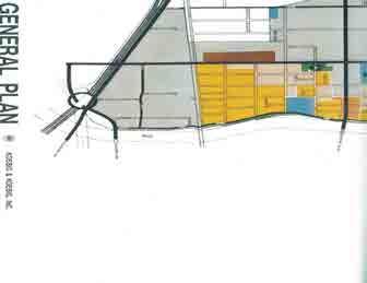
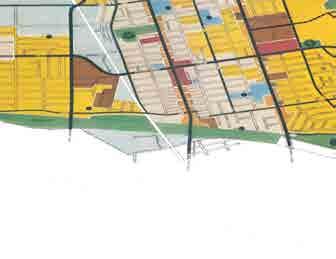
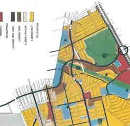
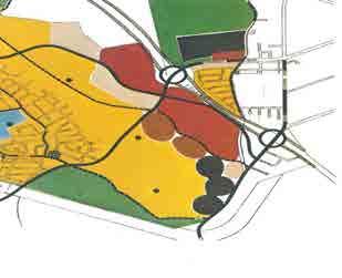
120
121
122 Monterey Park Land Use and Zoning Maps
123
124 July 2001
125 Legend FRWY 2,800 4,200 Elizabeth Av Gladys Av N Florence Av AV N AV NEW S Pomelo Av S Sefton Av Bleeker Av Pot r ero Alpaca St Celito Dr HIL L DR Yarrow St Crain Dr St Av Ora nge BLV D ren ce Dr Law to n Delta St nd e Eckhart Av Av g Dr Arland Av ya v Av S Oran ge Rd Kelburn Av S Re dd in Kempton Av Ba ile A S Li n co ln r rd Cl ov e S S Graylock Av Isab ella Av E Fernfield Dr ce d Gr a N Rural Dr N Orange Av N Nicholson Av N Alhambra Av S Alhambra Av S Russell Av NEW AV GARFIELD S Lincoln Av S Ramona Av AV v ilco xa SW G ARFIELD St SB Gra rad sha nd ri we d ge Av Av Isabella Av SD ivin av St L om av er de S Findlay Av N Baltimore Av N S Ynez Av za v Yn e El M erc ista POMONA er Dr rn St G E Floral Dr ST Av M E Markland Dr Av BLVD tr Po d ran e ero MONTEBELLO TOWN CENTER Y FRW POMONA MONTEBELLO City of Monterey Park Source: Los Angeles County Assessor Data, ,400 S Ferdinand Av W EAST LOS ANGELES S St nte Fue S Bradshawe Av W Gleason St W Floral Dr RIGGIN yo D r Ke n r Dr Sa tu Av POMONA 0 ad o Dr ta Vis Wa nd e Av sid e BLVD Dr Hills ide St St S Bleakwood Av rin g W S Hendricks Av TE RE Y ON Pebbledon School St E Arlight St s la At rd W Andrix St Av lfo Te Ta ylo Railroad Ackley St Aldergate St ilcox S Woods Av S St De La ER NT M TE st Sheriff Rd Av BE AC H Mcbride CO RP O RA LONG Av Dr Arro W Elmgate St R Stacked Multiple Roadway GABRIEL n w St r gia lle Co Pepper St Van Buren Dr E Co ral V ie rd Dr h cp SM Av St st h St Berne e th ea r D in err re nc Do To ll H EAST LOS ANGELES COLLEGE Avd C esar C have z Dr Freeway Sphere of Influence Boundary SAN FLO RA L to M ar s Tegner Dr Keller St City Boundary AV MAR DEL St ep et Wy Av ood El R tr Me SW 1St W Roca r od S Dorn e Brig htw e r v n lto Fu W d Dr College View Dr lan High Longhill Dr sid D Open Space (O-S) La r y e dg Ri Bluffhill Dr Mooney Dr D ff W Manufacturing (M) Centeral Business Commercial (C-B) Country Rd ey rcli Ridg ecrest St DR FLORAL Br ie Office Professional (O-P) Shopping Center (S-C) Planned Development Overlay (P-D) n oo M CE t Tex Rd PA S S nd bo ga Va Abajo S Commercial / Professional (C-P) Neighborhood Shopping (N-S) ROSEMEAD AV Mooney Dr Commercial Services (C-S) High-Density Residential (R-3) Civic District Overlay (C-D) E Newmark Av GRAVES E Cr e A S Regional Specialty Center (R-S) Medium-Multiple Residential (R-2) Senior Citizens Housing Overlay (S-C-H) AV GARVEY Av RD ba rri W Harding Av Kin gsfo rd Dr St Jad e Copa Wy Casuda Canyon Dr E AV W Newmark Av Tre e Dr Dr E Emerson Av l Av S Chandler Av W Newmark Av Alamo Dr Ladera St MONTEREY PARK GOLF COURSE Vista Dr a be WM S Electric Av W Verde ATLA NTIC d Sunrise Dr v Bl Barranca a on Cumbre St DR W m Ra N Mc Pherrin Av GARVEY W Dr W Emerson Av N Huntington Av ALHAMBRA N SA Hershey Av Hilliard Av N Moore Av N Atlantic Blvd FRW Y A RN BE W Hampton Av O IN RD Fulto n F Y RW Single-Family Residential (R-1) Feet 5,600 Zoning Map
126 Pico Rivera Land Use and Zoning Maps
127
128

129
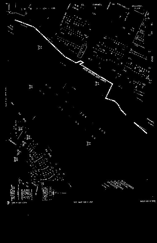
130
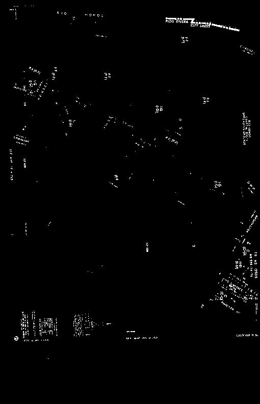
131
132
Section Regulatory Framework/Methodology. Land Use and Development
 Section 4.2 Land Use and Development This section summarizes the existing land uses and developments in the project area, and the potential impacts of the proposed alternatives on these resources. Information
LOS ANGELES COUNTY METROPOLITAN TRANSPORTATION AUTHORITY (LACMTA)
") CE OF PREPARAT LOS ANGELES COUNTY METROPOLITAN TRANSPORTATION AUTHORITY (LACMTA) NOTICE OF PREPARATION OF AN ENVIRONMENTAL IMPACT STATEMENT (E1S)lENVIRONMENTAL IMPACT REPORT (EIR) TO: AGENCIES, ORGANIZATIONS
CE OF PREPARAT LOS ANGELES COUNTY METROPOLITAN TRANSPORTATION AUTHORITY (LACMTA) NOTICE OF PREPARATION OF AN ENVIRONMENTAL IMPACT STATEMENT (E1S)lENVIRONMENTAL IMPACT REPORT (EIR) TO: AGENCIES, ORGANIZATIONS
Eastside Transit Corridor Phase 2 Draft Environmental Impact Statement/ Environmental Impact Report APPENDIX Q
 Draft Environmental Impact Statement/ Environmental Impact Report APPENDIX Q VISUAL AND AESTHETIC IMPACTS TECHNICAL MEMORANDUM State Clearinghouse Number: 2010011062 Visual and Aesthetic Impacts Technical
Eastside Transit Corridor Phase 2 Draft Environmental Impact Statement/ Environmental Impact Report APPENDIX F. SECTION 4(f) EVALUATION
 EVALUATION") Draft Environmental Impact Statement/ Environmental Impact Report APPENDIX F SECTION 4(f) EVALUATION State Clearinghouse Number: 2010011062 August 2014 Prepared for Los Angeles County Metropolitan Transportation
Draft Environmental Impact Statement/ Environmental Impact Report APPENDIX F SECTION 4(f) EVALUATION State Clearinghouse Number: 2010011062 August 2014 Prepared for Los Angeles County Metropolitan Transportation
Eastside Transit Corridor Phase 2 Technical Study Update Community Outreach Meeting February 2017
 Eastside Transit Corridor Phase 2 Technical Study Update Community Outreach Meeting February 2017 Purpose of Tonight s Meeting Recap of Board motion (2014) and technical study process Provide update on
Attachment D Eastside Transit Corridor Phase 2 Technical Study Route Options Screening Analysis and Community Outreach Executive Summary April 2017
 Attachment D Eastside Transit Corridor Phase 2 Technical Study Route Options Screening Analysis and Community Outreach Executive Summary April 2017 Technical Study Scope Nov 2014: Board-directed Technical
Right-of-Way Acquisitions and Relocations Technical Memorandum
 Right-of-Way Acquisitions and Relocations Technical Memorandum Southeast Extension Project Lincoln Station to RidgeGate Parkway Prepared for: Federal Transit Administration Prepared by: Denver Regional
Eastern Terminus TECHNICAL MEMORANDUM CENTRAL BROWARD EAST-WEST TRANSIT ANALYSIS BROWARD COUNTY, FLORIDA
 Eastern Terminus TECHNICAL MEMORANDUM CENTRAL BROWARD EAST-WEST TRANSIT ANALYSIS BROWARD COUNTY, FLORIDA FINANCIAL PROJECT ID NUMBER 411189-2-22-01 FLORIDA DEPARTMENT OF TRANSPORTATION DISTRICT 4 Prepared
4. ENVIRONMENTAL IMPACT ANALYSIS 7. LAND USE AND PLANNING
 4. ENVIRONMENTAL IMPACT ANALYSIS 7. LAND USE AND PLANNING 4.7.1 INTRODUCTION The following analysis discusses the consistency of the Proposed Project with the corresponding land use and zoning designations
RESOLUTION NO. R Refining the route, profile and stations for the Downtown Redmond Link Extension
 RESOLUTION NO. R2018-32 Refining the route, profile and stations for the Downtown Redmond Link Extension MEETING: DATE: TYPE OF ACTION: STAFF CONTACT: Capital Committee Board PROPOSED ACTION 09/13/2018
112th Avenue Light Rail Options Concept Design Report JUNE 2010 PREPARED FOR PREPARED BY TBG PGH
 112th Avenue Light Rail Options Concept Design Report JUNE 2010 PREPARED FOR PREPARED BY TBG060310124909PGH C ontents Introduction 1 Project Overview 1 Public Involvement and Technical Coordination 4 Description
East Corridor Final Environmental Impact Statement
 East Corridor Final Environmental Impact Statement Alternatives Considered Operating Plan The requirements for opening day operations versus year 2030 are based on ridership and operations. Opening day
DOWNTOWN REDMOND LINK EXTENSION SEPA Addendum to the East Link Project Final Environmental Impact Statement
 DOWNTOWN REDMOND LINK EXTENSION 2018 SEPA Addendum to the East Link Project Final Environmental Impact Statement AUGUST 2018 Downtown Redmond Link Extension SEPA Addendum to the 2011 East Link Project
2. INTRODUCTION 2.1 AUTHORITY 2.2 PURPOSE AND INTENT 2.3 SITE LOCATION
 2. INTRODUCTION 2.1 AUTHORITY The City of Gardena initiated and prepared the Artesia Corridor Specific Plan pursuant to the provisions of California Government Code, Title 7, Division 1, Chapter 3, Article
Regional Transportation District
 NORTHEAST AREA TRANSIT EVALUATION FINAL REPORT Prepared for: Regional Transportation District Prepared by: David Evans and Associates, Inc. URS, Corporation November 2007 LIST OF FIGURES Figure 1: Northeast
TRANSPORTATION ELEMENT GOALS, OBJECTIVES, AND POLICIES
 TRANSPORTATION ELEMENT GOALS, OBJECTIVES, AND POLICIES GOAL 2 The City shall provide a safe, convenient, effective, and energy efficient multimodal transportation system which is coordinated with the Future
NOTICE OF PREPARATION
 NOTICE OF PREPARATION To: All Interested Parties Subject: Notice of Preparation of an Environmental Impact Report From: City of Petaluma Address: 11 English Street, Petaluma, CA 94952-2610 Contact: Heather
California Environmental Quality Act (CEQA) Environmental Review Process
 Environmental Review Process") California Environmental Quality Act (CEQA) Environmental Review Process Los Angeles Union Station Forecourt and Esplanade Improvements constitute a Project Los Angeles County Metropolitan Transportation
California Environmental Quality Act (CEQA) Environmental Review Process Los Angeles Union Station Forecourt and Esplanade Improvements constitute a Project Los Angeles County Metropolitan Transportation
Section 4.11 Traffic and Transportation 4.11 TRAFFIC AND TRANSPORTATION
 4.11 TRAFFIC AND TRANSPORTATION The following sections summarize the evaluation of the potential traffic/transportation impacts of the San Gabriel River Corridor Master Plan. First, the analysis methodology
The transportation system in a community is an
 7 TRANSPORTATION The transportation system in a community is an important factor contributing to the quality of life of the residents. Without a sound transportation system to bring both goods and patrons
COLVER ROAD INDUSTRIAL CONCEPT PLAN
 COLVER ROAD INDUSTRIAL CONCEPT PLAN A CONCEPTUAL LAND USE AND TRANSPORTATION PLAN FOR TA-4 AN URBAN RESERVE AREA OF THE CITY TALENT City of Talent Adopted by City Council Resolution No., June, 2015 PART
Ashland BRT Environmental Assessment: logos of CTA, CDOT, Chicago Department of Housing and Economic Development
 Ashland BRT Environmental Assessment: logos of CTA, CDOT, Chicago Department of Housing and Economic Development Overview The Chicago Transit Authority (CTA), in partnership with the Chicago Department
APPENDIX D: Visual and Aesthetic Conditions for NCCU Station Refinement. Durham-Orange Light Rail Transit Project
 APPENDIX D: Visual and Aesthetic Conditions for NCCU Station Refinement Durham-Orange Light Rail Transit Project October 2016 1. Introduction The Combined FEIS/ROD summarizes the effects of the D-O LRT
5.4.6 Cumulative Operational Impacts
 5.4.5.2 Visual Character Impacts The proposed project is located in greater downtown Los Angeles, which is a dynamic environment where new projects are constructed on an ongoing basis. Additional development
I. DESCRIPTION OF PROPOSED ACTION... 1 A. General Description... 1 B. Historical Resume and Project Status... 2 C. Cost Estimates...
 PROJECT COMMITMENTS SUMMARY... S-1 1. Type of Action... S-1 2. Description of Action... S-1 3. Summary of Purpose and Need... S-1 4. Alternatives Considered... S-2 5. NCDOT Alternatives Carried Forward...
1.0 PROJECT PURPOSE AND NEED
 1.0 PROJECT PURPOSE AND NEED The FasTracks Plan includes the extension of the Central Corridor from its current terminus at 30th/Downing to a connection to the East Corridor commuter rail service planned
Appendix D Community Impact Assessment
 Appendix D Community Impact Assessment This page is intentionally blank. Mid-City/Exposition Light Rail Transit Project Community Impact Assessment Memorandum for the Improvements at Farmdale Avenue and
Crenshaw/LAX Transit Corridor Project
 Crenshaw/LAX Transit Corridor Project Final Environmental Impact Report/ Final Environmental Impact Statement TABLE OF CONTENTS EXECUTIVE SUMMARY August 2011 State Clearing House No. 2007091148 U.S. Department
Final Land Use and Development Opportunities Report 5.0 Environmental Impact/Environmental Consequences
 Figure 5-11. Wilshire/16th 1/4-Mile Station Area August 16, 2010 Page 5-27 Figure 5-12. Wilshire/4th 1/4-Mile Station Area August 16, 2010 Page 5-28 5.7 Alternative 4 Westwood/VA Hospital Extension Plus
Northwest Rail Corridor and US 36 BRT Development Oriented Transit Analysis 4.4 STATION AREA FINDINGS
 4.4 STATION AREA FINDINGS Each station is different, and each one requires a separate set of recommendations based on the vision for the site. This section outlines an initial TOD strategy and recommendations
NORTH-SOUTH CORRIDOR STUDY EXECUTIVE SUMMARY. Executive Summary
 Executive Summary Background As congestion continues to affect mobility in the region, the Ozarks Transportation Organization (OTO) is particularly concerned with traffic movement. The North-South Corridor
Mississippi Skyway Preliminary Engineering Report
 EXECUTIVE SUMMARY Mississippi Skyway Preliminary Engineering Report CITY OF RAMSEY, MINNESOTA DECEMBER 2014 City of RAMSEY EXECUTIVE SUMMARY Project Need and Intent The Mississippi Skyway pedestrian bridge
Appendix E Preliminary Location Hydraulic Study
 Appendix E Prepared for: State of Alaska Department of Transportation and Public Facilities Prepared by: HDR Alaska, Inc. 2525 C Street, Suite 305 Anchorage, Alaska 99503 February 2014 This page intentionally
Southeast Extension to RidgeGate Parkway Scoping Booklet
 Southeast Extension to RidgeGate Parkway Scoping Booklet PUBLIC SCOPING MEETING SCHEDULE Public Scoping Meeting Wednesday, November 2, 2011 6:00pm to 7:30pm City of Lone Tree Recreation Center Willow Room
Division of Land / Environmental Review. Volume I FINAL ENVIRONMENTAL IMPACT REPORT WEST LOS ANGELES COMMUNITY PLAN AREA
 Division of Land / Environmental Review City Hall 200 N. Spring Street, Room 750 Los Angeles, CA 90012 Volume I FINAL ENVIRONMENTAL IMPACT REPORT ENV-2006-1914-EIR State Clearinghouse No. 2006061096 WEST
Public input has been an important part of the plan development process.
 Lakewood s Comprehensive Plan recognizes that transportation helps shape the community, and that the way the community provides for the safe and efficient movement of people affects the character of the
Table of Contents G.1.a Water Resources - Surface Water - Drainage
 Table of Contents G.1.a Water Resources - Surface Water - Drainage 1. INTRODUCTION... 1335 2. ENVIRONMENTAL SETTING... 1335 a. Regional Hydrology... 1335 b. Local Hydrology... 1337 c. On-site Hydrology...
Table of Contents. Land Use and Development Opportunities Report Table of Contents
 Table of Contents Table of Contents 1.0 INTRODUCTION... 1-1 2.0 PROJECT DESCRIPTION... 2-1 2.1 No Build Alternative... 2-1 2.2 TSM Alternative... 2-1 2.3 Build Alternatives... 2-1 2.3.1 Alternative 1 Westwood/UCLA
Corridor Vision. 1Pursue Minnehaha-Hiawatha Community Works Project. Mission of Hennepin County Community Works Program
 1Pursue Minnehaha-Hiawatha Community Works Project Minnehaha-Hiawatha Community Works is a project within the Hennepin Community Works (HCW) program. The mission of the HCW program is to enhance how the
SOUTH NATOMAS COMMUNITY PLAN
 SOUTH NATOMAS Community Plan Part Three : COMMUNITY PLAN AREAS AND SPECIAL STUDY AREAS SACRAMENTO 2030 GENERAL PLAN Contents Community Location... 3-SN-3 Community Vision... 3-SN-4 Community Profile...
Issues Requiring Future Study
 Issues Requiring Future Study Transportation planning is an ongoing process that tends to identify new issues as it finds solutions for others. Some issues are so complex that a solution to one problem
Gold Line Bus Rapid Transit Transit Oriented Development (BRTOD) Helmo Station Area Plan
 Helmo Station Area Plan") Appendix F Gold Line Bus Rapid Transit Transit Oriented Development (BRTOD) Helmo Station Area Plan Introduction and Purpose of the Plan The Gold Line Bus Rapid Transit facility is an eleven-mile dedicated
Appendix F Gold Line Bus Rapid Transit Transit Oriented Development (BRTOD) Helmo Station Area Plan Introduction and Purpose of the Plan The Gold Line Bus Rapid Transit facility is an eleven-mile dedicated
WESTSIDE SUBWAY EXTENSION PROJECT. Addendum to the Visual and Aesthetic Impacts Technical Report
 PROJECT to the Visual and Aesthetic Impacts Technical Report August 2011 Visual and Aesthetic Impacts Technical Report SUMMARY On October 28, 2010, the Metro Board selected the Westwood/VA Hospital Extension
Transportation. Strategies for Action
 Transportation A major priority for the Overlake Neighborhood is to develop a multimodal transportation system. To achieve this system, a balance has to be found among travel, circulation and access needs;
POTOMAC YARD METRORAIL STATION
 POTOMAC YARD METRORAIL STATION DRAFT ENVIRONMENTAL IMPACT STATEMENT EXECUTIVE SUMMARY R Introduction Environmental Impact Statement for a New Metrorail Station at Potomac Yard The Federal Transit Administration
SBCAG STAFF REPORT. MEETING DATE: March 17, 2016 AGENDA ITEM: 5I
 SBCAG STAFF REPORT SUBJECT: Cabrillo-UPRR Bridge Project MEETING DATE: March 17, 2016 AGENDA ITEM: 5I STAFF CONTACT: Fred Luna RECOMMENDATION: Authorize the chair to sign a Memorandum of Understanding
Alaskan Way, Promenade, and Overlook Walk Final EIS Appendix D - Supplemental Draft EIS Comments and Responses October 2016.
 B-001-001 The use of Columbia Street for two-way transit was a decision made by King County Metro as part of its Southwest Transit Pathway evaluation. This project is separate from AWPOW. B-001-002 Modeling
3.10 LAND USE SETTING PROJECT SITE EXISTING LAND USE DESIGNATIONS AND ZONING. General Plan Land Use Designations.
 This section of the Draft EIR addresses the existing land uses on and adjacent to the project site and discusses the potential impacts of the proposed project on existing land uses. Key issues addressed
Venice Pumping Plant Dual Force Main Project Draft EIR
 City of Los Angeles 5.9 LAND USE PLANS 5.9.1 Environmental Setting Venice Pumping Plant Dual Force Main Project Draft EIR The Project lies within the bounds of Los Angeles County and the City of Los Angeles.
4.500 Preston Road Overlay District
 Section 4.500 Preston Road Overlay District 2004 Zoning Ordinance 4.500 Preston Road Overlay District (ZC 98-29; Ordinance No. 98-9-12) 4.501 Purpose To provide appropriate design standards for the use
PROJECT BACKGROUND. Preliminary Design Scope and Tasks
 PROJECT BACKGROUND Preliminary Design Scope and Tasks The purpose of this Study is the development of preliminary designs for intersection improvements for Trunk Highway (TH) 36 at the intersections of
West Broadway Transit Study Initial Screening of Alternatives Memo
 West Broadway Transit Study Initial Screening of Alternatives Memo 5/22/2015 Prepared by the SRF Consulting Group Team for Table of Contents Purpose... 1 Methodology... 1 Screening... 5 Screening Criteria...
Floodplain Technical Memorandum
 Southeast Extension Project Lincoln Station to RidgeGate Parkway Prepared for: Federal Transit Administration Prepared by: Denver Regional Transportation District May 2014 Table of Contents Page No. Chapter
WELCOME! 8 8:30 6: TH STREET IMPROVEMENTS. Open House. Presentation & Q&A
 WELCOME! 168 TH STREET IMPROVEMENTS 6:30 Open House 7 8 Presentation & Q&A 8 8:30 Open House WELCOME Todd Pfitzer City of Omaha Engineer Bob Stubbe City of Omaha Public Works Director Jon Meyer Project
STREET DESIGNATIONS AND STANDARD ROADWAY DIMENSIONS
 City of Los Angeles MP 2035 Draft EIR 3.0 Project Description TABLE 3.3: Previous Designation STREET DESIGNATIONS AND STANDARD ROADWAY DIMENSIONS Previous Designated Dimensions Class I (126/102) Class
CHAPTER 7: Transportation, Mobility and Circulation
 AGLE AREA COMMUNITY Plan CHAPTER 7 CHAPTER 7: Transportation, Mobility and Circulation Transportation, Mobility and Circulation The purpose of the Transportation, Mobility and Circulation Chapter is to
Whittier Greenway Trail. Est. 2009
 Whittier Greenway Trail Est. 2009 The Whittier Greenway Trail begins in the northwest corner of Whittier, near the 605 Freeway, and closely parallels Whittier Boulevard. When it reaches Painter Avenue,
Midtown Corridor Alternatives Analysis. Appendix A - Initially Considered Alternatives Screening
 Midtown Corridor Alternatives Analysis Appendix A - Initially Considered Alternatives Screening Arterial BRT on Lake Street - Overall Rating: RATING Metropolitan Council recommendations stated in the Transportation
3.0 PROJECT DESCRIPTION
 3.0 PROJECT DESCRIPTION 3.1 BACKGROUND Under California law (Government Code Section 65300 et seq.), every city and county is required to have a general plan. The general plan is to be comprehensive and
The Illinois Department of Transportation and Lake County Division of Transportation. Route 173, including the Millburn Bypass
 The Illinois Department of Transportation and Lake County Division of Transportation welcome you to this Public Hearing for U.S. Route 45 from Illinois Route 132 to Illinois Route 173, including the Millburn
South Davis County COMMUNITY SPOTLIGHT
 South Davis County COMMUNITY SPOTLIGHT Davis/SLC Community Connector Bus Rapid Transit line connecting SLC & Davis County RTP Phase 1 Project Generate 3,100 average weekday riders Relieve congestion on
Appendix E Section 4(f) Evaluation
 Evaluation") Appendix E Section 4(f) Evaluation Appendix E Draft Section 4(f) Evaluation E.1 Introduction This appendix addresses a federal regulation known as Section 4(f), which protects parks, recreation areas,
Appendix E Section 4(f) Evaluation Appendix E Draft Section 4(f) Evaluation E.1 Introduction This appendix addresses a federal regulation known as Section 4(f), which protects parks, recreation areas,
Northern Branch Corridor SDEIS March Table of Contents
 Table of Contents Executive Summary... ES-1 ES.1 Introduction... ES-1 ES.2 Project Background... ES-1 ES.3 Purpose and Need... ES-5 ES.4 Alternatives... ES-6 ES.5 Operating Plan... ES-11 ES.6 Cost Analysis...
Planning Districts INTRODUCTION
 INTRODUCTION To facilitate detailed examination of development prospects for all areas of the community, Delano has been divided into 14 planning districts. The location of these planning districts is
4.0 AFFECTED ENVIRONMENT AND ENVIRONMENTAL CONSEQUENCES
 4.0 AFFECTED ENVIRONMENT AND ENVIRONMENTAL CONSEQUENCES The following sections discuss the impacts associated with environmental resources for the tunneling method Alternatives A and B. The construction
Call to Artists Public Art for Los Angeles Metro Stations
 Conceptual Design for Call to Artists Public Art for Los Angeles Metro Stations Artesia Transit Center Union Station/Patsaouras Transit Plaza Los Angeles County Metropolitan Transportation Authority February
South King County High Capacity Transit Corridor Report. Figure 1-1. Study Area
 Figure 1-1. Study Area 2 Figure 1-2. Sound Transit Long-Range Plan 3 1.2 Goals, Objectives, and the Need for HCT Sound Transit developed a set of HCT guiding principles, goals, and objectives for the Long-Range
III. PROJECT DESCRIPTION
 III. PROJECT DESCRIPTION LOCATION AND BOUNDARIES The City of Manhattan Beach is located in the South Bay region of Los Angeles County, California, approximately 2 miles south of the Los Angeles International
PROJECT STATEMENT LOCATION/DESIGN PUBLIC HEARING. 19 th AVENUE NORTH EXTENSION PROJECT FROM SPRINGDALE DRIVE TO NORTH 2 ND STREET/U.S.
 PROJECT STATEMENT LOCATION/DESIGN PUBLIC HEARING 19 th AVENUE NORTH EXTENSION PROJECT FROM SPRINGDALE DRIVE TO NORTH 2 ND STREET/U.S. 67 HEARING LOCATION: ERICKSEN COMMUNITY CENTER 1401 11 TH AVENUE NORTH
Metro Orange Line Extension Four Years Early and $61 Million Under Budget
 White Paper: Metro Orange Line Extension Four Years Early and $61 Million Under Budget July 2013 Innovation for better mobility Metro Orange Line Extension Iteris, Inc. was the prime consultant leading
3. VISION AND GOALS. Vision Statement. Goals, Objectives and Policies
 Vision Statement Queen Creek s interconnected network of parks, trails, open spaces and recreation opportunities provide safe and diverse activities and programs that sustain its unique, small town, equestrian
Capital Projects in and near Odenton Town Center
 Capital Projects in and near Odenton Town Center Map ID Anne Arundel County Department of Public Works This project provides for the design, right of way acquisition, and construction of approximately
Albert Lea. Redevelopment Plan. 701 Xenia Avenue South, Suite 300 Minneapolis, MN Tel: (763) Fax: (763) wsbeng.
 Fax: (763) wsbeng.") Albert Lea Redevelopment Plan 701 Xenia Avenue South, Suite 300 Minneapolis, MN 55416 Tel: (763) 541-4800 Fax: (763) 541-1700 wsbeng.com Albert Lea Redevelopment Plan Table of Contents Composite Districts...
Albert Lea Redevelopment Plan 701 Xenia Avenue South, Suite 300 Minneapolis, MN 55416 Tel: (763) 541-4800 Fax: (763) 541-1700 wsbeng.com Albert Lea Redevelopment Plan Table of Contents Composite Districts...
MEMORANDUM. DATE: March 15, Chairman and Members Community Redevelopment Agency. Leif J. Ahnell, C.P.A., C.G.F.O. Executive Director
 MEMORANDUM DATE: March 15, 2019 TO: FROM: Chairman and Members Community Redevelopment Agency Leif J. Ahnell, C.P.A., C.G.F.O. Executive Director SUBJECT: Camino Square, IDA No. CRP-16-02, located at 171
Public Hearing. Charlotte County-Punta Gorda MPO - Meeting Rooms A and B March 14, open house at 4 p.m., formal presentation at 5 p.m.
 Public Hearing Charlotte County-Punta Gorda MPO - Meeting Rooms A and B March 14, 2019 open house at 4 p.m., formal presentation at 5 p.m. Welcome to the Public Hearing for the Harborview Road (CR 776)
Final Environmental Impact Statement/Final Environment Impact Report Appendix K Responses to Comments Received
 Final Environmental Impact Statement/Final Environment Impact Report Avenue and Brynhurst Avenue at Florence Avenue. Other measures involve the closing of three intersections at 59th Place, Coliseum Place
Project facts that will help me to understand the I-710 Corridor Project and DEIR/EIS
 Project facts that will help me to understand the I-710 Corridor Project and DEIR/EIS What is the I-710 Corridor Project? The Interstate 710 (I-710) Corridor Project proposes to improve I-710 from Ocean
THE GREEN VISION WORKSHOP Friday, November 6, 2009
 THE GREEN VISION WORKSHOP Friday, November 6, 2009 SUSTAINABLE LONG RANGE PLANNING IN SANTA MONICA Eileen Fogarty Director, Planning and Community Development GREEN BUILDINGS Santa Monica has the most
1.0 Circulation Element
 5/9/18 1.0 Circulation Element 1.1 Introduction As growth and development occur in Apache County, enhancements to its circulation system will be necessary. With time, more roads will be paved and air and
REZONING GUIDE. Zone Map Amendment (Rezoning) - Application. Rezoning Application Page 1 of 3. Return completed form to
 - Application. Rezoning Application Page 1 of 3. Return completed form to") Zone Map Amendment (Rezoning) - Application COMMUNITY PLANNING & DEVELOPMENT REZONING GUIDE Rezoning Application Page 1 of 3 PROPERTY OWNER INFORMATION* CHECK IF POINT OF CONTACT FOR APPLICATION Property
Zone Map Amendment (Rezoning) - Application COMMUNITY PLANNING & DEVELOPMENT REZONING GUIDE Rezoning Application Page 1 of 3 PROPERTY OWNER INFORMATION* CHECK IF POINT OF CONTACT FOR APPLICATION Property
G. RECREATION AND OPEN SPACE ELEMENT. The following summarizes the Recreation and Open Space Element:
 G. RECREATION AND OPEN SPACE ELEMENT The purpose of the Element is to provide the framework and direction for a comprehensive system of public and private sites for recreation, including, but not limited
Project Facts about the I-710 Corridor Project and RDEIR/SDEIS
 Project Facts about the I-710 Corridor Project and RDEIR/SDEIS What is the I-710 Corridor Project? The Interstate 710 (I-710) Corridor Project proposes to improve I-710 from Ocean Boulevard in the City
APPENDIX J SHPO COORDINATION
 Final Environmental Impact Statement/Final Environment Impact Report Appendix J SHPO Coordination APPENDIX J SHPO COORDINATION August 2011 CRENSHAW/LAX TRANSIT CORRIDOR PROJECT Final Environmental Impact
Tyvola & Archdale Transit Station Area Plan. May 15, 2008
 Tyvola & Archdale Transit Station Area Plan First Public Meeting May 15, 2008 Presentation Outline 1. Purpose and Process 2. Station Area Overview 3. Plan Recommendations Vision Land Use Transportation
2. AGENCY COORDINATION AND PUBLIC INVOLVMENT
 2. AGENCY COORDINATION AND PUBLIC INVOLVMENT This chapter discusses the process carried out for conducting agency coordination and public involvement activities. TECHNICAL ADVISORY COMMITTEE A Technical
Chapter 1.0 Introduction
 Chapter 1.0 Introduction 1.1 Background The North Metro commuter rail line is part of the RTD FasTracks regional transit system expansion program to build more than 100 miles of rail transit throughout
Tyvola & Archdale Transit Station Area Plan. June 5, 2008
 Tyvola & Archdale Transit Station Area Plan Second Public Meeting June 5, 2008 Presentation Outline 1. Purpose and Process 2. Station Area Overview 3. Plan Recommendations 4. Comments Received and Proposed
REPORT TO PLANNING COMMISSION
 CITY OF Meeting Date: October 25, 2011 Agenda Item: Community Development Department Planning Division P. O. Box 151560, San Rafael, CA 94915-1560 PHONE: (415) 485-3085/FAX: (415) 485-3184 Case Numbers:
4.8 LAND USE AND PLANNING
 4.8 LAND USE AND PLANNING 4.8.1 INTRODUCTION This section describes existing and planned land uses at the Hayward campus and analyzes the impact of implementation of the proposed Master Plan on land uses
NOTICE OF PREPARATION
 NOTICE OF PREPARATION DATE: April 6, 2017 TO: FROM: Responsible Agencies Trustee Agencies Local and Public Agencies Interested Parties Contact: Brent Cooper, AICP, Community Development Director 4381 Broadway
STATE OF TENNESSEE DEPARTMENT OF TRANSPORTATION ENVIRONMENTAL DIVISION
 STATE OF TENNESSEE DEPARTMENT OF TRANSPORTATION ENVIRONMENTAL DIVISION Suite 900 - James K. Polk Building 505 Deaderick Street Nashville, Tennessee 37243-0334 MEMORANDUM TO: FROM: Files Joe W. Matlock,
LOS ANGELES CITY PLANNING DEPARTMENT STAFF REPORT
 LOS ANGELES CITY PLANNING DEPARTMENT STAFF REPORT LOS ANGELES CITY PLANNING COMMISSION CASE NO: CPC 2006-9374 CRA CEQA: Exempt DATE: December 21, 2006 Location: Valley Plaza and Laurel Plaza TIME: after
NOTICE OF PREPARATION OF ENVIRONMENTAL IMPACT REPORT
 NOTICE OF PREPARATION OF ENVIRONMENTAL IMPACT REPORT TO: State Clearinghouse, Responsible and Trustee Agencies, and Other Interested Parties DATE: May 18, 2017 SUBJECT: Notice of Preparation of Environmental
4.13 Security and System Safety
 4.13 4.13.1 Introduction This section describes the affected environment and environmental consequences related to security and system safety from operations of the NEPA Alternatives. Information regarding
Staff Report and Recommendation
 Community Planning and Development Planning Services 201 W. Colfax Ave., Dept. 205 Denver, CO 80202 p: 720.865.2915 f: 720.865.3052 www.denvergov.org/cpd TO: City Council Neighborhoods and Planning Committee
Executive Summary. NY 7 / NY 2 Corridor
 Executive Summary NY 7 / NY 2 Corridor Transportation and Land Use Study December 2005 Prepared for: Town of Colonie Capital District Transportation Committee Prepared by: Introduction: Land use decisions
ROAD CLOSURE AND LAND USE AMENDMENT SILVER SPRINGS (WARD 1) NORTHEAST OF NOSEHILL DRIVE NW AND SILVER SPRINGS ROAD NW BYLAWS 2C2018 AND 29D2018
 NORTHEAST OF NOSEHILL DRIVE NW AND SILVER SPRINGS ROAD NW BYLAWS 2C2018 AND 29D2018") Page 1 of 19 EXECUTIVE SUMMARY This application proposes redesignating two parcels in the community of Silver Springs from Special Purpose Future Urban Development (S-FUD) District and undesignated road
Page 1 of 19 EXECUTIVE SUMMARY This application proposes redesignating two parcels in the community of Silver Springs from Special Purpose Future Urban Development (S-FUD) District and undesignated road
Archaeological Resources Supplemental Survey Technical Report
 ` Archaeological Resources Supplemental Survey Technical Report March 2012 THIS PAGE INTENTIONALLY LEFT BLANK NATIONAL ARCHAEOLOGICAL DATABASE (NADB) INFORMATION Authors Consulting Firm Nancy E. Sikes,
A. WHAT IS A GENERAL PLAN?
 I. Introduction A. WHAT IS A GENERAL PLAN? A general plan is the planning guideline for the future of a city. It contains goals and policies which regulate urban development, the protection of the natural
Final Environmental Impact Statement/Final Environment Impact Report Appendix K Responses to Comments Received
 Final Environmental Impact Statement/Final Environment Impact Report Response to comment 20-14-H. Please Refer to Master Response 7 regarding safety treatments and approach to safety for the project. Response