URBAN DESIGN & PLANNING
|
|
|
- Ashlynn McBride
- 5 years ago
- Views:
Transcription
1 URBAN DESIGN & PLANNING
2 URBAN DESIGN & PLANNING


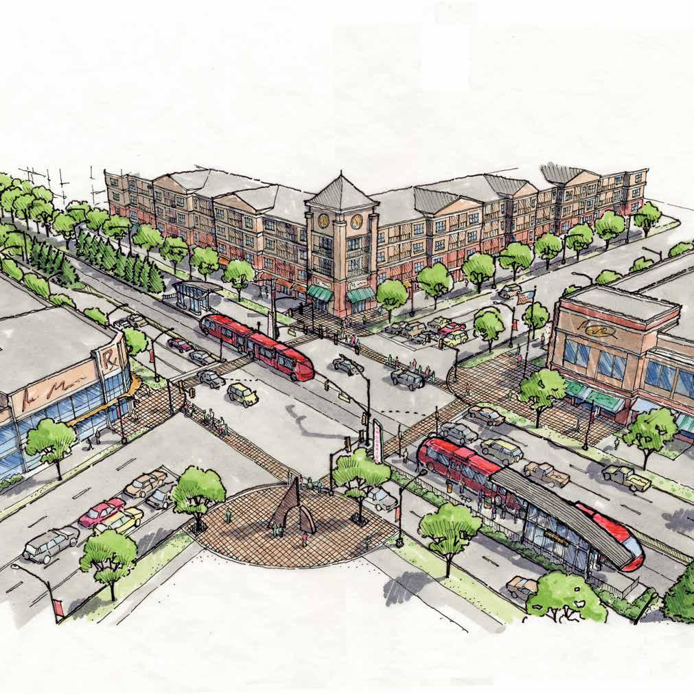
3 profile services We provide urban design and planning services in six areas: Buildings & Sites Streets & Parks Schools & Campuses Neighborhoods & Districts OUR WORK OUR story Urban design thrives in an environment that values and debates the civic realm. Corridors & Centers Cities & Towns 30+ miles of pedestrian improvements UDP EXPERIENCE FIRM-WIDE EXPERIENCE OFFICES Lord Aeck Sargent is an award-winning architecture and urban design firm with six offices across the country. Our mission of responsive design is dedicated to the creation of enduring places. Our staff includes registered architects, urban planners, landscape architects, materials specialists, preservationists, cost estimators and zoning specialists. With a focus on the design of walkable, livable urban communities, we approach the built environment of each community as a collage of its unique people, politics and place. We believe in the principles of good urbanism diversity, connectivity, sustainability. We are known for our strengths in public involvement, graphic communication and implementation strategies. 60+ school sites & campuses 80+ cities and towns 300 community meetings in the last seven years $243M secured for affordable housing Atlanta Ann Arbor Austin Chapel Hill Lexington Washington, D.C. We have completed more than 350 projects across the country and, as a testament to the determination and passion of our clients, our plans have resulted in thousands of new housing units, first class schools and institutions, hundreds of acres of new parks and open spaces, miles of streetscape and bicycle paths and, most importantly, the creation of dozens of memorable places. urban design & planning

4 what is good urban design? what is good urban design? Stan Harvey, Principal Stan Harvey, Principal Good urban design is based in the understanding of a place. It is both creative product and thoughtful process.


5 Buildings & sites These structures and properties form the building blocks and fabric of a community. We conduct programming, site planning, design guidelines and architectural design for numerous public and private sector clients, including developers, institutions and community groups. Battery Park Master Plan Realticorp Anderson, Sc The 120+ acre Master Plan for a greenfield development just a few miles from Clemson University in upstate South Carolina explored a variety of unique design concepts. These concepts were refined to identify a new multi-use district that is at once walkable and urban, yet takes full advantage of numerous natural features by preserving waterways, views, and several nature areas. South Fourth Street Design Guidelines Louisville Downtown Development Authority Louisville, KY A framework and design guidelines for future improvements was created for current and future retail improvements along the historic South Fourth Street corridor in Downtown Louisville, including refinement and infill of public spaces, and a focus on maintaining historic continuity while allowing creative solutions for storefronts and other unique architectural features. East Decatur Station City of Decatur Decatur, Ga In 2006, the East Decatur Station LLC called for a comprehensive Development Plan to update, design, and provide implementation strategies for a new urban neighborhood set within a mix of light industrial, institutional and retail uses a few blocks from Downtown Decatur. The Plan includes a revitalized mixed-use, mixed-income community that takes full advantage of the MARTA transit station and offers new housing, retail, and office opportunities to develop a place. N. Highland Steel Lofts Perennial Properties, Inc. Atlanta, GA Comprised of Grinnell Lofts, N. Highland Steel Lofts and The Shops at N. Highland Steel, this five building mixed-use community is located between North Highland Avenue and the Beltline in the Inman Park Historic District. The project includes residential, commercial, office, and a mix of structured, surface and on-street parking.


6 streets & parks Our firm has always believed in the importance of the public and civic realm in shaping successful communities. Our work in recent years has helped shape the urban landscape across a variety of settings and scales, with a focus on sustainability, parks and plazas, streetscapes, cycling facilities, and green infrastructure. The Red Mile Development Plan Lexington Trots Breeders Association, LLC Lexington, KY The Red Mile Development Plan is a progressive infill development project located in the heart of a dense residential and industrial portion of Lexington, at the nation s second oldest standing harness racing venue. The Plan proposes nearly 300,000 square feet of commercial space, 200 residential units, and 50,000 square feet of office space, lining a signature town green. City of Atlanta Cycling Facilities and Midtown Public Spaces Midtown Alliance Atlanta, GA Based on Atlanta s push to incorporate cycling facilities as quality-oflife improvements in urban areas and as an extension of the Midtown Public Spaces Program, Urban Collage/Lord Aeck Sargent continues to help design and help implement many of the City s first NACTOcompliant bicycle facilities. These projects range from small-scale bike box facilities to mile-long cycle tracks and on-street parking. Butler Park Atlanta Housing Authority / City of Atlanta Named after civil rights activist Selena Sloan Butler, the once-vibrant 3.4-acre Butler Park in Downtown Atlanta had become the eyesore in an area that was seeing an urban renaissance. The design team helped the Atlanta Housing Authority and the City of Atlanta through facilitating community workshops, creating an overall award-winning park master plan that included a diverse range of passive and active recreation amenities, and overseeing design and construction through the park s re-opening in Fall NoLi Sustainability Plan The North Limestone Neighborhood Association, Inc. Since completion of the North Limestone Sustainability Plan, the North Limestone Neighborhood (NoLi) has managed to secure $270,000 in Water Quality Improvement Grants. The Plan sets out to achieve the goal of improving water quality and reducing runoff while educating the community on rainwater issues, while providing a framework that guides private and public projects.


7


8 schools & campuses A community s future lies in the strength of its schools and educational institutions. Our unique approach and technical analysis concentrates on public K-12 school districts, private schools, and community colleges. Our work seeks to create outstanding educational facilities and integrate them within the larger structure of their surroundings. Sayre Campus Master Plan Sayre School lexington, ky The Sayre School Campus Master Plan focuses on creating better internal pedestrian connections between proposed and existing educational buildings and student-oriented open spaces, accommodating flexibility for future school expansion, and improving the relationship between campus edges and adjacent land uses for the private K-12 school located in Downtown Lexington. Campus Master Plan north carolina central university durham, nc The update to the NCCU Campus Master Plan addressed the challenges and opportunities related to a rise in enrollment. The updated plan included provisions for new facilities and services, development of coherent campus districts, improvements to campus green spaces, reconfigured parking for a more pedestrian-oriented campus, town-gown issues, and expansion solutions. Campus Planning Bluegrass Community & Technical College Lexington, KY North Avenue Corridor Study Georgia Institute of Technology atlanta, ga The new 65-acre campus of Bluegrass Community & Technical College (BCTC) sits on the former site of the Eastern State Hospital, the nation s second oldest running mental institution. The Plan worked to create a blueprint for the growth and development of BCTC within the constraints of the historic nature of the site, and the mixed adjacencies of historic neighborhoods and industrial uses. The Corridor Study was developed to establish a conceptual plan for campus development along North Avenue, more fully integrate the corridor into the Georgia Tech Campus, and identify necessary transportation improvements. Specific recommendations called for consistent streetscaping, open space improvements, and circulation improvements that were implemented beginning in 2008.
, a 1,400-acre area on the eastern edge of the downtown historic district, brought major stakeholders together to create a vision and next steps for the Wheaton")


9 neighborhoods & districts East Savannah Gateway Choice Neighborhood Initiative Housing Authority of Savannah savannah, ga The East Savannah Gateway Choice Neighborhoods Initiative (CNI), a 1,400-acre area on the eastern edge of the downtown historic district, brought major stakeholders together to create a vision and next steps for the Wheaton Street corridor and a target site, which is currently in the first phases of design. Community-based planning is the foundation of the firm s work. From revitalization efforts for historic neighborhoods & housing developments to new planned communities to dynamic mixed-use districts, our work creates sustainable plans for diverse housing, commercial, open space and institutions within walkable neighborhoods and districts. University Area Choice Neighborhoods Initiative Atlanta Housing Authority atlanta, ga Lexington Distillery District lexington, ky Just beyond downtown Lexington, the Lexington Distillery District is heavily industrial today, characterized by rail yards, decrepit infrastructure, and old warehouses remaining from a time when Bourbon Distilleries were plentiful in this area. The adaptive re-use plan calls for revitalization of many of the historic buildings as well as residential, commercial, and mixed-use infill development. The University Area Choice Neighborhoods Initiative (CNI) centers on the former public housing site of University Homes, located in the heart of the largest concentration of Historically Black Colleges and Universities in the nation. A shared vision and implementation strategies were developed to create a vibrant and thriving College Town community built on the historical relationship between the schools and the surrounding neighborhoods. Campbell Terrace and Delona Grades Hope VI Master Plan Fayetteville Metropolitan Housing Authority Fayetteville, NC urban design & planning A 2006 HOPE VI plan was developed for the Campbell Terrace and Delona Gardens communities, which included adaptive re-use, community gardens and orchards, senior housing, townhomes, single family homes, existing institution/educational, and Cityowned property.

10

, and open space/pedestrian plans, specifically aimed at aging retail")

 Feasibility Study and subsequent Plan helped shape the redevelopment / future land use envelope for the entire BeltLine, as well as locating and defining twelve")
11 corridors & centers Westport Road Corridor Study Louisville Metro Planning and Design Louisville, KY Louisville Metro conducted a corridor study along the aging commercial Westport Road. The community-based effort resulted in a vision that addressed pedestrian, bicycle, and streetscape improvements; conceptual plans for future retail development; a comprehensive guide for future connectivity to surrounding neighborhoods; and recommendations for promoting transit ridership. Most growth and development occurs in regional activity centers and the corridors that connect them. Multi-modal transportation networks and live/work/play centers arise from corridor studies, transit-oriented development (TOD), and open space/pedestrian plans, specifically aimed at aging retail strips and shopping/office centers. TAD Feasibility Study / Redevelopment Plan Atlanta Beltline, Atlanta, GA The Atlanta BeltLine is a 22-mile transit and greenway corridor connecting neighborhoods and open space, and promoting investment along an underused railroad right-of-way ringing Downtown. The Tax-Allocation District (TAD) Feasibility Study and subsequent Plan helped shape the redevelopment / future land use envelope for the entire BeltLine, as well as locating and defining twelve potential catalytic activity centers. Ephesus Church Road/Fordham Boulevard Small Area Plan Chapel Hill, NC The Ephesus Church / Fordham Boulevard Small Area Plan and Traffic Analysis defines appropriate land use and develops a solution for the existing transportation network in order to promote economic development within one of the major commercial districts of Chapel Hill. Northwest Corridor Transit Alternatives Analysis Connect Cobb Cobb County, GA The Northwest Corridor is one of the largest and most congested areas in the Atlanta metro region. The Connect Cobb study focused on identifying the most appropriate mode and alignment for a high capacity transit system. The study also helped define station area locations, envision transit-oriented development, and project economic growth at each station.


12 cities & towns The functional, economic and cultural heart of most communities lies in their downtowns. We direct engaging and award-winning visioning processes, downtown master plans and town center plans for all sizes of towns and cities across the Southeast. Imagine Downtown Central Atlanta Progress / City of Atlanta Atlanta, GA Imagine Downtown united several smaller plans with new ideas for five important corridors and districts, and created a vision for urban development that was built on exciting new projects like the Georgia Aquarium and the World of Coca-Cola. Historic Garner Downtown Plan Town of Garner / Garner Revitalization Association Garner, NC The strategic plan to re-invent Garner s constrained historic downtown envisions an expanded town center that opens the downtown with increased connectivity and gateway redevelopments. The expanded town center hinges on an investment strategy that weaves together strategic public investments in infrastructure and key office, residential and supporting retail redevelopments. Dahlonega Downtown Plan & Design Guidelines City of Dahlonega Dahlonega, GA Auburn Downtown Master Plan City of Auburn Auburn, AL The Dahlonega Downtown Master Plan found alternatives that would allow growth without sacrificing the unique character of this historic North Georgia Mountains City. The master plan and a companion set of design guidelines create several character districts which draw the surrounding natural and cultural landscapes in, but leave room for new infill development and redevelopment. The Auburn Downtown Master Plan seeks to define a clear and thoughtful vision for physically expanding the footprint of the historic Downtown Core. The 15-year vision defines key physical and market-based strategies including: signature streetscape enhancements, a re-imagining of open space, identifying development areas, and parking strategies.
![Plan into action Jennifer Ball, Vice President Planning & Economic Development Central Atlanta Progress [LAS] provides the extraordinary skill set,](/docs-images/90/103693883/images/13-2.jpg "knowledge of area and policy, and engages the community in both an innovative and diplomatic way, garnering results that help put the plan into")
13 Plan into action Jennifer Ball, Vice President Planning & Economic Development Central Atlanta Progress [LAS] provides the extraordinary skill set, knowledge of area and policy, and engages the community in both an innovative and diplomatic way, garnering results that help put the plan into action.


14 full Service Design firm profile Lord Aeck Sargent is an architecture and design firm with a 70-year history of creating environments people want to use and preserve. Selected Work With offices in Atlanta GA, Austin TX, Ann Arbor MI, Chapel Hill NC, Lexington KY and Washington DC, our firm has seven practice areas: science & technology, higher education, arts & culture, historic preservation, housing & mixed-use and urban design & planning. We thrive in the midst of complex projects that require depth of experience and cross-discipline collaboration. Responsive design has been our guiding philosophy for seventy years, and we deliver uniquely creative responses to each project s every detail. The result is thoughtful solutions that respond to the site, the context and the needs of its occupants. Our portfolio includes museums, arts centers, government buildings, laboratories, corporate headquarters, education facilities, housing and conference facilities. Our services range from master planning and programming to design, construction administration and facility management support. Our design staff represents a broad range of experiences in design and construction. Our staff includes registered architects, urban designers, materials specialists, interior designers, historic preservationists, land planners, cost estimators and zoning specialists dedicated professionals 130+ college & university clients nationwide 50+ LEED-accredited professionals 50+ LEED certified projects 2030 LAS was one of the first architecture firms in the country to adopt The 2030 Challenge urban design & planning

15

16 Lordaecksargent.com Urban Design & Planning Leadership Atlanta 1175 Peachtree Street NE Suite 2400 Atlanta, GA Chapel Hill 1450 Raleigh Road Suite 109 Chapel Hill, NC Stanford Harvey AICP Robert Begle Ann Arbor 213 South Ashley Street Suite 200 Ann Arbor, MI Austin 816 Congress Avenue Suite 1270 Austin, TX Lexington 269 West Main Street Suite 500 Lexington, KY Washington, D.C Greensboro Station Place Suite 401 McLean, VA 22102
URBAN DESIGN & PLANNING
 URBAN DESIGN & PLANNING WHAT IS GOOD URBAN DESIGN? Stan Harvey Principal Good urban design is based on the understanding of a place. It is both creative product and thoughtful process. TABLE OF CONTENTS
greenprint midtown SUSTAINABILITY ACTION PLAN 2012
 greenprint midtown SUSTAINABILITY ACTION PLAN 2012 MIDTOWN ALLIANCE SOUTHFACE ENERGY INSTITUTE RENAISSANCE PLANNING GROUP SUSTAINABLE ATLANTA PERKINS+WILL 2 GREENPRINT MIDTOWN 1. Introduction Sustainability
ANC 2A Presentation. November 9, 2006
 ANC 2A Presentation November 9, 2006 Introduction & Overview Applicants Boston Properties and KSI Services (project developers) The George Washington University (land owner) 2.66 acre site (former GW hospital
BROOKLYN PARK / 85TH AVE LRT STATION CDI DEVELOPMENT GUIDELINES DRAFT
 August 2018 Page intentionally left blank The Brooklyn Park Library adjacent to the 85th Ave LRT Station Area. OVERVIEW The Blue Line LRT Extension / Bottineau corridor offers a unique opportunity to leverage
Atlanta BeltLine Corridor Environmental Study. Scoping Meeting August 2008
 Atlanta BeltLine Corridor Environmental Study Scoping Meeting August 2008 What Will We Be Discussing Today? Study Overview - How Did We Get Here? - What Is the Study About? - Who Is Involved? - Where Is
Gold Line Bus Rapid Transit Transit Oriented Development (BRTOD) Helmo Station Area Plan
 Helmo Station Area Plan") Appendix F Gold Line Bus Rapid Transit Transit Oriented Development (BRTOD) Helmo Station Area Plan Introduction and Purpose of the Plan The Gold Line Bus Rapid Transit facility is an eleven-mile dedicated
Appendix F Gold Line Bus Rapid Transit Transit Oriented Development (BRTOD) Helmo Station Area Plan Introduction and Purpose of the Plan The Gold Line Bus Rapid Transit facility is an eleven-mile dedicated
1 October Dear Citizens of Charlotte and Mecklenburg County,
 1 October 2011 Dear Citizens of Charlotte and Mecklenburg County, As co-chairs of the Center City 2020 Vision Plan Steering Committee, we are proud to present the Center City 2020 Vision Plan, which sets
TEMPLE MEDICAL & EDUCATION DISTRICT
 City of Temple, Texas TEMPLE MEDICAL & EDUCATION DISTRICT 1 Description. The City of Temple joined in partnership with key public and private entities to jointly promote education and medical activities
RE-Imagining the Downtown Colorado Springs Master Plan
 RE-Imagining the Downtown Colorado Springs Master Plan 2016 APA Colorado State Conference October 25, 2016 Overview 8:00 Welcome, Introductions, and Overview 8:15 Downtown s Planning History 8:30 A Market
Atlanta BeltLine Subarea 3 Master Plan Update
 Atlanta BeltLine Subarea 3 Master Plan Update April 14, 2018 Workshop Meeting 1 22 miles, connecting 45 neighborhoods 22 MILES of transit 46 MILES of streetscapes and complete streets 33 MILES of urban
Hopkins. Development Guidelines May Overview. Sponsored by: Blake Road Corridor Collaborative City of Hopkins
 Hopkins Blake Road LRT Station Area Development Guidelines May 2015 Sponsored by: Blake Road Corridor Collaborative City of Hopkins Overview Hopkins is a dynamic community of over 17,000 residents located
Transportation. Strategies for Action
 Transportation A major priority for the Overlake Neighborhood is to develop a multimodal transportation system. To achieve this system, a balance has to be found among travel, circulation and access needs;
LEED-ND 101: Practical Strategies for Achieving Sustainability Goals. Travis Parker Lakewood Planning Director
 LEED-ND 101: Practical Strategies for Achieving Sustainability Goals Travis Parker Lakewood Planning Director Metro Vision Idea Exchange Oct 11, 2012 West Corridor Stations West Corridor Overview West
DALY CITY VISIONING PROCESS COMMUNITY WORKSHOP 3 MAY 8, 2008
 DALY CITY VISIONING PROCESS COMMUNITY WORKSHOP 3 MAY 8, 2008 PROCESS General Plan - a statement of the community s values, vision and aspirations for now and into the future... Timeframe LONG TERM - 2030
9 North Downtown Master Plan & Saskatchewan Polytechnic
 9 North Downtown Master Plan & Saskatchewan Polytechnic Overview The area south of 33 rd Street (across from Kelsey-Woodlawn) will begin to see significant changes in the future. The North Downtown Master
DRAFT ROOSEVELT ROAD. District Recommendations. Figure 5.23 The Roosevelt Road Corridor
 CHAPTER 5 Figure 5.23 The Road Corridor Road will develop as a mixed-use corridor, emphasizing regional retail, west of the river and mixed-use development east of the river. KEY RECOMMENDATIONS 1. High
Vision & Land Use. Discussion. Historic Preservation Plan. Foggy Bottom Campus Plan:
 Vision & Land Use Foggy Bottom Campus Plan: 2006-2025 Historic Preservation Plan Discussion Community Meeting Presentation August 2, 2006 Presentation Format Overview Sherry Rutherford, GW Foggy Bottom
UNIVERSITY OF KENTUCKY 2012 Campus Plan Update. Ross Tarrant Architects
 UNIVERSITY OF KENTUCKY 2012 Campus Plan Update AGENDA TEAM 1 2 3 4 5 ENGAGEMENT PUBLIC INPUT PROCESS GOALS AND OBJECTIVES PLANNING PROCESS AND SCHEDULE TOPICS AND DISCUSSION Team SASAKI UNIVERSITY OF PENNSYLVANIA
2040 LUP is a part of the Comprehensive Plan and carries the same legal authority. Economic Challenges
 1.1. Guiding Anchorage s Growth Where will new residents settle over the next two decades? Where will people work, shop, and play? Will there be enough room to grow? How will Anchorage look? Will growth
dr. robert paterson Spring 2016
 sustainable land use planning community and regional planning dr. robert paterson Spring 2016 Contemporary land use planning requires an analysis and understanding of physical and social demographics,
BeltLine Corridor Environmental Study
 BeltLine Corridor Environmental Study Citywide Conversation on Transit and Trails April 2, 2009 Agenda & Introductions Introductions Environmental Study Process Overview of the BeltLine Project BeltLine
GPA FALL 2017 CONFERENCE
 Change in Doraville Doraville at the beginning of a new era Design Doraville (Comp. Plan) adopted in 2016 Doraville Town Center Masterplan LCI (2005) Downtown Doraville Masterplan LCI (2010) 2014 Adoption
Town Center (part of the Comprehensive Plan)
") Town Center (part of the Comprehensive Plan) Mercer Island Town Center Looking North (2014) In 1994, a year-long process culminated in a set of design guidelines and code requirements for the Town Center
Town Center (part of the Comprehensive Plan) Mercer Island Town Center Looking North (2014) In 1994, a year-long process culminated in a set of design guidelines and code requirements for the Town Center
FUNDING CORRIDOR REVITALIZATION
 FUNDING CORRIDOR REVITALIZATION Integrated corridor planning for the 21 st Century America Planning Association Annual Conference Atlanta, GA April 27, 2014 Mariia Zimmerman, MZ Strategies, LLC mariia@mzstrategies.com
Robbinsdale LRT Station. CDI Development Guidelines. August Overview
 Robbinsdale LRT Station August 2018 Overview The City of Robbinsdale may have the coolest opportunity site along the 13 mile stretch of the Bottineau LRT corridor / Blue Line extension. Located a block
Land Use. Hardware Street Vendor Mixed-Use
 Land Use Definition Land Use is the way a piece of real estate is utilized. Existing, proposed, and adopted land uses all play a role in the planning process. Once a land use plan is adopted, the next
City of Long Beach. creating vibrant and exciting places
 City of Long Beach creating vibrant and exciting places Land Use Element Urban Design Element Overview of the two draft General Plan elements Discuss areas of change Economic goals of the plans Case study
Transit / Housing Oriented Redevelopment
 Broward County Urban Planning and Redevelopment Department Kick-Off Meeting October 24, 2007 Transit / Housing Oriented Redevelopment 1 Future Land Use 2 Broward County Charter Voters approved in 1974.
iii. Visioning framework
 III. VISION iii. Visioning framework III.1 Overview A vision is a clear and succinct description of what an institution and its community should look like after it successfully implements its goals and
Atlanta BeltLine. Subareas 9 & 10. Master Plan Updates. March 26, Washington Park Jamboree 1
 Atlanta BeltLine Subareas 9 & 10 Master Plan Updates March 26, 2018 Washington Park Jamboree 1 22 miles, connecting 45 neighborhoods 22 MILES of transit 46 MILES of streetscapes and complete streets 33
The Private Role in a Public-Private Partnership. Ask Me Anything Conference May 30, 2018
 The Private Role in a Public-Private Partnership Ask Me Anything Conference May 30, 2018 1 Thoughts to Share Today Schmit+Associates Essential Elements of a P3 Community Vision Market Demand Economic Viability
THE NEIGHBORHOOD TODAY
 THE NEIGHBORHOOD TODAY CORE AREA VISION How are we Good Urbanism A Site s DNA thinking about Elements of great Unique elements urban communities embedded in a place the site and design? ELEMENTS LIKE:
FOR SALE Roosevelt Way Seattle, WA Features. Michael Todd
 FOR SALE FOR MORE INFORMATION PLEASE CONTACT: 5048 Roosevelt Way Seattle, WA 98105 Features mtodd@ westlakeassociates.com PRICE: $1,795,000 UNITS: 3 SIZE: 6,450 SF ZONE: NC2 40 CAP: 4.5 GRM: 18.1 + Transit
ARISE: The Rock Renaissance Area Redevelopment & Implementation Strategy
 2014 Professional Awards 1 ARISE: The Rock Renaissance Area Redevelopment & Implementation Strategy Janesville, WI Completed December 2014 Analysis & Planning Purpose of Project 2 The purpose of the Rock
ROBBINSDALE LRT STATION CDI DEVELOPMENT GUIDELINES
 August 2018 OVERVIEW The City of Robbinsdale has a prime-opportunity site in the middle of the 13 mile stretch of the Bottineau LRT corridor / Blue Line extension. Robbinsdale offers a prominent, vital,
U T D N o r t h C a m p u s T O D and D o w n t o w n D e n t o n T O D
 U n i v e r s i t y o f T e x a s a t D a l l a s C i t y o f R i c h a r d s o n U T D N o r t h C a m p u s T O D and D o w n t o w n D e n t o n T O D Rick Leisner, AICP Assistant Director of Development
GUIDING PRINCIPLES IN THIS CHAPTER
 GUIDING PRINCIPLES The guiding principles and design concepts in this chapter work together with the Chapel Hill 2020 Comprehensive Plan to support new public places that can be enjoyed by all while also
7Page 1 CLEMMONS COMMUNITY COMPASS 1 PLAN OVERVIEW
 1 Plan Overview WHAT IS I THE CLEMMONS COMMUNITY COMPASS? The Clemmons Community Compass is our community s comprehensive plan. It serves as our blueprint and provides direction for the future of the Village
Corridor Vision. 1Pursue Minnehaha-Hiawatha Community Works Project. Mission of Hennepin County Community Works Program
 1Pursue Minnehaha-Hiawatha Community Works Project Minnehaha-Hiawatha Community Works is a project within the Hennepin Community Works (HCW) program. The mission of the HCW program is to enhance how the
Status Report: MD 355 Project
 Status Report: MD 355 Project OCTOBER 2006 M-NCPPC MONTGOMERY COUNTY PLANNING DEPARTMENT Summary of Community Comments, and break to the Results of the MD 355 Participation Session Brookside Gardens -
Transit Implementation Strategy Westside Study Group Meeting
 Westside Study Group Meeting February 27, 2012 The Portland Streetcar Passing Through a Park Near Portland State University Westside Study Group Meeting February 27, 2012 1. TIA Update 2. TIS Process To-Date
Route 110 Alternatives Analysis
 Route 110 Alternatives Analysis Public Meeting #1 December 15, 2014 Source: Town of Babylon Agenda Welcome/Introduction Hon. Antonio A. Martinez Deputy Supervisor, Town of Babylon Update on East Farmingdale
Ivywild On The Creek PRELIMINARY CREEK DISTRICT MASTER PLAN
 Ivywild On The Creek PRELIMINARY CREEK DISTRICT MASTER PLAN Introduction: Rejuvenating an extraordinary Creekside neighborhood THE CREEKSIDE DISTRICT The Ivywild On The Creek Neighborhood District Master
3.5 Historic Old Town Character Area
 3.5 Historic Old Town Character Area Downtown Suwanee is characterized by two areas: Historic Old Town and Town Center. Due to their proximity and similar purposes, the two areas can function together
NEC of Central Avenue and Indian School Road
 NEC of Central Avenue and Indian School Road For this location, there are two applicable plans that provide guidance on development. The two plans include the Indian School Specific Plan (1991) and the
North Fair Oaks Community Plan Summary and Information
 North Fair Oaks Community Plan Summary and Information WHAT IS THE NORTH FAIR OAKS COMMUNITY PLAN? The North Fair Oaks Community Plan is part of the San Mateo County General Plan, and establishes policies
Welcome to the Oakridge Centre Open House
 Welcome to the Oakridge Centre Open House Why is the City hosting this event? This open house is to inform you of a rezoning application submitted to the City of Vancouver to amend the existing CD-1 (Comprehensive
Silverdale Regional Center
 Silverdale Regional Center Vision for Silverdale Regional Center The Silverdale Regional Center Plan (Plan) will guide the evolution of the Silverdale Regional Center from a collection of strip malls and
FOUR MILE RUN VALLEY WORKING GROUP AND CHARGE
 FOUR MILE RUN VALLEY WORKING GROUP AND CHARGE Adopted April 16, 2016 Amended July 19, 2016 Overview of Integrated Effort The overall goal of the Four Mile Run Valley (4MRV) initiative is to develop a comprehensive
EXECUTIVE SUMMARY EXECUTIVE SUMMARY
 1 EXECUTIVE SUMMARY EXECUTIVE SUMMARY Penn s Landing is envisioned as a welcoming riverfront green space adjacent to a refurbished civic marina becoming the centerpiece for adjacent development. With a
TECHNICAL ASSISTANCE PANEL. Graniteville TAP: Developing a Community Vision
 TECHNICAL ASSISTANCE PANEL SPONSORED BY: Graniteville TAP: Developing a Community Vision Graniteville Community Development Improvement Corporation Mission To provide leadership in the responsible use
Chapter 1: Introduction
 Chapter 1: Introduction The Penn Avenue Community Works Corridor Vision and Implementation Framework presents an integrated communitybased vision and a coordinated, long-term implementation framework for
section 3: Vision, Values and Goals
 Vision, Values and Goals 3 2041 Vision: Victoria is an urban sustainability leader inspiring innovation, pride and progress towards greater ecological integrity, livability, economic vitality, and community
Chapter 1.0 Introduction
 Chapter 1.0 Introduction 1.1 Background The North Metro commuter rail line is part of the RTD FasTracks regional transit system expansion program to build more than 100 miles of rail transit throughout
The Baileys Planning District portion of the Comprehensive Plan contains site design recommendations for both the Baileys Crossroads Community
 The Baileys Planning District portion of the Comprehensive Plan contains site design recommendations for both the Baileys Crossroads Community Business Center and the Seven Corners Community Business Center.
Developer s Program. The Station at East 54
 Developer s Program The Station at East 54 Existing Conditions The Station at East 54 is proposed for a 1.12 acre site at the northeast corner of Hamilton Road and Prestwick Road, tucked between the East
Chapter 4. Linking Land Use with Transportation. Chapter 4
 Chapter 4 Linking Land Use with Transportation Chapter 4 59 Chapter 4 Linking Land Use with Transportation Community Design and Transportation Program Introduction Since the 1950s, the predominant development
Downtown Elkton Station Area Plan, Elkton, MD. Difficult enough to get support for new starts challenge to fund Houston transit
 Difficult enough to get support for new starts challenge to fund Houston transit More difficult to build Community Support for dense development at station areas Major Concerns: Traffic, Property values,
3. Endorse the LRT vision in transforming Surrey into Connected-Complete-Livable communities, and more specifically, the official vision statement:
 CORPORATE REPORT NO: R038 COUNCIL DATE: February 20, 2017 REGULAR COUNCIL TO: Mayor & Council DATE: February 16, 2017 FROM: General Manager, Engineering FILE: 8740-01 SUBJECT: Surrey Light Rail Transit
LAND USE AMENDMENT DOWNTOWN COMMERCIAL CORE (WARD 7) MACLEOD TRAIL SE AND 5 AVENUE SE BYLAW 254D2017
 MACLEOD TRAIL SE AND 5 AVENUE SE BYLAW 254D2017") Page 1 of 10 EXECUTIVE SUMMARY This Land Use Amendment application seeks to redesignate a full downtown block (currently the YWCA site) from a Direct Control based on the CM-2 District (Land Use Bylaw
Page 1 of 10 EXECUTIVE SUMMARY This Land Use Amendment application seeks to redesignate a full downtown block (currently the YWCA site) from a Direct Control based on the CM-2 District (Land Use Bylaw
TOD 101 CREATING LIVABLE COMMUNITIES WITH TRANSIT
 1 CREATING LIVABLE COMMUNITIES WITH TRANSIT What are transit Centered Communities? Benefits of Partnerships to Support and Implement What You Will Learn Portland s Pearl District Your Trainers Today Catherine
Urban Planning and Land Use
 Urban Planning and Land Use 701 North 7 th Street, Room 423 Phone: (913) 573-5750 Kansas City, Kansas 66101 Fax: (913) 573-5796 Email: planninginfo@wycokck.org www.wycokck.org/planning To: From: City Planning
City of Tacoma Planning and Development Services
 Agenda Item E-1 City of Tacoma Planning and Development Services To: Planning Commission From: Elliott Barnett, Planning Services Division Subject: Tacoma Mall Regional Center Subarea Plan and EIS Meeting
Implementation Guide Comprehensive Plan City of Allen
 Implementation Guide 2030 Comprehensive Plan City of Allen DRAFT 2015 Implementation Guide Allen 2030 Comprehensive Plan INTRODUCTION The Comprehensive Plan serves as a guide for the growth and development
Transportation Working Team Duane Diggs, Co-Chair (VOICE Buffalo) Kelly Dixon, Co-Chair (GBNRTC) Paul Ray, Facilitator (UB Regional Institute)
 Kelly Dixon, Co-Chair (GBNRTC) Paul Ray, Facilitator (UB Regional Institute)") towards a more sustainable Buffalo Niagara Transportation Working Team Duane Diggs, Co-Chair (VOICE Buffalo) Kelly Dixon, Co-Chair (GBNRTC) Paul Ray, Facilitator (UB Regional Institute) Agenda Welcome,
towards a more sustainable Buffalo Niagara Transportation Working Team Duane Diggs, Co-Chair (VOICE Buffalo) Kelly Dixon, Co-Chair (GBNRTC) Paul Ray, Facilitator (UB Regional Institute) Agenda Welcome,
Transit-Oriented Development (TOD) along Metro Rail Corridor Open House. A Regional Economic Development Opportunity
 along Metro Rail Corridor Open House. A Regional Economic Development Opportunity") Transit-Oriented Development (TOD) along Metro Rail Corridor Open House A Regional Economic Development Opportunity August 29, 2018 1. Project Context Metro Rail Extension Four segments for analysis: 1
Transit-Oriented Development (TOD) along Metro Rail Corridor Open House A Regional Economic Development Opportunity August 29, 2018 1. Project Context Metro Rail Extension Four segments for analysis: 1
b r a n c h av e n u e tr a n s it co r r i d o r r e vita lization pl a n a m o d el fo r s u b u r ban retro fit
 b r a n c h av e n u e tr a n s it co r r i d o r r e vita lization pl a n a m o d el fo r s u b u r ban retro fit P R I N C E G EO RG E S CO U NT Y, M D ADO PTED 0 p R O J E C T C AT E G O R Y : U R B
D-O LRT Zoning Discussion. Chapel Hill Boards & Commissions October 16, 2017
 D-O LRT Zoning Discussion Chapel Hill Boards & Commissions October 16, 2017 Update on Overall D-O LRT Station Area Initiative Objectives Design and educate on principles of Good Transit-Oriented Development
Sewanee Village + Request for Builder/Developer Proposals
 Sewanee Village + Request for Builder/Developer Proposals Contact: Frank X. Gladu Special Assistant to the Vice Chancellor University of the South 735 University Ave Version 3 Sewanee TN 37383 Released:
Northwest Rail Corridor and US 36 BRT Development Oriented Transit Analysis 4.4 STATION AREA FINDINGS
 4.4 STATION AREA FINDINGS Each station is different, and each one requires a separate set of recommendations based on the vision for the site. This section outlines an initial TOD strategy and recommendations
LAND USE OVERVIEW WHAT YOU WILL FIND IN THIS CHAPTER
 LAND USE WHAT YOU WILL FIND IN THIS CHAPTER Information about the City s expected population and employment growth. Description and capacity of existing and future land use designations. Policies that
JANUARY 19, 2011 CENTRAL AVENUE-METRO BLUE LINE TRANSIT-ORIENTED DEVELOPMENT IMPLEMENTATION PROJECT COMMUNITY FORUM
 CENTRAL AVENUE-METRO BLUE LINE TRANSIT-ORIENTED DEVELOPMENT IMPLEMENTATION PROJECT COMMUNITY FORUM JANUARY 19, 2011 THE MARYLAND-NATIONAL CAPITAL PARK AND PLANNING COMMISSION PRINCE GEORGE S COUNTY PLANNING
DOWNTOWN RESIDENTIAL DISTRICT DEVELOPMENT OPPORTUNITES
 DOWNTOWN RESIDENTIAL DISTRICT DEVELOPMENT OPPORTUNITES Out of all the areas in Downtown Painesville, this district provides the greatest opportunity for change with the vacation of Lake East Hospital.
Presentation to Town Council in association with Kubilins Transportation Group Rose & Associates Equinox Environmental
 Presentation to Town Council 03.03.09 in association with Kubilins Transportation Group Rose & Associates Equinox Environmental Vision Statement: Boone 2030 is...a friendly, vibrant, attractive community...financially,
CORTEX K. OFFICE SPACES FOR THE MODERN WORKSTYLE DEVELOPED BY KOMAN & AVAILABLE Q4 2019
 CORTEX K. OFFICE SPACES FOR THE MODERN WORKSTYLE DEVELOPED BY KOMAN & AVAILABLE Q4 2019 THE KOMAN GROUP IS DEVELOPING A SIGNATURE MIXED-USE DEVELOPMENT WELCOMING YOUR CUSTOMERS TO CORTEX. FUTURE PHASE
The Five Components of the McLoughlin Area Plan
 The Five Components of the McLoughlin Area Plan This documents contains the complete language of the five components of the McLoughlin Area Plan: The Vision Statement The Values The Guiding Principles
Elliot Park 4. Neighborhood Master Plan. The Master Plan
 Elliot Park 4 Neighborhood Master Plan August 2002 Why Master Plan? Construction cranes signal new growth downtown as the backdrop to this smaller scale, quiet neighborhood. Do nothing or plan for the
REZONING GUIDE. Zone Map Amendment (Rezoning) - Application. Rezoning Application Page 1 of 3. Return completed form to
 - Application. Rezoning Application Page 1 of 3. Return completed form to") Zone Map Amendment (Rezoning) - Application COMMUNITY PLANNING & DEVELOPMENT REZONING GUIDE Rezoning Application Page 1 of 3 PROPERTY OWNER INFORMATION* CHECK IF POINT OF CONTACT FOR APPLICATION Property
Zone Map Amendment (Rezoning) - Application COMMUNITY PLANNING & DEVELOPMENT REZONING GUIDE Rezoning Application Page 1 of 3 PROPERTY OWNER INFORMATION* CHECK IF POINT OF CONTACT FOR APPLICATION Property
Downtown Huntersville in 2030
 Downtown Huntersville in 2030 In 2030 Huntersville s Downtown will be a thriving, mixed-use town center with a variety of housing types (single-family, townhomes, live-work, and apartments), retail establishments,
City of Hermosa Beach Administrative Policy #
 City of Hermosa Beach Administrative Policy # SUBJECT: Living Streets Policy Date: Approved by: City Council Authority: Public Works Department & Community Development Department Mayor, PURPOSE The City
PARTNERSHIP FOR COLLABORATIVE INNOVATION
 RESPONDENT TEAM: PARTNERSHIP FOR COLLABORATIVE INNOVATION THORON CAPITAL Phase I redevelopment PRESENTATIONS Saint Elizabeths east campus September 30, 2014 The Team Roles and Responsibilities MASTER DEVELOPER
Visioning Statement and Guiding Principles
 Visioning Statement and Guiding Principles Planning for the Future The General Plan The General Plan represents Woodland's shared vision of the future and defines a path to lead the community toward its
CONTEXT: the Highway, the River + the Railroads run through us.
 CONTEXT: the Highway, the River + the Railroads run through us. I-25 36 In the past they have divided us, now we have an opportunity to unite us. I-76 I-270 I-76 CSU I-25 LEGEND Cut + Cover River North
Draft for Public Review. The Market and Octavia Neighborhood Plan
 Draft for Public Review The Market and Octavia Neighborhood Plan San Francisco Planning Department As Part of the Better Neighborhoods Program December 2002 IOverview Why Plan a Better Neighborhood Here
The Master Plan Framework
 The Master Plan Framework The East Harbour Master Plan advances the development of 60 acres of former industrial lands east of the Don River. The Master Plan outlines a vision for a vibrant, transit-oriented
hermitage town center
 hermitage town center A Community Vision prepared by Strada for The City of Hermitage and The Mercer County Regional Planning Commission January 2007 table of contents introduction 3 design principles
Reshaping The City: New Visions for Urban Transport. Trent Lethco, Associate Principal Allison Davis, Senior Planner Vicent Risica, Planner Arup
 Reshaping The City: New Visions for Urban Transport Trent Lethco, Associate Principal Allison Davis, Senior Planner Vicent Risica, Planner Arup Agenda Where are we now? Rethinking infrastructure? Cities
Historic Preservation Preserve, restore or adaptively re-use historic structures and landscapes.
 Checklist for New Construction Developers of building projects in the Loring Park Neighborhood are encouraged to pursue the standards that are identified below. For large projects requiring special allowances,
Welcome. Thank you for attending our first Early Input Opportunity Meeting. The Purpose of this meeting is to: Introduce you to the project team
 Welcome Our proposal at 2050-2070 Marine Drive & 2000 Curling Road represents an exciting opportunity to contribute to the vibrancy of the Lions Gate Village area and our growing community. Thank you for
City of Fort Lauderdale UPTOWN URBAN VILLAGE. Public Workshop December 7, 2016
 Public Workshop December 7, 2016 Workshop Agenda Introductions Project Presentation o o o History Project Scope/Timeline Character of Study Area o o o o Land Use Public Realm/Pedestrian Mobility Multimodal
WALTER RAND TRANSPORTATION CENTER
 WALTER RAND TRANSPORTATION CENTER PLANNING AND DESIGN STUDY Public Meeting May 25, 2017 TONIGHT S AGENDA Introduction and Welcome Project Objectives The Study Area: WRTC and its Context Circulation Assessment
Sustainable Development Call for Projects Western Infrastructure Project Submissions
 2009-2010 Sustainable Development Call for Projects Western Infrastructure Project Submissions January 20, 2010 2009-2010 SDCFP Summary of Infrastructure Funding Infrastructure Projects Number of Projects
ARLINGTON COUNTY, VIRGINIA
 ARLINGTON COUNTY, VIRGINIA County Board Agenda Item Meeting October 15, 2005 DATE: September 28, 2005 SUBJECT: Request to Advertise the adoption of the 2005 Clarendon Sector Plan C. M. RECOMMENDATION:
TOD IMPLEMENTATION BEST PRACTICE TOOLBOX Leveraging Transit for City Shaping
 arrington.gb@gmail.com gbplacemaking.com THE TOD I LIVE IN ~ PORTLAND, OR TOD IMPLEMENTATION BEST PRACTICE TOOLBOX Leveraging Transit for City Shaping BEST PRACTICE TOPICS Timing & transit Parking & retail
Mountain View & Old Dixie Master Plans DACC Meeting. July 10, 2018
 Mountain View & Old Dixie Master Plans DACC Meeting July 10, 2018 Agenda I. Project Schedule II. Goals III. Design Workshop Our Team Sizemore Group: Award-Winning Planning and Architecture Principal: Bill
In surveys, Dallas residents say what they want to change most
 NEIGHBORHOODS ELEMENT In surveys, Dallas residents say what they want to change most in the city is its appearance they want it to look beautiful, with trees and pedestrian-friendly neighborhoods. The
PLAN ELEMENTS WORKSHOP. April 5, 2016
 PLAN ELEMENTS WORKSHOP April 5, 2016 needs more housing. But there is no one-size fits-all solution. Every neighborhood has its own character. In some places, density is not only appropriate it is badly
FOUR MILE RUN VALLEY WORKING GROUP AND CHARGE Adopted April 16, 2016 Amended July 19, 2016
 FOUR MILE RUN VALLEY WORKING GROUP AND CHARGE Adopted April 16, 2016 Amended July 19, 2016 Working Group Charge The Working Group is charged by the County Board to collaborate with staff to provide commission,
Review of Opportunity Area C Draft Comprehensive Plan and Draft BOS Follow-On Motions. Special Working Group Meeting March 4, 2015
 Review of Opportunity Area C Draft Comprehensive Plan and Draft BOS Follow-On Motions Special Working Group Meeting March 4, 2015 The slides that follow identify where the draft Comprehensive Plan has
The Atlanta BeltLine. Quarterly Briefing March @atlantabeltline. Reynoldstown Senior Affordable Housing
 The Atlanta BeltLine Quarterly Briefing March 30, 2017 @atlantabeltline @atlantabeltline @atlantabeltline Reynoldstown Senior Affordable Housing Framework for a multi-use and transit corridor in the heart