Dignowity Hill Neighborhood Plan & Eastside Reinvestment Plan
|
|
|
- Georgiana Shelton
- 5 years ago
- Views:
Transcription
1 Dignowity Hill Neighborhood Plan & Eastside Reinvestment Plan Rebecca Paskos, Senior Planner Neighborhood & Urban Design Division Planning & Community Development Department City of San Antonio (210) July 27, 2009
2 Meeting Purpose Review Planning Efforts Thus Far Review Economic Development and Housing goals and objectives Review proposed Future Land Use Plan Zoning verses Land Use Proposed Future Land Use Comments/Questions Neighborhood Commercial Revitalization Program

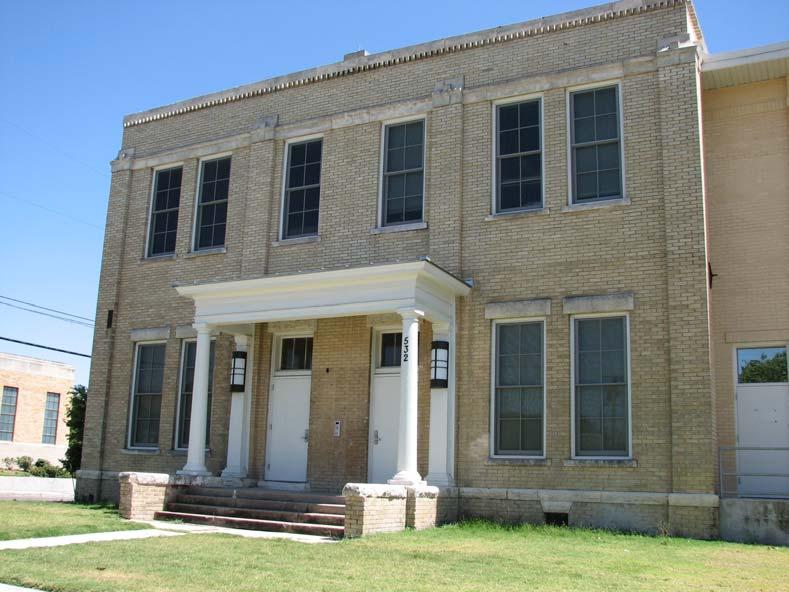
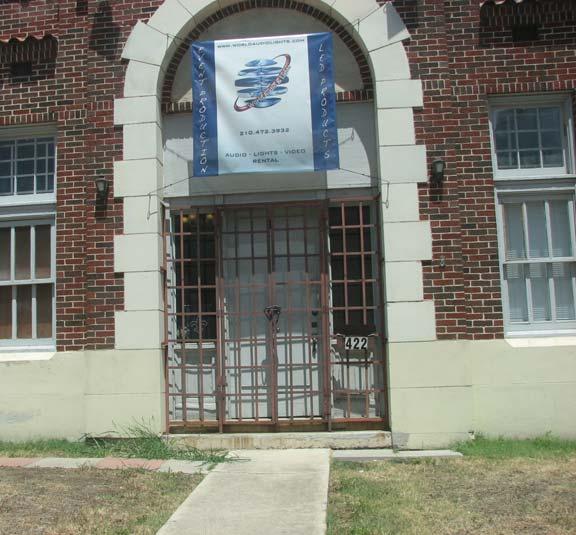
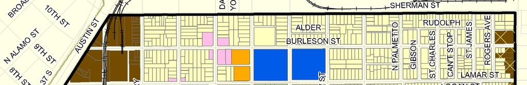
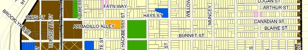
3 Boundaries North: Sherman East: New Braunfels, St. James, Palmetto South: Houston, Crockett, Commerce West: IH-37
4 Neighborhood Plan & Reinvestment Plan Neighborhood Plan Identify long and short term goals with action steps to achieve goals and objectives Chapters include: Future land use plan Crime & Public Safety Housing & Economic Development Community Facilities & Public Health Transportation & Infrastructure Reinvestment Plan Identify priority projects for immediate reinvestment strategy Propose partnerships and identify funding sources
5 Planning Timeline April/May Research and data analysis Review goals and objectives from other plans Meet with individual organizations to develop potential partnerships June Hold 1st public meeting Hold 1st Planning Team meeting and organize Planning Team July Create an updated Land Use Plan with accompanying text Present draft document to Planning Team Continue edits to draft document
6 Planning Timeline August Hold a public meeting to receive public input on the neighborhood plan and reinvestment plan Staff creates a final reinvestment plan based on Planning Team input, public meeting input, and best planning practices Staff organizes review of plans with relevant City Departments Present final draft to Community Development Advisory Committee September Staff prepares the Dignowity Hill Neighborhood Plan for consideration by the Planning Commission and City Council September 16 Present at Community Development Summit October - onward The neighborhood promotes the plan to stakeholders and newcomers Work toward implementation
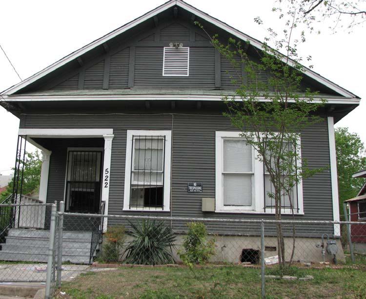
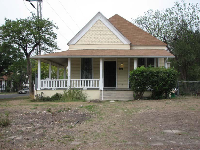
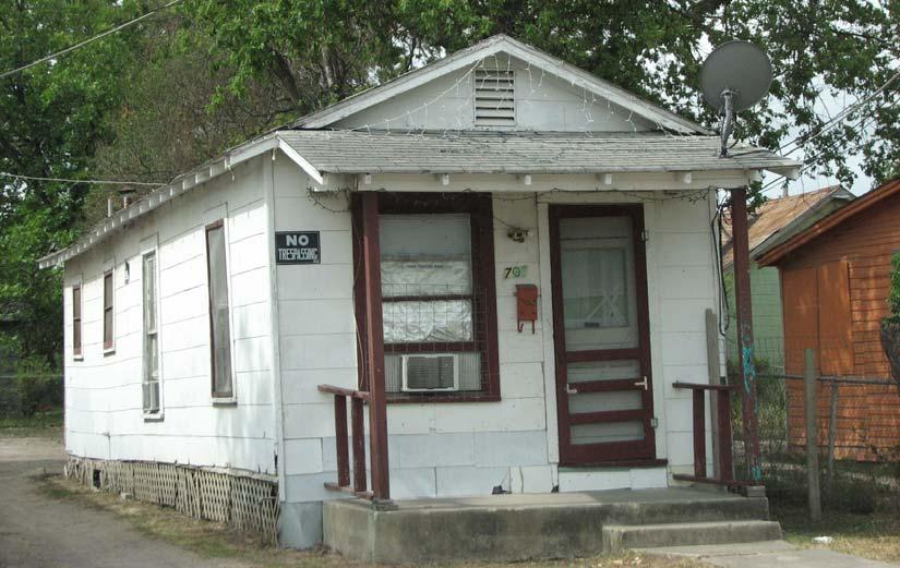
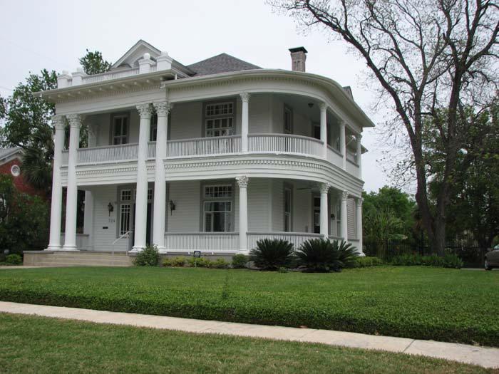
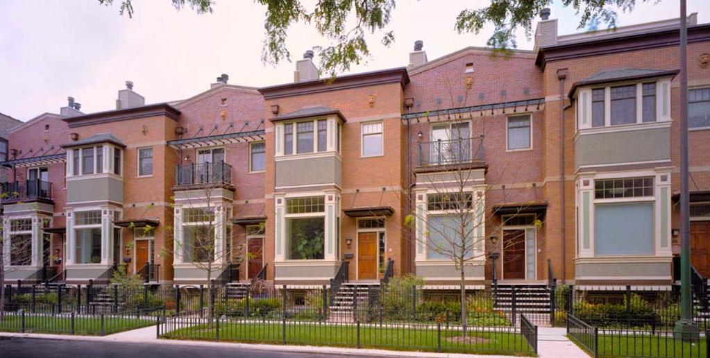
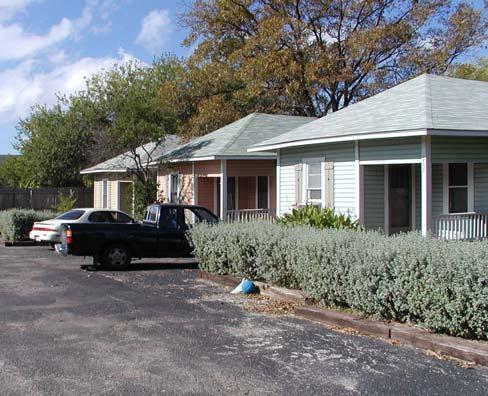
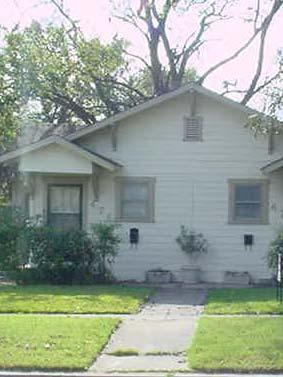
7 Housing & Economic Development Goal 1: Increase homeownership Decrease the number of vacant lots and housing through rehabilitation and marketing of properties for infill housing Convert renters to owners Goal 2: Well maintained and diverse housing stock Improve housing for mid-range level consumers that are cost efficient to allow the renovation of historic structures that are in disrepair Assist elderly and disabled to maintain and repair housing Enhance and maintain public housing so that it contributes to the beauty of the neighborhood
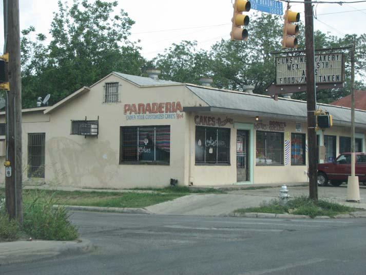
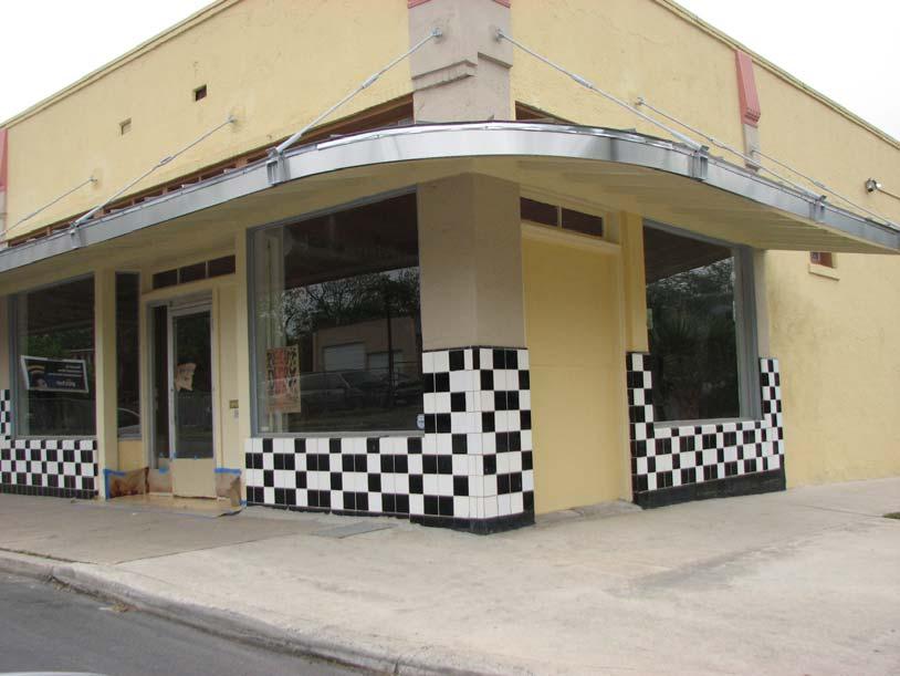
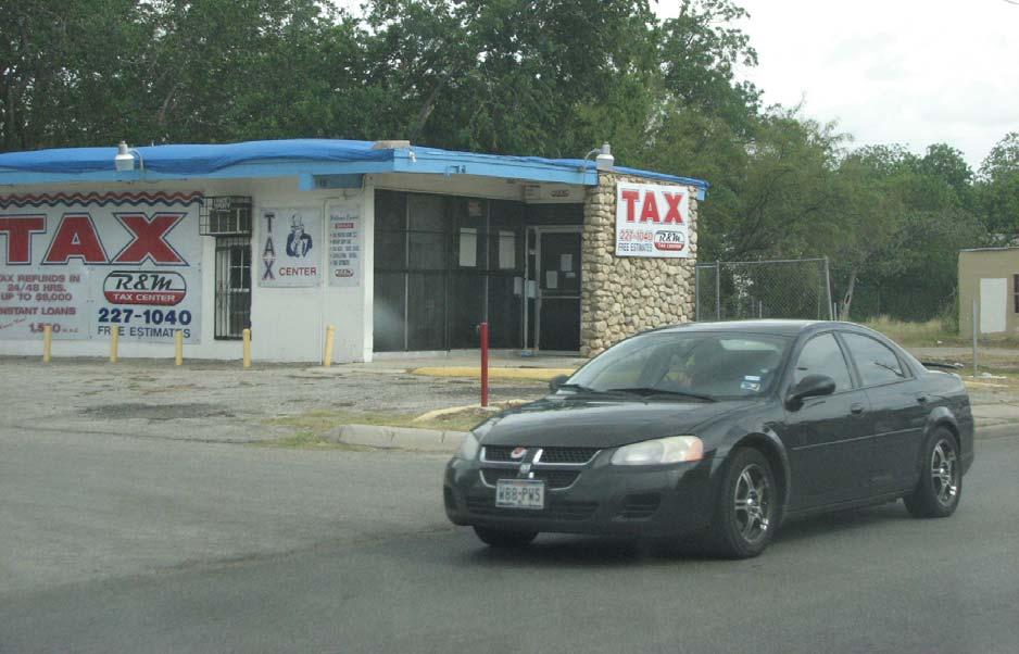
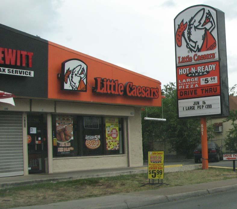
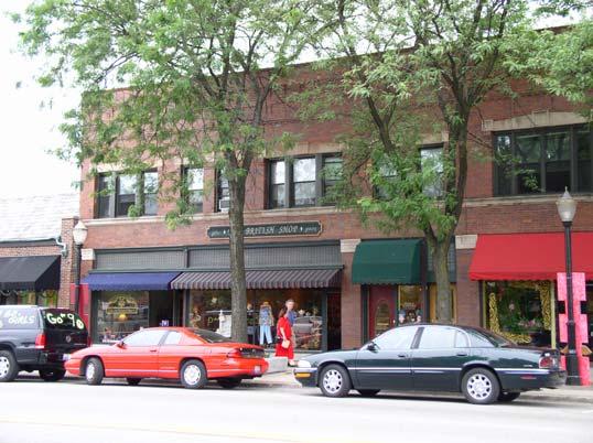
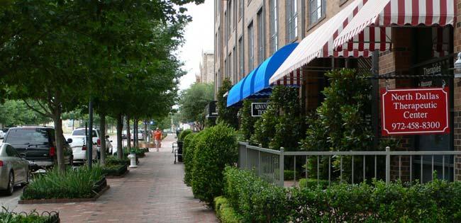
8 Housing & Economic Development, Cont. Goal 3: Expand neighborhood businesses that are convenient and safe for residents and visitors to easily access and enjoy Establish and promote shopping within the Dignowity Hill neighborhood Redevelop commercial businesses along North New Braunfels Avenue Capitalize on Riverwalk expansion Open the flow of people from the north side to the east side Decrease heavy truck and bus traffic on residential streets
9 Proposed Reinvestment Strategies Neighborhood Sweep Housing Lead based paint abatement Owner occupied housing rehabilitation Weatherization program St. Phillip s College Housing Rehabilitation Program Assist with locating home repair loans Historic tax credits Neighborhood branding and publicity Office of Cultural Affairs tour guide VIA bus shelters Historic District signage
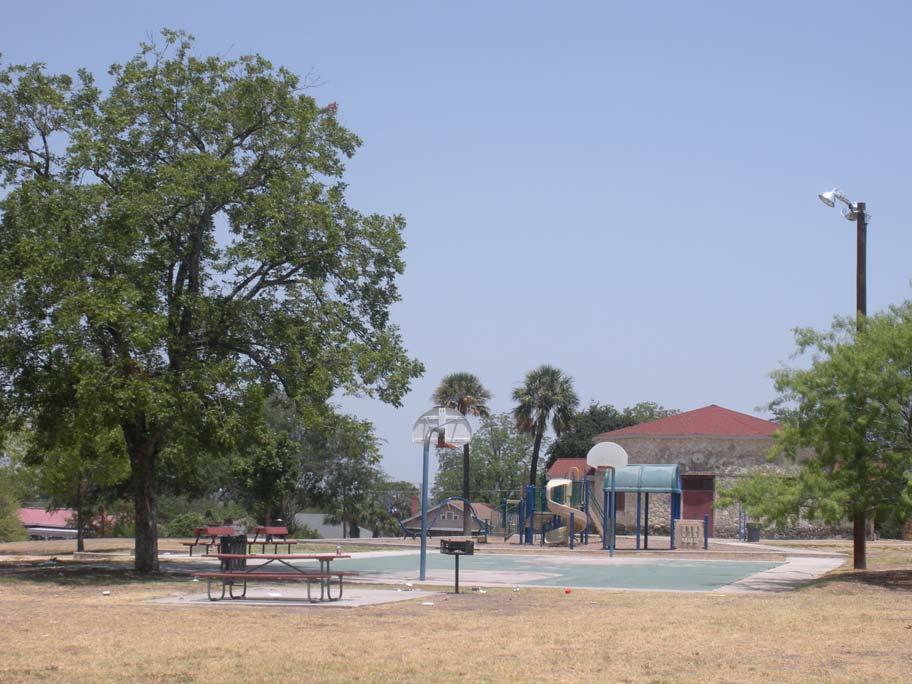
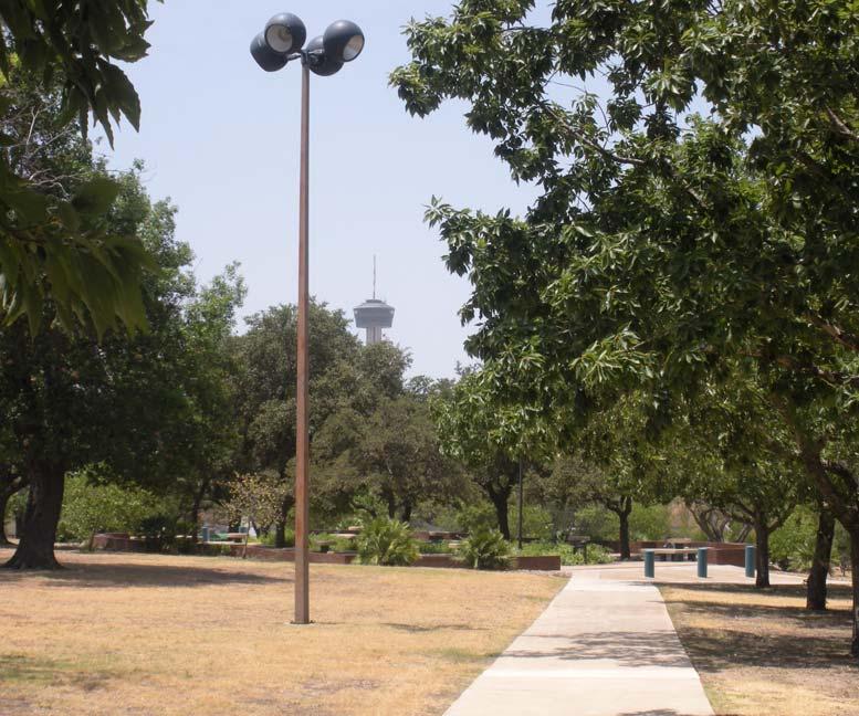
10 Proposed Reinvestment Strategies, cont. Commercial revitalization Project Facelift under NCR with SAGE Funds for energy efficiency improvements through OEP Grow America Fund through NDC Park improvements Scheduled events in parks Access to parks Added amenities Infrastructure Street maintenance and improvements Sidewalks Drainage Street planting program
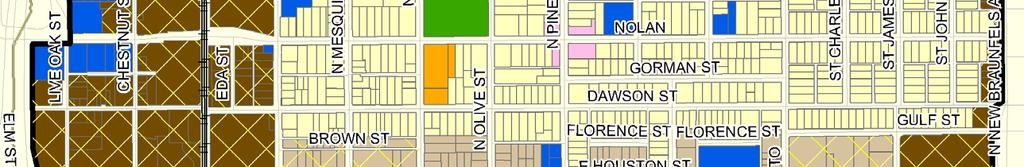
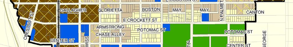
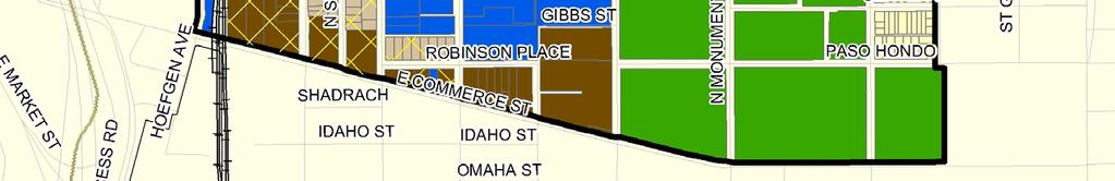
11 LAND USE
12 Land Use Existing vs. Future General Land Use Categories: Low density residential Duplex, Triplex, Quadplex Multifamily Commercial Office Industrial Public / Institutional Parks / Open Space Agriculture Vacant What is existing land use? A description (by category) identifying how land is currently utilized or occupied What is future land use? A description (by category) identifying how land is desired to be used in the future, regardless of how the land is being currently utilized or occupied
13 Land Use Verses Zoning Q. Are Zoning and Land Use the same? No. Q. How do Land Use and Zoning Relate? A completed Land Use Plan adopted by City Council as part of a Community Planning process is utilized as a guide when making decisions related to zoning, but does not constitute zoning.
14 Land Use Verses Zoning Adoption of the future land use plan does not change the current zoning. The future land use plan comes into play only for any zoning change requests after the plan is adopted.
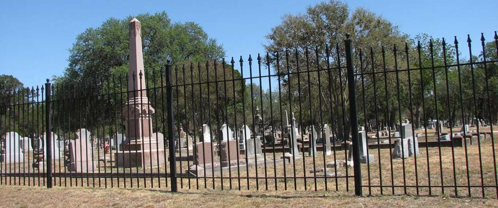
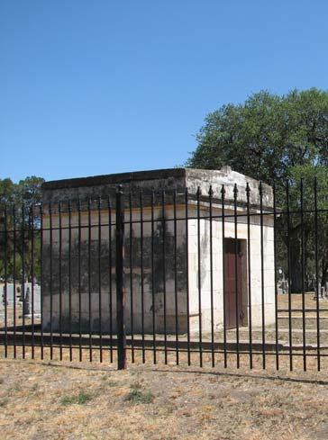
15 Existing Land Use
:")


16 Current Zoning Downtown (D): Cherry & IH-37 Mixed Residential (RM-4): Historic district Single family residential (R-4): East Arts & Entertainment (AE- 1 & AE-3): Commerce Intense commercial (C-3): New Braunfels Light industrial (I-1): Cherry & Houston

17 Adopted Future Land Use Low Density Residential Medium Density Residential Commercial Warehousing Mixed Use Parks/Open Space
18 Proposed Future Land Use Plan Low Density Residential High Density Residential Neighborhood Commercial Low Density Mixed Use High Density Mixed Use Public Institutional Parks/Open Space
19 Future Land Use Low Density Residential Single-family homes on individual lots, on streets with low traffic volumes Granny flats and accessory structures allowed Includes duplexes, triplexes, and fourplexes where currently exist but not recommended for new construction Pre-existing neighborhood commercial uses less than 3,000 square feet located on a corner allowed to remain Shown as Light Yellow on land use maps
20
21 Future Land Use High Density Residential Housing unit(s) meant for more than one family Density varies from townhouses and duplexes to fourplexes and apartment complexes Shown as Orange on land use map May serve as a transitional use between low density residential and commercial uses

22
23 Future Land Use Neighborhood Commercial Least intense commercial use Shown as Pink May include: professional/personal services, retail, restaurants, cafes, and gift shops
24
25 Future Land Use Low Density and High Density Mixed Use Any use that integrates a blend of residential, retail, office, entertainment or other land uses in one building or block. Indicated in Light Brown and Dark Brown. Low Density Mixed Use allows up to neighborhood commercial uses and medium density residential uses High Density Mixed Use allows up to community commercial uses and high density residential uses


26
27 Future Land Use Transit Oriented Development (TOD) Mix of residential and commercial uses that rely on transit, centralized parking, pedestrian linkages Located within quarter mile of a major transit stop and transit station
28
29 Future Land Use Public / Institutional Any use that does not appear on the public tax roles, and is usually considered to be for public or community use: Schools Churches Hospitals Police or Fire Stations Typically shown as Blue on land use maps


30
31 Future Land Use Parks & Open Space Public or private parks that are meant for active use by a neighborhood, community, or region Typically shown as green on land use maps
32
33 Proposed Future Land Use Plan
34
35 Next Steps 3 rd Planning Team Meeting (Review goals and objectives) first week in August Open House August/September
36 Contact Information Nina Nixon-Mendez, AICP Planning Manager Neighborhood & Urban Design Section Richard Milk, AICP Community Development Coordinator Community Development Section Rebecca Paskos Project Lead, Senior Planner Loretta Olison Senior Planner
EXISTING COMPREHENSIVE PLAN
 EXISTING COMPREHENSIVE PLAN Town Center Land Use Element: V. LAND USE POLICIES Town Center Mercer Island's business district vision as described in "Your Mercer Island Citizen-Designed Downtown" was an
Roosevelt Corridor. R e i n v e s t m e n t P l a n. Public Meeting Gilbert Elementary School May 12, :00 pm
 Roosevelt Corridor R e i n v e s t m e n t P l a n Public Meeting Gilbert Elementary School May 12, 2009 6:00 pm Agenda 6:00 6:10 6:25 6:40 6:55 7:00 Opening Comments Councilwoman Jennifer V. Ramos District
Policies and Code Intent Sections Related to Town Center
 Policies and Code Intent Sections Related to Town Center The Town Center Vision is scattered throughout the Comprehensive Plan, development code and the 1994 Town Center Plan. What follows are sections
Status Update (2006 vs. Now) Citizen s Advisory Committee February Plan for Prosperity
 Citizen s Advisory Committee February Plan for Prosperity") Status Update (2006 vs. Now) Citizen s Advisory Committee February 2018 Plan for Prosperity 2000 2017 2000 2017 Gardnerville Population 6,000 5,760 5746 5,500 5,000 5,067 5,550 5,165 5,394 5,412 5,250
Status Update (2006 vs. Now) Citizen s Advisory Committee February 2018 Plan for Prosperity 2000 2017 2000 2017 Gardnerville Population 6,000 5,760 5746 5,500 5,000 5,067 5,550 5,165 5,394 5,412 5,250
A BLUEPRINT FOR BROCKTON A CITY-WIDE COMPREHENSIVE PLAN
 A BLUEPRINT FOR BROCKTON A CITY-WIDE COMPREHENSIVE PLAN Public Meeting October 2016 1 Plan Summary and Discussion Public Meeting May 4 2017 City of Brockton Bill Carpenter, Mayor Department of Planning
TRANSPORTATION ELEMENT GOALS, OBJECTIVES, AND POLICIES
 TRANSPORTATION ELEMENT GOALS, OBJECTIVES, AND POLICIES GOAL 2 The City shall provide a safe, convenient, effective, and energy efficient multimodal transportation system which is coordinated with the Future
Making Transit Oriented Development Work For Boonton, NJ
 Making Transit Oriented Development Work For Boonton, NJ Bloustein School of Planning and Public Policy Studio Dan Burton Loannie Dao Webster Slater Brandon Williams Ian Watson Maria Laham Nicola Mammes
Community Meeting November 18, 2015
 Top Concerns We ve Heard Use of Urban Road Code Total number of units and effect on schools and transportation Land swaps with Parks Department: how do these benefit the community? Zoning classifications:
MAIN STREET ECONOMIC DEVELOPMENT STRATEGY
 MAIN STREET ECONOMIC DEVELOPMENT STRATEGY A PATHWAY TO A BETTER POUGHKEEPSIE DRAFT Working Paper #2: Planning Strategies Submitted December 1 st, 2015 to the City of Poughkeepsie LAND USE LAW CENTER PACE
Metro. Activity Center Design Guidelines. Recommendations For Developing Focused, Mixed-Use Commercial/Residential Centers
 Metro Activity Center Design Guidelines Recommendations For Developing Focused, Mixed-Use Commercial/Residential Centers Metro Activity Centers What is a MAC? Legacy, the adopted guide for the future growth
The Auburn Plan Designing the Future of Auburn February 28, 2005
 The Auburn Plan Designing the Future of Auburn February 28, 2005 Block-by-Block Bicycle Tour Aerial survey Focus Group Meetings September 7 and 8 Design Workshops October 11, 14, and 21 Revitalization
Chapter 4. Linking Land Use with Transportation. Chapter 4
 Chapter 4 Linking Land Use with Transportation Chapter 4 59 Chapter 4 Linking Land Use with Transportation Community Design and Transportation Program Introduction Since the 1950s, the predominant development
Citizen Advisory Group Meeting 5: Land Use April 14, 2011
 Citizen Advisory Group Meeting 5: Land Use April 14, 2011 Meeting Agenda 1. Background Review 2. Transportation Follow-up 3. PED Overlay Approach 4. Land Use Mapping 5. Group Exercise 6. Wrap-up and Next
Staff Report to the North Ogden City Planning Commission
 Staff Report to the North Ogden City Planning Commission SYNOPSIS / APPLICATION INFORMATION Application Request: Concept review on a legislative application to rezone land located at approximately 1750
6 Strategic Vision and Vision Matrix
 PUBLIC HANDOUT: FEBRUARY 11, 2013 TOWN COUNCIL MEETING STRATEGIC VISION PLAN: VISIONING INTO ACTION 6 Strategic Vision and Vision Matrix 6.1 Strategic Vision The Strategic Vision builds on the vision of
EXHIBIT A. Tax Increment Reinvestment Zone No. 1 (Town Center) First Amended Project Plan 1
 First Amended Project Plan 1") EXHIBIT A Tax Increment Reinvestment Zone No. 1 (Town Center) First Amended Project Plan 1 1 As amended by Resolution No. 2008-02-001(TR1R) of the Tax Increment Reinvestment Zone No.1, and approved to
EXHIBIT A Tax Increment Reinvestment Zone No. 1 (Town Center) First Amended Project Plan 1 1 As amended by Resolution No. 2008-02-001(TR1R) of the Tax Increment Reinvestment Zone No.1, and approved to
CITY OF PUYALLUP. Background. Development Services
 CITY OF PUYALLUP Development Services 333 South Meridian Puyallup WA 98371 To: City Council From: Katie Baker, AICP, Planning Division Re: South Hill Neighborhood Plan Adoption Date: (Meeting date: February
PLAN ELEMENTS WORKSHOP. April 5, 2016
 PLAN ELEMENTS WORKSHOP April 5, 2016 needs more housing. But there is no one-size fits-all solution. Every neighborhood has its own character. In some places, density is not only appropriate it is badly
The Cambie Corridor 2015 Fall workshop series. What we heard WORKSHOP OUTLINE
 The Cambie Corridor 2015 Fall workshop series W 16 AVE Area 5 CAMBIE CORRIDOR Phase 3 What we heard ovember 21, 2015, 9am-noon, 1:30-4:30pm Peretz Centre 89 Participants* WORKSHOP OUTLIE Introductions
Cumberland Region Tomorrow is a private, non-profit, citizen based regional organization working with Greater Nashville Regional Council
 Cumberland Region Tomorrow is a private, non-profit, citizen based regional organization working with Greater Nashville Regional Council and others in the public and private sectors, dedicated to planning
JANUARY 19, 2011 CENTRAL AVENUE-METRO BLUE LINE TRANSIT-ORIENTED DEVELOPMENT IMPLEMENTATION PROJECT COMMUNITY FORUM
 CENTRAL AVENUE-METRO BLUE LINE TRANSIT-ORIENTED DEVELOPMENT IMPLEMENTATION PROJECT COMMUNITY FORUM JANUARY 19, 2011 THE MARYLAND-NATIONAL CAPITAL PARK AND PLANNING COMMISSION PRINCE GEORGE S COUNTY PLANNING
City of Hermosa Beach Administrative Policy #
 City of Hermosa Beach Administrative Policy # SUBJECT: Living Streets Policy Date: Approved by: City Council Authority: Public Works Department & Community Development Department Mayor, PURPOSE The City
FUNDING CORRIDOR REVITALIZATION
 FUNDING CORRIDOR REVITALIZATION Integrated corridor planning for the 21 st Century America Planning Association Annual Conference Atlanta, GA April 27, 2014 Mariia Zimmerman, MZ Strategies, LLC mariia@mzstrategies.com
The transportation system in a community is an
 7 TRANSPORTATION The transportation system in a community is an important factor contributing to the quality of life of the residents. Without a sound transportation system to bring both goods and patrons
8implementation. strategies
 PROGRAM STRATEGIES 8implementation strategies T he implementation actions of this chapter are designed to support and carry out the land use, economic development, transportation, urban design, and program
John M. Fleming Managing Director, Planning and City Planner. Old East Village Dundas Street Corridor Secondary Plan Draft Terms of Reference
 Report to Planning and Environment Committee To: From: Subject: Chair and Members Planning & Environment Committee John M. Fleming Managing Director, Planning and City Planner Old East Village Dundas Street
FUTURE LAND USE ELEMENT
 FUTURE LAND USE ELEMENT GOAL I: To create and sustain a great place to live, play, and prosper Objective 1: The City of Ocala shall incorporate the principles and strategies of the Ocala 2035 Vision into
Volume 2: Implementation Plan
 Volume 2: Implementation Plan February 25 th 2002 Implementation Introduction This document outlines the steps that should be taken to implement the Washington Heights Neighborhood Plan. The City Council
1.0 Purpose of a Secondary Plan for the Masonville Transit Village
 Report to Planning and Environment Committee To: Chair and Members Planning & Environment Committee From: John M. Fleming Managing Director, Planning and City Planner Subject: Masonville Transit Village
THEMES, VISION, + PRINCIPLES
 CHAPTER 2: THEMES, VISION, + PRINCIPLES This page intentionally left blank. 20 VISION DRAFT AUGUST 2018 2 2 THEMES, VISION, + GUIDING PRINCIPLES The Key Themes, Vision, and Guiding Principles presented
Downtown Dubuque...it s a great time.
 Downtown Dubuque...it s a great time. Your timing could not be better to invest in Downtown. With hundreds of millions in public and private investment occurring on the City s downtown waterfront, millions
CHAPTER 3 VISION, GOALS, & PLANNING PRINCIPLES. City of Greensburg Comprehensive Plan. Introduction. Vision Statement. Growth Management Goals.
 CHAPTER 3 VISION, GOALS, & PLANNING PRINCIPLES Introduction The Greensburg Comprehensive Plan is intended as a working community document. A combination of long and short-term goals, this document is intended
Creating Community Around Commuter Rail in Arvada Colorado. Presented By Mike Elms, AICP Community Development Director City of Arvada Colorado
 Creating Community Around Commuter Rail in Arvada Colorado Presented By Mike Elms, AICP Community Development Director City of Arvada Colorado Arvada s s Location 10 miles west of Denver A first tier suburb
International Blvd. TOD Plan Public Workshop #1
 International Blvd. TOD Plan Public Workshop #1 Add photos or project images September 21 and 22, 2010 Workshop Purpose Introduce the public to the Project Review and discuss the existing conditions analysis
CHAPTER 4 COMMUNITY DEVELOPMENT AND DESIGN
 CHAPTER 4 COMMUNITY DEVELOPMENT AND DESIGN The Community Development and Design Chapter is extremely important because it, together with the Transportation and Circulation Chapter, provides the foundation
Communities Plan. Parkland-Spanaway-Midland. LUAC Review of Draft Policies
 Parkland-Spanaway-Midland Communities Plan LUAC Review of Draft Policies Presented by: Tiffany O Dell, Senior Planner Planning & Public Works Tiffany.Odell@co.pierce.wa.us 253-798-6859 November 1, 2017
TOWN COUNCIL / PLANNING COMMISSION
 Workshop #3 TOWN COUNCIL / PLANNING COMMISSION January 20, 2011 Consultant Team In Attendance Tonight BMS Design Group Nevada City and San Francisco Michael Smiley, AICP, ASLA Partner-in-Charge Nancy L.
A. WHAT IS A GENERAL PLAN?
 I. Introduction A. WHAT IS A GENERAL PLAN? A general plan is the planning guideline for the future of a city. It contains goals and policies which regulate urban development, the protection of the natural
5 Land Use Element49
 5 Land Use Element 49 City of Forney - Comprehensive Plan Land Use Introduction Forney s Comprehensive Plan is a guide for physical and economic development in the City of Forney over the next 20-years.
Isabel Neighborhood Plan: Alternatives
 Isabel Neighborhood Plan: Alternatives Presented by: Lori Parks, Associate Planner February 2, 2015 Agenda 1. Background on BART to Livermore 2. Isabel Neighborhood Plan 3. Alternative Scenarios 4. General
TOWN OF NEW CASTLE - Master Plan Update
 Our Presentation Today (1) Recap the Master Planning Process To Date (2) Present the Outline of the Master Planning Work Plan (3) Present the Calendar for the Master Plan (4) Outline the scope of a Downtown
CENTRAL ESTUARY PLAN AVISION FOR OAKLAND S WATERFRONT
 Central Estuary Plan A VISION FOR OAKLAND S WATERFRONT Specific Plan and Environmental Assessment Presentation to the Parks and Recreation Advisory Commission December 9, 2009 This Afternoon s Presentation
CITY OF UNION CITY MINUTES GENERAL PLAN ADVISORY COMMITTEE
 CITY OF UNION CITY MINUTES GENERAL PLAN ADVISORY COMMITTEE WEDNESDAY, MARCH 4, 2015, 6:30 P.M. IN THE CITY COUNCIL CONFERENCE ROOM OF CITY HALL 34009 ALVARADO-NILES BLVD., UNION CITY, CALIFORNIA Attachment
LAND USE OVERVIEW WHAT YOU WILL FIND IN THIS CHAPTER
 LAND USE WHAT YOU WILL FIND IN THIS CHAPTER Information about the City s expected population and employment growth. Description and capacity of existing and future land use designations. Policies that
The Community and Transportation Linkage Planning Program
 The Community and Transportation Linkage Planning Program Sandy Misiewicz, AICP Capital District Transportation Committee Senior Transportation Planner II CSS National Dialog 2 October 1, 2013 Capital
BRYN MAWR. Tier 2 Characteristics: Location: Lancaster Avenue from Old Lancaster Road on the east to Norwood Avenue on the west
 BRYN MAWR Tier 2 Characteristics: Transit-oriented Mixed use Along Lancaster Avenue Serve township-wide needs Civic space Employment centers Location: Lancaster Avenue from Old Lancaster Road on the east
CHAPTER 7: Transportation, Mobility and Circulation
 AGLE AREA COMMUNITY Plan CHAPTER 7 CHAPTER 7: Transportation, Mobility and Circulation Transportation, Mobility and Circulation The purpose of the Transportation, Mobility and Circulation Chapter is to
What We Heard. Downtown Georgetown Planning Study. April 4, 2018
 What We Heard Downtown Georgetown Planning Study April 4, 2018 Workshop 2 - July 5, 2017 01 DESIGN SUMMIT The Downtown Georgetown Planning Study will guide growth and development in the downtown over the
INDEPENDENCE BOULEVARD AREA PLAN. June 24, 2008
 INDEPENDENCE BOULEVARD AREA PLAN Public Meeting #1 June 24, 2008 Tonight s Agenda Introduction Welcome and Ground Rules Overview Presentation Purpose of the Plan What Brings Us Here? A Tour of the Corridor
Urban Planning and Land Use
 Urban Planning and Land Use 701 North 7 th Street, Room 423 Phone: (913) 573-5750 Kansas City, Kansas 66101 Fax: (913) 573-5796 Email: planninginfo@wycokck.org www.wycokck.org/planning To: From: City Planning
Economic Development & Housing Council Committee Comprehensive Plan Update September 20, 2005
 1 Economic Development & Housing Council Committee Comprehensive Plan Update September 20, 2005 Purpose To update the Committee on the ForwardDallas! Plan, including: Status Anticipated Products Public
A P P E N D I X B - O P P O R T U N I T Y S I T E S
 A P P E N D I X B - O P P O R T U N I T Y S I T E S OPPORTUNITY SITES As listed in the Land Use Element, the City has identified 15 Opportunity Sites expected to be the focus of change and revitalization
Downtown Elkton Station Area Plan, Elkton, MD. Difficult enough to get support for new starts challenge to fund Houston transit
 Difficult enough to get support for new starts challenge to fund Houston transit More difficult to build Community Support for dense development at station areas Major Concerns: Traffic, Property values,
RESEDA - WEST VAN NUYS COMMUNITY PLAN
 RESEDA - WEST VAN NUYS COMMUNITY PLAN Executive Summary As part of the initial outreach effort, the Department of City Planning hosted two workshops for the Reseda-West Van Nuys Community Plan Area during
SPRINGHILL LAKE TRANSIT VILLAGE
 Greenbelt Metro Area Sector Plan - Subarea Design Policies and Guidelines - Springhill Lake Transit Village 113 SPRINGHILL LAKE TRANSIT VILLAGE Residential Neighborhood and Village Center CONCEPT Springhill
4.1.3 LAND USE CATEGORIES
 4.1.3 LAND USE CATEGORIES a. City Center District The City Center District incorporates the existing character and mix of uses in downtown Belmont to encourage redevelopment and new development in keeping
ULI St. Louis Technical Assistance Panel
 ULI St. Louis Technical Assistance Panel ULI St. Louis Technical Assistance Panel Sponsored by: Citizens for Modern Transit in partnership with METRO ULI St. Louis Mission Statement The mission of the
DRAFT. October Wheaton. Design Guidelines
 October 2011 DRAFT Wheaton Design Guidelines 2 Draft - Design Guidelines - Wheaton Sector Plan Contents 04 Section 1: Introduction 06 Section 2: Context 08 Section 3: Design Guidelines 09 Goal 1: Create
ALBEMARLE COUNTY CODE CHAPTER 18 ZONING SECTION 20A NEIGHBORHOOD MODEL - NMD
 CHAPTER 18 ZONING SECTION 20A NEIGHBORHOOD MODEL - NMD Sections: 20A.1 PURPOSE AND INTENT 20A.2 STATUS AS A PLANNED DEVELOPMENT DISTRICT 20A.5 CODES OF DEVELOPMENT 20A.6 PERMITTED USES 20A.7 RESIDENTIAL
Joint Meeting City Council and the Plan Commission. September 1st, 2015
 Joint Meeting City Council and the Plan Commission September 1st, 2015 1 The City Plan Commission shall recommend a City Plan for the physical development of the City Article IX Section 2 of the City of
REZONING GUIDE. Zone Map Amendment (Rezoning) - Application. Rezoning Application Page 1 of 3. Return completed form to
 - Application. Rezoning Application Page 1 of 3. Return completed form to") Zone Map Amendment (Rezoning) - Application COMMUNITY PLANNING & DEVELOPMENT REZONING GUIDE Rezoning Application Page 1 of 3 PROPERTY OWNER INFORMATION* CHECK IF POINT OF CONTACT FOR APPLICATION Property
Zone Map Amendment (Rezoning) - Application COMMUNITY PLANNING & DEVELOPMENT REZONING GUIDE Rezoning Application Page 1 of 3 PROPERTY OWNER INFORMATION* CHECK IF POINT OF CONTACT FOR APPLICATION Property
City of Villages Parking Strategies. William Anderson, FAICP City Planning & Community Investment San Diego Parking Symposium July 14, 2006
 City of Villages Parking Strategies William Anderson, FAICP City Planning & Community Investment San Diego Parking Symposium July 14, 2006 City of Villages Strategy A hierarchy of walkable, mixed use districts
D-O LRT Zoning Discussion. Chapel Hill Boards & Commissions October 16, 2017
 D-O LRT Zoning Discussion Chapel Hill Boards & Commissions October 16, 2017 Update on Overall D-O LRT Station Area Initiative Objectives Design and educate on principles of Good Transit-Oriented Development
2035 General Plan Update and Belmont Village Specific Plan. Joint Study Session with the City Council and Planning Commission April 12, 2016
 2035 General Plan Update and Belmont Village Specific Plan Joint Study with the City Council and Planning Commission April 12, 2016 Agenda 1. Welcome and Introductions 2. General Plan Update Status of
PROCESS CHECK Implementing Ordinances planned for adoption with the General Plan:
 PROCESS CHECK PROCESS CHECK Implementing Ordinances planned for adoption with the General Plan: Urban Growth Boundary extension Northwest Quad zoning Bel Marin Keys Master Plan amendments (biotech campus,
Planning Commission April 4, 2013 BOCC Workshop Page 1
 Planning Commission April 4, 2013 BOCC Workshop Page 1 Planning Commission April 4, 2013 BOCC Workshop Page 2 Planning Commission April 4, 2013 BOCC Workshop Page 3 Planning Commission April 4, 2013 BOCC
Today Land & People. Northeast Nampa Gateway District. Employment. Land Use Characteristics. Demographics. Current Zoning
 Today Land & People Employment Major employers include Saint Alphonsus, the College of Western Idaho, the Auto Mall, Sorrento Lactalis and Walmart. 3,004 jobs in 2010 (COMPASS-CIM 2040 TAZ data) 4,345
CHARLES PUTMAN CHARLES PUTMAN AND ASSOCIATES, INC
 MEMORANDUM CHARLES PUTMAN & ASSOCIATES, INC. LAND DEVELOPMENT CONSULTANTS PLANNING ZONING PERMITTING 4722 NW Boca Raton Boulevard, Suite C-106 Boca Raton, Florida 33431 Phone: 561/994-6411 FAX: 561/994-0447
Cobb County Design Guidelines Mableton Parkway & Veterans Memorial Highway Community Design Workshop January 12, 2017
 Community Design Workshop January 12, 2017 Agenda Opening Remarks / Introductions Scope of Work Existing Conditions Key Issues / Opportunities VPS Summary Draft Vision & Goal Statement Implementation Concepts
Planning Commission Special Workshop. October 25, 2018
 Planning Commission Special Workshop October 25, 2018 Composition of Committee Steven Neeves, Chair Marvin Heyd, Vice-Chair Joe Burch Pam Creech Ruth Anne Ellis Rick Elliott Christy Everett Chris Hennigan
Lynn Housing Authority and Neighborhood Development. Washington Street Gateway District Plan A p r i l
 Lynn Housing Authority and Neighborhood Development Washington Street Gateway District Plan A p r i l 2 0 0 8 rendering of sagamore hill from lynnway pedestrian overpass table of contents project area
S C O P E O F W O R K A P R I L
 white flint 2 sector plan S C O P E O F W O R K A P R I L 2 0 1 2 MONTGOMERY COUNTY PLANNING DEPARTMENT M-NCPPC MontgomeryPlanning.org 1 white flint 2 sector plan Scope of Work abstract This scope of work
Atlanta BeltLine Subarea 3 Master Plan Update
 Atlanta BeltLine Subarea 3 Master Plan Update April 14, 2018 Workshop Meeting 1 22 miles, connecting 45 neighborhoods 22 MILES of transit 46 MILES of streetscapes and complete streets 33 MILES of urban
City of Lake Mary, Florida. Evolution of a Historic Downtown with Transit Oriented Development Strategies
 City of Lake Mary, Florida Evolution of a Historic Downtown with Transit Oriented Development Strategies What is Transit Oriented Development? Walkable villages located at and around transit stations in
VISION, GOALS & CONCEPT DIAGRAM 2.0
 CHAPTER 2.0 2.1 Vision Creation Process 2.2 City Center Vision Statement, Goals and Objectives 2.3 Individual Zone Visions 2.4 Steps in City Building 2.5 Urban Form Concept Diagram for City Center VISION,
178 Carruthers Properties Inc.
 178 Carruthers Properties Inc. Planning Rationale for 178 Carruthers Avenue Site Plan Control Application June 2014 Table of Contents 1.0 Introduction 2.0 Overview of Subject Property 3.0 Current Zoning
Corridors. Re-vitalize our Corridors and Gateways
 Corridors Re-vitalize our Corridors and Gateways Artist s rendering from the 287 Strategic Plan, 2015 Corridors are the major throughways of Loveland but they also provide important commercial, community
PINE CURVE REZONING. Property does not meet criteria for open space preservation and is not a candidate for a park
 PINE CURVE REZONING BACKGROUND Purchased as two parcels in 2001 and 2002 Annexed and Zoned Greater Downtown District Historic Center September 25, 2002 and October 7, 2002 WHAT THE PROJECT IS AND IS NOT
SUMMERSIDE / MT. CARMEL REINVESTMENT CORRIDOR COMMUNITY DEVELOPMENT STRATEGY
 SUMMERSIDE / MT. CARMEL REINVESTMENT CORRIDOR COMMUNITY DEVELOPMENT STRATEGY FEBRUARY 2013 I. Location of the Summerside/Mt. Carmel Reinvestment Corridor The Summerside/Mt. Carmel Reinvestment Corridor
NEC of Central Avenue and Indian School Road
 NEC of Central Avenue and Indian School Road For this location, there are two applicable plans that provide guidance on development. The two plans include the Indian School Specific Plan (1991) and the
REGIONAL ACTIVITY CENTER
 DRAFT REGIONAL ACTIVITY CENTER 70 EAST BENCH MASTER PLAN DRAFT 06 Introduction The East Bench Regional Activity center is comprised of large educational, research, medical, and employment centers. These
Pinellas County. Staff Report
 Pinellas County 315 Court Street, 5th Floor Assembly Room Clearwater, Florida 33756 Staff Report File #: 16-416A, Version: 1 Agenda Date: 3/29/2016 Subject: Election of the Chairman and Vice-Chairman of
6. REGIONAL AND COMMUNITY FACILITIES DESIGNATIONS 6.1. OBJECTIVES FOR REGIONAL AND COMMUNITY FACILITIES LAND USE DESIGNATIONS
 6. REGIONAL AND COMMUNITY FACILITIES DESIGNATIONS INTRODUCTION The Regional and land use designations provide the primary locations for uses which satisfy the health, education and other service needs
Market Demand and Land Use
 Market Demand and Land Use Summary 57 Challenges 60-61 Guiding Principles 62 Strategy and Implementation 63-69 Establish a mix of uses that contribute to a vibrant downtown. 58 Summary Historically, downtown
2030 Comprehensive Plan VISION STATEMENT
 RESOURCE DOCUMENT for Steering Committee Meeting #2 July 12, 2017 2030 Comprehensive Plan VISION STATEMENT Steering Committee from 2008 Established the Lauderdale s Vision as: Creating a livable, lovable
Access to the University of North Carolina at Chapel Hill, UNC Hospitals, and Chapel Hill Transit.
 M 1/ 4 1/ 2 E IL M E IL Station Family: County: City: UNC Hospitals WHY THIS STATION? University Village Orange Chapel Hill Access to the University of North Carolina at Chapel Hill, UNC Hospitals, and
4 C OMMUNITY D ISTRICTS
 4 C OMMUNITY D ISTRICTS N ew development in the Area will include many different types of land uses, including a destination retail area that attracts people from all over the region; recreation opportunities
EXECUTIVE SUMMARY DRAFT CHAPTER 1 INTRODUCTION EXECUTIVE SUMMARY
 CHAPTER 1 EXECUTIVE SUMMARY INTRODUCTION Through the joint efforts of the City of Tulsa planning staff and the Land Services division of Indian Nations Council of Governments (INCOG), the Berryhill Land
Strategic Target: Utilize Pay-For-Use Services Whenever Possible
 2004 Strategic Planning Report The 2003 Strategic Planning Steering Committee compiled and presented this report to the Olathe City Council on March 25, 2004. This is the result of community meetings conducted
City of Long Beach. creating vibrant and exciting places
 City of Long Beach creating vibrant and exciting places Land Use Element Urban Design Element Overview of the two draft General Plan elements Discuss areas of change Economic goals of the plans Case study
Public Open House #1
 Public Open House #1 TONIGHT S AGENDA Welcome Project Overview The Big Picture The Station Area The Analysis Thoughts about Future Change Breakout Group Discussions Summation / Next Steps Project Overview
South Central Connecticut Region Plan of Conservation & Development 2018 Update. Municipal Planners
 South Central Connecticut Region Plan of Conservation & Development 2018 Update Municipal Planners July 28th, 2017 1 Introductions 2 Purpose of Today s Meeting Supplement data analysis with qualitative
SUBJECT: GO Station Mobility Hubs Preferred Concepts: Aldershot GO, Burlington GO and Appleby GO. Planning and Development Committee - Public Meeting
 Page 1 of Report PB-76-17 SUBJECT: GO Station Mobility Hubs Preferred Concepts: Aldershot GO, Burlington GO and Appleby GO TO: FROM: Planning and Development Committee - Public Meeting Planning and Building
Carlsbad Village Redevelopment Concept Summary of Features
 Carlsbad Village Redevelopment Concept Summary of Features Calthorpe Associates November 5, 2003 The Redevelopment Concept illustrates a vision for the future of Carlsbad Village. The overall vision of
AREA REDEVELOPMENT PLAN THE WAY WE GROW
 AREA REDEVELOPMENT PLAN THE WAY WE GROW Office Consolidation June 2014 Submitted to the City of Edmonton Planning & Development Department By: Edmonton, AB T5G 0Y5 Phone 780 482-4813 Fax 780 488-4566 Email:
North Fair Oaks Community Plan Summary and Information
 North Fair Oaks Community Plan Summary and Information WHAT IS THE NORTH FAIR OAKS COMMUNITY PLAN? The North Fair Oaks Community Plan is part of the San Mateo County General Plan, and establishes policies
Streets for People, Place-Making and Prosperity. #TOcompletestreets
 COMPLETE STREETS FOR TORONTO Streets for People, Place-Making and Prosperity COMPLETE STREETS: A NEW APPROACH A Complete Streets design approach considers the needs of all users people who walk, bicycle,
4- PA - LD - LIVELY DOWNTOWN. LD - Background
 4- PA - LD - LIVELY DOWNTOWN LD - Background The downtown has been the service centre for the community since the city s inception and the area continues to supply people with their personal services,
Goals, Objectives & Strategies
 1 2 Goals, Objectives & Strategies This Chapter presents a vision for the future of Le Roy and describes goals, objectives, and strategies to achieve that vision. Housing, Public Infrastructure & Utilities,
Nassau County Cultivating Opportunities for Sustainable Development Nassau County Infill Redevelopment Feasibility Study
 Nassau County Cultivating Opportunities for Sustainable Development Nassau County Infill Redevelopment Feasibility Study NY-CT Sustainable Communities Steering Committee Meeting March 14, 2014 Project